Aeron & Arth walks 4 walks for all the family to enjoy
|
|
|
- Gwenda Skinner
- 5 years ago
- Views:
Transcription


1 Aeron & Arth walks walks for all the family to enjoy

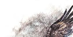
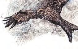
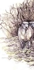
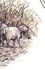
2 Please take note that the maps illustrating these walks are intended as a rough guide only. You should use the most recent version of the relevant Ordnance Survey map when walking these routes. On Walks and, where additional footpaths are highlighted, the authors and landowners are not responsible for the condition of the path or the safety of individuals. Copyright: Cilcennin Cyntaf Text and photographs: Ray Williams Illustrations: Philip Huckin Design: Argraff Ltd Translation: Carys Williams October 203


3 Introduction This Family Walks booklet is designed to provide local families and visitors with an opportunity to explore the public footpaths in the beautiful valleys of the rivers Aeron and Arth. They are intended as the first of a series of such booklets that will highlight the opportunities for similar family friendly walks in the villages of both river valleys. The detail on the bio-diversity of the natural environment available on the walks, both to the keen naturalist and the amateur enthusiast, is limited, but further information is available on and The publication was funded by a grant from the Big Lottery Fund and formed part of the 3 year Wildlife Where You Live project run by Denmark Farm (see website for details) in 2 villages in Ceredigion which ended in 203.


.")
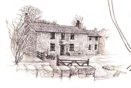
4 WALK Family walk to the secret garden at Tyglyn Proceed up the hill from the village hall, turn right at the Commercial Inn and walk out through the village to way marked Green Lane on the right. Follow this lane across the road and down the track to the farmhouse 2 at the bottom. Pass in FRONT of the house to cross a wooden bridge 3 across the River Camel, turning immediately left up through the wood to a wooden stile. Continue through the meadow, taking time to see the small pond on your right to a wooden gate at the bottom. Carry on down the meadow with river Distance 5-6km Moderate now on your left, to a wooden bridge. Turn left across the bridge, up the hill to a tarmac drive. Follow this drive to Blaencamel Farm shop where a wonderful array of organic vegetables may be seen (and purchased!). At this point, you may decide to visit the wonderful secret garden at Tyglyn yards down the road to a well marked entrance. Explore this lovingly restored garden and riverside before returning to Newgate Farm entrance At point 5 you may wish to pass between the poly tunnels to a delightful circular woodland walk (5-0 minutes) that criss-crosses the river before returning to the farm drive again. 6 Continue down the drive, leave the farm entrance and turn immediately right down a green lane to a wooden gate 6 at the bottom. Cross the small meadow to a river crossing on stepping stones to a farm gate on the track on your left. Continue down the track to the main road. 6

 to another lane at the far end.")


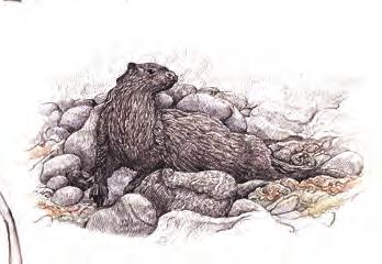
5 Climb up the hill to a well marked green lane on your right. Enjoy the quiet. secluded lane, through two steel farm gates into a wooded section (some boggy areas) to another lane at the far end. Pass through another metal gate on your right, cross the field and keeping the hedge on your right hand side go through the small wooden gate in the corner. Follow the track behind the old Quarry Cottage, 7 down through the wood to a wooden stile directly ahead. Turn left up the meadow to rejoin the section through the wood, crossing the wooden river bridge again before climbing up the lane to the road. NAT URE WATCH 7 Look out for Pig Nut on woodland paths, and a wonderful display of bulbs in the spring. 3 2 START END 2

6 Leave the village hall and turn left down the hill past the Old Vicarage before climbing up to Bidarren House on your left 2. At this point you may choose to carry straight on and join the walk just past Mount Cottage or you may choose to turn right up a quiet road with views back over the valley to join the walk at a bridleway sign on your left hand side. WALK 2 Cilcennin Circular Family Walk As you can see on the map, you are now able to walk a loop of lanes and tracks that link up both options. You also have the option of crossing the wetland meadow just beyond Blaenwaun, to a small woodland pond 5. Distance 3-5km Moderate From Mount Cottage, continue up the quiet lane passing wet meadows on your right with traditional beef cattle 3 (which breed are these cows?), to a small cottage (Lyra Villa) on your left. Again at this point, you have a choice. Either continue straight on towards Blaenwaun on the rough track or turn right down the wide green lane, passing behind a dwelling on the right to a wooden stile on your left. 6 - ensure to include this quiet bridleway (Lon Pugh), once thought to be used for moving stock from local smallholdings, to hill pastures. When you return to the Bidarren junction 2, you can link up with Walk - a family walk to the secret garden at Tyglyn. 2


7 NAT URE WATCH START END Look out for the rare Red Poll cattle, insectivorous sundews, cranberry and bog asphodel.


8 WALK 3 Pennant Lanes Walk The walk can begin on the road bridge over the river Arth. Take the footpath to right of the chapel up the hill to a footbridge over a small brook, continue to the brow of the field and follow the hedge line to a gate. Pass through gateway and turn immediately right through the farmyard to the road and turn left. After 00 yards, turn left through small gate into field and continue down to footbridge over river Arth. Keeping the river Arth on your right, follow hedge to an old track and pass though wooden gate returning to the river bridge at the old Ship Inn 5 on your right and the Chapel opposite. Continue up the hill, bearing left and turn right down the road to large barn at Monachty 2 (approx ½ mile), once a guest house of the great Cistercian Abbey at Strata Florida, and former home of the Gwynne family, responsible for the development of Aberaeron and it's harbour. Turn sharp left up way marked lane to a small road and turn left again past an old traditional smallholding 3. Follow on to a way marked track on the right and continue down towards the farm turning sharp left before farmyard. Pass through gate and continue along hedge line and down to the river. NAT URE WATCH Look out for Otter spraints under river bridge, Pig Nut on woodland paths, and the fungus, King Alfred s Cake, on Ash and oak trees. 3


9 Distance 5km Moderate 5 START END 3 2 5


10 WALK Waterfall Walk Start the walk at Village Hall car park in Ciliau Aeron. Turn left up the hill to a waymark on the right and pass through a couple of gates behind farm buildings onto a forest track that leads to a lovely waterfall. Distance 3-km Moderate Pause and enjoy the solitude before crossing the small bridge and continuing along the woodland path to a stile. Instead of crossing over, turn around and climb diagonally back up the wood to arrive above the brook 2. Walk down to cross a wooden footbridge before climbing steeply through two small gates to the road. Turn right and continue up the hill to a waymarked farm entrance (Parc Farm) on your left. At stile 3, look for an additional footpath through pasture land, rejoining the public footpath further down 5. Otherwise follow the concrete road through the farm yard that leads to a gate onto an old cart track. Follow the track down through lovely woodland to a steep path on the left. It may be easier at this point to follow the track, past a quarry, to a field gate at the bottom. Enter the field noting the lovely bull rushes in a dew pond to your right before passing through another field gate back in to the wood. Turn sharp right and then diagonally on the path through the wood to return to the Village Hall car park below.


11 NAT URE WATCH Look out for Parkland oak trees, Woodland bulbs, ferns and wildflowers on old cart tracks. START END 5 2 3

12 Please follow The Countryside Code Respect Protect Enjoy Be safe plan ahead and follow any signs Leave gates and property as you find them Protect plants and animals, and take your litter home Keep dogs under close control Be considerate to other people Image Aardman-Animation Ltd 200
Pontfadog. Walk A. Walk A
 Walk A A Bird s eye view of the village 2km. (1 1 /2 miles); height gain 45m. (150ft) about 45 minutes. Six minutes walk along the main road towards Glyn Ceiriog reach a signpost to Llwynmawr. Take the
Walk 1. Cotswold Water Park. Gateway Centre to Cerney Wick, railway track to Lake 6, Gateway Centre.
 Cotswold Water ark Walk way A Swindon/ Cirencester Thomas and Severn Canal way to Cerney Wick, railway track to Lake, way. Spine Road East Hotel Time: hours (short walk km) Distance: km A level walk along
START - UPHILL BEACH. (tidal!) The West Mendip Way is route-marked with these round blue signs
 The West Mendip Way is route-marked with these round blue signs") START - UPHILL BEACH Start Times: 10:30 11:15 12:00 Please allow sufficient time to check in with the marshals Start on the beach at the high water line (tidal!) The West Mendip Way is route-marked with
START - UPHILL BEACH Start Times: 10:30 11:15 12:00 Please allow sufficient time to check in with the marshals Start on the beach at the high water line (tidal!) The West Mendip Way is route-marked with
The Mendip Way. Route Directions and Maps Uphill to Wells
 The Mendip Way Route Directions and Maps Uphill to Wells Website: www.mendiphillsaonb.org.uk Email: mendip@mendiphillsaonb.org.uk Facebook & Twitter: @MendipHillsAONB Phone: 01761462338 1 Uphill to Loxton
BISHOPSTONE CIRCULAR WALK
 BISHOPSTONE CIRCULAR WALK 4½ miles (7¼ km) - allow 2 hours (see maps on final pages) Introduction This walk is within the North Wessex Downs Area of Outstanding Natural Beauty and starts from the small,
Beautiful Walks from the Blue Ball Inn
 Walk No. 5 RIVER VALLEYS AND MOOR Countisbury, Watersmeet, Hillsford Bridge, Cheriton, Shilstone Hill, Rockford and Chiselcombe. 8.5 MILES APPROX. Walking time four and a half hours approx. OS 1;25,000
Ystwyth and Rheidol Bridleway Routes. Route 2:Llanilar Circular
 Ystwyth and Rheidol Bridleway Routes Route 2:Llanilar Circular Route overview and terrain: A long circle using connecting ridges with fine views to link the Rheidol and Ystwyth river valleys. The route
BURGHCLERE PARISH RIGHTS OF WAY
 BURGHCLERE PARISH RIGHTS OF WAY Full descriptions compiled by Neill & Miggie Bruce All photos Miggie Bruce FP23 on Ridgemoor, looking south, with FP22 crossing by the bush FP1. From C183 Aldern Bridge
CWMGIEDD FROM ABERCRAVE
 Abercrave to Cwmgiedd Walk Page 1 Starting from The Abercrave Inn. Grid Ref: SN 824128 From the Abercrave Inn, an 11.3km (7 miles) walk to the foothills of the Cribarth Mountain, then through forest to
Leaden Boot Challenge ROUTE INSTRUCTIONS
 Leaden Boot Challenge ROUTE INSTRUCTIONS Section 1 Alstonefield to Ilam From the village hall car park turn R then L and pass through the village keeping to the R to enter Church Street. Pass the Church
Slad over to Pitchcombe and back
 The walk climbs up from Slad over Wickridge Hill, descends to near Pitchcombe, then climbs back over Wickridge hill and round the back of Slad. Page 1 Start Point: SO 8718 0732 The Woolpack, Slad Length:
Woodland Walk If you enjoyed this walk there are two others available in the same area.
 The Woodland Walk 11-12 kilometres (7-8 miles) 4-5 hours Terrain: some easy hills Can be slippery when wet 5 stiles Unsuitable for a pushchair/wheelchair Uses OS map 197 Parking: Pulborough Station and
Beamers Trail. Walk No.1. 6 miles. (easy with some moderate ascents and descents)
") Beamers Trail Walk No.1 6 miles (easy with some moderate ascents and descents) 1 BEAMERS TRAIL 6 miles (easy with som WALK The Warpers Trail forms part of the long distance Witton Weavers Way. This is
Beamers Trail Walk No.1 6 miles (easy with some moderate ascents and descents) 1 BEAMERS TRAIL 6 miles (easy with som WALK The Warpers Trail forms part of the long distance Witton Weavers Way. This is
Ardingly Lake, Ouse Valley, Borde Hill
 point your feet on a new path Ardingly Lake, Ouse Valley, Borde Hill Distance: 14 km=9 miles or 12½ km=8 miles Region: West Sussex Author: Hautboy Refreshments: Borde Hill Map: Explorer 135 (Ashdown Forest)
Sponsored by. statestreet.com
 /STATESTREETISLANDWALK #ISLANDWALKJSY Sponsored by statestreet.com Important Information If you forget everything else PLEASE remember the following.» Remember to check OUT of every checkpoint» If you
Reigate Hill and Gatton Park
 point your feet on a new path Reigate Hill and Gatton Park Distance: 11½ km=7 miles easy-to-moderate walking or 2 walks of 6½ km=4 miles and 5½ km=3½ miles Region: Surrey Author: Schwebefuss Refreshments:
A Circular Walk from Chapel Carn Brea
 A Circular Walk from Chapel Carn Brea 4.3 Miles A Walk Visiting Five Historic Ancient Sites This circular walk offers the possibility of several alternatives, depending on the walker s available time and
Bewl Water & the High Weald
 1 Bewl Water & the High Weald Stonegate station - Stonegate - Wallcrouch - Newbarn - Cousley Wood - Wood's Green - Wadhurst station Length: 9 ½ miles (15.3km) Underfoot: Large portions of this path are
Leaden Boot Challenge 2016 ROUTE INSTRUCTIONS
 Leaden Boot Challenge 2016 ROUTE INSTRUCTIONS Section 1 Alstonefield to Ilam (CP2) From the village hall car park turn R then L and pass through the village keeping to the R to enter Church Street. Pass
HARDMOORS 55 RACE ROUTE 2018 HELMSLEY - GUISBOROUGH
 HARDMOORS 55 RACE ROUTE 2018 HELMSLEY - GUISBOROUGH HELMSLEY - CHECKPOINT 1 (WHITE HORSE) 1. Leave RACE START, continue ahead on road (Baxtons Sprunt) At crossroads turn right down Canons Garth eventualy
Hindhead, Keffolds Copse and Gibbet Hill
 point your feet on a new path, Keffolds Copse and Gibbet Hill Distance: 6 km=4 miles Region: Surrey Author: Schwebefuss Refreshments: Punch Bowl Café moderate walking Date written: 14-apr-2015 Last update:
HARDMOORS ROUTE DESCRIPTION
 HARDMOORS 60 2016 ROUTE DESCRIPTION RACE START (GUISBOROUGH) - CHECKPOINT 2 (SALTBURN) DISTANCE 9 MILES CUT OFF TIME 1030 GRID REF OS 666 208 1. Leaving the Sea Cadets Hall, turn left onto the road and
Penn Common and Bramshaw Wood
 Trail Activity Type Terrain Author Distance Ascent Location : HAMPTR0025 : Walk : Pub : Towpaths and Cycle Tracks : Anne-Marie Edwards : 5.3 miles / 8.5 kms : 381 feet / 116 metres : SU253173 / SP5 2BZ
Tacklers Trail. Walk No miles. (A walk with a couple of short steep slopes and some rough moorland paths)
") Tacklers Trail Walk No.3 9.5 miles (A walk with a couple of short steep slopes and some rough moorland paths) WALK 3 TACKLERS TRAIL 9.5 miles (moderate wi 1. Sunnyhurst Visitor Centre The Warpers Trail
Tacklers Trail Walk No.3 9.5 miles (A walk with a couple of short steep slopes and some rough moorland paths) WALK 3 TACKLERS TRAIL 9.5 miles (moderate wi 1. Sunnyhurst Visitor Centre The Warpers Trail
Medway Valley Orchards
 1 Medway Valley Orchards East Farleigh station - Kettle Corner - Farleigh Green - Buston Manor - Yalding - Yalding station Length: 6 ¾ miles (10.9km) Underfoot: Generally, this is a walk on good paths,
Hay Wood, Rowington and Baddesley Clinton - Warwickshire
 Hay Wood, Rowington and Baddesley Clinton - Warwickshire Starts at Lay-by alongside Hay Wood 2 hours 30 minutes 5.5miles 8.8km Leisurely ID: 0.683 Developed by: John Clift Checked by: Andy Page www.ramblersroutes.org
ID: 283 Distance: 6.2 miles Height gain: 500 Metres Map: Explore OL 19 Contributor David and Chris Stewart
 Walkingworld Wild Boar Fell ID: 283 Distance: 6.2 miles Height gain: 500 Metres Map: Explore OL 19 Contributor David and Chris Stewart Features Birds, Great Views, Hills or Fells Description: Wild Boar
Walk 1: Highfield, Lob Wood and The River Wharfe
 Walk 1: Highfield, Lob Wood and The River Wharfe Start: The Hen Pen Garden, Main Street, Addingham LS29 0NS, SE 077 498. Alternative Start: Near Bolton Bridge SE 071 525 (see page 6). Full walk: 4.5 miles
Self-Guided Walk Malham, Gordale and Malham Tarn
 Self-Guided Walk Malham, Gordale and Malham Tarn Combine all the major geological attractions of Malham in this walk and hopefully leave enough time to enjoy the cafes, pubs and shops of the village. Malham
Beautiful Walks from the Blue Ball Inn
 Walk No. 2 WINSTONS WALK Countisbury, Wind Hill, Watersmeet, Ash Bridge and Winston s path. 5 Miles approx. Walking time- Two and a half hours approx. (Not including Breaks) OS 1:25,000 Sheet 64/74 Lynton
Description for the Round Rotherham 8 December 2007
 Directions: L left R right ½L, ½R half left, half right X cross X Rds cross roads SA straight Codes: BR bridge FP footpath FB footbridge RWY railway CP car park RD road Description for the Leave Event
Tour Of Tameside The alternative tameside trail
 Tour Of Tameside The alternative tameside trail A 30 mile walk around the borough of Tameside taking in the Valleys of the Medlock, Etherow and Tame. The whole walk can be completed in one day by anyone
The 34 th Poppyline Marathon
 The 34 th Poppyline Marathon Saturday 9th June 2018 - Route Description Emergency number: 07906 404673 or 07597 052572 Ahd - Ahead BL - bear left BR - bear right BW - bridleway Cont - continue FB - footbridge
Chess & Gade. Chalfont & Latimer Station - Latimer - Chenies - Sarratt - Kings Langley Station. Length: 8 ¾ miles (14.25km)
") 1 Chess & Gade Chalfont & Latimer Station - Latimer - Chenies - Sarratt - Kings Langley Station Length: 8 ¾ miles (14.25km) Underfoot: Well-trodden paths, mainly firm in all weather conditions, though
1 Chess & Gade Chalfont & Latimer Station - Latimer - Chenies - Sarratt - Kings Langley Station Length: 8 ¾ miles (14.25km) Underfoot: Well-trodden paths, mainly firm in all weather conditions, though
Approximate distance: 7.5 miles For this walk we ve included OS grid references should you wish to use them.
 Approximate distance: 7.5 miles For this walk we ve included OS grid references should you wish to use them. 6 5 7 8 4 1 2 Start End N 3 W E S Reproduced by permission of Ordnance Survey on behalf of HMSO.
Bentley and Isington Mill Lower Froyle: The Anchor
 point your feet on a new path and Isington Mill Lower Froyle: The Anchor Distance: 12 km=7 miles Region: Hampshire Author: Botafuego Refreshments: Lower Froyle, easy walking Date written: 6-may-2012 Date
The Sudbury Branch Walks 1-4
 The Sudbury Branch Walks 1-4 Sudbury Branch Walks From Sudbury to Marks Tey The gentle declivities, the luxuriant meadow flats sprinkled with flocks and herds... the sound of water escaping from the mill
Orchards and oasts a taste of the Garden of England
 49 Orchards and oasts a taste of the Garden of England Open parkland, orchards, oasts and incredible panoramic views over the Weald to the South Downs make this a truly memorable walk. Linton Village 50
Fetcham Downs and Bocketts Farm A magical teashop walk
 point your feet on a new path Fetcham Downs and Bocketts Farm A magical teashop walk Distance: 3 km=2 miles or 4 km=2½ miles Region: Surrey Author: Fusszweig Refreshments: Bocketts Farm easy walking Date
Ranmore Common and Polesden Lacey
 point your feet on a new path Ranmore Common and Polesden Lacey Distance: 9½ km=6 miles Region: Surrey Author: Fusszweig Refreshments: Polesden Lacey easy walking Date written: 20-dec-2016 Last update:
Delamere Loop. The. Useful Businesses Equestrian Escapes Tailor-made horse riding holidays in Cheshire. Tel:
 The Loop Accommodation Providers Akesmere Bed & Breakfast OS Grid Ref. SJ589/669 B&B for horse and rider. Chester Road, Little, Tarporley, Cheshire CW6 9ER Tel: 01829 760348 www.akesmerefarm.co.uk Useful
Chevening and the North Downs
 1 Chevening and the North Downs Dunton Green station - Chipstead - Chevening - Knockholt - Hawley's Corner - Botley Hill - Oxted station Length: 12 ¼ miles (19.7 km) Underfoot: Portions of the walk are
The. History Walk. WWII Armaments factory
 The History Walk WWII Armaments factory 4.8-6.5 kilometres (3-4 miles) 2.5-3.5 hours Terrain: easy Can be slippery when wet No stiles Unsuitable for a pushchair/wheelchair Uses OS map 197 Parking: Pulborough
The Aislabie Walk A journey through picturesque landscapes Studley Royal Laver Banks Hackfall
 The Aislabie Walk A journey through picturesque landscapes Studley Royal Laver Banks Hackfall Mark Reid The Aislabie Walk WALK INFORMATION A journey through picturesque landscapes Studley Royal Laver Banks
Gomshall station - Abinger Hammer - Abinger Common - Friday Street - Leith Hill - Coldharbour - Holmwood station
 1 To Leith Hill Gomshall station - Abinger Hammer - Abinger Common - Friday Street - Leith Hill - Coldharbour - Holmwood station Important note: this walk cannot currently be done wholly by train on a
Friday Street, Leith Hill, Holmbury Hill
 point your feet on a new path Friday Street, Leith Hill, Hill Distance: 12 km=7 miles easy-to-moderate walking + optional tour of Hill: 1½ km=1 mile Date written: 27-oct-2011 Region: Surrey Author: Schwebefuss
Aira Force & Ullswater Access Statement
 Aira Force & Ullswater Access Statement Aira Force, Watermillock, Penrith, CA11 0JS T: 017684 82067 E: ullswater@nationaltrust.org.uk Section 1: Aira Force Section 2: Ullswater Countryside Section 1: Aira
Gritstone Trail. Walkers Guide. Follow the 35 mile / 56km trail through Cheshire s Peak District.
 Gritstone Trail Walkers Guide Follow the 35 mile / 56km trail through Cheshire s Peak District www.cheshireeast.gov.uk Walking the Gritstone Trail Where is the Gritstone Trail? Stride out along the Gritstone
This path goes past an old tree nursery and sawmill. After 800m it crosses over a lane. Follow the bridleway fingerpost into the woods.
 FRENSHAM PONDS 11K CIRCULAR TRAIL 2½ HRS GU10 2DA This magnificent heathland trail starts in woodland and then brings you out onto the open heather of Frensham Common, with no roadwork! The route runs
As pretty as a picture
 43 As pretty as a picture Discover this enchanting stroll through classic Kentish countryside and peaceful Plaxtol. Shipbourne Village Green 44 44 Shipbourne Crown copyright 0009238. St Giles Church Location:
3.1 Bowness-on-Solway to Carlisle
 3.1 Bowness-on-Solway to Carlisle Map panel 1 Distance 15 miles (24 km) Terrain minor roads, tracks, field paths and riverside footpath, muddy in places Grade easy, with gentle gradients on undulating
walking
 Two Castles Trail Meander through rolling countryside full of history on this 24 mile waymarked walking route between Okehampton and Launceston Castles www.devon.gov.uk/ walking www. dartmoor.co.uk www.
Freefolk and Whitchurch
 Trail Activity Type Terrain Author Distance Ascent Location : HAMPTR0026 : Walk : Tea Shop : Towpaths and Cycle Tracks : Jean Patefield : 5.6 miles / 9 kms : 377 feet / 115 metres : SU487488 / RG28 7NN
COWAL WAY MULTI-USE ACCESS NOTES
 COWAL WAY MULTI-USE ACCESS NOTES The Cowal Way is a 57 mile long distance path. Starting at Portavadie, it winds its way up through the Cowal peninsula via Tighnabruich, Glendaruel, Strachur, Lochgoilhead
San Luis Obispo. Bishop Peak Felsman Loop Eagle Rock Maino Open Space Poly Canyon Poly P Other Areas
 San Luis Obispo Bishop Peak Felsman Loop Eagle Rock Maino Open Space Poly Canyon Poly P Other Areas 1 JCT. ELEV. 72 400 00 0 FELSMAN LOOP GATE LOOP RIDGE 600 FENCE JCT. ELEV. 860 1000 1200 BISHOP PEAK
GRINDLEFORD GALLOP 2018
 GRINDLEFORD GALLOP 2018 Route Information The Grindleford Gallop follows a fixed 21 mile route through the lanes and paths of Derbyshire. All competitors must follow this route. An OS map of the area with
St Breward Parish Council
 St Breward Parish Council Footpath Paring Schedule for 2017 Tenders are invited for the maintenance of the Public Footpaths in St Breward Parish from suitably qualified contractors. Persons wishing to
Singleton and the South Downs
 point your feet on a new path Singleton and the South Downs Distance: 13½ km=8½ miles easy walking with a few steeper sections Region: West Sussex Author: Hautboy Refreshments: Singleton, Hill Barn Date
The Hundred Parishes
 The Hundred Parishes Walks from railway stations number 3 3 miles (5kms) circular walk from Stansted Mountfitchet Start & finish: Stansted Mountfitchet station. Ordnance Survey Explorer Map 195. Grid Reference:
RIVER AMENITY PLOT TITLE NO: ON F BRIDLEPATH F GORING ON THAMES F OXFORDSHIRE.
 RIVER AMENITY PLOT TITLE NO: ON133796 F BRIDLEPATH F GORING ON THAMES F OXFORDSHIRE www.warmingham.com RIVER AMENITY PLOT TITLE NO: ON133796 F BRIDLEPATH F GORING ON THAMES F OXFORDSHIRE Goring Railway
Warpers Trail. Walk No miles. (Easy with a few, short steep ascents)
") Warpers Trail Walk No.4 8.5 miles (Easy with a few, short steep ascents) 4 WARPERS TRAIL 8.5 miles (easy with a WALK The Warpers Trail forms part of the long distance Witton Weavers Way. This walk combines
Warpers Trail Walk No.4 8.5 miles (Easy with a few, short steep ascents) 4 WARPERS TRAIL 8.5 miles (easy with a WALK The Warpers Trail forms part of the long distance Witton Weavers Way. This walk combines
Gomshall station - Abinger Hammer - Abinger Common - Friday Street - Leith Hill - Coldharbour - Holmwood station
 1 To Leith Hill Gomshall station - Abinger Hammer - Abinger Common - Friday Street - Leith Hill - Coldharbour - Holmwood station Important note: this walk cannot currently be done on a Sunday due to the
Cuxton, Ranscombe and Cobham
 1 Cuxton, Ranscombe and Cobham Cuxton station - Ranscombe - Cobham Park - Cobham - Sole Street station Length: 5 ¾ miles (9.4 km) Underfoot: Most of this walk is on well-made paths or tracks, with a few
Basingstoke Canal and Dogmersfield
 point your feet on a new path? Basingstoke Canal and Dogmersfield Distance: 11 km=7 miles easy ing or 2 s of 7½ km=4¾ miles and 5¼ km=3¼ miles Region: Hampshire Author: Botafuego Refreshments: The Barley
The Clyde Walkway. Cambuslang Bridge to Strathclyde Country Park. Thanks to
 Thanks to The Clyde Walkway is a partnership venture based on co-operation and agreement. North Lanarkshire, South Lanarkshire and Glasgow City Councils would like to acknowledge the help and support of
West Wirral (Dee Estuary)
") View of Hilbre Island from West Kirby with walkers at low tide. West Wirral (Dee Estuary) West Kirby is the start of the 12 mile long Wirral Way, the backbone of Wirral Country Park, the old Hooton to
View of Hilbre Island from West Kirby with walkers at low tide. West Wirral (Dee Estuary) West Kirby is the start of the 12 mile long Wirral Way, the backbone of Wirral Country Park, the old Hooton to
The Chelford Round Route
 The Chelford Round The Chelford Round is a 20 miles (32km) with 500 feet (160 metres) ascent, trail that starts and finishes at the Egerton Arms, Chelford. Our gentle route crosses some beautiful, rural
Lock by Jamie McKendrick
 A423 M1 Lock by Jamie McKendrick A46 Warwick Stratfordupon-Avon A3400 14 A42 LEAMINGTON SPA M1 NORTHAMPTON 16 A5 A At the crank of the windlass in the racks the paddle boards square blocks of elm are lifted
Baggy Point, Croyde, North Devon
 Baggy Point, Croyde, North Devon A walk using the South West Coast Path that is likely to be suitable for people with impaired mobility or with a pushchair, wheelchair, or mobility scooter. The Coast Path
Lewes and the South Downs
 point your feet on a new path and the South Downs Distance: 0 km=1½ miles moderate walking with long easy stretches Region: East Sussex Author: Hautboy Refreshments: Date written: 8-apr-013 Map: Explorer
Approximate distance: 5.5 miles For this walk we ve included OS grid references should you wish to use them. Start. End
 Approximate distance: 5.5 miles For this walk we ve included OS grid references should you wish to use them. Start End 2 1 5 4 6 3 N W E 7 S Reproduced by permission of Ordnance Survey on behalf of HMSO.
WALKS AROUND WOODHURST
 WALKS AROUND WOODHURST With Walks To Woodhurst from North St. Ives Woodhurst is situated on the verge of an elevated tract of table land four miles north of St. Ives. Its footpaths vary from leafy lanes
London to Oxford Trek map
 London to Oxford Trek map Route stats: 103.6 km (64.4 miles) with 800 metres of climbing Start time: 08:00-09:00am Checkpoints: Start - Spelthorne Leisure Centre TW18 1AJ Distance: 0km (0m) Leave here
The Copper Horse Lodge, Windsor Park George III statue and view of Windsor Castle Andy Oakes Julian P Guffogg Don Cload
 Trail Activity Area Type(s) Author Distance Ascent Location : BRKSTR0008 : Walk : Windsor and the South East : Country Escape : Andy Oakes : 5 miles / 8.1 km : 239 feet / 73 metres : SU947727 / SL4 2BT
Blue House Farm MATTINGLEY, HAMPSHIRE
 Blue House Farm MATTINGLEY, HAMPSHIRE Blue House Farm BOTTLE LANE, MATTINGLEY, HAMPSHIRE Farmhouse set in the centre of approximately 96 acres with extensive equestrian and agricultural buildings including
The Bridestone Rocks from Lydgate
 Print this page Back to results The Bridestone Rocks from Lydgate Ancient tracks and gritstone outcrops, with terrific views of the steepsided Cliviger Valley. Distance 5 miles (8km) Minimum time 2hrs
Mapledurham, Gallowstree and Shepherd s Green
 Mapledurham, Gallowstree and Shepherd s Green Pangbourne station Mapledurham Gallowstree Common Satwell Shepherd s Green Grey s Court Henley-on-Thames Length: 15 ½ miles (24.8km) Underfoot: Minor roads
Delamere Loop. The. Accommodation Providers. Useful Businesses
 The Loop Accommodation roviders Akesmere Bed & Breakfast OS Grid Ref. SJ589/669 B&B for horse and rider. Chester Road, Little, Tarporley, Cheshire CW6 9ER Tel: 01829 760348 www.akesmerefarm.co.uk Useful
Walking Horace Greeley s Farm A New Castle Historical Society Project
 Walking Horace Greeley s Farm A New Castle Historical Society Project A Brief History of Horace Greeley s Farm Horace Greeley, publisher of the New York Tribune, and later a candidate for President of
Distance: 18 km=11 miles or 12½ km=7½ miles or 9 km=5½ miles
 point your feet on a new path The Devil s Dyke Distance: 18 km=11 miles or 12½ km=7½ miles or 9 km=5½ miles Region: West Sussex Author: Hautboy Refreshments: Devil s Dyke, Fulking, Poynings moderate ing
Cragg Vale to Todmorden
 Cragg Vale to Todmorden Map Co-Ordinates : SE 002232 The Te Duem Stone near Stoodley Pike symbolises a long tradition of wayfaring. Crossing the the Pennine Way, the route drops down towards Lumbutts and
Self-Guided Walk Langdale Pikes. Start & Finish: NT car park (free to members) at Sticklebarn - on the right just beyond the New Dungeon Ghyll hotel.
 at Sticklebarn - on the right just beyond the New Dungeon Ghyll hotel.") Self-Guided Walk Langdale Pikes Key Information These mountains form a collection of spires and cliffs on the north side of Langdale. This walk visits four of the main tops Pavey Ark, Harrison Stickle,
Self-Guided Walk Langdale Pikes Key Information These mountains form a collection of spires and cliffs on the north side of Langdale. This walk visits four of the main tops Pavey Ark, Harrison Stickle,
Version 1.0 (19/04/2014) Copyright walkpeakdistrict.com. All rights reserved. Page 1 of 22
 Copyright walkpeakdistrict.com. All rights reserved. Page 1 of 22") Version 1.0 (19/04/2014) Copyright 2013 2014 walkpeakdistrict.com. All rights reserved. Page 1 of 22 Chee Dale Discover this exquisite river gorge on the Wye, hidden away just 3 miles from Buxton Abou
Version 1.0 (19/04/2014) Copyright 2013 2014 walkpeakdistrict.com. All rights reserved. Page 1 of 22 Chee Dale Discover this exquisite river gorge on the Wye, hidden away just 3 miles from Buxton Abou
West Hoathly, Balcombe & Bluebell Railway Steam and Seed Bank
 point your feet on a new path West Hoathly, Balcombe & Bluebell Railway Steam and Seed Bank Distance: 8 km= miles or walks of 9½ km=6 miles and 0 km=6½ miles Region: West Sussex Author: Stivaletti Refreshments:
Vermont Cows by Peter Salmon
 Vermont Cows by Peter Salmon SUSTAINABLE FOREST & PROPERTY MANAGEMENT: At current the Dorset Town Forest includes the 30 acre parcel that sits atop Owl s Head peak in Dorset. By acquiring this property
Self-Guided Walk Botallack to Land s End
 Self-Guided Walk Botallack to Land s End A beautiful coastal walk rich in industrial heritage, wildlife and swimming opportunities too. Ending at Land's End. Michael Carpenter, route researcher Key Information
A DISCUSSION PAPER ON THE DEVELOPMENT OF WALKING ROUTES IN ASSOCIATION WITH MARK HILL WIND FARM. 25 th March Prepared by Force 9 Energy
 A DISCUSSION PAPER ON THE DEVELOPMENT OF WALKING ROUTES IN ASSOCIATION WITH MARK HILL WIND FARM 25 th March 2006 Prepared by Force 9 Energy INTRODUCTION This paper presents an outline of potential leisure/recreational
The Clyde Walkway. Crossford to Falls of Clyde, New Lanark. Thanks to
 Thanks to The Clyde Walkway is a partnership venture based on co-operation and agreement. North Lanarkshire, South Lanarkshire and Glasgow City Councils would like to acknowledge the help and support of
landcapes and romance Artists and poets have been inspired by the idyllic scenes of picturesque Kent villages sheltered by rolling, chalk hills.
 landcapes and romance Artists and poets have been inspired by the idyllic scenes of picturesque Kent villages sheltered by rolling, chalk hills. WALK 4 41 41 WALK 4 42 Pond Location: Distance: 5 miles
Much of the information which follows is included by kind permission of the Tynedale Council (now defunct) and is based on its brochure.
 and is based on its brochure.") The Tyne Green Trail This easy going circular walk is on level ground throughout. It follows the course of the River Tyne between Hexham Bridge and the turning point just past Watersmeet. The return is
The Tyne Green Trail This easy going circular walk is on level ground throughout. It follows the course of the River Tyne between Hexham Bridge and the turning point just past Watersmeet. The return is
ESK VALLEY WALK V A LLEY W ALK. A REGIONAL ROUTE including Ordnance Survey Maps. North York Moors National Park
 North York Moors National Park A REGIONAL ROUTE including Ordnance Survey Maps ESK ESK VALLEY WALK V A LLEY W ALK ESK VALLEY WALK More than a stroll but less than a trek, Regional Routes are an easy and
Horden. A walk of nature...sea and history
 Horden A walk of nature......sea and history 182 283 A181 Wingate B1287 Peterlee Seaham Easington B1281 Newcastle Horden Blackhall A179 Newcastle International Airport Crimdon A1086 Location... Horden
Best Hikes on Orcas Island
 Published on San Juan Islands Washington Visitors Bureau Orcas Island Lopez Island Friday Harbor San Juan Island (https://www.visitsanjuans.com) Best Hikes on Orcas Island The Emerald Isle offers big trees,
WALK 2 POOLE HARBOUR. Greenlands To Norden Park-and-ride. Trails
 POOLE Trails WALK 2 Greenlands To Norden Park-and-ride Local History Geology This route is dominated by the chalk ridge which runs from Old Harry at Studland to beyond West Lulworth. The ridge once continued
Eskdale Granite Bouldering Copyright Philip Wake
 Eskdale Granite Bouldering Copyright Philip Wake Directions (from the south) From the M6 motorway leave at junction 36 for Kendal/Lakes. Follow signs for Barrow. Before you reach Barrow, turn right to
Approximate distance: 4.5 miles For this walk we ve included OS grid references should you wish to use them. Start. End
 Approximate distance: 4.5 miles For this walk we ve included OS grid references should you wish to use them. 2 1 Start End 4 3 N W E S Reproduced by permission of Ordnance Survey on behalf of HMSO. Crown
The Cleeve Hawkcombe, Porlock, Somerset. People Property Places
 The Cleeve Hawkcombe, Porlock, Somerset People Property Places A substantial and imposing old house enjoying lovely outlooks and within a short walk of the charming coastal village of Porlock Features
Crimdon. A walk of nature...sea, sand and countryside
 Crimdon A walk of nature......sea, sand and countryside A182 B1283 A181 Wingate B1287 Peterlee Seaham Easington B1281 Newcastle Horden Blackhall A179 Newcastle International Airport Crimdon A1086 Location...
Little Hookstead Farm High Halden. rural land and property
 Little Hookstead Farm High Halden rural land and property Farms Land and Estates RURAL LAND AND PROPERTY www.hobbsparker.co.uk Little Hookstead Farm Hookstead, High Halden, Kent TN26 3NH A traditional
MORAY COAST TRAIL - Notes on multi-use access
 MORAY COAST TRAIL - Notes on multi-use access The Moray Coast Trail in the north-east of Scotland is one of Scotland s Great Trails. Approximately 50 miles long, the route links settlements between Findhorn