What types of housing should be developed in Shakopee? Where should they go?
|
|
|
- Bathsheba Patterson
- 5 years ago
- Views:
Transcription


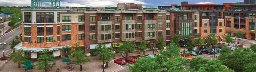
1 HOUSING OPPORTUNITIES CHARACTER AREA MAP DOWNTOWN er R iv a t o e s nn OLD SHAKOPEE Mi A K INTO DOWNTOWN C B e. e. 6th Avve 6t MARSCHALL RD G H CANTERBURY I 17th Ave. Marschall Rd. WEST END Marystown Rd. Old Brick Yard Rd. E SUBURBAN RURAL TRANSITION SOUTHBRIDGE J Eag le C reek Blvd. 18 A B C D E F G H I J K A B C D E F G H I J K th St. O Dowd 150th St. F DEAN LAKES Mystic Rd Mys Chesnut Blvd. Quarry Deans 69 D Fisher Vierling Dr. 41 Ea gle Cre ek Blv d. Townhouses 4th Ave. 10th h Ave. Avve e TOWN SQUARE MALL Mixed-Use Grass Lower Prior Apartment Community Apartment Building RURAL TOWNSHIP What types of housing should be developed in Shakopee? Where should they go? the places (A, B, C, etc) on the map above and the images of housing types to 1. Review the right and on the second page. A B C D E F G H I J K In the boxes below each image check the letter(s), corresponding to the map of where you think the type and style of housing should be in Shakopee. More than one letter may be checked for each housing type. Please include comments on any/each of the housing types. If your comments address a specific image, please mention which one. A B C D E F G H I J K If you do not agree with the housing type example, or do not think the style fits in Shakopee, please explain in your comments.
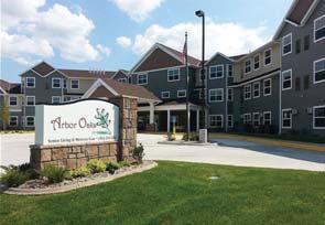
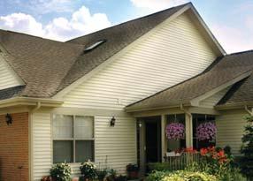
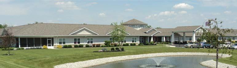
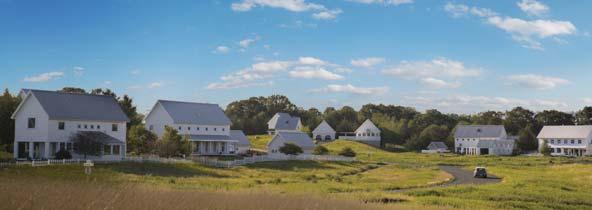
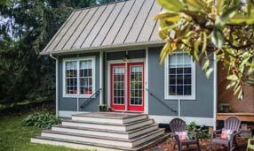
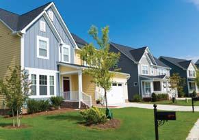
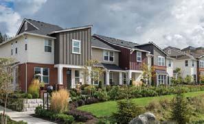
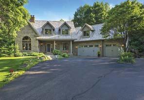

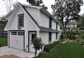
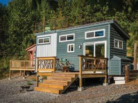
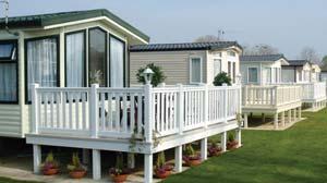
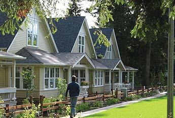
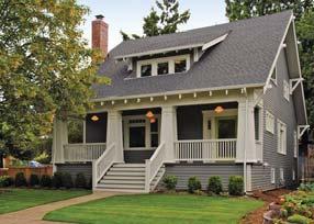
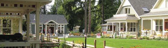
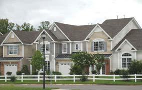
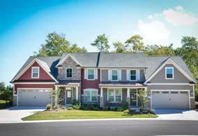
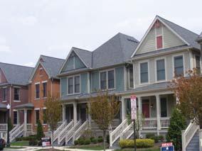
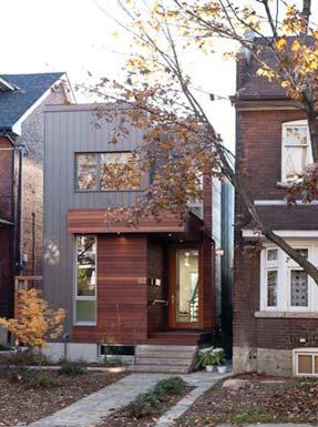
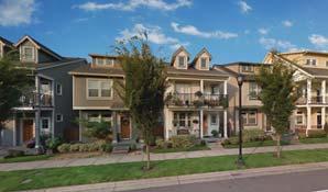
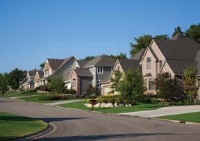
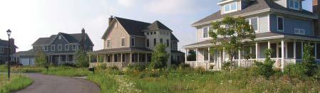
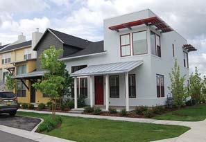
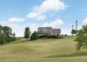
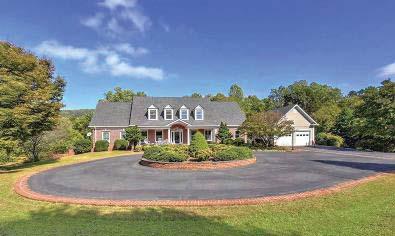
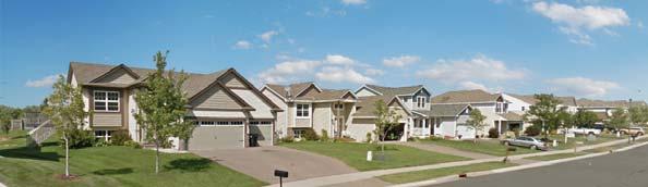
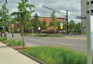
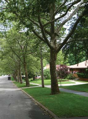
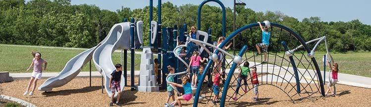
2 HOUSING OPPORTUNITIES Single Family Suburban Single Family Attached Single Family Small Lot Conservation Subdivisions Large Lot Homes Cottage Homes Senior Care Living Other Home Types HOUSING PAGE 2 See intructions below the housing opportunities map. If you do not agree with the housing type example, or do not think the style fits in Shakopee, please explain in your comments.


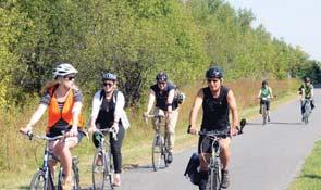
3 TRANSPORTATION OPPORTUNITIES TRANSPORTATION NETWORK MAP 41 Minnesota River 150th St. 69 OLD BRICK YARD RD 6th Ave. MARYSTOWN RD 10th Ave. Chesnut Blvd. O Dowd MARSCHALL RD Grass MINNESOTA VALLEY STATE TRAIL 4th Ave. Eagle Creek Blvd. 140th St. 17th Ave. CANTERBURY RD MYSTIC LAKE DR 12th Ave. Deans 21 Quarry PARK-AND-RIDE Fisher PARK-AND-RIDE 18 Lower Prior Walkable Streets & Places Regional Highway Connections Housing Near Employment Access to Transit - Bus Stops & Stations, Park-&-Rides What types of transportation options should we have in Shakopee? Where should they go? 1. you agree with. you think is a priority. comments address a specific image, please let us know which one. If you do not agree with the strategy example, or do not think it fits in Shakopee, please explain in your comments.
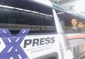

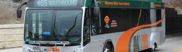
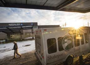
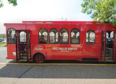
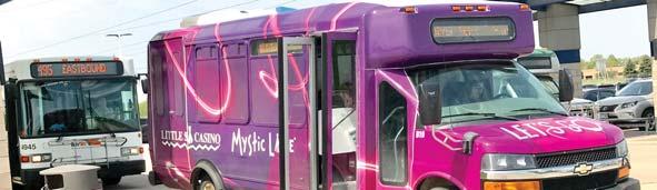

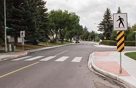
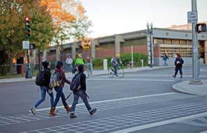

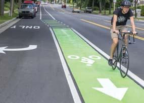
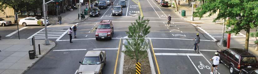
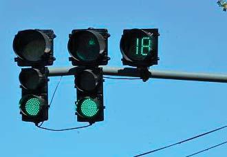
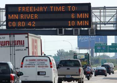
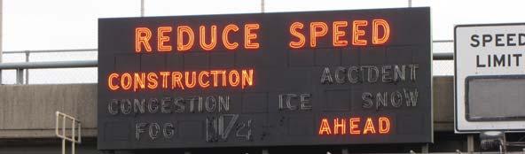
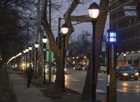
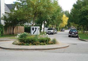
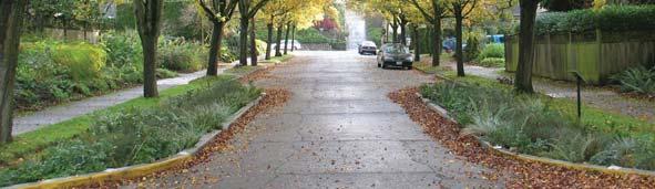
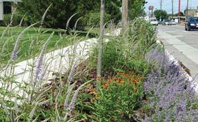
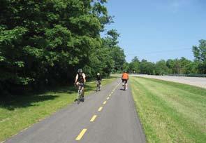
4 TRANSPORTATION OPPORTUNITIES Pedestrian Crossings Trail Connections Complete Streets Street Trees/Landscaping Smart Traffic Systems Express & Bus Rapid Transit Local Transit/Shuttles Safety Improvements 1. you agree with. you think is a priority. comments address a specific image, please let us know which one.


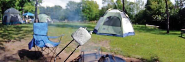
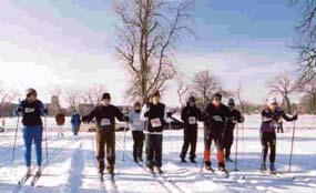
5 PARKS, TRAILS, & OPEN SPACE OPPORTUNITIES PARKS, TRAIL, & OPEN SPACE MAP Access to River/Riverfront Grass MINNESOTA VALLEY NWR MEMORIAL PARK M HUBER PARK er Riv a t o e s inn B lue QUARRY LAKE PARK Ea gle Cre ek Blv d. Vierling Dr. 10th Ave. TAHPAH PARK 69 Chesnut Blvd. C Ch Marystown Rd. Old Brick Yard Rd. O DOWD LAKE PARK 140th St. O Dowd 150th St. Quarry Q Potential Bike/Ped Bridge Crossing 17th Ave. STONEBROOKE GOLF COURSE Deans Mystic L ake ak er Rd Preserve Bluff in West End Marschall Rd. d d. 41 Fisher 4th Ave. 6th Ave. Programing/Activities MYSTIC LAKE GOLF COURSE Lower Prior Natural Open Space Trails What types of parks should be developed in Shakopee? Where should they go? 1. you agree with. you think is a priority. comments address a specific image, please let us know which one. If you do not agree with the strategy example, or do not think it fits in Shakopee, please explain in your comments.


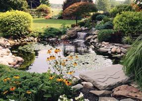
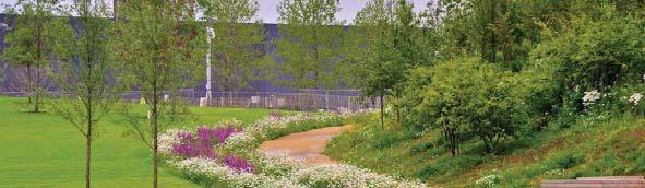
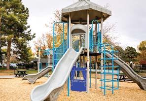
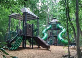
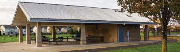
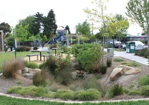
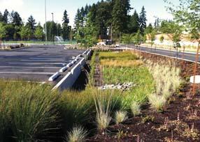
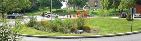
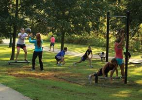
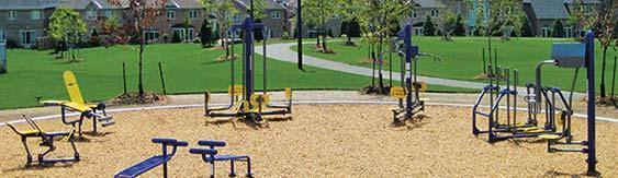
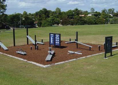
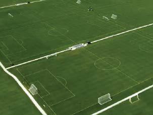
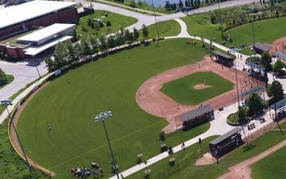
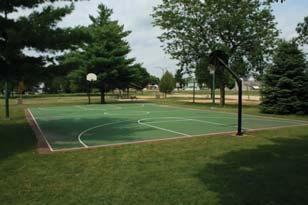


6 PARKS, TRAILS, & OPEN SPACE OPPORTUNITIES Playground Equipment Athletic Facilities Formal Landscaping Concessions & Restrooms Signage & Wayfinding Seating & Shelters Exercise & Fitness Trails Stormwater Management 1. you agree with. you think is a priority. comments address a specific image, please let us know which one.


7 ECONOMIC VITALITY OPPORTUNITIES EMPLOYMENT OPPORTUNITIES MAP M DOWNTOWN/ RIVERFRONT TOWN SQUARE MALL 4th Ave. 6th Ave. MARSCHALL RD 10th h Ave. MARYSTOWN RD 69 Chesnut Blvd. Marystown Rd. Old Brick Yard Rd. VALLEY GREEN Quarry Qua Qu Q ua La DEAN LAKES 17th Ave. SOUTHBRIDGE Deans Mystic Rd WEST END Ea gle Canterbury Cre ek Park Blv d. Vierling Dr. Marschall Rd. 41 Industrial/Office Space in West End MINNESOTA VALLEY STATE TRAIL Bl ake Fisher F Valleyfair INTO DOWNTOWN er Riv a t o e s inn Employment in/near Downtown Grass th St. CANTERBURY-MYSTIC LAKE CORRIDOR O Dowd 150th St. Mystic Casino Lower Prior Revitalize into Downtown Amenities Near Employment in Valley Green Business Park What types of economic development strategies should Shakopee pursue? 1. you agree with. you think is a priority. comments address a specific image, please let us know which one. If you do not agree with the strategy example, or do not think it fits in Shakopee, please explain in your comments.


8 ECONOMIC VITALITY OPPORTUNITIES Post-Secondary Institution/ Workforce Development Promote Valleyfair-Canterbury- Mystic Corridor Quality of Life Recreational Tourism Business & Civic Leadership Coordination Housing for Employees Coworking/Shared Work Space Redevelop Aging Sites Before After? 1. you agree with. you think is a priority. comments address a specific image, please let us know which one.
PIZZA HUT & WINGSTREET
 PIZZA HUT & WINGSTREET NNN Investment 257 South Marschall Road Shakopee, Minnesota 55379 7486 La Jolla Boulevard, Suite 173 La Jolla, California 92037 EXECUTIVE SUMMARY PROPERTY Pizza Hut & WingStreet
WEST OFFICE CENTER DRIVE FORT WASHINGTON OFFICE PARK FORT WASHINGTON, PA
 WEST OFFICE CENTER DRIVE FORT WASHINGTON OFFICE PARK FORT WASHINGTON, PA The Park The Location The Amenities The Future The Fort Washington Office Park has undergone signification and extensive revitalization
City of Glendale - Southside STUDY AREA PROFILE
 City of Glendale - Southside STUDY AREA PROFILE STUDY AREA ID #168 BASE MAP PARK METRICS WHERE ARE PARKS MOST NEEDED AMENITY QUANTITIES AND CONDITIONS PARK NEEDS FRAMEWORK PROJECT COST ESTIMATES PROJECT
CANNING CITY CENTRE. the new energy of the southeast
 CANNING CITY CENTRE the new energy of the southeast 2 INTRODUCTION From early beginnings as an important cultural and recreation place for the Beeloo Nyoongar people, to being a trading post connecting
CHAPTER 5. Chapter 5 Recreation Element
 CHAPTER 5 Recreation Element Chapter 5 Recreation Element The Recreation Element of the Meyers Area Plan is a supplement to the Recreation Element of the TRPA Regional Plan and the El Dorado County General
CHAPTER 3 PLANNING GOALS
 CHAPTER 3 PLANNING GOALS AND PUBLIC INPUT INTRODUCTION This portion of the Algonac Master Plan is intended to outline a course for action in achieving the community s vision for the future. Throughout
LIVE. WORK. PLAY. STATUS OF DEVELOPMENT FALL Produced for information by the Town of Markham
 LIVE. WORK. PLAY. STATUS OF DEVELOPMENT Produced for information by the Town of Markham Community TOWN OF MARKHAM CIVIC CENTRE 101 TOWN CENTRE BOULEVARD Completed in 1989. East of Town Centre Boulevard,
Coast to Coast Connector Summit
 Project Partners Welcome to the Coast to Coast Connector Summit Winter Garden, Florida City Hall October 1, 2014 1 Why are we here? Objectives 1. Inform key stakeholders on the current state of the C2C
Shantz Village. Development Summary November Steve Seiler, Senior Associate. Daniel Goldstrom, Partner
 A D U L T C O M M U N I T Y November 2017 45 Acre Mixed Use Development Staged Closing to 2021 35.55 Acres Net 10 Lots Zoned Fully Serviced Curb & Gutter 8.18 Acres 75 Adult Villas 7.87 Acres Supportive
October 23, 2017 Council Workshop
 MAPLEWOOD VILLAGE CENTRE AND INNOVATION DISTRICT IMPLEMENTATION PLAN & DESIGN GUIDELINES October 23, 2017 Council Workshop COMMUNITY PLAN Purpose of Council Workshop Highlight What We Heard Phase 3 & Key
2. Goals and Policies. The following are the adopted Parks and Trails Goals for Stillwater Township:
 D. PARKS AND TRAILS 1. Introduction Stillwater Township s population is relatively low, with most residents living on rural residences on large lots. The need for active park space has been minimal in
TIGER VIII Grant Application. Attachment 3: Letters of Support
 TIGER VIII Grant Application Attachment 3: Letters of Support Region 3 222 S 6 th St, Room 317 Grand Junction, CO 81501 May 29, 2015 Mr. Anthony Foxx Secretary of Transportation United States Department
TRUCKEE TAHOE AIRPORT DISTRICT BOARD OF DIRECTOR STAFF REPORT
 AGENDA ITEM: 11 TRUCKEE TAHOE AIRPORT DISTRICT BOARD OF DIRECTOR STAFF REPORT AGENDA TITLE: MEETING DATE: January 24, 2018 PREPARED BY: NTPUD Agency Partnership Opportunity, Multi-Use Trailhead Access
Bike/Pedestrian/Golf Cart Trail Recommendations for the City of Dasher
 Valdosta-Lowndes MPO Memo To: From: City of Dasher Mayor and City Council VLMPO Staff CC: Date: 7/12/2018 Re: Bike/Pedestrian/Golf Cart Trail Recommendations for the City of Dasher The City of Dasher is
ATTACHMENT 3. City Centre Area Plan PUBLIC ONLINE SURVEY #1 - FINDINGS. Background
 ATTACHMENT 3 City Centre Area Plan PUBLIC ONLINE SURVEY #1 - FINDINGS Background As part of the City Centre Area Plan update Phase 1 consultation strategy, a public online survey was conducted from February
RIVERSIDE PLAZA PROFESSIONAL OFFICE AT THE GATEWAY TO RIO RANCHO & ALBUQUERQUE
 PROFESSIONAL AT THE GATEWAY TO RIO RANCHO & ALBUQUERQUE AVAILABLE SUITES + + Suite 210 4,914± RSF + + Suite 225 1,100± RSF + + Suite 260 2,617± RSF LEASE RATE + + $16.50/RSF/YR Full Service PROPERTY FEATURES
ORANGE COUNTY TRANSPORTATION AUTHORITY. Go Local Fixed-Guideway Program History and Project Update. PowerPoint 3
 ORANGE COUNTY TRANSPORTATION AUTHORITY Go Local Fixed-Guideway Program History and Project Update PowerPoint 3 Santa Ana-Garden Grove Fixed Guideway Project OCTA Board of Directors September 26, 2011 Project
Chapter 1: Introduction
 Chapter 1: Purpose of the Comprehensive Plan The purpose of the Comprehensive Plan of the City of Rockaway Beach is to provide a policy guide for the growth and future development of the City. Section
BASSETTS CREEK SECTION CONTENTS: BASSETTS CREEK BRYN MAWR LUCE LINE
 BASSETTS CREEK SECTION CONTENTS: BASSETTS CREEK BRYN MAWR LUCE LINE GLENWOOD AVE MULTI-USE DIAMONDS VINCENT AVE N MORGAN AVE N PENN AVE N DOG PARK MULTI-USE FIELDS PLAYGROUND AK E RD S CHESTNUT AVE DA
Chessie Trail Public Forum Minutes. December 7, :00 7:30 pm Turman Room, Preston Library, VMI
 1. Welcome Chessie Trail Public Forum Minutes December 7, 2017 6:00 7:30 pm Turman Room, Preston Library, VMI a. Col Jay Williams welcomed everyone to the meeting and thanked them for their interest and
Frederickson LUAC. Community Plan Update. Parks & Recreation. September 25, 2017
 Frederickson LUAC Community Plan Update Parks & Recreation September 25, 2017 Kimberly Freeman Resource Stewardship Superintendent kimberly.freeman@co.pierce.wa.us 253-798-4261 Joseph Coppo Senior Parks
Rogue River Access and Management Plan Draft Alternatives
 Rogue River Access and Management Plan Draft Alternatives The Rogue River Access and Management Plan was initiated in December, 2011 and is being led by Jackson County Parks (JCP) and Oregon Department
6. How connected do you feel to the Sans Souci community?
 Please complete and return before May 1st, 2017, to be entered for a prize drawing. Further instructions are available on the last page. Digital version available at GCPlanning.org. 1. Do you live and/or
Greater Minnesota Regional Parks and Trails Commission Designation Application
 Greater Minnesota Regional Parks and Trails Commission Designation Application General Section Designation Application #: 15-050D Date Submitted: 06/30/2015 Park or Trail Name: Perham to Pelican Rapids
MAPLEWOOD VILLAGE CENTRE AND INNOVATION DISTRICT IMPLEMENTATION PLAN & DESIGN GUIDELINES. November 6, 2017 Regular Meeting of Council
 MAPLEWOOD VILLAGE CENTRE AND INNOVATION DISTRICT IMPLEMENTATION PLAN & DESIGN GUIDELINES November 6, 2017 Regular Meeting of Council Recommendation THAT Council: Approve the Maplewood Village Centre and
MAC Meeting. February 2, 2017
 MAC Meeting February 2, 2017 Community Engagement Over 1,000 stakeholders consulted Board and Staff workshops 90 participants 9 Focus Groups (arts & culture, festivals/music, hotels, dining & beer, sports,
Striders Day 3: Thursday, May 24
 Striders Day 3: Thursday, May 24 Microsoft Campus, Bridle Trails State Park, Redmond (10.9 miles) Gather at Microsoft Visitors Center, 9:30, ½ mile walk from Overlake TC. Departure: Redmond Transit Center
ILLINOIS RIVER CENTER AT HAVANA. Linking Resources for Success. Governor s Conference on the Management of the Illinois River System (October, 2005)
") ILLINOIS RIVER CENTER AT HAVANA Linking Resources for Success Governor s Conference on the Management of the Illinois River System (October, 2005) Linking Resources For Success COMMUNITY REVITALIZATION
ILLINOIS RIVER CENTER AT HAVANA Linking Resources for Success Governor s Conference on the Management of the Illinois River System (October, 2005) Linking Resources For Success COMMUNITY REVITALIZATION
Purpose. To provide a policy and planning framework so tourism grows in a manner that is economically, socially and environmentally sustainable
 Purpose To provide a policy and planning framework so tourism grows in a manner that is economically, socially and environmentally sustainable and thus able to meet the future needs of residents, visitors,
City of Walnut STUDY AREA PROFILE
 City of Walnut STUDY AREA PROFILE STUDY AREA ID #133 BASE MAP PARK METRICS WHERE ARE PARKS MOST NEEDED AMENITY QUANTITIES AND CONDITIONS PARK NEEDS FRAMEWORK PROJECT COST ESTIMATES PROJECT REPORTING FORM
Rating: 5.0 (scale of 1-10)
") 95 Community Trail System Groundcover: 2-metre paved path, 1- metre grass buffer on either side. Location: Fort St. John Ownership: City of Fort St. John Rating: 5.0 (scale of 1-10) Strategic value: Linear
95 Community Trail System Groundcover: 2-metre paved path, 1- metre grass buffer on either side. Location: Fort St. John Ownership: City of Fort St. John Rating: 5.0 (scale of 1-10) Strategic value: Linear
Toronto and East York Community Council. Acting Director, Community Planning, Toronto and East York District
 STAFF REPORT ACTION REQUIRED 440, 444, 450 and 462 Front Street West; 425, 439, 441 and 443 Wellington Street West; 6-18 Spadina Ave. and 1 and 19 Draper Street Urban Design Guidelines Final Report Date:
MORE TIME PLACEMENT HIGH TRAFFIC LOCATIONS 10-SECOND AD SPOTS
 STATE OF THE ART BETTER TECHNOLOGY MORE TIME PLACEMENT HIGH TRAFFIC LOCATIONS 10-SECOND AD SPOTS REACH & FREQUENCY Las Vegas Billboards is dedicated to giving the reach and frequency needed for a successful
CITY OF VAUGHAN EXTRACT FROM COUNCIL MEETING MINUTES OF SEPTEMBER 26, 2017
 CITY OF VAUGHAN EXTRACT FROM COUNCIL MEETING MINUTES OF SEPTEMBER 26, 2017 Item 12, Report No. 31, of the Committee of the Whole, which was adopted without amendment by the Council of the City of Vaughan
MEETING MINUTES District 1 Trail Planning Meeting 1
 MEETING MINUTES District 1 Trail Planning Meeting 1 June 1, 2017 2:00 PM 3:30 PM City of Two Harbors 2:00 Introductions Attendees: Lisa Austin, MnDOT Bryan Anderson, MnDOT Jasna Hadzic-Stanek, MnDOT Justin
Trail Etiquette. Hours of Operation. Trail Accessibility
 Trail Guide The Elmhurst Park District, with 28 parks and over 460 acres of land, offers nearly six miles of paved or asphalt park trails and maintains an additional 3.6 miles of trails within Elmhurst.
M E S T I Z O C U R T I S P A R K
 ARAPAHOE CONNECTION TO BUS ROUTE AT ND AND LAWRENCE, FUTURE LIGHT RAIL STATION LEGEND SOCIAL TRAIL FLAGSTONE PAVING TO RESTORE/MAINTAIN CONCRETE PAVING DIAGONAL CURVILINEAR SOCIAL ROUTE IS OUT OF HISTORIC
Official Minutes of MARION COUNTY BOARD OF COUNTY COMMISSIONERS. May 8, 2018
 Official Minutes of MARION COUNTY BOARD OF COUNTY COMMISSIONERS May 8, 2018 CALL TO ORDER: The Marion County Board of County Commissioners met in a special session in Commission Chambers at 5:33 p.m. on
Former Middle School Site Green Space & Brecksville Road Streetscape. March 27, 2018
 Former Middle School Site Green Space & Brecksville Road Streetscape March 27, 2018 Brecksville Streetscape & Downtown Greenspace Project Schedule City of Indepenence 2017 2018 Meeting Schedule Tasks/Deliverables
Coralville Limestone
 Coralville Limestone Coralville Parks and Recreation Created in 2016 pg. 1 Comprehensive Overview and Pricing Sheet Roundabouts Heartland drive ----------------------------------------------------------------------------------------------
City of Woodland Park
 1891 2016 CELEBRATING 125 YEARS City of Woodland Park 4 th Annual Teller County Economic Forecast February 18, 2016 Commercial Projects Completed in 2015 Starbucks and Verizon Eagle Fire Lodge 5 new rooms
CONTEXT MAP COMPREHENSIVE RECREATIONAL MASTER PLAN. to Virginia Civil War Trails. Riverside Park. Mountains to Sea Trail. Rowe Environmental Park
 OMPREHENSIE REREATIONAL MASTER PLAN ONTEXT MAP to irginia ivil War Trails NOT TO SALE iver tr rara A Riverside Mountains to Sea Trail Rowe Environmental School The Ararat River reenway is located along
Bloor Street West Rezoning Application for a Temporary Use By-law Final Report
 STAFF REPORT ACTION REQUIRED 3741 3751 Bloor Street West Rezoning Application for a Temporary Use By-law Final Report Date: June 12, 2007 To: From: Wards: Reference Number: Etobicoke York Community Council
ARLINGTON COUNTY, VIRGINIA
 ARLINGTON COUNTY, VIRGINIA County Board Agenda Item Meeting of April 16, 2005 DATE: March 28, 2005 SUBJECTS: A. Adoption of the Fort Myer Heights North Plan. B. GP-300-04-1 Adoption of the following General
Is Scarborough City Centre A Transit Village?
 s Scarborough City Centre a Transit Vii? Martin Barakengera s Scarborough City Centre A Transit Village? Executive Summary The purpose of this Master's Report is to determine whether Scarborough City Centre
Project Kickoff. Agenda. Pete Sechler AECOM. Randy Goers City of Tampa
 Project Kickoff April 11, 2012 Agenda Pete Sechler AECOM Randy Goers City of Tampa AECOM Parsons Brinkerhoff The Leytham Group ChappellRoberts Blackmon-Roberts Group MindMixer Fowler White Boggs, PA Agenda
Abbott Rd Rehabilitation Phase II - Elmore Rd to Birch Rd
 Abbott Rd Rehabilitation Phase II - Elmore Rd to Birch Rd Project ID SOA07003 Department State of Alaska Project Type Improvement Start Date December 2017 Location Assembly: Section 4, Seats F & G, Assembly:
CHAPTER 1 INTRODUCTION MORENO VALLEY GENERAL PLAN 1. INTRODUCTION. 1.1 What is a General Plan?
 1. INTRODUCTION 1.1 What is a General Plan? A General Plan is a comprehensive long-term strategy for the physical development of a city. It determines how land may be used and the infrastructure and public
Downtown SMART Train Station
 From January 21, 2016 - January 26, 2016, 1:45 PM As with any public comment process, participation in Open Novato is voluntary. The responses in this record are not necessarily representative of the whole
Spadina Avenue Built Form Study Preliminary Report
 STAFF REPORT ACTION REQUIRED Spadina Avenue Built Form Study Preliminary Report Date: July 9, 2014 To: From: Wards: Reference Number: Toronto and East York Community Council Director, Community Planning,
GOALS, OBJECTIVES, & RECOMMENDATIONS historic preservation. BUDA 2030 COMPREHENSIVE PLAN preserving our heritage sustaining our future
 HISTORIC PRESERVATION Buda has the second largest concentration of historic structures in Hays County, many of which are located along Main Street in downtown Buda. 1 These historic buildings form the
Part Three : COMMUNITY PLAN AREAS AND SPECIAL STUDY AREAS SACRAMENTO 2030 GENERAL PLAN. Introduction
 Special study Areas Part Three : COMMUNITY PLAN AREAS AND SPECIAL STUDY AREAS SACRAMENTO 2030 GENERAL PLAN Introduction Beyond the boundaries of the 2030 General Plan, the City has defined Special Study
875 WEST ELLIOT ROAD, TEMPE, ARIZONA. Rendering created by: PHArchitecture
 875 WEST ELLIOT ROAD, TEMPE, ARIZONA Rendering created by: PHArchitecture WHY ELLIOT CENTER HIGH PARKING RATIO 6:1000 EXPANDABLE PARKING UP TO 7:1000 FRESH NEW EXTERIOR VERSATILE BUILDING 14 FOOT CEILING
E C O N O M I C D EV E L O P M E N T C O R P O R AT I O N
 Welcome to ridgeport The expansion of one of the strongest diversified economic bases of any small city in the U.S.A. is bringing unmatched opportunities to, Texas BridgeporT E C O N O M I C D EV E L O
RARE 67,701 SF OFFICE/R&D BUILDING WITH HEAVY POWER (DIVISIBLE TO ± 33,000 SF) 5901 OPTICAL COURT, SAN JOSE, CA AVAILABLE FOR LEASE OR SALE
 5901 OPTICAL COURT, SAN JOSE, CA AVAILABLE FOR LEASE OR SALE") RARE 67,701 SF OFFICE/R&D BUILDING WITH HEAVY POWER (DIVISIBLE TO ± 33,000 SF) 5901 OPTICAL COURT, SAN JOSE, CA AVAILABLE FOR LEASE OR SALE PROJECT HIGHLIGHTS ± 67,701 SF AVAILABLE DIVISIBLE BY FLOOR -
RARE 67,701 SF OFFICE/R&D BUILDING WITH HEAVY POWER (DIVISIBLE TO ± 33,000 SF) 5901 OPTICAL COURT, SAN JOSE, CA AVAILABLE FOR LEASE OR SALE PROJECT HIGHLIGHTS ± 67,701 SF AVAILABLE DIVISIBLE BY FLOOR -
Alliant Energy Center Visioning Workshop Input Madison, WI July 20, 2017
 Alliant Energy Center Visioning Workshop Input Madison, WI July 2, 217 A neighborhood meeting was held on July 18 and 19 th, 217 to gather community feedback on the topics of connections, destination district,
A VISION FOR EL MIRAGE
 el mirage A VISION FOR EL MIRAGE OASIS, ARIZONA A thriving desert jewel destination with a strong arts district, high-wage employment parks system joined together by cohesive, multi-use accessible trails
IN FOCUS NSW. Developing Western Sydney
 IN FOCUS NSW Developing Western Sydney DEVELOPING WESTERN SYDNEY Introduction Western Sydney is one of the fastest growing regions in Australia. Traditionally infrastructure expenditure and development
Town of Markham Yonge and Steeles Corridor Study and City of Vaughan Yonge Street Area Study
 STAFF REPORT ACTION REQUIRED Town of Markham Yonge and Steeles Corridor Study and City of Vaughan Yonge Street Area Study Date: August 14, 2009 To: From: Wards: Reference Number: North York Community Council
WEST LAND USE MASTER PLAN AND DESIGN GUIDELINES PHASE 1 SUMMARY
 WEST LAND USE MASTER PLAN AND DESIGN GUIDELINES PHASE 1 SUMMARY WELCOME / AGENDA WELCOME PROJECT OVERVIEW PUBLIC MEETING RESULTS/STAKEHOLDER INPUT MARKET STUDY RESULTS WHERE WE RE HEADED NEXT STEPS STEERING
Shop Local Shop Smart to Give Away Reusable Shopping Bags at Christmas on Main Street Tree Lighting Festival in Downtown Stuart
 Shop Local Shop Smart to Give at Christmas on Main Street Tree Lighting Festival in Downtown Stuart Program Highlighting Locally Owned Businesses on Black Friday STUART, FL November 21, 2014 Downtown Stuart
Link Union Station (LINK US)
") Link Union Station (LINK US) Presentation for LAUS Master Commercial Developer Industry Forum October 13 th 2017 Jeanet Owens, PE Senior Executive Officer Program Management / Regional Rail Project Overview
Link Union Station (LINK US) Presentation for LAUS Master Commercial Developer Industry Forum October 13 th 2017 Jeanet Owens, PE Senior Executive Officer Program Management / Regional Rail Project Overview
CREATING CONNECTIONS IN THE CITY OF NIAGARA FALLS PUBLIC MEETING DECEMBER 6, 2017
 CREATING CONNECTIONS IN THE CITY OF NIAGARA FALLS PUBLIC MEETING DECEMBER 6, 2017 CONGESTION COSTS OUR ECONOMY The average commute in Ontario is already over 45 minutes, and that figure jumps to more than
SAN RAFAEL City Council January 20, 2015
 SONOMA MARIN AREA RAIL TRANSIT SMART CENTRAL SAN RAFAEL STATUS UPDATE SAN RAFAEL City Council January 20, 2015 CENTRAL SAN RAFAEL SMART SOUTH OF PUERTO SUELLO TUNNEL 1. Active Construction 2. Construction
NOTE: YOU MAY COMPLETE THIS SURVEY ONLINE (USING THIS DOCUMENT TO VIEW MAPS AND GRAPHICS) AT:
 AT:") for completing the Town of Beech Mountain Comprehensive Planning Survey. The information you provide in reply to the following questions will be used to help the Town develop a plan that will guide our
for completing the Town of Beech Mountain Comprehensive Planning Survey. The information you provide in reply to the following questions will be used to help the Town develop a plan that will guide our
S i t e A n a ly s i s
 S i t e A n a ly s i s 11 SECTION B SITE ANALYSIS Existing Conditions TRANSPORTATION CONTEXT: The Ohlone Greenway site, paralleling San Pablo Avenue to the west, is centrally located within the City of
25 th Avenue Grade Separation. Community Meeting November 13, 2018
 25 th Avenue Grade Separation Community Meeting November 13, 2018 Agenda I. Project Need II. Project Benefits III. Project Description IV. Funding V. Schedule VI. Construction VII. Next Steps 2 Project
HARBOUR EDGE STITCH. Uniting the Waterfront with the City Centre
 78 AC_BEU_CCMP_2_TM1_4 _FD.indd 78 20/07/12 12:04 PM 01 HARBOUR EDGE STITCH Uniting the Waterfront with the City Centre 01 VISION OUR 2032 VISION IS: Quay Street as a high-quality Harbour Edge space that
NINE5 SIX12. Explore Westshore, Anytime. Tampa s Westshore District
 NINE5 SIX12 Explore Westshore, Anytime. Tampa s Westshore District Do your best work in Westshore. Whether your company needs a 50,000-squarefoot space with all the bells and whistles or your startup is
Regional Wayfinding Sign Strategy Thurston County Trails 2017
 Regional Wayfinding Sign Strategy Thurston County Trails 2017 Partners: Members and partnering organizations of the Thurston Thrives Community Design Action Team City of Lacey, City of Olympia, City of
Stage 2 ION: Light Rail Transit (LRT) from Kitchener to Cambridge
 from Kitchener to Cambridge") Stage 2 ION: Light Rail Transit (LRT) from Kitchener to Cambridge Public Consultation Centre (PCC) No. 3 Please Sign-in Cambridge City Hall November 21, 2017 2:00 to 8:00pm Preston Memorial Auditorium
Stage 2 ION: Light Rail Transit (LRT) from Kitchener to Cambridge Public Consultation Centre (PCC) No. 3 Please Sign-in Cambridge City Hall November 21, 2017 2:00 to 8:00pm Preston Memorial Auditorium
Community Development Committee
 C Community Development Committee For the Metropolitan Council meeting of October 31, 2012 Committee Report Item:2012-316 ADVISORY INFORMATION October 16, 2012 Date Prepared: Subject: Intercity Regional
Metropolitan Parks and Open Space Commission Subject District(s), Member(s): Policy/Legal Reference: Staff Prepared/Presented: Division/Department:
, Member(s): Policy/Legal Reference: Staff Prepared/Presented: Division/Department:") Business Item Metropolitan Parks and Open Space Commission Meeting date: May 20, 2013 Subject: Proposed System Addition Discussion for the 2040 Regional Parks Policy Plan District(s), Member(s): All Policy/Legal
Business Item Metropolitan Parks and Open Space Commission Meeting date: May 20, 2013 Subject: Proposed System Addition Discussion for the 2040 Regional Parks Policy Plan District(s), Member(s): All Policy/Legal
Welcome To Downtown Mesa Az
 Welcome To Downtown Mesa Az See Attached Check here: http://www.mesaaz.gov/home/showdocument?id=13106 Downtown Square Mile 1906 Downtown Square Mile today Short History of Mesa - https://www.youtube.com/watch?v=ozkmmchpisc
LINK (5465) N. Robert St., St. Paul, MN 55101
 N. Robert St., St. Paul, MN 55101") 651-602-LINK (5465) www.transitlinktc.org 390 N. Robert St., St. Paul, MN 55101 Service Details Customer Guide Table of Contents Customer Guide... page 1 Service Details... page 2 Areas... page 2 Eligibility...
651-602-LINK (5465) www.transitlinktc.org 390 N. Robert St., St. Paul, MN 55101 Service Details Customer Guide Table of Contents Customer Guide... page 1 Service Details... page 2 Areas... page 2 Eligibility...
Unincorporated East Los Angeles - Southeast STUDY AREA PROFILE
 Unincorporated East Los Angeles - Southeast STUDY AREA PROFILE STUDY AREA ID #30 BASE MAP PARK METRICS WHERE ARE PARKS MOST NEEDED AMENITY QUANTITIES AND CONDITIONS PARK NEEDS FRAMEWORK PROJECT COST ESTIMATES
Business Item No XXX. Proposed Action That the Metropolitan Council approve the Coon Creek Regional Trail Master Plan.
 Business Item No. 2015-XXX Metropolitan Parks and Open Space Commission Meeting date: July 7, 2015 For the Community Development Committee meeting of July 20, 2015 For the Metropolitan Council meeting
THE ESCALADE Westbank Drive, Austin, Texas 78746
 SM The Escalade is well positioned within the desirable Southwest submarket, situated close to a multitude of restaurants, shopping, and hotels as well as major employment centers. The property provides
Tourism 201 CHAPTER 10
 Tourism 201 CHAPTER 10 202 Doncaster Unitary Development Plan Tourism 203 Tourism INTRODUCTION 10.1 The increasing importance of tourism is recognised in the UDP by having its own chapter. The benefits
Committee. Presentation Outline
 CW-33-15 11/9/2015 Community and Corporate Services Committee November 10, 2015 1 Presentation Outline Background Vision and Objectives Study Process and Timeline Public and Stakeholder Engagement Organization
Colorado Springs & Pikes Peak Region Destination Master Plan
 Colorado Springs & Pikes Peak Region Destination Master Plan Overview June 19, 2018 DESTINATION MASTER PLAN What is Destination Master Planning? Focus on infrastructure, facilities, services, attractions
For Lease Retail Space LUXURY
 1127 LUXURY Euclid Avenue,Cleveland, Ohio 44115 RYAN FISHER Vice President Retail Services DIRECT 216 239 5069 ryan.fisher@colliers.com > PROPERTY HIGHLIGHTS Excellent opportunity to locate at the center
Township Superintendent
 EMPLOYMENT OPPORTUNITY Township Superintendent Buena Vista Charter Township Township Superintendent BUENA VISTA CHARTER TOWNSHIP Buena Vista Charter Township, located in Saginaw County, Michigan, strives
Area Surrounding Maplewood Manor
 BAY CITY, MICHIGAN HOUSING COMMISSION Neighborhood Revitalization Plan Area Surrounding Maplewood Manor January 13, 2014 CITY COMMISSION DRAFT PLAN PRESENTATION BAY CITY, MICHIGAN 1 Planners Phil McKenna,
VILLAGE OF SAYWARD 2014 ANNUAL REPORT. The Village of Sayward P.O. Box 29, 652 H Kusam Way Sayward B.C. V0P 1R0
 VILLAGE OF SAYWARD 2014 ANNUAL REPORT The Village of Sayward P.O. Box 29, 652 H Kusam Way Sayward B.C. V0P 1R0 Contents of the Annual Report Item 1: Item 2: Item 3: Item 4: Item 5: Message from the Mayor
SHINGLE CREEK SECTION CONTENTS: BOHANON PARK CREEKVIEW PARK SHINGLE CREEK PARK SHINGLE CREEK REGIONAL TRAIL WEBBER PARK
 SHINGLE CREEK SECTION CONTENTS: BOHANON PARK CREEKVIEW PARK SHINGLE CREEK PARK SHINGLE CREEK REGIONAL TRAIL WEBBER PARK SPLASH PAD Good condition. PARK BUILDING BRYANT AVE N Good condition and unique to
2016 Development Cost Charges (DCC) UPDATE
 UPDATE") 2016 Development Cost Charges (DCC) UPDATE City of Richmond Public Meeting November 3, 2016 Outline Development Cost Charges (DCC) Overview DCC Rate Calculation DCC Recoverable Costs (DCC Programs) Estimated
2016 Development Cost Charges (DCC) UPDATE City of Richmond Public Meeting November 3, 2016 Outline Development Cost Charges (DCC) Overview DCC Rate Calculation DCC Recoverable Costs (DCC Programs) Estimated
Minnesota Great River Road Transportation Alternatives Local Project Summaries December 19, 2016
 Minnesota Great River Road Transportation Alternatives Local Project Summaries December 19, 2016 For MN-MRPC Consideration on January 5, 2017 and Potential Letters of Support Aitkin pg. 2 Brainerd pg.
Saginaw Charter Township Master Plan
 Saginaw Charter Township Master Plan Overview of Draft & Public Hearing August 20, 2014 230 South Washington Avenue Saginaw Michigan 48607 (989) 754-4717 www.spicergroup.com Saginaw Charter Township Master
Parking Amendments - Bay Street, between Harbour Street and Queens Quay West (York Street, Bay Street, and Yonge Street Ramp Removal)
") REPORT FOR ACTION between Harbour Street and Queens Quay West (York Street, Bay Street, and Yonge Street Ramp Removal) Date: October 26, 2017 To: Toronto and East York Community Council From: Acting Director,
REPORT FOR ACTION between Harbour Street and Queens Quay West (York Street, Bay Street, and Yonge Street Ramp Removal) Date: October 26, 2017 To: Toronto and East York Community Council From: Acting Director,
Redevelopment of East Boston s Inner Harbor Waterfront
 to its Waterfront Redevelopment of East Boston s Inner Harbor Waterfront to its Waterfront Redevelopment of East Boston s Inner Harbor Waterfront Redevelopment Background extensive planning City + community
Changing Lanes. Click to edit Master title style. Community Consultation Meeting #1. Second level Third level. Fourth level.
 Changing Lanes The Click City of to Toronto edit Master Review text of styles Laneway Suites Community Consultation Meeting #1 November 30, 2017 Agenda 6:30 Introductions Councillor Ana Bailão (Ward 18)
For Lease. Exceptional Office Space HIGHLY VISIBLE LOCATION IN THE HEART OF SANTA FE. Lease Rate See Advisor Available ± 8,018 SF Property Highlights
 SEC 5th St. & St. Michaels Dr. For Lease Lease Rate See Advisor Available ± 8,018 SF Property Highlights Newly remodeled choose your own flooring Multiple offices & large reception area Located on second
PARRAMORE OAKS FRAMEWORK PLANNED DEVELOPMENT OVERVIEW. Presented by Dean Grandin, AICP ZON
 PARRAMORE OAKS FRAMEWORK PLANNED DEVELOPMENT OVERVIEW Presented by Dean Grandin, AICP Short Ave. S. Parramore St. On/Off Ramps between I-4 & SR408/East-West Xpwy. Request The applicant is requesting a
The Narrows Waterfront Park A Crown Jewel for Southern Brooklyn
 The Narrows Waterfront Park A Crown Jewel for Southern Brooklyn In New York, the unquestioned popularity of urban spaces such as Riverside Park, the High Line, Brooklyn Bridge Park and others has demonstrated
RIVERFRONT PROPERTIES
 Proposed Location Photo Credit: Visit Saint Paul An iconic downtown Saint Paul site located along the bluff with sweeping, unobstructed views of the Mississippi River Urban site Transit access Vibrant
2.1 Site Location. Site Location. Harbouside Waterfront Rezoning Submission - November 2012
 Site Context 2.0 2.1 Site Location Site Location Harbouside Waterfront Rezoning Submission - November 2012 Site Location The Harbourside Waterfront site is located in the southwest corner of the City of
Commuter Park and Ride Steering Committee Meeting Notes August 7, :00 a.m. to 11:00 a.m. Attendees Name Organization Phone
 Commuter Park and Ride Steering Committee Meeting Notes August 7, 2013 10:00 a.m. to 11:00 a.m. Attendees Name Organization Email Phone Eileen Horn Lawrence/Douglas County ehorn@lawrenceks.org 785-330-3121
 288.075, F.S. Florida Job Growth Infrastructure Application Response to Question 1A Provide the title and a detailed description of the public infrastructure improvements. The West River Riverwalk
10 PARKS AND RECREATION ELEMENT
 10 Public parks and recreational facilities are important contributions to quality of life in Chino. Parks are prime locations for physical activity, sports, relaxation and community gatherings, which