Nowell s Lakes. At a glance (last updated: February 2006) Ecological values
|
|
|
- Doreen Atkinson
- 5 years ago
- Views:
Transcription
1 Nowell s Lakes At a glance (last updated: February 2006) TRC reference: Ecological district: Egmont Other reference: STDC SNA 15 LENZ environment: F5.2c Land tenure: Private Protection status: A, B, C GPS: E E N Area: Total: ha ha 10.4 ha Location Nowell s Lakes are two lakes located on privately owned land, 3 km south of Hawera. It lies in the Egmont Ecological District. General description Nowell s Lakes and environs have a combined area of 10.4 ha. They are located adjacent to each other in coastal dune land. The lakes have highly modified margins but have been well replanted with flaxland and reedland species. An overland drainage pipe, which controls the lake level at times of flooding, extends from one of the lakes to the coast. The lakes provide an important link between the coast and land for coastal bird life. Ecological features Vegetation The Nowell s Lake site contains reedland and flaxland made up of raupo (Typha orientalis), flax (Phormium tenax), and lake club rush (Schoenoplectus tabernaemontanii). Other native plants present are cabbage trees (Cordyline australis), taupata (Coprosma repens), and toetoe (Cortaderia fulvida). Exotic plants such as jointed rush (Juncus articulatus), sweet grass (Glyceria maxima), and pines (Pinus radiata) are also present. Other birds present include the white-faced heron (Ardea novaehollandiae novaehollandiae), pied stilt (Himantopus himantopus), cattle egret (Bubulus ibis coromandus), paradise shelduck (Tadorna variegata), pukeko (Porphyrio porphyrio melanotus), and Canadian goose (Branta canadensis). Native freshwater crayfish (koura) and freshwater perch (Perca fluviatilis) are present in both lakes. Ecological values Ecological values Rank Comment Rarity and distinctiveness High Contains the Acutely Threatened Australasian bittern Also contains the At Risk little black shag Representativeness High Contains indigenous vegetation on F5.2c an Acutely Threatened LENZ environment Ecological context High Coastal dune wetlands are uncommon in Taranaki. Lakes provide important habitat for coastal birds including migratory birds.also provides core habitat for Australasian bittern and little black shag, and other indigenous birds Sustainability Positive Recently replanted regenerating vegetation. Key ecological processes still influence the site. Under appropriate management it can remain resilient to existing or potential threats Management threats and response Potential and actual threats to the sustainability of the Nowells Lakes wetland s ecological values are as follows: Threats to ecological values Pest animals Level of risk Medium to high Comment Possums, cats, mustelids, hedgehogs, and rats Weeds Medium Jointed rush, sweet grass, gorse and boxthorn Habitat modification Low Fenced Fauna Nowell s Lakes are a feeding area for a significant number of native water birds including the Acutely Threatened (Nationally Endangered) matuku/australasian bittern (Botaurus poiciloptilus) and the At Risk (Sparse) little black shag (Phalacrocorax sulcirostris). 148
 B Regulatory protection by local government Site specific rules apply Taranaki Regional Council rules for wetlands (refer Appendix IIB of the Regional")
2 Site protection measures addressing potential threats and actual threats are as follows Site protection /No Description A Public ownership or formal agreement In part: Taranaki Regional Council Memorandum of Encumbrance (1 of 2 land owners) B Regulatory protection by local government Site specific rules apply Taranaki Regional Council rules for wetlands (refer Appendix IIB of the Regional Fresh Water Plan) South Taranaki District Council rules for Significant Natural Areas (refer Schedule II of the District Plan) General regional or district rules might also apply C Active protection Fenced Enhancement planting of wetland margin Self-help Possum Control Programme 149
3 Nukuhau Lakes Catchment At a glance (last updated: February 2006) TRC reference: Ecological district: Matemateaonga Other reference: STDC SNA 26 SSBI R21/H012 LENZ environment: F1.1d (9.5 ha) Land tenure: Private Protection status: B F1.3b (277.8 ha) F7.2a F7.1b GPS: E N Area: ha (5.3 ha) (2.1 ha) Location The Nukuhau Lakes Catchment is located on privately owned land, 23 km north-east of Patea. It lies in the Matemateaonga Ecological District. General description The Nukuhau Lakes Catchment includes six small lakes within a catchment area of ha. The lakes drain into a tributary of the Omahine Stream. The lakes were formed by a large slump and several smaller slips near the gully head, which have impeded drainage. Much of the vegetation surrounding the lakes has been cleared in the past and is secondary regenerating forest and scrub. The lakes are significant as a rare sequence of slump-formed lakes with associated wetland vegetation, and enclosed within an entirely forested catchment. Ecological features Vegetation The lake edges have a fringe of raupo (Typha orientalis), only one or two metres wide. Towards the north-west, toetoe and giant umbrella sedge (Cyperus ustulatus) are present, while in the south-west Carex secta is common. In the south-west corner a small remnant of swamp forest also persists that consists of pukatea (Laurelia novae-zelandiae) and kahikatea (Dacrycarpus dacrydiodes). The wetland vegetation generally merges into secondary vegetation, which is strongly dominated by tree ferns (mainly ponga) and manuka (Leptospermum scoparium). In places, particularly higher up, a number of other species can be found. These include mountain flax (Phormium cookianum), koromiko (Hebe stricta), karamu (Coprosma robusta), hangehange (Geniostoma rupestre var. ligustrifolium), mapou (Myrsine australis), heketara (Olearia rani var. colorata), and bracken fern. High up in the south-west of the main catchment, ponga and manuka are replaced by mahoe (Melicytus ramiflorus) and there is also rangiora (Brachyglottis repanda), lancewood (Pseudopanax crassifolium), and mapou present. The forest on the higher slopes is a mixed broadleaved forest dominated by tawa (Beilschmiedia tawa). The canopy also contains hinau (Elaeocarpus dentatus) and rewarewa (Knightia excelsa), with some Hall s totara. There is a poorly defined subcanopy with some mahoe, mapou, mamaku (Cyathea medullaris), kaikomako (Pennantia corymbosa), karamu and pate (Schefflera digitata). The understorey contains common species such as kawakawa (Macropiper excelsum), hangehange (Geniostoma rupestre var. ligustrifolium), and kamahi (Weinmannia racemosa). Climbers include bush lawyer, supplejack (Ripogonum scandens), kiekie (Freycinetia baueriana subsp. banksii), and red rata vine (Metroideros fulgens). On a few ridge and spur crests some black beech (Nothofagus solandri), forest persists as well as heketara and mingimingi. Fauna The Nukuhau Lakes Catchment provide habitat for the At Risk (Sparse) spotless crake (Porzana tabuensis plumbea), which is particularly uncommon in Taranaki. Ecological values Ecological values Rank Comment Rarity and distinctiveness High Contains the At Risk spotted crake, which is particularly uncommon in Taranaki Representativeness Low High quality example of indigenous vegetation on F7.2a an At Risk LENZ environment Ecological context High A rare sequence of slump-formed lakes with associated wetland vegetation within an entire forested catchment. The area is large, well buffered and provides core habitat for the at risk spotless crake Sustainability Positive Though much of the vegetation is secondary there is good scope for continued regeneration. Key ecological processes still influence the site. Under appropriate management, it can remain resilient to existing or potential threats 150

4 Management threats and response Potential and actual threats to the sustainability of the Nukuhau Lakes and Catchment s ecological values are as follows: Threats to ecological values Pest animals Weeds Level of risk Medium to high Low Comment Possums, cats, goats, pigs, rabbits, mustelids, hedgehogs, and rats Habitat modification Low Unfenced grazing is a threat Site protection measures addressing potential threats and actual threats are as follows: Site protection /No Description A Public ownership or formal agreement No B Regulatory protection by local government C Active protection No Site specific rules apply Taranaki Regional Council rules for wetlands (refer Appendix IIB of the Regional Fresh Water Plan) South Taranaki District Council rules for Significant Natural Areas (refer Schedule II of the District Plan) General regional or district rules might also apply 151
5 Oapui Forest Sanctuary At a glance (last updated: February 2006) TRC reference: Ecological district: North Taranaki Other reference: DOC LENZ environment: F5.2a Land tenure: Crown Protection status: A, B GPS: E N Area: 1.2 ha Location The Crown owned Oapuni Forest Sanctuary is located on Junction Road adjoining the Taramouku Stream, 17 km east of Inglewood. The Sanctuary is in the North Taranaki Ecological District. General description The Oapuni Forest Sanctuary, which is administered by the Department of Conservation, is a very small (1.2 ha) remnant of vigorously regenerating secondary lowland podocarp forest on alluvial terraces. The Sanctuary is in close proximity to other Key Native Ecosystems Taramoukou and Taramoukou Conservation Area. Ecological features Vegetation The Oapuni Forest Sanctuary s mainly canopy species comprises primarily of dense rimu (Dacrydium cupressinum) forest. Fauna Unknown. No specific indigenous fauna species have been recorded for the Oapuni Forest Sanctuary. Ecological values Ecological values Rank Comment Rarity and distinctiveness Low Not known to contain any Acutely Threatened species or species uncommon in Taranaki Representativeness High Contains indigenous vegetation on F5.2a an Acutely Threatened LENZ environment Ecological context Medium Close to and interconnected with other Key Native Ecosystems Taramoukau Forest and Taramoukau Conservation Area Sustainability Positive A very small remnant so will be influenced by edge effects but with appropriate management should remain resilient to actual and potential threats Management threats and response Potential and actual threats to the sustainability of Oapuni Forest Sanctuary ecological values are as follows: Threats to ecological values Level of risk Pest animals Low medium Weeds Low Comment Possums, cats, mustelids, and rats Habitat modification Low Very small so any edge effects are prominent Site protection measures addressing potential threats and actual threats are as follows: Site protection /No Description A Public ownership or formal agreement Forest Sanctuary B Regulatory protection by local government General regional or district rules might apply C Active protection No 152
6 153
7 Ohura Road 1 Wetland At a glance (last updated: February 2006) TRC reference: Ecological district: Matemateaonga Other reference: LENZ environment: H3.1b (4.3 ha) Land tenure: Private Protection status: B GPS: E N Area: 17.4 ha F1.1d (13.1 ha) Location The Ohura Road 1 Wetland is located on privately owned land, 30 km northeast of Stratford. The site lies in the Matemateaonga Ecological District. General description The Ohura Road 1 is a lacustrine wetland and covers 17.4 ha. It is a manmade lake with dam adjacent to pine forestry. The wetland is in close proximity to the Te Wera Covenant Wetlands and the Te Wera Wetland and is therefore interconnected with these other Key Native Ecosystems. Ecological features Vegetation Raupo (Typha orientalis), kahikatea (Dacrycarpus dacrydioides), flax (Phormium tenax), and lake clubrush/kuta (Schoenoplectus validus) are present. Ecological values Ecological values Rank Comment Rarity and distinctiveness High Contains the At Risk spotted crake and fernbird, which are particularly uncommon in Taranaki Representativeness High Contains indigenous vegetation on H3.1b an Acutely Threatened LENZ environment Ecological context High The area provides core habitat for the regionally uncommon and threatened spotless crake and fernbird. It is also near and therefore interconnected with Te Wera Covenant Wetlands and the Te Wera Wetland Sustainability Positive A large area in relatively good vegetative condition. Key ecological processes still influence the site. Under appropriate management, it can remain resilient to existing or potential threats Management threats and response Potential and actual threats to the sustainability of Ohura Road 1 s ecological values are as follows: Threats to ecological values Pest animals Level of risk Medium to high Comment Possums, cats, rabbits, mustelids, goats, pigs, and hedgehogs Weeds Low to Small infestations of willow medium Habitat modification Medium The wetland is unfenced with the west bank open to grazing. Vegetation clearance, drainage and forestry activities are also potential threats Fauna Birdlife present at the Ohura Road 1 includes spotless crake (Porzana tabuensis plumbea) and fernbird (Bowdleria punctata vealeae) which are identified as At Risk (Sparse). Spotless crake and fernbird are both particularly uncommon in Taranaki. Pukeko (Porphyrio porphyrio) are also present. 154

8 Site protection measures addressing potential threats and actual threats are as follows: Site protection /No Description A Public ownership or formal agreement No B Regulatory protection by local government General regional or district rules might apply C Active protection No 155
 Land tenure: Crown Protection status: A, B, C GPS: 2664800E 6250697N Area: 14.3 ha F7.2a (2.7 ha) Location The Crown owned Okau Scenic Reserve is located 35 km east of Urenui.")
9 Okau Scenic Reserve At a glance (last updated: February 2006) TRC reference: Ecological district: North Taranaki Other reference: DOC LENZ environment: F5.2a (11.9 ha) Land tenure: Crown Protection status: A, B, C GPS: E N Area: 14.3 ha F7.2a (2.7 ha) Location The Crown owned Okau Scenic Reserve is located 35 km east of Urenui. The Reserve lies in the North Taranaki Ecological District. General description The Okau Scenic Reserve includes a small (14.3 ha) forested hill and a palustrine wetland. It is administered by the Department of Conservation and predominantly lies on river flats on the poorly drained Mount Damper plateau. Ecological features Vegetation There are 134 plant species present in the Okau Scenic Reserve. In the wetland Carex species dominate, including the lage tussocks of Carex virgata and Carex secta. There is also an area of kahikatea (Dacrycarpus dacrydioides) over dense herbaceous vegetation. which is identified as being Chronically Threatened (Gradual Decline), is also present. Ecological values Ecological values Rank Comment Rarity and distinctiveness Medium Regionally distinctive in that it contains the At Risk and regionally uncommon fernbird Also contains the Chronically Threatened New Zealand pigeon Representativeness Low Contains indigenous vegetation on Acutely Threatened (F5.2a) and At Risk (F7.2a) LENZ environments Ecological context Medium Contains core habitat for the threatened wood pigeon and fernbird, and is close to and interconnected with other areas of indigenous forest Sustainability Positive In relatively good vegetative condition. Key ecological processes still influence the site. Under appropriate management, it can remain resilient to existing or potential threats Management threats and response Potential and actual threats to the sustainability of Okau Scenic Reserve s ecological values are as follows: Threats to ecological values Pest animals Level of risk Medium to high Comment Possums, goats, cats, mustelids, and rats Weeds Low to Blackberry and willow medium Habitat modification Medium Stock encroachment is a threat on the western and southern boundaries Fauna Notable birdlife present in the Okau Scenic Reserve include the At Risk (Sparse) fernbird (Bowdleria punctata vealeae), which is particularly uncommon in Taranaki. New Zealand pigeon (Hemiphaga novaeseelandiae), 156
 B Regulatory protection by local government Site specific rules apply Taranaki Regional Council rules for wetlands (refer Appendix IIA of the Regional Fresh Water Plan) General regional or")
10 Site protection measures addressing potential threats and actual threats are as follows: Site protection /No Description A Public ownership or formal agreement Public Conservation Estate (Scenic Reserve) B Regulatory protection by local government Site specific rules apply Taranaki Regional Council rules for wetlands (refer Appendix IIA of the Regional Fresh Water Plan) General regional or district rules might also apply C Active protection Partially fenced 157
11 Okoki At a glance (last updated: February 2006) TRC reference: Ecological district: North Taranaki Other reference: NPDC SNA 8 LENZ environment: C1.2a (0.4 ha) Land tenure: Private Protection status: B GPS: E N Area: 94.0 ha F1.1b (84.3 ha) F5.2a (6.7 ha) F7.2a (2.6 ha) Location Okoki is located on privately owned land, 3.4 km north-east of Urenui. It lies in the North Taranaki Ecological District. General description Okoki is a relatively large (94 ha) area of primary and secondary semicoastal forest adjoining the lower reaches of the Urenui River. It contains a variety of forest types of high naturalness, with good regeneration and high species diversity. Another Key native ecosystem Okoki Pa Historic reserve adjoins this site on the western end. Ecological values Ecological values Rank Comment Rarity and distinctiveness Low Not known to contain any Acutely Threatened species or species uncommon in Taranaki Representativeness High Contains indigenous vegetation on Acutely Threatened (F5.2a, C1.2a) and At Risk (F7.2a) LENZ environments Ecological context Medium Range of ecosystem types and provides connection between coastal and inland habitats. Adjoins the Okoki Pa Historic Reserve Sustainability Positive In relatively good vegetative condition. Key ecological processes still influence the site. Under appropriate management, it can remain resilient to existing or potential threats Management threats and response Potential and actual threats to the sustainability of Okoki s ecological values are as follows: Threats to ecological values Pest animals Level of risk Low to medium Comment Weeds Low Gorse Habitat modification Low Possums, cats, mustelids, and rats Ecological features Vegetation Canopy vegetation at Okoki comprises predominantly of tawa (Beilschmiedia tawa) puriri (Vitex lucens) rewarewa (Knightia excelsa) forest on the drier hill slopes and ridges. On the colluvial hillslope and alluvial terrace tawa pukatea (Laurelia novaezelandiae) forest is present. Other common vegetation types include mamaku (Cyathea medullaris) mahoe (Melicytus ramiflorus) - pigeonwood (Hedycarya arborea), mamaku (Cyathea medullaris). Gorse is also present. Fauna Unknown. No specific indigenous fauna species have been recorded for Okoki. 158
 General regional or district")
12 Site protection measures addressing potential threats and actual threats are as follows: Site protection /No Description A Public ownership or formal agreement No B Regulatory protection by local government C Active protection No Site specific rules apply New Plymouth District Council rules for Significant Natural Areas (refer Appendix 21 of the District Plan) General regional or district rules might also apply 159
13 Okoki Pa Historic Reserve At a glance (last updated: February 2006) TRC reference: Ecological district: North Taranaki Other reference: DOC 70520, LD No 48 LENZ environment: F1.1b Land tenure: Crown Protection status: A, B GPS: Area: 7.2 ha Location The Crown owned Okoki Pa Historic Reserve is located 31 km north-east of New Plymouth. The Reserve lies in the North Taranaki Ecological District. General description The Okoki Pa Historic Reserve is 7.2 ha is size and lies close to State Highway 3 and adjoins another Key Native Ecosystem Okoki. The Reserve comprises of a flat topped hill with slopes rising steeply from the Urenui River flats on the eastern and south-western sides. The hill, which was last occupied as a pa in the 1820s, has reverted to secondary broadleaved semicoastal forest. There is a memorial to Te Rangi Hiroa (Sir Peter Buck) in the form of a stylised Maori canoe prow on the edge of the forest. Ecological features Vegetation Canopy vegetation at the top platform (tihi) of the pa, comprises of rewarewa/new Zealand honeysuckle (Knightia excelsa), karaka (Corynocarpus laevigatus), and kohekohe (Dysoxylum spectabile) forest. Additional species in the canopy include tawa(beilschmiedia tawa), mahoe, puriri(vitex lucens), and pukatea(laurelia novaezelandiae). A planted kauri (Agathis australis) is also present. Ecological values Ecological values Rank Comment Rarity and distinctiveness Low Not known to contain any Acutely Threatened species or species uncommon in Taranaki Representativeness Low LENZ environment not threatened Ecological context High Important buffer and interconnected to another Key Native Ecosystem (Okoki), extending and increasing the size of that area Sustainability Positive In relatively good vegetative condition. Key ecological processes still influence the site. Under appropriate management, it can remain resilient to existing or potential threats particularly if larger adjacent area of forest (Okoki) remains Other values The Okoki Pa Historic Reserve also has historical and cultural values. It is an old pa site and contains a memorial to Te Rangi Hiroa. Management threats and response Potential and actual threats to the sustainability of the Okoki Pa Historic Reserve s ecological values are as follows: Threats to ecological values Pest animals Weeds Level of risk Low to medium Low Comment Possums, cats, mustelids, and rats Habitat modification Medium Ancient pa site, now in regenerating forest Fauna Unknown. No specific indigenous fauna species have been recorded for the Okoki Pa Historic Reserve. 160
 B Regulatory protection by local government General regional or district rules might apply C Active protection")
14 Site protection measures addressing potential threats and actual threats are as follows: Site protection /No Description A Public ownership or formal agreement Public Conservation Estate (Historic Reserve) B Regulatory protection by local government General regional or district rules might apply C Active protection 161
15 Omata Bush At a glance (last updated: February 2006) TRC reference: Ecological district: Egmont Other reference: NPDC SNA 20 LENZ environment: F5.2b Land tenure: Private Protection status: B, C GPS: E N Area: 10.4 ha Location Omata Bush is located on privately-owned land, 6.5 km east of Omata. It lies in the Egmont Ecological District. General description Omata Bush is a small (10.4 ha) semi-coastal forest remnant in two convergent gullies with a ridge between them. It is located 1.5 km east of the Tank Farm Ponds (Lloyd Ponds) and 500 metres east of Barrett Lake Scenic Reserve. Ecological features Vegetation Canopy vegetation in the gullies is dominated by pukatea (Laurelia novaezelandiae) with occasional kareao/supplejack (Ripogonum scandens) and pate (Schefflera digitata). The understorey is in good condition and consists of dense tangles of supplejack (Ripogonum scandens), kiekie (Freycinetia baueriana subsp. banksii), and young puketea. On the drier slopes and ridge, the canopy consists mainly of tawa (Beilschmiedia tawa), puriri (Vitex lucens) and kohekohe (Dysoxylum spectabile) with emergent rewarewa (Knightia excelsa). Fauna Unknown. No specific indigenous fauna species have been recorded for the Omata Bush. Ecological values Ecological values Rank Comment Rarity and Low Not known to contain any Acutely Threatened species, or species distinctiveness uncommon in Taranaki Representativeness High Contains indigenous vegetation on F5.2b an Acutely Threatened LENZ environment Ecological context Medium Close to and interconnected with Tank Farm Ponds (Lloyd Ponds) and Barrett Lake Scenic Reserve Sustainability Positive In relatively good vegetative condition. Key ecological processes still influence the site. Under appropriate management, it can remain resilient to existing or potential threats Management threats and response Potential and actual threats to the sustainability of Omata Bush s ecological values are as follows: Threats to ecological values Pest animals Weeds Level of risk Low to medium Low Comment Possums, cats, mustelids, and rats Habitat modification Medium Subdivision and clearance Site protection measures addressing potential threats and actual threats are as follows: Site protection /No Description A B Public ownership or formal agreement Regulatory protection by local government No Site specific rules apply New Plymouth District Council rules for Significant Natural Areas (refer Appendix 21 of the District Plan) General regional or district rules might also apply C Active protection Fenced Self-help Possum Control Programme 162
16 163
17 Onaero River Scenic Reserve At a glance (last updated: February 2006) TRC reference: Ecological district: Egmont Other reference: DOC 70522, LD No 50 LENZ environment: C1.2a Land tenure: Crown Protection status: A, B GPS: E N Area: 3.9 ha Location The Crown owned Onaero River Scenic Reserve lies approximately 25 km north-east of New Plymouth on the banks of the Onaero River approximately 200 metres from the rivermouth. The Reserve lies in the Egmont Ecological Region. General description The Onaero River Scenic Reserve is a small (3.9 ha) coastal forest on the steep banks lining the Onaero River. The Reserve, which is administered by the Department of Conservation, adjoins a marginal strip (4 ha) which connects to the Mataro Scenic Reserve 12.5 ha away. Ecological features Vegetation The Onaero River Scenic Reserve comprises primarily of rewarewa (Knightisa excelsa),karaka (Corynocarpus laevigatus), and kowhai (Sophora microphylla) forest. The canopy, up to 8 metres in height, is dominated by karaka and kowhai with scattered emergent rewarewa. Kohekohe (Dysoxylum spectabile) is also present in the canopy while kawakawa (Macropiper excelsum) and hangehange (Geniostoma rupestre var. ligustrifolium), are the common understorey species. The closed road in the north of the reserve was planted with natives in the early 1960s and includes species not natural to the area including Pomaderris apetala and Olearia paniculata. Other species planted include pohutukawa (Metrosideros excelsa), rimu (Dacrydium cupressinum), and totara (Podocarpus totara). There is a small wetland bisected by the road (State Highway 3) dominated by raupo (Tyoha orientalis) with toetoe (Cortaderia species), cabbage tree (Cordyline australis), and fuchsia (Fuchsia excorticata). On the northern side this grades into a very small area of pukatea (Laurelia novaezelandiae) swamp forest. The Reserve also contains the southern most record of Crimson rata (Metrosideros carminea). Fauna Birdlife present include black shag (Phalocrocorax carbo), harrier hawk (Circus approximans), pukeko (Porphyrio porphyrio melanotus), and fantail (Rhipidura fuliginosa placabilis). Ecological values Ecological values Rank Comment Rarity and distinctiveness High Regionally distinctive in that it is the southern limit of Metrosideros carminea Representativeness High Contains indigenous vegetation on C1.2a an Acutely Threatened LENZ environment Ecological context Medium Coastal forest adjoining marginal strip (4ha) which connects to Mataro Scenic Reserve Sustainability Positive Key ecological processes still influence the site. Needs appropriate management to remain resilient to existing and potential threats, particularly weeds Other values The Reserve also contains an old pa site with well preserved earthworks. Management threats and response Potential and actual threats to the sustainability of Onaero River Scenic Reserve s ecological values are as follows: Threats to ecological values Pest animals Level of risk Lowmedium Comment Possums, cats, mustelids, and rats Weeds Medium Asparagus scandens and abundant wattle in the south of the area Habitat modification Low to mdium Old pa site now regenerating. Some panting of natives not natural to the area 164
 B Regulatory protection by local government yes General regional or district rules might apply C Active protection No")
18 Site protection measures addressing potential threats and actual threats are as follows: Site protection /No Description A Public ownership or formal agreement Public Conservation Estate (Scenic Reserve) B Regulatory protection by local government yes General regional or district rules might apply C Active protection No 165
19 Otakeho Beach At a glance (last updated: February 2006) TRC reference: Ecological district: Egmont Other reference: LENZ environment: F5.2c Land tenure: Crown Protection status: A, B, C GPS: E N Area: 4.3 ha Location Otakeho Beach is located 6.5 km west of Manaia and lies in the Egmont Ecological District. General description Otakeho Beach comprises of foreshore and a marginal strip, which are administered by the Department of Conservation. It is a small sandy beach at the bottom of high cliffs. The area is 4.3 ha in size and is popular for fishing. Ecological features Vegetation Vegetation at the Otakeho Beach includes the At Risk (Range Restricted) woollyhead Craspedia Otakeho. This plant is found only in two sites in the North Island, both in Taranaki. The only other sites in New Zealand occur around Nelson. Fauna Unknown. No specific indigenous fauna species have been recorded for Otakeho Beach. Ecological values Ecological values Rank Comment Rarity and distinctiveness High Contains the At Risk woollyhead Craspedia Otakeho (range restricted). This is one of only two sites in the North Island where the plant is found Representativeness High High quality example of indigenous vegetation on F5.2c an Acutely Threatened LENZ environment ecosystem Ecological context High Provides core habitat for the regionally distinctive and threatened woollyhead Craspedia Otakeho Sustainability Positive In relatively good vegetative condition. Key ecological processes still influence the site. Under appropriate management, it can remain resilient to existing or potential threats Other Values Otakeho Beach has recreational values of local significance and is a popular fishing spot. Management threats and response Potential and actual threats to the sustainability of Otakeho Beach s ecological values are as follows: Threats to ecological values Pest animals Weeds Level of risk Low to medium Medium to high Comment Possums, cats, mustelids, and rats Giant gunnera Habitat modification Low Coastal erosion processes 166
 B Regulatory protection by local government General regional or district rules might apply C Active protection In part: adjacent private land in the Self-help Possum Control Programme 167")
20 Site protection measures addressing potential threats and actual threats are as follows: Site protection /No Description A Public ownership or formal agreement Crown land (foreshore and marginal strip) B Regulatory protection by local government General regional or district rules might apply C Active protection In part: adjacent private land in the Self-help Possum Control Programme 167
21 Patea Wetland At a glance (last updated: February 2006) TRC reference: Ecological district: Foxton Other reference: STDC SNA 23 LENZ environment: C3.2d (1.1 ha) Land tenure: Private Protection status: B GPS: E N Area: 2.9 ha J4.2a (1.8 ha) Location The Patea Wetland is located on privately owned land on the southern outskirts of the Patea township. The wetland lies in the Foxton Ecological District. General description The Patea Wetland is a small (2.9 ha) palustrine wetland, located in the centre of a grazed pasture. It is an ephemeral wetland, which dries up during the summer months. Ecological features Vegetation There is very little wetland vegetation present other than lake clubrush/kapungawha (Schoenoplectus validus) and rushes. Pasture species and a number of weeds are also present including Willow weed (Polygonum persicaria), paspallum (Paspallum dilatatum), and kikuyu grass (Penniesetum clandestinum). Ecological values Ecological values Rank Comment Rarity and distinctiveness High Regionally distinctive in that it is the only known location for tadpole shrimp in Taranaki Representativeness High Contains indigenous vegetation on C3.2d and J4.2a Acutely Threatened LENZ environments Ecological context High Core habitat for indigenous tadpole shrimp in Taranaki Sustainability Positive Although very little wetland vegetation is present and it has been severely modified, key ecological processes still influence the site. Under appropriate management, it can remain resilient to existing or potential threats Management threats and response Potential and actual threats to the sustainability of the Patea Wetland s ecological values are as follows: Threats to ecological values Pest animals Level of risk Low to medium Comment Possums, cats, mustelids, hedgehogs, rats and black swans Weeds Medium Willow weed, paspallum and kikuyu grass Habitat modification Medium to high Eutrophication is a threat due to being located in the centre of a farmed paddock The wetland is unfenced, and is grazed Fauna The Patea Wetland is the only known location habitat for tadpole shrimp (Lepidurus apus). The presence of tadpole shrimp is attributed to a lack of predatory fish. The wetland is also used by many birds as a coastal stop-off point and, even though there is very little wetlands vegetation present on-site, the area provides a good habitat for wading birds such as the pied stilt (Himantopus himantopus). 168
 South Taranaki District Council rules")
22 Site protection measures addressing potential threats and actual threats are as follows: Site protection /No Description A Public ownership or formal agreement No B Regulatory protection by local government C Active protection No Site specific rules apply Taranaki Regional Council rules for wetlands (refer Appendix III of the Regional Fresh Water Plan) South Taranaki District Council rules for Significant Natural Areas (refer Schedule II of the District Plan) General regional or district rules might also apply 169
23 Pohokura Swamp At a glance (last updated: February 2006) TRC reference: Ecological district: Matemateaonga Other reference: DOC LENZ environment: F5.2a (0.2 ha) Land tenure: Private Protection status: B GPS: E N Area: 6.0 ha F7.2a (5.8 ha) Location The Pohokura Swamp is located on privately owned land, 38 km north-east of Stratford. The swamp lies in the Matemateaonga Ecological District. General description The Pohokura Swamp is a long thin gully, 6.0 ha in area. The swamp, which was previously cleared, now contains secondary induced vegetation and is surrounded by pine plantations on the northern side and dry stock property on the southern side. Ecological features Vegetation Vegetation within the swamp consists predominantly of raupo reedland (Typha orientalis) and kahikatea (Dacrycarpus dacrydioides) in the lower reaches. Ecological values Ecological values Rank Comment Rarity and distinctiveness Representativeness High Medium to high Contains the At Risk spotless crake, which is particularly uncommon in Taranaki Contains indigenous vegetation on Acutely Threatened (F5.2a) and At Risk (F7.2a) LENZ environments Ecological context High Provides habitat for the at risk spotless crake, close to series of similar wetlands at Te Wera Covenants Sustainability Positive In relatively good vegetative condition. Key ecological processes still influence the site. Under appropriate management, it can remain resilient to existing or potential threats Management threats and response Potential and actual threats to the sustainability of the Pohokura Swamp s ecological values are as follows: Threats to ecological values Pest animals Level of risk Medium to high Comment Weeds Medium Willows and blackberry Possums, cats, mustelids, pigs, goats, hedgehogs, and rats Habitat modification Medium Southern parts of the wetland are accessible to livestock. Effects associated with forestry operations in adjacent areas may be a problem in the future Exotic species such as willow (Salix) and blackberry (Rubus fruticosus) are also apparent in and around the wetland. Fauna The swamp provides habitat for spotless crake (Porzana tabuensis plumbea), which has been identified as being At Risk (Sparse) nationally. The spotless crake is particularly uncommon in Taranaki. 170
 General regional or district rules might")
24 Site protection measures addressing potential threats and actual threats are as follows: Site protection /No Description A Public ownership or formal agreement No B Regulatory protection by local government C Active protection No Site specific rules apply Taranaki Regional Council rules for wetlands (refer Appendix III of the Regional Fresh Water Plan) General regional or district rules might also apply 171
25 Pouiatoa Conservation Area At a glance (last updated: February 2006) TRC reference: Ecological district: North Taranaki Other reference: DOC LENZ environment: D2.3a (20.6 ha) Land tenure: Crown Protection status: A, B F1.1b (3,073.2 ha) F1.1c F1.1d F5.2a (91.1 ha) (390.1 ha) (8.9 ha) F7.2a (295.2 ha) GPS: Area: 3,879.1 ha Location The Crown owned Pouiatoa Conservation Area is located 11 km south-east of Urenui. It lies in the North Taranaki Ecological District. General description The Pouiatoa Conservation Area is a large (3,879.1 ha) area of primary and induced forest types administered by the Department of Conservation. It encompasses a range of landforms and the headwaters of the Urenui River and minor sub-catchments of the Waitara River. The outlying occurances of both black beech and hard beech represent the transition zones between the large tracts of hard beech forest further north and the black beech forest of the Matemateaonga Ecological District further south. Ecological features Vegetation The Pouiatoa Conservation Area contains one of the southern most stands of hard beech (Nothofagus truncata) in the North Taranaki Ecological District marking the northern boundary of a hard beech gap between Taranaki and the western foothills of the Tararua Ranges. It also contains the largest concentration of black beech (Nothofagus solandri) in North Taranaki Ecological District. tawa) and rimu (Dacrydium cupressinum) are secondary in importance to kamahi (Weinmania racemosa), hinau (Elaeocarpus dentatus), rewarewa (Knightia excelsa), miro (Prumnopitys ferruginea), and thin-barked totara (Podocarpus halli). This type provides a marked contrast to the adjacent beech forest ridges. The well advanced stands of induced kanuka (Kunzea ericoides var. ericoides) forest are an uncommon forest type in the North Taranaki Ecological District and rare on such a large scale. Pukatea (Laurelia novaezelandiae)-dominant forest and a semi-coastal outlier of tawa (Beilschmiedia tawa) and kohekohe (Dysoxylum spectabile) forest, are both present on gentle dipslopes. Of note is that the area contains and is the southern limit in the North Island of the club moss Lycopodium deuterodensum. Fauna Native birdlife present in the Pouiatoa Conservation Area include the New Zealand falcon (Falco novaeseelandiae), which is identified as Acutely Threatened (Nationally Vulnerable). Other notable birdlife includes the Chronically Threatened (Serious Decline) North Island brown kiwi (Apteryx australis mantelli), and the Chronically Threatened (Gradual Decline) New Zealand pigeon (Hemiphaga novaseelandiae). Ecological values Ecological values Rank Comment Rarity and distinctiveness High Contains the Acutely Threatened New Zealand falcon Also contains the Chronically Threatened North Island brown kiwi and New Zealand pigeon Representativeness High Contains indigenous vegetation on Acutely Threatened (F5.2a) and At Risk (D2.3a, F1.1c, F7.2a) LENZ environments Ecological context High Very large area providing a range of core habitats for threatened and other species Sustainability Positive In very good vegetative condition. Self sustaining forest. Key ecological processes still influence the site. Under appropriate management, it can remain resilient to existing or potential threats The Conservation Area is a good representation of the Urenui Siltstone steeplands and associated dry ridge forest type where tawa (Beilschmiedia 172

26 Management threats and response Potential and actual threats to the sustainability of Pouiatoa s ecological values are as follows: Threats to ecological values Level of risk Comment Pest animals Medium Possums, goats, cats, mustelids, and rats Weeds Habitat modification Low Low Site protection measures addressing potential threats and actual threats are as follows: Site protection /No Description A Public ownership or formal agreement Public conservation estate (Conservation Area) B Regulatory protection by local government General regional or district rules might apply C Active protection No 173
27 Pou Tehia Historic Reserve and Tongaporutu Conservation Area At a glance (last updated: February 2006) TRC reference: Ecological district: North Taranaki Other reference: LD No 45A LENZ environment: F1.1b (162.9 ha) Land tenure: Crown Protection status: A, B C1.2a (1.3 ha) GPS: E N Area: ha Location The Crown owned Pou Tehia Historic Reserve and Tongaporutu Conservation Area adjoin State Highway 3, 51 km north-east of New Plymouth. Both areas lie in the North Taranaki Ecological District. General description The Pou Tehia Historic Reserve and Tongaporutu Conservation Area have a combined area of ha. Both areas are administered by the Department of Conservation. To the west of State Highway 3, lies Pou Tehi Historic Reserve. The Reserve comprises of a sharp sandstone knob with coastal forest that is a Māori ancestral burial ground. To the east of State Highway 3 lies the Tongaporutu Conservation Area, which support a small catchment of vigorously regenerating secondary coastal and semicoastal forest and scrub adjoining the Tongaporutu River. Ecological features Vegetation Canopy vegetation in the Pou Tehia Historic Reserve and Tongaporutu Conservation Area is dominated by karaka (Corynocarpus laevigatus), kohekohe (Dysoxylum spectabile), kowhai (Sophora microphylla), wharangi (Melicope ternata), titoki (Alectryon excelsus) and puriri (Vitex lucens), with occasional emergent rewarewa (Knightia excelsa). Steep sandstone cliffs support rengarenga (Arthropodium tenella), Olearia thomsonii, flax (Phormium cookianum), manuka (Leptospermum scoparium), and karamu (Coprosma robusta). Fauna Unknown. No specific indigenous fauna species have been recorded for the Pou Tehia Historic Reserve and Tongaporutu Conservation Area. Ecological values Ecological values Rank Comment Rarity and distinctiveness Low Not known to contain any Acutely Threatened species or species uncommon in Taranaki Representativeness High Contains small area of indigenous vegetation on C1.2a an Acutely Threatened LENZ environment Ecological context Medium One of few areas in region that support true coastal vegetation. Close to Kawau Pa, 9 km from Mt Messenger forest Sustainability Positive In good vegetative condition. Key ecological processes still influence the site. Under appropriate management it can remain resilient to existing or potential threats Other values The Pou Tehia Historic Reserve and Tongaporutu Conservation Area adjoining State Highway 3 at thetongaporutu Estuary, has locally important scenic attributes. The Pou Tehia Historic Reserve also has significant cultural and historical values. Extensive Maori fortifications of a pa site are well preserved under regenerating vegetation. Chief Pou Tehia is buried on top of pa site and there is a memorial to Thomas McClutchie on top of pa site (cross and headstone). 174

28 Management threats and response Potential and actual threats to the sustainability of Pou Tehia Historic Reserve and Tongaporutu Conservation Area s ecological values are as follows: Threats to ecological values Pest animals Weeds Level of risk Lowmedium Lowmedium Comment Cats, mustelids, rats, and possums Willow Habitat modification Low Hydrangeas planted around burial ground on top of pa site. Part of Tongaporutu Conservation Area suffered a fire in the 1970s, now well regenerated Site protection measures addressing potential threats and actual threats are as follows: Site protection /No Description A Public ownership or formal agreement Public Conservation Estate (Historic Reserve and Conservation Area) B Regulatory protection by local government General regional or district rules might apply C Active protection No 175
29 Pukatea At a glance (last updated: February 2006) TRC reference: Ecological district: North Taranaki Other reference: NPDC SNA 7 LENZ environment: C1.2a (8.2 ha) Land tenure: Private Protection status: B F1.1b (69.2 ha) F5.2a (9.8 ha) F7.2a (23.9 ha) GPS: E N Area: ha Location Pukatea is located on privately-owned land, 9 km north of Urenui. It lies within the Egmont Ecological District. General description Pukatea is a semi-coastal forest remnant (111.4 ha) on a variety of landforms, adjacent to the Mimi River and Mimi Scenic Reserve. It contains a number of rare and distinctive flora species. Ecological features Vegetation Canopy vegetation in the gullies is dominated by pukatea (Laurelia novaezelandiae) tawa (Beilschmiedia tawa) and associated semi-coastal species such as kohekohe (Dysoxylum spectabile), kawakawa (Macropiper excelsum), nikau (Rhopalostylis sapida), and puriri (Vitex lucens). Kareao/supplejack (Ripogonum scandens), mahoe (Melicytus ramiflorus) and pigeonwood (Hedycarya arborea) are also present on the drier hill slopes. Some previously cleared land has reverted to manuka shrubland. Fauna Unknown. No specific indigenous fauna species have been recorded for Pukatea. Ecological values Ecological values Rank Comment Rarity and distinctiveness High Regionally distinctive populations of the plants Arthropteris tenella and Brachyglottis turneri Representativeness High Contains indigenous vegetation on Acutely Threatened (C1.2a, F5.2a) and At Risk (F7.2a) LENZ environments Ecological context Medium Provides core habitat for the regional rare and distinctive plants Arthropteris tenella and Brachyglottis turneri Sustainability Positive Key ecological processes still influence the site, compact shape and relatively large size. Under appropriate management, it can remain resilient to existing or potential threats Management threats and response Potential and actual threats to the sustainability of Pukatea s ecological values are as follows: Threats to ecological values Pest animals Weeds Habitat modification Level of risk Low to medium Low Low to medium Comment Possums, cats, mustelids, and rats Natural barriers prevent livestock access to much of the area. However, grazing is a potential threat in some places, particularly along the northern boundary There is a small area of pukatea forest on the alluvial terrace with abundant nikau. This forest type is now rare in North Taranaki. The site contains the only known occurance of Arthropteris tenella in the North Taranaki Ecological District and, in the cliff vegetation, there is also a small population of Brachyglottis turneri, a lowland plant species of local distribution. 176
 General regional or district")
30 Site protection measures addressing potential threats and actual threats are as follows: Site protection /No Description A Public ownership or formal agreement No B Regulatory protection by local government C Active protection No Site specific rules apply New Plymouth District Council rules for Significant Natural Areas (refer Appendix 21 of the District Plan) General regional or district rules might also apply 177
31 Puketapu Road End At a glance (last updated: February 2006) TRC reference: Ecological district: Egmont Other reference: RAP 138 LENZ environment: F5.2c Land tenure: Crown, district and private Protection status: A, B, C GPS: E N Area: 10.6 ha Location Puketapu Road End is located on Crown, district and private land, 9 km south of Opunake. The site is within the Egmont Ecological District. General description Puketapu Road End is 10.6 ha in area and comprises of steep metre cliffs, boulder and gravel beaches with a small herbfield towards the northern headland. The foreshore is Crown owned and administered by the Department of Conservation. Extending from the foreshore is an Esplanade Reserve, which is administered by the South Taranaki District Council. Parts of the site also extend onto private land. Ecological features Vegetation The steep cliffs are vegetated in taupata (Coprosma repens) with occasional emergent karaka (Corynocarpus laevigatus). Other canopy species include kawakawa (Macropiper excelsum) and flax (Phormium tenax). Due to the steepness of the cliffs the vegetation is in good condition. Chronically Threatened (Gradual Decline) shore puha (Sonchus kirkii) are also present. Fauna Puketapu Road End is one of four Taranaki sites known to contain the Notoreas Taranaki an endemic moth that lives on the Pimelea prostrata var. urvilleana. This moth is only found in south Taranaki and north-west Nelson. Ecological values Ecological values Rank Comment Rarity and distinctiveness High Contains the Acutely Threatened Crassula peduncularis and Myosotis pygmaea minutiflora Distinctive in that it contains the Chronically Threatened and regionally rare pygmy forget-me-not (Myosotis pygmaea var. pygmaea) and the regionally endemic Crassula manaia. It also contains the moth Notoreas Taranaki, which is only found in south Taranaki and north-west Nelson Representativeness High Contains indigenous vegetation on F5.2c an Acutely Threatened LENZ environment Ecological context High Provides core habitat for a regionally distinctive and threatened flora and fauna species Sustainability Positive In good vegetative condition. Key ecological processes still influence the site. Under appropriate management, it can remain resilient to existing or potential threats Other Values Puketapu Road End has recreational, amenity and historical and cultural values. It is a popular surfcasting and diving area. It also the historic pa of Papakaka Te Rangi and the Puketapu Redoubt. The coastal herbfields contain a variety of very rare and notable plants including Crassula manaia, which is endemic to the Egmont Waverley coast and is identified as Chronically Threatened (Gradual Decline) nationally. The Acutely Threatened (Nationally Endangered) C. peduncularis and the non-threatened C. sieberiana are also present. Other plants of note are the tiny flowered pygmy forget-me-not Myosotis pygmaea minutiflora. This plant is very rare in the North Island and, in Taranaki, is restricted to a few coastal sites. The plant is also identified as Acutely Threatened (Nationally Vulnerable) nationally. The Chronically Threatened (Serious Decline) shore spurge Euphorbia glauca and the 178

32 Management threats and response Potential and actual threats to the sustainability of Puketapu Road End s ecological values are as follows: Threats to ecological values Pest animals Weeds Level of risk Low to medium Low Comment Possums, mustelids, cats, rats, and mice Habitat modification Medium Vehicular and predestrian traffic Coastal erosion Site protection measures addressing potential threats and actual threats are as follows: Site protection /No Description A B Public ownership or formal agreement Regulatory protection by local government Crown land (foreshore) District Council land (Local Purpose Reserve) General regional or district rules might apply C Active protection Self-help Possum Control Programme 179
33 Puketoro wetlands and Makakaho ponds At a glance (last updated: February 2006) TRC reference: Ecological district: Matemateaonga Other reference: STDC SNA No. 29 STDC SNA No. 30 LENZ environment: Land tenure: Private Protection status: B, C GPS: The sites are located between the following coordinates: E N E N Area: D2.3a (29.3 ha) F1.1c (31.9 ha) F1.1d (0.3 ha) F1.3a (0.1 ha) F 1.3b (9.6 ha) F7.2a (4.6 ha) 75.8 ha Location The Puketoro wetlands and Makakaho ponds are located on privately owned land, 32km north-east of Waverley. The wetlands lie in the Matemateaonga Ecological District. General description The Puketoro wetlands and Makakaho ponds system is made up of 51 small lacustrine and palustrine wetlands scattered throughout an area of the eastern hill country. A series of small ponds, with extensive slump surfaces, the wetlands are surrounded by agriculture, forest, and scrubland. However, they provide a series of interconnected ecosystems for flora and fauna in the area and have a combined size of 75.8 ha. Fauna Birdlife within the Puketoro wetlands and Makakaho ponds include the At Risk (Sparse) spotless crake (Porzana tabuensis plumbea), fernbird (Bowdlseria punctata vealeae), and New Zealand dabchick (Poliocephalus poliocephalus). Spotless crake and fernbird are particularly uncommon in Taranaki. Ecological values Ecological values Rank Comment Rarity and distinctiveness High Contains the At Risk spotless crake and fernbird, which are particularly uncommon in Taranaki Also contains the At Risk New Zealand dabchick Representativeness Medium Contains indigenous vegetation on D2.3a, F1.1c, F1.3a, F7.2a all At Risk LENZ environment Ecological context High The wetland system is made up of 51 small, scattered wetlands providing a series of interconnected ecosystems for flora and fauna Also provides core habitat for the fernbird, spotless crake and New Zealand dabchick and other waterfowl. Sustainability Positive In varying vegetative condition. Key ecological processes still influence the site. Under appropriate management, it can remain resilient to existing or potential threats Management threats and response Potential and actual threats to the sustainability of Puketoro wetlands and Makakaho ponds ecological values are as follows: Threats to ecological values Pest animals Weeds Level of risk Medium to high Low Comment Possums, cats, goats, pigs, mustelids, hedgehogs, and rats Ecological features Vegetation Vegetation in the Puketoro wetlands and Makakaho ponds area consists mainly of developed pasture, with some raupo (Typha orientalis) on lake margins. Habitat modification Medium to high Most areas are unfenced and accessible to livestock 180
 General regional or district rules might also apply C")
34 Site protection measures addressing potential threats and actual threats are as follows: Site protection /No Description A Public ownership or formal agreement No B Regulatory protection by local government Site specific rules apply South Taranaki District Council rules for Significant Natural Areas (refer Schedule II of the District Plan) General regional or district rules might also apply C Active protection Some fencing 181
35 QEII Covenants 5/06/001A & 5/06/001B At a glance (last updated: February 2006) TRC reference: Other reference: QEII 5/06/001A QEII 5/06/001B Ecological district: LENZ environment: Matemateaonga D2.3a (16.6 ha) F1.1b (43.3 ha) F1.1c (0.8 ha) F1.3b (280.1 ha) F5.2a (0.9 ha) F5.2c (6.2 ha) F7.2a (4.7 ha) Land tenure: Private Protection status: A, B, C GPS: E N Area: ha Location This site is on privately owned land and is covered by two QEII covenants (5/06/001A and 5/06/001B). The site is located 15.2 km south-east of Eltham, on the northern end of Lake Rotorangi, and lies within the Matemateaonga Ecological District. General description These two QEII Covenants cover a large (352.6 ha) area of lowland podocarp/hardwood forest. Covenant 5/06/001A has a Forest & Bird lodge within it, and a walking track to Lake Rotorangi. Ecological features Vegetation Tawa (Beilschmiedia tawa) forest is the predominant vegetation type in the covenanted areas. Kamahi (Weinmannia racemosa) is a common canopy associate. Fauna The New Zealand falcon (Falco novaeseelandiae) has been seen rearing young in QEII Covenant 5/06/001A. This bird is identified as Acutely Threatened (Nationally Vulnerable). Other threatened birds found in the covenanted areas are the North Island brown kiwi (Apteryx australis mantelli), which is identified as Chronically Threatened (Serious Decline), and the New Zealand pigeon (Hemiphaga novaseelandiae), which is identified as Chronically Threatened (Gradual Decline). Also present are the bellbird (Anthornis melanura), fantail (Rhipidura fulginosa), grey warbler (Gerygone igata), whitehead (Mohoua albicilla), tui (Prosthermadera novaeseelandiae), shining cuckoo (Chrysococcyx lucidus), harrier hawk (Circus approximans), tomtit (Petroica macrocephala), and New Zealand kingfisher (Halcyon sancta vagans). Ecological values Ecological values Rank Comment Rarity and distinctiveness High Contains the Acutely Threatened New Zealand falcon Also contain the Chronically Threatened North Island brown kiwi and New Zealand pigeon Representativeness Medium Contains indigenous vegetation on Acutely Threatened (F5.2a) and At Risk (D2.3a, F1.1c, F7.2a) LENZ environments Ecological context High Large site covering a range of ecosystem types. It provides core habitat for the threatened New Zealand falcon, North Island brown kiwi and New Zealand wood pigeon Sustainability Positive In good vegetative condition. Large area. Key ecological processes still influence the site. Under appropriate management, it can remain resilient to existing or potential threats Management threats and response Potential and actual threats to the sustainability of the QEII Covenant 5/06/001A & 5/06/001B sites ecological values are as follows: Threats to ecological values Pest animals Weeds Level of risk Medium to high Low Comment Possums, goats, cats, mustelids, and rats Habitat modification Low Formally protected and partially fenced 182

36 Site protection measures addressing potential threats and actual threats are as follows: Site protection /No Description A Public ownership or formal agreement QEII Covenants covering the whole site B Regulatory protection by local government General regional or district rules might apply C Active protection The site is partially fenced Forest & Bird carry out possum and mustelid control. 183
37 QEII Covenant 5/06/018 At a glance (last updated: February 2006) TRC reference: Ecological district: Other reference: QEII 5/06/018 LENZ environment: F7.2a Land tenure: Private Protection status: A, B, C GPS: E N Area: 12.0 ha Matemateaonga Location The QEII Covenant 5/06/018 site is located on privately owned land, 40 km north-east of Stratford. It lies in the Matemateaonga Ecological District. General description The QEII Covenant 5/06/018 site covers a small area of palustrine lowland swamp and podocarp forest (12.0 ha). It is located close to the Awahou Scenic Reserve, Pohukura Swamp, and Te Wera Covenants. Ecological features Vegetation The swamp area of the site is mostly raupo (Typha orientalis) with some kahikatea (Dacrycarpus dacrydioides). Manuka (Leptospermum scoparium), Carex secta and Coprosma sp. grow on the edge of the swamp. Ecological values Ecological values Rank Comment Rarity and distinctiveness High Contains the Acutely Threatened grey duck and the regionally uncommon and At Risk spotless crake and fernbird Representativeness Medium Contains indigenous vegetation on F7.2a an At Risk LENZ environment Ecological context High Provides habitat for the nationally endangered grey duck. Also located close to the Awahou Scenic Reserve, Pohukura Swamp and Te Wera Covenants Sustainability Positive In good vegetative condition. Key ecological processes still influence the site. Under appropriate management, it can remain resilient to existing or potential threats Management threats and response Potential and actual threats to the sustainability of the QEII Covenant 5/06/018 site s ecological values are as follows: Threats to ecological values Pest animals Level of risk Medium to high Comment Weeds Low Willow Possums, goats, cats, mustelids, hedgehogs, and rats Habitat modification Low May be an issue and a requirement for fencing if land clearance on northern side occurs Fauna Birds found within this Covenant area include the Acutely Threatened (Nationally Endangered) grey duck (Anas superciliosa), and the At Risk (Sparse) fernbird (Bowdleria punctata vealeae), and spotless crake (Porzana tabuensis plumbea). Fernbird and spotless crake are particularly uncommon in Taranaki. Other birdlife present include is the whitehead (Mohoua albicilla). 184
 General regional or district")
38 Site protection measures addressing potential threats and actual threats are as follows: Site protection /No Description A Public ownership or formal agreement QEII Covenant covering the whole site B Regulatory protection by local government Site specific rules apply Taranaki Regional Council rules for wetlands (refer Appendix IIA of the Regional Fresh Water Plan) General regional or district rules might also apply C Active protection Part of the site is fenced 185
39 QEII Covenant 5/06/026 At a glance (last updated: February 2006) TRC reference: Ecological district: North Taranaki Other reference: QEII 5/06/026 LENZ environment: F5.2a (6.5 ha) Land tenure: Private Protection status: A, B, C GPS: E N Area: 27.1 ha F7.2a (20.6 ha) Location The QEII Covenant 5/06/026 site is located on privately owned land, 18 km north-east of Stratford, at the northern end of Stanley Road. The site lies in the North Taranaki Ecological District. General description The QEII Covenant 5/06/026 site covers 27.1 ha of lowland tawa/podocarp forest. The forest has, in the past, been milled over, and the surrounding land cleared for farming. This is the largest area of bush for some distance around the Stratford area. The site is adjacent to a four hectare scenic reserve, which is of a similar forest type. There is a large block of indigenous forest about 4 km to the east of the site. Ecological features Vegetation Vegetation within the covenanted area is dominated by tawa (Beilschmiedia tawa), rewarewa (Knightia excelsa), rimu (Dacrydium cupressinum), miro (Prumnopitys ferruginea), five finger (Pseudopanax arboreus), kahikatea (Dacrycarpus dacrydioides), silver fern (Cyathea dealbata), mahoe (Melicytus ramiflorus), and laceback (Hoheria sextylosa). Tree ferns form the understorey. Also present at the site are morepork (Ninox novaeseelandiae), tui (Prosthermadera novaeseelandiae), bellbird (Anthornis melanura), and grey warbler (Gerygone igata). Ecological values Ecological values Rank Comment Rarity and distinctiveness Meduim Contains the Chronically Threatened North Island brown kiwi and New Zealand pigeon Representativeness High Contains indigenous vegetation on Acutely Threatened (F5.2a) and At Risk (F7.2a) LENZ environments Ecological context Medium Provides habitat for threatened indigenous species such as the North Island brown kiwi and the New Zealand wood pigeon. Also provides connectivity to a scenic reserve located close by Sustainability Positive In good vegetative condition. Key ecological processes still influence the site. Under appropriate management, it can remain resilient to existing or potential threats Management threats and response Potential and actual threats to the sustainability of the QEII Covenant 5/06/026 site s ecological values are as follows: Threats to ecological values Level of risk Comment Pest animals Low Possums, cats, mustelids, and rats Weeds Medium Darwin s barberry Habitat modification Low Formally protected and fenced Fauna The site supports a wealth of native birds, including the North Island brown kiwi (Apteryx australis mantelli), which is identified as Chronically Threatened (Serious Decline), and the New Zealand pigeon (Hemiphaga novaseelandiae), which is identified as Chronically Threatened (Gradual Decline). 186
 to replace barberry")
40 Site protection measures addressing potential threats and actual threats are as follows: Site protection /No Description A Public ownership or formal agreement QEII Covenant covering the whole site B Regulatory protection by local government General regional or district rules might apply C Active protection The site is fenced Enhancement planting (Coprosma robusta) to replace barberry 187

41 QEII Covenants 5/06/040b, 5/06/040c and 5/06/081 At a glance (last updated: February 2006) TRC reference: Other reference: , , QEII 5/06/040b QEII 5/06/040c QEII 5/06/081 Ecological district: LENZ environment: Egmont H1.3b Land tenure: Private Protection status: A, B, C GPS: E N E N E N Area: 2.4 ha Location This site covers three covenanted areas (QEII 5/06/04b, 5/06/040C and 5/06/081) on privately owned land, 7 km south-east of Okato. The covenanted areas lie in the Egmont Ecological District. General description QEII 5/06/04b, 5/06/040C and 5/06/081 consists of three covenants on two small areas of remnant swamp forest (combined area of 2.4 ha). The forests overlie recent debris flow. They are situated off Saunders Road is a small area near Egmont National Park and the upper reaches of the Stony (Hangatahua) River and adjoins the Blue Rata Reserve. Ecological features Vegetation Vegetation within the QEII 5/06/081 and QEII 5/06/040B sites is mainly swamp forest, 35% of which is swamp maire (Syzygium maire). Other canopy species include kamahi (Weinmannia racemosa), kahikatea (Dacrycarpus dacrydiodes), tawa (Beilschmiedia tawa), pigeonwood (Hedycarya arborea), mahoe (Melicytus ramiflorus) and a few rimu (Dacrydium cupressinum), and miro (Prumnopitys ferruginea). Shrubs are found mainly around the edges of the forest and include hangehange (Geniostoma rupestre var. ligustrifolium), pate (Schefflera digitata), shining karamu (Coprosma lucida), karamu (Coprosma robusta), kanono (Coprosma grandifolia), lancewood (Pseudopanax crassifolium), and kanuka (Kunzea ericoides var. ericoides). Lianes and epiphytes include kiekie (Freycinetia baueriana subsp. banksii), bush lawyer (Rubus cissoides), kapuka (Griselinia littoralis), supplejack (Ripogonum scandens), clematis (Clematis paniculata), rata (Metrosideros fulgens), white rata (Metrosideros perforata), astelia (Astelia trinerva), and collospermum (Collospermum hastatum). Tree ferns include mamaku (Cyathea medullaris) and wheki (Dicksonia squarrosa). Ground cover is a mix of ferns and seedlings. Vegetation within the QEII 5/06/040C site is also mainly swamp forest, but with 50% kahikatea. Other canopy species include swamp maire, pukatea (Laurelia novae-zelandiae), miro, rimu, rewarewa (Knightia excelsa), tawa, pigeonwood, and kamahi. The sub-canopy consists of pate, hangehange, lancewood, tree fuchsia (Fuchsia excorticata) and karamu. Ground cover is again a mix of ferns and seedlings. Fauna Birdlife in the three QEII Saunders Road sites includes New Zealand pigeon (Hemiphaga novaeseelandiae), which is identified as Chronically Threatened (Gradual Decline). Bellbird (Anthornis melanura melanura), tui (Prosthemadera novaeseelandiae), North Island fantail (Rhipidura fuliginosa placabilis), tomtit (Petroica macrocephala), and grey warbler (Gerygone igata) are also present. 188

42 Ecological values Ecological values Rank Comment Rarity and distinctiveness Medium Contains the Chronically Threatened New Zealand pigeon Representativeness Medium Contains indigenous vegetation on H1.3b an Underprotected LENZ environment Ecological context High One of the sites effectively joins the Blue Rata Scenic Reserve adding a swamp maire element to the Reserve. Also close to Egmont National Park, providing linkage to lower altitude forests Sustainability Positive Although small, it is in excellent vegetative condition. Key ecological processes still influence the sites. Under appropriate management, they can remain resilient to existing or potential threats Management threats and response Potential and actual threats to the sustainability of the QEII Saunders Road sites ecological values are as follows: Threats to ecological values Pest animals Level of risk Low to medium Comment Possums, feral cats, mustelids, and rats Weeds Low Blackberry around forest edges Habitat modification Low Partially fenced. However there is no livestock access Site protection measures addressing potential threats and actual threats are as follows: Site protection /No Description A Public ownership or formal agreement QEII Covenant covering the whole site B Regulatory protection by local government Site specific rules apply Taranaki Regional Council rules for wetlands (refer Appendix IIA of the Regional Fresh Water Plan) General regional or district rules might also apply C Active protection One wetland is fenced. The other is partially fenced (but there is no stock access) Self-help Possum Control Programme 189
 F1.1b (209.1 ha) F1.1d (23.2 ha) F 5.2a Land tenure: Private Protection status: A, B, C (3.4 ha) F7.2a (19.5 ha) GPS: 2635900E 6228300N Area: 256.")
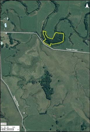
43 QEII Covenant 5/06/045 At a glance (last updated: February 2006) TRC reference: Other reference: NPDC ID28097 QEII 5/06/045 Ecological district: North Taranaki LENZ environment: C1.1a (0.9 ha) F1.1b (209.1 ha) F1.1d (23.2 ha) F 5.2a Land tenure: Private Protection status: A, B, C (3.4 ha) F7.2a (19.5 ha) GPS: E N Area: ha Location The QEII Covenant 5/06/045 site is located on privately owned land, 30 km east of Inglewood on Toro Road, which is off Junction Road. The site lies in the North Taranaki Ecological District. General description The QEII Covenant 5/06/045 site is a large forested area (256.1 ha), with many specimen trees. Some of the covenanted area is in pasture but most of it is lowland primary and secondary podocarp and hardwood forest. The area also includes a regionally significant wetland (7.5 ha). While this is a constructed wetland it provides habitat for a range of waterfowl. Indigenous vegetation cover is lowland tawa (Beilschmiedia tawa) rimu (Dacrydium cupressinum) kahikatea (Dacrycarpus dacrydioides) forest on hillslopes. The Tarata Scenic Reserve (150 ha) is located 10 km to the west. Ecological features Vegetation Indigenous vegetation within the covenant area consists of tawa (Beilschmiedia tawa), rewarewa (Knightia excelsa), rimu (Dacrydium cupressinum), kahikatea (Dacrycarpus dacrydioides), pukatea (Laurelia novaezelandiae), hard beech (Nothofagus truncata), pigeonwood (Hedycarya arborea), kamahi (Weinmannia racemosa), thin barked totara (Podocarpus hallii), and rata (Metrosideros robusta). Mahoe (Melicytus ramiflorus), rangiora (Brachyglottis repanda), lancewood (Pseudopanax crassifolium) and Coprosma species are present in the understorey, and ferns are predominant in the ground cover. In the wetland raupo (Typha orientalis) reedland, sedges (Carex spp.), and flax (Phormium tenax) predominate. Fauna Notable birdlife present at the QEII Covenant 5/06/045 site are North Island brown kiwi (Apteryx australis mantelli), which is identified as Chronically Threatened (Serious Decline). Other birdlife present include whitehead (Mohoua albicilla) and Shining Cuckoo (Chrysococcyx lucidus). Ecological values Ecological values Rank Comment Rarity and distinctiveness Medium Contains Chronically Threatened (Serious Decline) North Island brown kiwi Representativeness High Contains indigenous vegetation on Acutely Threatened (F5.2a), Chronically Threatened (C1.1a), and At Risk (F7.2a) LENZ environments Ecological context Medium Provides inland wetland habitat for waterfowl Sustainability Positive A significantly large area in good and improving vegetative condition. Key ecological processes still influence the site. Under appropriate management, it can remain resilient to existing or potential threats 190

44 Other values The QEII Covenant 5/06/045 site has recreational walking tracks throughout the bush and a lodge available for accommodation. Pony clubs also use the bush as a stop off. Management threats and response Potential and actual threats to the sustainability of the QEII Covenant 5/06/045 site s ecological values are as follows: Threats to ecological values Level of risk Comment Pest animals Low Possums, goats, cats, mustelids, and rats Weeds Low Ragwort Habitat modification Low to medium Formally protected. Stock and public access some internal fencing required Site protection measures addressing potential threats and actual threats are as follows: Site protection /No Description A Public ownership or formal agreement QEII Covenant covering the entire site B Regulatory protection by local government Site specific rules apply Taranaki Regional Council rules for wetlands (refer Appendix IIA of the Regional Fresh Water Plan) New Plymouth District Council rules for Significant Natural Areas (refer Schedule 21 of the District Plan) General regional or district rules might also apply C Active protection Some areas fenced 191

45 QEII Covenant 5/06/067 At a glance (last updated: February 2006) TRC reference: Ecological district: Egmont Other reference: QEII 5/06/067 LENZ environment: F5.2a Land tenure: Private Protection status: A, B, C GPS: E N Area: 4.0 ha Location The QEII Covenant 5/06/067 site is located on privately owned land 4.3 km from Parihaka and 7.1 km east of Pungarehu. The site is within the Egmont Ecological District. General description The QEII Covenant 5/06/067 site is a lowland hardwood forest wetland and covers 4.0 ha. It lies within the semi-coastal to lowland bioclimatic zone of the Egmont Ecological District. The covenant area lies on a lahar deposit, in a poorly drained basin that drains into the Waitotoroa Stream. Minor seasonal variations in water level in the wetlands are beneficial, as they provide extensive feeding and dabbling margins for a variety of bird species. Ecological features Vegetation The vegetation within the covenant area is predominantly swamp maire (Syzygium maire) pukatea (Laurelia novae zelandiae) forest with some emergent kahikatea (Dacrycarpus dacrydioides). Species found in the understorey include mahoe (Melicytus ramiflorus), Coprosma species, hangehange (Geniostoma rupestre var. ligustrifolium), lancewood (Pseudopanax crassifolium), wineberry (Aristotelia serrata), pate (Schefflera digitata), wheki (Dicksonia squarrosa), manuka (Leptospermum scoparium), cabbage tree (Cordyline australis), pigeonwood (Hedycarya arborea), kamahi (Weinmannia racemosa), and poroporo (Solanum laciniatum). Climbers include supplejack (Ripogonum scandens), kiekie (Freycinetia baueriana subsp. banksii), and small white rata. A number of ferns are also present in the forest, including sickle spleenwort (Asplenium polyodon), drooping spleenwort (A. flaccidum), hen and chicken fern (A. bulbiferum), histiopteris (Histiopteris incisa), gully fern (Pneumatopteris pennigera), and Blechnum species. Within the wetland area vegetation consists of raupo (Tyoha orientalis), Carex secta, Juncus species, and toetoe (Cortaderia toetoe). Fauna No specific indigenous or exotic fauna species have been recorded for the QEII Covenant 5/06/067 site. However, the the wetland is noted as providing extensive feeding and dabbling margins for a variety of bird species. Ecological values Ecological values Rank Comment Rarity and distinctiveness Low Not known to contain any Acutely Threatened species or species uncommon in Taranaki Representativeness High Contains indigenous vegetation on F5.2a an Acutely Threatened LENZ environment Ecological context Medium Within developed farmland but provides a linkage for birds particularly wetland birds Sustainability Positive In good and improving vegetative condition. Key ecological processes still influence the site. Under appropriate management, it can remain resilient to existing or potential threats Other values The QEII Covenant 5/06/067 site also has historical and recreational values. It is near Parihaka Marae, which is of national historical and cultural significance. The lake may have once been used for recreational boating. 192

46 Management threats and response Potential and actual threats to the sustainability of the QEII Covenant 5/06/067 site s ecological values are as follows: Threats to ecological values Pest animals Level of risk Low to medium Comment Possums, cats, mustelids, and rats Weeds Low Gorse and blackberry Habitat modification Low Formally protected and fenced. Site protection measures addressing potential threats and actual threats are as follows: Site protection /No Description A Public ownership or formal agreement QEII Covenant covers most of the site B Regulatory protection by local government Site specific rules apply Taranaki Regional Council rules for wetlands (refer Appendix IIA of the Regional Fresh Water Plan) General regional or district rules might also apply C Active protection Covenant area is fenced and public access restricted Self-help Possum Control Programme 193
47 QEII Covenant 5/06/102 At a glance (last updated: February 2006) TRC reference: Ecological district: Egmont Other reference: QEII 5/06/102 LENZ environment: H1.3a (0.4 ha) Land tenure: Private Protection status: A, B, C GPS: E N Area: 1.6 ha F5.2b (1.2 ha) Location The QEII Covenant 5/06/102 site is located on privately owned land, 2 km from Okato. The site lies in the Egmont Ecological District. General description The QEII Covenant 5/06/102 site is a small (1.6 ha) lowland wetland forest remnant on flat to gently rolling country. The site is different to other covenant areas in the Egmont Ecological District as it has open water and a wetland as well as bush remnants on the side slopes. The covenant area is approximately 40% bush, 30% lake, 25% wetland and 5% exotic trees, mainly old macrocarpa. The lake and wetland have been formed as a result of a small stream in a gully being partially dammed a long time ago. The lake is long and narrow and extends over the middle reaches of the gully. The wetland is at the lower end of the lake. Stock has been excluded for many years so the bush is in good condition. Corbett Lake Scenic Reserve is 2 km to the south. some Carex secta, with a few flax (Phormium tenax) plants along the northeast side. Fauna Threatened birdlife present in QEII Covenant 5/06/102 site are grey duck (Anas superciliosa), which is identified as Acutely Threatened (Nationally Endangered) and New Zealand pigeon (Hemiphaga novaeseelandiae), which is identified as Chronically Threatened (Gradual Decline). Other birdlife present includes bellbird (Anthornis melanura melanura), grey warbler (Gerygone igata), fantail (Rhipidura fuliginosa), black swan (Cygnus atratus), paradise shelduck (Tadorna variegata), mallard duck (Anas platyrhynchos), white faced heron (Ardea novaehollandiae), and pukeko (Porphyrio porphyrio). Ecological values Ecological values Rank Comment Rarity and distinctiveness High Contains the Acutely Threatened grey duck Also contains the Chronically Threatened New Zealand pigeon Representativeness High Very small example of indigenous vegetation on Acutely Threatened (H1.3a, F5.2b) LENZ environments Ecological context Medium Small lakes are rare on the Egmont ring plain, particularly at this altitude on the western side. Also provides core habitat for the threatened grey duck and New Zealand pigeon Sustainability Positive In excellent vegetative condition. Key ecological processes still influence the site. Under appropriate management, it can remain resilient to existing or potential threats Ecological features Vegetation Canopy trees within the forest include kahikatea (Dacrycarpus dacrydioides), pukatea (Laurelia novae-zelandiae), puriri (Vitex lucens), and karaka (Corynocarpus laevigatus). The sub-canopy consists of mahoe (Melicytus ramiflorus), mapou (Myrsine australis), cabbage tree (Cordyline australis), tree ferns, pigeonwood (Hedycarya arborea), and poroporo (Solanum aviculare). Ground cover is predominantly young seedlings. The wetland area at the lake outlet is dominated by raupo (Typha orientalis) and Carex species. Around the margins of the lake are small areas of raupo, 194

48 Management threats and response Potential and actual threats to the sustainability of the QEII Covenant 5/06/102 site s ecological values are as follows: Threats to ecological values Pest animals Level of risk Low to medium Comment Possums, cats, mustelids, and rats Weeds Low Small amount of blackberry, barberry, wandering willy and willow Habitat modification Low Formally protected and partially fenced Site protection measures addressing potential threats and actual threats are as follows: Site protection /No Description A Public ownership or formal agreement QEII Covenant B Regulatory protection by local government General regional or district rules might apply C Active protection Fenced Supplementary planting Self-help Possum Control Programme 195
49 QEII Covenant 5/06/121 At a glance (last updated: February 2006) TRC reference: Ecological district: North Taranaki Other reference: QEII 5/06/121 LENZ environment: F1.1b (96.6 ha) Land tenure: Private Protection status: A, B, C F1.1d (98.9 ha) F7.2a (51.1 ha) GPS: E N Area: ha Location The QEII Covenant 5/06/121 site is located near Uruti. The site lies in the North Taranaki Ecological District. General description The QEII Covenant 5/06/121 site is a large (246.6 ha) lowland primary and secondary podocarp/hardwood forest. Approximately 70% of the covenant area is lowland primary tawa/podocarp forest and the remaining 30% is lowland secondary mahoe pigeonwood kohekohe forest. The forest is located at a wide valley face with topography ranging from flat to rolling to very steep on the valley sides. The Mironui Stream flows through the area with numerous catchments branching off. This stream flows into the Waitara River. The forest is situated on the boundaries of the Makino Conservation Area to the north and the Rerekino Forest to the south. The Mironui Scenic Reserve is 2 km to the north-east and Waikekeho is 2.1 km to the west. The forest plays an important stabilising role for the easily eroded surrounding landforms. There are very few privately owned forests of this size that are protected. Ecological features Vegetation Vegetation is predominantly tawa (Beilschmiedia tawa) podocarp forest. Many years ago the large podocarps were removed from a 25 ha section at the front (south) of the forest. This area has since regenerated with manuka (Leptospermum scoparium), which is now being taken over by mahoe (Melicytus ramiflorus), pigeonwood (Hedycarya arborea), kohekohe (Dysoxylum spectabile), rewarewa (Knightia excelsa), and tree ferns. The northern and largest section of the forested block consists mainly of large tawa. Other canopy species include rimu (Dacrydium cupressinum), miro (Prumnopitys ferruginea), and some large totara (Podocarpus totara). The subcanopy consists of lancewood (Pseudopanax crassifolium), mahoe, five finger (Pseudopanax arboreus), marbleleaf (Carpodetus serratus), Coprosma species, and tree ferns. The groundcover is excellent with a wide range of species that include regenerating seedlings of the forest species and many different ferns. Fauna The QEII Covenant 5/06/121 site provides habitat for a number of bird species. Of particular note is the presence of New Zealand pigeon (Hemiphaga novaeseelandiae) and rifleman (Acanthisitta chloris), which are both identified as Chronically Threatened (Gradual Decline). Bellbird (Anthornis melanura melanura) are also present. The streams provide habitat for many different invertebrate. Ecological values Ecological values Rank Comment Rarity and distinctiveness Medium Contains the Chronically Threatened New Zealand pigeon and rifleman Representativeness Medium Contains indigenous vegetation on F7.2a an At Risk LENZ environment Ecological context High The forest is on the boundary of the Waitara River and is an important part of the river s catchment. Provides linkage between the Makino and Rerekino Forests, which are ecologically similar Sustainability Positive Large area in excellent and stable vegetative condition. Forest is totally self-sustaining. Key ecological processes still influence the site. Under appropriate management, it can remain resilient to existing or potential threats Other values The QEII Covenant 5/06/121 site has recreational value. The Moki Track passes along the base of the large forest area. 196

50 Management threats and response Potential and actual threats to the sustainability of the QEII Covenant 5/06/121 site s ecological values are as follows: Threats to ecological values Pest animals Weeds Level of risk Medium to high Low Comment Possums, goats, cats, mustelids, and rats Habitat modification Low Formally protected and fenced Site protection measures addressing potential threats and actual threats are as follows: Site protection /No Description A Public ownership or formal agreement QEII Covenant covers the entire site B Regulatory protection by local government General regional or district rules might apply C Active protection Fenced 197
51 QEII Covenant 5/06/148 At a glance (last updated: February 2006) TRC reference: Ecological district: North Taranaki Other reference: QEII 5/06/148 LENZ environment: F1.1b (13.8 ha) F1.1d (46.3 ha) F1.3b (3.7 ha) F7.2a (6.2 ha) Land tenure: Private Protection status: A, B, C GPS: E N Area: 70.0 ha Location The QEII Covenant 5/06/148 site is located on privately owned land at Purangi, 45 km east of Inglewood, close to Junction Road. The site lies in the North Taranaki Ecological District. General description The QEII Covenant 5/06/148 site is a large area (70.0 ha) of remnant lowland modified forest covering a small catchment in medium to steep hill country which drains to the Waitara River. The Covenant site includes two small wetlands. The site contains large rimu and northern rata. The vegetation at the site is typical of what once covered the whole area. The site also has a high density of North Island brown kiwi. The site is surrounded by regenerating bush, forest, and some grazing land, and is near the Pouiatoa Forest (administered by Department of Conservation), which is 5 km to the north of the site. Ecological features Vegetation Vegetation within the Covenant area is primarily rimu-rata / pukatea-tawa forest. Emergents include rimu (Dacrydium cupressinum) and rata (Metrosideros robusta), some very large individual trees. The canopy and understorey include species such as pukatea (Laurelia novaezelandiae), hinau (Elaeocarpus dentatus), pigeonwood (Hedycarya arborea), miro (Prumnopitys ferruginea), tawa (Beilschmiedia tawa), matai (Prumnopitys taxifolia), nikau (Rhopalostylis sapida), kamahi (Weinmannia racemosa), manuka (Leptospermum scoparium), and kanuka (Kunzea ericoides). Narrow leaved maire (Nestegis montana) is found in one area of the forest. The two wetlands are dominated by sedges (Carex spp.). Fauna The New Zealand falcon (Falco novaeseelandiae) has been seen nesting in the Covenant area. This bird is identified as Acutely Threatened (Nationally Vulnerable). Also found in the Covenant area are the North Island brown kiwi (Apteryx australis mantelli), which is identified as Chronically Threatened (Serious Decline),and the New Zealand pigeon (Hemiphaga novaseelandiae) and rifleman (Acanthisitta chloris), both of which are identified as being Chronically Threatened (Gradual Decline). The fernbird (Bowdleria punctata vealeae), which is identified as being nationally At Risk (Sparse), has been heard within the Covenant area, but not seen. The fernbird is particularly uncommon in Taranaki. Also present are tui (Prosthermadera novaeseelandiae), bellbird (Anthornis melanura), fantail (Rhipidura fulginosa), whitehead (Mohoua albicilla), and tomtit (Petroica macrocephala). Forest gecko (Hoplodactylus granulatus) has also been sighted in the area. This gecko is classified as Data Deficient nationally. Ecological values Ecological values Rank Comment Rarity and distinctiveness Representativeness High Low to medium Contains the Acutely Threatened New Zealand falcon and is regionally distinctive through the presence of forest geckos and the fernbird Also contains the Chronically Threatened North Island brown kiwi, New Zealand pigeon, and rifleman Contains indigenous vegetation on F7.2a an At Risk LENZ environment Ecological context High Is close to and interconnected with the nearby Pouiatoa Forest. It also provides core habitat for a large number of threatened species Sustainability Positive In very good vegetative condition. Large area in a circular shape. Key ecological processes still influence the site. Under appropriate management, it can remain resilient to existing or potential threats 198

52 Other values The Marahau Pa is located close to the QEII Covenant site, and the large loop in the Waitara River has cultural significance to Maori. Management threats and response Potential and actual threats to the sustainability of the QEII Covenant 5/06/148 site s ecological values are as follows: Threats to ecological values Level of risk Comment Pest animals Low Possums, goats, cats, mustelids, and rats Weeds Habitat modification Low Low to medium In unfenced parts of the covenant there is some threat from grazing Site protection measures addressing potential threats and actual threats are as follows: Site protection /No Description A Public ownership or formal agreement QEII Covenant covers the entire site B Regulatory protection by local government General regional or district rules might apply C Active protection The site is mostly fenced Intensive and effective pest control by landowners 199
53 QEII Covenant 5/06/152 At a glance (last updated: February 2006) TRC reference: Ecological district: North Taranaki Other reference: QEII 5/06/152 LENZ environment: F1.1b (11.2ha) F1.1d (286.3 ha) F1.3b Land tenure: Private Protection status: A, B, C (0.5 ha) F7.2a (35.7 ha) GPS: E N Area: ha Location The QEII Covenant 5/06/152 site is located on privately owned land near Waitiri Road, Omoana, in eastern Taranaki. The site is within the Matemateaonga Ecological District. General description The QEII Covenant 5/06/152 site covers ha of lowland modified forest. The vegetation is typical of regenerating forest found in the eastern Taranaki area. The area had previously been cleared and farmed. The Covenant site covers a single catchment that feeds the Mangatoromiro Stream, which is a tributary of the Patea River. The Covenant site is surrounded by other forest. An adjoining 80 ha is proposed for a QEII Covenant. Other nearby protected areas include the Tahunaware Scenic Reserve, Rauhitiroa Road Conservation Area, Waitiri Scenic Reserve, and Waitotara Conservation Area. Fauna An Ornithological Society survey of the Covenant area identified 34 bird species. These included the New Zealand falcon (Falco novaeseelandiae), which is identified as Acutely Threatened (Nationally Vulnerable). Also present at the site are North Island brown kiwi (Apteryx australis mantelli), which is identified as Chronically Threatened (Serious Decline) nationally. Also present at the site are North Island robin (Petroica australis longipes), fantail (Rhipidura fulginosa), bellbird (Anthornis melanura), grey warbler (Gerygone igata), kingfisher, pukeko (Porphyrio porphyrio), and New Zealand pipit (Anthus novaeseelandiae novaeseelandiae). Ecological values Ecological values Rank Comment Rarity and distinctiveness High Contains the Acutely Threatened New Zealand falcon Also contains the Chronically Threatened North Island brown kiwi Representativeness High Contains indigenous vegetation on F7.2a an Acutely Threatened LENZ environment Ecological context High Close to and provides connectivity to Tahunaware Scenic Reserve, Rauhitiroa Road Conservation Area, Waitiri Scenic Reserve, and Waitotara Conservation Area. There is also a proposed QEII covenant adjacent to this site Also provides core habitat for the threatened New Zealand falcon and North Island brown kiwi Sustainability Positive In good vegetative condition. Large area in a circular shape. Key ecological processes still influence the site. Under appropriate management, it can remain resilient to existing or potential threats Ecological features Vegetation Canopy vegetation within the Covenant area primarily consists of rewarewa (Knightia excelsa) pukatea (Laurelia novaezelandiae) rata (Metrosideros robusta) forest. Manuka (Leptospermum scoparium) and kanuka (Kunzea ericoides) are also present. 200

54 Management threats and response Potential and actual threats to the sustainability of the QEII Covenant 5/06/152 site s ecological values are as follows: Threats to ecological values Pest animals Weeds Level of risk Medium to high Low Comment Possums, goats, cats, mustelids, and rats Habitat modification Low Low threat from grazing Site protection measures addressing potential threats and actual threats are as follows: Site protection /No Description A Public ownership or formal agreement QEII Covenant covers the whole site B Regulatory protection by local government General regional or district rules might apply C Active protection The site is mostly fenced 201
55 Rapanui (headwaters) At a glance (last updated: February 2006) TRC reference: Ecological district: North Taranaki Other reference: NPDC SNA 4 LENZ environment: F1.1b Land tenure: Private Protection status: B GPS: E N Area: 92.4 ha Location The Rapanui (headwaters) site is located on privately owned land, 8.5 km south-east of Mokau. The site lies in the North Taranaki Ecological District. General description The Rapanui (headwaters) site is a large (92.4 ha) primary, semi coastal and lowland hillslope forest at the headwaters of the Rapanui and Mangahutiwai catchments. It bridges the gap between the coastal and semicoastal areas of Kuwhatahi and the lowland forests of Huitiwai together these three areas provide a continuous tract of coastal, semi-coastal and lowland indigenous vegetation types over a range of landforms. Ecological features Vegetation Canopy species on the drier hillslopes and ridges in the Rapanui (headwaters) site is predominantly hard beech (Nothofagus truncata) and tawa (Beilschmiedia tawa) and, to a lesser extent, rewarewa (Knightia excelsa), manuka (Leptospermum scoparium), and mamaku (Cyathea medullaris). There is also some areas of regenerating bush comprising of pukatea (Laurelia novaezelandiae) kahikatea (Dacrycarpus dacrydioides) / wheki (Dicksonia squarrosa)-ramarama (Lophomyrtus bullata)/ Carex virgata tussock-treeland on the alluvial terrace. Fauna Unknown. No specific indigenous fauna species have been recorded for the Rapanui (headwaters) site. Ecological values Ecological values Rank Comment Rarity and distinctiveness Low Not known to contain any Acutely Threatened species or species uncommon in Taranaki Representativeness Low LENZ environment not threatened Ecological context High Is interconnected with Kuwhatahi and Huitiwai providing a regionally unique continuous tract of coastal, semi coastal and lowland indigenous forest types over a range of landforms Sustainability Positive In good vegetative condition. Key ecological processes still influence the site. Under appropriate management, it can remain resilient to existing or potential threats Management threats and response Potential and actual threats to the sustainability of Rapanui (headwaters) site s ecological values are as follows: Threats to ecological values Pest animals Weeds Level of risk Medium to high Low Comment Possums, goats, cats, mustelids and rats Habitat modification Low Potential effects include livestock grazing and vegetation clearance around the margins Site protection measures addressing potential threats and actual threats are as follows: Site protection /No Description A B Public ownership or formal agreement Regulatory protection by local government No Site specific rules apply New Plymouth District Council rules for Significant Natural Areas (refer Appendix 21 of the District Plan) General regional or district rules might also apply C Active protection No 202
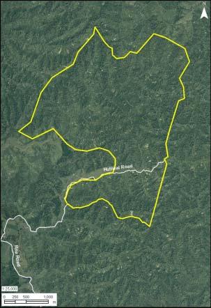
56 203
57 Rapanui Petrel Colony At a glance (last updated: February 2006) TRC reference: Ecological district: North Taranaki Other reference: LENZ environment: C1.2a Land tenure: Private Protection status: B, C GPS: E N Area: 2.4 ha Location The Rapanui Petrel Colony is located on privately owned land, approximately 70 km, north of New Plymouth and 12 km south of Mokau. The sites lie in the North Taranaki Ecological District. General description The Rapanui Petrel Colony is a small (2.4 ha) coastal flaxland cliff landscape located on the southern side of the Rapanui stream mouth. Severe erosion has taken place on the coastal cliffs. Another Key Native Ecosystem the Rapanui Wetland is located on the northern side of the Rapanui Stream mouth. Ecological features Vegetation Vegetation within the Petrel Colony site is predominantly secondary scrub. A number of native and exotic trees, shrubs, ferns, grass and herb species are present. Canopy species include kawakawa (Macropiper excelsum), karo (Pittosporum crassifolium), and taupata (Coprosma repens). These plants are all very stunted and windblown. There is no understorey present. Groundcover consists of pasture grass and flax. The native white sun orchid (Thelymitra longifolia) is also present. Fauna The petrel colony site provides a large nesting site for the grey-faced petrel (Pterodroma macroptera gouldi). While the grey-faced petrel is not a threatened species, nevertheless the site is ecologically unique as it is the only large nesting site for the petrel on the mainland where once it was abundant along the Taranaki coast. Other birds present include tui (Prosthemadera novaeseelandiae), diving petrel (Pelecanoides urinatrix), and fluttering shearwater (Puffinus gavia). Ecological values Ecological values Rank Comment Rarity and distinctiveness High Regionally distinctive in that it is the only large nesting site of the grey-faced petrel on the mainland Representativeness High Contains indigenous vegetation on C1.2c an Acutely Threatened LENZ environment Ecological context High Provides core habitat and a large nesting site for the only mainland colony of grey-faced petrel as extension of habitat on offshore stacks Sustainability Positive In fair but improving vegetative condition. Key ecological processes still influence the site. Under appropriate management, it can remain resilient to existing or potential threats Management threats and response Potential and actual threats to the sustainability of Rapanui Petrel Colony s ecological values are as follows: Threats to ecological values Level of risk Comment Pest animals Low Possums and cats have been present in the past, but have been eradicated Weeds Low Boxthorn and kikuyu grass are present Habitat modification Low Predator proof fence but requires ongoing maintenance Site protection measures addressing potential threats and actual threats are as follows: Site protection /No Description A B Public ownership or formal agreement Regulatory protection by local government No QEII Covenant in progress General regional or district rules might apply C Active protection Predator proof fence Sustained pest control Weed control and supplementary planting 204
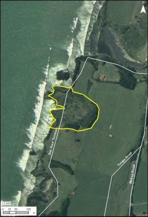
58 205

59 Rapanui Wetland At a glance (last updated: February 2006) TRC reference: Ecological district: North Taranaki Other reference: LENZ environment: F5.2a Land tenure: District council land Protection status: A, B, C GPS: E N Area: 1.7 ha Location The Rapanui Wetland is located approximately 70 km, north of New Plymouth and 12 km south of Mokau. The site lies in the North Taranaki Ecological District. General description The Rapanui Wetland is a small (1.7 ha) palustrine wetland on the northern bank of the Rapanui Stream mouth and adjacent to State Highway 3. The wetland lies mostly on New Plymouth District Council owned land and is designated a Recreation Reserve. Another Key Native Ecosystem the Rapanui Petrel Colony is located on the southern side of the Rapanui Stream mouth. Ecological features Vegetation Vegetation within the Rapanui Wetland is predominantly raupo (Typha orientalis) with some flax (Phormium tenax). Fauna The Acutely Threatened (Nationally Endangered) Australasian bittern (Botaurus poiciloptilus) can be found at the Rapanui Wetland and probably moves between this site and the Mohakatino Swamp. Ecological values Ecological values Rank Comment Rarity and distinctiveness High Contains the Acutely Threatened Australasian bittern Representativeness High Contains indigenous vegetation on F5.2a an Acutely Threatened LENZ environment Ecological context High Connected to petrel colony by coastal cliff vegetation and also nearby Kawau Pa. Also provides habitat for indigenous and threatened Australasian bittern in connection with similar wetland at Mohakatino rivermouth Sustainability Positive In good vegetative condition. Key ecological processes still influence the site. Under appropriate management, it can remain resilient to existing or potential threats Other values Rapanui Beach and Wetland has the following additional values: Recreational: there is a small roadside picnic area, and a nearby sandy beach that is popular for swimming and fishing Cultural: pa and midden (oven) sites are present. 206

60 Management threats and response Potential and actual threats to the sustainability of Rapanui Wetland s ecological values are as follows: Threats to ecological values Pest animals Weeds Level of risk Low to medium Low Comment Possums, cats, rabbits, mustelids, hedgehogs, and rats Habitat modification Medium No stock access into the Rapanui Wetland Potential effects include clearance, road works, and free campers leaving domestic rubbish Site protection measures addressing potential threats and actual threats are as follows: Site protection /No Description A Public ownership or formal agreement District Council land (Recreation Reserve) B Regulatory protection by local government Site specific rules apply Taranaki Regional Council rules for wetlands (refer Appendix III of the Regional Fresh Water Plan) General regional or district rules might also apply C Active protection Partially fenced (with natural vegetative barriers) 207
61 Ratapihipihi Scenic Reserve At a glance (last updated: February 2006) TRC reference: Ecological district: Egmont Other reference: DOC 70422, LD No 58 LENZ environment: F5.2b Land tenure: Crown Protection status: A, B, C GPS: E N Area: 17.2 ha Location The Crown owned Ratapihipihi Scenic Reserve is located 5 km south of New Plymouth. The Reserve lies in the Egmont Ecological District. General description The 17.2 ha Ratapihipihi Scenic Reserve is administered by the Department of Conservation. The Reserve is a remnant of semi-coastal forest. The forest is predominantly on the east side of a gully with a large stream and associated tributaries flowing through the bottom. Ecological features Vegetation Ratapihipihi Scenic Reserve is primarily covered by tawa (Beilschmiedia tawa) pukatea (Laurelia novaezelandiae)/kohekohe (Dysoxylum spectabile) forest. Tawa up to 20 metres high is the principal canopy component with pukatea common close to streams and in areas of impeded drainage. Although there was some extraction of rimu (Dacrycarpus dacrydioides), miro (Prumnopitys ferruginea), rata (Metrosideros robusta) and puriri (Vitex lucens) in the late 1850s some large individuals of rimu and puriri remain. The understorey is dominated by kohekohe (Dysoxylum spectabile), mahoe (Melicytus ramiflorus), pigeonwood (Hedycarya arborea), kawakawa (Macropiper excelsum), nikau (Rhopalostylis sapida), and tree ferns. Fauna Unknown. No specific indigenous fauna species have been recorded for the Ratapihipihi Scenic Reserve. Ecological values Ecological values Rank Comment Rarity and distinctiveness Low Not known to contain any Acutely Threatened species or species uncommon in Taranaki Representativeness High Contains indigenous vegetation on F5.2b an Acutely Threatened LENZ environment Ecological context Medium Connected to other small forest fragments by gully systems, riparian vegetation Sustainability Positive Key ecological processes still influence the site. Management required of exisiting (weeds) and potential threats. However, under appropriate management, it can remain resilient to existing or potential threats Other values Ratapihipihi Scenic Reserve has walking tracks popular for public recreation. Management threats and response Potential and actual threats to the sustainability of Ratapihipihi s ecological values are as follows: Threats to ecological values Level of risk Pest animals Low medium Comment Possums, cats, mustelids, and rats Weeds Medium Wandering willy on stream banks, Asparagus scandens, selaginella Habitat modification Low to medium Past extraction of trees, construction and maintenance of walking tracks. There are also planted native vegetation, which is not natural to this area Some natives trees have also been planted in the Reserve including species not natural to the area including kauri (Agathis australis), silver beech (Nothofagus menzeisii), tanekaha (Phyllocladus trichomanoides), Olearia paniculata, Hoheria populnea, and ribbonwood (Plagianthus betulinus). 208
 B Regulatory protection by local government General regional or district rules might apply C Active protection Department of Conservation possum control")
62 Site protection measures addressing potential threats and actual threats are as follows: Site protection /No Description A Public ownership or formal agreement Public Conservation Estate (Scenic Reserve) B Regulatory protection by local government General regional or district rules might apply C Active protection Department of Conservation possum control programme 209
63 Rerekino Conservation Area At a glance (last updated: February 2006) TRC reference: Ecological district: North Taranaki Other reference: DOC LENZ environment: F1.1b (289.6 ha) Land tenure: Crown Protection status: A, B F1.1d (229.1 ha) F7.2a (1.8 ha) GPS: E N Area: ha Location The Crown owned Rerekino Conservation Area is located 21 km east of Urenui. The Reserve lies in the North Taranaki Ecological District. General description The Rerekino Conservation Area is a large (520.7 ha) riparian strip of mainly primary forest. The Reserve, which is administered by the Department of Conservation, lies on the western bank of the south flowing middle reaches of the Waitara River. Ecological features Vegetation The Rerekino Conservation Area primarily comprises of tawa (Beilschmedia tawa)-kamahi (Weinmannia racemosa)-hinau (Elaeaocarpus dentatus) forest, with an exceptionally high stocking of rimu (Dacrycarpus dacrydioides). Miro (Prumnopitys ferruginea) and thin-barked totara (Podocarpus hallii) are common on ridges and rimu is a frequent emergent of the small enclaves of alluvial terrace forest adjoining the Waitara River. Fauna Unknown. No specific indigenous fauna species have been recorded for the Rerekino Conservation Area. Ecological values Ecological values Rank Comment Rarity and distinctiveness High Regionally uncommon alluvial terrace forest with high stocking rate of rimu Representativeness Medium Contains indigenous vegetation on F7.2a an At Risk LENZ environment (F7.2a) Ecological context Medium Adjoins Waitara River and close to other large forest remnants Sustainability Positive Self sustaining forest. Key ecological processes still influence the site. Under appropriate management, it can remain resilient to existing or potential threats Management threats and response Potential and actual threats to the sustainability of Rerekino Conservation Area s ecological values are as follows: Threats to ecological values Level of risk Comment Pest animals Medium Possums, goats, cats, mustelids, and rats Weeds Low Habitat modification Medium Cattle grazing in margns Site protection measures addressing potential threats and actual threats are as follows: Site protection /No Description A B Public ownership or formal agreement Regulatory protection by local government Conservation Area administered by the Department of Conservation General regional or district rules might apply C Active protection No 210
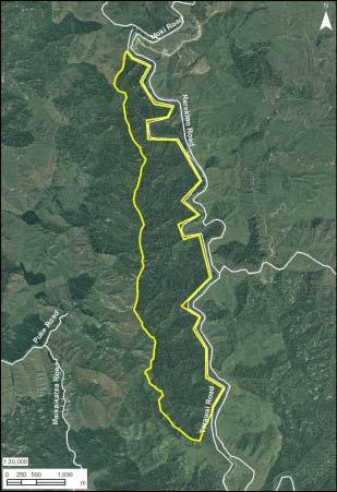
64 211
65 Rotokohu Wetland (Scenic Reserve) At a glance (last updated: February 2006) TRC reference: Ecological district: Matemateaonga Other reference: STDC SNA 25 DOC LENZ environment: H3.1b Land tenure: Crown Protection status: A, B, C GPS: E N Area: 29.5 ha Location The Crown-owned Rotokohu Wetland (Scenic Reserve) is located 30 km north-east of Waverley. It lies in the Matemateaonga Ecological District. General description The Rotokoku Wetland (Scenic Reserve) lies predominantly in the Rotokohu Scenic Reserve with the remainder being in the Waitotara Conservation Area. Both areas are administered by the Department of Conservation. The wetland is 29.6 ha in size and is part of the best remaining drowned floodplain wetland type in the Matemateaonga Ecological District. Part of the wetland includes swampy alluvial deposits on the western side of Pokeka Stream and adjoins the Rotokohu Wetlands. This area is commonly called Lake Hawkes Reserve, and contains steep bluffs and gorges. The lake is formed by a large landslide and contains an impressive waterfall. The eastern boundary of the Rotokohu Scenic Reserve adjoins the Rotokoku Wetland and Catchment. While the western boundary adjoins and in some places is part of the Waitotara Conservation Area. crake (Porzana tabuensis plumbea), are present. The fernbird and spotless crake are particularly uncommon in the region. Ecological values Ecological values Rank Comment Rarity and distinctiveness High Regionally distinctive in that the site is the southern most recorded location of mountain neinei and through the presence of the At Risk fernbird and spotless crake, which are particularly uncommon in the region Representativeness High Contains indigenous vegetation on H3.1b an Acutely Threatened LENZ environment Ecological context High Best representative example of a natural floodplain in the Matemateaonga Ecological District. The site is interconnected with the ecosystems of the Rotokoku Wetland and Catchment area and the nearby Pokeke Stream, lakes and the forest Also provides core habitat for the threatened fernbird and spotless crake Sustainability Positive In good vegetative condition. Key ecological processes still influence the site. Under appropriate management, it can remain resilient to existing or potential threats Other values Rotokoku Scenic Reserve also has recreational value. The area has scenic value, being a mosaic of pools, stream and reed beds, and is traversed by a popular tramping track to the Waitotara Conservation Area. Management threats and response Potential and actual threats to the sustainability of the Rotokohu Wetland (Scenic Reserve) s ecological values are as follows: Ecological features Vegetation The main vegetation types include: Carex Juncus Cyperus tussockland, sedges including purei/makura (Carex secta), Carex virgata, Juncus gregiflorus, soft rush (Juncus effusus), and giant umbrella sedge (Cyperus ustulatus). The Rotokoku Scenic Reserve also contains mountain neinei (Dracophyllum traversii) and is the southern most location for this plant. Fauna The At Risk (Sparse) fernbird (Bowdleria punctata vealeae) and spotless Threats to ecological values Pest animals Weeds Habitat modification Level of risk Medium to high Low Medium to high Comment Possums, cats, goats, fallow deer, pigs, rabbits, mustelids, hedgehogs, and rats Unfenced grazing by cattle is a problem. Reserve suffered severe sediment deposition following the 2004 flood event 212
 B Regulatory protection by local government Site specific rules apply Taranaki Regional Council rules for wetlands (refer Appendix IIA of the Regional Fresh Water Plan) South Taranaki")
66 Site protection measures addressing potential threats and actual threats are as follows: Site protection /No Description A Public ownership or formal agreement Public Conservation Estate (Scenic Reserve) B Regulatory protection by local government Site specific rules apply Taranaki Regional Council rules for wetlands (refer Appendix IIA of the Regional Fresh Water Plan) South Taranaki District Council rules for Significant Natural Areas (refer Schedule II of the District Plan) General regional or district rules might also apply C Active protection Partially fenced 213
67 Rotokohu Wetland and catchment At a glance (last updated: February 2006) TRC reference: Ecological district: Matemateaonga Other reference: STDC SNA 25 SSBI R21/H022 PNA 41 LENZ environment: Protection status: GPS: E N Area: 86.9 ha F1.1d (28.5 ha) F1.1e (0.3 ha) F1.3b (27.6 ha) F5.2a (0.2 ha) F5.2c (1.3 ha) F7.2a (1.3 ha) H3.1 b (27.6 ha) Location The Rotokohu Wetland and catchment is located on privately owned land, 30 km north-east of Waverley. It lies in the Matemateaonga Ecological District. General description The Rotokoku Wetland and catchment covers 86.9 ha and lies along the Pokaka Stream, 2 km above its confluence with the Waitotara River. A slump to the south of the site has impeded drainage of the stream. The area consists of Lake Rotokohu itself, two smaller lakes and at least two more temporary ponds, as well as periodically submerged floodplain and hill country forest. The stream carries a high silt load following heavy rain and this area receives frequent depositions of silt. The area represents the best representative example of a natural floodplain in the Ecological District. The western boundary of the Rotokohu site adjoins the Rotokoku Scenic Reserve and Waitotara Conservation Area. Ecological features Vegetation The area contains sedgeland and rush vegetation. An adjoining area of tawa (Beilschmiedia tawa)and black beech (Nothofagus solandri var. solandri) forest provides important buffering to the wetland. Several sedge species dominate the vegetation on the floodplain - rautahi (Carex geminata) and B giant umbrella sedge (Cyperus ustulatus) are the most common. The rushes Juncus gregiflorus and J. effusus are also widespread. Other sedges include swamp sedge (Carex virgata), C. dissita, Carex lessoniana, sharp spike sedge (Eleocharis acuta), and Isolepis distigmatosa. Carex secta and Bolboschoenus fluviatilis are also locally common and there are stands of Schoenoplectus validus in the lakes. Under the sedges a range of herbs are present, including species of buttercup, watercress, water forget-me-not, willow herbs, and bachelor s button. Several small weeds, including jointed rush (Juncus articulatus), are present as ground cover. The main lake has a fringe of raupo (Typha orientalis). In other parts of the wetland taller species dominate, though the sedge and rush association still persists. Toetoe marks the boundary between the two different vegetation types. The taller species include round-leaved coprosma (Coprosma rotundifolia), ramarama (Lophomyrtus bullata), mahoe (Melicytus ramiflorus), wineberry (Aristotelia serrata), kahikatea (Dacrycarpus dacrydiodes), and pukatea (Laurelia novaezelandiae). Fauna The Rotokoku Wetland and catchment contain the At Risk (Sparse) fernbird (Bowdleria punctata vealeae) and spotless crake (Porzana tabuensis plumbea), which are particularly uncommon in Taranaki. Ecological values Ecological values Rank Comment Rarity and distinctiveness High Contains the At Risk fernbird and spotless crake, which are particularly uncommon in Taranaki Representativeness High Contains indigenous vegetation on Acutely Threatened (F5.2a, F5.2c, H3.1b)), Chronically Threatened (F1.1e) and At Risk (F7.2a) LENZ environments Ecological context High Best representative example of a natural floodplain in the Matemateaonga Ecological District. The site is interconnected with the ecosystems of the Rotokoku Scenic Reserve, Pokeke Stream, lakes and the forest on the adjacent slopes Provides core habitat for the threatened and regionally uncommon fernbird and spotless crake Sustainability Positive In good vegetative condition. Key ecological processes still influence the site. Under appropriate management, it can remain resilient to existing or potential threats 214

68 Other values The Rotokohu Wetland and catchment also has recreational value. The area has scenic value, being a mosaic of pools, stream and reed beds, and is traversed by a popular tramping track to the Waitotara Conservation Area. Management threats and response Potential and actual threats to the sustainability of the Rotokohu Wetland and catchment secological values are as follows: Threats to ecological values Pest animals Level of risk Medium to high Comment Possums, cats, goats, fallow deer, pigs, mustelids, hedgehogs, and rats Weeds Medium Willows, pampas grass, and jointed rushes Habitat modification Medium to high Unfenced grazing by cattle stock is a problem. Wetlands suffered severe sediment deposition following the 2004 flood event Site protection measures addressing potential threats and actual threats are as follows: Site protection /No Description A Public ownership or formal agreement No B Regulatory protection by local government C Active protection No Site specific rules apply Taranaki Regional Council rules for wetlands (refer Appendix IIB of the Regional Fresh Water Plan) South Taranaki District Council rules for Significant Natural Areas (refer Schedule II of the District Plan) General regional or district rules might also apply 215
69 Rowan Road At a glance (last updated: February 2006) TRC reference: Ecological district: Egmont Other reference: STDC SNA 9 LENZ environment: C1.3a Land tenure: Private Protection status: B, C GPS: E N Area: 2.7 ha Location The Rowan Road site is located on privately owned land, 3 km south-west of Kaponga. It lies in the Egmont Ecological District. General description The Rowan Road lowland forest remnant covers approximately 2.7 ha and lies between an unnamed tributary of Little Dunn s Creek and Dunn s Creek. The canopy of this site is wind damaged, and there is no undergrowth due to extensive past grazing. However, the site has been identified as the best remaining forest remnant in the Opunake Formation. Ecological features Vegetation The forest canopy consists of mainly tawa (Beilschmiedia tawa), with some mahoe (Melicytus ramiflorus) and pukatea (Laurelia novaezelandiae). Ecological values Ecological values Rank Comment Rarity and distinctiveness Low Not known to contain any Acutely Threatened species, or species uncommon in Taranaki Representativeness High Contains indigenous vegetation on C1.3a an Acutely Threatened LENZ environment. Identified as the best remaining forest remnant in the Opunake Formation. Indigenous vegetation of any type on this landform is now rare Ecological context Low Very few small forest/riparian remnants in vicinity Sustainability Positive In relatively poor vegetative condition due to wind damage and extensive past grazing. However, key ecological processes still influence the site. Under appropriate management, it could recover and remain resilient to existing or potential threats Management threats and response Potential and actual threats to the sustainability of the Rowan Road wetland s ecological values are as follows: Threats to ecological values Pest animals Level of risk Low to medium Comment Weeds Low Pasture grasses Possums, cats, mustelids, and rats Habitat modification High There is no undergrowth due to extensive past grazing Fauna Unknown. No specific indigenous fauna species have been recorded for Rowan Road. 216
 General regional or district rules might also apply C")
70 Site protection measures addressing potential threats and actual threats are as follows: Site protection /No Description A Public ownership or formal agreement No B Regulatory protection by local government Site specific rules apply South Taranaki District Council rules for Significant Natural Areas (refer Schedule II of the District Plan) General regional or district rules might also apply C Active protection Self-help Possum Control Programme 217
Frankley School Bush. At a glance (last updated: November 2010)
") Frankley School Bush At a glance (last updated: November 2010) TRC reference: Ecological district: Egmont Other reference: LENZ environment: F5: 2b Land tenure: Crown (Ministry of Education) Protection
Frankley School Bush At a glance (last updated: November 2010) TRC reference: Ecological district: Egmont Other reference: LENZ environment: F5: 2b Land tenure: Crown (Ministry of Education) Protection
SES Refer to the disclaimer at the beginning of this appendix.
 Appendix 1d Schedule of sites of ecological significance - inner islands AP IU ROA D O RA PIU R OAD OR 30 30 ORAPIU R AD O 30 30 OR AP IU RO AD Omaru Bay Forest : 25-12 SES 30 1:4,000 0 25 50 100 This
Pole kauri-pohutukawa forest with scattered rimu on ridgeline and upper hillslope. Fringe of pohutukawa forest along shoreline.
 Appendix 2 Appendix 2 Ecological Values Summary Alex Jenkins Memorial Reserve Titirangi South Moderately large, intact secondary coastal forest remnant extending around a steep, rocky sandstone shoreline.
PAKARU ROAD FOREST. Ecological unit. Landform/geology. Taraire forest on hillslope (20%) (b) Kanuka/manuka tanekaha forest on hillslope (80%)
 (b) Kanuka/manuka tanekaha forest on hillslope (80%)") PAKARU ROAD FOREST Survey no. Q05/005 Survey date 19 December 1994 Grid reference Q05 147 440 95 ha Altitude 20 140 m asl Ecological unit Taraire forest on hillslope (20%) (b) Kanuka/manuka tanekaha forest
PAKARU ROAD FOREST Survey no. Q05/005 Survey date 19 December 1994 Grid reference Q05 147 440 95 ha Altitude 20 140 m asl Ecological unit Taraire forest on hillslope (20%) (b) Kanuka/manuka tanekaha forest
Significant Natural Area Assessment. Property Name: Hillend Station
 Private Bag 50072, Queenstown 9348, New Zealand QUEENSTOWN, 10 Gorge Road, Phone +64 3 441 0499, Fax +64 3 450 2223 WANAKA, 47 Ardmore Street, Phone +64 3 443 0024, Fax +64 3 450 2223 Significant Natural
Ecology and Landscapes Briefing 26 July 2018
 Ecology and Landscapes Briefing 26 July 2018 Part 1 1. Introductions Part 2 Part 3 Part 4 2. Council Obligations 3. History of Hutt development and native vegetation clearance 4. Significant vegetation
SOUNDS ECOLOGICAL DISTRICT
 SOUNDS ECOLOGICAL DISTRICT Map 4 - Sounds Ecological District OVERVIEW The Sounds Ecological District is one of four forming the Sounds-Wellington Ecological Region. It forms the largest and central district,
Significant Natural Area Assessment. Property Name: Cochrane & Ashkel Ltd. Area Size (ha): 5.33
: 5.33") Private Bag 50072, Queenstown 9348, New Zealand QUEENSTOWN, 10 Gorge Road, Phone +64 3 441 0499, Fax +64 3 450 2223 WANAKA, 47 Ardmore Street, Phone +64 3 443 0024, Fax +64 3 450 2223 Significant Natural
Private Bag 50072, Queenstown 9348, New Zealand QUEENSTOWN, 10 Gorge Road, Phone +64 3 441 0499, Fax +64 3 450 2223 WANAKA, 47 Ardmore Street, Phone +64 3 443 0024, Fax +64 3 450 2223 Significant Natural
Vegetation of the Wellington Town Belt Maggy Wassilieff
 Vegetation of the Wellington Town Belt Maggy Wassilieff Over the brink Wellington's Town Belt is a 400ha swathe of vegetation that partially encircles the city. No pre-european forest survived on the Town
Te Arai dune lands. Christine Wild for the Te Arai Beach Preservation Society
 Te Arai dune lands 1 Community concerns about the environmental impacts of increased subdivision provision on the Te Arai dune lands of the Landscape Protection Zone Rural; Mangawhai/Pakiri Christine Wild
PART 3 Natural Heritage Features and Landscape
 PART 3 Natural Heritage Features and Landscape PAGE 63 PAGE 64 3 NATURAL HERITAGE FEATURES AND LANDSCAPE 3.1 LAND, LANDFORMS AND LANDSCAPE The WRHA Act identifies a number of features in Section 7 National
north Marlborough - Significant Natural Areas Project Overview Map 2 - D Urville Ecological District
 Results of Ecological District Survey Work D URVILLE Ecological District Map 2 - D Urville Ecological District Overview The D Urville Ecological District is one of four forming the Sounds-Wellington Ecological
APPENDIX 1 Psuedopanax for DNA analysis for a comparative study of GBI species and those on the adjacent mainland.
 APPENDIX 1 Psuedopanax for DNA analysis for a comparative study of GBI species and those on the adjacent mainland. 4 digit numbers following the dates are time collected. These are used as reference numbers
Schedule 3.1 Ecological Sites
 Proposed Kāpiti Coast Plan Natural Environment Schedule 3.1 Sites Sites are areas of significant indigenous vegetation and significant habitats of indigenous flora. Note: Abbreviations within the tables
-12- By. G.. W. Mason, D. L. Knowlton and I. A. E. Atkinson.
 -12- LIST OF VASCULAR PLANTS FROM MOTUHOROPAPA ISLAND, HAURAKI GULF. By. G.. W. Mason, D. L. Knowlton and I. A. E. Atkinson. This list was made during a brief visit to the island in July 1954, and must
Park-specific management and policies Belmont Regional Park
 Park-specific management and policies Belmont Regional Park 6.3 Belmont Regional Park 6.3. Legal status Territorial Authority: Hutt City Council, Porirua City Council, Wellington City Council Title Held
1.15 TONGARIRO GEOTHERMAL FIELD. List of Geothermal Sites. Te Maari Craters. Emerald Lakes. Contract Report No. 2348
 1.15 TONGARIRO GEOTHERMAL FIELD List of Geothermal Sites TGV01 TGV02 TGV03 TGV04 Te Maari Craters Ketetahi Emerald Lakes Red Crater 2011 452 TGV01 Te Maari Craters 0508 WILDNZ www.wildlands.co.nz ± ± 0
Schedule 1 Wetland Management Areas Schedule
 Schedule 1 Management Areas Schedule Schedule 1 Management Areas Schedule All provisions in this schedule are regional plan [rcp/rp]. Introduction s have been identified as nationally threatened ecosystems
Appendix A Register of Significant Heritage Resources
 20 February 2007 Appendix A - Register of Significant Heritage Resources Appendix A Register of Significant Heritage Resources Historic Buildings, Places and Sites Note: Historic Buildings, Places and
Schedule 1 Wetland Management Areas Schedule
 All provisions in this schedule are regional plan [rcp/rp]. Introduction s have been identified as nationally threatened ecosystems that have been reduced significantly from their former extent. s are
A Directory of Wetlands in New Zealand TONGARIRO/TAUPO CONSERVANCY. Lake Taupo (24)
") TONGARIRO/TAUPO CONSERVANCY Lake Taupo (24) Location: 175 55'E, 38 47'S. In the centre of North Island. Area: c.61,500 ha. Altitude: 357 m. Overview: Lake Taupo is a deep, windswept, volcanic lake, the
TONGARIRO/TAUPO CONSERVANCY Lake Taupo (24) Location: 175 55'E, 38 47'S. In the centre of North Island. Area: c.61,500 ha. Altitude: 357 m. Overview: Lake Taupo is a deep, windswept, volcanic lake, the
Northland Regional Landscape Assessment Worksheet
 Northland Regional Landscape Assessment Worksheet DESCRIPTION AND CHARACTERISATION Component Land Types Northern and eastern dissected ranges; high relief land type Unit name MT TIGER BUSH AND REMNANTS
WAIPA CATCHMENT PLAN ACTIONS FOR IMPLEMENTATION 2014/15
 WAIPA CATCHMENT PLAN ACTIONS FOR IMPLEMENTATION 2014/15 About this document In 2014/15, the Waikato River Authority is giving increased priority to projects that support the implementation of the Waipa
Park-specific management and policies Wainuiomata Recreation Area
 Park-specific management and policies Wainuiomata Recreation Area 6.8 Wainuiomata Recreation Area 6.8.1 Legal status Title held: Legislative status: Wellington Regional Council Administered under Local
Park-specific management and policies. Akatarawa Forest
 Park-specific management and policies Akatarawa 6 Park-specific management and policies 6.1 Akatarawa 6.1.1 Legal status Title held: Legislative status: Wellington Regional Council Administered under Local
Trelissick Park is zoned Conservation Site under the District Plan and is classified as Scenic Reserve under the Reserves Act 1977.
 SUBURBAN RESERVES MANAGEMENT PLAN 2015 I 49 3.2 SECTOR 2 Trelissick Park Trelissick Park is located between the Johnsonville railway line and Ngaio Gorge Road. Most of the park lies on the northern side
Hawke s Bay Regional Parks Network. Pekapeka Regional Park Individual Park Plan
 Hawke s Bay Regional Parks Network Pekapeka Regional Park Individual Park Plan 2015-2024 Hawke s Bay Regional Council 159 Dalton Street Private Bag 6006 Napier 4110 Hawke s Bay New Zealand Telephone: 0800
Terrestrial Protected Area Nomination: Central Mangrove Wetland South-West, Grand Cayman
 Terrestrial Protected Area Nomination: Central Mangrove Wetland South-West, Grand Cayman The attached nomination, proposing that a parcel of land in the Central Mangrove Wetland be made a Protected Area
Te Manahuna Consulting
 Assessment of the natural values at the proposed centre pivot irrigation site and surrounds on Ben Ohau Station, Mackenzie Basin, New Zealand August 2016 Abstract The natural values of the area proposed
A summary of Draft Makara Peak Mountain Bike Park Master Plan
 A summary of Draft Makara Peak Mountain Bike Park Master Plan OVEMBER 216 Image: Peter Marshall 2 3 Introduction Since it was established in 1998, the Makara Peak Mountain Bike Park (Makara Peak) has grown
Wetlands you can visit in the Wellington Region
 Wetlands you can visit in the Wellington Region The Wellington Region at the base of the North Island lies on an active fault-zone, comprising an extensive valley nestled between two coastal ranges. Its
Ngaio Walking Tracks map 1
 Skyline Walkway Part of this walkway runs north-south along the ridge between Mt Kaukau and Crofton Downs. It is 4 km long and takes two hours at an easy pace. On a clear day there are spectacular views
FORGOTTEN WORLD HIGHWAY
 FORGOTTEN WORLD HIGHWAY New Zealand s oldest heritage trail between Taumarunui and Stratford An initiative of New Plymouth District Council FORGOTTEN WORLD HIGHWAY Don t forget Drive on the LEFT at all
The Mackenzie Basin ecology and protection
 The Mackenzie Basin ecology and protection Photo Chris Woolmore Nicholas Head Plant Ecologist Acknowledgements Warren Chinn, Joy Comrie, Iain Gover, Di Lucas, Brian Patrick, Geoff Rogers, Susan Walker,
Polhill Reserve. Formal Assessment of Brooklyn Trail Builders Proposal. David Halliday and Myfanwy Emeny Parks, Sport and Recreation
 Polhill Reserve Formal Assessment of Brooklyn Trail Builders Proposal David Halliday and Myfanwy Emeny Parks, Sport and Recreation 1 Introduction The track proposal has been evaluated in accordance with
STORNETTA BROTHERS COASTAL RANCH
 STORNETTA BROTHERS COASTAL RANCH Location: Surrounding Point Arena Lighthouse and immediately south of Manchester State Park Mendocino Co., CA Acres: 1,860 Resources: Over two miles of Pacific Ocean coastline
Priority Species, Communities, Ecosystems, and Threats
 Priority Species, Communities, Ecosystems, and Threats East Gippsland Regional Catchment Strategy 2015/2016 1.0 Objective This document aims to assist in the preparation of project applications for 2015-2016
Around and about Geraldine
 Around and about Geraldine A guide to recreational opportunities SOUTH CANTERBURY Track classifications Short walk Easy walking for up to an hour Track is well formed, with an even, welldrained surface.
COMMON AND SCIENTIFIC NAMES OF SPECIES MENTIONED IN THE TEXT (*DENOTES EXOTIC SPECIES, INTRODUCED TO NEW ZEALAND)
") Appendix 1 COMMON AND SCIENTIFIC NAMES OF SPECIES MENTIONED IN THE TEXT (*DENOTES EXOTIC SPECIES, INTRODUCED TO NEW ZEALAND) Fauna Birds Adzebill Blackbird* Kiwi Moa Moa Moa New Zealand crow New Zealand
Appendix 1 COMMON AND SCIENTIFIC NAMES OF SPECIES MENTIONED IN THE TEXT (*DENOTES EXOTIC SPECIES, INTRODUCED TO NEW ZEALAND) Fauna Birds Adzebill Blackbird* Kiwi Moa Moa Moa New Zealand crow New Zealand
Waikato Botanical Society Inc. Newsletter No. 16, February 2004
 President: Jo McQueen Ph (07) 849 5141 a/h JMcQueen@hortresearch.co.nz Waikato Botanical Society Inc. Newsletter No. 16, February 2004 For all correspondence: Waikato Botanical Society c/o Department of
3.0 EXISTING PARK & RECREATION SPACE
 3.0 EXISTING PARK & RECREATION SPACE TOWN PARK & RECREATION SPACE An inventory of current parks and recreation area in the Town of Cedarburg is shown in Table 3. These areas total roughly 381.89 acres.
East Harbour Regional Park. Management plan 2007
 East Harbour Regional Park Management plan 2007 Contents East Harbour Regional Park overview 3 Park history 5 Plan s framework 7 Regional Parks Network Management Plan 7 Land status 8 Plan outline 8 Vision
Instream intrinsic values of the Te Puna Creek catchment
 Instream intrinsic values of the Te Puna Creek catchment J. Benn Technical Support Department of Conservation Canterbury Conservancy Christchurch (25 October 2011) Draft/living document Disclaimer This
Discover. Ashhurst Domain. Nature s Playground
 Discover Ashhurst Domain Nature s Playground Discover Step back into New Zealand, Aotearoa, of generations long gone. Discover lush natural surrounds echoing with rich birdsong in one of the Manawatu s
Biodiversity Funds Funding Round 16 - Project Briefs
 Biodiversity Funds Funding Round 16 - Project Briefs Project No Project Name Organisation Fund Amount Region ADV-437 Freshwater Biodiversity Advice Service Nelson Marlborough Fish & Game Advice $100,000
Compilation of Summary of intrinsic values chapters from Canterbury Conservancy s intrinsic values catchment reports.
 CWMS: Ashburton Zone Compilation of Summary of intrinsic values chapters from Canterbury Conservancy s intrinsic values catchment reports. The status of the intrinsic values reports that these chapters
Wetlands Reservoirs of Biodiversity. Billy McCord, SCDNR
 Wetlands Reservoirs of Biodiversity Billy McCord, SCDNR Estuaries Tidal Deepwater Intertidal Salt Marsh Tidal Riverine Fresh & Brackish Deepwater Tidal Emergent Marsh Freshwater Riverine Seasonally Flooded
Ep156 Miller's Grove (2.3 ha) TL
 TL") Ep156 Miller's Grove (2.3 ha) TL 520040 Miller's Grove is located just within the extreme eastern boundary of Ongar Great Park, a medieval deer park dating from the 11 th century. This broadleaved woodland
Ep156 Miller's Grove (2.3 ha) TL 520040 Miller's Grove is located just within the extreme eastern boundary of Ongar Great Park, a medieval deer park dating from the 11 th century. This broadleaved woodland
Summary of Preliminary Proposal
 Crown Pastoral Land Tenure Review Lease name : SIMONS PASS Lease number : PT 019 Summary of Preliminary Proposal A Preliminary Proposal is advertised for public submissions as per Section 43 of the Crown
Location: 7km west of Invercargill on Dunns Road
 SANDY POINT DOMAIN Sandy Point Domain offers the Invercargill community important environmental and recreational resources providing opportunities for picnicking, play, walking, biking, running and as
PROTECTED AREAS ZONE - POLICY
 PROTECTED AREAS ZONE - POLICY.1 Introduction The Protected Areas Zone applies to the land depicted on the Ruapehu District Plan Maps as: Amenity Policy Area. Protected Areas - Conservation. (c) Protected
WHAT TO PLANT IN COROMANDEL ECOLOGICAL REGION COLVILLE, TAIRUA, THAMES AND WAIHI ECOLOGICAL DISTRICTS
 WHAT TO PLANT IN COROMANDEL ECOLOGICAL REGION COLVILLE, TAIRUA, THAMES AND WAIHI ECOLOGICAL DISTRICTS WAIKATO REGIONAL COUNCIL LOCAL AREA PLANTING GUIDE SERIES 2 PLANTING LOCAL NATIVE TREES TO PRESERVE
1 INFORMATION REQUIREMENTS
 1 INFORMATION REQUIREMENTS 1.1 BACKGROUND 2 1.2 WHAT IS THE DISTRICT PLAN 3 1.3 DISTRICT PLAN STRUCTURE 4 1.4 HOW TO USE THE DISTRICT PLAN 5 1.5 STRATEGIC FRAMEWORK 6 Whanganui District Plan (15 January
VISUAL Impact Assessment
 5.0 Existing Landscape Character TO GOULBURN FEDERAL HIGHWAY 5.1 Landscape Character Units Generally one of the first steps in carrying out a landscape and visual assessment is to identify and map the
New South Wales Crown Lands A treasure trove of biodiversity
 New South Wales Crown Lands A treasure trove of biodiversity For decades now, the New South Wales government has been viewing crown lands across the state with a degree of avarice, seeing them as saleable
Department of Conservation National Survey Report 1: Quintessentially Kiwi
 Department of Conservation National Survey Report 1: Quintessentially Kiwi Survey conducted: June 2011 Reporting produced: September 2011 Contents 1.0 Methodology... 3 2.0 Findings... 5 2.1 Places... 5
Pinellas County Environmental Lands
 Pinellas County Environmental Lands In addition to traditional parks and recreation facilities, Pinellas County owns and manages a system of environmental lands that provides specialized resource-based
Lake Wissota Access Locations within the LaFayette Township. By Chad Martin
 Lake Wissota Access Locations within the LaFayette Township By Chad Martin Anson/ Wissota Access Point # 1 Road: 195 th St. Associated Fire Numbers: 13294 Defining Characteristics: Forested from road
The South Gippsland Koala. For over 60 years, the plantation industry has shared a unique relationship with the Strzelecki Koala. protection.
 The South Gippsland Koala For over 60 years, the plantation industry has shared a unique relationship with the Strzelecki Koala. protection harmony THE CO-EXISTENCE OF THE KOALA WITH THE PLANTATIONS co-existence
Conservation Volunteer Projects. Hauraki Area, Coromandel Peninsula
 Conservation Volunteer Projects Hauraki Area, Coromandel Peninsula Conservation Volunteer Programme Welcome to the Conservation Volunteer Programme. In this booklet are opportunities to participate in
2.0 Physical Characteristics
 _ 2.0 Physical Characteristics 2.1 Existing Land Use for the Project The site is comprised of approximately 114 acres bounded by Highway 101 to the north, the existing town of Los Alamos to the east, State
MANAGEMENT DIRECTION STATEMENT
 Lower Mainland District MAAGEMET DIRECTIO STATEMET January 2001 for Liumchen Ecological Reserve Ministry of Environment Lands and Parks BC Parks Division Table of Contents Page Introduction... 1 Purpose
Terrestrial Protected Area Nomination: Hemmington Forest, Cayman Brac Central
 Terrestrial Protected Area Nomination: Hemmington Forest, Cayman Brac Central Initial discussions with major landowners in the Hemmington Forest area have indicated that a nomination to protect some or
Tranquil Wood Rhewl, near Ruthin, Denbighshire acres of medal-winning hardwoods for 26,500 (freehold)
") WOODS 4 SALE Phone: 01248 364 362 www.woods4sale.co.uk UK Woodland & Woods For Sale: Specialising in the Sales of Small Woodlands in England, Scotland and Wales for Recreation, Wildlife Conservation and
WOODS 4 SALE Phone: 01248 364 362 www.woods4sale.co.uk UK Woodland & Woods For Sale: Specialising in the Sales of Small Woodlands in England, Scotland and Wales for Recreation, Wildlife Conservation and
Myrsine divaricata Helichrysum aggregatum Olearia colensoi v a r. colensoi Podocarpus totara 1 foot high
 1 DAY TRIP TO MT AROWHANA DECEMBER 1975 M. HEGINBOTHAM It was a calm cloudless day when our party of four left Opotiki at 5 30 a.m. to climb Mt Arowhana. The 100 mile car drive to the foot of the mountain
MANAGEMENT DIRECTION STATEMENT June, 1999
 Thompson River District MANAGEMENT DIRECTION STATEMENT June, 1999 for Roche Lake Provincial Park Ministry of Environment Lands and Parks BC Parks Division Table of Contents I. Introduction A. Setting
Bear Creek Habitat Improvement Project
 06/10/10 Bear Creek Habitat Improvement Project El Paso County, Colorado Pike National Forest and Colorado Springs Utilities Owned Land Report prepared by: Eric Billmeyer Executive Director Rocky Mountain
Connie Rudd Superintendent, Black Canyon of the Gunnison National Park
 National Park Service U.S. Department of the Interior Black Canyon of the Gunnison National Park and Curecanti National Recreation Area Information Brochure #1 Wilderness and Backcountry Management Plan
Unimproved meadow with extensive riverside frontage and a bank of mixed hardwoods with good hard track access in the heart of rural South Wales.
 WOODS 4 SALE Phone: 01248 364 362 www.woods4sale.co.uk UK Woodland & Woods For Sale: Specialising in the Sales of Small Woodlands in England, Scotland and Wales for Recreation, Wildlife Conservation and
5.0 INDIVIDUAL RESERVES
 5.0 INDIVIDUAL RESERVES Recorded information on the twenty five reserves featured in this management plan has been limited due to the minimal amount of research. Therefore the reserve descriptions in this
Significant Ecological Marine Area Assessment Sheet
 Name: Doubtless Bay Significant Ecological Marine Area Assessment Sheet Summary: The reef systems of Doubtless Bay and adjoining reef edges of soft bottom habitat score as a high ranking ecological area.
17.24 Te Muri Regional Park
 17.24 Te Muri Regional Park 17.24.1 Park values 1.1 Land Form Located 46 kilometres from central Auckland on the region s north eastern coast, the 407 hectare park extends three kilometres inland from
Western Australia The State of Islands
 Western Australia The State of Islands How many islands? There are c. 3700 islands off the coast of WA 2 estimates: 3424 (State), 3747 (Commonwealth) mainly continental islands in State waters, most managed
Biodiversity Planning with 50/50 vision
 1 Biodiversity Planning with 50/50 vision Mairi Jay Senior Lecturer, Department of Geography University of Waikato New Zealand is of world importance for its native biological diversity. Because of the
MANAGEMENT DIRECTION STATEMENT
 Skeena District MAAGEMET DIRECTIO STATEMET July, 2000 for Driftwood Canyon Provincial Park Ministry of Environment Lands and Parks BC Parks Division i Table of Contents Driftwood Canyon Park Approvals
Map 7 SECTION C: WAIKATO S EAST COAST MARINE AND TERRESTRIAL AREAS. Miranda. Miranda. Legend. Hauraki Coastal Natural Character Ratings: Level 4
 95 Miranda SECTION C: WAIKATO S EAST COAST MARINE AND TERRESTRIAL AREAS Miranda Map 7 Legend Extent of Coastal Environment Coastal Terrestrial Area 2: Hauraki Hauraki Coastal Natural Character Ratings:
Brushtail possum (Trichosurus vulpecula) diet in a north Westland mixed-beech (Nothofagus) forest
 diet in a north Westland mixed-beech (Nothofagus) forest") COCHRANE ET AL: POSSUM DIET IN MIXED-BEECH FOREST 61 SHORT COMMUNICATION Brushtail possum (Trichosurus vulpecula) diet in a north Westland mixed-beech (Nothofagus) forest C. Hamish Cochrane 1, David A.
COCHRANE ET AL: POSSUM DIET IN MIXED-BEECH FOREST 61 SHORT COMMUNICATION Brushtail possum (Trichosurus vulpecula) diet in a north Westland mixed-beech (Nothofagus) forest C. Hamish Cochrane 1, David A.
THUNDER HILL PROVINCIAL PARK
 THUNDER HILL PROVINCIAL PARK PURPOSE STATEMENT AND ZONING PLAN February 2003 Approved by: THUNDER HILL PROVINCIAL PARK Purpose Statement and Zoning Plan Primary Role The primary role of Thunder Hill Provincial
Introduction And Background
 Part 1 Introduction And Background By the 1870 s, when it became evident that the kauri resources were not limitless and that millers interests were in conflict with the nation s, William Swanson, became
SHOREHAM FORESHORE RESERVE MANAGEMENT PLAN EXTRACT
 SHOREHAM FORESHORE RESERVE MANAGEMENT PLAN EXTRACT EXECUTIVE SUMMARY To protect the natural undeveloped character of the Reserve by conserving and enhancing indigenous flora and fauna whilst providing
ANAGEMENT. LAN November, 1996
 M ANAGEMENT P LAN November, 1996 for Paul Lake Provincial Park Ministry of Environment, Lands and Parks BC Parks Department Paul Lake Provincial Park M ANAGEMENT P LAN Prepared by BC Parks Kamloops Area
NARRABEEN LAGOON SUMMIT am Wednesday, 13 April 2005 Warringah Council Chambers, 725 Pittwater Road, Dee Why.
 NARRABEEN LAGOON SUMMIT 9.15 9.30am Wednesday, 13 April 2005 Warringah Council Chambers, 725 Pittwater Road, Dee Why. NSW Minister for the Environment, the Hon. Bob Debus I am very pleased to be here to
MAIN LAKE PROVINCIAL PARK
 MAIN LAKE PROVINCIAL PARK PURPOSE STATEMENT AND ZONING PLAN March 2003 MAIN LAKE PROVINCIAL PARK Purpose Statement and Zoning Plan Primary Role The primary role of Main Lake Park is to protect a biologically
VARGAS ISLAND PROVINCIAL PARK
 VARGAS ISLAND PROVINCIAL PARK PURPOSE STATEMENT AND ZONING PLAN February 2003 VARGAS ISLAND PROVINCIAL PARK Purpose Statement and Zoning Plan Primary Role The primary role of Vargas Island Park is to protect
6.46 Panepane Point. Background:
 6.46 Panepane Point Location Matakana Island Current Inventory Classification: Fee Simple Toilet ID 1252 Nil 178.1806 Ha Rural. Previous RMP Kaimai Ward RMP October 2008. Matakana Island Plan adopted 23
Wanaka Community Board 15 April Report for Agenda Item: 4
 Wanaka Community Board 15 April 2015 Department: Infrastructure Report for Agenda Item: 4 Mt Burke Station Stopping and Vesting of Road Purpose 1 To obtain the Board s support for a stakeholder agreement
Use of Wetlands for Sustainable Tourism Management
 Use of Wetlands for Sustainable Tourism Management Christine Lim a and Michael McAleer b a School of Tourism and Hotel Management, Griffith University (christine.lim@mailbox.gu.edu.au) b Department of
Case Study: 1. The Clarence River Catchment
 Case Study: 1. The Clarence River Catchment The NSW coastline is a great natural asset, making an enormous contribution to the economy. The resources of coastal catchments such as the Clarence River Catchment,
3.27 Lake Wahakari (Aupouri), NRC Lake No. 35; surveyed in 2005 and 2008.
, NRC Lake No. 35; surveyed in 2005 and 2008.") 3.27 Lake Wahakari (Aupouri), NRC Lake No. 35; surveyed in 2005 and 2008. Plate: Lake Wahakari. Summary Overall ranking Outstanding: Good emergent and submerged vegetation with numerous endangered biota.
3.27 Lake Wahakari (Aupouri), NRC Lake No. 35; surveyed in 2005 and 2008. Plate: Lake Wahakari. Summary Overall ranking Outstanding: Good emergent and submerged vegetation with numerous endangered biota.
The Aotea Track offers a range of spectacular landscapes, superb views and rich history.
 Aotea Track Located in Great Barrier Island/Aotea in the Auckland region The Aotea Track offers a range of spectacular landscapes, superb views and rich history. Travel over streams that show off a constant
Introduction to Map 30: Sgeir Alt Mhic Eoghainn to Ton Loisgte
 Introduction to : Sgeir Alt Mhic Eoghainn to Ton Loisgte This map section covers some 7.8km of coastline. This section takes in the south western facing butt of the Rhinns and includes the villages of
Title/Name of the area: Chwaka Bay, Zanzibar
 Title/Name of the area: Chwaka Bay, Zanzibar Presented by: Dr. Charles Lugomela, Ag. Head, Department of Aquatic Sciences and Fisheries, University of Dar es Salaam, P.O. Box 35064 Dar es Salaam, Tanzania
Boatswain bay biodiversity reserve
 Boatswain bay biodiversity reserve March 2003 1 1. Plan and description 1.1. Geographic location, boundaries and dimensions The plan of the proposed Boatswain bay biodiversity reserve and its location
Whitemouth Falls Provincial Park. Draft Management Plan
 Whitemouth Falls Provincial Park Draft Management Plan Whitemouth Falls Provincial Park Draft Management Plan Table of Contents 1. Introduction... 3 2. Park History... 3 3. Park Attributes... 4 3.1 Natural...
Biodiversity is life Biodiversity is our life
 Biodiversity is life Biodiversity is our life Chapter 10 Section 2 Biodiversity at Risk Objectives Define and give examples of endangered and threatened species. Describe several ways that species are
DIXIE HIGHWAY Region of Peel NAI Area # 1304, 1320, 2449, 2625, 3961
 DIXIE HIGHWAY 407 1 Region of Peel NAI Area # 1304, 1320, 2449, 2625, 3961 Toronto and Region Conservation Authority City of Brampton Size: 36 hectares Watershed: Etobicoke Creek Con 4 E, Lots 13, 14 Ownership:
MCARTHUR SWAMP PLANNING UNIT Pit-McCloud River Watershed
 Existing Conditions & Uses Overview Spring-fed lake and rivers; valuable grazing lands and important waterfowl area Planning unit provides the only public access to Ahjumawi Lava Springs State Park 7,596
9.2.1 Organised groups and settlement during the main period of prehistoric Maori occupation
 Figure 5. Distribution of pa and pit sites in the Bay of Plenty region. 9.2.1 Organised groups and settlement during the main period of prehistoric Maori occupation The broad pattern of Maori occupation
TRIP REPORT: LAKE OKATAINA, ROTORUA, JAN. 2008
 TRIP REPORT: LAKE OKATAINA, ROTORUA, 24-28 JAN. 2008 Mike Wilcox (editor) The Auckland Anniversary Weekend trip for 2008 was based at the Okataina Education and Recreation Trust s Camp, Lake Okataina,
Conservation Partners for the National Reserve System Program: a Western NSW focus
 Conservation Partners for the National Reserve System Program: a Western NSW focus Cooper, N. 1, Webber, L. 2, Nicolson, K. 3 1 Department of Environment, Climate Change and Water NSW, PO Box 788 Broken