Leidos Flight Service (LFS) Web User Guide
|
|
|
- Octavia Henderson
- 5 years ago
- Views:
Transcription
1 Leidos Flight Service (LFS) Web User Guide Table of Contents 1. Feedback Account Registration, Password Management, and Login... 7 a. Account Registration... 7 b. Login... 8 c. Forgotten Password... 9 d. Change Password... 9 e. Change Username f. Unlock Your Account Helpful Videos Contact Us Home Page a. News and Information b. Links c. System Alerts Pilot Dashboard Page a. Flight Plan List b. Route Alerts c. Weather and Airport Conditions d. System Alerts Advanced Services Dashboard a. ACAS: Adverse Condition Alerting Service b. EasyActivate TM and EasyClose TM c. Close Reminders d. ATC Notices e. SE-SAR Weather Page Overview Leidos Page 1 of 254
2 a. CONUS b. Atlantic c. Mexico/Caribbean d. South America e. Pacific f. Canada g. Alaska h. Single Site Radar/VAD Winds Flight Planning & Briefing Flight Planning a. Domestic Flight Plan Form Validation b. ICAO Flight Plan Form Validation c. Alaska VFR with Extended ETA Flight Plan Form Validation d. Advanced Services e. Flight Plan Helper Menu and Dialogs f. Flight Plan Functions g. Activating a Proposed VFR Flight Plan h. Closing an Active VFR Flight Plan i. Route of Flight Validations j. Flight Planning Restrictions k. Recent and Flight Planning Lists l. Pre-Stored Flight Plans (Scheduled Flight Plans) Weather Briefing a. Briefing Menu b. Plain Text/NEXTGEN Settings Help c. Registering for Briefing Updates d. Briefing e. Textual Briefing Printing Page f. Briefing Tabs g. Briefing Graphics Pane h. Route Briefing i. Area Briefing Leidos Page 2 of 254
3 j. Next Generation Briefing k. Locations Briefing Navigation Log a. Fuel Usage Cannot be Calculated Dialog b. Include in Navigation Log Dialog c. Popups Disabled d. Navigation Log Results Page e. Navigation Log Restrictions Altitude Optimization Departure Time Evaluation Route Mapping Route Planning a. IFR Recent ATC Assigned b. V (low altitude airway) c. FAA Preferred d. Coded Departure (See FAA overview) History Page a. View Flight Plan Event Details Page b. View Flight Plan Briefing Event Page c. View Navigation Log Event Page d. View UOA Manipulation Event Page e. View ATC Route Notice Transmission Event Page Airports Page a. Communications b. Geographical Information c. Services d. Operations e. NAVAIDs f. Runways g. Remarks h. Military Services i. Military Remarks Leidos Page 3 of 254
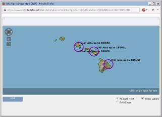
4 j. Airport Links, Charts, and Legends UAS UAS Operating Area Planning a. UOA Form Validation b. Active, Pending and Past UOA Lists c. UOA states and actions d. NOTAM Submission Display UAS Operating Areas a. Display the UAS Operating Areas b. Base Map background c. Sectionals Map data d. Select Adverse Conditions layers e. Configure Map options f. Time-Filter UOA options g. Show UOA & Adverse Condition Labels Account a. Account Holder (User) b. Aircraft c. Display Settings d. Service Provider Authorization e. Aircraft & Favorite Plan Sharing f. Change Password g. Change Username Links Help Logout Leidos Page 4 of 254
5 LFS Web User Guide 1. Feedback Leidos Flight Service encourages all users to provide feedback so that we can continue to enhance the service offerings and user experience of our website. Leidos Page 5 of 254
6 Please perform the following steps to provide feedback. Leidos Page 6 of 254

7 a. Select Feedback and Suggestions link near the bottom of the Home page b. Provide answers to feedback questions c. Click Submit Feedback button 2. Account Registration, Password Management, and Login a. Account Registration To register for a new account, simply select the Create New Account link in the Leidos Pilot Web login box near the top right of the Home page. Leidos Page 7 of 254
8 If pilot has an existing call-in profile with LFS, the system will link the web account and profile when web account is created. b. Login The Leidos Pilot Web login box appears near the top right of the Home page when you are not logged in. Your username is the address associated with your account. Once you have logged in, the login box is no longer displayed. Leidos Page 8 of 254


9 Some functionality on the website is not available if you are not logged in. These items will appear grayed out in the menu bar (see graphic below), and clicking them will have no effect. Once you have logged in, they will not be grayed and will be clickable. c. Forgotten Password If you have a need to reset your password for an existing account, select the Forgot/Reset link in the Leidos Pilot Web login box near the top right of the Home page. A new default password will be sent to the account associated with the existing account. The next time you sign in using this account, use the new default password from the . The system will immediately display the Change Password and Acknowledge Terms of Agreement page before allowing any other action. If not, you will need to change your password using the Account Tab. d. Change Password Hovering over the Account tab on the menu displays the Change Password link, as shown below. Leidos Page 9 of 254

10 Once clicked, the change password page is displayed where users can enter a new password. The password criteria are also listed on the page. Users have to enter the new password twice to confirm the spelling. If the new password entered matches, users have to click the Save button. If successful, the change password page remains displayed with the password input fields blanked out, and a password changed confirmation dialog displayed. When OK is selected in the dialog, the change password page remains displayed. From there users can navigate to anywhere on the site. Users can change their passwords as many times as they want/need as long as the following criteria are met: Passwords must be between 8 to 32 alphanumeric characters. Must contain at least three of four of the following types of characters: o Uppercase letters, Lowercase letters, Numbers, Special characters. Cannot be the same as your current password. Your most recent 12 passwords cannot be reused. Three incorrect login attempts will lock your account. Leidos Page 10 of 254


11 If the passwords do not match or fail validation, the screen will remain the same with a failure message. If the password criteria are not met, the screen will remain the same with a failure message and the password rules. e. Change Username Hovering over the Account tab on the menu displays the Change Username link, as shown below: Leidos Page 11 of 254
12 Once a user clicks the Change Username link, the change username page is displayed. This is where a user can change their current username to a new username. The username criterion is a valid address. Users have to enter the new username twice to confirm the spelling. The users have the following options: Click the Send Test button. Click the Submit button. If the user clicks the Send Test button, the following Results dialog is displayed: Then an is sent to the user for contact verification: From: DO_NOT_REPLY@afss.com with the Subject: o Leidos Flt Svc Notification Message received will be similar to the following: o Leidos Flt Svc Contact Verification Message Thank you for selecting Leidos Flt Svc When the OK button is selected in the dialog, the change username page remains displayed. If the user clicks the Submit button, and the username changed successfully, the following Results dialog is displayed: Leidos Page 12 of 254
13 The user is sent a confirmation containing a temporary password and further instructions. When the OK button is selected in the dialog, the user is logged off his or her session, and redirected to the home page where the user may log in using the new username and temporary password sent via . If the user clicks the Submit button, and the username changed successfully, but there is an error sending the confirmation . The following Results dialog is displayed: When the OK button is selected in the dialog, the change username page remains displayed. When either the Test button or Submit button is selected, if the usernames do not match or fail validation, the following Results dialog is displayed: When the OK button is selected in the dialog, the change username page remains displayed with one of the following failure messages: Cannot reuse current Username Leidos Page 13 of 254


14 Username already exists Mismatched Required Invalid f. Unlock Your Account If you enter an invalid username or password on login you will see the following screen: If you are using a valid Username, but an invalid password, there is a limit to the number of consecutive login failures. When the next failure will cause your account to be locked, the message above the Username entry will be: After receiving this message, you must enter the current password correctly or your account will become locked. Using the Forgot/Reset link will change your password and provide a temporary password in an . Using the Forgot/Reset link before your account is locked provides several opportunities to enter the temporary password correctly before your account is locked again. Leidos Page 14 of 254

15 Once you have entered an incorrect password more than permitted number of consecutive times, your account will be temporarily locked the message above the Username field will be: An will be sent once each time your account is locked. The contains instructions to unlock your account. Unlocking the account does not change the password. The Forgot/Reset link that changes passwords will not reset a locked account. Leidos Page 15 of 254


16 3. Helpful Videos To view the Training Videos, select the links under How-To Videos on the Home page. You can also select Helpful Videos from the Help menu. Leidos Page 16 of 254
.")
17 4. Contact Us The contact information for Leidos Flight Service can be found on the website s footer menu by selecting the Contact Us link. For flight services support, please contact Leidos Flight Service: WX-BRIEF ( ). For all other support needs, including technical support, please contact Leidos Flight Service Support Desk: or R-AFSS-NSC@leidos.com. Leidos Page 17 of 254

18 5. Home Page a. News and Information The Home page contains news and information about Leidos Flight Service. On this page are Featured Capabilities, Partnerships, Pilot Advocacy, News & Announcements, Upcoming Events, How-To Videos, and Resources. If you are not logged on, the Leidos Pilot Web login box appears on this page. For more information about logging in, see the Account Registration, Password Management, and Login section of this guide. Leidos Page 18 of 254

19 b. Links Near the bottom of the Home page are links for Feedback, Social Media, and Contacts. Reference the Feedback section of this document for more information on leaving feedback. c. System Alerts If Leidos Flight Service is experiencing temporary technical difficulties, a message will be displayed on the Home page to notify users of the issue. For example, if there is a US NOTAM Service Interruption, a notification will be displayed below the Welcome message. The following is an example of such a message. When the Service is resumed, the message will not be displayed. Leidos Page 19 of 254

20 6. Pilot Dashboard Page Once you have successfully logged in, the default webpage is the Pilot Dashboard page, which can also be selected at any time by clicking on the tab towards the top of the page labeled Pilot Dashboard. The Advanced Services Dashboard allows the user to register for alerts and notifications. Any Active or Proposed Flights associated with your profile can be found here along with any graphics including METARs, TAFs, and NOTAMs if configured in your Account -> Display Settings tab. If any Active flight has gone into Search and Rescue status, then a red exclamation icon will be displayed to the left of the flight s aircraft ID and an alert message will be displayed at the top left of the Pilot Dashboard page. a. Flight Plan List i. The Flight Plan list is read-only. ii. It is displayed in the following order: a) Active flight plans b) Proposed flight plans c) Scheduled briefs (Reference section Scheduled Brief for more details) iii. The primary sort for the Active Flights list is the ETA column in ascending order. The secondary sort is the ACID in ascending order. The primary sort for the Proposed Leidos Page 20 of 254
: a) Flight state: Active, Proposed, or Briefing b) Alerts: An icon is displayed when there are alerts for the flight plan.")
21 Flights and Scheduled Briefings is the ETD column in ascending order. The secondary sort is the ACID in ascending order. iv. The flight plans display the following data (from left to right): a) Flight state: Active, Proposed, or Briefing b) Alerts: An icon is displayed when there are alerts for the flight plan. This is only applicable to active and proposed flight plans. c) icon: An icon is displayed if there are scheduled briefings associated with the flight plan. A scheduled briefing can be associated with an active flight plan, proposed flight plan, or other scheduled briefings. It is matched with another flight plan if it shares the same ACID, Departure, Destination, Route, and ETD. d) ACID: The Aircraft Identifier e) Departure to Destination: The departure point will be displayed, followed by to, followed by the destination point. f) Flight rule: The flight rule for the flight plan g) ETA or ETD: For active flight plans, the ETA in the user s time zone and UTC time zone will be displayed. For proposed flight plans and scheduled briefings, the ETD in the user s time zone and the UTC time zone will be displayed. h) Action Button: The button is displayed for flights in the active state. When the user clicks the Close button, the system displays the Close confirmation dialog with and buttons. This helps ensure every opportunity is available to avoid accidentally closing an Active Flight Plan prematurely. Reference Closing an Active VFR Flight Plan for more details on closing a Flight Plan. The Activate button is displayed for flights in the proposed state. The user can activate a proposed flight plan by clicking the Activate button from the Pilot Dashboard page. When a user clicks on the button, the flight plan is validated. If there are validation errors, the user will be redirected to the Flight Plan & Briefing page. If no errors exist, an activation dialog is displayed to allow the user to change the activation time (HHMM) to +/- 30 minutes of the current time. Leidos Page 21 of 254
 Drop down menu: A drop down menu will provide several options depending on the flight plan type.")
22 Reference Activating a Proposed VFR Flight Plan for more details on activation of proposed flight plans. Reference Flight Planning Restrictions for restrictions on activating proposed flight plans. i) Drop down menu: A drop down menu will provide several options depending on the flight plan type. (1) Active flight plans will have the following options: (a) Perform a route briefing (b) View the alerts (reference Route alerts for details) for the flight along its route (c) Amend briefings (if any are associated with the flight) (d) Cancel briefings (if any are associated with the flight) (2) Active flight plans will have the following options: (a) Cancel the flight plan (b) Activate the flight plan (c) Perform a route briefing (d) View the alerts for the flight along its route (e) Amend briefings (if any are associated with the flight) (f) Cancel briefings (if any are associated with the flight). (3) Scheduled briefings will have the following options: (a) Amend briefings (b) Cancel briefings. Reference section Scheduled Brief for more details on amending and canceling scheduled briefs. Reference section Multiple Scheduled Briefings Dialog: for details on trying to amend/cancel briefs where there are multiple associated scheduled briefs with a flight plan. j) Go button: The Go button activates the action that was selected from the drop down menu. v. Multiple Scheduled Briefings Dialog: If the icon or the amend/cancel briefing action is selected and there is more than one scheduled associated with the flight plan, the following dialog is displayed: Leidos Page 22 of 254
 will be displayed.")

23 The briefing time for each scheduled brief is displayed in chronological order. The format for the briefing time is the system time, followed by the UTC time in parenthesis. The user can select one of the times and then press OK. At this point the appropriate dialog (View & Amend Briefing or Cancel Briefing) will be displayed. The user can then follow the usual steps for amending or canceling an briefing. b. Route Alerts Alerts for Flight plans are available on the Pilot Dashboard page if configured in accordance with pilot s Pilot Dashboard -> Advanced Services Dashboard. Notices for ATC route changes are available on the Pilot Dashboard page for users that have registered to receive ATC Notices. For more information on registering for ATC Notices, see the "Advanced Services Dashboard" section of this guide. The is displayed when there are alerts for a particular flight plan. Clicking on the button displays a dialog from which the alerts can be viewed and acknowledged. The alerts and notices window presents text alerts on the left and a map area on the right, with previous/next controls to step through the alerts. When the Don t Show This Alert Again button is clicked, the text added next to the alert number indicates that the alert has been acknowledged. The acknowledged alert will remain in the dialog while the dialog remains open and is still selectable via the arrow buttons, but the alert will be suppressed when the dialog is opened in the future. Leidos Page 23 of 254

24 c. Weather and Airport Conditions The Weather and Airport Conditions section displays small versions of your favorite weather graphics as shown below. As a new user, the system will provide you with default weather graphics. The default graphics show the most recent versions of US WEATHER DEPICTION, US SURFACE ANALYSIS, 12 HR SURFACE PROG, and CONUS RADAR SUMMARY. Selecting an image will open a new popup window with a larger version of the graphic. You may change the weather graphics to your own personal selection from Display Settings page by selecting the Edit Favorites link on the Pilot Dashboard page. In addition, you may click the weather graphic image to enlarge the image. The Airports section displays METARs, Density Altitude, TAFs and NOTAMs related to the airports you are interested in. As a new user, the system will provide you with this information for a default set of airports. The default airports are SFO, DEN and JFK. An airport briefing may be retrieved for any of these airports by entering an Aircraft ID and clicking the button. Also, as a new user, the METAR, TAF, and NOTAM text is shown by default in plain-text translation. Leidos Page 24 of 254

25 You may change the airports to your own personal selection from Display Settings page by selecting the Edit Favorites link on the Pilot Dashboard page. Leidos Page 25 of 254
 will be displayed.")
26 Pilots also have the ability to view the METAR, TAF, and NOTAM text without plain-text translation by deselecting the checkbox. In the event a particular NOTAM spans more than two lines of space, an indicator of (more) will be displayed. You can view the full NOTAM text by using your mouse to hover over the affected NOTAM. Leidos Page 26 of 254

27 d. System Alerts If Leidos Flight Service is experiencing temporary technical difficulties, a message will be displayed on the Pilot Dashboard page to notify users of the issue. For example, if there is a US NOTAM Service Interruption, a notification will be displayed below the Welcome message. The following is an example of such a message. When the Service is resumed, the message will not be displayed. Leidos Page 27 of 254
28 6.1. Advanced Services Dashboard a. ACAS: Adverse Condition Alerting Service Clicking on the ACAS icon will open a dialog as follows: The ACAS service will send alert messages to devices, text message phone numbers and addresses registered for the service. The dialog will display a list of all devices and contacts registered for the service. If no contacts nor devices have been registered, then the dialog will display No devices or contacts are currently registered. The user can choose whether to filter out ACAS alerts based on filed altitude by selecting the checkbox at the bottom of the ACAS service window. Leidos Page 28 of 254
29 Clicking on the Video icon will open a help video on how to register for the ACAS service. Clicking on the device providers link will open a dialog showing the service providers that support ACAS. Clicking on a link for a service provider will open a new browser tab with that service provider s home page. Clicking on the Add from My Devices & Contacts button will open a new dialog which contains a list of all Devices, Phone Numbers, and Addresses associated with the pilot s profile. The user can register any of the shown contacts for the ACAS service by selecting the checkbox next to each contact. Leidos Page 29 of 254

30 Pressing the OK button will close the Add from My Devices & Contacts dialog. The selected contact or device will be displayed in the main ACAS dialog. The user can choose whether to receive InFlight alerts, PreFlight alerts or both by selecting the checkbox associated with the type of alert. Clicking on the Remove button will remove the contact row. Clicking on the Test Message button will send a test message to the device or contact in the row. Clicking on the Add Text Phone Number button will display a blank Phone Number row. A valid phone number must be provided to successfully register. Clicking on the Add Address button A valid address must be provided. will display a blank row. Clicking on the Add Portable Device button will display a blank portable device row. A valid device provider and device ID must be entered. Leidos Page 30 of 254
31 When a device provider is selected, the Help button will become enabled. Clicking on the Help button will open a new window with information based on the selected device provider. To receive alerts for Garmin devices, the user can provide a Garmin/Iridium phone number. To receive alerts on an installed device, the user must add the device on the Account->Aircraft tab. This device will then be displayed in the Add from My Devices & Contacts dialog. Clicking on the OK button will submit the changes made to the ACAS registration. If an entry is not valid, or if any field is left blank, an error dialog will popup. After selecting OK, the error fields will be highlighted in yellow and the error will be displayed under each field. Leidos Page 31 of 254

32 If there are no errors, the ACAS dialog will close and a Confirmation dialog will popup. Selecting OK will close the Confirmation dialog. The Advanced Services Dashboard will be updated. If you have successfully registered for the ACAS service then the icon border will be green. If you have not registered any device or contacts, then the icon border will be clear. b. EasyActivate TM and EasyClose TM Clicking on the EasyActivate TM EasyClose TM icon follows: will open a dialog as Leidos Page 32 of 254
33 The EasyActivate TM EasyClose TM service will send alert messages to text message phone numbers and addresses registered for the service. The dialog will display a list of all contacts registered for the service. If no contacts have been registered, then the dialog will display No contacts are currently registered. Clicking on the Video icon will open a help video on how to register for the EasyActivate TM EasyClose TM service. Selecting the Add from My Contacts button will open a new dialog which contains a list of all Phone Numbers, and Addresses associated with the pilot s profile. The user can register any of the shown contacts for the EasyActivate TM EasyClose TM service by selecting the checkbox next to each contact. Pressing the OK button will close the Add from My Contacts dialog. The selected contacts will be displayed in the main EasyActivate TM EasyClose TM dialog. Leidos Page 33 of 254

34 Clicking on the Remove button will remove the contact row. Clicking on the Test Message button will send a test message to the contact in the row. Clicking on the Add Text Phone Number button will display a blank Phone Number row. A valid phone number must be provided to successfully register. Clicking on the Add Address button A valid address must be provided. will display a blank row. Clicking on the OK button will submit the changes made to the EasyActivate TM EasyClose TM registration. If an entry is not valid, or if any field is left blank, an error dialog will popup. After selecting OK, the error fields will be highlighted in yellow and the error will be displayed under each field. If there are no errors, the EasyActivate TM EasyClose TM dialog will close and a Confirmation dialog will popup. Selecting OK will close the Confirmation dialog. The Advanced Services Dashboard will be updated. If you have successfully registered for the EasyActivate TM EasyClose TM service then the icon border will be green. If you have not registered any contact, then the icon border will be clear. c. Close Reminders Clicking on the Close Reminders icon will open a dialog as follows: Leidos Page 34 of 254
35 The Close Reminders service will send messages to devices, text message phone numbers and addresses registered for the service. The dialog will display a list of all devices and contacts registered for the service. If no contacts or devices have been registered, then the dialog will display No devices or contacts are currently registered. Clicking on the Video icon Close Reminders service. will open a help video on how to register for the Clicking on the device providers link will open a dialog showing the service providers that support Flight Plan Close Reminders. Leidos Page 35 of 254
36 Clicking on a link for a service provider will open a new browser tab with that service provider s home page. Clicking on the Add from My Devices & Contacts button will open a new dialog which contains a list of all Devices, Phone Numbers, and Addresses associated with the pilot s profile. The user can register any of the shown contacts for the Close Reminders service by selecting the checkbox next to each contact. Pressing the OK button will close the Add from My Devices & Contacts dialog. The selected contact or device will be displayed in the main Close Reminders dialog. Clicking on the Remove button will remove the contact row. Clicking on the Test Message button will send a test message to the device or contact in the row. Leidos Page 36 of 254
37 Clicking on the Add Text Phone Number button will display a blank Phone Number row. A valid phone number must be provided to successfully register. Clicking on the Add Address button A valid address must be provided. will display a blank row. Clicking on the Add Portable Device button will display a blank portable device row. A valid device provider and device ID must be entered. When a device provider is selected, the Help button will become enabled. Clicking on the Help button will open a new window with information based on the selected device provider. To receive alerts for Garmin devices, the user can provide a Garmin/Iridium phone number. To receive alerts on an installed device, the user must add the device on the Account->Aircraft tab. This device will then be displayed in the Add from My Devices & Contacts dialog. Clicking on the OK button will submit the changes made to the Close Reminders registration. If an entry is not valid, or if any field is left blank, an error dialog will popup. Leidos Page 37 of 254
38 After selecting OK, the error fields will be highlighted in yellow and the error will be displayed under each field. If there are no errors, the Close Reminders dialog will close and a Confirmation dialog will popup. Selecting OK will close the Confirmation dialog. The Advanced Services Dashboard will be updated. If you have successfully registered for the Close Reminders service then the icon border will be green. If the user has not registered any device or contacts, then the icon border will be clear. d. ATC Notices Clicking on the ATC Notices icon will open a dialog as follows: The ATC Notices service will messages to addresses registered for the service. The dialog will display a list of all contacts registered for the service. Leidos Page 38 of 254
39 If no contacts have been registered, then the dialog will display No contacts are currently registered. Clicking on the Video icon ATC Notices service. will open a help video on how to register for the Selecting the Add from My Contacts button will open a new dialog which contains a list of all Addresses associated with the pilot s profile. The user can register any of the shown contacts for the ATC Notices service by selecting the checkbox next to each contact. Pressing the OK button will close the Add from My Contacts dialog. The selected contacts will be displayed in the main ATC Notices dialog. Clicking on the Remove button will remove the contact row. Clicking on the Test Message button will send a test message to the contact in the row. Leidos Page 39 of 254
40 Clicking on the Add Address button A valid address must be provided. will display a blank row. Clicking on the OK button will submit the changes made to the ATC Notices registration. If an entry is not valid, or if any field is left blank, an error dialog will popup. After selecting OK, the error fields will be highlighted in yellow and the error will be displayed under each field. If a valid contact is provided and there are no errors, the ATC Notices dialog will close and a Confirmation dialog will popup. Selecting OK will close the Confirmation dialog. The Advanced Services Dashboard will be updated. If you have successfully registered for the ATC Notices service then the icon border will be green. If you have not registered any contact, then the icon border will be clear. e. SE-SAR Clicking on the SE-SAR icon will open a dialog as follows: Leidos Page 40 of 254

41 The SE-SAR service will send messages to devices, text message phone numbers and addresses registered for the service. The dialog will display a list of all devices and contacts registered for the service. If no contacts or devices have been registered, then the dialog will display No devices or contacts are currently registered. Clicking on the click here link will display the SE-SAR Service dialog. Leidos Page 41 of 254


42 Clicking on the Video icon SAR service. will open a help video on how to register for the SE- Clicking on the device providers link will open a dialog showing the service providers that support SE-SAR. Clicking on a link for a service provider will open a new browser tab with that service provider s home page. Clicking on the Add from My Devices & Contacts button will open a new dialog which contains a list of all Devices, Phone Numbers, and Addresses associated with the pilot s profile. The user can register any of the shown contacts for the SE-SAR service by selecting the checkbox next to each contact. Leidos Page 42 of 254
43 Pressing the OK button will close the Add from My Devices & Contacts dialog. The selected contact or device will be displayed in the main SE-SAR dialog. Clicking on the Remove button will remove the contact row. Clicking on the Test Message button will send a test message to the device or contact in the row. For Garmin inreach (DeLorme), spidertracks, and SkyConnect devices, the user can choose to receive alerts by selecting the checkbox. Clicking on the Add Text Phone Number button will display a blank Phone Number row. A valid phone number must be provided to successfully register. Clicking on the Add Address button A valid address must be provided. will display a blank row. Leidos Page 43 of 254
44 Clicking on the Add Portable Device button will display a blank portable device row. A valid device provider and device ID must be entered. When a device provider is selected, the Help button will become enabled. Clicking on the Help button will open a new window with information based on the selected device provider. To receive alerts for Garmin devices, the user can provide a Garmin/Iridium phone number. To receive alerts on an installed device, the user must add the device on the Account->Aircraft tab. This device will then be displayed in the Add from My Devices & Contacts dialog. Clicking on the OK button will submit the changes made to the SE-SAR registration. If no device is entered and at least one contact is entered, an error dialog will popup. If an entry is not valid, or if any field is left blank, an error dialog will popup. After selecting OK, the error fields will be highlighted in yellow and the error will be displayed under each field. Leidos Page 44 of 254

45 If there are no errors, the SE-SAR dialog will close and a Confirmation dialog will popup. Selecting OK will close the Confirmation dialog. The Advanced Services Dashboard will be updated. If you have successfully registered for the SE-SAR service then the icon border will be green. In order to successfully register for SE-SAR, the user must register at least one device and select the Confirmation checkbox to confirm they have set up with their service providers to send position reports to LFS. If the user has registered at least one device, but has not selected the Confirmation checkbox, the icon border will be yellow and the Registration Status will be Confirmation Required. If the user has not registered any device or contacts, then the icon border will be clear. Leidos Page 45 of 254

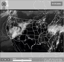
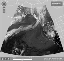
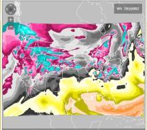
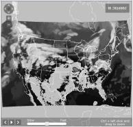
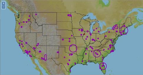
46 7. Weather Page Overview Hovering over Weather in the menu bar causes a drop-down menu to be displayed, containing the links shown below. Clicking on the graphic in the dropdown menu will display the Weather Page, which allows you to view graphical weather data for a variety of geographic areas. Clicking on any link under the Product Categories column will display the selected product on the Weather Page. Select the desired geographic area, then the specific graphic product within the geographic area. Each area has numerous weather charts available, as well as radar and satellite graphics. Single-site radar is available for CONUS. There are non- CONUS sites available as well. Clicking on any link under the Featured Products column will open a separate tab or window displaying the selected weather product graphic. The examples below depict some of the various weather products. a. CONUS Leidos Page 46 of 254


47 Selecting Skew-T/Log P diagrams from rawinsonde data will open National Center for Atmospheric Research Upper-Air page in separate window o Leidos Page 47 of 254


48 Click on any adverse condition to get the text. Select Pan/Zoom radio button to enable Pan/Zoom capability. Leidos Page 48 of 254


49 Selecting any of the Surface Progs buttons will open the National Weather Service Short Range Forecasts (Days ½-2 ½) page in a separate window o Selecting a region and forecast time for Cloud Coverage will enable the Go button. Selecting the Cloud Coverage Go button will display the cloud coverage chart for the specified region and the specified forecast time. Selecting a region and forecast time for Visibility, Surface Winds, Precipitation & Weather will enable the Go button. Selecting the Visibility, Surface Winds, Precipitation & Weather Go button will display the visibility, surface winds, precipication and weather chart for the specified region and the specified forecast time. Select the "Help" link for either Could Coverage or Visibility, Surface Winds, Precipitation & Weather for additional information regarding graphical area forecast data. Selecting Graphical Turbulence Guidance - CONUS button will display a base CONUS map. To view the GTG graphics select a Plot (default - Combined), Forecast Time (default 0 Hr) and an Altitude (default no selection). The issue time and valid time will display with the selected GTG product. Selecting Current & Forecast Icing Product - CONUS button will display a base CONUS map. To view the CIP or FIP graphics select a Plot (default - Severity), Forecast Time (default 0 Hr) and an Altitude (default no selection). The SLD checkbox default is checked. The issue time and valid time will display with the selected CIP/FIP product and with the SLD checkbox. Selecting Freezing Level Forecasts will open Aviation Weather Center Current Freezing Level Forecast page in separate window o Leidos Page 49 of 254


50 o Selecting ADDS Wind & Temperature Forecast will open Aviation Weather Center ADDS Wind Tempurature Forecast page in separate window o Leidos Page 50 of 254


51 Leidos Page 51 of 254


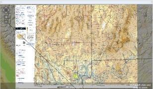
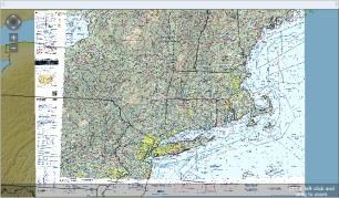
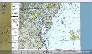
52 Select the desired city to view the sectional. Leidos Page 52 of 254

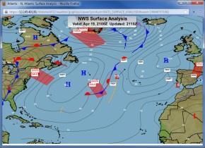
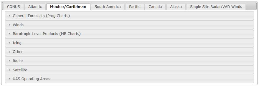
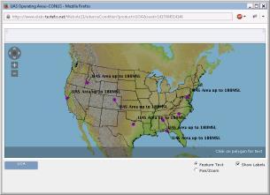
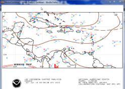
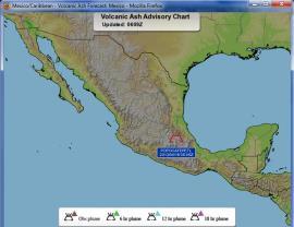
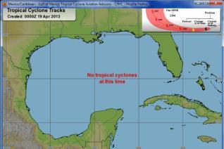
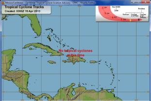
53 b. Atlantic c. Mexico/Caribbean Leidos Page 53 of 254


54 Leidos Page 54 of 254


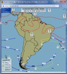
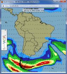
55 d. South America Leidos Page 55 of 254


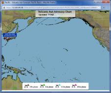
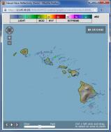
56 e. Pacific Leidos Page 56 of 254

57 Leidos Page 57 of 254

58 Leidos Page 58 of 254

59 Leidos Page 59 of 254


60 f. Canada Selecting Canadian Weather Charts will open the Aviation Weather Center IFFDP - CA Clouds web site in a separate tab or window Selecting Canadian Hazard Charts will open the Aviation Weather Center IFFDP - CA Ice Turb web site in a separate tab or window Leidos Page 60 of 254


61 g. Alaska Selecting Icing / Freezing Levels for Alaska will open the OAA s Nation Weather Service Alaska Aviation Weather Unit Icing Forecast Summary in a separate tab or window Leidos Page 61 of 254

62 Selecting Turbulence for Alaska will open the OAA s Nation Weather Service Alaska Aviation Weather Unit Turbulence Forecast Summary in a separate tab or window Selecting Weather Cameras for Alaska will open the Aviation Cameras Home - Federal Aviation Administration web site in a separate tab or window Leidos Page 62 of 254

63 Leidos Page 63 of 254


64 h. Single Site Radar/VAD Winds Leidos Page 64 of 254
65 8. Flight Planning & Briefing Hovering over Flight Planning & Briefing in the menu bar displays causes the dropdown menu shown below to appear. If the pilot has Pre-Stored Flight Plan (PSFP) access, an additional link for Scheduled Flight Plans will be displayed. a. Briefings, Flight Plans & NavLogs b. Alaska VFR with Extended ETA c. Scheduled Flight Plans (Displayed with PSFP access) d. Locations Briefing e. History Briefings, Flight Plans & NavLogs The Briefings, Flight Plans & NavLogs page allows pilots to: Create new flight plans Perform area and route briefings Generate a navigation log (NavLog) Manage favorite flight plans Retrieve recent flight plans. The Briefings, Flight Plans & NavLogs page supports both Domestic and ICAO compliant flight plans. Each flight plan form is offered as a separate template because of the differences in requirements between Domestic and International (ICAO) flight plans. You can switch between the two templates by clicking on the Domestic or ICAO button on the top right of the page. When the When the button is selected, the Domestic Flight Plan template displays. button is selected, the ICAO Flight Plan template displays. Please note that although entered field data will be retained if you navigate to another page, switching between the Domestic and ICAO Flight Plan template may result in some entered data being lost due to differences in requirements between Domestic and ICAO flight plans. A return flight plan in Draft status can be created by clicking the bottom right of the page. button on the Leidos Page 65 of 254

66 The new flight plan for the return flight route will switch the Departure and Destination field, as well as reverse the Route. Please note that some information will be lost due to it no longer being relevant in the return route of the flight. Alaska VFR with Extended ETA The Alaska VFR with Extended ETA page supports VFR flight plans within Alaska with up to two weeks of flight duration Flight Planning Each form identifies the required fields to file a flight plan of that type. Some fields have helper dialog which is accessible by clicking on the icon next to the field to assist with searching and selecting the appropriate values. Hovering with the mouse pointer over any field label will provide a summary of general syntax and semantic rules for the field and indicate for which actions the field is required. Clicking the label will provide more detailed information about the field. a. Domestic Flight Plan Form Validation The syntax validation for the fields and the required minimum fields for additional actions for flight planning and briefing are described in the table below. DOMESTIC FLIGHT PLAN Field Syntax Validation Required for Actions Domestic Flight Plan Flight Rule VFR, IFR, MVFR, or MIFR Standard Brief Outlook Brief Abbreviated Brief Leidos Page 66 of 254
67 DOMESTIC FLIGHT PLAN Field Syntax Validation Required for Actions File Amend Activate Save Favorite Aircraft ID 1 letter followed by 1-6 alphanumeric characters Example: N0819W Aircraft Type 1 letter followed by 1-3 alphanumeric characters Must be valid aircraft type in Aircraft Type Search Examples: J2, C25A, B738 Refer to Domestic Flight Plan Form, Aircraft Type Search for details. Aircraft Equipment 1 letter Refer to Domestic Flight Plan Form, Aircraft Equipment for details. No. of Aircraft 1-2 digits Example: 1 Heavy Aircraft takeoff weights of at least 300,000 pounds Airspeed Airspeed value zero not allowed Knots: 2-4 digits, max of 3700 Mach: M followed by 3 digits, max of 500, with an implicit decimal after the first digit (M075 = 0.75 Mach, M200 = 2.00 Mach, M312 = 3.12 Mach) Examples: 50, 100, 130, M100 Altitude (100s ft) Flight Level: 2-3 digits OTP: OTP OTP and Flight Level: OTP/ followed by 2-3 digits VFR: VFR VFR and Flight Level: VFR/ followed by 2-3 digits ABV and Flight Level: ABV/ followed by 2-3 digits Block Altitude: 2-3 digits followed by B and 2-3 digits Examples: 65, 80, 210, VFR/095 Additional Format Rules for Use of Altitude Optimization: IFR, MIFR flights: Flight Level: ABV and Flight Level: ABV/20- ABV/600 OTP and Flight Level: OTP/20- OTP/600 VFR and Flight Level: VFR/25- VFR/179 VFR, MVFR flights: Optimize Altitude Standard Brief Outlook Brief Abbreviated Brief File Amend Activate Dep/Dest/Altn1/Altn2 Area Brief NavLog Optimize Altitude Evaluate Departure Time File Amend Activate File Amend Activate Leidos Page 67 of 254 N/A N/A Standard Brief Outlook Brief Abbreviated Brief File Amend Activate NavLog Optimize Altitude Evaluate Departure Time Standard Brief Outlook Brief Abbreviated Brief File Amend Activate NavLog Optimize Altitude Evaluate Departure Time
68 DOMESTIC FLIGHT PLAN Field Syntax Validation Required for Actions Flight Level: ABV and Flight Level: ABV/25- ABV/179 OTP and Flight Level: OTP/25- OTP/179 VFR and Flight Level: VFR/25- VFR/179 Additional Format Rules for Use of Evaluate Departure Time: IFR, MIFR, VFR, MVFR flights: Flight Level: ABV and Flight Level: ABV/00- ABV/999 OTP and Flight Level: OTP/00- OTP/999 VFR and Flight Level: VFR/01- VFR/179 Block Altitude: 00B01-998B999 Departure 3-5 alphanumeric airport/heliport/navaid (default airport), or waypoint identifier Examples: HGR, KSEA, 9OI5 Refer to Domestic Flight Plan Form, Departure/Destination/Alternates for details character latitude/longitude in the format aabb(a)(/)(c)ccdd(b), where parentheses denote optional characters aa is degrees latitude in the range bb is minutes latitude in the range (c)cc is degrees longitude in the range dd is minutes longitude in the range (A) is either N or S (North or South, default to N if unspecified) (B) is either W or E (West or East, default to W if unspecified) Example: 4449N/7322W Standard Brief Outlook Brief Abbreviated Brief File Amend Activate Dep Area Brief Save Favorite NavLog Optimize Altitude Plan a Route Map Route Evaluate Departure Time Location name is required in the Remarks field when latitude/longitude is used for departure. Use the displayed Latitude/Longitude Location Name dialog for assistance alphanumeric fix-radial-distance in the format (A)(A)(A)AAaaabbb, where parentheses denote optional characters (A)(A)(A)AA is 2-5 alphanumeric airport/heliport/navaid/waypoint identifier aaa is radial measure in degrees from North in the range bbb is distance in nautical miles in the range Example: HGR For restrictions, refer to Flight Planning Restrictions. Leidos Page 68 of 254
69 DOMESTIC FLIGHT PLAN Field Syntax Validation Required for Actions Departure Date & Time MM/DD/YYYY; based off of the selected time zone value HHMM; where HHMM are 4 digits, current time based off of the selected time zone value; if not available, will default to UTC time Time zone: Standard Brief Outlook Brief Abbreviated Brief File Amend Activate Dep/Dest/Alt1/Alt2 Area Brief NavLog Optimize Altitude Evaluate Departure Time Route of Flight (Leave blank for direct) characters 3-5 alphanumeric airport/heliport/navaid/waypoint identifier Examples: HGR, KSEA, 9OI character latitude/longitude in the format aabb(a)(/)(c)ccdd(b), where parentheses denote optional characters aa is degrees latitude in the range bb is minutes latitude in the range (c)cc is degrees longitude in the range dd is minutes longitude in the range (A) is either N or S (North or South, default to N if unspecified) (B) is either W or E(West or East, default to W if unspecified) Example: 4449N/7322W 8-11 alphanumeric fix-radial-distance in the format (A)(A)(A)AAaaabbb, where parentheses denote optional characters (A)(A)(A)AA is 2-5 alphanumeric airport/heliport/navaid/waypoint identifier aaa is radial measure in degrees from North in the range bbb is distance in nautical miles in the range Example: HGR V and J Airways V Airway in the format Vd(d)(d), where parentheses denote optional digits J Airway in the format Jd(d)(d), where parentheses denote optional digits Examples: V469, J123 Standard Instrument Departure (SID) 1 letter followed by 2-5 alphanumeric characters N/A Leidos Page 69 of 254
70 DOMESTIC FLIGHT PLAN Field Syntax Validation Required for Actions Example: DRWN6 Standard Terminal Arrival Route (STAR) 1 letter followed by 2-5 alphanumeric characters Example: SKETR5 Full Route Example: MRB V39 SDZ V3 FLO V437 CHS V1 STARY V437 KIZER V267 PAOLA For validations, refer to Route of Flight Validations. For restrictions, refer to Flight Planning Restrictions. Destination 3-5 alphanumeric airport/heliport/navaid (default airport), or waypoint identifier Examples: HGR, KSEA, 9OI5 Refer to Domestic Flight Plan Form for details character latitude/longitude in the format aabb(a)(/)(c)ccdd(b), where parentheses denote optional characters aa is degrees latitude in the range bb is minutes latitude in the range (c)cc is degrees longitude in the range dd is minutes longitude in the range (A) is either N or S (North or South, default to N if unspecified) (B) is either W or E (West or East, default to W if unspecified) Example: 4449N/7322W Standard Brief Outlook Brief Abbreviated Brief File Amend Activate Dest Area Brief Save Favorite NavLog Optimize Altitude Plan a Route Map Route Evaluate Departure Time Location name is required in the Remarks field when latitude/longitude is used for destination. Use the displayed Latitude/Longitude Location Name dialog for assistance alphanumeric fix-radial-distance in the format (A)(A)(A)AAaaabbb, where parentheses denote optional characters (A)(A)(A)AA is 2-5 alphanumeric airport/heliport/navaid/waypoint identifier aaa is radial measure in degrees from North in the range bbb is distance in nautical miles in the range Example: HGR For restrictions, refer to Flight Planning Restrictions. Time Enroute HHMM; where HHMM are 4 digits Example: 0430 File Amend Activate Leidos Page 70 of 254
71 DOMESTIC FLIGHT PLAN Field Syntax Validation Required for Actions Fuel on Board HHMM; where HHMM are 4 digits Example: 0600 Remarks characters Example: STUDENT SOLO FLIGHT File Amend Activate N/A No. on Board 1-3 digits Example: 1 Location name is required in the Remarks field when latitude/longitude is used for departure and/or destination. Use the displayed Latitude/Longitude Location Name dialog for assistance. Alternate alphanumeric airport/heliport identifier Examples: HGR, KSEA, 9OI5 Refer to Domestic Flight Plan Form, Departure/Destination/Alternates for details. For restrictions, refer to Flight Planning Restrictions. Alternate alphanumeric airport/heliport identifier Examples: HGR, KSEA, 9OI5 Refer to Domestic Flight Plan Form, Departure/Destination/Alternates for details. For restrictions, refer to Flight Planning Restrictions. Pilot Contact Information characters Example: JONES, BOB, (202) HGR, (301) Beacon Code 4 octal digits ( ). Only Present on form if assigned. Value cannot be changed by user. Aircraft Color 1-15 letters Use a / to separate colors Examples: W, R/T Refer to Domestic Flight Plan Form, Aircraft Color for details. Briefing Corridor Nautical Miles: 50, 75, or 100 Default: 50 Winds Aloft Corridor Nautical Miles 100, 200, 300, 600 Default: 200 High Altitude Briefing Select checkbox when altitude is at or above FL180 to exclude enroute METARs and TAFs from the briefing. Default: not checked File Amend Activate Alt Area Brief Alt2 Area Brief File Amend Activate N/A File Amend Activate N/A N/A N/A The Latitude/Longitude Location Name Dialog When a latitude/longitude value is entered in the Departure and/or Destination fields a description of the location(s) must be provided in the Remarks field. The following dialog is displayed for assistance: Leidos Page 71 of 254

72 b. ICAO Flight Plan Form Validation The syntax validation for the fields and the required minimum fields for additional actions for flight planning and briefing are described in the table below. Leidos Page 72 of 254

73 ICAO FLIGHT PLAN Field Syntax Validation Required for Actions ICAO Flight Plan Aircraft ID 1 letter followed by 1-6 alphanumeric characters Example: N0819W File Amend Activate Standard Brief Outlook Brief Abbreviated Brief Area Brief NavLog Optimize Altitude Evaluate Departure Time Flight Rule VFR, IFR, YFR, or ZFR File Amend Activate Standard Brief Outlook Brief Abbreviated Brief Save As Favorite Flight Type G, M, N, S, X, or D N/A No. of Aircraft 1-2 digits Example: 1 Aircraft Type 1 letter followed by 1-3 alphanumeric characters Must be valid aircraft type in Aircraft Type Search N/A File Amend Leidos Page 73 of 254
74 ICAO FLIGHT PLAN Field Syntax Validation Required for Actions Examples: J2, C25A, B738 Refer to ICAO Flight Plan Form for details. Wake Turbulence H - Aircraft takeoff weights of at least 300,000 pounds M - Aircraft takeoff weights greater than 15,000 pounds, but less than 300,000 pounds L - Aircraft takeoff weights of 15,000 pounds or less The Wake Turbulence will be automatically populated based on the Aircraft Type. Refer to ICAO Flight Plan Form for details. Aircraft Equipment 1-64 alphanumeric characters Use Aircraft Equipment helper dialog for assistance. If the value R is entered, then Other Information must contain a PBN/ value. If the value Z is entered, then Other Information must contain either a NAV/, DAT/ or COM/ value. Examples: F, E3G, M3 Refer to ICAO Flight Plan Form for details. Departure 3-4 alphanumeric airport identifier Examples: KSEA, KHGR 2-5 alphanumeric significant point 11 character latitude/longitude in the format aabbacccddb aa is degrees latitude in the range bb is minutes latitude in the range ccc is degrees longitude in the range dd is minutes longitude in the range A is either N or S (North or South) B is either E or W (East or West) Example: 4449N07322W 8-11 alphanumeric fix-radial-distance in the format (A)(A)(A)AAaaabbb, where parentheses denote optional characters (A)(A)(A)AA is 2-5 alphanumeric airport/heliport/navaid/waypoint identifier aaa is radial measure in degrees from North in the range bbb is distance in nautical miles in the range Example: HGR Activate File Amend Activate File Amend Activate File Amend Activate Standard Brief Outlook Brief Abbreviated Brief Departure Area Brief Save As Favorite NavLog Optimize Altitude Plan a Route Map Route Evaluate Departure Time Departure Date & Time ZZZZ or AFIL If ZZZZ or AFIL is entered, then a location of one of the above formats must be provided in DEP/ in the Other information field For restrictions, refer to Flight Planning Restrictions MM/DD/YYYY; based off of the selected time zone value HHMM; where HHMM are 4 digits, current time based off of the selected time zone value; if not available, will default to UTC time Time zone: Standard Brief Outlook Brief Abbreviated Brief File Amend Activate Area Brief NavLog Optimize Altitude Evaluate Departure Time Leidos Page 74 of 254
75 ICAO FLIGHT PLAN Field Syntax Validation Required for Actions Cruising Speed Airspeed value zero not allowed Knots: N followed by 4 digits, max of 3700 Mach: M followed by 3 digits, max of 500, with an implicit decimal after the first digit (M075 = 0.75 Mach, M200 = 2.00 Mach, M312 = 3.12 Mach) Examples: N0100, M100 Level Altitude in hundreds of feet, for flights below 18,000 feet, minimum is 100 feet: A followed by 3 digits (A095 = 9,500 feet) Flight Level in hundreds of feet, for flights at or above 18,000 feet: F followed by 3 digits (F195 = 19,500 feet) Altitude in tens of meters: M followed by 4 digits (M0230 = 2,300 meters) Standard Metric Level in tens of meters: S followed by 4 digits (S1230 = 12,300 meters) VFR with Altitude in hundreds of feet, minimum is 100 feet: VFR/ followed by 3 digits (VFR/170 = 17,000 feet) VFR: VFR Examples: A095, F190, M0230, S1000, VFR/123 Additional Format Rules for Use of Altitude Optimization: IFR, YFR flights: A020-A179 F180-F600 M0061-M1828 S0061-S1828 VFR/025-VFR/179 VFR, ZFR flights: A025-A179 M0077-M0548 S0077-S0548 VFR/025-VFR/179 Standard Brief Outlook Brief Abbreviated Brief File Amend Activate NavLog Optimize Altitude Evaluate Departure Time Standard Brief Outlook Brief Abbreviated Brief File Amend Activate NavLog Optimize Altitude Evaluate Departure Time Surveillance Equipment Additional Format Rules for Use of Evaluate Departure Time: IFR, YFR, VFR, ZFR flights: A001-A179 F180-F999 M0000-M3048 S0000-S3048 VFR/001-VFR/ alphanumeric characters Use Surveillance Equipment helper dialog for assistance. Examples: S, X, SV1 Refer to ICAO Flight Plan Form for details. Route of Flight characters alphanumeric airport/heliport/navaid/waypoint identifier Examples: KSEA, KHGR character latitude/longitude in the format aabb(a)(/)(c)ccdd(b), where parentheses denote optional characters aa is degrees latitude in the range bb is minutes latitude in the range (c)cc is degrees longitude in the range dd is minutes longitude in the range (A) is either N or S (North or South, default to N if unspecified) (B) is either W or E(West or East, default to W if unspecified) Example: 4449N/7322W File Amend Activate File Amend Activate Map Route Leidos Page 75 of 254
76 ICAO FLIGHT PLAN Field Syntax Validation Required for Actions alphanumeric fix-radial-distance in the format (A)(A)(A)AAaaabbb, where parentheses denote optional characters (A)(A)(A)AA is 2-5 alphanumeric airport/heliport/navaid/waypoint identifier aaa is radial measure in degrees from North in the range bbb is distance in nautical miles in the range Example: HGR V and J Airways V Airway in the format Vd(d)(d), where parentheses denote optional digits J Airway in the format Jd(d)(d), where parentheses denote optional digits Examples: V469, J Standard Instrument Departure (SID) 1 letter followed by 2-5 alphanumeric characters Example: DRWN6 7. Standard Terminal Arrival Route (STAR) 1 letter followed by 2-5 alphanumeric characters Example: SKETR5 8. Cruising Speed and/or Level change at a point in the route, in the format <point>/<speed><altitude> <point> as defined in items 2, 3, and 4 above <speed> is in the same format as the Cruising Speed field <altitude> is in the same format as the Level field Must include both Speed and Level values, even if only one is changing Example: MSN/N0150A Flight Rules change at a point in the route, in the format: o <point><space><vfr or IFR> Example: MSN VFR o Or with a speed/altitude change: <point>/<speed><altitude><space><vfr or IFR> <point> as defined in items 2, 3, and 4 above <speed> is in the same format as the Cruising Speed field <altitude> is in the same format as the Level field Must include both Speed and Level, even if only one is changing Example: MSN/N0150A095 IFR Full Route Example: MRB V39 SDZ V3 FLO V437 CHS V1 STARY V437 KIZER V267 PAOLA For validations, refer to Route of Flight Validations. For restrictions, refer to Flight Planning Restrictions. Destination 3-4 alphanumeric airport identifier Examples: KSEA, KHGR 2-5 alphanumeric significant point 11 character latitude/longitude in the format aabbacccddb aa is degrees latitude in the range bb is minutes latitude in the range ccc is degrees longitude in the range dd is minutes longitude in the range A is either N or S (North or South) B is either E or W (East or West) Example: 4449N07322W File Amend Activate Standard Brief Outlook Brief Abbreviated Brief Destination Area Brief Save As Favorite NavLog Optimize Altitude Plan a Route Map Route Evaluate Departure Time Leidos Page 76 of 254
77 ICAO FLIGHT PLAN Field Syntax Validation Required for Actions 8-11 alphanumeric fix-radial-distance in the format (A)(A)(A)AAaaabbb, where parentheses denote optional characters (A)(A)(A)AA is 2-5 alphanumeric airport/heliport/navaid/waypoint identifier aaa is radial measure in degrees from North in the range bbb is distance in nautical miles in the range Example: HGR ZZZZ If ZZZZ is entered, then a location of one of the above formats must be provided in DEST/ in the Other information field For restrictions, refer to Flight Planning Restrictions Est Elapsed Time HHMM; where HHMM are 4 digits Example: 0530 If 0000 is entered, then the Estimated Time of Arrival must be provided in the ETA field. ETA DDHHMM; where DDHHMM are 6 digits Example: Time zone will default to the selected time zone in Departure Date & Time field. Estimated Time of Arrival must be at least 100 hours or more than the Departure Date & Time. Estimated Time of Arrival cannot be more than 27 days from Departure Date & Time. Alternate alphanumeric airport identifier Examples: KSEA, KHGR File Amend Activate File Amend Activate Alternate 1 Area Brief 2-5 alphanumeric significant point 11 character latitude/longitude in the format aabbacccddb aa is degrees latitude in the range bb is minutes latitude in the range ccc is degrees longitude in the range dd is minutes longitude in the range A is either N or S (North or South) B is either E or W (East or West) Example: 4449N07322W 8-11 alphanumeric fix-radial-distance in the format (A)(A)(A)AAaaabbb, where parentheses denote optional characters (A)(A)(A)AA is 2-5 alphanumeric airport/heliport/navaid/waypoint identifier aaa is radial measure in degrees from North in the range bbb is distance in nautical miles in the range Example: HGR ZZZZ If ZZZZ is entered, then a location of one of the above formats must be provided in ALTN/ in the Other information field For restrictions, refer to Flight Planning Restrictions Alternate alphanumeric airport identifier Examples: KSEA, KHGR Alternate 2 Area Brief 2-5 alphanumeric significant point 11 character latitude/longitude in the format aabbacccddb aa is degrees latitude in the range bb is minutes latitude in the range ccc is degrees longitude in the range Leidos Page 77 of 254
78 ICAO FLIGHT PLAN Field Syntax Validation Required for Actions dd is minutes longitude in the range A is either N or S (North or South) B is either E or W (East or West) Example: 4449N07322W 8-11 alphanumeric fix-radial-distance in the format (A)(A)(A)AAaaabbb, where parentheses denote optional characters (A)(A)(A)AA is 2-5 alphanumeric airport/heliport/navaid/waypoint identifier aaa is radial measure in degrees from North in the range bbb is distance in nautical miles in the range Example: HGR ZZZZ If ZZZZ is entered, then a location of one of the above formats must be provided in ALTN/ in the Other information field For restrictions, refer to Flight Planning Restrictions Beacon Code 4 octal digits ( ). Only present on form if assigned. Value cannot be changed by user. Other Information alphanumeric characters, spaces, and forward slash (/) Use the Other Information helper dialog for a list of all valid codes and for formatting the following subfield elements: STS/: Enter special handling codes for Air Traffic Services. If more than one code is used, each code must be separated by a space. Example: STS/ALTRV PBN/: Enter RNAV and/or RNP capabilities. A maximum of 8 codes may be entered. Aircraft Equipment field must contain R. Example: PBN/A1 NAV/: Enter significant data related to navigation equipment, other than that specified in PBN/ subfield. A "Z" will be automatically inserted into the Aircraft Equipment field. This subfield is a free text field. Example: NAV/MYEQUIPMENT COM/: Enter communications applications or capabilities that are not specified in the Aircraft Equipment field. A "Z" will be automatically inserted into the Aircraft Equipment field. This subfield is a free text field. Example: COM/MYEQUIPMENT DAT/: Enter data applications or capabilities that are not specified in the Aircraft Equipment field. A "Z" will be automatically inserted into the Aircraft Equipment field. This subfield is a free text field. Example: DAT/MYEQUIPMENT SUR/: Enter the surveillance capabilities of the aircraft not specified in the Surveillance Equipment field. This subfield is a free text field. Example: SUR/MYEQUIPMENT DEP/: Enter the departure of the flight plan when ZZZZ is entered in the departure field, as shown below. DEP/ will be automatically inserted into the Other Information field. 3-4 alphanumeric airport identifier 2-5 alphanumeric significant point 11 character latitude longitude in the format aabbacccddb N/A Leidos Page 78 of 254
79 ICAO FLIGHT PLAN Field Syntax Validation Required for Actions aa is degrees latitude in the range bb is minutes latitude in the range ccc is degrees longitude in the range dd is minutes longitude in the range A is either N or S (North or South) B is either E or W (East or West) 8-11 alphanumeric fix-radial-distance in the format (A)(A)(A)AAaaabbb, where parentheses denote optional characters (A)(A)(A)AA is 2-5 alphanumeric airport/heliport/navaid/waypoint identifier aaa is radial measure in degrees from North in the range bbb is distance in nautical miles in the range Example: DEP/KHGR Example: DEP/4449N07322W Example: DEP/HGR Location name is required following latitude/longitude when latitude/longitude is used for the DEP/ and/or DEST/ subfields. DEST/: Record the destination of the flight plan when ZZZZ is entered in the departure field. Use the same rules as the DEP/ subfield. Example: DEST/KHGR Example: DEST/4449N07322W Example: DEST/HGR DOF/: Records the departure date of the flight as YYMMDD if the Proposed Departure Time is more than 24 hours ahead of the current time. DOF/ will be automatically inserted into the Other Information field. Example: DOF/ REG/: Enter the nationality or registration mark of the aircraft. This subfield is a free text field. Example: REG/UNITEDSTATES EET/: Enter significant points or FIR boundary designators, and accumulated estimated elapsed times from take-off to the points or FIR boundaries. If multiple points or boundaries are entered, they must be separated by a space, and the time values must be in increasing order from left to right. None of the time values may be equal to, or exceed the Total Estimated Elapsed Time. Points and designators can be identified using FIR ID, enroute point, latitude/longitude, or Fix-Radial- Distance (FRD). EET/<position><time> or EET/<position1><time1><sp><position2><time2> <sp><position3><time3> Example: EET/CZEG0026 SEL/: Enter the SELCAL (Selective Calling) code for aircraft so equipped. This subfield is a free text field. Example: SEL/ABCD TYP/: Enter the aircraft type, if ZZZZ is entered into the Aircraft Type field. This subfield is a free text field. Example: TYP/J2 Leidos Page 79 of 254
80 ICAO FLIGHT PLAN Field Syntax Validation Required for Actions CODE/: Enter the aircraft address, which is expressed in the form of an alphanumerical code of six hexadecimal characters. Example: CODE/AC82EC DLE/: Enter the en-route delay or holding at significant point(s) on the route. If multiple delay points may be included, they must be separated by a space. DLE/<significant point>hhmm or DLE/<significant point>hhmm<space><significant point>hhmm. The <significant point> can be one of the following formats: 3-4 alphanumeric airport identifier 2-5 alphanumeric significant point 11 character latitude longitude in the format aabbacccddb aa is degrees latitude in the range bb is minutes latitude in the range ccc is degrees longitude in the range dd is minutes longitude in the range A is either N or S (North or South) B is either E or W (East or West) 8-11 alphanumeric fix-radial-distance in the format (A)(A)(A)AAaaabbb, where parentheses denote optional characters (A)(A)(A)AA is 2-5 alphanumeric airport/heliport/navaid/waypoint identifier aaa is radial measure in degrees from North in the range bbb is distance in nautical miles in the range Example: DLE/4449N07322W0045 OPR/: Enter the ICAO designator or name of the aircraft operating agency. This subfield is a free text field. Example: OPR/MYAGENCY ORGN/: Enter the originator's 8 letter AFTN address. Example: ORGN/AFTNADDRESS PER/: Enter the aircraft performance data. This subfield accepts one of the following codes: A, B, C, D, E, or H. Example: PER/H ALTN/: Enter the alternate airports of the flight plan when ZZZZ is entered into either of the alternate aerodrome field. Use the same rules as the DEP/ subfield. Example: ALTN/KHGR Example: ALTN/4449N07322W Example: ALTN/HGR RALT/: Enter the en-route alternate airports. Use the same rules as the DEP/ subfield. Example: RALT/KHGR Example: RALT/4449N07322W Example: RALT/HGR TALT/: Enter one take-off alternate aerodrome. Use the same rules as the DEP/ subfield. Example: TALT/KHGR Example: TALT/4449N07322W Example: TALT/HGR Leidos Page 80 of 254
81 ICAO FLIGHT PLAN Field Syntax Validation Required for Actions RIF/: Enter route details for a revised destination airport. This subfield is a free text field, but should follow the rules of the Route of Flight field. Example: RIF/KHGR RMK/: Enter any other plain language remarks for the flight plan. This subfield is a free text field. Example: RMK/STUDENT PILOT Refer to ICAO Flight Plan Other Information Field for details. Supplementary Information Fuel Endurance HHMM; where HHMM are 4 digits Example: 0530 Persons on Board 1-30 alphanumeric characters, spaces, and backslash \ Example: 1, TWO, 3\4 Aircraft Color & Markings alphanumeric characters, spaces, and backslash \ Example: B\BE AND RED Emergency Equipment Survival Equipment Select appropriate checkboxes for your aircraft N/A Emergency Radios Select appropriate checkboxes for your aircraft N/A Jackets Select appropriate checkboxes for your aircraft N/A Dinghies Number 1-2 digits Example: 01 Capacity 1-3 digits Example: 003 Covered Select if dinghies are covered N/A Color 1-20 alpha characters including spaces Example: B Supplemental Remarks alphanumeric characters, spaces, and backslash \ Example: STUDENT SOLO FLIGHT Pilot in Command alphanumeric characters, spaces, and backslash \ Example: Jones Pilot Contact Information characters Example: JONES, (202) HGR, (301) Route Corridor Nautical Miles: 50, 75, or 100 N/A Winds Aloft Corridor Nautical Miles 100, 200, 300, 600 Default: 200 High Altitude Briefing Select checkbox when altitude is at or above FL180 to exclude enroute METARs and TAFs from the briefing Default: not checked File Amend Activate File Amend Activate N\A N/A N/A N/A N/A N/A File Amend Activate N/A N/A i. ICAO Flight Plan Other Information Field The Other Information field on the ICAO Flight Plan page can be used to record additional information about the flight plan that s not documented in the rest of the plan. Information in the field is entered using one or more of the subfields shown below. Each subfield must be followed by the slash character / and cannot appear more than once in the field. In addition, the subfields must appear in the order shown below i.e. STS/ before PBN/ before NAV/ etc. Leidos Page 81 of 254
82 The entry TYP/C172 RMK/THIS IS A REMARK would be considered valid. The entry RMK/THIS IS A REMARK TYP/C172 would be considered invalid because RMK cannot come before TYP. The entry TYP/C172 TYP/C180 RMK/THIS IS A REMARK would be considered invalid because TYP cannot appear more than once in the field. Subfield Order 1. STS/ 7. DEP/ 13. TYP/ 19. ALTN/ 2. PBN/ 8. DEST/ 14. CODE/ 20. RALT/ 3. NAV/ 9. DOF/ 15. DLE/ 21. TALT/ 4. COM/ 10. REG/ 16. OPR/ 22. RIF/ 5. DAT/ 11. EET/ 17. ORGN/ 23. RMK/ 6. SUR/ 12. SEL/ 18. PER/ Leidos Page 82 of 254
.")
83 The Other Information Helper Dialog To assist you with filling in the Other Information field, the Web site provides a helper dialog which is accessible by clicking on the icon next to the field. The helper dialog is shown below. i. The STS subfield The STS subfield is used to record reasons for special handling of the flight plan by Air Traffic Services (ATS). The reasons are represented by the codes shown below. If more than one code is used, each code must be separated by a space. For example, the entry STS/ALTRV ATFMX would be considered valid while the entry STS/ALTRVATFMX would be considered invalid. ALTRV This code indicates a flight operated in accordance with an altitude reservation. ATFMX This code indicates a flight approved for exemption from the ATFM measures by the appropriate authority. FFR The code indicates a fire-fighting flight. FLTCK This code indicates a flight check for calibration of navigational aids. HAZMAT This code indicates a flight carrying hazardous material. HEAD This code indicates a flight with Head of State status. HOSP This code indicates a medical flight declared by medical authorities. HUM This code indicates a flight operating on a humanitarian mission. MARSA This code indicates a flight for which a military entity assumes responsibility for separation of military aircraft. MEDEVAC This code indicates a life critical medical emergency evacuation. NONRVSM This code indicates a non-rvsm capable flight intending to operate in RVSM airspace. SAR This code indicates a flight engaged in a search and rescue mission. Leidos Page 83 of 254

84 STATE This code indicates a flight engaged in military, customs, or police services. The STS Helper Dialog To assist you with filling in the STS subfield, the Web site provides a helper dialog which is accessible by clicking on the icon next to the STS check box on the Other Information as shown below. ii. The PBN subfield The PBN subfield is used to record RNAV and/or RNP capabilities. The capabilities are represented by the codes shown below. A1 B4 C2 D2 O1 S1 B1 B5 C3 D3 O2 S2 B2 B6 C4 D4 O3 T1 B3 C1 D1 L1 O4 T2 If a PBN/ value is entered into the Other Information field, then the Aircraft Equipment value must contain R. Omitting PBN/ or R invalidates the flight plan. The PBN Helper Dialog To assist you with filling in the PBN subfield, the Web site provides a helper dialog which is accessible by clicking on the icon next to the PBN check box on the Other Information as shown below. Leidos Page 84 of 254

85 iii. iv. The NAV subfield The NAV subfield is used to record significant data related to navigation equipment, other than that specified in PBN/ subfield, as required by the appropriate ATS authority. The subfield accepts alphanumeric and spaces in free text. If the Other Information field contains the NAV subfield, the Web site will insert the value Z into the Aircraft Equipment field. Omitting Z invalidates the flight plan. The COM subfield The COM subfield is used to record communications applications or capabilities that are not specified in the Aircraft Equipment field. The subfield accepts alphanumeric and spaces in free text. If the Other Information field contains the COM subfield, the Web site will insert the value Z into the Aircraft Equipment field. Omitting Z invalidates the flight plan. v. The DAT subfield The DAT subfield is used to record data applications or capabilities that are not specified in the Aircraft Equipment field. The subfield accepts alphanumeric and spaces in free text. If the Other Information field contains the DAT subfield, the Web site will insert the value Z into the Aircraft Equipment field. Omitting Z invalidates the flight plan. vi. vii. The SUR subfield The SUR subfield is used to record the surveillance capabilities of the aircraft not specified in the Surveillance Equipment field. The subfield accepts alphanumeric and spaces in free text. The DEP subfield The DEP subfield is used to record the departure of the flight plan. The subfield accepts the following formats: 3 4 alphanumeric FAA airport identifier 4 alphanumeric ICAO aerodrome identifier Leidos Page 85 of 254
 B is either E or W (East or West) 8 11 alphanumeric fix-radial-distance in the format")
86 2 5 alphanumeric significant point 11 character latitude/longitude in the format aabbacccddb aa is degrees latitude in the range bb is minutes latitude in the range ccc is degrees longitude in the range dd is minutes longitude in the range A is either N or S (North or South) B is either E or W (East or West) 8 11 alphanumeric fix-radial-distance in the format (A)(A)(A)AAaaabbb, where parentheses denote optional characters (A)(A)(A)AA is 2-5 alphanumeric airport/heliport/navaid/waypoint identifier aaa is radial measure in degrees from North in the range bbb is distance in nautical miles in the range If ZZZZ or AFIL is entered into the Departure Aerodrome field, then a location must be provided in DEP/ in the Other Information field. Omitting ZZZZ, AFIL or DEP/ invalidates the flight plan. The Latitude/Longitude Location Name Dialog When a latitude/longitude value is entered in the DEP/ subfield a description of the location(s) must be provided after latitude/longitude. The following dialog is displayed for assistance: For restrictions, refer to Flight Planning Restrictions. viii. The DEST subfield The DEST subfield is used to record the destination of the flight plan. The subfield accepts the following formats: 3 4 alphanumeric FAA airport identifier 4 alphanumeric ICAO aerodrome identifier 2 5 alphanumeric significant point 11 character latitude/longitude in the format aabbacccddb aa is degrees latitude in the range bb is minutes latitude in the range ccc is degrees longitude in the range dd is minutes longitude in the range A is either N or S (North or South) B is either E or W (East or West) Leidos Page 86 of 254

87 8 11 alphanumeric fix-radial-distance in the format (A)(A)(A)AAaaabbb, where parentheses denote optional characters (A)(A)(A)AA is 2-5 alphanumeric airport/heliport/navaid/waypoint identifier aaa is radial measure in degrees from North in the range bbb is distance in nautical miles in the range If ZZZZ is entered into the Destination Aerodrome field, then a location must be provided in DEST/ in the Other Information field. Omitting either ZZZZ or DEST/ invalidates the flight plan. The Latitude/Longitude Location Name Dialog When a latitude/longitude value is entered in the DEST/ subfield a description of the location(s) must be provided after latitude/longitude. The following dialog is displayed for assistance: ix. For restrictions, refer to Flight Planning Restrictions. The DOF subfield The DOF subfield is used to record the date of the flight departure. The format is shown below. DOF/YYMMDD YY = 00 to 99 and represents the last 2 digits of the year (example, the year 2012 would be represented as 12). MM = 01 to 12 and is a 2 digit representation of the month. DD = 01 to 31 and is a 2 digit representation of the day of the month. If the Proposed Departure Time is more than 24 hours ahead of the current time, DOF subfield is required. The Web site will insert DOF/ into the Other Information field. x. The REG subfield xi. The REG subfield is used to record the nationality or common mark and registration mark of the aircraft. The subfield accepts alphanumeric and spaces in free text. The EET subfield The EET subfield is used to record significant points or FIR boundary designators and accumulated estimated elapsed times from take-off to such points or FIR boundaries. The format is shown below. EET/<position><time> Leidos Page 87 of 254
88 The EET subfield can be used to record multiple points or designators. Each point/designator and time is separated from the next point/designator and time by a space. EET/<position1><time1><sp><position2><time2><sp><position3><time3> Points and designators can be identified using FIR ID, enroute point, latitude/longitude, or Fix-Radial-Distance (FRD). When reporting multiple positions in this subfield, the time values must be in increasing order from left to right and none of the EET times may equal or exceed the value in the Total Estimated Elapsed Time field. xii. xiii. xiv. xv. The SEL subfield The SEL subfield is used to record the SELCAL code for aircraft so equipped. The subfield accepts alphanumeric and spaces in free text. The TYP subfield The TYP subfield is used to record the aircraft type. The subfield accepts alphanumeric and spaces in free text. The CODE subfield The CODE subfield is used to record the aircraft address. The subfield accepts alphanumeric and spaces in free text. The DLE subfield The DLE subfield is used to record the en-route delay or holding at significant point(s) on the route of flight. The format is shown below. DLE/<significant point>hhmm The <significant point> can be one of the following formats: 3 4 alphanumeric FAA airport identifier 4 alphanumeric ICAO aerodrome identifier 2 5 alphanumeric significant point 11 character latitude/longitude in the format aabbacccddb aa is degrees latitude in the range bb is minutes latitude in the range ccc is degrees longitude in the range dd is minutes longitude in the range A is either N or S (North or South) B is either E or W (East or West) 8 11 alphanumeric fix-radial-distance in the format (A)(A)(A)AAaaabbb, where parentheses denote optional characters (A)(A)(A)AA is 2-5 alphanumeric airport/heliport/navaid/waypoint identifier aaa is radial measure in degrees from North in the range bbb is distance in nautical miles in the range HHMM is a 4 digit number that records the length of the delay in hours and minutes. HH = 00 to 99, and MM = 00 to 59. The DLE subfield can accept multiple significant points. If there are multiple points, each point has a delay time and is separated from the next point by a single space. The DLE token is not repeated. An example of the format is shown below: DLE/<significant point>hhmm<space><significant point>hhmm For restrictions, refer to Flight Planning Restrictions. Leidos Page 88 of 254

89 xvi. xvii. xviii. The OPR subfield The OPR subfield is used to record the ICAO designator or name of the aircraft operating agency. The subfield accepts alphanumeric and spaces in free text. The ORGN subfield The ORGN subfield is used to record the 8 letter AFTN address. The PER subfield The PER subfield is used to record aircraft performance data. The aircraft performance data are represented by the codes shown below. The subfield accepts one of the following codes: A, B, C, D, E, or H. PER Helper Dialog To assist you with filling in the PER subfield, the Web site provides a helper dialog which is accessible by clicking on the icon next to the PER check box on the Other Information. The helper dialog is shown below. xix. The ALTN subfield The ALTN subfield is used to record alternate aerodromes. The subfield accepts the following formats: 3 4 alphanumeric FAA airport identifier 4 alphanumeric ICAO aerodrome identifier 2 5 alphanumeric significant point 11 character latitude/longitude in the format aabbacccddb aa is degrees latitude in the range bb is minutes latitude in the range ccc is degrees longitude in the range dd is minutes longitude in the range A is either N or S (North or South) B is either E or W (East or West) 8 11 alphanumeric fix-radial-distance in the format (A)(A)(A)AAaaabbb, where parentheses denote optional characters (A)(A)(A)AA is 2-5 alphanumeric airport/heliport/navaid/waypoint identifier aaa is radial measure in degrees from North in the range bbb is distance in nautical miles in the range If ZZZZ is entered into either Alternate Aerodrome 1 or 2 fields, then a location must be provided in ALTN/ in the Other Information field. Omitting either ZZZZ or ALTN/ invalidates the flight plan. Leidos Page 89 of 254
90 xx. xxi. The maximum number of entries in alternate aerodromes is 2. If there are two entries, each alternate is separated by a single space, and the ALTN/ subfield is not repeated. An example of the format is shown below. ALTN/KGAI KHGR For restrictions, refer to Flight Planning Restrictions. The RALT subfield The RALT subfield is used to record en-route alternate aerodromes. The subfield accepts the following formats: 3 4 alphanumeric FAA airport identifier 4 alphanumeric ICAO aerodrome identifier 2 5 alphanumeric significant point 11 character latitude/longitude in the format aabbacccddb aa is degrees latitude in the range bb is minutes latitude in the range ccc is degrees longitude in the range dd is minutes longitude in the range A is either N or S (North or South) B is either E or W (East or West) 8 11 alphanumeric fix-radial-distance in the format (A)(A)(A)AAaaabbb, where parentheses denote optional characters (A)(A)(A)AA is 2-5 alphanumeric airport/heliport/navaid/waypoint identifier aaa is radial measure in degrees from North in the range bbb is distance in nautical miles in the range If there are multiple en-route alternate aerodromes, each alternate is separated by a single space, and the RALT token is not repeated. An example of the format is shown below. RALT/KGAI KHGR For restrictions, refer to Flight Planning Restrictions. The TALT subfield The TALT subfield is used to record one take-off alternate aerodrome. The subfield accepts the following formats: 3 4 alphanumeric FAA airport identifier 4 alphanumeric ICAO aerodrome identifier 2 5 alphanumeric significant point 11 character latitude/longitude in the format aabbacccddb aa is degrees latitude in the range bb is minutes latitude in the range ccc is degrees longitude in the range dd is minutes longitude in the range A is either N or S (North or South) B is either E or W (East or West) 8 11 alphanumeric fix-radial-distance in the format (A)(A)(A)AAaaabbb, where parentheses denote optional characters (A)(A)(A)AA is 2-5 alphanumeric airport/heliport/navaid/waypoint identifier aaa is radial measure in degrees from North in the range bbb is distance in nautical miles in the range For restrictions, refer to Flight Planning Restrictions. Leidos Page 90 of 254
91 xxii. xxiii. The RIF subfield The RIF subfield is used to record route details to a revised destination aerodrome. The subfield accepts alphanumeric and spaces in free text and may not contain non-navigable items such as Remote Communications Outlets (RCOs) or weather station identifiers. The RMK subfield The RMK subfield is used to record any other plain language remarks when required by the appropriate ATS authority or deemed necessary. The subfield accepts alphanumeric and spaces in free text. DataComm (CPDLC) Dialog: Applicable to IFR/YFR/ZFR flight plans, when Aircraft Equipment contains a J-Code (J1-J7) and Other Information does not contain REG/ data, clicking on File/Amend/Activate button will bring up a DataComm (CPDLC) dialog. Through this dialog, the user can elect to enable and select the types, or opt out of DataComm services. Leidos Page 91 of 254

92 c. Alaska VFR with Extended ETA Flight Plan Form Validation The syntax validation for the fields and the required minimum fields for additional actions for flight planning and briefing are described in the table below. ALASKA VFR WITH EXTENDED ETA FLIGHT PLAN Field Syntax Validation Required for Actions Domestic Flight Plan Flight Rule (Read-only) VFR Standard Brief Outlook Brief Abbreviated Brief File Amend Activate Save Favorite Aircraft ID 1 letter followed by 1-6 alphanumeric characters Example: N0819W Aircraft Type 1 letter followed by 1-3 alphanumeric characters Must be valid aircraft type in Aircraft Type Search Examples: J2, C25A, B738 Refer to Domestic Flight Plan Form, Aircraft Type Search for details. Aircraft Equipment 1 letter Refer to Domestic Flight Plan Form, Aircraft Equipment for details. Optimize Altitude Standard Brief Outlook Brief Abbreviated Brief File Amend Activate Dep/Dest/Altn1/Altn2 Area Brief NavLog Optimize Altitude Evaluate Departure Time File Amend Activate File Amend Activate Leidos Page 92 of 254
93 ALASKA VFR WITH EXTENDED ETA FLIGHT PLAN Field Syntax Validation Required for Actions No. of Aircraft 1-2 digits Example: 1 Heavy Aircraft takeoff weights of at least 300,000 pounds Airspeed Knots: 2-4 digits, max of 3700 Mach: M followed by 3 digits, max of 500, with an implicit decimal after the first digit (M075 = 0.75 Mach, M200 = 2.00 Mach, M312 = 3.12 Mach) Examples: 50, 100, 130, M100 Altitude (100s ft) Flight Level: 2-3 digits OTP: OTP OTP and Flight Level: OTP/ followed by 2-3 digits VFR: VFR VFR and Flight Level: VFR/ followed by 2-3 digits ABV and Flight Level: ABV/ followed by 2-3 digits Block Altitude: 2-3 digits followed by B and 2-3 digits Examples: 65, 80, 210, VFR/095 Additional Format Rules for Use of Altitude Optimization: IFR, MIFR flights: Flight Level: ABV and Flight Level: ABV/20- ABV/600 OTP and Flight Level: OTP/20- OTP/600 VFR and Flight Level: VFR/25- VFR/179 VFR, MVFR flights: Flight Level: ABV and Flight Level: ABV/25- ABV/179 OTP and Flight Level: OTP/25- OTP/179 VFR and Flight Level: VFR/25- VFR/179 Departure 3-5 alphanumeric airport/heliport/navaid (default airport), or waypoint identifier Examples: HGR, KSEA, 9OI5 Refer to Domestic Flight Plan Form, Departure/Destination/Alternates for details character latitude/longitude in the format aabb(a)(/)(c)ccdd(b), where parentheses denote optional characters aa is degrees latitude in the range bb is minutes latitude in the range (c)cc is degrees longitude in the range dd is minutes longitude in the range N/A N/A Standard Brief Outlook Brief Abbreviated Brief File Amend Activate NavLog Optimize Altitude Evaluate Departure Time Standard Brief Outlook Brief Abbreviated Brief File Amend Activate NavLog Optimize Altitude Evaluate Departure Time Standard Brief Outlook Brief Abbreviated Brief File Amend Activate Dep Area Brief Save Favorite NavLog Optimize Altitude Plan a Route Map Route Evaluate Departure Time Leidos Page 93 of 254
94 ALASKA VFR WITH EXTENDED ETA FLIGHT PLAN Field Syntax Validation Required for Actions (A) is either N or S (North or South, default to N if unspecified) (B) is either W or E (West or East, default to W if unspecified) Example: 4449N/7322W Location name is required in the Remarks field when latitude/longitude is used for departure. Use the displayed Latitude/Longitude Location Name dialog for assistance alphanumeric fix-radial-distance in the format (A)(A)(A)AAaaabbb, where parentheses denote optional characters (A)(A)(A)AA is 2-5 alphanumeric airport/heliport/navaid/waypoint identifier aaa is radial measure in degrees from North in the range bbb is distance in nautical miles in the range Example: HGR For restrictions, refer to Flight Planning Restrictions. Departure Date & Time MM/DD/YYYY; based off of the selected time zone value HHMM; where HHMM are 4 digits, current time based off of the selected time zone value; if not available, will default to UTC time Time zone: Standard Brief Outlook Brief Abbreviated Brief File Amend Activate Dep/Dest/Alt1/Alt2 Area Brief NavLog Optimize Altitude Evaluate Departure Time Route of Flight (Leave blank for direct) characters 3-5 alphanumeric airport/heliport/navaid/waypoint identifier Examples: HGR, KSEA, 9OI character latitude/longitude in the format aabb(a)(/)(c)ccdd(b), where parentheses denote optional characters aa is degrees latitude in the range bb is minutes latitude in the range (c)cc is degrees longitude in the range dd is minutes longitude in the range (A) is either N or S (North or South, default to N if unspecified) N/A Leidos Page 94 of 254
95 ALASKA VFR WITH EXTENDED ETA FLIGHT PLAN Field Syntax Validation Required for Actions (B) is either W or E(West or East, default to W if unspecified) Example: 4449N/7322W 8-11 alphanumeric fix-radial-distance in the format (A)(A)(A)AAaaabbb, where parentheses denote optional characters (A)(A)(A)AA is 2-5 alphanumeric airport/heliport/navaid/waypoint identifier aaa is radial measure in degrees from North in the range bbb is distance in nautical miles in the range Example: HGR V and J Airways V Airway in the format Vd(d)(d), where parentheses denote optional digits J Airway in the format Jd(d)(d), where parentheses denote optional digits Examples: V469, J123 Standard Instrument Departure (SID) 1 letter followed by 2-5 alphanumeric characters Example: DRWN6 Standard Terminal Arrival Route (STAR) 1 letter followed by 2-5 alphanumeric characters Example: SKETR5 Full Route Example: MRB V39 SDZ V3 FLO V437 CHS V1 STARY V437 KIZER V267 PAOLA For validations, refer to Route of Flight Validations. For restrictions, refer to Flight Planning Restrictions. Fuel on Board HHMM; where HHMM are 4 digits Example: 0600 Destination 3-5 alphanumeric airport/heliport/navaid (default airport), or waypoint identifier Examples: HGR, KSEA, 9OI5 Refer to Domestic Flight Plan Form for details character latitude/longitude in the format aabb(a)(/)(c)ccdd(b), where parentheses denote optional characters aa is degrees latitude in the range bb is minutes latitude in the range (c)cc is degrees longitude in the range File Amend Activate Standard Brief Outlook Brief Abbreviated Brief File Amend Activate Dest Area Brief Save Favorite NavLog Optimize Altitude Plan a Route Map Route Evaluate Departure Time Leidos Page 95 of 254
96 ALASKA VFR WITH EXTENDED ETA FLIGHT PLAN Field Syntax Validation Required for Actions dd is minutes longitude in the range (A) is either N or S (North or South, default to N if unspecified) (B) is either W or E (West or East, default to W if unspecified) Example: 4449N/7322W Location name is required in the Remarks field when latitude/longitude is used for destination. Use the displayed Latitude/Longitude Location Name dialog for assistance alphanumeric fix-radial-distance in the format (A)(A)(A)AAaaabbb, where parentheses denote optional characters (A)(A)(A)AA is 2-5 alphanumeric airport/heliport/navaid/waypoint identifier aaa is radial measure in degrees from North in the range bbb is distance in nautical miles in the range Example: HGR For restrictions, refer to Flight Planning Restrictions. Arrival Date & Time MM/DD/YYYY; based off of the selected time zone value HHMM; where HHMM are 4 digits, current time based off of the selected time zone value; if not available, will default to UTC time Time zone: File Amend Activate Remarks characters Example: STUDENT SOLO FLIGHT No. on Board 1-3 digits Example: 1 Location name is required in the Remarks field when latitude/longitude is used for departure and/or destination. Use the displayed Latitude/Longitude Location Name dialog for assistance. Alternate alphanumeric airport/heliport identifier Examples: HGR, KSEA, 9OI5 N/A File Amend Activate Alt Area Brief Leidos Page 96 of 254
97 ALASKA VFR WITH EXTENDED ETA FLIGHT PLAN Field Syntax Validation Required for Actions Refer to Domestic Flight Plan Form, Departure/Destination/Alternates for details. For restrictions, refer to Flight Planning Restrictions. Alternate alphanumeric airport/heliport identifier Examples: HGR, KSEA, 9OI5 Alt2 Area Brief Refer to Domestic Flight Plan Form, Departure/Destination/Alternates for details. For restrictions, refer to Flight Planning Restrictions. Pilot Contact Information characters Example: JONES, BOB, (202) HGR, (301) Beacon Code 4 octal digits ( ). Only Present on form if assigned. Value cannot be changed by user. Aircraft Color 1-15 letters Use a / to separate colors Examples: W, R/T Refer to Domestic Flight Plan Form, Aircraft Color for details. Briefing Corridor Nautical Miles: 50, 75, or 100 Default: 50 Winds Aloft Corridor Nautical Miles 100, 200, 300, 600 Default: 200 High Altitude Briefing Select checkbox when altitude is at or above FL180 to exclude enroute METARs and TAFs from the briefing. Default: not checked File Amend Activate N/A File Amend Activate N/A N/A N/A The Latitude/Longitude Location Name Dialog When a latitude/longitude value is entered in the Departure and/or Destination fields a description of the location(s) must be provided in the Remarks field. The following dialog is displayed for assistance: Leidos Page 97 of 254
98 d. Advanced Services The following advanced services are available for flight plans. Clicking on each of the advance service icons will display the dialog box to register for that device. Reference Advanced Services Dashboard for further information. ATC Notices SE-SAR Surveillance Enhanced Search And Rescue Leidos Page 98 of 254

99 ACAS Adverse Condition Alerting Service EasyActivate TM and EasyClose TM Leidos Page 99 of 254
100 Close Reminders If more than one Special Device has been added from the Advanced Services Dashboard, the field Portable Device will be displayed under the Advanced Services icons. If the Aircraft selected is equipped with a Position Reporting Device and this special device is set in the Aircraft tab in Account page, then the Portable Device field will not be visible; instead the special device in the aircraft will be used for position reporting. e. Flight Plan Helper Menu and Dialogs i. Domestic Flight Plan Form Aircraft Type Aircraft Type Search This helper dialog lets the pilot enter a minimum of two alphanumeric characters to search and select Aircraft. Enter characters in the Aircraft Type text box on the FP form and click on. The helper dialog opens with the Exact Match checkbox deselected by default. Selecting the Exact Match will narrow the search results. If no match is found, the following message is displayed No records match search criteria. In that case, deselect the Exact Match checkbox and initiate another search by clicking on the Search button. The search result is sorted by default on A/C type. If the helper dialog is opened with no text in the Aircraft Type field, the search box displays TYPE, MODEL, OR MANUFACTURER, and the Exact Match checkbox will not be checked by default. Leidos Page 100 of 254


 Name City Enter characters in the text box on the FP form and click")

101 Aircraft Equipment This pull down menu lets the pilot select an Aircraft Equipment. Departure Point, Destination Point, Alternate Airport, Alternate Airport 2 Departure/Destination/Alternates This helper dialog lets the pilot enter a minimum of two alphanumeric characters to search by following: Airport ID Heliport ID NavAid ID (Not available for Alternates or from Airports Page) Waypoints ID (Not available for Alternates or from Airports Page) Name City Enter characters in the text box on the FP form and click on Departure/Destination/Alternates button. The helper dialog opens with the Exact Match checkbox deselected by default. Selecting Exact Match checkbox will narrow the search results. Leidos Page 101 of 254

102 If no match is found, the following message is displayed No records match search criteria. In that case, deselect the Exact Match checkbox and initiate another search by clicking on the Search button. If the helper dialog is opened with no text in the FP form field, the search box displays ID, Name, or City, and the Exact Match checkbox will not be checked by default. For Airports, Heliports, and NavAid, the Departure/Destination/Alternates results will display the tie-in ARTCC and the tie-in FSS, if available. Aircraft Color This helper dialog lets the pilot select one or more Aircraft Color. Airport Info When Airport Info button is clicked, the Airport Information Page, if available, is opened in a separate window for the requested airport. Reference Airports Page for description of the information available. If your browser is configured to block popups and is not on your list of websites with popups allowed, you will see the Request Complete dialog below. Clicking on OK will allow the popup to appear. To allow this popup to appear without the Request Complete dialog, add to your list of websites where popups are allowed. Leidos Page 102 of 254

103 ii. ICAO Flight Plan Form Aircraft Type Reference Domestic Flight Plan Form, Aircraft Type Search above. Wake Turbulence If available, the Wake Turbulence will be automatically populated based on the Aircraft Type. Aircraft Equipment This helper dialog lets the pilot select one or more Aircraft Equipment. If N = NIL is selected the rest of the options are disabled. Surveillance Equipment This helper dialog lets the pilot select one or more Surveillance Equipment. If N = NIL is selected the rest of the options are disabled. Leidos Page 103 of 254

104 Departure, Destination, Alternate 1, Alternate 2 Departure/Destination/Alternates Reference Domestic Flight Plan Form, Departure/Destination/Alternates above Other Information Reference ICAO Flight Plan Other Information Field for details. Aircraft Color & Markings This helper dialog lets the pilot select one or more Aircraft Color & Markings. Reference Domestic Flight Plan Form, Aircraft Color above. Airport Info Reference Domestic Flight Plan Form, Aircraft Info above. On the ICAO form, if ZZZZ is entered into the Departure field, then the DEP/ subfield value in the Other Information field will be used for Airport Info. If ZZZZ is entered into the Destination field, then the DEST/ subfield value in the Other Information field will be used for Airport Info. If ZZZZ is entered into the Alternate1 field, then the first value after the ALTN/ subfield in the Other Information field will be used for Airport Info. If ZZZZ is entered into the Alternate2 field, then the second value after the ALTN/ subfield in the Other Information field will be used for Airport Info. f. Flight Plan Functions i. The following flight plan functions are available on new flight plan forms. ii. The following flight plan functions are available on flight plan forms for VFR flight plans that have been filed. iii. The following flight plan functions are available on flight plan forms for IFR flight plans that have been filed. Leidos Page 104 of 254


105 iv. The following flight plan functions are available on flight plan forms for VFR flight plans that have been activated. For details on Flight Activation, reference Activating a Proposed VFR Flight Plan. For restrictions, refer to Flight Planning Restrictions. v. Flight Plan Alerts and Notifications In order to setup Alerts and Notifications, the Alerts and Notifications Contact Information section must be saved in your profile by navigating to Pilot Dashboard -> Advanced Services Dashboard. If more than one Special Device is added from the Advanced Services Dashboard, the field Portable Device will be displayed under the Advanced Services icons. If the Aircraft selected is equipped with a Position Reporting Device and this special device is set in the Aircraft tab in Account page, then the Portable Device field will not be visible; instead the special device in the aircraft will be used for position reporting. g. Activating a Proposed VFR Flight Plan Proposed VFR flights can be activated from either the Pilot Dashboard page or the Flight Planning & Briefing Page. Once a VFR flight plan has been activated, the user must close the active flight within 30 minutes of their estimated arrival time, or be subjected to Search and Rescue (SAR) procedures at ETA + 30 minutes. When a user clicks on the OK button, the VFR flight plan is validated. The user will be redirected to the Flight Plan & Briefing page if there are validation errors. If no errors exist, an activation popup allows the user to change the Activation time (HHMM) to +/- 30 minutes of the current time in the dialog. For restrictions, refer to Flight Planning Restrictions. h. Closing an Active VFR Flight Plan Select the Close button to close active VFR flight plans. The pilot must provide the aircraft location and select the OK button in the dialog. The Aircraft Location field Leidos Page 105 of 254
106 requires at least 3 characters in length, otherwise the message Aircraft Location must be at least 3 characters. is displayed. If the user clicks on the OK button on the Close Flight Plan dialog, the following actions occur: The confirmation dialog is closed, and The flight plan is closed and removed from the list on the Pilot Dashboard page. If the user presses the Do not Close button on the Close Flight Plan dialog, the confirmation dialog is closed and no action is performed. i. Route of Flight Validations i. In the Route of Flight field, if the first route element is same as the departure airport and a NAVAID, the NAVAID will be retained in the route. Similarly, if the last route element is same as the destination airport and a NAVAID, the NAVAID will be retained in the route. ii. All consecutive duplicate route elements will be removed. iii. The route of flight field may not contain non-navigable items such as Remote Communications Outlets (RCOs) or weather station identifiers. iv. If equipage data is provided in the flight plan, it will be validated accordingly and if it is invalid, an error message will be displayed. v. If the aircraft type and equipage do not qualify for the SID/STAR provided in the route, an error message will be displayed. j. Flight Planning Restrictions i. If a Flight Plan intersects the DC SFRA or the DC FRZ, one of the following messages may be displayed. For Filing or Amending VFR Flight Plans intersecting DC SFRA: o Your proposed VFR flight plan intersects the DC SFRA. You must either change to an IFR Flight Plan with an Altitude of VFR/NNN (where NNN is hundreds of feet), or file with a Leidos Flight Service Specialist (800-WX-BRIEF). For Filing or Amending VFR Flight Plans intersecting the DC FRZ: o Your proposed flight plan intersects the DC FRZ. You must file with a Washington Center Flight Data Specialist ( ). For Activating VFR Flight Plans intersecting the DC SFRA: o Your proposed flight plan intersects the DC SFRA. You must activate with a Leidos Flight Service Specialist (800-WX-BRIEF). For Activating VFR Flight Plans intersecting the DC FRZ: o Your proposed flight plan intersects the DC FRZ. You must activate with a Washington Center Flight Data Specialist ( ). ii. IFR Flight Plans within 46 minutes of ETD cannot be amended or cancelled. The following message will be displayed if a user tries to amend such an IFR flight plan. Leidos Page 106 of 254


107 o Amendment of an IFR flight plan is not allowed within 46 minutes of ETD. Please contact a Leidos Flight Service Specialist (800-WX-BRIEF) for assistance. The following message will be displayed if a user tries to cancel such an IFR flight plan. o Cancellation of an IFR flight plan is not allowed within 46 minutes of ETD. Please contact a Leidos Flight Service Specialist (800-WX-BRIEF) for assistance. iii. IFR Flight Plans cannot be activated. The Activate button is not presented for IFR flight plans. iv. For Domestic IFR/MIFR and ICAO IFR/YFR round-robin flight plans, a route element is required. If the route field is empty, a fix-radial-distance (FRD) point will be added to the route and the prefix FRC will be added to the remarks field. o For Domestic, the FRD format will be <DEP> o For ICAO the format will be DCT <DEP> DCT Note this is applicable for departure/destination airport/heliport/navaid/waypoint fixes. v. Flights that depart from within an allowable foreign airspace or intersect foreign airspace must be filed as an ICAO flight plan. The exception to this, are flights that depart from Canadian airspace; they must be filed as ICAO IFR or YFR flight plans. The following countries are considered allowable foreign departure locations: Canada, Mexico, Puerto Rico, Bahamas, Pacific Rim, Turks & Caicos, and US Virgin Islands. k. Recent and Flight Planning Lists Fill out the Flight Plan form and click on the Save As Favorite button to be added to your Favorite Flight Plan list. Once added, Personal or Shared Favorite Flight Plans are available to be selected from the pull down menu. Fill out the Flight Plan form and click on the button to be added to your Recent Flight Plan list. Up to 30 Flight Plans that have been filed recently will Leidos Page 107 of 254
108 get added to the Recent Flight Plans which are available to be selected from the pull down menu. l. Pre-Stored Flight Plans (Scheduled Flight Plans) The Pilot Web Pre-Stored Flight Plan (PSFP) feature is only available to operators who have entered into a Letter of Agreement with Leidos Flight Service per FAA Order A PSFP may be applicable when an operator intends to make two or more identical flights per week. The PSFP is a stored and automatically filed flight plan that reoccurs on a scheduled basis for a pre-determined or indefinite amount of time. For additional information or activation of this feature through your Pilot Web account, please contact the appropriate Service Area Plans & Procedures Department: Eastern Service Area: / or R-AFSS-PPS- ESA@leidos.com Central Service Area: / or R-AFSS-PPS- CSA@leidos.com Western Service Area: or R-AFSS-PPS-WSA@leidos.com The Scheduled Flight Plans page is used to view and manage Pre-Stored Flight plans. It may be selected by navigating to the Flight Planning & Briefing menu item and selecting Scheduled Flight Plans. When the Scheduled Flight Plans page is selected, the following page is displayed: Leidos Page 108 of 254
109 Operators are able to create flight plans and then add schedules for that flight plan using this interface. Each flight plan must have at least one schedule. i. Scheduled Flight Plans Area The Scheduled Flight Plan Area lists a summary of the operator s scheduled flight plans. Leidos Page 109 of 254
110 Selecting a plan from the list allows the operator to edit or view the details of the plan and the plan s schedules. Selecting a plan in the list will cause the plan to be populated in the Flight Plan Area as well as its schedules to be populated in the Schedule Summary Area. The Delete Flight Plan button is enabled when a scheduled flight plan has been selected. When the Delete Flight Plan button is clicked a confirmation dialog appears with buttons OK and Cancel. If OK is selected, the confirmation dialog will close, the flight plan will be removed from the Scheduled Flight Plan table, all associated schedules will be removed from the Schedule Summary Area and the plan is deleted. If the flight plan is successfully deleted, a dialog appears with the message Scheduled flight plan was deleted. If the deletion is unsuccessful, a dialog appears with the message Unable to delete selected flight plan. Please retry or refresh the web browser. If the problem persists, please contact a Leidos Flight Service Specialist (800-WX-BRIEF) for assistance. If Cancel is selected, the confirmation dialog will close and no changes are made to the plan. Select the Add Schedule button to create a new schedule. The Add Schedule button is enabled when a scheduled flight plan has been selected. When the Add Schedule button is clicked the flight plan form is validated and if the flight plan form validation succeeds, the plan and schedules are saved. ii. Schedule Summary Area The Scheduled Summary Area provides a summary of the schedules associated with the plan selected in the Scheduled Flight Plans Area. Selecting a schedule from the list will cause the Schedule Dialog (reference section Schedule Dialog) to be opened. The dialog will be populated with the schedule details for the row selected. iii. Flight Plan Area The flight plan area allows operators to enter or modify a flight plan to be scheduled. Note: Values on a new flight plan mask, including the Aircraft ID, will be populated from the user's primary aircraft profile. Switching Between Form Types Leidos Page 110 of 254
111 Flight plans can be entered using a Domestic or ICAO flight plan mask. Operators can switch between the different flight plan masks by selecting the desired form using the buttons below: The Flight Plan Template Switch Buttons are displayed above the Flight Plan template area. The selected Flight Plan template is highlighted with a light blue color. The image above shows what would be displayed when Domestic is selected. If a flight plan is selected from the Scheduled Flight Plans area, the Flight Template Switch Buttons are all disabled to prevent the user from changing the flight plan type. Operators may clear the selection using the Clear button. If a flight plan is not selected in the table, the button associated with the currently displayed template is disabled. Otherwise, the buttons are enabled. If a user presses a template switch button while the template for another flight plan type is displayed, the newly selected switch button will have a background highlighted in blue, and the button associated with the original template will have a grey background. Note that data is not transferred between template switches but the user s entries on each template are maintained until the form is saved or cleared. All flight plan masks have 2 buttons below the mask Save Flight Plan and Clear. Saving Scheduled Flight Plans After selecting a flight plan mask and populating the flight plan mask or updating an existing flight plan mask, press the Save Flight Plan button. For a pre-store flight plan to be saved the following fields are required: o For Domestic FP: Flight Rules, Aircraft Id, Aircraft Type, Aircraft Equipment, Airspeed, Departure, Altitude, Destination, Estimated Time Enroute, Aircraft Color o For an ICAO FP: Aircraft ID, Flight Rule, Aircraft Type, Wake Turbulence Category, Aircraft Equipment, Surveillance Equipment, Departure Aerodrome, Cruising Speed, Level, Route of Flight, Destination Aerodrome, Total Estimated Elapsed Time When the Save Flight Plan button is pressed, the new or modified scheduled flight plan is validated. Saving a scheduled flight plan will follow the same validation process and error responses as filing a flight plan on the Flight Planning and Briefing Page. Reference Flight Planning Restrictions for additional error conditions and required dialog responses relating to route validation, SFRA/FRZ penetration, Canadian departures, and altitude conflicts. If the flight plan fails validation, a dialog appears with either the general error message There are errors in the submitted data. or a specific error message related to restrictions mentioned above. Additionally, an error message will appear below each field causing the validation failure. If the required fields are not populated, an error message in red text beneath each missing field, Required is displayed. If any of the submitted entries do not pass validation, Invalid in red text beneath each invalid field is displayed. Leidos Page 111 of 254
112 For a new flight plan with no schedules, if all of the required fields are populated and pass validation, the blank Schedule Dialog window is displayed. Saving a valid schedule through the dialog will also save the flight plan. For a new or modified flight plan with schedules, if all of the required fields are populated and validation is successful, the scheduled flight plan is saved and a success dialog with title Confirmation and button OK is opened containing the message Scheduled flight plan was updated. Clearing The Flight Plan Mask To clear the Flight plan currently displayed in the flight plan mask, select the Clear button. If the user presses the Clear button when there is no selected flight plan, a default flight plan template is displayed. If there is a selected flight plan and the currently displayed flight plan template have fields that have been changed by the user since the last save, a confirmation dialog with the message Flight Plan changes have not been saved. Discard changes? and two buttons: OK and Cancel is displayed. If the OK button is pressed, the scheduled plan list selection is cleared, and a default flight plan template is displayed. If the Cancel button is selected, the Clear Flight Plan dialog is closed and there are no changes to the displayed flight plan template. If there have been no changes to the fields since the last save, the scheduled plan list selection is cleared and displays a default flight plan template. Note that in all cases, the default flight template will be of the same type as the previously displayed flight plan template. So if the previously displayed flight plan is domestic, a default domestic flight plan template is displayed. Leidos Page 112 of 254
113 Domestic Mask When the Domestic flight plan mask is selected, the flight plan mask below will be displayed. Refer to section 7.1.a for Domestic Flight Plan Form validation rules. Note that placing the mouse over a field label or clicking on the field label will also display the validation rules for that field. Leidos Page 113 of 254
114 ICAO Mask When the ICAO flight plan mask is selected, the flight plan mask below will be displayed. Refer to section 7.1.b for ICAO Flight Plan Form validation rules. Note that placing the mouse over a field label or clicking on the field label will also display the validation rules for that field. Leidos Page 114 of 254
115 iv. Schedule Dialog The Schedule Dialog allows a pilot to add, view, modify, and delete schedules for scheduled flight plans. This dialog is displayed whenever the user selects an existing schedule to edit or clicks the Add Schedule button in the Scheduled Flight Plan Area. Each scheduled flight plan must have at least one schedule. Each schedule must have a departure time specified in UTC. Each schedule has a start day (the day the schedule becomes active). Optionally, each schedule can also have a stop day (the day the schedule becomes inactive). The Automatically adjust for daylight savings time. option automatically adjust the departure time for daylight savings when checked. Each schedule also has a recurrence pattern. This pattern allows the operator to schedule the flight plan to be automatically filed on a day(s) of week, day of the month or a specified day of the week and week of the month (i.e. the first Sunday of every month). The table below lists the action buttons available on the Plan Schedule Dialog and provides details related to these buttons. Leidos Page 115 of 254
116 PLAN SCHEDULE CONTROLS Button Name Description Action on Click Plan Schedule Controls Save Delete Cancel Save the current schedule and plan. Delete the current schedule from the plan. Close this dialog without saving. If Departure Time or Start Date contains no data then the red text Required will be displayed under the field. If Stop Date radio button is selected and Stop Date contains no data then the red text Required will be displayed under the field. If Departure Time contains invalid data, then the red text Invalid Time will be displayed under the field. If Start Date or Stop Date contains invalid data, then the red text Invalid Date will be displayed under the field with invalid data. If any of the recurrence records created by the user are defined such that there will be no occurrences in the future, the dialog will display in red text: "The selected schedule has no future occurrences. Please modify and try again. If the schedule save is associated with a new scheduled flight plan that does not pass the route restrictions, the associated error dialog will be displayed and all entered schedule information will be lost. Otherwise, the following will occur: The full pre-stored flight plan form and schedules are saved to the prefiled plan system. The Schedule Dialog is closed. A success dialog is opened and contains the message Scheduled flight plan was updated The schedule is deleted from the schedule list and the full pre-stored flight plan form and remaining schedules are saved. The Schedule Dialog is closed. A success dialog is opened and contains the message Scheduled flight plan was updated. The Schedule Dialog is closed. If an existing schedule was displayed, any modifications to the schedule are discarded and the schedule remains unchanged. If the dialog was for a new schedule, any input data is discarded. The table below lists all of the fields on the Plan Schedule Dialog and provides details including validation rules, expected formats and interactions. PLAN SCHEDULE FIELDS Field Name Description Expected Data Format Plan Scheduled Fields Departure Time (UTC) Start Date Stop Date Radio Button Stop Date No Stop Date Radio Button Departure time for the flight in UTC. Displays the starting date for the schedule recurrence of this flight plan. On click: The date selector is displayed. Indicates that the scheduled recurrence of this flight plan has an end date. On click: The Stop Date field is enabled. Displays the ending date for the scheduled recurrence of this flight plan. On click: The date selector is displayed. Indicates that the scheduled recurrence of this flight plan has no end date. HHMM 8 digits separated by / MM/DD/YYYY Must be earlier than Stop Date Selected/Not Selected 8 digits separated by / MM/DD/YYYY If a Stop Date is specified, it must be later than Start Date On click: The Stop Date field is disabled. Note that the entry in the Stop Date field will be retained until the schedule is saved so that if the user toggles back to the Stop Date Option, the original entry will still be selected. Leidos Page 116 of 254
117 PLAN SCHEDULE FIELDS Field Name Description Expected Data Format Automatically adjust for daylight savings time check box Every week on radio button Days of the week check boxes Once a month on the day of month radio button Day of the month drop down box Once a month on the week/day of week radio button Week drop down box Day of week drop down box When entering times in the Departure Time field the user must specify if the time has been adjusted for daylight savings time (e.g., the current date is July 4th and the DEP is not in Arizona). When checked and daylight savings time is in effect, the plan's estimated departure time is interpreted as being relative to daylight time, and is reduced by one hour so that it will be properly processed by the. The effect is that the flight's estimated departure time is a constant local time, regardless of the time of year. Indicates that the recurrence pattern is weekly on specified days of the week. The following 3 radio buttons are in a radio button group and only one of these radio buttons can be selected at a time: Every week on Once a month on the day of month Once a month on the week/day of week Displays the days of the week that the flight plan will be filed every week. Note that the user may specify that a recurrence is daily simply by selecting all of the checkboxes. Indicates that the recurrence pattern is monthly, on a day of the month specified numerically (e.g., Once a month on the 15th). When this radio button is selected the associated day of the month drop-down is enabled. The following 3 radio buttons are in a radio button group and only one of these radio buttons can be selected at a time: Every week on Once a month on the day of month Once a month on the week/day of week Displays the day of the month, 1-31, that the flight plan will be filed. Note that if the current month of filing has less than the specified days, the last day of the month is used. For example, if 31 is selected and the current month is April, than the filing will take place on the 30th. Indicates that the recurrence pattern is monthly, as specified by a particular week of the month (e.g., First, Second, Third, Fourth) and day of the week (e.g., Sunday, Monday, Tuesday, Wednesday, Thursday, Friday, Saturday). The following 3 radio buttons are in a radio button group and only one of these radio buttons can be selected at a time: Every week on Once a month on the day of month Once a month on the week/day of week Displays the week of the month for this recurrence pattern. Displays the day of the week for this monthly recurrence pattern. Checked/Unchecked Selected/Unselected Checked/Unchecked Selected/Unselected Select a value in the drop down list. Selected/Unselected Select a value in the drop down list. Select a value in the drop down list. Leidos Page 117 of 254
 dialog. Through this dialog, the user can elect to enable and select the types, or opt out of DataComm services. 8.2.")
118 DataComm (CPDLC) Dialog: Applicable to IFR/YFR/ZFR ICAO flight plans, when Aircraft Equipment contains a J- Code (J1-J7) and Other Information does not contain REG/ data, clicking on Save Flight Plan button will bring up a DataComm (CPDLC) dialog. Through this dialog, the user can elect to enable and select the types, or opt out of DataComm services Weather Briefing The Weather Briefing window provides the user with weather and other data pertinent to the route of flight. User can request a briefing on the website by clicking either the Standard Brief, Outlook Brief, Abbreviated Brief button or an Area Brief button. If any required field for briefing fails validation, a popup message appears detailing the error. For Route Briefs, if there is no or incomplete Aircraft Performance data available for the selected aircraft, the following warning dialog with an option to not remind the user again will appear: Leidos Page 118 of 254


119 For Area Briefs and Route Briefs with completed Aircraft Performance data, the following standard dialog will appear. This will also appear if the checkbox in the above dialog was previously selected: This window consisting of two panes/frames one for text briefing and one for graphics will be displayed in a new browser window after clicking the Continue button on the dialog. If your browser is configured to block popups and is not on your list of websites with popups allowed, you will see the Request Complete dialog below. Clicking on OK will allow the popup to appear. To allow this popup to appear without the Request Complete dialog, add to your list of websites where popups are allowed. a. Briefing Menu The type of briefing requested, either Standard brief or Area brief, is displayed left of the menu bar with additional flight details. The following buttons are available on the menu bar. Display Plain Text/NEXTGEN Settings Help Leidos Page 119 of 254
120 Display Plain Text Translation Display NEXTGEN View Register for Briefing Change Alerting Service (BCAS) Display Briefing Display the Textual Briefing Printing Page b. Plain Text/NEXTGEN Settings Help The following dialog is displayed when the Plain Text/NEXTGEN Settings Help icon is clicked. c. Registering for Briefing Updates Registering for briefing updates allows a pilot to receive alerts when conditions change after the briefing. The pilot can choose to be ed changes to TFRs, Closed/Unsafe NOTAMs (runway or airport closures) and adverse weather conditions. When registering the pilot can select the briefing elements they will receive updates for, the start and the stop times for receiving alerts, the addresses to which alert are sent. Altitude filtering is applied to UAS Operating Areas (UOAs) for briefing updates. All UOAs within 10nm of the departure, destination or alternates are shown; an en-route UOA is only shown where the flight plan altitude is within 2,000ft of the UOA's altitude range. Briefing updates are registered for on a briefing-by-briefing basis and are available for all briefing types. Note that for the scheduled briefings, this service is available 48 hours into the future. The system will display the Briefing Update Registration dialog Leidos Page 120 of 254
121 when the button is clicked. This page allows the pilot to choose the sections to register for Briefing Change Alert Service s. Clicking on the Video icon Change Alerting Service (BCAS). will open a help video on how to register for Briefing The Stop Notification Service time field defaults to ETD when the dialog is accessed from immediate briefings, and shows "HHMM" when accessed via the Scheduled Briefing page. When registered for briefing updates, s like the following example will be sent to the pilot during the specified notification period if any briefing changes in the pilotselected sections are received. Leidos Page 121 of 254
122 The Briefing Update has a link at the bottom of the to cancel any future alerts. d. Briefing The system will display the Briefing popup when the button is clicked. This page allows the pilot to choose the sections to . In dialogs for selecting the contents of briefings, the Adverse Conditions group will be selected by default. Leidos Page 122 of 254
123 Leidos Page 123 of 254
124 e. Textual Briefing Printing Page The system will display the Textual Briefing Printing Page popup when the button is clicked. This page allows the pilot to choose the sections to print. In dialogs for selecting the contents of briefings, the Adverse Conditions group will be selected by default. f. Briefing Tabs There are several briefing tabs created in the briefing as described in this section. Depending on screen orientation, the orientation of the briefing window automatically switches between the following views: landscape view with the text pane on left and graphics pane on right. portrait view with text pane on top and graphics on bottom. The left pane contains the text briefing for the flight. The briefing window has a button to expand the size of the text pane to the full size of the window. The graphics pane has a popup configuration panel that allows the user to customize the map with weather imagery and auxiliary layers that are displayed on the graphics pane. Tabs with unviewed data contain a yellow icon next to the tab label. Leidos Page 124 of 254


125 Landscape: Portrait: If a prior briefing window is open from a previous briefing request, the newly requested briefing will be displayed in this existing window. Leidos Page 125 of 254

126 i. Adverse Cond The Adverse Cond tab allows the user to access Adverse Conditions that intersect the flight plan route corridor or an area briefing. The tab will appear with one of two views, depending on whether the briefing is eligible for Delta Conditions. Refer to Next Generation Briefing Adverse Condition for details on Delta Conditions. Standard Briefing without Delta Conditions Standard Briefing with Delta Conditions Delta This displays the Adverse Conditions that have changed for a filed plan since the last standard briefing was performed. Refer to Next Generation Briefing Adverse Condition for details. TFR Special Notice This allows the user to review Temporary Flight Restrictions (TFRs) associated with the flight path of the aircraft. User can click on Notices to Airmen Publication (NTAP) link to display FAA Notices to Airmen If there is an interruption in the US NOTAM Service, the following message will be displayed: NOTAM data may not be current due to a US NOTAM Service interruption. A recheck of data prior to departure may be warranted. This message will also be displayed under the TFR section in the All tab, ed Briefings, and Textual Printed Briefings. Refer to Next Generation Briefing Adverse Condition for details. Closed/Unsafe NOTAMs This is focused on helping the user quickly check for Adverse Condition NOTAMs at the Departure, Destination, and Alternate Airports. Adverse condition NOTAMs are NOTAMs indicating runway or aerodrome closures or unsafe conditions. Note that the tab can include International as well as D-NOTAMs. If both International and D-NOTAMs exist for an airport, the D-NOTAMs will be listed first and the International NOTAMs will follow. Additionally, from this tab the user has quick access to Airport Information Pages and Airport Diagrams (if these are available) via hyperlinks, as in this example: Leidos Page 126 of 254
 weather advisories along the flight path of the aircraft.")
127 Conv SIG This allows the user to review Convective Significant Meteorological (SIGMET) data associated with the flight path of the aircraft. Refer to Next Generation Briefing Adverse Condition for details. SIGMET This allows the user to review Significant Meteorological (SIGMET) weather advisories along the flight path of the aircraft. Refer to Next Generation Briefing Adverse Condition for details. AIRMET Airmen s Meteorological (AIRMET) records are issued for potentially hazardous weather conditions, such as moderate turbulence and icing, surface winds of more than 30 knots, or restricted visibility. AIRMET Reporting Areas ID Location Alternate ID HNL Honolulu, HI FAHW31 BOS Boston, MA FAUS41 MIA Miami, FL FAUS42 CHI Chicago, IL FAUS43 DFW Dallas/Ft Worth, TX FAUS44 SLC Salt Lake City, UT FAUS45 SFO San Francisco, CA FAUS46 JNU Juneau, AK FAAK47 ANC Anchorage, AK FAAK48 FAI Fairbanks, AK FAAK59 The AIRMET tabs are categorized by type and presented on separate sub-tabs as there may be many AIRMETs associated with a given flight plan. It allows the user to review AIRMETs along the pilot s planned route of flight. Refer to Next Generation Briefing Adverse Condition for details. IFR Leidos Page 127 of 254
128 This contains AIRMETs that indicate Instrument Flight Rules (IFR) conditions. These AIRMETs have headings that contain AIRMET SIERRA and AIRMET phenomenon sections that begin with AIRMET IFR or contain IFR on the first line. Mtn Obsc This contains AIRMETs that indicate Mountain Obscuration (Mtn Obsc) conditions. These AIRMETs have headings that contain AIRMET SIERRA and AIRMET phenomenon sections that begin with AIRMET MTN OBSCN, MTN OBSCN, "AIRMET MT OBSC", "MT TEMPO OBSC", or "MTS OCNL OBSC". Icing This contains AIRMETs that indicate icing conditions. These AIRMETs have headings that contain AIRMET ZULU and AIRMET phenomenon sections that begin with AIRMET ICE or FRZLVL. Freezing Level This contains AIRMETs that indicate freezing level conditions. These AIRMETs have headings that contain AIRMET ZULU and AIRMET phenomenon sections that begin with AIRMET ICE or FRZLVL. Turb Low This contains AIRMETs that indicate turbulence at altitudes less than Flight Level (FL)180. These AIRMETs have headings that contain AIRMET TANGO and AIRMET phenomenon sections that begin with AIRMET TURB. Turb High This contains AIRMETs that indicate turbulence at or above Flight Level (FL)180. These AIRMETs have headings that contain AIRMET TANGO and AIRMET phenomenon sections that begin with AIRMET TURB. Wnds>30 Kts This contains AIRMETs that indicate surface winds greater than 30 knots. These AIRMETs have headings that contain AIRMET TANGO and STG SFC WNDS and phenomenon section contains AIRMET STG SFC WNDS. Leidos Page 128 of 254
129 LLWS This contains AIRMETs that indicate low level wind shear conditions. These AIRMETs have headings that contain AIRMET TANGO and AIRMET phenomenon sections that begin with LLWS POTENTIAL. Other UUA This contains AIRMETs that do not fall into any of the other categories. This allows the user to review urgent Pilot Report (PIREP) and urgent Aircraft Report (AIREP) data. The user also has the ability to view the text in plain-text translation by selecting the checkbox. Icing PIREP/AIREP Icons Negative Trace Trace to Light PIREP/AIREP Icons Legend Light Light to Moderate Moderate Moderate to Severe Severe Turbulence PIREP/AIREP Icons Negative Smooth Light Light to Moderate Moderate Moderate to Severe Severe Extreme Sky Condition PIREP/AIREP Icons Unknown Clear Few Clouds Scattered Clouds Broken Clouds Overcast Other PIREP/AIREP Icons UA UUA *Note that the icon displayed will reflect the most severe condition reported. Also note that an urgent PIREP or AIREP will be depicted using the UUA icon regardless of the conditions reported in the message text. If a PIREP or AIREP contains more than one condition, a composite icon is displayed depicting all of the conditions. CWA Leidos Page 129 of 254
130 This allows the user to review Center Weather Advisory information for US ARTCC regions. Refer to Next Generation Briefing Adverse Condition for details. Severe Weather This allows the user to review Aviation Watch Notification Messages issued by the National Weather Service (NWS) Storm Prediction Center (SPC) as well as Warning Messages issued by local NWS offices. These messages alert the aviation community to the presence of organized thunderstorms that are forecast to produce tornadoes and/or severe weather in the conterminous U.S. The SPC also issues Public Watch Notification messages. These messages alert a broader audience and are displayed on this tab. The area described in the Public Watch Notification messages will be contained within the area described in the Aviation Watch Notification message. The SPC issues the following three types of Watch messages: Aviation Watch Notification Message Public Severe Thunderstorm Watch Notification Message Public Tornado Watch Notification Message Local NWS offices issue the following two types of Warning messages: Severe Thunderstorm Warning Message Tornado Warning Message The Public Severe Thunderstorm Watch Notification Message and Public Tornado Watch Notification Message alert the aviation community, NWS offices, the public, the media, and emergency managers to the presence of organized thunderstorms that are forecast to produce tornadoes and/or severe weather in the conterminous U.S. The Severe Thunderstorm Warning Message is issued when trained Skywarn spotters or Doppler capable weather radar indicates a strong thunderstorm is producing dangerously large hail or high winds, capable of causing significant damage. It does not account for lightning or flooding. The Tornado Warning Message is issued to warn an area that a tornado may be imminent. It can be issued after either a tornado or funnel cloud has already been spotted, or if there are radar indications that a tornado may be possible. Refer to Next Generation Briefing Adverse Condition for details ii. Synopsis/Surface Analysis This allows the user to review a synopsis for each area forecast region associated with the route of flight. It also allows the user to view the Surface Analysis Chart for the route of flight. The user also has the ability to view the Synopsis/Surface Analysis tab in plain-text translation by selecting the checkbox. iii. Current Wx The Current Wx allows the user to access METARs and PIREPs for affected locations included in a flight plan route corridor or an area briefing. The user also has the ability to view the text in plain-text translation by selecting the checkbox. METAR Leidos Page 130 of 254
131 This allows the user to review Meteorological Aviation Reports (METAR) along the flight path of the aircraft, or around the location selected, in the case of an area briefing. If the High Altitude Briefing checkbox is checked and the altitude is above the transition level (FL180) METAR data along the route will not be provided in the briefing. Refer to Next Generation Briefing Current Wx for details. PIREP (Pilot Reports) This allows the user to review both routine and urgent PIREP and AIREP data. The tab will contain routine PIREP, urgent PIREP, routine AIREP, and urgent AIREP data. Reference UUA section above for icon legend. iv. Forecasts Clouds This allows the users to review a list of cloud coverage charts. The list of charts will be ordered by regions along the route of flight, with the CONUS region always listed last. Each region will be ordered by forecast times from earliest to latest. The forecast times are within the overall flight time +/- 3 hours. There are 10 regions: Northeast, East, Southeast, Northcentral, Central, Southcentral, Northwest, West, Southwest, and Continental United States(labeled CONUS ). Each chart will be a hyperlink that when clicked will open a window displaying the associated cloud coverage chart. There is a Help link above the list of charts that links to a document provided by FAA that gives the user access to additional information concerning graphical area forecast content. If there are no charts associated with the flight plan, due to the route of flight or the planned flight time then No current Cloud Coverage data for this briefing. will be displayed in the text pane. When data is missing for a particular time or region, the hyperlink will become inactive and current data unavailable will be displayed next to the link text. Refer to Next Generation Briefing Forecasts Clouds for details Leidos Page 131 of 254


132 Vis, Sfc Winds & Precip This allows the users to review a list of visibility, surface winds, precipitation and weather charts. The list of charts will be ordered by regions along the route of flight, with the CONUS region always listed last. Each region will be ordered by forecast times from earliest to latest. The forecast times are within the overall flight time +/- 3 hours. Each chart will be a hyperlink that when clicked will open a window displaying the associated visibility, surface winds, precipitation and weather chart. There is a Help link above the list of charts that links to a document provided by FAA that gives the user access to additional information concerning graphical area forecast content Leidos Page 132 of 254


133 If there are no charts associated with the flight plan, due to the route of flight or the planned flight time then No current Visibility, Surface Winds, Precipitation & Weather data for this briefing. will be displayed in the text pane. When data is missing for a particular time or region, the hyperlink will become inactive and current data unavailable will be displayed next to the link text. Refer to Next Generation Briefing Forecasts Vis, Sfc Winds & Precip for details Terminal Forecast This allows the user to review the expected meteorological conditions at a landing facility for a specific time period. A TAF contains information on the expected surface wind, visibility, weather and clouds as well as on expected significant changes to one or more of these elements during the validity period. If the High Altitude Briefing checkbox is checked and the altitude is above the transition level (FL180) TAF data along the route will not be provided in the briefing. Leidos Page 133 of 254
134 The Web supports TAF data for all sites located in CONUS, Atlantic, Mexico/Caribbean, South America, Pacific, Canada, and Alaska. Majority of these sites are located in the CONUS and Alaska, however sites on various islands in the Pacific, the Caribbean, the North and South Atlantic, and Indian oceans are also included. Refer to Next Generation Briefing Forecasts Terminal Forecast for details. Winds Aloft This allows the user to review wind and temperature aloft forecasts as produced by the NWS National Centers for Environmental Prediction (NCEP). The forecasts are for specified locations in the Continental United States (CONUS), the Hawaiian Islands, Alaska and coastal waters, and the western Pacific Ocean, and Canada. The forecasts include wind direction, wind speed, and temperature. These values are reported across different forecast periods, at different altitudes, and at different locations. Each forecast includes 3 forecast periods. These periods are 6 hour use, 12 hour use, and 24 hour use. The Winds Aloft tab presents the 6, 12, and 24 hour forecast periods. Winds Aloft Forecast Periods Data Available Model Run 6 hour FOR USE times 12 hour FOR USE times 24 hour FOR USE times ~0200Z 0000Z Z Z Z ~0800Z 0600Z Z Z Z ~1400Z 1200Z Z Z Z ~2000Z 1800Z Z Z Z Winds Aloft Canadian Forecast Periods Data Available Model Run 6 hour FOR USE times 12 hour FOR USE times 24 hour FOR USE times ~0200Z 0000Z Z Z Z ~0800Z 0600Z Z Z Z ~1400Z 1200Z Z Z Z ~2000Z 1800Z Z Z Z The forecasts support 3 different sets of altitudes depending on the region of the forecast. One set of altitudes covers the CONUS and Alaska region. The second set of altitudes covers Hawaii and the Western Pacific region. The third set of altitudes covers Canada region. Each set of altitudes is further split into 2 levels, high and low. Winds Aloft Altitude Levels by Region CONUS, Alaska Hawaii, Western Pacific Canada Low Level Low Level Low Level High Level High Level High Level The Winds Aloft tab consists of the following: Altitudes within 4000 feet Checkbox Winds Aloft Legend Altitude Row Leidos Page 134 of 254


135 Station ID Column Winds Aloft Area. The standard altitude columns are displayed as well as the filed altitude, the filed altitude plus and minus 2000 feet, and the filed altitude plus and minus 4000 feet columns. The filed altitude column is highlighted in blue. Altitude columns below the lowest standard altitude and above the highest standard altitude will not be displayed. Blank entries on the winds aloft table indicate opposing winds or that there is no wind data available for that station at that particular altitude. The altitudes within 4000 feet checkbox is checked by default and allows users to show or hide columns with altitudes 4000 feet greater than or less than the filed altitude. The state of the checkbox is remembered for the next time the Winds Aloft tab is visited. The table below has the checkbox checked and displays columns with altitudes within 4000 feet of the filed altitude. The image below has the checkbox unchecked and displays all altitude columns. The graphics pane of the winds aloft tab will always display an image with a route corridor as specified on the Flight Planning and Briefing page for Winds Aloft Corridor. The default is 200 nm. Refer to Next Generation Briefing Forecasts Winds Aloft for details Area Forecast Leidos Page 135 of 254
 issues FAs for the regions described in the following sections.")
 will be included in the briefing with the states or zones broken out.")
 issues six (6) FAs covering separate geographical areas of the CONUS.")
 in Honolulu issues an FA for the main Hawaiian Islands and adjacent coastal waters extending out")
 issues an FA for portions of the Gulf of Mexico, the Caribbean Sea and adjacent portions of the North Atlantic.")
136 This allows the user to review regional weather conditions that could impact aviation operations in the U.S. and adjacent coastal waters. The National Weather Service (NWS) issues FAs for the regions described in the following sections. Area Forecasts are issued in bulletins containing several states or zones worth of forecast data in a single area forecast product. If a flight penetrates any states or zones in an area forecast product, the entire FA bulletin(s) will be included in the briefing with the states or zones broken out. Refer to Next Generation Briefing Forecasts Area Forecast for details. Forecast Areas CONUS The Aviation Weather Center (AWC) issues six (6) FAs covering separate geographical areas of the CONUS. Within the 6 FAs, the data are divided along state boundaries. FAUS41 FAUS42 FAUS43 FAUS44 FAUS45 FAUS46 Hawaii The Weather Forecast Office (WFO) in Honolulu issues an FA for the main Hawaiian Islands and adjacent coastal waters extending out 40 nautical miles from the coastlines. FAHW31 Gulf of Mexico The Aviation Weather Center (AWC) issues an FA for the northern Gulf of Mexico. FAGX20 Caribbean The Aviation Weather Center (AWC) issues an FA for portions of the Gulf of Mexico, the Caribbean Sea and adjacent portions of the North Atlantic. FACA20 Alaska The Alaskan Aviation Weather Unit (AAWU) issues seven (7) FAs covering separate geographical areas of Alaska and the adjacent coastal waters, including the Pribilof Islands and Southeast Bering Sea. Area ID Area Name FAAK47 FAAK48 FAAK49 FAAK57 FAAK58 FAAK59 FAAK68 Part 1, Juneau Area Forecast Part 1, Anchorage Area Forecast Part 1, Fairbanks Area Forecast Part 2, Juneau Area Forecast Part 2, Anchorage Area Forecast Part 2, Fairbanks Area Forecast Part 3, Anchorage Area Forecast Leidos Page 136 of 254
 FAAK47 FAAK48 FAAK49 FAAK57 FAAK58 FAAK59 FAAK68 12 - Lynn Canal / Glacier Bay (JB) 13 - Central Southeast Alaska (JC) 14 - Southern Southeast Alaska (JD) 17 - Copper")
137 Forecast Areas The 7 Alaskan FAs are comprised of a non-overlapping subset of 25 forecast zones. Area ID Included Zones (Zone ID) FAAK47 FAAK48 FAAK49 FAAK57 FAAK58 FAAK59 FAAK Lynn Canal / Glacier Bay (JB) 13 - Central Southeast Alaska (JC) 14 - Southern Southeast Alaska (JD) 17 - Copper River Basin (AC) 18 - Cook Inlet/Susitna Valley (AB) 19 - Central Gulf Coast (AD) 20 - Kodiak Island Area (AE) 03 - Upper Yukon Valley (FB) 04 - Koyukuk/Upper Kobuk Valley (FE) 07 - Tanana Valley (FC) 08 - Lower Yukon Valley (FF) 16 - Eastern Gulf Coast (JE) 15 - Southeast Alaska Coastal Waters (JF) 09 - Kuskokwim Valley (AF) 10 - Yukon Kuskokwim Delta (AG) 11 - Bristol Bay Area (AH) 21 - Alaska Peninsula, Port Heiden to Unimak Pass (AI) 22 - Alaska Peninsula, Unimak Pass to Adak (AJ) 01 - Arctic Coast (FG) 02 - North Slope Brooks Range (FH) 05 - Northern Seward Peninsula - Lower Kobuk Valley (FI) 06 - Southern Seward Peninsula - Eastern Norton Sound (FJ) 23 - St. Lawrence Island and Western Norton Sound (FK) 24 - Alaska Peninsula, Adak to Attu (AK) 25 - Pribilof Islands and Southeast Bering Sea (AL) Leidos Page 137 of 254
138 v. NOTAMs The NOTAMs tab allows the user to access all Notices to Airmen (NOTAMs) that intersect the flight plan route corridor or an area briefing. Each sub-tab provides a filtered view of NOTAMs. The user also has the ability to view NOTAM (except FDC NOTAM) text in plain-text translation by selecting the checkbox. Departure This is focused on helping the user quickly review all NOTAMs for the departure specified in a flight plan. NOTAMs are separated in to the following headings: Navigation, Communication, Service, Obstruction within 10 nautical miles, Airspace within 10 nautical miles, Special Use Airspace within 10 nautical miles, Runway, Taxiway, Apron, Aerodrome, FDC, Other/Unverified, Military Destination This is focused on helping the user quickly review all NOTAMs for the destination specified in a flight plan. NOTAMs are separated in to the following headings: Navigation, Communication, Service, Obstruction within 10 nautical miles, Airspace within 10 nautical miles, Special Use Airspace within 10 nautical miles, Runway, Taxiway, Apron, Aerodrome, FDC, Other/Unverified, Military Alternate 1 This is focused on helping the user quickly review all NOTAMs for the first alternate destination specified in a flight plan. This tab will not be visible if the first alternate destination is not specified. NOTAMs are separated in to the following headings: Navigation, Communication, Service, Obstruction, Airspace, Special Use Airspace, Runway, Taxiway, Apron, Aerodrome, FDC, Other/Unverified, Military Alternate 2 This is focused on helping the user quickly review all NOTAMs for the second alternate destination specified in a flight plan. This tab will not be visible if the second alternate destination is not specified. NOTAMs are separated in to the following headings: Navigation, Communication, Service, Obstruction, Airspace, Special Use Airspace, Runway, Taxiway, Apron, Aerodrome, FDC, Other/Unverified, Military Departure/Destination/Alternate 1/Alternate 2 -> SUA/OBST/AIRSPACE NOTAM types that cannot be graphically depicted are indicated with (Not Depicted On Graphics) after the NOTAM text as shown below. Leidos Page 138 of 254

139 For NOTAMs that can be graphically depicted, the following symbology is used in the graphical layer: En Route->NAV This is focused on helping the user quickly review all Navigation NOTAMs that intersect the flight plan route corridor or an area briefing. For Navigation NOTAMs, the following symbology is used in the graphical layer: Navigation types are color coded based on the condition and depicted on the graphics showing the Affected location as labels. The corresponding NOTAM text for each of the Navigation types is shown on the text pane. Navigation types that cannot be graphically depicted are indicated with (Not Depicted On Graphics) after the NOTAM text as shown below. The user can choose to hide the labels by deselecting the Show Labels checkbox from the Auxiliary section of the Graphics Configuration Panel. On top of the text pane, pilots can select or deselect Navigation types; only selected Navigation types will be displayed on both text pane and graphics pane. En Route->COM This is focused on helping the user quickly review all Communication NOTAMs that intersect the flight plan route corridor or an area briefing. For Communication NOTAMs, the following symbology is used in the graphical layer: Communication types are color coded based on the condition and depicted on the graphics showing the Affected location as labels. The corresponding NOTAM text for each of the Communication types is shown on the text pane. Communication types that cannot be graphically depicted are indicated with (Not Depicted On Graphics) after the NOTAM text as shown below. Leidos Page 139 of 254
140 The user can choose to hide the labels by deselecting the Show Labels checkbox from the Auxiliary section of the Graphics Configuration Panel. En Route->SVC This is focused on helping the user quickly review all Service NOTAMs that intersect the flight plan route corridor or an area briefing. The following symbology is used in the graphical layer: The corresponding NOTAM text for each NOTAM is shown on the text pane. NOTAMs that cannot be graphically depicted are indicated with (Not Depicted On Graphics) after the NOTAM text as shown below. En Route->OBST This is focused on helping the user quickly review all Obstruction NOTAMs that intersect the flight plan route corridor or an area briefing and not within 10 miles of the Departure or Destination. Obstruction NOTAMs are categorized within the text pane as follows. NOTAMs found to be within the route corridor are added under the header Location within route corridor. NOTAMs whose location is determined to be outside the route corridor are found under the header Location outside route corridor (Not Depicted On Graphics). NOTAMs for which an exact location cannot be determined are found under the header Others (Not Depicted On Graphics). For Obstructions NOTAMs, the following symbology is used in the graphical layer: Obstructions are color coded in relation to the filed altitude of the flight plan and depicted on the graphics showing the Mean Sea Level (MSL) as labels. The corresponding NOTAM text for each of the Obstructions is shown on the text pane. Obstructions that cannot be graphically depicted will appear under the Location outside route corridor Leidos Page 140 of 254

141 (Not Depicted On Graphics) or Others (Not Depicted On Graphics) headers as described above. The user can choose to hide the labels by deselecting the Show Labels checkbox from the Auxiliary section of the Graphics Configuration Panel. On top of the text pane, pilots have the ability to view the summary of the Obstruction NOTAMs. Pilots can also choose to exclude obstructions beyond 1000ft of filed altitude; this will display the obstructions below 1000ft of the filed altitude highlighted in red and orange on the graphics pane. En Route->AIRSPACE This is focused on helping the user quickly review Airspace NOTAMs that intersect the flight plan route corridor or an area briefing. For AIRSPACE NOTAMs, the following symbology is used in the graphical layer: En Route->SUA This is focused on helping the user quickly review Special Use Airspace NOTAMs whose actual or affected locations (ARTCCs or FIRs) intersect the flight plan route corridor or an area briefing. En Route->RWY/TWY/APRON/AD/FDC This is focused on helping the user quickly review all Runway, Taxiway, Apron, Aerodrome, and FDC NOTAMs that intersect the flight plan route corridor or an area briefing. The following symbology is used in the graphical layer: The corresponding NOTAM text for each NOTAM is shown on the text pane. NOTAMs that cannot be graphically depicted are indicated with (Not Depicted On Graphics) after the NOTAM text as shown below. Leidos Page 141 of 254
142 En Route->Other/Unverified This is focused on helping the user quickly review Other and Unverified NOTAMs that intersect the flight plan route corridor or an area briefing. Other refers to NOTAMs whose equipment, aid, facility area, or service does not fit one of the identified keywords, such as a house on fire near an airport, but not on the airport grounds. En Route->Mil This is focused on helping the user quickly review Military (Mil) NOTAMs that intersect the flight plan route corridor or an area briefing. The following symbology is used in the graphical layer: The corresponding NOTAM text for each NOTAM is shown on the text pane. NOTAMs that cannot be graphically depicted are indicated with (Not Depicted On Graphics) after the NOTAM text as shown below. Gen FDC This is focused on helping the user quickly review and brief General Flight Data Center (GFDC) NOTAMs. General FDC NOTAMs are the same informational class of NOTAMs as FDC NOTAMs because they report information that is regulatory in nature. However, General FDC NOTAMs are not correlated to any specific affected location identifiers included in a flight plan route corridor or area briefing. Intl This is focused on helping the user quickly review International (Intl) NOTAMs whose affected locations are included in the flight plan route corridor or an area briefing. Uncategorized Leidos Page 142 of 254
143 This is focused on helping the user quickly review all NOTAMs that do not have a recognized NOTAM type. NOTAMs may not be categorized because the type does not exist or because it was unintentionally misspelled. vi. Flow Control This allows the user to review advisories from the Air Traffic Control System Command Center (ATCSCC) that are associated with the flight path of the aircraft. vii. UOA This allows the user to see the Unmanned Aircraft System (UAS) Operating Areas (UOAs) that intersect the route corridor for the briefing. Leidos Page 143 of 254
144 viii. Misc The Misc tab contains several sub-tabs containing information that is less frequently required for a pilot briefing. NHC Bulletins This allows the user to review National Hurricane Center (NHC) bulletins, also known as Tropical Storm Public advisories and Tropical Cyclone Advisories (TCAs) or a Tropical Cyclone Public (TCP) advisory. Convective Outlook This allows the user to review Convective Outlook messages that are associated with the flight path of the aircraft. ix. All This allows the user to review the entire content of the briefing. Pilots also have the ability to view the text for some products in plain-text translation by selecting the checkbox. Leidos Page 144 of 254
145 g. Briefing Graphics Pane The graphics pane contains the accompanying graphical data for the particular tab or sub-tab currently selected and displayed on the text panel. When a sub-tab is selected on the text pane, the graphics pane will display the appropriate graphics like overlays for the tab. The table below lists the briefing product overlays displayed by default for each briefing tab along with the supplemental weather charts which may be accessed using the Supplemental Wx button and the default weather imagery displayed for each briefing tab. Note that the default imagery may be replaced with alternative imagery using the Graphics Configuration button. Briefing Graphics Pane Level 1 Tab Level 2 Tab Level 3 Tab Graphics Default Imagery Briefing Graphics Data Overlays: None TFRs TFR N/A Supplemental Weather Charts: None Overlays: None Base Map Adverse Condition Closed/Unsafe NOTAMs Conv SIG SIGMET N/A N/A N/A Supplemental Weather Charts: None Overlays: ALL Conv SIGMETs Conv SIGMET (default) Conv SIGMET Outlook Supplemental Weather Charts: CONUS: CONUS Radar Summary Overlays: SIGMETs Supplemental Weather Charts: CONUS Surface Analysis Surface Prog 12Hr Surface Prog 24Hr Surface Prog 36Hr Surface Prog 48Hr Jet Stream 12Hr Jet Stream 24Hr Mexico Caribbean Surface Analysis Mex/Carib Surface Prog Day 1 Mex/Carib Surface Prog Day 2 Caribbean Caribbean Surface Analysis Caribbean Surface Prog 12Hr Caribbean Surface Prog 24Hr Caribbean Surface Prog 36Hr Alaska CONUS: Mosaic Composite 10m Carib: Puerto Rico Regional Radar Alaska: Alaska Mosaic Base Reflectivity Hawaii: Hawaii Base Reflectivity 10m Same as Convective SIGMET Leidos Page 145 of 254
146 Level 1 Tab Briefing Graphics Pane Level 2 Tab Level 3 Tab Graphics Default Imagery Alaska Surface Map Alaska Sig Wx Pro 24Hr Alaska Sig Wx Prog 36Hr Canada: None Hawaii NE Pacific Surface Analysis 00 NE Pacific Surface Analysis 06 NE Pacific Surface Analysis 12 NE Pacific Surface Analysis 18 Adverse Condition AIRMET IFR MTN Obsc Icing Freezing Level Turb Low Turb High Winds>30 Kts LLWS Overlays: IFR (default) IFR With Outlooks All Supplemental Weather Charts: Same as SIGMET Overlays: MTN Obscuration (default) MTN Obscuration With Outlooks All Supplemental Weather Charts: Same as SIGMET Overlays: Icing (default) Icing With Outlooks All Supplemental Weather Charts: Same as SIGMET Overlays: N/A for non-conus Freezing Level Chart for CONUS Supplemental Weather Charts: Same as SIGMET for non-conus Freezing Level Chart for CONUS Overlays: Turb Low Alt (default) Turb Low Alt With Outlooks All Supplemental Weather Charts: Same as SIGMET Overlays: Turb High Alt (default) Turb High Alt With Outlooks All Supplemental Weather Charts: Same as SIGMET Overlays: Winds > 30 (default) Winds > 30 With Outlooks All Supplemental Weather Charts: Same as SIGMET Overlays: Low Level Wind Shear (LLWS) (default) LLWS With Outlooks All Same as Convective SIGMET Leidos Page 146 of 254
147 Level 1 Tab Adverse Condition Synopsis/S urface Analysis Current Wx Briefing Graphics Pane Level 2 Tab Level 3 Tab Graphics Default Imagery UUA CWA Severe Weather N/A METAR Other N/A N/A N/A N/A N/A Supplemental Weather Charts: Same as SIGMET Overlays: Other (default) Other With Outlooks All Supplemental Weather Charts: Same as SIGMET Overlays: PIREP Supplemental Weather Charts: None Overlays: CWA polygon layer Supplemental Weather Charts: None Overlays: Severe Weather Supplemental Weather Charts:None Overlays: Base Map Supplemental Weather Charts: CONUS Surface Analysis (default) Surface Prog 12Hr Surface Prog 24Hr Surface Prog 36Hr Surface Prog 48Hr Radar Summary CONUS Radar Summary North East Radar Summary South East Radar Summary North Central Radar Summary South Central Radar Summary North West Radar Summary South West Mexico Caribbean Surface Analysis (default) Mex/Carib Surface Prog Day 1 Mex/Carib Surface Prog Day 2 Caribbean Caribbean Surface Analysis (default) Caribbean Surface Prog 12hr Caribbean Surface Prog 24hr Caribbean Surface Prog 36hr Alaska Alaska Surface Map (default) Alaska Sig Wx Prog 24Hr Alaska Sig Wx Prog 36Hr Canada None Hawaii NE Pacific Surface Analysis 00 (default) NE Pacific Surface Analysis 06 NE Pacific Surface Analysis 12 NE Pacific Surface Analysis 18 Overlays: METAR/SPECI (default) Supplemental Weather Charts: None Same as Convective SIGMET Same as Convective SIGMET Same as Convective SIGMET Leidos Page 147 of 254
148 Level 1 Tab Briefing Graphics Pane Level 2 Tab Level 3 Tab Graphics Default Imagery PIREP Clouds Vis, Sfc Winds & Precip N/A N/A N/A CONUS Wx Depiction Other Regions None Overlays: ALL Supplemental Weather Charts: None Overlays: Cloud Coverage Chart (NEXTGEN) Base Map (STANDARD) Supplemental Weather Charts: None Overlays: Visibility, Surface Winds, Precipitation and Weather Chart (NEXTGEN) Base Map (STANDARD) Supplemental Weather Charts: None Same as UUA above None None Forecasts Area Forecast N/A Overlays: Area Forecast (default) Supplemental Weather Charts: None Same as Convective SIGMET Terminal Forecast Winds Aloft N/A N/A Overlays: Area Forecast (default) Supplemental Weather Charts: None Overlays: Winds Aloft Wind Barbs for selected Altitude and Forecast Period (NEXTGEN) Winds Aloft (STANDARD) Supplemental Weather Charts: None Same as Convective SIGMET None NOTAMs Departure Destination N/A N/A Overlays: Airspace, OBST and SUA types within 10 NM of Departure A single graphic located at the Departure will depict any and all Navigation, Communication, Service, Runway, Taxiway, Apron, Aerodrome, FDC, Other/Unverified and Military NOTAMs Supplemental Weather Charts: None Overlays: Airspace, OBST and SUA types within 10 NM of Destination A single graphic located at the Destination will depict any and all Navigation, Communication, Service, Runway, Taxiway, Apron, Aerodrome, FDC, Other/Unverified and Military NOTAMs Supplemental Weather Charts: None None None Leidos Page 148 of 254
149 Level 1 Tab Briefing Graphics Pane Level 2 Tab Level 3 Tab Graphics Default Imagery Alternate 1 Alternate 2 En Route N/A N/A NAV COM SVC OBST AIRSPACE SUA RWY/TWY/ APRON/AD/FD C Overlays: Airspace, OBST and SUA types at the Alternate 1 A single graphic located at the Alternate 1 will depict any and all Navigation, Communication, Service, Runway, Taxiway, Apron, Aerodrome, FDC, Other/Unverified and Military NOTAMs Supplemental Weather Charts: None Overlays: Airspace, OBST and SUA types at the Alternate 2 A single graphic located at the Alternate 2 will depict any and all Navigation, Communication, Service, Runway, Taxiway, Apron, Aerodrome, FDC, Other/Unverified and Military NOTAMs Supplemental Weather Charts: None Overlays: Navigation types based on NOTAM condition Supplemental Weather Charts: None Overlays: Base Map Supplemental Weather Charts: None Overlays: Base Map Supplemental Weather Charts: None Overlays: Obstruction (MSL) proximity to filed altitude Supplemental Weather Charts: None Overlays: Airspace types other than SUA NOTAM types Supplemental Weather Charts: None Overlays: ALL (default) MOA Alert Restricted Warning Prohibited Unspecified Military IFR Route Military VFR Route Military Slow Route Aerial Refueling Route Supplemental Weather Charts: None Overlays: Base Map Supplemental Weather Charts: None None None None None None None None None Leidos Page 149 of 254
150 Level 1 Tab Flow Control UOA Briefing Graphics Pane Level 2 Tab Level 3 Tab Graphics Default Imagery Gen FDC Intl Uncategorized N/A N/A Other/Unverifie d Mil N/A N/A N/A N/A None Overlays: Base Map Supplemental Weather Charts: None Overlays: Base Map Supplemental Weather Charts: None Overlays: ARTCC Boundaries Supplemental Weather Charts: None Overlays: Base Map Supplemental Weather Charts: None Overlays: Base Map Supplemental Weather Charts: None Overlays: ARTCC Boundaries Supplemental Weather Charts: None Overlays: UOA polygon layer Supplemental Weather Charts: None None None None None None None None Misc NHC Bulletins Convective Outlook N/A N/A All N/A N/A Overlays: Base Map Supplemental Weather Charts: CONUS Gulf of Mexico Active Cyclones (default) Mexico Gulf of Mexico Active Cyclones (default) Caribbean Caribbean Se Active Cyclones (default) Hawaii Central North Pacific Active Cyclones (default) Charts: Day 1 Convective Outlook Day 2 Convective Outlook Day 3 Convective Outlook Overlays: Base Map Supplemental Weather Charts: None None None None i. Background Map Leidos Page 150 of 254

151 Additionally the background map for most of the briefing tab graphics may be modified by the pilot using the dropdown list that appears at the top of the graphic pane: The Terrain & Color Map is the default background for all tabs except the UUA and PIREP tabs, which use the Monochrome Dark Map. Alternatively, the pilot may select the Color Map or the Monochrome Light Map as the background. This selection is only retained for the duration of this briefing. The Sectional Map data will be displayed above the base imagery but below all other overlays if is selected. The image in the Briefing Graphics Pane will be updated to display a set of seamless Sectional charts. These Sectional charts have been modified from their original format in order to allow multiple adjacent charts to be displayed simultaneously without the legends from one chart obscuring the map data from another. Zoom in on the selected area of interest on the graphics window to see the navigation data on the chart, Leidos Page 151 of 254


152 ii. Button Bar At the bottom of the graphics pane is a button bar which contains a number of buttons the pilot may use to modify the graphic. a. Weather Imagery Dropdown List: This dropdown list allows the user to select radar or satellite imagery to display on the map. The imagery products that are available are categorized by the following geographical areas: Alaska, Canada, CONUS, Caribbean, Hawaii, and Mexico. The user can turn off imagery by selecting None. Leidos Page 152 of 254

153 b. Animate Wx button: This button displays the Animation controls which allow the pilot to animate the radar or satellite weather graphics. Clicking the button displays the following controls: Clicking on the play button,, starts the animation of the weather. The weather images may also be stepped through one at a time using the forward,, or back,, buttons. The speed of the animation may also be controlled using the slider,. c. Graphics Configuration Panel The system will display the Graphics Configuration Panel popup when the button is clicked. This popup allows the user to select the Auxiliary Layers that overlays on the map displayed in the Graphics pane. Map Features Map Features allow the user to select additional graphics layers to be displayed on the map. Different categories of layers are grouped together, and an accordion control allows expansion and contraction of each group. For Current Wx -> METAR, an additional layer to show the Station Labels is available for selection. For the Navaid layers, the following symbology is used: Leidos Page 153 of 254

154 A small black square (4x4 Pixels) is used when a technical issue prevents the correct icon from being displayed. d. Supplemental Wx button: This button launches the Supplemental Weather Graphics dialog which the pilot may use to open weather charts which may be useful in relation to the current briefing tab. These weather charts will open in separate windows. The dialog appears as follows: Leidos Page 154 of 254
155 h. Route Briefing For Route Briefing, select the,, or button from the Flight Planning & Briefing page or from the Pilot Dashboard page. The following information is required to request a Standard Route Briefing: Flight Rule Aircraft ID Aircraft Type Aircraft Equipment Departure Point, Proposed Departure Date Proposed Departure Time Airspeed, Altitude Destination Point There are three types of Route Briefing: i. Standard Brief The Standard Brief option will display all Route Briefing tabs. This button will be disabled if the flight plan s ETD is greater than 6 hours in the future. ii. Outlook Brief The Outlook Brief will display the following Route Briefing tabs: Temporary Flight Restrictions Closed/Unsafe NOTAMs Convective SIGMET SIGMET IFR Mountain Obscuration Icing Freezing Level Turbulence Low Altitude Turbulence High Altitude Winds over 30 Knots Low Level Wind Shear Other (AIRMET) Urgent Pilot Report Center Weather Advisory Severe Weather Synopsis/Surface Analysis Clouds Vis, Sfc Winds & Precip Area Forecast Terminal Forecast Leidos Page 155 of 254
156 iii. Abbreviated Brief The Abbreviated Brief option will present a popup for the user to choose which Route Briefing tabs to display. In dialogs for selecting the contents of briefings, the Adverse Conditions group will be selected by default. This button will be disabled if the flight plan s ETD is greater than 6 hours in the future. iv. Scheduled Brief The Scheduled option will present a popup for the user to choose which Routing Briefing tabs to display. The date and time for when to send the briefing, an address to receive the briefing, and at least one briefing content option are required. In the dialog for selecting the contents of the briefing, the Adverse Conditions group will be selected by default. After successfully scheduling a briefing, the successfully scheduled popup will contain a button for registering for Briefing Update if the scheduled briefing is less than 48 hours from the current time. After scheduling the briefing, the briefing can be viewed, amended, and canceled from the Pilot Dashboard page. Leidos Page 156 of 254
157 i. Area Briefing For an Area Briefing, select the, next to the Destination, Departure, Alternate 1 or Alternate 2 fields on the Flight Planning & Briefing page. The provided Area Brief will use the flight plan s departure date and time and will cover a configurable radius around the fix. The default radius is 25 nautical miles. A standard area briefing will Leidos Page 157 of 254
158 appear unless the flight plan s ETD is greater than 6 hours in the future in which case an outlook briefing will appear. The Area Briefing button provides a drop down selection to allow for four briefing types and an area settings configuration dialog. The following is a description of each of the actions performed by the Area Brief drop down buttons: i. Standard Brief The Standard Brief option will display all Area Briefing tabs. This button will be disabled if the flight plan s ETD is greater than 6 hours in the future. ii. Outlook Brief The Outlook Brief will display the following Area Briefing tabs: Temporary Flight Restrictions Closed/Unsafe NOTAMs Convective SIGMET SIGMET IFR Mountain Obscuration Icing Freezing Level Turbulence Low Altitude Turbulence High Altitude Winds over 30 Knots Low Level Wind Shear Other (AIRMET) Urgent Pilot Report Center Weather Advisory Severe Weather Synopsis/Surface Analysis Clouds Vis, Sfc Winds & Precip Area Forecast Terminal Forecast iii. Abbreviated Brief The Abbreviated Brief option will present a popup for the user to choose which Area Briefing tabs to display. In the dialog for selecting the contents of the briefing, the Adverse Conditions group will be selected by default. This button will be disabled if the flight plan s ETD is greater than 6 hours in the future. Leidos Page 158 of 254

159 Leidos Page 159 of 254

160 iv. Scheduled Brief The Scheduled option will present a popup for the user to choose which Area Briefing tabs to display. In the dialog, the date and time for when to send the briefing, an address to receive the briefing, and at least one briefing content option are required. In the dialog for selecting the contents of the briefing, the Adverse Conditions group will be selected by default. After successfully scheduling a briefing, the successfully scheduled popup will contain a button for registering for Briefing Update if the scheduled briefing is less than 48 hours from the current time. After scheduling the briefing, the briefing can be viewed, amended, and canceled from the Pilot Dashboard page. Leidos Page 160 of 254
 and the radius to be used for the winds aloft briefing tab. Options for the area brief radius are 25, 50, 75, and 100 nautical miles with a default value of 25.")
161 v. Area Settings The Area Settings option will bring up an Area Settings dialog box that allows the user to choose the radius to be used for the area briefing (for tabs other than the winds aloft tab) and the radius to be used for the winds aloft briefing tab. Options for the area brief radius are 25, 50, 75, and 100 nautical miles with a default value of 25. Options for the winds aloft brief radius are 50, 100, 150, and 300 nautical miles with a default of 100. Each of the Departure, Destination, Alternate 1, and Alternate 2 Area Brief drop down lists contains an Area Settings dialog button. Selecting values on any one of the Area Setting dialogs will set the values for all four. The values selected will persist until the form is reset and are not saved to the user s profile. One of the following minimums must be met to request an Area Briefing: o Aircraft ID, Departure Point, Proposed Departure Date, Proposed Departure Time o Aircraft ID, Destination Point, Proposed Departure Date, Proposed Departure Time o Aircraft ID, Alternate Airport, Proposed Departure Date, Proposed Departure Time o Aircraft ID, Alternate Airport 2, Proposed Departure Date, Proposed Departure Time Leidos Page 161 of 254


162 For Area Briefing of an Airport, select the button page. The following information is required to request an Airport Briefing: Aircraft ID from the Pilot Dashboard Leidos Page 162 of 254


163 j. Next Generation Briefing Several Briefing tabs have Next Generation Briefing capability. These tabs can either be displayed as the default Standard briefing as in a STANDARD view or in Next Generation briefing as in a NEXTGEN view. Users can toggle between the two views and the selected view is retained when navigating between the briefing tabs. The exception is the Delta tab, which is only available with NEXTGEN features and does not include the option to use the STANDARD view. A confirmation dialog is displayed when NEXTGEN View is unchecked. The following products have NEXTGEN brief option which gives pilots enhanced next generation briefing capabilities. Adverse Cond Delta (NEXTGEN only) TFR Conv SIG SIGMET AIRMET IFR MTN Obsc Icing Freezing Level Turb Low Leidos Page 163 of 254
164 Turb High Wnds>30 Kts LLWS Other UUA CWA Severe Weather Current Wx METAR PIREP Forecasts Clouds Vis, Sfc Winds & Precip Terminal Forecasts Area Forecasts Winds Aloft UOA Misc Convective Outlook In addition, for TFRs and the NextGen enhanced weather products that are defined by polygons, the pilot will be shown an estimate of when the route of flight is predicted to pass by or pass through those polygons as well as how close in time the route is to the weather product s active times. This information is displayed in timetags in the text summaries and graphics pane of the Next Generation Briefing. These timetags aid the pilot in decision making and avoidance of TFRs and severe weather phenomena. In order to see the passing timetags and summaries you must first put the briefing in NextGen briefing view. Intersection timetags can be seen for TFR SIGMET Convective SIGMET AIRMET CWA Severe Weather UOA These timetags will be displayed on the pilot web briefing page in the text summary area of the text pane and in the graphic pane as labels attached to the route. Using the planned cruising speed the system estimates the time at which the planned route of flight passes through or near one of the polygon types listed above. The timetags are attached at the points along the route the aircraft is expected to reach by the time displayed in the timetag. In the graphic image and text summary, three different icons are used to give you a quick indication of your route s proximity to a TFR or weather product when it is active. The icons are shown below: Icon Label Color Description Green The route of flight is estimated to pass a TFR or weather product well outside its active time. Yellow The route of flight is estimated to pass a TFR or weather product at a time that could put the aircraft nearby when it is active should the estimated departure time change significantly (an hour or more either way). Red The route of flight is estimated to pass a TFR, SIGMET, CWA or Severe Weather Warning when it is active. Examples of summary information are shown below: Leidos Page 164 of 254


165 The figures above show a Convective SIGMETs that are active more than 60 minutes prior to the time the aircraft following this route of flight is estimated to pass through the Convective SIGMETs. Leidos Page 165 of 254


166 The figures above show a TFR that is passed through while it is active. Non-severe weather product intersection is shown with warning icon and yellow background. The figures above show an AIRMET - IFR that is passed through while it is active. The route s AIRMET - IFR intersection is shown with red icon and red background. Leidos Page 166 of 254

.")
167 Based on the flight route, the number of available elements will be listed in the top bar with the navigation buttons. Click on the buttons to step through each element and view both the text and the corresponding highlighted graphics. Page Numbers Navigation Button Navigation Button The Delta tab displays the list of Adverse Condition products that have changed since the last standard briefing was performed for a filed plan, provided the last briefing is not older than the configured briefing horizon time (currently set at 12 hours). The products are ordered based on the where the condition occurs along the route and the list can be stepped through using the navigation buttons. i. Adverse Conditions In NEXTGEN view pilots have the ability to step through individual elements of TFR, Conv SIG, SIGMET, AIRMET, UUA, CWA, Severe Weather while at the same time view the corresponding highlighted area in the graphic. The following depicts the general layout of these tabs: Phenomenon Summary Full Text Graphic depiction Pilots also have the ability to view smart plain-text translation of Conv SIG, SIGMET, AIRMET and CWA where translations of weather phenomena are provided with the ability to view the corresponding highlighted area in the graphic. The Adverse Condition briefing tabs consist of the following: Delta, only included when this flight plan has had a previous briefing. TFR, for Temporary Flight Restriction messages. Conv SIG, for Convective SIGMET messages. SIGMET, for SIGMET messages. AIRMET Leidos Page 167 of 254
168 IFR, for IFR condition AIRMET messages. MTN Obsc, for Mountain Obscuration AIRMET messages. Icing, for Icing AIRMET messages. Freezing Level, for Freezing Level AIRMET messages. Turb Low, for low altitude turbulence AIRMET messages. Turb High, for high altitude turbulence AIRMET messages. Wnds>30 Kts, for significant surface wind AIRMET messages. LLWS, for low level wind shear AIRMET messages. Other, for all other AIRMET messages. UUA, for urgent PIREP messages. CWA, for Center Weather Advisories. Severe Weather, for Aviation Weather Watch and Public Weather Watch messages. For the TFR tab, Conv SIG tab, SIGMET tab, AIRMET subtabs, CWA tab, Severe Weather tab, when the pilot switches to NextGen mode, only those weather polygons that intersect the route of flight will be displayed on the graphics pane. In Standard mode, pilots will see all polygons for that weather product, including those that do not intersect their route of flight. ii. Current Weather In NEXTGEN view, pilots have the ability to view groups of METARs and individual PIREP elements and their corresponding highlighted area in the graphic. METARs are grouped and summarized based on reported conditions along the route of flight. In addition, pilots also have the ability to view smart plain-text translation of PIREPs and METARs. METAR For the METAR tab color indicates general ceiling and visibility conditions described in the METAR VFR, MVFR, IFR, LIFR, or undetermined. Overall Condition Color Indication Condition Block Condition Color VFR MVFR IFR LIFR UNKN Green Blue Red Magenta Gray The following screenshots depict the action of stepping through the METAR groupings. The first grouping is an overview of all METAR stations. Leidos Page 168 of 254

, this section will")
169 Departure area group: Third page: This page shows the METAR data along the route. If the High Altitude Briefing has been selected and the requested altitude is above the transition level (FL180), this section will not be included in the briefing. Leidos Page 169 of 254


170 Pilots also have the ability to view the METAR text in plain-text translation by selecting the checkbox. PIREP For the PIREP tab reported conditions are depicted using icons rather than polygons. The display includes a scrollable legend defining the conditions associated with these icons. In NEXTGEN view the pilot may step through each of the PIREPs within their route corridor along their route of flight and see the location associated with the report highlighted on the graphic pane. Additionally, these reports may be translated to plain text using the Plain Text checkbox. Leidos Page 170 of 254


171 iii. Forecasts Clouds In NEXTGEN view pilots have the ability to step through the list of cloud coverage along the route of flight while at the same time view the cloud coverage chart in the graphic. The list of charts will be ordered by forecast times from earliest to latest and also ordered by the regions with the CONUS region at the bottom of the list. There is also a Help link above the summary that links to a document provided by FAA that gives the user to additional information concerning graphical are forecast content. If there are no charts associated with the flight plan, due to the route of flight or the planned flight time then No current Cloud Coverage data for this briefing. will be displayed in the text pane. When data is missing for a particular time or region, the selected chart will include current data unavailable in its text and will display Image unavailable within the graphics pane. Leidos Page 171 of 254

172 iv. Ccc Sfkf v. Forecasts Vis, Sfc Winds & Precip In NEXTGEN view pilots have the ability to step through the list of visibility, surface winds, precipitation and weather along the route of flight while at the same time view the visibility, surface winds, precipitation and weather chart in the graphic. The list of charts will be ordered by forecast times from earliest to latest and also ordered by the regions with the CONUS region at the bottom of the list. There is also a Help link above the summary that links to a document provided by FAA that gives the user to additional information concerning graphical are forecast content. If there are no charts associated with the flight plan, due to the route of flight or the planned flight time then No current Visibility, Surface Winds, Precipitation & Weather data for this briefing. will be displayed in the text pane. When data is missing for a particular time or region, the selected chart will include current data unavailable in its text and will display Image unavailable within the graphics pane. Leidos Page 172 of 254

, TAF data along the")
173 vi. Forecasts Terminal Forecast In NEXTGEN view pilots have the ability to view Time-based display of TAFs along the route of flight. Projected flight times are used to identify the applicable forecast periods of the TAF reports. The forecasted flight conditions are highlighted in the text and displayed as color-coded icons in the graphics. If the High Altitude Briefing has been selected and the requested altitude is above the transition level (FL180), TAF data along the route of flight will not be included in the briefing. Leidos Page 173 of 254

, but only the earliest passing time is shown.")
174 Projected Flight Time Top of Climb TAF Map Icon Top of Descent TAF nearest to Departure Flight condition Passing Time Highlighted area Full Text Offset Time TAF nearest to Departure and within 5nm of Departure The Passing Time is calculated based on planned cruising speed adjusted for forecast winds. The Highlighted Area of the text indicates the TAF line(s) that are in effect during the projected Passing Time. Note: if the flight passes a TAF station more than once, the range of passing times is used to determine the related TAF line(s), but only the earliest passing time is shown. The Offset Time indicates when the passing time is close to a different forecast line of the TAF message. The number indicates how many minutes earlier or later that TAF line is in effect relative to the passing time. The Flight Condition is determined for each line based on the reported Ceiling and Visibility. The Full Text contains the full text of the TAF message. The Ceiling and/or Visibility will be shown in bold when lower than VFR conditions. Leidos Page 174 of 254


, the icon will be displayed as a")
175 The TAF map icons are used to display the Flight Conditions related to the time the flight is projected to pass the TAF station. A buffer of 60 minutes before and after the passing time is used to include any nearby forecast period. The icon is composed of three different regions: left, center, right. These different regions are used to symbolize Passing Time - 1 hour, Passing Time, and Passing Time + 1 hour, respectively. The three regions of a TAF icon will commonly be the same, resulting in a single-colored circle. However when forecasted conditions are changing within the hour around the passing time, the icon can have multiple colors. If a TAF station is in the briefing that does not include passing times (example: an Area Brief or an Alternate airport outside of corridor), the icon will be displayed as a yellow square Reference table Overall Condition Color Indication. TAF Map Icon Projected Flight Time Pilots also have the ability to view the TAF text in plain-text translation by selecting the checkbox. Leidos Page 175 of 254


176 vii. Forecasts Area Forecast In NEXTGEN view pilots have the ability to step through State Based Area Forecasts along the route of flight while at the same time view the highlighted area of the displayed state in the graphic. Based on the route corridor, the number of available elements will be listed in the top bar with the buttons. Click on the buttons to view only the states and regions that are within the route corridor of the flight plan while at the same time view the corresponding highlighted region in the graphic. Leidos Page 176 of 254


177 Pilots also have the ability to view the text in plain-text translation by selecting the Plain Text checkbox. viii. Winds Aloft In NEXTGEN view pilots have the ability to step through a combination of an altitude and a forecast period while at the same time view the highlighted data with wind barbs in the graphic. When the tab is first opened, the default selection shows the briefed Altitude and the Forecast Period that contains the ETD highlighted in blue. If the briefed Altitude is outside the minimum or maximum Winds Aloft data altitude (e.g. less than A010 or greater than F530), then the default is either the first or last column respectively. Leidos Page 177 of 254

178 Click on the up and down arrow buttons to change the selected Forecast Period and click on the left and right arrow buttons to change the selected Altitude. If necessary, the table is scrolled to view the newly highlighted section. If the selected Altitude is not the briefed Altitude, the column header for the briefed Altitude is highlighted in green. If the scroll bars are used to display table data not currently visible, the selected Altitude and Forecast Period are not changed. If the current Altitude selection is not within 4000 feet and the Altitudes within 4000 feet is checked, then the view returns to the default selection. If another tab is selected and then the Winds Aloft tab is reselected, the previous selected data is displayed. When the arrow buttons change either the selected Altitude or Forecast Period, the graphics pane updates to match the current selections. If the Winds Aloft data is updated by NWS National Centers for Environmental Prediction (NCEP) after the briefing is requested, the graphic pane displays the latest Winds Aloft data. The table data remains static for the briefing and therefore may not match the graphics pane. The table scroll bars do not change the graphics pane data displayed. Leidos Page 178 of 254

179 k. Locations Briefing Locations Briefing allows users to submit a single form to request Area Briefings for up to 10 different locations. The Locations Briefing form can be reached by selecting the option in the Flight Planning & Briefing menu. i. Requesting a Locations Briefing The following form is displayed when the Locations Briefing option is selected from the Flight Planning & Briefing menu. The Aircraft ID defaults to the user s primary aircraft if available, and any secondary or shared aircraft is available by selecting the dropdown arrow next to the input field. Aircraft ID, Departure Date & Time, and Location 1 are required for a Locations Briefing; all other Locations are optional. The following table shows the information users must provide to successfully request a Locations Briefing. This data is also available by hovering and/or clicking the field labels on the Locations Briefing form. Leidos Page 179 of 254
180 Field Name Aircraft ID Departure Date & Time Location (1-10) Valid Form Data 2-7 letters/numbers, beginning with a letter Example: N1234F6 MM/DD/YYYY HHMM Examples: 01/05/ Departure Date & Time must be no more than 2 hours in the past or 27 days in the future. Only Outlook Briefings can be requested for more than 6 hours in the future. Only Location 1 is required; all others are optional. Users must provide either: Airport, Heliport, NAVAID, Waypoint Identifier 3-5 letters/numbers, will default to Airport if the identifier applies to more than one type. Examples: JFK, KSEA, 9OI5 Use the icon next to each Location input field to search for valid identifiers. Refer to the Departure/Destination/Alternates section under Domestic Flight Plan Form for more information. Latitude/Longitude Coordinates Must be in the format aabb(a)(/)(c)ccdd(b), where parentheses denote optional characters. aa is degrees latitude (00-90) bb is minutes latitude (00-59) (c)cc is degrees longitude (00-180) dd is minutes longitude (00-59) (A) is either N or S (North or South, default to N if not provided) (B) is either W or E (West or East, default to W if not provided) Examples: , 4449N7322W, 4449N/7322W Fix-Radial-Distance Must be in the format (A)(A)(A)AAaaabbb, where parentheses denote optional characters. (A)(A)(A)AA is an Airport, Heliport, NAVAID, or Waypoint Identifier (2-5 letters/numbers) aaa is radial measure in degrees from North ( ) bbb is distance in nautical miles ( ) Example: HGR After completing the form, users can request the Locations Briefing by clicking the Standard Brief, Outlook Brief, or Abbreviated Brief button. a. Standard Locations Briefing The Standard Brief option will return a Locations Briefing containing all of the standard briefing information for each location requested. Reference Briefing Tabs for more information on each of the briefing sections that will be included in the Standard Locations Briefing. The Standard Brief option is only available for departure times less than 6 hours in the future. Leidos Page 180 of 254
181 b. Outlook Locations Briefing The Outlook Brief option will return a Locations Briefing containing only the following briefing sections for each location requested: Temporary Flight Restrictions Closed/Unsafe NOTAMs Convective SIGMET SIGMET IFR Mountain Obscuration Icing Freezing Level Turbulence Low Altitude Turbulence High Altitude Winds over 30 Knots Low Level Wind Shear Other (AIRMET) Urgent Pilot Report Center Weather Advisory Severe Weather Synopsis/Surface Analysis Clouds Vis, Sfc Winds & Precip Area Forecast Terminal Forecast Reference Briefing Tabs for more information on each of these briefing sections. c. Abbreviated Locations Briefing The Abbreviated Brief option will present a popup dialog allowing the user to choose which briefing sections to include in the request. Adverse Conditions are always pre-selected by default. Reference Briefing Tabs for more information on each of the available briefing sections. The Abbreviated Brief option is only available for departure times less than 6 hours in the future. Leidos Page 181 of 254

182 ii. Reading the Locations Briefing The Locations Briefing will return in a separate browser window or tab, depending on browser settings. If your browser is configured to block popups and is not on your list of websites with popups allowed, you will see the Request Complete dialog below. Clicking on OK will allow the popup to appear. To allow this popup to appear without the Request Complete dialog, add to your list of websites where popups are allowed. The briefing header contains a summary of the request information used to generate the Locations Briefing, as well as additional options to the right. Leidos Page 182 of 254
183 Help Dialog Briefing Type (Standard, Outlook, or Abbreviated) Locations in the briefing Register for Briefing Updates See Plain Text/NEXTGEN Settings Help Plain Text Translation Control Aircraft ID ETD (DDHHMM in UTC) Briefing Radius (always 1.5 nautical miles for Locations Briefing) For each location in the briefing, the full textual briefing content for that location will appear on a single tab, labeled by the location identifier. This is similar to the ALL tab in Area Briefings. The in plain text. option allows users to read data in some of the briefing sections Reference Briefing Tabs for more information on each of the available briefing sections. The briefing graphics pane is provided similar to standard area briefings. The default state of the graphics pane is similar to that of the ALL tab on area briefings. Reference Briefing Graphics Pane for more information on the default state and the options available for customizing the graphics pane. Leidos Page 183 of 254

184 8.3. Navigation Log Navigation Log is used by the pilot as a tool for flight planning, for example to compute estimated time enroute for the flight plan or to compute fuel consumption. It can be printed and used in the cockpit for reference by the pilot during the flight. The NavLog button is available on the Flight Plan form. Before flight plan is filed. After flight plan has been filed. After flight plan has been activated. When the NavLog button is clicked, the Navigation Log Selection dialog box is displayed with the various options to format the Navigation Log Results Page. a. Fuel Usage Cannot be Calculated Dialog This dialog is only displayed when there is no or incomplete Aircraft Performance data available for the selected aircraft to inform the user that the Navigation Log will not calculate fuel usage if they choose to Continue. If the complete set of Aircraft Performance data is available then this dialog will not be displayed. The dialog will also not be displayed if the checkbox was selected in a previous NavLog or Route Brief (Standard, Outlook, or Abbreviated) request. i. Continue If the user clicks on the Continue button, The system closes the Fuel Usage Cannot be Calculated Dialog. The system displays the Include in Navigation Log Dialog. ii. Cancel If the user clicks on the Cancel button, the system closes the Fuel Usage Cannot be Calculated Dialog and no Navigation Log is generated. Leidos Page 184 of 254


185 b. Include in Navigation Log Dialog The Include in Navigation Log selection dialog has various options to format the Navigation Log. The checkbox set allows the user to select which of the optional sections of the Navigation Log are to be shown when the Navigation Log Results page is created. The checkbox set consists of the following items that are checked by default. The Fuel Used checkbox is disabled if there is no or incomplete Aircraft Performance data available for the selected aircraft. i. Continue If the user clicks on the Continue button, the system requests a Navigation Log. If the Navigation Log request is successful, the system will display the Navigation Log Results page in a new browser window otherwise the system displays an error message. ii. Cancel If the user clicks on the Cancel button, the system closes the Navigation Log Selection Dialog and no Navigation Log is generated. iii. No-Winds Navigation Log If the user checks the No Winds checkbox, the navigation log results will contain information that is calculated without using winds aloft data. The checkbox is not checked by default. c. Popups Disabled If your browser is configured to block popups and is not on your list of websites with popups allowed, you will see the Request Complete dialog below. Clicking on OK will allow the popup to appear. To allow this popup to appear without the Request Complete dialog, add to your list of websites where popups are allowed. Leidos Page 185 of 254
.")
186 d. Navigation Log Results Page The Navigation Log Results page is compiled using Aircraft Performance data from the Aircraft tab in Account page, navigation data (Route of flight) and weather data (winds and temperature aloft, forecast or actual). If a Navigation Log is requested and the performance data for the aircraft is incomplete or nonexistent, then a Navigation Log Results page is generated with limited information, for example fuel burn cannot be determined. i. Navigation Log with Performance Data If the Navigation Log is generated with available Performance Data, then the Fuel Burn is calculated. ii. Navigation Log with No Performance Data The Fuel Burn will not be calculated if the Navigation Log is generated with no Performance Data. Leidos Page 186 of 254


187 iii. Performance Data Availability Performance Data is available for the Navigation Log if the Performance Characteristics data for the Aircraft ID is entered in the Aircraft tab in Account page. User must have valid entries for all of the following fields: Startup/Taxi Fuel Burn Climb Performance Airspeed, Fuel Burn Rate, Climb Rate Cruise Performance Fuel Burn Rate Descent Performance Airspeed, Fuel Burn Rate, Descent Rate The Navigation Log and Route Brief (Standard, Outlook, or Abbreviated) will be generated without Performance Data if the above information is not entered. iv. Performance Data message If Performance Data was not used in generating the Navigation Log, the system displays the Performance Data message along the top of the Navigation Log Results page. Leidos Page 187 of 254
188 If Performance Data was used in generating the Navigation Log, the system does not display the Performance Data message. v. Navigation Log Results Page Description The section describes the various sections of the Navigation Log Results Page. Navigation Log Results Page Description Field Description Format Conditional Appearance Summary Displays a summary of the planned flight Aircraft Flight Plan Aircraft ID field Per Flight Plan page N/A Est Date/Time Proposed Flight Plan Proposed Per Flight Plan page in UTC N/A Departure Date and Proposed Departure Time fields time Actual Date/Time Active Flight Plan Actual Departure Per Flight Plan page in UTC N/A (For Pilot s note) Date and Actual Departure Time time Departure Flight Plan Departure Point field Per Flight Plan page N/A Destination Flight Plan Destination field Per Flight Plan page N/A Route Flight Plan Route field Per Flight Plan page N/A Proposed Altitude Flight Plan Altitude field Per Flight Plan page N/A Total Distance Total flight distance NNNNN, feet N/A Total Time Total flight time for this flight HHMM N/A Enroute Total Fuel Consumption *First leg includes startup/taxi Fuel Total fuel used for this flight Aircraft s performance data has startup and taxi fuel amount and Pilot has asked for fuel consumption calculation In fuel units specified in the aircraft performance data Text comment Displayed if aircraft profile has performance data. Displayed when startup and taxi fuel from aircraft profile is added to the first leg fuel consumption Departure Information Contains a series of labels which are used by the pilot to write in frequencies and other departure information. Weather For Pilot s note ATIS For Pilot s note Clearance For Pilot s note Delivery CTAF For Pilot s note Ground For Pilot s note Tower For Pilot s note Departure For Pilot s note Clearance For Pilot s note Navigation Information Contains the following information: Leidos Page 188 of 254
 Intersections Navigational Aids Listed below for each fix type.")
189 Navigation Log Results Page Description Field Description Format Conditional Appearance Fix Name Fix Name (Airport) Fix Name (NavAid) Fix Name (Waypoint) Contains the fixes, listed vertically, in the order shown in the Route field from the Flight Plan page. Fixes can be Airports Waypoints Lat/Long Fix/Radial/Distance (FRD) Intersections Navigational Aids Listed below for each fix type. 3 or 4 alphanumeric Airport ID lat/long in format degrees and minutes in tenths digit 2 to 3 letter NavAid followed by hyphen and first 10 characters of NavAid short name ( when available ) lat/long in format degrees and minutes in tenths digit Morse code identifier Frequency included The identifier of the fix from which the waypoint is referenced lat/long in format degrees and minutes in tenths digit Morse Id Morse Id for Fix( if available) 20 characters N/A Lat/Long Latitude followed by a slash and lat/long in format degrees N/A longitude and minutes in tenths digit Freq Closest radio frequency(tacan, VOR, VORTAC, DME, NDB) Frequency in MHz N/A Wind( Deg/kt ) The display for leg wind is compass Degrees NNN, values degrees/speed. from Leidos Page 189 of 254 N/A N/A N/A N/A Displayed when Winds/Temp checkbox
190 Temp Navigation Log Results Page Description Field Description Format Conditional Appearance Magnetic Heading (MH) / Magnetic Course(MC) Altitude Route Leg Remaining Est GS Outside air temperature (OAT) for a particular leg at the corresponding Altitude These values are derived from the direction of the aircraft s route of flight, based on each leg. Magnetic course is the aircraft s true north course corrected for magnetic north variation (and provides the aircraft s ground track). Magnetic heading is the Magnetic Course corrected for wind (the direction the aircraft is pointed) (using current or actual winds aloft for the corresponding Altitude). If there is a direct headwind or tailwind, then these values are the same. An approximate altitude is calculated if passing a fix while climbing or descending Note: Approximate altitude can only be calculated using airplane performance info. The Route consists of either a victor airway or jet airway as shown in the Navigation Log Request page Route field. Leg distance in units matching Aircraft Speed entry A Leg is the route an aircraft travels from one fix to another. Total distance remaining in units matching Aircraft Speed entry Estimated ground speed is the aircraft airspeed plus or minus the effects of wind (current or actual winds aloft for the corresponding Altitude). Groundspeed can change as leg direction and/or winds aloft direction/speed change. Blank space for the pilot to manually write in the actual ground speed. Wind speed NNN, values NNN in degrees Celsius; below zero degrees C have a minus (-) sign NNN degrees, values from For altitudes up to 17,999, in format NNNNN. Altitudes at and above expressed as flight levels- format FLNNN Alphanumeric string. When no airway is shown in the route of flight field, then the word Direct is used instead of an airway NNNNN nautical miles or kilometers (km) values of 1 to NNNNN nautical miles or kilometers (km) values of 1 to Airspeed format is the same as that in the aircraft profile performance section. Leg Estimated leg time HH:MM N/A Tot Estimated total time enroute HH:MM N/A Leg Fuel Used Fuel consumption for the given leg. Up to six numeric characters with one decimal (NNNNNN.N) Append unit in column header from aircraft profile: is selected in Navigation Log dialog Displayed when Winds/Temp checkbox is selected in Navigation Log dialog Displayed when MH/MC checkbox is selected in Navigation Log dialog Displayed when Altitude/Route checkbox is selected in Navigation Log dialog Displayed when Altitude/Route checkbox is selected in Navigation Log dialog Displayed when Leg Time checkbox is selected in Navigation Log dialog Displayed when Total Time checkbox is selected in Navigation Log dialog Displayed when Ground Speed checkbox is selected in Navigation Log dialog Leidos Page 190 of 254 N/A Gallons/hr (gal) Liters/hr (L) Pounds/hr (lb) Kilograms/hr (kg) For the first leg the Startup/Taxi Fuel Burn from the Aircraft Profile N/A Displayed if there is an aircraft profile containing performance data and Fuel Used checkbox is selected in Navigation Log dialog

191 Navigation Log Results Page Description Field Description Format Conditional Appearance Performance Characteristics will be included. It is displayed as <Startup//Taxi Fuel Burn> "+" <first leg fuel Total Fuel Used The total fuel consumed by the completion of the leg. used>. Up to six numeric characters with one decimal (NNNNNN.N) Append unit in column header from aircraft profile: Gallons/hr (gal) Liters/hr (L) Pounds/hr (lb) Kilograms/hr (kg) For the first leg, the sum of fuel used and startup/taxi fuel burn value from Aircraft Profile Performance Characteristics will be displayed. Displayed if there is an aircraft profile containing performance data and Fuel Used checkbox is selected in Navigation Log dialog Notes Column provided for Pilot to take notes N/A N/A Destination Information Contains a series of labels which are used by the pilot to write in frequencies and other destination information. Approach For Pilot s note Weather For Pilot s note ATIS For Pilot s note CTAF For Pilot s note Tower For Pilot s note Ground For Pilot s note FBO/Other For Pilot s note Notes blank area for use by the pilot for writing any pertinent notes during the flight. Filled in by pilot Controls: Print icon The user can print the Navigation Log by clicking on the Print icon. Controls: icon The user can the Navigation Log by clicking on the icon. Leidos Page 191 of 254
192 e. Navigation Log Restrictions The table below lists the conditions where Navigation Log cannot be generated. Domestic Altitude ICAO Cruising Level Navigation Log Restrictions Navigation Log cannot be generated for Domestic Altitudes of: VFR OTP Navigation Log cannot be generated if the Cruising Level is in: VFR Leidos Page 192 of 254


193 8.4. Altitude Optimization Altitude Optimization helps the pilot decide at which altitude to fly the route by estimating fuel usage and ETE for up to five different altitudes. It will estimate the ETE and fuel for 2,000 and 4,000 ft above a target altitude entered as well as 2,000 and 4,000 ft below it. It can check altitudes from 2,500 ft to 17,900 ft if flying VFR, MVFR, or ZFR and 2,000 ft up to 60,000 ft if flying IFR, MIFR, or YFR. The button is available on the Flight Plan form. When the Optimize button is clicked, the Altitude Optimization dialog box is displayed with up to five different altitude options and corresponding ETE and fuel usage estimates for the pilot to select. Once the Altitude Optimization dialog is displayed the pilot may: i. Double-click a row If the user double-clicks on a row, The system closes the Altitude Optimization Dialog. The system populates the Altitude or Level field with the value selected by the user. ii. Use the Select button If the user clicks on a row, then clicks the Select button, The system closes the Altitude Optimization Dialog. The system populates the Altitude or Level field with the value selected by the user. iii. Use the Cancel button If the user clicks on the Cancel button, the system closes the Altitude Optimization Dialog and the original altitude entered by the user remains populated in the field. Leidos Page 193 of 254


194 Aircraft performance characteristics are required in order to calculate fuel usage. The following message, * Results are not tailored to your aircraft s performance. Enter your aircraft s information at Account > Aircraft, will be displayed if performance characteristics for a given aircraft are not present. Depending on the flight rule and its associated altitude boundary conditions, if the user enters an altitude near the threshold, blank rows will be displayed if the 2,000 or 4,000 ft below or above altitudes are outside the acceptable range. Leidos Page 194 of 254

195 There are some cases in which altitude optimization cannot figure out a solution. The following screenshot shows the message that will be displayed. This generally happens when the climb or descent rates were entered incorrectly, which can be verified on the Account Profile page in the Aircraft section. The user may still select any of the altitudes as they wish. Leidos Page 195 of 254

196 8.5. Departure Time Evaluation Evaluate Departure Time helps the pilot decide the best time to depart by presenting a summarization of TAF and adverse conditions along the planned route of flight over a range of departure times. The system divides the route of flight into 20 segments and presents a summary of the TAF conditions for each segment based on the proposed departure time. The system will also present TAF and adverse condition summaries for the previous six hours and the following six hours. The button is available on the Flight Plan form. When the Evaluate button is clicked, the Evaluate Departure Time dialog is displayed showing the forecasted TAF and adverse conditions along the route of flight for 13 different departure times. Each column presents the worst case TAF condition in that time segment. The ordering of the TAF conditions from best to worst is: VFR, MVFR, IFR, LIFR, UNKN. The image below shows the TAF summaries for a route of flight from IAH to ORD with a proposed departure time of Summaries are provided for the six previous hours and the following six hours. Each row is divided into 20 segments and if there are TAF reports in the appropriate segment, the summarized condition is indicated with an icon. If there are no TAF reports for the segment, a blank image is displayed to indicate no TAF reports. When an adverse condition exists for the segment, the background of the segment is shaded. Leidos Page 196 of 254


197 Once the Evaluate Departure Time dialog is displayed the pilot may: i. Double-click a row If the user double-clicks on a row, The system closes the Evaluate Departure Time Dialog. The system populates the Departure Date and Time fields with the value selected by the user. ii. Use the Select button If the user clicks on a row, then clicks the Select button, The system closes the Evaluate Departure Time Dialog. The system populates the Departure Date and Time field with the value selected by the user. iii. Use the Cancel button If the user clicks on the Cancel button, the system closes the Evaluate Departure Time and the original departure date and time entered by the user remains populated in the field. In order to accurately calculate the flight s ETE, the aircraft s performance data is used. The following message, * Results are not tailored to your aircraft s performance. Enter your aircraft s information at Account > Aircraft, will be displayed if performance characteristics for a given aircraft are not present. By default, the Evaluate Departure Time dialog displays conditions for the departure time entered by the user plus six hours surrounding the departure time. The row indicating the proposed departure time is highlighted in blue and is in the middle. However, if the departure time is less than six hours in the future, additional TAF and adverse conditions are added after the proposed departure time row until all 13 hours rows are populated. Leidos Page 197 of 254

198 Clicking on the Video icon will open a help video on Departure Planning Tool. For more information on adverse conditions, click on the What s this? link. Leidos Page 198 of 254

199 8.6. Route Mapping For Route Mapping, the button is available on the Flight Plan form. In order to successfully Map a route, the Departure and Destination fields are required. For ICAO flights, the Route of Flight is also required. When the button is clicked, the Route dialog is opened. The dialog displays the route on a terrain and color map. The dialog also features pan/zoom capability. If either the Departure field or Destination field is left blank, or has an invalid entry, selecting the button will display an error dialog. Leidos Page 199 of 254


200 If the Route of Flight field has an invalid entry, an error dialog will be shown. On the ICAO flight plan form, an error dialog will be shown if the Route of Flight field is blank Route Planning For Route Planning, the button is available on the Flight Plan form. Plan a Route helps the pilot decide a route of flight using the departure and destination of the flight plan. The system will generate various types of routes based on the route types listed below. Once a route type is selected the system will generate the appropriate route of flight. *Note that the calculated route does not consider weather, flight restrictions, altitude, or traffic flow management initiatives and that it is the pilot's responsibility to verify the route is flyable given their plane's performance envelope, fuel capacity, equipage and weather conditions. Route types: Leidos Page 200 of 254
201 I. IFR - Recent ATC Assigned II. V (low altitude airway) III. FAA Preferred IV. Coded Departure (See FAA overview) When the button is clicked, the Plan a Route dialog page is displayed. The pilot is presented with a set of radio buttons to select a route type. When a route type is selected and the button is clicked, the Plan a Route results dialog is displayed, showing an airway or multiple airways in a tabular form. If the page. button is clicked, the dialog closes and returns to Flight Planning & Briefing Once the Plan a Route results dialog is displayed the pilot may: Leidos Page 201 of 254
202 I. Double-click a row If the user double-clicks on a row, the system closes the Plan a Route dialog. The system populates the Route of Flight field with the value selected by the user. II. Use the button If the user clicks the Select button, the system closes the Plan a Route dialog. The system populates the Route of Flight field with the value selected by the user. III. Use the button If the user clicks the Map button, the system will open a Map Route dialog displaying the route value selected by the user. Reference Route Mapping for more information. IV. Use the button If the user clicks the Back to Find Routes button the system will return to the previous Plan a Route dialog. V. Use the button If the user clicks the Cancel button, the system closes the Plan a Route dialog and the original route entered by the user remains populated in the Route of Flight field. Error messages will be displayed following the Results: preceeded with icon. a. IFR Recent ATC Assigned This option will return a list of up to fifteen recently assigned routes between departure and destination of a Flight Plan, in the following tabular structure: Leidos Page 202 of 254
 The V (low altitude airway) radio button selection will return the system recommended low altitude airways between the flight plan departure and destination of the Flight Plan.")
203 Columns,,, are sortable in both ascending and descending manner. If there are no IFR routes exist between departure and destination of the specified Flight Plan, the following will be displayed: b. V (low altitude airway) The V (low altitude airway) radio button selection will return the system recommended low altitude airways between the flight plan departure and destination of the Flight Plan. Departure and destination points can be Airports, FRDs, VORs, VORTACs. Optionally, a SID and/or STAR can be selected. If a SID is selected, the system recommended path will start from the associated departure fix. If a STAR is selected, the system recommended path will end at the associated destination transition fix. Victor airways cannot be calculated for round robin flights. Leidos Page 203 of 254

204 c. FAA Preferred The FAA Preferred routes radio button selection will return a list of FAA Preferred airways between the flight plan departure and destination in a tabular structure. Columns,,,,, are sortable in both ascending and descending manner. d. Coded Departure (See FAA overview) This option will return a list of coded departure routes for the departure and destination specified in the Flight Plan in the following tabular structure: Leidos Page 204 of 254

205 Columns,, and are sortable in both ascending and descending manners. Clicking on the Equipment Code Definitions link brings up a dialog defining the 3 equipment codes. If no coded departure routes exist for the specified departure and destination, the following will be displayed: 8.8. History Page The History page may be selected by navigating to the Flight Planning & Briefing menu item and selecting History. The Pilot History Page displays up to fifteen (15) days of pilot history events. Each event displayed contains the Event Date and Time, Event Type, Aircraft ID, Source (Web or Provider or Scheduled Flight Plan), Departure and Destination. Details of certain events may be further examined by selecting the View button located next to the event. Leidos Page 205 of 254
206 The Pilot History page displays up to 15 events at a time. The current set of events being looked at and the total number of events available are displayed at the top of the table in between the navigation buttons. The user can navigate through the events by clicking on the next and previous buttons. They can view the most recent events by clicking on the jump to first page clicking on the jump to last page button. button. They can view the oldest events by The events displayed on the Pilot History page are as follows: a. Flight Plan Events i. File Domestic/ICAO/Stereo ii. Amend Domestic/ICAO/Stereo Leidos Page 206 of 254
207 iii. Cancel Domestic/ICAO/Stereo iv. Activate Domestic/ICAO v. Close Domestic/ICAO Additional details are available for File and Amend events, by pressing the View button. b. Briefing Events i. Standard Briefing ii. Outlook Briefing iii. Abbreviated Briefing iv. Delta Briefing v. Briefing vi. Scheduled Briefing vii. Locations Briefing Additional details are available for BRIEFING events, by pressing the View button. c. NavLog Events i. NavLog ii. NavLog Additional details are available for NavLog events, by pressing the View button. d. UOA Manipulation Events i. File ii. Amend iii. Cancel Additional details are available for UOA manipulation events, by pressing the View button. e. ATC Route Notice Transmission Events i. ATC Route Notice Transmission Additional details are available for ATC Route Notice Transmission events, by pressing the View button. a. View Flight Plan Event Details Page The View Flight Planning Event Details page may be selected by navigating to the Flight Planning & Briefing menu item, selecting History and then selecting the View button located next to the event. File and amend events will have a View button. Leidos Page 207 of 254

208 The View Flight Plan Event Details field items are described in the DOMESTIC FLIGHT PLAN table which is located in the 8.1. Flight Planning part a. Domestic Flight Plan Form Validation in this document. The View Flight Planning Event Details page can be printed by selecting the print icon located on the top right side of the page. b. View Flight Plan Briefing Event Page The View Flight Briefing Event page may be selected by navigating to the Flight Planning & Briefing menu item and selecting History and then selecting the View button located next to one of the briefing event items displayed in the list of history event items. The different types of briefing events that can be viewed and printed are listed in the beginning of this chapter. The image below is an example of a past standard briefing. Leidos Page 208 of 254

209 The View Flight Briefing Event display contains the briefing material that was present at the time of the request. For a Locations Briefing event, the display contains the briefing material for all locations in the Locations Briefing request. The View Flight Briefing Event page can be printed by selecting the print icon located on the top right side of the page. c. View Navigation Log Event Page The View Navigation Log Event page may be selected by navigating selecting the View button located next to one of the NavLog event items displayed in the list of history event items. The image below is an example of a past Navigation Log. Leidos Page 209 of 254

210 The Navigation Log Event display contains the Navigation Log material that was present at the time of the request. The View Navigation Log Event page can be printed by selecting the print icon located on the top right side of the page. d. View UOA Manipulation Event Page The View UOA Manipulation Event page may be selected by selecting the View button located next to one of the UOA manipulation event items displayed in the list of history event items. The image below is an example of a past File UOA Event. Leidos Page 210 of 254
211 The View UOA Manipulation Event page can be printed by selecting the print icon located on the top right side of the page. e. View ATC Route Notice Transmission Event Page The View ATC Route Notice Transmission Event page may be displayed by selecting the View button located next to an ATC Route Notice Transmission event item displayed in the Pilot History. The image below is an example of an ATC Route Notice Transmission Event. Leidos Page 211 of 254

212 The ATC Route Notice Transmission Event display contains the ATC Route Notice Transmission material that was present at the time of the request. The View ATC Route Notice Transmission Event page can be printed by selecting the print icon located on the top right side of the page. Leidos Page 212 of 254


213 9. Airports Page Hovering over Airports from the menu bar causes a drop-down menu to be displayed. It contains a text box and button, as well as the links shown below. a. Communications b. Services c. Operations d. NAVAIDS e. Runways f. Remarks g. Airport Charts Retrieving information on specific airports can be accessed via the Airports page. Enter the appropriate three letter airport identifier in the open box, and select the GO button. If more than one airport can be associated with the three letter identifier given, several choices will be present in a drop down menu. Alternatively, a search function can be used to lookup the desired airport code by clicking the magnifying glass. Reference Departure/Destination/Alternates in Flight Plan Helper Menu and Dialogs for more information on this search function. The auto-populate and ENCODE/DECODE capabilities are only available via the Airports page and not via the dropdown Airports menu. Several aspects of the airport will be displayed as selectable Topics. Leidos Page 213 of 254


214 Click on each Topic header for more detailed information: a. Communications This Topic displays all the frequencies associated with this airport. b. Geographical Information This Topic displays the Lat/Long and Altitude of the airport, as well as the number of miles to the closest city. c. Services This Topic displays available fuel types, maintenance and repair services available, as well as oxygen availability. Leidos Page 214 of 254

215 d. Operations This Topic indicates the Airport manager and Airport Use indicating availability to the public, as well as whether there is a control tower available, and the NOTAMS facility associated with the airport. e. NAVAIDs This Topic provides the nearest VORTACs, DME/TACANs, and HIWAS locations and frequencies related to the airport location. f. Runways This Topic indicates the runways for the airport, as well as their composition and maintenance (but NOT current weather) condition(s). g. Remarks This Topic indicates any restrictions and/or concerns while operating on, at, or near the airport location. Leidos Page 215 of 254

216 z For military airports, there are two additional sections / topics that are available: h. Military Services This Topic displays fuel types, maintenance and repair services available for the military. i. Military Remarks This Topic indicates any restrictions and/or concerns while operating on, at, or near the military airport location. j. Airport Links, Charts, and Legends Below the remarks section is an area consisting of links related to the specified airport. The first link in this section is a link to a satellite view of the airport. By clicking this link, a new window opens with the satellite view. Listed next are the Airport Charts associated with the specified airport and airport region which can be opened by clicking on the desired link. Legends for these charts are also included below the charts, labeled as Chart Legends. At the very bottom of the page is a convenient link to the National Flight Data Center (NFDC) website. Leidos Page 216 of 254

217 Note: Charts and Legends are typically Adobe.pdf files and will require a.pdf compatible browser to use correctly. Leidos Page 217 of 254
 Fly-Away / Lost-Link Reporting (future capability) CONUS (See Display UAS Operating Areas below) Hawaii (See Display UAS Operating Areas below) Alaska")
218 10. UAS The UAS menu item allows access to capabilities for Unmanned Aircraft Systems (UAS). Hovering over the UAS menu displays the links shown below. Planning (See UAS Operating Area Planning below) Fly-Away / Lost-Link Reporting (future capability) CONUS (See Display UAS Operating Areas below) Hawaii (See Display UAS Operating Areas below) Alaska (See Display UAS Operating Areas below) Guam (See Display UAS Operating Areas below) Caribbean (See Display UAS Operating Areas below) UAS Operating Area Planning The UAS planning page allows the pilot to Create new UAS Operating Areas. Manage planned and active UAS Operating Areas. View Past UAS Operating Areas. Preview NOTAMs that will be submitted for the operating area. Submit NOTAMs for UOAs. The pilot needs to be authorized in order to have this capability enabled and displayed. Display the NOTAMs that were submitted. The UAS planning page identifies the required fields to create a UAS Operating Area. Hovering with the mouse pointer over any field label will provide a summary of general syntax and semantic rules for the field and indicate for which actions the field is required. Clicking the label will provide more detailed information about the field. Select the Submit NOTAM check box to submit a NOTAM. Select the Preview NOTAM button to display the NOTAMs that will be submitted. Clicking on the Video icon Planning Form. will open a help video on UAS Operating Area (UOA) Leidos Page 218 of 254

219 Clicking on the Address button located in the Circular Area section of the form will display an address search dialog. This allows you to search for an address that can be used to populate the Center Point field with the address s latitude and longitude. To search for an address, enter the search criteria (2-125 characters) in the text box and click the Search button. A list of address matches will be displayed. Select the desired address by clicking on it, and then clicking the Select button. If no matches are found, the text No addresses match search criteria. is displayed. If the address lookup service is unavailable, the text Address search is unavailable. It will be available again tomorrow. is displayed. Any other error displays the text, There was an error during processing. Leidos Page 219 of 254


220 Clicking on the Map button located in the Operating Area section of the form will display a map depicting the proposed UAS operating area. An operating area must be specified prior to displaying the map. If no operating area is specified, the map will not open and the operating area section on the form will indicate being required. The map can be panned and zoomed using either the mouse and on screen controls. The map provides three selectable views; Street, Satellite and Sectional, the default being the Street view. Leidos Page 220 of 254
221 a. UOA Form Validation The syntax validation for the fields and the required fields are described in the table below. Aircraft ID or Reg. No. UOA Form Field Syntax Validation Description 8-10 alphanumeric characters or 1 letter followed by 1-6 alphanumeric characters Examples: , N0819W This is the identification for the UAS. The Aircraft ID or Registration Number of the UAS should be used when available. Minimum Altitude 1-5 digits, max of The minimum height of the UOA in Mean Sea Level (MSL) feet or Above Ground Level (AGL). When AGL is selected, this field defaults to Surface (SFC). Maximum Altitude 1-5 digits, max of The maximum height of the UOA in Mean Sea Level (MSL) feet or in Above Ground Level (AGL) Frequency Start Date & Time One Flight or Recurring Flight must be selected MM/DD/YYYY; based off of the selected time zone value HHMM; where HHMM are 4 digits, current time based off of the selected time zone value; if not available, will default to your local time Time zone: Indicates if the UOA is being defined for a single or recurring flight. This identifies the start time of the UOA for a single flight. Visible when One Flight is selected for Frequency Must be no more than 27 days from current day End Date & Time MM/DD/YYYY; based off of the selected time zone value HHMM; where HHMM are 4 digits, current time based off of the selected time zone value; if not available, will default to your local time Time zone: This identifies the end time of the UOA for a single flight Visible when One Flight is selected for Frequency Leidos Page 221 of 254
222 First Day Last Day UOA Form Field Syntax Validation Description Must be no more than 365 days from current day MM/DD/YYYY If submitting UOA with NOTAMs, or previewing NOTAMs, in combination with the start of the daily active time range, must be less than or equal to 72 hours from the current time. MM/DD/YYYY Must be no more than 365 days from current day The day the UOA schedule begins. Visible when Recurring Flight is selected for Frequency The day the UOA schedule ends. Visible when Recurring Flight is selected for Frequency Active Days At least one must be selected The days of the week the UOA will be active, within the first and last days of the schedule. Visible when Recurring Flight is selected for Frequency Daily Active Time Range At least one of the three options must be selected. When specifying start and end time explicitly: o HHMM; where HHMM are 4 digits, current time based off of the selected time zone value; if not available, will default to pilot s local time o Time zone: The time range during the day the UOA will be active, on those days where it is active. Visible when Recurring Flight is selected for Frequency Operating Area Circular Area - Center Point Selection of either Circular Area, Noncircular Area or Line One of the following formats: 2-4 alphanumeric airport/heliport/navaid (default airport) identifier Examples: HGR, KSEA, 9OI character latitude/longitude in the format aabb(ss)(.)(t)(a)(/)(c)ccdd(ss)(.t)(b), where parentheses denote optional characters aa is degrees latitude in the range bb is minutes latitude in the range (c)cc is degrees longitude in the range dd is minutes longitude in the range ss is seconds in the range (.t) is tenths of a second.0 to.9 (A) is either N or S (North or South, default to N if unspecified) (B) is either W or E (West or East, default to W if unspecified) This selection is used to select if the UOA will be a circular shape, a polygon or a line. This field identifies the center point of a circular area. Different formats can be used to identify this area, including navaids, FRDs, or latitude/longitudes. FRDs only permitted when referenced from a VOR Visible only when Circular Area is selected Leidos Page 222 of 254
223 UOA Form Field Syntax Validation Description Example: 4449N/7322W 9-11 alphanumeric fix-radial-distance in the format AAAaaabbb(.b(b)), where parentheses denote optional characters AAA is 3 alphanumeric VOR identifier aaa is radial measure in degrees from North in the range bbb(.b(b)) is distance in nautical miles in the range or Example: HGR Circular Area - Radius Point Range.1 to 25.0 This identifies the radius of the UOA in nautical miles from the center point. Nautical miles can be calculated by multiplying miles by Visible only when Circular Area is selected Non-circular Area Line - Points character describing at least three point which can be in the following formats: 2-4 alphanumeric airport/heliport/navaid (default airport) identifier Examples: HGR, KSEA, 9OI character latitude/longitude in the format aabb(ss)(.)(t)(a)(/)(c)ccdd(ss)(.t)(b), where parentheses denote optional characters aa is degrees latitude in the range bb is minutes latitude in the range (c)cc is degrees longitude in the range dd is minutes longitude in the range ss is seconds in the range (.t) is tenths of a second.0 to.9 (A) is either N or S (North or South, default to N if unspecified) (B) is either W or E (West or East, default to W if unspecified) Example: 4449N/7322W 9-11 alphanumeric fix-radial-distance in the format AAAaaabbb(.b(b)), where parentheses denote optional characters AAA is 3 alphanumeric VOR identifier aaa is radial measure in degrees from North in the range bbb(.b(b)) is distance in nautical miles in the range or Example: HGR character describing at least three point which can be in the following formats: 2-4 alphanumeric airport/heliport/navaid (default airport) identifier Examples: HGR, KSEA, 9OI character latitude/longitude in the format aabb(ss)(.)(t)(a)(/)(c)ccdd(ss)(.t)(b), This field is used to define a non-circular area. The points entered will be used to create the boundary for the UOA. FRDs only permitted when referenced from a VOR Visible only when Non-circular Area is selected This field is used to define a line to be used to create the boundary for the UOA. FRDs only permitted when referenced from a VOR Visible only when Line is selected Leidos Page 223 of 254
224 UOA Form Field Syntax Validation Description where parentheses denote optional characters aa is degrees latitude in the range bb is minutes latitude in the range (c)cc is degrees longitude in the range dd is minutes longitude in the range ss is seconds in the range (.t) is tenths of a second.0.9 (A) is either N or S (North or South, default to N if unspecified) (B) is either W or E (West or East, default to W if unspecified) Example: 4449N/7322W 9-11 alphanumeric fix-radial-distance in the format AAAaaabbb(.b(b)), where parentheses denote optional characters AAA is 3 alphanumeric VOR identifier aaa is radial measure in degrees from North in the range bbb(.b(b)) is distance in nautical miles in the range or Example: HGR Line - Width Range.1 to 25.0 This identifies the width of the UOA line in nautical miles around the center line. Nautical miles can be calculated by multiplying miles by Visible only when Line Area is selected Contact Information characters. The name and phone number of the UAS operator. Additional Information (optional) characters. Any additional information, such as a description of the flight. Pre-programmed Contingency Route (optional) characters. This field is used if the UAS includes a pre-programmed Have the service create NOTAM(s) for this UOA NOTAM COA Identifier (Certificate of Waiver or Authorization) Optional Authorized COA Identifier contingency route. Causes NOTAMs based on the UOA to be submitted to the USNS Authorized identifier issued to a public operator for a specific UOA activity for which NOTAMs are submitted. Required if NOTAMs to be submitted for the UOA Enabled when the Have the service create NOTAM(s) for this UOA checkbox is checked Preview NOTAM N/A Displays the NOTAM text that would be submitted to the USNS when the UOA is submitted. Enabled when the Have the service create NOTAM(s) for this UOA checkbox is checked View NOTAM N/A Displays the NOTAM text that has already been successfully submitted to the USNS for the UOA. Leidos Page 224 of 254
225 UOA Form Field Syntax Validation Description Visible only after the UOA has been submitted. b. Active, Pending and Past UOA Lists These lists provide access to the UOAs associated with your account. When a UOA is created it will be added to one of the lists. Active UOAs A UOA will be in this list if it the start time is in the past and the end time is in the future Pending UOAs A UOA will be in this list if the start time is in the future. Past UOAs A UOA will be in this list if the end time is in the past. UOAs remain in the system and are assessable for 15 days. c. UOA states and actions The initial UOA form shows the state of Draft. This indicates that the UOA is not yet created. The following options available are: Submit Validates the data on the form. If validation of the submitted form data is successful, a dialog with a map of the specified UOA is displayed. Clear This clears the form and returns to an empty Draft form UOAs with a start time in the future will show the state of Pending. The following options available are: Amend Validates the data on the form. If the operating area is modified and validation of the submitted form data is successful, a dialog with a map of the specified UOA is displayed. Cancel This cancels the UOA. Since the UOA was not active, it is not shown in the Past UOA list. Copy & Create Draft This creates a draft copy of the details in the form. The original Pending UOA is not changed. Clear This clears the form and returns to an empty Draft form. The original Pending UOA is not changed. UOAs with a start time in the past and an end time in the future will show the state of Active. The following options available are: Amend Validates the data on the form. If the operating area is modified and validation of the submitted form data is successful, a dialog with a map of the specified UOA is displayed. Cancel This cancels the UOA. Since the UOA was active, it is shown in the Past UOA list. Copy & Create Draft This creates a draft copy of the details in the form. The original Active UOA is not changed. Leidos Page 225 of 254

226 Clear This clears the form and returns to an empty Draft form. The original Active UOA is not changed. UOAs with an end time in the past will show the state of Past. The form is not modifiable, because the UOA has been closed. The following options available are: Copy & Create Draft This creates a draft copy of the details in the form. The original Closed UOA is not changed. Clear This clears the form and returns to an empty Draft form. The original Active UOA is not changed. d. NOTAM Submission The NOTAM section of the UOA input form indicates your current registration status. A link is provided that displays a dialog window which describes the training requirements and terms and conditions for usage of the service. Agreeing to the service via the dialog window will cause the user to become certified. Registration is valid for 1 year. To view your expiration date, click on the link in the NOTAM section of the UOA form to open the registration dialog window. When your registration expires, you will be required to re-register before being permitted to file a UOA with an associated NOTAM. Prior to registration for NOTAM submission, the NOTAM section will display a link for registering: After successful registration, the NOTAM section will display controls for allowing NOTAM submission and NOTAM preview: Leidos Page 226 of 254

227 To register for NOTAM submission: 1. Click on the link to open the registration dialog window. 2. Review the information presented. 3. If you have reviewed the training video, check the applicable checkbox. 4. If you agree to the terms and conditions, check the applicable checkbox. 5. Click the Register button. a) Note: The Register button will not be enabled until both of the above checkboxes have been checked. UAS NOTAM Services Registration dialog window to Register for NOTAM submissions. Leidos Page 227 of 254

228 To unregister for NOTAM submission: 1. Click the link to open the registration dialog window 2. Click the Cancel Registration button UAS NOTAM Services Registration dialog window to unregister for NOTAM submissions. The UAS registration is effective for one year. Once you have registered your Registration Status will change from Not Registered to Registered and the expiration date will be displayed with the Registration Status information. Leidos Page 228 of 254

229 10.2. Display UAS Operating Areas The UAS map display allows the pilot/uoa operator to a. Display the UAS Operating Areas b. Base Map background c. Sectionals Map data d. Select Adverse Conditions layers e. Configure Map options f. Time-Filter UOA options g. Show UOA & Adverse Condition Labels a. Display the UAS Operating Areas The UAS map display will automatically refresh the Adverse Conditions every minute. The display options will be saved in the browser so the next time you display the map the same settings will be selected. The UAS main menu dropdown has options to open a window to display all the UOAs that are currently planned and Leidos Page 229 of 254

230 active in different regions. The UOA layer is always displayed. The following regions are available: CONUS Hawaii Alaska Guam Caribbean Example window for Alaska: b. Base Map background Additionally the background map may be modified by the pilot/uoa operator using the dropdown list that appears at the top of the graphic pane: There are four different base maps that can be selected which are Terrain & Color Map, Color Map, Monochrome Dark Map and Monochrome Light Map. The base map overlay can be changed by selected the pull-down menu and selecting the desired base map. Leidos Page 230 of 254

231 Base Map selection c. Sectionals Map data The sectional map data can be toggled on and off by selecting the sectionals check box. The Sectional Map data will be displayed above the base imagery but below all other overlays if Sectionals is selected. The image in the Briefing Graphics Pane will be updated to display a set of seamless Sectional charts. Leidos Page 231 of 254

232 Sectionals selection These Sectional charts have been modified from their original format in order to allow multiple adjacent charts to be displayed simultaneously without the legends from one chart obscuring the map data from another. Zoom in on the selected area of interest on the graphics window to see the navigation data on the chart, d. Select Adverse Conditions layers The Adverse Cond button allows the user to access Adverse Conditions that intersect the UOAs. At the bottom of the display there is a dynamically created list of the adverse conditions legends with icons associated for the active layers which is scrollable. Leidos Page 232 of 254
233 Adverse Conditions selection Adverse Conditions legends Adverse Conditions scrollbar The Adverse Condition layers below can be toggled on and off by selecting the Adverse Conditions button at the bottom of the display. To the right side of each layer there is an icon that represents the style that is associated with that specific layer. Checking the box next to the Adverse Condition will turn that specific layer on and the layer will be automatically refreshed on a predefined time interval. When the data is being refreshed an icon will be displayed to the left side of the base map background pull-down menu. The Time-Filter and Adverse Conditions are mutually exclusive selections. When a Time-Filtering UOA option has been selected then the button Adverse Conditions will not be selectable. Leidos Page 233 of 254

234 The Adverse Conditions that can be selected are displayed in the figure below. Leidos Page 234 of 254

235 e. Configure Map options The Configure Maps options allows the pilot/uoa operator to toggle on or off map feature labels, Airports/Heliports, Navaids, Routes, Military Training Routes, Special Use Airspace, ARTCC Boundaries, Lat/Long Grid and the Time Zone Grid. Configure Map Popup Configure Map selection The Configure Maps options that can be selected are displayed in the figure below. Leidos Page 235 of 254
236 f. Time-Filter UOA options The Time-Filtering UOA options allows the pilot/uoa operator to filter which UOAs are being displayed for schedule planning purposes. When the Show All current and future UOAs is selected all of the schedule and active UOAs will be displayed. When the Show UOAs active From MM/DD/YYYY HH:MM to MM/DD/YYYY HH:MM is selected the pilot/uoa operator would enter the desired time that they would like to show the active UOAs. The selected time range will be displayed at the top of the map display window. Once the end of the time range has been reached then the time filter range information will be removed and the Time-Filter option will be set to Show all current and future UOAs Leidos Page 236 of 254

237 Time-Filter selected range Time-Filter UOA popup Time-Filter UOA selection When the Show UOAs active within the next HH hours is selected the pilot/uoa operator would enter the desired number of hours that they would like to show the active UOAs. The selected time range will be displayed at the top of the map display window. The active time range information updates as the data is updated. The Time-Filter and Adverse Conditions are mutually exclusive selections. When the Adverse Conditions layer has been selected then the Time-Filtering UOA button will not be selectable. g. Show UOA & Adverse Condition Labels The pilot/uoa operator can choose to hide the labels by deselecting the Show Labels checkbox from the Auxiliary section of the Graphics Configuration Panel. Leidos Page 237 of 254

238 Show UOA & Adverse Condition Labels selection Leidos Page 238 of 254
 Aircraft Service Provider Authorization Aircraft & Favorite Plan Sharing Change Password Change Username a.")
239 11. Account Hovering over the Account menu displays the links shown below. Account Holder (User) Aircraft Service Provider Authorization Aircraft & Favorite Plan Sharing Change Password Change Username a. Account Holder (User) The top of the page is a prolog which describes the benefits provided by the page and contains a link to the privacy policy. The first legend is the Username box. In this legend, the pilot s current user name is shown in the Username field which is the address used to login to the Website. The user may change their username by clicking on the Change Username link. Once clicked, the user will be directed to the Change Username page. The second legend is the Name box. Leidos Page 239 of 254

240 In this legend, pilots enter the details of their name. Please note that pilots can update any field in this legend at a later date if needed. Pilots can enter their first name in the First Name field which can be special characters, numbers and space with maximum length of 15 characters. Please note that this field is optional and can be left blank. Pilots can enter their middle initial in Middle Initial field which can be a special character or number with maximum length of 1 character. Please note that this field is optional and can be left blank. Pilots can enter their last name in the Last name field which can be special characters, numbers and space with maximum length of 40 characters. Pilots can enter their name suffix in the Suffix field which can be special characters, numbers and space with maximum length of 4 characters. Please note that this field is optional and can be left blank. The third legend is the Pilot Details box. In this legend there are three fields: Certification, Logged Hours, and Instrument Rated. These fields are optional and can be updated at a later date if needed. Pilots can select their certification from the Certification drop down box. Pilots can record the hours they have flown in the Logged Hours field. Only numbers can be entered in this field with maximum length of 6 characters. Pilots can indicate if instrument rated by checking the box Instrument Rated. This can be checked later once instrument rated is achieved. The fourth legend is the Address box. Leidos Page 240 of 254
.")
241 In this legend there are six fields for pilots to record the details of their address. All these fields can be left blank or updated at a later date if needed. However, if one of these fields is filled out, the user must enter all other fields with the exception of Address (line 2). Pilots can enter their street address in the Address (line 1) field which can be special characters, numbers and space with maximum length of 50 characters. Pilots can enter additional address information in the Address (line 2) field which can be special characters, numbers and space with maximum length of 50 characters. This can be used if the address does not fit in the Address (line 1) field. Pilots can enter the city where they live in the City field which can be special characters, numbers and space with maximum length of 25 characters. Pilots can select the state or province where they live from the State/Prov field drop down box. Pilots also have the option to enter the first letter and it will display the first state or province that starts with that letter. If there are more than one state or province starting with that letter, hitting the letter again will cycle though the different choices. Example if M is selected then Maine is displayed; if you press the M key more than once it will cycle though the other states or provinces that start with the letter M - Maryland, Massachusetts, Michigan etc. Pilots can select the country where they live from the Country field drop down box. Currently, the 3 choices are - United States of America, Canada or blank. Leidos Page 241 of 254
242 Pilots can enter their zip code in the Postal Code field which can be special characters, numbers and space with maximum length of 10 characters. The fifth legend is the Primary Phone Number box. In this legend pilots must provide one primary phone number. Pilots can enter their primary phone number in the Phone Number (Primary) field which can be numbers or (xxx) xxx-xxxx format with maximum length of 15 characters. Next to the Phone Number (Primary) field is a drop down box to select the phone type. The sixth legend is the Additional Phone Numbers box. Nine additional phone numbers may be added. Pilots can click on to add additional phone numbers following the same format as described above for primary phone number. To delete any additional phone numbers click on the. The seventh legend is the Emergency Contacts box. In this legend pilots can click on to add optional emergency contacts. Nine additional emergency contacts may be added. Pilots can enter their emergency contact name in the Name field which can be special characters, numbers and space with maximum length of 51 characters. Leidos Page 242 of 254

 field which can be special characters, numbers and letters.")
243 Pilots can enter their emergency contact phone number in the Phone Number field which can be numbers or (xxx) xxx-xxxx format with maximum length of 15 characters. Next to the Phone Number field is a drop down box to select the phone type. To delete any additional phone numbers click on the. The last legend on this page is the Addresses box. In this legend the pilot s primary address is shown in the Address (Primary) field. Nine additional addresses may be added. address must include sign in the Address (Primary) field which can be special characters, numbers and letters. Next to the Address (Primary) field is a drop down box to select the type. Pilots can click on to add additional addresses following the same format as described above for primary address. To delete any additional addresses click on the. b. Aircraft For each aircraft there are two legends: Aircraft Information and Aircraft Performance. The first aircraft that is added will automatically be set as the primary aircraft. Nine additional aircraft may be added. Pilots can click on to add additional aircraft. To set another aircraft as primary, The Aircraft ID must be selected from the View Aircraft ID: drop down. Information for the selected aircraft will be presented for viewing. Leidos Page 243 of 254

244 The button is then clicked allowing aircraft information to be changed including the selection. Selecting the Primary Aircraft checkbox and then saving, will set the currently viewed aircraft as primary. To delete the currently viewed aircraft, click on the. A pop up box will appear in the center of the screen asking for the user to confirm the deletion. The first legend is the Aircraft Information box. In this legend pilots can enter the details of their aircraft. Please note that pilots can update any field in this legend at a later date if needed. The information from this legend will be pre-populated in the corresponding fields on the Flight Planning & Briefing page whenever the Aircraft ID is selected. If an aircraft has a Position Reporting Device installed, it may be entered below. Portable Position Reporting Device can be added from Pilot Dashboard->Advanced Services Dashboard. Note: If Garmin inreach (DeLorme) is selected, an authentication code (provided by Garmin inreach (DeLorme)) must be appended to the device ID in order for the aircraft to be successfully saved to the profile. Enter the IMEI (device ID), a hyphen, and the 5 digit authentication code (no spaces). Each installed and portable special device must have a unique device ID. Duplicates are not allowed. Leidos Page 244 of 254
245 Leidos Page 245 of 254
246 The second legend is the Aircraft Performance box. In this legend pilots can enter the performance data of the aircraft previously entered into the Aircraft Information legend. Please note that pilots can update the fields in this legend at any time for an aircraft in their profile. The performance data entered in the Aircraft Performance section is used when generating Navigation Logs, Route Briefings, Altitude Optimization, and Departure Time Evaluation. The availability of the performance data will improve the fuel consumption estimates and accuracy of the time enroute calculations provided in the Navigation Log and Altitude Optimization dialogs. It will improve the accuracy of the estimated intersection times provided in the NextGen Route Briefings and the Evaluate Departure Time dialog. Aircraft performance data is not required. If aircraft performance data is not provided the fuel consumption will not be calculated. The time enroute and estimated intersection times will be based on the airspeed provided in the flight plan and will not include the aircrafts climb and descend characteristics. Following sections constitute Aircraft s Performance profile. Startup/Taxi Fuel Burn Climb Performance Cruise Performance Descent Performance Startup/Taxi Fuel Burn Fuel used during startup/taxi which will be added to the fuel used in the first leg of the flight. Leidos Page 246 of 254
247 Fuel Consumed - representing units selected above in the format, 1-6 digits; minimum 0.1, maximum Climb Performance Parameters used to calculate the fuel burn for the climb portion of the flight plan. Airspeed - representing knots in the format, 1-4 digits; minimum 1, maximum Fuel Burn Rate - representing units selected above in the format, 1-5 digits; minimum 0.1, maximum Climb Rate - representing ft/min in the format 1-5 digits; minimum 1, maximum Cruise Performance Parameter used to calculate the fuel burn for the cruise portion of the flight plan. Fuel Burn Rate - representing units selected above in the format, 1-5 digits; minimum 0.1, maximum To enter hourly fuel burn rates, click on the following button: Fuel Burn Rate for Cruise Performance can be entered in increments of hours for a total of 8 hours. These values enable the system to improve the accuracy of the fuel consumption estimate. If a flight exceeds the total number of Hourly Burn Rate entries, the system will use the last hourly entry for the remainder of the cruise portion of the flight. If Hourly Burn Rates are not provided, the system will use the single Cruise Performance Fuel Burn Rate for the cruise portion of the flight. Hourly Fuel Burn Rates can be added, up to a maximum of 8 hours, by clicking on button. Leidos Page 247 of 254

248 By clicking button, the last Hourly Fuel Burn Rate entered in aircraft s profile can be deleted. Descent Performance Parameters used to calculate the fuel burn for the descent portion of the flight plan. Airspeed - representing knots in the format, 1-4 digits; minimum 1, maximum Fuel Burn Rate - representing units selected above in the format, 1-5 digits; minimum 0.1, maximum Descent Rate - representing ft/min in the format 1-5 digits; minimum 1, maximum c. Display Settings Pilots can add a maximum of three airports and four graphic weather products to be displayed on the Pilot Dashboard page. See Pilot Dashboard page section of this document for a discussion of the default weather products and airports. The Airports for METARs, TAFs, and NOTAMs section allows you to select the airports that will display that information on the Pilot Dashboard page. You may select up to three airports to display by typing their identifiers in the text entry boxes or searching for them using the icon next to the field. Flight Plan Helper Menu and Dialogs for Departure/Destination/Alternates for airports. Leidos Page 248 of 254
, Hawaii, or Alaska options are chosen from the dropdown, pilots will be required to enter an Airport and Range.")
249 The next four legends are the Graphic boxes. Pilots can use the drop down to select the type of Weather Graphic to display on the Pilot Dashboard page. If one of the CONUS (excluding CONUS Radar Summary), Hawaii, or Alaska options are chosen from the dropdown, pilots will be required to enter an Airport and Range. Upon clicking the button, the system will display the message Airport is required and/or Range is required to the right of the text boxes if these fields are left blank. If the fields are not filled in correctly, Airport is invalid and/or Range is invalid will be displayed. To clear the Graphic field click on d. Service Provider Authorization button. This page has a list of service providers that are available for selection. In order for you to use external flight service providers, you must authorize them to work with Leidos Flight Service on your behalf in order to perform actions using your Pilot Web account. These actions can include, but are not limited to, flight planning actions, weather data retrieval, and Pilot Web account updates. You can authorize any number of service providers based on your preference. Leidos Page 249 of 254
250 e. Aircraft & Favorite Plan Sharing In the To share with another pilot legend, pilots can choose to share their favorite flight plans and aircraft profiles with other users. Pilots can click on to add the user s information. Inputted address is validated syntactically and semantically to check if the username exists. On sharing, the user will be able to view and select your Aircraft from the Pilot Dashboard page. User will also be able to view and select both Favorite Flight Plans and/or Aircraft from the Flight Planning page. Leidos Page 250 of 254


251 To stop sharing with the user, click on next to the name of that user. A pop up box will appear in the center of the screen asking to confirm the deletion. f. Change Password Reference section Change Password g. Change Username Reference section Change Username Leidos Page 251 of 254

252 12. Links Hovering over Links in the menu bar, causes a drop-down to appear. It contains the links shown below. a. Aeronautical Charts b. AOPA c. DOT d. FAA e. FAA FAAS Team f. FAA Instrument Flight Procedures g. FAA Published NOTAMs h. FAA TFRs i. FAA UAS j. GPS RAIM Data k. NOAA l. NOAA Weather Center 13. Help Hovering over Help in the menu bar causes a drop-down menu to be displayed. It contains the links shown below. a. Announcements b. Contractions Lookup c. Frequently Asked Questions d. Helpful Videos e. User Guide Selecting Announcements will display the announcements page for the Leidos Flight Service (LFS) Website. Leidos Page 252 of 254

253 Selecting Contractions Lookup will display the page allowing the user to encode or decode Contractions, Company Codes, or Country Codes. Leidos Page 253 of 254
PILOT PORTAL. User s Manual for registered users. of the COMSOFT Aeronautical Data Access System (CADAS) ARO Tallinn
 ARO Tallinn") PILOT PORTAL of the COMSOFT Aeronautical Data Access System (CADAS) User s Manual for registered users For assistance contact: ARO Tallinn Phone: +372 6 258 282, +372 6258 293, +372 6 058 905 Fax: +372
PILOT PORTAL of the COMSOFT Aeronautical Data Access System (CADAS) User s Manual for registered users For assistance contact: ARO Tallinn Phone: +372 6 258 282, +372 6258 293, +372 6 058 905 Fax: +372
NAIPS Internet Service Authorised NOTAM Originator User Guide Version 3.0. (To be read in addition to NIS User Guide 3.0)
") NAIPS Internet Service Authorised NOTAM Originator User Guide Version 3.0 (To be read in addition to NIS User Guide 3.0) User Guide for Authorised NOTAM Originators Version 3.0 1. Introduction... 3 1.1
NAIPS Internet Service Authorised NOTAM Originator User Guide Version 3.0 (To be read in addition to NIS User Guide 3.0) User Guide for Authorised NOTAM Originators Version 3.0 1. Introduction... 3 1.1
NAIPS Internet Service User Guide Version 4.0
 NAIPS Internet Service User Guide Version 4.0 User Guide for NAIPS Internet Service (NIS) Version 4.0 1. Introduction... 4 1.1 Background... 4 1.2 References... 4 1.3 Connection - PC and Browser Setup...
myldtravel USER GUIDE
 myldtravel USER GUIDE Rev #2 Page 2 of 37 Table of Contents 1. First-Time Login... 4 2. Introduction to the myldtravel Application... 7 3. Creating a Listing... 8 3.1 Traveller Selection... 9 3.2 Flight
Garmin Pilot. Plan. File. Fly.
 Garmin Pilot Plan. File. Fly. Garmin Pilot Comprehensive Suite of Aviation Tools VFR Sectionals IFR High and Low En-route charts Dynamic Layer Maps Aviation Weather AOPA Airport Directory Flight Plan Filing
FSXmap.com. Interactive Airport and Runway map for Flight Simulator X
 FSXmap.com Interactive Airport and Runway map for Flight Simulator X Thank you for your interest in FSXmap.com! This is an interactive Airport and Runway map targeted for Microsoft Flight Simulator X (onwards
USER GUIDE DOCUMENT VIETJET AIR FLIGHTVIEW
 USER GUIDE DOCUMENT VIETJET AIR FLIGHTVIEW VERSION CHANGE LOG Version Description of Change Author Date 0.1 Beginning of the Document Thanh Hien December 2018 1 TABLE OF CONTENTS USER GUIDE DOCUMENT VIETJET
GDC Services Access via PDA. User Guide
 GDC Services Access via PDA User Guide Usage Instructions Once the application is open on your PDA and you are connected to the Internet (either a wireless connection or linked to a computer via ActiveSync),
ultimate traffic Live User Guide
 ultimate traffic Live User Guide Welcome to ultimate traffic Live This manual has been prepared to aid you in learning about utlive. ultimate traffic Live is an AI traffic generation and management program
PASSUR Aerospace. Departure Metering Program at Toronto Pearson International Airport. Training Manual
 PASSUR Aerospace Toronto Pearson International Airport Departure Metering Program at Toronto Pearson International Airport Training Manual Name: Today s Date: Toronto Pearson Deicing Sequencing Training
WHAT S NEW in 7.9 RELEASE NOTES
 7.9 RELEASE NOTES January 2015 Table of Contents Session Usability...3 Smarter Bookmarks... 3 Multi-Tabbed Browsing... 3 Session Time Out Pop Up... 4 Batch No Show Processing...5 Selecting a Guarantee
QuickStart Guide. Concur Premier: Travel
 QuickStart Guide Concur Premier: Travel Proprietary Statement This document contains proprietary information and data that is the exclusive property of Concur Technologies, Inc., Redmond, Washington. If
4 REPORTS. The Reports Tab. Nav Log
 4 REPORTS This chapter describes everything you need to know in order to use the Reports tab. It also details how to use the TripKit to print your flight plans and other FliteStar route data. The Reports
Quick Reference Guide Version
 Quick Reference Guide Version 2013.1 400 Minuteman Road Andover, MA 01810 USA Tel 978.983.6300 Fax 978.983.6400 Edgbaston House (15 th Floor) 3 Duchess Place, Hagley Road Birmingham, B16 8HN United Kingdom
Sporty s Flight Planner User Guide
 Sporty s Flight Planner User Guide BREW Version, Updated April 20, 2004 For customers of Verizon Wireless, Midwest Wireless and U.S. Cellular Page 1 Table of Contents Table of Contents... 2 Overview...
EMC Unisphere 360 for VMAX
 EMC Unisphere 360 for VMAX Version 8.4.0 Online Help (PDF version) Copyright 2016-2017 EMC Corporation All rights reserved. Published May 2017 Dell believes the information in this publication is accurate
Angel Flight Information Database System AFIDS
 Pilot s Getting Started Guide Angel Flight Information Database System AFIDS Contents Login Instructions... 3 If you already have a username and password... 3 If you do not yet have a username and password...
Sporty s Flight Planner User Guide
 Sporty s Flight Planner User Guide J2ME Version, Updated April 20, 2004 For customers of Cingular, Sprint PCS, T-Mobile and AT&T Wireless Page 1 Table of Contents Table of Contents... 2 Overview... 3 Usage
Performance Planning in FOREFLIGHT MOBILE
 Performance Planning in FOREFLIGHT MOBILE 4th Edition Covers ForeFlight Mobile v9.4 on ipad Introduction... 4 About Performance Planning... 4 Aircraft Performance Profiles... 6 Updating Existing Aircraft
Mobile FliteDeck VFR Release Notes
 Mobile FliteDeck VFR Release Notes This document supports version 2.3.0 (build 2.3.0.10334) of Mobile FliteDeck VFR for ios. The minimum operating system requirement for this release is ios10. On the date
GOGO Overview How it Works Shop by Fares not Search by Schedule IMPORTANT:
 GOGO Overview Concur is happy to announce our next direct connect provider, Gogo. Gogo allows travelers to get online while in the air, keeping them connected. Using the Gogo exclusive network and services,
The Official s Guide to Athletix
 The Official s Guide to Athletix Introduction This tutorial is designed to help Officials learn more about how to use the site and how it can help manage officiating information. Table of Contents Introduction
The Most Respected Name in Pilot Certification. IFR Flight Planning. Training Supplement. Revised
 The Most Respected Name in Pilot Certification IFR Flight Planning Training Supplement Revised 2014-12-23 800-255-2877 904-273-3018 Revised 2014-12-23 Copyright 2012 Airline Transport Professionals. No
5/4/2016 ht.ttlms.com
 Order Template Screen 1 Free Form Lesson Overview 2 Free Form OpSpecs for Each SAO 3 Free Form Issuing OpSpecs for SAO 4 Single Answer Knowledge Check 5 Free Form Key Components of the OpSpec(s) for each
CruisePay Enhancements for 2005 Training Guide Version 1.0
 CruisePay Enhancements for 2005 Training Guide Version 1.0 Royal Caribbean Cruises Ltd. 2004 i 9/8/2005 Table of Content: 1 Overview 1 1.1 Purpose: 2 1.2 Assumptions: 2 1.3 Definitions: 2 2 Web Application
myidtravel Functional Description
 myidtravel Functional Description Table of Contents 1 Login & Authentication... 3 2 Registration... 3 3 Reset/ Lost Password... 4 4 Privacy Statement... 4 5 Booking/Listing... 5 6 Traveler selection...
RV10 Weight and Balance
 RV10 Weight and Balance Author: Greg Hale -------- ghale5224@aol.com Rev. Date: 4/15/2008 11:43:34 AM The RV10 weight and balance program was designed for the Van's RV10 aircraft. The program includes
NOTAM Submission and Retrieval
 n NOTAM Submission and Retrieval Dear AFPEx User, We have produced this downloadable document in addition to the guidance available on the myafpex.co.uk website to provide the information available there
CRISIS AIREP Guidance
 CRISIS AIREP Guidance Crisis AIREP Guidance Page 1 Content for the Guidance Release : [Release] Project : Project System : Software Category : Final Version : 1 Author : Dragica Stankovic Document Identification
Performance Planning in FOREFLIGHT MOBILE
 Performance Planning in FOREFLIGHT MOBILE 5th Edition Covers ForeFlight Mobile v10.0 on ipad Introduction... 5 About Performance Planning... 5 Aircraft Performance Profiles... 7 Updating Existing Aircraft
USER GUIDE Cruises Section
 USER GUIDE Cruises Section CONTENTS 1. WELCOME.... CRUISE RESERVATION SYSTEM... 4.1 Quotes and availability searches... 4.1.1 Search Page... 5.1. Search Results Page and Cruise Selection... 6.1. Modifying
Devon and Somerset Gliding Club Notes on NOTAMs and SPINE interpretation software
 Devon and Somerset Gliding Club Notes on NOTAMs and SPINE interpretation software This document is intended to provide some background information on NOTAM information, as relevant to gliding in the UK,
e-airportslots Tutorial
 e-airportslots Tutorial 2017 by IACS (International Airport Coordination Support) page 1 Table of contents 1 Browser compatibility... 4 2 Welcome Screen... 4 3 Show Flights:... 4 4 Coordination... 7 4.1
LS-Data. Manual. Altenrhein Luftfahrt GmbH Office Park 3 Top 312 / Postfach 90 A-1300 Wien Flughafen
 LS-Data Manual Altenrhein Luftfahrt GmbH Office Park 3 Top 312 / Postfach 90 A-1300 Wien Flughafen Contents: 1. General... 2 2. Requirements... 2 3. Log In... 3 4. Cockpit crew... 4 4.1. New flight...
FlightCRM. User Manual. version 2.1
 FlightCRM User Manual version 2.1 Table of Contents Introduction... 6 Overview... 6 User Functions... 7 Logging on... 7 The Menu System... 8 Logging Out... 9 Packages... 10 Master Daily Flight Record...
Online Guest Accommodation Booking System
 DIRECTORATE OF ESTATES, MINISTRY OF URBAN DEVELOPMENT, GOVERNMENT OF INDIA Online Guest Accommodation Booking System [User Manual For Booking Agency] Document Prepared By Sunil Babbar, Scientist C, NIC
S E L F B R I E F I N G U S E R M A N U A L
 S E L F B R I E F I N G U S E R M A N U A L Index PREFACE... 2 ACRONYMS AND ABBREVIATIONS... 3 ACTIVATION OF THE SELF BRIEFING SYSTEM... 4 generic... 4 MODIFY PERSONAL PASSWORD... 5 User Menu... 6 Weather...
MyFBO Help. Contents TRAINING ONLY
 MyFBO Help Updated: July 25,2011 The online help menu works well to find most answers and explanations how to use the system. Simply click on the blue question mark symbol on the top right corner of MyFBO.com.
ELOQUA INTEGRATION GUIDE
 ELOQUA INTEGRATION GUIDE VERSION 2.2 APRIL 2016 DOCUMENT PURPOSE This purpose of this document is to guide clients through the process of integrating Eloqua and the WorkCast Platform and to explain the
CPDLC-DCL U.S. Airports
 CPDLC-DCL U.S. Airports Data Link Clearance Services December 1, 2016 Prepared by Christian Renneissen 2015 Rockwell 2015 Collins. Rockwell Collins. DCL - Data Link Clearance Service The Departure Clearance
MAP SYMBOLS APPENDIX F BASEMAP AIRPORT TIS AND TAS TRAFFIC NAVAIDS Rev. A Garmin G1000 Pilot s Guide for Cessna Nav III
 MAP SYMBOLS AIRPORT Unknown Airport Non-towered, Non-serviced Airport BASEMAP Interstate Highway State Highway Towered, Non-serviced Airport US Highway National Highway Non-towered, Serviced Airport Towered,
Gleim Private Pilot Syllabus Fifth Edition, 3rd Printing Updates March 2016
 Page of Gleim Private Pilot Syllabus Fifth Edition, rd Printing Updates March 0 NOTE: Text that should be deleted is displayed with a line through it. New text is shown with a blue background. If you see
AVIA 3133 INSTRUMENT PROCEDURES UNIVERSITY OF OKLAHOMA
 AVIA 3133 INSTRUMENT PROCEDURES UNIVERSITY OF OKLAHOMA, 20 I,, have acquired and have in my possession a copy of the training course outline, training syllabus, and safety procedures and practices for
Initiated By: AFS-400
 U.S. Department of Transportation Federal Aviation Administration Advisory Circular Subject: Development and Submission of Special Date: 04/14/2015 AC No: 90-112A Instrument Procedures to the FAA Initiated
ICAO Flightplan Form Basics
 DATE OF FLIGHT where YY is the last two digits of the year, MM is a two-digit representation of the month, and DD is a two-digit representation of the date. i.e. 0070, 0 Did you know? The [+] [+] and [+
myldtravel USER GUIDE
 myldtravel USER GUIDE Page 2 of 32 Welcome to myidtravel a self service tool that allows you to book travel on other airlines at a discount rate based on standby travel. And by end of Summer 2017 you will
Virgin Australia s Corporate Booking Portal User Guide
 Virgin Australia s Corporate Booking Portal User Guide Status: Review Version: 2.1 (accelerate) Date 07/06/2013 Table of Contents 1. Introduction... 4 2. Getting Started... 4 3. User Profiles... 4 User
User Guide for E-Rez
 User Guide for E-Rez Table of Contents Section 1 Using E-Rez... 3 Security & Technical Requirements... 3 Logging on to E-Rez... 4 Verify Your Profile... 4 Section 2 Travel Center... 5 Familiarize yourself
E: W: avinet.com.au. Air Maestro Training Guide Flight Records Module Page 1
 E: help@avinet.com.au W: avinet.com.au Air Maestro Training Guide Flight Records Module Page 1 Contents Assigning Access Levels... 3 Setting Up Flight Records... 4 Editing the Flight Records Setup... 10
UVACARS User Guide Version 1.0
 UVACARS User Guide Version 1.0 Effective 1 February 2015 Table of Contents List of Revisions... 3 Credits... 4 Introduction... 5 Installation... 6 Using UVACARS... 8 Getting Started... 8 Preparing UVACARS
COMPANY POLICY Flight Safety & Operating Regulations
 1. FLIGHT PREPARATION a) Weather Briefing i) all pilots shall conduct a weather briefing before each flight to ensure they are aware of the current and forecast weather affecting the training area or route
STUDENT PILOT PRE-CROSS-COUNTRY WRITTEN EXAM
 DO NOT WRITE ON THIS TEST FEB 2013 STUDENT PILOT PRE-CROSS-COUNTRY WRITTEN EXAM This test is required prior to solo cross-country per AFMAN This test is not required if the student has passed the FAA Knowledge
Concur Travel User Guide
 Concur Travel User Guide Table of Contents Updating Your Travel Profile... 3 Travel Arranger... 3 Access... 3 Book a Flight... 5 Step 1: Start the Search... 5 Step 2: Select a flight... 7 Step 3: Select
FOR DEALER USE ONLY. Online Resource YOUR TRAINING GUIDE. Version 3.0
 FOR DEALER USE ONLY Online Resource YOUR TRAINING GUIDE. Version 3.0 2 Your Training Guide Contents 1. Introduction p5 Overview 6 Training standards 7 2. Partner Training Centre p9 Getting set up 10 Logging
User Reference Manual
 User Reference Manual Of Food Licensing & Registration System (FLRS) (Version 2.0) For Food Business Operator (FBO) 1 1. Login Page Type the URL: - http://foodlicensing.fssai.gov.in and first create Username
Sabre Online Quick Reference Guide
 Sabre Online Quick Reference Guide Logging in Logging In www.tandemtravel.co.nz Log into Sabre Online with your allocated username (your work email address) and password (case sensitive) Forgotten your
USE OF RADAR IN THE APPROACH CONTROL SERVICE
 USE OF RADAR IN THE APPROACH CONTROL SERVICE 1. Introduction The indications presented on the ATS surveillance system named radar may be used to perform the aerodrome, approach and en-route control service:
Instructor s Checklist
 Instructor s Checklist Precision Flight Controls Advanced Aviation Training Device CR-12 Original Issue 12/01/2013 REVISIONS Changes and/or additions in this checklist will be covered by Owner Advisories
Version 9: Guide to the Big Changes
 Version 9: Guide to the Big Changes This document describes some of the big changes introduced with our Version 9 release. It s designed specifically for customers that are familiar with our earlier versions,
CoPilot. User s Manual ... Flight Planning Software for Palm OS Handhelds. Laurie J. Davis. Version 5.3
 . CoPilot User s Manual.......... Flight Planning Software for Palm OS Handhelds Laurie J. Davis Version 5.3 . CoPilot User s Manual Flight Planning Software for Palm OS Handhelds General Description...
Lesson: Total Time: Content: Question/answer:
 Go! Lesson: Total Time: Content: Question/answer: Worldspan 60 minutes 45 minutes 15 minutes Lesson Description: This lesson is designed to review the booking using cruise options, search, fare codes and
Flight Planning User Guide APRIL 2018
 Flight Planning User Guide APRIL 2018 Table of Contents Flight Planning... 3 Sabre Manager... 4 Sabre FPM... 9 Analyzed Contingency Fuel (ACF)... 34 WSI... 39 Pilot Bulletins... 44 Pairing Info... 47 Crew
BEARHHAWK Weight and Balance
 BEARHHAWK Weight and Balance Author: Greg Hale -------- ghale5224@aol.com Rev. Date: 3/23/2008 5:14 PM The Bearhawk weight and balance program was designed for the Bearhawk aircraft. The program includes
Preliminary Staff User s Manual. CASSi The Computerized Aircraft Scheduling System Rev. 1.28a. February 10, 2001
 CASSi The Computerized Aircraft Scheduling System Rev. 1.28a February 10, 2001 Page 1 of 37 June 25, 2000 Introduction CASSi is the Computerized Aircraft Scheduling System, an Internet based system that
INSTRUCTIONS FOR USING THIS SAMPLE FLIGHT MANUAL SUPPLEMENT
 INSTRUCTIONS FOR USING THIS SAMPLE FLIGHT MANUAL SUPPLEMENT 1. For those installations not installed in accordance with GDL 82 Mooney M20 Series STC SA02573SE, a flight manual supplement may be created
Using Mountain Air's Website
 Using Mountain Air's Website Version 1.1 January 3, 2013 2013 Mountain Air Virtual Airlines Help-Tip for learning the Website: While exploring Mountain Air's website, you will see your mouse arrow cursor
Homeport 2.0 User Guide for Public Users
 Commanding Officer U.S. Coast Guard Operations Systems Center Kearneysville, WV 25430 Homeport 2.0 User Guide for Public Users Version 1.0 Draft October 17, 2017 Table of Contents 1. PREFACE...1 1.1 About
Operator User Manual. Version Date of Last Update: February 4, For updates contact:
 Operator User Manual Version 1.4 - Date of Last Update: February 4, 2015 For updates contact: support@rocketroute.com Page 1 Contents 1. Preparing a Route 1.1 Steps for Preparing an IFR Route 1.2 AutoRouter
Eurowings Aviation & Consulting Ltd.
 Planning of Eurowings cross country flights shall be mainly performed through a Microsoft Excel application designed and developed by Eurowings as a teaching tool for its students but also licensed pilots,
PPS Release Note
 PPS8 1.6.316 Release Note 1. Foreword With this release note, we have collected all the NEW and changed items which has been implemented after PPS8 1.6.176. With the release of PPS8 1.6.316, we would like
How to Program the PMDG 737 NGX FMC
 How to Program the PMDG 737 NGX FMC Greg Whiley Aussie Star Flight Simulation Greg Whiley Aussie Star Flight Simulation 2 For flight simulation use only How to Program the PMDG 737-800 NGX FMC The Flight
HEATHROW S VIP SERVICE
 HEATHROW S VIP SERVICE YOUR STEP-BY-STEP GUIDE TO REGISTERING AND BOOKING Welcome to online registering of Heathrow s VIP Service the easy way. Heathrow s VIP Service is a seamless, private and personal
S-Series Hotel App User Guide
 S-Series Hotel App User Guide Version 1.2 Date: April 10, 2017 Yeastar Information Technology Co. Ltd. 1 Contents Introduction... 3 About This Guide... 3 Installing and Activating Hotel App... 4 Installing
Mobile FliteDeck VFR Version Release Notes
 Mobile FliteDeck VFR Version 2.2.1 - Release Notes This document supports version 2.2.1 (build 10281) of Mobile FliteDeck VFR for ios. The minimum operating system requirement for this release is ios10.
NHS Professionals System User Guide
 System: Holiday Booking Version Number: 1702.01.00.01 Audience: Flexible Workers Document Version Number: V3 Version Number Author Date Signed Off V3 John Russell 29 th September 2017 V0.2 John Russell
INSTRUMENT RATING (SENIOR PRIVATE PILOT) UK FLIGHT TEST STANDARDS
 UK FLIGHT TEST STANDARDS") INSTRUMENT RATING (SENIOR PRIVATE PILOT) UK FLIGHT TEST STANDARDS This document applies to Senior Private Pilot exams within UK airspace only, and should not be used elsewhere as some subjects are only
INSTRUMENT RATING (SENIOR PRIVATE PILOT) UK FLIGHT TEST STANDARDS This document applies to Senior Private Pilot exams within UK airspace only, and should not be used elsewhere as some subjects are only
PublicVue TM Flight Tracking System. Quick-Start Guide
 PublicVue TM Flight Tracking System Quick-Start Guide DISCLAIMER Data from the PublicVue TM Flight Tracking System (FTS) is being provided to the community as an informational tool, designed to increase
FAASafety.gov Help Manual for WINGS - Pilot Proficiency Program Federal Aviation Administration May 1, 2007
 FAASafety.gov Help Manual for WINGS - Pilot Proficiency Program Federal Aviation Administration May 1, 2007 Gold Systems Inc. FAASafety.gov WINGS Pilot Proficiency Program 1 FAASafety.gov Help Manual for
EXPLANATION OF TPP TERMS AND SYMBOLS
 U.S. TERMINAL PROCEDURES PUBLICATION 52 EXPLANATION OF TPP TERMS AND SYMBOLS The discussions and examples in this section will be based primarily on the IFR (Instrument Flight Rule) Terminal Procedures
ST Electronics (Info-Software Systems) Pte Ltd. AOCS ACDM Flight Information Management (FIM) Training Guide
 Pte Ltd. AOCS ACDM Flight Information Management (FIM) Training Guide") Pte Ltd (Regn No: 198601030N) AOCS ACDM Flight Information Management (FIM) Training Guide The information contained herein is the property of Pte Ltd and may not be copied, used or disclosed in whole
Pte Ltd (Regn No: 198601030N) AOCS ACDM Flight Information Management (FIM) Training Guide The information contained herein is the property of Pte Ltd and may not be copied, used or disclosed in whole
General Information on 24-Month OPT Extension Based on Degree in Science, Technology, Engineering, or Math (STEM)
") Contents General Information on 24-Month OPT Extension Based on Degree in Science, Technology, Engineering, or Math (STEM) 1 Regulations and Policy Guidance 2 OPT Request Statuses 2 Process Overview 3
Contents General Information on 24-Month OPT Extension Based on Degree in Science, Technology, Engineering, or Math (STEM) 1 Regulations and Policy Guidance 2 OPT Request Statuses 2 Process Overview 3
European Virtual Airlines
 Welcome to European Virtual Airlines We are excited to have you on board, and we look forward to seeing you fly with us! Flying for EVA is good fun, and it's easy. To get the best experience with our airline
Surveillance and Broadcast Services
 Surveillance and Broadcast Services Benefits Analysis Overview August 2007 Final Investment Decision Baseline January 3, 2012 Program Status: Investment Decisions September 9, 2005 initial investment decision:
Gleim Airline Transport Pilot FAA Knowledge Test 2014 Edition, 1st Printing Updates May 2014
 Page 1 of 5 Gleim Airline Transport Pilot FAA Knowledge Test 2014 Edition, 1st Printing Updates May 2014 NOTE: Deleted text is displayed with a line through the text. New text is shown with a blue background.
IFR SEPARATION WITHOUT RADAR
 1. Introduction IFR SEPARATION WITHOUT RADAR When flying IFR inside controlled airspace, air traffic controllers either providing a service to an aircraft under their control or to another controller s
Contents. Subpart A General 91.1 Purpose... 7
 Contents Rule objective... 3 Extent of consultation... 3 Summary of comments... 4 Examination of comments... 6 Insertion of Amendments... 6 Effective date of rule... 6 Availability of rules... 6 Part 91
ENR-5 FLIGHT PLANNING
 04 JAN 18 (2) Flight planning VFR-ENR-5-1 ENR-5 FLIGHT PLANNING 5.1 Flight plan submission 5.1.1 VFR flight plans shall be submitted exclusively by means of Central Air Traffic Services Reporting Office
Class B Airspace. Description
 Class B Airspace Ref. AIM 3-2-3 and FAR 91.131 Surrounds certain large airports Within each Class B airspace area, there are multiple segments with different ceiling/floor altitudes. Example: 70/30 = ceiling
4. How often do you use an IFR-certified GPS as your primary method of navigation? Answer Options
 GPS FAILURE Survey 1. Do you fly primarily in the United States or Canada? United States Canada 2. Do you fly primarily IFR or VFR? IFR VFR Both equally 3. How many hours a year do you fly IFR? 0 1-20
Travel Agent - User Guide
 Travel Agent - User Guide Amadeus Fare World Contents Amadeus Fare World... 3 Search screen... 4 Standard Search... 4 Open Jaw search... 5 Agentweb... 5 Power Pricer (Agency Mark Up)... 6 Search functions...
Flight inspection service of LGS Radionavigation Aids in 2017
 Annex 5 1. Subject TECHNICAL SPECIFICATION Flight inspection service of LGS Radionavigation Aids in 2017 (identification Nr. LGS 2016/107) 1.1. Flight inspection of LGS radio navigation aids for one year.
To view a video tutorial, click here:
 Booking a Flight To view a video tutorial, click here: http://assets.concur.com/concurtraining/cte/en-us/cte_en-us_trv_booking-flight.mp4 From the SAP Concur home page, use the Flight tab to book a flight
BASIC IVAC FUNCTIONS
 BASIC IVAC FUNCTIONS 1. Introduction This guideline aims to help you out with all of the basic functions you need to know when you act as an air traffic controller on the network. It is designed to ensure
AIR LAW AND ATC PROCEDURES
 1 The International Civil Aviation Organisation (ICAO) establishes: A standards and recommended international practices for contracting member states. B aeronautical standards adopted by all states. C
CASS & Airline User Manual
 CASSLink AWB Stock Management System CASS & Airline User Manual Version 2.11 (for CASSLink Version 2.11) Version 2.11 1/29 March 2009 CASSLink Stock Management Table of Contents Introduction... 3 1. Initialising
Weight and Balance User Guide
 Weight and Balance User Guide Selecting the Weight and Balance tab brings up the Departure and Destination screen, used for initiating the process for a standalone WB report. Select the tail to be used
e-crew Horizon Air Pilot Trip Trades Phase I Notes for the Crewmembers
 e-crew Horizon Air Pilot Trip Trades Phase I Notes for the Crewmembers Trip Trades allow Crewmembers to trade trips without involving Crew Scheduling, provided the trade does not violate any Government,
FLASHCARDS AIRSPACE. Courtesy of the Air Safety Institute, a Division of the AOPA Foundation, and made possible by AOPA Holdings Company.
 AIRSPACE FLASHCARDS Courtesy of the Air Safety Institute, a Division of the AOPA Foundation, and made possible by AOPA Holdings Company. The Air Safety Institute is dedicated to making flying easier and
MyTraveler User s Manual
 MyTraveler User s Manual MyTraveler is the DataTraveler Elite tool that enables you to access and customize your DataTraveler Elite through the MyTraveler Console. Messages and prompts guide you through
Hotel Gainsharing Flight Attendant User Guide
 Flight Attendant Table of Contents Overview... 3 Last What revised Hotel 12/2016 Gainsharing?... 3 How does it work?... 3 What additional things do you need to keep in mind?... 4 Request Hotel Gainsharing