DRAFT. Proposed near term changes MIDDLE CANAL TRAIL MIDDLE CANAL TRAIL. Safety Improvements. Stop Sign. Crosswalks. Stop Sign
|
|
|
- Sarah Stewart
- 5 years ago
- Views:
Transcription

1 E 300 DR 300 W W 220 W E Historic Cache County Canal Pathway W 260 E 200 IT MM SU D R YO CA W 150 SR 218 W 100 E 100 S 300 E S 200 E W 200 S S 1100 E E 120 S sunrise elementar y S 830 E S 100 E S 455 E S 100 W S 300 W W 100 S E 210 S W 5400 S 900 E S 800 E E 560 S E 600 S Smithfield S 220 E S 100 E S 250 E S MAI ST S 800 W E 4800 County E E 100 E S MAI ST 400 W E 4500 E E 500 E 1200 E W 300 S 400 E S 100 E US 91 S 50 E S 200 W S 250 E E 3100 E 600 S S 100 W E 3025 E VIEW 270 E 0E E E 950 E 600 E E 2100 E E 100 E 400 E MAI ST E 2180 g 1000 E HIGHLAD DR E 1530 E W E 1400 Logan E 1500 E 1425 W 1330 E 1260 DR orth Logan E 1600 E 1700 ASPE 565 W 200 E W 1600 school E E place of worship 2000 E E 1750 W 1200 n n E 1800 Bonneville Shoreline Trail public parks e re ca o ny E 1900 W 1800 city boundaries E 2300 E 2200 prescriptive easement / trail preservation 730 W E E W 2200 elk ridge park 5E E 2280 E E 2400 public ownership / established trail DR E 2500 E 2440 Legend COTTOWOOD L E 2700 E E W 00 9 RIDGE E RED OAK DR W 2500 canal alignment E 3250 E E S 350 W 300 W IW AY J E 3450 W 580 S E 2600 SR 252 E 3400 E TA X E 100 S E 200 S W 400 S (fu ture) g reen ca nyon high E E 0 E 300 S Hyde Park orth Logan 1000 W 820 E E E 34 E 100 E W 575 E 100 E E 150 W 200 S W 3100 k n Y CA W CETER ST W 3200 R O e r pa ca o ny W 3700 d hy D E 300 E 300 W 100 W 3700 E W W 400 Hyde Park 350 E E W 800 W E E E 570 W 3800 W 1400 d r y ca nyon W 1000 S W 4200 Logan hfield 1000 E W 800 S W 4600 O RD AY DRY C smit S 700 E S 250 E E 420 S skyview high W 600 S W 700 S E 5400 E 400 S S 50 E S 80 W SR 91 S 200 W E 300 S S 1000 E S 200 W S 400 W S 600 W W 300 S W 5000 E E E E 400 W W SR 218 E 1350 E 1250 Utah Sta te Universi ty S o u t h e r n Te r m i n u s : ,000 2,000 Feet 4,000


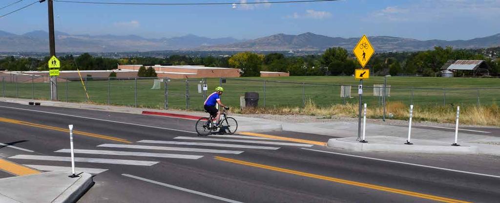
2 800 E 1200 E Proposed near term changes Safety Improvements Stop Sign Crosswalks Stop Sign Pedestrian Crossing Signs Gate Modifications MIDDLE CAAL TRAIL 300 S 600 S 4400 Smithfield Wayfinding and regulatory signs MIDDLE CAAL TRAIL Lundstrom Park 1.5 miles 18 min 7 min Central Hyde Park 3.5 miles 42 min 17 min orth Logan Hyde Park Center St. 200 S O MOTOR VEHICLES ALLOWED CLOSED FROM DUSK TO DAW RESPECT PRIVATE PROPERTY O LITTERIG O LOITERIG DOGS MUST BE O LEASH orth Logan City orth Park Police Skyview Highschool 5.2 miles Farm users have right of way. yield 1 hour 24 min Logan You Are Here aka, slow down, say hi
 Maintenance eeds (Pathway only - no")
 Equestrian Fat Tire Lundstrom")
 Equestrian Fat Tire Jogger / Hiker Stroller or Wheelchair")

3 Potential Long Term Improvements - surfacing atural surface + grass mix surface Development Costs (Pathway only - no plantings) Maintenance eeds (Pathway only - no plantings) Equestrian Fat Tire Jogger / Hiker Stroller or Wheelchair Skinny Tire Upper Canal, Hyde Park Crushed Gravel Surface Development Costs (Pathway only - no plantings) Maintenance eeds (Pathway only - no plantings) Equestrian Fat Tire Lundstrom Trail, Logan UT Jogger / Hiker Stroller or Wheelchair Skinny Tire? Paved Surface Development Costs (Pathway only - no plantings) Maintenance eeds (Pathway only - no plantings) Equestrian Fat Tire Jogger / Hiker Stroller or Wheelchair Skinny Tire Logan River Trail, Logan UT


 Maintenance eeds (ongoing weeding and mowing) ote that these improvements would not")


4 Proposed Long Term improvements - Plantings Spring Improvements These improvements would easily be the most costly and complex improvements to make, as any opening of spring flow into the channel would have to still accomodate stormwater flow and not clog the channel by too much vegetative growth. However, through proper design and engineering, as well as attentive maintenance, these facilities could green up certain parts of the current channel. Development Costs (planting establishment) Maintenance eeds (ongoing weeding and mowing) ote that these improvements would not be contiguous along the pathway, but take advantage of natural springs where they lie. Upper Canal, orth Logan Wildflower and Grass Seed Mix This option has seen success at many trails and parks by promoting a seed mix that contains hardy native grasses and wildflowers. Maintenance needs include mowing and weeding, but compared to other options on this page, the cost of this option is relatively low. Development Costs (seed mix planting) Ongoing Maintenance Costs (mowing / weeding) Stone Lined Channel Baer Pathway, Logan UT Equal or greater in cost than establishing spot spring improvements, lining the channel with stones and riprap has the potential to beautify the corridor while reducing maintenance costs significantly. This treatment has been successfully applied to the Lundstrom trail (part of the upper canal system) in Logan. Development Costs (planting establishment) Maintenance eeds (ongoing weeding and mowing) Lundstrom Canal, Logan UT
 limits owner liability for any persons entering their land for recreation.")
 was signed into law in 1971.")
5 Liability and Maintenance Liability PRIVATE AREA PUBLIC PATHWAY PRIVATE LIABILITY CIVIC LIABILITY Public Trails Reduce Landowner Liability By formally preserving the canal pathways as public trails, adjacent landowner liability is significantly reduced. Utah's Recreational Use Statute, (detailed at right) limits owner liability for any persons entering their land for recreation. This means that even though prescriptive easements may not be clear on paper, individuals are prevented against bringing suit against landowners when recreating on their land. Prescriptive Easements Utah Recreational Use Statute The Utah Recreational Use Statute (Utah Code 57-14) was signed into law in Its stated purpose is to encourage public and private owners of land to make land and water areas available to the public for recreational purposes by limiting the owner s liability toward persons entering the land and water areas for those purposes (Utah Code ). Governmental Immunity Act of Utah A governmental entity, its officers, and its employees are immune from suit, and immunity is not waived, for any injury proximately caused by a negligent act or omission of an employee committed within the scope of employment, if the injury arises out of or in connection with, or results from:... (n) the operation or existence of a pedestrian or equestrian trail that is along a ditch, canal, stream, or river, regardless of ownership or operation of the ditch, canal, stream, or river, if: (i) the trail is designated under a general plan adopted by a municipality under Section 10-9a-401 or The Governmental Immunity Act of Utah, (also detailed at right) provides additional layers of immunity for local landowners once a trail like our historic canal pathways are designated and recognized as public facilities. This formalization also removes the landowner from the hassle of dealing with any claims that could arise due to increased public use of the pathway. The local government, be it Cache County, Hyde Park, orth Logan or Logan City would be the primary arbiter with any disputes that arise. But if the pathways stay closed, all disputes will fall squarely on the shoulders of private landowners. by a county under Section 17-27a-401; (ii) the trail right-of-way or the right-of-way where the trail is located is open to public use as evidenced by a written agreement between: (A) the owner or operator of the trail right-of-way or of the right-of-way where the trail is located; and (B) the municipality or county where the trail is located; and (iii) the written agreement: (A) contains a plan for operation and maintenance of the trail; and What IS prescriptive easement anyway? To establish a prescriptive easement, the use must be: ~ (1) Open, or used in such a way that the property owner would be According to aware that the property is being used. (2) otorious, or used in such a way that the general public would be A prescriptive easement is created when a person uses another person s property aware that the property is being used. (even though the use was not expressly agreed to) for a prolonged period. (3) Adverse to the owner s interest, or without permission or approval Prescriptive easements recognize long-standing usage, especially if the use was from the property owner. relied upon for the enjoyment of property. (4) Continuously used for at least 20 years. Maintenance & Care Community Wide Support From the orthpark and Logan City Police commitment to responding to concerns and patrolling this pathway, to County and City support for making improvements and repairs and maintaining the stormwater channels, to community volunteer efforts organized by the Trails Cache, multiple groups will come together to ensure that this canal preservation project is maintained and cared for as the amenity it is, and not a weed filled eyesore. Police Support & Patrol Civic Maintenance Cache County, Smithfield, Hyde Park, orth Logan and Logan City have all experessed a commitment to making improvements and repairs as needed to both a public trail corridor and the stormwater channel of the canal pathways. The orthpark Police Department and Logan City Police Departments are supportive of preserving public access to the canal pathways. As such, they have indicated committment to patrolling the corridors on foot or bicycle and responding to concerns as they arise. Community Volunteers Organized by the trails cache ( cachecounty.org), seasonal volunteer days will organize the community to care for the canal pathway corridor through removal of trash, weed cleanup, and minor repairs.


 Health 20% of Utahn s Engage")


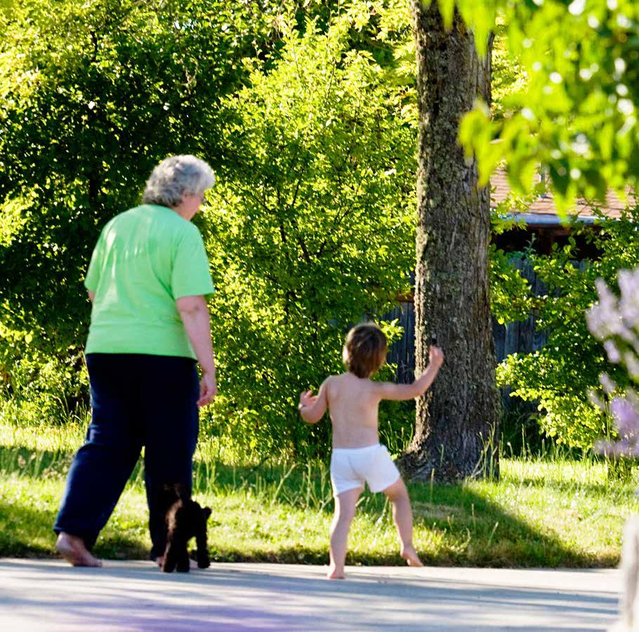

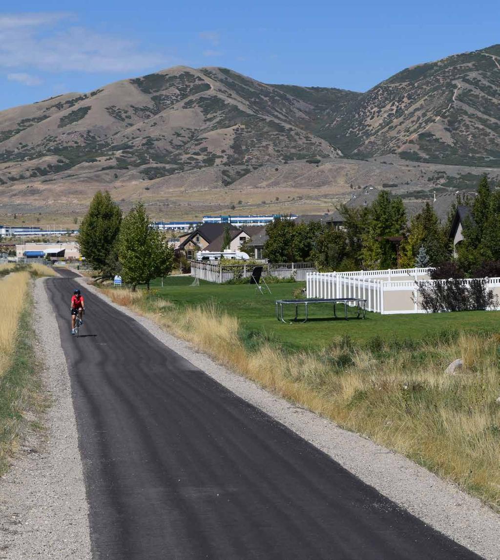
6 Preservation Benefits Property Values People come to Cache Valley to escape the urbanized Wasatch Front. Rural walking paths like these historic canal pathways are part of that attraction. Cache Valley Homeowners will Pay 11% More to have Trails 500' from their door. The lifestyle benefits to walking paths through town are what will help our valley attract businesses, grow the economy, and keep talented people working here. Property owners have much to benefit - single family home values within 500' of a trail, trailhead or park in cache valley have been assesed as 11% more valuable than those outside that range. (2015 assessor values) Health 20% of Utahn s Engage in no Your grandparents had an easier time walking around Cache Valley, crossing streets and avoiding traffic than leisure time you do. physical Activity Modernizing changes in Cache Valley, Utah and the ation as a whole tend to prioritize vehicular movement over walking across the street. Historic pathways like these canals offer an alternate way to move, and one that unlike your truck, can actually make you healthier and feel better. Imagine having a nice place away from the streets to take a walk and enjoy a Cache Sunset - one that you could access directly from your neighborhood. That's what these pathways offer, and make the idea of walking to Church, school, or work, much more realistic for many residents in the valley. Safety 9% of Utah s or Walks to Work Imagine your children being able to safely access school, the park, or their friends neighborhood without having to walk alongside busy roads or cross large intersections. That's what these pathways offer. For those of us, from the young to the old, who want to walk or bike, or simply can't drive, these pathways offer a protected, safe, and pleasant way to get from A to B in our valley. 19% of Utah Roadway Fatalaties are or Pedestrian Related Eyes on the Street - The opening of a public trail, rather than make conditions worse, typically makes them better, as a vast majority of users are your neighbors and healthy recreationalists, who will displace vagrants or vandals who could otherwise hide throughout the corridor. Examples such as the Jordan River Parkway and Ogden River Pathway illustrate how recreational trails draw positive uses to areas, rather than negative ones. With our canals, the space will exist for maintenance and use of the canal companies regardless of public use, but only if we open it to the community will we have the ability to displace those who would use the corridor to hide from public scrutiny.


7 Community Trail Precedents Lundstrom Canal Trail, Logan UT Lundstrom Canal Trail, Logan UT Canyon Road Trail, Logan UT SLC Canal Trail, West Valley City UT Highline Canal Trail, Logan UT Jordan River Trail, Lehi UT Jordan River Trail, Lehi UT Murdock Canal Trail, Highland UT Murdock Canal Trail, Lindon UT Murdock Canal Trail, Lindon UT
A CASE FOR COMPLETING THE JORDAN RIVER PARKWAY: A
 A CASE FOR COMPLETING THE JORDAN RIVER PARKWAY: A safe crossing at 9000 South and 850 West Proposed 9000 South Underpass Parkway Timeline Parkway, Trail, and Tourism Facts Blueprint Jordan River 1971 1973
Appendix 3. Greenway Design Standards. The Whitemarsh Township Greenway Plan
 Appendix 3 Greenway Design Standards This chapter discusses two design standards for the greenway types discussed above. First, trail design standards are presented together with trailhead facilities and
METROPOLITAN COUNCIL 390 North Robert Street, St. Paul, MN Phone (651) TDD (651)
 TDD (651)") METROPOLITAN COUNCIL 390 North Robert Street, St. Paul, MN 55101 Phone (651) 602 1000 TDD (651) 291 0904 DATE: June 19, 2007 TO: Metropolitan Parks and Open Space Commission FROM: Jan Youngquist, Senior
METROPOLITAN COUNCIL 390 North Robert Street, St. Paul, MN 55101 Phone (651) 602 1000 TDD (651) 291 0904 DATE: June 19, 2007 TO: Metropolitan Parks and Open Space Commission FROM: Jan Youngquist, Senior
Georgetown-Lewes Rail/Trail Study. Rail/Trail Study: Cool Spring to Cape Henlopen State Park New Road Extension (House Resolution No.
 Georgetown-Lewes Rail/Trail Study Rail/Trail Study: Cool Spring to Cape Henlopen State Park New Road Extension (House Resolution No. 47) August 22, 2011 Presentation Outline Background Benefits Statewide
Longmont to Boulder Regional Trail Jay Road Connection DRAFT FINAL REPORT
 Longmont to Boulder Regional Trail Jay Road Connection DRAFT FINAL REPORT December 2018 Project Summary Boulder County, Colorado, in partnership with the City of Boulder, is evaluating options for multi-use
AGENDA ITEM 5 D WAKULLA ENVIRONMENTAL INSTITUTE (WEI) TRAIL FEASIBILITY STUDY
 TRAIL FEASIBILITY STUDY") March 19, 2018 AGENDA ITEM 5 D WAKULLA ENVIRONMENTAL INSTITUTE (WEI) TRAIL FEASIBILITY STUDY TYPE OF ITEM: Action STATEMENT OF ISSUE The Wakulla Environmental Institute (WEI) Trail is one of several trails
March 19, 2018 AGENDA ITEM 5 D WAKULLA ENVIRONMENTAL INSTITUTE (WEI) TRAIL FEASIBILITY STUDY TYPE OF ITEM: Action STATEMENT OF ISSUE The Wakulla Environmental Institute (WEI) Trail is one of several trails
PLANNING COMMISSION AGENDA REPORT May 10, Members of the Planning Commission. Joyce Parker-Bozylinski, Contract Planner
 PLANNING COMMISSION AGENDA REPORT May 10, 2007 TO: FROM: PROPOSAL: APPLICANT: RECOMMENDATION: Members of the Planning Commission Joyce Parker-Bozylinski, Contract Planner Approval of the Calabasas Trails
Section 1 Introduction
 BST Coalition Annual Report 2014 Section 1 Introduction The Bonneville Shoreline Trail has been designated as Utah's Millennium Legacy Trail, as part of a White House initiative on the basis of our Governor's
FINCH HYDRO CORRIDOR TRAIL PROJECT
 FINCH HYDRO CORRIDOR TRAIL PROJECT Pharmacy Avenue to Birchmount Road January 29 th, 2018 L Amoreaux Community Centre (2000 McNicoll Avenue) 1 Purpose of Drop In Event The purpose of today s drop-in event
MORGAN CREEK GREENWAY Final Report APPENDICES
 APPENDICES MORGAN CREEK GREENWAY Appendix A Photos of Existing Conditions in Trail Corridor Photos of existing conditions Main trail corridor - February 2009 Photos of existing conditions south bank Morgan
FEASIBILITY CRITERIA
 This chapter describes the methodology and criteria used to evaluate the feasibility of developing trails throughout the study areas. Land availability, habitat sensitivity, roadway crossings and on-street
Wallace Falls State Park Classification and Management Planning Stage 3 Preliminary Recommendations July 18, 2018 Sultan City Hall
 Wallace Falls State Park Classification and Management Planning Stage 3 Preliminary Recommendations July 18, 2018 Sultan City Hall Thanks for coming! This document contains State Parks preliminary recommendations
Gardner: overview. Santa Fe, Oregon, and California National Historic Trails UNINCORPORATED JOHNSON COUNTY OLATHE UNINCORPORATED JOHNSON COUNTY
 Santa Fe, Oregon, and California ational Historic Trails : overview 99: p.134 100: p.135 GARDER JUCTIO 102: p.137 56: p.126 EDGERTO Burlington orthern Intermodal and Logistics 98: p.133 101: p.136 S Waverly
City of Durango 5.8 FUNDING TRAILS DEVELOPMENT
 5.8 FUNDING TRAILS DEVELOPMENT The City has been successful in establishing dedicated local funding sources as well as applying for grants to develop the City s trail system, having received nearly $2.4
CHAPTER ONE LITERATURE REVIEW
 CHAPTER ONE LITERATURE REVIEW LITERATURE REVIEW This chapter summarizes the most recently published community impact studies and articles that relate to multiuse trails. The review focuses on publications
Blueways: Rivers, lakes, or streams with public access for recreation that includes fishing, nature observation, and opportunities for boating.
 Parks, Open Space and Trails PRINCE WILLIAM COUNTY 2008 COMPREHENSIVE PLAN TRAILS PLAN CONTENTS The components of the trails plan are: Intent Definitions Goals, Policies, and Action Strategies Trails Map
Port Gamble Shoreline Area Conceptual Trail Proposal
 The North Kitsap Trails Association is pleased to be a partner to the Kitsap Forest and Bay Project and assist Kitsap County, Forterra, Olympic Property Group, Great Peninsula Conservancy and the Port
Sacramento Placerville Transportation Corridor Alternatives Analysis
 Sacramento Placerville Transportation Corridor Alternatives Analysis EL DORADO COUNTY TRANSPORTATION COMMISSION 1 Sacramento Placerville Transportation Corridor 2 Goal of the Project To give public officials
BACK COUNTRY UNIT PREFERRED ALTERNATIVE
 BACK COUNTRY UNIT PREFERRED ALTERNATIVE San Francisco (118 mi) Carmel-By-The-Sea Carmel River Carmel Valley Road State Beach Private Property Point Lobos State Reserve Point Lobos Ranch RUSTIC CAMPING
Business Item No
 Metropolitan Parks and Open Space Commission Meeting date: February 6, 2018 For the Community Development Committee meeting of February 20, 2018 For the Metropolitan Council meeting of February 28, 2018
$866,000. $1,400,000 Health Benefits $13,156,000 TOTAL ANNUAL DIRECT BENEFITS. $10,890,000 Economic Benefits
 SINGING RIVER TRAIL Trails Create Value + Generate Economic Activity Trails generate economic returns through improved health, safety, and environmental conditions, raise property values, and attract visitors.
MASTER PLAN EXECUTIVE SUMMARY
 Biscuit Run State Park Scottsville Road (State Route 20) Charlottesville, VA 22902 Biscuit Run State Park MASTER PLAN EXECUTIVE SUMMARY Department of Conservation and Recreation Division of Planning and
Economic Development and Tourism
 SECTION 4 SECTION 4 Economic Development and Tourism 4. Economic Development and Tourism Tourism plays a very important role in Niagara s economy, providing employment and generating business for support
Trail Feasibility Study
 VOLUSIA COUNTY MPO CITY OF NEW SMYRNA BEACH FINAL REPORT JUNE 30, 2009 Trail Feasibility Study What s inside? 1 Introduction 2 Project Purpose & Scope 3 Physical Inventory & Assessment of Right-of- Way
Brampton, Ontario REQ. no.: PLANNING, DESIGN & DEVELOPMENT COMMITTEE
 ftorontoand REGION rv~ Conservation for The Living City May 22,2009 2I22V,5L CFN 42397 CLERK S DEPT. Mr. Peter Fay City Clerk, City of Brampton MAY 2 7 2008 2 Wellington Street West Brampton, Ontario REQ.
Nov. 19 th Public Workshop Summary
 On November 19 th, more than 60 community members attended an Open Space Matters workshop at the Linen Building in downtown Boise for over two hours. Participants learned about reserves, discussed the
CHAPTER 4 -- THE LAND USE PLAN: DESCRIPTIONS AND POLICIES FOR THIRTEEN PLANNING AREAS
 CHAPTER 4 -- THE LAND USE PLAN: DESCRIPTIONS AND POLICIES FOR THIRTEEN PLANNING AREAS NORTH CENTRAL CAC AREA LITTLE VALLEY ROAD TO JUG HANDLE CREEK PLANNING AREA This planning area includes Cleone, Noyo,
A number of goals were identified during the initial work on this Big Lake Transportation Plan.
 C. Transportation General Background Information Big Lake s transportation system includes all the roads, paths and facilities that allow the movement of private vehicles, trains and planes, as well as
BST Coalition Annual Report 2005
 BST Coalition Annual Report 2005 I. Introduction The Bonneville Shoreline Trail Coalition (Coalition) is an organization of entities, both citizen and governmental, representing the communities in Utah
January 14, Orange County Transportation Authority Attn: M2 NCCP/HCP 550 South Main Street P.O. Box Orange, CA
 Equestrian Trails, Inc. Corral 357 P.O. Box 1026 Trabuco Canyon, CA 92678 http://saddlebackcanyonriders.com/ President: James Iacono... 714-612-1789 January 14, 2016 Orange County Transportation Authority
Hudson Highlands Fjord Trail Draft Master Plan. April 29, 2015
 Hudson Highlands Fjord Trail Draft Master Plan April 29, 2015 Agenda Route Overview Proposed Segment Results of Community Survey on that Segment Next Steps Municipal Endorsement Environmental Review Implementation
COASTAL CONSERVANCY. Staff Recommendation September 22, 2011 BAY AREA RIDGE TRAIL: HOOD MOUNTAIN TO HIGHWAY 12
 COASTAL CONSERVANCY Staff Recommendation September 22, 2011 BAY AREA RIDGE TRAIL: HOOD MOUNTAIN TO HIGHWAY 12 File No. 11-039-001 Project Manager: Betsy Wilson RECOMMENDED ACTION: Authorization to disburse
This document is being shared by the Parks, Recreation and Musuem Advisory Board at the request of Golden citizens and in order to be transparent
 This document is being shared by the Parks, Recreation and Musuem Advisory Board at the request of Golden citizens and in order to be transparent about what documents and information was shared during
PALO CORONA REGIONAL PARK MPRPD BOARD MEETING AUGUST 8, 2018
 PALO CORONA REGIONAL PARK MPRPD BOARD MEETING AUGUST 8, 2018 ACKNOWLEDGEMENTS AGENCIES AND ORGANIZATIONS The Trust for Public Land Big Sur Land Trust Santa Lucia Conservancy California State Parks Point
Lake Windermere Westside Legacy Trail. A multi-use non-motorized paved trail promoting health, wealth and outdoor appreciation
 Lake Windermere Westside Legacy Trail A multi-use non-motorized paved trail promoting health, wealth and outdoor appreciation Jan 26, 2015 Executive Summary The Lake Windermere Westside Legacy Trail will
SOUTHEASTERN BOX ELDER COUNTY 2017 ACTIVE TRANSPORTATION CONCEPT PLAN DRAFT
 SOUTHEASTERN BOX ELDER COUNTY 2017 ACTIVE TRANSPORTATION CONCEPT PLAN SIGNATURE PAGE The following communities have participated in this trail planning process and approve the Southeastern Box Elder County
Discussion Paper: Development of a Plan for Trails on Public Land
 Discussion Paper: Development of a Plan for Trails on Public Land APRIL 2017 The purpose of this Discussion Paper is to summarize the status & issues relating to District trails and feedback to date, and
Business Item No XXX. Proposed Action That the Metropolitan Council approve the Coon Creek Regional Trail Master Plan.
 Business Item No. 2015-XXX Metropolitan Parks and Open Space Commission Meeting date: July 7, 2015 For the Community Development Committee meeting of July 20, 2015 For the Metropolitan Council meeting
Non-Motorized Transportation
 Non-Motorized Transportation Non-motorized facilities are important components to the transportation system. They provide an environmentally-friendly, low-cost mode of travel. Some of the facilities can
SOUTH INTERCHANGE AREA
 Santaquin City General Plan 1 Location and Characteristics The South Interchange Area of Santaquin is located west of Interstate 15 and south of 500 South (Figure 1). It includes properties already annexed
Chapter 6: POLICY AND PROCEDURE RECOMMENDATIONS
 Chapter 6 POLICY AND PROCEDURE RECOMMENDATIONS FOR SRRA Below are seven policy elements that should be considered for adoption by the Southwest Regional Recreation Authority of Virginia: 1. Develop strategies
Assessing Your Trails, Keeping Them Safe and Enjoyable
 Jon Wood, PLA, ASLA Associate Vice President Stewart Bert Lynn, PLA, ASLA, LEED AP Project Manager Mecklenburg County Asset and Facility Management Assessing Your Trails, Keeping Them Safe and Enjoyable
West Orange Trail. Clean, Green, Fun!
 West Orange Trail Clean, Green, Fun! The West Orange Trail - when completed - will be a 36-mile, multipurpose recreational greenway containing a 14-foot wide paved surface to be enjoyed by walkers, joggers,
Preferred Recreation Recommendations Stemilt-Squilchuck Recreation Plan March 2018
 Preferred Recreation Recommendations Stemilt-Squilchuck Recreation Plan March 2018 Below are the recommended recreation ideas and strategies that package together the various recreation concepts compiled
3.0 LEARNING FROM CHATHAM-KENT S CITIZENS
 3.0 LEARNING FROM CHATHAM-KENT S CITIZENS An important aspect in developing the Chatham-Kent Trails Master Plan was to obtain input from stakeholders and the general public. Throughout the course of the
University Region Non-Motorized Plan 2015
 Non-Motorized Transportation Non-motorized facilities are important components to the transportation system. They provide an environmentally-friendly, low-cost mode of travel. Some of the facilities can
Chapter 6. Action Program. Heart of the Lakes Area Recreation Plan
 Heart of the Lakes Area Recreation Plan 1. Design and construct the following trails (please see the following map): a. the Speedway Trail 1) primary pathway the main trail 2) secondary pathway the proposed
Northeast Quadrant Distinctive Features
 NORTHEAST QUADRANT Northeast Quadrant Distinctive Features LAND USE The Northeast Quadrant includes all the area within the planning area that is east of Interstate 5 and to the north of State Route 44.
The Baker/Carver Regional Trail is intended to
 Section V Design Guidance The Baker/Carver Regional Trail is intended to safely accommodate 183,000 annual visits, an array of non-motorized uses, a variety of skill levels, and persons with special needs.
Lafourche Parish Government REQUEST FOR QUALIFICATIONS. Landscape Architectural Services
 Lafourche Parish Government REQUEST FOR QUALIFICATIONS Landscape Architectural Services Bayou Lafourche Parish Multi-Use Path Feasibility Study Phase 1 And Bayou Lafourche Parish Multi-Use Path Feasibility
Blue River Trail Master Plan JSA to Town Hall June 2004
 Blue River Trail Master Plan JSA to Town Hall June 2004 Prepared for: Silverthorne Town Council Silverthorne SPORT Committee Department of Recreation and Culture Silverthorne Public Works Silverthorne
2. Goals and Policies. The following are the adopted Parks and Trails Goals for Stillwater Township:
 D. PARKS AND TRAILS 1. Introduction Stillwater Township s population is relatively low, with most residents living on rural residences on large lots. The need for active park space has been minimal in
TRAIL ANNUAL REPORT
 TRAIL ANNUAL REPORT 2016-17 Identify Undeveloped projects identified in the City s Greenprint or trail database 15.90 miles Study Projects that have been or are currently being studied to determine a feasible
TRUCKEE TAHOE AIRPORT DISTRICT BOARD OF DIRECTOR STAFF REPORT
 AGENDA ITEM: 11 TRUCKEE TAHOE AIRPORT DISTRICT BOARD OF DIRECTOR STAFF REPORT AGENDA TITLE: MEETING DATE: January 24, 2018 PREPARED BY: NTPUD Agency Partnership Opportunity, Multi-Use Trailhead Access
Section 3.6 Recreation
 3.6 RECREATION This section evaluates the potential impacts of the proposed project on recreation within MTRP. The evaluation is based on field observations, a review of maps of MTRP and the MTRP Master
SITKA SEA WALK CRESCENT HARBOR TENNIS COURTS TO SITKA NATIONAL HISTORICAL PARK
 SITKA SEA WALK CRESCENT HARBOR TENNIS COURTS TO SITKA NATIONAL HISTORICAL PARK October 10, 2011 Crescent Harbor tennis courts to Sitka National Historical Park Workshop Agenda 1.5 hours Project Introduction
Adopt a Trail Blue Ridge Parkway
 Adopt a Trail Blue Ridge Parkway THANK YOU Thank You for volunteering to maintain a trail with the Adopt-A-Trail program! You are helping to keep these trails open for public use and enjoyment. We couldn
Cascade River State Park Management Plan Amendment
 This document is made available electronically by the Minnesota Legislative Reference Library as part of an ongoing digital archiving project. http://www.leg.state.mn.us/lrl/lrl.asp Cascade River State
FINAL TESTIMONY 1 COMMITTEE ON RESOURCES UNITED STATES HOUSE OF REPRESENTATIVES. July 13, 2005 CONCERNING. Motorized Recreational Use of Federal Lands
 FINAL TESTIMONY 1 STATEMENT OF DALE BOSWORTH CHIEF Of the FOREST SERVICE UNITED STATES DEPARTMENT OF AGRICULTURE Before the SUBCOMMITTEE ON FORESTS AND FOREST HEALTH And the SUBCOMMITTEE ON NATIONAL PARKS,
Flow Stand Up Paddle Board Parkway Plan Analysis
 Regional Parks Department Jeffrey R. Leatherman, Director County of Sacramento Divisions Administration Golf Leisure Services Maintenance Rangers Therapeutic Recreation Services Flow Stand Up Paddle Board
The Park District will operate the WMRRT using a wide variety
 OPERATIONS & MAINTENANCE PLANS & DETAILS The Park District will operate the WMRRT using a wide variety of professional staff and in accordance with Park District policies, guidelines, and ordinances. This
PARK PAVILION RULES AND REGULATIONS
 1 HARRY S. TRUMAN PARKWAY ANNAPOLIS, MARYLAND 21401 410-222-7300 PARK PAVILION RULES AND REGULATIONS Reservation Permit Is Issued Subject To The Following: 1. This permit is for a maximum of 100 persons
Comment 2: Thank you for your presentation. Very informative. We would like to continue being informed with the project process.
 Comment 1: I appreciate the opportunity to learn about this project, and I m happy it s the Fancher Creek Trail. I think it will make our area nicer. Thank you! Response 1: Comment 2: Thank you for your
BST Coalition Annual Report 2012 Table of Contents
 BST Coalition Annual Report 2012 BST Coalition Annual Report 2012 Table of Contents Introduction... 2 Progress Reports... 4 BST Committee General Efforts... 4 County by County Progress Reports... 5 Cache
Citrus Heights Creek Corridor Trail Project Trail Advisory Group Field Trip #2 September 11, :00 11:00 am Trellis Hall, Citrus Heights
 September 11, 2013 9:00 11:00 am Trellis Hall, Citrus Heights Project Overview The City of Citrus Heights is studying the feasibility of establishing a multi use trail system within the City s 26 miles
Rails with Trails Finding the mobility, safety, and liability sweet spot 5/10/2017
 Rails with Trails Finding the mobility, safety, and liability sweet spot 5/10/2017 The National Transportation Systems Center Advancing transportation innovation for the public good U.S. Department of
3. COLTA / HUGA CONNECTIONS - PRELIMINARY
 9 3. COLTA / HUGA CONNECTIONS - PRELIMINARY 3.1 COLTA The Chain of Lakes Trail Association (COLTA) trail, formerly identified as the Chester Spur Line, was completed and opened for use in June 2011. The
Trail # NW Tuesday, June DESIGN. Provide an Review the Provide an. Project Goals: System system. wayfinding
 I. Welcome / Introductions Bethany Creek Trail #2 Segment 3 Neighborhood Meeting #1 Bethany Presbyterian Church 15505 NW Springville Road, Portland, OR 97229 Tuesday, June 26, 2018 @ 6:00PM Meeting Minutes
TART Trails, Inc. (231)
") TART Trail System TART Trails, Inc. www.traversetrails.org (231) 941-4300 Leelanau Trail Stretching 15 miles along a former railroad corridor, the TART-owned Leelanau Trail connects Traverse City and Suttons
TART Trail System TART Trails, Inc. www.traversetrails.org (231) 941-4300 Leelanau Trail Stretching 15 miles along a former railroad corridor, the TART-owned Leelanau Trail connects Traverse City and Suttons
MPRB: Southwest LRT Community Advisory Committee Issues and Outcomes by Location Current to: 12 November 2010
 MPRB: Southwest LRT Community Advisory Committee Issues and Outcomes by Location Current to: 12 November 2010 This is a compilation of issues and outcomes identified by the CAC. It is a work in progress,
Non-motorized Trail Plan & Proposal. August 8, 2014
 Town of Star Valley Ranch, Wyoming and the Star Valley Ranch Association in partnership with the USDA Forest Service, Bridger-Teton National Forest, Greys River Ranger District Non-motorized Trail Plan
Committee Report. Community Development Committee For the Metropolitan Council meeting of August 12, Business Item No.
 Committee Report Business Item No. 2015-168 Community Development Committee For the Metropolitan Council meeting of August 12, 2015 Subject: Coon Creek Regional Trail Master Plan, Anoka County Proposed
CHAPTER 5. Chapter 5 Recreation Element
 CHAPTER 5 Recreation Element Chapter 5 Recreation Element The Recreation Element of the Meyers Area Plan is a supplement to the Recreation Element of the TRPA Regional Plan and the El Dorado County General
11. Recreational Trails and Pathways Needs
 11. Recreational Trails and Pathways Needs Background Walking, biking, hiking, in-line skating, canoeing, and other trail- and pathway-related activities are important to Boiseans. This importance is demonstrated
Kitsap County Department of Community Development
 1 of 2 8/17/2018 Kitsap County Department of Community Development 2018 Comprehensive Plan Amendments - Planning Commission Consideration - Comment Matrix # Name, Org Comment Staff Response AMENDMENT:
Northaven Trail Phase 2 Initial Project Overview
 Northaven Trail Phase 2 Initial Project Overview Partnership Project to extend existing Northaven Trail Improve Bike/Ped Connectivity On Dallas Trail Network Plan City and County Funding Oncor Texas Trails
Mechanized River Valley Access Public Engagement Report. April 2015
 Mechanized River Valley Access Public Engagement Report April 2015 Table of Contents Background... 1 Stakeholder Consultation... 3 What We Heard... 4 Conclusion... 7 Background The North Saskatchewan River
Hillsborough County Florida Hillsborough County s Trailways Addressing Program
 Hillsborough County Florida Hillsborough County s 9-1-1 Trailways Addressing Program 2010 ProBike/ProWalk Florida -Conference May 12-13, 2010 1 REQUEST Staff from the Hillsborough County Sheriff s Office
Cooloolabin Dam Recreation Management Discussion Paper. November 2013
 Cooloolabin Dam Recreation Management Discussion Paper November 2013 Contents November 2013... 1 Background... 3 Overview of Cooloolabin Dam... 6 Weed Management... 7 Cultural Heritage... 7 Commercial
Trail Etiquette. Hours of Operation. Trail Accessibility
 Trail Guide The Elmhurst Park District, with 28 parks and over 460 acres of land, offers nearly six miles of paved or asphalt park trails and maintains an additional 3.6 miles of trails within Elmhurst.
Interoffice Memorandum
 Supplemental Information Agenda Item No. 5.1 May 1, 2014 Interoffice Memorandum May 1, 2014... Date Honorable Planning Commission... To Rick Carter, PE... From Agenda Item 5.1-2014-2019 Capital Improvement
Macleod Trail Corridor Study. Welcome. Macleod Trail Corridor Study Open House. Presentation of Proposed Design Concepts
 Macleod Trail Corridor Study Welcome Macleod Trail Corridor Study Open House Presentation of Proposed Design Concepts Study Purpose Develop a corridor plan for Macleod Trail that aligns with The City s:
Piestewa Peak/Dreamy Draw Trail Guide
 Piestewa Peak/Dreamy Draw Trail Guide Trail #1A - Perl Charles Memorial Trail Length: 4.8 miles Elevation: 2,200 ft. - 1,340 ft. Difficulty: Moderate to difficult The Perl Charles trailhead is located
Logo Department Name Agency Organization Organization Address Information 5700 North Sabino Canyon Road
 Logo Department Name Agency Organization Organization Address Information United States Forest Coronado National Forest 5700 North Sabino Canyon Road Department of Service Santa Catalina Ranger District
DRAFT - APRIL 13, 2007 ROUTING STUDY FOR TRAIL CONNECTIONS BETWEEN CALAIS AND AYERS JUNCTION
 DRAFT - APRIL 13, 2007 ROUTING STUDY FOR TRAIL CONNECTIONS BETWEEN CALAIS AND AYERS JUNCTION Abstract The vision for the East Coast Greenway is an off-road urban trail system running from Calais, Maine
RATTLESNAKE HILL PHILLIPS, HARRIS FARM, LIME KILN & QUARRY
 Town of, MA Trails Map 6a SPLIT ROCK PRIMARY SECONDARY PRIVATE PRIVATE PROPERY STAY ON HEAD FUTURE TO SKINNER (NOT MARKED) 0 miles 0.25 0.250 0.5 Mapbox, Data Odbl, OpenStreetMap contributors primary use
Jefferson County Non-Motorized Transportation and Recreational Trails Plan 2010
 Chapter 8: Goals and objectives Plan Update: The following update presents general principles, goals, and objectives related to non-motorized transportation facilities as a component of the overall transportation
BOAT DOCKS AND LAUNCHES. Public Engagement Report July 2015
 BOAT DOCKS AND LAUNCHES Public Engagement Report July 2015 TABLE OF CONTENTS BACKGROUND 3 STAKEHOLDER CONSULTATION 6 PARTICIPANT PROFILE 7 RESPONSE THEMES 8 CONCLUSION 16 BACKGROUND The North Saskatchewan
PROPOSED PARK ALTERNATIVES
 8 Chimne y Rock State Park M a ster Pl an 2011 PROPOSED PARK ALTERNATIVES Introduction Three different park development concepts were prepared and presented to the citizens of North Carolina through a
BUCKS COUNTY TRAILS. September 10, 2015 Presentation to:
 BUCKS COUNTY TRAILS September 10, 2015 Presentation to: BUCKS COUNTY TRAILS Benefits of Trails Bucks County Trails The Circuit Active Trail Projects Planning Studies Municipal Trails Planning Other Trail
13.1 REGIONAL TOURISM ISSUES AND SUMMARY OF FINDINGS
 13 REGIONAL TOURISM T he County of Mariposa s recreation needs and facilities fall within two categories: regional tourism and local recreation. This Element focuses on regional tourism issues related
Dungeness Recreation Area County Park Master Plan
 Dungeness Recreation Area County Park Public Outreach Meeting October 10, 2007 Project Overview USFWS Site Dungeness Recreation Area County Park Meeting Objectives: Re-Introduce project; provide status
CORNWALL WATERFRONT PLAN 2007
 CANAL LANDS CANAL LANDS Page 58 Introduction This chapter details areas of possible development or redevelopment, and lands to be protected from any form of development in the Canal Lands area. As outlined
Understanding user expectations And planning for long term sustainability 1
 Understanding user expectations And planning for long term sustainability 1 What is a natural surface trail? It can be as simple has a mineral soil, mulched or graveled pathway, or as developed as elevated
The Narrows Waterfront Park A Crown Jewel for Southern Brooklyn
 The Narrows Waterfront Park A Crown Jewel for Southern Brooklyn In New York, the unquestioned popularity of urban spaces such as Riverside Park, the High Line, Brooklyn Bridge Park and others has demonstrated
EXECUTIVE SUMMARY FALL Introduction. Findings
 EXECUTIVE SUMMARY FALL 2004 Introduction Trails are one of the most popular and highly desirable recreational resources in communities of all sizes throughout the country. In addition to providing a safe
Village of Taos Ski Valley 2015 Master Plan. Recreation Element
 Village of Taos Ski Valley 2015 Master Plan Taos Ski Valley is known across the world for skiing and winter sports, but the Village has more to offer than advanced skiing terrain and short lift lines.
Ontario Trails Viewpoints and Information on the Ontario Trails Act Trailhead Ontario by Patrick Connor CAE June 7, 2015
 Ontario Trails Viewpoints and Information on the Ontario Trails Act 2015 Trailhead Ontario by Patrick Connor CAE June 7, 2015 Ontario Trails Council A provincial charitable organization Started in 1975
Community Development Committee
 C Community Development Committee For the Metropolitan Council meeting of October 31, 2012 Committee Report Item:2012-316 ADVISORY INFORMATION October 16, 2012 Date Prepared: Subject: Intercity Regional
System Group Meeting #1. March 2014
 System Group Meeting #1 March 2014 Meeting #1 Outcomes 1. Understand Your Role 2. List of Revisions to Existing Conditions 3. Information Sources Study Area The Purpose of Mountain Accord is to Preserve