BUCKS COUNTY TRAILS. September 10, 2015 Presentation to:
|
|
|
- Laurel Preston
- 6 years ago
- Views:
Transcription


1 BUCKS COUNTY TRAILS September 10, 2015 Presentation to:

2 BUCKS COUNTY TRAILS Benefits of Trails Bucks County Trails The Circuit Active Trail Projects Planning Studies Municipal Trails Planning Other Trail Projects Resources
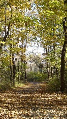
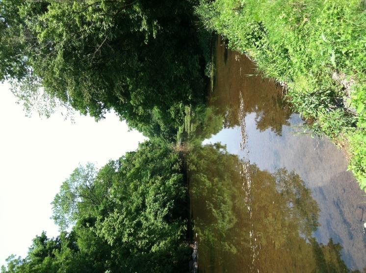
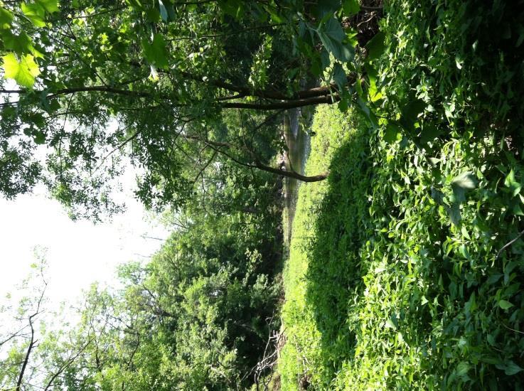
3 BENEFITS OF TRAILS Recreational benefits including safe walking and biking routes and increased access to for nature study, bird watching, fishing and water-based recreation Environmental benefits such as reducing the need to drive, encouraging the removal/management of invasive plants and improving stormwater management as part of trail development Quality of Life benefits including encouraging physical activity, aids in developing a sense of community centered around usage and volunteerism in maintaining the trail Economic benefits derived from users of trails spending money at local businesses and providing opportunities for job training programs from trail maintenance and stewardship

4 BUCKS COUNTY TRAILS Current Trails in Bucks County: Limited long-distance trails Fragmented trails network primarily in the form of trails located within municipal, county and state parks
5 BUCKS COUNTY TRAILS PLANNING HISTORY 1955 Bucks County Parks Board recommends creation of a linear park system along various stream valleys in the County including the Neshaminy Creek and Mill and Black Ditch creeks 2011 County adopts Bucks County Open Space & Greenways Plan identifying 27 greenway corridors throughout the county, designating some of them for possible future trail development 2012 Bucks County Bicycle Master Plan adopted 2013 County applies for funding to begin implementation of these plans
6 BUCKS COUNTY TRAILS PLANNING HISTORY 2013/2014 Doylestown to New Hope / Route 202 Bike Lane Feasibility Study conducted 2014 Jan County adopts Upper Neshaminy Creek Trail Feasibility Study Aug Dec County brings together an internal team and outside expertise to identify a path forward for moving the trail planning efforts forward County adopts Mill-Queen Anne-Black Ditch Creeks Trail Feasibility Study identifying a proposed multi-use trail alignment along the Mill, Queen Anne and Black Ditch creeks 2015 Bucks County Commissioners indicate their interest in advancing three priority trail projects: Upper Bucks Rail Trail Newtown Rail Trail Upper Neshaminy Creek Trail Phase 1
7 BUCKS COUNTY TRAILS WHY PLAN FOR TRAILS? Bucks County Open Space & Greenways Plan What types of recreational facilities do we need more of in the County? (Top 5 responses) Percent of responders What should be the top priorities for the county relative to parks, open space and natural resources? (Top 5 responses) 48% 48% 53% 64% 65% 37% 39% 40% 43% 43% Outdoor Ice Skating Water Access Points Community Bike Paths Gardens & Lanes Trails Provide more Bike Lanes and Paths Protect Farmland Develop Regional Trail System Protect Animal & Plant Habitats Protect Water Resources
 East Coast Greenway Newtown Rail Trail (Recently")
8 THE CIRCUIT The Circuit: Proposed 750-mile trail network throughout the region: 300 miles complete 50 miles in progress 400 miles in planning Trails in Bucks County as par t of the Circuit: Neshaminy Creek Doylestown to New Hope bike route Liberty Bell Trail including Upper Bucks Rail Trail) East Coast Greenway Newtown Rail Trail (Recently added)

9 THE CIRCUIT
10 ACTIVE TRAIL PROJECTS Upper Bucks Rail Trail Newtown Rail Trail Upper Neshaminy Creek Trail Phase 1 Peace Valley Trail East Coast Greenway

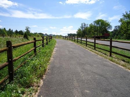
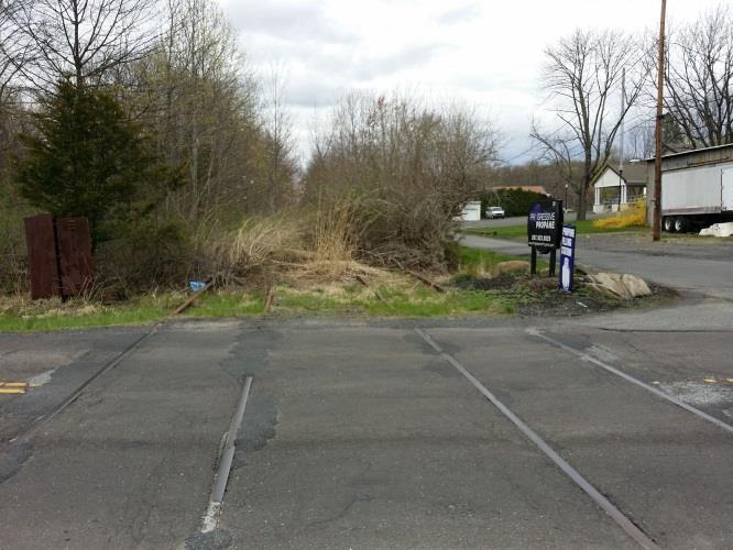
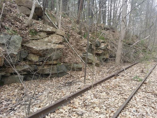
11 UPPER BUCKS RAIL TRAIL P roject S pecifics 3.1 mile Multi-Use Trail 12 wide crushed stone Extends from Lehigh/Bucks County line south to Veterans Park in Richland Township. Future plans call for extending it into Quaker town Connects into the existing Saucon Rail Trail which will eventually connect to the South Bethlehem Greenway and D&L trail into Easton Richland and Springfield townships have passed suppor ting resolutions

12 UPPER BUCKS RAIL TRAIL Trail Benefits: Aids in economic development by encouraging visitors from Lehigh Valley to come into Upper Bucks Provides access to Heller town via existing trails, and eventually Bethl ehem and Easton Connects to Veterans Park in Richland Township Par t of Quaker town Area Trails network Trail Challenges: Potential hydraulic / drainage issues near Coopersburg


13 UPPER BUCKS RAIL TRAIL
14 UPPER BUCKS RAIL TRAIL Current Status / Next Steps: Commissioners have agreed to fund the design and engineering of the Upper Bucks Rail Trail and anticipate being able to secure funding for the future development of the trail Request for Proposal issued for design & engineering work for the Upper Bucks Rail Trail and recommendation made to the Commissioners relative to recommended engineering firms Springfield and Richland townships are working with SEPTA to negotiate the lease of the right-of-way

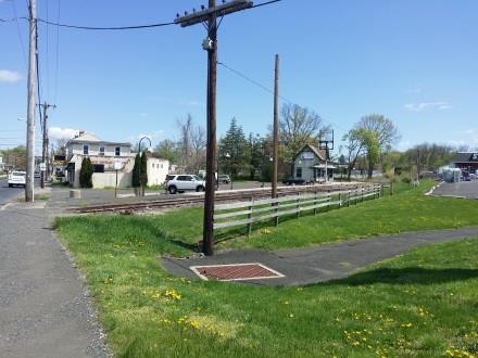
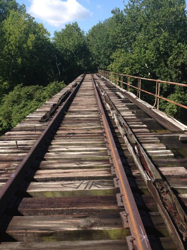
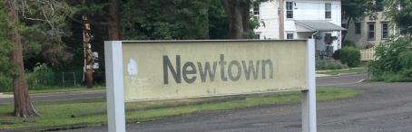
15 NEWTOWN RAIL TRAIL COUNTY LINE ROAD TO NEWTOWN BOROUGH
16 NEWTOWN RAIL TRAIL COUNTY LINE ROAD TO NEWTOWN BOROUGH Project Specifics 8.4 mile Multi-Use Trail Upper Southampton Township Northampton Township Middletown Township Newtown Township Newtown Borough 2.55 miles 4.50 miles 0.50 miles 0.35 miles 0.50 miles 12 wide crushed stone or asphalt Would connect into the Pennypack Trail and the Neshaminy Creek Trail Estimated cost to design and build: $5.1 million

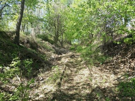
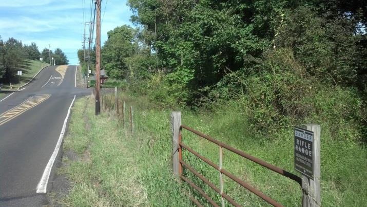
17 NEWTOWN RAIL TRAIL UPPER SOUTHAMPTON TOWNSHIP Project Specifics 2.55 mile Multi-Use Trail 12 wide crushed stone Extends from County Line Road to Bristol Road Would connect into the Pennypack Trail Estimated cost to design and build: $506,000


18 NEWTOWN RAIL TRAIL UPPER SOUTHAMPTON TOWNSHIP Trail Benefits: Projected usage is very high given connection to Pennypack Trail and residential density in the area Provide connections into Tamanend Park and adjacent Klinger Middle School Connects to commercial areas along Second Street Pike Trail Challenges: Known erosion issues Two at-grade state road crossings at County Line Road and Second Street Pike

19 NEWTOWN RAIL TRAIL
20 NEWTOWN RAIL TRAIL STATUS BY MUNICIPALITY U p p er S o u t h ampto n To w nship M ay 5 Resolution of S u p p o r t r eceived f ro m Upper S o u t h a m p to n Township J u n e $ 100, 000 in f u n d ing for d esign a n d engineering of Upper S o u t h a m p to n Tow n ship section r eceived via William Penn Fo u n d a t ion G e o r g e S c h o ol / M i d dl etown To w n ship G eorge S c h o o l T h r ee m eet ings h eld to d a te w ith o n g o ing d iscussions r egarding t r a il M iddletow n Tw sp One meet ing h eld a n d generally suppor t ive b u t want to make sure that G eorge S c h o o l is in suppor t N ew town B o ro ug h S ep & Oct Attend a n d p r esented to New town B o ro u g h C o u n c il Wo r k ing to address c o n c erns r egarding liability a n d trail m a intenanc e Dec / J a n A n t icipate vo te by N ew tow n B o ro u g h N ew town To w n ship S ep P r esented to New tow n Tow n ship B o a r d of S u p er visors N ov A n t icipated vo te by N ew tow n Tow n ship B o a r d of S u p er visors N o r thampto n To w n sh ip I n itiate d iscussions

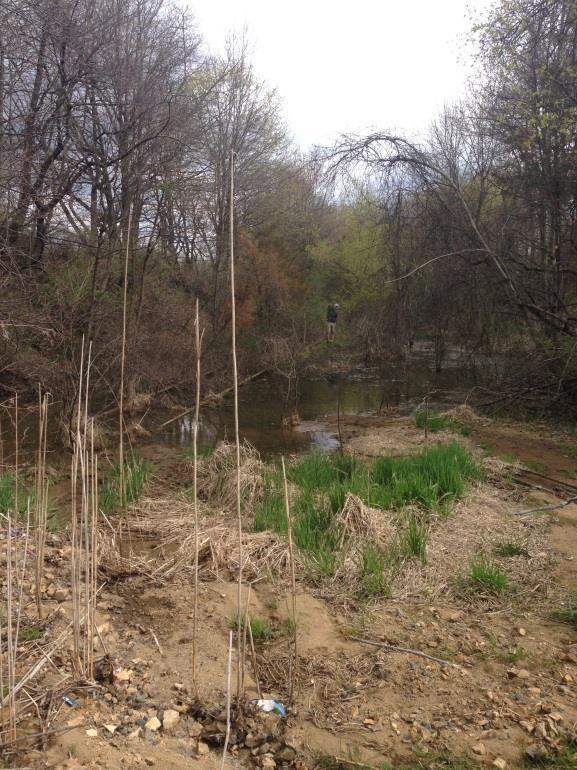
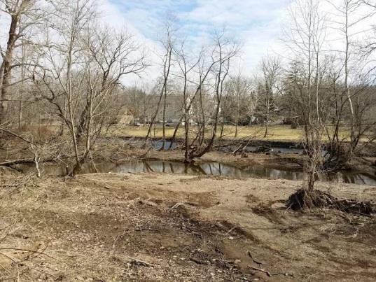
21 UPPER NESHAMINY CREEK TRAIL PHASE 1 - DOYLESTOWN CENTRAL PARK TO EDISON-FURLONG VILLAGE / BRIDGE POINT PARK P roject S pecifics 0.5 mile Multi-Use Trail 10 wide asphalt 2 large bridges over the Neshaminy Creek Extends from Central Park to Bri dge Point Park Connects into the existing Doylestown Community Bike & Hike System Estimated cost to design and build: $1.5 million

22 UPPER NESHAMINY CREEK TRAIL PHASE 1 - DOYLESTOWN CENTRAL PARK TO EDISON-FURLONG VILLAGE / BRIDGE POINT PARK Doylestown Central Park Bridge Point Park

23 UPPER NESHAMINY CREEK TRAIL PHASE 1 DOYLESTOWN CENTRAL PARK TO EDISON-FURLONG VILLAGE / BRIDGE POINT PARK Trail Benefits: High projected usage given residential density and connections to Central Park, Bridge Point Park, Doylestown Community Bike & Hike System and Route 202 Parkway Trail Right-of-way is 100% owned by Doylestown Township and Bucks County. However, an easement is needed from Bucks County Fish & Game Trail Challenges: Expensive given the need for two bridges over Neshaminy Creek Engineering challenges for trail on island behind Public Safety Training Center


24 UPPER NESHAMINY CREEK TRAIL PHASE 1 DOYLESTOWN CENTRAL PARK TO EDISON-FURLONG VILLAGE / BRIDGE POINT PARK
25 UPPER NESHAMINY CREEK TRAIL PHASE 1 DOYLESTOWN CENTRAL PARK TO EDISON-FURLONG VILLAGE / BRIDGE POINT PARK Current Status: Upper Neshaminy Creek Trail is still being pursued but given high price tag associated with the cost of two bridges and the need to acquire an agreement from Bucks County Fish & Game, it is lower on the priority list Next Steps: Secure easement from Bucks County Fish & Game for a portion of the property they lease from Bucks County Continue to seek funding to move forward with this segment of the Upper Neshaminy Creek Trail Explore funding opportunities for additional segments of the Upper Neshaminy Creek Trail

26 PEACE VALLEY PARK TRAIL
27 PEACE VALLEY PARK TRAIL Project Specifics Completion of 0.71 missing segment to complete the trail around Lake Galena Repave 2.0 miles of existing trails between Sailors Point on the west shore and Angler s Pier on the east shore Current Status Funding received from Pennsylvania Department of Conservation and Natural Resources Request for proposal for design and engineering work issued and proposals currently being evaluated Next Steps County Commissioners select engineering firm and design and engineering work begins

28 East Coast Greenway EAST COAST GREENWAY
29 PLANNING STUDIES County Planning Studies Bucks County Open Space and Greenways Plan (2011) Bucks County Bicycle Master Plan (Nov 2012) Upper Neshaminy Creek (Adopted Jun 2014) Mill-Queen Anne-Black Ditch Creeks (Adopted Dec 2014) Lower Neshaminy Creek (Anticipated adoption Dec 2015) Middle Neshaminy Creek (Anticipated adoption Jun 2016) Regional Planning Studies Pennsylvania Highlands Trails Network Liberty Bell Trail Pennridge Area Greenway Plan

30 PLANNING STUDIES

31 UPPER NESHAMINY CREEK TRAIL STUDY CHALFONT TO FORKS OF NESHAMINY P roject S pecifics 15.0 mile Multi-Use Trail 10 wide asphalt Extends from Chalfont Borough to Forks of Neshaminy Connects into the existing Doylestown Community Bike & Hi ke System Estimated cost to design and build: $13.4 million

32 UPPER NESHAMINY CREEK TRAIL STUDY CHALFONT TO FORKS OF NESHAMINY

33 UPPER NESHAMINY CREEK TRAIL STUDY CHALFONT TO FORKS OF NESHAMINY

34 MILL-QUEEN ANNE-BLACK DITCH CREEKS TRAIL STUDY P roject S pecifics 15.1 mile Multi-Use Trail 10 wide asphalt Extends Veterans Memorial Park in the west to Oxford Valley Park in the north, to Bristol Borough in the south and Levittown Parkway to the east Connects Oxford Valley, Frosty Hollow, Queen Anne, Black Ditch parks and Silver Lake Nature Center Estimated cost to design and build: $13.6 million

35 MILL-QUEEN ANNE-BLACK DITCH CREEKS TRAIL STUDY

36 MILL-QUEEN ANNE-BLACK DITCH CREEKS TRAIL STUDY

37 LOWER NESHAMINY CREEK TRAIL

38 LOWER NESHAMINY CREEK TRAIL

39 MIDDLE NESHAMINY CREEK TRAIL Forks of Neshaminy / Rushland to Helen Randle Park / Swamp Road

40 MIDDLE NESHAMINY CREEK TRAIL Helen Randle Park / Swamp Road to Buck Road via Tyler State Park

41 MIDDLE NESHAMINY CREEK TRAIL Buck Road to Core Creek Park
42 MUNICIPAL TRAILS PLANNING Municipal Trail Plans Tri-Municipal Master Trail & Greenway Plan Bensalem Township Greenways & Trails Feasibility Study Ongoing Municipal Trail Planning / Implementation Doylestown Bike & Hike Committee Warrington Township Trails Committee Plumstead Township Trails Committee AMC Quakertown Area Trails Committee Newtown Township Trails Committee

43 OTHER TRAIL PROJECTS Regional Trail Planning Delaware Canal Vision Study County Planning Bucks County Bicycle Map
44 RESOURCES Upper Neshaminy Creek Trail Feasibility Study cs/pc/upperneshaminycreektrailfeasibilitystu dy.pdf?sfvrsn=2 Mill-Queen Anne-Black Ditch Creeks Trail Feasibility Study cs/default -source/pc/mill-queen-anne-blackditch-creeks-trails-feasibility -study.pdf?sfvrsn=0 Lower Neshaminy Creek Trail Feasibility Study Will be posted to Bucks County Planning Commission website shortly Questions: Paul W. Gordon
PA Highlands Trail Network. Draft Feasibility Study Report
 PA Highlands Trail Network Draft Feasibility Study Report Pennsylvania Highlands Trail Network Feasibility Study Page 2 The Pennsylvania Highlands Trail Network (PHTN) Feasibility Study is being conducted
Georgetown-Lewes Rail/Trail Study. Rail/Trail Study: Cool Spring to Cape Henlopen State Park New Road Extension (House Resolution No.
 Georgetown-Lewes Rail/Trail Study Rail/Trail Study: Cool Spring to Cape Henlopen State Park New Road Extension (House Resolution No. 47) August 22, 2011 Presentation Outline Background Benefits Statewide
Section II. Planning & Public Process Planning for the Baker/Carver Regional Trail began in 2010 as a City of Minnetrista initiative.
 Section II Planning & Public Process Planning for the began in 2010 as a City of initiative. city staff began discussions with the Park District on the possibility of a north/south regional trail connection
Pennsylvania Highlands Trail Network. Trail Concept Plan Unami Hills to Hopewell Big Woods
 Pennsylvania Highlands Trail Network Trail Concept Plan Unami Hills to Hopewell Big Woods Appalachian Mountain Club May 2015 Pennsylvania Highlands Trail Network - Trail Concept Plan - Unami Hills to Hopewell
Northaven Trail Phase 2 Initial Project Overview
 Northaven Trail Phase 2 Initial Project Overview Partnership Project to extend existing Northaven Trail Improve Bike/Ped Connectivity On Dallas Trail Network Plan City and County Funding Oncor Texas Trails
The Chu property is a 6.57 acre parcel located in the Town of Superior on the west side of McCaslin Boulevard. In 2014, the Town of Superior acquired
 1 The Chu property is a 6.57 acre parcel located in the Town of Superior on the west side of McCaslin Boulevard. In 2014, the Town of Superior acquired the Chu property for open space with a contribution
APPENDIX OFFICIAL MAP ORDINANCE OF HAMILTONBAN TOWNSHIP OFFICIAL MAP NARRATIVE
 APPENDIX A OFFICIAL MAP ORDINANCE OF HAMILTONBAN TOWNSHIP OFFICIAL MAP NARRATIVE INTRODUCTION: The Official Map of Hamiltonban Township has been prepared to identify those lands and features that Hamiltonban
Becky A. Bradley, AICP. Executive Director, LVPC Secretary, LVTS
 Becky A. Bradley, AICP Executive Director, LVPC Secretary, LVTS 2017 Final Plans Total Plans (427) Lehigh County Municipality Plan Count ALLENTOWN CITY 32 LOWER MACUNGIE TOWNSHIP 26 UPPER MACUNGIE TOWNSHIP
Trails are like people: No
 Trails: Lessons Learned Happy Trails Experts, Townships Offer Tips for Successfully Connecting People and Places You can see it now. A beautiful trail meandering through your township. But that s all it
2. Goals and Policies. The following are the adopted Parks and Trails Goals for Stillwater Township:
 D. PARKS AND TRAILS 1. Introduction Stillwater Township s population is relatively low, with most residents living on rural residences on large lots. The need for active park space has been minimal in
EAST DON TRAIL ENVIRONMENTAL ASSESSMENT. Community Liaison Committee Meeting #3 July 15, :30 to 8:30 pm Flemingdon Park Library
 EAST DON TRAIL ENVIRONMENTAL ASSESSMENT Community Liaison Committee Meeting #3 July 15, 2013 6:30 to 8:30 pm Flemingdon Park Library Agenda 1. Welcome 2. Housekeeping and Updates a) Housekeeping b) CLC
TRUCKEE TAHOE AIRPORT DISTRICT BOARD OF DIRECTOR STAFF REPORT
 AGENDA ITEM: 11 TRUCKEE TAHOE AIRPORT DISTRICT BOARD OF DIRECTOR STAFF REPORT AGENDA TITLE: MEETING DATE: January 24, 2018 PREPARED BY: NTPUD Agency Partnership Opportunity, Multi-Use Trailhead Access
COASTAL CONSERVANCY. Staff Recommendation November 6, 2008 SAN FRANCISCO BAY TRAIL: CANAL BOULEVARD CONSTRUCTION
 COASTAL CONSERVANCY Staff Recommendation November 6, 2008 SAN FRANCISCO BAY TRAIL: CANAL BOULEVARD CONSTRUCTION File No. 07-037-02 Project Manager: Michelle Jesperson RECOMMENDED ACTION: Authorization
Auburn Trail / Ontario Pathways Trail Connector Feasibility Study Public Information Meeting Wednesday, August 22, 2012
 Auburn Trail / Ontario Pathways Trail Connector Feasibility Study Public Information Meeting Wednesday, August 22, 2012 Purpose of Feasibility Study Purpose Evaluate the feasibility of constructing a multiuse
LUDLAM TRAIL CORRIDOR DISTRICT
 1 APPLICATION NO. 9 MAY 2015 CDMP CYCLE LUDLAM TRAIL CORRIDOR DISTRICT PLANNING ADVISORY BOARD November 2, 2015 BACKGROUND 2 Staff Application Former Florida East Coast railroad corridor (privately owned)
Having trouble reading this ? View it on your browser. Spring Volume 4, No.1 - Connecting, Preserving, Revitalizing
 Having trouble reading this email? View it on your browser. Spring 2013 - Volume 4, No.1 - Connecting, Preserving, Revitalizing In this issue: April 18th Dinner Will Celebrate Partners Future Funding:
Non-Motorized Transportation
 Non-Motorized Transportation Non-motorized facilities are important components to the transportation system. They provide an environmentally-friendly, low-cost mode of travel. Some of the facilities can
Business Item No
 Metropolitan Parks and Open Space Commission Meeting date: February 6, 2018 For the Community Development Committee meeting of February 20, 2018 For the Metropolitan Council meeting of February 28, 2018
This document is being shared by the Parks, Recreation and Musuem Advisory Board at the request of Golden citizens and in order to be transparent
 This document is being shared by the Parks, Recreation and Musuem Advisory Board at the request of Golden citizens and in order to be transparent about what documents and information was shared during
University Region Non-Motorized Plan 2015
 Non-Motorized Transportation Non-motorized facilities are important components to the transportation system. They provide an environmentally-friendly, low-cost mode of travel. Some of the facilities can
Environment and Natural Resources Trust Fund 2019 Request for Proposals (RFP)
") Environment and Natural Resources Trust Fund 2019 Request for Proposals (RFP) Project Title: Glacial Edge Trail and Downtown Pedestrian Bridge Category: G. Land Acquisition for Habitat and Recreation ENRTF
Environment and Natural Resources Trust Fund 2019 Request for Proposals (RFP) Project Title: Glacial Edge Trail and Downtown Pedestrian Bridge Category: G. Land Acquisition for Habitat and Recreation ENRTF
PLANNING COMMISSION AGENDA REPORT May 10, Members of the Planning Commission. Joyce Parker-Bozylinski, Contract Planner
 PLANNING COMMISSION AGENDA REPORT May 10, 2007 TO: FROM: PROPOSAL: APPLICANT: RECOMMENDATION: Members of the Planning Commission Joyce Parker-Bozylinski, Contract Planner Approval of the Calabasas Trails
Rule Governing the Designation and Establishment of All-Terrain Vehicle Use Trails on State Land
 Rule Governing the Designation and Establishment of All-Terrain Vehicle Use Trails on State Land 1.0 Authority 1.1 This rule is promulgated pursuant to 23 V.S.A. 3506. Section 3506 (b)(4) states that an
City of Durango 5.8 FUNDING TRAILS DEVELOPMENT
 5.8 FUNDING TRAILS DEVELOPMENT The City has been successful in establishing dedicated local funding sources as well as applying for grants to develop the City s trail system, having received nearly $2.4
Tamanend Park Day FREE FAMILY EVENT! Saturday, September 9, :00 AM - 2:00 PM. Down on the Farm TAMDAY2017. Schedule of Events
 Down on the Farm FREE FAMILY EVENT! Day Colonial Crafts 11 AM-2 PM Saturday, September 9, 2017 11:00 AM - 2:00 PM Schedule of Events Zydeco-A-Go-GO Live Band 11 AM-2 PM Elmwood Zoo on Wheels 12-1 PM Face
FEASIBILITY CRITERIA
 This chapter describes the methodology and criteria used to evaluate the feasibility of developing trails throughout the study areas. Land availability, habitat sensitivity, roadway crossings and on-street
Stephens State Park Trails
 TRAILS OF ALLAMUCHY MOUNTAIN & STEPHENS STATE PARKS Allamuchy Mountain and Stephens State Parks contain 28 marked trails providing access to diverse landscapes for walking, hiking, biking, bird-watching,
SOUTH INTERCHANGE AREA
 Santaquin City General Plan 1 Location and Characteristics The South Interchange Area of Santaquin is located west of Interstate 15 and south of 500 South (Figure 1). It includes properties already annexed
Kennedy & Associates, LLC
 Kennedy & Associates, LLC A Partial List of Clients and Projects Traditional Neighborhood Developments Northgate Upper Hanover Township, PA Wynstone Village New Hanover Township, PA Biltmore Estates Skippack
The following trails completed their work utilizing funds awarded by the Greenways Foundation:
 The Greenways Foundation Grant Awards 2013 and 2014 Our grant program has been in place since 2012 and is funded entirely by the proceeds received through our Indiana BMV specialty license plate. Please
$866,000. $1,400,000 Health Benefits $13,156,000 TOTAL ANNUAL DIRECT BENEFITS. $10,890,000 Economic Benefits
 SINGING RIVER TRAIL Trails Create Value + Generate Economic Activity Trails generate economic returns through improved health, safety, and environmental conditions, raise property values, and attract visitors.
ROAD AND TRAIL PROJECT APPROVAL
 ROAD AND TRAIL PROJECT APPROVAL www.marincountyparks.org Marin County Parks, 3501 Civic Center Dr, Suite 260, San Rafael, CA 94903 DATE: July 12, 2017 PRESERVE: Gary Giacomini Open Space Preserve PROJECT:
Other Principle Arterials Minor Arterial Major Collector Minor Collector Local
 CHAPTER 10 TRANSPORTATION Introduction The system of public roads in East Pikeland Township is decidedly rural in character. Since the 1984, the road network has remained much the same, with the addition
Segment 2: La Crescent to Miller s Corner
 goal of the USFWS refuges is to conserve, protect and enhance fish, wildlife and plants and their habitats for the continuing benefit of the American people. Refuge lands are used largely for fishing,
PUBLIC DRAF MISSION TRAILS REGIONAL PARK Mission Gorge 5-27
 5.4. Mission Gorge MISSION TRAILS REGIONAL PARK The goal for the Mission Gorge area is to provide a variety of sustainable trails and other park amenities that can accommodate the high number of visitors
Economic Development and Tourism
 SECTION 4 SECTION 4 Economic Development and Tourism 4. Economic Development and Tourism Tourism plays a very important role in Niagara s economy, providing employment and generating business for support
Biking and Hiking to a Better Doylestown. (History of the Doylestown Bike & Hike System present)
") Biking and Hiking to a Better Doylestown (History of the Doylestown Bike & Hike System 1992 - present) The current Bike & Hike System has an unlikely origin: it began as a simple plan to use leftover balled
Biking and Hiking to a Better Doylestown (History of the Doylestown Bike & Hike System 1992 - present) The current Bike & Hike System has an unlikely origin: it began as a simple plan to use leftover balled
2016 Regional Transportation Alternatives Program (TAP) Grant Application
 Grant Application") 2016 Regional Transportation Alternatives Program (TAP) Grant Application PROJECT TITLE: Yelm-Tenino Trail Extension Feasibility Study TRPC use only GENERAL PROJECT INFORMATION Agency or Organization City
2016 Regional Transportation Alternatives Program (TAP) Grant Application PROJECT TITLE: Yelm-Tenino Trail Extension Feasibility Study TRPC use only GENERAL PROJECT INFORMATION Agency or Organization City
Chapter 6: POLICY AND PROCEDURE RECOMMENDATIONS
 Chapter 6 POLICY AND PROCEDURE RECOMMENDATIONS FOR SRRA Below are seven policy elements that should be considered for adoption by the Southwest Regional Recreation Authority of Virginia: 1. Develop strategies
Port Gamble Shoreline Area Conceptual Trail Proposal
 The North Kitsap Trails Association is pleased to be a partner to the Kitsap Forest and Bay Project and assist Kitsap County, Forterra, Olympic Property Group, Great Peninsula Conservancy and the Port
Blueways: Rivers, lakes, or streams with public access for recreation that includes fishing, nature observation, and opportunities for boating.
 Parks, Open Space and Trails PRINCE WILLIAM COUNTY 2008 COMPREHENSIVE PLAN TRAILS PLAN CONTENTS The components of the trails plan are: Intent Definitions Goals, Policies, and Action Strategies Trails Map
Welcome. Green Line in Your Community
 Welcome Green Line in Your Community Today s session will provide you with information on options The City is exploring for connecting the Green Line in the Beltline to the future Inglewood/Ramsay station.
J. Recreation Plan of Conservation and Development. The Town of Hebron. Section 2. Preservation of Unique Assets. 1 P a g e
 The Town of Hebron Section 2 2014 Plan of Conservation and Development Preservation of Unique Assets J. Recreation Open spaces, parks, sports fields, and recreational programs are considered essential
Mohawk Hudson Bike Hike Trail Crossroad Connection Study
 Summary Report - April 21, 2003 Mohawk Hudson Bike Hike Trail Crossroad Connection Study Summary Report Introduction The Capital District Transportation Committee (CDTC), in partnership with Albany County,
5.0 Study Area Inventory & Trail Alternatives. 5.1 Photographic Overview of Study Area
 39 5.0 Study Area Inventory & Trail Alternatives Previous sections of this study contain physical, social, and regulatory information for the Crosswicks Creek/Doctors Creek watershed and the smaller Doctors
BASSETTS CREEK SECTION CONTENTS: BASSETTS CREEK BRYN MAWR LUCE LINE
 BASSETTS CREEK SECTION CONTENTS: BASSETTS CREEK BRYN MAWR LUCE LINE GLENWOOD AVE MULTI-USE DIAMONDS VINCENT AVE N MORGAN AVE N PENN AVE N DOG PARK MULTI-USE FIELDS PLAYGROUND AK E RD S CHESTNUT AVE DA
County of Peterborough Active Transportation Master Plan
 The TMP developed a conceptual AT/cycling network for Peterborough County that identified both on-road and off-road (trail) AT facilities. This was a coarse network based on the existing trails and off-road
CHAPTER 5. Chapter 5 Recreation Element
 CHAPTER 5 Recreation Element Chapter 5 Recreation Element The Recreation Element of the Meyers Area Plan is a supplement to the Recreation Element of the TRPA Regional Plan and the El Dorado County General
Conservation Area Management Statement
 Conservation Area Management Statement Miller Creek Wildlife Area Resolution #: Approval: Issue Date: Date of Last Revision: Table of Contents 1. Purpose....... 1 2. Property Description...... 1 2.1. Legal
Trail # NW Tuesday, June DESIGN. Provide an Review the Provide an. Project Goals: System system. wayfinding
 I. Welcome / Introductions Bethany Creek Trail #2 Segment 3 Neighborhood Meeting #1 Bethany Presbyterian Church 15505 NW Springville Road, Portland, OR 97229 Tuesday, June 26, 2018 @ 6:00PM Meeting Minutes
2966 Street Road, Suite B Bensalem, PA W. Butler Avenue Chalfont, PA W. Street Road Warminster, PA
 Effective March 2018 Listing is alphabetical by county. Bucks County Aria AllMed CHOP Urgent Care Bucks County Keystone Medical Urgent Care Patient Care Now LLC 2966 Street Road, Suite B Bensalem, PA 19020-2604
Greenways Commission Meeting Agenda Monday, March 20, 2017; 4:00 pm 7:00 pm Town Hall, Parking Lot
 Greenways Commission Meeting Agenda Monday, March 20, 2017; 4:00 pm 7:00 pm Town Hall, Parking Lot I. 4:00 4:05 pm Leave Town Hall Parking Lot for Briar Chapel II. III. IV. 4:30 pm Site Visit - Briar Chapel
of the Philmont Avenue Corridor Lower Moreland Township Montgomery County, Pennsylvania
 A FEASIBILITY STUDY for the Greenway and Redevelopment Plan of the Philmont Avenue Corridor Lower Moreland Township Montgomery County, Pennsylvania Woodlands and open fields adjoining Philmont Avenue,
Chapter 2: Summary of Existing Open Space System
 Chapter 2: Summary of Existing Open Space System In 1976, the Wake County Board of Commissioners established the Wake County Parks and Recreation Department in order to provide park facilities and programs
SAUCON RAIL TRAIL OVERSIGHT COMMISSION MEETING
 SAUCON RAIL TRAIL OVERSIGHT COMMISSION MEETING Date: Monday, Time: 6:00 PM Location: Lower Saucon Township Council Meeting Room Present: Lower Saucon Township: Roger Jurczak, Jerry Holum, Chris Garges
AGENDA ITEM 5 D WAKULLA ENVIRONMENTAL INSTITUTE (WEI) TRAIL FEASIBILITY STUDY
 TRAIL FEASIBILITY STUDY") March 19, 2018 AGENDA ITEM 5 D WAKULLA ENVIRONMENTAL INSTITUTE (WEI) TRAIL FEASIBILITY STUDY TYPE OF ITEM: Action STATEMENT OF ISSUE The Wakulla Environmental Institute (WEI) Trail is one of several trails
March 19, 2018 AGENDA ITEM 5 D WAKULLA ENVIRONMENTAL INSTITUTE (WEI) TRAIL FEASIBILITY STUDY TYPE OF ITEM: Action STATEMENT OF ISSUE The Wakulla Environmental Institute (WEI) Trail is one of several trails
MEETING OF THE METROPOLITAN PARKS AND OPEN SPACE COMMISSION Tuesday, April 4, 2017
 Minutes of the MEETING OF THE METROPOLITAN PARKS AND OPEN SPACE COMMISSION Tuesday, April 4, 2017 Committee Members Present: Tony Yarusso, Rick Theisen, Robert Moeller, Todd Kemery, Sarah Hietpas, Margie
EXECUTIVE SUMMARY FALL Introduction. Findings
 EXECUTIVE SUMMARY FALL 2004 Introduction Trails are one of the most popular and highly desirable recreational resources in communities of all sizes throughout the country. In addition to providing a safe
Chapter 9 Recreation
 Chapter 9 Chapter 9 1.0 INTRODUCTION The Town of Littleton is within one of New England s most important recreation areas. More than three million people live within 100 miles of the area. Local residents
MONTGOMERY TOWNSHIP OPEN SPACE & PATHWAYS COMMITTEE
 MONTGOMERY TOWNSHIP OPEN SPACE & PATHWAYS COMMITTEE Meetings: 2 nd Wednesday of each month @ 6:30 PM in the Municipal Building Questions? Call the Open Space Coordinator, Lauren Wasilauski, at (908) 359-8211
EDGEWILD TRAIL Non Motorized Trail PROPOSED DEVELOPMENT PROJECT
 EDGEWILD TRAIL Non Motorized Trail PROPOSED DEVELOPMENT PROJECT SESW, SWSE Section 15, NWNE, NENW, SWNE, SENE Section 22, Township 138, Range 27 (City of Fifty Lakes) Crow Wing County Land Services Department
Longmont to Boulder Regional Trail Jay Road Connection DRAFT FINAL REPORT
 Longmont to Boulder Regional Trail Jay Road Connection DRAFT FINAL REPORT December 2018 Project Summary Boulder County, Colorado, in partnership with the City of Boulder, is evaluating options for multi-use
Classifications, Inventory and Level of Service
 Classifications, Inventory and Level of Service Section 3 Kenmore Park, Recreation and Open Space Plan 1 P a g e Classifications and Inventory Park Classifications Kenmore classifies its parks based upon
2015 Business Survey Report Erie to Pittsburgh Trail March 2015
 2015 Business Survey Report Erie to Pittsburgh Trail March 2015 Table of Contents Executive Summary 2 2013 EPT Trail User Survey and Impact Analysis 3 Overview 3 Results 3 2014 2015 Erie to Pittsburgh
Business Item No xx
 Business Item No. 2015-xx Metropolitan Parks and Open Space Commission Meeting date: April 7, 2015 For the Community Development Committee meeting of April 21, 2015 For the Metropolitan Council meeting
ETOBICOKE CREEK NORTH TRAIL PROJECT. May 18, 2017 at Michael Power High School 105 Eringate Drive, Etobicoke ON M9C 3Z7
 ETOBICOKE CREEK NORTH TRAIL PROJECT May 18, 2017 at Michael Power High School 105 Eringate Drive, Etobicoke ON M9C 3Z7 1 Purpose of Open House The purpose of today s open house is to present the design
Northeast Regional Office 2133 Market St, #222 Camp Hill, PA Patricia Tomes Program Coordinator
 Northeast Regional Office 2133 Market St, #222 Camp Hill, PA 17011 717-238-1717 Patricia Tomes Program Coordinator Economic Impact of Rail-Trails Trail User Surveys Results and Comparison 2006 The Trails
Header i
 Header i 048285014.10 Header Sub Title Body Text here. Body text here. Body text here. Section 1... 1 Executive Summary... 1 Opportunities and Constraints... 3 Overall Opportunities and Constraints Map
Emily to Blind Lake Trail PROPOSED TRAIL DEVELOPMENT APPLICATION SUMMARY
 Emily to Blind Lake Trail PROPOSED TRAIL DEVELOPMENT APPLICATION SUMMARY Township 137 Range 26 (Fairfield Township) sections 2 & 3 Township 138 Range 26 (City of Emily) sections 27, 34, 35, & 36 Township
Blue River Trail Master Plan JSA to Town Hall June 2004
 Blue River Trail Master Plan JSA to Town Hall June 2004 Prepared for: Silverthorne Town Council Silverthorne SPORT Committee Department of Recreation and Culture Silverthorne Public Works Silverthorne
Update Report - Etobicoke Creek and South Mimico Creek Trails
 REPORT FOR ACTION Update Report - Etobicoke Creek and South Mimico Creek Trails Date: October 23, 2017 To: Etobicoke York Community Council From: General Manager, Parks Forestry and Recreation Wards: Ward
CITY OF BROOKFIELD Capital Improvement Fund Budget
 CITY OF BROOKFIELD Capital Improvement Fund Budget The City adopts an annual capital improvement budget, based on a five-year capital improvement program (CIP). The annual budget and CIP are prepared by
MEETING MINUTES District 1 Trail Planning Meeting 1
 MEETING MINUTES District 1 Trail Planning Meeting 1 June 1, 2017 2:00 PM 3:30 PM City of Two Harbors 2:00 Introductions Attendees: Lisa Austin, MnDOT Bryan Anderson, MnDOT Jasna Hadzic-Stanek, MnDOT Justin
The Triple Divide Trail System: Building an Eco-Tourism Corridor as a Strategy for River Conservation
 The Triple Divide Trail System: Building an Eco-Tourism Corridor as a Strategy for River Conservation William Hart, President Genesee River Wilds, Belmont, NY in collaboration with Allen Kerkeslager, Saint
Chapter 1. Master Plan Vision & Process
 Chapter 1. Master Plan Vision & Process View of the Otter Tail River from George B. Wright Park Creating the Glacial Edge Trail The Glacial Edge Trial is a planned 14-mile regional destination trail in
Poudre River District 3. Irrigation Ditch Construction in Fort Collins - Late 19 th Century
 Poudre River District 3 Irrigation Ditch Construction in Fort Collins - Late 19 th Century Where Does the Water in the Poudre Come From? Three main sources Native River Water C-BT System Water Other Transbasin
Bear Creek Habitat Improvement Project
 06/10/10 Bear Creek Habitat Improvement Project El Paso County, Colorado Pike National Forest and Colorado Springs Utilities Owned Land Report prepared by: Eric Billmeyer Executive Director Rocky Mountain
CHAPTER 4 -- THE LAND USE PLAN: DESCRIPTIONS AND POLICIES FOR THIRTEEN PLANNING AREAS
 CHAPTER 4 -- THE LAND USE PLAN: DESCRIPTIONS AND POLICIES FOR THIRTEEN PLANNING AREAS NORTH CENTRAL CAC AREA LITTLE VALLEY ROAD TO JUG HANDLE CREEK PLANNING AREA This planning area includes Cleone, Noyo,
FORECASTING FUTURE ACTIVITY
 EXECUTIVE SUMMARY The Eagle County Regional Airport (EGE) is known as a gateway into the heart of the Colorado Rocky Mountains, providing access to some of the nation s top ski resort towns (Vail, Beaver
DATE: January 19, WCA Governing Board. Johnathan Perisho, Project Manager. Mark Stanley, Executive Officer
 Item 14 DATE: January 19, 2017 TO: FROM: THROUGH: SUBJECT: WCA Governing Board Johnathan Perisho, Project Manager Mark Stanley, Executive Officer Item 14: Consideration of a resolution to accept an acquisition
MASTER PLAN EXECUTIVE SUMMARY
 Biscuit Run State Park Scottsville Road (State Route 20) Charlottesville, VA 22902 Biscuit Run State Park MASTER PLAN EXECUTIVE SUMMARY Department of Conservation and Recreation Division of Planning and
Shelf Road Recreation Area 2015 BLM Annual Report of Rocky Mountain Field Institute Stewardship Under BLM Agreement L12AC20483 November 19, 2015
 Summary Shelf Road Recreation Area 2015 BLM Annual Report of Rocky Mountain Field Institute Stewardship Under BLM Agreement L12AC20483 November 19, 2015 Managed by the BLM Royal Gorge Field Office, Shelf
Evergreen Trail School
 Evergreen Trail School Making Washington a Better Place to Ride Preston, WA & Tiger Mt. Sat, April 9, 2015 8-11:45am: Classroom 11:45-12:45pm: Lunch 12:45-4pm: Trail Work Classroom Agenda Introduction
Chapter 6. Action Program. Heart of the Lakes Area Recreation Plan
 Heart of the Lakes Area Recreation Plan 1. Design and construct the following trails (please see the following map): a. the Speedway Trail 1) primary pathway the main trail 2) secondary pathway the proposed
MEMORANDUM. FROM: John A. Bishop, AICP, Assistant Director - Transportation. May 22, 2017 Transportation Committee Meeting
 COUNTY of FREDERICK Department of Planning and Development 540/ 665-5651 Fax: 540/ 665-6395 MEMORANDUM TO: Frederick County Transportation Committee FROM: John A. Bishop, AICP, Assistant Director - Transportation
3. COLTA / HUGA CONNECTIONS - PRELIMINARY
 9 3. COLTA / HUGA CONNECTIONS - PRELIMINARY 3.1 COLTA The Chain of Lakes Trail Association (COLTA) trail, formerly identified as the Chester Spur Line, was completed and opened for use in June 2011. The
City of Solvang SUNNY FIELDS SPUR TRAIL STUDY
 City of Solvang SUNNY FIELDS SPUR TRAIL STUDY project description The City of Solvang, in partnership with the County of Santa Barbara Public Works Department, is developing an alignment study for a proposed
SUMMER VILLAGE OF SILVER SANDS. Municipal Development Plan
 SUMMER VILLAGE OF SILVER SANDS Municipal Development Plan Bylaw 253-2014 Adopted August 22, 2014 Summer Village of Silver Sands Municipal Development Plan Bylaw No. 253-2014 Page 2 1 INTRODUCTION 1.1 SETTING
Naugatuck River Greenway Steering Committee
 This letter is being submitted in strong support of the City of Ansonia s application to the Department of Energy and Environmental Protection Recreational Trails Program for the funding to conduct a routing
Port MacKenzie Rail Extension
 Port MacKenzie Rail Extension Project The Matanuska-Susitna Borough (MSB) and the Alaska Railroad Corporation (ARRC) jointly propose construction and operation of a new rail line to connect the Borough
All Groups. Conserve/
 All Groups Total stickers Large Open Small Multifamily Conserve/ Lot Space Lot Res Total Park Downtown 1 5 25 31 11 Fringe East 5 30 7 42 13 Fringe West 2 9 35 17 63 11 Rural Topsham 14.5 21.5 5 41 26
DRAFT. Proposed near term changes MIDDLE CANAL TRAIL MIDDLE CANAL TRAIL. Safety Improvements. Stop Sign. Crosswalks. Stop Sign
 E 300 DR 300 W W 220 W 200 300 E Historic Cache County Canal Pathway W 260 E 200 IT MM SU D R YO CA W 150 SR 218 W 100 E 100 S 300 E S 200 E W 200 S S 1100 E E 120 S sunrise elementar y S 830 E S 100 E
METROPOLITAN COUNCIL 390 North Robert Street, St. Paul, MN Phone (651) TDD (651)
 TDD (651)") METROPOLITAN COUNCIL 390 North Robert Street, St. Paul, MN 55101 Phone (651) 602 1000 TDD (651) 291 0904 DATE: June 19, 2007 TO: Metropolitan Parks and Open Space Commission FROM: Jan Youngquist, Senior
METROPOLITAN COUNCIL 390 North Robert Street, St. Paul, MN 55101 Phone (651) 602 1000 TDD (651) 291 0904 DATE: June 19, 2007 TO: Metropolitan Parks and Open Space Commission FROM: Jan Youngquist, Senior
January 2018 Air Traffic Activity Summary
 January 2018 Air Traffic Activity Summary Jan-2018 Jan-2017 CY-2018 CY-2017 Passengers 528,947 505,421 4.7% 528,947 505,421 4.7% Passengers 537,332 515,787 4.2% 537,332 515,787 4.2% Passengers 1,066,279
Preferred Recreation Recommendations Stemilt-Squilchuck Recreation Plan March 2018
 Preferred Recreation Recommendations Stemilt-Squilchuck Recreation Plan March 2018 Below are the recommended recreation ideas and strategies that package together the various recreation concepts compiled
RIVER ACCESS STRATEGY
 RIVER ACCESS STRATEGY The River Access Strategy is a 10-year plan the City of Edmonton is developing to inform future programming, operations and infrastructure improvements that support access to the
Trails Design and Management Handbook
 Trails Design and Management Handbook OPEN SPACE PITKIN AND TRAILS COUNTY Open Space and Tr ails Progr am Pitkin County, Color ado Pitkin County Open Space and Trails Program Trails Design and Management
City Council Workshop July 26, 2010
 Des Moines Trails Connecting a Community City Council Workshop July 26, 2010 1 OVERVIEW Trail Benefits Trails Progress How We Fund Trails What s Next for Trails 2 What is a trail? Paved Trails 10 wide
Section 3.6. Parklands & Recreation Areas
 Section 3.6: Parklands & Recreation Areas Section 3.6 Parklands & Recreation Areas 3.6 PARKLANDS AND RECREATION AREAS 3.6.1 Introduction to Analysis This section provides an overview of parklands and recreational
Wilds. Headwaters. Lakes. Oxbows. Falls
 56 5 4 3 Wilds Headwaters Lakes Oxbows Falls 57 Zones It could be said the on-the-ground essence of this master plan appears within the next 6 pages of this report. As we learned in the preceding Cultural