Dean Peak. March 2018 Prepared by: James Holderer. Proposed Lands with Wilderness Characteristics. Public Lands in the Hualapai Mountains
|
|
|
- Sabina Stone
- 5 years ago
- Views:
Transcription


1 Proposed Lands with Wilderness Characteristics Dean Peak Public Lands in the Hualapai Mountains A proposal report to the Bureau of Land Management, Kingman Field Office, Arizona March 2018 Prepared by: James Holderer
2 Table of Contents Dean Peak Proposed LWC PREFACE: This Proposal was developed according to BLM Manual 6310 P. 3 Section 1: Overview of the Proposed Lands with Wilderness Characteristics Unit Introductions: Overview map showing unit locations and boundary P. 6 Provides a brief description of unit boundaries and characteristics and scenic photo points Section 2: Documentation of Wilderness Characteristics The proposed LWC meets the minimum size criteria for roadless lands P.7 The proposed LWC is affected primarily by the forces of nature P.7 The proposed LWC has outstanding opportunities for solitude and/or primitive and unconfined recreation P.8 Supplemental values P.10 Scenic Photos: images that capture the wilderness character of the proposed LWC P.11 Section 3: Maps and Description of the Unit Boundary, Routes, and Impacts Overview maps showing extent of inset maps P. 15 Inset maps with photopoint locations P. 16 Narrative description of the proposed LWC boundary and vehicle routes P. 21 Section 4: Photopoint Data Data tables and geotagged photographs to accompany the detailed boundary & P. 25 vehicle routes description 2
3 PREFACE: This Proposal was developed according to BLM Manual 6310 General Overview Instruction Memorandum and Manuals 6310 and 6320 set out the BLM s approach to protecting wilderness characteristics on public lands. This guidance acknowledges that wilderness is a resource that is part of BLM s multiple use mission, requires the BLM to keep a current inventory of wilderness characteristics, and directs the agency to consider protection of these values in land use planning decisions. 1 In March 2012, the Bureau of Land Management issued updated manuals for inventorying and managing Lands with Wilderness Characteristics on public lands (hereafter often referred to as LWC s). These manuals provide the agency with direction for implementing its legal obligations to inventory and consider management of Lands with Wilderness Characteristics, including the Federal Land Policy and Management Act s provision that BLM preserve and protect certain public lands in their natural condition (43 U.S.C. 1701(a)(8)). Manual 6310 (Conducting Wilderness Characteristics Inventory on BLM Lands) guides the BLM on how to meet its obligations to inventory for and identify lands with wilderness characteristics. Manual 6320 (Considering Lands with Wilderness Characteristics in the BLM Land Use Planning Process) guides the BLM on the options available to address lands with wilderness characteristics in land use planning once they have been identified in the required inventory, such as putting management prescriptions in place to protect wilderness characteristics. The of this report is to provide the BLM with recommendations for designation of Lands with Wilderness Characteristics in the Kingman Field Office of northwestern Arizona, based on new, accurate, and up- to-date information, collected and presented according to the requirements described in Manual Memorandum is available online at: 2 Manual 6310 is available online at: 3
4 What does Manual 6310 require for the identification of LWC s? Minimum standard for LWC proposals are described in Manual 6310 in section.06.b.1. There are three things required in a citizen s wilderness proposal in order to meet the minimum standard for BLM to consider it in an inventory and to consider it as new information: Detailed map with specific boundaries; Detailed narrative of the wilderness characteristics; and Photographic documentation. Once there is new information that meets these standards, then as soon as practicable, the BLM shall evaluate the information, including field checking as needed and comparing with existing data to see if previous conclusions remain valid. Further, BLM will document its rationale and make it available to the public (section.06.b.2). This proposal report provides the three necessary criteria listed above. What does Manual 6310 require for an area to be identified as an LWC? The requirements for determining whether lands possess wilderness characteristics are found in Manual 6310, section.06.c.2. Lands with Wilderness Characteristics must possess the following traits: Size Sufficient roadless area to satisfy size requirements (5,000 acres, of sufficient size to make management practicable or any roadless island of the public lands ; or contiguous with Wilderness, Wilderness Study Areas, USFWS areas Proposed for Wilderness, Forest Service WSAs or areas of Recommended Wilderness, National Park Service areas Recommended or Proposed for Designation). Naturalness Affected primarily by the forces of nature The criteria is apparent naturalness which depends on whether an area looks natural to the average visitor who is not familiar with the biological composition of natural ecosystems versus human affected ecosystems. This is an important distinction between ecological integrity and apparent naturalness. Human impacts Human impacts must be documented and some are acceptable so long as they are substantially unnoticeable ; Examples include trails, bridges, fire rings, minor 4
5 radio repeater sites, air quality monitoring devices, fencing, spring developments, and stockponds. Outside human impacts impacts outside the area are generally not considered, but major outside impacts should be noted and evaluated for direct effects on the entire area (the manual explicitly cautions BLM to avoid an overly strict approach ). Outstanding opportunities for either solitude or primitive and unconfined recreation The area does not have to possess both opportunities for solitude and primitive and unconfined recreation, nor does the area need to have outstanding opportunities on every acre; BLM cannot compare lands in question with other parcels; BLM cannot use any type of rating system or scale. Supplemental values Ecological, geological, scientific, scenic, educational or historical features should be documented where they exist, although they are not required traits. What does Manual 6310 require for the identification of the boundaries of an LWC? Boundaries should be based on wilderness inventory roads and naturalness rather than opportunities for solitude or primitive and unconfined recreation. For inventorying wilderness characteristics, BLM will use the road definition from FLPMA s legislative history; the term road and wilderness inventory road are interchangeable in this guidance. The AWC survey team took a very literal, maintenance-driven approach to road/way determination. Wilderness inventory roads are routes which have been: (1) improved and maintained (when needed), (2) by mechanical means (but not solely by the passage of vehicles), (3) to insure relatively regular and continuous use. Primitive routes or ways are transportation linear features located within areas that have been identified as having wilderness characteristics and not meeting the wilderness inventory road definition. Lands between individual human impacts should not be automatically excluded from the area; no setbacks or buffers allowed; boundaries should be drawn to exclude developed rights-of-way; undeveloped rights-of-way and similar possessory interests (e.g. as mineral leases) are not treated as impacts to wilderness characteristics because these rights may never be developed ; areas can have wilderness characteristics even though every acre within the area may not meet all the criteria. 5

6 Section 1: Overview of the Proposed Lands with Wilderness Characteristics Dean Peak Proposed LWC Map Summary This proposed LWC contains considerable acreage, is apparently natural, offers a breadth of outstanding opportunities for solitude and primitive/ unconfined recreation, and contains supplemental values. Occupying the anomalous northern extent of the Hualapai Mountains, the Dean Peak proposed LWC is as regionally novel as it is wild. Here, craggy granitic/gneissic escarpments, yawning canyons, wildfire-charred snags, boulder-strewn washes, and a breadth of biodiversity stand testament to this wildness. The 3,000 altitudinal gradient found here is in profound contrast with the surrounding valley bottomlands; this topographic relief and isolation has significant implications on local climate and therefore available habitat niches for wildlife. Atop this Sky Island, a recreationist can stand beside mixed-conifer trees and gaze afar upon the Upland Sonoran and Mohave deserts. The striking terrain, vegetation, and weather found in this proposed LWC attracts recreationists searching for an escape from the deserts into the mountains. Opportunities for backpacking, hiking, rock climbing, horseback riding, hunting, nature study, and photography are outstanding within this proposed LWC, all within a state of solitude. The northern boundary is defined by East Sweetwater Road and State Trust Land and associated access routes. One cherrystem is present along this boundary. The eastern boundary is defined by private land, Yellow Pine Ranch Road, and power lines, which loosely follow Yellow Pine Ranch Road. Three cherrystems are present along this boundary. The southern boundary is defined wilderness inventory roads, the town of Pine Lake, State Trust land, and Hualapai Mountain County Park. Two cherrystems are present along this boundary. The western boundary is defined by State Trust land, private land, Hualapai Mountain Road and associated power lines, Getz Ranch Road, and other wilderness inventory roads. There are two cherrystems along this boundary. 6
7 Section 2: Documentation of Wilderness Characteristics Size: The proposed LWC meets the minimum size criteria for roadless lands The Dean Peak proposed LWC contains approximately 14,800 acres. Naturalness: The proposed LWC is affected primarily by the forces of nature The Dean Peak proposed LWC contains biodiversity and ecological community structure representative of the ecosystems that one would expect to see in this region. Here, the substantial, regionally unique altitudinal gradient of Dean Peak offers temperature, moisture, and aspect variability not found in the surrounding deserts; this creates niches for a wide breadth of biotic communities, in contrast. These biomes include Sonoran and Mohave desert scrub, interior chaparral, pinion-juniper woodlands, ponderosa pine forest, and mixed-conifer forest. South-facing aspects and the foothills/lower-elevation reaches of the unit are characterized by Yucca spp., Opuntia spp., Quercus spp., Prosopis spp., Berberis fremontii, Canotia holacantha, Juniperus spp., and Pinus edulis and monophylla. Travelling higher in elevation, interior chaparral and pinion-juniper woodlands become increasingly prominent; here, Arctostaphylos spp., Cercocarpus spp., Ceanothus greggi, and Rhus aromatica become more common. Continuing up along the altitudinal gradient, Pinus ponderosa and Ceanothus fendleri become increasingly abundant. Further yet, Pseudotsuga menziesii and Abies concolor become present. In these mixed-conifer forests Robinia neomexicana and Quercus gambleii dominate the understory. Craggy canyons and wide sandy washes dissect Dean Peak; several springs can be found in these places, as can a variety of obligate and facultative riparian species. Here, Celtis reticulata, Fraxinus spp., Salix spp., and Bacharris salicifolia characterize the drainage bottoms. A considerable portion of the proposed LWC exists within the 2013 Dean Peak fire scar; the vegetation is regenerating in an apparently natural manner. Here, Eriodictyon angustifolium and Penstemon spp. are common, among other regenerating interior chaparral species. All of these characteristic species described are the proper constituents of the ecosystems present in the region. Not only are these ecosystems themselves in an apparently natural state, they contain minimal human impacts. Few impacts are present within the unit boundaries, all of which are acceptable and substantially unnoticeable. The majority of the impacts within the unit boundaries exist as primitive ways; they are relics of a history of prospecting and mining. Presently, most of these ways are unmaintained and without. Although unmaintained throughout, these ways often begin in fairly navigable condition closer to major roads, but quickly deteriorate further along; this is evidence that they are kept open solely by the passage of vehicles, whom likely do not venture too far in the wilderness. For an example of this, see points 016, 019, ; at points 016 and 019 the route appears navigable, however further down the route, all subsequent ways at points show the lack of maintenance becoming increasingly evident, as users are likely turning around. Another example of this is at points 7
8 055 (best section of route) and 057 (worst section of route). Other primitive ways can be seen at points 007-9, , , , , and All of these primitive ways are substantially unnoticeable and would revegetate rapidly if access were barred from the various OHV users who utilize them. Several abandoned mines and prospects exist throughout the proposed LWC, for examples see points 086 and 091. These mines are all overshadowed by the topographic complexity of the unit, and thus not substantially noticeable. It is important to note that several of these mines exhibit large metal spikes with pink ribbon and dated tag; perhaps a survey of some sort is going on here. An abandoned water trough is present; it can be seen at point 022. It is substantially unnoticeable because it is screened by topography and vegetation. Eight cherrystems are present along the unit boundaries. Along the western boundary a short cherrystem provides access to a used and maintained well. Another long cherrystem provides access to undeveloped private land, a corral, and Mohave Weather System Burn Spring. Along the northern boundary a short cherrystem provides access along a natural wash to a used and maintained windmill/well and water trough. Along the eastern boundary one cherrystem provides access to a well and water trough. Another provides access to a solar-powered well, two water cisterns, and a water trough; access to this along a short BLM route and along McGarry s Wash. A shorter cherrystem provides access to Standard Mineral Mine; this mine seems abandoned, but there are water cisterns here and a maintained power line ends here. Other abandoned mining impacts are excluded along this cherrystem also. Another cherrystem provides access to Mohave Weather System Yellow Pine Spring. Along the southern boundary a short cherrystem provides access to the KZZZ-FM Kingman and KGMN-FM Kingman radio towers. of these cherrystemmed features have the potential to impact naturalness within the surrounding proposed LWC because they are overshadowed and/or completely hidden by the topographic complexity of this mountainous proposed LWC. A frequently used and developed shooting range is excluded along the northern boundary (Point 102). This shooting range is screened by topography and is along the boundary of an attenuated portion of the unit; thus the sound produced by this shooting range will not impact the majority of the proposed LWC. There are no other outside impacts that have the potential to impact naturalness within the unit boundary. The proposed LWC has outstanding opportunities for solitude and/or primitive and unconfined recreation Solitude Dean Peak is one of five prominent peaks in the Hualapai Mountains, which abruptly rise over 5,000 feet from the surrounding desert valley bottoms. This steep altitudinal gradient has caused fluvial geomorphic processes to run rampant for millennia, dissecting the mountainsides into an eclectic spread of deep, craggy canyons and wide sandy washes. Furthermore, whether in or out of drainages, the surface geology is often defined by granitic outcrops in the forms of cliffs, boulders, spires, or slabs. These topographic and 8
9 geologic complexities offer immediate topographic screening and thus outstanding opportunities for solitude. The remote and rugged nature of this landscape alone ensures a recreationist that they are likely not to encounter anyone or any human impact. Across the entire ecological gradient, all biomes offer consistent, outstanding vegetative screening because of the larger growth forms of the many constituent species. This includes all shrubs discussed in the Section 2: Naturalness clause of this report; they tend to form tall, dense thickets, which offer outstanding vegetative screening and thus solitude. The same is true of the pinion-juniper woodland community, which often forms an ecotone with the interior chaparral community. Pinus ponderosa, Pseudotsuga menziesii, and Abies concolor offer similar screening, but also offer screening from other recreationists at higher elevations due to their arborescent growth forms. Within the Dean Peak fire scar, vegetative screening is less available as this burn area has only had 4-5 years to regenerate. Primitive/Unconfined Recreation The floral, topographic, and geologic diversities found within this proposed LWC offer a variety of outstanding opportunities for primitive and unconfined recreation. This proposed LWC, in it s novel diversity, beckons to be explored. Here, a recreationist can experience bajadas and foothills, steep slopes, canyons and washes, open ponderosa pine forests, dense interior chaparral, desolate burn areas, craggy peaks, and a sensation that they will never know what is around the next corner. The terrain found here makes for outstanding backpacking and day-hiking opportunities. Outstanding opportunities for horseback riding exist also. The cragginess of the Hualapai Mountains, gives them a classic appearance, and calls to hikers interested in getting out of the desert, and into the mountains. Although the unit namesake, Dean Peak, is in-fact on State Trust Land in the heart of the unit, a permit for access can be acquired. If acquired, a backpacker could seamlessly hike through one of the many canyons in the proposed LWC, travelling amidst granite cliffs and boulders, across biomes, up mountainsides, to the summit of Dean Peak. Four especially impressive canyons within the proposed LWC could facilitate this; they are Frees Wash, Hualapai Canyon, McGarry s Wash, and Soap Canyon. Water can be found in many of these drainages, whether via springs or in small pools. This proposed LWC also offers outstanding opportunities for rock climbing on Precambrian granite. The quality of this granite is impeccable; it has been weathered to perfection and is utterly solid. There are many outcrops within the unit that would interest a traditional climber searching for first ascents (see scenic photo S3). Granite boulders also cover the landscape; some in massive piles, others cover the slopes, and others rest alone along drainage bottoms. Proper bouldering routes could easily be developed here. This unit is also substantially interesting to the rock scrambler. The breadth of biomes found within this proposed LWC offers outstanding opportunities for nature study, as many of the biomes found here are uncommon within the Kingman Field Office. These biomes include ponderosa pine forests and mixed-conifer forests. Furthermore, these biomes all form eco-tones with one another. Eco-tones can be exciting, 9
10 insightful places for nature-study because they are inherently areas of higher biodiversity and are often novel. Here, not only do unique plant communities over lap with one another, but as do their associated fauna. Thus, this is not only a place to observe and study a large variety of species and biomes, but also novel species interactions. Of particular interest is the Sonoran and Mohave influence on this unit; the Mohave and Sonoran deserts already form an eco-tone in the valley bottoms surrounding the Hualapai Mountains, and here within the proposed LWC, this eco-tone is merging with higher-elevation species assemblages. Supplemental Values The unit is home to sensitive species of concern listed by Arizona Game and Fish The Heritage Data Management System, administered by Arizona Game and Fish Department, lists special-status species by USGS quadrangle. These lists can be found at 1. The proposed LWC s covers portions of 4 quadrangles, each with their own species of concern. The Hualapai Springs quadrangle contains 14 species of concern, the Rattlesnake Hill quadrangle contains 18 species of concern, the Hualapai Peak quadrangle contains 30 species of concern, and the Dean Peak quadrangle contains 23 species of concern. The large amount of species of concern found here is partially reflective of the breadth of biomes found here. The conservation of these sensitive species would be improved if this area were managed as an LWC. 1 AZGFD. Habimap. Date accessed: November 13, Online tool available at: 10

11 Scenic Photos Scenic Photo S1: Looking NE towards the Hualapai Valley from within the proposed LWC. Canotia holacantha, Yucca spp., and Juniperus spp. characterize these bajadas and foothills found at the lower elevations of the proposed LWC. This vegetation offers excellent vegetative screening. Scenic Photo S2: Looking S towards Dean Peak from the foothills in the northern portion of the proposed LWC. The rugged terrain of the unit is evident in the craggy horizon shown here; as are opportunities for rock climbing. The breadth of biomes is also visible here; note the silhouettes of arborescent mixed conifer species on the horizon and the interior chaparral/pinion-juniper communities in the foreground. Topographic screening is abundant throughout. 11

12 Dean Peak Proposed LWC Scenic Photo S3: Exposures of granite such as this are common throughout the proposed LWC and offer outstanding opportunities for traditional climbing, bouldering, and scrambling. Scenic Photo S4: Looking N towards Dean Peak and the proposed LWC from the summit of Aspen Peak. Here, the altitudinal gradient of the proposed LWC is evident in its contrast with the surrounding valley bottoms. Also notice the topographic complexity of the unit in its many canyons and ridges, and the abundant granite outcrops. 12
13 Dean Peak Proposed LWC Scenic Photo S5: Looking W towards Dean Peak up Soap Canyon. This would be an excellent backpacking route; here a recreationist could travel up the easily navigable Soap Canyon, through changing biomes, and towards the summit of Dean Peak. Scenic Photo S6: Looking W towards Dean Peak up McGarry s Wash. Here, Ericmeria sp., Juniperus spp., and Celtis reticulata cover the canyon floor. Similar to Soap Canyon, this would also make an excellent backpacking route. The wide canyon bottom of this drainage also offers excellent opportunities for horseback riding into the heart of the proposed LWC. Note the weather seen here; the high elevations of the proposed LWC are likely to support adiabatic cooling, causing precipitation and weather conditions not found in the surrounding valleys. 13


14 Dean Peak Proposed LWC Scenic Photo S7: Looking SW across the northern foothills surrounding Dean Peak towards cloud-laden mountains. Interior chaparral and pinion-juniper communities are present here and provide vegetative screening. Scenic Photo S8: Looking S into the Hualapai Mountains from East Sweetwater Road. Topographic screening is abundant and evident here as the bajadas and foothills transform into mountains. 14

15 Section 3: Maps and Description of the Unit Boundary, Routes, and Impacts Photo Data Point Locations and Key to Inset Maps - This map is meant to be used locate where field survey data was collected and as a key to proceeding inset maps. Following this key, on page 16 ten inset maps can be found which offer increased clarity on specific photo point locations and their context. The layer titled KFO Route Inventory reflects spatial data acquired from the BLM regarding the Kingman Field Office s route inventory. Photo data points reflect location of qualitative data collected during the field survey, viewable in Section 4 of this proposal. 15


16 Inset Maps with Photopoint Locations Maps 1 & 2 Inset 1: Point 001 shows Getz Ranch Road. Point 104 shows the unit boundary. Point 102 shows an excluded shooting range. Point 015 shows an excluded impact, which acts as a boundary element. Points 002-9, 014, 103, 105, and 106 show primitive ways. Inset 2: Point 010 shows a cherrystemmed route. 012 shows an excluded impact. Points 013, 016, and show primitive ways. Boundary elements on the west side of this image are defined by power lines and associated access routes. 16


17 Inset Maps with Photopoint Locations Maps 3 & 4 Inset 3: Points 028 and 033 show a wilderness inventory road. Points show primitive ways. Inset 4: Points 034, 043, and 045 show wilderness inventory roads. Points 035, 044, and show primitive ways. Point 036 shows a cherrystemmed route. 17


18 Inset Maps with Photopoint Locations Maps 5 & 6 Inset 5: Point 037 and 042 show a cherrystemmed route, which excludes a weather system. Points show primitive ways. Inset 6: Points 051 and 057A show excluded impacts. Points and show primitive ways. 18


19 Inset Maps with Photopoint Locations Maps 7 & 8 Inset 7: Point 064 shows excluded water cisterns. Point 071 shows an acceptable impact. Points 063, , and show primitive ways. Inset 8: Point 061 shows Yellow Pine Ranch Road. Points 062 and 060 show cherrystemmed routes. Points 073A-076 show primitive ways. 19


20 Inset Maps with Photopoint Locations Maps 9 & 10 Inset 9: Point 083 shows a cherrystemmed well. Point 082 shows an acceptable impact. Points 081, 086, and 091 show abandoned mines. Points , 084, and show primitive ways. Inset 10: Point 095 shows a cherrystemmed windmill/well and water cistern; point 098 shows the cherrystemmed access route. Points and show primitive ways. Point 100 shows East Sweetwater road the unit boundary. 20
21 Narrative Description of the Proposed LWC Boundary and Vehicle Routes Western Boundary: Points ; wilderness inventory roads, state trust land, private land, power lines and associated access routes. 001 shows Getz Ranch Road, a wilderness inventory road; it is constructed, maintained, and with. 002 shows a reclaimed & unused way, it minimally affects naturalness. 003 shows an unmaintained primitive way without. It is kept open solely by the passage of vehicles. 005 shows a primitive way in a natural wash, it is unconstructed, unmaintained, and serves no. 004, 007, and 009 show an unconstructed, unmaintained primitive way without. This way is kept open solely by the passage of vehicles. o 004 shows the best section of the route; it is navigable, but clearly unmaintained. o 007 and 009 shows the typical condition of the route: clearly unmaintained and barely passable. 010 shows the condition of a cherrystemmed route; this route provides access to private land, a maintained livestock watering station at 012 and Mohave Weather System Burn Spring at point 011. This route is constructed and with ; maintenance is likely if needed. 013 shows a reclaimed and unused way. 014 shows an unconstructed and unmaintained primitive way. It is kept open solely by the passage of vehicles. 015 shows an excluded water cistern and corral. Power lines end here. This excluded impact serves as a boundary element. 017 shows a cherrystemmed well/livestock watering station. 018 shows the continuation of the cherrystemmed route leading to 017; it is unmaintained and without. Water piping runs along this route and connects to the corral at point 012, however it is substantially unnoticeable. 016, show a network of primitive ways. o 016 and 019 show the best section of a route, however it clearly unmaintained and no longer serves a. Both of these points show the lack of maintenance, as they show erosion. If access were barred they would quickly revegetate. o 020 shows a reclaimed and unused way. It was undetectable. o 021 shows an unmaintained way without. It is only passable by miscellaneous offroad vehicles. o 022 shows an unmaintained, non-functional water trough. This is an acceptable impact because it is substantially unnoticeable. o 023 shows an unmaintained, revegetating primitive way. It serves no and is kept open solely by the passage of vehicles. It minimally affects naturalness. 21
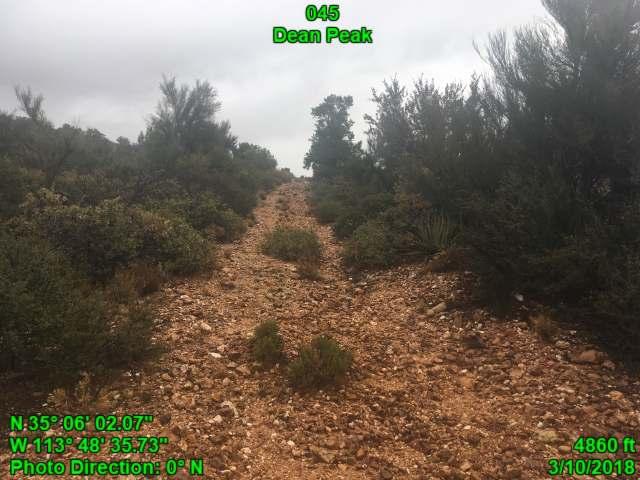
22 o show reclaimed and unused ways. They minimally affect naturalness. 026 show a primitive way which is unmaintained and without. It minimally affects naturalness and is kept open soley by the passage of vehicles. 027 shows a reclaimed and unused way. It minimally affects naturalness. Southern Boundary: Points ; Hualapai Mountain County Park, state trust land, wilderness inventory roads, the town of Pine Lake, and other private land. Two cherrystems. A cherrystem excludes two radio towers along this boundary. No photo data was collected. 028, 033, 034, and 045 show the condition of a wilderness inventory road; it is constructed, with, and maintenance is likely if needed/old evidence show primitive ways which are unmaintained, without, and kept open solely by the passage of vehicles. They minimally affect naturalness. 035 shows a primitive way following Soap Canyon, a natural wash. This way is largely unconstructed, unmaintained, and without. A few portions of this route show construction leading into and out of the wash. However these portions are also unmaintained, for example point , 037, and 042 show a cherrystemmed route, which provides access to Mohave Weather System Yellow Pine Spring. o 036 shows the route looking fairly navigable. It is constructed, and with. o 037 begins to show the route lacking evidence of maintenance. It seems to be kept open solely by the passage of vehicles. o 042 shows the route becoming increasingly less navigable. However, because of the of the route maintenance is likely when needed. o Thus, this route is only cherrystemmed to the Mohave Weather System, beyond this point, the route loses and becomes an unmaintained, primitive way. All subsequent routes are deemed unmaintained and thus primitive ways. This is evident further along at points and and 041 shows a reclaimed and unused way. It minimally affects naturalness. 040 shows an unmaintained, less primitive way. It connects to points 030 and 031. All subsequent routes are deemed to be primitive ways for the same reasons. They minimally affect naturalness show reclaimed and unused primitive ways. They minimally affect naturalness. Eastern Boundary: Points ; private land, Yellow Pine Ranch Road and associated power lines. 046 shows a reclaimed and unused way. It minimally affects naturalness. 22
23 show a primitive way. o 047 shows the best section of the route looking fairly navigable. However, it is unmaintained and without. It is kept open solely by the passage of vehicles. o 049 shows the condition of the route deteriorate; here, it is clearly unmaintained. Pinyon pines are growing in the route. o 048 shows a subsequent way unmaintained and without. 050 shows a primitive way, it is unmaintained and without. It is kept open solely by the passage of vehicles. It minimally affects naturalness. 051 shows an excluded impact along a cherrystem. Here, two old water cisterns, a power breaker, an old mine, and functional power lines are excluded. Other nearby mining impacts are excluded along this cherrystem, also. 052 shows a reclaimed and unused primitive way show primitive ways; they are unmaintained, without, and kept open solely by the passage of vehicles. They minimally affect naturalness. 055 shows a navigable, but unmaintained and less primitive way. It is kept open solely by passage of vehicles show the deterioration of the way. This route minimally affects naturalness. 057A shows an excluded water cistern. 058 and 059 show an unmaintained, less primitive way. 058 shows the best section of the route, however it rapidly deteriorates at shows McGarry s Wash. This is the main route used to access a solar well, water cisterns, and a water trough at point 064. o 062 shows a cherrystemmed portion of a route, which parallels McGarry s Wash and serves the same. Later portions of this route are reclaimed & unused. For an example of this see point shows a reclaimed and unused route; it is undetectable show a reclaimed and unused route; it minimally affects naturalness. All subsequent routes are therefore also primitive ways show reclaimed and unused routes; they minimally affect naturalness. 070 and 072 show an unmaintained, less primitive way. It minimally affects naturalness. 073 shows a primitive way in McGarry s Wash. This route is unconstructed, unmaintained, and without show primitive ways which are unmaintained and without. They are kept open solely by the passage of vehicles and minimally affect naturalness. 078 shows a primitive way in a natural wash; it is unconstructed, unmaintained, and without. 079 shows a reclaimed and unused route. It minimally affects naturalness. 080 shows a navigable route; however it is unmaintained and without. It ends a 081 an abandoned mine. This mine minimally affects naturalness because its screened by topography. 084 shows a primitive way in a natural wash. It is unconstructed, unmaintained, and without. 23
24 083 shows a cherrystemmed well. Along this cherrystem a water trough is also excluded. 082 shows a collapsed building alongside the 083 cherrystem. It minimally affects naturalness, and perhaps adds wilderness character due to its rustic, reclaimed nature. 086 shows Enterprise Mine an abandoned mine. This mine minimally affects naturalness because it is screened by topography show primitive ways which are unmaintained, and without. They terminate at abandoned prospects. They are kept open solely by the passage of vehicles. 089, 090, 093, and 099 show segments of BLM Route This route is a primitive way because it is unmaintained and serves no apparent. It is kept open solely by the passage of vehicles. 091 shows an abandoned mine. This is an acceptable impact because it is screened by topography. 092 and 094 show primitive ways which are unmaintained and without. They are kept open solely by the passage of vehicles. Northern Boundary: Points and ; state trust land and East Sweetwater Road. 095 shows a cherrystemmed windmill/well and water cistern. 098 shows the access route. 096 shows a less, unmaintained route continuing along a natural wash form the cherrystemmed impact at 095. It is a primitive way show a primitive way which is unconstructed, unmaintained, and without. It seems to be user-created and is kept open solely by the passage of vehicles. 100 shows E Sweetwater Road; this route is constructed, maintained, and with. It is a wilderness inventory road. 101 and 104 show access routes to state trust land; they are constructed and with. is likely if needed. 102 shows an excluded shooting range; it is highly impacted, and complete with a bolted metal table. 103 shows a reclaimed and unused way. It minimally affects naturalness. 105 shows a primitive way. It appears to be solely used by dirt bikes. It is unmaintained, user created, and without. 106 shows an unmaintained, less way. It minimally affects naturalness and is kept open solely by the passage of vehicles. This ends the narrative discussion. 24


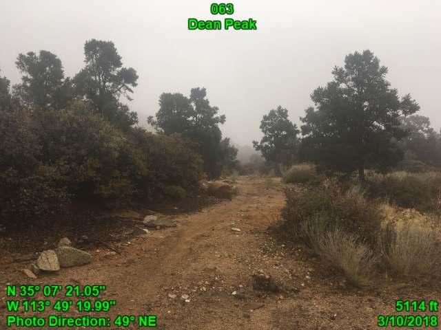
25 Section 4: Photopoint Data This section contains the photos and associated data tables for each point displayed on the inset maps and described in the boundary description. Data are presented in numbered order as they appear in the boundary description. The table associated with each point includes notes recorded in the field using GeoJot, supporting the rationale for including or excluding the feature in the unit. The associated map shows satellite imagery of the exact location and direction the photo was taken in. Maps, photos, and tables were produced in GeoJot Core. Point 005 name No evidence/usercreated Use 4-WD Trucks Purpose Class Natural Wash Kept open solely by passage of vehicles


26 Point 004 name No evidence/usercreated Use 4-WD Trucks Purpose Class Way Kept open solely by passage of vehicles Best section of route


27 Point 006 name No evidence/usercreated Use 4-WD Trucks Purpose Class Way Kept open solely by passage of vehicles


28 Point 007 name No evidence/usercreated Use 4-WD Trucks Purpose Class Way Kept open solely by passage of vehicles Point 008 name No evidence/usercreated Use No sign observed Purpose Reclaimed & unused Class


29 Point 009 name 7127 No evidence/usercreated Use No sign observed Purpose Class Way Kept open solely by passage of vehicles Point 010 name Bladed Use 4x4 Trucks Purpose Multiple uses Road Class Cherrystem Likely if needed Boundary Element


30 Point 013 name Bladed Use No sign observed Purpose Way Class Point 012 name N/A N/A N/A Use N/A Purpose N/A N/A Exclude this Class impact N/A Livestock Watering/Feeding station Impact: Excluded


31 Point 011 name N/A N/A N/A Use N/A Purpose N/A N/A Class Mohave County Weather System Burn Spring N/A Weather System Impact: Excluded


32 Use Purpose Class Point 014 name No evidence/usercreated Misc. Off Road Vehicles Way Kept open solely by passage of vehicles


33 Point 015 name N/A N/A N/A Use N/A Purpose N/A N/A Class N/A Power lines ending at water cistern and corral Boundary Element Point 017 name N/A N/A N/A Use N/A Purpose N/A N/A Cherrystem N/A Water trough/well Class Impact: Excluded


34 Point 018 name Bladed Use 4-WD Trucks Purpose Class Way Kept open solely by the passage of vehicles Boundary Element Point 020 name No evidence/usercreated Use No sign observed Purpose Reclaimed & unused Class


35 Point 021 name Bladed Use Misc. Off Road Vehicles Purpose Class Way Kept open solely by passage of vehicles Point 022 name N/A N/A N/A Use N/A Purpose N/A N/A N/A Water trough Class Impact: Acceptable


36 Point 023 name Bladed Use Misc. Off Road Vehicles Purpose Class Way Kept open solely by passage of vehicles


37 Point 024 name Bladed Use Misc. Off Road Vehicles Purpose Reclaimed & unused Class Point 025 name Bladed Use Misc. Off Road Vehicles Purpose Reclaimed & unused Class


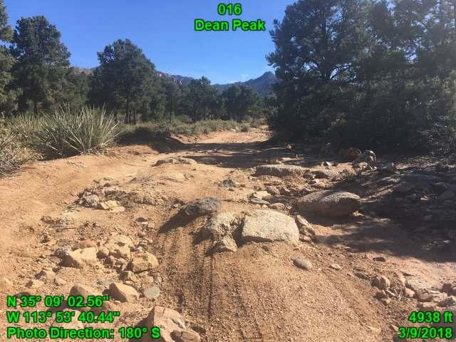
38 Point 019 name Bladed Use 4-WD Trucks Purpose Way Class Best section of route Point 016 name Bladed Use 4-WD Trucks Purpose Way Class Best section of route


39 Point 026 name Bladed Use 4-WD Trucks Purpose Class Way Kept open solely by passage of vehicles Point 027 name Bladed Use No sign observed Purpose Reclaimed & unused Class


40 Point 028 name Bladed Use 4-WD Trucks Purpose Multiple uses Road Class Old evidence years ago Boundary Element Point 029 name 7171B Bladed Use Misc. Off Road Vehicles Purpose Class Way Kept open solely by passage of vehicles


41 Point 031 name Bladed Use Misc. Off Road Vehicles Purpose Class Way Kept open solely by passage of vehicles


42 Point 030 name 7178 Bladed Use Misc. Off Road Vehicles Purpose Recreation Way Class Kept open solely by passage of vehicles


43 Point 032 name 7207A Bladed Use Misc. Off Road Vehicles Purpose Way Class Point 033 name 7184 Bladed Use 4-WD Trucks Purpose Multiple uses Road Class Old evidence years ago


44 Point 034 name 7184 Bladed Use 4-WD Trucks Purpose Multiple uses Road Class Likely if needed Point 035 name 7178 No evidence/usercreated Use 4-WD Trucks Purpose Way Natural Wash Class


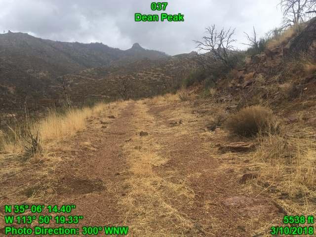
45 Point 036 name 7180 Bladed Use 4-WD Trucks Purpose Weather system access Road Class Cherrystem Likely if needed Boundary Element Point 037 name Bladed Use 4-WD Trucks Purpose Weather system access Road Class Cherrystem Likely if needed Boundary Element


46 Point 039 name 7335 Bladed Use No sign observed Purpose Reclaimed & unused Class Point 038 name Use No sign observed Purpose Not existent Class


47 Point 041 name Use No sign observed Purpose Reclaimed & unused Class Point 042 name Use No sign observed Purpose Reclaimed & unused Class


48 Point 040 name Use Misc. Off Road Vehicles Purpose Way Class Point 043 name 7184 Bladed Use 4-WD Trucks Purpose Multiple uses Road Class Likely if needed Boundary Element


49 Point 044 name Bladed Use No sign observed Purpose Reclaimed & unused Class Point 045 name Bladed Use No sign observed Purpose Reclaimed & unused Class


50 Point 046 name Bladed Use No sign observed Purpose Reclaimed & unused Class Point 049 name Bladed Use 4-WD Trucks Purpose Class Way Kept open solely by passage of vehicles


51 Point 048 name Bladed Use No sign observed Purpose Reclaimed & unused Class


52 Point 047 name Bladed Use No sign observed Purpose Class Way Kept open solely by passage of vehicles Best section of route


53 Point 050 name Bladed Use No sign observed Purpose Reclaimed & unused Class Point 051 name N/A N/A N/A Use N/A Purpose N/A N/A Class Cherrystem N/A Abandoned mine, cisterns, and power lines Boundary Element


54 Point 052 name Bladed Use No sign observed Purpose N/A Reclaimed & unused Class Cherrystem minimally affects naturalness Primtive Route

55 Point 054 name Bladed Use Misc. Off Road Vehicles Purpose Class Way Kept open solely by passage of vehicles and accesses abandoned Standard Mineral Mine Junction s s


56 Point 053 name Bladed Use Misc. Off Road Vehicles Purpose Way Class s

57 Point 055 name Bladed Use Misc. Off Road Vehicles Purpose Class Way Kept open solely by passage of vehicles Best section of route


58 Point 057A name N/A N/A N/A Use N/A Purpose N/A N/A Exclude this impact N/A Livestock Watering/Feeding station Class Impact: Excluded Point 057 name 7182 Bladed Use Misc. Off Road Vehicles Purpose Way Class 057A


59 Point 056 name 7182 Bladed Use Misc. Off Road Vehicles Purpose Way Class


60 Point 059 name 7180 Bladed Use Misc. Off Road Vehicles Purpose Class Way Kept open solely by passage of vehicles


61 Point 058 name 7180 Bladed Use Misc. Off Road Vehicles Purpose Class Way Kept open solely by passage of vehicles Best section of route


62 Point 060 Yellow Pine Ranch name Rd Bladed Cattle Guard Use 2-WD Vehicles Purpose Multiple uses Road Class Very recent blade - past year Point 061 name Vegetation clearing Use 4-WD Trucks Purpose Cistern and solarwell access Natural Wash Cherrystem Likely if needed McGarrys Wash Class Boundary Element


63 Point 062 name 7302 Bladed Use 4-WD Trucks Purpose Road Natural Wash Class Cherrystem Likely if needed Boundary Element Point 065 name N/A N/A N/A Use N/A Purpose N/A N/A Cherrystem N/A Water cisterns Class Boundary Element


64 Point 065 name No evidence/usercreated Use No sign observed Purpose Not a route Class Point 070 name No evidence/usercreated Use No sign observed Purpose Class Way Kept open solely by passage of vehicles


65 Point 072 name Bladed Use No sign observed Purpose Class Way Kept open solely by passage of vehicles Point 071 name N/A N/A N/A Use N/A Purpose N/A N/A N/A Ruin Class Impact: Acceptable


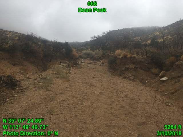
66 Point 069 name No evidence/usercreated Use No sign observed Purpose Reclaimed & unused Class Point 068 name No evidence/usercreated Use No sign observed Purpose Natural Wash Natural Wash Class


67 Use Purpose Class Point 073 name No evidence/usercreated Misc. Off Road Vehicles Natural Wash Natural Wash Point 066 name No evidence/usercreated Use No sign observed Purpose Way Class minimally affects naturalness


68 Point 067 name No evidence/usercreated Use No sign observed Purpose Way Class Point 063 name No evidence/usercreated Use No sign observed Purpose Way Class


69 Point Unit name name Use Purpose Class Point Dean Peak No evidence/usercreated Misc. Off Road Vehicles Natural Wash 073A Point 076 Unit name name Use Purpose Class Natural Wash Dean Peak 7226A Bladed Misc. Off Road Vehicles Way


70 Point 074 name 7226 Bladed Misc. Off Road Use Vehicles ; historic Purpose access to currently abandoned Century Mine Class Way Kept open solely by passage of vehicles


71 Point 075 name 7226 Bladed Misc. Off Road Use Vehicles ; historic Purpose access to currently abandoned Century Mine Class Way Kept open solely by passage of vehicles Erosion


72 Point 085 name No evidence/usercreated Use 4-WD Trucks Purpose Class Way Kept open solely by passage of vehicles


73 Point 077 name 7139 Bladed Use Misc. Off Road Vehicles Purpose Class Way Kept open solely by passage of vehicles


74 Use Purpose Class Point 078 name 7139 No evidence/usercreated Misc. Off Road Vehicles Natural Wash Kept open solely by passage of vehicles Point 082 name N/A N/A N/A Use N/A Purpose N/A N/A N/A Junk minimally affects naturalness Class Impact: Acceptable


75 Point 083 name N/A N/A N/A Use N/A Purpose N/A N/A Cherrystem N/A Well Functional Class Boundary Element Use Purpose Class Point 084 name No evidence/usercreated Misc. Off Road Vehicles Natural Wash Well


76 Point 079 name Bladed Use No sign observed Purpose Reclaimed & unused Class Point 081 name N/A N/A N/A Use N/A Purpose N/A N/A N/A Mine minimally affects naturalness Class Impact: Acceptable


77 Point 080 name Bladed Use 4-WD Trucks Purpose Class Way Kept open solely by the passage of vehicles Navigable. but w/o


78 Point 086 name N/A N/A N/A Use N/A Purpose N/A N/A Exclude this impact N/A Enterprise Mine minimally affects naturalness Class Impact: Acceptable


79 Point 087 name 7139D Bladed Use Misc. Off Road Vehicles Purpose Class Way Kept open solely by passage of vehicles


80 Point 088 name 7139D Bladed Use Misc. Off Road Vehicles Purpose Class Way Kept open solely by passage of vehicles

81 Point 089 name 7139 Bladed Use Misc. Off Road Vehicles Purpose Class Way Kept open solely by the passage of vehicles Best section of route


82 Point 090 name Bladed Use Misc. Off Road Vehicles Purpose Class Way Kept open solely by passage of vehicles Point 091 name N/A N/A N/A Use N/A Purpose N/A N/A N/A Abandoned Mine minimally affects naturalness Class Impact: Acceptable


83 Point 092 name 7139E Bladed Use Misc. Off Road Vehicles Purpose Class Way Kept open solely by passage of vehicles


84 Point 093 name 7139 Bladed Use Misc. Off Road Vehicles Purpose Class Way Kept open solely by passage of vehicles Point 095 name N/A N/A N/A Use N/A Purpose N/A N/A Class Cherrystem N/A Windmill/Well and Water trough Impact: Excluded


85 Point 094 name 7143 Bladed Use Misc. Off Road Vehicles Purpose Class Way Kept open solely by passage of vehicles Point 096 name No evidence/usercreated Use No sign observed Purpose Natural Wash Natural Wash Class


86 Point 098 name 7143A No evidence/usercreated Use 2-WD Vehicles Purpose Class Way Kept open solely by passage of vehicles


87 Point 097 name 7143A No evidence/usercreated Use 4-WD Trucks Purpose Class Way Kept open solely by passage of vehicles

88 Point 098 name 7143 Probably only bladed once Use 4-WD Trucks Windmill/Well Purpose and water trough access Road Class Cherrystem Likely if needed Boundary Element


89 Point 099 name 7139 Probably only Use Purpose Class bladed once Misc. Off Road Vehicles Way Kept open solely by passage of vehicles


90 Point 100 name E Sweetwater Rd Paved/chipsealed/gravel surfaced Use 2-WD Vehicles Purpose Multiple uses Road Unit Boundary Old evidence years ago Class Boundary Element Point 101 name Bladed Use 4-WD Trucks Purpose Private land access 7122D Class Unit Boundary Likely if needed Boundary Element


91 Use Purpose Class Point 105 name No evidence/usercreated ATV and/or Dirtbike Way Kept open solely by passage of vehicles Point 104 name Bladed Use 4-WD Trucks Purpose Private land access Road Class Unit Boundary Likely if needed Boundary Element


92 Point 106 name No evidence/usercreated Use 4-WD Trucks Purpose Private land access Way Class Kept open solely by passage of vehicles Follows natural wash


93 Point 103 name No evidence/usercreated Use No sign observed Purpose Reclaimed & unused Class minimally affects naturalness Point 102 name N/A N/A N/A Use N/A Purpose N/A N/A Exclude this impact N/A Shooting range Class Impact: Excluded


94 Point 003 name Bladed Use Misc. Off Road Vehicles Purpose Class Way Kept open solely by passage of vehicles


95 Point 002 name No evidence/usercreated Use No sign observed Purpose Reclaimed & unused Class Point 001 name Getz Ranch Rd Bladed Use No sign observed Purpose Private land access Road Class Unit Boundary Very recent blade - past year Boundary Element
96 96
Proposed Lands With Wilderness Characteristics: HOVERROCKER Public Lands in Greenlee County, Arizona
 Proposed Lands With Wilderness Characteristics: HOVERROCKER Public Lands in Greenlee County, Arizona A proposal report to the Bureau of Land Management, Safford Field Office, Arizona February, 2018 Prepared
Proposed Lands With Wilderness Characteristics: STEWART CANYON. Public Lands in Greenlee County, Arizona
 Proposed Lands With Wilderness Characteristics: STEWART CANYON Public Lands in Greenlee County, Arizona A proposal report to the Bureau of Land Management, Safford Field Office, Arizona February, 2018
A proposal report to the Bureau of Land Management, Safford Field Office, Arizona. October, 2016
 PELONCILLO MOUNTAINS LANDS WITH WILDERNESS CHARACTERISTICS THREE UNITS OF PUBLIC LAND CONTIGUOUS TO THE NORTHERN BOUNDARY OF THE PELONCILLO MOUNTAINS WILDERNESS, ARIZONA: WHITEHORSE, ANTELOPE CANYON AND
Dry Mountain Public Lands in Graham County, AZ Managed by the BLM Safford Field Office
 Proposed Lands With Wilderness Characteristics: Dry Mountain Public Lands in Graham County, AZ Managed by the BLM Safford Field Office A proposal report to the Bureau of Land Management, Safford Field
Proposed Lands With Wilderness Characteristics: Gila Box Public Lands in Graham and Greenlee Counties, Arizona
 Proposed Lands With Wilderness Characteristics: Gila Box Public Lands in Graham and Greenlee Counties, Arizona A proposal report to the Bureau of Land Management, Safford Field Office, Arizona March, 2018
/s/ Robert V. Abbey Director
 Form 1221-2 (June 1969) UNITED STATES DEPARTMENT OF THE INTERIOR BUREAU OF LAND MANAGEMENT MANUAL TRANSMITTAL SHEET Release 6-129 Date 03/15/2012 Subject 6310 Conducting Wilderness Characteristics Inventory
A proposal report to the Bureau of Land Management, Safford Field Office, Arizona. October, 2016
 JAVELINA PEAK LANDS WITH WILDERNESS CHARACTERISTICS PUBLIC LANDS IN THE WHITLOCK MOUNTAINS, ARIZONA A proposal report to the Bureau of Land Management, Safford Field Office, Arizona October, 2016 Prepared
Connie Rudd Superintendent, Black Canyon of the Gunnison National Park
 National Park Service U.S. Department of the Interior Black Canyon of the Gunnison National Park and Curecanti National Recreation Area Information Brochure #1 Wilderness and Backcountry Management Plan
Lands with Wilderness Characteristics: Chipeta and Pahlone Foothills
 Lands with Wilderness Characteristics: Chipeta and Pahlone Foothills Ouray, Chipeta, and Pahlone Peaks over interior unit, Royal Gorge Field Office Photo: John Sztukowski The intent of this report is to
Arthur Carhart National Wilderness Training Center s Wilderness Investigations High School
 Arthur Carhart National Training Center s Investigations High School 101/Lesson 2 (OPTION 2B) Introducing the Act Goal: Students will understand the difference between wild spaces and federally designated
WORKSHEET 1 Wilderness Qualities or Attributes Evaluating the Effects of Project Activities on Wilderness Attributes
 WORKSHEET 1 Wilderness Qualities or Attributes Evaluating the Effects of Project Activities on Wilderness Attributes Date: 3/7/2017 Roadless Area: Ruby South Description of Project Activity or Impact to
Special Recreation Management Areas Extensive Recreation Management Areas Public Lands Not Designated as Recreation Management Areas
 From the Proposed RMP: Special Recreation Management Areas SRMAs are an administrative unit where the existing or proposed recreation opportunities and recreation setting characteristics are recognized
DOS CABEZAS MOUNTAINS
 DOS CABEZAS MOUNTAINS LANDS WITH WILDERNESS CHARACTERISTICS PUBLIC LANDS CONTIGUOUS TO THE BLM S DOS CABEZAS MOUNTAINS WILDERNESS IN THE NORTHERN CHIRICAHUA MOUNTAINS, ARIZONA A proposal report to the
Lands with Wilderness Characteristics: Thirtyone Mile Mountain
 Lands with Wilderness Characteristics: Thirtyone Mile Mountain Thirtyone Mile Mountain, Royal Gorge Field Office Photo: John Sztukowski The intent of this report is to present objective data to illustrate
Final Recreation Report. Sunflower Allotment Grazing Analysis. July 2015
 Final Recreation Report Sunflower Allotment Grazing Analysis July 2015 Table of Contents Introduction... 3 Affected Environment... 3 Four Peaks Wilderness Area... 3 Dispersed Recreation... 3 Environmental
Continental Divide National Scenic Trail Legislative History and Planning Guidance
 Continental Divide National Scenic Trail Legislative History and Planning Guidance Legislation, Policy, and Direction Regarding National Scenic Trails The National Trails System Act, P.L. 90-543, was passed
Expanding Settlement Growing Mechanization
 The Wilderness Act of 1964 Expanding Settlement Growing Mechanization Versus Wilderness protection is paper thin, and the paper should be the best we can get that upon which Congress prints its Acts. David
April 10, Mark Stiles San Juan Public Lands Center Manager 15 Burnett Court Durango, CO Dear Mark,
 Mark Stiles San Juan Public Lands Center Manager 15 Burnett Court Durango, CO 81301 Dear Mark, We are pleased to offer the following comments on the draft San Juan Public Lands Center management plans
Cuerda de Leña Wash Wilderness Proposal PRODUCED BY:
 Cuerda de Leña Wash Wilderness Proposal PRODUCED BY: September 2004 Copyright 2004 by Jason A. Williams, Arizona Wilderness Coalition All rights reserved No part of this thesis my be used, reproduced,
Theme: Predominately natural/natural appearing; rustic improvements to protect resources. Size*: 2,500 + acres Infrastructure**:
 Recreation Opportunity Spectrum (ROS) Classes The Recreation Opportunity Spectrum (ROS) provides a way to describe the variations in the degree of isolation from the sounds and influences of people, and
Proposed Lands with Wilderness Characteristics: Black Mesa. A proposal report to the Bureau of Land Management, Kingman Field Office, Arizona
 Proposed Lands with Wilderness Characteristics: A proposal report to the Bureau of Land Management, Kingman Field Office, Arizona August, 2015 Prepared by: Joseph M. Trudeau & Amber R. Fields Table of
San Juan Resource Area Recreation Impact Inventory/Monitoring
 San Juan Resource Area Recreation Impact Inventory/Monitoring Indian Creek Climbing Area Overview & Summary of Findings 2007 Pam Foti, Professor Aaron Divine, Lecturer Janet Lynn, Program Coordinator Northern
Trail Phasing Plan. Note: Trails in the Clear Creek Canyon area (Segments will be finalized in the future to minimize wildlife impacts
 Note: Trails in the Clear Creek Canyon area (Segments 2 5 and a future JCOS connection) will be finalized in the future to minimize wildlife impacts Trail Phasing Plan P Parking 3 Easy Trail Intermediate
Minimum Requirements References in National Park Service Policy
 Minimum Requirements References in National Park Service Policy 2006 NPS Management Policies Chapter 6: Wilderness Preservation and Management 6.3 Wilderness Resource Management 6.3.1 General Policy (in
Recreation Opportunity Spectrum for River Management v
 Recreation Opportunity Spectrum for Management v. 120803 Introduction The following Recreation Opportunity Spectrum (ROS) characterizations and matrices mirror the presentation in the ROS Primer and Field
LESSON 5 Wilderness Management Case Studies
 LESSON 5 Wilderness Management Case Studies Objectives: Students will: review the key points of the Wilderness Act of 1964. brainstorm solutions for Wilderness management issues. Materials: Í Leave no
Appendix I. Wilderness Review
 Appendix I. Wilderness Review This appendix contains the wilderness inventory conducted for the Ash Meadows, Moapa Valley, and Pahranagat National Wildlife Refuges (NWRs) as part of the Comprehensive Conservation
RE: Access Fund Comments on Yosemite National Park Wilderness Stewardship Plan, Preliminary Ideas and Concepts
 September 30, 2016 Superintendent Yosemite National Park Attn: Wilderness Stewardship Plan P.O. Box 577 Yosemite, CA 95389 RE: Access Fund Comments on Yosemite National Park Wilderness Stewardship Plan,
Lands with Wilderness Characteristics: Reinecker Ridge
 Lands with Wilderness Characteristics: Reinecker Ridge Reinecker Ridge, Royal Gorge Field Office Photo: John Sztukowski The intent of this report is to present objective data to illustrate that the area
Securing Permanent Protection for Public Land
 Securing Permanent Protection for Public Land Tools for Wyoming Advocates Paul Spitler* The Wilderness Society * I am a wilderness policy expert, not a powerpoint expert! Platform and Resolutions of the
Appendix I Case-Studies in Wilderness Management
 Appendix I Case-Studies in Wilderness Management Management Issue Scenarios Note: These scenarios are meant to be used as guidelines for the program leader rather than to be read verbatim. Introduce a
LANDS WITH WILDERNESS CHACTERISTICS
 LANDS WITH WILDERNESS CHACTERISTICS A hiking guide for Ten BLM roadless areas inventoried by Wild Connections Each area description includes a summary of BLM s inventory for wilderness characteristics,
5.0 OUTDOOR RECREATION OPPORTUNITIES AND MANAGEMENT
 5.0 OUTDOOR RECREATION OPPORTUNITIES AND MANAGEMENT 5.1 Introduction This section describes the range of recreational activities that currently take place in Marble Range and Edge Hills Parks, as well
Wilderness Character and Wilderness Characteristics. What s the difference? Why does it matter?
 Introduction Wilderness Character and Wilderness Characteristics What s the difference? Why does it matter? The terms wilderness character and wilderness characteristics are sometimes used interchangeably
Hermosa Area Preservation The Colorado Trail Foundation 4/11/2008
 Hermosa Area Preservation The Colorado Trail Foundation 4/11/2008 Legend d o Tr ail NPA - National Protection Area ra NCA - National Conservation Area o e C Th The Colorado Trail lo FS inventoried Roadless
EMERY COUNTY PUBLIC LAND MANAGEMENT ACT OF 2018 S. 2809/H.R. 5727
 EMERY COUNTY PUBLIC LAND MANAGEMENT ACT OF 2018 S. 2809/H.R. 5727 September 25, 2018 OVERVIEW The Emery County Public Land Management Act of 2018 is a significant step backwards for wilderness and conservation
1 Permanent Full Time Forester GS /07/09 Kaibab National Forest Duty Station: Williams or Tusayan, AZ
 1 Permanent Full Time Forester GS-460-05/07/09 Kaibab National Forest Duty Station: Williams or Tusayan, AZ Merit Vacancy Announcement: Open Monday January 11 th to Friday January 20 th 2016 and working
Table 1: Santiago Peak Communication Site. Latitude 1 Longitude 1 Elev 2 Address T/R/S 3 APN 4 USGS Quadrangle
 County of Riverside Public Safety Enterprise Communication Project Appendix A: Candidate Site Descriptions Overview The site is located in the Cleveland National Forest (CNF) at an existing communication
Wilderness Areas Designated by the White Pine County bill
 Wilderness Areas Designated by the White Pine County bill SEC. 321. SHORT TITLE. This subtitle may be cited as the `Pam White Wilderness Act of 2006'. SEC. 322. FINDINGS. Congress finds that-- The White
National Wilderness Steering Committee
 National Wilderness Steering Committee Guidance White Paper Number 1 Issue: Cultural Resources and Wilderness Date: November 30, 2002 Introduction to the Issue Two of the purposes of the National Wilderness
Lands with Wilderness Characteristics: Stanley Creek, Green Mountain
 Lands with Wilderness Characteristics: Stanley Creek, Green Mountain Green Mountain, Royal Gorge Field Office Photo: Jaimie Reiss The intent of this report is to present objective data to illustrate that
(Short Listing) DUPUYER ACREAGE, ROCKY MOUNTAN FRONT
 DUPUYER ACREAGE, ROCKY MOUNTAN FRONT") (Short Listing) DUPUYER ACREAGE, ROCKY MOUNTAN FRONT This unique property is located 8½ miles northwest of Dupuyer, Montana and approximately thirty 30 miles northwest of Choteau, Montana. Great Falls
(Short Listing) DUPUYER ACREAGE, ROCKY MOUNTAN FRONT This unique property is located 8½ miles northwest of Dupuyer, Montana and approximately thirty 30 miles northwest of Choteau, Montana. Great Falls
3.12 Roadless Areas and Unroaded Areas
 3.12 Roadless Areas and Unroaded Areas Introduction This analysis focuses on the direct and indirect effects of activities proposed in the Como Forest Health project on roadless area values, including
Order of the Minister of Environment #39, August 22, 2011 Tbilisi
 Registration Code 360050000.22.023.016080 Order of the Minister of Environment #39, August 22, 2011 Tbilisi On preparatory stages and procedure of the methodology for Elaborating structure, content and
Lands with Wilderness Characteristics: Browns Canyon South
 Lands with Wilderness Characteristics: Browns Canyon South Browns Canyon South, Royal Gorge Field Office Photo: John Sztukowski The intent of this report is to present objective data to illustrate that
National Park Service Wilderness Action Plan
 National Park Service U.S. Department of the Interior National Park Service Wilderness Action Plan National Wilderness Steering Committee National Park Service "The mountains can be reached in all seasons.
Big Sandy Ranch Mohave County, Arizona
 Big Sandy Ranch Mohave County, Arizona Photo [9] Deeded land on hillside within the River Ranch parcel Listed for sale exclusively by: Traegen Knight Headquarters West Ltd. PO BOX 1980 St. Johns, AZ 85936
Rogue Gorge (Mt. Stella) Roadless Area-- T30S R3E (primarily in portions of Sections 23, 26, 33, 34 & 35)
 Roadless Area-- T30S R3E (primarily in portions of Sections 23, 26, 33, 34 & 35)") Rogue Gorge (Mt. Stella) Roadless Area-- T30S R3E (primarily in portions of Sections 23, 26, 33, 34 & 35) Rogue River-Siskiyou National Forest--High Cascades Ranger District Upper, higher elevation trail
Rogue Gorge (Mt. Stella) Roadless Area-- T30S R3E (primarily in portions of Sections 23, 26, 33, 34 & 35) Rogue River-Siskiyou National Forest--High Cascades Ranger District Upper, higher elevation trail
WALKER MOUNTAIN WILDERNESS PROPOSAL
 WALKER MOUNTAIN WILDERNESS PROPOSAL March 2007 TABLE OF CONTENTS PAGE Overview Map...3 Introduction...4 Wilderness Review Mandates.4 Unit Description 5 Wilderness Characteristics..6 Size 6 Naturalness.6
ROAD AND TRAIL PROJECT APPROVAL
 ROAD AND TRAIL PROJECT APPROVAL www.marincountyparks.org Marin County Parks, 3501 Civic Center Dr, Suite 260, San Rafael, CA 94903 DATE: July 12, 2017 PRESERVE: Gary Giacomini Open Space Preserve PROJECT:
2.0 PARK VISION AND ROLES
 2.0 PARK VISION AND ROLES 2.1 Significance in the Protected Area System Marble Range and Edge Hills provincial parks protect 6.8% of the Pavillion Ranges Ecosection, which is located in the Southern Interior
2016 Trails Maintenance and Operating Costs
 2016 Trails Maintenance and Operating Costs Motorized Trails Maintenance for motorized trails comes from vehicle registration fees and a portion of the federal Recreation Trails Program (RTP) funds. The
Rule Governing the Designation and Establishment of All-Terrain Vehicle Use Trails on State Land
 Rule Governing the Designation and Establishment of All-Terrain Vehicle Use Trails on State Land 1.0 Authority 1.1 This rule is promulgated pursuant to 23 V.S.A. 3506. Section 3506 (b)(4) states that an
Wyoming Public Lands Initiative in Carbon County
 Wyoming Public Lands Initiative in Carbon County THE CARBON COUNTY WPLI ADVISORY COMMIT TEE WANTS YOUR INPUT Wilderness Study Area: A special designation that applies to lands managed to protect wilderness
Creating a User-Driven Long-Distance OHV Trail Through Partnering
 Joseph Raffaele Outdoor Recreation Planner U.S. Bureau of Land Management Yuma, Arizona Creating a User-Driven Long-Distance OHV Trail Through Partnering BLM is a multiple-use land management agency within
Evaluation of Outstanding Remarkable Values for Collawash River March 2011
 Evaluation of Outstanding Remarkable Values for Collawash River March 0 Segment From headwaters of East Fork Collawash River to Buckeye Creek Mileage: miles Free flowing: Yes Scenic:, Substantial River
SAN MIGUEL CREEK RANCH. q Trinidad, Las Animas County, Colorado q
 SAN MIGUEL CREEK RANCH q Trinidad, Las Animas County, Colorado q 2 s San Miguel Creek Ranch is a scenic well-balanced cattle and trophy hunting ranch that showcases the very best of Southern Colorado.
FINAL TESTIMONY 1 COMMITTEE ON RESOURCES UNITED STATES HOUSE OF REPRESENTATIVES. July 13, 2005 CONCERNING. Motorized Recreational Use of Federal Lands
 FINAL TESTIMONY 1 STATEMENT OF DALE BOSWORTH CHIEF Of the FOREST SERVICE UNITED STATES DEPARTMENT OF AGRICULTURE Before the SUBCOMMITTEE ON FORESTS AND FOREST HEALTH And the SUBCOMMITTEE ON NATIONAL PARKS,
EXPLORING BIOMES IN GORONGOSA NATIONAL PARK
 EXPLORING BIOMES IN GORONGOSA NATIONAL PARK ABOUT THIS WORKSHEET This worksheet complements the Click and Learn Gorongosa National Park Interactive Map (http://www.hhmi.org/biointeractive/gorongosa-national-park-interactive-map),
Dumont Dunes Special Recreation Management Area (SRMA)
") Dumont Dunes Special Recreation Management Area (SRMA) RMA/RECREATION MANAGEMENT ZONE (RMZ) OBJECTIVE(S) DECISIONS Objective Statement: Designate this area as a Special Recreation Management Area. To manage
Dumont Dunes Special Recreation Management Area (SRMA) RMA/RECREATION MANAGEMENT ZONE (RMZ) OBJECTIVE(S) DECISIONS Objective Statement: Designate this area as a Special Recreation Management Area. To manage
NATIONAL PARK SERVICE CERTIFICATION OF COMPLETED SEGMENTS OF THE NORTH COUNTRY NATIONAL SCENIC TRAIL
 NATIONAL PARK SERVICE CERTIFICATION OF COMPLETED SEGMENTS OF THE NORTH COUNTRY NATIONAL SCENIC TRAIL Completed trail segments that (1) follow the route identified in the 1982 National Park Service (NPS)
2.0 Physical Characteristics
 _ 2.0 Physical Characteristics 2.1 Existing Land Use for the Project The site is comprised of approximately 114 acres bounded by Highway 101 to the north, the existing town of Los Alamos to the east, State
French Fire Recovery and Restoration Project Wilderness Resource Impact Analysis
 French Fire Recovery and Restoration Project Wilderness Resource Impact Analysis This Wilderness Resource Impact Analysis for the French Recovery and Restoration Project (Project) includes a review of
Coconino National Forest Potential Wilderness Proposal
 Coconino National Forest Potential Wilderness Proposal As part of their Forest Plan Update, the Coconino National Forest needs to address the need for additional wilderness. The last evaluation was done
Lidar Imagery Reveals Maine's Land Surface in Unprecedented Detail
 Maine Geologic Facts and Localities December, 2011 Lidar Imagery Reveals Maine's Land Surface in Unprecedented Detail Text by Woodrow Thompson, Department of Agriculture, Conservation & Forestry 1 Introduction
Ribbon Cliff - Ribbon Mesa text and photos by Charlie Hickenbottom
 Ribbon Cliff - Ribbon Mesa text and photos by Charlie Hickenbottom Looking for something a little different than Sage Hills or Saddlerock? Perhaps something a little wilder, a little less traveled? Look
Roduner Ranch FOR SALE. 5,878± Acres Potential Development Land. Merced County, California. Offices Serving The Central Valley
 FOR SALE 5,878± Acres Potential Development Land Merced County, California Offices Serving The Central Valley F R E S N O V I S A L I A B A K E R S F I E L D 7480 N. Palm Ave, Ste 101 3447 S. Demaree Street
A GIS Analysis of Probable High Recreation Use Areas in Three Sisters Wilderness Deschutes and Willamette National Forests
 Lindsey Kiesz Geo 565 Term Project 3/15/2010 A GIS Analysis of Probable High Recreation Use Areas in Three Sisters Wilderness Deschutes and Willamette National Forests Introduction The Three Sisters Wilderness
Federal Land and Resource Management: A Primer 1
 Federal Land and Resource Management: A Primer 1 RS20002 Coordinated by Ross W. Gorte Natural Resource Economist and Policy Specialist Environment and Natural Resources Policy Division December 22, 1998
WILDERNESS PLANNING. Wilderness. Interagency Regional Wilderness Stewardship Training. Alamosa, Colorado - March 26-29, 2007
 WILDERNESS PLANNING Interagency Regional Wilderness Stewardship Training Alamosa, Colorado - March 26-29, 2007 Suzanne Stutzman Lead Planner/Wilderness Coordinator National Park Service, Intermountain
The Roots of Carrying Capacity
 1 Applying Carrying Capacity Concepts in Wilderness 1872 1964...shall be preserved for the use & enjoyment of the American people...in such manner as will leave them unimpaired for future generations...
What Is An Ecoregion?
 Ecoregions of Texas What Is An Ecoregion? Ecoregion a major ecosystem with distinctive geography, characteristic plants and animals, and ecosystems that receives uniform solar radiation and moisture Sometimes
THE GHOST ROSE RANCH. Randy J. Wood Qualifying Broker Cell:
 Wild West Properties, LLC 7020 Santa Marisa, NE Albuquerque, NM 87113 505-836-4558 http://www.wildwestproperties.com/ Randy J. Wood Qualifying Broker Cell: 505-980-8019 E-mail: rjwood5@comcast.net THE
Procedure for the Use of Power-Driven Mobility Devices on Mass Audubon Sanctuaries 1 September 17, 2012
 Procedure for the Use of Power-Driven Mobility Devices on Mass Audubon Sanctuaries 1 September 17, 2012 Background As part of Mass Audubon s mission to preserve the nature of Massachusetts for people and
Bureau of Land Management Public Lands Guide Northwest District
 Bureau of Land Management Public Lands Guide Northwest District NORTHWEST Fee Site Restrooms Picnic Sites Developed Campgrounds Farmington Field Office (505) 564-7600 Alien Run Mountain Bike Trail Angel
Lands with Wilderness Characteristics: Booger Red, Bare Hills, The Bank
 Lands with Wilderness Characteristics: Booger Red, Bare Hills, The Bank Booger Red, Bare Hills, The Bank unit, Royal Gorge Field Office Photo: Ryan McCarley The intent of this report is to present objective
Wilderness Research. in Alaska s National Parks. Scientists: Heading to the Alaska Wilderness? Introduction
 Wilderness Research in Alaska s National Parks National Park Service U.S. Department of Interior Scientists: Heading to the Alaska Wilderness? Archeologist conducts fieldwork in Gates of the Arctic National
Salt River Allotments Vegetative Management EIS Draft Recreation Affected Environment Report Don R. Sullivan November 6, 2012
 Salt River Allotments Vegetative Management EIS Draft Recreation Affected Environment Report Don R. Sullivan November 6, 2012 Introduction The area surrounding the Salt River Canyon, the Salt River Canyon
Existing Resource Information
 Botanical and Wildlife Vegetation alliances/wildlife habitats Grasslands annual/perennial Chaparral mixed/montane/chamise-redshank Riparian montane/valley foothill riparian Sierran mixed conifer Montane
Steps in the Management Planning Process
 Steps in the Management Planning Process Developing a management plan for Kalamalka Lake Park will follow a multi-stage process. The planning process for this park is currently in the Draft Management
Wallace Lake Provincial Park. Management Plan
 Wallace Lake Provincial Park Management Plan 2 Wallace Lake Provincial Park Table of Contents 1. Introduction... 3 2. Park History... 3 3. Park Attributes... 4 3.1 Natural... 4 3.2 Recreational... 4 4.
RECREATION. Seven issues were identified that pertain to the effects of travel management on outdoor recreation within portions of the project area.
 RECREATION Seven issues were identified that pertain to the effects of travel management on outdoor recreation within portions of the project area. OPPORTUNITIES FOR SOLITUDE / QUIET TRAILS. One attraction
MINIMUM REQUIREMENTS DECISION GUIDE WORKSHEETS
 ARTHUR CARHART NATIONAL WILDERNESS TRAINING CENTER MINIMUM REQUIREMENTS DECISION GUIDE WORKSHEETS Prescribed burning of islands within Okefenokee Wilderness Area.... except as necessary to meet minimum
HEADQUARTERS WEST LTD. CATTLE RANCHES HORSE PROPERTIES RURAL REAL ESTATE
 Aravaipa Creek Flowing Through the Property Offered for sale exclusively by: Sandy Ruppel Headquarters West, Ltd. PO BOX 542 Sonoita, AZ 85637 Phone (520) 444-1745 sandy@headquarterswest.com www.headquarterswest.com
Overview. Wilderness Act of Statement of Need. What is Wilderness Character. Monitoring Wilderness Character
 Overview Monitoring Wilderness Character What What & Why? How? How? Conceptual Development How? How? Implementation Future? Future? Troy Hall Steve Boutcher USFS Wilderness & Wild and Scenic River Program
Brinker Creek Ranch. Colorado - Routt County - Yampa
 Located at the base of the Flattops Range in the Steamboat/Vail corridor, Brinker Creek Ranch consists of 1,451 acres ideally suited for high country grazing and native grass hay production. Traditionally
Greens Peak Ranch Apache County, Arizona
 Greens Peak Ranch Apache County, Arizona Photo [1] View of the deeded land Listed for sale exclusively by: Traegen Knight Headquarters West Ltd. PO BOX 1980 St. Johns, AZ 85936 Phone: (928) 524-3740, Fax:
TAYLOR CANYON RANCH COLORADO - ROUTT COUNTY - STEAMBOAT SPRINGS
 TAYLOR CANYON RANCH COLORADO - ROUTT COUNTY - STEAMBOAT SPRINGS Tucked up against the steep valley shaped by Mt. Pau and rising to the Routt National Forest, Taylor Canyon Ranch is an easily accessible,
ANAGEMENT. LAN November, 1996
 M ANAGEMENT P LAN November, 1996 for Paul Lake Provincial Park Ministry of Environment, Lands and Parks BC Parks Department Paul Lake Provincial Park M ANAGEMENT P LAN Prepared by BC Parks Kamloops Area
The Atlas of Hillforts of Britain and Ireland. Hillfort survey notes for guidance
 The Atlas of Hillforts of Britain and Ireland Hillfort survey notes for guidance The collection of surveys for the Atlas is now finished but you can use this form and the accompanying Notes for Guidance
Camp Jack Wright PERMANENT ORIENTEERING COURSE (2004)
") Camp Jack Wright PERMANENT ORIENTEERING COURSE (2004) WHAT IS ORIENTEERING? The skill which enables a person to navigate with a map. In the competitive sport, the winner is the person who finishes in the
Camp Jack Wright PERMANENT ORIENTEERING COURSE (2004) WHAT IS ORIENTEERING? The skill which enables a person to navigate with a map. In the competitive sport, the winner is the person who finishes in the
USDA TRAILS STRATEGY PROGRAM
 USDA TRAILS STRATEGY PROGRAM WRPI Program: English Peak Survey Jorge D. Briceño Southwestern Community College Internship Time Period: June 6, 2016 August 8, 2016 Advisor: Sam Commarto Recreation Officer
Fixed Anchors. Non-Wilderness Management Areas
 Access Fund-Carolina Climbers Coalition Proposals Submitted for Consideration and Support to the National Forest Forum and Nantahala- Pisgah Forest Partnership July 25, 2017, Updated July 28, 2017 Fixed
Logo Department Name Agency Organization Organization Address Information 5700 North Sabino Canyon Road
 Logo Department Name Agency Organization Organization Address Information United States Forest Coronado National Forest 5700 North Sabino Canyon Road Department of Service Santa Catalina Ranger District
COASTAL CONSERVANCY. Staff Recommendation December 2, 2004 COYOTE HELLYER COUNTY PARK BAY AREA RIDGE TRAIL
 COASTAL CONSERVANCY Staff Recommendation December 2, 2004 COYOTE HELLYER COUNTY PARK BAY AREA RIDGE TRAIL File No. 04-057 Project Manager: Amy Hutzel RECOMMENDED ACTION: Authorization to disburse up to
Marchand Provincial Park. Management Plan
 Marchand Provincial Park Management Plan 2 Marchand Provincial Park Table of Contents 1. Introduction... 3 2. Park History... 3 3. Park Attributes... 4 3.1 Natural... 4 3.2 Recreational... 4 3.3 Additional
Map 1.1 Wenatchee Watershed Land Ownership
 Map 1.1 Wenatchee Watershed Land Ownership Map 1.1 Wenatchee Watershed Land Ownership The Wenatchee watershed lies in the heart of Washington state in Chelan County. Just larger than the state of Rhode
APPENDIX G - ARIZONA TRAIL RELOCATION ANALYSIS
 APPENDIX G - ARIZONA TRAIL RELOCATION ANALYSIS TABLE OF CONTENTS 1.0 INTRODUCTION... 1 2.0 MANAGEMENT FRAMEWORK... 1 3.0 EXISTING TRAIL DESCRIPTION... 3 4.0 EVALUATION PROCESS AND CRITERIA... 4 5.0 ALTERNATIVE
SHASTA WEST PLANNING AREA
 2016 SHASTA COUNTY COMMUNITY WILDFIRE PROTECTION PLAN SHASTA WEST PLANNING AREA Covering the communities of: Centerville Redding (west & downtown) Shasta I. PROPOSED PROJECTS A. THE PLANNING AREA SHASTA
Wilderness Specialist s Report
 United States Department of Agriculture Forest Service July 2009 Wilderness Specialist s Report Travel Management Rule EIS USDA Forest Service Southwestern Region Apache-Sitgreaves National Forests Prepared