Wakulla County Adopted Infrastructure Plan
|
|
|
- Osborne Lyons
- 5 years ago
- Views:
Transcription


1 Prepared for November 2012 (Adopted October 15, 2012) Tallahassee Adopted Infrastructure Plan

2 Adopted Infrastructure Plan Adopted by the Board of County Commissioners October 15, 2012


3 3 Adopted Infrastructure Plan Adopted by the Board of County Commissioners October 15, 2012 Table of Contents Introduction...4 Projects 1. Aquaculture Coastal Bike/Pedestrian/Paddling Trails Boat Ramps Coastal Boat Ramps Fresh Water Bridges...33 The purpose of the Adopted Infrastructure Plan is to provide a framework of the infrastructure and recreational needs to build a strong economy, promote job creation, and strengthen the County s future. 6. Intersections Parks, Recreational & Community Facilities Public Safety Sidewalks Sewer & Stormwater...65 Additional Projects...73 Prepared by Kimley-Horn and Associates, Inc. Prepared for November 2012
 and local communities, an effort was made to bring together in one document a comprehensive Adopted Infrastructure Plan")


4 4 Adopted Infrastructure Plan Adopted by the Board of County Commissioners October 15, 2012 Introduction To ensure that County resources are committed to and focused on projects that are the most needed, as well as priorities of the Board of County Commissioners (Board) and local communities, an effort was made to bring together in one document a comprehensive Adopted Infrastructure Plan (Plan). The genesis of this Plan began with taking into account major county-owned and operated recreational parks, lands and trails, as well as major arterial roads, intersections, bridges, sidewalks, and sewer/stormwater facilities. Each site was evaluated for needed improvements, repairs, new construction, and other potential land uses or acquisitions. Other considerations used to determine projects were the health and safety aspects for our citizens, visitors, and the environment. Furthermore, economic development, workforce development, and educational needs played a major role in project selection. Project Funding Each project and its individual elements is subject to the availability of funding, additional public input, and Board approval prior to actual implementation. Some projects may require input, collaboration, and approval of federal and/or state agencies, especially those that may be funded from federal, state, or foundational sources. All projects will be considered for RESTORE Act funds and grant opportunities as appropriate and as funding becomes available. This Plan provides a framework for developing and maintaining our County resources and will contribute to growing a healthy local economy and workforce, benefiting s citizens, businesses, and visitors. Furthermore, this Plan will foster funding priorities, grant applications, and economic drivers for the County. It also serves as a tool for updating the County s Comprehensive Plan as required by the Department of Economic Opportunity and the Capital Improvement Plan. This Plan was presented to the Board of County Commissioners on October 1, 2012, and was formally adopted on October 15, Prepared by Kimley-Horn and Associates, Inc. Prepared for November 2012


5 5 Aquaculture COASTAL
, local recreational and commercial fishermen, and the Organization for Artificial Reefs (OAR) to determine the best locations and")


6 Cost Estimate: $250,000 6 Artificial Reefs Coastal waters surrounding, FL Work with the Florida Fish and Wildlife Conservation Commission (FWC), local recreational and commercial fishermen, and the Organization for Artificial Reefs (OAR) to determine the best locations and materials for the artificial reefs. Due to regional impact, collaborate and partner with surrounding counties and experts. Visit artificial-reefs/ar-program for more information on the Artificial Reef Program in Florida. Use heavy, stable, durable, and non-polluting materials when constructing the artificial reefs. According to the FWC website, there are 33 artificial reefs along s coast, including Marker 24 and Rotary Reef 3, all made from various materials. Project AquaCulture Coastal Prepared for November 2012

.")

7 Cost Estimate: $200,000 7 Oyster Relay/ Planting Coastal waters surrounding, FL Annual project to relocate oysters from waters classified as restricted or conditionally restricted to waters classified as conditionally approved or approved. After a certain period of time, the oysters cleanse themselves and become safe for humans to eat. An Oyster Relay Program aids in creating a sustainable environment for seafood harvesting and employment opportunities that have been significantly impacted by the closure of oyster harvesting zones in the County. Relay is held by the Wakulla Commercial Fisherman Association (WCFA). Identify new oyster beds and evaluate current stock year-to-year. In 2011, a $50,000 oyster relay grant was awarded to by the Florida Department of Agriculture and Consumer Services. Oyster relay/planting is: A recurring event that stimulates the economy. Most often accomplished during closed harvesting seasons. Increases and promotes healthy oysters. Project AquaCulture Coastal Prepared for November 2012
8 Additional projects 8 Project Name Project Description Estimated Project Cost Coastal Waters Growing oysters in trees Pilot program to establish cost and effectiveness of growing oysters on tree limbs and woody shrubs, which could be obtained from cleared public or private lands. Oysters would be planted in strategic coastal areas for easy monitoring. $25,000


9 9 Bike/Pedestrian/Paddling Trails
10 Cost Estimate: $2,000, Ochlockonee Bay Trail The Ochlockonee Bay Trail (referred to locally as the OBBT ) begins at Mashes Sands Park, just southeast of Panacea, FL, with a proposed endpoint at the historical Train Depot in Sopchoppy, FL When completed, the OBBT will be approximately 13 miles long and serve as a connector trail to the planned Capital to the Sea Loop and many local popular outdoor recreational sites, including the Ochlockonee State Park, the Florida Trail, and the St. Marks National Wildlife Refuge. The completed OBBT will be a major tourism and economic driver for and quite possibly Franklin and Bay counties. Funding for the OBBT thus far has come from a Florida Department of Transportation (FDOT) Enhancement Grant and, most recently, a commitment from the Capital Region Transportation Planning Agency (CRTPA) for Phase 5A. The OBBT is divided into the following phases that originated from a 2003 design plan: Phase 1: begins just west of the Mashes Sands trailhead and ends east of the Tide Creek Bridge (~2.09 miles). Completed. Phase 2: includes the Tide Creek Bridge and proceeds along Mashes Sands Road (CR 372) across the intersection of U.S. 98, where CR 372 turns into Surf Road and extends approximately 1.90 miles along Surf Road (total length is ~2.38 miles). $1.1 million in funding is needed to complete Phase 2. Phase 3: picks up where Phase 2 ends and continues running along Surf Road, ending at the southeastern boundary of the St. Marks National Wildlife Refuge (~1.40 miles). FDOT funding will be available FY for construction. Phase 4: passes entirely within the St. Marks National Wildlife Refuge running alongside Surf Road (~4.78 miles). Construction is in process and expected to be completed in early Project Phase 5A: picks up at the west end of the St. Marks National Refuge (where Phase 4 ends), running along Surf Road to the intersection of U.S. 319, Sopchoppy city limits (~0.95 miles). CRTPA has committed funding for design, permitting and construction in FY ; however an additional $10,000 is needed to fully complete construction. Phase 5B: picks up at the intersection of Surf Road and U.S. 319, running along U.S. 319 and ending in Sopchoppy at the historic Train Depot (~0.95 miles). This phase is unfunded with an estimated cost of $1,000,000 to design, permit, and construct. The OBBT is a priority of the Board of County Commissioners and included in the County s 2012 approved Bicycle, Pedestrian and Blueways Master Plan.»» Funding needed to complete Phases 2 and 5B is being pursued at the state level. Bike/Pedestrian/Paddling Trails Prepared for November 2012

11 Exhibit: Ochlockonee Bay Trail 11
, which begins at Mashes Sands Park, just southeast of Panacea, FL, with a proposed endpoint at")


12 Cost Estimate: $575, Ochlockonee Bay Trail Amenities Along the Ochlockonee Bay Trail Corridor (referred to locally as the OBBT ), which begins at Mashes Sands Park, just southeast of Panacea, FL, with a proposed endpoint at the historical Train Depot in Sopchoppy, FL New no existing characteristics. Trail amenities are included in the 2012 Adopted Bicycle, Pedestrian, and Blueways Master Plan. Add amenities, including: Animal-proof trash and recycle cans Shelters Benches Pre-fabricated restrooms Boardwalks and observation platforms, which includes a crossing at Buckhorn Creek Project Bike racks Potable water Directional and informational signage Bike/Pedestrian/Paddling Trails Prepared for November 2012


13 Cost Estimate: $650, Ochlockonee Bay Trailheads Three trailheads along the Ochlockonee Bay Trail (referred to locally as the OBBT ), which begins at Mashes Sands Park, just southeast of Panacea, FL, with a proposed endpoint at the historical Train Depot in Sopchoppy, FL Mashes Sands: Provide a defined and developed trailhead with amenities normally associated with trailheads, such as restrooms, parking, ADA access, potable water, shelters, benches, trash cans, and bike racks. Surf Road: The OBBT Surf Road segment is the longest section of the OBBT, and there is no designated or defined trailhead or other amenities. There is also no commercial development along Surf Road to provide any shelter, refreshments, or restrooms. The County would need to acquire property and design, permit, and construct a trailhead with amenities. Sopchoppy: Provide a defined trailhead at the Sopchoppy Train Depot with bike racks, parking, and signage. Mashes Sands: The trailhead at Mashes Sands is undeveloped. Therefore, funding is needed to design, permit, and construct a dedicated and defined trailhead with amenities. Surf Road: None Sopchoppy: The Sopchoppy Train Depot, which already exists, would be designed as a trailhead. Trailheads for the OBBT are included in the approved 2012 Bicycle, Pedestrian and Blueways Masterplan. Project Bike/Pedestrian/Paddling Trails Prepared for November 2012


14 Cost Estimate: $19,860, Capital City to the Sea Loop Various locations in, FL (see Map on following page) The preliminary plan for the Capital City to the Sea Loop (CCSL) is to create a paved 120-mile trail loop running from Cascades Park in Tallahassee through various parts of Wakulla and Franklin counties. This effort is being lead by Capital Regional Transportation Planning Agency (CRTPA). The 16-mile St. Marks Bike Trail, which stretches from Tallahassee to St. Marks is one completed segment of the CCSL. The OBBT will also connect to the CCSL. Funding for this project comes from the CRTPA. Portions of the CSSL located in are included in the County s approved 2012 Bicycle, Pedestrian and Blueways Masterplan, where additional information and maps can be found. Expected completion date is within the next five years. Once completed it will not only connect Leon, Wakulla, and Franklin counties, but will also connect to the St. Johns River to the Sea Loop, connecting North Florida to various parts of Central Florida. Add equestrian trails in parallel along sections that can connect with the Equestrian Center and other equestrian trails. Project Bike/Pedestrian/Paddling Trails Prepared for November 2012

15 Capital City to the Sea Loop Exhibit: Capital City to the Sea Loop 15

 from Rosa Shingles Road to the St. Marks Bike Trail along SR 363. Estimated cost of $3,197,000.")
16 Cost Estimate: $14,532, Connector Trails Various locations in, FL (see Map on following page) Provide strategically placed paved, designated multi-use bike and pedestrian trails with signage throughout Wakulla County, giving maximum connectivity to and between locations, such as downtown Crawfordville, St. Marks, St. Marks Bike Trail, OBBT, Sopchoppy, Panacea, Medart, New Port, St. Marks Lighthouse, Wakulla River, Wakulla Springs and other popular destinations. Arran Road connecting at U.S. 319 and terminating at a future trailhead near Forest Highway 13. Estimated cost of $1,123,000. Bloxham Cutoff (SR 267) from Rosa Shingles Road to the St. Marks Bike Trail along SR 363. Estimated cost of $3,197,000. CR 59 (Lighthouse Road), connecting the intersection of CR 59 at U.S. 98 to the St. Marks Lighthouse. Estimated cost of $511,000. Curtis Mills Road from the intersection at Smith Creek Road and U.S Estimated cost of $2,721,000. MLK connecting U.S. 319 to U.S. 98. Estimated cost of $2,109,000. Shadeville Highway (CR 365) at the intersection of U.S. 319 (St. Marks Bike Trail cross over) to the intersection of Bloxham Cutoff (SR 267). Estimated cost of $1,197,000. St. Marks Wildlife Refuge from CR 59 to St. Marks. Estimated cost of $1,701,000. U.S. 319 from Medart, starting at U.S. 319, where it splits off into U.S. 98, and then running along U.S. 319 and connecting to the OBBT at the intersection of U.S. 319 and Surf Road. Estimated cost of $1,973,000. Project These connector trails are included in the County s Adopted Bicycle, Pedestrian, and Blueways Masterplan, 2012, where additional information and site specific maps can be found.»» These connector trails are not part of the Capital to the Sea Loop. Bike/Pedestrian/Paddling Trails Prepared for November 2012

17 Exhibit: Connector Trails 17 Connector Trails

: Wakulla River Paddling Trail Sopchoppy River Paddling Trail Ochlockonee River Lower Paddling Trail Florida Circumnavigational")
18 Cost Estimate: $50, Paddling Trails Various locations along rivers, lakes, and coastline in Wakulla County, FL Construct signage in multiple locations along Wakulla s rivers, lakes, and coastline to identify dedicated canoe/ kayak launches and designated paddling trails. Design, permit, and construct canoe/kayak launches to provide access to s many rivers, lakes, and coastal waters, especially areas providing access to a state designated paddling trail. Wakulla has four state designated paddling trails (or blueways ): Wakulla River Paddling Trail Sopchoppy River Paddling Trail Ochlockonee River Lower Paddling Trail Florida Circumnavigational Saltwater Paddling Trail (Crocked River/St. Marks Refuge segment) Wakulla has several parks and boat ramps along the state designated paddling trails. Other popular areas for canoe/kayaking not designated as a state paddling trail include the St. Marks River, Wakulla River south of U.S. 98, and Lake Ellen.»» Canoers and kayakers are using existing boat ramps intended for motorized boats and vessels to gain water access for this popular activity. Others are launching the canoe/kayak anywhere along the banks and shoreline, often dragging the canoe/kayak over sand and vegetation. Project A blueway, or paddling trail, is a water path that is accessible to the public for the purposes of canoeing or kayaking. Blueways typically include launch points, camping locations, and points of interest to encourage family recreation, ecological education, and preservation of natural resources. Signage and dedicated canoe/kayak launches along Wakulla s state designated blueways is included in the adopted 2012 Bicycle, Pedestrian, and Blueways Masterplan. Some canoe/kayak launches are included as part of a larger project and can be found in the Parks, Recreation and Community Facilities; Bridges-Coastal; and Bridges-Fresh Water sections. Bike/Pedestrian/Paddling Trails Prepared for November 2012

19 Exhibit: Paddling Trails 19
20


21 21 Boat Ramps Coastal


22 Cost Estimate: $2,000, Bayside Marina 2273 Surf Road, Panacea, FL; Bayside Marina on Surf Road The County would like to close the boat ramp at the end of Roho Road that is in close proximity to the marina. Acquisition of existing property and marina. Restore the marina. Restore the boat ramp that is at the marina. The proposed ramp will be made of concrete and wide enough to launch two boats at once. Marina currently listed for sale for $499, acres +/- 36 existing boat slips Project Overlooks Ochlockonee Bay Located on the south side of Surf Road Boat Ramps Coastal Prepared for November 2012

.")

23 Mashes Sands Park Boat Ramp Cost Estimate: $1,000, Mashes Sands Road, Panacea, FL (Approximately) No additional information. Extend the ramp. Currently there is a steep drop-off. Armor the ramp to prevent further erosion at the end of the ramp. Construct new restroom facility. Dredge canal and construct sheet pile wall (also included in Additional Projects table on page 26). Boats that launch at this ramp can access Ochlockonee Bay and Apalachee Bay. Project Ramp is constructed of concrete. Twelve parking spots in a gravel parking area. A fee is required to launch at this ramp. Restrooms Boat Ramps Coastal Prepared for November 2012


24 Cost Estimate: $1,250, Shell Point Boat Ramp Shell Point Beach, Shell Point, FL Build concrete boat ramp wide enough for two boats to launch. Add restroom facility, parking area, and floating dock. Acquire property. Vacant lot No additional information. Project Boat Ramps Coastal Prepared for November 2012


25 Rock Landing Improvements and Commercial Pier Cost Estimate: $595, Dickerson Bay (Off U.S. 98, south of Crawfordville), Panacea, FL Add a fish cleaning area. Construct a boardwalk. Expand the number of boat slips. Expanded parking through land acquisition. Provide stormwater management for runoff from the parking area into the Bay. Add education kiosks and information throughout the Park area. Expand docking for permitted commercial vessels, which will help to revive the commercial fishing industry, as there are limited docking slips currently available. 24-hour accessible public boat ramp that can be used by both permitted commercial and recreational fisherman Rock Landing was purchased through a Florida Boating Improvement Program grant in It is part of the Panacea Waterfronts Community Program and provides boating and fishing activities, as well as a gathering spot for visitors. It also provides access to the Gulf of Mexico. Rock Landing lies within the Ochlockonee Barriers, a 22.1-mile stretch of beaches extending from Turkey Point, Franklin County, to the St. Marks River,. Within this area is an important regional network of federal, state and private conservation lands, including the St. Marks National Wildlife Refuge, Apalachicola National Forest, Tate s Hell State Forest, Ochlockonee River State Park, and the Phipps Preserve, providing for an array of outdoor recreation opportunities. Project 10 boat slips Limited parking Boat Ramps Coastal Prepared for November 2012
26 Additional projects 26 Project Name Project Description Estimated Project Cost Spring Creek Spring Creek Marina and Boat Ramp Acquire the Spring Creek Marina and boat ramp site. The ramp is located in the boundary of the City of St. Marks and was originally completed with County assistance. Design and construct a new boat ramp, rehabilitate the marina, add ADA accessibility, pave parking area, renovate restroom and changing area, and rehabilitate boat docks and slips. $1,200,000 Live Oak and Oyster Bay Community Boat Ramps Increase parking at these boat ramps. TBD Mashes Sands Park Boat Ramp Dredging Sunrise Canal Shell Point Oyster Bay Channel Spring Creek Canals Ochlockonee Bay Channel Dredging is needed to provide for safer passage of vessels. TBD TBD = To be determined.


27 27 Boat Ramps Fresh Water


28 Cost Estimate: $400, Curtis Mill Boat Ramp End of N.T. Smith Road, Sopchoppy, FL Build a new concrete boat ramp wide enough for one boat to launch. Add stabilized parking in the existing 60-foot-wide right-of-way. Small amount of room exists within the right-of-way for parking. No additional information. Project Boat Ramps Freshwater Prepared for November 2012
 Ramp is in poor condition and needs to be replaced.")


29 Cost Estimate: $400, Lake Ellen Canoe/Kayak Launch Ellen Drive, Crawfordville, FL (Exit U.S. 98 at Floyd Gray Road, head north to Lake Ellen) Ramp is in poor condition and needs to be replaced. Construct a canoe/kayak launch and dredge launch area. Improve parking. Construct stabilized parking area within the existing right-of-way at the end of Ellen Drive. The public ramp allows boaters to access Lake Ellen. Ramp is narrow and made of concrete. No defined parking area results in vehicles parking along the shoulders of Lake Ellen Drive. Project Boat Ramps Freshwater Prepared for November 2012
 Construct a canoe/kayak launch with synthetic matting or turf for use by non-motorized blueway users (who don t")


30 Cost Estimate: $300, Wakulla River CR 365 West bank of Wakulla River and south shoulder of County Road 365, St. Marks, FL (locally referred to as Upper Bridge ) Construct a canoe/kayak launch with synthetic matting or turf for use by non-motorized blueway users (who don t want to be intimidated by larger, motorized boats). Improve parking. Portions of the Wakulla River between this launch site and the U.S. 98 bridge may be shallow during certain seasons, making the river less manageable for some motorized boats. State designated paddling trail. Direct motorized boats to the paved ramp along U.S. 98. Included in the 2012 Adopted Bicycle, Pedestrian and Blueways Master Plan. Install trash cans, changing area, and restrooms. Narrow ramp constructed out of sand. Minimal parking. Project Motorized boats are allowed to launch from this site, although it is very narrow and uneven with limited parking. Boat Ramps Freshwater Prepared for November 2012


31 Cost Estimate: $150, Wakulla River U.S. 98 Wakulla River and U.S. 98 (locally referred to as Lower Bridge ) No additional information. Design and construct asphalt access road at U.S. 98. Stabilize parking area. Add ADA parking. Improve existing canoe/kayak launch. Concrete boat ramp for motorized boats. Canoe/kayak rentals and launch. Included in the 2012 Adopted Bicycle, Pedestrian and Blueways Master Plan. Project Boat Ramps Freshwater Prepared for November 2012
32


33 33 Bridges


34 Cost Estimate: $4,500, Sopchoppy River Bridge Sopchoppy River and County Road 375, Sopchoppy, FL Replace and widen bridge decking, widen bridge approach, and replace foundations. Bridge length: 225 LF Bridge width: 22 ft. Existing facility is in need of structural rehabilitation. Project Bridges Prepared for November 2012

.")

35 Cost Estimate: $2,200, Tide Creek Bridge Mashes Sands Road (at Tide Creek), Panacea, FL Widen bridge decking and bridge approach, relocate utilities, and add foundations. The Tide Creek Bridge is the missing link that connects Phases 1 and 2 of the Ochlockonee Bay Trail, which is part of the Capital City to the Sea Loop Trail (a regional multiuse trail). The Tide Creek Bridge is a crucial part of the evacuation route for Mash Island residents in the case of a storm or emergency. The bridge is the only access to the area. Bridge length: 190 LF Bridge width: 28 ft. Serves private residences, public boat ramp users (commercial and recreational), two public coastal parks, and a regional multi-use trail. Project Bridges Prepared for November 2012
 Widen bridge decking, widen bridge approach, and add foundations.")

.")
36 Cost Estimate: $5,600, Wakulla River CR 365 Wakulla River and County Road 365, FL (locally referred to as Upper Bridge ) Widen bridge decking, widen bridge approach, and add foundations. Bridge length: 450 LF Bridge width: 40 ft. Boat launch site next to bridge. Regarding boat launch next to the bridge Direct motorized boats to the paved ramp along U.S. 98. Construct the Upper Bridge boat ramp with synthetic matting or turf for use by non-motorized blueway users (who don t want to be intimidated by larger, motorized boats). Project Bridges Prepared for November 2012


37 37 Intersections
 Add travel")


38 U.S. 319 & Arran Road/ Martin Luther King, Jr. Memorial Road Cost Estimate: $6,000, Crawfordville, FL (near Courthouse) Add travel and auxiliary lanes to each approach to increase capacity: Arran Road/Martin Luther King, Jr. Memorial Road to be improved where warranted. U.S. 319 to become a four lane facility with turn lanes. Add sidewalks and landscaping, upgrade signals, and relocate utilities. Acquire right-of-way. Project Signal-controlled intersection. No additional information. Intersections Prepared for November 2012
 Realign Ivan Church Road.")


39 Cost Estimate: $2,800, U.S. 319 & Ivan Church Road Crawfordville, FL (near Walmart) Realign Ivan Church Road. Add travel and auxiliary lanes to U.S. 319 approaches to increase capacity: Ivan Church Road to be improved where warranted. U.S. 319 to become a four lane facility with turn lanes. Add sidewalks and landscaping, upgrade signals, and relocate utilities. Acquire right-of-way. Project Signal-controlled intersection. No additional information. Intersections Prepared for November 2012
 Add travel and")


40 Cost Estimate: $4,000, U.S. 319 & Wakulla-Arran Road Crawfordville, FL (near McDonald s) Add travel and auxiliary lanes to U.S. 319 to increase capacity: Wakulla-Arran Road to be improved where warranted. U.S. 319 to become a four lane facility with turn lanes. Add sidewalks and landscaping, upgrade signals, and relocate utilities. Acquire right-of-way. Signal-controlled intersection. Project No additional information. Intersections Prepared for November 2012
 North of Crawfordville, FL Add travel and")


41 Cost Estimate: $4,400, U.S. 319 & SR 267 (Bloxham Cutoff Road) North of Crawfordville, FL Add travel and auxiliary lanes to all approaches to increase capacity: SR 267 to become a four lane facility with turn lanes. U.S. 319 to become a four lane facility with turn lanes. Add landscaping and medians, and upgrade signals. Acquire right-of-way. Signal-controlled intersection. Project No additional information. Intersections Prepared for November 2012


42 Cost Estimate: $6,100, U.S. 319 & U.S. 98 Intersection Realignment Medart, FL Realign U.S. 319 to intersect U.S. 98 at a more perpendicular angle. Add auxiliary lanes to each approach to increase capacity. Acquire right-of-way and relocate utilities. Stop sign at intersection. No additional information. Project Intersections Prepared for November 2012


43 43 Parks, Recreational & Community Facilities


44 Cost Estimate: $1,300, Crawfordville Chain of Parks (Hudson, Azalea, Crabapple and Hickory Parks) In the center of downtown Crawfordville, FL Hudson Park: Add new restroom facilities, signage, vendor/ walking path with electrical hookups, amphitheater, and site lighting. Azalea Park: Mill and resurface walking trail and provide paved parking. Crabapple Park: Design, permit, and construct a park with walking paths, shelters, lighting, picnic tables, and other features normally associated with a downtown park. Connect Hudson, Azalea, Crabapple, and Hickory parks through sidewalks or walking trails to provide a Chain of Parks. Azalea Park: This is a family/community park used for special events. There is a paved walking/jogging trail, gazebos, picnic tables, restrooms, and benches. It also has a large, cement lion that is painted by citizens for holidays and events. Crabapple Park: Undeveloped. Hickory Park: Primary features include tennis courts and playground equipment. No additional information. Project Hudson Park: This is primarily an event park used for many public and private events. It has restrooms and a large covered pavilion with stage. Parks, Recreational & Community facilities Prepared for November 2012


. Project Boat ramp.")
45 Cost Estimate: $2,925, Mashes Sands Park Improvements and Amenities At the east end of Mashes Sands Road, FL»» Cost of $2,925,000 includes boat ramp rehabilitation, which is also addressed in the Boat Ramps Coastal section. Rehabilitate boat ramp areas and beach. Improve parking lot. Add entrance gate, canoe/kayak launch, restrooms, observation platforms, signage/educational kiosks, and walking paths. Extend wooden walkway for observation. Mat beach sand for wheelchair accessibility to beach. Public fishing pier (wooden). Project Boat ramp. Beach access. Parks, Recreational & Community facilities Prepared for November 2012
 No additional information.")


46 Cost Estimate: $1,200, Recreational Complex Crawfordville, FL (exact location to be determined) No additional information. Design and construct a multi-sport recreational facility for both recreational youth and high school participants, complete with athletic fields, seating, restrooms, and concession stands. Requires property acquisition. New project no existing characteristics. Project Parks, Recreational & Community facilities Prepared for November 2012


47 Cost Estimate: $5,200, Shell Point Park 117 Beaty Taff Drive, FL (From Spring Creek Highway, turn onto Highway 367) Restore/renourish beach to increase and stabilize dune habitat. Upgrade existing beach maintenance plan, design improvements, and construct improvements: Gazebo Serves local and regional beachgoers. The beach includes a playground, restroom facility, large pavilion, and three sun shelters. Cost of project could be, potentially, $2,000,000 less if a permitable sand source is located just offshore. Refer to the Boat Ramps Coastal section for Shell Point Park boat ramp. Canoe/Kayak Launch New playground Signage Project Paved parking Replace the old fisherman s jetty Land acquisition to expand public beach access and parking to the west of existing park, and add another fishing jetty. Parks, Recreational & Community facilities Prepared for November 2012

, and the west building is used for public workshops and private gatherings (small fee for use).")

48 Wakulla County Community Center Cost Estimate: $2,500, Shadeville Road and Trice Lane, Shadeville, FL Build recreational facilities that include: Pool Multi-use fields Walking paths Exercise stations Basketball courts Pedestrian traffic is from local residents. Automobile traffic is from residents and drivers using Trice Lane to reach Crawfordville highway. Property originally served as a church and was purchased by the County in The east building currently houses some Sheriff s office functions (they will relocate), and the west building is used for public workshops and private gatherings (small fee for use). A HUD Congressional Special Project grant of $396,000 is being used to construct a multi-purpose room in accordance with the original scope. Additional funds are needed to complete all renovations, rehabilitation, and additions. Beach volleyball courts Picnic pavilion Project Restroom facility Playground equipment Property is acres (approximately half of the property has been cleared). Parks, Recreational & Community facilities Prepared for November 2012


 Big Bend Maritime Center will promote north Florida waterways and serve as an informational resource with a blueway launch site.")
49 Woolley Park/ Big Bend Maritime Center Cost Estimate: $1,966, Panacea, FL (east of Highway 98) Pave and stabilize parking area and repave walking path. Upgrade and renovate existing building, boardwalk, and playground. Construct canoe/kayak launch. Renovate interior of buildings. Improve stormwater facilities and landscaping. Add turtle-sensitive lighting and amphitheater. Provide connectivity and cohesiveness between Woolley Park and Big Bend Maritime Center. The Big Bend Maritime Center expands opportunities for public education on the scenic beauty, economic significance, and historical value of the region s natural resources and people. The Center currently serves as a museum linking the area s history to present-day experiences. The planned (future) Big Bend Maritime Center will promote north Florida waterways and serve as an informational resource with a blueway launch site. The portion of the Florida Circumnavigational Saltwater Paddling Trail in Wakulla, from Mashes Sands along the coast to the Refuge, will be developed and marketed as the Apalachee Bay Maritime Heritage Paddling Trail. The Center will be a focal point of activity, with one of the houses on the property devoted to Apalachee Bay and equipped with charts, nature and heritage information, and parking for launching canoes/kayaks. Project Buildings, playground, boardwalk, and picnic area. Woolley Park is an event park and home to Blue Crab Festival and Children s Fishing Tournament. Parks, Recreational & Community facilities Prepared for November 2012
50 Additional projects 50 Project Name Project Description Estimated Project Cost Cultural and Historic Town Center Crawfordville Design, permit, and construct a town square and promenade. Land acquisition may be necessary. TBD Heritage Park Historical Center Design, permit, and construct a historical center at the Heritage Park showcasing local artifacts, stories, and history of. TDB Wakulla Medart Landfill Acquire the inactive landfill in Medart for the design and construction of a recreational facility for the Wakulla High School Cross Country running team to participate and to hold meets and other events. Construct a natural trail and, most likely, remediate the site. $950,000 Wakulla River County Park Acquire land along the Wakulla River and design, permit, and construct a county park with amenities and river access for the public. TBD Wakulla Welcome Center Improve and restore amenities at the Wakulla/Panacea Welcome Center, including but not limited to: boardwalk; new roof; elevator upgrade; repair decking and ramp around building; expand walking trail and boardwalk; and construction of a nature trail. $285,000 Panacea Panacea Women s Club Acquire +/- 30 acres located next to the existing Panacea Women s Club for the purpose of adding outdoor recreation facilities such as baseball fields, playground, and basketball courts. $300,000 TBD = To be determined.


51 51 Public Safety


52 Cost Estimate: $2,000, Crawfordville Fire & EMS Trice Lane, Crawfordville, FL Add approximately 8,000 square feet of a Fire Station and EMS facility Demo the existing EMS facility Small facility located on Trice Lane. No additional information. Project Public Safety Prepared for November 2012


53 Cost Estimate: To be determined upon further analyses. 53 Airport North end at U.S. 98 and South end at Surf Road, Panacea, FL No additional information. Planning and improvements such as: Paving the runway Lighting Property acquisition Hangar construction Fuel farm Airport Master Plan Update Project Currently has a grass runway Airport manager is a volunteer Public Safety Prepared for November 2012


.")
54 Cost Estimate: $750, Sheriff s Office Annex Oak Street, Crawfordville, FL Add approximately 6,000 square feet of office space and evidence processing on property adjacent to the existing Wakulla Sheriff s Office. Temporarily located at the site of the planned Wakulla Community Center (formerly a church property was purchased by the County in 2010). No additional information. Project Public Safety Prepared for November 2012
55 Additional projects 55 Project Name Project Description Estimated Project Cost Wakulla Animal Control Facility Expansion and Renovation Design and construct an extension to the existing Animal Control Facility to include an adoption center and additional kennel storage. $380,000
56


57 57 Sidewalks
 Construct.")


58 Cost Estimate: $128, Crawfordville High Drive High Drive, Crawfordville, FL (near Courthouse) Construct.8 mile of 5-foot-wide concrete sidewalk along High Drive. Increase pedestrian access and connectivity. Provide direct access to recreational facilities, businesses, and commercial areas. Provide safe routes throughout residential neighborhoods. No existing characteristics. Project No additional information. Sidewalks Prepared for November 2012


59 Cost Estimate: $96, Crawfordville Ochlockonee Street Ochlockonee Street, Crawfordville, FL The right-of-way on Ochlockonee Street is 50 feet. No additional information. Construct.6 mile of 5-foot-wide concrete sidewalk on Ochlockonee Street, from Arran Road to Cedar Avenue. Ochlockonee Street sidewalk would improve connectivity with the parks and support: Proposed parade route. Proposed cottage commercial industry zoning. Increase pedestrian access and connectivity. Provide direct access to recreational facilities, businesses, and commercial areas. Project Provide safe routes throughout residential neighborhoods. Sidewalks Prepared for November 2012


60 Crawfordville Senior Center to Community and Commercial Facilities Cost Estimate: $367, Wakulla Senior Citizens Center, 33 Michael Drive, Crawfordville, FL No additional information. Walmart, 35 Mike Stewart, Crawfordville, FL Construct 2.3 miles of 5-foot-wide concrete sidewalk connecting the Wakulla Senior Citizens Center to the local Walmart. Increase pedestrian access and connectivity. Provide direct access to recreational facilities, businesses, and commercial areas. Provide safe routes throughout residential neighborhoods. Project No existing characteristics. Sidewalks Prepared for November 2012

. Increase pedestrian access and connectivity.")
61 Cost Estimate: $400, Crawfordville Shadeville Road Crawfordville, FL Construct an estimated 2.5 miles of 5-foot-wide concrete sidewalk. With a dedicated right-of-way of 66 feet, there is adequate right-of-way for sidewalks and bicycle lanes. No additional information. Add sidewalks to Shadeville Highway to: Connect residential developments, including Bridlewood Apartments, to commercial development on Feli Way and U.S Provide important connections to the new Wakulla County Community Center (located at the former River of Life Church property). Increase pedestrian access and connectivity. Provide direct access to recreational facilities, businesses, and commercial areas. Provide safe routes throughout residential neighborhoods. Project Sidewalks Prepared for November 2012


62 Cost Estimate: $750, Crawfordville Sidewalks U.S. Highway 319 U.S. 319, Crawfordville, FL Construct Crawfordville area sidewalks along the main arterial, U.S. 319, as well as routes/connections to various community buildings, such as the Community Center and Senior Citizen Center. Install high-intensity crosswalks at significant intersections: Connection across U.S. 319 between Hudson Park and Hickory Park. Connection across U.S. 319 at Wakulla-Arran Road. Intersection of U.S. 319 and Martin Luther King Jr. Memorial Drive/Arran Road. Pedestrian facilities will include sidewalks, enhanced crosswalks, mid-block crossings, and enhanced curb ramps at intersections and driveways. No existing characteristics. Enhancements could include pedestrian-actuated signals, use of materials with visual and textual differences, motion-detecting caution lights that only flash when bicyclists or pedestrians are present, and improved curb ramps that meet current design standards. These Crawfordville Town Plan recommendations are the product of numerous stakeholder interviews and public meetings. Project Future connections that become significant when redevelopment occurs within. s where there is heavy commercial activity. Increase pedestrian access and connectivity. Provide direct access to recreational facilities, businesses, and commercial areas. Provide safe routes throughout residential neighborhoods. Sidewalks Prepared for November 2012
 Jer-Be-Lou Boulevard No existing characteristics.")


63 Cost Estimate: $268, Panacea Pedestrian Improvements Panacea, FL Construct sidewalks in the following areas: Otter Lake Road U.S. 98 to Otter Lake (1.6 miles) Jer-Be-Lou Boulevard No existing characteristics. Use a combination of sidewalks, crosswalks, and signage to provide residents and visitors with added mobility options. Recommendations were adapted from the Panacea Walkable Waterfronts Florida Community Group Pedestrian project. Walker Street Mound Street Piney Street Panacea Welcome Center Increase pedestrian access and connectivity. Project Provide direct access to recreational facilities, businesses, and commercial areas. Provide safe routes throughout residential neighborhoods. Add golf cart crossing. Sidewalks Prepared for November 2012

 Wakulla High School does not qualify for Safe")

64 Cost Estimate: $200, Wakulla High School/ Medart Sidewalks U.S. 98 at Wakulla High School (3237 Coastal Highway, Crawfordville, FL) Wakulla High School does not qualify for Safe Routes to School funding. When funding becomes available, additional areas have been identified for sidewalk construction. Construct multi-use trail along U.S. 98 corridor where Wakulla High School is located. Construct sidewalk along Jack Crum Road (school route). Increase pedestrian access and connectivity. Provide direct access to recreational facilities, businesses, and commercial areas. Provide safe routes throughout residential neighborhoods. Project No existing characteristics. Sidewalks Prepared for November 2012

65 65 Sewer & Stormwater


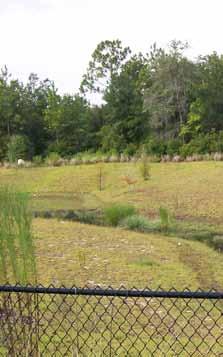
66 Cost Estimate: To be determined upon further analyses. 66 Crawfordville Central Stormwater Crawfordville, FL Limited sewer facilities extend through the Crawfordville area. Consideration of extending sewer facilities will be necessary for future development in the Crawfordville area. Construct regional stormwater facilities. Stormwater is currently addressed on a development-bydevelopment basis, with each property responsible for managing stormwater on-site. This approach results in multiple stormwater ponds scattered throughout the Crawfordville area. Each property s development potential is limited due to the stormwater pond that occupies a portion of that property. (Ponds are typically surrounded by a chain-link fence, detracting from the visual aesthetics of the area.) Project Limited sewer. Sewer & Stormwater Prepared for November 2012


67 Cost Estimate: $2,100, Greiner s Addition Sewer and Stormwater South of Martin Luther King Jr. Memorial Road between U.S. 319 and Rehwinkel Road, Crawfordville, FL No additional information. Construct stormwater conveyance and detention areas in Greiner s Addition subdivision. Flood Plain reduction project that will inherently provide increased treatment Design of improvements Lot acquisition Construction of cross drains, driveway culverts, and other conveyances that will control and convey stormwater to newly constructed detention areas. Project Serves private residences in one of the densest areas of with little infrastructure. Sewer & Stormwater Prepared for November 2012


68 Cost Estimate: $8,300, Magnolia Gardens Sewer and Stormwater South of Martin Luther King Jr. Memorial Road between U.S. 319 and Rehwinkel Road, Crawfordville, FL Extend sanitary sewer service to Magnolia Gardens subdivision. Plant upgrades Regional Lift Station and Forcemain Design of improvements Construction of cross drains, driveway culverts, and other conveyances that will control and convey stormwater to newly constructed detention areas. Serves private residences in one of the densest areas of. No additional information. Gravity Collection System with the subdivision Duplex services to lot corners Lot acquisition Smaller lift stations within the subdivision Project Construct stormwater conveyance and detention areas in Magnolia Gardens subdivision. Flood Plain reduction project that will inherently provide increased treatment. Sewer & Stormwater Prepared for November 2012


69 Cost Estimate: To Be Determined 69 Panacea Sewer and Stormwater Panacea, FL Construct stormwater conveyance and detention areas in the Panacea Area, specifically East of U.S. 98. Serves private residences in one of the densest areas of with little infrastructure. No additional information. Conveyance and treatment project that is located within the flood/surge prone areas of Panacea. Design of improvements Lot acquisition Construction of cross drains, driveway culverts, and other conveyances that will control and convey stormwater to newly constructed detention areas. Improvements to existing manholes and lift stations. Project Sewer & Stormwater Prepared for November 2012


70 Cost Estimate: $26,500, Wakulla Gardens Sewer and Stormwater South of Martin Luther King Jr. Memorial Boulevard between U.S. 319 and Alexander Road, FL Extend sanitary sewer service to all five units of Wakulla Gardens subdivision. Plant upgrades Regional Lift Station and Forcemain Gravity Collection System within the subdivision Duplex services to lot corners Lot Acquisition Smaller lift stations within the subdivision Design of improvements in areas yet-to-be designed. Construction of cross drains, driveway culverts, and other conveyances that will control and convey stormwater to newly constructed detention areas. One of the oldest and largest subdivisions in the County. Over 3,000 lots. Serves private residences in one of the densest areas of that is in close proximity of Wakulla Springs. No additional information. Project Construct stormwater conveyance and detention areas in all five units of Wakulla Gardens. Flood Plain reduction project that will inherently provide increased treatment. Sewer & Stormwater Prepared for November 2012
71 Additional projects 71 Project Name Project Description Estimated Project Cost Wakulla Wastewater Treatment Plant Expansion Modifications to the existing Wastewater Treatment Facility (WWTF) that will allow for increased capacity and increased treatment levels. The existing facility is designed and permitted to treat 600,000 GPD. The proposed facility will treat 1,200,000 GPD and provide high-level disinfection so that 300,000 GPD of effluent can be utilized as irrigation in public facilities. $4,200,00 Sopchoppy Stormwater TBD Spring Creek Sewer Hookup Facilitate all of Spring Creek being on sewer by obtaining funding to pay the tap fee for those homes that are on aging septic systems of questionable efficacy. TBD TBD = To be determined.
72
73 Additional projects 73 St. Marks Project Name Project Description Estimated Project Cost Fire Escape Road Boat Ramp Parking Lot Overlay and restripe the existing asphalt parking lot at this site. $356,000 Howard Street Overlay existing asphalt roadway (Howard Street) from Gulfspray Drive to Port Leon Drive. $92,000 Mock Street Overlay existing asphalt roadway and add parking. $179,000 Port Leon Drive Electric Utilities Underground electric installation. $323,000 Refinery Boat Dock and Roadways Overlay existing asphalt roadways and repair and refurbish concrete boat dock. $957,000 Refinery Boat Dock Overlay existing asphalt roadway near boat ramp and add parking. $642,000 Port Leon Drive and Shell Island Road Sidewalk Install new sidewalks and landscaping. $765,000 Boardwalk To connect to the end terminus of the St. Marks Bike Trail and extend to the St. Marks River and connect to recently constructed boardwalk at the park and boat ramp. TBD Shell Point Walker Creek Road Rehabilitate to ensure future storms do not further damage the road or undo work recently completed from Tropical Storm Debby damages. TBD Canal Street Grade and provide some type of firm topping/road base. This would also create a connector road between Shell Point and Oyster Bay to truly create a golf cart community flavor. TBD Spring Creek Sewer Hookup Facilitate all of Spring Creek being on sewer by obtaining funding to pay the tap fee for those homes that are on aging septic systems of questionable efficacy. TBD Sopchoppy Curtis Mill Road Jug Branch The culvert at Jug Branch becomes a dam during high water runoff from upstream causing severe flooding in the area, including the road. Enlarging the culvert area will prevent the dam affect and flooding. If the Curtis Mill Road continues to flood at this area, it could potentially wash out the road, cutting off emergency transportation routes for residents along Curtis Mill Road and others that depend on this Road. TBD Tallahassee Community College Environmental Institute Design and build a one-of-a-kind Environmental Institute to provide education and training focused on environmental education and careers, especially the Gulf Coast and surround coastline. This would provide an economic and workforce opportunity for due to the potential national appeal. TBD Wakulla Rivers and Coastline Channel Markers and Other Navigational Signage Provide or repair important channel markers and navigational signage for boater safety, no wake zones, speed limits, manatees, and boating safety. TBD TBD = To be determined.
74
75

76 Adopted Infrastructure Plan November 2012
AGENDA ITEM 5 D WAKULLA ENVIRONMENTAL INSTITUTE (WEI) TRAIL FEASIBILITY STUDY
 TRAIL FEASIBILITY STUDY") March 19, 2018 AGENDA ITEM 5 D WAKULLA ENVIRONMENTAL INSTITUTE (WEI) TRAIL FEASIBILITY STUDY TYPE OF ITEM: Action STATEMENT OF ISSUE The Wakulla Environmental Institute (WEI) Trail is one of several trails
March 19, 2018 AGENDA ITEM 5 D WAKULLA ENVIRONMENTAL INSTITUTE (WEI) TRAIL FEASIBILITY STUDY TYPE OF ITEM: Action STATEMENT OF ISSUE The Wakulla Environmental Institute (WEI) Trail is one of several trails
Header i
 Header i 048285014.10 Header Sub Title Body Text here. Body text here. Body text here. Section 1... 1 Executive Summary... 1 Opportunities and Constraints... 3 Overall Opportunities and Constraints Map
City of Haslett. City of East Lansing. City of East Lansing
 Central Park North (Nancy L. Moore Park) Lake Park North Expansion White Park Expansion #2 White Park Expansion #1 County East East Haslett East East TF87-212 Acquisition $90,000.00 Park. TF08-138 Acquisition
2. Goals and Policies. The following are the adopted Parks and Trails Goals for Stillwater Township:
 D. PARKS AND TRAILS 1. Introduction Stillwater Township s population is relatively low, with most residents living on rural residences on large lots. The need for active park space has been minimal in
Blueways: Rivers, lakes, or streams with public access for recreation that includes fishing, nature observation, and opportunities for boating.
 Parks, Open Space and Trails PRINCE WILLIAM COUNTY 2008 COMPREHENSIVE PLAN TRAILS PLAN CONTENTS The components of the trails plan are: Intent Definitions Goals, Policies, and Action Strategies Trails Map
Lake Myra County Park. Wake County, North Carolina Community Forum #2 June 12, 2008
 Lake Myra County Park Wake County, North Carolina Community Forum #2 June 12, 2008 Welcome and Introduction Meeting Agenda Welcome Introductions of Project Team Master Plan Process Community Forum #1 Updates
NEWBORO AND PORTLAND HARBOUR REDVELOPMENT PLANS
 INTRODUCTION The Municipal docks in both Newboro and Portland were transferred to the Township of Rideau Lakes by Parks Canada in 2002. Little has been done to improve the docks physical condition or role
City of Durango 5.8 FUNDING TRAILS DEVELOPMENT
 5.8 FUNDING TRAILS DEVELOPMENT The City has been successful in establishing dedicated local funding sources as well as applying for grants to develop the City s trail system, having received nearly $2.4
TRUCKEE TAHOE AIRPORT DISTRICT BOARD OF DIRECTOR STAFF REPORT
 AGENDA ITEM: 11 TRUCKEE TAHOE AIRPORT DISTRICT BOARD OF DIRECTOR STAFF REPORT AGENDA TITLE: MEETING DATE: January 24, 2018 PREPARED BY: NTPUD Agency Partnership Opportunity, Multi-Use Trailhead Access
Camping (Primitive) Camping (RV) Electrical Potable Water Grill Established Fire Pit Picnic Table
 Camping (RV) Electrical Potable Water Grill Established Fire Pit Picnic Table") Alden - 9th Road River Mile 777 Map: 38.20833, -98.32031 Managing Agency: Kansas Department of Wildlife, Parks & Tourism Nearest Community: Alden, Rice County Kansas Developed Amenities Provided Parking
Alden - 9th Road River Mile 777 Map: 38.20833, -98.32031 Managing Agency: Kansas Department of Wildlife, Parks & Tourism Nearest Community: Alden, Rice County Kansas Developed Amenities Provided Parking
CHAPTER 4 EXISTING PARKS AND RECREATION FACILITIES INVENTORY
 CHAPTER 4 EXISTING PARKS AND RECREATION FACILITIES INVENTORY Existing park and recreation sites and facilities provide the basis upon which to build a park and recreation plan for the city. This inventory
Auburn Trail / Ontario Pathways Trail Connector Feasibility Study Public Information Meeting Wednesday, August 22, 2012
 Auburn Trail / Ontario Pathways Trail Connector Feasibility Study Public Information Meeting Wednesday, August 22, 2012 Purpose of Feasibility Study Purpose Evaluate the feasibility of constructing a multiuse
Appendix 3. Greenway Design Standards. The Whitemarsh Township Greenway Plan
 Appendix 3 Greenway Design Standards This chapter discusses two design standards for the greenway types discussed above. First, trail design standards are presented together with trailhead facilities and
PUBLIC INPUT MEETING Heart of Navarre Tourism Corridor September 27, 2016
 PUBLIC INPUT MEETING Heart of Navarre Tourism Corridor September 27, 2016 Meeting Overview What is the Heart of Navarre Tourism Corridor? Highway 98 from Ortega to Andorra Street County-owned portion
Port Gamble Shoreline Area Conceptual Trail Proposal
 The North Kitsap Trails Association is pleased to be a partner to the Kitsap Forest and Bay Project and assist Kitsap County, Forterra, Olympic Property Group, Great Peninsula Conservancy and the Port
Non-Motorized Transportation
 Non-Motorized Transportation Non-motorized facilities are important components to the transportation system. They provide an environmentally-friendly, low-cost mode of travel. Some of the facilities can
University Region Non-Motorized Plan 2015
 Non-Motorized Transportation Non-motorized facilities are important components to the transportation system. They provide an environmentally-friendly, low-cost mode of travel. Some of the facilities can
MORGAN CREEK GREENWAY Final Report APPENDICES
 APPENDICES MORGAN CREEK GREENWAY Appendix A Photos of Existing Conditions in Trail Corridor Photos of existing conditions Main trail corridor - February 2009 Photos of existing conditions south bank Morgan
THREE MILE PLAN TOWN OF SUPERIOR COLORADO
 THREE MILE PLAN TOWN OF SUPERIOR COLORADO February 23, 2015 INTRODUCTION This document has been prepared by the Town of Superior, Colorado, to address the existing and proposed land uses within an approximate
Palm Beach County Traffic Report July 13 through July 20, 2012
 For Immediate Release July 13, 2012 Meredith Cruz, (561) 641-6440 mcruz@corradino.com Palm Beach County Traffic Report July 13 through July 20, 2012 Palm Beach County Palm Beach County traffic will be
Understanding the caring capacity of the visitor experience Provide facilities to support a high level user experience Address visual quality through
 Understanding the caring capacity of the visitor experience Provide facilities to support a high level user experience Address visual quality through recreation ecological restoration opportunities Collaboration
Acquisition in fee simple of approximately one-half acre of property on the shore of Spring Lake to expand the Lakeside Beach Park.
 Lakeside Beach TF00-136 $122,550.00 in fee simple of approximately one-half acre of property on the shore of Spring Lake to exp the Lakeside Beach. 2000 River Ravines TF00-150 $910,000.00 in fee simple
MASTER PLAN EXECUTIVE SUMMARY
 Biscuit Run State Park Scottsville Road (State Route 20) Charlottesville, VA 22902 Biscuit Run State Park MASTER PLAN EXECUTIVE SUMMARY Department of Conservation and Recreation Division of Planning and
FDOT Treasure Coast Traffic Impact Report June 19 through June 26, 2015
 June 19, 2015 Chuck McGinness, 954-777-4302 chuck.mcginness@dot.state.fl.us FDOT Treasure Coast Traffic Impact Report June 19 through June 26, 2015 TREASURE COAST Construction and maintenance-related lane
Northeast Quadrant Distinctive Features
 NORTHEAST QUADRANT Northeast Quadrant Distinctive Features LAND USE The Northeast Quadrant includes all the area within the planning area that is east of Interstate 5 and to the north of State Route 44.
PARKS & BEACHES PROJECTS
 #18 72ND STREET PARK, LIBRARY, #19 BLUEWAYS & AQUATIC CENTER $1.1 MILLION $60 MILLION New facility to include: Create Kayak Launches with All Wheels Skate Park Floating Docks and Seating at: Library/Media
The Baker/Carver Regional Trail is intended to
 Section V Design Guidance The Baker/Carver Regional Trail is intended to safely accommodate 183,000 annual visits, an array of non-motorized uses, a variety of skill levels, and persons with special needs.
Section XIII. Cost Estimates
 Section XIII Cost Estimates 13-01. INTRODUCTION SECTION XIII COST ESTIMATES a. General. Preliminary cost estimates for development of proposed new and renovation or replacement actions at Lake Shelbyville
CHAPTER 4 -- THE LAND USE PLAN: DESCRIPTIONS AND POLICIES FOR THIRTEEN PLANNING AREAS
 CHAPTER 4 -- THE LAND USE PLAN: DESCRIPTIONS AND POLICIES FOR THIRTEEN PLANNING AREAS NORTH CENTRAL CAC AREA LITTLE VALLEY ROAD TO JUG HANDLE CREEK PLANNING AREA This planning area includes Cleone, Noyo,
Airport Planning Area
 PLANNING AREA POLICIES l AIRPORT Airport Planning Area LOCATION AND CONTEXT The Airport Planning Area ( Airport area ) is a key part of Boise s economy and transportation network; it features a multi-purpose
Tallahassee-St. Marks Historic Railroad Trail
 Revitalizing a Historic Trail Designated as a National Recreation Trail, the 16-mile Tallahassee-St. Marks Historic Railroad Trail has been enjoyed by countless bicyclists, runners, and outdoor enthusiasts
NORTHWEST SECTION CONTENTS: CLEVELAND PARK FOLWELL PARK RYAN LAKE PARK VICTORY PRAIRIE DOG PARK VICTORY PARK
 NORTHWEST SECTION CONTENTS: CLEVELAND PARK FOLWELL PARK RYAN LAKE PARK VICTORY PRAIRIE DOG PARK VICTORY PARK LUCY LANEY COMMUNITY SCHOOL N 33RD AVE N 33RD AVE SINGLE-FAMILY RESIDENTIAL MULTI-USE DIAMOND
Mini-budget Workshop Coastal Projects
 Mini-budget Workshop Coastal Projects Public Works Department Coastal Division July 16, 2015 Coastal Infrastructure 99 dune walkovers 9 beachfront parks Dispersed over 35 miles of 2 inlet parks coastline.
PIONEER PARK. City of Des Peres Parks Master Plan. SWT Design 46 INTRODUCTION
 PIONEER PARK INTRODUCTION Pioneer Park is a 7 acre neighborhood park located east of Interstate 270 and south of Manchester Road along Tallie Road. The park is situated in a residential neighborhood with
35 Bee Tree Park Planning Zone 3
 35 Bee Tree Park Planning Zone 3 2701 Finestown Road Visit Date: August 2016 St. Louis County Parks Master Plan Page 1 35 Bee Tree Park 2701 Finestown Road St. Louis County Parks Master Plan Planning Zone
Assessing Your Trails, Keeping Them Safe and Enjoyable
 Jon Wood, PLA, ASLA Associate Vice President Stewart Bert Lynn, PLA, ASLA, LEED AP Project Manager Mecklenburg County Asset and Facility Management Assessing Your Trails, Keeping Them Safe and Enjoyable
Aid to Local Ports FY19 Requests
 City Accomack- Greenbackville Harbor Phase III Accomack-Quinby Harbor Bulkhead Cape Charles- Installation of 4 th breakwater Total Project Cost Amount Requested Proposed Allocation Carryover Request $260,000.00
Proposal to Redevelop Lower Kananaskis River-Barrier Lake. Bow Valley Provincial Park. Frequently Asked Questions
 Proposal to Redevelop Lower Kananaskis River-Barrier Lake Bow Valley Provincial Park Frequently Asked Questions What is being proposed? What are the details of the proposal? Where is the project area located?
Corabelle Park. Inventory. Future Development
 Corabelle Park Size: Approximately 4 acres Site Description: Corabelle Park is a relatively new park within the Murray County Park System. It is located on the south side of Corabelle Lake just off gravel
Southwest Quadrant Distinctive Features
 SOUTHWEST QUADRANT Southwest Quadrant Distinctive Features LAND USE The 31.17 square mile Southwest Quadrant includes all the area within the planning area west of I-5 and south of the Sacramento River.
BRYAN REGIONAL PARK. Presented by: Burditt Consultants November 13, 2018
 BRYAN REGIONAL PARK Presented by: Burditt Consultants November 13, 2018 AGENDA 1. Project Purpose & Mission 2. Project Vision & Goals 3. Stakeholder Feedback 4. Program Overview 5. Phase A Plan Overview
Proposal to Redevelop Lower Kananaskis River-Barrier Lake. Bow Valley Provincial Park
 Frequently Asked Questions Proposal to Redevelop Lower Kananaskis River-Barrier Lake Bow Valley Provincial Park Frequently Asked Questions What has been decided? What are the details of the plan? What
Brentsville Courthouse
 46 Prince William County Proposed FY 2014-2019 Capital Improvement Program Brentsville Courthouse Existing budget will complete the jail restoration. There is no additional funding allocated to projects
proof Northwest District
 1 Northwest District The Northwest Florida Water Management District is the most rural of all five water management districts. From just east of Tallahassee west to the Florida/Alabama line, and from the
Wilds. Headwaters. Lakes. Oxbows. Falls
 56 5 4 3 Wilds Headwaters Lakes Oxbows Falls 57 Zones It could be said the on-the-ground essence of this master plan appears within the next 6 pages of this report. As we learned in the preceding Cultural
3. COLTA / HUGA CONNECTIONS - PRELIMINARY
 9 3. COLTA / HUGA CONNECTIONS - PRELIMINARY 3.1 COLTA The Chain of Lakes Trail Association (COLTA) trail, formerly identified as the Chester Spur Line, was completed and opened for use in June 2011. The
A CASE FOR COMPLETING THE JORDAN RIVER PARKWAY: A
 A CASE FOR COMPLETING THE JORDAN RIVER PARKWAY: A safe crossing at 9000 South and 850 West Proposed 9000 South Underpass Parkway Timeline Parkway, Trail, and Tourism Facts Blueprint Jordan River 1971 1973
April 4, 2014 Chuck McGinness, FDOT TREASURE COAST TRAFFIC REPORT April 4 through April 11, 2014
 April 4, 2014 Chuck McGinness, 954-777-4090 Chuck.McGinness@dot.state.fl.us FDOT TREASURE COAST TRAFFIC REPORT April 4 through April 11, 2014 TREASURE COAST Construction and maintenance-related lane closures
Welcome to the future of Terwillegar Park a Unique Natural Park
 Welcome to the future of Terwillegar Park a Unique Natural Park 1 Introduction The Terwillegar Park Concept Plan study will develop an overall concept plan, management objectives and development guidelines
Georgetown-Lewes Rail/Trail Study. Rail/Trail Study: Cool Spring to Cape Henlopen State Park New Road Extension (House Resolution No.
 Georgetown-Lewes Rail/Trail Study Rail/Trail Study: Cool Spring to Cape Henlopen State Park New Road Extension (House Resolution No. 47) August 22, 2011 Presentation Outline Background Benefits Statewide
Chapter eight. Parks and Recreation. Introduction. Crystal Lake Park District
 Chapter eight Parks and Recreation Introduction One of the indicators of quality of life in a city is the parks and recreation system. The City of Crystal Lake is fortunate to have an excellent parks and
4.0 Context for the Crossing Project
 4.0 Context for the Crossing Project This section provides background information about key features of the North Douglas Crossing project area, and opportunities and constraints. This information is important
Welcome! INTRODUCTION. Tell us what you think! Comment forms are provided for your feedback
 Welcome! Comment forms are provided for your feedback Tell us what you think! INTRODUCTION The City of Salmon Arm s O cial Community Plan (OCP) and its Parks and Recrea on Master Plan (2012) both iden
6.5 DURANGO EXCELS AT PARK CONNECTIVITY
 City of Durango 6.5 DURANGO EXCELS AT PARK CONNECTIVITY The City of Durango excels at park connectivity as evidenced by the success of the Animas River Trail (ART) project. While it is clear there are
Public Works Department. Fiscal Year 2019 Projects
 Public Works Department Fiscal Year 2019 Projects Palm Avenue Drainage Improvements Description: Neighborhood drainage improvement and flood abatement Phase: Currently in design (began FY18) Schedule:
METROPOLITAN COUNCIL 390 North Robert Street, St. Paul, MN Phone (651) TDD (651)
 TDD (651)") METROPOLITAN COUNCIL 390 North Robert Street, St. Paul, MN 55101 Phone (651) 602 1000 TDD (651) 291 0904 DATE: June 19, 2007 TO: Metropolitan Parks and Open Space Commission FROM: Jan Youngquist, Senior
METROPOLITAN COUNCIL 390 North Robert Street, St. Paul, MN 55101 Phone (651) 602 1000 TDD (651) 291 0904 DATE: June 19, 2007 TO: Metropolitan Parks and Open Space Commission FROM: Jan Youngquist, Senior
Completion: August 2011 LS #321 Design LS #8
 1 CIPNumber c350406 2 c350302 3 c350902 LEGEND PERMITTING/ BIDDING CHARLOTTE COUNTY UTILITIES Burnt Store Water Reclamation Facility (Expansion to 0.75 MGD) East Port Expansion Water Reclamation Facility
MPRB: Southwest LRT Community Advisory Committee Issues and Outcomes by Location Current to: 12 November 2010
 MPRB: Southwest LRT Community Advisory Committee Issues and Outcomes by Location Current to: 12 November 2010 This is a compilation of issues and outcomes identified by the CAC. It is a work in progress,
FINAL. Bicycle/Pedestrian Feasibility Study City of DeBary Dirksen Drive Trail. Prepared For: Volusia County MPO
 City of DeBary Dirksen Drive Trail FINAL Prepared By: Reynolds, Smith and Hills, Inc. Prepared For: Volusia County MPO September 2007 Table of Contents INTRODUCTION...1 PROJECT PURPOSE AND SCOPE...2 PHYSICAL
THOMAS A. SWIFT METROPARK Introductions History Present Conditions Future Development Plans Implementation Strategies Statistics
 THOMAS A. SWIFT METROPARK Introductions History Present Conditions Future Development Plans Implementation Strategies Statistics Introduction As an open meadow park positioned along the Mahoning River,
City of Chelan Shoreline Public Access Plan
 City of Shoreline Public Access Plan This City of Shoreline Public Access Plan documents how the City has planned for parks and recreation in the community, particularly along Lake and the River. This
November 21, 2012 Barbara Kelleher, (954)
") November 21, 2012 Barbara Kelleher, (954) 777-4090 barbara.kelleher@dot.state.fl.us BROWARD COUNTY TRAFFIC IMPACT REPORT November 26 to November 30, 2012 FORT LAUDERDALE -- Construction and maintenance-related
November 21, 2012 Barbara Kelleher, (954) 777-4090 barbara.kelleher@dot.state.fl.us BROWARD COUNTY TRAFFIC IMPACT REPORT November 26 to November 30, 2012 FORT LAUDERDALE -- Construction and maintenance-related
Understanding user expectations And planning for long term sustainability 1
 Understanding user expectations And planning for long term sustainability 1 What is a natural surface trail? It can be as simple has a mineral soil, mulched or graveled pathway, or as developed as elevated
Capital Prioritization
 14 Capital Prioritization 279 279 280 Park & Recreation CAPITAL PRIORITIZATION As described in Chapter 8, the recommendations presented in Chapter 9 are prioritized to provide a guide for future capital
Blue River Trail Master Plan JSA to Town Hall June 2004
 Blue River Trail Master Plan JSA to Town Hall June 2004 Prepared for: Silverthorne Town Council Silverthorne SPORT Committee Department of Recreation and Culture Silverthorne Public Works Silverthorne
Webber Park Master Plan Charrette Summary
 SMALL GROUP #1 - September 29, 2011 Webber Park Master Plan Charrette Summary More trash cans, especially near picnic grounds A year round pool is very needed-physical & mental health are significantly
Second Street Improvements Project Project Update Archive
 Second Street Improvements Project Project Update Archive 12/03/18: In observance of the Holiday Moratorium, crews have paused a majority of construction activity on 2nd Street until January 2, 2019. A
Lake Wissota Access Locations within the LaFayette Township. By Chad Martin
 Lake Wissota Access Locations within the LaFayette Township By Chad Martin Anson/ Wissota Access Point # 1 Road: 195 th St. Associated Fire Numbers: 13294 Defining Characteristics: Forested from road
EXECUTIVE SUMMARY FALL Introduction. Findings
 EXECUTIVE SUMMARY FALL 2004 Introduction Trails are one of the most popular and highly desirable recreational resources in communities of all sizes throughout the country. In addition to providing a safe
Trail Etiquette. Hours of Operation. Trail Accessibility
 Trail Guide The Elmhurst Park District, with 28 parks and over 460 acres of land, offers nearly six miles of paved or asphalt park trails and maintains an additional 3.6 miles of trails within Elmhurst.
COCONUT GROVE WATERFRONT MASTER PLAN. ERA / Curtis Rogers / ConsulTech / Paul George Ph.D.
 COCONUT GROVE WATERFRONT MASTER PLAN ERA / Curtis Rogers / ConsulTech / Paul George Ph.D. Agenda City's Vision & Community Input Framework Concepts December 2006 Schemes Draft Final Plan Waterfront Open
ONONDAGA CREEKWALK PHASE II. Public Information Meeting Series 1
 ONONDAGA CREEKWALK PHASE II Public Information Meeting Series 1 Andrew Maxwell Director, Syracuse-Onondaga County Planning Agency Owen Kerney Assistant Director for City Planning Russell Houck, PE City
FDOT Treasure Coast Traffic Impact Report
 July 22, 2016 Chuck McGinness, 954-777-4302 chuck.mcginness@dot.state.fl.us FDOT Treasure Coast Traffic Impact Report July 22 through July 29, 2016 TREASURE COAST Construction and maintenance-related lane
places Mooloolaba s heart five
 five places the mooloolaba heart 1 Flexible community event use of school oval 2 Enhanced streetscape District cycle route Future cross-block pedestrian link 5 Existing school buildings New signalised
Lake Tahoe Shoreline Plan 03 Policy Topic: Access Issues
 Lake Tahoe Shoreline Plan 03 Policy Topic: Access Issues V9 Last Updated 03.10.2017 1 Brief Description Physical access to the waters of Lake Tahoe is one of the key issues surrounding the Shoreline Plan
Gardner: overview. Santa Fe, Oregon, and California National Historic Trails UNINCORPORATED JOHNSON COUNTY OLATHE UNINCORPORATED JOHNSON COUNTY
 Santa Fe, Oregon, and California ational Historic Trails : overview 99: p.134 100: p.135 GARDER JUCTIO 102: p.137 56: p.126 EDGERTO Burlington orthern Intermodal and Logistics 98: p.133 101: p.136 S Waverly
WHY MOVE YOUR BUSINESS TO HOLLYWOOD?
 WHY MOVE YOUR BUSINESS TO HOLLYWOOD? Close to international airport and seaport Centrally located in 3.5 million population No personal income tax Diverse labor force and talent pool Waterfront executive
The Recreational Trail along Cushing Park road has been a successful addition to the city
 The Recreational Trail along Cushing Park road has been a successful addition to the city Trails TRAILS, PATHS, ROUTES AND CONNECTORS Citizen input pointed to trails, paths, bike routes, and other non-motorized
Citrus Heights Creek Corridor Trail Project Trail Advisory Group Field Trip #2 September 11, :00 11:00 am Trellis Hall, Citrus Heights
 September 11, 2013 9:00 11:00 am Trellis Hall, Citrus Heights Project Overview The City of Citrus Heights is studying the feasibility of establishing a multi use trail system within the City s 26 miles
SECTION 4. PUBLIC RECREATION
 SECTION 4. PUBLIC RECREATION Brooker Creek Preserve is the largest remaining tract of wild land in Pinellas County and contains many species not found anywhere else in the County. As such, these wild lands
DRAFT - APRIL 13, 2007 ROUTING STUDY FOR TRAIL CONNECTIONS BETWEEN CALAIS AND AYERS JUNCTION
 DRAFT - APRIL 13, 2007 ROUTING STUDY FOR TRAIL CONNECTIONS BETWEEN CALAIS AND AYERS JUNCTION Abstract The vision for the East Coast Greenway is an off-road urban trail system running from Calais, Maine
FDOT Treasure Coast Traffic Impact Report March 25 through April 1, 2016
 March 25, 2016 Chuck McGinness, 954-777-4302 chuck.mcginness@dot.state.fl.us FDOT Treasure Coast Traffic Impact Report March 25 through April 1, 2016 TREASURE COAST Construction and maintenance-related
4. Safety Concerns Potential Short and Medium-Term Improvements
 NH Route 104 Access Management Study Page 19 4. Safety Concerns Potential Short and Medium-Term Improvements Potential safety improvement strategies are listed by priority based on field observations by
CONTEXT MAP COMPREHENSIVE RECREATIONAL MASTER PLAN. to Virginia Civil War Trails. Riverside Park. Mountains to Sea Trail. Rowe Environmental Park
 OMPREHENSIE REREATIONAL MASTER PLAN ONTEXT MAP to irginia ivil War Trails NOT TO SALE iver tr rara A Riverside Mountains to Sea Trail Rowe Environmental School The Ararat River reenway is located along
Segment 2: La Crescent to Miller s Corner
 goal of the USFWS refuges is to conserve, protect and enhance fish, wildlife and plants and their habitats for the continuing benefit of the American people. Refuge lands are used largely for fishing,
IL 390 Station. Wood Dale Open House Summary 5/18/17
 Wood Dale Open House Summary 5/18/17 The first public open house for the Wood Dale Comprehensive Plan took place on May 18 th, 2017. The program was conducted as a fun community event and there were 216
NORTH OF BROADWAY SECTION CONTENTS: COTTAGE PARK FARVIEW PARK GLEN GALE PARK IRVING TRIANGLE JORDAN PARK NEWTON PARK PERKINS HILL PARK
 NORTH OF BROADWAY SECTION CONTENTS: COTTAGE PARK FARVIEW PARK GLEN GALE PARK IRVING TRIANGLE JORDAN PARK NEWTON PARK PERKINS HILL PARK N ILIO NA VE N JAM ES AV E PLAYGROUND PAR K PRO PER TY B OUN DAR Y
FDOT Treasure Coast Traffic Impact Report October 9 through October 16, 2015
 From: Kathleen Dempsey To: Kathleen Dempsey Subject: FDOT Treasure Coast Traffic Report 10 09 15 through 10 16 15 Date: Friday, October 09, 2015 2:10:36 PM Attachments: image003.png CR 714_Median Construction
FIRE Equipment Fire Training Equipment 105, , Total of Equipment 105, ,
 FIRE Equipment Fire Training Equipment 105,000-105,000 - - - - - - - - - - Total of Equipment 105,000-105,000 - - - - - - - - - - Fire Apparatus Aerial Ladder Replacement 5,320,000 1,120,000 - - 1,400,000
City of Oak Harbor Parks & Descriptions
 City of Oak Harbor Parks & Descriptions North West Section Koetje Park - NE 7 th Avenue (3.5 acres) Neighborhood and Community Park with playgrounds on one tot lot, one soccer/practice field, picnic tables,
CITY COUNCIL MARCH 15, 2016 CEDAR LAKE AND LAKE OLATHE PARKS MASTER PLAN. Lake Olathe and Cedar Lake Parks Olathe, Kansas OLATHE PARKS AND RECREATION
 CITY COUNCIL MARCH 15, 2016 MASTER PLAN TEAM STAFF: MICHAEL MEADORS PARKS DIRECTOR MICHAEL LATKA PROJECT MANAGER BRAD CLAY DEPUTY DIRECTOR LISA DONNELLY PARK PROJECT PLANNER PAUL KRUEGER OLATHE PARKS CITY
4.0 FACILITIES INVENTORY
 4.0 FACILITIES INVENTORY 4.1 PARK LEVEL OF SERVICE STANDARDS (LOS) Based on current City of Longview Parks and Recreation Level of Service (LOS) Standards (Figure G), the City currently has a deficiency
Dungeness Recreation Area County Park Master Plan
 Dungeness Recreation Area County Park Public Outreach Meeting October 10, 2007 Project Overview USFWS Site Dungeness Recreation Area County Park Meeting Objectives: Re-Introduce project; provide status
Frederickson LUAC. Community Plan Update. Parks & Recreation. September 25, 2017
 Frederickson LUAC Community Plan Update Parks & Recreation September 25, 2017 Kimberly Freeman Resource Stewardship Superintendent kimberly.freeman@co.pierce.wa.us 253-798-4261 Joseph Coppo Senior Parks
NORTH HEMPSTEAD BEACH PARK MASTER PLAN
 NORTH HEMPSTEAD BEACH PARK MASTER PLAN COMMUNITY DESIGN CHARRETTE Supervisor Judi Bosworth Viviana L. Russell Peter J. Zuckerman Angelo P. Ferrara Anna M. Kaplan Lee R. Seeman Dina M. De Giorgio VISIONING
Chair and Members of Harbour East - Marine Drive Community Council. Brad Anguish, Director, Parks and Recreation
 P.O. Box 1749 Halifax, Nova Scotia B3J 3A5 Canada Item No. 15.1.1 Harbour East-Marine Drive Community Council December 3, 2015 TO: SUBMITTED BY: Chair and Members of Harbour East - Marine Drive Community
2013 Construction Accomplishments
 2013 Construction Accomplishments MOA Parks & Recreation Key Accomplishments in 2013 1. Over 10 Million Dollars in MOA Park Improvements 2. A Successful Volunteer Program with over 9,000 Volunteer Hours
DATE: 23 March, 2011 TO: Communities FROM: BlazeSports America. RE: Accessible Trails Checklist 1
 M E M O R A N D U M DATE: 23 March, 2011 TO: Communities FROM: BlazeSports America RE: Accessible Trails Checklist 1 The purpose of the Accessible Trails Checklist (below) is to help the community review
Business Item No XXX. Proposed Action That the Metropolitan Council approve the Coon Creek Regional Trail Master Plan.
 Business Item No. 2015-XXX Metropolitan Parks and Open Space Commission Meeting date: July 7, 2015 For the Community Development Committee meeting of July 20, 2015 For the Metropolitan Council meeting
October 31, 2014 Chuck McGinness, (954)
") From: McGinness, Charles To: McGinness, Charles Subject: FDOT Broward County Traffic Impact Report 10 31 14 through 11 07 14 Date: Friday, October 31, 2014 2:59:04 PM Attachments: image002.png October
From: McGinness, Charles To: McGinness, Charles Subject: FDOT Broward County Traffic Impact Report 10 31 14 through 11 07 14 Date: Friday, October 31, 2014 2:59:04 PM Attachments: image002.png October