Ralph C. Wilson, Jr. Centennial Park Ralph C. Wilson, Jr. Foundation University at Buffalo Regional Institute 17 January 2019
|
|
|
- Agnes Hensley
- 5 years ago
- Views:
Transcription
1 Ralph C. Wilson, Jr. Centennial Park Ralph C. Wilson, Jr. Foundation University at Buffalo Regional Institute 17 January 2019 Michael Van Valkenburgh Associates Inc.
2 Who is MVVA?


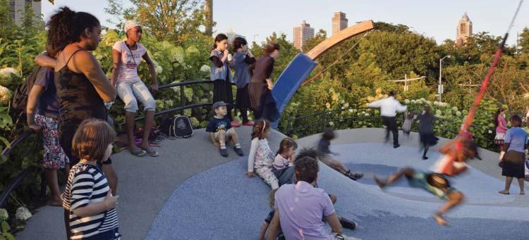
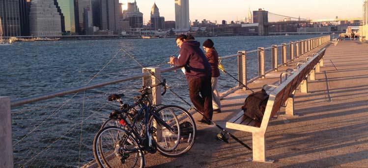
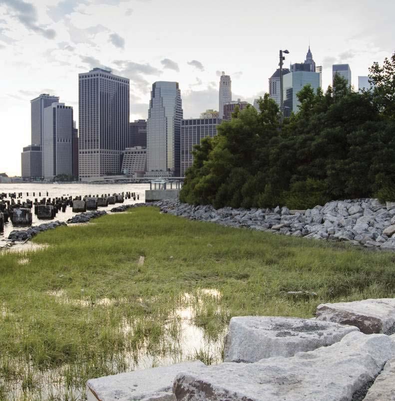
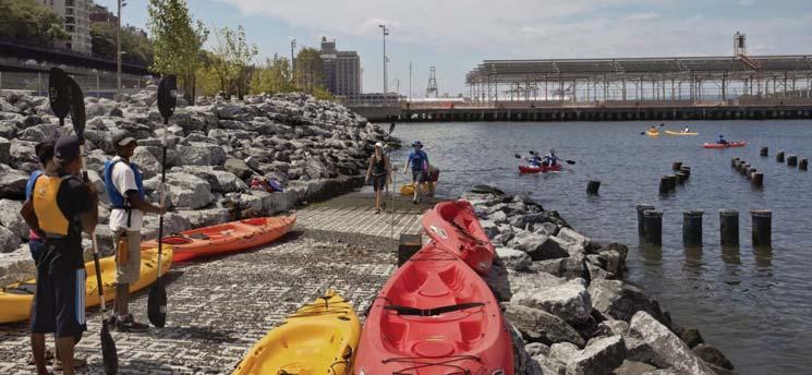
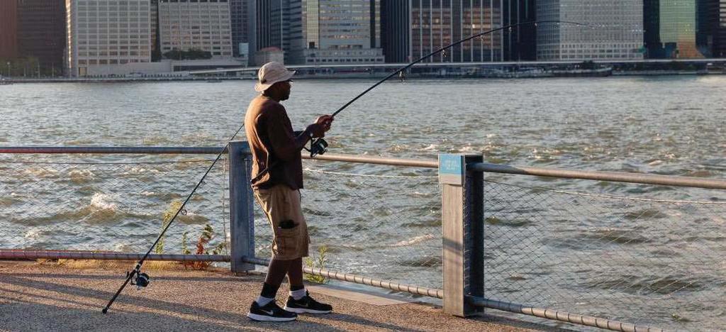
3 Brooklyn Bridge Park, Brooklyn, NY
4 How do we work?

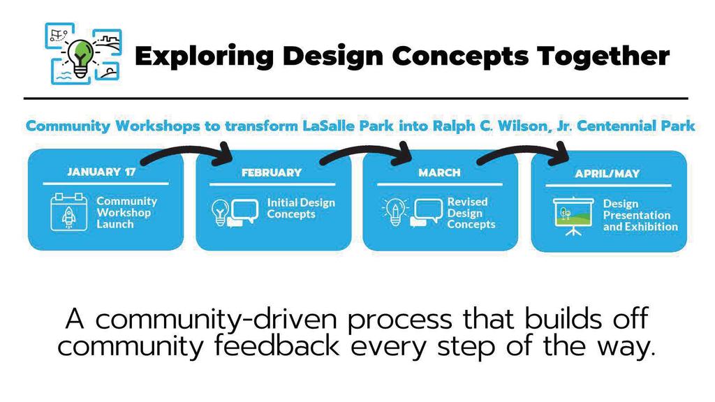
5 Design Process: Internal Design Development + Community Workshops
6 DESIGN COMMUNITY FEEDBACK CONCEPTUAL DESIGN SCHEME we are here conceptual costing conceptual design schematic design design development construction documents project construction Concept Development Phase Workflow
7 Existing Conditions Analysis


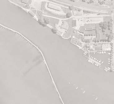
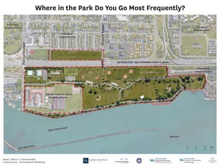
8 Buffalo, NY Niagra River Riverwalk and multi-use trails Ralph C. Wilson, Jr. Centennial Park Canada United States Legend Riverwalk and multi-use trails Lake Erie Project Site in Context


9 Lakeview Neighborhood Colonel Francis G. Ward Pumping Station Project Site Columbus Neighborhood Waterfront Neighborhood Lakefront Blvd Front Park Neighborhood Interstate 190 (former Erie Canal) Lake Erie ft Porter Avenue Hudson Street Project Boundary Black Rock Canal Bird Island Pier Niagara River


10 Lakeview Neighborhood Front Park Neighborhood Porter Avenue Jersey street Hudson Street Niagara Street Columbus Neighborhood Church Street Interstate 190 (former Erie Canal) Legend Park Entrances 10 Min. walk to LaSalle Route # 5 Route # 8 Route # 40 Colonel Francis G. Ward Pumping Station Lakefront Blvd Black Rock Canal Waterfront Neighborhood Erie Street Route # 29 Route # 6 Route # 22 Lake Erie Closest bus stops ft Existing Park Access + Urban Connections


")


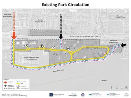
11 Fron t Park Neig ighb hbor orho hoodod Porter Avenue Lake kevi ew Neig ighb orho hood od Hudson Street Colu lumbus Ne ighb hbor hood Inte ters tatete 190 (former Erie Canal) Legend P P Colo lone nel Fran anci cis G. War ard Pump mpin ing St at ion P P Projec tboun oundar y d l Lakefront Blv Wate rfro ront Neig ighb orho hood od Multi-Modal Access Pedestrian & Bicycle Access Pedestrian Path Bicycle Path Black Rock Canal P Road Parking Lots On-Street Parking Bird Island Pier Lake Erie ft Existing Park Circlulation


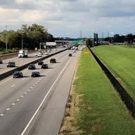
12 Fron t Park Neig ighb hbor ho od Port er Ave venu e La ke view Neig ighb hbor orho hood od INTERSTATE Undesired noise Hu ds on Str tree t Co lumb us Neig ighb or ho od WATERFRONT NEIGHBORHOOD - Private land Inte ters tate te 190 (fo form rmer Eri rie Ca nal) Co lo nel Fran anci s G. War ard Pu mpin ing St at ion d l Lakefront Blv Wate rfro ront Neig ighb orho hood od PORTER AVE - Two-way road Black Rock Canal PUMPING STATION - Fenced off for Homeland Security Lake Erie WATERFRONT - Breathtaking views - Wind ft The Edges of the Park


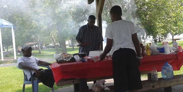
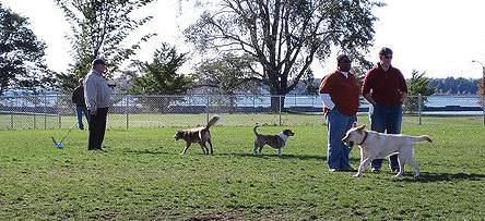
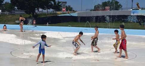
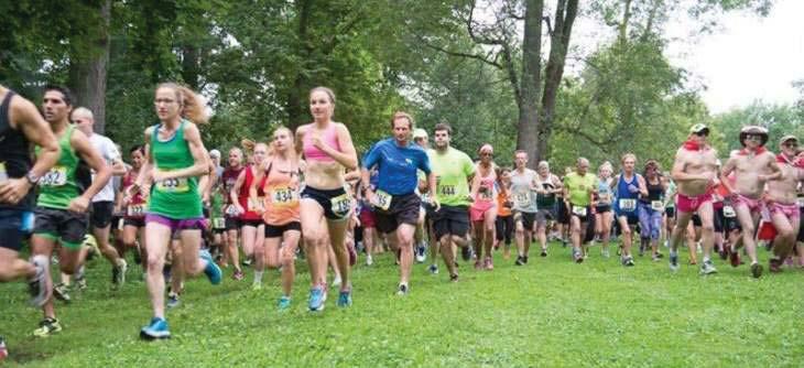
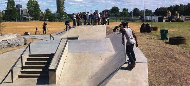
13 Fron ont Park Neig hb or hood od Port rter Ave. Lake view Neig ighb hbor orho hood od Hu dson St. Colu lumb us Neig ighb hbor hood In ters tate te 190 (fo form rmer Eri rie Cana l) LEGEND Picnic Shelter Pool/ Splash Pad Playground Skate Park Colo lone nel Fran anci s G. War d Pu mp ing Station d l Lakefront Blv Wate terf rfro ront Ne ighb or hood od Athletic Fields Event Lawn Black Rock Canal Dog Park Passive Lawn Space Pavilion Lake Erie ft Existing Programming
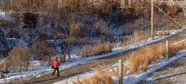
14 Seasonal Park Use JAN. FEB. MARCH ARPIL MAY JUNE JULY AUG. SEPT. NOV. DEC. Pool & Splash Pad Skate Park Riverwalk Trail Baseball Diamonds Football Field Soccer Fields Dog Park ( The Barkyard ) Pavilion Picnic Shelters


")


15 Fron ont Park Neig ighb or ho od Port er Ave. Lake view Ne ighb orho hood od Hu dson St. Colu lumb mbus Neig ighb hbor hood LEGEND In ters tate te 190 (fo form rmer Eri rie Cana nal) Percent of Site Coverage Tree Canopy 12% Open Lawn 44% Colo lone nel Fran anci s G. War d Pu mp ing Stat ation d l Lakefront Blv Wate terf rfro ront Ne ighb orho hood od Recreational 40% Black Rock Canal Lake Erie ft Existing Planting
16 I V E P A S S A C T RCWJC PARK I V E ACCESSIBLE CIRCULATION Correct Mix of Uses
17 Initial Design Observations
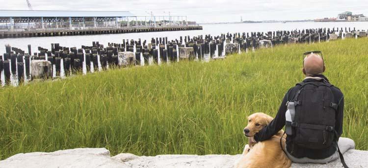
18 1. Build on the Strengths of LaSalle Park while Transforming it into Ralph C. Wilson Jr., Centennial Park. Develop LaSalle into a world class park through strategic interventions and overall enhancements that build on what the community already values about it and the site s unique assets.

19 LaSalle Park is a Welcoming Place for All

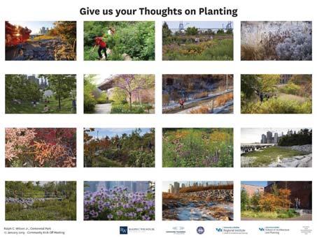
20 It Supports Activities for Different Interests and Age Groups

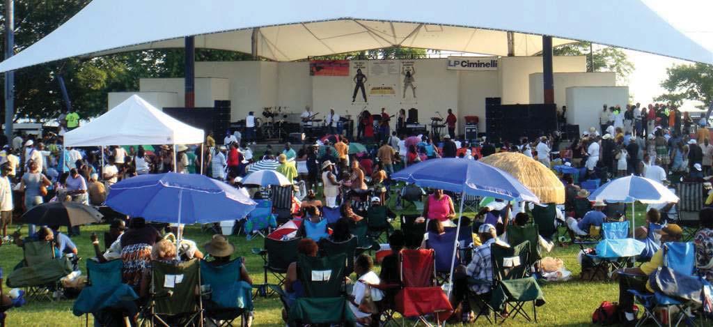
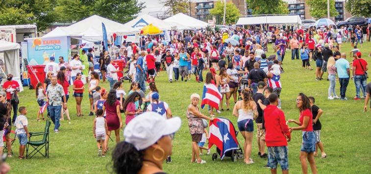
21 Flexible Spaces Accommodate Large Gatherings and Events

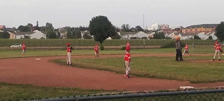
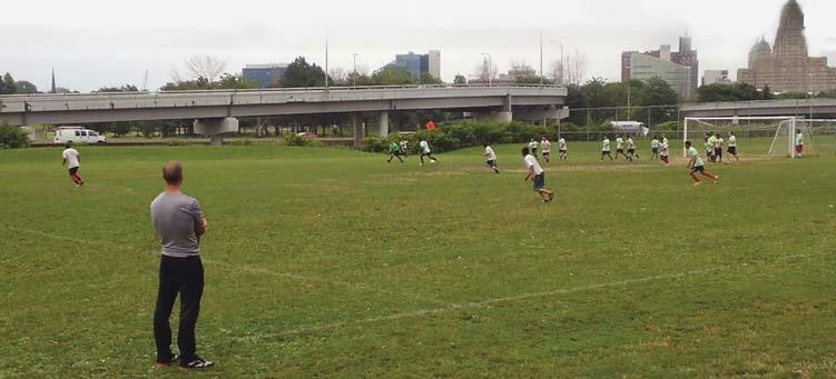
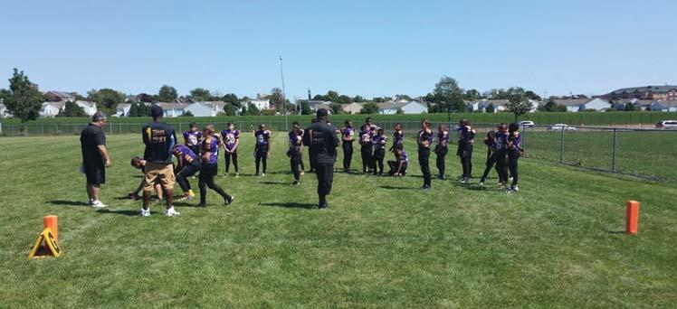
22 Various Athletic Facilities Serve the Surrounding Diverse Community

23 The Site is Powerful and Boundless

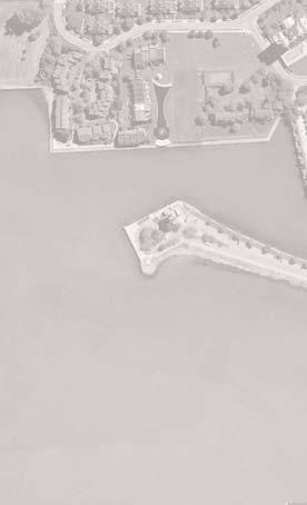
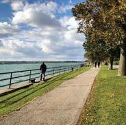
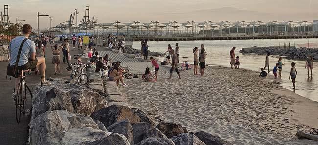
24 Waterfront Views are Exceptional
25 2. Re-imagine the Waterfront and Engage the Rest of the Park. Integrate a mix of hard and soft edges along the waterfront that reveal daily and seasonal water level changes and provide opportunities for the community to interact with the water in diverse ways.

26 Distinct Shoreline Treatments Add Experiential Complexity along the Waterfront

27 Embrace the Water s Edge

28 Engage the Water
29 3. Enrich the Park Experience with Topography and Planting. Introduce topography and planting to articulate spaces, hide and reveal views, block undesired sounds and sights, add rhythm and complexity to circulation network, display seasonality, and provide protection from elements.

30 Planting and Topography Articulate Spaces and Create Flow Between Them

31 Subtle Elevation Changes Enhance Movement through the Park

32 Landforms Block Undesired Noise and Sights


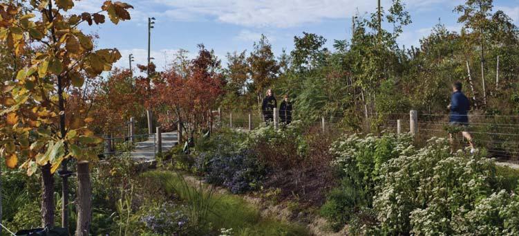
33 Plants and Seasonal Interest

34 Support Wildlife
35 4. Strengthen Neighborhood Connections and Improve Park Circulation. Provide safe, welcoming, and accessible entrances to the park to facilitate arrival from surrounding neighborhoods. Establish a hierarchical circulation network that allows visitors to move and experience the park in unique ways.

36 Integrate a Safe & Accessible Pedestrian and Bike Bridge into the Park


37 Establish a Hierarchy of Pedestrian Paths

38 Extend Vehicular, Bike, and Pedestrian Circulation to Reach Selective Programming

39 Integrate Parking into the Park
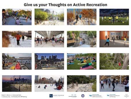
40 5. Make The Park a Welcoming and Diverse Place for Everyone to Enjoy Year-round. Orchestrate an ensemble of diverse and flexible spaces that provide opportunities for active recreation, passive uses, and temporary occupation throughout the year for Buffalonians of all backgrounds and age ranges.

41 Places for Organized Sports

42 Places for Unstructured Recreation

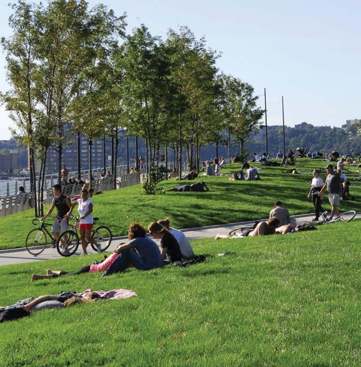
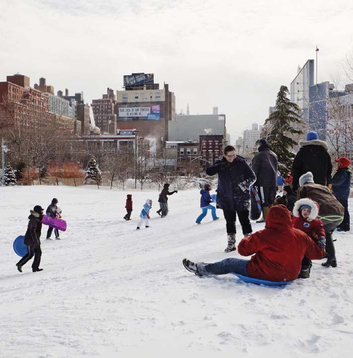
43 Places for Year-round Use

44 Places to Take In Views

45 Places to Engage with Water
46 Places for Exploration

47 Places for Play

48 Places for Families


49 Places for Groups and Individuals

50 Places for Dogs


51 Flexible Places that can be Temporarily Owned

52 Places for Delight

53 Places for Temporary Art Pieces

54 Places for Respite

55 Places for Assembly

56 Ralph C. Wilson, Jr. Centennial Park will continue to be a Place for All!
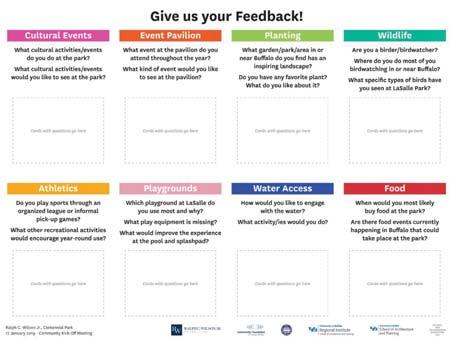
57 Worksession - Feedback Stations
58
LANDING S PARK CONCEPTUAL PLAN HAMILTON ANDERSON JANUARY City of Novi, Michigan. The Park at 13 Mile and Old Novi Road
 HAMILTON ANDERSON JANUARY 2012 LANDING S PARK CONCEPTUAL PLAN January 2012 Page 1 of 15 January 2012 PROJECT GOALS Activate the park by introducing new elements Provide clear access to the water and enhance
BASSETTS CREEK SECTION CONTENTS: BASSETTS CREEK BRYN MAWR LUCE LINE
 BASSETTS CREEK SECTION CONTENTS: BASSETTS CREEK BRYN MAWR LUCE LINE GLENWOOD AVE MULTI-USE DIAMONDS VINCENT AVE N MORGAN AVE N PENN AVE N DOG PARK MULTI-USE FIELDS PLAYGROUND AK E RD S CHESTNUT AVE DA
PIONEER PARK. City of Des Peres Parks Master Plan. SWT Design 46 INTRODUCTION
 PIONEER PARK INTRODUCTION Pioneer Park is a 7 acre neighborhood park located east of Interstate 270 and south of Manchester Road along Tallie Road. The park is situated in a residential neighborhood with
NORTHWEST SECTION CONTENTS: CLEVELAND PARK FOLWELL PARK RYAN LAKE PARK VICTORY PRAIRIE DOG PARK VICTORY PARK
 NORTHWEST SECTION CONTENTS: CLEVELAND PARK FOLWELL PARK RYAN LAKE PARK VICTORY PRAIRIE DOG PARK VICTORY PARK LUCY LANEY COMMUNITY SCHOOL N 33RD AVE N 33RD AVE SINGLE-FAMILY RESIDENTIAL MULTI-USE DIAMOND
Unincorporated East Rancho Dominguez STUDY AREA PROFILE
 Unincorporated East Rancho Dominguez STUDY AREA PROFILE STUDY AREA ID #31 BASE MAP PARK METRICS WHERE ARE PARKS MOST NEEDED AMENITY QUANTITIES AND CONDITIONS PARK NEEDS FRAMEWORK PROJECT COST ESTIMATES
YOU CAN MAKE A DIFFERENCE! VISIONING SESSION FOR THREAD LAKE OCTOBER 8, 2013
 YOU CAN MAKE A DIFFERENCE! VISIONING SESSION FOR THREAD LAKE OCTOBER 8, 2013 PEOPLE IN NEIGHBORHOODS & INSTITUTIONS ARE BUILDING A BETTER FLINT RIGHT NOW! DIPLOMAT PHARMACY GENESSEE COUNTY LAND BANK FLINT
M E S T I Z O C U R T I S P A R K
 ARAPAHOE CONNECTION TO BUS ROUTE AT ND AND LAWRENCE, FUTURE LIGHT RAIL STATION LEGEND SOCIAL TRAIL FLAGSTONE PAVING TO RESTORE/MAINTAIN CONCRETE PAVING DIAGONAL CURVILINEAR SOCIAL ROUTE IS OUT OF HISTORIC
St. John s Park Redevelopment Master Plan Public Engagement Report
 St. John s Park Redevelopment Master Plan Public Engagement Report Prepared by HTFC Planning & Design October 2017 TABLE OF CONTENTS 1.0 Introduction........ 1 2.0 Stakeholder and Public Notification......
and plant some trees, but that was only accomplished through state and federal work-relief programs.
 PEAVEY LOCATION AND HISTORY Peavey Park sits in the Phillips Community on a large block bounded by major streets: Franklin Avenue, Chicago Avenue, and Park Avenue. The southern continue through to Chicago
SOUTH PARK AT FRESHKILLS PARK ANCHOR PARKS PROGRAM COMMUNITY VISIONING. JCC of Staten Island February 1, 2017
 SOUTH PARK AT FRESHKILLS PARK ANCHOR PARKS PROGRAM COMMUNITY VISIONING JCC of Staten Island February 1, 2017 TONIGHT S AGENDA 1/ PRESENTATION: ANCHOR PARKS OVERVIEW WHAT WE HEARD IN NOVEMBER CONCEPTUAL
Dover Park Master Plan. Community Design Event Tuesday, May 22, 5 7 pm
 Dover Park Master Plan Community Design Event Tuesday, May 22, 5 7 pm Agenda I. Introduction / Overview 20 minutes II. Small Group Design Activity 60 minutes III. Small Group Report Out IV. Conclusion
EXISTING CONDITIONS AND CHARACTER
 DEMING HEIGHTS PARK LOCATION AND HISTORY Located in the Audubon Park neighborhood, Deming Heights Park is surrounded by a residential area. The first land for the park was acquired in 1913 along with the
Unincorporated Quartz Hill -Lancaster- Palmdale STUDY AREA PROFILE
 Unincorporated Quartz Hill -Lancaster- Palmdale STUDY AREA PROFILE STUDY AREA ID #19 BASE MAP PARK METRICS WHERE ARE PARKS MOST NEEDED AMENITY QUANTITIES AND CONDITIONS PARK NEEDS FRAMEWORK PROJECT COST
SHINGLE CREEK SECTION CONTENTS: BOHANON PARK CREEKVIEW PARK SHINGLE CREEK PARK SHINGLE CREEK REGIONAL TRAIL WEBBER PARK
 SHINGLE CREEK SECTION CONTENTS: BOHANON PARK CREEKVIEW PARK SHINGLE CREEK PARK SHINGLE CREEK REGIONAL TRAIL WEBBER PARK SPLASH PAD Good condition. PARK BUILDING BRYANT AVE N Good condition and unique to
NEW MEADOWS PARK PROPOSED MASTER PLAN
 NEW MEADOWS PARK PROPOSED MASTER PLAN A vision for your neighborhood park, the draft master plan is ready for your review. Tuesday September 12 th, 2017 5:30-7:00 PM Hellgate School District #4 middle
Unincorporated Northeast Antelope Valley STUDY AREA PROFILE
 Unincorporated Northeast Antelope Valley STUDY AREA PROFILE STUDY AREA ID #17 BASE MAP PARK METRICS WHERE ARE PARKS MOST NEEDED AMENITY QUANTITIES AND CONDITIONS PARK NEEDS FRAMEWORK PROJECT COST ESTIMATES
MIAMI RIVER COMMISSION
 COMMISSION July 13, 2015 CG LLC L-0 1.1 PROJECT TEAM OWNERSHIP CG, LLC 3200 STIRLING ROAD HOLLYWOOD, FL 33021 ARCHITECT KOBI KARP AND 2915 BISCAYNE BLVD SUITE 200 MIAMI, FL 33137 ER CG LLC ROMAN AND WILLIAMS
- Welcome. - Project Next Steps. - Intros. - Public Comment Time. - Guiding Principles Revisited. - Balance in the Service Area
 ST ONY RK VAN p ' LEVf uxr PARK ER CAC Role The appointed CAC for the East of the River Park Master Plan shall: Become knowledgeable about the project and its scope and advise MPRB staff and consultants
David Tickle, Principal, Urban Design, Hassell
 David Tickle, Principal, Urban Design, Hassell August 2015 NEWCASTLE URBAN TRANSFORMATION & TRANSPORT PROGRAM REVITALISATION POTENTIAL Establishing a Vision and Objectives VISION: RE-ESTABLISH NEWCASTLE
BACK COUNTRY UNIT PREFERRED ALTERNATIVE
 BACK COUNTRY UNIT PREFERRED ALTERNATIVE San Francisco (118 mi) Carmel-By-The-Sea Carmel River Carmel Valley Road State Beach Private Property Point Lobos State Reserve Point Lobos Ranch RUSTIC CAMPING
Unincorporated East Los Angeles - Southeast STUDY AREA PROFILE
 Unincorporated East Los Angeles - Southeast STUDY AREA PROFILE STUDY AREA ID #30 BASE MAP PARK METRICS WHERE ARE PARKS MOST NEEDED AMENITY QUANTITIES AND CONDITIONS PARK NEEDS FRAMEWORK PROJECT COST ESTIMATES
DRAFT TH AVE NE URBAN DESIGN MERIT PRESENTATION DPD# NOVEMBER 2017
 DRAFT 11.08.17 4801 24TH AVE NE URBAN DESIGN MERIT PRESENTATION 17-002 DPD#3027312 16 NOVEMBER 2017 PROJECT BACKGROUND URBAN DESIGN ANALYSIS VACATION / NO-VACATION COMPARISON URBAN DESIGN MERIT INTRODUCTION
Schachtner Street. Village Park Somerset, Wisconsin
 Schachtner Street Village Park Village Park Schachtner Street Softball Field Lower Terrace Parking Area Baseball Field Upper Terrace Parking Lot Mid Terrace Parking Area Restroom Building Path to Bridge
Building the transportation network we need for the future in Niagara Region
 Building the transportation network we need for the future in Niagara Region Niagara@metrolinx.com Metrolinx.com/Niagara Metrolinxengage.com INSERT FOOTER 1 WHO IS METROLINX? Metrolinx was created in 2006
NFTA Access Enhancement Study for Canalside and Cobblestone Alternatives Discussion. Alternative A South Park Avenue
 Alternative A South Park Avenue Alternative A Summary Alternative A extends Metro Rail service around the foot of Main Street east along South Park Avenue to serve a new station platform located along
City of Glendale - Southside STUDY AREA PROFILE
 City of Glendale - Southside STUDY AREA PROFILE STUDY AREA ID #168 BASE MAP PARK METRICS WHERE ARE PARKS MOST NEEDED AMENITY QUANTITIES AND CONDITIONS PARK NEEDS FRAMEWORK PROJECT COST ESTIMATES PROJECT
Trail Etiquette. Hours of Operation. Trail Accessibility
 Trail Guide The Elmhurst Park District, with 28 parks and over 460 acres of land, offers nearly six miles of paved or asphalt park trails and maintains an additional 3.6 miles of trails within Elmhurst.
CLEVELAND PARK LOCATION AND HISTORY EXISTING CONDITIONS AND CHARACTER LOCATION
 CLEVELAND PARK LOCATION LOCATION AND HISTORY Attempts to create a neighborhood park and playground in the Cleveland neighborhood began in 1926, when the park board designated for acquisition the block
River First Initiative and Waterworks Park
 River First Initiative and Waterworks Park The RiverFIRST proposal is critical to the creation of a larger regional parks and trails network, as well as ecological and infrastructure system. When realized,
STITCH TRANSFORMATIVE IDEA 3. SHORELINE STITCH. Re-connect the city to the waterfront and link the east and west Core Circle landscapes
 SHORE STITCH TRANSFORMATIVE IDEA 3. SHORELINE STITCH Re-connect the city to the waterfront and link the east and west Core Circle landscapes 126 LINE PUBLIC WORK 127 TRANSFORMATIVE IDEA 3. SHORELINE STITCH
Community Workshop #3 Summary March 13 th, 6pm 8pm Waterfront Elementary BPS #95 4th St. Buffalo, NY 14201
 Community Workshop #3 Summary March 13 th, 6pm 8pm Waterfront Elementary BPS #95 4th St. Buffalo, NY 14201 This Meeting On March 13th, over 150 people from the community came out Waterfront Elementary
City of LA Valley Glen - North Sherman Oaks STUDY AREA PROFILE
 City of LA Valley Glen - North Sherman Oaks STUDY AREA PROFILE STUDY AREA ID #61 BASE MAP PARK METRICS WHERE ARE PARKS MOST NEEDED AMENITY QUANTITIES AND CONDITIONS PARK NEEDS FRAMEWORK PROJECT COST ESTIMATES
San Francisco, California Hunters Point Shipyard. Design for Development
 San Francisco, California Hunters Point Shipyard Design for Development San Francisco, California Hunters Point Shipyard Design for Development Adopted June 3, 2010 by: San Francisco Planning Commission
PALO CORONA REGIONAL PARK MPRPD BOARD MEETING AUGUST 8, 2018
 PALO CORONA REGIONAL PARK MPRPD BOARD MEETING AUGUST 8, 2018 ACKNOWLEDGEMENTS AGENCIES AND ORGANIZATIONS The Trust for Public Land Big Sur Land Trust Santa Lucia Conservancy California State Parks Point
China Creek North Park Upgrades and Glen Pump Station. Park Board Committee Meeting Monday, July 10, 2017
 China Creek North Park Upgrades and Glen Pump Station Park Board Committee Meeting Monday, July 10, 2017 Purpose The purpose of this presentation is to: Share the results of the public engagement processes;
how it started where we are now what is coming up NEW WESTMINSTER WATERFRONT PARK THE RIVER THE PAST THE PEOPLE
 how it started Downtown Waterfront Park How It Started March 2009 City of New Westminster Purchases 3.2 Hectare Westminster Pier Site March 2009 City of New Westminster and Design Team develop plan for
25 th Avenue Grade Separation. December 13, 2017
 25 th Avenue Grade Separation December 13, 2017 Agenda I. Overview II. III. IV. Project Description Project Benefits Project Construction V. Next Steps VI. Questions 2 Overview Project Location 4 E. 25
Committee. Presentation Outline
 CW-33-15 11/9/2015 Community and Corporate Services Committee November 10, 2015 1 Presentation Outline Background Vision and Objectives Study Process and Timeline Public and Stakeholder Engagement Organization
Parks Master Plan. Interim Presentation: Long Range Vision August 3, 2016
 Parks Master Plan Interim Presentation: Long Range Vision August 3, 2016 Presentation Outline 1. Overview, Schedule, Needs Assessment Summary 2. Long Range Vision 3. Next Steps 4. Questions, Discussion
City of Sierra Madre STUDY AREA PROFILE
 City of Madre STUDY AREA PROFILE STUDY AREA ID #112 BASE MAP PARK METRICS WHERE ARE PARKS MOST NEEDED AMENITY QUANTITIES AND CONDITIONS PARK NEEDS FRAMEWORK PROJECT COST ESTIMATES PROJECT REPORTING FORM
Frederickson LUAC. Community Plan Update. Parks & Recreation. September 25, 2017
 Frederickson LUAC Community Plan Update Parks & Recreation September 25, 2017 Kimberly Freeman Resource Stewardship Superintendent kimberly.freeman@co.pierce.wa.us 253-798-4261 Joseph Coppo Senior Parks
Imagine LaSalle March Online Feedback Survey Open March 15 th March 24 th
 Imagine LaSalle March Online Feedback Survey Open March 15 th March 24 th The online survey presented the draft design vision for the park through the images that were shown at in the presentation at the
WEST CENTRAL SECTION CONTENTS: FARWELL PARK NORTH COMMONS PARK OLIVER TRIANGLE RUSSELL PARK THEODORE WIRTH REGIONAL PARK VALLEY VIEW PARK WILLARD PARK
 WEST CENTRAL SECTION CONTENTS: FARWELL PARK NORTH COMMONS PARK OLIVER TRIANGLE RUSSELL PARK THEODORE WIRTH REGIONAL PARK VALLEY VIEW PARK WILLARD PARK FARWELL PLACE THOMAS AVE N SWING BENCH PICNIC AREA
Bellevue South Park. Located between E 26th and E 28th at Mt. Carmel Place, in the Borough of Manhattan.
 Bellevue South Park Located between E 26th and E 28th at Mt. Carmel Place, in the Borough of Manhattan. Community Board 6 Review January 2, 2018 Christopher M. Crowley, RLA NYC Parks Total Budget: Project
DUNBAR & ASSOCIATES: ARNPRIOR RECREATION MASTER PLAN. Draft Community Workshop Meeting: June 26, 2014 Nick Smith Centre
 DUNBAR & ASSOCIATES: ARNPRIOR RECREATION MASTER PLAN Draft Community Workshop Meeting: June 26, 2014 Nick Smith Centre On Thursday, June 26, 2014 from 7:00 to 9:00 pm, Dunbar & Associates hosted a Community
Community Input Meeting. Fairgrounds Master Planning Update. January 7, 2016, 7 pm
 Community Input Meeting Fairgrounds Master Planning Update January 7, 2016, 7 pm Fiesta Hall Santa Clara County Fairgrounds 355 Tully Road, San Jose, CA Tonight s Agenda 1) Board of Supervisors Direction
Classifications, Inventory and Level of Service
 Classifications, Inventory and Level of Service Section 3 Kenmore Park, Recreation and Open Space Plan 1 P a g e Classifications and Inventory Park Classifications Kenmore classifies its parks based upon
Summary of Small Group Discussion Notes
 THE CORPORATION OF THE CITY OF WINDSOR Parks and Facilities/ Windsor Essex Local Immigration Partnership Community Consultation: Parks for Today-Planning for Tomorrow Dec 9, 2014 Windsor Public Library
Lake Waconia Regional Park 6. Lake Waconia Regional Park
 Lower Lakeshore Trail Interpretive/Adventure Trail Multiple Seating & Observation Areas Flexible Day Use Recreation Area Docks/Fishing Group Camping Group Day Use Space Winter Gathering/Event Space -Season
NORTH OF BROADWAY SECTION CONTENTS: COTTAGE PARK FARVIEW PARK GLEN GALE PARK IRVING TRIANGLE JORDAN PARK NEWTON PARK PERKINS HILL PARK
 NORTH OF BROADWAY SECTION CONTENTS: COTTAGE PARK FARVIEW PARK GLEN GALE PARK IRVING TRIANGLE JORDAN PARK NEWTON PARK PERKINS HILL PARK N ILIO NA VE N JAM ES AV E PLAYGROUND PAR K PRO PER TY B OUN DAR Y
Unincorporated Acton/ Uninc. South Antelope Valley STUDY AREA PROFILE
 Unincorporated Acton/ Uninc. South Antelope Valley STUDY AREA PROFILE STUDY AREA ID #9 BASE MAP PARK METRICS WHERE ARE PARKS MOST NEEDED AMENITY QUANTITIES AND CONDITIONS PARK NEEDS FRAMEWORK PROJECT COST
Villages at Buffalo Run East
 Villages at Buffalo Run East Neighborhood Park Subhead to title page goes here. Public Design Meeting April 9, 2015 Capital Improvement Program Commerce City s $137 million CIP is the result of a 2013
NORTH HEMPSTEAD BEACH PARK MASTER PLAN
 NORTH HEMPSTEAD BEACH PARK MASTER PLAN COMMUNITY DESIGN CHARRETTE Supervisor Judi Bosworth Viviana L. Russell Peter J. Zuckerman Angelo P. Ferrara Anna M. Kaplan Lee R. Seeman Dina M. De Giorgio VISIONING
HARBOUR EDGE STITCH. Uniting the Waterfront with the City Centre
 78 AC_BEU_CCMP_2_TM1_4 _FD.indd 78 20/07/12 12:04 PM 01 HARBOUR EDGE STITCH Uniting the Waterfront with the City Centre 01 VISION OUR 2032 VISION IS: Quay Street as a high-quality Harbour Edge space that
Unincorporated Charter Oak Islands - Covina - Covina Islands STUDY AREA PROFILE
 Unincorporated Charter Oak Islands - Covina - Covina Islands STUDY AREA PROFILE STUDY AREA ID #11 BASE MAP PARK METRICS WHERE ARE PARKS MOST NEEDED AMENITY QUANTITIES AND CONDITIONS PARK NEEDS FRAMEWORK
COMMITTEE OF THE WHOLE (WORKING SESSION) APRIL 19, 2011 YORK REGION RAPID TRANSIT HIGHWAY 7 BUS RAPID TRANSIT- VMC STATION WARD 4.
 APRIL 19, 2011 YORK REGION RAPID TRANSIT HIGHWAY 7 BUS RAPID TRANSIT- VMC STATION WARD 4.") COMMITTEE OF THE WHOLE (WORKING SESSION) APRIL 19, 2011 YORK REGION RAPID TRANSIT HIGHWAY 7 BUS RAPID TRANSIT- VMC STATION WARD 4 Recommendation The Commissioner of Engineering and Public Works and the
COMMITTEE OF THE WHOLE (WORKING SESSION) APRIL 19, 2011 YORK REGION RAPID TRANSIT HIGHWAY 7 BUS RAPID TRANSIT- VMC STATION WARD 4 Recommendation The Commissioner of Engineering and Public Works and the
I-70/I-71 Project Public Meeting Presented By
 I-70/I-71 Project Public Meeting Presented By Ohio Department of Transportation ms consultants, inc. engineers, architects, planners MSI Design June 9, 2010 W e l c o m e Thom Slack Planning Administrator,
25 th Avenue Grade Separation. September 13, 2017
 25 th Avenue Grade Separation September 13, 2017 Agenda I. Overview II. III. IV. Project Description Project Benefits Project Construction V. Next Steps VI. Questions 2 Overview Project Location 4 E. 25
CITY OF MANVEL Parks & Recreation Master Plan Community Meeting Summary
 CITY OF MANVEL Parks & Recreation Master Plan Community Meeting Summary The City of Manvel hosted a Community Meeting on June 23, 2016 at the Church of the Harvest. Over 25 community members attended and
CLIPPER COVE PROMENADE & MARINA DEVELOPMENT
 CLIPPER COVE PROMENADE & MARINA DEVELOPMENT Treasure Island / Yerba Buena Island Citizen Advisory Board Review May 05 2015 CLIPPER COVE PROMENADE & MARINA DEVELOPMENT TREASURE ISLAND TI YBI CAB Review
Wilds. Headwaters. Lakes. Oxbows. Falls
 56 5 4 3 Wilds Headwaters Lakes Oxbows Falls 57 Zones It could be said the on-the-ground essence of this master plan appears within the next 6 pages of this report. As we learned in the preceding Cultural
Parks and Recreation Master Plan
 Emerging Themes Parks and Recreation Master Plan City of Mount Dora, Florida September 17, 2018- Revised October 1, 2018 Agenda Welcome & duction Master Plan The Inventory & Existing Community Overview
hudsonriverpark.org 2017 Brand Activation and Partnership Opportunities
 1 2017 Brand Activation and Partnership Opportunities 2 A World Class Park Background Hudson River Park is enjoyed annually by millions of New Yorkers and visitors from around the world. Since construction
Sport Capital Improvement Plan. Paul Borci Manager, Campus Planning Property & Campus Services
 Sport Capital Improvement Plan Paul Borci Manager, Campus Planning Property & Campus Services What is SCIP? Property and Campus Services (PCS) in collaboration with Melbourne University Sport (MU Sport)
City of Palmdale - Westside STUDY AREA PROFILE
 City of Palmdale - Westside STUDY AREA PROFILE STUDY AREA ID #125 BASE MAP PARK METRICS WHERE ARE PARKS MOST NEEDED AMENITY QUANTITIES AND CONDITIONS PARK NEEDS FRAMEWORK PROJECT COST ESTIMATES PROJECT
City of LA Reseda - West Van Nuys STUDY AREA PROFILE
 City of LA Reseda - West Van Nuys STUDY AREA PROFILE STUDY AREA ID #95 BASE MAP PARK METRICS WHERE ARE PARKS MOST NEEDED AMENITY QUANTITIES AND CONDITIONS PARK NEEDS FRAMEWORK PROJECT COST ESTIMATES PROJECT
City of Signal Hill STUDY AREA PROFILE
 City of Signal Hill STUDY AREA PROFILE STUDY AREA ID #141 BASE MAP PARK METRICS WHERE ARE PARKS MOST NEEDED AMENITY QUANTITIES AND CONDITIONS PARK NEEDS FRAMEWORK PROJECT COST ESTIMATES PROJECT REPORTING
Welcome to the Cross County Trail Public Input Session!
 Welcome to the Cross County Trail Public Input Session! Please sign in on the table below! What are we doing here? Camden County has proposed a bicycle and pedestrian trail spanning across the entire county.
SR 934 Project Development And Environment (PD&E) Study
 Study") SR 934 Project Development And Environment (PD&E) Study Project Advisory Group Meeting March 1, 2018 State Road 934/NE/NW 79th Street from west of I-95 (NW 13th CT) to N. Bayshore Drive PD&E STUDY SR 934/NE/NW
SR 934 Project Development And Environment (PD&E) Study Project Advisory Group Meeting March 1, 2018 State Road 934/NE/NW 79th Street from west of I-95 (NW 13th CT) to N. Bayshore Drive PD&E STUDY SR 934/NE/NW
Analysis and Feasibility Broward County Convention Center Master Plan Study Fort Lauderdale, FL HKS I Urban Design Studio
 Analysis and Feasibility Broward County Convention Center Master Plan Study Fort Lauderdale, FL 04.01.14 HKS I Urban Design Studio Summary of Outreach Purpose of Stakeholder Outreach Identify and engage
SOUTH LAKE TAHOE, CALIFORNIA REGAN BEACH PRELIMINARY DESIGN NOVEMBER 2015
 SOUTH LAKE TAHOE, CALIFORNIA REGAN BEACH PRELIMINARY DESIGN NOVEMBER 2015 Contents BACKGROUND...1 CONTEXT MAP....2 PROJECT BACKGROUND....3 AERIAL TIMELINE....4 HISTORIC PHOTOS...5 EXISTING CONDITIONS
City of Walnut STUDY AREA PROFILE
 City of Walnut STUDY AREA PROFILE STUDY AREA ID #133 BASE MAP PARK METRICS WHERE ARE PARKS MOST NEEDED AMENITY QUANTITIES AND CONDITIONS PARK NEEDS FRAMEWORK PROJECT COST ESTIMATES PROJECT REPORTING FORM
City of San Dimas / Unincorporated San Dimas STUDY AREA PROFILE
 City of San Dimas / Unincorporated San Dimas STUDY AREA PROFILE STUDY AREA ID #156 BASE MAP PARK METRICS WHERE ARE PARKS MOST NEEDED AMENITY QUANTITIES AND CONDITIONS PARK NEEDS FRAMEWORK PROJECT COST
Parks, Recreation and Cultural Needs Assessment and Facilities Plan. November 21, 2016 City Council Worksession
 Parks, Recreation and Cultural Needs Assessment and Facilities Plan November 21, 2016 City Council Worksession History and Process FY16/17 Budget Appropriation for Needs Assessment, Dean and Stonewall
Community Advisory Committee Meeting #3 April 21, 2015
 Community Advisory Committee Meeting #3 April 21, 2015 Purpose (charge) of the CAC: Be Knowledgeable, Be an Engaged Representative, Develop Master Plan, & Prioritize Plan 1 Welcome/ Introductions Review
Gerald R. Ford International Airport Authority Master Plan Update A World Class Gateway
 Gerald R. Ford International Airport Authority Master Plan Update A World Class Gateway Master Plan Advisory Committee (MPAC) Alternatives September 28, 2017 AGENDA Review of Previous Work Ultimate Land
Waterfront and Marina Strategic Plan. May 26, 2015 Infrastructure, Investment & Development Committee
 Waterfront and Marina Strategic Plan May 26, 2015 Infrastructure, Investment & Development Committee 1 Purpose Background Update work completed or underway Vision & principles Balanced plan with opportunities
SAN ANTONIO RIVER IMPROVEMENTS PROJECT. August 6, 2008
 SAN ANTONIO RIVER IMPROVEMENTS PROJECT August 6, 2008 1 History of the SA River Improvements 1921 Flood Olmos Dam Complete in 1929 Downtown Flood Relief Projects in 1950 s Dams on the River Channel and
Longmont to Boulder Regional Trail Jay Road Connection DRAFT FINAL REPORT
 Longmont to Boulder Regional Trail Jay Road Connection DRAFT FINAL REPORT December 2018 Project Summary Boulder County, Colorado, in partnership with the City of Boulder, is evaluating options for multi-use
The Narrows Waterfront Park A Crown Jewel for Southern Brooklyn
 The Narrows Waterfront Park A Crown Jewel for Southern Brooklyn In New York, the unquestioned popularity of urban spaces such as Riverside Park, the High Line, Brooklyn Bridge Park and others has demonstrated
City of Manhattan Beach STUDY AREA PROFILE
 City of STUDY AREA PROFILE STUDY AREA ID #178 BASE MAP PARK METRICS WHERE ARE PARKS MOST NEEDED AMENITY QUANTITIES AND CONDITIONS PARK NEEDS FRAMEWORK COST ESTIMATES Note: This Study Area did not hold
Memorable Designs, Unforgettable places
 Memorable Designs, Unforgettable places We create environments that connect people, introduce nature into life s moments and provide a backdrop against which unforgettable experiences unfold. DELRAY BEACH
Experience the environment
 Experience it. Experience the environment The Grand is where CREATIVE, STATE-OF-THE-ART OFFICE meets inviting outdoor spaces featuring vibrant landscaping, pedestrian walkways and a two acre PROMINENT
City of Washington & East Washington Borough Comprehensive Parks and Recreation Plan October Public Open Houses Summary
 Public Open Houses Summary Wednesday, October 5 th and Thursday, October 6 th 2011 1. Public Survey Station Attendees of the meetings were asked to complete the public recreation survey. 159 were completed
Public Park System. Township of Derry. Providing natural open space for the recreational use of our residents and guests.
 Township of Derry Public Park System Providing natural open space for the recreational use of our residents and guests. Directory of Recreational Amenities Hershey s Commitment to Recreation Famous candy
Corktown Parks. Public Meeting. City of Toronto
 Corktown Parks Public Meeting City of Toronto 15-04-20 Agenda 1. Reasons for Study 2. Consultation to Date 3. Parks Evaluation 4. Community Context 5. Bright St. Playground 6. Orphans Green (Dog Off Leash)
TOWN OF LAKESHORE PARKS
 TOWN OF LAKESHORE PARKS Welcome! This document shows the display boards that were used for the Parks Masterplan Open Houses held on July 26, 27, and August 2, 2016 for the Town of Lakeshore. The displays
Section II. Planning & Public Process Planning for the Baker/Carver Regional Trail began in 2010 as a City of Minnetrista initiative.
 Section II Planning & Public Process Planning for the began in 2010 as a City of initiative. city staff began discussions with the Park District on the possibility of a north/south regional trail connection
Overview Parks Alliance Overview March 2017
 Overview Our Mission The mission of the San Francisco Parks Alliance is to inspire and promote civic engagement and philanthropy to protect, sustain and enrich San Francisco parks, recreation and green
Webber Park Master Plan Charrette Summary
 SMALL GROUP #1 - September 29, 2011 Webber Park Master Plan Charrette Summary More trash cans, especially near picnic grounds A year round pool is very needed-physical & mental health are significantly
2.1 TITLE: VMC PARKS MASTER PLAN AND IMPLEMENTATION STRATEGY PROJECT UPDATE
 2.1 Item: VMC Sub-committee Report DATE: Tuesday, June 12, 2018 WARD: 4 TITLE: VMC PARKS MASTER PLAN AND IMPLEMENTATION STRATEGY PROJECT UPDATE FROM: Jason Schmidt-Shoukri, Deputy City Manager, Planning
BUCKS COUNTY TRAILS. September 10, 2015 Presentation to:
 BUCKS COUNTY TRAILS September 10, 2015 Presentation to: BUCKS COUNTY TRAILS Benefits of Trails Bucks County Trails The Circuit Active Trail Projects Planning Studies Municipal Trails Planning Other Trail
Winnebago County Community Park
 Directions to Community Park From Interstate Hwy. 41 to Oshkosh exit 124, which is Hwy. 76/Jackson Street. East on Hwy 76/ Jackson Street to left on County Road Y, 1/4 mile. Winnebago County Park is on
Fun Facts. How many Baseball fields do we have? a. 2 b. 14 c. 16 d. 21
 It Starts in Parks Fun Facts How many Baseball fields do we have? a. 2 b. 14 c. 16 d. 21 Fun Facts How many people visit Central Winds Park Annually? a. Over 100,000 b. 20,000 c. 10,000 d. 1,000 It Starts
WHY MOVE YOUR BUSINESS TO HOLLYWOOD?
 WHY MOVE YOUR BUSINESS TO HOLLYWOOD? Close to international airport and seaport Centrally located in 3.5 million population No personal income tax Diverse labor force and talent pool Waterfront executive
Hillsborough MPO Technical Advisory Committee. Monday, February 20, 2017
 Hillsborough MPO Technical Advisory Committee Monday, February 20, 2017 1 Study Purpose Support the vision for a livable, connected, and competitive downtown. Evaluate alternatives for the system s modernization
MOSCONE EXPANSION PROJECT Yerba Buena Alliance PRESENTATION FEBRUARY 06, 2014
 MOSCONE EXPANSION PROJECT Yerba Buena Alliance PRESENTATION FEBRUARY 06, 2014 MOSCONE EXPANSION PROJECT OBJECTIVES Expand the contiguous exhibition space increasing the quantity of highly flexible meeting
PARKS & BEACHES PROJECTS
 #18 72ND STREET PARK, LIBRARY, #19 BLUEWAYS & AQUATIC CENTER $1.1 MILLION $60 MILLION New facility to include: Create Kayak Launches with All Wheels Skate Park Floating Docks and Seating at: Library/Media
San Pedro Waterfront Development Efforts Presentation for Trade, Commerce & Technology Committee
 San Pedro Waterfront Development Efforts Presentation for Trade, Commerce & Technology Committee November 17, 2015 Ports O Call Area Redevelopment Ports O Call Area Redevelopment Implementation Schedule
Home of Southbank Partners. Riverfront Commons. Southbank Partners. Covington Newport Bellevue Ft. Thomas Dayton Ludlow
 Home of Southbank Partners Riverfront Commons Southbank Partners Covington Newport Bellevue Ft. Thomas Dayton Ludlow Riverfront Commons Fostering a vision of Northern Kentucky s Future Riverfront Commons