DRAFT TH AVE NE URBAN DESIGN MERIT PRESENTATION DPD# NOVEMBER 2017
|
|
|
- Vivien Ford
- 5 years ago
- Views:
Transcription

1 DRAFT TH AVE NE URBAN DESIGN MERIT PRESENTATION DPD# NOVEMBER 2017

2 PROJECT BACKGROUND URBAN DESIGN ANALYSIS VACATION / NO-VACATION COMPARISON URBAN DESIGN MERIT
3
4 INTRODUCTION OF DEVELOPMENT TEAM PHOENIX PROPERTY COMPANY PRESTON HART
5 EQUITY BY DESIGN EQUITY ISSUES WHO IS IMPACTED PROPOSED AMENITIES OUTREACH OUTREACH IMPACTS Creation of accessible open space in the form of new and safe connections between the trail, rightofway, and commercial district to the East (U Village) Safer pedestrian experience on 24th Avenue NE for all Neighborhood pedestrians/cyclists University of Washington students, staff, employees Users of the Burke- Gilman Trail Local residents Local businesses Bicycle repair tools Seating Bicycle parking Water Lighting Wayfinding (Facilitated by Natalie Quick Consulting Public Relations, McCullough Hill Leary, and the design team) University of Washington Ravenna-Bryant Community Association Seattle Parks and Recreation Adjacent developers Orientation, alignment, size, and user designation of trail connections Public versus private delineation Building massing, orientation, and design response in relation to the trail More direct and accessible connections from BGT to public ROW Cascade Bicycle Club Seattle Public Utilities Local businesses, adjacent developers (U Village, Greystar, etc.)

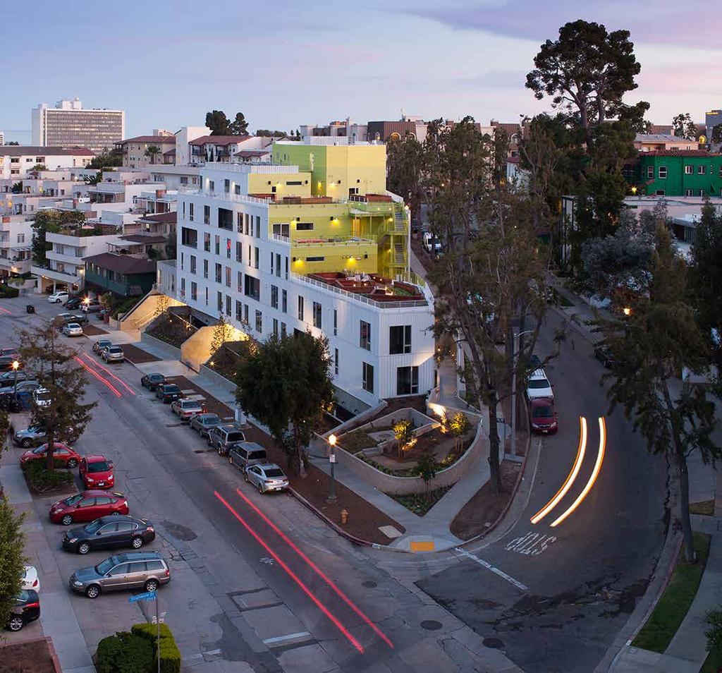
6 PROJECT LOCATION & BACKGROUND PROJECT ADDRESS th Avenue NE RAVENNA NEIGHBORHOOD BURKE GILMAN TRAIL SITE 24TH AVE NE PEND OREILLE NE 49TH ST NE 47TH ST 25TH AVE NE UNIVERSITY VILLAGE BOUNDARIES OF THE BLOCK Private developments to North and South Burke Gilman Trail to the West 24th Ave NE to the East NEIGHBORHOOD PLANNING AREA University Community Urban Center ZONING Current = LR3 Interim Rezone = NC-85 Anticipated HALA Zoning = NC-75 NE 45TH ST UNIVERSITY OF WASHINGTON ZONING OVERLAYS / REVIEW DISTRICT Ravenna Urban Center Village


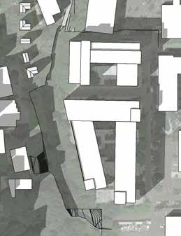
7 EXISTING SITE STREET TO BE VACATED SPU EASEMENT BURKE-GILMAN TRAIL COURTYARD NE 49TH ST R.O.W. = 50' W PARKING NE 48TH ST. - AREA OF R.O.W. TO BE VACATED = 9,743 SF PARKING 39.0 R.O.W. = 50' W 24TH AVE NE SPU EASEMENT PARKING PARKING BURKE-GILMAN TRAIL PARKING COURTYARD NE 47TH ST R.O.W. = 50' W 47.0 AREA OWNED BY U.W. 37.0

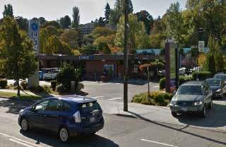
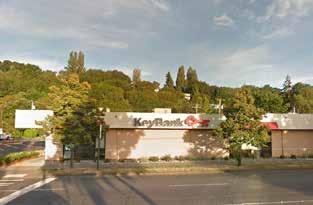
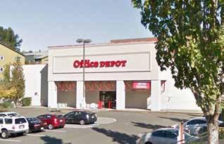
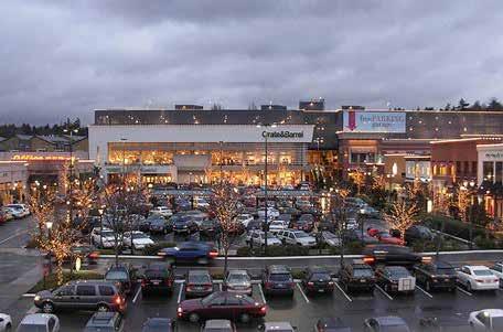
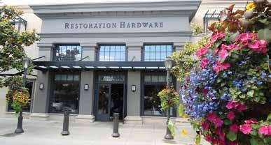
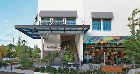
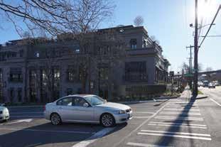
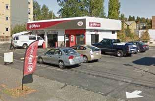
8 NEIGHBORHOOD CONTEXT SITE OFFICE / COMMERCIAL 22ND AVE NE BURKE GILMAN TRAIL 24TH AVE NE RAVENNA AVE NE NE 49TH ST RESIDENTIAL RETAIL INSTITUTIONAL HOSPITALITY PLANNED PROJECTS NE 47TH ST 25TH AVE NE


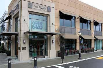
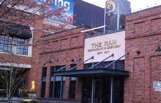
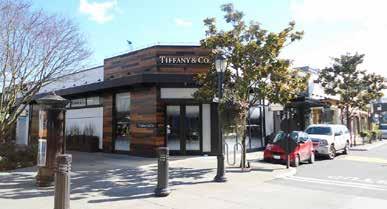
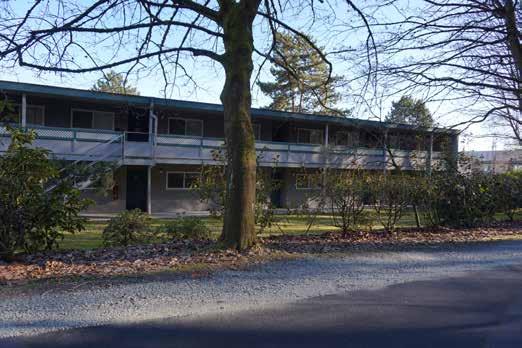
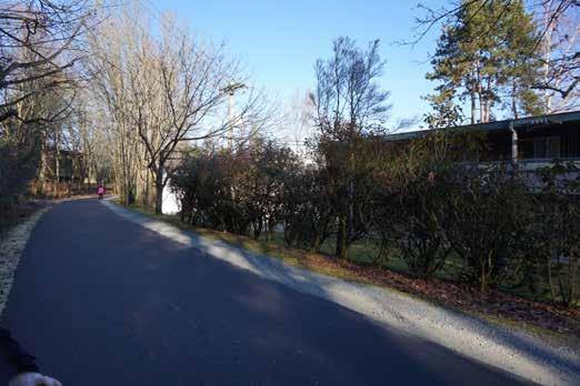
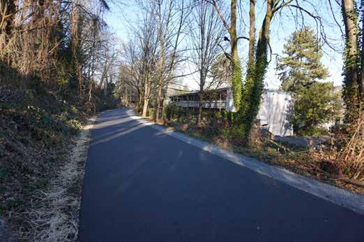
9 NEIGHBORHOOD CHARACTER


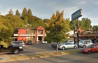
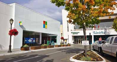
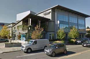
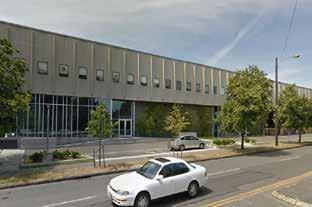
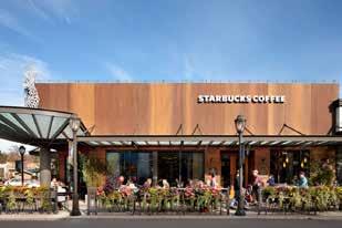
10 NE 48TH ST COPYRIGHT 2015 WEBER THOMPSON 24TH AVE ELEVATIONS / SITE PHOTOS 24TH AVE NE NE 49TH ST NE 47TH ST NE 48TH ST NE 48TH ST NE 48TH ST TRAILSIDE URBAN DESIGN MERIT PRESENTATION PAGE 10 DRAFT

11 COPYRIGHT 2015 WEBER THOMPSON 24TH AVE ELEVATIONS / SITE PHOTOS 25TH AVE NE NE 49TH ST NE 47TH ST 24TH AVE NE NE 48TH ST BURKE-GILMAN TRAIL TRAILSIDE URBAN DESIGN MERIT PRESENTATION PAGE 11 DRAFT

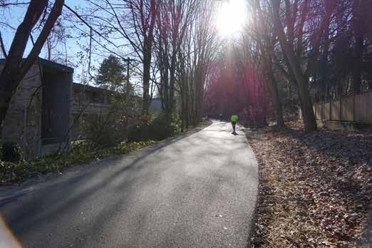

12 SITE PHOTOS FROM BURKE-GILMAN TRAIL

13 SECTION THROUGH SITE LOOKING NORTH 40' HEIGHT 75 HEIGHT (NC2 75 PROPOSED HALA RE ZONE) 40 HEIGHT (LR EXISTING ZONING) 27 HEIGHT (EXISTING BUILDING HEIGHT) 40 WIDE EL EL ND AVE NE 30 WIDE RAVENNA AVE NE EL BURKE GILLMAN TRAIL SITE EL WIDE 24TH AVE NE KEY BANK EL WIDE 25TH AVE NE UNIVERSITY VILLAGE

14 SECTION LOOKING NORTH WITH PROPOSED PROJECT 85' HEIGHT 75' HEIGHT 65' HEIGHT
15 EARLY DESIGN GUIDANCE PUBLIC COMMENT BOARD GUIDANCE / COMMENT Expressed support for the preferred design alternative. Noted the buildings minimize the façade along the Burke Gilman Trail, the street, and includes public amenity space. Would like to see the transition between the Burke Gilman trail and the site read as a public gateway. Would prefer to see a larger connector provided to the south in lieu of the north connector. Expressed support for the development s focus on the public realm, including a new pedestrian connection between the Burke Gilman Trail, NE 47th Street, and University Village. Expressed support for the large gestures of public open space, and connectors. The Board provided unanimous support for the applicant s preferred massing Option 4. The Board applauded the north south connectors and the Trailside Commons as public open spaces. The Board agreed that the new connections between the Burke Gilman Trail, at the south facing open space was a special amenity. The proposal maximizes these benefits by providing a significant public open space within the Trailside Commons. The Board acknowledged public comments regarding the limited connection of the north connector to University Village, but ultimately the Board supported the north connector for the added porosity to the site and for the future connection opportunities it may provide to University Village. THE PROJECT HAS SUBMITTED A MASTER USE PERMIT APPLICATION
16

17 2018 UW CAMPUS MASTER PLAN PROJECT SITE Long-Term Vision, Campus at Full Build-out Figure 70. Graphics are for Illustrative Purposes Only NE 45th St 15th Ave NE NE 41st St University Bridge NE Pacific St Montlake Blvd NE Potential Building Existing Building Potential Primary Open Space 2018 Seattle Campus Master Plan - October 2016 Draft Plan 81

18 2018 UW CAMPUS MASTER PLAN NE 43rd St The Ave / University Way 11th Ave NE 12th Ave NE Brooklyn Ave 15th Ave NE Memorial Way PROJECT SITE Chelan Way NORTH CAMPUS HOUSING 25th Ave NE NE 45th St Proposed Pedestrian Circulation Figure 103. Graphics are for Illustrative Purposes Only NE 41st St Campus Pkwy Spokane Lane EAST CAMPUS LAND BRIDGE University Bridge Burke-Gilman Trail WEST CAMPUS GREEN South of Gould Skamania Lane NE Pacific St Thurston Lane Snohomish Lane Montlake Blvd NE Existing Primary Route Potential Primary Route Existing Secondary Route SOUTH CAMPUS GREEN Potential Secondary Route Existing Connector Route Potential Connector Route Continuous Waterfront Trail 2018 Seattle Campus Master Plan - October 2016 Draft Plan 105

19 URBAN DESIGN ANALYSIS FOCUS AREA LAND USE Ravenna Park NE 55th St PROJECT SITE Ravenna Park NE 55th St MULTI-FAMILY NE 54th St RIGHT OF WAY NE 54th St SINGLE FAMILY NEIGHBORHOOD/ COMMERCIAL Ravenna Ave NE NE Blakely St Ravenna Ave NE NE Blakely St MAJOR INSTITUTION NE 50th St NE 50th St NE 49th St PROPOSED R.O.W. VACATION 9,735 SF NE 49th St 22nd Ave NE PROJECT SITE 101,235 SF 24th Ave NE NE 47th St 25th Ave NE UNIVERSITY VILLAGE 22nd Ave NE PROJECT SITE 24th Ave NE NE 47th St 25th Ave NE UNIVERSITY VILLAGE Burke-Gilman Trail Burke-Gilman Trail UW VEHICLE MAINT. FACILITY UW VEHICLE MAINT. FACILITY N N UNIVERSITY OF WASHINGTON NE 45th St Montlake Blvd NE UNIVERSITY OF WASHINGTON NE 45th St Montlake Blvd NE
20 URBAN DESIGN ANALYSIS TRANSIT ROAD NETWORK NE 54th St Ravenna Park NE 55th St Transit Corridor (Metro Bus) Bus Stop NE 54th St Ravenna Park NE 55th St PRINCIPAL ARTERIAL COLLECTOR ARTERIAL Ravenna Ave NE NE Blakely St Ravenna Ave NE NE Blakely St LOCAL STREET NE 50th St 372 NE 50th St 980 NE 49th St NE 49th St 2 22nd Ave NE PROJECT SITE 24th Ave NE NE 47th St 25th Ave NE UNIVERSITY VILLAGE 22nd Ave NE PROJECT SITE 24th Ave NE NE 47th St 25th Ave NE 3 UNIVERSITY VILLAGE Burke-Gilman Trail UW VEHICLE MAINT. FACILITY Burke-Gilman Trail UW VEHICLE MAINT. FACILITY UNIVERSITY OF WASHINGTON NE 45th St Montlake Blvd NE UNIVERSITY OF WASHINGTON NE 45th St Montlake Blvd NE N


21 25TH AVE Site PEDESTRIAN & BIKE NETWORK ACCESS & CIRCULATION 1 NE 55TH ST 24TH AVE NE NE 49TH ST 25TH AVE NE SHARED PED. & BIKE 2 3 NE 47TH ST Calvary Cemetary NE BLAKELEY ST 35TH AVE NE URBAN DESIGN ANALYSIS Ravenna Park NE 60TH ST NE UNIVERSITY VILLAGE ST Vehicular Entrances NE Blakely St Parking Entrances Calvary Cemetary NE BLAKELEY ST NE 45TH ST MA 35TH AVE NE D NE E BLV MON TLAK Site 24TH AVE NE E NE UNIVERSITY VILLAGE ST UNIVERSITY VILLAGE 1 NE 45TH ST 25th Ave NE NE 55th St MA NE 45th St D NE E BLV 15th Ave NE TLAK MON NE ke Blvd Montla ge yb rid ive rsit Un il LEGEND NE Pa c ific St 1 25th Ave NE NE 55th St X Study Intersection X Weekday PM Peak Hour Traffic Volumes 3 25th Ave NE NE 47th St/NE U-Village St NE 047th St , n Trail - Gilma Burke Trailside Development 200 Sep 20, :46pm 25th Ave NE NE 49th St UW VEHICLE MAINT. FACILITY UNIVERSITY VILLAGE 5 Sep 20, :46pm jessical M:\17\ Trailside Development\Graphics\17061 Graphics_TIA.dwg Layout: Future With N NE Tr a ista an Trailside Development er V lm ,110 DR Gi PROJECT SITE th Ave NE e- ni Rai rk IAL 95 24th Ave NE NO PEDESTRIAN CONNECTION 25th Ave NE NE 47th St/NE U-Village St OR E NE Campus Pkwy EM Weekday PM Peak Hour Traffic Volumes SM X TE Ave N Study Intersection 25th Ave NE NE 49th St GA NE5549th St Ave NE Ravenna 22nd X RY 60 LEGEND UNIVERSITY OF WASHINGTON Bu RN 3 Circulation LD NE 47TH ST 2 IA OR EM BIKE ROUTE M ES T GA NE 49TH ST NE Blakely St PROJECT SITE Signalized Intersection RY PEDESTRIAN ROUTE WEEKDAY PM PEAK HOUR TRAFFIC FIGURE VOLUMES FIGURE 6 N jessical M:\17\ Trailside Development\Graphics\17061 Graphics_TIA.dwg Layout: Future With
22 URBAN DESIGN ANALYSIS BIKE MASTER PLAN OPEN SPACE NE 54th St Ravenna Park NE 55th St OFF-STREET (BGT) NE 54th St Ravenna Park NE 55th St OPEN SPACE CYCLE TRACK (PBL) Ravenna Ave NE NE Blakely St NEIGHBORHOOD GREENWAY IN-STREET MINOR SEPARATION Ravenna Ave NE NE Blakely St NE 50th St NE 50th St 22nd Ave NE PROJECT SITE 24th Ave NE NE 49th St NE 47th St 25th Ave NE UNIVERSITY VILLAGE 22nd Ave NE PROJECT SITE 24th Ave NE NE 49th St NE 47th St 25th Ave NE UNIVERSITY VILLAGE Burke-Gilman Trail UW VEHICLE MAINT. FACILITY Burke-Gilman Trail UW VEHICLE MAINT. FACILITY UNIVERSITY OF WASHINGTON NE 45th St Montlake Blvd NE 0 N UNIVERSITY OF WASHINGTON NE 45th St Montlake Blvd NE N
23 URBAN DESIGN ANALYSIS DRY UTILITIES WET UTILITIES NE Blakely St OVERHEAD POWER NE Blakely St WATER MAIN NE 50th St Ravenna Ave NE NE 50th St Ravenna Ave NE KING COUNTY MAIN DEDICATED STORM DRAIN NE 49th St NE 49th St SANITARY SEWER DRAIN PROJECT SITE 24th Ave NE 25th Ave NE PROJECT SITE 24th Ave NE 25th Ave NE COMBINED SEWER DRAIN 22nd Ave NE NE 47th St UNIVERSITY VILLAGE 22nd Ave NE NE 47th St UNIVERSITY VILLAGE Burke-Gilman Trail UW VEHICLE MAINT. FACILITY Burke-Gilman Trail UW VEHICLE MAINT. FACILITY NE 45th St UNIVERSITY OF WASHINGTON Montlake Blvd NE 0 N NE 45th St UNIVERSITY OF WASHINGTON Montlake Blvd NE N 400
24
25 DEVELOPMENT PROGRAM GROSS BUILDING AREA (ABOVE GRADE) 384,783SF ESTIMATED TOTAL RESIDENTIAL UNITS ESTIMATED TOTAL BEDS 268 UNITS 724 BEDS ESTIMATED PARKING QUANTITY (ALL ACHEMES) 278 STALLS BUILDING HEIGHT 65-75FT
26 SITE PLAN NO STREET VACATION WITH STREET VACATION EL EL EL PEDESTRIAN CONNECTION NE 49TH STREET NE 49TH STREET PEDESTRIAN CONNECTION EL GARAGE ACCESS PORT COCHERE NE 48TH STREET PORT- COCHERE ACCESS ARRIVAL COURT GARAGE ACCESS ARRIVAL COURT ACCESS PORT COCHERE 24TH AVE NE STUDY COURT 24TH AVE NE BURKE GILMAN TRAIL PORT- COCHERE ACCESS BURKE GILMAN TRAIL THE COMMONS NE 47TH STREET PEDESTRIAN & BIKECONNECTION NE 47TH STREET EL EL EL EL. 37.0


27 TYPICAL FLOOR PLAN NO STREET VACATION WITH STREET VACATION


28 DESIGN COMPARISON NO STREET VACATION STREET VACATION

29 BUILDING SECTION 75' HEIGHT 65' HEIGHT 75' HEIGHT 65' HEIGHT TRAIL SPU EASEMENT 50 BURKE GILMAN TRAIL EASEMENT PROPERTY LINE LAWN PLAZA NO STREET VACATION WITH STREET VACATION


30 ADDITIONAL PERSPECTIVES NO STREET VACATION WITH STREET VACATION STREET LEVEL VIEW FROM SOUTHEAST STREET LEVEL VIEW FROM SOUTHEAST STREET LEVEL VIEW FROM 24TH AVE NE AND NE 49TH ST STREET LEVEL VIEW FROM 24TH AVE NE AND NE 49TH ST


31 AIR / LIGHT / VIEWS NO STREET VACATION WITH STREET VACATION FALL/SPRING EQUINOX FALL/SPRING EQUINOX 9 am 12 pm 3 pm 9 am 12 pm 3 pm

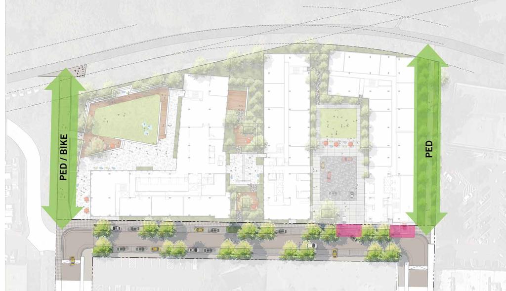
32 PEDESTRIAN / BIKE ACCESS & CIRCULATION NO STREET VACATION WITH STREET VACATION
33 PEDESTRIAN / BIKE ACCESS & CIRCULATION NO STREET VACATION WITH STREET VACATION EL EL NORTHERN TRAIL CONNECTION FOR PEDESTRIANS - COMPOSED OF ADA ACCESSIBLE RAMPS WITH LESS THAN 5% GRADE POSSIBLE CENTRAL TRAIL CONNECTION LIKELY COMPOSED OF STAIRS - THIS WILL POSE ACESSIBILITY CHALLENGES EL EL TWO SIDEWALKS PROVIDED LONG X 6 WIDE = 3,024 SF DEDICATED TO PEDESTRIAN ACCESS TWO TRAIL CONNECTIONS PROVIDED: NORTH 250 LONG X 10 WIDE = 2,500 SF DEDICATED TO PEDESTRIANS SOUTH 250 LONG X 15 WIDE = 3,750 SF DEDICATED TO PEDESTRIANS AND BICYCLES COMBINED = 6,250 SF DEDICATED TO PEDESTRIAN AND BIKE ACCESS EL EL SOUTHERN TRAIL CONNECTION FOR BIKES AND PEDESTRIANS - COMPOSED OF ADA ACCESIBLE RAMPS (8.3% MAX. SLOPE).
34 VEHICLE ACCESS & CIRCULATION NO STREET VACATION WITH STREET VACATION
35 VEHICLE ACCESS & DRIVEWAYS NO STREET VACATION WITH STREET VACATION TOTAL WIDTH OF DRIVEWAYS AND 25 ROW S = TOTAL WIDTH OF DRIVEWAYS AND ROW S = 44 22


36 VEHICLE HOURLY TRIP COUNTS NO STREET VACATION WITH STREET VACATION 5 5 VEHICLES PER HOUR DROP OFF AREA

37 PROPOSED CURBLESS STREET WITH STREET VACATION FUTURE REDEVELOPMENT C.L. RIGHT-OF-WAY RIGHT-OF-WAY SIDEWALK PLANTING TRAVEL TRAVEL PLANTING SIDEWALK + PARKING LANE LANE + PARKING 50 RIGHT-OF-WAY
38 PUBLIC / PRIVATE OPEN SPACE NO STREET VACATION WITH STREET VACATION PUBLIC PUBLIC (LIMITED ACCESS) PRIVATE OPEN DURING THE DAY
39 ELECTRICAL UTILITIES NO STREET VACATION WITH STREET VACATION PROPOSED PROJECT WILL BE FED FROM EXISTING POLE ON 25TH AVE LINES WILL BE UNDERGROUNDED ALONG 49TH ST, AND 24TH AVE NEW TRANSFORMER ON 24TH WILL FEED ANTICIPATED DEVELOPMENT ON EAST SIDE OF 24TH AVE.
40 WET UTILITIES NO STREET VACATION WITH STREET VACATION WATER MAIN DEDICATED STORM DRAIN SANITARY SEWER DRAIN

41 URBAN DESIGN MERIT ACCESS CIRCULATION OPEN SPACE UTILITIES AIR / LIGHT / VIEWS
42 ACCESS & ARTICULATION

43 OPEN SPACE
44 ELECTRICAL UTILITIES NO STREET VACATION WITH STREET VACATION PROPOSED PROJECT WILL BE FED FROM EXISTING POLE ON 25TH AVE LINES WILL BE UNDERGROUNDED ALONG 49TH ST, AND 24TH AVE NEW TRANSFORMER ON 24TH WILL FEED ANTICIPATED DEVELOPMENT ON EAST SIDE OF 24TH AVE.
45 WET UTILITIES NO STREET VACATION WITH STREET VACATION WATER MAIN DEDICATED STORM DRAIN SANITARY SEWER DRAIN

46 AIR, LIGHT & VIEWS

47 AIR, LIGHT & VIEWS
SWEDISH FIRST HILL MEDICAL CENTER
 SWEDISH FIRST HILL MEDICAL CENTER BLOCK 95 ALLEY VACATION / URBAN DESIGN MERIT JULY 16, 2015 CONTENTS INTRODUCTION NEIGHBORHOOD CONTEXT EXISTING CONDITIONS DESIGN COMPARISON 2 07 / INTRODUCTION 3 PROJECTS
RESORT AREA STRATEGIC ACTION PLAN (RASAP) STEERING COMMITTEE MEETING - APRIL 3, 2019
 STEERING COMMITTEE MEETING - APRIL 3, 2019") RESORT AREA STRATEGIC ACTION PLAN (RASAP) STEERING COMMITTEE MEETING - APRIL 3, 2019 Welcome & Introductions - Deb Zywna AGENDA FY 20 Resort CIP Proposed Projects - Kathy Warren ORDFBC Design Guidelines
RESORT AREA STRATEGIC ACTION PLAN (RASAP) STEERING COMMITTEE MEETING - APRIL 3, 2019 Welcome & Introductions - Deb Zywna AGENDA FY 20 Resort CIP Proposed Projects - Kathy Warren ORDFBC Design Guidelines
Boston Redevelopment Authority 2/26/ Chestnut Hill Avenue Boston/Brookline, MA
 Boston Redevelopment Authority 2/26/2014 Cassidy Playground Waterworks Design revisions made since the DPIR submission March 2013 Massing - Reduced project 16,030 SF, for a total project area of 218,520
Bloor Street West Rezoning Application for a Temporary Use By-law Final Report
 STAFF REPORT ACTION REQUIRED 3741 3751 Bloor Street West Rezoning Application for a Temporary Use By-law Final Report Date: June 12, 2007 To: From: Wards: Reference Number: Etobicoke York Community Council
BOSTON, MA 171 TREMONT IMPACT ADVISORY GROUP 5/19/16
 BOSTON, MA 171 TREMONT IMPACT ADVISORY GROUP 5/19/16 171 Tremont will continue the transformation of Downtown Crossing into a revitalized neighborhood where all Bostonians can live, work, and play. 171
7272 WISCONSIN AVENUE LOCAL AREA TRANSPORTATION REVIEW
 7272 LOCAL AREA TRANSPORTATION REVIEW AND TRANSPORTATION POLICY AREA REVIEW MONTGOMERY COUNTY, MARYLAND Submitted on behalf of Carr Properties Prepared by: Wells + Associates, Inc. Submission: July 1,
Welcome to the Cross County Trail Public Input Session!
 Welcome to the Cross County Trail Public Input Session! Please sign in on the table below! What are we doing here? Camden County has proposed a bicycle and pedestrian trail spanning across the entire county.
Site Location and Setting
 Memorandum Date: To: From: Subject: Kristy Le, Gary Black Steve Orem Santa Teresa County Park Historic Area Traffic and Parking Study Hexagon Transportation Consultants, Inc. has completed a traffic and
URBAN DESIGN REPORT. Proposed Residential Development, Old Church Road, Caledon East
 Proposed Residential Development, Old Church Road, Caledon East TABLE CONTENTS: 1.0 DEVELOPMENT 1.1 Introduction-Analysis of Guiding Principles and Documents 1.2 Community Design and Architectural Design
3. COLTA / HUGA CONNECTIONS - PRELIMINARY
 9 3. COLTA / HUGA CONNECTIONS - PRELIMINARY 3.1 COLTA The Chain of Lakes Trail Association (COLTA) trail, formerly identified as the Chester Spur Line, was completed and opened for use in June 2011. The
Spadina Avenue Built Form Study Preliminary Report
 STAFF REPORT ACTION REQUIRED Spadina Avenue Built Form Study Preliminary Report Date: July 9, 2014 To: From: Wards: Reference Number: Toronto and East York Community Council Director, Community Planning,
Bonita to Bridgeport January 24, 2019
 Thank you for participating 6:00-6:05 Welcome 6:05-6:55 Presentation; clarifying questions 7:00-7:30 Talk with staff; write comments Concerns with Locally Preferred Alternative (LPA) route between Bonita
Memorandum / Letter of Intent
 VERONA WAUKESHA KENOSHA APPLETON WESTON Memorandum / Letter of Intent To: Adam Sayre, Director of Planning & Development, City of Verona From: Kevin Yeska, JSD Professional Services, Inc. www.jsdinc.com
FINAL. Bicycle/Pedestrian Feasibility Study City of DeBary Dirksen Drive Trail. Prepared For: Volusia County MPO
 City of DeBary Dirksen Drive Trail FINAL Prepared By: Reynolds, Smith and Hills, Inc. Prepared For: Volusia County MPO September 2007 Table of Contents INTRODUCTION...1 PROJECT PURPOSE AND SCOPE...2 PHYSICAL
AGENDA ITEM 5 D WAKULLA ENVIRONMENTAL INSTITUTE (WEI) TRAIL FEASIBILITY STUDY
 TRAIL FEASIBILITY STUDY") March 19, 2018 AGENDA ITEM 5 D WAKULLA ENVIRONMENTAL INSTITUTE (WEI) TRAIL FEASIBILITY STUDY TYPE OF ITEM: Action STATEMENT OF ISSUE The Wakulla Environmental Institute (WEI) Trail is one of several trails
March 19, 2018 AGENDA ITEM 5 D WAKULLA ENVIRONMENTAL INSTITUTE (WEI) TRAIL FEASIBILITY STUDY TYPE OF ITEM: Action STATEMENT OF ISSUE The Wakulla Environmental Institute (WEI) Trail is one of several trails
Area Surrounding Maplewood Manor
 BAY CITY, MICHIGAN HOUSING COMMISSION Neighborhood Revitalization Plan Area Surrounding Maplewood Manor January 13, 2014 CITY COMMISSION DRAFT PLAN PRESENTATION BAY CITY, MICHIGAN 1 Planners Phil McKenna,
Abbott Rd Rehabilitation Phase II - Elmore Rd to Birch Rd
 Abbott Rd Rehabilitation Phase II - Elmore Rd to Birch Rd Project ID SOA07003 Department State of Alaska Project Type Improvement Start Date December 2017 Location Assembly: Section 4, Seats F & G, Assembly:
Everett Riverwalk Life style explore
 Life style explore Project Overview The 217-acre Everett Riverfront redevelopment is visible from I-5 with traffic counts charted at 170,000+ vehicles per day with direct freeway access from 4-way interchange.
Georgetown-Lewes Rail/Trail Study. Rail/Trail Study: Cool Spring to Cape Henlopen State Park New Road Extension (House Resolution No.
 Georgetown-Lewes Rail/Trail Study Rail/Trail Study: Cool Spring to Cape Henlopen State Park New Road Extension (House Resolution No. 47) August 22, 2011 Presentation Outline Background Benefits Statewide
Arvidson, Adam R. Adam,
 Arvidson, Adam R. From: Andrew Hestness Sent: Wednesday, May 18, 2016 5:39 PM To: Arvidson, Adam R. Cc: Renee Spillum; Schroeder, Michael Subject: RE: Park Dedication Attachments: FranklinPlan - Bystrom
Update: Manhattan Community Board 1 Land Use, Economic Development & Zoning committee February 12, 2018
 Update: Manhattan Community Board 1 Land Use, Economic Development & Zoning committee February 12, 2018 1 GOVERNORS ISLAND IS FOR NEW YORKERS 2 WE RE MOVING TOWARDS A YEAR-ROUND, 24 HOUR COMMUNITY 3 Governors
OR MISSION TRAIL ELEMENTARY
 Leawood: overview OVERLAD PARK 24: p.70 I-LA PARK 32: p.72 TOMAHAWK PARK 23: p.69 31: p.71 GEZER PARK OR MISSIO TRAIL ELEMETARY 22: p.68 W 133rd St W 135th St KASAS CITY MO - other segments Beginning/end
South Bay Metro Light Rail Extension. Summer/Fall 2017 Project Briefings
 South Bay Metro Light Rail Extension Summer/Fall 2017 Project Briefings Meeting Agenda 2 Project History Project Development Schedule Feedback 3 Project History Alternatives Analysis Measure R $272M 2008
S i t e A n a ly s i s
 S i t e A n a ly s i s 11 SECTION B SITE ANALYSIS Existing Conditions TRANSPORTATION CONTEXT: The Ohlone Greenway site, paralleling San Pablo Avenue to the west, is centrally located within the City of
Longmont to Boulder Regional Trail Jay Road Connection DRAFT FINAL REPORT
 Longmont to Boulder Regional Trail Jay Road Connection DRAFT FINAL REPORT December 2018 Project Summary Boulder County, Colorado, in partnership with the City of Boulder, is evaluating options for multi-use
Crystal City Station Improvements. Project Overview. Table 2: North Entrance. Table 1: South Entrance. 20th St. S 18th St. S.
 Table 1: South Entrance Table 2: North Entrance 20th St. S 18th St. S Proposed Second Entrance Crystal Drive Existing Station Location Platform Future 4 th Track Future New Airport Connection (by others)
South Bay Light Rail Extension Summer/Fall 2017 Project Briefing
 South Bay Light Rail Extension Summer/Fall 2017 Project Briefing Meeting Agenda 2 Project History Project Development Schedule Feedback Study Area Project History 4 Alternatives Analysis 2008 Measure R
East Link Project Update. Maintenance of Traffic During Construction. April 21, 2015
 East Link Project Update Maintenance of Traffic During Construction April 21, 2015 1 Agenda TFP project 242 Bellevue Way HOV Bellevue Way - Maintenance of Traffic During Construction Early Work Utilities
FINCH HYDRO CORRIDOR TRAIL PROJECT
 FINCH HYDRO CORRIDOR TRAIL PROJECT Pharmacy Avenue to Birchmount Road January 29 th, 2018 L Amoreaux Community Centre (2000 McNicoll Avenue) 1 Purpose of Drop In Event The purpose of today s drop-in event
A. CONCLUSIONS OF THE FGEIS
 Chapter 11: Traffic and Parking A. CONCLUSIONS OF THE FGEIS The FGEIS found that the Approved Plan will generate a substantial volume of vehicular and pedestrian activity, including an estimated 1,300
Community Development Committee
 C Community Development Committee For the Metropolitan Council meeting of October 31, 2012 Committee Report Item:2012-316 ADVISORY INFORMATION October 16, 2012 Date Prepared: Subject: Intercity Regional
Thornton Water Project. Larimer County Route Study and Project Update September 12, 2017
 Thornton Water Project Larimer County Route Study and Project Update September 12, 2017 Purpose of Meeting Provide information on the Thornton Water Project Present the results of the pipeline routing
Classifications, Inventory and Level of Service
 Classifications, Inventory and Level of Service Section 3 Kenmore Park, Recreation and Open Space Plan 1 P a g e Classifications and Inventory Park Classifications Kenmore classifies its parks based upon
Lake Erie Commerce Center Traffic Analysis
 LOCATION: East of NYS Route 5 at Bayview Road Town of Hamburg Erie County, New York PREPARED BY: Wendel Companies 140 John James Audubon Parkway Suite 200 Amherst, New York 14228 January 2012 i ii Table
NEW CONSTRUCTION STRONG OWNERSHIP ADJACENT TO GAS WORKS PARK SWEEPING VIEWS LARGE ROOFTOP DECK WITH WI-FI
 NEW CONSTRUCTION STRONG OWNERSHIP ADJACENT TO GAS WORKS PARK SWEEPING VIEWS LARGE ROOFTOP DECK WITH WI-FI The LEED Certification Mark is a registered trademark owned by the U.S. Green Building Council
Pedestrian Safety Review Spadina Avenue
 STAFF REPORT ACTION REQUIRED Pedestrian Safety Review Spadina Avenue Date: October 13, 2015 To: Toronto and East York Community Council From: Director, Transportation Services, Toronto and East York District
2433 Dufferin Street Zoning By-law Amendment Application - Preliminary Report
 STAFF REPORT ACTION REQUIRED 2433 Dufferin Street Zoning By-law Amendment Application - Preliminary Report Date: July 22, 2014 To: From: Wards: Reference Number: North York Community Council Director,
DESIGN AND CONSTRUCTION OPEN HOUSE
 DESIGN AND CONSTRUCTION OPEN HOUSE The purpose of tonight s meeting is to provide: Design progress of the new Operations and Maintenance Facility in Bellevue. Agenda 6:00 p.m. Open House Approved transit
BONITA BEACH ROAD. May 18, Ian Lockwood, PE Cindy Zerger, AICP, ASLA Ken Ray, RLA. Greg Diserio, RLA. Tara Salmieri, AICP
 BONITA BEACH ROAD May 18, 2016 Ian Lockwood, PE Cindy Zerger, AICP, ASLA Ken Ray, RLA Greg Diserio, RLA Tara Salmieri, AICP Toole Design Group Engineers Planners Landscape Architects Authors BONITA BEACH
Trails, steps, & P-Patch to be south of I- 5 Colonnade
 UW Campus Trails, steps, & P-Patch to be south of I- 5 Colonnade Blaine and Howe Street steps REI N new lighting existing features connector trail new features or improvements overhead freeway and support
Northaven Trail Phase 2 Initial Project Overview
 Northaven Trail Phase 2 Initial Project Overview Partnership Project to extend existing Northaven Trail Improve Bike/Ped Connectivity On Dallas Trail Network Plan City and County Funding Oncor Texas Trails
West Santa Ana Branch Transit Corridor. Community Meetings March 12, 13, 17 & 19, 2018
 West Santa Ana Branch Transit Corridor Community Meetings March 12, 13, 17 & 19, 2018 Purpose of this Meeting > Update on Public Scoping comments received > Why Metro is revisiting the Northern Alignments
VI. ALTERNATIVES TO THE MASTER PLAN C. RENOVATED EAST BUILDING ALTERNATIVE
 VI. ALTERNATIVES TO THE MASTER PLAN C. RENOVATED EAST BUILDING ALTERNATIVE INTRODUCTION The Renovated East Building Alternative would include the continued use of the renovated West Building and the renovation
DECISION/DIRECTION NOTE
 DECISION/DIRECTION NOTE Title: St. John s Municipal Plan Amendment Number 134, 2017 and St. John s Development Regulations Amendment Number 617, 2017 Proposed Rezoning to the Commercial Neighbourhood (CN)
Business Item No XXX. Proposed Action That the Metropolitan Council approve the Coon Creek Regional Trail Master Plan.
 Business Item No. 2015-XXX Metropolitan Parks and Open Space Commission Meeting date: July 7, 2015 For the Community Development Committee meeting of July 20, 2015 For the Metropolitan Council meeting
Crystal City Block Plan #CCBP-G-1 Long Range Planning Committee. January 29, 2018
 Crystal City Block Plan #CCBP-G-1 Long Range Planning Committee January 29, 2018 0 Agenda I. Block plan overview II. Deviations from Sector Plan guidance a) Bulk Plane Angle b) Corner Building c) Open
Proposed Bicycle Lanes on Yonge Street from Queens Quay to Front Street
 STAFF REPORT ACTION REQUIRED Proposed Bicycle Lanes on Yonge Street from Queens Quay to Front Street Date: March 12, 2007 To: From: Toronto and East York Community Council Director, Transportation Infrastructure
Analysis and Feasibility Broward County Convention Center Master Plan Study Fort Lauderdale, FL HKS I Urban Design Studio
 Analysis and Feasibility Broward County Convention Center Master Plan Study Fort Lauderdale, FL 04.01.14 HKS I Urban Design Studio Summary of Outreach Purpose of Stakeholder Outreach Identify and engage
ITS. Intermountain Transportation Solutions Traffic Studies Transportation Analysis Signal Design Site Planning. January 9, 2013
 ITS Intermountain Transportation Solutions Traffic Studies Transportation Analysis Signal Design Site Planning Raymond Wright, P.E. City of Spokane Transportation Department 11707 East Sprague Avenue,
Project Kickoff. Agenda. Pete Sechler AECOM. Randy Goers City of Tampa
 Project Kickoff April 11, 2012 Agenda Pete Sechler AECOM Randy Goers City of Tampa AECOM Parsons Brinkerhoff The Leytham Group ChappellRoberts Blackmon-Roberts Group MindMixer Fowler White Boggs, PA Agenda
Construction Staging Adelaide Street West
 REPORT FOR ACTION Construction Staging Adelaide Street West Date: October 6, 2016 To: Toronto and East York Community Council From: Acting Director, Transportation Services, Toronto and East York District
Dogpatch Project Descriptions Summary DRAFT UNDER REVIEW January 11, 2017
 1. OPEN SPACE A. Esprit Park Why : Esprit Park, Dogpatch s only City Park, is already struggling under current use. It was not designed for intensive use and is not sustainable in its current state. What
25 th Avenue Grade Separation. September 13, 2017
 25 th Avenue Grade Separation September 13, 2017 Agenda I. Overview II. III. IV. Project Description Project Benefits Project Construction V. Next Steps VI. Questions 2 Overview Project Location 4 E. 25
To: Mary Beth Avedesian B.F. Saul Company
 1140 Connecticut Avenue NW Suite 600 Washington, DC 20036 202.296.8625 TECHNICAL MEMORANDUM To: Mary Beth Avedesian B.F. Saul Company From: Daniel B. VanPelt, P.E., PTOE Felice B. Brychta, P.E. Tricia
WHY MOVE YOUR BUSINESS TO HOLLYWOOD?
 WHY MOVE YOUR BUSINESS TO HOLLYWOOD? Close to international airport and seaport Centrally located in 3.5 million population No personal income tax Diverse labor force and talent pool Waterfront executive
Airport Planning Area
 PLANNING AREA POLICIES l AIRPORT Airport Planning Area LOCATION AND CONTEXT The Airport Planning Area ( Airport area ) is a key part of Boise s economy and transportation network; it features a multi-purpose
TRANSPORTATION ELEMENT
 Transportation TRANSPORTATION ELEMENT Data, Inventory, and Analysis Prepared by Contents 1.0 INTRODUCTION... 1 2.0 EXISTING CONDITIONS... 1 2.1 Roadways... 1 2.1.1 Jurisdiction... 1 2.1.2 Functional Classification...
Orlando Loch Haven Park (Conditional Use Permit) Project Overview (updated 5/31/2018)
 Project Overview (updated 5/31/2018)") Orlando Ballet @ Loch Haven Park (Conditional Use Permit) Project Overview (updated 5/31/2018) NOTE: The information presented in this project overview is based on staff s preliminary review of the submitted
Orlando Ballet @ Loch Haven Park (Conditional Use Permit) Project Overview (updated 5/31/2018) NOTE: The information presented in this project overview is based on staff s preliminary review of the submitted
San Francisco, California Hunters Point Shipyard. Design for Development
 San Francisco, California Hunters Point Shipyard Design for Development San Francisco, California Hunters Point Shipyard Design for Development Adopted June 3, 2010 by: San Francisco Planning Commission
CONTENTS. 1 Introduction Always Moving Forward while Building on the Past A Dynamic Destination... 5
 2010 STRUCTURE PLAN - 2 - CONTENTS 1 Introduction... 5 1.1 Always Moving Forward while Building on the Past... 5 1.2 A Dynamic Destination... 5 2 Map A... 6 Exhibition Place and its Neighbours... 7 3 Demonstration
Memo. Orange City Trail Plan Becky Mendez, AICP Jamie Krzeminski, PE, PTOE Matt Wiesenfeld, PE, AICP. Development of the Existing and Proposed Network
 Memo Date: Friday, December 22, 2017 Project: To: From: Subject: Trail Plan Becky Mendez, AICP Jamie Krzeminski, PE, PTOE Matt Wiesenfeld, PE, AICP Development of the Existing and Proposed Network HDR
Hospital Link Project Project Update Winter 2018
 Hospital Link Project Project Update Winter 2018 General The project provides a link from Riverside Drive and the Transitway to the Hospital Link Road. Construction of the Hospital Link facility is open
China Creek North Park Upgrades and Glen Pump Station. Park Board Committee Meeting Monday, July 10, 2017
 China Creek North Park Upgrades and Glen Pump Station Park Board Committee Meeting Monday, July 10, 2017 Purpose The purpose of this presentation is to: Share the results of the public engagement processes;
Clackamas County Development Agency
 Clackamas County Development Agency Development Services Building, 150 Beavercreek Rd., Oregon City, OR 97045 www.clackamas.us/transportation/renewal 503-742-4323 The Clackamas County Board of Commissioners
23,760 SF ASSEMBLAGE ZONED LR2
 MAPLE LEAF TOWNHOUSE OR MULTI-FAMILY DEVELOPMENT OPPORTUNITY Under Construction: Townhouse Development Under Construction: 6-Story Multifamily Project 23,760 SF ASSEMBLAGE ZONED LR2 2020, 2024, 2100 &
SOUTHEAST BOULEVARD Planning Study Washington, DC. Progress Drawings October 6, 2014
 Existing Conditions Site Plan CONGRESSIONAL CEMETERY SOUTHEAST BOULEVARD Planning Study Concept A (formerly A-1) Site Plan Concept A (formerly A-1) Concept A proposes an expansion of the Capitol Hill neighborhood
Action Recommendation: Budget Impact:
 City of Fayetteville Staff Review Form 2017-0692 Legistar File ID 12/19/2017 City Council Meeting Date - Agenda Item Only N/A for Non-Agenda Item Andrew Garner Submitted By 12/1/2017 Submitted Date Action
DRAFT - APRIL 13, 2007 ROUTING STUDY FOR TRAIL CONNECTIONS BETWEEN CALAIS AND AYERS JUNCTION
 DRAFT - APRIL 13, 2007 ROUTING STUDY FOR TRAIL CONNECTIONS BETWEEN CALAIS AND AYERS JUNCTION Abstract The vision for the East Coast Greenway is an off-road urban trail system running from Calais, Maine
Toronto and East York Community Council. Acting Director, Community Planning, Toronto and East York District
 STAFF REPORT ACTION REQUIRED 440, 444, 450 and 462 Front Street West; 425, 439, 441 and 443 Wellington Street West; 6-18 Spadina Ave. and 1 and 19 Draper Street Urban Design Guidelines Final Report Date:
EXHIBIT 1. BOARD AUTHORIZATION FOR PUBLIC HEARING AND SUBSEQUENT ISSUANCE OF A JOINT DEVELOPMENT SOLICITATION
 EXHIBIT 1. BOARD AUTHORIZATION FOR PUBLIC HEARING AND SUBSEQUENT ISSUANCE OF A JOINT DEVELOPMENT SOLICITATION Washington Metropolitan Area Transit Authority Board Action/Information Summary @Action O Information
Committee. Presentation Outline
 CW-33-15 11/9/2015 Community and Corporate Services Committee November 10, 2015 1 Presentation Outline Background Vision and Objectives Study Process and Timeline Public and Stakeholder Engagement Organization
Madison Metro Transit System
 Madison Metro Transit System 1101 East Washington Avenue Madison, Wisconsin, 53703 Administrative Office: 608 266 4904 Fax: 608 267 8778 TO: FROM: SUBJECT: Plan Commission Timothy Sobota, Transit Planner,
Home of Southbank Partners. Riverfront Commons. Southbank Partners. Covington Newport Bellevue Ft. Thomas Dayton Ludlow
 Home of Southbank Partners Riverfront Commons Southbank Partners Covington Newport Bellevue Ft. Thomas Dayton Ludlow Riverfront Commons Fostering a vision of Northern Kentucky s Future Riverfront Commons
3450 Dufferin Street - Official Plan Amendment, Zoning Amendment and Draft Plan of Subdivision Applications Request for Directions Report
 STAFF REPORT ACTION REQUIRED 3450 Dufferin Street - Official Plan Amendment, Zoning Amendment and Draft Plan of Subdivision Applications Request for Directions Report Date: March 15, 2017 To: From: Wards:
Ralph C. Wilson, Jr. Centennial Park Ralph C. Wilson, Jr. Foundation University at Buffalo Regional Institute 17 January 2019
 Ralph C. Wilson, Jr. Centennial Park Ralph C. Wilson, Jr. Foundation University at Buffalo Regional Institute 17 January 2019 Michael Van Valkenburgh Associates Inc. Who is MVVA? Brooklyn Bridge Park,
Non-Motorized Transportation
 Non-Motorized Transportation Non-motorized facilities are important components to the transportation system. They provide an environmentally-friendly, low-cost mode of travel. Some of the facilities can
Metrolinx Projects: Temporary Delegation for Long- Term Road Closures
 PW29.1 REPORT FOR ACTION Metrolinx Projects: Temporary Delegation for Long- Term Road Closures Date: April 24th, 2018 To: Public Works and Infrastructure Committee From: General Manager, Transportation
KING STREET PILOT STUDY PUBLIC MEETING
 KING STREET PILOT STUDY PUBLIC MEETING 2017.02.13 PUBLIC WORK with GEHL STUDIO / NEW YORK SWERHUN ASSOCIATES SAM SCHWARTZ CONSULTING LLC STARTING POINTS 17 1 - TRANSIT FIRST! Transit service is beyond
Committee Report. Community Development Committee For the Metropolitan Council meeting of April 13, Business Item No.
 Committee Report Business Item No. 2016-48 Community Development Committee For the Metropolitan Council meeting of April 13, 2016 Subject: Harriet Island-South St. Paul Regional Trail Master Plan, Saint
2016 Development Cost Charges (DCC) UPDATE
 UPDATE") 2016 Development Cost Charges (DCC) UPDATE City of Richmond Public Meeting November 3, 2016 Outline Development Cost Charges (DCC) Overview DCC Rate Calculation DCC Recoverable Costs (DCC Programs) Estimated
2016 Development Cost Charges (DCC) UPDATE City of Richmond Public Meeting November 3, 2016 Outline Development Cost Charges (DCC) Overview DCC Rate Calculation DCC Recoverable Costs (DCC Programs) Estimated
City of Madison, Buckeye Road Monona Drive to Stoughton Road County AB Dane County Public Involvement Meeting
 City of Madison, Buckeye Road Monona Drive to Stoughton Road County AB Dane County Public Involvement Meeting Wednesday, May 31, 2017 6:30 to 8 P.M. Frank Allis Elementary School 4201 Buckeye Road Madison,
PURPOSE AND NEED (CONCURRENCE POINT 1) NEW CANADA ROAD PROJECT FROM STATE ROUTE 1 (U.S. HIGHWAY 70) TO U.S. INTERSTATE 40
 NEW CANADA ROAD PROJECT FROM STATE ROUTE 1 (U.S. HIGHWAY 70) TO U.S. INTERSTATE 40") PURPOSE AND NEED (CONCURRENCE POINT 1) NEW CANADA ROAD PROJECT FROM STATE ROUTE 1 (U.S. HIGHWAY 70) TO U.S. INTERSTATE 40 Project Description The primary purpose of this project is to improve the major
PURPOSE AND NEED (CONCURRENCE POINT 1) NEW CANADA ROAD PROJECT FROM STATE ROUTE 1 (U.S. HIGHWAY 70) TO U.S. INTERSTATE 40 Project Description The primary purpose of this project is to improve the major
e: w: remingtoncorp.com Quarry Park News More on page 1 & 2.
 e: QuarryParkLOA@remingtoncorp.com w: remingtoncorp.com Quarry Park News INSIDE: New Amenities Set For 2016 Openings More on page 1 & 2. Amenities Opening in 2016 The Remington YMCA Quarry Park Recreation
 Appendix H1 Traffic Study Hill St Obispo Ave Obispo Ave Student Drop-off & Pick-up Area Parking Lot Plaza Level Hill St Fire Lane Access Service Lane Access Redondo Ave Redondo Ave Parking Lot N No
Business Item No
 Metropolitan Parks and Open Space Commission Meeting date: February 6, 2018 For the Community Development Committee meeting of February 20, 2018 For the Metropolitan Council meeting of February 28, 2018
COLLEGE STREET STUDY Community Consultation Meeting. December 2015
 COLLEGE STREET STUDY Community Consultation Meeting December 2015 2 Agenda 6:30 pm Introductions, Agenda Review and Welcome 6:40 pm Presentation Planning Recommendations 7:30 pm Questions and Discussion
2018 Service Changes Ada County
 2018 Service Changes Ada County System Benefits 15 minute headways on State Street during peak hours o 30 minutes on Saturdays 30 minute headways on Emerald all day on weekdays More frequent and direct
SANDAG s Regional Transportation Plan
 SANDAG s Regional Transportation Plan Oceanside 5 Camp Pendleton Carlsbad P A C C I I F I C C O O C C E E A A N N 472 398 76 Encinitas 399 78 Solana Beach 472 Vista 15 San Marcos 399 399 470 610 Escondido
Director, Community Planning, Toronto and East York District
 STAFF REPORT October 25, 2005 To: From: : Subject: Toronto and East York Community Council Director, Community Planning, Toronto and East York District Status Report OPA & Rezoning Application 05 117524
November 11, 2009 BY . Planning and Growth Management Department 110 Laurier Avenue West, 4 th Floor Ottawa, Ontario K1P 1J1. Dear Mr.
 November 11, 2009 Planning and Growth Management Department 110 Laurier Avenue West, 4 th Floor Ottawa, Ontario K1P 1J1 BY E-MAIL Attention: Mr. Don Herweyer Dear Mr. Herweyer: Reference: Abbott-Fernbank
LANCASTER CORRIDOR REDEVELOPMENT ROSEDALE STREET REDESIGN PEACH STREET RAILROAD CROSSINGS
 LANCASTER CORRIDOR REDEVELOPMENT ROSEDALE STREET REDESIGN PEACH STREET RAILROAD CROSSINGS Presented at the SEE Development Excellence Workshop By Councilmember Wendy Davis, City of Fort Worth March 24,
Aloha Stadium Conceptual Redevelopment Report. April 5, 2017
 Aloha Stadium Conceptual Redevelopment Report April 5, 2017 THE HISTORY OF ALOHA STADIUM A Hawaii landmark since 1975 Aloha Stadium has stood for over 40 years and effectively achieved its mission as a
Public Open House. Chief Peguis Trail Project
 Public Open House Chief Peguis Trail Project CHIEF PEGUIS TRAIL OPEN HOUSE Welcome! Please browse the display boards Project Engineers and City of Winnipeg representatives are available to address your
Appendix B Connecting Track Options Evaluation Criteria
 Appendix B Connecting Track Options Evaluation Criteria 608979-853_ra_July5-0_App Title Pages.Docx TTC ASHBRIDGES BAY MAINTENANCE AND STORAGE FACILITY CONNECTING TRACK ROUTE ALTERNATIVE - EVAULATION MATRIX.0
San Diego Convention Center Phase III Expansion. SDCCC Presentation to Mayor s Task Force June 2, 2009
 Expansion SDCCC Presentation to Mayor s Task Force June 2, 2009 Agenda The TSA/HNTB Team Experience and Lessons Learned Project Methodology Issues and Opportunities Alternative Masterplan Concepts Under
Committee Report. Community Development Committee For the Metropolitan Council meeting of August 12, Business Item No.
 Committee Report Business Item No. 2015-168 Community Development Committee For the Metropolitan Council meeting of August 12, 2015 Subject: Coon Creek Regional Trail Master Plan, Anoka County Proposed
2175 Lake Shore Boulevard West Official Plan and Zoning Amendment, and Removal of the Holding Provision Applications Final Report
 STAFF REPORT ACTION REQUIRED 2175 Lake Shore Boulevard West Official Plan and Zoning Amendment, and Removal of the Holding Provision Applications Final Report Date: May 22, 2009 To: From: Wards: Reference
Regional Wayfinding Sign Strategy Thurston County Trails 2017
 Regional Wayfinding Sign Strategy Thurston County Trails 2017 Partners: Members and partnering organizations of the Thurston Thrives Community Design Action Team City of Lacey, City of Olympia, City of
Restoration of Historic Streetcar Services in Downtown Los Angeles
 Restoration of Historic Streetcar Services in Downtown Los Angeles Alternatives Analysis Community Update Meeting November 3, 2011 Introduction Local lead agency: Metro Federal lead agency: Federal Transit
Claremont Project Background and Update Community Meeting September 11, 2017
 Claremont Project Background and Update Community Meeting September 11, 2017 Topics Project Background Claremont Segment Information Project Timeline Upcoming Discussion Items Upcoming Meetings Questions