and plant some trees, but that was only accomplished through state and federal work-relief programs.
|
|
|
- Jessie Clarke
- 5 years ago
- Views:
Transcription


1 PEAVEY LOCATION AND HISTORY Peavey Park sits in the Phillips Community on a large block bounded by major streets: Franklin Avenue, Chicago Avenue, and Park Avenue. The southern continue through to Chicago Avenue, and the large school complex of Hope Academy, to which the small park recreation center is attached. Peavey is an interesting example of the acquisition of park land gradually over time. Land for the original 3.44-acre park at the corner of Park and 22nd was donated by the four children of Mrs. Mary D. Wells, the daughter of Frank Peavey, in The name of the park was stipulated in the deed to the land given to the park board. Peavey was prominent in the grain trade in Minneapolis and a portion of the park was once his home site. The donation of the land came twenty years after community members had petitioned the park board to acquire land for park purposes in the neighborhood. From the time of the initial donation, park superintendent Theodore Wirth hoped that the land would form the nucleus of a small playground park and hoped additional land could be secured for the park. In fact, the park has more than doubled in size since At the time the park board was planning to expand the park in the 1940s, park superintendent Charles Doell wrote that play spaces were badly needed in this thickly-populated district of the city. The problem faced by the neighborhood, as most older neighborhoods in the city, was that property values in developed neighborhoods that were being newly developed. Therefore property owners were less likely to accept assessments on their property for park improvements. (The practice of assessing neighborhood property for park improvements ended in 1968 because of the inequities it had caused.) In 1941, the park board acquired four lots (one-half acre) adjacent to the original park from the state at no cost. The park was expanded more dramatically in 1947 when the park board purchased by condemnation 2.8 acres in 22 lots east to Chicago Avenue. The park expanded slightly again in 1949, when the city turned of Columbus and 22nd. The next addition to the park came in 1956 when the park was expanded by another.68 acre, in part through the vacation of Columbus occurred in 1992 when the park board acquired two lots at the corner of Franklin and Chicago with funds from the National Park Service. The liquor store on the corner was demolished and the site was incorporated into the park. While land was added to the original park donation, almost nothing was done to develop the land into a useful park for many years. Park superintendent Theodore Wirth submitted a plan for development of the park in 1928, noting that the grounds were not very sightly in their present condition and serve no particular purpose. In the lean years to come nothing would be done to improve the park. From 1935 to and plant some trees, but that was only accomplished through state and federal work-relief programs. Finally, in 1956, the park board secured funds divided between bonds and neighborhood assessments to improve the park. From 1956 to 1958, the park was pool were installed, and a small shelter was built. The shelter had garage-type self-storing doors that could be opened in the summer and closed in winter to serve as a warming house. In 1992 the shelter was demolished and replaced with a new, larger shelter attached to what was then Four Winds School (and is now Hope Academy) in the southeast corner of the park in At about the same time the buildings on the most recent addition to Peavey Park, two lots at the corner of Franklin and Chicago, were demolished and converted into a new entrance to the park with brightly colored mosaic tile benches. In 2000, the neighborhood, with assistance from the University of Minnesota, prepared a master plan for the park. The creation of this plan was driven in part by ongoing safety issues in the park and on surrounding the plan was the removal of the tennis courts at the corner of Franklin and Portland and rearrangement and resurfacing of the basketball courts. CH 4 NEIGHBORHOOD PARK PLANS PEAVEY 177

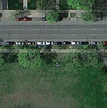
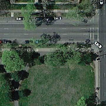
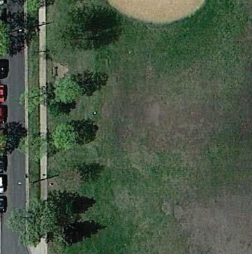
2 PROCESSES EXISTING CONDITIONS AND CHARACTER Peavey Park has a fairly typical suite of park amenities. its corners occupies the southwestern quadrant of the provides access to a wading pool, playgrounds, and basketball courts. The basketball area features three half-courts arranged in a triangle with backboards on the outer edges. The eastern edge of the park features rolling terrain with medium-sized trees, while the public art plaza featuring detailed mosaics is a heavily used gathering space on the corner of Franklin and Chicago, one of the busiest intersections in the service area. CONNECTIONS BETWEEN PARKS focus on: The existing City of Minnepolis bicycle/ pedestrian routes on Park Avenue and 24th Street (just south of the park), which connect Peavey to the Phillips Pool and East Phillips park Safety concerns continue at Peavey Park. Lighting exists throughout the park and is left on all night. The feeling in the neighborhood is that Peavey neither meets the needs of the surrounding area nor serves as a destination park like some others in the system. It therefore fails to attract as heavy use as might be expected in such a dense neighborhood. The community-prepared master plan, which formed the basis for the SSAMP plan, strives to remake the park to accomplish these goals. 178
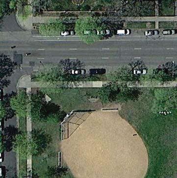
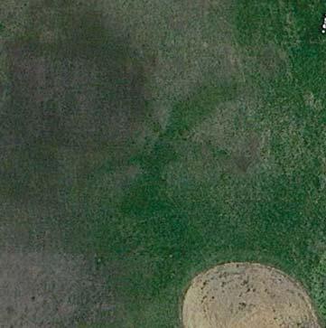
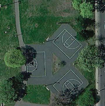
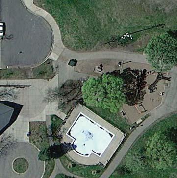
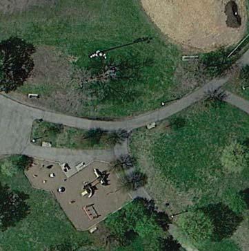
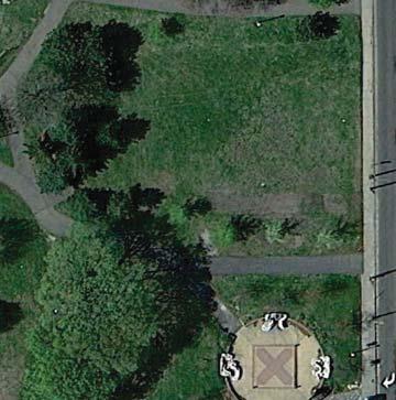
3 Existing Conditions: Peavey CH 4 NEIGHBORHOOD PARK PLANS PEAVEY 179

4 CHICAGO AVE S PARK AVE LG Proposed Plan: Peavey E 22ND ST
5 THE PROPOSED DESIGN Peavey is one of few parks in the SSAMP (along with Currie Park), which will see a nearly complete overhaul. In fact, the only element to remain in the Peavey park plan is the public art gathering space on the northeast corner of the park. The plan draws heavily from the master plan prepared by the community and the University of Minnesota in 2000, but makes some the community during the SSAMP planning process. Every move in the plan is designed to increase activity, improve visibility, and strike a balance between sports and passive use. The park is organized around a diagonal promenade stretching from the north center edge of the park to the southeastern corner. This promenade will feel like a grand pedestrian avenue, possibly with benches and high-quality pavement. As the main entry and circulation route through the park as well as a place to encounter neighbors and gather for conversation it should communicate the welcoming nature of the park, as well as reinforce the excitement and potential of the surrounding neighborhood. Circling the park and intersecting with the promenade are two rings of pathways that undulate through natural areas, gardens, and shady woods. One ring is entirely paved, while the other is partly aggregate surfacing, to create a variety of experiences. Arranged among these paths are a variety of active and passive recreation opportunities. A new recreation center-like building anchors the southern edge of the park. This partnership-based building will offer eyes on the park and serve as a destination to draw people in from the street into the interior of the park. The building should be integrated with the site, as an indoor/outdoor space with opportunities for gathering. Just west of the building is a lawn games area that could be used for skating. In front of the building, angled to follow the promenade, games or any other combination of youth games and its edges. In the northwestern corner of the park are two full-court basketball courts, one half-court, and a shooting practice hoop. Inclusion of full court basketball is a departure fro existing conditions and from the 2000 master plan, but it was held up as a critical need by the community. The new basketball complex provides varied options for playing and practicing the sport with high visibility from the streets. East of the promenade are play areas, a group shelter, a community orchard, and an interactive water feature that serves as both play feature and activating element in the park. The water feature is the only aquatic offering in the park (a major swimming pool and two wading pools are available in parks in fairly close proximity). The element could feature programmable jets with lighting, or could be integrated into the design of the play areas to allow for creative play with water. The edges of the park feature naturalized pollinatorfriendly plantings and overstory trees. If the naturalized plantings are kept low in height and the trees are pruned up, this planting scheme will provide good visibility into the park while also creating a real edge between the recreation space and the surrounding streets. By building on previous community planning efforts and listening to the community again during the SSAMP process, the plan for Peavey Park envisions a destination park that is active, vibrant, lush, exciting, and safe. KNOWN LAND USE AND COORDINATION ISSUES There are no known land use or coordination issues with Peavey Park. The current recreation building sits on land owned by Hope Academy. The outcomes of RecQuest will centers in the system as a whole, including at Peavey, at which time discussions with Hope Academy will be necessary. UPDATE EXISTING LG Traditional Play Structure Basketball Court Multi-use Field NEW/ ADDED Outdoor Gathering Space Group Shelter Interactive Water Play Walking Loop Trail Skating Rink Lawn/Court Games Urban Agriculture Area Basketball Court CH 4 NEIGHBORHOOD PARK PLANS PEAVEY 181
6 PROCESSES aquatics 1: General Input 2: Initial Concepts 3: The Preferred Concept Spring-Fall 2015 Fall-Winter 2015/2016 Now Mixed opinions on wading pool: suggestion for splash pad, desire for supervision Like the interactive water play area Interactive water play areas in several locations instead of single wading pool (can function as plazas and activate the whole park space) play Play areas almost universally disliked, due to lack of shade and disrepair Play areas not shown large enough in the concepts Play areas located in eastern portion of park, along main walkway athletics Significant preference for multi-use fields over diamonds, though fields need improvement Athletic field improvements should accommodate an adult-size soccer field Large multi-use field space west of main walkway, able to accommodate adult soccer and multiple youth fields (no diamonds planned for this park) courts Basketball is really big in this park; full courts would be preferred over half Full court basketball is needed in this park, though it is shown too close to kids play areas Suggestion that the skating rink double as a bocce court in the summer Basketball courts reconfigured in northwest corner of park, to include two full courts, one half court, and a warm-up hoop Addition of bocce and lawn games area that can be flooded in winter for skating winter Include winter skating in park for learners, with boards Like having the skating rink, but many kids don't have skates Addition of winter skating rink adjacent to park building 182
7 PROCESSES CONT. landscape 1: General Input 2: Initial Concepts 3: The Preferred Concept Spring-Fall 2015 Fall-Winter 2015/2016 Now Use the previous University of Minnesota design concept as the basis for the plan Community gardens and natural areas Like that both concepts generally follow University plan, but general preference for "B" showing building on southern edge Like food forest / orchard Park design follows general concept prepared by the neighborhood and the University of Minnesota, organized around high-activity diagonal walkway connecting Franklin and Chicago Addition of urban agriculture areas in several locations, including an orchard / food forest More trees and shade Concern about number of trees shown on the perimeter, could reduce visibility into park Addition of naturalized areas and gardens throughout the park other SAFETY is the number one concern in the park: want more officer foot patrols, more activity, more visibility, more lighting Like picnic area with grills; expand it Significant positive opinion of public art on corner of Chicago and Franklin, but in need of refurbishment Placing the new building or a pergola along Franklin will block views into the park and create a safety issue; prefer building located to south edge of park Addition of park building, conceived as a public/private partnership to activate the park and improve safety through "eyes on the park" Addition of interconnected walking loops and plazas of different types: an active community gathering plaza around the building, a paved walking trail looping around the park, a soft surface trail looping around the park, and interactive water feature plazas in several locations Addition of a group picnic shelter along the main walkway near the orchard Public art at the Franklin and Chicago corner, as existing CH 4 NEIGHBORHOOD PARK PLANS PEAVEY 183
8 COST ESTIMATE Asset Type Project 2017 ESTIMATED COST/PROJECT Implementation Sequence Prioritization Category Applicable SSAMP Actions Aquatics Interactive Water feature in different location $ 369,613 PLANNED 16, 20a, 20b Play Traditional Play Structures (2) in new container $ 698,158 FUNDED/PLANNED 16, 23b, 23d Athletics Athletic field renovation, incl. demolition of 2 diamonds and renovation of field $ 624,236 FUNDED/PLANNED 16, 21a, 21b Courts Basketball Court (2 full, 1 half) $ 279,263 PLANNED 16, 22a Most elements in the Peavey plan affect one Landscape Urban Agriculture Area $ - another. Phasing is too CONDITIONAL 19 Landscape Naturalized areas $ 58,600 complex to determine PLANNED 26, 29 Other Renovate public art/plaza on corner of Chicago and Franklin $ - within this cost estimate PLANNED 16 Other Group picnic shelter $ 90,350 PLANNED 16, 18 Other Lawn games/skating area $ 73,923 PLANNED 16, 18, 24 Other Community Center, in new location $ 3,585,247 CONDITIONAL 16 Other Renovate walking paths $ 752,762 PLANNED 16, 17 Other Miscl. signs, trees, furniture $ 77,287 PLANNED 9, 17 TOTAL $ 6,519,090 OPERATIONS ESTIMATE FACILITIES Total Per Unit Operations Cost Premier Field Tennis Court Half Court Basketball Adult Fitness Walking Loop Trail Restroom/Storage Building Difference $ 53,000 NOTE: Urban Agriculture Areas will be implemented in The renovation of the public art/plaza on the corner of Chicago will be the responsibility of City of Minneapolis public art program. Implementation of new recreation center depends on 184
CLEVELAND PARK LOCATION AND HISTORY EXISTING CONDITIONS AND CHARACTER LOCATION
 CLEVELAND PARK LOCATION LOCATION AND HISTORY Attempts to create a neighborhood park and playground in the Cleveland neighborhood began in 1926, when the park board designated for acquisition the block
FOLWELL PARK LOCATION AND HISTORY LOCATION
 FOLWELL PARK LOCATION LOCATION AND HISTORY Folwell Park is a large (by neighborhood park standards) tract of land located south of Dowling Avenue between Humboldt and Knox Avenues. The land for the park
WEST CENTRAL SECTION CONTENTS: FARWELL PARK NORTH COMMONS PARK OLIVER TRIANGLE RUSSELL PARK THEODORE WIRTH REGIONAL PARK VALLEY VIEW PARK WILLARD PARK
 WEST CENTRAL SECTION CONTENTS: FARWELL PARK NORTH COMMONS PARK OLIVER TRIANGLE RUSSELL PARK THEODORE WIRTH REGIONAL PARK VALLEY VIEW PARK WILLARD PARK FARWELL PLACE THOMAS AVE N SWING BENCH PICNIC AREA
NORTH OF BROADWAY SECTION CONTENTS: COTTAGE PARK FARVIEW PARK GLEN GALE PARK IRVING TRIANGLE JORDAN PARK NEWTON PARK PERKINS HILL PARK
 NORTH OF BROADWAY SECTION CONTENTS: COTTAGE PARK FARVIEW PARK GLEN GALE PARK IRVING TRIANGLE JORDAN PARK NEWTON PARK PERKINS HILL PARK N ILIO NA VE N JAM ES AV E PLAYGROUND PAR K PRO PER TY B OUN DAR Y
BASSETTS CREEK SECTION CONTENTS: BASSETTS CREEK BRYN MAWR LUCE LINE
 BASSETTS CREEK SECTION CONTENTS: BASSETTS CREEK BRYN MAWR LUCE LINE GLENWOOD AVE MULTI-USE DIAMONDS VINCENT AVE N MORGAN AVE N PENN AVE N DOG PARK MULTI-USE FIELDS PLAYGROUND AK E RD S CHESTNUT AVE DA
HALL PARK LOCATION AND HISTORY EXISTING CONDITIONS AND CHARACTER LOCATION
 HALL PARK LOCATION LOCATION AND HISTORY Hall park straddles Lyndale Avenue on the city s near north side. This neighborhood was identified in a 1938 study of the city s playground needs as one of five
EXISTING CONDITIONS AND CHARACTER
 DEMING HEIGHTS PARK LOCATION AND HISTORY Located in the Audubon Park neighborhood, Deming Heights Park is surrounded by a residential area. The first land for the park was acquired in 1913 along with the
NORTHWEST SECTION CONTENTS: CLEVELAND PARK FOLWELL PARK RYAN LAKE PARK VICTORY PRAIRIE DOG PARK VICTORY PARK
 NORTHWEST SECTION CONTENTS: CLEVELAND PARK FOLWELL PARK RYAN LAKE PARK VICTORY PRAIRIE DOG PARK VICTORY PARK LUCY LANEY COMMUNITY SCHOOL N 33RD AVE N 33RD AVE SINGLE-FAMILY RESIDENTIAL MULTI-USE DIAMOND
PIONEER PARK. City of Des Peres Parks Master Plan. SWT Design 46 INTRODUCTION
 PIONEER PARK INTRODUCTION Pioneer Park is a 7 acre neighborhood park located east of Interstate 270 and south of Manchester Road along Tallie Road. The park is situated in a residential neighborhood with
PARK PLANS SECTION CONTENTS: INTRODUCTION KEY/LEGEND PARK PLANS & COST ESTIMATES
 PARK PLANS SECTION CONTENTS: INTRODUCTION KEY/LEGEND PARK PLANS & COST ESTIMATES This page was intentionally left blank PROCESSES INTRODUCTION The South Service Area Master Plan creates unique new designs
PARK PLANS SECTION CONTENTS: INTRODUCTION KEY/LEGEND PARK PLANS & COST ESTIMATES
 PARK PLANS SECTION CONTENTS: INTRODUCTION KEY/LEGEND PARK PLANS & COST ESTIMATES This page was intentionally left blank PROCESSES INTRODUCTION The South Service Area Master Plan creates unique new designs
SHINGLE CREEK SECTION CONTENTS: BOHANON PARK CREEKVIEW PARK SHINGLE CREEK PARK SHINGLE CREEK REGIONAL TRAIL WEBBER PARK
 SHINGLE CREEK SECTION CONTENTS: BOHANON PARK CREEKVIEW PARK SHINGLE CREEK PARK SHINGLE CREEK REGIONAL TRAIL WEBBER PARK SPLASH PAD Good condition. PARK BUILDING BRYANT AVE N Good condition and unique to
M E S T I Z O C U R T I S P A R K
 ARAPAHOE CONNECTION TO BUS ROUTE AT ND AND LAWRENCE, FUTURE LIGHT RAIL STATION LEGEND SOCIAL TRAIL FLAGSTONE PAVING TO RESTORE/MAINTAIN CONCRETE PAVING DIAGONAL CURVILINEAR SOCIAL ROUTE IS OUT OF HISTORIC
PARK PLANS SECTION CONTENTS: INTRODUCTION KEY/LEGEND PARK PLANS & COST ESTIMATES
 PARK PLANS SECTION CONTENTS: INTRODUCTION KEY/LEGEND PARK PLANS & COST ESTIMATES This page was intentionally left blank PROCESSES INTRODUCTION The South Service Area Master Plan creates unique new designs
Dover Park Master Plan. Community Design Event Tuesday, May 22, 5 7 pm
 Dover Park Master Plan Community Design Event Tuesday, May 22, 5 7 pm Agenda I. Introduction / Overview 20 minutes II. Small Group Design Activity 60 minutes III. Small Group Report Out IV. Conclusion
POLICY & STRATEGIES The Vancouver Park Board approves major changes in Vancouver parks, including the design and development of parks.
 September 8, 2017 TO: Park Board Chair and Commissioners FROM: General Manager Vancouver Board of Parks and Recreation SUBJECT: Brewers Park and Clinton Park Renewal Concept Plans RECOMMENDATION THAT the
Community Advisory Committee Meeting #3 April 21, 2015
 Community Advisory Committee Meeting #3 April 21, 2015 Purpose (charge) of the CAC: Be Knowledgeable, Be an Engaged Representative, Develop Master Plan, & Prioritize Plan 1 Welcome/ Introductions Review
Stittsville Parks Information Session
 Stittsville Parks Information Session Amberway Park, Blackstone Park, Bryanston Gate Park & William Bradley Park Thursday, February 8, 2018 Open House 6:30-8:45pm Presentation 7pm Goulbourn Recreation
2. Goals and Policies. The following are the adopted Parks and Trails Goals for Stillwater Township:
 D. PARKS AND TRAILS 1. Introduction Stillwater Township s population is relatively low, with most residents living on rural residences on large lots. The need for active park space has been minimal in
4MRV Parks Master Plan: Site Analysis
 4MRV Parks Master Plan: Site Analysis Lardner/Klein Landscape Architects in association with: RK&K Grimm + Parker Kittelson & Associates Partners for Economic Solutions RIB U.S.Cost Civil Engineering Architecture
Northeast Quadrant Distinctive Features
 NORTHEAST QUADRANT Northeast Quadrant Distinctive Features LAND USE The Northeast Quadrant includes all the area within the planning area that is east of Interstate 5 and to the north of State Route 44.
City of Signal Hill STUDY AREA PROFILE
 City of Signal Hill STUDY AREA PROFILE STUDY AREA ID #141 BASE MAP PARK METRICS WHERE ARE PARKS MOST NEEDED AMENITY QUANTITIES AND CONDITIONS PARK NEEDS FRAMEWORK PROJECT COST ESTIMATES PROJECT REPORTING
PARKS & BEACHES PROJECTS
 #18 72ND STREET PARK, LIBRARY, #19 BLUEWAYS & AQUATIC CENTER $1.1 MILLION $60 MILLION New facility to include: Create Kayak Launches with All Wheels Skate Park Floating Docks and Seating at: Library/Media
Unincorporated Quartz Hill -Lancaster- Palmdale STUDY AREA PROFILE
 Unincorporated Quartz Hill -Lancaster- Palmdale STUDY AREA PROFILE STUDY AREA ID #19 BASE MAP PARK METRICS WHERE ARE PARKS MOST NEEDED AMENITY QUANTITIES AND CONDITIONS PARK NEEDS FRAMEWORK PROJECT COST
Southwest Quadrant Distinctive Features
 SOUTHWEST QUADRANT Southwest Quadrant Distinctive Features LAND USE The 31.17 square mile Southwest Quadrant includes all the area within the planning area west of I-5 and south of the Sacramento River.
LANDING S PARK CONCEPTUAL PLAN HAMILTON ANDERSON JANUARY City of Novi, Michigan. The Park at 13 Mile and Old Novi Road
 HAMILTON ANDERSON JANUARY 2012 LANDING S PARK CONCEPTUAL PLAN January 2012 Page 1 of 15 January 2012 PROJECT GOALS Activate the park by introducing new elements Provide clear access to the water and enhance
RUSSELL PARK LOCATION AND HISTORY EXISTING CONDITIONS AND CHARACTER LOCATION
 RUSSELL PARK LOCATION LOCATION AND HISTORY Russell Triangle sits surrounded by streets in a neighborhood bounded by Broadway Avenue, Golden Valley Road, and Theodore Wirth Parkway. The small triangle is
REAL ESTATE TRANSACTION ADVISORY SERVICES
 REAL ESTATE TRANSACTION ADVISORY SERVICES Improving Performance and Value of Amtrak-owned Assets AMTRAK STATION DEVELOPMENT 1 New York Penn Station Moynihan Train Hall Philadelphia 30 th Street Station
The Narrows Waterfront Park A Crown Jewel for Southern Brooklyn
 The Narrows Waterfront Park A Crown Jewel for Southern Brooklyn In New York, the unquestioned popularity of urban spaces such as Riverside Park, the High Line, Brooklyn Bridge Park and others has demonstrated
Park Design and Location Criteria
 Park Design and Location Criteria This section is presented in the interest of assisting park and recreation agencies in the development of a system of parks and recreation areas. A recreation system is
RIVERFRONT PROPERTIES
 Proposed Location Photo Credit: Visit Saint Paul An iconic downtown Saint Paul site located along the bluff with sweeping, unobstructed views of the Mississippi River Urban site Transit access Vibrant
Chapter 6. Action Program. Heart of the Lakes Area Recreation Plan
 Heart of the Lakes Area Recreation Plan 1. Design and construct the following trails (please see the following map): a. the Speedway Trail 1) primary pathway the main trail 2) secondary pathway the proposed
Great Wolf Lodge Fact Sheet & Frequently Asked Questions Potential Location in Gilroy, California 8/30/17
 WHAT? Great Wolf Resorts has identified Gilroy, California as a potential location for a new Great Wolf Lodge family resort and has entered into a 60-day period of exclusivity with the City and community
OAKLAND TOWNSHIP PARKS AND RECREATION MILLAGE RENEWAL AUGUST 2, 2016 BALLOT PROPOSAL QUESTIONS & ANSWERS PULL-OUT SECTION (APRIL 21, 2016)
") OAKLAND TOWNSHIP PARKS AND RECREATION MILLAGE RENEWAL AUGUST 2, 2016 BALLOT PROPOSAL QUESTIONS & ANSWERS PULL-OUT SECTION (APRIL 21, 2016) 2007 2016 Millage Accomplishments Timeline in Pull-out The Mission
OAKLAND TOWNSHIP PARKS AND RECREATION MILLAGE RENEWAL AUGUST 2, 2016 BALLOT PROPOSAL QUESTIONS & ANSWERS PULL-OUT SECTION (APRIL 21, 2016) 2007 2016 Millage Accomplishments Timeline in Pull-out The Mission
City of Galion Park Satisfaction Survey Results
 City of Galion Park Satisfaction Survey Results Dec. 5, 2016 Goal: To get feedback from the community on: 1. General satisfaction of city-owned parks 2. How to improve park facilities and recreation opportunities
Trail Etiquette. Hours of Operation. Trail Accessibility
 Trail Guide The Elmhurst Park District, with 28 parks and over 460 acres of land, offers nearly six miles of paved or asphalt park trails and maintains an additional 3.6 miles of trails within Elmhurst.
Chapter eight. Parks and Recreation. Introduction. Crystal Lake Park District
 Chapter eight Parks and Recreation Introduction One of the indicators of quality of life in a city is the parks and recreation system. The City of Crystal Lake is fortunate to have an excellent parks and
Parks Master Plan. Interim Presentation: Long Range Vision August 3, 2016
 Parks Master Plan Interim Presentation: Long Range Vision August 3, 2016 Presentation Outline 1. Overview, Schedule, Needs Assessment Summary 2. Long Range Vision 3. Next Steps 4. Questions, Discussion
Waukee Trailhead Public Art and Amenities Project
 Waukee - Trailhead Public Art and Amenities Project Sponsor Waukee Project Title Waukee Trailhead Public Art and Amenities Project Termini Description ( i.e. Park Avenue to 19th Street) NE Intersection
SOUTH PARK AT FRESHKILLS PARK ANCHOR PARKS PROGRAM COMMUNITY VISIONING. JCC of Staten Island February 1, 2017
 SOUTH PARK AT FRESHKILLS PARK ANCHOR PARKS PROGRAM COMMUNITY VISIONING JCC of Staten Island February 1, 2017 TONIGHT S AGENDA 1/ PRESENTATION: ANCHOR PARKS OVERVIEW WHAT WE HEARD IN NOVEMBER CONCEPTUAL
City of Sierra Madre STUDY AREA PROFILE
 City of Madre STUDY AREA PROFILE STUDY AREA ID #112 BASE MAP PARK METRICS WHERE ARE PARKS MOST NEEDED AMENITY QUANTITIES AND CONDITIONS PARK NEEDS FRAMEWORK PROJECT COST ESTIMATES PROJECT REPORTING FORM
City of Haslett. City of East Lansing. City of East Lansing
 Central Park North (Nancy L. Moore Park) Lake Park North Expansion White Park Expansion #2 White Park Expansion #1 County East East Haslett East East TF87-212 Acquisition $90,000.00 Park. TF08-138 Acquisition
NEW MEADOWS PARK PROPOSED MASTER PLAN
 NEW MEADOWS PARK PROPOSED MASTER PLAN A vision for your neighborhood park, the draft master plan is ready for your review. Tuesday September 12 th, 2017 5:30-7:00 PM Hellgate School District #4 middle
LAUREL TRIANGLE LOCATION AND HISTORY LOCATION
 LAUREL TRIANGLE LOCATION AND HISTORY Laurel Triangle is a small triangle in the Bryn Mawr neighborhood, bounded by Cedar Lake Road, Laurel Avenue, and Oliver Avenue. It is a special consideration park
2015 Budget Parks & Recreation Department
 Parks & Recreation Department February 2, 2015 Slide 1 COMMUNITY ENGAGEMENT Over 11,000 attended Caledon Day Over 700 celebrated one-year countdown to Pan Am Games Recognized almost 200 volunteers at the
Capital Prioritization
 14 Capital Prioritization 279 279 280 Park & Recreation CAPITAL PRIORITIZATION As described in Chapter 8, the recommendations presented in Chapter 9 are prioritized to provide a guide for future capital
RENTAL DIRECTORY. Homewood-Flossmoor Park District HFPARKS.COM
 RENTAL DIRECTORY Homewood-Flossmoor Park District WELCOME The Homewood-Flossmoor Park District has a variety of facilities to help you plan the perfect location for your meeting or party needs, whether
City of LA Valley Glen - North Sherman Oaks STUDY AREA PROFILE
 City of LA Valley Glen - North Sherman Oaks STUDY AREA PROFILE STUDY AREA ID #61 BASE MAP PARK METRICS WHERE ARE PARKS MOST NEEDED AMENITY QUANTITIES AND CONDITIONS PARK NEEDS FRAMEWORK PROJECT COST ESTIMATES
Recreation and Park Commission, Capital Committee. Through: Philip A. Ginsburg, General Manager Dawn Kamalanathan, Capital and Planning Manager
 Date: May 29, 2013 To: Recreation and Park Commission, Capital Committee Through: Philip A. Ginsburg, General Manager Dawn Kamalanathan, Capital and Planning Manager From: Subject: Mary Hobson, Project
Criteria Based System for MPRB Regional Park and Trail Capital Project Scheduling
 Criteria Based System for MPRB Regional Park and Trail Capital Project Scheduling July 19, 2017 Background Beginning with the 2017-2022 Capital Improvement Program (CIP), MPRB used equity-driven metrics
Villages at Buffalo Run East
 Villages at Buffalo Run East Neighborhood Park Subhead to title page goes here. Public Design Meeting April 9, 2015 Capital Improvement Program Commerce City s $137 million CIP is the result of a 2013
Hemisfair Civic Park. Vision and Program Plan
 Hemisfair Civic Park Vision and Program Plan OCTOBER 2013 Hemisfair Civic Park Vision and Program Plan Prepared under the direction of the Hemisfair Park Area Redevelopment Corporation. Planning assistance
BRACEVILLE NATURE PRESERVE Introductions History Present Conditions Future Development Plans Implementation Strategies Statistics
 BRACEVILLE NATURE PRESERVE Introductions History Present Conditions Future Development Plans Implementation Strategies Statistics Introduction Braceville Nature Preserve is one of MetroParks largest preserves.
Sports Complex Subcommittee Recommendation Report. Brad Chaney Subcommittee Chair March 17, 2009
 Sports Complex Subcommittee Recommendation Report Brad Chaney Subcommittee Chair March 17, 2009 Subcommittee Background Subcommittee created by the Board August 6, 2008. Members include Brad Chaney ( Park
Unincorporated East Rancho Dominguez STUDY AREA PROFILE
 Unincorporated East Rancho Dominguez STUDY AREA PROFILE STUDY AREA ID #31 BASE MAP PARK METRICS WHERE ARE PARKS MOST NEEDED AMENITY QUANTITIES AND CONDITIONS PARK NEEDS FRAMEWORK PROJECT COST ESTIMATES
Corktown Parks. Public Meeting. City of Toronto
 Corktown Parks Public Meeting City of Toronto 15-04-20 Agenda 1. Reasons for Study 2. Consultation to Date 3. Parks Evaluation 4. Community Context 5. Bright St. Playground 6. Orphans Green (Dog Off Leash)
4.0 FACILITIES INVENTORY
 4.0 FACILITIES INVENTORY 4.1 PARK LEVEL OF SERVICE STANDARDS (LOS) Based on current City of Longview Parks and Recreation Level of Service (LOS) Standards (Figure G), the City currently has a deficiency
2014 SPLOST Final Draft County-wide Parks System Rehabilitation
 Page 1 of 5 ADA Improvements (County Wide) Accessibility projects related to trails/walkways, door entrances, pool access, curb cuts, ramps, etc. Additionally, ADA Audit of facilities to identify and prioritize
St. John s Park Redevelopment Master Plan Public Engagement Report
 St. John s Park Redevelopment Master Plan Public Engagement Report Prepared by HTFC Planning & Design October 2017 TABLE OF CONTENTS 1.0 Introduction........ 1 2.0 Stakeholder and Public Notification......
Tahoe Donner Association Public Scoping Meeting DUDEK
 Tahoe Donner Association Public Scoping Meeting DUDEK Introduction Purpose of this Meeting: Solicit feedback and ideas from members, and staff as we begin the Association Master Plan. Association Master
Public Park System. Township of Derry. Providing natural open space for the recreational use of our residents and guests.
 Township of Derry Public Park System Providing natural open space for the recreational use of our residents and guests. Directory of Recreational Amenities Hershey s Commitment to Recreation Famous candy
WEST JORDAN PARKS, RECREATION AND TRAILS MASTER PLAN Advisory Committee Meeting #2
 WEST JORDAN PARKS, RECREATION AND TRAILS MASTER PLAN Advisory Committee Meeting #2 MONDAY, NOVEMBER 5, 2018, 6:00 P.M.; PARKS DEPT. CONFERENCE ROOM ATTENDEES: Lisa Dean Larry Gardner Duane Harding David
ATKINSON PARK POOL / SPLASH PAD PUBLIC
 WELCOME TO ATKINSON PARK POOL / SPLASH PAD PUBLIC OPEN HOUSE PURPOSE OF MEETING TO GAIN INPUT AND COMMENTS FROM THE COMMUNITY REGARDING CHANGING ATKINSON POOL TO A SPLASH PAD AND RENOVATING THE CURRENT
Northwest Corner of Castlemore Road and The Gore Road - Ward 10
 _BRAMPTON bromp Flower City Date: June 7, 2012 File: MOO-Naming $*-* i Report City Council The Corporation of the City of Brampton BRAMPTON CITY COUNCIL JUN 2 0 2012 DATE: Subject: Contact: Recommendation
crrv OF DALLAS Memorandum Trinity River Corridor Project Update On Recreation
 Memorandum OATE December 8, 2011 crrv OF DALLAS TO Trinity River Corridor Project Committee Members: Vonciel Jones Hill (Chair) Linda Koop (Vice Chair), Monica Alonzo, Scott Griggs, Angela Hunt, Delia
Experience the environment
 Experience it. Experience the environment The Grand is where CREATIVE, STATE-OF-THE-ART OFFICE meets inviting outdoor spaces featuring vibrant landscaping, pedestrian walkways and a two acre PROMINENT
NORTH HEMPSTEAD BEACH PARK MASTER PLAN
 NORTH HEMPSTEAD BEACH PARK MASTER PLAN COMMUNITY DESIGN CHARRETTE Supervisor Judi Bosworth Viviana L. Russell Peter J. Zuckerman Angelo P. Ferrara Anna M. Kaplan Lee R. Seeman Dina M. De Giorgio VISIONING
IBO. Fiscal Brief January Costs Climb for Replacing Parks Displaced by New Yankee Stadium. Now Also Available. IBO s Weblog
 IBO New York City Independent Budget Office Fiscal Brief January 2009 Costs Climb for Replacing Parks Displaced by New Yankee Stadium Now Also Available IBO s Weblog... at www.ibo.nyc.ny.us SUMMARY In
City of Palmdale - Westside STUDY AREA PROFILE
 City of Palmdale - Westside STUDY AREA PROFILE STUDY AREA ID #125 BASE MAP PARK METRICS WHERE ARE PARKS MOST NEEDED AMENITY QUANTITIES AND CONDITIONS PARK NEEDS FRAMEWORK PROJECT COST ESTIMATES PROJECT
Wilds. Headwaters. Lakes. Oxbows. Falls
 56 5 4 3 Wilds Headwaters Lakes Oxbows Falls 57 Zones It could be said the on-the-ground essence of this master plan appears within the next 6 pages of this report. As we learned in the preceding Cultural
Perfect for School, Government Us
 Perfect for School, Government Us Price: $2,280,000 Wow! You will Love this Prestigious Custom Built 15,000 Sq Ft Church located on an Over-sized "Buildable" 27,930 Sq Ft. Corner Lot with plenty of Private
Appendix B - Undeveloped Parks and Existing Parks with Remaining Development Programming
 Appendix B - Undeveloped Parks and Existing Parks with Remaining Development Programming Table of Contents Appendix B - Undeveloped Parks and Existing Parks with Remaining Development Programming Table
Unincorporated Northeast Antelope Valley STUDY AREA PROFILE
 Unincorporated Northeast Antelope Valley STUDY AREA PROFILE STUDY AREA ID #17 BASE MAP PARK METRICS WHERE ARE PARKS MOST NEEDED AMENITY QUANTITIES AND CONDITIONS PARK NEEDS FRAMEWORK PROJECT COST ESTIMATES
Philip A. Ginsburg, General Manager Dawn Kamalanathan, Director of Planning and Capital Division
 Date November 1, 2017 To: Through: From: Recreation and Park Commission Capital Committee Philip A. Ginsburg, General Manager Dawn Kamalanathan, Director of Planning and Capital Division Brett Desmarais,
TEMPE BEACH PARK - RECOMMENDATIONS
 TEMPE BEACH PARK - RECOMMENDATIONS Tempe Beach Park has the potential to become a regional destination park, but it suffers from a host of physical and operational problems, as well as structural flaws.
TRUCKEE TAHOE AIRPORT DISTRICT BOARD OF DIRECTOR STAFF REPORT
 AGENDA ITEM: 11 TRUCKEE TAHOE AIRPORT DISTRICT BOARD OF DIRECTOR STAFF REPORT AGENDA TITLE: MEETING DATE: January 24, 2018 PREPARED BY: NTPUD Agency Partnership Opportunity, Multi-Use Trailhead Access
- Welcome. - Project Next Steps. - Intros. - Public Comment Time. - Guiding Principles Revisited. - Balance in the Service Area
 ST ONY RK VAN p ' LEVf uxr PARK ER CAC Role The appointed CAC for the East of the River Park Master Plan shall: Become knowledgeable about the project and its scope and advise MPRB staff and consultants
Webber Park Master Plan Charrette Summary
 SMALL GROUP #1 - September 29, 2011 Webber Park Master Plan Charrette Summary More trash cans, especially near picnic grounds A year round pool is very needed-physical & mental health are significantly
REVISED AGENDA. Special Council Meeting. Monday, September 11, 2017 (REVISED TO INCLUDE ON-TABLE ITEMS)
") Mission Statement In carrying out its mandate, Bowen Island Municipality will work towards conducting operations in a way that: Improves the economic, environmental and social well-being for present and
Mission Statement In carrying out its mandate, Bowen Island Municipality will work towards conducting operations in a way that: Improves the economic, environmental and social well-being for present and
Trails. Lois Jensen Nature Preserve is a 30 acre parcel on the north end of the city. It provides unspoiled wooded paths.
 Trails Lois Jensen Nature Preserve is a 30 acre parcel on the north end of the city. It provides unspoiled wooded paths. TRAIL S, PATHS, ROUTES AND CONNECTORS Citizen input pointed to trails, paths, bike
City of Glendale - Southside STUDY AREA PROFILE
 City of Glendale - Southside STUDY AREA PROFILE STUDY AREA ID #168 BASE MAP PARK METRICS WHERE ARE PARKS MOST NEEDED AMENITY QUANTITIES AND CONDITIONS PARK NEEDS FRAMEWORK PROJECT COST ESTIMATES PROJECT
Community Meeting #2. Hoffman Park / Glen Park Master Plans River Falls, Wisconsin. draft master plan concepts
 Hoffman Park / Glen Park Master Plans River Falls, Wisconsin Community Meeting #2 draft master plan concepts Hoisington Koegler Group Inc. 123 North Third Street Suite 100 Minneapolis, Minnesota 55401
Business needs consumers! Get people back in to Port by attracting them!
 18 March 2013 Port Adelaide Precinct Plan Theme based analysis community feedback from Open Day Business District There were a range of suggestions for revitalising and boosting the Business District s
MASTER PLAN EXECUTIVE SUMMARY
 Biscuit Run State Park Scottsville Road (State Route 20) Charlottesville, VA 22902 Biscuit Run State Park MASTER PLAN EXECUTIVE SUMMARY Department of Conservation and Recreation Division of Planning and
Tallahassee-St. Marks Historic Railroad Trail
 Revitalizing a Historic Trail Designated as a National Recreation Trail, the 16-mile Tallahassee-St. Marks Historic Railroad Trail has been enjoyed by countless bicyclists, runners, and outdoor enthusiasts
Summary of Small Group Discussion Notes
 THE CORPORATION OF THE CITY OF WINDSOR Parks and Facilities/ Windsor Essex Local Immigration Partnership Community Consultation: Parks for Today-Planning for Tomorrow Dec 9, 2014 Windsor Public Library
J. Recreation Plan of Conservation and Development. The Town of Hebron. Section 2. Preservation of Unique Assets. 1 P a g e
 The Town of Hebron Section 2 2014 Plan of Conservation and Development Preservation of Unique Assets J. Recreation Open spaces, parks, sports fields, and recreational programs are considered essential
Parks, Recreation, Trails and Open Space Master Plan Survey Results. October 2018
 Parks, Recreation, Trails and Open Space Master Plan Survey Results October 2018 Conducted by Qualtrics subconsultant 300 completed responses Random attempt to get a balanced response from all four Council
Inner Harbor 2.0. The resulting Inner Harbor 2.0 Plan provides a road map for a more sustainable, attractive and active Inner Harbor.
 Inner Harbor 2.0 In 2012, recognizing that some of the Inner Harbor infrastructure had outlived its useful life, the City completed a State of Good Repair Study, while Waterfront Partnership, along with
Classes Other locations & Parks
 Other Parks 1 Classes Other locations & Parks Update: 6/11/2018 Visit us online at www.coconutcreek.net/parks-rec How to register for a class Registration is ongoing until filled, except in cases where
BRYAN REGIONAL PARK. Presented by: Burditt Consultants November 13, 2018
 BRYAN REGIONAL PARK Presented by: Burditt Consultants November 13, 2018 AGENDA 1. Project Purpose & Mission 2. Project Vision & Goals 3. Stakeholder Feedback 4. Program Overview 5. Phase A Plan Overview
Blueways: Rivers, lakes, or streams with public access for recreation that includes fishing, nature observation, and opportunities for boating.
 Parks, Open Space and Trails PRINCE WILLIAM COUNTY 2008 COMPREHENSIVE PLAN TRAILS PLAN CONTENTS The components of the trails plan are: Intent Definitions Goals, Policies, and Action Strategies Trails Map
Each picture below has a brief explanation of the alignment. Please review and feel free to send any questions you might have.
 TO: Golden Parks, Recreation and Museums Advisory Board FR: Al Head & Ben Davis, Golden Giddyup Tim Waters & Jerry Harcek, Golden Community Members RE: Singletrack Sidewalks Pilot Proposal 3.0, January,
Chapter 2: Summary of Existing Open Space System
 Chapter 2: Summary of Existing Open Space System In 1976, the Wake County Board of Commissioners established the Wake County Parks and Recreation Department in order to provide park facilities and programs
STITCH TRANSFORMATIVE IDEA 3. SHORELINE STITCH. Re-connect the city to the waterfront and link the east and west Core Circle landscapes
 SHORE STITCH TRANSFORMATIVE IDEA 3. SHORELINE STITCH Re-connect the city to the waterfront and link the east and west Core Circle landscapes 126 LINE PUBLIC WORK 127 TRANSFORMATIVE IDEA 3. SHORELINE STITCH
17 Mathilda Welmering Park Planning Zone 3
 17 Mathilda Welmering Park Planning Zone 3 8301 Mathilda Visit Date: September 2016 St. Louis County Parks Master Plan Page 1 Description: The six acre Mathilda Welmering Park is named for two streets
Fun Facts. How many Baseball fields do we have? a. 2 b. 14 c. 16 d. 21
 It Starts in Parks Fun Facts How many Baseball fields do we have? a. 2 b. 14 c. 16 d. 21 Fun Facts How many people visit Central Winds Park Annually? a. Over 100,000 b. 20,000 c. 10,000 d. 1,000 It Starts
2014 Parks and Trails General Obligation Bond: $42 million. $3 million County Trails $1 million City Playgrounds $38 million FMRP
 2014 Parks and Trails General Obligation Bond: $42 million $3 million County Trails $1 million City Playgrounds $38 million FMRP FMRP Location and Connections Major Timelines Completion of phase I the
KoenigRubloffLovesTheNorthwestSuburbs COMMUNITY GUIDE
 KoenigRubloffLovesTheNorthwestSuburbs COMMUNITY GUIDE THE NORTHWEST SUBURBS OF COOK COUNTY ARE VERY SPECIAL PLACES THAT WE ARE THRILLED TO SERVE Few places in America can compare to the communities in
APPENDIX E: SUMMARY OF PUBLIC MEETING QUESTIONNAIRE RESULTS
 Appendices Gwinnett County 2004 Comprehensive Parks and Recreation Master Plan APPENDIX E: SUMMARY OF PUBLIC MEETING QUESTIONNAIRE RESULTS March 2004 Monteith Brown Planning Consultants & The Jaeger Company