San Antonio Channel Improvement Project MISSION REACH ECOSYSTEM RESTORATION PROJECT. Welcome Assistant Secretary (CW) Jo-Ellen Darcy December 8, 2009
|
|
|
- Peter Adams
- 6 years ago
- Views:
Transcription
 Jo-Ellen Darcy")
1 San Antonio Channel Improvement Project MISSION REACH ECOSYSTEM RESTORATION PROJECT Welcome Assistant Secretary (CW) Jo-Ellen Darcy December 8,
2 Presentation Overview Review history of San Antonio River Build a greener and fully-functional ecosystem Complete project faster Exemplify government and community collaboration Create a better community and nation 2
3 3 Historic San Antonio River


4 Then: 1890 Abundant native trees, grass and other riparian vegetation. Mission San José can be seen in the background. 4


5 5 Historic Flooding


6 SACIP Timeline 1946 Flood - Lives lost 1960 s s Channelization of 31 miles of the San Antonio River and its tributaries 1998 Flood Downtown protected by flood tunnels. Tunnels pay for themselves in one event SACIP authorized 1980 s s Completion of two underground flood tunnels on San Antonio River and San Pedro Creek


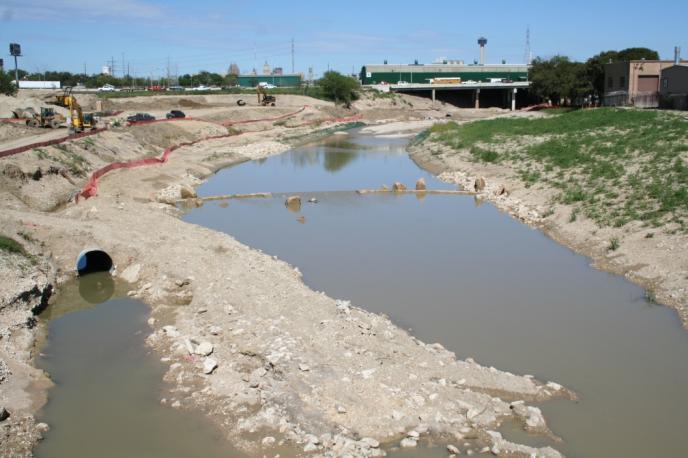
7 Pre-1960s Channelization 2008 Channel 7


8 HILDEBRAND AVE. LEXINGTON AVE. ALAZAN NUEVA ST. CREEK CREEK ALAMO ST. SAN ANTONIO RIVER 8 90 Channelized River LEGEND SACIP ORIGINAL ALIGNMENT SOUTH OF DOWNTOWN TRIBUTARY HEAD WATERS CREEK 281 MARTINEZ N W E S DOWNTOWN SAN ANTONIO CREEK APACHE PEDRO SAN MISSION CONCEPCION 81 MISSION SAN JOSE MISSION SAN JUAN 410 ESPADA MISSION

9 Current State Designed to move as much water as possible out of the area Has very little habitat value Has very little economic value Has very little cultural or artistic value Has very little recreational value 9
 Images: 1. USDA, NRCS. 2008.")
. 2.")
10 Now: non-native dominated plant community 1. Bermuda grass (Cynodon dactylon) 2. Johnson grass (Sorghum halepense) Images: 1. USDA, NRCS The PLANTS Database ( 3 July 2008). 2. University of Texas Austin Image Archive of Central Texas Plants (


11 Mission Reach: 1990 s -- Present 1993 SARA Board of Directors and San Antonio City Council adopt resolutions supporting a conceptual plan for San Antonio River from Guenther Street to Espada Dam and from Nueva Street to U.S. Highway Congress passes the Water Resources Development Act of 2000 to expand project to include ecosystem restoration and recreation Finalize local concept design USACE completes GRR USACE and SARA PED agreement Late 1990 s SARA and Bexar County, in cooperation with City of San Antonio complete and San Antonio River Flood Control Channel Modifications Preliminary Engineering Analysis Report Committee of Six forms San Antonio River Oversight Committee Today Assistant Secretary of the Army approves GRR and requests OMB to consider budgeting ecosystem restoration project SARA and USACE execute PCA Initiate construction Phase 1 Awarded $25.4 M in stimulus funding
12 Project Limits 13 miles of improvements to San Antonio River Project initiated in 1997 Two reaches complete Two reaches under construction 12
13 Mission Reach: Project Limits 8 mile ecosystem restoration and recreation project Restoring river previously channelized by U.S. Army Corps of Engineers for flood control 13


14 14 BUILD A GREENER AND FULLY- FUNCTIONAL ECOSYSTEM
15 Ecosystem Restoration Promotes U.S. Army Corps of Engineers Ecosystem Restoration Objectives Restores previously channelized (degraded) ecosystem in densely populated area Exemplifies model urban ecosystem restoration Supports a greener Corps by restoring a fully functional, healthy ecosystem Applies proven science-based engineering techniques 15


16 Mission Reach Ecosystem Restoration Existing River Channel Proposed River Channel Existing Riverine System Rating = 1.2* Proposed Riverine System Rating = 8.2* * per USACE study; based on scale with 1 as extremely degraded and 10 as pristine; proposed condition rating is at 50 year maturity period


17 Restoring Habitat Features 20,000+ young trees & shrubs 334 acres of riparian woodland habitat 113 acres of aquatic habitat 31 riffles 13+ acres of embayment 2 river remnants: San Juan & Espada


18 Ecosystem Restoration: In Progress Engineered restoration features using erosion control fabric and spur dikes. A point bar is forming on inside bend of pilot channel Riffle structure with erosion control fabric in the background


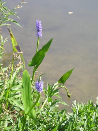
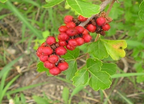
19 Native Species Butterfly On scarlet salvia Stonefly larva Longear sunfish Red-shouldered hawk in cypress Red-eared slider Red shiner Blacktail shiner Water primrose hornworm moth on water primrose Yellow-crowned night heron Bluegill
 250 stems/acre 70 stems/acre 27 stems/acre 0")
20 Tree & Shrub Densities Woody species planting densities were determined by USACE using hydrologic flood models and resistance to flow (Manning s equation) 250 stems/acre 70 stems/acre 27 stems/acre 0 stems/acre

21 Vegetation Zones


22 Mission Reach over time Natural Succession takes place over centuries This goal of this project is to take the Mission Reach from a man made drainage ditch to a Climax Community in ~50 years For maximum success, grasses need to be established, then small trees planted Constant monitoring and control will be necessary in the future 22


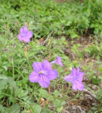


23 Mission Reach Ecosystem Restoration Native Grasses and Wildflowers


24 Plant Materials All plant material must be of acceptable origin from Bexar county or appropriate adjacent ecoregions Edwards Plateau Blackland Prairie South Texas Plains Post Oak Savanah Texas Forest Service under contract to collect and grow all woody plant materials Photos: Texas Forest Service


25 25 COMPLETE PROJECT FASTER
26 Project Partners and Budget Total City County Private Funds Presented in millions of dollars SAWS Concept Design $1.0 $0.3 $ USACE Downtown Reach $13.3 $2.4 $ Eagleland $13.6 $6.2 $ $2.6 Museum Reach Park $12.6 $11 $ Museum Reach Urban $72.1 $52.3 $13.1 $6.5 $0.2 - Mission Reach $271.9 $4.5 $115.3 $4.8 $6.0 $141.3 TOTAL $384.5 $76.7 $146.4 $11.3 $6.2 $ San Antonio River Authority committed to Operation and Maintenance as construction phases are completed.
27 Project Budget In Millions of Dollars Total Bexar Bexar City SAWS Private USACE County County Visitor Tax Mission Reach Project $271.9 $75.6 $39.7 $4.5 $6.0 $4.8 $141.3 Bexar County has committed local funding if necessary to ensure completion of the Mission Reach project by % of voters voted to extend visitors tax to support the Mission Reach Project 27 Request for FY 2011 budget is $84.8 million to meet remaining federal share of construction cost.


28 Betterments and Enhancements

29 Mission Reach Phases: Accelerated Schedule Phase 1: Construction underway; completion spring 2010 Phase 2A: Construction award Dec. 2009; duration months Phase 2B, 2C & 3: Construction award March 2010; duration 3 years Phase 4: Construction award June 2010; duration 3 years Completion in 2013

30 1.25 mile section from Lone Star Blvd to confluence with San Pedro Creek Construction underway USACE Bid Awarded in June 2008 Total Contract: $25.2 M County: $ 12.2 M City: $ 3.9 M USACE $ 9.1 M Visitor Tax Betterments Construction Budget: $9.9 M Completion Spring 2010 Mission Reach: Phase 1
31 Mission Reach: Phase 2A One mile section from confluence to Mission Road USACE Schedule -- Award in December 2009 Scheduled Completion March 2011 (14 mo) Est. construction cost: $41.3 M County $11.7 M Federal $30.4 M including $25.4 million in stimulus Phase Features Excavation of over 800,000 cubic yards of soil 40 acres of riparian habitat Over 2,200 native trees 2 acres of embayment 6 riffle structures 1.2 miles of hike and bike trails 1 instream pedestrian footbridge


32 EXEMPLIFY GOVERNMENT AND COMMUNITY COLLABORATION 32
33 Collaborative: SARIP Project Partners Local Governmental Partners Bexar County: Donation of land for project and primary funding partners for flood control, river restoration and betterments elements of the project City of San Antonio: Donation of land for project and Funding for project recreational elements San Antonio Water System: Funding for utility relocation San Antonio River Authority (SARA): Local sponsor with USACE, project administration and management. Donation of land for project and funding of operation and maintenance Federal Governmental Partners U.S. Army Corps of Engineers (USACE): Federal funding for river restoration and some recreational components, management of design and federal project administration and construction management National Park Service: Management and operation of cultural and natural resources of the San Antonio Missions National Historical Park and swap of lands for completion of project Federal Aviation Administration: Coordination of the regulation of airspace of Stinson Airport within project area Department of Education: Grants for Living Classrooms
34 Collaborative: SARIP Local Project Partners Community Partners San Antonio River Oversight Committee: Active citizen advisory committee established in 1998 representing the various neighborhood and business stakeholders along the river San Antonio River Foundation: Raising $23 million in private funding for art and amenity enhancements to the project School Districts: Providing educational opportunities to engage students in environmental education programs Community organizations: Numerous Business and community organization continue to support project. Witte Museum: Educational programs at local natural history museum


35 NPS: San Antonio Missions National Historical Park Today Nominated as a World Heritage Area 2 National Historic Landmarks 4 Colonial Missions Portions of the Mission s farms and ranches 26 Maintained Landscapes The oldest working Spanish Aqueduct and Dam in America Over 4,000 sqft of Historic Wood Features Over 270,000 sqft of historic masonry buildings 7 historic acequias, 13 miles of irrigation channel 1,355+ Historic Metal Features Numerous frescos


36 NPS: San Antonio Missions National Historical Park Visitation Visitation to Missions has increased 673% from 216,488 visitors in 1984 to 1,674,105 visitors in 2009 (just 25 years).


37 Ecological & Cultural Connections The origins of the City of San Antonio lie in the 16 th century with the San Antonio River as an essential ingredient in the success of the Spanish settlement By 1731 six missions were established near the river, each granted royal rights to the river water to support crops, ranching, and ultimately the conversion of local natives to loyal citizens of new Spain Restoring the river will re-establish the ecological context of the historic frontier missions and reconnect to the Missions while also enhancing the relevance of other nearby Spanish Colonial resources. Mission Concepción Mission San José Mission San Juan 37 Mission Espada

38 38 San Juan River Remnant San Juan Remnant

39 39 Espada Remnant


40 Mission Portals


41 CREATE A BETTER COMMUNITY AND NATION 41


42 Improving Quality of Life Recreational & Art Features 10.6 miles of hike & bike trails 4 foot bridges 5 shade structures 73 picnic tables Overlooks and river-edge landings Paddling access points
43 Supports current administration s goals Economic Health Supports job development in historically underserved community Promotes economic development including eco-tourism, increased property values and attract business Cultural Enrichment Preserves, protects, restores and interprets the essence of Hispanic Culture and Spanish Colonial resources Social Vitality Reconnects residents to their treasured natural resource Expands opportunities for Living Classrooms for environmental education and appreciation Quality of Life Supports Livable Communities by restoring acres of native habitat within an urban corridor Promotes new urbanism and sustainable communities Transforms river into 13-mile connectivity corridor to art museums, restaurants, zoo, historical and cultural locations 43
44 San Antonio Channel Improvement Project MISSION REACH ECOSYSTEM RESTORATION PROJECT December 8,
SAN ANTONIO RIVER IMPROVEMENTS PROJECT. August 6, 2008
 SAN ANTONIO RIVER IMPROVEMENTS PROJECT August 6, 2008 1 History of the SA River Improvements 1921 Flood Olmos Dam Complete in 1929 Downtown Flood Relief Projects in 1950 s Dams on the River Channel and
SAN ANTONIO RIVER IMPROVEMENTS PROJECT. April 27, 2009
 SAN ANTONIO RIVER IMPROVEMENTS PROJECT April 27, 2009 1 Project Limits 2 Project Partners City of San Antonio Provides project funding for project amenities (i.e.. Sidewalks, Landscaping, Lighting, etc.)
TRINITY RIVER CORRIDOR
 TRINITY RIVER CORRIDOR MODIFIED DALLAS FLOODWAY PROJECT UPDATE May 12, 2015 Jon Loxley Project Manager Dallas Floodway Project Fort Worth District U.S. Army Corps of Engineers US Army Corps of Engineers
INFILL HARD CORNER & REDEVELOPMENT OPPORTUNITY 731 PROBANDT and 134 & 138 KING ROGER ST
 INFILL HARD CORNER & REDEVELOPMENT OPPORTUNITY 731 PROBANDT and 134 & 138 KING ROGER ST First American Commercial Property Group 18618 Tuscany Stone, Ste. 210, San Antonio, TX 78258 Ph: 210.496.7775 Fx:
Cat Island Chain Background & Access Guide
 Cat Chain Background & Access Guide Brown County Port & Resource Recovery Department 2561 S. Broadway, Green Bay, WI 54304 (920) 492-4950 www.portofgreenbay.com January 2018 1 Restoration of the Cat Chain
Sibley LUPA. Board Executive Committee Meeting December 7, 2017
 Sibley LUPA Board Executive Committee Meeting December 7, 2017 Project Location & Project Area 1,318-acre Robert Sibley Volcanic Regional Preserve Project Area Purpose Project Purpose & Goals Append the
A CASE FOR COMPLETING THE JORDAN RIVER PARKWAY: A
 A CASE FOR COMPLETING THE JORDAN RIVER PARKWAY: A safe crossing at 9000 South and 850 West Proposed 9000 South Underpass Parkway Timeline Parkway, Trail, and Tourism Facts Blueprint Jordan River 1971 1973
Silver Lake Park An Environmental Jewel for the Citizens of Prince William County
 Silver Lake Park An Environmental Jewel for the Citizens of Prince William County The Prince William Park Authority Mission Statement states: The Prince William County Park Authority will create quality
Blue River Trail Master Plan JSA to Town Hall June 2004
 Blue River Trail Master Plan JSA to Town Hall June 2004 Prepared for: Silverthorne Town Council Silverthorne SPORT Committee Department of Recreation and Culture Silverthorne Public Works Silverthorne
Section II. Planning & Public Process Planning for the Baker/Carver Regional Trail began in 2010 as a City of Minnetrista initiative.
 Section II Planning & Public Process Planning for the began in 2010 as a City of initiative. city staff began discussions with the Park District on the possibility of a north/south regional trail connection
COASTAL CONSERVANCY. Staff Recommendation December 2, 2004 COYOTE HELLYER COUNTY PARK BAY AREA RIDGE TRAIL
 COASTAL CONSERVANCY Staff Recommendation December 2, 2004 COYOTE HELLYER COUNTY PARK BAY AREA RIDGE TRAIL File No. 04-057 Project Manager: Amy Hutzel RECOMMENDED ACTION: Authorization to disburse up to
Phoenix Habitat Restoration Projects
 Phoenix Habitat Restoration Projects Spur Cross Ranch Cave Creek (Estergard) Regional Tree and Shade Summit March 9, 2010 Desert Riparian Ecosystems Healthy riparian areas like this once existed along
ETOBICOKE CREEK NORTH TRAIL PROJECT. May 18, 2017 at Michael Power High School 105 Eringate Drive, Etobicoke ON M9C 3Z7
 ETOBICOKE CREEK NORTH TRAIL PROJECT May 18, 2017 at Michael Power High School 105 Eringate Drive, Etobicoke ON M9C 3Z7 1 Purpose of Open House The purpose of today s open house is to present the design
Flow Stand Up Paddle Board Parkway Plan Analysis
 Regional Parks Department Jeffrey R. Leatherman, Director County of Sacramento Divisions Administration Golf Leisure Services Maintenance Rangers Therapeutic Recreation Services Flow Stand Up Paddle Board
2016 Regional Transportation Alternatives Program (TAP) Grant Application
 Grant Application") 2016 Regional Transportation Alternatives Program (TAP) Grant Application PROJECT TITLE: Yelm-Tenino Trail Extension Feasibility Study TRPC use only GENERAL PROJECT INFORMATION Agency or Organization City
2016 Regional Transportation Alternatives Program (TAP) Grant Application PROJECT TITLE: Yelm-Tenino Trail Extension Feasibility Study TRPC use only GENERAL PROJECT INFORMATION Agency or Organization City
Parks & Recreation Areas Program
 PARKS & RECREATION Parks & Recreation Areas Program As part of its mission to conserve and protect natural resources, the Upper Big Blue Natural Resources District (NRD) has been involved in several large-scale
Clam Harbour Provincial Park
 Clam Harbour Provincial Park Public Engagement Session Thursday, September 14 th, 2017 5:30pm 7:30pm Webbers Store 11470 Nova Scotia Trunk 7 Lake Charlotte, NS Agenda Overview of the Provincial Parks System
Committee. Presentation Outline
 CW-33-15 11/9/2015 Community and Corporate Services Committee November 10, 2015 1 Presentation Outline Background Vision and Objectives Study Process and Timeline Public and Stakeholder Engagement Organization
City of Durango 5.8 FUNDING TRAILS DEVELOPMENT
 5.8 FUNDING TRAILS DEVELOPMENT The City has been successful in establishing dedicated local funding sources as well as applying for grants to develop the City s trail system, having received nearly $2.4
ARCHAEOLOGICAL MONITORING OF THE ASHBY STREET DRAINAGE PROJECT, SAN ANTONIO, BEXAR COUNTY, TEXAS
 ARCHAEOLOGICAL MONITORING OF THE ASHBY STREET DRAINAGE PROJECT, SAN ANTONIO, BEXAR COUNTY, TEXAS Anne A. Fox and I. Waynne Cox / Center for Archaeological Research The University of Texas at San Antonio
MASTER PLAN EXECUTIVE SUMMARY
 Biscuit Run State Park Scottsville Road (State Route 20) Charlottesville, VA 22902 Biscuit Run State Park MASTER PLAN EXECUTIVE SUMMARY Department of Conservation and Recreation Division of Planning and
2009 RIVER TOWN OF THE YEAR AWARD APPLICATION Supplemental Material Images
 2009 RIVER TOWN OF THE YEAR AWARD APPLICATION Supplemental Material Images Our History The earliest record of settlement along the river is in 1854; one of the earliest in Carroll County. About this time
NAVAJO COMMUNITY PLAN
 NAVAJO COMMUNITY PLAN Prepared by the NAVAJO COMMUNITY PLANNERS and THE CITY OF SAN DIEGO City of San Diego Planning Department 202 C Street, MS 4A San Diego, CA 92101 Printed on recycled paper. This information,
Bear Creek Habitat Improvement Project
 06/10/10 Bear Creek Habitat Improvement Project El Paso County, Colorado Pike National Forest and Colorado Springs Utilities Owned Land Report prepared by: Eric Billmeyer Executive Director Rocky Mountain
2.0 Physical Characteristics
 _ 2.0 Physical Characteristics 2.1 Existing Land Use for the Project The site is comprised of approximately 114 acres bounded by Highway 101 to the north, the existing town of Los Alamos to the east, State
crrv OF DALLAS Memorandum Trinity River Corridor Project Update On Recreation
 Memorandum OATE December 8, 2011 crrv OF DALLAS TO Trinity River Corridor Project Committee Members: Vonciel Jones Hill (Chair) Linda Koop (Vice Chair), Monica Alonzo, Scott Griggs, Angela Hunt, Delia
Welcome to the future of Terwillegar Park a Unique Natural Park
 Welcome to the future of Terwillegar Park a Unique Natural Park 1 Introduction The Terwillegar Park Concept Plan study will develop an overall concept plan, management objectives and development guidelines
Hawke s Bay Regional Parks Network. Pekapeka Regional Park Individual Park Plan
 Hawke s Bay Regional Parks Network Pekapeka Regional Park Individual Park Plan 2015-2024 Hawke s Bay Regional Council 159 Dalton Street Private Bag 6006 Napier 4110 Hawke s Bay New Zealand Telephone: 0800
Northaven Trail Phase 2 Initial Project Overview
 Northaven Trail Phase 2 Initial Project Overview Partnership Project to extend existing Northaven Trail Improve Bike/Ped Connectivity On Dallas Trail Network Plan City and County Funding Oncor Texas Trails
KASKASKIA RIVER NAVIGATION POOL Compartment 12 UNIT 1 Kaskaskia Lock and Dam Lands These lands are now being managed by the Carlyle Lake project
 KASKASKIA RIVER NAVIGATION POOL Compartment 12 UNIT 1 Kaskaskia Lock and Dam Lands These lands are now being managed by the Carlyle Lake project office. Sections 1-4 in this plan present Kaskaskia River
Dungeness Recreation Area County Park Master Plan
 Dungeness Recreation Area County Park Public Outreach Meeting October 10, 2007 Project Overview USFWS Site Dungeness Recreation Area County Park Meeting Objectives: Re-Introduce project; provide status
The Partnership Wild & Scenic Rivers Program
 BUDGET REQUEST FISCAL YEAR 2017 Proven, cost-effective protection for 770 miles of rivers and thousands of acres of riparian land Westfield River, MA (L) and Farmington River, CT (R) Partnership Wild &
Inner Harbor 2.0. The resulting Inner Harbor 2.0 Plan provides a road map for a more sustainable, attractive and active Inner Harbor.
 Inner Harbor 2.0 In 2012, recognizing that some of the Inner Harbor infrastructure had outlived its useful life, the City completed a State of Good Repair Study, while Waterfront Partnership, along with
Coronado National Forest Santa Catalina Ranger District
 United States Department of Agriculture Forest Service Coronado National Forest Santa Catalina Ranger District File Code: 1950 Date: October 14, 2015 Dear Interested Party: The Santa Catalina Ranger District
Establishing a National Urban Park in the Rouge Valley
 STAFF REPORT ACTION REQUIRED Establishing a National Urban Park in the Rouge Valley Date: March 29, 2012 To: From: Wards: Reference Number: Executive Committee Deputy City Manager, Cluster B All p:\2012\cluster
Niagara Natural Heritage Park
 A Future Proposal For the Niagara-on-the-Lake DND Lands....... Parks Canada Lakeshore Road Property 1 May, 2016 The Harmony Residents Group We are proposing a Natural Heritage Park be established on the
Preservation & Restoration of the Houston Region s Green Fabric: The Role of the Harris County Flood Control District
 Preservation & Restoration of the Houston Region s Green Fabric: The Role of the Harris County Flood Control District Glenn Laird, Environmental Chief Harris County Flood Control District Parks + Natural
Chapter 2: Summary of Existing Open Space System
 Chapter 2: Summary of Existing Open Space System In 1976, the Wake County Board of Commissioners established the Wake County Parks and Recreation Department in order to provide park facilities and programs
Engineering With Nature Geographic Project Mapping Tool (EWN ProMap)
") Engineering With Nature Geographic Project Mapping Tool (EWN ProMap) Cynthia Banks Program Manager Burton Suedel, PhD Research Biologist Michelle Bourne Research Biologist U.S. Army ERDC 23 June 2015 Dredging
Engineering With Nature Geographic Project Mapping Tool (EWN ProMap) Cynthia Banks Program Manager Burton Suedel, PhD Research Biologist Michelle Bourne Research Biologist U.S. Army ERDC 23 June 2015 Dredging
PULLMAN-MOSCOW REGIONAL AIRPORT Runway Realignment Project
 PULLMAN-MOSCOW REGIONAL AIRPORT Runway Realignment Project GENERAL AIRPORT INFORMATION AIRPORT USERS Airport ownership: Public, owned by the Pullman-Moscow Regional Airport Board Year opened: February
Citrus Heights Creek Corridor Trail Project Trail Advisory Group Field Trip #2 September 11, :00 11:00 am Trellis Hall, Citrus Heights
 September 11, 2013 9:00 11:00 am Trellis Hall, Citrus Heights Project Overview The City of Citrus Heights is studying the feasibility of establishing a multi use trail system within the City s 26 miles
China Creek North Park Upgrades and Glen Pump Station. Park Board Committee Meeting Monday, July 10, 2017
 China Creek North Park Upgrades and Glen Pump Station Park Board Committee Meeting Monday, July 10, 2017 Purpose The purpose of this presentation is to: Share the results of the public engagement processes;
BRYAN REGIONAL PARK. Presented by: Burditt Consultants November 13, 2018
 BRYAN REGIONAL PARK Presented by: Burditt Consultants November 13, 2018 AGENDA 1. Project Purpose & Mission 2. Project Vision & Goals 3. Stakeholder Feedback 4. Program Overview 5. Phase A Plan Overview
THAT the Board approve the final proposed concept plan for the Jericho Marginal Wharf site as shown in Figure C-4 of Appendix C.
 Date: January 17, 2012 TO: Board Members Vancouver Park Board FROM: General Manager Parks and Recreation SUBJECT: Jericho Marginal Wharf Phase 2 Concept Plan RECOMMENDATION THAT the Board approve the final
Trinity River Vision Update
 Trinity River Vision Update Presented to the City Council by: Mark Rauscher, Program Manager Planning & Development Department / Program Management Office August 23, 2011 1 Purpose of the Briefing Overview
Park Updates 1. Cavalero 2. Lundeen 3. Frontier Heights Citizen Advisory Committee
 Page 1 of 10 PARK BOARD AGENDA Community Center 1808 Main Street, Lake Stevens Monday, April 11, 2016 CALL TO ORDER: 6:00 pm ROLL CALL: GUEST BUSINESS: ACTION ITEMS: A. B. C. Approval of February 8, 2016
TRUCKEE TAHOE AIRPORT DISTRICT BOARD OF DIRECTOR STAFF REPORT
 AGENDA ITEM: 11 TRUCKEE TAHOE AIRPORT DISTRICT BOARD OF DIRECTOR STAFF REPORT AGENDA TITLE: MEETING DATE: January 24, 2018 PREPARED BY: NTPUD Agency Partnership Opportunity, Multi-Use Trailhead Access
March 2, The Honorable Mayor Williams D. Sessoms, Jr. Members of City Council. Subject: Coastal CIP Presentation to City Council - March 6, 2018
 OFFICE OF THE CITY MANAGER (757) 385-4242 (757) 427-5626 FAX MUNICIPAL CENTER BUILDING 1, ROOM 234 2401 COURTHOUSE DRIVE VIRGINIA BEACH, VA 23456-9001 March 2, 2018 The Honorable Mayor Williams D. Sessoms,
Daisy Dean Trail 628/619 ATV Trail Construction
 Background and Purpose and Need The Daisy Dean ATV Trail Construction Project is located in the Little Belt Mountains, Musselshell Ranger District, Lewis and Clark National Forest approximately 32 miles
Riverine Sand Mining/Scofield Island Restoration (BA-40)
") Riverine Sand Mining/Scofield Island Restoration (BA-40) Conference on Ecological and Ecosystem Restoration Kenneth Bahlinger, CPRA Project Manager July 31, 2014 committed to our coast committed to our
Riverine Sand Mining/Scofield Island Restoration (BA-40) Conference on Ecological and Ecosystem Restoration Kenneth Bahlinger, CPRA Project Manager July 31, 2014 committed to our coast committed to our
The Lone Star Coastal National Recreation Area: Feasibility Study Status Report - September 2013
 The Lone Star Coastal National Recreation Area: Feasibility Study Status Report - September 2013 Lone Star Coastal National Recreation Area Concept National Park Criteria Concept Storm Surge Damage Reduction
Rouge National Park. Opportunities and Challenges
 Rouge National Park Opportunities and Challenges January 2013 Rouge Park Finch Meander Rouge Beach at Lake Ontario Toronto GLWQA Area of Concern Rouge National Park Nationally Significant First Nation
Criddle/Vane Homestead Provincial Park. Draft Management Plan
 Criddle/Vane Homestead Provincial Park Draft Management Plan 2 Criddle/Vane Homestead Provincial Park Table of Contents 1. Introduction... 3 2. Park History.... 3 3. Park Attributes.... 3 3.1 Natural....
Buffalo District Navigation Program Overview
 Buffalo District Navigation Program Overview 16 FEB 2011 US Army Corps of Engineers Buffalo District Area of Operations Our Facilities District Headquarters 2 Area Offices 3 Regulatory Field Offices Lake
Spanish Missions History and Purpose
 Spanish Missions History and Purpose Columbus's voyage of discovery opened a new world of possibilities for the Spanish. In the Americas, Spain soon began to use its soldiers to increase the size of its
4.0 Context for the Crossing Project
 4.0 Context for the Crossing Project This section provides background information about key features of the North Douglas Crossing project area, and opportunities and constraints. This information is important
Proposal to Redevelop Lower Kananaskis River-Barrier Lake. Bow Valley Provincial Park
 Frequently Asked Questions Proposal to Redevelop Lower Kananaskis River-Barrier Lake Bow Valley Provincial Park Frequently Asked Questions What has been decided? What are the details of the plan? What
The Alamo. The Alamo. ground and the Shrine of Texas Liberty. heroic struggle against impossible odds a place
 The Alamo The Alamo originally served as a home to missionaries for nearly seventy years. Construction began on the present site in 1724. The Alamo is famously known as the scene of a pivotal battle in
Pinellas County Environmental Lands
 Pinellas County Environmental Lands In addition to traditional parks and recreation facilities, Pinellas County owns and manages a system of environmental lands that provides specialized resource-based
SECTION 3 GENERAL DESCRIPTION OF THE RIVER BASIN
 SECTION 3 GENERAL DESCRIPTION OF THE RIVER BASIN SECTION 3 GENERAL DESCRIPTION OF THE RIVER BASIN River basin description. A general description of the river basin or subbasin, as appropriate, in which
CITY OF VAUGHAN EXTRACT FROM COUNCIL MEETING MINUTES OF JANUARY 25, 2011
 Item 1, Report No. 1, of the Priorities and Key Initiatives Committee, which was adopted without amendment by the Council of the City of Vaughan on January 25,. 1 RAPID TRANSIT UPDATE TORONTO-YORK SPADINA
Manhattan Project National Historical Park. Tracy D. Atkins Principal Representative
 Manhattan Project National Historical Park Tracy D. Atkins Principal Representative Park Establishment 2015 NDAA passed December 2014 authorizing the park in three locations with joint management with
Proposed Official Plan Amendment 41 to the Region of York Official Plan
 COMMITTEE OF THE WHOLE NOVEMBER 18, 2002 REGION OF YORK OFFICIAL PLAN AMENDMENT 41 THE OAK RIDGES MORAINE CONSERVATION PLAN Recommendation The Commissioner of Planning recommends: 1. That the City of Vaughan
CITY COUNCIL AGENDA MEMORANDUM
 To: Mayor and City Council From: Charles Ozaki, City and County Manager Prepared By: Kevin Standbridge, Deputy City and County Manager Katie Allen, City and County Engineer David Shinneman, Community Development
Fair Park Comprehensive Development Plan Update. City Council Briefing November 5, 2007
 1 Fair Park Comprehensive Development Plan Update City Council Briefing November 5, 2007 Introduction Park and Recreation Department Renaissance Plan focused on eight Big Moves: Upgrade current parks Provide
Map 1.1 Wenatchee Watershed Land Ownership
 Map 1.1 Wenatchee Watershed Land Ownership Map 1.1 Wenatchee Watershed Land Ownership The Wenatchee watershed lies in the heart of Washington state in Chelan County. Just larger than the state of Rhode
Whitemouth Falls Provincial Park. Draft Management Plan
 Whitemouth Falls Provincial Park Draft Management Plan Whitemouth Falls Provincial Park Draft Management Plan Table of Contents 1. Introduction... 3 2. Park History... 3 3. Park Attributes... 4 3.1 Natural...
WESTSIDE CREEKS ECOSYSTEM RESTORATION. Appendix J: Recreation
 WESTSIDE CREEKS ECOSYSTEM RESTORATION Appendix J: Recreation RECREATION APPENDIX WESTSIDE CREEKS DRAFT RECREATION PLAN Recreation development provides opportunities that significantly benefit communities.
BA Collaborators. Driftless Area Initiative The Prairie Enthusiasts Trout Unlimited TNC TCF Natural Resources Foundation of Wisconsin
 BA Collaborators Driftless Area Initiative The Prairie Enthusiasts Trout Unlimited TNC TCF Natural Resources Foundation of Wisconsin The mission of the of the Blufflands Alliance is to actively conserve
Environment and Natural Resources Trust Fund 2019 Request for Proposals (RFP)
") Environment and Natural Resources Trust Fund 2019 Request for Proposals (RFP) Project Title: Glacial Edge Trail and Downtown Pedestrian Bridge Category: G. Land Acquisition for Habitat and Recreation ENRTF
Environment and Natural Resources Trust Fund 2019 Request for Proposals (RFP) Project Title: Glacial Edge Trail and Downtown Pedestrian Bridge Category: G. Land Acquisition for Habitat and Recreation ENRTF
DATE: January 19, WCA Governing Board. Johnathan Perisho, Project Manager. Mark Stanley, Executive Officer
 Item 14 DATE: January 19, 2017 TO: FROM: THROUGH: SUBJECT: WCA Governing Board Johnathan Perisho, Project Manager Mark Stanley, Executive Officer Item 14: Consideration of a resolution to accept an acquisition
Wilds. Headwaters. Lakes. Oxbows. Falls
 56 5 4 3 Wilds Headwaters Lakes Oxbows Falls 57 Zones It could be said the on-the-ground essence of this master plan appears within the next 6 pages of this report. As we learned in the preceding Cultural
Criddle/Vane Homestead Provincial Park. Management Plan
 Criddle/Vane Homestead Provincial Park Management Plan 2 Criddle/Vane Homestead Provincial Park Table of Contents 1. Introduction... 3 2. Park History.... 3 3. Park Attributes.... 4 3.1 Natural.... 4 3.2
April 10, Mark Stiles San Juan Public Lands Center Manager 15 Burnett Court Durango, CO Dear Mark,
 Mark Stiles San Juan Public Lands Center Manager 15 Burnett Court Durango, CO 81301 Dear Mark, We are pleased to offer the following comments on the draft San Juan Public Lands Center management plans
Region 1 Piney Woods
 Region 1 Piney Woods Piney Woods 1. This ecoregion is found in East Texas. 2. Climate: average annual rainfall of 36 to 50 inches is fairly uniformly distributed throughout the year, and humidity and temperatures
Southwest Quadrant Distinctive Features
 SOUTHWEST QUADRANT Southwest Quadrant Distinctive Features LAND USE The 31.17 square mile Southwest Quadrant includes all the area within the planning area west of I-5 and south of the Sacramento River.
San Antonio's River Walk Behind the scenes tour or did you know?
 San Antonio's River Walk Behind the scenes tour or did you know? Robert B. Kauffman, Ph.D 7 Hill Top Drive Frostburg, MD 21532 o: (301) 687-4474 e: rkauffman@frostburg.edu All historical slides are from
Environmental Development of River Road Ranch
 Environmental Development of River Road Ranch New Braunfels, Texas Alix Scarborough GEO 3426 April 2012 Introduction The 2,400-acre Word-Borcher ranch has been owned by the Word family since 1941. Located
ROAD AND TRAIL PROJECT APPROVAL
 ROAD AND TRAIL PROJECT APPROVAL www.marincountyparks.org Marin County Parks, 3501 Civic Center Dr, Suite 260, San Rafael, CA 94903 DATE: July 12, 2017 PRESERVE: Gary Giacomini Open Space Preserve PROJECT:
26 Utah s Patchwork Parkway SCENIC BYWAY CORRIDOR MANAGEMENT PLAN (SR 143)
") Natural Natural Quality applies to those features in the visual environment that are in a relatively undisturbed state. These features predate the arrival of human populations and may include geological
Natural Natural Quality applies to those features in the visual environment that are in a relatively undisturbed state. These features predate the arrival of human populations and may include geological
ADVENTURE PLAN EXPLORE PARK
 ADVENTURE PLAN ROANOKE COUNTY S EXPLORE PARK ROANOKE COUNTY PARKS, RECREATION AND TOURISM 1206 KESSLER MILL RD SALEM, VA 24153 (540) 387-6078 WHAT S INCLUDED? Explore Park Adventure Plan - Guided by extensive
Segment 2: La Crescent to Miller s Corner
 goal of the USFWS refuges is to conserve, protect and enhance fish, wildlife and plants and their habitats for the continuing benefit of the American people. Refuge lands are used largely for fishing,
Dr. Christopher Brown New Mexico State University GEF Project Rio Meeting Ciudad Juárez, México 3-5 October 2006
 Political and Institutional Aspects of Rio Grande/ Río Bravo Basin Management Dr. Christopher Brown New Mexico State University GEF Project Rio Meeting Ciudad Juárez, México 3-5 October 2006 Institutional
Comprehensive Bibliography of Archaeological Projects The Mission San Josẻ y San Miguel de Aguayo (41BX3) Collections
 Collections") Comprehensive Bibliography of Archaeological Projects The Mission San Josẻ y San Miguel de Aguayo (41BX3) Collections Bradford, J., and D. Traylor 1981 Archaeological Excavations at the Mission San José
Comprehensive Bibliography of Archaeological Projects The Mission San Josẻ y San Miguel de Aguayo (41BX3) Collections Bradford, J., and D. Traylor 1981 Archaeological Excavations at the Mission San José
1 PROJECT STATUS UPDATE 2 ND CONCESSION FROM BRISTOL ROAD TO DOANE ROAD TOWNS OF EAST GWILLIMBURY AND NEWMARKET
 Report No. 3 of the Regional Council Meeting of March 28, 2013 1 PROJECT STATUS UPDATE 2 ND CONCESSION FROM BRISTOL ROAD TO DOANE ROAD TOWNS OF EAST GWILLIMBURY AND NEWMARKET The recommends: 1. Receipt
The Vision for the San Juan Islands Scenic Byway
 The Vision for the San Juan Islands Scenic Byway 2 Judd Cove, Orcas Island, Courtesy of Kurt Thorson (kurtthorson.com) and San Juan County Land Bank Vision for the San Juan Islands Scenic Byway The San
Environment and Natural Resources Trust Fund 2017 Request for Proposals (RFP)
") Project Title: Total Project Budget: $ Environment and Natural Resources Trust Fund 2017 Request for Proposals (RFP) Floating Classroom: Connecting 20,000 Youth to Minnesota Waterways Category: Proposed
Project Title: Total Project Budget: $ Environment and Natural Resources Trust Fund 2017 Request for Proposals (RFP) Floating Classroom: Connecting 20,000 Youth to Minnesota Waterways Category: Proposed
GREATER DES MOINES WATER TRAILS AND GREENWAYS PLAN
 GREATER DES MOINES WATER TRAILS AND GREENWAYS PLAN A shared vision for our rivers, creeks and greenways. www.dmampo.org/water-trails Des Moines Area MPO Iowa Department of Natural Resources dmampo.org/water-trails
STREAMWALKS REVISITED
 STREAMWALKS REVISITED Maggie A. Kendrick, Department of Earth Sciences, University of South Alabama, Mobile, AL, 36688. Email: mak0209@aol.com. The goal of my research is to have a system of streamwalks
USDA Trails Strategy WRI: ENGLISH PEAK SURVEY. Theodore Mendoza San Diego State University June 6 th 2016 August 18 th Advisor: Sam Commarto
 WRI: ENGLISH PEAK SURVEY Theodore Mendoza San Diego State University June 6 th 2016 August 18 th 2016 Advisor: Sam Commarto Klamath National Forest Submitted: March 21, 2017 Table of Contents Acknowledgements
Part four. In this part you will find: The next steps to deliver the master plan
 Part four NEXT STEPS In this part you will find: The next steps to deliver the master plan 6. How COULD the Master Plan be delivered? There are a number of steps required to take the proposals in the master
Great Wolf Lodge Fact Sheet & Frequently Asked Questions Potential Location in Gilroy, California 8/30/17
 WHAT? Great Wolf Resorts has identified Gilroy, California as a potential location for a new Great Wolf Lodge family resort and has entered into a 60-day period of exclusivity with the City and community
Hillsborough MPO Technical Advisory Committee. Monday, February 20, 2017
 Hillsborough MPO Technical Advisory Committee Monday, February 20, 2017 1 Study Purpose Support the vision for a livable, connected, and competitive downtown. Evaluate alternatives for the system s modernization
Commercial Property Near Primary Island Intersection
 CORPUS CHRISTI, TEXAS Mainland Corpus Christi Laguna Madre JFK Causeway Padre Isles Country Club S. Padre Island Drive PROPERTY Sand Dollar Ave. (Platted) Highway 361 Town Center / Riverwalk Site Packery
SHASTA WEST PLANNING AREA
 2016 SHASTA COUNTY COMMUNITY WILDFIRE PROTECTION PLAN SHASTA WEST PLANNING AREA Covering the communities of: Centerville Redding (west & downtown) Shasta I. PROPOSED PROJECTS A. THE PLANNING AREA SHASTA
ORANGE COUNTY TRANSPORTATION AUTHORITY. Go Local Fixed-Guideway Program History and Project Update. PowerPoint 3
 ORANGE COUNTY TRANSPORTATION AUTHORITY Go Local Fixed-Guideway Program History and Project Update PowerPoint 3 Santa Ana-Garden Grove Fixed Guideway Project OCTA Board of Directors September 26, 2011 Project
FEASIBILITY CRITERIA
 This chapter describes the methodology and criteria used to evaluate the feasibility of developing trails throughout the study areas. Land availability, habitat sensitivity, roadway crossings and on-street
Trail # NW Tuesday, June DESIGN. Provide an Review the Provide an. Project Goals: System system. wayfinding
 I. Welcome / Introductions Bethany Creek Trail #2 Segment 3 Neighborhood Meeting #1 Bethany Presbyterian Church 15505 NW Springville Road, Portland, OR 97229 Tuesday, June 26, 2018 @ 6:00PM Meeting Minutes
CITY OF VAUGHAN EXTRACT FROM COUNCIL MEETING MINUTES OF OCTOBER 30, 2012
 CITY OF VAUGHAN EXTRACT FROM COUNCIL MEETING MINUTES OF OCTOBER 30, 2012 Item 36, Report No. 39, of the Committee of the Whole, which was adopted without amendment by the Council of the City of Vaughan
LANDING S PARK CONCEPTUAL PLAN HAMILTON ANDERSON JANUARY City of Novi, Michigan. The Park at 13 Mile and Old Novi Road
 HAMILTON ANDERSON JANUARY 2012 LANDING S PARK CONCEPTUAL PLAN January 2012 Page 1 of 15 January 2012 PROJECT GOALS Activate the park by introducing new elements Provide clear access to the water and enhance