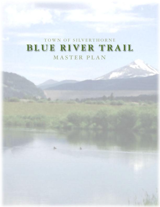
Blue River Trail Master Plan JSA to Town Hall June 2004
|
|
|
- Amanda Benson
- 5 years ago
- Views:
Transcription
1

2 Blue River Trail Master Plan JSA to Town Hall June 2004 Prepared for: Silverthorne Town Council Silverthorne SPORT Committee Department of Recreation and Culture Silverthorne Public Works Silverthorne Community Development By: This plan made possible by a grant from: The Great Outdoors Colorado Trust

3 CONTENTS SECTION PAGE NO. Purpose and Study Area 1 Planning & Design Guidelines 1 Layout and Alignment 2 Implementation 14 Recommended Phasing 14 Appendices (Under Separate Covers) Appendix 1: Cost Estimates Appendix 2: Wayfinding System


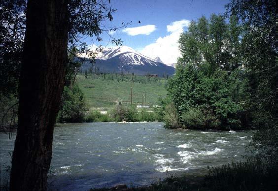
4 PURPOSE AND STUDY AREA This plan is intended to be a specific guide for the design and construction of the Blue River Trail from the Town Hall to the northern Town limits. The proposed trail will be a continuous 10 -wide paved, multi-use facility accommodating pedestrians, bicyclists and wheelchairs. The plan also identifies trailheads and access for anglers and paddlecraft. This plan will be the primary reference for right-of-way acquisition, budgeting, fundraising, construction drawings and phasing of the Blue River Trail. The project study area consists of the Blue River Corridor through the Town of Silverthorne from the current terminus of the Blue River Trail just north of the Town Hall to the Town Limits adjacent to the Joint Sewer Authority (JSA) facilities. TRAIL PLANNING & DESIGN GUIDELINES PURPOSE OF THIS PLAN Identify the actual trail alignment and cross sections. Identify trailheads and access points for trail use, boating and fishing. Identify rights-of-way existing and recommended for acquisition. Estimate cost estimates for budgeting and funding. A number of important trail planning and design guidelines have been identified. They come from the Silverthorne Parks, Trails and Open Space Master Plan, comments by the SPORT Committee, Staff, Town Council, landowners, agencies and other stakeholders. These include: Part of an integrated network of multi-use trails readily accessible from neighborhoods, schools, businesses, activity centers, and transportation systems, regardless of income, age, or physical ability. Meets state-of-the-art design standards appropriate to the types of trail uses, with attractive fixtures and furnishings and an integrated information/ interpretive system. Runs through pleasant settings offering a variety of experiences. Grade-separated from street traffic using safe underpasses and overpasses. Include users, property owners, residents, businesses and other stakeholders in the planning process. Establish a phasing and implementation schedule for building the trail from the Town Center to the North T Li i Trail and trail facilities are compatible with homes, places of business, roads and the natural environment. Designed to serve multiple objectives such as drainageway maintenance roads and non-motorized transportation. Avoids user conflict and overcrowding. Safe and affordable to build and maintain. Foremost, protect aquatic habitat. Also protect riparian habitat, confluence and tributary areas and movement corridors, especially from the confluence of Willow Creek north. This includes River Otter (Colorado Endangered Species), Moose and other large and small mammals that move along this corridor. BLUE RIVER TRAIL MASTER PLAN 1
5 Specifically identify and delineate wetlands that will be impacted by the trail. There are a number of high quality wetlands along the corridor. First objective is to avoid wetlands and aquatic degradation. Avoid degradation of the riverbank by the trail, anglers and recreationalists. Do this by designing and regulating to direct users to less vulnerable places along the river, including thick vegetative buffers. Also, buffer the river from the trail, parking lots and other contaminant sources Retain the navigability of the river (Don t obstruct paddle craft with bridges or other structures.) Loose animals can be detrimental. Must enforce leash law and pets-at-large management. Aquatic improvements by the Town should include enhancement of the riparian edge as well as in-stream work. Structures including bridges and underpasses must not impede flood flows or raise flood level. Maintenance activities including snow removal must be clean without harmful chemicals. Construction specifications, maintenance procedures and supervision must adhere to best practices and all permit requirements to avoid habitat and resource damage. Be sure aquatic vegetation is maintained and enhanced beneath and adjacent to the pedestrian bridge abutments and other river edge structures. LAYOUT AND ALIGNMENT The project is divided into five segments: Segment 1: JSA to Hamilton Creek Road (North Pond) Segment 2: Hamilton Creek Road to Bald Eagle Road Segment 3: Bald Eagle Road to Mesa Drive Segment 4: Mesa Drive to Town Hall Segment 5: Cottonwood Park Primitive Walk Total length (Segments 1-4) is 2.3 miles plus the 1900 primitive walk (Segment 5) The plan also considers an alternative alignment for Segment 3. SEGMENT 1: JSA TO HAMILTON CREEK ROAD Overview The 10 -wide asphalt trail begins just south of the JSA facility and extends through Cottonwood Park to Hamilton Creek Road terminating at the trailhead in North Pond Park. It also connects to the Cottonwood Park Natural Area Primitive Walk (Segment 5). In the future the paved trail will continue north along the river to link with the Maryland Creek Trail. Components 10 -wide asphalt pathway from North Trailhead at JAS to trailhead at North Pond (2800 ). BLUE RIVER TRAIL DEVELOPMENT PLAN 2
 located at the north end of Cottonwood Park with parking for 20 cars, entry signage and trail access display.")


6 Trail stubs to Cottonwood Park parking area, to elementary school, and to North Pond Park Trailhead. North Trailhead and parking area (asphalt surface) located at the north end of Cottonwood Park with parking for 20 cars, entry signage and trail access display. Lot also provides boater and angler access via the primitive trail to the river. Rest area with storm shelter at north end of Cottonwood Park. Rest area at stub to Cottonwood Park. Wet meadows interpretive display at trail stub rest area. Waterless toilet at North Trailhead. Waterless toilet at Cottonwood Park (part of park project). Trailhead access display sign with trail wayfinding and accessibility information at North Trailhead, Cottonwood Park and North Pond Park parking lots. Rest area with shelter, toilet, parking and trailhead access display at North Pond Park as part of park improvements. Safety and directional signage. Walk-in boater and angler access from North Trailhead via primitive path to river near JSA. BLUE RIVER TRAIL DEVELOPMENT PLAN 3


7 SEGMENT 2: HAMILTON CREEK ROAD TO BALD EAGLE Overview The 10 -wide asphalt trail continues from the North Pond Trailhead on a causeway between the pond and wetlands. The design anticipates the possible future extension of Allegra Lane with the trail located to the east of the roadway. The trail then continues along the west bank of the river adjacent to the Ponds at Blue River residences, using an existing dedicated easement. The design strives to integrate the trail with homes by using grading and landscaping. A trail stub accesses Allegra Lane midway through the development. This segment terminates with a ramp to the street at Bald Eagle Road. BLUE RIVER TRAIL DEVELOPMENT PLAN 4


8 Components 10 -wide asphalt pathway from trailhead at North Pond Park to Bald Eagle Road (2400 ). Consider landscaping, including trees and shrubs, between the trail and the homes, laid out to promote a sense of privacy and trail safety, while not obstructing views from the housing units. Rest area with storm shelter overlooking the pond. Wetland interpretive signage overlooking wetland. Safety, directional and respect-residents -privacy signage. BLUE RIVER TRAIL DEVELOPMENT PLAN 5


9 SEGMENT 3: BALD EAGLE ROAD TO MESA DRIVE Overview The 10 -wide asphalt trail passes under the reconstructed Bald Eagle Road viaduct with ramps to street level on both sides. The asphalt trail continues along the west bank of the river in an existing easement, past residences, to the Blue River Run neighborhood. The trail then passes through that single-family residential area on street (Legend Lake Circle) for several hundred yards before crossing Willow Creek and entering the southern portion of Blue River Run Townhomes. The trail then continues though floodplain lands owned by the Town, along the west side of the river. At the south end of Blue River Run, the trail crosses privately held floodplain land (easement required) to the CDOT right-of-way (permit required) and follows the west bank on a constructed bench. Opposite Mesa Drive, the trail crosses to the east side of the river on a clear-span pedestrian bridge. Alternate routes have been proposed, subject to landowner approval and wetland permitting. These include a trail on a deck through floodplain land at the confluence with Willow Creek and a clear-span 230 crossing upstream of the islands in the river near Mesa Drive (please see detail below). Components 10 -wide asphalt pathway from Bald Eagle Road to Mesa Drive cul-de-sac (4900 ). Crusher fine trail stub to overlook on South Lake (800 ) Two rest areas (one with shelter at South Lake). On-street segment with share-the-road signage for 400 along Legend Lake Circle. 100 pedestrian span over Willow Creek above floodway. Trail-on-bench (400 ) with combination retaining wall along edge of Highway 9. This leaves riverbank intact with riparian vegetation enhancements installed. 180 clear-span pedestrian bridge over river to connect to east bank at Mesa Drive. Trail stubs access Blue River Run neighborhood and Mesa Drive neighborhoods. Trailhead access display signs at Legend Lake Circle, Blue River Run access stub and at Mesa Drive access point. BLUE RIVER TRAIL DEVELOPMENT PLAN 6

 through wetland areas and along the west bank of the river, proximate to the confluence with")
 a 230 clear-span pedestrian bridge to the east bank of the river 600 upstream of Mesa")
10 Riparian and trout fishery interpretive signage overlooking river at Mesa Drive. Safety and directional signage. Upgrade Bald Eagle Road to accommodate bicycle and pedestrian traffic. Upgrades and Alternatives (BRVLE Upgrade) Pursue with property owners (Blue River Valley Ranch Lake Estates) upgraded trail routing with a combination of trail-on-grade and on a deck (500 ) through wetland areas and along the west bank of the river, proximate to the confluence with Willow Creek, providing an alternative to the on-street link through Blue River Run. Decking should be set 5 above ground surface. Pursue with property owners (Continental Divide Land Trust) a 230 clear-span pedestrian bridge to the east bank of the river 600 upstream of Mesa Drive as alternative to benched trail along the Highway 9 right-of-way. Example of Deck Near Frisco BLUE RIVER TRAIL DEVELOPMENT PLAN 7
11 BLUE RIVER TRAIL DEVELOPMENT PLAN 8


 to a Town-owned parcel where a trail link to Highway 9 and west side neighborhoods can be provided.")
12 SEGMENT 4: MESA DRIVE TO TOWN HALL Note: Two routes are being considered for this segment an east side route and a west side route. When both routes are in place, the trail system will provide a loop with pedestrian crossings of the river. East Side Route The 10 -wide asphalt trail follows the east bank of the river using an existing easement for approximately 750. The trail then follows an elevated deck for approximately 150 and then continues another 900 along the east bank the entire length to the Town Hall. Approximately 250 of the trail is cut into the bank with a rock retaining wall. West Side Route The trail crosses to the west bank on a 220 clear-span pedestrian bridge. The trail then follows the west bank for approximately 800 (with land owner agreements) to a Town-owned parcel where a trail link to Highway 9 and west side neighborhoods can be provided. The trail then crosses back to the east bank on a 230 clear span pedestrian bridge where it joins the existing paved Blue River Trail approximately 900 north of the Town Hall. In the future, the west side trail will continue north to a proposed pedestrian bridge at Mesa Drive. Components 10 -wide asphalt pathway from Mesa Drive to link to existing trail north of Town Hall (1700 ). Trail on deck along east bank to protect riparian area (175 ). Two clear-span pedestrian bridges over the river. Trail link through Town-owned property to Highway 9, providing access to west side neighborhoods and commercial areas. All improvements must be compatible with site s intended drainage functions.. Trailhead access display at Town Hall. Riparian and trout fishery interpretive signage overlooking river at west bank trailhead. Safety and directional signs. Maintain fishing access along east bank. Trail on deck that splits around large tree. BLUE RIVER TRAIL DEVELOPMENT PLAN 9


13 Alternative trail routing, approximately 500 of trail on grade (with property owner permission). Note: alternative trail routings through this area include placing trail within the current access easement or benching the trail into the bank of the river. Both routes would require significant riparian vegetation removal with replacement vegetation planted between the new trail and the adjacent yards as well as replacement of riparian vegetation along the disturbed riverbank. Approximately 250 of trail benched into bank of river with retaining wall. Attractive security fencing where desired and appropriate. Private property signage as appropriate. BLUE RIVER TRAIL DEVELOPMENT PLAN 10

14 BLUE RIVER TRAIL DEVELOPMENT PLAN 11

15 SEGMENT 5: COTTONWOOD PARK PRIMITIVE WALK Overview The 6 -wide crushed granite walking trail begins at the North Trailhead just south of the JSA facility and winds through the floodplain area accessing the riverbank and wooded areas to the east of the JSA facility. Open space and vegetative buffering are included to protect sensitive areas. This trail serves as an interpretive walking/jogging path and also provides boater and angler access to the Blue River. Bicycles, including mountain bikes, are prohibited on this trail. Wheelchairs and electric mobility devices for people with disabilities are permitted. In the future, the portion of this trail that extends to the north along the river will become a 10 -wide paved multi-use trail continuing northward into the County, and ultimately connecting to the proposed Maryland Creek trail and loop trail system that encircles Silverthorne. Components 6 -wide crushed granite pathway loop and spur trail through woods (1,900 ). Trail on 10 wide deck over wetland areas (200 ). Ramp with retaining wall accessing the lower meadow area. Picnic tables and benches. Informal boat landing (existing). Wet meadows and historic ruins interpretive displays. Trailhead access display sign with wayfinding and accessibility information. Boater-Access display sign at boat launch. Safety and directional signage. Walk-in boater and angler access from North Trailhead via primitive path to river near JSA. BLUE RIVER TRAIL DEVELOPMENT PLAN 12

16 BLUE RIVER TRAIL DEVELOPMENT PLAN 13

17 BLUE RIVER TRAIL DEVELOPMENT PLAN 14
18 IMPLEMENTATION The following key steps are recommended to implement the trail plan: 1. Identify a project implementation team recruited from Town staff and The SPORT Committee and assign specific roles and responsibilities. 2. Build community consensus and adopt this plan. 3. Pursue the remaining rights-of-way and landowner agreements to assemble the complete trail corridor including the BRVE alternative corridor. 4. Pursue and refine applicable regulatory requirements, including the Riverfront Mixed Zone District ordinance, that are appropriate and supportive of the trail implementation effort. 5. Work with the Colorado Department of Transportation to address possible trail routing next to Hwy. 9 in the right-of-way. 6. Identify, map and flag all wetlands in the immediate vicinity of the proposed trail corridor and define any areas directly impacted. 7. Secure Colorado Division of Wildlife and U.S. Army Corps of Engineers approvals and secure any necessary permits under Section 404 of the U.S. Clean Water Act. 8. Establish a project budget and implementation schedule with annual goals and funding requirements. 9. Identify potential funding sources and pursue grants for trail engineering and construction. RECOMMENDED PHASING The phasing strategy is based on several rationales: Logical and usable trail segments. Feasible projects that are timely from a financial and right-of-way acquisition standpoint. Strategic projects that bring maximum benefit from limited resources. Projects that showcase the Blue River and the parks and promote the ultimate completion of the entire trail. Pursuant to these rationales the following sequence of projects is recommended: (see table on page 15 below) BLUE RIVER TRAIL DEVELOPMENT PLAN 15
19 PROJECT Secure Trails Rights of Way Compliance Studies Construct Segment 1: Trail Only Construct Segments 2: Trail Only EST. COST To be negotiated To be negotiated $ 258,000 Construct Segment 5 305,292 Construct Bridge to West Side Lot Construct Segment 3: Trail Only Construct Segment 4 East: Trail Only Construct Segment 4 West: Trail Only Add Amenities Table 1: Project Phasing Strategy RATIONALE Will take time to secure rights of way on east and west banks. May be able to work cooperatively with some owners as sites develop. Could have interim footpaths. YEAR Includes site specific wetland delineation once trail route is finalized 2004 Links parks and school and can be built in conjunction with parks. Minimal right-of-way and permitting requirements ,102 Links neighborhoods to school and parks and to Hamilton Road Element of Cottonwood park. Can be built by volunteers or with in-kind crews, materials and equipment ,000 Provides link to west side, Rt. 9 Path and Commercial areas ,571,000 Links to Mesa Drive and east side neighborhoods ,000 Completes trail corridor ,391 Completes trail system, enhances west side To be determined As funds are available BLUE RIVER TRAIL DEVELOPMENT PLAN 16
FEASIBILITY CRITERIA
 This chapter describes the methodology and criteria used to evaluate the feasibility of developing trails throughout the study areas. Land availability, habitat sensitivity, roadway crossings and on-street
MORGAN CREEK GREENWAY Final Report APPENDICES
 APPENDICES MORGAN CREEK GREENWAY Appendix A Photos of Existing Conditions in Trail Corridor Photos of existing conditions Main trail corridor - February 2009 Photos of existing conditions south bank Morgan
Longmont to Boulder Regional Trail Jay Road Connection DRAFT FINAL REPORT
 Longmont to Boulder Regional Trail Jay Road Connection DRAFT FINAL REPORT December 2018 Project Summary Boulder County, Colorado, in partnership with the City of Boulder, is evaluating options for multi-use
Segment 2: La Crescent to Miller s Corner
 goal of the USFWS refuges is to conserve, protect and enhance fish, wildlife and plants and their habitats for the continuing benefit of the American people. Refuge lands are used largely for fishing,
Business Item No
 Metropolitan Parks and Open Space Commission Meeting date: February 6, 2018 For the Community Development Committee meeting of February 20, 2018 For the Metropolitan Council meeting of February 28, 2018
CHAPTER III: TRAIL DESIGN STANDARDS, SPECIFICATIONS & PERMITS
 CHAPTER III Trail Design Standards, Specifications & Permits This chapter discusses trail standards, preferred surface types for different activities, permits, and other requirements one must consider
ANCLOTE COASTAL TRAIL ALTERNATIVES ANALYSIS STUDY
 ANCLOTE COASTAL TRAIL ALTERNATIVES ANALYSIS STUDY PASCO COUNTY MPO JULY 2015 PROJECT OVERVIEW... INTRODUCTION EXECUTIVE SUMMARY CONTEXT... TAMPA BAY AREA, PINELLAS, & PASCO COUNTY S MULTI-USE TRAIL PLANS
3. COLTA / HUGA CONNECTIONS - PRELIMINARY
 9 3. COLTA / HUGA CONNECTIONS - PRELIMINARY 3.1 COLTA The Chain of Lakes Trail Association (COLTA) trail, formerly identified as the Chester Spur Line, was completed and opened for use in June 2011. The
Appendix 3. Greenway Design Standards. The Whitemarsh Township Greenway Plan
 Appendix 3 Greenway Design Standards This chapter discusses two design standards for the greenway types discussed above. First, trail design standards are presented together with trailhead facilities and
The Baker/Carver Regional Trail is intended to
 Section V Design Guidance The Baker/Carver Regional Trail is intended to safely accommodate 183,000 annual visits, an array of non-motorized uses, a variety of skill levels, and persons with special needs.
DRAFT - APRIL 13, 2007 ROUTING STUDY FOR TRAIL CONNECTIONS BETWEEN CALAIS AND AYERS JUNCTION
 DRAFT - APRIL 13, 2007 ROUTING STUDY FOR TRAIL CONNECTIONS BETWEEN CALAIS AND AYERS JUNCTION Abstract The vision for the East Coast Greenway is an off-road urban trail system running from Calais, Maine
City of Solvang SUNNY FIELDS SPUR TRAIL STUDY
 City of Solvang SUNNY FIELDS SPUR TRAIL STUDY project description The City of Solvang, in partnership with the County of Santa Barbara Public Works Department, is developing an alignment study for a proposed
Georgetown-Lewes Rail/Trail Study. Rail/Trail Study: Cool Spring to Cape Henlopen State Park New Road Extension (House Resolution No.
 Georgetown-Lewes Rail/Trail Study Rail/Trail Study: Cool Spring to Cape Henlopen State Park New Road Extension (House Resolution No. 47) August 22, 2011 Presentation Outline Background Benefits Statewide
Business Item No XXX. Proposed Action That the Metropolitan Council approve the Coon Creek Regional Trail Master Plan.
 Business Item No. 2015-XXX Metropolitan Parks and Open Space Commission Meeting date: July 7, 2015 For the Community Development Committee meeting of July 20, 2015 For the Metropolitan Council meeting
City of Durango 5.8 FUNDING TRAILS DEVELOPMENT
 5.8 FUNDING TRAILS DEVELOPMENT The City has been successful in establishing dedicated local funding sources as well as applying for grants to develop the City s trail system, having received nearly $2.4
Chapter 6: POLICY AND PROCEDURE RECOMMENDATIONS
 Chapter 6 POLICY AND PROCEDURE RECOMMENDATIONS FOR SRRA Below are seven policy elements that should be considered for adoption by the Southwest Regional Recreation Authority of Virginia: 1. Develop strategies
Understanding user expectations And planning for long term sustainability 1
 Understanding user expectations And planning for long term sustainability 1 What is a natural surface trail? It can be as simple has a mineral soil, mulched or graveled pathway, or as developed as elevated
Auburn Trail / Ontario Pathways Trail Connector Feasibility Study Public Information Meeting Wednesday, August 22, 2012
 Auburn Trail / Ontario Pathways Trail Connector Feasibility Study Public Information Meeting Wednesday, August 22, 2012 Purpose of Feasibility Study Purpose Evaluate the feasibility of constructing a multiuse
AGENDA ITEM 5 D WAKULLA ENVIRONMENTAL INSTITUTE (WEI) TRAIL FEASIBILITY STUDY
 TRAIL FEASIBILITY STUDY") March 19, 2018 AGENDA ITEM 5 D WAKULLA ENVIRONMENTAL INSTITUTE (WEI) TRAIL FEASIBILITY STUDY TYPE OF ITEM: Action STATEMENT OF ISSUE The Wakulla Environmental Institute (WEI) Trail is one of several trails
March 19, 2018 AGENDA ITEM 5 D WAKULLA ENVIRONMENTAL INSTITUTE (WEI) TRAIL FEASIBILITY STUDY TYPE OF ITEM: Action STATEMENT OF ISSUE The Wakulla Environmental Institute (WEI) Trail is one of several trails
EXECUTIVE SUMMARY FALL Introduction. Findings
 EXECUTIVE SUMMARY FALL 2004 Introduction Trails are one of the most popular and highly desirable recreational resources in communities of all sizes throughout the country. In addition to providing a safe
Trail # NW Tuesday, June DESIGN. Provide an Review the Provide an. Project Goals: System system. wayfinding
 I. Welcome / Introductions Bethany Creek Trail #2 Segment 3 Neighborhood Meeting #1 Bethany Presbyterian Church 15505 NW Springville Road, Portland, OR 97229 Tuesday, June 26, 2018 @ 6:00PM Meeting Minutes
COASTAL CONSERVANCY. Staff Recommendation December 2, 2004 COYOTE HELLYER COUNTY PARK BAY AREA RIDGE TRAIL
 COASTAL CONSERVANCY Staff Recommendation December 2, 2004 COYOTE HELLYER COUNTY PARK BAY AREA RIDGE TRAIL File No. 04-057 Project Manager: Amy Hutzel RECOMMENDED ACTION: Authorization to disburse up to
Welcome to the future of Terwillegar Park a Unique Natural Park
 Welcome to the future of Terwillegar Park a Unique Natural Park 1 Introduction The Terwillegar Park Concept Plan study will develop an overall concept plan, management objectives and development guidelines
RUSHMORE CONNECTOR TRAIL PROPOSAL
 PURPOSE AND NEED Background The U.S. Forest Service, Black Hills National Forest (Forest Service) has received a special use permit application from the State of South Dakota Department of Game, Fish and
Committee Report. Community Development Committee For the Metropolitan Council meeting of August 12, Business Item No.
 Committee Report Business Item No. 2015-168 Community Development Committee For the Metropolitan Council meeting of August 12, 2015 Subject: Coon Creek Regional Trail Master Plan, Anoka County Proposed
China Creek North Park Upgrades and Glen Pump Station. Park Board Committee Meeting Monday, July 10, 2017
 China Creek North Park Upgrades and Glen Pump Station Park Board Committee Meeting Monday, July 10, 2017 Purpose The purpose of this presentation is to: Share the results of the public engagement processes;
The Chu property is a 6.57 acre parcel located in the Town of Superior on the west side of McCaslin Boulevard. In 2014, the Town of Superior acquired
 1 The Chu property is a 6.57 acre parcel located in the Town of Superior on the west side of McCaslin Boulevard. In 2014, the Town of Superior acquired the Chu property for open space with a contribution
2. Goals and Policies. The following are the adopted Parks and Trails Goals for Stillwater Township:
 D. PARKS AND TRAILS 1. Introduction Stillwater Township s population is relatively low, with most residents living on rural residences on large lots. The need for active park space has been minimal in
METROPOLITAN COUNCIL 390 North Robert Street, St. Paul, MN Phone (651) TDD (651)
 TDD (651)") METROPOLITAN COUNCIL 390 North Robert Street, St. Paul, MN 55101 Phone (651) 602 1000 TDD (651) 291 0904 DATE: June 19, 2007 TO: Metropolitan Parks and Open Space Commission FROM: Jan Youngquist, Senior
METROPOLITAN COUNCIL 390 North Robert Street, St. Paul, MN 55101 Phone (651) 602 1000 TDD (651) 291 0904 DATE: June 19, 2007 TO: Metropolitan Parks and Open Space Commission FROM: Jan Youngquist, Senior
A BOAT RAMP TO NOWHERE
 A BOAT RAMP TO NOWHERE A PROPOSAL FOR ACCESS TO HARVIE PASSAGE A Presentation to the City of Calgary December 2017 Presented by: Peter Crowe-Swords Bow River Trout Foundation Background: The Bow River
Public Notice ISSUED: December 10, 2018 EXPIRES: January 9, 2019
 APPLICANT: REFER TO: St. Louis and Lake Counties Regional Rail Authority 2018-01942-ARC Public Notice ISSUED: December 10, 2018 EXPIRES: January 9, 2019 SECTION:404 - Clean Water Act 1. APPLICATION FOR
Continental Divide National Scenic Trail Legislative History and Planning Guidance
 Continental Divide National Scenic Trail Legislative History and Planning Guidance Legislation, Policy, and Direction Regarding National Scenic Trails The National Trails System Act, P.L. 90-543, was passed
Draft Concept Alternatives Analysis for the Inaugural Airport Program September 2005
 Section 10 Preferred Inaugural Airport Concept 10.0 Introduction The Preferred Inaugural Airport Concept for SSA was developed by adding the preferred support/ancillary facilities selected in Section 9
Citrus Heights Creek Corridor Trail Project Trail Advisory Group Field Trip #2 September 11, :00 11:00 am Trellis Hall, Citrus Heights
 September 11, 2013 9:00 11:00 am Trellis Hall, Citrus Heights Project Overview The City of Citrus Heights is studying the feasibility of establishing a multi use trail system within the City s 26 miles
Dungeness Recreation Area County Park Master Plan
 Dungeness Recreation Area County Park Public Outreach Meeting October 10, 2007 Project Overview USFWS Site Dungeness Recreation Area County Park Meeting Objectives: Re-Introduce project; provide status
SAN ANTONIO RIVER IMPROVEMENTS PROJECT. August 6, 2008
 SAN ANTONIO RIVER IMPROVEMENTS PROJECT August 6, 2008 1 History of the SA River Improvements 1921 Flood Olmos Dam Complete in 1929 Downtown Flood Relief Projects in 1950 s Dams on the River Channel and
Procedure for the Use of Power-Driven Mobility Devices on Mass Audubon Sanctuaries 1 September 17, 2012
 Procedure for the Use of Power-Driven Mobility Devices on Mass Audubon Sanctuaries 1 September 17, 2012 Background As part of Mass Audubon s mission to preserve the nature of Massachusetts for people and
Becker County Trail Routing Feasibility Study
 2016 Becker County Trail Routing Feasibility Study CONNECTING DETROIT MOUNTAIN AND MOUNTAIN VIEW RECREATIONAL AREA TO THE HEARTLAND TRAIL BECKER COUNTY ULTEIG ENGINEERS Contents Acknowledgements...2 INTRODUCTION...3
THOMAS A. SWIFT METROPARK Introductions History Present Conditions Future Development Plans Implementation Strategies Statistics
 THOMAS A. SWIFT METROPARK Introductions History Present Conditions Future Development Plans Implementation Strategies Statistics Introduction As an open meadow park positioned along the Mahoning River,
Flow Stand Up Paddle Board Parkway Plan Analysis
 Regional Parks Department Jeffrey R. Leatherman, Director County of Sacramento Divisions Administration Golf Leisure Services Maintenance Rangers Therapeutic Recreation Services Flow Stand Up Paddle Board
Committee Report. Community Development Committee For the Metropolitan Council meeting of April 13, Business Item No.
 Committee Report Business Item No. 2016-48 Community Development Committee For the Metropolitan Council meeting of April 13, 2016 Subject: Harriet Island-South St. Paul Regional Trail Master Plan, Saint
Southwest Quadrant Distinctive Features
 SOUTHWEST QUADRANT Southwest Quadrant Distinctive Features LAND USE The 31.17 square mile Southwest Quadrant includes all the area within the planning area west of I-5 and south of the Sacramento River.
Camping (Primitive) Camping (RV) Electrical Potable Water Grill Established Fire Pit Picnic Table
 Camping (RV) Electrical Potable Water Grill Established Fire Pit Picnic Table") Alden - 9th Road River Mile 777 Map: 38.20833, -98.32031 Managing Agency: Kansas Department of Wildlife, Parks & Tourism Nearest Community: Alden, Rice County Kansas Developed Amenities Provided Parking
Alden - 9th Road River Mile 777 Map: 38.20833, -98.32031 Managing Agency: Kansas Department of Wildlife, Parks & Tourism Nearest Community: Alden, Rice County Kansas Developed Amenities Provided Parking
Rule Governing the Designation and Establishment of All-Terrain Vehicle Use Trails on State Land
 Rule Governing the Designation and Establishment of All-Terrain Vehicle Use Trails on State Land 1.0 Authority 1.1 This rule is promulgated pursuant to 23 V.S.A. 3506. Section 3506 (b)(4) states that an
National Forests and Grasslands in Texas
 United States Department of Agriculture Forest Service National Forests and Grasslands in Texas Sam Houston NF 394 FM 1375 West New Waverly, Texas 77358 Phone 936-344-6205 Dear Friends, File Code: 1950
City of Haslett. City of East Lansing. City of East Lansing
 Central Park North (Nancy L. Moore Park) Lake Park North Expansion White Park Expansion #2 White Park Expansion #1 County East East Haslett East East TF87-212 Acquisition $90,000.00 Park. TF08-138 Acquisition
MUNICIPALITY OF ANCHORAGE
 MUNICIPALITY OF ANCHORAGE ANCHORAGE PARKS & RECREATION Memorandum PRC 08-56 DATE: 5 August 2008 TO: FROM: SUBJECT: Parks & Recreation Commission Holly Spoth-Torres, Park Planner PRC 08-56 Far North Bicentennial
EAST DON TRAIL ENVIRONMENTAL ASSESSMENT. Community Liaison Committee Meeting #3 July 15, :30 to 8:30 pm Flemingdon Park Library
 EAST DON TRAIL ENVIRONMENTAL ASSESSMENT Community Liaison Committee Meeting #3 July 15, 2013 6:30 to 8:30 pm Flemingdon Park Library Agenda 1. Welcome 2. Housekeeping and Updates a) Housekeeping b) CLC
Blueways: Rivers, lakes, or streams with public access for recreation that includes fishing, nature observation, and opportunities for boating.
 Parks, Open Space and Trails PRINCE WILLIAM COUNTY 2008 COMPREHENSIVE PLAN TRAILS PLAN CONTENTS The components of the trails plan are: Intent Definitions Goals, Policies, and Action Strategies Trails Map
COMMUNITY MEETING NOVEMBER 1, Wheaton Regional Park Pine Lake Trail
 COMMUNITY MEETING NOVEMBER 1, 2012 MEETING AGENDA I. Introduction of Project Team II. Trail Renovation Process III. Wheaton Regional Park IV. Pine Lake Trail Renovation Project V. Comments and Questions
Proposal to Redevelop Lower Kananaskis River-Barrier Lake. Bow Valley Provincial Park. Frequently Asked Questions
 Proposal to Redevelop Lower Kananaskis River-Barrier Lake Bow Valley Provincial Park Frequently Asked Questions What is being proposed? What are the details of the proposal? Where is the project area located?
Town of Frisco. Trails Master Plan. Legend. Planning Area 1. i l. 9 Campground. Lake Hill Development. Giberson Property. Frisco Transit Center
 SO-UV I-70 UPPER SALT LICK TOO-PWECH SUNRISE 1 Town of Frisco Planning Area 1 NAH-OON-KARA I-70 Lake Hill Development Legend Existing Trails Existing USFS System Trails 2 A Existing Non-System Trails Bike
Community Development Committee
 C Community Development Committee For the Metropolitan Council meeting of October 31, 2012 Committee Report Item:2012-316 ADVISORY INFORMATION October 16, 2012 Date Prepared: Subject: Intercity Regional
White Mountain National Forest Saco Ranger District
 United States Department of Agriculture Forest Service White Mountain National Forest Saco Ranger District 33 Kancamagus Highway Conway, NH 03818 Comm: (603) 447-5448 TTY: (603) 447-3121 File Code: 1950
Port Gamble Shoreline Area Conceptual Trail Proposal
 The North Kitsap Trails Association is pleased to be a partner to the Kitsap Forest and Bay Project and assist Kitsap County, Forterra, Olympic Property Group, Great Peninsula Conservancy and the Port
Decision Memo Ice Age Trail Improvement (CRAC 37)
") Decision Memo Ice Age Trail Improvement (CRAC 37) U.S. Forest Service Chequamegon-Nicolet National Forest, Medford-Park Falls Ranger District Taylor County, Wisconsin T32N, R2W, Town of Grover, Section
Decision Memo Ice Age Trail Improvement (CRAC 37) U.S. Forest Service Chequamegon-Nicolet National Forest, Medford-Park Falls Ranger District Taylor County, Wisconsin T32N, R2W, Town of Grover, Section
Preferred Recreation Recommendations Stemilt-Squilchuck Recreation Plan March 2018
 Preferred Recreation Recommendations Stemilt-Squilchuck Recreation Plan March 2018 Below are the recommended recreation ideas and strategies that package together the various recreation concepts compiled
Wilds. Headwaters. Lakes. Oxbows. Falls
 56 5 4 3 Wilds Headwaters Lakes Oxbows Falls 57 Zones It could be said the on-the-ground essence of this master plan appears within the next 6 pages of this report. As we learned in the preceding Cultural
Chapter 4.0 Alternatives Analysis
 Chapter 4.0 Alternatives Analysis Chapter 1 accumulated the baseline of existing airport data, Chapter 2 presented the outlook for the future in terms of operational activity, Chapter 3 defined the facilities
THAT the Board approve the final proposed concept plan for the Jericho Marginal Wharf site as shown in Figure C-4 of Appendix C.
 Date: January 17, 2012 TO: Board Members Vancouver Park Board FROM: General Manager Parks and Recreation SUBJECT: Jericho Marginal Wharf Phase 2 Concept Plan RECOMMENDATION THAT the Board approve the final
CITY COUNCIL AGENDA MEMORANDUM
 To: Mayor and City Council From: Charles Ozaki, City and County Manager Prepared By: Kevin Standbridge, Deputy City and County Manager Katie Allen, City and County Engineer David Shinneman, Community Development
Outdoor Developed Areas
 The United States Access Board is an independent federal agency that promotes equality for people with disabilities through leadership in accessible design and the development of accessibility guidelines
What s covered. What s not covered. Options for those not covered. ABA Coverage
 The United States Access Board is an independent federal agency that promotes equality for people with disabilities through leadership in accessible design and the development of accessibility guidelines
Fossil Creek Wild & Scenic River Comprehensive River Management Plan Forest Service Proposed Action - details March 28, 2011
 Fossil Creek Wild & Scenic River Comprehensive River Management Plan Forest Service Proposed Action - details March 28, 2011 Primary Goals of the Proposed Action 1. Maintain or enhance ORVs primarily by
America s Great Outdoors: Feasibility Study for Connecting Urban Refuges to the Rocky Mountain Greenway Trail Network
 Case 1:18-cv-01017-PAB Document 7-17 Filed 05/31/18 USDC Colorado Page 1 of 42 America s Great Outdoors: for Connecting Urban Refuges to the Rocky Mountain Greenway Trail Network Rocky Flats and Two Ponds
EXECUTIVE SUMMARY PROGRAM DEVELOPMENT REPORT PURPOSE EXISTING SETTING EXPANDING PARKLAND
 EXECUTIVE SUMMARY PROGRAM DEVELOPMENT REPORT PURPOSE As the culmination of the first phase of the master planning process, this Program Development Report creates the framework to develop the Calero County
River Parks Trail: Tulsa, Oklahoma
 River Parks Trail: Tulsa, Oklahoma Purpose: The purpose of the River Parks Trail is to maintain, preserve, develop, and promote the Arkansas River for the economic and cultural benefit of the community.
Bear Creek Habitat Improvement Project
 06/10/10 Bear Creek Habitat Improvement Project El Paso County, Colorado Pike National Forest and Colorado Springs Utilities Owned Land Report prepared by: Eric Billmeyer Executive Director Rocky Mountain
Parkland County Municipal Development Plan Amendment Acheson Industrial Area Structure Plan
 Parkland County Municipal Development Plan Amendment Acheson Industrial Area Structure Plan New Plan Acheson Industrial Area Structure Plan Amendment Parkland County Municipal Development Plan Board Reference
At the time, the portion of the line through Eagle County remains wholly under the ownership of Union Pacific Railroad (UP).
.") Chapter 5 The Railroad Corridor as a Trail Corridor The intent of this chapter is to identify how the rail corridor, if available for lease or purchase in all or part, could be incorporated into the core
Chapter 5 The Railroad Corridor as a Trail Corridor The intent of this chapter is to identify how the rail corridor, if available for lease or purchase in all or part, could be incorporated into the core
CRANE LAKE TRAILS NETWORK AND SPACES
 CRANE LAKE TRAILS NETWORK AND SPACES AREA TRAILS COMMUNITY TRAILS GOLD COAST TRAIL LAKE PARK OPTION ONE LAKE PARK OPTION TWO OVERFLOW TRAILHEAD PARKING THE GATE AREA TRAILS Trails are a major resource
Lake Myra County Park. Wake County, North Carolina Community Forum #2 June 12, 2008
 Lake Myra County Park Wake County, North Carolina Community Forum #2 June 12, 2008 Welcome and Introduction Meeting Agenda Welcome Introductions of Project Team Master Plan Process Community Forum #1 Updates
CHAPTER 5. Chapter 5 Recreation Element
 CHAPTER 5 Recreation Element Chapter 5 Recreation Element The Recreation Element of the Meyers Area Plan is a supplement to the Recreation Element of the TRPA Regional Plan and the El Dorado County General
MASTER PLAN EXECUTIVE SUMMARY
 Biscuit Run State Park Scottsville Road (State Route 20) Charlottesville, VA 22902 Biscuit Run State Park MASTER PLAN EXECUTIVE SUMMARY Department of Conservation and Recreation Division of Planning and
ALBANY-HUDSON ELECTRIC TRAIL FEASIBILITY STUDY. Final Report OCTOBER 2011
 ALBANY-HUDSON ELECTRIC TRAIL FEASIBILITY STUDY Final Report OCTOBER 2011 ALBANY-HUDSON ELECTRIC TRAIL FEASIBILITY STUDY Prepared for: Town of East Greenbush 225 Columbia Turnpike Rensselaer, New York 12144
Assessing Your Trails, Keeping Them Safe and Enjoyable
 Jon Wood, PLA, ASLA Associate Vice President Stewart Bert Lynn, PLA, ASLA, LEED AP Project Manager Mecklenburg County Asset and Facility Management Assessing Your Trails, Keeping Them Safe and Enjoyable
Regional Wayfinding Sign Strategy Thurston County Trails 2017
 Regional Wayfinding Sign Strategy Thurston County Trails 2017 Partners: Members and partnering organizations of the Thurston Thrives Community Design Action Team City of Lacey, City of Olympia, City of
Chapter 2: Summary of Existing Open Space System
 Chapter 2: Summary of Existing Open Space System In 1976, the Wake County Board of Commissioners established the Wake County Parks and Recreation Department in order to provide park facilities and programs
MORGAN CREEK GREENWAY CONCEPTUAL MASTER PLAN Including Carrboro High School Spur Trail TOWN OF CARRBORO
 CONCEPTUAL MASTER PLAN Including Carrboro High School Spur Trail TOWN OF CARRBORO FINAL REPORT FEASIBILITY ANALYSIS Prepared By COULTER JEWELL THAMES PA 15 March 2010 Coulter Jewell Thames, PA 111 WEST
Kit Carson-Challenger Ridge Trail Project Annual Performance Report-2014 October 22, 2014
 1 Kit Carson-Challenger Ridge Trail Project Annual Performance Report-2014 October 22, 2014 Willow Lake and Kit Carson Peak 2 SUMMARY The Rocky Mountain Field Institute began Phase 1 of a multi-phase,
Auke Bay Area Plan. DRAFT Transportation Chapter
 Auke Bay Area Plan DRAFT Transportation Chapter Existing Conditions This plan comes at a time of change in the transportation infrastructure within Auke Bay. Both marine and upland transportation facilities
Stephens State Park Trails
 TRAILS OF ALLAMUCHY MOUNTAIN & STEPHENS STATE PARKS Allamuchy Mountain and Stephens State Parks contain 28 marked trails providing access to diverse landscapes for walking, hiking, biking, bird-watching,
Wallace Falls State Park Classification and Management Planning Stage 3 Preliminary Recommendations July 18, 2018 Sultan City Hall
 Wallace Falls State Park Classification and Management Planning Stage 3 Preliminary Recommendations July 18, 2018 Sultan City Hall Thanks for coming! This document contains State Parks preliminary recommendations
Proposal to Redevelop Lower Kananaskis River-Barrier Lake. Bow Valley Provincial Park
 Frequently Asked Questions Proposal to Redevelop Lower Kananaskis River-Barrier Lake Bow Valley Provincial Park Frequently Asked Questions What has been decided? What are the details of the plan? What
ROAD AND TRAIL PROJECT APPROVAL
 ROAD AND TRAIL PROJECT APPROVAL www.marincountyparks.org Marin County Parks, 3501 Civic Center Dr, Suite 260, San Rafael, CA 94903 DATE: July 12, 2017 PRESERVE: Gary Giacomini Open Space Preserve PROJECT:
6.5 DURANGO EXCELS AT PARK CONNECTIVITY
 City of Durango 6.5 DURANGO EXCELS AT PARK CONNECTIVITY The City of Durango excels at park connectivity as evidenced by the success of the Animas River Trail (ART) project. While it is clear there are
Discussion Paper: Development of a Plan for Trails on Public Land
 Discussion Paper: Development of a Plan for Trails on Public Land APRIL 2017 The purpose of this Discussion Paper is to summarize the status & issues relating to District trails and feedback to date, and
Langton Lake Park Implementation Planning Session One 6 June Attendees signed in
 27 Attendees signed in Meeting summary Following an overview of the Parks and Recreation Renewal Program and the key directions of the Parks and Recreation System Master Plan, meeting participants were
A CASE FOR COMPLETING THE JORDAN RIVER PARKWAY: A
 A CASE FOR COMPLETING THE JORDAN RIVER PARKWAY: A safe crossing at 9000 South and 850 West Proposed 9000 South Underpass Parkway Timeline Parkway, Trail, and Tourism Facts Blueprint Jordan River 1971 1973
TRAIL ANNUAL REPORT
 TRAIL ANNUAL REPORT 2016-17 Identify Undeveloped projects identified in the City s Greenprint or trail database 15.90 miles Study Projects that have been or are currently being studied to determine a feasible
Little River Trail Feasibility Study
 Final April, 2014 Prepared for the State Coastal Conservancy By the Natural Resources Services Division of Redwood Community Action Agency Table of Contents Executive Summary... 1 1. Project Purpose and
11. Recreational Trails and Pathways Needs
 11. Recreational Trails and Pathways Needs Background Walking, biking, hiking, in-line skating, canoeing, and other trail- and pathway-related activities are important to Boiseans. This importance is demonstrated
Kelly Motorized Trails Project Proposed Action
 Kelly Motorized Trails Project Proposed Action November 28, 2011 The Flagstaff Ranger District of the Coconino National Forest is seeking public input on the proposed Kelly Motorized Trails Project (formerly
BRACEVILLE NATURE PRESERVE Introductions History Present Conditions Future Development Plans Implementation Strategies Statistics
 BRACEVILLE NATURE PRESERVE Introductions History Present Conditions Future Development Plans Implementation Strategies Statistics Introduction Braceville Nature Preserve is one of MetroParks largest preserves.
4.19 Parks, Recreation, and Conservation Lands
 interchange would have on the Reed Paige Clark Homestead located on the north side of Stonehenge Road. Alternative D would also affect Palmer Homestead, E.F. Adams House, and Knapp Brothers Shoe Manufacturing
Coronado National Forest Santa Catalina Ranger District
 United States Department of Agriculture Forest Service Coronado National Forest Santa Catalina Ranger District File Code: 1950 Date: October 14, 2015 Dear Interested Party: The Santa Catalina Ranger District
Description of the Proposed Action for the Big Creek / Yellow Pine Travel Plan (Snow-free Season) and Big Creek Ford Project
 and Big Creek Ford Project") Description of the Proposed Action for the Big Creek / Yellow Pine Travel Plan (Snow-free Season) and Big Creek Ford Project Payette National Forest Krassel Ranger District Valley and Idaho Counties, Idaho
Description of the Proposed Action for the Big Creek / Yellow Pine Travel Plan (Snow-free Season) and Big Creek Ford Project Payette National Forest Krassel Ranger District Valley and Idaho Counties, Idaho
NEWBORO AND PORTLAND HARBOUR REDVELOPMENT PLANS
 INTRODUCTION The Municipal docks in both Newboro and Portland were transferred to the Township of Rideau Lakes by Parks Canada in 2002. Little has been done to improve the docks physical condition or role
MEETING MINUTES District 1 Trail Planning Meeting 1
 MEETING MINUTES District 1 Trail Planning Meeting 1 June 1, 2017 2:00 PM 3:30 PM City of Two Harbors 2:00 Introductions Attendees: Lisa Austin, MnDOT Bryan Anderson, MnDOT Jasna Hadzic-Stanek, MnDOT Justin
SAN ANTONIO RIVER IMPROVEMENTS PROJECT. April 27, 2009
 SAN ANTONIO RIVER IMPROVEMENTS PROJECT April 27, 2009 1 Project Limits 2 Project Partners City of San Antonio Provides project funding for project amenities (i.e.. Sidewalks, Landscaping, Lighting, etc.)