Sibley LUPA. Board Executive Committee Meeting December 7, 2017
|
|
|
- Jessica Coral Lambert
- 5 years ago
- Views:
Transcription

1 Sibley LUPA Board Executive Committee Meeting December 7, 2017

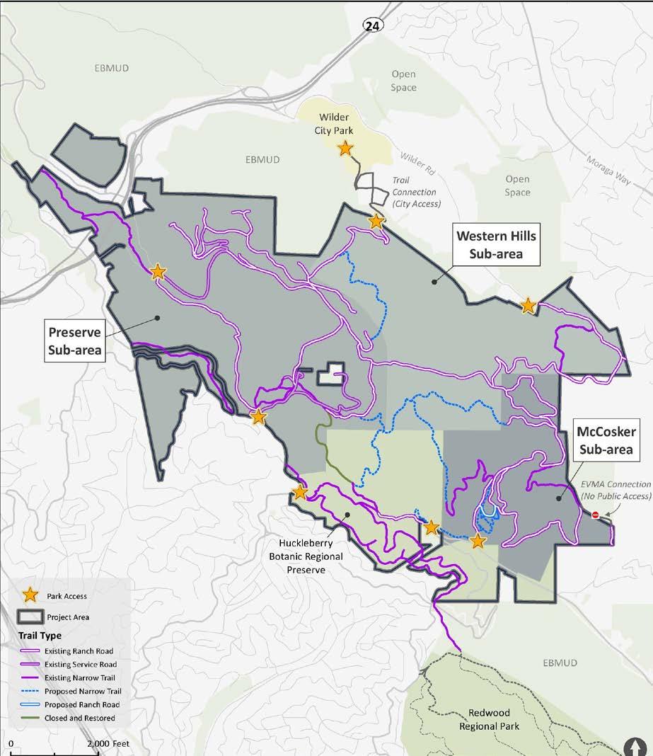
2 Project Location & Project Area

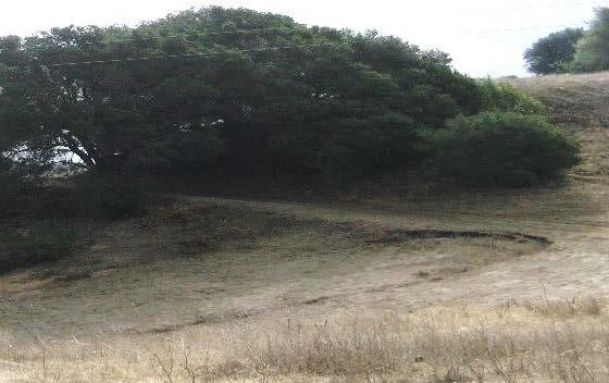
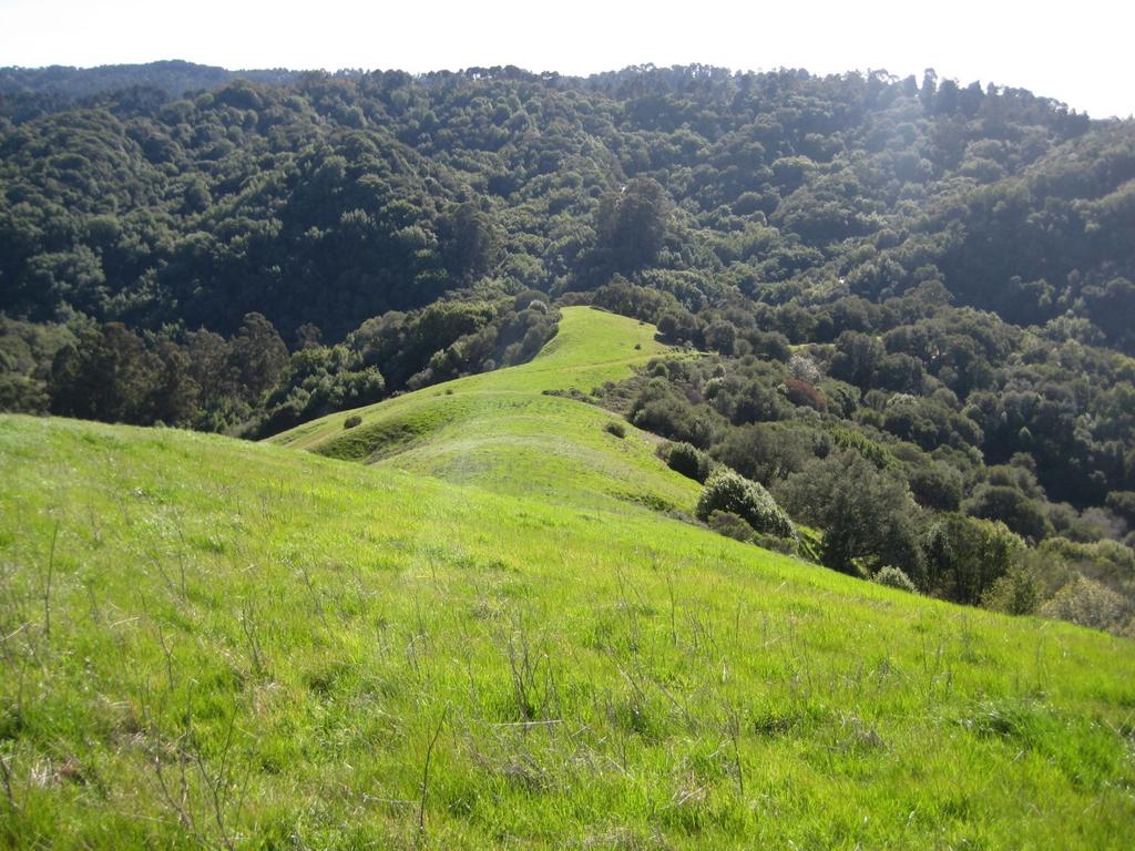
3 1,318-acre Robert Sibley Volcanic Regional Preserve Project Area
4 Purpose Project Purpose & Goals Append the 1985 LUPD to incorporate the Western Hills and McCosker sub-areas and developed local trails into Robert Sibley Volcanic Regional Preserve Preserve the rich heritage of natural and cultural resources and provide open space, trails, and safe and healthful recreation and environmental education in accordance with the District 2013 Master Plan Goals Maintain the natural ecology of the project area and enhance ecosystem functioning in key locations Incorporate climate adaptation and resiliency strategies into creek restoration actions, recreational facility design, and program development Maintain and augment existing public recreation and interpretive opportunities within the project area


5 Preserve Sub-area Proposed Recreation Amenities Repair & repave Old Tunnel Road Trail use change to add bike use to connect to bike use trails Expand parking at Main Sibley Staging Area from spaces & extend water line to existing backpack camp site Close, restore & realign trail segment


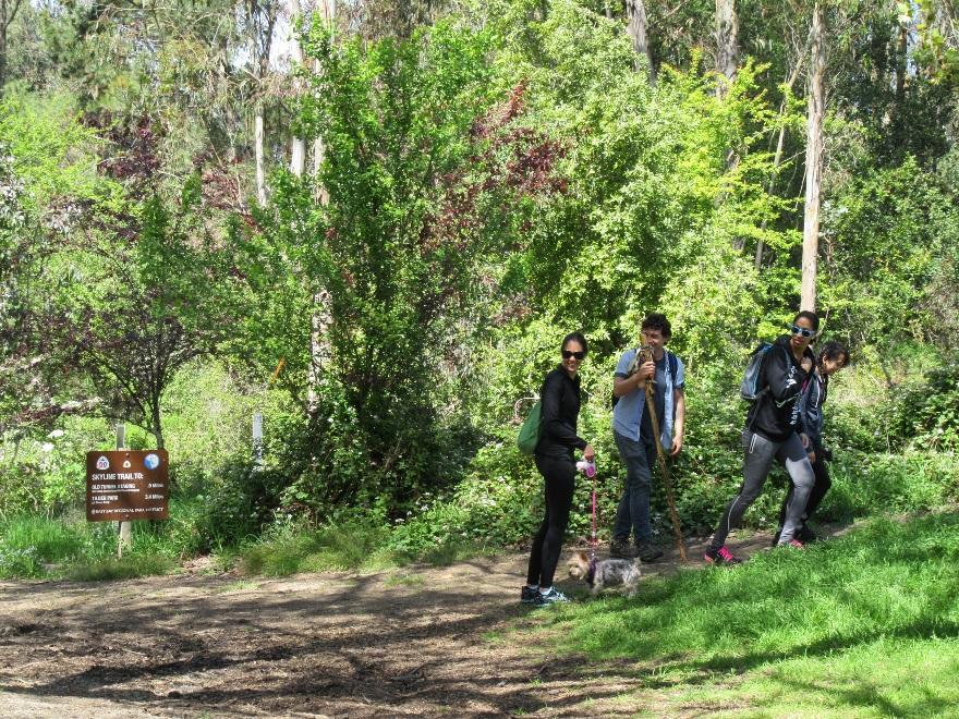
6 Western Hills Sub-area Recreation Amenities Wilder Park with dedicated parking for Sibley Preserve Red Tail Hawk Staging Area 19 cars & 2 horse trailers Multi-use Ranch Road Trail Connection to Sibley Preserve NEW 4-6 Wide Multi-use Trails Linking Sibley Preserve to McCosker and Huckleberry Multi-use Ranch Road Trail Connection to Sibley Preserve Multi-use 4-6 Wide Trail Connection to Sibley Preserve 389-Acre Conservation Easement

7 Huckleberry Proposed Trails Close, restore & realign trail segment Construct new 4-6 wide trail for hikers and equestrians
8 McCosker Sub-area


9 Existing Site Conditions Open creek channel Fill Terraces from Prior Land Uses Proposed Developed Recreation Site Failed culverts Proposed Creek Restoration Site

 and")
 Fern")
10 Potential Recreation Sites Kitchen Orchard Terrace (Lower Terrace) and Fiddleneck Field (Middle Terrace) Fern View Terrace (Upper Terrace)
11 Technical Study Findings for McCosker Sub-area
12 Technical Studies - Preliminary Stream Assessment Findings Soils & Geology Disturbed areas contain 7-30 feet of fill material with an average depth of feet It will be possible to balance cut and fill material on-site Stream channel fill material is suitable for onsite reuse Stream design can be designed to include habitat features suitable The gradient for of rainbow the stream s trout main including stem is about : 6 % A mix of cascades, resting pools, and spawning sites Over summering pools with a minimum depth of 1.5 feet A low flow channel 8-12 feet wide Circulation Primary access into the site can accommodate an allweather surface off Pinehurst Rd. and the stream restoration work
13 Options Considered


14 Comparative Development Areas Temescal Building & Parking acre Capacity: 130 people, 28 cars Redwood Group Camp 0.7 Acre (capacity : 50 people, 10 cars) Tilden Botanic Garden Building & Parking -10 acres Capacity: Tours 20 people, cars Trudeau Meeting Facility Building & Parking Acres Capacity:164 people, capacity 30 cars

15 Community Input for McCosker Sub-area Top Community Rankings: Stream Ecology, Restoration & Streamoriented Nature Programs Parking & Access Trails & Trail Activities Community Camping Preferences Backpack Camps Overnight Group Camp - Rustic - Tents on the Ground Top Community Trail Connections: Trail Connection to Huckleberry Trail Connection to Sibley Ridgeline Access to Quiet, Peaceful Spaces


16 Concept Plan Focus Creek Restoration & Rustic Developed Recreation Areas Master Plan goals of balancing conservation with recreation & interpretive activities Community preferences for creek restoration & limited recreation facility development Site constraints including: Degraded creek system with opportunities to enhance habitat Limited site access Limited opportunities for parking Water availability limited no connections to City water systems Limited sewage management capabilities - no connections to City sewage systems
17 McCosker Sub-area Recommendations

18 McCosker Sub-area Watershed Creek Restoration & Developed Recreation Area


19 Creek Restoration Recommendations Options Presented at January 2017 Community Meeting Restore & enhance 1,900 linear feet of creek, tributaries, and adjacent uplands in the McCosker sub-area Revised Recommendations Restore enhance 2,900 linear feet of creek, tributaries, and adjacent uplands in the McCosker sub-area


20 Camping Recommendations Options Presented at January 2017 Community Meeting Provide a combined group camp and interpretive program area within previously disturbed areas for up to 75 people with parking for up to 25 cars by reservation only Revised Recommendations Provide a combined group camp/backpack camp area and interpretive program area within previously disturbed areas for up to 50 people with parking for up to 26 cars by reservation only

21 McCosker Sub-area Proposed Concept Plan Open existing 4-6 wide trail for hikers, bicyclists, equestrians and dogs on leash Open existing ranch road trails for hikers, bicyclists, equestrians, & dogs on leash Creek restoration & developed recreation area Rename 10-car staging area Eastport Staging Area Construct new 4-6 wide trail for hikers, equestrians, & dogs on leash Infrastructure Improvements 3,200 lf of new water line to serve recreation area, 4,000 gallon water tank & water treatment system Underground utility lines & emergency phone service at Fiddleneck Field

")


22 Proposed Restoration & Recreation Concept Plan -McCosker Sub-area Develop Fern View Terrace (Upper Terrace) as a picnic & interpretive site Develop Kitchen Orchard Terrace (Lower Terrace) & Fiddleneck Field (Middle Terrace) as a combined group campsite & interpretive program area for up to 50 people Improve circulation including 3 new bridges, & ADA trails to provide access throughout developed recreation area Restore 2,900 linear feet of creek channel & riparian habitat
23 Project Trail Recommendations
24 Proposed Trail Recommendations Options Presented at January 2017 Community Meeting Expand existing trail system taking into consideration hiking, biking, equestrian and dog walking opportunities recognizing that not all trails will be available for all trail uses Revised Recommendations Expanded trail system would include: No change to existing trail uses in the Preserve, except a section of Round Top where bikes will be added to connect to other bike-allowed trails to make connections to Orinda Multi-use trails -hike, bike, horse, dogs on leash in Western Hills accordance with Conservation easement allowable uses No dogs, bikes, or horses along Alder Creek Nature Trail Dogs on leash in remainder of McCosker Bikes on ranch road trails and selected 4-6 wide trails No bikes in Huckleberry Preserve in accordance with existing trail access policies Closure and realignment of a trail segment in Huckleberry and a new trail connection to McCosker for hikers, equestrians and dog-walkers


25 Trail Types

26 Trail Uses

27 Trail Types Trail Uses
28 Project Status Community Engagement 3 community meetings including CEQA scoping meeting, 2 on-site meetings & 2 youth engagement meetings June 19, 2017 NOP issued - Responsible & Trustee Agencies, over 550 community members & local government entities & 179 notices 12 responses Late Fall 2017 Winter Preferred Concept Plan Presentation to PAC & Board Executive Committee Public Draft LUPA/EIR Permitting
29 Questions?
BACK COUNTRY UNIT PREFERRED ALTERNATIVE
 BACK COUNTRY UNIT PREFERRED ALTERNATIVE San Francisco (118 mi) Carmel-By-The-Sea Carmel River Carmel Valley Road State Beach Private Property Point Lobos State Reserve Point Lobos Ranch RUSTIC CAMPING
EXECUTIVE SUMMARY PROGRAM DEVELOPMENT REPORT PURPOSE EXISTING SETTING EXPANDING PARKLAND
 EXECUTIVE SUMMARY PROGRAM DEVELOPMENT REPORT PURPOSE As the culmination of the first phase of the master planning process, this Program Development Report creates the framework to develop the Calero County
Rogue River Access and Management Plan Draft Alternatives
 Rogue River Access and Management Plan Draft Alternatives The Rogue River Access and Management Plan was initiated in December, 2011 and is being led by Jackson County Parks (JCP) and Oregon Department
SAN ANTONIO RIVER IMPROVEMENTS PROJECT. August 6, 2008
 SAN ANTONIO RIVER IMPROVEMENTS PROJECT August 6, 2008 1 History of the SA River Improvements 1921 Flood Olmos Dam Complete in 1929 Downtown Flood Relief Projects in 1950 s Dams on the River Channel and
Silver Lake Park An Environmental Jewel for the Citizens of Prince William County
 Silver Lake Park An Environmental Jewel for the Citizens of Prince William County The Prince William Park Authority Mission Statement states: The Prince William County Park Authority will create quality
Preferred Recreation Recommendations Stemilt-Squilchuck Recreation Plan March 2018
 Preferred Recreation Recommendations Stemilt-Squilchuck Recreation Plan March 2018 Below are the recommended recreation ideas and strategies that package together the various recreation concepts compiled
The Chu property is a 6.57 acre parcel located in the Town of Superior on the west side of McCaslin Boulevard. In 2014, the Town of Superior acquired
 1 The Chu property is a 6.57 acre parcel located in the Town of Superior on the west side of McCaslin Boulevard. In 2014, the Town of Superior acquired the Chu property for open space with a contribution
REVISED AGENDA. Special Council Meeting. Monday, September 11, 2017 (REVISED TO INCLUDE ON-TABLE ITEMS)
") Mission Statement In carrying out its mandate, Bowen Island Municipality will work towards conducting operations in a way that: Improves the economic, environmental and social well-being for present and
Mission Statement In carrying out its mandate, Bowen Island Municipality will work towards conducting operations in a way that: Improves the economic, environmental and social well-being for present and
ROAD AND TRAIL PROJECT APPROVAL
 ROAD AND TRAIL PROJECT APPROVAL www.marincountyparks.org Marin County Parks, 3501 Civic Center Dr, Suite 260, San Rafael, CA 94903 DATE: July 12, 2017 PRESERVE: Gary Giacomini Open Space Preserve PROJECT:
Coronado National Forest Santa Catalina Ranger District
 United States Department of Agriculture Forest Service Coronado National Forest Santa Catalina Ranger District File Code: 1950 Date: October 14, 2015 Dear Interested Party: The Santa Catalina Ranger District
PALO CORONA REGIONAL PARK MPRPD BOARD MEETING AUGUST 8, 2018
 PALO CORONA REGIONAL PARK MPRPD BOARD MEETING AUGUST 8, 2018 ACKNOWLEDGEMENTS AGENCIES AND ORGANIZATIONS The Trust for Public Land Big Sur Land Trust Santa Lucia Conservancy California State Parks Point
2. Goals and Policies. The following are the adopted Parks and Trails Goals for Stillwater Township:
 D. PARKS AND TRAILS 1. Introduction Stillwater Township s population is relatively low, with most residents living on rural residences on large lots. The need for active park space has been minimal in
Understanding the caring capacity of the visitor experience Provide facilities to support a high level user experience Address visual quality through
 Understanding the caring capacity of the visitor experience Provide facilities to support a high level user experience Address visual quality through recreation ecological restoration opportunities Collaboration
Park Design and Location Criteria
 Park Design and Location Criteria This section is presented in the interest of assisting park and recreation agencies in the development of a system of parks and recreation areas. A recreation system is
SAN ANTONIO RIVER IMPROVEMENTS PROJECT. April 27, 2009
 SAN ANTONIO RIVER IMPROVEMENTS PROJECT April 27, 2009 1 Project Limits 2 Project Partners City of San Antonio Provides project funding for project amenities (i.e.. Sidewalks, Landscaping, Lighting, etc.)
Finn Creek Park. Management Direction Statement Amendment
 Finn Creek Park Management Direction Statement Amendment November 2013 Management Direction Statement Amendment Approved by: Jeff Leahy Regional Director, Thompson Cariboo BC Parks November 12, 2013 Date
China Creek North Park Upgrades and Glen Pump Station. Park Board Committee Meeting Monday, July 10, 2017
 China Creek North Park Upgrades and Glen Pump Station Park Board Committee Meeting Monday, July 10, 2017 Purpose The purpose of this presentation is to: Share the results of the public engagement processes;
Happy Creek Development 2467 Happy Creek Rd. Sevierville, TN 37876
 DEVELOPMENT FOR SALE - REDUCED PRICE 2467 Happy Creek Rd. Sevierville, TN 37876 PROPERTY DESCRIPTION PROPERTY OVERVIEW One of the most private and natural settings at the base of the Great Smoky Mountains,
TRUCKEE TAHOE AIRPORT DISTRICT BOARD OF DIRECTOR STAFF REPORT
 AGENDA ITEM: 11 TRUCKEE TAHOE AIRPORT DISTRICT BOARD OF DIRECTOR STAFF REPORT AGENDA TITLE: MEETING DATE: January 24, 2018 PREPARED BY: NTPUD Agency Partnership Opportunity, Multi-Use Trailhead Access
B10. Agate Beach State Recreation Site
 B10. Agate Beach State Recreation Site Location Within the City of Newport, just south of the Yaquina Head Outstanding Natural Area. The park is located along the west side of Highway 101 at the mouth
Miller/ Knox Regional Shoreline
 East Bay Regional Park District Board Meeting March 19 th, 2019 Miller/ Knox Regional Shoreline Land Use Plan Amendment Miller/Knox Regional Shoreline 1960 s EBRPD Expands to Contra Costa County Only 64
Steps in the Management Planning Process
 Steps in the Management Planning Process Developing a management plan for Kalamalka Lake Park will follow a multi-stage process. The planning process for this park is currently in the Draft Management
Bear Creek Habitat Improvement Project
 06/10/10 Bear Creek Habitat Improvement Project El Paso County, Colorado Pike National Forest and Colorado Springs Utilities Owned Land Report prepared by: Eric Billmeyer Executive Director Rocky Mountain
THAT the Board approve the final proposed concept plan for the Jericho Marginal Wharf site as shown in Figure C-4 of Appendix C.
 Date: January 17, 2012 TO: Board Members Vancouver Park Board FROM: General Manager Parks and Recreation SUBJECT: Jericho Marginal Wharf Phase 2 Concept Plan RECOMMENDATION THAT the Board approve the final
LAND USE GUIDELINES NEW TOWN
 VI LAND USE A L T ETruRck TNraiAl T I V E S AarNnelDla D E S I G N W GUIDELINES NEW TOWN ad Ro DAVEN CA LF IRE ALTERNATIVE LAND USE PLANS AND DESIGN GUIDELINES - VI VI LAND USE ALTERNATIVES Asilomar Hotel
Attendance Presentation
 TO The Community of Saanich FROM District of Saanich DATE January 30, 2017 RE Meeting Notes Haro Woods Jan 28th Community Engagement Goward House, 2495 Arbutus Road, Victoria BC Attendance In total, 18
PROPOSED PARK ALTERNATIVES
 8 Chimne y Rock State Park M a ster Pl an 2011 PROPOSED PARK ALTERNATIVES Introduction Three different park development concepts were prepared and presented to the citizens of North Carolina through a
FINAL TESTIMONY 1 COMMITTEE ON RESOURCES UNITED STATES HOUSE OF REPRESENTATIVES. July 13, 2005 CONCERNING. Motorized Recreational Use of Federal Lands
 FINAL TESTIMONY 1 STATEMENT OF DALE BOSWORTH CHIEF Of the FOREST SERVICE UNITED STATES DEPARTMENT OF AGRICULTURE Before the SUBCOMMITTEE ON FORESTS AND FOREST HEALTH And the SUBCOMMITTEE ON NATIONAL PARKS,
MAA 5 Year Approved Projects List FY through FY
 MAA 5 Year Approved Projects List FY 2018 19 through FY 2022 23 AA01 Miramontes Ridge: Gateway to the Coast Public Access, Stream Restoration and Agriculture Enhancement AA01 Miramontes Ridge: Gateway
Dungeness Recreation Area County Park Master Plan
 Dungeness Recreation Area County Park Public Outreach Meeting October 10, 2007 Project Overview USFWS Site Dungeness Recreation Area County Park Meeting Objectives: Re-Introduce project; provide status
Piedra River Protection Workgroup Meeting #5 Feb. 21, 2012 Ross Aragon Community Center, Pagosa Springs
 Piedra River Protection Workgroup Meeting #5 Feb. 21, 2012 Ross Aragon Community Center, Pagosa Springs What happened at this meeting? - Identified conservation easements - Discussed In-stream Flows -
Proposed Action Kaibab Campground Capital Improvement Project September 2008
 Background Kaibab Campground Capital Improvement Project September 2008 The Williams Ranger District of the Kaibab National Forest is proposing to improve the Kaibab Lake Campground. Kaibab Lake Campground
Chapter 6. Trail Design. Trail Design
 Chapter 6 Trail Design Trail Design The trail winds through a region rich in scenic beauty, cultural, and natural history. Volunteer landscape architects working with the Core and Planning Teams, have
TRAIL DATABASE SCHEMA (8/26/2014)
") Trail Data Model for LINES Source Data Source Agency dataagency Agency or entity that created the dataset where the original line was sourced from. Source Date of Last Data Used to Update sourcedate Publication
Trail Data Model for LINES Source Data Source Agency dataagency Agency or entity that created the dataset where the original line was sourced from. Source Date of Last Data Used to Update sourcedate Publication
MASTER PLAN EXECUTIVE SUMMARY
 Biscuit Run State Park Scottsville Road (State Route 20) Charlottesville, VA 22902 Biscuit Run State Park MASTER PLAN EXECUTIVE SUMMARY Department of Conservation and Recreation Division of Planning and
10/25/2013. What is the SCORP?! 2013 Local Government Survey 2013 Statewide Public Survey Advisory Group Priority Areas Your Suggestions!
 COLORADO OUTDOOR RECREATION TRENDS RESULTS FROM THE SCORP AND STATEWIDE Colorado Outdoor Recreation Resource Partnership September 2013 PRESENTATION What is the SCORP?! 2013 Local Government Survey 2013
Nov. 19 th Public Workshop Summary
 On November 19 th, more than 60 community members attended an Open Space Matters workshop at the Linen Building in downtown Boise for over two hours. Participants learned about reserves, discussed the
Welcome! metrovancouver.org. Aldergrove Regional Park - Management Plan
 Welcome! Aldergrove Regional Park - Management Plan The process to create a Management Plan for Aldergrove Regional Park is underway and we would like your input on the draft Vision, Framework and Concept.
Pinellas County Environmental Lands
 Pinellas County Environmental Lands In addition to traditional parks and recreation facilities, Pinellas County owns and manages a system of environmental lands that provides specialized resource-based
April 10, Mark Stiles San Juan Public Lands Center Manager 15 Burnett Court Durango, CO Dear Mark,
 Mark Stiles San Juan Public Lands Center Manager 15 Burnett Court Durango, CO 81301 Dear Mark, We are pleased to offer the following comments on the draft San Juan Public Lands Center management plans
Open Space and Mountain Parks (OSMP) Department
 Department") Open Space and Mountain Parks (OSMP) Department Marshall Mesa-Southern Grasslands Trail Study Area (TSA) Plan November 4, 2005 1 Open Space and Mountain Parks (OSMP) Department Marshall Mesa-Southern Grasslands
Open Space and Mountain Parks (OSMP) Department Marshall Mesa-Southern Grasslands Trail Study Area (TSA) Plan November 4, 2005 1 Open Space and Mountain Parks (OSMP) Department Marshall Mesa-Southern Grasslands
Map 1.1 Wenatchee Watershed Land Ownership
 Map 1.1 Wenatchee Watershed Land Ownership Map 1.1 Wenatchee Watershed Land Ownership The Wenatchee watershed lies in the heart of Washington state in Chelan County. Just larger than the state of Rhode
Mark West Creek Flow Study Report
 Mark West Creek Flow Study Report Biology and Geology of Mark West Creek The headwaters of Mark West Creek are located in the Mayacamas Mountain range, which border Napa and Sonoma County, where it then
Park Updates 1. Cavalero 2. Lundeen 3. Frontier Heights Citizen Advisory Committee
 Page 1 of 10 PARK BOARD AGENDA Community Center 1808 Main Street, Lake Stevens Monday, April 11, 2016 CALL TO ORDER: 6:00 pm ROLL CALL: GUEST BUSINESS: ACTION ITEMS: A. B. C. Approval of February 8, 2016
Welcome to the future of Terwillegar Park a Unique Natural Park
 Welcome to the future of Terwillegar Park a Unique Natural Park 1 Introduction The Terwillegar Park Concept Plan study will develop an overall concept plan, management objectives and development guidelines
Management Direction Statement
 Management Direction Statement Rocky Fork State Park 4/18/2017 Table of Contents Rocky Fork State Park Introduction 4 Purpose of Management Direction Statements Setting and Context Park Themes Mission
MAIN LAKE PROVINCIAL PARK
 MAIN LAKE PROVINCIAL PARK PURPOSE STATEMENT AND ZONING PLAN March 2003 MAIN LAKE PROVINCIAL PARK Purpose Statement and Zoning Plan Primary Role The primary role of Main Lake Park is to protect a biologically
Procedure for the Use of Power-Driven Mobility Devices on Mass Audubon Sanctuaries 1 September 17, 2012
 Procedure for the Use of Power-Driven Mobility Devices on Mass Audubon Sanctuaries 1 September 17, 2012 Background As part of Mass Audubon s mission to preserve the nature of Massachusetts for people and
COASTAL CONSERVANCY. Staff Recommendation December 2, 2004 COYOTE HELLYER COUNTY PARK BAY AREA RIDGE TRAIL
 COASTAL CONSERVANCY Staff Recommendation December 2, 2004 COYOTE HELLYER COUNTY PARK BAY AREA RIDGE TRAIL File No. 04-057 Project Manager: Amy Hutzel RECOMMENDED ACTION: Authorization to disburse up to
South Colony Basin Recreation Fee Proposal
 South Colony Basin Recreation Fee Proposal Purpose and Need for Collecting Fees in South Colony Basin: Forest Service appropriated funds have not been sufficient to maintain current recreational services
HIGHWAY 17 WILDLIFE and REGIONAL TRAIL CROSSINGS
 HIGHWAY 17 WILDLIFE and REGIONAL TRAIL CROSSINGS Agenda and Meeting Format 7:00-7:15 Welcome 7:15-8:00 Presentation 8:00-8:30 Open House 8:30 Recap 9:00 Conclusion 2 Meeting Goals: Introduce the project
When One Size Doesn t Fit All Building Volunteers with a Spectrum of Opportunity
 November 2013 PNTS When One Size Doesn t Fit All Building Volunteers with a Spectrum of Opportunity Claire Miller City of Scottsdale McDowell Sonoran Preserve The Preserve is Born 1991 Citizens form the
Protected Area Network in Finland
 Protected Area Network in Finland Barents Protected Area Network Conference: Road to a functional network of protected areas in the Barents Region Helsinki, Finland 19 March 2013 Sanna-Kaisa Juvonen &
Logo Department Name Agency Organization Organization Address Information 5700 North Sabino Canyon Road
 Logo Department Name Agency Organization Organization Address Information United States Forest Coronado National Forest 5700 North Sabino Canyon Road Department of Service Santa Catalina Ranger District
San Juan Resource Area Recreation Impact Inventory/Monitoring
 San Juan Resource Area Recreation Impact Inventory/Monitoring Indian Creek Climbing Area Overview & Summary of Findings 2007 Pam Foti, Professor Aaron Divine, Lecturer Janet Lynn, Program Coordinator Northern
Fossil Creek Wild & Scenic River Comprehensive River Management Plan Forest Service Proposed Action - details March 28, 2011
 Fossil Creek Wild & Scenic River Comprehensive River Management Plan Forest Service Proposed Action - details March 28, 2011 Primary Goals of the Proposed Action 1. Maintain or enhance ORVs primarily by
FEASIBILITY CRITERIA
 This chapter describes the methodology and criteria used to evaluate the feasibility of developing trails throughout the study areas. Land availability, habitat sensitivity, roadway crossings and on-street
Trail Etiquette. Hours of Operation. Trail Accessibility
 Trail Guide The Elmhurst Park District, with 28 parks and over 460 acres of land, offers nearly six miles of paved or asphalt park trails and maintains an additional 3.6 miles of trails within Elmhurst.
Clam Harbour Provincial Park
 Clam Harbour Provincial Park Public Engagement Session Thursday, September 14 th, 2017 5:30pm 7:30pm Webbers Store 11470 Nova Scotia Trunk 7 Lake Charlotte, NS Agenda Overview of the Provincial Parks System
Auburn Trail / Ontario Pathways Trail Connector Feasibility Study Public Information Meeting Wednesday, August 22, 2012
 Auburn Trail / Ontario Pathways Trail Connector Feasibility Study Public Information Meeting Wednesday, August 22, 2012 Purpose of Feasibility Study Purpose Evaluate the feasibility of constructing a multiuse
SHUSWAP LAKE MARINE PROVINCIAL PARK
 SHUSWAP LAKE MARINE PROVINCIAL PARK Purpose Statement and Zoning Plan The primary role of the Shuswap Lake Marine Provincial Park is to provide a system of sites for marine overnight and day use of Shuswap
Understanding user expectations And planning for long term sustainability 1
 Understanding user expectations And planning for long term sustainability 1 What is a natural surface trail? It can be as simple has a mineral soil, mulched or graveled pathway, or as developed as elevated
Michipicoten Island Regional Plan
 Michipicoten Island Regional Plan This is one of twenty Regional Plans that support implementation of the Lake Superior Biodiversity Conservation Strategy (Strategy). The Strategy, prepared and overseen
Rockin River Ranch State Park. TAC Meeting No. 2
 Rockin River Ranch State Park TAC Meeting No. 2 ASPT Welcome Skip Varney Deputy Director of Operations and Development Rockin River Ranch State Park Workshop Outline Planning Process/Schedule Overview
Dakota County Planning Commission Advisory Committee Meeting Minutes Date: May 23, 2017 Time: 6:00 p.m. to 8:30 p.m.
 Dakota County Planning Commission Advisory Committee Meeting Minutes Date: May 23, 2017 Time: 6:00 p.m. to 8:30 p.m. Members Present Staff Present Mike Greco Trinity Augesen Vacant Lori Hansen Jill Smith
Tahoe Donner Association Public Scoping Meeting DUDEK
 Tahoe Donner Association Public Scoping Meeting DUDEK Introduction Purpose of this Meeting: Solicit feedback and ideas from members, and staff as we begin the Association Master Plan. Association Master
FINGER-TATUK PROVINCIAL PARK
 FINGER-TATUK PROVINCIAL PARK PURPOSE STATEMENT AND ZONING PLAN March 2003 FINGER-TATUK PROVINCIAL PARK Purpose Statement and Zoning Plan Finger-Tatuk Provincial Park is 17,151 ha in size. It includes the
Yard Creek Provincial Park. Management Plan
 Yard Creek Provincial Park Management Plan Draft January 2010 Yard Creek Provincial Park Management Plan Approved by: telàlsemkin/siyam/chief Scott Benton Bill Williams Squamish Executive Director ation
CHAPTER 5. Chapter 5 Recreation Element
 CHAPTER 5 Recreation Element Chapter 5 Recreation Element The Recreation Element of the Meyers Area Plan is a supplement to the Recreation Element of the TRPA Regional Plan and the El Dorado County General
Village of Taos Ski Valley 2015 Master Plan. Recreation Element
 Village of Taos Ski Valley 2015 Master Plan Taos Ski Valley is known across the world for skiing and winter sports, but the Village has more to offer than advanced skiing terrain and short lift lines.
Southern Shenandoah Valley Chapter
 Southern Shenandoah Valley Chapter June 7, 2018 Members of the State Water Control Board c/o Office of Regulatory Affairs, Department of Environmental Quality P.O. Box 1105 Richmond, Virginia 23218 citizenboards@deq.virginia.gov
Appendix 3. Greenway Design Standards. The Whitemarsh Township Greenway Plan
 Appendix 3 Greenway Design Standards This chapter discusses two design standards for the greenway types discussed above. First, trail design standards are presented together with trailhead facilities and
2.0 PARK VISION AND ROLES
 2.0 PARK VISION AND ROLES 2.1 Significance in the Protected Area System Marble Range and Edge Hills provincial parks protect 6.8% of the Pavillion Ranges Ecosection, which is located in the Southern Interior
HLUET TRANSMITTAL RECOMMENDED ACTION
 HLUET TRANSMITTAL TO: Housing, Land Use, Environment & Transportation Committee Prepared by: Elish Ryan, Park Planner FROM: Lisa Killough, Director DATE: November 1, 2002 Reviewed by: Mark Frederick, Planning
City of Haslett. City of East Lansing. City of East Lansing
 Central Park North (Nancy L. Moore Park) Lake Park North Expansion White Park Expansion #2 White Park Expansion #1 County East East Haslett East East TF87-212 Acquisition $90,000.00 Park. TF08-138 Acquisition
Lake Myra County Park. Wake County, North Carolina Community Forum #2 June 12, 2008
 Lake Myra County Park Wake County, North Carolina Community Forum #2 June 12, 2008 Welcome and Introduction Meeting Agenda Welcome Introductions of Project Team Master Plan Process Community Forum #1 Updates
DESCRIPTION OF DRAFT LAND USE PLAN ALTERNATIVES. Overview of Draft Alternatives (Common Features and Themes)
") Concord Hills Regional Park Land Use Plan EAST BAY REGIONAL PARK DISTRICT DESCRIPTION OF DRAFT LAND USE PLAN ALTERNATIVES The following memorandum describes the draft Alternatives for Concord Hills Regional
Concord Hills Regional Park Land Use Plan EAST BAY REGIONAL PARK DISTRICT DESCRIPTION OF DRAFT LAND USE PLAN ALTERNATIVES The following memorandum describes the draft Alternatives for Concord Hills Regional
Final General Management Plan/Wilderness Study/Environmental Impact Statement:
 This document is scheduled to be published in the Federal Register on 03/11/2016 and available online at http://federalregister.gov/a/2016-05542, and on FDsys.gov DEPARTMENT OF THE INTERIOR 4312-FF National
Ragged Mountain Natural Area. Public Planning Meeting #1 February 29 th, 2016
 Ragged Mountain Natural Area Public Planning Meeting #1 February 29 th, 2016 Planning During dam construction P&R approached by various groups asking if the rules would be changed once the dam was complete
Header i
 Header i 048285014.10 Header Sub Title Body Text here. Body text here. Body text here. Section 1... 1 Executive Summary... 1 Opportunities and Constraints... 3 Overall Opportunities and Constraints Map
Colorado s Instream Flow Program at 40. Celebrating 40 Years of Success and Challenges January 15, 2014 Denver, Colorado
 Colorado s Instream Flow Program at 40 Celebrating 40 Years of Success and Challenges January 15, 2014 Denver, Colorado ISF Program established in 1973 by Senate Bill 97 Recognized the need to correlate
Rule Governing the Designation and Establishment of All-Terrain Vehicle Use Trails on State Land
 Rule Governing the Designation and Establishment of All-Terrain Vehicle Use Trails on State Land 1.0 Authority 1.1 This rule is promulgated pursuant to 23 V.S.A. 3506. Section 3506 (b)(4) states that an
White Mountain National Forest Saco Ranger District
 United States Department of Agriculture Forest Service White Mountain National Forest Saco Ranger District 33 Kancamagus Highway Conway, NH 03818 Comm: (603) 447-5448 TTY: (603) 447-3121 File Code: 1950
Thank you for this third opportunity to comment on the proposed revisions to the Coconino National Forest Management plan.
 March 19, 2014 Flagstaff Biking Organization PO Box 23851 Flagstaff, AZ 86002 Vern Keller Coconino National Forest Attn: Plan Revision 1824 South Thompson Street Flagstaff, Arizona 86001 coconino_national_forest_plan_revision_team@fs.fed.us
EAST DON TRAIL ENVIRONMENTAL ASSESSMENT. Community Liaison Committee Meeting #3 July 15, :30 to 8:30 pm Flemingdon Park Library
 EAST DON TRAIL ENVIRONMENTAL ASSESSMENT Community Liaison Committee Meeting #3 July 15, 2013 6:30 to 8:30 pm Flemingdon Park Library Agenda 1. Welcome 2. Housekeeping and Updates a) Housekeeping b) CLC
Establishing a National Urban Park in the Rouge Valley
 STAFF REPORT ACTION REQUIRED Establishing a National Urban Park in the Rouge Valley Date: March 29, 2012 To: From: Wards: Reference Number: Executive Committee Deputy City Manager, Cluster B All p:\2012\cluster
Department of Environment, Climate Change & Water NSW. Stakeholder feedback
 Department of Environment, Climate Change & Water NSW Stakeholder feedback 1 Stakeholders group Blue Gum High Forest Group Guardians of Lane Cove NP Sydney Metropolitan Wildlife Service Ku-ring-gai Historical
Draft General Management Plan/Wilderness Study/Environmental Impact Statement
 This document is scheduled to be published in the Federal Register on 05/06/2015 and available online at http://federalregister.gov/a/2015-10528, and on FDsys.gov DEPARTMENT OF THE INTERIOR National Park
Longmont to Boulder Regional Trail Jay Road Connection DRAFT FINAL REPORT
 Longmont to Boulder Regional Trail Jay Road Connection DRAFT FINAL REPORT December 2018 Project Summary Boulder County, Colorado, in partnership with the City of Boulder, is evaluating options for multi-use
WORKSHEET 1 Wilderness Qualities or Attributes Evaluating the Effects of Project Activities on Wilderness Attributes
 WORKSHEET 1 Wilderness Qualities or Attributes Evaluating the Effects of Project Activities on Wilderness Attributes Date: 3/7/2017 Roadless Area: Ruby South Description of Project Activity or Impact to
MARBLE RIVER PROVINCIAL PARK
 MARBLE RIVER PROVINCIAL PARK PURPOSE STATEMENT AND ZONING PLAN March 2003 MARBLE RIVER PROVINCIAL PARK Purpose Statement and Zoning Plan Primary Role The primary role of Marble River Park is to protect
Segment 2: La Crescent to Miller s Corner
 goal of the USFWS refuges is to conserve, protect and enhance fish, wildlife and plants and their habitats for the continuing benefit of the American people. Refuge lands are used largely for fishing,
Environment and Natural Resources Trust Fund 2019 Request for Proposals (RFP)
") Environment and Natural Resources Trust Fund 2019 Request for Proposals (RFP) Project Title: Glacial Edge Trail and Downtown Pedestrian Bridge Category: G. Land Acquisition for Habitat and Recreation ENRTF
Environment and Natural Resources Trust Fund 2019 Request for Proposals (RFP) Project Title: Glacial Edge Trail and Downtown Pedestrian Bridge Category: G. Land Acquisition for Habitat and Recreation ENRTF
NAVAJO COMMUNITY PLAN
 NAVAJO COMMUNITY PLAN Prepared by the NAVAJO COMMUNITY PLANNERS and THE CITY OF SAN DIEGO City of San Diego Planning Department 202 C Street, MS 4A San Diego, CA 92101 Printed on recycled paper. This information,
Wallace Falls State Park Classification and Management Planning Stage 3 Preliminary Recommendations July 18, 2018 Sultan City Hall
 Wallace Falls State Park Classification and Management Planning Stage 3 Preliminary Recommendations July 18, 2018 Sultan City Hall Thanks for coming! This document contains State Parks preliminary recommendations
Wilds. Headwaters. Lakes. Oxbows. Falls
 56 5 4 3 Wilds Headwaters Lakes Oxbows Falls 57 Zones It could be said the on-the-ground essence of this master plan appears within the next 6 pages of this report. As we learned in the preceding Cultural
$850,000 Awarded to 20 Organizations
 $850,000 Awarded to 20 Organizations The Conservation Alliance is pleased to fund the following organizations to support their efforts to protect wild lands and waterways for their habitat and recreation
DOYLE SPRINGS PLANNING UNIT Kern-Tule River Watershed
 Existing Conditions & Uses Overview Consists of a mostly forested parcel with small hydropower developments and part of a private recreation cabin development, along with two small transmission line corridor
Greater Minnesota Regional Parks and Trails Commission Designation Application
 Greater Minnesota Regional Parks and Trails Commission Designation Application General Section Designation Application #: 14-015D Date Submitted: 08/31/2015 Park or Trail Name: Alexander Ramsey Park District
BACKCOUNTRY TRAIL FLOOD REHABILITATION PROGRAM
 BACKCOUNTRY TRAIL FLOOD REHABILITATION PROGRAM Backcountry Trail Flood Rehabilitation A June 2013 Flood Recovery Program Summary In June 2013, parts of Southern Alberta were devastated from significant