Parks & Recreation Areas Program
|
|
|
- Donald Bates
- 5 years ago
- Views:
Transcription
1

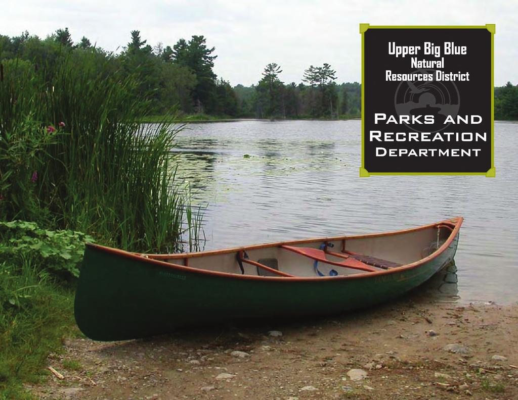
2 PARKS & RECREATION Parks & Recreation Areas Program As part of its mission to conserve and protect natural resources, the Upper Big Blue Natural Resources District (NRD) has been involved in several large-scale dam and reservoir projects since These multi-purpose projects are designed for flood and erosion control, groundwater recharge, and use in progressive groundwater research. As a result, the additional benefit of these projects is the opportunity for outdoor recreation. The NRD has developed six sites: Smith Creek Recreation Area, Pioneer Trails Recreation Area, the Bruce L. Anderson Recreation Area and Recharge Lake, Recharge Lake Archery Range, Overland Trail Reservoir and Recreation Area, and Oxbow Trail Recreation Area. These sites provide habitat for wildlife. Area residents can enjoy activities, such as camping, fishing, boating, hiking, as well as winter sports such as skiing, sledding, tobogganing, snowshoeing, snowmobile riding, and ice skating. On this page is a District map locating the Parks & Recreation areas inside the Upper Big Blue NRD. The following pages are detailed maps of each recreation site that the NRD manages. Pioneer Trails Recreation Area Aurora Bruce L. Anderson Recreation Area Recharge Lake & Archery Range Overland Trail Reservoir & Recreation Area Oxbow Trail Reservoir & Recreation Area Ulysses Smith Creek Recreation Area Beaver Crossing = Recreation Areas 2 Number of Acres: Water & Land Inside Recreation Areas Managed by the Upper Big Blue NRD The Upper Big Blue NRD recreational areas are utilized year-round with people participating in camping, boating, hiking, hunting and fishing, as well as winter sports including cross-country skiing, sledding, tobogganing, snowshoeing, snowmobile riding, and ice skating. These sites are designed for public use and we are proud to offer these areas for recreation. At this time, we currently do not manage any wetland areas. The accompanying table highlights the land size of each recreation area.


3 Overland Trail Recreation Area The Overland Trail Recreation Area, located 2.0 miles east and 1.0 mile south of York, features a 17-surface-acre lake which stores 121 acre feet of water. The site was named for the nearby Overland Trail, which during the 1860 s, was a spur off the Oregon Trail. The primary purposes of the dam and reservoir were designed to provide flood control, aquifer recharge and recreational opportunities. Camping, picnicking, and hiking are permitted in designated areas. Boating and canoeing are also allowed along with skiing, sledding, tobogganing, snowshoeing, snowmobiling, and ice skating. Development at the facility remains limited to preserve wildlife habitat. 3


4 PARKS & RECREATION Oxbow Trail Recreation Area Constructed in 1998, the Oxbow Trail Recreation Area is located 1.5 miles east of Ulysses, Nebraska, and features a 39-surface-acre lake which can store 274 acre feet of water. Named for the nearby Oxbow Trail used by pioneers during the mid-1850s, the dam and reservoir was designed to provide flood control, wildlife habitat, and recreation. The lake s water source is supplied by rainfall and underground springs. A fishing jetty is accessible on the west side of the lake along with a boat ramp and dock. The recreation area is open to hiking and camping. The trapping of furbearers is permitted during the allowable hunting and trapping season. A picnic shelter and tables are also available. 4


5 Aquatic Life in the Recreation Areas Major Game Fish typically found at the Upper Big Blue Natural Resources District recreation areas include: (clockwise from top) Bluegill, Green Sunfish, Crappie, Channel Catfish, Black Bullhead, and Largemouth Bass 5


 to provide direction and assistance in the wise use, conservation and development of our soil, water and related natural resources.")


6 NRD PROFILE Once dismissed as The Great American Desert, Nebraska now is known both nationally and abroad for its agricultural bounty and natural wonders. We sometimes take these wonders for granted, but they surround us from one corner of the state to another; from Niobrara to Red Cloud, from Scottsbluff to Omaha. The Nebraska Legislature enacted a law in 1969 to combine 154 special purpose entities into 23 Natural Resources Districts (NRDs). NRDs were officially established on July 1, These Districts are unique to Nebraska and to the rest of the country. NRDs are local government units with broad responsibilities to protect our natural resources. Major Nebraska river basins form the boundaries enabling NRDs to respond best to local needs. An elected Board of Directors governs each District. Much of their funding comes from local property taxes. In most cases, your local NRD typically uses 1-2 percent of all property taxes collected in the District. NRDs help Nebraskans respond to natural resources challenges with local control and local solutions. Partnerships have been built with various agencies and organizations, including the USDA Natural Resources Conservation Service, the Nebraska Department of Natural Resources, other state and federal agencies, municipalities, counties, and private organizations. Natural Resources Districts the greatest sources of the state s wealth and its assurance for future prosperity More than 56,000 citizens rely on the Upper Big Blue Natural Resources District (NRD) to provide direction and assistance in the wise use, conservation and development of our soil, water and related natural resources. The NRD is dedicated to the conservation and careful development of natural resources to serve everyone s needs. Many NRD projects and programs leave long-lasting results: dams, terraces, drainage ditches, windbreaks, reservoirs, recreation areas (including parks, campgrounds, and trails), groundwater management (both quantity and quality), and irrigation and crop production educational opportunities. The Nebraska Association of Resources Districts, a statewide association created by NRDs, provides administrative services, legislative representation, statewide communication, and coordination for the 23 independent Districts. NRDs have experienced tremendous growth in the responsibilities given to them by state statute, especially in protecting groundwater. The NRDs inform Nebraska s young people by supplying information, education, and other outreach efforts. It is vital that future generations understand the importance of securing Nebraska s natural resources. 7
7 PARKS & RECREATION Activities at Upper Big Blue NRD Managed Recreation Areas PLEASE NOTE: NO PARK PERMIT IS NECESSARY AT ANY OF THE UPPER BIG BLUE NRD MANAGED AREAS Tent Camping Hiking/Biking Boating/Canoeing Swimming Fishing Hunting waterfowl Hunting upland game Trapping furbearers Firearm target practice Horseback riding Wind surfing Winter sports* Snowmobiles Scuba diving Water skiing Jet ski Motor bikes** Skateboarding, roller/inline skating AMENITIES Restrooms Grills Boat ramp Boat dock RV Camping (concrete pads/electrical hook-ups) Picnic tables Picnic shelter Archery range Smith Creek Pioneer Trails Recharge Lake Overland Trail Oxbow Trail 8 NOTE: When an activity is listed as permissible, that activity must only occur according to Upper Big Blue NRD rules and regulations in designated areas. The use of narcotics is strictly prohibited. Hunting and Trapping: Waterfowl: Ducks, Geese, etc. Upland game: Deer, Pheasant, Quail, Turkey, etc. When trapping, a special permit must be obtained from the NRD. The Upper Big Blue NRD does not issue hunting or fishing permits. These permits must be obtained from the Nebraska Game & Parks Commission. * Snow skiing, cross-country skiing, snow boarding, sledding, tobogganing, snowshoeing, ice skating, etc. ** Motorcycles, mini-bikes, three/four wheelers, mopeds, motorized scooters.


8 Pioneer Trails Recreation Area The Pioneer Trails Recreation Area, located 1.25 miles east and 1.0 mile north of Aurora, Nebraska, features a 40-surface-acre lake which can store 277 acre feet of water. Constructed on a tributary of Lincoln Creek in 1986, the project was designed to provide flood control, aquifer recharge, wildlife habitat, and recreational opportunities. Target shooting is prohibited. Discharging center-fire and rim-fire rifles, handguns, and muzzleloading firearms are prohibited unless a special trapping permit is issued by the District. Hunting is prohibited on the south 250 feet on the lands located in the SW 1/4 of Section 26 designated for public use. 9


9 PARKS & RECREATION Bruce L. Anderson Recreation Area (Recharge Lake) The Bruce L. Anderson Recreation Area, named for the longtime Upper Big Blue NRD Board of Director and conservation advocate, is located 1.75 miles west of York, Nebraska, on 4th Street, and features a 44-surface-acre lake which stores 310 acre feet of water on a tributary of Beaver Creek. Constructed in 1990, for a five-year groundwater recharge study, the lake is now used primarily for recreation. A boat dock and ramp is accessible on the east side of the lake. Hunting is prohibited. The Recharge Lake Archery Range used for target practice is located to the west of Road K. Facilities at the site include picnic tables, cooking grills, fire rings, hiking trails, and playground equipment. A picnic shelter is located near the north parking lot. Archery Range 10


10 Upper Big Blue Archers The Upper Big Blue Archers is a club that utilizes the Upper Big Blue Natural Resources District Archery Range at Recharge Lake in York, Nebraska. The 14+ acre outdoor range is open to the public with over 25 covered bale targets, elevated platforms, and a variety of shooting situations. The club is open for membership to add to their current members. You can contact them through the following link: upperbigbluearchers.webs.com Smith Creek Recreation Area The Smith Creek Recreation Area, located 1.25 miles south and 1.0 mile east of the Utica, Nebraska interchange off Interstate 80, features a 20-surface-acre lake which stores 142 acre feet of water. Constructed in 1983, the Smith Creek dam and reservoir was designed primarily to provide aquifer recharge and recreational opportunities. Waterfowl hunting is permitted within the boundaries of the Smith Creek Recreation Area. Facilities at the site include a picnic shelter and tables, cooking grills and fire rings, as well as a hand pump and a wooden footbridge across the spillway on the west side of the lake. 11


11 Upper Big Blue Natural Resources District Parks & Recreation Second Printing June East 25th Street York, NE Ph: Fax:
National Recreation Trail Update Form
 National Recreation Trail Update Form Introduction Thank you for taking the time to complete this form. Your assistance will help ensure that the National Recreation Trail (NRT) database is complete and
National Recreation Trail Application for Designation
 National Recreation Trail Application for Designation Introduction Thank you for your interest in the National Recreation Trail (NRT) program. Completed NRT application packages must be submitted by December
AMERICAN S PARTICIPATION IN OUTDOOR RECREATION: Results From NSRE 2000 (With weighted data) (Round 1)
 (Round 1)") AMERICAN S PARTICIPATION IN OUTDOOR RECREATION: Results From NSRE 2000 (With weighted data) (Round 1) The emphasis of this report is on participation patterns across activities and segments of our society.
AMERICAN S PARTICIPATION IN OUTDOOR RECREATION: Results From NSRE 2000 (With weighted data) (Round 1) The emphasis of this report is on participation patterns across activities and segments of our society.
SECTION 3 GENERAL DESCRIPTION OF THE RIVER BASIN
 SECTION 3 GENERAL DESCRIPTION OF THE RIVER BASIN SECTION 3 GENERAL DESCRIPTION OF THE RIVER BASIN River basin description. A general description of the river basin or subbasin, as appropriate, in which
Recreation in the Battle River Basin: Overview. John Thompson, Watrecon Consulting
 Recreation in the Battle River Basin: Overview John Thompson, Watrecon Consulting Recreation Rates for Alberta & Battle Basin Households 1996 2004 Battle Basin Alberta Battle Basin Alberta Bird Watching
Preferred Recreation Recommendations Stemilt-Squilchuck Recreation Plan March 2018
 Preferred Recreation Recommendations Stemilt-Squilchuck Recreation Plan March 2018 Below are the recommended recreation ideas and strategies that package together the various recreation concepts compiled
RULE 6 NRD PARK REGULATIONS
 RULE 6 NRD PARK REGULATIONS Upper Big Blue Natural Resources District 105 Lincoln Avenue York, Nebraska 68467 402-362-6601 17 September 2015 RULE 6 NRD PARK REGULATIONS TABLE OF CONTENTS Chapter 1 Authority...
Lake Myra County Park. Wake County, North Carolina Community Forum #2 June 12, 2008
 Lake Myra County Park Wake County, North Carolina Community Forum #2 June 12, 2008 Welcome and Introduction Meeting Agenda Welcome Introductions of Project Team Master Plan Process Community Forum #1 Updates
Segment 2: La Crescent to Miller s Corner
 goal of the USFWS refuges is to conserve, protect and enhance fish, wildlife and plants and their habitats for the continuing benefit of the American people. Refuge lands are used largely for fishing,
O REGON TRAILS SUMMIT. Oregon Trails Summit. Rogue River National Forest
 O REGON TRAILS SUMMIT Oregon Trails Summit 2014 Rogue River National Forest OREGON TRAILS 2015: A VISION FOR THE FUTURE The 2015-2024 Oregon Statewide Trails Plan Why do a trails plan? 2005-2014 Oregon
TENKILLER STATE PARK -An Overview-
 TENKILLER STATE PARK -An Overview- - 0 - TENKILLER STATE PARK Region: Northeast (Green Country) Cherokee & Sequoyah Counties CONTENTS General Information. 2 Addresses Driving Directions Phone Numbers Email
James M. Robb. Colorado River State Park. Passes And Permits. James M. Robb ENJOY YOUR STATE PARKS. cpw.state.co.us
 Passes And Permits A Colorado State Parks Pass is required on all motor vehicles entering the park. All passes must be affixed to the lower right inside of the windshield. An ANNUAL PASS is valid at any
Silver Lake Park An Environmental Jewel for the Citizens of Prince William County
 Silver Lake Park An Environmental Jewel for the Citizens of Prince William County The Prince William Park Authority Mission Statement states: The Prince William County Park Authority will create quality
GENERAL INFORMATION SIGNS
 GENERAL INFORMATION SIGNS I 1-1 THROUGH I14-1b RECREATIONAL AND CULTURAL INTEREST AREA SIGNS Michigan Department of Transportation Traffic and Safety PW Reference Documents\Traffic Reference\Typicals\Develop\Sign_StdHwySigns_D\i00_titlepage_i.dgn
10/25/2013. What is the SCORP?! 2013 Local Government Survey 2013 Statewide Public Survey Advisory Group Priority Areas Your Suggestions!
 COLORADO OUTDOOR RECREATION TRENDS RESULTS FROM THE SCORP AND STATEWIDE Colorado Outdoor Recreation Resource Partnership September 2013 PRESENTATION What is the SCORP?! 2013 Local Government Survey 2013
Guide to over 600 Corps-managed campgrounds on nearly 200 lakes around the country
 Guide to over 600 Corps-managed campgrounds on nearly 200 lakes around the country Published by: Roundabout Publications PO Box 19235 Lenexa, KS 66285 800-455-2207 www.travelbooksusa.com in Corps of Engineers
Acres Monterey County, California OPEN GROUND IN SALINAS VALLEY VEGETABLE AND STRAWBERRY PROPERTY
 324 +- Acres Monterey County, California OPEN GROUND IN SALINAS VALLEY VEGETABLE AND STRAWBERRY PROPERTY EXCLUSIVELY PRESENTED BY: Morris Garcia License 00834407 (559) 994-7453 Cell Sarah Donaldson License
Lincoln County ORP Survey Response Summary
 Lincoln County ORP Survey Response Summary North Central Wisconsin Regional Planning Commission Q1 Which recreational activities did you participate in during 2015? (Choose all that apply.) Answered: 125
COLORADO STATE PARKS NORTHWEST REGION RON VELARDE NORTHWEST REGIONAL MANAGER
 COLORADO STATE PARKS NORTHWEST REGION RON VELARDE NORTHWEST REGIONAL MANAGER COLORADO STATE PARKS NORTHWEST REGION HIGHLINE LAKE JAMES M. ROBB COLORADO RIVER VEGA RIFLE COMPLEX SYLVAN LAKE STAGECOACH STATE
FINAL TESTIMONY 1 COMMITTEE ON RESOURCES UNITED STATES HOUSE OF REPRESENTATIVES. July 13, 2005 CONCERNING. Motorized Recreational Use of Federal Lands
 FINAL TESTIMONY 1 STATEMENT OF DALE BOSWORTH CHIEF Of the FOREST SERVICE UNITED STATES DEPARTMENT OF AGRICULTURE Before the SUBCOMMITTEE ON FORESTS AND FOREST HEALTH And the SUBCOMMITTEE ON NATIONAL PARKS,
CHAPTER 5. Chapter 5 Recreation Element
 CHAPTER 5 Recreation Element Chapter 5 Recreation Element The Recreation Element of the Meyers Area Plan is a supplement to the Recreation Element of the TRPA Regional Plan and the El Dorado County General
Flow Stand Up Paddle Board Parkway Plan Analysis
 Regional Parks Department Jeffrey R. Leatherman, Director County of Sacramento Divisions Administration Golf Leisure Services Maintenance Rangers Therapeutic Recreation Services Flow Stand Up Paddle Board
Oklahoma RV Parks and Campgrounds
 1 Oklahoma RV Parks and Campgrounds Rolling Stone Stables and RV Park Brief Description: Rolling Stone Stables and RV park is an 80 acre horse farm and RV park. We are located just 2 miles from I-40 for
Lewis River Recreation Sites
 Lewis River Recreation Sites Parking Fees Hours Visitors entering day-use sites with vehicles must pay applicable fees during peak recreation season. * Pass holders, please check in with booth attendant
Chapter 9 Recreation
 Chapter 9 Chapter 9 1.0 INTRODUCTION The Town of Littleton is within one of New England s most important recreation areas. More than three million people live within 100 miles of the area. Local residents
Morgan Estates. Lassen County, CA. Proudly Offered By
 Morgan Estates Lassen County, CA Proudly Offered By 707 Merchant Street, Suite 100, Vacaville, Ca 95688 (707) 455-4444 Office (707) 455-0455 Fax info@caoutdoorproperties.com Introduction Looking North
MOREAU LAKE STATE PARK CURRENT PLANNING EFFORTS
 MOREAU LAKE STATE PARK CURRENT PLANNING EFFORTS PLANNING EFFORTS S O U T H E R N PA L M E R T O W N CONSERVATION & ECONOMIC DEVELOPMENT STRATEGY Moreau Lake State Park Master Plan Mt. McGregor Correctional
GREENWOOD VEGETATION MANAGEMENT
 APPENDIX G GREENWOOD VEGETATION MANAGEMENT PROJECT RECREATION RESOURCE REPORT Prepared by: Laurie A. Smith Supervisory Forester Stearns Ranger District Daniel Boone National Forest August 4, 2016 The
CHAPTER 2H. RECREATIONAL, HISTORICAL MARKER, TRAFFIC GENERATOR AND CULTURAL INTEREST AREA SIGNS
 2006 Edition Page 2H-1 CHAPTER 2H. RECREATIONAL, HISTORICAL MARKER, TRAFFIC GENERATOR AND CULTURAL INTEREST AREA SIGNS Section 2H.01 Scope Recreational or cultural interest areas are attractions or traffic
Dungeness Recreation Area County Park Master Plan
 Dungeness Recreation Area County Park Public Outreach Meeting October 10, 2007 Project Overview USFWS Site Dungeness Recreation Area County Park Meeting Objectives: Re-Introduce project; provide status
Cat Island Chain Background & Access Guide
 Cat Chain Background & Access Guide Brown County Port & Resource Recovery Department 2561 S. Broadway, Green Bay, WI 54304 (920) 492-4950 www.portofgreenbay.com January 2018 1 Restoration of the Cat Chain
Camping (Primitive) Camping (RV) Electrical Potable Water Grill Established Fire Pit Picnic Table
 Camping (RV) Electrical Potable Water Grill Established Fire Pit Picnic Table") Alden - 9th Road River Mile 777 Map: 38.20833, -98.32031 Managing Agency: Kansas Department of Wildlife, Parks & Tourism Nearest Community: Alden, Rice County Kansas Developed Amenities Provided Parking
Alden - 9th Road River Mile 777 Map: 38.20833, -98.32031 Managing Agency: Kansas Department of Wildlife, Parks & Tourism Nearest Community: Alden, Rice County Kansas Developed Amenities Provided Parking
Lewis River Recreation Sites
 Lewis River Recreation Sites N 0 miles 2 4 8 Parking Fees Hours Visitors entering day-use sites with vehicles must pay applicable fees during peak recreation season. * Pass holders, please check in with
Public Park System. Township of Derry. Providing natural open space for the recreational use of our residents and guests.
 Township of Derry Public Park System Providing natural open space for the recreational use of our residents and guests. Directory of Recreational Amenities Hershey s Commitment to Recreation Famous candy
Chambers of Commerce and Lake Groups advertised this NCWRPC created online survey that was : Opened: August 22, 2012; and Closed: October 4, 2012.
 Vilas County Outdoor Recreation Survey Chambers of Commerce and Lake Groups advertised this NCWRPC created online survey that was : Opened: August 22, 202; and Closed: October 4, 202. Q What Vilas County
SAXON HARBOR REDEVELOPMENT SURVEY
 SAXON HARBOR REDEVELOPMENT SURVEY SEPTEMBER, 2016 1,173 RESPONSES 1 BACKGROUND 1. WHAT TYPES OF ACTIVITIES DO YOU ENGAGE IN AT SAXON HARBOR Sightseeing Swimming Picnicing Fishing Camping Photography Motorized
Crystal Lake Area Trails
 Lake Area Trails Welcome to the Lake area of the Big Snowy Mountains! This island mountain range in central Montana features peaks reaching to 8,600 feet and long, high ridges from which vistas of the
proof Northwest District
 1 Northwest District The Northwest Florida Water Management District is the most rural of all five water management districts. From just east of Tallahassee west to the Florida/Alabama line, and from the
GENERAL INFORMATION SIGNS
 GENERAL INFORMATION SIGNS I 1-1 THROUGH I13-2 RECREATIONAL AND CULTURAL INTEREST AREA SIGNS CLEARVIEW FONT MI/2012 Michigan Department of Transportation PW: Reference Docum ents\traffic Reference\Typicals\Develop\Sign_StdHwySigns_D\I00_titlepage_e.dgn
Plaza del Rio. Rio Grande Sanctuary. Exclusive Home Sites in the San Luis Valley, Colorado
 Plaza del Rio Rio Grande Sanctuary Photography by Gary Tyson River Valley Group, LLC and Team Murphy Realty, LLC offer for sale: Exclusive Home Sites in the San Luis Valley, Colorado Plaza del Rio Exclusive
2.1 Physical and Biological Description Matabitchuan River Watershed
 2.1 Physical and Biological Description Watershed 2.1.1 Physical Description The system watershed has a total area of about 933 km 2 and is a tributary system to Lake Temiskaming and the Ottawa River Drainage
VOLUME II APPENDIX F DETAILED PHYSICAL DESCRIPTION OF PROJECT RESERVOIRS AND LANDS
 VOLUME II APPENDIX F DETAILED PHYSICAL DESCRIPTION OF PROJECT RESERVOIRS AND LANDS THE CENTRAL NEBRASKA PUBLIC POWER AND IRRIGATION DISTRICT FERC PROJECT NO. 1417 PHYSICAL DESCRIPTION OF PROJECT LANDS
IRIS Internet Research Information Series
 *************************************************** IRIS Internet Research Information Series **************************************************** OUTDOOR RECREATION ACTIVITY TRENDS: What s Growing, What
BUCK POINT RANCH. Aspen Associates Realty
 BUCK POINT RANCH Aspen Associates Realty www.aspenassociatesrealty.com 970.544.5800 WELCOME TO Buck Point Ranch is a 960± acre property located in one of the last pristine valleys in close proximity to
METROPOLITAN COUNCIL 390 North Robert Street, St. Paul, MN Phone (651) TDD (651)
 TDD (651)") DATE: March 27, 2012 METROPOLITAN COUNCIL 390 North Robert Street, St. Paul, MN 55101 Phone (651) 602-1000 TDD (651) 291-0904 TO: Metropolitan Parks and Open Space Commission FROM: Arne Stefferud, Planning
DATE: March 27, 2012 METROPOLITAN COUNCIL 390 North Robert Street, St. Paul, MN 55101 Phone (651) 602-1000 TDD (651) 291-0904 TO: Metropolitan Parks and Open Space Commission FROM: Arne Stefferud, Planning
8. Agricultural, Natural and Cultural Resources
 8. Agricultural, Natural and Cultural Resources Agriculture Agriculture is still a prevalent land use in the Town of Medary. Increased housing development has caused a decrease in farmland over the last
CHAPTER 4 EXISTING PARKS AND RECREATION FACILITIES INVENTORY
 CHAPTER 4 EXISTING PARKS AND RECREATION FACILITIES INVENTORY Existing park and recreation sites and facilities provide the basis upon which to build a park and recreation plan for the city. This inventory
PURPOSE AND NEED. Introduction
 Public Scoping: Allocation of Recreation Capacity for Commercial Outfitter Guide Services on North Kruzof Island Trails (Kruzof Island Outfitter Guide) PURPOSE AND NEED Introduction The U.S. Department
Wilds. Headwaters. Lakes. Oxbows. Falls
 56 5 4 3 Wilds Headwaters Lakes Oxbows Falls 57 Zones It could be said the on-the-ground essence of this master plan appears within the next 6 pages of this report. As we learned in the preceding Cultural
This Passport: Revised October 20, 2017, EAM # Discovering the Trails of Webster, NY
 This Passport: Revised October 20, 2017, EAM #161923 Discovering the Trails of Webster, NY The Town of Webster invites you to explore and experience our diverse outdoor adventures! Here s your opportunity
OPEN SPACE. The Open Space Element describes the County s goals and policies with respect to open space areas and addresses the following topics:
 PURPOSE This element addresses open spaces for: the managed production of resources, outdoor recreation, public health and safety, and the preservation of natural resources. Amador County s open space
U.S. National Forest Campground Guide
 U.S. National Forest Campground Guide Southwestern Region Arizona, New Mexico, Oklahoma and Texas National Forests and Grasslands in the Southwestern Region NF = National Forest NG = National Grassland
FINGER-TATUK PROVINCIAL PARK
 FINGER-TATUK PROVINCIAL PARK PURPOSE STATEMENT AND ZONING PLAN March 2003 FINGER-TATUK PROVINCIAL PARK Purpose Statement and Zoning Plan Finger-Tatuk Provincial Park is 17,151 ha in size. It includes the
Central Texas. Country Clubs & Resorts
 Central Texas Country Clubs & Resorts Central Texas Country Clubs and Resorts 5 2 46 25 20 9 28 6 27 Ranch Rd. 2 7 6 Ranch Rd. 2 620 26 7 2 3 23 24 826 3 8 8 3 620 2222 0 2 5 4 9 4 2 22 95 95 The country
SAN ANTONIO RIVER IMPROVEMENTS PROJECT. April 27, 2009
 SAN ANTONIO RIVER IMPROVEMENTS PROJECT April 27, 2009 1 Project Limits 2 Project Partners City of San Antonio Provides project funding for project amenities (i.e.. Sidewalks, Landscaping, Lighting, etc.)
City of Haslett. City of East Lansing. City of East Lansing
 Central Park North (Nancy L. Moore Park) Lake Park North Expansion White Park Expansion #2 White Park Expansion #1 County East East Haslett East East TF87-212 Acquisition $90,000.00 Park. TF08-138 Acquisition
PARKS CONNECTING PEOPLE WITH NATURE R.J. CARDIN, DIRECTOR MARICOPA COUNTY PARKS AND RECREATION DEPT.
 PARKS CONNECTING PEOPLE WITH NATURE R.J. CARDIN, DIRECTOR MARICOPA COUNTY PARKS AND RECREATION DEPT. BUCKEYE HILLS PARK AGREEMENTS: Department enters into Special Use Permit to allow Arizona State Rifle
Stephens Rd. Nature Preserve
 Stephens Rd. Nature Preserve History Stephens Road Nature Preserve (SRNP) is a 350-acre nature preserve in Huntersville that comprises nine properties purchased between 1994 and 2008. Parcels included
System Group Meeting #1. March 2014
 System Group Meeting #1 March 2014 Meeting #1 Outcomes 1. Understand Your Role 2. List of Revisions to Existing Conditions 3. Information Sources Study Area The Purpose of Mountain Accord is to Preserve
SAN ANTONIO RIVER IMPROVEMENTS PROJECT. August 6, 2008
 SAN ANTONIO RIVER IMPROVEMENTS PROJECT August 6, 2008 1 History of the SA River Improvements 1921 Flood Olmos Dam Complete in 1929 Downtown Flood Relief Projects in 1950 s Dams on the River Channel and
Summary of Recreation Sites Development Name:
 Development Name: Eau Pleine Site Number: 1 Owner: WVIC Eau Pleine Tailwater Boat Launch Lanes 1 Concrete plank landing, access to Eau Pleine tailwater & Lake DuBay. (45 planks long, 62.5') Picnic Tables
City of Durango 5.8 FUNDING TRAILS DEVELOPMENT
 5.8 FUNDING TRAILS DEVELOPMENT The City has been successful in establishing dedicated local funding sources as well as applying for grants to develop the City s trail system, having received nearly $2.4
Camp Aspen Lakes HEBER, UTAH
 Camp Aspen Lakes HEBER, UTAH General Information Amphitheater Located north of campsite #6 (Far West) is the amphitheater. It is shared with and coordinated among all guests. Portable power can be made
Frizzell Creek Ranch Summerville, OR $1,400, ± Acres
 Frizzell Creek Ranch Summerville, OR $1,400,000 165± Acres 1 Introduction The Frizzell Creek Ranch is a beautiful 165± acre ranch located in northeast Oregon at the base of the Wallowa Whitman National
Village of Taos Ski Valley 2015 Master Plan. Recreation Element
 Village of Taos Ski Valley 2015 Master Plan Taos Ski Valley is known across the world for skiing and winter sports, but the Village has more to offer than advanced skiing terrain and short lift lines.
MASTER PLAN EXECUTIVE SUMMARY
 Biscuit Run State Park Scottsville Road (State Route 20) Charlottesville, VA 22902 Biscuit Run State Park MASTER PLAN EXECUTIVE SUMMARY Department of Conservation and Recreation Division of Planning and
Woodland Mountain Property
 Woodland Mountain Property So Close, Yet So Far Away Summit County, Utah 5 Acres $79,000 3616 Elmwood Street, Salt Lake City, UT 84106 801-870-1801 info@landrancher.com Welcome to Woodland Mountain Enjoy
Rogue River Access and Management Plan Draft Alternatives
 Rogue River Access and Management Plan Draft Alternatives The Rogue River Access and Management Plan was initiated in December, 2011 and is being led by Jackson County Parks (JCP) and Oregon Department
Chapter eight. Parks and Recreation. Introduction. Crystal Lake Park District
 Chapter eight Parks and Recreation Introduction One of the indicators of quality of life in a city is the parks and recreation system. The City of Crystal Lake is fortunate to have an excellent parks and
KETTLE CREEK CONSERVATION AUTHORITY TRAIL GUIDE.
 KETTLE CREEK CONSERVATION AUTHORITY TRAIL GUIDE www.kettlecreekconservation.on.ca EXPLORE OUR TRAILS HIKE OUR TRAILS Kettle Creek Conservation Authority (KCCA) proudly supports and promotes an active lifestyle
Piedra River Protection Workgroup Meeting #5 Feb. 21, 2012 Ross Aragon Community Center, Pagosa Springs
 Piedra River Protection Workgroup Meeting #5 Feb. 21, 2012 Ross Aragon Community Center, Pagosa Springs What happened at this meeting? - Identified conservation easements - Discussed In-stream Flows -
Recreation. Individuals Communities Economy Environment
 Recreation There s a Corps Lake Near You! Value to Individuals When it s time for outdoor recreation, Americans head for the water. Our many lakes, rivers, and beaches offer everyone fun, fitness, rest,
Greater Minnesota Regional Parks and Trails Commission Designation Application
 Greater Minnesota Regional Parks and Trails Commission Designation Application General Section Designation Application #: 14-015D Date Submitted: 08/31/2015 Park or Trail Name: Alexander Ramsey Park District
A Vision for South Skunk River and Chichaqua Bottoms Greenbelt
 A Vision for South Skunk River and Chichaqua Bottoms Greenbelt Photo: Jim Pease Chichaqua Bottoms Booklet 7 of 8 Greater Des Moines Water Trails and Greenways 1 2016 Table of Contents Booklet 1: Water
Acquisition in fee simple of approximately one-half acre of property on the shore of Spring Lake to expand the Lakeside Beach Park.
 Lakeside Beach TF00-136 $122,550.00 in fee simple of approximately one-half acre of property on the shore of Spring Lake to exp the Lakeside Beach. 2000 River Ravines TF00-150 $910,000.00 in fee simple
TRAIL USER PERMIT FEE NATURAL RESOURCES, AGRICULTURE AND ENVIRONMENT INTERIM COMMITTEE
 TRAIL USER PERMIT FEE NATURAL RESOURCES, AGRICULTURE AND ENVIRONMENT INTERIM COMMITTEE Chris Haller Off-highway Vehicle Program Manager and Recreation Why? Motorized (Off-highway Vehicle-OHV) community
LANDING S PARK CONCEPTUAL PLAN HAMILTON ANDERSON JANUARY City of Novi, Michigan. The Park at 13 Mile and Old Novi Road
 HAMILTON ANDERSON JANUARY 2012 LANDING S PARK CONCEPTUAL PLAN January 2012 Page 1 of 15 January 2012 PROJECT GOALS Activate the park by introducing new elements Provide clear access to the water and enhance
NAVAJO STATE PARK is a park that
 Passes and Permits A Colorado State Parks Pass is required on all motor vehicles entering the park. All passes are to be displayed on the lower right inside of the windshield. An annual Pass is valid at
RATTLESNAKE HILL PHILLIPS, HARRIS FARM, LIME KILN & QUARRY
 Town of, MA Trails Map 6a SPLIT ROCK PRIMARY SECONDARY PRIVATE PRIVATE PROPERY STAY ON HEAD FUTURE TO SKINNER (NOT MARKED) 0 miles 0.25 0.250 0.5 Mapbox, Data Odbl, OpenStreetMap contributors primary use
River Ridge Campgrounds Cabin and RV sites
 River Ridge Campgrounds Cabin and RV sites Hooray!!! The River Ridge Campground at Sprewell Bluff Park is officially open for overnight guests! There are primitive cabins and RV sites for anyone who would
(Photo Credit: The Portland Press Herald)
") (Photo Credit: The Portland Press Herald) What a weekend for Greely Athletics! Congratulations to the Greely Girls Hockey Team on their Class A State Championship win over Cheverus. Also congratulations
(Photo Credit: The Portland Press Herald) What a weekend for Greely Athletics! Congratulations to the Greely Girls Hockey Team on their Class A State Championship win over Cheverus. Also congratulations
Michigan Brought to you by the City of East Jordan Parks Department
 Welcome to t s a E n a d r o J Michigan Brought to you by the City of East Jordan Parks Department East Jordan Tourist Park Camping on Lake Charlevoix 218 N. Lake St. East Jordan, MI Set on the shores
Lake Baroon RECREATION GUIDE
 Lake Baroon RECREATION GUIDE seqwater.com.au About Lake Baroon OUR VISION To manage access to recreation opportunities while protecting natural resources and water quality. Lake Baroon, located between
F. Forest Recreation Management
 F. Forest Recreation Management F.1) Park and Recreation Management F.1.A. Program Overview. The park and recreation program has been in existence since 1980. With ever increasing outdoor recreation demands
2. Goals and Policies. The following are the adopted Parks and Trails Goals for Stillwater Township:
 D. PARKS AND TRAILS 1. Introduction Stillwater Township s population is relatively low, with most residents living on rural residences on large lots. The need for active park space has been minimal in
Whitemouth Falls Provincial Park. Draft Management Plan
 Whitemouth Falls Provincial Park Draft Management Plan Whitemouth Falls Provincial Park Draft Management Plan Table of Contents 1. Introduction... 3 2. Park History... 3 3. Park Attributes... 4 3.1 Natural...
RECREATION MANAGEMENT PLAN WELLS HYDROELECTRIC PROJECT FERC NO. 2149
 RECREATION MANAGEMENT PLAN WELLS HYDROELECTRIC PROJECT FERC NO. 2149 May 2010 Prepared by: Public Utility District No. 1 of Douglas County Copyright 2010. Public Utility District No. 1 of Douglas County.
80 Ruff Hill Road, Groton, VT
 80 Ruff Hill Road, Groton, VT Curtis Trousdale, Owner, Broker, Realtor Cell: 802-233-5589 curtis@preferredpropertiesvt.com 2004 Williston Road, South Burlington VT 05403 www.preferredpropertiesvt.com Phone:
Meadow Creek and Goat Creek pass through Goat Falls Ranch & Alpine Peak
 Henri W. LeMoyne 1346 Fillmore Street Post Office Box 5225 Phone: (208) 733-0874 Fax: (208) 733-8475 E-mail: henri@lemoynerealty.com Twin Falls, Idaho 83303-5225 Location: The Goat Falls Ranch is located
Lake Kurwongbah RECREATION GUIDE
 Lake Kurwongbah RECREATION GUIDE seqwater.com.au OUR VISION To manage access to recreation opportunities while protecting natural resources and water quality. About Lake Kurwongbah Lake Kurwongbah is located
Understanding the caring capacity of the visitor experience Provide facilities to support a high level user experience Address visual quality through
 Understanding the caring capacity of the visitor experience Provide facilities to support a high level user experience Address visual quality through recreation ecological restoration opportunities Collaboration
Tahoe Donner Association Public Scoping Meeting DUDEK
 Tahoe Donner Association Public Scoping Meeting DUDEK Introduction Purpose of this Meeting: Solicit feedback and ideas from members, and staff as we begin the Association Master Plan. Association Master
Proposed Scotchman Peaks Wilderness Act 2016 (S.3531)
") 1 Proposed Scotchman Peaks Wilderness Act 2016 (S.3531) Frequently Asked Questions PLACE Where is the area that would be designated as Wilderness? The lands outlined in S.3531 lie within Idaho along its
1 Proposed Scotchman Peaks Wilderness Act 2016 (S.3531) Frequently Asked Questions PLACE Where is the area that would be designated as Wilderness? The lands outlined in S.3531 lie within Idaho along its
Yuba Creek Natural Area Acquisition. Acme Township. Acme Township. TF Acquisition $1,576, Grand Traverse
 Yuba Creek Natural Area TF00-162 $1,576,021.00 in fee simple of 403 acres of critical wetls upl habitat with over 5,000 feet of frontage on Yuba Creek, a tributary to the east arm of Bay. 2000 Petobago
Topsham Trail Guide.
 Topsham Trail Guide A guide to the walking, hiking, biking, water and ATV trails of Topsham, Maine and surrounding towns $4.95 Developed by the www.greatertopshamtrailalliance.org The Greater Topsham Trail
States Agritourism Statutes
 University of Arkansas Division of Agriculture An Agricultural Law Research Project States Agritourism Statutes Wisconsin www.nationalaglawcenter.org Current through 2017 Act 10, published June 2, 2017.
Public Review on Proposed Changes to Trapping Policy
 Public Review on Proposed Changes to Trapping Policy in Manitoba s Provincial Parks and Other Crown Lands With Recreational Developments In December 2012, two dogs were killed in traps while they were
GS /08/09 Engineering Technician Chattooga River Ranger District Chattahoochee-Oconee National Forests
 GS-0802-07/08/09 Engineering Technician Chattooga River Ranger District Chattahoochee-Oconee National Forests Introduction: The Chattahoochee-Oconee National Forests, USDA Forest Service Region 8, will
112th CONGRESS. 1st Session H. R. 113 IN THE HOUSE OF REPRESENTATIVES
 HR 113 IH 112th CONGRESS 1st Session H. R. 113 To provide for additions to the Cucamonga and Sheep Mountain Wilderness Areas in the Angeles and San Bernardino National Forests and the protection of existing
Lake Kurwongbah RECREATION GUIDE. seqwater.com.au
 Lake Kurwongbah RECREATION GUIDE seqwater.com.au OUR VISION To manage access to recreation opportunities while protecting natural resources and water quality. About Lake Kurwongbah Lake Kurwongbah is located