GREATER DES MOINES WATER TRAILS AND GREENWAYS PLAN
|
|
|
- Daniella Hill
- 5 years ago
- Views:
Transcription
1 GREATER DES MOINES WATER TRAILS AND GREENWAYS PLAN A shared vision for our rivers, creeks and greenways. Des Moines Area MPO Iowa Department of Natural Resources

2 dmampo.org/water-trails Iowa s First Regional Water Trails Plan
3 Water Trails & Greenways Vision: The water trails and greenways of Greater Des Moines will be a natural haven, healthy ecosystem, signature recreational destination, economic driver, and community focal point that welcome people of all ages, abilities, interests, incomes, and cultures to connect with their rivers, creeks and greenways. Mission: Ever mindful of future generations, our mission is to cooperate across political boundaries, cultures and recreational uses to accentuate and enhance the region s water trails and greenways to realize their immense potential as a multifaceted centerpiece for a vibrant and dynamic region. dmampo.org/water-trails
4 Water Trails & Greenways: Project Phases Existing Conditions Report Complete State of the Rivers Report Vision and Goals - Complete Draft Plan Complete Master Plan Fall 2016 Public Input Major input opportunities throughout dmampo.org/water-trails
5 All this plan could include. WHAT ARE WATER TRAILS?

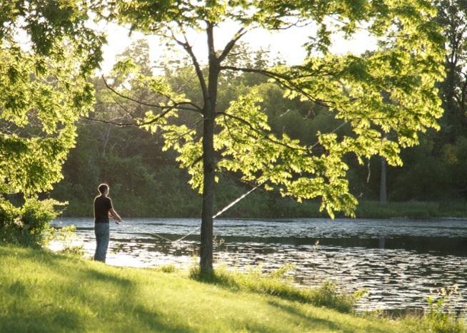
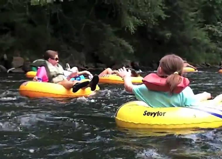
6 Variety of User Experiences
7 DRAFT WATER TRAILS & GREENWAYS PLAN dmampo.org/water-trails
8 Organization Booklets Goals/Strategies/Policies 7 river and creek segments High level recommendations Maps Project lists Creative writing
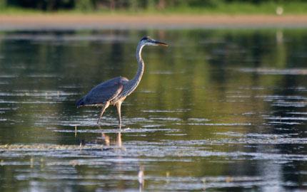
9 dmampo.org/water-trails Greater Des Moines Water Trails & Greenways Plan 23 soft trails 150 miles of waterways 15 fishing nodes 36% of floodplain protected 22 govts. 18 wading areas 13 paddle carry down accesses

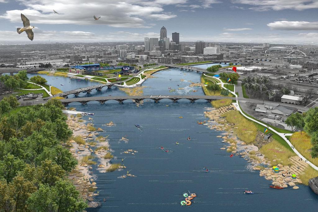
10 Raccoon River 31 miles Tale of 2 rivers rural and urban Multi-day paddling trips dmampo.org/water-trails

11 dmampo.org/water-trails Raccoon River: Van Meter to I35

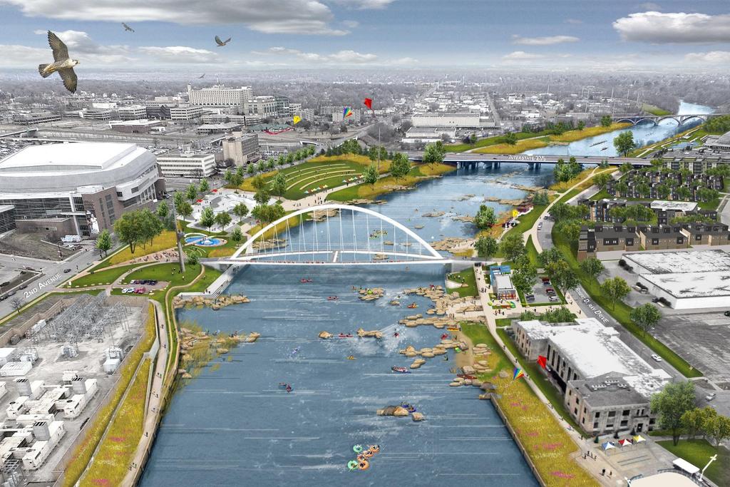
12 dmampo.org/water-trails Raccoon River: I-35 to downtown

 Walnut Woods (improve) Water")
13 dmampo.org/water-trails Carry-down/Boat Access Points Van Meter Booneville (improve) Hallett-Marietta Reclamation Commerce Ledges 63 rd Street (north side) Walnut Woods (improve) Water Works Park 2 (add and improve) Downtown Des Moines (north side)
14 dmampo.org/water-trails Economic Development Hubs Van Meter Booneville Another in WDSM? Downtown Des Moines

15 Raccoon River Regional Park Hallett Quarry Restoration Maffitt and adjoining WW property Walnut Woods Brown s Woods Raccoon River Park Water Works Park Gray s Lake Park dmampo.org/water-trails


16 dmampo.org/water-trails Raccoon River Regional Park Fishing Access & Aquatic Habitat Hallett Quarry Maffitt/WW property Walnut Woods Brown s Woods Raccoon River Park Water Works Park Gray s Lake Park


17 dmampo.org/water-trails Raccoon River Regional Park Wading, Discovery, Play Hallett Quarry Maffitt/WW property Walnut Woods Brown s Woods Raccoon River Park Water Works Park Gray s Lake Park


18 Raccoon River Regional Park Trail Connections, Soft Trails and Pedal/Paddle Opportunities Connect Van Meter to future Dallas County and WDSM trails Maffitt and WW property to other trails and the river Soft trails Pedestrian crossings over the river Hallett Quarry, Raccoon River Park Pedal/Paddle opportunities dmampo.org/water-trails Hallett Quarry Maffitt/WW property Walnut Woods Brown s Woods Raccoon River Park Water Works Park Gray s Lake Park


19 dmampo.org/water-trails Raccoon River Regional Park Interpretation, Wayfinding, Marketing Hallett Quarry Maffitt/WW property Walnut Woods Brown s Woods Raccoon River Park Water Works Park Gray s Lake Park


20 dmampo.org/water-trails Raccoon River Regional Park Rentals/Liveries Hallett Quarry Maffitt/WW property Walnut Woods Brown s Woods Raccoon River Park Water Works Park Gray s Lake Park


21 dmampo.org/water-trails Raccoon River Regional Park Programming classes and events Hallett Quarry Maffitt/WW property Walnut Woods Brown s Woods Raccoon River Park Water Works Park Gray s Lake Park


22 dmampo.org/water-trails Raccoon River Regional Park Beauty & Respite Hallett Quarry Maffitt/WW property Walnut Woods Brown s Woods Raccoon River Park Water Works Park Gray s Lake Park


23 dmampo.org/water-trails Raccoon River Regional Park Historical Roots

24 dmampo.org/water-trails Water Works Park Master Plan: Circuit Access points (2) Dam mitigation Fish cleaning station Bcycle Hub


25 dmampo.org/water-trails Quarry Restoration Wildlife habitat Fishing amenities Birding trails Trail connections Carry-down portage connection from river to quarry

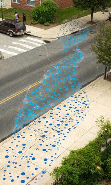
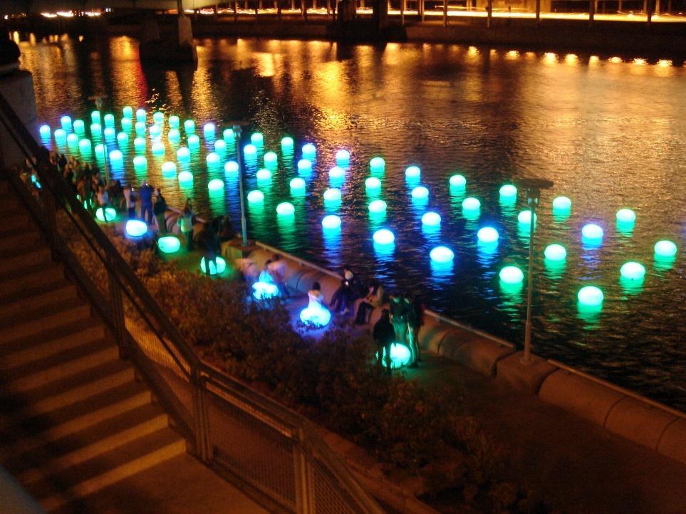
26 Public Art
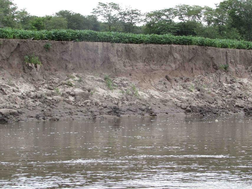
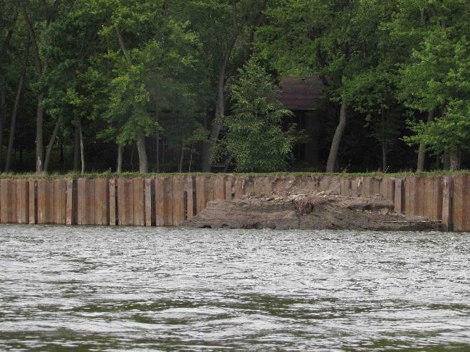
27 Shoreline Restoration, Watershed Improvements & Floodplain Protection

28 Shoreline Restoration & Watershed Improvements


29 27% of Raccoon River floodplain is protected Floodplain Protection
30 Maintenance: Logjams & Trail Viewpoints
31 DOWNTOWN DES MOINES dmampo.org/water-trails

32 Downtown Considerations Water levels: low-flow pool need to match flash board water levels Consensus: dams should be mitigated Edge treatment: more habitat, less formal Channel treatment: full spectrum of experiences Historic nature of balustrades Below dams: fishing/birding important dmampo.org/water-trails
33
34
35 Next Steps Gather feedback this summer including feedback from council, boards, etc. MPO Board vote on final master plan fall 2016 Request each city adopt the plan Phase I Implementation
36 Lead Planner Teva Dawson WHAT DID WE MISS? dmampo.org/water-trails
A Vision for South Skunk River and Chichaqua Bottoms Greenbelt
 A Vision for South Skunk River and Chichaqua Bottoms Greenbelt Photo: Jim Pease Chichaqua Bottoms Booklet 7 of 8 Greater Des Moines Water Trails and Greenways 1 2016 Table of Contents Booklet 1: Water
Waukee Trailhead Public Art and Amenities Project
 Waukee - Trailhead Public Art and Amenities Project Sponsor Waukee Project Title Waukee Trailhead Public Art and Amenities Project Termini Description ( i.e. Park Avenue to 19th Street) NE Intersection
City Council Workshop July 26, 2010
 Des Moines Trails Connecting a Community City Council Workshop July 26, 2010 1 OVERVIEW Trail Benefits Trails Progress How We Fund Trails What s Next for Trails 2 What is a trail? Paved Trails 10 wide
Wilds. Headwaters. Lakes. Oxbows. Falls
 56 5 4 3 Wilds Headwaters Lakes Oxbows Falls 57 Zones It could be said the on-the-ground essence of this master plan appears within the next 6 pages of this report. As we learned in the preceding Cultural
Committee. Presentation Outline
 CW-33-15 11/9/2015 Community and Corporate Services Committee November 10, 2015 1 Presentation Outline Background Vision and Objectives Study Process and Timeline Public and Stakeholder Engagement Organization
Planning for State Parks
 Planning for State Parks on Oregon s Central Coast South Beach & Beverly Beach Management Units February 2015 Why are we here today? To introduce the planning process for Oregon State Parks in the South
Silver Lake Park An Environmental Jewel for the Citizens of Prince William County
 Silver Lake Park An Environmental Jewel for the Citizens of Prince William County The Prince William Park Authority Mission Statement states: The Prince William County Park Authority will create quality
2009 RIVER TOWN OF THE YEAR AWARD APPLICATION Supplemental Material Images
 2009 RIVER TOWN OF THE YEAR AWARD APPLICATION Supplemental Material Images Our History The earliest record of settlement along the river is in 1854; one of the earliest in Carroll County. About this time
crrv OF DALLAS Memorandum Trinity River Corridor Project Update On Recreation
 Memorandum OATE December 8, 2011 crrv OF DALLAS TO Trinity River Corridor Project Committee Members: Vonciel Jones Hill (Chair) Linda Koop (Vice Chair), Monica Alonzo, Scott Griggs, Angela Hunt, Delia
SAN ANTONIO RIVER IMPROVEMENTS PROJECT. August 6, 2008
 SAN ANTONIO RIVER IMPROVEMENTS PROJECT August 6, 2008 1 History of the SA River Improvements 1921 Flood Olmos Dam Complete in 1929 Downtown Flood Relief Projects in 1950 s Dams on the River Channel and
Environment and Natural Resources Trust Fund 2019 Request for Proposals (RFP)
") Environment and Natural Resources Trust Fund 2019 Request for Proposals (RFP) Project Title: Glacial Edge Trail and Downtown Pedestrian Bridge Category: G. Land Acquisition for Habitat and Recreation ENRTF
Environment and Natural Resources Trust Fund 2019 Request for Proposals (RFP) Project Title: Glacial Edge Trail and Downtown Pedestrian Bridge Category: G. Land Acquisition for Habitat and Recreation ENRTF
SAN ANTONIO RIVER IMPROVEMENTS PROJECT. April 27, 2009
 SAN ANTONIO RIVER IMPROVEMENTS PROJECT April 27, 2009 1 Project Limits 2 Project Partners City of San Antonio Provides project funding for project amenities (i.e.. Sidewalks, Landscaping, Lighting, etc.)
Flow Stand Up Paddle Board Parkway Plan Analysis
 Regional Parks Department Jeffrey R. Leatherman, Director County of Sacramento Divisions Administration Golf Leisure Services Maintenance Rangers Therapeutic Recreation Services Flow Stand Up Paddle Board
Infusion of new ideas and energy to continue funding for trails and greenspace
 2012 Summit County Trail & Greenway Plan: Infusion of new ideas and energy to continue funding for trails and greenspace Summit County Trail & Greenway Plan OHIO GREENWAYS History of Trail & Greenway Plan
Header i
 Header i 048285014.10 Header Sub Title Body Text here. Body text here. Body text here. Section 1... 1 Executive Summary... 1 Opportunities and Constraints... 3 Overall Opportunities and Constraints Map
The Vision for the San Juan Islands Scenic Byway
 The Vision for the San Juan Islands Scenic Byway 2 Judd Cove, Orcas Island, Courtesy of Kurt Thorson (kurtthorson.com) and San Juan County Land Bank Vision for the San Juan Islands Scenic Byway The San
MPRB: Southwest LRT Community Advisory Committee Issues and Outcomes by Location Current to: 12 November 2010
 MPRB: Southwest LRT Community Advisory Committee Issues and Outcomes by Location Current to: 12 November 2010 This is a compilation of issues and outcomes identified by the CAC. It is a work in progress,
PEMBERTON VALLEY RECREATIONAL TRAILS MASTER PLAN UPDATE Community Open House. April 2018
 PEMBERTON VALLEY RECREATIONAL TRAILS MASTER PLAN UPDATE Community Open House April 2018 Introductions Introductions Matt Bakker, BHA Project Coordinator Other Team Members: Liz Scroggins, Grey Owl Consulting
Hudson Highlands Fjord Trail Draft Master Plan. April 29, 2015
 Hudson Highlands Fjord Trail Draft Master Plan April 29, 2015 Agenda Route Overview Proposed Segment Results of Community Survey on that Segment Next Steps Municipal Endorsement Environmental Review Implementation
Rogue River Access and Management Plan Draft Alternatives
 Rogue River Access and Management Plan Draft Alternatives The Rogue River Access and Management Plan was initiated in December, 2011 and is being led by Jackson County Parks (JCP) and Oregon Department
Information Requests. Street Car Wildlife Golden Valley Leash Ordinance/Dog Park
 Information Requests Street Car Wildlife Golden Valley Leash Ordinance/Dog Park (How we got here!) 1980 Plan for Wirth Park (Designated Master Plan) Wirth Lake/Picnic Area designated as a general recreation
TRINITY RIVER CORRIDOR
 TRINITY RIVER CORRIDOR MODIFIED DALLAS FLOODWAY PROJECT UPDATE May 12, 2015 Jon Loxley Project Manager Dallas Floodway Project Fort Worth District U.S. Army Corps of Engineers US Army Corps of Engineers
APPENDIX A: Survey Instruments
 Three different surveys were conducted during the research phase of the NCHA Trails Study. One questionnaire was designed for elected officials and user groups (general public). The other two questionnaires
CHAPTER 5. Chapter 5 Recreation Element
 CHAPTER 5 Recreation Element Chapter 5 Recreation Element The Recreation Element of the Meyers Area Plan is a supplement to the Recreation Element of the TRPA Regional Plan and the El Dorado County General
Welcome to the Cross County Trail Public Input Session!
 Welcome to the Cross County Trail Public Input Session! Please sign in on the table below! What are we doing here? Camden County has proposed a bicycle and pedestrian trail spanning across the entire county.
Preferred Recreation Recommendations Stemilt-Squilchuck Recreation Plan March 2018
 Preferred Recreation Recommendations Stemilt-Squilchuck Recreation Plan March 2018 Below are the recommended recreation ideas and strategies that package together the various recreation concepts compiled
Exploring State Water Trail Programs
 National Park Service U.S. Department of the Interior Rivers, Trails, and Conservation Assistance Program Exploring State Water Trail Programs Barbara Nelson- Jameson Corita Waters Jessie Egan E X P E
THAT the Board approve the final proposed concept plan for the Jericho Marginal Wharf site as shown in Figure C-4 of Appendix C.
 Date: January 17, 2012 TO: Board Members Vancouver Park Board FROM: General Manager Parks and Recreation SUBJECT: Jericho Marginal Wharf Phase 2 Concept Plan RECOMMENDATION THAT the Board approve the final
$866,000. $1,400,000 Health Benefits $13,156,000 TOTAL ANNUAL DIRECT BENEFITS. $10,890,000 Economic Benefits
 SINGING RIVER TRAIL Trails Create Value + Generate Economic Activity Trails generate economic returns through improved health, safety, and environmental conditions, raise property values, and attract visitors.
REVISED AGENDA. Special Council Meeting. Monday, September 11, 2017 (REVISED TO INCLUDE ON-TABLE ITEMS)
") Mission Statement In carrying out its mandate, Bowen Island Municipality will work towards conducting operations in a way that: Improves the economic, environmental and social well-being for present and
Mission Statement In carrying out its mandate, Bowen Island Municipality will work towards conducting operations in a way that: Improves the economic, environmental and social well-being for present and
Section II. Planning & Public Process Planning for the Baker/Carver Regional Trail began in 2010 as a City of Minnetrista initiative.
 Section II Planning & Public Process Planning for the began in 2010 as a City of initiative. city staff began discussions with the Park District on the possibility of a north/south regional trail connection
STITCH TRANSFORMATIVE IDEA 3. SHORELINE STITCH. Re-connect the city to the waterfront and link the east and west Core Circle landscapes
 SHORE STITCH TRANSFORMATIVE IDEA 3. SHORELINE STITCH Re-connect the city to the waterfront and link the east and west Core Circle landscapes 126 LINE PUBLIC WORK 127 TRANSFORMATIVE IDEA 3. SHORELINE STITCH
Attendance Presentation
 TO The Community of Saanich FROM District of Saanich DATE January 30, 2017 RE Meeting Notes Haro Woods Jan 28th Community Engagement Goward House, 2495 Arbutus Road, Victoria BC Attendance In total, 18
Blueways: Rivers, lakes, or streams with public access for recreation that includes fishing, nature observation, and opportunities for boating.
 Parks, Open Space and Trails PRINCE WILLIAM COUNTY 2008 COMPREHENSIVE PLAN TRAILS PLAN CONTENTS The components of the trails plan are: Intent Definitions Goals, Policies, and Action Strategies Trails Map
Welcome to the future of Terwillegar Park a Unique Natural Park
 Welcome to the future of Terwillegar Park a Unique Natural Park 1 Introduction The Terwillegar Park Concept Plan study will develop an overall concept plan, management objectives and development guidelines
Segment 2: La Crescent to Miller s Corner
 goal of the USFWS refuges is to conserve, protect and enhance fish, wildlife and plants and their habitats for the continuing benefit of the American people. Refuge lands are used largely for fishing,
MASTER PLAN EXECUTIVE SUMMARY
 Biscuit Run State Park Scottsville Road (State Route 20) Charlottesville, VA 22902 Biscuit Run State Park MASTER PLAN EXECUTIVE SUMMARY Department of Conservation and Recreation Division of Planning and
Sibley LUPA. Board Executive Committee Meeting December 7, 2017
 Sibley LUPA Board Executive Committee Meeting December 7, 2017 Project Location & Project Area 1,318-acre Robert Sibley Volcanic Regional Preserve Project Area Purpose Project Purpose & Goals Append the
Strategic Objectives, Initiatives and Actions
 Strategic Objectives, Initiatives and Actions The following Strategic Objectives and the associated Initiatives and Actions for each have been developed to meet the challenges associated with trail development
Green Mountain Trail Collaborative Stewardship and Communication Work Group Meeting Notes June 30, 2010
 Date: 6-30-10 Time: 12:30-1:30 Location: Phone Conference Facilitator: Brian D. Cotterill Note Taker: Brian D. Cotterill Committee Members in Attendance: Danny Hale Doug Webber Sherry Winnie Alexis Nelson
Trail Etiquette. Hours of Operation. Trail Accessibility
 Trail Guide The Elmhurst Park District, with 28 parks and over 460 acres of land, offers nearly six miles of paved or asphalt park trails and maintains an additional 3.6 miles of trails within Elmhurst.
Lake Manchester RECREATION GUIDE. seqwater.com.au
 Lake Manchester RECREATION GUIDE seqwater.com.au About Lake Manchester OUR VISION To manage access to recreation opportunities while protecting natural resources and water quality. Lake Manchester is located
LANDING S PARK CONCEPTUAL PLAN HAMILTON ANDERSON JANUARY City of Novi, Michigan. The Park at 13 Mile and Old Novi Road
 HAMILTON ANDERSON JANUARY 2012 LANDING S PARK CONCEPTUAL PLAN January 2012 Page 1 of 15 January 2012 PROJECT GOALS Activate the park by introducing new elements Provide clear access to the water and enhance
2016 Regional Transportation Alternatives Program (TAP) Grant Application
 Grant Application") 2016 Regional Transportation Alternatives Program (TAP) Grant Application PROJECT TITLE: Yelm-Tenino Trail Extension Feasibility Study TRPC use only GENERAL PROJECT INFORMATION Agency or Organization City
2016 Regional Transportation Alternatives Program (TAP) Grant Application PROJECT TITLE: Yelm-Tenino Trail Extension Feasibility Study TRPC use only GENERAL PROJECT INFORMATION Agency or Organization City
Appendix 3. Greenway Design Standards. The Whitemarsh Township Greenway Plan
 Appendix 3 Greenway Design Standards This chapter discusses two design standards for the greenway types discussed above. First, trail design standards are presented together with trailhead facilities and
Colorado Springs & Pikes Peak Region Destination Master Plan
 Colorado Springs & Pikes Peak Region Destination Master Plan Overview June 19, 2018 DESTINATION MASTER PLAN What is Destination Master Planning? Focus on infrastructure, facilities, services, attractions
Map 1.1 Wenatchee Watershed Land Ownership
 Map 1.1 Wenatchee Watershed Land Ownership Map 1.1 Wenatchee Watershed Land Ownership The Wenatchee watershed lies in the heart of Washington state in Chelan County. Just larger than the state of Rhode
Non-Motorized Transportation
 Non-Motorized Transportation Non-motorized facilities are important components to the transportation system. They provide an environmentally-friendly, low-cost mode of travel. Some of the facilities can
River First Initiative and Waterworks Park
 River First Initiative and Waterworks Park The RiverFIRST proposal is critical to the creation of a larger regional parks and trails network, as well as ecological and infrastructure system. When realized,
COASTAL CONSERVANCY. Staff Recommendation December 2, 2004 COYOTE HELLYER COUNTY PARK BAY AREA RIDGE TRAIL
 COASTAL CONSERVANCY Staff Recommendation December 2, 2004 COYOTE HELLYER COUNTY PARK BAY AREA RIDGE TRAIL File No. 04-057 Project Manager: Amy Hutzel RECOMMENDED ACTION: Authorization to disburse up to
IOWA ORNITHOLOGISTS' UNION - Birding Sites in Dallas County
 IOWA ORNITHOLOGISTS' UNION - Birding Sites in Dallas County Printed on 7/19/2018 Beaver Bottoms Wetland (restricted) (Important Bird Area) GPS Coordinates:, Ownership: Private (see directions for access)
ETOBICOKE CREEK NORTH TRAIL PROJECT. May 18, 2017 at Michael Power High School 105 Eringate Drive, Etobicoke ON M9C 3Z7
 ETOBICOKE CREEK NORTH TRAIL PROJECT May 18, 2017 at Michael Power High School 105 Eringate Drive, Etobicoke ON M9C 3Z7 1 Purpose of Open House The purpose of today s open house is to present the design
Table 3-7: Recreation opportunity spectrum class range by prescription. Recreation Opportunity Spectrum (ROS) Classes
 Classes") Appendix F Table -7: Recreation opportunity spectrum class range by prescription. Recreation Opportunity Spectrum (ROS) Classes Prescription Primitive Primitive II Roaded Modified Rural Urban 111 - Primitive
Appendix F Table -7: Recreation opportunity spectrum class range by prescription. Recreation Opportunity Spectrum (ROS) Classes Prescription Primitive Primitive II Roaded Modified Rural Urban 111 - Primitive
Sidewalk. Summer Kids Camp
 Sidewalk Toronto Summer Kids Camp October 2018 Contents About Kids Camp 05 Curriculum 07 Detailed Program 09 Campers Reflections 13 4 About Kids The Sidewalk Toronto Summer Kids Camp was created for children
LUDLAM TRAIL CORRIDOR DISTRICT
 1 APPLICATION NO. 9 MAY 2015 CDMP CYCLE LUDLAM TRAIL CORRIDOR DISTRICT PLANNING ADVISORY BOARD November 2, 2015 BACKGROUND 2 Staff Application Former Florida East Coast railroad corridor (privately owned)
Buffalo Bayou Preservation Association was founded
 1. 1962 Rachel Carson publishes Silent Spring, an environmental discourse which inspired an environmental movement that led to the creation of the U.S. Environmental Protection Agency 2. 1966 Buffalo Bayou
Fossil Creek Wild & Scenic River Comprehensive River Management Plan Forest Service Proposed Action - details March 28, 2011
 Fossil Creek Wild & Scenic River Comprehensive River Management Plan Forest Service Proposed Action - details March 28, 2011 Primary Goals of the Proposed Action 1. Maintain or enhance ORVs primarily by
BRYAN REGIONAL PARK. Presented by: Burditt Consultants November 13, 2018
 BRYAN REGIONAL PARK Presented by: Burditt Consultants November 13, 2018 AGENDA 1. Project Purpose & Mission 2. Project Vision & Goals 3. Stakeholder Feedback 4. Program Overview 5. Phase A Plan Overview
TRUCKEE TAHOE AIRPORT DISTRICT BOARD OF DIRECTOR STAFF REPORT
 AGENDA ITEM: 11 TRUCKEE TAHOE AIRPORT DISTRICT BOARD OF DIRECTOR STAFF REPORT AGENDA TITLE: MEETING DATE: January 24, 2018 PREPARED BY: NTPUD Agency Partnership Opportunity, Multi-Use Trailhead Access
Rouge National Park. Opportunities and Challenges
 Rouge National Park Opportunities and Challenges January 2013 Rouge Park Finch Meander Rouge Beach at Lake Ontario Toronto GLWQA Area of Concern Rouge National Park Nationally Significant First Nation
City of Durango 5.8 FUNDING TRAILS DEVELOPMENT
 5.8 FUNDING TRAILS DEVELOPMENT The City has been successful in establishing dedicated local funding sources as well as applying for grants to develop the City s trail system, having received nearly $2.4
Green Legacy. Securing our. Greenlands Strategy
 Greenlands Strategy Securing our Green Legacy Together we can create an interconnected network of Greenlands for the health and well-being of the environment and future generations Caring for the Credit
MUNICIPALITY OF ANCHORAGE
 MUNICIPALITY OF ANCHORAGE ANCHORAGE PARKS & RECREATION Memorandum PRC 08-56 DATE: 5 August 2008 TO: FROM: SUBJECT: Parks & Recreation Commission Holly Spoth-Torres, Park Planner PRC 08-56 Far North Bicentennial
The Casco Bay Estuary Partnership (CBEP, formerly the Casco
 The Casco Bay Estuary Partnership The Casco Bay Estuary Partnership (CBEP, formerly the Casco Bay Estuary Project) is a collaborative effort to preserve and protect the bay s resources. The partners include
Greening Project Status Report: Grand Canyon National Park
 Greening Project Status Report: Grand Canyon National Park Prepared for the Federal Energy Management Program U.S. Department of Energy February 2001 iii Contents Page 1. Introduction... 1 2. Context of
Phoenix Habitat Restoration Projects
 Phoenix Habitat Restoration Projects Spur Cross Ranch Cave Creek (Estergard) Regional Tree and Shade Summit March 9, 2010 Desert Riparian Ecosystems Healthy riparian areas like this once existed along
PROPOSED AQUATIC FACILITY FEES. Dallas Park and Recreation Board December 15, 2016
 PROPOSED AQUATIC FACILITY FEES Dallas Park and Recreation Board December 15, 2016 Purpose To review and consider the fees for the new Family Aquatic Centers scheduled to open in 2018 and 2019 2 Background
SUMMER QUARTERLY MEETING JULY 21, Tri-State Trails is made possible by the generous support of Interact for Health.
 SUMMER QUARTERLY MEETING JULY 21, 2017 Tri-State Trails is made possible by the generous support of Interact for Health. AGENDA Welcome, introductions, and updates around the room Tri-State Trails Announcements
EXECUTIVE SUMMARY PROGRAM DEVELOPMENT REPORT PURPOSE EXISTING SETTING EXPANDING PARKLAND
 EXECUTIVE SUMMARY PROGRAM DEVELOPMENT REPORT PURPOSE As the culmination of the first phase of the master planning process, this Program Development Report creates the framework to develop the Calero County
Regional Wayfinding Sign Strategy Thurston County Trails 2017
 Regional Wayfinding Sign Strategy Thurston County Trails 2017 Partners: Members and partnering organizations of the Thurston Thrives Community Design Action Team City of Lacey, City of Olympia, City of
SOUTH PARK AT FRESHKILLS PARK ANCHOR PARKS PROGRAM COMMUNITY VISIONING. JCC of Staten Island February 1, 2017
 SOUTH PARK AT FRESHKILLS PARK ANCHOR PARKS PROGRAM COMMUNITY VISIONING JCC of Staten Island February 1, 2017 TONIGHT S AGENDA 1/ PRESENTATION: ANCHOR PARKS OVERVIEW WHAT WE HEARD IN NOVEMBER CONCEPTUAL
Citrus Heights Creek Corridor Trail Project Trail Advisory Group Field Trip #2 September 11, :00 11:00 am Trellis Hall, Citrus Heights
 September 11, 2013 9:00 11:00 am Trellis Hall, Citrus Heights Project Overview The City of Citrus Heights is studying the feasibility of establishing a multi use trail system within the City s 26 miles
DRAFT - APRIL 13, 2007 ROUTING STUDY FOR TRAIL CONNECTIONS BETWEEN CALAIS AND AYERS JUNCTION
 DRAFT - APRIL 13, 2007 ROUTING STUDY FOR TRAIL CONNECTIONS BETWEEN CALAIS AND AYERS JUNCTION Abstract The vision for the East Coast Greenway is an off-road urban trail system running from Calais, Maine
University Region Non-Motorized Plan 2015
 Non-Motorized Transportation Non-motorized facilities are important components to the transportation system. They provide an environmentally-friendly, low-cost mode of travel. Some of the facilities can
Naugatuck River Greenway Steering Committee
 This letter is being submitted in strong support of the City of Ansonia s application to the Department of Energy and Environmental Protection Recreational Trails Program for the funding to conduct a routing
System Group Meeting #1. March 2014
 System Group Meeting #1 March 2014 Meeting #1 Outcomes 1. Understand Your Role 2. List of Revisions to Existing Conditions 3. Information Sources Study Area The Purpose of Mountain Accord is to Preserve
Chapter 2: Summary of Existing Open Space System
 Chapter 2: Summary of Existing Open Space System In 1976, the Wake County Board of Commissioners established the Wake County Parks and Recreation Department in order to provide park facilities and programs
Ohrid Lake and Prespa Lake, Sub basin s on Crn Drim river basin International Workshop, Sarajevo, Bosna and Hercegovina May 2009
 Ohrid Lake and Prespa Lake, Sub basin s on Crn Drim river basin International Workshop, Sarajevo, Bosna and Hercegovina 18-20 May 2009 Ms. Darinka Jantinska Ministry of Environment and Physical Planning
Airport Planning Area
 PLANNING AREA POLICIES l AIRPORT Airport Planning Area LOCATION AND CONTEXT The Airport Planning Area ( Airport area ) is a key part of Boise s economy and transportation network; it features a multi-purpose
Operating Principles Tourism Dawson Creek will operate on the following operating principles:
 Vision Statement That Tourism Dawson Creek be recognized as a provincial leader and innovator in destination development and marketing while leading the City of Dawson Creek towards sustainable economic
Preservation & Restoration of the Houston Region s Green Fabric: The Role of the Harris County Flood Control District
 Preservation & Restoration of the Houston Region s Green Fabric: The Role of the Harris County Flood Control District Glenn Laird, Environmental Chief Harris County Flood Control District Parks + Natural
The Lower Prut Floodplain Natural Park (Romania)
") The Lower Prut Floodplain Natural Park (Romania) Gabriela Costea Natural Sciences Museum Complex Galati (Romania) & member of the Scientific Council of the Lower Prut Floodplain Natural Park The Prut The
The Lower Prut Floodplain Natural Park (Romania) Gabriela Costea Natural Sciences Museum Complex Galati (Romania) & member of the Scientific Council of the Lower Prut Floodplain Natural Park The Prut The
The Narrows Waterfront Park A Crown Jewel for Southern Brooklyn
 The Narrows Waterfront Park A Crown Jewel for Southern Brooklyn In New York, the unquestioned popularity of urban spaces such as Riverside Park, the High Line, Brooklyn Bridge Park and others has demonstrated
YMCA Calgary Camp Chief Hector YMCA Summer Camp
 KANANASKIN 12 AND 13Y HECTOR LODGE PROGRAM OPTIONS 12Y Hike 12/13Y Horse 12/13Y Mountain Arts *NEW* 13Y Hike 13Y Canoe Campers in the 12 and 13Y Programs experience a wide variety of camp activities. Through
Everett Riverwalk Life style explore
 Life style explore Project Overview The 217-acre Everett Riverfront redevelopment is visible from I-5 with traffic counts charted at 170,000+ vehicles per day with direct freeway access from 4-way interchange.
Longmont to Boulder Regional Trail Jay Road Connection DRAFT FINAL REPORT
 Longmont to Boulder Regional Trail Jay Road Connection DRAFT FINAL REPORT December 2018 Project Summary Boulder County, Colorado, in partnership with the City of Boulder, is evaluating options for multi-use
10/25/2013. What is the SCORP?! 2013 Local Government Survey 2013 Statewide Public Survey Advisory Group Priority Areas Your Suggestions!
 COLORADO OUTDOOR RECREATION TRENDS RESULTS FROM THE SCORP AND STATEWIDE Colorado Outdoor Recreation Resource Partnership September 2013 PRESENTATION What is the SCORP?! 2013 Local Government Survey 2013
AUCKLAND WATERFRONT VISION 2040
 AUCKLAND WATERFRONT VISION 2040 HARBOUR BRIDGE WESTHAVEN MARINA WYNYARD POINT WESTERN RECLAMATION VIADUCT HARBOUR FANSHAWE STREET VICTORIA PARK PRINCES WHARF QUEENS WHARF PORT CAPTAIN COOK WHARF QUAY STREET
Proposal to Redevelop Lower Kananaskis River-Barrier Lake. Bow Valley Provincial Park. Frequently Asked Questions
 Proposal to Redevelop Lower Kananaskis River-Barrier Lake Bow Valley Provincial Park Frequently Asked Questions What is being proposed? What are the details of the proposal? Where is the project area located?
Conservation Area Management Statement
 Conservation Area Management Statement Miller Creek Wildlife Area Resolution #: Approval: Issue Date: Date of Last Revision: Table of Contents 1. Purpose....... 1 2. Property Description...... 1 2.1. Legal
Environment and Natural Resources Trust Fund 2017 Request for Proposals (RFP)
") Project Title: Total Project Budget: $ Environment and Natural Resources Trust Fund 2017 Request for Proposals (RFP) Floating Classroom: Connecting 20,000 Youth to Minnesota Waterways Category: Proposed
Project Title: Total Project Budget: $ Environment and Natural Resources Trust Fund 2017 Request for Proposals (RFP) Floating Classroom: Connecting 20,000 Youth to Minnesota Waterways Category: Proposed
Crystal Lake Area Trails
 Lake Area Trails Welcome to the Lake area of the Big Snowy Mountains! This island mountain range in central Montana features peaks reaching to 8,600 feet and long, high ridges from which vistas of the
DISCUSSION AGENDA OF Pisgah Ledge GEOGRAPHIC AREA SMALL GROUP MEETING SUMMARY REVIEWED
 Wednesday, August 2, 2017 12:00 4:00pm Brevard, NC The Meeting Outcomes: 1. One or more proposals of mutual interests are developed and described for the geographic area (s) of focus and discussion. 2.
October 23, 2017 Council Workshop
 MAPLEWOOD VILLAGE CENTRE AND INNOVATION DISTRICT IMPLEMENTATION PLAN & DESIGN GUIDELINES October 23, 2017 Council Workshop COMMUNITY PLAN Purpose of Council Workshop Highlight What We Heard Phase 3 & Key
Stagecoach State Trail Master Plan
 Stagecoach State Trail Master Plan Minnesota Minnesota Department Department of of Natural Natural Resources Resources Parks and and Trails Trails Division Division Parks March March 2012 2012 The Minnesota
source FOR CHANGE Saginaw Bay Watershed Initiative Network 2014 ANNUAL REPORT
 source FOR CHANGE Saginaw Bay Watershed Initiative Network 2014 ANNUAL REPORT Dear Friends: On behalf of The Conservation Fund and the Saginaw Bay Watershed Initiative Network (WIN), I am pleased to present
32 ARCHITECTURE MAX HIRSH, RESEARCH PROFESSOR, UNIVERSITY OF HONG KONG
 32 ARCHITECTURE MAX HIRSH, RESEARCH PROFESSOR, UNIVERSITY OF HONG KONG In recent decades, airports have transformed from simple transportation facilities into sophisticated urban centers. Two factors are
Understanding the caring capacity of the visitor experience Provide facilities to support a high level user experience Address visual quality through
 Understanding the caring capacity of the visitor experience Provide facilities to support a high level user experience Address visual quality through recreation ecological restoration opportunities Collaboration
Trail Towns Using Trail Systems To Leverage Place, Tourism, and Economic Development
 Trail Towns Using Trail Systems To Leverage Place, Tourism, and Economic Development Harry Burkholder, AICP Community Planner II 324 Munson Avenue Traverse City, MI 49686 231-929-3696 burkholder@liaa.org
Mississippi River Parkway Commission of Minnesota
 Mississippi River Parkway Commission of Minnesota Bluffs Region (Hastings to Iowa Border) September 23, 2016 10:00 11:30 a.m. Red Wing Ignite 419 Bush Street, Red Wing, MN Bluffs Region Agenda I. Welcome