BOWERS FIELD AIRPORT MASTER PLAN
|
|
|
- Brittany Ariel Hill
- 5 years ago
- Views:
Transcription


1 BOWERS FIELD KITTITAS COUNTY, WASHINGTON AUGUST 2018

2 KITTITAS COUNTY AIRPORT - BOWERS FIELD REPORT FINAL REPORT, AUGUST 2018 PREPARED FOR PREPARED BY CENTURY WEST ENGINEERING 421 N. Pearl #206 Ellensburg, WA
3 Table of Contents Chapter 1 - Introduction and Project Overview Study Purpose Project Need Project Eligibility & Funding Airport Ownership History of Airport and Development Study Organization Local Citizen Participation Summary Chapter 2 - Inventory of Existing Conditions Airport Setting Physical Geography Climate Historical Aviation Activity Airfield Facilities Runways Runway Approach Capabilities Runway Wind Coverage Airfield Pavement Condition Taxiways Aircraft Apron Airport Lighting & Signage Landside Facilities Airspace and Navigational Aids Airport Support Facilities/Services Vehicle Access and Parking Public Protection Utilities Airport Industrial Park (AIP) Land Use Planning and Zoning Chapter 3 - Aviation Activity Forecasts Introduction Forecast Process Airport Service Area Socioeconomic Trends & Forecasts National General Aviation Activity Trends Overview of Recent Local Events Historic and Current Aviation Activity Instrument Flight Activity Aviation Activity Forecasts Local and Itinerant Operations Aircraft Operations Fleet Mix Critical Aircraft Current and Future Critical Aircraft Operational Peaks Forecast Summary Fifty-Year Forecast TABLE OF CONTENTS AUGUST
4 Chapter 4 - Airport Facility Requirements Introduction Airport Layout Plan Assessment Updated Assessment - Critical (Design) Aircraft and Design Standards Runway Evaluation Visibility Data Instrument Operations Data FAR Part 77 Surfaces Airport Design Standards Runway Safety Area Runway Object Free Area (ROFA) Obstacle Free Zones Runway Protection Zone (RPZ) Taxiway Design Group (TDG) Taxiway Safety Area (TSA) Taxiway Object Free Area (TOFA) Taxilane Object Free Area (TOFA) Building Restriction Line (BRL) Aircraft Parking Area Runway - Parallel Taxiway/Taxilane Separation Airside Requirements Runway Length Evaluation Runway Width Airfield Pavement Taxiways Taxilanes Airfield Instrumentation, Lighting, and Markings Landside Facilities Support Facilities Facility Requirements Summary Airfield Capacity Chapter 5 - Environmental Review Introduction Protected Species and Habitat Wetlands Wastewater and Solid Waste Treatment Stormwater Hazardous Materials and Cleanup Sites Chapter 6 - Airport Development Alternatives Introduction Evaluation Process Preferred Development Alternative Summary Preliminary Alternatives Assessment Unique Circumstances Part 1 Airside Development Alternatives Part 2 Landside Development Alternatives Environmental Conditions Chapter 7 - Airport Layout Plan Drawings Introduction TABLE OF CONTENTS AUGUST
5 Chapter 8 Airport Land Use Compatibility Introduction Government Roles in Airport Land Use Land Use Jurisdiction Chapter 9 - Airport Financial Plan Introduction Airport Development Schedule and Cost Estimates Capital Funding Sources & Programs Airport Rates and Fees Cash Flow Analysis Chapter 10 - Planning for Compliance & Solid Waste Recycling Plan Introduction Kittitas County Compliance Airport Compliance with Grant Assurances FAA Compliance Overview Other FAA Compliance Requirements WSDOT Aviation Division Grant Assurances Part 2 Solid Waste and Recycling Plan Introduction Waste Audit Plan to Minimize Solid Waste Generation Operational and Maintenance Requirements Waste Management Contracts Potential for Cost Savings or Revenue Generation Future Development and Recommendations References List of Tables Table 2-1: Based Aircraft and Operations Table 2-2: Airport Data Table 2-3: Runway Data Table 2-4: Runway Wind Coverage Table 2-5: Airfield Pavement Condition Summary Table 2-6: Aircraft Aprons Table 2-7: Existing Airport Lighting & Signage Table 2-8: Aviation Related Buildings at Bowers Field Table 2-9: Instrument Approach Procedures Table 2-10: Aviation Fuel Storage Table 2-11: Kittitas County Airport Industrial Park Tenants (2018) Table 3-1 Public-Use Airports in the Vicinity of Bowers Field Table 3-2 Personal Per Capita Income & Employment Data Table 3-3 Historic Population Table 3-4 Population Forecasts Table 3-5 FAA Long Range Forecast Assumptions Table 3-6 Bowers Field Fuel Volume Table 3-7 FAA TAF Data Table 3-8 Bowers Field (ELN) Based Aircraft Table 3-9 Instrument Activity Table 3-10 Summary of Existing Based Aircraft Forecasts Table 3-11 Existing Aircraft Operations TABLE OF CONTENTS AUGUST
6 Table 3-12 Based Aircraft Forecast Table 3-13 Forecast Based Aircraft Fleet Mix Table 3-14 Summary of Aircraft Operations Forecasts Table 3-15 General Aviation Forecast Aircraft Operations Fleet Mix Table 3-16 General Aviation Aircraft & Design Categories Table 3-17 Bowers Field - Summary of Critical Aircraft & ARC Table 3-18 Bowers Field - Forecast Activity Fleet Mix Table 3-19 Peak General Aviation Operations Forecast Table 3-20 Forecast Summary Table 3-21 Bowers Field - Master Plan Forecast Compared to TAF Table Year Forecast Table 4-1 Summary of Non-Conforming Items Table 4-2 Design Aircraft (Existing and Future) Table 4-3 Runway Design Codes Table 4-4 Approach Reference Codes (APRC) Table 4-5 Departure Reference Codes (DPRC) Table 4-6 Summary of Approach & Departure Reference Codes Table Visibility Data Table Bowers Field Instrument Operations Table 4-9 FAR Part 77 Airspace Surfaces Table 4-10 Runway 11/29 Design Standards Summary for Primary and Crosswind Designation Table 4-11 Runway 11/29 and 7/25 - Design Standards Summary for Runway Designation Table 4-12 Runway 11/29 and 7/25 - Design Standards Required for Visibiity Table 4-13 Taxiway Design Standards Summary (Dimensions in Feet) Table 4-14 Wind Analysis Table 4-15 Design Family of Aircraft Table 4-16 Runway Length Adjustments (ELN) Table 4-17 FAA Recommended Runway Lengths for Planning (ELN) Table 4-18 Typical Business Aircraft Runway Requirements Table 4-19 Apron and Hangar Facility Requirements Summary Table 4-20 Facility Requirements Summary Table 6-1 Comparison of Alternatives Table 8-1: Summary of WSDOT Aviation Recommended Land Use Measures Table 8-2: Summary of Airport Safety Zones (Bowers Field) Table 9-1: 20-Year Capital Improvement Program Table 9-2: Airport Rates and Fees (2017) Table 9-3: Airport's Revenue and Expense Spreadsheet Table 10-1: Summary of FAA AIP Grant Assurances Table 10-2: Recyclable Options List of Figures Figure 2-1 Location Map Figure 2-2 Existing Airfield Conditions Figure 2-3 Existing Airport Facilities Figure 2-4 Wind Roses Figure 2-5 Existing Pavement Conditions Figure 2-6 Airspace Classifications Figure 2-7 Area Airspace Figure 2-8 Traffic Patterns Figure 2-9 Airport Fencing and Gate Plan Figure 2-10 Surface Access (Existing) Figure 2-11 Utilities Plan Figure 2-12 Airport Zoning Figure 3-1 Airport Service Area TABLE OF CONTENTS SEPTEMBER
7 Figure 3-2 US Active General Aviation Fleet Figure 3-3 CWU Flight Training Hours Logged Figure 3-4 Aviation Fuel Activity Figure 3-5 Historic Fuel Sales Figure 3-6 Bowers Field Based Aircraft Forecasts Figure 3-7 Bowers Field Based Aircraft Fleet Mix (2015) Figure 3-8 Bowers Field- Forecast Based Aircraft Fleet Mix (2035) Figure 3-9 Bowers Field General Aviation Operations Forecast Figure 3-10 Airport Reference Codes (ARC) Figure 4-1 Conformance Items (Airside) Figure 4-2 Conformance Items (Landside) Figure 4-3 FAR Part Figure 4-4 FAR Part Figure 4-5 Typical Landing Gear Configuration Figure 4-6 Taxiway Design Groups Figure 4-7 FAA Runway Length Curves Figure 4-8 Runway Length Requirements (ARC B-II Multi-Engine Turboprop) Figure 6-1 Preferred Airside Alternative Figure 6-2 Preferred Landside Alternative Figure 6-3 Preliminary Airside Alternative Figure 6-4 Preliminary Airside Alternative Figure 6-5 Preliminary Airside Alternative Figure 6-6 Preliminary Airside Alternative Figure 6-7 Preliminary Airside Alternative Figure 6-8 Preliminary Airside Alternative Figure 6-9 Preliminary Airside Alternative Figure 6-10 Preliminary Airside Alternative Figure 6-11 Preliminary Landside Alternative 1 (West Apron) Figure 6-12 Preliminary Landside Alternative 2 (East Apron) Airport Layout Plan Drawings Figure 8-1 Kittitas County Land Use Map Figure 8-2 Kittitas County Zoning Map Figure 8-3 City of Ellensburg Land Use Map Figure 8-4 City of Ellensburg Zoning Map Appendix A Appendix B Appendix C Appendix D Appendix E Appendix F Appendix G Appendix H List of Appendices Copies of the instrument approach and departure procedure charts FAA Forecast Review Environmental Memo (Parametrix) Local Land Use Project Cost Estimates FAA Grant Assurances WSDOT Grant Assurances FAA Correspondence Glossary of Aviation Terms TABLE OF CONTENTS AUGUST
8 Chapter 1 Introduction & Project Overview
 to address the airport s needs for the next twenty years.")
9 Chapter 1 Introduction and Project Overview Kittitas County in cooperation with the Federal Aviation Administration (FAA) updated the Airport Master Plan for Bowers Field Airport (FAA airport identifier ELN) to address the airport s needs for the next twenty years. The Airport Master Plan provides specific guidance in making the improvements necessary to maintain a safe and efficient airport that is economically, environmentally, and socially sustainable. Study Purpose The purpose of the Bowers Field (Airport) Airport Master Plan is to define the current, short-term, and long-term needs of the airport through a comprehensive evaluation of facilities, conditions, and FAA airport planning and design standards. The study also addresses elements of local planning (land use, transportation, environmental, economic development, etc.) that have the potential of affecting the planning, development, and operation of the airport. FAA Advisory Circular 150/5070-6B Airport Master Plans defines the specific requirements and evaluation methods established by FAA for the study. This project updates and replaces two existing FAA-funded airport plans for Bowers Field: the Bowers Field Airfield Needs Assessment (2012) and the Bowers Field Airport Master Plan Update (2004). Project Need Bowers Field is included in the federal airport system the National Plan of Integrated Airport Systems (NPIAS). NPIAS airports are eligible for federal funding of eligible improvements through FAA programs such as the Airport Improvement Program (AIP). However, to maintain funding eligibility, the FAA requires airports to maintain current planning that is consistent with applicable FAA technical standards, policies, and regulations, including periodically updating their Airport Layout Plans (ALP) as conditions change. CHAPTER 1 INTRODUCTION AND PROJECT OVERVIEW AUGUST
10 This project updates the 2012 Bowers Field Airfield Needs Assessment Study and the 2004 Airport Master Plan. Since the previous planning studies were completed, the FAA has identified several areas of emphasis for airports that affect airport planning. These include land use compatibility in runway protection zones (RPZ) and complex airfield geometry (collocated thresholds, intersecting runways, runway or taxiway hot spots, etc.). Some of these elements were analyzed and reviewed by FAA in the Airfield Needs Assessment. However, FAA requested that these issues be addressed in the master plan based on current FAA standards and policies. Project Eligibility and Funding Participation in the NPIAS is limited to public use airports that meet specific FAA activity and geographic criteria. There are currently 3,331 existing NPIAS facilities including airports, heliports, and seaplane bases. 1 The FAA recognizes that NPIAS airports are vital to serving the air transportation needs of the public and that access to the nation s air transportation system is not limited to commercial air service. Bowers Field and Cle Elum Municipal Airport are the only NPIAS airports in Kittitas County. The primary division for NPIAS airports is Primary and Nonprimary. The 389 Primary airports account for about 12 percent of the overall NPIAS system, but provide the majority of commercial air service throughout the system. The 2,942 Nonprimary airports include General Aviation, Reliever, and Nonprimary Commercial Service airports (2,500 to 10,000 annual passenger enplanements). Additional designations reflect the airport s functional (asset) role (e.g., national, regional, local, basic) and service level (e.g., commercial, reliever, general aviation). Bowers Field Airport has the following NPIAS classification/designation in the current ( ) NPIAS report: Category: Non-Primary Asset Role: Local Service Level: General Aviation Funding for the Airport Master Plan Update is provided through an FAA Airport Improvement Program (AIP) grant (90%) with a local match (10%) provided by Kittitas County. The AIP is a dedicated fund administered by FAA with the specific purpose of maintaining and improving the nation s public use airports. The AIP is funded exclusively through general aviation and commercial aviation users fees and the funds can only be used for eligible projects National Plan of Integrated Airport Systems CHAPTER 1 INTRODUCTION AND PROJECT OVERVIEW AUGUST
11 Airport Ownership Kittitas County is the owner and operator of Bowers Field Airport (ELN). As the airport owner (sponsor) of record, Kittitas County is responsible for conforming to all applicable FAA regulations, design standards, and grant assurances. History of Airport and Development According to local sources, civilian aviation first appeared in the Ellensburg area in 1926, with aircraft initially operating from a privately-owned golf course that served as a landing strip. In 1930, a graded runway was constructed at the current airport site by Kittitas County and aviation enthusiasts. A crosswind runway (7-25) was constructed in 1936 with Civil Aeronautics Administration (CAA) funds and Work Progress Administration (WPA) labor. The airport was sold to the City of Ellensburg in Additional airfield improvements were made as flight training programs and other airport activity increased in response to wartime aviation needs. In the early 1940s, the airport was expanded through the CAA s DLAND program (Development of Landing Areas for National Defense) as a leased military airfield (Ellensburg Army Airfield). Available information indicates that in 1943 the airport became an Army Air Force flight training based and support facility operated by the Air Technical Service Command. 2 During this period the airfield received extensive improvements through government and military funding programs, including paving and expansion of the runways, construction of a control tower, and support buildings, personnel housing, and aircraft hangars. In 1947, the airfield was declared military surplus and deeded to Kittitas County, which resulted in the deactivation, closure and further abandonment of military airfield facilities and landside infrastructure. The airfield was subsequently named after Ensign Robert Keith Bowers, an Ellensburg native son killed in action at Pearl Harbor in Scheduled airline service was briefly established at Bowers Field in the late 1940s by Empire Airlines, a locally owned regional carrier. The City of Ellensburg assumed ownership of Bowers Field from 1957 to 1961, at which time it reverted to County control. A newly formed Port District assumed operation of Bowers Field in 1965, but the Port District was dissolved in 1973, after which time airport control reverted back to Kittitas County. Central Washington University (CWU) began a Flight Technology program in 1975 that resulted in the construction of a classroom space. Subsequently, Kittitas County constructed the large FBO hangar and upgraded the above ground fuel storage tanks. Airport facilities were upgraded during the 1990s, including reconstruction of the primary runway (11/29), installation of the on-site weather observation system, and extension of utilities to the south industrial area. Several privately-owned hangars and the DNR regional office and helicopter support facilities were also constructed at the airport during this period. 2 CHAPTER 1 INTRODUCTION AND PROJECT OVERVIEW AUGUST
12 An Airport Master Plan Update 3 was initiated in the early 2000s and an airport overlay zone was jointly adopted by Kittitas County and the City of Ellensburg in HISTORY OF AIRPORT PLANNING Planning for Bowers Field Airport has been updated on a regular basis with the cooperation and funding support of FAA and WSDOT Aviation. The County s commitment to long-term planning is focused on maintaining a safe and functional facility that meets user needs and FAA standards. The previous airport master plan was completed in The ALP drawing was most recently updated in 2013 as part of the Airfield Needs Assessment. 4 These documents served as the primary data sources for this Master Plan Update, in addition to design drawings, aerial photography, available mapping and survey data, and local planning studies. Several facility and operational issues arose during the master plan that were addressed in real time and incorporated as required, into the planning process. These included the long-deferred decision to close Runway 7/25 (summer 2017) due to its age and deteriorated pavement condition, numerous changes involving the CWU flight training program, and changes in the airport s Fixed Base Operator (FBO) services. These issues are noted in relevant sections of the master plan. Study Organization Work in progress on the Airport Master Plan Update was documented in a series of technical memoranda (presented as draft chapters). The chapters were prepared to document progress in the study, facilitate the review of preliminary results, and obtain input throughout the master planning process. During the evaluation of development alternatives, several refinements to the preliminary concepts were created and presented that ultimately were incorporated into the preferred alternative, the ALP, and the final development alternatives chapter. At the end of the study, the draft chapters were updated and incorporated into the Airport Master Plan technical report. The draft chapters and supporting documents were prepared over a period of approximately 18 months. Each draft chapter was reviewed locally and by the FAA and Washington State Department of Transportation Aviation Division (WSDOT) for consistency with federal and state regulations, policies, and standards. 3 Bowers Field Airport Master Plan Update (Bucher, Wills & Ratliff, 2004) 4 Bowers Field ALP Update and Airfield Needs Assessment (Century West Engineering, 2013) CHAPTER 1 INTRODUCTION AND PROJECT OVERVIEW AUGUST
13 The Bowers Field Airport Master Plan will include the following chapters: Chapter 1 Introduction and Project Overview Chapter 2 Inventory of Facilities Chapter 3 Aviation Activity Forecasts Chapter 4 Demand-Capacity & Facility Requirements Analyses Chapter 5 Environmental Review Chapter 6 Airport Development Alternatives Chapter 7 Airport Layout Plan and Terminal Area Plans Chapter 8 Land Use Planning Chapter 9 Airport Financial Plan/CIP Chapter 10 FAA Compliance Review Appendix AGIS Survey Local Citizen Participation At the project outset, Kittitas County committed to an inclusive, transparent planning process to make all project work products available for public review. The public involvement element of the Airport Master Plan Update provided opportunities for all interested individuals, organizations, or groups to participate in the project. First, all draft work products were available for public review and comment. Links to the documents were posted on the project webpage to allow for convenient access, review, and comment. Copies of the draft work products were also made available for public review and comment at the Kittitas County Public Works Department office throughout the course of the study. Comment forms were available for both electronic and printed versions of the draft work products. Numerous printed copies of chapters were also provided to interested members of the public upon request. Second, a series of public meetings was held during the project to facilitate public participation. The public meetings included study sessions and briefings with Kittitas County Commissioners and staff, periodic updates to the Bowers Field Airport Advisory Committee, and open houses. The project team presented information, provided updates on study progress, and identified upcoming decision points during these meetings. Third, a local twelve-member planning advisory committee (PAC) was formed by Kittitas County to assist the project team in reviewing draft technical working papers and to provide input into the planning process. Three members of the PAC were selected from the Bowers Field Airport Advisory Committee and one member was a sitting county commissioner. These individuals were responsible for serving as liaisons to their respective groups. CHAPTER 1 INTRODUCTION AND PROJECT OVERVIEW AUGUST
14 The PAC included one representative from the Central Washington University (CWU) aviation program. The CWU representative was responsible for coordinating all internal CWU review and input into the planning process. In addition to the official CWU representative, the PAC included two CWU aviation faculty members (representing different stakeholder groups) and two current/former CWU flight instruction contractors. In total, 5 of the 12 PAC members had active or recent employment or business interests related to the CWU flight program. This level of representation was critical to ensure that the university s flight program requirements were reflected in the master plan. The composition of the 12-member PAC was intended to provide an effective blend of community members: Board of County Commissioners (BOCC) (1); Airport Advisory Committee representatives (3); Central Washington University (CWU) aviation program (1*); CWU flight instruction contractor (IASCO) (1); Washington Department of Natural Resources (DNR) (1); Fixed Base Operator/former CWU flight instruction contractor (Midstate Aviation) (1); City and County Planning Departments (2); Airport tenants, neighbors, local business (2); and Representatives from the FAA Seattle Airports District Office and the Washington State Department of Transportation - Aviation Division (WSDOT) served as ex officio members. * The PAC included a total of 3 CWU Aviation Department faculty members - one official representative of CWU and two faculty CWU aviation department faculty members representing other interest groups (tenant, etc.). The PAC met throughout the project, reviewed and commented on draft work products, discussed key project issues and provided local knowledge and expertise to the planning process. The PAC meetings were open to the public and public comment was encouraged. A project open house coincided with the first PAC meeting to provide interested stakeholders an opportunity to participate in the project. CHAPTER 1 INTRODUCTION AND PROJECT OVERVIEW AUGUST
15 Summary The FAA-defined airport master planning process requires a sequential, systematic approach, which leads to selection of a preferred development option for the airport that is integrated into the ALP and Airport Capital Improvement Program (ACIP). To meet this goal, the Airport Master Plan Update: Provides an updated assessment of existing facilities and activity; Forecasts airport activity measures (design aircraft, based aircraft, aircraft operations, etc.) for the current 20- year planning period; Examines previous planning recommendations (2004 Airport Master Plan and 2012 Facility Needs Assessment) as appropriate, to meet the current and projected airport facility needs, consistent with FAA airport design standards; Determines current and future facility requirements for both demand-driven development and conformance with FAA design standards: Provides consistency between airport planning and land use planning to promote maximum compatibility between the airport and surrounding areas: Provides an updated Airport Layout Plan (ALP) drawing set to accurately reflect current conditions and master plan facility recommendations: Develops an Airport Capital Improvement Program (ACIP) that prioritizes improvements and estimates project development costs and funding eligibility for the 20-year planning period: Evaluates airport sponsor compliance with FAA Airport Improvement Program (AIP) grant assurances. The preparation of this document may have been supported, in part, through the Airport Improvement Program financial assistance from the Federal Aviation Administration as provided under Title 49, United States Code, section The contents do not necessarily reflect the official views or policy of the FAA. Acceptance of this report by the FAA does not in any way constitute a commitment on the part of the United States to participate in any development depicted therein nor does it indicate that the proposed development is environmentally acceptable with appropriate public laws. CHAPTER 1 INTRODUCTION AND PROJECT OVERVIEW AUGUST
16 Chapter 2 Inventory of Existing Conditions

17 Chapter 2 Inventory of Existing Conditions The purpose of this chapter is to document the existing facilities and conditions at Kittitas County Airport - Bowers Field (Airport Identifier Code: ELN). The airport is owned and operated by Kittitas County, Washington. This project replaces the 2004 Airport Master Plan Update 1 and the Kittitas County Bowers Field ALP Update Airfield Needs Assessment, 2 which served as primary sources for inventory data. However, where available, more current or comprehensive data have been included in the chapter to illustrate current conditions. Existing airfield facilities were examined during on-site inspections to update facility inventory data. The consultants also worked closely with county staff to review current facility and operational data maintained by the county. Airport Setting Bowers Field is located in Ellensburg, in central Kittitas County, Washington. The airport is located just outside the Ellensburg city limits, but within the Ellensburg Urban Growth Area (UGA), approximately two miles north of the city center. Ellensburg is the largest city in Kittitas County and is the county seat. The U.S. Census Bureau 2014 estimates of population were 42,522 for Kittitas County and 18,774 for the City of Ellensburg (incorporated area only). 3 1 Bowers Field Airport Master Plan Update (Bucher, Willis, Ratliff and Associates, 2004) 2 Kittitas County Bowers Field ALP Update Airfield Needs Assessment (Century West Engineering Corporation, 2012) 3 US Census Bureau, QuickFacts, December 30, CHAPTER 2 INVENTORY OF EXISTING CONDITIONS AUGUST
18 Kittitas County extends from the east slopes of the Cascade Range to the Columbia River Basin. The County boundary is formed by prominent geographic features including the Cascade and Wenatchee Mountain ranges, and Columbia River. Neighboring counties include: King (west), Chelan (north), Douglas (northeast), Grant (east), Yakima (south & southwest), and Pierce (west). Ellensburg is located approximately 110 miles east of Seattle and 174 miles west of Spokane on U.S. Interstate 90 (I-90), the main east-west travel route across Washington. Ellensburg is located approximately 35 miles north of Yakima via Interstate 82 (I-82). U.S. Highway 97 travels through Kittitas County and connects with U.S. Highway 2 to access Wenatchee, Leavenworth, and the Puget Sound via Stevens Pass. U.S. Highway 97 is a primary north-south inland route that extends from north-central California to British Columbia. A location and vicinity map is provided in Figure 2-1. CHAPTER 2 INVENTORY OF EXISTING CONDITIONS AUGUST


19 Bowers Field KITTITAS COUNTY Bowers Field Bowers Field LOCATION MAP FIGURE 2-1 KITTITAS COUNTY - BOWERS FIELD
20 Local and Community Setting HISTORY According to the Kittitas County website, Native American inhabitants (Kittitas or Upper Yakama Indians) in the Kittitas Valley can be traced back to at least the early 1700s, 4 although the earliest indigenous peoples in the Columbia Basin can be traced back thousands of years. Historians note that the Kittitas Valley provided a unique and vital food source that included salmon, game, roots and berries, and was a traditional gathering place for tribes located east of the Cascade Mountains. As western settlers arrived in the Kittitas Valley, the Native American population became dispersed. Many initially relocated to the Yakima Valley and lower valleys, and were eventually relocated to the Yakama Indian Reservation, which was created by the Treaty of 1855 with the United States government. Early settlers began arriving in the Kittitas Valley in late 1860s and Ellensburg was originally platted in The City of Ellensburg was incorporated in 1883 and elected its first city council members in Kittitas County was formed in November of 1883 when it was partitioned from the northern part of Yakima County. According to local records, William Bud Wilson was an early settler who had the first claim and built the first log cabin in 1868 where the City of Ellensburg now stands. In 1870, two cowboys moved a log house to a spot nearby so they could open it as a store. Another young settler made a sign for the store and dubbed it "Robber's Roost." Settlers were few and the post depended on trade in furs and horses with Native Americans to buy supplies. In 1872, John A. Shoudy, a Civil War veteran, bought the store and 160 acres of land. In 1873, Mr. Shoudy started a postal service in Ellensburg. He and his wife Mary Ellen platted the Town of Ellensburg and it was officially filed in April The new town was named Ellensburg after his wife. 5 Land was donated to the Northern Pacific Railroad with the hope that Ellensburg would become a rail center to serve the areas farms, forests, and mines. Initially, a rail siding was constructed in the town followed by construction of direct rail service in 1886, which spurred development of markets in cattle, dairy products, timber, wool, and hay. 6 On July 4, 1889, Ellensburg experienced a catastrophic fire that destroyed 10 business blocks and 200 homes. Following the blaze, Ellensburg quickly rebuilt, including the majority of the city s current historic district, which contains numerous brick and masonry buildings. Central Washington University (CWU) was established in Ellensburg in 1891, as the Washington State Normal School marked CWU s 125 th anniversary, which includes all but eight years of the City of Ellensburg s history. 4 Jennifer Ochran, About The County, 5 City of Ellensburg Webpage (History) 6 Ellensburg Comprehensive Plan, 2006 Update (Amended thru 2014), Community Profile, p. 13. CHAPTER 2 INVENTORY OF EXISTING CONDITIONS AUGUST
21 CURRENT CONDITIONS Major components of the region s economy include retail trade, medical services, government and related public administration, manufacturing, agriculture, business services, and tourism. Leading employers include Central Washington University (CWU), Kittitas Valley Healthcare (KVH), the Ellensburg School District, Kittitas County, Anderson Hay & Grain, Elmview, Fred Meyer, and the City of Ellensburg. 7 Detailed historic and projected socioeconomic data (population, employment, income, etc.) will be presented in the Aviation Activity Forecast chapter. Central Washington University (CWU) is Ellensburg s largest employer with approximately 1,300 employees. University events and campus facilities provide a wide range of amenities to the community and draw visitors year round. The university currently offers undergraduate and graduate degree programs with more than 135 majors offered through its five colleges. Total student enrollment in was 10, Tourism and recreation are a significant segments of the local economy. Ellensburg s historic downtown and numerous events held throughout the year draw visitors from throughout the United States and internationally. The largest annual event is the combined Ellensburg Rodeo and Kittitas County Fair, which are held over the Labor Day Weekend and attract upwards of 75,000 people over five days. The Ellensburg Rodeo is a premier professional rodeo event that began in 1923 and has grown to become one of America s top 10 professional rodeos. Kittitas Valley Healthcare (KVH) provides hospital and a variety of clinic services in Ellensburg, and urgent care and clinic services in Cle Elum. The Emergency Department at KVH Hospital is designated as a Level IV trauma center by the Washington Department of Health Services. In 2014, KVH Hospital was recognized by the National Rural Healthcare Association as a Top 20 critical access hospital (ranked among 1,300 critical access hospitals in the nation). 9 Physical Geography Kittitas County has a land area of 2,135 square miles (1.48 million acres) and is located at the geographic center of Washington State. The land area comprises varied terrain sloping to the east and south from the high Cascades to the Columbia River. More than half the county is covered by coniferous forests and approximately thirty percent (30%) is in pasture or unimproved grazing land. Less than two percent (2%) of the County is urbanized. 10 Elevations within the county range from just under 500 feet above mean sea level (MSL) (Columbia River) to 7,960 feet (Mt. Daniel). 7 Kittitas County Chamber of Commerce, Employment Resources, Central Washington University Website 9 kvhhealthcare.org 10 City of Ellensburg History, December 30, CHAPTER 2 INVENTORY OF EXISTING CONDITIONS AUGUST
22 The Kittitas Valley is located on a fertile plateau in the Columbia Basin. The Ellensburg Plateau is composed of agricultural land, including areas within 100-year floodplains of the Yakima River and several smaller drainages. The origin of the Columbia Basin dates back tens of millions of years. The basin was transformed through a series of major geologic events, including the Great Missoula Floods, which occurred 14,000 to 18,000 years ago. The wide basalt plateau cut by the Columbia River stretches across portions of Washington, Oregon, and Idaho. The topography in Kittitas County includes snow-capped mountains, irrigated valley land, desert terrain, and two major rivers, the Yakima and the Columbia. The Yakima River flows through the Kittitas Valley, originating in the Cascade Mountains at Keechelus Lake and ending at the Columbia River in Richland, Washington. Climate Ellensburg has a semi-arid climate that has strong winters and summers with four distinct seasons. Historic climatic data for Bowers field is available from 1940 through The data indicate that July and August are typically the warmest months; December and January are the coldest. On a monthly basis, the average maximum temperature is 84.0 degrees Fahrenheit (July) with the average minimum temperature of 32.2 degrees (January). Ellensburg averages 9.12 inches of precipitation and 35.2 inches of snowfall annually. Available wind data indicate that prevailing winds predominate from the northwest, favoring Runway 11/29. Historical Aviation Activity Bowers Field accommodates a wide variety of aeronautical activity, including small single- and multiengine aircraft, business class turbine aircraft (business jets and turboprops), and helicopters. Existing tenants include the Central Washington University (CWU) flight training program, the Washington Department of Natural Resources (seasonal helicopter fire response), two privately owned business jets, local and CWU fixed base operators (FBO), and private aircraft owners. The 2012 Kittitas County Bowers Field ALP Update Airfield Needs Assessment provides the most recent detailed estimate of airport activity. Other recent estimates include the FAA Airport Master Record Form (5010-1) and the FAA s Terminal Area Forecast (TAF), which may not reflect the most recent airportspecific activity analysis. The estimates of airport activity are summarized in Table 2-1. Updated estimates of airport activity will be prepared as part of the Aviation Activity Forecasts, to be presented in Chapter Three. 11 Western Regional Climatic Center, Observation Station ( ) CHAPTER 2 INVENTORY OF EXISTING CONDITIONS AUGUST
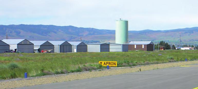
23 TABLE 2-1: BASED AIRCRAFT AND OPERATIONS BOWERS FIELD ACTIVITY TYPE ACTIVITY LEVEL Based Aircraft Count 2012 Airfield Needs Assessment FAA Airport Master Record Form (12 months ending 12/30/14) FAA TAF Most Recent Historic Year (2014) Single-Engine Piston not listed Multi-Engine Piston 3 4 not listed Turboprop 1 0 not listed Turbojet 2 0 not listed Rotorcraft 0 0 not listed Ultralight/Experimental 0 0 not listed Glider 0 1 not listed Military 0 0 not listed Total Based Aircraft Annual Aircraft Operations 48,660 60,445 51,865 Airfield Facilities Bowers Field has two intersecting runways (11/29 and 7/25) with a taxiway system that provides access to all developed areas of the airfield. The primary runway is lighted; the secondary runway is not lighted. Note: Runway 7/25 was closed in Pre-2018 information related to the runway presented in draft chapters is maintained for reference. The airfield is equipped with onsite weather observation and supports instrument approaches with both ground-based navigational aids (located off site) and satellite-based systems (GPS). All landside facilities (aircraft parking, hangars, etc.) are located south of the runway-taxiway system. In addition to its aeronautical activities, the airport also accommodates a fully serviced industrial park and agricultural leases. Table 2-2 summarizes airport data. Figures 2-2 and 2-3 provide views of the existing airfield facilities and an enlarged view of south landside area and the airport industrial park. CHAPTER 2 INVENTORY OF EXISTING CONDITIONS AUGUST
24 TABLE 2-2: AIRPORT DATA AIRPORT NAME/DESIGNATION BOWERS FIELD (ELN) Airport Owner Date Established Kittitas County Pre-1938 Airport Category National Plan of Integrated Airport Systems (NPIAS): Nonprime Local Service, General Aviation Airport FAA Airport Reference Code: B-II (as depicted on 2012 ALP) Washington State Aviation System Plan, Long-Term Air Transportation Study (2009): Regional Service Airport Acreage Airport Reference Point (ARP) Coordinates Approximately Acres See updated Exhibit A Airport Property Map in Chapter 7 N W Airport Elevation 1,763.3 feet MSL 12 Airport Traffic Pattern Configuration/Altitude Airport Communication Airport Weather Left Traffic 2,673 feet MSL / 1,000 feet above ground level (AGL) Common Traffic Advisory Frequency MHz Automated Surface Observation System (ASOS) MHz and (509) AGIS Survey (2016) CHAPTER 2 INVENTORY OF EXISTING CONDITIONS AUGUST


25 LEGEND Runway Protec Zone Gov t. Avia on Hungry Junc on Road Fixed Base Opera on FBO Box Hangar T Hangar Airport Business/ Industrial Runway 11 Wind Cone / Segmented Circle ASOS Avia on Fuel Storage Runway 11/29 4,301 x 150' Look Road 2 1 Runway 7 Runway 25 Runway 7/25-5,590 x 150' TXY A TAXIWAY C TAXIWAY D TXY F TAXIWAY B Runway 29 TXY E Bowers Road 3 Water Storage Tower EXISTING AIRFIELD CONDITIONS FIGURE 2-2 KITTITAS COUNTY - BOWERS FIELD
 20 HANGAR (LOT H-42) 29 CITY WATER WELL (LOT C-28) 3 MIDSTATE AVIATION (LOT H-21) 12 HANGAR (LOT H-32) 21 EBDA (LOT C-1) 30 MILLER REFRIGERATION (LOT C-24) 4 MIDSTATE AVIATION (LOT")
 15 HANGAR (LOT H-37) 24 COUNTY STORAGE (LOT C-8) 33 CITY OF ELLENSBURG WATER TOWER 7 12-UNIT T-HANGAR (LOT H-20) 16 HANGAR (LOT H-38) 25 AIRFIELD ELECTRICAL VAULT 34 EAST TIEDOWN APRON 8 HANGAR")

26 1 2 MIDSTATE AVIATION (LOT H-21) MIDSTATE AVIATION (LOT H-21) TENANTS/BUILDINGS/FACILITIES WEST TIEDOWN APRON (LOT H-10/11) WA DEPT OF NATURAL RESOURCES (LOT H-1) 19 HANGAR (LOT H-41) 28 ELMVIEW (LOT C-30) 20 HANGAR (LOT H-42) 29 CITY WATER WELL (LOT C-28) 3 MIDSTATE AVIATION (LOT H-21) 12 HANGAR (LOT H-32) 21 EBDA (LOT C-1) 30 MILLER REFRIGERATION (LOT C-24) 4 MIDSTATE AVIATION (LOT H-21) 13 HANGAR (LOT H-33) 22 CWU (LOT C-2) 31 AIRPORT SAFE STORAGE (LOT C-34) 5 HANGAR (LOT H-17) 14 HANGAR (LOT H-36) 23 EMERY LLC (LOT C-3) 32 ELLENSBURG PALLET (LOT C-38, C-39) 6 HANGAR (LOT H-18) 15 HANGAR (LOT H-37) 24 COUNTY STORAGE (LOT C-8) 33 CITY OF ELLENSBURG WATER TOWER 7 12-UNIT T-HANGAR (LOT H-20) 16 HANGAR (LOT H-38) 25 AIRFIELD ELECTRICAL VAULT 34 EAST TIEDOWN APRON 8 HANGAR 17 HANGAR (LOT H-39) 26 KITTCOM (911 CENTER) (LOT C-33) 35 CITY WATER WELL 9 21 UNIT HANGAR (CARERRA) (LOT H-19) 18 HANGAR (LOT H-40) 27 PRECISION AG (LOT C-31) 36 HELICOPTER PARKING (LOT H-1) Taxiway C RUNWAY 7/25 LEGEND PRIVATE/TENANT OWNED COUNTY OWNED CITY OWNED Taxiway B Bowers Road Avia on Fuel Storage Airport Road Beech Road Elmview Road Cessna Road Falcon Road EXISTING AIRFIELD FACILITIES FIGURE 2-3 KITTITAS COUNTY - BOWERS FIELD
27 Runways Note: Runway 7/25 was temporarily closed by NOTAM in August 2017 due to its significantly deteriorated pavement. The runway was permanently closed through submittal of FAA Form 7480 in The eastern section of runway pavement (intersection with Runway 11/29) is scheduled for removal in Maintaining a shorter and narrower version of the runway was recommended in the previous master plan and a modified version of that recommendation was maintained in the airfield development alternatives analysis in the current plan (see Chapter 6). Pre-2018 information related to the runway presented in draft chapters is maintained for reference. Bowers Field has two intersecting runways. The primary runway (11/29) is oriented in a northwest-southeast direction ( degree magnetic heading) and the secondary runway (7/25) is oriented in an east-west direction ( degree magnetic heading). Runway 7/25 intersects Runway 11/29 approximately 458 feet from the Runway 29 end. Table 2-3 summarizes the characteristics of the current runways at the airport. TABLE 2-3: RUNWAY DATA BOWERS FIELD RUNWAY 7/25 (CLOSED) Data provided for reference (now obsolete) Dimensions 5,590 x 150 Bearing N Effective Gradient 0.82% Surface/Condition Pavement Strength Markings Lighting Signage Asphalt / Very Poor and Failed 28,000 lbs. Single Wheel Basic - Runway 7 (Poor Condition) Basic - Runway 25 (Poor Condition) None Runway Hold Position Signs, Directional, Location Signs (unlighted) RUNWAY 11/29 Dimensions 4,301 x 150 Bearing N Effective Gradient 0.38% Concrete center 75 / Very Good Surface/Condition Asphalt - Outer 37.5 feet each side / Poor 35,000 lbs. Single Wheel Pavement Strength 57,000 lbs. Dual Wheel 100,000 lbs. Dual Tandem Basic - Runway 11 (Fair Condition) Markings Basic - Runway 29 (Fair Condition) Medium Intensity Runway Edge Lighting (MIRL); Threshold Lighting Visual Guidance Indicators Lighting Precision Approach Slope Indicator (PAPI-4) Runway 29 Runway End Identifier Lights (REIL) Runway 29 Signage Condition: Poor (wiring and control systems) Runway Hold Position Signs, Directional, Location Signs (unlighted) CHAPTER 2 INVENTORY OF EXISTING CONDITIONS AUGUST
28 The runway system was originally constructed in 1942 and the configuration has changed little over time. It is noted that the airport s primary runway is 1,289 feet shorter than the secondary runway. The current operational limitations for the primary and secondary runways were documented in the 2012 Airfield Needs Assessment, which defined the need to provide a 5,500-foot runway length for the design aircraft. The master plan update will reexamine the runway system to evaluate options for meeting the needs of current and future design aircraft. As noted in the 2001 Airport Master Plan, Runway 7/25 has not been eligible for FAA funding for decades due to the wind coverage provided by the primary runway (11/29). The inability of airport sponsors to maintain WWII-era airfield pavements without FAA funding is a common problem that often results in runway closure. Kittitas County recognizes the importance of Runway 7/25 to its operations, including flight training. The County has indicated its desire to keep Runway 7/25 in service if an effective rehabilitation and funding strategy can be identified. The 2012 Airport Layout Plan recommended reducing the length and width of the runway to serve small general aviation aircraft. This recommendation will be reviewed in the alternatives evaluation in Chapter 6. RUNWAY 11/29 Runway Designation The 2012 Airfield Needs Assessment identified a recent change in magnetic declination that requires a change in designation for Runway 11/29. Based on the current magnetic declination and runway bearing (relative to true north), Runway 11/29 will be re-designated 12/30. The change in magnetic declination does not affect Runway 7/25. The existing runway end number markings and associated runway signage for Runway 11/29 will need to be replaced to reflect the new numbers as part of a future project. Published airport facility data, including instrument approach and departure procedures will also need to be updated. Runway Description Runway 11/29 is 4,301 feet long and 150 feet wide. The runway has an effective gradient of 0.38 percent, with the high point (1,763.3 feet MSL) located at the Runway 11 threshold. The runway is equipped with edge lights; Runway 29 is equipped with a visual guidance indicator (VGI) and runway end identifier lights (REIL). The center 75 feet of Runway 11/29 has a Portland cement concrete (PCC) surface that was added in 1997 as a reconstruction/overlay of the original 1942 runway section which consisted of 3.5 inches of asphalt (AC) over 6 inches of crushed aggregate. The outer 37.5 feet on each side on the runway has the original asphalt surface, which is now more than 75 years old. The runway pavement condition ranges from very good (PCC section) to poor (AC sections). CHAPTER 2 INVENTORY OF EXISTING CONDITIONS AUGUST
29 The published 13 weight bearing capacity for Runway 11/29 is: 35,000 pounds for aircraft with single wheel (SW) landing gear; 57,000 pounds for aircraft with dual wheel (DW) landing gear; and 100,000 pounds for aircraft with dual tandem (DT) landing gear. The runway is equipped with unlighted runway hold position signs and distance remaining signs (nonstandard green background/white numbers). Two runway hold position signs located on the Runway 11 turnaround are internally illuminated; however, airport staff indicate that these have never been operational. Runway 11/29 is not served by a parallel taxiway. The runway is served by two access taxiways (Taxiway F and Taxiway E). Taxiway F connects to the runway approximately 2,750 feet beyond the Runway 29 threshold and connects to Taxiway B near the main apron. Taxiway E connects the Runway 29 threshold with Taxiway B, the parallel taxiway for Runway 7/25. An aircraft turnaround is located adjacent to the Runway 11 threshold (north side) to facilitate aircraft movement in the absence of a parallel taxiway. The turnaround was intended to be used by aircraft backtaxiing on the runway (for takeoff on Runway 11) or by aircraft rolling out after landing on Runway 29 that are unable to exit the runway via the last available exit taxiway (Taxiway F). However, local pilots and airport management indicate that the area is rarely used, which may be in part due to the 150-foot width of the runway. Runway Markings Runway 11/29 has basic/visual markings, which are not fully consistent with the current non-precision instrument approach capabilities. The runway markings (white paint) include runway designation numbers, centerline stripe, threshold bar and aiming bars (located 1,000 feet from each threshold). The Runway 29 end has four yellow arrowheads prior to the threshold bar denoting the relocated threshold. A section of pavement previously identified as a stopway is located beyond the end of Runway 11 and is marked with yellow chevrons. See Stopway section below. Aircraft hold lines (yellow paint) are located on all entrance taxiways. Aircraft hold lines provide clear visual information to pilots and airport ground vehicles required to hold short of an active runway. Yellow taxiway lead-in lines are painted at the connections to Taxiway B and F. The markings were observed to be in fair condition during a recent site visit. Per FAA standards, the markings for the primary runway take precedence over the secondary runway in areas where the runways intersect. 13 FAA Chart Supplement CHAPTER 2 INVENTORY OF EXISTING CONDITIONS AUGUST
30 Stopway (Rwy 11 end) The FAA Airport Record Form (5010-1) for Bowers Field lists a 1,460-foot stopway at the northwest end of Runway 11/29 (beyond the Runway 11 end). The pilot website which relies on FAA 5010 data, also lists the stopway for Runway 11/29 but makes no distinction in pavement condition between the runway (good) and the stopway (failed). A visual inspection of the stopway area conducted as part of 2012 Airfield Needs Assessment confirmed that the pavement has failed and could not function as originally configured without risk of serious damage to an aircraft. The yellow chevrons marking the original stopway are clearly visible from the air, although the poor condition of the pavement is not necessarily obvious. This creates the potential for confusion by pilots unfamiliar with the airport about the use of the stopway. There are no records of maintenance being performed on the stopway pavement in recent history and the pavement was not included in the 1997 runway rehabilitation. FAA Advisory Circular (AC) 150/ A provides the following definition for stopways: A stopway is an area beyond the takeoff runway, centered on the extended runway centerline, and designated by the airport owner for use in decelerating an airplane during an aborted takeoff. It must be at least as wide as the runway and able to support an aircraft during an aborted takeoff without causing structural damage to the airplane. The recommendation made in 2012 was to publish a Notice to Airmen (NOTAM) indicating that the stopway was not available for use until it could be physically altered to eliminate any potential confusion by pilots unfamiliar with the airfield and all published references were eliminated. In addition, the following note was placed on the 2012 Airport Layout Plan (ALP): 2. STOPWAY AT NW END OF RUNWAY 11/29 NOT IN SERVICE. STOPWAY MARKINGS TO BE REMOVED. Airport management should update published airfield data to remove all references to the stopway. Airport management should also issue a NOTAM stating the stopway at the NW end of Runway 11/29 is not available for use until it is physically removed and airport data records can be updated. RUNWAY 7/25 (CLOSED) Note: Runway 7/25 is officially closed and is scheduled for removal of the eastern section of the runway pavement (intersection with Runway 11/29) in Runway 7/25 is 5,590 feet long and 150 feet wide with an asphalt surface. The runway has an effective gradient of 0.82 percent, with the high point (1,755.2 feet MSL) located at its east end (Runway 25 threshold). The published weight bearing capacity for Runway 7/25 is 28,000 pounds for aircraft with CHAPTER 2 INVENTORY OF EXISTING CONDITIONS AUGUST
31 single wheel (SW) landing gear. The 75 year old pavement has become brittle and is easily penetrated, shedding pieces of asphalt and loose aggregate on the surface when damaged. This pavement rating is not considered to be an accurate reflection of the runway s actual pavement strength. Runway 7/25 has significant cracking and is in very poor to failing condition. The runway has been closed during the winter months (December 15 through February 28) since at least the 1990s due to concerns over its surface condition. As with the original sections of Runway 11/29, Runway 7/25 was constructed in 1942 (2.5 inches of asphalt (AC) over 6 inches of crushed aggregate) and has not been rehabilitated or reconstructed. The extensive cracking on the runway has allowed significant weed growth that has created a significant, ongoing maintenance need. The runway has basic/visual markings on both the Runway 7 and 25 ends. The runway markings (white paint) include runway designation numbers, centerline stripe, and threshold bar. Runway 25 and 7 have four yellow arrowheads prior to the threshold bar denoting their relocated thresholds. Runway 7/25 is unlighted and has no visual guidance indicators (VGI). The runway is equipped unlighted runway hold position signs and runway distance remaining signs (non-standard green background with white letters). The runway is served by a full-length south parallel taxiway (Taxiway B) and a series of access taxiways connecting the runway/parallel taxiways to the main apron area and other developed landside areas. The runway has three 90-degree exit taxiway connections and one angled exit taxiway (Taxiway D) connection. Aircraft hold lines and taxiway lead-in lines (yellow paint) are located at each taxiway connection (Taxiways A, C, D, and E). The markings were observed to be in fair-to-poor condition during a recent site visit and scheduled for repainting. Runway Approach Capabilities Runways 29 and 25 have straight-in non-precision instrument (NPI) approaches, but have visual markings that are not consistent with current approach capabilities. Based on current approach capabilities, NPI markings are required for these runway ends including runway numbers, threshold markings, threshold demarcation bars (where required), and aiming point markings. The airport s newest instrument approach procedure aligns aircraft directly with the end of Runway 11, which is typical of a straight-in approach. However, the RNAV GPS-C approach is classified as a circling procedure, in part based visual markings in place on Runway 11. The FAA flight procedures office has indicated that the approach would be upgraded to include a straight-in designation if NPI markings were added and all obstruction clearance criteria is met. CHAPTER 2 INVENTORY OF EXISTING CONDITIONS AUGUST
32 Runway Wind Coverage It is generally preferable for aircraft to land and takeoff directly into the wind, although varying wind conditions often require crosswind operations. When wind conditions exceed the capabilities of a specific aircraft, use of a crosswind runway (when available) may be preferable. At airports with single runways, occasional periods of strong crosswinds can limit operations until conditions improve. The FAA recommended planning standard is that primary runways should be capable of accommodating at least 95 percent of wind conditions within the prescribed crosswind component. This crosswind component is based on a direct crosswind (90 degrees to the direction of flight) of varying speeds depending on the aircraft type: 10.5 knots (12 miles per hour) for small aircraft; and 13 knots (15 miles per hour) for general aviation aircraft in Airplane Design Group II. Aircraft are able to tolerate increasingly higher wind speeds as the crosswind angle is reduced and aligns directly opposing the direction of flight. Wind data for Bowers Field was compiled for the period 2006 through 2015 for all-weather (All-WX), visual (VFR), and instrument (IFR) conditions from the automated on-site weather observation system. 14 The updated historic data are virtually identical to data presented on the ALP drawings prepared in the last master plan update and the Airfield Needs Assessment. Prevailing winds are generally from the northwest and are closely aligned with Runway 11/29. Table 2-4 summarizes the crosswind coverage for Runway 7/25 and Runway 11/29 for large and small aircraft. 14 NOAA National Climatic Data Center (NCDC) data for Bowers Field (79,236 observations, ) CHAPTER 2 INVENTORY OF EXISTING CONDITIONS AUGUST
33 TABLE 2-4: RUNWAY WIND COVERAGE BOWERS FIELD Weather Conditions Wind Speed Runway 7-25 Runway Runway 7-25 & Combined All WX VFR IFR 12 MPH (13 Knots) 83.60% 99.27% 99.73% 15 MPH (13 Knots) 91.18% 99.69% 99.90% 12 MPH (13 Knots) 80.39% 99.18% 99.68% 15 MPH (13 Knots) 89.47% 99.66% 99.88% 12 MPH (13 Knots) 99.14% 99.73% 99.95% 15 MPH (13 Knots) 99.47% 99.87% 99.99% Runway 7-25 Bearing = Degrees True Runway Bearing = Degrees True Source: NCDC; The wind roses depicted on Figure 2-4 graphically illustrate the relationship between the runway alignments and local wind conditions. CHAPTER 2 INVENTORY OF EXISTING CONDITIONS AUGUST
34 Runway 7 W WNW WSW Runway SW NW NNW SSW N S KNOTS NNE.1 SSE 30 Calms = 71.8% NE SE ENE ESE Runway 29 E Runway 25 Runway 7 W WNW WSW Runway SW NW NNW SSW N S KNOTS NNE.1 Calms = 66.4% SSE NE SE ENE ESE Runway 29 E Runway 25 Runway 7 W WNW WSW Runway SW NW NNW SSW N S KNOTS Calms = 97.9% NNE SSE NE SE ENE ESE Runway 29 E Runway 25 ALL WX WIND ROSE VFR WIND ROSE IFR WINDROSE Period: Knots 13 Knots Source: National Climatic Data Center Period: Knots 13 Knots Source: National Climatic Data Center Period: Knots 13 Knots Source: National Climatic Data Center WIND ROSES FIGURE 2-4 KITTITAS COUNTY - BOWERS FIELD
35 Airfield Pavement Condition The Washington Department of Transportation (WSDOT) - Aviation Division manages the Pavement Maintenance Program (PMP), a program of pavement evaluation and maintenance for Washington s general aviation airports. The most recent PMP airfield pavement inspection for Bowers Field was conducted in The rehabilitation of the eastern section of the main apron was completed after the PMP inspection was conducted and that pavement is currently in excellent condition. Table 2-5 summarizes airfield pavement conditions for Bowers Field based on the 2012 PMP inspection. Figure 2-5 graphically illustrates the airfield pavement conditions identified in the 2012 PMP. TABLE 2-5: DETAILED SUMMARY OF AIRFIELD PAVEMENT CONDITION PAVEMENT Runway 7/25 (Closed in 2018) Runway 11/29 SECTION DESIGN/AGE 2.5 AC; 6 Aggregate Base (1942) Note: the west 125 of runway has 3 Aggregate Base and 6 Aggregate Subbase Center 75 section: 6 PCC overlay & 4 AC (1997); 3.5 AC; 6 Aggregate Base (1942) Outer 37.5 sections: 3.5 AC; 6 Aggregate Base (1942) 2012 PCI RATING/ CONDITION 1,2 Eastern Section / Poor Western Section / Failing Center / Excellent Outer Edges (50 ) / Poor Runway 11 Hold Area 6 PCC & 4 AC (1997); 3.5 AC; 6 Aggregate Base (1942) 93/ Excellent Runway 7/25 Parallel Taxiway (Txy A, B, and E) Taxiway C Taxiway D and F AC (2002); 2.5 AC, 3 Aggregate Base, 5 Aggregate Subbase ( ) AC (2002); 2.5 AC, 2.5 Aggregate Base, 6 Aggregate Subbase (1942) AC (2002); 2 AC (1976); 2.5 AC, 2.5 Aggregate Base, 6 Aggregate Subbase (1942) Excellent 95 Excellent 83 Good Terminal Apron 1.5 AC (1995); 2.5 AC (1942); 6 Aggregate Base (1942) 68 Good West Apron 6-9 PCC (1943); 6 Aggregate Base (1943) 65 Good DNR Apron 2.5 AC (1943); 3 Aggregate Base, 5 Aggregate Subbase (1943) 92 Excellent East Hangar Taxilanes AC ( some sections); 2 AC, 6 Aggregate Base (1942) 5/61 Failing- Good Notes: 1. The Pavement Condition Index (PCI) scale ranges from 0 to 100, with seven general condition categories ranging from failed to excellent. For additional details, see Pavement Management Report for Bowers Field. 2. The condition ratings are from the 2012 pavement inspection. The ratings do not necessarily correspond to current pavement conditions and do not reflect construction, repair, maintenance or rehabilitation work completed since WSDOT Aviation Airport Pavement Database (IDEA); Bowers Field (2012) CHAPTER 2 INVENTORY OF EXISTING CONDITIONS AUGUST

36 Note: Condi ons Per 2012 Inspec on Source: WSDOT Avia on Pavement Maintenance Program Database EXISTING PAVEMENT CONDITIONS FIGURE 2-5 KITTITAS COUNTY - BOWERS FIELD
37 The primary distresses observed during the inspection were longitudinal and transverse cracking, alligator cracking, weathering/raveling, swelling, joint spalling, and corner spalling. An emergency repair project was required several years ago near the threshold of Runway 25 after an aircraft induced pavement failure occurred. Runway 7/25 continues to deteriorate and presents a significant maintenance and safety concern for airport management. The current FAA Chart Supplement notes that Runway 7/25 is closed between December 15 and February 28 each year and there are weeds growing through the pavement cracks. Additional engineering evaluations are recommended to determine if/when additional operational restrictions are needed due to the pavement condition. Airport management has indicated plans to improve weed control on the runway surface. Note: Pavement evaluations on Runway 7/25 were conducted in summer 2017 to assess runway surface conditions and identify rehabilitation options. The airport management decision to effect an emergency closure of the runway through a published NOTAM due to its deteriorated condition was based on the professional engineering assessments and the airport sponsor obligation to protect public safety and to operate the airport in a responsible manner. Taxiways The taxiway system at Bowers Field is depicted on Figures 2-2 and 2-3, presented earlier in this chapter. The taxiway system provides access to both runways and landside facilities located south of the runways. The airport s primary runway (11/29) is not served by a parallel taxiway and has two access taxiway connections (Taxiways E and F). Aircraft operations occurring north of the mid-runway connection (Taxiway F) require back taxiing on the runway. The secondary runway (7/25) is served by a full length parallel taxiway with four exit taxiway connections. The southern section of Runway 11/29 that intersects with Runway 7/25 also connects to the parallel taxiway. The parallel taxiway for Runway 7/25 provides access to the full length of the south landside area. The parallel taxiway and the four connecting taxiways located on the south side of Runway 7/25 have a total of five different designations (A-E). Taxiway F is a diagonal cross-field taxiway that provides access to Runway 11/29, just north of its midpoint. All of the taxiways connecting to Runway 7/25 and 11/29 have aircraft hold lines located 200 feet from the adjacent runway centerlines, which coincide with the outer edge of the runway obstacle free zone (OFZ). All taxiways are 50 feet wide and constructed of asphalt. The taxiways have standard markings including centerline stripe and runway holding position markings. The striping and markings are generally in good condition. All taxiways connecting to a runway are equipped with unlighted mandatory hold position signs. CHAPTER 2 INVENTORY OF EXISTING CONDITIONS AUGUST
38 TAXIWAY A Taxiway A is a diagonal exit taxiway that connects the Runway 7 end to the parallel taxiway (Taxiway B). A 155-foot section of inline taxiway is located west of the Runway 7 threshold and connects to Taxiway A. The inline taxiway does not have a taxiway designation, although it could be considered an extension of Taxiway A. Taxiway A is equipped with blue retro-reflective edge markers. The asphalt surface had a PCI rating of 84 in the 2012 PMP. TAXIWAY B Taxiway B is the full length south parallel taxiway for Runway 7/25, which also provides taxiway access to the end of Runway 29. The runway-parallel taxiway separation is 525 feet. Taxiway B directly abuts all of the aircraft aprons that extend from the west end of the flight line (DNR facilities) to the east aircraft tiedowns. The east aircraft hangar area has four access taxilane connections to Taxiway B. The taxiway is equipped with blue retro-reflective edge markers. The asphalt surface had PCI ratings ranging from 79 to 84 in the 2012 PMP. TAXIWAY C Taxiway C is a diagonal exit taxiway located approximately 1,300 feet east of the Runway 25 threshold that connects Runway 7/25 to the parallel taxiway (Taxiway B). Taxiway C is equipped with blue retroreflective edge markers. The asphalt surface had a PCI rating of 95 in the 2012 PMP. TAXIWAY D Taxiway D is a diagonal exit taxiway located approximately 2,500 feet east of the Runway 25 threshold that connects Runway 7/25 to the parallel taxiway (Taxiway B) at the intersection of Taxiways B and C. Taxiway C is equipped with blue retro-reflective edge markers. The asphalt surface had a PCI rating of 83 in the 2012 PMP. TAXIWAY E Taxiway E is a diagonal exit taxiway that extends from the east end of Taxiway B (at the Runway 29 threshold) to the Runway 25 end. Taxiway E is equipped with blue retro-reflective edge markers. The asphalt surface had a PCI rating of 83 in the 2012 PMP. CHAPTER 2 INVENTORY OF EXISTING CONDITIONS AUGUST
39 TAXIWAY F Taxiway F is a 1,569-foot taxiway that extends from the north side of Runway 7/25 to Runway 11/29, near its midpoint. Taxiway F provides the only useable exit for aircraft landing on Runway 29 and the primary taxi route for aircraft traveling to the airport s south landside area. Taxiway F is directly aligned with Taxiway D on opposite sides of Runway 7/25, which creates the common taxiing route via Taxiway F, D, and B. Taxiway F is equipped with blue retro-reflective edge markers. The asphalt surface had a PCI rating of 83 in the 2012 PMP. TAXILANES Bowers Field has several taxilanes serving landside facilities including the main tiedown apron, the west apron, west hangar area, and the east hangar area. The main taxilanes on the east apron are marked with centerline stripes (excellent condition). The other taxilanes have worn centerline stripes or no pavement markings. Aircraft Apron MAIN APRON The main apron is located north of the FBO building. This apron is marked with fifteen (15) small airplane parking positions, facing northwest. The main apron has the aircraft fuel storage and dispensing area. EAST GENERAL AVIATION APRON The east general aviation apron includes parking for both large and small aircraft. The apron was expanded (new pavement), rehabilitated (sealcoat existing pavement), and reconfigured with new tiedowns and drive-through parking in The western section of the apron has a single 250-foot long parking row for business aircraft that directly abuts Taxiway B. The parking row is configured with lead-in lines marked for three (3) drive-through parking positions. This section of apron also has five (5) north-facing small airplane tiedowns configured in one east-west row at the south edge. The eastern section of the apron has twenty-three (23) north-facing small airplane tiedowns configured in three east-west rows. The construction of a new hangar near the southeast corner of the apron in 2017 will require some changes in existing taxilanes and the elimination of several tiedowns to provide standard wingtip clearances since the hangar is capable of accommodating larger aircraft (ADG II). The existing taxilanes on this section of the apron are designed based on ADG I standards. The apron s conformance with FAA standards will be addressed in the evaluation of landside alternatives. CHAPTER 2 INVENTORY OF EXISTING CONDITIONS AUGUST
40 WEST GENERAL AVIATION APRON The west general aviation apron is largely unchanged since its original construction in The Portland cement concrete (PCC) surface was designed to accommodate a large number of military aircraft and apron has a large quantify of steel tiedown anchors imbedded in the surface. A portion of the apron is currently being used to accommodate several aircraft operated by CWU s flight training contractor. Approximately six (6) tiedown anchors are currently being used, configured in two rows with northwest-facing aircraft parking. As noted earlier, the existing taxilanes do not meet ADG I design standards for object free area clearance. Table 2-6 summarizes the existing public use apron facilities at the airport. TABLE 2-6: AIRCRAFT APRONS BOWERS FIELD APRON ESTIMATED AREA (SQUARE YARDS) COMPOSITION AIRCRAFT PARKING/TIEDOWNS East General Aviation Apron 25,808 Asphalt 28 small 3 large Main Apron (FBO) 16,625 Asphalt 15 small West General Aviation Apron 23,055 Concrete 6 small (Est.) Airport Lighting and Signage The airport accommodates day and night operations in both visual and instrument meteorological conditions (IMC). Runway 11/29 is equipped with lighting that is consistent with its non-precision instrument requirements and runway use. None of the major taxiways are equipped with edge lighting However, there are blue taxiway light fixtures at the intersection of Taxiway F and Runway 11/29. The runway-taxiway system has extensive non-illuminated signage that conveys directional, location, and runway clearance information to pilots. Table 2-7 summarizes existing airport lighting and signage. CHAPTER 2 INVENTORY OF EXISTING CONDITIONS AUGUST
41 TABLE 2-7: EXISTING AIRPORT LIGHTING & SIGNAGE CATEGORY TYPE CONDITION Airport Lighting Runway Lighting Visual Guidance Indicators Taxiway Lighting Airfield Signage Other Lighting Airport Rotating Beacon (white/green dual lens) Lighted Wind Cones (1) Rwy 7/25 None Rwy 11/29 Medium Intensity Runway Lighting (MIRL) (white/amber lenses); Threshold Lighting (red/green lenses) 4-Light PAPI (red/white lenses) Rwy 29: (P4L) 3 degree glide path Blue edge lights at connection of Rwy 11/29 and Taxiway F. Blue retro-reflective markers on all taxiways Non-illuminated Mandatory, Location, Directional, and Destination Signs; Distance Remaining Signs Obstruction lights, lighted wind cones (1)/lighted segmented circle and wind T, flood lighting in hangar, fuel areas. Good Fair/Poor Fair Fair Fair Good/Fair AIRPORT LIGHTING The airport rotating beacon is mounted on top of a water tower across Bowers Road and immediately south of the east apron and airport electrical vault. Rotating beacons are used to indicate the location of an airport to pilots at night or during reduced visibility. The beacon provides sequenced white and green flashing lights (representing a lighted land airport) and rotates in a 360-degree circle to allow pilots to identify the airport from all directions and from several miles away. A single lighted wind cone is located within the segmented circle. The segmented circle is located in the center of the airport between the two runways - west of the runway intersection and east of Taxiway F. The rotating beacon and lighted wind cone operate dusk-dawn. The runway lighting and visual guidance indicators are pilot-activated using the common traffic advisory frequency (CTAF) MHz. Airport management reports ongoing reliability issues with airfield lighting control systems. APPROACH LIGHTING Runway 29 has a non-standard omnidirectional approach lighting system (ODALS) that is no longer operational. RUNWAY LIGHTING Runway 11/29 has medium intensity runway edge lighting (MIRL); Runway 29 is equipped with a visual guidance indicator (VGI) and Runway End Identifier Lights (REIL). Runway 7/25 is unlighted. CHAPTER 2 INVENTORY OF EXISTING CONDITIONS AUGUST
42 MIRL: The MIRL system includes white edge lights (with amber lights located near the runway ends to indicate runway remaining) and runway threshold lights. The threshold lights consist of two sets of four fixtures near each corner of the runway ends. The fixtures have split lenses (green/red) indicating the beginning and end of the runway. Visual Guidance Indicators (VGI): Runway 29 is equipped with a 4-box Precision Approach Path Indicator (PAPI) that is calibrated to provide a 3-degree visual glide path. PAPIs project light along a standard glide path from a runway end, with red and white colored lights indicating the aircraft s vertical position above, below, or on the defined glide path. REIL: Runway 29 is equipped with runway end identifier lights (REIL), which consists of two high intensity sequenced strobe lights that mark the approach end of the runway to assist pilots in establishing visual contact with the runway environment during periods of darkness or reduced visibility. The operating condition of the REILs has not been determined. Airport management reports significant, ongoing reliability issues with the runway lighting systems due to rodent damage to the buried wiring and lighting control units. Based on these issues and the age of the systems, replacement of all existing lighting systems is anticipated to be conducted as part of the runway rehabilitation project. TAXIWAY LIGHTING All of the major taxiways at Bowers Field are equipped with stake mounted blue retro-reflective edge markers. The intersection of Taxiway F and Runway 11/29 is marked with a limited number of blue taxiway edge lights. AIRFIELD SIGNAGE The runway-taxiway system has unlighted runway hold position signs (red background with white letters/numbers for runways) at the aircraft holding positions for each taxiway connection with a runway. The runways are equipped with unlighted runway distance remaining signs (non-standard green background with white letters). Other signage includes taxiway directional signs [A, B, D, etc.] (yellow background and black numbers/letters) and taxiway location signs (black background and yellow numbers/letters). OTHER LIGHTING Overhead flood-lighting is located along the south side of the main apron area and in the aircraft fueling area. Hangars also have exterior wall-mounted floodlights. Red obstruction lights are mounted on the top of several structures or built items (antennas, windsocks, etc.) on the airfield. CHAPTER 2 INVENTORY OF EXISTING CONDITIONS AUGUST
43 Landside Facilities HANGARS AND AVIATION RELATED BUILDINGS Bowers Field accommodates a variety of aviation-related buildings including aircraft storage hangars, commercial hangars, and buildings used to support tenant operations. The south side of the airport currently accommodates all landside facilities and based aircraft. The airport also includes the Kittitas County Airport Industrial Park on the south side of Bowers Road that includes numerous non-aeronautical buildings and tenants. Figure 2-3, presented earlier in this chapter, depicts the existing buildings on the airport. Table 2-8 summarizes existing aviation use buildings located at the airport. The primary fixed base operator (FBO) facilities at Bowers Field are located near the middle and east end of the south landside area. Facilities include a large county owned aircraft storage hangar with office space. The hangar is approximately 100 by 200 feet and includes the ground floor and second floor office space. The hangar is owned by the county and leased to CWU. CWU also owns a maintenance hangar located adjacent to the large hangar. The aviation fuel storage and dispensing facilities are located east of the large hangar, adjacent to the east aircraft parking apron. The fuel facilities are managed by Midstate Aviation, one of the airport s FBOs. Midstate Aviation s operations are located in a private hangar located near the east end of the main apron. CHAPTER 2 INVENTORY OF EXISTING CONDITIONS AUGUST
44 TABLE 2-8: AVIATION RELATED BUILDINGS AT BOWERS FIELD BUILDING 1. Large Conventional Hangar (FBO) USE FBO, 2 hangar bays; pilot facilities including lounge space, restroom, and kitchen. 2. Small Buildings (east of large hangar) Classrooms 3. Conventional Hangar (NW of large hangar) Aircraft maintenance 4. Storage Building (west of large hangar) Equipment storage 5. Conventional Hangar (south of County T-hangar) Aircraft storage (tenant owned) 6. Conventional Hangar (south of County T-hangar) Aircraft storage (tenant owned) 7. Conventional Hangar (west of County T-hangar) Aircraft storage (tenant owned) 8. T-hangar (12 unit double-sided) Aircraft storage (county owned) T-hangar (21 unit double-sided, with end unit*) *2016 fire destroyed three units; 18 units currently available Department of Natural Resources (3 main structures with additional smaller storage buildings) Aircraft storage (Carrera tenant owned) Agency wildfire operations/helicopter dispatch 11. Conventional Hangar (east of tiedown apron) Aircraft storage (tenant owned) 12. Conventional Hangar (east of tiedown apron) Aircraft storage (tenant owned) 13. Conventional Hangar (east of tiedown apron) Aircraft storage (tenant owned) 14. Conventional Hangar (east of tiedown apron) Aircraft storage (tenant owned) 15. Conventional Hangar (east of tiedown apron) Aircraft storage (tenant owned) 16. Conventional Hangar (east of tiedown apron) Aircraft storage (tenant owned) 17. Conventional Hangar (east of tiedown apron) Aircraft storage (tenant owned) 18. Conventional Hangar (east of tiedown apron) Aircraft storage (tenant owned) 19. Conventional Hangar (east of tiedown apron) Aircraft storage (tenant owned) 20. Conventional Hangar (east of tiedown apron) Aircraft storage (tenant owned) New in 2017 The airport current has two T-hangars (30 units); 12 small conventional hangars (aircraft storage); 2 medium conventional hangars (FBO); and 1 large hangar (FBO). The hangars are divided between the east and west ends of the south landside area. CHAPTER 2 INVENTORY OF EXISTING CONDITIONS AUGUST
45 Airspace and Navigational Aids AIRSPACE CLASSIFICATIONS Airspace within the United States is classified by the FAA as controlled or uncontrolled with altitudes extending from the surface upward to 60,000 feet above mean sea level (MSL). Controlled airspace classifications include Class A, B, C, D, and E. Class G airspace is uncontrolled. Figure 2-6 illustrates and describes the characteristics of the airspace classifications defined by the FAA. Aircraft operating within controlled airspace are subject to varying levels of positive air traffic control that are unique to each airspace classification. Requirements to operate within controlled airspace vary, with the most stringent requirements associated with very large commercial service airports in high traffic areas. Uncontrolled airspace is typically found in remote areas or is limited to a 700 or 1,200-foot AGL layer above the surface and below controlled airspace. LOCAL AREA AIRSPACE STRUCTURE Figure 2-7 depicts nearby airports, notable obstructions, special airspace designations and instrument flight rules (IFR) routes in the vicinity of Bowers Field, as identified on the Seattle Sectional Chart. Bowers Field is located in an area of Class E airspace that begins at 700 feet above ground and extends upward to 18,000 feet above mean sea level (MSL). The local Class E airspace consists of a 3-nautical mile radius surrounding the airport with east quadrants that extend approximately 20 nautical miles. Radio communication is not required for VFR operations in Class E airspace, although pilots are encouraged to use the common traffic advisory frequency (CTAF) when operating at the airport. Aircraft are required to obtain an ATC clearance prior to operating in Class E airspace during IFR conditions. Several Low Altitude Enroute Instrument Airways connect to the nearby Ellensburg VORTAC, 16 located 3 nautical miles east of the airport: Victor 2 (V2) west to the Seattle VORTAC and east-northeast to Moses Lake VOR/DME; Victor 25 (V25) north-northeast to Wenatchee VOR/DME and south to Yakima VORTAC; Victor 336 (V336) northeast to the Ephrata VORTAC; and Victor 486 (V486) south to the Selah intersection with the Yakima VORTAC. The instrument airways are designed to provide defined paths (fixed courses and minimum altitudes) for enroute aircraft that are clear of terrain and other potential hazards for aircraft operating without the benefit of visual contact. Aircraft transition between enroute and terminal airspace through the use of defined instrument approach and departure procedures. 16 VORTAC = Very High Frequency Omni Directional Radio Range (VOR), with Tactical Air Navigation (TACAN). CHAPTER 2 INVENTORY OF EXISTING CONDITIONS AUGUST
46 The minimum enroute altitudes for the nearby instrument airways are well above the local airport traffic pattern altitude and do not conflict with VFR airport operations. The local fixed-wing traffic pattern altitude at Bowers Field is 1,000 feet above ground level (AGL) (approximately 2,763 MSL) with standard left traffic on both runways. The typical traffic patterns for Runway 7/25 and Runway 11/29 are depicted in Figure 2-8. SPECIAL USE AIRSPACE The nearest Military Restricted Areas are R-6714A/B/C/F/G and H located to the south and east. Restricted areas are designated to segregate VFR and IFR traffic. When a Restricted Area is active, all traffic must reroute around the Restricted Area. Prior to entering a Restricted Area, pilots must contact the controlling agency shown on the frequency tab of the sectional chart to ask if the Restricted Area is active (hot) or not (cold). Clearance is not required for VFR operations through a Restricted Area when the controlling agency has made a determination that the Restricted Area is inactive (cold). NAVIGATIONAL AIDS AND WEATHER There are no ground based navigational aids located on Bowers Field. The Ellensburg VORTAC 17 is located off the airport, approximately three nautical miles east-southeast, east of Naneum Road and north of Lyons Road. The VORTAC supports instrument approaches to Runway 25, in addition to its enroute air navigation function. The VORTAC is FAA-owned and maintained. Bowers Field has an on-site automated surface observing system (ASOS) that provides 24-hour weather information. The ASOS is located north of Runway 7/25, east of Taxiway F. The ASOS provides altimeter setting, wind data, density altitude, visibility, cloud/ceiling data, temperature, dew point, icing, lightning, sea level pressure, and precipitation. The ASOS is owned and maintained by the National Weather Service (NWS). The airport has a hazardous inflight weather advisory service (HIWAS), which is a continuous broadcast of hazardous weather information transmitted through the VORTAC. This includes Airmen s Meteorological Information (AIRMETs), significant meteorological information (SIGMETs), convective SIGMETs, and urgent pilot reports (PIREPs). 17 Very high frequency Omnidirectional Radio range (VOR) combined with UHF frequencies (Tactical Air Navigation TACAN) CHAPTER 2 INVENTORY OF EXISTING CONDITIONS AUGUST

47 FL600 Class A 18,000 msl 14,500 msl Class E Class B Class C Class D Class G Class G 1,200 agl 700 agl Airspace Class De i Minimum Pilot Quali a ons Entry Requirements VFR Visibility Below 10,000 msl** VFR Cloud Clearance Below 10,000 msl*** VFR Visibility 10,000 msl and Above** VFR Cloud Clearance 10,000 msl and Above COMMUNICATION REQUIREMENTS AND WEATHER MINIMUMS Class A Class B Class C Class D Class E Class G Generally airspace above 18,000 feet MSL up to and including FL 600. Generally mul layered airspace from the surface up to 10,000 feet MSL surrounding the na on s busiest airports Generally airspace from the surface to 4,000 feet AGL surrounding towered airports with service by radar approach control Generally airspace from the surface to 2,500 feet AGL surrounding towered airports Generally controlled airspace that is not Class A, Class B, Class C, or Class D Instrument Ra ng Student* Student* Student* Student* Student* IFR: ATC Clearance VFR: Opera ons Prohibited ATC Clearance IFR: ATC Clearance VFR: Two-Way Communica on w/ ATC IFR: ATC Clearance VFR: Two-Way Communica on w/ ATC IFR: ATC Clearance VFR: None N/A 3 Statute Miles 3 Statute Miles 3 Statute Miles 3 Statute Miles N/A Clear of Clouds 500 Below 1,000 Above 2,000 Horizontal 500 Below 1,000 Above 2,000 Horizontal 500 Below 1,000 Above 2,000 Horizontal Generally uncontrolled airspace that is not Class A, Class B, Class C, Class D, or Class E None Day: 1 Statute Mile Night: 3 Statute Miles 500 Below 1,000 Above 2,000 Horizontal*** N/A 3 Statute Miles 3 Statute Miles 3 Statute Miles 5 Statute Miles 5 Statute Miles N/A Clear of Clouds 500 Below 1,000 Above 2,000 Horizontal 500 Below 1,000 Above 2,000 Horizontal 1,000 Below 1,000 Above 1 Statute Mile Horizontal 1,000 Below 1,000 Above 1 Statute Mile Horizontal *Prior to opera ng within Class B, C or D airspace (or Class E airspace with an opera ng control tower), student, sport, and recrea onal pilots must meet the applicable FAR Part 61 training and endorsement requirements. Solo student, sport, and recrea onal pilot opera ons are prohibited at those airports listed in FAR Part 91, appendix D, sec on 4. **Student pilot opera ons require at least 3 statute miles visibility during the day and 5 statute miles visibility at night. ***Class G VFR cloud clearance at 1,200 agl and below (day); clear of clouds. AIRSPACE CLASSIFICATION FIGURE 2-6 KITTITAS COUNTY - BOWERS FIELD
 TIETON STATE AIRPORT (4S6) YAKIMA AIR TERMINAL (YKM) LEGEND G Airports with other than hard-surface runways Glider")
 Class E Airspace (surface) AREA AIRSPACE FIGURE 2-7 KITTITAS")
48 CASHMERE DRYDEN (8S2) PANGBORN MEMORIAL (EAT) EASTON STATE AIRPORT (ESW) QUINCY (80T) CLE ELUM (S93) G DE VERE (2W1) BOWERS FIELD (ELN) DESERT AIRE (M94) TIETON STATE AIRPORT (4S6) YAKIMA AIR TERMINAL (YKM) LEGEND G Airports with other than hard-surface runways Glider Operations Compass Rose (VOR/DME or VORTAC) VOR or RNAV Airways Public-use airports with hard-surfaced runways 1,500ft. to 8,069ft. Class E Airspace with floor 700 above surface Class D Airspace (surface) Class E Airspace (surface) AREA AIRSPACE FIGURE 2-7 KITTITAS COUNTY - BOWERS FIELD

49 LEGEND RUNWAY 7-25 AIRCRAFT FLIGHT PATTERN (LARGE AC) AIRCRAFT FLIGHT PATTERN (SMALL AC) RUNWAY AIRCRAFT FLIGHT PATTERN (LARGE AC) AIRCRAFT FLIGHT PATTERN (SMALL AC) REECER CREEK ROAD CITY OF ELLENSBURG BOUNDARY AIRPORT PROPERTY LINE HIGHWAY HIGHWAY FAUST ROAD FAUST ROAD LOOK ROAD HUNGRY JUNCTION ROAD RWY 11 OLD OLD HIGHWAY HIGHWAY RWY 07 RWY 25 BRICK MILL ROAD BRICK MILL ROAD INTERSTATE 90 INTERSTATE 90 RWY 29 WILSON CREEK ROAD CITY OF ELLENSBURG CITY OF ELLENSBURG TRAFFIC PATTERNS FIGURE 2-8 KITTITAS COUNTY - BOWERS FIELD
50 Instrument Procedures Instrument approach and departure procedures are developed by the FAA using ground based electronic navigational aids and satellite navigation (SATNAV) to guide aircraft through a series of prescribed maneuvers in and out of an airport s terminal airspace. The procedures are designed to enable continued airport operation during instrument meteorological conditions (IMC), but are also used during visual conditions, particularly in conjunction with an instrument flight plan. The capabilities of each instrument approach are defined by the technical performance of the procedure platform and the presence of nearby obstructions, which may affect the cloud ceiling and visibility minimums for the approach, and the routing for both the approach and missed approach procedure segments. The aircraft approach speed and corresponding descent rate may also affect approach minimums for different types of aircraft. Bowers Field currently has five published non-precision instrument approaches, including three global positioning system (GPS) procedures and two VOR-based procedures that use the Ellensburg VORTAC. Bowers Field also has special takeoff minimums/departure procedures and special alternate minimums. The existing instrument approach capabilities for Bowers Field are summarized in Table 2-9. Copies of the instrument approach and departure procedure charts are included in Appendix A. CHAPTER 2 INVENTORY OF EXISTING CONDITIONS AUGUST
51 TABLE 2-9: INSTRUMENT APPROACH PROCEDURES BOWERS FIELD APPROACH APPROACH CATEGORY A APPROACH CATEGORY B APPROACH CATEGORY C APPROACH CATEGORY D RNAV/GPS - RWY 29 Ceiling Vis. Ceiling Vis. Ceiling Vis. Ceiling Vis. LNAV MDA N/A N/A N/A N/A Circling N/A N/A N/A N/A RNAV/GPS - RWY 25 LNAV MDA Circling RNAV/GPS - C Circling VOR/DME - A Circling N/A N/A N/A N/A VOR - B Circling 1, N/A N/A N/A N/A N/A N/A Approach Categories are based on the approach speed of an aircraft in the landing configuration (typically 1.3 times the stall speed Vso). Approach Categories: Category A: 0-90 knots (Cessna 172, Beechcraft Bonanza, Piper Seneca) Category B: knots (Beechcraft King Air, Cessna Citation) Category C: knots (Learjet 45, Canadair Challenger) Category D: knots (Gulfstream 550) Ceiling: Lowest permitted height of clouds in feet above ground level (AGL) Vis: Minimum visibility required in statute miles Source: National Ocean Service Instrument Approach Plates Airport Support Facilities/Services AIRCRAFT FUEL Bowers Field has 100-octane low lead (100LL) aviation gasoline (AVGAS) and jet fuel (Jet-A) available for sale through a local fixed base operator (FBO), Midstate Aviation. DNR maintains jet fuel storage tanks for their own use. Table 2-10 summarizes existing aviation fueling facilities on the airport. CHAPTER 2 INVENTORY OF EXISTING CONDITIONS AUGUST
52 TABLE 2-10: AVIATION FUEL STORAGE BOWERS FIELD STORAGE TYPE Fixed Point Fuel Tanks and Dispensing Facilities Mobile Fuel Trucks and Portable Tanks LOCATION/FACILITIES County Owned 1-12,000 gallon above-ground storage tank (100LL) On Airport 1 12,000 gallon above-ground storage tank (Jet-A) On Airport 24-hour credit card access for self-fueling (100LL and Jet A) FBO Owned 1 - mobile truck (Jet-A) DNR Owned 8 - mobile trucks (Jet-A) (truck capacity varies 750-2,500 gallons) FIXED BASE OPERATORS (FBO) Bowers Field currently has two entities authorized to provide aeronautical/fixed base operator (FBO) services: Midstate Aviation and Central Washington University (CWU). CWU entered into an FBO agreement in late 2017 as an extension of its recently established in-house aircraft flight training operations at the airport. CWU currently leases the county-owned main hangar and associated facilities and purchased an adjacent privately-owned hangar. The FBO model is similar to the arrangement the county had with Midstate Aviation during its extended tenure as the flight training contractor for CWU. Based on a regular presence at the airport, CWU staff are able to provide basic FBO services associated with the public use of the main hangar and the adjacent parking apron. Contracted FBO functions include providing public access to restroom and pilot facilities in the main hangar, managing the tiedown apron and main hangar use, and performing basic airport management tasks such as issuing Notices to Airmen (NOTAM). Midstate Aviation provides FBO services including managing the county-owned aircraft fueling system. Midstate also offers mobile fueling (jet fuel) with their own fuel truck. Midstate relocated its operations to a new hangar constructed near the east end of the main apron in The company website indicates services include aircraft maintenance, hangaring, and fueling needs. PUBLIC RESTROOMS Public restrooms are located in the main hangar/fbo building. FENCING Bowers Field has 6-foot chain link fencing and controlled-access gates along the majority of the south landside area, directly adjacent to Bowers Road. The majority of the airport operations area is fenced with a combination of field fencing and 4-strand barbed-wire fencing. Figure 2-9 illustrates the existing fencing and gates on the airport. CHAPTER 2 INVENTORY OF EXISTING CONDITIONS AUGUST


53 LEGEND RUNWAY RUNWAY GATE - VEHICLE ELECTRONIC # GATE - VEHICLE MANUAL # GATE - PEDESTRIAN # TTAAXX IIW WAA YY D D X X EXISTING FENCE TTAAXX IIW WAA YY C C TAXIWAY BB TAXIWAY TAXIWAY BB TAXIWAY X X X X X X X X X X X X ELMVIEW ELMVIE W ROAD ROAD BEECH ROAD BEECH ROAD CESSNA CESSN ROAD A ROAD 8 KITTITAS COUNTY - BOWERS FIELD 17 X AIRPORT FENCING AND GATE PLAN FIGURE X X 1 X 15 X X BOWERS ROAD ROAD BOWERS X X 14 5 X X 4 X X X 8 X 7 X X 1 6 X BOWERS FIELD AIRPORT, AIRPORT FENCING AND GATE PLAN FIGURE 2-9
54 AIRPORT EQUIPMENT Kittitas County Public Works, Airport Department maintains one tow-behind airfield mower. The airport s snow removal equipment and other maintenance equipment are provided by the Kittitas County Public Works, Roads Department. Vehicle Access and Parking Surface access to Bowers Field is provided from Interstate 90 via West University Way north to Reecer Creek Road then continuing north to Bowers Road then east on Bowers Road to the airport entrance. An alternative route is provided by North Walnut Street and Airport Road, which extend approximately 1.5 miles north from Dean Nicholson Blvd (East 14 th Avenue) on the north side of the CWU campus to Bowers Road. The airport is located approximately 2 miles north of downtown Ellensburg. Existing surface access in the vicinity of Bowers Field road is depicted on Figure The FBO parking lot is located on the east side of the hangar, with overflow parking south of Bowers Road in an unpaved lot. Additional vehicle parking is available adjacent to individual hangars and airport buildings. Public Protection POLICE The airport (airfield and industrial park) is located outside the city limits in Kittitas County, but within the City of Ellensburg Urban Growth Boundary. The Kittitas County Sheriff s Department provides local law enforcement with additional support provided by the City of Ellensburg Police Department and Washington State Patrol (WSP) as needed. FIRE Kittitas Valley Fire Rescue (KVFR) provides fire protection service to the airport and industrial park. KVFR s main fire station in Ellensburg is located on East Mountain View Drive. The station is staffed 24/7 with a mix of full-time and volunteer firefighters. The main fire station is located approximately 4.1 miles from the airport via North Main Street, A Street, East Helena Avenue, and Airport Road. KVFR also operates a station on the Vantage highway, approximately ¼-mile east of North Pfenning Road. The Vantage Highway station is approximately 3.5 miles from the airport via Pfenning Road, Brick Road, Sanders Road, and Airport Road. CHAPTER 2 INVENTORY OF EXISTING CONDITIONS AUGUST


55 LEGEND TTA TTA AXXII AXXII W WA W WA AYY AYY C C C C VEHICLE ROAD AIRPORT PROPERTY LINE PORT PROPERTY LINE SPEED LIMIT SPEED SPEED LIMIT SIGN LIMIT ED LIMIT SIGN W WA AYY D D ICLE ROAD TTA AXXII W WA TTA YY D AXXII A D LEGEND ADT - AVERAGE DAILY TRAFFIC COUNT TAXIWAY BB TAXIWAY TAXIWAY BB TAXIWAY TAXIWAY BB TAXIWAY TAXIWAY BB TAXIWAY DT - AVERAGE DAILY TRAFFIC COUNT SPEED LIMIT 25 ADT ADT BOWERS ROAD ROAD BOWERS SPEED ELMVIEW ROAD ROAD ELMVIEW LIMIT 25 PIPER ROAD PIPER ROAD ELMVIEW ROAD ROAD ELMVIEW T SPEED LIMIT SPEED LIMIT 35 ROAD FALCON ROAD FALCON 50 ADT ADT HUNGRY HUNG RY JUNC JUNCTION TION ROAD ROAD SPEED LIMIT SPEED LIMIT SPEED LIMIT ADT ADT HUNGRY HUN GRY JUNC JUNCTION TION ROA ROAD D BRICK MILL BRICK MILL ROAD ROAD LOOK ROAD LOOK ROAD AIRPORTT ROAD AIRPOR ROAD N SPEED LIMIT SCALE OF FEET SCALE: 1"=150' N 300 AIRPORT AIRPO RT ROAD ROAD BO BOWE WERS RS RO ROAD AD 0 SEE TERMINAL TERMINAL SEE AREA VIEW VIEW AREA 150 BRICKK MILL BRIC MILL ROAD ROA D ADT ADT COUNTY - BOWERS FIELD BOWERS FIELD AIRPORT,KITTITAS SURFACE ACCESS ROADS PLAN FIGURE 2-10 SURFACE ACCESS (EXISTING) FIGURE 2-10 SCALE OF FEET SCALE: 1"=150' T AF 25 ROAD FALCON ROAD FALCON DR SPEED LIMIT DR 25 LOOK ROAD LOOK ROAD SPEED LIMIT 25 AF AIRPORT ROAD AIRPORT ROAD AIRPORT AIRPOR ROAD T ROAD 35 SPEED LIMIT PIPER ROAD PIPER ROAD 35 SPEED LIMIT BEECH ROAD BEECH ROAD SPEED LIMIT CESSNA ROAD CESSNA ROAD BOWERS ROAD ROAD BOWERS CESSNA CESSN A ROAD ROAD BOWERS BOW ERS BUS BUSINE INESS SS LOO LOOPP 25 ADT ADT BEECH ROAD BEECH ROAD SPEED LIMIT 300 BO BOWE WERS RS RO ROAD AD SEE TERMINAL TERMINAL SEE AREA VIEW VIEW AREA ADT ADT
56 Utilities In 2013, Kittitas County completed an Airport Utility Master Plan 18 that addressed a number of constraints regarding utility service to the airport and industrial park that were identified in a 1994 Economic Development and Strategic Plan. The utility master plan focused on installation of water lines, water storages facilities, sewer and gas lines, and fiber optic cable to the airport and industrial park. Based on the significant investment in facilities, the developed areas of Bowers Field now have water, natural gas, sanitary sewer, electrical, telephone/internet service, and fiber optical cable service. Figure 2-11 depicts the utilities available throughout the airport and the industrial park. Bowers Field is not connected to the City of Ellensburg storm sewer system. Airfield drainage is managed through a system of open ditches and culverts, including several dating to the airfield construction conducted in the early 1940s. Airport management has identified significant seasonal flooding issues that are related to drainages entering the north end of the airport Bowers Field Airport Utility Master Plan. USKH. Completed in CHAPTER 2 INVENTORY OF EXISTING CONDITIONS AUGUST

57 NATURAL GAS SEWER LEGEND TAXIWAY C TAXIWAY C TAXIWAY TAXIWAY D WATER POWER STORM WATER TAXIWAY B TAXIWAY B PROPERTY LINE HYDRANT VALVE AIRPORT ROAD AIRPORT ROAD BEECH ROAD BEECH ROAD BOWERS ROAD BOWERS ROAD CESSNA ROAD CESSNA ROAD PIPER ROAD PIPER ROAD ELMVIEW ROAD ELMVIEW ROAD FALCON ROAD N SCALE OF FEET SCALE: 1"=150' 300 SEE TERMINAL AREA VIEW UTILITIES PLAN FIGURE 2-11 BOWERS FIELD AIRPORT, UTILITIES PLAN FIGURE 2-11 KITTITAS COUNTY - BOWERS FIELD
58 WATER The City of Ellensburg provides water service to the airport via a 16-inch water line that runs along Airport Road and most of Bowers Road (reduced to a 12-inch line on the east end of Bowers Road). In addition, an 8-inch line was installed along Falcon Road. A one-million gallon water storage tank was also constructed across Bowers Road in the Airport Industrial Park. The City also maintains a domestic water well on the airport. SANITARY An 8-inch sanitary sewer line runs along Airport Road, Bowers Road, and Falcon Road to serve the airport and industrial park. POWER The City of Ellensburg, Kittitas County PUD, and Puget Sound Energy (PSE) all provide electrical service to areas of the Airport and Industrial Park. Electrical lines extend along Bowers Road south of the airfield and supply power to airport hangars, and businesses. Power is also provided within the Airport Industrial Park. Electrical lines extend across Bowers Road providing power to the airport electrical vault, which serves all the power needs on the airfield (lighting, etc.). GAS The City of Ellensburg provides natural gas to the airport by underground gas pipelines. Existing pipelines are buried along the south side of Bowers Road and run from Airport Road on the west to along Bowers Road with extensions under Bowers Road to airport buildings on the north side of Bowers Road. Smaller sections of buried pipelines extend under Bowers Road and run for short distances along the north edge of the road, serving airport tenants. TELEPHONE/INTERNET Charter Communications and Fair Point Communications provide telephone and high-speed internet service to the airport and industrial park area. CHAPTER 2 INVENTORY OF EXISTING CONDITIONS AUGUST
59 Airport Industrial Park The Airport Industrial Park is located within airport property and totals approximately 143 acres, approximately 80 of which are considered useable for industrial park purposes. The industrial park is fully serviced with utilities and offers convenient and redundant access. A list of business and industrial park tenants is provided in Table TABLE 2-11: KITTITAS COUNTY AIRPORT INDUSTRIAL PARK TENANTS (2018) Ellensburg Business Development Authority (EBDA) Incubator Facility Kittitas County Emergency Communications Facility (KITCOM 911 center) Central Washington University Flight Technology Building Precision Ag Elmview Industries Valley Fence Miller Refrigeration Ellensburg Pallet Land Use Planning and Zoning Kittitas County has land use authority for the airport and its immediate surroundings. Title 19 of the Kittitas County Code establishes the zoning guidelines for airport land. A detailed description of current zoning, airport overlay zoning, and land use will be developed and is presented in the Airport Land Use (Chapter 8). ZONING The airport is zoned Light Industrial 19. The Light Industrial zone is established to preserve areas for industrial and related uses of such a nature that they do not create serious problems of compatibility with other kinds of land uses and to protect such zones from encroachment by conflicting land uses. The airport is surrounded by predominantly agricultural-related zoning with areas of rural residential zoning located in nearby unincorporated areas. Areas within the city limits south of the airport include conventional residential zoning. AIRPORT OVERLAY ZONING Kittitas County developed the Airport Zone, 20 which was jointly adopted by the City of Ellensburg (Ellensburg Land Development Code, Chapter ) in The Airport Zone establishes an airport overlay zoning district on properties located on, adjacent to, and in the vicinity of public-use airports including Easton State, Cle Elum Municipal, DeVere Field, and Kittitas County Airport (Bowers Field), in order to protect the health, welfare, safety, and quality of life on the general public, property owners, 19 Kittitas County Code, Title 17, Chapter I-L Light Industrial Zone. 20 Kittitas County Code, Title 17, Chapter Airport Zone. CHAPTER 2 INVENTORY OF EXISTING CONDITIONS AUGUST
60 airport operators, and aviation community; and also to ensure compatible land uses in the vicinity of the affected environments of the airport overlay zoning district. The airport overlay zoning incorporates the airport safety zones defined in WSDOT Aviation Division airport land use compatibility guidelines with modified land use density standards for areas located within the Ellensburg urban growth area (UGA) and outside the UGA. The overlay zone also provides height and hazard protection for the FAR Part 77 airspace defined for the airport. Figure 2-12 depicts the Airport Zoning. CHAPTER 2 INVENTORY OF EXISTING CONDITIONS AUGUST


61 KITTITAS ZONING MAPMAP KITTITASCOUNTY COUNTY ZONING DR AF T CITY CITYOF OFELLENSBURG ELLENSBURG OFFICIAL ZONIGN MAP OFFICIAL ZONING MAP AIRPORT ZONING FIGURE 2-12 BOWERS FIELD AIRPORT ZONING FIGURE 2-12 KITTITASAIRPORT, COUNTY - BOWERS FIELD
62 Chapter 3 Aviation Activity Forecasts

63 Chapter 3 Aviation Activity Forecasts The overall goal of aviation activity forecasting is to prepare forecasts that accurately reflect current conditions, relevant historic trends, and provide reasonable projections of future activity, which can be translated into specific airport facility needs anticipated during the next twenty years and beyond. Introduction This chapter provides updated forecasts of aviation activity for Kittitas County Airport Bowers Field (ELN) for the twenty-year master plan horizon ( ). The most recent FAA-approved aviation activity forecasts for Bowers Field were prepared in 2011 for the Airfield Needs Assessment project. Those forecasts evaluated changes in local conditions and activity that occurred since the previous master plan forecasts were prepared in 2000, and re-established base line conditions. The Needs Assessment forecasts provide the accepted airport-specific projections that are most relevant for comparison with the new master plan forecasts prepared for this chapter. The forecasts presented in this chapter are consistent with Bowers Field s current and historic role as a community/regional general aviation airport. Bowers Field is the only airport in Kittitas County capable of accommodating a full range of general aviation activity, including business class turboprops and business jets. This level of capability expands the airport s role to serve the entire county and the local Ellensburg community. The intent is to provide an updated set of aviation demand projections for Bowers Field that will permit airport management to make the decisions necessary to maintain a viable, efficient, and cost-effective facility that meets the area s air transportation needs. CHAPTER 3 AVIATION ACTIVITY FORECASTS AUGUST
64 Unless specifically noted, the forecasts of activity are unconstrained and assume that Kittitas County will be able to make the facility improvements necessary to accommodate anticipated demand. Through the evaluation of airport development alternatives later in the master plan, Kittitas County will consider if any unconstrained demand will not or cannot be reasonably met. The FAA-defined airport master plan forecasting process for general aviation airports is designed to address elements critical to airport planning by focusing on two key activity segments: based aircraft and aircraft operations (takeoffs & landings). Detailed breakdowns of these are also provided including aircraft fleet mix, activity peaking, distribution of local and itinerant operations, and the determination of the critical aircraft, also referred to as the design aircraft. The critical aircraft represents the most demanding aircraft type or family of aircraft that uses an airport on a regular basis (a minimum of 500 annual takeoffs & landings). The existing and future critical aircraft are used to define a variety of FAA design standards for airfield facilities to be used in master planning. FAA airport design standards are organized into several different groupings, each reflecting the physical requirements of that aircraft type. The activity forecasts also provide consistency in evaluating future demand-based facility requirements such as runway and taxiway capacity, aircraft parking and hangar capacity. Forecast Process The Federal Aviation Administration (FAA) provides guidance on forecasting aviation activity in airport master planning projects. FAA Advisory Circular (AC) 150/5070-6B, Airport Master Plans, outlines seven standard steps involved in the forecast process: 1) Identify Aviation Activity Measures: The level and type of aviation activities likely to impact facility needs. For general aviation, this typically includes based aircraft and operations. 2) Previous Airport Forecasts: May include the FAA Terminal Area Forecast (TAF), state or regional system plans, and previous master plans. 3) Gather Data: Determine what data are required to prepare the forecasts, identify data sources, and collect historical and forecast data. 4) Select Forecast Methods: There are several appropriate methodologies and techniques available, including regression analysis, trend analysis, market share or ratio analysis, exponential smoothing, econometric modeling, comparison with other airports, survey techniques, cohort analysis, choice and distribution models, range projections, and professional judgment. 5) Apply Forecast Methods and Evaluate Results: Prepare the actual forecasts and evaluate for reasonableness. CHAPTER 3 AVIATION ACTIVITY FORECASTS AUGUST
65 6) Summarize and Document Results: Provide supporting text and tables as necessary. 7) Compare Forecast Results with FAA s TAF: Follow guidance in FAA Order C, Field Formulation of the National Plan of Integrated Airport Systems. In part, the Order indicates that forecasts should not vary significantly (more than 10 percent) from the TAF. When there is a greater than 10 percent variance, supporting documentation should be supplied to the FAA. The aviation demand forecasts are then submitted to the FAA for their approval. Airport Service Area The airport service area refers to the geographic area surrounding an airport that generates most local activity. A 30- or 60-minute surface travel time is used to approximate the boundaries of a service area for a typical general aviation airport. The population, economic characteristics, and capabilities of competing airports within an airport s service area are important factors in defining locally generated demand for aviation facilities and services, and influence the airport s ability to attract transient aircraft activity. In contrast, the service area for commercial airports often extends beyond a two hour drive time due the relatively small number of airports with scheduled airline service. Ellensburg is located within the service areas defined for three commercial airports: Yakima Air Terminal, Pasco/Tri Cities, and SEATAC International Airport. Figure 3-1 illustrates the approximate service area boundaries for Bowers Field. Competing airports located beyond the service areas typically have less impact on local airport activity due to the redundancy provided by closer facilities. With numerous airports nearby, service areas often overlap, creating competition between airports for items such as hangar space, fuel and aviation services. These items are sensitive to cost, convenience and quality of facilities or services for both locally based and transient users. CHAPTER 3 AVIATION ACTIVITY FORECASTS AUGUST
 Waterville Cashmere- Dryden Ephrata Easton State Cle Elum Quincy Bowers Field Eastern (ELN) Oregon Regional Airport")
66 Approximate 60 minute surface travel time to/from Bowers Field Approximate 30 minute surface travel time to/from Bowers Field Public use airports in service area. Lake Chelan Mansfield Public use airports in vicinity (outside service area) Waterville Cashmere- Dryden Ephrata Easton State Cle Elum Quincy Bowers Field Eastern (ELN) Oregon Regional Airport Ellensburg Tieton State Yakima Desert Aire Sunnyside Prosser AIRPORT SERVICE AREA FIGURE 3-1 KITTITAS COUNTY - BOWERS FIELD
67 Table 3-1 lists the publicly owned, public use airports within a 50 nautical mile (air miles) radius of Bowers Field. It is noted that some of the public use airports listed provide competitive facilities and services with master plans that provide for future facility expansion. Bowers Field and Cle Elum Municipal Airport are the only FAA funded airports (National Plan of Integrated Airport Systems NPIAS) in Kittitas County, and within the 30-minute defined service area boundary. Bowers Field accommodates a full range of general aviation activity, including large turbine aircraft associated with business aviation. Bowers Field also accommodates a regional helicopter wildfire response facility managed by the Washington Department of Natural Resources (DNR). The unique and unduplicated facilities provided at Bowers Field create a large geographic service area that extends through the entire county and into adjacent counties. Cle Elum Municipal Airport (S93) is the closest airport in the service area. Cle Elum has a paved and lighted 2,379-foot runway that accommodates small single-engine and multi-engine aircraft, and helicopters. The airport does not offer fuel, services or pilot facilities. Pangborn Memorial Airport (EAT) and the Yakima Air Terminal (YKM) are the largest airports located within the service area for Bowers Field, accommodating general aviation and commercial activity with a full range of facilities and services. TABLE 3-1: PUBLIC USE AIRPORTS IN VICINITY OF BOWERS FIELD (WITHIN 50 NAUTICAL. MILES) AIRPORT LOCATION RUNWAY LENGTH(S) (FEET) SURFACE LIGHTED RUNWAY? FUEL AVAILABLE? Cle Elum Municipal Airport Pangborn Memorial Airport Yakima Air Terminal Easton State Airport Quincy Municipal Airport Cashmere-Dryden Airport Ephrata Municipal Airport 17.5 NM Northwest 26 NM Northeast 27 NM South 30 NM Northwest 30 NM Northeast 34 NM North 45 NM Northeast 2,379 Asphalt Yes No 5,700 4,460 7,604 3,835 Asphalt Yes Yes Asphalt Yes Yes 2,640 Turf Yes No 3,660 Asphalt Yes No 1,800 Asphalt Yes No 5,500 3,842 Asphalt Yes Yes CHAPTER 3 AVIATION ACTIVITY FORECASTS AUGUST
68 Socioeconomic Trends and Forecasts AREA ECONOMY Historically, downturns in general aviation activity often occur during periods of weak economic conditions and growth typically coincides with favorable economic conditions. It is evident that the recent economic recession and the slow recovery that followed, has constrained general aviation activity locally, statewide, and throughout the national airport system. However, as indicated in the FAA s national longterm aviation forecasts, the overall strength of both U.S. and regional economies is expected to sustain economic growth over the long-term, which has historically supported growth in aviation activity. The local and regional economy for Kittitas County has historically been led by agriculture, recreation and tourism, while being anchored by Central Washington University. These core sectors will continue to be leading employers in the region and provide opportunities for local businesses to expand into a variety of value added products. The unique aspects of both the upper and lower county economy have the potential of impacting activity at Bowers Field based on its large geographic airport service area and unique facilities. The 2012 Census of Agriculture 1 for Kittitas County lists 1,006 farms, totaling 183,124 acres (182 acres per farm average), which was approximately 3 to 4 percent lower than recorded in the 2007 census. The land in farm use is 50 percent pastureland; 37 percent cropland; 8 percent woodland; and 5 percent other uses. The market value of the products sold in 2012 was estimated at $68.9 million, up 13 percent from Top crop and livestock items (by acreage) include hay, cattle, wheat, horses, vegetables (all), and sweet corn. In 2015, overall nonfarm employment in Kittitas County was estimated at 16,990 Washington Employment Security Department (ESD). 2 The data reveal several interesting facts about the nature of employment in the county. Private versus Government: o Total Private Employment: 10,470 (62%) o Total Government Employment: 6,520 (%) Leading Employment Sectors (general): o Service Providing: 15,480 (91%) o Goods Producing: 1,510 (9%) Leading Employment Sectors (specific): 1) State and Local Government (Education): 4,570 (26.9%) 2) Leisure and Hospitality: 3,210 (18.9%) 3) State and Local Government (Non-Education): 1,770 (10.4%) 4) Retail Trade: 1,660 (9.8%) 5) Education and Health Services: 1,450 (8.5%) 1 USDA 2012 Census of Agriculture, County Profile, Kittitas County, Washington 2 Washington State ESD, Labor Market and Performance Analysis, CHAPTER 3 AVIATION ACTIVITY FORECASTS AUGUST
69 6) Mining, Logging, and Construction: 930 (5.5%) 7) Information and Financial Activities: 730 (4.3%) 8) Professional and Business Services: 680 (4.0%) Many of the traditional industry sectors are characterized by seasonal employment fluctuations and modest wages. The per capita income for Kittitas County in 2015 was $37,775, approximately 22 percent below Washington s per capita income level of $48,292. It is noted however, that the university student population is considered in this calculation, which skews the numbers downward due to reduced income levels while attending school. A summary of the Woods & Poole 2014 forecast of personal per capita income and employment data for Kittitas County is provided in Table 3-2. It is noted that the 2014 forecasts are expressed in 2009 dollars; however, the key long-term assumption is that the gap between Kittitas County and Washington per capita income is expected to remain about the same during the next twenty years. Overall employment growth is modest, but will result in expanded economic activity. TABLE 3-2: PERSONAL PER CAPITA INCOME & EMPLOYMENT DATA HISTORIC FORECAST Per Capita Income (in 2009 dollars) U.S. $39,144 $41,554 $44,387 $47,848 $51,833 $56,346 Washington $41,341 $43,699 $46,455 $49,838 $53,719 $58,086 Kittitas County $31,489 $33,157 $35,304 $37,986 $41,084 $44,588 Kittitas County % of Washington 76% 76% 76% 76% 76% 77% Employment (Kittitas County) # Jobs 20,182 21,409 22,873 24,417 26,056 27,787 Source: Woods & Poole (2014) As the economy of Kittitas County evolves, the potential exists for the suburbanization of Metropolitan Seattle/Puget Sound to expand in Kittitas County based on proximity to the region, increasingly reliable freeway access via U.S. Interstate 90, regional economics and shifting demographics (including in-migration of retirees), etc. While this trend involves some positive aspects, there are concerns over the potential impact on housing prices, supply of affordable housing, the local workforce, and the ratio of local live/work and commuter populations. However, as an indicator of economic activity, growth in population provides a basic stimulant to a local economy and contributes to transportation demand. The Kittitas County unemployment rate was at 6.3% in July 2016, which was less than one percentage point higher than the Washington statewide unemployment rate of 5.7%. CHAPTER 3 AVIATION ACTIVITY FORECASTS AUGUST
70 POPULATION In broad terms, the population within an airport s service area affects the type and scale of aviation facilities and services that can be supported. Although a large number of airport-specific factors can affect activities at an airport, changes in population often reflect other broader economic conditions that may also affect airport activity. The airport service area for Bowers Field includes Ellensburg, Kittitas, Cle Elum, Roslyn, Easton, and unincorporated Kittitas County. Although Bowers Field is located in Ellensburg, changes in population in its entire service area will be examined. HISTORIC POPULATION Certified estimates of population for Washington counties and incorporated cities are developed annually by the Office of Financial Management (OFM). The annual OFM estimates, coupled with the decennial U.S. Census, conducted every ten years, provide an indication of local area population trends over an extended period. Washington state growth. Historic population data and average growth rates for Kittitas County, Ellensburg, and Washington are summarized in Table 3-3. YEAR KITTITAS COUNTY TABLE 3-3: HISTORIC POPULATION CITY OF ELLENSBURG (INCORPORATED AREA ONLY) ELLENSBURG SHARE (%) OF KITTITAS COUNTY POPULATION WASHINGTON ,725 12,360 46% 4,866, ,369 15,431 46% 5,894, ,915 18,174 44% 6,724, ,670 18,810 44% 7,061,410 Average Annual Rates (AAR) of Growth (%) KITTITAS COUNTY CITY OF ELLENSBURG % 2.2% % 1.6% % 1.3% %.69% Sources: 1. U.S. Census data 2. Office of Financial Management (OFM) annual estimates. WASHINGTON 1.9% 1.3% 1.2%.98% The 2015 OFM population estimate for Kittitas County was 42,670; the City of Ellensburg (incorporated area only) was 18,810, which accounted for 44 percent of county population. Since 2000, population growth in Kittitas County has slightly outpaced Ellensburg (1.7 percent compared to 1.3 percent average annual growth). CHAPTER 3 AVIATION ACTIVITY FORECASTS AUGUST
71 POPULATION FORECASTS Office of Financial Management (OFM) Long-term population forecasts prepared by the Office of Financial Management (OFM) are periodically generated to support local and statewide planning. The most recent OFM projections (May 2012) were developed in three scenarios (Low, Medium, High) for Kittitas County through 2040, with projected annual growth rates ranging from 0 to 2.13 percent. The three scenarios project that Kittitas County population in 2040 will be between 43,000 and 70,000 Kittitas County Coordinated Population Forecast In 2015, Kittitas County began an update of its twenty-year Comprehensive Plan. A major component of the update was an evaluation of population and employment, which led to developing projections and allocations within the county. 3 The analysis of forecast population was based on OFM s most recent projections that extend to Based on its analysis, the High OFM forecast has been preliminarily selected as the preferred population forecast for use in determining overall growth and local distributions within the county. Table 3-4 summarizes the forecast and presents Ellensburg s share of county population, assuming current levels are maintained. TABLE 3-4: POPULATION FORECASTS 2010 US CENSUS KITTITAS COUNTY OFM High Forecast 2 (1.94% AAR ) 40,915 47,759 52,395 57,065 61,652 66,075 CITY OF ELLENSBURG 45% of County OFM Forecast 1 (1.99% AAR ) 18,174 21,492 23,578 25,679 27,743 29,734 WASHINGTON OFM Medium Forecast 3 (.93% AAR, ) 6,724,540 7,022,200 7,411,977 7,793,173 8,154,193 8,483, City of Ellensburg population projection assumes that 2010 allocation (45%) of county population is maintained and applied to OFM High Forecast (final allocation to be determined by Kittitas County in 2016) 2. Kittitas County Medium Forecast prepared by Office of Financial Management (OFM) May Washington State Medium Forecast prepared by Office of Financial Management (OFM) May Draft Population Projection Review and Analysis; Draft Employment Projections and Allocation Scenarios (BERK Consulting, December, 2015) CHAPTER 3 AVIATION ACTIVITY FORECASTS AUGUST
72 National General Aviation Activity Trends The first fifteen years of the 21 st Century has presented numerous challenges for general aviation (GA). On a national level, most measures of GA activity declined sharply during The Great Recession and have only recently started to show modest signs of improvement. In addition to the broad economic effects of the recession, general aviation has also experienced several other market pressures that have depressed activity. Chief among these have been the rising price and impending regulatory restriction of leaded aviation gasoline (AVGAS). After several years of evaluation and industry testing, the FAA is now moving into the final phase of testing that is expected to result in the selected replacement fuel grade by The primary goal of developing a new blend of unleaded AVGAS is to comply with the Clean Air Act. The anticipated phase out of leaded aviation fuels is similar to the transition to unleaded automobile gasoline that occurred in the 1970s. In 2015, the FAA estimated that 208 million gallons of AVGAS were consumed in the U.S., compared to 1.47 billion gallons of jet fuel (general aviation only). Based on FAA long-term forecasts, the piston general aviation fleet is expected to shrink by approximately 12 percent over the next twenty years, although AVGAS consumption is forecast to remain within 1 percent (/-) of current levels during the period. By comparison, general aviation jet fuel consumption and the turbine fleet are forecast to increase by 54 percent during the period. With AVGAS consumption expected to remain at current levels for the foreseeable future, it is reasonable to conclude that the segments of piston-related aviation activity expected to grow, such as flight training, will consume an increasingly larger share of AVGAS within the current twenty-year planning period. Less active segments of piston activity will consume an increasingly smaller share of AVGAS. This trend would be expected to impact utilization levels (annual flight hours) differently for flight training and non-flight training piston aircraft. The anticipated system wide growth in several turbine-related activity segments provides a reasonable basis to assume that the conditions exist for turboprop, business jet, helicopter, and aerial applicator traffic to increase at airports that have historically accommodated these aircraft types. Data maintained by the FAA show significant system-wide declines of several key general aviation activity indicators occurred between 2001 and During this period, piston aircraft flight hours declined by 38 percent and AVGAS consumption levels dropped by approximately 25 percent. In contrast, activity measures attributed to turbine aircraft have all increased well above 2001 levels. As depicted in Figure 3-2, the active GA fleet has fluctuated within an overall decline over the last 15 years. The FAA s long-term forecasts predict that the U.S. active GA aircraft fleet will grow by approximately 3 percent between 2015 and 2036, but will remain below recent peak levels. 4 4 FAA Aerospace Forecast Fiscal Years CHAPTER 3 AVIATION ACTIVITY FORECASTS AUGUST
73 FIGURE 3-2: US ACTIVE GENERAL AVIATION FLEET Historic Forecast Year It is noted that within the overall forecast growth from 2015 to 2036, several segments are projected to decline in actual numbers including single engine piston aircraft (-14%) and multi-engine piston aircraft (-11%). These declines reflect attrition of an aging fleet, which is not being offset by new aircraft production. Encouraging areas within the GA fleet are found in turboprops (particularly single engine) (32%), experimental aircraft (20%), sport aircraft (153%), and business jets (66%) growth through Aircraft manufacturing has shown positive gains in recent years after an extended period of weak sales. Worldwide GA aircraft deliveries in 2015 totaled 3,320 aircraft, a decrease of 4.8 percent over the previous year, but still well below (-38 percent) the recent peak in The adaption of both turbine and diesel engines for small general aviation aircraft by several established manufacturers; the development of a replacement for 100LL AVGAS; and the resurgence of unleaded automobile gasoline for a growing Light Sport Aircraft (LSA) and experimental aircraft fleet are positive developments that may be significant in the long-term future of general aviation. Although the FAA maintains a modestly favorable long-term outlook, many of the activity segments associated with piston engine aircraft and AVGAS consumption are not projected to return to prerecession levels by Although some segments of general aviation are expected to grow at moderately high rates, most measures of the general aviation industry suggest modest, sustained growth in the range of 0 to 2 percent annually is expected over the next twenty years. 5 General Aviation Manufacturers Association (GAMA), 2014 Delivery Report CHAPTER 3 AVIATION ACTIVITY FORECASTS AUGUST
74 Rather than the broad and robust growth experienced during its formative years, the long-term expectations for general aviation now reflect focused opportunities for growth (flight training, sport aircraft use, business aviation, etc.) that are consistent with changing macroeconomic conditions and the more specific economic challenges associated with private aircraft ownership. Many of the traditional activity sectors associated with general aviation (single-engine and piston engine aircraft ownership, active private pilots, aircraft utilization, etc.) are expected to decline by about 10 to 15 percent over the next twenty years largely as the active aircraft fleet shrinks and the pilot population ages. The FAA s annual growth assumptions for individual general aviation activity segments are summarized in Table 3-5. CHAPTER 3 AVIATION ACTIVITY FORECASTS AUGUST
75 TABLE 3-5: FAA LONG RANGE FORECAST ASSUMPTIONS (U.S. GENERAL AVIATION) ACTIVITY COMPONENT FORECAST ANNUAL AVERAGE GROWTH RATE ( ) Aircraft in U.S. Fleet Single Engine Piston Aircraft in U.S. Fleet -0.7% Multi-Engine Piston Aircraft in U.S. Fleet -0.5% Turboprop Aircraft in U.S. Fleet 1.3% Turbojet Aircraft in U.S. Fleet 2.5% Experimental Aircraft in U.S. Fleet 0.9% Sport Aircraft in U.S. Fleet 4.5% Piston Helicopters in U.S. Fleet 2.1% Turbine Helicopters in U.S. Fleet 2.0% Active GA Fleet (# of Aircraft) 0.2% Active Pilots in U.S. Private Pilots -0.6% Commercial Pilots -0.6% Airline Transport Pilots 0.4% Instrument Rated Pilots 0.1% Sport Pilots 4.8% Student Pilots (Indicator of flight training activity) 0.3% Active GA Pilots (All Ratings) 0.1% Hours Flown in U.S. Piston AC -0.5% Turbine AC 2.5% Experimental AC 1.9% Sport AC 5.0% Total GA Fleet Hours 1.2% Fuel Consumption in U.S. AVGAS (Gallons consumed - GA only) 0.0% Jet Fuel (Gallons consumed GA only) 2.1% Source: FAA Long Range Aerospace Forecasts (FY ) CHAPTER 3 AVIATION ACTIVITY FORECASTS AUGUST

76 Overview of Recent Local Events An element of the forecast update considers changes in local events that have occurred since the most recent aviation activity forecasts were prepared in The events will be evaluated to determine their potential significance in testing previous forecast assumptions and defining updated assumptions. FLIGHT TRAINING Flight training has accounted for the majority of airport activity at Bowers Field dating back to 1990s or earlier. Central Washington University (CWU) provides a flight training program certified under FAR Part 141 Pilot Schools. CWU relies on contract services for aircraft flight instruction and to provide its flight training fleet; simulator training is provided with CWU instructors and equipment in their facility at Bowers Field. The flight program had approximately 136 active students in the academic year and projects an enrollment of 160 to 180 active flight students in In 2014, CWU awarded its flight training contract to IASCO Flight Training (IFT), based in Redding, California. The contract was previously awarded to Midstate Aviation, a local flight school and aeronautical service provider that has been operating on Bowers Field since The change of contractors involved an uneven transition period which included a temporary interruption and significant decline of flight training operations at the airport in Activity steadily increased in 2015 and has continued to increase through mid Figure 3-3 depicts the flight hours generated through CWU s flight program at various points between 2000 and FIGURE 3-3: CWU FLIGHT TRAINING - FLIGHT HOURS LOGGED BOWERS FIELD CHAPTER 3 AVIATION ACTIVITY FORECASTS AUGUST
77 Complete data for 2014 were not available, however the 2014 sales of aviation gasoline (AVGAS) which is heavily influenced by flight training activity was 31 percent lower than 2013 and 21 percent lower than The sharp decline and partial recovery of fuel sales experienced during this period is consistent with the documented changes within the CWU flight training program. Based on year-to-date activity reported through June, CWU flight training activity in 2016 is projected to be comparable to 2010 levels. Future expectations for flight training activity will be discussed later in the chapter, however, it is apparent the CWU flight training program continues to work through a process of redefining its overall program objectives and structure. This process appears to be an essential strategic element for preserving the existing program and expanding beyond current and past capabilities. Although the volume of CWU flight training has fluctuated over time, the activity consistently represents the majority of air traffic at the airport. The 2011 Airfield Needs Assessment study estimated that flight training accounted for 73 percent of total airport operations (takeoffs and landings) in 2010, down slightly from the 80 percent estimated in the 2000 Airport Master Plan. The current air traffic distribution is expected to remain relatively unchanged during the twenty-year planning period. It is also noted that the change in flight training contractors resulted in a significant change in the composition of the airport s based aircraft fleet, although the overall fleet size has not changed significantly. During this transition, Midstate Aviation sold the majority of their flight training aircraft (17 estimated in 2011), while IFT brought in new flight training aircraft (10 to 16 during 2016). A hangar fire in summer 2016 destroyed two of IFT s aircraft; IFT reports that these aircraft will be replaced and the company is currently planning its fleet requirements based on 2016 enrollments. The overall net effect is that the current (August 2016) based aircraft fleet is estimated at 60 aircraft, down from an estimated 65 in However, IFT, indicates that up to an additional six aircraft will be located at Bowers Field to accommodate fall 2016 enrollments Note: (information updated as part of FAA forecast review; original data has not been modified) Ongoing contract and operational issues led to a CWU decision in early 2017 to bring flight operations in house and eliminate use of subcontractors to provide their aircraft fleet and flight instruction. IFT s current contract expires in 2018 and CWU indicates that it will not be renewed. Despite a difficult contractor period that has plagued the flight training program in recent years, the underlying strength of the flight training program (as measured by student enrollment levels) has been preserved. With a new organizational structure in place by 2018, the future of the flight program appears to be bright and will continue as the largest segment of flight activity at Bowers Field for the foreseeable future. CHAPTER 3 AVIATION ACTIVITY FORECASTS AUGUST
78 AVIATION FUEL SALES Under its current agreement, Midstate Aviation, the airport s fixed base operator (FBO) provides quarterly fuel records to airport management. Table 3-6 summarizes the fuel delivery data for Bowers Field between 2010 and TABLE 3-6: BOWERS FIELD FUEL VOLUME (GALLONS) (PROJ) Aviation Gasoline (100LL) 65,996 58,469 56,102 56,762 39,385 47,559 88,070 % Change From Prev. Year % -4.0% 1.2% -30.6% 20.8% 85.2% Jet Fuel (Jet A) 53,549 52,376 99,174 50,739 72,125 54,103 50,188 % Change From Prev. Year % 89.6% -48.8% 42.1% -25.0% -7.2% Total 119, , , , , , ,258 % Change From Prev. Year % 40.0% -30.8% 3.7% -8.8% 36.0% * Projected based on Jan-Jun YTD volumes (38,495 gal. AVGAS; 20,007 gal. Jet-A), planned flight training student enrollments in fall 2016 quarter, and review of recent historic levels Figure 3-4 illustrates historic AVGAS and Jet Fuel sales volumes at Bowers Field between 2000 and The overall trends and periodic fluctuations are consistent with specific events at the airport. Figure 3-5 compares general aviation fuel consumption in the U.S. and at Bowers Field in the period. A review of recent historic records indicates fluctuations in aviation gasoline AVGAS (100LL) sales/delivery volumes are consistent with the events in flight training noted above. The 2011 Airfield Needs Assessment documented the decline in AVGAS consumption that occurred between 2000 and 2010, which coincided with a documented decline in flight training activity during the period. A combination of events, including economic recession, the rising cost of flight training, and limited employment opportunities were believed to be contributing to declining activity. Improving conditions over the last several years appear to have arrested the downward trend and the long-term expectations for flight training demand suggest growth. Although the overall trend line for Bowers Field points downward, the current level of flight training and the associated AVGAS consumption appear to be returning to levels experienced in the early-to-mid 2000s. If current levels are sustained over the next few years, the linear trend will begin to level and eventually rise. CHAPTER 3 AVIATION ACTIVITY FORECASTS AUGUST

79 FIGURE 3-4: AVIATION FUEL ACTIVITY (ANNUAL GALLONS SOLD ) BOWERS FIELD FIGURE 3-5: HISTORIC FUEL SALES BOWERS FIELD & US GENERAL AVIATION CHAPTER 3 AVIATION ACTIVITY FORECASTS AUGUST
80 Jet fuel volumes at Bowers Field have also fluctuated in recent years, although the overall trend has shown consistent upward growth. It appears that factors unrelated to flight training activity are responsible for these shifts. Two specific upward spikes (89%, 42%) in annual jet fuel volume occurred in 2012 and 2014, which coincided with major wildfire helicopter response efforts based at Bowers Field. A decline in jet fuel volume is identified early in Based on reporting for the first and second quarter (through June), jet fuel volume is running approximately 18 percent below the average volume for same period in and 34 percent below This downward shift appears to be related to a reduction in FBO services provided at the airport. The future of FBO services at Bowers Field is uncertain at this time. However, the ability to support locally based aircraft and attract transient general aviation activity is heavily dependent on the selection, quality, and reliability of FBO services available. For larger business aircraft, the ability to provide mobile full service fueling is particularly important. The FBO indicates that they are seeing an increase in larger turbine business aircraft activity related to the Suncadia Resort, located near Cle Elum/Roslyn, although they do not consistently purchase fuel due to the limitations associated with the current 4,301-foot length of Runway 11/29. It is noted that the Department of Natural Resources (DNR) does not purchase aviation fuel from Midstate Aviation for their normal flight operations. DNR maintains their own mobile fuel trucks and does not report fuel volumes to the county. However, during major emergency response operations, when additional fuel is required, local fuel purchases are made for DNR and contract aircraft. This segment of jet fuel consumption varies by year and depends on the severity of the fire season. HANGAR CONSTRUCTION One multi-unit hangar (Carrera 21-unit) and one small/medium conventional hangar (Lease Lot H-32) have been constructed at Bowers Field since No new hangars have been constructed on the airport since 2011, when the Carrera T-hangar was completed. A fire in July 2016 destroyed four units and damaged two other units in the Carrera T-hangar. Several units in the T-hangar have been used by the CWU flight training contractor for aircraft storage and maintenance. Prior to the recent fire, the building owner indicated that they had five vacant units available for rent. The use of a T-hangar to house flight training operations is not ideal. Demand currently exists for larger conventional hangar space for flight training aircraft storage and maintenance operations. The existing large hangar on the airport is currently leased by the airport FBO. Changes in FBO operations are anticipated in the near future, which may allow the existing hangar to accommodate CWU flight training operations. Alternatively, the university may seek funding to construct a facility on the airport that would include hangar space. CHAPTER 3 AVIATION ACTIVITY FORECASTS AUGUST
81 Suncadia Resort Suncadia Resort is a planned development located in upper Kittitas County, near Cle Elum. The $1 billion, 6,300-acre development provides a year-round destination resort experience that includes three nationally-rated golf courses, guest lodging though a variety of on-site properties, and private homes. The resort is ranked #4 on U.S. News & World Report s Best Resorts in Washington. 6 Suncadia is currently experiencing substantial growth in new home construction and residential lot sales. A total of 3,900 home sites are planned through the current and future plats. According to resort staff, 1,400 home sites have been sold to date, with 400 to 450 sites currently developed. Since 2015, about 60 new home sites are sold each year. Overall, growth in Upper Kittitas County is following a similar trend with expanded recreation, second home, and retirement residential investment. It is noted that the average value of new home construction in Upper County is significantly higher than for the overall county. The economic forces associated with the ongoing Upper County real estate investment and growth in resort business are complementary to stimulating demand for air traffic. Bowers Field is the only airport in Kittitas County capable of accommodating the full range of business class aircraft (business jets and turboprops) that are routinely used to access premier golf resorts, particularly in locations with limited scheduled commercial air service. This activity includes private and company-owned aircraft, aircraft charter flights, and fractional aircraft operators such as NetJets, Flexjet, and Flight Options. As the region continues to grow, it is reasonable to expect air traffic at Bowers Field will reflect this growth, particularly for business class aircraft unable to operate at Cle Elum Municipal Airport. General aviation airports located near remote premier golf resorts with limited commercial air service often experience increased flight activity. Two regional examples include Bandon State Airport and SW Oregon Regional Airport (Bandon Dunes Golf Resort), and Sunriver Airport (Sunriver Resort). Historic & Current Aviation Activity For Bowers Field, aircraft operational data (takeoffs and landings, touch and go landings, etc.) are limited to estimates. As a non-towered airport, no records of operational activity are maintained. However, a review of estimates contained in state aviation system plans, previous master plans, FAA Terminal Area Forecast (TAF) data, and onsite activity counts provide a general indication of activity at the airport over time. Based aircraft counts are updated periodically either as part of a master plan update or by airport management for other purposes. 6 (8/1/17) CHAPTER 3 AVIATION ACTIVITY FORECASTS AUGUST
82 HISTORIC DATA - FAA TERMINAL AREA FORECAST (TAF) The Federal Aviation Administration (FAA) maintains the Terminal Area Forecast (TAF) for airports that are included in the federal airport system the National Plan of Integrated Airport System (NPIAS). When reviewing FAA TAF data, it is important to note that when there is no change from year to year it often indicates a lack of data, rather than no change in activity. Similarly, a large change in data in a single year may follow updated reporting that captures changes that occurred over several years. Small changes in year-to-year activity that extend through the forecast typically reflect assumed growth rates that are not frequently updated. For these reasons, the TAF should be used as general guide for comparison with other forecasts and periodic activity estimates. A review of historic TAF data for Bowers Field (1990 through 2014) reflects several significant fluctuations in estimated annual aircraft operations totals and based aircraft totals. Acknowledging that these internal fluctuations reflect a low level of accuracy in any given year, the 25-year data sample suggests overall growth in both activity segments during the period. The TAF estimates an increase in based aircraft from about 35 to 50 aircraft, with a 2011 peak of 65. Aircraft operations estimates range from around 14,000 to 60,000 during the same period. The FAA TAF estimate for 2014 was 48 based aircraft and 51,865 operations. Table 3-7 summarizes recent historic TAF based aircraft and aircraft operations estimates for Bowers Field as currently published by FAA. TABLE 3-7: FAA TAF DATA BOWERS FIELD YEAR AIRCRAFT OPERATIONS 1 BASED AIRCRAFT 1 RATIO: GA OPERATIONS PER BASED AIRCRAFT , , , , , , , , , , , , , , FAA Terminal Area Historical Activity Estimates (January 2016) CHAPTER 3 AVIATION ACTIVITY FORECASTS AUGUST
83 CURRENT ESTIMATE OF ACTIVITY Based Aircraft A review of the airport s current based aircraft fleet was performed in order to provide the most accurate data for estimating current activity and developing updated activity forecasts. A review of airport tenant records, the FAA data bases for airport-identified based aircraft and FAA-registered aircraft within Kittitas County, and data collected from airport users was conducted to determine the current based aircraft total for Bowers Field. In January 2011, there were 55 total verified based aircraft at Bowers Field. 7 In July 2016, the based aircraft count was 60, a decrease of 5 aircraft from As noted earlier, since the 2011 aircraft count was made, the airport has experienced two significant events affecting its based aircraft count. First, a change in contractors for the CWU flight training program led to the sale and departure of the majority of the previous contractor s (Midstate Aviation) fleet of aircraft (estimated to be 17 in 2011). Midstate reported in June 2016 that they currently have four single-engine piston aircraft based at Bowers Field, and that one previously owned twin-engine piston aircraft is based at the airport (sold to a local pilot). The current CWU flight training contractor (IASCO Flight Training IFT) has positioned as many as 16 aircraft at the airport in response to its student enrollments starting in late However, IFT operates bases in Ellensburg and Redding, California and periodically adjusts and positions its aircraft fleet of based on ongoing training requirements. The July 2016 hangar fire at Bowers Field destroyed two flight training aircraft and two other private aircraft. IFT indicates that their lost aircraft are in the process of being replaced, and that an additional two aircraft will be located at Bowers Field in fall 2016 based on student enrollments. With these changes, the flight training fleet in the fall of 2016 will total 14 aircraft. The two private aircraft destroyed in the recent fire are not expected to be immediately replaced. The based aircraft fleet mix is primarily single-engine and multi-engine piston airplanes with a small number of turbine aircraft (2 business jets, 1 multi-engine turboprop), and one piston helicopter. The current based aircraft count is summarized in Table Kittitas County Bowers Field ALP Update Airfield Needs Assessment (2011), Century West Engineering CHAPTER 3 AVIATION ACTIVITY FORECASTS AUGUST
84 TABLE 3-8: BOWERS FIELD (ELN) BASED AIRCRAFT AIRCRAFT TYPE TOTAL Based Aircraft (July 2016) Single-Engine Piston 52 Multi-Engine Piston 6 Turboprop 1 Turbojet 2 Total Based Aircraft 60 The Washington Department of Natural Resources (DNR) operates a wild fire response base at Bowers Field and bases several turbine helicopters (agency and contractor operated) at the airport during the typical five-month fire season. These aircraft are not included in the airport s based aircraft count, since they are not permanently located at the airport. Aircraft Operations FAA Guidance for Estimating Air Traffic at Non-Towered Airports The FAA provides planning guidance for estimating activity at general aviation airports without control towers, including the use of activity ratios to project aircraft operations from the number of based aircraft at the airport. In the absence of actual aircraft operation counts, an operation per based aircraft (OPBA) ratio is generally adequate for airport planning purposes. The OPBA is intended to reflect operations from both locally-based and transient aircraft. These ratios are intended to provide the basis to approximate air traffic, however, it is recognized that the presence of unique activities can skew ratios considerably. For example, an airport with a large portion of its activity associated with flight training will typically have higher activity levels (ratios) due to significantly higher aircraft utilization levels (annual flight hours per aircraft, etc.). Conversely, an airport with limited or no fixed base operator (FBO) services, or aviation fuel, will typically have lower activity levels. Prior to the recent economic recession, the FAA developed typical OPBA ratios for general aviation airports based on observations at airports throughout the United States. 8 The recommended ratios ranged from 250 to 450 operations per based aircraft depending on the size of the community, airport type, and the nature of the air traffic. These ratios were also consistent with a range of activity models derived from a detailed analysis of independent variables. 9 As noted earlier, most measures of general aviation activity 8 Field Formulation of National Plan of Integrated Airport Systems (FAA) 9 Model for Estimating General Aviation Operations at Non-Towered Airports Using Towered and Non-Towered Airport Data (GRA, 2001) CHAPTER 3 AVIATION ACTIVITY FORECASTS AUGUST
85 tracked by FAA declined sharply during the recent economic recession and have not yet returned to prerecession levels. The system wide impact has been a reduction in aircraft utilization, which translates into lower activity ratios. One notable exception is the number of active Student Pilot certificates, which has run opposite to most other pilot categories, growing at just less than 2 percent annually since Roughly translated, airports with established flight training activity have been more successful in maintaining or growing their flight activity during the last decade and have generally outperformed system wide averages. The connection between reduced AVGAS consumption and reduced piston aircraft hours flown within the U.S. fleet has also been well documented by the FAA during the last decade. In most cases, fueling activity trends and aircraft utilization trends are congruent. The significant fluctuations in AVGAS fueling volumes experienced at Bowers Field since 2014 are consistent with major structural changes in the university flight training program noted earlier. However, aside from the recent fluctuations which can be traced to specific and temporary localized events, Bowers Field has consistently outperformed the national growth in AVGAS consumption. This is a direct reflection of the impact of established flight training at the airport. Based on the FAA s relatively positive long-term forecast demand for general aviation flight training, it is reasonable to assume that this trend will continue as long as institutional flight training remains at Bowers Field. On a national level, sustained growth in general aviation jet fuel consumption can be attributed to many factors. Included among these is a growing turbine aircraft fleet, increased demand for business class aircraft and on-demand travel, and aircraft ownership structures (e.g., corporate, government, high networth individuals, etc.) less dependent on discretionary spending to determine aircraft ownership and use. These factors are well aligned with the operational capabilities of Bowers Field and the composition of competing airports within its service area. In light of long-term FAA and business & general aviation aircraft industry market expectations, there is no indication that future levels of business aircraft activity at Bowers Field will not grow in response to an expanding business, recreational, and tourism economy in Kittitas County. Current Air Traffic Estimate Flight training activity at the airport reflects significantly higher aircraft utilization compared to private aircraft. Based on reported logged flight hours for 2015 and year to date 2016, and an average of 4 operations per flight hour logged, the projected level of fixed wing flight training at Bowers Field for 2016 is 36,000 aircraft operations. The current level of flight training activity is comparable to the recent typical levels (produced by the former flight training contractor) and is 66 percent higher than The significant year-to-year change reflects the dynamic nature of the activity and the effect of increasing the size of the flight training fleet and hours of instruction in response to student demand. The current level of non-flight training activity is estimated using an OPBA ratio of 225 per (non-flight training aircraft). This ratio is consistent with recent fueling activity and the services provided by the local fixed base operator (FBO). CHAPTER 3 AVIATION ACTIVITY FORECASTS AUGUST
86 By combining flight training and non-flight training general aviation activity, an aggregate operations-perbased aircraft ratio is produced. Government or military activity is not typically included in calculating activity ratios at general aviation airports, although the air traffic is included in the overall operations estimate for the airport. Based on current conditions, activity components/levels at Bowers Field include the following: A. Non Flight Training Based Aircraft (50) x 225 operations per based aircraft ratio (captures local and transient aircraft activity); B. Fixed Wing Flight Training Aircraft: 9000 flight hours x average of 4 operations per flight hour - 9,000 x 4 (operations ratio); and C. DNR & Military Related Helicopter Activity (static estimate of 700 annual aircraft operations). A. 50 x 225 = 11,250 Operations B. 9,000 x 4 = 36,000 Operations C. = 700 Operations 2016 Total (ABC): 47,950 Operations 47,250/60 (Based Aircraft) = 788 GA Operations per Based Aircraft Synopsis of Current Air Traffic The 2016 estimate of operations is approximately 1.5 percent lower than 2011 (48,660) and about 12 percent below the 2015 forecast (54,250) contained in the Airfield Needs Assessment study. The primary factors affecting actual versus forecast air traffic at Bowers Field since 2011 include an unanticipated change in CWU flight training contractors, an associated reduction in FBO services, fewer than expected aircraft relocating from other airports to occupy a new (2011) 21-unit hangar, a July 2016 fire that destroyed 4 aircraft, and reduced DNR helicopter activity at Bowers Field as part of the agency s continuous management/assignment of available assets in its regional wildfire response program. Based on the documented volume of airport-based flight training activity, it appears reasonable to use the OPBA ratio from the 2016 estimate (788 operations per based aircraft), to provide a basis for developing forecasts of future activity. CHAPTER 3 AVIATION ACTIVITY FORECASTS AUGUST
87 Instrument Flight Activity Flight activity data for aircraft operating under instrument flight rules in the national airspace system is tracked by FlightAware, a company that developed live flight tracking services for commercial and general aviation. Instrument flight plan data for Bowers Field were obtained for calendar year 2015 and data previously acquired for other studies were also analyzed. The data are summarized in Table 3-9 by aircraft type. The data captures all civil aircraft filing instrument flight plans listing Bowers Field either as the originating airport or the destination airport. Military aircraft are not included in the FAA instrument flight plan data. It is noted that aircraft may cancel IFR flight plans enroute, so not every flight plan actually results in instrument operations. However, for the purposes of developing master plan activity forecasts, the data provides documentation of business class aircraft operating (commonly operating under IFR flight plans) at Bowers Field. Business class turboprops and business jets have been identified as the critical aircraft in the previous two FAA-funded master planning projects at Bowers Field. The 2015 data is consistent with the recent airport activity trends noted earlier. For example, single engine piston IFR activity was down by more than 50 percent compared to Airport-based flight training typically accounts for the majority of that activity segment at Bowers Field, and the temporary reduction in overall flight training in 2015 is reflected in reduced instrument flight training. Turbine aircraft IFR activity has remained relatively stable between 400 and 500 annual operations, with modest year-to-year fluctuations. The air traffic includes a mixture of turboprops, small/medium business jets, and large business jets. As noted earlier, Bowers Field is the only airport in Kittitas County capable of accommodate business class aircraft. Previous master plan estimates of instrument meteorological conditions (IMC) 10 at Bowers Field were 6.5 percent, with 93.5 percent visual conditions. Based on current traffic estimates, instrument operations currently appear to account for about 3 percent of overall operations, with instrument approaches (in actual instrument weather conditions) accounting for approximately 1 percent of total itinerant landings. Note: 2016 Data Update: Instrument flight plan data for calendar year 2016 were available for inclusion in this section (coinciding with FAA review), and has been added to Table 3-9. The 2016 data is relatively consistent with recent airport activity trends, which has fluctuated slightly year-to-year. IFR Jet activity in 2016 increased by 10.8 percent from the previous year (2015). The average IFR jet activity at Bowers Field for the last three years of data reviewed (2010, 2015, and 2016) was 276 operations (flight plan segments). This total does not include visual flight activity such as maintenance and training flights, and short flights that may be conducted to nearby airports with visual flight rules (VFR) flight plans. The IFR data total also does not include unmatched IFR flight plans (when an aircraft files IFR on either the arrival or the departure, but 10 Visibility less than 3 statute miles and ceilings less than 1,000 feet above ground level (AGL). CHAPTER 3 AVIATION ACTIVITY FORECASTS AUGUST
88 not both). With rare exceptions, all aircraft generate at least one takeoff and one landing segment for each flight. It is estimated that these flights account for an additional 15 percent over the filed IFR flight plan segments for jets (estimated 317 total jet operations in 2016). TABLE 3-9: INSTRUMENT ACTIVITY (FLIGHT PLAN FILINGS/OPERATIONS) BOWERS FIELD ARC TYPE REPRESENTATIVE AIRCRAFT Piston Aircraft (Fixed Wing) A-I SEP/ MEP Cessna 182/Beechcraft Baron ,296 1,195 1,302 B-I MEP Beechcraft Baron 58/PA-31 Navajo/Cessna Subtotal - Piston ,319 1,246 1,360 Turbine Aircraft (Fixed Wing) A-I SETP TBM 700/EPIC A-II SETP Cessna Caravan/Pilatus PC B-I METP Beechcraft King Air 100/Piper Cheyenne/Rockwell Aero Commander B-I Jet Raytheon/Beech Premier 400A B-II METP Beechcraft King Air 90/100/200/ B-II Jet Cessna Citation Bravo, Excel, Encore/Falcon 20, C-I Jet Hawker HS125, Learjet 31/45/55/ C-II Jet Bombardier Challenger/Gulfstream III D-I Jet Learjet 35/36/ D-II Jet Gulfstream IV, V B-III Jet Bae Jet Blocked (assumed to be B-II Jet) Subtotal - Turbine Other -- HELI Helicopter Total Instrument Operations 1,128 1,166 1,798 1,664 1,825 Source: FlightAware. 1. FAA TFMSC Report (2016) CHAPTER 3 AVIATION ACTIVITY FORECASTS AUGUST
89 Aviation Activity Forecasts EXISTING FORECASTS Three current aviation forecasts for Bowers Field are available to compare with current activity, recent historic trends, and the updated forecasts prepared for the master plan: 2011 Bowers Field Airfield Needs Assessment 11 (current FAA approved forecast) FAA Terminal Area Forecasts (TAF) (2015 update) 2007 WSDOT Aviation Long-term Air Transportation Study (LATS) LATS provides a forecast of based aircraft and annual aircraft operations at Washington s public use airports in the time period. The existing forecasts have been reviewed but are not modified to reflect recent events. Minor adjustments (interpolation, extrapolation) have been made to present each projection with common forecast year intervals. Although some projections may be obsolete relative to current activity (in actual numbers), the existing forecasts provide a useful gauge of future growth rates that are generally consistent with national and statewide expectations for defining general aviation activity. It is noted that none of the existing aviation activity forecasts for Bowers Field reflect the recent fire-related loss of four aircraft, which accounted for 6 percent of the June 2016 based aircraft fleet (64), two weeks prior to the fire. Existing based aircraft and operations forecasts are summarized below and in Tables 3-10 and Updated forecasts have been developed and are presented later in the chapter AIRFIELD NEEDS ASSESSMENT Based Aircraft The 2011 Airfield Needs Assessment forecasts project an increase from 65 to 88 (23) based aircraft between 2011 and 2030, which reflects an average annual growth rate of 1.6 percent. The current count of 60 aircraft is tracking approximately 13 percent below the nearest forecast year (2015), although the planned addition of 4 to 6 additional flight training aircraft within the next twelve months will close the forecast gap considerably. As noted earlier, the former CWU flight training contractor has sold the majority of its training fleet, and a July 2016 hangar fire destroyed 4 aircraft, both of which are reflected in the current count. Correlation to current activity: Fair Bowers Field Airport Layout Plan Update and Airfield Needs Assessment (Century West Engineering) CHAPTER 3 AVIATION ACTIVITY FORECASTS AUGUST
90 Aircraft Operations The 2011 Airfield Needs Assessment projects annual aircraft operations at Bowers Field to increase from to 48,660 to 72,330, between 2011 and 2030, which reflects an average annual growth rate of 2.1 percent. The current (2016) estimate of 49,200 annual operations is approximately 9.3 percent below the forecast for However, based on the potential expansion of flight training activity, the forecasts appear to provide reasonable a projection for comparison to the new forecast models developed for the master plan. Correlation to current activity: Fair FAA TERMINAL AREA FORECAST (TAF) Based Aircraft The FAA TAF projects based aircraft at Bowers Field to increase from 48 to 73 (25) between 2014 and 2035, which represents average annual growth of 2.02 percent. The TAF shows a single year adjustment for 2011 based aircraft (16 aircraft) that mirrors the (2011) base year data contained in the Airfield Needs Assessment forecasts. However, without explanation, the TAF based aircraft total for the following year reverted back to pre-adjustment levels and then increased in subsequent years at the established TAF growth rate. The verification of based aircraft conducted for the master plan update confirms that the 2016 TAF forecast of 51 based aircraft is 9 aircraft below current levels. It is recommended that the FAA reset the base year data during the next TAF update to reflect the current based aircraft count generated in the master plan. With the changes in flight training aircraft numbers planned for fall 2016, the gap between the TAF and actual based aircraft count could increase to 14 to 16 by the end of the year, but that should be independently verified before making any additional adjustments. In its current form or revised, as the FAA s primary long-term system-level forecast, the TAF provides a reasonable baseline projection to which other forecasts can be compared. Correlation to current activity: Low On a regional level, the Terminal Area Forecast projects that based aircraft in the seven-state Northwest-Mountain Region will increase at an annual average rate of 0.96 percent through 2040, compared to 0.84 percent for the nine U.S. regions combined. The FAA forecast reflects expectations that the region has slightly stronger growth potential than the national system as a whole. CHAPTER 3 AVIATION ACTIVITY FORECASTS AUGUST
91 Aircraft Operations The FAA TAF projects aircraft operations at Bowers Field to increase from 51,865 to 74,298 between 2014 and 2035, which represents average annual growth of 1.73 percent. The current (2016) estimate of 49,200 annual operations is approximately 8.9 percent below the forecast for However, as noted in the previous forecast, the planned expansion of flight training in late 2016 above current levels are expected to generate activity that is similar to the TAF projection. Correlation to current activity: Fair The Terminal Area Forecast projects that total airport operations in the seven-state Northwest- Mountain Region will increase at an annual average rate of 1.07 percent through 2040, compared to 0.64 percent for the nine U.S. regions combined. As with based aircraft, the FAA forecast reflects expectations that the region has slightly stronger growth potential than the national system as a whole WSDOT LATS FORECAST Based Aircraft The LATS forecast projects an increase in Bowers Field based aircraft from 56 to 74 (18 aircraft, 32%) between 2005 and 2030, which reflects an average annual growth rate of 1.1 percent. The verification of based aircraft conducted for the master plan update confirms that the 2016 LATS forecast of 67 based aircraft is 7 aircraft above current levels. However, as noted earlier, the planned addition of several flight training aircraft at the airport in the fall 2016 will bring the actual and forecast levels closer. Correlation to current activity: Fair Aircraft Operations The LATS forecast projects an increase in Bowers Field annual aircraft operations from 21,545 to 27,845 (29%) between 2005 and 2030, which reflects an average annual growth rate of 1.03 percent. The 2016 estimate of aircraft operations conducted for the master plan update, and the estimate of activity prepared in the 2011 Airfield Needs Assessment are both considerably higher than the range of activity forecast in LATS. Although the growth rates used in LATS are comparable to other existing forecasts, the disparity in overall activity volume compared to recent activity estimates and the FAA TAF renders the projection obsolete. Correlation to current activity: Poor CHAPTER 3 AVIATION ACTIVITY FORECASTS AUGUST
92 TABLE 3-10: SUMMARY OF EXISTING BASED AIRCRAFT FORECASTS FOR BOWERS FIELD EXISTING FORECASTS Airfield Needs Assessment (1.61% AAR ) Washington Department of Transportation Long-term Air Transportation Study (LATS) (1.1% AAR ) FAA Terminal Area Forecast (Jan 2016) (2.02% AAR ) TABLE 3-11: EXISTING AIRCRAFT OPERATIONS FORECASTS (BOWERS FIELD) EXISTING FORECASTS Airfield Needs Assessment (2.11% AAR ) 2007 Washington Department of Transportation Long-term Air Transportation Study (LATS) (1.03% AAR ) FAA Terminal Area Forecast (Issued Jan 2016) (1.73% AAR ) 48,660 54,250 61,670 67,210 72,330-21,945 25,395 26,095 26,795 27,845-48,660 52,933 58,275 63,615 68,957 74,298 UPDATED FORECASTS Based Aircraft Updated projections of based aircraft at Bowers Field have been prepared based on a review of recent socioeconomic data, existing aviation activity forecasts and current conditions. An evaluation of various forecasting methods was conducted to determine the most appropriate models for use at Bowers Field. The method recommended for developing new forecasts of based aircraft at Bowers Field is a market share technique that compares Bowers Field to the based aircraft population within the seven-state Northwest Mountain Region (ANM) 12 of the FAA. Various demand scenarios were created in the market share analysis. 12 FAA ANM Northwest Mountain Region consists of Washington, Oregon, Idaho, Montana, Wyoming, Utah, and Colorado. CHAPTER 3 AVIATION ACTIVITY FORECASTS AUGUST
93 The updated based aircraft forecasts are summarized in Table The existing and updated forecasts are depicted on Figure 3-6. Discarded Forecast Model A common forecasting method is use of a population-based projection that links the number of based aircraft to a specific population base (e.g., county population). The theory is that an historic relationship exists between based aircraft at a particular airport and the defined population it serves, thereby providing a reliable basis for predicting future airport activity based on changes in population. Once established, assumptions can be defined to determine whether the defined relationship is maintained, increased, or decreased over time. A regression analysis was conducted using Bowers Field historic based aircraft (listed in the FAA s Terminal Area Forecast (TAF)) and Kittitas County population for the 15-year period between 2000 and While both variables have experienced overall growth, the analysis did not yield a reliable statistical correlation. Among the factors affecting the analysis are small sample size, significant non-linear fluctuations in TAF data, and the limited number of variables being analyzed. As noted earlier, a significant share of based aircraft at Bowers Field have historically been associated with the university flight training program. The university-generated flight activity is not directly impacted by changes in population, which neutralizes a typical population effect that may exist for other based aircraft not involved in flight training. Based on an absence of statistical validation, the use of population-based forecasting models at Bowers Field is not recommended. FAA NORTHWEST-MOUNTAIN REGION (ANM) BASED AIRCRAFT MARKET SHARE As noted above, the use of market share analysis is recommended for use in forecasting based aircraft at Bowers Field. The use of a regional, rather than national market share analysis is also recommended as it provides a more geographically relevant indication of system demand for which to compare local activity. The impact created by the airport s significant level of flight training activity is addressed through specific assumptions about the activity. From a forecasting perspective, having an individual segment of activity account for a large percentage of overall airport activity presents risk, to the extent that unanticipated events associated with that activity can render any forecast obsolete. In the case of Bowers Field, the established institutional connection to flight training activity tempers the risk considerably, but does not eliminate it outright. Historic based aircraft data and the current operational plans of the Central Washington University (CWU) Aviation Department and flight training contractor were analyzed in developing forecast scenarios. It is recognized that market forces and a variety of operational constraints have the potential of affecting future demand and capacity for flight training at Bowers Field. These factors include overall market demand, competition from other university/college affiliated flight training programs, constraints on staff and fleet acquisition, and operational capacity for the available airspace required to accommodate multiple CHAPTER 3 AVIATION ACTIVITY FORECASTS AUGUST
94 practice areas in the local area. It is noted that the runway-taxiway system at Bowers Field has the ability to accommodate significantly greater volumes of air traffic than currently experienced. The use of existing and emerging traffic avoidance technology is expected to allow air traffic to be safely accommodated within currently defined practice areas away from the airport. A variety of operational adjustments are also available, including seasonal or temporary use of other nearby airports and practice areas to absorb peak demands. Market Share Forecast Scenarios Four market share projections were developed for the updated based aircraft forecasts. A review of TAF data for Bowers Field indicates a market share percentage of approximately 0.23 percent. However, the significant fluctuations in TAF data noted earlier, including two recent examples of underestimated counts appear to affect the reliability of the 15-year market share calculation. Based on actual airport counts conducted for FAA-funded planning projects, Bowers Field accounted for percent of the ANM region based aircraft fleet in 2016 and percent in These market shares are considered reasonable baseline reference points. Projections were developed based on maintaining, increasing, and decreasing market share, and an additional scenario that involves elimination of CWU flight training at the airport. The first three scenarios provide market share assessments that assume the current composition of airport activity (flight training, nonflight training general aviation, and government activity) will remain relatively unchanged. The distinctions between these scenarios are relatively small, and are related to the overall strength of the local market relative to regional expectations and continued strength in flight training. The fourth scenario was developed to illustrate the significance of flight training on Bowers Field s overall activity and the potential impact on the airport if the current/historic levels of flight training were not maintained in the future NOTE: (INFORMATION UPDATED AS PART OF FAA FORECAST REVIEW; ORIGINAL FORECAST SCENARIOS HAVE NOT BEEN MODIFIED) ONGOING CONTRACT AND OPERATIONAL ISSUES LED TO A CWU DECISION IN EARLY 2017 TO BRING FLIGHT OPERATIONS IN HOUSE AND ELIMINATE USE OF SUBCONTRACTORS TO PROVIDE THEIR AIRCRAFT FLEET AND FLIGHT INSTRUCTION. IFT S CURRENT CONTRACT EXPIRES IN 2018 AND CWU INDICATES THAT IT WILL NOT BE RENEWED. The forecasts are presented in Table 3-12 and depicted on Figure 3-6. Each of the forecasts reflect the net change from current based aircraft levels and include reductions of existing aircraft through fleet attrition, relocation, and pilot inactivation. The forecasts include both flight training and non-flight training aircraft. CHAPTER 3 AVIATION ACTIVITY FORECASTS AUGUST
95 The Maintain ANM Market Share forecast maintains Bowers Field s 2016 share of the ANM region at percent. The projection results in an increase from 60 to 79 based aircraft (19) by 2035, which represents an average annual growth rate of 0.95 percent. This projection assumes that Bowers Field s growth in based aircraft will mirror the regional average over the next twenty years, which suggests an ability to respond to demand for facilities and services. The Decreasing ANM Market Share forecast gradually reduces Bowers Field s share of the ANM region from to percent. The projection results in an increase from 60 to 73 based aircraft (13) at Bowers Field by 2035, which represents an average annual increase of 0.53 percent. This projection assumes that Bowers Field s growth in based aircraft will increase at approximately half the forecast rate as the ANM region (0.53% vs 0.96%). The lower growth projection reflects a combination of factors, including the ability to accommodate demand for facilities and services. The Increasing ANM Market Share forecast gradually increases Bowers Field s share of the ANM region from to percent. The projection results in an increase from 60 to 85 based aircraft (25) at Bowers Field by 2035, which represents an average annual growth rate of 1.34 percent. This projection assumes that Bowers Field s growth in based aircraft will exceed the forecast average annual growth rate for the overall fleet by approximately 40 percent (1.34% vs 0.96%). As with the other increased market share projection, the underlying strength of the established flight training market and the Airport s ability to attract and accommodate new aircraft are key factors in outperforming the region. The Maintain ANM Market Share/No Institutional Flight Training forecast was developed to illustrate the significance of flight training on Bowers Field s overall activity. This scenario underscores the inherent vulnerability that exists when a single user generates a large portion of an airport s overall activity. Although not considered comparable to the other forecasts in terms of likelihood, it does present an alternative condition that could exist if flight training at the airport was eliminated or significantly downsized. It is recognized that institutional aviation activity may be less vulnerable than other segments of general aviation to dramatic changes in activity, although it is not entirely immune to them. The recent change in Central Washington University (CWU) flight training contractors resulted in a temporary interruption of flight training activity at Bowers Field that adversely affected airport operations. The reliance on outside contractors, and periodic changes in these contractors, create an element of risk for CWU to provide fight training without interruption, which in turn, creates ongoing risk exposure for the airport. Options for developing a fully integrated program with a university-owned aircraft fleet, physical facilities, and adequate staffing may reduce this risk exposure, but would require a significantly greater commitment of resources than previously established for the program. As with university academic programs in general, maintaining or increasing funding levels perpetually cannot be assumed, since the process is subject to a variety of outside influences. Similarly, realignments within the existing aviation program are possible, which could include full or partial relocation of flight training activity to another airport. CHAPTER 3 AVIATION ACTIVITY FORECASTS AUGUST
96 However unlikely, a variety of risk factors exist that are not controlled by the airport that could contribute to significant decline, or elimination of institutional flight training at Bowers Field during the current planning period. This scenario assumes that the current institutional flight training (CWU) will end within the first five years of the forecast period, resulting in an immediate loss of flight training aircraft (currently accounting for 24 percent of Bowers based aircraft). Non-flight training based aircraft are projected to increase at the same rate as the ANM region during the planning period. It is assumed that flight training may be reconstituted, but at significantly lower (non-institutional) levels than currently exist. The overall projection results in a decrease from 60 to 55 based aircraft (-5) at Bowers Field by 2035, which represents an average annual growth rate of percent. Summary (Based Aircraft Forecast) The maintain ANM market share forecast is recommended as the preferred based aircraft forecast for use in the airport master plan. This projection assumes that Bowers Field will be able sustain growth that is in line with forecast growth (0.951 percent annually) for the region that is made up of seven northwestern and mountain states. Continued growth of the local flight training aircraft fleet is assumed. Based on projected enrollments, the flight school indicates a need for 18 to 24 aircraft during the next five years. Current and recent fleet numbers have fluctuated between 10 and 16 aircraft. It is assumed that upon reaching a sustainable fleet size between 16 and 18 aircraft, growth will level off and be consistent with regional expectations for based aircraft growth through the remainder of the twenty-yearplanning period. The net increase (19) in based aircraft includes both flight training and non-flight training aircraft. The forecast levels also account for periodic reductions of existing based aircraft through fleet attrition, relocation, and pilot inactivation. CHAPTER 3 AVIATION ACTIVITY FORECASTS AUGUST
97 TABLE 3-12: BASED AIRCRAFT FORECAST (MARKET SHARE OF NW-MTN REGION) YEAR BASED AIRCRAFT BOWERS FIELD FAA ANM BASED AIRCRAFT 1 % OF ANM BASED AIRCRAFT AT BOWERS FIELD Historic , /66* 23, Forecast Increase Share (1.34% AAR) Forecast Decrease Share (0.532% AAR) ,223 25,456 26,639 27,891 24,223 25,456 26,639 27,891 Forecast Maintain Share (0.951% AAR) (Recommended) ,223 25,456 26,639 27, Forecast Maintain Market Share for Non-Flight Training/No CWU Flight Training (-0.955% AAR) FAA Terminal Area Forecast Summary, Fiscal Years year average based on TAF for ELN and ANM 24,223 25,456 26,639 27,891 * Actual BAC count Q3 2016/Projected BAC total in Q based on flight training enrollments CHAPTER 3 AVIATION ACTIVITY FORECASTS AUGUST

98 FIGURE 3-6: BOWERS FIELD - BASED AIRCRAFT FORECASTS CHAPTER 3 AVIATION ACTIVITY FORECASTS AUGUST
99 BASED AIRCRAFT FLEET MIX The airport s current mix of based aircraft consists of primarily single- and multi-engine piston aircraft, with three business class turbine aircraft (1 multi-engine turboprop and 2 business jets) and one helicopter. Table 3-13 summarizes the projected based aircraft fleet mix for the planning period. Figures 3-7 and 3-8 depict the current (2015) and long-term (2035) distribution of based aircraft by type. The based aircraft fleet mix during the planning period is expected to continue being predominantly singleengine and multi-engine piston aircraft, with a growing number of turbine aircraft and helicopters. TABLE 3-13: FORECAST BASED AIRCRAFT FLEET MIX ACTIVITY Single Engine Piston Multi-Engine Piston Turboprop Business Jet Helicopter Other (Experimental, etc.) Total Based Aircraft CHAPTER 3 AVIATION ACTIVITY FORECASTS AUGUST
 FIGURE 3-8: BOWERS FIELD")

100 FIGURE 3-7: BOWERS FIELD - BASED AIRCRAFT FLEET MIX (2015) FIGURE 3-8: BOWERS FIELD FORECAST BASED AIRCRAFT FLEET MIX (2035) CHAPTER 3 AVIATION ACTIVITY FORECASTS AUGUST
101 AIRCRAFT OPERATIONS Updated aircraft operations projections have been developed for comparison with existing forecasts in order to identify a selected forecast for the master plan. The updated operations forecasts utilize the 2016 estimate (47,950) as the base for new projections. As noted earlier, flight training activity has represented the majority of air traffic at Bowers Field for the last twenty years and beyond. This was confirmed during the recent change in flight training contractors in 2014 when AVGAS volume dropped 31 percent from the previous year, then rebounded by 21 percent the following year as activity gradually returned to normal levels. The forecasts of aircraft operations will separate flight training from non-flight training activity due to its unique demand characteristics. As with the current estimate of air traffic presented earlier in this chapter, general aviation non-flight training activity will be projected using an operation per based aircraft ratio (OPBA), common to general aviation airports. Flight Training Although the 2014 change in CWU flight training contractors resulted in a temporary interruption and initial reduction in flight training activity, the 2016 year-to-date flight hours logged are on par with recent pre-transition levels. The rapid pace of the recent operational build up in flight training is reflected in a 66 percent single-year increase in logged flight hours between 2015 and 2016 reported by CWU s flight training contractor, Iasco Flight Training (IFT). In the first six months of 2016, IFT logged 85 percent of the flight hours it logged in all of 2015 and the current trend is expected to continue in the second half of the year. Projections provided by the CWU Aviation Department and IFT in June 2016 anticipate significant increases above current levels in active flight students, annual flight hours, and fleet size to be experienced over the next three to five years. The program s year-to-year projected growth in flight hours between 2016 and 2020 ranges from 22 to 50 percent. Overall, the volume of flight training related flight hours is projected to increase from 9,000 to 22,000 hours by 2020, which represents 25 percent average annual growth. The projected additional activity represents 13,000 flight hours above 2016 levels. The Aviation Department and IFT indicate that the strong outlook for flight training is a reflection of both broad market conditions and program-specific objectives. The current level of flight training activity appears to represent a reliable benchmark. The program and its flight training contractor have demonstrated varying success in accommodating current demand, although it appears that the current organizational structure is capable of accommodating incremental growth in activity through current and expanded resources (aircraft fleet, flight instructors, etc.). However, the ability to achieve sustained, double-digit increases over an extended period is less certain and is subject to a variety of external forces. The ability of any flight training contractor to successfully accommodate significant increases in demand over a short period is affected by internal and regulatory quality control standards, the supply of qualified flight instructors, and the economics associated with fleet expansion. CHAPTER 3 AVIATION ACTIVITY FORECASTS AUGUST
102 Competition among accredited flight training programs for the same pool of prospective students also presents a challenge for achieving long-term growth projections. It is important to note that the CWU Aviation Program is in the currently in the process of redefining itself, which may involve adding/expanding its non-flight programs. The extent and timing of this transformation is unknown at this time. However, even small areas of specialized or focused growth have the potential of raising the overall profile of the program and positively impacting the competitiveness of its flight training program. The potential development of dedicated CWU Aviation Department flightrelated and non-flight facilities at Bowers Field would also benefit airport operations and contribute to a campus effect that could spin off a variety of complimentary uses for the airfield and industrial park. From a forecasting perspective, it is important to recognize the composition of existing air traffic and its future growth potential. The approach recommended for developing updated operations forecasts at Bowers Field is to maintain currently-established flight training levels (except where noted), and assign varying confidence levels to the projected (new) growth in this activity anticipated over the next several years. This approach recognizes the existing activity as stable and tempers future expectations to reflect the uncertainty of unrealized growth. Flight Training Scenario 1. This forecast assumes 100 percent confidence that the projected additional flight training demand (estimated to be 13,000 flight hours) is realized by A ratio of 4 operations per flight hour is used to estimate flight training aircraft operations at the airport. Flight training growth beyond 2020 is projected at an average rate of 0.5 percent, comparable to the FAA s long-term forecast growth in active student pilot certificates between 2020 and In this projection, flight training activity increases from 36,000 to 94,836 annual operations between 2016 and 2035, which represents an average annual growth rate of 5.23 percent. Flight Training Scenario 2. This forecast assumes 66 percent confidence that the projected additional flight training demand (13,000 flight hours x.66) is realized by The operations per flight hour ratio and forecast growth beyond 2020 are unchanged from Scenario 1. In this projection, flight training activity increases from 36,000 to 75,783 annual operations between 2016 and 2035, which represents an average annual growth rate of 4.0 percent. Flight Training Scenario 3. This forecast assumes 33 percent confidence that the projected additional flight training demand (13,000 flight hours x.33) is realized by The operations per flight hour ratio and forecast growth beyond 2020 are unchanged from the previous scenarios. In this projection, flight training activity increases from 36,000 to 57,290 annual operations between 2016 and 2035, which represents an average annual growth rate of 2.48 percent. This projection represents sustained, moderate growth above current levels of flight training through CHAPTER 3 AVIATION ACTIVITY FORECASTS AUGUST
103 Flight Training Scenario 4. This forecast assumes that CWU flight training operations at Bowers Field end by A residual volume of flight training is assumed to remain at 4,000 annual operations, which would then grow at a pace consistent with the FAA s long-term forecast growth in active student pilot certificates between 2020 and In this projection, flight training activity decreases from 36,000 to 4,200 annual operations between 2016 and 2035, which represents an average annual growth rate of percent. Other General Aviation Future non-flight training general aviation operations are projected by applying a gradual increase from 225 to 270 operations per based aircraft ratio (OPBA) through the planning period. The projection assumes that aircraft utilization will gradually increase above current levels as the airport attracts increased transient aviation activity and sustains modest growth in locally-generated flight activity. The increase in aircraft utilization also reflects the underlying strength of the local and regional economy and the ability to attract business, recreational and tourism related activity. This projected activity is added to each of the flight training forecast scenarios described above. DNR Fire Related Activity and Military The current level of typical seasonal flight activity reported by DNR is 600 helicopter operations. Military helicopter traffic is estimated to be 100 annual operations. Maintaining this level of flight activity through the planning period is reasonable for forecasting purposes, although it is recognized that activity can vary greatly depending on factors such as the frequency, severity and location of wildfires; and the response requirements for natural disasters. This projected activity is added to each of the flight training forecast scenarios described above. Summary (Aircraft Operations Forecast) Existing and updated aircraft operations forecasts are presented in Table The updated forecasts incorporate the flight training scenarios described above with non-flight training general aviation activity and DNR/Military helicopter operations. Based on the degree of uncertainty associated with defining future flight training activity, a median projection was created that plots a course mid-way through the forecast enveloped defined by the four flight training scenarios. The median projection provides a reasonable mid-range forecast within a wide range of activity scenarios and is recommended as the preferred aircraft operations forecast for use in the airport master plan. The updated operations forecasts reflect a growth rate comparable to the 2011 Airfield Needs Assessment forecasts, due in large part to the continued growth in general aviation flight training at Bowers Field. Nonflight training general aviation activity is tempered slightly through the use of lower activity rations that are CHAPTER 3 AVIATION ACTIVITY FORECASTS AUGUST
104 consistent recent national trends (aircraft utilization, fuel consumption, etc.) and the FAA s long-term growth expectations nationally, which have been tempered significantly compared to pre-recession forecasts. TABLE 3-14: SUMMARY OF AIRCRAFT OPERATIONS FORECASTS EXISTING FORECASTS Airfield Needs Assessment (2.11% AAR ) 2007 Washington Department of Transportation Long-term Air Transportation Study (LATS) (1.03% AAR ) FAA Terminal Area Forecast (Issued Jan 2016) (1.71% AAR ) 55, ,670 67,210 72, , , ,795 27, ,002 58,275 63,615 68,957 74,298 UPDATED AIRCRAFT OPERATIONS FORECASTS Flight Training High GA OPBA Ratio Increasing (4.49% AAR ) Flight Training Medium GA OPBA Ratio Increasing (3.45% AAR ) 47, , , , ,386 47,950 83,260 86,046 88,657 91,333 Flight Training Low GA OPBA Ratio Increasing (2.22% AAR ) No CWU Flight Training/Increasing OPBA Ratio (Non Flight Training GA) (4.56% AAR ) Median Projection (2.28% AAR ) Recommended Forecast 47,950 66,100 68,452 70,619 72,840 47,950 16,940 18,050 18,890 19,750 47,950 66,810 69,180 71,352 73, Interpolated between adjacent forecast years. Note (2018): The uncertainty surrounding the CWU flight training program that existed during the forecast analysis (fall 2016) is reflected in the long term aviation activity forecasts. The subsequent decision by CWU in 2017 to eliminate its long-established contractor model in favor of in-house aircraft ownership and management suggests the potential exists for greater stability in CWU flight training activity at Bowers Field. However, discussions regarding CWU s future at Bowers Field continue. In mid-2018, Kittitas County and CWU approved an agreement to evaluate issues related to the potential co-sponsorship or management of Bowers Field. CWU has assumed limited FBO responsibilities in conjunction with its recent lease of facilities. CHAPTER 3 AVIATION ACTIVITY FORECASTS AUGUST

105 FIGURE 3-9: BOWERS FIELD GENERAL AVIATION OPERATIONS FORECAST CHAPTER 3 AVIATION ACTIVITY FORECASTS AUGUST
106 Local and Itinerant Operations General aviation operations consist of aircraft takeoffs and landings conducted by general aviation aircraft and are classified as local or itinerant. Local operations are conducted in the vicinity of an airport and include flights that begin and end the airport. These include local area flight training, touch and go landings, flightseeing, and other flights that do not involve a landing at another airport. Itinerant operations include flights between airports, including cross-country flights. Itinerant operations reflect specific travel between multiple points, often associated with business and personal travel. The 2011 Airfield Needs Assessment estimated a 55 percent local and 45 percent itinerant traffic distribution for forecast operations. The current FAA TAF uses a 57/43 percent local-itinerant split. A 55/45 percent split is maintained in the updated operations forecast and is summarized in Table 3-18, located at the end of the chapter. Aircraft Operations Fleet Mix Currently, single and multi-engine piston aircraft account for approximately 97 percent of airport operations, followed by helicopters and turbine fixed wing aircraft. Although small piston aircraft will continue to generate the majority of aircraft operations at Bowers Field through the planning period, the overall fleet mix will become slightly more diverse based on current trends in aircraft manufacturing and the airport s large regional service area. The volume of business aircraft activity (turboprops and jets) is expected to increase during the planning period. The general aviation aircraft operations fleet mix forecast is summarized in Table TABLE 3-15: GENERAL AVIATION FORECAST AIRCRAFT OPERATIONS FLEET MIX AIRCRAFT TYPE 2016 % 2020 % 2025 % 2030 % 2035 % Single Engine Piston 43, , , , , Multi Engine Piston 2, , , , ,800 7 Turboprop 456 <1 530 <1 660 < Jet 296 <1 396 <1 498 <1 600 <1 704 <1 Helicopter , , , ,300 2 Total Operations (100%) 47, , , , , Note: Percentages may not sum due to independent rounding CHAPTER 3 AVIATION ACTIVITY FORECASTS AUGUST
107 Critical Aircraft As noted earlier, the selection of design standards for airfield facilities is based upon the characteristics of the aircraft that are expected to use the airport. This aircraft or aircraft type is designated as the critical aircraft. The FAA provides the following definitions: The critical aircraft is the most demanding aircraft type, or grouping of aircraft with similar characteristics, that make regular use of the airport. Regular use is 500 annual operations, including both itinerant and local operations, but excluding touch-and-go operations. An operation is either a takeoff or landing. 13 The FAA groups aircraft into five categories (A-E) based upon their approach speeds. Aircraft Approach Categories A and B include small propeller aircraft, many small or medium business jet aircraft, and some larger aircraft with approach speeds of less than 121 knots (nautical miles per hour). Categories C, D, and E consist of the remaining business jets as well as larger jet and propeller aircraft generally associated with commercial and military use with approach speeds of 121 knots or more. The FAA also establishes six airplane design groups (I-VI), based on the wingspan and tail height of the aircraft. The categories range from Airplane Design Group (ADG) I, for aircraft with wingspans of less than 49 feet, to ADG VI for the largest commercial and military aircraft. The combination of airplane design group and aircraft approach speed for the critical aircraft creates the Airport Reference Code (ARC), which is used to define applicable airfield design standards. It is noted that each runway is assigned an ARC through the facility requirements runway use analysis, and the Airport ARC is based on the most demanding runway-derived ARC at the airport. A list of typical general aviation and business aviation aircraft and their respective design categories is presented in Table Figure 3-10 illustrates representative aircraft in various design groups. Aircraft with a maximum gross takeoff weight greater than 12,500 pounds are classified as large aircraft by the FAA; aircraft 12,500 pounds and less are classified as small aircraft. 13 FAA Advisory Circular (AC) 150/ Critical Aircraft and Regular Use Determination CHAPTER 3 AVIATION ACTIVITY FORECASTS AUGUST
108 AIRCRAFT TABLE 3-16: GENERAL AVIATION AIRCRAFT & DESIGN CATEGORIES AIRCRAFT APPROACH CATEGORY AIRPLANE DESIGN GROUP MAXIMUM GROSS TAKEOFF WEIGHT (LBS) Grumman American Tiger A I 2,400 Cessna 182 (Skylane) A I 3,100 Cirrus Design SR22 A I 3,400 Beechcraft Bonanza A36 A I 3,650 Socata/Aerospatiale/Daher TBM A I 6,579-7,394 Beechcraft Baron 58 B I 5,500 Cessna 340 B I 5,990 Cessna Citation Mustang B I 8,645 Embraer Phenom 100 B I 10,472 Cessna Citation CJ1 B I 10,700 Beech King Air A100 B I 11,800 Beechcraft 400A/Premier I B I 16,100 Piper Malibu (PA-46) A II 4,340 Cessna Caravan 675 A II 8,000 Pilatus PC-12 A II 10,450 Cessna Citation CJ2 B II 12,500 Cessna Citation II B II 13,300 Cessna Citation CJ3 B II 13,870 Beech King Air 350 B II 15,000 Cessna Citation Bravo B II 15,000 Cessna Citation CJ4 B II 16,950 Embraer Phenom 300 B II 17,968 Cessna Citation XLS B II 20,200 Dassault Falcon 20/200 B II 28,660 Bombardier Learjet 55 C I 21,500 Beechcraft Hawker 800XP C II 28,000 Gulfstream 200 C II 34,450 Cessna Citation X C II 36,100 Bombardier Challenger 300 C II 37,500 Gulfstream III C II 69,700 Learjet 35A/36A D I 18,300 Gulfstream G450 D II 73,900 Bombardier Global Express 5000 C III 92,750 Source: AC 150/ , as amended; aircraft manufacturer data. CHAPTER 3 AVIATION ACTIVITY FORECASTS AUGUST
 12,500 lbs. or less (small) 12,500 lbs.")


109 A-I B-I A-II, B-II B-II A-III, B-III 12,500 lbs. or less (small) 12,500 lbs. or less (small) 12,500 lbs. or less (small) Greater than 12,500 lbs. Greater than 12,500 lbs. Beech Baron 55 Beech Baron 58 Super King Air 200 Super King Air 300, 350 DHC Dash 7 Beech Bonanza Beech King Air 100 Pilatus PC-12 Beech 1900 DHC Dash 8 Cessna 182 Cessna 402 DHC Twin Otter Cessna Citation Excel Q-300, Q-400 Piper Archer Cessna 421 Cessna Caravan Falcon 20, 50 DC-3 Piper Seneca Piper Navajo King Air C90 Falcon 200, 900 Convair 580 Piper Cheyenne Citation II, Bravo XLS Fairchild F-27 Cessna Citation I Citation CJ3 ATR 72 ATP C-I, D-I C-II, D-II C-III, D-III C-IV, D-IV D-V Lear 25, 35, 55, 60 Gulfstream II, III, IV Boeing Business Jet B-757 B Series Israeli Westwind Canadair 600 Gulfstream 650 B-767 B HS Canadair Regional Jet B Series DC Lockheed JetStar MD-80, DC-9 DC - 10 Citation X Fokker 70, 100 MD - 11 Citation Sovereign A319, A320 L 1011 Hawker 800 XP Gulfstream V Global Express AIRPORT REFERENCE CODES (ARC) FIGURE 3.10 KITTITAS COUNTY - BOWERS FIELD
110 Current and Future Critical Aircraft Based on current activity and the updated airport master plan forecasts, the critical aircraft identified for Bowers Field are consistent with previous planning. Table 3-17 summarizes the current and future critical aircraft and airport reference code (ARC) for Bowers Field. An analysis of aircraft use and applicable design standards will be performed in the facility requirements analysis to address specific facility needs. TABLE 3-17: BOWERS FIELD SUMMARY OF CRITICAL AIRCRAFT & ARC Airport ARC: B-II Based on the updated master plan forecasts, the current and future critical aircraft for Bowers Field is included in Airport Reference Code (ARC) B-II: Current Critical Aircraft: Raytheon/Beechcraft King Air 250 (representative AC type, multi-engine turboprop) Future Critical Aircraft: Cessna Citation 550/560 series (representative AC type, multi-engine business jet) Airplane Design Group II (ADG II) traffic at Bowers Field has historically included a variety of aircraft types, including single-engine and multi-engine turboprops and business jets. The majority of this activity is generated by Approach Category A and B aircraft, although the airport also accommodates limited amounts of Approach Category C and D aircraft activity (ADG I, II and III). Bowers Field currently accommodates two locally-based ADG II business jets; one ADG II business jet that operates regularly at the airport; and a variety of transient business jets. In the current mix of ADG II traffic, neither of the primary aircraft types (multi-engine turboprop and business jet) individually reach the FAA s regular use threshold of 500 annual operations. However, when combined, the ADG II turbine aircraft reach the 500 annual operations threshold. Forecast growth within this activity segment is anticipated, and ADG II business jets alone are expected to reach and surpass the 500 annual operations during the current twenty-year planning period. CHAPTER 3 AVIATION ACTIVITY FORECASTS AUGUST
111 Table 3-18 summarizes forecast activity at Bowers Field by aircraft type, aircraft approach speed (AAC), and airplane design group (ADG). TABLE 3-18: BOWERS FIELD FORECAST ACTIVITY FLEET MIX AIRCRAFT TYPE AAC ADG HISTORIC FORECAST Cessna 172 A-I 46,298 64,764 66,782 68,642 70,513 TBM 900 A-I Beechcraft Baron 58 B-I Piper Cheyenne II (PA-31T) B-I Cessna Citation CJ2 B-I Pilatus PC-12 A-II Beechcraft King Air 250 B-II Cessna Citation Bravo B-II Bombardier Learjet 60 C-I Cessna Citation X C-II Learjet 35 D-I Gulfstream IV D-II Gulfstream V D-III Total Operations (Fixed Wing) 47,150 65,810 68,080 70,152 72,277 Helicopter 800 1,000 1,100 1,200 1,300 TOTAL ALL OPERATIONS 47,950 66,810 69,180 71,352 73,577 Subtotals by AAC A 47,254 65,964 68,142 70,142 72,153 (FW Heli) B ,110 1,300 C D Subtotals by ADG I 46,630 65,188 67,288 69,230 71,203 (FW only) II ,062 III CHAPTER 3 AVIATION ACTIVITY FORECASTS AUGUST
112 Critical Aircraft Conclusions Based on current and forecast air traffic, ARC B-II is the appropriate design criteria for the twenty-year planning period. The combination of business jet and large multi-engine turboprop activity is expected to the reach the 500 annual operations threshold prior to the 2025 forecast year (the mid-point in the twentyyear planning period). The trend toward increased business jet and large turboprop activity at Bowers Field reflects both national conditions (turbine aircraft manufacturing trends), and local conditions (forecast population and economic growth, increased services for turbine aircraft, etc.). As noted earlier, continued growth at Suncadia Resort, in upper Kittitas County is expected to increase air traffic at Bowers Field, including turbine aircraft. Operational Peaks It is estimated that peak month activity at Bowers Field occurs during the summer (typically June) and accounts for approximately 11 percent of annual aircraft operations. This level of peaking is consistent with the mix of airport traffic and is expected to remain relatively unchanged during the planning period. Peak day operations are defined by the average day in the peak month (design day) and the busy day in the typical week during peak month (busy day); the peak hour within the design day represents the design hour. The design day is calculated by dividing peak month operations by 30. The busy day is estimated to be 25 percent higher than the average day in the peak month (design day x 1.25). The design hour operations are estimated to equal 15 percent of design day operations. The operational peaks for each forecast year are summarized in Table TABLE 3-19: PEAK GENERAL AVIATION OPERATIONS FORECAST ACTIVITY Annual Operations 47,950 66,810 69,180 71,352 73,577 Peak Month Operations (11%) 5,275 7,349 7,610 7,849 8,094 Design Day (average day in peak month) Busy Day Design Hour Operations (assumed % of design day) CHAPTER 3 AVIATION ACTIVITY FORECASTS AUGUST
113 Forecast Summary The summary of based aircraft and annual aircraft operations forecasts is provided in Table As with any long-term facility demand forecast, it is recommended that long-term development reserves be protected to accommodate demand that may exceed current projections. For planning purposes, a reserve capable of accommodating a doubling of the twenty-year preferred forecast demand should be adequate to accommodate unforeseen facility needs during the current planning period. However, should demand significantly deviate from the airport s recent historical trend, updated forecasts should be prepared to ensure that adequate facility planning is maintained. Air Taxi activity is projected at 100 annual operations, consistent with the FAA TAF. Government flight activity, which includes Department of Natural Resources (DNR) fire response helicopters and military activity is projected to remain at current levels (700 annual operations) during the planning period. Instrument Operations are projected to account for approximately 1 to 2 percent of total airport operations. TABLE 3-20: FORECAST SUMMARY ACTIVITY Itinerant Operations General Aviation 20,777 29,264 30,331 31,308 32,310 Air Taxi Military Total Itinerant Operations 21,577 30,064 31,131 32,108 33,110 Local Operations (all GA) 26,373 36,746 38,049 39,244 40,467 Total Local & Itinerant Operations 47,950 66,810 69,180 71,352 73,577 Based Aircraft Operations Per Based Aircraft (GA) 786 1, Comparison with TAF Master plan forecasts are compared to the FAA s Terminal Area Forecast (TAF), and significant deviations from the TAF must be approved by FAA. For Bowers Field, the evaluation of existing activity described in this chapter revealed significant variances in TAF base year (2015) data, which affects all subsequent forecasts. As a result, the correlation between the TAF and master plan forecasts is low. However, if the TAF data for 2015 was updated to correlate to the master plan data, and the existing TAF forecast growth rate was maintained, the correlation with the master plan would improve significantly. Table 3-21 compares the master plan based aircraft and operations forecasts with the corresponding TAF forecasts. CHAPTER 3 AVIATION ACTIVITY FORECASTS AUGUST
114 TABLE 3-21: BOWERS FIELD MASTER PLAN FORECAST COMPARED TO TAF ACTIVITY MEASURE YEAR AIRPORT FORECAST 2017 TAF AF/TAF (% DIFFERENCE) Enplanements Base Year % Base Year 5 Years % Base Year 10 Years % Commercial Operations Base Year % Base Year 5 Years % Base Year 10 Years % Total Operations Base Year ,950 61, % Base Year 5 Years ,810 67, % Base Year 10 Years ,180 74, % Source: TAF Template provided by FAA. The recommended master plan based aircraft forecast differs from the TAF in large part due to a significant difference in base year data. The master plan forecast also reflects a specific increase in the number of flight training aircraft planned between 2016 and 2020, which is not reflected in the TAF. The recommended master plan aircraft operations forecast also reflects a current estimate of activity that reflects specific operational data and changes in airport activity. The master plan aircraft operations forecast projects a significant increase between 2016 and 2020, which is directly attributed to an increase in flight training activity. This anticipated increase in activity is not reflected in the TAF. The average annual growth rate in the master plan aircraft operations forecast is 2.18 percent, compared to 1.70 percent in the TAF. The FAA forecast approval letter and the TAF Comparison Worksheets for Bowers Field are provided in Appendix B. CHAPTER 3 AVIATION ACTIVITY FORECASTS AUGUST
115 Fifty-Year Forecast Per the airport master plan project scope of work, fifty-year demand forecasts were prepared by extrapolating the average annual growth rates (AAGR) for the recommended 20-year based aircraft and aircraft operations forecasts. The purpose of the 50-year projection is to provide an estimate of demand that can be used to approximate long-term aviation use land requirements for the airport. Table 3-22 summarizes the 50-year forecast including the intermediate 30- and 40-year based aircraft and aircraft operations TABLE 3-22: 50-YEAR FORECAST ACTIVITY Annual Operations 47,950 73,577 92, , ,698 Based Aircraft CHAPTER 3 AVIATION ACTIVITY FORECASTS AUGUST
116 Chapter 4 Airport Facility Requirements

117 Chapter 4 Airport Facility Requirements Introduction The airport facility requirements analysis combines the results of the inventory and forecasts contained in Chapters Two and Three, and the applicable planning criteria to determine the facility needs for the Airport during the current twenty-year planning period. The facility requirements evaluation identifies the adequacy or inadequacy of existing airport facilities and identifies what new facilities may be needed during the planning period based on forecast demand or conformance to FAA standards. Airport facilities may be broadly divided into two categories for this evaluation: Airside facilities include runways, taxiways, navigational aids, and airfield lighting systems. Landside facilities include hangars, terminal and fixed base operator (FBO) facilities, aircraft parking apron(s), and aircraft fueling. Support items such as surface access, automobile parking, security, and utilities are also examined within the landside facilities. All airfield items are evaluated based on established FAA standards. The evaluation of demand-driven elements will reflect in gross numbers, new facility needs such as runway length requirements, hangar space, and aircraft parking positions based on forecast demand and the needs of the type of aircraft being accommodated. Items such as lighting, navigational aids, and approach capabilities are evaluated based on overall airport activity and facility classification. The updated aviation activity forecasts presented in Chapter Three defined the current and future design aircraft for the airport. However, as part of an extended conversation between Kittitas County and the FAA, it was determined that all options related to the runway needs at Bowers Field need to be CHAPTER 4 AIRPORT FACILITY REQUIREMENTS AUGUST
118 addressed in this master plan. This creates the need to evaluate facilities in ways that have not been required in previous master plans. As a result, the future design aircraft identified in the forecasts may be applied to the current runway configuration, or may be altered based on the outcome of the master plan. Specifically, the evaluation of the primary and secondary runway designation will directly affect the design aircraft and corresponding design standards that will be applied to Runway 11/29 and 7/25 in the future. Based on this unique situation, this chapter will evaluate applicable design standards and the operational implications for both runway designation scenarios. Options for accommodating current and future runway needs will be evaluated in the Airport Development Alternatives (Chapter Six). This analysis will include preliminary cost information to determine the most cost-effective and efficient means for meeting projected facility needs. Including the runway designation noted above, the FAA has requested that three key elements are addressed in the evaluation of airside facilities at Bowers Field: Primary-Secondary Runway Designation. As part of the re-evaluation of the recommended runway configuration depicted on the 2012 FAA-approved Airport Layout Plan (ALP) drawing, the FAA raised the possibility of designating Runway 7/25 as the primary runway due to its current length and full-length parallel taxiway as an alternative to extending Runway 11/29 and constructing a new parallel taxiway. This change in runway designation would allow Runway 7/25 to be eligible for FAA funding and Runway 11/29 would be designated as a crosswind runway, also eligible for FAA funding. A review of primary-secondary runway options will be included in the alternatives analysis. Confusing Geometry. Current FAA design guidance focuses on avoiding runway incursions by simplifying runway and taxiway configurations whenever possible. As with the primarysecondary designation discussion noted above, the FAA has requested that the existing intersecting runway configuration, and the associated taxiway connections near the intersection, be examined to identify potential improvements. The FAA guidance that can be applied to the intersecting runways at Bowers Field is general in nature and does not provide a singularly clear path to a specific preferred configuration. A review of runway configuration options will be included in the alternatives analysis. Runway Protection Zone (RPZ) Incompatible Land Use Policy. The FAA issued interim guidance on RPZ land use compatibility in October 2012, which remains in place at this time. The policy discourages the presence of incompatible land uses and activities within RPZs. The FAA includes roadways among several identified incompatible land uses and requires extensive CHAPTER 4 AIRPORT FACILITY REQUIREMENTS AUGUST
.")
119 review and justification to approve a change to an RPZ that would worsen existing conditions. This would include introducing a new road in an existing RPZ and introducing an existing road to a new RPZ (as a result of a runway change). The latter condition is depicted on the 2012 FAAapproved ALP for future RPZs on Runway 11 and 29. A review of RPZ options will be included in the alternatives analysis. The graphic below illustrates the interdependency of these areas of emphasis and the resulting effect on planning outcomes. The desired outcome is to find a runway configuration and design path that that is supported by FAA and Kittitas County as the best alternative available. Note: Runway 7/25 was closed in summer 2017 due to its deteriorated pavement condition. The evaluation of facility requirements contained in this chapter reflects the conditions that were in place at the time (fall 2016). The runway function and condition were noted and these factors were reflected in the airside alternatives evaluation. CHAPTER 4 AIRPORT FACILITY REQUIREMENTS AUGUST
120 2012 Airport Layout Plan Assessment The facility requirements evaluation includes a review of the most recent (2012) FAA-approved Airport Layout Plan (ALP) 1 for Bowers Field to identify consistency between previous planning and current design criteria. Airspace planning criteria previously depicted as ultimate on the 2012 ALP FAR Part 77 Airspace Plan are also reviewed for consistency with updated facility needs, including runway approach capabilities. SUMMARY The previously-recommended future configuration and standards for Bowers Field are summarized below. These recommendations will be re-evaluated as part of the master planning process: Runway 11/29 o Designation: Primary Runway o Future Dimensions: 5,500 x 75 o o o ARC: B-II Approach Visibility: Runway 29 3/4-mile Runway 11 1-mile Recommended Improvements: Runway Narrowing to 75 Upgrade Stormwater Drainage Runway Extension - 1,199 beyond north end (wet/slippery recommended length) Replace Runway Markings (NPI instrument, updated runway end numbers) Replace MIRL, PAPI, REIL Construct Parallel Taxiway Install Approach Lighting System (ALS) on Runway 29 Runway 7/25: o Designation: Secondary Runway o Future Dimensions: 3,700 x 60 o o o ARC: B-I Approach Visibility: 1-mile Recommended Improvements: Runway Narrowing to 60 Runway Reduction 5,590 to 3,700 1 The current Bower Field Airport Layout Plan was updated in 2012, as part of the 2013 Needs Assessment. CHAPTER 4 AIRPORT FACILITY REQUIREMENTS AUGUST
121 Maintain Runway 25 Threshold Relocate Runway 7 Threshold East Replace Runway 25 Markings (NPI instrument) Runway 7/25 Status (fall 2016): The pavement condition for Runway 7/25 is poor, with the western section of the runway in very poor condition. The runway is not currently eligible for FAA funding based on the wind coverage provided by Runway 11/29. The evaluation of primary and secondary runway designations noted earlier could change funding eligibility for Runway 7/25, but only if the runway was designated as the primary runway. In the event that the current secondary designation is maintained, outside funding would be limited to WSDOT Aviation grants, which are currently limited to $250,000 per biennium. The practical assessment of the Runway 7/25 pavement is that it will continue to deteriorate, and is now beyond the point where minor maintenance and repairs will be effective. As a result, the runway may require closure in the current twenty-year planning period unless major repairs and/or reconstruction can be accomplished. The runway is currently weight limited (12,500 pounds) and it is closed for three months over the winter. UPDATED CONFORMANCE REVIEW Based on the updated inventory of facilities presented in Chapter Two, existing airfield facilities were evaluated for their conformance with the FAA standards depicted on the 2012 ALP. This assessment will also be reviewed in the updated facility requirements analysis that addresses the FAA s defined areas of emphasis described earlier. It is acknowledged that the ultimate items noted below may change based on the preferred airside development alternative that is developed in this master plan update. Detailed definitions of the standards and individual facility assessments are provided later in the chapter. The reader is encouraged to consult the Glossary of Aviation Terms to clarify technical information. Existing and potential non-conforming items identified on Bowers Field are summarized in Table 4-1. Figure 4-1 depicts non-conforming items within the overall runway-taxiway system at Bowers Field, based on the 2012 ALP recommendations. Figure 4-2 depicts non-conforming items within the landside areas at Bowers Field. CHAPTER 4 AIRPORT FACILITY REQUIREMENTS AUGUST
122 EXISTING CONDITIONS TABLE 4-1: SUMMARY OF NON-CONFORMING ITEMS Non-Conforming Item: The outer edge of the existing RPZ for Runway 25 extends approximately 13 feet over Look Road, within the County-owned right of way. Issue: The FAA s 2012 Interim Guidance on Incompatible Land Uses in RPZs discourages roads and other items within RPZs. Action: The evaluation of incompatible land uses within existing/future RPZs will be addressed in the alternative analysis. Non-Conforming Item: Aligned taxiways are located beyond the ends of Runway 7, 25, and 29. Issue: FAA Advisory Circular (AC) 150/ A Airport Design and Engineering Brief 75 consider in-line, or aligned taxiways to be a poor airport design element that should be mitigated as part of runway/taxiway reconstruction or new construction. Action: The evaluation of runway end and connecting taxiway design configurations will be addressed in the alternatives analysis. Non-Conforming Item: Aircraft tiedowns located on the west general aviation apron do not meet ADG-I taxilane OFA standards for separation. Issue: The existing aircraft tiedown configuration does not meet taxilane OFA standards (ADG-I). Action: Existing aircraft parking will be reviewed/reconfigured as part of the alternatives analysis. Non-Conforming Item: Aircraft parked or temporarily staged adjacent the north side of the Carrera T-hangar would penetrate Taxiway B OFA (ADG-II). Issue: FAA OFA clearing standards excludes parked aircraft. Action: Airport management control of activities on north side of hangar (define no parking zone) Non-Conforming Item: The taxilanes between the two T-hangar buildings (Carrera T-hangar & County T-hangar) and between the conventional hangars and County T-hangar do not meet ADG-I taxilane OFA standards for wingtip clearances. Issue: The taxilanes and hangar configuration will be reviewed to ensure adequate protection of Taxilane OFA. Action: New hangar construction will be designed to meet taxilane OFA standards (ADG-I). CHAPTER 4 AIRPORT FACILITY REQUIREMENTS AUGUST
123 EXISTING CONDITIONS TABLE 4-1 (CONTINUED): SUMMARY OF NON-CONFORMING ITEMS Non-Conforming Item: The Runway 11, 29, and 25 ends have visual/basic markings. These runway ends support non-precision instrument (NPI) approaches, which require NPI markings. Issue: The runway markings are non-standard. Action: New non-precision instrument markings should be painted on Runway 11, 29, and 25 ends. The markings for Runway 11/29 also need to be updated to reflect a change in magnetic variation; these projects should be combined when appropriate. Non-Conforming Item: Runway 11/29 and 7/25 intersect near their east ends. The configuration has the potential for causing confusion for pilots and misidentification of Runway 25 or 29, particularly during taxi for takeoff. Issue: Intersecting runways and close proximity of runway ends. Action: The alternatives analysis will evaluate options to separate the two runways. The adequacy of existing signage and pavement markings will also be examined. ULTIMATE CONDITIONS (PREVIOUSLY PLANNED -- AS DEPICTED ON 2012 ALP) Non-Conforming Item: A future non-precision instrument approach with visibility minimums not lower than ¾-mile for Runway 29 will result in a larger RPZ that extends over Look Road and beyond airport property. Issue: The FAA s 2012 Interim Guidance on Incompatible Land Uses in RPZs discourages roads and other items within RPZs; any proposed change to an existing RPZ that introduces a new incompatible land use, or worsens an existing incompatible land use, requires analysis of available options and formal FAA approval. Action: Evaluate justification for upgraded instrument approach and address RPZ issue in alternatives analysis, if recommendation is maintained. Non-Conforming Item: A future runway extension beyond the end of Runway 11 shifts the RPZ over Hungry Junction Road. Issue: The FAA s 2012 Interim Guidance on Incompatible Land Uses in RPZs discourages roads and other items within RPZs; any proposed change to an existing RPZ that introduces a new incompatible land use, or worsens an existing incompatible land use, requires analysis of available options and formal FAA approval. Action: Evaluate future runway length requirement and road alignments to address RPZ issue in alternatives analysis, if recommendation is maintained. CHAPTER 4 AIRPORT FACILITY REQUIREMENTS AUGUST
124 OFA (E) OFZ (E) RWY 7 EL ' (L.P.) EXISTING RPZ 500' X 700' X I000' NON-PRECISION INSTRUMENT (NPI) NOT LOWER THAN I-MILE B-II OFA (E) OFZ (E) RSA (E) OFA (E) RWY 11 EL ' (H.P.) 1 3 RSA (E) RSA (E) RSA (E) OFZ (E) OFA (E) OFA (E) 300' 200' OFZ (E) OFZ (E) OFA (E) RWY 25 EL ' (H.P.) RUNWAY 7 END 5 OFZ (E) RSA (E) RSA (E) 1 2 LEGEND RUNWAY 7 END; ALIGNED TAXIWAY RUNWAY 29 END; ALIGNED TAXIWAY 3 RUNWAY 25 END; ALIGNED TAXIWAY 4 RUNWAY 25 RPZ; PROPERTY CONTROL, ROAD 500' OFA 400' OFA 150' RSA RWY 29 EL ' (L.P.) EXISTING RPZ 500' X 700' X I000' APPROACH VISIBILITY MINIMUMS NOT LOWER THAN I-MILE B-II 300' 200' OFA (E) OFA (E) OFZ (E) OFZ (E) RWY 7 EL ' (L.P.) RSA (E) RSA (E) 500' OFA 400' OFA 150' RSA 5,590' X 150' (EXISTING) 4,301' X 150' (EXISTING) TRUE BEARING TRUE BEARING OFZ (E) OFA (E) 2 RUNWAY 25 AND 29 END LOOK ROAD 5 RUNWAY 11, 29, 25 ENDS; NONPRECISION MARKINGS TAXIWAY C TAXIWAY D TAXIWAY F TAXIWAY B OFZ (E) 300' 200' 5 OFA (E) OFA (E) 300' 200' EXISTING RPZ 500' X 700' X I000' APPROACH VISIBILITY MINIMUMS NOT LOWER THAN I-MILE B-II RWY 25 EL ' (H.P.) 4 RWY 29 EL ' (L.P.) 0' N 300' 600' Scale: 1"=300' BOWERS ROAD NOTE: 1. "EXISTING" RUNWAY DIMENSIONAL STANDARDS AS DEPICTED ON 2012 BOWERS FIELD ALP. SEE AIRPORT CONFORMANCE (TERMINAL VIEW) FIGURE 4-2 AIRPORT ROAD BEECH ROAD CESSNA ROAD EXISTING RPZ 500' X 700' X I000' NON-PRECISION INSTRUMENT (NPI) NOT LOWER THAN I-MILE B-II CONFORMANCE ITEMS (AIRSIDE) FIGURE 4.1 KITTITAS COUNTY - BOWERS FIELD
125 N OFA (E) OFZ (E) OFA (E) OFZ (E) 1 LEGEND TAXIWAY OFA (ADG-II); PARKED AIRCRAFT 0' 50' 100' Scale: 1"=50' RSA (E) TAXIWAY F RSA (E) 2 3 TAXILANE OFA (ADG-I); HANGAR SEPARATION <79', PARKED VEHICLES TAXILANE OFA (ADG-I); TIEDOWNS 500' OFZ (E) OFA (E) TAXIWAY C TAXIWAY D TAXIWAY B BOWERS ROAD BEECH ROAD CESSNA ROAD 131' 1 131' 79' 79' 400' 79' 150' RUNWAY ,590' X 150' RSA (E) RSA (E) OFZ (E) OFA (E) 79' 61' ' 70' 2 ELMVIEW ROAD CONFORMANCE ITEMS (LANDSIDE) FIGURE 4.2 KITTITAS COUNTY - BOWERS FIELD
126 Updated Assessment - Critical (Design) Aircraft and Design Standards The updated assessment reviews both runways and their potential for being designated as the primary or secondary runway based on current FAA standards. The 2012 ALP lists the current Airport Reference Code (ARC) as B-II for both runways, although the future ARC for Runway 7/25 is B-I. Based on their historical development, both runways currently meet or exceed, or are capable of meeting, most of the ARC B-II or B-I dimensional standards required for the primary and secondary runways. However, runway crosswind coverage and the ability to accommodate future facility needs (e.g., runway length, pavement rehabilitation, taxiway access, etc.) are unique to each runway and require evaluation. The analysis does not presume a particular outcome for the primary and secondary runway discussion since both scenarios are capable of meeting facility needs, and both have advantages and disadvantages. The final determination will be determined by the preferred airside alternative developed in the master plan. Wind Coverage The FAA standard for wind coverage on a primary runway is the ability to accommodate at least 95 percent of all wind conditions. When wind coverage falls below 95 percent, a second (crosswind) runway may be eligible for FAA funding. At Bowers Field, the current primary runway, Runway 11/29, has sufficient wind coverage (>95%) to justify FAA non-participation in Runway 7/25. However, if Runway 7/25 was designated the primary runway, its wind coverage (<95%) is not adequate to reach the desired 95 percent coverage threshold and a second (crosswind) runway would be needed. It is also noted that as a crosswind runway, Runway 11/29 would need to accommodate both large and small aircraft (ADG I and II) based on the lower level of wind coverage provided by Runway 7/25. Based on FAA runway wind coverage criteria, both runways would be eligible for FAA funding in this scenario. Existing Runway Limitations The current primary runway (11/29) is the shortest available runway, although its pavement is designed to accommodate aircraft in excess of 100,000 pounds (dual tandem wheel). 2 The airport s current secondary runway (7/25) is the longest runway available but has a published maximum gross weight of 12,500 pounds (single wheel), is closed seasonally, and is in very poor condition. 2 Airport Facility Directory (A/FD) Effective Date March 2, 2017 CHAPTER 4 AIRPORT FACILITY REQUIREMENTS AUGUST
127 Several key factors are noted below: Runway 11/29 does not have adequate length to accommodate the current and future design aircraft. The 2012 ALP depicts a future 1,199-foot extension (to 5,500 feet) and a narrowing to 75 feet. The center 75 feet of Runway 11/29 is constructed of Portland Cement Concrete (PCC) and is in very good condition. The outer sections are constructed of asphaltic concrete (AC) and are in fair-to-poor condition (original 1943 pavement). The runway edge lights, signs, and storm drainage systems are designed for a 150-foot wide runway. These runway systems will require replacement when the runway is narrowed. Runway 11/29 does not have taxiway access to both ends, which requires runway back-taxiing for some aircraft operations. The 2012 ALP depicts a future parallel taxiway for Runway 11/29; the parallel taxiway may be constructed in phases with the highest priority section extending from Taxiway Foxtrot to the north end of the runway. Note (2018): The 2017 closure of Runway 7/25 shifted all CWU flight training activity to Runway 11/29. The absence of a reliable funding source for the rehabilitation of Runway 7/25 has elevated the priority of the FAAfunded parallel taxiway for Runway 11/29 to support increased air traffic on the runway, including flight training. Runway 7/25 has both adequate length to accommodate the current and future design aircraft. The 2012 ALP depicts Runway 7/25 being narrowed and shortened (3,700 x 60 feet). Runway 7/25 (constructed in 1942) requires full pavement reconstruction, strengthening, and narrowing (75 feet as primary runway, 60 feet as secondary runway). Runway 7/25 has a full-length parallel taxiway that is in good condition. Both runways will require new lighting systems (new or replacement) as a primary runway. Instrument Approach Capabilities and Runway Designation The facility requirements evaluation also reviews the ability of both runways to accommodate the previous master plan recommendation to upgrade instrument approach capabilities by reducing approach visibility minimums from the current 1-mile to 3/4-mile. The 2012 ALP depicts a future ¾-mile visibility approach for Runway 29. Several runway designation and configuration options have been identified based on both current and upgraded instrument approach capabilities. These are summarized below: CHAPTER 4 AIRPORT FACILITY REQUIREMENTS AUGUST
128 Airport Planning & Design Standards Note: The following FAA standards are being evaluated for the Primary and Secondary runways at Bowers Field: 1. If RW is the Primary Runway (Existing/Future Standard) Airport Reference Code (ARC) A/B-II. Runway design standards for aircraft approach category A & B runways with not lower than 1-statute mile approach visibility minimums. The primary Runway Protection Zone is based on the approach visibility standard not lower than 1-mile for Aircraft Approach Categories A and B; the other RPZ is based on not lower than 1-mile. FAR Part 77 airspace planning criteria based on other than utility non-precision instrument runway; visibility minimums greater than 1- statute mile. Then, the Secondary Runway is Runway 7/25 Option Airport Reference Code (ARC) A/B-I Small. Runway design standards for aircraft approach category A & B runways with not lower than 1-statute mile approach visibility minimums. The primary Runway Protection Zone is based on the approach visibility standard not lower than 1-mile for all aircraft; the other RPZ is based on visual. FAR Part 77 airspace planning criteria based on utility with non-precision instrument approaches. 2. If RW 7-25 is the Primary Runway (Future Optional Standard) Airport Reference Code (ARC) A/B-II. Runway design standards for aircraft approach category A & B runways with not lower than ¾-statute mile approach visibility minimums. The primary Runway Protection Zone is based on the approach visibility standard not lower than ¾ mile for all aircraft; the other RPZ is based on not lower than 1-mile. FAR Part 77 airspace planning criteria based on other than utility non-precision instrument runway. Then, the Crosswind Runway is Runway 11/29 Option Airport Reference Code (ARC) A/B-II. Runway design standards for aircraft approach category A & B runways with not lower than 1-statute mile approach visibility minimums. The primary Runway Protection Zone is based on the approach visibility standard not lower than 1-mile for all aircraft; the other RPZ is based on visual. FAR Part 77 airspace planning criteria based on other than utility with non-precision instrument approaches. All references to the standards are based on these assumptions, unless otherwise noted. (Per FAA Advisory Circular 150/ A, as amended; FAR Part ) As noted in the Forecast Chapter, current and forecast air traffic at Bowers Field consists of a wide range of fixed-wing aircraft ranging from single-engine piston to business jets, and helicopters. The updated aviation activity forecasts identify the design aircraft to be applied to the primary and secondary runways at Bowers Field, which is summarized in Table 4-2. The design aircraft is intended to represent the most demanding aircraft using each runway on a regular basis. CHAPTER 4 AIRPORT FACILITY REQUIREMENTS AUGUST
129 Design Aircraft TABLE 4-2: DESIGN AIRCRAFT (EXISTING AND FUTURE) PRIMARY RUNWAY (If either 11/29 or 7/25) Existing Beechcraft Super King Air 350 Future Citation Bravo Crosswind Runway 11/29 Option Beechcraft Super King Air 350 (E) Citation Bravo (F) RUNWAY OPTIONS Secondary Runway 7/25 Option Cessna 172 ARC B-II B-II B-II A-I Large/Small Aircraft Large Large Large Small Runway Evaluation RUNWAY DESIGN CODE The Runway Design Code (RDC) is comprised of the selected Aircraft Approach Category (AAC), the Airplane Design Group (ADG), and the approach visibility minimums of a specific runway end. For airports with more than one runway, each runway will have its own RDC. The RDC provides the information needed to determine specific runway design standards. The approach visibility minimums refer to the visibility minimums expressed by runway visual range (RVR) values in feet. The possible RVR values and corresponding approach visibility increments are: 1200 (corresponding to lower than 1/4 mile); 1600 (lower than 1/2 mile but not lower than 1/4 mile); 2400 (lower than 3/4 mile but not lower than 1/2 mile); 4000 (lower than 1 mile but not lower than 3/4 mile); 5000 (not lower than 1 mile); and VIS (visual). The existing and future RDCs for the primary and secondary runway are described in Table 4-3: TABLE 4-3 RUNWAY DESIGN CODES PRIMARY RUNWAY (If either 11/29 or 7/25) Existing/Future Future (Optional) Runway 11/29 Option RUNWAY OPTIONS Runway 7/25 Option Runway Design Code B-II 5000 B-II 4000 B-II 5000 A-I 5000 CHAPTER 4 AIRPORT FACILITY REQUIREMENTS AUGUST
130 APPROACH AND DEPARTURE REFERENCE CODES The Approach and Departure Reference Codes (APRC and DPRC respectively) represent the current operational capabilities of each specific runway end and adjacent parallel taxiways. The approach and departure reference codes use physical characteristics of design aircraft to define specific standards: Aircraft Approach Category (AAC): A grouping of aircraft based on a speed of Vref, if specified, or if Vref is not specified, 1.3 Vso at the maximum certificated landing weight 3 ; Airplane Design Group (ADG): A classification of aircraft based on wingspan and tail height; and Approach Visibility Minimums (expressed as Runway Visual Range [RVR] values). Table 4-4 lists the Approach Reference Codes (APRC) defined by FAA based on approach visibility minimums and runway-taxiway separation. The approach reference codes use all three components listed above. Table 4-5 lists the Departure Reference Codes (DPRC) defined by FAA; the DPRC omits the Approach Visibility Minimums used in the APRC. Table 4-6 summarizes the APRCs and DPRCs recommended for the primary and secondary runway. TABLE 4-4: APPROACH REFERENCE CODES (APRC) Visibility Minimums RUNWAY TO TAXIWAY SEPARATION (FEET) Visual B/I(S)/VIS B/I(S)/VIS B/I/VIS B/II/VIS B/II/VIS B/III/VIS D/II/VIS B/III/VIS D/IV/VIS D/V/VIS D/VI/VIS D/VI/VIS Not lower than 1 mile B/I(S)/5000 B/I(S)/5000 B/I/5000 B/II/5000 B/II/5000 B/III/5000 D/II/5000 B/III/5000 D/IV/5000 D/V/5000 D/VI/5000 D/VI/5000 Not lower than ¾ mile B/I(S)/4000 B/I(S)/4000 B/I/4000 B/II/4000 B/II/4000 B/III/4000 D/II/4000 B/III/4000 D/IV/4000 D/V/4000 D/VI/4000 D/VI/4000 Lower than 3/4 mile but not lower than ½ mile B/I(S)/2400 B/I/4000 B/I(S)/2400 B/II/4000 B/I/2400 B/III/ D/II/4000 B/II/2400 B/III/2400 D/IV/2400 D/V/2400 D/VI/2400 D/VI/2400 Lower than 1/2 mile D/V/2400 D/IV/1600 D/VI/2400 D/V/1600 D/VI/1600 Notes: (S) denotes small aircraft Entries for Approach Category D also apply to Approach Category E. However, there are no Approach Category E aircraft currently in the civil fleet. For ADG-VI aircraft with tail heights of less than 66 feet (20 m), ADG-V separation standards may be used. Visibility minimums expressed as RVR values in feet. 3 Vref is the landing reference speed that is typically 1.3 times stall speed in landing configuration (Vso). Vso is the aircraft stall speed or minimum flight speed in the landing configuration. CHAPTER 4 AIRPORT FACILITY REQUIREMENTS AUGUST
131 TABLE 4-5: DEPARTURE REFERENCE CODES (DPRC) RUNWAY TO TAXIWAY SEPARATION (FEET) B/I(S)/VIS B/I/VIS B/II/VIS B/III/VIS D/II/VIS D/IV/VIS D/V/VIS D/VI/VIS See Table 4-4 Notes TABLE 4-6: SUMMARY OF APPROACH & DEPARTURE REFERENCE CODES BOWERS FIELD PRIMARY RUNWAY (If either 11/29 or 7/25) Future Existing (Optional) Runway 11/29 Option RUNWAY OPTIONS Runway 7/25 Option APRC B/II 5000 B/II 4000 B/II 5000 A/I 5000 DPRC B/II Same B/II A/I Visibility Data The airport s surface observation system (ASOS) records changes in visibility. The number of observations in a given period will vary depending on how rapidly changes in actual weather conditions occur, therefore the data do not correlate to percentages of actual time. However, the percentage of specific conditions provides a general indication of common visibility conditions. An analysis of Bowers Field s visibility data 4 is summarized in Table 4-7. The data indicates that visibility levels below current instrument approach capabilities (1-mile) accounted for 3.9 percent of all observed conditions in The proposed improvement in approach capabilities down to 3/4-mile visibility would have accommodated an additional 1.6 percent of all recorded visibility conditions. As a result, the proposed improvement of instrument capabilities will marginally improve airport accessibility during instrument meteorological conditions (IMC). 4 Bowers Field ASOS (2016 data) CHAPTER 4 AIRPORT FACILITY REQUIREMENTS AUGUST
132 TABLE 4-7: 2016 VISIBILITY DATA 2016 VISIBILITY DATA # of Observations % of Total Observations Not lower than 1-mile visibility 10, % Not lower than 3/4-mile % Lower than 3/4-mile % Total Observations 10, % Source: Bowers Field Automated Surface Observation System (ASOS) Local pilots familiar with typical IMC operations at Bowers Field have indicated that a ¼-mile reduction in approach visibility minimums would not provide significant benefits based on the minimum descent altitudes provided by the existing non-precision instrument approaches. For example, a reduction in approach visibility minimums for the Runway 29 RNAV approach would not be expected to reduce the minimum descent altitudes, which is determined by terrain and obstructions within the approach and departure airspace. The 2012 ALP identified a future instrument approach with approach visibility minimums not lower than 3/4-mile for Runway 29. This level of instrument approach capability requires protecting a larger Runway Protection Zone (RPZ) than is required for current approach capabilities (visibility not lower than 1-mile), which is now complicated by the FAA s incompatible land use policy for RPZs. The updated facility requirements analysis will consider this recommendation and determine whether it remains valid. If the recommendation for a future instrument approach with 3/4-mile visibility minimums is maintained, then an analysis of potential runway ends for both runways (primary-secondary designation) is needed to identify which runway is best suited to accommodate the larger RPZ required for a non-precision instrument approach with 3/4-mile visibility. This analysis must now include an evaluation of incompatible land uses within the proposed RPZ to address FAA policy. Instrument Operations Data Table 4-8 provides a detailed breakout of the instrument flight rule (IFR) flight plans filed for Bowers Field (either as the origin or destination). It is noted that IFR flight plans are routinely filed for business and commercial aircraft, which does necessarily correspond to the frequency of instrument meteorological conditions (IMC). Aircraft routinely cancel IFR flight plans enroute and may not execute an instrument procedure in actual instrument weather conditions. 5 FlightAware Data (ELN 2015) CHAPTER 4 AIRPORT FACILITY REQUIREMENTS AUGUST
133 TABLE 4-8: 2015 BOWERS FIELD INSTRUMENT OPERATIONS BOWERS FIELD FLIGHTAWARE DATA Type A-I A-II B-I B-II C-I C-II D-I Totals SE Piston % ME Piston % SE Turboprops % ME Turboprops % Business Jets % Helicopter 2 0.2% Blocked/Unknown 1 0.1% Totals , % In 2016, there was an estimated 47,950 operations at Bowers Field. 6 Assuming a similar number of operations occurred in 2015, only 2 percent of the total flights had filed instrument flight plans. The instrument flight plan data provides a reliable indication of business aircraft activity at Bowers Field that is based on actual IFR flight plan filings. The local FBO owner, who also provides contract business jet flight operations, indicates that the majority of business jet and multi-engine turboprop activity at Bowers Field occurs under IFR flight plans. For planning purposes, it is assumed that 90 percent of this category of activity is captured in IFR data and 10 percent of operations occur under visual flight rules (VFR). The non-ifr activity includes maintenance flights, basic flight training, and flights to airports without instrument capabilities, such as Lake Chelan Airport or Methow Valley State in Winthrop. FAR Part 77 Surfaces U.S. airport airspace is defined by Federal Aviation Regulations (FAR) Part Objects Affecting Navigable Airspace. FAR Part 77 defines airport imaginary surfaces that are established to protect the airspace immediately surrounding a runway. The airspace and ground areas surrounding a runway should be free of obstructions (i.e., structures, parked aircraft, trees, etc.) to the maximum extent possible to provide a safe aircraft operating environment. FAA Order B - United States Standard for Terminal Instrument Procedures (TERPS) defines protected airspace surfaces associated with instrument approaches and departures. 6 Kittitas County-Bowers Field, Airport Master Plan Update (Draft Chapter 3, Aviation Activity Forecasts 2016) CHAPTER 4 AIRPORT FACILITY REQUIREMENTS AUGUST
134 The physical characteristics of the imaginary surfaces are determined by runway category and the approach capabilities of each runway end. Consistent with FAA planning standards, the FAR Part 77 Airspace Plan depicts the ultimate airspace for the recommended runway configuration depicted on the FAA-approved ALP. Figures 4-3 and 4-4 on the following pages illustrate plan and isometric views of generic Part 77 surfaces. Table 4-9 summarizes the FAR Part 77 airspace criteria recommended or being considered for each runway. CHAPTER 4 AIRPORT FACILITY REQUIREMENTS AUGUST


135 FAR PART 77 FIGURE 4-3 KITTITAS COUNTY - BOWERS FIELD

136 FAR PART 77 FIGURE 4-4 KITTITAS COUNTY - BOWERS FIELD
137 TABLE 4-9: FAR PART 77 AIRSPACE SURFACES PRIMARY RUNWAY (IF EITHER 11/29 OR 7/25) Other than Utility Non-Precision ( 1-Mile) PRIMARY RUNWAY FUTURE (OPTIONAL) Other than Utility Non-Precision ( 3/4-Mile) Width of Primary Surface 500 feet 1,000 feet Approach Surface Length 10,000 feet 10,000 feet Approach Surface Width (Outer End) 3,500 feet 4,000 Approach Surface Slope 34:1 34:1 CROSSWIND RUNWAY (RUNWAY 11/29 OPTION) Other than Utility Non-Precision ( 1-Mile) SECONDARY RUNWAY (RUNWAY 7/25 OPTION) Utility Non-Precision ( 1-Mile) Width of Primary Surface 500 feet 500 feet Approach Surface Length 10,000 feet 5,000 feet Approach Surface Width (Outer End) 3,500 feet 2,000 feet Approach Surface Slope 34:1 20:1 AIRPORT (APPLICABLE TO ALL RUNWAYS) Transitional Surface Horizontal Surface Elevation Horizontal Surface Radius Conical Surface 7:1 Slope to 150 feet above runway 150 feet above airport elevation 10,000 feet 20:1 for 4,000 feet The 2012 Airspace Plan identified one (future) obstruction within the FAR Part 77 surfaces. Updated obstruction data from the Airports Geographic Information System (AGIS) survey being conducted as part of this master plan will be added to the updated airspace plan drawing prior to final submittal to FAA. APPROACH SURFACE The approach surface extends outward and upward from each end of the primary surface, along the extended runway centerline. The dimensions and slope of the approach surfaces are determined by the type of aircraft intended to use the runway and the most demanding approach planned for the runway. CHAPTER 4 AIRPORT FACILITY REQUIREMENTS AUGUST
138 2012 Airspace Plan (obstruction analysis to be updated based on AGIS data and recommended airside alternatives): Runway 11/29 One penetration (power pole) was identified in the future Runway 11 approach surface (based on 1,199-foot runway extension). The recommended disposition was to bury the power line beyond the end of Runway 11. Runway 7/25 No approach surface penetrations were identified. PRIMARY SURFACE The primary surface is a rectangular plane longitudinally centered on the runway (at centerline elevation) extending 200 feet beyond each runway end. The width of the primary surface depends on runway category, approach capability, and approach visibility minimums. The primary surface should be free of any penetrations, except items with locations fixed-by-function (i.e., PAPI, runway or taxiway edge lights, etc.). The outer ends of the primary surface connect to the inner portion of the runway approach surfaces Airspace Plan (obstruction analysis to be updated based on AGIS data and recommended airside alternatives): Runway 11/29 The primary surface width (1,000 feet) is required based on the ultimate approach visibility not lower than ¾-mile for an other than utility runway. Runway 7/25 No change in the existing primary surface width (500 feet) is required based on the existing approach visibility minimums. No primary surface penetrations are identified for either runway. TRANSITIONAL SURFACE The transitional surface is located along the lateral edges of the primary surface and is represented by a plane rising perpendicularly to the runway centerline at a slope of 7 to 1. The transitional surface extends outward and upward to an elevation 150 feet above the airport elevation. The outer edges of the transitional surface connect with the horizontal surface. The transitional surface should be free of obstructions (i.e., parked aircraft, structures, trees, terrain, etc.) Airspace Plan (obstruction analysis to be updated based on AGIS data and recommended airside alternatives): No transitional surface penetrations were identified for either runway. CHAPTER 4 AIRPORT FACILITY REQUIREMENTS AUGUST
139 HORIZONTAL SURFACE The horizontal surface is a flat plane located 150 feet above the airport elevation. The horizontal surface boundaries are defined by the radii (10,000 feet for larger than utility instrument runways and 5,000 feet for utility runways) constructed from each runway end. The outer edges of the radii for each runway are connected with tangent lines, which taken together define the horizontal surface Airspace Plan (obstruction analysis to be updated based on AGIS data and recommended airside alternatives): No horizontal surface penetrations were identified for either runway. CONICAL SURFACE The conical surface is an outer band of airspace that encircles the horizontal surface. The conical surface begins at the outer edge of the horizontal surface and extends outward 4,000 feet and upward at a slope of 20: Airspace Plan (obstruction analysis to be updated based on AGIS data and recommended airside alternatives): No conical surface penetrations were identified for either runway. TERMINAL INSTRUMENT PROCEDURES (TERPS) The purpose of Terminal Instrument Procedures (TERPS) is to prescribe the criteria for the formulation, review, approval, and publishing of procedures for Instrument Flight Rules (IFR) operations to and from civil and military airports. TERPS criteria specify the minimum measure of obstacle clearance that is considered by the FAA to supply a satisfactory level of vertical protection from obstructions. Runways with instrument approaches are required to protect the 40:1 departure slope. The 40:1 slope extends 10,200 feet from the departure end of the runway centered along the extended runway centerline. This standard currently applies to Runway 11/29 and 7/25; TERPS departure surfaces are depicted on all four runway ends on the 2012 ALP drawing. Airport Design Standards FAA Advisory Circular (AC) 150/ A (incorporating Change 1), Airport Design, serves as the primary reference in establishing the geometry of airfield facilities. A comparison of existing and future design standards for each runway is summarized in Table 4-10, 4-11 and CHAPTER 4 AIRPORT FACILITY REQUIREMENTS AUGUST
140 Detailed narrative descriptions of the specific design standards are presented in the following sections of the chapter. TABLE 4-10: RUNWAY 11/29 - DESIGN STANDARDS SUMMARY FOR PRIMARY AND CROSSWIND DESIGNATION (DIMENSIONS IN FEET) FAA STANDARD RUNWAY 11/29 EXISTING CONDITIONS PRIMARY RUNWAY A/B-II NOT LOWER THAN 1-MILE FUTURE STANDARDS CROSSWIND RUNWAY (OPTION) A/B-II NOT LOWER THAN 1-MILE FUTURE STANDARDS Runway Length 1 4,301 5,015-5, ,015-5,460 1 Runway Width Runway Shoulder Width Runway Safety Area Width Beyond RWY End Prior to Landing Threshold Runway Obstacle Free Zone Width Beyond RWY End Prior to Landing Threshold Object Free Area Width Beyond RWY End Prior to Landing Threshold Runway Protection Zone Length RWY 11: 1,000 RWY 29: 1,000 Runway Protection Zone Inner Width Runway Protection Zone Outer Width Runway Centerline to: Parallel Taxiway/Taxilane CL Aircraft Parking Area Building Restriction Line (BRL) RWY 11: 500 RWY 29: 500 RWY 11: 700 RWY 29: 700 N/A N/A 626/ RWY 11: 1,000 RWY 29: 1,000 RWY 11: 500 RWY 29: 500 RWY 11: 700 RWY 29: / RWY 11: 1,000 RWY 29: 1,000 RWY 11: 500 RWY 29: 500 RWY 11: 700 RWY 29: / Runway length required to accommodate 75 percent of large airplanes of 60,000lbs or less at 60 percent on a dry runway and on a wet runway during winter temperatures (40 degrees or less). 2. An 18-foot and 35-foot BRL are identified on the 2012 ALP. 3. There are no aircraft parking areas located on either side of Runway 11/29. A future aircraft parking area would be required to meet the 250-foot runway centerline to aircraft parking area separation, which increased to feet to clear ADG-II parallel taxiway OFA. CHAPTER 4 AIRPORT FACILITY REQUIREMENTS AUGUST
141 TABLE 4-11: RUNWAY 7/25 - DESIGN STANDARDS SUMMARY FOR THE PRIMARY OR SECONDARY FAA STANDARD RUNWAY DESIGNATION (DIMENSIONS IN FEET) RUNWAY 7/25 EXISTING CONDITIONS PRIMARY RUNWAY A/B-II NOT LOWER THAN 1-MILE FUTURE STANDARDS SECONDARY RUNWAY (OPTION) A/B-I SMALL NOT LOWER THAN 1-MILE FUTURE STANDARDS Runway Length 5,590 5,015-5, ,700 Runway Width Runway Shoulder Width Runway Safety Area Width Beyond RWY End Prior to Landing Threshold Runway Obstacle Free Zone Width Beyond RWY End Prior to Landing Threshold Object Free Area Width Beyond RWY End Prior to Landing Threshold Runway Protection Zone Length Runway Protection Zone Inner Width Runway Protection Zone Outer Width Runway Centerline to: Parallel Taxiway/Taxilane CL Aircraft Parking Area Building Restriction Line (BRL) RWY 7: 1,000 RWY 25: 1,000 RWY 7: 500 RWY 25: 500 RWY 7: 700 RWY 25: RWY 7: 1,000 RWY 25: 1,000 RWY 7: 500 RWY 25: 500 RWY 7: 700 RWY 25: RWY 7: 1,000 RWY 25: 1,000 RWY 7: 250 RWY 25: 250 RWY 7: 450 RWY 25: Distance from Runway 7/25 centerline to nearest aircraft tiedown. 2. Distance from Runway 7/25 centerline to nearest building. 3. Distance required to clear the existing Taxiway B OFA. This setback will accommodate a 49-foot building/parked aircraft. 4. Runway length required to accommodate 75 percent of large airplanes of 60,000lbs or less at 60 percent on a dry runway and on a wet runway during winter temperatures (40 degrees or less). 5. Runway length required to accommodate 95 and 100 percent of small airplanes with less than 10 seats CHAPTER 4 AIRPORT FACILITY REQUIREMENTS AUGUST
142 TABLE 4-12: RUNWAY 11/29 AND 7/25 - DESIGN STANDARDS REQUIRED FOR ¾-MILE VISIBILITY FAA STANDARD INSTRUMENT APPROACH (DIMENSIONS IN FEET) RUNWAY 11/29 EXISTING CONDITIONS RUNWAY 7/25 EXISTING CONDITIONS PRIMARY RUNWAY A/B-II NOT LOWER THAN 3/4-MILE FUTURE (OPTIONAL) STANDARDS Runway Length 1 4,301 5,590 5,015-5,460 1 Runway Width Runway Shoulder Width Runway Safety Area Width Beyond RWY End Prior to Landing Threshold Runway Obstacle Free Zone Width Beyond RWY End Prior to Landing Threshold Object Free Area Width Beyond RWY End Prior to Landing Threshold Runway Protection Zone Length Runway Protection Zone Inner Width Runway Protection Zone Outer Width Runway Centerline to: Parallel Taxiway/Taxilane CL Aircraft Parking Area Building Restriction Line (BRL) RWY 11: 1,000 RWY 29: 1,000 RWY 11: 500 RWY 29: 500 RWY 11: 700 RWY 29: 700 N/A N/A 626/ RWY 7: 1,000 RWY 25: 1,000 RWY 7: 500 RWY 25: 500 RWY 7: 700 RWY 25: ,700 1,000 1, / Runway length required to accommodate 75 percent of large airplanes of 60,000lbs or less at 60 percent on a dry runway and on a wet runway during winter temperatures (40 degrees or less). 2. An 18-foot and 35-foot BRL is identified on the 2012 ALP. 3. There are no aircraft parking areas located on either side of Runway 11/29. A future aircraft parking area would be required to meet the 250-foot runway centerline to aircraft parking area separation, which increased to feet to clear ADG-II parallel taxiway OFA. 4. Distance from Runway 7/25 centerline to nearest aircraft tiedown. 5. Distance from Runway 7/25 centerline to nearest building. CHAPTER 4 AIRPORT FACILITY REQUIREMENTS AUGUST
143 Runway Safety Area (RSA) The FAA defines the Runway Safety Area (RSA) as a prepared surface centered on, and surrounding a runway. The RSA enhances the safety of aircraft which undershoot, overrun, or veer off the runway, and it provides greater accessibility for fire-fighting and rescue equipment during such incidents. The FAA notes that the RSA is intended to enhance the margin of safety for landing and departing aircraft and that RSA standards cannot be modified. The FAA states that The RSA must be: (1) cleared and graded and have no potentially hazardous ruts, humps, depressions, or other surface variations; (2) drained by grading or storm sewers to prevent water accumulation; (3) capable, under dry conditions, of supporting snow removal equipment, Aircraft Rescue and Fire Fighting (ARFF) equipment, and the occasional passage of aircraft without causing structural damage to the aircraft; and (4) free of objects, except for objects that need to be located in the RSA because of their function. Objects higher than 3 inches above grade must be constructed, to the extent practical, on frangible mounted structures of the lowest practical height with the frangible point no higher than 3 inches above grade. Other objects, such as manholes, should be constructed at grade and capable of supporting the loads noted above. In no case should their height exceed 3 inches above grade. The recommended transverse grade for the RSA located along the sides of a runway ranges between 1½ to 5 percent from the runway shoulder edges. The recommended longitudinal grade for the first 200 feet of RSA beyond the runway end is 0 to 3 percent. The remainder of the RSA must remain below the runway approach surface slope. The maximum negative grade is 5 percent. Limits on longitudinal grade changes are plus or minus 2 percent per 100 feet within the RSA. The assessment of current/future RSA conditions and the requirements for the primary and secondary runways at Bowers Field are presented below: CHAPTER 4 AIRPORT FACILITY REQUIREMENTS AUGUST
144 ASSESSMENT: RUNWAY SAFETY AREA (RSA) PRIMARY RUNWAY ARC A/B-II NOT LOWER THAN 1-MILE 150 feet wide and extends 300 feet prior and beyond each runway end. Both Runway 11/29 and 7/25 appear to meet FAA dimensional and surface condition/obstruction clearing standards. The paved area beyond the end of Runway 11 is in very poor condition and may not meet surface condition or compaction standards for RSA. Same Same PRIMARY RUNWAY FUTURE (OPTIONAL) ARC A/B-II NOT LOWER THAN ¾-MILE SECONDARY RUNWAY (RUNWAY 11/29 OPTION) ARC A/B-II NOT LOWER THAN 1-MILE 150 feet wide and extends 300 feet prior and beyond each runway end. Runway 11/29 appears to meet FAA dimensional and surface condition/obstruction clearing standards. The paved area beyond the end of Runway 11 is in very poor condition and may not meet surface condition or compaction standards for RSA. SECONDARY RUNWAY (RUNWAY 7/25 OPTION) ARC A/B-I SMALL NOT LOWER THAN 1-MILE 120 feet wide and extends 240 feet prior and beyond each runway end. Runway 7/25 appears to meet FAA dimensional and surface condition/obstruction clearing standards. Runway Object Free Area (ROFA) Runway Object Free Areas (ROFA) are two-dimensional surfaces centered about the runway centerline intended to be clear of objects that protrude above the runway safety area edge elevation, including terrain. Obstructions within the ROFA may interfere with aircraft flight in the immediate vicinity of the runway. The FAA clearing standard is: The ROFA clearing standard requires clearing the ROFA of above-ground objects protruding above the nearest point of the RSA Except where precluded by other clearing standards, it is acceptable for objects that need to be located in the ROFA for air navigation or aircraft ground maneuvering purposes to protrude above the nearest point of the RSA, and to taxi and hold aircraft in the ROFA. To the extent practicable, objects in the ROFA should meet the same frangibility requirements as the RSA. Objects non-essential for air navigation or aircraft ground maneuvering purposes must not be placed in the ROFA. This includes parked airplanes and agricultural operations. CHAPTER 4 AIRPORT FACILITY REQUIREMENTS AUGUST
145 The assessment of current/future ROFA conditions and the requirements for the primary and secondary runways at Bowers Field are presented below: ASSESSMENT: RUNWAY OBJECT FREE AREA (ROFA) PRIMARY RUNWAY ARC A/B-II NOT LOWER THAN 1-MILE 500 feet wide and extends 300 feet prior and beyond each runway end. Both Runway 11/29 and 7/25 appear to meet FAA dimensional and surface condition/obstruction clearing standards. Same Same PRIMARY RUNWAY FUTURE (OPTIONAL) ARC A/B-II NOT LOWER THAN ¾-MILE CROSSWIND RUNWAY (RUNWAY 11/29 OPTION) ARC A/B-II NOT LOWER THAN 1-MILE 500 feet wide and extends 300 feet prior and beyond each runway end. Runway 11/29 appears to meet FAA dimensional and obstruction clearing standards. SECONDARY RUNWAY (RUNWAY 7/25 OPTION) ARC A/B-I SMALL NOT LOWER THAN 1-MILE 250 feet wide and extends 240 feet prior and beyond each runway end. Runway 7/25 appears to meet FAA dimensional and obstruction clearing standards. Obstacle Free Zones The Runway Obstacle Free Zone (ROFZ) is a defined volume of airspace centered above the runway centerline, above a surface whose elevation at any point is the same as the elevation of the nearest point on the runway centerline. The ROFZ extends 200 feet beyond each end of the runway. The assessment of current/future ROFZ conditions and the requirements for the primary and secondary runways at Bowers Field are presented below: CHAPTER 4 AIRPORT FACILITY REQUIREMENTS AUGUST
146 ASSESSMENT: OBSTACLE FREE ZONE (OFZ) PRIMARY RUNWAY ARC A/B-II NOT LOWER THAN 1-MILE 400 feet wide and extends 200 feet prior to and beyond each runway end. Both Runway 11/29 and 7/25 appear to meet FAA dimensional and surface condition/obstruction clearing standards. Same Same PRIMARY RUNWAY FUTURE (OPTIONAL) ARC A/B-II NOT LOWER THAN ¾-MILE CROSSWIND RUNWAY (RUNWAY 11/29 OPTION) ARC A/B-II NOT LOWER THAN 1-MILE 400 feet wide and extends 200 feet prior to and beyond each runway end. Runway 11/29 appears to meet FAA dimensional and obstruction clearing standards. SECONDARY RUNWAY (RUNWAY 7/25 OPTION) ARC A/B-I SMALL NOT LOWER THAN 1-MILE 250 feet wide and extends 200 feet prior to and beyond each runway end. The existing ROFZ for Runway 7/25 appears to meet FAA dimensional and obstruction clearing standards. Runway Protection Zone (RPZ) The FAA defines a runway protection zone as follows: The Runway Protection Zone (RPZ) is trapezoidal in shape and centered about the extended runway centerline. The central portion and controlled activity area are the two components of the RPZ. The central portion of the RPZ extends from the beginning to the end of the RPZ, centered on the runway centerline. Its width is equal to the width of the runway OFA. The RPZ may begin at a location other than 200 feet beyond the end of the runway. When an RPZ begins at a location other than 200 feet beyond the end of the runway, two RPZs are required, i.e., a departure RPZ and an approach RPZ. The two RPZs normally overlap. The FAA notes that when approach RPZs are required, they begin 200 feet beyond the (displaced) threshold. No displaced thresholds currently exist at Bowers Field. The RPZ s function is to enhance the protection of people and property on the ground. This is best achieved through airport owner control over RPZs. Control is preferably exercised through the acquisition of sufficient property interest in the RPZ and includes clearing RPZ areas (and maintaining them clear) of incompatible objects and activities. RPZs with buildings, roadways, or other items do not fully comply with FAA standards. It is recognized that realigning major surface roads located within the RPZs may not always be feasible. As noted earlier, CHAPTER 4 AIRPORT FACILITY REQUIREMENTS AUGUST
147 the FAA recommends that airport sponsors control the RPZs through ownership whenever possible, although avigation easements are commonly used when an outright purchase is not feasible. The assessment of current/future RPZ conditions and requirements for each runway end (existing/future configuration options) at Bowers Field is presented below: ASSESSMENT: RUNWAY PROTECTION ZONE (RPZ) PRIMARY RUNWAY ARC A/B-II NOT LOWER THAN 1-MILE 500 x 700 x x 1510 x 1700 PRIMARY RUNWAY FUTURE (OPTIONAL) ARC A/B-II NOT LOWER THAN ¾-MILE The existing RPZs for Runway 11/29 appear to meet FAA dimensional, obstruction clearing, and land use capability standards. The existing Runway 25 RPZ extends approximately 13 feet over Look Road (County-owned ROW). Options for mitigating any incompatible land use will be included in the alternatives analysis. If the ¾-mile approach visibility standards is applied to the Runway 29 end, then the RPZ will extend over Look Road and adjacent privately-owned land east of the road. A similar condition would exist on the other instrument runway ends (25 and 11) with the larger RPZ. Options for mitigating any incompatible land use will be included in the alternatives analysis. CROSSWIND RUNWAY (RUNWAY 11/29 OPTION) ARC A/B-II NOT LOWER THAN 1-MILE 500 x 700 x x 450 x 1000 SECONDARY RUNWAY (RUNWAY 7/25 OPTION) ARC A/B-I SMALL NOT LOWER THAN 1-MILE The existing RPZs for Runway 11/29 appear to meet FAA dimensional, obstruction clearing, and land use capability standards. The existing Runway 25 RPZ extends approximately 13 feet over Look Road (County-owned ROW). Options for mitigating any incompatible land use will be included in the alternatives analysis. Note: FAA Guidance on RPZs and Roads (Fall 2012) In October 2012, the FAA released interim guidance regarding RPZs and incompatible land uses, with a particular focus on roads. This guidance directs airport sponsors to evaluate any planned changes to existing RPZs that introduce or increase the presence of roads in RPZs. Existing roads within RPZs are also to be evaluated during master planning to determine if feasible alternatives exist for realignment of a road outside RPZs or for changes to the RPZs themselves. The FAA Seattle Airports District Office has subsequently indicated that the primary focus of this policy is related to proposed changes to RPZs as the result of a change to a runway end/rpz location, approach visibility minimums, or the built items located in an RPZ. Any proposed changes in the length or configuration of either runway that changes CHAPTER 4 AIRPORT FACILITY REQUIREMENTS AUGUST
 Taxiway Design Group (TDG) is based on the dimensions of the aircraft landing gear including distance from the cockpit to the main gear (CMG) and main")
148 the location of existing RPZs evaluated in this study are subject to review by FAA headquarters in Washington D.C. This guidance applies to all existing and proposed RPZs at Bowers Field. TAXIWAY EVALUATION Taxiway Design Group (TDG) Taxiway Design Group (TDG) is based on the dimensions of the aircraft landing gear including distance from the cockpit to the main gear (CMG) and main gear width (MGW). These dimensions affect an aircraft s ability to safely maneuver around the airport taxiways and dictate pavement fillet design. Taxiways and taxilanes can be constructed to different TDGs based on the expected use of that taxiway/taxilane by the design aircraft. Figure 4-5 illustrates the landing gear configuration of a typical small general aviation aircraft, which is used to define its taxiway design group. FIGURE 4-5 TYPICAL LANDING GEAR CONFIGURATION The graphic depicted in Figure 4-6 is used to determine the specific Taxiway Design Group for aircraft based on two physical dimensions. The major taxiways at Bowers Field accommodate both ADG I and II aircraft, which is best represented by TDG 2. ADG-I and II taxiway and taxilane design standards are summarized in Table CHAPTER 4 AIRPORT FACILITY REQUIREMENTS AUGUST


149 FIGURE 4-6 TAXIWAY DESIGN GROUPS TABLE 4-13: TAXIWAY DESIGN STANDARDS SUMMARY (DIMENSIONS IN FEET) FAA STANDARD ADG-I ADG-II Taxiway Width 25 feet 35 feet Taxiway Shoulder Width 10 feet 10 feet Taxiway Safety Area Width 49 feet 79 feet Taxiway Object Free Area Width 89 feet 131 feet Taxiway CL to Fixed/Movable Object 44.5 feet 65.5 feet Taxilane OFA Width 79 feet 115 feet Taxilane CL to Fixed/Movable Object 39.5 feet 57.5 feet CHAPTER 4 AIRPORT FACILITY REQUIREMENTS AUGUST
150 Taxiway Safety Area (TSA) Taxiway Safety Areas (TSA) serve a similar function as runway safety areas and use the same design criteria for surface conditions, with varying dimensions based on airplane design group. As with runway safety areas, the ground surface located immediately adjacent to the taxiways periodically requires maintenance or improvement to adequately support the weight of an aircraft or an airport vehicle. Grading and/or soil compaction within taxiway safety areas should be completed as needed. Taxiway pavement edges should be periodically inspected to ensure that grass, dirt, or gravel build-ups do not exceed 3 inches. Items within the safety area that have locations fixed-by-function (taxiway reflectors, edge lights, signs, etc.) must be mounted on frangible (breakaway) mounts. It is noted that safety area standards do not apply to taxilanes typically located within hangar developments or aircraft parking aprons. Taxilanes provide aircraft access within a parking or hangar area; taxiways provide aircraft access between points on the airfield and serve runways (e.g., parallel taxiways and exit taxiways). All designated taxiways at Bowers Field accommodate ADG-II aircraft. Taxiway B is a parallel taxiway for Runway 7/25 and it also provides access to the entire south landside area. Taxiway access to Runway 11/29 is limited to two points (Taxiway Bravo connects at end of Runway 29) and Taxiway F (connects near mid-runway). The assessment of current/future safety area conditions and the requirements for existing taxiways at Bowers Field is presented below: ASSESSMENT: TAXIWAY SAFETY AREA 79 feet wide (39.5 feet each side of taxiway centerline) TAXIWAY A, B, C, D, E & F ADG-II EXISTING STANDARD The TSA for all existing taxiways appears to meet FAA dimensional and surface condition/obstruction clearing standards. Runway 7/25 has four separate taxiway connections (A, C, D/F & E), all of which meet the same design criteria as the parallel taxiway. No non-conforming conditions were identified. CHAPTER 4 AIRPORT FACILITY REQUIREMENTS AUGUST
151 Taxiway Object Free Area (TOFA) Taxiway Object Free Areas (TOFA) are intended to provide unobstructed taxi routes (adequate wingtip clearance) for aircraft. The outer edge of the TOFA defines the recommended standard distance from taxiway centerline to a fixed or moveable object. The FAA clearing standard prohibits service vehicle roads, parked aircraft, and above ground objects (hangars, other built items, etc.), except for objects with locations fixed-by-function (navigational aids, airfield signs, etc.). The applicable design standard (ADG I or II), is determined by the largest aircraft that may be accommodated in aircraft parking areas or hangars served by that taxiway/taxilane. The taxiway/taxilane OFA standards are not affected by potential changes in runway approach visibility minimums. As with the taxiway safety area, any items within the taxiway object free area that have locations fixed-byfunction must be frangible (breakaway) to meet FAA standards. The assessment of current and future object free area conditions and the requirements for existing taxiways at Bowers Field is presented below: ASSESSMENT: TAXIWAY OBJECT FREE AREA (TOFA) TAXIWAY A, B, C, D, E & F ADG-II EXISTING STANDARD 131 feet wide (65.5 feet each side of taxiway centerline) The north side of the Carrera T-hangar is located approximately 89 feet from the centerline of Taxiway B. The OFA for Taxiway B extends 65.5 feet from centerline, which provides approximately 23.5 feet of area between the north-facing hangar units and the edge of OFA. Aircraft parked or staged on the apron (moveable objects) north of the hangar are likely to penetrate the Taxiway B OFA. No change in the Taxiway B OFA is recommended, although airport management should limit aircraft and vehicle parking north of the Carrera hangar to avoid creating a penetration to the Taxiway B OFA. TOFA for all other taxiways appears to meet FAA dimensional and surface condition/obstruction clearing standards. Taxilane Object Free Area (TOFA) Hangar and apron taxilane clearances are also measured by the distance from the taxilane centerline to an adjacent fixed or moveable object (building, fence, tree, parked aircraft, etc.), on both sides of centerline. Since the type of aircraft located within a particular hangar can change over time, the appropriate method for determining hangar taxilane clearance standards is based on the largest aircraft that can be physically accommodated within the hangar. At Bowers Field, ADG-II standards are applied to taxilanes serving larger hangars (door openings 50 feet wide and larger) and ADG-I standards are applied to taxilanes serving small individual hangars or T-hangars. While relocation of existing hangars may not be CHAPTER 4 AIRPORT FACILITY REQUIREMENTS AUGUST
152 highly feasible, any planned new hangars (and associated taxilanes) should meet the applicable ADG-I or II taxilane object free area clearance standards. Apron taxilanes are typically designed to accommodate specific aircraft types. The majority of the taxilanes at Bowers Field accommodate ADG I aircraft; however, some taxilanes accommodate both ADG-I and II aircraft and should meet the more stringent ADG II OFA standard. The existing large airplane drive through parking positions on the main tiedown apron are served by an ADG-II taxilane on the south side. Figure 4-2, presented earlier in the chapter, illustrates the existing and standard taxilane OFA clearances at Bowers Field. The assessment of current/future object free area conditions and the requirements for existing taxilanes at Bowers Field is presented below: ASSESSMENT: TAXILANE OFA (TOFA) SMALL AIRPLANE T-HANGARS AND TIEDOWN TAXILANES ADG-I EXISTING/FUTURE STANDARD LARGE AIRPLANE APRON AND HANGAR TAXILANES ADG-II EXISTING/FUTURE STANDARD 79 feet (39.5 feet each side of centerline) 115 feet (57.5 feet each side of centerline) The taxilane between the Carrera T-hangar and County T-hangar does not meet ADG-I OFA standards. In addition, the clearance between the County T-hangar and the adjacent (south) conventional hangars does not meet ADG-I OFA standards. No non-conforming conditions identified. The taxilanes serving the west general aviation apron tiedowns, currently used by IASCO, do not meet ADG- I OFA standards. Options for addressing existing nonstandard conditions will be included in the alternatives analysis. Building Restriction Line (BRL) A Building Restriction Line (BRL) identifies the minimum setback required to accommodate a typical building height, such as a hangar. The BRL should be sited to provide all runway and taxiway clearances on the ground and for the FAR Part 77 surfaces. Taller buildings may be located progressively farther from a runway in order to clear the 7:1 transitional surface that extends laterally from each runway. For planning purposes, BRLs are often established based on the clearances required for typical airport buildings (e.g., small hangars, large hangars, terminal buildings, air traffic control towers, etc.). The stated BRL height (e.g., 35 feet) represents the height (top elevation) of a structure, relative to the CHAPTER 4 AIRPORT FACILITY REQUIREMENTS AUGUST
153 elevation of the adjacent runway. Changes in ground elevation between the runway and building site must be considered in building design to ensure airspace penetrations. The assessment of current/future building restriction line conditions and the requirements at Bowers Field is presented below: ASSESSMENT: BUILDING RESTRICTION LINES (BRL) 376 feet (18-foot BRL) 495 feet (35-foot BRL) PRIMARY RUNWAY ARC A/B-II NOT LOWER THAN 1-MILE Based on a 500-foot wide primary surface clearance and of the 7:1 transitional slope. Note: Actual BRL may be determined by parallel taxiway clearance requirements, if applicable. The nearest existing structures are located approximately 608 feet from Runway 7/25 centerline and 805 feet from Runway 11/29 centerline. There are no known built item penetrations (to be verified with AGIS survey). 376 feet (18-foot BRL) 495 feet (35-foot BRL) CROSSWIND RUNWAY (RUNWAY 11/29 OPTION) ARC A/B-II NOT LOWER THAN 1-MILE Based on a 500-foot wide primary surface clearance and of the 7:1 transitional slope. Note: Actual BRL may be determined by parallel taxiway clearance requirements, if applicable. The nearest existing structure is located approximately 805 feet from Runway 11/29 centerline, which exceeds standards. 626 feet (18-foot BRL) 745 feet (35-foot BRL) PRIMARY RUNWAY FUTURE (OPTIONAL) ARC A/B-II NOT LOWER THAN ¾-MILE Based on a 1,000-foot wide primary surface clearance and of the 7:1 transitional slope. Note: Actual BRL may be determined by parallel taxiway clearance requirements, if applicable. Runway 7/25 would not be able to meet the Future (Optional) standards based on the existing location of the Carrera T-hangar building (608 feet from runway centerline). Runway 11/29 is capable of meeting the Future (Optional) standards. 376 feet (18-foot BRL) 495 feet (35-foot BRL) SECONDARY RUNWAY (RUNWAY 7/25 OPTION) ARC A/B-I SMALL NOT LOWER THAN 1-MILE Based on a 500-foot wide primary surface clearance and of the 7:1 transitional slope. Note: Actual BRL may be determined by parallel taxiway clearance requirements, if applicable. For Runway 7/25, Taxiway Bravo has a foot taxiway centerline to runway centerline separation. In this case, the BRL would be determined by the more demanding ADG-II Taxiway Bravo OFA clearance requirements ( = 593), which exceeds airspace clearing requirements for the runway. A 593- foot BRL would accommodate structures up to approximately 49 feet above runway elevation. CHAPTER 4 AIRPORT FACILITY REQUIREMENTS AUGUST
154 All new construction on or in the immediate vicinity of the airport requires FAA review for airspace compatibility. FAA Form , Notice of Proposed Construction or Alternation, should be prepared and submitted to FAA at least 60 to 90 days prior to planned construction. The 7460 form should be submitted by the County (or tenant with county approval) for any projects located on the airport and submitted by the applicant for any projects located off airport property. The FAA will review all proposed development to determine if the proposed construction would create any obstructions to FAR Part 77 airspace surfaces or impact other airfield clearances. In general, the FAA will object to proposals that result in a penetration to any FAR Part 77 airspace surfaces on the basis of safety. Aircraft Parking Area The aircraft parking area is determined by the minimum setback required for locating aircraft parking in order to clear the adjacent runway-taxiway system. The location of the aircraft parking area is generally determined by the more demanding of runway airspace clearance and taxiway obstruction clearance. At Bowers Field, all aircraft parking is located on the south side of the runway-taxiway system. The south APL is defined by the lateral clearances (OFA) for Taxiway Bravo. The assessment of current/future aircraft parking lines conditions and the requirements at Bowers Field is presented below: ASSESSMENT: AIRCRAFT PARKING AREA PRIMARY RUNWAY ARC A/B-II NOT LOWER THAN 1-MILE 320 feet Based on a 500-foot wide primary surface clearance and of the 7:1 transitional slope. Note: Actual aircraft parking area may be determined by parallel taxiway clearance requirements, if applicable. For Runway 7/25 the existing aircraft parking area (to clear a 10-foot aircraft tail height) is determined by the ADG-II parallel taxiway (Bravo) OFA clearance requirements ( = 593), which exceeds the 320 feet required for runway airspace clearance alone. CROSSWIND RUNWAY (RUNWAY 11/29 OPTION) ARC A/B-II NOT LOWER THAN 1-MILE 320 feet Based on a 500-foot wide primary surface clearance and of the 7:1 transitional slope. PRIMARY RUNWAY FUTURE (OPTIONAL) ARC A/B-II NOT LOWER THAN ¾-MILE 570 feet Based on a 1,000-foot wide primary surface clearance and of the 7:1 transitional slope. Note: Actual aircraft parking area may be determined by parallel taxiway clearance requirements, if applicable. For Runway 7/25 the existing aircraft parking area (to clear a 10-foot aircraft tail height) is determined by the ADG-II parallel taxiway (Bravo) OFA clearance requirements ( = 593), which exceeds the 570 feet required for runway airspace clearance alone. SECONDARY RUNWAY (RUNWAY 7/25 OPTION) ARC A/B-I SMALL NOT LOWER THAN 1-MILE 320 feet (minimum based on Taxiway B OFA) Based on a 500-foot wide primary surface clearance and of the 7:1 transitional slope. CHAPTER 4 AIRPORT FACILITY REQUIREMENTS AUGUST
155 Note: Actual aircraft parking area may be determined by parallel taxiway clearance requirements, if applicable. No existing aircraft parking area for Runway 11/29 is depicted on the 2012 ALP. However, the runway is capable of meeting FAA dimensional and obstruction clearing standards for aircraft parking lines. Note: Actual aircraft parking area may be determined by parallel taxiway clearance requirements, if applicable. For Runway 7/25 the existing aircraft parking area (to clear a 10-foot aircraft tail height) is determined by the ADG-II parallel taxiway (Bravo) OFA clearance requirements ( = 593), which exceeds the 320 feet required for runway airspace clearance alone. Runway - Parallel Taxiway/Taxilane Separation Bowers Field has one parallel taxiway (Taxiway Bravo), which serves Runway 7/25, but also provides access to the end of Runway 29. A summary of the primary and secondary runway separation requirements is presented below: ASSESSMENT: RUNWAY PARALLEL TAXIWAY/TAXILANE SEPARATION PRIMARY RUNWAY ARC A/B-II NOT LOWER THAN 1-MILE 240 feet Same PRIMARY RUNWAY FUTURE (OPTIONAL) ARC A/B-II NOT LOWER THAN ¾-MILE Runway 11/29 is not served by a parallel taxiway at this time. A future parallel taxiway should be constructed to meet A/B-II separation standards. Same Runway 7/25 is equipped with a parallel taxiway (Taxiway Bravo) that has a runway centerline to taxiway centerline separation of feet, which exceeds the A/B-II standards. CROSSWIND RUNWAY (RUNWAY 11/29 OPTION) ARC A/B-II NOT LOWER THAN 1-MILE 240 feet 150 feet SECONDARY RUNWAY (RUNWAY 7/25 OPTION) ARC A/B-I SMALL NOT LOWER THAN 1-MILE Runway 11/29 is not currently served by a parallel taxiway. A future parallel taxiway should be constructed to meet A/B-II separation standards. Runway 7/25 is equipped with a parallel taxiway (Taxiway Bravo) that has a runway centerline to taxiway centerline separation of feet, which exceeds the A/B-I Small standards. CHAPTER 4 AIRPORT FACILITY REQUIREMENTS AUGUST
156 Airside Requirements Airside facilities are those directly related to the arrival, departure, and movement of aircraft including: Runways Runways Taxiways Airfield Instrumentation and Lighting The adequacy of the existing runway system at Bowers Field was analyzed relative to runway configuration/function, orientation, airfield capacity, runway length, pavement strength, and runway lighting and instrumentation. RUNWAY CONFIGURATION AND GEOMETRY Runway 11/29 and 7/25 intersect near the Runway 25 and 29 ends. The FAA has indicated that this configuration may be confusing to pilots when taxiing to access Runway 29 and Runway 25 for takeoff. The FAA s general design guidance encourages simplified runway geometry, including options to eliminate intersecting runways where feasible. The 2012 ALP depicts the future runway configuration with the existing intersection maintained. Options for breaking the runway connection or installing additional lighting or signage to increase pilot awareness will be included as part of the alternatives analysis. RUNWAY ORIENTATION & WIND COVERAGE The orientation of runways for takeoff and landing operations are primarily a function of wind velocity and direction, combined with the ability of aircraft to operate under adverse wind conditions. A runway s wind coverage is determined by an aircraft s ability to operate with a direct crosswind, which is defined as 90 degrees to the direction of travel. FAA has defined the maximum direct crosswind for small aircraft as 12 miles per hour (10.5 knots) for planning purposes; for larger general aviation aircraft, a 15-mile per hour (13 knot) direct crosswind has been established. Ideally, an aircraft will take off and land directly into the wind or with a light crosswind. Aircraft are able to operate safely at progressively higher wind speeds as the crosswind angle decreases and the wind direction aligns more closely to opposing the direction of flight. Larger aircraft generally have a higher design crosswind component. The FAA recommends that primary runways accommodate at least 95 percent of local wind conditions. When this level of coverage is not provided, the FAA recommends consideration of a crosswind runway. CHAPTER 4 AIRPORT FACILITY REQUIREMENTS AUGUST
157 An updated evaluation of Bowers Field wind data (All Weather, VFR, and IFR) was conducted and indicates that Runway 11/29 accommodates approximately 99 percent of all weather wind conditions for both small and large aircraft. Runway 7/25 accommodates approximately 83.6 percent of all weather wind conditions for small aircraft and 91.2 percent for large aircraft. If Runway 7/25 becomes the primary runway, then Runway 11/29 would be required as a crosswind runway to meet the 95 percent wind coverage requirement for both small and large aircraft. The current tabulated wind data for Bowers Field is summarized in Table TABLE 4-14: WIND ANALYSIS Runway 11/29 Runway 7/25 Runway 11/29 & 7/25 Combined All Weather 12 MPH 99.27% 83.60% 99.73% 15 MPH 99.69% 91.18% 99.90% VFR 12 MPH 99.18% 80.39% 99.68% 15 MPH 99.66% 89.47% 99.88% IFR 12 MPH 99.73% 99.14% 99.95% 15 MPH 99.87% 99.47% 99.99% Runway 11/29 = Degrees True Runway 7/25 = Degrees True Source: National Climate Data Center (Bowers Field ASOS data) Runway Length Evaluation Runway length requirements are based primarily on airport elevation, mean maximum temperature of the hottest month, runway gradient, and the critical aircraft type expected to use the runway. The design aircraft identified for each runway reflect the specific requirements for each type of use. The current primary runway (Runway 11/29) at Bowers Field currently accommodates a full range of multi-engine piston and turbine aircraft, including large business jets. As noted earlier, the current secondary runway (Runway 7/25) has historically accommodated multi-engine piston and turbine aircraft activity, primarily due to its available length (5,590 feet) and the limited length of Runway 11/29 (4,301 feet). However, Runway 7/25 has deteriorated and is no longer recommended for use by large aircraft. CHAPTER 4 AIRPORT FACILITY REQUIREMENTS AUGUST
158 DESIGN AIRCRAFT For general aviation airports that accommodate regular large turbine activity, the FAA recommends using the family of design aircraft approach for defining runway length requirements. FAA Advisory Circular (AC) 150/5325-4B, Runway Length Requirements for Airport Design identifies a group of airplanes that make up 75 percent of the fleet, which represents the majority of turbine aircraft operating at Bowers Field. Based on local site conditions, this segment of activity requires runway lengths ranging from 5,015 feet to 6,562 feet, with 60 and 90 percent useful loads. Step #1. Identify the list of critical design airplanes that will make regular use of the proposed runway for an established planning period of at least five years. For Federally funded projects, the definition of the term substantial use quantifies the term regular use. Tables 4-2 summarizes the current and future design aircraft at Bowers Field. Historic and forecast aircraft operations data indicates that Bowers Field is in a period of transition in terms of design aircraft. Bowers Field has historically accommodated a wide range of multi-engine turboprop aircraft and is seeing an increase in business jet activity. This trend is consistent with aircraft manufacturing trends for business aircraft, where business jet production has consistently outpaced turboprop production over the last decade. Step #2. Identify the airplanes that will require the longest runway lengths at maximum certificated takeoff weight (MTOW). This will be used to determine the method for establishing the recommended runway length. Except for regional jets, when the MTOW of listed airplanes is 60,000 pounds (27,200 kg) or less, the recommended runway length is determined according to a family grouping of airplanes having similar performance characteristics and operating weights. Bowers Field currently accommodates a wide variety of ARC B-I and B-II multi-engine turboprop and business jet activity, in addition to more demanding Approach Category C and D turbine aircraft operations. When combined, these aircraft represent a composite design aircraft (ARC B-II). Based on current air traffic, a typical multi-engine turboprop (Beechcraft King Air 350) represents the current design aircraft for the primary runway at Bowers Field. The design aircraft is classified as a large airplane based on its maximum weight above 12,500 pounds. Business jet traffic is forecast to reach 500 annual operations during the current twenty year planning period and a medium business jet (typical, Cessna Citation Bravo) represents the future design aircraft for the primary runway at Bowers Field. The design aircraft is classified as a large airplane based on its maximum weight above 12,500 pounds. CHAPTER 4 AIRPORT FACILITY REQUIREMENTS AUGUST
159 A summary of the representative aircraft within this family of aircraft, which includes the future design aircraft for Bowers Field is presented in Table Based on the FAA-recommended methodology, planning for the primary runway should be consistent with the requirements of this segment of activity. TABLE 4-15: DESIGN FAMILY OF AIRCRAFT AIRPLANES THAT MAKE UP 75% OF THE FLEET (LARGE AIRPLANES LESS THAN 60,000 LBS) Beechcraft/Mitsubishi/Raytheon - 400A, Premier I Bombardier Challenger 300 Cessna Citation I/II/III/V/VII, CJ-2, Bravo, Excel, Ultra/Encore, Sovereign Dassault Falcon 10, 200, 500, 900 Israel Aircraft Industries Jet Commander 1121, 1123, 1124 Learjet - 20 series, 30 series, 40, 45 Raytheon Hawker Hawker 400, 600 Aircraft in Bold are based at ELN. Source FAA AC 150/5325-4B Step #3. Determine the method that will be used for establishing the recommended runway length. The advisory circular provides the following guidance for airports such as Bowers Field with a blend of turbojet and small airplane operations: If the airport is planned for operations that will include only turbojetpowered airplanes weighing under 60,000 pounds maximum certificated takeoff weight (MTOW) in conjunction with other small airplanes of 12,500 pounds or less, use the curves shown in either figures 3-1 or 3-2. The curves referenced in the AC are based on the runway length requirements for 75 and 95 percent of large airplane fleet. These curves are depicted in Figure 4-7 with specific Bowers Field assumptions defined and the corresponding unadjusted runway lengths identified. The FAA-prescribed design procedure for this airplane weight category requires several specific inputs: airport elevation above mean sea level, mean daily maximum temperature of the hottest month at the airport, and the critical design airplanes with their respective useful loads. CHAPTER 4 AIRPORT FACILITY REQUIREMENTS AUGUST
 airports have witnessed an increase use of their primary runway by scheduled airline service and privately owned business jets.")
160 FIGURE 4-7: FAA RUNWAY LENGTH CURVES 75 PERCENT OF FLEET AT 60 OR 90 PERCENT USEFUL LOAD AC 150/5345-4B provides additional guidance on the unique need to plan for business jet activity at general aviation airports: General aviation (GA) airports have witnessed an increase use of their primary runway by scheduled airline service and privately owned business jets. Over the years, business jets have proved themselves to be a tremendous asset to corporations by satisfying their executive needs for flexibility in scheduling, speed, and privacy. In response to these types of needs, GA airports that receive regular usage by large airplanes over 12,500 pounds MTOW, in addition to business jets, should provide a runway length comparable to non-ga airports. That is, the extension of an existing runway can be justified at an existing GA airport that has a need to accommodate heavier airplanes on a frequent basis. The FAA provides the following rationale behind useful load (passengers, cargo, fuel etc.) percentages for planning runway lengths for this type of aircraft: Curves are not developed for operations at 100 percent useful load because many of the airplanes used to develop the curves were operationally limited in the second segment of climb. That is, the allowable gross takeoff weight is often limited by ambient conditions of temperature and elevation to an operating weight that is less than their maximum structural gross weight. Therefore, APMs contain climb limitations when CHAPTER 4 AIRPORT FACILITY REQUIREMENTS AUGUST
161 required. Because of the climb limitation, the runway length resulting from the 90 percent useful load curves are considered by this AC to approximate the limit of beneficial returns for the runway. A specific list of business jets were used to obtain an average operating empty weight, which in turn, was used to develop the curves. Step #4. Select the recommended runway length from among the various runway lengths generated by step #3 As indicated in Figure 4-7, the unadjusted runway length for Bowers Field that corresponds with the future design aircraft family (75 percent of large airplanes weighing less than 60,000 pounds, at 60 percent useful load) is 5,015 feet, 714 feet less than Runway 11/29. However, the unadjusted runway length does not necessarily reflect the unique physical characteristics associated with the runway or airfield. See Step #5 below for the adjusted runway length that corresponds to this segment of airport activity. Step #5. Apply any necessary adjustment to the obtained runway length, when instructed by the applicable chapter of this AC, to the runway length generated by step #4 to obtain a final recommended runway length. For instance, an adjustment to the length may be necessary for runways with non-zero effective gradients. AC 150/5345-4B provides the following guidance on runway length adjustments: The runway lengths obtained from figures 3-1 and 3-2 are based on no wind, a dry runway surface, and zero effective runway gradient. Effective runway gradient is defined as the difference between the highest and lowest elevations of the runway centerline divided by the runway length. Therefore, increase the obtained runway lengths from the figures to account for (1) takeoff operations when the effective runway gradient is other than zero and (2) landing operations of turbojet-powered airplanes under wet and slippery runway surface conditions. These increases are not cumulative since the first length adjustment applies to takeoffs and the latter to landings. After both adjustments have been independently applied, the larger resulting runway length becomes the recommended runway length. The procedures for length adjustments are as follows: EFFECTIVE RUNWAY GRADIENT (TAKEOFF ONLY) The runway lengths calculated from (AC) 150/5325-4B, Runway Length Requirements for Airport Design, Table 3-1 are increased at the rate of 10 feet for each foot of elevation difference between the high and low points of the runway centerline. Runway 11/29 has a 16.2-foot elevation gain from the Runway 29 threshold (low point) to the Runway 11 threshold (high point), which would require an additional 162 feet of runway length for takeoff operations. CHAPTER 4 AIRPORT FACILITY REQUIREMENTS AUGUST
162 Runway 7/25 has a 45.7-foot elevation gain from the Runway 7 threshold (low point) to the Runway 25 threshold (high point), which would require an additional 457 feet of runway length for takeoff operations. WET AND SLIPPERY RUNWAYS (APPLICABLE ONLY TO LANDING OPERATIONS OF TURBOJET-POWERED AIRPLANES) By regulation, the runway length for turbojet-powered airplanes obtained from the 60 percent useful load curves are increased by 15 percent or up to 5,500 feet, whichever is less to account for wet or slippery runway surface conditions. The runway lengths for turbojet powered airplanes obtained from the 90 percent useful load curves are also increased by 15 percent or up to 7,000 feet (2,133 meters), whichever is less. No adjustment is provided for turboprop-powered airplanes. Although Ellensburg is not subject to substantial rainfall, airport users report the concrete surface of Runway 11/29 typically remains slippery for several days following snow plowing, unlike the asphalt runway and taxiway surfaces that absorb more radiant heat, which promotes more rapid melting. This condition occurs during winter months, with a typical temperature of 40 degrees Fahrenheit. TABLE 4-16: RUNWAY LENGTH ADJUSTMENTS (ELN) Unadjusted Dry Runway Length (temp. 84, 1763 msl): 4,850 feet (75% of 60% useful load from FAA curves) Runway 11/29 Effective Runway Gradient 16.2-foot elevation gain (16.2 x 10 = 162 ) Adjusted Runway Length (Dry) 5,015 feet (4, rounded) Runway 7/25 Effective Runway Gradient 45.7-foot elevation gain (45.7 x 10 = 457 ) Adjusted Runway Length (Dry) 5,310 feet (4, rounded) Applicable to Both Runways Wet & Slippery Runway (temp. 40 ) 4,750 15% increase (4,750 x.15 = ) Adjusted Runway Length (Wet) 5,460 feet (4, rounded) A summary of FAA recommended runway lengths for planning based on the requirements of small and large general aviation aircraft in a variety of load configurations is presented in Table CHAPTER 4 AIRPORT FACILITY REQUIREMENTS AUGUST
163 TABLE 4-17: FAA RECOMMENDED RUNWAY LENGTHS FOR PLANNING (ELN) Runway Length Parameters for Bowers Field Airport Elevation: 1,763.3 feet MSL Mean Maximum Temperature in Hottest Month: 83.9 F Maximum Difference in Runway Centerline Elevation: 16.2 feet (Runway 11/29) Dry Runway EXISTING RUNWAY LENGTHS: RUNWAY 11/29: 4,301 FEET; RUNWAY 7/25: 5,590 FEET SMALL AIRPLANES WITH LESS THAN 10 SEATS 95 percent of these airplanes (Secondary Rwy) 3,700 feet 100 percent of these airplanes 4,250 feet Small airplanes with 10 or more seats 4,400 feet LARGE AIRPLANES OF 60,000 POUNDS OR LESS 75 percent of these airplanes at 60 percent useful load (Primary Rwy) 75 percent of these airplanes at 60 percent useful load (Primary Rwy) 5,015 feet (Dry) 5,460 feet (Wet) 75 percent of these airplanes at 90 percent useful load 6,562 feet 100 percent of these airplanes at 60 percent useful load 5,862 feet 100 percent of these airplanes at 90 percent useful load 8,562 feet 1. Runway lengths determined by FAA Airport Design graphs and tables in AC 150/5325-4B 2. Large Airplanes of 60,000 lbs. or less - runway lengths include 162 feet for runway gradient on Runway 11/29 3. Wet/Slippery Runway Calculation is based on typical winter conditions (40-degree F) Primary Runway: The methodology outlined in AC 150/5324-4B indicates that a length of 5,015 feet is required to accommodate 75 percent of large airplanes (60,000 pounds or less maximum gross takeoff weight) at 60 percent useful load and dry runway conditions. The length required to accommodate the same segment of aircraft with wet and slippery runway conditions is 5,460 feet. 7 Individual aircraft requirements will vary, and runway length requirements may increase significantly during warmer temperatures or when operating aircraft at heavier weights. At 4,301 feet, Runway 11/29 is 714 feet shorter than the length required for dry runway conditions and 1,159 feet shorter than the length required for wet/slippery runways. At 5,590 feet, Runway 7/25 is 575 feet longer than the length required for dry runway conditions and 130 feet longer than the length required for wet/slippery runways. 7 Useful load is generally defined as passengers, cargo, and usable fuel. CHAPTER 4 AIRPORT FACILITY REQUIREMENTS AUGUST
164 For planning purposes, it is recommended that the length corresponding to the wet/slippery runway be used to define future runway planning requirements based on the future design aircraft (business jet). Secondary/Crosswind Runway: If Runway 7/25 is designated as the primary runway, then Runway 11/29 (designated as the crosswind runway) would be required to accommodate the same air traffic as the primary runway, functioning as a crosswind runway. The runway length for the crosswind runway would be determined based on the critical aircraft for the primary runway (RDC of B-II) using the same methodology for determining runway length. If Runway 11/29 is designated as the primary runway, then as the secondary runway, Runway 7/25 s length is based on typical use by small aircraft. A common planning approach for secondary general aviation runways is the ability to accommodate 75 or 95 percent of the small airplane fleet (aircraft 12,500 pounds and less). AC 150/5324-4B indicates that the runway lengths required to accommodate 95 and 100 percent of the small airplane fleet at Bowers Field are 3,700 feet and 4,250 feet. If FAA funding is not available for Runway 7/25, the County has the option of determining the runway length based on a variety of factors (cost, operational need, etc.). For planning purposes, maintaining the previous recommended length of 3,700 feet provides reasonable operational flexibility. The runway length requirements for a variety of business jets are summarized in Table 4-18 for comparison. CHAPTER 4 AIRPORT FACILITY REQUIREMENTS AUGUST
165 AIRCRAFT TABLE 4-18: TYPICAL BUSINESS AIRCRAFT RUNWAY REQUIREMENTS PASSENGERS (TYPICAL CONFIGURATION) MAXIMUM TAKEOFF WEIGHT RUNWAY LENGTH REQUIRED FOR TAKEOFF 1 RUNWAY LENGTH REQUIRED FOR LANDING 2 Cessna Citation Mustang 4-5 8,645 4,360 2,820 Cessna Citation CJ ,700 4,860 2,900 Cessna Citation CJ ,500 4,360 3,270 Cessna Citation CJ ,870 3,970 3,060 Cessna Citation CJ ,950 5,210 2,955 Cessna Citation Bravo ,800 4,770 3,720 Cessna Citation Encore ,830 4,750 3,090 Cessna Citation XLS ,200 4,580 3,490 Cessna Citation VII ,450 5,910 3,240 Citation Sovereign ,300 4,250 2,890 Cessna Citation X ,100 6,500 3,880 Learjet ,500 5,660(a) 3,060(a) Challenger ,500 6,440(a) 2,990(a) Gulfstream 100 (Astra) ,650 7,010(a) 3,360(a) Gulfstream 200 (G-II) ,450 7,900(a) 3,770(a) Gulfstream 300 (G-III) ,000 6,630(a) 3,670(a) 1. FAR Part 25 or 23 Balanced Field Length (Distance to 35 Feet Above the Runway); 2,000 feet MSL, 86 degrees F; Zero Wind, Dry Level Runway, 15 degrees flaps, except as otherwise noted. 2. Distance from 50 Feet above the runway; Flaps Land, Zero Wind. (a) For general comparison only. Manufacturer runway length data based on sea level and standard day temperature (59 degrees F) at maximum takeoff/landing weight; Source: Aircraft manufacturers operating data, flight planning guides. Figure 4-8 illustrates the performance tables for a Beechcraft King Air 350, a typical multi-engine turboprop that represents the current design aircraft. The performance data confirms that the runway length requirements for turboprop and business jet aircraft (existing and future design aircraft) operating at Bowers Field do not differ significantly. CHAPTER 4 AIRPORT FACILITY REQUIREMENTS AUGUST

166 FIGURE 4-8: RUNWAY LENGTH REQUIREMENTS - ARC B-II MULTI-ENGINE TURBOPROP (TYP) Runway Width PRIMARY RUNWAY Based on the current and future ARC A/B-II, the standard width for the primary runway is 75 feet. Runway 11/29 and 7/25 are 150 feet wide, which exceeds the dimensional standard for the primary runway. The primary runway will be narrowed (to 75 feet) as part of a future runway improvement project. CHAPTER 4 AIRPORT FACILITY REQUIREMENTS AUGUST
167 SECONDARY/CROSSWIND RUNWAY The design standards applied to the secondary runway at Bowers Field will depend on which runway is designated the primary runway. Based on wind coverage, the requirements of the secondary runway will differ. If Runway 7/25 is maintained as the secondary runway, the ADG-I design standards would be appropriate (with a 60-foot width). However, if Runway 7/25 is designated as the primary runway, then Runway 11/29 would be designated as a crosswind runway with ADG-II design standards (with a 75-foot width). In either scenario, the secondary runway will be narrowed as part of a future runway improvement project: Runway 11/29 Option - 75-foot dimensional standard for ARC A/B-II with 1-mile approach visibility minimums; or Runway 7/25 Option - 60-foot dimensional standard for ARC A/B-I Small with 1-mile approach visibility. Airfield Pavement An updated airfield pavement management program (PMP) for Bowers Field was completed by WSDOT Aviation in The updated pavement plan, along with other engineering analyses will be the primary decision making tools for the ongoing maintenance and replacement of airfield pavements. The 2012 PMP includes anticipated preventative maintenance and major rehabilitation projects through The plan includes major rehabilitation projects for Runway 7/25 and the outboard (asphalt) sections of Runway 11/29, based on their existing 150-foot widths. It is noted that the PMP projects are defined by pavement condition index (PCI) rating, and it assumes existing sections will be maintained in their current configuration. In reality, neither runway will be maintained at the current 150-foot width in the next pavement rehabilitation project. The future widths of the runways will depend on the preferred alternative (primary/secondary runway designation). Regardless of its designation, it is evident that Runway 7/25 will require major rehabilitation during the current planning period to remain in service. Airport management will continue to monitor the runway condition for safety. Major rehabilitation is identified for portions of the east hangar taxilanes and the main apron (note: the tiedown section of the apron was rehabilitated in 2012). Rehabilitation of asphalt pavements is typically programmed on a 15- to 25-year cycle for planning purposes, depending on use and pavement design. Crack filling and fog/slurry seals should be performed on a regular basis for all asphalt sections to maximize the useful pavement life. A prioritized list of pavement rehabilitation or reconstruction projects will be provided in the updated capital improvement program. Portland Cement Concrete (PCC) pavements require periodic maintenance and repair. This CHAPTER 4 AIRPORT FACILITY REQUIREMENTS AUGUST
168 may include resurfacing due to spalling, repair of broken section corners, and replacement of joint seals. Surface deterioration (Alkali Silica Reaction) due to chemical exposure (deicing compounds) generally requires slab replacement, although some resin-based surface applications may provide temporary repair. PAVEMENT STRENGTH Ideally, all airfield pavements should have the same weight bearing capacity as the primary runway to accommodate all aircraft operating at the airport. However, pavements accommodating small aircraft (tiedown apron, hangar taxilanes, etc.) are normally designed based on a 12,500-pound aircraft weight. The published pavement strength for Runway 11/29 at Bowers Field is adequate to accommodate current and forecast demand; however, if Runway 7/25 is designated as the primary runway, then increased pavement strength will be required. Runway 11/29: 35,000 pounds single wheel; 57,000 pounds dual wheel; 100,000 pounds single tandem wheel land gear configurations. The inner 75 feet of the runway was reconstructed with concrete in 1997 and the outer 37.5 feet on each side is the original asphalt pavement from Runway 7/25: 12,500-pound single wheel configuration. 8 Based on a visual inspection, the pavement appears to be in very poor condition, with extensive cracking and vegetation growth, which is also noted on the FAA Airport/Facility Directory. The runway is closed between December 15 and February 28 annually, due to soft pavement conditions. Taxiways Taxiways are constructed primarily to facilitate aircraft movements to and from the runway system. Some taxiways are necessary simply to provide access between aprons and runways, while additional taxiways become necessary as activity increases and safer and more efficient circulation to and from the airfield is needed. The existing taxiway system provides aircraft access to the runways and all landside facilities. The major taxiways at Bowers Field are 35 feet wide, consistent with ADG-II standards: Taxiway B - Parallel to Runway 7/25 (35 feet wide); Taxiway A, C, D, and E Runway 7/25 exit taxiways (35 feet wide); and Taxiway F Connects to Taxiway D and provides access to Runway 11/29 (35 feet wide). A future parallel taxiway (Taxiway Golf) for Runway 11/29 is identified on the 2012 ALP. 8 Airport Facility Directory (A/FD) Effective Date March 2, CHAPTER 4 AIRPORT FACILITY REQUIREMENTS AUGUST
169 Bowers Field has aligned taxiways to Runway 7, 25 and 29 ends. FAA Engineering Brief 75 states, Aligned taxiways should not be approved for new construction since they increase the risk of runway incursions and pose operational problems, making them a poor airport design element. Options to remove the aligned taxiways will be included as part of the alternatives analysis. New access taxiways serving hangar development should be designed to accommodate the appropriate aircraft being served (e.g., 25 feet wide for ADG I aircraft and 35 feet wide for ADG-II aircraft). Taxilanes The development of new hangars or aircraft parking areas may require taxilane extensions or new taxilanes. New taxilanes should be planned to meet the same width standards as taxiways. The airport taxilanes include: East Tiedown Taxilanes Connects Taxiway B to the large drive through parking positions (35 feet wide) and the small airplane tiedowns (25 feet wide). West Tiedown Taxilane Provides access to the small; airplane tiedowns (25 feet wide); and Hangar Taxilanes There are two taxilanes located between the two T-hangar buildings (Carrera T-hangar & County T-hangar) and between the County T-hangar and conventional hangars (25 feet wide). An additional taxilane provides access to the southeast row of conventional hangars (25 feet wide). Airfield Instrumentation, Lighting, and Markings Airfield lighting systems have typical useful life of twenty years, although some systems remain reliable, serviceable, and fully functional for a considerably longer period. For planning purposes, the useful life of airfield lighting systems is assumed to be twenty years and replacement of the systems will be included in the twenty-year capital improvement program. RUNWAY/TAXIWAY LIGHTING AND NAVIGATION SYSTEMS The lighting systems associated with Runway 11/29 are in fair condition. The MIRL, and the Runway 29 PAPI and REIL are now more than twenty years old and are recommended for replacement as part of the next runway improvement project. Runway 7/25 is unlighted; if the runway is designated as the primary runway, then new Medium Intensity Runway Lighting (MIRL), PAPI and REIL systems would be required. CHAPTER 4 AIRPORT FACILITY REQUIREMENTS AUGUST
170 The major taxiways at Bowers Field are equipped with blue reflective edge markers. Installation of Medium Intensity Taxiway Lights (MITL) may be considered if pilot visibility at night needs to be enhanced. FAA-owned NAVAIDs will be replaced or decommissioned by FAA at the end of their useful life. This includes the Ellensburg VORTAC, located 3.0 nautical miles southeast of the airport. The 2012 ALP identifies a future Medium Approach Light System (MALS) for Runway 29 to support a future instrument approach procedure with ¾-mile approach visibility minimums. Based on a subsequent change in instrument approach lighting requirements, ¾-mile approach visibility minimums may now be obtained without an approach lighting system (ALS). RUNWAY MARKINGS The runway end markings for Runway 11, 29, and 25 are not consistent with their existing non-precision instrument approaches. These runway ends currently have visual markings. The markings should be updated during the next runway rehabilitation or painting project (magnetic variation change noted below). The runway markings are consistent with FAA standards for color (white). A review of magnetic declination for Bowers Field indicates a shift in magnetic heading has occurred for Runway 11/29. Based on a comparison of magnetic declination and the runway bearing (relative to true north), the runway designation should be changed to Runway 12/30. The existing runway end numbers require full/partial removal (Runway 11 becomes 12; Runway 29 becomes 30) when the new numbers are painted. A project to remark the runway will need to coincide with updated runway signage and updated published data (e.g., A/FD, 5010). The change in declination does not affect the current designation for Runway 7/25. The Inventory Chapter noted a 1,460-foot paved stopway beyond the end of Runway 11 was listed in the FAA Airport Record form This pavement is in poor condition and is not considered useable pavement. The stopway was planned for removal as part of the Runway 11/29 extension depicted on the 2012 ALP. Airport management indicates that the stopway markings (yellow chevrons) were painted over (black) in 2016 and all references to the stopway will be removed in published data (FAA , AirNav.com, etc.). All four runway ends have a white threshold bar denoting the end of useable runway. Runway 11 and 29 have a 10-foot wide bar; Runway 7 and 25 have a 20-foot wide bar. The FAA standard for threshold bars is 10 feet. CHAPTER 4 AIRPORT FACILITY REQUIREMENTS AUGUST
171 Runway ends 7, 25, and 29 have relocated thresholds with aligned taxiways marked with four small yellow chevrons and a yellow taxiway centerline. The FAA discourages aligned taxiways and requires that alternative taxiways designs be evaluated in master planning, where they exist. TAXIWAY/TAXILANE MARKINGS The taxiway/taxilane markings at Bowers Field are consistent with FAA standards for color (yellow) and configuration. Taxiway B and its four runway exit taxiways are marked with centerline stripes and hold lines. Aircraft hold lines are located on all taxiway connections to runways and consist of two solid yellow lines and two dashed yellow lines; the hold line locations coincide with the outer edges of the runway obstacle free zone (OFZ). An aircraft holding area and turnaround is located at the end of Runway 11. Each taxiway connection to the holding area is marked with hold lines that coincide with the outer edges of the runway OFZ. The east general aviation apron tiedowns have yellow tiedown markings and taxilane centerlines. The west general aviation apron tiedowns and aircraft hangar taxilanes are unmarked. The main apron has painted yellow aircraft parking positions, but no taxilane markings. Bowers Field is painted in white on the main apron. Runway and taxiway markings require periodic repainting as they wear or when pavements are sealcoated or are rehabilitated. AIRFIELD SIGNAGE The lighted airfield signage (location, directional, destination, distance remaining, and mandatory instruction signs) are reflective and are in fair condition. The distance remaining signs do not meet standards for color (existing signs have white inscriptions on a green background) the FAA standard is white inscriptions on a black background. Two internally illuminated mandatory signs are located in the aircraft holding bay adjacent to Runway 11. Airport management indicates that these signs have never been illuminated and are used as reflective signs. Replacement of the existing reflective signs with internally illuminated signs is recommended as part of the next airfield lighting project. AIRFIELD LIGHTING The airfield lighting systems (airport beacon, wind cones) meet standards for location, type, and color. Normal replacement of lighting systems is assumed in the current twenty year planning period. CHAPTER 4 AIRPORT FACILITY REQUIREMENTS AUGUST
172 ON-FIELD WEATHER DATA The airport has an Automated Surface Observation System (ASOS), which provides on-site weather data required to support airport operations in both visual and instrument conditions. The ASOS is owned and maintained by the National Weather Service (NWS). Landside Facilities Landside facilities at Bowers Field described in the Inventory Chapter include several aircraft apron areas, two T-hangar buildings, one large two-bay commercial hangar, 13 small conventional hangars, aircraft fueling facilities, and the Department of Natural Resources (DNR) complex that includes the main operations building, several outbuildings, and two helicopter parking pads. The large two-bay commercial hangar (County owned) is leased for aircraft maintenance and flight training and provides public restrooms and pilot facilities for locally-based and transient users. AIRCRAFT PARKING AND TIEDOWN APRON Aircraft aprons provide parking for locally based aircraft not stored in hangars, for transient aircraft visiting the airport, and for specialized ground operations such as aircraft fueling. The useable apron areas at Bowers Field total approximately 72,778 square yards, which includes the east general aviation apron, west general aviation apron, main apron, and DNR apron. The existing aircraft aprons are configured for several uses: The main tiedown area has 28 small airplane tiedowns (all north-facing) and three drive-through parking positions for larger aircraft (multi-engine turboprops, business jets, etc.). There are no designated transient helicopter parking positions located on the public-use aprons; transient helicopters currently park in available open areas on aprons. The apron located directly in front of the large hangar has 14 northwest-facing small airplane parking spaces (no tiedown anchors). Historically, the local flight school utilized these parking positions for daytime use and the aircraft were stored in the adjacent hangar overnight. The west apron currently accommodates flight training aircraft parking, west of the Carrera T- hangar. The apron has temporary markings painted for several parking positions, although the actual parking configuration varies. In the most recent Google Earth image (undated, but after the June 15, 2017 Carrera hangar fire) 13 aircraft are parked in two parallel rows facing northwest. The space between the parking rows may be used to taxi aircraft, but it is not marked as a taxilane and it does not meet FAA taxilane object free area (OFA) wingtip clearance. The northern edge of the aircraft parking area is marked with a white dashed line that is located CHAPTER 4 AIRPORT FACILITY REQUIREMENTS AUGUST
173 approximately 97 feet south of the Taxiway Bravo centerline, which is clear of the Taxiway Bravo OFA. The western end of the west apron also accommodates overflow helicopter parking during fire season. The west end of the apron directly abuts the DNR compound, and a dedicated vehicle gate is located at the southeast corner of the apron. The west end of the apron and the adjacent dirt area south of the apron can accommodate several helicopters (3 are visible in summer 2016 aerial photography). DNR has indicated that future improvements within their lease area (west end of complex) may include several additional helicopter hardstand parking positions. For planning purposes, it is assumed that 4 to 6 seasonal helicopter parking positions will continue to be required outside of the DNR lease area for the foreseeable future. Projected demand for based and transient aircraft parking during the current planning period is summarized in Table Future aircraft parking needs include small airplane tiedowns, drive through parking positions for larger aircraft and multi-engine aircraft, and helicopter parking as described below. Conservative development reserves should be established to accommodate a combination of aircraft parking positions, roughly equal to 50 to 100 percent of the modest twenty-year forecast (net) demand. The location and configuration of the development reserves will be addressed in the alternatives analysis. SMALL AIRCRAFT PARKING DEMAND (LOCAL AND ITINERANT) A review of the existing aircraft storage breakdown revealed that approximately 90 percent of non-flight training based aircraft are stored in hangars and 10 percent use tiedowns. The existing IASCO Flight Training aircraft currently park on the west general aviation apron. Flight training aircraft at Bowers Field are historically hangared due to inclement weather conditions. For planning purposes, it is assumed that CWU-affiliated flight training aircraft will be stored in an existing hangar or in new CWUconstructed hangar space within their existing lease. This segment of demand will not be duplicated in the overall assessment of hangar/apron calculations. Based on the projected increase in non-flight training based aircraft (12) over the twenty-year planning period, it is estimated that Bowers Field will have approximately 58 non-flight training based aircraft by Assuming 10 percent of these aircraft will park on aircraft apron, 6 locally-based tiedowns will be required. The FAA planning criterion of 300 square yards per small airplane was applied to the number of locally based tiedowns to determine future requirements. FAA AC 150/ A suggests a methodology by which itinerant parking requirements can be calculated using busy day operations. Future itinerant small airplane parking demand was estimated based on 40 percent of design day itinerant operations (25% of daily itinerant operations divided by two, CHAPTER 4 AIRPORT FACILITY REQUIREMENTS AUGUST
174 to identify peak parking demand). The FAA planning criterion of 360 square yards per small airplane was applied to the number of itinerant spaces to determine future requirements. During the current twenty year planning period, itinerant aircraft parking requirements are estimated to range from 10 to 16 aircraft positions including small single-engine aircraft tiedowns, multi-engine drivethrough parking positions, and helicopter parking positions. BUSINESS AIRCRAFT PARKING The main aircraft parking apron currently has 3 drive-through parking positions, which appears to be adequate to accommodate business aircraft parking demand well into the planning period. Based on forecast demand, the need for one or two additional business aircraft drive-through parking positions is anticipated (approximately 625 square yards per position) by the end of the current planning period. HELICOPTER PARKING The addition of designated helicopter parking positions should be considered to provide adequate separation between transient helicopters and fixed-wing aircraft to reduce potential damage from rotor wash. Demand for 1 to 2 transient helicopter parking positions is anticipated during the current planning period. AIRCRAFT HANGARS The airport has both commercial hangars used for aviation businesses and aircraft storage hangars. As noted previously, approximately 90 percent of the airport s non-flight training based aircraft are stored in hangars. For planning purposes, it is assumed that the current level of hangar/apron storage will continue in the planning period. Currently, the Carrera T-hangar building has 3 vacant units and the hangar owner has indicated that those units will be filled this year. The hangar owner has also indicated that the three units that were damaged by a fire in 2016 will be repaired in It is likely that the existing 12-unit County-owned T-hangar building will reach the end of its useful life during the planning period and those aircraft will need to be relocated to another hangar. Replacement of this hangar capacity is assumed. As noted in the updated aviation activity forecasts, the number of flight training and non-flight training based aircraft at Bowers Field is projected to increase by 19 aircraft during the twenty-year planning period. Demand for new hangar space (aircraft storage only) is estimated to be 29 additional spaces totaling approximately 43,500 square feet for year This estimate is based on a projected 90 percent of = based aircraft hangar utilization and the 12 aircraft currently stored in the County-owned T-hangar that will be displaced at the end of the hangar s useful life. A planning standard of 1,500 square feet per CHAPTER 4 AIRPORT FACILITY REQUIREMENTS AUGUST
175 based aircraft stored in hangars is used to project gross space requirements. The projected hangar storage requirements are presented in Table In addition to aircraft storage, additional demand for business related and commercial hangar needs is anticipated. Specialized aviation service businesses such as flight training, engine & airframe repair, avionics, interior, and paint shops generally prefer locations that provide convenient aircraft access. Successful aviation service businesses generally rely on both locally based aircraft and their ability to attract customers from outside the local area. While there is no specific formula to predict demand for general aviation service businesses, reserving space for additional commercial hangars is recommended. Individual aircraft owner needs vary and demand can be influenced by a wide range of factors beyond the airport s control. In addition, the moderate forecast growth in based aircraft may be exceeded if conditions are favorable. For this reason, it is recommended that hangar development reserves be identified to address uncertain hangar market conditions and demand factors. Given the modest projections of growth, development reserves should be established to accommodate a combination of conventional hangars and T-hangars, roughly equal to 50 to 100 percent of the twenty-year (net) forecast demand. The location and configuration of the development reserves will be addressed in the alternatives analysis. CHAPTER 4 AIRPORT FACILITY REQUIREMENTS AUGUST
176 ITEM TABLE 4-19: APRON AND HANGAR FACILITY REQUIREMENTS SUMMARY BASE YEAR (2015) Based Aircraft Forecast Aircraft Parking Apron - Existing Aircraft Parking Type/Capacity Existing Apron Areas Small Aircraft Parking Large Aircraft Parking Transient Helicopter Parking Projected Needs (Gross Demand) 1 Flight Training Aircraft Parking (@ 300 SY each) Locally Based Tiedowns (@ 300 SY each) Small Airplane Itinerant Tiedowns (@ 360 SY each) Business Aircraft Parking Positions (@ 625 SY each) Small Helicopter Parking Positions (@ 380 SY each) Total Apron Needs 2 Aircraft Hangars (Existing Facilities) Existing Hangar Units / Aircraft Storage Capacity 3 Projected Needs (Net Increase in Demand) (New) Hangar Space Demand (@ 1,500 SF per space) (Cumulative 20-year projected demand: 24 spaces / 36,000 SF) 72,778 SY (estimated) 56 Spaces* 3 Spaces 0 Spaces** 56 Spaces 18 Spaces SY ea 5 Spaces SY ea 9 Spaces SY ea 2 Spaces SY ea 1 Space SY ea 35 Spaces / 11,770 SY 5 Spaces / 7,500 SF 19 Spaces SY ea 5 Spaces SY ea 11 Spaces SY ea 3 Spaces SY ea 1 Space SY ea 39 Spaces / 13,415 SY 14 Spaces 4 / 21,000 SF 20 Spaces SY ea 6 Spaces SY ea 12 Spaces SY ea 3 Spaces SY ea 2 Spaces SY ea 43 Spaces / 14,755 SY 2 Spaces / 3,000 SF 21 Spaces SY ea 6 Spaces SY ea 12 Spaces SY ea 4 Spaces SY ea 2 Spaces SY ea 45 Spaces / 15,680 SY 3 Spaces / 4,500 SF * Estimated number of tiedowns (14) West General Aviation Apron; (28) Main General Aviation Apron; (14) FBO Apron. ** Transient helicopters are accommodated on the apron areas. DNR has two private-use helicopter pads and may construct additional pads within their leased area. 1. Aircraft parking demand levels identified for each forecast year represent forecast gross demand. 2. Hangar demand levels identified for each forecast year represent the net increase above current hangar capacity. 3. Hangar space estimated including 13 small conventional hangars, one 12-unit County-owned T-hangar, one 21-unit (Carrera-owned) T- hangar; one large County-owned commercial hangar. 4. Hangar demand assumes that the County-owned T-hangar (12-unit) will reach the end of its useful life and those aircraft will require new hangar space. CHAPTER 4 AIRPORT FACILITY REQUIREMENTS AUGUST
177 AIRCRAFT WASH DOWN FACILITIES Centralized wash down facilities for general aviation aircraft are commonly located near hangars or parking aprons. The systems are designed to capture wash residue at a catch basin and divert the runoff through drain line connections to the sanitary sewer system. Close access to utility systems is a key siting factor. Wash facilities are typically sized to accommodate one aircraft on a pad approximately 50-feetby-50-feet. If this type of facility is required at Bowers Field, a location adjacent to the main apron would be recommended. SURFACE ACCESS AND VEHICLE PARKING Airport Road provides the primary surface access to Bowers Field within Ellensburg. Airport Road extends north from the intersection of North Walnut Street and East Helena Ave, approximately 0.9 miles to the airport. Several surface streets connect to Airport Road, providing access to the airport throughout Ellensburg. Additional airport access is provided by Bowers Road, an east-west county road that connects to Reecer Creek Road, 1.5 miles west of Airport Road. Kittitas County has developed conceptual plans to extend surface access from the Bowers Field Industrial/Business Park to Look Road east of the airport. The Industrial/Business Park tenants have off street vehicle parking incorporated in their lease lots. The Department of Natural Resources wildfire response facility has both improved and unimproved parking for vehicles and equipment within their lease area. Airport hangar tenants typically park vehicles adjacent to, or inside their hangars when operating their aircraft. Small areas of paved and gravel public parking are located adjacent to the County-owned large commercial hangar (currently used as an FBO). The development of additional vehicle parking areas may be required adjacent to the aircraft parking aprons and new hangars, particularly commercial buildings. Support Facilities FUEL FACILITIES Kittitas County offers 24-hour self-serve fueling with 100-octane low lead (100LL) aviation gasoline (AVGAS) and Jet-A with an automated credit card system. The existing storage capacity (2 12,000 gallon above-ground, double wall tanks) appears to be adequate to accommodate projected needs. The fuel tanks are in good condition and meet current regulations for secondary containment. The credit card system was upgraded (new) in The fuel storage area has adequate space to accommodate additional tanks, if required. CHAPTER 4 AIRPORT FACILITY REQUIREMENTS AUGUST
178 Midstate Aviation, the current fixed base operator (FBO) at Bowers Field, provides full-serve Jet-A fuel service with one FBO-owned fuel truck. DNR maintains their own Jet-A fuel storage and dispensing facilities within their lease area. UTILITIES & AIRPORT EQUIPMENT The existing airport utility systems discussed in the Inventory Chapter appear to be generally adequate to support future development on the south landside areas and in the Airport Industrial/Business Park. If future development occurs on the north, east, or west sides of the airport, extensions of water, sanitary sewer, electric, gas, and telephone service will be required to support future development in those areas. Any proposed electric lines near the airfield should be buried. The 2012 ALP depicts the existing overhead electrical line along Hungry Junction Road to be buried within the limits of the approach and departure surfaces (north of Runway 11/29). General aviation airports with significant snow removal activities may qualify for FAA funding for both equipment (airport-dedicated plow, etc.) and storage buildings. The current use of county road equipment on the airport should be reviewed to determine if airport-specific equipment is justified. A future airport maintenance equipment building site inside the fence should be considered since airfield maintenance equipment is not typically licensed for use on public roads. In addition, two specific items have recently been identified that may require system upgrades: Fire Flow: Local fire crews responding to the summer 2016 hangar fire at the airport connected to the fire hydrant located on the north side of Bowers Road at the Cessna Road intersection. The direct line distance from the hydrant to the structure was approximately 350 feet; however, fire officials indicated that the actual hose length required to reach the structure was significantly increased by ground conditions and the requirement to protect the hose from damage. Fire officials indicated that the increased hose length reduced water pressure at the point of attack and suggested considering the addition of a hydrant adjacent to the major structures in the terminal area. Stormwater: Bowers Field has experienced periodic flooding in conjunction with seasonal events. Airport officials are examining the functionality of existing airfield stormwater systems, most of which date back to the original airport construction in The stormwater systems associated with recent roadway improvements and within the airport industrial park are also being examined, as is the potential for connecting airport facilities to the City of Ellensburg stormwater system. SECURITY Bowers Field has perimeter security fencing around the airport operations area with controlled vehicle access and pedestrian gates on the south side of the airport along Bowers Road. Airport fencing consists CHAPTER 4 AIRPORT FACILITY REQUIREMENTS AUGUST
179 of 8-foot chain link along the south side of the airport and 4-foot field fencing along the north, east, and west sides of the airport operations area. Additional field fencing defines the on-airport agriculture leased areas north of the runway-taxiway system. Overhead floodlights are located adjacent to the FBO building, vehicle parking lot, aircraft fueling area, east general aviation apron, and aircraft storage hangars. Airport tenants have identified the need for additional overhead lighting on the west apron, which currently accommodates CWU s flight training contractor. The overhead light poles located south of the main tiedown apron and adjacent to the east hangar area will also be evaluated to address potential obstruction issues for aircraft. Floodlights should be provided in any aircraft parking or hangar area and in any other new development area to maintain adequate security. The use of full or partial cutoff light fixtures is recommended for all exterior lighting to limit upward glare. Facility Requirements Summary The projected twenty-year facility needs for Bowers Field are summarized in Table As noted in the table, several specific facility needs are dependent on the primary and secondary runway designation being addressed in the alternatives analysis. For example, the primary runway length of 5,015 feet or 5,460 feet is recommended for dry and wet/slippery conditions. Runway 11/29, the current primary runway, would require an extension to provide the recommended runway length. In contrast, Runway 7/25 has adequate length to meet the facility need, although its deteriorated condition would require full pavement reconstruction, in addition to lighting and other improvements. These issues will be addressed in the alternatives analysis to determine the best options moving forward. The updated forecasts of aviation activity anticipate modest growth in activity that will result in moderate demand for new landside facilities (aircraft parking, hangars, etc.). The existing airfield facilities can accommodate a significant increase in activity, with targeted facility improvements. For the most part, the need for new or expanded facilities, such as aircraft hangars, will be market driven. The non-conforming items noted at this chapter are minor and can be addressed systematically during the current planning period to improve overall safety for all users. CHAPTER 4 AIRPORT FACILITY REQUIREMENTS AUGUST
180 TABLE 4-20: FACILITY REQUIREMENTS SUMMARY ITEM SHORT-TERM LONG-TERM Runway 11/29 Runway 7/25 Pavement Maintenance Runway Extension (5,015/5,460 feet)* Runway Width Reduction* Replace MIRL* REILs* Non-Precision Instrument Markings (Rwy 29, 11 and 25)* Pavement Reconstruction Runway Width Reduction* Install MIRL* REILs* PAPIs* Pavement Maintenance Pavement Maintenance Note: Runway 7/25 pavement will become unusable during current planning period without major repair/reconstruction Taxiways and Taxilanes Aircraft Aprons Hangars Navigational Aids and Airfield Lighting Parallel Taxiway (Rwy 11/29 *) Pavement Rehabilitation (East Hangar Taxilanes) Pavement Maintenance Pavement Rehabilitation West Apron (concrete repair) Replacement or Structural Upgrade of County Owned T-Hangar New Hangar Construction Based on Demand Replacement at End of Useful Life) Visual Guidance Indicator (PAPI) and REIL (Rwy 29) Runway Edge Lighting (Rwy 11/29) Airfield Signage (including Distance Remaining Signs) REIL (all lighted runway ends)* Non-Precision Instrument Markings (Rwy 29, 11 and 25)* Pavement Maintenance/Rehabilitation Install MITL on major taxiways (optional) Pavement Maintenance/Rehabilitation Hangar Development Reserves CWU Aviation Hangar/Complex Replacement (at end of useful life) ASOS Windsocks Fuel Storage None Reserve for additional fuel storage Utilities & Equipment Extend Utilities to New Development Areas Additional water hydrant(s) adjacent to structures Stormwater Upgrade (TBD) Snow Removal/Maintenance Equipment & Building Same Roadways & Vehicle Parking Security Extend/Improve Roads to New Development Areas Add Vehicle Parking in Existing/Future Hangar Areas Overhead Lighting (apron and hangar areas) Maintain Existing Fencing/Gates Road relocations may be required depending on future runway extensions or RPZ changes. Install New Fencing/Gates in New Development Areas * Facility Requirement Depends on Primary and Secondary Runway Designation (to be defined in the alternatives analysis) Pavement Maintenance: Vegetation control, crack fill, sealcoat, slurry seal, localized patching, joint rehabilitation, etc. CHAPTER 4 AIRPORT FACILITY REQUIREMENTS AUGUST
181 Airfield Capacity Annual service volume (ASV) is a measure of estimated airport capacity and delay used for long-term planning. ASV, as defined in FAA Advisory Circular (AC) 150/5060-5, Airport Capacity and Delay, provides a reasonable estimate of an airport s operational capacity. The ratio between demand and capacity helps define a timeline to address potential runway capacity constraints before they reach a critical point. If average delay becomes excessive (greater than 3 minutes per aircraft), significant congestion can occur on a regular basis, which significantly reduces the efficient movement of air traffic. ASV is calculated based on the runway and taxiway configuration, percent of VFR/IFR traffic, aircraft mix, lighting, instrumentation, the availability of terminal radar coverage and the level of air traffic control at an airport. For long-term planning purposes, the FAA estimates annual capacity (ASV) for a single runway with no air carrier traffic is approximately 230,000 operations; hourly capacity is estimated to be 98 operations during visual flight rules (VFR) conditions and 59 operations during instrument flight rules (IFR) conditions. Airfield capacity analyses at non-towered airports assume that only one runway is in use at any moment, which effectively equals the capacity of a single runway airport. Although these estimates assume optimal conditions (air traffic control, radar, etc.), they provide a reasonable basis for approximating existing and future capacity: Existing Capacity: 47,950 Annual Operations / 230,000 ASV = 20.85% (demand/capacity ratio) Future Capacity: 73,577 Annual Operations / 230,000 ASV = 32% (demand/capacity ratio) Based on these ratios, the average delay per aircraft would be expected to remain below one minute through the planning period and no capacity enhancements are anticipated during the planning period. On a practical level, the existing taxiway system at Bowers Field provides significant efficiency of aircraft movement on and off active runways, CHAPTER 4 AIRPORT FACILITY REQUIREMENTS AUGUST
182 Chapter 5 Environmental Review

183 Chapter 5 Environmental Review Parametrix, a member of the Century West airport master plan team, prepared an Environmental Overview Memorandum for Bowers Field. Introduction The purpose of this environmental review is to identify physical or environmental conditions of record, which may affect the recommended improvements at Bowers Field Airport. This review included land use, water resources (wetlands, stormwater), species of concern, federal lands, and essential fish habitat. The scope of work for this element is limited to compiling, reviewing, and briefly summarizing information of record from applicable local, federal, and state sources for the airport site and its environs. The environmental memorandum is included in Appendix C and a brief overview is provided below. Protected Species and Habitat The environmental review focused on federally threatened or endangered species within the project area (one-mile radius of the airport). A review of state threatened or endangered species was not included as part of this review, since this document provides baseline information for federally funded projects. The review queried the Washington Department of Fish and Wildlife (WDFW) and Priority Habitat and Species (PHS) data and has identified there are no federally listed threatened or endangered species or critical habitat within the project area. Whiskey Creek and Mercer Creek are located in the project area, but do not appear to be accessible to fish. However, fish presence (steelhead and chinook) are documented within Whiskey Creek approximately 1.3 miles downstream, outside the project area. CHAPTER 5 ENVIRONMENTAL ASSESSMENT AUGUST

184 Wetlands The National Wetland Inventory (NWI) identifies several potential wetlands on and adjacent to the airport. The two airport parcels located north of Hungry Junction Road are entirely within a potential wetland. There is a large wetland located west of and in between the two runways. Additional small areas of potential wetlands are located on airport property, particularly near Whiskey Creek and Mercer Creek. There is a small freshwater pond identified on the northwest side of the Runway 11 end. Wastewater and Solid Waste Treatment An 8-inch sanitary sewer line that runs along Airport Road, Bowers Road, and Falcon Road serves the airport and industrial park. The sewer lines are part of the City of Ellensburg s sewer system, which connects to the city s Wastewater Treatment Facility. Waste Management of Ellensburg provides solid waste collection services to the airport. The waste is then transferred to the Ellensburg Transfer Station, which is ultimately transferred to the Greater Wenatchee Regional Landfill. Stormwater Tightline drainage systems exist for both Runway 11/29 and Runway 7/25, which were constructed with the original infrastructure in Runway 11/29 has catch basins spaced at approximately 500-foot intervals along the east side of the runway, which are connected with a series of 12-inch, 18-inch, and 24- inch concrete pipes. The runway is crowned and stormwater flows to the shoulders and is collected in catch basins with wooden grates. Drainage on the west side of the runway is connected to the east drainage system via culvert crossings. The stormwater is conveyed to the south end of the runway end and discharges to an open ditch located south of Taxiway E. The airport frequently experiences flooding on the north end of Runway 11/29 and nearby access roads. Flooding is common during the spring when stream levels are high from snowmelt and irrigation waters have turned on. Hazardous Materials and Cleanup Sites Six sites regulated for hazardous materials are located on the south side of the airport. These sites include a mix of designations including hazardous waste management, hazardous waste generation, independent cleanup, leaking underground storage tank, state cleanup site, and underground storage tank site. A list and map of the sites are located in the environmental memorandum. Prior to development of sites with a previous history of hazardous materials and/or cleanup, it is recommended that a Phase I Environmental Site Assessment (ESA) be conducted to determine site history. If the Phase I ESA indicates the potential presence of contamination, site sampling may need to be conducted to confirm the presence and concentration of any contaminants that may be present. CHAPTER 5 ENVIRONMENTAL ASSESSMENT AUGUST

185 Chapter 6 Airport Development Alternatives

186 Chapter 6 Airport Development Alternatives The evaluation of future development options represents a critical step in the airport master planning process. The primary goal is to define a path for future development that provides an efficient use of resources and is capable of accommodating the forecast demand and facility needs defined in the master plan. Introduction As noted in the facility requirements evaluation, current and long-term planning for Bowers Field is based on maintaining and improving the airport s ability to serve a wide range of general aviation, business aviation, and fire-fighting aircraft. The airport accommodates a wide variety of fixed-wing aircraft and helicopters. Evaluation Process Creating preliminary alternatives represents the first step in a multi-step process that leads to the selection of a preferred alternative, which will define the airport s future development needs. The preliminary alternatives are created to respond to defined facility needs, with the goal identifying general preferences for both individual items and the overall concepts being presented. The process allowed a wide range of ideas to be considered and the most effective facility development concept to be defined. All proposed facility improvements were consistent with applicable FAA airport design standards (based on the design aircraft) and FAR Part 77 airspace planning standards. From this evaluation process, elements of a preferred alternative emerged that effectively accommodated all required facility improvements. Based on the preferences of the airport sponsor (Kittitas County), the Consultant consolidated these elements into a draft preferred alternative that was refined further through the process of finalizing the remaining elements of the airport master plan. Throughout this CHAPTER 6 AIRPORT DEVELOPMENT ALTERNATIVES AUGUST
187 process, public input and coordination with the Planning Advisory Committee (PAC), FAA, WSDOT, airport users, and the general public will also help to shape the preferred alternative. Preferred Development Alternative Summary The preferred alternative was developed through the evaluation process described above and includes both the preferred airside and landside development. For convenience of the reader, the recommended preferred alternative is summarized at the beginning of chapter. The preliminary alternatives evaluation, the process that was undertaken to get to the preferred alternative, is presented following this section. The evaluation of the airport development alternatives was organized to first address airside development needs. A primary focus of the airside evaluation was to determine the primary and secondary runway designations and configurations for Bowers Field from both an operational and funding perspective. Taxiway improvement options were also evaluated. Once a preferred airside development option was selected, the evaluation of landside development options was conducted. At the end of the process, the elements of the preferred airside and landside improvements were incorporated into the Airport Layout Plan (ALP) and Terminal Area Plan drawings. The evaluation of the airfield development options was an interactive process involving the local 12- member project Planning Advisory Committee (PAC), airport users, and the general public. Two PAC meetings were held to discuss preliminary development options. The preliminary alternatives were also presented to FAA. PAC members provided review comments and preferences that were considered by Kittitas County when selecting the preferred alternatives. In April 2017, the preliminary airside (runway) options were presented to the PAC and the public. The meeting was followed by an extended period of local review, comment, and concept refinements that led to a preliminary preferred airside alternative. The preliminary preferred airside alternative was presented to the PAC in June Preliminary landside alternatives were also presented to the PAC at the June 2017 meeting. The alternatives focused primarily on different hangar configuration options for the west and east sections of the terminal area. This meeting was also followed by a period of local review, comment, and concept refinements that led to a preliminary preferred landside alternative by July The recommended airside configuration is depicted on Figure 6.1 and the preferred landside alternative (east and west areas) is depicted on Figure 6.2. These concepts were added to the Airport Layout Plan (ALP) and Terminal Area Plan drawings and were subsequently refined through the normal ALP review process. CHAPTER 6 AIRPORT DEVELOPMENT ALTERNATIVES AUGUST
188 2018 Update: The decision by Kittitas County in August 2017 to close Runway 7/25 by NOTAM 1 increased the focus and urgency to seek a practical long-term solution to address the deteriorated condition of the closed runway. The master plan s preferred airside alternative recommended that Runway 7/25 be reconfigured to 3,700 x 60 feet in conjunction with its rehabilitation. Century West Engineering prepared cost estimates for three runway rehabilitation options ranging from minor repair (crackfill and sealcoat) to full depth reconstruction. The master plan also recognized that the runway is not eligible for FAA funding and that other sources of funding would be required to rehabilitate the runway. Central Washington University (CWU) has indicated that Runway 7/25 is vital to their flight training operations at Bowers Field. Ongoing discussions between Kittitas County and CWU include developing a financial plan for rehabilitating Runway 7/25 while also maintaining adequate funds to match the FAA-funded improvements to Runway 11/29 and its new parallel taxiway. The timeline for rehabilitation of Runway 7/25 is entirely dependent on funding, which at this time, remains an unknown. However, the runway rehabilitation project will remain among the short-term priority projects in the master plan capital improvement program (CIP), pending funding. The loss of Runway 7/25 increased aircraft use of Runway 11/29. As a result, the need for the parallel taxiway increased significantly and the project was elevated ahead of the rehabilitation of Runway 11/29 and the longer-term extension of Runway 11/29. These events were coordinated with FAA in the late summer/early fall 2017 and were addressed in the updated capital improvement program (CIP) project implementation sequence. Based on the effective coordination with Kittitas County leading into the October 5, 2017 Joint Planning Conference (JPC), and the discussion of FAA development priorities during the JPC, the FAA supported initial project implementation in early 2018 while FAA completed its final review of the master plan elements: the Runway 7/25 pavement break (eliminating the intersection with Runway 11/29) and the Environmental Assessment (EA) for projects included in the airport s 5-year CIP. PREFERRED AIRSIDE DEVELOPMENT As noted above, the preferred airside development was selected and refined, based on a review of the preliminary development options presented later in the chapter. The basic elements of the preferred airside alternative retain Runway 11/29 as the primary runway at Bowers Field. For planning purposes, Runway 7/25 is maintained as the secondary runway (not eligible for FAA funding) and will be reconfigured to meet Airplane Design Group I (ADG I) standards when funding is obtained. As noted earlier, Runway 7/25 was closed by airport management in August 2017 based on professional engineering opinions related to its pavement condition, concerns about user safety, and the potential legal liability facing Kittitas County if aircraft operations were allowed to continue on the runway in its seriously deteriorated condition. 1 NOTAM = Notice to Airmen CHAPTER 6 AIRPORT DEVELOPMENT ALTERNATIVES AUGUST
189 Key features of the Preferred Airside Alternative are summarized below: Runway 11/29 (future 12/30) The runway is extended to 5,128 feet. Runway extensions are added at the north end (660 feet) and the south end (167 feet) for a total of 828 feet (project schedule dependent on forecast activity/justification for design aircraft); The future Runway Protection Zones (RPZ) for both runway ends are contained entirely on airport property with no incompatible land uses, including roads; The runway is narrowed to 75 feet to meet ADG II standards: o The excess 75 feet of runway width, consisting of two outer sections (37.5 feet wide each) and the original 1,460-foot stopway at the north end of the runway (original 1943 asphalt pavement) will be removed as part of the runway project; The existing runway lighting, airfield signage, visual approach aids, and stormwater drainage system will be replaced as part of the runway rehabilitation; The runway will be re-designated 12/30 due to a change in magnetic variation; Non-precision instrument markings are recommended for both runway ends; A full-length south parallel taxiway is added to Runway 11/29: o o o Four 90-degree connecting taxiways to the runway; The existing angled Taxiway Foxtrot connection to Runway 11/29 will be removed (from the parallel taxiway to the runway); Aircraft hold area added to Runway 29 end (Runway 11 hold area planned for future runway/parallel taxiway extension); Taxiway access to the Runway 29 end will be reconfigured in conjunction with the south runway extension to eliminate the existing aligned taxiway; Airspace protections and building setbacks required to accommodate an instrument approach with 1- mile approach visibility minimums on Runway 11/29 will be maintained. CHAPTER 6 AIRPORT DEVELOPMENT ALTERNATIVES AUGUST
190 Runway 7/25 Runway 7/25 is reconstructed/reconfigured to 3,700 x 60-feet and shifted to its western end. The existing pavement located east of the future Runway 25 end will be removed to eliminate the runway intersection and the excess pavement created by the runway narrowing is recommended to be removed when the runway is reconstructed. A new 90-degree taxiway connector is required to access the future Runway 25 end from Taxiway Bravo. The aligned taxiway at the Runway 7 end will be eliminated as part of the runway reconfiguration Update: The first project related to Runway 7/25 is a pavement break at the east end of the closed runway to eliminate the intersection with Runway 11/29. Taxiway Echo, which connects the Runway 29 and 25 thresholds will also be removed. The pavement removal is consistent with the future configuration of Runway 7/25. CHAPTER 6 AIRPORT DEVELOPMENT ALTERNATIVES AUGUST


 PARALLEL TAXIWAY")


191 131' FUTURE RPZ 500' X 700' X 1000' HUNGRY JUNCTION RD RUNWAY FUTURE RPZ 500' X 700' X 1000' 200' 200' OPTION 2 FUTURE RPZ 500' X 700' X 1000' THRESHOLD LOCATION OPTIONS EXISTING RPZ 500' X 700' X 1000' RUNWAY RUNWAY ' X 75' WET RUNWAY 5015' X 75' DRY RUNWAY PARALLEL TAXIWAY RUNWAY 7-25 RUNWAY 7-25 OPTION 1 OPTION 2 OPTION 1 EXISTING/FUTURE RPZ 500' X 700' X 1000' N Scale: 1"=200' EXISTING RPZ 500' X 700' X 1000' 3700' X 60' LOOK RD LOOK RD RUNWAY 7-25 BOWERS RD LEGEND SEE DETAIL WINDOW BUILDING (EXISTING) RUNWAY LENGTH (FUTURE) PARALLEL TAXIWAY TAXIWAY OPTION A N TAXIWAY OPTION B TO BE REMOVED AIRPORT PROPERTY LINE Scale: 1"=500' PREFERRED AIRSIDE ALTERNATIVE FIGURE 6.1 KITTITAS COUNTY - BOWERS FIELD
192 PREFERRED LANDSIDE DEVELOPMENT As noted above, the preferred landside development was selected and refined, based on a review of the preliminary development options presented later in the chapter. Infill and incremental expansion of facilities within the existing landside development area on the south side of the airfield is recommended to maximize access to existing utilities, surface access, and security features (controlled access gates, fencing). The recommended west and east landside configurations are depicted in Figure 6.2. As noted earlier, the landside concepts have been incorporated into the Terminal Area Plan drawing with additional refinement (see Chapter 7 for final recommended configuration). West Landside Area The west landside area includes lease areas for Central Washington University (CWU) and Washington Department of Natural Resources (DNR), the west apron, and hangars located west of the FBO hangar. The existing CWU and DNR lease areas are assumed to accommodate all future tenant buildings, aircraft parking needs, and vehicle parking. All future development within the DNR and CWU lease areas are subject to applicable county regulations and FAA review through the 7460 (Notice of Proposed Construction) process. The primary focus of the public use portions of the west landside area is to accommodate hangars and taxilanes for ADG I aircraft. Removal of several existing hangars is planned at the end of their useful lives to allow standard taxilane clearances and accommodate new aeronautical uses. Phasing of new hangar construction may be dictated by the ability to build around existing hangars planned for future removal. Hangar reserve areas are identified for areas with existing hangars. As currently depicted, a north facing 8-unit hangar, hangar access taxilane, and vehicle parking can be constructed without impacting any existing hangars. Subsequent hangar construction requires removal of individual existing hangars. Key features are summarized below: T-hangars and multi-unit hangars (20 new units, plus reserve for 8 units); New ADG I taxilane to new hangar sites; ADG I taxilane object free area (OFA) clearances (79 feet) for all taxilanes; Two ADG I taxilane connections to Taxiway Bravo within the hangar area; The existing vehicle gate located west of the FBO hangar is maintained; Existing fencing would be relocated (north side of Bowers Road and existing sidewalk); Vehicle parking is located along the south side of the new hangar development; CHAPTER 6 AIRPORT DEVELOPMENT ALTERNATIVES AUGUST
193 Two non-aeronautical use building sites with vehicle parking are located adjacent the southeast corner of the CWU lease area (no direct access to apron or taxilanes optional aeronautical development by CWU or other tenants if apron access is provided); Snow storage pad south of the apron to control localized site flooding during snow melt; Future DNR helicopter parking pads (within existing lease); and CWU Aviation Complex Expansion (TBD). East Landside Area The primary focus of the east landside area is to accommodate hangars and taxilanes for ADG I and ADG II aircraft. The east landside area includes the main aircraft parking apron, FBO and storage hangars, and the aircraft fuel island. The 2017 construction of a new FBO hangar near the east end of the main apron will require reconfiguration of adjacent taxilanes to accommodate ADG II aircraft, which will result in the loss of 5 existing tiedowns. Key features are summarized below: Main apron ADG II taxilane reconfiguration (eliminates 11 existing tiedowns at full development); Tiedown apron expansion (9 small airplane tiedowns in unpaved cutout immediately east of main apron); Large (multi-unit) hangars located south of main apron: o 2 large conventional hangars (north facing doors); o Typical 3 or 4-unit hangars with interior bays and common roof; and o Vehicle parking adjacent to hangars (2 new controlled access gates). Infill development - small conventional hangars along east hangar taxilane (3 depicted); Additional small hangar development in east unpaved cutouts (11 hangars depicted); Snow storage pad south of the main apron to control localized site flooding during snow melt; and Pave Bowers Road to the east access gate (future connection to Look Road). The planned development of an aircraft holding area for Runway 29 adjacent to Taxiway Bravo will require removal of one existing taxilane from the east end of the hangar area to Taxiway Bravo. CHAPTER 6 AIRPORT DEVELOPMENT ALTERNATIVES AUGUST
 TAXIWAY (RESERVE) BUILDING (RESERVE) SNOW STORAGE (FUTURE) FENCE")
")
 (4 UNITS) 25'")

 131' TAXIWAY B (TOFA) 115' 79' 79' MAGNETIC DEC.")
 79' 57.")
 LARGE MULTI-UNIT HANGARS")
194 LEGEND BUILDING (EXISTING) BUILDING (FUTURE) AIRFIELD PAVEMENT (FUTURE) CWU LEASE AREA TO BE REMOVED VEHICLE PARKING (FUTURE) TAXIWAY (RESERVE) BUILDING (RESERVE) SNOW STORAGE (FUTURE) FENCE (EXISTING) FENCE (FUTURE) TAXIWAY OBJECT FREE AREA (TOFA) KEY FEATURES COMMERCIAL HANGAR AREA LARGE CONVENTIONAL HANGARS VEHICLE PARKING & ACCESS EXISTING LONG TERM LEASES UNAFFECTED (TOFA) (TOFA) DNR LEASE 100' CWE LEASE AREA TAXIWAY B 65.5' SNOW STORAGE 100' 79' 21-UNIT T-HANGAR 79' 79' T-HANGAR 52' X 276' (12 UNITS) (4 UNITS) 25' 79' 131' MULTI-UNIT HANGAR 33' X 336' (8 UNITS) (4 UNITS) (TOFA) (TOFA) 79' GATE (E) FBO MATCH LINE SEE BELOW BOWERS ROAD COMMERCIAL BUILDINGS WEST LANDSIDE UNIVERSITY OF ALASKA ANCHORAGE AVIATION TECHNOLOGY BUILDING, MERRILL FIELD, ANCHORAGE, AK (EXAMPLE OF CONCEPT) (TOFA) CONNECTION TO RELOCATED RUNWAY 25 BRL (35') 131' TAXIWAY B (TOFA) 115' 79' 79' MAGNETIC DEC ' EAST (2001 VALUE) N MATCH LINE SEE ABOVE 3-UNIT HANGAR 115' 3/4 - UNIT HANGAR 35' 79' 79' 35' 79' CONVENTIONAL HANGARS BRL (35') 79' 57.5' 745' TO RUNWAY CENTERLINE FBO KEY FEATURES Scale: 1"=80' VEHICLE GATE (F) MITCHELL HANGAR SITE FUTURE CONNECTION TO LOOK ROAD ADG II TAXILANES (MAIN APRON) LARGE MULTI-UNIT HANGARS SMALL CONVENTIONAL HANGARS VEHICLE PARKING & ACCESS EAST LANDSIDE PREFERRED LANDSIDE ALTERNATIVE FIGURE 6.2 KITTITAS COUNTY - BOWERS FIELD
195 Preliminary Alternatives Assessment Note: This section was is presented in its original form and has not been updated to reflect any subsequent analyses leading to selection of the preferred airside or landside alternatives. Unique Circumstances As noted in the facility requirements chapter, the current master planning evaluation at Bowers Field has been made more complicated by the need to address several design and policy issues raised by FAA since their approval of the previous Airport Layout Plan (ALP) in These issues affect previously planned airside (runway-taxiway) improvements and they present several unanswered questions affecting future facilities at Bowers Field. Since the airside issues present numerous design challenges and a multitude of configurational options, it was determined that the most efficient process would be to fully address airside alternatives prior to addressing landside facility options (e.g., hangars, aircraft parking, support facilities, etc.). Once the preferred airside alternative is determined, the evaluation of landside alternatives will be performed, again with preliminary alternatives, then a preferred alternative identified. The evaluation of alternatives will be conducted in two parts: Part 1 - Airside Development Alternatives (Runway-Taxiway System) Part 2 - Landside Improvement Alternatives (Aprons and Hangar Areas) Once the overall preferred alternative is selected by the Kittitas County, a detailed capital improvement program will be created that identifies and prioritizes specific projects to be implemented. The elements of the preferred alternative will be integrated into the updated ALP drawings that will guide future improvements at the airport. Part 1 - Airside Development Alternatives OVERVIEW The evaluation of airside development alternatives includes three areas of emphasis specifically identified by FAA in the master plan scope of work: Primary-Secondary Runway Options; Confusing Geometry (intersecting runways); and Runway Protection Zone (RPZ) Land Use Compatibility Policy. The preliminary airside alternatives attempt to provide the runway lengths recommended for the primary and secondary runways in the facility requirements chapter. Unless specific factors require a modification, the primary runway lengths used in planning are 5,015 feet (length needed to accommodate design aircraft in dry conditions) and 5,460 feet (length needed to accommodate design aircraft in wet/slippery conditions). The former is the length for the design aircraft to operate unconstrained in the CHAPTER 6 AIRPORT DEVELOPMENT ALTERNATIVES AUGUST
196 most common hot day conditions; the latter is required to compensate for slippery conditions that typically occur in winter conditions. In some of the preliminary alternatives, the full recommended lengths may not be met due to site limitations. The ability to accommodate future runway lengths is also dependent on availability of County and FAA funding. It is important to note that while both extension lengths are justified, the addition of either runway extension will significantly improve operational safety for the design aircraft at Bowers Field. The 2013 Bowers Field Airfield Needs Assessment study produced a preferred alternative that included a 1,199-foot extension of Runway 11/29 to meet the needs of the design aircraft. Other runway improvements included narrowing, and replacement of lighting systems. A parallel taxiway for Runway 11/29 was also recommended. These improvements are depicted on the current FAA-approved Airport Layout Plan (ALP) drawing for Bowers Field and are currently programmed in the FAA and WSDOT State Capital Improvement Program (SCIP). The master plan update provides a fresh look at addressing facility needs, but also allows the components of the previous preferred alternative to be retained or modified, if they meet current needs. The preliminary airside alternatives were developed in schematic form to support the first level of evaluation. This evaluation is used to identify the option or options that appear to best meet the runway requirements identified in the facility requirements chapter. In the event that Kittitas County does not wish to pursue future runway improvements, further supporting documentation would be added to outline ongoing maintenance of existing facilities. The preliminary airside alternatives include one no-build alternative (Alternative 1) and seven build alternatives (Alternatives 2-8). Uniform planning criteria is used for the primary and secondary runways in each of the build alternatives. Site or other considerations may result in different runway lengths, which are noted when they appear. The No-Action alternative maintains existing runway capabilities within the practical limits of maintenance, although this alternative does not address the runway length requirements defined in the facility requirements analysis. ITEMS OF INTEREST Runways 11/29 and 7/25 are both 150 feet wide, which exceeds the applicable design standard (75 or 60 feet) for both the primary and secondary runway. A runway narrowing is assumed in all of the alternatives. The narrowing may trigger several other improvements, depending on the runway and its planned use. Each of the build alternatives includes two configurational options (A and B) that address confusing runway geometry identified by FAA, which has been attributed to the intersecting runway configuration. The options maintain and eliminate the existing runway intersection. Breaking the existing runway CHAPTER 6 AIRPORT DEVELOPMENT ALTERNATIVES AUGUST
197 intersection is the simplest way to address FAA design issues. It is noted that an option to eliminate the runway intersection was also presented in the 2013 Airfield Needs Assessment. It was not selected as the preferred alternative, nor did FAA indicate a preference in its review of the proposed airside alternatives. Maintaining the runway intersection, which has been in place since 1942, with adequate signage and markings to improve pilot situational awareness, also appears to present a reasonable option. The FAA will be asked to provide formal guidance on this issue specific to the conditions at Bowers Field that will be considered in the selection of the preferred alternative by Kittitas County. Due to a recent change in magnetic variation, Runway 11/29 now needs to re-designated 12/30 to provide the correct magnetic heading reference for pilots. To avoid confusion, the runway will continue to be identified as 11/29 in the alternatives analysis and be updated during the final development of the airport layout plan (ALP) drawing set. The change in runway designation requires replacing the runway end number markings and runway-specific directional signage. These improvements are required for all of the airside alternatives described below, and possibly modified depending on the recommended configuration of Runway 11/29. PRELIMINARY DEVELOPMENT ALTERNATIVES The preliminary Airside Development Alternatives are described below with graphic depictions (Figures 6-3 through 6-12) illustrating the key elements of each alternative. The preliminary alternatives are intended to facilitate a discussion and evaluation about the most efficient way to meet the facility needs of the airport. With the exception of the no-action alternative, each of the build alternatives provides two options related to the existing intersecting runways. Option A maintains the intersecting runway configuration in each alternative; Option B eliminates the runway intersection in each alternative. The alternatives figures are intentionally schematic to address the key configurational issues noted above. The evaluation of the preliminary airside alternatives is intended to narrow the range of options to allow more detailed evaluation and refinement leading to the selection of a preferred alternative. Additional analysis and refinement will be performed on the recommended option, if it is clearly identified, or on the final group of options being considered, if a single option is not clearly identified. The refinement of the runway development concepts will include future taxiway configurations and improvements, as applicable. It is important to note that the eventual preferred alternative may come from one of the preliminary alternatives, a combination or hybrid of the preliminary alternatives, or a new concept that evolves through the evaluation and discussion of the preliminary alternatives. As noted earlier, Kittitas County also has the option of limiting future facility improvements based on financial considerations or development limitations. CHAPTER 6 AIRPORT DEVELOPMENT ALTERNATIVES AUGUST
198 NO-BUILD ALTERNATIVE Airside Alternative 1 (Maintenance Only) Airside Alternative 1 (see Figure 6-3) is a no-action alternative for Bowers Field, which effectively places the airside facilities into a maintenance only mode. Existing facilities and equipment would be maintained to the extent feasible with targeted improvements required through normal life cycle maintenance. These would include pavement maintenance, repainting runway/taxiway markings, and replacing lighting and visual navigational aids at the end of their useful life. The current level and eligibility for FAA funding is maintained, although funding allocated to Bowers Field may be forfeited (e.g., reallocated by FAA) in years when specific projects are not identified and funding is due to expire. The maintenance only mode for airside facilities would not necessarily apply to landside facilities, unless specifically selected by Kittitas County. This alternative does not provide the recommended runway length for the primary runway identified in the facility requirements analysis; the secondary runway is maintained, although its remaining useful life is limited in the maintenance mode due to very poor pavement condition. Runway 11/29 In this alternative, Runway 11/29 is maintained as the primary runway at its current length of 4,301 feet. The existing 150-foot runway width exceeds the ADG II design standard (75 feet) and the runway would be narrowed as part of its next major maintenance project. The outer 37.5 feet on each side of the runway is constructed of asphalt (original 1942 pavement), which is in poor condition (23/100 PCI predicted in 2017). The inner 75 feet of the runway is constructed of Portland Cement Concrete (PCC) (1997 new pavement), which is in excellent condition (90/100 PCI predicted in 2017). This section of the runway has a useful life that extends beyond the current twenty-year planning period and will require only normal pavement maintenance. The runway narrowing project assumes replacement of the existing storm drainage system, runway edge lighting, and visual aids (PAPI and REIL on Runway 29), all of which are designed based on the 150-foot runway width. Signage for Runway 11/29 will also require replacement (at end of useful life or sooner due to change runway designation 12/30 ). The FAA typically requires removal of the excess runway pavement at the time of narrowing to eliminate future maintenance issues related to ongoing pavement deterioration (foreign object debris FOD). The paved overrun located beyond the end of Runway 11 would also be removed as part of the runway safety area re-grading to meet FAA standards. CHAPTER 6 AIRPORT DEVELOPMENT ALTERNATIVES AUGUST
199 The timing of the runway narrowing project will dictate whether any interim pavement maintenance (crack filling, sealcoat) on the outer asphalt sections would be effective in preserving pavement condition until the more costly runway improvements are completed. Future taxiway upgrades (e.g., parallel taxiway, elimination of aligned taxiways, etc.) would be evaluated for the existing runway. Runway 7/25 In this alternative, Runway 7/25 is maintained at its current length 5,590 feet or any reduced length that could be supported by Kittitas County without FAA funding. As noted in the facility requirements analysis, the current condition of Runway 7/25 indicates a limited remaining operational life without major rehabilitation. The ability to maintain a safe operating surface through minor maintenance (crack filling, sealcoats, etc.) also appears to be limited; rehabilitating at least a portion of the runway is required to maintain some level of runway function. Without significant funding support from WSDOT Aviation or other outside sources (CWU, etc.), it is anticipated that Runway 7/25 would be closed permanently at some point during the current twenty year planning period in this alternative. The primary elements of Airside Alternative 1 include: Runway 11/29 is the primary runway (FAA eligible) o Runway is maintained at current length (4,301 feet) o Runway width reduced to 75 feet (B-II) o Requires new/modified storm drainage system o Requires new MIRL, replace PAPI and REIL Runway 7/25 is the secondary runway (not FAA eligible) o Maintained as feasible; closed if conditions warrant The alternative does not provide the primary runway length recommended to accommodate the design aircraft. The airport would continue to operate with constraints for design aircraft in both dry and wet/slippery conditions. BUILD ALTERNATIVES (ALTERNATIVES 2-8) A series of build alternatives (Airside Alternatives 2-8) were developed that address runway improvements in line with the defined facility requirements. The alternatives are summarized below and depicted in Figure 6-4 to Figure CHAPTER 6 AIRPORT DEVELOPMENT ALTERNATIVES AUGUST
200 Airside Alternative 2 Airside Alternative 2 (see Figure 6-4) reflects a modified version of the future runway configuration depicted on the 2013 ALP. In this alternative, Runway 11/29 is the primary runway with extensions at the north end (Runway 11) to provide the dry and wet/slippery lengths identified in the facility requirements chapter. The proposed runway extensions are depicted separately (blue and red) to illustrate the incremental difference between the two length options. The dry runway length (blue) accommodates the design aircraft (multi-engine turboprop/medium business jet) in the most common operating conditions (hot day, summer) found at Bowers Field. The wet/slippery runway length (red) provides additional operating margins for the same aircraft during winter months when runway surface conditions (snow or ice residue) can reduce aircraft performance. Both options improve the ability of the existing 4,301 foot runway to accommodate the design aircraft. This alternative maintains the Runway 29 threshold location in its current location. This alternative requires construction of a parallel taxiway to provide taxiway access the future end of Runway 11. It is noted that the proposed runway configuration results in the future Runway Protection Zones (RPZ) for Runway 11 extending partially over an adjacent county road (Hungry Junction Road). Consistent with FAA guidance on addressing incompatible land uses within RPZs, this alternative represents the unmitigated condition that results in a roadway (deemed to be an incompatible land use by FAA) within the RPZ. The FAA evaluation of Runway/RPZ configurations contains an element of subjectivity that is intended to address site specific conditions and overall feasibility of available options. The other airside alternatives presented in this section mitigate RPZ conditions to varying degrees when addressing proposed runway configurations. Runway 7/25 is maintained as the secondary runway (3,700 x 60 feet) to accommodate small aircraft. In this alternative, Runway 7/25 is not eligible for FAA funding, and would require local, state, or airport user funding. It is assumed that the runway will require rehabilitation as part of its reconfiguration. The useful life issues noted in Alternative 1 also affect the ability to maintain current use of the runway without interruption. CHAPTER 6 AIRPORT DEVELOPMENT ALTERNATIVES AUGUST
201 The primary elements of Airside Alternative 2 include: Runway 11/29 is the primary runway (FAA eligible) o o o o o o o Runway extended at Runway 11 end (714 feet/445 feet) 5,015 feet/5,460 feet (dry/wet lengths) The outer corner of future Runway 11 RPZs extend over Hungry Junction Road Runway width reduced to 75 feet (B-II) Requires new/modified storm drainage system Requires new MIRL, replace PAPI and REIL Parallel taxiway required to provide access to Runway 11 end Runway 7/25 is the secondary runway (not FAA eligible) o o Reconstructed at 3,700 feet long Runway width would be reduced to 60 feet (A-I Small) The alternative provides the primary runway length recommended to accommodate the design aircraft and the existing operational constraints are eliminated. Airside Alternative 3 Airside Alternative 3 (see Figure 6-5) maintains Runway 11/29 as the primary runway, but limits the north runway extension to 660 feet to avoid Hungry Junction Road entering the future Runway 11 RPZ. The alternative also converts the existing south aligned taxiway (167 feet) into useable runway to offset the reduced extension provided at the Runway 11 end. The proposed runway extensions are depicted separately (blue and red) to illustrate the incremental difference between the lengths associated with dry and wet/slippery conditions. The proposed configuration provides the defined dry runway length (5,015 feet) but provides 332 feet less than the defined wet runway length. Both options improve the ability of the existing 4,301 foot runway to accommodate the design aircraft, although the wet runway length provided in this alternative is marginally constrained (when measured against the runway length analysis in the facility requirements chapter). This alternative requires construction of a parallel taxiway to provide taxiway access the future end of Runway 11. Runway 7/25 is maintained as the secondary runway (3,700 x 60 feet) with the same operational and funding issues noted in Alternative 2. CHAPTER 6 AIRPORT DEVELOPMENT ALTERNATIVES AUGUST
202 The primary elements of Airside Alternative 3 include: Runway 11/29 is the primary runway (FAA eligible) o Runway extended at Runway 11 end (660 feet) o Existing aligned taxiway (167 feet) at Runway 29 end is converted to runway (54 feet/113 feet - dry/wet lengths) o 5,015 feet/5,128 feet (dry/wet lengths) o Runway width reduced to 75 feet (B-II) o Requires new/modified storm drainage system o Requires new MIRL, replace PAPI and REIL o Parallel taxiway required to provide access to Runway 11 end Runway 7/25 is the secondary runway (not FAA eligible) o Reconstructed at 3,700 feet long o Runway width would be reduced to 60 feet (A-I Small) The alternative provides the primary runway length required to accommodate the design aircraft on dry runway conditions; the existing operational constraint for wet/slippery runway conditions is partially mitigated, although some operational limits will remain. Airside Alternative 4 Airside Alternative 4 (see Figure 6-6) maintains Runway 11/29 as the primary runway with runway extensions located at both ends. The runway extensions are limited to keep the future RPZs from crossing existing roads. The north end runway extension (660 feet) is identical to Alternative 3. The south end of the runway includes two elements converting 167 feet of existing aligned taxiway into runway (as depicted in Alternative 3) and an additional 308 feet of new pavement beyond the existing taxiway. The Runway 29 threshold is relocated approximately 475 feet south of its existing location. The threshold location is determined by the limits of the Runway 29 RPZ (1-mile approach visibility) and the adjacent road (Look Road). The future Runway 29 approach surface (34:1) would clear Look Road by approximately 29 feet, which exceeds the FAR Part 77 standard of 15 feet for vehicles travelling on public roads. The proposed runway extensions are depicted separately (blue and red) to illustrate the incremental difference between the lengths associated with dry and wet/slippery conditions. The proposed configuration provides the defined dry runway length (5,015 feet) through the north runway extension and reconfiguring existing taxiway pavement. The south runway extension, limited by the RPZ location, provides 24 feet less than the defined wet runway length. Both options improve the ability of the existing 4,301 foot runway to accommodate the design aircraft, although the wet runway length provided in this alternative is marginally constrained (when measured against the runway length analysis in the facility CHAPTER 6 AIRPORT DEVELOPMENT ALTERNATIVES AUGUST
203 requirements chapter). This alternative requires construction of a parallel taxiway to provide taxiway access the future end of Runway 11 and Runway 29. Runway 7/25 is maintained as the secondary runway (3,700 x 60 feet) with the same operational and funding issues noted in Alternative 2. The primary elements of Airside Alternative 4 include: Runway 11/29 is the primary runway (FAA eligible) o Extended at Runway 11 end (660 feet) o Existing aligned taxiway (167 feet) at Runway 29 end is converted to runway (54 feet/113 feet - dry/wet lengths) o Extended at Runway 29 end (308 feet) o 5,015 feet/5,436 feet (dry/wet lengths) o Runway width reduced to 75 feet (B-II) o Requires new/modified storm drainage system o Requires new MIRL, replace PAPI and REIL o Parallel taxiway required to provide access to Runway 11 and new Runway 29 end Runway 7/25 is the secondary runway (not FAA eligible) o Reconstructed at 3,700 feet long o Runway width would be reduced to 60 feet (A-I Small) The alternative provides the primary runway length required to accommodate the design aircraft on dry runway conditions; the existing operational constraint for wet/slippery runway conditions is largely mitigated, although a minor operational limits will remain. Airside Alternative 5 Airside Alternative 5 (see Figure 6-7) maintains Runway 11/29 as the primary runway, and combines the north 714-foot runway extension proposed in Alternative 2 with an additional north runway extension (445 feet) to provide the dry and wet/slippery lengths. The south taxiway conversion (167 feet) proposed in Alternative 3 is also included in this option to provide the dry lengths. To address FAA RPZ land use policy, this alternative realigns Hungry Junction Road outside the future RPZs for Runway 11. County road design standards were used to conceptually define the roadway alignment. The realigned roadway is contained entirely within airport property on the north side of Hungry Junction Road. The existing Hungry Junction Road-Tipton Road connection would be relocated approximately 400 feet north, near the apex of the realigned curved roadway section. CHAPTER 6 AIRPORT DEVELOPMENT ALTERNATIVES AUGUST
204 The proposed runway extensions are depicted separately (blue and red) to illustrate the incremental difference between the lengths associated with dry and wet/slippery conditions. The proposed configuration provides the defined dry and wet/slippery runway lengths (5,015/5,460 feet) through the north runway extensions and reconfiguring existing taxiway pavement. Both options improve the ability of the existing 4,301 foot runway to accommodate the design aircraft. This alternative requires construction of a parallel taxiway to provide taxiway access the future end of Runway 11 and Runway 29. Runway 7/25 is maintained as the secondary runway (3,700 x 60 feet) with the same operational and funding issues noted in Alternative 2. The primary elements of Airside Alternative 5 include: Runway 11/29 is the primary runway (FAA eligible) o Extended at Runway 11 end (547- and 445-foot extension options) o Existing aligned taxiway (167 feet) at Runway 29 end is converted to runway (dry length) o 5,015 feet/5,460 feet (dry/wet lengths) o Runway width reduced to 75 feet (B-II) o Requires new/modified storm drainage system o Requires new MIRL, replace PAPI and REIL o Parallel taxiway required to provide access to Runway 11 end Hungry Junction Road realigned to avoid future Runway 11 RPZ Runway 7/25 is the secondary runway (not FAA eligible) o Reconstructed at 3,700 feet long o Runway width would be reduced to 60 feet (A-I Small) The alternative provides the primary runway length required to accommodate the design aircraft on dry and wet/slippery runway conditions; the existing operational constraints are eliminated in this alternative. Airside Alternative 6 Airside Alternative 6 (see Figure 6-8) is a modified version of the previously recommended upgrade in instrument approach capabilities for Runway 29. This alternative accommodates an upgrade to ¾-mile approach visibility minimums to Runway 29, which requires a larger RPZ. The previously recommended upgrade (as depicted on the 2013 ALP drawing) resulted in the future RPZ extending off airport property and over a public roadway (Look Road). As noted earlier, the FAA RPZ land use policy now discourages incompatible land uses, including roads being located in an RPZ. CHAPTER 6 AIRPORT DEVELOPMENT ALTERNATIVES AUGUST
205 To address this policy and maintain the previous recommendation to upgrade approach visibility minimums, the Runway 29 threshold is displaced 390 feet north of its existing threshold location and combined with runway extensions at both ends (limited by RPZ placements). The north end runway extension (660 feet) is identical to Alternative 3. The south end extension (308 feet of new pavement) is combined with converting 167 feet of existing aligned taxiway into runway. This configuration is identical to the south extension depicted in Alternative 4, which is also limited by RPZ clearance. In this alternative however, the south RPZ limit is based on the future departure RPZ for Runway 11 (located at the Runway 29 end). In its future configuration, the Runway 29 threshold is displaced 863 feet from the future runway end, which reduces the amount of runway available for landing to 4,571 feet. The full runway length (5,434 feet) is available for takeoff on Runway 29, and for both takeoff and landing on Runway 11. The proposed runway extensions are depicted separately (blue and red) to illustrate the incremental difference between the lengths associated with dry and wet/slippery conditions. The proposed configuration provides the defined dry runway length (5,015 feet) through the north runway extension and reconfiguring a portion of the existing taxiway pavement. The runway extensions, which are limited by the future RPZ locations, provides 24 feet less than the defined wet runway length and the use of a displaced threshold on Runway 29 reduces available runway length for landing. However, both options improve the ability of the existing 4,301 foot runway to accommodate the design aircraft, although the wet runway length provided in this alternative is marginally constrained (when measured against the runway length analysis in the facility requirements chapter). This alternative requires construction of a parallel taxiway to provide taxiway access the future end of Runway 11 and Runway 29. Runway 7/25 is maintained as the secondary runway (3,700 x 60 feet) with the same operational and funding issues noted in Alternative 2. CHAPTER 6 AIRPORT DEVELOPMENT ALTERNATIVES AUGUST
206 The primary elements of Airside Alternative 6 include: Runway 11/29 is the primary runway (FAA eligible) o Extended at Runway 11 end (660 feet) o Existing aligned taxiway (167 feet) at Runway 29 end is converted to runway (54 o o o o o o feet/113 feet - dry/wet lengths) Extended at Runway 29 end (308 feet) 5,015 feet/5,436 feet (dry/wet lengths) Runway width reduced to 75 feet (B-II) Requires new/modified storm drainage system Requires new MIRL, replace PAPI and REIL Runway 29 instrument approach visibility minimums reduced to ¾-mile, which requires larger future RPZ and 1,000 foot wide runway primary surface and increased building and aircraft parking setbacks o A 863-foot displaced threshold is added to Runway 29 to mitigate future RPZ road conflict o Parallel taxiway required to provide access to Runway 11 and new Runway 29 end Runway 7/25 is the secondary runway (not FAA eligible) o Reconstructed at 3,700 feet long o Runway width would be reduced to 60 feet (A-I Small) The alternative provides the primary runway length required to accommodate the design aircraft on dry runway conditions; the existing operational constraint for wet/slippery runway conditions is largely mitigated, although a minor operational limits will remain. Airside Alternative 7 Airside Alternative 7 (see Figure 6-9) applies the primary runway designation and planning criteria to Runway 7/25. In this alternative, the Runway 7 threshold location is maintained in its current location and the Runway 25 threshold is relocated west. Runway 11/29 is designated as the crosswind runway (required for both large and small aircraft). The proposed runway extensions are depicted separately (blue and red) to illustrate the incremental difference between the lengths associated with dry and wet/slippery conditions. The proposed configuration provides the defined dry and wet/slippery lengths (5,015/5,460 feet) for the primary runway. As with the other build alternatives, options are depicted for maintaining and eliminating the existing intersecting runway configuration. If the existing runway intersection is maintained, Runway 11/29 is CHAPTER 6 AIRPORT DEVELOPMENT ALTERNATIVES AUGUST
207 maintained at its current length 4,301 feet. The option for eliminating the existing runway intersection requires relocating the Runway 29 threshold 1,195 feet north, and adding 594 feet at the north end to provide the recommended 3,700 feet for the secondary/crosswind runway length. The relocation for the Runway 29 threshold is determined by independently clearing the runway safety areas for both runways. A primary advantage of this alternative is the existing full length parallel taxiway serving Runway 7/25. Future taxiway access to Runway 11 would become a lower priority as a crosswind runway. Based on wind coverage of the primary runway, Runway 11/20 would meet the FAA eligibility criteria for funding, although FAA priorities may affect the ability to support both runways. Runway 11/29 is maintained as the crosswind runway, either at its current length or reduced to 3,700 feet if the existing runway intersection is eliminated. In this alternative, the crosswind runway has the same design aircraft (ADG II) as the primary runway and will be planned based on the ARC B-II standards that are currently applied to the runway. A future runway width of 75 feet is recommended. The primary elements of Airside Alternative 7 include: Runway 7/25 is the primary runway (FAA eligible) o Full reconstruction required o 5,015 feet/5,460 feet (dry/wet lengths) o Maintains existing Runway 25 threshold location o Runway width reduced to 75 feet (B-II) o Requires new/modified storm drainage system o Requires new MIRL, replace PAPI and REIL o Modified taxiway connections to existing full length parallel Runway 11/29 is the secondary runway (FAA eligible) o Maintained at current 4,301-foot length or reconfigured to 3,700 feet long, depending on runway intersection evaluation o Runway width reduced to 75 feet (B-II) The alternative provides the primary runway length recommended to accommodate the design aircraft on dry and wet/slippery runway conditions; the existing operational constraints are eliminated. Airside Alternative 8 Airside Alternative 8 (see Figure 6-10) provides the same future primary and secondary runway lengths and features as Alternative 7, although in this alternative, the Runway 7 (west end) threshold location is CHAPTER 6 AIRPORT DEVELOPMENT ALTERNATIVES AUGUST
208 maintained, which shifts the Runway 25 end west, in both the dry and wet/slippery runway length configuration. The proposed runway extensions are depicted separately (blue and red) to illustrate the incremental difference between the lengths associated with dry and wet/slippery conditions. The proposed configuration provides the defined dry and wet/slippery lengths (5,015/5,460 feet) for the primary runway. The primary elements of Airside Alternative 8 include: Runway 7/25 is the primary runway (FAA eligible) o Full reconstruction required o 5,015 feet/5,460 feet (dry/wet lengths) o Maintains existing Runway 7 threshold location o Runway width reduced to 75 feet (B-II) o Requires new/modified storm drainage system o Requires new MIRL, replace PAPI and REIL o Modified taxiway connections to existing full length parallel Runway 11/29 is the secondary runway (FAA eligible) o Maintained at current 4,301-foot length or reconfigured to 3,700 feet long, depending on runway intersection evaluation o Runway width reduced to 75 feet (B-II) The alternative provides the primary runway length recommended to accommodate the design aircraft on dry and wet/slippery runway conditions; the existing operational constraints are eliminated. CHAPTER 6 AIRPORT DEVELOPMENT ALTERNATIVES AUGUST
209 TABLE 6-1: COMPARISON OF ALTERNATIVES AIRSIDE ALTERNATIVES YES/NO Meets Primary Runway Length for Dry Runway (5,015 feet) Meets Primary Runway Length for Wet Runway (5,460 feet) Requires Crosswind Runway (FAA eligible) No Yes Yes Yes Yes Yes Yes Yes No Yes No No Yes No Yes Yes No No No No Yes No Yes Yes Eliminates Runway Intersection No/ Yes* Yes/ No Yes/ No Yes/ No Yes/ No Yes/ No Yes/ No Yes/ No Meets RPZ Policy for Incompatible Land Uses (Roads in RPZs, Property Control) Requires a Road Realignment to Clear RPZ Accommodates Larger RPZ (3/4-mile Approach Visibility) with FAA RPZ Policy Requires a Displaced Threshold & Declared Distances Requires Construction of Parallel Taxiway No No Yes Yes Yes Yes Yes Yes No No No No Yes No No No No No No No No Yes No No No No No No No Yes No No No Yes Yes Yes Yes Yes No No * Yes if Runway 7/25 is closed permanently Preliminary project cost estimates were created for each alternative for use in comparing the alternatives. The cost estimates were later refined for the preferred airside and landside alternatives and included in the Capital Improvement Plan (CIP). The preliminary engineering cost estimates and analysis are included in Appendix E. CHAPTER 6 AIRPORT DEVELOPMENT ALTERNATIVES AUGUST
210 LEGEND EXISTING RUNWAY LENGTH AIRPORT PROPERTY LINE TIPTON RD HUNGRY JUNCTION RD HUNGRY JUNCTION RD LOOK RD LOOK RD BOWERS RD N EXISTING LENGTH/WIDTH RUNWAY ' X 150' Scale: 1"=600' RUNWAY ' X 150' PRELIMINARY AIRSIDE ALTERNATIVE 1 FIGURE 6.3 KITTITAS COUNTY - BOWERS FIELD
 LENGTH/WIDTH 4301' X 150' 5015' X 75'")
211 OPTION A OPTION B LEGEND EXISTING RUNWAY LENGTH DRY RUNWAY LENGTH WET / SLIPPERY RUNWAY LENGTH SECONDARY RUNWAY LENGTH AIRPORT PROPERTY LINE TIPTON RD TIPTON RD HUNGRY JUNCTION RD HUNGRY JUNCTION RD HUNGRY JUNCTION RD HUNGRY JUNCTION RD LOOK RD LOOK RD LOOK RD LOOK RD BOWERS RD BOWERS RD N DRAFT RUNWAY EXISTING LENGTH/WIDTH PROPOSED (DRY) LENGTH/WIDTH 4301' X 150' 5015' X 75' PROPOSED (WET) LENGTH/WIDTH 5460' X 75' RUNWAY EXISTING LENGTH/WIDTH PROPOSED (DRY) LENGTH/WIDTH 4301' X 150' 5015' X 75' PROPOSED (WET) LENGTH/WIDTH 5460' X 75' Scale: 1"=600' RUNWAY ' X 150' 3700' X 60' 3700' X 60' RUNWAY ' X 150' 3700' X 60' 3700' X 60' PRELIMINARY AIRSIDE ALTERNATIVE 2 FIGURE 6.4 KITTITAS COUNTY - BOWERS FIELD
212 OPTION A OPTION B LEGEND EXISTING RUNWAY LENGTH DRY RUNWAY LENGTH SECONDARY RUNWAY LENGTH AIRPORT PROPERTY LINE TIPTON RD TIPTON RD HUNGRY JUNCTION RD HUNGRY JUNCTION RD HUNGRY JUNCTION RD HUNGRY JUNCTION RD LOOK RD LOOK RD LOOK RD LOOK RD BOWERS RD BOWERS RD N RUNWAY EXISTING LENGTH/WIDTH PROPOSED (DRY) LENGTH/WIDTH 4301' X 150' 5015' X 75' PROPOSED (WET) LENGTH/WIDTH 5460' X 75' RUNWAY EXISTING LENGTH/WIDTH PROPOSED (DRY) LENGTH/WIDTH 4301' X 150' 5120' X 75' PROPOSED (WET) LENGTH/WIDTH 5120' X 75' Scale: 1"=600' RUNWAY ' X 150' 3700' X 60' 3700' X 60' RUNWAY ' X 150' 3700' X 60' 3700' X 60' PRELIMINARY AIRSIDE ALTERNATIVE 3 FIGURE 6.5 KITTITAS COUNTY - BOWERS FIELD
213 OPTION A OPTION B LEGEND EXISTING RUNWAY LENGTH DRY RUNWAY LENGTH SECONDARY RUNWAY LENGTH AIRPORT PROPERTY LINE TIPTON RD TIPTON RD HUNGRY JUNCTION RD HUNGRY JUNCTION RD HUNGRY JUNCTION RD HUNGRY JUNCTION RD LOOK RD LOOK RD LOOK RD LOOK RD BOWERS RD BOWERS RD N RUNWAY EXISTING LENGTH/WIDTH PROPOSED (DRY) LENGTH/WIDTH 4301' X 150' 5436' X 75' PROPOSED (WET) LENGTH/WIDTH 5436' X 75' RUNWAY EXISTING LENGTH/WIDTH PROPOSED (DRY) LENGTH/WIDTH 4301' X 150' 5436' X 75' PROPOSED (WET) LENGTH/WIDTH 5436' X 75' Scale: 1"=600' RUNWAY ' X 150' 3700' X 60' 3700' X 60' RUNWAY ' X 150' 3700' X 60' 3700' X 60' PRELIMINARY AIRSIDE ALTERNATIVE 4 FIGURE 6.6 KITTITAS COUNTY - BOWERS FIELD
214 OPTION A OPTION B LEGEND EXISTING RUNWAY LENGTH DRY RUNWAY LENGTH WET / SLIPPERY RUNWAY LENGTH SECONDARY RUNWAY LENGTH REALIGN HUNGRY JUNCTION RD. TIPTON RD REALIGN HUNGRY JUNCTION RD. TIPTON RD AIRPORT PROPERTY LINE HUNGRY JUNCTION RD HUNGRY JUNCTION RD HUNGRY JUNCTION RD HUNGRY JUNCTION RD LOOK RD LOOK RD LOOK RD LOOK RD BOWERS RD BOWERS RD N RUNWAY EXISTING LENGTH/WIDTH PROPOSED (DRY) LENGTH/WIDTH 4301' X 150' 5460' X 75' PROPOSED (WET) LENGTH/WIDTH 5460' X 75' RUNWAY EXISTING LENGTH/WIDTH PROPOSED (DRY) LENGTH/WIDTH 4301' X 150' 5460' X 75' PROPOSED (WET) LENGTH/WIDTH 5460' X 75' Scale: 1"=600' RUNWAY ' X 150' 3700' X 60' 3700' X 60' RUNWAY ' X 150' 3700' X 60' 3700' X 60' PRELIMINARY AIRSIDE ALTERNATIVE 5 FIGURE 6.7 KITTITAS COUNTY - BOWERS FIELD
215 OPTION A OPTION B LEGEND EXISTING RUNWAY LENGTH DRY RUNWAY LENGTH WET / SLIPPERY RUNWAY LENGTH SECONDARY RUNWAY LENGTH TIPTON RD TIPTON RD AIRPORT PROPERTY LINE HUNGRY JUNCTION RD HUNGRY JUNCTION RD HUNGRY JUNCTION RD HUNGRY JUNCTION RD LOOK RD LOOK RD LOOK RD LOOK RD BOWERS RD BOWERS RD N RUNWAY EXISTING LENGTH/WIDTH PROPOSED (DRY) LENGTH/WIDTH 4301' X 150' 4571' X 75' PROPOSED (WET) LENGTH/WIDTH 4571' X 75' RUNWAY EXISTING LENGTH/WIDTH PROPOSED (DRY) LENGTH/WIDTH 4301' X 150' 4571' X 75' PROPOSED (WET) LENGTH/WIDTH 4571' X 75' Scale: 1"=600' RUNWAY ' X 150' 3700' X 60' 3700' X 60' RUNWAY ' X 150' 3700' X 60' 3700' X 60' PRELIMINARY AIRSIDE ALTERNATIVE 6 FIGURE 6.8 KITTITAS COUNTY - BOWERS FIELD
 FUTURE RPZ (WET RUNWAY) SECONDARY RUNWAY LENGTH (FUTURE) FUTURE RPZ (SECONDARY RUNWAY) TIPTON RD WET / SLIPPERY RUNWAY LENGTH (FUTURE) FUTURE RPZ (WET RUNWAY)")
216 OPTION A LEGEND OPTION B LEGEND EXISTING RUNWAY EXISTING RUNWAY EXISTING RPZ EXISTING RPZ DRY RUNWAY LENGTH (FUTURE) DRY RUNWAY LENGTH (FUTURE) FUTURE RPZ (DRY RUNWAY) FUTURE RPZ (DRY RUNWAY) TIPTON RD WET / SLIPPERY RUNWAY LENGTH (FUTURE) FUTURE RPZ (WET RUNWAY) SECONDARY RUNWAY LENGTH (FUTURE) FUTURE RPZ (SECONDARY RUNWAY) TIPTON RD WET / SLIPPERY RUNWAY LENGTH (FUTURE) FUTURE RPZ (WET RUNWAY) SECONDARY RUNWAY LENGTH (FUTURE) FUTURE RPZ (SECONDARY RUNWAY) AIRPORT PROPERTY LINE AIRPORT PROPERTY LINE HUNGRY JUNCTION RD HUNGRY JUNCTION RD HUNGRY JUNCTION RD HUNGRY JUNCTION RD RUNWAY RUNWAY RUNWAY RUNWAY LOOK RD LOOK RD LOOK RD LOOK RD RUNWAY 7-25 RUNWAY 7-25 RUNWAY 7-25 BOWERS RD BOWERS RD N EXISTING LENGTH/WIDTH PROPOSED (DRY) LENGTH/WIDTH PROPOSED (WET) LENGTH/WIDTH EXISTING LENGTH/WIDTH PROPOSED (DRY) LENGTH/WIDTH PROPOSED (WET) LENGTH/WIDTH RUNWAY ' X 150' 4301' X 75' 4301' X 75' RUNWAY ' X 150' 3700' X 75' 3700' X 75' Scale: 1"=600' RUNWAY ' X 150' 5015' X 75' 5460' X 75' RUNWAY ' X 150' 5015' X 75' 5460' X 75' PRELIMINARY AIRSIDE ALTERNATIVE 7 FIGURE 6.9 KITTITAS COUNTY - BOWERS FIELD
 FUTURE RPZ (WET RUNWAY) SECONDARY RUNWAY LENGTH (FUTURE) FUTURE RPZ (SECONDARY RUNWAY) TIPTON RD WET / SLIPPERY RUNWAY LENGTH (FUTURE) FUTURE RPZ")
 LENGTH/WIDTH")

217 OPTION A LEGEND OPTION B LEGEND EXISTING RUNWAY EXISTING RUNWAY EXISTING RPZ EXISTING RPZ DRY RUNWAY LENGTH (FUTURE) DRY RUNWAY LENGTH (FUTURE) FUTURE RPZ (DRY RUNWAY) FUTURE RPZ (DRY RUNWAY) TIPTON RD WET / SLIPPERY RUNWAY LENGTH (FUTURE) FUTURE RPZ (WET RUNWAY) SECONDARY RUNWAY LENGTH (FUTURE) FUTURE RPZ (SECONDARY RUNWAY) TIPTON RD WET / SLIPPERY RUNWAY LENGTH (FUTURE) FUTURE RPZ (WET RUNWAY) SECONDARY RUNWAY LENGTH (FUTURE) FUTURE RPZ (SECONDARY RUNWAY) AIRPORT PROPERTY LINE AIRPORT PROPERTY LINE HUNGRY JUNCTION RD HUNGRY JUNCTION RD HUNGRY JUNCTION RD HUNGRY JUNCTION RD RUNWAY RUNWAY RUNWAY RUNWAY LOOK RD LOOK RD LOOK RD LOOK RD RUNWAY 7-25 RUNWAY 7-25 RUNWAY 7-25 BOWERS RD BOWERS RD N EXISTING LENGTH/WIDTH PROPOSED (DRY) LENGTH/WIDTH PROPOSED (WET) LENGTH/WIDTH EXISTING LENGTH/WIDTH PROPOSED (DRY) LENGTH/WIDTH PROPOSED (WET) LENGTH/WIDTH RUNWAY ' X 150' 4301' X 75' 4301' X 75' RUNWAY ' X 150' 3700' X 75' 3700' X 75' Scale: 1"=600' RUNWAY ' X 150' 5015' X 75' 5460' X 75' RUNWAY ' X 150' 5015' X 75' 5460' X 75' PRELIMINARY AIRSIDE ALTERNATIVE 8 FIGURE 6.10 KITTITAS COUNTY - BOWERS FIELD
218 Part 2 - Landside Development Alternatives The preliminary landside alternatives address facility requirements related to aircraft parking aprons, aircraft hangars, and support facilities. As noted in the Inventory chapter, all existing landside facilities at Bowers Field are located on the south side of the runway-taxiway system, in the area identified as the south flight line. The preliminary landside development alternatives divide the south flight line into two sections east and west of the main hangar, along the south side of Taxiway Bravo. The west landside alternative focuses on the area between the large FBO hangar and the DNR lease area. The east landside alternative focuses on the area between the large FBO hangar and the east end of the flight line. Two options are presented for each alternative to provide variety in facility configurations. LANDSIDE ALTERNATIVE 1 (WEST) The primary theme in this alternative is to accommodate future hangar development in the west area, with public use aircraft parking located on the main apron (east of the FBO apron). Landside alternative 1 is depicted in Figure Large Tenant Lease Areas The proposed improvements are compatible with the existing lease boundaries for Central Washington University (CWU) and the Washington Department of Natural Resources (DNR). The current use of the west apron for flight school aircraft parking may continue within CWU s lease area. Expansion of aviation-related facilities within these lease areas is anticipated within the current twenty-year planning period, but is dependent on tenant needs and resources. A conceptual aviation technology building (actual scale) is depicted within the CWU lease area to demonstrate the overall capabilities of the site. The building depicted is the actual University of Alaska Anchorage (UAA) Aviation Technology Center located on Merrill Field in Anchorage. The UAA building includes hangar space, aircraft maintenance facilities, classrooms, labs, office space, and support areas. This concept indicates that the existing CWU lease located north of Bowers Road is sufficient to accommodate a large building, aircraft parking, and vehicle parking. Expansion of DNR helicopter parking pads is depicted along the existing flight line, west of the two existing parking pads. The expanded helicopter parking directly abuts the south edge of Taxiway Bravo. Maintaining Taxiway Bravo is recommended to provide access to the west landside area, regardless of the status of Runway 7/25. DNR has indicated a need to expand their helicopter parking capabilities and has space within its current lease area to accommodate a significant expansion. DNR and contractor CHAPTER 6 AIRPORT DEVELOPMENT ALTERNATIVES AUGUST
219 helicopters are routinely parked on the apron located within the CWU lease during fire season when operations levels are high. Expanding helicopter parking within the DNR lease is expected to accommodate the peak demand levels at the facility. Facility Development Options A and B The proposed development in Option A is configured to accommodate small aircraft and uses ADG I taxilane design standards. Hangar door openings 50 feet or less are planned, which is consistent with small aircraft use (wingspans up to 49 feet). The proposed development in Option B is configured to accommodate a combination of large and small aircraft, and uses ADG II taxilane design standards for most of the development. Aircraft with wingspans up to 79 feet can be accommodated within the portions of the development with ADG II taxilane access. Large hangars may contain multiple units or a single large floor area. Large hangars may have door openings greater than 79 feet, but taxilane access would be restricted to the upper wingspan limit (79 feet) of ADG II. Both options provide a non-aeronautical building site located adjacent to the southeast corner of the CWU lease. The development of the site may be complimentary to future CWU development or independent. The non-aeronautical site does not have direct access to the aircraft apron or adjacent taxilanes, although it is recommended as an aviation-related use based on its proximity to the flight line and its location on the north side of Bowers Road. Both options provide vehicle parking located adjacent to new hangars and the non-aeronautical building site, on the north side of Bowers Road. Key features of Option A and B are summarized below: Option A 2 T-hangars (20 units; 8 reserve units); The reconfigured hangar development provides standard ADG I taxilane object free area (OFA) clearances (79 feet) for all new taxilanes; The proposed configuration shifts the hangars to the west to accommodate east and west taxilane connections to Taxiway Bravo within the development; The existing vehicle gate located west of the main apron is maintained; New vehicle parking is located near the southeast end of the T-hangar development and adjacent to the small conventional hangars; A non-aeronautical use building site with vehicle parking is located adjacent the southeast corner of the CWU lease area; and CHAPTER 6 AIRPORT DEVELOPMENT ALTERNATIVES AUGUST
220 Existing fencing would be relocated (north of existing sidewalk). Option B 4 large conventional hangars (building footprints may vary) located along the southern edge of the development; 1 T-hangar approximately 19 units located within the apron area; 1 small conventional hangar located within the apron area; The hangar development provides standard ADG II taxilane object free area (OFA) clearances (115 feet) for the major taxilanes; The taxilane between the existing (Carrera) and future T-hangar provides standard ADG I taxilane object free area (OFA) clearance (79 feet); The proposed configuration shifts the new hangars to the west to accommodate east and west taxilane connections to Taxiway Bravo within the development; The existing vehicle gate located west of the main apron is maintained; New vehicle parking is located along the entire southern edge of the development; A non-aeronautical use/commercial building site with vehicle parking is located adjacent the southeast corner of the CWU lease area; and Existing fencing would be relocated to accommodate new development. A note about redevelopment: Both options assume the existing county-owned T-hangar and three existing small conventional hangars located south and west of the county T-hangar will be relocated. As noted in the facility requirements chapter, the taxilane object free area (OFA) clearances associated with these hangars do not meet FAA standards. Reconfiguration of the taxilanes and the adjacent hangars is recommended. It is assumed that the affected hangars will reach the end of their useful lives within the current twentyyear planning period, which provides an opportunity to redevelop the site to accommodate future hangar demand. It is noted that the proposed new development is flexible and can be modified as needed, to accommodate the existing hangars until they are removed/relocated. The development of new hangars may be phased over time, based on demand. This will allow phased development of new taxilanes and relocation of individual hangars based on specific factors such as remaining lease term and building condition. CHAPTER 6 AIRPORT DEVELOPMENT ALTERNATIVES AUGUST
221 LANDSIDE ALTERNATIVE 2 (EAST) The primary theme in this alternative is to accommodate future hangar development, address apron taxilane clearance issues, and provide for additional aircraft parking. The east landside area is identified to accommodate future hangar and aircraft parking development on the current Airport Layout Plan (ALP). This evaluation follows a similar path, although some changes in facility configurations are proposed. Landside Alternative 2 is depicted in Figure The east landside area is divided into two sections the main apron and undeveloped area to the south; and the east row of hangars and three undeveloped cutouts located between the hangar row and Taxiway Bravo. A 35-foot building restriction line (BRL) for Runway 11/29 is maintained is this area based on the potential future upgrade to ¾-mile instrument approach visibility minimums. Vehicle parking is located adjacent to hangar clusters, adjacent to Bowers Road. The proposed construction of an aircraft hold area at the end of Runway 29 may require eliminating the connection between the eastern-most hangar taxilane and Taxiway Bravo (depending on the selected hold area and threshold configuration). Main Apron Taxilanes Both options depict a recommended reconfiguration of the main apron taxilanes to meet ADG II standards. The reconfiguration includes the taxilanes located at east end of the tiedown apron and in the middle section of the apron. These taxilane reconfigurations are in part driven by the current construction of a new large hangar (identified as Mitchell Hangar Site ) adjacent to the southeast corner of the apron that can accommodate ADG II aircraft. Providing ADG II taxilane access to this hangar will create two unconnected sections of ADG II taxilane at the east and west ends of the apron. The reconfiguration of the taxilane in the middle of the apron connects these parts of the apron and provides a clear taxi path between the FBO apron, fueling area, and business aircraft parking positions and the east end of the apron, without requiring ADG II aircraft to use Taxiway Bravo. The expansion of the taxilane object free area (OFA) from 79 feet to 115 feet required to meet ADG II standards will eliminate six existing tiedowns. Other existing tiedowns located near the west end of the apron would be eliminated in the future to accommodate hangar development. Additional aircraft tiedowns are planned in both options. The eastern section of Bowers Road is planned for upgrade (same roadway/sidewalk configuration as the existing improved sections). CHAPTER 6 AIRPORT DEVELOPMENT ALTERNATIVES AUGUST
222 Facility Development Options A and B Option A locates new small conventional hangar rows south of main tiedown apron, with three (ADG I) north-south taxilane connections to the apron. 16 small hangars are depicted in this area. Infill sites for several new hangars are also located within the existing east hangar area. Vehicle parking is located adjacent to hangar clusters, adjacent to Bowers Road. Two of the unpaved cutouts located east of the tiedown apron are identified as future aircraft tiedown apron. As depicted, the expanded apron would provide an additional 24 small airplane tiedowns, which may be phased based on demand. The tiedowns will accommodate new demand and mitigate the loss of existing tiedowns due to apron reconfiguration noted earlier. The first cutout provides 9 additional tiedowns based on the clearances of the adjacent taxilanes. As depicted, development within the second cutout eliminates the adjacent north-south section of taxilane between the east hangar row and Taxiway Bravo and provides 15 additional tiedowns (9 tiedowns if the short taxilane is maintained). Development of 6 small hangars is depicted in the east hangar row and the eastern-most unpaved cutout. Option B locates new large multi-unit hangars south of main tiedown apron and concentrates new development of small hangars in the east hangar row (infill) and in the unpaved cutouts north of the hangar row. The large hangars are typical of multi-unit conventional hangars designed to accommodate larger aircraft. The hangars are configured with uniform north wall placement, which reflects the required ADG II taxilane clearances in the middle section of the apron. Additional pavement will be required from the southern edge of the apron to the north walls of the hangars. Alternatively, the western large hangar could be positioned forward of the eastern hangar to reduce additional apron pavement. Vehicle parking is located adjacent to the hangars, adjacent to Bowers Road. Small hangar development is located east of the main apron, including three (infill) hangar sites in the existing east hangar row and 11 small hangars are depicted in the unpaved cutouts north of the east hangar row. The western unpaved cutout located is identified as future aircraft tiedown apron with 9 additional tiedowns. Key features of Option A and B are summarized below: Option A Main apron ADG II taxilane reconfiguration (eliminates 11 existing tiedowns at full development); Phased tiedown apron expansion: o Phase 1 9 small airplane tiedowns (western unpaved cutout); o Phase 2 15 small airplane tiedowns (middle unpaved cutout); Small hangar rows located south of main apron: CHAPTER 6 AIRPORT DEVELOPMENT ALTERNATIVES AUGUST
223 o o o 3 north-south ADG I taxilanes serving six hangar rows; 16 small conventional hangars (east/west facing doors); Vehicle parking adjacent to hangars; Small conventional hangars in east unpaved cutout (3 depicted); and Infill development - 3 small conventional hangars in east hangar row. Option B Main apron ADG II taxilane reconfiguration (eliminates 11 existing tiedowns at full development); o Tiedown apron expansion (9 small airplane tiedowns in western unpaved cutout); Large (multi-unit) hangars located south of main apron: o o o 2 large conventional hangars (north facing doors); Typical 3 or 4-unit hangars with interior bays and common roof; Vehicle parking adjacent to hangars; Small conventional hangars in east unpaved cutout (3 depicted); and Infill development - 3 small conventional hangars in east hangar row. Environmental Conditions As noted in Chapter 5 Environmental Assessment, there are several listed hazardous materials and cleanup sites in the vicinity of the proposed improvements shown in the east and west landside alternatives. Prior to development of sites with a previous history of hazardous materials and/or cleanup, it is recommended that a Phase I Environmental Site Assessment (ESA) be conducted to ascertain site history. If the Phase I ESA indicates the potential presence of contamination, site sampling may need to be conducted to confirm the presence and concentration of any contaminants that may be present. Additionally, if contaminants are found, coordination with Washington Department of Ecology would be conducted to determine further action. A portion of the future parallel taxiway for Runway 11/29 goes through an area identified as potential wetlands on the National Wetland Inventory (NWI). It is noted that the NWI only identifies potential wetlands and a wetland delineation study is required to determine if wetlands are present, which would establish US Army Corps of Engineers 404 permit and other critical area permits. There is also a potential wetland area adjacent to Runway 7/25. During removal of the existing runway pavement and construction of the new runway section, wetlands in that area should be avoided wherever possible, otherwise applicable permits will be required. Figure 6-12 West Landside Alternative CHAPTER 6 AIRPORT DEVELOPMENT ALTERNATIVES AUGUST
 FENCE (FUTURE) TAXIWAY OBJECT FREE AREA (TOFA) KEY FEATURES COMMERCIAL HANGAR AREA LARGE CONVENTIONAL HANGARS VEHICLE PARKING & ACCESS EXISTING LONG TERM LEASES UNAFFECTED (TOFA) (TOFA)")
 (4 UNITS) 25' 79' 131' 79' MULTI-UNIT HANGAR 33' X 336' (8 UNITS) (4 UNITS) (TOFA) (TOFA) 79' GATE (E) FBO MATCH LINE SEE")
224 LEGEND BUILDING (EXISTING) BUILDING (FUTURE) AIRFIELD PAVEMENT (FUTURE) CWU LEASE AREA TO BE REMOVED VEHICLE PARKING (FUTURE) TAXIWAY (RESERVE) BUILDING (RESERVE) SNOW STORAGE (FUTURE) FENCE (EXISTING) FENCE (FUTURE) TAXIWAY OBJECT FREE AREA (TOFA) KEY FEATURES COMMERCIAL HANGAR AREA LARGE CONVENTIONAL HANGARS VEHICLE PARKING & ACCESS EXISTING LONG TERM LEASES UNAFFECTED (TOFA) (TOFA) DNR LEASE 100' CWE LEASE AREA TAXIWAY B 65.5' SNOW STORAGE 100' 79' 21-UNIT T-HANGAR 79' T-HANGAR 52' X 276' (12 UNITS) (4 UNITS) 25' 79' 131' 79' MULTI-UNIT HANGAR 33' X 336' (8 UNITS) (4 UNITS) (TOFA) (TOFA) 79' GATE (E) FBO MATCH LINE SEE ALTERNATIVE 5-15 BOWERS ROAD COMMERCIAL BUILDINGS OPTION A UNIVERSITY OF ALASKA ANCHORAGE AVIATION TECHNOLOGY BUILDING, MERRILL FIELD, ANCHORAGE, AK (EXAMPLE OF CONCEPT) (TOFA) (TOFA) TAXIWAY B 131' (TOFA) 100' 65.5' (TOFA) MAGNETIC DEC ' EAST (2001 VALUE) N DNR LEASE CWE LEASE AREA COMMERCIAL USE BUILDING 115' 17.5' 79' 115' 21-UNIT T-HANGAR 79' 115' T-HANGAR 52' X 440' 115' 115' GATE (E) FBO MATCH LINE SEE ALTERNATIVE BOWERS ROAD Scale: 1"=80' CONVENTIONAL HANGARS OPTION B PRELIMINARY LANDSIDE ALTERNATIVE 1 (WEST APRON) FIGURE 6.11 KITTITAS COUNTY - BOWERS FIELD
Chapter 1 Introduction and Project Overview
 Chapter 1 Introduction and Project Overview Kittitas County in cooperation with the Federal Aviation Administration (FAA) is updating the Airport Master Plan for Bowers Field Airport (FAA airport identifier
Chapter 1 Introduction and Project Overview
 EPHRATA MUNICIPAL AIRPORT Chapter 1 Introduction and Project Overview The Port of Ephrata in cooperation with the Federal Aviation Administration (FAA) is updating the Airport Master Plan for Ephrata Municipal
Kittitas County Airport Bowers Field Airport Master Plan Planning Advisory Committee Meeting #1 April 6, 2016
 Kittitas County Airport Bowers Field Airport Master Plan Planning Advisory Committee Meeting #1 April 6, 2016 Project Team Kittitas County, WA Airport Owner (Sponsor) and Operator, Land Use Century West
Addendum - Airport Development Alternatives (Chapter 6)
") Bowers Field Addendum - Airport Development Alternatives (Chapter 6) This addendum to the Airport Development Alternatives chapter includes the preferred airside development alternative and the preliminary
Bowers Field Addendum - Airport Development Alternatives (Chapter 6) This addendum to the Airport Development Alternatives chapter includes the preferred airside development alternative and the preliminary
DRAFT FINAL REPORT AIRPORT MASTER PLAN. Rifle Garfield County Airport Revised May 15, 2014
 DRAFT FINAL REPORT AIRPORT MASTER PLAN Rifle Garfield County Airport Revised May 15, 2014 As required by Paragraph 425.B(4) of FAA Order 5100.38C, Airport Improvement Program (AIP) Handbook: The preparation
FACILITY REQUIREMENTS SUMMARY OF KEY ISSUES OVERVIEW
 FACILITY REQUIREMENTS SUMMARY OF KEY ISSUES OVERVIEW This summary is intended to provide a brief overview of the key issues associated with conformance to FAA standards at Methow Valley State Airport.
CHAPTER 1: INTRODUCTION
 CHAPTER 1: INTRODUCTION Purpose and Scope The information presented in this report represents the study findings for the 2016 Ronan Airport Master Plan prepared for the City of Ronan and Lake County, the
Table of Contents. Overview Objectives Key Issues Process...1-3
 Table of Contents Chapter One Introduction Overview...1-1 Objectives...1-1 Key Issues...1-2 Process...1-3 Chapter Two Inventory of Existing Conditions Airport Setting...2-1 Locale...2-1 Airport Surroundings...2-5
STUDY OVERVIEW MASTER PLAN GOALS AND OBJECTIVES
 INTRODUCTION An Airport Master Plan provides an evalua on of the airport s avia on demand and an overview of the systema c airport development that will best meet those demands. The Master Plan establishes
TABLE OF CONTENTS. Washington Aviation System Plan Update July 2017 i
 TABLE OF CONTENTS Chapter 1 Overview... 1-1 1.1 Background... 1-1 1.2 Overview of 2015 WASP... 1-1 1.2.1 Aviation System Performance... 1-2 1.3 Prior WSDOT Aviation Planning Studies... 1-3 1.3.1 2009 Long-Term
Document prepared by MnDOT Office of Aeronautics and HNTB Corporation. MINNESOTA GO STATE AVIATION SYSTEM PLAN
 LAST UPDATE JULY 2013 Acknowledgements The preparation of this document was financed in part by a grant from the Federal Aviation Administration (Project No: 3-27-0000-07-10), with the financial support
Executive Summary. MASTER PLAN UPDATE Fort Collins-Loveland Municipal Airport
 Executive Summary MASTER PLAN UPDATE Fort Collins-Loveland Municipal Airport As a general aviation and commercial service airport, Fort Collins- Loveland Municipal Airport serves as an important niche
Appendix D Project Newsletters. Tacoma Narrows Airport. Master Plan Update
 Appendix D Project Newsletters Tacoma Narrows Airport Master Plan Update This appendix contains the newsletters distributed throughout the project. These newsletters provided updates and information on
Merritt Island Airport
 TABLE OF CONTENTS CHAPTER 1 INTRODUCTION... 1-1 INTRODUCTION AND PROJECT OVERVIEW... 1-1 General Guidelines... 1-1 Prior Planning Documentation... 1-2 Key Issues... 1-2 Goals and Objectives... 1-2 Regulatory
CHAPTER 3 ALTERNATIVES CONSIDERED
 CHAPTER 3 ALTERNATIVES CONSIDERED 3.0 ALTERNATIVES The 2010 Stevensville Airport Master Plan contained five (5) airside development options designed to meet projected demands. Each of the options from
TABLE OF CONTENTS. General Study Objectives Public Involvement Issues to Be Resolved
 TABLE OF CONTENTS Description Page Number LIST OF ACRONYMS... a CHAPTER ONE INTRODUCTION General... 1-1 Study Objectives... 1-1 Public Involvement... 1-2 Issues to Be Resolved... 1-2 CHAPTER TWO EXISTING
CHAPTER 1 BACKGROUND AND PROPOSED ACTION
 CHAPTER 1 BACKGROUND AND PROPOSED ACTION 1.0 INTRODUCTION An Environmental Assessment (EA) evaluates the effects of a proposed Federal action on the surrounding environment and is prepared in compliance
1.0 Project Background Mission Statement and Goals Objectives of this Sustainable Master Plan
 TABLE OF CONTENTS CHAPTER 1 INTRODUCTION 10 Project Background 1-1 11 Mission Statement and Goals 1-1 12 Objectives of this Sustainable Master Plan 1-2 CHAPTER 2 INVENTORY 20 Airport Background 2-1 201
Lopez Island Airport Master Plan Update. Public Meeting June 15, 2017
 Lopez Island Airport Master Plan Update Public Meeting June 15, 2017 Master Plan Update Team Reid Middleton/Everett, WA Shannon Kinsella, Project Manager Melania Haagsma, Project Engineer Mead & Hunt/Tulsa,
Airport Master Plan. Brookings Regional Airport. Runway Runway 17-35
 Runway 17-35 Airport Master Plan Runway 12-30 Brookings Regional Airport Table of Contents Table of Contents Chapter 1: Master Plan Goals... 1-1 1.1. Introduction... 1 1.2. Objective 1 Identify improvements
Current Airport Roles
 Chapter Four: Current Airport Roles Introduction Current airport roles are defined differently from national, state, and local perspectives. The Federal Aviation Administration (FAA) has established two
Introduction DRAFT March 9, 2017
 Chapter Overview The City of Redmond (City) initiated an update to the Airport Master Plan ( Plan ) to assess the facility and service needs of the Redmond Municipal Airport ( the Airport ) throughout
Table of Contents. Master Plan March 2014 TOC i Spokane International Airport
 Table of Contents Page Chapter 1 Inventory 1. Introduction... 1 1 1.1 Community Profile... 1 2 1.1.1 Location and Setting... 1 1 1.1.2 Climate... 1 2 1.1.3 Socioeconomic Conditions... 1 5 1.1.4 Area Land
Chapter Six ALP Drawings. Tacoma Narrows Airport. Master Plan Update
 Chapter Six ALP Drawings Master Plan Update The master planning process for the (Airport) has evolved through efforts in the previous chapters to analyze future aviation demand, establish airside and landside
Prepared By: Mead & Hunt, Inc Port Lansing Road Lansing, MI 48906
 Master Plan The preparation of this document was financed in part through a planning grant from the Federal Aviation Administration (FAA) as provided under Section 505 of the Airport and Airway Improvement
Airport Master Plan. Rapid City Regional Airport. October 2015 FAA Submittal
 Airport Master Plan Rapid City Regional Airport October 2015 FAA Submittal Rapid City Regional Airport Master Plan Update Table of Contents Executive Summary... i Scope & Timeline... i Forecasts... i Preferred
General Aviation Master Plan Update
 Peter O. Knight Airport Public Meeting #2 Peter O. Knight Airport Agenda Welcome and Introductions HCAA System of Airports Purpose of Public Meetings Master Plan Status Update Next Steps Q & A 2 Our System
CHAPTER 1 INTRODUCTION AND BACKGROUND
 CHAPTER 1 INTRODUCTION AND BACKGROUND An Environmental Assessment (EA) evaluates the effects of a proposed Federal action on the surrounding environment and is prepared in compliance with the National
Milton. PeterPrinceAirportislocatedinSantaRosaCounty, approximatelythreemileseastofmilton.
 Milton GeneralAviationAirport PeterPrinceAirportislocatedinSantaRosaCounty, approximatelythreemileseastofmilton. Existing Facilities Peter Prince Airport is served by one runway, Runway 18/36, 3,700 feet
STAFF REPORT. Airport Land Use Plan Consistency Review: Santa Barbara Airport Master Plan. MEETING DATE: November 19, 2015 AGENDA ITEM: 7D
 STAFF REPORT SUBJECT: Airport Land Use Plan Consistency Review: Santa Barbara Airport Master Plan MEETING DATE: AGENDA ITEM: 7D STAFF CONTACT: Peter Imhof, Andrew Orfila RECOMMENDATION: Adopt findings
Westover Metropolitan Airport Master Plan Update
 Westover Metropolitan Airport Master Plan Update June 2008 INTRODUCTION Westover Metropolitan Airport (CEF) comprises the civilian portion of a joint-use facility located in Chicopee, Massachusetts. The
BELFAST MUNICIPAL AIRPORT OVERVIEW
 BELFAST MUNICIPAL AIRPORT OVERVIEW LOCATION AND HISTORY Belfast Municipal Airport (Federal Aviation Administration (FAA) airport code BST, International Civil Aviation Organization airport code KBST, FAA
Chapter 4 Airport Facility Requirements
 Chapter 4 Airport Facility Requirements Introduction CHAPTER 4 AIRPORT FACILITY REQUIREMENTS MAY 2013-1 Organization of Materials CHAPTER 4 AIRPORT FACILITY REQUIREMENTS MAY 2013-2 RPZ - ROAD RPZ - NON-AIRPORT
Lake Tahoe Airport Master Plan Public Meeting March 16, 2015
 Lake Tahoe Airport Master Plan Public Meeting March 16, 2015 What is an Airport Master Plan? a comprehensive study of an airport [that] usually describes the short, medium, and long term development plans
ERIE INTERNATIONAL AIRPORT MASTER PLAN TABLE OF CONTENTS
 EXECUTIVE SUMMARY ERIE INTERNATIONAL AIRPORT MASTER PLAN TABLE OF CONTENTS PAGE NO. CHAPTER 1-INTRODUCTION... 1-1 1.01 General...1-1 1.02 Purpose and Scope of Study...1-1 1.03 The Planning Process...1-2
Chapter 2 FINDINGS & CONCLUSIONS
 Chapter 2 FINDINGS & CONCLUSIONS 2.01 GENERAL Dutchess County acquired the airport facility in 1947 by deed from the War Assets Administration. Following the acquisition, several individuals who pursued
Airport Master Plan for. Brown Field Municipal Airport PAC Meeting #3
 Airport Master Plan for Brown Field Municipal Airport PAC Meeting #3 Public Meeting #1 > 8/24/17 from 5:30 to 8:00 pm > 41 attendees signed-in > Comments: > EAA area > Environmental constraints > Focus
1.1.3 Taxiways. Figure 1-15: Taxiway Data. DRAFT Inventory TYPICAL PAVEMENT CROSS-SECTION LIGHTING TYPE LENGTH (FEET) WIDTH (FEET) LIGHTING CONDITION
 WIDTH (FEET) LIGHTING CONDITION") 1.1.3 Taxiways EWN has an extensive network of taxiways and taxilanes connecting the terminal, air cargo, and general aviation areas with the runways as listed in Figure 1-15. A 50-foot wide parallel taxiway
1.1.3 Taxiways EWN has an extensive network of taxiways and taxilanes connecting the terminal, air cargo, and general aviation areas with the runways as listed in Figure 1-15. A 50-foot wide parallel taxiway
Airport Master Plan Update
 Duttchessss Countty Airrporrtt Masstterr Plan Updatte Airport Master Plan Update Final Report Dutchess County Airport Town of Wappingers, New York C&S Engineers, Inc. 499 Col. Eileen Collins Blvd. Syracuse,
CHAPTER 1 EXECUTIVE SUMMARY
 CHAPTER 1 EXECUTIVE SUMMARY 1 1 EXECUTIVE SUMMARY INTRODUCTION William R. Fairchild International Airport (CLM) is located approximately three miles west of the city of Port Angeles, Washington. The airport
AIRPORT MASTER PLAN FOR. charles B. WHEELER DOWNTOWN AIRPORT KANSAS CITY, MISSOURI
 AIRPORT MASTER PLAN FOR charles B. WHEELER DOWNTOWN AIRPORT KANSAS CITY, MISSOURI Prepared For The City of Kansas City, Missouri By Coffman Associates, Inc. January 2004 "The contents of these documents
Chapter 5 Airport Development Alternatives
 Chapter 5 Airport Development Alternatives Introduction CHAPTER 5 AIRPORT DEVELOPMENT ALTERNATIVES JUNE 2013-1 Evaluation Process No-Action Alternative CHAPTER 5 AIRPORT DEVELOPMENT ALTERNATIVES JUNE 2013-2
Appendix C AIRPORT LAYOUT PLANS
 Appendix C AIRPORT LAYOUT PLANS Appendix C AIRPORT LAYOUT PLANS Airport Master Plan Santa Barbara Airport As part of this Airport Master Plan, the Federal Aviation Administration (FAA) requires the development
DRAFT MASTER PLAN UPDATE
 DRAFT MASTER PLAN UPDATE CHAPTER VI: AIRPORT LAYOUT PLAN NARRATIVE DRAFT REPORT APRIL 2017 PREPARED BY: Table of Contents WESTCHESTER COUNTY AIRPORT 6 AIRPORT LAYOUT PLAN NARRATIVE REPORT... 6-1 6.1 AGIS
Tallahassee International Airport Master Plan. Technical Advisory Committee Meeting #2 October 19, 2016
 Tallahassee International Airport Master Plan Technical Advisory Committee Meeting #2 October 19, 2016 Agenda Welcome / Introductions Master Plan Process and Project Status Forecast of Aviation Demand
Source: Chippewa Valley Regional Airport ASOS, Period of Record
 Chapter 1 Inventory Runway wind coverage is the percentage of time a runway can be used without exceeding allowable crosswind velocities. Allowable crosswind velocities vary depending on aircraft size
Grants Pass Airport Master Plan & Airport Layout Plan Update
 Attendees: Grants Pass Airport Master Plan & Airport Layout Plan Update Meeting #3 January 26, 2010 Merlin Community Center 100 Acorn Street, Merlin 5:45 7:15 p.m. Josephine County Department of Airports:
Vista Field Airport. Master Plan Update. February, Prepared for: Port of Kennewick One Clover Island Kennewick, Washington
 Vista Field Airport February, 2006 Prepared for: Port of Kennewick One Clover Island Kennewick, Washington 99336 Prepared by: J-U-B ENGINEERS, Inc. 2810 W. Clearwater Avenue, Suite 201 Kennewick, Washington
JOSLIN FIELD, MAGIC VALLEY REGIONAL AIRPORT DECEMBER 2012
 1. Introduction The Federal Aviation Administration (FAA) recommends that airport master plans be updated every 5 years or as necessary to keep them current. The Master Plan for Joslin Field, Magic Valley
Preferred Alternative Summary
 Tacoma Narrows Airport Master Plan Update Preferred Alternative Summary The Preferred Alternative represents Pierce County s vision for the long-term development of the Tacoma Narrows Airport. This Alternative
Preliminary Findings of Proposed Alternative
 Preliminary Findings of Proposed Alternative The attached drawing provides a schematic layout of the proposed alternative that will be discussed on July 27, 2010. A full report will follow and should be
PULLMAN-MOSCOW REGIONAL AIRPORT Runway Realignment Project
 PULLMAN-MOSCOW REGIONAL AIRPORT Runway Realignment Project GENERAL AIRPORT INFORMATION AIRPORT USERS Airport ownership: Public, owned by the Pullman-Moscow Regional Airport Board Year opened: February
Dallas Executive Airport Town Hall Meeting April 3, 2014
 Dallas Executive Airport Town Hall Meeting April 3, 2014 Background 1,040 acre general aviation facility owned and operated by the City of Dallas 150 based aircraft including business jets and helicopters,
Agenda: SASP SAC Meeting 3
 Agenda: SASP SAC Meeting 3 Date: 04/12/18 Public Involvement Plan Update Defining the System Recommended Classifications Discussion Break Review current system Outreach what we heard Proposed changes Classification
Chapter One INVENTORY
 Chapter One INVENTORY Airport Layout Plan Report The initial step in the preparation of the Airport Layout Plan Report for is the collection of information pertaining to the Airport and the area it serves.
Airport Master Plan for Montgomery-Gibbs Executive Airport PAC Meeting #3
 Airport Master Plan for Montgomery-Gibbs Executive Airport PAC Meeting #3 Agenda > Introductions > Public Meetings Overview > Working Paper 3 - Facility Requirements > Working Paper 4 - Environmental Baseline
Chapter 9 Airport Financial Plan
 Chapter 9 Airport Financial Plan Introduction The purpose of this chapter is to present the projects identified in the twenty-year Airport Capital Improvement Program (ACIP) that have been developed and
Runway Length Analysis Prescott Municipal Airport
 APPENDIX 2 Runway Length Analysis Prescott Municipal Airport May 11, 2009 Version 2 (draft) Table of Contents Introduction... 1-1 Section 1 Purpose & Need... 1-2 Section 2 Design Standards...1-3 Section
Lake Tahoe Airport Master Plan
 Lake Tahoe Airport Master Plan City Council Briefing October 20, 2015 What is an Airport Master Plan? a comprehensive study of an airport [that] usually describes the short, medium, and long term development
The purpose of this Demand/Capacity. The airfield configuration for SPG. Methods for determining airport AIRPORT DEMAND CAPACITY. Runway Configuration
 Chapter 4 Page 65 AIRPORT DEMAND CAPACITY The purpose of this Demand/Capacity Analysis is to examine the capability of the Albert Whitted Airport (SPG) to meet the needs of its users. In doing so, this
Bremerton National Airport Airport Master Plan Project Update February 12, 2013
 Bremerton National Airport Airport Master Plan Project Update February 12, 2013 Project Team Century West Engineering Northwest firm founded in 1969 500+ airport projects completed throughout the Pacific
PLU Airport Master Plan. Master Plan Advisory Committee (MPAC) Meeting #4 March 19, 2018
 Meeting #4 March 19, 2018") PLU Airport Master Plan Master Plan Advisory Committee (MPAC) Meeting #4 March 19, 2018 Meeting Agenda 1. Master Plan Status [5 Minutes] 2. Preferred Forecasts [15 Minutes] 3. Runway Length Options [45
PLU Airport Master Plan Master Plan Advisory Committee (MPAC) Meeting #4 March 19, 2018 Meeting Agenda 1. Master Plan Status [5 Minutes] 2. Preferred Forecasts [15 Minutes] 3. Runway Length Options [45
MONTEREY REGIONAL AIRPORT MASTER PLAN TOPICAL QUESTIONS FROM THE PLANNING ADVISORY COMMITTEE AND TOPICAL RESPONSES
 MONTEREY REGIONAL AIRPORT MASTER PLAN TOPICAL QUESTIONS FROM THE PLANNING ADVISORY COMMITTEE AND TOPICAL RESPONSES Recurring topics emerged in some of the comments and questions raised by members of the
Chapter 4 Airport Facility Requirements. Introduction
 Chapter 4 Airport Facility Requirements Introduction The airport facility requirements analysis combines the results of the inventory and forecasts contained in Chapters Two and Three, and the applicable
Chippewa-Eau Claire Metropolitan Planning Area Long Range Transportation Plan
 1.2.7 2010 Eau Claire County Comprehensive Plan According to Eau Claire County s most recent comprehensive plan, the County will limit land use development adjacent to EAU in order to preserve the ability
HILLSBORO AIRPORT MASTER PLAN UPDATE Planning Advisory Committee Meeting 1
 HILLSBORO AIRPORT MASTER PLAN UPDATE Planning Advisory Committee Meeting 1 Feb. 27, 2017 HILLSBORO AIRPORT MASTER PLAN UPDATE Planning Advisory Committee Welcome Curtis Robinhold, Port of Portland 1 HILLSBORO
APPENDIX B: NPIAS CANDIDATE AIRPORT ANALYSIS
 APPENDIX B: NPIAS CANDIDATE AIRPORT ANALYSIS The National Plan of Integrated Airport Systems (NPIAS) is the Federal Aviation Administration s (FAA) national airport plan. The NPIAS includes nearly 3,500
Public Information Meeting. September 2015
 W ki P O & T / Working Papers One & Two/ Public Information Meeting September 2015 Agenda Introductions and Opening Comments Project Overview, Process, and Schedule Review Materials from Working Papers
AIRSIDE CAPACITY AND FACILITY REQUIREMENTS
 AIRSIDE CAPACITY AND FACILITY REQUIREMENTS This Section investigates the capacity of the airport, its ability to meet current demand, and the facilities required to meet forecasted needs as established
Hartford-Brainard Airport Potential Runway Closure White Paper
 Hartford-Brainard Airport Potential Runway 11-29 Closure White Paper June 2012 In recent years there has been discussion regarding the necessity of Runway 11-29 to the Hartford- Brainard Airport (HFD)
Punta Gorda Airport Master Plan Update
 Punta Gorda Airport Master Plan Update Draft Executive Summary Prepared for: The Charlotte County Airport Authority January 2018 Charlotte County Airport Authority James Herston, Chair Robert D. Hancik,
AIRPORT MASTER PLAN. Newport State Airport. Draft. (Colonel Robert F. Wood Airpark) THE Louis Berger Group, INC. Prepared for: Prepared by:
 THE Louis Berger Group, INC. Prepared for: Prepared by:") Draft AIRPORT MASTER PLAN Newport State Airport () Prepared for: 2000 Post Road Warwick, Rhode Island 02886-1533 THE Louis Berger Group, INC. 20 Corporate Woods Boulevard Albany, New York 12211-2370 Prepared
Draft AIRPORT MASTER PLAN Newport State Airport () Prepared for: 2000 Post Road Warwick, Rhode Island 02886-1533 THE Louis Berger Group, INC. 20 Corporate Woods Boulevard Albany, New York 12211-2370 Prepared
Summary of Committee Discussion/Questions Metropolitan Transportation Services Senior Planner Russ Owen presented this item.
 Committee Report Business Item No. 2017-191 Transportation Committee For the Metropolitan Council meeting of September 13, 2017 Subject: Final Crystal Airport 2035 Long Term Comprehensive Plan (LTCP) Proposed
AIRPORT MASTER PLAN UPDATE
 AIRPORT MASTER PLAN UPDATE PENSACOLA INTERNATIONAL AIRPORT Technical Advisory Committee Meeting #2 June 20, 2017 Agenda» Introduction» Facility Requirements Airside Terminal Landside General Aviation Cargo
CHAPTER 1. INTRODUCTION
 CHAPTER 1. INTRODUCTION An Airport Master Plan Update serves as an opportunity for airport sponsors, airport users, and other stakeholders to discuss the existing challenges and uncertain futures surrounding
Draft Concept Alternatives Analysis for the Inaugural Airport Program September 2005
 Section 10 Preferred Inaugural Airport Concept 10.0 Introduction The Preferred Inaugural Airport Concept for SSA was developed by adding the preferred support/ancillary facilities selected in Section 9
Chapter 8.0 Implementation Plan
 Chapter 8.0 Implementation Plan 8.1 Introduction This chapter is the culmination of the analytical work accomplished in the previous chapters. The result is a prioritized list of the essential projects.
FORECASTING FUTURE ACTIVITY
 EXECUTIVE SUMMARY The Eagle County Regional Airport (EGE) is known as a gateway into the heart of the Colorado Rocky Mountains, providing access to some of the nation s top ski resort towns (Vail, Beaver
Technical Advisory Committee Meeting February 29, 2016
 Technical Advisory Committee Meeting February 29, 2016 Meeting Agenda Introduction Recap of Planning Process Project Status Goals and Objectives Forecasts of Aviation Demand Overview of Facility Requirements
MASTER PLAN CONCEPT 1 DRAFT
 The Airport Master Plan Update for Dallas Executive Airport has included the development of aviation demand forecasts, an assessment of future facility needs, and the evaluation of airport development
Norfolk International Airport
 Norfolk International Airport Master Plan Update Technical Advisory Committee Meeting #1 Community Advisory Committee Meeting #1 January 24, 2018 Agenda Project Background Introductions Overview of Airport
Study Committee Meeting. September 2015
 W ki P T / Working Paper Two/ Study Committee Meeting September 2015 Agenda Introductions and Opening Comments Project Overview, Process, and Schedule Review Materials from Working Paper Two Comments,
City of Monett, Missouri. Pride and Progress. Airport Master Plan Update. for the Monett Municipal Airport
 City of Monett, Missouri Airport Master Plan Update for the Monett Municipal Airport Pride and Progress Airport Inventory Monett Municipal Airport (HFJ) Master Plan Update MoDOT Project Number: 08-098B-1
Chapter 1: Introduction Draft
 Chapter 1: Draft TABLE OF CONTENTS 1... 4 1.6.1 Stakeholder Engagement Plan... 10 Chapter 1 Page 2 TABLE OF EXHIBITS Exhibit 1.1-1 ABIA Annual Growth Since 1993... 5 Exhibit 1.4-1: ABIA Location Map...
Airport Master Plan 1
 1 Aviation Demand AIRPORT PLANNING PROCESS FAA Design Standards Financial Resources Community Goals Environmental Requirements Serve Business Community This Advisory Circular (AC) provides guidance for
CHAPTER 3 FACILITY REQUIREMENTS
 CHAPTER 3 FACILITY REQUIREMENTS 3.1 INTRODUCTION To properly plan for the future requirements of Newport News/Williamsburg International Airport, it is necessary to translate the forecasts of aviation
According to FAA Advisory Circular 150/5060-5, Airport Capacity and Delay, the elements that affect airfield capacity include:
 4.1 INTRODUCTION The previous chapters have described the existing facilities and provided planning guidelines as well as a forecast of demand for aviation activity at North Perry Airport. The demand/capacity
6.1 INTRODUCTION 6.2 AIRSIDE ALTERNATIVES NORTH PERRY AIRPORT MASTER PLAN UPDATE RUNWAY LENGTH REQUIREMENTS SECTION 6: ALTERNATIVES ANALYSIS
 6.1 INTRODUCTION In the previous chapter, facility needs for the 20-year planning horizon were identified. The next step in the planning process is to identify and evaluate the various ways certain facilities
New Opportunities PUBLIC WORKSHOP. Venice Municipal. Bringing g the pieces together
 Bringing g the PUBLIC WORKSHOP Venice Municipal Airport New Opportunities Presented for Venice City Council & Citizens of Venice September 25, 2009 Slide 1 Bringing g the Welcome & Introductions May 12th
CHAPTER 5 - FACILITY REQUIREMENTS
 CHAPTER 5 - FACILITY REQUIREMENTS This chapter identifies the requirements for airfield and landside facilities to accommodate the forecast demand level. Facility requirements have been developed for the
STUDY WORK GROUP MEETING No. 3. November 29, 2016
 STUDY WORK GROUP MEETING No. 3 November 29, 2016 Agenda Welcome and introductions Update project schedule Brief overview of previous SWG meeting Update on aviation forecasts Introduction to airfield demand/capacity
PLU Airport Master Plan. Master Plan Advisory Committee (MPAC) Meeting #2 October 16, 2016
 Meeting #2 October 16, 2016") PLU Airport Master Plan Master Plan Advisory Committee (MPAC) Meeting #2 October 16, 2016 Meeting Agenda 1. Introductions and Contacts [10 Minutes] 2. Plan Overview and MPAC Role [20 Minutes] 3. MPAC Visioning
PLU Airport Master Plan Master Plan Advisory Committee (MPAC) Meeting #2 October 16, 2016 Meeting Agenda 1. Introductions and Contacts [10 Minutes] 2. Plan Overview and MPAC Role [20 Minutes] 3. MPAC Visioning
CHAPTER FOUR AIRPORT ALTERNATIVES
 4.0 INTRODUCTION CHAPTER FOUR The goal of the master planning process is to provide the City of New Smyrna Beach with an assessment of the adequacy and capabilities of the Airport as well as to identify
CATCODE ] CATCODE
![CATCODE ] CATCODE](/thumbs/82/85644630.jpg "CATCODE ] CATCODE") Runways. FAC: 1111 CATCODE: 111111 OPR: AFCEC/COS OCR: AF/A3O-A 1.1. Description. The runway is the paved surface provided for normal aircraft landings and take offs. Runways are classified as either Class
Runways. FAC: 1111 CATCODE: 111111 OPR: AFCEC/COS OCR: AF/A3O-A 1.1. Description. The runway is the paved surface provided for normal aircraft landings and take offs. Runways are classified as either Class
Chapter Seven COST ESTIMATES AND FUNDING A. GENERAL
 Chapter Seven COST ESTIMATES AND FUNDING A. GENERAL This chapter delineates the recommended 2005 2024 Sussex County Airport Capital Improvement Program (CIP). It further identifies probable construction
The presentation was approximately 25 minutes The presentation is part of Working Group Meeting 3
 This is the presentation for the third Master Plan Update Working Group Meeting being conducted for the Ted Stevens Anchorage International Airport Master Plan Update. It was given on Thursday March 7
TECHNICAL ADVISORY COMMITTEE MEETING 3 SEPTEMBER 10, Airport Master Plan
 TECHNICAL ADVISORY COMMITTEE MEETING 3 SEPTEMBER 10, 2018 Airport Master Plan WELCOME & INTRODUCTIONS Kimberly Moss, Doug Hammon (The Ohio State University) 2 Member Introduction Name Organization 3 MEETING
Airport Master Plan Open House Front Range Airport February 23, 2017
 Airport Master Plan Open House Front Range Airport February 23, 2017 MASTER PLAN PROCESS AND OVERVIEW MASTER PLAN ELEMENTS The Master Plan is a 20-year plan to understand the needs of current and future
Yolo County Airport. ALP Narrative Report. April Prepared by Mead & Hunt, Inc. for the County of Yolo, California
 Yolo County Airport ALP Narrative Report April 2016 Prepared by Mead & Hunt, Inc. for the County of Yolo, California Yolo County Airport ALP Narrative Report Prepared for the County of Yolo Mindi Nunes,
Public Review Draft South County Airport Master Plan Report. County of Santa Clara San Martin, California
 Public Review Draft South County Airport Master Plan Report County of Santa Clara San Martin, California July 2005 County of Santa Clara Board of Supervisors Donald F. Gage Blanca Alvarado Peter A. McHugh