Traffic Calming and Road Safety Provision Options Woore Village
|
|
|
- Vincent Austin
- 5 years ago
- Views:
Transcription
1 Traffic Calming and Road Safety Provision Options Woore Village
2 Contents 1 Executive Summary 4 2 Introduction Background 6 3 Existing Provisions and Conditions Background supporting option assessment Current speed restrictions and accident data 7 4 Management of Construction Traffic in the Proposed Scheme Assessment of the Proposed Scheme at Woore Construction traffic control measures 10 5 Measures Considered 12 6 Soft Traffic Calming Measures Soft traffic calming options Measure 1 Road marking, upgrade of gateways and upgrade of crossing Measure 2 Vehicle Activated Signs Measure 3 Alternative soft traffic calming measures 20 7 Hard Traffic Calming Measures Discussion of Hard Calming Options Measure 4 - A51/A525 junction safety improvements Measure 5 Hard traffic calming measures on A51 north of the A51/A525 junction Measure 6 Hard traffic calming measures on A51 south of the A51/A525 junction Measure 7 Extension of hard traffic calming measures along A51, A525 and B Measure 8 Alternative hard traffic calming measures 33 8 Traffic Management Measures Other Traffic Management Measures Available Measure 9 School crossing patrols 35 9 Measures to Improve Footway Provision Existing provision Measure 10 Enhanced pedestrian crossing points on A51 38 Page 1
3 9.3 Measure 11 Footway improvements close to the Falcon Inn Measure 12 - Continuous footway along the A51, A525 and B Measure 13 - Pedestrian access to Bridgemere Garden Centre Design Package Options Benefits of combined packages of measures Design Package 1 Combined hard and soft traffic calming measures on A51 including road humps south of the A51/A525 junction Design Package 2 Combined hard and soft traffic calming measures on A51 excluding road humps (Recommended) Design Package Comparison Table Summary and Recommendations 53 References 55 Appendix A Traffic Survey Locations and results 56 Appendix B - Traffic calming measures (Hard and Soft) 59 List of figures Figure 1: Measure 1 - Combined soft traffic calming measures and identification of main hazard targets 16 Figure 2: Measure 2 - Indicative VAS sign layout 18 Figure 3: View looking north on A51 at the A51/A525 junction 22 Figure 4: Indicative layout of revised junction 23 Figure 5: Indicative temporary bus stop location 24 Figure 6: Existing footway build-out outside entrance to Swan Court apartments 25 Figure 7: Measure 5 - Hard traffic calming north of A51/A525 junction 28 Figure 8: Measure 6 - Hard traffic calming south of A51/A525 junction 32 Figure 9: Existing crossing facility outside Woore Primary School 35 Figure 10: Existing uncontrolled crossing facility on outskirts of Ireland s Cross 37 Figure 11: Existing crossing facility on outskirts of Woore (southern side)38 Figure 12: Existing hedge narrows the footpath on the southern side of the Falcon Inn entrance 40 Figure 13: Design Package 1 - Hard Calming solution combined with complementary soft calming provision 45 Figure 14: Design Package 2 - Use of VAS, enhanced road marking and signage plus selected hard traffic calming measures. 48 Page 2
4 Figure A15: Extract from Ordnance survey map showing two speed and volume data points (Sites 3 and 4) 56 List of tables Table 1: List of measures assessed 13 Table 2: Design Packages Summary 43 Table 3: Design Package Comparison 51 Table 4: Traffic survey results Sites 3 and 4 56 Page 3
5 1 Executive Summary HS2 has engaged with Woore Parish Council to address their concerns regarding the potential effects of HS2 construction traffic on Woore village. Woore Parish Council has suggested measures to mitigate the effects of HS2 construction traffic. This report examines the suggested mitigation proposals and proposes a package of measures which could practically be implemented to improve traffic behaviour (focussing on: traffic speed, pedestrian safety at road crossings, pedestrian safety on footways, safety of A51/A525 junction) in Woore village during the construction phase of HS2. The concerns expressed by Woore Parish Council reflect existing underlying issues with speed management and lack of good provision for pedestrians, which the additions of HS2 construction traffic will have the potential to worsen. A number of options have been considered to improve pedestrian safety and enhance traffic calming in Woore Village. These options would form a package of measures to address concerns over traffic speed compliance and pedestrian safety in Woore. Measures would complement provisions for the control of HS2 construction traffic set out in the HS2 Route-wide Traffic Management Plan for the Proposed Scheme. The review of each measure considered the existing road and traffic conditions within Woore village, potential future improvements to provisions, their benefits to Woore village, dis-benefits and the associated costs. The measures have been considered as a temporary design improvement, with the assumption that once HS2 Phase 2a construction has been completed, any mitigation works would be removed, and the highway returned to its original layout. Should the local highway authority wish to retain them after HS2 construction is complete, consideration could be given to retain some of the provisions permanently under their highways powers. The recommended design package (Refer to Section 12 for further details) combines the following physical, non-physical and traffic management measures to improve road user and pedestrian safety in Woore village: Measure 1: A series of soft calming measures including road marking measures; upgrading of an existing controlled crossing; installation of a new zebra crossing and improved gateways in the north and south entrances to the village. Measure 2: Vehicle Activated Signs (VAS) Measure 4: Adjustments to the kerb-lines at the junction of the A51 / A525 junction. Page 4
6 Measure 11: Improvements to pavement provision adjacent to the Falcon Inn. Following feedback from Woore Parish Council on the design packages presented in this study, any packages requiring changes to the highway will need to be discussed and approved with the highway authority, Shropshire County Council, prior to being implemented. This report has been produced on behalf of High Speed Two (HS2) Limited. The views expressed in this report do not necessarily reflect the views of HS2 Limited. Page 5
7 2 Introduction 2.1 Background Woore Village is situated some 2.5km south west of the line of route of HS2. As a result of construction of the Proposed Scheme, the Environmental Statement, which accompanied the deposit of the HS2 Phase 2a High-Speed Rail (West Midlands - Crewe) Bill, the Bill, in Parliament assumes that some HS2 construction traffic will pass through the village via the A525 and A51 (both roads passing through the village). The use of the A51 London Road and the A525 is primarily to provide construction traffic access to the Madeley Cutting and Madeley Tunnel South satellite compounds, when the sites are being established, to service them during construction of the main works and, at the end of the construction phase (when the satellite compounds are to be removed). Once the satellite compounds are established, a main haul route is expected to be constructed along the alignment of the trace. This will minimise the amount of construction traffic using the local road network. Woore Parish Council and Woore Primary and Nursery School petitioned the Bill, regarding their concerns with respect to heavy construction traffic passing through the village. These concerns were then raised during their appearance in Select Committee, in May The Select Committee s Second Special Report of Sessions (July 2018) requested that HS2 give further consideration (working with Shropshire County Council) to traffic calming and road safety provision for Woore village. Additional traffic surveys were undertaken in August A site visit was undertaken in early September 2018 in support of the options considered in this report. The concerns expressed related to existing traffic speed within the village, pedestrian safety at both road crossings, pedestrian safety on the village footways (particularly for those accessing the school), the safety at the A51 and A525 junction in the centre of the village and local parking provision during construction. The purpose of this report is to consider potential options with respect to traffic calming and road safety provision in Woore village. This takes into consideration the points made by Woore Parish Council and Woore Primary and Nursery School to the Select Committee and discussions between HS2 Ltd., Woore Parish Council and Shropshire County Council on the 31st July A list of community requests was prepared by Woore Parish Council following the consultation on 31 st July and each of these have been considered with respect to potential options for traffic calming and improved road safety in Woore. Page 6
8 3 Existing Provisions and Conditions 3.1 Background supporting option assessment The A51 and A525 are not part of the Highways England national routes for heavy or high abnormal loads 1. These roads may be part of Shropshire County Council s internal routes for high or heavy, vehicles but this is yet to be confirmed. No detailed survey data is available for Woore to determine accurate road layout details for this stage of design. All design in this report is based on the standard Ordnance Survey data available in the public domain. The A51 and A525 roads are part of the local bus route network. Neither is part of the national cycle network. 3.2 Current speed restrictions and accident data The A525 is a national speed limit carriageway, with a short section of 40mph leading up to the 30mph speed limit at the entry to Woore village. The southbound approach to Woore, on the A51, is a national speed limit carriageway leading up to the 30mph speed limit at entry to Woore village. The northbound approach to Woore, on the A51, is a 40mph speed limit (from Ireland s Cross) leading up to the 30mph speed limit at the entry to Woore village. Speed compliance signs have been erected through Woore village, in the form of speed indicator signs. These are located on the A51 on the approach to the A525 junction to encourage drivers to slow down. Recent speed and volume data collection surveys in August 2018 were carried out some time after the installation of these signs. Speed limit The latest survey undertaken by HS2 (subsequent to those for the Environmental Statement (2017)) was undertaken in August This provided additional speed and volume traffic surveys for Woore village along the A51 and the A525. Figure A15, in Appendix A shows the locations of where the speed and volume data were collected. A summary of key findings is presented in Appendix A, Table 4. Table 4 indicates the 85 th percentile speeds exceeded the speed limit (30mph) on the A51 at Woore (site 4). The surveyed values (30.6mph 1 Highways England defines that certain routes are suitable for use (subject to appropriate precautions) by vehicles which are abnormally high compared to the standard vehicles which use the road system. Highways England also defines that certain routes are suitable for use (subject to appropriate precautions) by vehicles which are abnormally heavy compared to the standard vehicles which use the road system. Page 7
9 northbound and 32.0mph southbound) indicate that the majority of vehicles passing through Woore on the A51 are not exceeding the applicable speed limits. Measured data shows that traffic on the A525 in Woore is generally travelling significantly slower than the 30mph limit. Accident data A UK-wide accident data source Crashmap shows that for the last 5 years there have been three recorded accidents along the A51 within Woore village. This includes two slight incidents at the junction with the A525 and one slight incident further north of the village centre. The data indicates that there are no accident clusters (nine or more accidents in three years) on roads in Woore. Page 8
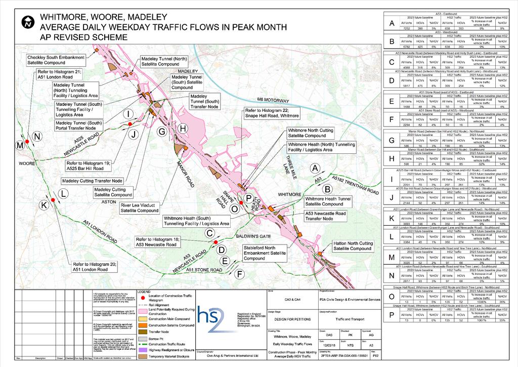
10 4 Management of Construction Traffic in the Proposed Scheme 4.1 Assessment of the Proposed Scheme at Woore As part of the environmental impact assessment (EIA) of the Proposed Scheme a traffic assessment of existing traffic flows along the A51 and A525 through Woore village and evaluation of construction traffic has been undertaken. This is presented in the Environmental Statement deposited with the Proposed Scheme in July The Environment Statement (2017) 2 reports that use of the local road network for HS2 construction traffic will increase traffic flows in the village of Woore during the peak month of construction, from the current traffic baseline: on the A51, south of the A525, by 10%; on the A525, by 14%; and on the A51, north of the A525, by 3%. The Environment Statement (2017) reports slightly higher HGV flows on the A51, south of the A525 then on the A525. On the A51, north of the A525, HGV flows are substantially lower. Average daily HS2 HGV construction traffic (combined two-way flow) during the peak month of construction is reported as 548 total vehicle movements on the A51 in Woore, south of the A525 with a peak period (where HGV traffic exceeds 70% of the peak month) of two months and a busy period (where HGV traffic exceeds 50% of the peak month) of five months. Appendix A includes the alphabet map for the Woore area which illustrates future baseline and AP1 revised scheme traffic flows. Appendix A also includes the AP1 revised scheme traffic histogram for the A51 south of the A525. The traffic figures reported in this Section 4.1 are consistent both for the Proposed Scheme and the AP1 revised scheme. Full details of the AP1 revised scheme are available in the Supplementary Environmental Statement and Additional Provision Environmental Statement 3, published in March HS2 Ltd (2017), High Speed Two (HS2) Phase 2a (West Midlands - Crewe), Environmental Statement, 3 HS2 Ltd (2018), High Speed Two (HS2) Phase 2a (West Midlands - Crewe), Supplementary Environmental Statement (SES1) and Additional Provision Environmental Statement(AP1 ES), Page 9
11 4.2 Construction traffic control measures Route-wide Traffic Management Plan The nominated undertaker has produced a Route-wide Traffic Management Plan (RTMP) which sets out how the project will be delivered. The RTMP has been consulted on with the highway authorities along the Phase 2a route. The RTMP covers matters such as plans to be produced by the Principal Contractor, consultation arrangements, vehicle flow management, driver and vehicle safety, travel to work, temporary traffic management and asset protection. Local Traffic Management Plan Prior to the commencement of the works, the nominated undertaker will require that Local Traffic Management Plans (LTMP) are produced, in consultation with the local highway and traffic authorities, the emergency services and other relevant key stakeholders, such as bus companies. The LTMPs will typically include a list of roads which may be used by construction traffic near the site, including any restrictions to construction traffic on these routes. The impact of road-based construction traffic would be managed in accordance with the Construction Code of Practice. The LTMP would set-out a contractor s statement of intent regarding their key methods of working which will affect the road network and users. It will identify matters such as anticipated changes to the road network, including major road closures. Contractors would be required to assess their traffic flow assumptions to ensure that, in accordance with Environmental Minimum Requirements, no new significant adverse effects would occur, beyond those reported in the Environmental Statement, due to construction traffic volumes. Quality plans and assurance / enforcement In accordance with the Construction Code of Practice, HS2 Ltd will require the main civil works principal contractor to operate their fleet (vehicles over 3.5t) under a recognised quality management operation. This may be ISO39001 or the Fleet Operator Recognition Scheme. Other quality plans may be recognised by the nominated undertaker. Vehicles regularly accessing any HS2 construction site will be required to adopt vehicle and driver safety standards which exceed the Construction Logistics and Community Safety (CLOCS) Standard, or equivalent. Page 10
12 The CLOCS standard includes improvements to vehicles beyond the legal minimum to seek to reduce the number of vulnerable road user crashes and injuries. The HS2 requirements are that the project s contractors adopt most, if not all CLOCS standards but that the contractors are to adopt higher requirements, including: drivers working on the project for more than 6 months undertake rural driver training; mass spoil vehicles are fitted with 4-way, or 360 degree digital recording equipment. Page 11
13 5 Measures Considered Woore Parish Council and Woore Primary and Nursery School have raised concerns with respect to traffic speed compliance through the village and the potential risk this poses to safety, particularly for vulnerable road users. Analysis of the speed survey data indicates that some drivers are exceeding the speed limit in Woore on the A51 London Road, in the southbound direction, where the 85 th percentile speed is 32 mph. Proposals to provide additional traffic calming in Woore may lead to a reduction in average vehicle speeds through Woore. Although the Proposed Scheme construction traffic control measures (described in Section 4) will ensure that construction traffic would meet legal requirements and road safety standards, further options for complementary traffic calming measures have been considered to improve traffic speed compliance and potential safety concerns in Woore village. When considering traffic calming measures to assist in speed management, there are soft (non-physical), which affect driver behaviour and hard (physical), which are self-enforcing measures that can be adopted. Combinations of hard and soft measures can also be effective. The review of each potential measure considered the requirements, benefits, dis-benefits and the associated costs. The measures have been considered as a temporary design with the assumption that once HS2 construction is complete, that any mitigation works will be removed and returned to its original layout. If the highway authority were to desire the measures to remain as permanent installations, then HS2 would enter discussion with them at a later stage. Specific requests for consideration have been identified by Woore Parish Council and have been considered in the assessment and the presentation of the options in this report. The approach adopted in this assessment considers the effectiveness of non-physical, physical, combined (physical and non-physical), and traffic management measures, on traffic calming and road safety. Specific recommendations relating to each measure, or combination of measures incorporate these criteria in the decision process. The following sections of the report present the assessment of the measures listed in Table 1 that were considered with a view to improving road and pedestrian safety in Woore village during the Phase 2a construction period. A design package combining a number of measures from the listed options is considered to be the optimum solution. Two design packages were Page 12

14 appraised and the measures included in each design package are summarised in Table 1. Design Package 2 is the recommended solution. Full details on the recommended design package can be found in Section Table 1: List of measures assessed Page 13
15 6 Soft Traffic Calming Measures 6.1 Soft traffic calming options Soft calming measures make use of features that require no physical change to the road layout or its vertical or horizontal alignment. The design aim of the soft calming measures described below is to increase road user s awareness of the speed limit through Woore and to enhance pedestrian facilities along the route to assist in key areas (e.g. outside the school and by the local shops). The design development took into account factors including the August 2018 speed survey data and an assessment of the existing road layout, provision and conditions. On this basis it was determined that soft measures would generally focus on roads on the southern side of the village, south of the A525. The following measures were taken forward to a more detailed appraisal, where engineering and construction feasibility, cost and environmental impacts were considered: Measure 1 Road marking, upgrade of gateways and upgrade of crossing Measure 2 Vehicle Activated Signs Alternative soft calming measures that were not taken forward to a detailed appraisal are outlined in the description of Measure Measure 1 Road marking, upgrade of gateways and upgrade of crossing This measure uses a combination of road markings, gateway upgrades and crossing upgrades. The aim is to create an environment within the village where drivers feel constrained to reduce their speeds and their awareness is reinforced that there are pedestrians present by regular reminders and visual cues. The aim would be to bring the 85 th percentile speed to lower than the 30mph speed limit (it is currently above this speed limit on the A51, based upon recently measured data). Soft calming in the village would be enhanced by additional road markings. This may include: School roundel markings being installed in the carriageway to supplement and enhance the existing signage. Anti-skid coloured surfacing and Slow text road marking being installed on the A51 southbound approach to the A51/A525 junction. Page 14
16 Red coloured surfacing with speed limit roundels and additional dragon s teeth markings being utilised to enhance the gateway features on the A51 at both entrances to the village. This would further highlight change to the 30mph speed limit. The existing signalised crossing outside the school in Woore would benefit from an upgrade to the latest puffin crossing 4 design. The change would benefit pedestrian experience and safety, particularly for school children, since on-crossing detection would extend green times for the pedestrian phase, when necessary. In addition, drivers would generally benefit from reduced wait times (because requests to stop would be cancelled if the pedestrian is detected to be no longer waiting at the crossing point). The request button and red/green man signals would also be upgraded leading to improved visualisation and usability, particularly for school children. The existing uncontrolled crossing point on A51, just south of the A51/A525 junction would benefit from an upgrade to a zebra crossing. This would improve pedestrian safety at the crossing point. The crossing point would likely be relocated slightly further south as part of the changes associated with Measure 4 - A51/A525 junction safety improvements, which is also a recommended measure in all design packages. Identification of key hazard targets together with a summary and indicative layout of potential combined soft calming measures options for Woore (as discussed above) is illustrated in Figure 1. 4 Puffin crossing - this term is used in the UK to describe a smart signalised crossing for pedestrians to differentiate from the old timed duration pelican crossing. The puffin crossing uses sensors to sense people waiting and crossing to keep the red phase active for the required duration Page 15

17 Figure 1: Measure 1 - Combined soft traffic calming measures and identification of main hazard targets Page 16
18 Advantages The following advantages are identified for Measure 1: Improved pedestrian safety at crossing points on A51; Low disruption to local residents and businesses as a result of the installation process; Soft calming has no impact on journey comfort or impact on emergency services and their response time travelling through an area; and Soft calming can reduce the urbanising feel to any calming. Disadvantages Disadvantages identified for Measure 1: May require additional soft or hard traffic calming measures to achieve reduction in 85 th percentile speed on A51 below the speed limit. (E.g. Measure 2 Vehicle Activated Signs); and Existing issues related to HGV turning movements at the A51/A525 junction (Refer to Section 7.2 for further details) can t be resolved through soft calming measures only. Recommendation The soft traffic calming measures outlined above would likely contribute to a slight reduction in the 85 th percentile speed through Woore village in addition to broader road safety improvements. However, soft measures alone would not resolve certain existing road safety issues such as the HGV movement issues at the A51/A525 junction. It is recommended that these soft traffic calming measures should be incorporated into a broader final package of works that also includes some hard traffic calming measures. 6.3 Measure 2 Vehicle Activated Signs Measure 2 includes five VAS signs along the A51, with two of these being larger and showing more information (located on the northern side of the A525 junction and the southern end of Woore). The indicative VAS signs layout is shown in Figure 2. The aim would be to bring the 85 th percentile speed to lower than the 30mph speed limit (it is currently above this speed limit on the A51, based upon recently measured data). VAS signs convey an illuminated message to drivers in response to vehicle speeds exceeding a pre-defined threshold. Thus, VAS signs target the message specifically at those drivers that need it. Page 17

19 Figure 2: Measure 2 - Indicative VAS sign layout Advantages The following advantages are identified for Measure 2: Page 18
20 VAS signs are blank when not activated. This limits visual intrusion, which is particularly relevant in rural areas; VAS signs can be powered by renewable methods (wind, and solar) in the absence of local mains electricity which can limit the disruption of installation (although the solar panels can have an urbanisation effect); VAS signs are relatively quick and easy to install, particularly lamp column mounted signs. VAS signs mounted on lamp columns can be relocated to new positions with minimal effort; Low disruption to local residents and businesses as a result of the installation process; Soft calming has no impact on journey comfort or impact on emergency services and their response time travelling through an area; and Soft calming can reduce the urbanising feel to any calming. Disadvantages The following disadvantages are identified for Measure 2: VAS signs rely on voluntary reductions in speed. Not all drivers will respond correctly; Larger signs can be visually intrusive in rural areas, especially if powered by renewable means (due to the additional solar array); The signs need regular maintenance; The signs may need a power supply which would require a utility connection and associated disturbance to the footpath (renewable energy options rely on the correct conditions to power the sign and these are not always present); and Existing issues related to HGV turning movements at the A525/A51 junction (See Section 7.2 for further details) can t be resolved through soft calming measures only. Recommendation The installation of VAS along the A51 would likely contribute to a reduction in the 85 th percentile speed through Woore village. However, this measure alone would not resolve certain existing road safety issues such as the HGV movement issues at the A51/A525 junction. It is recommended that VAS signs be incorporated into a broader combined package of measures that also includes some hard traffic calming measures. Page 19
21 6.4 Measure 3 Alternative soft traffic calming measures A number of alternative soft traffic options were considered at the village of Woore but were discounted as part of the preliminary appraisal of options that was undertaken. This preliminary appraisal considered options in terms of whether they are reasonable against environmental, technical and design criteria, these are as follows: Measure 3a Provision of soft traffic calming measures outside Woore village Measure 3b - Provision of speed cameras Measure 3c Provision of prominent speed gate on A525 Measure 3d Provision of a temporary pedestrianised crossing at the Falcon Inn Measure 3e - Provision of a temporary pedestrianised crossing at the A525 A consideration of each of the above options is provided in Appendix B of this report. Page 20
22 7 Hard Traffic Calming Measures 7.1 Discussion of Hard Calming Options Hard calming makes use of features that require physical changes to the road layout or its vertical profile. This method of traffic calming is largely self-enforcing and would slow down most road users to the desired speed. The distance between features directly relates to the average speed along the route. The closer the feature, the lower the speeds. However, there is a balance between speeds and smooth traffic flow to control noise and emissions. Another consideration is the overall functionality of the road and the desire to maintain suitable speeds for through traffic, including commercial traffic, which can often conflict with the desires of local residents. Many vehicle cross-overs occur on the A51 through Woore. (A cross-over is a location where a vehicle travelling in one lane must cross through the opposite lane into a junction, domestic access or service road (or vice versa)). These would limit the type of physical engineering that could be installed because hard traffic calming features could create potential access difficulties for residents living close to the road. The following option was taken forward to a detailed appraisal where engineering and construction feasibility, cost and environmental impacts were considered: Measure 4 A51/A525 junction safety improvements Measure 5 - Hard traffic calming measures on A51 north of the A51/A525 junction Measure 6 - Hard traffic calming measures on A51 south of the A51/A525 junction Alternative hard calming measures that were not taken forward to a detailed appraisal are outlined in the descriptions of Measure 7 and Measure Measure 4 - A51/A525 junction safety improvements Currently HGVs that are westbound on the A525 making a left turn out of the A525 onto the A51 (southbound) overrun into the opposing lane to ensure that they clear the adjacent footway buildout that is located on the southern side of the junction, see Figure 3. To improve the safety of turning movements for the increased frequency of HGVs arising from HS2, the existing kerb line would require to be Page 21

23 temporarily set back during the duration of construction traffic movements as shown in the sketch in Figure 4. This measure is included in both design packages. Figure 3: View looking north on A51 at the A51/A525 junction Page 22

24 Figure 4: Indicative layout of revised junction The kerb radius would be reduced to achieve the left turn out of the junction whilst keeping a 2m wide footway at the rear of the carriageway to maintain safe provision for pedestrians. The existing uncontrolled pedestrian crossing located on the southern side of the A51/A525 junction on the A51 would need to be relocated away from the junction. This would allow for the kerb line to be adjusted but maintain the crossing provision. This uncontrolled crossing could be in the form of a new build out further south outside the antiques shop (Refer to Figure 4) The new, uncontrolled crossing would conflict with the bus stop on the north bound side of the A51. This could be temporarily relocated to the south of the existing location. Figure 5 illustrates the indicative temporary bus stop location. The existing footway at this location is sufficiently wide to enable footway users to pass each other safely when people are waiting at the bus stop. Discussions with the bus companies and traffic authority would need to take place in order to confirm the exact temporary bus stop location. Page 23

25 Figure 5: Indicative temporary bus stop location The existing footway width on the western side of the A51 at the existing uncontrolled crossing point just south of the A51/A525 junction is narrow. The existing footway width at the proposed temporary location of the crossing is similarly narrow. In both design packages it is recommended that this crossing be upgraded to a zebra crossing. It may be necessary to widen the footway into the existing raised verge in order to accommodate the signage and tactile paving associated with the temporary zebra crossing. This would need to be discussed with the Local Highway Authority at a later design stage if this temporary measure is to be implemented. Based on information at this stage of design development it is not clear if utilities may be affected by the option for temporary junction improvement proposals. Indications on site show that there are communication services within this area. Requirements for diversions / lowering of utility services cannot be ruled out and may cause disruption as well as adding to the cost of the junction improvement. Temporary loss of parking An area currently designated for parking would need to be temporarily converted to a footway build-out as part of the junction improvement works Page 24

26 (Refer to Figure 4). This will assist pedestrians in crossing the A51 safely. The provision of a replacement parking space in Woore village is challenging. In general, the existing carriageway and footway width through the village is insufficient to enable the provision of additional parking spaces within the available cross section width. One of the locations examined as a possible temporary parking replacement was the footway outside the Swan Court apartments. There is an existing footway build-out outside the building entrance (Refer to Figure 6) that could be replaced with a temporary parking space. However, it is assumed that this location is currently used as an informal crossing point for the northern end of the village. There are few alternative safe crossing locations on the A51 north of the A51/A525 junction. The provision of an alternative replacement crossing point would necessitate the removal of parking spaces and make the design changes redundant. On this basis it is not recommended that this location be utilised for alternative parking. Any additional on-street parking provision in other locations on the A51 will reduce the width of the highway for moving traffic and therefore has the potential to cause disruption to the flow of traffic on this A road. The A51 is currently used by large HGVs and agricultural vehicles in this location and anything which unduly negatively affects the flow of the A road would not be desirable. No other safe location for the provision of temporary replacement parking in the village was identified and as a result it is assumed that parking available in the village would be slightly reduced for the duration of construction works while the design changes to the A51/A525 junction remain in place. Whilst there is the potential loss of one space there are limited on street parking restrictions in the vicinity of the shops and therefore the loss of one parking space will not result in any adverse effect. Figure 6: Existing footway build-out outside entrance to Swan Court apartments Page 25
27 Advantages The following advantages are identified for Measure 2: Design changes could be made in advance of HS2 construction phase to provide a safer access onto the A51 southbound for HGVs approaching from the A525; and Disruption from these proposals would be relatively low and reinstatement to the original conditions after HS2 construction is complete would be relatively simple, if required. Disadvantages The following disadvantages are identified for Measure 2: The relocation of the uncontrolled crossing may result in some temporary loss of current parking on the A51 to the south of the junction, due to the need for a build-out to assist pedestrians crossing the road; and An existing bus stop and shelter / public notice board is located close to this proposed crossing. The bus stop would need to be relocated temporarily and space to provide this is limited. The shelter / public notice board could be retained in its current position. Recommendation This option is considered to be a practicable way to improve the safe turning movements of HGVs through the A51/A525 junction during the HS2 construction period. It is recommended that this option is included in any combined package of design works to reduce the impact of HGV movements through the village. Pedestrian safety at the relocated crossing point on the A51 could be further enhanced by incorporating additional soft calming measures (E.g. Zebra Crossing). See the description of the recommended design package in Section 10.3 for further details. 7.3 Measure 5 Hard traffic calming measures on A51 north of the A51/A525 junction Measure 5 provides an indicative layout of potential effective hard calming options for Woore north of the A525 junction on the A51. These are designed to self-enforce a 30mph speed limit and enhance pedestrian facilities along the route (Refer to Figure 7). Flat top humps or cushions are considered possible (but may not be desirable) for Woore village to control speed within the current 30mph Page 26
28 speed limit taking into consideration existing conditions of the highways in the village. These are described in more detail in Appendix B. Speeds of vehicles between humps are influenced by before speed, hump dimensions and the longitudinal hump spacing. Lower heights and shallower ramp gradients can be used on bus routes to reduce discomfort for bus drivers and passengers and reduce delays to emergency services. This is considered important for Woore village because the road network is on a bus route. However, it is noted that this type of hump design is likely to increase the ability for cars to travel at higher speed, though less than on an unrestricted carriageway. Cushions are also considered an alternative option to humps for Woore village. Speed of vehicles over cushions is mainly determined by cushion width. Cushion dimensions and spacing can be varied depending upon the road type and target speed required. Narrower cushions can be used to reduce discomfort to passengers in mini-buses and ambulances. Cushion layouts can be varied to suit changes of road width. It is also important that the incidence of commercial vehicles straddling cushions is minimised (TAL 06/96). This can be reduced by the introduction of parking restrictions to maintain clear space around the cushions. This may be particularly relevant to the effectiveness of traffic calming in combination with the use of the A525 and A51 for construction traffic and may be a requirement if cushions were adopted as a hard traffic calming solution in Woore. The associated reduction of roadside parking is likely to be seen as a disadvantage by some people who visit or use the village amenities. Page 27

29 Figure 7: Measure 5 - Hard traffic calming north of A51/A525 junction Advantages/Disadvantages The following advantages are identified for the adoption of road hump hard traffic calming options for Woore village: Road humps are a proven speed control device used in 20mph zones and on 30mph roads and have been shown in some locations to result in a reduction of over-speeding with consequent reductions in injury accidents of up to 60 per cent; The hump design to maintain speeds within limits (which is influenced by vehicle type and hump dimensions) of typical vehicles on the A51 can be accommodated within Woore village road characteristics; Vehicles can park over humps which reduces (but may not eliminate) the impact on parking space; Page 28
30 Flat-top humps (kerb-to-kerb) can also provide good crossing places for pedestrians and may enhance pedestrian travelling experience when crossing the roads in the village, providing wider desired benefits; Humps and raised junctions can improve the appearance of a road (if designed and built to a high standard and in materials sensitive to the location) and would not necessarily significantly change the heritage characteristics of the village; and Flat top humps are proven to be an effective speed control device without supervision by the authorities. i.e. They are largely selfenforcing. Disadvantages for Woore village with respect to the adoption of road hump hard calming options can be summarised as follows: Delays to emergency service vehicles and buses; Potential poor quality of ride for all vehicles, including bicycles; Additional wear and tear of vehicles (including emergency vehicles and buses). Local Woore residents being frequent road users in the area would be affected. In addition, the possibility of grounding for vehicles with a long wheelbase and/or for scraping of the underside of vehicles would be a possibility; Increased vehicle noise and exhaust emissions to Woore village caused by vehicles negotiating features and from gear changes and speed reduction. This would be limited, where possible, by careful design but may not be fully eliminated; Potential temporary disruption to Woore village and road users during installation and removal, including requirements for the provision additional drainage to accommodate for kerb-to-kerb road humps; Some hump schemes may not be visually attractive and may be considered urbanising in rural areas this may be a disadvantage to Woore village due to the local perception of the heritage characteristics of the village; Ongoing maintenance cost; and Road humps need marking, signing and lighting except in 20 mph zones. This may affect the heritage characteristics of the village. The following advantages are identified for cushion hard calming options for Woore village: Cushion solutions provide less discomfort than road humps to occupants of buses and commercial vehicles; Cushions cause fewer delays to emergency vehicles; Page 29
31 Cushions are an effective speed control device (although not as effective as round or fat-top road humps); Drainage issues are reduced; and Cyclists and motorcyclists may be able to avoid the cushions which may be attractive to some road users in Woore village. The following disadvantages of cushion hard calming options for Woore village are considered: Different colours and materials may need to be adopted to increase the visibility of these measures. This may be a disadvantage to residents of Woore village with respect to heritage preservation; Cushions are not suitable for reducing speeds of two-wheeled motor vehicles; Discomfort is experienced by drivers and passengers in smaller vehicles (cars, light commercial vehicles, minibuses and some ambulances); These are not always effective for controlling speed of wider axle width vehicles, which may be a concern of Woore s HGV traffic use. To ensure effectiveness parking restrictions or additional build-outs may also be required; There is a noise and vibration impact from provision of cushions. There is a potential for poor driving style as drivers attempt to lessen the impact of the cushions depending on road constraints). This is likely to be an unattractive potential issue for Woore due to carriageway constraints; Potential for grounding of vehicles; They are not suitable at pedestrian crossing places as they are potentially a tripping hazard; There is an increased risk of damage to vehicles parked adjacent to the cushions; Temporary disruption to road users during installation and removal; Ongoing maintenance cost; Potential for temporary loss of parking spaces in the vicinity of the cushions as it must be ensured that emergency vehicles and buses etc. have sufficient space to straddle the cushions; and Speed cushions need road marking, signing and lighting (except in 20 mph zones where this need is reduced). This may affect the heritage characteristics of the village. Speed cushions may not fit in with the character of the street and may be considered urbanising in rural areas. Page 30
32 Recommendation Though hard traffic calming can be an effective means of achieving speed reductions and improving road safety, they also have a number of disadvantages. Taking account of these disadvantages, it is not recommended that these hard traffic calming measures should be adopted for Woore village. 7.4 Measure 6 Hard traffic calming measures on A51 south of the A51/A525 junction Measure 6 provides an indicative layout of potential effective hard calming options for Woore south of the A51/A525 junction. These are designed to self-enforce a 30mph speed limit and enhance pedestrian facilities along the route (Refer to Figure 8). At the two locations where the road humps are to be coincident with existing pedestrian crossing points (The uncontrolled crossing just south of the A51/A525 junction and the signalised crossing adjacent to Woore Primary School), flat top humps coincident with the crossings would be utilised to enhance pedestrian safety at these locations. Further details on the design considerations related to road humps and cushions can be found in Section 7.3. Page 31

33 Figure 8: Measure 6 - Hard traffic calming south of A51/A525 junction Advantages The following advantages are identified for Measure 6: Enhanced pedestrian safety at two existing pedestrian crossing points; and Refer to Section 7.3 for a list of advantages associated with road humps and cushions. Disadvantages The following disadvantages are identified for Measure 6: Refer to Section 7.3 for a list of disadvantages associated with road humps and cushions. Page 32
34 Recommendation Whilst the hard traffic calming measures may improve pedestrian safety at the crossing points south of the A51/A525 junction and may also contribute to a reduction in the 85 th percentile speed on the A51, this measure is not recommended for adoption in Woore village on the basis of the disadvantages listed above. Alternative traffic calming measures were deemed to be more appropriate. 7.5 Measure 7 Extension of hard traffic calming measures along A51, A525 and B5026 The extension of hard traffic calming along the A51, A525 and B5026 outside the main village of Woore is challenging. There is insufficient carriageway width or highway land available in Woore Parish for the majority of the lengths of these roads to consider the installation of central reserves, chicanes or traffic islands features. Hard measures along these roads within the Parish, as a means of traffic calming, would therefore not be feasible. The B5026 does not have gateway feature entering into Irelands Cross. It would be possible to install a gateway feature here to highlight the entrance to the existing 40mph speed limit. However, in view of the fact that HS2 construction traffic will not be using the B5026 it would be difficult to justify the disruption caused by the construction of this sort of feature at this location. Any new infrastructure with respect to traffic calming in Woore would need to be agreed and approved by the local highway authority, Shropshire County Council. 7.6 Measure 8 Alternative hard traffic calming measures A number of alternative hard traffic options were considered at the village of Woore but were discounted as part of a preliminary appraisal of options. Measures were considered in terms of whether they were reasonable against environmental, technical and design criteria, taking into account the scale of the problem that is currently considered to exist compared to the scale of the disruption that would occur to implement the change. These are as follows: Measure 8a - Provision of Chicanes Measure 8b - Pinch Points Measure 8c - Traffic Islands and Refuges Measure 8d - Round and Flat Top Humps Measure 8e - Cushions Page 33
35 Measure 8f - Rumble Strips Measure 8g - Mini Roundabouts A description of each of the above options is provided in Appendix B of this report. Page 34

36 8 Traffic Management Measures 8.1 Other Traffic Management Measures Available Measures available include: the provision of a traffic control officer during school opening or closure periods or improvements to the existing signalised crossing. 8.2 Measure 9 School crossing patrols School crossing patrols are not common in Shropshire 5.. It is a common policy of many highway authorities not to provide school crossing patrols at such locations due to the presence of an existing, very visual and safe crossing point for pedestrians to cross the road. The existing signalised crossing at Woore is directly outside the entrance to Woore Primary and Nursery School, as shown in Figure 9. Figure 9: Existing crossing facility outside Woore Primary School As discussed in Section 6.2 of this report, there would be some benefit from upgrading this crossing to a Puffin crossing to improve pedestrian safety provision and traffic flows. The opportunity for provision of a school crossing patrol officer, even as a temporary measure, would require further discussion with Shropshire County Council. The discussions would need to consider: 5 Refer to Page 35
37 In what ways it would be considered to be useful over and above the existing provision; Any specific issues relating to the location; How to reliably staff the crossing; Cost of staffing; School staff views; and Local highway authority views. The provision of a school control crossing officer would more typically be found at uncontrolled crossing points and zebra crossings. Page 36
 or, alternatively, infrequent housing (for example; at the southern end of Woore there are")
38 9 Measures to Improve Footway Provision 9.1 Existing provision Within Woore village, the A51 has footways on both sides of the highway for most of its length. Where it is omitted, there is lack of available highway land to provide it (at the north end of village) or, alternatively, infrequent housing (for example; at the southern end of Woore there are only 5 houses present on the east side of the A51). At some locations, the effective width of the footway is reduced by obstructions. The B5026 (at Ireland s Cross) has footway facilities at its northern end which links up to the A51 pedestrian facilities without the need to cross over the A51. Again, existing highway boundaries determine what side of the highway that the provision for the footway can be located. The A525 has footways on both sides of the road in the centre of Woore. The provision reduces to one side of the highway when leaving the village centre. Housing is mainly located on this existing footway side. Between Ireland s Cross and Woore the footway provision is non-continuous due to the highway layout, residential dwelling locations and highway boundary features. The highway boundary determines which side of the carriageway a footway can be located. Therefore, between Ireland s Cross and Woore there are two locations where pedestrians are required to cross over the A51 to continue their journey using the footway. The first point is at the northern extent of Ireland s Cross and the second point being at the southern edge of Woore village as shown in and Figure 10 and Figure 11. Figure 10: Existing uncontrolled crossing facility on outskirts of Ireland s Cross Page 37
 could be enhanced")
39 Figure 11: Existing crossing facility on outskirts of Woore (southern side) There are no existing footways provided outside of Woore to the north of the village. 9.2 Measure 10 Enhanced pedestrian crossing points on A51 The two existing uncontrolled pedestrian crossing points between Ireland s Cross and Woore (Refer to Figure 10 and Figure 11) could be enhanced with temporary soft calming measures. With the likely relatively low use of the uncontrolled crossings between Woore and Ireland s Cross, it would not be appropriate or cost-effective to install controlled crossings (such as zebra crossings) at these locations. There could also be some safety concerns with such a proposal due to low pedestrian usage and related driver behaviours. The locations of these uncontrolled crossing points are within a 40mph speed limit. Current design standards do not allow the installation of zebra crossing on roads with 85 th percentile speeds over 35mph. If speeds are anticipated to be above this level, any crossings would need to be of a signalised pedestrian crossing type. A more appropriate solution would be the utilisation of additional signage, road markings, reflective bollards and coloured surfacing. These measures would highlight to oncoming road users both the presence of a crossing point and the need to be aware of pedestrians wanting to cross at these locations. This would improve driver awareness of the hazard and general pedestrian safety along the road. The detailed design of this measure would need to be developed in consultation with the local highway authority. Page 38
40 Advantages The following advantages are identified for Measure 10: Increased driver awareness of the two crossing points leading to improved pedestrian safety; Low disruption to local residents and businesses as a result of the installation process; and No impact on journey comfort or impact on emergency services and their response time travelling through an area. Disadvantages The following disadvantages are identified for Measure 10: Additional street furniture (E.g. reflective bollards) would introduce obstructions for footway users and it may not be possible to accommodate them at all crossings within the footway width available. Recommendation The soft traffic calming measures outlined above would likely contribute to improved safety for pedestrians during the construction period. It is recommended that these soft traffic calming measures should be incorporated into a broader final package of works that also include additional soft and hard traffic calming measures along the route. 9.3 Measure 11 Footway improvements close to the Falcon Inn A section of existing footway is narrowed by a private hedge along the boundary between the school and the Falcon Inn on the western side of the carriageway, as shown in Figure 12 Page 39

41 Figure 12: Existing hedge narrows the footpath on the southern side of the Falcon Inn entrance The hedge encroaches onto the footway restricting the usable width of the footway for pedestrians over this short section. This is an important length of footway taking into consideration the proximity to the school access and the understanding of the use of the Falcon car park for school drop-off and pick-ups. The works would entail significant cutting back and removal of the hedge to the highway boundary, erection of a temporary fence removal of the temporary fence and re-planting/cultivation of the hedge (on the assumption that the cut-back to the hedge would be so severe that it would not survive) after HS2 construction works are complete. Advantages The particular short section of footway would be significantly more accessible for pedestrians, prams and mobility scooters. Disadvantages The section of footway would still be relatively narrow and other obstructions (such as wooden service poles) would still, locally, obstruct the footway width. Recommendation This option will improve accessibility for pedestrians and is therefore recommended. Page 40
42 9.4 Measure 12 - Continuous footway along the A51, A525 and B5026 A continuous pavement along the A51, A525 and B5026 through the village was suggested by Woore Parish Council to limit the need to cross the main roads. As presented in the review of current provision and constraints, this option is not considered feasible (within the scope of the Phase 2A hybrid Bill) due to the lack of available highway land. The fitting of pedestrian guardrail barriers at crossing points is also not recommended. They are mainly used in urban environments where options for adequate design of crossing locations may be restricted. There should be no requirement for such measures in Woore village for well-designed crossing points. Installation of such provision in Woore village would create more street furniture clutter and potentially adversely affect the existing heritage characteristics of the village. The footways in Woore are not wide and any street furniture installed would need to be set back from the kerb edge which would further restrict the available width. This would potentially create a hazard / annoyance for people using the footways, especially those using pushchairs and mobility scooters. Advantages A continuous pavement would clearly improve pedestrian safety. Disadvantages It would be very disruptive to properties alongside the route due to the need to obtain land from private properties to provide the continuous route that is desired; and There would be a loss of roadside parking. Recommendation It is considered to be too disruptive to the village to provide a continuous footway route. As outlined in Section 9.2 of this report, at two uncontrolled crossing points on the A51 (where one footway ends and pedestrians are forced to cross the road) it is recommended that improved signage and road markings be installed to warn traffic that pedestrians may be crossing ahead. 9.5 Measure 13 - Pedestrian access to Bridgemere Garden Centre Provision of pedestrian access to the Bridgemere Garden Centre was considered. It is noted that the HS2 construction works has no impact on the Page 41
43 existing access to the garden centre other than the additional construction related traffic, which as reported in the Environment Statement (2017) during the peak month of construction equates to 66 HGVs in each direction. The garden centre is located out of the village of Woore, further north along the A51. There is no footway access to this location along the A51. The distance between the Garden Centre and the point in Woore Village where the current footway ends is approx. 1350m. The provision of a footway along the A51 would require numerous areas of land take from private residential and agricultural land. In addition, the proposal would have significant environmental impacts, with extensive lengths of hedges and many trees being affected. It is highly likely that utility services would require some diversion and possible earthworks would be required which could potentially increase land take beyond the width of the footway itself. Recommendation Considering these significant challenges, the associated environmental impacts and land take required to construct pedestrian access from Woore to the Bridgemere Garden Centre along the A51, the provision is not recommended. Page 42

44 10 Design Package Options 10.1 Benefits of combined packages of measures Combined hard and soft traffic calming measures offer the opportunity to establish an environment within a locality in which drivers are continually influenced and reminded to drive below posted speed limits and to maintain full consideration of non-motorised users. A number of alternative combined traffic calming options were considered at the village of Woore. The following design packages were taken forward to an outline appraisal where engineering and construction feasibility, cost and environmental impacts were considered. Design Package 1 Combined hard and soft traffic calming measures on A51 including road humps south of the A51/A525 junction Design Package 2 Combined hard and soft traffic calming measures on A51 excluding road humps Refer to Table 2 for a summary table outlining the measures that have been included in each design package. Table 2: Design Packages Summary 10.2 Design Package 1 Combined hard and soft traffic calming measures on A51 including road humps south of the A51/A525 junction Design Package 1 presents a combination of hard and soft traffic calming measures on the A51 including road humps south of the A51/A525 junction (Refer to Figure 13). Measures 1, 4 and 6 have been included in this package and are summarised below. Page 43
45 This option includes the installation of flat top road humps (or cushions) through the Woore village on the A51. The road humps are in targeted locations where they would provide the greatest benefit, while considering the spatial requirements between the calming features. A new raised zebra crossing is proposed between the Falcon Inn and the A51/A525 junction (as part of the relocation of the existing build out at the A51/A525 junction). The existing signalised crossing outside the school access would be converted to a flat top road hump and the signals would be upgraded to a puffin crossing standard. The safety improvements to the A51/A525 junction outlined in the description of Measure 4 are included as part of this combined package of works. The soft calming measures include the following additional road marking treatments: School roundel markings being installed in the carriageway to supplement and enhance the existing signage. Red coloured surfacing with speed limit roundels and additional dragon s teeth markings being utilised to enhance the existing gateway features on the A51 at the southern and northern entrances to the village. This would further highlight change to the 30mph speed limit. Page 44

46 Figure 13: Design Package 1 - Hard Calming solution combined with complementary soft calming provision Page 45
47 Advantages The key advantages of Design Package 1 can be summarised as follows: Improved pedestrian safety at crossing points on the A51; Road humps are a proven speed control device used in 20mph zones and on 30mph roads and have been shown in some locations to result in a reduction of over-speeding with consequent reductions in injury accidents of up to 60 per cent; and Design changes to A51/A525 junction could be made in advance of HS2 construction phase to provide a safer access onto the A51 southbound for HGVs approaching from the A525. Refer to Sections 6.2, 7.2 and 7.4 for additional details regarding the advantages of Measures 1, 4 and 6 respectively. Disadvantages The key disadvantages of Design Package 1 can be summarised as follows: Road humps and cushions would lead to delays to emergency service vehicles and buses; potential poor quality of ride for all vehicles; additional wear and tear of vehicles; increased vehicle noise and exhaust emissions; potential disruption to Woore village during installation and removal; and potential negative impact on the heritage characteristics of Woore village. The safety improvements to the A51/A525 junction and the upgrade of the adjacent uncontrolled crossing may result in some temporary loss of current parking on the A51 and will require temporary relocation of the existing bus stop on the A51. Refer to Sections 6.2, 7.2 and 7.4 for additional details regarding the disadvantages of Measures 1, 4 and 6 respectively. Recommendation This design package is not recommended. This is primarily because of the numerous disadvantages associated with the utilisation of road humps and/or cushions in Woore village. The package of measures recommended in Design package 2 is deemed more appropriate to achieve the speed reduction and road safety goals of these design changes, whilst minimising the negative impacts through Woore village. Page 46
48 10.3 Design Package 2 Combined hard and soft traffic calming measures on A51 excluding road humps (Recommended) Design Package 2 presents a combination of hard and soft traffic calming measures on the A51 excluding road humps and cushions. (Refer to Figure 14) Measures 1, 2, 4, 10 and 11 have been included in this package and are summarised below. The soft calming measures include: A series of VAS signs through the village on A51 to encourage speed reduction; Road marking and signage measures to improve driver awareness of uncontrolled crossings between Woore and Ireland s cross; School roundel markings being installed in the carriageway to supplement and enhance the existing signage; Anti-skid coloured surfacing and Slow text road marking being installed on the A51 southbound approach to the A51/A525 junction; Red coloured surfacing with speed limit roundels and additional dragon s teeth markings being utilised to enhance the existing gateway features on the A51 at the southern and northern entrances to the village. This would further highlight change to the 30mph speed limit; A new zebra crossing is proposed between the Falcon Inn and the A51/A525 junction (as part of the relocation of the existing build out at the A51/A525 junction); and The existing signalised crossing outside the school access would be upgraded to a puffin crossing. The safety improvements to the A51/A525 junction outlined in the description of Measure 4 and the improvements to the footway provision outside the Falcon Inn outlined in Measure 10 are also included as part of this combined package of works. Page 47

49 Figure 14: Design Package 2 - Use of VAS, enhanced road marking and signage plus selected hard traffic calming measures. Page 48
50 Advantages The key advantages of Design Package 2 can be summarised as follows: Improved pedestrian safety at crossing points and along footways on the A51; Low disruption to local residents and businesses as a result of the installation process compared to hard calming measures; Measures would have no impact on journey comfort or impact on emergency services and their response time travelling through an area; Measures would not lead to any increases in vehicle emissions, noise or vibrations. Soft calming can reduce the urbanising feel to any calming; and Design changes to A51/A525 junction could be made in advance of HS2 construction phase to provide a safer access onto the A51 southbound for HGVs approaching from the A525. Refer to Sections 6.2, 6.3, 7.2, 9.2 and 9.3 for additional details regarding the advantages of Measures 1, 2, 4, 10 and 11 respectively. Disadvantages The key disadvantages of Design Package 2 can be summarised as follows: VAS signs rely on voluntary reductions in speed. Not all drivers will respond correctly; The safety improvements to the A51/A525 junction and the upgrade of the adjacent uncontrolled crossing may result in some temporary loss of current parking on the A51 and will require temporary relocation of the existing bus stop on the A51. Refer to Sections 6.2, 6.3, 7.2, 9.2 and 9.3 for additional details regarding the disadvantages of Measures 1, 2, 4, 10 and 11 respectively. Recommendation This combined package of hard and soft traffic calming measures is the recommended solution. This design solution would aim to: Maintain sub 30mph vehicle speeds through the village; Minimise impact on the heritage characteristics of Woore village; Minimise noise and emissions resulting from traffic calming measures; Enhance pedestrian safety in the village; and Improve the safe and efficient passage of vehicles including both HGVs and agricultural vehicles. Page 49
51 10.4 Design Package Comparison Table As part of the appraisal of each design package, each design package was assigned a rating relative to the Proposed Scheme design against the following design criteria: Impact on traffic speeds; Impact on pedestrian safety at crossings; Impact on pedestrian safety on village footways (Particularly for school access); Impact on safety at the A51/A525 junction; Disruption to village during construction of calming measures; Impact on local parking provision; Delays to emergency services and buses caused by calming measures; Impact of calming measures on vehicle emissions, noise and vibrations; and Impact of calming measures on heritage characteristics of Woore village. Each design package was assigned a rating from one to three stars against each of these criteria. A summary of these ratings along with a description of the performance metric for each criteria and additional commentary is provided below in Table 3. Page 50
52 Table 3: Design Package Comparison Criteria Impact on traffic speeds Impact on pedestrian safety at crossings Impact on pedestrian safety on village footways (Particularly for school access) Impact on safety at the A51/A525 junction Disruption to village during construction of calming measures Impact on local parking provision Relative performance metric (From * to ***) *** = large reduction Baseline Relative Performance Comments Proposed Scheme Design Package 1 Design Package 2 (Recommended) Baseline Proposed Scheme Design Package 1 Design Package 2 (Recommended) Baseline *** ** *** = large improvement *** ** *** = large improvement * ** *** = large improvement ** ** *** = low disruption ** *** *** = low reduction in parking *** *** The Proposed Scheme construction traffic control measures (described in Section 4) will ensure that construction traffic would meet legal requirements and road safety standards. The Proposed Scheme does not include calming measures that would aim to reduce speeds through Woore village. The surveyed existing 85 th percentile speed on the A51 was above the 30mph speed limit in Woore village. The Proposed Scheme does not include changes to the existing pedestrian crossings or footways in Woore village. The Proposed Scheme includes provision to temporarily remove existing street furniture to allow HGVs to pass through the junction safely. Low disruption would result from the removal of street furniture at the A51/A525 junction. The Proposed Scheme does not include calming measures that would lead to a reduction in parking provision through the village. Road humps would have the greatest impact on speed reduction and should reduce the 85th percentile speed on the A51 below 30mph. Flat top humps coincident with crossings would have the greatest impact on pedestrian safety at crossings. Package does not include improvements to footway provision. It is expected that the measures included in Design Package 2 would also lead to a reduction in the 85th percentile speed on the A51 to below 30mph. Upgrades to the signalised crossing at the school and a number of uncontrolled crossings would also improve pedestrian safety through the village. A moderate improvement to pedestrian safety on footways would be achieved through the removal of overgrown vegetation obstructing the footway adjacent to the primary school and by increasing driver awareness of pedestrians along A51 with signage and road marking measures. Both packages include similar measures that will lead to additional safety improvements at the junction, further improving the safety of HGV movements. The installation and removal of the road humps in the carriageway would lead to greater disruption to the village compared to Design Package 2. Relatively low disruption would result from the A51/A525 junction upgrade and other works, primarily on the footways. The A51/A525 junction upgrade present in both options will likely lead to minor reduction in parking provision in the village for the duration of the construction phase. Page 51
53 Table 3: Design Package Comparison (Continued) Criteria Delays to emergency services and buses caused by calming measures Impact of calming measures on vehicle emissions, noise and vibrations Impact of calming measures on heritage characteristics of Woore village Relative performance metric (From * to ***) *** = shortest delay Baseline Proposed Scheme Relative Performance Design Package 1 *** = smallest increase ** *** Baseline Comments Design Package 2 (Recommended) Baseline Proposed Scheme Design Package 1 Design Package 2 (Recommended) * *** *** = small impact * ** The Proposed Scheme does not include calming measures that would lead to delays to emergency services and buses through the village. The Proposed Scheme does not include calming measures that would lead to increased vehicle emissions, noise and vibrations. The Proposed Scheme does not include calming measures that would impact on the heritage characteristics of Woore village. Road humps would lead to delays for emergency services and buses. Road humps would lead to increased vehicle emissions (CO, NOx and PM), noise and vibrations through the village. Road humps may be considered 'urbanising' in nature, negatively impacting the heritage characteristics of Woore village. Package does not include any hard calming measures that would delay emergency services and buses. Package does not include any hard calming measures that would increase vehicle emissions, noise or vibrations. Additional signage and road marking may be considered to have a moderate impact to heritage characteristics of the village. One advantage of VAS signs is that they are blank when not displaying a message. Page 52
54 11 Summary and Recommendations A range of measures have been considered with respect to improving road safety and traffic calming in Woore village. It is recommended that a package of complementary measures (Design Package 2) is considered to address concerns over traffic speed compliance and pedestrian safety in Woore. The recommended measures would also complement provision for the control of construction traffic set out in the HS2 construction management plan (using current industry standards and guidance) for the Proposed Scheme. The recommended package of measures includes: Adjustments to the A51/A525 junction; A series of soft calming measures including VAS, road signage and markings and improved gateways in the north and south entrances to the village; Upgrading of the existing signalised pedestrian crossing and the possible introduction of a new zebra crossing to replace the existing uncontrolled crossing just south of the A5/A525 junction; and Improvements to pavement provision outside the Falcon Inn. Generally, road humps or cushions are not recommended in the package of measures as a result of the disadvantages outlined in Section 7.3. Wider upgrading and enhancing pavement provision throughout the village is not recommended due to lack of highway land available to accommodate the provision and lack of potential demand in some locations. The provision of a school patrol officer lacks clear additional benefit over other options (such as improving the existing, signal-controlled crossing to a Puffin crossing). However, the option is not discounted at this point and should be discussed further with Shropshire County Council. Hard traffic calming features remain an option for Woore village but are less favoured and not recommended due to several disadvantages to the village. These disadvantages include: noise impact, increased emissions, installation disruption, heritage impacts and cause increased wear and tear on vehicles passing through Woore. Following feedback from Woore Parish Council on the design packages presented in this study, any measures requiring changes to the highway will need to be discussed and agreed with the highway authority, Shropshire County Council prior to being taken forward. Page 53
55 The recommended measures are shown diagrammatically in Figure 14. The solution would aim to achieve: Maintaining sub 30mph vehicle speeds through village; Minimise impact on the heritage characteristics of Woore village; Minimise noise and emissions resulting from traffic calming measures; Enhance pedestrian safety in the village; and Improve the safe and efficient passage of vehicles including both HGVs and agricultural vehicles. Page 54
56 References 1. Local Transport Note 1/07 March 2007 Traffic Calming 2. HS2 Ltd (2017), High Speed Two (HS2) Phase 2a (West Midlands - Crewe), Environmental Statement, 2a-environmental-statement 3. HS2 Ltd (2018), High Speed Two (HS2) Phase 2a (West Midlands - Crewe), Supplementary Environmental Statement (SES1) and Additional Provision Environmental Statement(AP1 ES), 4. Environmental Statement Volume 5: Technical appendices. Draft Code of Construction Practice (CT ) 5. High Speed 2 Phase 1 and 2a: Route-Wide Traffic Management Plan. Document no.: HS2-HS2-CL-PLN Page 55
 Site 4 A51 NB 3246 2.0 30.6 Site 4 A51 SB 3228 2.0 32.0 Site 3 A525 EB 1857 1.7 25.9 Site 3 A525 WB 1822 3.0 25.")
57 Appendix A Traffic Survey Locations and results Figure A15: Extract from Ordnance survey map showing two speed and volume data points (Sites 3 and 4) Table 4: Traffic survey results Sites 3 and 4 Location Direction AADT % HGV 85 th Percentile Speed (MPH) Site 4 A51 NB Site 4 A51 SB Site 3 A525 EB Site 3 A525 WB Notes: AADT - Annual average daily traffic (number) % HGV - % of AADT which is recorded as HGV traffic 85 th Percentile speed Measured speed of which 85% of traffic is below at the location Page 56
58 Page 57
59 Page 58
60 Appendix B - Traffic calming measures (Hard and Soft) Hard traffic calming measures The hard traffic calming measures considered in Woore are discussed below: Measure 8a Chicanes Chicane designs vary considerably but most fall into two broad categories: Single lane, consisting of staggered build outs, narrowing the road so that the traffic from one direction must give way to opposing traffic. Two lane, using build outs to provide deflection, but with lanes separated by road markings or a central island. A single lane chicane allows traffic flow in both directions, but there is only room for one vehicle to pass at a time. Generally, priority is given to one direction, minimising the possibility of vehicle conflicts. Priority should be given to vehicles leaving a traffic-calmed area to reduce the speed of vehicles entering the area. Two lane chicanes require more carriageway width than single lane chicanes, as they allow two vehicles to pass in opposite directions at the same time. Where chicanes do not have a central divider, vehicles can encroach into the opposing traffic lane, and this may result in less speed reduction being achieved, and / or safety being compromised. Measure 8b - Pinch Points A pinch point is where the road is narrowed from both sides at the same position along the road for 5 to 10m. By implementing this measure, the carriageway width can be restricted so that only one vehicle at a time may pass, or so that two vehicles can pass slowly. Roads with a high frequency of buses and / or heavy goods vehicles need a wider carriageway width between the pinch points. Measure 8c - Traffic Islands and Refuges Central islands and refuges can be installed in the middle of the carriageway to narrow the width of the traffic lanes and assist in reducing vehicle speeds. Such facilities must be accompanied by the relevant road markings. Measure 8d - Round and Flat Top Humps Round top and flat top humps have been used extensively across the UK. Flat top humps having the added benefit that they can also be used as raised crossing points in appropriate locations. Measure 8e Cushions Page 59
61 Cushions are favoured more commonly over rounded top and flat top humps, especially on bus routes. A speed cushion is a form of road hump, occupying part of the traffic lane in which it is installed. Speed cushions are generally located in pairs, arranged transversely across the carriageway, but single cushions centrally positioned between build outs, "three abreast" versions, and double pair arrangements have also been used. Measure 8g - Rumble Strips Rumble devices are designed to provide a vibratory and/or audible effect. They are intended to alert drivers to take greater care in advance of a hazard such as a bend or junction, and to help to reduce vehicle speeds. Reliance should not be placed on such traffic calming surfaces alone when seeking speed reduction. Measure 8h - Mini Roundabouts Mini roundabouts assist in giving easier access from side roads. A mini roundabout should not be considered as a traffic calming measure in isolation and should only be considered as a package of traffic calming measures. A summary of published comparison of various Hard Measures with respect to traffic calming performance (from reference 1: Local Transport Note 1/07 March 2007 Traffic Calming) as shown below: Page 60

62 Features like traffic / pedestrian islands, pinch points and mini roundabouts, of the hard-calming features, are not considered suitable for use in Woore village due to the geometrical constraints of the highways in the village. Generally, there is a lack of carriageway width / highway land to provide these features. These traffic calming features are normally installed on roads with a wider footprint (a characteristic that can encourage an increase in vehicle speeds due to driver perception). Chicanes are often combined with vertical measures to be effective and potentially adding noise impact to the village. Chicane designs would also need to accommodate moderate to high amounts of HGV vehicles usage which would require wider spacing of the chicanes. The accommodation of HGV movements may be less effective in calming car speed (requiring shorter stagger of the chicanes). As a result, the use of chicanes on the A51, which is used by large HGVs and agricultural vehicles, is not considered to be appropriate. Chicanes are unlikely to control traffic speed more effectively than other available options. Page 61
London Borough of Barnet Traffic & Development Design Team
 London Borough of Barnet Traffic & Development Design Team AERODROME ROAD PEDESTRIAN FACILITY AND BUS STOP INTRODUCTION FEASIBILITY REPORT Job Number: 60668 Doc Ref: S106/12-13/60668 Author: Manoj Kalair
20mph Speed Limit Zones
 Traffic Advisory Leaflet 7/91 May 1991 20mph Speed Limit Zones Summary This leaflet illustrates the main steps in the procedures for the implementation of 20mph zones. It provides brief details on: the
75mm High Road Humps. Traffic Advisory Leaflet 2/96 April 1996
 Traffic Advisory Leaflet 2/96 April 1996 75mm High Road Humps Introduction The Highway (Road Humps) Regulations 1990 and the Road Humps (Scotland) Regulations 1991 allowed considerable flexibility in the
Queen s Circus Roundabout
 Stage 2 Road Safety Audit Ref: 1128-RSA-01 Prepared for: Steer Davies Gleave By: Capital Traffic Prepared by: Checked by: Approved by: Andy Haunton, Audit Team Leader Jonathan Thompson, Audit Team Member
Traffic Calming Measures
 REPUBLIC OF GHANA MINISTRY OF TRANSPORTATION Ghana Highway Authority Road Safety and Environment Division Traffic Calming Measures Design Guideline Version 1 / July 2007 Traffic Calming Measures Page 2
Speed control humps - Scotland, England and Wales
 Traffic Advisory Leaflet 3/91 September 1991 Speed control humps - Scotland, England and Wales Introduction Road humps are an extremely effective means of keeping vehicle speeds low. The standard round
John Betts School Crossing Review
 John Betts School Crossing Review Paddenswick Road London Borough of Hammersmith & Fulham August 2015 DOCUMENT CONTROL Project Centre has prepared this report in accordance with the instructions from the
Traffic calming on major roads: a traffic calming scheme at Costessey, Norfolk
 Traffic Advisory Leaflet 14/99 December 1999 Traffic calming on major roads: a traffic calming scheme at Costessey, Norfolk Introduction This leaflet summarises the impact of a traffic calming scheme on
Proposals for the Harrogate Road / New Line Junction Improvement Scheme. August / September Supported by:
 Proposals for the Harrogate / New Line Junction Improvement Scheme August / September 2016 Supported by: Introduction Key Benefits Proposals are currently being developed for changes to the junction of
Seek the Board s approval for the Donald Place kerb and channel renewal to progress to final design, tender and construction; and
 3. DONALD PLACE - KERB AND CHANNEL RENEWAL General Manager responsible: General Manager City Environment Officer responsible: Transport and City Streets Manager Author: Michelle Flanagan, Streets Capital
A63 Castle Street, Hull HullBID Network Lunch 24 August 2017
 A63 Castle Street, Hull HullBID Network Lunch 24 August 2017 James D Leeming Senior Project Manager What we will cover today? Introduction to Highways England and the Road Investment Strategy A63 Scheme
Major Scheme Business Case Summary Report for Programme Entry
 Paper A Heart of South West Local Transport Board Major Scheme Business Case Summary Report for Programme Entry M5 Junction 25, Taunton July 2016 1 SCHEME SUMMARY Scheme Name M5 Junction 25, Taunton Date
Sky Temporary Car Park Transport Statement
 001 Issue 26 August 2016 This report takes into account the particular instructions and requirements of our client. It is not intended for and should not be relied upon by any third party and no responsibility
Regulatory Committee
 Page 1 - Proposed Turning Movement Bans at South Gate Junction, Dorchester Regulatory Committee Date of Meeting 16 March 2017 Officer Subject of Report Executive Summary Andrew Martin Service Director
LYNDHURST NEW URBAN DEVELOPMENT AREA STRUCTURE PLAN. Lyndhurst New Urban Development Area Structure Plan OUTCOMES AND PERFORMANCE STANDARDS
 APPENDIX 15.1-3 LYNDHURST NEW URBAN DEVELOPMENT AREA STRUCTURE PLAN Purpose of the Structure Plan Lyndhurst New Urban Development Area Structure Plan OUTCOMES AND PERFORMANCE STANDARDS LSP-P1 The District
Cuadrilla Elswick Ltd
 Cuadrilla Elswick Ltd Tewmporary Shale Gas Exploration Description Roseacre Wood, Lancashire Planning Inspectorate Reference APP/Q2371/W/15/3134385 Local Authority Reference: LCC/2014/0101 CE 1/3 Summary
HENLEAZE, STOKE BISHOP & WESTBURY-ON-TRYM NEIGHBOURHOOD PARTNERSHIP September Chock Lane Traffic Calming scheme Monitoring Report
 HENLEAZE, STOKE BISHOP & WESTBURY-ON-TRYM NEIGHBOURHOOD PARTNERSHIP September 2015 Title: Officer: Chock Lane Traffic Calming scheme Monitoring Report Rob Grieve, Principal Officer, Highways and Traffic,
ACORNS PROJECTS LIMITED
 ACORNS PROJECTS LIMITED A4 London Road, M4 J5 to Sutton Lane, Slough, Berkshire Combined Stage 1 and 2 Road Safety Audit For Slough Borough Council Prepared by Acorns Projects Limited Safety Traffic Project
Commissioning Director - Environment
 Finchley and Golders Green Area Committee 27 April 2017 Title Report of Wards Status Urgent Key Enclosures Summers Lane,N12 Request for Pedestrian Improvements Commissioning Director - Environment Woodhouse
Glasgow Street Traffic Review
 Glasgow Street Traffic Review Recommendation That the Standing Policy Committee on Transportation recommend to City Council: 1. That the Administration proceed with removing the pinch points installed
Report to: Greater Cambridge Partnership Joint Assembly 18 January A10 Foxton level crossing bypass and travel hub
 Report to: Greater Cambridge Partnership Joint Assembly 18 January 2018 Lead officer: Chris Tunstall GCP Director of Transport A10 Foxton level crossing bypass and travel hub 1. Purpose 1.1 The list of
The Point Roundabout Improvement Scheme
 The Point Roundabout Improvement Scheme Background and Existing Situation The junction of North Wall Quay, East Wall Road and the East Link Bridge, also known as the Point roundabout, is located in the
Dyke Road Cycle and Pedestrian Improvements 14/02/2014 Reference number PEDESTRIAN CROSSING AND GUARDRAILING ASSESSMENT
 14/02/2014 Reference number 102470 PEDESTRIAN CROSSING AND GUARDRAILING ASSESSMENT DYKE ROAD CYCLE AND PEDESTRIAN IMPROVEMENTS PEDESTRIAN CROSSING AND GUARDRAILING ASSESSMENT IDENTIFICATION TABLE Client/Project
Uniclass L534+L212. August home zones. paving PRECAST CONCRETE PAVING SOLUTIONS FOR TODAY S RESIDENTIAL STREET ENVIRONMENTS.
 August 2005 Uniclass L534+L212 paving home zones PRECAST CONCRETE PAVING SOLUTIONS FOR TODAY S RESIDENTIAL STREET ENVIRONMENTS www.paving.org.uk Home Zone Principles Home Zones are residential streets
A. CONCLUSIONS OF THE FGEIS
 Chapter 11: Traffic and Parking A. CONCLUSIONS OF THE FGEIS The FGEIS found that the Approved Plan will generate a substantial volume of vehicular and pedestrian activity, including an estimated 1,300
Gold Coast. Rapid Transit. Chapter twelve Social impact. Chapter content
 Gold Coast Rapid Transit Chapter twelve Social impact Chapter content Social impact assessment process...235 Existing community profile...237 Consultation...238 Social impacts and mitigation strategies...239
Finchley and Golders Green Area Committee 27 April 2017
 Finchley and Golders Green Area Committee 27 April 2017 Title Report of Wards Status Urgent Key Enclosures Officer Contact Details Junction of Regents Park Road / Tillingbourne Gardens, N3 Commissioning
Open Report on behalf of Richard Wills, Executive Director for Environment and Economy
 Agenda Item 7 Executive Open Report on behalf of Richard Wills, Executive Director for Environment and Economy Report to: Executive Date: 02 September 2014 Subject: Lincoln East West Link Road Phase 1
East Lancashire Highways and Transport Masterplan East Lancashire Rail Connectivity Study Conditional Output Statement (Appendix 'A' refers)
") Report to the Cabinet Member for Highways and Transport Report submitted by: Director of Corporate Commissioning Date: 1 June 2015 Part I Electoral Divisions affected: All East Lancashire Highways and
Report to the Cabinet Member for Highways and Transport Report submitted by: Director of Corporate Commissioning Date: 1 June 2015 Part I Electoral Divisions affected: All East Lancashire Highways and
Hazardous Cattle Crossing: Use of Flashing Amber Lamps
 THE HIGHWAYS AGENCY THE SCOTTISH OFFICE DEVELOPMENT DEPARTMENT THE WELSH OFFICE Y SWYDDFA GYMREIG THE DEPARTMENT OF THE ENVIRONMENT FOR NORTHERN IRELAND Hazardous Cattle Crossing: Use of Flashing Amber
Date: 11 th January, From: Plaistow & Ifold Parish Neighbourhood Plan - Steering Group. Plaistow & Ifold Parish Council
 Date: 11 th January, 2017 From: Plaistow & Ifold Parish Neighbourhood Plan - Steering Group To: Plaistow & Ifold Parish Council Re: Neighbourhood Plan Report to Parish Council Meeting 17 Jan 2017 The Steering
Trigger Point Justification Note 30 th August 2013
 1. Introduction Trigger Point Justification Note 30 th August 2013 DCC constructed a highway assignment model of Tiverton and the surrounding area and this suggested that in pure capacity terms, up to
HIGHWAYS PANEL held at COUNCIL OFFICES LONDON ROAD SAFFRON WALDEN at 7.30pm on 23 MARCH 2015
 HIGHWAYS PANEL held at COUNCIL OFFICES LONDON ROAD SAFFRON WALDEN at 7.30pm on 23 MARCH 2015 Present: Councillor A Walters (Chairman) Councillors C Cant, J Freeman and J Salmon (Uttlesford District Council).
Chapter 2 Route window W25 Maidenhead station. Transport for London
 Chapter 2 Route window W25 Maidenhead station MAIDENHEAD STATION 2 Route window W25 Maidenhead station 2.6 The drawings provided at the end of this chapter present the main features of the route window,
Perth and Kinross Council Development Control Committee 27 August 2008 Recommendation by Development Quality Manager
 Perth and Kinross Council Development Control Committee 27 August 2008 Recommendation by Development Quality Manager 5(7) 08/414 Erection of kennels and cattery at Baltree Farm, Hatchbank, Kinross, KY13
Saighton Camp, Chester. Technical Note: Impact of Boughton Heath S278 Works upon the operation of the Local Highway Network
 Technical Note: Impact of Boughton Heath S278 Works July 2013 SAIGHTON CAMP CHESTER COMMERCIAL ESTATES GROUP TECHNICAL NOTE: IMPACT OF BOUGHTON HEATH S278 WORKS UPON THE OPERATION OF THE LOCAL HIGHWAY
Report on the Crafthole Traffic Light Project 3 rd July th September 2017
 Report on the Crafthole Traffic Light Project 3 rd July 2017 4 th September 2017 Brief History The village of Crafthole sits on the B3247 road, one of the 2 Gateways to the Rame Peninsula, the other being
N4 Carrick-on-Shannon to Dromod Road Project. 2.1 Introduction
 Chapter 2 Need for the Scheme 2.1 Introduction The National Primary Route N4, Dublin to Sligo is a strategic corridor from Dublin to the northwest and border counties (See RCSR 101 in Volume 2). The National
Introduction of traffic control measures to improve congestion and air quality within the town centre
 Objectives Introduction of traffic control measures to improve congestion and air quality within the town centre Independent of a realignment of the B4009 (new edge road) To focus on the here and now Impact
Roundhouse Way Transport Interchange (Part of NATS City Centre Package)
") Roundhouse Way Transport Interchange (Part of NATS City Centre Package) 15/16 16/17 17/18 18/19 19/20 Total TOTAL COST Roundhouse Way Transport Interchange 0.5m 0.5m FUNDING CIL 0.05m 0.05m Growth Deal
Roundhouse Way Transport Interchange (Part of NATS City Centre Package) 15/16 16/17 17/18 18/19 19/20 Total TOTAL COST Roundhouse Way Transport Interchange 0.5m 0.5m FUNDING CIL 0.05m 0.05m Growth Deal
Date 24/10/2011. Date 04/11/2011. Date 25/10/2011. Date 10/11/2011. Date 25/10/2011. Date 25/10/2011. Date 10/11/2011.
 DELEGATED POWERS REPORT NO. 1489 SUBJECT: Traffic Signal Review, Junction of Oakleigh Road North and the A1000 Control sheet All of the following actions MUST be completed at each stage of the process
Felixstowe Branch Line FAQ
 Felixstowe Branch Line FAQ How was the location of the track doubling work decided? We undertook a study to identify how to meet the freight demand along the Felixstowe Branch Line by modelling the route.
IOW Ramblers Submission Paper to the Sept 2016 ROW Improvement Plan Consultation.
 IOW Ramblers Submission Paper to the Sept 2016 ROW Improvement Plan Consultation. The current Island Rights of Way Improvement Plan is a comprehensive document and much of its content is still relevant
A303. Sparkford to Ilchester Dualling Scheme. Public consultation. Welcome. Highways England -- creative MCR18_0016
 Sparkford to Ilchester Dualling Scheme Public consultation Welcome Background The /A358 corridor provides vital east-west connectivity between the south west and London and the south east for people, communities
Riverside Heights, Norwich. Travel Plan
 RIVERSIDE HEIGHTS, NORWICH Client: Engineer: Taylor Wimpey East Anglia Create Consulting Engineers Limited Hungate House Princes Street Norwich Norfolk NR3 1AZ Tel: 08454507908 Email: enquiries@createconsultingengineers.co.uk
MEMORANDUM OF UNDERSTANDING WITH BUSINESS IMPROVEMENT DISTRICTS WITHIN BIRMINGHAM
 MEMORANDUM OF UNDERSTANDING WITH BUSINESS IMPROVEMENT DISTRICTS WITHIN BIRMINGHAM For services in respect of: Highway Maintenance and Management Car Parking Traffic Management Signatories: For Birmingham
E40. Temporary activities
 E40. Temporary activities E40.1. Background Temporary activities contribute to Auckland's vibrancy and to the social, cultural and economic well-being of communities. Temporary activities also enable filming
A21 TONBRIDGE TO PEMBURY DUALLING. Statement of Case
 A21 TONBRIDGE TO PEMBURY DUALLING Statement of Case In Respect of Applications for the Demolition of Listed Buildings Under the Provisions of the Planning (Listed Buildings and Conservation Areas) Act
Appendix 9 Melbourn Greenway Review
 Appendix 9 Melbourn Greenway Review Nigel Brigham & Associates A report for 1 Introduction This report is based on fieldwork carried out in 2016 to review the Greenway network around Cambridge as shown
Chapter 7 Route Window C6 Farringdon station. Transport for London
 Chapter 7 Route Window C6 Farringdon station FARRINGDON STATION 7 Route Window C6 Farringdon station Fox and Knot Street Worksite Farringdon Crossover Worksite This worksite will be situated on the triangular
M4 Junctions 3 to 12 Smart motorway
 Welcome The Highways Agency is proposing to improve the M4 motorway between Junction 3 and Junction 12 by introducing a Smart motorway scheme, which will: Relieve congestion and smooth the flow of traffic
5 Rail demand in Western Sydney
 5 Rail demand in Western Sydney About this chapter To better understand where new or enhanced rail services are needed, this chapter presents an overview of the existing and future demand on the rail network
Traffic Calming Special Authorisations
 Traffic Advisory Leaflet 3/93 May 1993 Traffic Calming Special Authorisations Introduction Legislation is now available to allow a wide range of traffic calming measures to be used on public roads. Some
USING SCOOT MULTI-NODES TO REDUCE PEDESTRIAN DELAY AT DUAL CROSSINGS IN BRISTOL
 USING SCOOT MULTI-NODES TO REDUCE PEDESTRIAN DELAY AT DUAL CROSSINGS IN BRISTOL Jackie Davies, Senior Technical Officer (UTC), Bristol City Council Traffic Signals Synopsis Bristol City Council has received
5.7 Local road upgrades
 5.7 Local road upgrades Local roads around the St Peters interchange and the intersection of Campbell Road and Euston Road would be upgraded to ensure safe and efficient connections with the New M5, and
M621. Junctions 1 to 7 Improvement scheme. Share your views
 M621 Junctions 1 to 7 Improvement scheme Share your views Investing in your roads Every road user wants less congested roads to enable swift, safe, comfortable and informed travel. On behalf of the government,
Gold Coast. Rapid Transit. Chapter content. Chapter four Route selection and staging
 Chapter four Route selection and staging Gold Coast Rapid Transit Chapter four Route selection and staging Chapter content Route selection...73 Section one: Helensvale to Griffith University...74 Section
Appendix 6 Fulbourn Greenway Review
 Appendix 6 Fulbourn Greenway Review Nigel Brigham & Associates A report for 1 Introduction This report is based on fieldwork carried out in 2016 to review the Greenway network around Cambridge as shown
"TOUCAN" - An unsegregated crossing for pedestrians and cyclists
 Traffic Advisory Leaflet 10/93 August 1993 "TOUCAN" - An unsegregated crossing for pedestrians and cyclists Summary This leaflet gives advice on the design and use of the Toucan signal controlled crossing,
Response to the London Heathrow Airport Expansion Public Consultation
 Response to the London Heathrow Airport Expansion Public Consultation Summary This report sets out the response to the Heathrow Airport s consultation on airport expansion and airspace change. The consultation
Smart Motorways Programme
 Smart Motorways Programme M27 Junction 4 to 11 Smart Motorway Response to Statutory Instrument Consultation The introduction of variable mandatory speed limits July 2018 Contents Executive Summary 3 1.
Promoter s Response Document
 April 2018 HIGH SPEED RAIL (WEST MIDLANDS - CREWE) BILL HOUSE OF COMMONS SELECT COMMITTEE Petition No. HS2-P2A-000134: Woore Parish Council Promoter s Response Document INTRODUCTION This Promoter s Response
THE PROPOSED NETWORK RAIL (ESSEX AND OTHERS LEVEL CROSSING REDUCTION) ORDER DEPARTMENT FOR TRANSPORT REFERENCE: TWA/17/APP/05
 ORDER DEPARTMENT FOR TRANSPORT REFERENCE: TWA/17/APP/05") OBJ/148/ W 031 E20 SNIVELLERS THE PROPOSED NETWORK RAIL (ESSEX AND OTHERS LEVEL CROSSING REDUCTION) ORDER PUBLIC INQUIRY, 18 OCTOBER 2017 DEPARTMENT FOR TRANSPORT REFERENCE: TWA/17/APP/05 OBJECTION BY
OBJ/148/ W 031 E20 SNIVELLERS THE PROPOSED NETWORK RAIL (ESSEX AND OTHERS LEVEL CROSSING REDUCTION) ORDER PUBLIC INQUIRY, 18 OCTOBER 2017 DEPARTMENT FOR TRANSPORT REFERENCE: TWA/17/APP/05 OBJECTION BY
City of Sydney Convenience Store Development Control Plan 2004
 City of Sydney Convenience Store Development Control Plan 2004 Table of Contents 1 Introduction 1 1.1 Citation 1 1.2 Area to which the plan applies 2 1.3 Commencement 1 1.4 Relationship to other environmental
Schedule of Planning Applications Committee Date: 23 May Reference: 06/18/0064/F Great Yarmouth Officer: Mr J Beck Expiry Date:
 Schedule of Planning Applications Committee Date: 23 May 2018 Reference: 06/18/0064/F Great Yarmouth Officer: Mr J Beck Expiry Date: 24-04-2018 Applicant: Proposal: Site: Mr Mavroudis Clear weather hoardings
Environment Committee 24 September 2015
 Environment Committee 24 September 2015 Title Enforcement of Single Yellow Lines on Bank Holidays Report of Commissioning Director - Environment Wards All Status Public Urgent No Enclosures Key No Appendix
Part four. In this part you will find: The next steps to deliver the master plan
 Part four NEXT STEPS In this part you will find: The next steps to deliver the master plan 6. How COULD the Master Plan be delivered? There are a number of steps required to take the proposals in the master
HEAD OF ECONOMIC PROMOTION AND PLANNING Nathan Spilsted, Senior Planning Officer Tel:
 7. TRAVELLER SITES ALLOCATIONS DOCUMENT REPORT OF: Contact Officer: Wards Affected: Key Decision: Report to: HEAD OF ECONOMIC PROMOTION AND PLANNING Nathan Spilsted, Senior Planning Officer Email: nathan.spilsted@midsussex.gov.uk
National Park Authority Board Meeting
 Paper for decision 1. Introduction 1.1 Preparations for the introduction of four Camping Management Zones (covering less than 4% of the National Park) have progressed significantly since Scottish Ministers
Ermine Street Environmental Enhancements
 Ermine Street Environmental Enhancements As part of Urban&Civic s commitment to minimise the impacts and maximise the benefits of the Alconbury Weald development, the design team have worked up a scheme
12, 14 and 16 York Street - Amendments to Section 16 Agreement and Road Closure Authorization
 REPORT FOR ACTION 12, 14 and 16 York Street - Amendments to Section 16 Agreement and Road Closure Authorization Date: April 27, 2018 To: Toronto and East York Community Council From: Senior Strategic Director,
Frequently Asked Questions on the Route 29 Solutions Improvements Projects
 Frequently Asked Questions on the Route 29 Solutions Improvements Projects Background What are the Route 29 Solutions improvement projects? These projects include the Route 29/250 Interchange ( Best Buy
Movement Strategy. November On behalf of Barton Oxford LLP
 Movement Strategy November 2014 On behalf of Barton Oxford LLP BARTON PARK, OXFORD. Movement Strategy 17/11/2014 Quality Management Issue/revision Issue 1 Revision 1 Revision 2 Revision 3 Remarks Date
4. Safety Concerns Potential Short and Medium-Term Improvements
 NH Route 104 Access Management Study Page 19 4. Safety Concerns Potential Short and Medium-Term Improvements Potential safety improvement strategies are listed by priority based on field observations by
Appendix 8 Sawston Greenway Review
 Appendix 8 Sawston Greenway Review Nigel Brigham & Associates A report for 1 Introduction This report is based on fieldwork carried out in 2016 to review the Greenway network around Cambridge as shown
03 Opportunities and Strategies Union Canal Study 17
 03 Opportunities and Strategies 17015 Union Canal Study 17 Introduction This chapter summarises the issues, opportunities for improvement and proposed strategy outcomes of the study of the towpath. The
WELCOME TO PROJECT EVERGREEN 3 CHILTERN S PROPOSED NEW OXFORD TO LONDON ROUTE
 PROJECT EVERGREEN 3 WELCOME TO PROJECT EVERGREEN 3 CHILTERN S PROPOSED NEW OXFORD TO LONDON ROUTE Chiltern Railways is proposing a railway improvement scheme between Oxford and Bicester (the Evergreen
NEWSLETTER #04 June 2018
 A5 Old Stratford Roundabout Improvements NEWSLETTER #04 June 2018 PROJECT TIMING UPDATE We are now entering into the final stages of the roundabout improvement works. Despite a number of operational challenges,
All reports. 1. Governance Service receive draft report Name of GSO DPR
 DELEGATED POWERS REPORT NO. SUBJECT: Redevelopment at Grahame Park Estate, NW9, Phase 1B Sub-phase 1 Highways Agreement under Sections 38 and 278 of the Highways Act 1980. Control sheet All of the following
PSP 75 Lancefield Road. Northern Jacksons Creek Crossing Supplementary Information
 PSP 75 Lancefield Road Northern Jacksons Creek Crossing Supplementary Information September 2017 The northern crossing of Jacksons Creek proposed within the Lancefield Road PSP is a key part of the ultimate
Update on the Thameslink programme
 A picture of the National Audit Office logo Report by the Comptroller and Auditor General Department for Transport Update on the Thameslink programme HC 413 SESSION 2017 2019 23 NOVEMBER 2017 4 Key facts
Integration of Pedestrian Traffic Signal Control within SCOOT-UTC Systems
 Traffic Advisory Leaflet 2/09 April 2009 Integration of Pedestrian Traffic Signal Control within SCOOT-UTC Systems Introduction SCOOT 1,2,3 (Split Cycle and Offset Optimisation Technique) is an adaptive
NATMAC INFORMATIVE INTRODUCTION OF STANSTED TRANSPONDER MANDATORY ZONE (TMZ)
") Directorate of Airspace Policy NATMAC Representatives DAP/STNTMZ 23 July 2009 NATMAC INFORMATIVE Dear Colleagues INTRODUCTION OF STANSTED TRANSPONDER MANDATORY ZONE (TMZ) INTRODUCTION 1.1 NATS issued a
Directorate of Airspace Policy NATMAC Representatives DAP/STNTMZ 23 July 2009 NATMAC INFORMATIVE Dear Colleagues INTRODUCTION OF STANSTED TRANSPONDER MANDATORY ZONE (TMZ) INTRODUCTION 1.1 NATS issued a
EXPLANATORY STATEMENT
 THE LONDON TO FISHGUARD TRUNK ROAD (A40) (PENBLEWIN TO SLEBECH PARK IMPROVEMENT) ORDER 200- AND THE LONDON TO FISHGUARD TRUNK ROAD (A40) (PENBLEWIN TO SLEBECH PARK IMPROVEMENT SIDE ROADS) ORDER 200-1.
Prince Albert Road Towpath Ramp, Camden Feasibility Report
 Prince Albert Road Towpath Ramp, Camden Feasibility Report Function Location: RE-004 Date: 25 October 2012 Report No: 5016-UA003174-UT31R-03 Prince Albert Road Towpath Ramp, Camden Feasibility Report
Airdrie - Bathgate Railway and Linked Improvements Bill. Environmental Statement Page 1
 Environmental Statement Page 1 1.0 INTRODUCTION 1.1 The Scheme Proposal The scheme proposals are to re-open the Airdrie to Bathgate section of the former Bathgate and Coatbridge Railway (Monklands Railway)
Chapter 14 Route Window C12 Mile End Park and Eleanor Street shafts. Transport for London
 Chapter 14 Route Window C12 Mile End Park and Eleanor Street shafts MILE END PARK AND ELEANOR STREET SHAFTS 14 Route Window C12 Mile End Park and Eleanor Street shafts Introduction 14.1 Crossrail s twin
Derry Hill and Bingley Road, Menston. Accidents waiting to happen.
 Derry Hill and Bingley Road, Menston. Accidents waiting to happen. School Bus unable to pass on Hawksworth Drive References: Derry Hill - 10/04551/MAF Bingley Road - 10/06229/MAO Bingley Road - 11/05691/OUT
Non-technical summary
 Introduction NTS1 NTS2 NTS3 Troika Developments Ltd (Troika) has submitted a planning application to Bournemouth Borough Council (BBC) for an extension of time to implement planning permission 7/2004/16450/G,
Location Outside 27 West Street (Ladbrokes) see picture Fig4. This location seems to give most viability in both directions. West Street, Buckingham
 see picture Fig4. This location seems to give most viability in both directions. West Street, Buckingham") West Street, Buckingham Proposal That a Puffin crossing be installed (see crossing definitions) outside 27 West Street to ensure pedestrian s are able to cross safely (see Fig1 for proposed crossing point).
West Street, Buckingham Proposal That a Puffin crossing be installed (see crossing definitions) outside 27 West Street to ensure pedestrian s are able to cross safely (see Fig1 for proposed crossing point).
TfL Planning. 1. Question 1
 TfL Planning TfL response to questions from Zac Goldsmith MP, Chair of the All Party Parliamentary Group on Heathrow and the Wider Economy Heathrow airport expansion proposal - surface access February
Proposed Changes to Inverness Airport s Airspace The Introduction of Controlled Airspace and Optimisation of Instrument Flight Procedures
 Proposed Changes to Inverness Airport s Airspace The Introduction of Controlled Airspace and Optimisation of Instrument Flight Procedures What is an Airspace Change Proposal? It is a formal UK Civil Aviation
Borough High Street Low Emission Neighbourhood
 Borough High Street Low Emission Neighbourhood Colourful Crossings Design Brief Better Bankside Business Improvement District Brief for Graphic Consultants December 2017 Page 1 of 10 1. Introduction Borough
Centurion Way Chichester
 Centurion Way Chichester Work book of plans to show details of the Centurion Way, its links, and potential developments and enhancements from linking to the South Downs National Park all the way to the
SOUTH CAMBRIDGESHIRE DISTRICT COUNCIL. Executive Director / Senior Planning Policy Officer
 SOUTH CAMBRIDGESHIRE DISTRICT COUNCIL REPORT TO: Leader and Cabinet 8 May 2008 AUTHOR/S: Executive Director / Senior Planning Policy Officer SOUTH CAMBRIDGESHIRE DISTRICT COUNCIL S RESPONSE TO UTTLESFORD
07/08 08/09 09/10 Total Carisbrooke Rest of Newport
 1 2 3 kjh 4 Forecasting The base year models have been developed to assist in forecasting the likely impacts of a number of development proposals in the Newport area and to inform the suitability of the
WELLINGTON $422 MILLION $614 MILLION $83 MILLION 22% SPEND $1.9 BILLION
 WELLINGTON WELLINGTON $1.9 BILLION FORECAST TOTAL WELLINGTON INVESTMENT The Wellington region s transport challenges are dominated by the region s concentration of population in the metropolitan cities,
Consultation on Draft Airports National Policy Statement: new runway capacity and infrastructure at airports in the South East of England
 Tony Kershaw Honorary Secretary County Hall Chichester West Sussex PO19 1RQ Telephone 033022 22543 Website: www.gatcom.org.uk If calling ask for Mrs. Paula Street e-mail: secretary@gatcom.org.uk 22 May
RESPONSE TO AIRPORT EXPANSION CONSULTATION 27 MARCH 2018 Submitted online by Helen Monger, Director
 RESPONSE TO AIRPORT EXPANSION CONSULTATION 27 MARCH 2018 Submitted online by Helen Monger, Director 1. Expanding Heathrow The expansion of Heathrow will be one of the largest infrastructure projects in
NATIONAL AIRSPACE POLICY OF NEW ZEALAND
 NATIONAL AIRSPACE POLICY OF NEW ZEALAND APRIL 2012 FOREWORD TO NATIONAL AIRSPACE POLICY STATEMENT When the government issued Connecting New Zealand, its policy direction for transport in August 2011, one