Cover: Entrance of Eshkaft e Pariz, Kuh e Pariz, Lorestan, Iran. Photo: Johannes Lundberg, May 26, 2010.
|
|
|
- Clementine Davis
- 5 years ago
- Views:
Transcription
1
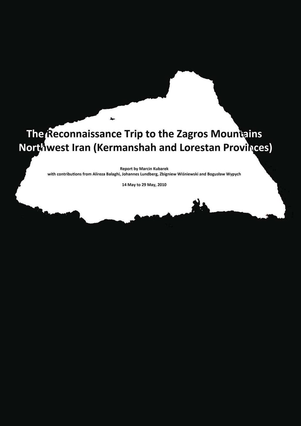
2 Cover: Entrance of Eshkaft e Pariz, Kuh e Pariz, Lorestan, Iran. Photo: Johannes Lundberg, May 26, 2010.
3 The Reconnaissance Trip to the Zagros Mountains, Northwest Iran (Kermanshah and Lorestan Provinces) Report by Marcin Kubarek with contributions from Alireza Balaghi, Johannes Lundberg, Zbigniew Wi niewski and Bogus aw Wypych Summary: During the two weeks of our reconnaissance tript to the Zagros Mountains we walked more than 200 kilometers checking five different limestone massives in two provinces. Several caves were found, the deepest ones were Z-2 (-70m) and Zahabi (-61m). The following persons participated in the entire trip: Alireza Balaghi (Iran), Marcin Kubarek (Poland), Johannes Lundberg (Sweden), Zbigniew Wi niewski (Poland), and Bogus aw Wypych (Poland). The trip took place between May 14 and May 29, It was organized in cooperation with the Iranian Mountaineering Federation. Itinerary 14 May 2010 Arrival from Poland and (already the day before) Sweden to Tehran and further by car to Qazvin. Alireza Balaghi met us at the airport and we spent the night in his house in Qazvin. 15 May 2010 Morning bus from Qazvin to Kermanshah. Shopping and visiting Taq Bostan. Dinner at Peiman s house. 16 May 2010 We went by minibus to the small village Sarias near Shamshir, north west of Kermanshah and at the foot of the Kuh-e Shahu mountains. During the hike up to masl we visited just a small part of Kuh-e Shahu massif. Scree cones were followed up to 3000 masl and the limestone is very cracked. The bedding was mostly vertical. No caves were found. Night in Kermanshah. 5 Iranians joined us this evening. Team: A. Balaghi, Marcin Kubarek, Zbigniew 'Stanley' Wisniewski, Bogus aw Wypych, Johannes Lundberg and H. Jahangard. 17 May 2010 We divided into two teams: A. Balaghi and 4 other Iranians went to check the surroundings of Ghuri Ghale cave to try to locate possible caves / entrances. They also tried to climb up to the big entrance located in the steepy wall of one of the peaks above Ghuri Ghale (they did not managed to reach the entrance). The second team, M. Kubarek, Z. Wisniewski, B. Wypych, J. Lundberg, Jalil Noroozi and Manuchar Moradnejad, went to check the plateau above the road Kermanshah Ghuri Ghale in the Kuh-e Shahu range; Jalil collected plants for his research. The situation in this area turned out to be similar to the one of the previous day we only located 2-3 very small entrances with no further way ahead. The limestone up to masl was very cracked and the plateaus were filled with a lot of sediments. Night in Kermanshah. 3
4 18 May 2010 We divided into three teams: 4 Iranians went to check the surroundings of Ghuri Ghale cave trying to find possible caves / entrances. They also made an attempt to climb up to the big entrance attempted yesterday. They failed this time again. The second team, A. Balaghi, M. Kubarek and B. Wypych, assisted by M. Moradnejad and the driver, went by car to Bel Cheshmeh spring in the Sirvan River valley, north east of Paveh. Manuchar did measurements of the water flow from the spring (4m 3 /s). The rocks above the spring are less cracked than in other places, however the bedding is very complicated and thick. Manuchar showed us a place above the spring where he has visited some pits reaching m depth. The caves finish with huge boulder chokes. We took the car through the bottom of the valley where dam and tunnel constructions take place. The third team, Z. Wisniewski, J. Lundberg, J. Noroozi, checked the surroundings of Ghuri Ghale cave, but without any successful results; Jalil and Johannes collected plants. They also went to Ghuri Ghale show cave for a touristic trip. Night in Kermanshah. 19 May 2010 Together with the Iranians and assisted by H. Jahangard we went to check the Kuh-e Zilu massif close to Kermanshah and the Do/Seh Cheshmeh springs. We climbed up to 2345 masl to the pass at the main ridge. The bottom of the valley with a spring and a small stream is about 200 m below the pass. Apparently the limestone is very difficult for cave development and there were no obvious cave entrances visible from the look-out place at the pass. Most of the Iranians thus went back to the city that afternoon. In the late afternoon A. Balaghi, M. Kubarek, B. Wypych and Mehdi Zare decided to visit Sangvareha Cave (Z-1) in order to survey it. The cave is located in the lateral part of the main valley, approximately 25m above its bottom. The rigging is very dangerous as not many bolts are found in the cave. It was explored a few years earlier by the Iranian caver or climber. We could not reach the bottom due to lack of equipment. Many animal bones and skulls were found. Stanley stayed at the pass to prepare the camp while Johannes went on a surface trip along the ridge and down to the valley where he found a 50m long cave relict. Outdoor night at the pass. 20 May 2010 A. Balaghi stayed on the pass while the rest of the team went on a surface trip to check the mountains on both the left and right sides of the valley. We located several small entrances and shelters but no big discoveries was done. In the afternoon two interesting entrances were found: Z-2 (J. Lundberg) and Z-3 (M. Kubarek). The first one was checked just to the bottom of the first step. The second, checked by B. Wypych the same day finished quickly with a sediment plug. Outdoor night at the pass. 21 May 2010 M. Zare went back to Kermanshah in the early morning, while A. Balaghi went down to bring back the drill taken by the Iranians two days ago. The rest of the team explored and surveyed the Z-2 and Z-3 caves. Z-3 finished after some 20 meters blocked by rocks and clay. Z-3 reached about 70 m in depth, ending in unreachable fissures and sediment plugs. In the meantime A. Balaghi checked the surroundings of our camp and located one entrance, however that cave finished quickly. Outdoor night at the pass. 4
5 22 May We returned from the mountains and took the minibus to Kermanshah. On the way down we checked an entrance pit that ended after a few meters. We did some shopping and spent the night in the city. 23 May 2010 Early morning we took the bus from Kermanshah to Khorramabad in the Lorestan province. We met the representatives of the local Mountain Federation who arranged transportation and accommodation for the entire team. In the afternoon we moved by minibus towards west, to Mirzavand Chele at the foot of the Sefid Kuh Mountains. Guided by a local with the same name as the village (Mr. Mirzavand), and Mr. Shahravan, the president of the mountaineering federation of Khorramabad, we arrived to a beautiful limestone gorge where we spent the night. In the morning we were taken to a big entrance pit located almost on the top of the ridge. The cave, called Zahabi and inhabitated by a bird colony, was explored to a depth of -61.3m. The cave was blocked by a snow plug at the bottom of its main chamber. We were also taken to two other entrances nearby, one of them finishing in a snow plug and a narrow fissure. There was also a small cave, Tapule, on the left side of the main gorge. It only reached 9 meters of depth. We came back to Khorramabad by minibus the same day. Night was spent in a hotel arranged by the Federation. Late in the evening we met Mr. Akbarian, the president of the mountaineering federation of Lorestan. 25 May 2010 Early morning we took the minibus to Alashtar to visit a part of the Kuh-e Garin mountains. Guided by Alireza Hashemi, a local teacher, we walked through a picturesque gorge located above one of the villages. We surveyed one cave called Kenarekh, reaching a depth of 21 meters. Another small cave was visited during the trip. In the afternoon we came back to Khorramabad. Late evening we took the taxi to Dorud city where we met local climbers introduced to us by A. Balaghi. We spent the night in the house of Safari, one of the climbers. 26 May 2010 Early morning we went for a whole day hike to the Kuh-e Pariz massif next to the city of Dorud. The aim of our trip was to locate several pits noticed by local climbers a few years ago. At that time one of the pits was descended and we were told that the explorer reached -50m. After the few hours long trip up to the plateau we located several very interesting pits developed in the conglomerate, the largest being Saz o Dohol. Due to lack of equipment we were not able to descend any of them. During the trip back we visited one big cave (Eshkaft-e Pariz) developed in the same rock formation but at a lower altitude. Around midnight we took the bus to Kraj where we changed to the bus to Qazvin. 27 May 2010 We spent the whole day in Qazvin, shopping and resting after the trip. 28 May 2010 We went for a short trip to the hills on the outskirts of Qazvin. We spent the last few hours of our trip to Iran in Qazvin. 29 May 2010 Early in the morning the four of us took a minibus to Tehran for the return trip back to our countries. 5
6 6
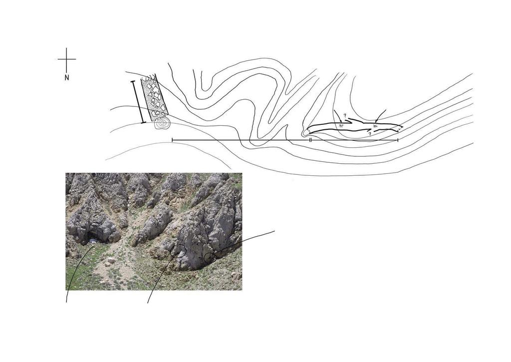
7 Name: GPS coordinates: Length: Depth: Denivelation: Entrance(s) altitude: Location: Detailed location: Description: Observations: History of exploration: Surveying: Small Cave in Kuh-e Shahu Small Cave in Kuh-e Shahu N E (+/- 5 meter) meter 5-10 meter 5-10 meter 2658 meter a.s.l. Iran, Kermanshah province, Kuh-e Shahu. The entrance is located on the slope north-east of the ridge. The entrance is not easily found. It can be found not far from the ridge, a few hundred meters north-east of the ridge, and just below a cliff. The cave is not large, hardly worthy notice. The entrance is small, less than 1x0.5m, leading into a small chamber. There is a small opening letting some light in to the left from the entrance. To the right is a small pit, perhaps 2m deep, leading to a small but clean passage ending in a small but richly decorated chamber. A small anastomosing upper passage can be found to the left, and also a small pit, 1.5m deep, leading to a passage that ends blindly after just a few meters. The total length of the cave is estimated to be 10 to 20 meter, and the depth less than 10 meter. The entrance has recently been blocked, probably by local herders, by using old clothes and small boulders. The inner passge of the cave is surprisingly rich in speleothems, mostly flowstone and stalactites. There are boulders and mud in the entrance chamber. The entrance was spotted by Jalil Noroozi on May 17, 2010, and explored by Johannes Lundberg on the same day. The entrance has obviously been known by locals for some time. The cave has not been surveyed, only very approximately measured. Sketch is from memory. Drawings: Sketch prepared by J. Lundberg, May Photographs: Photographs were taken in May
8 8
9 Name: GPS coordinates: Length: Depth: Denivelation: Entrance(s) altitude: Location: Detailed location: Description: Observations: History of exploration: Surveying: Shelter Cave in Zilu Shelter Cave in Zilu N E (+/- 5 meter) c. 50 meter 0 meter c. 6 meters 2243 meter a.s.l. Iran, Kermanshah province, Dasht-e Zilu Mountains. The entrance is located on the southern slope of the main valley. The entrance is situated on the lower part of the southern slope of the main valley, a few hundred meters south of the small brook flowing (intermittently?) in the valley and above some stone constructions built by herders. The entrance is easily seen from below. The entrance is large, 6 m wide and some meters high. The cave is, except from the innermost part of the inner chamber, two smaller side passages, and the entrance to the inner chamber, of standing height. The entrance is light, with a daylight chimney some six meters high and two meters in diameter. To the right is a passage that after 9 meters end in a more than one meter high wall; the passage continues for about 2 more meters before it ends as a smaller entrance. To the left from the entrance is a small lower passage ending after 4m in boulders and clay. Parallel to this small passage is a larger passage, leading through a small opening (about 1x1m) to a larger inner chamber, about 15m long and 3 to 5 meter wide. A small side passage to this chamber may continue, but is narrow and partly blocked. Only the lower passage to the left has boulders and clay on the floor, the other passages are clean. There are several signs of people using this cave as a shelter, including the constuction of a wall at the end of the right passage, a fire place in the entrance, and a strong smell of fire in the inner chamber. There are also empty bottles and other trash in the cave. The cave was explored on May 19, 2010 by J. Lundberg, but has obviously been known by locals for a long time. The cave has not been surveyed, only very approximately measured. Sketch is from memory. Drawings: Sketch prepared by J. Lundberg, May Photographs: Photographs were taken in May
10 10
11 Name: GPS coordinates: Length: Depth: Denivelation: Entrance(s) altitude: Location: Detailed location: Description: Observations: History of exploration: Surveying: Snow Cave and Porcupine Hide Cave Snow Cave and Porcupine Hide Cave N E (+/- 35 meters) c. 20 meter and meter, respectively Not available Not available 2607 meters a.s.l. Iran, Kermanshah province, Dasht-e Zilu Mountains. The entrances are located close to each other on the western slope of a small valley. The coordinates are to the northern entrance of Porcupine Hide Cave. The entrance is situated on the western slope high up in a small side valley to the main valley in Dasht-e Zilu Mountains and are easily seen from the valley and the opposite slope. The Porcupine Hide is a meter long phreatic tunnel, with a diameter of just over 1 meter. There are two small side passages, one to the left some 10 meters into the cave, and one to the right another 10 meters further in, seen from the entrance furthest away from the Snow Cave. The Porcupine Hide ends in a second entrance (close to the Snow Cave) with a balcony about 2 meters above the ground. The Snow Cave entrance is large (4x4m) and with a small snow field just outside. The passage continues in the same size, but after only about 20 meter the passage is entirely blocked by large boulders and sediments. No way through the boulders could be found, nor any side passages. The Porcupine Hide Cave has two nests with quills from the Indian Crested Porcupine (Hystrix indica Kerr) as well as what probably is dung from the Porcupines. The nests are located nearly half way into the cave. The air temperature in the Snow Cave is much lower than the ambient temperature, and also much lower than the temperature in the Porcupine Hide Cave. It is possible that the two caves once were parts of the same, much larger but today partly eroded cave system. The caves were explored on May 20, 2010 by J. Lundberg. The caves have not been surveyed, only very approximately measured. Sketch is from memory. Drawings: Sketch prepared by J. Lundberg, May Photographs: Photographs were taken in May
12 12
13 CAVE Z-1 (Sangvareha) Name: Z-1; Sangvareha GPS coordinates: N E (+/- 16 meter) Length: 136 meters Depth: 72.9 meters Denivelation: 72.9 meters Entrance(s) altitude: 2465 meters a.s.l. Iran, Kermanshah province, Dasht-e Zilu Mountains. The Location: entrance is located on the western slope of the main valley. The entrance is situated ca 25m above the bottom of the valley, in the front of another, much smaller valley going Detailed location: uphill to the pass. The entrance is visible from the path in the valley. It is possible to climb the wall without using rope, however it is a bit risky. The entrance dimensions are 2.1m heigh x 7.3m wide, oval shaped. A straight, horizontal passage covered with clay and small rubble leads for several dozens meters, then it turns right and drops steeply via a 6m step into a chamber. There is a narrow passage on the left leading towards a second 25m deep pitch with a small rock bridge. The passage continues as a high meander which floor is covered with clay. The bottom of the pitch is covered with large amounts of animal bones. Description: There is another pitch dropping down steeply from the right corner of the previous one. It is ca 8.5m deep. There is a muddy 3.5m step further down, finishing in a high chamber covered with clay and another, 3m high chamber covered with a lot of clay. The passage drops down into the 10m final pit from where the passage continues as a meander. The floor is covered with small sized rubble. There is no further passage ahead. The floor is covered with clay and small rubble and a large Observations: amount of animals bones and skulls. Some stalactites and other speleothemes can be found in the cave. The cave was explored few years ago by an Iranian caver History of exploration: from Kermanshah (MB. Eyvazi). Surveying was completed on May 19, 2010 by A. Balaghi, M. Surveying: Kubarek, B. Wypych, M. Zarei. Sketch, plan and cross section prepared by A. Balaghi, M. Drawings: Kubarek, May Photographs: Photographs were taken by B. Wypych in May
14 N CAVE SANGVAREHA Dasht e Zilu,Kermanshah,Iran Location: N E Entrance altitude:2465 meters a.s.l. Surveying by A. Balaghi, M. Kubarek, B. Wypych, M. Zarei. Sketch by A. Balaghi, M. Kubarek. May 2010 P-6 P m/c P-30 Entrance 2.1x7.3m 4 14
15 0.0 CAVE SANGVAREHA Dasht e Zilu,Kermanshah,Iran Location: N E Entrance altitude:2465 meters a.s.l. Surveying by A. Balaghi, M. Kubarek, B. Wypych, M. Zarei. Sketch by A. Balaghi, M. Kubarek. May P-30 P P m/c N 15
16 16
17 CAVE Z-2 Name: Z-2 GPS coordinates: N E (+/- 5 meters) Length: 209 meters Depth: 70.1 meters Denivelation: 70.1 meters Entrance(s) altitude: 2621 meters a.s.l. Iran, Kermanshah province, Dasht-e Zilu Mountains. The Location: entrance is located on the eastern slope of the main valley. The entrance is situated ca 200 meters above the bottom of the valley, on the opposite side of Z-1 cave. The cave entrance is situated in a small pit, along the lateral ridge Detailed location: starting from the pass. The pit is covered with shattered blocks of limestone. The entrance is difficult to locate from the pass. Caving equipment is needed to visit the cave. The entrance dimensions are 3.5m height x 1.3m width, square shaped. A 4m high step drops down to a narrow meander passage going south-west. Here a 4.5m deep pitch starts, leading to a chamber covered with clay and small rubble. Its floor drops down steeply to another 8m deep pitch, finishing with a steep floor and a window to the cave s biggest pitch. It is 18m deep and oval shaped. It finishes with Description: a boulder and clay plug in a spacious chamber. There is a 16m high steep wall going up towards east, covered in white coloured dripstone. From the bottom of the 18m-pitch it is possible to squeeze down through a small clay-covered passage to a north-east running passage where large amounts of speleothemes can be found. The passage finishes with a very narrow fissure dropping down through a ca 4m water filled pit. The cave ends in a clay plug here. The floor is covered with clay and small rubble. There are some stalactites and other speleothemes found in the cave, Observations: especially abundant in its lower part. Animal bones and skulls were found during the exploration. Bats were noticed in the higher parts of the cave. The cave was found and explored on May 20 and 21, 2010 by History of exploration: the Swedish-Polish team of cavers. Surveying was completed on May 21, 2010 by Z. Wisniewski, Surveying: J. Lundberg. Sketch, plan and cross section prepared by J. Lundberg, May Drawings: Photographs: Photographs were taken in May
18 18
19 19
20 20
21 CAVE Z-3 Name: Z-3 GPS coordinates: N E (+/- 5 meters) Length: 34 meters Depth: 6.2 meters Denivelation: 6.2 meters Entrance(s) altitude: 2621 meters a.s.l. Iran, Kermanshah province, Dasht-e Zilu Mountains. The Location: entrance is located on the eastern slope of the main valley. The entrance is situated ca 200m above the bottom of the valley, on the opposite side of Z-1 cave and 1m from the Z-2 cave. The cave entrance is situated in a small pit, along the Detailed location: lateral ridge starting from the pass. The pit is covered with shattered blocks of limestone. It is parallel to the entrance of Z-2. The entrance is difficult to locate from the pass. The entrance pit is about 6m deep, but can easily be climbed. The entrance pit leads straight down to an irregular chamber, Description: about 8m in maximum height, 5m long and 5m wide. To the right is a short passage, about 3m long, closing up and blocked but may be possible to continue. The floor of the chamber is covered with blocks, especially under the entrance pit. The floor of the inner part is covered Observations: by clay. Signs of possible tectonic movements can be seen in the cracked and partly displaced right wall. The cave was found and explored on May 20 and 21, 2010 by History of exploration: the Swedish-Polish team of cavers. Surveying was completed on May 21, 2010 by Z. Wisniewski Surveying: and J. Lundberg. Sketch, plan and cross section prepared by J. Lundberg, May Drawings: Photographs: Photographs were taken in May
22 22
23 23
24 24
25 CAVE ZAHABI Name: Zahabi GPS coordinates: N E (+/- 4 meters) Length: meters Depth: 61.3 meters Denivelation: 61.3 meters Entrance(s) altitude: 2255 meters a.s.l. Iran, Lorestan province, Sefid Kuh Mountains. The entrance is Location: located in the mountains above Mirzavand Chele. The entrance is situated below a small ridge, along the path going from the main valley, through the pass and up to the Detailed location: heart of the mountains. The entrance is easily visible from the path. Caving equipment is obligatory. The entrance is a huge oval shaped vertical pitch with the dimension 22x16m. The depth vary with the snow level in the bottom; at the time of the exploration the depth was 46 meters. The walls are cracked, covered with some dripstone. The bottom of the pitch is covered by snow, mud and guano. Birds are nesting in the cave. There is a meters high passage going south from the bottom of the pitch. It ends Description: with a boulder choke between snow. On the north side of the bottom chamber another passage starts. It is possible to reach it from a small window located on the top of the mud and guano cone. The cone is 6-8 meters high. The passage drops down steeply at the other side of the window as a 6m high step into a spacious chamber, 6.5m long and up to 11m high. The chamber is covered with nice speleothemes. There is a dried lake in the bottom of the chamber. The floor is covered with clay, small rubble and a big amount of snow. Some stalactites and other speleothemes can be Observations: found in this cave. Bird s nest and some birds bones were found in the chamber. The cave has been known for many years by local shepherds. It was shown by Mr. Mirzavand, a local man, to the Polish- History of exploration: Swedish-Iranian cavers on May 23, 2010 and explored the same day. Surveying was completed on May 23, 2010 by M. Kubarek, B. Surveying: Wypych and J. Lundberg. Sketch, plan and cross section prepared by M. Kubarek, May Drawings: Photographs: Photographs were taken in May
26 26
27 CAVE TAPULE Name: Tapule GPS coordinates: N E (+/- 4 meter) Length: 29 meters Depth: 9.3 meters Denivelation: 9.3 meters Entrance(s) altitude: 2544 meters a.s.l. Location: Iran, Lorestan province, Sefid Kuh Mountains. The entrance is located in the mountains above Mirzavand Chele. The entrance is situated in the estern wall of the gorge, near where the path to the pass cross the screen cone. The Detailed location: entrance is visible from the opposite side of the gorge when returning from the pass (the entrance is then on the right wall). Caving equipment is needed to visit the cave. The entrance dimensions are 1.5 x 1 meters. The cave starts with a vertical pitch 7.6m deep. The pitch ends in a chamber Description: with the dimensions 16x6x8 meters, and with some speleothemes. The bottom of the pitch is covered with some big boulders and clay. The cave ends with another chamber, 3x10x5 meters. Observations: Shattered rocks and a small amount of speleothemes. History of exploration: The entrance was shown by Mr. Mirzavand, a local man, to the Polish-Swedish-Iranian team of cavers. Surveying: Surveying was completed on May 24, 2010 by B. Wypych, A. Balaghi. Drawings: Sketch, plan and cross section prepared by B. Wypych, A. Balaghi, May Photographs: Photographs were taken in May
28 P-7 CAVE Tapule Lorestan,Iran Location: N E Entrance altitude:2544 meters a.s.l. Surveying by A. Balaghi, B. Wypych. Sketch by A. Balaghi. 0 1m Scale 1:100 N C? 28
29 CAVE KENAREKH Name: Kenarekh GPS coordinates: N E (+/- 5 meter) Length: 74 meters Depth: 17.2 meters Denivelation: 21.3 meters Entrance(s) altitude: 2010 meters a.s.l. Iran, Lorestan province, Valash Mountains. The entrance is Location: located on the right slope of the dry river. The entrance is situated 300m upstream and 42m above the Detailed location: spring on the right side (going up) of the (temporarily) dry river valley. The entrance dimensions are 1.4m height x 1.1m wide, square shaped and leading to a chamber. To the right is a small pit, about 6m deep and easily climbed. The pit leads to a larger chamber, about 15m in height and 7m wide. In the inner right corner is a partly water filled pit. The vertical distance from the pit margin to the water surface is about 4m, and the depth of the water is not known, but more than 2m, possible at least twice as deep. A water filled but large passage can be seen a few meters under the surface. From the main chamber, but to the left, is a small dry passage. The dimension is about 1 x 1 meter, and it ends just under the roof of a small chamber, about 2m above the floor. This small Description: chamber (2.5m in height and 5m wide) has one passage going upwards but ending in blocks after closing in after less than one meter, and one passage going downward and ending in a partly water filled but low passage. This water filled passage continues at least for 1.5m, but may be longer. The end has not been seen. Halfway down to this lower chamber is to the right a small chamber (about sitting height), the pot chamber. Two chimneys enter the main chamber, but it is not possible to reach these chimneys without aid climbing; they enter the chamber 15 respectively 17 meters up. A short side passage leads from the main chamber half way up the pit down to the chamber. The bottom of the main chamber is filled with large boulders and clay. A few spelothems (stalagmites and flowstone) can be found. Many insects, including a fly (Diptera), inhabits the cave including the large chamber. Just at the entrance to the pot chamber a small pot of unburned clay was found, laying Observations: down and filled with sediments. It was un-broken when found, but unfortunately part of the pot was broken when taken out for photographing. It was later replaced at the site of finding. The wall separating the pot chamber and the main chamber is made of collapsed boulders and clay. The entrance was shown by Alireza Hashemi, a local teacher, History of exploration: on May 25, 2010 to the Polish-Swedish-Iranian team of cavers. Surveying was completed on May 25, 2010 by A. Bailghi, J. Surveying: Lundberg. Sketch, plan and cross section prepared by J. Lundberg, July Drawings: Photographs: Photographs were taken in May
30 30

31 31
Another World, Underground: Carlsbad Caverns National Park
 Another World, Underground: Carlsbad Caverns National Park Welcome to This Is America with VOA Learning English. This week on our program, we explore a UNESCO World Heritage Site in the American Southwest,
Temple Caves in Kayin and Mon Province Myanmar
 Temple Caves in Kayin and Mon Province Myanmar Results of the Speleological Project January 2009 in cooperation with the Myanmar Tourism Promotion Board Content: 1. Introduction 2. Tourism 3. Area 4. Maps
Mazandaran Province To introduce Mazandaran one just has to mention that it is the number one province for tourism in Iran, with over 12 million
 Mountaineering Alam Kuh and Damavand peaks (Mazandaran-Iran) Duration: 9+2 Days operation by: farmis travel agency Iran Welcome to Iran, the hidden side of the world! Iran: the amazing Islamic Middle Eastern
Silvertip 1996 By Peter Sprouse
 Silvertip 1996 By Peter Sprouse The north cirque of Silvertip Mountain. Photo by Peter Sprouse It had been quite a long time since I had been caving at Silvertip Mountain. The long drive from Texas, the
beach. Make the ford and follow the trail out to the junction with Red Creek Tr in an open grassy area.
 Description: This is a moderate to slightly strenuous 22.8 mile backpack (add 2.6 miles if you do the packless out and back to the Lion s Head) that will have you exploring nearly every thing that is The
Figure 1 Understanding Map Contours
 Figure 1 Understanding Map Contours The light brown lines overprinted on topographic maps are called contour lines. They indicate the elevation above sea level of land features and thus permit you to view
Self-Guided Walk Langdale Pikes. Start & Finish: NT car park (free to members) at Sticklebarn - on the right just beyond the New Dungeon Ghyll hotel.
 at Sticklebarn - on the right just beyond the New Dungeon Ghyll hotel.") Self-Guided Walk Langdale Pikes Key Information These mountains form a collection of spires and cliffs on the north side of Langdale. This walk visits four of the main tops Pavey Ark, Harrison Stickle,
Self-Guided Walk Langdale Pikes Key Information These mountains form a collection of spires and cliffs on the north side of Langdale. This walk visits four of the main tops Pavey Ark, Harrison Stickle,
CRANBERRY. Introduction
 Introduction Introduction The Cranberry Boulders are a group of 60 problems set in a beautiful mossy forest above the Cranberry Creek. The boulders are located approximately 36km south of Revelstoke on
Minimal Impact Caving Guidelines
 Minimal Impact Caving Guidelines Photograph Brendan Marris 2016 Introduction Caving is a fascinating recreational activity which attracts the interest of a diverse range of people and groups, who all benefit
PERUVIAN ANDES ADVENTURES. TOCLLARAJU CLIMB or ISHINCA + TOCLLARAJU CLIMBING. Tocllaraju 4 Days Ishinca + Tocllaraju 5 or 6 days
 PERUVIAN ANDES ADVENTURES TOCLLARAJU CLIMB or ISHINCA + TOCLLARAJU CLIMBING Tocllaraju 4 Days Ishinca + Tocllaraju 5 or 6 days PEAKS Tocllaraju: 6034m (19797 ft) Grade: D / Hard / Some steep & technical
Introduction to Safety on Glaciers in Svalbard
 Introduction to Safety on Glaciers in Svalbard Content Basic info on Svalbard glaciers Risk aspects when travelling on glaciers Safe travel on glaciers UNIS safety & rescue equipment Companion rescue in
Ranchers, Rattlers and Recharge
 Ranchers, Rattlers and Recharge Caving on the Phillips Ranch in Crockett County, West Texas By Sofia Casini Photos by Goeff Hoese and Peter Sprouse Participants: Don Arburn, Peter Sprouse, Ryan Reid, Geoff
GLACIER STUDIES OF THE McCALL GLACIER, ALASKA
 GLACIER STUDIES OF THE McCALL GLACIER, ALASKA T John E. Sater* HE McCall Glacier is a long thin body of ice shaped roughly like a crescent. Its overall length is approximately 8 km. and its average width
Ala-Kul trekking guide.
 Ala-Kul trekking guide. The marshrutka 101 brings you to the entrance of the park. For 400 KGS, a taxi will stop between the entrance and the broken bridge, saving at least 1 hour of walk. Download me
The Cleo s Bath North Side Hike
 The Cleo s Bath North Side Hike This hike is a cross-country hike from Pinecrest Lake to the north side of Cleo s Bath. It is quieter and much less crowded than the normal route, which goes up the south
GOLDEN EARS PROVINCIAL PARK
 GOLDEN EARS PROVINCIAL PARK Trail Information as of October 10 th 2015 Do not underestimate the mountainous wilderness of Golden Ears Provincial Park. The combination of rugged terrain and rapidly changing
Guthega to Mt Twynam. 2183m. 1583m. 6 hrs 45 mins 14.8 km Return. Experienced only. 913m
 Guthega to Mt Twynam 6 hrs 45 mins 14.8 km Return Experienced only 5 913m This walk starts from Guthega and makes its way along the Snowy River to the Illawong Lodge, via the Blue Cow Creek flying fox.
Hiking Las Vegas.com
 Hike: Mt. Wilson via First Creek Canyon route Trailhead: First Creek marked Distance: 10 miles up and back Elevation gain: 3,400 feet Elevation of Peak: 7,070 feet Time: 7 to 9 hours (up and back) Difficulty:
Erskine Creek via Pisgah Rock and Jack Evans
 Erskine Creek via Pisgah Rock and Jack Evans 4 hrs 30 mins 7.1 km Circuit Very experienced only 6 421m This walk visits some great lookouts and explores the lower section of Erskine Creek. Most of the
ISOM & ISSOM forbidden symbol comparison
 & forbidden symbol comparison Forbidden symbols and their relatives Symbol 2000 (Long, Middle) 2007 (Sprint) 201 Impassable cliff An impassable cliff, quarry or earth bank (see 106) is shown with a 0.35
CIEC 9 PEAKS AWARD SUPPLEMENT POSSIBLE ROUTES FOR THE 9 PEAKS AWARD TRIP
 CIEC 9 PEAKS AWARD SUPPLEMENT POSSIBLE ROUTES FOR THE 9 PEAKS AWARD TRIP As you plan your trip, be aware of 3 regulations in this wilderness: 1. Camp only in designated campsites. 2. No campfires allowed.
MOUNT KILIMANJARO TREK
 TANZANIA TREK EXTREME ABOUT THE CHALLENGE Climb the highest freestanding mountain in the world! Kilimanjaro is the highest mountain on the African continent at 5896m. Its snow-capped summit rises high
Wicklow Mountains Path Survey
 Wicklow Mountains Path Survey Ballinacor Croaghanmoira Fananierin Start to Finish: T 11723 86602 to T 11175 89057 Altitude (lowest highest): 385m 664m Weather: Hot Access: Coolgarrow forest entrance Surveyed
TREK KILIMANJARO ABOUT THE CHALLENGE KILIMANJARO TREK - 11 DAY TANZANIA TREK RED 3
 TREK KILIMANJARO TANZANIA TREK RED 3 ABOUT THE CHALLENGE Climb the highest freestanding mountain in the world! Kilimanjaro is the highest mountain on the African continent at 5896m. Its snow-capped summit
Mt. Kilimanjaro Trek. WanderTours P.O. Box Seattle WA Itinerary dates: January 23 - February 1, 2019 Tour Escort: Beth Whitman
 WanderTours P.O. Box 16102 Seattle WA 98116 Mt. Kilimanjaro Trek Itinerary dates: January 23 - February 1, 2019 Tour Escort: Beth Whitman HIGHLIGHTS The six-day Machame Route to Uhuru Peak, considered
World s Largest Cavern Discovered In Viet Nam in1991. meaning Mountain River Cave
 World s Largest Cavern Discovered In Viet Nam in1991 meaning Mountain River Cave British scientists from the British Cave Research Association, led by Howard and Deb Limbert, conducted a survey in Phong
USDA Trails Strategy WRI: ENGLISH PEAK SURVEY. Theodore Mendoza San Diego State University June 6 th 2016 August 18 th Advisor: Sam Commarto
 WRI: ENGLISH PEAK SURVEY Theodore Mendoza San Diego State University June 6 th 2016 August 18 th 2016 Advisor: Sam Commarto Klamath National Forest Submitted: March 21, 2017 Table of Contents Acknowledgements
PERUVIAN ANDES ADVENTURES. ARTESONRAJU CLIMB 6025m (19767 ft) Grade: D+ to TD/ Technical. Routes: The two routes to climb Artesonraju are;
 Grade: D+ to TD/ Technical. Routes: The two routes to climb Artesonraju are;") PERUVIAN ANDES ADVENTURES ARTESONRAJU CLIMB 6025m (19767 ft) Grade: D+ to TD/ Technical Routes: The two routes to climb Artesonraju are; *Via the Paron Valley South East Ridge 5 days (option for 6 with
PERUVIAN ANDES ADVENTURES ARTESONRAJU CLIMB 6025m (19767 ft) Grade: D+ to TD/ Technical Routes: The two routes to climb Artesonraju are; *Via the Paron Valley South East Ridge 5 days (option for 6 with
Looking north from the SW shieling site with Lub na Luachrach in the foreground
 Looking north from the SW shieling site with Lub na Luachrach in the foreground Upper Gleann Goibhre - Shieling sites Two shieling sites in the upper reaches of the Allt Goibhre were visited and recorded
Wicklow Mountains Path Survey
 Wicklow Mountains Path Survey Glenmacnass Tonelagee Start to Finish: O 114 030 to O 085 016 Altitude (lowest highest): 370m 817m Weather: Sunny day, hot Access: Military Road, Glenmacnass Surveyed by:
Baou de Quatre Ouro (576 m) and Croupatier via the caves path
 and Croupatier via the caves path") Baou de Quatre Ouro (576 m) and Croupatier via the caves path A walk proposed by MCTOUL This active route will take you through the Croupatier to the Baou de Quatre Ouro, one of the four "Toulonais brothers".
Baou de Quatre Ouro (576 m) and Croupatier via the caves path A walk proposed by MCTOUL This active route will take you through the Croupatier to the Baou de Quatre Ouro, one of the four "Toulonais brothers".
PERUVIAN ANDES ADVENTURES. EXPEDITION Climbing Alpamayo & Huascaran. PEAKS: Maparaju 5350m Alpamayo 5947m Huascaran Sur 6768m
 PERUVIAN ANDES ADVENTURES EXPEDITION Climbing Alpamayo & Huascaran PEAKS: Maparaju 5350m Alpamayo 5947m Huascaran Sur 6768m 23 days Huaraz to Huaraz Grade: Technical, physically demanding This is a comprehensive
Route #2) Mt. Massive - Southwest Slopes
 Mt. Massive - Southwest Slopes") Route #2) Mt. Massive - Southwest Slopes Difficulty: Class 2 Ski: Advanced, D6 / R2 / III Exposure: Summit Elevation: Trailhead Elevation: Elevation Gain: Round-trip Length: Trailhead: County Sheriff:
Route #2) Mt. Massive - Southwest Slopes Difficulty: Class 2 Ski: Advanced, D6 / R2 / III Exposure: Summit Elevation: Trailhead Elevation: Elevation Gain: Round-trip Length: Trailhead: County Sheriff:
Map of area and southern tip of Coronation Island
 Map of area and southern tip of Coronation Island In August of 2007, cavers Steve Lewis, Dan Monteith and David Love assisted Tim Heaton, University of South Dakota and Fred Grady, Smithsonian returned
Little Simon s Seat. Little Simon s Seat. Unknown Stones. Climbs 32 Altitude 450m a.s.l. Faces North West
 Climbs 32 Altitude 450m a.s.l. Faces North West Other condition info: A jumble of boulders that are composed of good, silvery grit, set high on Simon s Seat. Problems have been done over the years but
Girrakool to Wondabyne station via Pindar caves
 Girrakool to Wondabyne station via Pindar caves 7 hrs 30 mins 18.1 km One way Experienced only 5 741m This walk starts from the Girrakool picnic area and winds south, following Piles creek into the Brisbane
Introduction to Topographic Maps
 Introduction to Topographic Maps DIRECTIONS: Read all of the following content. READ EVERYTHING!! At the end of the packet, you will find two topographic maps. Your task is to indentify each of the elevations
Y.C. ROMANIA 2004 REPORT
 Y.C. ROMANIA 2004 REPORT HISTORY AND BACKGROUND OF Y.C.R. The origins of Y.C.R. began in Wilson s Hospital School (Co.Westmeath) back in 1993, and grew from a number of school exchange trips made to a
6 DAYS MACHAME ROUTES ON KILIMANJARO
 6 DAYS MACHAME ROUTES ON KILIMANJARO Day 1: Moshi Machame camp In the morning, we depart from our base hotel at approximately 8:00 AM for the Machame village where you begin the trek. From the park entrance
Oman Trek Trek the dramatic and beautiful scenery of Oman
 Oman Trek Trek the dramatic and beautiful scenery of Oman Discover Oman on this breath taking 5 day challenge. The mountain ranges and deserts of Oman offer spectacular trekking, and enables you to experience
FROM JUTA TO ROSHKA via Chaukhi pass
 FROM JUTA TO ROSHKA via Chaukhi pass Duration: 1-2 days The hike can take one or two days, depending on how you plan it. I will focus on the 1-day version of the trek which takes 8-9 hours and starts in
Rongai 6 Days 5 Nights
 Rongai 6 Days 5 Nights The Rongai Route is one of the easiest routes and the success rate is very high. The route starts on the North side of the mountain just South of the Kenyan border and is one of
RIS SUMMER CAMP Students Gr. 3-8 JUNE 20-24, 2016 Camp Only 14,000 B Camp + Summer School= 42,000 B
 BIG OUTDOORS EDUCATION AND ADVENTURE RIS SUMMER CAMP Students Gr. 3-8 JUNE 20-24, 2016 Camp Only 14,000 B Camp + Summer School= 42,000 B ACCOMMODATION AT PETCHARAT SCOUT RESORT Air conditioned dorm rooms.
Tiger Mountain State Forest:
 98 60 hikes within 60 miles: SEATTLE 20 Tiger Mountain State Forest: West Tiger Mountain Three Loop i KEY AT-A-GLANCE INFORMATION Length: 5.1 miles round-trip Configuration: Loop Difficulty: Moderate difficult
Mount Kilimanjaro Climbing via Marangu Route 6 day-itinerary
 Mount Kilimanjaro Climbing via Marangu Route 6 day-itinerary (For the 5-day route, simply exclude the additional acclimatisation day at Horombo hut - day 3 on the itinerary below.) Total hiking distance:
1/ Clatterjack 7a * SDS under right side of the roof. Out to lip, left to the arête and up before stepping back right to finish
 14 Crow Crag The potential of Crow Crag has gradually come to light though lines still remain unexplored. Despite the woodland location the excellent rock dries pretty quickly and there are some strong
2015 Cordillera Central Mountains of Peru, Sullcon and Paca climbing Expedition
 Introduction The Cordillera Central (also called the Huarochiri or Pariacacca Mountains) is the closest Andean Mountain Range to Lima the Capital of Peru (see Map 1). It is located approximately 80 to
September Newsletter. Search for Ayios Georgios. Sharing experiences as we journey together
 Sharing experiences as we journey together Search for Ayios Georgios This is my third newsletter this year and comes 6 months after I published the last one. I decided to change the format for this edition
Meet the world s newest glacier at Mount St. Helens
 Meet the world s newest glacier at Mount St. Helens By Seattle Times, adapted by Newsela staff on 08.10.15 Word Count 733 Hikers walk past this chunk of the volcano that existed before May 18, 1980. The
Rogue Gorge (Mt. Stella) Roadless Area-- T30S R3E (primarily in portions of Sections 23, 26, 33, 34 & 35)
 Roadless Area-- T30S R3E (primarily in portions of Sections 23, 26, 33, 34 & 35)") Rogue Gorge (Mt. Stella) Roadless Area-- T30S R3E (primarily in portions of Sections 23, 26, 33, 34 & 35) Rogue River-Siskiyou National Forest--High Cascades Ranger District Upper, higher elevation trail
Rogue Gorge (Mt. Stella) Roadless Area-- T30S R3E (primarily in portions of Sections 23, 26, 33, 34 & 35) Rogue River-Siskiyou National Forest--High Cascades Ranger District Upper, higher elevation trail
Note: Coordinates are provided as Universal Transverse Mercator UTM Zone U21, North American Datum 1983 (NAD 83).
.") Northern Traverse Route Description The Northern Traverse (formerly the North Rim Traverse) is an unmarked and rugged backcountry hiking route. It is known be a demanding hike, because of its terrain and
Northern Traverse Route Description The Northern Traverse (formerly the North Rim Traverse) is an unmarked and rugged backcountry hiking route. It is known be a demanding hike, because of its terrain and
MT KILIMANJARO TREK- LEMOSHO ROUTE
 #Trekking MT KILIMANJARO TREK- LEMOSHO ROUTE 10 Days 9 Nights Overview Take the challenging and less-travelled Lemosho route up to the highest peak in Africa, considered by many to be the most beautiful
CWMGIEDD FROM ABERCRAVE
 Abercrave to Cwmgiedd Walk Page 1 Starting from The Abercrave Inn. Grid Ref: SN 824128 From the Abercrave Inn, an 11.3km (7 miles) walk to the foothills of the Cribarth Mountain, then through forest to
2004 KOSCIUSKO/HECETA EXPEDITION
 THE ALASKAN CAVER Volume 26, Number 4 October, 2006 THE ALASKAN CAVER EDITOR: Carlene Allred 2525 Fourth Ave Ketchikan, Alaska 99901 hm: 907 225-1116 carleneallred@kpunetnet PRESIDENT: David Love 6740
Bouldering Guide. The Shrine. February 06, 2010 Jason Allemann Kristal Dubois.
 The Shrine Bouldering Guide February 06, 2010 Jason Allemann Kristal Dubois www.topout.org The Shrine contains the largest concentration of developed boulders in the Ottawa/ Gatineau region. Most of the
Enhanced Emergency Shelter Kit (EESK)
") Finalized on 9 th of August 2017 Enhanced Emergency Shelter Kit (EESK) Introduction The enhanced emergency shelter kit was designed to cover the surface area of 15 m 2 with volume of 37.5 m 3. The size
Finalized on 9 th of August 2017 Enhanced Emergency Shelter Kit (EESK) Introduction The enhanced emergency shelter kit was designed to cover the surface area of 15 m 2 with volume of 37.5 m 3. The size
Leptis Magna. 9 LEPTIS MAGNA s NORTH COAST
 9 LEPTIS MAGNA s NORTH COAST The following observations were made on August 24, 25 and 26, 2000, thanks to the kind hospitality of the late Professor André Laronde during his year 2000 campaign of the
Glacial Geomorphology Exercise
 James Madison University Field Course in western Ireland Glacial Geomorphology Exercise 3-day road log (abbreviated) Striations Large kame terrace Cirque with moraines Kame delta Striations Eskers Raised
TUPPER DESIGNATED ACCESS ROUTE
 TUPPER DESIGNATED ACCESS ROUTE 1 FOR ACCESS/EGRESS TO CONNAUGHT, LOOKOUT, STONE ARCH, PORTAL PATHS AND TUPPER TRAVERSE EGRESS Length: 2.6km Vertical Gain: +162m / -83m (Values are for access. For egress,
Trekking at Peuma Hue
 Trekking at Peuma Hue Peuma Hue is a paradise for those who love hiking and trekking. A large variety of trails cross pristine forest, ancient rocks and stunning waterfalls with beautiful views over the
There are actually six geographic sub-regions, three in both the uplands and the lowlands.
 6 Regions of AR Although Arkansas is most easily divided into two distinct geographical regions, the northwestern uplands and the southeastern lowlands, this description does not accurately portray the
Using Drakensberg maps in Basecamp
 Using Drakensberg maps in Basecamp Below are a few of the functions that are specific to a map that you might find handy within Basecamp. People using Mapsource for older units should be able to do much
CHALLENGE OVERVIEW. ACCOMMODATION. You will be accommodated in friendly, simple hotels and tents whilst on the mountain.
 CHALLENGE OVERVIEW Mount Kilimanjaro is one of the seven Natural Wonders of the World and for many people, standing on its summit is a life-long ambition. The snow-capped peak was first reached by German
Pontfadog. Walk A. Walk A
 Walk A A Bird s eye view of the village 2km. (1 1 /2 miles); height gain 45m. (150ft) about 45 minutes. Six minutes walk along the main road towards Glyn Ceiriog reach a signpost to Llwynmawr. Take the
Unit 1: Physical Environment Glaciated Landscapes
 Unit 1: Physical Environment Glaciated Landscapes Corries Corries are bowl-shaped hollows high up in the mountains. They are formed in the following way: Snow collects in a hollow on a mountainside (usually
Mighty Glaciers. Mighty Glaciers. Visit for thousands of books and materials.
 Mighty Glaciers A Reading A Z Level M Leveled Reader Word Count: 684 LEVELED READER M Mighty Glaciers Written by Ned Jensen Visit www.readinga-z.com for thousands of books and materials. www.readinga-z.com
The Atlas of Hillforts of Britain and Ireland. Hillfort survey notes for guidance
 The Atlas of Hillforts of Britain and Ireland Hillfort survey notes for guidance The collection of surveys for the Atlas is now finished but you can use this form and the accompanying Notes for Guidance
Camp Jack Wright PERMANENT ORIENTEERING COURSE (2004)
") Camp Jack Wright PERMANENT ORIENTEERING COURSE (2004) WHAT IS ORIENTEERING? The skill which enables a person to navigate with a map. In the competitive sport, the winner is the person who finishes in the
Camp Jack Wright PERMANENT ORIENTEERING COURSE (2004) WHAT IS ORIENTEERING? The skill which enables a person to navigate with a map. In the competitive sport, the winner is the person who finishes in the
Climbing Oak and Brushy Top Mountains
 Climbing Oak and Brushy Top Mountains Story and photographs by Vann Helms www.blueridgeimpressions.org Brushy Top Mountain- February 2, 2014 Brushy top summit After a January of record breaking cold weather,
Beautiful Walks from the Blue Ball Inn
 Walk No. 5 RIVER VALLEYS AND MOOR Countisbury, Watersmeet, Hillsford Bridge, Cheriton, Shilstone Hill, Rockford and Chiselcombe. 8.5 MILES APPROX. Walking time four and a half hours approx. OS 1;25,000
KANG YATSE-II KANG YATSE-II TREK Jul 23 - Aug 04 &Aug 15-27, 2019
 KANG YATSE-II KANG YATSE-II TREK Jul 23 - Aug 04 &Aug 15-27, 2019 KANG YATSE-II: INTRODUCTION The Western Summit of the Kang Yatse Peak, or Kang Yatse II, offers the perfect challenge for folks looking
47I THE LAS ANIMAS GLACIER.
 THE LAS ANIMAS GLACIER. ONE of the largest of the extinct glaciers of the Rocky Mountains was that which occupied the valley of the Las Animas river. This stream originates in the San Juan mountains in
Skiing and Snowshoes on Un-groomed Fernan Saddle Terrain
 Skiing and Snowshoes on Un-groomed Fernan Saddle Terrain Three ski or snowshoe routes are available from the Fernan Saddle Parking Lot which either do not cover routes ordinarily groomed for snow machine
Vatnajökull Glacier Expedition (IMG51)
") 2018 Vatnajökull Glacier Expedition (IMG51) Nine-Day Cross Country Ski-Tour with Pulkas / Sledges across the mighty Vatnajökull Glacier in Iceland - Expedition manual - Content overview Expedition overview
2018 Vatnajökull Glacier Expedition (IMG51) Nine-Day Cross Country Ski-Tour with Pulkas / Sledges across the mighty Vatnajökull Glacier in Iceland - Expedition manual - Content overview Expedition overview
Report on the excavations on the site Novopokrovskoe II in V. Kol'chenko, F. Rott
 Report on the excavations on the site Novopokrovskoe II in 2016 V. Kol'chenko, F. Rott In 2016 the Novopokrovskiy archeological group of the Institute of History and Heritage of the National Academy of
DD FORM 3009, FEB 2016 REPLACES DA FORM 1247, WHICH IS OBSOLETE. Page 1 of 6 Pages Adobe Professional X
 ROUTE CLASSIFICATION For use of this form, see ATP 3-34.81/MCWP 3-17.4; the proponent agency is TRADOC. SECTION I 1. SERIAL NUMBER 2. TO 3. FOR INFORMATION 4. DATE/TIME GROUP 5. NUMBER OF SHEETS OR ENCLOSURES
! Kilimanjaro Expedition
 ! Kilimanjaro Expedition Tanzania 2016 Climb Only: $4,350 (land costs) Feb 4-12; June 12-20; July 10-18; Aug 6-14; Sept 11-19; Dec 4-12 2016 Climb & Safari: $5,850 (land costs) Feb 4-15; June 12-23; July
Leaden Boot Challenge ROUTE INSTRUCTIONS
 Leaden Boot Challenge ROUTE INSTRUCTIONS Section 1 Alstonefield to Ilam From the village hall car park turn R then L and pass through the village keeping to the R to enter Church Street. Pass the Church
4.1 Landforms. Note: dimensions are specified in mm at the scale of 1: All drawings are at 1:7 500 for clarity only.
 4.1 Landforms Note: dimensions are specified in mm at the scale of 1:15 000. All drawings are at 1:7 500 for clarity only. OM = Outside measure IM = Inside measure CC = Centre to centre 0.2 0.4 OM 0.4
Marangu 6 Days 5 Nights
 Marangu 6 Days 5 Nights Marangu Route is also known as the Coca Cola or tourist route. It is the easiest and shortest route to the summit. This is also the only route with the comforts of sleeping huts
Darwin s gigantic blunder
 Trail Darwin s gigantic blunder Explore how ice shaped the landscape and why Charles Darwin made a nice mess of Glen Roy Time: 1hr 10 mins Distance: 2 miles Landscape: rural At Glen Roy a curious feature
Dadder Cave and Jack Evans track
 Dadder Cave and Jack Evans track 2 Days 10.3 km Circuit Very experienced only 535m This fairly short overnight walk is a great way to explore Erskine Creek. The walking along Erskine creek is mostly off
Architectural Analysis in Western Palenque
 Architectural Analysis in Western Palenque James Eckhardt and Heather Hurst During the 1999 season of the Palenque Mapping Project the team mapped the western portion of the site of Palenque. This paper
APPENDIX D: SUSTAINABLE TRAIL DESIGN. APPENDICES Town of Chili Parks and Recreation Master Plan Update
 APPENDIX D: SUSTAINABLE TRAIL DESIGN APPENDICES Town of Chili Parks and Recreation Master Plan Update Sustainable Trail Construction Sustainable trails are defined by the US Forest Service as trails having
THE THREE PEAKS OF TANZANIA
 THE THREE PEAKS OF TANZANIA Longido, Mt Meru, and Kilimanjaro in 13 days Day 1 Arrival Longido approx 10kms trekking FBA can arrange your flights to Nairobi or Kilimanjaro. If booking your own flights,
Mount Kilimanjaro Climbing via Rongai Route 8 day-itinerary
 Mount Kilimanjaro Climbing via Rongai Route 8 day-itinerary Total hiking distance: Approximately 70 kms The Rongai route ascends Kilimanjaro from the north-eastern side of the mountain, along the border
COSTA BLANCA MOUNTAIN WALKERS - WALK DESCRIPTION. Visit for more walks descriptions in Spain
 COSTA BLANCA MOUNTAIN WALKERS - WALK DESCRIPTION Visit www.walksinspain.org for more walks descriptions in Spain Walk description originally prepared by:- Ralph Phipps Last Updated 25th Sep 2015 Title
HIKING IN THE CANADIAN ROCKIES
 HIKING IN THE CANADIAN ROCKIES Distance Time Elevation y MORAINE LAKE TRAILS THE ROCKPILE 0.8 km (0.5 mi) 20 min 30 m (98 ft) Located adjacent to the Lodge, the short interpretive trail up the Rock Pile
Machame 7 Days 6 Nights
 Machame 7 Days 6 Nights If Marangu is the Coca Cola route, then the Machame Route is the Whiskey route. It is the second most popular and one of the most scenic routes on the mountain. All climbers sleep
ANGEL PEAK SCENIC AREA
 Activities: Facilities: ANGEL PEAK SCENIC AREA Hiking, photography, watchable wildlife, camping, picnicking. Note: While formal hiking trails in the area are limited, dispersed hiking opportunities abound
The Nest Bouldering Guide By Marc Eveleigh Updated March 24 th, 2016
 The Nest Bouldering Guide By Marc Eveleigh Updated March 24 th, 2016 Introduction The Nest is a small bouldering area set in a neat section of canyon with a rushing stream. Originally called Mophead a
Orienteering. The fundamental outdoors skill!
 The fundamental outdoors skill! Orienteering Nothing will make you feel more confident in the out of doors like knowing how to find your way in the woods. Orienteering Prepared by: Jeffrey Lybarger Assistant
(west) onto Charleston Boulevard. Drive 16 miles on Charleston and turn right into Red Rock
 onto Charleston Boulevard. Drive 16 miles on Charleston and turn right into Red Rock") Hike: North Peak and Ice Box Overlook up and back Trailhead: 2.5 miles up the Rocky Gap Road not mark Distance: 5 miles round trip Elevation gain: 2,694 feet Elevation Peak: 7,094 feet Time: 3 to 5 hours
Hike: North Peak and Ice Box Overlook up and back Trailhead: 2.5 miles up the Rocky Gap Road not mark Distance: 5 miles round trip Elevation gain: 2,694 feet Elevation Peak: 7,094 feet Time: 3 to 5 hours
Below is an example of a well laid-out template of a route card used by the Sionnach Team which is a good format to begin with.
 Route Card A route card is used as a navigational aid to hill walkers by setting out a step by step plan for an intended hike. It is good practice to make out a route card before every hike you or your
Merritts Traverse. 1928m
 Merritts Traverse 3 hrs Hard track 5.8 km Circuit 4 167m This walk starts with a scenic journey to the top of the hill on the chairlift. Starting along Merritts Nature walk, this walk soon detours down
Route #1) Mt. of the Holy Cross - North Ridge
 Mt. of the Holy Cross - North Ridge") Climbing 14ers can be very dangerous, please read the Mountaineering Safety Page and make sure you have a map+compass and can use them effectively, without the help of electronic devices. Route #1) Mt.
Climbing 14ers can be very dangerous, please read the Mountaineering Safety Page and make sure you have a map+compass and can use them effectively, without the help of electronic devices. Route #1) Mt.
COLOMBIA ADVENTURES SANTANDER ULTIMATE ESSENTIAL MULTISPORT 7 DAYS TRIP HIGHLIGHTS:
 COLOMBIA ADVENTURES Effort: Moderate to challenging Activities: Hiking, biking, rafting, rappelling, cultural exploration Santander is home to beautiful rolling mountains, deep canyons, fast-flowing rivers
Recrystallization of snow to form LARGE. called FIRN: like packed snowballs. the weight of overlying firn and snow.
 Chapter 11 Glaciers BFRB P. 103-104, 104, 108, 117-120120 Process of Glacier Formation Snow does NOT melt in summer Recrystallization of snow to form LARGE crystals of ice (rough and granular) called
Trail Phasing Plan. Note: Trails in the Clear Creek Canyon area (Segments will be finalized in the future to minimize wildlife impacts
 Note: Trails in the Clear Creek Canyon area (Segments 2 5 and a future JCOS connection) will be finalized in the future to minimize wildlife impacts Trail Phasing Plan P Parking 3 Easy Trail Intermediate
Route Combo) Mt. Bierstadt - Bierstadt, Sawtooth, Evans
 Mt. Bierstadt - Bierstadt, Sawtooth, Evans") Climbing 14ers can be very dangerous, please read the Mountaineering Safety Page and make sure you have a map+compass and can use them effectively, without the help of electronic devices. Route Combo)
Climbing 14ers can be very dangerous, please read the Mountaineering Safety Page and make sure you have a map+compass and can use them effectively, without the help of electronic devices. Route Combo)