Pontfadog. Walk A. Walk A
|
|
|
- Cathleen Gilbert
- 5 years ago
- Views:
Transcription
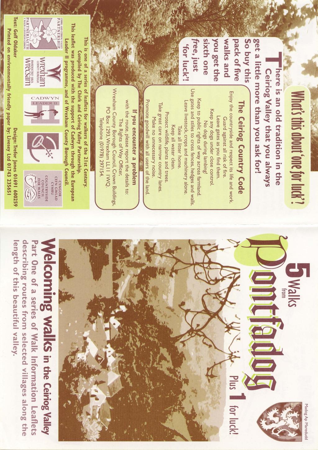
1
2


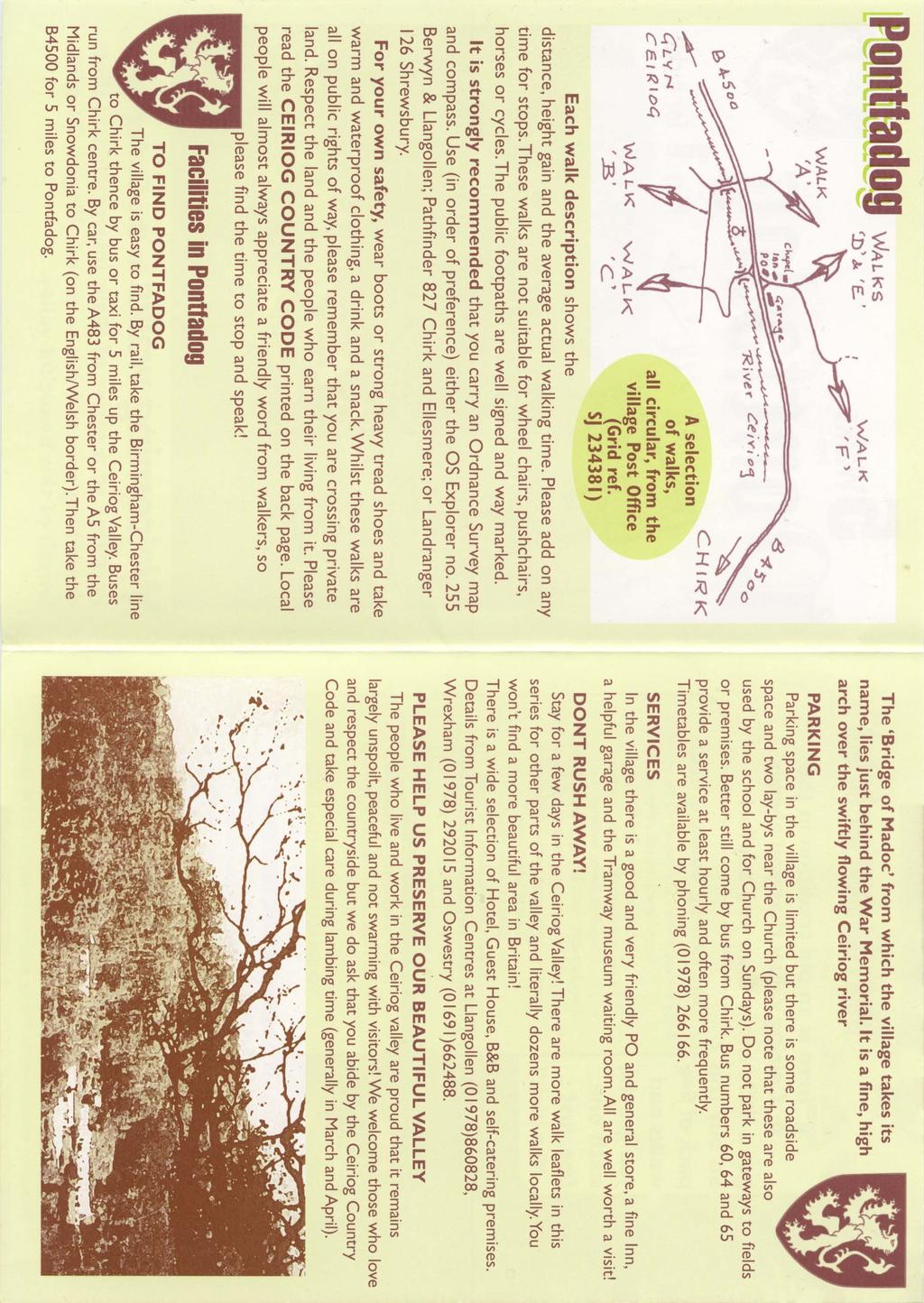
3 Walk A A Bird s eye view of the village 2km. (1 1 /2 miles); height gain 45m. (150ft) about 45 minutes. Six minutes walk along the main road towards Glyn Ceiriog reach a signpost to Llwynmawr. Take the opposite lane, which doubles back above the village. Where the tarmac swings L., keep ahead on a stone track heading generally north. Twelve minutes along the stone track, reach the buildings of Pentre farm ( it may be muddy here), to emerge onto a tarmac lane. Go L. uphill for 3 minutes to where a stream passes below the lane. Go R. up steps and cross fields following path 9 to a driveway. Go L. up the drive for 1 /2 minute, then go R. into a field passing a large upright stone. Keep on path 9, eastwards (fairly level) across fields, then at a stile, turning R. down to a tarmac lane. Turn R. and follow the lane back to the village. This is a good introductory walk to the area, for you will pass through most of the village and as you rise above it you obtain excellent views of the centre and of the surrounding landscape. You will be passing fairly close to the oldest oak tree in Britain which is 41 1 /2 ft in girth and is calculated to be 1600 years old! It began life as the last of the Romans were leaving and was a fully mature tree when King Offa built his dyke! Unfortunately it is not visible from the public road or paths. The Oldest Oak Tree in Britain Walk A


4 Walk B Around Nant Gwryd A beautiful valley with fine views. 4.5km. (3 1 /2 miles); height gain 150m. (500 ft.) about 1 1 /2 hours. Woodland walks, stony tracks, grassy ways and country lanes. Six minutes along the main road towards Glyn Ceiriog, take the lane on the L. signposted Llwynmawr. Cross the river, and 1 minute later, by Felyn Lyn turn L. uphill for 1 minute then go sharp R. onto a driveway/footpath. Pass below the cottage garden onto path 36 for about 10 minutes. You walk with lovely oak woods on your L. and views across open meadowland below. Emerging onto a track, cross it through a gate into a field. You are now on path 28 which keeps uphill, close to the fence for 5 minutes. The forest edge now briefly descends to your path. From here follow a line of mixed old trees diagonally across a sloping meadow heading for a group of 5 old birch trees. Pass them, and ahead to Siamese twins of Ash and Oak which cunningly conceal a stile! Again ahead and slightly upwards for 80 metres to a stile onto a track. Take this downhill but only for 1 minute before taking a contouring path on L. above the cottage and buildings. Cross a couple of fields, then the path drops steeply for 10 yards down a wooded bank between fields. Follow the lower fence towards the old farmstead of Cilnant. The formal right of way passes through the farmyard but the owner asks walkers to use his signposted alternative. Once beyond the buildings, walk uphill on the farm driveway (ignore fork to the right) to a tarmac lane. At 275m. (900ft.) above sea level, this is the highest point of the walk. Go downhill, on the lane, turning a sharp bend by Craig-y-oryn and down to a lovely old house and barns. Here take the R. fork (or L. if you fancy refreshment from the Golden Pheasant Hotel!). Continue for 18 minutes to a junction of lanes. Go R. and in 6 minutes you are back at Felyn Lyn. Fork L. over the river, then R. onto the main road and into the village. Walk B

5 Walk C Around Brown Billy Hill Wonderful 360 panoramic views! Good tracks and country lanes. 6km. (4 miles); height gain 270m. (885 ft.) about 2 1 /2 hours. By the War Memorial in the village centre cross the river bridge, steeply uphill for 2 minutes and follow the road sharp R. upwards to the Graig. Along this lane for 3 minutes to a diagonal cross-roads and straight ahead onto an (initially) tarmac track, rising within the woodland of Coed Pen-craig. Follow this clear and attractive track for 45 minutes to a clear cross-roads. Turn L. onto a green lane, reasonably level for 6 minutes to a tarmac lane. Go L. gently down hill, passing Henmer House. Just over 1 minute beyond this, go L. still on tarmac, gently uphill again. About 11 minutes walking brings you to a wood (you reach your highest point of 365m. (1,205 ft) above sea level just before the wood). Keep to the lane which drops quite steeply to the R. and below the wood. About 25 minutes after reaching the wood, arrive at a T junction with a tarmac lane. Ahead, take the stile between two gates. This short path bends R. and drops to another tarmac lane. Go L. downhill for about 10 minutes to reach the river bridge and village. Walk C
 about 1 hour 45 minutes. Lanes, bridleways and ancient tracks. Quite muddy, rocky, rough and sometimes wet in places.")
6 Walk D Across Sunny Hillsides Explore the south facing slopes of the long ridge which divides the valleys of the rivers Ceiriog and Dyfrdwy (Dee). 5km. (3 1 /2 miles); height gain 223m. (736 ft.) about 1 hour 45 minutes. Lanes, bridleways and ancient tracks. Quite muddy, rocky, rough and sometimes wet in places. From the Post Office follow the lane uphill past the Swan Inn and just beyond the Methodist Chapel fork L. About 7 minutes later you pass between the house and barns of Pentre Farm and 40 metres beyond that take the driveway to the L. which rises for 5 minutes to the open-ended barn of Tyn-y-twll. Opposite this barn, go R. up an (often muddy) tree lined bridleway. After about 8 minutes emerge onto open meadowland, keeping straight ahead, following a hedge on your R. Approaching woodland, look for a waymark which leads up through delightful broad-leaved trees. It becomes rocky underfoot and sometimes with running water, so good boots are essential! Keep straight ahead until reaching a ford through the main stream, then rise immediately to the tarmac lane. You are now about 40 minutes into the walk and those who are weary could follow the lane down, back to the village. However, our walk goes L. up hill on the lane for 4 minutes to a T junction and telephone box. Go L. still uphill but more gradually for 6 minutes to a fork by Bryn Arddyn. (Walk E diverges from this walk here.) Go L. along the fine terrace lane Unsuitable for motors and enjoy superb views over and the Ceiriog valley. After 10 minutes see a track leading L. signed to Tyn-y-Mynydd. You could choose this, for an old stone track will lead you back to Tyn-y-twll, but our walk goes straight ahead, ignoring the bridleway to the R. (Walk E rejoins this walk here.) Descend this ancient and attractive track for 16 minutes ignoring the farm drive to Pen-y-brongyllon L. and two footpaths on your R. to reach a tarmac lane. Turn L. dropping to an arrowhead crossroads. Go L. again and in under 2 minutes, see a track on the L. (signed to Bodgers Cottage). Take this and in 150 metres, take the R. (lower) path. You may spot a Mongolian Yurt dome amongst the trees! Keep ahead for 300 metres, the path becoming a track and later swing sharp R. downhill onto a tarmac lane. This brings you onto the main valley road. Go L. for a 6 minutes walk back to the village centre. Walk D
; height gain 290m. (960 ft.) 2 1 /2 hours. Lanes, bridleways, meadowland footpaths and old tracks. Quite muddy, wet and rough in places.")
7 Walk E Sunny Hillsides to the Ridge Top! An extension of walk D to the northwest of, affording views of the Ceiriog valley, the Vale of Llangollen and the Llantysilio ridge beyond. 8km. (5 miles); height gain 290m. (960 ft.) 2 1 /2 hours. Lanes, bridleways, meadowland footpaths and old tracks. Quite muddy, wet and rough in places. Follow the first half of notes for Walk D, to the fork of lanes at Bryn Arddyn. Diverging from walk D we enter the farmyard gate and bear R. between the barns and enter the field behind. Whilst the public path (Path 6) keeps to the R. of a fenceline, the owner is happy that anyone nervous of grazing horses may opt to follow up the L. of this fence. The route rises gently to the north crossing four stiles. About 14 minutes after leaving the farmyard, go directly across the lane to enter a field with golden gorse bushes. Keep straight ahead for about 3 minutes to open up excellent views of the Llantysilio ridge with the Vale of Llangollen deep down below. A place to sit and stare! Retrace your way back to the ridge lane (3 minutes) and go R. along the lane gently uphill for 7 minutes to your highest point of the walk at 410m. (1360ft). Here a minor lane forks off obliquely L. and a bridleway leaves the tarmac through a gate at 90 L. Descend this lovely grassy bridleway for about 14 minutes taking in a new range of views across Glyn Ceiriog and away to the high Berwyn ridge in the west. Reach tarmac lane and follow it downhill for 5 minutes to find a bridleway on L. with double steel gates and a wooden bridle gate. Enter this, rising with a wall to your R. and continue along this track, keeping above a spruce wood, after which the route levels out and then falls. Keep above the stone wall and enjoy another set of panoramic views! This bridleway will take about 11 minutes. When you reach a tarmac lane, turn R. We have now re-joined Walk D, where the notes say Descend this ancient and attractive track... Follow those notes back to the end of the walk. Walk E

8 Walk F The one for Luck! A lovely walk to the north east of the village, but quite a strenuous one with steep gradients. 5km. (3 1 /2 miles); height gain 286m. (950 ft.) 1 hour 45 minutes. From the Post Office follow the lane uphill past the Swan Inn. Just beyond the Chapel, take the lane forking right. You will pass the attractive buildings of Tan-y-garth farm on your right and just beyond it bear right at another fork. Straight ahead now, still on the lane, through delightful native woodland. Ignore the first track forking off to the R. but keep climbing more steeply on the tarmac! A second track on R. is signed as a bridleway (you are now some 20 minutes from the start). Walk (thankfully) downhill through this spruce wood then along a clear track, passing through 3 bridle gates (with their no dismount gate catches). Cross the stream and up to the fence line ahead. The main track swings R. here but we go L. up the side of the gorge. Keep close to the fence until a stile gives access to a clear firm track, take this uphill, passing R. of Ty-nant. 3 minutes beyond this, take the L. fork of tracks and continue ahead to the recently renovated old farmhouse of Pennant. Take the lane L. and after 100 metres (unless you are weary!) take the R. fork. This soon becomes quite a steep pull up past the modern Winlle farm. The long hill is rewarded by fine views across the valley and out to the N.Shropshire and Cheshire plain. As the lane passes young woodland on R. the slope eases and at a mono-pitch stone barn ahead you have reached your highest point at almost 670m (1,200 ft) above sea level. Its probably about 1 hour and 10 minutes from the start and time to return! By this barn, turn sharp L. down a lane for 4 minutes. On a R-hand bend, a green lane forks R. Make a choice here, for the green lane is more direct, but is steep, eroded and a bit awkward in places. A more gentle way is to keep on the tarmac and take the R. option at the hairpin which will take you home. However, the green lane is more attractive, dropping with the valley to a farm, then ahead on a steep tarmac lane to rejoin the outward route at Tan-y-graig. Go R. here back to the start. See sketch map below. Walk F
Slad over to Pitchcombe and back
 The walk climbs up from Slad over Wickridge Hill, descends to near Pitchcombe, then climbs back over Wickridge hill and round the back of Slad. Page 1 Start Point: SO 8718 0732 The Woolpack, Slad Length:
The Mendip Way. Route Directions and Maps Uphill to Wells
 The Mendip Way Route Directions and Maps Uphill to Wells Website: www.mendiphillsaonb.org.uk Email: mendip@mendiphillsaonb.org.uk Facebook & Twitter: @MendipHillsAONB Phone: 01761462338 1 Uphill to Loxton
CWMGIEDD FROM ABERCRAVE
 Abercrave to Cwmgiedd Walk Page 1 Starting from The Abercrave Inn. Grid Ref: SN 824128 From the Abercrave Inn, an 11.3km (7 miles) walk to the foothills of the Cribarth Mountain, then through forest to
Beautiful Walks from the Blue Ball Inn
 Walk No. 5 RIVER VALLEYS AND MOOR Countisbury, Watersmeet, Hillsford Bridge, Cheriton, Shilstone Hill, Rockford and Chiselcombe. 8.5 MILES APPROX. Walking time four and a half hours approx. OS 1;25,000
Leaden Boot Challenge ROUTE INSTRUCTIONS
 Leaden Boot Challenge ROUTE INSTRUCTIONS Section 1 Alstonefield to Ilam From the village hall car park turn R then L and pass through the village keeping to the R to enter Church Street. Pass the Church
Leaden Boot Challenge 2016 ROUTE INSTRUCTIONS
 Leaden Boot Challenge 2016 ROUTE INSTRUCTIONS Section 1 Alstonefield to Ilam (CP2) From the village hall car park turn R then L and pass through the village keeping to the R to enter Church Street. Pass
Hindhead, Keffolds Copse and Gibbet Hill
 point your feet on a new path, Keffolds Copse and Gibbet Hill Distance: 6 km=4 miles Region: Surrey Author: Schwebefuss Refreshments: Punch Bowl Café moderate walking Date written: 14-apr-2015 Last update:
BURGHCLERE PARISH RIGHTS OF WAY
 BURGHCLERE PARISH RIGHTS OF WAY Full descriptions compiled by Neill & Miggie Bruce All photos Miggie Bruce FP23 on Ridgemoor, looking south, with FP22 crossing by the bush FP1. From C183 Aldern Bridge
HARDMOORS 55 RACE ROUTE 2018 HELMSLEY - GUISBOROUGH
 HARDMOORS 55 RACE ROUTE 2018 HELMSLEY - GUISBOROUGH HELMSLEY - CHECKPOINT 1 (WHITE HORSE) 1. Leave RACE START, continue ahead on road (Baxtons Sprunt) At crossroads turn right down Canons Garth eventualy
HARDMOORS ROUTE DESCRIPTION
 HARDMOORS 60 2016 ROUTE DESCRIPTION RACE START (GUISBOROUGH) - CHECKPOINT 2 (SALTBURN) DISTANCE 9 MILES CUT OFF TIME 1030 GRID REF OS 666 208 1. Leaving the Sea Cadets Hall, turn left onto the road and
Ystwyth and Rheidol Bridleway Routes. Route 2:Llanilar Circular
 Ystwyth and Rheidol Bridleway Routes Route 2:Llanilar Circular Route overview and terrain: A long circle using connecting ridges with fine views to link the Rheidol and Ystwyth river valleys. The route
Reigate Hill and Gatton Park
 point your feet on a new path Reigate Hill and Gatton Park Distance: 11½ km=7 miles easy-to-moderate walking or 2 walks of 6½ km=4 miles and 5½ km=3½ miles Region: Surrey Author: Schwebefuss Refreshments:
BISHOPSTONE CIRCULAR WALK
 BISHOPSTONE CIRCULAR WALK 4½ miles (7¼ km) - allow 2 hours (see maps on final pages) Introduction This walk is within the North Wessex Downs Area of Outstanding Natural Beauty and starts from the small,
ID: 283 Distance: 6.2 miles Height gain: 500 Metres Map: Explore OL 19 Contributor David and Chris Stewart
 Walkingworld Wild Boar Fell ID: 283 Distance: 6.2 miles Height gain: 500 Metres Map: Explore OL 19 Contributor David and Chris Stewart Features Birds, Great Views, Hills or Fells Description: Wild Boar
Sponsored by. statestreet.com
 /STATESTREETISLANDWALK #ISLANDWALKJSY Sponsored by statestreet.com Important Information If you forget everything else PLEASE remember the following.» Remember to check OUT of every checkpoint» If you
Aeron & Arth walks 4 walks for all the family to enjoy
 Aeron & Arth walks walks for all the family to enjoy Please take note that the maps illustrating these walks are intended as a rough guide only. You should use the most recent version of the relevant Ordnance
Ardingly Lake, Ouse Valley, Borde Hill
 point your feet on a new path Ardingly Lake, Ouse Valley, Borde Hill Distance: 14 km=9 miles or 12½ km=8 miles Region: West Sussex Author: Hautboy Refreshments: Borde Hill Map: Explorer 135 (Ashdown Forest)
Beautiful Walks from the Blue Ball Inn
 Walk No. 2 WINSTONS WALK Countisbury, Wind Hill, Watersmeet, Ash Bridge and Winston s path. 5 Miles approx. Walking time- Two and a half hours approx. (Not including Breaks) OS 1:25,000 Sheet 64/74 Lynton
START - UPHILL BEACH. (tidal!) The West Mendip Way is route-marked with these round blue signs
 The West Mendip Way is route-marked with these round blue signs") START - UPHILL BEACH Start Times: 10:30 11:15 12:00 Please allow sufficient time to check in with the marshals Start on the beach at the high water line (tidal!) The West Mendip Way is route-marked with
START - UPHILL BEACH Start Times: 10:30 11:15 12:00 Please allow sufficient time to check in with the marshals Start on the beach at the high water line (tidal!) The West Mendip Way is route-marked with
Bewl Water & the High Weald
 1 Bewl Water & the High Weald Stonegate station - Stonegate - Wallcrouch - Newbarn - Cousley Wood - Wood's Green - Wadhurst station Length: 9 ½ miles (15.3km) Underfoot: Large portions of this path are
Singleton and the South Downs
 point your feet on a new path Singleton and the South Downs Distance: 13½ km=8½ miles easy walking with a few steeper sections Region: West Sussex Author: Hautboy Refreshments: Singleton, Hill Barn Date
Ranmore Common and Polesden Lacey
 point your feet on a new path Ranmore Common and Polesden Lacey Distance: 9½ km=6 miles Region: Surrey Author: Fusszweig Refreshments: Polesden Lacey easy walking Date written: 20-dec-2016 Last update:
Baggy Point, Croyde, North Devon
 Baggy Point, Croyde, North Devon A walk using the South West Coast Path that is likely to be suitable for people with impaired mobility or with a pushchair, wheelchair, or mobility scooter. The Coast Path
Lewes and the South Downs
 point your feet on a new path and the South Downs Distance: 0 km=1½ miles moderate walking with long easy stretches Region: East Sussex Author: Hautboy Refreshments: Date written: 8-apr-013 Map: Explorer
Bentley station - Alice Holt Forest - Frensham Great Pond - Rushmoor - Pitch Place - Gibbet Hill - Haslemere station
 1 Devil s Punch Bowl and Surrey Heaths Bentley station - Alice Holt Forest - Frensham Great Pond - Rushmoor - Pitch Place - Gibbet Hill - Haslemere station Length: 13 ¾ miles (22.0 km) Underfoot: Almost
A Circular Walk from Chapel Carn Brea
 A Circular Walk from Chapel Carn Brea 4.3 Miles A Walk Visiting Five Historic Ancient Sites This circular walk offers the possibility of several alternatives, depending on the walker s available time and
Fetcham Downs and Bocketts Farm A magical teashop walk
 point your feet on a new path Fetcham Downs and Bocketts Farm A magical teashop walk Distance: 3 km=2 miles or 4 km=2½ miles Region: Surrey Author: Fusszweig Refreshments: Bocketts Farm easy walking Date
beach. Make the ford and follow the trail out to the junction with Red Creek Tr in an open grassy area.
 Description: This is a moderate to slightly strenuous 22.8 mile backpack (add 2.6 miles if you do the packless out and back to the Lion s Head) that will have you exploring nearly every thing that is The
Friday Street, Leith Hill, Holmbury Hill
 point your feet on a new path Friday Street, Leith Hill, Hill Distance: 12 km=7 miles easy-to-moderate walking + optional tour of Hill: 1½ km=1 mile Date written: 27-oct-2011 Region: Surrey Author: Schwebefuss
Walk 1. Cotswold Water Park. Gateway Centre to Cerney Wick, railway track to Lake 6, Gateway Centre.
 Cotswold Water ark Walk way A Swindon/ Cirencester Thomas and Severn Canal way to Cerney Wick, railway track to Lake, way. Spine Road East Hotel Time: hours (short walk km) Distance: km A level walk along
Self-Guided Walk Malham, Gordale and Malham Tarn
 Self-Guided Walk Malham, Gordale and Malham Tarn Combine all the major geological attractions of Malham in this walk and hopefully leave enough time to enjoy the cafes, pubs and shops of the village. Malham
Skiing and Snowshoes on Un-groomed Fernan Saddle Terrain
 Skiing and Snowshoes on Un-groomed Fernan Saddle Terrain Three ski or snowshoe routes are available from the Fernan Saddle Parking Lot which either do not cover routes ordinarily groomed for snow machine
Gomshall station - Abinger Hammer - Abinger Common - Friday Street - Leith Hill - Coldharbour - Holmwood station
 1 To Leith Hill Gomshall station - Abinger Hammer - Abinger Common - Friday Street - Leith Hill - Coldharbour - Holmwood station Important note: this walk cannot currently be done wholly by train on a
Ivinghoe Beacon and the Grand Union
 1 Ivinghoe Beacon and the Grand Union Cheddington station - Horton Wharf - Ivinghoe - Ivinghoe Beacon - Bridgewater Monument - Aldbury - Tring station Length: 11 ¼ miles (18.3km) Underfoot: The first mile
GRINDLEFORD GALLOP 2018
 GRINDLEFORD GALLOP 2018 Route Information The Grindleford Gallop follows a fixed 21 mile route through the lanes and paths of Derbyshire. All competitors must follow this route. An OS map of the area with
Map: Landranger #27 Forres and Nairn and 36 Grantown and Aviemore
 THE DAVA WAY This is a newly created long distance route that runs from Forres to Grantown, mostly following the old railway line. You will need to detour around a couple of sections that are not really
Gomshall station - Abinger Hammer - Abinger Common - Friday Street - Leith Hill - Coldharbour - Holmwood station
 1 To Leith Hill Gomshall station - Abinger Hammer - Abinger Common - Friday Street - Leith Hill - Coldharbour - Holmwood station Important note: this walk cannot currently be done on a Sunday due to the
Self-Guided Walk Langdale Pikes. Start & Finish: NT car park (free to members) at Sticklebarn - on the right just beyond the New Dungeon Ghyll hotel.
 at Sticklebarn - on the right just beyond the New Dungeon Ghyll hotel.") Self-Guided Walk Langdale Pikes Key Information These mountains form a collection of spires and cliffs on the north side of Langdale. This walk visits four of the main tops Pavey Ark, Harrison Stickle,
Self-Guided Walk Langdale Pikes Key Information These mountains form a collection of spires and cliffs on the north side of Langdale. This walk visits four of the main tops Pavey Ark, Harrison Stickle,
Hay Wood, Rowington and Baddesley Clinton - Warwickshire
 Hay Wood, Rowington and Baddesley Clinton - Warwickshire Starts at Lay-by alongside Hay Wood 2 hours 30 minutes 5.5miles 8.8km Leisurely ID: 0.683 Developed by: John Clift Checked by: Andy Page www.ramblersroutes.org
Distance: 18 km=11 miles or 12½ km=7½ miles or 9 km=5½ miles
 point your feet on a new path The Devil s Dyke Distance: 18 km=11 miles or 12½ km=7½ miles or 9 km=5½ miles Region: West Sussex Author: Hautboy Refreshments: Devil s Dyke, Fulking, Poynings moderate ing
The Bridestone Rocks from Lydgate
 Print this page Back to results The Bridestone Rocks from Lydgate Ancient tracks and gritstone outcrops, with terrific views of the steepsided Cliviger Valley. Distance 5 miles (8km) Minimum time 2hrs
Chevening and the North Downs
 1 Chevening and the North Downs Dunton Green station - Chipstead - Chevening - Knockholt - Hawley's Corner - Botley Hill - Oxted station Length: 12 ¼ miles (19.7 km) Underfoot: Portions of the walk are
3.1 Bowness-on-Solway to Carlisle
 3.1 Bowness-on-Solway to Carlisle Map panel 1 Distance 15 miles (24 km) Terrain minor roads, tracks, field paths and riverside footpath, muddy in places Grade easy, with gentle gradients on undulating
Walk 1: Highfield, Lob Wood and The River Wharfe
 Walk 1: Highfield, Lob Wood and The River Wharfe Start: The Hen Pen Garden, Main Street, Addingham LS29 0NS, SE 077 498. Alternative Start: Near Bolton Bridge SE 071 525 (see page 6). Full walk: 4.5 miles
Merritts Traverse. 1928m
 Merritts Traverse 3 hrs Hard track 5.8 km Circuit 4 167m This walk starts with a scenic journey to the top of the hill on the chairlift. Starting along Merritts Nature walk, this walk soon detours down
Mapledurham, Gallowstree and Shepherd s Green
 Mapledurham, Gallowstree and Shepherd s Green Pangbourne station Mapledurham Gallowstree Common Satwell Shepherd s Green Grey s Court Henley-on-Thames Length: 15 ½ miles (24.8km) Underfoot: Minor roads
Britain s oldest surviving water-balanced cliff lift
 44 3.6 Saltburn by the Sea to Sandsend Map panels 3 and 4 Distance 17 miles (27½ km) Terrain mostly grass and field paths which can be muddy; some pavement, beach and shore Grade undulating route, with
Aston Rowant Discovery Trail
 The walk was developed by Aston Rowant Parish Council. The Trail is stile-free and fully way-marked. The circular route is 5.3m but with the extension to a pub and hotel 6.2m. Key Main Aston Rowant Discovery
river point your feet on a new path
 river point your feet on a new path Frensham and Bourne Wood Distance: 13 km=8 miles or 11 km=7 miles easy walking with a few steep gradients Region: Surrey Author: Schwebefuss Refreshments: Shortfield
The Sudbury Branch Walks 1-4
 The Sudbury Branch Walks 1-4 Sudbury Branch Walks From Sudbury to Marks Tey The gentle declivities, the luxuriant meadow flats sprinkled with flocks and herds... the sound of water escaping from the mill
Penn Common and Bramshaw Wood
 Trail Activity Type Terrain Author Distance Ascent Location : HAMPTR0025 : Walk : Pub : Towpaths and Cycle Tracks : Anne-Marie Edwards : 5.3 miles / 8.5 kms : 381 feet / 116 metres : SU253173 / SP5 2BZ
Eastbourne. Alfriston 3¾ 6 3¾ 6. Birling Gap. Exceat
 3.8a Alfriston to Eastbourne (footpath) Map panel 6 (page 64) Distance 10½ miles (17 km) Terrain valley walk initially, first along riverbank path then hillside paths above, including stretch through forest;
Woodland Walk If you enjoyed this walk there are two others available in the same area.
 The Woodland Walk 11-12 kilometres (7-8 miles) 4-5 hours Terrain: some easy hills Can be slippery when wet 5 stiles Unsuitable for a pushchair/wheelchair Uses OS map 197 Parking: Pulborough Station and
This path goes past an old tree nursery and sawmill. After 800m it crosses over a lane. Follow the bridleway fingerpost into the woods.
 FRENSHAM PONDS 11K CIRCULAR TRAIL 2½ HRS GU10 2DA This magnificent heathland trail starts in woodland and then brings you out onto the open heather of Frensham Common, with no roadwork! The route runs
The 34 th Poppyline Marathon
 The 34 th Poppyline Marathon Saturday 9th June 2018 - Route Description Emergency number: 07906 404673 or 07597 052572 Ahd - Ahead BL - bear left BR - bear right BW - bridleway Cont - continue FB - footbridge
COSTA BLANCA MOUNTAIN WALKERS - WALK DESCRIPTION. Visit for more walks descriptions in Spain
 Visit www.walksinspain.org for more walks descriptions in Spain Walk description originally prepared by:- Ralph Phipps Last Updated 15 th July 2016 Title of Walk Location of Start (include name of nearest
A Tour of the Valle del Gizio
 Walk 25 A Tour of the Valle del Gizio Walking time 5hrs 30mins (4hrs if Colle Mitra is omitted) Difficulty 2 (likely to be snowbound in winter months); 1 (if Colle Mitra is omitted) Ascent/descent 570m/570m
Medway Valley Orchards
 1 Medway Valley Orchards East Farleigh station - Kettle Corner - Farleigh Green - Buston Manor - Yalding - Yalding station Length: 6 ¾ miles (10.9km) Underfoot: Generally, this is a walk on good paths,
West Wirral (Dee Estuary)
") View of Hilbre Island from West Kirby with walkers at low tide. West Wirral (Dee Estuary) West Kirby is the start of the 12 mile long Wirral Way, the backbone of Wirral Country Park, the old Hooton to
View of Hilbre Island from West Kirby with walkers at low tide. West Wirral (Dee Estuary) West Kirby is the start of the 12 mile long Wirral Way, the backbone of Wirral Country Park, the old Hooton to
Drive and Stop Routes
 Drive and Stop Routes Limantour Road 1 - easy and likely productive. From Bear Valley Visitor Center drive back out and turn left onto Bear Valley Rd. Turn left at Limantour Road (the first road). Drive
Eglwyseg Mountain a landscape of prehistoric cairns and later industry
 Eglwyseg Mountain a landscape of prehistoric cairns and later industry Walk Information: Maps: OS Explorer 256 Distance: 5.3 miles / 8.5 kilometres (linear) or up to 9.6 miles / 15.5 kilometres (circular)
Freefolk and Whitchurch
 Trail Activity Type Terrain Author Distance Ascent Location : HAMPTR0026 : Walk : Tea Shop : Towpaths and Cycle Tracks : Jean Patefield : 5.6 miles / 9 kms : 377 feet / 115 metres : SU487488 / RG28 7NN
Chess & Gade. Chalfont & Latimer Station - Latimer - Chenies - Sarratt - Kings Langley Station. Length: 8 ¾ miles (14.25km)
") 1 Chess & Gade Chalfont & Latimer Station - Latimer - Chenies - Sarratt - Kings Langley Station Length: 8 ¾ miles (14.25km) Underfoot: Well-trodden paths, mainly firm in all weather conditions, though
1 Chess & Gade Chalfont & Latimer Station - Latimer - Chenies - Sarratt - Kings Langley Station Length: 8 ¾ miles (14.25km) Underfoot: Well-trodden paths, mainly firm in all weather conditions, though
The Copper Horse Lodge, Windsor Park George III statue and view of Windsor Castle Andy Oakes Julian P Guffogg Don Cload
 Trail Activity Area Type(s) Author Distance Ascent Location : BRKSTR0008 : Walk : Windsor and the South East : Country Escape : Andy Oakes : 5 miles / 8.1 km : 239 feet / 73 metres : SU947727 / SL4 2BT
Hadleigh Castle and Chalkwell Oaze
 1 Hadleigh Castle and Chalkwell Oaze Benfleet station Hadleigh Park Hadleigh Castle Leigh-on-Sea Chalkwell station A short stroll through the lush woods of Hadleigh Park high above the Thames-side marshes,
(WP19178masl) where the left branch is taken. Within 50min 300m are ascended. Start of the track shelter. Level grassy area
 where the left branch is taken. Within 50min 300m are ascended. Start of the track shelter. Level grassy area") SOUTHERN CROSSING 260-Series: Levin S25, S26 Carterton NZ Grid GPS: Geodetic datum1949 Topo50 Map: BP33 Featherstone NZTM GPS: NZTM on WGS 84 How to get to START: The motor camp in Levin makes a good overnight
SOUTHERN CROSSING 260-Series: Levin S25, S26 Carterton NZ Grid GPS: Geodetic datum1949 Topo50 Map: BP33 Featherstone NZTM GPS: NZTM on WGS 84 How to get to START: The motor camp in Levin makes a good overnight
IRON BARK and COLENSO HUTS 260 Series Map: 1:50, U21 NZ Grid GPS: Geodetic Datum 1949
 IRON BARK and COLENSO HUTS 260 Series Map: 1:50,000 260-U21 NZ Grid GPS: Geodetic Datum 1949 Topo50 Map: BK36 Taoroa Junction GPS: on WGS84 How to get to START: Exit Taupo on SH1 down the lake to Turangi
The Hundred Parishes
 The Hundred Parishes Walks from railway stations number 3 3 miles (5kms) circular walk from Stansted Mountfitchet Start & finish: Stansted Mountfitchet station. Ordnance Survey Explorer Map 195. Grid Reference:
Broxbourne Woods Brickendon, Ermine Street, Wormley West End
 point your feet on a new path Broxbourne Woods Brickendon, Ermine Street, Wormley West End Distance: 10 km=6 miles (+ 1.2 km=0.8 mile for north pub) easy walking or two walks of 7 km=4½ miles (south) and
White Horse Trail Route directions (Clockwise) split into 10 section with an alternative for the Alton Barnes to Cherhill section
 split into 10 section with an alternative for the Alton Barnes to Cherhill section") White Horse Trail Route directions (Clockwise) split into 10 section with an alternative for the Alton Barnes to Cherhill section S1 White Horse Trail directions Westbury to Bulkington Maps: OS Explorer
White Horse Trail Route directions (Clockwise) split into 10 section with an alternative for the Alton Barnes to Cherhill section S1 White Horse Trail directions Westbury to Bulkington Maps: OS Explorer
A novel character. Discover what shaped the landscape that so inspired the Brontës. Directions
 Trail A novel character Discover what shaped the landscape that so inspired the Brontës Time: 1-1 ½ hrs Distance: 1 ½ miles Landscape: rural The small village of Haworth in West Yorkshire is most famous
Telluride-to-Moab Alternative Singletrack Options
 Telluride-to-Moab Alternative Singletrack Options Day 1 Day 1 Alternate 1: Galloping Goose to Deep Creek. 18.4 miles, ascent 3,530ft, descent 1,388ft. This is fun, flowey, moderate to intermediate singletrack
Delamere Loop. The. Useful Businesses Equestrian Escapes Tailor-made horse riding holidays in Cheshire. Tel:
 The Loop Accommodation Providers Akesmere Bed & Breakfast OS Grid Ref. SJ589/669 B&B for horse and rider. Chester Road, Little, Tarporley, Cheshire CW6 9ER Tel: 01829 760348 www.akesmerefarm.co.uk Useful
For more information and to buy this book click here ISBN: CICERONE. Guides for walkers, trekkers, mountaineers, climbers and cyclists
 For more information and to buy this book click here ISBN: 9781852844103 CICERONE Guides for walkers, trekkers, mountaineers, climbers and cyclists www.cicerone.co.uk SALÈVE AND VALLÉE VERTE SALÈVE WALK
Brightling, Dudwell Valley, Bateman s Forests and Follies
 point your feet on a new path Brightling, Dudwell Valley, Bateman s Forests and Follies Distance: 15 km=9½ miles Region: East Sussex Author: Stivaletti Refreshments: Woods Corner, Burwash Weald moderate
Description for the Round Rotherham 8 December 2007
 Directions: L left R right ½L, ½R half left, half right X cross X Rds cross roads SA straight Codes: BR bridge FP footpath FB footbridge RWY railway CP car park RD road Description for the Leave Event
Approximate distance: 7.5 miles For this walk we ve included OS grid references should you wish to use them.
 Approximate distance: 7.5 miles For this walk we ve included OS grid references should you wish to use them. 6 5 7 8 4 1 2 Start End N 3 W E S Reproduced by permission of Ordnance Survey on behalf of HMSO.
River Isla B951. Diarmid s Tomb
 3. 4 Spittal of Glenshee to Kirkton of Glenisla Distance 14.6 miles 23.5 km Terrain mainly on rough moorland path with boggy bits and stream crossings, then heading east along at the B951 for 2.5 miles,
Trail Beginning Elevation: 7553 ft The Poison Creek Trailhead is located at the end of National Forest Road 646E (NF-646E).
.") West Mountain Trails Poison Creek Trail #134 Length: 2.9 miles (4.7 km) Difficulty Horseback: A good trail for the first time west mountain rider, some steep sections Hiking: Most Difficult USGS Maps:
West Mountain Trails Poison Creek Trail #134 Length: 2.9 miles (4.7 km) Difficulty Horseback: A good trail for the first time west mountain rider, some steep sections Hiking: Most Difficult USGS Maps:
RIVER AMENITY PLOT TITLE NO: ON F BRIDLEPATH F GORING ON THAMES F OXFORDSHIRE.
 RIVER AMENITY PLOT TITLE NO: ON133796 F BRIDLEPATH F GORING ON THAMES F OXFORDSHIRE www.warmingham.com RIVER AMENITY PLOT TITLE NO: ON133796 F BRIDLEPATH F GORING ON THAMES F OXFORDSHIRE Goring Railway
Rock Creek Park, MD - Lake Needwood
 ock Creek Park, MD - Lake Needwood Lake Needwood, is a reservoir located at the end of the north end of the ock Creek hiker-biker trail. At the other end, ock Creek empties into the Potomac iver near Thompson
Tour Of Tameside The alternative tameside trail
 Tour Of Tameside The alternative tameside trail A 30 mile walk around the borough of Tameside taking in the Valleys of the Medlock, Etherow and Tame. The whole walk can be completed in one day by anyone
Victoria Falls Lookout to Blue Gum Forest
 Victoria Falls Lookout to Blue Gum Forest 8 hrs Experienced only 13.8 km One way 5 112m This long day-walk follows a remote track down from Victoria Falls lookout, passing the waterfall, and into the Grose
Pen Cerrig-calch prehistoric cairns
 Walk Information: Maps: OS Explorer OL13 Distance: 8 miles / 13 kilometres Duration: Allow at least 6 hours for the circular walk Difficulty: medium. Some narrow paths, occasionally rough underfoot Start
San Miguel to Caserio de la Hoya Circular (San Miguel)
") Tenerife Sur: Short Walks Under 10 km San Miguel to Caserio de la Hoya Circular (San Miguel) Route Summary An informative and scenic walk back in time from San Miguel to below El Roque, overlooking the
Tenerife Sur: Short Walks Under 10 km San Miguel to Caserio de la Hoya Circular (San Miguel) Route Summary An informative and scenic walk back in time from San Miguel to below El Roque, overlooking the
COWAL WAY MULTI-USE ACCESS NOTES
 COWAL WAY MULTI-USE ACCESS NOTES The Cowal Way is a 57 mile long distance path. Starting at Portavadie, it winds its way up through the Cowal peninsula via Tighnabruich, Glendaruel, Strachur, Lochgoilhead
Version 1.0 (19/04/2014) Copyright walkpeakdistrict.com. All rights reserved. Page 1 of 22
 Copyright walkpeakdistrict.com. All rights reserved. Page 1 of 22") Version 1.0 (19/04/2014) Copyright 2013 2014 walkpeakdistrict.com. All rights reserved. Page 1 of 22 Chee Dale Discover this exquisite river gorge on the Wye, hidden away just 3 miles from Buxton Abou
Version 1.0 (19/04/2014) Copyright 2013 2014 walkpeakdistrict.com. All rights reserved. Page 1 of 22 Chee Dale Discover this exquisite river gorge on the Wye, hidden away just 3 miles from Buxton Abou
Dehesa Vieja and the Los Molinos area give us the gift of one of the finest
 ROUTE Dehesa Vieja and the Los Molinos area give us the gift of one of the finest beauty spots in our town. Recent history brings paradoxes: a short time ago, this place that now offers us so much beauty
C E N T R A L C A T S K I L L S
 120 C E N T R A L C A T S K I L L S Central Catskills Once out of the southern parts of the Catskills, the Long Path enters the more well traveled and civilized regions. The trail joins the Devil s Path,
Countryside Trails Dunkeld
 R A N G E R S E RV I C E Countryside Trails Dunkeld WELCOME Welcome to this southern end of Atholl Estates. The countryside here is a wonderful blend of lochs, woodland and heather moor. There is a large
Darwin s gigantic blunder
 Trail Darwin s gigantic blunder Explore how ice shaped the landscape and why Charles Darwin made a nice mess of Glen Roy Time: 1hr 10 mins Distance: 2 miles Landscape: rural At Glen Roy a curious feature
Lund Stones. Lund Stones. Unknown Stones. Climbs - 40 Altitude 300m Faces South, South West Grid ref SE
 Climbs - 40 Altitude 300m Faces South, South West Grid ref SE 175713 Lund Stones Other condition info: An isolated edge with good rock, that, once cleaned, reveals fine and distinctive problems, across
Wicklow Mountains Path Survey
 Wicklow Mountains Path Survey Ballinacor Croaghanmoira Fananierin Start to Finish: T 11723 86602 to T 11175 89057 Altitude (lowest highest): 385m 664m Weather: Hot Access: Coolgarrow forest entrance Surveyed
walking
 Two Castles Trail Meander through rolling countryside full of history on this 24 mile waymarked walking route between Okehampton and Launceston Castles www.devon.gov.uk/ walking www. dartmoor.co.uk www.
s point your feet on a new path
 s point your feet on a new path Arundel: Park, Hills and Forests Distance: 20 km=12½ miles Region: West Sussex Author: Hautboy Refreshments: Arundel, Houghton, Whiteways Lodge moderate walking Date written:
Lordenshaw. What are cup & ring marks?
 Lordenshaw Lordenshaw hill has one of the largest clusters of ancient cup and ring marked stones in the UK. We ve chosen four interesting spots we d like to share with you. What are cup & ring marks? The
Piestewa Peak/Dreamy Draw Trail Guide
 Piestewa Peak/Dreamy Draw Trail Guide Trail #1A - Perl Charles Memorial Trail Length: 4.8 miles Elevation: 2,200 ft. - 1,340 ft. Difficulty: Moderate to difficult The Perl Charles trailhead is located
jennings 3 day rydal ale trail
 jennings 3 day rydal ale trail Grade: Time/effort: 5 Navigation: 2 Technicality: 2 Start: Queens Hotel, Ambleside GR NY375044 Finish: Queens Hotel, Ambleside GR NY375044 Distance: 29.6 miles (47.6 km)
Asheville & WNC Hikes
 Asheville & WNC Hikes Amazingly, we have 3,000+ miles of free public hiking trails near Asheville, including 1,600 miles in the Pisgah and Nantahala National Forests, 850 miles in Great Smokey Mountains
Mersey Valley Timberland Trail
 Route Pack Page 1 Route Summary A long distance linear walk on roads and country paths linking town and countryside to parks, woodlands and other open spaces. Grade Distance Accessibility Allow Start Map