The Cherokee Hiker. MARCH 2019 Volume 36, Issue III. Cherokee Hiking Club, Inc. 198 Crews Drive Benton TN
|
|
|
- Katrina Harrington
- 5 years ago
- Views:
Transcription

1 The Cherokee Hiker MARCH 2019 Volume 36, Issue III Cherokee Hiking Club, Inc. 198 Crews Drive Benton TN CHC Hike and Events Calendar. Recent Hike and Event Calendar. FEBRUARY 1, 2019, FRIDAY DAY HIKES IN AND AROUND THE OCOEE WHITEWATER CENTER ON US 64 Hikes from the Whitewater Center every Friday for the next few months, led by Mike Friedman. Hikes depend on the weather and the group preferences on each Friday. Mike has led numerous hikes over the past month, including the Rhododendron Trail, Bear Paw trail, the Old Copper Road, and Brush Creek trail. All have been well attended, and several visitors have joined the groups.
2

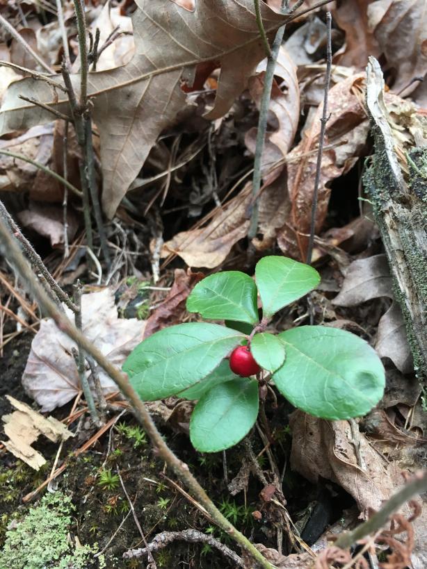
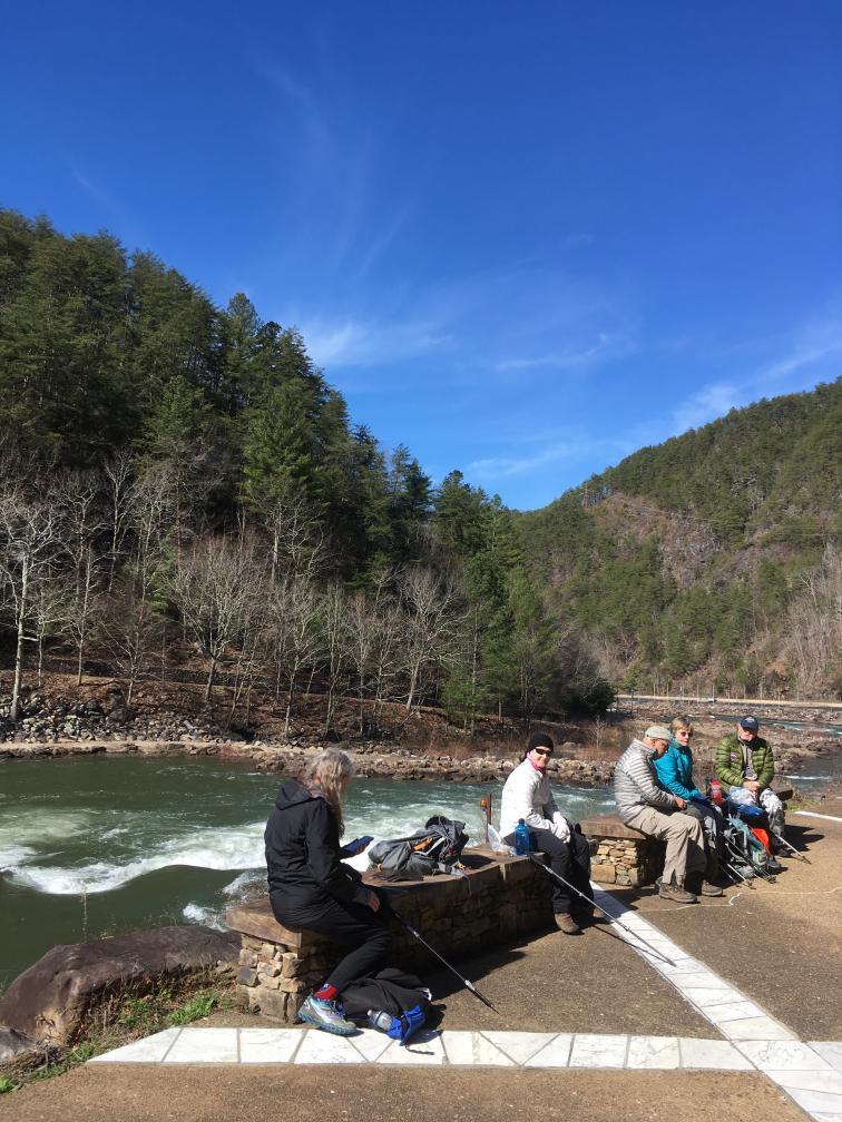
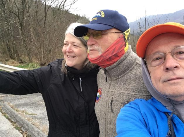
3 FEBRUARY 2, 2019 SATURDAY ROCK CREEK DRY POND Eleven hikers enjoyed a beautiful, warm February hike in the Little Frog Wilderness area. After meeting at Thunder Rock Campground, we carpooled the short distance to the trailhead to begin our hike. We enjoyed great views of surrounding mountains such as Little Frog, Big Frog, and Panther Knob under crystal clear skies. After climbing around the lower flanks of Little Frog, we dropped down into the Rock Creek gorge to view the once impressive hemlock stands along the drainage. Sadly many of the biggest trees have already succumbed to the woolly algid that is wiping out the area s hemlocks. It was nice to see several living specimens, however a sight we may not witness for much longer in the Cherokee National Forest. The weather cooperated once again for our hike as a lack of significant rain during the week made the crossing of Rock Creek much easier than expected. After a lunch on the opposite bank, we climbed back out of the gorge to the intersection with the Dry Pond Lead Trail. We then enjoyed downhill trekking the rest of the way to Highway 64. Making the hike were club members James Anderson, Al Johnson, Mike Friedman, Jack Callahan, Megan Callahan, Sue Robinson, Judy Price, Mary Alton, Deborah Slaughter, Jackie Williams, and hike leader Randy Morris.

4 FEBRUARY 7, 2019 THURSDAY MONTHLY CLUB MEETING MICHAELS RESTURANT IN ETOWAH TN See meeting minutes attached. FEBRUARY 18, 2019 MONDAY CONFEDERATE LINE TRAIL AT CHICKAMAUGA BATTLEFIELD After a visit to the museum, Jennifer Schroll led 14 members and visitors on a 7 mile hike along the Confederate Line, with stops along the way to answer questions about historic markers and possibility of earning a NPS patch.


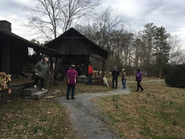
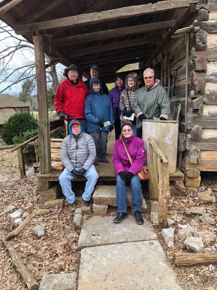
5 The ground is flat and after the recent rains there was a bit of water which required some rerouting at times but Jennifer kept us all on track. The park has numerous trails similar to the one we explored, and there are options for future hikes there. The firearms museum is one of the most extensive in the country, and is a great exhibit of how they evolved. It was a great day to be out! FEBRUARY 19, 2019 TUESDAY MUSEUM OF APPALACHIA AT NORRIS, TN Eight members made the trip to the museum, on a bit of a cool overcast day. The weather allowed us to view all the outside log structures and then we had a nice warm lunch in the restaurant. Food and service were great. After lunch we toured the indoor portion of the museum, which has over 250,000 items from the Appalachian area, most items dating from the late 1700s on. If your grandparents or great grandparents had an item, there is one in this museum. Members making the trip included Ann and Bill Gray, Ruth and Clayton Pannell, Doreen Johnson, Linda Kryssing, Margaret Callahan, and Jack Callahan, event leader.

6
7 UPCOMING EVENTS MARCH 1, 2019 FRIDAY HIKE UP OSWALD DOME Eight miles round trip, moderately strenuous, with an elevation gain of around 3100 feet. Possible sightings of pink Lady Slippers (??) this time of year. Bring water, snacks, and wear good hiking shoes. Possible lunch after at Flip Flops on the Hiwassee River at Reliance. Meet at Quinn Springs Picnic Area parking lot on Hwy 30 at 10:00 am. Hike Leaders Clare and Ed Sullivan, or MARCH SATURDAY ESTELLE MINE TRAIL AT CROCKFORD-PIGEON MTN WMA NEAR LAYFATTE, GEORGIA Easy to moderate trail, with optional old mine ore cart tunnels to walk through. Approximately 5 miles. For those wishing to go the tunnel route, bring flashlight. There are trails around the tunnels for those not wanting to walk through. Trail ends at the Pocket Wildflower area. Will require a car shuttle. Hike Leader Jennifer Schroll, text or jennifergeologist@gmail.com. To carpool from Cleveland, meet at the Park and Ride at 8:30 am on Georgetown Road at I-75, Exit 25 next to the Mapco/BP station just west of the intersection. Approximate drive time from Cleveland is 1.5 hours. NOTE: There is a $10 nonresident one day per person permit required by the State WMA which can be purchased on line. It is listed as a one day Fishing License. Go to Georgiawildlife.com/licenses-permits-passes to purchase. MARCH 10, 2019 SUNDAY WHITE OAK MOUNTAIN TRAIL SYSTEM, AJACENT TO SOUTHERN ADVENTIST UNIVERSITY IN COLLEGEDALE, TN We will hike 4 to 6 miles depending upon the group. This property is a part of the College complex. Trails are moderate to easy, with a large combination of routes to select from. These are mixed use trails with bike traffic. Bring a lunch, water and hiking shoes. Meet at the Home Depot parking lot on Paul Huff Parkway in Cleveland at 9:30 am to carpool. or meet at trailhead after parking at lot P1C off Morningside Drive next to the campus in Collegedale around 10:15 where we will begin the hike. Hike Leader Jack Callahan or jackn1945@bellsouth.net if attending. Coordinates for the trailhead parking lot 35 deg 02 min sec North, 85 deg 03 min sec. W.

8 This is the trailhead MARCH 14, 2019 THURSDAY MONTHLY CLUB MEETING We will meet at the Etowah Community Center at 6 pm, pot luck supper, with a presentation by Larry and Candy Van Dyke on their trip to India. The Community Center is located at 435 Cooper Street in Etowah. MARCH 16, 2019 SATURDAY ALBRIGHT GROVE HIKE IN THE GREAT SMOKY MOUNTAINS NP. Approximately 7 mile hike with an elevation gain of about 1500 feet, rated moderate. This area is home to many large poplar, Frazer magnolia, basswood and beech in a virgin old growth stand. We will stop for supper on the way home. Bring a lunch, water and sturdy hiking shoes. This route was last hiked by the club in Time and location of carpool from Cleveland/Benton to be determined. Hike Leader Randy Morris, or randytaylormorris@gmail.com. MARCH 22, 2019 FRIDAY HIKE IN THE BIG FROG WILDERNESS AREA Actual trail and length to be determined. Hike leader Mike Friedman, or michael @aol.com. MARCH 30-31, 2019 SATURDAY/SUNDAY OVERNIGHT CAMPING/FISHING TRIP, PARKSVILLE LAKE We will camp on the lakeside in a primitive campsite in the Baker Creek arm of the lake. We will use the Forest Service boat ramp at Kings Slough as our access point. Plan on four meals including a supper and a breakfast. For more details if you are interested in putting your name on the list, contact Jack Callahan at or jackn1945@bellsouth.net. LOOKING AHEAD... Reservations for the Club Group Campout at Big South Fork NRRA have been made for October 20-25th 2019, in Site E-1. Looking forward to the second round with Honey Creek Loop trail. Wind River Backpacking Trip dates have been set for September 3-12, Actual hike dates will be from 5-10 September, six
9 days, five nights, with a total distance of about 40 miles. The hike is currently full, but if you are interested please contact Jack Callahan to have your name put on the alternate list, in case someone cancels out. Don't forget, final call...dues are due! Cherokee Hiking Club Meeting minutes February 7, in attendance this evening. Welcome to a few new people that may consider joining our group. This meeting held at Michael's restaurant in Etowah. Treasury report given by Jack Callahan in lieu of Randy s absence. January 6, we had a balance of $1,899. We received $165 in 6 membership renewals and 5 new memberships. No expenditures this month, which brings February s balance to $2,064. New and unfinished business 1). Membership dues are due if you haven t paid up yet. 2). This year s Christmas party to be held 12/14 at Benton Station Baptist Church with Dam Deli catering. 3). Reminder to nominating committee to come up with new club president for ). Please look at scheduled hike s difficulty rating before attempting. Any questions, contact hike leader to clarify if the hike is in your physical fitness ability. 5). Looking to purchase bright orange baseball caps with Cherokee Hiking club emblem. Cost would be $12 each for 12 caps. Let Jack know if you d like one, two or twenty. Previous month s hikes/events 1). January 15, Ruth led 9 people on the Eureka trail in Athens. Reported to be a easy and nice hike along old railroad bed turned into trails for hikers and bikers. 2). January 21, Jack led 8 people on this hike along the piney river. Very cold start of 19* and ending cold at 29*. Very beautiful with icicles hanging along the rocks as well as the river with high level of water from recent rains. Will try to return here when spring flowers come out. 3). January 26, Lookout Wild Film festival in Chattanooga was reported to be a very interesting event and informative as well.
10 4). February 1, Mike started his hike every Friday at 10 am. 6 people attended and walked the easy Rhododendron trail, and then hiked the bear paw loop. 5). February 2, Randy led 11 people on the 8.5 mile Rock Creek to Dry pond lead trail. Weather was great for this hike. The water crossing was almost knee high and cold but no one fell in at least. Upcoming hikes/events 1). February 8, Mike leading hike from Boyd s Gap to whitewater center. Meet at whitewater center lower parking at 10 am. 2). February 18, Jennifer leading this approx. 6 mile hike at the Chickamauga battlefield. Meeting at the park and ride by exit 25 on the left on rte 60 at 8:30am to carpool. Or meet at 9:15 at the museum at the battlefield. Bring lunch and be prepared for muddy areas. Easy flat walking. Great firearm display at museum. 3). February 19, Jack organizing trip to Museum of Appalachia. Admission fee $15 for seniors, $18 regular admission. Meet at 8:30am Home Depot in Cleveland on garden side of store to carpool. Cafeteria at museum for lunch. 4). March 1, Clare is leading hike up to Oswald Dome. This is a difficult 8 mile hike. 4 miles up many switchbacks, and 4 miles down. 5). March 10, Collegedale hiking led by Jack. Meet at 9:30 at Home Depot in Cleveland to carpool. Depending on who shows up, depends on level of hiking done. Next club meeting to be held March 14th at Etowah s senior center at 6pm. Larry and Candy Van Dyke to give presentation on their extensive trip to the Himalayas and elsewhere just as wonderful! Meeting ended at 6:55 pm Submitted by Sue Robinson, secretary
The Cherokee Hiker. APRIL 2019 Volume 36, Issue IV. Cherokee Hiking Club, Inc. 198 Crews Drive Benton TN
 The Cherokee Hiker APRIL 2019 Volume 36, Issue IV Cherokee Hiking Club, Inc. 198 Crews Drive Benton TN 37307 www.cherokeehikingclub.org CHC Hike and Events Calendar. Recent Hike and Event Calendar. MARCH
The Cherokee Hiker. AUGUST 2018 Volume 35, Issue 8. Cherokee Hiking Club, Inc. 198 Crews Drive Benton TN
 The Cherokee Hiker AUGUST 2018 Volume 35, Issue 8 Cherokee Hiking Club, Inc. 198 Crews Drive Benton TN 37307 www.cherokeehikingclub.org CHC Hike and Events Calendar. August August 7, 2018 - Tuesday - Tellus
The Cherokee Hiker. JANURARY 2019 Volume 36, Issue 1. Cherokee Hiking Club, Inc. 198 Crews Drive Benton TN
 The Cherokee Hiker JANURARY 2019 Volume 36, Issue 1 Cherokee Hiking Club, Inc. 198 Crews Drive Benton TN 37307 www.cherokeehikingclub.org CHC Hike and Events Calendar. Recent Hike and Event Reports DECEMBER
The Cherokee Hiker. JUNE 2018 Volume 35, Issue 6. Cherokee Hiking Club, Inc. 198 Crews Drive Benton TN
 The Cherokee Hiker JUNE 2018 Volume 35, Issue 6 Cherokee Hiking Club, Inc. 198 Crews Drive Benton TN 37307 www.cherokeehikingclub.org CHC Hike and Events Calendar JUNE 2, 2018 SATURDAY BMT MUDD GAP TO
The Cherokee Hiker. May 2017 Volume 33, Issue 5. Cherokee Hiking Club, Inc. 198 Crews Drive Benton TN
 The Cherokee Hiker May 2017 Volume 33, Issue 5 Cherokee Hiking Club, Inc. 198 Crews Drive Benton TN 37307 www.cherokeehikingclub.org ~CHC Hike and Events Calendar~ May 6, 2017 Saturday. Grassy Gap Hike.
The Cherokee Hiker. March 2011 Volume 27, Issue 3. Cherokee Hiking Club, Inc Varnell Road Cleveland, TN
 The Cherokee Hiker March 2011 Volume 27, Issue 3 Cherokee Hiking Club, Inc. 2349 Varnell Road Cleveland, TN 37311 www.cherokeehikingclub.org ~CHC Hike and Events Calendar~ March 5, 2011 Saturday. Walls
The Cherokee Hiker. October 2010 Volume 26, Issue 10. Cherokee Hiking Club, Inc Varnell Road Cleveland, TN
 The Cherokee Hiker October 2010 Volume 26, Issue 10 ~CHC Hike Calendar~ Cherokee Hiking Club, Inc. 2349 Varnell Road Cleveland, TN 37311 www.cherokeehikingclub.org October 2, 2010 Saturday. Coker Creek
The Cherokee Hiker. December 2010 Volume 26, Issue 12. Cherokee Hiking Club, Inc Varnell Road Cleveland, TN
 The Cherokee Hiker December 2010 Volume 26, Issue 12 ~CHC Hike Calendar~ Cherokee Hiking Club, Inc. 2349 Varnell Road Cleveland, TN 37311 www.cherokeehikingclub.org December 4, 2010 Saturday. Big Frog
The Cherokee Hiker. September 2010 Volume 26, Issue 9. Cherokee Hiking Club, Inc Varnell Road Cleveland, TN
 The Cherokee Hiker September 2010 Volume 26, Issue 9 ~CHC Hike Calendar~ Cherokee Hiking Club, Inc. 2349 Varnell Road Cleveland, TN 37311 www.cherokeehikingclub.org September 11, 2010 Saturday. Bob Bald/Hangover
Blue Ridge Hiking Club Hike List July- September 2016
 Blue Ridge Hiking Club Hike List July- September 2016 Saturday, July 2, Elk Knob: 3.8 mile round trip with 900 ft. gain in elevation. Spectacular views at the summit. The trails are mostly moderate, but
The Cherokee Hiker. July 2012 Volume 28, Issue 7. Cherokee Hiking Club, Inc. 198 Crews Drive Benton TN
 The Cherokee Hiker July 2012 Volume 28, Issue 7 Cherokee Hiking Club, Inc. 198 Crews Drive Benton TN 37307 www.cherokeehikingclub.org ~CHC Hike and Events Calendar~ July 8, 2012 Sunday. Lower Hiawassee
The Cherokee Hiker. September 2014 Volume 30, Issue 9. Cherokee Hiking Club, Inc. 198 Crews Drive Benton TN
 The Cherokee Hiker September 2014 Volume 30, Issue 9 Cherokee Hiking Club, Inc. 198 Crews Drive Benton TN 37307 www.cherokeehikingclub.org ~CHC Hike and Events Calendar~ September 11, 2014 Thursday. Monthly
Blue Ridge Hiking Club - First Quarter 2018 Hikes
 Blue Ridge Hiking Club - First Quarter 2018 Hikes Monday, Jan 1: Trout Lake to Manor House & Figure 8 Trail: Meet at Trout Lake parking lot, at 9:30. (1st exit left off Parkway just south of Cone Manor
ABOUT THE PARKS NANTAHALA NATIONAL FOREST MOUNTAINS NATIONAL PARK CHEROKEE NATIONAL FOREST PISGAH NATIONAL FOREST GREAT SMOKY HIKING TRAILS
 ABOUT THE PARKS GREAT SMOKY MOUNTAINS NATIONAL PARK NANTAHALA NATIONAL FOREST CHEROKEE NATIONAL FOREST PISGAH NATIONAL FOREST GREAT SMOKY MOUNTAINS NATIONAL PARK Straddling the border between North Carolina
Stephens State Park Trails
 TRAILS OF ALLAMUCHY MOUNTAIN & STEPHENS STATE PARKS Allamuchy Mountain and Stephens State Parks contain 28 marked trails providing access to diverse landscapes for walking, hiking, biking, bird-watching,
The Cherokee Hiker. April 2010 Volume 26, Issue 4. Cherokee Hiking Club, Inc Varnell Road Cleveland, TN
 The Cherokee Hiker April 2010 Volume 26, Issue 4 ~CHC Hike Calendar~ Cherokee Hiking Club, Inc. 2349 Varnell Road Cleveland, TN 37311 www.cherokeehikingclub.org April 17, 2010 Saturday. Three Forks to
CMC Member Guide to the CMC Website
 CMC Member Guide to the CMC Website HOW TO: Sign Up or Cancel a Trip/Event/Class Change Your Personal Information PLUS HOW TO FIND: Renew Your Membership Trip classification information Denver Group Classification
Cherokee Hiking Club Trail Blurb
 Cherokee National Forest Trail #164 Distance: 6.2 miles Elevation Change: 2280 feet High Point: 3692 feet (Waucheesi Mountain) Low Point: 1412 feet (Wildcat Creek) Trail Rating: Moderately Strenuous (NW
The Cherokee Hiker. June 2010 Volume 26, Issue 6. Cherokee Hiking Club, Inc Varnell Road Cleveland, TN
 The Cherokee Hiker June 2010 Volume 26, Issue 6 ~CHC Hike Calendar~ Cherokee Hiking Club, Inc. 2349 Varnell Road Cleveland, TN 37311 www.cherokeehikingclub.org June 12, 2010 Saturday. Piney River Dayhike,
The Cherokee Hiker. January 2011 Volume 27, Issue 1. Cherokee Hiking Club, Inc Varnell Road Cleveland, TN
 The Cherokee Hiker January 2011 Volume 27, Issue 1 Cherokee Hiking Club, Inc. 2349 Varnell Road Cleveland, TN 37311 www.cherokeehikingclub.org ~CHC Hike and Events Calendar~ January 9, 2011 Sunday. Annual
The Cherokee Hiker. May 2010 Volume 26, Issue 5. Cherokee Hiking Club, Inc Varnell Road Cleveland, TN
 The Cherokee Hiker May 2010 Volume 26, Issue 5 ~CHC Hike Calendar~ Cherokee Hiking Club, Inc. 2349 Varnell Road Cleveland, TN 37311 www.cherokeehikingclub.org May 8, 2010 Saturday. Whigg Meadow Hike &
Covenant Health presents
 Covenant Health presents www.covenanthealth.com 1. 2. 3. 4. 5. 6. 7. 8. 9. 10. 11. Trail Guidelines Wear proper hiking shoes. Please be on time. Make sure that you understand & have signed the waiver.
Family Hiking Day on the Appalachian Trail
 Family Hiking Day on the Appalachian Trail September 30, 2017 Guided Hikes and Trail Celebrations In celebration of National Public Lands Day, September 30th is Family Hiking Day on the Appalachian Trail!
ROAD SCHOLAR SPRING HIKING ADVENTURE Tentative Schedule April 8-13, 2018
 Sunday, April 8 ROAD SCHOLAR SPRING HIKING ADVENTURE Tentative Schedule April 8-13, 2018 PM 3:00-5:00 Arrival, registration and move in to the dorm. 6:00 Supper EVE 7:00 Welcome & Orientation, Sign Ups
ASRA 2018 Hike Schedule
 ASRA 2018 Hike Schedule Date/Day Destination Hike Info Meeting Info Leader Feb 10, Saturday Stagecoach and 9:00 at the Confluence kiosk. Manzanita trails Parking fee required. We ll hike along the trail
Section 7: Pick Up Where You Left Off! S-Tree Road over the Todd Road
 2018 TRACE NOTES Helpful information for your adventure on Section 7 of the Hiker Challenge. Start Point S-Tree Rd. End Point Intersection Todd Rd. / Hale Ridge Rd. WEATHER DECISION Weather Alert!!!! Potential
ROAD SCHOLAR SPRING HIKING ADVENTURE Tentative Schedule April 9-14, 2017
 ROAD SCHOLAR SPRING HIKING ADVENTURE Tentative Schedule April 9-14, 2017 Sunday, April 9 PM 3:00-5:00 Arrival, registration and move in to the dorm. 6:00 Supper EVE 7:15 Welcome & Orientation, Sign Ups
GREAT SMOKY MOUNTAINS FAMILY CAMP!
 GREAT SMOKY MOUNTAINS FAMILY CAMP! July 10-15, 2017 SCHEDULE OF EVENTS Monday PM 3:00-5:00 EVE 5:45 WELCOME! Arrival, registration and move in to the dorm. Supper 6:45 Welcome & Orientation & Sign Up for
beach. Make the ford and follow the trail out to the junction with Red Creek Tr in an open grassy area.
 Description: This is a moderate to slightly strenuous 22.8 mile backpack (add 2.6 miles if you do the packless out and back to the Lion s Head) that will have you exploring nearly every thing that is The
Asheville & WNC Hikes
 Asheville & WNC Hikes Amazingly, we have 3,000+ miles of free public hiking trails near Asheville, including 1,600 miles in the Pisgah and Nantahala National Forests, 850 miles in Great Smokey Mountains
Suggested Day Hikes. Mount Greylock State Reservation 3, 4 1, 2. Take a Hike! Things to remember:
 Suggested Day Hikes Mount Greylock State Reservation Take a Hike! This guide offers suggested day hike routes in two parts: 1) Year-round Hikes and 2) Seasonal Hikes (late-may to Nov.1). Use this guide
Crystal Lake Area Trails
 Lake Area Trails Welcome to the Lake area of the Big Snowy Mountains! This island mountain range in central Montana features peaks reaching to 8,600 feet and long, high ridges from which vistas of the
Peak to Peak MST Segment 1A
 1 Mountains-to-Sea Trail Last Updated 1/1/2017 Peak to Peak MST Segment 1A View from the Mountains-to-Sea Trail at Clingmans Dome Photo by Danny Bernstein CLINGMANS DOME TO WATERROCK KNOB ALTERNATE ROUTE
BRR Leg 1 (3.9 miles, Easy)
") BRR Leg 1 (3.9 miles, Easy) Min 3901 Max 4919 Ascent +21 Descent -1031 0.0 Start (Grayson Highlands State Park Visitor Center) 3.9 Grayson Highlands State Park Office & Gate, on R (EZ 1) Leg Notes: Minimal
BRR Leg 1 (3.9 miles, Easy) Min 3901 Max 4919 Ascent +21 Descent -1031 0.0 Start (Grayson Highlands State Park Visitor Center) 3.9 Grayson Highlands State Park Office & Gate, on R (EZ 1) Leg Notes: Minimal
Great Eastern Trail Newsletter
 Great Eastern Trail Newsletter Volume 1, Number 1, January 2011 By Timothy A. Hupp Please feel free to print out or copy and distribute this newsletter Note this is the first newsletter of the Great Eastern
U.S.D.A. FOREST SERVICE KETCHUM RANGER DISTRICT 206 SUN VALLEY ROAD P.O. BOX 2356 KETCHUM, ID (208)
") U.S.D.A. FOREST SERVICE KETCHUM RANGER DISTRICT 206 SUN VALLEY ROAD P.O. BOX 2356 KETCHUM, ID 83340 (208) 622-5371 Road and Trail Report 05/8/2015 More trails opened in Greenhorn this week. Only high elevation
U.S.D.A. FOREST SERVICE KETCHUM RANGER DISTRICT 206 SUN VALLEY ROAD P.O. BOX 2356 KETCHUM, ID 83340 (208) 622-5371 Road and Trail Report 05/8/2015 More trails opened in Greenhorn this week. Only high elevation
Southern Utah University Hike Brochure
 Southern Utah University Hike Brochure Taylor Creek Trail Twenty minutes from Cedar City Red Hollow An hour and a half from Cedar City Fees: Entrance fee to Kolb Canyon Length: 5 miles round trip Length:
BRR Leg 1 (4.0 miles, Easy)
") BRR Leg 1 (4.0 miles, Easy) Min 3881 Max 4948 Ascent +36 Descent -1027 0.0 Start (Grayson Highlands State Park Visitor Center) 4.0 Grayson Highlands State Park Office & Gate, on L (EZ 1) Leg Notes: Minimal
BRR Leg 1 (4.0 miles, Easy) Min 3881 Max 4948 Ascent +36 Descent -1027 0.0 Start (Grayson Highlands State Park Visitor Center) 4.0 Grayson Highlands State Park Office & Gate, on L (EZ 1) Leg Notes: Minimal
Bradshaw Trails Series
 Bradshaw Trails Series Curtis James Troop 7014 Curtis.James@erau.edu My Motto: Never get lost! Hiking Rules Bradshaw Hiking Patch Series Hiking Tools Hiking Rules Hiking Merit Badge* Take five 10-mile
Other Agencies and Organizations
 Daniel Boone National Forest 1700 Bypass Road WInchester, KY 40391 859-745-3100 Location Northern terminus is near Morehead, Kentucky. Southern terminus is located in the Big South Fork NRRA in Tennessee.
 Hike date Exertion Destination/ Leader(s) Description and Contact info Rating Hike Name 7/8-12/10 S+ Extreme Pleinair Sandy Compton Contact info: 208-290-1281 or sandy@scotchmanpeak.org This hike is nearly
Benton MacKaye Trail
 Benton MacKaye Trail Mags taking a break in the Smokies Thru-Hikers' Guidebook Aproved by By: Ernest Engman aka SGT Rock 2010 Edition Benton MacKaye Thru-Hikers Guide Copyright 2010, Ernest Engman. First
Fall 2017 Hiking Schedule All Hikes Depart From Pavilion Across From White Pine and Hemlock Lodges
 Pace Codes: Fall 2017 Hiking Schedule All Hikes Depart From Pavilion Across From White Pine and Hemlock Lodges Leisurely: Nature or historical walk; frequent stops for observation Moderate: Steady, 1 to
Central Alberta Mountain Club 2017 Trip Schedule
 Central Alberta Mountain Club 2017 Trip Schedule Date Trip Trip Coordinator Type Distance Elevation Time # participants April 3, 6, 10, 13, 20 Spring Fling Exercise Thing Activities start at 6:30 pm ending
Great Smoky Mountains National Park Summer Ranger Programs June 17-Aug 11, 2018
 Great Smoky Mountains National Park Summer Ranger Programs June 17-Aug 11, 2018 Sundays: Coffee With a Ranger 10:00 a.m. Join a Ranger for a cup of coffee and find out what s happening in the park! Coffee
Location: Height: Access: Distance: Elevation: Season: Difficulty: Lat/Long: Directions:
 Upper Eagle Falls Upper Eagle Falls (~20 ft.) is a short hike up from the roadside at the Eagle Falls picnic area. It is very difficult to get a parking spot here during the day, so it is recommended to
The Cherokee Hiker. October 2011 Volume 27, Issue 10. Cherokee Hiking Club, Inc Varnell Road Cleveland, TN
 The Cherokee Hiker October 2011 Volume 27, Issue 10 Cherokee Hiking Club, Inc. 2349 Varnell Road Cleveland, TN 37311 www.cherokeehikingclub.org ~CHC Hike and Events Calendar~ October 1, 2011- Saturday.
Leg 1 (4.0 miles, Easy)
") Leg 1 (4.0 miles, Easy) Leg Description: Steady, but controlled downhill (paved). Leg Notes: Great views of the Grayson Highlands balds and mountains. Watch for wild ponies. 0.0 Grayson Highlands State
Leg 1 (4.0 miles, Easy) Leg Description: Steady, but controlled downhill (paved). Leg Notes: Great views of the Grayson Highlands balds and mountains. Watch for wild ponies. 0.0 Grayson Highlands State
Trail Report for KOKANEE GLACIER PROVINCIAL PARK and other Kootenay Lake Area parks (including west side of Purcell Wilderness Conservancy)
") Updated: October 23, 2017 Please call 250-354-6333 if you have new trail conditions to report. PARK AREA ROADS TRAILS ADDITIONAL INFORMATION Kokanee Creek SPECIAL NOTICE: Trail from Gibson Lake to drainage
Updated: October 23, 2017 Please call 250-354-6333 if you have new trail conditions to report. PARK AREA ROADS TRAILS ADDITIONAL INFORMATION Kokanee Creek SPECIAL NOTICE: Trail from Gibson Lake to drainage
LIST OF LOCAL SIGHTS AND RECREATION
 LIST OF LOCAL SIGHTS AND RECREATION Pictures of Klamath Falls - http://members.spree.com/sip/sunnidaze/me/kfalls.html One of the local members of Kingsley Field took some pictures of the local area in
Ouachita Mountain Hikers (
 Ouachita Mountain Hikers (www.omhikers.net) Click Here to visit us on Facebook Hike Flash September 16, 2018 What's New on the Web Site? The most recent Hike Flash in both desktop and mobile formats may
Driving Time: 3 hours (allow extra time for stops)
") Scenic Byways loop This journey takes visitors through the eastern edge of Mt. Rainier National Park and along two of Washington s most beloved scenic byways, the Chinook Byway and the White Pass Scenic
Scenic Byways loop This journey takes visitors through the eastern edge of Mt. Rainier National Park and along two of Washington s most beloved scenic byways, the Chinook Byway and the White Pass Scenic
Reports from the Field. Club Meeting. Next meeting Monday June 4, 2018
 Newsletter of the Chattanooga Hiking Club June 2018 Club Meeting The Chattanooga Hiking Club meets at 6:30 PM on the first Monday of even numbered months at the Outdoor Chattanooga offices on River Street.
A Publication of Friends of Sleeping Bear Dunes
 A Publication of Friends of Sleeping Bear Dunes 2014, Friends of Sleeping Bear Dunes, P.O. Box 545, Empire, MI 49630 www.friendsofsleepingbear.org info@friendsofsleepingbear.org Learn more about the Friends
Come explore the falling waters that have sculpted
 waterfalls of southeast tennessee On the Cover: Layla at Imodium Falls, Soddy-Daisy, TN Photo courtesy of Roger King PIKEVILLE 11 B L E D S O E «30 «56 127 DAYTON BEERSHEBA SPRINGS G R U N D Y «303 5 «7
Hatchet and Weogufka Creeks Treasures of Coosa County. Roger Vines County Extension Coordinator
 Hatchet and Weogufka Creeks Treasures of Coosa County Roger Vines County Extension Coordinator Overview Coosa County The Heart of Alabama Very rural county with an abundance of natural resources forestland,
Little Grand Canyon near Pomona, Illinois
 Little Grand Canyon near Pomona, Illinois Below: View of the trail and the terrain created using the Map My Hike app Below: Summary of the hike created using the Map My Hike app Presented by: Jennifer
2019 DAY HIKE AT IRON MOUNTAIN SATURDAY, JANUARY 19
 WHERE? In Google Maps, paste the following coordinates for Iron Mountain: 32.978215,-116.972593 or CLICK ON THIS LINK. I. Purpose of the Day Hike A. THE WBC Day Hike is a relatively short trail hike to
WHAT TO BRING to WILDERNESS ADVENTURE TREK
 WHAT TO BRING to WILDERNESS ADVENTURE TREK Campers will be outside most of the time and should bring rugged clothes that can get dirty. Please label items with child's name. Items needed while in front-country
Mountain High Hikers Newsflash August 26, 2009
 Mountain High Hikers Newsflash August 26, 2009 One Club, Many Parts Lake Winfield Scott Hike, Picnic, and Short Membership Meeting this Saturday, August 29 th 9:00 until Come one, come all! Hikes begin
KETTLEBOWL - Distance: Approximately 13 miles Highway 52 to Polar at Highway 64.
 LANGLADE COUNTY ICE AGE NATIONAL SCENIC TRAIL CONDITIONS (As of September 7, 2017) Due to situations beyond the control of the Langlade County Chapter of the Ice Age Trail Alliance, conditions are constantly
Trail Beginning Elevation: 7553 ft The Poison Creek Trailhead is located at the end of National Forest Road 646E (NF-646E).
.") West Mountain Trails Poison Creek Trail #134 Length: 2.9 miles (4.7 km) Difficulty Horseback: A good trail for the first time west mountain rider, some steep sections Hiking: Most Difficult USGS Maps:
West Mountain Trails Poison Creek Trail #134 Length: 2.9 miles (4.7 km) Difficulty Horseback: A good trail for the first time west mountain rider, some steep sections Hiking: Most Difficult USGS Maps:
SPRING 2018 TRIPS FEBRUARY
 SPRING 2018 TRIPS FEB. 18 (Sunday) ( Beginner Adv.) CLIMBING FEBRUARY $ Rec Members / $ Rec Non Kings Bluff, TN $33 / $36 Sign-up by: Friday, Feb. 9 Pre-Trip Meeting: Tuesday, 2/13 at 5:00 pm FEB. 10 (Saturday)
LANGLADE COUNTY ICE AGE NATIONAL SCENIC TRAIL CONDITIONS (As of May 18, 2017)
") LANGLADE COUNTY ICE AGE NATIONAL SCENIC TRAIL CONDITIONS (As of May 18, 2017) Due to situations beyond the control of the Langlade County Chapter of the Ice Age Trail Alliance, conditions are constantly
LANGLADE COUNTY ICE AGE NATIONAL SCENIC TRAIL CONDITIONS (As of May 18, 2017) Due to situations beyond the control of the Langlade County Chapter of the Ice Age Trail Alliance, conditions are constantly
BANFF NATIONAL PARK, ALBERTA, CANADA LYC ADVENTURE TRIP ITINERARY 2016
 BANFF NATIONAL PARK, ALBERTA, CANADA LYC ADVENTURE TRIP ITINERARY 2016 Tuesday, July 5, 2016 Anytime prior to 5:00pm Staff & Camper Arrival (Airport pick-up Calgary International Airport Calgary, Alberta,
Road and Trail Report 05/25/2015
 U.S.D.A. FOREST SERVICE KETCHUM RANGER DISTRICT 206 SUN VALLEY ROAD P.O. BOX 2356 KETCHUM, ID 83340 (208) 622-5371 Road and Trail Report 05/25/2015 Trail and Road conditions remain much the same as last
To Wellness. To Wellness PASSPORT PASSPORT. Partners. Partners. Ashland County Health & Human Services 630 Sanborn Avenue, Ashland, WI
 Partners Ashland County Health & Human Services 630 Sanborn Avenue, Ashland, WI Ashland Bretting Center 320 4th Avenue W., Ashland, WI PASSPORT Bayfield County Health Department 117 E. 6th Street, Washburn,
43 STONE MOUNTAIN LOOP
 204 60 hikes within 60 miles: atlanta 43 STONE MOUNTAIN LOO i KEY AT-A-GLANCE INFORMATION LENGTH: 5.5 miles CONFIGURATION: Loop DIFFICULTY: Easy SCENERY: Views of Stone Mountain and Confederate Memorial;
Cataloochee. Fishing Species Rainbow Trout and Brook Trout. Recreation
 Cataloochee River Information The Cataloochee River is located in the historic Cataloochee Valley--a relatively remote part of Smoky Mountain National Park. The campground is a secluded setting and offers
Garibaldi Provincial Park Trail Conditions
 Garibaldi Provincial Park s August 2, 2018 Garibaldi Park is located in the coast mountain wilderness and the weather can be severe and unforgiving. Be well prepared, properly equipped and informed before
Sun Lakes Garden Club January 2019 Newsletter
 Sun Lakes Garden Club January 2019 Newsletter Didn t Jean Olenick do a great job in building a big toasty fire for us? Well, she bought a DVD with Christmas music and a crackling fire and hauled her DVD
Your Guide to Mountainbiking around Atlin (yes, you can hike these trails as well)
") Your Guide to Mountainbiking around Atlin (yes, you can hike these trails as well) Foreword Thanks to the rich mining history in Atlin, the historic mining roads have become the perfect trails for recreational
Your Guide to Mountainbiking around Atlin (yes, you can hike these trails as well) Foreword Thanks to the rich mining history in Atlin, the historic mining roads have become the perfect trails for recreational
Walking Main Street. 63 North Main Street, Waynesville, NC 28786, United States. The Blue Ridge Parkway
 Walking Main Street 63 North Main Street, Waynesville, NC 28786, United States Waynesville has a fantastic and classic small town downtown- its Main Street offers a variety of stores including the Mast
The temperature is nice at this time of year, but water is already starting to be scarce.
 In March of 2003, Scott Morrison and I went backpacking in the Grand Canyon. The temperature is nice at this time of year, but water is already starting to be scarce. Another issue with this time of year
AOTA ArtTrek Locations
 AOTA ArtTrek Locations ArtTrek is a summer-long Grand County, CO art adventure. Highlighted by snow-covered mountain vistas and rolling meadows threaded with sparkling streams and rivers, numerous sites
Schedule of Events. 11:15 a.m. 11:45 a.m. Pre-Settlement and Early Settlement History presented by Mike Baughn
 Dear Attendee, Thank you so much for reserving your attendance at The Nature Conservancy in Kansas 25th Anniversary Celebration: Visitors Day at Smoky Valley Ranch, Saturday, June 7th. Please find enclosed
Camp Geronimo Rainbow Trails
 Camp Geronimo Rainbow Trails With over 5,000 acres of surrounding national forest, the possibilities of getting out and seeing the wilderness are almost limitless. Camp Geronimo offers some of the greatest
Parking Parking is available in the lot in front of the Marsh Pavilion. There is no charge for parking.
 General Information Arrival Please arrive promptly at 5:30 p.m. for check-in at the Marsh Pavilion. Registration will not begin until 5:30 p.m. and guests should remain outside until this time. Upon entry,
Reports from the Field. Club Meeting. Next meeting Monday October 1, There will be no August meeting. Newsletter of the Chattanooga Hiking Club
 Newsletter of the Chattanooga Hiking Club August 2018 Club Meeting The Chattanooga Hiking Club meets at 6:30 PM on the first Monday of even numbered months at the Outdoor Chattanooga offices on River Street.
OTZINACHSON REGIONAL GROUP OF THE SIERRA CLUB Edward Abbey Hiking Society Spring- Summer 2013 Outings Schedule
 For more information contact: Paul Shaw, Outings Chair 155 Mowery Lane Sunbury PA 17801 717-215- 8339 pshaw@ptd.net Saturday, March 23: Switchback Railroad, Carbon County 11 miles, moderate to strenuous.
LOWER SPRING CANYON - CAPITOL REEF
 LOWER SPRING CANYON - CAPITOL REEF Rating: Moderate Hike Length: 5-7 hours (10-11 miles) Gear: Standard Hiking Gear Maps: Fruita, UT; Twin Rocks, UT; Water: A filterable spring a bit over 1/2 way. Recommend
OMH Trail Data / History
 Lake Sylvia Loop Ouachita National Forest (AR) This is a five-mile loop with several variations for Saturday hikes. The basic loop starts at Lake Sylvia campground and goes south to meet the Ouachita Trail
The Monthly Planet. Cheryl. The Sky s The Limit. Central Ohio Saturn CarClub Chapter 4 Issue #121 April 2007
 The Monthly Planet Central Ohio Saturn CarClub Chapter 4 Issue #121 April 2007 The Sky s The Limit I have some big news to announce this month! We re starting a Referral Rewards program in the CarClub!
CONTRIBUTOR REWARDS PROGRAM
 CONTRIBUTOR REWARDS PROGRAM Here s how it works... Document + submit an adventure Earn Adventure Points (AP) when it s published Get rewards: awards, prizes, pro deals + earn cash Page Document + submit
Canada Rocky Mountain Adventure Into the Wild
 Canada Rocky Mountain Adventure Into the Wild Itinerary Canada Rocky Mountain Adventure Into the Wild 15 days / 14 nights Calgary Kananaskis Country Spray Lake Canmore Banff Lake Louise Moraine Lake Jasper
Who will supervise? Teachers and Administrators Facility Staff A Nurse Approx. ratio 10:1
 Who will supervise? Teachers and Administrators Facility Staff A Nurse Approx. ratio 10:1 Where will we sleep? Great Lakes Voyage and Northern Tracks How will we get there? Motorcoach! How long is the
Spring 2015 Camp-O-Ree
 High Altitude & Frontier Districts Spring 2015 Camp-O-Ree Welcome to the Spring 2015 Mountain Biking Camp-O-Ree. We encourage everyone to attend. Bring your mountain bike if you have one! When: Friday,
TAHOE GETAWAY. Monday, October 1 through October 4, 2012
 TAHOE GETAWAY Monday, October 1 through October 4, 2012 COORDINATORS Sue Geisler --- Hiking Dennis Ratay --- Lodging Lodging is now filled. Waiting List: Anyone else interested in participating in the
Thursday Hikers. Third Thursday Hike
 August, 2018 Flatirons Ski Club An Outdoor Multi Sports and Social Group www.flatironsskiclub.com ************************************************************************************************* Next
Difficult Run Stream Valley Park
 Difficult Run Stream Valley Park The more intense mountain bikers have known about for Difficult Run for some time. Equestrians have known it longer. Eight miles of unpaved trail, the Rails to River Trail
Non-motorized Trail Plan & Proposal. August 8, 2014
 Town of Star Valley Ranch, Wyoming and the Star Valley Ranch Association in partnership with the USDA Forest Service, Bridger-Teton National Forest, Greys River Ranger District Non-motorized Trail Plan
Seven Ponds Nature Center's Great Wildflowers of the Great Smoky Mountains April 15-20, 2018
 Seven Ponds Nature Center's Great Wildflowers of the Great Smoky Mountains April 15-20, 2018 Introduction The Southern Appalachians contain some of our country's most impressive natural features. The area
Mazatzal Wilderness Trail Maintenance and Exploration
 Mazatzal Wilderness Trail Maintenance and Exploration March 15-19 (Wednesday - Sunday) Difficulty: Beginner Camping: Car Camping Mileage: Wednesday ~4 miles Thursday ~4-6 miles Friday ~4-6 miles Saturday
Antiquer. Smoky Mountain. Historic Coal Creek Tour September 10, EAST TENNESSEE REGION, ANTIQUE AUTOMOBILE CLUB OF AMERICA Chartered in 1957
 EAST TENNESSEE REGION, ANTIQUE AUTOMOBILE CLUB OF AMERICA Chartered in 1957 Smoky Mountain Antiquer IN THIS ISSUE Back Roads Bounty ETR Dues Sea Ray Dreams BOARD OF DIRECTORS Robert Quillin President Lafayette
Oregon Section F - Page 1 WGS84 Zone 10T m
 08 N. 07 N. 06 N. Oregon Section F - Page 1 WGS84 Zone 10T LavaCampLakeTR - Lava Camp Lake Trail #4060 junction. - mi 1982.6-5287 ft LavaCampLake - Lava Camp Lake, campground, outhouse, 1/2 mile NE of
GOLDEN EARS PROVINCIAL PARK
 GOLDEN EARS PROVINCIAL PARK Trail Information as of October 10 th 2015 Do not underestimate the mountainous wilderness of Golden Ears Provincial Park. The combination of rugged terrain and rapidly changing
THE PANTHER S ROAR PO BOX 51 CASHIERS, NC (828) 269-HIKE
 269-HIKE") Friends of Panthertown The Panther s Roar Panthertown Valley WNC THE PANTHER S ROAR PO BOX 51 CASHIERS, NC 28717 WWW.PANTHERTOWN.ORG (828) 269-HIKE Friends of Panthertown News Everybody needs beauty as
Friends of Panthertown The Panther s Roar Panthertown Valley WNC THE PANTHER S ROAR PO BOX 51 CASHIERS, NC 28717 WWW.PANTHERTOWN.ORG (828) 269-HIKE Friends of Panthertown News Everybody needs beauty as
CIEC 9 PEAKS AWARD SUPPLEMENT POSSIBLE ROUTES FOR THE 9 PEAKS AWARD TRIP
 CIEC 9 PEAKS AWARD SUPPLEMENT POSSIBLE ROUTES FOR THE 9 PEAKS AWARD TRIP As you plan your trip, be aware of 3 regulations in this wilderness: 1. Camp only in designated campsites. 2. No campfires allowed.
HIKING TRAILS IN THE DAHLONEGA AREA
 HIKING TRAILS IN THE DAHLONEGA AREA 22 Trails in the North Georgia Mountains within 32 miles of Dahlonega Provided by the Dahlonega- Lumpkin County Visitors Center Information compiled and produced by
Friday October 3. Lower Javelina Trail - Level D. about 3 miles, less than 500. Hike Contact: Joel Tormoen
 Friday October 3 Lower Javelina Trail - Level D. about 3 miles, less than 500 Hike Contact: Joel Tormoen joeltormoen@gmail.com Depart WB trailhead 8:00 am - return before 11:00 am This quite easy hike