AGENDA - PLANNING COMMITTEE OF THE WHOLE JULY 21, 2014
|
|
|
- Rodney Gallagher
- 5 years ago
- Views:
Transcription
1 AGENDA - PLANNING COMMITTEE OF THE WHOLE JULY 21, 2014 Page A Regular Meeting of the Planning Committee of the Whole will be held on July 21, 2014 at 9:00 a.m. in the Council Chambers, Municipal Offices, Port Carling, Ontario. 1. Call to Order 2. Adoption of Agenda a. Consideration of a resolution to adopt the agenda. 3. Disclosure of Interest 4. Adoption of Minutes 4-11 a. Consideration of a resolution to adopt the Planning Committee of the Whole Meeting minutes held on June 16, Planning Chair Burgess and Vice Chair Murphy a. Delegations and Petitions 1. Bob List, agent, List Planning Ltd. and Greg Miklas, applicant, to attend Re: item 5.b.1., ZBA-20/14, Miklas 2. Dave Spolnik, agent, Sprout Studios, to attend Re: item 5.b.2., ZBA-21/14, Barker & Marks 3. Angela Ghikadis, agent, Planscape, to attend Re: item 5.b.3., ZBA-24/14, Perch Island Partnership Ltd. 4. Terry Ledger, agent, T-Squared, to attend Re: item 5.b.4., ZBA-26/14, Macpherson 5. Angela Ghikadis, agent, Planscape, and Jamie Blair, applicant, to attend, Re: item 6.a., ZBA-17/14, Blair 6. Margaret Walton, agent, Planscape, to attend Re: item 6.b., ZBA-13/14, Duke b. Zoning By-law / Official Plan Amendments Page 1 of 127
2 Page b. Zoning By-law / Official Plan Amendments ZBA-20/14, Miklas, Part of Lot 28, Concession 6, Parts 3 & 7 on Plan 35R- 7915, (Watt), Roll # ZBA-21/14, Barker & Marks, Part of Lot 25, Concession 3, Part of Lot 28 on Plan M-298, (Wood), Roll # ZBA-24/14, Perch Island Partnership Ltd., Perch Island, (Medora), Roll # ZBA-26/14, Macpherson, Wanilah Island, Parts 1 & 2 on Plan 35R-16198, (Wood), Roll # c. Site Plans / Plans of Subdivision and Condominium d. Long Range Planning / Special Projects Report from the Director of Planning, Re: Zoning By-law (Community Zoning) e. Heritage 1. Verbal update from the Director of Planning, Re: Bala Heritage Conservation District f. Other Business Report from the Director of Planning, Re: Monthly Report 2. Report from the Director of Planning, Delegation of approval authority of Plans of Condominium & Subdivision and Part Lot Control 3. Verbal update from the Director of Planning, Re: Rooming House Licensing By-law 4. Discussion Re: Growth Assumptions - District / Township. 6. New and Unfinished Business a. ZBA-17/14, Blair, Part of Chief's Island, Lake Joseph, Lot 20 on Plan 557, (Medora), Roll # b. ZBA-13/14, Duke, South Part of Lot 31, Concession 2, (Medora), Roll # Committee in Closed Session a. Committee in Closed Session to be held for advice that is subject to solicitor-client priviledge, including communications necessary for that purpose. Page 2 of 127
3 Page 8. Adjournment a. Consideration of a resolution to adjourn. Page 3 of 127
4 THE CORPORATION OF THE TOWNSHIP OF MUSKOKA LAKES MINUTES PLANNING COMMITTEE OF THE WHOLE MONDAY, JUNE 16 TH, 2014 A Regular Meeting of the Planning Committee of the Whole was held on Monday, June 16 th, 2014 at 9:00 a.m. in the Council Chambers, Municipal Office, Port Carling, Ontario. PRESENT: OFFICIALS PRESENT: Mayor Alice Murphy Vice Chair C. Mortimer - Clerk Councillor Ruth Nishikawa D. Pink - Director of Planning Councillor Donelda Kruckel N. Popovich - Senior Planner Councillor Allen Edwards L. Forbes - Planning Assistant Councillor Jean-Ann Baranik Councillor Gault McTaggart Councillor Brad Burgess - Chair Councillor Don Furniss Councillor Ron Brent Councillor Phil Harding arr. at 10:38 am 1. Call to Order a. Chair Burgess called the meeting to order at 9:03 a.m. 2. Adoption of Agenda a. Consideration of a resolution to adopt the agenda as amended. Resolution Number: PCOW-1-16/06/14 Councillor Edwards Councillor Furniss: Be it resolved that the Planning Committee of the Whole agenda dated June 16, 2014, be adopted as amended to add item 7.a. Closed Session for a proposed or pending acquisition or disposition of land by the municipality. Carried. 3. Disclosures of Interest a. None. 4. Adoption of Minutes a. Consideration of a resolution to adopt the Planning Committee of the Whole minutes held May 20, Resolution Number PCOW-2-16/06/14 Councillor Edwards Councillor Furniss: Be it resolved that the Planning Committee of the Whole Meeting minutes held on May 20, 2014 be adopted. Carried. Consideration Planning of a resolution Committee of the Whole Minutes June 16, Page 41 of to adopt the Planning
5 Planning Committee of the Whole Minutes June16, Page 2 of 8 b. Consideration of a resolution to adopt the Special Planning Committee of the Whole minutes held on June 3, Resolution Number PCOW-3-16/06/14 Councillor Edwards Councillor Furniss: Be it resolved that the Special Planning Committee of the Whole Meeting minutes held on June 3, 2014 be adopted. Carried. 5. Planning Chair Burgess and Vice Chair Murphy a. Delegations and Petitions 1. Stephen Fahner, agent, attended at 9:26 a.m., Re: item 5.b.1., ZBA-31/13, Ontario Limited, (Shamrock Lodge), and at 10:37 a.m., item 5.b.5., ZBA-19/14, Aitken 2. Margaret Walton, agent, Planscape, attended at 9:38 a.m., Re: item 5.b.2., ZBA-13/14, Duke and at 11:07 a.m., item 5.c.2., Mist Opportunities Inc. 3. Angela Ghikadis, agent, Planscape, attended at 9:53 a.m., Re: item 5.b.4., ZBA-17/14, Blair 4. Michelle Vivar, Rogers Communications Inc., attended at 9:05 a.m., Re: Item 6.a., Rogers Communication Tower relocation, Minett b. Zoning By-law / Official Plan Amendments 1. ZBA-31/13, Ontario Limited, (Shamrock Lodge), Part of Lots 24 & 25, Concession 6, Parts 1 to 4 on Plan 35R-4887, Part 2 on Plan 35R-4959, Roll # A copy of the report is attached. Mr. Popovich explained the history, nature, and location of the application/property. Mr. Tim Bryant, 1090 Shamrock Road, Port Carling, ON, P0B 1J0, attended the meeting. Mr. Bryant indicated his family has owned and operated Shamrock Lodge for almost 35 years and some of the existing buildings are in poor repair and require replacement. Many people are looking for wedding destinations and this plan would help them facilitate those types of functions. Mr. Bryant explained that many of the units that require replacement are not winterized and would like the Lodge to be a year round destination. He stated this proposal is a long term plan and goal to keep the Lodge viable. In response to Committee s questions, Mr. Bryant indicated the existing boathouse has two slips, however only one can be used due to insufficient water depth. Mr. Popovich indicated the proposed dock length is 88 feet. The boathouse would be located 83 feet from the High Water Mark. Mr. Stephen Fahner, agent, Northern Vision Planning Ltd., 109 Meadow Heights Drive, Bracebridge, ON, P1L 1A4, attended the meeting. Mr. Fahner reviewed the requested exemptions and proposed replacement of buildings. He indicated the average unit size is approximately 450 square feet, modest by today s standards. The modest increases are requested to keep the Lodge competitive. Mr. Fahner reviewed the requested exemptions and Official Plan policies. Committee held a brief discussion regarding zone categories and the proposed boathouse. Committee directed that the application be circulated to rezone the property to WC1A4 and that the Heritage Committee be sent the application for comments. Consideration Planning of a resolution Committee of the Whole Minutes June 16, Page 52 of to adopt the Planning
6 Planning Committee of the Whole Minutes June16, Page 3 of 8 Resolution Number PCOW-5-16/06/14 Councillor Furniss Councillor Edwards: Be it resolved that Zoning By-law Amendment Application, ZBA-31/13, Ontario Limited, (Shamrock Lodge), Roll # be approved for circulation. Carried. 2. ZBA-13/14, Duke, South Part of Lot 31, Concession 2, (Medora), Roll # A copy of the report is attached. Mr. Popovich explained the history, nature, and location of the application/property. Ms. Margaret Walton, agent, Planscape, 104 Kimberley Avenue, Bracebridge, ON, P1L 1Z8, attended the meeting. Ms. Walton indicated Dwayne Duke; the applicant s cousin was also present. Ms. Walton explained the purpose of the application is to permit a dwelling prior to the establishment of the main commercial use. She noted there would be no other change in zoning provisions. In response to Committee s questions, Ms. Walton indicated there was no specific plan regarding size or location of a dwelling at this time. She noted most resorts have a dwelling. It was the consensus of Committee to defer the application until a building envelope is determined and could be included in the circulation. 3. ZBA-14/14, Christie, Duck Island, Lake Muskoka, (Medora), Roll # A copy of the report is attached. Mr. Popovich explained the history, nature, and location of the application/property. Committee discussed the existing dry-land boathouse and the requested 11% lot coverage. Committee members requested an amendment to the main motion to consider the dry-land boathouse and requested lot coverage. Resolution Number PCOW-8-16/06/14 Councillor Baranik Councillor Harding: Be it resolved that the resolution be amended by adding the wording subject to the removal or reduction in size of the dry land boathouse and corresponding change to lot coverage. Defeated. Resolution Number PCOW-9-16/06/14 Councillor Furniss Councillor Edwards: Be it resolved that Zoning By-law Amendment Application, ZBA-14/14, Christie, Roll # be approved for circulation. Carried. 4. ZBA-17/14, Blair, Part of Chief's Island, Lake Joseph, Lot 20 on Plan 557, (Medora), Roll # A copy of the report is attached. Mr. Popovich explained the history, nature, and location of the application/property. Consideration Planning of a resolution Committee of the Whole Minutes June 16, Page 63 of to adopt the Planning
7 Planning Committee of the Whole Minutes June16, Page 4 of 8 Ms. Angela Ghikadis, agent, Planscape, 104 Kimberley Avenue, Bracebridge, ON, P1L 1Z8, attended the meeting. Ms. Ghikadis indicated she represented the Blair family. Ms. Ghikadis explained the draft new comprehensive zoning by-law would permit this type of development as of right. She indicated she was available to answer questions. In response to Committee s questions, Ms. Ghikadis indicated the proposed boathouse is single storey with the potential for a floor to be added in the future for a two storey boathouse. She explained the Blair s own four properties on the island and live year round on the island. They are looking to build a boathouse for additional storage space for boats. Mr. Pink confirmed the requested amendment would be permitted as of right in the new draft comprehensive zoning by-law and reviewed the current zoning provisions for boathouses and sleeping cabins. Committee held a discussion regarding the size of the proposed boathouse and the ability for it to become two storeys with living accommodations on a vacant lot. It was the consensus of Committee that the application be deferred so the boathouse could be reduced in size. 5. ZBA-19/14, Aitken, Part of Lots 27 & 28, Concessions 8 & 9, Part 2 and Part of Part 3 on Plan RD-1763, (Watt), Roll # A copy of the report is attached. Mr. Popovich explained the history, nature, and location of the application/property. Mr. Stephen Fahner, agent, Northern Vision Planning Ltd., 109 Meadow Heights Drive, Bracebridge, ON, P1L 1A4, attended the meeting. Mr. Fahner indicated he represented the property owner, Fred Aitken. He submitted and reviewed a PowerPoint presentation, a copy of which is attached, and indicated he was available to answer questions. Councillor Harding arrived to the meeting at 10:38 a.m. Committee held a discussion regarding concerns with the aesthetics of the proposed storage facilities. They wanted to ensure it retains the character of the surrounding area. Committee also wanted to ensure the development was well set back and buffered from the roadway with no outdoor storage. In response to Committee s questions, Mr. Pink noted plantings and aesthetics could be addressed through the site plan control process. Resolution Number PCOW-6-16/06/14 Councillor Baranik Councillor Brent: Be it resolved that Zoning By-law Amendment Application, ZBA-19/14, Aitken, Roll # be approved for circulation, subject to an increased front yard setback of 75 and a prohibition of open storage. Carried. c. Site Plans / Plans of Subdivision and Condominium 1. SPA-22/14, The Young Men's Christian Association of Metro Toronto (YMCA, Camp Pinecrest), Lots 16 to 19, Part of Lot 18, Concessions 8 & 9, (Wood), Roll # A copy of the report is attached. Mr. Pink explained the history, nature, and location of the application/property. Consideration Planning of a resolution Committee of the Whole Minutes June 16, Page 74 of to adopt the Planning
8 Planning Committee of the Whole Minutes June16, Page 5 of 8 Mr. Pink circulated paper copies of the sketches that were included in the agenda package. He explained that the proposed development in the site plan does not comply with the zoning by-law at this time and suggested Committee not make a decision at this time. Committee held a discussion regarding the proposed development and use of the property. Committee members inquired regarding property taxation with respect to this property and requested that the Treasurer speak to this matter at the June 17, 2014 Committee of the Whole meeting. Staff answered questions for Committee regarding process. It was the consensus of Committee that this application be deferred. Committee requested the zoning by-law amendment application for the YMCA be brought forward to the next meeting of Council on July 18, C2009-3, Mist Opportunities Inc., (Touchstone), Part of Lots 18 & 19, Concession 6, Parts 9, 10, 11 & 20 on Plan 35R-18077, (Monck), Roll # A copy of the report is attached. Mr. Pink explained the history, nature, and location of the application/property. Ms. Margaret Walton, agent, Planscape, 104 Kimberley Avenue, Bracebridge, ON, P1L 1Z8, attended the meeting. Ms. Walton explained the new owners are working with existing condominium owners and are working toward operating as a boutique hotel. This is a phased condominium and if the extension is not granted, the approval will lapse. Ms. Walton indicated the extension would give the new owners time to fulfill conditions. In response to Committee s question, Mr. Pink indicated a problematic ownership issue could result if an extension is not given and the approval lapses. Resolution Number PCOW-7-16/06/14 Councillor Baranik Councillor Brent: Be it resolved that Planning Committee of the Whole recommend to Council that the Township of Muskoka Lakes has no objection to the extension of draft approval of Application No. C2009-3, Mist Opportunities Inc. (Touchstone Resort), Roll # Carried. d. Long Range Planning / Special Projects 1. Report from the Director of Planning, Re: Zoning By-law (Front Yard Setbacks and Community Zoning). A copy of the report is attached. Mr. Pink reviewed his report for Committee. In response to Committee s questions, Mr. Pink reviewed Official Plan policies regarding serviced, un-serviced, and future service areas in Communities and Urban Centres on waterfront and non-waterfront lots. He also reviewed zoning by-law provisions and Official Plan policies regarding lot sizes. Committee held a lengthy discussion and noted concerns with lot frontages in un-serviced communities. Chair Burgess suggested Committee submit comments to the Planning Department for further review. Consideration Planning of a resolution Committee of the Whole Minutes June 16, Page 85 of to adopt the Planning
9 e. Heritage Planning Committee of the Whole Minutes June16, Page 6 of 8 2. Report from the Jones Consulting Group Ltd., Re: Zoning By-law (Site Specific). A copy of the report is attached. Mr. Pink reviewed the report for Committee. #1 In response to Committee s question, Mr. Pink indicated the origin of the request was from the Muskoka Heritage Trust. He explained the Province requires certain wording in order to provide taxation relief. Committee agreed with the recommendation in the report. #2 In response to Committee s question, Mr. Pink indicated the use exists and may continue as a legal non-conforming use. It was the consensus of Committee that if the owner wishes to change the existing zoning, they could submit a zoning amendment application, and agreed with the recommendation in the report. #3 Committee concurred with the recommendation within the report. #4 Mr. Pink answered questions from Committee regarding the existing zoning and the history of the lands. Committee concurred with the recommendation within the report. 1. Heritage Committee Minutes April 15, A copy of the minutes is attached. Committee had no comments. 2. Heritage Committee Minutes April 24, A copy of the minutes is attached. Committee had no comments. 3. Report from the Director of Planning, Re: Heritage Committee Action Items. A copy of the report is attached. Mr. Pink reviewed his report for Committee. In response to Committee s question, Mr. Pink reviewed the process of how the minutes are approved by the Heritage Committee and provided to Planning Committee of the Whole for information purposes. Committee discussed the request to list the The Knoll located on the property known as Hanna s Landing in the Township s Heritage Registry. Committee requested that the Heritage Committee provide additional information prior to any consideration being given in this regard. Ms. Margaret Walton, Planscape, who was in attendance, was permitted to address Committee regarding the Heritage Committee s recommendation with respect to the area identified as The Knoll. Consideration Planning of a resolution Committee of the Whole Minutes June 16, Page 96 of to adopt the Planning
10 Planning Committee of the Whole Minutes June16, Page 7 of 8 Committee held a discussion regarding the request from the Heritage Committee to circulate the Heritage Nomination Tree packages. Councillor Nishikawa requested a recorded vote. Resolution Number PCOW-10-16/06/14 Councillor Baranik Councillor Nishikawa: Be it resolved that Planning Committee of the Whole recommend to Council that the nomination package regarding the Symbolic White Pine Grove/ Arboreal Remnant located in Margaret Burgess Park be circulated to Dan Dugan at the Ministry of Natural Resources as well as all those that were circulated the Heritage Tree Nomination Packages previously. Recorded Vote: NAYS YEAS Councillor Baranik X Councillor Brent X Councillor Burgess X Councillor Edwards X Councillor Furniss X Councillor Harding X Councillor Kruckel X Councillor McTaggart X Councillor Nishikawa X Mayor Murphy X Totals 0 10 Carried. Councillor Nishikawa left the Council Chambers at 2:18 p.m. f. Other Business 1. Report from the Director of Planning, Re: Monthly Activity Report. A copy of the report is attached. Mr. Pink highlighted his report for Committee. 6. New and Unfinished Business a. Report from the Director of Planning, Re: Rogers Communication Tower, Minett. A copy of the report is attached. Mr. Pink reviewed his report for Committee. Ms. Michelle Vivar, Municipal Relations, Rogers Communications, 8200 Dixie Road, Brampton, ON, L6T 0C1, attended the meeting. Ms. Vivar indicated the new location is approximately 40 metres from the originally proposed location. All other aspects of the proposed tower would remain the same. Resolution Number PCOW-4-16/06/14 Councillor Baranik Councillor McTaggart: Be it resolved that Planning Committee of the Whole recommend to Council that it has no objection to the relocation of the communication tower on Part of Lots 19 & 20, Concession 14, (Medora), Roll # , as per the Site Layout Design dated May 12, Consideration Planning of a resolution Committee of the Whole Minutes June 16, Page 10 7 of of 8127 to adopt the Planning
11 Planning Committee of the Whole Minutes June16, Page 8 of 8 Carried. 7. Committee in Closed Session a. Committee in Closed Session was held for a proposed or pending acquisition or disposition of land by the municipality. Resolution Number PCOW-11-16/06/14 Councillor Baranik Councillor McTaggart: Be it resolved that Closed Session convene at 2:22 p.m. for a proposed or pending acquisition or disposition of land by the municipality, affecting the municipality or local board, pursuant to Section 239(2) of the Municipal Act, Carried. Councillor Nishikawa returned to the Council Chambers at 2:23 p.m. Resolution Number PCOW-12-16/06/14 Councillor Baranik Councillor McTaggart: Be it resolved that Planning Committee of the Whole reconvene at 2:59 p.m. to report on matters arising from Closed Session. Carried. There was no report to Planning Committee of the Whole arising from Closed Session. 8. Adjournment a. Consideration of a resolution to adjourn. Resolution Number: PCOW-13-16/06/14 Councillor Baranik Councillor McTaggart: Be it resolved that this meeting adjourn at 3:00 p.m., and the next regular meeting of the Planning Committee of the Whole will be held on July 21, 2014 at 9:00 a.m. or at the call of the Chair in the Council Chambers, Municipal Office, Port Carling. Carried. Brad Burgess, Chair Cheryl Mortimer, Clerk Consideration Planning of a resolution Committee of the Whole Minutes June 16, Page 11 8 of of 8127 to adopt the Planning
12 ZBA-20/14 MIKLAS ZBA-20/14, Miklas, Part of Lot 28, Concession 6, Parts Page 12 of 127

13 ZBA-20/14, Miklas, Part of Lot 28, Concession 6, Parts Page 13 of 127
14 PLANNING COMMITTEE OF THE WHOLE AGENDA REPORT TO: Chair Burgess and Members of the Planning Committee of the Whole MEETING DATE: 21 July 2014 SUBJECT: ZBA-20/14, Miklas, Part of Lot 28, Concession 6, (Watt) Parts 3 & 7, Plan 35R-7915, Roll # RECOMMENDATION: That ZBA-20/14 (Miklas) be approved for circulation subject to the conversion of the dwelling located above the boathouse into a sleeping cabin. APPROVALS: Date Signature Submitted By: N. Popovich, Senior Planner 15/07/14 Original signed by N. Popovich Approved By: D. Pink, Director of Planning 15/07/14 Original signed by D. Pink Acknowledged: C. Harris, CAO 16/07/14 Original signed by C. Harris ORIGIN BACKGROUND Particulars of Property: Lot Frontage 393 feet Lot Area 1.92 acres Proposed Exemptions: Section Description Requirement Proposed Exemption d.(ii), c Maximum Area of 650 square feet 1,368 square Sleeping Cabin feet Proposal Convert a dwelling into a sleeping cabin BACKGROUND PLANNING DATA Official Plan Designation: Waterfront ZBA-20/14, Miklas, Part of Lot 28, Concession 6, Parts Page 1 of 7 Page 14 of 127
15 By-law Zoning: Waterfront Residential (WR8) Schedule No.: 23 Access: Neighbouring Uses: Original Shore Road Allowance: Fisheries Resource: Longhurst Road Waterfront Residential Closed Type II General Fish Habitat Civic Address: 1052 Longhurst Road Unit 19 PLANNING CONSIDERATIONS 1. Provincial Policy Statement The Provincial Policy Statement, 2014 (PPS) provides policy direction on matters of provincial interest related to land use planning and development. This application has been reviewed against the PPS, and is consistent with it. 2. District Official Plan The subject site is designated Waterfront in the District Official Plan. Generally within the Waterfront Area recreation and the protection and enhancement of the environment are important policy issues. What follows are some policy excerpts from the District Official Plan that relate to the application. D.18 The Waterfront is a major recreation resource area that should be made accessible to both public and private users. D.19 The Area Municipalities will establish a variety of lot sizes and frontages reflective of environmental constraints. In particular, waterfront lots should be of sufficient size to accommodate the use proposed, related structural requirements and private individual services. In addition, waterfront lots should be sized and designed to recognize environmental, manmade or other influences including soil, terrain, water quality, fish habitat and waterbody constraints among others D.20 The maintenance of the shoreline of lakes and rivers is key to preserving the quality of the natural and cultural heritage of Muskoka within the Waterfront designation. Tree cover, vegetation and other natural features are encouraged to be retained to uphold the visual and environmental integrity of the Waterfront. Where development is proposed, a natural, substantially undisturbed buffer is recommended at the water s edge to generally meet a target of 8 metres (26 feet) in width for three-quarters of the water frontage. D.24 Shoreline development consists of single unit dwellings and accessory buildings and structures located on individual lots which are situated in a linear fashion along the shoreline. ZBA-20/14, Miklas, Part of Lot 28, Concession 6, Parts Page 2 of 7 Page 15 of 127
16 3. Township Official Plan The subject property falls within the Waterfront Designation. The Waterfront setting consists of open space and low density residential land uses on mainland and island shorelines amongst a predominantly forested landscape. One of the main objectives of the Official Plan policies for the Waterfront designation is to ensure that built form does not become concentrated or dominate the Waterfront to the detriment of natural form. Section B2.4 notes that a principle of the Official Plan is that limiting density of buildings and structures in the Waterfront area is important in protecting the character of the Waterfront area. Many factors affect Waterfront character such as number of structures, setbacks, shoreline vegetative buffers, height, built size, built form, shoreline structures and the historical lake development. Strict adherence to policies limiting density related to these factors is paramount. Section B4.2 indicates that an Objective is to ensure that built form does not become concentrated or dominate the Waterfront to the detriment of natural form. Section B5.2 directs that natural form should dominate the character of the Waterfront. Natural shorelines may visually screen development viewed from the water and buffer uses. Shorelines shall be encouraged to be maintained in a predominantly natural state with tree cover and ground vegetation retained as development occurs. Section B.5.18 states that the redevelopment of existing properties shall be encouraged to follow current development standards, as closely as possible. Section B.5.27 notes that accessory residential uses may be permitted, provided the lot standards meet those required for residential development. Section B5.46 indicates that the preservation and protection of the appearance of the shoreline in a natural vegetated state shall be encouraged. Section B5.51 states that the retention of trees and native vegetation shall be encouraged through site plan control to uphold the visual and environmental integrity of the Waterfront. Where development is proposed, a natural undisturbed buffer is required at the water s edge to generally meet a target of 15 metres (50 feet) in depth from the high water mark. Where little or no natural buffer exists, renaturalizing will be required, where possible. Minor accessory structures and an access pathway to the shoreline are permitted. Section B.10.3 states that one dwelling and one sleeping cabin shall be permitted per residential property, where the lot dimensions are appropriate. Section B13.2 indicates that standards regulating shoreline structures shall be detailed in the implementing comprehensive zoning by-law. Section B13.3 directs that buildings, structures, or works extending beyond the normal or controlled high water mark or located at the shoreline shall be designed and located in a suitable manner so as to have regard for the following matters: Section F notes that in considering exemptions/minor variances to the Comprehensive Zoning By-law, Council shall consider, among others, the following matters: Cumulative impact on such matters as the environmental, visual/aesthetics, and lake character, Impact of decisions on future development in the Township, ZBA-20/14, Miklas, Part of Lot 28, Concession 6, Parts Page 3 of 7 Page 16 of 127
17 Habitable vs. non-habitable space, Setback from the lake, Size of building not in compliance with by-law (subject to the application), Whether the structure contains walls (ie. Boatports, carports), Buffering from lake, Buffering from neighbouring properties, Terrain and possible building locations, Location of buildings on neighbouring properties, Visual impact, Impact on the natural shoreline. Section F1.6.6 indicates that when considering alterations/additions to non-complying structures which require a by-law exemption/variance, the structure shall be brought into compliance with the by-law as much as possible. 4. Zoning By-law The subject property is zoned Waterfront Residential (WR8). The zoning by-law limits waterfront residential properties to one dwelling per lot and also limits the size of a sleeping cabin to a maximum of 650 square feet and the second storey of a boathouse to 650 square feet. In this instance the second storey of the existing boathouse contains a dwelling that is 1,368 square feet in area. The applicant proposes to convert the dwelling above the boathouse into a sleeping cabin by removing the stove and constructing a new dwelling on land that complies with all other By-law requirements. 5. Site Characteristics Staff inspected the subject property on 6 June The property is relatively level in the vicinity of the proposed dwelling. The area behind the existing boathouse contains areas of steep slopes. The level area in the vicinity of the new dwelling is devoid of vegetation. The applicant has indicated that the water table is high in this area and that trees have toppled in high winds due to shallow root structures. 6. Existing and Proposed Development The property currently contains a legal non-complying boathouse with dwelling above. The footprint of the structure and floor area above are each approximately 1,368 square feet. This structure was built circa An approximately 4,586 square foot dwelling is proposed to be constructed on the level portion of the property. The resulting lot coverage is approximately 8.42% of the lot area within 200 feet of the present water s edge. This is in compliance with density provisions. 7. Boathouse Dwelling The zoning by-law does not permit a dwelling in the second storey of the boathouse, however it was constructed in the 1950 s. As the principle structure on the lot, it would contribute to a larger amount of activity, lighting, and higher intensity of use on the water, as opposed to a residence appropriately setback from the water s edge. Converting the structure to an accessory sleeping cabin is an improvement and although staff would prefer to reduce its size, Staff examined the second storey to see if it was possible to reduce the floor area and in this case it does not appear to be available as an option. Therefore the draft by-law would recognize a sleeping cabin with a floor area of 1,368 square feet, provided the stove is ZBA-20/14, Miklas, Part of Lot 28, Concession 6, Parts Page 4 of 7 Page 17 of 127
 and site plan control would apply.")
18 removed. This would entail circulating the current application to permit an oversized sleeping cabin and obtaining a Building Permit to remove the cooking facilities from the second storey. Staff take some comfort that the property contains nearly 400 feet of frontage. 8. Site Plan Control The property is zoned Waterfront Residential (WR8) and site plan control would apply. The agreement shall be used to require re-vegetation of the area around the proposed dwelling in consultation with a landscape firm. In addition, the agreement can also be used to confirm that the use of the second storey of the boathouse is limited to a sleeping cabin. 9. Completed Application Bill 51 amended the Planning Act and requires planning approval authorities to determine if an application is complete. For an application such as this, required accompanying information should include a clear sketch drawn to scale. This has been submitted and the application is considered complete. Existing Two-storey Boathouse ZBA-20/14, Miklas, Part of Lot 28, Concession 6, Parts Page 5 of 7 Page 18 of 127


19 Interior of Second Storey of Two-storey Boathouse Area of Proposed Dwelling ZBA-20/14, Miklas, Part of Lot 28, Concession 6, Parts Page 6 of 7 Page 19 of 127

20 Steep Slope Area Behind Boathouse ZBA-20/14, Miklas, Part of Lot 28, Concession 6, Parts Page 7 of 7 Page 20 of 127
21 ZBA-20/14, Miklas, Part of Lot 28, Concession 6, Parts Page 21 of 127
22 ZBA-20/14, Miklas, Part of Lot 28, Concession 6, Parts Page 22 of 127
23 ZBA-20/14, Miklas, Part of Lot 28, Concession 6, Parts Page 23 of 127
24 ZBA-21/14 BARKER & MARKS ZBA-21/14, Barker & Marks, Part of Lot 25, Concession Page 24 of 127

25 ZBA-21/14, Barker & Marks, Part of Lot 25, Concession Page 25 of 127
26 PLANNING COMMITTEE OF THE WHOLE AGENDA REPORT TO: Chair Burgess and Members of Planning Committee of the Whole MEETING DATE: 21 July 2014 SUBJECT: ZBA-21/14, Marks & Barker, Part Lot 25, Concession 3 (Wood), Lake Muskoka, Part Lot 28, Plan M-298, Roll # RECOMMENDATION: That application ZBA-21/14 (Marks & Barker) be circulated. APPROVALS: Date Signature Submitted By: N. Popovich, Senior Planner 16/07/14 Original signed by N. Popovich Approved By: D. Pink, Director of Planning 16/07/14 Original signed by D. Pink Acknowledged: C. Harris, Interim CAO 16/07/14 Original signed by C. Harris ORIGIN BACKGROUND Particulars of Property: Lot Frontage: 407 feet (by-law) Lot Area: 2.38 acres Proposed Exemptions: Section Description Requirement Proposed Exemption 3.1.2(d)(i), Number of One sleeping cabin Permit two 7.2.A.1 & sleeping cabins permitted (three existing) sleeping cabins & 7.28B, on a property & expansions to sleeping Dwelling cabins and dwellings not reconstruction permitted a(5) Front Yard Setback (Dwelling) e & Cumulative e (12) Width Docks 35 feet (for existing structures) - 1 foot 7 inches existing 25 % of lot frontage up up to a maximum of 75 feet 75 feet on property Proposal Decrease from three sleeping cabins to two sleeping cabins & reconstruct dwelling 9.0 feet Permit dwelling reconstruction within front yard 106 feet Permit a cumulative dock width of 106 feet ZBA-21/14, Barker & Marks, Part of Lot 25, Concession Page 1 of 12 Page 26 of 127
27 BACKGROUND PLANNING DATA Official Plan Designation: By-law Zoning: Waterfront Waterfront Residential (WR5) Schedule No.: 42 Access: Neighbouring Uses: Original Shore Road Allowance: Fisheries Resource: Civic Address: Ashforth Drive Waterfront Residential Not Applicable Type II General Fish Habitat 1218 Ashforth Drive PLANNING CONSIDERATIONS 1. Introduction/Background The subject site contains a dwelling, boathouse, three sleeping cabins (one in the second storey of the boathouse), and a dock. The applicants propose to demolish and replace the existing dwelling in the same general location, demolish the two land based sleeping cabins and construct a new land based sleeping cabin, expand the boathouse with a boatport, expand the existing dock, and construct a new detached garage. The end result should the application be approved would be a new dwelling, a total of two sleeping cabins, and expanded boathouse, expanded dock, and a new detached garage on the property. 2. Provincial Policy Statement The Provincial Policy Statement, 2014 (PPS) provides policy direction on matters of provincial interest related to land use planning and development. According to the Planning Act, any planning decision shall be consistent with provincial policy statements. This application has been reviewed against the PPS, and is consistent with it. 3. District Official Plan The subject site is designated Waterfront in the District Official Plan. Generally within the Waterfront Area recreation and the protection and enhancement of the environment are important policy issues. What follows are some policy excerpts from the District Official Plan that relate to the application. D.18 The Waterfront is a major recreation resource area that should be made accessible to both public and private users. D.20 The maintenance of the shoreline of lakes and rivers is key to preserving the quality of the natural and cultural heritage of Muskoka within the Waterfront designation. Tree cover, ZBA-21/14, Barker & Marks, Part of Lot 25, Concession Page 2 of 12 Page 27 of 127
28 vegetation and other natural features are encouraged to be retained to uphold the visual and environmental integrity of the Waterfront. Where development is proposed, a natural, substantially undisturbed buffer is recommended at the water s edge to generally meet a target of 8 metres (26 feet) in width for three-quarters of the water frontage. D.24 Shoreline development consists of single unit dwellings and accessory buildings and structures located on individual lots which are situated in a linear fashion along the shoreline. 4. Township of Muskoka Lakes Official Plan The subject property falls within the Waterfront Designation. One of the main objectives of the Waterfront designation is to ensure that built form does not dominate the natural shoreline. The policies encourage low-density residential development to achieve this objective. Official Plan Policies are quite firm with respect to density. Section B2.4 states that limiting density of buildings and structures in the Waterfront area is important in protecting the character of the Waterfront area. Many factors affect Waterfront character such as number of structures, setbacks, shoreline vegetative buffers, height, built size, built form, shoreline structures, and the historical lake development. Strict adherence to policies limiting density related to these factors is paramount. Section B3.1 indicates that a Goal of the Official Plan is to protect the character of the waterfront in recognition of the different character of individual lakes. Section B3.3 states that a Goal of the Official Plan is to ensure that development is suited to its site and that appropriate access and services are provided. Section B3.4 notes that another Goal of the Official Plan is to preserve and enhance the high quality of the recreational and biological aspects of the Waterfront. Section B4.2 indicates that an Objective of the Official Plan is to ensure that built form does not become concentrated or dominate the Waterfront to the detriment of natural form. Section B4.4 notes that an Objective of the Official Plan is to identify the character of individual lakes through a classification system and assign appropriate limitations in an effect to protect this character. Section B4.18 directs that another Objective of the Official Plan is to control development on the waterfront such that it does not dominate the natural shoreline. Section B4.20 notes that another Objective of the Official Plan is to foster redevelopment opportunities of residential and commercial properties while maintaining the character of the waterfront area. Section B5.2 states that natural form should dominate the character of the Waterfront. Natural shorelines may visually screen development viewed from the water and buffer uses. Shorelines shall be encouraged to be maintained in a predominantly natural state with tree cover and ground vegetation retained as development occurs. Section B5.4 notes that where development occurs in the Waterfront, it should complement the natural and built form and should enhance and protect those qualities that contribute to character. ZBA-21/14, Barker & Marks, Part of Lot 25, Concession Page 3 of 12 Page 28 of 127
29 Section B5.8 indicates that waterfront lots should be of sufficient dimension and size to accommodate the use proposed, related structures, and services within acceptable standards. As such, a variety of lot sizes, water frontages, setbacks and structural limitations are expected in recognition of the natural and built influences in the Waterfront. Section B5.12 states that shorelines of all lakes listed in Schedule J to the Official Plan are considered significant within the context of Section 34(1) of the Planning Act. As such, the locating or using of buildings or structures is generally prohibited in such areas. The front yard setbacks, as detailed in an implementing comprehensive zoning by-law, are established in recognition of: a) Requirement of a shoreline vegetative buffer; b) Minimizing the dominance of the built form on the natural environment; c) Maintenance of privacy and noise attenuation especially on properties fronting onto a narrow waterbody; d) Maintenance of aesthetic qualities of the waterfront; and, e) Protection of natural habitat and minimizing environmental impact in the foreshore area. Section B5.13 indicates that land based buildings and structures (unless otherwise specified in the Plan) shall be located a minimum of 20 metres (66 feet) from the normal or controlled high water mark of a waterbody with the exception of the following: a) minor accessory buildings or structures and marine related facilities, which shall be located as detailed in an implementing comprehensive zoning bylaw; b) septic tile bed and mantle, which shall not be permitted within 30 metres (100 feet) of the waterbody; c) buildings and structures proposed on vacant lots that abut or are adjacent to Natural Areas described in Section B.7, which shall be located as detailed in an implementing comprehensive zoning by-law; d) existing development as defined in an implementing zoning by-law; and, e) consideration may be given to alternatives where such setbacks are not possible due to terrain or other constraints and where on site phosphorus management is implemented. Section B5.18 indicates that redevelopment of existing properties shall be encouraged to follow current development standards as closely as possible, to be compatible with and consistent with sound planning principles including environmental considerations. In addition, encouragement shall be given to restoring and preserving natural shorelines. Section B5.46 notes that the preservation and protection of the appearance of the shoreline in a natural vegetated state shall be encouraged. Section B5.51 states that the retention of trees and native vegetation shall be encouraged through site plan control to uphold the visual and environmental integrity of the Waterfront. Where development is proposed, a natural undisturbed buffer is required at the water s edge to generally meet a target of 15 metres in depth from the high water mark. Where little or no ZBA-21/14, Barker & Marks, Part of Lot 25, Concession Page 4 of 12 Page 29 of 127
30 natural buffer exists, renaturalizing will be required, where possible. Minor accessory structures and an access pathway to the shoreline are permitted. Section B9.2 provides policies for development on Category 1 lakes, permitting two storey boathouses subject to all other provisions in the Plan, limiting lot coverage to 10 percent of the area within 200 feet of the water s edge, and limiting dock width to 25 percent of the lot frontage, while boathouses are subject to further restrictions. Section B.9.6 directs that coverage is a means by which density is controlled, therefore, strict compliance is required. However, no Official Plan Amendment is required for: a) variation not exceeding 1/10 of the permitted coverage; or, b) variation to recognize coverage of existing structures. Section B.10.1 notes that development on the waterfront must be carefully controlled and monitored to maintain the character of the Waterfront area. Character of the Waterfront is not only a result of built size and form but also the number of habitable buildings, setbacks, shoreline vegetative cover, height, shoreline structures, and historical lake development. Section B10.3 directs that one dwelling and one sleeping cabin shall be permitted per residential property, where the lot dimensions are appropriate. Section B.10.8 of the Official Plan states that the maximum permitted development on the lakes depends on the category of lake and must comply with Sections B.9.2 to B.9.5. Section B.10.9 states that the policies and implementing zoning by-law provisions regarding density shall be strictly adhered to in accordance with Section F.1.6 of the Official Plan. The shoreline structures section of the Official Plan (Section 13) states that standards regulating shoreline structures shall be detailed in the implementing comprehensive zoning by-law (Section B13.2). Section B.13.3 provides that buildings, structures, or works extending beyond the normal or controlled high water mark or located at the shoreline shall be designed and located in a suitable manner so as to have regard for the following matters: a) critical fish and wildlife habitat; b) the natural flow of water; c) potential damage from flood and ice heaving; d) privacy; and e) other shoreline, resource development, and environmental policies. Section B.13.4 states that to maintain a balance of natural and built form, the maximum cumulative width of shoreline structures, including all docks, shall be the lesser of 25 percent or 23 metres (75 feet) of the lot s water frontage, with the exception of the following: a) Waterfront landings, which shall be limited to 25 percent; b) Waterfront contractors, which shall be limited to 25 percent; c) Resort properties, which shall be limited to 25 percent except in the case of applications for shoreline structures adjacent to the following three (3) resort properties where the applications shall fulfill the information requirements and be consistent with the guidelines set out in Appendix C as part of a site plan agreement. The three resort properties are the Lake Joseph Club, Muskokan Resort Club, and Ferndale Resort. d) Marinas, which shall be limited to 75 percent; and, ZBA-21/14, Barker & Marks, Part of Lot 25, Concession Page 5 of 12 Page 30 of 127
31 e) Large residential properties with severance potential, as determined by the Township, which shall generally be limited to 25 percent per minimum water frontage on potential lots. Section B13.5 indicates that shoreline structures shall not impede the immediate view of surrounding properties, as defined by the extension of property lines onto the water. Section B13.7 also goes on to state that new two storey boathouses shall generally meet the following requirements: a) located on Category 1 Lakes, provided it is not on a narrow waterbody and fish habitat is protected; b) located on a lot with a minimum water frontage of 90 metres (300 feet); c) may include a second storey of up to 650 sq. ft.; d) may include a covered deck of up to 250 sq. ft.; and, e) an increased setback from the projected side lot line. Section F1.6.4 states that in considering applications, the potential impact of similar approvals will be considered. The cumulative impact of amendments on this and other lands will be considered to have greater weight than site specific considerations. Section F1.6.5 indicates that in considering exemptions/minor variances to the Comprehensive Zoning By-law, Council shall consider, among others, the following matters: cumulative impact on such matters as the environmental, visual/aesthetics, and lake character impact of decisions on future development in the Township size of building not in compliance with the By-law buffering from neighbouring properties location of buildings on neighbouring properties visual impact impact on natural shoreline Section F1.6.6 notes that when considering alterations/additions to non-complying structures which require a by-law exemption/variance, the structure shall be brought into compliance with the by-law as much as possible. Section F1.6.8 states that due to carefully planned origins of certain provisions of the zoning bylaw, exemptions may not be granted for, among other matters, lot coverage, front yard setbacks for non-complying structures, reduced side yard setbacks for two-storey boathouses or shoreline structure widths. 5. Zoning By-law The subject property is zoned Waterfront Residential (WR5). The required exemptions are outlined in the introductory material of this report. The exemptions have the effect of allowing the main dwelling to be reconstructed in the same general location, while allowing for the redistribution of space. The exemptions also have the effect of reducing the number of sleeping cabins from the three existing to a total of two sleeping cabins. In addition, an expansion of the dock width is proposed. 6. Site Characteristics A site visit was conducted on 9 July The property has steep slopes along the shoreline and the existing dwelling is nestled among a small plateau. There is mature vegetation ZBA-21/14, Barker & Marks, Part of Lot 25, Concession Page 6 of 12 Page 31 of 127
32 throughout the property although there is a deck that connects the dwelling to the dock on the west side. The upper storey of the existing boathouse contains a games room, which is classified as a sleeping cabin according to the By-law. There is also an existing sleeping cabin located south of the existing dwelling that has a deficient setback and is proposed to be demolished. A new sleeping cabin is proposed in a wooded area located west of the existing boathouse. 7. Front Yard - Reconstructed Dwelling & Deck The minimum required front yard for a dwelling in a Waterfront Residential (WR5) Zone, as it applies to this property, is 35 feet. The existing main dwelling is almost entirely located within the 35 foot setback. The closest the structure comes to the high water mark is 1 foot 7 inches. This distance is proposed to increase to 9 feet 4 inches for the new dwellling. Regarding the existing deck, it presently extends from the edge of the dwelling and onto the dock. In fact it appears that portion of the existing deck extends over the water. The site plan indicates that the deck will be removed and replaced with a landscaped patio, which does not have to comply with front yard setbacks. There is also the opportunity to replace the existing deck area with landscaping once the deck is removed. The Township Official Plan outlines the functions of a front yard as including the provision of a shoreline buffer, minimizing the dominance of the built form on the natural environment, provision of privacy and maintenance of aesthetic quality of the waterfront. Since the reconstruction is generally in the same location, there is very little change to the qualities of the front yard. It should be noted that although solid built form will be reduced within the front yard setback; there is a simultaneous increase in covered area. Covered area is generally viewed as having less of a dominating effect than solid form. Approximately one-half of the new dwelling will be located beyond the 35 foot setback. The building site has been established for many years. The Official Plan recognizes that the full 66 foot setback may not be achieved, but does encourage increased compliance. Though close to the high water mark, by utilizing the same general location the number of trees that would otherwise need to be removed is limited. In addition, the amount of blasting required will be reduced. As noted previously, there is the opportunity to re-vegetate the existing dwelling footprint as well as the lakeside sleeping cabin footprint, which is a notable improvement. 8. Number of Sleeping Cabins The zoning by-law permits a total of one sleeping cabin on a property. This lot has three existing sleeping cabins and the proposal is to reduce this number down to two sleeping cabins. In terms of the sleeping cabin located in the second floor of the boathouse, no changes are proposed. Instead, a lakeside sleeping cabin with a setback of approximately 15 feet from the shoreline will be replaced with a sleeping cabin that has a 35 foot setback from the shoreline in a new location, which is in compliance with setbacks. The third sleeping cabin, which is located in the same building as an existing garage, will be demolished. 9. Proposed Cumulative Dock Width The By-law states that the cumulative width of docks shall not exceed 25 percent of the shoreline, up to a maximum of 75 feet. In this case, with a By-law frontage of 407 feet, the maximum cumulative width permitted is 75 feet, and the applicant is requesting a cumulative width of 106 feet, or 26.0 percent. The cumulative width is based upon the proposed expansion of the two-storey boathouse with a boatport and the existing dock. The actual shoreline is 705 feet and staff are of the opinion that the cumulative width proposed is appropriate for this parcel ZBA-21/14, Barker & Marks, Part of Lot 25, Concession Page 7 of 12 Page 32 of 127
33 of land, especially when considering that the proposed boathouse expansion is away from the mutual side lot line. If the actual shoreline is utilized, the proposed cumulative width would be approximately 15 percent. The two docking structures are also situated on opposite shorelines of the point. 10. Second Storey of Boathouse The second storey of the existing boathouse is used as a games room. Under the by-law, this is classified as a sleeping cabin. The structure was constructed in 1999 with Building Permit 99/401 and showed a covered area on the second storey, which was permitted at the time. The building permit specifically states that the upper area is not to be enclosed. The site visit revealed that the second storey is enclosed and the matter will be forwarded to the enforcement officer. 11. By-law Administration The amendments are to allow the reconstruction of the main dwelling with a less than required 35 foot setback from the shoreline, a new sleeping cabin location, and the expansion of dock associated with a boathouse. Where reconstruction is proposed, the direction is to improve compliance with the Zoning By-law, and improve the natural environment. In this case, there are slight improvements to compliance with the Zoning By-law proposed with the dwelling and the sleeping cabin. With regard to this site, there are steep slopes that limit the location of a new dwelling and by complying with the required 35 foot setback from the shoreline, would necessitate the removal of a significant amount of mature vegetation. Through the site plan process there will be an opportunity to improve the shoreline vegetative buffer. In terms of the cumulative width of docks, the subject site has two distinct frontages and the shoreline structures are divided between these two frontages, thereby limiting the impact when viewed from the water. Based on Staff s review, the proposal is consistent with the Provincial Policy Statement, and can conform to the District Official and Township Official Plans. 12. Site Plan Control Section B.5.51 of the Township Official Plan identifies the importance of Site Plan control to uphold the visual and environmental integrity of the Waterfront. The subject site is subject to Site Plan Control, although the proposed development may not qualify as a doubling of the dwelling floor area. In view of this uncertainty, Staff would recommend that site plan control be imposed, especially with respect to the re-vegetation of the existing building footprints. 13. Complete Application Subsection 34(10.4) of the Planning Act requires Council to provide notification to the applicant regarding the completeness of applications. The application fulfills the complete application criteria of the Township Official Plan contained in Section F.15, and should therefore be deemed complete. ZBA-21/14, Barker & Marks, Part of Lot 25, Concession Page 8 of 12 Page 33 of 127


34 Existing Driveways showing slopes Existing Dwelling location ZBA-21/14, Barker & Marks, Part of Lot 25, Concession Page 9 of 12 Page 34 of 127


35 Slope behind dwelling View from behind dwelling ZBA-21/14, Barker & Marks, Part of Lot 25, Concession Page 10 of 12 Page 35 of 127


36 Sleeping Cabin at water to be demolished Existing Boathouse to be expanded with boatport in this location ZBA-21/14, Barker & Marks, Part of Lot 25, Concession Page 11 of 12 Page 36 of 127


37 Boathouse with Games room above Site of new sleeping cabin ZBA-21/14, Barker & Marks, Part of Lot 25, Concession Page 12 of 12 Page 37 of 127
38 ZBA-21/14, Barker & Marks, Part of Lot 25, Concession Page 38 of 127
39 ASHFORTH DRIVE RESIDENCE PARTIAL PROPOSED SITE PLAN - COTTAGE MAY 23, 2014 SCALE: 1/16"=1'-0" FRESH RESIDENTIAL DESIGN ST1.2 PREPARED BY: ZBA-21/14, Barker & Marks, Part of Lot 25, Concession Page 39 of 127


 MAY")

40 ZBA-21/14, Barker & Marks, Part of Lot 25, Concession Page 40 of 127 ASHFORTH DRIVE RESIDENCE PROPOSED BUILDING ELEVATIONS - (NOT EXACT REPRESENTATION) MAY 23, 2014 SCALE: NTS FRESH RESIDENTIAL DESIGN A2.0 PREPARED BY:
41 ZBA-24/14 PERCH ISLAND PARTNERSHIP LTD. ZBA-24/14, Perch Island Partnership Ltd., Perch Page 41 of 127

42 ZBA-24/14, Perch Island Partnership Ltd., Perch Page 42 of 127
43 PLANNING COMMITTEE OF THE WHOLE AGENDA REPORT TO: Chair Burgess and Members of the Planning Committee of the Whole MEETING DATE: 21 July 2014 SUBJECT: ZBA-24/14, Perch Island Partnership Limited, Perch Island, Lake Joseph, (Medora), Roll # RECOMMENDATION: That ZBA-24/14 (Perch Island Partnership Limited) be approved for circulation. APPROVALS: Date Signature Submitted By: N. Popovich, Senior Planner 16/07/14 Original signed by N. Popovich Approved By: D. Pink, Director of Planning 16/07/14 Original signed by D. Pink Acknowledged: C. Harris, Interim CAO 16/07/14 Original signed by C. Harris ORIGIN BACKGROUND Particulars of Property: Lot Frontage 273 feet (By-law) 840 feet (shoreline) Lot Area 0.75 acres ZBA-24/14, Perch Island Partnership Ltd., Perch Page 1 of 14 Page 43 of 127
44 Proposed Exemptions: Exemption Existing Proposed Difference Request e.(10) Two storey boathouses only permitted on lots with 300 feet of frontage Two - 2 storey boathouses on 273 feet One 2 storey boathouse on 273 feet Reduction from two 2 storey boathouses to Permit two storey boathouse to be constructed on a lot with less than 300 feet e. Habitable space only permitted in boathouses on lots with more than 300 feet of frontage e (7) Maximum floor area of second storey of boathouse is 650 ft e Maximum boathouse height to be 16 feet on a lot with less than 300 feet of frontage e Maximum boathouse width 16% (43.7 feet) e Maximum second storey width - 13% (32.8 feet) e. Maximum cumulative width of docks to be 25% of bylaw frontage (or feet) e.(7) Covered area to a maximum size of 250 ft 2 on a lot with >400 feet of frontage e Second storey to be located a maximum of 35 feet from the water Three separate areas of habitable space 1,175 square feet Two areas of habitable space 1,082 square feet one Reduction of habitable space -93 square feet frontage Permit habitable space in a boathouse on a lot with less than 300 feet of frontage Permit second storey of 1,082 square feet <22 feet 25 feet +3 feet Permit boathouse 25 feet high on a lot with less than 300 feet of frontage = 47 feet (17.2%) 47 feet as above = 135 ft (49%) (according to survey) 49 feet (17.9%) 49 feet (17.9 %) 134 feet 1 inch (49%) (according to architect) square feet + 2 feet Permit boathouse with first storey width of 49 feet or 17.9% +2 feet Permit boathouse with second storey width of 49 feet or 17.9% -11 inches Permit cumulative width of docks to be 134 feet 1 inch +270 square feet Permit covered area of 270 ft 2 on a lot with less than 400 feet of frontage 36 feet 46 feet +10 feet Permit second storey of boathouse to extend a maximum of 46 feet from shore ZBA-24/14, Perch Island Partnership Ltd., Perch Page 2 of 14 Page 44 of 127
45 BACKGROUND PLANNING DATA Official Plan Designation: By-law Zoning: Waterfront Waterfront Residential (WR3) Schedule No.: 27 Access: Neighbouring Uses: Original Shore Road Allowance: Fisheries Resource: Civic Address: Water access Waterfront Residential Not applicable Type 2 Fish Habitat 1 Perch Island J44 PLANNING CONSIDERATIONS 1. Background The applicants wish to demolish two existing two-storey boathouses with living accommodation above each boathouse and construct a new two-storey boathouse with living accommodation above. The applicant has requested relief from By-law 87-87, as summarized in the table noted above. 2. Provincial Policy Statement The Provincial Policy Statement, 2014 (PPS) provides policy direction on matters of provincial interest related to land use planning and development. This application has been reviewed against the PPS, and is consistent with it. 3. District of Muskoka Official Plan The subject site is designated Waterfront in the District Official Plan. Generally within the Waterfront Area recreation and the protection and enhancement of the environment are important policy issues. What follows are some policy excerpts from the District Official Plan that relate to the application. D.18 The Waterfront is a major recreation resource area that should be made accessible to both public and private users. D.20 The maintenance of the shoreline of lakes and rivers is key to preserving the quality of the natural and cultural heritage of Muskoka within the Waterfront designation. Tree cover, vegetation and other natural features are encouraged to be retained to uphold the visual and environmental integrity of the Waterfront. Where development is proposed, a natural, substantially undisturbed buffer is recommended at the water s edge to generally meet a target of 8 metres (26 feet) in width for three-quarters of the water frontage. D.24 Shoreline development consists of single unit dwellings and accessory buildings and structures located on individual lots which are situated in a linear fashion along the shoreline. ZBA-24/14, Perch Island Partnership Ltd., Perch Page 3 of 14 Page 45 of 127
46 K.60 Buildings, structures, or works extending beyond the normal or controlled high water mark or located at the shoreline shall be designed and located in a manner which: a) does not have a significant detrimental effect on critical fish and wildlife habitat; b) does not have a significant detrimental effect on property by facilitating erosion; c) minimizes the obstruction to the natural flow of water; d) minimizes potential damage from flood and ice heaving; and e) implements shoreline and resource development and environmental policies of the affected agency. 4. Muskoka Lakes Official Plan The subject property falls within the Waterfront Designation. One of the main objectives of the Waterfront designation is to ensure that built form does not dominate the natural shoreline. The policies encourage low-density residential development to achieve this objective. Official Plan Policies are quite firm with respect to density. Section B2.4 states that limiting density of buildings and structures in the Waterfront area is important in protecting the character of the Waterfront area. Many factors affect Waterfront character such as number of structures, setbacks, shoreline vegetative buffers, height, built size, built form, shoreline structures, and the historical lake development. Strict adherence to policies limiting density related to these factors is paramount. Section B3.1 indicates that a Goal of the Official Plan is to protect the character of the waterfront in recognition of the different character of individual lakes. Section B3.3 states that a Goal of the Official Plan is to ensure that development is suited to its site and that appropriate access and services are provided. Section B3.4 notes that another Goal of the Official Plan is to preserve and enhance the high quality of the recreational and biological aspects of the Waterfront. Section B4.2 indicates that an Objective of the Official Plan is to ensure that built form does not become concentrated or dominate the Waterfront to the detriment of natural form. Section B4.4 notes that an Objective of the Official Plan is to identify the character of individual lakes through a classification system and assign appropriate limitations in an effect to protect this character. Section B4.18 directs that another Objective of the Official Plan is to control development on the waterfront such that it does not dominate the natural shoreline. Section B4.20 notes that another Objective of the Official Plan is to foster redevelopment opportunities of residential and commercial properties while maintaining the character of the waterfront area. Section B4.24 indicates that an Objective of the Official Plan is to ensure development of small lots is compatible with development in the area. Section B5.2 states that natural form should dominate the character of the Waterfront. Natural shorelines may visually screen development viewed from the water and buffer uses. Shorelines ZBA-24/14, Perch Island Partnership Ltd., Perch Page 4 of 14 Page 46 of 127
47 shall be encouraged to be maintained in a predominantly natural state with tree cover and ground vegetation retained as development occurs. Section B5.4 notes that where development occurs in the Waterfront, it should complement the natural and built form and should enhance and protect those qualities that contribute to character. Section B5.8 indicates that waterfront lots should be of sufficient dimension and size to accommodate the use proposed, related structures, and services within acceptable standards. As such, a variety of lot sizes, water frontages, setbacks and structural limitations are expected in recognition of the natural and built influences in the Waterfront. Section B5.12 states that shorelines of all lakes listed in Schedule J to the Official Plan are considered significant within the context of Section 34(1) of the Planning Act. As such, the locating or using of buildings or structures is generally prohibited in such areas. The front yard setbacks, as detailed in an implementing comprehensive zoning by-law, are established in recognition of: a) Requirement of a shoreline vegetative buffer; b) Minimizing the dominance of the built form on the natural environment; c) Maintenance of privacy and noise attenuation especially on properties fronting onto a narrow waterbody; d) Maintenance of aesthetic qualities of the waterfront; and, e) Protection of natural habitat and minimizing environmental impact in the foreshore area. Section B5.18 indicates that redevelopment of existing properties shall be encouraged to follow current development standards as closely as possible, to be compatible with and consistent with sound planning principles including environmental considerations. In addition, encouragement shall be given to restoring and preserving natural shorelines. Section B5.22 notes that due to concerns of character, visual impact, environmental impact, access, and service provision, islands less than 0.8 hectares (2 acres) shall not be developed for residential purposes and shall be limited to a picnic shelter and a dock, or existing development as of the date of adoption of this Plan. Section B5.23 directs that where development is being considered for islands slightly less than 0.8 hectares (2 acres) in size, the following matters shall be examined in an Environmental Impact Study accompanying a Zoning By-law Amendment application: a) retention of tree cover; b) protection of critical fish and wildlife habitat; c) adequate soil depth and site suitability for a septic system; d) satisfactory long term access and service delivery; and, e) subdued visual impact and appropriate location of building envelopes. ZBA-24/14, Perch Island Partnership Ltd., Perch Page 5 of 14 Page 47 of 127
48 Section B5.46 notes that the preservation and protection of the appearance of the shoreline in a natural vegetated state shall be encouraged. Section B5.51 states that the retention of trees and native vegetation shall be encouraged through site plan control to uphold the visual and environmental integrity of the Waterfront. Where development is proposed, a natural undisturbed buffer is required at the water s edge to generally meet a target of 15 metres in depth from the high water mark. Where little or no natural buffer exists, renaturalizing will be required, where possible. Minor accessory structures and an access pathway to the shoreline are permitted. Section B9.2 provides policies for development on Category 1 lakes, permitting two storey boathouses subject to all other provisions in the Plan, limiting lot coverage to 10 percent of the area within 200 feet of the water s edge, and limiting dock width to 25 percent of the lot frontage, while boathouses are subject to further restrictions. Section B.10.1 notes that development on the waterfront must be carefully controlled and monitored to maintain the character of the Waterfront area. Character of the Waterfront is not only a result of built size and form but also the number of habitable buildings, setbacks, shoreline vegetative cover, height, shoreline structures, and historical lake development. Section B10.3 directs that one dwelling and one sleeping cabin shall be permitted per residential property, where the lot dimensions are appropriate. Section B.10.8 of the Official Plan states that the maximum permitted development on the lakes depends on the category of lake and must comply with Sections B.9.2 to B.9.5. The shoreline structures section of the Official Plan (Section 13) states that standards regulating shoreline structures shall be detailed in the implementing comprehensive zoning by-law (Section B13.2). Section B.13.3 provides that buildings, structures, or works extending beyond the normal or controlled high water mark or located at the shoreline shall be designed and located in a suitable manner so as to have regard for the following matters: a) critical fish and wildlife habitat; b) the natural flow of water; c) potential damage from flood and ice heaving; d) privacy; and e) other shoreline, resource development, and environmental policies. Section B.13.4 states that to maintain a balance of natural and built form, the maximum cumulative width of shoreline structures, including all docks, shall be the lesser of 25 percent or 23 metres (75 feet) of the lot s water frontage, with the exception of the following: a) Waterfront landings, which shall be limited to 25 percent; b) Waterfront contractors, which shall be limited to 25 percent; c) Resort properties, which shall be limited to 25 percent except in the case of applications for shoreline structures adjacent to the following three (3) resort properties where the applications shall fulfill the information requirements and be consistent with the guidelines set out in Appendix C as part of a site plan agreement. The three resort properties are the Lake Joseph Club, Muskokan Resort Club, and Ferndale Resort. d) Marinas, which shall be limited to 75 percent; and, e) Large residential properties with severance potential, as determined by the Township, which shall generally be limited to 25 percent per minimum water frontage on potential lots. ZBA-24/14, Perch Island Partnership Ltd., Perch Page 6 of 14 Page 48 of 127
49 Section B13.5 indicates that shoreline structures shall not impede the immediate view of surrounding properties, as defined by the extension of property lines onto the water. Section B13.7 also goes on to state that new two storey boathouses shall generally meet the following requirements: a) located on Category 1 Lakes, provided it is not on a narrow waterbody and fish habitat is protected; b) located on a lot with a minimum water frontage of 90 metres (300 feet); c) may include a second storey of up to 650 sq. ft.; d) may include a covered deck of up to 250 sq. ft.; and, e) an increased setback from the projected side lot line. Section F1.6.4 states that in considering applications, the potential impact of similar approvals will be considered. The cumulative impact of amendments on this and other lands will be considered to have greater weight than site specific considerations. Section F1.6.5 indicates that in considering exemptions/minor variances to the Comprehensive Zoning By-law, Council shall consider, among others, the following matters: cumulative impact on such matters as the environmental, visual/aesthetics, and lake character impact of decisions on future development in the Township size of building not in compliance with the By-law buffering from neighbouring properties location of buildings on neighbouring properties visual impact impact on natural shoreline Section F1.6.6 notes that when considering alterations/additions to non-complying structures which require a by-law exemption/variance, the structure shall be brought into compliance with the by-law as much as possible. Section F1.6.8 states that due to carefully planned origins of certain provisions of the zoning bylaw, exemptions may not be granted for, among other matters, lot coverage, front yard setbacks for non-complying structures, reduced side yard setbacks for two-storey boathouses or shoreline structure widths. 5. Zoning By-law The subject property is zoned Waterfront Residential (WR3). The zoning by-law implements the Official Plan policies by requiring a minimum of 300 feet of straight-line frontage on a Category 1 Lake to permit a two storey boathouse. There are also provisions regarding cumulative width for docks and boathouses, boathouse height, and second storey size, as outlined in the introductory section of this report. 6. Site Characteristics Staff inspected the subject property on 9 June The island contains a dwelling, swim dock, two separate two-storey boathouses, and a hot tub. The island has a gentle slope from the shoreline to the centre of the property and is well vegetated. There are abutting neighbours on separate islands to the south and east. ZBA-24/14, Perch Island Partnership Ltd., Perch Page 7 of 14 Page 49 of 127
50 7. Two Storey Boathouse Lot Frontage As noted above, part of the applicant s request is to demolish two existing two-storey boathouses and replace them with a single new two-storey boathouse on a property with less than 300 feet of frontage. The subject property is an island and has an actual shoreline distance of 840 feet. However, the by-law frontage is 273 feet and an exemption is required in order to permit a two-storey boathouse. In this instance, there are two existing two-storey boathouses located in the southern portion of the island and the new boathouse would be located in the same general location. The existing boathouses are in poor shape and the applicant proposes to replace them with a boathouse that is slightly wider. The Official Plan was amended during the Waterfront Density exercise to require 300 feet of frontage for two storey boathouses. It was felt that 300 feet of frontage was necessary to address concerns of visual impact, privacy, and intensity of use at the waterfront. The 300 foot requirement is meant to prevent a crowded appearance along the shoreline and to maintain a low density, natural shoreline. The natural form must continue to dominate over the built form. There is also more activity associated with a two storey boathouse, which can negatively impact privacy and fish and wildlife habitat. Exercises were completed at the time that illustrated the cumulative visual impact of two storey boathouses on lots of less than 300 feet, which resulted in built form dominating the shoreline. Council has been consistent in maintaining a 300 foot requirement for two storey boathouses. In this case, staff would note that the proposal represents the replacement of two existing twostorey boathouses with a similar sized structure, generally satisfies the intent of the Official Plan, and the actual frontage significantly exceeds 300 feet. It should be noted that exemptions 1, 2, and 4 would not be required if more than 300 feet of frontage had been recognized. 8 Proposed Second Storey Floor Area The By-law permits a maximum floor area of 650 square feet in the second storey of a boathouse. The two existing boathouses contain a total of 1,175 square feet of floor area in the second storeys and the applicant is proposing to reduce the second storey floor area to 1,082 square feet. As there is a reduction in second storey floor area, staff are generally supportive of this aspect of the application, however, would prefer a further reduction. It should also be noted that the current design would be defined as two sleeping cabins by the Zoning By-law. A redesign of the second storey connection is required or an exemption added to the application to permit two sleeping cabins. There are presently three separate living spaces today. The proposed boathouse would only have living space above the boathouse. 9 Proposed Cumulative Dock Width The By-law states that the cumulative width of docks shall not exceed 25 percent of the shoreline, up to a maximum of 75 feet. In this case, with a By-law frontage of 273 feet, the maximum cumulative width permitted is feet, and the applicant is requesting a cumulative width of 134 feet 1 inch or 49 percent. At this time, the existing cumulative width of docks is 135 feet or 49 percent. Therefore the proposal is to reduce the existing dock width from 135 feet to 134 feet 1 inch. The actual shoreline is 840 feet and staff are of the opinion that the cumulative width proposed is appropriate for this parcel of land, especially when considering that the proposed boathouses will maintain the same general impact upon neighbours. If the actual shoreline is utilized, the proposed cumulative width would be approximately 16 percent. Noncompliance is also in large part as a result of the structures angle to the shoreline. ZBA-24/14, Perch Island Partnership Ltd., Perch Page 8 of 14 Page 50 of 127
51 10 Proposed Cumulative Boathouse Width The By-law states that the cumulative width of the first storey of a boathouse shall not exceed 16 percent of the By-law frontage, up to a maximum of 75 feet. For a second storey, the maximum width is 13 percent of the By-law frontage. In this case the existing width of the first storeys of the boathouses are 47 feet or 17.2 percent. The proposal is to increase the width of the first storey of the new boathouse to 49 feet or 17.9 percent. Regarding the second storey width, the two boathouses are presently 47 feet wide or 17.2 percent. The proposed boathouse will have a second storey width of 49 feet or 17.9 percent. Similar to the width of docks, it is worth noting that the actual frontage is significantly greater than the By-law frontage. Staff are also of the opinion that the proposed 2 foot increase in the width of the first and second storey of the boathouse will be difficult to discern for the average person passing by in a boat. 11 Proposed Boathouse Covered Area Section e(7) of the Zoning By-law permits a maximum 250 square foot covered area for lots that have greater than 400 feet of frontage in addition to habitable space of 650 square feet. In this instance the applicant is proposing a covered area of 270 feet and the lot has less than 400 feet of frontage. Although the covered area is on the eastern portion of the proposed boathouse and will have a minor impact upon the immediate neighbour to the south, this is added bulk to the existing structure and may contribute to overall built form dominating the island. In view of the size of the second storey and Official Plan policies encouraging closer compliance, staff would prefer if this area was reduced/removed. 12 Proposed Boathouse Height The proposed two-storey boathouse would be 25.0 feet in height. Section e of the Zoning By-law restricts the height of a boathouse on a property with less than 300 feet of frontage to 16 feet. In this case, both existing boathouses are approximately 22 feet in height. As noted previously, the location of the two-storey boathouse is in the same general location as the existing two-storey boathouses. The proposed height is comparable to the existing height of the two boathouses. If the property was recognized as 300 feet of By-law frontage, a height of 25 feet would be permitted, as-of-right. 13 Proposed Location of Second Storey The application includes a proposal to allow the boathouse to extend 46 feet into the water. The By-law limits a second storey of a boathouse to extend 35 into the water and the existing boathouses project 36 feet from the shoreline. The proposed extension into a narrow channel between two islands should not impair the ability to navigate between the two islands. With over 400 feet of By-law frontage, a second storey length of 50 feet is permitted, as-of-right. 14 Narrow Waterbody The existing and proposed boathouse location is in a narrow channel with approximately 160 feet to the island to the south. Official Plan policies discourage two storey boathouses on narrow waterbodies and proposed By-law would not permit two storey boathouses in ZBA-24/14, Perch Island Partnership Ltd., Perch Page 9 of 14 Page 51 of 127

52 restricted waterbodies (246 feet or less across). In this case, two two-storey boathouses exist and the new boathouse is located in the same general location as the existing boathouses. 15. By-law Administration This is a proposal that does not satisfy numerous provisions of the Official Plan as well as Bylaw 87-87, as amended. Official Plan policies do not state whether frontage requirements are actual or straight-line measurements (it is implemented by the zoning by-law, which uses a straight-line measurement). This island has a significant difference between actual and by-law frontage; 840 feet versus 273 feet respectively. In this case, because the proposal is to replace two two-storey boathouses with a single two-storey boathouse in the same general location and with the same general scale and magnitude, staff are of the opinion that the exemptions requested are acceptable for this island, subject to the comments made above. In fact, the habitable floor area of the second storeys is declining from the existing 1,175 square feet to 1,082 square feet. The major change in the new boathouse will be a 275 square foot covered area on the eastern side of the proposed boathouse. This covered area should not impact neighbours and has been incorporated into the overall boathouse design. 15 Complete Application Bill 51 amended the Planning Act and requires planning approval authorities to determine if an application is complete. For an application such as this, typically little accompanying information is required except a clear sketch drawn to scale. A clear site plan, elevations as well as floor plans of most of the proposed structure has been provided. View of Island from the west ZBA-24/14, Perch Island Partnership Ltd., Perch Page 10 of 14 Page 52 of 127
")

53 Existing Dock No changes proposed Side view of Boathouse (from west) ZBA-24/14, Perch Island Partnership Ltd., Perch Page 11 of 14 Page 53 of 127


54 View of Boathouses from southeast View from south of two existing boathouses ZBA-24/14, Perch Island Partnership Ltd., Perch Page 12 of 14 Page 54 of 127


55 Games room on ground floor of western boathouse Upper storey of western boathouse ZBA-24/14, Perch Island Partnership Ltd., Perch Page 13 of 14 Page 55 of 127


56 Upper storey of eastern boathouse View of Boathouses from the rear ZBA-24/14, Perch Island Partnership Ltd., Perch Page 14 of 14 Page 56 of 127
57 ZBA-24/14, Perch Island Partnership Ltd., Perch Page 57 of 127
58 ZBA-24/14, Perch Island Partnership Ltd., Perch Page 58 of 127
59 ZBA-24/14, Perch Island Partnership Ltd., Perch Page 59 of 127
60 ZBA-24/14, Perch Island Partnership Ltd., Perch Page 60 of 127
61 ZBA-26/14 MACPHERSON ZBA-26/14, Macpherson, Wanilah Island, Parts 1 & 2 Page 61 of 127

62 ZBA-26/14, Macpherson, Wanilah Island, Parts 1 & 2 Page 62 of 127
63 PLANNING COMMITTEE OF THE WHOLE AGENDA REPORT TO: Chair Burgess and Members of Planning Committee of the Whole MEETING DATE: 21 July 2014 SUBJECT: ZBA-26/14 (Macpherson), Part of Island A (Wanilah Island), Lake Muskoka, Parts 1 & 2, Plan 35R-16198, Roll # RECOMMENDATION: That ZBA-26/14 (Macpherson) be approved for circulation. APPROVALS: Date Signature Submitted By: N. Popovich, Senior Planner 15/07/14 Original signed by C. Harris Approved By: D. Pink, Director of Planning 15/07/14 Original signed by D. Pink Acknowledged: C. Harris, Interim CAO 16/07/14 Original signed by C. Harris ORIGIN BACKGROUND Particulars of Property: Lot Frontage 1,640 feet (By-law) 2,034 feet (actual) Lot Area 17 acres Proposed Exemption: Section Description Requirement Proposed Exemption c, 7.2.A.1.a, Number of One Dwelling per Two Dwellings 7.28, 7.28B Dwellings on a Lot Lot Proposal To Permit a Second Dwelling on a Lot ZBA-26/14, Macpherson, Wanilah Island, Parts 1 & 2 Page 1 of 4 Page 63 of 127
64 BACKGROUND PLANNING DATA Official Plan Designation: By-law Zoning: Waterfront Waterfront Residential (WR3) Schedule No.: 48 Access: Neighbouring Uses: Original Shore Road Allowance: Fisheries Resource: Civic Address: Water access Waterfront Residential Not Applicable Type II General Fish Habitat Unit 2 Island M17 PLANNING CONSIDERATIONS 1. Background The property contains a detached dwelling and a sleeping cabin. The applicant is seeking approval to expand the sleeping cabin with a proposed 206 square foot addition and convert it to a dwelling. 2. Provincial Policy Statement The Provincial Policy Statement, 2014 (PPS) provides policy direction on matters of provincial interest related to land use planning and development. The proposal is consistent with the policy direction provided by the Provincial Policy Statement. 3. District of Muskoka Lakes Official Plan The subject site is designated Waterfront in the District Official Plan. Generally within the Waterfront Area recreation and the protection and enhancement of the environment are important policy issues. What follows are some policy excerpts from the District Official Plan that relate to the application. Section D.18 of the District Official Plan states, The Waterfront is a major recreation resource area that should be made accessible to both public and private users. Section D.20 of the District Official Plan states, The maintenance of the shoreline of lakes and rivers is key to preserving the quality of the natural and cultural heritage of Muskoka within the Waterfront designation. Tree cover, vegetation and other natural features are encouraged to be retained to uphold the visual and environmental integrity of the Waterfront. Where development is proposed, a natural, substantially undisturbed ZBA-26/14, Macpherson, Wanilah Island, Parts 1 & 2 Page 2 of 4 Page 64 of 127
65 buffer is recommended at the water s edge to generally meet a target of 8 metres (26 feet) in width for three-quarters of the water frontage. 4. Township of Muskoka Lakes Official Plan The subject site is designated Waterfront in the Township Official Plan. Generally the Waterfront policies encourage the protection of waterfront character, and the environment. One of the main objectives of the Waterfront designation is to ensure built form does not dominate the natural shoreline. Section B.5.2 of the Official Plan states, Natural form should dominate the character of the Waterfront. Natural shorelines may visually screen development viewed from the water and buffer uses. Shorelines shall be encouraged to be maintained in a predominantly natural state with tree cover and ground vegetation retained as development occurs. Section B.5.8 of the Official Plan states, Waterfront lots should be of sufficient size dimension and size to accommodate the use proposed, related structures, and services within acceptable standards. As such, variety of lot sizes, water frontages, setbacks, and structural limitations are expected in recognition of the natural and built influences in the Waterfront. Section B.5.18 of the Official Plan states, Redevelopment of existing properties shall be encouraged to follow current development standards, as closely as possible, to be compatible with and consistent with sound planning principles including environmental considerations. In addition, encouragement shall be given to restoring and preserving natural shorelines. Section B.5.51 of the Official Plan states that, The retention of trees and native vegetation shall be encouraged through site plan control to uphold the visual and environmental integrity of the Waterfront. Section B of the Official Plan states that, Development on the waterfront must be carefully controlled and monitored to maintain the character of the Waterfront area. Character of the Waterfront is not only a result of built size and form but also the number of habitable buildings, setbacks, shoreline vegetative cover, height, shoreline structures, and historical lake development. Section B.10.3 of the Official Plan states that, One dwelling and one sleeping cabin shall be permitted per residential property where the lot dimensions are appropriate. ZBA-26/14, Macpherson, Wanilah Island, Parts 1 & 2 Page 3 of 4 Page 65 of 127
66 Section F of the Official Plan states that, When considering alterations/additions to non-complying structures which require a by-law exemption/variance, the structure shall be brought into compliance with the by-law as much as possible. Section F.18.2 of the Official Plan states that, When redevelopment is proposed of a non-complying structure(s), every effort shall be made to comply with the Comprehensive Zoning By-law. 5. Site Characteristics Department staff have not yet had the opportunity to visit the subject property but hope to prior to the public meeting. It is noted that the property is very large and that the proposed addition is relatively small in size, at the rear of the structure. 6. Two Dwellings The applicants have requested that two dwellings be recognized on the property. The large dwelling is 2,300 square feet in size and the sleeping cabin is 608 square feet in area. Sections B.5.18 and F.18.2 of the Official Plan encourage redevelopment to follow current development standards as closely as possible. The proposed 206 square foot addition would be to the smaller of the two dwellings and satisfies the regulations that apply to a dwelling expansion, except for the number of dwellings on a property. It should also be noted that the property contains sufficient lot frontage and lot area to be subdivided in conformity with Official Plan policies, and zoning provisions. The number of dwellings would be permitted as-of-right if the lot was subdivided. By not going through the consent process, any additions to either structure will require further planning approval. The application form notes that the smaller of the two structures was constructed in the 1950 s and the larger dwelling was built in By-law Administration The subject property is very large in terms of both lot frontage and area. The two dwellings are located in close proximity to each other in the approximate centre of the property. The proposed 206 square foot addition is on the rear of the smaller dwelling and is likely not visible from the water. 8. Site Plan Control By-law provides that lots zoned WR-3 are not subject to site plan control. The proposed addition is small and the property is large; therefore site plan control is not recommended in this instance. 9. Complete Application Bill 51 amended the Planning Act and requires planning approval authorities to determine if an application is complete. For an application such as this, little accompanying information is required. The application is deemed complete. ZBA-26/14, Macpherson, Wanilah Island, Parts 1 & 2 Page 4 of 4 Page 66 of 127

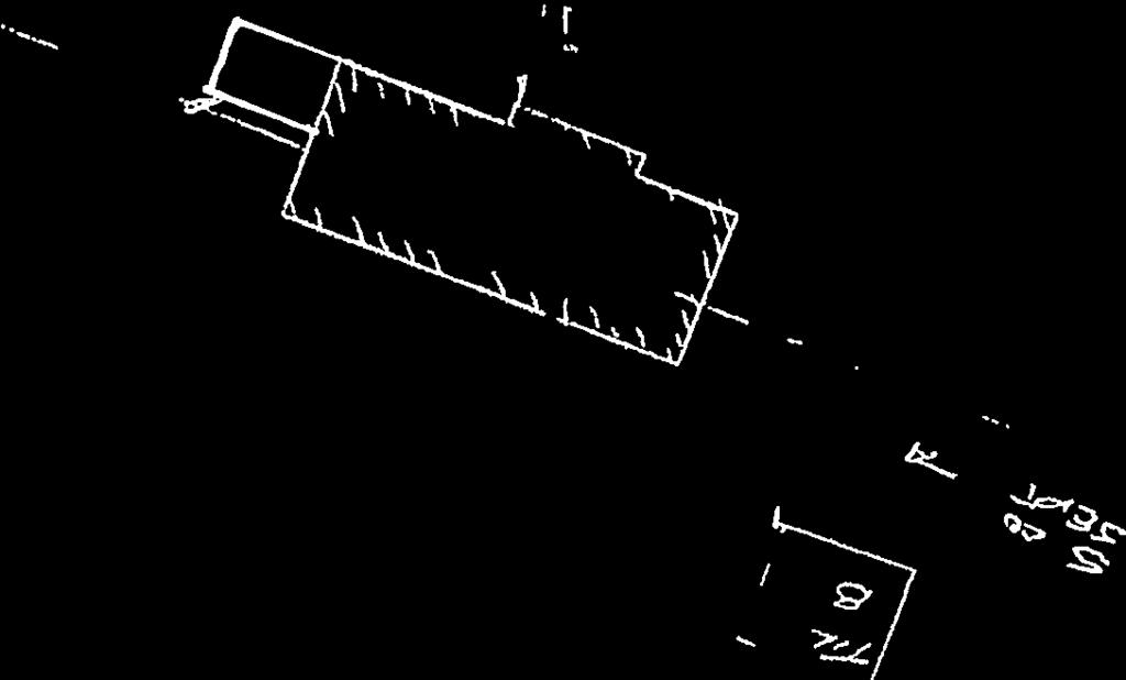


67 ZBA-26/14, Macpherson, Wanilah Island, Parts 1 & 2 Page 67 of 127

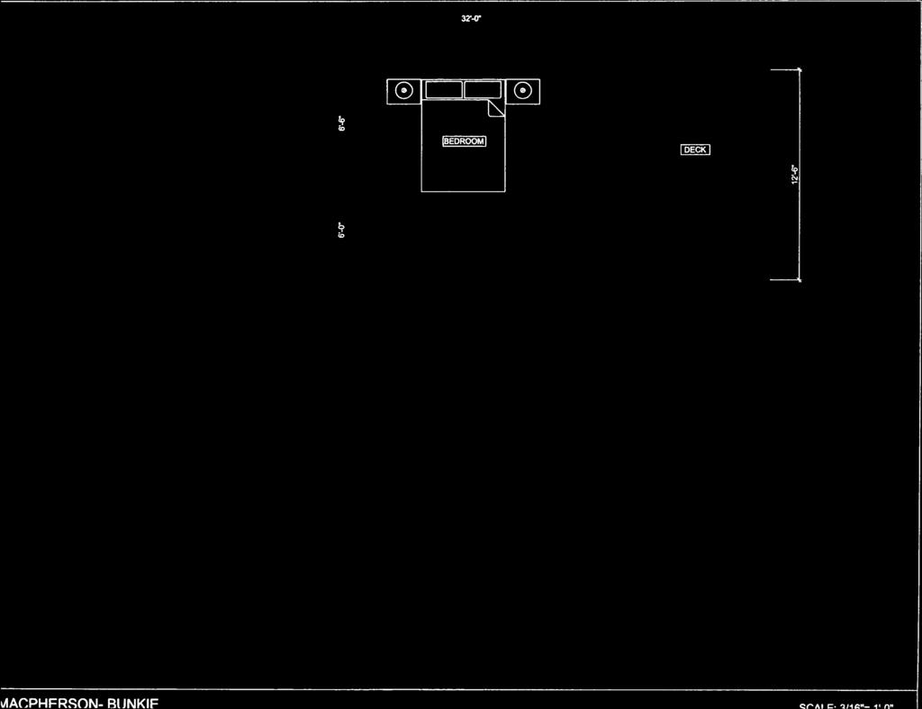

68 ZBA-26/14, Macpherson, Wanilah Island, Parts 1 & 2 Page 68 of 127
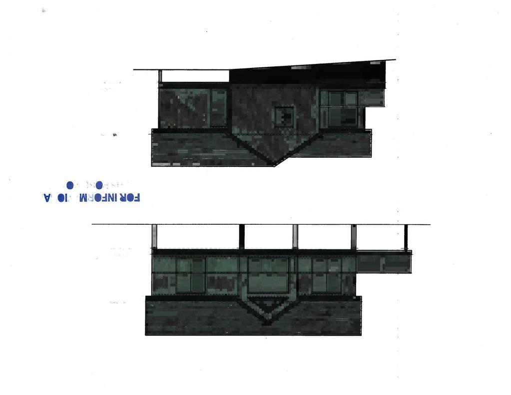
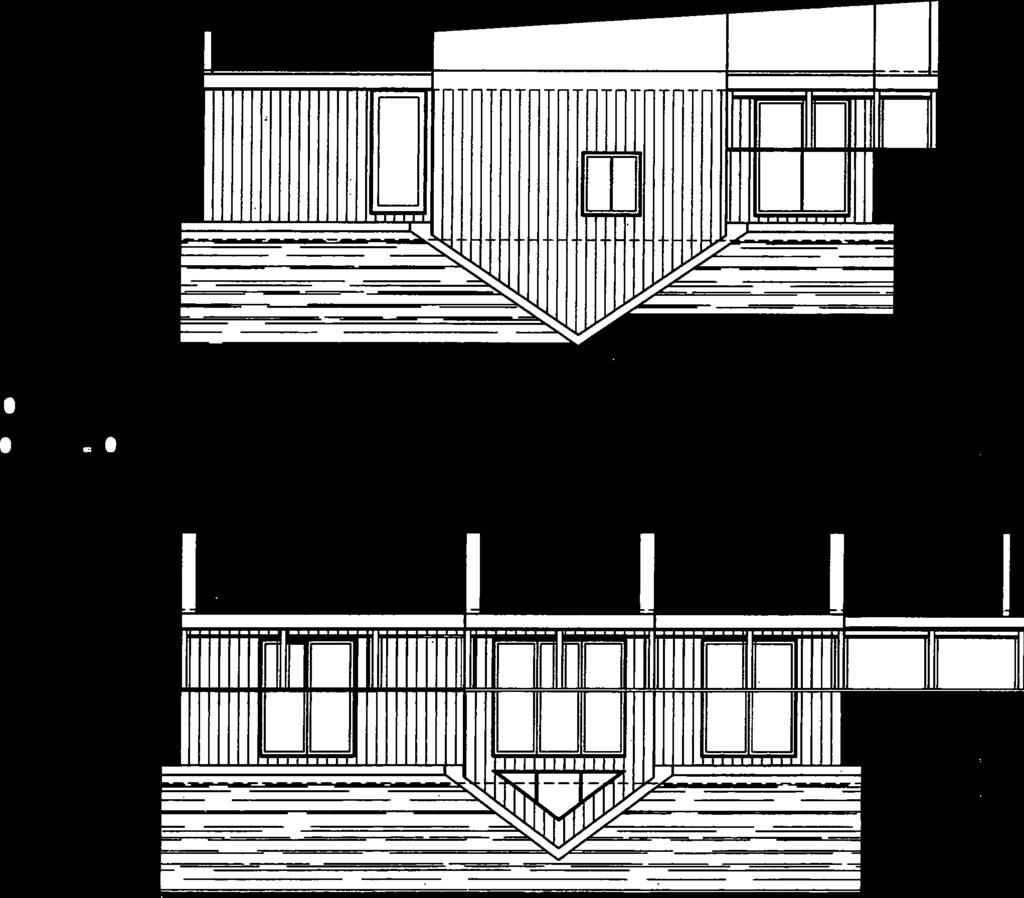


69 ZBA-26/14, Macpherson, Wanilah Island, Parts 1 & 2 Page 69 of 127

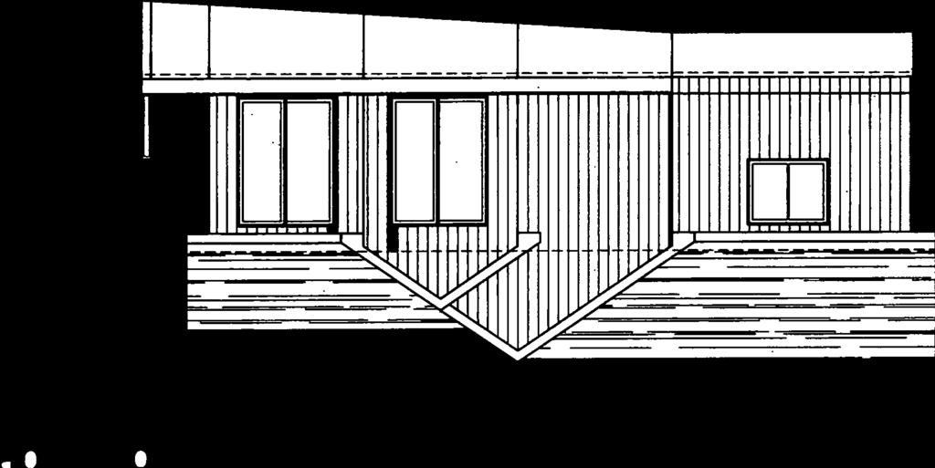
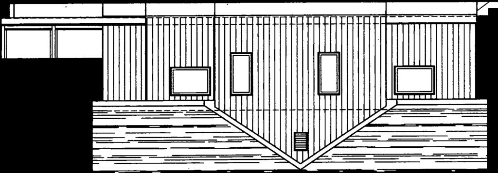

70 ZBA-26/14, Macpherson, Wanilah Island, Parts 1 & 2 Page 70 of 127
71 COMPREHENSIVE ZONING BY-LAW REVIEW Report from the Director of Planning, Re: Zoning By-law Page 71 of 127
72 PLANNING COMMITTEE OF THE WHOLE AGENDA REPORT TO: Chair Burgess and Members of Planning Committee of the Whole MEETING DATE: July 21, 2014 SUBJECT: Draft Comprehensive Zoning By-law , Community Residential Zoning RECOMMENDATION: For Committee s information, discussion and direction to staff. APPROVALS: Date Signature Submitted By: D. Pink, Director of Planning 11/07/14 Original signed by D. Pink Acknowledged: C. Harris, Interim CAO 15/07/14 Original signed by C. Harris ORIGIN This report is a result of discussions at the June 16, 2014 Planning Committee of the Whole meeting surrounding proposed zoning changes to lots in Communities and Urban Centres in proposed Zoning By-law Previously, when zoning changes in Communities/Urban Centres were discussed, Committee members requested that changes be compiled in chart form, as well as additional rationale provided by way of applicable Official Plan policies. This was completed in the staff report dated April 22, 2014, which is attached to the current agenda for Committee s information. At the meeting of June 16, 2014, the April 22, 2014 report was reviewed and concerns were again raised regarding the proposed zoning changes. The concerns raised were mainly surrounding the proposed minimum lot frontage requirement of 60 m (200 ft.) in Community Residential (R3) zones (unserviced Communities), and the lack of differentiation between serviced and un-serviced lots along the waterfront in Urban Centres (R4 zones). As no direction or decisions were provided or made, comments and concerns were to be forwarded to staff. Staff have not received any comments to date. As the timelines for completing this project are very tight, staff have brought the matter back to Planning Committee of the Whole at this time. Report from the Director of Planning, Re: Zoning By-law Page 1 of 2 Page 72 of 127
73 ANALYSIS Community Residential (R3) As detailed in the April 22, 2014 staff report, policy D of the Official Plan states that single family lots shall meet a minimum standard of 0.4 hectares (1 acre) of area and 60 metres (200 feet) of frontage. These same standards are proposed to be carried forward in draft By-law Although staff would not recommend revising these figures in the By-law, Council can reduce the minimum frontage requirement, which was specifically raised as a point of concern at the June 16, 2014 meeting. The amount of 130 feet was discussed, as it is the current by-law requirement in R3 zones (Glen Orchard, Milford Bay, and Torrance). Community Residential (R4) As outlined in the previous staff report, there is currently no differentiation between lot requirements (minimum frontage and area) for properties that abut and do not abut the water in Urban Centres, in Bylaw As the Official Plan recognizes character differences between these two types of lots, draft By-law proposes a new zone category (R4) for lots that abut the water in serviced Urban Centers (Bala and Port Carling). The currently proposed minimum lot frontage and area requirements for these lots are 30.5 m (100 feet) and 0.19 ha (~0.5 acres), respectively, versus 15.2 m (50 feet) and 0.05 ha (5,382 sq. ft.) for in-town lots. As noted above, concerns were raised by Committee that the minimum lot frontage and area requirements are the same in the R4 zone, whether or not the lot has municipal servicing available. If Committee wishes, larger minimum frontage and area requirements can be imposed where the lot is not serviced. Similar to un-serviced Communities, standards of 60 m (200 feet) and 0.4 ha (1 acre) can be utilized, although this can be somewhat stringent in an Urban Centre setting. The alternative of reducing lot requirements where the lot is serviced is not as palatable, as the currently proposed difference between waterfront and non-waterfront lots is 50 feet versus 100 feet. A further reduction may result in a fairly insubstantial difference, and Official Plan policies clearly identify a character difference and encourage larger sizes for waterfront lots. As also raised in the previous staff report, if Committee wishes, lot coverage for serviced lots along the water can be increased, or for un-serviced lots decreased. The current proposal is 20%. Report from the Director of Planning, Re: Zoning By-law Page 2 of 2 Page 73 of 127
74 PLANNING COMMITTEE OF THE WHOLE AGENDA REPORT TO: Chair Burgess and Members of Planning Committee of the Whole MEETING DATE: April 22, 2014 SUBJECT: Draft Comprehensive Zoning By-law , Front Yard Setbacks, Community Residential Zoning RECOMMENDATION: For Committee s information, discussion and direction to staff. APPROVALS: Date Signature Approved By: D. Pink, Director of Planning 10/04/14 Original signed by D. Pink Acknowledged: C. Wray, CAO 11/04/14 Original signed by C. Wray ORIGIN This report is a resul t of discussions at the A pril 1, 2014 special Planning Committee of the Whole meeting surrounding proposed changes to the grand-fathering of front yard setbacks in zones abutting the waterfront and zoning changes to lots abutting the water in Communities and Urban Ce ntres, in proposed Zoning By-law Committee members requested that a revised proposal be presented regarding front yard setbacks and that zoning changes in Communities/Urban Centres be compiled in chart form, as well as a dditional rationale provided. ANALYSIS Front Yard Setback Please see the Febru ary 18, 2014 and April 1, 2014 staff repo rts for furt her information on grandfathering of front yard setbacks along the waterfront. Staff would propose t he following revised wording for Committee s consider underlined; ation, with changes The front yard setback for each building and structure, on a lot, which are considered legal non-complying due to an encroachment into the required 20.1 or 30.5 metres front yard setback, shall be the setback which existed on that date, or a minimum of metres from the high water mark, or from the front Report from the Director of Planning, Re: Zoning By-law Page 1 of 9 Page 74 of 127
75 lot line, whichever is greater. For those buildings and structures with an existing legal non-complying front yard setback less tha n 15.2 metres, they may be enl arged, extended, reconstructed or otherwise structurally altered at their existing front yard setback or a minimu m of 10.6 me tres, whichever is greater, provided the resultant in crease in ground floor area and gross floor area located within 10.6 metres and 15.2 metres of the high water mark or front lot line, does not exceed 20% of th e ground floor area and gross floor area of the existing building or structure. For the purpose of deter mining the existing front yard setback, it shall be calculated based on the setback for each type of building or structure. In the case of a sundeck, which e xisted prior to the passing of this By-law, which is co nsidered legal non-complying due to an encroachment into the required 20.1 metre front yard setback, the front yard setback for that sundeck shall be the setback which existed on that date or a minimum of 12.2 metres from the high water mark whichever is greater. For a sundeck with an existing legal non-complying front yard setback less than 12.2 metres, it may be enlarged, extended, reconstructed or otherwise structur ally altered at its existing front yard setback or a minimum of 7.6 metres, whichever is g reater, provided the resultant increase in area locat ed within 7. 6 metres and 12.2 metres of the high water mark or front lot line, does not exceed 20% of the area of the existing sundeck. Although staff is not o verly supportive of the added complexity/length of the pro vision, it d oes have some positive features. As has be en discussed during previous meetings, staff is generally supportive of the current wording in By-law , which pushes re-developme nt further from the water (35 feet to 50 feet) and in so doing provides for an enhanced vegetative buffer, while still allowing some grandfathering to a minimum of 50 feet. It is a very well understood provision amongst staff, is not overly complicated by the req uirement for various ca lculations and survey work, and the public has general familiarity with it. With the above noted, staff can recognize the merit in pe rmitting modest expansions for those lega l structures currently sitting within 50 feet to 35 feet. They were either constructed with Building Permits subject to the by-laws of the day, or have been in existence for an extensive period of time. Although the planning process (minor varia nce) is always available to owners, this can be onerous for small additions and permitting some modest expansion, as of right, can be appropriate. The proposed wording above combines both situations. It pushes larg er redevelopment further from the water, no closer than the existing setback to a minimum of 50 feet, while allowing small expansions to those structures located within 50 feet. The suggested wording would permit an enlargement of up to 20% of the existing building size to be located within the 35 foot to 50 foot area. A 20% increase would permit, at the most, an e xpansion of up to 1,250 sq. ft. within the 35 foot to 50 foot area (6,250 sq. ft. existing + 20% (1,250 sq. ft.) = 7,500 sq. ft.). This is most likely not a co mmon scenario. Presuming a more norma l dwelling size of 2,500 sq. ft., the maximum expansion possible would be 500 sq. ft. with in 50 feet. Compliance with all oth er zoning provisions (lot coverage, height, etc.) would still be required and may further limit potential expansions. Beyond a setback of 50 feet, no specific limitation is imposed, with lot coverage, the maximum size of 7,500 sq. ft., and all other zoning provisions limiting the size of any redevelopment. Report from the Director of Planning, Re: Zoning By-law Page 2 of 9 Page 75 of 127
76 Width Limitation Although there were so me suggestions to in corporate a width limitatio n in the by- law, staff is quit e hesitant to do so. Staff s lengthy experience working wit h By-law has revealed that t he width limitation on docks and boathouses as one of th e most difficult to calcu late, more misunderstood, and most subject to error. A s a result, staff s preference is to not duplicate these issues on land. With the extreme variation in sh orelines, architectural designs, and forms of d evelopment that the Township experiences, drafting a clear provision that is understandable and would apply well to all devel opment is extremely difficult if not impossible. Virtually no shoreline is straight, and no development perfectly perpendicular to a straight shoreline. Sundecks Similarly to other structures, staff has drafted wording that allows sundecks located within the proposed 40 foot setback (for existing sundecks within 40 feet) to be enlarged by n o more than 20% within the 25 foot to 40 foot area. By-law currently allo ws sundeck expansions at a minimum front yard of 25 feet. Administration It should be noted that the proposed wording does require added administrative co mplexities. Staff will be required to take note of previous Building Permits, so that a further 20% is not added again at a later date. This will have to be relayed to owners during pre-consultations, many of which may not be familiar with the history of the lot in question. It also creates some difficulty in calculating the precise resultant floor area size within the 35 foot to 50 foot area. Surveys will b e required in many instances. Surveyors do not typically survey gross floor areas in the case of two storey designs. Urban Centres/Communities As currently drafted in By-law , for those residential and commercial lots in Urban Centres and Communities that abut the water, the same wording and distances are propo sed as that of the Waterfront designation (50 feet an d 66 feet). As suggest ed in previous staff rep orts, given t hat the zoning by-law has since its inceptio n permitted developme nt at a 25 foot setback from the water in these areas, Committee may wish to permit a 20% expansion at a setback of 25 feet, with the grandfathered setback of 50 feet also pushed forward. Sundecks are currently permitted to the water s edge, provided they do not exceed a height of 6 feet (no height limitation in commercia l zones). By-law proposes a 40 foot grand-fathered setback. With a potentially permitted front yard for 20% expansions at 25 fe et for buildings, the sundeck setback should also be less. A setback of 15 feet for 20% e xpansions could be considered and the 40 foot setback also pushed forward. Although this would leave minimal room for buffering, it is an improvement. Community Residential Zones As stated above, Co mmittee previously requested that the portion of the March 18, 2014 staff repor t outlining changes to Community Residential zones be articulated in chart form and Official Plan policies outlining rationale for these changes be provided. Staff offers the following; Report from the Director of Planning, Re: Zoning By-law Page 3 of 9 Page 76 of 127
77 Zones R1 R2 R3 Where Utilized in By-law Port Carling and Bala (water and sewer) Port Carling and Bala (water or sewer) Glen Orchard, Milford Bay, Torrance (no service) Where Proposed in By-law Port Carling and Bala (water and sewer) in-town not on waterfront Port Carling and Bala (water or sewer or no service) in-town not on waterfront All Communities (no service) Glen Orchard, Milford Bay, Torrance, Foots Bay, Windermere Changes to Development Standards ** Minimum lot frontage and area reduced, from 66 feet and 7,500 sq. ft. to 50 feet and 5,382 sq. ft., respectively A new maximum lot frontage and area proposed, 75 feet and 8,500 sq. ft., respectively Existing R2 and R5 zones to R2 Existing minimum lot frontage and area requirements replaced with requirement for concurrent Zoning By-law Amendment Existing R3, R4 and R6 zones to R3 Minimum lot frontage and area increasing from 130/150 feet and 30,000 sq. ft./1 acre to 200 feet and 1 acre, respectively Minimum front yard increasing from 25 feet to 66 feet - only for those lots abutting water, and grand-fathering provisions added Sleeping cabins permitted only for those lots abutting water Two storey boathouses subject to same provisions as waterfront zones (Category 1 Lake, 300 feet, etc.) R4 R5 R6 Foots Bay, Minett, Windermere (no service) Port Carling and Bala (no service) Various locations (Cottage Industry) Port Carling and Bala waterfront lots A new zone, the following are changes from R1; Minimum lot frontage and area increasing from 66 feet and 7,500 sq. ft. to 100 feet and 20,450 sq. ft., respectively Maximum lot coverage decreased from 35% to 20% Minimum front yard increased from 25 feet to 66 feet and grand-fathering provisions added Minimum side yard increased from 6 feet to 15 feet Sleeping cabins permitted Two storey boathouses subject to same provisions as waterfront zones (Category 1 Lake, 300 feet, etc.) X No longer proposed X No longer proposed ** Height is proposed to increase in all zones from 30 feet to 35 feet ** New requirement for 30% landscaped area has been added to all zones ** The current minimum ground floor requirement of 750 sq. ft. has been changed to a minimum gross floor requirement of 69.7 sq. m. (750 sq. ft.) in all zones Report from the Director of Planning, Re: Zoning By-law Page 4 of 9 Page 77 of 127
78 The following policy provides guidance for the decreased and maximum lot requirements in R1 zones; Low Density Residential C In general, the following minimum n ew lot stan dards will b e required f or new single detached dwellings: Lot Area Sewer & Water 511 sq m (5,500 square feet) Lot Frontage 15 m (50 feet) No lot area shall be greater than 789 sq. m. (8,500 sq. ft.) or have a lot frontage greater than 22 metres (75 feet). Consideration will be given to lot areas larger than the maximum where terrain constraints warrant a larger lot size. The following policies provide guidance for removing lot and site requirements in R2 zones; Servicing General C New lot cr eation shall generally not be per mitted unless on full municipal services. Servicing - Water Service Only C Until municipal sewer services are available to service the lands identified within Area 2, single de tached residential development shall be limited to the development of existing lots where: a suitable sewage disposal system can be accommodated on the property; and It is designed in a manner that will f acilitate future connection to municipal services. A hydrogeological report may be required to confirm that such development will be viable and sustainable. Servicing Future Service Areas C Until municipal sewer a nd water serv ices are available to service the lands identified within Area 3, development shall be limited to existing lots where: A potable water supply is confirmed for the proposed development and a suitable sewage disposal system can be accommodated on the property; and It is designed in a manner that will f acilitate future connection to municipal services. A hydrogeological report may be required to confirm that such development will be viable and sustainable. C Until municipal sewer a nd water serv ices are available to service the lands identified within the area designated as Area 4, new lots can be created which constitute minor infilling and are restricted to minor dry development of a low density in character with the surrounding area where: A potable water supply is confirmed for the proposed development and a sewage disposal system can be accommodated on the property; Report from the Director of Planning, Re: Zoning By-law Page 5 of 9 Page 78 of 127
79 It is designed in a manner that will f acilitate future connection to municipal services. A hydorgeological report may be required to confirm that such development will be viable and sustainable. The following policies provide guidance for the revised lot requirements and increased front yards, two storey boathouses, and sleeping cabins along the water, in R3 zones; Development Form D Single family lots shall meet a mini mum standard of 0.4 hectares (1 a cre) of area and 60 metres (200 feet) of frontage. Where the character of existing development warrants it larger minimum req uirements may be imposed. Smaller minimum lot sizes may be consider ed where substantiated by a hydrogeological study. D Lots that front onto water have a sim ilar character to shoreline development in the waterfront land use designation. To maintain this character, lot sizes may be larger for these shoreline lots th an standard town lots that do not front on the water. Where the lots are of sufficient size, sleeping cabins may also be recognized. Lake System Health D.7.3 The role of natural vegetated shorelines in buffe ring waterbodies from erosion, siltation and nutrient migration adjacent to the sensitive littoral zone is critical to the protection of water quality. Preservation and restoration, where appropriate, of shoreline buffers is therefore required. The frontage of a lot will be maintained in a natura l state to a target depth of 15 metres (50 feet) from the shoreline where new lo ts are being created and where vacant lots ar e being developed. Where lots are already de veloped and further develop ment or redevelopment is prop osed, or where the lot is located w ithin a community, these targets should be achieved to the extent feasible. W here these targets cannot be met, a net improvement over the existing situation is required. Shoreline Areas D.18.4 A minimum 20 metre (66 feet) setback from any shoreline will be required for all development, excluding shoreline structures. Where this setback can not be achieved, a lesser setback may be consider ed where on-site pho sphorus management is implemented and in the following circumstances: Sufficient lot depth is not available; Terrain or soil condition s exist which make other locations on the lot more suitable; The proposal is for an addition to an existing building or r eplacement of a leaching bed where the setback is not further reduced; Redevelopment is pro posed on a n existing lot and a n et improvement is achieved; or, The lot is located within a Community and a net improvement over the existing situation is achieved. Report from the Director of Planning, Re: Zoning By-law Page 6 of 9 Page 79 of 127
80 Boathouses and Boatports D.19.7 New two-storey boathouses shall generally meet the following requirements: a) located on Category 1 Lakes, provided the stru cture is not located on a narrow waterbody and significant f ish habitat is protected, as defined in this Plan; b) located on a lot with a minimum water frontage of 90 metres (300 feet); c) may include a secon d floor stru cture not e xceeding the floor area permitted for a sleeping cabin; d) may include a covered deck up to 23 square metres (250 square feet); and, e) an increased setback from the projected side lot line. The following policies provide guidance for the revised lot requirements and increased front yards, two storey boathouses, decreased density, and sleeping cabins along the water, in R4 zones; Protecting and Promoting Character C The Waterfront charact er within any Urban Ce ntre can generally be d ifferent than the est ablished character in the core area s. This should be recognized and promoted. Lake System Health C.6.7 In accordance with Section C.16, front yard setbacks f or all stru ctures on shoreline lots shall be greater than those on non-shoreline lots. General Residential Development Policies C Lots that front on the water have a similar character to shoreline development in the adjacent Waterfront land use designation. To maintain this character, lot sizes shall generally be larger for these shoreline lots than standard "town" lots that do not front on the water. Where the lots are of sufficient size, sleeping cabins may also be permitted. Shoreline Areas C.16.2 Shoreline development shall occu r on lots larger than lots without water frontage. Where the shoreline development in t he Urban Centre designation is in proximity to the shore line development in the Waterfront designation the lot frontages shall be increased to be more compatible with those in the Waterfront designation. C.16.3 C.16.4 Development impacting shoreline areas will be compatible both in scale and architectural style with the existing character of development in the Urban Centre. Density of dev elopment on a lot with water front age in a residential designation shall be less than permitted on lots without waterfront frontage. A minimum 20 metre (66 feet) setback from any shoreline will be required for all development, excluding shoreline structures. Where this setback can not be achieved, a lesser setback may be consider ed where on-site pho sphorus management is implemented and in the following circumstances: Sufficient lot depth is not available; Report from the Director of Planning, Re: Zoning By-law Page 7 of 9 Page 80 of 127
81 Terrain or soil cond itions exist which make oth er locations on the lot more suitable; The proposal is for an addition to an existing building or replacement of a leaching bed where the setback is not further reduced; Redevelopment is proposed on a n existing lot and a net improve ment is achieved; or, The lot is lo cated within an Urban Centre and a net improvement over the existing situation is achieved. Boathouses and Boatports C.17.7 New two-storey boathouses shall generally meet the following requirements: a) located on Category 1 Lakes, provided the structure is not located on a narrow waterbody and significant fish habitat is protected, as defined in this Plan; b) located on a lot with a minimum water frontage of 90 metres (300 feet); c) may include a second floor structure not exceeding the floor area permitted for a sleeping cabin; d) may include a covered deck up to 23 square metres (250 square feet); and, e) an increased setback from the projected side lot line. In staff s op inion, the a bove policies are abundantly clear regarding the proposed changes t o zone standards such as in creased or d ecreased lot frontage and area r equirements, and decr eased densities, boathouse standards and increased front yard setbacks alo ng the water, numerous policies containing specific numeric measurements. With that said, concer ns were raised specif ically regarding the proposed reduct ion in density in R4 zones, in which policies do not contain a specific numerical guideline, which is commonly the case in an Official Plan. Considering the average lot size and form of development the Township experiences in Urban Centres along the water, staff is of the opinion that th e proposed changes are both appropriate and would also not result in significant impacts to landholders in the proposed new zone. To verify this belief, staff conducted a GIS exerc ise/analysis on lots proposed to be zoned R4. Please note the da ta is ba sed on Municip al Property A ssessment Corporation (MPAC) data, which is not survey accurate. Assessment data of the total footprint of all struct ures and lo t area of each lot proposed to be zoned R4 was compiled. The following provides a brief synopsis of the findings; 369 properties proposed to be rezoned R4 Of which, 33 properties are vacant Average lot area 30,370 sq. ft. (0.7 acres) Average total building footprint 1,661 sq. ft. Average lot coverage 7.97% (not including vacant lots) 15 properties exceed proposed lot coverage of 20% - equivalent to 4.1% It was discovered 2 of these pro perties should be zon ed R1 (very small lots surrounded by R4). Therefore 13 properties exceed 20% - equivalent to 3.5% Average lot size of 13 properties 6,802 sq. ft. (removing 1 outlier 5,844 sq. ft.) 3 lots are currently over 35% Therefore, 10 properties proposed to be limited, within 20% and 35% equivalent to 2.7% Report from the Director of Planning, Re: Zoning By-law Page 8 of 9 Page 81 of 127
82 As can be seen, the 13 properties that would exceed the proposed coverage of 20% are to some extent an anomaly as they are very s mall, averaging the si ze of some built development experienced in the waterfront designation. Including t hese properties, the av erage lot co verage is essentially 8%. The status quo (35%) would permit average existing development along the water in Bala and Port Carling to expand by over 4 times and, in staff s opinion, the cumulative impact of this would not be pre ferred. The proposed lot coverage of 20% will still allow considerable expansion rights for the average property in the proposed R4 zone. Some concerns were also raised t hat there is no differentiation prop osed between the lot coverage permitted for those serviced lots versus un-serviced lots, along the water. Staff can recognize the merit in this and the proposed lot coverage for serviced lots can either be in creased, or for un-serviced lots decreased. It should be pointed out, however, that servicing can have a significan t positive effect with respect to water quality, but minimal to no impact on built form visual impacts, both primary reasons for lot coverage provisions. Report from the Director of Planning, Re: Zoning By-law Page 9 of 9 Page 82 of 127
83 MONTHLY REPORT Report from the Director of Planning, Re: Monthly Page 83 of 127
84 PLANNING COMMITTEE OF THE WHOLE AGENDA REPORT TO: Chair Burgess and Members of Planning Committee of the Whole MEETING DATE: July 21, 2014 SUBJECT: Monthly Planning Department Activity Report RECOMMENDATION: None. For Committee s discussion and information only. APPROVALS: Date Signature Submitted By: D. Pink, Director of Planning 15/07/14 Original signed by D. Pink Acknowledged: C. Harris, Interim CAO 16/07/14 Original signed by C. Harris ORIGIN This monthly report provides an update and overview of departmental activity. It is not a comprehensive list of all activities but does contain information that may be of interest to members of Planning Committee of the Whole. ANALYSIS Planning Applications The Planning Department has received to date; no Official Plan Amendment, four Zoning By-law Amendment, seven Minor Variance, four Consent, no Deeming By-law and 11 Site Plan Applications since the previous monthly departmental report. Sixteen Municipal Record Search requests were also received. Also on the current agenda are reports on; delegation of Subdivision, Condominium, and Part Lot Control approval authority and proposed draft Comprehensive Zoning By-law , for Committee s consideration and direction. Report from the Director of Planning, Re: Monthly Page 1 of 3 Page 84 of 127
85 Application Activity - Last Month Year-to-Date 0 Ontario Municipal Board No appeals to the Ontario Municipal Board were received since the previous monthly department report and no decisions received. One Hearing was held on an appeal to a Minor Variance decision of the Committee of Adjustment. Several appeals continue to take up an extensive amount of staff time with ongoing negotiations and meetings. Commercial Building Permit Review Planning Department staff provide a zoning analysis/plans review function for all Building Permits received on commercial and industrial zoned property. At this time of year, the number of reviews begins to pick up and these detailed drawings can take considerable time to review. Comprehensive Zoning By-law Review A number of regular and special Planning Committee meetings have been held on the proposed new by-law since the November 2013 Public Meeting date. Committee has worked its way through major changes in each section of the by-law, public comments, and site specific comments. Further review and direction only remains on several areas in the Community section of the by-law, and an additional staff report has been prepared for the current agenda. Time is of the essence at this stage of the process, with the upcoming municipal election. This becomes evident with an outline of the remaining steps detailed below. Report from the Director of Planning, Re: Monthly Page 2 of 3 Page 85 of 127
86 Staff has made changes to the zoning schedules as a result of Committee directions and forwarded the schedules to the District for completion, which is currently ongoing. The consultant is currently producing a second draft of the text of the by-law based on Committee directions. At which time direction from Committee has been received on all outstanding matters, these revisions can be finalized, reviewed by staff, and a polished second draft posted on the website. The public should be afforded some time for review, after which Council can then consider final approval. Heritage Committee/Heritage Conservation District A public workshop on the proposed Heritage Conservation District in Bala is scheduled at the Bala Community Centre on July 24, 2014 at 7:00 pm to gain input on the Plan phase of the project. The statutory Public Meeting will be held at a later date. The consultants have finalized the Study report, however, the Heritage Committee has yet to meet and review it. The workplan includes a presentation to Council by the consultants once this has occurred. Plans of Subdivision/Condominium Area planners met at the District for a meeting to discuss potentially downloading approvals of Plans of Subdivision and Condominiums from the District of Muskoka to area municipalities. Discussions and s on the topic amongst the group are ongoing. A separate staff report has been prepared and is on the current Planning Committee of the Whole agenda. Leonard Lake Association Annual General Meeting Township Senior Planner, Nick Popovich presented at the Leonard Lake Association Annual General Meeting on the weekend of July 12, 2014 to provide an update on the ongoing Comprehensive Zoning By-law Review process. He was well received and answered many questions from those in attendance. Vacations With the summer season upon us, a number of staff have begun taking advantage of their holiday time off work. As the department is busiest at this time of year, remaining staff in the office are kept more than busy with day to day operations/planning applications and there is limited time to concentrate on special projects that would typically be discussed in a monthly report. Report from the Director of Planning, Re: Monthly Page 3 of 3 Page 86 of 127
87 PLANS OF SUBDIVISION & CONDOMINIUM Report from the Director of Planning, Delegation of Page 87 of 127
88 PLANNING COMMITTEE OF THE WHOLE AGENDA REPORT TO: Chair Burgess and Members of Planning Committee of the Whole MEETING DATE: July 21, 2014 SUBJECT: Delegation of Subdivision, Condominium, and Part Lot Control Approval Authority RECOMMENDATION: THAT Planning Committee give consideration to the acceptance of the delegation of approval under the Planning Act for Subdivisions, Condominiums and Part Lot Control applications; THAT should Council wish to proceed with the delegation of Planning Act approvals, that staff be given direction to continue discussions with the District of Muskoka regarding the logistics of delegation of Subdivisions, Condominiums and Part Lot Control applications; and THAT delegation of said approvals be initiated with new approvals beginning at a date to be determined in early 2015, with older files being transitioned over a one year period following that date. APPROVALS: Date Signature Submitted By: D. Pink, Director of Planning 17/07/14 Original signed by D. Pink Acknowledged: C. Harris, Interim CAO 17/07/14 Original signed by C. Harris BACKGROUND In late 2013 and early 2014 Strategy Corporation Inc. undertook an operational review of the District Municipality of Muskoka which included consultation with District Council, staff, area municipalities and various other stakeholders. In January 2014 the District of Muskoka reviewed Strategy Corporation s report which offered 38 recommendations to a number of District operations and functions, including the potential for delegating certain planning functions to the area municipalities. Report from the Director of Planning, Delegation of Page 1 of 5 Page 88 of 127
89 Specific recommendations within the report related to the District Planning Department included: MP1: The Planning and Economic Development Department should be repurposed with less emphasis on development control and a greater emphasis on policy and planning and corporate policy. MP2: The District should capitalize on opportunities to delegate development control activities to area Municipalities which are willing and able to do so. Plans of Subdivision, Condominium and Part Lot Control should be delegated to the local municipalities as permitted by the Planning Act. MP3: A Planning Comment Protocol should be established with the Area Municipal Planning Departments. The District deferred a decision on the first two recommendations and District staff were directed to discuss with area municipalities the potential for downloading Plans of Subdivision, Condominium and Part Lot Control approval authority. Over the following months the District met individually with representatives of each of the municipalities to discuss the implications of these potential actions. On May 28, 2014 area planners and District staff held a group meeting on the topic. Going forward, the District is looking for direction from each area Council on recommendation MP2 of the operational review. This report addresses the implications for the Township of Muskoka Lakes to take on the approval authority for Subdivision, Condominium, and Part Lot Control applications. ANALYSIS Approval Process Under the present system the District of Muskoka processes all three subject applications, including pre-consultation, receipt, planning review, circulation as required, decision making and ongoing administration. As part of their review, the District will examine their interests in terms of infrastructure, such as water, sewer and roads, and circulate to the respective area municipality for their comments. Currently, the Township of Muskoka Lakes is a commenting agency for Subdivision and Condominium applications, similar to the District of Muskoka for Zoning and Consent applications. What is proposed is essentially an exchange of roles, whereby the District will become the commenting agency. Both departments will continue to conduct their planning review and analysis, while the Township will inherit administration and approval functions. The basic components of the approval process can be generally broken down for the purposes of this report into three groups; Administration, Analysis, and Decision Making. Purpose of Delegating Approval Authority It is important to have clear goals and ideally benefits when undertaking an operational change as currently proposed. In this case, reasons cited in the operational review report and area planners meetings included; Increased efficiency; Assisting the local development community by dealing with one level of government through the multiple layers of development/planning approvals (streamlining process); Eliminating perceived duplication of services; and, Bringing planning approvals closer to the respective community. Report from the Director of Planning, Delegation of Page 2 of 5 Page 89 of 127
90 Staff is fully supportive of increasing efficiencies and streamlining the planning process for the public, where possible. It should be noted, however, that no reduction in the overall workload or process is currently proposed, but an exchange or transfer of roles. Administration Staff s main concerns with the proposed delegation are in respect to the administration component of the approval process. These include; Analysis Lack of storage space. Senior management have for some time identified that physical storage space in the Township for files required by legislation for retention is running out. Subdivision and Condominium files and drawings are physically large and will exacerbate this problem. Electronic space may also be a concern in the future. Routine. The Township processes a large number of Zoning, Minor Variance, Consent and Site Plan applications, most well in excess of 75 per year. Accordingly, administration staff is very familiar with Planning Act requirements in processing these applications and is efficient in doing so. The number of Condominium and Subdivision applications per year is typically low for the Township (~1-2), which makes it very difficult to establish routines, efficiencies and maintain expertise in processing these applications. Staffing. Although Condominium and Subdivision application numbers may be historically low, staff are working at their capacity with current approvals and with the potential uptake of more duties, the hiring of additional staff should be considered. Subdivisions and Condominiums are very administratively heavy and can take years to complete. More details on staff levels are provided in a later section of this report. Township planning staff do have the knowledge base with respect to this additional responsibility. There will need to be some training to bring staff fully up to speed, most notably on Condominium applications, but in general they follow a similar process to other planning applications. As stated previously, this role is not entirely new in that the Township currently comments on these applications, and staff undertakes a planning analysis to do so. Staff does, however, note similar concerns as with the administration function, in particular with the limited number of applications and difficulty in establishing routines and efficiencies. There are other components within analysis that also need to be considered, such as legal and engineering expertise. Subdivision and Condominium processes can be very technical and complex and agreements can often require legal review or assistance. Budgeting for more legal and other professional consulting costs may be warranted, including defending appeals to the Ontario Municipal Board. The District would currently defend any appeals and has in-house legal expertise. Township costs may potentially be offset to some degree by application fees and cost acknowledgement agreements. There may also be an impact on the Public Works Department and a need to assess staffing needs or at times the need to acquire outside engineering expertise. Technical studies are commonly peer reviewed for Condominium and Subdivision applications, with costs borne by the applicant. The District of Muskoka would continue to review and comment on applications with respect to their responsibilities such as water and sewer services and District roads. Decision Making Staff can see the merit in delegating approval authority and bringing decision making to the area Council level, closer to the respective community that is impacted by the development. Report from the Director of Planning, Delegation of Page 3 of 5 Page 90 of 127
91 Staffing Although the historical number of Condominium and Subdivision applications within the Township is relatively low (approximately one two per year), and may therefore appear as easily absorbed by current staffing levels, the department is at times already operating at its capacity or beyond in processing existing planning applications. Planning applications and Ontario Municipal Board Hearings are at consistently high levels, and staff has also noted a marked increase over the years in the amount of correspondence into planning matters and zoning complaints, which is inevitable given the value of land and development the Township is experiencing. These are random variables that take up a considerable amount of staff time and resources. Since the last hiring increase, a number of new responsibilities and initiatives have been undertaken by the Township related to the Planning Department, including; administration and enforcement of the Tree Preservation and Site Alteration By-laws, administration over heritage related matters, health and safety, Dark Sky Lighting By-law, monthly reports, emergency management, plans review of all commercial and industrial Building Permits, reviews of solar energy proposals, and potentially administration of Community Improvement Plans and rooming house licensing, to name a few. As well, the Ontario Professional Planners Institute has for 2014 mandated accumulation and tracking of professional learning credits (outside courses, seminars, etc.). It should also be noted that although Condominium and Subdivision application numbers are currently low, this may change in the future. Department staff are at times overwhelmed with workloads and morale and quality of work on occasion suffer as a result, subsequently increasing the risk of errors. Staff is unaware of the final direction from other area municipal Council s and their individual staffing workloads, but is generally aware of concerns as a result of the group meeting. Huntsville, for example, is recommending that hiring of additional administrative staff be considered as a result of the proposed delegation. Staff questions the wisdom of spreading the administrative and analysis functions of these approvals across six municipalities with the potential for a number of related staffing increases, while the current system consolidates the workload into approximately one full time equivalent at the District level. No area municipality receives a large enough volume of new applications to gain comfort and routine in their regular processing, whereas a group this is the case. In essence, what is proposed is the reverse of pooling resources. Policies and Procedures If delegated, staff will need to take a closer look at Official Plan policies in terms of pre-consultation requirements, complete application expectations and required associated reports. An amendment to the Official Plan may, therefore, be required. Application forms, fee structure, agreements, notices, signage and other procedures will also have to be developed. Going Forward The consultant s recommendation results in an interesting situation. In staff s opinion, the optimal outcome would result in the same agreement being reached amongst all area municipalities. To leave authority for one or two municipalities at the District level would further complicate the approval process for the public. There is no way of knowing what direction each area Council will provide. During the area planners meeting, there seemed to be general consensus to accept the delegation of approval authority, and that is staff s gut feel as to the eventual outcome at other municipalities. With this said, there was considerable concern expressed and reluctance to accept the transition of ongoing/existing application files and their associated administrative obligations. Staff finds this somewhat confusing, as inevitably over time a similar backlog and administrative burden will develop at each municipality. Report from the Director of Planning, Delegation of Page 4 of 5 Page 91 of 127
92 Timing was discussed by area planners and if delegation is accepted, a transition date of early 2015 was anticipated, in order to go over all logistics, training, etc. It was generally agreed upon to phase older files over time after that date. If Council directs that delegation be accepted, staff recommends it that be given direction to continue discussions with the District of Muskoka regarding the formal process to delegate and the logistics of delegation of Subdivisions, Condominiums and Part Lot Control applications. Alternatives To not accept delegation of approval authority for Subdivision, Condominium and Part Lot Control applications. To accept only some approvals proposed to be delegated. Report from the Director of Planning, Delegation of Page 5 of 5 Page 92 of 127
93 ZBA-17/14 BLAIR ZBA-17/14, Blair, Part of Chief's Island, Lake Page 93 of 127

94 ZBA-17/14, Blair, Part of Chief's Island, Lake Page 94 of 127
95 PLANNING COMMITTEE OF THE WHOLE AGENDA REPORT TO: Chair Burgess and Members of the Planning Committee of the Whole MEETING DATE: 21 July 2014 SUBJECT: ZBA-17/14, Blair, Part of Chief s Island, Lake Joseph, (Medora), Lot 20, Plan M-557, Roll # RECOMMENDATION: That ZBA-17/14 (Blair) be approved for circulation, subject to a limitation of a single storey boathouse only. APPROVALS: Date Signature Submitted By: N. Popovich, Senior Planner 15/07/14 Original signed by N. Popovich Approved By: D. Pink, Director of Planning 15/07/14 Original signed by D. Pink ORIGIN BACKGROUND Particulars of Property: Lot Frontage 564 feet Lot Area 4.6 acres Proposed Exemption: Section Description Requirement Proposed Exemption Proposal Construction No accessory building To permit an accessory single To allow the sequence shall be permitted prior to storey boathouse prior to the construction of a the establishment of the establishment of the main boathouse and main use residential building docks ZBA-17/14, Blair, Part of Chief's Island, Lake Page 1 of 5 Page 95 of 127
96 BACKGROUND PLANNING DATA Official Plan Designation: By-law Zoning: Waterfront Waterfront Residential (WR-7, WR) Schedule No.: 20 Access: Neighbouring Uses: Original Shore Road Allowance: Fisheries Resource: Civic Address: Water Access Waterfront Residential Not Applicable Type 2 (General) Fish Habitat 30 Chief s Island, J5 PLANNING CONSIDERATIONS 1. Background The applicant wishes to construct a single storey boathouse prior to the residential dwelling unit on a water access property. The application was considered by Planning Committee of the Whole on 16 June At that time it was decided to defer the application in order to allow the applicant to re-design or reduce the size of the proposed boathouse. The application has not been amended and the applicant has requested that the matter be brought forward for further consideration. 2. Provincial Policy Statement The Provincial Policy Statement, 2014 (PPS) provides policy direction on matters of provincial interest related to land use planning and development. According to the Planning Act, any planning decision shall be consistent with provincial policy statements. This application has been reviewed against the PPS, and is consistent with it. 3. District of Muskoka Official Plan The subject site is designated Waterfront in the District Official Plan. Generally within the Waterfront Area recreation and the protection and enhancement of the environment are important policy issues. 4. Township of Muskoka Lakes Official Plan The subject property falls within the Waterfront Designation. One of the main objectives of the Waterfront designation is to ensure that built form does not dominate the natural shoreline. The policies encourage low-density development to achieve this objective. ZBA-17/14, Blair, Part of Chief's Island, Lake Page 2 of 5 Page 96 of 127
97 Section B5.2 states that natural form should dominate the character of the Waterfront. Natural shorelines may visually screen development viewed from the water and buffer uses. Shorelines shall be encouraged to be maintained in a predominantly natural state with tree cover and ground vegetation retained as development occurs. Section B5.8 indicates that waterfront lots should be of sufficient dimension and size to accommodate the use proposed, related structures, and services within acceptable standards. As such, a variety of lot sizes, water frontages, setbacks and structural limitations are expected in recognition of the natural and built influences in the Waterfront. The Official Plan is silent on construction sequence policies. 5. Zoning By-law The subject property is zoned Waterfront Residential (WR-7, WR). The main permitted use is residential (dwelling unit). The required exemption is outlined in the introductory section of this report. The proposed development complies with the Zoning By-law in all other respects (width, setbacks, lot coverage, etc.). 6. Site Characteristics Staff inspected the subject property on 24 February The property is well vegetated and generally level, with steep rock portions along the shoreline. 7. Construction Sequence The property is currently vacant except for a narrow finger dock. A single storey boathouse 58 feet wide and docks 68 feet wide are proposed. The Zoning By-law permits a dock prior to the main use on a lot accessible by water only. Staff feels it is reasonable to permit a boathouse prior to the main use on a water access lot. Although the Official Plan is silent on construction sequence, the intent of this provision is to prevent cluttering of properties, maintenance of property standards, and preventing small habitable structures from becoming the main use. If committee is considering approval of the proposal, Staff would recommend that the draft by-law limit any permitted boathouse to a single storey only. 8. By-law It should be noted that Planning Committee members have provided direction to permit single storey boathouses on water access lots prior to the establishment of the main use, as-of-right, in draft By-law Site Plan Control Site Plan approval has been granted and an agreement registered on title in September This site plan includes a residence and a similar boathouse in the same general location. The applicant s agent has indicated that the owner s family owns adjacent properties and rather than applying to add further shoreline structures to those properties, the current application was deemed more appropriate. At this time it is stated that there are no plans for a cottage. 10. Complete Application ZBA-17/14, Blair, Part of Chief's Island, Lake Page 3 of 5 Page 97 of 127

98 Bill 51 amended the Planning Act and requires planning approval authorities to determine if an application is complete. For an application such as this, little accompanying information is required. The application is deemed complete. View looking east View looking west ZBA-17/14, Blair, Part of Chief's Island, Lake Page 4 of 5 Page 98 of 127
99 View looking north General location of proposed boathouse ZBA-17/14, Blair, Part of Chief's Island, Lake Page 5 of 5 Page 99 of 127
100 PLANNING COMMITTEE OF THE WHOLE AGENDA REPORT TO: Chair Burgess and Members of the Planning Committee of the Whole MEETING DATE: 16 June 2014 SUBJECT: ZBA-17/14, Blair, Part of Chief s Island, Lake Joseph, (Medora), Lot 20, Plan M-557, Roll # RECOMMENDATION: That ZBA-17/14 (Blair) be approved for circulation, subject to a limitation of a single storey boathouse only. APPROVALS: Date Signature Submitted By: N. Popovich, Senior Planner 11/06/14 Original signed by N. Popovich Approved By: D. Pink, Director of Planning 11/06/14 Original signed by D. Pink ORIGIN BACKGROUND Particulars of Property: Lot Frontage 564 feet Lot Area 4.6 acres Proposed Exemption: Section Description Requirement Proposed Exemption Proposal Construction No accessory b uilding To permit an accessory single To allow the sequence shall be permitted prior to storey boathouse prior to the construction of a the establishment of the establishment of the main boathouse and main use residential building docks ZBA-17/14, Blair, Part of Chief's Island, Lake Page 1 of 5 Page 100 of 127
101 BACKGROUND PLANNING DATA Official Plan Designation: By-law Zoning: Waterfront Waterfront Residential (WR-7, WR) Schedule No.: 20 Access: Water Access Neighbouring Uses: Waterfront Residential Original Shore Road Allowance: Fisheries Resource: Civic Address: Not Applicable Type 2 (General) Fish Habitat 30 Chief s Island, J5 PLANNING CONSIDERATIONS 1. Background The applicant wishes to construct a single store y boathouse prior to the residential dwelling unit on a water access property. 2. Provincial Policy Statement The Provincial Policy Statement, (PPS) provides policy direction on matters of provincial interest related to land use planning and development. According to the Planning Act, any planning decision shall be consist ent with provincial policy stateme nts. This a pplication has been reviewed against the PPS, and is consistent with it. 3. District of Muskoka Official Plan The subject site is designated Waterfront in the District Official Plan. Generally within the Waterfront Area recreation and the protection and enhancement of the environment are important policy issues. 4. Township of Muskoka Lakes Official Plan The subject property falls within the Waterfront Designation. One of the main objectives of the Waterfront designation is to ensure that built form does not dominate the natural shoreline. The policies encourage low-density development to achieve this objective. Section B5.2 states that natural form should dominate the character o f the Waterfront. Natural shorelines may visually screen development viewed from the water and buffer uses. Shoreline s shall be en couraged to be maintained in a predominantly natural sta te with tree cover and ground vegetation retained as development occurs. Section B5.8 indicates that waterfront lots should be o f sufficient dimension and size to accommodate the use proposed, related structures, and services within acceptable standards. ZBA-17/14, Blair, Part of Chief's Island, Lake Page 2 of 5 Page 101 of 127
102 As such, a variety of lot sizes, water frontages, setbacks and structural limitations are expected in recognition of the natural and built influences in the Waterfront. The Official Plan is silent on construction sequence policies. 5. Zoning By-law The subject property is zoned Waterfront Residential (WR-7, WR). Th e main permitted use is residential (dwelling unit). The required exemption is outlined in the introductory section of this report. The proposed development complies with the Zoning B y-law in all other respects (width, setbacks, lot coverage, etc.). 6. Site Characteristics Staff inspected the subject property on 24 February generally level, with steep rock portions along the shoreline. The property is well vegetated and 7. Construction Sequence The property is currently vacant e xcept for a narrow finger dock. A single storey boathouse 5 8 feet wide and docks 68 feet wide are proposed. The Zoning By-law permits a dock prior to the main use on a lot accessible by water only. Staff feels it is r easonable to permit a boathouse prior to the main use on a water access lot. Although the Official Plan is silent on construction sequence, the intent of this provision is to prevent cluttering of properties, maintenance of property standards, and preve nting small habitable structures from becoming the main u se. If committee is considering approval of the proposal, Staff would recommend that the draft by-law limit any permitted boathouse to a single storey only. 8. By-law It should be noted that Planning Committee members have provided direction to permit single storey boathouses on water access lots prior to the establishment of the main use, as-of-right, in draft By-law Site Plan Control Site Plan approval has been granted and an agreement reg istered on title in September This site plan includes a residence and a similar boathouse in the same general location. The applicant s agent has indicated that the owner s family owns adjacent properties and rather than applying to add further shoreline st ructures to those properties, the current application was deemed more appropriate. At this time it is stated that there are no plans for a cottage. 10. Complete Application Bill 51 amended the Pl anning Act and requires planning approval authorities to determine if an application is complete. For an application such as this, little acco mpanying information is required. The application is deemed complete. ZBA-17/14, Blair, Part of Chief's Island, Lake Page 3 of 5 Page 102 of 127

103 View looking east View looking west ZBA-17/14, Blair, Part of Chief's Island, Lake Page 4 of 5 Page 103 of 127
104 View looking north General location of proposed boathouse ZBA-17/14, Blair, Part of Chief's Island, Lake Page 5 of 5 Page 104 of 127


105 ZBA-17/14, Blair, Part of Chief's Island, Lake Page 105 of 127
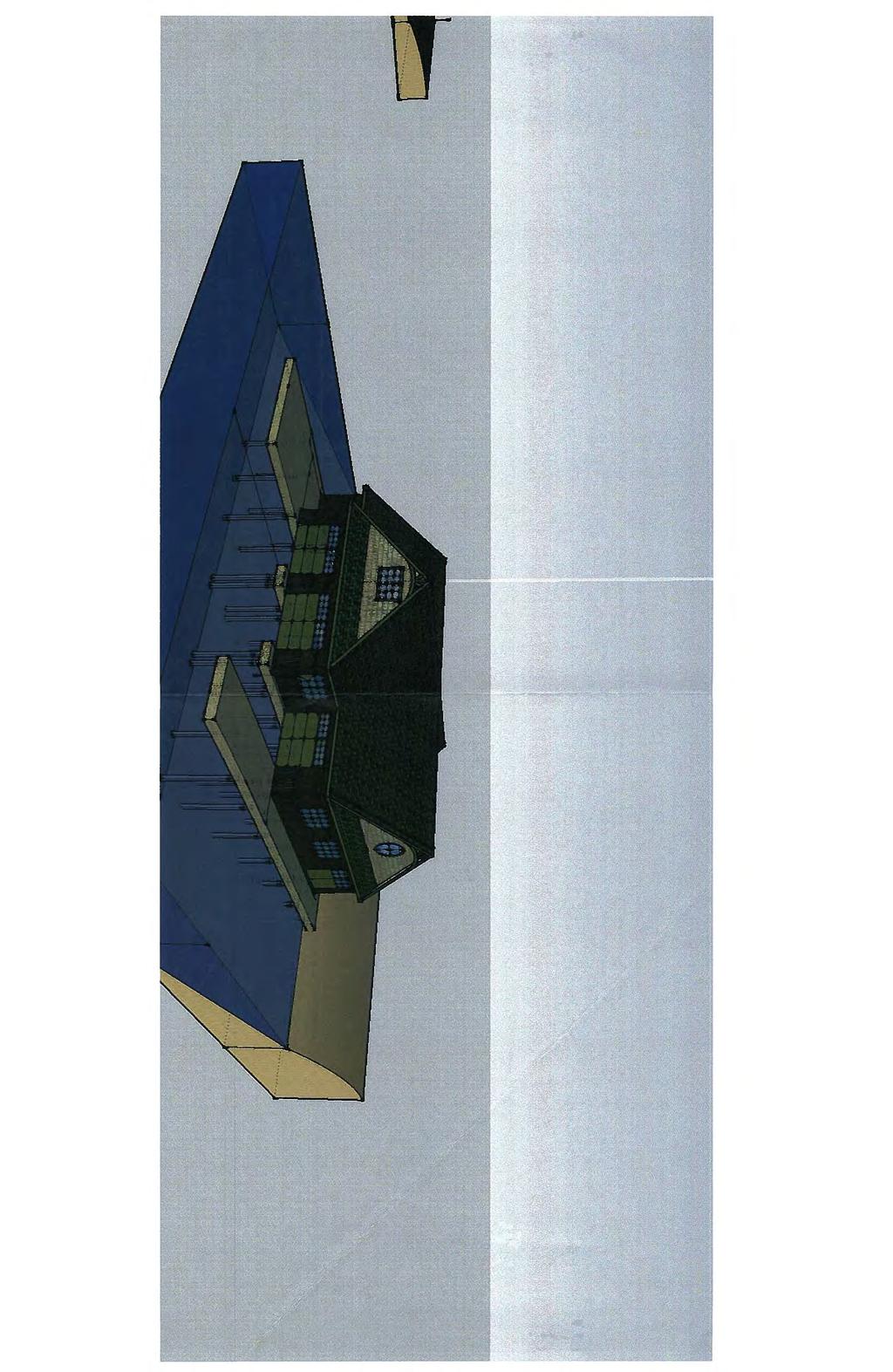


106 ZBA-17/14, Blair, Part of Chief's Island, Lake Page 106 of 127
107 ZBA-13/14 DUKE ZBA-13/14, Duke, South Part of Lot 31, Concession Page 107 of 127

108 ZBA-13/14, Duke, South Part of Lot 31, Concession Page 108 of 127
109 PLANNING COMMITTEE OF THE WHOLE AGENDA REPORT TO: Chair Burgess and Members of the Planning Committee of the Whole MEETING DATE: 21 July 2014 SUBJECT: ZBA-13/14, Duke, Part of Lots 30 & 31, Concession 2, (Medora), Roll # RECOMMENDATION: That ZBA-13/14 (Duke) be approved for circulation. APPROVALS: Date Signature Submitted By: N. Popovich, Senior Planner 15/07/14 Original signed by N. Popovich Approved By: D. Pink, Director of Planning 15/07/14 Original signed by D. Pink ORIGIN BACKGROUND Particulars of Property: Lot Frontage 911 feet Lot Area 25.4 acres Proposed Exemption: Section Description Requirement Proposed Exemption Proposal Construction sequence No accessory building shall be permitted prior to the establishment of the main use To permit an accessory dwelling unit prior to the establishment of the main commercial use To allow the construction of a residential dwelling unit BACKGROUND PLANNING DATA Official Plan Designation: By-law Zoning: Waterfront Resort Commercial Waterfront (WC1A4), Resort Commercial Backlot (WC1B), Open Space (OS3), & Environmental Protection (EP1) & (EP2) ZBA-13/14, Duke, South Part of Lot 31, Concession Page 1 of 9 Page 109 of 127
110 Schedule Nos.: 29 & 36 Access: Neighbouring Uses: Original Shore Road Allowance: Fisheries Resource: Foreman Road Waterfront Residential Not Applicable Type I (Significant) & Type 2 (General) Fish Habitat Civic Address: 1169 Foreman Road, Unit #3 PLANNING CONSIDERATIONS 1. Background The Waterfront Commercial (WC1A4) zoning of the property stems from the historical use of a Tourist Resort on the lot. According to the applicant s agent, this use ceased many years ago and the property has been vacant since. Demolition permits were issued in 1995 for 13 old buildings. The applicants wish to construct a residential dwelling unit and an amendment is required as the WC1A4 zoning permits a dwelling, but only as an accessory use. The establishment of a main commercial use (Tourist Resort) is required prior to permitting an accessory residential dwelling unit. The application was considered by Planning Committee of the Whole on 16 June At that time it was decided to defer the application in order to allow the applicant to provide a proposed building envelope for the dwelling as well as the size/dimensions for the dwelling. The applicant has provided a revised plan depicting the potential location of a dwelling on the property. No dimensions or size information have been provided. The property is over 25 acres in area and has over 900 feet of frontage. In staff s opinion, it would be difficult to construct a residence in compliance with the zoning By-law that would negatively impact future resort development. 2. Provincial Policy Statement The Provincial Policy Statement, 2014 (PPS) provides policy direction on matters of provincial interest related to land use planning and development. According to the Planning Act, any planning decision shall be consistent with provincial policy statements. This application has been reviewed against the PPS, and is consistent with it. 3. District of Muskoka Official Plan The subject site is designated Waterfront in the District Official Plan. Generally within the Waterfront Area recreation and the protection and enhancement of the environment are important policy issues. Policies regarding resorts recognize they change and evolve as the industry changes. The intent of policies is to be flexible and accommodate changing situations. Policies discourage the downzoning of resort properties. ZBA-13/14, Duke, South Part of Lot 31, Concession Page 2 of 9 Page 110 of 127
111 4. Township of Muskoka Lakes Official Plan The subject property falls within the Waterfront Designation. One of the main objectives of the Waterfront designation is to ensure that built form does not dominate the natural shoreline. The policies encourage low-density development to achieve this objective. Goals and objectives are also generally supportive of waterfront commercial development such as Tourist Resorts, encouraging appropriate redevelopment and expansion, and recognizing their important economic function. Section B.5.18 of the Official Plan states: Redevelopment of existing properties shall be encouraged to follow current development standards, as closely as possible, to be compatible with and consistent with sound planning principles including environmental considerations. In addition, encouragement shall be given to restoring and preserving natural shorelines. Section B.11.4 of the Official Plan states: Limited expansion, enlargement, or redevelopment of existing commercial establishments shall be permitted to approved limits detailed in the implementing comprehensive zoning by-law, as of the date of adoption of this Plan. Various zoning categories shall take into account the general differences in resorts and their densities. Section B.11.4 of the Official Plan states: Expansion, enlargement, or redevelopment of commercial establishments beyond the approved limits, as established in zoning, requires an amendment to the implementing comprehensive zoning by-law and is subject to site plan control. Consideration of proposals shall take into account the suitability of the site and the ability of the surrounding area to accommodate and sustain the expansion, enlargement, or redevelopment. Proposals shall maintain the general intent of the Plan and the following guidelines will be used in their evaluation: a) the property is of sufficient dimension and size to accommodate the proposal. Specific densities will be established in the amending zoning bylaw; b) the proposal should blend in with the waterfront setting and terrain, taking into account such issues as slope, vegetative cover, aesthetics, compatibility, and access; c) water and sewage disposal systems shall be able to handle the proposal; d) access routes shall have the capacity or be upgraded to handle additional traffic; and, e) the effect of the proposal would comply with the intent of any water quality policies of this Plan or the District of Muskoka Official Plan. Section B.11.7 of the Official Plan states: All lands upon which resorts, marinas, waterfront contractors, retail, service commercial, and/or light industrial uses are located or permitted, shall be referred to as the Employment Areas of the Township. Council recognizes that Employment Areas contribute substantially to the economic base of the Township. As such, Council supports the retention of all Employment Areas and operations in order to facilitate proper redevelopment and/or expansion. The conversion of Employment Areas to Non-Employment Areas shall be permitted through a comprehensive review, only where it has been demonstrated that the land is not required for employment purposes over the long term and that there is a need for the conversion. Section B of the Official Plan states: All resort development or redevelopment shall meet the following siting requirements: ZBA-13/14, Duke, South Part of Lot 31, Concession Page 3 of 9 Page 111 of 127
112 a) a minimum setback of 20m (66 feet) from the normal or controlled high water mark of a waterbody for all structures except shoreline and minor non-habitable structures; b) the provisions of Section 5.51; c) increased setbacks related to the height of buildings shall be encouraged; d) tree cover and vegetation is encouraged to uphold the visual and environmental integrity of the shoreline; e) A minimum of 30 metre setback from any shoreline will be required for leaching beds. Where this is not feasible, on-site phosphorus management will be required. The Official Plan is silent on construction sequence policies. 5. Zoning By-law The subject property is zoned predominantly Resort Commercial Waterfront (WC1A4) and Resort Commercial Backlot (WC1B). Main permitted uses include Hotel, Motel, and Tourist Resort. The required exemption is outlined in the introductory section of this report. The proposal complies with the Zoning By-law in all other respects. 6. Site Characteristics Staff inspected the subject property on 2 June The property is relatively level with large areas of mature vegetation. A portion of the shoreline is level beach with the southern area having steep vegetated slopes at the shoreline. There is a driveway leading into the property from Foreman Road and there is a meadow in close proximity to the shoreline. There is a dilapidated structure located on the edge of the meadow and it should be demolished prior to the construction of any new buildings. 7. Existing and Proposed Development There is currently a dilapidated structure located on the property. The proposed dwelling will be required to be located within the Resort Commercial Waterfront (WC1A4) zoned portion of the property. There is no site plan indicating where the dwelling will be constructed but there is ample area for a dwelling to meet the applicable setbacks. The Zoning By-law permits a gross floor area of 4,000 sq. ft. per acre zoned WC1A4 and a maximum dwelling size of 7,500 square feet. The dwelling will be required to meet all applicable by-law provisions (setbacks, height, etc.). 8. Downzoning Although the commercial use of the property has ceased operation some time ago and an accessory residential use is now proposed, this application should not be considered as a downzoning application. The commercial zoning is to remain, permitting a commercial operation as-of-right in the future. At this time, Official Plan policies speak strongly to the retention of waterfront commercial zoning, deeming them Employment Lands under the Provincial Policy Statement and requiring a ZBA-13/14, Duke, South Part of Lot 31, Concession Page 4 of 9 Page 112 of 127
113 Comprehensive Review to justify downzoning. The District of Muskoka is currently considering an update to their Official Plan, which may open the door to more flexibility in this regard in the future. 9. Site Plan Control The property, located on the Indian River and zoned commercial, is automatically subject to site plan control. Mature vegetation is located along the shoreline and will be required to be retained through the site plan process. 10. Completed Application Bill 51 amended the Planning Act and requires planning approval authorities to determine if an application is complete. For an application such as this, little accompanying information is required. The applicant is not proposing a dwelling location at this time and the application is deemed complete. View from Foreman Road ZBA-13/14, Duke, South Part of Lot 31, Concession Page 5 of 9 Page 113 of 127


114 Vegetation along the driveway Vegetation common to the interior of the lot ZBA-13/14, Duke, South Part of Lot 31, Concession Page 6 of 9 Page 114 of 127

115 Driveway leading into property Meadow close to the shoreline ZBA-13/14, Duke, South Part of Lot 31, Concession Page 7 of 9 Page 115 of 127


116 Existing building on edge of meadow Meadow near shoreline ZBA-13/14, Duke, South Part of Lot 31, Concession Page 8 of 9 Page 116 of 127

117 Shoreline looking south ZBA-13/14, Duke, South Part of Lot 31, Concession Page 9 of 9 Page 117 of 127
, Roll # 5-1-8 RECOMMENDATION: That ZBA-13/14 (Duke) be approved for circulation. APPROVALS: Date Signature Submitted By: N.")
118 PLANNING COMMITTEE OF THE WHOLE AGENDA REPORT TO: Chair Burgess and Members of the Planning Committee of the Whole MEETING DATE: 16 June 2014 SUBJECT: ZBA-13/14, Duke, Part of Lots 30 & 31, Concession 2, (Medora), Roll # RECOMMENDATION: That ZBA-13/14 (Duke) be approved for circulation. APPROVALS: Date Signature Submitted By: N. Popovich, Senior Planner 10/06/14 Original signed by N. Popovich Approved By: D. Pink, Director of Planning 10/06/14 Original signed by D. Pink ORIGIN BACKGROUND Particulars of Property: Lot Frontage 911 feet Lot Area 25.4 acres Proposed Exemption: Section Description Requirement Proposed Exemption Proposal Construction No accessory b uilding To permit an accessory To allow the sequence shall be pe rmitted prior to dwelling unit prior to the construction of a the establishment of th e establishment of the main residential dwelling main use commercial use unit BACKGROUND PLANNING DATA Official Plan Designation: Waterfront By-law Zoning: Resort Commercial Waterfront (WC1A4), Resort Commercial Backlot (WC1B), Open Space (OS3), & Enviro nmental Protection (EP1) & (EP2) ZBA-13/14, Duke, South Part of Lot 31, Concession Page 1 of 8 Page 118 of 127
119 Schedule Nos.: 29 & 36 Access: Foreman Road Neighbouring Uses: Waterfront Residential Original Shore Road Allowance: Fisheries Resource: Not Applicable Type I (Significant) & Type 2 (General) Fish Habitat Civic Address: 1169 Foreman Road, Unit #3 PLANNING CONSIDERATIONS 1. Background The Waterfront Commercial (WC1A 4) zoning of the property stems from the histor ical use of a Tourist Resort on the lo t. According to the app licant s agent, this use ceased many years ago and the property has been vacant since. Demolition permits were issu ed in 1995 for 13 old buildings. The applicants wish to construct a residential dwelling unit and an amendment is required as the WC1A4 zoning permits a dwelling, but only as an accessory use. The establishment of a main commercial use (Tourist Resort) is required prior to permitti ng an accessory residential dwelling unit. 2. Provincial Policy Statement The Provincial Policy Statement, (PPS) provides policy direction on matters of provincial interest related to land use planning and development. According to the Planning Act, any planning decision shall be consist ent with provincial policy stateme nts. This a pplication has been reviewed against the PPS, and is consistent with it. 3. District of Muskoka Official Plan The subject site is designated Waterfront in the District Official Plan. Generally within the Waterfront Area recreation and the protection and enhancement of the environment are important policy issue s. Policies r egarding resorts recog nize they change and evolve as t he industry changes. The intent of policies is to be flexible and accommodat e changing situations. Policies discourage the downzoning of resort properties. 4. Township of Muskoka Lakes Official Plan The subject property falls within the Waterfront Designation. One of the main objectives of the Waterfront designation is to ensure that built form does not dominate the natural shoreline. The policies encourage low-density development to achieve this objective. Goals and objectives are also generally supportive of waterfront comme rcial development such as To urist Resorts, encouraging appropriate redevelopment and ex pansion, and reco gnizing their important economic function. Section B.5.18 of the Official Plan states: Redevelopment of existing properties shall be encouraged to follow current development standards, as closely as possible, to be compatible ZBA-13/14, Duke, South Part of Lot 31, Concession Page 2 of 8 Page 119 of 127
120 with and consistent with sound planning principles including environmental considerations. In addition, encouragement shall be given to restoring and preserving natural shorelines. Section B.11.4 of the Official Plan states: Limited expansion, enlargement, or redevelopment of existing commercial establishments shall be permitted to approved limits detailed in the implementing comprehensive zoning by-law, as of the date of adoption of this Plan. Various zoning categories shall take into account the general differences in resorts and their densities. Section B.11.4 of the Official Plan states: Expansion, enlargement, or redevelopment of commercial establishments beyond the approved limits, as established in zoning, requires an amendment to the implementing comprehensive zoning by-law and is subject to site plan control. Consideration of proposals shall take into account the suitability of the site and the ability of the surrounding area to accommodate and sustain the expansion, enlargement, or redevelopment. Proposals shall maintain the general intent of the Plan and the following guidelines will be used in their evaluation: a) the property is of sufficient dimension and size to accommodate the proposal. Specific densities will be established in the amending zoning bylaw; b) the proposal should blend in with the waterfront setting and terrain, taking into account such issues as slope, vegetative cover, aesthetics, compatibility, and access; c) water and sewage disposal systems shall be able to handle the proposal; d) access routes shall have the capacity or be upgraded to handle additional traffic; and, e) the effect of the proposal would comply with the intent of any water quality policies of this Plan or the District of Muskoka Official Plan. Section B.11.7 of the Official Plan states: All lands upon which resorts, marinas, waterfront contractors, retail, service commercial, and/or light industrial uses are located or permitted, shall be referred to as the Employment Areas of the Township. Council recognizes that Employment Areas contribute substantially to the economic base of the Township. As such, Council supports the retention of all Employment Areas and operations in order to facilitate proper redevelopment and/or expansion. The conversion of Employment Areas to Non-Employment Areas shall be permitted through a comprehensive review, only where it has been demonstrated that the land is not required for employment purposes over the long term and that there is a need for the conversion. Section B of the Official Plan states: All resort development or redevelopment shall meet the following siting requirements: a) a minimum setback of 20m (66 feet) from the normal or controlled high water mark of a waterbody for all structures except shoreline and minor non-habitable structures; b) the provisions of Section 5.51; c) increased setbacks related to the height of buildings shall be encouraged; d) tree cover and vegetation is encouraged to uphold the visual and environmental integrity of the shoreline; ZBA-13/14, Duke, South Part of Lot 31, Concession Page 3 of 8 Page 120 of 127
121 e) A minimum of 30 metre setback from any shoreline will be required for leaching beds. Where this is not feasible, on-site phosphorus management will be required. The Official Plan is silent on construction sequence policies. 5. Zoning By-law The subject property is zoned predominantly Resort Commercial Waterfront (WC1A4) and Resort Commercial Backlot (WC1B). Main per mitted uses include Hotel, Motel, a nd Tourist Resort. The required exemption is outlined in the introductory section of this report. The proposal complies with the Zoning By-law in all other respects. 6. Site Characteristics Staff inspected the subject property on 2 June The property is relatively level with large areas of mature vegetation. A portion of the shoreline is level beach with the so uthern area having steep vegetated slopes at t he shoreline. There is a driveway leading into the property from Foreman Road and there is a meadow in clos e proximity to the shoreline. There is a dilapidated structure located on the edge of th e meadow and it should be demoli shed prior to the construction of any new buildings. 7. Existing and Proposed Development There is currently a dilapidated structure located on the property. The proposed dwelling will be required to be located within the Resort Commercial Water front (WC1A4) zoned portion of the property. There is no site plan indicating where the dwe lling will be constructed but there is ample area for a dwelling to meet the applicable setbacks. The Zoning By-law permits a gross floor area of 4,000 sq. ft. per acre zoned WC1A4 and a maximum dwelling size of 7,500 square feet. The dwelling will b e required to meet all applicable by-law provisions (setbacks, height, etc.). 8. Downzoning Although the commercial use of th e property has ceased operation some time ago and an accessory residential use is n ow proposed, t his application should not be con sidered as a downzoning application. The commercial zoning is to remain, permitting a commercial operation as-of-right in the future. At this time, Official Plan policie s speak strongly to the retention of waterfront commercial zoning, deeming them Employment Lands under the Provincial Policy Statement and requiring a Comprehensive Review to justify downzoning. The District of Muskoka is currently considering an update to their Official Plan, which may ope n the door to more flexi bility in this regard in the future. 9. Site Plan Control The property, located on the Indian River and zoned commercial, is automatically subject to site plan control. Mature vegetation is located al ong the sh oreline and will be required to be retained through the site plan process. 10. Completed Application ZBA-13/14, Duke, South Part of Lot 31, Concession Page 4 of 8 Page 121 of 127

122 Bill 51 amended the Pl anning Act and requires planning approval authorities to d etermine if an application is complete. For an application such as this, little acco mpanying information is required. The applicant is not proposing a dwelling location at this time and the a pplication is deemed complete. View from Foreman Road Vegetation along the driveway ZBA-13/14, Duke, South Part of Lot 31, Concession Page 5 of 8 Page 122 of 127
123 Vegetation common to the interior of the lot Driveway leading into property ZBA-13/14, Duke, South Part of Lot 31, Concession Page 6 of 8 Page 123 of 127


124 Meadow close to the shoreline Existing building on edge of meadow ZBA-13/14, Duke, South Part of Lot 31, Concession Page 7 of 8 Page 124 of 127
TOWNSHIP OF GEORGIAN BAY COMMITTEE OF ADJUSTMENT
 TOWNSHIP OF GEORGIAN BAY COMMITTEE OF ADJUSTMENT Minutes of the meeting of June 12, 2006, held in the Council Chambers, Baxter Ward Community Centre, Township of Georgian Bay, Port Severn, Ontario. MEMBERS
COMMITTEE OF ADJUSTMENT FOR MINOR VARIANCE MINUTES Monday, October 3, :30 p.m Town Council Chambers Page 1
 Page 1 1. CALL TO ORDER Committee Chair K. Parlett called the meeting to order at 5:30 p.m. and the following were recorded as being present. Committee Members: Staff: Committee Member, K. Parlett (Chairperson)
COMMITTEE OF ADJUSTMENT FOR MINOR VARIANCE MINUTES Monday July 26, :30 p.m Town Council Chambers Page 1
 Page 1 1. CALL TO ORDER Acting Committee Chair W. Moore called the meeting to order at 5:30 p.m. and the following were recorded as being present. Committee Members: Staff: Committee Member, K. Parlett
Township of Havelock-Belmont-Methuen Regular Council Meeting Agenda
 Township of Havelock-Belmont-Methuen Regular Council Meeting Agenda Date: Place: Council Chamber Time: 9:30 a.m. 12:30 p.m. Note: Declaration of Pecuniary Interest and General Nature Thereof Minutes: June
TABLE WATERFRONT RESIDENTIAL ZONES, PERMITTED MAIN USES
 4.1 WATERFRONT RESIDENTIAL ZONES 4.1.1 Permitted Uses No person shall within any Waterfront Residential Zone use any land or erect, locate, alter or use any building or structure for any use except in
THE CORPORATION OF THE TOWNSHIP OF GEORGIAN BAY COMMITTEE OF ADJUSTMENT AUGUST 6 TH, 1999
 THE CORPORATION OF THE TOWNSHIP OF GEORGIAN BAY COMMITTEE OF ADJUSTMENT AUGUST 6 TH, 1999 Minutes of the meeting of August 6 th, 1999 at 2:00 p.m. in the Cottage, Administration Office, Township of Georgian
2433 Dufferin Street Zoning By-law Amendment Application - Preliminary Report
 STAFF REPORT ACTION REQUIRED 2433 Dufferin Street Zoning By-law Amendment Application - Preliminary Report Date: July 22, 2014 To: From: Wards: Reference Number: North York Community Council Director,
URBAN DESIGN REPORT. Proposed Residential Development, Old Church Road, Caledon East
 Proposed Residential Development, Old Church Road, Caledon East TABLE CONTENTS: 1.0 DEVELOPMENT 1.1 Introduction-Analysis of Guiding Principles and Documents 1.2 Community Design and Architectural Design
Bloor Street West Rezoning Application for a Temporary Use By-law Final Report
 STAFF REPORT ACTION REQUIRED 3741 3751 Bloor Street West Rezoning Application for a Temporary Use By-law Final Report Date: June 12, 2007 To: From: Wards: Reference Number: Etobicoke York Community Council
ISTRIO MUNICIPALITY OF MUSKOK
 ISTRIO MUNICIPALITY OF MUSKOK.- -..-.. -.-... -- PLANNING AND ECONOMIC DEVELOPMENT DEPARTMENT 70 PINE STREET, BRACEBRIDGE, ONTARIO PI L 1 N3 Telephone (705) 645-2231 OR 1-800-461-4210 (705 area code) Fax
TOWNSHIP OF GEORGIAN BAY PLANNING AND COMMUNITY DEVELOPMENT COMMITTEE
 TOWNSHIP OF GEORGIAN BAY PLANNING AND COMMUNITY DEVELOPMENT COMMITTEE Minutes of the meeting of October 19, 2004 held in the Baxter Ward Community Centre, Township of Georgian Bay, Port Severn, Ontario.
THE CORPORATION OF THE TOWNSHIP OF GEORGIAN BAY COMMITTEE OF ADJUSTMENT NOVEMBER 27, 2000
 THE CORPORATION OF THE TOWNSHIP OF GEORGIAN BAY COMMITTEE OF ADJUSTMENT NOVEMBER 27, 2000 Minutes of the meeting of November 27, 2000 held in the Council Chambers, Baxter Ward Community Centre, Township
401, and 415 King Street West - Zoning Amendment Application - Preliminary Report
 STAFF REPORT ACTION REQUIRED 401, 407-409 and 415 King Street West - Zoning Amendment Application - Preliminary Report Date: January 27, 2011 To: From: Wards: Reference Number: Toronto and East York Community
City of Surrey PLANNING & DEVELOPMENT REPORT File:
 City of Surrey PLANNING & DEVELOPMENT REPORT File: 7917-0297-00 Planning Report Date: September 11, 2017 PROPOSAL: Amend CD By-law No. 18795 (based on RH-G). to allow for an increased house size on thirteen
377 Spadina Rd & 17 Montclair Ave Zoning Amendment Application Final Report
 STAFF REPORT ACTION REQUIRED 377 Spadina Rd & 17 Montclair Ave Zoning Amendment Application Final Report Date: September 14, 2016 To: From: Wards: Reference Number: Toronto and East York Community Council
TOWNSHIP OF GALWAY-CAVENDISH AND HARVEY
 Present: Staff Present: Reeve Tom Flynn Deputy Reeve Madeline Pearson Councillor Janet Clarkson Councillor Bev Matthews Councillor Peter Franzen Pat Kemp, CAO/Deputy Clerk Natalie Garnett, Clerk Mike Zimmer,
Section 61 Recreational Vehicle Park / Campground (Bylaw No. 2012/10)
") Part 7 General Regulations Section 61 Recreational Vehicle Park / Campground (Bylaw No. 2012/10) 61.1 A comprehensive site plan shall be provided to the satisfaction of the Development Authority that shows
Part 7 General Regulations Section 61 Recreational Vehicle Park / Campground (Bylaw No. 2012/10) 61.1 A comprehensive site plan shall be provided to the satisfaction of the Development Authority that shows
Parkland County Municipal Development Plan Amendment Acheson Industrial Area Structure Plan
 Parkland County Municipal Development Plan Amendment Acheson Industrial Area Structure Plan New Plan Acheson Industrial Area Structure Plan Amendment Parkland County Municipal Development Plan Board Reference
b. Minimum Site Area. Recreational vehicle parks shall be located on a parcel of land not less than 3 acres in area.
 6450 RECREATIONAL VEHICLE PARK REGULATIONS 6450 TITLE AND PURPOSE. The provisions of Section 6450 through 6499, inclusive, shall be known as the Recreational Vehicle Park Regulations. The purpose of these
2. RESOLUTION TO CLOSE MEETING
 THE CORPORATION OF THE CITY OF VERNON A G E N D A To deliver effective and efficient local government services that benefit our citizens, our businesses, our environment and our future REGULAR OPEN MEETING
COUNCIL AGENDA Tuesday, August 23 rd, 2016 Lanark Highlands Municipal Office Council Chambers 75 George Street, Lanark, Ontario
 COUNCIL AGENDA Tuesday, August 23 rd, 2016 Lanark Highlands Municipal Office Council Chambers 75 George Street, Lanark, Ontario Committee of the Whole 6:00 p.m., immediately followed by Council Page Chair,
Ontario Municipal Board Commission des affaires municipales de l Ontario
 Ontario Municipal Board Commission des affaires municipales de l Ontario ISSUE DATE: February 27, 2015 CASE NO(S).: PL140972 PROCEEDING COMMENCED UNDER subsection 34(19) of the Planning Act, R.S.O. 1990,
SUMMER VILLAGE OF SILVER SANDS. Municipal Development Plan
 SUMMER VILLAGE OF SILVER SANDS Municipal Development Plan Bylaw 253-2014 Adopted August 22, 2014 Summer Village of Silver Sands Municipal Development Plan Bylaw No. 253-2014 Page 2 1 INTRODUCTION 1.1 SETTING
Proposed Official Plan Amendment 41 to the Region of York Official Plan
 COMMITTEE OF THE WHOLE NOVEMBER 18, 2002 REGION OF YORK OFFICIAL PLAN AMENDMENT 41 THE OAK RIDGES MORAINE CONSERVATION PLAN Recommendation The Commissioner of Planning recommends: 1. That the City of Vaughan
THE MUNICIPALITY OF KINCARDINE Page 1 March 14, 2007
 Page 1 March 14, 2007 1.0 CALL TO ORDER Mayor Larry Kraemer called to order, in the Municipal Administration Centre, at 5:00 p.m. on March 14, 2007 a Special Session of the Council of the Corporation of
Lot Lot 25. Lot 24. Lot 23. Lot 22. congregate housing as a site specific permitted use at 633 Winnipeg Street (RD2 Zone).
.") Public Notice October 6, 2016 Subject Property: 633 Winnipeg Street Lot 6, District Lot 202, Similkameen Division Yale District, Plan 804 Application: Rezone PL2016-7738 The applicant is proposing to operate
Public Notice October 6, 2016 Subject Property: 633 Winnipeg Street Lot 6, District Lot 202, Similkameen Division Yale District, Plan 804 Application: Rezone PL2016-7738 The applicant is proposing to operate
The Corporation of the Township of Wollaston By-law Being a by-law to licence recreational vehicles and tents in the Township of Wollaston
 By-law 38-17 Being a by-law to licence recreational vehicles and tents in the Township of Wollaston WHEREAS Section 164 of the Municipal Act, 2001 as amended, authorizes the municipality to prohibit or
KAP Lot 3. Lot 3. Lot Lot 5. Lot 6. Lot 7. Lot 8. Lot KAP 81153
 Public Notice April 26, 2018 Subject Property: 249 Westminster Ave W Lot A, District Lot 4, Group 7, Similkameen Division Yale (Formerly Yale Lytton) District, KAP92015 Application: Rezone PL2018-8201
Spadina Avenue Built Form Study Preliminary Report
 STAFF REPORT ACTION REQUIRED Spadina Avenue Built Form Study Preliminary Report Date: July 9, 2014 To: From: Wards: Reference Number: Toronto and East York Community Council Director, Community Planning,
Community Development
 Community Development City & Borough of Juneau Community Development 155 S. Seward Street Juneau, AK 99801 (907) 586 0715 Phone (907) 586 4529 Fax DATE: February 11, 2016 TO: FROM: Planning Commission
Date: 11 th January, From: Plaistow & Ifold Parish Neighbourhood Plan - Steering Group. Plaistow & Ifold Parish Council
 Date: 11 th January, 2017 From: Plaistow & Ifold Parish Neighbourhood Plan - Steering Group To: Plaistow & Ifold Parish Council Re: Neighbourhood Plan Report to Parish Council Meeting 17 Jan 2017 The Steering
CULTUS LAKE PARK BOARD AMENDED AGENDA
 CULTUS LAKE PARK BOARD AMENDED AGENDA (1) CALL TO ORDER WEDNESDAY, MARCH 18, 2015 PARK OFFICE BOARDROOM 7:00 PM Regular Meeting (2) RESOLUTION TO PROCEED IN CAMERA (4:00) THAT the meeting be closed to
AMENDMENT NO. 03 TO THE OFFICIAL PLAN FOR THE TOWNSHIP OF ADJALA-TOSORONTIO OAK RIDGES MORAINE CONSERVATION PLAN
 AMENDMENT NO. 03 TO THE OFFICIAL PLAN FOR THE TOWNSHIP OF ADJALA-TOSORONTIO OAK RIDGES MORAINE CONSERVATION PLAN Adopted by Council July 19 th, 2004 Approved with modifications by the Province of Ontario
Chairman Frothingham explained that the cases will be heard together and then voted on separately.
 1 2 3 4 5 6 7 8 9 10 11 12 13 14 15 16 17 18 19 20 21 22 23 24 25 26 27 28 29 30 31 32 33 TOWN OF SUNAPEE ZONING BOARD AUGUST 11, 2016 PRESENT: Edward Frothingham, Chair; Daniel Schneider, Vice-chair;
Changing Lanes. Click to edit Master title style. Community Consultation Meeting #1. Second level Third level. Fourth level.
 Changing Lanes The Click City of to Toronto edit Master Review text of styles Laneway Suites Community Consultation Meeting #1 November 30, 2017 Agenda 6:30 Introductions Councillor Ana Bailão (Ward 18)
Development Agreement No. DA16-002
 STAFF REPORT Planning Commission AGENDA ITEM NUMBER 5 MEETING DATE April 13, 2016 CASE NUMBER PROPERTY OWNER PROJECT PROPONENTS City of Buena Park as Successor Agency to the former Community Redevelopment
Rule Governing the Designation and Establishment of All-Terrain Vehicle Use Trails on State Land
 Rule Governing the Designation and Establishment of All-Terrain Vehicle Use Trails on State Land 1.0 Authority 1.1 This rule is promulgated pursuant to 23 V.S.A. 3506. Section 3506 (b)(4) states that an
BOARD OF ADJUSTMENT AGENDA
 BOARD OF ADJUSTMENT AGENDA February 28, 2018 I. Call to Order II. III. Approval of Minutes Old Business: 1. Coleman Bass Construction (VAR17-0112) Variance* 1800 NW Mystic Avenue Interior Side Setback
DRAFT GENERAL IMPLEMENTATION PLAN AND SPECIFIC IMPLEMENTATION PLAN MIDDLETON MUNICIPAL AIRPORT MOREY FIELD. Revised 12/12/03
 DRAFT GENERAL IMPLEMENTATION PLAN AND SPECIFIC IMPLEMENTATION PLAN MIDDLETON MUNICIPAL AIRPORT MOREY FIELD Revised 12/12/03 As recommended for approval by the Plan Commission General Project Description
TOWNSHIP OF NORTH KAWARTHA IN-WATER ZONING REGULATION BACKGROUND AND OPTIONS. Prepared By: Municipal Planning Services Ltd.
 TOWNSHIP OF NORTH KAWARTHA IN-WATER ZONING REGULATION BACKGROUND AND OPTIONS Prepared By: Municipal Planning Services Ltd. December 21, 2015 TABLE OF CONTENTS 1.0 BACKGROUND..1 2.0 OFFICIAL PLAN.....2
RECREATIONAL VEHICLE EXAMPLES
 RV Ordinance 21.03.010 (I). Recreational Vehicles. 1. Purpose. The purpose of the recreational vehicle (RV) code is to clearly define what is considered a recreational vehicle and to identify locations
2175 Lake Shore Boulevard West Official Plan and Zoning Amendment, and Removal of the Holding Provision Applications Final Report
 STAFF REPORT ACTION REQUIRED 2175 Lake Shore Boulevard West Official Plan and Zoning Amendment, and Removal of the Holding Provision Applications Final Report Date: May 22, 2009 To: From: Wards: Reference
Changing Lanes. Click to edit Master title style. Toronto and East York Community Council. Second level Third level. Fourth level.
 Changing Lanes Toronto s Click to Laneway edit Master Suites text Strategy styles Toronto and East York Community Council May 2, 2018 2,433 Total number of Laneways in the City of Toronto 295 km Of Laneways
THE CORPORATION OF DELTA COMMUNITY PLANNING ADVISORY COMMITTEE
 THE CORPORATION OF DELTA COMMUNITY PLANNING ADVISORY COMMITTEE Minutes of the Regular Meeting of the Community Planning Advisory Committee held Thursday, February 4, 2016 at 7:00 p.m. in the Annacis Room
Airport Planning Area
 PLANNING AREA POLICIES l AIRPORT Airport Planning Area LOCATION AND CONTEXT The Airport Planning Area ( Airport area ) is a key part of Boise s economy and transportation network; it features a multi-purpose
UPPER TOWNSHIP ZONING BOARD OF ADJUSTMENT MEETING MINUTES JUNE 14, 2018
 UPPER TOWNSHIP ZONING BOARD OF ADJUSTMENT MEETING MINUTES The regular meeting of the Upper Township Zoning Board of Adjustment was held at the Township Hall, 2100 Tuckahoe Road, Petersburg, New Jersey.
TOWN OF FARMINGTON ZONING BOARD OF APPEALS MEETING MINUTES APPROVED MINUTES
 TOWN OF FARMINGTON ZONING BOARD OF APPEALS MEETING MINUTES APPROVED MINUTES The following minutes are a written summary of the main points that were made and the actions taken at the Town of Farmington
Chair and Members, The Etobicoke York Community Council. Mark Sraga, Director and Deputy Chief Building Official
 STAFF REPORT ACTION REQUIRED Sign Variance Report - Revised 29 Algie Avenue Date: January 11, 2010 To: From: Chair and Members, The Etobicoke York Community Council Mark Sraga, Director and Deputy Chief
Lot 6. Lot 13. Lot 12 E ot 13 R.P. R.P. Section : to increase the maximum floor area of all accessory buildings from 75m 2 to 89m 2.
 Public Notice April 6, 2017 Subject Property: 3598 South Main Street Lot 5, District Lot 197, Similkameen Division Yale District, Plan 20373 Application: Development Variance Permit PL2017-7890 The applicant
The District of North Vancouver FACT SHEET
 The District of North Vancouver Community Planning Dept. 355 West Queens Road North Vancouver British Columbia, V7N 4N5 COMMUNITY PLANNING FACT SHEET APPLICANT: THE SITE: Musson Cattell Mackey Partnership
Town of Markham Yonge and Steeles Corridor Study and City of Vaughan Yonge Street Area Study
 STAFF REPORT ACTION REQUIRED Town of Markham Yonge and Steeles Corridor Study and City of Vaughan Yonge Street Area Study Date: August 14, 2009 To: From: Wards: Reference Number: North York Community Council
CITY OF SPOKANE VALLEY Request for Council Action
 CITY OF SPOKANE VALLEY Request for Council Action Meeting Date: June 28, 2016 Department Director Approval: Item: Check all that apply: consent old business new business public hearing information admin.
CITY OF GRANBURY ZONING BOARD OF ADJUSTMENT MINUTES
 CITY OF GRANBURY ZONING BOARD OF ADJUSTMENT MINUTES 09-26-06 The Zoning Board of Adjustment of the City of Granbury convened in regular session on Tuesday, September 26, 2006, at 5:30 p.m. in the Council
Township of Centre Wellington Committee of the Whole Agenda Tuesday, February 2, :00 am Council Chamber, 1 MacDonald Square, Elora Page
 Township of Centre Wellington Committee of the Whole Agenda Tuesday, February 2, 2016 9:00 am Council Chamber, 1 MacDonald Square, Elora Page 1. CALL TO ORDER 2. DISCLOSURE OF PECUNIARY INTEREST UNDER
5 September 9, 2015 Public Hearing
 5 September 9, 2015 Public Hearing APPLICANT: SHIP CABIN CLUB, INC. PROPERTY OWNER: RED HEAD REALTY CORPORATION REQUEST: Enlargement of a Nonconforming Use and Structures STAFF PLANNER: Kevin Kemp ADDRESS
RECREATIONAL VEHICLE RESORT DISTRICT R-RVR. Lacombe County Land Use Bylaw No: 1237/17 Date Adopted: July 6, Page 111
 RECREATIONAL VEHICLE RESORT DISTRICT Page 111 7.10 RECREATIONAL VEHICLE RESORT DISTRICT () 1 PURPOSE 2 USES The purpose of the Recreational Vehicle Resort District is to provide an area that will facilitate
The rezoning application is recommended for consideration of approval.
 Date: November 26, 2012 To: From: Chairperson and Members Planning and Housing Committee Ken O Brien, MCIP Manager of Planning & Information Cliff Johnston, MCIP Director of Planning Re: Department of
12, 14 and 16 York Street - Amendments to Section 16 Agreement and Road Closure Authorization
 REPORT FOR ACTION 12, 14 and 16 York Street - Amendments to Section 16 Agreement and Road Closure Authorization Date: April 27, 2018 To: Toronto and East York Community Council From: Senior Strategic Director,
Port Bruce. Interim Management Statement
 Port Bruce Interim Management Statement Port Bruce Interim Management Statement August 3, 1999 This Port Bruce Provincial Park Interim Management Statement provides direction for the custodial management
Official Minutes of MARION COUNTY BOARD OF COUNTY COMMISSIONERS. May 8, 2018
 Official Minutes of MARION COUNTY BOARD OF COUNTY COMMISSIONERS May 8, 2018 CALL TO ORDER: The Marion County Board of County Commissioners met in a special session in Commission Chambers at 5:33 p.m. on
REGIONAL BOARD REPORT
 REGIONAL BOARD REPORT Administrator s Office For the Board August 21, 2008 DATE: August 14, 2008 FILE NOS.: A-07-06377/8/9.000 FROM: RE: Chief Administrative Officer OCP and Zoning Amendment Application
rcr MUNICIPALITY OF MUSKOKA
 THE rcr MUNICIPALITY -.- - OF MUSKOKA --. -----, PLANNING AND ECONOMIC; DEVELOPMENT DEPARTMENT 70 PINE STREET, BRACEBRIDGE, ONTARIO PI L 1 N3 Telephone (705) 645-2231 OR 1-800-461-4210 (705 area code)
REPORT. Bed and Breakfast Review - Land Use Policies and Regulations
 REPORT PLANNING AND DEVELOPMENT COUNCIL MEETING MEETING DATE: JANUARY 25, 2010 FROM: Planning Services DATE: January 4, 2010 PD: 011-10 SUBJECT: Bed and Breakfast Review - Land Use Policies and Regulations
STAFF REPORT FOR ACTION
 Insert TTC logo here STAFF REPORT FOR ACTION Hillcrest Complex Property Study Date: November 30, 2016 To: From: TTC Board Chief Executive Officer Summary This report outlines a plan for staff to proceed
HARBOUR EAST-MARINE DRIVE COMMUNITY COUNCIL MINUTES. October 3, 2013
 HALIFAX REGIONAL MUNICIPALITY HARBOUR EAST-MARINE DRIVE COMMUNITY COUNCIL MINUTES October 3, 2013 PRESENT: Councillor Darren Fisher, Chair Councillor David Hendsbee, Vice Chair Councillor Bill Karsten
Request for Decision. Resolution. Finance Implications. Presented: Monday, Jan 23, Report Date Wednesday, Dec 14, 2016.
 Presented To: Planning Committee Request for Decision Armand Charbonneau & Stephanie Malik - Application for rezoning in order to permit a camping ground having a total of 32 campsites and a hostel/chalet
Request for Decision. Resolution. Presented: Monday, Feb 22, Report Date Tuesday, Feb 02, Routine Management Reports.
 Presented To: Planning Committee Request for Decision Proposed Telecommunications Tower, Eastlink, PIN 73571-0847, Parcel 38801, Part 1, Plan 53R-5462, Lots 3 and 4, Plan M-467, Lot 12, Concession 5, Neelon
to allow construction of an addition to an existing home at Lark Place.
 Tuesday, July 15, 1997 Committee Room City Hall 14245-56 Avenue Surrey, B.C. Tuesday, July 15, 1997 Time: 9:03 a.m. Present: Staff Present: Chairperson - M. Cooper C. van den Broek Manager, Residential
Expropriation of a portion of 5795 Yonge Street for public street purposes. Government Management Committee
 GM13.18 STAFF REPORT ACTION REQUIRED Expropriation of a portion of 5795 Yonge Street for public street purposes Date: May 25, 2016 To: From: Wards: Reference Number: Government Management Committee Chief
STAFF REPORT ACTION REQUIRED
 STAFF REPORT ACTION REQUIRED Proposed Area-Specific Amendment to Chapter 694, Signs, General, with Respect to Ricoh Coliseum and BMO Field and a Portion of Exhibition Place Date: July 23, 2014 To: From:
A GUIDE TO MANITOBA PROTECTED AREAS & LANDS PROTECTION
 A GUIDE TO MANITOBA PROTECTED AREAS & LANDS PROTECTION Manitoba Wildands December 2008 Discussions about the establishment of protected lands need to be clear about the definition of protection. We will
Denis Leger, Commissioner, Transportation, Properties and Emergency Services. Sheila Kidd, Director, Transportation Services
 CITY OF KINGSTON REPORT TO COUNCIL Report No.: 13-279 TO: FROM: RESOURCE STAFF: Mayor and Members of Council Denis Leger, Commissioner, Transportation, Properties and Emergency Services Sheila Kidd, Director,
THAT the Agenda and Addendum, for the March 14, 2016 meeting of Heritage Guelph be approved.
 MEETING Heritage Guelph DATE March 14, 2016 LOCATION TIME City Hall Meeting Room C 12:00 PM 2:00 PM PRESENT Daphne Wainman-Wood (Chair), Tony Berto, Mary Tivy, Bob Foster, Lynn Allingham, Charles Nixon,
LIVONIA JOINT ZONING BOARD OF APPEALS MEETING MINUTES- November 3, 2014
 LIVONIA JOINT ZONING BOARD OF APPEALS MEETING MINUTES- November 3, 2014 Present: Chair P. Nilsson, C. Rider, M. Sharman, G. Cole, Code Enforcement Officer A. Backus, Recording Secretary J. Brown Absent:
Town of Southern Pines Planning Board Meeting Douglass Community Center 1185 W. Pennsylvania Avenue November 17, 2016 at 7:00 p.m.
 AGENDA Town of Southern Pines Planning Board Meeting Douglass Community Center 1185 W. Pennsylvania Avenue November 17, 2016 at 7:00 p.m. I. Call to Order II. III. Approval of Minutes Public Hearing: CU-07-16:
DECISION/DIRECTION NOTE
 DECISION/DIRECTION NOTE Title: St. John s Municipal Plan Amendment Number 134, 2017 and St. John s Development Regulations Amendment Number 617, 2017 Proposed Rezoning to the Commercial Neighbourhood (CN)
Criteria for an application for and grant of, or a variation to, an ATOL: fitness, competence and Accountable Person
 Consumer Protection Group Air Travel Organisers Licensing Criteria for an application for and grant of, or a variation to, an ATOL: fitness, competence and Accountable Person ATOL Policy and Regulations
Priscilla Davenport, Saluda District
 AT A MEETING OF THE MIDDLESEX COUNTY PLANNING COMMISSION HELD ON THURSDAY, NOVEMBER 13, 2003, IN THE PUBLIC MEETING ROOM OF THE COOK S CORNER OFFICE COMPLEX, COOK S CORNER, VIRGINIA. Present: Absent: John
Committee of the Whole Meeting Agenda
 Committee of the Whole Meeting Agenda Consolidated as of March 1, 2019 Monday, March 4, 2019 1:00 p.m. Council Chambers, Guelph City Hall, 1 Carden Street Please turn off or place on non-audible all electronic
Continental Divide National Scenic Trail Legislative History and Planning Guidance
 Continental Divide National Scenic Trail Legislative History and Planning Guidance Legislation, Policy, and Direction Regarding National Scenic Trails The National Trails System Act, P.L. 90-543, was passed
9 CONSTRUCTION OF BATHURST STREET FROM GREEN LANE WEST TO SOUTH OF HIGHWAY 11, TOWN OF EAST GWILLIMBURY AND TOWNSHIP OF KING
 Clause No. 9 in Report No. 9 of Committee of the Whole was adopted, without amendment, by the Council of The Regional Municipality of York at its meeting held on May 15, 2014. 9 CONSTRUCTION OF BATHURST
ZONING BY-LAW INTRODUCTORY STATEMENT
 ZONING BY-LAW INTRODUCTORY STATEMENT This document is the City of Guelph Comprehensive Zoning By-law 1995-14864. The By-law replaces the City of Guelph Restricted Area (Zoning) By-law 1971-7666, as amended.
MINUTES BOROUGH OF LAVALLETTE WORKSHOP MEETING OF THE PLANNING BOARD Wednesday, February 25, P.M.
 MINUTES BOROUGH OF LAVALLETTE WORKSHOP MEETING OF THE PLANNING BOARD Wednesday, February 25, 2009 7 P.M. Chairman Lionel Howard presiding. Roll Call: Vincent Marino, Designee of Mayor LaCicero -present
BUFFALO TOWNSHIP PLANNING COMMISSION REGULAR MONTHLY MEETING FEBRUARY 1, 2017
 The Regular Monthly of the Buffalo Township Planning Commission was called to order on Wednesday, February 1, 2017, at 7:30 p.m. in the Buffalo Township Municipal Building by the Chairman Ray Smetana.
THE DISTRICT MUNICIPALITY OF MUSKOKA ENGINEERING AND PUBLIC WORKS COMMITTEE. Meeting No. PW Council Chamber, District Administration Building
 THE DISTRICT MUNICIPALITY OF MUSKOKA ENGINEERING AND PUBLIC WORKS COMMITTEE Meeting No. PW-6-2008 PLACE: TIME: Council Chamber, District Administration Building 9:00 a.m. DATE: April 30, 2008 PRESENT:
Planning and Building Department
 Page 1 of Report PB-27/11 CITY OF Burlington Planning and Building Department TO: Chair and Members of the Community Development Committee SUBJECT: Niagara Escarpment Plan Amendment 179 (NEPA 179) Addition
Comparison Between Old and New ALUC Plans
 A P P E N I X H Comparison Between Old and New ALUC Plans OVERVIEW This Placer County Airport Land Use Compatibility Plan (ALUCP) sets forth land use compatibility criteria for the environs of Auburn Municipal,
Front Carport Design Standards, Requirements & Application
 Front Carport Design Standards, Requirements & Application THIS PAGE INTENTIONALLY LEFT BLANK. Carport: A structure designed or used to shelter vehicles that is open on at least two sides. Carport shall
Chair and Members of Harbour East - Marine Drive Community Council. Brad Anguish, Director, Parks and Recreation
 P.O. Box 1749 Halifax, Nova Scotia B3J 3A5 Canada Item No. 15.1.1 Harbour East-Marine Drive Community Council December 3, 2015 TO: SUBMITTED BY: Chair and Members of Harbour East - Marine Drive Community
NEWBORO AND PORTLAND HARBOUR REDVELOPMENT PLANS
 INTRODUCTION The Municipal docks in both Newboro and Portland were transferred to the Township of Rideau Lakes by Parks Canada in 2002. Little has been done to improve the docks physical condition or role
MINUTES FIRST MEETING OF 2016 ECONOMIC DEVELOPMENT COMMITTEE OF THE WHOLE
 MINUTES FIRST MEETING OF 2016 ECONOMIC DEVELOPMENT COMMITTEE OF THE WHOLE The Economic Development Committee of the Whole met on January 27, 2016 immediately following County Council at the Lanark County
Tuesday, July 28, 1998 A. CORPORATE REPORTS B. ITEMS REFERRED BY COUNCIL C. DELEGATIONS
 Tuesday, Council Chamber City Hall 14245-56 Avenue Surrey, B.C. Tuesday, Time: 4:00 p.m. Present: Chairperson: Councillor Watts Mayor McCallum Councillor Villeneuve Councillor Steele Councillor Hunt Absent:
BOARD REPORT. TO: Chair and Directors File No: BL PL
 BOARD REPORT TO: Chair and Directors File No: BL 825-38 PL20180175 SUBJECT: Electoral Area F: Scotch Creek/Lee Creek Amendment (Pinegrove RV Park) Bylaw No. 825-38 DESCRIPTION: Report from Dan Passmore,
Toronto and East York Community Council. Director, Toronto Building, Toronto and East York District
 Sign Variance - 25 Bishop Tutu Blvd STAFF REPORT ACTION REQUIRED Date: February 16, 2009 To: From: Wards: Reference Number: Toronto and East York Community Council Director, Toronto Building, Toronto and
1. Call to order and review of agenda. The meeting was called to order by Vice Chairperson Dave Campbell at 6:00 PM
 Approved 9/6/2017 SPECIAL MEETING: JENSEN CAMPGROUND SPR CASCO TOWNSHIP PLANNING COMMISSION August 2, 2017-6 PM Members Present: Greg Knisley, Judy Graff, Dave Hughes, Dave Campbell, Lou Adamson and Dan
Appendix A to Schedule 2 of By-Law Application for Seasonal Recreational / Park Model Campground License
 www.springwater.ca 2231 Nursery Road Minesing, Ontario L9X 1A8 Canada Appendix A to Schedule 2 of By-Law 2008-118 Application for Seasonal Recreational / Park Model Campground License Total Number of Sites:
Public Meeting Information Report Development Approval and Planning Policy Department
 Public Meeting: February 16, 2016 at 7:00 pm in Council Chambers, Town Hall Applicant: Gagnon & Law Urban Planners Ltd. on behalf of Flato Palgrave Mansions Inc. File No.: 21T-90034C & RZ 88-07 The Purpose
REGULAR MEETING OF THE KENNER CITY COUNCIL DECEMBER 7, :00P.M. COUNCIL CHAMBER- KENNER CITY HALL SUPPLEMENTAL AGENDA PUBLIC APPEARANCE AGENDA
 REGULAR MEETING OF THE KENNER CITY COUNCIL DECEMBER 7, 2017-5:00P.M. COUNCIL CHAMBER- KENNER CITY HALL SUPPLEMENTAL AGENDA PUBLIC APPEARANCE AGENDA 13. RESOLUTIONS AND MOTIONS BY COUNCILMEMBERS 13-H. A
Concept Curtin Precinct Map and Code
 Concept Curtin Precinct Map and Code Proposed changes from the revised Curtin Group Centre Draft Master Plan recommendations Disclaimer: This document is intended to show the proposed changes to the existing
ORDINANCE NO. JACKSON TOWNSHIP, CAMBRIA COUNTY
 ORDINANCE NO. JACKSON TOWNSHIP, CAMBRIA COUNTY AN ORDINANCE OF THE TOWNSHIP OF JACKSON AMENDING SECTIONS OF THE JACKSON TOWNSHIP ZONING ORDINANCE AS FOLLOWS: PROVIDING NEW DEFINITIONS OF CAMPGROUNDS, CAMPSITE,