Town of Schroon Townwide Revitalization Strategy February 2018 Final
|
|
|
- Daniel Merritt
- 5 years ago
- Views:
Transcription

1
2 Town of Schroon Advisory Committee Willard (Bill) Bruce Juliana Carattini Brooke Clark Barbara M. Brancone Connor Duke Connor Mark Granger Marcia Hartnett John Harvey Dan Kelleher Lisa Hess Marks Bruce Murdock Corrie O Dea Glen Repko Sue Repko Anthony Ruiz Pete Seagle Joe Steiniger Meg Wood Town of Schroon Townwide Revitalization Strategy February 2018 Final Project Management Team Mike Marnell (Town Supervisor) Roger Friedman (Committee Chair) Tracey Clothier (The LA Group) Amanda Magee (The Trampoline Advertising and Design) Garrett Dague (Essex County Planning Department) Barbara Kendall (NYS Department of State) This project is funded through the New York State Department of State with funds provided under Title 11 of the Environmental Protection Fund.
3 EXECUTIVE SUMMARY The Town of Schroon was awarded a grant from the Department of State for Local Waterfront Revitalization Strategy in December The project was initiated in March 2017 and a local committee of volunteers was formed to guide the planning process. The Advisory Committee represents a cross-section of Schroon Lakes year-round and second home residents, business owners, and retirees. Three NYS DEC personnel with expertise in Schroon Lake s Forest Preserve area, and Dan Kelleher from Economic Affairs at the Adirondack Park Agency, were recruited to round out the group. Consultants from the LA Group and Trampoline Advertising and Design guided the Project Advisory Committee in the development of the Revitalization Strategy. The mission statement for the project was - to develop a plan using Schroon Lake s natural resources and assets to create an economic development strategy with actionable recommendations reflects this unfettered scope. The scope of the project was broadened to a townwide project called the Schroon Townwide Revitalization Strategy. The project relied considerably on prior planning efforts and several recent studies of recreation and tourism trends in the Adirondacks including: 1977 Schroon Lake Comprehensive Plan; Schroon Lake Tourism Destination Master Plan; Town of Schroon Smart Growth Hamlet Expansion and Affordable Housing Plan; Schroon Lake Watershed Master Plan; and the Unit Management Plans for the forest preserve areas (see a full list of resources in the Appendix). The Town hosted a public meeting on August 31, 2017 to present the primary ideas that emerged from the work of the Project Advisory Committee for the development of a Townwide Revitalization Strategy. Approximately 125 residents and visitors attended the event held at the historic Boathouse Theater in Schroon Lake Town Park. The purpose of the meeting was for consultants to present the existing conditions in the community and the findings of the Project Advisory Committee, and request feedback from those attending the meeting on the draft recommendations. The comments received from the Project Advisory Committee and at the public meeting were thoughtful and insightful and ultimately shaped the outcome of the plan. A summary of these comments provides an overview of the assets of this special community: World-renowned Seagle Music Colony that is expanding its season from May to December. One of the most beautiful and best maintained waterfront park in the Adirondacks that includes the Town s iconic beach (according to Adirondack Life magazine). Exceptional safe, friendly small-town culture with a high quality of life that. Walkable two block commercial district with easy access and parking. Active, well-organized community organizations that provide high-quality educational, entertainment, and performing arts events. A town government that has an exceptional record of maintaining their public spaces. A well-funded school that is transforming the school into a 21st century academic leader in the region. i
4 An arts organization with a long history of providing nationally-recognized education and entertainment. The best year-round access of any community off I-87. Proximity to the two major traffic generators in the Adirondacks: Lake George and Lake Placid. Two pristine lakes: 9-mile long Schroon Lake and 5-mile long Paradox Lake with excellent boat access, camping, and year-round fishing. A stable tax base that will continue providing high-quality community services to residents. Schroon has a vibrant and engaged retirement community, an indication of the high quality of life they enjoy in part due to the Town s unique and varied infrastructure as well as cultural, recreational and social offerings which offer an opportunity for job growth. One of the concerns is that there is a shrinking visitor base. On most days, the total number of visitors to the public beach is about 50 percent of what it was in the 1950 s and 1960 s. Since the early 1970 s, sewer capacity at the municipal sewer plan has remained steady and inflow has dipped slightly. However, over the past 20 years, approximately 150 tourist rooms have disappeared. Some have been replaced with bed and breakfast facilities and others diverted to other through forms of overnight accommodations like Airbnb s. The Town needs a fresh approach for branding, marketing and promotion that has the potential to appeal to a new generation of visitors. The approach would provide a framework for the Schroon Lake Area Chamber of Commerce to begin addressing the changing destination marketplace with partner Regional Office of Sustainable Tourism (ROOST), the accredited Destination Marketing Organization (DMO) for Lake Placid and Essex County, Franklin County, and Hamilton County. Recommendations for revitalization center on improving the curb appeal of the downtown and accessibility to the waterfront. The Plan also suggests organizing the trail systems and waterways in the town into a cohesive recreation plan that is complimentary with regional recreational planning initiatives. Recreation planning includes how the town can leverage the redevelopment of Frontier Town and the North Country National Scenic Trail which will pass through Schroon Lake to its eastern terminus at Crown Point. This report is arranged to provide the reader an overview of the project and its findings in the first section. The first section includes the Recommended Projects Implementation Chart and a map illustrating the locations of recommended projects. The second section provides the details of the individual recommendations in the plan. Appendix materials contain the Community Profile, Existing Conditions Report, and other foundational materials pertinent to the Revitalization Strategy. ii
5 There are a number of recommendations that are available, attainable and amenable. These are projects that the Town, with minimal effort, can immediately begin to implement. The following list represents those recommendations. PROJECTS READY FOR IMPLEMENTATION Tourism Branding and Marketing Plan Work with the five communities of the Upper Hudson Recreation Hub, especially Schroon s neighbor, Town of North Hudson, with whom the town already shares significant cooperation. Expand participation in a group of local chambers that will work on regionally-cooperative tourism initiatives and cooperative events. Include: Tri-Lakes Business Alliance, North Warren Chamber, Gore Mountain Regional Chamber and Ticonderoga Area Chamber. Identify how the Town can effectively participate in the Hamlet to Hut Destination-Based Trail System. Expand the set of Schroon Lake signature events such as the Hobie Cat Sailing Regatta, Adirondack Marathon and Distance Festival, Ice Fishing Derby and Cycle Adirondacks. Arts, Culture and Heritage Marketing Plan Develop a marketing plan for the creative economy that blends outdoor pursuits with the fine arts and performing arts venues in the community. Expand visitor information, interpretive displays and materials, and the number of historical markers. Reactivate the Schroon Lake Tourism Council The Town Board and Chamber of Commerce should reactivate the Tourism Council. Prepare a long-term grant strategy that would outline and prioritize the projects the Town wants to implement in the next five years. Recruit a vendor that would contract with the Town to provide kayak/paddleboard rentals at the Town Beach. Town/State-Owned Facility Improvements Address the bank erosion north of the Town beach. Assign a formal canoe/kayak/sup launch area on the south side of the Boathouse. Remove rocks and debris. Install signage and a kayak storage locker to encourage users to visit the downtown. Upgrade public skating rink to a covered, multi-purpose outdoor pavilion with a smaller rink area that would enable the site to have all-season use and reduce maintenance. Continue to improve public access to the town beach, launch and docks. Provide handicap access to the pier by improving the gravel surface between the parking area and pier. Explore the feasibility of developing a fitness path on town-owned lands. Develop a formal dog park on Town-owned lands at the beach area west of the Boathouse. Post appropriate signage and waste bags. Create a hiking trail on old town roadbed near Hollow Road and Thilo Roads. Designate formal kayak launch area away from paved boat launch and provide kayak locker racks and bicycle racks. Provide public information about new boat inspection and wash station at the north end of Schroon Lake. Collaborate with the Town of Chester and New York State Department of Transportation (DOT) to provide marked bike lanes on both sides of the Route 9 shoulders with signage. Improve Downtown Aesthetics Make physical improvements in the downtown streetscape including adding street trees and improving building facades. Continue to upgrade public spaces for their attractiveness and functionality. iii


6 Improve Pedestrian and Bicycle Experience Continue to improve walkability by adding accessible crosswalks, benches, and shade trees throughout the hamlet. Place bike racks at key locations throughout the hamlet. Make wheelchair accommodation improvements at the Town Park. Place more digital speed signs on Route 9, particularly on the curve south of the business district. Create Informational and Heritage Signage Develop distinctive gateway entrances at Northway Exits 27 and 28. Consolidate random signage to single signage boards. Provide signage to indicate the location of the beach and launch from Main Street. Develop new signs for restroom locations, an historic sign at the Leland Hotel, and a large historical interpretive sign or mural on the Boathouse. Affordable Housing Renew the effort to have the APA reclassify the area of two contiguous properties from Low Intensity to Hamlet as outlined in the Town of Schroon s Smart Growth Hamlet Expansion Plan. iv
7 Town of Schroon Townwide Revitalization Strategy February 2018 EXECUTIVE SUMMARY TABLE OF CONTENTS PAGE PROJECT OVERVIEW Project Description... 1 Planning Process... 1 Public Outreach... 2 Revitalization Boundary... 3 Local and Regional Plans and Initiatives... 4 Findings... 5 Recommended Projects and Implementation Chart... 8 REVITALIZATION STRATEGIES AND PROJECTS Economic Development and Tourism Infrastructure Recreational Facilities and Waterfront Access Waterfront, Hamlet and Downtown Revitalization LIST OF FIGURES Figure 1 Revitalization Boundary Map... 4 Figure 2 Recommended Recreational Projects Map... 7 Figure 3 Inventory of Recreation Facilities and Trails Map Figure 4 Downtown and Waterfront Improvement Projects Map LIST OF APPENDICES Appendix A Community Profile Appendix B Existing Conditions Analysis Appendix C Branding Concepts for Schroon Lake Appendix D SWOT Analysis and Public Workshop Summary Appendix E Trail Town Checklist Appendix F List of Resources and Foundational Plans and Initiatives Appendix G List of Grants and Funding Sources Appendix H Adirondack Community Based Trails and Lodging System v

8 PROJECT OVERVIEW Project Description The Town of Schroon was awarded a grant from the Department of State for Local Waterfront Revitalization Strategy in The original scope was to focus on the many water assets of the Town of Schroon and incorporate them into a plan that will have positive economic impacts on the Schroon Lake area. The project scope expanded to the development of a plan utilizing Schroon Lake s natural resources and assets for an economic development strategy with actionable recommendations. The Schroon Townwide Revitalization Strategy was based on key foundational documents including: Schroon Lake Comprehensive Plan; Schroon Lake Tourism Destination Master Plan; Tourism Destination Area Workbook for Schroon Lake; Town of Schroon Smart Growth Hamlet Expansion and Affordable Housing Plan; Schroon Lake Watershed Master Plan; the Unit Management Plans for the Forest Preserve areas in the Town of Schroon; and several other more recent studies of regional trends in the Adirondacks. A Local Waterfront Revitalization Strategy is a comprehensive plan that is funded through the New York State Department of State (NYSDOS) with funds provided under Title 11 of the Environmental Protection Fund. It consists of a planning document prepared by a community, and the program established to implement the plan. The Strategy combines new opportunities and outlines a roadmap for achieving the Town s vision. It establishes a long-term partnership among local government, community-based organizations, and the State. NYSDOS is a critical partner and potential source of future funding for the implementation of the recommendations outlined in the plan. Planning Process A local committee of volunteers representing a broad cross-section of the Schroon Lakers met over a period of 7 months. The Advisory Committee invited year-round and second home residents, young and retired residents, business owners, DEC personnel with expertise in local Forest Preserve areas, and the Adirondack Park Agency. The common denominator among all members of the committee was a passion for Schroon Lake. The Advisory Committee was guided by professional planners from the LA Group, P.C. and Trampoline Advertising and Design Company. P a g e 1


9 The Advisory Committee was initially structured into three interest groups: Economic Development and Tourism Infrastructure Waterfront, Hamlet and Downtown Revitalization Recreation Facilities and Waterfront Access The Advisory Committee took part in a downtown walk-about to identify the physical and aesthetic challenges and opportunities in the downtown and waterfront areas. The end goal was to create a First Impressions assessment of the community that examined the assets and opportunities associated with the following characteristics: diversity of businesses and condition of storefronts; accessibility for those with physical handicaps; condition of the streetscape; curb appeal; pedestrian safety and movement; use and access to public spaces; signage; condition of the Committee Streetscape Walk-about waterfront area; historic character; and parking. The Committee s findings formed the recommendations for the Waterfront, Hamlet and Downtown Revitalization section. Public Outreach Public participation was achieved at a public meeting the Town of Schroon hosted on August 31, 2017 to present the primary ideas that had emerged from the work of the Project Advisory Committee for the development of a Townwide Waterfront Revitalization Strategy. Approximately 125 residents and visitors attended the event held at the historic Boathouse Theater in Schroon Lake Town Park. The purpose of the meeting was for consultants from the LA Group and Trampoline Advertising and Design to present the existing conditions in the community and the findings of the Project Advisory Committee and receive feedback from those attending the meeting on the draft recommendations. P a g e 2

10 Consultants explained that the Town needs a fresh approach for branding, marketing and promotion that has the potential to appeal to a new generation of visitors. Trampoline provided a fresh framework for the Schroon Lake Area Chamber of Commerce to begin to address the changing destination marketplace with partner Regional Office of Sustainable Tourism (ROOST) the accredited Destination Marketing Organization (DMO) for Lake Placid and Essex County, Franklin County and Hamilton County. Recommendations for revitalization centered on improving the curb appeal of the downtown and accessibility to the waterfront. Participants were responsive to the suggestion of organizing the trail systems and waterways in the town into a cohesive recreation plan that compliments the regional recreational planning initiatives. Recreation planning would include how the town could leverage the redevelopment of Frontier Town Public Meeting in the Boathouse Theater and the North Country National Scenic Trail which will pass through Schroon Lake to its eastern terminus at Crown Point. Participants at the public meeting expressed the need for the plan to reflect a welcoming and safe community with high quality of life factors which include the preeminence of a diverse number of cultural venues and visitor events. In addition to the public meeting, interviews were conducted with key people in the community. A Facebook page was created to engage both the Advisory Committee and the public. Revitalization Boundary The study boundary for the project encompasses the entire Town of Schroon. As depicted in Figure 1, the northern boundary borders the Town of North Hudson, the eastern boundary borders the Town of Crown Point and Ticonderoga, the southern boundary borders the Town of Chester, Horicon and Hague (Warren County), and the western boundary borders the Town of Minerva. P a g e 3

11 P a g e 4
12 Local and Regional Plans and Initiatives Town of Schroon Master Plan This planning document was finally adopted by the Town Board in Many of the goals and objectives outlined 40 years ago are still valid: Encourage industrial development by creating an industrial park; Grow commercial recreation by expanding recreational activities in the town and bringing in a major chain motel; Use the abundance of state-owned land as an economic asset by actively utilizing state waterfront, former summer hotel and boys camp, and open land for hunting; Construct a community center, expand the youth program, and construct a ski slope, fishing pier, and golf course; Revise the zoning ordinance so that residential building is encouraged and encourage development of rental apartments; and Revise the zoning code to encourage controlled growth, expand service areas for public water and sewer, adopt the NYS Building Code, protect the attractiveness of the town, and assure that regulations allow for mobile homes as low-income housing options. Schroon Lake Village Main Street Revitalization Under a grant from the New York State Council on the Arts, a review of the existing conditions and possible solutions for the Schroon Lake Main Street was prepared for the Essex County Division of Community Planning and Development. Completed in August 1980, the revitalization plan included an initial analysis of Main Street with general and specific recommendations tied to an implementation strategy. Destination Master Plan for Schroon Lake ROOST spearheaded a destination master planning process that resulted in the development of destination master plans for six communities, including Saranac Lake, Schroon Lake, Moriah, Ticonderoga, Wilmington and Lake Placid. Each of the communities now has a destination master plan that identifies unique challenges and strategies specific to their needs and in appropriate scale. Schroon s goals included increasing jobs and business opportunities, generating year-round revenue, and increasing the quality of life in Schroon Lake by recapturing its status as an Adirondack Lakeside Destination, becoming a base camp for Adirondack adventures, and expanding the local set of visitor products and experiences. Tourism Destination Area Nomination Workbook 2014 Draft This document represents the second phase of the Schroon Tourism Destination Area economic development strategy through partner ROOST. This level of detail enables the Town to have access to additional financing programs to receive Priority Project status for Consolidated Funding Applications (CFA) submitted for consideration by the North Country Regional Economic Development Council (REDC). The Town of Schroon has submitted a Tourism Destination Area Nomination Application along with the Towns of Chester, Horicon, Minerva, Johnsburg, North Hudson, and Newcomb. P a g e 5
13 Schroon Lake Watershed Management Plan This Plan is a comprehensive review of the state of Schroon Lake and its watershed, outlining considerable information related to the lake and surrounding lands. The goal of this initiative was to identify issues affecting the water quality and ecology of Schroon Lake, and to outline specific recommendations to protect the lake for the future. Town of Schroon Reclassification Process for a Residential Smart Growth Affordable Housing Initiative The focus of this grant application is hamlet expansion in the Town of Schroon and the need for an Adirondack Park Agency (APA) reclassification permit. The Town of Schroon s hamlet expansion plan applies and implements many of the Smart Growth recommendations and principles discussed in the Hamlets 3 report. The report looked for potential housing development sites that are generally level with soils compatible with septic systems, available Town water, R-20 zoning (20,000 square feet for a single-family dwelling), and features which fit the Smart Growth concept for residential development. Future required actions include having the Adirondack Park Agency reclassify the land from Low Intensity to Hamlet and bring sewer to the area. Unit Management Plans for Pharaoh Lake Wilderness Complex, Vanderwhacker Mountain Wild Forest, Hoffman Notch Wilderness and Hammond Pond Wild Forest These four-unit management plans and updates include a history of the site and an inventory of natural resources and manmade facilities. They focus on encouraging land acquisition to enhance public access and protect open land as well as the development of trails and other associated resources such as campsites and cabins. Proposed future uses and management practices for various areas are outlined. Findings The Advisory Committee organized their recommendations into the following three categories: Economic Development and Tourism Infrastructure Recreational Facilities and Waterfront Access Waterfront, Hamlet and Downtown Revitalization The following map, Figure 2, illustrates the location of physical projects. The following pages include the implementation chart which summarizes the specific projects and initiatives under each category and provides cost estimates and implementation measures. The next section provides the details of each of the projects and initiatives outlined in the chart. P a g e 6

14 P a g e 7
15 RECOMMENDED PROJECTS AND IMPLEMENTATION CHART RECOMMENDED PROJECTS: ECONOMIC DEVELOPMENT AND TOURISM INFRASTRUCTURE Project #1 Tourism Branding and Marketing Plan Actions Needed a. Develop a unique Town brand that recognizes the quality of life, strong sense of community, beauty, and exceptional outdoor activities of Schroon. b. Work with ROOST to develop a website that is all-inclusive or has links to recreation and culture sites. c. Work with ROOST to establish a shared position as a Destination Area Marketer that would link regional and local tourism initiatives. d. Lobby to get Schroon Lake included in the I Love NY itinerary package geared toward international travelers. e. Work with the five communities of the Upper Hudson Recreation Hub, especially Schroon s neighbor, Town of North Hudson, with whom the town already shares significant cooperation. f. Expand participation in a group of local chambers that will work on regionally-cooperative tourism initiatives and cooperative events. Include: Tri-Lakes Business Alliance, North Warren Chamber, Gore Mountain Regional Chamber and Ticonderoga Area Chamber. g. Expand and leverage Schroon Lake s Base Camp image to appeal to adventure tourists, backcountry skiers, and mountain bikers. h. Identify how the Town can effectively participate in the Hamlet to Hut Destination-Based Trail System. i. Expand the mission of the Chamber of Commerce model to be regionally-inspired and locally-driven. j. Increase the budget of the Chamber of Commerce to consistently promote the region on a sustainable basis. k. Expand the set of Schroon Lake signature events such as the Hobie Cat Sailing Regatta, Adirondack Marathon and Distance Festival, Ice Fishing Derby and Cycle Adirondacks. l. Promote the Town s new tennis courts, golf course, ski area, beach, ice skating rink, and snowmobile and crosscountry ski trail network as high-quality assets. Costs and Implementation Highly dependent on whether the town participates with ROOST on the cost of hiring a Destination Area Marketer. Cost would likely be $30,000 which could potentially be covered by a short-term grant to start. Project #2 Arts, Culture and Heritage Marketing Plan Actions Needed a. Develop a marketing plan for the creative economy that blends outdoor pursuits with the fine arts and performing arts venues in the community. b. Expand visitor information, interpretive displays and materials, and the number of historical markers. c. Explore the feasibility of developing a pilot arts business incubator program to attract artists to vacant buildings in the downtown. d. Continue to assist repairs on the Strand Theatre. e. Utilize public art to shape the identity of the town and draw visitor interest. Costs and Implementation This is most likely a volunteer effort using community partners. Project #3 Reactivate the Schroon Lake Tourism Council Actions Needed a. The Town Board and Chamber of Commerce should reactivate the Tourism Council. b. Continue to advance the feasibility of attracting a developer to construct a medium size hotel in the hamlet. c. Prepare a long-term grant strategy that would outline and prioritize the projects the Town wants to implement in the next five years. P a g e 8
16 d. Expand grant writing resources through Essex County and consultant services. e. Maintain an up-to-date database of vacant commercial properties to convey to potential users. f. Actively recruit small scale local and regional cottage industries. g. Recruit a vendor that would contract with the Town to provide kayak/paddleboard rentals at the Town Beach. h. Publish a detailed assessment of downtown business district and opportunities on the Town, realtors and Chamber websites. i. Review and redefine the community relationship with Word of Life Bible Institute. j. Promote the airport for small and light aircraft, ultra-light air craft, blimp and helicopter tour and promo events. Costs and Implementation These tasks would be assigned to the Tourism Council with assistance from the new Destination Area Marketer and the Schroon Lake Area Chamber of Commerce. No costs are therefore associated with this recommendation. Project #4 Trail Adventure Experience Actions Needed a. Become a Certified Trail Town through the national Trail Town Certified Network b. Provide visitors with high quality detailed information about the trail systems online and in print. c. Develop a set of trail itineraries for all ages and abilities. Costs and Implementation Cost to hire a consultant to develop this initiative would be $10,000-$15,000. This type of project is often funded through the New York State Department of Environmental Conservation (DEC) Adirondack Smart Growth Grant program or the New York State Department of State (DOS) Local Waterfront Revitalization Strategy (LWRS) Implementation Grant program. Project #5 Expand Commerce Park Actions Needed a. Acquire the nearly 20 acres currently used as a sand pit immediately north of the old Commerce Park. Costs and Implementation Cost is presently unknown. RECOMMENDED PROJECTS: RECREATIONAL FACILITIES AND WATERFRONT ACCESS Project #1 Town-Owned Facility Improvements Actions Needed a. Address the bank erosion north of the Town beach and along the shoreline at the south entrance into the beach area. b. Assign a formal canoe/kayak/sup launch area on the south side of the Boathouse. Remove rocks and debris. Install signage and a kayak storage locker to encourage users to visit the downtown. c. Upgrade public skating rink to a covered, multi-purpose outdoor pavilion with a smaller rink area that would enable the site to have all-season use and reduce maintenance. d. Continue to improve public access to the town beach, launch and docks. Provide handicap access to the pier by improving the gravel surface between the parking area and pier. e. Add snowmaking on Golf Course Ski Hill to improve winter conditions and expand the season. f. Expand the municipal golf course from 9 to 18 holes. g. Explore the feasibility of developing a fitness path on town-owned lands. h. Develop a formal dog park on Town-owned lands at the beach area west of the Boathouse. Post appropriate signage and waste bags. i. Create a hiking trail on old town roadbed near Hollow Road and Thilo Roads. Costs and Implementation a. Can be completed with Town crews. Work with Essex County Soil and Water Conservation District to secure a P a g e 9
17 grant for a bank stabilization plan and materials. b. Can be developed with Town crews. Signs and rack can be requested in the 2018 Adirondack Smart Growth Grant round or Department of State (DOS) 2018 Local Waterfront Revitalizations Strategy (LWRS) Implementation Grant. c. Utilize existing grant to construct basic structure. Apply for additional funds through DOS 2018 LWRS Implementation Grant for unfunded amenities. d. Can be completed with Town crews. e. Explore resources from other communities with ski areas and/or request in future Adirondack Smart Growth Grant round. f. Form an ad hoc committee to determine the feasibility of this action. g. Form an ad hoc committee to determine the location, feasibility and cost of this action. h. Minor cost for signage. i. This could largely be a volunteer effort to clear the road of vegetation and mark the trail appropriately. Project #2 Develop a Townwide Trail Plan Actions Needed a. Develop a town wide trail plan that creates an organized network of trails with consistent information on subjects such as permitted activities. Costs and Implementation $25,000. Apply for grant funds through the Adirondack Smart Growth Program or the DOS LWRS Implementation Grant Program. Project #3 State-Owned Facility Improvements Actions Needed a. State Boat Launch: Designate formal kayak launch area away from paved boat launch and provide kayak locker racks and bicycle racks. Provide public information about new boat inspection and wash station at the north end of Schroon Lake. b. Schroon Falls: Investigate the potential to create a formal area for kayak/canoe access. c. Schroon River Route 74 Fishing Access: Consider the feasibility of developing a small dock with kayak/canoe access site so that it is functional. Add signage about river conditions and other access points. d. Eagle Lake Hand Launch site (located in the Town of Ticonderoga): Improve launch so that it is functional and add signage about lake and Paragon Brook conditions and locations of other access points. This action may require an amendment to the fishing access easement. e. Muller Pond and Oliver Ponds Hand Launch Areas: Provide clear signage about the use of these sites and the potential for invasive species. Consider making these sites accessible when next round of Unit Management Plan (UMP) Vanderwhacker Mountain Wild Forest amendments. f. Paradox Lake State Campground: Address beach access for swimming and launching of canoes and kayaks and improve the overall condition of the boat launch. g. Trailheads: Improve the trailheads at all trail areas. Provide consistent signage and sign-in boxes. Provide improved maintenance and improve accessibility where needed and feasible. Improve parking where needed and feasible. h. Improve the wilderness experience. Promote trail network in Pharaoh Lake Wilderness Area. For: Provide a formal trail connection between Gull Pond and Spectacle Ponds (will require a Pharaoh Lake Wilderness UMP amendment). i. Loch Muller to Marion Pond: Improve trail access. j. Big Pond Trail: Improve trail access. Costs and Implementation Improvement costs will be evaluated by the New York State Department of Environmental Conservation (DEC) on a priority basis. Uses not in the current Unit Management Plan (UMP) must be approved through the UMP amendment process. P a g e 10
18 Project #4 Bike Lane Improvements Actions Needed a. Collaborate with the Town of Chester and New York State Department of Transportation (DOT) to provide marked bike lanes on both sides of the Route 9 shoulders with signage. b. Work with DOT to explore the feasibility of delineating a bike lane through the hamlet, including utilizing roadways with less traffic. c. Work with DOT to provide marked bike lanes on both sides of the Route 74 shoulders with signage. Costs and Implementation Costs will be evaluated by DOT. RECOMMENDED PROJECTS: WATERFRONT, HAMLET AND DOWNTOWN REVITALIZATION Project #1 Add New Planning Tools Actions Needed a. Develop Main Street Design Guidelines for building facades, setbacks, trees and landscaping, signage, building character, and parking. b. Update the 1977 Comprehensive Plan. c. Review and update site plan review standards and zoning code. Costs and Implementation Varying costs depending on extent of planning needs. Project #2 Expand Utilities Actions Needed a. Expand the town sewer district to make it more affordable to users and enable the potential for the expansion of the hamlet area. b. Explore the feasibility of new parking area behind Tops. c. Continue to expand broadband and Wi-Fi into areas of low availability and poor existing service. d. Continue to expand cell service into areas where there are gaps in service. Costs and Implementation Costs are unknown currently. Project #3 Community Asset Inventory Actions Needed a. Develop a Community Capacity Inventory that surveys the resources, skills, and talents from local businesses and individuals in the community. Costs and Implementation This would be an effort conducted by volunteers in the community. Project #4 Affordable Housing Actions Needed a. Renew the effort to have the APA reclassify the area of two contiguous properties from Low Intensity to Hamlet as outlined in the Town of Schroon s Smart Growth Hamlet Expansion Plan. Costs and Implementation Costs would include consultant assistance, where needed to supplement local efforts. Project #5 Improve Pedestrian and Bicycle Experience Actions Needed a. Continue to improve walkability by adding accessible crosswalks, benches, and shade trees throughout the hamlet. b. Place bike racks at key locations throughout the hamlet. c. Make wheelchair accommodation improvements at the Town Park. d. Place more digital speed signs on Route 9, particularly on the curve south of the business district. P a g e 11
19 Costs and Implementation Minimal costs are related to these recommendations which can be accomplished by Town crews. Project #6 Improve Downtown Aesthetics Actions Needed a. Make physical improvements in the downtown streetscape including adding street trees and improving building facades. b. Continue to upgrade public spaces for their attractiveness and functionality. Costs and Implementation $10,000-$20,000 could be raised within the community. Project #7 Create Informational and Heritage Signage Actions Needed a. Develop distinctive gateway entrances at Northway Exits 27 and 28. Consolidate random signage to single signage boards. b. Provide signage to indicate the location of the beach and launch from Main Street. c. Develop new signs for restroom locations, an historic sign at the Leland Hotel, and a large historical interpretive sign or mural on the Boathouse. Costs and Implementation $15,000-$20,000, some of which could be generated through fund-raising and technical assistance through Adirondack Architectural Heritage. P a g e 12
20 REVITALIZATION STRATEGIES AND PROJECTS Economic Development and Tourism Infrastructure Analysis of Existing Conditions Schroon Lake is the quintessential small town in an iconic Adirondack setting that offers a multitude of outstanding events and activities that illustrate that special environment. The Main Street borders beautiful Schroon Lake with a picture-perfect beach and waterfront park. Schroon Lake is surrounded by wilderness, has many accessible ponds and lakes, and is adjacent to Schroon River. The Schroon Lake area is home to many events and activities on a year-round basis. With the Seagle Colony, the country s oldest summer voice program, a very active Arts Council, the Strand Theater and others, the Schroon Lake area has much to offer culturally. Not only is Schroon Lake a premier destination, the Town s proximity to Lake Placid and Lake George allows it to pull visitors from both regions. Despite the many quality activities and amenities available, there are still several challenges. A well-designed and comprehensive tourism and marketing plan will increase jobs and business opportunities, generate year-round revenue, and increase the quality of life in Schroon Lake by recapturing its status as an Adirondack Lakeside Destination, becoming a Base Camp for Adirondack adventures, and expanding its set of visitor products and experiences. For the Town of Schroon to have the capacity and leverage to succeed as a true Tourism Destination Area, it will need partnerships with neighboring communities. Developing these partnerships and the appropriate connections between the region s assets will transform this region into a powerhouse tourism market based on rural small towns, lakes, mountains and many recreational and cultural activities. Vision and Future Goals Build an economic development model that strives to reach new visitors through a strong and distinctive branding message that evokes a unique experience and results in a growing economy and population. Market the Town s high quality of life and small-town character. Identify infrastructure and business recruitment needs. Expand recreational, environmental and heritage tourism opportunities. Improve tourism infrastructure, visitor support services, and tourism promotion. Promote the fine art and performing arts venues. Expand the mission of the Chamber of Commerce model to be regionally-inspired and locally-driven. Market Schroon Lake as a regional visitor Base Camp. Leverage regional initiatives for economic development including: o Frontier Town Upper Hudson Recreation Hub initiative o North Country National Scenic Trail o Adirondack Community Based Trails and Lodging System (Hamlets to Hut) P a g e 13
21 PROJECT #1 TOURISM BRANDING AND MARKETING PLAN Actions Needed: Develop a Brand Building Strategy for the Town: Develop a strong and unique brand that recognizes the quality of life, strong sense of community, beauty, and exceptional outdoor activities. Highlight Schroon Lake as the place for the Ultimate American Adirondack Experience with the unique small town qualities and as an undiscovered gem. Develop a cohesive branding effort, with a parent brand and sub- brands, to create the opportunity for the Town of Schroon to become part of a wider itinerary and take advantage of the Frontier Town Upper Hudson Recreation Hub redevelopment initiative. Create a town mark and tagline, and campaign elements to promote the area 365 days a year for its arts, recreation, and exceptional beauty. A marketing initiative that shares the assets with business owners will strengthen every advertising dollar spent by reinforcing a consistent message and result in expanding the visitor base. See the custom images developed by Trampoline Advertising and Design on following pages. Develop a Marketing Plan: Lobby to get Schroon Lake included in I Love NY itinerary package geared toward international travelers. The itinerary covers Saratoga, Lake George, Lake Placid, and Tupper Lake. Resolve website issues between ROOST and Adirondack Regional Tourism Council. Work with ROOST to develop a website that is all-inclusive or has links to recreation and culture sites. Develop a consistent year-round social media presence. Increase the budget of the Chamber to consistently promote the region on a sustainable basis. Work with ROOST to develop a shared position as a Destination Area Marketer who works to implement regional tourism strategies with the Schroon Lake Area Chamber of Commerce. Actively become part of the regional economic development experience that takes advantage of coordinated events in multiple communities throughout the year. Create and participate in a sub-group of chambers that will work on regionally-cooperative tourism initiatives and events that recognize their unique resources and create synergy between communities. Include the Tri-Lakes Business Alliance, North Warren Chamber, Gore Mountain Regional Chamber and Ticonderoga Area Chamber, to work on cooperative tourism initiatives and events that would drive visitors to multiple locations for longer periods of time over the course of all the seasons. Strive to develop events that will encourage visitors to stay a minimum of two days and one overnight. Expand the set of unique events such as the Hobie Cat Sailing Regatta by holding a festival during that time or sponsoring a Schroon Lake-branded boat. Work to establish the town as a sailing hotspot. Coordinate events with other regional sailing events in Hague. Expand on P a g e 14
22 this concept by putting a greater focus on water sports events including kayak, SUP and canoe races. Expand signature community events such as the Adirondack Marathon and Distance Festival, Cycle Adirondacks and expand winter events including the Chamber s efforts to establish an annual Winter Carnival event. Embrace the idea of being a base camp in the Adirondack Park conveys the idea of adventure tourists, backcountry skiers, and mountain bikers. Build an identity that draws visitors from the Frontier Town site to Schroon Lake for a village like experience that meets their needs for goods and services. Leverage Schroon Lake s Base Camp image and its geographic presence between two scenic byway themes: First Wilderness Heritage Corridor and Lakes to Locks Passage. Identify how the Town can effectively participate in the Hamlet to Hut Destination-Based Trail System See Appendix H for the three trail segments recommended for the Schroon Lake area. Promote the Town s new tennis courts, golf course, ski area, beach, ice skating rink, and snowmobile and cross-country ski trail network as high-quality assets. Cost and Implementation: Brand Building Strategy: - Parent Brand and Tagline $5,000-10,000 - Advertising Elements $3,000-6,000 - Media Plan: $2,500 (for planning and research, actual purchase of media space separate) Destination Area Marketer: Highly dependent on whether the town participates with ROOST. Cost would likely be $30,000 which could potentially be covered by a short-term grant to start. P a g e 15


23 Custom Images Created By Trampoline Advertising and Design P a g e 16
24 PROJECT #2 ARTS, CULTURE AND HERITAGE MARKETING PLAN Actions Needed: Develop a marketing plan for the creative economy that blends outdoor pursuits with the fine arts and performing arts venues in the community. Incorporate the plan into the general branding and marketing that is recommended in Project #1. Include the venues of the Arts Council, Seagle Colony, Adirondack Folk Festival, Boathouse Concerts, Square Dancing, Strand Theatre, Adirondack Shakespeare Festival and Scaroon Manor. Explore the potential to increase visitor experiences for heritage tourism, potentially through a local on-land and on-water guide service. Expand visitor information, interpretive displays and materials, and the number of historical markers. Expand the current relationship with Adirondack Architectural Guide and utilize their resources to develop stories about notable people and historic places in the town. Explore the feasibility of developing a pilot arts business incubator program to attract artists and artisans to vacant buildings in the downtown. Continue to assist the private landowner with needed critical repairs on the Strand Theatre including restoration of the exterior façade, adapting the restroom to ADA standards, and adding an air conditioning/heating system. Utilize public art to shape the identity of the town and draw visitor interest. Potentially, this could be a display of unusual and custom wooden sculptures, or Adirondack chairs throughout the downtown. Cost and Implementation: This is most likely a volunteer effort using community partners. PROJECT #3 REACTIVATES THE SCHROON LAKE TOURISM COUNCIL Actions Needed: The Chamber of Commerce, with Town Board support, should reactivate the Tourism Council to assist in implementing the recommendations in this plan. The Town Board should consider making the status of this plan s recommendations a monthly or quarterly agenda item. Prepare a long-term grant strategy that would outline and prioritize the projects the Town wants to implement in the next five years. The strategy would provide specific details on costs, identify appropriate grant programs, and set time frames. Projects would be organized to complement and support one another. Assign a budget line item dedicated to the needed cash match required for grant projects. P a g e 17
25 Maintain an up-to-date database of vacant commercial properties to convey to potential users. Include a detailed assessment of the condition, availability, and utilization of each property. Publish a detailed assessment of the downtown business district and potential opportunities on the websites of the town, realtors and chamber website. Actively recruit small scale local and regional cottage industries for the following services: attorney, plumber, surveyor, electrician, contractors, store owners, food service, taxi service, dentist, water sports instruction, and recreation guides. Recruit a well-rounded mix of retail, restaurants and services for the downtown business district. that expand on existing niches that are unique to Schroon and needed to provide a balance of retail visitors desire including: coffee shop; additional retail; art gallery; upscale food options; outdoor goods/equipment; bookshop; breweries; a waterfront restaurant and/or floating restaurant/tour boat; year-round sports store with fishing and hunting equipment, licenses and supplies, bike, kayak, canoes, cross country skis and snowshoes rental and sales, hiking and golf supplies; Sweet Treats - candy, soft ice cream, limited bakery, soda fountain; and Regional Arts and Crafts Store, with artists providing demonstrations during peak season; a vendor that would contract with the Town to provide kayak/paddleboard rentals at the Town Beach. Redefine the community relationship with Word of Life Bible Institute by reaching out to work on ways to improve the way visitors participate in local events and contribute to local businesses and services. Explore ways of potential sharing services within the town. Promote airport for small and light aircraft, ultra-light air craft, blimp and helicopter tour and promo events. The Town should continue to advance the feasibility of attracting a developer to construct a medium size hotel in the hamlet. Explore options for providing financial assistance to upgrade existing accommodation businesses through the Business Loan Fund. Review the viability and function of the Town s existing revolving loan fund. Consider its function to be able to partner with other local, regional and state funding entities to provide funding assistance for recommendations in this plan. Cost and Implementation: These tasks would be assigned to the reactivated Tourism Council with assistance from the new Destination Area Marketer and the Schroon Lake Area Chamber of Commerce. No direct costs are therefore associated with this recommendation. P a g e 18

26 PROJECT #4 - TRAIL ADVENTURE EXPERIENCE Actions Needed: Become a Certified Trail Town. This means that the town has made every effort to welcome and to meet the needs of both day hikers and long-distance hikers. This is a year-round strategy that extends to mountain bikers, road bikers, skiers and snowmobilers. Provide visitors with the high quality detailed information about town and state trail systems as on-line and in print brochures. Develop a set of trail itineraries that cover up to a week of challenging adventures. Blend land and water itineraries. Begin with the itineraries outlined for Schroon Lake in the Adirondack Community Based Trails and Lodging System. Develop a trail adventure experience that draws individuals and families to the trails and trail systems throughout the community. This idea could be extended outside the town boundaries offering hikers multiple places to hike in several different communities over multiple days. The towns of Schroon, Chester, Minerva and North Hudson could potentially host a joint group hike event over an entire weekend where people are invited to explore different trails. Geocaching would be organized on specific trails and used to promote themes on natural history, the arts, environment and local history. Local businesses support the effort by providing coupons for families for ice cream cones, coffee, and other items or services. Saturday night Schroon Lake could host an event where families can meet and share their findings. It would be promoted as a weekend event that holds the visitor overnight. This concept would be reinforced through special talks and events throughout the communities. Cost and Implementation: Cost to hire a consultant to develop this initiative would be $10,000-15,000. This type of project is often funded through the DEC Adirondack Smart Growth Grant program or the DOS LWRS Implementation Grant program. PROJECT #5 - EXPAND COMMERCE PARK Actions Needed: Acquire 20+/- acres currently used as a sand pit immediately north of the old Commerce Park (Town and/or the Essex County IDA), or identify a new location that has the potential to be reclassified for industrial use under APA zoning. Market this site to industries that complement the community and provide needed jobs. Cost and Implementation: Cost is unknown at this time. P a g e 19
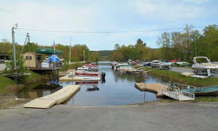
27 Recreational Facilities and Waterfront Access Analysis of Existing Conditions The Town of Schroon is surrounded by an abundance of natural resources. The town s proximity to many of the protected forested lands of the Adirondacks makes it an ideal location for those looking for outdoor recreation ideas and places to appreciate nature in its most pristine form. Recreation in Schroon is one of its biggest draws for tourists and residents alike. Its own recreation facilities, location on Schroon Lake, and proximity to the Adirondack Mountains and wilderness areas make Schroon a place for people desiring all types of recreation. The snowmobile network is extensive with community connectors to Scaroon Manor in Chester plus Minerva and North Hudson in place. See Figure 3 at the end of this section for the existing state and local trails in the Town of Schroon and neighboring area. Vision and Future Goals Improve condition, availability, and connectivity of all recreational facilities throughout the Town. Develop trail connections to Frontier Town Make bicycle-friendly Improvements Expand winter recreational use Improve trailheads and other facilities on state-owned lands Improve the wilderness experience. Optimize public use of state land at Pharaoh Wilderness and Hoffman Notch Wilderness areas. Provide trail connections the proposed North Country Scenic Trail (an east-west version of the Appalachian Trail) which will link the Dakotas to Lake Champlain. Embrace the Adirondack regional trail Town initiative. Create trail itineraries that enable visitors to understand the types and characteristics of the trails. Recommended Projects PROJECT #1 - TOWN-OWNED FACILITY IMPROVEMENTS Actions Needed: Address the bank erosion north of the Town beach and along the shoreline at the south entrance into the beach area. Cost and Implementation: Can be completed with town crews. Work with Essex County Soil and Water Conservation District to secure a grant for a bank stabilization plan and materials. P a g e 20
28 Assign a formal canoe/kayak/sup launch area on the south side of the Boathouse. Remove rocks and debris. Install signage and a kayak storage locker to encourage users to visit the downtown. Cost and Implementation: Can be developed with town crews. Signs and rack can be requested in 2018 Adirondack Smart Growth Grant round or DOS 2018 LWRS Implementation Grant. Upgrade public skating rink to a covered, multi-purpose outdoor pavilion with smaller rink area that would enable the site to have all-season use and reduce maintenance costs. Cost and Implementation: Utilize existing grant to construct basic structure. Apply for additional funds through DOS 2018 LWRS Implementation Grant for unfunded amenities. Continue to improve public access to the town beach, launch and docks. Provide handicap access to the pier by improving the gravel surface between the parking area and pier. Cost and Implementation: Can be completed with town crews. Add snowmaking on Golf Course Ski Hill to improve winter conditions and expand the season. Cost and Implementation: Explore resources from other communities with ski areas and/or request in future Adirondack Smart Growth Grant round. Expand the municipal golf course from 9 to 18 holes. Cost and Implementation: Form an ad hoc committee to determine the feasibility of this action. Explore the feasibility of developing a fitness path on town-owned lands. Cost and Implementation: Form an ad hoc committee to determine the location, feasibility and cost of this action. Develop a formal dog park on town-owned lands at the beach area west of the Boathouse. Post appropriate signage and dog waste bags. Cost and Implementation: Minor cost for signage and waste bags. Create a hiking trail on old town roadbed near Hollow Road and Thilo Roads. Cost and Implementation: This could largely be a volunteer effort to clear the road of vegetation and mark the trail appropriately. Form an adhoc committee to determine potential locations and cost of this action. P a g e 21
29 PROJECT #2 DEVELOP A TOWNWIDE TRAIL PLAN Actions Needed: Develop a town wide trail plan that creates an organized network of trails with consistent information about permitted activities, etc. Create individual trail profiles and a series of land and water trail itineraries. Organize by level of difficulty, distance and length of time to traverse, and opportunities to connect to neighboring and regional trail systems. Accommodate day users, weekenders and long-distance users. Link individual trail segments with options for overnight accommodations. Include the following elements into the plan: o Connect local hiking, biking, snowmobile trails to Frontier Town and to the hamlet of Pottersville. o Provide the trail link from Schroon Lake to the North Country Scenic Trail which will locally traverse the Hoffman Notch Wilderness by North Pond and Big Pond and then exit near the Northway underpass near Schroon Falls. o Expand on-road and off-road biking opportunities including obtaining permission for trail use on private lands. o Explore the feasibility of utilizing snowmobile trails for public walking and biking in the non-winter seasons where permitted in UMPs. o Develop online trail brochures that have profiles and GPS locations of the trails. Make available to all local and regional chambers and marketing organizations to put on websites. Utilize the Adirondack Community-Based Trails and Lodging System as a start. Cost and Implementation: Depending of the extent of the plan - $25,000-$50,000. Apply for grant funds through the Adirondack Smart Growth Program or funding through the DOS LWRS Implementation Grant Program (next round anticipated July 2018). PROJECT #3 STATE-OWNED FACILITY IMPROVEMENTS Actions Needed: State Boat Launch: Designate formal kayak launch area away from paved boat launch and provide kayak locker racks and bicycle racks. Provide public information about new boat inspection and wash station at the north end of Schroon Lake. Schroon Falls: Investigate the potential to create a formal area for kayak/canoe access with DEC. Schroon River Route 74 Fishing Access: Investigate the feasibility of developing a small dock with kayak/canoe access site so that it is functional. Add signage about river conditions and other access points. Eagle Lake Hand Launch site: Improve launch so that it is functional and add signage about lake and Paragon Brook conditions and locations of other access points. This action may require an amendment to the fishing access easement. P a g e 22
30 Muller Pond and Oliver Ponds Hand Launch Areas: Provide clear signage about the use of these sites and the potential for invasive species. Consider making these sites accessible when next round of UMP Vanderwhacker Mountain Wild Forest amendments. Paradox Lake State Campground: Address beach access for swimming and launching of canoes and kayaks and improve the overall condition of the boat launch. Trailheads: Improve the trailheads at all trail areas. Provide consistent signage and sign-in boxes. Provide improved maintenance and improve accessibility where needed and feasible. Improve parking where needed and feasible. Gull Pond and Spectacle Ponds: Provide a connection between these two trails. This action would require a future Pharaoh Lake Wilderness UMP amendment. Improve trail access from Loch Muller to Marion Pond which will be the North Country National Scenic Trail western entrance to the town. Improve trail access at Big Pond Trail. Cost and Implementation: Improvement costs will be evaluated by DEC on a priority basis. Some uses must be approved through the UMP amendment process. PROJECT #4 BIKE LANE IMPROVEMENTS Actions Needed: Route 9: Collaborate with the Town of Chester and NYS DOT to provide marked bike lanes on both sides of the Route 9 shoulders with signage. Route 9 Hamlet Area: Work with DOT to explore the feasibility of delineating a bike lane through the hamlet of Schroon Lake, including utilizing less used roadways and off-road areas. Route 74: Work with DOT to provide marked bike lanes on both sides of the Route 74 shoulders with signage, where feasible. Cost and Implementation: Costs will be evaluated by DOT. P a g e 23

31 P a g e 24
32 WATERFRONT, HAMLET AND DOWNTOWN REVITALIZATION Analysis of Existing Conditions Schroon Lake has an intact attractive downtown with an abundance of Adirondack charm and a good mix of basic need stores and services. The outstanding public waterfront park, beach, launch and docking provide a walkable, relaxing and enjoyable space for both residents and visitors. The challenges of filling empty store fronts and keeping businesses open year-round are a wake-up call but also an opportunity to find new ways of appealing to a potential new wave of visitors from several regional tourism initiatives. Vision and Future Goals: Create an outstanding first impression of the hamlet for visitors and follow it up with an authentic downtown and waterfront experience that exceeds visitor expectations. See Figure 4 following this section for an illustration of the type and location of specific improvements. Improve building and streetscape aesthetics in the business district. Develop seamless pedestrian connections between the downtown and the waterfront park and remove barriers for people with physical limitations. Seek a strategic balance of retail and service businesses to fill empty storefronts. Update planning and zoning regulations as needed. Map the sewer district infrastructure and expand where needed and feasible. Improve overall telecommunications and Wi-Fi availability. Continue to explore affordable and innovative affordable housing alternatives. Recommended Projects Most of the following projects were selected based on the results of a committee walking tour that assessed conditions in the downtown and immediate waterfront. These projects were refined by feedback received at the public meeting and future committee meetings. PROJECT #1 ADD NEW PLANNING TOOLS Actions Needed: Develop Main Street Design Guidelines for building facades, setbacks, trees and landscaping, signage, building character and parking. Update the 1977 Comprehensive Plan. Review and update site plan review standards and zoning code. Consider an architectural review board. Cost and Implementation: Typically, $10,000-50,000 depending on extent of planning needs. PROJECT #2 EXPAND UTILITIES Actions Needed: Expand the town sewer district to make it more affordable to users and enable the potential P a g e 25
33 for the expansion of the hamlet area. Explore feasibility of a new public parking area behind Tops Grocery Store. Continue to expand broadband and Wi-Fi into areas of low availability or poor service. Continue to expand cell service into areas where there are gaps in service. Cost and Implementation: Costs are unknown. PROJECT #3 - COMMUNITY ASSET INVENTORY Actions Needed: Utilize the expertise and resources from second home residents who are or may become yearround residents. Develop a Community Capacity Inventory that surveys the resources, skills, and talents within the private sector, including local businesses and individuals in the community. This would become a comprehensive database of individuals and professionals, who would reliably respond to emergencies in the community, support the network of community services and implement town-supported projects. Cost and Implementation: This would be an effort conducted by volunteers in the community. PROJECT #4 AFFORDABLE HOUSING Actions Needed: Renew the effort to have the APA reclassify the area of two contiguous properties from Low Intensity to Hamlet as outlined in the Town of Schroon s Smart Growth Hamlet Expansion Plan. Recruit a developer who would be interested in building an affordable housing pilot project that is designed to attract school teachers, town and county employees, and employees of new businesses. Cost and Implementation: No costs are related to this recommendation. PROJECT #5 IMPROVE PEDESTRIAN AND BICYCLE EXPERIENCE Actions Needed: Add accessible crosswalks, benches, and shade trees, throughout the hamlet. Place bike racks at key locations throughout hamlet. Make wheelchair accommodation improvements at Town Park: o Improve the pathway in behind the benches at the top of the park. o Add Mobi-mat or stone and stone dust at handicap access dock. o Add yellow lines and "no parking" sign at handicap access near launch. o Remove sidewalk cracks and install ramp. o Install wheelchair accessible sidewalk near bandstand. P a g e 26
34 o Add wheelchair access by the playground. o Adapt existing paved ramp down to the beach to be safely wheelchair accessible. Cost and Implementation: Minimal costs are related to these recommendations which can be accomplished by town crews. Place more digital speed signs on Route 9, particularly on the curve south of the business district. Cost and Implementation: Costs determined by DOT. PROJECT #6 IMPROVE DOWNTOWN AESTHETICS Actions Needed: Make physical improvements in the downtown streetscape: o Replace weeds and overgrown areas with ornamental plants/flowers; Assess the condition of existing street trees; replace or add trees and plant materials where needed. Provide mulch around plants and trees. o Conceal propane tanks and other items that detract in the downtown. o Replace concrete planters with wood planters that match the existing Adirondack chairs. o Paint the concrete wall with a mural. o Replace light posts to be all consistent with the black ones. o Add lighting to the falls at south end of park. o Make timing of the lights in and around the park consistent. o Create a new crosswalk across from the Tops parking lot. o Make crosswalks more visible to oncoming traffic add pedestrian signs to slow down vehicles. Create beautiful and functional public spaces: o Improve square dance patio with seating and landscaping. o Add pocket park seating and plant grass next to the falls. o Add interpretive signage, pavers, and benches in front of the old bath house to make another gathering space. Potentially use engraved pavers as a chamber fundraiser. o Add dog waste stations around the park and in town. o Update and add seating along Main Street. o Change gazebo, benches, and stairs back to white paint. o Replace existing waste baskets to decorative waste baskets throughout the downtown. Cost and Implementation: $10,000 20,000 which could be raised within the community. PROJECT #7 CREATE INFORMATIONAL AND HERITAGE SIGNAGE Actions Needed: Develop distinctive and beautiful gateway entrances at Northway Exits 27 and 28. Consolidate random signage to single signage boards. P a g e 27
35 Request the removal of the Department of State sign at the launch or place in another location. Provide signage to indicate the location of the Town Park and Beach from the downtown. Develop new signs for: o Restroom locations o Location of beach and launch from downtown o Historic sign at the Leland Hotel o Large historical interpretive sign or mural on the side of the Boathouse to show how the waterfront used to look Cost and Implementation: $15,000 20,000 some of which could be generated through fund-raising and assistance through Adirondack Architectural Heritage. P a g e 28

36 P a g e 29


37 Town of Schroon Townwide Revitalization Strategy Appendix Town of Schroon Essex County, New York February 2018
38 LIST OF APPENDICES Appendix A Appendix B Appendix C Appendix D Appendix E Appendix F Appendix G Appendix H Community Profile Existing Conditions Analysis Branding Concepts for Schroon Lake SWOT Analysis and Public Workshop Summary Trail Town Checklist List of Resources and Foundational Plans and Initiatives List of Grants and Funding Sources Adirondack Community Based Trails and Lodging System
39 Appendix A Community Profile
40 TOWN OF SCHROON COMMUNITY PROFILE The community profile is a summary of the demographics of the town as well as a general inventory of town resources and community facilities. Population and Income The demographics of the Town of Schroon are representative of a typical Adirondack town. The population of 1,006 residents has a median age of 52, much higher than the U.S. median age of The largest population group is the age range of 65-74, making up 19.1% of the town. These statistics show that Schroon has an aging population with needs that need to be met in the near future, but that the town needs to develop ways to retain younger residents and attract younger families. Residents of Schroon are overall more educated than the rest of the country with 91.5% having at least graduated high school, higher than the national average of 86.7%. More than a quarter of residents have a bachelor s degree or higher, 26.3%. Schroon is not particularly diverse, with 93.4% of residents being White. Other races are less represented with the next most common being Hispanic at 36 residents, Asian at 19 residents, Black or African American at 6, and American Indian or Alaska Native at 2. A number of residents, 21, reported being some other race than those listed in the Census, and six residents reported being two or more races. The demographics of the Town of Schroon are representative of a typical Adirondack town. The population of 1,006 residents has a median age of 52, much higher than the US median age of The largest population group is the age range of 65-74, making up 19.1% of the town. These statistics show that Schroon has an aging population with needs that need to be met in the near future, but that the town needs to develop ways to retain younger residents and attract younger families to stay. Economic Profile The majority of employed residents work in the private sector, 51%, while government workers make up 28.7% and self-employed residents make up 18.8%. Of the 915 residents that are 16 years and over, 406 are in the work force (44.4%) and 404 are employed. A large number of residents are not in the labor force at 509 people, 55.6%. This number is likely inflated by the large retired population in Schroon. The median household income in town is $53,452. Of all residents, 7.3% fall below the poverty line, lower than the national rate of 15.5%. Housing Characteristics In the Town of Schroon, there are 2,293 housing units. The majority are single family detached units at 81%. All types of apartments make up 13.6% of the housing stock, and mobile homes and other types of housing make up 4.5%. Of all of the housing units, only 462 are occupied and only 369 of those are owned occupied, making for a significant portion of all housing units to be vacant. The housing available is aging and will require maintenance and upgrades in the coming years due to 69.5% being built before
41 Population Age: Town Median Age Essex County Median Age New York State Median Age US Median Age Total Town Acres Residential Land Use Town Watershed Acres Shoreline Townwide Residential Real Property Value Shoreline Residential Real Property Value Commercial Real Property Value Exempted Real Property Value Public Services Community Services Vacant Residential Conserved Lands Private Forest Land Key Housing Unit Statistics Total Housing Seasonal Housing Residential Development: Existing Residential Potential Future Residential *US Census 5-Year Estimate Economic Profile Town of Schroon: Key Demographic Statistics ,795 1,654 1,011* Key Land Use Statistics Key Property Tax Statistics ,601 acres (private: 26,113; state: 58,343; water: 6,145) 2, acres 68,875.5 acres ± (watershed acres x 34%) miles/acres $473,019,210 $265,727,300 $35,023,700 $655,557 Key Land Use Statistics % % % % % % 2, State Forest Land Open Water Wetlands Developed Forested Key Infrastructure Statistics Sewer Services: Number onsite Systems Number Sewer Connections Road Network: State Roads County Roads Local Roads Private Roads % % % % % Watershe d plan pg miles 13.3 miles 60.3 miles 0.0 miles 2
42 2, ,800 1,721 1, Number of people 1,600 1,400 1,200 1,000 1, , ,654 1, Age in years Population Median Age Transportation With Schroon being a smaller town, the downtown corridor is an area particularly suited for walking and biking. These modes of transportation are common for residents and should be encouraged for local travel. For regional travel, car is the most common for work commutes and weekend travel. Work commute time is a big issue for residents of Schroon. The mean travel time to work is 29.2 minutes. Being higher than the national average of 25.9 minutes while also being farther away from the economic hubs of larger cities is likely to be a reason people aren t moving to Schroon. Of the people that do commute to work, over a third of residents arrive at work between 9am and noon. This schedule is not feasible for the typical office worker. With almost half of workers taking over 30 minutes to get to work, it s easy to understand why so many residents work from home (16.9%). There is no local public transportation in Schroon as far as busses or shuttles. There is taxi service for Schroon, but it is out of nearby towns. Exit 28 on the Northway has an Adirondack Trailways stop for longer distance trips. Infrastructure and Community Services The main road through town is US Route 9. The Adirondack Northway runs just west of town, with exits located at the south end of the lake up to just north of the lake. Schroon s water comes from two drilled wells off of NYS Rout3 74. The town wastewater treatment plant was rebuilt in 2007 and now serves 60% of Town parcels, the rest having individual septic systems. Starbuckville Dam on Schroon River was replaced 2006 and now has an automated gate that is much faster and easier to operate. Schroon Lake Airport is public and had resurfacing and safety upgrades in Other amenities in the town include: 3
43 Town park and boat launch Hiking and snowmobile trails Lodging Fire House Schroon Lake Health Center Nearest hospital is Moses Ludington Hospital in Ticonderoga For a small community, the Town of Schroon works to provide adequate services for its residents. The town is home to the Schroon Lake Senior Center which provides lunch Monday through Friday through the Essex County Office for Aging and also delivers meals on a more regular basis through Meals on Wheels for residents unable to come to the Senior Center. The center also has games afternoon events and serves as a social location for seniors in the Schroon Area. The town also has a library located in the same building as Town Hall as well as Schroon Lake Central School nearby for students in kindergarten through high school. The majority of employed residents work in the private sector, 51%, while government workers make up 28.7% and self-employed residents make up 18.8%. Of the 915 residents that are 16 years and over, 406 are in the work force (44.4%) and 404 are employed. A large number of residents are not in the labor force at 509 people, 55.6%. This number is likely inflated by the large retired population in Schroon. The median household income in town is $53,452. Of all residents, 7.3% fall below the poverty line, lower than the national rate of 15.5%. 4
44 Appendix B Existing Conditions Analysis

45 Appendix B EXISTING CONDITIONS ANALYSIS Table of Contents Tourism Marketing Resources Economic Development Historic Resources Cultural Resources Natural Resources Recreational and Waterfront Resources Downtown Resources Tourism Marketing Resources Existing Conditions The Town of Schroon utilizes a multi-layered process for attracting visitors to the area. The following is an overview of the major organizations and public entities at the forefront of the tourism and marketing efforts for the Town of Schroon. At the local level, the Schroon Lake Area Chamber of Commerce ( has been working on behalf of local businesses since The Chamber focuses on services for Chamber members that generate community pride and support comradery such as social mixers and business classes. It also generates visitation interest in the region by hosting and co-hosting special events throughout the year. The Chamber supports a webpage ( and a Facebook page ( to promote events and activities throughout the area. The Schroon Lake Chamber of Commerce and the Regional Office of Sustainable Tourism (ROOST) work together to bring visitors to the region. The Guide put out by the Lake Placid - Essex County Visitors Bureau, a subsidiary of ROOST, includes the Schroon Lake region throughout. ROOST is a Destination Marketing Organization (DMO) which promotes the development and marketing of a tourism destination area (TDA). As the DMO for this region, ROOST is the Tourism Promotion Agency for Essex County, Hamilton County, and Franklin County. Based out of Lake Placid, ROOST has in-house marketing staff, blog writers, a conference and group sales team, and works with many local and regional events. ROOST also has Visitor Service staff in Lake Placid, Saranac Lake, and Crown Point, as well as agreements with the Ticonderoga Area Chamber of Commerce, the Schroon Lake Area Chamber of Commerce, the Whiteface Region Visitors Bureau, and the Saranac Lake Area Chamber of Commerce. The TDA designation is an economic development tool that provides communities with access to programs, financing and opportunities to advance their tourism-related economy. 1
46 Appendix B Designated TDAs may have access to financing programs and will be positioned for Priority Project status for Consolidated Funding Application (CFAs) they submit for consideration by the North Country Regional Economic Development Council. Additionally, Tourism Investment Funds will be targeted at private sector investments in designated TDAs. Schroon Lake is part of an identified group of communities that is brandable for tourism attraction and development. A brand is a unique image and message that increases awareness of the community for both tourism and sustainable economic development when adopted and integrated consistently. It reflects the customers impression of a product, destination or organization. The collective TDA region includes the towns of Johnsburg, Minerva, Chester, Horicon, Schroon and North Hudson. This area represents a critical mass of attractions, amenities, tourism support services, accommodations and infrastructure that enables a sustainable tourism economy. These are centers of activity and enterprise along the Byways and Blueways of the North County that have engaged in tourism development planning and having initiated local projects whose primary goal is tourism demand generation. The Town of Schroon participated in the Schroon Lake Destination Master Plan (2009) and are in the process of refining the Tourism Area Nomination Workbook (2017 Draft). The process with ROOST and the North Country Regional Economic Development Council resulted in a plan that seeks to increase jobs and business opportunities, generate year-round revenue, and increase the quality of life in Schroon Lake by recapturing its status as an Adirondack lakeside destination, becoming a Base Camp for Adirondack adventures, and expanding its set of visitor products and experiences. The Schroon Lake Area Chamber of Commerce augments their efforts by advertising all of the events in the community. Add how they are financed and relationship with ROOST. ROOST supports the work of the Schroon Lake Area Chamber by providing visitor service support and database work through an annual contract that is paid for through occupancy tax funds collected through area lodging properties. Challenges and Opportunities Since the latter 1800 s, tourism has been the life blood of the Schroon Lake area. Once able to house thousands of tourists, today Schroon Lake s tourism accommodations are not adequate to meet the needs of the traveling public. Thanks to an Adirondack Smart Growth grant awarded to Essex County, the Town of Schroon has a Tourism Blueprint in place. The Tourism Blueprint recognizes and promotes the strengths of the area. Despite the many quality activities and amenities available, there are still several challenges. The primary need is for new modern accommodations that will drive economic revitalization. A good example of the type of accommodations needed is the 9-unit Main Street Schroon Lake motel, which was purchased and has been completely remodeled in There are several other accommodations projects on the drawing board; however, without a minimum of 20% guaranteed grant money, these essential projects will most likely not be able to get off the ground. 2


47 Appendix B In order for the Town of Schroon to have the capacity and leverage to succeed as a true Tourism Destination Area, it will need partnerships with neighboring communities. Although Schroon Lake is in the Lake Placid Region, it is at the southern tip of the Region and has little in common with Lake Placid. Just south of Schroon are the Towns of Horicon and Chester. These towns are in the Lake George Region as well, but also experience the same disconnect from Lake George. Between Horicon, Chester and Schroon, there are 5 superb Lakes Brant, Friends, Loon, Paradox and Schroon and much more. The Town of Schroon should also reach out to North Hudson and Minerva to be part of this regional collective. The Town of Schroon has also attempted a partnership with the Gore Mountain area located about 30 miles southwest. Developing these partnerships and the appropriate connections between the region s assets will transform this region into a powerhouse tourism market based on rural small towns, lakes, mountains and many recreational and cultural activities. A well-designed and comprehensive tourism and marketing plan will increase jobs and business opportunities, generate year-round revenue, and increase the quality of life in Schroon Lake by recapturing its status as an Adirondack Lakeside Destination, becoming a Base Camp for Adirondack adventures, and expanding its set of visitor products and experiences. Not only is Schroon Lake a premier destination, the Town s proximity to Lake Placid and Lake George allows it to pull visitors from both regions. The marketing plan would entail the creation of a town mark and tagline and campaign elements to promote the area 365 days a year for its arts, recreation, and enduring beauty. Creating this system and sharing the assets with business owners in town, will strengthen every advertising dollar spent by reinforcing a consistent message and putting the Town of Schroon back on the map. 3
48 Appendix B Economic Development Existing Conditions Perhaps the strongest economic developments factor in the Schroon Lake Region is the opportunity to enjoy the best of outdoor activities in the Adirondack Park. The area has a wide array of hiking options for all abilities on trails in the Hoffman Notch Wilderness, Severance Hill, and Pharaoh Lake Wilderness. With the region being home to the most easily accessible water in the area on Schroon Lake, Paradox Lake and the Schroon River, paddling, boating, and swimming are a major local asset. Unique experiences in the area include whitewater rafting and horseback riding. A natural attraction of Natural Stone Bridge and Caves allows the novice to go spelunking and explore the largest natural marble cave entrance in the Eastern United States. In the winter, the outdoor recreation paradise stays alive with winter activities. Snowmobiling, ice fishing, cross country skiing, and snowshoeing are the big draws to the area, as well as the close proximity to Gore Mountain s skiing and riding. Summer sees the unique option to hear vocal performances through Seagle Music Colony, the oldest and most distinguished vocal training programs in the United States. The Adirondack Shakespeare Company also adds to the summer cultural experience. Challenges and Opportunities The main obstacle, both for tourism and new business, is the relative anonymity the Town of Schroon has relative to other destinations. The accommodations industry suffered a loss of more than 150 rooms over the last 20 years. The simple nostalgic small cabins and motel rooms that lack modern lodging amenities are no in vogue. Visitors are demanding larger, upgraded facilities with more amenities. At the same time, the lack of access to capital and a declining customer base is preventing many tourist accommodations from being able to afford to make needed improvements. Shrinking shares of overnights in existing facilities are increasingly due to Airbnb and other home rental agencies. The Tourism Destination Plan also cites the need for a small hotel in the community. Other economic development challenges include: Turnover of lakeside properties from commercial to residential Growing number of empty storefronts in the downtown No lakeside dining opportunities Limited day and nighttime activities for visitors Aging population and shrinking school enrollments Lack of jobs in general Lack of affordable housing for young people The opportunities for the future of Schroon Lake far exceed the challenges. Schroon Lake is an undiscovered gem just a short drive away from everywhere. The town is the perfect stopping point on a trip to Vermont or the High Peaks but has enough to offer that vacationers could enjoy a week spent exclusively there. Less crowded than Lake George, Schroon Lake is a better option for water sport enthusiasts who would rather avoid boat traffic. The Schroon Lake 4
49 Appendix B Marine already offers boat rentals as well as standup paddleboards, and the public docks and town beach make the water accessible for everyone. Exceptional paddling is available on the Schroon River at the north and south ends of the lake. Smaller Paradox Lake offers even fewer commercial venues so provides a different experience for visitors. Something truly special about the town is that as some local villages have grown touristy to appeal to a wider audience, Schroon Lake has maintained a small town, classic Adirondack feel. Schroon has several extraordinary assets that set it apart from other Adirondack towns, specifically the Seagle Music Colony, the pristine waterfront, and the easy multiple access points from the Northway. A unique event that Schroon Lake offers is the Hobie Cat Sailing Regatta. More work done to promote this event and rally the town around the visitors at this time (perhaps holding a festival during that time or sponsoring a Schroon Lake branded boat), could work to establish the town as a sailing hotspot. If this idea works, more focus on water sports could work for Schroon Lake in the same way that the Hub in Brant Lake established the town as a biking destination. On that same note, The Adirondack Marathon and Dance Festival is a great event that could be expanded to draw many more of visitors to the area. Schroon Lake stands out from other towns in the area for the quality of its local food and drink offerings as well. Paradox Brewery, Sticks and Stones, DeCesare s, Pitkins and more cover all the bases for people looking to eat local without sacrificing quality. Paradox especially has a wide following both locally and beyond, making it a valuable asset to the community. Additionally, it has cultural offerings that are uncommon for a small Adirondack town. The Seagle Music Colony, the active Strand Theater, Adirondack Artists and Crafters Expo, Adirondack Folk Festival, Boathouse Concerts, Square Dancing, and Adirondack Shakespeare Festival are prized by the community and can extend the community s brand as a fine arts and performance community. The Adirondacks are getting stronger each season with self-promotion, collaborations, and blurbs in the news. This summer I Love New York & the Wild Center launched an itinerary package geared toward international travelers, specifically a Chinese audience to start. The itinerary covers Saratoga, Lake George, Lake Placid, and Tupper Lake. It could easily accommodate the addition of options in Schroon. It is critical for the town to get out ahead of the State s Frontier Town redevelopment initiative. Schroon s existing assets should be identified as a foundation for additional investment. The town does not present a consistent brand and the dollars currently invested in tourism promotion do not reflect what it takes to truly get the word out and make the town a competitive destination. A cohesive branding effort, with a parent brand and sub brands is needed to create the opportunity for the Town of Schroon to become part of a wider itinerary. The advantages Schroon has in proximity to the Northway, natural beauty, all level hikes, watersports, and Adirondack charm. Centrally located shops make it a turn-key sell to visitors when using the right creative and tone. The walk conducted this summer revealed many 5
, a regional effort to enhance recreation-based tourism through a network of")

50 Appendix B options for low-impact improvements that when done concurrently could transform the area from quaint to warm and inviting. The Town of Schroon is an included component of the Adirondack Community-Based Trails and Lodging System Project (ACTLS), a regional effort to enhance recreation-based tourism through a network of interconnected trails, lodging facilities, and community connections. The final report, available in early 2018, will include the proposed routes in this document as well as background on the Adirondack Park, other hut to hut systems examined for comparison, economic impact, keys to success, implementation strategy, Long Lake demonstration project results, and appendices providing more information on Adirondack communities and resources. The project sponsors welcome community input on the proposed conceptual hut-to-hut routes described in this report. The Town has the opportunity to utilize the suggested itineraries in their marketing of outdoor activities. The completion of the North Country National Scenic Trail is underway in the Adirondacks. It consists of existing trail segments and is being joined through volunteer trail building. The proposed trail beginning section will start in the Adirondack Park near the Vermont border and will follow along the Great Lakes to its end at Lake Sakakawea in North Dakota. The completed trail will serve people of all abilities and interests such as day hikers, backpackers, and wildlife watchers. This initiative proves an additional opportunity for the Town to connect with visitors who will want to come into the community for respite, events and overnight accommodations. 6


51 Appendix B Historic Resources Existing Conditions The Town of Schroon was among the earliest popular settlements in the Adirondack region. It s location along the waterways connecting logging to mills in Glens Falls and proximity to the Old State Road (U.S. Route 9), made it an ideal stop to get gas and rest overnight while traveling north from the New York Metropolitan Area. The construction of resort hotels such as the Leland House, Camp Santanoni, and later Scaroon Manor turned the town into a booming tourist location in the early 1900s. A significant historic property is Scaroon Manor at the southern boundary of the Town. Originally this property supported Taylor s Hotel. The property was reimaged as Scaroon Manor in 1925, a new kind of Adirondack resort dedicated to romance, action, youth and fun. It thrived under the slogan Scaroon Loves You until it closed in the 1960s. Its outdoor amphitheater seated 500 and had a revolving two-part stage offering nightly entertainment including singers, dancers and comedians. The resort s 327 acres includes 8,350 feet of shoreline. The site was purchased by the State of New York in 1967 and today has become an ADA compliant prime destination for public primitive and RV camping, boat launching and docking, and swimming. The Seagle Music Colony opened in Hague in 1915 and later bought and opened a property in Schroon in 1922, becoming the oldest summer singer training program in the country. Students would travel from far away for the ability to train under Oscar Seagle, the baritone singer that was famous throughout the U.S. and Europe. Challenges and Opportunities The opportunity exists to extend the utilization of Scaroon Manor for unique presentations and shows. The Town can also establish a historic sites tour by land and boat. This can be a self-driving tour that covers several communities and covers cultural sites including the natural history of the area. 7


52 Appendix B Cultural Resources Existing Conditions Schroon Lake offers an extraordinary number of diverse cultural venues that can be organized into an effective economic development strategy. The Schroon Lake Arts Council promotes an extensive set of arts and music events through its online calendar and ticket office. A summary of places that offer cultural and entertainment events includes the following: Seagle Music Colony Schroon Lake Arts Council Strand Theater Boathouse Theater Scaroon Manor Word of Life Youth and Family Camps Natural Stone Bridge and Caves Challenges and Opportunities Schroon has quietly built up its reputation for performing arts and now has the potential to return to its former tourism prominence in the region. The Schroon Lake Arts Council promotes arts and music events in town. Their Schroon Lake Signature Events Hobie Cat Sailing Regatta Cycle Adirondacks Folk Music Festival Adirondack Marathon Distance Festival Adirondack Schroon Lake Arts and Crafts Fair Adirondack Shakespeare Company Wednesday Night Square Dancing Boathouse Concerts Annual Fourth of July Spectacular & Parade Olde Tyme Christmas Celebration Ice Fishing Derby website has an extensive events calendar and offers tickets online. An opportunity exists to make the performing arts an important pillar in the greater economic development strategy for the Town of Schroon. The activities of the arts and culture sector and local economic vitality are connected in many ways. Arts, culture, and creativity have the capacity to: Improve a community's competitive edge Create a foundation for defining a sense of place Attract new and visiting populations Integrate the visions of community and business leaders Contribute to the development of a skilled workforce 8

53 Appendix B Natural Resources Existing Conditions The Town of Schroon is surrounded by an abundance of natural resources. The Town s close proximity to many of the protected forested lands of the Adirondacks makes it an ideal location for those looking for outdoor recreation ideas and places to appreciate nature in its most pristine form. Schroon Lake Paradox Lake Schroon River Pharaoh Lake Wilderness Hoffman Notch Wilderness Hammond Pond Wild Forest Vanderwhacker Mountain Wild Forest Other lakes, ponds, brooks, and streams Schroon Lake Schroon Lake is 9 miles long and 1 mile wide at its widest point. The lake exhibits very high water quality (AA) and clarity and is considered late oligotrophic (low productivity). The watershed is 316 miles encompassing 10 townships. Primary impacts to Schroon Lake s water quality are from upland sources from stormwater runoff and sediment impacts from bank erosion and salt from winter road treatments. There is good control of aquatic invasive species in Schroon Lake following fifteen years of Eurasian watermilfoil and Curly-leaf pondweed management. There is one island in the lake and it is owned privately by the Word of Life Bible Institute. Detailed information about Schroon Lake is available in the 2010 Schroon Lake Watershed Management Plan ( Paradox Lake Paradox Lake is approximately 4.75 miles long and one mile wide. It averages 19 feet in depth with a maximum depth of 55 feet. Paradox Lake Campground is a small DEC campground located on the shore of Dark Bay, which is on Paradox Lake. There are 58 campsites, hot showers, flush toilets, trailer dump station, recycling center, boat launch site, and picnic area with pavilion rental, firewood sales, and canoe and boat rentals. On the opposite shore of the lake, accessible only by boat, a short trail leads to Peaked Hill and Peaked Hill Pond. More detailed information about Paradox Lake is available at: Schroon River The meandering Schroon River is the primary water source for Schroon Lake. Running from its origins at New Pond in Elizabethtown, the Schroon River picks up dozens of streams both large and small, and outlets at the north end of Schroon Lake. The river itself from headwaters to the lake is 31.3 miles long, but when all tributary streams to the river are added, the length of the entire flowing system exceeds 260 miles. A major tributary system to the Schroon River is the Paradox chain of lakes on the eastern side of the watershed, which includes Paradox Lake and 9
54 Appendix B Eagle Lake. Most of the streams within the Schroon Lake watershed exhibit excellent natural stream buffers. However, at several locations along the more developed brooks, there is little to no stream buffer and the lawns are, directly adjacent to the streambanks. These areas exhibit the highest evidence of bank failures. According to the Schroon Lake Watershed Management Plan, there is a considerable amount of streamside developable land in the Schroon Lake watershed. Municipal codes vary as to requirements for vegetative cutting and building setbacks, but no municipality has regulations requiring an undisturbed stream buffer on new development projects. Given the effectiveness of the existing vegetative buffers in protecting the streams around the lake, provisions to maintain these buffers would be beneficial within the watershed. No illegal overflow pipes from septic systems were identified on any of the streams. Most of the homes and other buildings identified on the stream reviews were set back from the streambank a fair distance (more than 50 feet). This helps considerably with keeping stormwater runoff from these developed areas away from the stream, as this runoff is often infiltrated into the yards and woods. Pharaoh Lake Wilderness The 46,283-acre Pharaoh Lake Wilderness is part of the Adirondack Forest Preserve. The wilderness contains an abundance of lakes and ponds, especially in the northern portion. The namesake Pharaoh Lake, at 441 acres, is one of the largest lakes in the Adirondacks completely surrounded by Forest Preserve lands. Other large waters in the wilderness include 167-acre Crane Pond, 77-acre Gooseneck Pond, 66-acre Whortleberry Pond, 54-acre Berrymill Pond, 32- acre Crab Pond, 15-acre Oxshoe Pond and 13-acre Bear Pond. The 2,551-foot Pharaoh Mountain, the highest mountain in the wilderness, is found on the northwest shore of Pharaoh Lake. The remainder of area is mainly comprised of smaller mountains and hills The Pharaoh Lake Wilderness is located in the Towns of Schroon and Ticonderoga in Essex County and in the Towns of Horicon and Hague in Warren County. The wilderness is 46,283 acres and is located east of Route 9 and Interstate 87, south of Route 74, north of Route 8 and west of Route 9N. The Pharaoh Lake Wilderness Area is located in the Towns of Schroon and Ticonderoga in Essex County and in the Towns of Horicon and Hague in Warren County. The wilderness is located east of Route 9 and Interstate 87, south of Route 74, north of Route 8 and west of Route 9N. The area is bounded on the west by the East Shore Road and private land; north by Route 74, the great lot line between Eagle and Pyramid Lakes and private land; east by Bald Ledge and Hague Brook Primitive Areas, Putnam Pond Public Campground and private land; and, south by Route 8 and private land. The wilderness was expanded in 1979 by the reclassification of the Crane Pond Primitive Area to wilderness, with the exception of the Crane Pond Road. A snowmobile trail, 3.5 miles in length leading from Route 74 to the Crane Pond Road, was closed in 1975, making this reclassification possible. In 1986, Crane Pond Road was reclassified as a primitive corridor and added to the Pharaoh Lake Wilderness following an assessment of public use trends and their resource impacts in the 10

55 Appendix B northwest portion of the wilderness by The Adirondack Park Agency. This action was approved by Governor Cuomo in November of 1987 as part of the five year revision of the Adirondack State Land Master Plan. According to the Master Plan, the Crane Pond Road was listed as a "non-conforming use" and, scheduled for closure no later than the end of the third year following wilderness classification. The road was officially closed to motor vehicle use in December Hammond Pond Wild Forest Area The Hammond Pond Wild Forest Area (HPWF) is comprised of approximately 45,558 acres in more than 50 parcels located in the Towns of Keene, Elizabethtown, Westport, North Hudson, Moriah, Crown Point, Schroon, and Ticonderoga in Essex County. The majority of the parcels are located between Lake Champlain in the east, State Route 74 in the south, the Northway in the west, and State Route 9N in the north. Some parcels are located between the Northway and US Route 9 and around the communities of Keene and Keene Valley. The area contains many water features. Paradox Lake, Eagle Lake, Hammond Pond, Moose Mountain Pond, and many other ponded waters are located within or border the area. Portions of the East Branch Ausable River, the Schroon River and the Boquet River - including Split Rock Falls - are also located within or along the wild forest. Black Brook, Crowfoot Brook, and many 11
, Harris Hill (2,211 feet), Peaked")
56 Appendix B more small streams and brooks can be found here. Although mountains and peaks here do not rise to the elevations of the nearby High Peaks, there are a number of small mountains including Hail Mountain (2,640 feet), Harris Hill (2,211 feet), Peaked Hill (1,865 feet), and Bloody Mountain (1,770 feet). A Unit Management Plan (UMP) was completed for the unit in A 1993 Generic Bicycle Amendment for Completed Adirondack Forest Preserve Unit Management Plans proposed an Amendment to the HPWF (and several other Forest Preserve units) to allow bicycle use on certain trails. This was the first formal Amendment to the 1988 HPWF UMP. 12
57 Appendix B Hoffman Notch Wilderness Area The Hoffman Notch Wilderness Area (HNWA) is located in the east central Adirondack Park within the towns of Minerva, Schroon, and North Hudson (Essex County). Approximately 21,593 acres of HNWA are in the Town of Schroon (56%). The unit is located within the watersheds of the Boreas and Schroon Rivers. The unit is made up of one large contiguous parcel, covering 38,488 acres and has miles of boundary line, of which are shared with other State management units. The planning area is directly south of the High Peaks Wilderness Area, west of Schroon Lake and northeast of the Vanderwhacker Wild Forest. Hoffman Notch Wilderness Area is part of the Adirondack Forest Preserve. The area is named for the "notch" or valley between the Blue Ridge Range, which includes Hoffman Mountain, and the Washburn Ridge. The area features ponds and streams for fishing and 15 miles of trails for hiking, snowshoeing and skiing. It also offers visitors solitude, as one of the less visited areas in the Adirondacks. Adjacent to the planning area, and not subject to the UMP, are privately owned lands, most of which are classified as Resource Management and Rural Use by the Adirondack Park Agency. There are also several private rod & gun clubs with small to moderate land holdings adjacent to the HNWA. 13
, Johnsburg, Chester (Warren County), and Indian Lake")
58 Appendix B Vanderwhacker Mountain Wild Forest The 91,854-acre Vanderwhacker Mountain Wild Forest (VMWF) is part of the Adirondack Forest Preserve. The Wild Forest is located in the central Adirondack Park within the towns of Minerva, Newcomb, Schroon Lake, North Hudson (Essex County), Johnsburg, Chester (Warren County), and Indian Lake (Hamilton County). Approximately 7,498 acres of the VMWF is in the Town of Schroon. The unit is within the Hudson River watershed and the lesser watersheds of the Boreas and Schroon rivers. The unit is made up of almost 2 dozen noncontiguous parcels, covering 91,854 acres in area and has 204 miles of boundary line. The bulk of the unit is made up of a single parcel of approximately sixty thousand acres, located mainly within the town of Minerva and home to the name-sake Vanderwhacker Mountain. The remainder of the parcels range in size from a hundred acres to more than six thousand acres. The planning area is bounded on the north by the High Peaks Wilderness Area (HPWA), on the east by Hoffman Notch Wilderness Area (HNWA) and Schroon Lake, on the south by State Route 8 and the Siamese Ponds Wilderness Area (SPWA), and on the west by the Hudson Gorge Primitive Area (HGPA) and the westerly Newcomb town line. 14


59 Appendix B This rugged, mountainous and forested area also contains many lakes, ponds, rivers and streams. The lands and waters provide an abundant variety of outdoor recreational opportunities. The VMWF contains 14.4 miles of designated foot trails, including access to the fire tower on the summit of Vanderwhacker Mountain. Challenges and Opportunities The four areas of Adirondack Forest Preserve need maintenance and modernization. The Town of Schroon has the opportunity to work with NYSDEC to make sure recommendations from this plan are reflected in current and future Unit Management Plans. 15
60 Appendix B Recreational and Waterfront Resources Existing Conditions Recreation in Schroon is one of its biggest draws for tourists and residents. The availability, variety and quality of recreation facilities, its location on Schroon Lake, and proximity to four significant Adirondack Forest Preserve areas, make Schroon a highly desirable place to live. Local resources include: Municipal Golf Course Schroon Lake Ski Center Schroon Town Park, Beach, Tennis Courts, Skating Rink and State Boat Launch Scaroon Manor Camping, Boat Launch and Beach Schroon River Kayak/Canoe Access Paradox Lake State Campground, Beach and Launch Eagle Point State Campground and Launch Frontier Town revitalization to Upper Hudson Recreation Hub Schroon Lake Snowmobile Trail System The network of over 20 miles of snowmobile trails in the Town of Schroon, some of which cross Vanderwhacker Mountain Wild Forest (VMWF), is located on the west side of the lake in the area between State Route 9 and Trout Brook Road from the Hoffman Notch Wilderness Area (HNWA) south to the County line. The network uses several roads and trails across public and private land including Thilo, Horseshoe Pond, and Charley Hollow Roads. In years gone by, these three roads served private property, some of which eventually became Forest Preserve. The roads still serve some non-residential private property in addition to VMWF, and approximately 3 miles of road/trail border or go through VMWF. In general, these old roads are in fair condition and are used mostly for snowmobiling. Some portions of the road network may also be used in the occasional extraction of forest products from private lands. In the 1960's, there was a push for the Conservation Department (predecessor to DEC) to identify possible locations for snowmobile trails and to work with local organizations to develop snowmobile trail networks in Essex County. In Schroon Lake, much of the snowmobile trail network was developed on old roads, with the exception of the Horseshoe Pond bypass in VMWF and the North Pond trail in HNWA. The local snowmobile club, Schroon Lake-North Hudson Snowmobile Club, with Town and Department consent, developed the portions of the network on Town Roads, Forest Preserve, and private land. The club has built and maintained bridges, hung signs, and performed maintenance and grooming throughout the trail network for over 30 years. Specifics for each trail are as follows: Horseshoe Pond Road This 3 mile-long road leads westerly from Charley Hill Road past Horseshoe Pond (secondary reservoir for the Town of Schroon) eventually meeting Hoffman Road. The entire length of the road has been a part of the Schroon Lake snowmobile network since the 1960's and was developed for such use in consultation with the Conservation 16
61 Appendix B Department. The eastern length of the road serving private land (1.12 miles) is regularly maintained for automobile traffic. The next length (0.08 miles west to the reservoir) may receive intermittent Town maintenance. Horseshoe Pond bypass This 1.3 mile-long snowmobile trail leads from private land along Horseshoe Pond Road and connects to Charley Hill Road just south of Poplar Hill. Along this route it crosses VMWF for approximately 0.2 miles. The northern ½ mile of trail (including the portion across state land) was developed and built by the Conservation Department in the 1960's to connect with an existing skid trail that lead across private land from Charley Hill Road to a point along the current trail near the state boundary. It was used for snowmobiling in order to bypass Horseshoe Pond so that snowmobiles would not have to travel on the frozen pond. This trail was not a Town Road, and appears on current USGS quadrangle maps as a snowmobile trail. This snowmobile trail has been a part of the Schroon Lake snowmobile network since the 1960's and was partially constructed by and developed in consultation with the Conservation Department. Charley Hollow Road This approximately 3 mile-long road leads southwesterly from Charley Hill Road to connect with Wamsley Road in the Town of Minerva. The first 2 miles or so serve private, year-round residential land, and hence are regularly maintained for automobile traffic. The last mile serves Forest Preserve land and some non-residential private land. Approximately 0.85 miles of the road crosses VMWF. The road has been a part of the Schroon Lake snowmobile network since the 1960's, and was developed for such use in consultation with DEC. Thilo Road This road runs westerly for approximately 1.2 miles from Charley Hill Road before splitting. One branch heads north for approximately 2.25 miles to Hoffman Road and another branch heads northwest for approximately 1.2 miles to Trout Brook Road. Approximately 0.75 miles of Thilo Road proper passes through VMWF and another 0.7 miles of the road border VMWF lands. Approximately 0.35 miles of the northwest branch passes through VMWF. No additional length is bordered by VMWF lands. 3.0 miles of snowmobile trails cross VMWF in the Town of Schroon. Of that total, 2.8 miles were developed in consultation with the Conservation Department in the 1960's. The remaining 0.2 mile trail section is located on Forest Preserve and was built by the Conservation Department in the 1960's. All of Thilo Road and its northwest branch have been part of the Schroon Lake snowmobile network since the 1960's and were developed for such use in consultation with DEC. Since the majority of the network is on private and Town lands, none of these VMW snowmobile trails have DEC Snowmobile Trail signs. Instead, signage developed by the local snowmobile club was used throughout the network for consistency. However, DEC snowmobile markers should be added to the VMWF trail sections. The Department will post Wild Forest signs at the point where each trail enters and leaves State Land. Through its use of private, Town, and State property, the overall network is a good example of public/private partnership. When issues trail maintenance across VMWF arise, current DEC policy regarding such work will be followed. The Department may work with the Town and/or local snowmobile club(s), via 17

62 Appendix B Adopt-a-Natural-Resource agreement, to determine what work may be necessary and how it shall be accomplished. Pottersville to Schroon Lake: Alternatives Discussion, Existing Conditions, and Assumptions The Schroon Lake snowmobile trail network is located mainly on the west side of the lake and is currently isolated from other nearby snowmobile trail networks. The North Warren snowmobile trail system comes closest to the Schroon Lake network, but terminates near Pottersville. There is an opportunity to create a linkage between the two networks across state and private land. Existing snowmobile trails, where they re located on Forest Preserve lands, may or may not be designed for non-winter use. If a trail has only been designed for winter snowmobiling, then it s likely that the trail lacks the dry tread necessary for non-winter use (snowmobile trails take advantage of frozen ground conditions). Therefore, this project would require working with the land manager to assess the viability of non-winter use of snowmobile trails, in order to offer an enjoyable recreational experience and prevent environmental degradation. 18
63 Appendix B Mountain Biking Trails The Town of Schroon is working on a comprehensive plan to identify trails in the area that may be used by the bicycling public. The approved Unit Management Plan for the nearby Scaroon Manor Campground Intensive Use Area includes a network of foot trails that will also be available to bicyclists. Therefore, efforts should be made to determine the feasibility of making any connecting snowmobile trail through the nearby VMWF parcels available to hikers and bicyclists. Due to an impassable topography and a lakefront residential area, the two VMWF parcels on the Warren County/Essex County line between State Route 9 and the Adirondack Northway, and the adjacent private land, provide the only possible off-road connection between the Pottersville and the Schroon Lake trail systems. This snowmobile/bicycle trail will also cross the Scaroon Manor Campground as is addressed in that unit s approved UMP. Given the ownership patterns in this area, it will be necessary for the new trail to cross private land. The Department will not place snowmobile trails on private land without the owner s permission. Where an owner of private property does agree to allow a snowmobile trail on their property, DEC should secure a permanent snowmobile trail easement which binds the owner s successors in title. The north end of the trail will exit Scaroon Manor at its main gate, cross Route 9, and continue in a southerly direction, utilizing the existing utility right-of-way for approximately 200 feet. Grading will be required to cut the trail into the existing side slope. A culvert will be necessary to cross the road ditch on the west side of Route 9 at road grade. At this point, the trail will have reached the northern VMWF parcel, from which there exist two options to get to the southern VMWF parcel. These options are described below: Cheney Pond-Irishtown Snow Trail Stony Pond-Irishtown Snow Trail Lost Pond Mountain Trail Horseshoe Pond Snow Trail Charlie Hollow Snow Trail Thilo Snow Trail Adirondack Community-Based Trails and Lodging System Project (ACTLS) This draft document is one component of the Adirondack Community-Based Trails and Lodging System Project (ACTLS), a regional effort to enhance recreation-based tourism through a network of interconnected trails, lodging facilities, and community connections. The final report, available in early 2018, will include the proposed routes in this document as well as background on the Adirondack Park, other hut to hut systems examined for comparison, economic impact, keys to success, implementation strategy, Long Lake demonstration project results, and appendices providing more information on Adirondack communities and resources. Fifty-nine routes throughout the Adirondack Park are proposed that, if all were built, would make the Adirondacks the largest hut-to-hut network in North America. As a recreation and tourism asset, these destination trails would be competitive with any found around the world. 19
64 Appendix B The Schroon Lake Circuit via Pharaoh Lake Wilderness is a 44-mile, 5-night, 4-day hiking and snowshoeing route in the eastern Adirondacks. The circuit features the scenic Pharaoh Lake Wilderness and summits many peaks offering views, including Severance, Pine, Blue, and Peaked hills, and Pharaoh, Treadway, and Bear mountains. The route also passes along the Schroon River, and Alder, Crane, Putnam, Crab, Horseshoe, Burge, and Peaked Hill ponds, as well as Schroon, Pharaoh, Pyramid, and Paradox lakes. The Schroon Lake Circuit via North Hudson is a 33-mile, 4-night, 3-day hiking and snowshoeing route that has one very difficult day; a highlight of the route is the Hoffman Notch Wilderness. The route begins and ends in the hamlet of Schroon Lake and provides scenic views from Severance, Peaked, Jones, and Hedgehog hills, as well as from a ridge of unnamed peaks that runs parallel to the Hoffman Mountain ridge. The route also passes over the Schroon River and by Paradox Lake. North Hudson will be the location of the "Gateway to the Adirondacks" at Northway Exit 29; this world class tourism hub will encourage visitors to experience the wide array of recreation opportunities available in the Adirondack Park. The Schroon Lake via Ticonderoga & Pharaoh Lake Wilderness Circuit is a 104-mile, 11-night, 10-day hiking and snowshoeing route in the eastern Adirondacks. The trail summits numerous peaks with views, including Severance, Number 8, Number 7, Franks, Orange, Pine, Blue and Peaked hills, and Pharaoh, Number 8, Little Stevens, Stevens, First Brother, Second Brother, Third Brother, Barton, Trumbull, Thomas, Cooks, Three Brothers, Treadway, and Bear mountains. The route also passes by the Schroon River, and Alder, Crane, Lost, Putnam, Rock, Clear, Crab, Horseshoe, Burge, and Peaked Hill ponds, as well as Schroon, Pharaoh, Brant, Pyramid, and Paradox lakes. The circuit also passes along Rogers Rock and overlooks Lake George. 20

65 Appendix B North Country National Scenic Trail This trail is still in the process of being completed. It consists of existing trail segments and is being joined through volunteer trail building. The proposed trail will start in the Adirondack Park near the Vermont border and will follow along the Great Lakes to its end at Lake Sakakawea in North Dakota. The completed trail will serve people of all abilities and interests such as day hikers, backpackers, and wildlife watchers. Challenges and Opportunities Accessibility is an issue at all the public areas in the waterfront park except the State Boat Launch and Scaroon Manor, and trail conditions, parking and signage is an issue at nearly all state-owned sites. 21
66 Appendix B Downtown Resources Existing Conditions A First Impressions Report was developed for the hamlet of Schroon Lake to provide a unique perspective of the downtown and waterfront condition of the community. To prepare the report, members of the Advisory Committee took part in a downtown walk-about to identify the physical and aesthetic challenges and opportunities in the downtown and waterfront areas. The end goal was to create a First Impressions assessment of the community that examined the assets and opportunities associated with the following characteristics: diversity of businesses and condition of storefronts; accessibility for those with physical handicaps; condition of the streetscape; curb appeal; pedestrian safety and movement; use and access to public spaces; signage; condition of the waterfront area; historic character; and parking. The Committee s findings formed the recommendations for the Waterfront, Hamlet and Downtown Revitalization section. These recommendations are intended to serve as the basis for community action. 22
67 Appendix B Town of Schroon Waterfront & Community Revitalization Strategy Hamlet of Schroon Lake First Impressions Report This project is funded through the New York State Department of State with funds provided under Title 11 of the Environmental Protection Fund. 23


68 Appendix B Accessibility PROJECT DESCRIPTION #9 Remove obstacles for people with physical limitations in the downtown and at the waterfront Actions Needed: 1. Only wheelchair accessible restaurant in town (back entrance through alley) 2. Town Hall is the only building with automatic doors in town 3. Pathway in grass along benches/upper tier 4. Mobi-mat or stone and stone dust with rolling 5. Add yellow lines and "no parking" sign 6. Smooth sidewalk and install ramp 7. Smooth sidewalk and install ramp 8. Make sidewalk near bandstand wheelchair accessible 9. Wheelchair access needed by playground 10. Change paved ramp down to the beach to be wheelchair accessible, not too steep 24

69 Appendix B Bicycle Traffic PROJECT DESCRIPTION #10 Encourage the use of bicycles as an alternate mode of transportation. Become a bike friendly community Actions Needed: 1. Bike rack placement at key sites throughout hamlet 2. Paint designated bike lane in wide parking shoulders (DOT request) 25

70 Appendix B Existing Land Uses PROJECT DESCRIPTION #11 Encourage innovative and efficient uses of space Actions Needed: 1. Two-sided stores along river to use open space in the back 2. Create pocket parks where space is available 26


71 Appendix B Landscaping/Community Art PROJECT DESCRIPTION #12 Improve downtown aesthetics Actions Needed: 1. Replace weeds with other plants/flowers, conceal propane tanks 2. Replace concrete planters 3. Neaten up trees along streets, plant/mulch around roots 4. Empty concrete wall, could be used for mural 27


72 Appendix B Lighting PROJECT DESCRIPTION #13 Strive for consistency in downtown lighting scheme Actions Needed: 1. Not all light posts are the attractive black ones, only on one side of Main Street 2. Add lighting to the falls at south end of park 3. Make timing of lights consistent 28

73 Appendix B Parking PROJECT DESCRIPTION #14 Ensure there is adequate parking in town at all times of the year Actions Needed: 1. Tops lot is one of the only safe places to park in the winter 2. Parking is often occupied by tenants and workers, no town policy for reserving parking for visitors 3. Explore feasibility of new parking area behind Tops 29


74 Appendix B Pedestrian Traffic PROJECT DESCRIPTION #15 Strive to make pedestrian access safe and usable in town Actions Needed: 1. Create a new crosswalk across from the Tops parking lot 2. No traffic signals in town 3. Make crosswalks more visible to oncoming traffic add pedestrian signs 30


75 Appendix B Public Spaces PROJECT DESCRIPTION #16 Strive to create public spaces that will serve the diverse sets of needs of the people that come to Schroon Actions Needed: 1. Improve square dance patio with seating and landscaping 2. Add pocket park seating and plant grass next to the falls 3. Add interpretive signage, pavers, and benches in front of the old bath house to make another gathering space. Use engravable pavers as a chamber fundraiser. 4. Add dog waste stations around the park and in town 31
 2.")


76 Appendix B Signage PROJECT DESCRIPTION #17 Create signage that is purposeful and informational Actions Needed: 1. Striping and signage (handicap and fire department) 2. Take down Department of State signs 3. No signs in town to show where the beaches are, re-install wooden sign to match trailheads 4. Historic markers at each store with pictures to show what they used to be 5. Kayak parking sign 6. Restroom signs 7. Restroom signs 8. Leland Hotel historic sign 9. Better usage of locked box for flyers and posters, offer place for community members to put up ads? 10. Add town sports area sign 11. Improve gateways 12. Add large historical sign to show how the waterfront used to look 32


77 Appendix B Storefront Condition/ Vacancies PROJECT DESCRIPTION #18 Strive to eliminate vacancies, attract businesses that fulfill a need, and have a streetscape that follows an Adirondack theme Actions Needed: 1. Timberwolf Pub: more open to neutral colors? 2. Add stone façade to concrete wall 3. Red House Antiques: open to new look? 4. Move wires underground/off Main Street as to not disrupt the town character 5. Coffee shop in vacancy next to laundromat? 6. Boathouse needs new paint, make trim Adirondack green 7. Stewart's upgrade to look like Lake George (Adirondack style) 8. Theater improvements major issues with foundation 33


78 Appendix B Street Furniture PROJECT DESCRIPTION #19 Add amenities to the streetscape Actions Needed: 1. White Adirondack chairs on the beach, make them available before and after summer season 2. Update and add seating along Main St. 3. Change gazebo, benches, and stairs back to white paint 4. Add decorative waste baskets (white to match white chairs and benches), add more throughout town 34

79 Appendix B Vehicular Traffic PROJECT DESCRIPTION #20 Ensure that vehicle traffic through town on Route 9 is safe for pedestrians Actions Needed: 1. Too fast on Rt. 9 around corner, need digital speed signs 35


80 Appendix B Waterfront PROJECT DESCRIPTION #21 Capitalize on the waterfront as a resource for tourists Actions Needed: 1. Put swimming float back out in deep water 2. Erosion remediation needed on the east side of the beach 3. Improve the area for boat trailer parking 36

81 Appendix B 37
82 Appendix C Branding Concepts for Schroon Lake
83
84 The Town of Schroon has several extraordinary assets that set it apart from other Adirondack towns, specifically the Seagle Music Colony, the pristine waterfront, and the easy multiple access points from the Northway. The main obstacle, both for tourism and new business, is the relative anonymity the Town of Schroon has relative to other destinations. It is critical that the town get ahead of the Frontier Town redevelopment and present the existing assets as a foundation for additional investment. There is not a consistent brand presented, nor do the dollars currently in play offer enough to truly get the word out. A cohesive branding effort, with a parent brand and sub brands to represent the varied options visitors and residents have can create the opportunity for the Town of Schroon to become part of a larger itinerary. The marketing plan would entail the creation of a town mark and tagline and campaign elements to promote the area 365 days a year for its arts, recreation, and enduring beauty. Creating this system and sharing the assets with business owners in town, will strengthen every advertising dollar spent by reinforcing a consistent message and putting the Town of Schroon on the map. Cost range: Parent Brand and Tagline $5,000-10,000 Advertising Elements $3,000-6,000 Media Plan: $2,500 (for planning and research, actual purchase of media space separate)


85

86
87

88
89
90


91
92 Appendix D SWOT Analysis and Public Workshop Summary
93
94
95
96
97
98
99
100
101
102 Appendix E Trail Town Checklist
103
104
105 Appendix F List of Resources and Foundational Plans & Initiatives
106 LIST OF RESOURCES Adirondack Community based Trails and Lodging System 2017 Adirondack Park Regional Assessment Plan (APRAP) 2009 Advantage Adirondacks: Advancing Economic Opportunity Across the Adirondack Park 2014 Connecting Millennials To The Adirondacks (The Wild Center) 2016 Destination Master Plan for Essex County 2009 Destination Master Plan for Schroon Lake 2009 North Country National Scenic Trail 2017 North Country Regional Economic Development Plan 2017 Schroon Lake Watershed Management Plan 2010 Tourism Destination Area Nomination Workbook 2014 Town of Schroon Master Plan 1977 Town of Schroon Reclassification Process for a Residential Smart Growth Affordable Housing Initiative 2016 Unit Management Plans: o Hammond Pond Wild Forest 2016 o Pharaoh Lake Wilderness Complex 1992 o Vanderwhacker Mountain Wild Forest 2005 o Hoffman Notch Wilderness 2012 Upper Hudson Watershed Management Plan 2017 Leisure Travel Study: Essex County, New York: Visitor Profile -Return on Investment Analysis 2014 This project is funded through the New York State Department of State with funds provided under Title 11 of the Environmental Protection Fund.
107 Appendix G List of Grants and Funding Sources
108 List of Grants and Funding Sources Developed by the LA Group, P.C. GOVERNMENTAL GRANT PROGRAMS Name Description Amount National Park Service: National Parks Service Rivers, Trails, and Conservation Assistance Program NYS Office for Small Cities: Community Development Block Grant (CDBG) NYS Office of Parks, Recreation and Historic Preservation (OPRHP): Recreational Trails Program Snowmobile Trail Grant Program NYS Department of Transportation (DOT): Transportation Alternatives Program (TAP) NYS Department of State (DOS): Local Waterfront Revitalization Program (LWRP) Technical assistance for community groups and local, state, and federal government agencies to conserve and improve access to rivers, preserve open space, and develop trails and greenways. For more information, visit: Provides grants to eligible cities, towns and villages with populations under 50,000, and counties with an area population under 200,000. Park and trail projects are eligible in low and moderate income communities in public facilities category or as part of broader comprehensive project. For more information, visit: Program for the acquisition or development of parks and recreational facilities, and development and maintenance of trails. Recreational trail grants can fund up to 80% of the total project cost. Snowmobile trail funding is based on the projected funds from snowmobile registration fees. Eligible snowmobile trails must be designated by OPRHP prior to the application submission. For more information, visit: Reimbursement program provides funds for bicycle and pedestrian facilities, and the preservation of abandoned railway corridors, including conversion and use for bicycle and pedestrian trails. Selected applicants will be eligible to receive funding up to 80% of project-related cost, with the remaining 20% provided by the project sponsors. All sponsors are required to attend an Informational Workshop before applying. For more information, visit: Provides matching grants on a reimbursement basis to villages, towns, cities, and counties located along designated inland waterways (includes Schroon River and Hudson River), to prepare or implement strategies for community and waterfront Technical assistance Up to $400,000 for individual applications $5,000 $200,000 $250,000 $5,000,000 No limit
109 NYS Department of Environmental Conservation (DEC) Smart Growth Implementation Grants NYS Department of Environmental Conservation (DEC) Adirondack Park Upper Hudson Rec Hub Eco-Tourism Microenterprise Grant Program National Resource Conservation Service (NRCS) Watershed Protection and Flood Prevention Program revitalization, including the planning or constructing land and water-based trails. The local match requirement is 25% the total project costs. For more information, visit: Provides implementation funding that supports advancement and/or completion of a project. Eligible projects include capital improvements and related project advancement such as the development of trailheads, waterway access, extraction points, and connector trails that are not located on but lead visitors to Forest Preserve and Conservation Easement lands. There is no requirement for applicants to provide matching funds. Currently, the status of the Implementation Grants is unknown. For more information, visit: Through the Essex County Industrial Development Agency, NYSDEC is offering $500,000 to eligible expanding or start-up for-profit small businesses and not-for-profit organizations which provide eco-tourism related services. Applicants outside the Towns of Minerva, Newcomb, North Hudson, Indian Lake, and Long Lake must establish a link to recreation/tourism based projects connected with the former Finch, Pruyn & Company lands in the Upper Hudson Rec Hub. A minimum matching fee of 10% the total project cost is required for grants up to $50,000, and 15% for grants between $50,000 and $100,000. For more information, visit: NRCS offers technical and financial assistance for planning, designing, and implementing measures for watershed protection, flood prevention, agricultural water management, sedimentation control, public water based fish, wildlife and recreation, and municipal and industrial water supply. Watershed areas 250,000 acres or less are eligible. For more information, visit: e2a9b1c79fe15583ed Maximum $75,000 $5,000 $100,000 Average of $650,000
110 NON GOVERNMENTAL GRANTS Name Description Amount Park and Trail Partnership Program (PTPP) Capacity and Organizational Effectiveness Grants Assists with capacity-building for 501(c)(3) not-for-profits which support New York State parks, trails, historic sites, and public lands. Eligible projects include strategic planning, professional development, web and promotional materials design, marketing, project implementation, and the hiring of short-term contractors or consultants. 50% of the funds are provided initially and the remainder is acquired upon submission of a sixmonth report. The match requirement is 15% the total project costs. For more information, visit: Up to $35,000 American Hiking Society National Trails Fund PeopleForBikes: Community Grants The North Face Explore Fund The Paddle Nation Project Acquisition, constituency building campaigns, and traditional trail work projects. Applicants must be a 501(c)(3) non-proft and a member of AHS Alliance of Hiking Organizations. Preference is given to single year projects. For more information, visit: Strives to fund projects including bike paths, rail trails, mountain bike trails, bike parks, BMX facilities, and large-scale bicycle advocacy initiatives. For more information, visit: Provides grants for U.S. based 501(c)(3) nonprofit organizations through an annual open grant application which offer programs that increase diversity and access to underrepresented populations in the outdoors or offer comprehensive programming to educate participants and develop their appreciation for the outdoors. Applicants can only apply for funding under either the Outdoor Experiences and Leadership Category or the Environmental Stewardship Category, and must indicate which category their program falls into in the application. For more information, visit: The Outdoor Foundation awards grants to 501(c)(3) nonprofit organizations and colleges/universities to support projects and initiatives which create connections between young people and their local waterways through recreational paddling. Projects will be selected based on the level of engagement and creativity, the involvement of a local outdoor retail sponsor, the use of social media, and a minimum of 5 high-resolution photos and a 1-3 minute video highlighting the project scope. $500 $3,000 Up to $10,000 $5,000 $25,000 Up to $2,500
111 Preserve New York Special consideration is given to projects involving a National Water Trail, a Wild and Scenic River, family or multi-generational populations, or an underserved community. For more information, visit: quiz_id=5170&x_order_by=1 The New York State Council on the Arts (NYSCA) and the Preservation League of New York State provide grants for historic structure reports, building condition reports, cultural landscape reports, and cultural resource surveys to local governments and notfor-profit groups with tax-exempt status. Candidates are judged based on the historical significance of the site, the financial and managerial competence of the applicant, and the level of support for the project from the public. Successful applicants receive project financing equivalent to 80% the total project cost. The remaining 20% is provided by the applicant. For more information, visit: $3,000 $10,000
112 Other Trail Assistance Resources New York State Commission on Community and National Service/AmeriCorps Program Programs must address community needs in one or several of five areas: homeland security, environment, education, public safety, or other human needs. The federal funds awarded provide support for member living allowances, benefits, operational support and the education award that AmeriCorps members receive upon completion of their service term. A minimum 33% local match is required. There is a minimum program size of 10 members per award, though these members do not have to work together at a single host site or organization. If a group cannot host 10 AmeriCorps members, it can pool resources with local or regional partners. For more information, visit American Trails Ideas and sources of funding from across America. For more information, visit Centerlines Bi-weekly e-newsletter of the National Center for Bicycling & Walking that providing news and information to help create more walkable and bicycle-friendly communities. For more information, visit Pedestrian and Bicycling Information Center Provides ideas that communities can use to raise funds for bicycle and pedestrian projects. For more information, visit Grant Space Foundation Directory Online The Foundation Directory Online is a searchable database to research potential non-governmental grants by grantmaker, state, and/or zip code. For more information, visit The Grantsmanship Center State Grant Resources An interactive map is provided allowing users to search available grant resources by U.S. state. For more information, visit
113 Appendix H Adirondack Community Based Trails and Lodging System


114 Draft Draft Draft Draft Draft Adirondack Community-based Trails & Lodging System Task 10: All Proposed Routes, including: Maps Route Descriptions Daily Stages Version 4.5 December 2017 Prepared by Jack Drury Joe Dadey Duane Gould of For This document was prepared with funding provided by the New York State Department of State under Title 11 of the Environmental Protection Fund
115 Table of Contents Page Introduction for Task 10 3 Route System Statistics 4 Route Difficulty Rating 10 Route Prioritization Criteria 11 1: Old Forge Circuit via Raquette Lake 13 2: Saranac Lake Elizabethtown Traverse 16 3: North Creek Circuit via Indian Lake, Hike-Paddle 19 4: Newcomb Lake Placid Traverse 22 5: Cranberry Lake Tupper Lake Traverse 25 6: Cranberry Lake Circuit 28 7: Speculator Tree Farm Circuit, Bike 31 8: Lake Placid Circuit via Keene Valley 34 9: North Creek North Hudson Traverse 37 10: Big Moose Circuit, Bike-Paddle-Hike 40 11: Old Forge Wanakena Traverse 43 12: Mountain View Saranac Traverse, Bike 46 13: Saranac Lake Duane Traverse via Mountain View, Bike 49 14: Tupper Lake Lake Clear Traverse 52 15: Lake Placid Circuit via Tahawus & Duck Hole 55 16: Westport Circuit via Wadhams & Whallonsburg & Willsboro 58 17: Newcomb Circuit via Long Lake 61 18: Indian Lake Blue Mountain Lake Circuit via Cedar River, Hike- 64 Bike 19: Elizabethtown Circuit via Keene 67 20: Newcomb Tupper Lake Traverse via Duck Hole & Coreys 70 21: Lake Placid Circuit via Elizabethtown & Jay 73 22: Woodgate Thendara Traverse 77 23: Speculator Circuit via Perkins Clearing, Bike-Hike-Bike 80 24: Star Lake Mountain View Traverse, Bike 83 25: Raquette Lake Historic Great Camp Circuit 87 26: Lake George Circuit 90 27: Saranac Lake Circuit via Debar Mountain 93 28: Piseco Circuit via Wells, Hike-Bike-Paddle 97 29: Indian Lake Speculator West Traverse : Wells Circuit : Northville Bakers Mills Traverse : Saranac Willsboro Traverse : Speculator Grand Siamese Ponds Wilderness Circuit : Saranac Lake Saranac Traverse : Chestertown Circuit via Brant Lake & Pottersville 120 Adirondack Community-based Trails and Lodging System Draft Route Description 12/2017 Prepared by Leading E.D.G.E. for the NYSDOS Page 1
116 36: Elizabethtown Champlain Valley Circuit : Saranac Lake Mountain View Traverse : Saranac Lake Circuit : Tupper Lake Circuit, Hike-Paddle : Schroon Lake Circuit via Pharaoh Lake : Mountain View Saranac Traverse : Willsboro Circuit via Poke-O-Moonshine Mtn : Ticonderoga Champlain Valley Circuit : Westport Champlain Valley Circuit : Caroga Lake Circuit via Arietta : Ticonderoga Circuit via Crown Point & North Hudson : Schroon Lake Circuit via North Hudson : Schroon Lake Circuit via Ticonderoga & Pharaoh Lake 162 Wilderness 49: Ticonderoga Circuit via Pharaoh Lake : Old Forge Saranac Lake Historic Canoe Route, Paddle : Thendara Tupper Lake Rail Traverse : Corinth Tahawus Traverse, Hike-Bike : Blue Mountain Lake Circuit via Raquette & Long lakes, Paddle- 183 Hike 54: Northville Lake Placid via Northville-Placid Trail : Blue Mountain Lake Circuit via Long Lake : Star Lake Old Forge Traverse : North Hudson Newcomb Traverse : North Country National Scenic Trail : Newcomb Circuit via Boreas Ponds 210 Adirondack Community-based Trails and Lodging System Draft Route Description 12/2017 Prepared by Leading E.D.G.E. for the NYSDOS Page 2


117 Introduction This draft document is one component of the Adirondack Community-Based Trails and Lodging System Project (ACTLS), a regional effort to enhance recreation-based tourism through a network of interconnected trails, lodging facilities, and community connections. The final report, available in early 2018, will include the proposed routes in this document as well as background on the Adirondack Park, other hut to hut systems examined for comparison, economic impact, keys to success, implementation strategy, Long Lake demonstration project results, and appendices providing more information on Adirondack communities and resources. The project sponsors welcome community input on the proposed conceptual hut-to-hut routes described in this report. This draft document includes: statistical data about the routes; a summary table with data about each route; a route difficulty rating table; criteria used to prioritize the routes; and, for each route, a) one or more maps, b) a description, and c) a daily stages table with relevant information. 77 percent of the trails currently exist. 47 percent of the lodgings currently exist. Adirondack Community-based Trails and Lodging System Draft Route Description 12/2017 Prepared by Leading E.D.G.E. for the NYSDOS Page 3

118 Route 40 Adirondack Community-based Trails and Lodging System Draft Route Description 12/2017 Prepared by Leading E.D.G.E. for the NYSDOS Page 137
119 ACTLS Route 40: Schroon Lake Circuit via Pharaoh Lake Wilderness (5 nights, 4 days) HIKE BIKE PADDLE SKI SNOWSHOE Route description: The Schroon Lake Circuit via Pharaoh Lake Wilderness is a 44-mile, 5-night, 4-day hiking and snowshoeing route in the eastern Adirondacks. The circuit features the scenic Pharaoh Lake Wilderness and summits many peaks offering views, including Severance, Pine, Blue, and Peaked hills, and Pharaoh, Treadway, and Bear mountains. The route also passes along the Schroon River, and Alder, Crane, Putnam, Crab, Horseshoe, Burge, and Peaked Hill ponds, as well as Schroon, Pharaoh, Pyramid, and Paradox lakes. Communities: (listed in the order that they will be traversed on this route) Hamlet/Village Town County Schroon Lake Schroon Essex Ticonderoga Essex Forest Preserve Units: 1. Pharaoh Lake Wilderness 2. Hammond Pond Wild Forest Conservation Easements: None Needs: Approval will be required to develop trails and accommodations as necessary on private and/or easement lands. Disclaimer: Lodging proposed on private land as an integral component of any of the proposed routes will only be implemented based on the interest and cooperation of willing landowners. These routes are conceptual in nature, including proposed locations for lodging. Strategic general locations for lodging usually not specific parcels were identified along each route. The identification and availability of specific parcels is only the first step in a long process of determining the suitability of a site as a lodging location. Adirondack Community-based Trails and Lodging System Draft Route Description 12/2017 Prepared by Leading E.D.G.E. for the NYSDOS Page 138
120 Daily Stages ACTLS Route 40: Schroon Lake Circuit via Pharaoh Lake Wilderness (5 nights, 4 days) All proposed routes have been designed to encourage travelers to spend at least one night both before and after their trip in a community. Lodging in Place (1=yes, 0=no) New Trail Needed, Approx. # of Miles Total # of Miles, including new trail Elevation Change (in feet) Up, Down, Net Difficulty Rating* by Daily Stage Night 1 - Schroon Lake 1 Day 1 - Night 2 - Crane Pond Road Day 2 - Night 3 - Pyramid Lake Day 3 - Night 4 - Schroon River near Severance Day 4 - Night 5 - Schroon Lake (same as Night 1) Lodging Facilities in Place 1 Lodging Facilities Needed 3 Total New Trail, Approx. # of Miles 10.9 * See Page 10, ACTLS Route Difficulty Rating , -1307, , -5438, , -4042, , -1249, Total # of Miles 43.7 Average Miles Per Day 10.9 Adjusted Difficulty Rating 3 Adirondack Community-based Trails and Lodging System Draft Route Description 12/2017 Prepared by Leading E.D.G.E. for the NYSDOS Page 139

121 Route 47 Adirondack Community-based Trails and Lodging System Draft Route Description 12/2017 Prepared by Leading E.D.G.E. for the NYSDOS Page 159
122 ACTLS Route 47: Schroon Lake Circuit via North Hudson (4 nights, 3 days) HIKE BIKE PADDLE SKI SNOWSHOE Route description: The Schroon Lake Circuit via North Hudson is a 33-mile, 4-night, 3-day hiking and snowshoeing route that has one very difficult day; a highlight of the route is the Hoffman Notch Wilderness. The route begins and ends in the village of Schroon Lake and provides scenic views from Severance, Peaked, Jones, and Hedgehog hills, as well as from a ridge of unnamed peaks that runs parallel to the Hoffman Mountain ridge. The route also passes over the Schroon River and by Paradox Lake. North Hudson will be the location of the "Gateway to the Adirondacks" at Northway Exit 29; this worldclass tourism hub will encourage visitors to experience the wide array of recreation opportunities available in the Adirondack Park. Communities: (listed in the order that they will be traversed on this route) Hamlet/Village Town County Schroon Lake Schroon Essex North Hudson North Hudson Essex Forest Preserve Units: 1. Hammond Pond Wild Forest 2. Hoffman Notch Wilderness Conservation Easements: None Needs: 1. Approval will be required to develop trails and accommodations as necessary on private and/or easement lands. 2. A new trail is required along the ridge of unnamed peaks that runs parallel to Hoffman Mountain ridge to complete this route. Disclaimer: Lodging proposed on private land as an integral component of any of the proposed routes will only be implemented based on the interest and cooperation of willing landowners. These routes are conceptual in nature, including proposed locations for lodging. Strategic general locations for lodging usually not specific parcels were identified along each route. The identification and availability of specific parcels is only the first step in a long process of determining the suitability of a site as a lodging location. Adirondack Community-based Trails and Lodging System Draft Route Description 12/2017 Prepared by Leading E.D.G.E. for the NYSDOS Page 160
123 Daily Stages ACTLS Route 47: Schroon Lake Circuit via North Hudson (4 nights, 3 days) All proposed routes have been designed to encourage travelers to spend at least one night both before and after their trip in a community. Lodging in Place (1=yes, 0=no) New Trail Needed, Approx. # of Miles Total # of Miles, including new trail Elevation Change (in feet) Up, Down, Net Difficulty Rating* by Daily Stage Night 1 - Schroon Lake 1 Day 1 - Night 2 - Schroon River near Severance Day 2 - Night 3 - North Hudson Day 3 - Night 4 - Schroon Lake (same as Night 1) 0 0 Lodging Facilities in Place 1 Lodging Facilities Needed 2 Total New Trail, Approx. # of Miles 17 * See Page 10, ACTLS Route Difficulty Rating , -1246, , -1657, , -5434, Total # of Miles 33.1 Average Miles Per Day 11 Adjusted Difficulty Rating 3 Adirondack Community-based Trails and Lodging System Draft Route Description 12/2017 Prepared by Leading E.D.G.E. for the NYSDOS Page 161

124 Route 48 Adirondack Community-based Trails and Lodging System Draft Route Description 12/2017 Prepared by Leading E.D.G.E. for the NYSDOS Page 162
Chester Townwide Recreation Plan Meeting Summary for July 30, 2014 Public Open House
 Chester Townwide Recreation Plan Meeting Summary for July 30, 2014 Public Open House Submitted By: Tracey M. Clothier Introductions: Supervisor Monroe introduced Committee Members and Consultants. Meeting
The Vision for the San Juan Islands Scenic Byway
 The Vision for the San Juan Islands Scenic Byway 2 Judd Cove, Orcas Island, Courtesy of Kurt Thorson (kurtthorson.com) and San Juan County Land Bank Vision for the San Juan Islands Scenic Byway The San
CHAPTER 5. Chapter 5 Recreation Element
 CHAPTER 5 Recreation Element Chapter 5 Recreation Element The Recreation Element of the Meyers Area Plan is a supplement to the Recreation Element of the TRPA Regional Plan and the El Dorado County General
City of Durango 5.8 FUNDING TRAILS DEVELOPMENT
 5.8 FUNDING TRAILS DEVELOPMENT The City has been successful in establishing dedicated local funding sources as well as applying for grants to develop the City s trail system, having received nearly $2.4
COUNTY COMPREHENSIVE PLAN
 50 : Policy Statement Lewis County has a unique and attractive rural character, which makes it a wonderful place to visit and explore. The region abounds with recreation opportunities that attract visitors
Legislative. Roundtable Reception LAKE PLACID. Thursday, April 27, Golden Arrow Lakeside Resort. 5:30-7:00 p.m.
 2017 Legislative Roundtable Reception LAKE PLACID Thursday, April 27, 2017 5:30-7:00 p.m. Golden Arrow Lakeside Resort co-sponsored by: 2017 LEGISLATIVE Roundtable Reception Lake Placid Legislative Roundtable
Proposal to Redevelop Lower Kananaskis River-Barrier Lake. Bow Valley Provincial Park. Frequently Asked Questions
 Proposal to Redevelop Lower Kananaskis River-Barrier Lake Bow Valley Provincial Park Frequently Asked Questions What is being proposed? What are the details of the proposal? Where is the project area located?
Wilds. Headwaters. Lakes. Oxbows. Falls
 56 5 4 3 Wilds Headwaters Lakes Oxbows Falls 57 Zones It could be said the on-the-ground essence of this master plan appears within the next 6 pages of this report. As we learned in the preceding Cultural
Proposal to Redevelop Lower Kananaskis River-Barrier Lake. Bow Valley Provincial Park
 Frequently Asked Questions Proposal to Redevelop Lower Kananaskis River-Barrier Lake Bow Valley Provincial Park Frequently Asked Questions What has been decided? What are the details of the plan? What
MASTER PLAN EXECUTIVE SUMMARY
 Biscuit Run State Park Scottsville Road (State Route 20) Charlottesville, VA 22902 Biscuit Run State Park MASTER PLAN EXECUTIVE SUMMARY Department of Conservation and Recreation Division of Planning and
Josh Clague, Natural Resources Planner NYS DEC 625 Broadway, 5th Floor Albany, NY Via
 16 June 2017 Conservation Education Recreation Since 1922 Member Services 814 Goggins Rd. Lake George, NY 12845-4117 Phone: (518) 668-4447 Fax: (518) 668-3746 e-mail: adkinfo@adk.org website: www.adk.org
Strategic Plan Mt Eden Village Inc T: W: mounteden.co.nz E:
 Strategic Plan 2018-2021 Mt Eden Village Inc T: 021 652 246 W: mounteden.co.nz E: admin@mounteden.co.nz Mt Eden Village Strategic Direction 2018-2021 This strategic plan sets the future direction for Mt
Snowmobile Connectors Are Disconnected
 Snowmobile Connectors Are Disconnected By Dave Gibson Adirondack Explorer MONDAY, AUGUST 10, 2015 The Boreas River and Route 28N where DEC proposes a new snowmobile bridge. Photo c Dave Gibson The contradictory,
Colorado Springs & Pikes Peak Region Destination Master Plan
 Colorado Springs & Pikes Peak Region Destination Master Plan Overview June 19, 2018 DESTINATION MASTER PLAN What is Destination Master Planning? Focus on infrastructure, facilities, services, attractions
2. Goals and Policies. The following are the adopted Parks and Trails Goals for Stillwater Township:
 D. PARKS AND TRAILS 1. Introduction Stillwater Township s population is relatively low, with most residents living on rural residences on large lots. The need for active park space has been minimal in
Committee. Presentation Outline
 CW-33-15 11/9/2015 Community and Corporate Services Committee November 10, 2015 1 Presentation Outline Background Vision and Objectives Study Process and Timeline Public and Stakeholder Engagement Organization
Chapter 1: Introduction
 Chapter 1: Purpose of the Comprehensive Plan The purpose of the Comprehensive Plan of the City of Rockaway Beach is to provide a policy guide for the growth and future development of the City. Section
13.1 REGIONAL TOURISM ISSUES AND SUMMARY OF FINDINGS
 13 REGIONAL TOURISM T he County of Mariposa s recreation needs and facilities fall within two categories: regional tourism and local recreation. This Element focuses on regional tourism issues related
2015 Business Survey Report Erie to Pittsburgh Trail March 2015
 2015 Business Survey Report Erie to Pittsburgh Trail March 2015 Table of Contents Executive Summary 2 2013 EPT Trail User Survey and Impact Analysis 3 Overview 3 Results 3 2014 2015 Erie to Pittsburgh
Greene County Tourism Economic Impact Analysis and Strategic Goals
 Greene County Tourism Economic Impact Analysis and Strategic Goals Summary of Findings and Recommendations October 2010 Prepared by: Tourism Economics 121, St Aldates, Oxford, OX1 1HB UK 303 W Lancaster
JOSLIN FIELD, MAGIC VALLEY REGIONAL AIRPORT DECEMBER 2012
 1. Introduction The Federal Aviation Administration (FAA) recommends that airport master plans be updated every 5 years or as necessary to keep them current. The Master Plan for Joslin Field, Magic Valley
Welcome to the future of Terwillegar Park a Unique Natural Park
 Welcome to the future of Terwillegar Park a Unique Natural Park 1 Introduction The Terwillegar Park Concept Plan study will develop an overall concept plan, management objectives and development guidelines
Blueways: Rivers, lakes, or streams with public access for recreation that includes fishing, nature observation, and opportunities for boating.
 Parks, Open Space and Trails PRINCE WILLIAM COUNTY 2008 COMPREHENSIVE PLAN TRAILS PLAN CONTENTS The components of the trails plan are: Intent Definitions Goals, Policies, and Action Strategies Trails Map
ROYAL GORGE PARK and RECREATION AREA. A Feat of Natural and Man-Made Engineering
 ROYAL GORGE PARK and RECREATION AREA A Feat of Natural and Man-Made Engineering As Growth Resumed in the 1870 s Town Leaders Began to Envision a Tourist Industry. The Arkansas River Canyon was advertised
The Future of the Road to Revolutions. A Battle Road Scenic Byway Public Forum November 9, 2010
 The Future of the Road to Revolutions A Battle Road Scenic Byway Public Forum November 9, 2010 Who is the Battle Road Scenic Byway? Four Towns: Arlington, Lexington, Lincoln, Concord Minute Man National
Conexus is committed to innovation and bringing financial services to market with speed. We have a long history of innovation, including:
 Corporate Profile Saskatchewan's largest and Canada's sixth largest credit union, Conexus has been serving its members for over 80 years. Today we manage more than $7.14 billion in funds and our 900 plus
Chapter 6: POLICY AND PROCEDURE RECOMMENDATIONS
 Chapter 6 POLICY AND PROCEDURE RECOMMENDATIONS FOR SRRA Below are seven policy elements that should be considered for adoption by the Southwest Regional Recreation Authority of Virginia: 1. Develop strategies
CHAPTER 3 PLANNING GOALS
 CHAPTER 3 PLANNING GOALS AND PUBLIC INPUT INTRODUCTION This portion of the Algonac Master Plan is intended to outline a course for action in achieving the community s vision for the future. Throughout
Downtown Hotel Development
 Downtown Hotel Development Emerging Opportunities for Small & Medium Size Cities National Extension Tourism Conference, June 15, 2009 Bill Ryan, University of Wisconsin-Extension Bill Way, University of
Engine of Economic Growth: Main Street
 Engine of Economic Growth: Main Street Downtown Milford, Inc. 2017-2018 Annual Report November 1, 2018 Sara Pletcher, DMI Board President Main Street Four Point Approach Economic Vitality: Business growth
BACKCOUNTRY TRAIL FLOOD REHABILITATION PROGRAM
 BACKCOUNTRY TRAIL FLOOD REHABILITATION PROGRAM Backcountry Trail Flood Rehabilitation A June 2013 Flood Recovery Program Summary In June 2013, parts of Southern Alberta were devastated from significant
The Crooked Road A Musical Engine
 The Crooked Road A Musical Engine The Crooked Road Region Nine Major Venues Birthplace of Country Music Blue Ridge Institute and Museum Blue Ridge Music Center Carter Family Fold Country Cabin Floyd
Spadina Avenue Built Form Study Preliminary Report
 STAFF REPORT ACTION REQUIRED Spadina Avenue Built Form Study Preliminary Report Date: July 9, 2014 To: From: Wards: Reference Number: Toronto and East York Community Council Director, Community Planning,
MONROE CONVENTION CENTER EXPANSION UPDATE
 NOVEMBER 28, 2017 MONROE CONVENTION CENTER EXPANSION UPDATE Monroe Convention Center & Visit Bloomington Monroe Convention Center 1991-2017 Celebrating 26 years of positive impact on commerce and culture
Lake Myra County Park. Wake County, North Carolina Community Forum #2 June 12, 2008
 Lake Myra County Park Wake County, North Carolina Community Forum #2 June 12, 2008 Welcome and Introduction Meeting Agenda Welcome Introductions of Project Team Master Plan Process Community Forum #1 Updates
Welcome and thank you for being here! Kick-Off Public Workshop November 19, 2014
 Welcome and thank you for being here! Kick-Off Public Workshop November 19, 2014 OPEN SPACE MATTERS: Boise s First Reserve Master Plan Julia Grant Foothills and Open Space Manager City of Boise Ellen Campfield
Chapter eight. Parks and Recreation. Introduction. Crystal Lake Park District
 Chapter eight Parks and Recreation Introduction One of the indicators of quality of life in a city is the parks and recreation system. The City of Crystal Lake is fortunate to have an excellent parks and
The Sunshine Coast is part of the global community and generates wealth through export, high-value industries and new investment.
 3.2 Strategic intent 3.2.1 Shaping growth an overview In 2031, the Sunshine Coast is renowned for its vibrant economy, ecological values, unique character and strong sense of community. It is Australia
ADVENTURE PLAN EXPLORE PARK
 ADVENTURE PLAN ROANOKE COUNTY S EXPLORE PARK ROANOKE COUNTY PARKS, RECREATION AND TOURISM 1206 KESSLER MILL RD SALEM, VA 24153 (540) 387-6078 WHAT S INCLUDED? Explore Park Adventure Plan - Guided by extensive
MAC Meeting. February 2, 2017
 MAC Meeting February 2, 2017 Community Engagement Over 1,000 stakeholders consulted Board and Staff workshops 90 participants 9 Focus Groups (arts & culture, festivals/music, hotels, dining & beer, sports,
Pier Enhancements April 6, 2017
 Pier Enhancements April 6, 2017 Pier Enhancement Categories Pier Plaza Improvements Contingency Play Elements Destination Differentiators Water Recreation Zone Furniture, Fixtures & Equipment Transportation
Environment and Natural Resources Trust Fund 2017 Request for Proposals (RFP)
") Project Title: Total Project Budget: $ Environment and Natural Resources Trust Fund 2017 Request for Proposals (RFP) Floating Classroom: Connecting 20,000 Youth to Minnesota Waterways Category: Proposed
Project Title: Total Project Budget: $ Environment and Natural Resources Trust Fund 2017 Request for Proposals (RFP) Floating Classroom: Connecting 20,000 Youth to Minnesota Waterways Category: Proposed
Appalachian Trail Community
 Harpers Ferry, West Virginia Appalachian Trail Community A Designation Program of the Appalachian Trail Conservancy The Appalachian Trail Conservancy (ATC) mission is to preserve and manage the Appalachian
FY19 Colorado Tourism Office Marketing Matching Grant Recipients
 $25,000 Colorado Campground and Lodging Owners Association A marketing plan centered on the Camp Colorado Guide, and expanding the use of digital marketing and social media channels in order to inspire
Strengthening the Ontario Trails Strategy. Report on Consultations and the Environmental Bill of Rights Registry
 Strengthening the Ontario Trails Strategy Report on Consultations and the Environmental Bill of Rights Registry Purpose To report on the feedback and information received through the regional consultations,
SENATE, No STATE OF NEW JERSEY. 217th LEGISLATURE INTRODUCED FEBRUARY 8, 2016
 SENATE, No. STATE OF NEW JERSEY th LEGISLATURE INTRODUCED FEBRUARY, 0 Sponsored by: Senator ROBERT W. SINGER District 0 (Monmouth and Ocean) Senator JOSEPH F. VITALE District (Middlesex) SYNOPSIS Establishes
MUNICIPALITY OF ANCHORAGE
 MUNICIPALITY OF ANCHORAGE ANCHORAGE PARKS & RECREATION Memorandum PRC 08-56 DATE: 5 August 2008 TO: FROM: SUBJECT: Parks & Recreation Commission Holly Spoth-Torres, Park Planner PRC 08-56 Far North Bicentennial
STUDY OVERVIEW MASTER PLAN GOALS AND OBJECTIVES
 INTRODUCTION An Airport Master Plan provides an evalua on of the airport s avia on demand and an overview of the systema c airport development that will best meet those demands. The Master Plan establishes
PROTECT Outlines Vision for Forest Preserve Classification of 69,000 Acres of former Finch/TNC Lands to be Purchased by the State
 PRESS RELEASE January 5, 013 PROTECT Outlines Vision for Forest Preserve Classification of 69,000 Acres of former Finch/TNC Lands to be Purchased by the State DEC also released its Conceptual Plan for
Cascade River State Park Management Plan Amendment
 This document is made available electronically by the Minnesota Legislative Reference Library as part of an ongoing digital archiving project. http://www.leg.state.mn.us/lrl/lrl.asp Cascade River State
Section II. Planning & Public Process Planning for the Baker/Carver Regional Trail began in 2010 as a City of Minnetrista initiative.
 Section II Planning & Public Process Planning for the began in 2010 as a City of initiative. city staff began discussions with the Park District on the possibility of a north/south regional trail connection
Area Surrounding Maplewood Manor
 BAY CITY, MICHIGAN HOUSING COMMISSION Neighborhood Revitalization Plan Area Surrounding Maplewood Manor January 13, 2014 CITY COMMISSION DRAFT PLAN PRESENTATION BAY CITY, MICHIGAN 1 Planners Phil McKenna,
Preferred Recreation Recommendations Stemilt-Squilchuck Recreation Plan March 2018
 Preferred Recreation Recommendations Stemilt-Squilchuck Recreation Plan March 2018 Below are the recommended recreation ideas and strategies that package together the various recreation concepts compiled
AGENDA ITEM 5 D WAKULLA ENVIRONMENTAL INSTITUTE (WEI) TRAIL FEASIBILITY STUDY
 TRAIL FEASIBILITY STUDY") March 19, 2018 AGENDA ITEM 5 D WAKULLA ENVIRONMENTAL INSTITUTE (WEI) TRAIL FEASIBILITY STUDY TYPE OF ITEM: Action STATEMENT OF ISSUE The Wakulla Environmental Institute (WEI) Trail is one of several trails
March 19, 2018 AGENDA ITEM 5 D WAKULLA ENVIRONMENTAL INSTITUTE (WEI) TRAIL FEASIBILITY STUDY TYPE OF ITEM: Action STATEMENT OF ISSUE The Wakulla Environmental Institute (WEI) Trail is one of several trails
RE: Access Fund Comments on Yosemite National Park Wilderness Stewardship Plan, Preliminary Ideas and Concepts
 September 30, 2016 Superintendent Yosemite National Park Attn: Wilderness Stewardship Plan P.O. Box 577 Yosemite, CA 95389 RE: Access Fund Comments on Yosemite National Park Wilderness Stewardship Plan,
National Scenic Byways Program US Department of Transportation
 1 2 National Scenic Byways Program US Department of Transportation Abstract The Cowlitz-Wahkiakum Council of Governments in partnership with Cowlitz, Skamania and Lewis Counties and the U.S. Forest Service,
Draft Executive Summary
 Draft Executive Summary The Juneau Tourism Plan development process was undertaken by Egret Communications and ARA Consulting in April 2001, under contract with the City and Borough of Juneau, Alaska.
MEDIUM SIZE STADIUM STRATEGY
 MEDIUM SIZE STADIUM STRATEGY Approved by City Council on March 12, 2014 This plan is available online at www.edmonton.ca I. Executive Summary... 4 II. Medium Size Stadium Strategy... 5 1. Background...
16 June Conservation. Education
 16 June 2017 Conservation Education Recreation Since 1922 Member Services 814 Goggins Rd. Lake George, NY 12845-4117 Phone: (518) 668-4447 Fax: (518) 668-3746 e-mail: adkinfo@adk.org website: www.adk.org
MEETING MINUTES District 1 Trail Planning Meeting 1
 MEETING MINUTES District 1 Trail Planning Meeting 1 June 1, 2017 2:00 PM 3:30 PM City of Two Harbors 2:00 Introductions Attendees: Lisa Austin, MnDOT Bryan Anderson, MnDOT Jasna Hadzic-Stanek, MnDOT Justin
MONTEREY REGIONAL AIRPORT MASTER PLAN TOPICAL QUESTIONS FROM THE PLANNING ADVISORY COMMITTEE AND TOPICAL RESPONSES
 MONTEREY REGIONAL AIRPORT MASTER PLAN TOPICAL QUESTIONS FROM THE PLANNING ADVISORY COMMITTEE AND TOPICAL RESPONSES Recurring topics emerged in some of the comments and questions raised by members of the
PEMBERTON VALLEY RECREATIONAL TRAILS MASTER PLAN UPDATE Community Open House. April 2018
 PEMBERTON VALLEY RECREATIONAL TRAILS MASTER PLAN UPDATE Community Open House April 2018 Introductions Introductions Matt Bakker, BHA Project Coordinator Other Team Members: Liz Scroggins, Grey Owl Consulting
Airport Planning Area
 PLANNING AREA POLICIES l AIRPORT Airport Planning Area LOCATION AND CONTEXT The Airport Planning Area ( Airport area ) is a key part of Boise s economy and transportation network; it features a multi-purpose
Tourism Development of the RA Vision Strategy Action plan 2017
 Tourism Development of the RA Vision Strategy Action plan 2017 State Committee for Tourism of the Ministry of Economic Development and Investment of Armenia AGENDA Statistics State policy goals, objectives
Evaluating Lodging Opportunities
 Evaluating Lodging Opportunities This section explores market opportunities for new lodging accommodations in the downtown area. It will help you understand travel and visitation trends, existing competition,
Parks and Recreation Master Plan
 Emerging Themes Parks and Recreation Master Plan City of Mount Dora, Florida September 17, 2018- Revised October 1, 2018 Agenda Welcome & duction Master Plan The Inventory & Existing Community Overview
Ministry of Parks, Culture and Sport. Plan for saskatchewan.ca
 Ministry of Parks, Culture and Sport Plan for 2018-19 saskatchewan.ca Table of Contents Statement from the Minister... 1 Response to Government Direction... 2 Operational Plan... 3 Highlights... 7 Financial
Business needs consumers! Get people back in to Port by attracting them!
 18 March 2013 Port Adelaide Precinct Plan Theme based analysis community feedback from Open Day Business District There were a range of suggestions for revitalising and boosting the Business District s
WELLINGTON EVENTS POLICY 2012
 WELLINGTON EVENTS POLICY 2012 We want to maintain and develop our icon events Hertz Sevens, NZ International Arts Festival, and the Brancott Estate World of WearableArt Awards Show and to add at least
Chisago Lakes Area Tourism Assessment Program Case Study Liz Templin, Extension Professor 2/29/12
 About the Tourism Assessment Program Chisago Lakes Area Tourism Assessment Program Case Study 2008-2011 Liz Templin, Extension Professor 2/29/12 The Chisago Lakes Area Tourism Assessment Program was conducted
Environment and Natural Resources Trust Fund 2019 Request for Proposals (RFP)
") Environment and Natural Resources Trust Fund 2019 Request for Proposals (RFP) Project Title: Glacial Edge Trail and Downtown Pedestrian Bridge Category: G. Land Acquisition for Habitat and Recreation ENRTF
Environment and Natural Resources Trust Fund 2019 Request for Proposals (RFP) Project Title: Glacial Edge Trail and Downtown Pedestrian Bridge Category: G. Land Acquisition for Habitat and Recreation ENRTF
Chapter 1: Introduction Draft
 Chapter 1: Draft TABLE OF CONTENTS 1... 4 1.6.1 Stakeholder Engagement Plan... 10 Chapter 1 Page 2 TABLE OF EXHIBITS Exhibit 1.1-1 ABIA Annual Growth Since 1993... 5 Exhibit 1.4-1: ABIA Location Map...
D1 January 8, 2014 Public Hearing APPLICANT: HUNT CLUB FARM
 D1 January 8, 2014 Public Hearing APPLICANT: HUNT CLUB FARM PROPERTY OWNER: HUNT CLUB A-1- A, LLC. STAFF PLANNER: Kevin Kemp REQUEST: Modification of a Conditional Use Permit approved by the City Council
Downtown Revitalization Tomball, Texas. Presented By: Mayor Gretchen Fagan City of Tomball
 Downtown Revitalization Tomball, Texas Presented By: Mayor Gretchen Fagan City of Tomball Downtown defines our community! Brings people together central gathering space Economic Opportunity increased property
Belfountain Complex - Stakeholder Advisory Committee Meeting Belfountain Conservation Area Property Tour Date: Time: Meeting Purpose
 Belfountain Complex - Stakeholder Advisory Committee Meeting Belfountain Conservation Area Property Tour Date: Thursday, October 9, 2014 Time: 6:00pm 7:30pm Meeting Purpose: A tour of Belfountain Conservation
Parkland County Municipal Development Plan Amendment Acheson Industrial Area Structure Plan
 Parkland County Municipal Development Plan Amendment Acheson Industrial Area Structure Plan New Plan Acheson Industrial Area Structure Plan Amendment Parkland County Municipal Development Plan Board Reference
System Group Meeting #1. March 2014
 System Group Meeting #1 March 2014 Meeting #1 Outcomes 1. Understand Your Role 2. List of Revisions to Existing Conditions 3. Information Sources Study Area The Purpose of Mountain Accord is to Preserve
Beth Lucas, Senior Planner Stephanie Brewer, Planner Broome County Planning May 12 th, 2016
 Beth Lucas, Senior Planner Stephanie Brewer, Planner Broome County Planning May 12 th, 2016 Background Data Collection Trail Mapping Promotional Strategy December 2014 County s natural beauty identified
TRUCKEE TAHOE AIRPORT DISTRICT BOARD OF DIRECTOR STAFF REPORT
 AGENDA ITEM: 11 TRUCKEE TAHOE AIRPORT DISTRICT BOARD OF DIRECTOR STAFF REPORT AGENDA TITLE: MEETING DATE: January 24, 2018 PREPARED BY: NTPUD Agency Partnership Opportunity, Multi-Use Trailhead Access
Appendix A BC Provincial Parks System Goals
 Appendix A BC Provincial Parks System Goals The British Columbia Provincial Parks System has two mandates: To conserve significant and representative natural and cultural resources To provide a wide variety
Operating Principles Tourism Dawson Creek will operate on the following operating principles:
 Vision Statement That Tourism Dawson Creek be recognized as a provincial leader and innovator in destination development and marketing while leading the City of Dawson Creek towards sustainable economic
Lafourche Parish Government REQUEST FOR QUALIFICATIONS. Landscape Architectural Services
 Lafourche Parish Government REQUEST FOR QUALIFICATIONS Landscape Architectural Services Bayou Lafourche Parish Multi-Use Path Feasibility Study Phase 1 And Bayou Lafourche Parish Multi-Use Path Feasibility
Trail Towns Using Trail Systems To Leverage Place, Tourism, and Economic Development
 Trail Towns Using Trail Systems To Leverage Place, Tourism, and Economic Development Harry Burkholder, AICP Community Planner II 324 Munson Avenue Traverse City, MI 49686 231-929-3696 burkholder@liaa.org
Schoolcraft Township is located in northeast Houghton County. A portion of the township borders Keweenaw County and Lake Superior.
 COMMUNITY DESCRIPTION Schoolcraft Township is located in northeast Houghton County. A portion of the township borders Keweenaw County and Lake Superior. The township is largely rural but has one main population
Rogue River Access and Management Plan Draft Alternatives
 Rogue River Access and Management Plan Draft Alternatives The Rogue River Access and Management Plan was initiated in December, 2011 and is being led by Jackson County Parks (JCP) and Oregon Department
Chapter 1: Introduction
 Chapter 1: TABLE OF CONTENTS 1... 4 1.1 Master Plan Study Content... 4 1.2 Purpose and Scope of Master Plan Study... 4 1.3 Airport History and Role... 6 1.4 Airport Location and Service Area... 6 1.5 ABIA
Longmont to Boulder Regional Trail Jay Road Connection DRAFT FINAL REPORT
 Longmont to Boulder Regional Trail Jay Road Connection DRAFT FINAL REPORT December 2018 Project Summary Boulder County, Colorado, in partnership with the City of Boulder, is evaluating options for multi-use
Village of Taos Ski Valley 2015 Master Plan. Recreation Element
 Village of Taos Ski Valley 2015 Master Plan Taos Ski Valley is known across the world for skiing and winter sports, but the Village has more to offer than advanced skiing terrain and short lift lines.
Resort Municipality Initiative Annual Report 2015
 Resort Municipality Initiative Annual Report 2015 Submitted by: City of Rossland in association with Tourism Rossland Prepared by: Deanne Steven Acknowledgements The City of Rossland would like to thank
Motion: Ayes: Noes: Absent: Motion: Ayes: Noes: Absent: Carried: Defeated: Referred to:
 PLANNING COMMITTEE MEETING AGENDA Date: Wednesday, March 28, 2018 @ 1:00 PM Planning Committee Members Present: Leuer, Davis, Granger, Hastings, Brunner, Brick, King, Ryan Also Present: Department Agenda
ANNUAL BUSINESS PLAN
 RIDEAU HERITAGE ROUTE TOURISM ASSOCIATION ANNUAL BUSINESS PLAN 2011 Aug 18, 2010 AMPLITUDE Tourism Consulting RHRTA BUSINESS PLAN 2011 1 TABLE OF CONTENTS 1.0 Executive summary 2.0 Association Profile
A Vision for South Skunk River and Chichaqua Bottoms Greenbelt
 A Vision for South Skunk River and Chichaqua Bottoms Greenbelt Photo: Jim Pease Chichaqua Bottoms Booklet 7 of 8 Greater Des Moines Water Trails and Greenways 1 2016 Table of Contents Booklet 1: Water
HOW TO OPERATE A PRODUCT DEVELOPMENT FAMILIARIZATION TOUR MANUAL FINAL REPORT FOR DEPARTMENT OF TOURISM & CULTURE
 HOW TO OPERATE A PRODUCT DEVELOPMENT FAMILIARIZATION TOUR MANUAL FINAL REPORT FOR DEPARTMENT OF TOURISM & CULTURE August 2008 1.0 PROJECTAPPLICANT Kluane Inc. Geordan Clark, General Manager Box 20, Burwash
Lake Placid Assessment Updated November 2008
 Lake Placid Assessment Updated November 2008 Intro Statement Years ago, Lake Placid took its tourism future in its own hands. It took a blossoming Adirondack resort destination and went out and convinced
LAND USE GUIDELINES NEW TOWN
 VI LAND USE A L T ETruRck TNraiAl T I V E S AarNnelDla D E S I G N W GUIDELINES NEW TOWN ad Ro DAVEN CA LF IRE ALTERNATIVE LAND USE PLANS AND DESIGN GUIDELINES - VI VI LAND USE ALTERNATIVES Asilomar Hotel
Chambers of Commerce and Lake Groups advertised this NCWRPC created online survey that was : Opened: August 22, 2012; and Closed: October 4, 2012.
 Vilas County Outdoor Recreation Survey Chambers of Commerce and Lake Groups advertised this NCWRPC created online survey that was : Opened: August 22, 202; and Closed: October 4, 202. Q What Vilas County
COMMUNICATIONS DEPARTMENT (Lisa Belsanti, Director) (Joshua Schare, Public Information Officer)
 (Joshua Schare, Public Information Officer)") CITY COUNCIL UNFINISHED BUSINESS AUGUST 21, 2017 SUBJECT: INITIATED BY: SUNSET STRIP ENTERTAINMENT SHUTTLE - PILOT PROGRAM HUMAN SERVICES & RENT STABILIZATION DEPARTMENT (Elizabeth Savage, Director) 'fj1f'..
CITY COUNCIL UNFINISHED BUSINESS AUGUST 21, 2017 SUBJECT: INITIATED BY: SUNSET STRIP ENTERTAINMENT SHUTTLE - PILOT PROGRAM HUMAN SERVICES & RENT STABILIZATION DEPARTMENT (Elizabeth Savage, Director) 'fj1f'..
APPENDIX OFFICIAL MAP ORDINANCE OF HAMILTONBAN TOWNSHIP OFFICIAL MAP NARRATIVE
 APPENDIX A OFFICIAL MAP ORDINANCE OF HAMILTONBAN TOWNSHIP OFFICIAL MAP NARRATIVE INTRODUCTION: The Official Map of Hamiltonban Township has been prepared to identify those lands and features that Hamiltonban
East Carolina Council Facility Study East Carolina Scout Reservation Camp Boddie Pamlico Sea Base
 East Carolina Council Facility Study East Carolina Scout Reservation Camp Boddie Pamlico Sea Base 1 VISION OF CAMP BODDIE EAST CAROLINA SCOUT RESERVATION 1. Attract Out Of Council Troops Use our natural
FORECASTING FUTURE ACTIVITY
 EXECUTIVE SUMMARY The Eagle County Regional Airport (EGE) is known as a gateway into the heart of the Colorado Rocky Mountains, providing access to some of the nation s top ski resort towns (Vail, Beaver