Exhibit A Section 2 Large Application Selection Criteria
|
|
|
- Cuthbert Tyler
- 5 years ago
- Views:
Transcription
1 Exhibit A Section 2 Large Application Selection Criteria LARGE APPLICANT INFORMATION Applicant or Organization Name: Colorado Fourteeners Initiative Mailing Address: 1600 Jackson St, Suite 352, Golden CO Applicant Lead Contact Name: Lloyd F. Athearn Title: Executive Director Is this the primary contact for Telephone: lloyd@14ers.org this grant: YES NO OFFICIAL USE ONLY DUNS # (IF REQUIRED): PROJECT MANAGER (this person will have day-today responsibility for the project) Name: Ben Hanus, Field Programs Manager Mailing Address: 1600 Jackson St, Suite 352, Golden CO Telephone: ben@14ers.org Name: PRIMARY PARTNER INFORMATION (IF APPLICABLE) Mailing Address: Partner Contact Name: Telephone: Title: Is this the primary contact for this grant: YES NO ABOUT THE PROJECT Project Title: Mount Columbia Trail Reconstruction Project (Phase I) Grant Request: $200,000 Required Match: $60,000 (Actual: $141,794) Total Project Cost: $341,794 Percent of overall match (% of total project cost): 41.5% Percent of cash match Is this project part of the Colorado Front Range (% of total project cost): 25% Trail: YES NO Does this trail connect to a regional trail system? If yes which system: YES NO 250 Word Project Description: (Please write a brief description of your project and the expected accomplishments. Be sure to include Who, What, When, and Where.) Colorado Fourteeners Initiative will work with Southwest Conservation Corps and volunteers to complete the first phase of a high-priority trail reconstruction project on Mount Columbia in the Sawatch Range near Buena Vista. The two-year project includes 1 mile (5,300 linear feet) of trail reroute/new construction up the peak s southwest flank. Work will build a more sustainably located summit trail to roughly 13,000 and replace the heavily eroded and braided, user-created route that ascends a scree field containing three imperiled alpine tundra plants. The project will protect native vegetation from trampling and siltation, reduce erosion from rain/snowmelt and
2 Exhibit A Section 2 Large Application Selection Criteria make a more pleasant/safe tread surface for Columbia hikers. People remarking on the project said Columbia is the 14er in worst shape and commented disparagingly about the current route, which is past the point of natural recovery. The CFI/SCC crew will work out of a backcountry basecamp. Project work includes hauling rocks to the worksite to construct 3,925 sq. ft. of retaining walls, 2,970 linear feet of mono wall, 2,505 sq ft. of rubble wall, 1,445 sq. ft. of back wall, 957 sq. ft. of barrier wall, and 19 switchbacks. The work will be done solely using hand tools (eg. Picks, shovels, McLeods, rock hammers, rock bars) and highline tram/griphoists. People and plants will benefit from the trail reconstruction project. Two additional phases of work are anticipated: Phase II reconstruction above 13,000 in and Phase III restoration in 2020, which are not part of this proposal. LAND OWNERSHIP 1. Provide the name/s of the property owners: USDA Forest Service 2. The trail corridor is controlled by: Fee Simple Lease Easement License Right-of-Way Other: Federal Land USER INFORMATION (Please check all that apply) Hiking Motorcycling Equestrian Walking Four-Wheeling Motor Boating Running All-Terrain Vehicle Paddling Skateboarding Snowmobiling Accessible Access In-Line Skating Snowshoeing Other Mountaineering Biking X-Country Skiing Other TRAIL SURFACE Asphalt Concrete Other Natural Crusher Fines PROJECT LOCATION (For multiple project sites attach a separate list.) Nearest Town or City: Buena Vista County(ies): Chaffee Township/Range/Section: 13S/80W/23 State Senate District #: 5 State Representative District #: 60
3 Exhibit A Section 2 Large Application Selection Criteria Acreage of new trailhead 0 Miles of trail grooming 0 Miles of new trail construction 1 Miles of trail being planned 0 Miles of trail maintenance 0 Miles of trail reroute 1 Miles of trail reconstruction 0 Miles of inter-connecting trail 0 Miles of trail to be signed 0 Other Miles of trail restoration 0 Other APPLICATION CHECKLIST Verify that this application contains all of the following required documents and the application is in this order: Completed and signed Applicant Summary Form Letter from Governing Body Completed Environmental Checklist(s) Vicinity and Project Maps Photographs Project Budget Form Response to Selection Criteria Questions (a narrative provided on your own paper) Attachments to Selection Criteria: Letter from youth organization, if applicable Documentation supporting public process Documentation of opposition, if applicable Letters of support Authorized Signature: Date: (From applicant organization) Printed Name and Title: Approved by State Parks: Date:
4

5
6
7
8 Mt. Columbia Local Vicinity Map - 1:100,000 #* Legend #* Mt. Columbia Copyright: 2011 National Geographic Society, i-cubed


9 Legend ExistingSocialyCreated TrailAlignment PhaseIConstruction Phase IConstruction* *

10 MountCol umbi a-exi s t i ngcondi t i ons Col umbi asummi t Exi st i ngsoci al l y Cr eat edrout e Pl annedtr ai l Rer out e Phot osdet ai l i ngt hemaj orr er out epl annedf orphas eioft hepr oj ec t. Pl annedtr ai l Rer out e Thepr oposedal i gnmentwi l lut i l i zeadur abl et al usf i el df ort her er out e,bypassi ngt hi sst eepl yer odedsect i on^ ^ Phot osdepi c t i ngt heex c es s i v es oi l l os s,whi c ht ot al s1. 5mi l l i onc ubi cf eetofer os i onont heex i s t i ngt r ai l.

11 MountColumbia-ExistingConditions DrabaGrayana DrabaOligosperma PhotoPage2of2 Globaly&LocalyImperiledAlpineplantspeciesfoundwithinexistingtrailcooridor. Portionoftrailinneedofdownslopestabilization. Highlybraidedsectiononsouthwestshoulder. Hikersnavigatetheseverelyerodedandwidenedascentroute
12 Source of Funds Date Secured Exhibit B Budget Form CPW Trails Grant Request Total Project Match Total Funding ($) CASH CPW (GOCO Funds) $200,000 $ 200, Gates Family Foundation Decision by 12/31/2014 $ 60, $ 60, National Forest Foundation Apply 7/2016 $ 20, $ 20, Chaffee County Local Governments Annual Applications $ 2, $ 2, Norcross Wildlife Foundation Apply 2016 $ 3, $ 3, $ IN KIND US Forest Service Southwest Conservation Corps TOTAL SOURCES OF FUNDS $ 200, $ 85, $ 285, CASH Quantity/Cost per Unit Qty Cost Total CPW Funds Total Project Total Funding Match ($) ($) Personnel $ 130, $ 91, $ 38, $ 130, CFI Field Programs Manager 24 $240/day 24 $ $ 5, $ $ 5, $ 5, Field Crew Leader #1 240 $170/day 240 $ $ 40, $ 40, $ $ 40, Field Crew Leader #2 240 $170/day 240 $ $ 40, $ 40, $ $ 40, Field Crew Leader #3 220 $150/day 220 $ $ 33, $ $ 33, $ 33, CFI Controller 5% of Grant Amount $ 10, $ 10, $ $ 10, Contracted Services $ 148, $ 108, $ 40, $ 148, SCC Youth Corps Crew 24 $6,200/wk 24 $ 6, $ 148, $ 108, $ 40, $ 148, Equipment/Supplies $ 6, $ $ 6, $ 6, Griphoist Equipment 350' cable, griphoist 1 $ 3, $ 3, $ $ 3, $ 3, Project Materials Slings, drill bits, pins, etc. 1 $ 1, $ 1, $ $ 1, $ 1, Cell/Satellite Phones estimated use 1 $ 1, $ 1, $ $ 1, $ 1, USE OF FUNDS CASH SUBTOTAL $ 200, $ 85, $ 285, IN KIND Quantity/Cost per Unit Qty Cost Total Total Funding ($) Personnel $ 32, $ $ 32, $ 32, USFS Peak Mgr (2014 field planning) 14 $368/day 14 $ $ 5, $ $ 5, $ 5, USFS Peak Mgr ( field work) $ $ 3, $ $ 3, $ 3, USFS Horsepacker 4 $6,000 each 4 $ 6, $ 24, $ $ 24, $ 24, Contracted Services $ 23, $ $ 23, $ 23, SCC In Kind Match 24 $973/wk 24 $ $ 23, $ $ 23, $ 23, $ $ USE OF FUNDS IN KIND SUBTOTAL $ $ 56, $ 56, TOTAL PROJECT COST $ 200, $ 141, $ 341, % REQUIRED MATCH $ 60, Authorized Signature: Date: 2 Nov 14 (from applicant organization) Printed name and title: Lloyd F. Athearn, Executive Director Authorized Signature: (Trails Program) Printed name and title: Date: Exhibit B Page 1 of 1
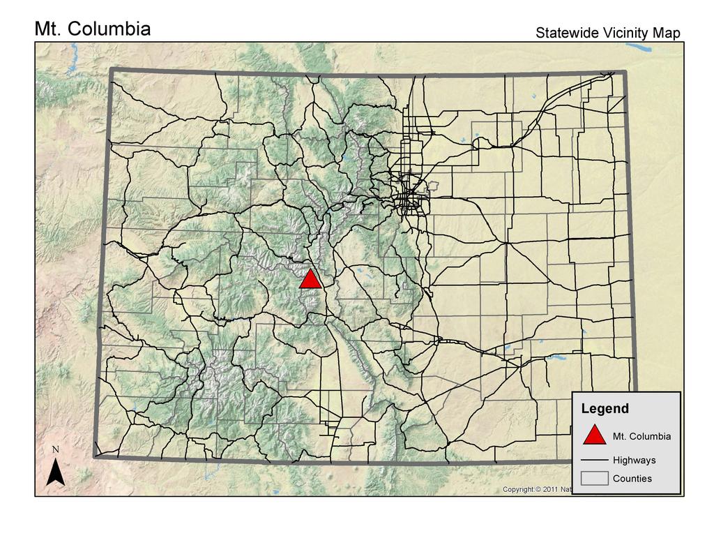
13 Responses to Grant Selection Criteria Mount Columbia Trail Reconstruction Project (Phase I) 1. Brief Description. The 14ers, the 54 Colorado peaks exceeding 14,000, draw hundreds of thousands of hikers per year from across the nation. Only two other states in the contiguous US have 14er peaks: California (13) and Washington (1). Most Colorado 14ers can be climbed without technical equipment or skills, unlike in California and Washington, making them more broadly accessible to hikers of all abilities. 14er peaks contain the largest amount of alpine tundra vegetation in the lower 48 states, ecosystems that contain rare and fragile plants and animals, sometimes unique globally. Between 1990 and 2010, Colorado s population grew by 1.7 million people, a 53% increase. Many new residents are fit outdoor enthusiasts drawn by Colorado s tremendous natural resources and opportunities for primitive recreation. Outdoor recreation is the second-largest segment of Colorado s tourism industry, with 42% of overnight pleasure trip visitors stopping in the mountains, 17% hiking and 6% participating in mountain climbing. A Price Waterhouse Coopers study suggests that 14er climbers contribute more than $20 million to Colorado s economy. A CSU report found that three Park County 14ers alone had a total economic impact of $1.9 million and created 45 jobs. 14er hikers coming from within 25 miles of the peak spent an average of $115 per day on equipment, travel and food. Since 1994 CFI has built 29 sustainable summit routes on 26 14ers, getting closer to the goal of ensuring that every 14er has at least one sustainable route. Mt Columbia (14,073 feet) is Colorado s 35 th highest peak. It is located within the Collegiate Peaks Wilderness on the USFS Salida Ranger District of the San Isabel National Forest. The peak was first climbed and named in 1916 by Roger W. Toll who was placing Colorado Mountain Club summit registers on all of the Sawtach Range peaks. Toll, an early Colorado climbing pioneer, was a 1906 Columbia University graduate. He continued the tradition of naming peaks in the area after Ivy League schools that began in 1869 with the Whitney party survey team s climb of nearby Mount Yale. Columbia is located in Chaffee County, which spans 1,015 square miles, approximately 80% of which is National Forest. The majority of visitors to Columbia travel the I-70 or US 285 corridors from the Front Range communities (Denver, Arapahoe, Jefferson, Adams, Boulder and Broomfield counties) with a total population of 2.5 million. Chaffee County prides itself on having more 14er peaks (12) than any other county. Recreation-based tourism is a major part of the local economy. The county had an estimated population of 18,510 residents in 2013 (#27 of Colorado s 64 counties for population) and a median household income of $34,368 (#36). The closest town is Buena Vista, which had 2,195 residents in 2010 and a median household income of $34,800. The Town s comprehensive plan notes that the local economy is becoming increasingly reliant on tourism and recreation, and specifically focuses on summer tourism related to the Arkansas River and the surrounding spectacular fourteeners and wilderness areas. As growth and development continue in this area, much of the emphasis will remain on tourism, second homes, retirees and recreational opportunities. This increases the need for sustainable trail development and maintenance on nearby 14ers like Columbia to limit recreation-caused impacts. 2. Project Scope. Mt Columbia is one of the most complex, labor- and time-intensive projects CFI has faced in 21 seasons due to the steep, loose conditions on the mountain and the lack of available and suitable building materials near the realigned trail. The USFS Peak Manager estimates that it will take two two-year phases of trail reconstruction to fully reroute the trail to more suitable terrain and to minimize impacts on imperiled alpine tundra plants. This multi-phase effort will involve 1.75 miles of new trail construction and 0.66 miles of existing trail reconstruction that starts at the junction with the Horn Fork Trail (#1449) roughly 4.25 miles from the North Cottonwood Trailhead. A third, one-year restoration phase will address the closure, stabilization and restoration of the existing scree field that is estimated to have 1.5 million cubic feet of erosion. This proposal involves just Phase I of the project that is scheduled to occur over the 2016 and 2017 summer field seasons. Phase I objectives include: a) 5,300 linear feet of new trail construction, b) 3,925 sq. ft. of retaining wall construction, c) 2,970 linear feet of mono wall construction, d) 2,505 sq. ft. of rubble wall construction, e) 1,445 sq. ft. of back wall construction, f) 957 sq. ft. of barrier wall construction, and g) 19 fully constructed switchbacks. When Phase I is completed CFI and the USFS anticipate that the new route will functionally replace the existing user-created route up the scree field where many imperiled plants are located and significant erosion is currently occurring. The full benefits of the project will accrue after the top half of the route is built (Phase II, ) and the restoration is completed (Phase III, 2020). However, significant environmental benefits will accrue even if only Phase I work is completed, since hikers will be out of the scree field and no longer causing significant erosional impacts. The trail realignment will utilize the most stable areas of the mountain and stabilize the hillside through trail hardening techniques (i.e. check steps, drainage dips, retaining 1
14 walls, staircases and other features that will improve drainage and soil stability). The project involves the physical work of heavy trail construction at high altitude using primitive trail tools (shovels, picks, rock bars, etc.), performing restoration of impacted areas, as well as signing the trail and closed areas. Treads will be out-sloped to shed water naturally, reducing erosion common on poorly-constructed trails. Tread will be native with widths of 18 inches, increased to 24 inches where side slopes exceed 50% grade. Clearing width will be 36 inches and clearing height 8 feet. Maximum grade will not exceed 30% for more than 500 feet with a sustained grade of 20-30% depending on the sustainability of the terrain type. The route design for Phase I includes eight strategically located passing sites where natural terrain and/or previous impacts permit this activity without increased degradation to the alpine environment. The first 0.25 mile section of work involves trail realignment, reconstruction and restoration of the existing, user-created route from the Horn Fork Trail junction to treeline at 11,600. The remainder of the Phase I trail work will require continuous construction of structures to create a sustainable trail through steep, unstable side slopes to roughly 13,000 where it connects with the existing route. Absent continuous walls and stabilizing structures, the loose soils forming the trail will be prone to significant erosion. Wilderness designation precludes the use of motorized transport. Available materials for construction generally large, native rocks must be hauled long distances from their source areas, necessitating use of high line tram systems and griphoists. Though time consuming, this is a necessary process to stabilize a very steep, loose mountainside. The Columbia trail is located in an alpine ecosystem where loose substrate, steep terrain, visitor goals and fragile tundra dictate unique trail design and construction strategies. After extensive scouring of the mountain and consideration of multiple possible route locations, the proposed trail corridor was established and field inventories related to the National Environmental Policy Act (NEPA) performed. Detailed trail design was started in 2013 and completed in Two consecutive seasons of snowfield inventories were completed to ensure that the newly established trail alignment avoids late and early season snowfields. The Columbia trail will be designed to most difficult hiker trail standards as described in the Forest Service Trails Management Handbook (FSH ). Trail standards for Wilderness are also used, including goals for naturalness, visual quality, visitor safety and wilderness character. CFI also applies institutional knowledge gained from 21 seasons of trail design and construction experience, which has proven successful in restoring the natural processes that allow alpine plant and wildlife communities to flourish. Project planning on 14ers is a four-year process one year each for project initiation, exploration, analysis and design before implementation occurs. CFI and the FS Peak Manager have worked directly with the Salida Ranger District to ensure the project is effectively planned and implemented. The district recreation specialist led the NEPA interdisciplinary team while the FS Peak Manager, with 20 years of 14er trail design experience, led the trail planning team. The Columbia interdisciplinary team included a wildlife biologist, archeologist, botanist and the FS Peak Manager. Columbia presents difficult management challenges, perhaps more so than any other 14er. Because the majority of hikers currently ascend and/or descend Columbia s west flank and the peak is often climbed in combination with nearby Mt Harvard (CFI-constructed route completed in 2002), it was decided that the final trail alignment should remain on the west flank to accommodate this existing use. In 2013 detailed construction survey notes were completed for the lower portion of the mountain; construction notes for the remainder of the route were completed in Nylon markers have been installed along the centerline of the tread. Wooden station markers have been placed every 100 feet along he designed route. Construction notes list pertinent data associated with each station (i.e. trail grade, side slope, azimuth, etc.), exact location, size and description for trail features, restoration treatments by location and critical areas for monitoring. 3. Long-Term Sustainability. Sustainability has been a guiding concept driving CFI s work since its inception in CFI s overriding goal is to ensure that every 14er has a sustainably located, durably constructed summit route to accommodate current and future use without damaging rare and fragile alpine tundra ecosystems. To ensure sustainability, all 14er trails: 1) are built through stable talus slopes where soils are stable and snow pack is low, 2) are compatible with side slope grades and soil conditions, 3) have a logical alignment, 4) show a low rate of change with regular maintenance, 5) have good natural drainage and 6) provide a durable surface for current and predicted use. Treads will be out-sloped to shed water naturally, reducing erosion common on poorly-constructed trails. Check steps, drainage dips, retaining walls, staircases, and other features will improve drainage and soil stability. The USFS is ultimately responsible for the long-term maintenance of these trails. The six National Forests containing 14ers annual contribute to support the USFS 14ers Program to reconstruct and maintain summit trails. A new, five-year agreement was approved by the six Colorado Forest Supervisors in 2014 that will continue the 14ers Partnership through CFI will provide long-term maintenance through its Adopt-a-Peak program with oversight by the USFS Peak Manager and local USFS Ranger Districts. CFI plans to engage 2
15 volunteers both in the reconstruction of this route and in its long-term maintenance. Since 2001, CFI s Adopt-a-Peak program has amassed 10,350+ days of volunteer trail maintenance, with an average of 1,125 days per season over the past four years. CFI has a robust network of volunteer organization that work in the Sawatch Range, but is continually recruiting additional Adopt-a-Peak partners. CFI independently raises funds to support the Adopt-a-Peak program, which will have two independent crews in and cost more than $150,000 per season. CFI established an endowment fund in 2012 with more than $56,000 in private donations to help fund in perpetuity the Outdoor Leadership Intern position working on the Adopt-a-Peak crew. The Sustainable Trails Program has furthered sustainability efforts since 2011 by inventorying current trail conditions and is now estimating hiking use patterns. In 2013 the last of 42 detailed, foot-by-foot, GPS-based inventories of baseline conditions was completed noting constructed features and resource-protection problems on both CFI-constructed and user-created 14er trails. This analysis helps prioritize relative conditions and the need for future trail reconstruction and maintenance work. Maintenance on 14er trails usually occurs every year or two depending upon hiking use and changing conditions. This past season CFI began using compact infrared trail counters to monitor hiking use levels at five locations serving seven 14ers. If sufficient funding is found five additional counters will be obtained and CFI plans to monitor hiking use at 10 14er locations. Monitoring use will help understand the root causes of changing trail conditions. 4. Youth Involvement. Youth and young adults play a critical role in performing CFI s trail projects. Planning is done principally by CFI and FS staff, but implementation is done largely by young people. CFI s hired seasonal crew leaders are generally from 22 to 30 years of age. The majority of the project work will be completed by Southwest Conservation Corps members aged 16 to 25 supervised by CFI staff. SCC crews have played critical roles in recent CFI 14er projects, including Chicago Basin ( ), San Luis Peak ( ) and El Diente Peak (2014). They will provide quality youth crew members for an anticipated 24 weeks over the two-season timeline of Phase I. Youth volunteer groups (Colorado College, Sanborn Western Camps, High Mountain Institute, CU Hiking Club) will represent around half of the estimated 250 volunteer days augmenting the work performed by CFI and SCC. CFI has successfully partnered with all of these organizations in the recent past. Colorado College was named CFI s 2013 Adopt-a-Peak Partner Organization of the Year. CFI has the ability to work with volunteers as young as 14 if part of a structured program or accompanied by a parent, or 18 if unaccompanied. Historically half of CFI s volunteer days have been provided by youth and young adults. 5. Multiple Trail Uses. Primary users of Columbia s high-altitude trail are hikers, mountaineers, multi-day backpackers, trail runners and walkers in summer, and snowshoers and backcountry skiers/snowboarders in winter. Motorized and mechanized use of this wilderness trail is prohibited. The trail is too steep for equestrian use. Exact use numbers are not available because registration is not required and agency approval was not received in time to allow an infrared trail counter to be placed on this peak during the 2014 field season. A CFI intern in 2013 made use projections of all the 14ers based on Peak Steward-reported hiker counts that estimated that Columbia/Harvard is visited by an estimated 14 hikers per day. This suggests that approximately 1,700 people hike Columbia over the four-month-long primary hiking season. A total of 12,348 registered users of the 14ers.com website have logged personal checklists noting all the 14ers they have climbed. Most have summited an average of 19 peaks. Columbia has been climbed by 27% of these hikers, which ranks tied for #29 on the full list of 58 peaks. Hiking 14ers is a very popular recreational activity. Many people who climb 14ers try to climb them all. As of 2013 the Colorado Mountain Club reported that 1,574 people had reported climbing all of the 14ers. The physical beauty and challenge of these peaks create long-term demand for properly constructed summit trails. 14er trails represent the extreme in trail difficulty, offering risk and challenge, and add to the diversity of recreational opportunities in Colorado. To maintain these qualities, Columbia s trail has been designated as most difficult in USFS trail design standards. The popularity of climbing 14ers indicates a need for trails of this difficulty. All users will benefit from the stability of a constructed trail vs. the steep, loose, eroded route on Columbia. 6. Unmet Recreational Needs. Colorado s 14ers offer unique recreational opportunities where hikers can reach these high summits, see terrain not available in many mountain ranges, and reach altitudes not possible in all but a handful of states. The non-technical nature of most Colorado 14ers means that most are accessible to fit hikers of all technical abilities. Climbers are drawn from across the country and many foreign nations to challenge themselves physically against these Colorado peaks. However, the combination of growing visitor use, unplanned routes on many 14ers, and extremely fragile alpine vegetation creates a pressing need to ensure trails are appropriately designed, maintained so that they retain their structure, and are capable of handling the high level of use they receive every year. The current, user-created route on Columbia is among the worst in the state, which is reflected in both the public feedback for this project and in many 3
16 14ers.com trip reports. The public comments provide descriptive detail about the deplorable conditions on the user-created route. This reputation leads to some 14er hikers putting off climbing the peak or avoiding it entirely. The scree field where use is currently occurring has countless trail braids that are causing severe impacts to the alpine tundra vegetation, including three imperiled plants. The ball-bearing-like scree is very difficult and dangerous to hike up and down, which results in many hikers falling and getting hurt. Because of this poor footing, many hikers are going off-route to find more stable ground, which causes further braiding and damage to unique and fragile alpine ecosystems. Many of the alpine plant species that live in Colorado s alpine zones are endemics, which means they occur only in Colorado. It is vital that 14er trails protect these plants while also facilitating recreational use on Columbia. The botanical survey found three rare plants located in the existing user-created trail corridor that need to be better protected: Draba grayana (Gray s Peak whitlow grass), Draba oligosperma (few-seeded draba) and Penstemon harbourii (Harbour beardtongue). Gray s Peak whitlow grass is a perennial herb of the mustard family that flowers during July and August and produces fruit from August to September. It is considered imperiled both globally and in Colorado and is ranked G2S2 by Colorado Natural Heritage Program (2012). This plant may be threatened by increasing unregulated recreation in his habitat, which includes elevations in central Colorado between 11,500 and 14,000. Few-seeded draba is a perennial herb in the mustard family that flowers from May to July. It ranges from Alaska and western Canada southward to California, but occurs in Colorado only in alpine scree slopes of the central ranges. It is ranked G5S2 by CNHP (2012), indicating that it is common and secure globally, but is imperiled in Colorado due to few known locations. Harbour beardtongue is a perennial herb of the figwort family found on talus and scree slopes in the alpine at elevations ranging from 11,800 to 12,850. It is a Colorado endemic, but is widely distributed in the state from the Medicine Bow Range in the north to the La Plata and San Juan Ranges in the south. CNHP (2012) ranks the species as G3G4/S3S4, which indicates the species is vulnerable both globally and in Colorado. The area where the Columbia route will be constructed is habitat for two sensitive animal species: White-tailed ptarmigan and Rocky Mountain Bighorn Sheep. Conservation measures identified for the project will mitigate harmful impacts. This project will mitigate resource impacts on Columbia by delineating a sustainable trail, screening users from sensitive plants and unstable soils, restoring degraded habitats and installing appropriate trail signage to focus recreational use onto a single route. Restoration measures will protect fragile alpine tundra, halt soil erosion and reestablish native vegetation to areas that have been degraded. Barrier walls and signage will note closure areas. Planned trail reconstruction and the construction of rerouted sections will give hikers a well-defined, sustainably located, durably constructed, and easy-to-follow trail that will eliminate the need to create trail braids or trample sensitive vegetation. By using sustainable building practices, soil erosion will be minimized and sedimentation of waterways will be reduced. This project will meet these needs by providing a sustainable trail for hikers on Columbia while minimizing damage to fragile alpine plant communities. 7. Expands Trail Links. The Phase I project principally addresses issues on the main route to Columbia s summit. However, the gentle terrain of the Sawatch Range allows high-altitude hikers to link together many different trails over the various ridges and flanks of these peaks. This route on Columbia often becomes either the ascent or descent route linking together other trails, access points and nearby peaks. For example, many hikers presently ascend the Horn Fork Trail (#1449) from the North Cottonwood trailhead to the summit of nearby Mt Harvard and traverse across the long ridge to Columbia before descending the user-created route back to the Horn Fork Trail. Another common route is to ascend Columbia from the long southeast ridge from the Colorado Trail (#1776) before descending the standard route back to the Horn Fork Trail. Occasionally hikers will access Harvard and Columbia from the north and east via either the Frenchman Creek Trail (#1457) or the South Pine Creek Trail (#1458) and then descend into Horn Fork Basin. One can also link in Columbia with Mt Yale via the Kroenke Lake Trail (#1448) and the Brown s Pass Trail (#1442). There is even an endurance event called Nolan s 14 ( that challenges ultra-runners to ascend and descend all 14 of the Sawatch Range 14ers within a 60-hour period that has competitors creating multiple possible combinations to link up this cluster of peaks that includes Columbia, Harvard and Yale. Collectively, the trails on Colorado s 14ers constitute a single trail system by distinction of their high elevation and name recognition. This system of trails spans from the Front Range in the east to the San Miguel Mountains in the west, and from the I-70 corridor in the north to Colorado s southern border in the south. The major 14er ascent routes together total more than 222 miles of trail (not counting non-traditional routes, route variations, and other lesser-used 14er trails). Completing this entire trail system by climbing all 54 of the peaks is a goal for many hikers and climbers. Their use includes moderate hiking, backpacking, technical mountaineering, and 4
17 backcountry skiing and snowboarding. When completed, this project will increase to 32 the number of sustainable routes constructed on 29 14ers. 8. State Trails Goals. 1) Integrated Trail System. The 54 14ers in Colorado represent a statewide, integrated system of trails by their popularity, elevation and desire by climbers to reach their summits. As of 2013 a total of 1,574 people had reported to the Colorado Mountain Club having climbed all the 14ers. Information about the 14er trails is contained in numerous guidebooks, the 14ers.com and 14erworld.com websites, and CD-based map products. CFI s on-going trail reconstruction and maintenance programs ensure this network of 14er trails is constructed to be sustainable and is maintained to provide for a high quality recreational experience. 2) Diverse/Integrated Trail System. 14er trails represent the extreme in trail difficulty and add to the diversity of recreational opportunities in Colorado. 14er climbers value opportunities for challenge and risk. To maintain these qualities, the Columbia trail has been designated as most difficult in FS trail design standards. The popularity of climbing 14ers and high use levels on these peaks indicate a need for trails of this difficulty in Colorado. On Nature s Trails lists the 14,000-foot peaks as one of Colorado s unique landscapes and mentions explicitly the increasingly sought after 14er trails. 3) Environmentally Appropriate Trail Design, Construction, and Management. This proposal will help restore environmentally appropriate trail design where natural erosive conditions, lack of prior maintenance, and high use have degraded it, and will bring sections of user-defined trails up to a more appropriate trail design. Projects are planned and designed to be sustainable according to standards as outlined by FS specifications and best practices. Many of these practices have been refined over 21 years to specifically address high use in the alpine environment. 5) Encourages Trail Stewardship. The Columbia project will utilize an anticipated 250 volunteer days in the construction phase, as well as on-going maintenance once completed. Youth and young adults have averaged half of all volunteers over CFI s 14-year Adopt-a-Peak trail maintenance program. Volunteers on all CFI projects benefit from environmental education talks during the project addressing alpine ecology, wilderness ethics and the importance of sustainable trail design. CFI projects often allow for educational interaction with other passing 14er climbers, further expanding the awareness of stewardship needs to protect these high peaks. 7) New Funding Opportunities. The Mt Columbia project ultimately envisions involving at least two major foundations, as well as corporate, local government and individual funders. To date CFI has applied for a three-year, $210,000 grant from the Gates Family Foundation that, if funded, will apply an anticipated $60,000 to support this project. CFI plans to engage the National Forest Foundation in 2017 at a level of $50,000-$60,000. (The single NFF Matching Award Program grant request for 2015 has been funded at $54,000 for El Diente Peak, while the 2016 request will be focused on Mt Eolus to complete the Southwest Fourteeners project). CFI envisions the State Trail commitment leveraging a significant amount of funding from foundations, corporations (Climax Molybdenum), local governments (Town of Buena Vista, City of Salida and Chaffee County) and individuals. On some past projects CFI has been able to leverage State Trails funding by more than 2-1 from other funders. 9. Public Planning and Involvement. CFI and the USFS utilize multiple approaches to engage the public during the planning and involvement process especially the 14er hiking community that follows our work closely regarding major trail reconstruction projects. The USFS follows traditional public notification guidelines, while CFI has embraced newer technologies to broaden the awareness of our work and future projects, including website, blog and Facebook postings, Google Earth videos posted on our YouTube channel and development of an online survey. Over several years of field research beginning in 1993, engagement with local communities (including a 70-person conference in 1997), and consultation with USFS and outside experts, CFI developed a Long Range Plan (LRP) for the 14ers in 1999 that outlined a multi-year strategy for accomplishing trail reconstruction and restoration of damaged alpine tundra on all 14ers statewide. The LRP scored and ranked all peaks based on a number of resource impact, hiking use and capacity indicators. The overriding goal was to ensure every 14er had at least one sustainably located and designed summit trail to accommodate current and future use more if terrain and use dictated. Columbia ranked #12 overall in the high priority category. All peaks higher in priority have had work performed with one exception (Mt Shavano) that has a major private land obstacle. In CFI s more recent Sustainable Trails inventory process ( ), the Columbia trail ranked among the six peaks in the severe category (the worst of five grades) out of 20 peaks inventoried that had never had a sustainable trail constructed. Of the other five peaks in this category, planning is under way on Mt Elbert and Snowmass Mountain with timelines that have construction occurring in later years. Shavano continues to have private land issues delaying work. CFI is working independently with the BLM regarding a plan for Redcloud Peak. The Columbia trail is currently the USFS s highest priority peak among those needing major trail reconstruction work. Trail delineation work on Columbia falls under the 1985 Land 5
18 and Resource Management Plan for the Pike and San Isabel National Forests. Proposed work occurs in areas designated as primitive wilderness which the forest plan states should: a) Minimize trail impacts to scenic resources and b) Eliminate duplicate trails. Direction provided for trails system management is to maintain drainage structures to prevent unacceptable resource damage, construct/reconstruct trails when needed as part of the transportation system and provide opportunities for isolation, solitude, self-reliance and challenge while traveling cross country or on system trails. The Columbia project has been listed in the Schedule of Proposed Actions starting 4/1/2010. A news release was sent to all Pike and San Isabel National Forests media contacts on 1/11/2012. A notice of this project was published in the Salida Mountain Mail on 1/19/2012. The same scoping notice was mailed to 12 potentially interested parties for comments, issues and concerns. The scoping period began 1/13/2012 and ran through 2/29/2012. More recently CFI posted photos of the Columbia field planning under way on its Facebook page on 7/18/2014. This post received 5,834 post views, 130 likes, 11 shares and 6 comments, which made it among the most engaging posts of the year. CFI also produced a Google Earth flyover video ( that was posted on YouTube on 10/23/2014 and subsequently shared to Facebook on 10/24/2014. Through 10/31/2014 the video has received 103 views, while the Facebook post has received 1,366 views, 10 likes, 2 shares and 2 comments. An online survey was also posted seeking feedback on the proposed project that has received 47 responses through 11/1/2014. Responses are discussed in the Public Feedback section. 10. Public Feedback. Almost without exception 14er hikers responding to the proposed Columbia project rate the current, user-created route as being among the worst in the state due to the lack of a planned, properly constructed summit trail. Facebook: People responding to CFI s Facebook posts were very critical of the current, user-created route and complimentary of CFI s planned trail. I m pleased to see this [trail reconstruction project] because we were unable to find any clear route up and people continually scrambling through the scree at random seemed to be doing some damage to the mountain. Thank god. Worst trail ever! We did this hike last year and, to this day, it s my least favorite 14 er of the 20 we ve done I will be interested to see what the trail looks like in the future. I ve taken both the west approach and the southeast route. Told myself both times that there has to be a better route. I think this new route is a step in the right direction. The erosion on the west side needs to stop. Thank you CFI. I think this would be a much safer route than what is set up currently. That scree field is very steep and slick. I have video of my self sending rocks up to the size of bowling balls down the trail and hitting a friend. He was ok but it could be very dangerous I love these mountains but wouldn t consider doing these again because of this route. If they brought the trail up to the ridge out of the scree field I would think it would be a more enjoyable hike. Survey Responses: Most people taking the survey had actually climbed Columbia (61.7%), so were personally familiar with the current condition. Of those who had climbed the peak, 28.6% rated the trail a 1, 31.4% rated it a 2, 25.7% rated it a 3, 2.9% rated it a 4, and 11.4% rated it a 5 (five-point scale: 1=worst, 5=best). (The people rating the route a 5, in combination with the other survey feedback, suggests there might have been some confusion about interpreting the scale). When asked what should be done with the current Columbia approach trail, 70.2% favored the full project implementation, 29.8% favored routine maintenance and 0% favored leaving the route as it is. When asked whether the trail project would positively contribute to the Horn Fork Basin, 95.7% said yes, while only 4.3% said no. Some direct quotes from written survey comments: Glad to hear that CFI is moving this project forward. This would be a much safer route to enjoy this amazing mountain. Mt. Columbia currently has the worst trail of the 20 14ers my husband & I have hiked. The erosion is awful, due to no switchbacks. Go for the new route! We did the Harvard to Columbia traverse. Due to the social trails, we got off route descending Columbia and ended up in the big gully following all sorts of social trails which was not fun. We saw others on the standard route later on and they were moving just as slow due to the poor trail conditions. This project is long overdue and 14ers initiative deserves a lot of credit for getting it underway. I like the idea of putting in some switchbacks. The trail is basically straight up Columbia after tree line right now. I am so excited to see this project. Columbia was the first 14er I climbed and I went with a friend who s bagged 26. Even he had a hard time figuring out where the existing trail is, so we ended up following the social trail even though we wondered how on earth the mountain could stand up to all the erosion of that had been the actual trail. Also, the social trail no fun to climb at all. Though I have not climbed Columbia, I have heard from many that the current route/trail is horrible (one of the reasons I have avoided it). I think this project is a great idea. This would be a much safer route to enjoy this amazing mountain. This trail was the most unpleasant of any 14er routes I have climbed (55 out of the 58 peaks). It was very unattractive, bad for the mountain, and the descent was bad for my knees. This change looks incredible. I would welcome the opportunity to spend a week or two helping and cannot wait to hike the new trail to the summit in the future. I think Columbia is one of the 6
19 peaks that could really, really benefit from some hard work. Would be happy to volunteer for a few days of work to help. CFI has learned that more aggressive, online outreach helps facilitate feedback from 14er enthusiasts about project plans. 11. Opposition to the Project. As with most CFI trail reconstruction projects, there has been limited concern or opposition. The USFS public scoping process noted that no significant issues were identified. There were no negative comments about the project on any of CFI s Facebook posts despite reaching 7,200 14er enthusiast hikers. In the online survey, CFI asked what concerns respondents had about the project. Many had no concerns or raised concerns that the project will address, such as protecting rare plants in the area. The primary concerns raised were: 1) cost (4 people), 2) people may not utilize the new route since it is longer and not as direct (5 people), and 3) that improving the trail will lead to more traffic, especially by less skilled hikers (2 people). Some direct quotes: Money is an issue. I saw no estimate but it can t be cheap and money may be used better on other things. Funding could be an issue. It is extensive project, labor intensive. Too long. May not address why people short cut The new trail is farther away from the summit and people will continue to use the shortcut. What will happen between Phase 1 and Phase 2, when the new trail is incomplete? I m also concerned that the new trail adds to much additional distance over the existing trail and will disincentivize proper use of the new trail. Are switchbacks really necessary on the lower half of Phase 1? Or could the existing trail be revitalized there to minimize the additional trail length? Based on CFI s 21 seasons and close to 30 previously constructed sustainable summit trail projects, we believe hikers will take the longer, but better constructed route rather than continue to utilize the existing scree field, which will be sufficiently walled off and posted with closed for restoration signs. This has been the case with virtually all of CFI s prior sustainably located summit trail projects. As to the link between Phase I and II, the completed Phase I work will get hikers sufficiently onto the ridge proper so that it is possible to close the existing route that is so impactful. Even if Phase II does not happen for some reason the new, lower route will be a significant improvement in terms of a hiking trail and will do a lot to limit erosion and lessen threats to alpine tundra plants. This is a long and expensive project, but necessary to protect plants and improve the hiking experience. 12. Shovel Ready. Yes! The project is fully planned, with foot-by-foot construction notes completed for the entire two-phase project. There is a small amount of work remaining to be done prioritizing sections of work to be addressed, but this will be completed before work is slated to begin in June The time needed to get an agreement in place with State Trails will ensure that CFI is 100% ready to go by the 2016 field season. The only potential obstacle to moving rocks and soil is fundraising. CFI s past experience shows that fundraising, while challenging, is not generally a significant obstacle. 13. Completion Ability. CFI has previously completed 29 sustainable 14er summit routes on 26 peaks over the past 21 field seasons. By the end of the 2015 field season another route, El Diente Peak s Kilpacker Basin, will be completed as part of the Southwest Fourteeners project. The USFS-CFI partnership has an experienced team with a long history of work on Colorado s high peaks. A new, five-year USFS partnership agreement was signed in 2014 that will provide base-level funding to continue the USFS Fourteener Peak Manager position who has 20 years of 14er trail design and implementation experience. The agreement will also provide modest financial support to CFI to cover some of its operating and administrative expenses. CFI s team is quite experienced. CFI s Executive Director has been in place for almost six years and has led the organization to record fundraising every year. Volunteer participation has hit all-time record numbers during his tenure and all trail reconstruction projects have been completed on time and on budget. CFI s Field Programs Manager has worked with the organization or Southwest Conservation Corps for the past six seasons. He successfully directed five field crews this season, including the Mt Bierstadt and El Diente trail reconstruction projects, as well as simultaneously coordinated logistics related to roughly 50 Adopt-a-Peak volunteer projects. He previously conducted the 42 Sustainable Trails baseline inventories and performed the analysis, so is intimately familiar with the condition and needs of all 14er routes. The physically demanding work on 14er trail reconstruction projects means that it is work suited best to the young and energetic. However, CFI has great success retaining project leaders from year to year such that generally 40-50% of seasonal leaders have worked previously for the organization. A ladder of progression also means that new CFI leaders are often people who have worked previously on CFI s trail reconstruction projects as members and then leaders of youth corps crews, so are often very familiar with how these high-altitude trail projects work. In some cases youth corps members or leaders have worked on the same trail reconstruction projects. Under the current leadership team, CFI has successfully completed six new 14er routes funded by State Trails without incident. In one case three routes were completed when only two were in the initial proposal with all additional costs privately funded. CFI has no outstanding, uncompleted State Trails or GOCO-funded grant projects. 7
20 14. Cash Match/Fundraising Plans. The entire Phase I budget required to complete the project totals $499,492. This includes food, travel, the in-kind value of volunteer labor and other expenses deemed ineligible by State Trails, which total $$157,698. This means that significantly more than the $6,000 in minimum cash match will need to be raised. This is quite typical for past CFI projects. CFI has already submitted a $210,000 grant request to the Gates Family Foundation to help support trail reconstruction and maintenance projects over the period, which includes $60,000 for this project. Gates Family Foundation has provided CFI with three previous three-year capital construction grants, the most recent of which expired in Based on conversations with the Foundation, CFI is quite optimistic that a commitment will be made before 12/31/2014. CFI also anticipates approaching the National Forest Foundation, which has provided more than $1 million to CFI s trail reconstruction and stewardship projects, for a grant to match State Trails funding on a 1-1 basis. Due to NFF grant rules and other committed projects, CFI plans to approach NFF in 2017 to fund work for that season. Other, smaller funders will also be approached to help fund the cash match and ineligible expenses of this project, including local governments in the area (Town of Buena Vista, City of Salida, Chaffee County). By 12/31/2014 CFI will know whether these local governments have made financial commitments for CFI s work in the area in CFI also will approach the Norcross Wildlife Foundation and Climax Molybdenum, both prior multi-year grant funders of CFI s work, to help with needed equipment acquisition and staffing expenses. CFI will fill any project funding gaps with donations from individual donors from across the country. Last year donations from individuals living in 44 states totaled more than $360,000 and represented the largest share of CFI s revenues. State Trails and Gates Family Foundation are CFI s only multi-year funders. That makes it virtually impossible to have other grant commitments in hand almost two years prior to ground breaking on this project. In-kind services will also play a significant role in completing the project. The USFS will provide an estimated $24,000 in horsepacking services associated with packing CFI s backcountry basecamp into and out of the wilderness both years. The USFS also will provide an anticipated $8,832 of in-kind services associated with on-the-ground field planning and project oversight. Volunteers working on the project will provide an estimated $45,100 in in-kind benefit through an estimated 250 days of work. The SCC crew will provide an additional $84,360 in in-kind benefit due to the volunteer value of work provided at below-market wages. This brings total in-kind on the two-season project to $56,184 (eligible) and $129,460 (ineligible). 15. Compelling Need. Obtaining a $200,000 State Trails/GOCO grant is absolutely critical to embarking on the multiphase, multi-year Mt Columbia Trail Reconstruction Project. A State Trails grant provides certainty for funding much of the day-to-day wage costs of this project over the two-year life of Phase I. That allows CFI to leverage State Trails funding by pursuing annual grants from other foundations, corporations and local governments. Some of these, like the NFF Matching Award Program, require a 1-1 match with non-federal funding sources. Others, like Gates Family Foundation, only provide 10% of total costs, which requires other funders to provide large chunks of funding to complete all the agreed-upon work. Put quite bluntly, this project will not happen without a State Trails grant. The small population base and lack of large, institutional funders in the Arkansas Valley mean that there are few to no sources that can provide sufficient funding required for such a personnel-intensive project like reconstructing Columbia s summit trail. The project is also sufficiently distant from Denver to be attractive to many urban funders. However, with a multi-year funding commitment from State Trails, CFI is able to go out with match money in hand and leverage financial commitments from others with an interest in a project like this. CFI has proven on multiple occasions that it can raise substantial funds once State Trails makes a commitment. Those first-time gifts are often the hardest to land, since few funders want to be the first dollars into a given project. However, with the recently completed White River Fourteeners and the on-going Southwest Fourteeners Trail Reconstruction Projects, CFI has proven that it can and will raise needed match funds and cover independently those needed costs (like food for hungry trail crews and travel between our Golden headquarters and alpine operations base in Twin Lakes and the North Cottonwood Trailhead). Given the State Trails funding cycle, if turned down this year, CFI would not be able to submit a funding request until November 2016, which would mean a delay of two years in initiating this project. Unless a trail realignment project is completed on Columbia as quickly as possible, the intrinsic, aesthetic, recreational and environmental values will continue to be lost due to continued erosion and smothering of rare and fragile alpine tundra plants. Rain events and spring snowmelt will continue to have a dramatic affect on the ecosystem. Hikers will continue to struggle to climb these steep, loose and inhospitable slopes, with the safety of many hikers continued to be placed in jeopardy, not to mention the enjoyment of the experience reduced substantially due to the horrible existing route. 8
21
22
23
24
25
26 Mount Columbia Trail Reconstruction Project (Phase I) Support Letters Category #1 and #2: Adjacent Landowners/City Owners: Joel Benson, Co Owner of the Buena Vista Roasery/Mayor, Town of Buena Vista Category #2: Federal Landowners Amy Ormseth, USFS Salida District Ranger (Included as Governing Body Support Letter) Category #3: Individual Users/User Groups Mark Obmascik, 14er Finisher/Author of Halfway to Heaven Julie Mach, Colorado Mountain Club Conservation Manager Category #4: Partners/Cooperators Patricia Chan, Colorado College Outdoor Education Jarret Roberts, Wildlands Restoration Volunteers
27 October 30, 2014 Colorado State Trails Committee S Hwy 85 Littleton CO Dear State Trails Committee: I would like to add my support to the grant proposal being submitted by the Colorado Fourteeners Initiative regarding reconstruction of the Mount Columbia summit trail. This multi- year project will begin the process of rebuilding a more sustainable, ecologically beneficial hiking trail for the many people who come to climb this popular Fourteener near Buena Vista. Protecting the Fourteeners is important to me personally. Mount Columbia is one of the closest of the 12 Sawatch Range Fourteeners located in Chaffee County that form Buena Vista s western scenic backdrop, and the first Fourteener that I peaked. I know I speak for many residents when I say that being near the mountains and the recreational opportunities they provide is a major reason for choosing to live here. As a person who incorporates Holistic Management practices into my business, the Buena Vista Roastery, I appreciate the way that CFI works to protect the unique ecological values found on Mount Columbia while simultaneously improving the recreational experience for hikers. The project is a win for environmental protection and a win for recreational access. As the Mayor of Buena Vista, protecting Mount Columbia s summit hiking trail is important to the town s economy. The Town s Comprehensive Plan notes that the Collegiate Peaks, nearby wilderness areas and the Arkansas River all play vital roles in supporting Buena Vista s recreation- dependent economy. Protecting nearby trails will ensure that people are able to continue to recreate on these nearby Fourteeners like Mount Columbia, which keeps tourist dollars flowing into our local economy. The Town has very limited funds with which to support local nonprofit organizations, but in 2014 we gave a grant to Colorado Fourteeners Initiative to support trail construction and maintenance work on nearby Fourteeners. We are currently considering a proposal to give additional funding to CFI in For all of the above reasons I hope the State Trails Committee will look favorably on CFI s request to rebuild the Mount Columbia hiking trail. Sincerely, Joel Benson Mayor, Town of Buena Vista Co- Owner, the Buena Vista Roastery
28 October 3A,2014 Colorado State Trails Committee Colorado Parks and Wildlife S. Hwy 85 Littleton CO Dear Trail-builders: Some heroes rush into burning buildings. Others fight crime and confront evil. A few even dedicate themselves to noble Iives ofvirtue, chastify, and selflessness. But you, Colorado State Trails Committee, can choose an easier path to heroism. You can fix the trail up Mount Columbia. There is no path in the Colorado high country that is worse than the o'trail" up Columbia. It is a mess. It is scree atop powdery dirt that is all rutted into a crumbling 3O-degree slope on the southwest shoulder of the 14,077-foot mountain west of Buena Vista. That, at least, is a technical description. In non-technical terms, this trail sucks. It is 1,600 vertical feet of misery. Climb three steps forward and slip two steps back. It feels like walking on greased marbles, except that these marbles have sharp edges and wedge inside your sock and prick your sole. More swear words have been uttered by hikers climbing Mount Columbia than any other Colorado l4er. This mourntain twists ankles, skins knees, and shreds bottoms of pants. What's worse is that we're making it worse. Every boot grinding up Mount Columbia only deepens erosion. A few summers ago, I hiked all the Coloradol4ers for a book, Halfway to Heaven, that won the National Outdoor Book Award. On my treks up and down the l4ers, I learned a lot of lessons about myself (slow and stubborn); my fellow hikers (big-hearted and fun); and my state's glorious high counffy. It was one of the greatest summers I could wish upon anyone. Yet every night, when campfire talk turned inevitably to the highs and lows of Colorado's 14ers, one mountain always wallowed lower than the rest. It was Columbia and its festering sore of a trail. Please be the hero of our campfires. Please combat skinned lanees, foul language, and ripped hiking pants. Please fix the trail up Mount Columbia. Thanks! i\lt tlc,t*a Mark Obmascik 630 Gaylord St. Denver, CO mobma@)zahoo.com
, to express our organization s strong support for the")
29 710 10th Street Golden, CO Colorado State Parks State Trails Program S. Hwy 85 Littleton CO October 23, 2014 Dear State Trails Committee: I am writing this letter on behalf of the Colorado Mountain Club (CMC), to express our organization s strong support for the Colorado Fourteeners Initiative s (CFI) Mt. Columbia Trail Improvement application for funding from the State Trails Program. The proposed project will address the extensive erosion and braiding that currently makes Mount Columbia one of the worst and most detrimental summit routes on any of the 14,000' peaks. From the CMC s combined perspective of conservation and recreation, this project will greatly benefit the members of the Colorado Mountain Club and others who recreate on these peaks. Founded in 1912, the Colorado Mountain Club is the largest as well as the oldest recreation and conservation organization in Colorado with over 5,000 members state-wide. The mission of the Club is to gather and disseminate information regarding Colorado s mountain environments; to furnish facilities for the enjoyment and study of the mountains by the Club members and the public; and to advocate for the preservation of alpine regions. The Club has 15 chapters throughout Colorado, and our members spend a great deal of time recreating on the 14,000-foot peaks (14ers) throughout the state. The Colorado Mountain Club and our individual members have a long and storied connection with the 14ers. Founding members of the CMC were some of the first to explore and climb the 14ers. The CMC Press has published several guidebooks to the 14ers, the most recent of which documents how CFI s work has changed summit routes so people can be sure to stay on the more recently constructed sustainable routes. And, the CMC has helped in the protection of these iconic peaks by promoting wilderness designation, serving as a founding member of the coalition that served as a catalyst for CFI s founding and by taking on direct 14er stewardship projects. Funding trail reconstruction and terrain restoration work on Mt. Columbia will not only provide a better experience for 14er trail users, but also will help protect Colorado s unique alpine environments. Colorado s alpine peaks contain a diversity of alpine tundra plants that are tremendously susceptible to trampling by hikers traveling off route. These peaks contain some very rare plants, including some species that may never have been documented previously in Colorado. Reconstructing summit routes in more sustainable locations that protect these rare plants and reduce the likelihood of unintended trampling will benefit Colorado s botanical heritage. Reconstructing these summit routes also makes the routes more durable and less prone to erosion, a long-term investment that makes sense in light of reduced funding for on-going trail maintenance. We encourage the State Trails Committee to seriously consider this application submitted by CFI to allow them to continue preserving and protecting the 14ers. Please do not hesitate to contact me if you have any questions about the Colorado Mountain Club s support of this grant application. Sincerely, Julie Mach, CMC Conservation Manager (303) juliemach@cmc.org
30 October 21, 2014 Colorado State Parks State Trails Program S. Hwy 85 Littleton, CO Dear Colorado State Trails Committee, I am writing on behalf of Colorado College in recommendation of the Colorado Fourteeners Initiative (CFI) and their planned construction and restoration efforts on Mount Columbia. Colorado College has collaborated with the CFI for the past decade to provide quality orientation experiences for between students each year. These trips not only allow students an important introduction to the care for our natural spaces, but provide the opportunity to learn the impact of their service from CFI professionals in the field. In addition to providing impactful orientation experiences, the organization accomplishes invaluable work maintaining some of the most well-loved and well-used recreation areas in our state. Collaborating with CFI is especially important for the Colorado College community because of our connection to the region. With a campus in close proximity to the Rocky Mountains, CFI has supported the Colorado College community in promoting environmental stewardship within the state and beyond. Their organization provides a fantastic outlet for students to work collaboratively to develop a sense of ownership and pride. Mount Columbia and its surrounding Collegiates specifically is an area that is well frequented by the CC community. This popular peak is endangered by extensive erosion and braiding on its current path, as there is no sustainable route for hikers to travel on. CFI s project would prevent further damage and create a long-term trail for continued use, while allowing CC to collaborate and be a part of the solution. At Colorado College we have found that CFI holds their volunteers to the highest standards while also providing oversight to complete high quality work. We believe CFI s contributions to the Colorado mountain regions in maintaining trail access is invaluable, and the organization upholds a strong reputation in representing Colorado s commitment to environmental stewardship and partnership. Colorado College looks forward to many upcoming years of collaboration with CFI to benefit our students as well as the greater community. The organization allows us to provide excellent orientation and service experiences for our students, and I strongly recommend them for funding through the grant to continue their strong partnerships and restorative efforts. Patricia Chan Patricia Chan Assistant Director of Outdoor Education Colorado College COLORADO COLLEGE OUTDOOR EDUCATION 14 E. Cache La Poudre St. Colorado Springs, CO (719)
 application for a State Trails grant to develop and implement the first phase of the Mt. Columbia trail reconstruction and restoration effort.")
31 Healing the Land Building Community Thursday, October 30, 2014 Dear State Trails Committee: On behalf of Wildlands Restoration Volunteers (WRV), I am writing to support the Colorado Fourteeners Initiative s (CFI) application for a State Trails grant to develop and implement the first phase of the Mt. Columbia trail reconstruction and restoration effort. Many of Colorado s public lands, including our fourteen thousand foot mountains, are highly popular areas. It is the belief of both WRV and CFI that restoring and preserving these mountains is very important if we hope to continue enjoying this precious natural resource for years to come. Having worked on other fourteeners with CFI, I can attest to the intensive damage that has been done to these high use areas in the alpine. The proposed work on the Mt. Columbia approach trail exemplifies this problem and is a prime candidate for your support through this grant. WRV engages thousands of local citizens each year in hands-on stewardship projects on local public lands to improve multi-use trail opportunities as well as protect and restore damaged lands for future generations to enjoy. Of all the degraded areas WRV works to restore, Colorado s fourteeners are one of the most pressing needs. Alpine ecosystems are especially sensitive and can unravel in a relatively short period of time. Catching a problem early can save immense amounts of work and years of recovery. From over seven years of collaborating on similar projects with CFI and the US Forest Service, I can be sure this project at Mt. Columbia is one of the most critical needs across the state s fourteeners. As mentioned, WRV and CFI have a long and productive partnership that goes back over seven years. WRV has often sought the rock and trail construction/maintenance expertise of CFI on our alpine projects. At the same time CFI has worked very closely with WRV on restoration efforts after trails are rerouted. The partnership is a great example of how CFI leverages its resources and network to make their projects successful, as I expect they will do with this proposed work. Wildlands Restoration Volunteers supports this grant application and we look forward to collaborating on phase two of these projects. If you have any questions or need more information, please contact me at or via at jarret@wlrv.org. Thank you for your consideration of CFI s grant request Sincerely, Jarret Roberts Community Programs Director Wildlands Restoration Volunteers jarret@wlrv.org Sterling Circle Suite 201. Boulder, CO
Kit Carson-Challenger Ridge Trail Project
 Kit Carson-Challenger Ridge Trail Project Project Accomplishments Report-USFS December 15, 2015 Photo courtesy of Justin Peterson 815 South 25 th Street, Suite 101 Colorado Springs, CO 80904 Dedicated
Kit Carson-Challenger Ridge Trail Project Annual Performance Report-2014 October 22, 2014
 1 Kit Carson-Challenger Ridge Trail Project Annual Performance Report-2014 October 22, 2014 Willow Lake and Kit Carson Peak 2 SUMMARY The Rocky Mountain Field Institute began Phase 1 of a multi-phase,
Bear Creek Habitat Improvement Project
 06/10/10 Bear Creek Habitat Improvement Project El Paso County, Colorado Pike National Forest and Colorado Springs Utilities Owned Land Report prepared by: Eric Billmeyer Executive Director Rocky Mountain
South Colony Basin Recreation Fee Proposal
 South Colony Basin Recreation Fee Proposal Purpose and Need for Collecting Fees in South Colony Basin: Forest Service appropriated funds have not been sufficient to maintain current recreational services
Preferred Recreation Recommendations Stemilt-Squilchuck Recreation Plan March 2018
 Preferred Recreation Recommendations Stemilt-Squilchuck Recreation Plan March 2018 Below are the recommended recreation ideas and strategies that package together the various recreation concepts compiled
2016 Trails Maintenance and Operating Costs
 2016 Trails Maintenance and Operating Costs Motorized Trails Maintenance for motorized trails comes from vehicle registration fees and a portion of the federal Recreation Trails Program (RTP) funds. The
Colorado Mountain Club 2015 Stewardship Team Program Accomplishments
 Summary In 2015, CMC launched a new Stewardship Team program and hired a crew of young (25 and under), natural resource professionals to increase capacity of public land management agencies and coordinate
Trail Assessment Report
 Trail Assessment Report Trail Options for the Bear Creek Canyon located in Pikes Peak Ranger District, Pike National Forest and on Colorado Springs Utility Lands Due to the presence of a unique species
American Conservation Experience
 ACE Project Report For Tonto National Forest, Arizona Trail Association and Arizona State Parks Title of Project: 4 Peaks Trail Maintenance Award Contract Number: ASP NM11021 Project Partner: Paul Burghard
Non-motorized Trail Plan & Proposal. August 8, 2014
 Town of Star Valley Ranch, Wyoming and the Star Valley Ranch Association in partnership with the USDA Forest Service, Bridger-Teton National Forest, Greys River Ranger District Non-motorized Trail Plan
US Forest Service Bears Ears Trail - NFST 1144 California Park to Hole in Wall Creek. Good (1) 2 3
 2 3") Trail Maintenance Endowment Fund Trail Criteria Form The Trail Maintenance Endowment Fund (TMEF) grant criteria form is used in determining the use of funds available on an annual basis. Decisions on how
Trail Maintenance Endowment Fund Trail Criteria Form The Trail Maintenance Endowment Fund (TMEF) grant criteria form is used in determining the use of funds available on an annual basis. Decisions on how
ROAD AND TRAIL PROJECT APPROVAL
 ROAD AND TRAIL PROJECT APPROVAL www.marincountyparks.org Marin County Parks, 3501 Civic Center Dr, Suite 260, San Rafael, CA 94903 DATE: July 12, 2017 PRESERVE: Gary Giacomini Open Space Preserve PROJECT:
APPENDIX D: SUSTAINABLE TRAIL DESIGN. APPENDICES Town of Chili Parks and Recreation Master Plan Update
 APPENDIX D: SUSTAINABLE TRAIL DESIGN APPENDICES Town of Chili Parks and Recreation Master Plan Update Sustainable Trail Construction Sustainable trails are defined by the US Forest Service as trails having
RE: Access Fund Comments on Yosemite National Park Wilderness Stewardship Plan, Preliminary Ideas and Concepts
 September 30, 2016 Superintendent Yosemite National Park Attn: Wilderness Stewardship Plan P.O. Box 577 Yosemite, CA 95389 RE: Access Fund Comments on Yosemite National Park Wilderness Stewardship Plan,
Proposed Action. Payette National Forest Over-Snow Grooming in Valley, Adams and Idaho Counties. United States Department of Agriculture
 United States Department of Agriculture Forest Service January 2012 Proposed Action Payette National Forest Over-Snow Grooming in Valley, Adams and Idaho Counties Payette National Forest Valley, Adams
BACKCOUNTRY TRAIL FLOOD REHABILITATION PROGRAM
 BACKCOUNTRY TRAIL FLOOD REHABILITATION PROGRAM Backcountry Trail Flood Rehabilitation A June 2013 Flood Recovery Program Summary In June 2013, parts of Southern Alberta were devastated from significant
Shelf Road Recreation Area 2015 BLM Annual Report of Rocky Mountain Field Institute Stewardship Under BLM Agreement L12AC20483 November 19, 2015
 Summary Shelf Road Recreation Area 2015 BLM Annual Report of Rocky Mountain Field Institute Stewardship Under BLM Agreement L12AC20483 November 19, 2015 Managed by the BLM Royal Gorge Field Office, Shelf
National Forests and Grasslands in Texas
 United States Department of Agriculture Forest Service National Forests and Grasslands in Texas Sam Houston NF 394 FM 1375 West New Waverly, Texas 77358 Phone 936-344-6205 Dear Friends, File Code: 1950
RUSHMORE CONNECTOR TRAIL PROPOSAL
 PURPOSE AND NEED Background The U.S. Forest Service, Black Hills National Forest (Forest Service) has received a special use permit application from the State of South Dakota Department of Game, Fish and
SEGMENT ASSESSMENT REPORT
 2017 SEGMENT ASSESSMENT REPORT SEGMENT 3: MT ROSE / TAHOE MEADOWS TO SPOONER SUMMIT REPORT SUMMARY This report is a compilation of information collected on the Tahoe Rim Trail during assessments performed
DECISION MEMO. Rawhide Trail #7073 Maintenance and Reconstruction
 Page 1 of 6 Background DECISION MEMO USDA Forest Service Jefferson Ranger District Jefferson County, Montana Rawhide Trail #7073 is located in the Elkhorn Mountain Range approximately 10 miles east of
Bradley Brook Relocation Project. Scoping Notice. Saco Ranger District. United States Department of Agriculture Forest Service
 Bradley Brook Relocation Project United States Department of Agriculture Forest Service Scoping Notice White Mountain National Forest February 2011 For Information Contact: Jenny Burnett White Mountain
National Park Service Wilderness Action Plan
 National Park Service U.S. Department of the Interior National Park Service Wilderness Action Plan National Wilderness Steering Committee National Park Service "The mountains can be reached in all seasons.
Bear Creek Watershed Restoration Project Final Project Report December 21, 2016
 Bear Creek Watershed Restoration Project Final Project Report December 21, 2016 Dedicated to the conservation and stewardship of public lands in Southern Colorado Rocky Mountain Field Institute 815 South
GOLDEN EARS PROVINCIAL PARK
 GOLDEN EARS PROVINCIAL PARK Trail Information as of October 10 th 2015 Do not underestimate the mountainous wilderness of Golden Ears Provincial Park. The combination of rugged terrain and rapidly changing
Restore and implement protected status that is equivalent, or better than what was lost during the mid-1990 s
 THE ROSSLAND RANGE, OLD GLORY AREA. Executive summary. The Friends of the Rossland Range Society, on behalf of the local outdoor community, seeks to accomplish the following with respect to the Old Glory
Volunteer Project Report for May 14-20, 2017 Yosemite National Park Volunteer Trip. Executive Summary
 120 Village Square #9, Orinda, California 94563 www.conservationvip.org info@conservationvip.org Tel: (925) 228-5946 A Non-Profit 501c3 Tax Exempt Organization Volunteer Project Report for May 14-20, 2017
USDA TRAILS STRATEGY PROGRAM
 USDA TRAILS STRATEGY PROGRAM WRPI Program: English Peak Survey Jorge D. Briceño Southwestern Community College Internship Time Period: June 6, 2016 August 8, 2016 Advisor: Sam Commarto Recreation Officer
S Central Coast Heritage Protection Act APRIL 21, 2016
 STATEMENT OF GLENN CASAMASSA ASSOCIATE DEPUTY CHIEF, NATIONAL FOREST SYSTEM U.S. FOREST SERVICE U.S. DEPARTMENT OF AGRICULTURE BEFORE THE UNITED STATES SENATE COMMITTEE ON ENERGY AND NATURAL RESOURCES
COLORADO FOURTEENERS INITIATIVE 2009 ANNUAL REPORT
 COLORADO FOURTEENERS INITIATIVE 2009 ANNUAL REPORT reconstruction maintenance education outreach finan COVER: Sunrise at South Sunlight Lake. Photo by Glenn Randall, www.glennrandall.com. THIS PAGE: Lone
To: Cam Hooley From: Trails 2000 Date: September 30, 2016 Re: Hermosa Comments. Dear Cam:
 ! To: Cam Hooley From: Trails 2000 Date: September 30, 2016 Re: Hermosa Comments Dear Cam: Trails 2000 is commenting on the Forest Service Management Plan for the Hermosa Creek Watershed Management Plan
City of Durango 5.8 FUNDING TRAILS DEVELOPMENT
 5.8 FUNDING TRAILS DEVELOPMENT The City has been successful in establishing dedicated local funding sources as well as applying for grants to develop the City s trail system, having received nearly $2.4
Continental Divide National Scenic Trail Legislative History and Planning Guidance
 Continental Divide National Scenic Trail Legislative History and Planning Guidance Legislation, Policy, and Direction Regarding National Scenic Trails The National Trails System Act, P.L. 90-543, was passed
Volunteer Project Trip Report Yosemite National Park May 16-20, 2012
 Conservation Volunteers International Program 120 Village Square #9 Orinda, California 94563 USA www.conservationvip.org A Non-Profit 501c3 Tax Exempt Organization CST 2089890-40 Volunteer Project Trip
Decision Memo for Desolation Trail: Mill D to Desolation Lake Trail Relocation
 for Salt Lake County, Utah Uinta-Wasatch-Cache National Forest Salt Lake Ranger District 1. Background The present location of the Desolation Trail (#1159) between Mill D and Desolation Lake follows old
PROPOSED ACTION South 3000 East Salt Lake City, UT United States Department of Agriculture
 United States Department of Agriculture Forest Service Uinta-Wasatch-Cache National Forest Salt Lake Ranger District 6944 South 3000 East Salt Lake City, UT 84121 801-733-2660 File Code: 1950/2300 Date:
Map 1.1 Wenatchee Watershed Land Ownership
 Map 1.1 Wenatchee Watershed Land Ownership Map 1.1 Wenatchee Watershed Land Ownership The Wenatchee watershed lies in the heart of Washington state in Chelan County. Just larger than the state of Rhode
COASTAL CONSERVANCY. Staff Recommendation December 2, 2004 COYOTE HELLYER COUNTY PARK BAY AREA RIDGE TRAIL
 COASTAL CONSERVANCY Staff Recommendation December 2, 2004 COYOTE HELLYER COUNTY PARK BAY AREA RIDGE TRAIL File No. 04-057 Project Manager: Amy Hutzel RECOMMENDED ACTION: Authorization to disburse up to
Project Planning, Compliance, and Funding
 Project Planning, Compliance, and Funding The plans above offer high level guidance to ensure that the A.T. is managed effectively as a whole unit in a decentralized management structure. Cooperative management
FINAL TESTIMONY 1 COMMITTEE ON RESOURCES UNITED STATES HOUSE OF REPRESENTATIVES. July 13, 2005 CONCERNING. Motorized Recreational Use of Federal Lands
 FINAL TESTIMONY 1 STATEMENT OF DALE BOSWORTH CHIEF Of the FOREST SERVICE UNITED STATES DEPARTMENT OF AGRICULTURE Before the SUBCOMMITTEE ON FORESTS AND FOREST HEALTH And the SUBCOMMITTEE ON NATIONAL PARKS,
National Recreation Trail Application for Designation
 National Recreation Trail Application for Designation Introduction Thank you for your interest in the National Recreation Trail (NRT) program. Completed NRT application packages must be submitted by December
Theme: Predominately natural/natural appearing; rustic improvements to protect resources. Size*: 2,500 + acres Infrastructure**:
 Recreation Opportunity Spectrum (ROS) Classes The Recreation Opportunity Spectrum (ROS) provides a way to describe the variations in the degree of isolation from the sounds and influences of people, and
Understanding user expectations And planning for long term sustainability 1
 Understanding user expectations And planning for long term sustainability 1 What is a natural surface trail? It can be as simple has a mineral soil, mulched or graveled pathway, or as developed as elevated
Route #1) Mt. of the Holy Cross - North Ridge
 Mt. of the Holy Cross - North Ridge") Climbing 14ers can be very dangerous, please read the Mountaineering Safety Page and make sure you have a map+compass and can use them effectively, without the help of electronic devices. Route #1) Mt.
Climbing 14ers can be very dangerous, please read the Mountaineering Safety Page and make sure you have a map+compass and can use them effectively, without the help of electronic devices. Route #1) Mt.
September 14, Comments of the Colorado Trail Foundation On the USFS Scoping Notice of August 13, 2010 RE: the relocation of the CDNST/CT Page 1
 THE COLORADO TRAIL FOUNDATION Comments on the U.S. Forest Service Scoping Notice of August 13, 2010 Regarding the Relocation of THE COLORADO TRAIL AND CONTINENTAL DIVIDE NATIONAL SCENIC TRAIL From La Garita
USDA Forest Service Deschutes National Forest DECISION MEMO. Round Lake Christian Camp Master Plan for Reconstruction and New Facilities
 USDA Forest Service Deschutes National Forest DECISION MEMO Round Lake Christian Camp Master Plan for Reconstruction and New Facilities Jefferson County, Oregon T. 13 S., R. 8 E., Section 16, W.M. Background:
Sawtooth National Forest Fairfield Ranger District
 United States Department of Agriculture Forest Service Sawtooth National Forest Fairfield Ranger District P.O. Box 189 Fairfield, ID. 83327 208-764-3202 Fax: 208-764-3211 File Code: 1950/7700 Date: December
The Chu property is a 6.57 acre parcel located in the Town of Superior on the west side of McCaslin Boulevard. In 2014, the Town of Superior acquired
 1 The Chu property is a 6.57 acre parcel located in the Town of Superior on the west side of McCaslin Boulevard. In 2014, the Town of Superior acquired the Chu property for open space with a contribution
National Recreation Trail Update Form
 National Recreation Trail Update Form Introduction Thank you for taking the time to complete this form. Your assistance will help ensure that the National Recreation Trail (NRT) database is complete and
CHAPTER III: TRAIL DESIGN STANDARDS, SPECIFICATIONS & PERMITS
 CHAPTER III Trail Design Standards, Specifications & Permits This chapter discusses trail standards, preferred surface types for different activities, permits, and other requirements one must consider
NON-MOTORIZED TRAIL RECREATION IN IDAHO
 Idaho Department of Parks and Recreation 5657 Warm Springs Avenue, Boise, Idaho 83716 Tel 208.334.4199 www.parksandrecreation.idaho.gov NON-MOTORIZED TRAIL RECREATION IN IDAHO 2016 This report contains
Itinerary Overview. Continental Divide Alpine Backpacking 22 days Ages Course Description
 Itinerary Overview Continental Divide Alpine Backpacking 22 days Ages 16-18 Course Description Welcome, you re in for an experience of a lifetime! Imagine hiking through rolling forests, sharing alpine
Daisy Dean Trail 628/619 ATV Trail Construction
 Background and Purpose and Need The Daisy Dean ATV Trail Construction Project is located in the Little Belt Mountains, Musselshell Ranger District, Lewis and Clark National Forest approximately 32 miles
GATEWAY PHASE 2. U.S. Forest Service and the Mount Shasta Trails Association
 GATEWAY PHASE 2 U.S. Forest Service and the Mount Shasta Trails Association PROJECT DEVELOPMENT Brief history - Gateway Phase 1 - IMBA conceptual plan - BikeShasta: concert series - USFS & MSTA partnered
Acadia National Park. Waterman Fund Grant Report 2016 Cadillac Mountain South Ridge Trail Rehabilitation. Acadia National Park
 Acadia National Park National Park Service U.S. Department of the Interior Natio n alpar kser vic e U. S. Depar tm en t o f the In ter io r Waterman Fund Grant Report 2016 Cadillac Mountain South Ridge
Chapter 6: POLICY AND PROCEDURE RECOMMENDATIONS
 Chapter 6 POLICY AND PROCEDURE RECOMMENDATIONS FOR SRRA Below are seven policy elements that should be considered for adoption by the Southwest Regional Recreation Authority of Virginia: 1. Develop strategies
Appendix C. Tenderfoot Mountain Trail System. Road and Trail Rehabilitation Plan
 Appendix C Tenderfoot Mountain Trail System Road and Trail Rehabilitation Plan All rehabilitation work would be under the direction of the District Fisheries Biologist, the Forest Hydrologist, and/or the
Creating a User-Driven Long-Distance OHV Trail Through Partnering
 Joseph Raffaele Outdoor Recreation Planner U.S. Bureau of Land Management Yuma, Arizona Creating a User-Driven Long-Distance OHV Trail Through Partnering BLM is a multiple-use land management agency within
Longmont to Boulder Regional Trail Jay Road Connection DRAFT FINAL REPORT
 Longmont to Boulder Regional Trail Jay Road Connection DRAFT FINAL REPORT December 2018 Project Summary Boulder County, Colorado, in partnership with the City of Boulder, is evaluating options for multi-use
Route #2) Mt. Massive - Southwest Slopes
 Mt. Massive - Southwest Slopes") Route #2) Mt. Massive - Southwest Slopes Difficulty: Class 2 Ski: Advanced, D6 / R2 / III Exposure: Summit Elevation: Trailhead Elevation: Elevation Gain: Round-trip Length: Trailhead: County Sheriff:
Route #2) Mt. Massive - Southwest Slopes Difficulty: Class 2 Ski: Advanced, D6 / R2 / III Exposure: Summit Elevation: Trailhead Elevation: Elevation Gain: Round-trip Length: Trailhead: County Sheriff:
Bob Marshall Wilderness Foundation
 About the Bob Marshall Wilderness Complex Considered by many to be the crown jewel of the wilderness preservation system, the Bob Marshall Wilderness Complex located in Northwestern Montana, is the third
The Frank Church River of No Return Wilderness
 ALLIANCE FOR WILDERNESS EDUCATION AND STEWARDSHIP PO Box 2667, Bellingham, WA 98227-2667 Tele: 360-927-1804 Fax: 360-527-9679 bradt@wildernessalliance.org www.wildernessalliance.org STEWARDS OF AMERICA
USDA Trails Strategy WRI: ENGLISH PEAK SURVEY. Theodore Mendoza San Diego State University June 6 th 2016 August 18 th Advisor: Sam Commarto
 WRI: ENGLISH PEAK SURVEY Theodore Mendoza San Diego State University June 6 th 2016 August 18 th 2016 Advisor: Sam Commarto Klamath National Forest Submitted: March 21, 2017 Table of Contents Acknowledgements
April 10, Mark Stiles San Juan Public Lands Center Manager 15 Burnett Court Durango, CO Dear Mark,
 Mark Stiles San Juan Public Lands Center Manager 15 Burnett Court Durango, CO 81301 Dear Mark, We are pleased to offer the following comments on the draft San Juan Public Lands Center management plans
10/25/2013. What is the SCORP?! 2013 Local Government Survey 2013 Statewide Public Survey Advisory Group Priority Areas Your Suggestions!
 COLORADO OUTDOOR RECREATION TRENDS RESULTS FROM THE SCORP AND STATEWIDE Colorado Outdoor Recreation Resource Partnership September 2013 PRESENTATION What is the SCORP?! 2013 Local Government Survey 2013
Hermosa Area Preservation The Colorado Trail Foundation 4/11/2008
 Hermosa Area Preservation The Colorado Trail Foundation 4/11/2008 Legend d o Tr ail NPA - National Protection Area ra NCA - National Conservation Area o e C Th The Colorado Trail lo FS inventoried Roadless
April 19-21, See below for Course Descriptions. Columbia Cascades Trail Skills College Cascades Locks, Oregon.
 Columbia Cascades Trail Skills College Cascades Locks, Oregon April 19-21, 2013 Friday, April 19 198, 199 First Aid and CPR 300 Basic Rock Work 302 Water Crossings and Seeps 398 Working with Pack Stock
LEAVE NO TRACE CENTER FOR OUTDOOR ETHICS CONSULTING SERVICES
 LEAVE NO TRACE CENTER FOR OUTDOOR ETHICS CONSULTING SERVICES LEAVE NO TRACE PURPOSE Americans love the outdoors. Today, more than 300 million people visit America s national parks and another 150 million
As outlined in the Tatshenshini-Alsek Park Management Agreement, park management will:
 Management Strategy General Strategy The priority management focus for the park is to ensure that its internationally significant natural, cultural heritage and recreational values are protected and that
2. STAKEHOLDER FEEDBACK // What We Heard
 1. QUARRY ROAD TRAIL // Welcome to the Information Session PROJECT DESCRIPTION WHY WE ARE HERE Quarry Road Trail is a popular commuter trail and recreational area for Calgarians. 1. To report citizen feedback
NATIONAL PARK SERVICE CERTIFICATION OF COMPLETED SEGMENTS OF THE NORTH COUNTRY NATIONAL SCENIC TRAIL
 NATIONAL PARK SERVICE CERTIFICATION OF COMPLETED SEGMENTS OF THE NORTH COUNTRY NATIONAL SCENIC TRAIL Completed trail segments that (1) follow the route identified in the 1982 National Park Service (NPS)
Dixon Trail Construction - From the Top of the Mountain 2016 Interim Report Friends of Cheyenne Mountain State Park September 2 nd, 2016
 - Dixon Trail Construction - From the Top of the Mountain 2016 Interim Report Friends of Cheyenne Mountain State Park September 2 nd, 2016 Prepared by: Andy Riter, Program Coordinator, and Joe Lavorini,
Wilderness Research. in Alaska s National Parks. Scientists: Heading to the Alaska Wilderness? Introduction
 Wilderness Research in Alaska s National Parks National Park Service U.S. Department of Interior Scientists: Heading to the Alaska Wilderness? Archeologist conducts fieldwork in Gates of the Arctic National
Header i
 Header i 048285014.10 Header Sub Title Body Text here. Body text here. Body text here. Section 1... 1 Executive Summary... 1 Opportunities and Constraints... 3 Overall Opportunities and Constraints Map
Mt. Hood National Forest
 United States Department of Agriculture Forest Service Mt. Hood National Forest Zigzag Ranger District 70220 E. Highway 26 Zigzag, OR 97049 503-622-3191 Fax: 503-622-5622 File Code: 1950-1 Date: June 29,
Mission. Purpose. Idaho Trails Association promotes the continued enjoyment of Idaho s hiking trails.
 The Idaho Trails Association (ITA) is a non-profit 501(c)3. Mission Idaho Trails Association promotes the continued enjoyment of Idaho s hiking trails. Purpose To facilitate the active enjoyment of Idaho
Thank you for this second opportunity to comment on the proposed revisions to the Coconino National Forest Management plan.
 March 8, 2011 Flagstaff Biking Organization PO Box 23851 Flagstaff, AZ 86002 Yewah Lau Coconino National Forest Attn: Plan Revision 1824 South Thompson Street Flagstaff, Arizona 86001 Sent via electronic
Secret-Lamoille Trail Project
 Secret-Lamoille Trail Project Historical Background Over the years, the US Forest Service and a variety of Forest users have routed and constructed trails in the Ruby Mountains. Many of those trails have
Tahoe National Forest Over-Snow Vehicle Use Designation
 Tahoe National Forest Over-Snow Vehicle Use Designation USDA Forest Service Tahoe National Forest February 20, 2015 Introduction The Forest Service, U.S. Department of Agriculture will prepare an Environmental
The Vision for the San Juan Islands Scenic Byway
 The Vision for the San Juan Islands Scenic Byway 2 Judd Cove, Orcas Island, Courtesy of Kurt Thorson (kurtthorson.com) and San Juan County Land Bank Vision for the San Juan Islands Scenic Byway The San
MUNICIPALITY OF ANCHORAGE
 MUNICIPALITY OF ANCHORAGE ANCHORAGE PARKS & RECREATION Memorandum PRC 08-56 DATE: 5 August 2008 TO: FROM: SUBJECT: Parks & Recreation Commission Holly Spoth-Torres, Park Planner PRC 08-56 Far North Bicentennial
Cultural Resource Management Report Deer Valley 4wd Restoration and Blue Lakes Road Maintenance Project R
 Cultural Resource Management Report R2015-05-03-10005 Undertaking Description: The proposes to perform road maintenance and meadow restoration on the Deer Valley 4wd trail and road maintenance on the Blue
Strengthening the Ontario Trails Strategy. Report on Consultations and the Environmental Bill of Rights Registry
 Strengthening the Ontario Trails Strategy Report on Consultations and the Environmental Bill of Rights Registry Purpose To report on the feedback and information received through the regional consultations,
EXECUTIVE SUMMARY PROGRAM DEVELOPMENT REPORT PURPOSE EXISTING SETTING EXPANDING PARKLAND
 EXECUTIVE SUMMARY PROGRAM DEVELOPMENT REPORT PURPOSE As the culmination of the first phase of the master planning process, this Program Development Report creates the framework to develop the Calero County
DECISION MEMO North Zone (Legacy Trails) Trail Stabilization Project
 Trail Stabilization Project") DECISION MEMO North Zone (Legacy Trails) Trail Stabilization Project USDA FOREST SERVICE Rocky Mountain Region (R2) Shoshone National Forest Wapiti and Greybull Ranger District Park County, Wyoming Background
DECISION MEMO North Zone (Legacy Trails) Trail Stabilization Project USDA FOREST SERVICE Rocky Mountain Region (R2) Shoshone National Forest Wapiti and Greybull Ranger District Park County, Wyoming Background
Kelly Motorized Trails Project Proposed Action
 Kelly Motorized Trails Project Proposed Action November 28, 2011 The Flagstaff Ranger District of the Coconino National Forest is seeking public input on the proposed Kelly Motorized Trails Project (formerly
Port Gamble Shoreline Area Conceptual Trail Proposal
 The North Kitsap Trails Association is pleased to be a partner to the Kitsap Forest and Bay Project and assist Kitsap County, Forterra, Olympic Property Group, Great Peninsula Conservancy and the Port
Thank you for this third opportunity to comment on the proposed revisions to the Coconino National Forest Management plan.
 March 19, 2014 Flagstaff Biking Organization PO Box 23851 Flagstaff, AZ 86002 Vern Keller Coconino National Forest Attn: Plan Revision 1824 South Thompson Street Flagstaff, Arizona 86001 coconino_national_forest_plan_revision_team@fs.fed.us
U.S. Army Corps of Engineers Fiscal Year 2017 Handshake Program Application
 U.S. Army Corps of Engineers Fiscal Year 2017 Handshake Program Application Please review instructions before completing application! Corps Lake/River Project Name: Pearson Skubitz Big HIll Lake District
Rule Governing the Designation and Establishment of All-Terrain Vehicle Use Trails on State Land
 Rule Governing the Designation and Establishment of All-Terrain Vehicle Use Trails on State Land 1.0 Authority 1.1 This rule is promulgated pursuant to 23 V.S.A. 3506. Section 3506 (b)(4) states that an
Peter Axelson. Beneficial Designs, Inc. Minden, NV
 Peter Axelson Beneficial Designs, Inc. Minden, NV Arroya Sit Ski Mono Ski Dynamic Seating Spring Assist Cross Country Ski Hand Bike Adaptive Canoe Seating Available from Chosen Valley Canoe Accessories
BACKGROUND DECISION. Decision Memo Page 1 of 6
 DECISION MEMO DEVIL S ELBOW BY-PASS, BOUNDARY TRAIL NO.1 U.S. FOREST SERVICE T9N, R7E, SECTION 9 RANGE 5E COWLITZ COUNTY WA MOUNT ST. HELENS NATIONAL VOLCANIC MONUMENT, GIFFORD PINCHOT NATIONAL FOREST
RECREATION. Seven issues were identified that pertain to the effects of travel management on outdoor recreation within portions of the project area.
 RECREATION Seven issues were identified that pertain to the effects of travel management on outdoor recreation within portions of the project area. OPPORTUNITIES FOR SOLITUDE / QUIET TRAILS. One attraction
Blueways: Rivers, lakes, or streams with public access for recreation that includes fishing, nature observation, and opportunities for boating.
 Parks, Open Space and Trails PRINCE WILLIAM COUNTY 2008 COMPREHENSIVE PLAN TRAILS PLAN CONTENTS The components of the trails plan are: Intent Definitions Goals, Policies, and Action Strategies Trails Map
Course Description. Oregon Pacific Crest Trail Backpacking for Adults
 Overview This backpacking course is designed to prepare and train you to tackle the Pacific Crest Trail (PCT) and other long distance hiking trails on your own. It is also designed so that if you desire,
PROPOSED PARK ALTERNATIVES
 8 Chimne y Rock State Park M a ster Pl an 2011 PROPOSED PARK ALTERNATIVES Introduction Three different park development concepts were prepared and presented to the citizens of North Carolina through a
Draft Strategic Plans for Coillte s eight Business Area Units ( )
") Draft Strategic Plans for Coillte s eight Business Area Units (2011-2015) Response to Public Consultation from Mountaineering Ireland April 2013 1 Introduction Mountaineering Ireland welcomes this opportunity
Draft Strategic Plans for Coillte s eight Business Area Units (2011-2015) Response to Public Consultation from Mountaineering Ireland April 2013 1 Introduction Mountaineering Ireland welcomes this opportunity
School Group Permits for Kananaskis Country Parks and Protected Areas-Memo
 Parks and Protected Areas School Group Permits for Parks and Protected Areas-Memo From: Date: January 4, 2005 Alberta Parks and Protected Areas Telephone: (403) 678-5508 To: All Alberta School Boards and
Trail Phasing Plan. Note: Trails in the Clear Creek Canyon area (Segments will be finalized in the future to minimize wildlife impacts
 Note: Trails in the Clear Creek Canyon area (Segments 2 5 and a future JCOS connection) will be finalized in the future to minimize wildlife impacts Trail Phasing Plan P Parking 3 Easy Trail Intermediate
Table of Contents. page 3 Long term Goals Project Scope Project History. 4 User Groups Defined Trail Representative Committee. 5 Trail Users Breakdown
 Launched April 27th, 2010 1 Table of Contents page 3 Long term Goals Project Scope Project History 4 User Groups Defined Trail Representative Committee 5 Trail Users Breakdown 13 Trail Users Desires 16