SEGMENT ASSESSMENT REPORT
|
|
|
- Prudence Gallagher
- 5 years ago
- Views:
Transcription

1 2017 SEGMENT ASSESSMENT REPORT SEGMENT 3: MT ROSE / TAHOE MEADOWS TO SPOONER SUMMIT
2 REPORT SUMMARY This report is a compilation of information collected on the Tahoe Rim Trail during assessments performed throughout the 2017 field season. The purpose of this report is to disseminate and record information on existing conditions and to use that information to plan improvements and modifications to trail assets and facilities. In addition, this report can help guide planning for future volunteer trail work days to address deficiencies large and small. For more information please contact Chris Binder, Director of Trail Operations, Tahoe Rim Trail Association at or ChrisB@TahoeRimTrail.org. 2
3 TABLE OF CONTENTS 01 ASSESSMENT OVERVIEW 1 ASSESSMENT PROCESS & GOALS 2017 FORMAL ASSESSMENT LOCATIONS 02 RESULTS AND RECOMMENDATIONS 3 TRAIL DEFICIENCIES SIGN ISSUES CAMPNG IMPACTS 03 NEXT STEPS 13 ASSESSMENT PROJECTIONS
4 ASSESSMENT OVERVIEW ASSESSMENT PROCESS & GOALS 01 Trail Management Objectives (TMOs) prescribed by the United States Forest Service (USFS) call for trail managers to conduct thorough trail assessments on all trails on a regular schedule. These assessments are meant to identify trail deficiencies and other concerns (including sign issues and campsite impacts) so that they can be corrected or otherwise addressed. The TMOs for the Tahoe Rim Trail (TRT) and its official spurs and connecting trails (the TRT system) require such an assessment every five years. In addition, the Tahoe Rim Trail Association (TRTA) has a desire to provide the public with accurate information regarding trail assets and features, such as the location of water sources and scenic vistas. To meet TMO requirements, and to collect and disseminate pertinent trail information to the public, the TRTA has instituted a trail assessment program. This program utilizes a high-accuracy Global Positioning Satellite (GPS) device to record information in the field and a Geographic Information System (GIS) to analyze, display and share that information. This report will focus only on those aspects of the assessment that can be improved or upgraded, namely trail deficiencies, signs, and camping impacts, and will not discuss the data collected for public information. Trail assessments are scheduled so that the entire TRT system can be assessed over a period of four years, with a fifth year available to re-survey sections and/or to provide time to cover any sections that were missed. This means that each year, approximately 50 miles of trail must be covered. Whenever possible, assessments are conducted collaboratively between Segment Coordinator(s) (volunteer trail maintainers) and TRTA s Director of Trail Operations. The Segment Coordinator(s) provide detailed background information on the trail section, as well as suggestions for improvements. The Director of Trail Operations records the information in the GPS unit, provides consistency between segments and, when appropriate, offers a second opinion. The information recorded in the field is transferred to a GIS maintained by the TRTA. From there the data is used to create this report, plan trail workdays, improve facilities, and update maps, webpages, and other sources of information for the public. 1 TRAIL ASSESSMENT GOALS Inventory Trail Deficiencies, Assets and Other Issues Build Digital Trail Information Database Improve the Trail System Provide Information to the Public
5 Please note that information specific to trailheads is not included in this report but can be found in a separate Trailhead Assessment Report ASSESSMENT LOCATIONS For administrative purposes, the TRT is divided into nine segments separated by major trailheads. In 2017, formal assessment work took place on sections of five segments. Due to funding sources with geographical restrictions, assessment work in 2017 and 2018 is focusing mostly on the TRT in Nevada, though a large chunk of Segment 8 in Desolation Wilderness was also assessed this year. The complete list of assessment locations in 2017 is as follows: Segment 2: Brockway to Mt Rose / Tahoe Meadows Western Gray Lake intersection to Relay Ridge (4.9 miles) Relay Ridge to Frog Pond Spur, including Mt Houghton (2.9 miles) Segment 3: Mt Rose / Tahoe Meadows to Spooner Summit Tunnel Creek Road to Christopher s Loop (3.6 miles) Hobart Road to North Canyon Trail intersection (4.5 miles) North Canyon Trail intersection to Spooner Summit (4 miles) Segment 4: Spooner Summit to Kingsbury North Spooner Summit to Genoa Road (3.5 miles) Genoa Road to Logan House Road (3.7 miles) Segment 5: Kingsbury North to Kingsbury South Kingsbury North to Kingsbury Grade, including Castle Rock (3.9 miles) Kingsbury South to Van Sickle (5 miles) Segment 8: Echo Lake to Barker Pass Bear Lake Road to Bayview/Eagle Lake Intersection (15 miles) A total of approximately 51 miles was formally assessed in Additional sections of trail were assessed for sign issues or other specific reasons and are included in the information on each segment. 2
 is planned for the summer of 2019 to address three minor realignments that will address deficiencies 31701, 31702 and 31703.")

6 RESULTS AND RECOMMENDATIONS SEGMENT 3: MT ROSE / TAHOE MEADOWS TO SPOONER SUMMIT 02 The trail formally assessed in Segment 3 is generally in excellent condition, though some sections need attention in the next few years to avoid evolving issues. A Backcountry Camp (or two) is planned for the summer of 2019 to address three minor realignments that will address deficiencies 31701, and TRAIL DEFICIENCIES Twelve low- and moderate-priority deficiencies were recorded in Segment 3, most of which concern locations where erosion is evident due to poor or missing drainage features or poor trail alignment. No deficiencies were noted between Tunnel Creek Road and Christopher s Loop, including the loop trail. Deficiency Description: Water funneling down 150 ft of trail Priority: Moderate Estimated Hours: 172 Notes: A reroute of approximately 700 ft has been designed Deficiency Description: Water funneling down 75 ft of trail Priority: Moderate Estimated Hours: 100 Notes: A reroute of approximately 330 feet has been designed 3


7 Deficiency Description: Water funneling down 300 ft of trail Priority: Moderate Special Equipment: Possibly a Griphoist Estimated Hours: 300 Notes: A reroute of approximately 860 ft has been designed. Deficiency Description: Water funneling down 75 ft of trail Priority: Low Estimated Hours: 0 Notes: Perform basic maintenance and monitor for changes. Deficiency Description: No Drainage Priority: Low Estimated Hours: 5 Notes: Re-establish drain above turn and deberm the turn drainage 4


8 Deficiency Description: Significant Berm Priority: Moderate Estimated Hours: 10 Notes: Major deberming needed for approximately 1500 ft south. Improve the drainage above the turn. Deficiency Description: Water Funnel Priority: Moderate Estimated Hours: 10 Notes: Install two rolling grade dips. Deficiency Type: Failing Structure Description: Busted Waterbar Priority: Moderate Estimated Hours: 5 Notes: Fix Waterbar 5


9 Deficiency Description: Tread Scouring Priority: Low Estimated Hours: 60 Notes: Replace Waterbar and install rolling dip Deficiency Type: Too Wide Description: Double Track Priority: Low Estimated Hours: 8 Notes: Deficiency Description: Tread Scoured Out Priority: Moderate Estimated Hours: 8 Notes: Monitor Deficiency Type: Too Narrow Description: Tread Falling Down Hill Priority: Low Estimated Hours: 20 Notes: Monitor, backslope is rock. 6


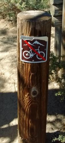
10 SIGN ISSUES Location: Tunnel Creek Road South Action: Replace illegible sign Location: South of Snapdragon Junction Action: Add confidence marker facing clockwise Location: Tunnel Creek South Vista Spur Action: Install 4x6 with vista marker and arrow Location: North of Christopher s Loop Junc. Action: Remove CM. Add NRT CM facing Counterclockwise. Location: South of Christopher s Loop Junc. Action: Add CM facing clockwise. 7


11 Location: Laxalt Junc. / Hobart Rd Crossing Action: Replace faded CM. Location: Laxalt Junc. / Hobart Rd Crossing Action: Add no motorized sign. Location: S. of Laxalt Junc. / Hobart Rd Crossing Action: Replace faded CM. Location: Spooner North TH Action: Remove no motorized sign. Location: Spooner North TH Action: Install no motorized sign 8


12 Location: Spooner N Equestrian TH Action: Add TRT Access marker at top. Location: Dirt Road Crossing on Spooner North TH Equestrian Access Trail Action: Remove broken carsonite. Install TRT Access marker 9

13 CAMPING IMPACTS Only two sites were discovered where obvious camping impacts had occurred. Though both sites are within the borders of Lake Tahoe Nevada State Park, where camping is prohibited, neither are recommended for restoration as one is on Tunnel Creek Road which is already heavily impacted and the other is so far off the trail that it does not appear to get much use as a nearby vista has become overgrown so the site is likely already in the process of recovery on its own. Campsite C1701 Location Type: Prohibited In Guthook App: No Approximate Area: 500+ sq ft Approximate Barren Core: 300+ sq ft Vegetative Ground Cover: 0% Vegetation Change: % Soil Exposure: % Soil Exposure Change: % Campsite Durability: Durable Cleanliness: Charcoal or Litter Trail Visibility: Easily Visible Social Trails: None Tree Damage: None Root Exposure: None Other Sites Visible: None Development: Moderate Fire Rings, Development Proximity to Water: 100+ ft Recovery Potential: Complete Restoration Impossible or Longer than 5-10 Years Recovery Recommended: No Condition Class: 3-Heavy Impact 10

14 Campsite C1702 Location Type: Prohibited In Guthook App: No Approximate Area: 200 sq ft Approximate Barren Core: Under 50 sq ft Vegetative Ground Cover: 6-25% Vegetation Change: 1-5% Soil Exposure: 51-75% Soil Exposure Change: 1-5% Campsite Durability: Not Durable, Not Fragile Cleanliness: Essentially Spotless Trail Visibility: Completely Screened Social Trails: One Tree Damage: None Root Exposure: One Tree Other Sites Visible: None Development: None Proximity to Water: 100+ ft Recovery Potential: Would Require Moderate Restoration Effort Recovery Recommended: No Condition Class: 1-Slight Impact 11


15 Trail Assessment Segment 3: Mt Rose/Tahoe Meadows to Spooner Summit C AREA OF DETAIL LEGEND Deficiency Campsite C Assessed Trail TRT Not Assessed Miles
16 NEXT STEPS 03 ASSESSMENT PROJECTIONS Approximately 12.1 miles were formally assessed on Segment 3 in 2017, which is nearly half of the 26.3 mile segment. The schedule for future formal assessments is as follows: July 2018 Diamond Peak to Tunnel Creek Road (3.1 miles) Christopher s Loop to Hobart Road (3.4 miles) August 2018 Ophir Creek TH Spur to Diamond Peak (4.7 miles) September 2018 Mt Rose Summit TH to Ophir Creek TH Spur (3 miles) 13
Trail Assessment Report
 Trail Assessment Report Trail Options for the Bear Creek Canyon located in Pikes Peak Ranger District, Pike National Forest and on Colorado Springs Utility Lands Due to the presence of a unique species
Non-motorized Trail Plan & Proposal. August 8, 2014
 Town of Star Valley Ranch, Wyoming and the Star Valley Ranch Association in partnership with the USDA Forest Service, Bridger-Teton National Forest, Greys River Ranger District Non-motorized Trail Plan
Logo Department Name Agency Organization Organization Address Information 5700 North Sabino Canyon Road
 Logo Department Name Agency Organization Organization Address Information United States Forest Coronado National Forest 5700 North Sabino Canyon Road Department of Service Santa Catalina Ranger District
Bear Creek Habitat Improvement Project
 06/10/10 Bear Creek Habitat Improvement Project El Paso County, Colorado Pike National Forest and Colorado Springs Utilities Owned Land Report prepared by: Eric Billmeyer Executive Director Rocky Mountain
TAHOE GETAWAY. Monday, October 1 through October 4, 2012
 TAHOE GETAWAY Monday, October 1 through October 4, 2012 COORDINATORS Sue Geisler --- Hiking Dennis Ratay --- Lodging Lodging is now filled. Waiting List: Anyone else interested in participating in the
Kit Carson-Challenger Ridge Trail Project
 Kit Carson-Challenger Ridge Trail Project Project Accomplishments Report-USFS December 15, 2015 Photo courtesy of Justin Peterson 815 South 25 th Street, Suite 101 Colorado Springs, CO 80904 Dedicated
Preferred Recreation Recommendations Stemilt-Squilchuck Recreation Plan March 2018
 Preferred Recreation Recommendations Stemilt-Squilchuck Recreation Plan March 2018 Below are the recommended recreation ideas and strategies that package together the various recreation concepts compiled
Managing Informal Trail Impacts. Jeff Marion, Unit Leader/Scientist Virginia Tech Field Unit, USGS, Patuxent WRC
 Managing Informal Trail Impacts Jeff Marion, Unit Leader/Scientist Virginia Tech Field Unit, USGS, Patuxent WRC jmarion@vt.edu, 540-231-6603 Presentation Objectives Informal Trail Management!! Decision
Kennesaw Mountain Trail Club. Trail Skills Workshop ~ Dips and Drains. Presented by: Jay M Dement
 Kennesaw Mountain Trail Club Trail Skills Workshop ~ Dips and Drains Presented by: Jay M Dement KEY CONCEPTS: Control Erosion and Users Where Do Trails Come From, and How Do They Work: Concept of trail
USDA Trails Strategy WRI: ENGLISH PEAK SURVEY. Theodore Mendoza San Diego State University June 6 th 2016 August 18 th Advisor: Sam Commarto
 WRI: ENGLISH PEAK SURVEY Theodore Mendoza San Diego State University June 6 th 2016 August 18 th 2016 Advisor: Sam Commarto Klamath National Forest Submitted: March 21, 2017 Table of Contents Acknowledgements
Colorado Mountain Club 2015 Stewardship Team Program Accomplishments
 Summary In 2015, CMC launched a new Stewardship Team program and hired a crew of young (25 and under), natural resource professionals to increase capacity of public land management agencies and coordinate
DECISION MEMO. Rawhide Trail #7073 Maintenance and Reconstruction
 Page 1 of 6 Background DECISION MEMO USDA Forest Service Jefferson Ranger District Jefferson County, Montana Rawhide Trail #7073 is located in the Elkhorn Mountain Range approximately 10 miles east of
Piestewa Peak/Dreamy Draw Trail Guide
 Piestewa Peak/Dreamy Draw Trail Guide Trail #1A - Perl Charles Memorial Trail Length: 4.8 miles Elevation: 2,200 ft. - 1,340 ft. Difficulty: Moderate to difficult The Perl Charles trailhead is located
Arizona National Scenic Trail
 1 The Arizona National Scenic Trail is an 800 mile recreation trail from Mexico to Utah that connects mountain ranges, canyons, deserts, forests, wilderness areas, historic sites, trail systems, points
Appendix C. Tenderfoot Mountain Trail System. Road and Trail Rehabilitation Plan
 Appendix C Tenderfoot Mountain Trail System Road and Trail Rehabilitation Plan All rehabilitation work would be under the direction of the District Fisheries Biologist, the Forest Hydrologist, and/or the
Kit Carson-Challenger Ridge Trail Project Annual Performance Report-2014 October 22, 2014
 1 Kit Carson-Challenger Ridge Trail Project Annual Performance Report-2014 October 22, 2014 Willow Lake and Kit Carson Peak 2 SUMMARY The Rocky Mountain Field Institute began Phase 1 of a multi-phase,
US Forest Service Bears Ears Trail - NFST 1144 California Park to Hole in Wall Creek. Good (1) 2 3
 2 3") Trail Maintenance Endowment Fund Trail Criteria Form The Trail Maintenance Endowment Fund (TMEF) grant criteria form is used in determining the use of funds available on an annual basis. Decisions on how
Trail Maintenance Endowment Fund Trail Criteria Form The Trail Maintenance Endowment Fund (TMEF) grant criteria form is used in determining the use of funds available on an annual basis. Decisions on how
Sierra National Forest 2015 Wilderness Program Accomplishment Report
 Sierra National Forest 2015 Wilderness Program Accomplishment Report The Sierra National Forest wilderness program provided stewardship and trail maintenance in the Ansel Adams, Dinkey Lakes, John Muir,
APPENDIX D: SUSTAINABLE TRAIL DESIGN. APPENDICES Town of Chili Parks and Recreation Master Plan Update
 APPENDIX D: SUSTAINABLE TRAIL DESIGN APPENDICES Town of Chili Parks and Recreation Master Plan Update Sustainable Trail Construction Sustainable trails are defined by the US Forest Service as trails having
April 19-21, See below for Course Descriptions. Columbia Cascades Trail Skills College Cascades Locks, Oregon.
 Columbia Cascades Trail Skills College Cascades Locks, Oregon April 19-21, 2013 Friday, April 19 198, 199 First Aid and CPR 300 Basic Rock Work 302 Water Crossings and Seeps 398 Working with Pack Stock
Theme: Predominately natural/natural appearing; rustic improvements to protect resources. Size*: 2,500 + acres Infrastructure**:
 Recreation Opportunity Spectrum (ROS) Classes The Recreation Opportunity Spectrum (ROS) provides a way to describe the variations in the degree of isolation from the sounds and influences of people, and
White Mountain Wilderness Trails
 The area in which these hikes are located is rugged high mountain country along the Mogollon Rim. This famous eastwest escarpment separates Arizona's high plateau from the basin and range below. These
CIEC 9 PEAKS AWARD SUPPLEMENT POSSIBLE ROUTES FOR THE 9 PEAKS AWARD TRIP
 CIEC 9 PEAKS AWARD SUPPLEMENT POSSIBLE ROUTES FOR THE 9 PEAKS AWARD TRIP As you plan your trip, be aware of 3 regulations in this wilderness: 1. Camp only in designated campsites. 2. No campfires allowed.
September 14, Comments of the Colorado Trail Foundation On the USFS Scoping Notice of August 13, 2010 RE: the relocation of the CDNST/CT Page 1
 THE COLORADO TRAIL FOUNDATION Comments on the U.S. Forest Service Scoping Notice of August 13, 2010 Regarding the Relocation of THE COLORADO TRAIL AND CONTINENTAL DIVIDE NATIONAL SCENIC TRAIL From La Garita
Walking Track Classification System Parks and Wildlife Service
 Appendix A Walking Track Classification Specifications Walking Track Classification System Parks and Wildlife Service This Walking Track Classification System is the outcome of a review of the track classifications
Arizona Game and Fish Department Report for Inventory of Motorized Dispersed Campsites on the Tonto National Forest
 Arizona Game and Fish Department Report for Inventory of Motorized Dispersed Campsites on the Tonto National Forest Prepared By: ' _2-_.J_.., +-- / S IS Specialist II, Arizona Game and Fish Dep rtment
Understanding the caring capacity of the visitor experience Provide facilities to support a high level user experience Address visual quality through
 Understanding the caring capacity of the visitor experience Provide facilities to support a high level user experience Address visual quality through recreation ecological restoration opportunities Collaboration
Trail Phasing Plan. Note: Trails in the Clear Creek Canyon area (Segments will be finalized in the future to minimize wildlife impacts
 Note: Trails in the Clear Creek Canyon area (Segments 2 5 and a future JCOS connection) will be finalized in the future to minimize wildlife impacts Trail Phasing Plan P Parking 3 Easy Trail Intermediate
Thank you for this third opportunity to comment on the proposed revisions to the Coconino National Forest Management plan.
 March 19, 2014 Flagstaff Biking Organization PO Box 23851 Flagstaff, AZ 86002 Vern Keller Coconino National Forest Attn: Plan Revision 1824 South Thompson Street Flagstaff, Arizona 86001 coconino_national_forest_plan_revision_team@fs.fed.us
Camp Geronimo Rainbow Trails
 Camp Geronimo Rainbow Trails With over 5,000 acres of surrounding national forest, the possibilities of getting out and seeing the wilderness are almost limitless. Camp Geronimo offers some of the greatest
National Recreation Trail Update Form
 National Recreation Trail Update Form Introduction Thank you for taking the time to complete this form. Your assistance will help ensure that the National Recreation Trail (NRT) database is complete and
DECISION MEMO North Zone (Legacy Trails) Trail Stabilization Project
 Trail Stabilization Project") DECISION MEMO North Zone (Legacy Trails) Trail Stabilization Project USDA FOREST SERVICE Rocky Mountain Region (R2) Shoshone National Forest Wapiti and Greybull Ranger District Park County, Wyoming Background
DECISION MEMO North Zone (Legacy Trails) Trail Stabilization Project USDA FOREST SERVICE Rocky Mountain Region (R2) Shoshone National Forest Wapiti and Greybull Ranger District Park County, Wyoming Background
ROAD AND TRAIL PROJECT APPROVAL
 ROAD AND TRAIL PROJECT APPROVAL www.marincountyparks.org Marin County Parks, 3501 Civic Center Dr, Suite 260, San Rafael, CA 94903 DATE: July 12, 2017 PRESERVE: Gary Giacomini Open Space Preserve PROJECT:
Other Agencies and Organizations
 Daniel Boone National Forest 1700 Bypass Road WInchester, KY 40391 859-745-3100 Location Northern terminus is near Morehead, Kentucky. Southern terminus is located in the Big South Fork NRRA in Tennessee.
MOUNTAIN BIKING THE CASCADE LOOP
 MOUNTAIN BIKING THE CASCADE LOOP By Henry Freimuth All photographs by Henry Freimuth The Cascades are on the Spanish Creek, which is a tributary of the Feather River. The Feather River was named by Spanish
Crystal Lake Area Trails
 Lake Area Trails Welcome to the Lake area of the Big Snowy Mountains! This island mountain range in central Montana features peaks reaching to 8,600 feet and long, high ridges from which vistas of the
City of Durango 5.8 FUNDING TRAILS DEVELOPMENT
 5.8 FUNDING TRAILS DEVELOPMENT The City has been successful in establishing dedicated local funding sources as well as applying for grants to develop the City s trail system, having received nearly $2.4
A Publication of Friends of Sleeping Bear Dunes
 A Publication of Friends of Sleeping Bear Dunes 2014, Friends of Sleeping Bear Dunes, P.O. Box 545, Empire, MI 49630 www.friendsofsleepingbear.org info@friendsofsleepingbear.org Learn more about the Friends
Route #2) Mt. Massive - Southwest Slopes
 Mt. Massive - Southwest Slopes") Route #2) Mt. Massive - Southwest Slopes Difficulty: Class 2 Ski: Advanced, D6 / R2 / III Exposure: Summit Elevation: Trailhead Elevation: Elevation Gain: Round-trip Length: Trailhead: County Sheriff:
Route #2) Mt. Massive - Southwest Slopes Difficulty: Class 2 Ski: Advanced, D6 / R2 / III Exposure: Summit Elevation: Trailhead Elevation: Elevation Gain: Round-trip Length: Trailhead: County Sheriff:
TUPPER DESIGNATED ACCESS ROUTE
 TUPPER DESIGNATED ACCESS ROUTE 1 FOR ACCESS/EGRESS TO CONNAUGHT, LOOKOUT, STONE ARCH, PORTAL PATHS AND TUPPER TRAVERSE EGRESS Length: 2.6km Vertical Gain: +162m / -83m (Values are for access. For egress,
Chattahoochee- Oconee National Forests. Decision Memo
 Page 1 of 6 USDA Forest Service Chattahoochee- Oconee National Forests Decision Memo Chattahoochee-Oconee National Forests Home Page Recreation Information Forest History Forest Facts Forest Management
KENNESAW MOUNTAIN TRAIL CLUB WORKDAY
 WORKDAY 4-14-18 1 Trail ambassadors or others see next page. 1 TOOLS HERE 2 1 7 20 Work for 4-14-18 will again be on the lower portion of the Mountain Trail below the fire road. Due to safety considerations,
Shelf Road Recreation Area 2015 BLM Annual Report of Rocky Mountain Field Institute Stewardship Under BLM Agreement L12AC20483 November 19, 2015
 Summary Shelf Road Recreation Area 2015 BLM Annual Report of Rocky Mountain Field Institute Stewardship Under BLM Agreement L12AC20483 November 19, 2015 Managed by the BLM Royal Gorge Field Office, Shelf
USDA Forest Service Deschutes National Forest DECISION MEMO. Round Lake Christian Camp Master Plan for Reconstruction and New Facilities
 USDA Forest Service Deschutes National Forest DECISION MEMO Round Lake Christian Camp Master Plan for Reconstruction and New Facilities Jefferson County, Oregon T. 13 S., R. 8 E., Section 16, W.M. Background:
Oregon Equestrian Trails Mt. Hood Chapter
 Oregon Equestrian Trails Mt. Hood Chapter November 17, 2010 To: Michelle Lombardo, Mt. Hood National Forest From: Barb Adams, Oregon Equestrian Trail, Mt. Hood Chapter Re: Barlow and Hood River Ranger
beach. Make the ford and follow the trail out to the junction with Red Creek Tr in an open grassy area.
 Description: This is a moderate to slightly strenuous 22.8 mile backpack (add 2.6 miles if you do the packless out and back to the Lion s Head) that will have you exploring nearly every thing that is The
STONE MOUNTAIN PROVINCIAL PARK Purpose Statement and Zoning Plan
 1 STONE MOUNTAIN PROVINCIAL PARK Purpose Statement and Zoning Plan Stone Mountain Provincial Park is situated 140 km west of Fort Nelson at Kilometre 595 of the Alaska Highway. The 25 690 ha park is located
Garibaldi Provincial Park Trail Conditions
 Garibaldi Provincial Park s November 20, 2018 Garibaldi Park is located in the coast mountain wilderness and the weather can be severe and unforgiving. Be well prepared, properly equipped and informed
Understanding user expectations And planning for long term sustainability 1
 Understanding user expectations And planning for long term sustainability 1 What is a natural surface trail? It can be as simple has a mineral soil, mulched or graveled pathway, or as developed as elevated
National Forests and Grasslands in Texas
 United States Department of Agriculture Forest Service National Forests and Grasslands in Texas Sam Houston NF 394 FM 1375 West New Waverly, Texas 77358 Phone 936-344-6205 Dear Friends, File Code: 1950
Mott Canyon Hazard Tree Incident
 Mott Canyon Hazard Tree Incident Lake Tahoe Basin Management Unit August 25, 2016 On August 25, 2016 while constructing a trail, John, a member of the Tahoe Rim Trail Association (TRTA) working under a
BACKSTORY & MMBA RECOMMENDATIONS
 URGENT!! COMMENT PERIOD ENDS MONDAY, MARCH 5 TH, 5PM!! MONTANA MOUNTAIN BICYCLE ALLIANCE RECOMMENDED COMMENTS ON CUSTER GALLATIN FOREST PLAN REVISION, Proposed Actions WINTER 2018 The CGNF Forest Plan
Trails Technical Committee
 Trails Technical Committee Winter 2017 Draft Report Alignment Proposals for the Inyo National Forest and the Town of Mammoth Lakes Map ID #S18 February 08, 2017 Map ID #S18 Key Agreements As of February
Keeping Wilderness Wild: Increasing Effectiveness With Limited Resources
 Keeping Wilderness Wild: Increasing Effectiveness With Limited Resources Linda Merigliano Bryan Smith Abstract Wilderness managers are forced to make increasingly difficult decisions about where to focus
GOLDEN EARS PROVINCIAL PARK
 GOLDEN EARS PROVINCIAL PARK Trail Information as of October 10 th 2015 Do not underestimate the mountainous wilderness of Golden Ears Provincial Park. The combination of rugged terrain and rapidly changing
INTRODUCTION. Mailing address: Burke County Community Development Attn: Tim Johnson P. O. Box 219 Morganton, NC
 REQUEST FOR QUALIFICATIONS: PROFESSIONAL, EXPERIENCED TRAIL BUILDERS FOR THE CONSTRUCTION OF THE FONTA FLORA STATE TRAIL LAKE JAMES SECTION BURKE COUNTY COMMUNITY DEVELOPMENT INTRODUCTION Burke County
BACKSTORY & MMBA RECOMMENDATIONS
 URGENT!! COMMENT PERIOD ENDS MONDAY, MARCH 5 TH, 5PM!! MONTANA MOUNTAIN BICYCLE ALLIANCE RECOMMENDED COMMENTS ON CUSTER GALLATIN FOREST PLAN REVISION, Proposed Actions WINTER 2018 The CGNF Forest Plan
Route #1) Mt. of the Holy Cross - North Ridge
 Mt. of the Holy Cross - North Ridge") Climbing 14ers can be very dangerous, please read the Mountaineering Safety Page and make sure you have a map+compass and can use them effectively, without the help of electronic devices. Route #1) Mt.
Climbing 14ers can be very dangerous, please read the Mountaineering Safety Page and make sure you have a map+compass and can use them effectively, without the help of electronic devices. Route #1) Mt.
Route Combo) Mt. Bierstadt - Bierstadt, Sawtooth, Evans
 Mt. Bierstadt - Bierstadt, Sawtooth, Evans") Climbing 14ers can be very dangerous, please read the Mountaineering Safety Page and make sure you have a map+compass and can use them effectively, without the help of electronic devices. Route Combo)
Climbing 14ers can be very dangerous, please read the Mountaineering Safety Page and make sure you have a map+compass and can use them effectively, without the help of electronic devices. Route Combo)
Bibbulmun Track. Cape to Cape Track. Two of the world s great long distance walking tracks. 973 km. 135 km km Off-road cycle touring
 Trail revitalising Western Australia Bibbulmun Track 973 km Cape to Cape Track 135 km Two of the world s great long distance walking tracks 1062 km Off-road cycle touring Trail revitalising 1. Framework
More people floated the Colorado River through
 STEWARDSHIP Managing Campsite Impacts on Wild Rivers Are There Lessons for Wilderness Managers? BY DAVID N. COLE Abstract: Campsites on popular wild rivers in the United States are heavily used by large
USDA TRAILS STRATEGY PROGRAM
 USDA TRAILS STRATEGY PROGRAM WRPI Program: English Peak Survey Jorge D. Briceño Southwestern Community College Internship Time Period: June 6, 2016 August 8, 2016 Advisor: Sam Commarto Recreation Officer
ANGEL PEAK SCENIC AREA
 Activities: Facilities: ANGEL PEAK SCENIC AREA Hiking, photography, watchable wildlife, camping, picnicking. Note: While formal hiking trails in the area are limited, dispersed hiking opportunities abound
Wild Sky Wilderness Area
 Wild Sky Wilderness Area M T. B A K E R - S N O Q U A L M I E N A T I O N A L F O R E S T S K Y K O M I S H R A N G E R D I S T R I C T USDA FOREST SERVICE WILD SKY WILDERNESS AREA TRAIL PLAN On May 8,
PROPOSED ACTION South 3000 East Salt Lake City, UT United States Department of Agriculture
 United States Department of Agriculture Forest Service Uinta-Wasatch-Cache National Forest Salt Lake Ranger District 6944 South 3000 East Salt Lake City, UT 84121 801-733-2660 File Code: 1950/2300 Date:
At the time, the portion of the line through Eagle County remains wholly under the ownership of Union Pacific Railroad (UP).
.") Chapter 5 The Railroad Corridor as a Trail Corridor The intent of this chapter is to identify how the rail corridor, if available for lease or purchase in all or part, could be incorporated into the core
Chapter 5 The Railroad Corridor as a Trail Corridor The intent of this chapter is to identify how the rail corridor, if available for lease or purchase in all or part, could be incorporated into the core
A GIS Analysis of Probable High Recreation Use Areas in Three Sisters Wilderness Deschutes and Willamette National Forests
 Lindsey Kiesz Geo 565 Term Project 3/15/2010 A GIS Analysis of Probable High Recreation Use Areas in Three Sisters Wilderness Deschutes and Willamette National Forests Introduction The Three Sisters Wilderness
2012 Squaw Butte Trail Warriors
 2012 Squaw Butte Trail Warriors Between June 1 st and September 30 th 2012 Squaw Butte supported nine trail maintenance projects. These projects covered a large section of south western Idaho, taking place
Secret-Lamoille Trail Project
 Secret-Lamoille Trail Project Historical Background Over the years, the US Forest Service and a variety of Forest users have routed and constructed trails in the Ruby Mountains. Many of those trails have
Trail Master Plan. Hungry Mother State Park
 Trail Master Plan For Hungry Mother State Park Prepared for Virginia State Parks Presented by Trail Dynamics, LLC PO Box 664 Cedar Mountain, NC 28719 www.traildynamics.com 1 1 Table of Contents Introduction
San Juan Resource Area Recreation Impact Inventory/Monitoring
 San Juan Resource Area Recreation Impact Inventory/Monitoring Indian Creek Climbing Area Overview & Summary of Findings 2007 Pam Foti, Professor Aaron Divine, Lecturer Janet Lynn, Program Coordinator Northern
Mount Rainier National Park November 2006 Flood Damage
 On November 6 and 7, 2006, Mount Rainier National Park received 18 inches of rain in 36 hours. This presentation summarizes the extensive flood damage that occurred throughout the park. Updated November
Who is Beneficial Designs?
 Who is Beneficial Designs? Beneficial Designs works towards universal access through research, design, and education. We believe all individuals should have access to the physical, intellectual, and spiritual
Course Description. Oregon Pacific Crest Trail Backpacking for Adults
 Overview This backpacking course is designed to prepare and train you to tackle the Pacific Crest Trail (PCT) and other long distance hiking trails on your own. It is also designed so that if you desire,
Tallahassee-St. Marks Historic Railroad Trail
 Revitalizing a Historic Trail Designated as a National Recreation Trail, the 16-mile Tallahassee-St. Marks Historic Railroad Trail has been enjoyed by countless bicyclists, runners, and outdoor enthusiasts
Anderson Mt. Proposed Wilderness Additions to the Rogue-Umpqua Divide Wilderness-- T30S R3E (mostly) Sections 4 & 9, and T29S R3E Section 33
 Sections 4 & 9, and T29S R3E Section 33") Anderson Mt. Proposed Wilderness Additions to the Rogue-Umpqua Divide Wilderness-- T30S R3E (mostly) Sections 4 & 9, and T29S R3E Section 33 When the 35,701 acre Rogue-Umpqua Divide Wilderness was designated
Anderson Mt. Proposed Wilderness Additions to the Rogue-Umpqua Divide Wilderness-- T30S R3E (mostly) Sections 4 & 9, and T29S R3E Section 33 When the 35,701 acre Rogue-Umpqua Divide Wilderness was designated
GATEWAY PHASE 2. U.S. Forest Service and the Mount Shasta Trails Association
 GATEWAY PHASE 2 U.S. Forest Service and the Mount Shasta Trails Association PROJECT DEVELOPMENT Brief history - Gateway Phase 1 - IMBA conceptual plan - BikeShasta: concert series - USFS & MSTA partnered
MORGAN CREEK GREENWAY Final Report APPENDICES
 APPENDICES MORGAN CREEK GREENWAY Appendix A Photos of Existing Conditions in Trail Corridor Photos of existing conditions Main trail corridor - February 2009 Photos of existing conditions south bank Morgan
Trail Feasibility Study
 VOLUSIA COUNTY MPO CITY OF NEW SMYRNA BEACH FINAL REPORT JUNE 30, 2009 Trail Feasibility Study What s inside? 1 Introduction 2 Project Purpose & Scope 3 Physical Inventory & Assessment of Right-of- Way
Trail Beginning Elevation: 7553 ft The Poison Creek Trailhead is located at the end of National Forest Road 646E (NF-646E).
.") West Mountain Trails Poison Creek Trail #134 Length: 2.9 miles (4.7 km) Difficulty Horseback: A good trail for the first time west mountain rider, some steep sections Hiking: Most Difficult USGS Maps:
West Mountain Trails Poison Creek Trail #134 Length: 2.9 miles (4.7 km) Difficulty Horseback: A good trail for the first time west mountain rider, some steep sections Hiking: Most Difficult USGS Maps:
Project Report Volunteer Trip Torres del Paine National Park, Patagonia, Chile December 3-15, Executive Summary
 Conservation Volunteers International Program 120 Village Square #9, Orinda, California 94563 USA www.conservationvip.org info@conservationvip.org Tel: (925) 228-5946 A Non-Profit 501c3 Tax Exempt Organization
PLANNING COMMISSION AGENDA REPORT May 10, Members of the Planning Commission. Joyce Parker-Bozylinski, Contract Planner
 PLANNING COMMISSION AGENDA REPORT May 10, 2007 TO: FROM: PROPOSAL: APPLICANT: RECOMMENDATION: Members of the Planning Commission Joyce Parker-Bozylinski, Contract Planner Approval of the Calabasas Trails
BACKCOUNTRY PROGRAM WATERSHED REPORT 2002
 BACKCOUNTRY PROGRAM WATERSHED REPORT 2002 Pfeifferhorn Peak, Lone Peak Wilderness Area Salt Lake Ranger District, Wasatch Cache National Forest Prepared by Backcountry Rangers: Joelle Dickson, Greg Hilbig
MOAB peopleforbikes.org/e-bikes
 emtb ADVENTURE MAPS MOAB peopleforbikes.org/e-bikes OVERVIEW Moab, Utah is a world-class mountain bike destination known for its vast, red sandstone landscapes nestled below the rising peaks of the La
(This page intentionally left blank.)
") Executive Summary (This page intentionally left blank.) Executive Summary INTRODUCTION The Cache Valley Transit District (CVTD) contracted with the team of Transportation Consultants, Inc. () and Fehr
Executive Summary (This page intentionally left blank.) Executive Summary INTRODUCTION The Cache Valley Transit District (CVTD) contracted with the team of Transportation Consultants, Inc. () and Fehr
Willow Creek Horse Camp Reconstruction
 Performance Period: 04/15/2017-12/31/2017 The following is a summary of hours and work completed on the Black Hills National Forest and other public lands during the reporting period for 2017 by the Black
Rogue Gorge (Mt. Stella) Roadless Area-- T30S R3E (primarily in portions of Sections 23, 26, 33, 34 & 35)
 Roadless Area-- T30S R3E (primarily in portions of Sections 23, 26, 33, 34 & 35)") Rogue Gorge (Mt. Stella) Roadless Area-- T30S R3E (primarily in portions of Sections 23, 26, 33, 34 & 35) Rogue River-Siskiyou National Forest--High Cascades Ranger District Upper, higher elevation trail
Rogue Gorge (Mt. Stella) Roadless Area-- T30S R3E (primarily in portions of Sections 23, 26, 33, 34 & 35) Rogue River-Siskiyou National Forest--High Cascades Ranger District Upper, higher elevation trail
Trail Report for KOKANEE GLACIER PROVINCIAL PARK and other Kootenay Lake Area parks (including west side of Purcell Wilderness Conservancy)
") Updated: October 23, 2017 Please call 250-354-6333 if you have new trail conditions to report. PARK AREA ROADS TRAILS ADDITIONAL INFORMATION Kokanee Creek SPECIAL NOTICE: Trail from Gibson Lake to drainage
Updated: October 23, 2017 Please call 250-354-6333 if you have new trail conditions to report. PARK AREA ROADS TRAILS ADDITIONAL INFORMATION Kokanee Creek SPECIAL NOTICE: Trail from Gibson Lake to drainage
Project Planning, Compliance, and Funding
 Project Planning, Compliance, and Funding The plans above offer high level guidance to ensure that the A.T. is managed effectively as a whole unit in a decentralized management structure. Cooperative management
Decision Memo for Desolation Trail: Mill D to Desolation Lake Trail Relocation
 for Salt Lake County, Utah Uinta-Wasatch-Cache National Forest Salt Lake Ranger District 1. Background The present location of the Desolation Trail (#1159) between Mill D and Desolation Lake follows old
Performance monitoring report for the second half of 2015/16
 Performance monitoring report for the second half of 2015/16 Gatwick Airport Limited 1. Introduction DATE OF ISSUE: 7 JUNE 2016 This report provides an update on performance at Gatwick in the second half
Oak Ridges Moraine: Southern Ontario's Sponge
 Oak Ridges Moraine: Southern Ontario's Sponge Lesson Overview Students will examine the location and the importance of the Oak Ridges Moraine and investigate ongoing conflicts concerning its development.
Peter Axelson. Beneficial Designs, Inc. Minden, NV
 Peter Axelson Beneficial Designs, Inc. Minden, NV Arroya Sit Ski Mono Ski Dynamic Seating Spring Assist Cross Country Ski Hand Bike Adaptive Canoe Seating Available from Chosen Valley Canoe Accessories
Table 3-7: Recreation opportunity spectrum class range by prescription. Recreation Opportunity Spectrum (ROS) Classes
 Classes") Appendix F Table -7: Recreation opportunity spectrum class range by prescription. Recreation Opportunity Spectrum (ROS) Classes Prescription Primitive Primitive II Roaded Modified Rural Urban 111 - Primitive
Appendix F Table -7: Recreation opportunity spectrum class range by prescription. Recreation Opportunity Spectrum (ROS) Classes Prescription Primitive Primitive II Roaded Modified Rural Urban 111 - Primitive
The success of this club and the events it provides to its members is directly related to the participation by its members
 END OF 2016 nwtra.com North West Trail Riders Association PO Box 571, Pendleton, OR 97801 Email: contact@nwtra.com Club President: Geoff Reiff Vice President: Brandon Robinson Treasurer: Chuck Overstreet
Daisy Dean Trail 628/619 ATV Trail Construction
 Background and Purpose and Need The Daisy Dean ATV Trail Construction Project is located in the Little Belt Mountains, Musselshell Ranger District, Lewis and Clark National Forest approximately 32 miles
Lava Mountain Trail Distance: Elevation Range: Trail Type: Difficulty: Season: Driving Distance: Driving Time: USGS Maps: Pros Cons
 Lava Mountain Trail Distance: 13.4 miles (including the side trip to North Star Lake) Elevation Range: 5900'-8330' Trail Type: singletrack Difficulty: moderate Season: late June-October Driving Distance:
Stein Valley Nlaka pamux Heritage Park
 Stein Valley Nlaka pamux Heritage Park - Trail Information Update and Winter Advisory November 2017 March 2018 Welcome to Stein Valley Nlaka pamux Heritage Park! **This trail update is to inform park users
Trail Details Location
 Blind Blue Ribbon Centennial Conditions: Forest trail, with duckboards, and rope railing. Need: Blind trail activity bag, available in the camp office. None Availability: Open all seasons. Use the outdoor
Marvine Creek Trail BCM Course Area Guide Backcountry. Trip Code Team Leader
 Marvine Creek Trail BCM Course Area Guide Backcountry Trip Code Team Leader Table of Contents Trail Summary... 3 Trail Information... 3 Trail Description... 4 Route Description... 5 Trail Distances...