Quandary Peak East Ridge
|
|
|
- Anna Parrish
- 5 years ago
- Views:
Transcription


1 Quandary Peak East Ridge Difficulty: Class 1 / 2 June 28,2013 Exposure: Summit Elev.: 14,265 feet Trailhead Elev.: 10,850 feet Elevation Gain: 3,450 feet Roundtrip: 6.75 miles Hikers: Shan Stuart, Rick Crandall and Rocky the Australian Terrier Quandary Peak is the highest peak and the only fourteener in the Tenmile Range. The trailhead is about 9 miles from Breckenridge. It is one of the most popular fourteeners due to its easy-to-follow route and easy access from Denver. Also there are no 4 wheel drive vehicle requirements to get to the trailhead. The route is rocky underfoot most of the way up past the tree line, but portions have been improved by the Colorado Fourteeners Initiative in the early 2000 s. While this mountain is not difficult, it s still a fourteener with 3500 of elevation gain and is susceptible to rapidly changing weather conditions and occasional tricky footing, so the trail still packs a punch. Much of the climbing occurs in two relatively short sections. One climbs 1300 feet over a 0.9-mile section, roughly midway through the hike. The other climbs 1100 feet during the final 0.8-mile push to the top. It s an OK first mountain for someone wanting to try a fourteener, although Mt. Elbert or Mt. Democrat are easier. The peak's name comes from a group of miners who were unable to identify a mineral specimen found on its slopes in the 1860s. The group was in a quandary over the exact nature of the mineral, and so dubbed the mountain "Quandary Peak!" We do know that some silver-bearing Galena has been found and mined at the Monte Cristo Mine on this mountain maybe that was the unknown mineral?


2 We overnighted in Breckenridge and started early to get to trailhead by 5:30 am. Even though the summer monsoon weather pattern hasn t started up yet, this June, 2013 has been unusually hot which can produce electrical storms in the mountains. Shan and Rocky on the trail at 5:30 am. We hiked for over an hour up to tree line at about 11,800 and that s where the rocks started, the trees shrunk and then disappeared. Rick pointing to the last tree.


3 Just above tree line we had a fun surprise. Some of the whiter rocks started moving and we realized we were seeing mountain goats above us. We continued uphill and to our delight more goats appeared and they didn t spook much. Clearly they felt they were the owners of the mountain. This appeared to be two families two big Dads and two Moms each with a baby goat in tow.
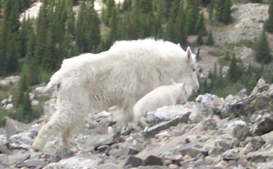
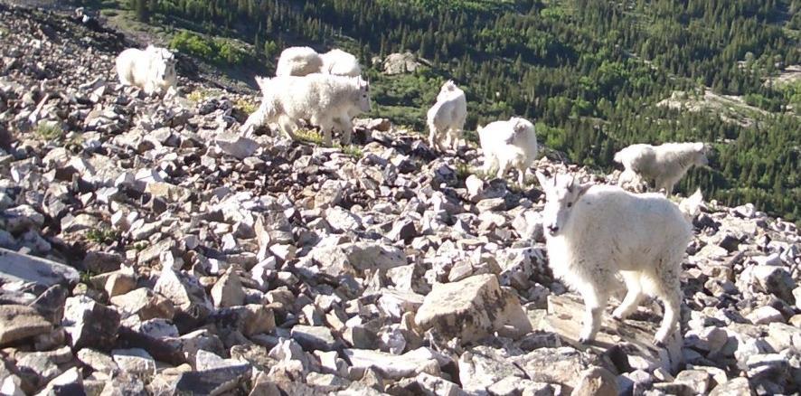
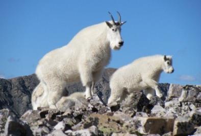
4


5 Oh yeah there s some good jumpers. We left the goats to their wanderings and headed uphill through the rocks. Rocky, our four year old Australian Terrier, was showing his strength and agility by hopping and jumping rocks his size almost all the way up for over 3 miles and 3000 of elevation gain, until we later got near the summit which was still under snow cover. Shan and Rocky at about 12,800 headed up; the summit is not yet in sight.


6 About 800 from the summit we transitioned from rocks to snow.. The snow conditions were perfect at that altitude the snow was firm enough to prevent post-holing and yet soft enough to get purchase with our boots. Of course Rocky had no trouble with his built-in crampons. Shan and Rocky nearing the summit.


7 And then we were at the summit Quandary Peak, elevation 14,265 at 9:40am, not exactly a record time up (3500 in 4 hours and 10 minutes) but we did spend some time with the goats and it was my first of the summer and Rocky s first ever. Rocky is now an official fourteener dog!
 that were summited all in one day by Emme surely the champion fourteener climber of all Australian Terriers (having checked off 17 in her climbing")

8 From the summit you can see four other nearby fourteeners (one of which is Mt. Democrat) that were summited all in one day by Emme surely the champion fourteener climber of all Australian Terriers (having checked off 17 in her climbing career). Emme is Rocky s grandmother! On that day in August, 2008 her summiting exploits raised $16,000 in pledges for the Aspen Animal Shelter & the Canine Health Foundation (see ) Mt. Democrat, At that time in 2008 Obama s prospects were on the rise and we thought summiting Mt. Democrat was pretty cool. Now, 5 years later not so much.

9 At 10:10 am headed back down.


10 Rocky was back into bouldering but also on a keen lookout for Marmots and Pikas. This shot was just before an amazing stunt I wish I d had the reflexes to capture. Rocky spotted a Pika and with several of us as witnesses, he leapt into the air down-mountain, catching 4 or 5 of air as the mountain under him fell away, and amazingly, landed front feet on a boulder, pivoted and scrambled across more rock just missing the clever Pika who ducked into a crevice just in time! Pikas are native to cold climates; most species live on rocky mountain sides where there are numerous crevices to shelter in. They are small mammals, about 6-8 long. They feed on plant matter and lichens found among the rocks.


11 As we got back to tree line, I turned around to take one last look at Quandary Peak and guess what? There were the storm clouds gathering right at the peak we were glad we d started early! Back at trailhead at 12:50, feelin good. We were 2 ½ hours coming down for a total of a 6 ½ hour leisurely day and a great start to the summer season.
Mt. Massive Southwest Slopes
 Mt. Massive Southwest Slopes Difficulty: Class 2 Exposure: Summit Elevation: 14,421 feet Trailhead Elevation: 10,500 feet Elevation Gain: 4,050 feet Round-trip Length: 8.00 miles Trailhead: N. Halfmoon
Mt. Elbert East Ridge
 Mt. Elbert East Ridge Difficulty: Class 1 Exposure: None Summit Elev.: 14,440 feet Trailhead Elev.: 10,400 feet Elevation Gain: 4,100 feet Roundtrip Length: 8.5 miles Trailhead: South Elbert (near Twin
Four Fourteeners in One Day
 Mt. Democrat: Summit: 14, 148 Mt. Cameron: Summit: 14,050 Mt. Lincoln: Summit: 14,286 Mt. Bross: Summit: 14,172 Four Fourteeners in One Day Trailhead: Trailhead Elev.: Total Elevation Gain: Roundtrip:
Grizzly Peak A - East Ridge July 15, 2012
 Grizzly Peak A - East Ridge July 15, 2012 Difficulty: Difficult Class 2/Class 3 Upper Elevation: 13,995 feet Trailhead Elevation: 11,360 feet Elevation Gain: 3,000 feet Round-trip Length: 6.0 miles Trailhead:
Mt. Eolus and North Eolus
 Mt. Eolus and North Eolus Difficulty: Class 3 Exposure: Summit Elev.: Mt. Eolus: 14,083 feet N. Eolus: 14,039 feet Camp Elev.: 11,100 feet Elevation Gain: 3,200' starting at Chicago Basin 6,300' starting
Mt. Lindsey in the Sangre de Cristos Aug 16, 2011
 Mt. Lindsey in the Sangre de Cristos Aug 16, 2011 Difficulty: Class 3 Summit Elevation: 14,042 feet Trailhead Elevation: 10,700 feet Elevation Gain: 3,500 feet but for us it was over 4000 Round-trip Length:
Mount Daly a Most Prominent Peak via South Ridge
 Mount Daly a Most Prominent Peak via South Ridge Difficulty: Class 3 Exposure: Exposed in places along the ridge Summit Elevation: 13,305 Elevation Gain: 4100 from trailhead; 1800 from Capitol Lake camp
Climbers: Rick Crandall; Rick Peckham July 29, 2016
 Wilson Peak Southwest Ridge First Try Difficulty: Class 3 Exposure: Exposed top 600 to summit Summit Elevation: 14,017 Elevation Gain: 3800 Round Trip: 10 miles Trailhead: Rock of Ages (Silver Pick) Climbers:
Glacier National Park, MT
 Glacier National Park, MT July 28 Aug. 1, 2010 We decided to go to Glacier National Park for our family vacation this year. We had a great time seeing beautiful scenery and a variety of wildlife which
Ellingwood Pt. via South Zapata Creek (non-standard route)
") Ellingwood Pt. via South Zapata Creek (non-standard route) Difficulty: Class 3 Exposure: Ellingwood Pt.: Elevation Gain: RT Length: Trailhead: 14,042 feet 4,800 feet (backpacking 2740 then 2060 starting
Ellingwood Pt. via South Zapata Creek (non-standard route) Difficulty: Class 3 Exposure: Ellingwood Pt.: Elevation Gain: RT Length: Trailhead: 14,042 feet 4,800 feet (backpacking 2740 then 2060 starting
Route #2) Mt. Massive - Southwest Slopes
 Mt. Massive - Southwest Slopes") Route #2) Mt. Massive - Southwest Slopes Difficulty: Class 2 Ski: Advanced, D6 / R2 / III Exposure: Summit Elevation: Trailhead Elevation: Elevation Gain: Round-trip Length: Trailhead: County Sheriff:
Route #2) Mt. Massive - Southwest Slopes Difficulty: Class 2 Ski: Advanced, D6 / R2 / III Exposure: Summit Elevation: Trailhead Elevation: Elevation Gain: Round-trip Length: Trailhead: County Sheriff:
Mt. Sneffels (from Yankee Boy Basin) - A Cool Fourteener
 - A Cool Fourteener") Mt. Sneffels (from Yankee Boy Basin) - A Cool Fourteener Difficulty: Difficult Class 3 Exposure: Summit Elev.: 14,150 feet Trailhead: Yankee Boy Basin Climbers: Rick Crandall; Shan Stuart; Laura Welch
Mt. Sneffels (from Yankee Boy Basin) - A Cool Fourteener Difficulty: Difficult Class 3 Exposure: Summit Elev.: 14,150 feet Trailhead: Yankee Boy Basin Climbers: Rick Crandall; Shan Stuart; Laura Welch
Your Guide to Mountainbiking around Atlin (yes, you can hike these trails as well)
") Your Guide to Mountainbiking around Atlin (yes, you can hike these trails as well) Foreword Thanks to the rich mining history in Atlin, the historic mining roads have become the perfect trails for recreational
Your Guide to Mountainbiking around Atlin (yes, you can hike these trails as well) Foreword Thanks to the rich mining history in Atlin, the historic mining roads have become the perfect trails for recreational
Route Combo) Mt. Bierstadt - Bierstadt, Sawtooth, Evans
 Mt. Bierstadt - Bierstadt, Sawtooth, Evans") Climbing 14ers can be very dangerous, please read the Mountaineering Safety Page and make sure you have a map+compass and can use them effectively, without the help of electronic devices. Route Combo)
Climbing 14ers can be very dangerous, please read the Mountaineering Safety Page and make sure you have a map+compass and can use them effectively, without the help of electronic devices. Route Combo)
L U N C H C R E E K T R A I L GLACIER NATIONAL PARK
 D I R T I N M Y S H O E S L U N C H C R E E K T R A I L GLACIER NATIONAL PARK Lunch Creek "Secret" Hike This short hike on the Lunch Creek Trail will knock your socks off! It's the perfect mix of length,
County Line trail - Miller Peak to Little Navaho
 County Line trail - Miller Peak to Little Navaho 7-17-2008 This hike features a portion of the County Line trail in the Teanaway that receives extremely little use despite offering a spectacular ridge-run
Maroon Peak. Climbers: Rick Crandall; Rick Schultz and Andy Mishmash with his dog Stormy Oct 11, 2012
 Difficulty: Class 3 Exposure: Summit Elev.: 14,156 feet Trailhead Elev.: 9,590 feet Elevation Gain: 4,800 feet RT Length: 12.00 miles Trailhead: Maroon Lake Maroon Peak Climbers: Rick Crandall; Rick Schultz
HIKING IN THE CANADIAN ROCKIES
 HIKING IN THE CANADIAN ROCKIES Distance Time Elevation y MORAINE LAKE TRAILS THE ROCKPILE 0.8 km (0.5 mi) 20 min 30 m (98 ft) Located adjacent to the Lodge, the short interpretive trail up the Rock Pile
playwinterpark.com Off The Beaten Path Hikes Hiking Recommendations for the Adventurous Hiker
 playwinterpark.com Off The Beaten Path Hikes Hiking Recommendations for the Adventurous Hiker Hike: Devil s Thumb (difficult) Length: 3.93 miles one-way Elevation: Trailhead 9609 Destination 12,236 Trailhead
Los Torres del Paine in the Chilean Patagonia
 Total Trekking: 95km (65 miles) Los Torres del Paine in the Chilean Patagonia Rick Crandall November 19 26, 2011 Torres del Paine is a mountain massif that is a national park of Chile, near the southern
Route #1) Mt. of the Holy Cross - North Ridge
 Mt. of the Holy Cross - North Ridge") Climbing 14ers can be very dangerous, please read the Mountaineering Safety Page and make sure you have a map+compass and can use them effectively, without the help of electronic devices. Route #1) Mt.
Climbing 14ers can be very dangerous, please read the Mountaineering Safety Page and make sure you have a map+compass and can use them effectively, without the help of electronic devices. Route #1) Mt.
Draft II - Trip Report by Kurt Wibbenmeyer
 Draft II - Trip Report by Kurt Wibbenmeyer COLORADO MOUNTAIN CLUB FAIRWEATHER MOUNTAIN EXPEDITION 2010 TEAM Rich McAdams Leader Mike Butyn Wayne Herrick Gerry Roach Bill Blazek Dave Covill Jim Rickard
Kuruwita Erathna Trail to Sri Pada (Adam s Peak)
") Kuruwita Erathna Trail to Sri Pada (Adam s Peak) Trail Difficulty: Easy Moderate Strenuous Tough Trail Head: Adevikanda, Erathna (near entrance to mini-hydro power plant) Nearest Town: Erathna Nearest
Kuruwita Erathna Trail to Sri Pada (Adam s Peak) Trail Difficulty: Easy Moderate Strenuous Tough Trail Head: Adevikanda, Erathna (near entrance to mini-hydro power plant) Nearest Town: Erathna Nearest
GOLDEN EARS PROVINCIAL PARK
 GOLDEN EARS PROVINCIAL PARK Trail Information as of October 10 th 2015 Do not underestimate the mountainous wilderness of Golden Ears Provincial Park. The combination of rugged terrain and rapidly changing
CIEC 9 PEAKS AWARD SUPPLEMENT POSSIBLE ROUTES FOR THE 9 PEAKS AWARD TRIP
 CIEC 9 PEAKS AWARD SUPPLEMENT POSSIBLE ROUTES FOR THE 9 PEAKS AWARD TRIP As you plan your trip, be aware of 3 regulations in this wilderness: 1. Camp only in designated campsites. 2. No campfires allowed.
Colorado Life Zone Scavenger Hunt
 Colorado Life Zone Scavenger Hunt Below are worksheets created for all the habitats or life zones. They were designed with the intention of breaking the class up into small groups, and having students
Three Sisters Wilderness Oct. 2009
 Three Sisters Wilderness Oct. 2009 I was in Bend, OR and had the whole day to travel back to Boise so I decided to take a hike to the popular Green Lakes and summit the South Sister in Three Sisters Wilderness.
Queen Mary Falls Ride. 40ks
 Queen Mary Falls Ride 40ks The 70k riders had wheeled out of the park at around 10,00am but the 40k riders had another hour to sit around and soak up the day. While we were waiting for kick off some of
SAMPLE HIKING TRIPS Made with love by your CUHC Officers
 SAMPLE HIKING TRIPS Made with love by your CUHC Officers DISCLAIMER: Be sure to check trail conditions and weather before you hit the trail! IMPORTANT: Permits and wilderness regulations are frequently
PERUVIAN ANDES ADVENTURES. TOCLLARAJU CLIMB or ISHINCA + TOCLLARAJU CLIMBING. Tocllaraju 4 Days Ishinca + Tocllaraju 5 or 6 days
 PERUVIAN ANDES ADVENTURES TOCLLARAJU CLIMB or ISHINCA + TOCLLARAJU CLIMBING Tocllaraju 4 Days Ishinca + Tocllaraju 5 or 6 days PEAKS Tocllaraju: 6034m (19797 ft) Grade: D / Hard / Some steep & technical
Looking back across Emerald Lake at Wapta Mountain (on the left) and Mount Burgess (on the right):
 and Mount Burgess (on the right):") YOHO LAKE FROM EMERALD LAKE, YOHO NATIONAL PARK, BRITISH COLUMBIA, CANADA We decided to hike to Yoho Lake from Emerald Lake even though the distance is longer than the trail from Takakkaw Falls (about
YOHO LAKE FROM EMERALD LAKE, YOHO NATIONAL PARK, BRITISH COLUMBIA, CANADA We decided to hike to Yoho Lake from Emerald Lake even though the distance is longer than the trail from Takakkaw Falls (about
Windom Peak. Climbers: Rick Crandall; Rick Peckham August 26, 2017
 Windom Peak Difficulty: Class 3 Exposure: Significant exposure at summit Summit Elevation: 14,082 Elevation Gain: 6000 from Needleton; 3000 from Chicago Basin camp at 11,100 Round Trip: 17 miles from Needleton;
Summit Kilimanjaro. 10 Days
 Summit Kilimanjaro 10 Days Summit Kilimanjaro Summit every adventurers's dream come true the mighty Kilimanjaro at 19,340 feet! Follow MT Sobek's highly experienced guides up the less-traveled Western
Mt. Thielsen Trip Report: April 29, 2012
 Mt. Thielsen Trip Report: April 29, 2012 Outing Organizer: Geoff Hance, with Brent McGregor Elevation Gain: 3,800 feet, over warming snow, with an exposed summit block Distance: About 9 miles round trip
HB/VS-078 Üssers Barrhorn
 HB/VS-078 Üssers Barrhorn Paul HB9DST, August 23, 2015 Summary: This was a HB9SOTA club project, an activation of the highest summit in Europe you can hike up without ropes or other equipment. The headline
KILIMANJARO 2018 RUN & TREK February 28 March 12
 KILIMANJARO 2018 RUN & TREK February 28 March 12 Wednesday 28 Feb Depart USA to Kilimanjaro International Airport, Tanzania, Africa Thursday 01 March Arrive Kilimanjaro. Met upon arrival at the Kilimanjaro
Kirigalpoththa Nature Trail Horton Plains National Park
 Kirigalpoththa Nature Trail Horton Plains National Park Trail Difficulty: Easy Moderate Strenuous Tough Trail Head: Horton Plains Visitor Centre Nearest Town: Pattipola Nearest City: Nanu-Oya Access to
Snowmass Mountain. Climbers: Brett Crandall; Rick Crandall; Rick Peckham August 11, 2014
 Snowmass Mountain Difficulty: Class 3 & 4 Exposure: Summit Elev.: 14,092 feet Trailhead Elev.: 8,400 feet Elevation Gain: 5,800 total; 3200 from Snowmass Lake RT Length: 22.00 miles total; 5 miles from
South Colony Basin Recreation Fee Proposal
 South Colony Basin Recreation Fee Proposal Purpose and Need for Collecting Fees in South Colony Basin: Forest Service appropriated funds have not been sufficient to maintain current recreational services
Marten & Kelly Lakes 10 th Annual Daddy-daughter Backpacking Adventure
 Marten & Kelly Lakes 10 th Annual Daddy-daughter Backpacking Adventure I took my daughters to Marten and Kelly Lakes this year (mid July 2016) for our daddy-daughter overnighter. Marten Lake is west of
Itinerary Overview. Continental Divide Alpine Backpacking 22 days Ages Course Description
 Itinerary Overview Continental Divide Alpine Backpacking 22 days Ages 16-18 Course Description Welcome, you re in for an experience of a lifetime! Imagine hiking through rolling forests, sharing alpine
Mountain Goats and Winter Recreation November 17, 2011
 Mountain Goats and Winter Recreation November 17, 2011 Summary Mountain goats need protection from disruption and displacement in their winter feeding areas by motorized and non-motorized recreationists
Charnley Explorer June 24 - July 15, 2018 Bachsten Creek and the Charnley River. Second draft: 14 November 2017
 Charnley Explorer June 24 - July 15, 2018 Bachsten Creek and the Charnley River. Second draft: 14 November 2017 The best part of the original section one is now part of out Gibb Road Gorges trip. The dates
The temperature is nice at this time of year, but water is already starting to be scarce.
 In March of 2003, Scott Morrison and I went backpacking in the Grand Canyon. The temperature is nice at this time of year, but water is already starting to be scarce. Another issue with this time of year
Podcast 31 - The Australian Alps - A Trip to Thredbo
 Podcast 31 - The Australian Alps - A Trip to Thredbo by Rob McCormack - Friday, January 03, 2014 http://slowenglish.info/?p=918 Learn English while learning about daily life in Australia, with Rob McCormack
MDA-004 Very Diffictult MDA-007 Stunts Ski Mccall - idaho MDA-008 Stunts Snowboard MDA-014 Skiing Def Mccall - idaho
 MDA-004 Very Diffictult MDA-007 Stunts Ski Wolf Creek - Colorado Mccall - idaho MDA-008 Stunts Snowboard MDA-014 Skiing Def MDA 014 SKIING DEF CENTER FRONT BLACK MDA 008-Stunts Snowboard WHT/BLACK Mccall
Get Out And Hike! From Bruce Rieman, scientist and retired fish guy:
 Get Out And Hike! Living between the Swans and Missions and not hiking is like living in Anaheim, California and not visiting Disneyland. To help others and myself enjoy our unique surroundings, I asked
It was breakfast. I was just cutting into my second. Where my Help Comes from
 Where my Help Comes from It was breakfast. I was just cutting into my second pancake when Shirley and Helen pushed the dining room door open, their faces red and their hair damp with sweat. They don t
Blanca Peak Northwest Ridge
 Blanca Peak Northwest Ridge Difficulty: Difficult Class 2 Exposure: Moderate, except more exposure on top of Northwest ridge Summit Elevation: 14,345 Elevation Gain: 5700 feet from car Round Trip: 14.5
Climbing Oak and Brushy Top Mountains
 Climbing Oak and Brushy Top Mountains Story and photographs by Vann Helms www.blueridgeimpressions.org Brushy Top Mountain- February 2, 2014 Brushy top summit After a January of record breaking cold weather,
OMH Trail Data / History
 Lake Sylvia Loop Ouachita National Forest (AR) This is a five-mile loop with several variations for Saturday hikes. The basic loop starts at Lake Sylvia campground and goes south to meet the Ouachita Trail
Friday October 3. Lower Javelina Trail - Level D. about 3 miles, less than 500. Hike Contact: Joel Tormoen
 Friday October 3 Lower Javelina Trail - Level D. about 3 miles, less than 500 Hike Contact: Joel Tormoen joeltormoen@gmail.com Depart WB trailhead 8:00 am - return before 11:00 am This quite easy hike
(west) onto Charleston Boulevard. Drive 16 miles on Charleston and turn right into Red Rock
 onto Charleston Boulevard. Drive 16 miles on Charleston and turn right into Red Rock") Hike: North Peak and Ice Box Overlook up and back Trailhead: 2.5 miles up the Rocky Gap Road not mark Distance: 5 miles round trip Elevation gain: 2,694 feet Elevation Peak: 7,094 feet Time: 3 to 5 hours
Hike: North Peak and Ice Box Overlook up and back Trailhead: 2.5 miles up the Rocky Gap Road not mark Distance: 5 miles round trip Elevation gain: 2,694 feet Elevation Peak: 7,094 feet Time: 3 to 5 hours
Piestewa Peak/Dreamy Draw Trail Guide
 Piestewa Peak/Dreamy Draw Trail Guide Trail #1A - Perl Charles Memorial Trail Length: 4.8 miles Elevation: 2,200 ft. - 1,340 ft. Difficulty: Moderate to difficult The Perl Charles trailhead is located
Cotopaxi (5.897mts) & Chimborazo s (6.268mts) Summit
 & Chimborazo s (6.268mts) Summit") Cotopaxi (5.897mts) & Chimborazo s (6.268mts) Summit Day 1: Arrive in Quito, transfer to hotel. Day 2: Acclimatisation day in Quito (city tour) Duration: 3 4 hours Enjoy a leisurely tour through Colonial
Cotopaxi (5.897mts) & Chimborazo s (6.268mts) Summit Day 1: Arrive in Quito, transfer to hotel. Day 2: Acclimatisation day in Quito (city tour) Duration: 3 4 hours Enjoy a leisurely tour through Colonial
FAQ for the Alpine Scrambling Program (Rev: 12/18/2018)
") FAQ for the Alpine Scrambling Program (Rev: 12/18/2018) What if I need to withdraw? Denver Group school refund policy is as follows: Student/participant requests for refunds of tuition/fees must be requested
FAQ for the Alpine Scrambling Program (Rev: 12/18/2018) What if I need to withdraw? Denver Group school refund policy is as follows: Student/participant requests for refunds of tuition/fees must be requested
TUPPER DESIGNATED ACCESS ROUTE
 TUPPER DESIGNATED ACCESS ROUTE 1 FOR ACCESS/EGRESS TO CONNAUGHT, LOOKOUT, STONE ARCH, PORTAL PATHS AND TUPPER TRAVERSE EGRESS Length: 2.6km Vertical Gain: +162m / -83m (Values are for access. For egress,
PERUVIAN ANDES ADVENTURES. ARTESONRAJU CLIMB 6025m (19767 ft) Grade: D+ to TD/ Technical. Routes: The two routes to climb Artesonraju are;
 Grade: D+ to TD/ Technical. Routes: The two routes to climb Artesonraju are;") PERUVIAN ANDES ADVENTURES ARTESONRAJU CLIMB 6025m (19767 ft) Grade: D+ to TD/ Technical Routes: The two routes to climb Artesonraju are; *Via the Paron Valley South East Ridge 5 days (option for 6 with
PERUVIAN ANDES ADVENTURES ARTESONRAJU CLIMB 6025m (19767 ft) Grade: D+ to TD/ Technical Routes: The two routes to climb Artesonraju are; *Via the Paron Valley South East Ridge 5 days (option for 6 with
Driving Time: 3 hours (allow extra time for stops)
") Scenic Byways loop This journey takes visitors through the eastern edge of Mt. Rainier National Park and along two of Washington s most beloved scenic byways, the Chinook Byway and the White Pass Scenic
Scenic Byways loop This journey takes visitors through the eastern edge of Mt. Rainier National Park and along two of Washington s most beloved scenic byways, the Chinook Byway and the White Pass Scenic
Itinerary Overview. Sawatch Range Mountaineering Ages days
 Itinerary Overview Sawatch Range Mountaineering Ages 14-16 22 days Course Description Welcome, you re in for an experience of a lifetime! Imagine hiking through rolling forests, sharing alpine meadows
A FOREST WITH NO TREES. written by. Scott Nelson
 A FOREST WITH NO TREES written by Scott Nelson 1735 Woods Way Lake Geneva, WI 53147 262-290-6957 scottn7@gmail.com FADE IN: EXT. RURAL VILLAGE - DAY An American town, circa 1880, on a warm summer day.
Tiger Mountain State Forest:
 98 60 hikes within 60 miles: SEATTLE 20 Tiger Mountain State Forest: West Tiger Mountain Three Loop i KEY AT-A-GLANCE INFORMATION Length: 5.1 miles round-trip Configuration: Loop Difficulty: Moderate difficult
2019 DAY HIKE AT IRON MOUNTAIN SATURDAY, JANUARY 19
 WHERE? In Google Maps, paste the following coordinates for Iron Mountain: 32.978215,-116.972593 or CLICK ON THIS LINK. I. Purpose of the Day Hike A. THE WBC Day Hike is a relatively short trail hike to
Suggested Day Hikes. Mount Greylock State Reservation 3, 4 1, 2. Take a Hike! Things to remember:
 Suggested Day Hikes Mount Greylock State Reservation Take a Hike! This guide offers suggested day hike routes in two parts: 1) Year-round Hikes and 2) Seasonal Hikes (late-may to Nov.1). Use this guide
VINNY - CHARACTER REPORT "MAGGIE"
 VINNY - CHARACTER REPORT "MAGGIE" SUMMARY: MAGGIE speaks 66 times (8%) for a total of 586 words (9%). MAGGIE appears as a non-speaking character 1 times. MAGGIE interacts most with VINCENT. DETAIL: Scene:
Trail Report for KOKANEE GLACIER PROVINCIAL PARK and other Kootenay Lake Area parks (including west side of Purcell Wilderness Conservancy)
") Updated: October 23, 2017 Please call 250-354-6333 if you have new trail conditions to report. PARK AREA ROADS TRAILS ADDITIONAL INFORMATION Kokanee Creek SPECIAL NOTICE: Trail from Gibson Lake to drainage
Updated: October 23, 2017 Please call 250-354-6333 if you have new trail conditions to report. PARK AREA ROADS TRAILS ADDITIONAL INFORMATION Kokanee Creek SPECIAL NOTICE: Trail from Gibson Lake to drainage
RUSSIA. Elbrus. I
 RUSSIA Elbrus RUSSIA Elbrus Mount Elbrus is the highest peak in Russia and Europe and although many mountaineers visit the area to climb the mountain, there are also many other attractions here. On the
Little Grand Canyon near Pomona, Illinois
 Little Grand Canyon near Pomona, Illinois Below: View of the trail and the terrain created using the Map My Hike app Below: Summary of the hike created using the Map My Hike app Presented by: Jennifer
Itinerary Overview. Sangre de Cristo Alpine Backpacking 22 days Ages Course Description
 Itinerary Overview Sangre de Cristo Alpine Backpacking 22 days Ages 16-18 Course Description Welcome, you re in for an experience of a lifetime! Imagine hiking through rolling forests, sharing alpine meadows
1. Waterfall Gully Mt Lofty. 5 Of the Best Hikes in Adelaide
 Adelaide is a beautiful city, and one of the most incredible things about Adelaide is the quality of bushwalking available on the suburban fringe. It is surrounded by the Mt Lofty Ranges, and much of the
CAHSEE on Target UC Davis, School and University Partnerships Student Workbook: Writing Applications Strand
 The Hiking Trip I never wanted to come on this stupid old hiking trip anyway! His voice echoed, shrill and panicked, across the narrow canyon. His father stopped, chest heaving with the effort of the climb,
Grand Canyon Lapbook L-GCAN. Designed by Cyndi Kinney
 Grand Canyon Lapbook L-GCAN Designed by Cyndi Kinney Grand Canyon Lapbook Copyright 2013 Knowledge Box Central www.knowledgeboxcentral.com ISBN # CD: 978-1-62472-084-0 Printed: 978-1-62472-085-7 Ebook
! Kilimanjaro Expedition
 ! Kilimanjaro Expedition Tanzania 2016 Climb Only: $4,350 (land costs) Feb 4-12; June 12-20; July 10-18; Aug 6-14; Sept 11-19; Dec 4-12 2016 Climb & Safari: $5,850 (land costs) Feb 4-15; June 12-23; July
21 Aug. 2004, 9:45am, at the Paradise trailhead. The day before the climb, we all took part in a one-day climbing school to refresh our skills in
 21 Aug. 2004, 9:45am, at the Paradise trailhead. The day before the climb, we all took part in a one-day climbing school to refresh our skills in walking with crampons on snow and ice, and in arresting
GIFFORD PINCHOT NATIONAL FOREST
 GIFFORD PINCHOT NATIONAL FOREST 9341 Wright Meadow 93 Spencer Meadow Spencer Butte 4247' 30 30A 19 24 80 31C Lewis River Lower Falls 5 Quartz Creek 90 Taidnapam Falls Upper Falls 31 Spencer Peak 3861'
12 Plantation Crack Area.
 12 Plantation Crack Area. There has always been some good, though limited, bouldering at Plantation Crack. Over the years this has been developed and now adds up to a fairly substantial area spread along
Itinerary Overview. Colorado San Juan Mountaineering 15-days
 Itinerary Overview Colorado San Juan Mountaineering 15-days Course Description Welcome, you re in for an experience of a lifetime! Imagine hiking through rolling forests, sharing alpine meadows with mountain
Skyline Drive Hogback Canon City
 Skyline Drive Hogback Canon City Direction to trailhead: From US 50, turn north onto 15th Street. At the traffic circle, continue north on 15th Street until it dead ends at Washington Street (about 1.5
Churchill Winter 5th to14th November 2018 Photographic tour with tour leader Danny Green
 www.natures-images.co.uk Churchill Winter 5th to14th November 2018 Photographic tour with tour leader Danny Green Itinerary : Days 1-2 Day 1 Monday 5th November We are all due to arrive at Winnipeg Airport
Best of the Rockies - Jasper Wilderness 7 Days/6 Nights - Detailed Itinerary
 Published on White Mountain Adventures (https://www.whitemountainadventures.com) Home > Best of the Rockies - Jasper Wilderness 7 Days/6 Nights - Detailed Itinerary Best of the Rockies - Jasper Wilderness
Explore Montana s Glacier National Park!
 Explore Montana s Glacier National Park! Sat-Sat, July 13-20 or July 20-27, 2019 1 P a g e Trailbound Trips Explore. Dream. Discover. Discover: * Stunning hikes * Glacier-studded mountain peaks * Wildlife
Trek2Kili P.O. Box 2112 Moshi TZ Whatsapp
 Trek2Kili P.O. Box 2112 Moshi TZ Whatsapp +255 673 360 trek2kili@gmail.com MT. KILIMANJARO MACHAME 7 DAY 6 NIGHT TREK Known as the Whisky Route, this is one of the most scenic and therefore popular routes
18 day itinerary: ACONCAGUA Normal Route 15 day trek. T r i p I t i n e r a r y
 T r i p I t i n e r a r y HIGHLIGHTS Summit the highest mountain in South America, and the second highest of the Seven Summits Breath-taking views of the Andes Three days set aside for the summit attempt
19 DAY ACONCAGUA CLIMB 19 DAY ACONCAGUA CLIMB
 19 DAY ACONCAGUA CLIMB 19 DAY ACONCAGUA CLIMB Trip Duration: 19 days Trip Difficulty: Destination: Argentina Begins in: Mendoza Activities: INCLUDED Airport transfers Ground transportation Accommodations
FROM JUTA TO ROSHKA via Chaukhi pass
 FROM JUTA TO ROSHKA via Chaukhi pass Duration: 1-2 days The hike can take one or two days, depending on how you plan it. I will focus on the 1-day version of the trek which takes 8-9 hours and starts in
LESSON 5 Wilderness Management Case Studies
 LESSON 5 Wilderness Management Case Studies Objectives: Students will: review the key points of the Wilderness Act of 1964. brainstorm solutions for Wilderness management issues. Materials: Í Leave no
Trail Phasing Plan. Note: Trails in the Clear Creek Canyon area (Segments will be finalized in the future to minimize wildlife impacts
 Note: Trails in the Clear Creek Canyon area (Segments 2 5 and a future JCOS connection) will be finalized in the future to minimize wildlife impacts Trail Phasing Plan P Parking 3 Easy Trail Intermediate
Kit Carson-Challenger Ridge Trail Project Annual Performance Report-2014 October 22, 2014
 1 Kit Carson-Challenger Ridge Trail Project Annual Performance Report-2014 October 22, 2014 Willow Lake and Kit Carson Peak 2 SUMMARY The Rocky Mountain Field Institute began Phase 1 of a multi-phase,
NATIONAL ATV / UTV JAMBOREE RIDES
 NATIONAL ATV / UTV JAMBOREE RIDES Note: Rides range from Beginner to Advanced and will last from 2 to 3 hours or an entire day of riding. 1. DESERT RIDE (CLEAR LAKE BIRD REFUGE & LACE CURTAINS/LAVA TUBES)
Frisco Historic Park. Prosit. Sustainability Activity. Insider's Tip. Published on Colorado.com (
 Published on Colorado.com (https://www.colorado.com) Summer in Historic Frisco 3 days More Itineraries Snuggled in the heart of Summit County, Frisco possesses the best of Colorado?s high country. From
Dark Sky Observing Sites
 Dark Sky Observing Sites Overview Our Vanishing Stars Doughton Park Doughton Park Hwy 421 to I-77 North to Hwy 21 North (off I-77 after Yadkin River at Elkin) to BRPkwy South to MP 241.1 Turn left into
Seven mountain peaks you must admire in Washington state
 Seven mountain peaks you must admire in Washington state heraldnet.com /life/seven-mountain-peaks-you-must-admire-in-washington-state/ From a distance, the mountains of the Cascade and the Olympic ranges
Hiking Las Vegas.com
 Hike: Mt. Wilson via First Creek Canyon route Trailhead: First Creek marked Distance: 10 miles up and back Elevation gain: 3,400 feet Elevation of Peak: 7,070 feet Time: 7 to 9 hours (up and back) Difficulty:
Mt. Kilimanjaro Trek. WanderTours P.O. Box Seattle WA Itinerary dates: January 23 - February 1, 2019 Tour Escort: Beth Whitman
 WanderTours P.O. Box 16102 Seattle WA 98116 Mt. Kilimanjaro Trek Itinerary dates: January 23 - February 1, 2019 Tour Escort: Beth Whitman HIGHLIGHTS The six-day Machame Route to Uhuru Peak, considered
Trip Report: Backpack to East Boulder Lake in California Trinity Alps, July 7-9, 2016
 Trip Report: Backpack to East Boulder Lake in California Trinity Alps, July 7-9, 2016 Trekkers: Richard Hales, Aleece Townsend, Carol Mockridge, Rosalie Rybka, Elisabeth Zinser Day 1: Richard and Aleece
White Mountain Wilderness Trails
 The area in which these hikes are located is rugged high mountain country along the Mogollon Rim. This famous eastwest escarpment separates Arizona's high plateau from the basin and range below. These
TAHOE GETAWAY. Monday, October 1 through October 4, 2012
 TAHOE GETAWAY Monday, October 1 through October 4, 2012 COORDINATORS Sue Geisler --- Hiking Dennis Ratay --- Lodging Lodging is now filled. Waiting List: Anyone else interested in participating in the
Glacier National Park
 Glacier National Park West Glacier, MO Page 1 Page 3-6 Report Rough Draft Glacier National Park Glacier National Park is located in the northwest corner of Montana and extends into Canada. It is located
Trek2Kili P.O. Box 2112 Moshi TZ Whatsapp
 Trek2Kili P.O. Box 2112 Moshi TZ Whatsapp +255 673 360 trek2kili@gmail.com MT. KILIMANJARO SHIRA 8 DAY 7 NIGHT TREK Very similar to Lemosho route, however it starts at 3,600 meters and is therefore not
Stok Kangri Trek 2013
 Stok Kangri Trek 2013 Area: Ladakh Duration: 11 Days Altitude: 6153 mts Grade: Moderate to Challenging Towering at an impressive 6153 m, Stok Kangri is a serious challenge. Although at such an impressive