Get Out And Hike! From Bruce Rieman, scientist and retired fish guy:
|
|
|
- Imogene Short
- 5 years ago
- Views:
Transcription
1 Get Out And Hike! Living between the Swans and Missions and not hiking is like living in Anaheim, California and not visiting Disneyland. To help others and myself enjoy our unique surroundings, I asked four local hikers to describe a personal favorite hike. You will enjoy hearing what four of your neighbors said when asked, Please describe a favorite hike. From Bruce Rieman, scientist and retired fish guy: My favorite hike? That s not a simple question in a place like this where there are amazing places to explore all around us. Within an hour I can be at the trailhead for dozens. maybe hundreds of iconic mountain hikes. If I ve got most of a day I can go to Turquoise Lake, or shuttle a car and hike the ridge from Morrell Lookout to Pyramid Pass. There are even some peaks to bag if energy is running high and I ve got some friends to push me. If time is a little more limited I can go part way on the big hikes or out the back door to Old Baldy just to get recharged with a view of the valley. If there s snow up high, we have company, or I just need some exercise, a walk through the Larch Grove, around the Ski Trails, in to one of The Falls, or the down and back on the Canoe Trail might work. The alternatives are pretty much endless. But, if I really had to get down to it I suppose my favorite hike is the Next One. When I m sitting up high somewhere I ll start looking around, seeing all the places I haven t been, and wondering if, or more likely how, I can get there. I can see a couple of peaks from the hill above my house and for four years I ve been obsessed with getting to one. I ve made no less than six day trips exploring different routes. I ve discovered some pretty cool places, but haven t gotten there yet. I know several people who have, and they ve given me lots of tips but for some reason I want to figure this one out on my own. I ve also got a list of 5 or 10 new places to explore that someone brought up with.. Did you know that you can get to x by going up y and then across z? Most serious hikers will never write about the places they really cherish. But if you happen to be hanging out in a shop where they like to hike hang out (we have one now), or in a pub where hikers love to go (especially after a long walk on a summer day), and if you re really interested, they ll tell you a lot. And from there the possibilities just seem to explode.
2 From Randi de Santa Anna, wildflower expert and nature advocate: I won t divulge my favorite day hike because it doesn t seem fair to the plants and critters to advertise their home. But I will say getting up into the high granite of the Missions is my preference if I only have a day to wander. Beginning my climb through the forest I make note of the abundance and location of the flowering huckleberries in anticipation of returning for the upcoming harvest. Scrambling out over the higher, rocky expanses I delight in re experiencing spring. Melting snowfields offer moisture to the riot of wildflowers, grass, and sedge plants that fill every cranny in the rocky substrate creating stunning alpine gardens. Huge patches of yellow glacier lilies nestle in wet seeps just emerged from snow pack, purple penstemon hunkers on the leeward side of a boulder, bright pink moss campion carpets the talus slopes above. I could spend months exploring the world created by water, wind, and rock. On a hot day my skin yearns for a high mountain baptism and I wrestle with my urge, knowing how cold the water will feel. The lake usually wins out. Dunking refreshes me, yes, but more than that, it draws me deeper into the pulse of the mountains which is what I yearn for more than anything; that way of being that exists beyond human construct, that just is. From Stan Nicholson, economist and community leader: Morrell Lookout to Holland Peak Hike Grand mountains form the eastern and western edges of the Seeley Lake Swan corridor: the Swan Front and the Bob Marshall Wilderness to the east and the Mission Mountains and Wilderness to the west. Many residents and visitors hike east or west between the sentinel peaks that define our valleys. Usually these excursions are to lower or midelevation lakes or wilderness destinations. The geological orientation of the mountains, make north south exploration difficult. Consequently, some interesting potential hikes in our backcountry are rarely tried.
3 We frequently drive by these high shoulders of our valleys without much sense of what we are seeing. What would it be like to be up on those lofty ridges? In August 1990, a partner and I hiked from the Morrell Lookout above Seeley Lake almost to Holland Peak above Condon. We explored roughly 40 miles of this marvelous terrain. To tempt the adventurous, I offer a general description our nine day, 40 mile walk. Elevations of the trail route start at 7,650 just below the Morrell Lookout, to 7,000 at several spots along the way, to 8,850 above Rumble Creek Lake and down to 4,600 at the Cooney Lookout. Some difficult terrain and orienting challenges provide interest for walkers. Over one half of the hike is on open ridges or trails, some a little difficult to find and follow. The rest of the trip is along sharp ridge tops, steep hillsides and precarious rock formations, hallmarks of these Alps like mountains. This is a hike for experienced hikers who wish to learn more about their front yard. Four topographical maps will be needed and should be followed religiously. Gear should be lightweight and meals must be planned to limit pack weight to 35 to 40 pounds; difficult parts of the route call for agility. Water is accessible along the route. The take off is from a saddle below the Morrell Lookout, which is 11 miles on a rough road from Cottonwood Lakes, east of Seeley Lake. The first few days of the hike include an easy climb to Morrell Peak, a northeast turn to follow ridges above Blind Canyon, bushwhacking to join the Pyramid Mountain Lake trail, over hill and dale, mostly hill to the lakes, east of Crescent Peak and on to George Lake. Navigating the ridges from Pyramid Lake to the lakes below Crescent Peak and on to George Lake requires some discipline to resist least resistant instincts. Twice we wandered east with punishing down and up hikes to regain the hiking route. Mostly we used the maps and compass to override easy forward march urges. Even with mostly good route selection discipline, there are some worthy challenges. We spent day three getting from the lake east of Crescent Peak to a ridge campsite beyond Grizzly Basin high in the Babcock Creek drainage. For us day four was a two mile ridge walk nearly straight west toward Sunday Mountain with Grizzly Basin to the south, then another two
4 miles mostly north down to the east end of George Lake. Day five was consumed by getting from George Lake to Koessler Lake, a four mile cross country slog east of Ptarmigan Peak and Ptarmigan Mountain, high above Doctor Lake. The route from Koessler Lake down to Upper Holland Lake is on trail as is the short assent to Sapphire Lake. Day seven is a wonderful hike along both open and sharp ridges which provide marvelous views into the Bob and over to the high Missions. At an impassable break in the ridge, we dropped down the east side to camp near water. For us day eight included a 1,000 foot scramble to regain the ridge from our camp at Terrace Lake. From the highest elevation on the route, at 8,850, we decided not to take a goat trail across a steep face above Rumble Creek Lake that would have brought us below Holland Peak. The one hiker that we encountered on the trip said the goat trail was safe to cross. We thought, perhaps for goats. Instead we negotiated a steep dissent to the Lake. The campsite with a 1,000 foot rock face to the east and nearly a 4,000 foot drop into the Valley is a special place. The final day was a punishing descent into the Swan Valley, which reminded us why we hiked from south to north. From Guido Niederoest, engineer and volunteer lake monitor: Morrell Falls Trail If you ever visit Seeley Lake and are the least bit interested in hiking, one of the easiest trails to take is the one to Morrell Falls. Morrell Falls can be readily reached even by non hikers. The trail is accessed via Morrell Creek Road, which if one drives north on Highway 83 is a right hand turn a bit north of the main part of town. Once you make the turn off Highway 83 follow the signs. The trailhead is about 7 miles from the turn off. The trail is mostly flat with only a few ups and downs unless you want to get to the top of the falls. The main trail leads you through first a lodgepole and then a mostly spruce and fir tree forest. There are two small lakes that you will come across, which I am told are good for fishing. The first will be off to the right and may not be very visible
5 through the forest underbrush. The second will again be to your right but a bit further along the trail. This lake though small makes a nice resting stop at about 1.8 miles from the trailhead. After crossing a wellbuilt footbridge you will begin to hear the waterfalls, which is another 0.3 miles along the trail. The trail ends at the base of the falls where you can find several fallen trees that make a nice viewing area to take pictures. They also make a nice picnic area. The falls are most spectacular in spring with melt water run off, though if you go too early you might encounter snow along the trail. Mid to end May is probably the best time to see the falls. Rather than climbing the rocks, which is not recommended as they are loose and can get very slippery, and if you are a bit more energetic you can also go to the top of the falls. This short trail is a bit back from the end of the main trail and to the right. This side trail is very steep. The advantage is that you get to the top end of the falls which can also give you a nice view of the surrounding forest. The total trail round trip distance is a bit less than 5 miles. The trail is used heavily during the summer months but since it is mostly in the trees, there is a lot of shade to help keep you cool. I prefer the quieter months so usually go in May or September. Conclusion From a refreshing walk through Girard Grove to nine days of ridges and route finding, our neighbors have shown there are plenty of options for all. Take a hike. You ll smile more. You ll remind yourself how fortunate you are to live an amazing valley framed by the Missions and Swans. However, if you want crowds, you still have to go to Disneyland. Thank you to Bruce Rieman, Randi de Santa Anna, Stan Nicholson, and Guido Niederoest for sharing both information and inspiration. Submitted by A. Lee Boman, Clearwater Resource Council board member.
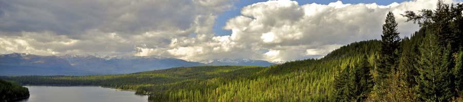
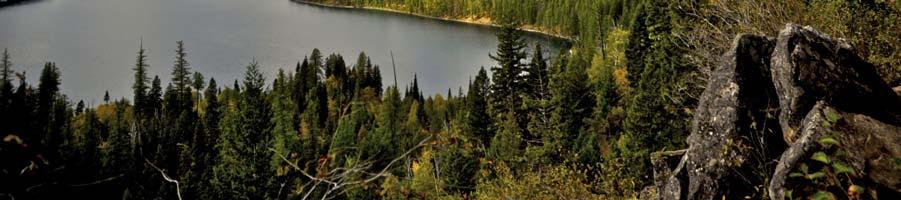
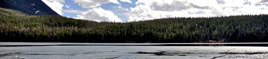
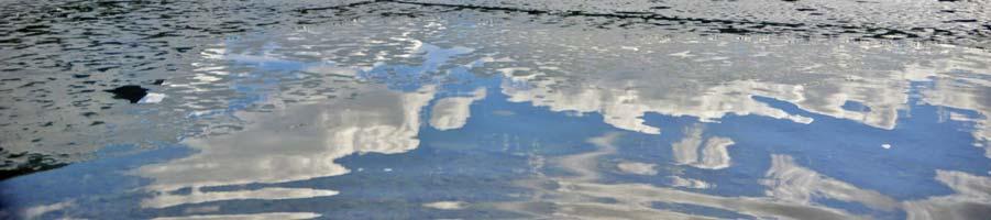
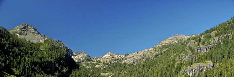
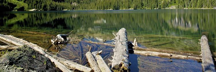
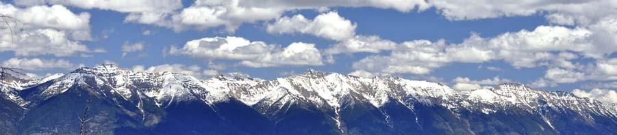
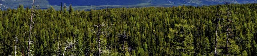
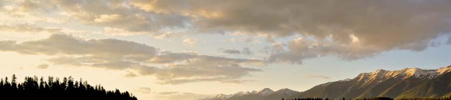
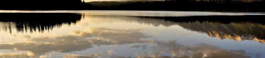
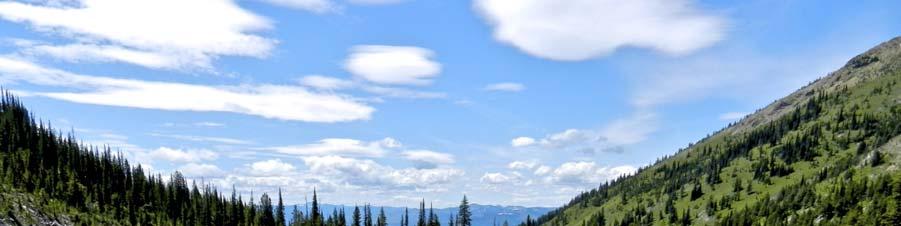
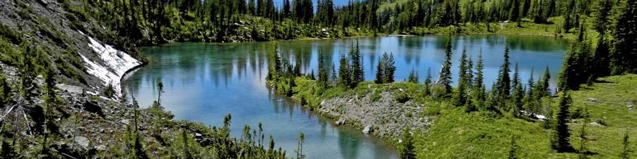
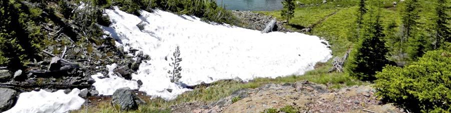
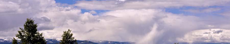
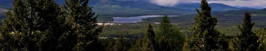
6 Photos for Hiking article #1 Holland Lake from trail to Holland Falls #2 Holland Lake and Clouds #3 Glacier Lake in Missions #4 Swan Range #5 Rainy Lake and Swans #6 Lake behind Crescent Peak #7 Crescent Lake in Swans #8 Shower over Seeley, from Mt Baldy

7

8

9

10
Three Sisters Wilderness Oct. 2009
 Three Sisters Wilderness Oct. 2009 I was in Bend, OR and had the whole day to travel back to Boise so I decided to take a hike to the popular Green Lakes and summit the South Sister in Three Sisters Wilderness.
CIEC 9 PEAKS AWARD SUPPLEMENT POSSIBLE ROUTES FOR THE 9 PEAKS AWARD TRIP
 CIEC 9 PEAKS AWARD SUPPLEMENT POSSIBLE ROUTES FOR THE 9 PEAKS AWARD TRIP As you plan your trip, be aware of 3 regulations in this wilderness: 1. Camp only in designated campsites. 2. No campfires allowed.
HIKING IN THE CANADIAN ROCKIES
 HIKING IN THE CANADIAN ROCKIES Distance Time Elevation y MORAINE LAKE TRAILS THE ROCKPILE 0.8 km (0.5 mi) 20 min 30 m (98 ft) Located adjacent to the Lodge, the short interpretive trail up the Rock Pile
L U N C H C R E E K T R A I L GLACIER NATIONAL PARK
 D I R T I N M Y S H O E S L U N C H C R E E K T R A I L GLACIER NATIONAL PARK Lunch Creek "Secret" Hike This short hike on the Lunch Creek Trail will knock your socks off! It's the perfect mix of length,
Trip Report: Backpack to East Boulder Lake in California Trinity Alps, July 7-9, 2016
 Trip Report: Backpack to East Boulder Lake in California Trinity Alps, July 7-9, 2016 Trekkers: Richard Hales, Aleece Townsend, Carol Mockridge, Rosalie Rybka, Elisabeth Zinser Day 1: Richard and Aleece
Route #1) Mt. of the Holy Cross - North Ridge
 Mt. of the Holy Cross - North Ridge") Climbing 14ers can be very dangerous, please read the Mountaineering Safety Page and make sure you have a map+compass and can use them effectively, without the help of electronic devices. Route #1) Mt.
Climbing 14ers can be very dangerous, please read the Mountaineering Safety Page and make sure you have a map+compass and can use them effectively, without the help of electronic devices. Route #1) Mt.
playwinterpark.com Off The Beaten Path Hikes Hiking Recommendations for the Adventurous Hiker
 playwinterpark.com Off The Beaten Path Hikes Hiking Recommendations for the Adventurous Hiker Hike: Devil s Thumb (difficult) Length: 3.93 miles one-way Elevation: Trailhead 9609 Destination 12,236 Trailhead
GOLDEN EARS PROVINCIAL PARK
 GOLDEN EARS PROVINCIAL PARK Trail Information as of October 10 th 2015 Do not underestimate the mountainous wilderness of Golden Ears Provincial Park. The combination of rugged terrain and rapidly changing
TREK THE ROCKIES ABOUT THE CHALLENGE TREK THE ROCKIES FOR HIGHLAND HOSPICE CANADA TREK DEMANDING
 TREK THE ROCKIES CANADA TREK DEMANDING ABOUT THE CHALLENGE The Canadian Rockies are justifiably world-famous for their magnificent scenery: the combination of impressive, jagged mountains, bright turquoise
Driving Time: 3 hours (allow extra time for stops)
") Scenic Byways loop This journey takes visitors through the eastern edge of Mt. Rainier National Park and along two of Washington s most beloved scenic byways, the Chinook Byway and the White Pass Scenic
Scenic Byways loop This journey takes visitors through the eastern edge of Mt. Rainier National Park and along two of Washington s most beloved scenic byways, the Chinook Byway and the White Pass Scenic
The West Coast California Part 2
 The West Coast California Part 2 I have wanted to visit Yosemite National Park for years, always saying one day I ll get there. Well the time is here and I m going to spend 6 days exploring as much as
Note: Coordinates are provided as Universal Transverse Mercator UTM Zone U21, North American Datum 1983 (NAD 83).
.") Northern Traverse Route Description The Northern Traverse (formerly the North Rim Traverse) is an unmarked and rugged backcountry hiking route. It is known be a demanding hike, because of its terrain and
Northern Traverse Route Description The Northern Traverse (formerly the North Rim Traverse) is an unmarked and rugged backcountry hiking route. It is known be a demanding hike, because of its terrain and
Rogue Gorge (Mt. Stella) Roadless Area-- T30S R3E (primarily in portions of Sections 23, 26, 33, 34 & 35)
 Roadless Area-- T30S R3E (primarily in portions of Sections 23, 26, 33, 34 & 35)") Rogue Gorge (Mt. Stella) Roadless Area-- T30S R3E (primarily in portions of Sections 23, 26, 33, 34 & 35) Rogue River-Siskiyou National Forest--High Cascades Ranger District Upper, higher elevation trail
Rogue Gorge (Mt. Stella) Roadless Area-- T30S R3E (primarily in portions of Sections 23, 26, 33, 34 & 35) Rogue River-Siskiyou National Forest--High Cascades Ranger District Upper, higher elevation trail
Little Grand Canyon near Pomona, Illinois
 Little Grand Canyon near Pomona, Illinois Below: View of the trail and the terrain created using the Map My Hike app Below: Summary of the hike created using the Map My Hike app Presented by: Jennifer
Route #2) Mt. Massive - Southwest Slopes
 Mt. Massive - Southwest Slopes") Route #2) Mt. Massive - Southwest Slopes Difficulty: Class 2 Ski: Advanced, D6 / R2 / III Exposure: Summit Elevation: Trailhead Elevation: Elevation Gain: Round-trip Length: Trailhead: County Sheriff:
Route #2) Mt. Massive - Southwest Slopes Difficulty: Class 2 Ski: Advanced, D6 / R2 / III Exposure: Summit Elevation: Trailhead Elevation: Elevation Gain: Round-trip Length: Trailhead: County Sheriff:
beach. Make the ford and follow the trail out to the junction with Red Creek Tr in an open grassy area.
 Description: This is a moderate to slightly strenuous 22.8 mile backpack (add 2.6 miles if you do the packless out and back to the Lion s Head) that will have you exploring nearly every thing that is The
Non-motorized Trail Plan & Proposal. August 8, 2014
 Town of Star Valley Ranch, Wyoming and the Star Valley Ranch Association in partnership with the USDA Forest Service, Bridger-Teton National Forest, Greys River Ranger District Non-motorized Trail Plan
The Cleo s Bath North Side Hike
 The Cleo s Bath North Side Hike This hike is a cross-country hike from Pinecrest Lake to the north side of Cleo s Bath. It is quieter and much less crowded than the normal route, which goes up the south
Trail Beginning Elevation: 7553 ft The Poison Creek Trailhead is located at the end of National Forest Road 646E (NF-646E).
.") West Mountain Trails Poison Creek Trail #134 Length: 2.9 miles (4.7 km) Difficulty Horseback: A good trail for the first time west mountain rider, some steep sections Hiking: Most Difficult USGS Maps:
West Mountain Trails Poison Creek Trail #134 Length: 2.9 miles (4.7 km) Difficulty Horseback: A good trail for the first time west mountain rider, some steep sections Hiking: Most Difficult USGS Maps:
Date Name Trail Segment Conditions, Hazards and General Notes on Trails
 Trail Reports for Sawtooth NRA ***Unless otherwise reported-expect high creeks, snow levels at 7500 ft. and trees on trails. Due to high winds in the area, if trees were previously reported removed there
Ribbon Cliff - Ribbon Mesa text and photos by Charlie Hickenbottom
 Ribbon Cliff - Ribbon Mesa text and photos by Charlie Hickenbottom Looking for something a little different than Sage Hills or Saddlerock? Perhaps something a little wilder, a little less traveled? Look
GLACIER STUDIES OF THE McCALL GLACIER, ALASKA
 GLACIER STUDIES OF THE McCALL GLACIER, ALASKA T John E. Sater* HE McCall Glacier is a long thin body of ice shaped roughly like a crescent. Its overall length is approximately 8 km. and its average width
San Luis Obispo. Bishop Peak Felsman Loop Eagle Rock Maino Open Space Poly Canyon Poly P Other Areas
 San Luis Obispo Bishop Peak Felsman Loop Eagle Rock Maino Open Space Poly Canyon Poly P Other Areas 1 JCT. ELEV. 72 400 00 0 FELSMAN LOOP GATE LOOP RIDGE 600 FENCE JCT. ELEV. 860 1000 1200 BISHOP PEAK
Mount Daly a Most Prominent Peak via South Ridge
 Mount Daly a Most Prominent Peak via South Ridge Difficulty: Class 3 Exposure: Exposed in places along the ridge Summit Elevation: 13,305 Elevation Gain: 4100 from trailhead; 1800 from Capitol Lake camp
Bradshaw Trails Series
 Bradshaw Trails Series Curtis James Troop 7014 Curtis.James@erau.edu My Motto: Never get lost! Hiking Rules Bradshaw Hiking Patch Series Hiking Tools Hiking Rules Hiking Merit Badge* Take five 10-mile
Quandary Peak East Ridge
 Quandary Peak East Ridge Difficulty: Class 1 / 2 June 28,2013 Exposure: Summit Elev.: 14,265 feet Trailhead Elev.: 10,850 feet Elevation Gain: 3,450 feet Roundtrip: 6.75 miles Hikers: Shan Stuart, Rick
Date Name Trail Segment Conditions, Hazards and General Notes on Trails
 Trail Reports for Sawtooth NRA ***Unless otherwise reported-expect high creeks, snow levels at 7900 ft. and trees on trails. Due to high winds in the area, if trees were previously reported removed there
Grizzly Peak A - East Ridge July 15, 2012
 Grizzly Peak A - East Ridge July 15, 2012 Difficulty: Difficult Class 2/Class 3 Upper Elevation: 13,995 feet Trailhead Elevation: 11,360 feet Elevation Gain: 3,000 feet Round-trip Length: 6.0 miles Trailhead:
Looking back across Emerald Lake at Wapta Mountain (on the left) and Mount Burgess (on the right):
 and Mount Burgess (on the right):") YOHO LAKE FROM EMERALD LAKE, YOHO NATIONAL PARK, BRITISH COLUMBIA, CANADA We decided to hike to Yoho Lake from Emerald Lake even though the distance is longer than the trail from Takakkaw Falls (about
YOHO LAKE FROM EMERALD LAKE, YOHO NATIONAL PARK, BRITISH COLUMBIA, CANADA We decided to hike to Yoho Lake from Emerald Lake even though the distance is longer than the trail from Takakkaw Falls (about
Charnley Explorer June 24 - July 15, 2018 Bachsten Creek and the Charnley River. Second draft: 14 November 2017
 Charnley Explorer June 24 - July 15, 2018 Bachsten Creek and the Charnley River. Second draft: 14 November 2017 The best part of the original section one is now part of out Gibb Road Gorges trip. The dates
Alberta Banff Hike Adventure
 Trip Summary Explore the jewels of Banff National Park and the Canadian Rockies on this six-day hiking adventure. Trek under the shadow of dizzying snow-capped peaks, walk high up in flower-dotted alpine
Oman Trek Trek the dramatic and beautiful scenery of Oman
 Oman Trek Trek the dramatic and beautiful scenery of Oman Discover Oman on this breath taking 5 day challenge. The mountain ranges and deserts of Oman offer spectacular trekking, and enables you to experience
A Long Weekend in Yosemite. 4 Days
 A Long Weekend in Yosemite 4 Days A Long Weekend in Yosemite On this relaxed yet action-paced 4-day hiking adventure, discover the wildly scenic, glacially sculpted Yosemite Valley, deep in the heart of
King George Area: May 5-18, 2019
 King George Area: May 5-18, 2019 Section 1: Faraway Bay airstrip to Twin Falls: May 5-12 We fly to the Faraway Bay airstrip where we leave the food for the second section, don our packs and head toward
Hiking Las Vegas.com
 Hike: Mt. Wilson via First Creek Canyon route Trailhead: First Creek marked Distance: 10 miles up and back Elevation gain: 3,400 feet Elevation of Peak: 7,070 feet Time: 7 to 9 hours (up and back) Difficulty:
Friday October 3. Lower Javelina Trail - Level D. about 3 miles, less than 500. Hike Contact: Joel Tormoen
 Friday October 3 Lower Javelina Trail - Level D. about 3 miles, less than 500 Hike Contact: Joel Tormoen joeltormoen@gmail.com Depart WB trailhead 8:00 am - return before 11:00 am This quite easy hike
Canada Rocky Mountain Adventure Into the Wild
 Canada Rocky Mountain Adventure Into the Wild Itinerary Canada Rocky Mountain Adventure Into the Wild 15 days / 14 nights Calgary Kananaskis Country Spray Lake Canmore Banff Lake Louise Moraine Lake Jasper
Location: Height: Access: Distance: Elevation: Season: Difficulty: Lat/Long: Directions:
 Upper Eagle Falls Upper Eagle Falls (~20 ft.) is a short hike up from the roadside at the Eagle Falls picnic area. It is very difficult to get a parking spot here during the day, so it is recommended to
Mt. Eolus and North Eolus
 Mt. Eolus and North Eolus Difficulty: Class 3 Exposure: Summit Elev.: Mt. Eolus: 14,083 feet N. Eolus: 14,039 feet Camp Elev.: 11,100 feet Elevation Gain: 3,200' starting at Chicago Basin 6,300' starting
Date Name Trail Segment Conditions, Hazards and General Notes on Trails
 Trail Reports for Sawtooth NRA ***Unless otherwise reported-expect high creeks, snow levels at 7900 ft. and trees on trails. Due to high winds in the area, if trees were previously reported removed there
HAVE A GREAT HIKE AND ENJOY!
 BAKER LAKE HIKE #5634 & #234 (Moderate to Strenuous walking sticks recommended) DIRECTIONS TO TRAILHEAD: From Triple Creek s driveway, turn left on West Fork Road and drive about 1.3 miles (just past mile
Itinerary Overview: What you will be doing Maroon Bells Alpine Backpacking 22 days
 Itinerary Overview: What you will be doing Maroon Bells Alpine Backpacking 22 days 0BCourse Description Welcome, you re in for an experience of a lifetime! Imagine hiking through rolling forests, sharing
 Hike date Exertion Destination/ Leader(s) Description and Contact info Rating Hike Name 7/8-12/10 S+ Extreme Pleinair Sandy Compton Contact info: 208-290-1281 or sandy@scotchmanpeak.org This hike is nearly
Glacier National Park, MT
 Glacier National Park, MT July 28 Aug. 1, 2010 We decided to go to Glacier National Park for our family vacation this year. We had a great time seeing beautiful scenery and a variety of wildlife which
Tumbler Ridge Global Geopark
 Tumbler Ridge Global Geopark WILDERNESS WATERFALLS These waterfalls are in remote locations, no trails exist, and GPS is required. Not every geosite needs a hiking trail. Providing ready access to all
Explore Montana s Glacier National Park!
 Explore Montana s Glacier National Park! Sat-Sat, July 13-20 or July 20-27, 2019 1 P a g e Trailbound Trips Explore. Dream. Discover. Discover: * Stunning hikes * Glacier-studded mountain peaks * Wildlife
Etna winter expedition 1
 Etna winter expedition Etna, still active volcano. I ve been always tempted to climb it. I found a cheap flight ticket to Catania in February and I told myself why not in the winter! Two adventurous friends
YOSEMITE ON HORSEBACK: THREE RIDES ALONG TIOGA ROAD Cindy Casey White Wolf Area, May Lake Loop, Ragged Peak Loop
 YOSEMITE ON HORSEBACK: THREE RIDES ALONG TIOGA ROAD Cindy Casey White Wolf Area, May Lake Loop, Ragged Peak Loop The high country along Tioga Road presents us with some of the most dramatic scenery in
Guthega to Mt Twynam. 2183m. 1583m. 6 hrs 45 mins 14.8 km Return. Experienced only. 913m
 Guthega to Mt Twynam 6 hrs 45 mins 14.8 km Return Experienced only 5 913m This walk starts from Guthega and makes its way along the Snowy River to the Illawong Lodge, via the Blue Cow Creek flying fox.
MAROON BELLS SNOWMASS WILDERNESS - COLORADO LYC ADVENTURE TRIP ITINERARY 2018
 MAROON BELLS SNOWMASS WILDERNESS - COLORADO LYC ADVENTURE TRIP ITINERARY 2018 Tuesday, July 31, 2018 3:00 6:30pm Check-in & Dinner Preparations at accommodations 3:00 to 5:00pm Staff & Camper Arrival (Airport
Kakadu Highlights No. 9: September 23 - October 6, 2018
 Kakadu Highlights No. 9: September 23 - October 6, 2018 Section 1: Barramundi Creek: September 23-26 We begin with a four to six hour, 350 kilometre drive from Darwin. The last 45 kilometres is on a 4WD
1. Waterfall Gully Mt Lofty. 5 Of the Best Hikes in Adelaide
 Adelaide is a beautiful city, and one of the most incredible things about Adelaide is the quality of bushwalking available on the suburban fringe. It is surrounded by the Mt Lofty Ranges, and much of the
Date Name Trail Segment Conditions, Hazards and General Notes on Trails
 Trail Reports for Sawtooth NRA ***Unless otherwise reported-expect high creeks, snow levels at 7900 ft. and trees on trails. Due to high winds in the area, if trees were previously reported removed there
Maple Leaf School TRU Trip to Wells Gray Provincial Park. October 28+29, 2017
 Maple Leaf School TRU Trip to Wells Gray Provincial Park October 28+29, 2017 Twelve students, our principal, our principal s son, and I left Kamloops at 7:00 am on October 28 in two 8-seat rental transit
Itinerary Overview. Continental Divide Alpine Backpacking 22 days Ages Course Description
 Itinerary Overview Continental Divide Alpine Backpacking 22 days Ages 16-18 Course Description Welcome, you re in for an experience of a lifetime! Imagine hiking through rolling forests, sharing alpine
TriPyramids via Slide Trails
 AMC August 12, 2010 TriPyramids via Slide Trails 0 2999 ft 2007, Appalachian Mountain Club. All rights reserved. Notes Created by AMC White Mountain Guide Online wmgonline.org 1 Distance Time Elev Change
Avalanches and the Mount Whitney Basin
 Avalanches and the Mount Whitney Basin 10 April 2006 by Bob Rockwell Prelude Avalanches are a fact of life in high mountains in winter, and we take courses to find out about them. We learn how to assess
Mindful Mountain Hiking Program
 Mindful Mountain Hiking Program Want to head for the hills? Join the Mindful Mountain Hiking Program for the summer and early autumn. Day hikes in Kananaskis Country and the Rockies are led by ACMG Day
GIFFORD PINCHOT NATIONAL FOREST
 GIFFORD PINCHOT NATIONAL FOREST 9341 Wright Meadow 93 Spencer Meadow Spencer Butte 4247' 30 30A 19 24 80 31C Lewis River Lower Falls 5 Quartz Creek 90 Taidnapam Falls Upper Falls 31 Spencer Peak 3861'
Saturday Hike - Hancock Loop & Out
 AMC August 3, 2015 Saturday Hike - Hancock Loop & Out 0 2487 ft 2007, Appalachian Mountain Club. All rights reserved. Notes Created by AMC White Mountain Guide Online wmgonline.org 1 Distance Time Elev
Rocky Mountain National Park Hiking Map By Trails Illustrated Maps
 Rocky Mountain National Park Hiking Map By Trails Illustrated Maps 10 Great Hikes for Families with Kids in Estes Park, Colorado - Choose from plenty of great family hikes in Rocky Mountain National park.
Meet the world s newest glacier at Mount St. Helens
 Meet the world s newest glacier at Mount St. Helens By Seattle Times, adapted by Newsela staff on 08.10.15 Word Count 733 Hikers walk past this chunk of the volcano that existed before May 18, 1980. The
Join Our Club! To receive updates and special offers from Stowe Mountain Lodge, sign up for our e-newsletter at. stowemountainlodge.
 1 Stowe Mountain Lodge is New England s preeminent mountain lodge located in the heart of the Stowe Mountain Resort community. Stowe is a true destination for all seasons and the premier location where
Itinerary Overview. Sangre de Cristo Alpine Backpacking 22 days Ages Course Description
 Itinerary Overview Sangre de Cristo Alpine Backpacking 22 days Ages 16-18 Course Description Welcome, you re in for an experience of a lifetime! Imagine hiking through rolling forests, sharing alpine meadows
Montana Island Lodge 2433 Highway 83 Seeley Lake, Montana
 Island Lodge 2433 Highway 83, INTRODUCTION Built on an island in the middle of a picturesque mountain lake, the Island Lodge is a once-in-a-lifetime estate property. Surrounded by the tranquil waters of
WILDERNESS TREK DESTINATIONS
 WILDERNESS TREK DESTINATIONS This document has been created for future Wilderness Trek leaders who would be taking groups of teens or young adults into the Wilderness. It's always comforting to know where
A TOPOGRAPHIC FEATURE OF THE HANGING VALLEYS OF THE YOSEMITE.
 A TOPOGRAPHIC FEATURE OF THE HANGING VALLEYS OF THE YOSEMITE. THE larger hanging valleys around the Yosemite valley have topographic features in common that are interesting in themselves, and they likewise
DAY 1 Ten miles out of Detroit, we cut off onto Whitewater Road 2243, a bumpy, gravel road that ends in a parking lot at the Whitewater Trailhead.
 1 WILDERNESS TREK VIII August 14-18, 2014 Greg and I chose to return to JEFFERSON PARK, a pristine, lake-filled, high mountain meadow on the North side of Oregon's own beautiful, Mt. Jefferson. In preparing
Kit Carson-Challenger Ridge Trail Project Annual Performance Report-2014 October 22, 2014
 1 Kit Carson-Challenger Ridge Trail Project Annual Performance Report-2014 October 22, 2014 Willow Lake and Kit Carson Peak 2 SUMMARY The Rocky Mountain Field Institute began Phase 1 of a multi-phase,
Serene Lake Trail 512
 1 of 9 9/20/2009 9:19 AM of the Clackamas River Ranger District of the Mount Hood National Forest Editors Only: News Stories Pictures Files Shortcuts Discuss Logoff Help Serene Lake Trail 512 Topic: Serene
Beaver Country Trails ATV Jamboree
 Beaver Country Trails ATV Jamboree #1 Lincoln Mine Intermediate (Open to all ATVs/UTVs) 34 Miles Highlights: This ride will highlight the historic Lincoln Mining District, the first lead mine in Utah,
Figure 1 Understanding Map Contours
 Figure 1 Understanding Map Contours The light brown lines overprinted on topographic maps are called contour lines. They indicate the elevation above sea level of land features and thus permit you to view
Route Combo) Mt. Bierstadt - Bierstadt, Sawtooth, Evans
 Mt. Bierstadt - Bierstadt, Sawtooth, Evans") Climbing 14ers can be very dangerous, please read the Mountaineering Safety Page and make sure you have a map+compass and can use them effectively, without the help of electronic devices. Route Combo)
Climbing 14ers can be very dangerous, please read the Mountaineering Safety Page and make sure you have a map+compass and can use them effectively, without the help of electronic devices. Route Combo)
Adventures in the Rockies. 6 Days
 Adventures in the Rockies 6 Days Adventures in the Rockies On this action-filled adventure, experience two different sides to the Rockies on the western side, discover hidden gems that few visitors get
The temperature is nice at this time of year, but water is already starting to be scarce.
 In March of 2003, Scott Morrison and I went backpacking in the Grand Canyon. The temperature is nice at this time of year, but water is already starting to be scarce. Another issue with this time of year
Coast to Crest Trail Corridor Hike
 Coast to Crest Trail Corridor Hike Jim Cunningham, Poway City Council member and Board Chair of the San Dieguito River Park in 2013 has embarked on a project to hike the entire 70-mile San Dieguito River
Mount Kilimanjaro Climbing via Marangu Route 6 day-itinerary
 Mount Kilimanjaro Climbing via Marangu Route 6 day-itinerary (For the 5-day route, simply exclude the additional acclimatisation day at Horombo hut - day 3 on the itinerary below.) Total hiking distance:
THE CANADIAN ROCKIES FOR MARIE CURIE June Register online now at mariecurie.org.uk/rockies or call
 Trek THE CANADIAN ROCKIES FOR MARIE CURIE 22-29 June 2019 Register online now at mariecurie.org.uk/rockies or call 0800 716 146 YOUR ADVENTURE STARTS HERE THE CANADIAN ROCKIES Experience one of the world
Photo Credit: Banff Lake Louise Tourism / Paul Zizka Photography MOUNTAIN ADVENTURES
 Photo Credit: Banff Lake Louise Tourism / Paul Zizka Photography MOUNTAIN ADVENTURES MOUNTAIN ADVENTURE PROGRAM Operated by Fairmont Chateau Lake Louise Fairmont Chateau Lake Louise has a long and proud
Mindful Mountain Hiking Program
 Mindful Mountain Hiking Program Want to head for the hills? Join the Mindful Mountain Hiking Program for the summer and early autumn. Day hikes in Kananaskis Country and the Rockies are led by ACMG Day
Alaska Backpacking Journey to Oz
 St. Elias Alpine Guides, LLC Wrangell-St. Elias National Park, Alaska (888) 933-5427 (907) 345-9048 www.steliasguides.com Alaska Backpacking Journey to Oz Traversing some of the most stunning terrain in
Most Excellent Solar Lights
 Mills Lake, Rocky Mountain National Park 9941, north 40 17 29, west 105 38 32 Saturday, September 19, 2010 Rocky Mountain National Park, Larimer County, Colorado Our last planned RV camping trip of 2010
Stephens State Park Trails
 TRAILS OF ALLAMUCHY MOUNTAIN & STEPHENS STATE PARKS Allamuchy Mountain and Stephens State Parks contain 28 marked trails providing access to diverse landscapes for walking, hiking, biking, bird-watching,
Kitimat. Pacific Inland Coast. Hiking Guide Kitimat, British Columbia, Canada
 Kitimat Pacific Inland Coast Hiking Guide Kitimat, British Columbia, Canada 2010-2011 Sites and Trails Emergency Call 911 Police - Fire - Medical 2 Welcome to Kitimat This information was produced to assist
MANCA 2015 LAND CRUISE MOROCCO HIGH ATLAS MOUNTAINS
 MANCA 2015 LAND CRUISE MOROCCO HIGH ATLAS MOUNTAINS The overnight train from Tangier to Marrakech on a full June moon is a magical ride. In the early morning, as she approached Marrakech the morning fog
Tiger Mountain State Forest:
 98 60 hikes within 60 miles: SEATTLE 20 Tiger Mountain State Forest: West Tiger Mountain Three Loop i KEY AT-A-GLANCE INFORMATION Length: 5.1 miles round-trip Configuration: Loop Difficulty: Moderate difficult
Self-Guided Walk Langdale Pikes. Start & Finish: NT car park (free to members) at Sticklebarn - on the right just beyond the New Dungeon Ghyll hotel.
 at Sticklebarn - on the right just beyond the New Dungeon Ghyll hotel.") Self-Guided Walk Langdale Pikes Key Information These mountains form a collection of spires and cliffs on the north side of Langdale. This walk visits four of the main tops Pavey Ark, Harrison Stickle,
Self-Guided Walk Langdale Pikes Key Information These mountains form a collection of spires and cliffs on the north side of Langdale. This walk visits four of the main tops Pavey Ark, Harrison Stickle,
Life in the Alpine Zone
 Life in the Alpine Zone Conditions change as elevation is gained. For every 1,000 foot increase in elevation, temperature drops about 3-5 degrees Fahrenheit and precipitation increases approximately 8
How Glaciers Change the World By ReadWorks
 How Glaciers Change the World How Glaciers Change the World By ReadWorks Glaciers are large masses of ice that can be found in either the oceans or on land. These large bodies of frozen water have big
Visitor s Center 110 E. Meeting Street Morganton, NC
 5 unique trails worth checking out! Cross-Country skiing! No snakes! Don t sweat it! www.discoverburkecounty.com Visitor s Center 110 E. Meeting Street Morganton, NC Photo of Table Rock by Justin Costner
Trek2Kili P.O. Box 2112 Moshi TZ Whatsapp
 Trek2Kili P.O. Box 2112 Moshi TZ Whatsapp +255 673 360 trek2kili@gmail.com MT. KILIMANJARO MACHAME 7 DAY 6 NIGHT TREK Known as the Whisky Route, this is one of the most scenic and therefore popular routes
Date Name Trail Segment Conditions, Hazards and General Notes on Trails
 Trail Reports for Sawtooth NRA ***Unless otherwise reported-expect high creeks, snow levels at 7900 ft. and trees on trails. Due to high winds in the area, if trees were previously reported removed there
TUPPER DESIGNATED ACCESS ROUTE
 TUPPER DESIGNATED ACCESS ROUTE 1 FOR ACCESS/EGRESS TO CONNAUGHT, LOOKOUT, STONE ARCH, PORTAL PATHS AND TUPPER TRAVERSE EGRESS Length: 2.6km Vertical Gain: +162m / -83m (Values are for access. For egress,
Itinerary Overview. Maroon Bells Mountaineering 22-days. Course Description
 Itinerary Overview Maroon Bells Mountaineering 22-days Course Description Welcome, you re in for an experience of a lifetime! Imagine hiking through rolling forests, sharing alpine meadows with mountain
Exploring the Natural Wonders of Arizona
 5 Days / 4 Nights DEVELOPED FOR Couples and Families HIGHLIGHTS Full Day Private Tour of Grand Canyon National Park Shared Helicopter Flightseeing Tour over the Canyon 2-Hour Private 4x4 Jeep Tour on the
Pushing the Limits: Hiking Off-Trail in the Catskills
 Shari Aber I ve always pushed the limits. That s who I am. That s why I was working for my black belt in karate when I was 50 gave it up after I tore my meniscus and had to undergo the first of 3 arthroscopic
Mountain Footsteps. Photo: Ric Carless
 ho: Ric Carless Road Directions Middle White River FS Roads Deep Lake and Driftwood Lake see page 101, Connor Lakes along Maiyuk Creek see page 105, and for access Top of the World rovincial ark see page
Sunday / Monday - Osceolas
 AMC August 3, 2015 Sunday / Monday - Osceolas 0 1737 ft 2007, Appalachian Mountain Club. All rights reserved. Notes Created by AMC White Mountain Guide Online wmgonline.org 1 Distance Time Elev Change
Cannon Traverse via Lonesome Lake - Hi Cannon - Kinsman Ridge
 AMC April 28, 2010 Cannon Traverse via Lonesome Lake - Hi Cannon - Kinsman Ridge 0 1673 ft 2007, Appalachian Mountain Club. All rights reserved. Notes Created by AMC White Mountain Guide Online wmgonline.org
September Newsletter. Search for Ayios Georgios. Sharing experiences as we journey together
 Sharing experiences as we journey together Search for Ayios Georgios This is my third newsletter this year and comes 6 months after I published the last one. I decided to change the format for this edition