Sevier County Candy Mountain Whistle Stop Trailhead Plan March 11, 2011 Project Partners
|
|
|
- Horace Sanders
- 5 years ago
- Views:
Transcription


1 Sevier County Candy Mountain Whistle Stop railhead Plan March 11, 2011 Sevier County Project Partners Utah State Parks Mormon Pioneer National Heritage Area Panoramaland RC&D Scenic Canyons Preservation Society National Park Service Rivers, rails, and Conservation Assistance Program Six County AOG Produced by: National Park Service Rivers, rails, and Conservation Assistance Program
2
3 able of Contents Page 1) Introduction...2 2) Partners...3 3) Vision, Goals, & Objectives...4 4) railhead Design Concept Site Plans...6 5) railhead Sign Plan - Introduction ) Site Entrance Sign ) Information Kiosks ) railhead Wayfinding ) rail Markers ) Sign Location Layout ) Phasing ) Potential or Existing Funding Sources ) Contact List
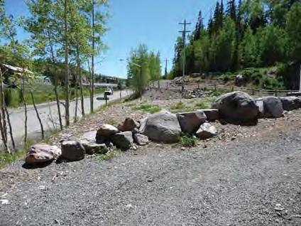
4 Introduction Big Rock Candy Mountain is located at the south end of the Candy Mountain Express Bike Path. It is a popular launch for river rafting, and also provides a connection to the Paiute AV trail system. For these reasons it is an ideal location for a multiple-use trailhead. hrough a private land donation by David Grow and support from the Mormon Pioneer National Heritage Area, Sevier County was able to secure a grant from the Utah State Parks rails and Pathways Program. hey have also received funding for a restroom facility from the Utah State Parks Off Highway Vehicle Program. his funding has positioned Sevier County to create an exciting multiple-use trailhead that serves bicyclists, hikers, off highway vehicle (OHV) riders, and river rafters. he National Park Service s Rivers, rails, and Conservation Assistance Program (RCA) assisted Sevier County in planning for the Candy Mountain Whistle Stop railhead by assisting in developing a private and public partnership and facilitating meetings with a wide variety of partners to develop a clear vision, and specific goals and objectives. hey have also provided conceptual site design plans and a sign plan for the area. his document presents the results of this planning effort. 2
5 Partners RCA helped assemble a group of private and public partners to provide input and assistance in this planning effort. his planning effort was aimed at creating recreational opportunities on public lands. he primary partners in this effort included: Sevier County; Mormon Pioneer National Heritage Area; Scenic Canyons Preservation Society; and the Panoramaland RC&D. his group also received valuable input into the planning process from both the Bureau of Land Management, the United States Forest Service, and the Six County Association of Governments. 3
6 Vision, Goals, & Objectives he Whistle Stop railhead Vision, Goals and Objectives were developed by the project partners with assistance of the National Park Service, Rivers, rails, and Conservation Assistance Program. his document provides Sevier County a framework for short and long term implementation and management for the trailhead area. Vision Statement: Create quality experiences through partnerships for recreating public to interact with the land and unique yet diverse cultural, historical and recreational resources through multiple interpretative and recreational opportunities. Goals and Objectives: Education Goal 1) Provide interpretation on transportation routes including trail systems, historical railroads, river systems, colonization efforts, Native American imprints, pioneer history, and mining. Objective: Create consistent interpretive signs with one theme and a few sub-themes, which explain the importance of the Candy Mountain Whistle Stop railhead located in the Mormon Pioneer National Heritage Area (MPNHA). As visitors travel through the area, they will recognize they are in a special place and will feel a sense of continuity, recurring themes, and a consistent message reinforced by brochures, kiosks, and signage throughout the MPNHA (refer to MPNHA Plan page 81). As visitors travel through the area, they will recognize they are in a special place and will feel a sense of continuity, recurring themes, and a consistent message all reinforced by interpretive signage. he estimated cost for a consultant to develop interpretive and informational text is $7,000. Funds through grants or the partnership will pay for the fabrication of the signs estimated at $10,000. 2) Develop a Site Rehabilitation and Planting Plan for the trailhead and immediate vicinity. Objective: he Panoramaland RC&D and the U Department of Wildlife Resources will create a site rehabilitation and planting plan to minimize weed establishment and apply to the County Weed Management Area (CWMA) to help fund the plan and signing that incorporates weed education by June Safety Goal 1) o safely integrate motorized and non-motorized use through a trailhead design and placement of signs. Objective: RCA will complete a sign plan including directional and informational (kiosk) sign placement and include types of signs to purchase to both direct and inform visitors about appropriate types of recreation uses and safety by March 11, Recreation Goal 1) o provide an aesthetically pleasing multi-use gathering area. 4
7 Objective: Partners will agree on a site plan that RCA will complete for the Candy Mountain Whistle Stop railhead by March 11, ) Create quality experiences through partnerships for the recreating public to interact with the land and unique yet diverse cultural, historical and recreational resources through multiple interpretive and recreational experiences that will encourage economic development. Objectives: Partners will agree on site and trail maintenance. A Memorandum of Understanding will be drafted by Sevier County and agreed upon and signed by Sevier County and the Paiute AV rail Committee. Sevier County will obtain an easement or Right-of-Way (ROW) for the trails leaving the County trailhead and connecting to public lands. he ROW will be drafted by the County with the County and private land owners signing and recording the easement by March 31, he private land owner will obtain a native seed mix using a standard BLM or USFS native seed mix to place on the area originally cleared for the placement of the restroom before the location was moved closer to the trail access. 3) Provide information about recreation opportunities located in MPNHA near the Whistle Stop railhead. A wide array of activities will be offered to augment and enrich visitor stays in the MPNHA (refer to MPNHA Plan page 103). Health Goal 1) Encourage physical activity on the trails. Objectives: Partners will encourage and support non-motorized recreation and events like the Big Rock Candy Mountain riathlon that occurs annually in July. he Health Department, Sevier County, MPNHA, and Richfield City will encourage visitors and residents to use the non-motorized Candy Mountain Express trail system with over 14 miles of paved trail, and the motorized Paiute rail system when providing information about recreational opportunities in Sevier County. he Health Department, County and City will begin providing information when the trailhead is completed in July Economic Development & ourism Goal 1) Attract and encourage visitors to stay longer in Sevier County. Objective: Increase visibility of the area through the MPNHA website and the Sevier County visitor guide. Visitors will recognize the trailhead is located in the MPNHA and will obtain information about accommodations near the trailhead. 5
8 railhead Design Concept Site Plans RCA has prepared the following design concept site plans to assist in the current development plans and assist in future planning efforts. hese site plans include recommendations for elements that are already planned and suggestions for future amenities. he Design Details sheet presents examples of recommended amenities and the railhead Features sheet presents more specific site information and construction recommendations. 6


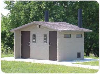
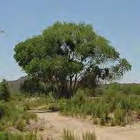
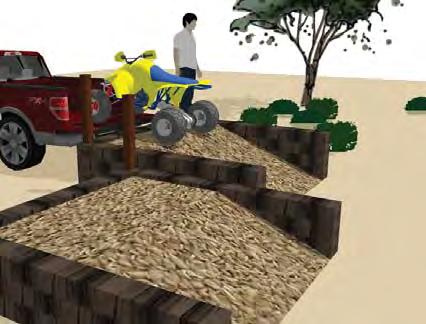
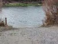
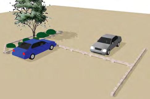
9 Native shade trees planted around picnic areas and in parking lot islands. Will require supplemental irrigation for 1-2 growing seasons. Raft launch/take out Parking lot bordered with boulders to protect riparian area. - boulders Directional wayfinding signs. Destination, mileage, and permitted use information. Signs specific to designated uses N Vault oilet - CX ioga w/chase funded through U State Parks Kiosk Locations OHV Loading Ramp. wo levels for different height truck beds. Parking bordered by some type of environmentally friendly material. Individual stalls not marked. Informational Kiosk - 3 required. One each for OHV users, Paved trail users, and Sevier River users. Candy Mountain Whistle Stop railhead railhead Design Details Produced by: National Park Service Rivers, rails, and Conservation Assistance Program
10


11 Picnic Area Na ve rees Ra Launch railer raffic 2-4% outslope OHV raffic from loading ramp OHV load/unloading area Paved access path ADA & vault service Restroom Barrier boulders direc ng OHV traffic Paved motorized Approximate scale access path N railhead features Parking: 4 ADA Parking 46 Standard Parking 16 Pull through Parking Construc on Recommenda ons - Minimum boulder size 3, recommended boulder size 5 - Outslope parking lot 2-4% to the West for proper drainage Restroom: OHV facili es: Other facili es: CX ioga w/chase ADA accessible Dual vault OHV dual-height loading ramp Informa onal kiosk railer parking railer accessible ra launch Picnic facili es Boa ng informa onal kiosk - Recommend 10 paved path as shown to edges of bike path ROW and to the restroom facility. his will eliminate gravel on the bike path as OHV users enter and exit the parking lot. - Installa on of na ve shade trees per recommenda on from Panoramaland RC&D plan ng plan, with temporary irriga on for at least 2 seasons. - Restroom final loca on to be determined by Utah State Parks Candy Mountain Whistle Stop railhead Features Produced by: National Park Service Rivers, rails, and Conservation Assistance Program
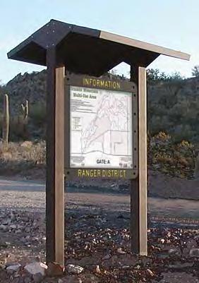
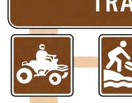
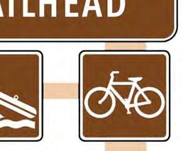
12 railhead Sign Plan- Introduction here is a need to delineate recreation opportunities through signs at the Candy Mountain Whistle Stop railhead to clearly identify access locations for a variety of recreation uses including motorized and non-motorized trails and a boat launch. he use of signs will enhance the safety, comfort, and navigation of the trailhead users. Establishing a sign hierarchy will guide the various user groups from Highway 89 to the parking area and then to their recreation destinations. Sign Hierarchy: 1) railhead Entrance Sign 2) Informational Kiosks 3) railhead/immediate Area Wayfinding 4) Directional/Use-ype rail Markers railhead Entrance Sign: he primary purpose of the entrance sign is to provide direction to the trailhead, it also indicates the types of recreation for which the trailhead is designed, including: Off Highway Vehicle (OHV), Raft/River use, and Bike/ Hike use. Compliance to standards of Utah Department of ransportation (UDO), U.S. Department of Federal Highway Administration, Manual on Uniform raffic Control Devices (MUCD) and the Standard Highway Signs and Markings (SHSM) Book will be necessary. hese standards can be found at the following websites: and htm (see page 10). Informational Kiosks: hree kiosks will be located at the trailhead and each kiosk will correlate with a specific user type: OHV, Raft/ River use, and Bike/Hike use. he purpose of three distinct kiosks is to appeal to the comfort of each user group and to help promote the multiple programming of the trailhead. Each kiosk will provide information that is directly applicable to that use, including trail maps or the river launch location. his will aid in the organization of information designed specifically for that recreation use. railhead Wayfinding: he trailhead wayfinding sign will provide three types of information: 1) name destinations, 2) direction to destinations, and 3) distance to destinations. hese signs will quickly orient the user and aid in the readability of the maps at the kiosk and the site itself. Directional/Use-ype rail Markers: rail markers will identify the trail entrance location and the type of use the trail is designed to accommodate. rail markers are traditionally recognized as fiberglass posts. hese markers provide reassurance to the user that they are on the appropriate trail through the use of a numbering and naming system. hey also reinforce recreation use types (motorized and non-motorized) that are appropriate for that particular trail. 9

13 Site Entrance Sign he purpose of this sign is to direct highway users to the entrance of the trailhead as well as to provide information on the activities located at the trailhead. U.S. Department of ransportation Federal Highway Administration Manual on Uniform raffic Control Devices Sign Guidelines: Overview: hese national standards are used by all states and the Utah Department of ransportation (UDO) references this manual in the Utah Department of ransportation Sign Manual. he Manual on Uniform raffic Control Devices (MUCD) contains the national standards governing all traffic control devices. his manual ensures the safety and uniformity of signing systems in all applications related to public agencies and owners of private roads that are open to the public. Adherence to MUCD is mandatory for the audience listed below and any non-compliance can result in federal-aid funding loss, as well as an increase in tort liability. Intended Audience of MUCD: State and local highway agencies, public agencies, owners of private roads open to public travel, the insurance industry, law enforcement agencies, incident management personnel, maintenance personnel, academic institutions, private industry, and construction and engineering organizations. Application to Candy Mountain Whistle Stop railhead : he 2009 version of the MUCD is the most current version for sign guidelines. Chapter 2M. Recreational and Cultural Interest Area Signs is the chapter that relates to the Candy Mountain Whistle Stop railhead. he MUCD defines recreational or cultural areas as:...attractions or traffic generators that are open to the general public for the purpose of play, amusement, or relaxation. Recreational attractions include such facilities as parks, campgrounds, gaming facilities, and ski areas, while examples of cultural attractions include museums, art galleries, and historical buildings or sites. (page 330) he MUCD identifies two different types of recreational or cultural interest signs: symbol signs and destination signs. he document states that guide signs can be used to direct persons to facilities, structures, and places, as well as to identify available services along the roadway. hey can also be used to sign non-vehicular activities such as trails, structures and facilities (see Figure 1). Figure 1. Examples of Recreational and Cultural Interest Symbol & Destination Signs Chapter 2M Page
14 RG-130 LIER CONAINER RG-140 LOOKOU OWER RG150 PEDESRIAN CROSSING RG-160 POIN OF INERES RG-170 RANGER SAION RG-180 SMOKING RG-190 RUCK U.S. Department of ransportation Federal Highway Administration Standard Highway Signs and Markings he Standard Highway RG-200 Signs and Markings RG-240 (SHSM) book provides RG-260 specific design RM-010standards for the RM-020 signs described in the UNNEL MUCD. his is also a DOG federally recognized SEAPLANE standard and is CAMPING used by (EN) UDO. his CAMPING book (RAILER) provides dimensions and user specific symbols to be used on MUCD signs. Below are potential symbols that can be used at the Candy Mountain Whistle Stop railhead. Using the guidance from the Manual on Uniform raffic Control Devices Sign Guidelines and the Standard Highway Signs and Markings book, an example of an entrance sign was developed and is shown in Figure 3. Figure 2. SHSM Symbol examples RM-030 FERRY AV Symbol RM-040 FIRS AID RM-050 Launch Symbol FOOD RM-060 GAS Bike Symbol RM-070 GROCERY SORE RM-080 Restroom HANDICAPPED Symbol RM-090 LODGING RL-170 AV RM-100 MECHANIC RW-170 RM-110 HAND POS LAUNCH OFFICE RM-120 RL-090 PICNIC AREARAIL (BICYCLE) RM-130 PICNIC SHELER RM-140 RES ROOM Page Page Page Page

15 Figure 3- Proposed Entrance Sign Approx. 90 Approx. 24 Approx. 42 Approx

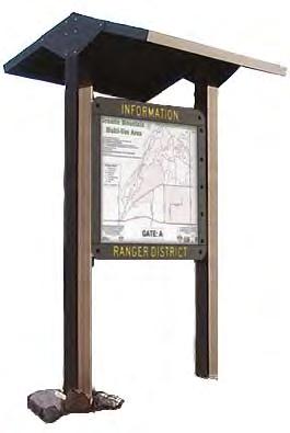
16 Information Kiosks Overview: he purpose of a kiosk is to provide the three primary user groups of the trailhead with information that is pertinent to that recreation group including OHV, Raft/River use, and Bike/Hike use. his will ensure that each recreation group knows that their particular activity is welcome at the trailhead and they are informed as to where their particular activity is permitted and encouraged. Information on Kiosk Sign: - Map of trail(s) related to the type of use with distances marked - rail difficulty level - Safety information - Interpretive information - railhead partners Figure 3. Proposed Kiosk Style: Single-Panel Kiosk (#03-420) 62 W x 90 H x 62 D installed Available from: Rockart Signs and Markers el:
.")


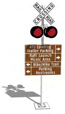
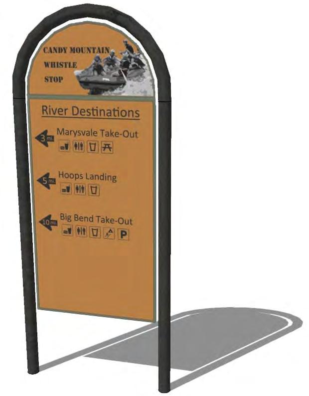
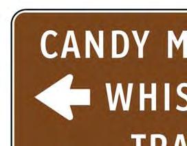
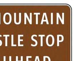
17 railhead Wayfinding Overview: Once users enter the trailhead, it is important they know where various amenities and facilities are located in and around the area. wo styles of wayfinding signs are proposed for the Candy Mountain Whistle Stop. he first is an adapted Railroad Crossing Sign with wayfinding panel to be used in the parking area (see Figure 4). he second is an arch style sign from Rockart Signs and Markers to be used along the trail (see Figure 5). Railroad Crossing Sign: he Railroad Crossing Sign serves a wayfinding function as users enter the parking area. Since this trailhead serves multiple user groups, the parking area has a more complex design with designated areas for specified uses. For this reason, a wayfinding sign is necessary for navigation in the parking lot. he proposed design integrates the railroad theme through adapting a railroad crossing sign and affixing a wayfinding panel to the front. Arch Sign: he arch sign will facilitate wayfinding to users once they have left their automobile and are seeking directional information to various destinations via the trail system. Rockart Signs and Markers offers this style of sign. It will include direction information and will indicate distance to a particular destination. Figure 4. Proposed Railroad Sign Figure 5. Rockart Arch Sign Example Design Produced by National Park Service Rivers, rails, and Conservation Assistance Program Included Information: - Direction to Restaurant/Gas Station - Direction/Distance to important points along trail - Direction to owns - Direction/Route Number for OHV trails - Raft Launch Site 14
18 rail Markers Overview: Candy Mountain Whistle Stop trails shall be marked with composite fiberglass posts available from several U.S. manufacturers listed below. hese flexible and durable markers come in a variety of lengths (1 to 8 ), are 4 wide (an industry standard), and provide a recessed surface for the application of 3 wide decals. he longer markers can be fitted with anchors to deter removal by vandals. Potential Sources: Rockart Signs and Markers Carsonite Composites Rhino Markers Omega Marking Company he information placed on these markers, in the form of decals or lettering, has many functions. Examples of the markers signs are shown below (see Figure 6). heir purpose is to achieve the following: - Indicate the recreation use - Identify the trail and/or trail segment - Describe the accepted right-of-way hierarchy in which, for example, cyclists yield to runners and both yield to walkers and hikers - Safety Information: Warn trail users of upcoming hazards - Indicate the distance and direction to the trailhead or other designation - Provide regulatory information when necessary Figure 6. ypical rail marking sign detail 15
19 rail Markers (Cont.) he following are the types of information the partners may provide when marking trails: Directional - Arrows showing the trail direction - Colored or numbered markers that indicate trail routes within a system of trails Informational - Example: Private property - please stay on trail - Example: Seasonal closure Difficulty/Safety Warning - Universal degree of difficulty symbols - Example: Steep incline - Safety messages Example: Watch for Falling Rock Reassurance - Example: railhead 1 mile or railhead with an arrow pointing the way - Colored or numbered markers that indicate trail routes within a system of trails - Distance markers - GPS location (longitude and latitude) Regulatory - Example: Winter use only - Example: Seasonal closure he sign location plan on the following page depicts recommended locations for the various types of signs designed for the trailhead area. 16


")


20 Site Entrance Sign - Indicates railhead urnoff Location - railhead Name - railhead User Groups Sign design, construction, and installation to be coordinated with Utah Department of ransportation User Group Kiosk - 3 Kiosks, one per user group (OHV, Raft, Hike/Bike) - Map of rails related to use - rail difficulty - Safety Information Single Panel Kiosk (#03-420) Rockart Signs and Markers el: Interpretive Information - railhead Partners Parking Wayfinding Raft Raft - Wayfinding upon arrival to parking area Produced by Rivers, rails, and Conservation Assistance Program - Direction of parking based on use OHV Bicycle Bicy Bicycle - Restroom and picnic area location V OHV OHV V railhead Heirarchy Signs at Candy Mountain Whistle Stop railhead are designed to enhance the safety, comfort, and navigation of the users of the trailhead. hrough establishing a hierarchy of signage types, a sign plan can be successfully implemented that is accessible and inclusive of all the different user groups. railhead Wayfinding - Wayfinding to important destinations along trail/river Entrance Sign Kiosk Wayfinding Candy Mountain Whistle Stop railhead Sign Plan - Direction/Distance to destination - Available facilities/ amenities at destination Arch op Sign Rockart Signs and Markers el: Produced by: National Park Service Rivers, rails, and Conservation Assistance Program
21 Phasing he conceptual site design plans contain elements that are currently funded and elements that will require additional funding. his necessitates a phased approach to the implementation of the railhead Plan. RCA recommends the following phasing of the Candy Mountain Whistle Stop railhead project. Phase I Phase II Phase III Phase IV Gravel Installation railhead boundary delineation Parking delineation Boat launch Railroad Crossing Wayfinding directional signs Implementation of the Rehabilitation Plan by Panoramaland RC&D Interpretative signage Informational kiosks and additional wayfinding/directional signs Additional recreational amenities including picnic tables, OHV loading/unloading ramp, shade structures, etc. 18
22 Potential and Existing Funding Sources Funding Source Funding For Due Awarded Possible Award Utah State Parks - RP Utah State Parks Boating Program Utah State Parks - RP Land and Water Conservation Fund - NPS Funding Provided to State to administer Scenic Canyon Preservation Society NRCS - RC&D and County Weed Management Area Sevier County ravel & ourism DWR - Watershed Funding Funding Awarded for railhead Improvement March 2011 $65,825 $65,825 Boat Ramp Anytime Varies railhead or rail Improvement Improvement of park like facilities such as picnic area or shade structures railhead Improvements Habitat Improvement/Weed Control/Interpretive Panels Signage and/or trailhead amenities Vegetation Improvement for wildlife or fishery habitat or interpretive panels May 2011 Up to $99,000 October annually Varies Usually $300,000- $400,000 Provided $25,000 $25,000 Varies N/A January Possible funding Grants Awarded to Date $5,000 in 2011 $5,000 in 2012 $100,825 Varies Varies Varies 19
23 Contact List Last Name DeMillion Richley Bona First Name Marcy Kenneth Monte Agency Representation National Park Service Rivers, rails, and Conservation Assistance Program National Park Service Rivers, rails, and Conservation Assistance Program Mormon Pioneer National Heritage Area Phone Number ext ext ext. 104 Polelonema Emery Six County AOG Huggard James Panoramaland RC&D ext. 100 Falvey Don Panoramaland RC&D Nash Malcolm Sevier County Arrington Kevin Sevier County Anderson Jason BLM/USFS Grow David Scenic Canyons Preservation Society
Chapter 6: POLICY AND PROCEDURE RECOMMENDATIONS
 Chapter 6 POLICY AND PROCEDURE RECOMMENDATIONS FOR SRRA Below are seven policy elements that should be considered for adoption by the Southwest Regional Recreation Authority of Virginia: 1. Develop strategies
CHAPTER 2H. RECREATIONAL, HISTORICAL MARKER, TRAFFIC GENERATOR AND CULTURAL INTEREST AREA SIGNS
 2006 Edition Page 2H-1 CHAPTER 2H. RECREATIONAL, HISTORICAL MARKER, TRAFFIC GENERATOR AND CULTURAL INTEREST AREA SIGNS Section 2H.01 Scope Recreational or cultural interest areas are attractions or traffic
Welcome to the future of Terwillegar Park a Unique Natural Park
 Welcome to the future of Terwillegar Park a Unique Natural Park 1 Introduction The Terwillegar Park Concept Plan study will develop an overall concept plan, management objectives and development guidelines
Regional Wayfinding Sign Strategy Thurston County Trails 2017
 Regional Wayfinding Sign Strategy Thurston County Trails 2017 Partners: Members and partnering organizations of the Thurston Thrives Community Design Action Team City of Lacey, City of Olympia, City of
Rogue River Access and Management Plan Draft Alternatives
 Rogue River Access and Management Plan Draft Alternatives The Rogue River Access and Management Plan was initiated in December, 2011 and is being led by Jackson County Parks (JCP) and Oregon Department
CHAPTER 5. Chapter 5 Recreation Element
 CHAPTER 5 Recreation Element Chapter 5 Recreation Element The Recreation Element of the Meyers Area Plan is a supplement to the Recreation Element of the TRPA Regional Plan and the El Dorado County General
ROYAL GORGE PARK and RECREATION AREA. A Feat of Natural and Man-Made Engineering
 ROYAL GORGE PARK and RECREATION AREA A Feat of Natural and Man-Made Engineering As Growth Resumed in the 1870 s Town Leaders Began to Envision a Tourist Industry. The Arkansas River Canyon was advertised
The Baker/Carver Regional Trail is intended to
 Section V Design Guidance The Baker/Carver Regional Trail is intended to safely accommodate 183,000 annual visits, an array of non-motorized uses, a variety of skill levels, and persons with special needs.
Kelly Motorized Trails Project Proposed Action
 Kelly Motorized Trails Project Proposed Action November 28, 2011 The Flagstaff Ranger District of the Coconino National Forest is seeking public input on the proposed Kelly Motorized Trails Project (formerly
Preferred Recreation Recommendations Stemilt-Squilchuck Recreation Plan March 2018
 Preferred Recreation Recommendations Stemilt-Squilchuck Recreation Plan March 2018 Below are the recommended recreation ideas and strategies that package together the various recreation concepts compiled
Staff Report Sign Design
 Staff Report Sign Design July 29, 2014 Planning & Zoning Commission Meeting Report date July 23, 2014 Project type Sign Design Legal description Section 2, Township 5, Range 82 Lots 3&4, S1/2NW1/4, SW1/4
PROPOSED ACTION South 3000 East Salt Lake City, UT United States Department of Agriculture
 United States Department of Agriculture Forest Service Uinta-Wasatch-Cache National Forest Salt Lake Ranger District 6944 South 3000 East Salt Lake City, UT 84121 801-733-2660 File Code: 1950/2300 Date:
Santa Clara South Hills Recreation Park Project Development and Management Plan
 Santa Clara South Hills Recreation Park Project Application for Land for Recreation or Public Purposes, City of Santa Clara, Utah Prepared for: Bureau of Land Management, St. George Field Office 345 East
FINAL TESTIMONY 1 COMMITTEE ON RESOURCES UNITED STATES HOUSE OF REPRESENTATIVES. July 13, 2005 CONCERNING. Motorized Recreational Use of Federal Lands
 FINAL TESTIMONY 1 STATEMENT OF DALE BOSWORTH CHIEF Of the FOREST SERVICE UNITED STATES DEPARTMENT OF AGRICULTURE Before the SUBCOMMITTEE ON FORESTS AND FOREST HEALTH And the SUBCOMMITTEE ON NATIONAL PARKS,
EXECUTIVE SUMMARY PROGRAM DEVELOPMENT REPORT PURPOSE EXISTING SETTING EXPANDING PARKLAND
 EXECUTIVE SUMMARY PROGRAM DEVELOPMENT REPORT PURPOSE As the culmination of the first phase of the master planning process, this Program Development Report creates the framework to develop the Calero County
TOURISM & PUBLIC SERVICES RURAL SIGNAGE POLICY
 Policy and Procedures Subject Title: Tourism and Public Services Rural Signage Policy Corporate Policy (Approved by Council): X Policy Ref. No.: ROADS-01-07 Administrative Policy (Approved by CAO): By-Law
PARKS CANADA SIGNING ALONG PROVINCIAL HIGHWAYS
 Page 1 of 5 RECOMMENDED PRACTICES PART SECTION SUB-SECTION HIGHWAY SIGNS GUIDE AND INFORMATION General National Parks, National Historic Sites, and National Marine Conservation Areas are present across
Waukee Trailhead Public Art and Amenities Project
 Waukee - Trailhead Public Art and Amenities Project Sponsor Waukee Project Title Waukee Trailhead Public Art and Amenities Project Termini Description ( i.e. Park Avenue to 19th Street) NE Intersection
Sign Library. Florida Trail Association
 310: FTA SIGN LIBRARY December 2015 Sign Library Florida Trail Association Trail signs are used to inform the motoring public and/or trail users that they are approaching, or are on, the Trail. When blazes
FEASIBILITY CRITERIA
 This chapter describes the methodology and criteria used to evaluate the feasibility of developing trails throughout the study areas. Land availability, habitat sensitivity, roadway crossings and on-street
Logo Department Name Agency Organization Organization Address Information 5700 North Sabino Canyon Road
 Logo Department Name Agency Organization Organization Address Information United States Forest Coronado National Forest 5700 North Sabino Canyon Road Department of Service Santa Catalina Ranger District
Trails Technical Committee
 Trails Technical Committee Winter 2017 Draft Report Alignment Proposals for the Inyo National Forest and the Town of Mammoth Lakes Map ID #S18 February 08, 2017 Map ID #S18 Key Agreements As of February
TRAILS INTERSECTION SIGNS
 TRAILS INTERSECTION SIGNS Intersection signs shall be placed at all trail intersections and located a minimum of 3 from the edge of trail. The top of the post shall pitch away from the sign and trail.
A CASE FOR COMPLETING THE JORDAN RIVER PARKWAY: A
 A CASE FOR COMPLETING THE JORDAN RIVER PARKWAY: A safe crossing at 9000 South and 850 West Proposed 9000 South Underpass Parkway Timeline Parkway, Trail, and Tourism Facts Blueprint Jordan River 1971 1973
Understanding the caring capacity of the visitor experience Provide facilities to support a high level user experience Address visual quality through
 Understanding the caring capacity of the visitor experience Provide facilities to support a high level user experience Address visual quality through recreation ecological restoration opportunities Collaboration
System Group Meeting #1. March 2014
 System Group Meeting #1 March 2014 Meeting #1 Outcomes 1. Understand Your Role 2. List of Revisions to Existing Conditions 3. Information Sources Study Area The Purpose of Mountain Accord is to Preserve
City of Durango 5.8 FUNDING TRAILS DEVELOPMENT
 5.8 FUNDING TRAILS DEVELOPMENT The City has been successful in establishing dedicated local funding sources as well as applying for grants to develop the City s trail system, having received nearly $2.4
The Vision for the San Juan Islands Scenic Byway
 The Vision for the San Juan Islands Scenic Byway 2 Judd Cove, Orcas Island, Courtesy of Kurt Thorson (kurtthorson.com) and San Juan County Land Bank Vision for the San Juan Islands Scenic Byway The San
GENERAL INFORMATION SIGNS
 GENERAL INFORMATION SIGNS I 1-1 THROUGH I14-1b RECREATIONAL AND CULTURAL INTEREST AREA SIGNS Michigan Department of Transportation Traffic and Safety PW Reference Documents\Traffic Reference\Typicals\Develop\Sign_StdHwySigns_D\i00_titlepage_i.dgn
Welcome and thank you for being here! Kick-Off Public Workshop November 19, 2014
 Welcome and thank you for being here! Kick-Off Public Workshop November 19, 2014 OPEN SPACE MATTERS: Boise s First Reserve Master Plan Julia Grant Foothills and Open Space Manager City of Boise Ellen Campfield
GLASS HOUSE MOUNTAINS PEAKS WALK, BEERBURRUM TRAILHEAD DRAFT CONCEPT PLAN
 GLASS HOUSE MOUNTAINS PEAKS WALK, BEERBURRUM TRAILHEAD DRAFT CONCEPT PLAN GLASS HOUSE Figure 1 REGIONAL WALK/RIDE OVERVIEW Aspirational Goal Create an interconnected nature-based recreation trail network
2. Goals and Policies. The following are the adopted Parks and Trails Goals for Stillwater Township:
 D. PARKS AND TRAILS 1. Introduction Stillwater Township s population is relatively low, with most residents living on rural residences on large lots. The need for active park space has been minimal in
Understanding user expectations And planning for long term sustainability 1
 Understanding user expectations And planning for long term sustainability 1 What is a natural surface trail? It can be as simple has a mineral soil, mulched or graveled pathway, or as developed as elevated
Table of Contents. page 3 Long term Goals Project Scope Project History. 4 User Groups Defined Trail Representative Committee. 5 Trail Users Breakdown
 Launched April 27th, 2010 1 Table of Contents page 3 Long term Goals Project Scope Project History 4 User Groups Defined Trail Representative Committee 5 Trail Users Breakdown 13 Trail Users Desires 16
Hudson Highlands Fjord Trail Draft Master Plan. April 29, 2015
 Hudson Highlands Fjord Trail Draft Master Plan April 29, 2015 Agenda Route Overview Proposed Segment Results of Community Survey on that Segment Next Steps Municipal Endorsement Environmental Review Implementation
Navigating Indiana Road Signage
 Navigating Indiana Road Signage JOE BRUNO Traffic Administration Engineer Indiana Department of Transportation Presentation Overview Background Logo Program (Gas, Food, Lodging, & Camping Services) Attraction
Longmont to Boulder Regional Trail Jay Road Connection DRAFT FINAL REPORT
 Longmont to Boulder Regional Trail Jay Road Connection DRAFT FINAL REPORT December 2018 Project Summary Boulder County, Colorado, in partnership with the City of Boulder, is evaluating options for multi-use
Villages at Buffalo Run East
 Villages at Buffalo Run East Neighborhood Park Subhead to title page goes here. Public Design Meeting April 9, 2015 Capital Improvement Program Commerce City s $137 million CIP is the result of a 2013
Survey Summary. 1. Overview. Pilot Implementation Survey Toronto Parks & Trails Wayfinding Strategy (Phase II) September 30 November 6, 2017
 September 30 November 6, 2017") Survey Summary Pilot Implementation Survey Toronto Parks & Trails Wayfinding Strategy (Phase II) September 30 November 6, 2017 1. Overview Between September 30 and November 6, 2017, the City of Toronto
Survey Summary Pilot Implementation Survey Toronto Parks & Trails Wayfinding Strategy (Phase II) September 30 November 6, 2017 1. Overview Between September 30 and November 6, 2017, the City of Toronto
CRANE LAKE TRAILS NETWORK AND SPACES
 CRANE LAKE TRAILS NETWORK AND SPACES AREA TRAILS COMMUNITY TRAILS GOLD COAST TRAIL LAKE PARK OPTION ONE LAKE PARK OPTION TWO OVERFLOW TRAILHEAD PARKING THE GATE AREA TRAILS Trails are a major resource
Blueways: Rivers, lakes, or streams with public access for recreation that includes fishing, nature observation, and opportunities for boating.
 Parks, Open Space and Trails PRINCE WILLIAM COUNTY 2008 COMPREHENSIVE PLAN TRAILS PLAN CONTENTS The components of the trails plan are: Intent Definitions Goals, Policies, and Action Strategies Trails Map
Creating a User-Driven Long-Distance OHV Trail Through Partnering
 Joseph Raffaele Outdoor Recreation Planner U.S. Bureau of Land Management Yuma, Arizona Creating a User-Driven Long-Distance OHV Trail Through Partnering BLM is a multiple-use land management agency within
K SIGNAGE & TRAFFIC CONTROL. Table of Contents
 Table of Contents K1. ACCOMMODATION OF TRAFFIC... 1 K2. MINIMUM CONSTRUCTION SIGNING... 1 K3. SUBDIVISION SIGNS... 2 K4. TRAFFIC CONTROL DEVICES... 2 K4.1 Traffic Signs Regulations... 2 K4.2 Materials...
DATE: 23 March, 2011 TO: Communities FROM: BlazeSports America. RE: Accessible Trails Checklist 1
 M E M O R A N D U M DATE: 23 March, 2011 TO: Communities FROM: BlazeSports America RE: Accessible Trails Checklist 1 The purpose of the Accessible Trails Checklist (below) is to help the community review
MUNICIPALITY OF ANCHORAGE
 MUNICIPALITY OF ANCHORAGE ANCHORAGE PARKS & RECREATION Memorandum PRC 08-56 DATE: 5 August 2008 TO: FROM: SUBJECT: Parks & Recreation Commission Holly Spoth-Torres, Park Planner PRC 08-56 Far North Bicentennial
Trans Canada Trail Signage Guidelines MADE BY CANADA
 Trans Canada Trail Signage Guidelines MADE BY CANADA Mission: We will promote and assist in the development and use of the Trans Canada Trail by supporting success at the local level in the creation of
GATEWAY PHASE 2. U.S. Forest Service and the Mount Shasta Trails Association
 GATEWAY PHASE 2 U.S. Forest Service and the Mount Shasta Trails Association PROJECT DEVELOPMENT Brief history - Gateway Phase 1 - IMBA conceptual plan - BikeShasta: concert series - USFS & MSTA partnered
Environment and Natural Resources Trust Fund 2019 Request for Proposals (RFP)
") Environment and Natural Resources Trust Fund 2019 Request for Proposals (RFP) Project Title: Glacial Edge Trail and Downtown Pedestrian Bridge Category: G. Land Acquisition for Habitat and Recreation ENRTF
Environment and Natural Resources Trust Fund 2019 Request for Proposals (RFP) Project Title: Glacial Edge Trail and Downtown Pedestrian Bridge Category: G. Land Acquisition for Habitat and Recreation ENRTF
PLANNING COMMISSION AGENDA REPORT May 10, Members of the Planning Commission. Joyce Parker-Bozylinski, Contract Planner
 PLANNING COMMISSION AGENDA REPORT May 10, 2007 TO: FROM: PROPOSAL: APPLICANT: RECOMMENDATION: Members of the Planning Commission Joyce Parker-Bozylinski, Contract Planner Approval of the Calabasas Trails
Appendix 3. Greenway Design Standards. The Whitemarsh Township Greenway Plan
 Appendix 3 Greenway Design Standards This chapter discusses two design standards for the greenway types discussed above. First, trail design standards are presented together with trailhead facilities and
Peter Axelson. Beneficial Designs, Inc. Minden, NV
 Peter Axelson Beneficial Designs, Inc. Minden, NV Arroya Sit Ski Mono Ski Dynamic Seating Spring Assist Cross Country Ski Hand Bike Adaptive Canoe Seating Available from Chosen Valley Canoe Accessories
Committee. Presentation Outline
 CW-33-15 11/9/2015 Community and Corporate Services Committee November 10, 2015 1 Presentation Outline Background Vision and Objectives Study Process and Timeline Public and Stakeholder Engagement Organization
Paiute Trail Hatfield-McCoy Highwood Mountains
 Paiute Trail Hatfield-McCoy Highwood Mountains Located in Central Utah Main trail is 238 miles 550 miles of designated side trails Links 16 communities in 4 counties Ranges from 5,200 to 11,500 feet Great
Nov. 19 th Public Workshop Summary
 On November 19 th, more than 60 community members attended an Open Space Matters workshop at the Linen Building in downtown Boise for over two hours. Participants learned about reserves, discussed the
CHAPTER III: TRAIL DESIGN STANDARDS, SPECIFICATIONS & PERMITS
 CHAPTER III Trail Design Standards, Specifications & Permits This chapter discusses trail standards, preferred surface types for different activities, permits, and other requirements one must consider
RUSHMORE CONNECTOR TRAIL PROPOSAL
 PURPOSE AND NEED Background The U.S. Forest Service, Black Hills National Forest (Forest Service) has received a special use permit application from the State of South Dakota Department of Game, Fish and
Mississippi River Parkway Commission of Minnesota
 Mississippi River Parkway Commission of Minnesota Bluffs Region (Hastings to Iowa Border) September 23, 2016 10:00 11:30 a.m. Red Wing Ignite 419 Bush Street, Red Wing, MN Bluffs Region Agenda I. Welcome
North Shore Lacamas Lake
 North Shore Lacamas Lake January 27, 2017 A Vision for Conservation and Recreation Acknowledgements Funding Funding for this planning effort was provided by the City of Camas and the Columbia Land rust
13.1 REGIONAL TOURISM ISSUES AND SUMMARY OF FINDINGS
 13 REGIONAL TOURISM T he County of Mariposa s recreation needs and facilities fall within two categories: regional tourism and local recreation. This Element focuses on regional tourism issues related
Citrus Heights Creek Corridor Trail Project Trail Advisory Group Field Trip #2 September 11, :00 11:00 am Trellis Hall, Citrus Heights
 September 11, 2013 9:00 11:00 am Trellis Hall, Citrus Heights Project Overview The City of Citrus Heights is studying the feasibility of establishing a multi use trail system within the City s 26 miles
Continental Divide National Scenic Trail Legislative History and Planning Guidance
 Continental Divide National Scenic Trail Legislative History and Planning Guidance Legislation, Policy, and Direction Regarding National Scenic Trails The National Trails System Act, P.L. 90-543, was passed
Blue River Trail Master Plan JSA to Town Hall June 2004
 Blue River Trail Master Plan JSA to Town Hall June 2004 Prepared for: Silverthorne Town Council Silverthorne SPORT Committee Department of Recreation and Culture Silverthorne Public Works Silverthorne
Business Item No XXX. Proposed Action That the Metropolitan Council approve the Coon Creek Regional Trail Master Plan.
 Business Item No. 2015-XXX Metropolitan Parks and Open Space Commission Meeting date: July 7, 2015 For the Community Development Committee meeting of July 20, 2015 For the Metropolitan Council meeting
POLICY DCS-04: Tourism Directional Sign Policy. Development and Cultural Services
 DCS-04 Page 1 of 8 POLICY DCS-04: Tourism Directional Sign Policy Development and Cultural Services Approval Date: March 11, 2008 Approval Authority: Council, Resolution No. 7 Effective Date: March 11,
2. STAKEHOLDER FEEDBACK // What We Heard
 1. QUARRY ROAD TRAIL // Welcome to the Information Session PROJECT DESCRIPTION WHY WE ARE HERE Quarry Road Trail is a popular commuter trail and recreational area for Calgarians. 1. To report citizen feedback
MASTER PLAN EXECUTIVE SUMMARY
 Biscuit Run State Park Scottsville Road (State Route 20) Charlottesville, VA 22902 Biscuit Run State Park MASTER PLAN EXECUTIVE SUMMARY Department of Conservation and Recreation Division of Planning and
The Chu property is a 6.57 acre parcel located in the Town of Superior on the west side of McCaslin Boulevard. In 2014, the Town of Superior acquired
 1 The Chu property is a 6.57 acre parcel located in the Town of Superior on the west side of McCaslin Boulevard. In 2014, the Town of Superior acquired the Chu property for open space with a contribution
CHAPTER 5. SIGNAGE & WAYFINDING
 CHAPTER 5. SIGNAGE & WAYFINDING The following chapter details Corbin Design s analysis of the existing conditions, challenges and requirements of the Town of Mammoth Lakes trail system signage. As the
Assessing Your Trails, Keeping Them Safe and Enjoyable
 Jon Wood, PLA, ASLA Associate Vice President Stewart Bert Lynn, PLA, ASLA, LEED AP Project Manager Mecklenburg County Asset and Facility Management Assessing Your Trails, Keeping Them Safe and Enjoyable
BRIAN HEAD AREA TRAILS MASTER PLAN. January 2015
 BRIAN HEAD AREA TRAILS MASTER PLAN January 2015.............. ACKNOWLEDGEMENTS & SIGNATURES Thanks to Brian Head Town s Trails Master Plan Development Committee who includes the key partners within the
GENERAL INFORMATION SIGNS
 GENERAL INFORMATION SIGNS I 1-1 THROUGH I13-2 RECREATIONAL AND CULTURAL INTEREST AREA SIGNS CLEARVIEW FONT MI/2012 Michigan Department of Transportation PW: Reference Docum ents\traffic Reference\Typicals\Develop\Sign_StdHwySigns_D\I00_titlepage_e.dgn
Ouimet Canyon Provincial Nature Reserve. Management Plan
 Ouimet Canyon Provincial Nature Reserve Management Plan NOTE: This document has been scanned and formatted, and therefore is slightly different from the original version. -March 2002 Additional copies
March 14, SUBJECT: Public input to the Bureau of Land Management, Gunnison Field Office, Travel Management Plan
 March 14, 2019 Delivered via email to ewaters@blm.gov Elijah Waters Field Manager BLM Gunnison Field Office Gunnison, CO 81230 SUBJECT: Public input to the Bureau of Land Management, Gunnison Field Office,
SCOPE Chapter 2D shall Apply to Any Road or
 SCOPE Chapter 2D shall Apply to Any Road or Street other then Low-Volume Roads, Expressways, and Freeways Low Volume Roads: Shall be a Facility Lying Outside Built-Up Areas & Having a Traffic Volume Less
Sibley LUPA. Board Executive Committee Meeting December 7, 2017
 Sibley LUPA Board Executive Committee Meeting December 7, 2017 Project Location & Project Area 1,318-acre Robert Sibley Volcanic Regional Preserve Project Area Purpose Project Purpose & Goals Append the
Hillsborough County Florida Hillsborough County s Trailways Addressing Program
 Hillsborough County Florida Hillsborough County s 9-1-1 Trailways Addressing Program 2010 ProBike/ProWalk Florida -Conference May 12-13, 2010 1 REQUEST Staff from the Hillsborough County Sheriff s Office
O REGON TRAILS SUMMIT. Oregon Trails Summit. Rogue River National Forest
 O REGON TRAILS SUMMIT Oregon Trails Summit 2014 Rogue River National Forest OREGON TRAILS 2015: A VISION FOR THE FUTURE The 2015-2024 Oregon Statewide Trails Plan Why do a trails plan? 2005-2014 Oregon
Chapter 6. Trail Design. Trail Design
 Chapter 6 Trail Design Trail Design The trail winds through a region rich in scenic beauty, cultural, and natural history. Volunteer landscape architects working with the Core and Planning Teams, have
Provincial Railway Technical Standards
 GENERAL: INDEX: The standards and requirements listed in this document are intended for use on provincially regulated railway public grade crossings. These standards are considered the minimum requirements
Georgetown-Lewes Rail/Trail Study. Rail/Trail Study: Cool Spring to Cape Henlopen State Park New Road Extension (House Resolution No.
 Georgetown-Lewes Rail/Trail Study Rail/Trail Study: Cool Spring to Cape Henlopen State Park New Road Extension (House Resolution No. 47) August 22, 2011 Presentation Outline Background Benefits Statewide
Lake Tahoe Airport Master Plan Public Meeting March 16, 2015
 Lake Tahoe Airport Master Plan Public Meeting March 16, 2015 What is an Airport Master Plan? a comprehensive study of an airport [that] usually describes the short, medium, and long term development plans
NCUTCD Proposal for Changes to the Manual on Uniform Traffic Control Devices
 1 2 3 4 5 6 7 8 9 10 11 12 13 14 15 16 17 18 19 20 21 22 23 24 25 26 27 28 29 30 31 32 TECHNICAL COMMITTEE: ITEM NUMBER: TOPIC: ORIGIN OF REQUEST: AFFECTED SECTIONS OF MUTCD: NCUTCD Proposal for Changes
Fossil Creek Wild & Scenic River Comprehensive River Management Plan Forest Service Proposed Action - details March 28, 2011
 Fossil Creek Wild & Scenic River Comprehensive River Management Plan Forest Service Proposed Action - details March 28, 2011 Primary Goals of the Proposed Action 1. Maintain or enhance ORVs primarily by
The Future of the Road to Revolutions. A Battle Road Scenic Byway Public Forum November 9, 2010
 The Future of the Road to Revolutions A Battle Road Scenic Byway Public Forum November 9, 2010 Who is the Battle Road Scenic Byway? Four Towns: Arlington, Lexington, Lincoln, Concord Minute Man National
5.1 Introduction 5-1. Modified on 7/14/05
 Use trail signage to support the objectives of providing opportunities for experiencing nature while engaging in outdoor recreation... 5.1 Introduction This chapter provides standards and guidelines for
Proposed Action. Payette National Forest Over-Snow Grooming in Valley, Adams and Idaho Counties. United States Department of Agriculture
 United States Department of Agriculture Forest Service January 2012 Proposed Action Payette National Forest Over-Snow Grooming in Valley, Adams and Idaho Counties Payette National Forest Valley, Adams
Advertising, Sponsorship, Directional, and Wayfinding Signage on Multi-Use Trails Policy
 DRAFT ( ) Advertising, Sponsorship, Directional, and Wayfinding Signage on Multi-Use Trails Policy Prepared for: SATS Multi-Use Trails Jurisdictions Committee Table of Contents Introduction... 3 Signage
Hiawatha National Forest St. Ignace Ranger District. File Code: 1950 Date: August 5, 2011
 United States Department of Agriculture Forest Service Hiawatha National Forest St. Ignace Ranger District W1900 West US-2 St. Ignace, MI 49781 906-643-7900 File Code: 1950 Date: August 5, 2011 Dear National
Port Gamble Shoreline Area Conceptual Trail Proposal
 The North Kitsap Trails Association is pleased to be a partner to the Kitsap Forest and Bay Project and assist Kitsap County, Forterra, Olympic Property Group, Great Peninsula Conservancy and the Port
Calgary River Access Strategy Priority Sites and Proposed Funding
 Calgary River Access Strategy Priority Sites and Proposed Funding CPS2017-0103 ATTACHMENT 2 A total of $7,660,000 (Class 5 estimate) is required to implement all sites within the Calgary River Access Strategy;
Proposal to Redevelop Lower Kananaskis River-Barrier Lake. Bow Valley Provincial Park. Frequently Asked Questions
 Proposal to Redevelop Lower Kananaskis River-Barrier Lake Bow Valley Provincial Park Frequently Asked Questions What is being proposed? What are the details of the proposal? Where is the project area located?
Council Policy Tourist Oriented Destination Signs
 POLICY 373 APPROVED @ City of Kelowna 1435 Water Street Kelowna, BC V1Y 1J4 250 469-8500 kelowna.ca Council Policy Tourist Oriented Destination Signs Contact Department: Civic Operations Traffic Operations
STORY MILL COMMUNITY PARK
 OWNER: City of Bozeman Department or Parks and Recreation P.O. Box 1230, 415 N. Bozeman Street Bozeman, MT 59715 Tel: (406)-582-2908 APPLICANT: The Trust for Public Land 1007 E. Main Street, Suite 300
Lower Eau Claire River Water Trail
 Lower Eau Claire River Water Trail The Adventure in Our Own Backyard Our Vision Our vision is for an enhancement of a Lower Eau Claire River Water Trail that Expands opportunities for safe and fun paddling
The Highway as a Public Forum: Effects on Safety and Operations
 The Highway as a Public Forum: Effects on Safety and Operations Louisiana Transportation Engineering Conference February 14, 2007 Steven C. Strength, P.E. District Traffic Operations Engineer LADOTD District
A. SHAPING RECREATION DESTINATIONS
 A. SHAPING RECREATION DESTINATIONS Shaping SLV Communities into Recreation Destinations Great trails and recreation opportunities don t just satisfy local athletes, they can also attract tourists, boost
Mt. Hood National Forest
 United States Department of Agriculture Forest Service Mt. Hood National Forest Zigzag Ranger District 70220 E. Highway 26 Zigzag, OR 97049 503-622-3191 Fax: 503-622-5622 File Code: 1950-1 Date: June 29,
Exterior Wayfinding Signage Design Standards
 Exterior Wayfinding Signage Design Standards 05/25/12 TABLE OF CONTENTS CONTENTS SIGNAGE POLICY 2 VEHICULAR SIGNS 3 Main Gateway [Sign 1]... 3 Parking Lot [Sign 2]... 4 Building Identification [Sign 3]...
Theme: Predominately natural/natural appearing; rustic improvements to protect resources. Size*: 2,500 + acres Infrastructure**:
 Recreation Opportunity Spectrum (ROS) Classes The Recreation Opportunity Spectrum (ROS) provides a way to describe the variations in the degree of isolation from the sounds and influences of people, and
OPEN HOUSE PRESENTATION
 Thank You For Attending Today Capital District Transportation Committee Behan Planning and Design The Chazen Companies Engineering Sidekick Creative C onsultecon, Inc. R obert B engraff Drone Pilot What