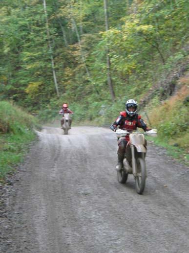
Paiute Trail Hatfield-McCoy Highwood Mountains
|
|
|
- Clement Berry
- 5 years ago
- Views:
Transcription

1 Paiute Trail Hatfield-McCoy Highwood Mountains

2


3 Located in Central Utah Main trail is 238 miles 550 miles of designated side trails Links 16 communities in 4 counties Ranges from 5,200 to 11,500 feet

4 Great Western Trail Fremont Trail Paunsagant Trail Pinchot Trail Arapien Trail Largest interconnected motorized system in country 2,500 miles


5 80% is ATVs 10% is Motorcycle 10% of use is horseback, hiker, mountain bike and full sized OHVs (jeeps)
6 Forest Service was closing routes to protect resources. Sportsmen wanted continued use of routes to favorite hunting and fishing spots. Tourism looking for destination recreation opportunities to draw people with money.
7 Create a motorized trail system to meet the needs of everyone The system would need to Protect natural resources Provide a high quality riding experience Connect communities Provide economic benefits to area
8 Forest Service & Bureau of Land Management Utah State Parks & Recreation 3 parks Economic Development 4 Counties 16 Communities Law Enforcement


9 Public Health OHV clubs and riding groups Business Fishlake Discovery Association Today there are over 50 active partners!
10 Sold idea to counties and communities Selected name and symbol Mapped system main trail side trails Marketing developed brochure & map can t ride Paiute without one Funding grants, donations, fund raisers Volunteers Paiute Trail Hosts Marked the routes signs and trail markers Win/Win solutions to problems proactive

11 Forest Service and BLM Trail System became a management tool


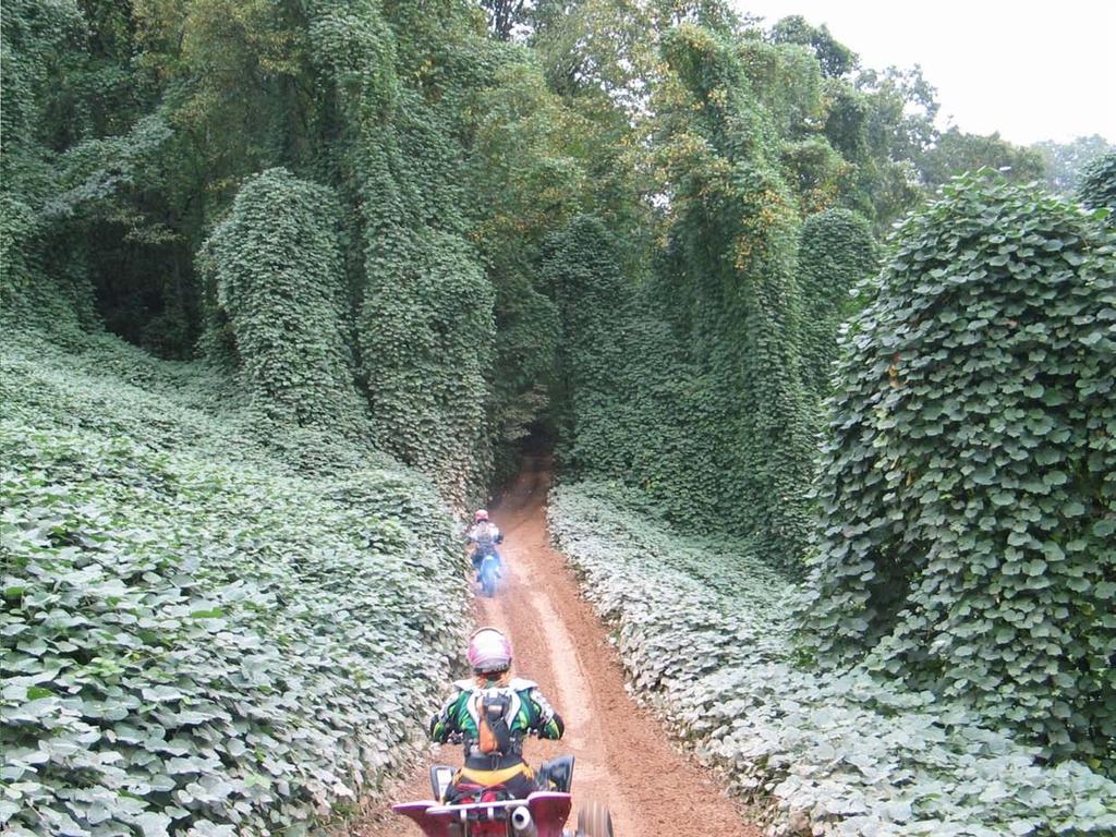
12 Sportsmen Access to Hunt, Fish, Camp, etc. Quantity and Quality Place to Ride


13 Forest Service & BLM State of Utah Local counties & towns They created: Dual-use roads, streets & trails for access to communities along the route. Gave riders access to food, fuel, lodgings & services.


14 All 50 States and beyond! 75% of 60,000 riders from outside the area Average rider spends $115 a day to ride

15 Boosted economy by $20,000,000 Highway 89 Paiute County Highway Use down 6% Room tax revenue up 20% Fewer cars more tourism $ s

16 Marysvale, mid 80 s 7 businesses Today 21 Paiute Trail


17 High quality OHV trail Provides environmental protection Economic engine for small Utah communities
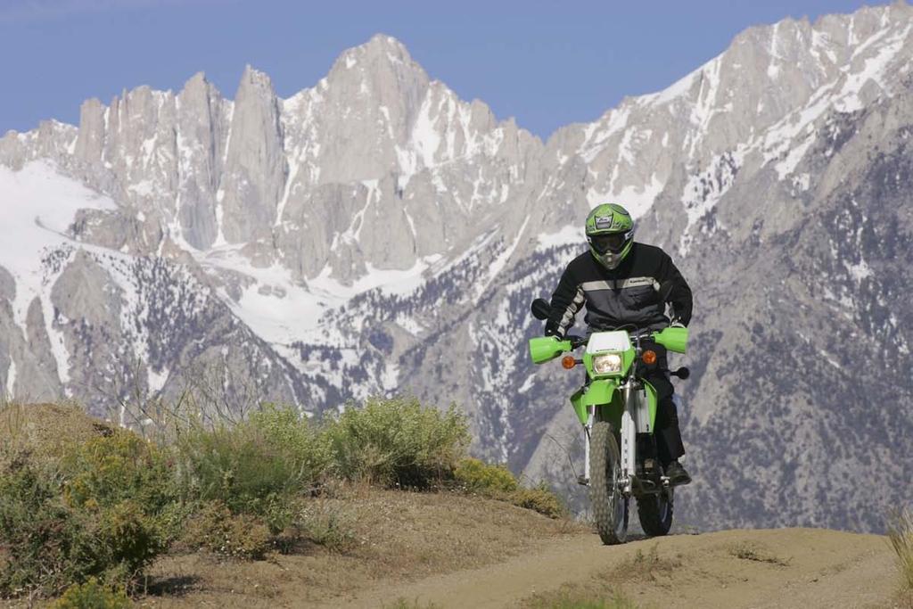
18


19 Located in 9 Counties in Southern West Virginia

20 With the Decline of the Coal Industry: The counties had lowest average income in the nation (48% of the national average) Local communities were looking for tourism opportunities Local roads from mining and timber made OHV use a natural choice


21 Most of the land in the area is privately owned by coal and timber companies Had to create an organization to create and maintain a trail system


22 Legislation was passed in 1996 to create the Hatfield-McCoy Regional Trail Authority


23 The authority is a quasi-governmental agency that manages the trail system and is governed by a multi-county board of directors

24 The system opened in 2000 with 300 miles of trails 100 miles were added in miles added in miles added in 2009 Additional miles are planned


25 ATVs Off-Highway Motorcycles Side x Sides or ROVs Equestrians Mountain bikes Hikers
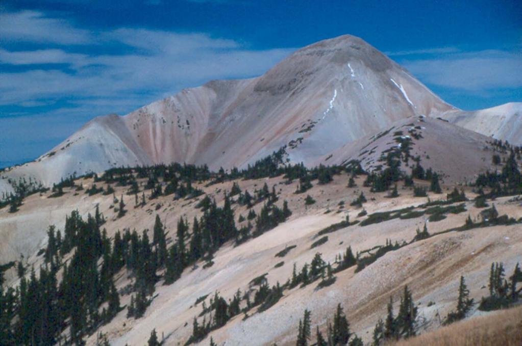
26 Crosses the property of over 200 different owners and lessees Land owners are not paid for the access Liability protection provided by Hatfield McCoy authority Guaranteed trail will not interfere with their land management
27 Comprised of 6 separate riding areas that range in size and level of difficulty Several riding areas are connected to each other Riding areas are connected to nearby communities


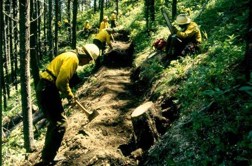
28 Annual fee from riders Appropriated State funds Recreational Trails Program grants

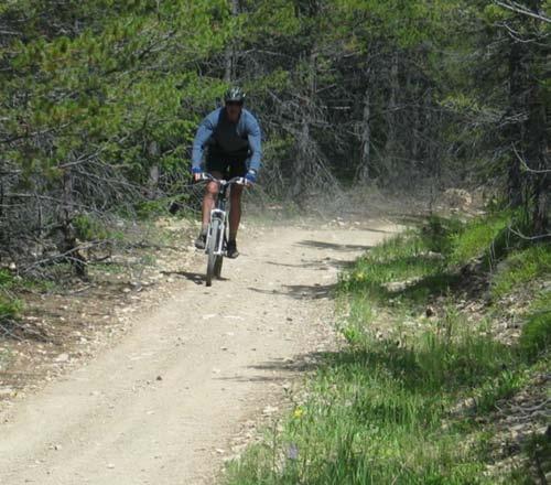
29 Trails are interconnected to the area communities Created entrepreneurial opportunities for businesses Created jobs for locals Pride in Community

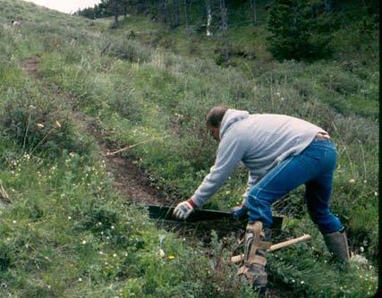
30 Increase in output of nearly $8 million Income growth of $3 million 146 new jobs 125% return on appropriated money

31 Reduced trespass on private lands Provided jobs & economic benefits High quality, sustainable recreation opportunity
32


33 Lewis & Clark National Forest Fort Benton Great Falls Highwood Mtns. 35 miles east of Great Falls, in central Montana.


34 Open grasslands and gentle ridgelines 42,500 acre, island mountain range

35 Travel Management Planning started in May, 1989


36 Forest Service asked stake holders to inventory the trails they used OHV riders Hikers Equestrians Adjacent land owners County Commissioners And Others Engaged all in a collaborative effort


37 Trail heads were built or improved Trails were relocated, reconstructed, or improved


38 Signs were installed Wet areas were improved


39 Volunteer Assistance from The Great Falls Trail Bike Riders The C.M. Russell Backcountry Horsemen Youth Groups Eagle Scouts


40 Montana Off-Highway Vehicle grant program paid for work done by The Chief Mountain Hotshot crew Contractors

41 North Fork Highwood Creek Trailhead The only FS funded capital investment!


42 Results: Trail that is fun to ride Off trail use is very low User conflicts are rare
43 Incredible sense of ownership by OHV riders and Back Country Horsemen Cooperative trail projects 19 miles multiple-use trail adopted by motorcycle club 10 miles multiple-use trail & 8 miles stock trail adopted by BCH

44
FINAL TESTIMONY 1 COMMITTEE ON RESOURCES UNITED STATES HOUSE OF REPRESENTATIVES. July 13, 2005 CONCERNING. Motorized Recreational Use of Federal Lands
 FINAL TESTIMONY 1 STATEMENT OF DALE BOSWORTH CHIEF Of the FOREST SERVICE UNITED STATES DEPARTMENT OF AGRICULTURE Before the SUBCOMMITTEE ON FORESTS AND FOREST HEALTH And the SUBCOMMITTEE ON NATIONAL PARKS,
Chapter 6: POLICY AND PROCEDURE RECOMMENDATIONS
 Chapter 6 POLICY AND PROCEDURE RECOMMENDATIONS FOR SRRA Below are seven policy elements that should be considered for adoption by the Southwest Regional Recreation Authority of Virginia: 1. Develop strategies
Creating a User-Driven Long-Distance OHV Trail Through Partnering
 Joseph Raffaele Outdoor Recreation Planner U.S. Bureau of Land Management Yuma, Arizona Creating a User-Driven Long-Distance OHV Trail Through Partnering BLM is a multiple-use land management agency within
Recreation News. Welcome. Chris Jackson. In this Issue: O S U C o l l e ge F o r e s t s
 Recreation News O S U C o l l e ge F o r e s t s In this Issue: Welcome New tree identification posts... New Arboretum Trails New Interpretive Signs Ridge Trail Seasonal Closures Leave No Trace reminder
TRAIL USER PERMIT FEE NATURAL RESOURCES, AGRICULTURE AND ENVIRONMENT INTERIM COMMITTEE
 TRAIL USER PERMIT FEE NATURAL RESOURCES, AGRICULTURE AND ENVIRONMENT INTERIM COMMITTEE Chris Haller Off-highway Vehicle Program Manager and Recreation Why? Motorized (Off-highway Vehicle-OHV) community
SOCIAL CONFLICT BETWEEN MOTORIZED AND NON-MOTORIZED RECREATIONAL ACTIVITIES.
 SOCIAL CONFLICT BETWEEN MOTORIZED AND NON-MOTORIZED RECREATIONAL ACTIVITIES. There is a great disparity in opinions about the effects on a person s recreational experience when they encounter others on
South Colony Basin Recreation Fee Proposal
 South Colony Basin Recreation Fee Proposal Purpose and Need for Collecting Fees in South Colony Basin: Forest Service appropriated funds have not been sufficient to maintain current recreational services
Continental Divide National Scenic Trail Legislative History and Planning Guidance
 Continental Divide National Scenic Trail Legislative History and Planning Guidance Legislation, Policy, and Direction Regarding National Scenic Trails The National Trails System Act, P.L. 90-543, was passed
13.1 REGIONAL TOURISM ISSUES AND SUMMARY OF FINDINGS
 13 REGIONAL TOURISM T he County of Mariposa s recreation needs and facilities fall within two categories: regional tourism and local recreation. This Element focuses on regional tourism issues related
Beaverhead-Deerlodge National Forest Butte Ranger District
 United States Department of Agriculture Forest Service Beaverhead-Deerlodge National Forest 1820 Meadowlark Lane Butte, MT 59701 406 494-2147 File Code: 1950 Date: September 1, 2010 Dear Interested Party:
Secret-Lamoille Trail Project
 Secret-Lamoille Trail Project Historical Background Over the years, the US Forest Service and a variety of Forest users have routed and constructed trails in the Ruby Mountains. Many of those trails have
Proposed Scotchman Peaks Wilderness Act 2016 (S.3531)
") 1 Proposed Scotchman Peaks Wilderness Act 2016 (S.3531) Frequently Asked Questions PLACE Where is the area that would be designated as Wilderness? The lands outlined in S.3531 lie within Idaho along its
1 Proposed Scotchman Peaks Wilderness Act 2016 (S.3531) Frequently Asked Questions PLACE Where is the area that would be designated as Wilderness? The lands outlined in S.3531 lie within Idaho along its
Partners: Michigan California Timber Company Shasta-Trinity National Forest Pacific Crest Trail Association The Trust for Public Land
 Partners: Michigan California Timber Company Shasta-Trinity National Forest Pacific Crest Trail Association The Trust for Public Land Describe the project location, size, opportunities, and timing. Provide
BACKCOUNTRY TRAIL FLOOD REHABILITATION PROGRAM
 BACKCOUNTRY TRAIL FLOOD REHABILITATION PROGRAM Backcountry Trail Flood Rehabilitation A June 2013 Flood Recovery Program Summary In June 2013, parts of Southern Alberta were devastated from significant
Crystal Lake Area Trails
 Lake Area Trails Welcome to the Lake area of the Big Snowy Mountains! This island mountain range in central Montana features peaks reaching to 8,600 feet and long, high ridges from which vistas of the
US Forest Service Bears Ears Trail - NFST 1144 California Park to Hole in Wall Creek. Good (1) 2 3
 2 3") Trail Maintenance Endowment Fund Trail Criteria Form The Trail Maintenance Endowment Fund (TMEF) grant criteria form is used in determining the use of funds available on an annual basis. Decisions on how
Trail Maintenance Endowment Fund Trail Criteria Form The Trail Maintenance Endowment Fund (TMEF) grant criteria form is used in determining the use of funds available on an annual basis. Decisions on how
To: Cam Hooley From: Trails 2000 Date: September 30, 2016 Re: Hermosa Comments. Dear Cam:
 ! To: Cam Hooley From: Trails 2000 Date: September 30, 2016 Re: Hermosa Comments Dear Cam: Trails 2000 is commenting on the Forest Service Management Plan for the Hermosa Creek Watershed Management Plan
March 14, SUBJECT: Public input to the Bureau of Land Management, Gunnison Field Office, Travel Management Plan
 March 14, 2019 Delivered via email to ewaters@blm.gov Elijah Waters Field Manager BLM Gunnison Field Office Gunnison, CO 81230 SUBJECT: Public input to the Bureau of Land Management, Gunnison Field Office,
Hermosa Area Preservation The Colorado Trail Foundation 4/11/2008
 Hermosa Area Preservation The Colorado Trail Foundation 4/11/2008 Legend d o Tr ail NPA - National Protection Area ra NCA - National Conservation Area o e C Th The Colorado Trail lo FS inventoried Roadless
RECREATION ACCESS AND COMMUNITY ENRICHMENT PLAN
 Template for facilitating Siskiyou County, the City of Yreka and the State of Jefferson in a RECREATION ACCESS AND COMMUNITY ENRICHMENT PLAN Access to the Mountains CREATING ACCESS TO PUBLIC AND PRIVATE
Federal Outdoor Recreation Trends Effects on Economic Opportunities
 United States Department of Agriculture Federal Outdoor Recreation Trends Effects on Economic Opportunities The Forest Service National Center for Natural Resources Economic Research is assisting the Federal
APPENDIX C RECREATION OPPORTUNITY SPECTRUM PROCESS AND CLASSES
 APPENDIX C RECREATION OPPORTUNITY SPECTRUM PROCESS AND CLASSES RECREATION OPPORTUNITY SPECTRUM PROCESS Recreation area management objectives are defined through a planning process referred to as the Recreation
proof Northwest District
 1 Northwest District The Northwest Florida Water Management District is the most rural of all five water management districts. From just east of Tallahassee west to the Florida/Alabama line, and from the
A Review of Managed Off Highway Vehicle Trail Areas In Haliburton County. Prepared for the Haliburton Highlands Trails and Tours Network
 A Review of Managed Off Highway Vehicle Trail Areas In Haliburton County Prepared for the Haliburton Highlands Trails and Tours Network By Dr. Meg Thorburn PhD 1 INTRODUCTION The Haliburton Highlands Trails
Santa Clara South Hills Recreation Park Project Development and Management Plan
 Santa Clara South Hills Recreation Park Project Application for Land for Recreation or Public Purposes, City of Santa Clara, Utah Prepared for: Bureau of Land Management, St. George Field Office 345 East
5.0 OUTDOOR RECREATION OPPORTUNITIES AND MANAGEMENT
 5.0 OUTDOOR RECREATION OPPORTUNITIES AND MANAGEMENT 5.1 Introduction This section describes the range of recreational activities that currently take place in Marble Range and Edge Hills Parks, as well
MASTER PLAN EXECUTIVE SUMMARY
 Biscuit Run State Park Scottsville Road (State Route 20) Charlottesville, VA 22902 Biscuit Run State Park MASTER PLAN EXECUTIVE SUMMARY Department of Conservation and Recreation Division of Planning and
Crook County Oregon. Natural Resources Planning Committee Draft Report
 Crook County Oregon Natural Resources Planning Committee Draft Report September 17, 2009 Ochoco Summit OHV Trail Planning field Review September 3, 2009 The Dechutes Provincial Advisory Committee invited
Strengthening the Ontario Trails Strategy. Report on Consultations and the Environmental Bill of Rights Registry
 Strengthening the Ontario Trails Strategy Report on Consultations and the Environmental Bill of Rights Registry Purpose To report on the feedback and information received through the regional consultations,
Welcome and thank you for being here! Kick-Off Public Workshop November 19, 2014
 Welcome and thank you for being here! Kick-Off Public Workshop November 19, 2014 OPEN SPACE MATTERS: Boise s First Reserve Master Plan Julia Grant Foothills and Open Space Manager City of Boise Ellen Campfield
Appendix D ( Rock Climbing Survey) Scroll Down
 Scroll Down") Appendix D (E-mail Rock Climbing Survey) Scroll Down 51 2006 Coopers Rock Recreation Study West Virginia University Dear Recreationist: The Department of Recreation, Parks, and Tourism Resources at West
Appendix D (E-mail Rock Climbing Survey) Scroll Down 51 2006 Coopers Rock Recreation Study West Virginia University Dear Recreationist: The Department of Recreation, Parks, and Tourism Resources at West
Other Agencies and Organizations
 Daniel Boone National Forest 1700 Bypass Road WInchester, KY 40391 859-745-3100 Location Northern terminus is near Morehead, Kentucky. Southern terminus is located in the Big South Fork NRRA in Tennessee.
(Short Listing) SOUTH FORK LOG CABIN, UTICA, MONTANA
 SOUTH FORK LOG CABIN, UTICA, MONTANA") (Short Listing) SOUTH FORK LOG CABIN, UTICA, MONTANA The South Fork Log Cabin is in the heart of thousands of acres of public land of the Lewis & Clark National Forest Service. This Cabin offers unlimited
(Short Listing) SOUTH FORK LOG CABIN, UTICA, MONTANA The South Fork Log Cabin is in the heart of thousands of acres of public land of the Lewis & Clark National Forest Service. This Cabin offers unlimited
Mendota Trail Newsletter
 Mendota Trail Newsletter FIRST MILE IS OPEN! On Saturday, October 7, 2017 supporters of the trail gathered at the Mendota Trailhead for the official grand opening of the first mile. A few well-placed words,
CHAPTER VIII ECONOMIC IMPACT POTENTIAL
 CHAPTER VIII Economic Impact Potential First and foremost, a connector trail or multiple trails from the State Park into the City of Cumberland will create some benefit to the community but the connector
F. Forest Recreation Management
 F. Forest Recreation Management F.1) Park and Recreation Management F.1.A. Program Overview. The park and recreation program has been in existence since 1980. With ever increasing outdoor recreation demands
Shonkin Creek Hideaway
 Shonkin Creek Hideaway 7.5 +/- acres of beautiful shade trees, the year round Upper Shonkin Creek just outside your door, and peace and quiet off a well-maintainted road. 42,000 acres of State Forest Land
Teton County Wyoming WPLI Proposal-Palisades and Shoal Creek Special Management Areas
 Teton County Wyoming WPLI Proposal-Palisades and Shoal Creek Special Management Areas Proposal Alliance The following Alliance of local and regional stakeholders have a common and unified interest to maintain
Whitefish Range Partnership Tentatively Approved by WRP 11/18/2013!Rec. Wilderness Page 1
 Whitefish Range Partnership Tentatively Approved by WRP 11/18/2013!Rec. Wilderness Page 1 Recommended Wilderness Background The Whitefish Range has a long management and legislative history associated
Willow Creek Horse Camp Reconstruction
 Performance Period: 04/15/2017-12/31/2017 The following is a summary of hours and work completed on the Black Hills National Forest and other public lands during the reporting period for 2017 by the Black
U.S.D.A. FOREST SERVICE KETCHUM RANGER DISTRICT 206 SUN VALLEY ROAD P.O. BOX 2356 KETCHUM, ID (208)
") U.S.D.A. FOREST SERVICE KETCHUM RANGER DISTRICT 206 SUN VALLEY ROAD P.O. BOX 2356 KETCHUM, ID 83340 (208) 622-5371 Road and Trail Report 05/8/2015 More trails opened in Greenhorn this week. Only high elevation
U.S.D.A. FOREST SERVICE KETCHUM RANGER DISTRICT 206 SUN VALLEY ROAD P.O. BOX 2356 KETCHUM, ID 83340 (208) 622-5371 Road and Trail Report 05/8/2015 More trails opened in Greenhorn this week. Only high elevation
Nez Perce National Historic Trail. Land and Water Conservation Fund FY2014 Request
 FY2014 Request National Trails System FY2014 Total LWCF Request: $2,840,000 Project Name Agency District # Tracts Acres Total Cost Cow Island and Cow Creek BLM MT-1 2 779 $1,600,000 (in conjunction with
BROCHURE. APPLE HILL WOODS 118 +/- Acres Camino, California. Presented by Jim Copeland
 BROCHURE APPLE HILL WOODS 118 +/- Acres Camino, California Presented by Jim Copeland 1 The Property This 118 acre is a rare gem in the Sierra Nevada foothills. Covered with lush forestland and scattered
BUTTE COUNTY FOREST ADVISORY COMMITTEE
 BUTTE COUNTY FOREST ADVISORY COMMITTEE November 24, 2014-4:00 P.M. ITEM NO. 1.00 2.00 Call to order Golden Valley Bank, 190 Cohasset Rd. Chico, CA 95926 (park in center of lot) Pledge of allegiance to
Wallace Falls State Park Classification and Management Planning Stage 3 Preliminary Recommendations July 18, 2018 Sultan City Hall
 Wallace Falls State Park Classification and Management Planning Stage 3 Preliminary Recommendations July 18, 2018 Sultan City Hall Thanks for coming! This document contains State Parks preliminary recommendations
ANALYSIS OF VISITOR PREFERENCES OF THE HATFIELD-MCCOY TRAILS
 1 ANALYSIS OF VISITOR PREFERENCES OF THE HATFIELD-MCCOY TRAILS Wendy Pace Concord University Recreation and Tourism Management Athens, WV 24712 pacew02@mycu.concor.edu Dr. Roy Ramthun Concord University
CURRENT AND POTENTIAL USE LEVELS BY ACTIVITY.
 CURRENT AND POTENTIAL USE LEVELS BY ACTIVITY. The public has the perception that current levels of participation are likely to increase for all types of recreational activities. There is public disagreement
CHAPTER 5. Chapter 5 Recreation Element
 CHAPTER 5 Recreation Element Chapter 5 Recreation Element The Recreation Element of the Meyers Area Plan is a supplement to the Recreation Element of the TRPA Regional Plan and the El Dorado County General
Blue Ridge Recreation Area
 Concept Plan for Blue Ridge Recreation Area Clear Creek, CO April, 2017 Prepa red fo r: Prepared by: Published: April, 2017 Concept Plan Executive Summary The proposed Blue Ridge Recreation Area (Blue
TRAIL DATABASE SCHEMA (8/26/2014)
") Trail Data Model for LINES Source Data Source Agency dataagency Agency or entity that created the dataset where the original line was sourced from. Source Date of Last Data Used to Update sourcedate Publication
Trail Data Model for LINES Source Data Source Agency dataagency Agency or entity that created the dataset where the original line was sourced from. Source Date of Last Data Used to Update sourcedate Publication
Tabor Mountain Recreation Society Who We Are What We Do Regional Park The Ask. Photo by Ken Hodges
 Tabor Mountain Recreation Society Who We Are What We Do Regional Park The Ask Photo by Ken Hodges 1 TMRS History 1961 logging and the Grove Fire activities resulted in many of the existing trails 1961
(Short Listing) DUPUYER ACREAGE, ROCKY MOUNTAN FRONT
 DUPUYER ACREAGE, ROCKY MOUNTAN FRONT") (Short Listing) DUPUYER ACREAGE, ROCKY MOUNTAN FRONT This unique property is located 8½ miles northwest of Dupuyer, Montana and approximately thirty 30 miles northwest of Choteau, Montana. Great Falls
(Short Listing) DUPUYER ACREAGE, ROCKY MOUNTAN FRONT This unique property is located 8½ miles northwest of Dupuyer, Montana and approximately thirty 30 miles northwest of Choteau, Montana. Great Falls
Stakeholder Engagement Session Report Motorized Trail Users Evergreen TEC Centre April 27,, 2010
 10001 84 Avenue Clairmont, AB T0H 0W0 Tel. 780-513-3950 email: wcps@wapiticorridor.ca Web site: www.wapiticorridor.ca Stakeholder Engagement Session Report Motorized Trail Users Evergreen TEC Centre April
Twin Rivers BCH Annual Report 2010
 Twin Rivers BCH Annual Report 2010 January We got started early this year with our first work project January 6 th. Washington Dept. of Fish & Wildlife agreed to let us improve the parking area and make
S Central Coast Heritage Protection Act APRIL 21, 2016
 STATEMENT OF GLENN CASAMASSA ASSOCIATE DEPUTY CHIEF, NATIONAL FOREST SYSTEM U.S. FOREST SERVICE U.S. DEPARTMENT OF AGRICULTURE BEFORE THE UNITED STATES SENATE COMMITTEE ON ENERGY AND NATURAL RESOURCES
System Group Meeting #1. March 2014
 System Group Meeting #1 March 2014 Meeting #1 Outcomes 1. Understand Your Role 2. List of Revisions to Existing Conditions 3. Information Sources Study Area The Purpose of Mountain Accord is to Preserve
St. Joe Travel Management Inventoried Roadless Area Report
 St. Joe Travel Management Inventoried Roadless Area Report Lynette Myhre and Tracy Gravelle July 2015 Regulatory Framework Idaho Roadless Rule Roadless area descriptions from the Idaho Roadless Conservation
Steve Holdsambeck District Ranger Spring Mountains National Recreation Area
 EXHIBIT C1 TESTIMONY ON RESOURCE MANAGEMENT ACTIVITIES ON THE SPRING MOUNTAINS NATIONAL RECREATION AREA HUMBOLDT-TOIYABE NATIONAL FOREST FOR THE LEGISLATIVE COMMITTEE ON PUBLIC LANDS May 28, 2004 Steve
Great Allegheny Passage
 Great Allegheny Passage Two documents are provided: Great Allegheny Passage Special Use Permit Application Great Allegheny Passage Rules and Guidelines. Great Allegheny Passage Allegany County Government
Statistical Report of State Park Operations:
 National Association of State Park Directors Statistical Report of State Park Operations: 2011-2012 Annual Information Exchange for the Period July 1, 2011 through June 30, 2012 Prepared for the National
KANANASKIS COUNTRY PROVINCIAL RECREATION AREAS MANAGEMENT PLAN DRAFT TERMS OF REFERENCE - November 20, 2007
 KANANASKIS COUNTRY PROVINCIAL RECREATION AREAS MANAGEMENT PLAN DRAFT TERMS OF REFERENCE - November 20, 2007 BACKGROUND There are 42 Provincial Recreation Areas (PRAs) within Kananaskis Country located
Non-motorized Trail Plan & Proposal. August 8, 2014
 Town of Star Valley Ranch, Wyoming and the Star Valley Ranch Association in partnership with the USDA Forest Service, Bridger-Teton National Forest, Greys River Ranger District Non-motorized Trail Plan
IDAHO STATE ATV ASSOCIATION, INC. an Idaho nonprofit corporation. STATEMENT OF POLICIES AND POSITIONS [adopted September 25, 2010]
![IDAHO STATE ATV ASSOCIATION, INC. an Idaho nonprofit corporation. STATEMENT OF POLICIES AND POSITIONS [adopted September 25, 2010]](/thumbs/93/113789894.jpg "IDAHO STATE ATV ASSOCIATION, INC. an Idaho nonprofit corporation. STATEMENT OF POLICIES AND POSITIONS [adopted September 25, 2010]") IDAHO STATE ATV ASSOCIATION, INC. an Idaho nonprofit corporation STATEMENT OF POLICIES AND POSITIONS [adopted September 25, 2010] The following represent the official policies and positions of the Idaho
IDAHO STATE ATV ASSOCIATION, INC. an Idaho nonprofit corporation STATEMENT OF POLICIES AND POSITIONS [adopted September 25, 2010] The following represent the official policies and positions of the Idaho
RUSHMORE CONNECTOR TRAIL PROPOSAL
 PURPOSE AND NEED Background The U.S. Forest Service, Black Hills National Forest (Forest Service) has received a special use permit application from the State of South Dakota Department of Game, Fish and
RE: Tenderfoot Trail Project
 Protecting Our OHV Access www.cohvco.org October 3, 2012 Rep. Jared Polis Att: Nissa Erickson 101 West Main Street Suite 101D PO Box 1453 Frisco, CO 80443 Dear Ms. Erickson; RE: Tenderfoot Trail Project
Land Use & Neighborhoods Spectacular, diverse landscape with distinct communities
 Land Use & Neighborhoods Spectacular, diverse landscape with distinct communities Most of the borough is remote, wild and held in public ownership: 70% of the borough is located within Denali National
ECONOMIC PROFILE. Tourism
 ECONOMIC PROFILE Tourism Park City & Summit County Utah Prepared by Park City Chamber of Commerce Convention & Visitors Bureau P.O. Box 1630 ~ Park City, UT 84060-1630 800.453.1360 ~ 435.649.6100 ~ fax
Chapter 6. Action Program. Heart of the Lakes Area Recreation Plan
 Heart of the Lakes Area Recreation Plan 1. Design and construct the following trails (please see the following map): a. the Speedway Trail 1) primary pathway the main trail 2) secondary pathway the proposed
RECREATION. 1. Conflict between motorized and non-motorized recreation uses,
 Island Unit Trail System Additions Project Chapter 3. Recreation RECREATION INTRODUCTION This section discusses the effects to public recreation opportunities and experiences. The type of recreational
Preferred Recreation Recommendations Stemilt-Squilchuck Recreation Plan March 2018
 Preferred Recreation Recommendations Stemilt-Squilchuck Recreation Plan March 2018 Below are the recommended recreation ideas and strategies that package together the various recreation concepts compiled
CHAPTER FOUR: Overview & Benefits of Trails
 An inventory of all the trails within the NCHA study area reveals that there are 294 trails totaling 2,231.70 miles of trails. A complete list of trails thus far identified in alphabetical order are provided
Tracy Ridge Shared Use Trails and Plan Amendment Project
 Tracy Ridge Shared Use Trails and Plan Amendment Project Scoping Document Forest Service Allegheny National Forest Bradford Ranger District McKean, County, Pennsylvania In accordance with Federal civil
Subj: POLICY FOR MAINSIDE TRAIL USE AT MARINE CORPS BASE QUANTICO
 UNITED STATES MARINE CORPS MARINE CORPS BASE QUANTICO, VIRGINIA 22134-5001 MCBO 5090.4 B 04 MARINE CORPS BASE ORDER 5090.4 From: Commander To: Distribution List Subj: POLICY FOR MAINSIDE TRAIL USE AT MARINE
Alternative 3 Prohibit Road Construction, Reconstruction, and Timber Harvest Except for Stewardship Purposes B Within Inventoried Roadless Areas
 Roadless Area Conservation FEIS Summary Table S-1. Comparison of Key Characteristics and Effects by Prohibition Alternative. The effects summarized in this table A would occur in inventoried roadless areas
Final Recreation Report. Sunflower Allotment Grazing Analysis. July 2015
 Final Recreation Report Sunflower Allotment Grazing Analysis July 2015 Table of Contents Introduction... 3 Affected Environment... 3 Four Peaks Wilderness Area... 3 Dispersed Recreation... 3 Environmental
Each picture below has a brief explanation of the alignment. Please review and feel free to send any questions you might have.
 TO: Golden Parks, Recreation and Museums Advisory Board FR: Al Head & Ben Davis, Golden Giddyup Tim Waters & Jerry Harcek, Golden Community Members RE: Singletrack Sidewalks Pilot Proposal 3.0, January,
[Workshop 1] Theme : Communication with local community. Case-study Presentation-2 by Laura Belleville, Appalachian Trail Conservancy
![[Workshop 1] Theme : Communication with local community. Case-study Presentation-2 by Laura Belleville, Appalachian Trail Conservancy](/thumbs/87/96501329.jpg "[Workshop 1] Theme : Communication with local community. Case-study Presentation-2 by Laura Belleville, Appalachian Trail Conservancy") [Workshop 1] Theme : Communication with local community Case-study Presentation-2 by Laura Belleville, Appalachian Trail Conservancy 2012 World Trail Conference Laura Belleville Director of Conservation
[Workshop 1] Theme : Communication with local community Case-study Presentation-2 by Laura Belleville, Appalachian Trail Conservancy 2012 World Trail Conference Laura Belleville Director of Conservation
G R E E N R I V E R - W Y O M I N G - S W E E T W A T E R C O U N T Y
 G R E E N R I V E R - W Y O M I N G - S W E E T W A T E R C O U N T Y Minor Ranch All information contained herein is taken from sources considered reliable, but is not guaranteed by either seller nor
Rogue River Access and Management Plan Draft Alternatives
 Rogue River Access and Management Plan Draft Alternatives The Rogue River Access and Management Plan was initiated in December, 2011 and is being led by Jackson County Parks (JCP) and Oregon Department
DOWNLOAD OR READ : THESE AMERICAN LANDS PARKS WILDERNESS AND THE PUBLIC LANDS REVISED AND EXPANDED EDITION PDF EBOOK EPUB MOBI
 DOWNLOAD OR READ : THESE AMERICAN LANDS PARKS WILDERNESS AND THE PUBLIC LANDS REVISED AND EXPANDED EDITION PDF EBOOK EPUB MOBI Page 1 Page 2 these american lands parks pdf The National Parks and Federal
INTRODUCTION TO RIFLE AIRPARK AND GARFIELD COUNTY AIRPORT INDUSTRIAL PARK PLANNED UNIT DEVELOPMENTS
 INTRODUCTION TO RIFLE AIRPARK AND GARFIELD COUNTY AIRPORT INDUSTRIAL PARK PLANNED UNIT DEVELOPMENTS MARCH 31, 2016 Offered By: Airport Land Partners Limited, a Colorado Limited Liability Corporation 312
GREENWOOD VEGETATION MANAGEMENT
 APPENDIX G GREENWOOD VEGETATION MANAGEMENT PROJECT RECREATION RESOURCE REPORT Prepared by: Laurie A. Smith Supervisory Forester Stearns Ranger District Daniel Boone National Forest August 4, 2016 The
November 6, RE: OBJECTION Regarding the Revised Colville Forest Plan. To Objection Reviewing Officer:
 305 N. 83 rd Street Seattle, WA 98103 206-633-1992 www.wawild.org info@wawild.org November 6, 2018 USDA Forest Service Attn: Chris French, Objection Reviewing Officer 1400 Independence Ave. SW, EMC-PEEARS,
Washakie Wilderness Ranch
 Washakie Wilderness Ranch Dubois, Wyoming Fly Fishing Hunting Ranching Conservation Washakie Wilderness Ranch Dubois, Wyoming Introduction: A stunning 160-acre parcel located at the base of the Ramshorn
CONFLICT MANAGEMENT THROUGH THE IMPLEMENTATION
 CONFLICT MANAGEMENT THROUGH THE IMPLEMENTATION OF A COLLABORATIVE PROCESS: TRAVEL MANAGEMENT PLANNING ON THE LOGAN RANGER DISTRICT OF THE UINTA-WASATCH-CACHE NATIONAL FOREST COMMUNITY SURVEY SELECTED RESULTS
Kelly Motorized Trails Project Proposed Action
 Kelly Motorized Trails Project Proposed Action November 28, 2011 The Flagstaff Ranger District of the Coconino National Forest is seeking public input on the proposed Kelly Motorized Trails Project (formerly
RECREATION. Seven issues were identified that pertain to the effects of travel management on outdoor recreation within portions of the project area.
 RECREATION Seven issues were identified that pertain to the effects of travel management on outdoor recreation within portions of the project area. OPPORTUNITIES FOR SOLITUDE / QUIET TRAILS. One attraction
Evaluating your resources
 Evaluating your resources Is agricultural tourism for you? Penny Leff UC SAREP Agritourism is: Any incomegenerating activity conducted on a working farm or ranch for the enjoyment and education of visitors.
The University of Georgia
 The University of Georgia Center for Agribusiness and Economic Development College of Agricultural and Environmental Sciences Georgia Agritourism Overview: Results from a 2005 Business Survey Center Report:
APPENDIX E - STRUCTURE RECREATION MANAGEMENT AREAS -SRMAS
 APPENDIX E - STRUCTURE RECREATION MANAGEMENT AREAS -SRMAS Appendix E Structured Recreation Management Areas Page E-1 Table of Contents Cortez Structured Management Area...2 Recreation Management Zone
Ridge to Rivers MINUTES. February 5, 2014
 Ridge to Rivers 2 nd Quarter Partnership Meeting MINUTES Partners present: Scott Koberg, Ada County Parks and Waterways, Doug Holloway and Julia Grant, Boise City Department of Parks and Recreation, Larry
PLANNING COMMISSION AGENDA REPORT May 10, Members of the Planning Commission. Joyce Parker-Bozylinski, Contract Planner
 PLANNING COMMISSION AGENDA REPORT May 10, 2007 TO: FROM: PROPOSAL: APPLICANT: RECOMMENDATION: Members of the Planning Commission Joyce Parker-Bozylinski, Contract Planner Approval of the Calabasas Trails
Recreation. Individuals Communities Economy Environment
 Recreation There s a Corps Lake Near You! Value to Individuals When it s time for outdoor recreation, Americans head for the water. Our many lakes, rivers, and beaches offer everyone fun, fitness, rest,
APPENDIX A: Survey Instruments
 Three different surveys were conducted during the research phase of the NCHA Trails Study. One questionnaire was designed for elected officials and user groups (general public). The other two questionnaires
S. 37, Forest Jobs and Recreation Act (FJRA)
") Testimony of Jeremy Fancher, International Mountain Bicycling Association Before the U.S. Senate Committee on Energy and Natural Resources Subcommittee on Public Lands, Forests, and Mining Hearing on Misc.
Testimony of Jeremy Fancher, International Mountain Bicycling Association Before the U.S. Senate Committee on Energy and Natural Resources Subcommittee on Public Lands, Forests, and Mining Hearing on Misc.
Rockin River Ranch State Park. TAC Meeting No. 2
 Rockin River Ranch State Park TAC Meeting No. 2 ASPT Welcome Skip Varney Deputy Director of Operations and Development Rockin River Ranch State Park Workshop Outline Planning Process/Schedule Overview
LANDER AREA MASTER TRAILS PLAN. Lander Cycling Club November 2012
 LANDER AREA MASTER TRAILS PLAN Lander Cycling Club November 2012 Table of Contents A. Overview 3 B. Introduction 4 C. Visitor Profile 5 D. Benefits to the Community 6 E. Area wide Goals and Objectives
APPENDIX. Alberta Land Stewardship Act AMENDMENTS TO THE SOUTH SASKATCHEWAN REGIONAL PLAN
 APPENDIX Alberta Land Stewardship Act AMENDMENTS TO THE SOUTH SASKATCHEWAN REGIONAL PLAN 1 All references to Alberta Environment and Sustainable Resource Development, Environment and Sustainable Resource
A MOBILE APP FOR RIDERS TO ENJOY AND SHARE THEIR EXPERIENCE
 A MOBILE APP FOR RIDERS TO ENJOY AND SHARE THEIR EXPERIENCE Web Mobile Innovation I iquad Quebec s Quad fédération + 30 000 downloads imotohr Quebec s Dirt Bike fédération + 5 000 downloads VTT Matapedia
Weston County, Wyoming
 The Sweet 200-Acre Property Weston County, Wyoming A unique opportunity to own a little piece of the old West, where one can experience unparalleled scenery, adventure and history walk in the footsteps