March, Monthly Newsletter of The Rocky Mountaineers
|
|
|
- Willa McDowell
- 5 years ago
- Views:
Transcription
1 March, 2017 Monthly Newsletter of The Rocky Mountaineers


2 Cover Photo: Florence Crags from Little St. Joe Mt. Photo: Matt Roscoe Climb, Hike, Ski, Bike, Paddle. Dedicated to the Enjoyment, and Promotion of Responsible Outdoor Adventure Club Contacts Website: Mailing Address: The Rocky Mountaineers PO Box4262 Missoula, MT President: Steve schombel Vice-President: Paul Jensen Secretary: Julie Kahl Treasurer: Steve Niday Newsletter Editor: Julie Kahl Webmaster: Alden Wright About the Club Mission Statement: The Rocky Mountaineers is a non-profit club dedicated to the enjoyment and promotion of responsible outdoor adventures Meeting and Presentations: During September through April, on the second Tuesday of the month, business meeting are generally held at 6:PM at a location in downtown Missoula, before the general membership meeting at 7:PM the Trail Head, with a featured presentation or speaker. General meeting is free and open to the public, business meeting is open to all members. The May meeting is usually a picnic. On a weekend in late August we gather in Glacier NP for the Glacier Classic Outing Dues: Club dues are $10, and due in April of each year, payment can be made through PayPal. Membership application is at the back of this newsletter. The FaceBook group is used to post short notice and up-to-date news as well as recent trip reports The Mountain Ear is the club newsletter of the Rocky Mountaineers and is usually published once a month. Anyone wishing to contribute articles are encouraged to do so - contact the editor Cover Photo Submission Guidelines: Should be up and down format (Portrait), prefer no recognizable people Retro Photos Submission Guidelines: Should be a former or current dues paying member or speaker to submit, but it doesn t have to be from a Rocky Mountaineers trip, no recognizable people 2
3 Mt. Steele from Google Images Mar. 14th, 2017 Mt Steele Long time club member Paul Jensen will give a presentation on climbing Mt Steele which is located in the St Elias Mountains of Canada. At 16,644 it is one of the higher peaks in the area. The trip included flying in to a glacier near the peak and afterwards walking out to the highway. April 11th, 2017 Monthly Meeting -Bryan Kercher, Dues paid in April May 9th, 2017 Monthly Meeting Club Picnic and election of Officers President s Message This will be a message when I stoop to asking for money. It is also a message about how the club works. The annual dues remain $10 per year. Several years ago we adopted a system that the dues would be due in April, instead of anytime people wanted to send in the money. This made it easier for the club to keep track of who had paid up, and was an official member. The downside is that people who have sent in dues in the last few months maybe have not been entered on the list of official members, and may have not gotten the e- mail edition of the newsletter, among other benefits. This should be something the next group of officers will try to correct. But to get back to my message, asking for money. We, as a club, have been pretty stable for many years. Our bank account remains about the same, so we have made sure that outlays equal inlays. But, future leaders may have more ambitious plans. Or, if people stop renewing, our small bank balance could disappear quickly. So I ask you, please, in the next couple of months, to join or renew. It should be easy, we have an account with PayPal. But, they do ask for a lot of personal information, and to establish a password. So, in my opinion, it would be better to send a check via snail mail to: Rocky Mountaineers, P.O. box 4262, Missoula, MT, Or bring $10 to one of our next two meetings and fill out a membership application. You do not have to remember a password if you fill out a paper application. I hope to see you at a meeting, Steve Schombel Trip Notes Please contact the trip leader for more information regarding any listed trips. Mileage listed is round trip mileage Elevation listed is gain only For information on class rating see below: Class Rating System Class 1 - Hiking, skiing, snowshoeing, biking etc. mostly on trails or roads, but may include some easy cross country travel Class 2 - Easy Scrambling Rugged off trail hiking, no hands required Class 3 - Scrambling Use of hands to ascend some sections of rock. Little to no exposure; a fall would not likely cause serious injury Class 4 - Climbing easy climbing, great exposure; a fall would possibly cause serious injury. Use of rope and protection at times possible. Class 5- Technical Climbing Use of rope, protection and belay a must. Class 6 - Aid Climbing Use of equipment to support your weight as you climb 3

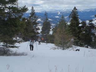
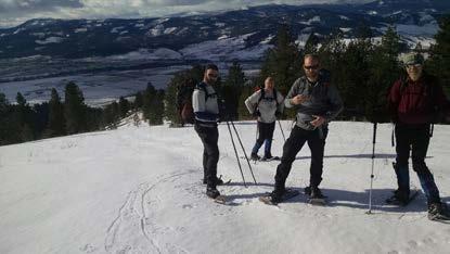
4 Shotgun RoaD (ID) Mar. 5th Dave R. and I talked about a snowshoe trip up Shotgun to road 5650(left) and heading towards Parachute Rd. Blackberry Lochsa Lodge. Yummy!!! Check with Lois for meeting time. Lois Crepeau Up Coming Trips And Adventures Chief Joseph Ski Overnighter MAR We will go for a weekend trip to Chief Joseph on Fri. & Sat. Mar. 10 & 11th. You probably need to make your own accommodations, but we will have a pot luck dinner at our cabin at The Broad Axe Lodge on the evening of the 10th. jawkal@rockymountaineers.com SOUTH CHAFFIN PEAK (The Tusk)- Bitterroots, Sat-Sun, March Rating: Class 5; Distance: 15 miles round trip; Elevation Gain: 5000 Description: This is one of only a few Bitterroot summits that require 5th class climbing. The unofficially named 9485 spire (South Chaffin is a location name the origin of The Tusk is unknown to me) is located at the head of the Chaffin Creek drainage. This will likely be a mixed snow/rock/ice climb IF it is even approachable right now. My plan is to ski up to Tamarack or Chaffin Lake area (about 6 miles) on Saturday, then head up into the upper part of the drainage on Sunday morning. If the peak looks climbable, we ll give it a go. If not, we could consider one of the other peaks around there (Sugarloaf, The Shard, Little Tin Cup). I don t know of any winter ascents of this peak. Equipment: Ski s, winter camp gear, ice tools, harness, crampons Leader: Forest Dean, mtnear1@gmail.com Sugarloaf, photo Forest Dean Freezeout Lake -Bird watching, mar. 22ND & 23RD You need to make your own travel and accommodation plans, but we may have a group meal on the night of the 22nd jawkal@rockymountaineers.com 4 Shotgun Rd. Chief Joseph Photos Julie Pelicans, photo David Kahl Wildflower Walk, Pattee Canyon or Miller Creek April 23rd We will watch the conditions to see which is the best area to see early season wildflowers. jawkal@rockymountaineers.com O Brian Creek, May 21st This will be a go as far as we want, on roads in the O Brian Creek area west of Missoula. Wildflower viewing should continue with later season flowers, may see some early bitterroots. jawkal@rockymountaineers.com These two trips, posted by Alden Wright, need alternative Leaders, if anyone is interested, contact Alden Ch-paa-qn (Squaw Peak) snowshoe hike, Saturday, March 11 In the summer, this is 7.2 miles with 1800 vertical. We will undoubtedly need to start considerably below the summer trailhead. A few days before the hike I will call the Forest Service to find where we will need to start. This 7996 peak is close to Missoula with 4000 of prominence and great views. Alden Wright rocky@wrightmontana.net Trapper Peak snowshoe hike Saturday, April 22 (tentative date) Trapper Peak is the highest peak in the Bitterroots at 10,000. In the summer it is 8.4 miles round trip with 3800 elevation gain. It is unlikely that we will be able to drive to the summer trailhead, so we might have another 3 miles round trip and another 1000 elevation gain (off trail). This is a popular trip, and I expect to have friends who will lead subgoups who will go faster than I can. Skiing is a possibility (skins required)----but I would like skiers to form a subgroup. There is no avalanche danger.


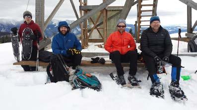
5 The warming hut at Lolo Pass will be open for the full moon on the 10th of March Photos from a trip up to the cabin -by Matt Rosco 5


6 Trip Reports Pistol Creek Lookout February 11, 2017 Pistol Creek Lookout is normally an easy hike with excellent views close to Missoula. Dave Patterson, Len Broberg, Neil Simpson, and Bill Burdick joined me on the snowshoe hike to Pistol Creek Lookout. John Bardsley posted an excellent blog on his hikes to the peak (with pictures) at mathgeekadventures.blogspot. com/2015/01/pistol-creek-lookout-arlee.html. To get to the trailhead, cross the Jocko River just north of Arlee, and then turn right on White Coyote Road. After about a mile you come to a T junction with Martz Drive. Go left, and go to the end of the road. We went up the ridge that was slightly to the right. Despite deep snow everywhere around Missoula, the ridge was free of snow for about 500 feet of elevation gain. We crossed a couple of fences and then hit snow and put on our snowshoes. We broke through the crust fairly frequently, and often sank to almost knee deep. Despite being only about 3 miles to the peak, it was a challenging hike. John Bardsley had posted a GPX track at peakbagger.com/climber/ascent.aspx?aid=624008, and we mostly followed this track. At the top of the ridge we followed the top of the ridge instead of a logging road lower down. The west face of the peak was steep and fairly thick, so we side-hilled on an old logging road almost to the ridge, and then climbed to the ridge and up to the peak. Views from the top were good but not as outstanding as John s pictures. We came down the same way we went up. Some of us were feeling the effects of repeatedly breaking through the crust with some cramping in our legs. We all enjoyed the hike. Alden Wright 6
7 7


8 Lubrecht Area snowshoe on Feb. 12 I dug out an old Cross Country Ski Trail Map for the Lubrecht Experimental Forest, and the trail I was trying to follow is the F Trail. It is no longer on the website map, but I believe it may have been one of the groomed trails in the past, or at least part of the network. Dave Robertson was the only one who joined me. We pulled into the parking lot for the Garnet Range Road about 10:45. There were so many snowmobiles coming and going we decided to follow a game trail we found to the east. Like most game trails it merged and split and wandered back and forth. Where there weren t many tracks we sunk in above our knees even on snowshoes, so it was tough uphill travel. We crossed the boundary fence, and then came across other snowshoe tracks. I saw the groomed road off to the right, so we crossed the fence again and found that we were 700 yards from the upper entrance to the F trail. There were some ski tracks on this road, and it was mostly level, so the going was much easier. We went maybe a mile and stopped to eat. It was a nice sunny day, and there were great views through openings in the trees. We saw the mountains around Seeley Lake. The snow was just right for snowshoeing, firm but not sticky. We turned around, and looked at the place where the F trail went downhill near the gate, with some tracks on it, but decided to go down the groomed road. There was surprisingly little snowmobile traffic on the road. Back at the parking lot we walked the spur road leading into Lubrecht, and found the lower part of the F trail, there was an old sign nailed to a tree. There were only deer tracks on this trail, but it would be an interesting one to explore sometime in the future. We both agreed that it was a wonderful day, great weather, good snow, and we d like to go out again. Some of you should join us. Steve Schombel 8

9 TRM 2-3,-1964 Rocky Mountaineers Meeting Minutes 2/21/2017 I. Call To Order: 5:57, The Dram Shop II. Attendees: Steve Schombel, Julie Kahl, Alden Wright, Lois Crepeau, Forest Dean, David Kahl, John Bardsley, Brent Maier III. Treasurer s Report: A. $825.28, paid a $73.00 cabin fee, B. Steve Niday will discuss the GMAR account with Joshua Phillips, soon IV. Discussions: A. New officers: John Bardsley and Brent Maier are interested in positions 1. Forest Dean was thinking of running for president 2. John -new sec. or Tres. 3. Discussed electing a new Tres. Steve Niday is OK either way B. Glacier Classic 1. Nothing available to reserve for the Aug th weekend a. Just go and hope to get spots, someone go up early Fri or Thurs. b. Reserve several regular sites at Fish Creek c. Try a private campground -Chewing Backbones, by Babb. 2. Decided to try Chewing Backbones C. September meeting 1. What we ve been doing isn t working, no picture pot luck for sure 2. Should we have a program, or cancel it? Most in favor of a program 3. Have an outdoor meeting like we do in May? Include a hike, run or something like that? D. Forest wants to get more better known speakers like Richard Smith did, suggestions: Gray Tompson, Steve Sheraff E. Trips: Chief Joseph and Freezeout Lake trips V. Adjourn 6:46 PM 9
: E-Mail: 2nd E-Mail (optional): Pay by PayPal available")
10 Rocky Mountaineers Membership Application Annual Membership Fee $10 Note: Membership includes all members of a family or household Make Check payable to the Rocky Mountaineers and send to: The Rocky Mountaineers, PO Box 4262, Missoula MT Name: Additional Family Members Names: Address: Best Phone include area code: 2nd Phone (optional): 2nd (optional): Pay by PayPal available on the Rocky Mountaineers Website. Click on the membership link on the main page Retro Photo 1998 Brett Douchette Steve Schombel (l) and Penny Palm (r) climbing a corner in the northeast ridge of Mt. Jackson, GNP Photo Julie Kahl 10
The Mountain Ear. April 2018
 The Mountain Ear April 2018 President s Message Greetings! My standard method of writing these monthly newsletters is to compose all the information that follows, then prepare the President s Message last.
The Mountain Ear. May, June & July Monthly Newsletter of the Rocky Mountaineers
 The Mountain Ear May, June & July 2016 Monthly Newsletter of the Rocky Mountaineers Climb, Hike, Ski, Bike, Paddle. Dedicated to the Enjoyment, and Promotion of Responsible Outdoor Adventure Club Contacts
Climb. Hike. Ski. Bike. Paddle. Dedicated to the Enjoyment and Promotion of Responsible Outdoor Adventure.
 1 Climb. Hike. Ski. Bike. Paddle. Dedicated to the Enjoyment and Promotion of Responsible Outdoor Adventure. Club Contacts Website: http://rockymountaineers.com e-mail: info@rockymountaineers.com Mailing
TUPPER DESIGNATED ACCESS ROUTE
 TUPPER DESIGNATED ACCESS ROUTE 1 FOR ACCESS/EGRESS TO CONNAUGHT, LOOKOUT, STONE ARCH, PORTAL PATHS AND TUPPER TRAVERSE EGRESS Length: 2.6km Vertical Gain: +162m / -83m (Values are for access. For egress,
MAY 2014 THE MOUNTAIN EAR. The Monthly Newsletter of the Rocky Mountaineers!
 MAY 2014 THE MOUNTAIN EAR The Monthly Newsletter of the Rocky Mountaineers! 1 Climb. Hike. Ski. Bike. Paddle. Dedicated to the Enjoyment and Promotion of Responsible Outdoor Adventure. Club Contacts Website:
Trail Beginning Elevation: 7553 ft The Poison Creek Trailhead is located at the end of National Forest Road 646E (NF-646E).
.") West Mountain Trails Poison Creek Trail #134 Length: 2.9 miles (4.7 km) Difficulty Horseback: A good trail for the first time west mountain rider, some steep sections Hiking: Most Difficult USGS Maps:
West Mountain Trails Poison Creek Trail #134 Length: 2.9 miles (4.7 km) Difficulty Horseback: A good trail for the first time west mountain rider, some steep sections Hiking: Most Difficult USGS Maps:
Mt. Thielsen Trip Report: April 29, 2012
 Mt. Thielsen Trip Report: April 29, 2012 Outing Organizer: Geoff Hance, with Brent McGregor Elevation Gain: 3,800 feet, over warming snow, with an exposed summit block Distance: About 9 miles round trip
Draft II - Trip Report by Kurt Wibbenmeyer
 Draft II - Trip Report by Kurt Wibbenmeyer COLORADO MOUNTAIN CLUB FAIRWEATHER MOUNTAIN EXPEDITION 2010 TEAM Rich McAdams Leader Mike Butyn Wayne Herrick Gerry Roach Bill Blazek Dave Covill Jim Rickard
Climb. Hike. Ski. Bike. Paddle. Dedicated to the Enjoyment and Promotion of Responsible Outdoor Adventure.
 1 Climb. Hike. Ski. Bike. Paddle. Dedicated to the Enjoyment and Promotion of Responsible Outdoor Adventure. Club Contacts Website: http://rockymountaineers.com e-mail: info@rockymountaineers.com Mailing
County Line trail - Miller Peak to Little Navaho
 County Line trail - Miller Peak to Little Navaho 7-17-2008 This hike features a portion of the County Line trail in the Teanaway that receives extremely little use despite offering a spectacular ridge-run
30 th Annual Alaska Mountain Wilderness Ski Classic 2017 * Atigun Gorge Wind River Wiseman Route Event Coordinator: Dave Cramer (907)
") Participant Guidelines 30 th Annual Alaska Mountain Wilderness Ski Classic 2017 * Atigun Gorge Wind River Wiseman Route Event Coordinator: Dave Cramer (907) 291-2339 1. The start is Sunday, April 2, 2017
Participant Guidelines 30 th Annual Alaska Mountain Wilderness Ski Classic 2017 * Atigun Gorge Wind River Wiseman Route Event Coordinator: Dave Cramer (907) 291-2339 1. The start is Sunday, April 2, 2017
Glacier National Park, MT
 Glacier National Park, MT July 28 Aug. 1, 2010 We decided to go to Glacier National Park for our family vacation this year. We had a great time seeing beautiful scenery and a variety of wildlife which
CIEC 9 PEAKS AWARD SUPPLEMENT POSSIBLE ROUTES FOR THE 9 PEAKS AWARD TRIP
 CIEC 9 PEAKS AWARD SUPPLEMENT POSSIBLE ROUTES FOR THE 9 PEAKS AWARD TRIP As you plan your trip, be aware of 3 regulations in this wilderness: 1. Camp only in designated campsites. 2. No campfires allowed.
Rogue Gorge (Mt. Stella) Roadless Area-- T30S R3E (primarily in portions of Sections 23, 26, 33, 34 & 35)
 Roadless Area-- T30S R3E (primarily in portions of Sections 23, 26, 33, 34 & 35)") Rogue Gorge (Mt. Stella) Roadless Area-- T30S R3E (primarily in portions of Sections 23, 26, 33, 34 & 35) Rogue River-Siskiyou National Forest--High Cascades Ranger District Upper, higher elevation trail
Rogue Gorge (Mt. Stella) Roadless Area-- T30S R3E (primarily in portions of Sections 23, 26, 33, 34 & 35) Rogue River-Siskiyou National Forest--High Cascades Ranger District Upper, higher elevation trail
The Rocky Mountaineers
 1 The Rocky Mountaineers Climb. Hike. Ski. Bike. Paddle. Dedicated to the Enjoyment and Promotion of Responsible Outdoor Adventure. Club Contacts Website: http://rockymountaineers.com e-mail: rockymountaineers@hotmail.com
CMC Member Guide to the CMC Website
 CMC Member Guide to the CMC Website HOW TO: Sign Up or Cancel a Trip/Event/Class Change Your Personal Information PLUS HOW TO FIND: Renew Your Membership Trip classification information Denver Group Classification
August The Mountain Ear. Monthly Newsletter of the Rocky Mountaineers
 August 2016 The Mountain Ear Monthly Newsletter of the Rocky Mountaineers Climb, Hike, Ski, Bike, Paddle. Dedicated to the Enjoyment, and Promotion of Responsible Outdoor Adventure Club Contacts Website:
The Mountain Ear. September Monthly Newsletter of The Rocky Mountaineers
 The Mountain Ear September 2016 Monthly Newsletter of The Rocky Mountaineers Cover Photo: Climbing Mt. Reynolds Photo: Bryan Kercher Sept. 13th Monthly Meeting At the Trail Head, 7:PM The Sept. meeting
Ribbon Cliff - Ribbon Mesa text and photos by Charlie Hickenbottom
 Ribbon Cliff - Ribbon Mesa text and photos by Charlie Hickenbottom Looking for something a little different than Sage Hills or Saddlerock? Perhaps something a little wilder, a little less traveled? Look
Anderson Mt. Proposed Wilderness Additions to the Rogue-Umpqua Divide Wilderness-- T30S R3E (mostly) Sections 4 & 9, and T29S R3E Section 33
 Sections 4 & 9, and T29S R3E Section 33") Anderson Mt. Proposed Wilderness Additions to the Rogue-Umpqua Divide Wilderness-- T30S R3E (mostly) Sections 4 & 9, and T29S R3E Section 33 When the 35,701 acre Rogue-Umpqua Divide Wilderness was designated
Anderson Mt. Proposed Wilderness Additions to the Rogue-Umpqua Divide Wilderness-- T30S R3E (mostly) Sections 4 & 9, and T29S R3E Section 33 When the 35,701 acre Rogue-Umpqua Divide Wilderness was designated
C E N T R A L C A T S K I L L S
 120 C E N T R A L C A T S K I L L S Central Catskills Once out of the southern parts of the Catskills, the Long Path enters the more well traveled and civilized regions. The trail joins the Devil s Path,
AMC Worcester Chapter Leadership Requirements & Guidelines REV 8.2 April 2010
 AMC Worcester Chapter Leadership Requirements & Guidelines REV 8.2 April 2010 Introduction: The purpose of this document is to define the requirements and guidelines for all leaders and co-leaders for
Quandary Peak East Ridge
 Quandary Peak East Ridge Difficulty: Class 1 / 2 June 28,2013 Exposure: Summit Elev.: 14,265 feet Trailhead Elev.: 10,850 feet Elevation Gain: 3,450 feet Roundtrip: 6.75 miles Hikers: Shan Stuart, Rick
Trail Phasing Plan. Note: Trails in the Clear Creek Canyon area (Segments will be finalized in the future to minimize wildlife impacts
 Note: Trails in the Clear Creek Canyon area (Segments 2 5 and a future JCOS connection) will be finalized in the future to minimize wildlife impacts Trail Phasing Plan P Parking 3 Easy Trail Intermediate
Sierra Club Loma Prieta Chapter Ski Touring Section. Types of Outings and Examples
 Sierra Club Loma Prieta Chapter Ski Touring Section Types of Outings and Examples Types of Trips Sponsored by STS* Drive to Lodging: overnight beds and meals, day ski trips Staffed Lodges (e.g., Clair
GOLDEN EARS PROVINCIAL PARK
 GOLDEN EARS PROVINCIAL PARK Trail Information as of October 10 th 2015 Do not underestimate the mountainous wilderness of Golden Ears Provincial Park. The combination of rugged terrain and rapidly changing
31 st Annual Alaska Mountain Wilderness Ski Classic 2018 * Atigun Gorge Wind River Wiseman Route Event Coordinator: Dave Cramer (907)
") Participant Guidelines 31 st Annual Alaska Mountain Wilderness Ski Classic 2018 * Atigun Gorge Wind River Wiseman Route Event Coordinator: Dave Cramer (907) 291-2339 1. The start is Sunday, April 1, 2018
Participant Guidelines 31 st Annual Alaska Mountain Wilderness Ski Classic 2018 * Atigun Gorge Wind River Wiseman Route Event Coordinator: Dave Cramer (907) 291-2339 1. The start is Sunday, April 1, 2018
Route #2) Mt. Massive - Southwest Slopes
 Mt. Massive - Southwest Slopes") Route #2) Mt. Massive - Southwest Slopes Difficulty: Class 2 Ski: Advanced, D6 / R2 / III Exposure: Summit Elevation: Trailhead Elevation: Elevation Gain: Round-trip Length: Trailhead: County Sheriff:
Route #2) Mt. Massive - Southwest Slopes Difficulty: Class 2 Ski: Advanced, D6 / R2 / III Exposure: Summit Elevation: Trailhead Elevation: Elevation Gain: Round-trip Length: Trailhead: County Sheriff:
Crystal Lake Area Trails
 Lake Area Trails Welcome to the Lake area of the Big Snowy Mountains! This island mountain range in central Montana features peaks reaching to 8,600 feet and long, high ridges from which vistas of the
Dnigi Hut. Dnigi is Dnaina for Moose. Location:
 Dnigi Hut in places. Stay on the main thoroughfare. Continue along the ridge top, going east to a pass above Knob Creek. Just beyond here look for a left turn which descends north-northwest (61,45.578,-148,52.414,2081
CTA TOUR COORDINATOR PRIMARY DUTIES & RESPONSIBILITIES
 CTA TOUR COORDINATOR PRIMARY DUTIES & RESPONSIBILITIES The goal of the Tour Coordinator (TC) is to organize and lead an MDT that is safe and enjoyable for a large group of skiers with a range of skiing
Official newsletter for the Northeast Iowa Waukon H.O.G. Chapter, established 1990
 Road Adventures And other Exciting Good Times August 2014 Official newsletter for the Northeast Iowa Waukon H.O.G. Chapter, established 1990 CHAPTER NEWS The HOG Chapter is still looking for an Editor
30 years TRAIL TAILS JULY MAY OFFICERS
 EAST SLOPE BACK COUNTRY HORSEMEN 30 years TRAIL TAILS JULY MAY 2013 2010 OFFICERS President: Bob Hermance Vice President: Dick Kinyon Secretary/ Treasurer: LeAnn Hermance State Directors: Fred Fitzpatrick
Mount Daly a Most Prominent Peak via South Ridge
 Mount Daly a Most Prominent Peak via South Ridge Difficulty: Class 3 Exposure: Exposed in places along the ridge Summit Elevation: 13,305 Elevation Gain: 4100 from trailhead; 1800 from Capitol Lake camp
KILIMANJARO 2018 RUN & TREK February 28 March 12
 KILIMANJARO 2018 RUN & TREK February 28 March 12 Wednesday 28 Feb Depart USA to Kilimanjaro International Airport, Tanzania, Africa Thursday 01 March Arrive Kilimanjaro. Met upon arrival at the Kilimanjaro
A VERY MERRY CHRISTMAS AND A HAPPY NEW YEAR TO ALL
 THE WINDSOCK PUBLICATION OF THE TRI-LAKES R/C FLYING CLUB EDITOR - DON JOHNSON - 272 SOUTH PORT LN Unit 33, KIMBERLING CITY, MO 65686 (417) 779-5340 e-mail donmarj@lvbw.net CLUB WEB SITE http://www.bransonrc.org
Friends of the Peak Board Meeting Minutes, August 14, 2012
 Friends of the Peak Board Meeting Minutes, August 14, 2012 Attending: Carol Beckman, Mike Cotter, Jim Strub, Eric Swab, Brian VanValkenburg. Meeting was called to order at 6:40 p.m. Minutes from the previous
Trail Report for KOKANEE GLACIER PROVINCIAL PARK and other Kootenay Lake Area parks (including west side of Purcell Wilderness Conservancy)
") Updated: October 23, 2017 Please call 250-354-6333 if you have new trail conditions to report. PARK AREA ROADS TRAILS ADDITIONAL INFORMATION Kokanee Creek SPECIAL NOTICE: Trail from Gibson Lake to drainage
Updated: October 23, 2017 Please call 250-354-6333 if you have new trail conditions to report. PARK AREA ROADS TRAILS ADDITIONAL INFORMATION Kokanee Creek SPECIAL NOTICE: Trail from Gibson Lake to drainage
Friday October 3. Lower Javelina Trail - Level D. about 3 miles, less than 500. Hike Contact: Joel Tormoen
 Friday October 3 Lower Javelina Trail - Level D. about 3 miles, less than 500 Hike Contact: Joel Tormoen joeltormoen@gmail.com Depart WB trailhead 8:00 am - return before 11:00 am This quite easy hike
APPENDIX 5: JUNEAU NORDIC SKI CLUB MEMO
 APPENDIX 5: JUNEAU NORDIC SKI CLUB MEMO To all participants in the McDowell Eaglecrest nordic long-range planning meeting: It was good to meet with all of you last month and talk about our vision for the
STOK KANGRI 5490M STOK KANGRI TREK Aug 03-15, 2019
 STOK KANGRI 5490M STOK KANGRI TREK Aug 03-15, 2019 STOK KANGRI TREK: INTRODUCTION One of the most popular trekking peaks in the Indian Himalayas and on the planet, the proximity to Leh (the capital of
Skiing and Snowshoes on Un-groomed Fernan Saddle Terrain
 Skiing and Snowshoes on Un-groomed Fernan Saddle Terrain Three ski or snowshoe routes are available from the Fernan Saddle Parking Lot which either do not cover routes ordinarily groomed for snow machine
Location: Height: Access: Distance: Elevation: Season: Difficulty: Lat/Long: Directions:
 Upper Eagle Falls Upper Eagle Falls (~20 ft.) is a short hike up from the roadside at the Eagle Falls picnic area. It is very difficult to get a parking spot here during the day, so it is recommended to
VCC WINTER Association Directives
 VCC WINTER Association Directives Tuesday, July 24, 2018 Q1: Which association are you a member of? Answered: 46 Skipped: 0 8 14 21 3 Q2: Which best describes your primary business? Answered: 46 Skipped:
Grizzly Peak A - East Ridge July 15, 2012
 Grizzly Peak A - East Ridge July 15, 2012 Difficulty: Difficult Class 2/Class 3 Upper Elevation: 13,995 feet Trailhead Elevation: 11,360 feet Elevation Gain: 3,000 feet Round-trip Length: 6.0 miles Trailhead:
Kitimat. Pacific Inland Coast. Hiking Guide Kitimat, British Columbia, Canada
 Kitimat Pacific Inland Coast Hiking Guide Kitimat, British Columbia, Canada 2010-2011 Sites and Trails Emergency Call 911 Police - Fire - Medical 2 Welcome to Kitimat This information was produced to assist
Cayuga Trails Club. Annual Meeting Sunday, January 25, 2015
 Cayuga Trails Club Annual Meeting Sunday, January 25, 2015 Meeting Agenda 1. Call meeting to order Roger Hopkins 2. Minutes of last meeting Mike Roberts 3. Treasurer's Report Jim Connors 4. President's
HB/VD-034 La Dôle. February 22, 2015 Paul HB9DST
 HB/VD-034 La Dôle February 22, 2015 Paul HB9DST Summary: So many options, your choice will depend on conditions. As in previous hikes, most of the work is in the second half. Not a technically difficult
Hiking Las Vegas.com
 Hike: Mt. Wilson via First Creek Canyon route Trailhead: First Creek marked Distance: 10 miles up and back Elevation gain: 3,400 feet Elevation of Peak: 7,070 feet Time: 7 to 9 hours (up and back) Difficulty:
HAVE A GREAT HIKE AND ENJOY!
 BAKER LAKE HIKE #5634 & #234 (Moderate to Strenuous walking sticks recommended) DIRECTIONS TO TRAILHEAD: From Triple Creek s driveway, turn left on West Fork Road and drive about 1.3 miles (just past mile
SYNOPSIS WEATHER AND SNOWPACK
 Peak 6996 Avalanche Fatality Incident Report Glacier National Park, MT Date of Avalanche: 31 March 2010 Date of Investigation: 2 April 2010 Investigation Team: Erich Peitzsch (USGS), Ted Steiner (Chugach
2012 Squaw Butte Trail Warriors
 2012 Squaw Butte Trail Warriors Between June 1 st and September 30 th 2012 Squaw Butte supported nine trail maintenance projects. These projects covered a large section of south western Idaho, taking place
Mammoth Winter Recreation Summit Saturday March 19, 2016
 Mammoth Winter Recreation Summit Saturday March 19, 2016 Track: Winter Recreation at Shady Rest Presenter: Haislip Hayes- Town of Mammoth Lakes (TOML) Presentation Notes 1. 12.5 acres of Shady Rest Park
The Happenings! MARCH 2017 Volume 35, Issue 3. Sierra Club San Diego Chapter Sierra Social Section
 The Happenings! MARCH 2017 Volume 35, Issue 3 Sierra Club San Diego Chapter Sierra Social Section Please note volleyball has resumed. The Social Section is in need of a treasurer! If you have accounting
21 Aug. 2004, 9:45am, at the Paradise trailhead. The day before the climb, we all took part in a one-day climbing school to refresh our skills in
 21 Aug. 2004, 9:45am, at the Paradise trailhead. The day before the climb, we all took part in a one-day climbing school to refresh our skills in walking with crampons on snow and ice, and in arresting
31 st Annual Alaska Mountain Wilderness Ski Classic 2018 * Galbraith Anaktuvuk Wiseman Route
 Participant Guidelines 31 st Annual Alaska Mountain Wilderness Ski Classic 2018 * Galbraith Anaktuvuk Wiseman Route Event Coordinator: Dave Cramer (907) 291-2339 1. The start is Sunday, April 1, 2018 at
Excelsior Pass Avalanche Accident January 1, 2008
 Excelsior Pass Avalanche Accident January 1, 2008 Accident Summary Time: 1 January 2008, approximately 13:00 hrs Location: Near Excelsior Pass to east of Church Mt, Northern Washington Cascades WA Activity:
(west) onto Charleston Boulevard. Drive 16 miles on Charleston and turn right into Red Rock
 onto Charleston Boulevard. Drive 16 miles on Charleston and turn right into Red Rock") Hike: North Peak and Ice Box Overlook up and back Trailhead: 2.5 miles up the Rocky Gap Road not mark Distance: 5 miles round trip Elevation gain: 2,694 feet Elevation Peak: 7,094 feet Time: 3 to 5 hours
Hike: North Peak and Ice Box Overlook up and back Trailhead: 2.5 miles up the Rocky Gap Road not mark Distance: 5 miles round trip Elevation gain: 2,694 feet Elevation Peak: 7,094 feet Time: 3 to 5 hours
Three Sisters Wilderness Oct. 2009
 Three Sisters Wilderness Oct. 2009 I was in Bend, OR and had the whole day to travel back to Boise so I decided to take a hike to the popular Green Lakes and summit the South Sister in Three Sisters Wilderness.
THE 1912 MODEL T By Royce Peterson
 www.centextinlizzies.org Volume10, Issue 4 April 2018 THE 1912 MODEL T By Royce Peterson As Ford reached the end of its 1911 model year on September. 31, 1911 the automotive industry knew one thing for
L U N C H C R E E K T R A I L GLACIER NATIONAL PARK
 D I R T I N M Y S H O E S L U N C H C R E E K T R A I L GLACIER NATIONAL PARK Lunch Creek "Secret" Hike This short hike on the Lunch Creek Trail will knock your socks off! It's the perfect mix of length,
The temperature is nice at this time of year, but water is already starting to be scarce.
 In March of 2003, Scott Morrison and I went backpacking in the Grand Canyon. The temperature is nice at this time of year, but water is already starting to be scarce. Another issue with this time of year
September 2012 Newsletter
 NEXT MEETING September 2012 Newsletter Location: Juanita Community Club 13027-100th Ave. NE, Kirkland, WA 98034 When: Friday, September 21, 2012. 7:30 p.m. (7:00 p.m. for juniors) Regular Program: Rock
GIFFORD PINCHOT NATIONAL FOREST
 GIFFORD PINCHOT NATIONAL FOREST 9341 Wright Meadow 93 Spencer Meadow Spencer Butte 4247' 30 30A 19 24 80 31C Lewis River Lower Falls 5 Quartz Creek 90 Taidnapam Falls Upper Falls 31 Spencer Peak 3861'
! Kilimanjaro Expedition
 ! Kilimanjaro Expedition Tanzania 2016 Climb Only: $4,350 (land costs) Feb 4-12; June 12-20; July 10-18; Aug 6-14; Sept 11-19; Dec 4-12 2016 Climb & Safari: $5,850 (land costs) Feb 4-15; June 12-23; July
The Trails. Hwy. 40 Kananaskis Valley. Hwy. 1 Canmore, Bow Valley. Hwy. 40 Peter Lougheed Prov. Park. Hwy. 742 The Smith-Dorrien. Hwy.
 The Trails Hwy. 1 Canmore, Bow Valley 1 Grassi 8 2 Ha Ling Peak 13 3 Teahouse Ridge 17 4 Grotto Canyon 21 5 Raven s End 24 6 Bow Valley Provincial Park Loop 28 7 Heart Mountain Circuit 32 8 Wind Ridge
playwinterpark.com Off The Beaten Path Hikes Hiking Recommendations for the Adventurous Hiker
 playwinterpark.com Off The Beaten Path Hikes Hiking Recommendations for the Adventurous Hiker Hike: Devil s Thumb (difficult) Length: 3.93 miles one-way Elevation: Trailhead 9609 Destination 12,236 Trailhead
September Newsletter. Search for Ayios Georgios. Sharing experiences as we journey together
 Sharing experiences as we journey together Search for Ayios Georgios This is my third newsletter this year and comes 6 months after I published the last one. I decided to change the format for this edition
KMR News. Welcome to the New Season
 KMR News September 2016 I N S I D E T H I S I S S U E 1 Welcome 2 Change of Date 3 Nominations 4 Trail Master 5 Annual Workshop 6 Meeting Changes Kettle Moraine Riders, Eagle, WI www.kmrsnowmobileclub.com
Road Adventures. Exciting Good Times. And other CHAPTER NEWS. October Patriot Ride Sept. 4 th and 5th
 Road Adventures And other Exciting Good Times October 2015 Official newsletter for the Northeast Iowa Waukon H.O.G. Chapter, established 1990. CHAPTER NEWS Patriot Ride Sept. 4 th and 5th On Thursday,
Serving the senior skiers of the San Juans. January 2018 Volume 34 Issue 1. President s Letter
 Gray Wolf Ski Club Serving the senior skiers of the San Juans January 2018 Volume 34 Issue 1 President s Letter Oh the pain, oh the burden. Our publication editor Mary Gamache has requested a formal letter
BACKCOUNTRY SKIING COURSE NEW ZEALAND 2017 COURSE NOTES
 BACKCOUNTRY SKIING COURSE NEW ZEALAND 2017 COURSE NOTES Backcountry Skiing & Snowboarding Course 2017 Course Notes All material Copyright Adventure Consultants Ltd 2016/2017 Welcome to Adventure Consultants
Arches of the. Sandflats Area. By Virginia Allen
 Arches of the Sandflats Area By Virginia Allen TABLE OF CONTENTS Introduction Dedication Road Log Arches 1. Perforated View Arch 2. Fee Booth Arch 3. Windsong Arch 4. Weird Arch 5. Resting Arch 6. Bike
beach. Make the ford and follow the trail out to the junction with Red Creek Tr in an open grassy area.
 Description: This is a moderate to slightly strenuous 22.8 mile backpack (add 2.6 miles if you do the packless out and back to the Lion s Head) that will have you exploring nearly every thing that is The
THE WHOLE DÔMES DE MIAGE VIA DURIER IN 2 DAYS 3,673 M
 THE WHOLE DÔMES DE MIAGE VIA DURIER IN 2 DAYS 3,673 M The most beautiful snow ridge of Tré la Tête basin, a mythical crossing in one of the wildest areas of Mont-Blanc massif! The private kingdom of our
Mt. Elbert East Ridge
 Mt. Elbert East Ridge Difficulty: Class 1 Exposure: None Summit Elev.: 14,440 feet Trailhead Elev.: 10,400 feet Elevation Gain: 4,100 feet Roundtrip Length: 8.5 miles Trailhead: South Elbert (near Twin
The 2 Man Trail Crew
 The 2 Man Trail Crew The year was 1972. We had just returned to the mountain town of Field from my work with the Avalanche Research team in Rodgers Pass. Grace and I moved into our small house along side
Jumbo Glacier Resort Master Plan Appendix 2-A
 Jumbo Glacier Resort Master Plan Appendix 2-A Avalanche Studies and Reports prepared by P. Schaerer of Stetham & Associates Pheidias Project Management Corp. Copyright June, 2005 JUMBO
PBCH Newsletter October, 2018 Tails and Trails Page 1 Issue No. 10
 PBCH Newsletter October, 2018 Tails and Trails Page 1 Issue No. 10 Calendar of Events October **Saturday, October 20 monthly meeting. 6:30 socialize and 7 p.m. meeting starts. 6360 4 th St., Dalton Garden
Horsemen s Association Newsletter
 Bear Valley Springs Horsemen s Association Newsletter January 2019 President: Peggy Smith 661-331-4995 1st Vice President: Doug Slavin 661-805-7707 2nd Vice President: Kathy Burns 626-710-2981 Secretary:
HIKING/BIKING IN MERRITT AREA
 HIKING/BIKING IN MERRITT AREA Coquihalla Lakes: Just inside the southern boundary of BC Park's Coquihalla Summit Park, a nice little twin lakes paddle with a private campground & lodge is the Coquihalla
Mt. Rainier Three-Day Muir Climb
 Mt. Rainier Three-Day Muir Climb Details below provided by AAI Elevation: 14,411 feet Guide Service: Alpine Ascents International (AAI) Fundraising minimum: $5,000.00 USD Muir Three-Day Overview Our three-day
ARCTIC AURORA TOUR 5-Day Itinerary
 ARCTIC AURORA TOUR 5-Day Itinerary If you are serious about the northern lights, then you ll want to dedicate more than day to it. This trip carries you away from Fairbanks to the historic village of Wiseman
The Roanoke Skier and Adventurer The Monthly Newsletter for the Roanoke Ski and Adventure Club
 The Roanoke Skier and Adventurer The Monthly Newsletter for the Roanoke Ski and Adventure Club DECEMBER 2018 President s Message Happy Holidays Roanoke Ski and Adventure Club! I am very excited to officially
1. Waterfall Gully Mt Lofty. 5 Of the Best Hikes in Adelaide
 Adelaide is a beautiful city, and one of the most incredible things about Adelaide is the quality of bushwalking available on the suburban fringe. It is surrounded by the Mt Lofty Ranges, and much of the
Get Out And Hike! From Bruce Rieman, scientist and retired fish guy:
 Get Out And Hike! Living between the Swans and Missions and not hiking is like living in Anaheim, California and not visiting Disneyland. To help others and myself enjoy our unique surroundings, I asked
April 2011 Newsletter
 Ridge Riders Snowmobile Club, Inc. PO Box 1004 Whitney Point, NY 13862 Web: WWW.RidgeRidersWP.org April 2011 Newsletter 2011-2012 Officers and Board of Directors Board of Directors Trail Captains Judi
February Hi TAC Newsletter of the Taranaki Alpine Club Inc.
 Sunrise Jan 06 2013 - P Andrews February 2013 Hi TAC The Trip Files November2012 The Trip Files February 2013 I hope Christmas treated you all well, and you got all you asked for. Better still if you got
HIKING IN THE CANADIAN ROCKIES
 HIKING IN THE CANADIAN ROCKIES Distance Time Elevation y MORAINE LAKE TRAILS THE ROCKPILE 0.8 km (0.5 mi) 20 min 30 m (98 ft) Located adjacent to the Lodge, the short interpretive trail up the Rock Pile
PERUVIAN ANDES ADVENTURES. ARTESONRAJU CLIMB 6025m (19767 ft) Grade: D+ to TD/ Technical. Routes: The two routes to climb Artesonraju are;
 Grade: D+ to TD/ Technical. Routes: The two routes to climb Artesonraju are;") PERUVIAN ANDES ADVENTURES ARTESONRAJU CLIMB 6025m (19767 ft) Grade: D+ to TD/ Technical Routes: The two routes to climb Artesonraju are; *Via the Paron Valley South East Ridge 5 days (option for 6 with
PERUVIAN ANDES ADVENTURES ARTESONRAJU CLIMB 6025m (19767 ft) Grade: D+ to TD/ Technical Routes: The two routes to climb Artesonraju are; *Via the Paron Valley South East Ridge 5 days (option for 6 with
MOUNT MADELINE GUIDED ASCENT 2018/2019 TRIP NOTES
 MOUNT MADELINE GUIDED ASCENT 2018/2019 TRIP NOTES Mount Madeline Trip Notes All material Copyright Adventure Consultants Ltd 2018/19 Mount Madeline (2,536m) is the second highest peak in the Darran Mountains,
Proposed Peninsula Bay Bike Track Development
 Proposed Peninsula Bay Bike Track Development May 2018 BACKGROUND The area of land at the northern extreme of Wanaka's Peninsula Bay development (Lot 923 DP 501325), currently owned by Infinity Investment
SAMPLE HIKING TRIPS Made with love by your CUHC Officers
 SAMPLE HIKING TRIPS Made with love by your CUHC Officers DISCLAIMER: Be sure to check trail conditions and weather before you hit the trail! IMPORTANT: Permits and wilderness regulations are frequently
THE EDGE September. GE Ski Club Newsletter FALL HIKE TO KANE MT. SEPTEMBER 19TH SOCIAL HOURS THE PREZ SAYS: SUPERBOWL SKI:
 September THE EDGE 2010 THE PREZ SAYS: DINNER AT THE WILLOWS FALL HIKE MT CLIMBING PRESENTATION GE Ski Club Newsletter www.geskiclub.org FALL HIKE TO KANE MT. SEPTEMBER 19TH [1] SOCIAL HOURS PANCAKE BREAKFAST
Mt. Kilimanjaro Trek. WanderTours P.O. Box Seattle WA Itinerary dates: January 23 - February 1, 2019 Tour Escort: Beth Whitman
 WanderTours P.O. Box 16102 Seattle WA 98116 Mt. Kilimanjaro Trek Itinerary dates: January 23 - February 1, 2019 Tour Escort: Beth Whitman HIGHLIGHTS The six-day Machame Route to Uhuru Peak, considered
PERUVIAN ANDES ADVENTURES. TOCLLARAJU CLIMB or ISHINCA + TOCLLARAJU CLIMBING. Tocllaraju 4 Days Ishinca + Tocllaraju 5 or 6 days
 PERUVIAN ANDES ADVENTURES TOCLLARAJU CLIMB or ISHINCA + TOCLLARAJU CLIMBING Tocllaraju 4 Days Ishinca + Tocllaraju 5 or 6 days PEAKS Tocllaraju: 6034m (19797 ft) Grade: D / Hard / Some steep & technical
The Cirque. Everything you need to know about climbing the Lotus Flower Tower. Southeast Face 2000 feet 19 pitches up 10 rappels down 5.
 The Cirque Cirque of the Unclimbables, Northwest Territories, Canada Created: Sept 4, 2011 Everything you need to know about climbing the Lotus Flower Tower Southeast Face 2000 feet 19 pitches up 10 rappels
Non-motorized Trail Plan & Proposal. August 8, 2014
 Town of Star Valley Ranch, Wyoming and the Star Valley Ranch Association in partnership with the USDA Forest Service, Bridger-Teton National Forest, Greys River Ranger District Non-motorized Trail Plan
Volume 26, Issue 10 October 2011
 Volume 26, Issue 10 October 2011 Welcome to the newsletter for the Ballooning Society of Pikes Peak (BSOPP)! This monthly publication of the balloon club is to inform and educate club members and others
Other Agencies and Organizations
 Daniel Boone National Forest 1700 Bypass Road WInchester, KY 40391 859-745-3100 Location Northern terminus is near Morehead, Kentucky. Southern terminus is located in the Big South Fork NRRA in Tennessee.