Creating a Vision for the Future
|
|
|
- Joy Townsend
- 5 years ago
- Views:
Transcription

1 Glendale Niagara District Plan Visioning & Conceptual Development Plan Public Workshop #2 August 16, 2018


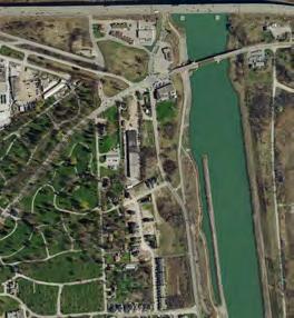


2 Welland Canal Airport Rd Taylor Rd Concession 7 Rd Concession 6 Rd Creating a Vision for the Future Welland Canals Parkway 700 hectares 400 hectares east of Homer Road Stewart Rd Niagara Stone Rd Glendale Niagara District Today Queenston Rd Queenston Rd Queenston St Victoria Lawn Cemetery Queen Elizabeth Way York Rd Glendale Ave York Rd General Brock Parkway Glendale Ave Wood End Conservation Area Queen Elizabeth Way Glendale Ave Royal Niagara Golf Club CN RAIL - FUTURE GO GM
3 Creating a Vision for the Future Many inputs and considerations Existing Conditions Attributes of Context Precedents What People Said Vision & Principles Vision Key Directions
4 Development Applications: Isolated


5 Glendale has all the right Ingredients Higher Education Highway Access Niagara College QEW and 405 Destination Retail Potential Train Access Outlet Collection Niagara GO Train Connection Green Spaces Residential Community Niagara Escarpment Wine and Fruit Growing Niagara-on-the-Green
6 Accessible Glendale Niagara District as an accessible part of the Toronto region 115 km 120 km Toronto 12 minutes $99 all incl Lake Ontario Billy Bishop Airport 4 weekday departures 1 hour 20 minutes + 1 hour 45 minutes? Hamilton Niagara-onthe-Lake Grimsby St Catharines Thorold Virgil Niagara District Airport St David s Niagara Falls 4 weekday departures
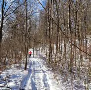
7 Trail Hub & Regional Hub Greater Niagara Circle Route Lake Ontario Waterfront Trail Greenbelt Route Bruce Trail Core Natural Heritage: Environmental Protection Areas Regional Hub for NOTL Old Town Tourism Niagara Escarpment Plan Area Greenbelt Plan Area Rural Areas Welland Canals Trail km 16 km 6.5 km km 10 km 5 Downtown St Catharines Artpark 4. Twenty Valley Port Dalhousie km Lake Ontario Downtown Thorold Lewiston-Queenston Bridge 10 km Downtown Niagara Falls Rainbow Bridge Lake Erie

8 Integrated with greenspace Setting the Glendale Niagara District in the Niagara Escarpment Core Heritage: CoreNatural Natural Heritage: Environmental P Core Natural Heritage: Environmental Environmental Protection Areas P Lake Ontario NiagaraEscarpment Escarpment Plan Area Niagara Plan Area Greenbelt Plan Area Greenbelt Plan Plan Area Greenbelt Area Rural Areas RuralAreas Areas Rural Glendale Niagara District Bruce Trail Virgil Twenty Valley St David s Ball s Falls 2 Louth Falls 3 Short Hills Provincial Park 4 Morningstar Mill 5 Decew House 6 Downtown Thorold 7 Welland Canal Locks 8 Welland Canals Centre 9 Battle of Beaver Dams 10 Niagara College 11 Screaming Tunnel 12 Queenston Heights 13 Lewiston-Queenston Bridge Points of Interest within the Niagara Escarpment Ball s Falls Niagara Escarpment Plan Area Niagara-onthe-Lake Short Hills 3 Map of the Glendale District s Setting within the Niagara Escarpment Welland Canal
9 Winemaking Region Glendale Niagara District as part of the Niagara Peninsula Winemaking Region Lake Ontario Niagara Lakeshore Grimsby Four Mile Creek Niagara River Beamsville Bench Lincoln Lakeshore Beamsville Creek Shores St Catharines St David s Bench Vinemount Ridge Twenty Mile Bench Short Hills Thorold Vineland Niagara Falls Fonthill Welland The Niagara Escarpment Plan Area Greenbelt Glendale Niagara District Wineries Map of the Niagara Peninsula Sub-Appellations Port Colborne Crystal Beach Fort Erie Lake Erie


10 Vision Statement Input from landowners and key stakeholders robust intra-municipal transit system well-connected network of open spaces, trails, walkways live-work destination mobility-first approach vision lifestyle choice unique to Niagara 4-season community attract entrepreneurial businesses vibrant town centre
11 Principles Input from landowners and key stakeholders housing mix of housing options accommodating full spectrum of ages and lifestyles connections more connections across QEW or create nodes on either side GO, pedestrian crossings over canal and QEW leverage natural system to improve connectivity across QEW improve connections opportunities to Niagara Region views maintain view corridors walkable make development more walkable employment ensure a range of employment opportunities attractions a cultural destination/ attraction along Welland Canal principles sustainable/ resilient incubators provide incubator/shared spaces for start-ups and small entrepreneurial businesses LID, electric car chargers, protection of natural spaces, innovative building technology, biodiverse schools neighbourhood schools within walking distance responsive development development sensitive and responsive to the context beautiful complete streets, tree-lined roads, complementary architecture, character
12 Why did you choose Glendale? Input from residents Location Food grows here country environment Cultural heritage Weather live in a smaller community Family community that is close-knit Ease of getting around love hearing the birds Buying local farm produce Conservation area golf course Avoid Toronto traffic Small town atmosphere Proximity to Buffalo Good deals on shopping Central location
13 Why are the biggest opportunities for change? Input from residents high rise rental housing Laura Secord Trail GO train station Parking within the neighbourhood festivals opportunities for change public square main street more restaurants grocery store bike lanes green spaces community facilities student housing complete community support for the college Regular and direct transit meaningful employment
14 Words to capture in a Vision Input from residents complete community successful sustainability transit year round bike lanes walkable useful spaces quality of life open space key words to use for a Vision safe small town atmosphere urban centre transition mixed use college beautiful
15 Draft Vision Statement Niagara will be a vibrant community for people of all ages, lifestyles, and abilities - a place to live, work, play, learn and grow. Its urban districts, with a mix of uses, will protect, integrate and celebrate the natural and rural surroundings reflecting the distinct character of the area. Niagara will be framed by a new park on the Welland Canal, the creek valleys, the Niagara Escarpment and agricultural lands. Niagara will put mobility first with a robust transit system, cycling trails and pedestrian routes seamlessly connecting areas north and south of the QEW.


16 Draft Design Principles Niagara is cohesive & complete has identifiable neighbourhoods has a mix of uses is walkable is authentic is sustainable has an integrated and extended green space system


17 10 Big Moves 1 Lead with the landscape/natural features 3 Hard edge to the agricultural lands 2 Create a Seaway Ecological Park 4 A convergence for the area s trails

18 5 Provide transit 7 Create a main street as a transition from the Outlet Collection Niagara to the adjacent urban neighbourhood Option 2 Option 1 6 Integrate the College into the District, accommodate its expansion and integrate/create a focus with food tech industries 8 Provide a diverse range of housing ensuring choice and affordability


19 9 Create a public/civic space as a focus for the urban district 10 Green streets and parking

 tur rag e Outlet Collection Niagara Potential) Homer Eco-park Public Square Outlet Collection Niagara Homer Rd St Catharines Museum & Welland Canals Centre e D Park ev ing")
20 Niagara Sto ne Rd Welland Ca Rd Airport Rd Airport Radical mix of uses Garden City Skyway Bold pedestrian/cycling connection over the QEW Homer Bridge nston Rd Queenston Rd Queenston Rd Queen ston Rd More road connections over the QEW Long-Term Redevelopment ne liza be th Welland Ca Wa yq u een Leon s ay nals Parkw (Fu Eliz Fire Station th W ay York York YoR rkdr d Purolator ed Bass Pro Shops (Fu Victoria Lawn Cemetery Holiday Inn Rd rr d T aylo evepark rr lop ing d me nt Po ten tial) tur Henry Schein Hilton Garden Inn abe Tay lo Pedestrian/Bike Link Future Mixed Use Area (Light Industrial, Commercial & Residential) tur rag e Outlet Collection Niagara Potential) Homer Eco-park Public Square Outlet Collection Niagara Homer Rd St Catharines Museum & Welland Canals Centre e D Park ev ing elo pm e nt y Urban Area Boundar Rd Lock 3 Ga Future Low Density Residential (Light Industrial, Commercial & Residential) Ga Great Lakes St Lawrence Seaway Maritime Security Operations Centre York Rd York Rd White White Oaks Oaks New East-West Connection rag Park Concession 7 Rd ee Eco-park ry Rd Townline Townline Rd Qu a Bounda Future Mixed Use Area Urban Area Boundary Ontario Travel Information Centre Urban Are Ave Q Quee dale St New North-South Rd Extension of Glendale Ave Gle n ton ns uee Concession 7 Rd nal Workshop Ideas A e Future Mixed Use Area (Light Industrial, Commercial & Residential) Residence Niagara Corporate Business Centre Eco-park Seaway Reservoir a Urb ry nda Bou rea na Niagara College ent rpm sca E gara dary oun nb Pla ck Parkway General Bro Nia Niagara Pic Leeson Park il Eco-park nd Wella ou nb Pla h t be za ay W ce Bru Niagara College Teaching Winery Eli ve le A Wood End Conservation Area n Residential District Taylor Rd Main Street Retail a Tr ee Qu kway N nt me carp Es Taylor Rd s Par Canal ra Br Niagara College Expansion ry a nd e uc Wine Visitor & Education Centre Existing Community a iag Bound Research & Innovation Hub ve vele A lenada dgale n Gle nt Plan Escarpme il Tra nda Gle Royal Niagara Golf Club Screaming Tunnel d er R rn Wa Glendale Bridge Signature Cycling Bridge ay aw Se e Av ge ula Ha ale nd Gle Rd AIL R CN O EG TUR - FU General Motors Lock


21 Niagara Sto ne Rd Welland Ca rt Rd Airport Rd Airpo Discrete areas for employment and residential neighbourhoods Garden City Skyway Homer Bridge Create a new entertainment tourism focus linked to the Outlet Collection at Niagara Quee nston Rd Queenston Rd Queenston Rd Queen ston Rd Urban Are a Bounda be th Welland Ca Wa yq u een Eco-park Leon s Eliz abe th W ay York ay nals Parkw rr Bass Pro Shops Lawn ery y Urban Area Boundar Rd d Ma in Str ee Homer Rd Park Holiday Inn tr Greenspace Additional Greenways and Roads York Rd White White Oaks Oaks eta il Residential District York Rd Employment Residence Residential District Niagara Corporate Business Centre Greenway a Urb ry nda Bou rea na Niagara College y wa en Gre Eco-park Employment Great Lakes St Lawrence Seaway Maritime Security Operations Centre Outlet Collection Outlet Collection Niagara Niagara Homer St Catharines Museum & Welland Canals Centre York YoR rkdr d Rd Purolator Tay lo Lock 3 Hilton Garden Inn Ave liza Henry Schein dale ne Fire Station Concession 7 Rd ee Hospitality/ Entertainment/ Leisure Development Rd Townline Townline Rd Qu ry Park Urban Area Boundary Ontario Travel Information Centre Gle n t ns sto een Qu Concession 7 Rd nal Workshop Ideas B ent rpm sca E gara dary oun nb Pla ck Parkway General Bro Nia Niagara New Road Bridge dale Pic Leeson Park ale d len G Ave n vele AG Research & Innovation HubTrail nd Wella Existing Community Br Wood End Conservation Area Niagara College Teaching Winery n ee th be za Eli ay W ce Bru Community Facility Taylor Rd ve le A n ou nb Pla Qu kway N nt me carp Es Taylor Rd s Par Canal ra ry da e uc Wine Visitor & Education Centre Niagara College Expansion a iag nt Plan Escarpme Market/ Grocery il Tra nda Gle Royal Niagara Golf Club aw Se e Av ay ge ula Ha ale nd Gle Rd AIL R CN General Motors Lock 4 d er R rn Wa Glendale Bridge O EG TUR - FU Screaming Tunnel ry Bounda
 Prestige Employment Mixed Use Destination REGIONAL ROAD 70 (SOUTH SERVICE ROAD) Hospitality Precinct Y0RK ROAD REGIONAL ROAD 89 (GLENDALE AVE.")
22 QUEENSTON ROAD AIRPORT ROAD 2010 Secondary Plan TOWNLINE (GRANTHAM) ROAD CONCESSION 7 ROAD MARTIN ROAD QUEENSTON ROAD QEW TO TORONTO Queenston Road Community Prestige Employment REGIONAL ROAD 58 (COON ROAD) Prestige Employment Mixed Use Destination REGIONAL ROAD 70 (SOUTH SERVICE ROAD) Hospitality Precinct Y0RK ROAD REGIONAL ROAD 89 (GLENDALE AVE.) Industrial Park Industrial Park Prestige Employment REGIONAL ROAD 81 (YORK ROAD) TO ST. DAVIDS Village Centre TAYLOR ROAD GLENDALE AVENUE EXTENSION Prestige Employment Prestige Employment Legend Niagara-on-the-Green Residential Community Institutional Campus NIAGARA ESCARPMENT QEW TO NIAGARA FALLS HIGHWAY 405 Special Study Area Secondary Plan Area Environmental Conservation Area REGIONAL ROAD 89 (GLENDALE AVENUE) REGIONAL ROAD 70 (TAYLOR ROAD) Schedule A: LAND USE & CHARACTER PRECINCTS Glendale Secondary Plan NORTH m 10 50

23 Emerging Preferred Vision


24 Roads & Trails Network of trails and multi-user paths Existing and new roads Transit terminal/tourist Centre Pedestrian bridge could be underpass instead Legend Existing Roads New Roads Trails
25 Natural Areas Eco-park & Welland Canal Heritage Park Natural areas Woodlots
26 Eco-Park & Welland Canal Heritage Park New road New multi-user path Preservation/expansion of natural environment Space for camping in Eco- Park Heritage interpretation (eg Signage etc) in Southern portion Boat mooring and Visitor s Centre Potential tourism destination area (winery, craft brewery, amphitheater, farm-to-table restaurant, wedding/event centre, hotel)
27 Parks System New community parks Stormwater management ponds with trails
28 Community Focus Park Community centre
29 Glendale Crossing Core community area Mixed uses Main street retail Local grocery store (2 sites: stand alone format and integrated behind main street) Greenway connects into Niagara-on-the-Green Potential high school site (10-11 acres)
30 Niagara College Plan incorporates Niagara College s master plan Expansion towards Taylor Road and Glendale Road/ Taylor Road intersection Frame north-south open space East-west pathway to Research & Innovation Hub
31 Research & Innovation Hub Expansion around existing Niagara Corporate Business Centre building Frame an open space that looks south across the ponds to the escarpment
32 Transit Terminal & Tourist Centre Large area available on MTO lands, adjacent to Niagara College and accessible from north and south New Ontario Travel Information Centre Transit Terminal with bus parking, shelters etc.
33 Mixed Use/Residential Centre Mixed Uses Residential
34 Mixed Use/Employment New park Potential Health Care or Medical Hub Mixed uses with employment, residential and some commercial
35 East Glendale Mostly low-rise residential (townhouses) Mixed uses at York Road and Concession 7 Road Small park
36 Employment Area New roads connecting eastwest and north-south Park/Woodlot preserved Preserves most existing development while unlocking internal parcels
37 Hospitality District Hotels
38 Interchange District Medium density residential Mixed uses Community park
39 North Glendale Mixed uses Hotels Community area Community parks Potential school site

40 Alternate Vision: Tourism Destination Potential large scale tourism destination such as a waterpark and resort hotel
 Hospitality (could be multi-storey) Glendale Niagara District Plan EMERGING PREFERRED VISION 0 100 200 300 400 500m The Planning Partnership August 16,")
41 Legend Low rise residential Mid rise residential Taller residential Mixed Use multi-storey Commercial (1 or 2 storey) Institutional (could be multi-storey) Business/Employment (could be multi-storey) Hospitality (could be multi-storey) Glendale Niagara District Plan EMERGING PREFERRED VISION m The Planning Partnership August 16, 2018
42 Next Steps The conceptual development plan for the District will be utilized as a control plan informing the development of further land-use and demonstration plans in the District Plan and Component Studies (to be completed by IBI Group) Visioning Workshop #2 August 16th at 6pm Presentation to the Public and table group discussions Meetings with landowners and stakeholders Final revisions - Final Vision Final Report Preparation of Short Report Describing the Vision & Conceptual Development Plan Presentation of Draft Vision & Plan to Committee/Council Presentation of results of visioning exercise to Niagara Region Planning and Economic Development Committee and Niagara-on-the-Lake Committee-of-the-Whole meetings September 5th (Niagara Region) September 10th (Niagara-on-the-Lake)
Economic Development and Tourism
 SECTION 4 SECTION 4 Economic Development and Tourism 4. Economic Development and Tourism Tourism plays a very important role in Niagara s economy, providing employment and generating business for support
Urban Pleasures Rural Treasure
 Urban Pleasures Rural Treasure Photo credit including cover photo: Dion Kedian Welcome to Niagara-on-the-Lake, one of Canada s most scenic and majestic playgrounds nestled between the Niagara River and
This page has been intentionally left blank.
 This page has been intentionally left blank. Chapter 2 2-2 2. Growing the Economy In many ways, the Niagara Region is a community of communities and this is becoming increasingly so. It is made up of towns
CREATING CONNECTIONS IN THE CITY OF NIAGARA FALLS
 CREATING CONNECTIONS IN THE CITY OF NIAGARA FALLS LEON STAMBOLICH, DIRECTOR, CORRIDOR INFRASTRUCTURE ERIN MOROZ, DIRECTOR, COMMUNICATIONS AND COMMUNITY RELATIONS NIAGARA FALLS CITY COUNCIL NOVEMBER 28,
Update on Top 10 Issues Facing South Niagara
 Update on Top 10 Issues Facing South Niagara Presented by Mayor Dave Augustyn, Pelham Mayor Vance Badawey, Port Colborne Mayor Damian Goulbourne, Welland Mayor Barb Henderson, Wainfleet Mayor Doug Martin,
Building the transportation network we need for the future in Niagara Region
 Building the transportation network we need for the future in Niagara Region Niagara@metrolinx.com Metrolinx.com/Niagara Metrolinxengage.com INSERT FOOTER 1 WHO IS METROLINX? Metrolinx was created in 2006
Building the transportation network we need for the future in Niagara Region
 Building the transportation network we need for the future in Niagara Region Niagara@metrolinx.com Metrolinx.com/Niagara Metrolinxengage.com INSERT FOOTER 1 WHO IS METROLINX? Metrolinx was created in 2006
26.2 Phipps Street Thompson Road Niagara Parkway Netherby Road. Road
 Table 9-1 Allowance Widths Town of Fort Erie Regional Number Name Segment Width in Metres 1 Dominion Gorham Lakeshore 3 Garrison Rosehill Central Avenue QEW Thompson Thompson Concession 19 Gilmore Concession
Committee. Presentation Outline
 CW-33-15 11/9/2015 Community and Corporate Services Committee November 10, 2015 1 Presentation Outline Background Vision and Objectives Study Process and Timeline Public and Stakeholder Engagement Organization
CREATING CONNECTIONS IN THE CITY OF ST. CATHARINES
 CREATING CONNECTIONS IN THE CITY OF ST. CATHARINES LEON STAMBOLICH, DIRECTOR, CORRIDOR INFRASTRUCTURE BRIAN GALLAUGHER, DIRECTOR, PROJECT PLANNING RER ST. CATHARINES CITY COUNCIL NOVEMBER 13, 2017 A REGION
STITCH TRANSFORMATIVE IDEA 3. SHORELINE STITCH. Re-connect the city to the waterfront and link the east and west Core Circle landscapes
 SHORE STITCH TRANSFORMATIVE IDEA 3. SHORELINE STITCH Re-connect the city to the waterfront and link the east and west Core Circle landscapes 126 LINE PUBLIC WORK 127 TRANSFORMATIVE IDEA 3. SHORELINE STITCH
October 23, 2017 Council Workshop
 MAPLEWOOD VILLAGE CENTRE AND INNOVATION DISTRICT IMPLEMENTATION PLAN & DESIGN GUIDELINES October 23, 2017 Council Workshop COMMUNITY PLAN Purpose of Council Workshop Highlight What We Heard Phase 3 & Key
The Sunshine Coast is part of the global community and generates wealth through export, high-value industries and new investment.
 3.2 Strategic intent 3.2.1 Shaping growth an overview In 2031, the Sunshine Coast is renowned for its vibrant economy, ecological values, unique character and strong sense of community. It is Australia
Building the transportation network we need for the future in Niagara Region
 Building the transportation network we need for the future in Niagara Region Niagara@metrolinx.com Metrolinx.com/Niagara Metrolinxengage.com INSERT FOOTER 1 WHO IS METROLINX? Metrolinx was created in 2006
CREATING CONNECTIONS IN THE CITY OF NIAGARA FALLS PUBLIC MEETING DECEMBER 6, 2017
 CREATING CONNECTIONS IN THE CITY OF NIAGARA FALLS PUBLIC MEETING DECEMBER 6, 2017 CONGESTION COSTS OUR ECONOMY The average commute in Ontario is already over 45 minutes, and that figure jumps to more than
Mileages are cumulative. Miles are shown in black kilometres are in red. Begins at Innsville Restaurant 1143 Hwy #8, Stoney Creek
 Brave Souls Run 2018 Welcome. This run is not a rally event. It is not a time/distance event and is not speed dependant. Please obey all speed limits, stop signs and road safety signs. You are responsible
2013 Priority Initiatives March 19, 2013
 2013 Niagara County Economic Development Address 2013 Priority Initiatives March 19, 2013 Kathryn L. Lance, Chair Niagara County Economic Development Committee 1 WNY Regional Economic Development Council
Planning and Building Department
 Page 1 of Report PB-27/11 CITY OF Burlington Planning and Building Department TO: Chair and Members of the Community Development Committee SUBJECT: Niagara Escarpment Plan Amendment 179 (NEPA 179) Addition
Westbrook Station. Transit Oriented Development Opportunity
 DEVELOPM Westbrook Station Transit Oriented Development Opportunity OPPOR Table of Contents Prime Real Estate Development Opportunity page 1 Calgary City of Opportunity page 3 What is Transit Oriented
MAPLEWOOD VILLAGE CENTRE AND INNOVATION DISTRICT IMPLEMENTATION PLAN & DESIGN GUIDELINES. November 6, 2017 Regular Meeting of Council
 MAPLEWOOD VILLAGE CENTRE AND INNOVATION DISTRICT IMPLEMENTATION PLAN & DESIGN GUIDELINES November 6, 2017 Regular Meeting of Council Recommendation THAT Council: Approve the Maplewood Village Centre and
Building the transportation network we need for the future in Niagara Region
 Building the transportation network we need for the future in Niagara Region Niagara@metrolinx.com Metrolinx.com/Niagara Metrolinxengage.com INSERT FOOTER 1 WHO IS METROLINX? Metrolinx was created in 2006
Stage 2 ION: Light Rail Transit (LRT) from Kitchener to Cambridge
 from Kitchener to Cambridge") Stage 2 ION: Light Rail Transit (LRT) from Kitchener to Cambridge Public Consultation Centre (PCC) No. 3 Please Sign-in Cambridge City Hall November 21, 2017 2:00 to 8:00pm Preston Memorial Auditorium
Stage 2 ION: Light Rail Transit (LRT) from Kitchener to Cambridge Public Consultation Centre (PCC) No. 3 Please Sign-in Cambridge City Hall November 21, 2017 2:00 to 8:00pm Preston Memorial Auditorium
Washington Township MASTER PLAN. Addendum: Washington Township Master Plan
 Washington Township MASTER PLAN Addendum: Washington Township Master Plan CHAPTER XI RECREATION CORE DISTRICT Introduction The Recreation Core District generally encompasses the areas north of 30 Mile
CANNING CITY CENTRE. the new energy of the southeast
 CANNING CITY CENTRE the new energy of the southeast 2 INTRODUCTION From early beginnings as an important cultural and recreation place for the Beeloo Nyoongar people, to being a trading post connecting
SUBJECT: Downtown Mobility Hub draft New Precinct Plan and Policy Framework
 Page 1 of Report PB-68-17 SUBJECT: Downtown Mobility Hub draft New Precinct Plan and Policy Framework TO: FROM: Committee of the Whole - Workshop Planning and Building Department Report Number: PB-68-17
COLLEGE STREET STUDY Community Consultation Meeting. December 2015
 COLLEGE STREET STUDY Community Consultation Meeting December 2015 2 Agenda 6:30 pm Introductions, Agenda Review and Welcome 6:40 pm Presentation Planning Recommendations 7:30 pm Questions and Discussion
SOUTH INTERCHANGE AREA
 Santaquin City General Plan 1 Location and Characteristics The South Interchange Area of Santaquin is located west of Interstate 15 and south of 500 South (Figure 1). It includes properties already annexed
Fall 2014 Hike Schedule
 Fall 2014 Hike Schedule Weekly Hikes Note Time Changes After Thanksgiving Tuesdays : 9 am meet in Short Hills Provincial Park, Wiley Rd Parking Lot (just off Cataract Rd), St Catharines (Map 3) 1.5 2 hrs,
This page has been intentionally left blank.
 This page has been intentionally left blank. 2 Appendix A List of Original Documents and s ORIGINAL DOCUMENTS: 1970-1979 By-law No. 828-785-73 as adopted on December 20, 1973 (the original 1973 Policy
Wilds. Headwaters. Lakes. Oxbows. Falls
 56 5 4 3 Wilds Headwaters Lakes Oxbows Falls 57 Zones It could be said the on-the-ground essence of this master plan appears within the next 6 pages of this report. As we learned in the preceding Cultural
Spadina Avenue Built Form Study Preliminary Report
 STAFF REPORT ACTION REQUIRED Spadina Avenue Built Form Study Preliminary Report Date: July 9, 2014 To: From: Wards: Reference Number: Toronto and East York Community Council Director, Community Planning,
9.1 INTRODUCTION 9.2 EXISTING DEVELOPMENT. Southern Cross University
 Property Strategy The property strategy delivers improved legibility, responds to the locational attributes of the site, and facilitates essential operational efficiencies. 9.1 INTRODUCTION Non-aviation
Proposal to Redevelop Lower Kananaskis River-Barrier Lake. Bow Valley Provincial Park
 Frequently Asked Questions Proposal to Redevelop Lower Kananaskis River-Barrier Lake Bow Valley Provincial Park Frequently Asked Questions What has been decided? What are the details of the plan? What
Downtown Mobility Hub: Draft New Precinct Plan. Art Gallery of Burlington September 7, 2017
 Downtown Mobility Hub: Draft New Precinct Plan Art Gallery of Burlington September 7, 2017 Meeting Purpose To present the draft new precinct plan for the Downtown Mobility Hub To get community input on
TOWN PLANNING SUBMISSION TO THE GREATER SYDNEY COMMISSION LANDS AT ARTARMON
 TOWN PLANNING SUBMISSION TO THE GREATER SYDNEY COMMISSION LANDS AT ARTARMON March 2017 TABLE OF CONTENTS 1.0 INTRODUCTION 3 2.0 THE SUBJECT SITE 4 3.0 STRATEGIC PLANNING CONTEXT 6 4.0 SUMMARY AND CONCLUSIONS
TEMPE BEACH PARK - RECOMMENDATIONS
 TEMPE BEACH PARK - RECOMMENDATIONS Tempe Beach Park has the potential to become a regional destination park, but it suffers from a host of physical and operational problems, as well as structural flaws.
places Mooloolaba s heart five
 five places the mooloolaba heart 1 Flexible community event use of school oval 2 Enhanced streetscape District cycle route Future cross-block pedestrian link 5 Existing school buildings New signalised
Bloor Street West Rezoning Application for a Temporary Use By-law Final Report
 STAFF REPORT ACTION REQUIRED 3741 3751 Bloor Street West Rezoning Application for a Temporary Use By-law Final Report Date: June 12, 2007 To: From: Wards: Reference Number: Etobicoke York Community Council
URBAN DESIGN REPORT. Proposed Residential Development, Old Church Road, Caledon East
 Proposed Residential Development, Old Church Road, Caledon East TABLE CONTENTS: 1.0 DEVELOPMENT 1.1 Introduction-Analysis of Guiding Principles and Documents 1.2 Community Design and Architectural Design
Hemisfair Civic Park. Vision and Program Plan
 Hemisfair Civic Park Vision and Program Plan OCTOBER 2013 Hemisfair Civic Park Vision and Program Plan Prepared under the direction of the Hemisfair Park Area Redevelopment Corporation. Planning assistance
RAY YENKANA Willowbrook Cr, Dawson Creek BC Canada $2,847,000
 1716 Willowbrook Cr, Dawson Creek BC Canada For SALE $2,847,000 This is a rare find, 32 townhomes in Dawson Creek, BC. Excellent investment in a single title multi family complex. Vendor has upgraded this
VICTORIA QUAY COMMERCIAL PRECINCT PLAN
 VICTORIA QUAY COMMERCIAL RECINCT LAN AUGUST 2014 2.0 Introduction 10 2.0 INTRODUCTION 2.1 The role of an Enabling recinct lan A recinct lan provides a clear assessment framework for development. in relation
21.07 ECONOMIC DEVELOPMENT AND EMPLOYMENT 19/03/2015 C323 Proposed C Key issues and influences. Economic Role and Function
 21.07 ECONOMIC DEVELOPMENT AND EMPLOYMENT 19/03/2015 C323 Proposed C347 21.07-1 Key issues and influences 14/10/2010 C168 Economic Role and Function Geelong is the largest regional city in Victoria and
VACANT INDUSTRIAL AND DEVELOPMENT LANDS
 VACANT INDUSTRIAL AND DEVELOPMENT LANDS AND VACANT BUILDINGS CANADA JANUARY 2013 For More Information Contact: City of Welland Economic Development Office 60 East Main Street Welland, Ontario Canada L3B
San Francisco, California Hunters Point Shipyard. Design for Development
 San Francisco, California Hunters Point Shipyard Design for Development San Francisco, California Hunters Point Shipyard Design for Development Adopted June 3, 2010 by: San Francisco Planning Commission
Director, Community Planning, Toronto and East York District
 STAFF REPORT October 25, 2005 To: From: : Subject: Toronto and East York Community Council Director, Community Planning, Toronto and East York District Status Report OPA & Rezoning Application 05 117524
LIVE. WORK. PLAY. STATUS OF DEVELOPMENT FALL Produced for information by the Town of Markham
 LIVE. WORK. PLAY. STATUS OF DEVELOPMENT Produced for information by the Town of Markham Community TOWN OF MARKHAM CIVIC CENTRE 101 TOWN CENTRE BOULEVARD Completed in 1989. East of Town Centre Boulevard,
Town of Markham Yonge and Steeles Corridor Study and City of Vaughan Yonge Street Area Study
 STAFF REPORT ACTION REQUIRED Town of Markham Yonge and Steeles Corridor Study and City of Vaughan Yonge Street Area Study Date: August 14, 2009 To: From: Wards: Reference Number: North York Community Council
EAST-WEST STITCH. Connecting the Western Edge of the City to the Centre
 98 AC_BEU_CCMP_2_TM1_4 _FD.indd 98 20/07/12 12:06 PM 02 EAST-WEST STITCH Connecting the Western Edge of the City to the Centre 01 02 Northern Motorway Daldy Street Fanshawe Street Nelson Street Hobson
Directions to US Drives
 Directions to US Drives From Interstate Highway 90 (East or West of Buffalo) (Via Interstate 290 & Interstate 190) Follow the highway signs to Niagara Falls, one of the Seven Natural Wonders of the World.
The CINDER CRUNCHER. the CINDER CRUNCHER ID MEET PROGRAM
 Feb. 2007 Vol 37 No 1 the CINDER CRUNCHER The CINDER CRUNCHER MARC H 2007 ID MEET Saturday 3 March 2007 at the Erin Mills Model Railroad Association Sheridan United Church 2501 Truscot Drive Mississauga,
Macleod Trail Corridor Study. Welcome. Macleod Trail Corridor Study Open House. Presentation of Proposed Design Concepts
 Macleod Trail Corridor Study Welcome Macleod Trail Corridor Study Open House Presentation of Proposed Design Concepts Study Purpose Develop a corridor plan for Macleod Trail that aligns with The City s:
Water & Wastewater Project Activity Report
 Water & Wastewater Project Activity Report A. Project Activity - Construction Phase MUNICIPALITY DESCRIPTION OR RN.08-32 Fort Erie Nigh Road Sewage PS Odour Control CRL Campbell Construction & Drainage
CREATING CONNECTIONS IN THE TOWN OF GRIMSBY PUBLIC MEETING NOVEMBER 21, 2017
 CREATING CONNECTIONS IN THE TOWN OF GRIMSBY PUBLIC MEETING NOVEMBER 21, 2017 CONGESTION COSTS OUR ECONOMY The average commute in Ontario is already over 45 minutes, and that figure jumps to more than an
LANDING S PARK CONCEPTUAL PLAN HAMILTON ANDERSON JANUARY City of Novi, Michigan. The Park at 13 Mile and Old Novi Road
 HAMILTON ANDERSON JANUARY 2012 LANDING S PARK CONCEPTUAL PLAN January 2012 Page 1 of 15 January 2012 PROJECT GOALS Activate the park by introducing new elements Provide clear access to the water and enhance
CORNWALL WATERFRONT PLAN 2007
 CANAL LANDS CANAL LANDS Page 58 Introduction This chapter details areas of possible development or redevelopment, and lands to be protected from any form of development in the Canal Lands area. As outlined
Airport Planning Area
 PLANNING AREA POLICIES l AIRPORT Airport Planning Area LOCATION AND CONTEXT The Airport Planning Area ( Airport area ) is a key part of Boise s economy and transportation network; it features a multi-purpose
Urban Growth Centres in the Greater Golden Horseshoe
 Urban Growth Centres in the Greater Golden Horseshoe Prepared by Ontario Growth Secretariat Issue I Winter 2005 Table of Contents Section 1 Introduction... 1 Analysis... 3 Future Analysis... 5 Section
What types of housing should be developed in Shakopee? Where should they go?
 HOUSING OPPORTUNITIES CHARACTER AREA MAP DOWNTOWN er R iv a t o e s nn OLD SHAKOPEE Mi A K INTO DOWNTOWN C B e. e. 6th Avve 6t MARSCHALL RD G H CANTERBURY I 17th Ave. Marschall Rd. WEST END Marystown Rd.
The Niagara Peninsula
 The Niagara Peninsula Chapter taken from Ulysses guide Hamilton and Surroundings Kitchener-Waterloo and Surroundings Niagara and the Wine Route The Niagara Peninsula and Surroundings Getting There and
- Gerald D. Hines Founder and Chairman, Hines
 Toronto s waterfront provides one of the most exciting vistas in Canada. Our goal is to honour the significance of the location with architecture of distinction, quality and lasting value. For us, there
Llandudno Junction. Regeneration Proposals for the Future. December 2009
 Llandudno Junction Regeneration Proposals for the Future December 2009 Llandudno Junction - Vision Statement 1 Purpose 1.1 The purpose of this document is to describe key priorities to support the regeneration
F6. Coastal Ferry Terminal Zone
 F6. Coastal Ferry Terminal Zone F6.1. Zone description The purpose of the Coastal Ferry Terminal Zone is to provide for the integrated and efficient operation and development of ferry terminal facilities.
Sustainable Urban Development. Presentation to WVCC 1 December 2010
 Sustainable Urban Development Presentation to WVCC 1 December 2010 Introduction Paul Carmody Hindmarsh (Consultation Manager) Tony Adams CB Richard Ellis (Planners) Simon Parsons PTW (Architects) Brett
Business Profile. oakville
 Business Profile oakville Location and Transportation When you locate in Oakville, you re connected to the world. Situated at the epicentre of Canada s golden horseshoe, Oakville is a dynamic community
PROJECTS. Otonabee South Monaghan. Active Transportation Master Plan Proposed Ultimate Network
 Otonabee South Monaghan Ultimate Network Otonabee-South Monaghan, located on the north shore of Rice Lake, is home to Lang Pioneer Village, Harold Town Conservation Area and numerous resorts that are major
County of Peterborough Active Transportation Master Plan
 The TMP developed a conceptual AT/cycling network for Peterborough County that identified both on-road and off-road (trail) AT facilities. This was a coarse network based on the existing trails and off-road
KNOW ITT MAKE IT GROW IT MOVE IT BUILD IT. niagaracanada.com
 KNOW ITT MAKE IT GROW IT MOVE IT BUILD IT niagaracanada.com HOW WELL DO YOU REALLY KNOW NIAGARA? The region that was once mainly known for its world wonder of a waterfall is attracting a different kind
Whitby s Six Business Parks
 Business parks Whitby s Six Business Parks 1. Port Whitby Business Park Boundaries Port Whitby Business Park Activity Total Park Size: Total Occupied: Total Developable: 787 acres 705.3 acres 81.7 acres
KNOW Tniagaracanada.com
 KNOW IT KNOW T THE RESULTS ARE IN NIAGARA IS BETTER FOR YOUR BOTTOM LINE A LEADER IN COST COMPETITIVE AMONGST 115 NORTH AMERICAN CENTRES 3RD MOST COMPETITIVE IN DIGITAL SERVICES 7TH MOST COMPETITIVE IN
MOORE PARK_ DIRECTIONS nd July, 2015
 MOORE _ DIRECTIONS 2040 2nd July, 2015 HISTORY OF MOORE Active + Green For 150 years, Moore Park has been the epicentre of Sydney s active recreation, sporting and entertainment activities. Grand Parade,
SUSTAINING OUR ENVIRONMENT, PLANNING FOR OUR FUTURE
 SUSTAINING OUR ENVIRONMENT, PLANNING FOR OUR FUTURE Key Recommendations to Inform the 2015 Provincial Review of the Oak Ridges Moraine Conservation Plan APRIL 2015 KEY RECOMMENDATIONS TO INFORM THE 2015
Creating Connections in Niagara Region
 Creating Connections in Niagara Region GERRY CHAPUT, CHIEF CAPITAL OFFICER - METROLINX ERIN MOROZ, DIRECTOR OF COMMUNICATIONS AND COMMUNITY RELATIONS - METROLINX METROLINX PRESENTATION TO NIAGARA REGION
Is Scarborough City Centre A Transit Village?
 s Scarborough City Centre a Transit Vii? Martin Barakengera s Scarborough City Centre A Transit Village? Executive Summary The purpose of this Master's Report is to determine whether Scarborough City Centre
PLANNING THE SUNBURY GROWTH CORRIDOR
 SUNBURY GROWTH CORRIDOR NOVEMBER 2016 PLANNING THE SUNBURY GROWTH CORRIDOR Sunbury Planning Background The Victorian Planning Authority, in consultation with Hume City Council, is undertaking a number
Part Three : COMMUNITY PLAN AREAS AND SPECIAL STUDY AREAS SACRAMENTO 2030 GENERAL PLAN. Introduction
 Special study Areas Part Three : COMMUNITY PLAN AREAS AND SPECIAL STUDY AREAS SACRAMENTO 2030 GENERAL PLAN Introduction Beyond the boundaries of the 2030 General Plan, the City has defined Special Study
Parkland County Municipal Development Plan Amendment Acheson Industrial Area Structure Plan
 Parkland County Municipal Development Plan Amendment Acheson Industrial Area Structure Plan New Plan Acheson Industrial Area Structure Plan Amendment Parkland County Municipal Development Plan Board Reference
2018 Airport Master Plan. Public Meeting and Open House February 7, 2018
 2018 Airport Master Plan Public Meeting and Open House February 7, 2018 Overview PortsToronto and Billy Bishop Airport Background on Airport Master Plan process, objectives and key components Managed Growth
precincts legend legend Precinct E precincts Figure 1.0: Precinct E in Complete Communities E S M K Kilometers
 precinct Precinct D A B C F G H I R Q J P O M K L legend legend 0 2 4 6 8 10 Kilometers precincts Figure 1.0: Precinct in Complete Communities Amber Trails The Maples Pipeline Rd. Mcphillips t. Commercial
Overview. ONE Properties
 Overview Border Business Park is a unique development located at the centre of Alberta s industrial hub. The Park is focused on the needs of end users and provides outstanding access, high visibility and
PCAL Case Study Retail Areas: Rouse Hill Town Centre
 PCAL Case Study Retail Areas: Rouse Hill Town Centre Introduction Rouse Hill Town Centre is a new mixed use development on a greenfield site in Sydney s North West. It has been planned to be a major hub
Proposal to Redevelop Lower Kananaskis River-Barrier Lake. Bow Valley Provincial Park. Frequently Asked Questions
 Proposal to Redevelop Lower Kananaskis River-Barrier Lake Bow Valley Provincial Park Frequently Asked Questions What is being proposed? What are the details of the proposal? Where is the project area located?
appendix F WATER FRONT KINGSTON Land Access
 KINGSTON WATER FRONT Land Access appendix F Kingston s Waterfront Master Plan Land Access A significant portion of Kingston s waterfront is not accessible to the public due to private ownership. Whether
DEVELOPMENT PROFILES
 DEVELOPMENT PROFILES 1-855-923-2338 Fort McMurray Generalized Land Development Concept 881 63 Parsons Creek Stone Creek Commercial The Commons at Eagle Ridge Timberlea West Growth MacDonald Island Snye
draft planning controls
 Introduction The South precinct is bounded by Danks, Bourke, McEvoy and Morehead streets. Current land uses include Sydney Water s heritage listed Waterloo Pumping Station and Valve ouse, warehouses, commercial
Windsor Kingsville Essex Tour:
 An Ontario's Southwest Cycling Itinerary Windsor Kingsville Essex Tour: Pedal into the Heart of Southern Ontario s Wine Country CYCLE LOTS TO SEE AND LOTS TO DO IN ONTARIO S SOUTHWEST Total Distance: 130
CONTENTS. 1 Introduction Always Moving Forward while Building on the Past A Dynamic Destination... 5
 2010 STRUCTURE PLAN - 2 - CONTENTS 1 Introduction... 5 1.1 Always Moving Forward while Building on the Past... 5 1.2 A Dynamic Destination... 5 2 Map A... 6 Exhibition Place and its Neighbours... 7 3 Demonstration
CLEVELAND PARK LOCATION AND HISTORY EXISTING CONDITIONS AND CHARACTER LOCATION
 CLEVELAND PARK LOCATION LOCATION AND HISTORY Attempts to create a neighborhood park and playground in the Cleveland neighborhood began in 1926, when the park board designated for acquisition the block
IL 390 Station. Wood Dale Open House Summary 5/18/17
 Wood Dale Open House Summary 5/18/17 The first public open house for the Wood Dale Comprehensive Plan took place on May 18 th, 2017. The program was conducted as a fun community event and there were 216
Establishing a National Urban Park in the Rouge Valley
 STAFF REPORT ACTION REQUIRED Establishing a National Urban Park in the Rouge Valley Date: March 29, 2012 To: From: Wards: Reference Number: Executive Committee Deputy City Manager, Cluster B All p:\2012\cluster
The Narrows Waterfront Park A Crown Jewel for Southern Brooklyn
 The Narrows Waterfront Park A Crown Jewel for Southern Brooklyn In New York, the unquestioned popularity of urban spaces such as Riverside Park, the High Line, Brooklyn Bridge Park and others has demonstrated
Gold Coast. Rapid Transit. Chapter content. Chapter four Route selection and staging
 Chapter four Route selection and staging Gold Coast Rapid Transit Chapter four Route selection and staging Chapter content Route selection...73 Section one: Helensvale to Griffith University...74 Section
DRAFT - APRIL 13, 2007 ROUTING STUDY FOR TRAIL CONNECTIONS BETWEEN CALAIS AND AYERS JUNCTION
 DRAFT - APRIL 13, 2007 ROUTING STUDY FOR TRAIL CONNECTIONS BETWEEN CALAIS AND AYERS JUNCTION Abstract The vision for the East Coast Greenway is an off-road urban trail system running from Calais, Maine
VILLAGE OF ROMEOVILLE COMPREHENSIVE PLAN
 VILLAGE OF ROMEOVILLE COMPREHENSIVE PLAN STEERING COMMITTEE MEETING #4 February 2, 2017 SUBAREA DEVELOPMENT CONCEPT PLANS OVERVIEW 1. Introduction 2. Project Timeline 3. Subarea Development Concept Plans
MASTER PLAN July 24, 2014
 MASTER PLAN July 24, 2014 Vision Statement The newly expanded Rif Curaçao Seaport will enhance the island s ability to welcome guests to a vibrant and entertaining waterfront. The Rif Seaport Curaçao development
The Vision for the San Juan Islands Scenic Byway
 The Vision for the San Juan Islands Scenic Byway 2 Judd Cove, Orcas Island, Courtesy of Kurt Thorson (kurtthorson.com) and San Juan County Land Bank Vision for the San Juan Islands Scenic Byway The San
SCHEDULED TUESDAY HIKES As at May 17, 2017
 Tuesday May 23: Beaver Valley Section, Eugenia, Map 26, This 14 km shuttle hike will take approximately 4.5 hours and is at a medium pace over There is no dropout point. No dogs please. There will be a
12, 14 and 16 York Street - Amendments to Section 16 Agreement and Road Closure Authorization
 REPORT FOR ACTION 12, 14 and 16 York Street - Amendments to Section 16 Agreement and Road Closure Authorization Date: April 27, 2018 To: Toronto and East York Community Council From: Senior Strategic Director,
3450 Dufferin Street - Official Plan Amendment, Zoning Amendment and Draft Plan of Subdivision Applications Request for Directions Report
 STAFF REPORT ACTION REQUIRED 3450 Dufferin Street - Official Plan Amendment, Zoning Amendment and Draft Plan of Subdivision Applications Request for Directions Report Date: March 15, 2017 To: From: Wards:
CD-1 Rezoning: 777 Pacific Blvd (NEFC Sub-area 10C)
") CD-1 Rezoning: 777 Pacific Blvd (NEFC Sub-area 10C) Public Hearing July 10, 2018 Site Context NEFC Events and Entertainment District Current location of BC Place Stadium 750 772 Pacific Blvd (NEFC 777
CD-1 Rezoning: 777 Pacific Blvd (NEFC Sub-area 10C) Public Hearing July 10, 2018 Site Context NEFC Events and Entertainment District Current location of BC Place Stadium 750 772 Pacific Blvd (NEFC 777