Study Methods and Assumptions
|
|
|
- Dwain Gregory
- 5 years ago
- Views:
Transcription
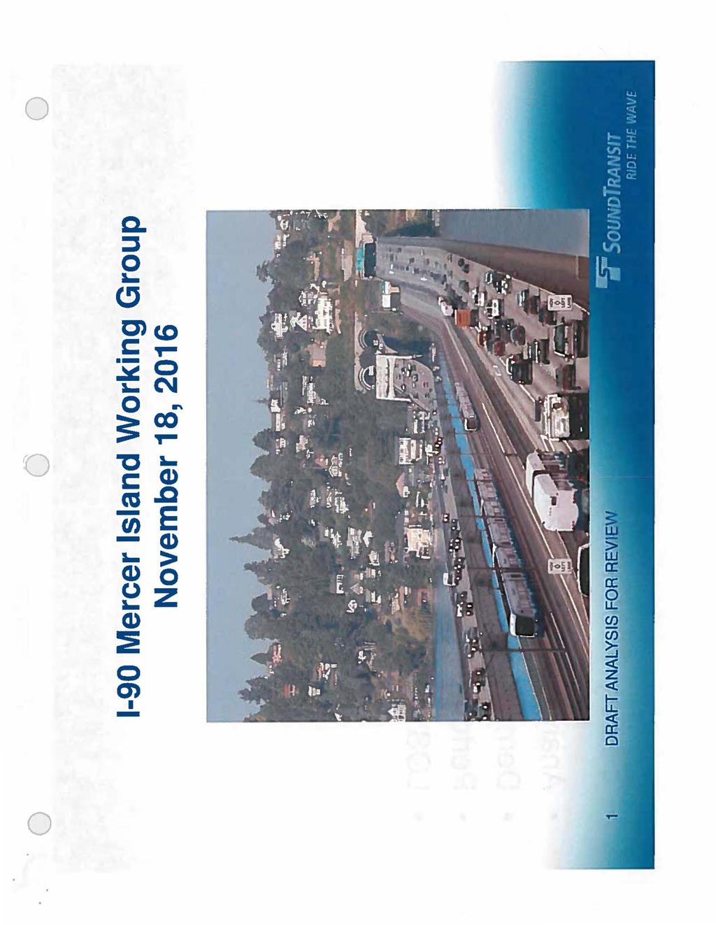
1

2 Study Methods and Assumptions Analysis conditions and study area Demand forecasts and projects Performance measures LOS standards DRAFT ANALYSIS FOR',EEVI.

3 o I Conditions and Study Years Conditions Year I: Existing 1 NoB.µild 1 I Constrµc_t i9rtl If I Ultimate -. ' x 22 x x 235 x x Existing & No-Build Conditions Ultimate Condition - Assumes both 1-9 Two-Way Transit and HOV and East Link projects are built and operating - Option 1: Ml vehicles able to use HOV lanes and ICW - Option 2: Ml vehicles restricted from HOV lanes and ICW, DRAFT AN!\LYSIS FOR RE'i

4 Conditions and Study Years East Link Construction - Mid-point of construction (22) Two-Way Transit and HOV Project completed - Operational Scenarios: Ml SOV eligible to use the HOV lanes and ICW Ml SOV restricted from the HOV lanes and ICW HOV lane converted to a general-purpose lane

5 o Study Area \./ I :.. r C...,11 \ \ 1 J'. \ \ :s.._ from 1-5 to 1-45 Analysis conducted for both AM and PM peaks Study area includes freeway and lo.cat S;tu.eets DRAFT ANALYSIS iffor REVI
 78th.s::.,... N llj l.")
6 Q 11 '\ '- '2d... se '" SI! 7ai.iA" SE -... il... z :: :> < w Cl) t& - Cl.l / r>... I l ASC 1 l:s 71::1-$( l't 7lr\J... tt... Ii r i' l :1"' -..u Clt11V11:1 1 il.. fi : l:""r iii,: JS:.. r!j>1f'".."" a..., Ml""ll llq;\a U... '1!llllh.S[ c. I I - ti) 78th.s::.,... N llj l.ll I 11th

7 o o o Future Forecasts and Projects PSRC model - Forecasts for 22 and Utilize PSRC adopted Land Use Targets forecast Sound Transit model - Bus and light rail ridership forecasts Reasonably foreseeable projects: - Includes Connecting Washington projects Two-Way Transit is completed immediately prior to East Link construction - ST 2 program is complete by ST 3 is not assumed DRAFJi ANALYSIS F.OR RE
 LOS C - Mercer Island (outside town center) LOS D VISSIM and Synchro used for analysis")
8 Performance Measures and Standards Performance Measures - Vehicle and transit demand forecasts - Intersection LOS and vehicle queues - Vehicle travel times Agency LOS Standards -WSDOT LOSE - Mercer Island (town center) LOS C - Mercer Island (outside town center) LOS D VISSIM and Synchro used for analysis results
9 o Draft Analysis Results Existing Conditions/Field Verification Future Traffic Forecasts and Travel Patterns Intersection LOS Travel Times on Mercer Island 1-9 Ramp Operations

10 Existing Conditions Intersection LOS 2161Exlstfn1,tandltlons lhtersection 1 - ID lnter5ectton - I 1stanifan W Mercer Way/1-9 Ramp E 22 W Mercer Way/SE 24th Street D A B 23 76th Avenue SE/N Mercer Way/1-9 Westbound on-ramp E A c 24 76th Avenue SE/SE 24th Street c A B 25 77th Avenue SE/N Mercer Way c E 26 77th Avenue SE/1-9 Westbound express lanes ramp E A B 27 77th Avenue SE/1-9 Eastbound Off-Ramp E B B 28 77th Avenue SE/Sunset Highway SE c B c 29 77th Avenue SE/SE 27th Street c B B 21 8th Avenue SE/N Mercer Way c c c 211 8th Avenue SE/1-9 WB/EB HOV Direct access E A B 213 8th Avenue SE/SE 27th Street c B c st Avenue SE/North Mercer Way D c B 215 Island Crest Way/N Mercer Way/1-9 Westbound off-ramp E B c 216 Island Crest Way/1-9 Eastbound On-Ramp E c c 217 8th Avenue/SE 28th Street c A Island Crest Way/SE 28th Street c c c 22 Island Crest Way/SE 4th Street D c D th Avenue/SE 4th Street D A c 222 East Mercer Way/1-9 Westbound ramp E B c Notes: 223 East Mercer Way/1-9 Eastbound off- ramp E 8 A 224 East Mercer Way/1-9 Eastbound on-ramp/se LOS Standards by agency are: Mercer Island - LOS D (LOS "C"for Town Center Arterial Intersections), WSDOT- LOSE l LOS DRAFJ" ANLYSIS frg F.l F.tE\llEW
; r \" r 1.,.! '1!")
11 Existing Conditions Travel Times lldl s ) ROAOK; ' I"- \ t I Route 38 T 76th Avenue.,... SE (via N Mercer Way) l l..a... I II,: Iii ft... IC r : Route 1 W Mercer way x II MERCEJ ;,\VIII ICJWn l..t!nlll!f'i I ISi.AND 1'41.1 Jtzn11111., l -,,.....? 1.;;,.:; al,.,,. - l ;:I J II ); r " r 1.,.! '1!Ci ' o I Travel Time Route I 1 - W Mercer Way I 2 - Island Crest Way (Outer Roadway) 'l - 3A- 76'h Avenue SE : -- (via Town Center) :::""'...i r/ /J('.,,,..!- It i f f th Avenue SE ti h i trl. i U.TI:>S. ""-.- I ii t... ' (via N Mercer Way) ".. r ' AM Peak Travel lime (minutes) I
 count on 1-9 and Island Crest Way ramp")
12 Travel Pattern Field Verification Conducted origin-destination counts on N. Mercer Way in AM - Up to 6 vehicles/hour use Island Crest Way WB offramp to 77th WB center roadway on-ramp Average vehicle occupancy (AVO) count on 1-9 and Island Crest Way ramp - 16 /o HOV share in the WB direction in AM Ramp utilization in PM period DAFT ANAl.L YSIS ifh IREV..1.

13 , o o o 1-9 and Mercer Island Traffic F'orecasts 1-9 across Lake Washington.Existing Future 235 Percent Growth AM Peak Hour 11,8 vehicles 12,9 vehicles 9% PM Peak Hour 13, 1 vehicles 14,4 vehicles 1% Mercer. 1 1sland L - _J ' Existing 216 _JL_ Fu re 235 _!l Percent - Total Volume HOV /o Total Volume HOV ; I Growth AM To Mercer Island 2,5 13% 2,75 13% 1% Peak ; Hour From Mercer Island 3,3 14% - 3,7 i 14% 12% PM To Mercer Island 3,4 17% 3,85 17% 13% Peak Hour From Mercer Island 3,25 19% 3,55 I 19% 9% Source: PSRC model DRAF.T ANALYSIS FOR REVI

14 Mercer Island AM WB 235 Travel Patterns "-. Nat to Sc=* 761hASE on-«amp Island crest w., :ic? l '\. \ 1.,.. N Sf2".,. Bulld1 -Bulld2 11 :+ :ll t'i t W Mercer Way 51. on-ramp r.mt:j 43 I tltn IL 1-;t;U;, llf'$t \ \ t' /;(. :ii... '(" t :;: Ill l \ 'Ii ' ; J! H/U.,...p.. m.., Sf.lmll SUlnlSI 1! "', <... 1i ::<..,. II: 'i!1 ' Build Opt 1 Westbound On-Ramp Volume Build Opt 2 Westbound On-Ramp Volume : jl Build Opt 2 Volume Is Greater than Build Opt 1 Build opt 2 Volume Is Less than Build Opt 1 Build Opt 2 Volume Is Equal to Build Opt 1 I.. j, SI!)'. < fi.. t..... OK :icj...! SE J1rclt 14thU :( It I '1' ->- :t 1! 1' " I; l:t.. i ii t I.. i! l:t. t lej)r.\ * \!l jsij15ti tt.uth Pl.,.c \!l. ):: Sf )i!mi = :IC :>! ::< l J t :le! SEl91115t.r: fi -Ef:leJ! ie l:,.;s! " j SE 41 St ' a; i i SE.6\h St hr.tdl,,_,., fl!...,. ' fl '"' " :'( l f; \ l I: l I - st 1t1is1 "' I " -e " \ )I\ ll t u o;... E Mercer Wlfl Oft.Ramp 235 City<f -... :IJ Sf<4lllSt.,.., i '.. 'If. ' \I... \ \ 4-/< ::.a 'j:. i... J DRAIT ANAILYiSIS.FOR ievie
l-1.&ch SI :X \"' l! 17th Ave SE Off-Ramp 8 17- J 47.. RllSTi.tl.. :le 11: [ +HI \" l!")
15 Mercer Island PM EB 235 Travel Patterns Nol!to5'* - Bulld WWayu Off-Ramp i Roanoke / "lil'xt!isi - isttisi 2so r Jef"k +is.. I f, ;J. J,'"iil:i 'fl. II: 1- 'll 'llmil st:jlnlsi, "' 5. llc ' )l-1.&ch SI :X "' l! 17th Ave SE Off-Ramp J 47.. RllSTi.tl.. :le 11: [ +HI " l! Bulld Opt 1 westbound on-ramp Vobne hiidil Buld Opt 2 Westbound Oft-Ramp Vobne Opt 2VolumeIsGreaterthanBulldOpt1 BuUd Opt-2 Volume Is Less than Bulld Opt 1 Bulld Opt 2 Volume is Equal to Build Opt 1 DRAFT ANALYSIS FOF.:UREVI - llllo Island crest Way Off-Ramp (HOV) ---""" I r <Mlwr IC: I 63 Island Oest Way M -.. Off- Ramp fout :) a: <;:: -1( )4!tft * t lfj",; - \. R:!Siti s1i:.sr l4t1t Pl it'.. t 1 i'- "' -i<. St'J6111SI,,.."' I I,_ <J.'Y' bl tj(!lc l J! < :ic... : SE4'>UIS! < l! J; snort. s1 - :. l I!lC SlHlhS. i,... Sl.4kl,St... l \ E Mera!rWay Off-Ramp S. HlhSI,,.._ :II t ,. 1, r ' N " i' 1 35 I',..._ lllw-< I I 135 ' - \ Ir : "\'I' '\... "' t \. \ 4-,AOC IJ I II \ J.':.. J
 (mitigated), Intersection LOS LOSB LOSE AM Peak Westbound approach LOS LOSC LOS F Hour Westbound Queue Length 1 425 feet >1/2 mile Travel Time2 4 mins >1 mins -- Notes: 1 - Queue")
16 Initial Future 235 AM Results 76"' Avenue SEIN Mercer Way/ 1.9J B "li:lla r 1' L Bulld"Optlon 2 JL Build Optlolli Westbound On-ramp ur - - P ion J! (unmitigated) (mitigated), Intersection LOS LOSB LOSE AM Peak Westbound approach LOS LOSC LOS F Hour Westbound Queue Length feet >1/2 mile Travel Time2 4 mins >1 mins -- Notes: 1 - Queue storage length is 75 feet to adjacent intersection at 771h Ave SEIN Mercer Way 2 - Travel time route begins at Island Crest Way/SE 28th Street and ends at W Mercer Way on-ramp gore - - LOSS LOSB 425 feet 4 mins Notto Scale t iv f SE74UI "t i XI ;f!l > > ;; ' 5 > <SI. 4- g f lr I.. i f 7 > c 1:1 SE 2-CUISI Luther Butbank P:ltlc I Mercet lshlt!d Ct>mmiiiiity & E BEAUMONT Route - Via N Mercer Way From: Island Crest Wav/SE 28th Street To: Westbound 1-9 via 76th Avenue SE On ramp DRAFT ANALYSIS fror F.lEV:IE
.")
17 o o o 76 1 h WB On-Ramp Modification Modified 76th WB on-ramp and ramp terminal to: - Based on 235 analysis, modify transit-only bypass to a metered shoulder when storage is needed (similar to Island Crest Way eastbound on-ramp). - Adjusted ramp metering rate to accommodate onramp demand - Signalize 76th/North Mercer Way ramp terminal
18 Year 235 Intersection LOS 235 Future Conditions AMPHkttour PM Peek ttour Intersection I LOS ID lnlersectjon standanf" :1 BulJd 2 21 lw Mercer Way/1-9 Ramp I E I B I 8 I B I C 22 W Mercer Way/ SE 24th Street D A B B B, th Avenue SE/ N Mercer Way/1-9 Westbound on-ramp E B B C C ' I 24 76th Avenue SE/ SE 24th Street C 8 B B 8 25 nth Avenue SE/ N Mercer Way c B B A A I 26 lnth Avenue SE/HID Westbound express lanes ramp I E 27 lnth Avenue SE/1 9 Eastbound Off Ramp I E 28 I 77th Avenue SE/ Sunset Highway SE I C 29 I nth Avenue SE/ SE 27th Street I C 21 l8th Avenue SE/ N Mercer Way I C 211 l8th Avenue SE/ 1-9 WB/ EB t!ov Dlrea access I E 212 l8th Avenue SE/1-9 EB HOV Oirea access I E 213 l8th Avenue SE/ SE 27th Street I C st Avenue SE/ North Mercer Way 215 Island Crest Way/ N Mercer Way/ 1 9 Westbound off-ramp E 216 II Island Crest Way/1 9 Eastbound On-Ramp I E 217 IBOth Avenue/ SE 28th Street I C 218 I ls land Crest Way/ SE 28th Street I C 219 I Island Crest Way/ SE 3th Street I C 22 I Island Crest Way/ SE 4th Street I D 221 l78th Avenue/ SE 4th Street I D 222 I East Mercer Way/1-9 Westbound ramp I E 223 I East Mercer Way/1-9 Eastbound off-ramp t E 224! East Mercer Wav/1-9 Eastbond on-ramp/ SE 36th Street I E Notes: 1 LOS Standards by agency are: Mercer Island - LOS D (LOS "C" for Town Center Arterial Intersections ), WSDOT LOS E LOS resutts include all East Li nk Final EIS mit igation and 76th Avenue ramp modifications. B B B c B A c c c c B c N/A c A 8 B 6 B I B I B B ll C I C 6 I B I B c,, c l c B I 8 I B A I A I A c I c c I I c c c c I c I c B I B I B c I c I c N/A I N/A I N/A C I D I D A I B I B 8 c c : I : I : I DRAFT ANALYSIS lr'or REV IE

19 Year 235 AM Travel Times --- r r r i: JI - '*- Rout l W Mam Way 111;. - N[llC(. :K\IM IOWTU.ftllet'J I ISl,ANO, I I,, IWtr f ;..O::'l"" 'I. r -t-' ',, 1\ s Ir 1 f ' " ft,,. ' a: f..;.. ; t. i" ; i'.. :--.. J.... I I I: ; I- '- z ll ".:. 'C I ""II ' ""'" 1 I '. Travel Time II AM Peak Travel llme (mlns) Route Ill Build Opt 1 Build Opt W Mercer Way Island Crest Way 4 3 3a h Avenue SE (via Town Center) 3b - 761h Avenue SE (via N Mercer Way) Average Travel Time {weighted by traffic volume) DRAFr ANALYSIS FOR!REV

20 Potential Intersection Mitigation West Mercer Way & 24th Mercer Island Final EIS Southbound left-turn Avenue SE 8th Avenue SE & SE 27th Mercer Island Final EIS Install traffic signal Street 77th Avenue SE & North Mercer Island Final EIS Install traffic signal Mercer Way 77th Avenue SE & 1-9 WSDOT Final EIS Install traffic signal eastbound off-ramp North Mercer Way & 76th WSDOT Final EIS/ Final EIS - Modify westbound westbound on-ramp Updated Analysis channelization Updated analysis - install traffic signal and modify ramp 76th westbound on-ramp WSDOT Updated Analysis Re-stripe transit only bypass to metered shoulder when needed
,, ~ :!! ~ ... a.. ~ C\I. c (1) ca.a. c, CJ. C') c.o. (1) Cl) Cl)
 ca.a. c, CJ. C') c.o. (1) Cl) Cl)") a..... C') c.o c,... - C\I "',, c (1) ca.a :!!... CJ (1) Cl) c Cl) :E O> -I Study Methods and Assumptions Refresher Conditions and years Study area Future forecasts and projects Performance measures DRAFT.ANALYSIS
a..... C') c.o c,... - C\I "',, c (1) ca.a :!!... CJ (1) Cl) c Cl) :E O> -I Study Methods and Assumptions Refresher Conditions and years Study area Future forecasts and projects Performance measures DRAFT.ANALYSIS
Interstate 90 and Mercer Island Mobility Study APRIL Commissioned by. Prepared by
 Interstate 90 and Mercer Island Mobility Study APRIL 2017 Commissioned by Prepared by Interstate 90 and Mercer Island Mobility Study Commissioned by: Sound Transit Prepared by: April 2017 Contents Section
PDF compression, OCR, web optimization using a watermarked evaluation copy of CVISION PDFCompressor
 o U.S. Department Washington Division Suite 501 Evergreen Plaza of Transportation 711 South Capitol Way Olympia, Washington 98501-1284 Federa' Highway (360) 753-9480 Administration (360) 753-9889 (FAX)
5.1 Traffic and Transportation
 5.1 When it opens in 2009, the Bellevue Nickel Improvement Project will increase the number of vehicles able to travel through the study area, improve travel speeds, and improve safety by reducing the
Memorandum. Roger Millar, Secretary of Transportation. Date: April 5, Interstate 90 Operations and Mercer Island Mobility
 Memorandum To: From: The Honorable Dow Constantine, King County Executive; The Honorable Ed Murray, City of Seattle Mayor; The Honorable Bruce Bassett, City of Mercer Island Mayor; The Honorable John Stokes,
EAST LINK EXTENSION 2017 SEPA Addendum
 EAST LINK EXTENSION 2017 SEPA Addendum SEATTLE MERCER ISLAND BELLEVUE OVERLAKE REDMOND MERCER ISLAND BELLEVUE OVERLAKE REDMOND Washington State Department of Transportation East Link Extension 2017 SEPA
Treasure Island Supplemental Information Report Addendum
 1 1 1 1 0 1 0 1 0 1 Treasure Island Supplemental Information Report Addendum Introduction Purpose The purpose of this Supplemental Information Report (SIR) Addendum is to determine if the current land
CITY MANAGER S OFFICE CITY OF MERCER ISLAND, WASHINGTON 9611 SE 36 th Street Mercer Island, WA (206)
") CITY MANAGER S OFFICE CITY OF MERCER ISLAND, WASHINGTON 9611 SE 36 th Street Mercer Island, WA 98040-3732 (206) 275-7600 www.mercergov.org August 18, 2016 Mr. Daniel M. Mathis Division Administrator Federal
CITY MANAGER S OFFICE CITY OF MERCER ISLAND, WASHINGTON 9611 SE 36 th Street Mercer Island, WA 98040-3732 (206) 275-7600 www.mercergov.org August 18, 2016 Mr. Daniel M. Mathis Division Administrator Federal
APPENDIX H MILESTONE 2 TRAFFIC OPERATIONS ANALYSIS OF THE AT-GRADE CROSSINGS
 Draft Environmental Impact Statement/Environment Impact Report Appendix H Milestone 2 Traffic Operations Analysis of the At-Grade Crossings APPENDIX H MILESTONE 2 TRAFFIC OPERATIONS ANALYSIS OF THE AT-GRADE
A. CONCLUSIONS OF THE FGEIS
 Chapter 11: Traffic and Parking A. CONCLUSIONS OF THE FGEIS The FGEIS found that the Approved Plan will generate a substantial volume of vehicular and pedestrian activity, including an estimated 1,300
SANTA CLARA COUNTY I-280 CORRIDOR STUDY
 SANTA CLARA COUNTY I-280 CORRIDOR STUDY Appendix B 2 Technical Memorandum Existing Transportation Condition Memo SANTA CLARA VALLEY TRANSPORTATION AUTHORITY (VTA) 1-1 Introduction The I-280 Corridor Study
MEMORANDUM. Open Section Background. I-66 Open Section Study Area. VDOT Northern Virginia District. I-66 Project Team. Date: November 5, 2015
 MEMORANDUM To: VDOT Northern Virginia District From: I-66 Project Team Date: November 5, 2015 Subject: Open Section Background The purpose of this technical memorandum is to provide narrative and technical
LUDWIG RD. SUBDIVISION PROJECT TRAFFIC IMPACT ANALYSIS
 LUDWIG RD. SUBDIVISION PROJECT TRAFFIC IMPACT ANALYSIS Prepared for Skip Coddington GSC Development, Inc PO Box 1623 Woodinville WA 9872 Prepared by 1141 NE 124 th St., #59 Kirkland, WA 9834 425.522.4118
Lake Erie Commerce Center Traffic Analysis
 LOCATION: East of NYS Route 5 at Bayview Road Town of Hamburg Erie County, New York PREPARED BY: Wendel Companies 140 John James Audubon Parkway Suite 200 Amherst, New York 14228 January 2012 i ii Table
McLean Citizens Association Transportation Committee Project Briefing
 McLean Citizens Association Transportation Committee Project Briefing November 10, 2015 Project Map 2 Project Context Only Interstate in the Country limited to HOV only traffic during rush hours Stoplight
TABLE OF CONTENTS. Coral Springs Charter High School and Middle School Job No Page 2
 Job No. 15-019 Page 2 TABLE OF CONTENTS 1.0 INTRODUCTION... 4 2.0 EXISTING CONDITIONS... 5 3.0 TRAFFIC GENERATION... 7 4.0 TRIP DISTRIBUTION... 8 5.0 FUTURE CONDITIONS... 8 6.0 SITE ACCESS...13 7.0 CONCLUSION...13
Pedestrian Safety Review Spadina Avenue
 STAFF REPORT ACTION REQUIRED Pedestrian Safety Review Spadina Avenue Date: October 13, 2015 To: Toronto and East York Community Council From: Director, Transportation Services, Toronto and East York District
Mercer SCOOT Adaptive Signal Control. Karl Typolt, Transpo Group PSRC RTOC July 6th, 2017
 Mercer SCOOT Adaptive Signal Control Karl Typolt, Transpo Group PSRC RTOC July 6th, 2017 Our mission, vision, and core values Mission: deliver a high-quality transportation system for Seattle Vision: connected
FEASIBILITY STUDY REFINED CONCEPT 1 PROJECT A
 VIRGINIA DEPARTMENT OF TRANSPORTATION I-85 / I-95 INTERCHANGE FEASIBILITY STUDY REFINED CONCEPT 1 PROJECT A Columbia Rd REFINED CONCEPT 1 PROJECT A Bellevue Rd COST: $3.3M Siege Rd Eliminate the loop ramp
APPENDIX J MODIFICATIONS PERFORMED TO THE TOR
 APPENDIX J MODIFICATIONS PERFORMED TO THE TOR This appendix summarizes the modifications that were performed in years 2012 and 2017 to rectify calculation errors that were observed in the data presented
Arlington County Board Meeting Project Briefing. October 20, 2015
 Arlington County Board Meeting Project Briefing October 20, 2015 Project Map 2 Project Context Only Interstate in the Country limited to HOV only traffic during rush hours Stoplight at the end of I-66
MEMORANDUM. Lynn Hayes LSA Associates, Inc.
 MEMORANDUM To: Lynn Hayes LSA Associates, Inc. Date: May 5, 217 From: Zawwar Saiyed, P.E., Senior Transportation Engineer Justin Tucker, Transportation Engineer I Linscott, Law & Greenspan, Engineers LLG
Planning. Proposed Development at the Southeast Corner of Lakeshore Road West and Brookfield Road Intersection FINAL.
 Project No. 121-22908 N o v e m b e r 2 0 1 2 Traffic Impact Study Transportation Planning th GENIVAR Inc., 600 Cochrane Drive, 5 Floor, Markham, Ontario L3R 5K3 Telephone: 905.475.7270 Fax: 905.475.5994
Transportation Improvement District (TID) Exercise New Castle County Unified Development Code
 Exercise New Castle County Unified Development Code") Transportation Improvement District (TID) Exercise New Castle County Unified Development Code Churchmans Crossing TID How should New Castle County deploy Transportation Improvement Districts (TIDs)? Site
Transportation Improvement District (TID) Exercise New Castle County Unified Development Code Churchmans Crossing TID How should New Castle County deploy Transportation Improvement Districts (TIDs)? Site
10.0 Recommendations Methodology Assumptions
 10.0 Recommendations To accommodate the projected growth of the I-526 corridor, this report has summarized potential improvement strategies that were separated into four categories, TDM, Modal, Traffic
Design Public Hearing
 Design Public Hearing Monday, March 7, 2016 Washington-Lee High School Cafeteria 1301 N. Stafford Street, Arlington, VA 22201 Tuesday, March 8, 2016 Eagle Ridge Middle School Cafeteria 42901 Waxpool Road,
Public Information Meetings. October 5, 6, 7, and 15, 2015
 Public Information Meetings October 5, 6, 7, and 15, 2015 Project Map 2 Project Context Only Interstate in the Country limited to HOV only traffic during rush hours Stoplight at the end of I-66 eastbound
Proposed Bicycle Lanes on Yonge Street from Queens Quay to Front Street
 STAFF REPORT ACTION REQUIRED Proposed Bicycle Lanes on Yonge Street from Queens Quay to Front Street Date: March 12, 2007 To: From: Toronto and East York Community Council Director, Transportation Infrastructure
Caliber Charter School VALLEJO, CA
 Traffic Impact Study Final Report Caliber Charter School VALLEJO, CA 21 June 2016 Prepared for: Prepared by: Traffic Engineering & Transportation Planning This report has been prepared and certified by
Traffic Analysis Final Report
 SR-71 Widening Project Project Approval/Environmental Documentation Traffic Analysis Final Report Prepared for Caltrans District 7 August 2012 6 Hutton Centre Drive, Suite 700 Santa Ana, California 92707
FIRST WEEK UPDATE: 66 EXPRESS LANES INSIDE THE BELTWAY Data from first four days shows faster, more reliable trips on I-66
 FOR IMMEDIATE RELEASE Tuesday, December 12, 2017 CONTACT: Michelle T. Holland 703-586-0487 (C) Michelle.Holland@vdot.virginia.gov Jennifer McCord 571-230-2926 Jennifer.McCord@vdot.virginia.gov FIRST WEEK
DOGWOOD AT VILLA AVENUE PROJECT
 TRANSPORTATION IMPACT ANALYSIS DOGWOOD AT VILLA AVENUE PROJECT El Centro, California September 4, 2018 LLG Ref. 3-17-2782 TABLE OF CONTENTS SECTION PAGE Appendices... ii List of Figures... i List of Tables...
Project Application. General Information ODOT PID. ODOT District. Primary County (3 char abrv)
") Current Status (Tier 1, Tier 2 or New) Proposed Status (Tier 1 or Tier 2) Project Application General Information ODOT PID ODOT District County (3 char abrv) Facility Name (i.e. route, rail, terminal,
Current Status (Tier 1, Tier 2 or New) Proposed Status (Tier 1 or Tier 2) Project Application General Information ODOT PID ODOT District County (3 char abrv) Facility Name (i.e. route, rail, terminal,
RW Bruhn Bridge and Approaches Project
 RW Bruhn Bridge and Approaches Project The Trans-Canada Highway 1 RW Bruhn Bridge and Approaches Project involves four-laning approximately 1.9 km of Highway 1 in Sicamous, including replacement of the
KING STREET TRANSIT PILOT
 KING STREET TRANSIT PILOT Update toronto.ca/kingstreetpilot #kingstreetpilot UPDATE Average streetcar travel times in continued to show similar trends as first observed in November. The most significant
FIRST WEEK UPDATE: 66 EXPRESS LANES INSIDE THE BELTWAY Data from first four days shows faster, more reliable trips on I-66
 Subject: FIRST WEEK UPDATE: 66 EXPRESS LANES INSIDE THE BELTWAY From: VDOT-News To: Time: Tuesday, December 12, 2017 9:05:36 AM -08:00 RELEASE: IMMEDIATE Michelle Holland,
2006 WEEKDAY TRAFFIC PROFILE. June 15, 2007
 June 15, 2007 Mr. Gary Stobb, P.E. Director of Planning/Operations Harris County Toll Road Authority 330 Meadowfern, Suite 200 Houston, TX 77067 Re: Westpark Tollway Value Pricing Analysis Dear Mr. Stobb:
MEMORANDUM. Bob Zagozda, Chief Financial Officer Westside Community Schools. Mark Meisinger, PE, PTOE Felsburg Holt & Ullevig. DATE: June 11, 2018
 MEMORANDUM TO: Bob Zagozda, Chief Financial Officer Westside Community Schools FROM: Mark Meisinger, PE, PTOE Felsburg Holt & Ullevig DATE: June 11, 218 6-11-18 SUBJECT: Sunset Hills Elementary School
I-66 Inside the Beltway Feasibility Study
 I-66 Inside the Beltway Feasibility Study Feasibility Study Study Process Context Sensitive Dialogues Corridor Assessments / Data Collection Problem Statement Refinement Concept Development Concept Evaluation
TRAFFIC IMPACT STUDY REPORT FOR PROPOSED OFFICE PROJECT AT 959 SEWARD STREET IN HOLLYWOOD SNYDER PARTNERS
 DRAFT TRAFFIC IMPACT STUDY REPORT FOR PROPOSED OFFICE PROJECT AT 959 SEWARD STREET IN HOLLYWOOD Prepared for: SNYDER PARTNERS Prepared by: Crain & Associates 2007 Sawtelle Boulevard, Suite 4 Los Angeles,
Route 141 and I-44 Design-Build Project Community Involvement Group. March 21, 2016
 Route 141 and I-44 Design-Build Project Community Involvement Group March 21, 2016 Purpose of CIG 1. Share information with major stakeholders 2. Keep stakeholders informed of the process 3. Reduce uncertainty
Aldridge Transportation Consultants, LLC Advanced Transportation Planning and Traffic Engineering
 Aldridge Transportation Consultants, LLC Advanced Transportation Planning and Traffic Engineering John M.W. Aldridge, PE, PTOE, AICP 182 Chimney Rock Road Colorado Registered Professional Engineer Highlands
BNA Master Plan Update Community Advisory Committee Meeting No. 5
 A Six Sigma Organization BNA Master Plan Update Community Advisory Committee Meeting No. 5 September 19, 2012 Introductions MNAA Staff RW Armstrong Team Albersman & Armstrong, Ltd. Atkins North America,
FINAL TERMINAL TRAFFIC MONITORING STUDY
 FINAL TERMINAL 91 216 TRAFFIC MONITORING STUDY Prepared for: Port of Seattle February 15, 217 Prepared by: 12131 113 th Avenue NE, Suite 23 Kirkland, WA 9834-712 Phone: 425-821-3665 www.transpogroup.com
Kingston Transportation Master Plan Draft Report Transit Forecasting 1
 TRANSIT FORECASTING Transit Forecasting 1 INTRODUCTION A spreadsheet model was developed to identify existing transit deficiencies and additional transit service requirements. The model comprised transit
Transform66: Inside the Beltway
 Transform66: Inside the Beltway Result of a multi-year planning that started during the McDonnell Administration 2016 compromise reached with General Assembly Convert I-66 to express lanes from 5:30a-9:30a
Strategic Signal Timing Changes = BIG Results. Barbara Jones, PE, PTOE DGL Consulting Engineers, LLC Senior Traffic Engineer
 Strategic Signal Timing Changes = BIG Results Barbara Jones, PE, PTOE DGL Consulting Engineers, LLC Senior Traffic Engineer Pre Signal Timing Updates Signal Timing Updates Average Retiming Interval Percent
San Mateo County Transportation Authority Board Meeting November 2, 2017 Item #10 1
 San Mateo County Transportation Authority Board Meeting November 2, 2017 Item #10 1 OVERVIEW Brief recap from October Traffic Analysis Findings Draft Environmental Document Summarized Outcomes Questions
MEMORANDUM. for HOV Monitoring on I-93 North and the Southeast Expressway, Boston Region MPO, November, 2011.
 MEMORANDUM Date: January 12, 2012 To: Congestion Management Process Files From: Seth Asante, Ryan Hicks, and Efi Pagitsas MPO Staff Re: Historical Trends: Travel Times and Vehicle Occupancy Levels for
East Link Project Update. Maintenance of Traffic During Construction. April 21, 2015
 East Link Project Update Maintenance of Traffic During Construction April 21, 2015 1 Agenda TFP project 242 Bellevue Way HOV Bellevue Way - Maintenance of Traffic During Construction Early Work Utilities
Director King County Department of Transportation. King County Department of Transportation
 Tolling in Washington State t Harold S. Taniguchi Director Why tolling Why Tolling? Gas tax down Electric collection technology Reduce peak demand and greenhouse gas emissions Tolling today in Washington
FHWA P/N Guidelines. Corridor Relationship. Highway 22 Segment 1 - US 169 to CSAH 2 Relevance / Documentation of Need
 Highway 22 Segment 1 - US 169 to CSAH 2 Vehicle Mobility Congestion Intersection Congestion Existing Conditions - Based on Highway Capacity Manual methodology, corridor level of service is currently LOS
Memorandum. To: From: cc: Date: November 7, Re: 1.0 Purpose and Organization of this Addendum. 2.0 Project Description
 Memorandum To: From: cc: Laura Prickett, Horizon Water and Environment Analette Ochoa and Wana Chiu, WRECO Parag Mehta, Kimley Horn Date: November 7, 2017 Re: Santa Cruz Route 1 Tier I and Tier II HOV
Appendix 4.1 J. May 17, 2010 Memorandum from CTPS to the Inter Agency Coordinating Group
 Appendix 4.1 J May 17, 2010 Memorandum from CTPS to the Inter Agency Coordinating Group CTPS CENTRAL TRANSPORTATION PLANNING STAFF Staff to the Boston Region Metropolitan Planning Organization MEMORANDUM
Sky Temporary Car Park Transport Statement
 001 Issue 26 August 2016 This report takes into account the particular instructions and requirements of our client. It is not intended for and should not be relied upon by any third party and no responsibility
TRAFFIC & PARKING STUDY FOR PROPOSED BIRMINGHAM BOUTIQUE HOTEL
 TRAFFIC & PARKING STUDY FOR PROPOSED BIRMINGHAM BOUTIQUE HOTEL Prepared for LORIENT CAPTIAL LLC Birmingham, MI By GIFFELS WEBSTER Washington Township, MI April 2017 i CONTENTS EXECUTIVE SUMMARY. ii INTRODUCTION.
Exposition Corridor Transit Project Phase 2
 Exposition Metro Line Construction Authority Final Environmental Impact Report Technical Background Report FINAL Ridership Results Version 0.4 December 2009 Prepared for: Exposition Metro Line Construction
2 Construction Program
 2018 C P 2018 Districtonstruction 2 Construction Program rogram district 2 Governor John Kasich ODOT Director Jerry Wray District Deputy Director Pat McColley, PE, SI 2018 Construction Program Thank you
BUSINESS OF THE CITY COUNCIL CITY OF MERCER ISLAND, WA
 BUSINESS OF THE CITY COUNCIL CITY OF MERCER ISLAND, WA December 1, 2008 Public Hearing TOWN CENTER PARKING TIME LIMITS (FIRST READING) Proposed Council Action: Conduct public hearing and first reading
This page intentionally left blank
 This page intentionally left blank Prepared for: Nevada Department of Transportation Prepared by: July 2015 This page intentionally left blank Table of Contents Executive Summary... ES-1 ES.1. HOV System
HOV LANE PERFORMANCE MONITORING: 2000 REPORT EXECUTIVE SUMMARY
 Final Report Research Project Agreement No. T1803, Task 4 HOV Monitoring V HOV LANE PERFORMANCE MONITORING: 2000 REPORT EXECUTIVE SUMMARY by Jennifer Nee TRAC Research Engineer John Ishimaru TRAC Senior
What We ve Learned About Highway Congestion
 What We ve Learned About Highway Congestion BY PRAVIN VARAIYA THERE ARE 26,000 SENSORS buried under the pavements of California freeways. Every thirty seconds, those sensors send data to our computers
EXISTING CONDITIONS A. INTRODUCTION. Route 107 Corridor Study Report
 II. EXISTING CONDITIONS A. INTRODUCTION The Route 107 study area extends from the south at Chestnut Street in Lynn approximately 3.7 miles to the north to Boston Street in Salem. The study area has three
Part 1 Facility Description, Hours, Access and Occupancy (5) Type [5]
![Part 1 Facility Description, Hours, Access and Occupancy (5) Type [5]](/thumbs/83/88592487.jpg "Part 1 Facility Description, Hours, Access and Occupancy (5) Type [5]") Sponsor [15] (1) ID [1] (2) State ID (YearOpen) [2] (3) Facility [3] (4) Length (C/L) (Lane) [4] Part 1 Facility Description, Hours, Access and Occupancy (5) Type [5] (6) Hours of Operation [6] (7) Separation
Sponsor [15] (1) ID [1] (2) State ID (YearOpen) [2] (3) Facility [3] (4) Length (C/L) (Lane) [4] Part 1 Facility Description, Hours, Access and Occupancy (5) Type [5] (6) Hours of Operation [6] (7) Separation
Glasgow Street Traffic Review
 Glasgow Street Traffic Review Recommendation That the Standing Policy Committee on Transportation recommend to City Council: 1. That the Administration proceed with removing the pinch points installed
1.2 Corridor History and Current Characteristics
 SECTION 1 Description and Background of Study Area 1.1 Introduction This preliminary engineering report was prepared for the Alaska Department of Transportation and Public Facilities (ADOT&PF). It is part
Toronto 2015 Pan Am/Parapan Am Games Temporary Traffic By-law Amendments for High Occupancy Vehicle Lanes (Supplementary Report)
") STAFF REPORT ACTION REQUIRED Toronto 2015 Pan Am/Parapan Am Games Temporary Traffic By-law Amendments for High Occupancy Vehicle Lanes (Supplementary Report) Date: March 25, 2015 To: From: Wards: Reference
STAFF REPORT ACTION REQUIRED Toronto 2015 Pan Am/Parapan Am Games Temporary Traffic By-law Amendments for High Occupancy Vehicle Lanes (Supplementary Report) Date: March 25, 2015 To: From: Wards: Reference
Watts St westbound thru
 Executive Summary At the request of the Hudson Square Business Improvement District, Sam Schwartz Engineering, DPC (Sam Schwartz) has completed a technical analysis of various congestion pricing and/or
1.0 Purpose and Organization of the Community Impact Assessment Addendum
 Memorandum To: From: cc: Laura Prickett, Horizon Water and Environment Carie Montero, Senior Project Manager/Environmental Lead, Parsons Transportation Group Parag Mehta, Kimley Horn Date: September 24,
IMPACT OF NORTH-SOUTH TRAFFIC
 CIRCULATION ELEMENT WHITE PAPER NO. 4 IMPACT OF NORTH-SOUTH TRAFFIC INTRODUCTION Beverly Hills is not well served from a regional transportation accessibility standpoint. This is especially true in regard
Major Projects Overview
 Major Projects Overview Miami-Dade Expressway Authority February 2018 About MDX MDX operates 5 roads in Miami Dade County SR 924, SR 112, SR 836, SR 874 and SR 878 MDX Primary Source of Revenue: User Fees-Tolls
DOWNTOWN BRT ALTERNATIVE - 19th AVE
 DOWNTOWN BRT ALTERNATIVE - 9th AVE New Route and Increased Service in Mixed Traffic Existing Route and Service in Mixed Traffic Light Rail Line / New Route and Increased in Exclusive Guideway Existing
Downtown Skokie & Oakton Street Corridor Study (Draft)
") Downtown Skokie & Oakton Street Corridor Study (Draft) Skokie, Illinois Project Manager: William C. Grieve, P.E., PTOE GHA Project #3261.805 Downtown Skokie & Oakton Street Corridor Study Skokie, Illinois
Downtown Skokie & Oakton Street Corridor Study (Draft) Skokie, Illinois Project Manager: William C. Grieve, P.E., PTOE GHA Project #3261.805 Downtown Skokie & Oakton Street Corridor Study Skokie, Illinois
State Project Reconstruction I-84
 State Project 151-273 Reconstruction I-84 Waterbury, Connecticut FROM WASHINGTON STREET TO PIERPONT ROAD I-84 Constructors J.V. Robert Turner Area Engineer Ken Fargnoli District Engineer John Dunham Assistant
KING STREET TRANSIT PILOT
 KING STREET TRANSIT PILOT Update toronto.ca/kingstreetpilot #kingstreetpilot HIGHLIGHTS TRANSIT RIDERSHIP TRANSIT CAPACITY To respond to this growth in ridership, the TTC has increased the capacity of
4. Safety Concerns Potential Short and Medium-Term Improvements
 NH Route 104 Access Management Study Page 19 4. Safety Concerns Potential Short and Medium-Term Improvements Potential safety improvement strategies are listed by priority based on field observations by
INTERSTATE 395 EXPRESS LANES NORTHERN EXTENSION TRAFFIC & TRANSPORTATION TECHNICAL REPORT SEPTEMBER 2016
 INTERSTATE 395 EXPRESS LANES NORTHERN EXTENSION TRAFFIC & TRANSPORTATION TECHNICAL REPORT SEPTEMBER 2016 INTERSTATE 395 EXPRESS LANES NORTHERN EXTENSION Traffic and Transportation Technical Report City
7272 WISCONSIN AVENUE LOCAL AREA TRANSPORTATION REVIEW
 7272 LOCAL AREA TRANSPORTATION REVIEW AND TRANSPORTATION POLICY AREA REVIEW MONTGOMERY COUNTY, MARYLAND Submitted on behalf of Carr Properties Prepared by: Wells + Associates, Inc. Submission: July 1,
SAN FRANCISCO MUNICIPAL TRANSPORTATION AGENCY BOARD OF DIRECTORS. RESOLUTION No
 SAN FRANCISCO MUNICIPAL TRANSPORTATION AGENCY BOARD OF DIRECTORS RESOLUTION No. 16-145 WHEREAS, The San Francisco Municipal Transportation Agency has proposed parking and traffic on San Bruno Avenue included
APPENDIX H Transportation Projects Considered for Cumulative Impact Analysis
 Final Supplemental Environmental Impact Statement on the Regional Transit Long-Range Plan APPENDIX H Transportation Projects Considered for Appendix H Transportation Projects Considered for Cumulative
NORTH FRASER PERIMETER ROAD WEST CORRIDOR DEFINITION STUDY
 NORTH FRASER PERIMETER ROAD WEST CORRIDOR DEFINITION STUDY MAY 2011 SW1132SWD NORTH FRASER PERIMETER ROAD WEST CORRIDOR DEFINITION STUDY TABLE OF CONTENTS 1.0 INTRODUCTION... 1 2.0 CURRENT TRAVEL PATTERNS
Site Location and Setting
 Memorandum Date: To: From: Subject: Kristy Le, Gary Black Steve Orem Santa Teresa County Park Historic Area Traffic and Parking Study Hexagon Transportation Consultants, Inc. has completed a traffic and
DEIS Comments 1. Page iv, Permit or Approval, Federal, Franchise for use ofinterstate Right-of-Way (ROW)
") RECEiVED 2 ~~ El751 u.s. Department of Transportation Federal Highway Administration Sound Transit Union Station 401 South Jackson Street Seattle, Washington 98104 Attention: East Link DEIS Comments Washington
RECEiVED 2 ~~ El751 u.s. Department of Transportation Federal Highway Administration Sound Transit Union Station 401 South Jackson Street Seattle, Washington 98104 Attention: East Link DEIS Comments Washington
Section 106 Update Memo #1 Attachment D. Traffic Diversion & APE Expansion Methodology & Maps
 Section 106 Update Memo #1 Attachment D Traffic Diversion & APE Expansion Methodology & Maps I-65/I-70 North Split Interchange Reconstruction Project (Des. Nos. 1592385 & 1600808) Traffic Diversion and
Evaluation of High-Occupancy-Vehicle
 TRANSPORTATION RESEARCH RECORD 1446 Evaluation of High-Occupancy-Vehicle Lanes in Phoenix, Arizona MARK J. POPPE, DAVID J.P. HOOK, AND KEN M. HOWELL High-occupancy-vehicle (HOV) lanes were first introduced
Washington Dulles International Airport (IAD) Aircraft Noise Contour Map Update
 Aircraft Noise Contour Map Update") Washington Dulles International Airport (IAD) Aircraft Noise Contour Map Update Ultimate ASV, Runway Use and Flight Tracks 4th Working Group Briefing 8/13/18 Meeting Purpose Discuss Public Workshop input
Washington Dulles International Airport (IAD) Aircraft Noise Contour Map Update Ultimate ASV, Runway Use and Flight Tracks 4th Working Group Briefing 8/13/18 Meeting Purpose Discuss Public Workshop input
STAR Bond Development
 STR ond Development Traffic Impact Study Goddard, Kansas Prepared for: Kansas Department of Transportation City of Goddard, Kansas Prepared by TranSystems November 218 November 3, 218 Kansas Department
TRANSPORTATION ELEMENT
 Transportation TRANSPORTATION ELEMENT Data, Inventory, and Analysis Prepared by Contents 1.0 INTRODUCTION... 1 2.0 EXISTING CONDITIONS... 1 2.1 Roadways... 1 2.1.1 Jurisdiction... 1 2.1.2 Functional Classification...
Nashua Regional Planning Commission
 Nashua Regional Planning Commission Congestion Management Program Corridor Overview NH 111 is a major east-west arterial roadway that passes through 3 municipalities in the Nashua region. It enters the
2018 Service Implementation Plan Executive Summary
 2018 Service Implementation Plan Executive Summary March 2018 2018 SERVICE IMPLEMENTATION PLAN Executive Summary 2018 Service Implementation Plan Each year, Sound Transit prepares a Service Implementation
PURPOSE AND NEED (CONCURRENCE POINT 1) NEW CANADA ROAD PROJECT FROM STATE ROUTE 1 (U.S. HIGHWAY 70) TO U.S. INTERSTATE 40
 NEW CANADA ROAD PROJECT FROM STATE ROUTE 1 (U.S. HIGHWAY 70) TO U.S. INTERSTATE 40") PURPOSE AND NEED (CONCURRENCE POINT 1) NEW CANADA ROAD PROJECT FROM STATE ROUTE 1 (U.S. HIGHWAY 70) TO U.S. INTERSTATE 40 Project Description The primary purpose of this project is to improve the major
PURPOSE AND NEED (CONCURRENCE POINT 1) NEW CANADA ROAD PROJECT FROM STATE ROUTE 1 (U.S. HIGHWAY 70) TO U.S. INTERSTATE 40 Project Description The primary purpose of this project is to improve the major
2011 Illinois Department of Transportation. I-290 PHASE I STUDY Additional Round 1 Alternatives Descriptions
 2011 Illinois Department of Transportation I- PHASE I STUDY Additional Round 1 s Descriptions www.dot.il.gov www.eisenhowerexpressway.com Blue Line I- > Blue Line Extension from CTA Terminal to Mannheim
NEWS RELEASE. EL PASO DISTRICT Jennifer Wright (915) a TxDOT Project For immediate release
 a TxDOT Project For immediate release") NEWS RELEASE a TxDOT Project For immediate release EL PASO DISTRICT Jennifer Wright (915) 790-4340 Jennifer.Wright3@txdot.gov Major Operation: 36 massive beams will be placed at Sunland & I 10. Operation
NEWS RELEASE a TxDOT Project For immediate release EL PASO DISTRICT Jennifer Wright (915) 790-4340 Jennifer.Wright3@txdot.gov Major Operation: 36 massive beams will be placed at Sunland & I 10. Operation
HDR itrans Consulting Inc. 100 York Blvd., Suite 300 Richmond Hill, ON L4B 1J8 Tel: (905) Fax: (905)
 Fax: (905)") !" # $ !" # $ Consulting Inc. 100 York Blvd., Suite 300 Richmond Hill, ON L4B 1J8 Tel: (905) 882-4100 Fax: (905) 882-1557 www.itransconsulting.com November 2009 %&'('$&$ 1. West Brampton Road Network...
!" # $ !" # $ Consulting Inc. 100 York Blvd., Suite 300 Richmond Hill, ON L4B 1J8 Tel: (905) 882-4100 Fax: (905) 882-1557 www.itransconsulting.com November 2009 %&'('$&$ 1. West Brampton Road Network...
Research Report Agreement T4118, Task 24 HOV Action Plan HOV ACTION PLAN
 Research Report Agreement T4118, Task 24 HOV Action Plan HOV ACTION PLAN by John M. Ishimaru Senior Research Engineer Duane Wright Systems Analyst Programmer Mark E. Hallenbeck Director Jaime Kang Research
Washington St. & Ash Coulee Dr./43 rd Ave Intersection Study
 430 IACC Building Fargo, ND 58105 Tel 701-231-8058 Fax 701-231-1945 www.ugpti.org www.atacenter.org Washington St. & Ash Coulee Dr./43 rd Ave Intersection Study Final Report April 2007 Prepared for: City
user s guide to Transportation Improvements in Astoria Planning Efforts outside Astoria for more information, contact:
 The Miles Crossing/ Jeffers Garden transportation plan (underway), will identify needed improvements to the Warrenton Astoria Highway and local street improvements to serve expected growth in the Miles
Chapter 4 Route Window NE3 Manor Park station. Transport for London
 Chapter 4 Route Window NE3 Manor Park station MANOR PARK STATION 4 Route Window NE3 Manor Park station 4.7 Highway access to Manor Park station is very good. A117 Station Road connects with A116 to the
Transport Impact Assessment
 Transport Impact Assessment Springbok Hotel Erf 5206, Springbok Northern Cape March 2018 5th Floor Imperial Terraces Carl Cronje Drive Tyger Waterfront Bellville, 7530 (021) 914 6211 (T) e mail: mail@itsglobal.co.za
 Appendix H1 Traffic Study Hill St Obispo Ave Obispo Ave Student Drop-off & Pick-up Area Parking Lot Plaza Level Hill St Fire Lane Access Service Lane Access Redondo Ave Redondo Ave Parking Lot N No