MASTER PLAN REPORT REPORT PREPARED BY:
|
|
|
- Elinor Gardner
- 5 years ago
- Views:
Transcription


1 MASTER PLAN REPORT REPORT PREPARED BY:
2 The preparation of this document was financed in part through an Airport Improvement Program grant from the Federal Aviation Administration (Project Number ) as provided under Section 505 of the Airport and Airway Improvement Act of 1982, as amended. The contents do not necessarily reflect official views or the policy of the DOT or the FAA. Acceptance of this report by the FAA does not in any way constitute a commitment on the part of the United States to participate in any development depicted therein not does it indicate the proposed development is environmentally acceptable in accordance with appropriate public laws. REPORT PREPARED BY: 2605 Port Lansing Road Lansing, MI Phone: (517)
3 Table of Contents Chapter 1 Inventory of Existing Facilities Page 1.1 General Airport Description and Location Airport History Existing Airport Environment Topography Soil Meteorological/Climate Conditions Wind Coverage Land Use Part 77 Surfaces Socioeconomic Data Population Trends Income Facilities Management Existing Airport Facilities Airside Facilities Existing Aviation Related Landside and Support Facilities Airport Tenants Air Space and Air Traffic Control Design Standards Runway Protection Zones Runway Object Free Areas and Runway Safety Areas Summary Chapter 2 Projections of Aviation Demand Role of the Airport Geographic Service Area Change to Service State Aviation System Goals Industry Trends Commercial Aviation General Aviation Business Jet and Corporate Use General Aviation Fleet Mix Forecasting Approach Projections of Demand Passenger Enplanement Projections Commercial Air Carrier Aircraft Operations Projections of Military Operations Projections of General Aviation Activity Projections of Based Aircraft Based Aircraft Fleet Mix General Aviation Operations Projections Critical Aircraft Commercial Service Military Operations General Aviation Table of Contents i
4 2.6 Projections Summary Chapter 3 Demand Capacity and Facility Requirements Basic Airport Design Factors Airport Classification Design Aircraft Wind Coverage Instrument Approach Procedures Airfield Capacity Navigable Airspace Runway Facilities Runway 1/ Future Crosswind Runway Taxiway System Aircraft Parking Areas (Aprons) Air Traffic Control Tower Airfield Lighting, Signage, and Electrical Navigational Aids Terminal Facility Aircraft Rescue and Fire Fighting (ARFF) Air Cargo Facility Requirements Commercial Aircraft Maintenance General Aviation Facility Requirements General Aviation Aircraft Storage and Maintenance Hangars Aircraft Parking Areas Other Airfield Design Issues Summary Chapter 4 Alternative Plan Concepts Methodology and Evaluation Criteria Airside Facilities Runway 1/ Crosswind Runway Alternatives Airfield Lighting and Electrical Facilities Navigational Aids Terminal Facilities General Aviation Facilities Air Cargo Facilities Support Facilities and Equipment Aircraft Maintenance Opportunities Surface Transportation and Auto Parking Other Facilities Summary Chapter 5 Recommended Plans Runway 1/ Crosswind Runway Airfield Lighting and Electrical Facilities Navigational Aids Terminal Facilities General Aviation Facilities Air Cargo Facilities Support Facilities and Equipment Table of Contents ii
5 5.9 Surface Transportation and Auto Parking Other Facilities Summary Chapter 6 Environmental Overview Noise Compatible Land Use Social Impacts Socioeconomic Impacts Environmental Justice Air Quality Water Quality Department of Transportation Act, Section 4(f) Historic, Archaeological, and Cultural Resources Biotic Communities Endangered and Threatened Species Wetlands Floodplains Coastal Zones and Coastal Barriers Wild and Scenic Rivers Farmland Energy Supply and Natural Resources Light Emissions Solid Waste Construction Impacts Environmental Contamination and Hazardous Waste Summary of Anticipated Impacts Chapter 7 Economic Considerations Sawyer s Aviation Market Position Industry Trends Market Share Service Area Hub Connections A Word from the Business Community Business Usage Survey Sawyer s Regional Economic Position The ABCs of Economic Development Existing Infrastructure Advantages of Being at Sawyer Operational Variables Survey Results Administrative Structure Procedural Efficiencies Business Development Economic Partnerships Current Marketing Initiatives Telkite s Website Sawyer s Website Joint Marketing Agreement Feasibility Study Regional Economic Impact Study Recommended Initiatives Economic Development Table of Contents iii
6 7.7.2 Service Enhancements Summary Figures Chapter 1 Inventory of Existing Facilities Page 1-1 Airport Location Map U.P. Commercial Service Airports All Weather Wind Rose Local Land Use Map FAR Part 77 Obstruction Surfaces Airport Organizational Chart Airport Taxiway Layout ILS Approach to Runway RNAV (GPS) Approach to Runway VOR Approach to Runway VOR Approach to Runway NDB Approach to Runway Aeronautical Chart Runway 1/19 Aircraft Safety Areas with Precision Approach Chapter 2 Projections of Aviation Demand 2-1 Sawyer Market Area Airport Hub Choices Enplanement Projections Comparison GA Aircraft Operations Comparisons Total Aircraft Operations Chapter 3 Demand Capacity and Facility Requirements 3-1 Airport Property Map Air Routes over the Upper Peninsula International Air Cargo Shipments U.S. Air Cargo Market World Air Cargo Traffic Obstruction Identification Surfaces FAR Part Chapter 4 Alternative Plan Concepts 4-1 Alternative Alternative Alternative Alternative Alternative Alternative Alternative Alternative Alternative Future Cargo and General Aviation Development Sawyer Region Ground Transportation Infrastructure Table of Contents iv
7 Chapter 5 Recommended Plans 5-1 Alternative Recommended Crosswind Runway Future General Aviation and Cargo Facility Development Chapter 6 Environmental Overview 6-1 Soil Restricted Areas Chapter 7 Economic Considerations 7-1 Summary of Aviation Projections Market Share Position Current Site Tables Chapter 1 Inventory of Existing Facilities Page 1-1 Meteorological and Climate Conditions Airport Operating Conditions Wind Coverage Comparison Obstruction Identification Surfaces FAR Part Population Areas Surrounding Sawyer and Marquette County Median Household Income Levels for Airport s Primary Market Area (Including Host Communities) Compared to the State of Michigan Airport Profile Sawyer International Airport Runway Pavement Strengths Sawyer International Airport Taxiway Inventory Sawyer International Airport Apron Inventory Sawyer International Airport Air Carrier Terminal and Administrative Areas (Constructed in 1999) Recent Airport Improvements Airport Tenants Airspace Classes Airport Reference Code (ARC) Sawyer International Airport Apron Inventory Chapter 2 Projections of Aviation Demand 2-1 Sawyer Market Area Hubs Served by Surrounding Airports Share of Regional Enplanements Comparison of Share of Regional Enplanements Enplanements Projections Scheduled Air Carrier/Commuter Operations Total Air Carrier/Commuter/Air Taxi Operations Military Operations Projections Based Aircraft Projections Based Aircraft Fleet Mix Projections General Aviation Operations Projections General Aviation Operations Projections Summary Summary of Aviation Projections Table of Contents v
8 Chapter 3 Demand Capacity and Facility Requirements 3-1 Airport Design Standards Knot Runway Usability Percentages Wind Coverage for Potential Crosswind Runway Alignments (Percent) 10.5 Knot Crosswind Component Options for Runway Protection Zone for a Crosswind Runway at Sawyer Apron Requirements Existing FAR Part 77 Survey Chapter 4 Alternative Plan Concepts (none) Chapter 5 Recommended Plans (none) Chapter 6 Environmental Overview (none) Chapter 7 Economic Considerations (none) Table of Contents vi
9 1 Inventory of Existing Facilities As outlined in Federal Aviation Administration (FAA) Advisory Circular (AC) 150/5070-6B, Airport Master Plans, the initial step in the master planning process is the collection and evaluation of information about the airport and the area it serves. The inventory task for Sawyer International Airport (Sawyer), also referred to as the Airport, was accomplished through physical inspection of the facilities, tenant and manager surveys, telephone conversations, review of previous Airport studies, and review of appropriate Airport management records. A large volume of data was collected, reviewed, and analyzed during the inventory effort at Sawyer. Many of the previously developed reports contain an extensive amount of information which supports the development of this document and should be consulted for historical reference and additional detail, where appropriate. Much of the detailed information will be presented in subsequent chapters of this report, as appropriate, to support the various technical analyses required as part of this project. This chapter presents an overall summary of the Airport facilities and the community it serves and is organized into the following sections: 1.1 General Airport Description and Location 1.2 Airport History 1.3 Existing Airport Environment 1.4 Land Use 1.5 Socioeconomic Data 1.6 Facilities Management 1.7 Existing Airport Facilities 1.8 Airport Tenants 1.9 Airspace and Air Traffic Control 1.10 Design Standards 1.11 Summary It should be noted that the Marquette regional area is rich in history, and is an outdoor paradise providing endless outdoor recreational activities for residents and visitors alike. Northern Michigan University, established in 1899, is located in the City of Marquette and is a four-year university that has over 9,000 students. Both the University and the area s recreational opportunities attract visitors to Marquette County by which many of whom arrive by air. These users, as well as business travelers and local residents, rely on the provision of air service from Sawyer. Chapter 1 - Inventory of Existing Facilities 1-1

10 1.1 General Airport Description and Location The Airport is located near Gwinn, within Marquette County, approximately 16 miles south of the City of Marquette in Michigan's Upper Peninsula (U.P.). Figure 1-1 depicts the location of the Airport with the U.P. The largest concentration of the County's 65,216 residents, as of 2008 estimates by the U.S. Census Bureau, live in the City of Marquette (20,780 or 32%), Negaunee (4,451 or 7%), and Ishpeming (6,474 or 7%). Sawyer is primarily located in Forsyth Township; however, portions of the Airport s property fall into West Branch Township to the east and Sands Township to the north, all within Marquette County. Sawyer is one of six airports in the U.P. providing air service. Escanaba is the closest, located approximately 66 miles south of Marquette, while Sault Ste. Marie is the farthest located 172 miles to the east. Figure 1-2 illustrates all of the U.P. airports and their distance in terms of miles and drive time from Marquette. Having not only the largest facility in terms of pavement area, but also in passenger enplanements, Sawyer currently is the aviation leader in the U.P. 1.2 Airport History Sawyer has a rich history spanning more than sixty years. Originally called the K.I. Sawyer County Airport in 1949, it served as the primary airport for Marquette County. In 1955, the United States government signed a 99-year lease with Marquette County that established K.I. Sawyer Air Force Base. Between 1955 and 1956 the Airport was a joint-use facility that was simultaneously used for civilian and military operations. In 1957, all civil aviation activity ceased and civilian operations moved to the Marquette County Airport in Negaunee for the next forty years. The K.I. Sawyer Air Force Base became home to the 410 th Bomb Wing through the 1960s, 1970s, and 1980s. In June 1992, the Airport came under the control of Air Combat Command (ACC) when the Strategic Air Command (SAC) was discontinued. K.I. Sawyer Air Force Base was closed by the United States government in September To commemorate the historical significance of the former base, the K.I. Sawyer Heritage Air Museum was established. The base was leased to the County of Marquette from the U.S. Air Force for operation as a commercial service airport between 1995 and 1999 when it was transferred to County ownership on September 22, The county transferred operations from the Marquette County Airport in Negaunee in September 1999 and, subsequently, closed the Negaunee site. Chapter 1 - Inventory of Existing Facilities 1-2

11 Figure 1-1 Airport Location Map Source: Mead & Hunt Chapter 1 - Inventory of Existing Facilities 1-3
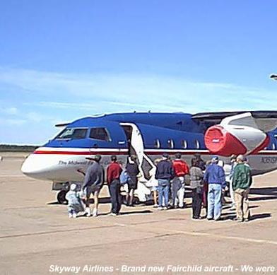
12 Figure 1-2 U.P. Commercial Service Airports Source: Mead & Hunt Today, Sawyer is a publicly owned public-use airport that accommodates both general aviation and commercial airline service. As of April 2009, Sawyer is served by two air carriers: Mesaba Airlines, a subsidiary of Delta Air Lines (formerly Northwest Airlines), and American Eagle, a subsidiary of American Airlines. Mesaba Airlines provides daily non-stop service to Detroit and Minneapolis - St. Paul while American Eagle provides daily service to Chicago O Hare with a stop in Milwaukee. Per Airport figures, over 112,072 total passengers passed through Sawyer in Chapter 1 - Inventory of Existing Facilities 1-4

13 1.3 Existing Airport Environment The topography and soil of an airport, as well as the meteorological conditions, can determine what type of development can occur due to limitations that certain slopes, soil types, and weather conditions can present to both landside and airside operations. Sawyer is no different since it is located in a portion of Michigan which often experiences extreme climatic conditions and is subject to topographic and soil conditions which must be considered in the development of the airport facilities Topography When evaluating the topography of the Sawyer site, it should be noted that much of the existing airport environs are already built, which has limited the normal level of concern associated with the topographic issue. Outside of the general airport operations area, the topography at Sawyer slopes from the northeast to the southwest. The natural slope of the land, ranging from zero to six percent (0-6%), allows for a majority of Airport property to be suitable for development. Elevations vary from approximately 1,220 feet Mean Sea Level (MSL) to around 1,170 feet MSL. The official Airport elevation (taken at the highest point on any landing surface) is 1,221 feet MSL Soil As with the topographic conditions, it is important to understand the types of soils in the vicinity of the Airport as this can often dictate the type of the development can take place in the area. The 1995 United States Department of Agriculture s soil survey titled "Soil Survey of Marquette County, Michigan" indicates that the soils at Sawyer are of the Rubicon Association and the Grayling Sand Association. These sandy soil complexes support woodlands and are generally unsuited for septic systems and building site development. The Airport is surrounded by several varying smaller soil complexes, including Garlic Fence Association found east and northeast of the Airport and Garlic-Alcoma-Voelker complexes found north and southwest of the Airport. The airfield is directly located on an Udorthents subsoil-urban land complex which is a sandy soil whose exact complex is obscured by human development. The Udorthents is a well-drained soil with low water capacity and slow surface runoff which is considered suitable for development of airport related facilities Meteorological/Climate Conditions The meteorological and climatic conditions of the area are important to understand as this can impact the operations of the Airport, as well as require specific considerations during planning, design, and construction. The climate of the Marquette County regional area is typical of that of the upper Midwestern states as winters are cold with heavy snow accumulations, while summers Chapter 1 - Inventory of Existing Facilities 1-5
14 are warm and occasionally humid. conditions can vary greatly. Spring and fall are transitional periods when weather According to the Climatology Center at Michigan State University, the coldest month on average is January with an average daily temperature of 12.3 degrees Fahrenheit. The hottest month is July with an average daily temperature of 64.9 degrees Fahrenheit. Table 1-1 illustrates the meteorological and climate conditions occurring at Sawyer. The Climatology Center at Michigan State University also reports that the total precipitation at Sawyer averages 51.6 inches per year which includes an average of 183 inches (15.25 feet) of annual snowfall per year. Table 1-1 Meteorological and Climate Conditions Month Minimum Maximum Average Average Temperature Temperature Temperature Precipitation in degees F in degrees F in degrees F in inches January February March April May June July August September October November December Source: Climatology Center at Michigan State University Observations regarding meteorological conditions including wind directions, speed, cloud ceiling, and visibility from the area were used to evaluate weather conditions. Wind and weather conditions influence Airport operational capacity by impacting the percentage of time traffic can operate under Visual Flight Rules (VFR), or the more stringent, capacity-reducing Instrument Flight Rules (IFR). Weather conditions can be divided into two categories: Visual Meteorological Conditions (VMC), which require VFR, and Instrument Meteorological Conditions (IMC), which require IFR. VMC exists when the cloud ceiling is 1,000 feet or greater above the ground and visibility is three statute miles or greater. IMC exists when the cloud ceiling is less than 1,000 feet and visibility is less than three statute miles. A pilot can operate under VFR or IFR during VMC, but must always operate under IFR during IMC. Comparing the metrological and climatic data between the Marquette County Airport site in Negaunee and Sawyer is important to demonstrate the difference between the two sites. As the current civilian airport, conditions between 2001 and 2008 are illustrated for the Sawyer site, while a ten year period prior to the closing of the Marquette County Airport was used for the Negaunee site. Table 1-2 compares the operational conditions of both sites. As these figures Chapter 1 - Inventory of Existing Facilities 1-6
15 illustrate, the Sawyer site offers greater visibility minimums than the previous Marquette County Airport site. Table 1-2 Airport Operating Conditions Airport Site VFR Conditions IFR Conditions Below Standard IFR Minimums Below 1/2 mile visibility and/or 200 foot ceiling Negaunee 81.8% 15.2% 3.0% Sawyer 85.1% 13.1% 1.8% Source: National Climatic Data Center Negaunee Site: Period of Record: Number of Operations: 72,743 Sawyer Site: Period of Record: Number of Operations: 72, Wind Coverage At any airport, the direction of the wind is a primary factor that influences the number and orientation of runways. Ideally, a runway should be aligned with the prevailing wind to minimize the crosswind component for aircraft. Generally, smaller airplanes are more affected by wind and have greater difficulty compensating for crosswinds. The desirable wind coverage for an airport is 95 percent (95%) usability, based on the total number of weather observations. Annual wind data was used to calculate the wind coverage for Runway 1/19. Runway wind coverage, or the percentage of time a runway can be used without exceeding allowable crosswind velocity, is based upon 10.5 knots or 12 miles per hour (MPH), 13 knots (15 MPH), 16 knots (18 MPH), and 20 knots (23 MPH) crosswind limitations. It should be noted that the reason for evaluating different crosswind components is that different sizes of aircraft are able to withstand different levels of crosswinds during their operations. For example, smaller aircraft such as single-engine general aviation aircraft are not able to accommodate excessive crosswind conditions; consequently, depending upon the size of a specific airplane, it may not be able to operate on a specific runway if the crosswind component exceeds the aircraft design considerations. In this instance, another runway may need to be constructed to meet the crosswind component. During periods when wind conditions on a runway exceed crosswind limitations, traffic may divert from that runway to a crosswind runway. Because Sawyer is a single runway airport, high winds significantly reduce Sawyer s operational capabilities. Utilizing FAA airport design software, it has been calculated that the wind coverage on Runway 1/19 provides percent (87.14%) coverage at 10.5 knots, and percent (94.26%) at 20 knots. Wind coverage at Sawyer under all weather conditions is illustrated in Figure 1-3. The prevailing wind is west-north-westerly, averaging 9 MPH. Chapter 1 - Inventory of Existing Facilities 1-7
16 Figure 1-3 All Weather Wind Rose Source: National Climatic Data Center FAA Airport Design version 4.2 MDOT Bureau of Aeronautics 1994 Data Site: Sawyer International Airport Period of Record: Number of Observations: 74,628 Wind data at Sawyer has been collected since 2001 and provides only an eight year history of wind observations. The U.S. Air Force collected wind data at Sawyer from 1973 to 1993 but the tabular data was not available for use in this study. However, wind roses were generated from the Air Force data and were published in the 1995 Base Reuse Plan. The 1995 Base Reuse Plan Chapter 1 - Inventory of Existing Facilities 1-8
17 wind roses were compared to the wind roses generated from the new Sawyer wind data. Both data sets are consistent except for the 10.5 knot crosswind component. The Air Force data indicates that the 10.5 knot crosswind coverage for all weather is 94.6 percent (94.6%), while the new Sawyer data indicates percent (87.14%) wind coverage for 10.5 knot crosswind velocities. The variation in the data could result from factors such as advancements in windrecording technologies. Because the available data at Sawyer is limited and the Air Force wind data could not be integrated, wind data was also analyzed for the former airport location in Negaunee. The wind coverage provided at the former airport location was compared to that of Sawyer. All crosswind velocities have been found to be comparable between the two data sources. Table 1-3 presents a summary of wind data from Sawyer, the Air Force Data, and the Negaunee site. By utilizing the most recent Sawyer data, it can be seen that at the 13 knot crosswind component, which is the highest percentage of crosswind component typically recommended for smaller general aviation aircraft, does not reach the 95 percent (95%) coverage which is recommended by the FAA. Therefore, to meet the needs of the smaller aircraft users of the Airport, a crosswind runway may be necessary to accommodate the wind conditions. Larger aircraft are able to operate with a higher crosswind component; therefore the current runway would typically accommodate the majority of these operations. Table 1-3 Wind Coverage Comparison Crosswind Coverage Component (percentage of coverage) Runway 10.5 knots 13 knots 16 knots 20 knots All-Weather Wind Coverage Runway 1/19 (Sawyer Data) Runway1/19 (Air Force Data) Runway 1/19 (Negaunee Site Data) Source: National Climatic Data Center Sawyer Data: Air Force Data: Negaunee Data: Land Use Part of maintaining a feasible airport site that is compatible with the local community is based upon the use of land use planning and zoning. As shown in Figure 1-4, there are various land uses surrounding the Airport. Some of these land uses are considered compatible (i.e. commercial, industrial), while others are considered incompatible (i.e. residential). The majority of the surrounding land is undeveloped and is considered to be fields or forested. However, small Chapter 1 - Inventory of Existing Facilities 1-9

18 pockets of both low and high density residential development are located south and southeast of the Airport within the former base housing development. Most of this housing is a result of the conversion of Air Force base housing into public housing. A recreational golf course is also located to the east of the Airport. Figure 1-4 Local Land Use Map Source: Mead & Hunt Chapter 1 - Inventory of Existing Facilities 1-10
19 Since potentially incompatible land uses currently exist in proximity to the Airport, the primary goal is to keep these uses from becoming more incompatible. This is most often done through the use of zoning ordinances and proactive planning efforts. Marquette County, the owner of Sawyer, has recognized the importance of compatible land use near the Airport and has implemented an Airport Overlay Zoning Ordinance Part 77 Surfaces Federal Aviation Regulation (FAR) Part 77 defines surfaces around an airport that are designed to determine if objects are obstructions to navigable aircraft. Although the FAA can determine if objects are hazards to air navigation, the FAA is not authorized to regulate land use. Under FAR Part 77, an aeronautical study is undertaken by the FAA to determine if objects are hazards to air navigation. However, there is no specific authorization in any statute that permits the FAA to limit land use decisions. In fact, in every aeronautical study determination, the FAA acknowledges that state or local authorities control the appropriate use of property beneath an airport s airspace. The FAA evaluates height concerns for land uses within the following five surface areas used as a basis for compatibility. These surfaces are described in detail in Chapter 3. Approach surface The approach surface is longitudinally centered on the extended runway centerline and extends outward and upward from the end of each primary surface. The approach slope of a runway is a ratio of 20:1, 34:1, or 50:1 depending on the approach type. The length of the approach surface varies from 5,000 to 50,000 feet and also depends upon the approach type. Transitional surface The transitional surface extends outward and upward at right angles to the runway centerline and extends at a slope of seven feet horizontally for each one foot vertically (7:1) from the sides of the primary and approach surfaces. The transitional surfaces extend to the point at which they intercept the horizontal surface at a height of 150 feet above the established airport elevation. Horizontal surface The horizontal surface is a horizontal plane located 150 feet above the established airport elevation and encompasses an area from the transitional surface to the conical surface. The perimeter is constructed by generating arcs from the center of each end of the primary surface and connecting the adjacent arcs by lines tangent to those arcs. The radius of the arc is 5,000 feet for all utility or visual runways and 10,000 feet for all other runways. Chapter 1 - Inventory of Existing Facilities 1-11
20 Conical surface The conical surface extends upward and outward from the periphery of the horizontal surface at a slope of 20 feet horizontally for every one foot vertically (20:1) for a horizontal distance of 4,000 feet. Approach surface The approach surface is longitudinally centered on the extended runway centerline and extends outward and upward from each end of the primary surface. An approach surface is applied to each end of the runway based on the type of approach NAVAIDs. The required approach slope for Runway 1 and Runway 19 is 50:1. The inner edge of the approach surface is the same width as the primary surface and it expands uniformly in width for 10,000 feet for runways with an approach slope of 20:1 and 34:1. For runways with an approach slope of 50:1 the approach surface extends for a horizontal distance of 10,000 feet at 50:1 and then an additional 40,000 feet at 40:1. In order to allow for the heights of vehicles on roadways, the approach surface must clear rail lines by 23 feet, interstate highways by 17 feet, and all other roads by 15 feet. Table 1-4 provides detailed information regarding the obstruction identification surfaces associated with Part 77 while Figure 1-5 illustrates a plan view of these surfaces. A DIM Item Width of Primary Surface and Approach Surface Inner Width Table 1-4 Obstruction Identification Surfaces FAR Part 77 Visual Runway Dimensional Standards (Feet) Non-Precision Instrument Runway A B A B C D Precision Instrument Runway ,000 1,000 B Radius of Horizontal Surface 5,000 5,000 5,000 10,000 10,000 10,000 C Approach Surface Outer Width 1,250 1,500 2,000 3,500 4,000 16,000 D Approach Surface Length 5,000 5,000 5,000 10,000 10,000 * E Approach Slope 20:1 20:1 20:1 34:1 34:1 * A Utility Runways B Runways Larger Than Utility C Visibility Minimums Greater Than ¾ Mile D Visibility Minimums as Low as ¾ Mile * - Precision Instrument Approach Slope is 50:1 for Inner 10,000 Feet and 40:1 for an Additional 40,000 Feet Source: Chapter 1 - Inventory of Existing Facilities 1-12
21 Figure 1-5 FAR Part 77 Obstruction Surfaces Source: Socioeconomic Data Examining the socioeconomic characteristics of an airport s primary market area provides an independent variable for observing trends at or near the Airport. Reviewing population and median household income trends within the Airport s primary market area identify the socioeconomic trends that may influence future activity. Sawyer s location in the central U.P. makes it accessible to a significant portion of the U.P. s population. Over the past several years, the Airport has maintained a database of the billing addresses of the vehicles parked in the commercial service terminal parking lot to assess where passengers were coming from. Based on this information, the Airport s primary market area consists of ten counties (Alger, Baraga, Delta, Dickinson, Houghton, Iron, Luce, Marquette, Menominee, and Schoolcraft). The nearby small unincorporated community of Gwinn is Sawyer s host community; however, the incorporated city of Marquette is also considered a host community. For the purpose of this section, analysis of the socioeconomic conditions affecting the city of Marquette will be used to gain an understanding of regional socioeconomic conditions affecting the Airport Population Trends Historic population trends for the Airport s primary market area and the city of Marquette are presented in Table 1-5. The population of Marquette declined nearly nine percent (9%) from 1990 to 2006, which is used as the base year when the study was started. Much of the decline occurred during the 1990s was largely due to the closing of the K.I. Sawyer Air Force Base. The city of Marquette and Marquette County have started to recover from the base closure and population growth has started to occur. Chapter 1 - Inventory of Existing Facilities 1-13
22 Table 1-5 Population Areas Surrounding Sawyer and Marquette County Period Percent Change Marquette 21,977 19,661 20, % Alger County 8,972 9,862 9, % Baraga County 7,954 8,746 8, % Delta County 37,780 38,520 37, % Dickinson County 26,831 27,472 27, % Houghton County 35,466 36,016 35, % Iron County 13,175 13,138 12, % Luce County 5,763 7,024 6, % Marquette County 70,887 64,634 64, % Menominee County 24,920 25,326 24, % Schoolcraft County 8,302 8,903 8, % Airport s Primary Market Area Total 240, , , % State of Michigan 9,295,297 9,938,444 10,095, % 2006 = Master Plan Base Year Source: U.S. Census Bureau (*estimated) The Airport s primary market area, which includes ten counties, has experienced a modest decline in population. This is attributable to several factors including an aging population and a shrinking youth population. The U.P. has a higher average age than the rest of the state. The youth population in the U.P. is leaving for educational and employment opportunities elsewhere due to higher unemployment rates and reduced job opportunities in the U.P. Michigan as a whole was one of only two states that lost population in 2008, losing 46,368 residents. Michiganders are fleeing the state for better job opportunities as the auto industry continues to decline. Other Midwestern states are experiencing similar trends while the nation grew just one percent (1%) in Income Evaluating the income trends in the market area is also an important exercise since this can illustrate the vitality of an area. Table 1-6 presents the median household income for the Airport s primary market area, the city of Marquette, and the State of Michigan between 1990 and The median household income for Marquette increased by 22.7 percent (22.7%) between 1990 and 2000, which is a significantly lower growth trend compared to the state average of 44 percent (44%) and the Airport s primary market area at 56.8 percent (56.8%). Chapter 1 - Inventory of Existing Facilities 1-14
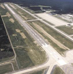
23 Table 1-6 Median Household Income Levels for Airport s Primary Market Area (Including Host Communities) Compared to the State of Michigan Period Percent Change City of Marquette $24,365 $29, % Alger County $21,569 $35, % Baraga County $19,424 $33, % Delta County $22,791 $35, % Dickinson County $24,809 $34, % Houghton County $17,650 $28, % Iron County $16,307 $28, % Luce County $20,370 $32, % Marquette County $25,137 $35, % Menominee County $21,586 $32, % Schoolcraft County $20,112 $31, % Airport s Primary Market Area Average $20,975 $32, % State of Michigan $31,020 $44, % 2006 data not available for U.P. counties Source: U.S. Census Bureau (*estimated) 1.6 Facilities Management Sawyer is owned and operated by the County of Marquette and day-to-day operation is the responsibility of the Airport Manager. The manager is supported by a full-time staff of twelve employees whom are stationed at the Airport. In addition to management, record keeping, and related activities, designated staff members are also certified to operate the Airport Rescue and Fire Fighting (ARFF) equipment and perform routine maintenance of airport facilities. Figure 1-6 outlines the Airport s organizational chart. An Airport Advisory Committee, appointed by the Marquette County Board of Commissioners, meets monthly to provide guidance on Airport issues. Major policy decisions regarding the Airport remain with the Board of Commissioners. 1.7 Existing Airport Facilities Sawyer is situated on 2,275 acres of land owned by Marquette County. This property includes existing Airport facilities, as well as, land for future development. In addition to the Airport s property, the County of Marquette owns 9,264 acres of property in proximity to Sawyer, which is primarily county forest area. Chapter 1 - Inventory of Existing Facilities 1-15
24 Figure 1-6 Airport Organization Chart County Board County Administrator Water/Waste Water Treatment Plant Leads Director of Operations Airport Manager Water/Waste Water Treatment Plant Staff Maintenance Supervisor Maintenance Staff Source: Airport Administration Having a clear understanding of the existing Airport facilities is important because this defines what is available today and lays the foundation for what may be necessary to accommodate future needs. The discussions of existing facilities are presented in two categories: airside and aviation related landside. The airside facilities include such areas as the runways, taxiways, aprons, aircraft parking and storage areas, airfield lighting, navigational aids, and airspace. The aviation related landside facilities include such items as the airport terminal building, vehicular access, automobile parking, and support facilities. The support facilities also include fueling facilities, airport rescue and firefighting (ARFF) facilities, airport maintenance, snow removal equipment (SRE) facilities, and utilities. There is also a category of facilities aside from the airside and landside that includes off-airfield facilities and those that do not have aviation related uses. Table 1-7 provides an overview of the Airport facilities Airside Facilities The airfield consists of many components which are necessary to accommodate safe aircraft operations including runways, taxiways, and an apron network; the visual and electronic navigational aids associated with runways; runway protection zones; and general aviation storage facilities. Chapter 1 - Inventory of Existing Facilities 1-16
25 Table 1-7 Airport Profile MAJOR FEATURES Property Existing: 2,275 acres Property encompasses airfield, building area, and runway protection zones Airfield Runway 1/19: 12,366 feet long, 150 feet wide; Asphalt/Concrete Airport Reference Code: D-III MASP Classification: Tier I Runway Lighting: High Intensity Navigational Aids Airport: - Air Traffic Control Tower ( hrs) - Segmented circle & lighted wind cones - Rotating Beacon - Pilot Controlled Runway Lights (when tower is closed) - AWOS Runway: - Runway 1: High Intensity Approach Lighting System with RAILs - Precision Approach Path Indicator Lights (PAPIs) - Runway 19: Runway End Identifier Lights - Precision Approach Path Indicator Lights (PAPIs) Building Area Development located on southeast side of Airport Aircraft Parking Capacity - T-Hangars: 30 - Twin T-Hangars: 10 - Tiedowns: 12 marked Aviation-Related Facilities - Airline Terminal - American Eagle Sawyer Base Maintenance Center - Boreal Aviation (Fixed Base Operator) - Aircraft Parking and Storage - Above Ground Fuel (Self-Fueling Facilities) Non-Aviation Related Facilities - Automobile Parking - Car Rental - Industrial Buildings MANAGEMENT AND SERVICES Management Airport Management and Maintenance: - Marquette County - Airport Manager and on-site staff of 12 Fixed Base Operator (FBO) Services Aircraft Fuel (100LL and Jet A) Aircraft Parking and Storage Aircraft Maintenance Avionics Flight Training Aircraft Rental Rental Car Courtesy Car Emergency and Security Fire Protection: - Airport Rescue and Fire Fighting Law Enforcement: - Marquette County Sheriff s Department on site during all scheduled commercial flights. AIRPORT SITE AND ENVIRONS Topography Airport Elevation: 1,221 ft. MSL Terrain: ranges from 1,170 ft. to 1,220 ft. MSL Access Direct: Kelly Johnson Memorial Drive M-553: Provides connection to Marquette Airport is 16 miles southeast of Marquette Nearby Land Uses North: Undeveloped, Fields, Forested East: Low/High Density Residential, Undeveloped, Fields, Forested South: Low/High Density Residential West: Undeveloped, Fields, Forested AIR TRAFFIC PROCEDURES Traffic Patterns Runway 1/19: Left Traffic Instrument Approach Procedures Runway 1 ILS: - Straight-in (1/2 mile; 200 ft. above touchdown zone elevation) - Circling (1 mile; 500 ft. above touchdown zone elevation) Runway 19 RNAV GPS: - Straight-in (1 mile; 500 ft. above touchdown zone elevation) - Circling (1 mile; 500 ft. above touchdown zone elevation) Runway 1 VOR: - Straight-in (1/2 mile; 500 ft. above touchdown zone elevation) - Circling (1 mile; 500 feet about touchdown zone elevation) Runway 19 VOR: - Straight-in (1/2 mile; 500 ft. above touchdown zone elevation) - Circling (1 mile; 500 feet about touchdown zone elevation) Runway 1 NDB: - Straight-in (3/4 mile; 400 ft. above touchdown zone elevation) - Circling (1 mile; 500 feet about touchdown zone elevation) Communications Tower/CTAF: Ground: Green Bay FSS RCO: UNICOM: Minneapolis Center Approach Departure Control: Source: Mead & Hunt Chapter 1 - Inventory of Existing Facilities 1-17
26 Runways. Sawyer is home to the longest runway in Michigan. Runway 1/19 is 12,366 feet long and 150 feet wide with a grooved concrete surface that is upwards of 20 inches (20 ) thick. The runway has a north/south orientation and is rated in fair condition on the Airport's FAA 5010 form, published on February 14, Limited concrete slab replacement was completed in 2008, as well as replacement of specific areas on the runway in In addition to runway length, pavement strength is also important when assessing the existing facilities. The maximum gross takeoff weight of an aircraft and its landing gear configuration is used to determine the strength of the pavement. The pavement strengths for each runway are presented in Table 1-8. Runway pavements are rated for single wheel, dual wheel, and dual tandem landing gear configurations. Table 1-8 Sawyer International Airport Runway Pavement Strengths Gear Configuration Pavement Strength Single Wheel 75,000 lbs Dual Wheel 175,000 lbs Dual Tandem 490,000 lbs Source: FAA Form 1050, February 2008 Taxiways. An extensive taxiway system supports aircraft operations at Sawyer. Taxiways are pavement areas constructed to provide access to runway surfaces while keeping aircraft off of active runways. The designation, width, orientation, and description of all existing taxiways at the Airport are summarized in Table 1-9 while Figure 1-7 depicts the Airport taxiway layout graphically. Table 1-9 Sawyer International Airport Taxiway Inventory Designation Width (ft.) Orientation Comment A 75 NE/SW Parallel Taxiway to Runway 1/19 B 75 NW/SE Connects Runway 1/19 to Taxiway A C 75 NW/SE Connects Runway 1/19 to Taxiway A D 75 NW/SE Connector Taxiway between Taxiway A and 600 series Hangars E 75 NW/SE Connects Taxiway A to General Aviation Apron F 75 NW/SE Connects Taxiway A to General Aviation Apron G 50 NE/SW Connects Taxiway A to the Hangar 400 apron Source: Mead & Hunt Chapter 1 - Inventory of Existing Facilities 1-18

27 Figure 1-7 Airport Taxiway Layout Chapter 1 - Inventory of Existing Facilities 1-19
28 Aprons. The apron facilities at Sawyer are a simple network that includes a general aviation apron and an air carrier terminal apron. The aprons are defined as areas where aircraft park and can be used for loading or unloading of passengers, refueling, or maintenance. These aprons serve the needs of the various aviation segments that utilize the Airport. Additionally, there is also a hold apron that is located northeast of Taxiway F that is used by aircraft for engine run-ups prior to departure and those waiting for departure clearance from air traffic control (ATC). The various apron dimensions and locations are described in Table Air Carrier Apron The current air carrier apron is adjacent to the commercial service terminal building. The apron covers over 320,000 square yards (100 acres). The apron is constructed of sixteen inches of concrete. Taxiways A, C, and D provide access to the apron. General Aviation Apron The general aviation apron is located adjacent to the general aviation terminal building and the building which houses the fixed-base operator at the southeast end of the field. It is just over 73,110 square yards in size (15.10 acres). Table 1-10 Sawyer International Airport Apron Inventory Apron Type Area (Sq. Yds.) Location(s) Air Carrier 320,100 Adjacent to the northeast façade of the air carrier terminal building. General Aviation 73,110 Adjacent to the General Aviation Terminal. Hold Apron 30,825 Adjacent to the northeast edge of Taxiway F between the runway and Taxiway A Source: Mead & Hunt Visual and Electronic Navigational Aids. Visual lighting aids at an airport are used to identify surfaces during approach, landing, and taxiing at night and in adverse weather conditions. These aids include various types of equipment that have different purposes. Sawyer is identified at night by a rotating beacon, which is located east of Runway 1/19 behind the general aviation terminal. The rotating beacon is a lighting system that provides two beams of light (one white and one green) 180 degrees apart that rotates 360 degrees so it can be seen from the air. The light is mounted on a tower structure which raises the light above the surrounding objects. Runway edge lighting is used to outline runways during periods of darkness and/or restricted visibility. Runway edge lights are white except for the last 2,000 feet of the runway where the lenses are white and amber. These lights can be seen from several miles from the Airport under good visibility conditions. As lighting systems are classified in accordance to their intensity and brightness, Runway 1/19 is illuminated by High Intensity Runway Lights (HIRL). Chapter 1 - Inventory of Existing Facilities 1-20
, Medium Intensity Approach Lighting System with")
29 Runway approach lighting at Sawyer provides visual guidance for approaching aircraft. These lighting systems include visual slope indicators, approach lights, and runway end identifier lights (REILs). The following approach lighting systems are associated with the respective runways at Sawyer: Runway 1 - Precision Approach Path Indicators (PAPI), Medium Intensity Approach Lighting System with Runway Alignment Indicator (MALSR) Runway 19 - PAPI, REIL Navigational aids (NAVAIDs) at an airport provide visual and electronic guidance and are categorized by the degree of accuracy associated with the type of approach such as precision or non-precision. Precision NAVAIDs. Precision NAVAIDs provide both vertical and horizontal guidance to aircraft upon landing at Sawyer. Non-precision NAVAIDs provide only horizontal guidance to landing aircraft. An example of a precision NAVAID is an Instrument Landing System (ILS) which is often coupled with the MALSR as noted in the previous section. An ILS is a combination of electronic equipment that provides pilots with information about the location of the runway centerline, appropriate angle of decent for approach and touchdown, and distance to the runway at fixed points along the approach. The components of the ILS are the localizer, glide slope, and markers. Non-precision NAVAIDs. Examples of non-precision NAVAIDs available at Sawyer include a Very High Frequency Omni-directional Range (VOR) radio navigational aid, Non-Directional Beacons (NDB), and Global Positioning System (GPS). The VOR provides azimuth readings to pilots of properly equipped aircraft by transmitting a radio signal at every degree to provide 360 individual navigational courses. Frequently, distance measuring equipment (DME) is combined with a VOR facility (VOR/DME) to provide distance, as well as directional information to the pilot. In addition, military TACAN and civil VORs are commonly combined to form a VORTAC. A VORTAC provides distance and direction information to civil and military pilots. In some instances, a VOR-A approach is developed which indicates that an aircraft can navigate to the general location of the airport and then use a circling approach to land at a specific runway end. The NDB transmits non-directional radio signals whereby the pilot of properly equipped aircraft can determine the bearing to or from the NDB facility and then track to or from the station. Chapter 1 - Inventory of Existing Facilities 1-21
30 GPS uses satellites placed in orbit around the earth to transmit electronic signals, which properly equipped aircraft use to determine altitude, speed, and position information. GPS allows pilots to navigate to any airport in the country, and they are not required to navigate using a specific navigational facility which is ground based at a specific airport. There are published approaches to the Airport's runways using the aforementioned NAVAIDs. Runway 1 is equipped with an ILS that allows aircraft approaches with visibility minimums of a 1/2 mile and ceilings of 200-foot Above Ground Level (AGL). This means that an approaching aircraft can descend to within 200 feet above the local ground level and have down to ½ mile of visibility and still land at the Airport. This is desirable so that aircraft can land during times of reduced visibility. Runway 19 has a non-precision approach that allows for landings when ceilings are 500-foot AGL and visibility is one mile. The following list details the current approaches as published by Jeppeson Charts, as of January An ILS Approach to Runway 1 is shown on Figure 1-8 An RNAV (GPS) Approach to Runway 19 is shown in Figure 1-9 A VOR Approach to Runway 1 is shown in Figure 1-10 A VOR Approach to Runway 19 is shown in Figure 1-11 An NDB Approach to Runway 1 is shown in Figure 1-12 Precision approaches at both runway ends require a clear 50:1 approach slope. The Sawyer Obstruction Chart, compiled by the National Oceanic and Atmospheric Administration, was reviewed to identify current and potential obstructions. The most recent chart (field surveyed in August 2004) was reviewed, along with the Airport's current Airport Master Record (FAA Form , published February 2008). The airport obstruction chart shows no penetrations of the airport obstruction identification surfaces. Chapter 1 - Inventory of Existing Facilities 1-22
31 Figure 1-8 ILS Approach to Runway 1 Source: FAA and Jeppeson Chapter 1 - Inventory of Existing Facilities 1-23
32 Figure 1-9 RNAV (GPS) Approach to Runway 19 Source: FAA and Jeppeson Chapter 1 - Inventory of Existing Facilities 1-24
33 Figure 1-10 VOR Approach to Runway 1 Source: FAA and Jeppeson Chapter 1 - Inventory of Existing Facilities 1-25
34 Figure 1-11 VOR Approach to Runway 19 Source: FAA and Jeppeson Chapter 1 - Inventory of Existing Facilities 1-26
35 Figure 1-12 NDB Approach to Runway 1 Source: FAA and Jeppeson Chapter 1 - Inventory of Existing Facilities 1-27

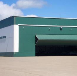
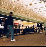
36 General Aviation Storage Facilities. Sawyer has a number of hangars, of varying sizes, to accommodate most aircraft types. For general aviation, Sawyer has approximately 30 T-hangars for small single-engine aircraft and ten T-hangars for twin-engine aircraft. These T-hangars provide individual storage of aircraft for those who do not prefer to store their aircraft in hangars with multiple aircraft. Additionally, there are several box-style hangars which also offer storage and revenue generation options for the Airport Existing Aviation Related Landside and Support Facilities Aviation related landside facilities are those considered to be used for aviation related activities that do not fall into the airside facilities category previously discussed. The existing landside facilities at the Airport include the air carrier terminal building, the general aviation terminal building, automobile parking, and vehicular access. This section also describes the other support facilities such as those used for Aircraft Rescue and Firefighting (ARFF), maintenance, snow removal, and fueling. Air Carrier Terminal Building. The air carrier terminal building was constructed in 1999 and is the gateway to Marquette for visitors arriving by air. The terminal building is home to four rental car companies and one snack shop. Departing passengers can wait for their flight in the large public area of the terminal or proceed through security into the hold room. The terminal building provides two jet bridges (or gates) that provide weather protected access to aircraft for both arriving and departing passengers. Table 1-11 illustrates the size of the terminal facilities. Table 1-11 Sawyer International Airport Air Carrier Terminal and Administrative Areas Constructed in 1999 Area Existing Terminal (Square Feet) Secured Area Holdroom 2,300 Non-secured area Baggage Makeup 1,500 Airline Ticketing 800 Snack Shop 350 Storage 980 Car Rental 2,640 Janitorial 54 Baggage Claim 40 Baggage Handling 2,000 Public Area 13,078 Restrooms (2 rooms) 1,400 Total Operational Square Feet: 41,000 Total Terminal Area: 41,000 Source: Airport Manager Chapter 1 - Inventory of Existing Facilities 1-28

37 General Aviation Terminal Building. The general aviation terminal building is located east of the runway and adjacent to Taxiway E, south of the air carrier terminal building. The general aviation terminal building is owned by the Airport, but is leased to Boreal Aviation who operates and maintains the building on a daily basis. The terminal offers general, corporate, and charter aviation travelers a crew lounge, pilot supplies, a conference room, an on-airport air crew courtesy car, rental car arrangements, and catering services. Airport Access and Parking. Kelly Johnson Memorial Drive provides direct access to M-553 which connects the Airport to Marquette. The surrounding road network also provides access to the Airport from points east, south, and southwest. The air carrier terminal vehicular parking area is approximately 23,570 square yards in size that provides an abundant number of parking spots for passengers. This area also supplies parking for rental car vendors, as well as airline, rental car, and airport employees. Adequate vehicular parking adjacent to Boreal Aviation is also available for general aviation users and airport visitors who utilize the general aviation apron. Support Facilities. Current support facilities at Sawyer include Aircraft Rescue and Fire Fighting (ARFF), Snow Removal Equipment (SRE), and fuel facilities. The current aircraft fueling facilities at Sawyer are provided by the Fixed Base Operator (FBO), utilizing five above ground storage tanks and three mobile fuel trucks. The fuel tanks vary in capacity with a 12,000 gallon tank that stores 100 octane low lead fuel and four tanks that store 20,000 gallons of Jet A fuel. Fuel trucks disperse the Jet-A fuel to aircraft while a self service station accomplishes the same task for 100 octane low lead fuel. Recent Airport Improvement Projects. Table 1-12 illustrates a summary of the construction projects which have been completed since the conversion of Sawyer to civilian use. As noted, there have been a substantial number of projects since 1998 which prepared the Airport for use as the air carrier airport for the central U.P. 1.8 Airport Tenants There are a number of tenants at Sawyer which contribute to the operation of the field, as well as the economic revenue and vitality of the facility. These include those that are aviation related, as well as others which are merely tenants, utilizing existing airport facilities. Fixed Based Operator. Fixed base operators (FBOs) typically provide a wide range of general aviation services including aircraft rental and charter operations, flight instruction, aircraft sales, major maintenance and repair, and fuel service. Boreal Aviation, Inc. provides FBO services at Sawyer including: aircraft maintenance, avionics, tie downs, aircraft rental, flight planning, a flight lounge and lobby, and fuel. Boreal Aviation also provides flight instruction and aircraft rental services. Chapter 1 - Inventory of Existing Facilities 1-29
38 Table 1-12 Recent Airport Improvements Phase I Site Work and Phase II Construction of Airline Passenger Terminal 1999 Formal Relocation to Former K.I. Sawyer AFB & opening of new passenger terminal building. Construction of three taxistreets Rehabilitation of sections of Taxiways A, B, & C Pave ILS Access Road &Critical Area Rehabilitation of Building 600 (Former USAF and Airport Fire Station Rehabilitation of Runway 1/19 (Phase I), Rehabilitation of Taxiway Lighting (A, B, C, A-2, & D) Rehabilitation of Hangar 400 (Phase I) Rehabilitation of North Terminal Apron, Phase I Rehabilitation of Runway 1/19 (Crack and Joint Repair) 2000 Construction of North Access Road (Kelly Johnson Memorial Drive) Rehabilitation of Taxiways A, B, C, & D Rehabilitation of Hangar 400, Phase II (Exterior Insulation and Electrical System) 2001 Construct 25 new general aviation T-hangars Installation of two (2) Passenger Boarding Bridges at Airline Passenger Terminal Series Hangar Improvements (Roofing and Exterior Siding) Runway Pavement Slab Replacement Begin Phase I (Site Work) and Phase II (Construction) of ARFF/SRE Building Bulk Fuel Farm Expansion Project 2005 Complete Phase II of the ARFF/SRE Building (Airport Services Center) Hangar Improvements (Interior Insulation and Electrical Service) Fueling Station at ARFF / SRE Building (Airport Services Center) 2006 Hangar Improvements (Interior Insulation, Hangar Bay Heating System, and Exterior Siding) Runway Safety Area Improvements Airfield Painting 2007 Begin Phase I of Runway Rehabilitation Program Phase II Construction of a Sand Storage Building 2008 Hangar Improvements (Interior Insulation and Electrical) Utility Improvements (Sprinkler System and Emergency Generator) Concrete Joint Repair and Slab Replacement on Runway and Taxiway Rehabilitation of Runway 1 Approach (Runway 19 Overrun) VOR and Glide slope Access Roads ARFF/SRE Building Alarm System 2003 Snow Removal Equipment Purchase (Snow plows and Front End Loader) Exterior Renovations of Hangar (Roofing and Exterior Siding) Source: Mead & Hunt Chapter 1 - Inventory of Existing Facilities 1-30
39 Aviation Tenants. Table 1-13 lists all of the tenants at the Airport. One of the larger employers, American Eagle, began performing overnight maintenance at Sawyer in The American Eagle Sawyer Base Maintenance Center employs over 200 people. American Eagle currently leases four buildings (three hangars and one support building) from Marquette County located on the south end of the air carrier apron. Non-Aviation Related Tenants. Sawyer is also home to 31 non-aviation related businesses. This diverse group of businesses range from government offices to educational and manufacturing facilities. Table 1-13 also lists these tenants. In addition to the businesses located on Airport property, 34 additional businesses are located adjacent to the Airport. 1.9 Air Space and Air Traffic Control The Federal Aviation Administration Act of 1958 establishes the FAA as the responsible agency for control and use of navigable airspace within the United States. An analysis of airspace use is critical in determining the capacity and operational interaction of Sawyer with surrounding airports. The airspace classification system was developed after World War II due to the increasing number of aircraft operating within the United States. Proper usage of airspace is critical for flight safety and efficient service to pilots and passengers within the national air transportation system. Sawyer Air Traffic Control Tower (ATCT) ATCT Frequency: MHz UNICOM Frequency: MHz Hours: hours (6 am 10 pm) FAA Contract Tower Program. The FAA s contract tower program began in It allows the FAA to contract air traffic control services to the private sector. The program has enhanced safety and improved ATC services. Currently, 226 airports participate in the program, representing 45 percent of all control towers in the U.S. A quarter of all Michigan air traffic control towers participate in the program; including Sawyer, Battle Creek, Jackson, and Detroit City. Table 1-14 provides a general summary of the various airspace classes utilized by the FAA. Airspace is divided into six classifications with Sawyer classified within Class D airspace requiring pilots to maintain two-way radio communications with air traffic control when operating within the airspace. When the tower is closed, pilots are responsible for their own separation when operating in the airspace. This Class D airspace provides a unique situation for pilots utilizing Sawyer to have the opportunity to both communicate with the air traffic control tower (ATCT) and have a relatively uncongested area for operations. This is particularly attractive to the military when conducting operations as compared to the more densely populated areas of Milwaukee and Green Bay. Sawyer s airspace is depicted in Figure 1-13 as published by the Michigan Department of Transportation Airports Division in their 2008 Aeronautical Chart. As noted, Sawyer has an ATCT that directs approach, landing, taxing, take-off, and departure of aircraft utilizing the Airport. The communications with the ATCT are handled with approach and departure procedures on Megahertz (MHz) from 6:00 AM 10:00 PM. The Universal Integrated Communication (UNICOM) communications are handled on frequency MHz during the time when the ATCT is inoperative. Chapter 1 - Inventory of Existing Facilities 1-31
40 100/100LL Jet A Fixed Wing Helicopter Fixed Wing Helicopter Engine Airframe Avionics Helicopter Tied owns Hangars Transient Ramp Pilot Supplies Charter Aircraft Sales Other Table 1-13 Airport Tenants FIXED BASE OPERATIONS (AVIATION RELATED SERVICES) Fuel Flight Aircraft Aircraft Parts & Sales Instruction Rental Maintenance Aircraft Storage Miscellaneous Name Boreal Aviation OTHER AVIATION-RELATED TENANTS Name Type of Business Airport Services Center Sawyer International Airport administration offices / maintenance American Eagle Commercial service operator American Eagle Sawyer Base Maintenance Center American Eagle performs overnight maintenance on regional jets Mesaba / Delta Air Lines Commercial service operator Transportation Security Administration Federal airport security agency NON-AVIATION RELATED TENANTS American Communications Network Commercial Michigan Department of Environmental Quality State Government B3PC Commercial R & G Management Commercial/Recreation (Red Fox Run Golf Course) Marquette County Road Commission Local Government The W (formerly YMCA) Commercial/Recreation PLC Canuss Industrial Comau Pico/Wisne Marquette Commercial Delphi Automotive Commercial Mid-Peninsula Contracting Commercial Naval Reserve Military Frank the Mover Commercial Industrial Marketing Commercial Mike Wills Excavating Commercial/Industrial Michigan State Police State Government Marquette County Health/Dental Local Government Avis Car Rental Commercial Meyer Family Vision Commercial Budget Rent A Car Commercial National Car Rental Commercial Federal Aviation Administration Federal Government Salvation Army Commercial Thrifty Car Rental Commercial Touch N Go Commercial Marquette General Behavioral Health Health Care Appleton Papers Commercial Richard Vermeulen, M.D. Health Care Sawyer Operations Authority Local Government Army National Guard Recruiting Military/Commercial Airgas Commercial Great Lakes Recovery Health Care Source: Sawyer International Airport Base Reuse Status Report (Provided by Sawyer 2008) Chapter 1 - Inventory of Existing Facilities 1-32

41 Table 1-14 Airspace Classes Airspace Classes. Federal Aviation Regulations define six categories of airspace, which conform in both name and description with airspace designations used internationally. Controlled Airspace is any of several types of airspace in which some or all aircraft may be subject to air traffic control. With the number of aircraft flying over the United States today, proper airspace usage is critical for flight safety and efficient service to pilots and the flying public. To assist in this goal, the airspace is divided into six classifications. Class A is the airspace from 18,000 feet to 60,000 feet. Visual Flight Rules (VFR) is not allowed. All pilots flying in Class A airspace shall file an Instrument Flight Rules (IFR) flight plan and receive an appropriate air traffic control (ATC) clearance. Class B is generally the airspace from the surface to 10,000 feet. This airspace is normally around the busiest airports in terms of aircraft traffic. Class B airspace is individually designed to meet the needs of the particular airport and consists of a surface area and two more layers. Pilots must contact air traffic control to receive an air traffic control clearance to enter Class B airspace. Class C is the airspace from the surface to 4,000 feet above the airport elevation. Class C airspace will only be found at airports that have an operational control tower, are serviced by a radar approach control, and that have a certain number of IFR operations. Although Class C airspace is individually tailored to meet the needs of the airport, the airspace usually consists of a surface area with a 5 nautical mile (NM) radius, an outer circle with a 10 NM radius that extends from 1,200 to 4,000 feet above the airport elevation and an outer area. Pilots must establish and maintain two-way radio communications with the ATC facility providing air traffic control services prior to entering airspace. Pilots of VFR aircraft are separated from pilots of IFR aircraft. Class D is generally that airspace from the surface to 2,500 feet about the airport elevation. Class D airspace only surrounds airports that have an operational control tower. Class D airspace is also tailored to meet the needs of the airport. Pilots are required to establish and maintain two-way radio communications with the ATC facility providing air traffic control services prior to entering the airspace. Class E is generally that airspace that is not Class A, B, C, D, or G. Class E airspace extends upward from either the surface or a designated altitude to the overlying or adjacent controlled airspace. If an aircraft is flying on a Federal airway below 18,000 feet, it is in Class E airspace. Class E airspace is also the airspace used by aircraft transiting to and from the terminal or en route environment normally beginning at 14,500 feet to 18,000 feet. Class E airspace ensures IFR aircraft remain in controlled airspace when approaching aircraft without Class D airspace or when flying on Victor airways federal airways that are below 18,000 feet. Class G is uncontrolled airspace. IFR aircraft will not operate in Class G airspace. VFR aircraft can operate in Class G airspace. Source: FAA Chapter 1 - Inventory of Existing Facilities 1-33
 150/5300-13, Airport Design, identifies the required design standards.")
42 Figure 1-13 Aeronautical Chart Source: Michigan Department of Transportation, Design Standards Design standards have been developed by the FAA to maintain safety standards at airports. FAA Advisory Circular (AC) 150/ , Airport Design, identifies the required design standards. The following sections outline a few of the critical design standards that are necessary for a safe operating environment. Existing FAA standards for some of the safety areas are based on the Airport Reference Code (ARC) that each runway is designated. The ARC incorporates characteristics of the most Chapter 1 - Inventory of Existing Facilities 1-34
43 demanding aircraft that operates at an airport on a regular basis and includes the following two components: Aircraft Approach Category (AAC) and Airplane Design Group (ADG). The aircraft approach category, designated by letter, represents the approach speed characteristics of the critical design aircraft. The airplane design group, designated by a Roman numeral, is based on wingspan and relates to the physical characteristics of the critical design aircraft. Table 1-15 and Table 1-16 illustrate the defining characteristics of an ARC. Table 1-15 Airport Reference Code (ARC) Approach Category Approach Speed, Knots A Less than 91 B C D E 166 or greater Source: FAA AC 150/ Table 1-16 Sawyer International Airport Apron Inventory Approach Category Wingspan (feet) Typical Aircraft I Less than 49 Beechcraft Bonanza, Learjet 25 II Gulfstream II III Boeing 737 IV Boeing 757 V Boeing VI Lockheed C-5A Source: FAA AC 150/ Airport activity at Sawyer includes air carrier, military, and general aviation. The Airport currently has an ARC of D-III, which accommodates most aircraft using Sawyer. The Air National Guard performs hundreds of training missions at Sawyer in the KC-135, a D-IV aircraft. The future ARC of the Airport is discussed in Chapter 3 and Chapter Runway Protection Zones Runway protection zones (RPZs), formerly known as "clear zones", were originally established to define land areas underneath aircraft approach paths. Control of these areas by the airport operator is highly desirable to prevent hazards to aircraft. The creation of RPZs is not only to preclude obstructions potentially hazardous to aircraft, but also to reduce the likelihood of aircraft nuisances and hazards to people on the ground near an airport. Guidelines were developed recommending that RPZs be kept free of structures and development. Where practical, airport owners should own property within RPZs, since it is desirable to keep RPZs clear of above ground objects. When ownership is not feasible, avigation easements are recommended to control height and land use issues. At Sawyer, the RPZs are owned by the Airport and are either clear of obstructions or the land within the RPZ is considered to be compatible. Chapter 1 - Inventory of Existing Facilities 1-35
44 The size of an RPZ is based upon the type of approach and ARC classification of the runway. The smaller RPZs are associated with visual approach runways for small single engine aircraft while larger RPZs are associated with precision instrument approach runways for large multi-jet engine aircraft. Figure 1-14 depicts the existing RPZ dimensions at Sawyer. Figure 1-14 Runway 1/19 Aircraft Safety Areas with Precision Approach Source: Mead & Hunt Chapter 1 - Inventory of Existing Facilities 1-36
45 Runway Object Free Areas and Runway Safety Areas The FAA has designated Runway Object Free Areas (OFAs) and Runway Safety Areas (RSAs) that surround runways to protect aircraft operations. FAA standards for these two safety areas are based on the ARC. Sawyer, with an ARC designation of D-III, requires RSAs and OFAs that meet the requirements of Category D approach and design group III aircraft. The OFA is a two-dimensional ground area centered on the runway. FAA standards prohibit parked aircraft and objects, except those NAVAIDs and objects which are frangible mounted, within the OFA. Essentially, any above-ground objects are prohibited in this area. The length and width of the OFA is determined by the ARC. As noted, Runway 1/19 serves approach category D aircraft and, therefore, meets FAA requirements for OFA widths of 800 feet centered on the runway centerline and lengths of 1,000 feet beyond the runway end. A preliminary review of the Sawyer s OFAs indicates that they meet the required FAA design criteria for a D-III airport. The RSA is a critical area surrounding the runway that provides an area for aircraft to come to rest in the event of an excursion from the runway surface. The FAA requires that the RSA be: Cleared, graded, and free of potential hazardous surface variations and properly drained Capable of supporting snow removal equipment (SRE), aircraft rescue and firefighting (ARFF) equipment, and aircraft (without causing damages to the aircraft) Free of objects except those mounted on low-impact resistant supports whose location is fixed by function Based on FAA requirements, the RSA for Runway 1/19 is 500 feet wide, centered on the runway centerline, and extends 1,000 feet beyond each runway end. A preliminary review of the Sawyer s RSAs indicates that the RSAs meet the required FAA design criteria for a D-III airport Summary Sawyer provides facilities and air service that benefits passengers throughout all of Michigan s Upper Peninsula. The Airport s facilities provide for all segments of aviation, including commercial, corporate, general aviation, military, and cargo. Sawyer s central location provides convenient access to the national air transportation system to area residents and beyond. The Airport serves as an important connection for businesses choosing to locate within or serve the Upper Peninsula. The airfield size currently allows for the operation of nearly all types of aircraft and the weather does not significantly hamper aircraft operations. The historic aviation trends affecting Sawyer show an upward trend in aircraft operations and passenger enplanements since the late 1990's. The socioeconomic trends in the area surrounding Sawyer also depict an upward trend in both population and median household incomes. The research presented in this Chapter reflects the significant opportunity for Sawyer to play a major role in aviation throughout Michigan s U.P. Chapter 1 - Inventory of Existing Facilities 1-37
46 THIS PAGE INTENTIONALLY LEFT BLANK Chapter 1 - Inventory of Existing Facilities 1-38
 using 2006 as the base year of analysis.")
47 2 Projections of Aviation Demand This element of the Sawyer International Airport (Sawyer) Master Plan provides estimates of future aviation demand at the Airport. Projections of short, intermediate, and long-term activity are based on future year milestones (2010, 2015, 2020, 2025, and 2030) using 2006 as the base year of analysis. The year 2006 serves as the base year as it was the most recent year for which a full year of activity data was available at the time the study began and was the time at which the forecasts for the chapter were developed. Where appropriate, 2007 and 2008 data is shown in the chapter to reflect more recent activity. Projections of aviation demand are an important element of the master planning process as they provide the basis for several key analyses, including: Determining the role of the Airport with respect to the type of aircraft to be accommodated in the future Evaluating the capacity of existing Airport facilities and their ability to accommodate projected aviation demand Estimating the extent of airside and landside improvements required in future years to accommodate projected demand This chapter uses 2006 data to project future levels of aviation demand through the year The forecast analysis contained in this chapter includes methodologies based on historical aviation trends at the Airport, as well as other socioeconomic trends related to the Marquette County area. National projections of aviation activity documented by the Federal Aviation Administration (FAA) are also reviewed within the context of this forecast analysis element. The ability to accurately forecast future aviation activity levels at an airport is impacted to a certain degree by the amount and validity of historical information that is available regarding that airport. In the case of Sawyer, a towered airport, a combination of tower and Airport records provide accepted and valid information. This chapter provides discussions of the methodologies and findings used for projecting passenger enplanements, aircraft operations, aircraft fleet mix, air cargo activity, and based aircraft for Sawyer. The projections of aviation demand are documented in the following sections: Chapter 2 Projections of Aviation Demand 2-1
48 2.1 Role of the Airport 2.2 Industry Trends 2.3 Forecasting Approach 2.4 Projections of Demand 2.5 Critical Aircraft 2.6 Projections Summary 2.1 Role of the Airport In order to project aviation demand at Sawyer with some degree of certainty, it is important to understand the role of the Airport. This section presents data that defines the Airport s role based upon several areas including geographic service area and the state aviation system goals Geographic Service Area An airport s air trade area (i.e. the geographical area it serves) is defined by several factors, including geographical and access considerations and proximity of alternative aviation facilities. Sawyer is centrally located in Michigan s Upper Peninsula (U.P.) making it accessible to a significant portion of the U.P. s population. The Airport s primary market area is made up of ten counties and is displayed in Figure 2-1. The market area is home to over 234,000 residents, which are located less than two hours from Sawyer by automobile. Table 2-1 lists the counties Sawyer serves and their populations. While there are three other commercial service airports within these counties, Sawyer offers more opportunities for flights as a regional destination. Table 2-1 Sawyer Market Area Population Alger County 9,558 Baraga County 8,617 Delta County 37,725 Dickinson County 27,029 Houghton County 35,334 Iron County 12,194 Luce County 6,684 Marquette County 64,675 Menominee County 24,381 Schoolcraft County 8,744 Total Market Area 234,941 Source: 2006 Estimates by U.S. Census Bureau Chapter 2 Projections of Aviation Demand 2-2
49 Figure 2-1 Sawyer Market Area Source: Mead & Hunt Chapter 2 Projections of Aviation Demand 2-3
50 The presence of five other Upper Peninsula airports with commercial service such as Houghton County Memorial Airport 115 miles to the northwest, Ford Airport in Iron Mountain 56 miles to the southwest, and Delta County Airport in Escanaba 46 miles to the southeast are important considerations in planning for the future of Sawyer. As of April 2009, Sawyer services three large hub airports (Chicago O Hare, Detroit Metro, and Minneapolis St. Paul) which provide access to many other destinations. Sawyer also has service to one medium hub (Milwaukee) that provides Sawyer passengers flexible flight schedules, competitive fares, and connections to destinations around the world. No other U.P. air carrier airport services more than two hubs, making Sawyer the premier air carrier airport in the U.P. for passengers seeking convenient connections to destinations worldwide. Sawyer is also the only U.P. airport with the choice of more than one airline. American Eagle provides regional jet service to Chicago O Hare and Milwaukee while Mesaba Airlines, the regional affiliate of Delta Air Lines, provides service to Detroit Metro and Minneapolis St. Paul. Having two airlines that serve four hubs allows for greater frequency of flights and competition between the airlines that result in airfares being lower at Sawyer than other U.P. air carrier airports. Table 2-2 lists the surrounding airports and the hubs they serve compared to Sawyer, while Figure 2-2 graphically illustrates the hubs served by each airport. Approximately 59 percent (59%) of the U.P. s population is within a two hour drive from Sawyer. As a result, Sawyer captures 53 percent (53%) of all air passengers originating in the U.P. As shown in Table 2-3, Sawyer s share of the regional total of enplaned passengers (Sawyer, Houghton, Escanaba, and Iron Mountain) has increased during the past 15 years, attributable to improvements in the air service offered at Sawyer. Passenger totals at Delta County Airport and Ford Airport have declined slightly in the past 15 years. Table 2-2 Hubs Served by Surrounding Airports Airport Chippewa County International Airport Delta County Airport Ford Airport Gogebic-Iron County Airport Houghton County Memorial Airport Sawyer International Airport Hubs Detroit Detroit, Minneapolis-St. Paul Detroit, Minneapolis-St. Paul Milwaukee Minneapolis-St. Paul Chicago, Detroit, Milwaukee, Minneapolis-St. Paul Source: Airport Management Change to Service The quality, price, quantity, hub choice, and frequency of airline service at each of the surrounding airports affect demand. It is recognized that changes at other airports in the area could potentially impact the activity and aviation demand at Sawyer. Chapter 2 Projections of Aviation Demand 2-4

51 Figure 2-2 Airport Hub Choices Source: Mead & Hunt Chapter 2 Projections of Aviation Demand 2-5
52 Table 2-3 Share of Regional Enplanements 1990 % of 2008 % of Enplan. Enplan. Enplan. Enplan. Airport With In U.P. With In U.P. Sawyer International, Marquette* 37, % 56, % Houghton County Memorial, Hancock 23, % 25, % Delta County, Escanba 13, % 4, % Ford, Iron Mountain/Kingsford 10, % 3, % Chippewa County International, Sault Ste. Marie 8, % 13, % Gogebic-Iron County, Ironwood 5, % 1, % Total 99, ,955 * = Negaunee site in 1990 Source: FAA Terminal Area Forecasts At the present time, no significant changes are anticipated in the air service at any of the surrounding airports; however, service at Delta County Airport and Ford Airport are currently subsidized as part of the US Department of Transportation (USDOT) Essential Air Service (EAS) program. Federal funding for the EAS program, like many federally funded programs, is being scrutinized due to the national economic climate. It is anticipated that the EAS program will continue for at least the next five years as it is currently included in the Administration s DOT budget proposal; however, the program is subject to renewal each year by Congress when funding the USDOT. For this reason, the potential impacts of passenger demand at Sawyer due to the loss of scheduled air carrier service at Delta County and Ford airports are reviewed below. As service at Houghton/Hancock is not subsidized by the EAS program and is completely market based, the projection of potential service changes and related impacts to this airport are not assessed. If service at Delta County Airport and Ford Airport were to be discontinued, there would potentially be 8,687 enplanements which would be forced to use a different airport to access the national air transportation system. Table 2-4 notes the drive time and distances from these two population centers to potential alternative airports and notes the number of flights and destinations offered at the potential alternative airport. As Austin Straubel Airport in Green Bay, Wisconsin has more air service offerings, it is more likely to attract passengers than either Sawyer or Rhinelander. However, for passengers from the Escanaba area, Sawyer is much closer; therefore it could be expected that Sawyer would attract a significant number of the Escanaba passengers. Rhinelander is as far or farther than the other alternatives and its air service options are less than either Green Bay or Sawyer. Therefore, very few, if any passengers that currently use Escanaba or Iron Mountain are expected to travel to Rhinelander for air service. Assuming that Sawyer would attract 50 percent (50%) of the Escanaba passengers and 25 percent (25%) of the Iron Mountain passengers, it could potentially result in an additional 3,347 enplanements. Chapter 2 Projections of Aviation Demand 2-6
53 Table 2-4 Comparison of Share of Regional Enplanements Sawyer International Rhinelander, WI Green Bay, WI Drive Time/Dist Delta County, Escanaba 60 miles / 74 min 140 miles / 161 min 113 miles / 137 min Ford, Iron Mountain/Kingsford 111 miles / 130 min 88 miles / 117 min 102 miles / 117 min Air Service Provided Approx. Daily Flights Hubs served % Passengers Using Delta County 50% 0% 50% Ford 25% 0% 75% Total Additional Passengers Delta County (4,697) 2, ,348 Ford (3,990) ,992 Total 8,687 3, ,340 Source: Mapquest.com shortest drive time Mead & Hunt, Inc. As of April 2008, scheduled commercial service was discontinued at the Escanaba, Iron Mountain, and Ironwood airports for a period of two months. In June 2008, service was restored with Escanaba and Iron Mountain receiving subsidized service with Mesaba Airlines, a subsidiary of Delta Air Lines, with twicedaily service to both Detroit and Minneapolis-St. Paul while Ironwood received subsidized service on Great Lakes Airlines providing twice daily service to Milwaukee. As was noted earlier, the loss of service at any of the surrounding airports is not anticipated; however, it may be reasonable to evaluate the impacts at Sawyer, particularly in terms of terminal facility requirements that may be required if the EAS program or general changes to the current service levels was eliminated in the future. An additional 3,347 enplanements could potentially use Sawyer in such a circumstance. As part of the master plan study, air passenger surveys were conducted to evaluate the opinion of passengers utilizing Sawyer. Nearly 500 passengers were asked questions regarding the purpose, destination, and origin of their trip. Of those surveyed, 56 percent (56%) were traveling for leisure, 35 percent (35%) for business, four percent (4%) for a convention or other business, and five percent (5%) for other reasons. The top ten origin cities for passengers traveling through Sawyer sited on the survey are: 1. Marquette, Michigan (23.4%) 2. Chicago, Illinois (4.7%) 3. Detroit, Michigan (8.24%) 4. Ishpeming, Michigan (4.2%) Chapter 2 Projections of Aviation Demand 2-7
54 5. Munising, Michigan (2.45%) 6. Kinross, Michigan (2.0%) 7. Houghton, Michigan (2.0%) 8. Milwaukee, Wisconsin (2.0%) 9. Negaunee, Michigan (2.0%) 10. Los Angeles, California (1.7%) The top 20 destination cities of survey respondents are: 1. Detroit, Michigan (12.9%) 2. Chicago, Illinois (5.8%) 3. Marquette, Michigan (5.4%) 4. Milwaukee, Wisconsin (3.0%) 5. Washington D.C. (2.37%) 6. Orlando, Florida (2.15%) 7. Denver, Colorado (1.94%) 8. Grand Rapids, Michigan (1.93%) 9. Minneapolis, Minnesota (1.72%) 10. New York City, New York (1.71%) 11. San Francisco, California (1.70%) 12. San Diego, California (1.51%) 13. Boston, Massachusetts (1.29%) 14. Knoxville, Tennessee (1.28%) 15. Lansing, Michigan (1.27%) 16. Phoenix, Arizona (1.26%) 17. Tampa, Florida (1.25%) 18. Jacksonville, Florida (1.24%) 19. Syracuse, New York (0.65%) 20. Los Angeles, California (0.43%) It was noted through the survey that international passengers also utilize Sawyer. The following countries were citied as either origins or destinations of Sawyer passengers: Australia Canada India Japan England Norway Pakistan State Aviation System Goals As categorized by the Michigan Airport System Plan 2008, Sawyer is a Tier 1 airport, responding to critical/essential state airport system goals. The system plan recommends that Tier 1 airports be developed to their full and appropriate level. The Airport s current State System Plan classification is D-V, which is the system plan s stated goal for Michigan s 17 airports with commercial service. 2.2 Industry Trends Notable changes have occurred in the aviation industry over the past ten years. These industry trends have, to varying degrees, influenced aviation demand components at Sawyer. To produce viable demand projections for the Airport, it is important to have an understanding of these trends. It is also important to relate how national trends are most likely to influence aviation demand at the Airport over the planning period. The following sections present a summary of some of these trends as detailed in the FAA s Aerospace Forecasts FY Chapter 2 Projections of Aviation Demand 2-8

55 2.2.1 Commercial Aviation The U.S. commercial aviation industry has withstood the turbulence created by the terrorist attacks on September 11, 2001 and its aftereffects. An industry that saw four network carriers enter bankruptcy in a five-year period is now slowly returning to profitability again. The FAA s forecasts indicate that domestic and international aviation growth will continue. As airports nationally have returned to pre-september 11, 2001 passenger levels, Sawyer has exceeded passenger levels last seen in the year Many activities, however, such as increased fuel prices, labor disputes, federal funding, and the state of the economy are affecting future operations. As of early 2008, the U.S. commercial aviation industry consisted of 33 mainline air carriers that use large passenger jets (over 90 seats) and 81 regional carriers that use smaller piston, turboprop, and regional jet aircraft (up to 90 seats) to provide connecting service for the larger carriers. Mainline and regional carriers provide both domestic and international passenger service between the U.S. and foreign destinations, although regional carrier international service is confined to border markets in Canada, Mexico, and the Caribbean. Three distinct trends have occurred over the past five years that have shaped today s U.S. commercial air carrier industry: (1) major restructuring and downsizing among the mainline network carriers; (2) rapid growth among low-cost carriers, particularly in non-traditional longdistance transcontinental markets; and (3) exceptional growth among regional carriers. Another industry trend that may affect U.S. commercial aviation is airline mergers. One airline merger has already occurred and impacts the air service of the region. In April 2008, Delta Air Lines and Northwest Airlines announced an agreement to merge the two separate airlines into one company. The U.S. Department of Justice approved the merger in October 2008 and the new airline will now be known as Delta Air Lines. As Northwest had a large market base in the Midwest, particularly in Michigan and the U.P., the effects of the merger have yet to be seen. It is anticipated that no major reductions in the level of air service provided by the two former companies should be seen, although some airports served by the two former separate airlines have had service dropped by one of the airlines in anticipation of the merger. The merger should not affect or reduce the level of service in the U.P. as Northwest served five of the six airports in the U.P., with it being the sole provider of air service at four of those airports. Due to the current state of the economy, forecasts for commercial aviation call for a sharp near term decline followed by a long term gradual increase. As of the FAA Aerospace Forecast for fiscal years 2009 through 2025, total domestic capacity is forecasted to drop nine percent (9%) in 2009 to mark the largest percentage decline since deregulation of the industry in Mainline carriers are forecasted to reduce domestic capacity by 9.5 percent (9.5%), while regional carriers are forecasted for a 5.5 percent (5.5%) drop in capacity from 2008 levels. As a result, commercial air carrier domestic revenue passenger miles (RPMs) are forecasted to fall 8.9 percent (8.9%) in 2009, and then grow at an average 3.4 percent (3.4) per year through Enplanements are also forecasted to fall 7.8 percent (7.8%) in 2009, and Chapter 2 Projections of Aviation Demand 2-9

56 then grow at an annual average of 2.7 percent (2.7 %) through While mainline carriers have been reducing the size of aircraft flown domestically, regional carriers have been increasing the size of their aircraft. The most visible example of this trend is the wave of seat regional jet aircraft that are entering the fleet. Regional carriers are better capable to support operations of their mainline partners by providing capacity that complements market demand. The airlines continue to take delivery of the 70 to 90 seat regional jet aircraft, in contrast with the 50-seat regional jets, and are using these to replace many larger, yet older and less fuel efficient aircraft. Many airlines are using the 70 to 90 seat regional jets on historically longer haul flight segments that were formerly served by larger mainline aircraft. Unfortunately, based on the haul lengths and passenger capacity demand, it is questionable if Sawyer would see any 70 to 90 seat regional jet aircraft in the foreseeable future; however, should they be utilized by the individual airlines, the facilities at Sawyer could easily accommodate them. It is projected that the number of 50 seat regional jets in service will continue to fall while the number of the larger 70 to 90 seat regional jets in service increases. The average seating capacity of the regional jet fleet is expected to increase from 50.0 seats in 2006 to 50.8 seats in 2007 and 59.0 seats in The changing aircraft fleet mix is narrowing the gap between the size and types of aircraft operated by the mainline and regional carriers. Commercial carriers calculate a load factor for each flight to determine the number of seats they must sell at a given price to cover its operational costs. Because revenue and costs vary from one airline to another, so does the load factor. Higher costs raise the load factor, while higher fares lower the load factor. On average, the load factor for the industry in recent years has surpassed 78 percent (78%) and is anticipated to climb due to higher fuel prices. Commercial carrier domestic load factor in 2008 was 79.3 percent (79.3%), a 0.5 point decrease from The decrease in load factor is partially due to the state of the economy resulting in a reduced number of people flying. In 2009, domestic load factor is forecasted to increase 0.1 points to 79.4 percent (79.4%) as mainline load factor rises 0.1 points and regional load factor falls 0.3 points. For the remainder of the FAA s forecasted period, domestic load factors are expected to peak in 2017 at 81.7 percent (81.7%), then gradually decline until reaching 80.1 percent (80.1%) in Passenger trip length is also forecast to increase in 2008 and beyond. In 2006, domestic passenger trip length increased by a substantial margin of 9.6 miles to miles with gains recorded by both mainline and regional carriers. Mainline carrier trip lengths are increasing primarily because shorter length routes are continuing to be transferred to regional partner carriers and because of increased point-to-point service. Regional carrier trip lengths have increased because of the introduction and use of the larger 70 to 90 seat regional jets as these are able to service longer haul markets. Chapter 2 Projections of Aviation Demand 2-10
 is increasing. However, as the current cycle of U.S.")
57 Another key factor in predicting aviation activity relative to passenger demand is the level of connecting versus non-stop (origin-destination) traffic. In the aggregate, it appears that the number of direct flights by carriers (both network and low-cost) is increasing. However, as the current cycle of U.S. airline industry restructuring unfolds and hub structures change, the impact on local communities and airport activity levels can fluctuate significantly. It is unknown with the current situation in the industry if the load factor, passenger trip length, and aircraft fleet mix will maintain the current levels General Aviation General aviation (GA) includes all flight activity other than military and scheduled commercial air service. General aviation activity includes gliders and powered parachutes to large, non-scheduled cargo jet aircraft. The majority of the world s air traffic falls into this category and most of the world s airports serve general aviation exclusively. General aviation in the United States is continuing to experience changes as a result of several significant events. The rapid downturn in the economy, which is exacerbated by the dramatic downturn in the stock market, has influenced the affordability of general aviation activity for private pilots and corporate aviation. Some economists say the U.S. is on the verge or has already entered into a national recession, with unemployment and the national budget deficit continuing to grow. The economic downturn in the U.S. has impacted the rest of the world and as a result, demands for American goods and services and international travel has decreased significantly. As U.S. and international corporate profits have plummeted, along with growth in the stock market, the demand for general aviation has been declining. This is evidenced by declines in new aircraft deliveries, cutbacks in GA aircraft production, and reductions in GA manufacturing employment. In the U.S., airport improvements, modernizing the air traffic control system, researching new technologies, and the operation of the FAA air traffic control system have historically been financed by an excise tax on general aviation fuel, airline passenger tickets, and air cargo. The FAA says that the general aviation community provides just three percent of the required financing to operate the national air traffic control system while it accounts for nearly 17 percent (17%) of its use. As a result, the federal government is considering implementing user fees for general aviation aircraft utilizing the FAA s air traffic control system. The general aviation community is strongly against the implementation of user fees as it would add to the mounting operating expense of general aviation aircraft. Due to critical issues such as these, general aviation activity fell 5.6 percent (5.6%) nationwide in Itinerant and local operations were also down 6.5 percent (6.5%) and 4.4 percent (4.4%) respectively. Activity is forecasted to fall again in 2009 to 6.2 percent (6.2%) due to the state of the economy, then rise 0.1 percent (0.1%) in 2010 and 0.6 percent (0.6%) in An increase in general aviation activity is then expected at an annual average of 0.6 percent (0.6%) a year through Chapter 2 Projections of Aviation Demand 2-11

58 2.2.3 Business Jet and Corporate Use As a result of more stringent security measures at commercial service airports and longer lines for passenger screening, many corporations are turning to general aviation to meet their business needs. In addition, personal safety and security concerns for corporate staff, combined with increasing delays in commercial aviation, has made business jet use a practical alternative to travel on commercial airlines. As the demand for business jets has grown over the past several years, the FAA projects that business use of general aviation aircraft will expand at a more rapid pace than that for personal/sport use. The business/corporate side of general aviation should continue to benefit from a growing market for new Very Light Jets (VLJs). As general aviation is expected to receive a boost from the certification of VLJs, these relatively inexpensive twin-engine small jets may redefine on-demand air taxi service. It is projected that 350 VLJs will join the fleet in 2009, with that figure growing to 400 to 500 per year through General Aviation Fleet Mix The general aviation fleet is projected to increase at an average annual rate of one percent (1.0%), growing from an estimated 234,015 aircraft in 2008 to 275,230 aircraft in The more expensive and sophisticated turbine-powered fleet (including rotorcraft) is projected to grow at an average of 3.2 percent (3.2%) a year through 2025, with the turbine jet fleet increasing at 4.8 percent (4.8%) per year. The number of piston-powered aircraft (including rotorcraft) is projected to decrease through 2013 as declines in single and multi-engine aircraft are forecasted. Although piston rotorcrafts are projected to increase rapidly at 3.9 percent (3.9%) per year, they are a relatively small component of this segment of general aviation aircraft. According to the FAA s Aerospace Forecast Fiscal Tears , singleengine and multi-engine fixed-wing piston aircraft, which are far more numerous, are projected to grow at much slower rates at 0.1 percent (0.1%) and one percent (1.0%) respectively. In addition, it is assumed that relatively inexpensive VLJs and new light sport aircraft could erode the replacement market for traditional piston aircraft at the high and low ends of the market respectively. 2.3 Forecasting Approach There are a number of different forecasting techniques available for use in the projection of aviation activity, ranging from subjective judgment to sophisticated mathematical modeling. Due to the fact that a large number of variables affect a facility plan, it is important that each variable be considered in the context of its use. For those variables which significantly affect the nature and extent of the facility, redundancy has been achieved through the utilization of several forecasting techniques so as to minimize the uncertainty associated with the variable range of the forecast. The following methodologies were used for the projections of a number of the aviation activity variables at Sawyer: Chapter 2 Projections of Aviation Demand 2-12

59 Trend Line Analysis. A historical trend line, or linear extrapolation, is one of the most widely used methods of forecasting. This technique utilizes time-series types of data and is most useful for a pattern of demand that demonstrates an historical linear relationship with time. In utilizing this technique, an assumption is made that the same factors which have influenced demand will continue to affect future demand and also continue to grow linearly with time. While this is a rather broad assumption, linear extrapolation often provides a reliable benchmark for comparing the results of other analyses. Growth Rate Analysis. The growth rate methodology, or exponential extrapolation, is generally used for projections of activity which have shown long-term trends to increase or decrease by an average annual percentage. This technique assumes that the historical annual growth rate will continue through the future. Population statistics have been shown to demonstrate such a variation in the past, particularly for large sample sizes. Projections utilizing this technique tend to be the most accurate for large data sets, as within large data sets there is generally less variation from year to year in the percentage of growth. Market Share Methodology. Market share, ratio, or top-down models are utilized to scale aviation activity down to a local level. Inherent to the use of such a method is the demonstration that the proportion of the large-scale activity which can be assigned to the local level is a regular and predictable quantity. This method has been used extensively in the aviation industry for aviation demand forecasting at the local level, and its most common use is in the determination of the share of total national traffic activity that will be captured by a particular region or airport. Historical data is examined to determine the ratio of local Airport traffic to total national traffic. From outside data sources, in this case the FAA, projected levels of national activity are determined and then proportioned to Sawyer based upon the observed and projected trends. Socio-Economic Methodologies. Socioeconomic, or a correlation analysis, examines the direct relationship between two or more sets of historical data. In this case, two socio-economic analyses have been performed, relating historical aviation activity to (1) historical population and (2) per capita income levels within Marquette County. Based upon the observed and projected correlation between historical aviation activity and the socio-economic data sets, future aviation activity projections are developed. In this case, Marquette County s historical and projected population and per capita income levels have been obtained from Woods & Poole Economics, Inc., an independent firm that specializes in long-term county economic and demographic projections. It is projected that Marquette County s population will increase from 60,522 in 2000 to 75,067 in 2020, representing a compounded annual growth rate of 1.14 percent (1.14%). Per capita income in the county is anticipated to increase at a compounded annual growth rate of 0.99 percent (0.99%) through 2020, rising from $27,283 in 2000 to $33,199 in Projections of Demand This section provides estimated future aviation demand projected to occur at Sawyer. Projections of Chapter 2 Projections of Aviation Demand 2-13
60 aviation demand have been included for passenger enplanements, commercial air carrier operations, military operations, and general aviation. Projections include short, intermediate, and long-term activity at Sawyer based on future year milestones (2010, 2015, 2020, 2025, and 2030) using 2006 as the base year of analysis. Year 2006 has been established as the base year as it is the most recent year for which a full year of activity data was currently available at the time the study began. Data from 2007 and 2008 is included to reflect more recent activity were appropriate Passenger Enplanement Projections Passenger demand is often tied to the number of enplanements, or the number of passengers who board an aircraft and depart from the Airport. Airline passenger demand is the key measure of the expected use of an airport and its gate facilities. Passenger enplanements at Sawyer have increased from 44,068 in 1996 to 56,212 in 2008, representing a compounded annual growth rate of 2.3 percent (2.3%). The enplanements at Sawyer are primarily regional/commuter operations. A number of forecasting methodologies were used to develop passenger projections for the Airport as part of this document. The methodologies employed in this study included a trend line analysis, a growth rate analysis, a market share analysis, and two socio-economic analyses. Figure 2-3 depicts the results of these enplanement projections analyses along with a summary of the FAA s current Terminal Area Forecast for Sawyer. Several factors likely influenced Sawyer s enplanement growth. Sawyer likely did not reach the high enplanement scenario due to circumstances affecting the commercial aviation industry. The terrorist attacks on September 11, 2001 initially crippled the aviation industry. Enplanement levels dramatically fell and many mainline air carriers such as United and Northwest began to encounter financial troubles. Passenger enplanements have returned to pre-september 11, 2001 levels and in some cases exceeded them. However, the state of the economy and labor issues have compounded the financial woes of many mainline air carriers which have significantly altered flight frequency and ticket prices, resulting in a stagnant national enplanement growth rate at 1.3 percent (1.3%). It is important to note that Sawyer is on-track for its development as initially outlined in the 1997 K.I. Sawyer Air Force Base and Community Feasibility Study (Base Reuse Plan) and is growing at a faster rate than that of the national average. The Base Reuse Plan provided three different scenarios for aviation demand forecasting: a low, base, and high scenario. The Base Reuse Plan enplanement projections for 2005 ranged from 45,445 (low scenario) to 74,180 (high scenario) annual passenger enplanements. The actual number of enplanements for 2008 was 56,212, placing it within the third scenario. Passenger enplanements at Sawyer, since relocating from the Negaunee site, are growing at 3.1 percent (3.1%) annually since 2000 compared to the national growth rate of 1.3 percent (1.3%) for the same period. As is shown in Table 2-5, the enplanement projections for the year 2030 range from a low of 68,944 utilizing the socio-economic variable methodology (based upon the population variable), to a high of 187,034 based upon the growth rate methodology. The preferred enplanement projection is defined by the market share methodology as it lies near the middle of all the forecasts and utilizes the FAA s Chapter 2 Projections of Aviation Demand 2-14
61 Enplanements Aerospace Projections. The FAA s Aerospace Projections take into account projections of such items as the U.S. and world economic environment, inflation, fuel and tickets prices, national aviation trends, and competitive pressures within the air carrier industry. Figure 2-3 Enplanement Projections Comparison 200, , , , , ,000 80,000 60,000 40,000 20, Year Historical Trend Line Methodology Growth Rate Methodology Market Share Methodology Socio-Economic Methodology - Population Variable Socio-Economic Methodology - Income Variable FAA TAF Summary Sources: Historical Enplanements FAA TAF; Airport Management Records TAF - FAA Terminal Area Forecast, Feb 2007 Mead & Hunt, Inc Commercial Air Carrier Aircraft Operations Commercial air carrier projections were developed for the Airport using previous enplanement data. These projections were supplemented with the historical and expected trends in load factors and average seats per departure. Historical and projected data for scheduled air carrier operations at Sawyer are presented in Table 2-6. At the Airport, the average seats per scheduled aircraft departure reached an all-time high of 34.5 in This increase in average seat capacity is due to the number of the airlines at the Airport shifting their fleets from 19 to 34 seat turboprop aircraft to regional jet aircraft, most commonly with 50 seats. In Chapter 2 Projections of Aviation Demand 2-15
62 the U.S., the regional/commuter fleet is projected to have a significant increase in the number of 70 to 90 seat jets, while the number of 50 seat jets and turboprops is projected to fall. These fleet changes are anticipated to increase the average number of seats per departure at Sawyer from 34.5 in 2006 to 45.0 in Table 2-5 Enplanement Projections Preferred Year Historical Trend Line Method Growth Rate Method Market Share Method Socio- Economic Method - Population Variable Socio- Economic Method - Income Variable FAA TAF Summary Historical: , , , , , , , , , , , , ,212 CAGR % Projected: ,279 79,915 76,726 67,387 72,080 75, ,758 98,844 90,398 67,536 78,282 88, , , ,623 67,825 85, , , , ,479 68,272 92, , , , ,927 68, , ,561 1 CAGR 2.54% 4.34% 3.03% 0.09% 1.66% 3.08% ( ) Notes: CAGR = Compounded Annual Growth Rate. 1 Projected by Mead & Hunt through linear extrapolation of FAA forecast figures Sources: Historical Enplanements FAA Terminal Area Forecasts Airport Management Records TAF - FAA Terminal Area Forecast, Feb 2007 Mead & Hunt, Inc. Chapter 2 Projections of Aviation Demand 2-16
63 Historic load factors for the carriers at Sawyer, as shown in Table 2-6, range from a low of 42.7 percent (42.7%) in 2001 to a high of 52.2 percent (52.2%) in These figures are somewhat low as nationally, the regional carriers have had an all time high load factor of 74.1 percent (74.1%). The Airport s load factor being well below the industry average is most significantly due to American Eagle s maintenance operation at Sawyer as noted below. American Eagle has more air service than what the market would viably support because of the presence of their aircraft maintenance facility. American Eagle brings in aircraft for overnight, routine maintenance, which means the aircraft often come into and then leave Sawyer with moderate or minimal passenger loads. Given the increased competitive pressures in the industry, particularly from the established and new low-fare carriers, the FAA projects that load factors will continue to slightly increase from their current record highs through For this analysis, the load factor for the Airport has been kept constant through the planning period at 50 percent (50%). Based on projected enplanements, the average number of seats per departure is expected to increase from 7,498 in 2006 to 12,260 in Table 2-6 Scheduled Air Carrier/Commuter Operations Scheduled Avg. Load Year Enplanements Passenger Dep Seats Factor Total Scheduled Air Carrier Operations Historical: , , , , ,076 3, % 6, ,292 4, % 8, ,589 4, % 8, ,649 3, % 6, ,468 3, % 6, ,333 3, % 7, ,417 3, % 7,498 CAGR (96-06) 2.44% Avg 46.6% CAGR (96-06) 1.17% Projected: ,726 4, % 8, ,398 4, % 9, ,623 5, % 10, ,479 5, % 11, ,927 6, % 12,260 CAGR 3.03% 2.07% 1.12% 2.07% ( ) Sources: Historical Enplanements FAA TAF; Airport Management Records Historical Scheduled Passenger Departures & Avg Seats - Official Airline Guide (OAG) Projections - Mead & Hunt, Inc. Chapter 2 Projections of Aviation Demand 2-17
64 Table 2-7 presents historical and projected commercial operations at Sawyer. A comparison between the scheduled passenger activity and the total commercial air carrier operations recorded by the ATCT indicates that the Airport experiences a significant amount of non-scheduled commercial air carrier activity. This activity is a result of some passenger charter activity, some fractional ownership business jets (which are recorded as air taxi operations), and most significantly due to the presence of the American Eagle maintenance facility at the Airport. A significant portion of the non-scheduled activity is American Eagle operations to/from their maintenance facility. Table 2-7 Total Air Carrier/Commuter/Air Taxi Operations Total Scheduled Unscheduled Year Commercial (AC, AT & Commuter) Air Carrier/Commuter Ops Reported by OAG Others 1/ Historical: , , , , ,279 6, % 7, % ,280 8, % 5, % ,130 8, % 6, % ,655 6, % 1, % ,279 6, % 1, % ,461 7, % 2, % ,328 7, % 3, % Projected National AT/Commuter CAGR (FAA) 2.40% Projected: ,686 8, % 4, % ,155 9, % 4, % ,940 10, % 5, % ,456 11, % 6, % ,027 12, % 6, % CAGR 2.18% 2.07% 2.40% ( ) 1/ Others is the difference between FAA reported Commercial Ops and Scheduled Ops reported by OAG. Others represents the Unscheduled (Maint. Ops) and Air Taxi/Fractional ownership aircraft Shaded Area = Prior to the opening of Sawyer's Air Traffic Control Tower in the Fall of Source: FAA Air Traffic Activity Data System (ATADS) & Terminal Area Forecast (TAF) Official Airline Guide (OAG) Projections - Mead & Hunt, Inc. Chapter 2 Projections of Aviation Demand 2-18
 opened.")
65 Non-scheduled commercial activity at the Airport ranges from a high of 51 percent (51%) in 2000, to a low of 17.4 percent (17.4%) in However, some of the higher activity levels were prior to 2002 when the Sawyer Air Traffic Control Tower (ATCT) opened. Data prior to the opening of the ATCT is not as reliable as there was not an operational ATCT providing accurate counts of flight activity. The FAA s projected annual growth rate of 2.4 percent (2.4%) for air taxi and commuter operations was used to forecast the growth in the same unscheduled activity at Sawyer. This is a very strong growth rate that appears reasonable at this time due to the projected sales of VLJs. Since Sawyer is located in a remote region of the country, with access to a finite population base and is in competition for passengers with five other non-hub airports and one hub airport (Green Bay), it is expected that overall growth is expected to be limited. Sawyer is within 180 miles of larger commercial service airports with larger turbine aircraft, increased flight frequency, and more competitive airfares than those at smaller airports like Sawyer. As a result, passenger load factors are anticipated to grow at a slower rate. Based on the scheduled passenger operations and non-scheduled commercial activity, total commercial air carrier operations at the Airport are projected to increase from 11,328 in 2006 to 19,027 by Projections of Military Operations Military aircraft operations at Sawyer include training and other operations conducted by various branches of the armed services; however, there are no military installations currently located at the Airport. Table 2-8 presents historical and projected military operations for the Airport. As shown in Table 2-8, total military operations between 1996 and 2006 ranged from 19 to 1,570. With a 12,366-foot runway, Sawyer is an attractive location for training operations for larger and high performance military aircraft. In projecting military activity, it is important to recognize that an airport s military operations are not influenced by the same factors that affect civil aviation. Rather, military activity is subject to factors relating to national defense and the allocation of military aircraft resources due to global commitments. Therefore, it is projected that military operations at the Airport will remain flat at 1,570 operations a year through the planning horizon. As the allocation of resources to various conflicts around the world have placed demands on military aircraft, it is important to note that an increase in military operations beyond the forecast could be accommodated at Sawyer should the need arise Projections of General Aviation Activity General aviation is generally defined as that portion of civil aviation which encompasses all facets of aviation except commercial and military operations. To determine the types and sizes of facilities that should be planned to accommodate general aviation activity, certain elements of this activity must be forecasted. General aviation activity projections were developed for the number of based aircraft, the based aircraft fleet mix, and operations which are discussed in individual sections below. Chapter 2 Projections of Aviation Demand 2-19
66 Table 2-8 Military Operations Projections Military Operations Year Itinerant % Local % Total Historical: % 0 0% % 0 0% % 0 0% % 0 0% % 0 0% % 0 0% % 0 0% % % % % 1, % % % 1,071 68% 1, % 1,035 78% 1, % % 939 Projected: % 1,071 68% 1, % 1,071 68% 1, % 1,071 68% 1, % 1,071 68% 1, % 1,071 68% 1,570 Note: Shaded Area is prior to Sawyer International Opening Shaded Area = Prior to the opening of Sawyer's Air Traffic Control Tower in the Fall of Sources: Historical Military Operations - FAA Terminal Area Forecast, Airport Management Records Projections - Mead & Hunt, Inc Projections of Based Aircraft The number of based aircraft at Sawyer has increased slightly, from 39 in 1996 to 48 in Nationally, the enactment of the General Aviation Revitalization Act of 1994 signaled a significant change in the general aviation industry. Since 1994, unit shipments of general aviation aircraft showed significant increases. Nationally, the active general aviation fleet is projected to increase at an average annual rate of 1.0 percent (1.0%) growing from an estimated 234,015 aircraft in 2008 to 275,230 aircraft in The more expensive and sophisticated turbine-powered fleet (including rotorcraft) is projected to grow at an average of 3.2 percent (3.2%) a year through 2025 with the turbine jet fleet increasing at 4.8 percent (4.8%) per year. The increased sales of jet aircraft reflects, to a large extent, the rapidly growing fractional ownership programs and the importance of business or corporate aviation travel to many of the nation s companies. Chapter 2 Projections of Aviation Demand 2-20
67 Historical and projected data for based aircraft at the Airport is presented in Table 2-9. The number of based aircraft at Sawyer has increased in step with the national number of based aircraft and active pilots. Since 1996, the number of active aircraft in the U.S. has increased at an average annual rate of 1.87 percent (1.87%) while based aircraft at Sawyer increased at 2.1 percent (2.1%). The FAA projects that the number of active aircraft in the U.S. will increase at a rate of 1.29 percent (1.29%) over the planning period. Assuming that the Airport s market share is maintained, it is projected that based aircraft at Sawyer will increase at 1.29 percent (1.29%) as well, and result in a projected 65 based aircraft by Table 2-9 Based Aircraft Projections Year Historical Trend Line Method Growth Rate Method Preferred Market Share Method Socio- Economic Methodology - Income Variable Socio- Economic Methodology - Population Variable FAA TAF Summary Historical: CAGR (96-06) 2.10% Projected: CAGR 1.64% 2.10% 1.29% 1.72% 0.10% 1.00% ( ) Notes: CAGR = Compounded Annual Growth Rate. 1 Projected by Mead & Hunt through linear extrapolation of FAA forecast figures Sources: Historical Based Aircraft - FAA Terminal Area Forecasts, May 2009 TAF - FAA Terminal Area Forecast Mead & Hunt, Inc. Chapter 2 Projections of Aviation Demand 2-21
68 Based Aircraft Fleet Mix Table 2-10 depicts the historical and projected based aircraft fleet mix. Projections of a future general aviation fleet mix were derived by applying national FAA projections regarding trends in aircraft types to historical trends in based aircraft fleet mix at the Airport. In order to project the future based aircraft fleet mix, it was assumed that the Airport would continue to have a strong presence of single-engine aircraft, but the presence of multi-engine and jet aircraft would increase. This assumes that over the planning period, fractional ownership companies and corporate flight departments will increase while greater sales in VLJs will materialize. By 2030, the fleet mix composition will be 91 percent (91%) single engine, three percent (3%) multi-engine, four percent (4%) jet aircraft, and one percent (1%) other. Table 2-10 Based Aircraft Fleet Mix Projections Historical: % 12 31% 0 0% 1 3% 0 0% % 12 31% 0 0% 2 5% 0 0% % 12 31% 0 0% 2 5% 0 0% % 12 33% 0 0% 2 6% 0 0% % 5 11% 0 0% 0 0% 2 4% % 10 23% 0 0% 0 0% 0 0% % 2 5% 0 0% 0 0% 0 0% % 0 0% 0 0% 0 0% 0 0% % 0 0% 0 0% 0 0% 0 0% % 1 2% 0 0% 0 0% 1 2% % 1 2% 1 2% 0 0% 1 2% % 6 14% 1 2% 0 0% 1 2% % 6 14% 1 2% 0 0% 1 2% 44 Projected: % 1 2% 1 2% 0 0% 1 2% % 2 3% 2 3% 0 0% 1 2% % 2 3% 2 4% 0 0% 1 2% % 2 3% 2 4% 0 0% 1 2% % 2 3% 3 4% 0 0% 1 2% 65 CAGR 1.16% 2.84% 4.08% 0.00% 1.29% 1.29% ( ) Notes: CAGR = Compounded annual growth rate. Numbers may not add due to rounding Sources: Historical Based Aircraft - FAA Terminal Area Forecast (TAF), May 2009 Total Based Aircraft - Based Aircraft Projections, Mead & Hunt, Preferred Methodology Projected Fleet Mix - Mead & Hunt, Inc. Chapter 2 Projections of Aviation Demand 2-22
69 General Aviation Operations Projections As shown in Table 2-11 and Figure 2-4, historical general aviation operations have been quite volatile since Sawyer s opening in The data prior to the ATCT opening in 2003 is not considered reliable due to the lack of ATCT counts. Projections in general aviation operations were prepared by a number of different methodologies, and as can be seen in Table 2-11 and Figure 2-4, the results of these various methodologies varies significantly. Table 2-11 General Aviation Operations Projections Preferred Year Historical Trend Line Method Growth Rate Method OPBA Method Market Share Method FAA TAF Summary Historical: , , , , , , , , , , , , ,110 CAGR (96-06) -0.82% Projected: ,051 16,502 18,282 18,950 18, ,526 15,840 19,685 20,883 20, ,002 15,204 20,703 22,481 21, ,477 14,594 21,978 24,302 22, ,953 14,009 23,188 26,068 24,433 1 CAGR -4.29% -0.82% 1.29% 1.78% 1.51% ( ) Notes: CAGR = Compounded Annual Growth Rate. 1 Projected by Mead & Hunt through linear extrapolation of FAA forecast figures Sources: Historical General Aviation Operations - FAA Terminal Area Forecast System (TAF), May 2009 Mead & Hunt, Inc. Chapter 2 Projections of Aviation Demand 2-23
70 GA Operations Figure 2-4 GA Aircraft Operations Comparison 50,000 45,000 40,000 35,000 30,000 25,000 20,000 15,000 10,000 5, Year Historical Trend Line Methodology Growth Rate Methodology OPBA Methodology Market Share Methodology FAA TAF Summary Sources: Historical General Aviation Operations - FAA Terminal Area Forecast System (TAF), May 2009 Mead & Hunt, Inc. Using operations per based aircraft (OPBA) methodology, general aviation aircraft operations are projected by dividing the number of general aviation operations that occur on an annual basis by the number of general aviation aircraft based at an airport. The OPBA is recognized by the FAA as an accepted method to relate the number of operations to a known variable; in this case, based aircraft. The number of general aviation operations per based aircraft at the Airport in 2006 was 355. Assuming that the number of operations per based aircraft remains around 355, it is projected that general aviation operations at the Airport will increase from 17,051 in 2006 to 23,188 in The OPBA methodology is the preferred forecasting model as its projections lie in the middle of some of the other forecasts and recognizes and takes into account the increased activity that is anticipated to be generated by the projected increase in based aircraft. For planning purposes, total general aviation operations are classified in two categories: local and itinerant. Local operations, as defined by the FAA, are performed by aircraft that: Chapter 2 Projections of Aviation Demand 2-24
71 Operate in the local traffic pattern or within sight of an airport Are known to be departing to, or arriving from, flight in local practice areas located within a 20-mile radius of an airport Are executing simulated or actual instrument or visual approaches or low passes at an airport (touch-and-go operations) Itinerant operations include all non-local operations. As shown in Table 2-12, the local-itinerant split at Sawyer has remained relatively constant over the past ten years, averaging around 52 percent (52%) itinerant operations and 48 percent (48%) local operations. This local-itinerant split is anticipated to continue through the planning period. Table 2-12 General Aviation Operations Projections Summary Total GA Itinerant GA % Local GA % Year Operations Operations Itinerant Operations Local Historical: ,506 10,403 56% 8,103 44% ,506 10,403 56% 8,103 44% ,506 10,403 56% 8,103 44% ,000 12,000 48% 13,000 52% ,000 12,000 48% 13,000 52% ,250 13,000 42% 18,250 58% ,591 13,142 42% 18,449 58% ,870 7,546 54% 6,324 46% ,105 7,158 59% 4,947 41% ,158 8,911 59% 6,247 41% ,051 9,112 53% 7,939 47% ,888 7,535 54% 6,353 46% ,110 6,903 53% 6,207 47% Avg ( ) 52% 48% Projected: ,282 9,533 52% 8,749 48% ,685 10,265 52% 9,420 48% ,703 10,796 52% 9,907 48% ,978 11,460 52% 10,517 48% ,188 12,092 52% 11,096 48% CAGR 1.29% 1.19% 1.40% ( ) Notes: Sources: CAGR = Compounded Annual Growth Rate. Historical General Aviation Operations - FAA Terminal Area Forecast System (TAF) Total GA Operations - GA Operations Projections, Mead & Hunt, Preferred Methodology Itinerant and Local GA Operations Projections - Mead & Hunt, Inc. Chapter 2 Projections of Aviation Demand 2-25
72 2.5 Critical Aircraft The critical design aircraft is determined based on the most demanding aircraft that is anticipated to regularly operate at an airport. The FAA typically defines this as an aircraft that has at least 500 annual operations at an airport. The FAA organizes airport design standards by Airport Reference Code (ARC) and is defined based on an AIRPORT REFERENCE CODES Aircraft Approach Category (AAC) Category A: Aircraft approach speed less than 91 knots Category B: Aircraft approach speed 91 knots or more but less than 121 knots. Category C: Aircraft approach speed 121 knots or more but less than 141 knots. Category D: Aircraft approach speed 141 knots or more but less than 166 knots. Category E: Aircraft approach speed 166 knots or more. Airplane Design Group (ADG) Group I: Wingspan up to but not including 49 feet. Group II: Wingspan 49 feet up to but not including 79 feet. Group III: Wingspan 79 feet up to but not including 118 feet. Group IV: Wingspan 118 feet up to but not including 171 feet. Group V: Wingspan 171 feet up to but not including 214 feet. Group VI: Wingspan greater than 214 feet. airport s critical design aircraft. The ARC incorporates characteristics of the most demanding aircraft that operates at an airport on a regular basis and includes the following two components: Aircraft Approach Category (AAC) and Airplane Design Group (ADG). Aircraft Approach Category (AAC) is designated by a letter (A through E) that relates to the operational characteristic of aircraft approach speed. Airplane Design Group (ADG) is designated by a Roman numeral (I through VI) and relates to the physical characteristics of aircraft wingspans Commercial Service Commercial service aircraft currently operating at the Airport include regional jets. These aircraft have a wingspan of nearly 70 feet and have an ARC of C-II with wingspans less than 79 feet and runway approach speeds less than 141 knots. As enplanements increase, passenger operations by larger regional aircraft are possible. Regional carriers are ordering numerous 70 to 90 seat regional jets with very few 50 seat and smaller regional jets being ordered. Therefore, near the end of the planning period, larger regional jets with 70 to 90 seats could be operating at Sawyer. The Bombardier CRJ-700 and CRJ-900 are both C-II aircraft with wingspans under 79 feet, while the Embraer ERJ-170 and ERJ-190 are C-III aircraft with wingspans of 85 and 93 feet, respectively. Since commercial service operations account for nearly 12 percent of the overall operations, the C-II ARC could be attributed to this class of aircraft in the near term Military Operations Military operations at Sawyer are conducted by a variety of aircraft types. As noted earlier, the 12,366 foot runway at Sawyer makes it an attractive location for both large and high performance military aircraft. Personnel operating the Sawyer Air Traffic Control Tower (ATCT) noted that the most frequent operations are likely from KC-135 aircraft from General Mitchell International Airport in Milwaukee, Wisconsin. The KC-135 is a D-IV aircraft. With 1,570 military operations in 2006, the KC-135 likely conducts over 500 annual operations at Sawyer, making it eligible as the design/critical aircraft at the Airport. Please refer to Chapter 3 for further discussion of the design/critical aircraft. Chapter 2 Projections of Aviation Demand 2-26
73 2.5.3 General Aviation As previously noted, general aviation operations are conducted by various single, multi-engine, and turbojet aircraft. Of particular interest for the design aircraft are the larger turbojet aircraft. Sawyer serves as the primary business airport for the north central Upper Peninsula and as such, receives a variety of types of business jets, nearly all of which are C-II aircraft. There are a few Design Group III business jets that utilize the Airport such as the Gulfstream G-V, the Global Express, and the Boeing Business Jet (BBJ); however, none of these types would likely conduct 500 annual operations at Sawyer. Therefore the critical/design general aviation aircraft is represented by the largest C-II business jets such as the Gulfstream III. 2.6 Projections Summary This chapter has provided forecasts for each sector of aviation demand anticipated over the planning period. Table 2-13 and Figure 2-5 presents a summary of aviation demand projections for Sawyer. Included in this projection summary are enplanements, aircraft operations, and based aircraft. Listed below are some of the highlights of this chapter: Post September 11 th passenger enplanements at Sawyer are growing at 3.1 percent (3.1%) compared to the national enplanement growth rate of 1.3 percent (1.3%). Sawyer is the only commercial service airport in Michigan s Upper Peninsula served by more than one air carrier. Sawyer s frequency of flights, choice of airlines, and ability to connect with four hubs attracts 53 percent (53%) of all air passengers originating in the U.P. General aviation operations are anticipated to increase from 17,051 in 2006 to 18,282 in 2010, representing an annual growth rate of 1.7 percent (1.7%). Based aircraft are projected to increase from 48 in 2006 to 51 in 2010 reflecting an annual growth rate of 1.5 percent (1.5%). Sawyer s general aviation forecasts are consistent with those occurring nationally. Chapter 2 Projections of Aviation Demand 2-27
74 Table 2-13 Summary of Aviation Projections Commercial Air Carrier General Aviation Military Total Based Year Enplanements Operations Operations Operations Operations Aircraft Historical: ,068 10,847 18, , ,618 11,440 18, , ,376 12,062 18, , ,067 14,040 25, , ,076 14,279 25, , ,292 14,280 31, , ,589 15,130 31, , ,649 8,655 13, , ,468 8,279 12,105 1,105 21, ,333 9,461 15, , ,417 11,328 17,051 1,570 29, ,517 12,657 13,888 1,324 27, ,212 10,911 13, , Projected: ,726 12,686 18,282 1,570 32, ,398 14,155 19,685 1,570 35, ,623 15,940 20,703 1,570 38, ,479 17,456 21,978 1,570 41, ,927 19,027 23,188 1,570 43, CAGR 3.03% 2.18% 1.29% 0.00% 1.60% 1.29% ( ) Source: Notes: Historical Enplanements, Operations - FAA Terminal Area Forecast System (TAF) Historical Based Aircraft - FAA Terminal Area Forecast System (TAF) Projections - Mead & Hunt, Inc. CAGR = Compounded Annual Growth Rate Chapter 2 Projections of Aviation Demand 2-28
75 Figure 2-5 Total Aircraft Operations 50,000 45,000 43,785 40,000 35,000 30,000 32,538 35,411 38,213 41,004 Historical Total Operations 25,000 20,000 Projected Total Operations 15,000 10,000 5, Source: Historical Enplanements, Operations - FAA Terminal Area Forecast System (TAF) Historical Based Aircraft - FAA Terminal Area Forecast System (TAF) Projections - Mead & Hunt, Inc. Chapter 2 Projections of Aviation Demand 2-29
76 THIS PAGE INTENTIONALLY LEFT BLANK Chapter 2 Projections of Aviation Demand 2-30
77 3 Demand Capacity and Facility Requirements When developing an airport master plan study, it is important to assess the future needs of the facility. These future airport facility needs are often categorized into three major groupings: airfield, passenger terminal, and landside. This chapter evaluates and recommends improvements to Sawyer International Airport (Sawyer), also referred to as the Airport. These recommended improvements include those to runways, taxiways, and navigational aids. Also discussed in this chapter are suggestions for improvements to the passenger terminal and the landside facilities. Improvements to the airfield will typically enhance safety or improve operational efficiency while passenger terminal improvements usually target capacity and efficiency of passenger processing. Other landside improvements will address additional development options. Sawyer serves as the Upper Peninsula s principal airport, providing facilities for scheduled air carriers and general aviation. It is anticipated that Sawyer will continue to function as it has in the past, as a non-hub air carrier airport serving a limited range of scheduled airline services, cargo, and general aviation. The current facility at Sawyer has a substantial amount of undeveloped area, unlike most airports, and is not land locked or experiencing considerable pressure from urban growth. The area that made up the former Air Force base occupied over 4,860 acres of property in Marquette County. Today, the area illustrated on the Airport Layout Plan includes approximately 2,500 acres of property. The majority of the Airport buildings and facilities are located on the southeast side of the Airport (see Figure 3-1). This layout, along with the facilities left behind from conversion to civilian use, lends itself to development that exceeds many of the typical design needs identified at an airport of this type. This chapter addresses these various design needs as well as facility requirements to meet the projected development needs. Specifically addressed in this chapter are the following airfield design elements: 3.1 Basic Airport Design Factors 3.2 Wind Coverage 3.3 Instrument Approach Procedures 3.4 Airfield Capacity 3.5 Navigable Airspace 3.6 Runway Facilities 3.7 Taxiway System 3.8 Aircraft Parking Areas (Aprons) 3.9 Air Traffic Control Tower Chapter 3 Demand Capacity Requirements and Facility Requirements 3-1

78 3.10 Airfield Lighting, Signage, and Electrical 3.11 Navigational Aids 3.12 Terminal Facility 3.13 Aircraft Rescue and Fire Fighting (ARFF) 3.14 Air Cargo Facilities Requirements 3.15 Commercial Aircraft Maintenance 3.16 General Aviation Facility Requirements 3.17 Other Airfield Design Issues 3.18 Summary 3.1 Basic Airport Design Factors The Federal Aviation Administration (FAA) provides guidance for airport design through a series of Advisory Circulars (AC) that enhance safety and operational utility at airports. Major considerations when using FAA ACs include: airport role, airport classification, wind coverage, instrument approach procedures, and airfield capacity. The requirements of the specific ACs will be addressed as necessary throughout this chapter, as well as in Chapter 4. Additionally, FAA AC 150/ , Airport Design, contains a number of design standards which must be taken into consideration when evaluating the existing and future development at Sawyer. The various design criteria are discussed throughout this chapter as well as in Chapter Airport Classification Through FAA AC 150/ , Airport Design, a set of airport classifications known as Airport Reference Codes (ARC) has been established to relate airport design criteria to the operational and physical characteristics of airplanes intended to operate on a runway, taxiway, or taxilane at an airport as noted in Chapter 2, Section 2.5. The ARC has two components relating to the design aircraft: aircraft approach category and airplane design group. Aircraft Approach Category (AAC) is designated by a letter (A through E) that relates to the operational characteristic of aircraft approach speed. Airplane Design Group (ADG) is designated by a Roman numeral (I through VI) and relates to the physical characteristics of aircraft wingspans. Based on the characteristics of Runway 1/19, Sawyer is currently designated as an ARC D-III airport within both the FAA database, as well as the within the Michigan Department of Transportation (MDOT AERO) State Aviation System Plan. This provides for aircraft with approach speeds below 141 knots or more but less than 166 knots and wingspans of 79 feet up to but not including 118 feet. The ARC is based upon the greatest critical design aircraft that most utilizes the airport. The appropriate design aircraft for Sawyer is discussed in the following section. Chapter 3 Demand Capacity Requirements and Facility Requirements 3-2

79 Figure 3-1 General Airport Layout Source: Mead & Hunt, Inc. Chapter 3 Demand Capacity Requirements and Facility Requirements 3-3

80 3.1.2 Design Aircraft Sawyer is currently designated as a non-hub commercial service airport in the FAA s National Plan of Integrated Airport Systems (NPIAS). As a non-hub commercial service airport, Sawyer is expected to provide needed passenger and aeronautical services for a wide range of aircraft types. The majority of the aircraft operations at Sawyer are generated by single-engine and twin-engine general aviation aircraft that fall within AAC categories A and B and ADG categories I and II. Most of these aircraft have maximum certified takeoff weights (MTOW) of 12,500 pounds or less. However, there are a number of operations by high performance turbojet and turbofan commercial and business aircraft with MTOWs greater than 60,000 pounds. Most of these aircraft are categorized by ARC designation C-II. In addition, there are frequent military operations at the Airport which include KC- 135 aircraft that has an ARC designation of D-IV. The majority of the KC-135 operations at Sawyer originate from General Mitchell International Airport in Milwaukee, Wisconsin. Most of these operations that occur at Sawyer are for training. Air traffic control personnel at Sawyer noted that these operations by KC-135s occur frequently and account for over 500 annual operations at the Airport. The design aircraft for an airport is defined by the FAA as the most critical type conducting or expected to conduct at least 500 annual operations (250 departures and 250 arrivals) at an airport. It is desirable to design as many of the airport elements as practical to meet the requirements for the ARC of the critical design aircraft. For this reason, it would seem logical to select the KC-135 as the critical design aircraft. The KC-135 operations are the most demanding and are anticipated to continue. While the KC-135 is a D-IV aircraft, the ARC for the Airport is recommended to remain at D-III which meets the vast majority of the D-IV design criteria as the reality of the facilities found at Sawyer already exceed the D-III and D-IV criteria. For example, the runway to taxiway separation standard for a D-III or D-IV runway would be 400 feet from center line to centerline; however, Sawyer currently has a 900 foot separation which far exceeds those standards. A discussion on runway length requirements for these aircraft is included in later sections of this chapter. Other design standards are typically applied to based aircraft storage areas (T-hangars and tiedowns) and restricted tenant-use facilities that would not be used by larger aircraft. Table 3-1 summarizes the FAA design standards associated with ARC classifications applicable at Sawyer. Chapter 3 Demand Capacity Requirements and Facility Requirements 3-4
81 Table 3-1 Airport Design Standards Item FAA Design Standards Runway 1/19 Airport Reference Code (ARC) C-II D-III D-III* Aircraft Approach Speed (AAS) <141 kts <166 kts <166 kts Airplane Wingspan (ADG) <79 ft. <188 ft. <118 ft. Aircraft Weight Group >12,500 lbs. >12,500 lbs. >12,500 lbs. Runway Design Pavement Width 100 ft. 100 ft. 150 ft. Runway Safety Area (RSA) Length Beyond Runway End 1000 ft ft ft. Width 500 ft. 500 ft. 500 ft. Obstacle Free Zone (OFZ) Width 400 ft. 400 ft. 400 ft. Object Free Area (OFA) Length beyond Runway End 1,000 ft. 1,000 ft. 1,000 ft. Width 800 ft. 800 ft. 800 ft. Gradient (maximum) 1.5% 1.5% 1.5% Runway Setbacks: From Runway Centerline to: Parallel Taxiway Centerline 400 ft. 400 ft. 1,086 ft. Hold Line 250 ft. 250 ft. 287 ft. Taxiway Design Width 35 ft. 50 ft. 79 ft. Safety Area Width 79 ft. 118 ft. 131 ft. * Current runway at D-III classification exceeds the design standards for a typical D-III ARC in many instances due to construction for military aircraft standards. Source: Mead & Hunt calculations from ALP drawings, Wind Coverage One of the primary factors influencing runway Wind Coverage Requirements: orientation and the number of runways at an An airport should demonstrate the ability to provide 95% airport is the wind. Ideally, a runway should wind coverage with minimum crosswind velocities. be aligned with the prevailing wind to minimize 10.5 knots for ARC A-I and B-I the crosswind component for aircraft operating 13 knots for ARC A-II and B-II at an airport. Generally, smaller airplanes are 16 knots for ARC A-III, B-III, and C-I through D-III more affected by wind and have greater 20 knots for ARC A-IV through D-VI difficulty compensating for crosswinds. The desirable wind coverage for an airport is 95 percent (95%) usability, based on the total number of weather observations. Chapter 3 Demand Capacity Requirements and Facility Requirements 3-5
82 Similarly, instrument approach procedures should be aligned with the prevailing wind when Instrument Meteorological Conditions (IMC) occurs during adverse weather conditions. Wind coverage for Runway 1/19 is less than 95 percent (95%) usability for 10.5 knot crosswinds. However, the runway exceeds this requirement for 13, 16 and 20 knot crosswind conditions. Sawyer International Airport All Weather - Runway 1/19 Crosswind (kts) % Wind Coverage During periods of wind conditions which exceed the 10.5 knot crosswind limitations, single engine and small twin engine general aviation activity must often delay flights until wind conditions calm, divert to another airport, or cancel their flights. It is critical that general aviation activity be provided the necessary facilities to operate safely and efficiently. Table 3-2 illustrates the 10.5 knot wind coverage provided by Runway 1/19 by month. This analysis has revealed that the current runway provides sufficient wind coverage for small general aviation aircraft only during the months of June, July, and August. The current runway does not provide sufficient wind coverage for small aircraft from September through May. Aviation forecasts and Air Traffic Control tower counts have identified nearly 9,000 general aviation operations occurring between September and May, with single engine aircraft composing of 94 percent (94%) of those operations. Because the existing runway does not provide sufficient crosswind coverage nine months out of the year, it is recommended a crosswind runway be planned for future development as funding opportunities present themselves. Table Knot Runway Usability Percentages Jan Feb Mar Apr May Jun Jul Aug Sep Oct Nov Dec Existing Runway (Percent) 1/ Source: National Climatic Data Center Sawyer Site: Period of Record: Number of Operations: 72,628 The orientation of the future crosswind runway is determined by wind direction and physical limitations of the surrounding land. The FAA recommends an airport runway configuration provide 95 percent (95%) wind coverage for the 10.5, 13, 16, and 20 knot crosswind conditions. As previously mentioned, Sawyer currently provides sufficient wind coverage at all wind speeds except the 10.5 knot wind speed on Runway 1/19. Table 3-3 evaluates potential crosswind runway orientations and their respective wind coverage both independently and combined with Runway 1/19. The combined wind coverage analysis included in Table 3-3 indicates that all alignments would exceed the 95 percent (95%) wind coverage required by the FAA. Chapter 3 Demand Capacity Requirements and Facility Requirements 3-6
83 Table 3-3 Wind Coverage for Potential Crosswind Runway Alignments (Percent) 10.5 Knot Crosswind Component Jan Feb Mar Apr May Jun Jul Aug Sep Oct Nov Dec (Independent Wind Coverage) 7/ / / / / / (Combined with Existing Runway 1/19 Wind Coverage) 7/ / / / / / Note: FAA recommends 95 percent (95%) runway usability. Source: National Climatic Center (Sawyer Site Data) Runway 1/19 provides sufficient wind coverage during summer months but not during the fall, winter, and spring for smaller general aviation aircraft. Should a crosswind runway be considered for construction, it is recommended that it have a surface type of either asphalt or concrete to allow Airport maintenance staff to plow the runway during the winter months. Further discussion on crosswind runway alternatives and the preferred orientation is discussed in detail in Chapter Instrument Approach Procedures Similar to runway orientation, it is desirable to align instrument approaches with the prevailing winds that are encountered during inclement weather. This alignment allows the final portion of the approach to be conducted into a headwind. However, factors other than wind often play a role in determining the best approach to an airport. Sawyer is presently served by one Category I precision instrument approach and four nonprecision approaches. The lowest minimums for a pilot to conduct a precision instrument approach Runway 1 Existing Approaches Instrument Cloud Ceiling Visibility Approach (feet)* Minimums (Mile) ILS 200 ½ VOR 500 ½ NDB 400 ¾ Runway 19 Existing Approaches Instrument Cloud Ceiling Visibility Approach (feet)* Minimums (Mile) RNAV GPS VOR 500 ½ Chapter 3 Demand Capacity Requirements and Facility Requirements 3-7
84 on Runway 1 are a cloud ceiling of 200 feet above Airport elevation and ½ statute mile visibility. Runway 1 also has two published non-precision approaches; A VHF omni-directional range (VOR) approach and a non-directional beacon (NDB) approach. Runway 19 has two nonprecision approaches; area navigation (RNAV) approach and a global positioning system (GPS) approach. All five approach procedures allow aircraft to circle-to-land for all runways. These approach types are previously discussed in Chapter 1. As commercial service and general aviation operations continue to develop, the Airport proposes several upgrades for the published approaches. These include an upgrade to the existing Category I precision instrument approach, installation of a Category II precision instrument approach, and the installation of a Category I instrument landing system (ILS) approach to Runway 19. A Category II ILS approach on Runway 1 would afford the Airport lower minimums (200-foot ceiling and 1,200-foot runway visual range [RVR] visibility), but would require special certifications for operators, pilots, aircraft, and airborne/ground equipment. A Category I ILS on Runway 19 would provide a precision approach to the other end of the runway that would enhance the utility of the Airport during times when conditions favor Runway 19. Ultimately, provisions could be made to install a Category III ILS approach which would further enhance the approach minimums. An additional approach procedure that is anticipated for the implementation on Runway 1/19 involves the use of the Wide Area Augmentation System or WAAS. This navigational aid utilizes approximately 25 ground reference stations positioned around the United States that monitor GPS satellite data. The signals received from the GPS satellites provide a level of accuracy of better than three meters 90 percent (90%) of the time. This technology is expected be used to develop new precision approaches for airports across the country since it can better meet the FAA s navigational requirements for accuracy, integrity, and availability compared to stand alone GPS approaches. Plans for implementation of these additional instrument approaches are recommended at the discretion of the FAA. 3.4 Airfield Capacity The capacity of an airport, or throughput, is the number of aircraft operations the runway and taxiway system can accommodate during a single hour before operational delays Annual Service Volume (ASV) is a reasonable estimate of an airport s annual capacity. It accounts for: become unreasonable. As demand approaches capacity, Differences in runway use Aircraft mix individual aircraft delay is increased. Because the magnitude and scheduling of user demand is relatively unconstrained, Weather conditions The amount of training activity reductions in aircraft delay can best be achieved through airport improvements that increase airfield capacity. Therefore, airfield capacity analysis is necessary to determine the timing and scope of airfield improvements such as new runways and taxiways. Chapter 3 Demand Capacity Requirements and Facility Requirements 3-8
85 At the present time, Sawyer is not affected by prolonged periods of demand-induced aircraft delay. For purposes of long range planning, airfield capacity was estimated on an annual basis or annual service volume (ASV) using the FAA airport design software. Calculations of ASV are dependent upon various physical and operational factors listed to the right. The evaluation revealed that Sawyer s ASV is currently 230,000 annual operations. As a rule of thumb, the planning for new facilities should be initiated when airport demand reaches 60 percent (60%) of its capacity, or, in this case, 138,000 operations, so that implementation may begin near the 80 percent (80%) capacity threshold. Based on the operational forecasts, this could occur at Sawyer by 2030 if the anticipated trends continue. 3.5 Navigable Airspace The U.S. Code of Federal Regulations (CFR) 14, Part 77, Objects Affecting Navigable FAR Part 77 Definitions Object An object is defined as any structure (i.e. building, power pole, tree, terrain etc.) that is at a Airspace, commonly known as Federal height above the runway elevation. Aviation Regulation (FAR) Part 77, establishes Obstacle An existing object of natural growth, or standards for determining obstructions in navigable airspace. Airports are responsible terrain, at a fixed geographical location, or which may be expected at a fixed location within a prescribed area, with reference to which vertical clearance is or for keeping the area around their facility free of must be provided to pilots during flight operation. any obstructions that could create hazards for Obstruction An obstacle becomes an obstruction air navigation, under terms of grant when it penetrates an imaginary surface described by assurances and other agreements with the FAA. Because Sawyer is a former military air base, current Federal Aviation Regulations and/or when it exceeds other policy limitations on height. Hazard Dependent upon the type of obstruction, mitigation is needed to reduce the risk of harm to people and property on the ground, as well as to pilots the approaches were cleared of most while in flight. obstructions. However, there are two Removal of Hazard Obstructions that cannot be mitigated with obstruction lighting or other means may obstructions near the approach to Runway 19 need to be demolished or removed. For example, that were identified during the aerial survey trees would be pruned or removed, or a building completed for this master plan update. To the extent that this has not already been done, would be demolished or relocated to meet clearance requirements. these trees should be pruned to reduce height to comply with applicable FAA approach slope standards for each runway end. 3.6 Runway Facilities This section highlights design standards applied to the existing runway as well as identifying runway improvements necessary to position the Airport for optimal development. The following are key elements associated runway design considerations: runway length and width, pavement strength, obstacle free zone, runway safety area, runway object free area, and runway protection zones. Runway Length and Width. Runway length requirements for specific aircraft are primarily dependent upon airfield elevation and temperature (the average high temperature for the hottest Chapter 3 Demand Capacity Requirements and Facility Requirements 3-9
86 month). A discussion of the recommended future length and width of the runway, as well as a crosswind runway, is provided in Chapter 4. Pavement Strength. Airport pavements are constructed to support anticipated aircraft loads over a structural life of 20 years. The reported values are based on an equivalent number of annual departures by the design aircraft. It should be noted that this value is not a physical limitation (i.e., pavement failure will not necessarily occur when a heavier aircraft uses the runway), but is an indication of the pavement s ability to realize its structural life. Pavement Strength- The design aircraft for purposes of determining pavement strength is the aircraft requiring the thickest pavement section based on aircraft weight, number of annual departures, and landing gear configuration. Obstacle Free Zone (OFZ). An OFZ is a three dimensional volume of airspace that supports the transition of ground to airborne operations or vice versa. The OFZ clearing standards prohibit airplanes from taxiing and parking in the OFZ. Also, only objects that are frangible mounted and needed for the safe movement of aircraft operations are allowed to penetrate the OFZ. The dimensions of OFZs vary depending upon size of aircraft served (small or large) and the visibility minimums of any associated instrument approach. The OFZ is composed of three separate surfaces which are implemented based upon the type of aircraft, navigation aids, and the visibility minimums. All runways have a Runway Obstacle Free Zone (ROFZ) which extends 200 feet beyond each end of the runway, and its width varies depending upon the size of aircraft using the runway and the visibility minimums. Only runways with an approach lighting system have an inner-approach OFZ, which is a defined volume of airspace centered on the runway centerline. It begins 200 feet beyond the end of a runway threshold at the same elevation as the runway threshold and extends 200 feet beyond the last light unit in the approach lighting system. Its width is the same as the runway OFZ and rises at a slope of 50 feet (horizontal) to one foot (vertical) from its beginning. The third component, the inner-transitional OFZ, applies only to runways with lower than ¾-statute mile approach visibility minimums. This surface is a defined volume of airspace along the sides of the runway OFZ and the inner-approach OFZ. Runway Safety Area (RSA). The RSA is a graded area surrounding the runway surface and is constructed to enhance the safety of airplanes in the event of an unintended excursion from the runway s paved surface. This area must be: Cleared and graded with no potentially hazardous humps, ruts, depressions, or other surface variations Adequately drained to prevent water accumulation Chapter 3 Demand Capacity Requirements and Facility Requirements 3-10
 structures Capable under normal (dry) conditions of supporting")
87 Capable of supporting snow removal equipment, rescue and firefighting equipment, and occasional aircraft passage without causing structural damage to the aircraft Free of objects, except for those that need to be located in the RSA because of their function, and then, to the extent practical, mounted on low impact (frangible) structures Capable under normal (dry) conditions of supporting airplanes without causing structural damage to the aircraft or injury to occupants inside The size of an RSA is predicated upon the ARC for a specific runway and the visibility minimums. Runway Object Free Area (ROFA). An ROFA is a two-dimensional ground surface surrounding runways. The ROFA clearing standards preclude above ground objects protruding above the RSA edge elevation, except those required to be located within the ROFA for navigation, ground maneuvering, aircraft taxi, and aircraft holding purposes. No other objects are permitted, specifically, parked airplanes and agricultural operations. The size of an ROFA is predicated upon the ARC for a specific runway and the visibility minimums. Runway Protection Zones (RPZs). RPZs are trapezoidal in shape and extend outward from the approach end of a runway. The purpose RPZs are to enhance the protection of people and property by clearing them of incompatible objects and activities. Specifically prohibited land uses include residences, places of public assembly, fuel storage facilities, and proposed uses that can potentially attract wildlife or generate dust/smoke. RPZ dimensions are based on approach visibility minimums at each runway end and the runway approach category Runway 1/19 Runway 1/19 is constructed of concrete and is the only runway at the Airport. Because the Airport serves a variety of users, multiple design aircraft were used for this analysis. As previously mentioned, the KC-135 military aircraft is the most demanding aircraft currently utilizing Sawyer. Therefore, for planning purposes, an Airport Reference Code (ARC) of D-III will be used to evaluate the airside facilities of Runway 1/19, while other ARCs may be evaluated for other runway facilities to address the diverse user base. Runway Length and Width. Runway 1/19 has a length of 12,366 feet which can accommodate all large airplanes at 90 percent (90%) useful load (i.e., fuel, passenger, and luggage) weighing up to 60,000 pounds for flights over a distance of 1,000 miles. The KC-135 military aircraft requires approximately 11,000 feet of runway to operate at 100 percent (100%) useful load. The current runway length also allows all commercial aircraft to operate without operational concessions such as reduced fuel or passenger load. Therefore, the existing length of Runway 1/19 is sufficient for the current mix of aircraft operating at the Airport. Chapter 3 Demand Capacity Requirements and Facility Requirements 3-11
88 Pavement Strength. Since Sawyer was previously an Air Force base for long range heavy bomber aircraft, the Airport s pavement strengths exceed their current needs. The published weight bearing capacity for Runway 1/19 is 75,000 pounds per single-wheel gear configuration, 175,000 pounds per dual-wheel gear configuration, and 490,000 pounds per dual-tandem-wheel gear configuration. The design aircraft, the KC-135, which has a dual-tandem-wheel gear configuration, has a maximum takeoff weight (MTOW) of 322,500 pounds. Therefore, the pavement strength at Sawyer exceeds aircraft requirements. Obstacle Free Zone (OFZ). Because Runway 1/19 serves aircraft weighing more than 12,500 pounds, the Runway OFZ width is 400 feet (200 feet each side of centerline at an elevation equal to the nearest runway centerline elevation) and extends 200 feet beyond each runway end. An inner-approach OFZ extends over the approach lighting systems at each end of the runway with a 50:1 slope extending outward and upward from the runway end elevation to a point 200 feet from the last light of the approach lighting system. Finally, an inner-transitional OFZ protects airspace to the sides of the runway and inner-approach OFZ. The inner-transitional OFZ rises vertically 45 feet from the edge of the OFZ before rising at a 6:1 slope away from the centerline to a height of 150 feet above the established Airport elevation. Runway 1/19 currently meets these standards. Runway Safety Area (RSA). FAA design standards for ARC D-III runways specify that the RSA needs to be 500 feet wide for the full runway length and extended 1,000 feet beyond each runway end. Sawyer s RSA is compliant with FAA design standards. In fact, Sawyer provides an additional level of safety within the RSA by providing asphalt overruns for nearly 100 percent (100%) of the required length beyond each runway end. The RSA for Runway 1 contains a paved overrun that is 930 feet long and 300 feet wide. The RSA then extends 70 feet beyond the end of the overrun to the total required length of 1,000 feet. The RSA for Runway 19 provides a 1,000 foot paved overrun. Both paved overruns are 300 feet wide while the total width of the RSA is 500 feet. Runway Object Free Area (ROFA). FAA design standards for ARC D-III mandate an 800 foot wide OFA extending the full length of the runway and 1,000 feet beyond each runway end. Runway 1/19 complies with this standard. Runway Protection Zones (RPZs). Runway 1 and Runway 19 have a precision approach with ½ mile visibility minimums and an ARC of D-III. Therefore, the RPZs have a 1,000 foot inner width, a 1,750 foot outer width, and a 2,500 foot length beginning 200 feet beyond the runway end Future Crosswind Runway Since the current wind coverage for Runway 1/19 is less than the 95 percent (95%) of the FAA desired coverage for the crosswind component of 10.5 knots, a crosswind runway may be needed to provide additional wind coverage. This runway, if considered, would likely be a hard surface to accommodate all-season use. Because the Airport serves a variety of users, multiple design aircraft could be utilized in discussion of potential crosswind runway alternatives. Chapter 3 Demand Capacity Requirements and Facility Requirements 3-12

89 Consequently, it is recommended that a crosswind runway be considered. Chapter 4 addresses these issues in more detail. Runway Length and Width. The specific length and width of a crosswind runway would be the product of determining the potential users and their needs. For example, the KC-135 (D-IV aircraft) can operate with crosswind components over 13 knots so they do not need a crosswind runway since there is percent (98.75%) crosswind coverage during crosswinds of more than 16 knots or more. Some of the smaller commercial service aircraft currently utilized by the airlines at Sawyer are more susceptible to crosswind conditions; therefore, looking at design lengths and widths to accommodate C-II and B-II aircraft should be considered in the alternatives analysis. Pavement Strength. Similar to the issue with runway length and width, pavement strength is also a product of the design aircraft; consequently, the recommended pavement strength for a crosswind runway would be assessed during the alternatives analysis. Obstacle Free Zone (OFZ). The size of an OFZ is dependent upon the size of aircraft using the runway and the visibility minimums for any associated instrument approaches. A potential crosswind runway would likely serve either B-II or C-II aircraft with either a visual approach or a non-precision instrument approach. By utilizing a GPS or RNAV approach, there are several options for the size of the OFZ. If a B-II runway were constructed with a visual approach that had visibility minimums not lower than ¾ statute miles, the OFZ width would have to be 400 feet centered on the extended runway centerline and would extend 200 feet beyond the runway end. Under this scenario, the potential crosswind runway would not include an inner-approach or inner transitional OFZ surface since an approach lighting system would not be anticipated. Runway Safety Area (RSA). Since the potential crosswind runway would likely be designed for either B-II or C-II aircraft, both with approach visibility minimums not lower than 3/4 statute miles, there would be different dimensions associated with the ARC used to determine size of the RSA. A B-II runway would require an RSA of 150 feet in width and a length beyond each runway end of 300 feet. Should a C-II alternative be considered, the RSA width would increase to 500 feet in width and 1,000 feet in length beyond the end of each runway. In both instances, the RSA parallels the runway surface at the appropriate width for the full length of the runway, in addition to the length beyond the runway end. Runway Object Free Area (ROFA). Similar to the RSA, the ROFA for a crosswind runway would likely be designed for either B-II or C-II aircraft; consequently, there would be different dimensions associated with the ROFA for each scenario. A B-II runway would require an ROFA of 500 feet in width and a 300 foot length beyond each the runway end. Should a C-II alternative be considered, the ROFA width would increase to 800 feet in width and 1,000 feet beyond each runway end. In both instances, the ROFA also parallels the runway surface at the appropriate width for the full length of the runway, in addition to the length beyond the runway end. Chapter 3 Demand Capacity Requirements and Facility Requirements 3-13
90 Runway Protection Zones (RPZs). Again, the dimensional requirements for this surface would be based upon the approach visibility minimums and the design aircraft. There would also be differences in the size of the RPZs associated with a crosswind runway depending upon the size of aircraft. Table 3-4 summarizes the possible dimensions associated with the two most likely scenarios for a crosswind runway. Table 3-4 Options for Runway Protection Zones for a Crosswind Runway at Sawyer Approach Facilities Length Inner Width Outer Width RPZ Visibility Expected to (Feet) (Feet) (Feet) (Acres) Minimums Serve Aircraft Approach 1, Categories Visual and A & B Not Lower Aircraft than 1-Mile Approach 1, , Categories C & D Not Lower than 3/4 All Aircraft 1,700 1,000 1, statute mile Source: FAA Advisory Circular 150/ , Airport Design 3.7 Taxiway System Taxiways link independent facilities and require careful planning for optimum airport utility. The taxiway system should provide for free movement of an aircraft to maneuver to and from the runway, terminal buildings, cargo areas, and parking areas. Taxiways can increase the utility of an airport by creating additional surfaces for aircraft to operate on, freeing the runway surface for use. For example, an aircraft can taxi from the terminal area to a runway end on a taxiway to prepare for take-off. Without the taxiway, the aircraft would have to taxi on the runway surface to reach the runway end (known as back-taxiing) to reach the desired take-off location. While this taxiing aircraft is on the runway, all other aircraft are precluded from utilizing the runway environment. With the taxiway in place, an aircraft can be taxiing to the runway while an additional aircraft may be landing or taking off. This increases not only utility but safety as aircraft are clear of the runway limiting chances for aircraft collisions. An extensive taxiway system has previously been constructed to support Runway 1/19. The taxiway system consists of seven taxiways/exit taxiways designated A through G. All of these taxiways are 75 feet wide with the exception of Taxiway G which is 50 feet wide. The taxiways not only meet the current mix of aircraft that utilize the Airport (i.e., military, airline, general aviation, business jets) but exceed traditional design standards. Chapter 3 Demand Capacity Requirements and Facility Requirements 3-14

91 Taxiway A is designated as the parallel taxiway to Runway 1/19 as it is parallel to the runway. This taxiway provides access to the runway ends through connector taxiways that have connections from the runway to Taxiway A. It also provides access from the various aircraft aprons and parking areas. No additional taxiways are recommended for Runway 1/19. Should a crosswind runway be considered for future development, the inclusion of a parallel taxiway will help to maintain the utility of the runway surface. At least 20,000 annual operations by the critical aircraft are typically used as a threshold for justification of construction of a parallel taxiway. Taxiway Safety Area. The taxiway safety area (TSA) is a critical two-dimensional area centered on the taxiway centerline which shall be: Cleared and graded with no potentially hazardous ruts, humps, depressions or other surface variations Drained by grading or storm sewers to prevent water accumulations Capable, under dry conditions of supporting snow removal equipment, ARFF equipment, and the occasional passage of aircraft without causing structural damage to the aircraft Free of objects, except for those that need to be located in the taxiway safety area because of their function Based on FAA criteria, the safety area for taxiways serving D-III aircraft is 118 feet wide. All of the taxiways on the Airport currently meet FAA criteria for taxiway safety area dimensions. Should a crosswind runway be considered, the TSA for a B-II and C-II configuration is 79 feet wide. Taxiway Object Free Area. Taxiway Object Free Areas (OFAs) are also centered on the taxiway centerline. The OFA shall be clear of service vehicle roads, parked aircraft, and all above ground objects except for those objects that need to be located in the OFA for air navigation or aircraft ground maneuvering purposes. The OFA for taxiways servicing D-III aircraft is 186 feet wide. All taxiway OFAs on the Airport currently meet FAA criteria for taxiway OFAs. Should a crosswind runway be considered for construction, the taxiway OFA for a B-II or a C-II configuration would be 131 feet in width. Runway Hold Lines. Runway holding position lines (hold lines) identify the location on a taxiway where a pilot is to stop before being cleared to proceed onto a runway. All taxiways intersecting runways must have hold lines located at the border of the runway safety area. The appropriate setback distance is determined by the design aircraft and the type of approach to the runway. For angled taxiways, the distance is measured from the edge of the hold line closest to the runway. Except for certain unique situations, the hold lines are to be installed perpendicular to the taxiway centerline. Chapter 3 Demand Capacity Requirements and Facility Requirements 3-15

92 As previously discussed, Runway 1/19 is designated as ARC D-III and has a precision approach serving both runway ends. Since the RSA for Runway 1/19 is 500 feet wide, the standard location for holding position markings is 250 feet from the runway centerline. There are four (4) holding position markings on the taxiways that intersect Runway 1/19. All taxiways intersecting Runway 1/19 meet or exceed this design standard. No changes are recommended. A crosswind runway would have hold lines marked on the taxiways that cross into the crosswind runway s safety area. 3.8 Aircraft Parking Areas (Aprons) Similar to the runway and taxiway surfaces, the amount of aircraft parking area or apron space at Sawyer exceeds the standard needs for the planning period. The current aprons that service the terminal building and the general aviation terminal area are sufficient in size in that they offer extensive area for the short- and long-term parking of aircraft. Typically the size of apron areas is a product of the number of based aircraft, as well as the type of itinerant aircraft landing at an airport, in addition to the size and number of commercial airline operations an airport experiences. With more than 115 acres of apron area, there is no need identified during the 20- year planning horizon that additional apron area will be necessary. 3.9 Air Traffic Control Tower The facilities of the air traffic control tower (ATCT), along with its function and designated airspace were described in Chapter 1. Air traffic controllers must have a clear view of all paths for arriving and departing aircraft as well as all ground (aircraft and vehicular) movements on controlled surfaces. In this regard, controller line-of-sight is an important factor for evaluating Airport improvements and certain off airport development projects. The Airport Layout Plan (ALP) includes the controller critical site lines and other criteria that help define the areas available for building development, runway visibility zones, aircraft parking limits, and building restriction lines. The current location of the ATCT and functionality of the existing facilities meet current needs at the Airport. No changes are planned Airfield Lighting, Signage, and Electrical This section describes any changes to airfield lighting that may be necessary over the next 20 years. For purposes of this section, airfield lighting consists of the airport beacon, approach lighting, visual approach aids, runway lighting, taxiway lighting, and miscellaneous airfield lighting including the electrical vault. A document titled Study of the Existing Airfield Electrical System and Navaid Components was completed in October 2008 by Mead & Hunt, Inc. which assessed the viability of the existing Chapter 3 Demand Capacity Requirements and Facility Requirements 3-16
93 electrical and navigational aid components at Sawyer. Recommendations from that study targeted several facility improvements related to the issues addressed as part of this section including: Installation of additional ground rods/larger conductors to improve the overall grounding system Replacement of partially damaged system cables, particularly the runway circuits Replacement of approximately fourteen existing lighting cans used on the medium intensity taxiway lighting (MITL) with full depth cans Retrofit of the existing control system with a fiber optic system which would reduce the system vulnerability to lighting, electromagnetic interference (EMI), and radio frequency interference (RFI) Construction of a new airfield vault is recommended to provide a more strategically placed facility within the confines of the secured area environment Replacement of existing constant current regulators (CCRs) to increase reliability in powering the runway circuit. Installation of an emergency generator that is large enough to match the capacity of the existing electrical service to the passenger terminal building Replacement of existing Precision Approach Path Indicator (PAPI) units Secure services of a master electrician to oversee many of these upgrades, as well as provide an experienced and knowledgeable staff person to address electrical related airport concerns Airport Beacon. A beacon is an integral part of an airfield lighting system. The beacon projects a beam of light in two directions 180 degrees apart. The optical system consists of one green lens and one clear lens. At airports such as Sawyer, the rotating mechanism is designed to rotate the beacon to produce alternate white and green flashes of light with a flash rate of 24 to 30 flashes per minute. The main function of the beacon is to indicate the location of a lighted airport. At Sawyer, the beacon is located at the south end of the field and is controlled by the ATCT. The current beacon meets the needs of the Airport and its users; consequently, no changes are planned. Approach Lighting. Approach lighting provides aircraft with guidance when approaching the Airport for landing. Usually, these facilities are specific to a particular runway. For example, Runway 1 is served by a Medium Intensity Approach Lighting System with Runway Alignment Indicator (MALSR). A MALSR has is a medium intensity approach lighting system (ALS) installed in the RPZ along the extended centerline of the runway. The MALSR provides visual guidance to pilots on runway alignment, height perception, and horizontal references for Category I precision approaches. Visual Approach Aids. Visual approach aids are often considered as those that provide guidance to a pilot when identifying and navigating toward a runway for landing. Runway 1 is served by a Precision Approach Path Indicator (PAPI) while Runway 19 is served by a PAPI and Runway End Identifier Lights (REILs). The PAPI lights provide horizontal guidance to an Chapter 3 Demand Capacity Requirements and Facility Requirements 3-17

94 approaching aircraft which enables the pilot to gauge the height and angle needed on approach to a runway. REILs are flashing strobe lights which are used to identify the end of the runway and do not provide horizontal guidance. No changes are recommended for these aids; however, if a crosswind runway were constructed, it is recommended that both a PAPI and REIL be planned for installation on either end of the runway. Runway and Taxiway Lighting. To create an airport which can be operational 24-hours a day, it is important to install runway and taxiway lighting systems. This includes standard ground based lighting fixtures that illuminate and delineate the edge of runway and taxiway pavements. The high-intensity runway and taxiway edge lighting on Runway 1/19 is adequate. Other than routine maintenance and electrical upgrades, no changes are recommended to the Runway 1/19 lighting system. If a crosswind runway is considered, medium-intensity runway and taxiway lighting is recommended to increase the safety and utility of the runway. Miscellaneous Airfield Lighting. Miscellaneous airfield lights include lights for wind indicators and obstructions. Three wind cones are located strategically around the Airport to provide pilots with the direction from which the wind is blowing. Each of these has been installed with lighting systems to assist pilots in viewing them at night or in low visibility situations and is marked by an obstruction light. Other objects penetrating navigable airspace may also require obstruction lighting in accordance with any airspace evaluations performed for obstacles penetrating FAR Part 77 surfaces. At the present time, there are very few objects with obstruction lighting at the Airport. Airfield Signage. Sawyer is certified under the U.S. Code of Federal Regulations (C.F.R.) 14, Part 139 which requires a Sign Plan in the Airport Certification Manual. The Sign Plan must show the locations and types of all signs on the airfield. The airfield signage plan should be updated regularly when modifications to airfield signs occur Navigational Aids Several ground-based navigational aids (NAVAIDs) are already installed at the Airport and were previously described in Chapter 1. It is important to note that in addition to the physical equipment associated with NAVAIDs, critical areas that must be maintained to clear any object that can reflect the electronic signals emitted, leading to degraded navigational performance. Two of these critical areas exist at Sawyer: One by the Runway 1 ILS glide slope antenna and the other by the Runway 1 ILS localizer antenna. Runway 1 Localizer Antenna. The existing ILS localizer antenna serving Runway 1 is located about 1,925 feet northwest of the departure end of Runway 1. Chapter 3 Demand Capacity Requirements and Facility Requirements 3-18

95 Runway 1 Glide Slope Antenna. A glide slope antenna also serves Runway 1. The glide slope signal is used to establish and maintain an aircraft s decent rate until visual contact confirms the runway alignment and location. No changes are recommended. Future Runway 19 and Crosswind Runway NAVAIDS. Planning for a future MALSR, in association with an instrument landing system or other precision instrument approach for Runway 19, is recommended to provide a greater level of use on the primary runway. Additionally, if the Wide Area Augmentation System (WAAS) approach is implemented by the FAA, this would be available as well for use on Runway 1/19. If a crosswind runway is considered, provisions are not anticipated to include approach lighting since a precision instrument approach is not expected beyond the installation of PAPIs and REILs on each runway end as discussed in the previous section. A non-precision instrument approach with use of a GPS based approach, such as an RNAV or LPV as discussed previously, has been planned but would not require any ground based equipment for their implementation. Automated Weather Observation System (AWOS). An Automated Weather Observation System (AWOS) is installed in the infield area. The AWOS provides real-time weather information for pilots including altimeter setting, wind speed, wind direction, temperature, dew point, cloud cover, ceiling, and precipitation. This information is available over a radio frequency ( MHz), via telephone ( ), and worldwide via the national aviation weather reporting network. This real-time weather information is of primary importance to pilots utilizing the Airport, especially under instrument meteorological conditions. No changes or improvements are recommended to this system during the 20 year planning period Terminal Facility A well designed passenger terminal, in terms of size and layout, as well as parking considerations, contribute to the efficiency of an airport s operation. These factors should be of prime consideration when viewing the terminal facilities at Sawyer. The existing Airport terminal facility is located on the east side of the airfield off of Airport Avenue. The passenger terminal has a total gross floor area of approximately 41,000 square feet. The terminal is separated into two areas; secured and nonsecured. The secured area is a simple hold room while the non-secured area includes the airline ticket counters, bag check area, restrooms, waiting area, rental car counters, and a snack shop. Chapter 1 of this document contains a more detailed summary of these facilities and their associated foot space. Passenger vehicle parking is located immediately east, north, and south of the terminal building. These parking areas serve long term and short term parking, rental car parking, and employee parking. The parking area was recently expanded in 2008, and now provides the Airport with Chapter 3 Demand Capacity Requirements and Facility Requirements 3-19

96 approximately 600 public/passenger parking spaces. This will allow for continued growth and development of passenger traffic at the Airport. Terminal Facility Space Requirements. During the passenger survey effort, the project team observed the terminal facility during periods of peak passenger demand and identified several potential terminal improvements which the Airport should consider. Many of the design issues are a result of the requirements instituted by the Transportation Security Administration (TSA) after the terrorist attacks on September 11, The size of the equipment, coupled with the new process for passenger screening, have become significant issues which impacted the operational efficiency of the terminal area. For example, the need to have the passenger screening areas just prior to boarding has necessitated several changes to the manner in which passengers previously utilized airport boarding areas. These issues are discussed below in greater detail and should be considered as funds become available with the goal to enhance the traveling experience for passengers and to encourage them to continue their use of Sawyer for their aviation travel needs. Passenger Hold Room. The most critical improvement would be the enhancement of the passenger hold room. The existing hold room is 2,300 square feet and can accommodate approximately 75 passengers. During peak periods, multiple flights are leaving Sawyer simultaneously resulting in combined passenger loads exceeding 75 passengers. Additionally, the current hold room does not have rest room facilities or vending machines. Because of this, many passengers choose to wait for boarding in the unsecure area of the terminal which provides restroom, vending options, and a snack shop. Flight delay is a secondary effect of the size of the hold room due to lack of restrooms and food options in the secure area. As noted, many passengers choose to wait in the unsecured terminal area prior to boarding their flights, requiring the Transportation Security Administration (TSA) to process a high volume of passengers in a short period of time. Ideally, if the hold room provided adequate amenities to accommodate passenger needs, they could enter the secure area after they check in for their flight, thus avoiding a high passenger screening volume immediately prior to boarding which can result in flight delays. It is recommended that an expansion of the passenger hold room be considered as part of any terminal expansion to address airline and passenger needs to reduce flight delays. A specific size is not recommended at this time as a full terminal area study should be conducted to fully assess the detailed needs for the individual facilities such as the number and sizing of restroom stalls, vending areas, seating, and queuing area for boarding. Each of these items would vary depending upon the anticipated capacity of the hold room area and requires much greater detail than is available as part of the Master Plan Study. It is recommended that a Concept Budget Report be completed to assess these needs in much greater detail. Chapter 3 Demand Capacity Requirements and Facility Requirements 3-20

97 Passenger Requests. Passenger surveys were conducted as part of the Master Plan Study to help determine what additional amenities the Airport could provide to make the passenger travel experience more enjoyable. Survey respondents identified the following improvements that would be beneficial to passengers, many of which were observed by the project team during the on-site inspections: Restrooms inside the hold room Full service restaurant Faster wireless internet service Televisions inside the terminal with news and weather updates More comfortable terminal furniture As noted with the passenger hold room, each of these items should be considered in expansion plans of the terminal building. Some items, such as a full service restaurant, would require not only additional floor space be added to the terminal but also require the Airport to handle the procurement of a vendor to run such an operation. The installation of faster wireless internet, televisions, and more comfortable furniture are items which the Airport should take under consideration as it evaluates the types of services it desires to provide to the traveling public. Funding for such items would be the responsibility of the Airport as these services are not eligible for federal or state funding. Since there are a diverse number of ways to address these items, no specific recommendations are provided regarding these issues as part of the Master Plan Study. It is recommended that the Airport consider these issues as part of their future development of the facility in an attempt to address passenger needs. Terminal Facility Baggage Makeup Area. Based upon conversations with existing airline staff members, as well as project team observations during field investigations, it was noted that an expansion of the existing baggage makeup area is needed. The existing area is approximately 1,500 square feet in size and during times of concurrent aircraft departures, the area becomes excessively congested. Expansion of this area would increase the efficiency of the baggage makeup. Since there are a diverse number of ways to address this issue, no specific recommendations are provided as part of the Master Plan Study; however, it is recommended that the Airport consider this issue as part of their future development of the facility in an attempt to increase the utility and efficiency of the baggage makeup area which may reduce flight delays. Terminal Facility Vehicular Parking Requirements. With the 2008 expansion and redesign of the terminal parking areas, the Airport is much better suited to handle the parking needs of passengers, rental cars, and employees. The 2008 project made a concerted effort to segregate some of these users to provide a better flow and consolidate them into more efficient areas for access to the terminal building. Should an increase in airline passengers be experienced at the Airport, provisions should be made to continue the expansion of the parking areas to the east to accommodate additional vehicles. At the present time and into the Chapter 3 Demand Capacity Requirements and Facility Requirements 3-21
 Because Sawyer provides commercial airline service, it must be certified under Federal Aviation Regulation Part 139.")
98 foreseeable future (10-year scenario), the existing parking is expected to be adequate for the needs of the Airport Aircraft Rescue and Fire Fighting (ARFF) Because Sawyer provides commercial airline service, it must be certified under Federal Aviation Regulation Part 139. One of the requirements of Part 139 criteria is the provision of qualified airport rescue and fire fighting personnel, equipment, and vehicles at the Airport. The ARFF building at Sawyer is located just north of the passenger terminal. The ARFF facility houses state-of-the-art fire fighting vehicles and rescue equipment, along with trained staff to utilize the equipment in the event of an aircraft emergency. Since the building has been recently constructed in 2005, no improvements to this facility are recommended at this time Air Cargo Facility Requirements Air cargo operations and associated facilities at Sawyer are limited at this time; however, the opportunities for expansion are significant. Current air cargo into Sawyer is either flown in by Superior Aviation, servicing UPS, or is transported in as part of regular commercial flights. For non-express shipping, Lansing, Grand Rapids, Green Bay, and other commercial airports in Michigan, Minnesota, and Illinois fly their cargo into Chicago, Detroit, or Minneapolis before being loaded and routed to Sawyer. Through its central hub at Lansing s Capital Region International Airport, UPS utilizes Superior Aviation to ship express freight to and from Sawyer. With the runway and apron areas that are currently available at Sawyer, there is a considerable asset available to the cargo operators; however, it is important to understand the current condition of the cargo industry prior to evaluating the feasibility of Sawyer s ability to attract cargo operations. With the explosion of foreign trade and such innovations as internet shopping, shipping for cargo and packages by air has become an increasingly important mode of delivery for businesses. An important element in the cargo market is the development of intercontinental air routes to other global destinations. Until the late 1990s, international aircraft flying from North America to Russia, Asia, and Europe would fly east or west to reach their destination depending on the departing location. These east/west routes typically encountered a headwind that results in longer flights and higher fuel consumption. In an effort to expedite the movement of goods, intercontinental air routes were developed in the late 1990s. The Russian, American, and Canadian governments agreed to establish intercontinental routes over the North Pole that would significantly reduce the time and costs required to fly international cargo routes. Four designated flight paths over the poles and into Russian Federation airspace have been established which are utilized by multiple aircraft companies. Chapter 3 Demand Capacity Requirements and Facility Requirements 3-22

99 These intercontinental routes provide substantial savings to the airlines utilizing the routes as they are more direct and have fewer headwinds than traditional east-west routes. These flights require a shorter distance from airports in North America and Asia. This benefit in distance equates to savings in time and fuel costs. However, the savings of these flights are only realized on flights originating in North America. Return flights over the poles to North America are not as beneficial as the more traditional southern routes that can take advantage of strong tail winds; consequently, flights taking goods to the Asian, Russian and European markets benefit from the routes over the North Pole but imports are still brought to the North American markets via the more traditional east-west routes. In terms of the United States cargo market, the vast majority of the overall market centers on flights between the major commercial airports of the world. Within the United States, these primarily include San Francisco International Airport (SFO), Chicago O Hare International Airport (ORD), Newark Liberty International Airport (EWR), and John F. Kennedy International Airport (JFK) in New York. From Chicago O Hare, you will find flights from several major carriers. Other airports such as Los Angeles International (LAX), Miami International (MIA), and Hartsfield-Jackson Atlanta International (ATL) also have significant cargo activity. While airports in Miami and Atlanta connect the airlines with markets and destinations in South America, the other airports offer several weekly flights to markets in Asia. These airports include Hong Kong International, Singapore Changi, Narita International in Tokyo, Incheon International in Seoul, and Pudong International in Shanghai. Regionally, Indianapolis International Airport (IND) is home to Federal Express (FedEx) and is a large hub for FedEx in the United States. In Michigan, FedEx has a presence at Gerald R. Ford International Airport in Grand Rapids, while UPS has operations based out of Capital Region International Airport in Lansing. This demonstrates the fact that there are both international and domestic markets which could be targeted as potential users of Sawyer. Figure 3-2 illustrates a sample of the flights that are currently operating within the vicinity of Sawyer. As shown in the graphic, there are a number of flights, including regional, national, Canadian, and intercontinental flights utilizing the airspace near Sawyer; thus indicating that Sawyer is in a strategically advantageous location for future growth. It appears that the majority of international air cargo is comprised of freight and mail, which is illustrated in Figure 3-3. Freight and mail shipments occur regularly between major markets on existing commercial air service carriers, whereas the express industry is made up of primarily consumer items using on-demand shipping with such carriers as UPS and FedEx. Chapter 3 Demand Capacity Requirements and Facility Requirements 3-23

100 Figure 3-2 Air Routes over the Upper Peninsula Chapter 3 Demand Capacity Requirements and Facility Requirements 3-24
 of the total freight shipped.")
 domestic market share. Its growth is likely due to an expanding U.S. consumer economy over the last 30 years and the rise of on-demand shipping for consumer goods.")
101 Figure 3-3 International Air Cargo Shipments Source: Boeing World Air Cargo Forecast 2008/2009 The U.S. market share of freight classifications is significantly different from the international market share. Within North America, the U.S. domestic air cargo market accounts for just fewer than 94 percent (93.8%) of the total freight shipped. Out of this large market, and illustrated in Figure 3-4, express carriers have gone from near non-existence in 1975 to dominating the current U.S. domestic market. With fleet operations from UPS, FedEx, and others, it currently has a 60.9 percent (60.9%) domestic market share. Its growth is likely due to an expanding U.S. consumer economy over the last 30 years and the rise of on-demand shipping for consumer goods. Although not updated in the Boeing World Air Cargo Forecast 2008/2009 from their 2004/2005 report, it is important to note the level of difference in Figure 3-4 between international and U.S. express service market shares. In addition to an increase in U.S. express carrier market, world air cargo traffic as a whole is expected to triple over the next 20 years as illustrated in Figure 3-5. Figure 3-4 U.S. Air Cargo Market Source: Boeing World Air Cargo Forecast 2004/2005 Chapter 3 Demand Capacity Requirements and Facility Requirements 3-25
102 Figure 3-5 World Air Cargo Traffic Source: Boeing World Air Cargo Forecast 2008/2009 Sawyer is located some distance from major markets such as Chicago or Detroit which creates extended travel times via land routes which may detract from the attractiveness of this northern location. Additionally, the existence of other air cargo airports in the Great Lakes Region that already offer air cargo opportunities provide immediate options for services and growth near existing major population centers which may reduce the degree of interest a business may have in investing in development at Sawyer. These other cargo airports have not reached a saturation point where capacity or efficiency is being impacted by high demand for space or services. Until that happens, it is likely that Sawyer may be at a disadvantage to attract general cargo or intercontinental cargo operators. It should be noted that it is important to preserve space within the existing facilities to accommodate this market. Sawyer is one of only a handful of airports with the existing facilities necessary to accommodate the aircraft being utilized for these types of flights. For example, the intercontinental routes over the North Pole require an aircraft that is capable of flying direct to its destination while carrying a large payload. The aircraft that are currently providing a large portion of these air cargo operations include Boeing s and Airbus A380s. These aircraft require significantly more infrastructure than some of the smaller commercial airliners operating today. Many of the aircraft that service intercontinental air cargo markets require a runway length of at least 10,000 to 12,000 feet in length. With Sawyer s existing 12,366 foot runway, the existing infrastructure is available to immediately accommodate these users. This existing infrastructure is also an important item to note with regards to emergency landings. Since many of the existing intercontinental and general cargo airports are located south of the Sawyer area, there are numerous flights near Sawyer by these cargo haulers. Should they experience mechanical troubles, Sawyer is located in proximity to their flight paths and can be used as an emergency landing site which can accommodate not only their runway needs but also provide infrastructure and maintenance facilities that may be able to service these aircraft. Chapter 3 Demand Capacity Requirements and Facility Requirements 3-26

103 Sawyer does not currently have any facilities solely devoted to the sorting and distribution of cargo; however, the potential for one or more carriers to begin cargo operations exists, particularly because of the existing Airport infrastructure, as previously noted. For example, there is ample room for the construction of a new hangar or sorting facility off the existing ramp area, south of the commercial service terminal building, where readily usable pavement is available for aircraft operations as well as pavement in place for ground access and auto and truck parking. An example of a potential facility would include a 5,000 square foot building for cargo processing and apron area to accommodate the maneuvering and parking of cargo sized aircraft, as well as parking for cargo tug vehicles and the storage of containers. At this time, it is recommended that place holders for areas to accommodate these uses be planned for, but note that the exact size required for these types of developments should be determined by the specific cargo company utilizing it Commercial Aircraft Maintenance Commercial aircraft maintenance opportunities are plentiful at Sawyer because of the number of existing large aircraft hangars. As demonstrated by the operations of American Eagle, which utilizes three existing hangars for maintenance, there are facilities available for other commercial aircraft maintenance operations. At this time, it is not recommended that any new structures be constructed to accommodate this type of use; however, retrofitting of existing buildings or improvements to make them more attractive to potential tenants is advisable. Assessments of individual buildings are not included as part of this study as that would require substantial architectural and structural assessments. As federal, state or local funds become available, it is recommended that some of the hangars be improved to provide for immediate occupancy should a tenant be interested in moving to Sawyer. Additional improvements may be targeted on a more specific basis pending individual needs of potential users General Aviation Facility Requirements The demand-capacity assessment of Sawyer s general aviation facilities includes evaluating the aircraft storage buildings, aircraft parking areas, and aircraft maintenance facilities. This assessment centers on the based aircraft projected for the Airport and the need to support them. The general aviation development options will be discussed in Chapter General Aviation Aircraft Storage and Maintenance Hangars The aircraft storage building requirements, or hangar requirements, for general aviation (GA) aircraft typically depend on the local climate conditions, as well as the size and type of the based Chapter 3 Demand Capacity Requirements and Facility Requirements 3-27

104 fleet at the Airport and local preferences. Airports that experience extended periods of inclement weather tend to have larger percentages of their based aircraft stored in hangars. In addition, aircraft that have higher values are also usually stored in hangars. At Sawyer, nearly all aircraft are stored in hangar facilities rather than on the ramp, due largely in part to the amount of snow experienced each winter. For analysis purposes, all based aircraft are assumed to be stored in hangars and all transient or itinerant aircraft are to be provided a parking or tie-down space on the apron area. At the present time, there are a number of based aircraft currently being stored in hangars. It is difficult to quantify the actual space being attributed to this use since the Airport has a mix of both traditional T-style hangars, which typically house a single aircraft, and box style, or conventional, hangars which can often accommodate more than one aircraft at a time depending upon the size of the structure. In today s market, hangar construction is typically driven by a demonstrated demand. The build it and they will come philosophy has become very limited as many airports are instead opting to develop a waiting list that is used to gauge the need for aircraft hangars. Once the demand for aircraft storage reaches a specific level, an individual airport may begin construction of a hangar facility. Additionally, many aircraft owners want to own their own hangar in which case an airport allows for construction by private owners and administers the construction of the hangar through a lease. These situations often result in the construction of a conventional hangar, where T- hangars are often constructed by an airport or a group of investors. In either scenario, provisions for additional hangar construction should be made as part of the long term growth of the Airport; however, tying specific size, number, or style of construction is not being included here to provide the Airport with flexibility as the demand for aircraft storage evolves over time. Other facilities that can be found at the Airport are hangars capable of housing aircraft maintenance operations. Aircraft maintenance hangar requirements can vary significantly from airport to airport. Requirements are generally dependent upon the number of fixed base operators (FBOs) at an airport and the nature of the services they provide. Additionally, assessing how much of an FBOs conventional hangar space is utilized for maintenance versus aircraft storage can be quite difficult as FBO hangars are quite often used for aircraft maintenance, aircraft storage, flight training and rental, and servicing transient general aviation aircraft. How much space is dedicated to each service can vary daily. Planning ratios generally assume that an additional 15 percent (15%) of the total aircraft storage area is required for adequate aircraft maintenance facilities. All hangar development shall also include the appropriate apron and access requirements in front of the hangar including lead-ins and taxilane object free areas. The Airport should replace or maintain the existing hangar facilities through the planning period as necessary. Development options to meet the required amount of aircraft storage space will be discussed in Chapter 4. Chapter 3 Demand Capacity Requirements and Facility Requirements 3-28
105 Aircraft Parking Areas As previously noted in Section 3.8, paved apron areas are typically provided for aircraft which do not have hangar storage. However, since it is assumed that all based aircraft will desire hangar storage, itinerant aircraft parking requirements is the primary focus of this assessment. The general aviation apron is located adjacent to the general aviation terminal building at the southeast end of the airfield. The apron is adjacent to the building which houses the FBO and is 73,110 square yards in size. The existing ramp area and tie-down space is more than ample for existing and near-term future demand. The methodology to determine the apron area required to accommodate transient aircraft is as follows: Estimated peak month itinerant operations (6.1% of annual traffic in peak month and 53% of itinerant general aviation traffic) Estimated average daily itinerant operations for the peak month (30 days in peak month) Assuming ramp space will be needed to accommodate 35 percent (35%) of the busy day transient aircraft at any given time during the day Planning standards indicate that 670 square yards should be allocated to each parking position on the transient apron. This factor also includes an allowance for the aircraft circulation requirements on the apron. Table 3-5 presents a summary of the future ramp requirements for the projected number of itinerant operations. Table 3-5 Apron Requirements Factor PMAD General Aviation Operations PMAD Itinerant Operations 53% Number of Parked Aircraft 35% Apron Space Required (Square Yards) 670 4,020 4,690 6,030 Existing Apron Areas (Square Yards) 73, Apron Space Available (Square Yards) 69,090 68,420 67,080 Percent of Apron Space Available 94.5% 93.6% 91.8% Notes: PMAD = Peak Month Average Day Source: Mead & Hunt, Inc. As seen in Table 3-5, it is anticipated that the Airport s existing general aviation ramp areas will for all intensive purposes, be adequate through the planning period. Chapter 3 Demand Capacity Requirements and Facility Requirements 3-29
106 3.17 Other Airfield Design Issues This section defines other airfield design criteria which are not addressed in previous sections, including: aircraft parking limit lines, airport imaginary surfaces (FAR Part 77), and building restriction lines. When combined with the criteria discussed in earlier sections (runway safety areas, runway object free areas, obstacle free zones, and controller line-of-sight) these restrictions establish the areas available for future aviation and non-aviation development discussed in Chapter 4. Aircraft Parking Limits. Aircraft parking limits (APL) lines are established to define where it is appropriate to park aircraft. Depending on the configuration of an airfield, APL lines may be set with respect to a runway or taxiway and in some cases, NAVAID critical areas and runway visibility zones. Due to the airfield configuration, the APL lines at Sawyer are set with respect to both the taxiway OFAs and runway setback requirements. All APL lines are depicted on the Airport Layout Plan. Airport Imaginary Surfaces. FAR Part 77, Objects Affecting Navigable Airspace, establishes standards for determining obstructions to aircraft. This is accomplished by defining specific airspace areas in the environs of an airport in which objects can not penetrate. These airspace areas are referred to as imaginary surfaces. Objects affected include existing or proposed objects of natural growth, terrain, or permanent and temporary construction, including buildings and equipment which is permanent or temporary in nature. Imaginary surfaces covered within FAR Part 77 include: Primary Surface Transitional Surface Horizontal Surface Conical Surface Approach Surface Like RPZs, the dimensions of FAR Part 77 surfaces vary depending on the type of runway approach. Sawyer s existing FAR Part 77 surfaces for the approach to Runway 1 is designated as precision while the Runway 19 approach is designated as non-precision. A crosswind runway, if considered for future development, would likely be designed with a visual approach or a non-precision approach. Although the FAA can determine which structures are hazards to air navigation, the FAA is not authorized to regulate tall structures. Under FAR Part 77, an aeronautical study can be undertaken by the FAA to determine whether the structure in question would be a hazard to air navigation. There is no specific authorization in any statute that permits the FAA to limit structure heights or determines which structures should be lighted or marked. Chapter 3 Demand Capacity Requirements and Facility Requirements 3-30
107 Figure 3-5 presents a plan and profile view of FAR Part 77 surfaces and detailed information regarding the dimensions of the surfaces. Definitions of the key FAR Part 77 surfaces are as follows: Approach surface The approach surface is longitudinally centered on the extended runway centerline and extends outward and upward from the end of each primary surface. The approach slope of a runway is a ratio of 20:1, 34:1, or 50:1, depending on the approach type. The length of the approach surface varies from 5,000 to 50,000 feet and also depends upon the approach type. Transitional surface The transitional surface extends outward and upward at right angles to the runway centerline and extends at a slope of seven feet horizontally for each one foot vertically (7:1) from the sides of the primary and approach surfaces. The transitional surfaces extend to the point at which they intercept the horizontal surface at a height of 150 feet above the established airport elevation. Horizontal surface The horizontal surface is a horizontal plane located 150 feet above the established airport elevation and encompasses an area from the transitional surface to the conical surface. The perimeter is constructed by generating arcs from the center of each end of the primary surface and connecting the adjacent arcs by lines tangent to those arcs. The radius of the arc is 5,000 feet for all utility or visual runways and 10,000 feet for all other runways. Conical surface The conical surface extends upward and outward from the periphery of the horizontal surface at a slope of 20 feet horizontally for every one foot vertically (20:1) for a horizontal distance of 4,000 feet. Approach surface The approach surface is longitudinally centered on the extended runway centerline and extends outward and upward from each end of the primary surface. An approach surface is applied on each end of the runway based on the type of approach NAVAIDs. The required approach slope for Runway 1 and 19 is 50:1 (horizontal feet to vertical feet). The inner edge of the approach surface is the same width as the primary surface and it expands uniformly in width for 10,000 feet for runways with an approach slope of 20:1 and 34:1. For runways with an approach slope of 50:1 the approach surface extends for a horizontal distance of 10,000 feet at 50:1 and then an additional 40,000 feet at 40:1. In order to allow for the heights of vehicles on roadways, the approach surface must clear rail lines by 23 feet, interstate highways by 17 feet, and all other roads by 15 feet. Chapter 3 Demand Capacity Requirements and Facility Requirements 3-31
108 A DIM Item Width of Primary Surface and Approach Surface Inner Width Figure 3-5 Obstruction Identification Surfaces FAR Part 77 Visual Runway A B A Dimensional Standards (Feet) Non-Precision Instrument Runway C B D Precision Instrument Runway ,000 1,000 B Radius of Horizontal Surface 5,000 5,000 5,000 10,000 10,000 10,000 C Approach Surface Outer Width 1,250 1,500 2,000 3,500 4,000 16,000 D Approach Surface Length 5,000 5,000 5,000 10,000 10,000 * E Approach Slope 20:1 20:1 20:1 34:1 34:1 * A Utility Runways B Runways Larger Than Utility C Visibility Minimums Greater Than ¾ Mile D Visibility Minimums as Low as ¾ Mile * - Precision Instrument Approach Slope is 50:1 for inner 10,000 Feet and 40:1 for an Additional 40,000 Feet Source: FAR Part 77 Penetrations to FAR Part 77 Surfaces. The current Airport Obstruction Chart for Sawyer was surveyed in August 1990 and published by the National Oceanic and Atmospheric Administration (NOAA). Because this information is dated, the Airport had an aerial survey completed in August Light detection and ranging, known as LiDAR, was used to survey all ground obstructions. LiDAR is a technology whereby a laser beam is projected at the ground from an airplane to Chapter 3 Demand Capacity Requirements and Facility Requirements 3-32
109 measure distance to the ground. This technology is used to create Digital Elevation Models (DEMs) which provide elevations of the ground and objects such as trees and buildings. Table 3-6 summarizes the objects found within the FAR Part 77 surfaces and their impact on the navigable airspace at Sawyer. Table 3-6 Existing FAR Part 77 Survey Object Runway Top Allowable Part 77 Approach Penetration Elevation Elevation Surface End Disposition Road CL* 1 1,170 1, TS Remain Road CL* 1 1,171 1, AS Remain Fence 1 1,180 1, TS Remain Railroad 1 1,170 1, TS Remain Fence 19 1,230 1, AS Remain Road CL* 19 1,225 1, AS Remain Tree 19 1,274 1,271-3 AS Prune Tree 19 1,274 1,272-2 AS Prune Road CL* 19 1,235 1, AS Remain Fence 19 1,231 1, AS Remain Fence 19 1,240 1, AS Remain Building 19 1,240 1, AS Remain *Note: Road CL (Center Line) includes 15 clearance. AS = Approach Surface TS = Transitional Surface Source: Mead & Hunt, Inc. Penetrations of FAR Part 77 surfaces must be removed unless an FAA aeronautical study, based on proposed operations, determines otherwise. To determine otherwise, the FAA must find no substantial adverse effects as defined by Order , Procedures for Handling Airspace Matters, Chapter 7, Evaluating Aeronautical Effect, Section 1. Generally, Sawyer has very few obstruction concerns; however, it is recommended that the trees which are nearing the penetration of Part 77 surfaces be removed or pruned to reduce height. Building Restriction Lines. The building restriction line (BRL) generally defines the limits of development of all on-airport structures, except facilities required by their function to be located near runways and taxiways. Areas unsuitable for building include existing and future runway protection zones, runway and taxiway object free areas, runway visibility zones, NAVAID critical areas, instrument approach obstacle clearance surfaces, and controller line-of-sight. After these restrictions are taken into account, the ALP considers the height restrictions associated with FAR Part 77 surfaces. Where no other restrictions exist, the BRL has been established at a minimum distance of 745 feet from the centerline of Runway 1/19. As previously noted, the vast majority of the infrastructure at Sawyer was constructed to serve large military aircraft. Because of this, the runway and taxiway have been separated by a distance of 1,086 feet. The existing BRL at the Sawyer is set at 745 feet from the centerline of Chapter 3 Demand Capacity Requirements and Facility Requirements 3-33
110 Runway 1/19 which locates the BRL between the runway and the taxiway. This implies that construction of buildings or other objects is permitted outside of the BRL between the taxiway and the runway. To prohibit the development of buildings or other objects between the taxiway and runway, it is recommended that the BRL be moved to coincide with the taxiway object free area located on the east side of Taxiway A Summary Sawyer is the region s principal airport, providing scheduled airline services and general aviation facilities. Since the facilities at Sawyer were developed for military uses including large military aircraft, the vast majority of these facilities currently exceed the typical FAA related design standards and the projected needs. This leads to a fairly short list of facility requirements: The design aircraft is the KC-135 which requires 11,000 feet of runway for standard take-off and landing operations. Wind analysis identified a need for a crosswind runway to accommodate small GA aircraft during winter months. Sawyer will not experience delay during the planning period. The existing primary runway length adequately meets the needs of all Airport users. All design standards meet or exceed FAA requirements. Expansion of the terminal hold room is recommended to meet passenger needs and reduce potential for flight delays including restrooms and vending areas. Expansion of the baggage handling area is recommended to reduce congestion experienced during flight overlaps. Sawyer is well positioned to meet the needs of cargo and intercontinental cargo carriers; however, it is unlikely cargo operators will locate at Sawyer until larger cargo markets are saturated. Sawyer is an attractive location for commercial aircraft maintenance due to its availability of large hangars and the area s skilled work force. General aviation facilities are adequate for current users. New GA development should be considered when additional users have been identified. Chapter 3 Demand Capacity Requirements and Facility Requirements 3-34
111 4 Alternative Plan Concepts The development of Sawyer s airport master plan began with an inventory of existing facilities and projected use of the Airport facilities twenty years into the future. Once these projections were made, the current facilities were measured against them and the anticipated facility improvement needs over the next twenty years were then identified. This Chapter summarizes the alternative plan concepts that were considered for each facility need, in order to weigh the pros and cons of each. Some projects, for example, may provide an ideal service level but come with an exceptionally high price tag. Other projects may face an insurmountable conflict with an adjacent land use or limitation from the site s natural features. Some projects may need to be coordinated with others to keep services operational. Larger projects may be divided into a series of smaller projects and completed incrementally over a period of several years. This process of considering alternatives allows thoughtful consideration of each project and the opportunity to create an optimal composite development plan for Sawyer. Sawyer is unique in that the Airport itself hosts a variety of activities and as a result, it serves a wide variety of aircraft. Sawyer is a general aviation airport, a commercial passenger airport, an aircraft maintenance facility, a cargo service facility, and a military training site, all within the confines of the existing facility. This Chapter presents an overall summary of the alternatives considered to improve various Airport facilities, and is organized into the following sections: 4.1 Methodology and Evaluation Criteria 4.2 Airside Facilities 4.3 Terminal Facilities 4.4 General Aviation Facilities 4.5 Air Cargo Facilities 4.6 Support Facilities and Equipment 4.7 Aircraft Maintenance Opportunities 4.8 Surface Transportation and Auto Parking 4.9 Other Facilities 4.10 Summary Chapter 4 Alternative Plan Concepts 4-1
112 4.1 Methodology and Evaluation Criteria The discussion of each alternative includes a project description and a discussion of the associated pros and cons in six different categories listed under the heading Evaluation Criteria. The following is a discussion of each of the evaluated criteria: Aircraft Service - This category addresses the impact of the proposed project on the different types of aircraft that utilize Sawyer. Since Sawyer serves a wide range of aircraft, the impact of each project needs to be considered from a variety of perspectives. For example, a project that has great benefit to the GA aircraft using Sawyer may not offer a benefit to the commercial airlines. Interruption of Service - This category addresses the impact of the project during the time of actual construction of the specific development item. Impact on Economic Development - This category considers how the project might impact a company s ability to do business in a positive or negative way. This may include decisions to start up a new business, expand an existing business or to relocate an existing business to another location based upon various development scenarios. Project Cost - This category provides an estimated project cost for the proposed alternative in 2009 dollars. If noted, there may be some associated project costs which are not included in the dollar figure. The figures are provided with the recognition that project costs will continue to increase annually. Because of this, the figures provided will not be accurate for budgeting purposes three years from now but they will provide an estimate of the project cost today and will show the cost of one alternative relative to the others. It must be noted that these cost estimates were developed without the benefit of any type of engineering services which include field investigation, soil borings, etc. Other Issues - This category addresses items such as the long-term operational and maintenance cost for the proposed alternative after the construction is complete. Future Repercussions -This final category looks into the future and considers potential long-term impacts of the alternatives beyond the scope of this plan. Sometimes an alternative may have both pros and cons in a single category because of its varied impact on different users. In this case, both the pros and cons are included under the same category heading. Since Sawyer faces very few concerns with respect to incompatible land uses or obstructions on adjacent properties, discussion of this issue is limited in the discussion of alternatives. Some alternatives will not include discussion of the evaluation criteria where there are very limited options for consideration. Chapter 4 Alternative Plan Concepts 4-2
113 In some instances, the specific details of an alternative may go beyond the scope of the master plan study. This is particularly true in regards to terminal building improvement. In those instances, it is recommended that a Concept Budget Report (CBR) be completed at a later date to address the more detailed needs. A CBR looks at the specific facility needs and develops alternatives to meet those needs, resulting in both a concept and associated budget for the proposed development. 4.2 Airside Facilities The discussion of demand capacity requirements and the pursuant determination of facility requirements in Chapter 3 considered both existing Runway 1/19 and a proposed crosswind runway. Four alternatives are considered here for Runway 1/19 and another five alternatives are considered for the development of a crosswind runway. Included with each of these alternatives are the appropriate support facilities such as taxiways, lighting, and navigational aids, as necessary to make each alternative a comprehensive addition to the operations at Sawyer Runway 1/19 Sawyer s existing runway was developed to serve the needs of military training and operations after it was commissioned as the K. I. Sawyer Air Force Base in Measuring 12,366 feet in length, it is the longest runway in Michigan. The runway has a width of 150 feet and a pavement surface consisting of both concrete and asphalt pavement, with concrete sections consisting of pavement at a minimum of 14 inches thick to in excess of 20 inches. The asphalt sections of the runway consist of asphalt at six inches thick in the center lanes of the runway with the shoulders at approximately three to four inches. The pavement was rated in fair condition and some concrete slab replacement projects were completed in 2001, 2007, 2008, and 2009 with additional sections of pavement identified for rehabilitation in future years. The pavement requirements were found to meet or exceed projected needs for the next 20 years. The FAA has questioned the justification for maintaining the existing runway length. Consequently, it has been requested as part of this analysis to evaluate the feasibility of continuing the use of the existing runway or possibly decommissioning a portion of the runway. It is acknowledged that each foot of runway has associated costs for maintenance, lighting and snow removal. Therefore, several alternatives are considered for reducing the length of the runway, in addition to maintaining the existing length. Chapter 4 Alternative Plan Concepts 4-3
114 THIS PAGE INTENTIONALLY LEFT BLANK Chapter 4 Alternative Plan Concepts 4-4
115 Alternative 1: Runway 1/19 12,366 foot runway (no change) Alternative 1 (Figure 4-1) maintains the status quo or the do nothing option for Runway 1/19. In this proposal the runway is left in its current condition at 12,366 feet in length by 150 feet wide. Evaluation Criteria: Aircraft Service: By leaving the runway at its current length, Sawyer will be able to continue its current level of service and accommodate the KC-135 military aircraft which require approximately 11,000 feet of runway at 100 percent (100%) useful load. All commercial aircraft will continue to operate without concessions such as reduced fuel or passenger load. This length far exceeds the runway length necessary to address any of the GA users. Interruption of Service: There is no construction associated with this project so no interruption of service is expected. An additional consideration with this criterion is maintenance of the existing runway surface. As a single-runway airport, closure or limitations on runway length during pavement reconstruction projects such as those experienced since 2001 through 2009 for runway crack repair and slab replacement, can have a significant impact on aircraft operations. With the current length, the Airport is able to close a considerable portion of the runway surface and still maintain operations with the remaining length and possible weight limitations. This is very important for users such as the airlines who would have to make significant concessions to aircraft payload including weight restrictions to the number of passengers that the airlines can carry, or even changes to travel schedules if there were a greatly reduced runway length. This should be a consideration for alternatives which result in a reduced runway length. Impact on Economic Development: By maintaining the existing runway length, Sawyer will leave options open for future air related business including aircraft repair, deconstruction and maintenance operations, construction operations, and air cargo carriers which may all benefit from the current runway length. As noted previously, there is limited opportunity for interruption of service with this alternative which enhances the economic benefit to users. Project Cost: Since no construction is associated with this project, there are no project costs; however there will be ongoing maintenance and operational costs. Other Issues: There are costs associated with maintenance, snowplowing, and lighting of each foot of runway. The cost of snow removal is expected to be higher than in other areas of the country due to the high level of snow accumulation each year. Accounting practices at Sawyer have not previously been set up to identify these costs specifically; consequently it is difficult to asses the costs of maintaining the runway at the current length. Changes are being initiated to better record maintenance costs. Chapter 4 Alternative Plan Concepts 4-5
116 THIS PAGE INTENTIONALLY LEFT BLANK Chapter 4 Alternative Plan Concepts 4-6
117 Figure 4-1 Alternative 1 Source: Mead & Hunt Chapter 4 Alternative Plan Concepts 4-7
118 THIS PAGE INTENTIONALLY LEFT BLANK Chapter 4 Alternative Plan Concepts 4-8
119 Alternative 2: Runway 1/19 11,000 foot runway Alternative 2 (Figure 4-2) proposes to decommission the northernmost 1,370 feet of Runway 1/19 and reduce the overall length to 11,000 feet. This length is based upon the runway length necessary to accommodate the critical aircraft, the KC-135. The taxiway associated with the northernmost 1,370 of runway would also be decommissioned and a new Taxiway B Connector would have to be constructed to serve the new runway end. Additionally, the runway and taxiway lighting would have to be altered to fit the new configuration and decommission the systems associated with the 1,370 feet of unused pavements. Evaluation Criteria: Aircraft Service: This 11,000 foot runway option would still accommodate the KC-135 critical aircraft and all commercial service aircraft and there would be limited service restrictions based on the shorter length identified. This length far exceeds the runway length necessary to address any of the GA users. Interruption of Service: During periods of runway rehabilitation, portions of the runway can be closed while the Airport remains open for aircraft operations with a generally acceptable runway and taxiway length still being available. Commercial and general aviation aircraft can be accommodated through the project phase but service to KC-135 aircraft would likely have to be suspended during the construction period. As a single-runway airport, closure or limitations on runway length during maintenance projects such as those experienced over the past two years (2007 and 2008) for runway crack repair and slab replacement, can have a significant impact on aircraft operations. With the proposed runway length of 11,000 feet, the Airport would still be able to close a considerable portion of the runway surface and still maintain operations with the remaining length. This is very important for users such as the airlines who would have to make concessions to aircraft payload or even changes to travel schedules if there were a greatly reduced runway length. This should be a significant consideration for alternatives which result in a reduced runway length. Impact on Economic Development: The 11,000 foot runway option remains a serviceable length for cargo aircraft and for aircraft manufacturing and maintenance operations so there should be limited impact on the Airport s ability to attract aviation related businesses to the site. As noted previously, there is limited opportunity for interruption of service with this alternative which enhances the economic benefit to users. Project Cost: The estimated project cost for the decommissioning of the 1,370 feet of runway, the associated taxiway and the respective lighting systems is $550,000. The new taxiway construction cost is estimated at $3,000,000 (2009 estimate). The two Chapter 4 Alternative Plan Concepts 4-9
120 projects combine for a total estimated project cost of $3,550,000. The significant cost for the taxiway construction is associated with the need to construct a taxiway which would accommodate the critical aircraft which is the KC-135, as well as the considerable distance over 900 feet, that must be covered to connect the runway and parallel taxiway surface. Other Issues: There are limited savings in the cost of snowplowing, maintenance and lighting on the decommissioned sections of pavement. The runway length in this alternative is reduced by 11 percent (11%) so the annual savings in maintenance costs may be expected to be proportional. Chapter 4 Alternative Plan Concepts 4-10

121 Figure 4-2 Alternative 2 Source: Mead & Hunt Chapter 4 Alternative Plan Concepts 4-11
122 THIS PAGE INTENTIONALLY LEFT BLANK Chapter 4 Alternative Plan Concepts 4-12
123 Alternative 3: Runway 1/19 9,000 foot runway Alternative 3 (Figure 4-3) proposes to decommission the northernmost 3,370 feet of Runway 1/19 and reduce the runway length to 9,000 feet. The section of Taxiway A associated with the northernmost 3,370 of runway would also have to be decommissioned. This alternative takes advantage of the location of the existing Taxiway B connector where this connector would serve the new north end of Runway 1/19 with no additional taxiway construction required. In addition to the decommissioning of the runway and taxiway pavements, lighting and pavement markings would have to be altered to fit the new configuration. With partial depth pavement repairs completed on Taxiway B during 2007, additional and more intensive pavement rehabilitation and/or reconstruction will need to occur. Evaluation Criteria: Aircraft Service: This alternative will accommodate all commercial service and business jet aircraft currently operating at the Airport but will not accommodate the KC-135 aircraft that have been identified as the critical aircraft for planning purposes of this Airport Master Plan. This runway length far exceeds the paved length necessary to address any of the GA users. Interruption of Service: During periods of runway rehabilitation, portions of the runway can be closed while the Airport remains open, with a generally acceptable runway and taxiway length still being available. Commercial and general aviation aircraft can be accommodated through the project phase, while pavement decommissioning takes place. As a single-runway airport, closure or limitations on runway length during maintenance projects such as those experienced over the past two years (2007 and 2008) for runway crack repair and slab replacement would have a significant negative impact on aircraft operations. With the proposed runway length of 9,000 feet, the Airport would be able to close some portions of the runway surface and maintain operations with the remaining length, however closing 3,000 feet at either end would be allowable to maintain those operations. This is very important for users such as the airlines who would have to make concessions to aircraft payload or even changes to travel schedules if there were a greatly reduced runway length. This should be a significant consideration for alternatives which result in a reduced runway length. Impact on Economic Development: The 9,000 foot runway length would likely deter businesses that need the longer runway from considering a location at Sawyer. These include air cargo carriers, larger aircraft manufacturing, aircraft deconstruction or maintenance operations, and other similar businesses. Because the 12,366 foot runway is an asset in attracting businesses who specifically need that infrastructure and a length of 9,000 feet may likely be a detriment to their consideration of Sawyer. Chapter 4 Alternative Plan Concepts 4-13
124 Project Cost: The total estimated cost to decommission the 3,370 feet of runway is $550,000 which includes relocation of runway and taxiway lighting and adjusting paint markings on the pavement. There are limited construction related costs since the existing pavements of the existing Taxiway B connector are utilized in this option. Other Issues: As noted in previous alternatives, the reduction of pavement length would reduce operational costs associated with that portion of pavement. The 9,000 foot runway alternative represents a 28 percent (28%) reduction in length and may be able to reduce operational and maintenance costs associated with the runway and taxiway. However, these savings in operational and maintenance costs may be off set by the reduction of service by users such as the KC-135 which would no longer use the runway, or other larger aircraft which would be limited due to the 9,000 foot runway length. This is a concern since a decrease in operations has implications with the funding and viability of the Air Traffic Control Tower. Loss of military operations results in a lower Benefit Cost Ratio for Sawyer s tower, leading to increased costs for the Airport to keep the tower open. This alternative considers a significant reduction in runway length. Once the existing length is decommissioned, it will be difficult to reactivate runway length if the need arises. Future need could arise from a demand from operations of military aircraft. This is an important consideration when evaluating the feasible and prudent alternatives. Chapter 4 Alternative Plan Concepts 4-14

125 Figure 4-3 Alternative 3 Source: Mead & Hunt Chapter 4 Alternative Plan Concepts 4-15
126 THIS PAGE INTENTIONALLY LEFT BLANK Chapter 4 Alternative Plan Concepts 4-16
127 Alternative 4: Runway 1/19 7,000 foot runway Alternative 4 (Figure 4-4) proposes to decommission the northernmost 5,370 feet of Runway 1/19 and reduce the runway length to 7,000 feet. The existing Taxiway B would need to be removed and a new Taxiway B constructed to serve the new north end of Runway 1/19. Additionally, the runway and taxiway lighting and marking would have to be altered to fit the new configuration and decommission the systems associated with the 5,370 feet of unused pavements. Evaluation Criteria: Aircraft Service: This alternative will accommodate commercial service and business jet aircraft currently operating at the Airport but will not accommodate the KC-135 aircraft that have been identified as the critical aircraft for planning purposes, nor would it provide opportunities for larger aircraft such as cargo haulers. This reduction in runway length affects Sawyer s ability to accommodate large civil and military aircraft. This length exceeds the runway length necessary to address the vast majority of GA users. Interruption of Service: As a single runway airport, users of Sawyer would experience some interruptions of service during the construction of the new taxiway and the decommissioning of the necessary portion and future pavement reconstruction of the existing runway. Closure of the runway at some point during the project would be likely and is expected to have a significant impact on operations. This would have a significant impact on the airline service since they would likely be required to either reduce payload (including passenger capacity) or reschedule flights to use the reduced runway length during the decommissioning process. Restricting aircraft operations during the day or night may be necessary during the project for certain phases to be completed. Additionally, as a single-runway airport, closure or limitations on runway length during runway maintenance projects such as those experienced over the past two years (2007 and 2008) for runway crack repair and slab replacement, would have a significant impact on aircraft operations. With the proposed runway length of 7,000 feet, the Airport would have limited opportunities to close portions of the runway surface and still maintain operations with the remaining length. This is very important for users such as the airlines who would have to make considerable concessions to aircraft payload or even changes to travel schedules if there were a greatly reduced runway length. This should be a significant consideration for the selection or implementation of this alternative Impact on Economic Development: While reducing the runway length to 7,000 feet may offer some savings in terms of pavement maintenance and operations costs associated with snow removal, a runway of this length would likely deter businesses that need a longer runway from considering a location at Sawyer. For example, the Chapter 4 Alternative Plan Concepts 4-17
128 current American Eagle operations have identified a preferred runway length of 8,500 feet as their ideal facility. A 7,000 foot runway would limit the use of some of the aircraft in their national fleet and would also place limitations on their ability to operate in severe weather conditions. A 7,000 foot runway would likely deter other aviation businesses such as air cargo carriers, aircraft deconstruction, industrial aircraft maintenance and maintenance operations and other similar businesses from considering Sawyer as a viable location for their operations Project Cost: The estimated project cost for this alternative includes $550,000 for runway decommissioning which includes adjustments to the lighting system for the runway and taxiway and changes to the paint markings on the pavement. It also includes an estimate of $3,000,000 for the new taxiway construction. The total cost estimate, then, for this alternative is $3,550,000. The significant cost for the taxiway construction is associated with the need to construct a taxiway which would match the existing pavements in the area to create a pavement section that will function with the surrounding pavement in a similar fashion during freeze-thaw conditions, etc. Additionally, the considerable distance that must be covered between the runway and parallel taxiway surface, over 900 feet, creates a pavement length of over 1,000 feet for the connector taxiway. Other Issues: As noted in previous alternatives, the reduction of pavement would likely reduce operational costs associated with that portion of pavement. The 7,000 foot runway alternative represents a 43 percent (43%) reduction in length and would be expected to reduce operational costs associated with the runway and taxiway maintenance and operational costs. However, these savings in operational and maintenance costs may be off set by the loss of service by users such as the KC-135 which would no longer use the runway, or other larger aircraft which would be limited due to the 7,000 foot runway length. Also, a 7,000 foot runway would increase costs associated with pavement rehabilitation work as this would have to be completed primarily at night leading to increased labor costs. An issue that arises from the potential reduction in operations may have an adverse impact to the operation and funding of the Air Traffic Control Tower which is tied to the level of air traffic operations that include military air traffic operations. Future Repercussions: This alternative considers a significant reduction in runway length. Once the existing length is decommissioned, it will be difficult to reactivate runway length if the need arises. Future need could arise from a demand from military operations that currently use the runway who may not find an alternative site or from businesses who are considering a location at Sawyer. Chapter 4 Alternative Plan Concepts 4-18

129 Figure 4-4 Alternative 4 Source: Mead & Hunt Chapter 4 Alternative Plan Concepts 4-19
130 THIS PAGE INTENTIONALLY LEFT BLANK Chapter 4 Alternative Plan Concepts 4-20
131 4.2.2 Crosswind Runway Alternatives As identified in Chapter 3 of this document, a crosswind runway is a new airfield infrastructure which should be considered for Sawyer. Crosswind runways are provided to afford aircraft an opportunity to land during instances of high wind conditions where aircraft, especially small aircraft, may be unable to land on the primary runway. In some cases, high winds can cause flight delay, diversion, or cancellation. Ideally, an airport will provide wind coverage so that aircraft are able to complete scheduled flights at least 95 percent (95%) of the time. Currently at Sawyer, this condition is met for all wind speeds except for the 10.5 knot crosswind level. More specifically, Sawyer meets recommended standards during June, July and August but not during the fall, winter and spring months. This affects single engine and small twin engine general aviation aircraft which are unable to land in some high wind conditions. A crosswind runway would increase wind coverage at Sawyer providing a secondary runway on an alignment that accommodates these crosswinds during the spring, winter, and fall months. Increased service to general aviation aircraft is appropriate to consider since GA aircraft activity is expected to increase by just over one-third (1/3) over the next 30 years at Sawyer, according to the forecasts in Chapter 2. Alternative design and locations are considered below. Consideration to several FAA design criteria associated with the development of a crosswind runway has been included in the development of the following alternatives. These options do not follow the traditional practice of providing a proposed crosswind runway length that is equal to or 100 percent (100%) of the primary runway length for critical aircraft. This is because the wind coverage on Runway 1/19 already meets industry standards for all critical aircraft, the KC-135, as well as the commercial airline aircraft. The exception to this coverage is for the smaller GA aircraft during a significant portion of the year. The proposed crosswind runway alternatives are therefore designed to serve the needs of the GA aircraft whose needs are not always met by the existing primary runway. Although these alternatives do not provide a secondary runway of equal length to the primary runway, they all provide an alternative to fill the gap in wind coverage which is considered to be appropriate for this unique circumstance. Since the primary focus of this set of alternatives is GA aircraft, several alternatives have been developed that would only be appropriate for use by A-I and smaller B-II aircraft which are those most adversely affected by the crosswind components. It should be noted that a combination of these alternatives could be utilized for future development if a phased approach were considered. For example, construction of a 3,000 foot or 4,000 foot runway in an initial phase may lead to an eventual runway development of 5,000 feet or 6,000 feet in runway length. Additionally, several alternatives were developed which not only accommodate the primary goal of wind coverage for the GA aircraft, but also address the potential use of a crosswind runway by commercial aircraft that would benefit from reduced crosswind components. While not required to meet their by the book crosswind components, pilots and the airlines will readily agree that landing into the wind, with as little crosswind component as possible, is preferred when feasible. Consequently, several of the crosswind runway alternatives look at the feasibility of constructing a crosswind runway that could be utilized by commercial airline aircraft, as well as GA aircraft. Chapter 4 Alternative Plan Concepts 4-21
132 A final note regarding the location of various alternatives should be made. The proximity of any of these alternatives to Runway 1/19 must be considered in the development of possible layouts. Consideration has been given to the configuration of the runway/runway intersection, taxiway/runway intersections, proximity to navigational aids, impacts to property within the approach areas, impacts on other existing Airport uses, and environmental considerations. These are noted below relative to each specific alternative. Chapter 4 Alternative Plan Concepts 4-22
133 Alternative 5: 4,000 foot turf crosswind runway Alternative 5, Runway 12/30 (Figure 4-5) proposes a 4,000 foot turf crosswind runway with a 200 foot width. The unusual 200 foot width for a 4,000 foot runway is recommended due to the unevenness of a turf surface in which a 200 foot width provides a greater margin of safety. This alternative is a very basic attempt to provide crosswind coverage with minimal expenses that can provide the GA aircraft with a crosswind runway. This option would not be paved or lighted, would not have a taxiway and would not have any navigational aids. It is located with adequate separation distance from the Taxiway B connector so that the connector can still be used. It is located within the general footprint from the previous study done as part of the base conversion. Evaluation Criteria: Aircraft Service: This alternative accommodates single engine GA aircraft which are most likely to utilize the crosswind runway; however, it would not accommodate commercial or corporate traffic. Additionally, some GA aircraft may be limited in their use of this alternative due to insurance requirements associated with turf runways. Interruption of Service: Since Sawyer is a single runway airport, construction related to this project would likely require with the short term closure of the runway, or at least a displacement or relocation of the runway threshold during construction. This would impact the level of service provided by the Airport during this time of construction. Long term, there is limited construction related to this alternative. Impact on Economic Development: With the addition of a crosswind alternative, GA operations may increase at the Airport leading to increased fuel sales and other revenue for Sawyer. It is not expected this alternative would provide any additional economic development for users such as the airlines or larger corporate aircraft. Project Cost: The cost of the project would be relatively small since the project does not include costs associated with pavement, lighting, a taxiway, or navigational aids. The estimated project cost is $800,000. This cost does not include annual maintenance such as mowing the turf surface or snow removal should the runway be maintained operational during the winter months, as discussed below. Other Issues: This alternative would only offer service during daylight hours and during months where the ground is free of ice and snow. Since Sawyer already meets wind coverage recommendations in the summer months, the turf surface alternative provides a minimal amount of additional wind coverage during the year. With a turf surface, maintaining the surface during the winter months can often be daunting. The plow blades often peal the turf surface up during the action of removing the snow from the runway which leads to debris during the winter months and extensive restoration costs in the spring when the surface of the turf runway has to be reestablished. This is a significant detriment to this alternative; however, there are still merits to this alternative as previously noted which must be considered. Chapter 4 Alternative Plan Concepts 4-23
134 THIS PAGE INTENTIONALLY LEFT BLANK Chapter 4 Alternative Plan Concepts 4-24

135 Figure 4-5 Alternative 5 Source: Mead & Hunt Chapter 4 Alternative Plan Concepts 4-25
136 THIS PAGE INTENTIONALLY LEFT BLANK Chapter 4 Alternative Plan Concepts 4-26
137 Alternative 6: 5,000 foot paved crosswind runway with lighting Alternative 6, Runway 12/30 (Figure 4-6) considers the development of a 5,000 foot paved crosswind runway, a full parallel taxiway, lighting for both the runway and the taxiway, and visual navigational aids. Because of its location and separation distance requirements, Taxiway B would have to be removed in this alternative to provide adequate separation standards to maintain FAA design criteria. This is the alternative that was recommended by the previous ALP plan on file. An environmental assessment was completed for this alternative at the time and details of that study are included in Chapter 6 of this document. Evaluation Criteria: Aircraft Service: This alternative accommodates single engine GA aircraft, many corporate GA aircraft and some commercial aircraft. The runway would provide access to the Airport at all times of the day and all through the year because of its paved and lighted surface. This alternative provides increased utility options for the Airport if Alternatives 2-4 are considered for Runway 1/19. This alternative would provide a viable runway surface for a majority of the corporate GA and even a number of the airline operations for use during instances where the length of Runway 1/19 is reduced due to maintenance or other activities. The existence of a 5,000 foot crosswind runway would likely be able to support the turbo-prop commercial operations during VFR conditions. It would not be able to accommodate existing and planned commercial regional jets. Interruption of Service: As a single runway airport, Sawyer would likely experience some interruption of service during the construction of this alternative. Construction related to this project would require the short term closure of Runway 1/19, or at least a displacement or relocation of the runway threshold during construction. This would impact the level of service provided by the Airport during this time of construction. Long term, there is limited interruption of service related to this alternative other than annual maintenance related activities. Impact on Economic Development: This alternative would be attractive to corporate and commercial aircraft as they would have an additional runway available for use during times of significant crosswinds to Runway 1/19. Currently, when these conditions exist, flights are often cancelled due to the potential safety concerns. Construction of this runway could attract additional carriers or customers and improve the operations of current clients. This alternative would improve the conditions for GA operations and is likely to result in an increase in GA operations by both based aircraft as well as itinerant aircraft. Project Cost: As previously noted, this alternative would require the decommissioning and removal of Taxiway B, which are estimated to cost $350,000. The cost estimate for the construction of the new crosswind runway is estimated at Chapter 4 Alternative Plan Concepts 4-27
138 $4,550,000 which includes construction of the runway, the taxiway, lighting for both the runway and taxiway and navigational aids including PAPIs and REILs. The total estimate of project costs for this alternative is $4,900,000. Other Issues: In addition to the project construction costs, the project will result in additional operational costs for snow removal, lighting, as well as maintenance of the pavement and navigational aids. At the present time, it is difficult to estimate maintenance and operational costs due to a limited amount of historical information to use as a basis for this assessment. Efforts are being made to remedy this issue. Chapter 4 Alternative Plan Concepts 4-28

139 Figure 4-6 Alternative 6 Source: Mead & Hunt Chapter 4 Alternative Plan Concepts 4-29
140 THIS PAGE INTENTIONALLY LEFT BLANK Chapter 4 Alternative Plan Concepts 4-30
141 Alternative 7: 6,500 foot paved crosswind runway with lighting Alternative 7 Runway 12/30 (Figure 4-7) considers construction of a 6,500 foot paved crosswind runway, a full parallel taxiway, lighting for both the runway and the taxiway and visual navigational aids. Because of its location and separation distance requirements relative to the crosswind runway, Taxiway B would be removed in this alternative. The connection to Runway 1/19 from the taxiway would be handled with the parallel taxiway to Runway 12/30. Portions of the roadbed and right-of-way for existing M-553, located west of the Airport property would have to be relocated to accommodate the expanded runway length to provide for not only the runway and taxiway area but also associated safety areas such as the RSA, OFA, and RPZ. This alternative builds upon the same layout as Alternative 6 which was recommended by the previous ALP plan on file. This alternative could be considered as a final step of a phased construction with Alternatives 5 and 6 being preliminary phases or it could be considered for development as a single construction project. Evaluation Criteria: Aircraft Service: With 6,500 feet of runway length, this alternative would accommodate single engine GA aircraft, most corporate GA aircraft and the vast majority of the commercial service aircraft who currently serve Sawyer, as well as those expected to utilize the Airport in the future. If the primary runway length is reduced and it requires runway maintenance, a 6,500 foot crosswind runway would be able to support Sawyer s commercial flight operations, as well as GA and corporate aircraft. This is an appealing scenario during times of runway maintenance on the primary runway and during crosswind conditions. In crosswind conditions, this alternative provides access to the Airport all year because of its paved and lighted surfaces. Implementation of this alternative could reduce the need to delay or cancel flights due to wind conditions which would be a benefit to both corporate and commercial aircraft. Interruption of Service: As a single runway airport, Sawyer would likely experience some interruption of service during the construction of this alternative. Construction related to this project would likely require the short term closure of Runway 1/19, or at least a displacement or relocation of the runway threshold during construction. This would impact the level of service provided by the Airport during this time of construction. Long term, there is limited interruption of service related to this alternative other than annual maintenance related activities. In addition to possible Airport disruption, there is also an anticipated disruption to vehicle traffic on M-553 while the roadway is relocated to the west of its existing location. Coordination with the Michigan Department of Transportation (MDOT) would be critical to define the exact location of the relocated roadway, as well as coordinate the design and construction of the project. Chapter 4 Alternative Plan Concepts 4-31
142 Impact on Economic Development: This alternative is attractive to corporate and commercial aircraft as they will be able to utilize a runway in times Runway 1/19 is affected by significant crosswinds. This could attract additional carriers or customers and improve the operations of current clients because it makes the runway infrastructure more usable to these users. This alternative would also significantly improve the conditions for GA operations and is likely to result in an increase in GA operations. Project Cost: This alternative would require the decommissioning and removal of Taxiway B at an estimated cost of $350,000. The cost estimate for the construction of the new crosswind runway is $8,300,000 with a total project cost estimated at $8,700,000. This includes relocation of approximately 1.3 miles of M-553 at a cost of just under $2,000,000. Additional coordination with MDOT would be necessary to address relocation issues which may result in the increased costs for this alternative. Other Issues: In addition to the project construction costs, the project will result in additional operational costs for snow removal, and lighting expenses, as well as, maintenance of the pavement and navigational aids. Chapter 4 Alternative Plan Concepts 4-32
143 Figure 4-7 Alternative 7 Source: Mead & Hunt Chapter 4 Alternative Plan Concepts 4-33
144 THIS PAGE INTENTIONALLY LEFT BLANK Chapter 4 Alternative Plan Concepts 4-34
145 Alternative 8: 3,500 foot runway utilizing pavements Alternative 8 (Figure 4-8) proposes development of a crosswind runway (Runway 5/23) near the southwest corner of the primary runway in order to utilize existing pavements southwest of the Runway 1 threshold. The proposed 3,500 foot long, 100 feet wide runway is based upon the width of the existing pavement surface. An alternative similar to this option was included in the 1995 Feasibility Study completed by Greiner Consulting Team for Sawyer at the time of the base closing. Evaluation Criteria: Aircraft Service: This option would accommodate many single engine GA aircraft which is the group most likely to need the crosswind runway. However, it would not accommodate commercial or corporate traffic due to the runway length. Interruption of Service: Since this option uses existing pavement, there would be minimal interruption of service to the primary runway during construction. Additionally, since this alternative is located at the extreme far end of the Runway 1/19, the runway could easily be displaced during any time of construction and still maintain more than 8,000 feet of usable runway length. Impact on Economic Development: This alternative proposes to locate a runway in a location which is currently being used as an automotive winter test site by Delphi Automotive. This site provides the single largest lease agreement at Sawyer because it generates the highest amount of revenue of any single site. Because this site has a commercial use on it, part of the cost of this alternative is the cost of relocating that business which will add significant cost to the project. Delphi Automotive has selected this location on the Airport to take advantage of the existing pavement infrastructure. In order to relocate the business, an equivalent facility would need to be constructed. Otherwise, the business would be forced to leave Sawyer altogether, taking its lease payments with it. The combination of the extensive pavement infrastructure and the extreme winter weather conditions make this location a premier test site in the Midwest. Other entities have expressed an interest in the area suggesting that it will continue to be a revenue generating asset for Sawyer over time, as long as pavement areas are maintained to service the potential business demands either through the re-use of existing pavements or the construction of new pavement areas. There are several physical limitations to this alternative which should be noted. The location of this alternative is restricted by the railroad on the west and existing hangars and buildings on the east. Options for future expansion of this runway to provide service to larger aircraft would be extremely limited. Additionally, the runway/runway intersection of this alternative is a concern as it relates to FAA design criteria. The end of the proposed crosswind runway would land on the existing Chapter 4 Alternative Plan Concepts 4-35
146 surface of Runway 1/19 and place the safety areas associated with Runway 5/23 over the Runway 1/19 surface as well as place operational surfaces within the Runway 1/19 safety areas and ILS critical area. These conditions, may not be considered acceptable to the FAA when there are other options available for development that offer better runway/runway and runway/taxiway intersections and safety area compliance. Project Cost: The cost of the project is minimal in terms of pavement costs since the basic pavements are already in place. Costs are associated with installing the appropriate lighting, painting, and marking necessary to utilize the pavement. This cost is estimated at $2,500,000. A greater cost that must be considered is the cost to the lease holder, Delphi Automotive. The cost of relocating the existing business would have to be considered, or in an extreme condition, the cost to Sawyer should the business choose to leave for another location instead of relocating on the Airport property. This would be a significant financial loss to the Airport revenue stream should the business choose to relocate elsewhere. A specific cost has not been established for this estimate, as it is unclear if the areas Delphi Automotive would need should they be relocated. Chapter 4 Alternative Plan Concepts 4-36

147 Figure 4-8 Alternative 8 Source: Mead & Hunt Chapter 4 Alternative Plan Concepts 4-37
148 THIS PAGE INTENTIONALLY LEFT BLANK Chapter 4 Alternative Plan Concepts 4-38
149 Alternative 9: 3,000 foot runway utilizing pavements Alternative 9, Runway 10/28, (Figure 4-9) proposes the development of a crosswind runway near the southwest corner of the primary runway in order to utilize existing pavements, west of the Runway 1 threshold. Figure 4-9 illustrates the proposed runway which is shown as 3,000 feet in length and one hundred feet wide based upon the width of the existing pavement surface. An alternative similar to this option was included in the 1995 Feasibility Study completed by Greiner Consulting Team for Sawyer at the time of the base closing and it been considered in this process to provide crosswind coverage for the GA community. Evaluation Criteria: Aircraft Service: This option would accommodate many single engine GA aircraft which is the group most likely to need the crosswind runway. However, it would not accommodate commercial or corporate traffic due to the proposed runway length. Interruption of Service: Since this option uses existing pavement, there would be minimal interruption of service to the primary runway during construction. Additionally, since this alternative is located at the extreme far end of the Runway 1/19, the runway could easily be displaced during any time of construction and still maintain more than 8,000 feet of usable runway length. Impact on Economic Development: This alternative, similar to Alternative 8, would be located within an area which is currently being used as an automotive winter test site by Delphi Automotive. This site provides the single largest lease agreement at Sawyer because it generates the highest amount of revenue of any single site. Because this site has a commercial use on it, part of the cost of this alternative is the cost of relocating that business which will add significant cost to the project. The business has selected this location on the Airport to take advantage of the existing pavement infrastructure. In order to relocate the business, an equivalent facility would need to be constructed. Otherwise, the business would be forced to leave Sawyer altogether, taking its lease payments with it. The combination of the extensive pavement infrastructure and the extreme winter weather conditions, this location is a premier winter test site in the upper Midwest. Other entities have expressed an interest in the area suggesting that it will continue to be a revenue generating asset for Sawyer over time, as long as pavement areas are maintained to service the potential business demands either through the re-use of existing pavements or the construction of new pavement areas. There are several physical limitations to this alternative which should be noted. The location of this alternative is restricted by the railroad on the west and existing hangars and buildings on the east. Options for future expansion of this runway to provide service to larger aircraft would be extremely limited. Additionally, the runway/runway intersection of this alternative is a concern as it relates to FAA design Chapter 4 Alternative Plan Concepts 4-39
150 criteria. The end of the proposed crosswind runway would land on the existing surface of the connector taxiway to Runway 1/19 and place the safety areas associated with Runway 10/28 in the aircraft maneuvering areas associated with Runway 1/19. This could create a very confusing situation for aircraft approaching the threshold of Runway 1 and Runway 28 both in the air and on the ground. These conditions, may not be considered acceptable to the FAA when there are other options available for development that offer better runway/runway and runway/taxiway intersections and safety area compliance. Project Cost: The cost of the project is minimal in terms of pavement costs since the basic pavements are already in place. Costs would associated with installing the appropriate lighting, painting and marking necessary to utilize the pavement. This cost is estimated at $1,500,000. A greater cost that must be considered is the cost to the lease holder, Delphi Automotive. The cost of relocating the existing business would have to be considered, or in an extreme condition, the cost to Sawyer should the business choose to leave for another location instead of relocating on the Airport property. This would be a significant reduction to Airport revenue should the business choose to relocate elsewhere. A specific cost has not been established for this estimate, as it is unclear as to the exact facilities that Delphi Automotive would need should they be relocated on site, however the cost is expected to be considerable. Chapter 4 Alternative Plan Concepts 4-40

151 Figure 4-9 Alternative 9 Source: Mead & Hunt Chapter 4 Alternative Plan Concepts 4-41
152 THIS PAGE INTENTIONALLY LEFT BLANK Chapter 4 Alternative Plan Concepts 4-42

153 4.2.3 Airfield Lighting and Electrical Facilities This section describes any changes to airfield lighting that may be necessary over the next 20 years. For purposes of this section, airfield lighting consists of the airport beacon, approach lighting, visual approach aids, runway lighting, taxiway lighting and miscellaneous airfield lighting including the electrical vault. A document titled Study of the Existing Airfield Electrical System and Navaid Components was completed in October 2008 by Mead & Hunt, Inc., which assessed the viability of the existing electrical and navigational aid components at Sawyer. Recommendations from that study targeted several facility improvements related to the issues addressed as part of this section including: Installation of additional grounding rods/larger conductors to improve the overall ground system Replacement of partially damaged system cables, particularly the runway circuits Replacement of existing lighting cans used on the medium intensity taxiway lighting (MITL) with full depth cans Retrofit of the existing control system with a fiber optic system which would reduce the system vulnerability to lightning, electromagnetic interference (EMI), and radio frequency interference (RFI) Construction of a new airfield vault is recommended to provide a more strategically placed facility within the confines of the secured area environment Replacement of existing Constant Current Regulators (CCR) to provide a more efficient use of the runway circuit and provide more reliability to the taxiing circuit Installation of an emergency generator that is large enough to match the capacity of the existing electrical service to the passenger terminal building Replacement of existing Precision Approach Path Indicator (PAPI) units Implementation of these recommendations is suggested in an effort to improve the overall electrical service at Sawyer. Evaluation Criteria: Aircraft Service: These recommendations would greatly improve the quality of the existing electrical facilities, and assist in making operations at the Airport run more efficiently. Reliable airfield lighting is a critical element to the safe operation of the Airport for all user groups, consequently these upgrades should be considered for implementation. Chapter 4 Alternative Plan Concepts 4-43
154 Interruption of Service: Replacement of existing airfield lighting and electrical facilities may result in a brief interruption of service while the updates are completed. Impact on Economic Development: The recommendations provided in this section would likely result in a more dependable electrical system at the Airport, providing a better level of service to existing and future users. Project Cost: The construction of a new airfield vault is estimated at $1,850,000. The new runway lighting cables and new taxiway lighting cables are estimated to cost $450,000 and $1,850,000 respectively. The cost for the replacement of the existing PAPI system is estimated at $36,000 and the generator at $200, Navigational Aids Runway 1 Glide Slope Antenna. A glide slope antenna serves Runway 1 and is one component of an Instrument Landing System (ILS). The glide slope signal is used to establish and maintain an aircraft s decent rate until visual contact confirms the runway alignment and location. No changes are recommended. Runway 1 Localizer. A localizer is the other component of an ILS. The localizer provides guidance to aircraft in sending out signals that align the aircraft with the centerline of the runway. Due to the extensive amounts of snowfall the region receives, it is recommended that the localizer for Runway 1 be improved to prohibit a deflection or redirection of its signal due to snow fall that is accumulated on the overrun of Runway 1. Since the overrun does not have a paved surface, it is difficult for Airport maintenance equipment to perform snow removal operations in the area. An improved localizer will assist in this manner. Future Runway 19 and Crosswind Runway NAVAIDS. Planning for a future Medium Intensity Approach Lighting System with Runway Alignment Indicator (MALSR), in association with an ILS or other precision instrument approach, for Runway 19 is recommended to provide a greater level of use on the primary runway. Additionally, if the Wide Area Augmentation System (WAAS) approach is implemented by the FAA, this would be available as well for use on the primary runway. If a crosswind runway is considered, provisions are not anticipated to include approach lighting since a precision instrument approach is not expected beyond the installation of PAPIs and REILs on each runway end as discussed in the previous section. A non-precision instrument approach with the use of a GPS based approach, such as an RNAV or LPV approach as discussed previously, has been planned but would not require any ground based equipment for their implementation. Evaluation Criteria: Aircraft Service: Providing additional NAVAIDS to Runway 19 and a potential crosswind runway would be beneficial to a wide range of users. The MALSAR on Runway 19 would further enhance the previous approach capabilities, while the Chapter 4 Alternative Plan Concepts 4-44

155 installation of PAPIs and REILs on a crosswind runway would enhance the utility of the runway for non-precision visual approaches. Interruption of Service: The installation of a MALSAR would result in very limited impacts to service since the installation would be off of the runway and there is sufficient room for a displaced threshold during construction. The installation of PAPIs and REILs would be included as part of the crosswind runway construction. Impact on Economic Development: The installation of additional NAVAIDS may make the Airport more attractive to current and future users, thus possibly resulting in an increase in regular users at Sawyer. Project Cost: The cost to install a MALSAR on Runway 19 is estimated at $500, Terminal Facilities The existing passenger terminal facility has a gross floor area of approximately 41,000 square feet and is divided into a secured and a non-secured area. The non-secured area is the first stop for travelers and is an area open to the public. The non-secured area is the area where travelers enter the building, approach the ticket counter and check their luggage. It is also the area available to the public for meeting arriving and departing passengers. Access to the non-secured area does not require going through security. The secured area is also referred to as the holding area and is the waiting area located beyond the security checkpoint but before the boarding gate. At Sawyer, the non-secured area is the only location in the passenger terminal offering amenities such as restrooms, a snack shop, and vending machines. As a result, during the study process the consultant team observed travelers waiting in the non-secured area for flights. If passengers wait for a boarding call to move through security, the result is a rush of passengers at the security screening area just prior to a flight s departure. This process is inefficient and can result in flight delays. As discussed in Chapter 3 of this document, a passenger survey conducted by the consultant team as a part of this study revealed that passengers utilize the non-secured area as long as possible, prior to boarding because of the lack of amenities within the secured area. The survey results indicated that travelers desire the following facilities in the secured area also known as the passenger hold room: Restrooms Vending options Food & Beverage Services Additionally, and for consideration these same passengers noted a desire for additional services in the non-secured areas which include: Chapter 4 Alternative Plan Concepts 4-45
 Improved public address and security announcement system Additionally, it was noted that there is often inadequate seating in the secured area, once all passengers are screened.")
156 A full-service restaurant Faster wireless internet service Televisions Comfortable passenger seating Improved heating, ventilation, and air conditioning (HVAC) Improved flight information display system (FIDS) Improved public address and security announcement system Additionally, it was noted that there is often inadequate seating in the secured area, once all passengers are screened. This is especially is true during times when more than one flight is leaving at or nearly the same time, which often overcrowds the seating opportunities. An expansion of the secured area or holding area of the passenger terminal in both square footage and travel amenities is recommended. The expansion would encourage travelers to move to the holding area earlier, make them more comfortable during the wait and afford the airlines an opportunity to be more efficient in terms of boarding and on-time departures. A specific square footage has not been identified at this time, pending additional review of the specific elements that the Marquette County would consider including in an expansion, such as: Restrooms (men s, women s, family) Vending, gifts and news, sundries concession Additional passenger seating Additional loading areas For the non-secured area, consideration could be given to the establishment of a restaurant; however, provisions for additional building area would likely be required to accommodate this development item. Restaurants can provide a better level of service to Airport users and can often become destination restaurants for non- Airport users if there is enough demand in the local market. This item should be considered carefully by the County prior to any action. Another need identified for the terminal building is the expansion of the baggage handling area. The existing area is too small to manage the bags efficiently, as discussed in Chapter 3. This is especially true when there are several flights leaving within the same time frame. This condition increases the opportunity for lost luggage and for collisions between luggage carts. A larger baggage handling area would improve both efficiency and safety. A specific square footage has not been identified at this time, pending additional review of the specific elements that the County and Airport officials would like to include in a potential expansion and how it may or may not be included with expansion of the passenger hold room. The development of a Concept Budget Report (CBR) is recommended to address this issue. Chapter 4 Alternative Plan Concepts 4-46

157 Improvements to communication systems such as televisions, public address, flight information display systems (FIDS), internet access, and furnishings are facilities which are not typically considered as part of the planning process and therefore are merely noted as part of this document for informational purposes to the County for consideration. This planning study identifies the general need to expand the terminal building facilities for increased efficiency. The Airport Layout Plan (ALP) drawing uses cross hatching on the west, north, and south sides of the building as an indication of the need to expand the terminal building while providing maximum flexibility with regard to location. Because this is a planning document, it is not intended to address specific architectural details and it does not include any type of structural analysis. As previously mentioned, a CBR is recommended as the next step in defining architectural options and design feasibility for terminal improvements as funding permits. Evaluation Criteria: Aircraft Service: The recommendations provided here to improve and expand the existing passenger terminal may make the Airport more attractive to the airlines by offering updated facilities that meet passenger needs, and may result in an increase in the number of flights being directed through Sawyer. Interruption of Service: Updates and new construction on the passenger terminal may result in a brief interruption of normal terminal procedures until the project is complete. Impact on Economic Development: Improvements to the passenger terminal that incorporate amenities identified by passengers may result in a higher level of passenger traffic through the Airport. Not only could the Airport attract more business by offering a larger facility with additional amenities, but it may also be able to move more passengers through the Airport in a timely manner resulting in a greater number of on-time departures. Project Cost: Costs for this development would be determined as part of the CBR process and are not addressed at this time. 4.4 General Aviation Facilities Chapter 3 identified an increase over time in the number of General Aviation (GA) flights at Sawyer. As a result, there is a projected need over the next twenty years for additional GA hangars. Because of Sawyer s winter weather conditions, GA aircraft of all types are typically stored inside hangars. Figure 4-10 illustrates a general layout for the future development of both T- Hangars and box hangars. Generally speaking, this area is located on the west side of the existing GA apron that serves the Fixed Base Operator (FBO) and existing GA hangars and is located between the apron and Taxiway A. Taxiway E connects the apron to Taxiway A and then Chapter 4 Alternative Plan Concepts 4-47

158 continues on to the runway or in some cases there may be access directly to Taxiway A. The green outline identified the general areas available for development while the magenta footprints illustrate possible layouts for actual hangar locations. The development of these buildings would be recommended as the need arises. As part of the final ALP drawing set, these areas would be delineated for future use without any specific footprints being shown to provide maximum flexibility to accommodate a wide range of users. It might be important to note that a conscious decision to separate Box-style hangars and T-hangars was made to show that there are different sizing concerns associated with each style. Due to the amount of snow that the Airport receives in the winter season, it should also be noted that orienting these buildings in a north/south direction will allow for greater sun exposure to assist in the melting of snow and ice that frequently builds up around airport facilities. Only a few existing hangars at the Airport that face in an east/west direction are rented during the winter season due to the accumulation and slow melting of snow and ice. These nuances should be taken into consideration when locating new hangars within those areas. With the general concept as shown in Figure 4-10, the proposed buildings could house approximately 50 to 70 aircraft depending upon the size of the individual aircraft and the overall number and style of hangars that would be developed. This sort of development area would meet the needs identified in Chapter 2, relative to the number of based aircraft projected to be stored at Sawyer during the planning period. Evaluation Criteria: Aircraft Service: By adding more hangar options at the Airport, a greater number of aircraft have the opportunity to be stored and utilized at Sawyer. This will likely result in an increase in the amount of GA traffic making use of the existing facilities. Interruption of Service: The construction or development of additional hangars for aircraft storage would most likely not interfere with normal operations at the Airport or existing users. Impact on Economic Development: By developing additional hangars for the projected increase in aircraft to be stored at the Airport, the Airport and FBO have an opportunity to generate additional funds by leasing out the storage space, as well as receive additional revenue from anticipated fuel sales. Project Cost: The project cost is to be determined and will vary based upon the number of hangars needed and the type of hangars constructed. The estimate to construct a 10-unit T-hangar facility is $600,000. Chapter 4 Alternative Plan Concepts 4-48
159 Figure 4-10 Future Cargo and General Aviation Development Source: Mead & Hunt Chapter 4 Alternative Plan Concepts 4-49
160 4.5 Air Cargo Facilities The existing infrastructure at Sawyer makes the Airport an excellent location for future air cargo facilities with wide body aircraft and also for aircraft deconstruction. To insure that adequate space is allocated to support future cargo operations, a cargo facility area has been identified south of the existing passenger terminal building on the same apron as the terminal building. As previously illustrated in Figure 4-10, footprints can been seen of two hangars that are each three hundred (300 ) feet square to accommodate Boeing 747 aircraft which are samples of typical cargo aircraft. This drawing is not intended to define the exact location or building footprint but to indicate the general location and reserve an appropriate amount of space for the use. Figure 4-10 also indicates the footprint of four parked Boeing 747 cargo aircraft to illustrate the areas which would be necessary to accommodate the parked aircraft during loading and unloading operations. As shown, there is still a substantial amount of the existing apron area which can accommodate additional use beyond the two 300 foot by 300 foot hangars should the need arise. The proposed air cargo terminal site makes good use of existing infrastructure. The proposed location shares the Air Carrier Apron with the passenger terminal building but is separated from the GA Apron. The location allows for shared use of parking for both aircraft on the apron, as well as vehicular parking with a reuse of the large parking lot located just east of the proposed building sites. It also provides safe and easy access to the runway via Taxiway C and then Taxiway A. Cargo planes are typically large and heavy and Sawyer is equipped to handle them based upon current pavement strengths. Site inspections have indicated that both the runway and the apron are constructed of concrete that may be as much as twenty (20 ) inches thick which exceeds design needs for current and expected future cargo aircraft. Sawyer is well positioned to serve as an air cargo point for intercontinental air service with a close proximity to air routes that cross over the top of the globe to reach destinations in Europe, as well as a domestic hub for cargo operations. Currently the major markets for air cargo like Detroit and Chicago are not saturated. However, as they expand, there will likely be a need for new facilities in the future to accommodate the growth in air freight. In addition to having specific cargo operations, Sawyer could also market itself as a facility that can accommodate emergency landings and provide repair service for air cargo flights. As previously shown in Figure 3-3 many flights already traverse the airspace in proximity to the Sawyer area for both domestic and international flights, including intercontinental routes over the North Pole. Consequently, having a facility which can be available for use should an emergency arise, provides a valuable option to these cargo operations, as well as commercial service flights. 4.6 Support Facilities and Equipment As discussed in previous chapters of this report, there are a number of facilities at Sawyer that support operations at the Airport. For example, the Aircraft Rescue and Fire-Fighting (ARFF) and Snow Removal Equipment (SRE) facilities are located jointly in the new Airport Services Center building found just north of the passenger terminal. This new, state-of-the art facility was completed in 2005 and contains the airport rescue and fire fighting personnel, equipment, and Chapter 4 Alternative Plan Concepts 4-50

161 vehicles that must be located on the Airport. maintenance vehicles associated with the SRE functions. It also houses snow plowing and other Airport Because the facility itself is new, there are no recommended improvements to the facility. However, some of the existing SRE equipment is sorely outdated and in need of replacement. The Capital Improvements Plan (CIP) includes various pieces of snow removal equipment in each of its five annual budget years with a combined total cost of just fewer than four million dollars ($4,000,000). Sawyer plans to provide local matching funds for each project with the bulk of the money being obtained through various FAA funding programs. Evaluation Criteria: Aircraft Service: The Airport receives a substantial amount of snow each year and annual wear on the SRE is significant. Replacement of equipment on a routine basis is necessary to serve the various users of the Airport. Interruption of Service: The replacement of SRE will not interrupt service in itself, however service may be interrupted in the event that the outdated and worn equipment is not replaced and can no longer be used to adequately clear the runway for normal Airport operations. Impact on Economic Development: Replacing outdated SRE will assist in maintaining safe, on-time procedures at the Airport that may otherwise be delayed. Project Cost: The cost to replace the old County SRE, including the tractor and related accessories, is estimated at $200,000. The cost to replace the snow blower and material spreader is estimated at $1,500,000. The total cost for these purchases is estimated at $1,700, Aircraft Maintenance Opportunities As evidenced by the current operations of American Eagle, re-use of existing 600-series hangars for regional jet and turboprop aircraft maintenance operations is a very viable. There are numerous structures, with airport access, which could be utilized for either aircraft maintenance such as the American Eagle operations or other aviation related business ventures such as GA aircraft maintenance or even corporate flight departments. There are several options available to discuss. Evaluation Criteria: Aircraft Service: The presence of additional aircraft maintenance opportunities, especially GA, would further enhance the operational capacity and utility of the Airport. Interruption of Service: The interruption of service is not likely in this instance. Chapter 4 Alternative Plan Concepts 4-51
 for renovations to the existing buildings. 4.")
162 Impact on Economic Development: By providing additional aircraft maintenance opportunities there is a potential for additional users and business development. Project Cost: The project cost should be addressed as part of the Concept Budget Report (CBR) for renovations to the existing buildings. 4.8 Surface Transportation and Auto Parking From the ground side, Sawyer is accessed directly from M-94 between US-41 to the east and M- 553 to the west. A majority of passengers and employees arrive in personal automobiles. Rental cars are available for rent in the terminal building. Other than personal automobiles, there is some opportunity for travel with ground transportation provides via taxi and shuttle buses. Sawyer is located approximately 16 miles south of the City of Marquette with the population centers of Negaunee and Ishpeming nearby. As a regional airport serving passengers and business activity, Sawyer s service area extends well beyond the borders of Marquette County. The existing road network provides a direct route between Sawyer and the City of Marquette to the north; between Sawyer and the Gladstone/Escanaba area to the southeast; and between Sawyer and Munising to the east. There is, however, a gap in the transportation network for destinations to the southwest. See Figure 4-11 for the road infrastructure surrounding Sawyer. Connections to areas southwest of Sawyer are more limited because M-94 ends at M-553. An extension of M-94 west to M-95 would provide a better connection to areas around Iron Mountain, Kingsford, and Crystal Falls. The current driving distance estimates for both Escanaba and Iron Mountain from Marquette are approximately one hour. In some cases, the drive to Sawyer could be appealing to passengers if they area able to get lower airfares or a direct flight. Better road connection to the southwest could also strengthen the regional economy by providing better connections for passenger traffic, but also Sawyer s industrial complex for the many nonaeronautical tenants that are located at the Airport. Additionally, the surface parking facilities at Sawyer have recently been upgraded to provide additional vehicle capacity as Sawyer continues the growth in passengers using the Airport facility. As part of Phase I, the passenger parking lot has been expanded to accommodate 600 vehicles, with rental car and employee parking lots expanded to accommodate 200 and 75 spaces respectively. Additional parking lot improvements expected to be completed by the time this Master Plan project is complete include enhanced lighting, signage, decorative fencing, and an automated revenue control system allowing parking lot users a number of payment alternatives. With these upgrades, there is adequate parking space to meet the anticipated need for parking for the next twenty years and no additional improvements are suggested. Chapter 4 Alternative Plan Concepts 4-52

163 Figure 4-11 Sawyer Region Ground Transportation Infrastructure Source: Michigan Department of Transportation Chapter 4 Alternative Plan Concepts 4-53
164 4.9 Other Facilities The Sawyer site contains an extensive collection of land side facilities in addition to the air side facilities detailed earlier in this chapter. This is part of Sawyer s unique history as the former K.I. Sawyer Air Force Base which was essentially a community in itself with residential, commercial, and office facilities on site. Much of the land without airport access has been sold to Telkite Technology Park for development as an industrial office and other uses, but there are approximately fifty buildings that remain under county ownership. Some are leased, some are vacant and in reasonable condition, and some of the structures have fallen into disrepair after years of being vacant. In a few cases, the disrepair is so extensive that it is not cost effective to consider renovations. The staff at Sawyer has identified six specific structures that have reached their useful life to be demolished. The removal of these buildings will result in open space for new construction and will improve the overall appearance of the area Summary As previously discussed, the existing facilities at Sawyer provide a tremendous asset to the Marquette County area. The alternatives evaluated as part of this Chapter address areas which could be enhanced or developed to further the success of the Airport. Alternatives have been developed to address the facility requirements identified in Chapter 3 of this document. Specific recommendations for implementation based upon these alternatives are contained in Chapter 5 of this report. Individual areas that resulted in alternative plan concepts were: Length of Runway 1/19 (Alternatives 1-4) Construction of a crosswind runway (Alternatives 5-9) Expansion of the passenger terminal building Improvements to the airfield lighting and electrical facilities Enhancement of the navigational aids Expanded hangar opportunities Air cargo handling opportunities Replacement of various Airport support equipment (SRE/ARFF) Enhancements to vehicular access Chapter 4 Alternative Plan Concepts 4-54

165 5 Recommended Plans After reviewing the airport infrastructure in Chapter 1 and the projected twenty year use of the facilities at Sawyer in Chapter 2, alternative plans were developed in Chapter 4 to provide guidelines on how to address these future needs. The recommendations listed in this chapter are based upon review of the alternative plans addressed in Chapter 4 and the facility requirements addressed in Chapter 3. The recommendations listed in this chapter take into consideration the best method to meet existing and future demand, taking into account their economic feasibility and the impact on the surrounding community. Consultation with the Airport, users and tenants of the Airport, and the interests of the surrounding community were also taken into consideration when developing the recommendations listed in this chapter. The following sections will provide a summary of recommendations to meet facility requirements identified in Chapter 3 of this document: 5.1 Runway 1/ Crosswind Runway 5.3 Airfield Lighting and Electrical Facilities 5.4 Navigational Aids 5.5 Terminal Facilities 5.6 General Aviation Facilities 5.7 Air Cargo Facilities 5.8 Support Facilities and Equipment 5.9 Surface Transportation and Auto Parking 5.10 Other Facilities 5.11 Summary General cost estimates have been included for alternatives which have presented fairly concise development parameters. In many instances, the recommended development requires additional analysis to provide a comprehensive estimate of anticipated cost. 5.1 Runway 1/19 Four alternative plans are discussed in Chapter 4 to enhance the capability of Runway 1/19 to meet future demand. In developing these four alternatives, aviation forecasts, the ability of the Chapter 5 Recommended Plans 5-1
166 existing runway to meet the demands of these future forecasts, and concerns of the Airport and the FAA were considered. Research of the economic and operational feasibility of the four plans was conducted and the best option was selected to meet existing and future needs of the Airport. Alternative 1 (Figure 5-1), which recommends the Airport retain Runway 1/19 at its existing length of 12,366 feet, is recommended to meet the existing and future needs of the Airport. Keeping the runway at its existing length is recommended because the Airport will continue to be able to serve its primary design category aircraft, the KC-135. Shortening the runway will not provide the KC-135 the 11,000 feet of runway needed to takeoff when the aircraft is operating at its maximum gross takeoff weight. Keeping the runway at its existing length also allows existing and planned commercial and general aviation aircraft to continue to operate at the Airport and be offered a large margin of safety. Also, commercial and general aviation aircraft will be able to continue to operate at the Airport without needing to make concessions such as reduced fuel or passenger loads when calculating runway distance needed for takeoff, due to issues such as runway contaminates in the winter months when snow and ice are a factor curing landing and takeoff. With Sawyer s location, retaining the runway s existing length allows the Airport to be a suitable diversion airport for intercontinental flights. With flights between cities on the east and west coasts of North America passing over the Upper Peninsula in proximity to Sawyer, the existing runway at the Airport allows for an attractive emergency landing location for the medium to large passenger aircraft that service these routes. With new service initiated between Detroit and Chicago to Beijing, Shanghai, Tokyo, Osaka, and Seoul, large intercontinental passenger aircraft such as the Boeing 747 and Airbus A340 pass in proximity to Sawyer on the routes between these cities. By providing a 12,366 foot runway, Sawyer becomes an attractive diversion airport should these large aircraft experience an emergency situation. Keeping the runway at its existing length also maintains several attractive business opportunities for the Airport to serve the aviation industry. With a 12,366 foot runway, the Airport will be able to accommodate all types of existing and planned aircraft, allowing for the development of aircraft maintenance, air cargo, and aircraft production and testing facilities. Keeping the runway at its existing length will not only benefit the Airport, but provide economic opportunities for the local community in the form of jobs created by new businesses which in turn could lead to an increase in spending and a larger tax base in the local communities. Although the costs associated with keeping this runway length operational was a concern expressed by the FAA, shortening it will impact the economic opportunities available to the Airport. It is determined that the benefits of the existing runway length far outweigh the costs associated in maintaining it. It is also determined that considering construction costs, it would not be financially feasible for the Airport to shorten the runway. The cost benefit that the Airport would receive from a shortened runway through reduced maintenance costs would be far less than the construction cost accrued to shorten it. With this in mind, it is recommended that Runway 1/19 remain at its existing length of 12,366 feet to meet the existing and future needs of the Airport. Chapter 5 Recommended Plans 5-2

167 Figure 5-1 Alternative 1 Source: Mead & Hunt Chapter 5 Recommended Plans 5-3
168 5.2 Crosswind Runway Chapter 3 of this document initiated discussion of constructing a crosswind runway at the Airport while Chapter 4 analyzed five alternatives to evaluate the feasibility of a crosswind runway. As defined in previous chapters, it is preferred that aircraft land and takeoff into the wind. Currently, the orientation of the Airport s only runway, Runway 1/19, does not meet the goal of FAA criteria calling for airports to have runways oriented such that regional winds in the area are covered 95 percent (95%) of the time when the Airport is experiencing a 10.5 knot crosswind. Runway 1/19 is not aligned with the prevailing winds in the area during the fall, winter, and spring months when a crosswind greater than 10.5 knots is often experienced at the Airport. As smaller, general aviation aircraft are greatly affected by crosswinds, and a one-third (1/3) increase in general aviation traffic is expected at the Airport over the next 30 years, it is recommended that the Airport construct a crosswind runway. The addition of a crosswind runway will allow for light general aviation and sport aviation aircraft to operate at the Airport when the crosswind component exceeds the ability to conduct safe aircraft operations from Runway 1/19. Construction of an ultimate 6,500 foot paved runway with lighting is recommended to meet the crosswind runway needs of the Airport (Figure 5-2). Designated Runway 12/30, this crosswind runway would allow Sawyer to meet the crosswind needs of small general aviation, corporate, and commercial aircraft by providing adequate wind coverage during all times of the year. In addition to being able to provide flexibility for aircraft when operating in crosswinds, a crosswind runway will also allow pavement maintenance to occur on Runway 1/19, minimally impacting aircraft operations at the Airport. The paved 6,500 foot crosswind runway, complete with runway lighting, will also allow the commercial service aircraft operating at Sawyer to reduce the amount of delays and canceled flights due to wind conditions. Although the negative impacts of a crosswind runway include the initial cost of construction and reoccurring maintenance and operational costs, it is determined that the overall benefit of the runway will outweigh these impacts. Due to the financial investment needed to construct a paved 6,500 foot runway, a phased approach to its development is recommended. Construction of a 4,000 foot turf runway, as an initial step in the development process, would address the need of a crosswind runway, reduce the cost necessary to construct a paved runway, and provide an initial phase leading to the development of a paved 6,500 foot runway. A negative impact of a 4,000 foot turf crosswind runway, though, is that it limits the type of aircraft that could use the runway. It would only be able to accommodate traffic during daylight hours and during warm months when snow or ice is not present. Given the amount and duration of snow and ice the region receives during the winter months, the turf crosswind runway could only be open for use to a limited number of light aircraft a few months of the year. If plowing of snow is considered, it should be noted that the equipment used to plow could tear up the turf surface of the runway, creating debris and large ruts that would have to be fixed to maintain a safe surface. Consequently, the turf option is a limited use option. Chapter 5 Recommended Plans 5-4

169 Figure 5-2 Recommended Crosswind Runway Source: Mead & Hunt Chapter 5 Recommended Plans 5-5

170 It is recommended that Sawyer consider the construction of a paved 6,500 foot runway to meet the year round wind coverage needs at the Airport. A crosswind runway of this length and type would increase the Airport s capability to serve aircraft most affected by crosswinds, reducing delays, diversions, and cancellations while increasing capacity. As construction costs are great in constructing this type of runway, a 4,000 foot turf runway will address the existing crosswind needs at the Airport and lay the groundwork necessary to development the runway into a 6,500 foot paved surface. It should be noted that a runway of this length would require the relocation of M-553 to the west of the Airport to accommodate the runway and relocated safety areas. The cost to construct a paved 6,500 foot runway and parallel taxiway is estimated to be $8,300, Airfield Lighting and Electrical Facilities Chapter 4 reviewed the existing airfield lighting and electrical needs of the Airport and analyzed upgrades of the existing equipment or installation of future equipment that would be necessary to meet existing and future needs. The recommendations listed in this section are based on the improvements in the quality of existing electrical facilities that would result in reduction of maintenance and operating costs. The following points recommend changes to the airfield lighting and electrical facilities at Sawyer: Installation of grounding rods and larger conductors to improve the grounding of the electrical system Replacement of cable systems that are damaged, particularly on the runway circuits. Replacement of lighting cans on the medium intensity taxiway lighting (MITL) system Retrofitting the existing control system with a fiber optic system that would reduce the system s vulnerability to lightning, electromagnetic interference (EMI), and radio frequency interference (RFI) Construction of a new mid-field vault that is more strategically placed within the confines of the secure area of the airport operations area Replacement of Constant Current Regulators (CCR) to provide for more efficiency and reliability to the runway and taxiway circuits Installation of an emergency generator that matches the electrical capacity of the terminal building Replacement of the existing Precision Approach Path Indicator (PAPI) units Implementation of these recommendations will allow the Airport to improve the airfield lighting and electrical facilities that meet existing and future lighting and electrical demands. Additionally, should the proposed crosswind runway be pursued, medium-intensity runway and taxiway lights (MIRL and MITL) should be installed on the paved surfaces to increase the utility of the runway Chapter 5 Recommended Plans 5-6
171 and allow for 24 hour operations. Some of these improvements are planned for 2009, however, funding of the projects are still in question at the time of publication. 5.4 Navigational Aids Chapter 4 reviewed the existing navigational aids (NAVAIDs) at Sawyer and analyzed equipment that would be necessary for the Airport to meet future navigational needs. Review of future aviation activity forecasts and future development was then considered to determine recommendations necessary to allow the Airport to meet future demand. The following lists recommendations for future NAVAID development: No changes are recommended for the Runway 1 glide slope antenna. It has been determined that the antenna will allow existing and future navigational needs to be met for Runway 1. Installation of a medium intensity approach lighting system with runway alignment indicator lights (MALSR) and an instrument landing system (ILS) or other type of precision approach equipment for Runway 19, such as installation of a ground-based reference station for the Wide Area Augmentation System (WAAS) to improve precision approaches to the airport utilizing Global Positioning System (GPS) navigation is recommended. Installation of precision approach path indicators (PAPIs) and runway end identifier lighting (REILs) on each end of the proposed crosswind runway is recommended, should it be constructed. The implementation of these recommendations will increase the capacity of the Airport to meet existing and future demands which are expected to lead to increased economic development of the communities served. 5.5 Terminal Facilities It is important that a commercial service airport have adequate terminal facilities to process passengers. Meeting the demands of travelers and the general public are critical in maintaining the viability of the Airport. Efficiency and safety should also be considered when analyzing the condition of a terminal building. In addition to the efficient processing of passengers, a terminal building should also be a gateway to the community it serves, or for the example of Sawyer, the region it serves, as Sawyer provides approximately 53 percent (53%) of all airline traffic traveling through the six commercial service airports located in the Upper Peninsula. Since the first and last impression a visitor has of a community may be the airport terminal, it is important that airport terminals provide a very positive and lasting impact on those passengers and others that use the terminal facility. To evaluate the existing conditions of the terminal, a survey was conducted with passengers to analyze what they thought of the existing terminal. The results of the survey were then used to determine recommendations necessary to meet existing needs and future demand requirements. Chapter 5 Recommended Plans 5-7

172 Due to the small size of the existing holding area, or secured hold room (Gate Area), where passengers wait to board flights, an expansion is recommended. As airline passenger traffic continues to grow, a future expansion is strongly recommended. The existing holding area proves inadequate especially during times when the passengers for two or more flights are waiting in the holding area. Expansion of this area will create more room and comfort for passengers and allow for better traffic flows of passengers waiting to board or arriving from flights. The results of the survey also noted that the passenger holding area of the terminal is lacking in amenities that are commonly found in the holding areas of other airports. At the Airport, restrooms, less than adequate food and beverage service, and additional seating to provide capacity for three airlines are currently found only in the public or lobby area outside of the passenger holding area or gate area. It is recommended these amenities be added to the secured passenger gate area in addition to the existing non-secure area of the terminal building to meet existing needs and to address future demands of passengers. The exact size and layout of an expanded holding area should be determined through a Concept Budget Report (CBR) study. A Concept Budget Report may include one or more of the following elements: Project phasing for a Phase I Renovation and Phase II Expansion Project Men s and women s restroom facilities Sufficient passenger seating Improved Heating Ventilation and Air Conditioning systems (HVAC) Backup power generator for entire terminal facility Terminal employee access control system Public address system Flight Information Display System (FIDS) Baggage make-up area properly sized to accommodate introduction of enhanced Department of Homeland Security (DHS)/Transportation Security Administration (TSA) approved security equipment and related passenger security technology Inclusion of a food service facility, such as a restaurant or deli counter, in the public area of the terminal for use by passengers and the general public is recommended. This would offer a greater level of service to passengers and those waiting for or dropping off passengers. The possibility of the restaurant becoming a destination in itself leads to the potential of increased revenue to the Airport unrelated to passenger use. Specific size requirements to include terminal enhancements and common passenger terminal amenities for an expanded terminal facility should be determined through the development of the above-mentioned CBR. Chapter 5 Recommended Plans 5-8

173 Expanding the baggage handling area is also recommended to increase safety and efficiency during airline baggage operations. The existing baggage handling area is too small especially during times when baggage from two or more flights needs to be loaded or unloaded from the various aircraft. The existing cramped area increases the risk of collisions between baggage carts and equipment and leads to an increased risk of injury to airline workers and lost baggage. Increasing the size of the baggage handling area would improve efficiency and safety. Specific sizing of an expansion should be determined with the completion of a CBR. Finally, improvements to the communication systems are recommended based upon the survey results. Survey respondents requested increased and updated televisions, better internet access, and updated furnishings. Based upon the findings of this survey, the Airport has already upgraded televisions in the terminal and provided enhanced, free internet access. Passengers typically pay for this service at other airports making this an attractive service at Sawyer for travelers. Although not typically part of an airport master plan process, updates to these systems may lead to an increased positive experience of those that pass through the Airport. Through the implementation of these recommendations to the terminal building, not only will business opportunities for concessionaires be increased, but the experiences of passengers and the general public will be enhanced. 5.6 General Aviation Facilities With a significant amount of the traffic at the Airport categorized as general aviation, it is important that existing and future facilities meet the expected growth in this area of aviation. Accommodating expected growth in general aviation operations will provide the Airport an opportunity to generate additional revenue through activities such as fuel sales and hangar leases. To meet the anticipated demands as outlined in Chapter 2, it is recommended that additional general aviation hangars are constructed in the future. Due to the region s harsh winter weather conditions, providing general aviation hangars to complement the existing facilities will provide an attractive option for those aircraft owners looking to base their aircraft at Sawyer. Specific design of the buildings and taxilanes or ramps needed for the development of additional hangars should be carefully considered when planning for the construction of the hangars (see Figure 5-3). A general area has been designated for development of these facilities which could include traditional T hangars as well as conventional box hangars. Construction of these facilities can be accomplished as specific demand arises and may be undertaken by the Airport or private entities. It is noted that limiting the construction of buildings with north facing doors is important due to limited snow melt experienced due to limited sun exposure. Efforts should be made to make either south or east facing doors for marginal warming and sun exposure during the winter season. Chapter 5 Recommended Plans 5-9

174 5.7 Air Cargo Facilities Being a former U.S. Air Force Base, the existing infrastructure of the facility is more than adequate to accommodate air cargo operations. The length and pavement strength of Runway 1/19 is able to accommodate all existing and planned aircraft, including the large and heavy aircraft associated with air cargo operations. Development of an air cargo terminal site is recommended to attract investment of air cargo operations to utilize the Airport (see Figure 5-3). The Airport s location can be used to attract air cargo operations since it is near intercontinental air service routes to reduce travel distances between markets in the United States, Europe, and Asia. The Airport s location to these intercontinental air service routes also allows it to be a potential hub for maintenance and repair of air cargo aircraft. With a 12,366 foot runway, Sawyer can also serve as an emergency landing location for air cargo flights operating to and from numerous overseas locations, major Canadian destinations, and major markets and urban centers in the United States such as Detroit, Chicago, and many others. The amount of construction necessary to develop facilities for air cargo operations will be minor due to the existing infrastructure that is already in place that can accommodate these aircraft. No construction will be necessary to enhance the size and strength of runways, taxiways, and ramps. The large amount of undeveloped land surrounding the southern end of the air carrier apron (north apron) is available for air cargo expansion. This includes area for the construction of a substantial building or two to serve as a package sorting and/or processing facility for cargo. The specific size of the building should be considered with a CBR. A placeholder of two 300 foot by 300 foot buildings have been illustrated on the ALP to demonstrate the area to be reserved for air cargo operation. 5.8 Support Facilities and Equipment Support facilities and equipment are defined as those that assist in the maintenance and operation of the Airport. Examples of these types of facilities and equipment include Aircraft Rescue and Fire Fighting (ARFF) and airfield maintenance. ARFF facilities need to house fire trucks and support equipment and maintenance facilities need to house snow removal equipment, tractors, and other support vehicles used to maintain the Airport. Planning for facilities and equipment for these operations is important in order to meet existing and future operational needs. The existing Airport Services Center was constructed in 2005 to house ARFF and maintenance equipment for Sawyer. Due to the existence of the new facility, no recommendations are needed for providing additional support facilities for the storage of Airport maintenance vehicles at the Airport; however, equipment needs have been identified. Chapter 5 Recommended Plans 5-10

175 Figure 5-3 Future General Aviation and Cargo Facility Development Source: Mead & Hunt Chapter 5 Recommended Plans 5-11
176 Many vehicles within the Airport s inventory for conducting snow removal operations are quite dated, with County-owned and former U.S. Air Force surplus equipment dating back to the late 1950s. These pieces of equipment are reaching a critical point requiring the replacement of these outdated vehicles as soon as possible to maintain Federal Aviation Regulation (FAR) Part 139 requirements and to minimize the need to cancel flight operations due to a lack of sufficient snow removal equipment. It is recommended that this equipment be replaced over the next five annual budget years, using money available in the Capital Improvements Plan (CIP) with funds from the FAA Airport Improvement Program (AIP) and possibly Michigan Airport Programming (MAP) block grants. Replacement of the snow removal equipment will allow for more efficient removal of snow during the winter season that will increase the capacity of the Airport and decrease delays and flight cancelations associated with winter weather and snow removal operations. 5.9 Surface Transportation and Auto Parking Adequate surface transportation and parking for automobiles are important landside components to an airport. Although an airport may have an excellent airside infrastructure to serve aircraft, a lacking infrastructure connecting the airport to the general public can limit economic opportunities for not only the airport but also the surrounding region. A high level of importance should be placed in analyzing surface transportation to and from the Airport as it is remotely located approximately 16 miles south of the population centers of Marquette, Negaunee, and Ishpeming. As one of the few facilities able to meet the air transportation needs of the Upper Peninsula, it is important that the issue of surface transportation be evaluated at a regional level. The Airport is currently well served by its connection to M-94 which provides access to M-553 to the west and US-41 to the east. The Airport s access to these routes allows for vehicle traffic to easily reach Marquette, Negaunee, and Ishpeming, and population centers to the west, southwest, and northwest regions of the Upper Peninsula (Ironwood, Iron Mountain, Houghton) along with population centers to the south, east (Munising, Newberry), and southeast along the Lake Michigan shoreline (Escanaba, Manistique). Infrastructure is lacking, however, for destinations west and southwest from the Airport. A recommendation is given to partner with MDOT to develop infrastructure that can reduce travel times to population centers such as Iron Mountain to the southwest, allowing the Airport to expand its market into northern Wisconsin. Construction of a roadway, for example an extension of M-94 to Iron Mountain, could meet this need. Since the Airport upgraded the auto parking in 2007 and 2008, no recommendations are necessary for the parking infrastructure at this time. Phase I of expanding the parking facilities Chapter 5 Recommended Plans 5-12

177 increased the parking at the Airport to 600 spaces for passengers, 75 spaces for employees, and 200 spaces for rental cars. Phase II, expected to be completed in 2009, will include a new parking toll system that will help to increase parking revenues. Due to the significant market share that Sawyer has for accommodating airline passengers in the Upper Peninsula, strong consideration should be given to providing for additional improvements for the parking lots, such as covered parking due to the significant snowfall that the area receives during the winter season Other Facilities Since the Airport was a former military airfield, extensive buildings and facilities were constructed to meet the needs of the base. Although much of the land without airport access has been sold to Telkite Technology Park for various types of development, approximately 50 buildings remain under ownership of Marquette County. Of these 50 buildings, some are leased, some are vacant, and some are beyond repair and may require demolition. Six buildings, identified by Airport staff, are recommended to be demolished to eliminate potential hazards associated with the buildings as well as to create more land to allow for future development and to improve the overall appearance of the area. The six buildings identified to be demolished are Buildings 403, 404, 414, 601, 610, and Summary The existing infrastructure at the Airport was analyzed to determine feasibility with existing and future demand. Chapter 4 developed possible solutions to meet these needs. Then, after considering cost analyses and feasibility of the solutions, recommendations were addressed to determine the most effective manner to address these existing and future needs. It is recommended that these solutions be implemented to increase the viability of the Airport for existing and future use as funding is available and demand increases. The following is a summary of the recommendations made in this chapter: Runway 1/19 should remain at its current length and configuration. A paved crosswind runway of 6,500 feet should be considered with appropriate NAVAIDs. If initial costs for a paved runway are too great, a 4,000 foot turf crosswind runway may be constructed with the runway eventually developing into a 6,500 foot paved runway, if deemed appropriate by the Airport and funding sources such as the FAA and State of Michigan. Upgrades should be made to a variety of airfield lighting equipment to allow the electrical system to operate efficiently and effectively. The secure holding area of the terminal building should be expanded to increase space and amenities to meet passenger needs and demands. Chapter 5 Recommended Plans 5-13
178 Inclusion of a food service facility, such as a restaurant or deli counter, in the public area of the terminal is recommended to offer a greater level of service to passengers and the general public. The baggage make-up area should be expanded to increase space, safety, and efficiency during baggage handling operations. More general aviation hangars should be constructed as demand calls for them. Opportunities should be investigated to develop air cargo operations at the Airport to increase airport revenue and economic development in the surrounding communities. Engage in conversation with the State of Michigan Department of Transportation to seek development or improvement of highways leading west and southwest from the airport to decrease travel times for airport users. Improving the road infrastructure will allow Sawyer to better serve those in markets west and southwest of the Airport. Select buildings on Airport property from the former military base should be demolished to increase development opportunities and to improve the appearance of the area. As the availability of federal and state funding allows, the Airport should continue to provide a program for a phased plan for the continued maintenance, rehabilitation, and/or reconstruction of airfield pavements. Chapter 5 Recommended Plans 5-14
.")
179 6 Environmental Overview This Chapter provides an overview of known environmental constraints associated with the Sawyer International Airport (Sawyer) Master Plan Update and is not intended to satisfy environmental clearance requirements outlined in FAA Order B, Airport Environmental Handbook, or to fulfill the requirements of the National Environmental Policy Act of 1969 (NEPA). Rather, the intent of this Chapter is to provide an overview of the environmental constraints that exist in the area and to provide data that can be used in developing any future NEPA compliant document such as a Categorical Exclusion, Environmental Assessment, or an Environmental Impact Statement. This Chapter will not determine or delineate any detailed environmental concerns, as that is the purpose of the NEPA environmental process; however, general assessments of the 21 required NEPA categories will be provided. In 1995, the K.I. Sawyer Base Re-use Plan recommended various improvements to Sawyer to facilitate the transfer of aircraft operations from Marquette County Airport in Negaunee to the existing Sawyer site. As a result, an Environmental Assessment (EA) was prepared in 1999 to evaluate the effects of the proposed projects on the surrounding natural, social, and economic environments. This EA provided a comprehensive inventory of known environmental constraints at Sawyer; therefore, the EA was used as a reference to create this chapter of the current Master Plan document. In addition, the Project Team coordinated with various local, state, and federal regulatory agencies throughout the master planning process including the Michigan Department of Environmental Quality (MDEQ), Michigan Department of Natural Resources (MDNR), U.S. Fish and Wildlife Service (USFWS), Federal Aviation Administration (FAA), and the Environmental Protection Agency (EPA) in an effort to supplement the information provided by the 1999 EA. This chapter is organized into the following sections: 6.1 Noise 6.2 Compatible Land Use 6.3 Social Impacts 6.4 Socioeconomic Impacts 6.5 Environmental Justice 6.6 Air Quality 6.7 Water Quality 6.8 Department of Transportation Act, Section 4(f) 6.9 Historic, Archaeological, and Cultural Resources 6.10 Biotic Communities 6.11 Endangered and Threatened Species Chapter 6 Environmental Overview 6-1
180 6.12 Wetlands 6.13 Floodplains 6.14 Coastal Zones and Coastal Barriers 6.15 Wild and Scenic Rivers 6.16 Farmland 6.17 Energy Supply and Natural Resources 6.18 Light Emissions 6.19 Solid Waste 6.20 Construction Impacts 6.21 Environmental Contamination and Hazardous Waste 6.22 Summary of Anticipated Impacts 6.1 Noise Per the Federal Aviation Administration (FAA) Environmental Desk Reference for Airport Actions, projects at airports that experience 90,000 annual piston-powered aircraft operations, 700 annual jet-powered aircraft operations, citing a new airport, runway relocation, runway strengthening, or a major runway expansion require a noise analysis including noise contour maps. This Master Plan Update project does not involve any of these actions and as such, a noise analysis or a noise contour map is not required. Noise contours are not typically generated for master plan studies unless impacts to surrounding incompatible land uses are anticipated and development of noise contours would assist with refinement of alternatives by evaluating noise impacts to adjacent communities or land uses. To evaluate noise impacts for a given project, the FAA, EPA, and Housing and Urban Development (HUD) have established the 65 day-night sound level (65 DNL) as the threshold for the determination of significant noise impacts. To determine if a proposed project will exceed these levels, the Integrated Noise Model (INM) is the accepted industry tool for evaluating aircraft noise impacts in the vicinity of an airport. The INM has many analytical uses, including analyzing changes in noise impacts resulting from new or extended runways or runway configurations, assessing new traffic demand and fleet mixes and alternative flight profiles, and evaluating modifications to operational procedures. An INM analysis was completed during the 1999 EA and was developed to evaluate the existing primary runway, the development of a 5,000 foot crosswind runway, and to assess the potential noise impacts to the surrounding community. The location of the proposed crosswind runway within the EA is identical to the crosswind runway alternatives presented within this Master Plan Update report. Based on the noise analysis conducted in the 1999 EA, proposed development will not likely impact the 65 DNL threshold. The 1999 EA states that no noise or land use impacts are anticipated with the development of the crosswind runway and all existing aircraft noise is anticipated to remain in the current 65 DNL if the runway length remains unchanged. As a result, the crosswind runway alternatives presented in this Master Plan Update are not expected to have noise impacts that exceed 65 DNL. Chapter 6 Environmental Overview 6-2

181 Although noise impacts are not expected with any crosswind runway alternative, further analysis is recommended during the formal environmental clearance process, such as an EA, to verify that no new noise sensitive land uses have been developed in proximity to Sawyer since the last noise analysis in FAA guidance directs a noise analysis be completed if a new crosswind runway is proposed. However, if a future crosswind runway is the same length and in the same location as the 1999 EA crosswind runway, the 1999 noise data can be utilized in place of a new noise analysis. Given that a crosswind runway was evaluated in the 1999 EA, additional noise modeling is unlikely to be required unless the crosswind runway footprint changes, the primary runway length is modified, or a significant change in fleet mix occurs. Aircraft noise can often be a nuisance to noise sensitive land uses surrounding an airport. For example, at the former site in Negaunee, noise complaints were experienced in the 1990s because residential development had occurred around the Marquette County Airport site. If the Marquette County Airport would have remained at the original Negaunee site and experienced the same operational growth as Sawyer, it is likely that many of the surrounding residents would have experienced an increase in aircraft noise. The decision to relocate to Sawyer alleviated this conflict and allowed for the continued development of the Negaunee area and allowed airport activity to be located in an area more suitable for aircraft noise. The decision to relocate to the Sawyer site should be recognized as a responsible land use planning decision. 6.2 Compatible Land Use Land use planning as it relates to Sawyer is fundamental to achieving and maintaining compatibility with the surrounding communities. The key concept behind land use planning and airports is to ensure that people who live, work, or own property near the airport enjoy acceptable levels of freedom from noise while the airport maintains its ability to satisfy existing users and expand its size and level of operation to meet projected aviation demand. Safety is another important consideration when evaluating compatible land uses around airports. Incompatible land uses such as solid waste landfills, open water, and wetlands can act as wildlife attractants and adversely affect safe aircraft operations. Airport sponsors are directed by the FAA to use their best efforts to promote compatible land uses and zoning measures to influence compatible development adjacent to airport property. The current land use around Sawyer is a mix of residential, agricultural, and industrial uses. The noise analysis conducted in the 1999 EA indicates that land uses will not be affected. Agency coordination, as part of this Master Plan study, was conducted and verified that land use impacts were unlikely. This element should be reviewed in the future to confirm that no incompatible land uses have been maintained in proximity to Sawyer. Chapter 6 Environmental Overview 6-3
182 As discussed in the previous section, residential development began to encroach on the Marquette County Airport site in Negaunee in the 1990s. As growth of residential properties around the airport increased, the opportunity of noise concerns for residents from aircraft overflights increased as well. The subsequent relocation to the Sawyer site has alleviated the land use conflicts and has increased the quality of life for residents surrounding the now closed Marquette County Airport. Additionally, the relocation to Sawyer has generated industrial and commercial opportunities in close proximity to air service and air freight operations. As a result of the move to Sawyer, 225 jobs were created with the location of the American Eagle Sawyer Base Maintenance Center. The development of this business and many others would not have been possible at the previous airport location. 6.3 Social Impacts Social impacts which are normally considered in an environmental overview include community, health, and safety impacts. Social impacts caused by a given project include moving homes and residences, causing disruptions to existing businesses, causing alterations to surface transportation in the community, interfering with planned development, or any appreciable changes in employment. When assessing social impacts of a particular project, an evaluation must be made in order to determine the level of health and safety impacts on a community and especially children. Executive Order 13045, Protection of Children from Environmental Health Risks and Safety Risks, defines risks to a community in terms of air, water, food, and the soil used to grow food. This order directs environmental documents to evaluate project-related impacts to air, water, food, and the soil to determine if disproportionate impacts would occur to the children of the community as a result of the project. An analysis of proposed alternatives indicates that no social impacts are expected. Agency coordination was conducted to verify this determination. As a result, it is not expected that property acquisition will be required for future airport developments, nor are there any expected residential, business, or road relocations, or impacts to community health and safety. Therefore, no social impacts are anticipated. 6.4 Socioeconomic Impacts Major airport development can often cause induced or secondary impacts on surrounding communities. Induced socioeconomic impacts address such issues as population movement and growth, public service demands, and changes in the business and economic activity created or generated by the proposed airport development. These impacts are normally not significant enough for an environmental assessment unless other categories, such as land use, social, and noise exhibit significant impacts. Improvements to Sawyer are not expected to create a significant change in population, public service, or economic activity in the area but are expected to have positive impacts on the surrounding community through the development of additional employment opportunities, business growth, and economic activity. Coordination with various resource agencies supports this finding. Thus, it has been determined that no detrimental significant socioeconomic impacts are anticipated. Chapter 6 Environmental Overview 6-4
183 6.5 Environmental Justice The purpose of Executive Order 12898, Federal Actions to Address Environmental Justice in Minority Populations and Low-income Populations, is to identify, address, and avoid disproportionately high and adverse human or environmental effects on minority and low-income populations. Environmental Justice is defined as the right to a safe, healthy, productive, and sustainable environment for all where environment is considered in its totality to include the ecological, physical, social, political, aesthetic, and economic environments. Minority populations are commonly defined as African American, Hispanic, Asian, or American Indian individuals. Each or all of these ethnic groups may live in geographic proximity to one another or may be geographically scattered but will be similarly impacted by the proposed project. Generally, when defining a minority population in relation to project impacts, the minority population or populations must exceed 50 percent (50%) of the total population within the vicinity of expected impacts. Low-income populations are defined as any group of persons identified as low-income who live in geographic proximity to a proposed project and will be similarly impacted. Several methods are used to calculate low-income populations including the Department of Health and Human Services poverty levels and the U.S. Census Bureau s annual statistical poverty thresholds. Based on the data provided in the previously completed EA and a review of the 2000 Census data, there are no disproportionate concentrations of minority, low-income, or other people with special transportation needs in the project area. Consequently, the proposed improvements to Sawyer will not require the relocation of residences and businesses or have any disproportionately high adverse impacts on minority or low-income populations. 6.6 Air Quality Generally, a detailed air quality analysis is needed for projects that due to their size, scope, or location have the potential to change or diminish air quality standards in a given area and are governed by the Clean Air Act and the EPA. National standards known as National Ambient Air Quality Standards (NAAQS) have been established for certain pollutants. Compliance with NAAQS means that the ambient outdoor levels of defined air pollutants are safe for human health and the environment. Federal regulations also require states to define geographic areas within the state as attainment, nonattainment, or maintenance areas for air quality standards. Areas defined as in attainment meet NAAQS standards and federal actions within attainment areas are not required to comply with general conformity air quality regulations. Nonattainment and maintenance areas are areas where the concentrations of pollutants exceed established standards and projects within those areas usually require an air quality analysis. Each state is required to develop an EPA approved State Implementation Plan (SIP) that addresses air quality and puts forth a plan to bring nonattainment and maintenance areas into compliance with national standards. Chapter 6 Environmental Overview 6-5
184 According to the FAA Environmental Desk Reference for Airport Actions, if the proposed improvements occur at an airport having less than 180,000 general aviation operations and less than 1.3 million enplanements, an air quality analysis is not needed. Since the enplanements are forecasted to be less than 1.3 million and the general aviation operations will be significantly less than 180,000, no significant impacts are expected. In addition, according to the previously completed 1999 EA, Sawyer is in an attainment area and is included in the State Implementation Plan. 6.7 Water Quality In accordance with the Clean Water Act of 1977, which established water quality standards, controls for discharges into surface and subsurface waters, and management plans for waste treatment, there are three (3) potential sources of water pollutants at Sawyer. These include sewage generated by the terminal and associated facilities, surface water runoff, and any existing underground contamination. In addition, there are several sites of environmental contamination due to previous Air Force operations which have resulted in land use restrictions associated with several of these sites. At the sites where contamination exceeds Michigan s Generic Residential clean up levels, restrictions exist on allowable uses of the property. Restrictions in place on several sites at Sawyer include soil use and groundwater use. None of the groundwater use restrictions should impact further development as they are intended to prevent exposure to drinking contaminated groundwater and to prevent the alteration of the contaminant plume s size/location by prohibiting the installation of any water supply or extraction wells. Since the various development alternatives do not require the development of wells, it is not expected to be an issue. According to the MDEQ, only two soil restricted areas may be of potential concern as it relates to this Master Plan. The Explosive Ordinance Disposal (EOD) Range and Land Fill number 4 (LF-4) are both located on the northeast side of Sawyer. They have been covered with engineered caps and any construction at either site is restricted. The EOD Range was the site of disposal of military ordinance and has a clay cover which is intended to shed precipitation and prevent contact with any explosive residues that might be present. LF-4 has an engineered cap system which includes a high density polyethylene liner, a gas collection system, and a protective sand and vegetative layer. Any damage to the cap system at either site would require immediate repair to equal or greater specification. The storm water management system around the cap perimeter must not be compromised. Figure 6-1 illustrates the location of both the EOD Range and LF-4. All other soil restricted areas permit construction where it would not involve removing existing buildings, roads, or other facilities. Any impact to these areas would require restoration to minimize the concentration of precipitation or runoff through the contaminated soils. Chapter 6 Environmental Overview 6-6

185 Coordination with the MDEQ and the United States Air Force Base Real Property Agency (AFRPA) environmental coordinator is strongly recommended in each phase of the airport improvement process. Source: Mead & Hunt Chapter 6 Environmental Overview 6-7
186 6.8 Department of Transportation Act, Section 4(f) Section 4(f) of the Department of Transportation Act provides that the Secretary of Transportation will not approve any program or project that requires the use of any publicly owned land from a public park, recreation area, or wildlife and waterfowl refuge of national, state, or local significance or land from a historic site of national, state, or local significance as determined by the officials having jurisdiction, thereof, unless there is no feasible and prudent alternative to the use of such land and such program, and the project includes all possible planning to minimize harm resulting from the use. To analyze the potential for Section 4(f) impacts, the 1999 EA was reviewed and agency coordination was conducted to determine if impacts could be expected. As a result of this analysis, it was determined that land acquisition is not anticipated for any project included in this Master Plan and acquisition of Section 4(f) property is not required. Therefore, Section 4(f) impacts will not be an issue and no further analysis is required at this time. 6.9 Historic, Archaeological, and Cultural Resources According to FAA Environmental Desk Reference for Airport Actions, two basic laws apply to this impact category. The first law, the National Historic Preservation Act of 1966, as amended [r]ecommends measures to coordinate Federal historic preservation matters, to recommend measures to coordinate Federal historic preservation activities, and to comment on Federal actions affecting historic properties included in or eligible for inclusion in the National Register of Historic Places. The second law, the Archaeological and Historic Preservation Act of 1974, [p]rovides the survey, recovery, and preservation of significant scientific, prehistorical, historical, archeological, or paleontological data when such data may be destroyed or irreparably lost due to a federal, federally licensed, or federally funded project. The FAA is concerned that airport development should not adversely impact any historic, architectural, archeological, or cultural resources. Often airport projects require that buildings be removed or previously undisturbed earth be excavated. These activities can permanently remove evidence of a historic building or archaeological site. The FAA requires that the effects of proposed projects on potentially historic, archaeological, and cultural resources be determined prior to construction. In this instance, it has been determined through discussions with the State of Michigan Historic Preservation Office (SHPO) that there are no registered historic sites on or adjacent to Sawyer. However, potential impacts to archaeological resources should be considered during the formal environmental clearance process although no impacts are anticipated. Additional coordination with SHPO will be required during any environmental documentation process Biotic Communities Prior to the approval or the funding of proposed projects, the FAA must determine the extent of a proposed project s impacts on biotic communities in the surrounding area. According to the FAA Environmental Desk Reference for Airport Actions, there are several categories for biotic communities Chapter 6 Environmental Overview 6-8
 of property owned by Sawyer is considered forested, but human activities have resulted in over half of this property")
187 that must be analyzed including vegetation, wildlife (including aquatic fauna), threatened and endangered species, and wetlands. According to the previously completed 1999 EA, approximately 35 percent (35%) of property owned by Sawyer is considered forested, but human activities have resulted in over half of this property being developed. In addition to aviation facilities, a majority of Sawyer owned property is maintained as lawns, athletic fields, and other types of landscaping including a 168 acre golf course. The forested areas surrounding Sawyer provide habitat for wildlife. A loss of habitat is likely with the development of a crosswind runway and would result in the displacement of wildlife. However, the displacement would likely not be considered significant since wildlife would migrate to adjacent suitable areas. To determine the potential for biotic impacts, the 1999 EA was reviewed, as well as formal coordination with various resource agencies including the MDNR and USFWS. As a result, some environmental concerns were identified including potential impacts to a state threatened species and state species of special concern in or around the project area. See Section 6.11 of this document for additional discussions on threatened and endangered species. It should be noted that during the development of any formal environmental assessment, further studies and coordination with the MDNR and the USFWS will be required Endangered and Threatened Species This section focuses on the potential impacts of the proposed development on species listed as endangered, threatened, or of special concern by the federal and state government. Endangered species are protected from harm pursuant to federal and state law. Species of special concern are not formally afforded regulatory protection; however, any reduction in their number or habitat is of concern from a state, regional, and/or national perspective. The Endangered Species Act of 1973 (ESA), as amended, provides for the protection of certain plants and animals, as well as the habitats in which they are found. In compliance with the ESA, agencies overseeing federally-funded projects are required to obtain from the USFWS information concerning any species listed, or proposed to be listed, which may be present in the area of the proposed project. Since the State of Michigan is a recipient of federal funds, as well as an agency overseeing the federally-funded project, coordination with the MDNR is required. The MDNR provided early coordination and comments regarding the project area as part of the Master Plan study. According to the letter, dated December 11, 2007, Records in the database indicate that a Chapter 6 Environmental Overview 6-9
188 qualified observer has documented the presence of special natural features at a site on or near the airport. The absence of records may mean that a site has not been surveyed. The only way to obtain a definitive statement on the presence of rare species is to have a competent biologist perform a field survey. The following list includes unique features that are known to occur on or near Sawyer: Intermittent wetland natural community Dry-mesic northern forest Narrow-leaved gentian (state threatened species) Frigga fritillary (state species of special concern) Fir clubmoss (state species of special concern) All future development projects have the potential to impact one of the above listed species or natural communities. A no effect statement will be required by the MDNR for the state threatened narrowleaved gentian before any land altering work begins. A determination of the presence of these species from a professional wildlife biologist will be needed during the environmental documentation process. Continued coordination with the MDNR will be required as a follow-up to the planning process and will be included in any future EA project prior to construction Wetlands The U.S. Environmental Protection Agency s Clean Water Act defines wetlands as: [t]hose areas that are inundated or saturated by surface or groundwater at a frequency and duration sufficient to support, and that under normal circumstances do support, a prevalence of vegetation typically adapted for life in saturated soil conditions. Wetlands generally include swamps, marshes, bogs, and similar areas. Federal regulations require that proposed actions avoid, to the greatest extent possible, any long-term and short-term impacts to wetlands including the destruction or altering of the functions and values of wetlands. According to the 1999 EA completed for the base conversion, Sawyer has 117 acres of known and identified wetlands. The 1999 EA determined that the impacts associated with the development of a crosswind runway would be to a man-made ditch and does not qualify as a wetland (USAF 3-101). In addition, National Wetland Inventory (NWI) maps were reviewed during the alternatives development phase of the Master Planning process and found no wetland impacts or areas of concern related to the proposed development. It is likely additional coordination and field verification will be required during the NEPA environmental process as projects are undertaken at a later date Floodplains A floodplain is generally a flat, low-lying area adjacent to a stream or river that is subject to inundation during high flows. The relative elevation of different floodplains determines their frequency of flooding, ranging from rare flows to those experienced several times a year. For example, a 100-year floodplain Chapter 6 Environmental Overview 6-10

189 would include the area of inundation that has a frequency of occurring, on average, once every 100 years. Federal regulations from the Department of Transportation direct that all airport development actions must avoid floodplains if another prudent and feasible alternative exists. If no other feasible alternative exists, activities in floodplains must be designed to minimize adverse impacts to the greatest extent possible. To determine floodplain impacts, a review of the 1999 EA, Federal Emergency Management Agency (FEMA) floodplain data, and coordination with the MDEQ indicated that the Sawyer is not located within a floodplain. As such, floodplain impacts are not expected Coastal Zones and Coastal Barriers The Coastal Zone Management Act of 1972 established the Federal Coastal Zone Management Program to encourage and assist states in preparing and implementing management programs to preserve, protect, develop, and where possible, to restore or enhance the resources of the nation s coastal zone. Sawyer, located inland in Gwinn, is not located in a coastal zone management area; therefore, development will not have an impact on the coastal resources Wild and Scenic Rivers The Wild and Scenic Rivers Act of 1968 provides protection for certain free-flowing rivers, which have outstanding or remarkable scenic, recreational, geologic, fish and wildlife, historic, cultural, or other similar values. To assess impacts to this environmental category, coordination with the MDNR indicated that wild and scenic rivers will not be impacted by any proposed project in the master plan. However, it should be noted that there are two wild and scenic rivers in the region. The Yellow Dog River which is located approximately 37 miles northwest and the Whitefish River located approximately 32 miles southeast. Neither of these rivers would be impacted by any improvement projects. As a result, Sawyer is not located in proximity to any wild or scenic rivers and therefore no impacts are expected Farmland The Farmland Protection Policy Act of 1981 (FPPA) was enacted to minimize the extent to which federal actions and programs contribute to the unnecessary and irreversible conversion of farmland to nonagricultural uses. Chapter 6 Environmental Overview 6-11

190 Farmland can be classified as prime farmland, unique farmland, or farmland that is of statewide or local importance pursuant to the FPPA. Prime farmland has the best combination of physical and chemical characteristics for producing food, forage, fiber, and oilseed crops. Unique farmland is defined as land other than prime farmland that is used for the production of specific high-value food and fiber crops such as citrus, tree nuts, olives, cranberries, fruits, and vegetables. Any federal action which may result in conversion of farmland to a non-agricultural use requires coordination with the Natural Resource Conservation Services (NRCS). All proposed development will occur on existing property which is not in agricultural protection or has been cleared for non-agricultural use. Therefore, no significant impact to prime or unique farmland is anticipated. Additional coordination is encouraged as part of the environmental process prior to construction Energy Supply and Natural Resources This section examines the potential changes in the demand for energy or natural resources that would have a significant measurable effect on local supplies due to the implementation of a proposed project. Energy requirements associated with an airport usually fall into two categories: those which relate to changed demands for stationary facilities and those which involve the movement of air and ground vehicles. Examples of these are airfield lighting, terminal building heating and cooling systems, and aircraft and passenger vehicles. FAA guidance typically states that airport improvement projects do not generally increase the consumption of energy or natural resources to the point that significant impacts would occur unless it is found that implementation of a proposed project would cause demand to exceed supply. All proposed actions presented in this Master Plan may cause increased energy consumption during construction, but this increase will be temporary in nature and does not constitute a significant impact. As a result, no long-term impacts to energy supply and natural resources are anticipated with any of the proposed improvement projects Light Emissions Aviation lighting required for security, obstruction clearance, and navigation are the chief contributors to light emissions radiating from airports. An analysis is necessary when projects include the introduction of new or the relocation of existing airport lighting facilities that may affect residential or other sensitive areas. For example, high-intensity strobe lights may shine directly into residences or overhead apron, parking, or streetlights to create glares that affect pilots and air traffic controllers. Only in these types of unusual circumstances would the impact of light emissions be considered sufficient to warrant a special study and a more detailed examination of alternatives. Chapter 6 Environmental Overview 6-12

191 The location and orientation of existing and proposed lighting systems are not expected to adversely affect local residences or the areas immediately surrounding Sawyer and therefore are not expected to be an issue Solid Waste FAA Order B, Airport Environmental Handbook, dictates that airport actions which relate only to airfield development (runways, taxiways, and related items) will not normally include any direct relationship to solid waste collection, control, or disposal other than that associated with the construction itself. Since there may be additional hangar development recommended as a part of this study, additional studies may be required during the environmental clearance process, although, no impacts related to solid waste are anticipated. In addition to the generation of solid waste noted above, landfills are also an area of concern. Although often considered a land use issue, land fills near airports can act as wildlife attractants and are considered incompatible land uses. To address wildlife attractants near airports, FAA AC 150/ B, Hazardous Wildlife Attractants on or near Airports, requires a minimum separation between landfills and airports of 5,000 feet for airports serving piston-powered aircraft and 10,000 feet for airports serving turbine-powered aircraft. To determine potential landfill impacts, research of the local area and a search of the MDEQ regulated landfill database indicate that there are two active landfills in the region. The Marquette County Landfill is located approximately 14 miles northwest of Sawyer and the We Energies Presque Isle Power Plant hazardous waste landfill is located approximately 20 miles north of the City of Marquette. According to FAA guidance, these landfills meet the separation criteria mentioned above and as such, no landfill impacts are expected Construction Impacts In order to minimize anticipated air quality, water quality, and soil erosion impacts associated with the proposed projects, all construction related activity will comply with the provisions specified in FAA Advisory Circular 150/ , Standards for Specifying Construction of Airport. In accordance with the State of Michigan s Soil Erosion and Sedimentation Control Act 451 of 1994 and the Natural Resources and Environmental Protection Act, Part 91, soil erosion permits issued by the County of Marquette will be required. In addition, all construction will be completed in accordance with the Michigan Department of Transportation s General Provisions for Construction of Airports. All construction and demolition debris will be disposed of in accordance with applicable state Chapter 6 Environmental Overview 6-13
192 and federal criteria. Further analysis will be required to determine construction impacts and proper techniques to reduce potential impacts as specific projects are developed Environmental Contamination and Hazardous Waste Hazardous materials and hazardous waste management activities at Sawyer are governed by specific environmental regulations. The terms hazardous waste and hazardous materials are defined as hazardous by the Comprehensive Environmental Response, Compensation, and Liability Act (CERCLA), 42 E.S.C 9601 et seq., as amended, and the Solid Waste Disposal Act, as amended by the Resource Conservation and Recovery Act (RCRA), 42 U.S.C In general, hazardous waste or materials include substances that because of their quantity, concentration, or physical, chemical, or infectious characteristics, may present substantial danger to public health or welfare or the environment when released into the environment. The State of Michigan defines hazardous substances under Section 3(P) of the Michigan Environmental Response Act (MERA) 307 which is enforced by the MDEQ. Sawyer, previously a military base, received, stored, and utilized large quantities of hazardous materials. The most commonly utilized hazardous materials included aviation and motor fuels, various grades of petroleum products, lubricants, hydraulic fluids, solvents, paints, thinners, and compressed gases. There are multiple sites at Sawyer that have been identified as hazardous. Formal environmental clearance process as part of a NEPA document will require extensive coordination with state and federal regulatory agencies to determine the significance of any potential impacts and mitigation requirements prior to construction of any major projects Summary of Anticipated Impacts As previously mentioned, this environmental overview is not intended to be a substitute for the NEPA environmental clearance process as outlined in FAA Order B, Airport Environmental Handbook. During the development of a NEPA compliant document for any proposed airport improvement project, each environmental category as outlined in FAA Order B will require a greater level of analysis than what is provided in this Master Plan. However, during the creation of this Master Plan, there were several environmental issues that were identified that may require additional review during an NEPA environmental clearance process prior to any proposed construction. Although several environmental issues were recognized, it should be noted that the potential environmental impacts are anticipated to be minimal and easily mitigated. These environmental issues include: Noise - Additional analysis is recommended during the formal environmental clearance process to verify no new noise sensitive land uses have developed in proximity to Sawyer due to changes in the aircraft fleet mix. FAA guidance directs a noise analysis be completed if a new crosswind runway is proposed. The closure of the Marquette County Airport and the relocation of aviation activity to the Sawyer is an example of sound land use planning. The relocation has increased the quality of life for Negaunee residents and the Sawyer location Chapter 6 Environmental Overview 6-14
193 allows for continued airport development without inducing significant noise levels on surrounding residents. Compatible Land Use - The noise analysis conducted in the 1999 EA indicates that land uses will not be impacted. During the development of any future environmental document, this issue should be reviewed to verify that no incompatible land uses have developed adjacent to Sawyer. Water Quality Early coordination with the MDEQ and the United States Air Force BRAC environmental coordinator is strongly recommended throughout each phase of the airport improvement process. Historic, Archaeological, and Cultural Resources Although there are no registered historic sites on or adjacent to Sawyer, potential impacts to archaeological resources should be considered during the formal environmental clearance process. Additional coordination with SHPO will be required during any environmental documentation process. Endangered and Threatened Species - A no effect statement will be required by the MDNR for the state threatened narrow-leaved gentian before any land altering work begins. A determination of the presence of this species by a professional wildlife biologist will be necessary during the environmental documentation process. Wetlands - It is likely additional coordination and field verification will be required with the MDEQ during the NEPA compliant environmental development process to delineate specific wetland boundaries. Environmental Contamination & Hazardous Waste - Multiple sites have been identified as hazardous or contaminated. The formal environmental clearance process will likely require coordination with state and federal regulatory agencies and a Phase I Hazardous Material evaluation to determine the significance of any potential impacts and mitigation requirements. Chapter 6 Environmental Overview 6-15
194 THIS PAGE INTENTIONALLY LEFT BLANK Chapter 6 Environmental Overview 6-16
195 7 Economic Considerations The Sawyer International Airport has undergone a dramatic transition since the closure of the K.I. Sawyer Air Force Base in September The airport has become a commercial aviation hub for the region with passenger air service, general aviation activities, and itinerant military operations. Sawyer s general aviation facility provides opportunities for services such as flight training school, corporate transportation services and light sport aircraft. The size of the runway will allow for the addition of air cargo services at Sawyer in the future and the renovated hangars have been well suited for American Eagle s maintenance operations. There are still raw land sites with airfield access proving to be an attractive location for commercial and industrial development. Various properties without airfield access have been purchased by Telkite Enterprises and are gaining national recognition as the Telkite Technology Park. This chapter considers the economic role the airport plays in the region. State and federal programs which may be effective economic development tools for the airport are also summarized. Local economic development partners are identified and current marketing activities are described. A review of the economic development work being performed by the airport staff and the other economic development specialists in the region shows their efforts to be comprehensive and effective. Summary information is provided to demonstrate the network that is already in place, while additional suggestions are included which may add to the already flourishing system. This chapter is organized into the following sections: 7.1 Sawyer s Aviation Market Position 7.2 Sawyer s Regional Economic Position 7.3 Operational Variables 7.4 Business Development 7.5 Economic Partnerships 7.6 Current Marketing Initiatives 7.7 Recommended Initiatives 7.8 Summary 7.1 Sawyer s Aviation Market Position Having served as a commercial service airport for less than ten years, Sawyer has come a long way but has not yet reached its full potential. Because it was created as a military facility, it has several features which are not typical but may be an advantage to its operation. 7-1 Chapter 7 - Economic Considerations
196 At 12,366 feet in length, Sawyer is host to the longest runway in Michigan. Sawyer has an extensive pavement system made up of the runway, seven taxiways and three apron areas which exceed 200 acres. Sawyer is the busiest airport in Michigan s Upper Peninsula with commercial, general aviation, and military activity Industry Trends The tragic effects of September 11 th 2001 on civil aviation in the United States cannot be understated. The four separate and almost simultaneous airplane hijackings changed the aviation industry immediately and permanently. As a result, there was a dramatic decrease in the number of both commercial airline passengers and general aviation flights. There were also many changes to the security and passenger screening systems associated with commercial air travel. For Sawyer specifically, the opening of Sawyer s Federal Contract Air Traffic Control Tower in the fall of 2002 explains the drop in air traffic operations noted on Figure 7-1 below for the following year. The Air Traffic Control Tower provides a precise count of air traffic operations where previous numbers were estimated. The drop between 2003 and 2004 could be, in part, a ripple effect from 9/11. After 2004, the numbers increased through After 2006, the counts decreased in 2007 to 26,774 and again in 2008 to 23,928. This trend is likely a reflection of the economic downturn affecting the nation and is expected to reverse as the economy improves over time. Mead & Hunt s long term projections anticipate a steady increase in air traffic operations over time. Prior to the addition of the Air Traffic Control Tower, there were estimated increases in specific operations. There was a significant estimated increase in military operations between 1998 and 1999 when the airport moved to Sawyer. There was also an estimated increase of approximately 6,000 general aviation operations and 2,000 commercial air carrier operations. The combined total of these increases was almost 10,000 operations. Although the numbers are estimated, the increase is generally attributed to the ability to more accurately record specific types of operations due to the Air Traffic Control Tower observations. In the face of the 9/11 setback, Sawyer has bounced back more quickly than the nation as a whole in terms of annual enplanements. The Airport s more precise records show that Sawyer s enplanements increased at a rate of 6.6 percent (6.6%) between 2004 and 2006 compared to the national rate of 1.3 percent (1.3%). Figure 7-1 shows a summary of Sawyer s aviation projections. World events contribute to air traffic in other ways as well. Increasing fuel costs have affected the airline industry. The rising cost of fuel has translated into rising ticket costs for travelers and decreased profits across the airline industry. At the same time, the airline industry has been restructured. This topic is discussed in detail in Chapter 2, but a summary can be provided through three industry trends. Chapter 7 - Economic Considerations 7-2
197 Figure 7-1 Summary of Aviation Projections Total Aircraft Operations 50,000 45,000 41,004 43,785 40,000 35,000 30,000 32,538 35,411 38,213 Historical Total Operations 25,000 20,000 Projected Total Operations 15,000 10,000 5,000 Air Traffic Control Tower provides accurate operations counts Source: Historical Enplanements, Operations - FAA TAF Historical Based Aircraft - FAA Terminal Area Forecast System (TAF) Projections - Mead & Hunt, Inc. Three distinct trends that have occurred over the past five years to shape today s U.S. commercial air carrier industry include: (1) major restructuring and downsizing among the mainline large network or national airlines; (2) growth among low-cost carriers, particularly in nontraditional long-distance transcontinental markets; and (3) steady growth among regional carriers. The recent merger of Delta and Northwest Airlines is an example of the first trend. Also, new technology plays a part in changing the aviation industry. Very Light Jets (VLJs) are a new group of aircraft entering the market which require less runway length to operate to and from, and fly at quicker speeds. They are expected to increase general aviation activities as companies utilize them more and more for point-to-point travel. An increase is expected in spite of the recent financial troubles experienced by several VLJ manufacturers. The increase may be less than originally anticipated. The FAA is also implementing a new approach procedure at a number of airports involving the use of the Wide Area Augmentation System or WAAS. This navigational aid utilizes approximately 25 ground referenced stations positioned around the United States that monitor GPS (Global Positioning Systems) satellite data. The increased accuracy of WAAS is expected to result in new precision approaches for airports across the country which will also contribute to point-to-point travel patterns in the industry. While these items don t play a significant role at Sawyer directly, they contribute to the trends that are expected to continue to shape the aviation industry. Chapter 7 - Economic Considerations 7-3
198 7.1.2 Market Share Sawyer has seen an increase in its market share position since air service was relocated from the previous Negaunee site. In 1996, the air service at the Negaunee site accounted for 38 percent (38%) of the commercial flight activity in the Upper Peninsula. As shown in Figure 7-2, this number had expanded to 53 percent (53%) at Sawyer in Comparatively, the next largest market share belongs to Houghton at percent (24.43%); followed by Sault Ste. Marie at percent (12.26%), and Escanaba at 4.56 percent (4.56%). While other airports have seen steady or even decreasing market shares over the past few years, Sawyer s market share has been increasing. This indicates an expanded air service area and may be attributed in part to the number of connections to the larger hub airports. Figure Market Share Position Current Site Source: Mead & Hunt Service Area In general, Sawyer s service area is defined as Marquette County as well as these counties: Alger, Baraga, Delta, Dickenson, Houghton, Iron, Luce, Menominee, and Schoolcraft. A map of the service area is provided in Chapter 2. This service area overlaps with the area also served by Ford Airport in Iron Mountain, Delta County Airport in Escanaba, and Houghton County Memorial Airport in Hancock. Enplanement data indicates that residents from these counties are in some cases choosing to travel from Sawyer. This may be due to available fares, choice of airlines, frequency of flights, choice of hub destination, connection options, Sawyer s central location in the Upper Peninsula, or a combination of these factors. It may also be due to the proximity to the 7-4 Chapter 7 - Economic Considerations
199 Upper Peninsula s population centers. Marquette is the Upper Peninsula s most populated county with an estimated 64,675 residents in 2006 and the central Upper Peninsula is the most populated region when compared to the eastern and western regions. Of the 15 counties in the Upper Peninsula, Marquette County has approx 64,675, or approximately 20 percent (20%) of the Upper Peninsula s population of approx. 315,000 residents. It is the most populated county in the Upper Peninsula Hub Connections Sawyer offers connections to four major hubs and is served by two commercial carriers Mesaba Airlines/Delta Connections and American Eagle. Mesaba Airlines/Delta Connections is a regional airline and an affiliate of Delta Airlines. In January 2009 their service schedule includes four direct daily flights to Detroit and one direct flight daily to Minneapolis. American Eagle is an affiliate of American Airlines and currently offers a daily flight to Chicago through Milwaukee. Iron Mountain has a daily direct flight to Detroit and Escanaba has daily direct service to Minneapolis. Other airports in the Upper Peninsula with commercial air service also offer direct service to one hub destination. The direct air service from Chicago and Detroit gives the Olympic Education Center the opportunity to bid on the athletic competition events. The events improve the economic and cultural activity in Marquette. In addition to dollars, they bring diversity into the community. Visiting athletes make school presentations and provide residents with an opportunity to see the events. Without air service, none of that would be possible. Mr. Jeff Kleinschmidt Director, U.S. Olympic Education Center at NMU A Word from the Business Community Both commercial airlines and general aviation service provide important benefits to the business community. More than just providing transportation, air service improves the regional economy and quality of life. Air service brings potential employees to the area for interviews, brings visiting scholars and dignitaries to visit the university and other area schools, takes professors to educational seminars, brings convention attendees to the area, and gets Olympic athletes to and from world competitions. Furthermore, air service transports critical medical supplies to the area to improve medical care options. The business community recognizes the many ways that the airport and air service benefits the region. We transport laboratory specimens for analysis every day to places all over the world and we coordinate this service for the fourteen other hospitals in the Upper Peninsula. There is a time component to this type of analysis that requires a quick travel time. Our courier knows the flights at Sawyer and depends on them to be on time. Mr. Gary Muller, President and CEO Marquette General Health System Chapter 7 - Economic Considerations 7-5
200 7.1.6 Business Usage Survey As part of the development of this document, a survey was distributed to regional businesses that may use the airport, in order to measure current and future airport use. In addition, the Airport Master Plan Project Team sought out suppliers and clients who use the facilities currently, or will in the future for cargo delivery and personnel transportation. The survey resulted in feedback from 24 business representatives which provided some useful information. The following comments summarize data collected from the survey. Ninety-five percent (95%) of those responding indicated that their business operations either had some business use of Sawyer (70%) or anticipated use (25%) of the airport over the next decade. Of those currently using an airport, Sawyer was used most often, not surprising given the fact that the survey was distributed to businesses in the Marquette area. Most ranked their business use in annual terms but one reported monthly use of the airport. In addition to Sawyer, there were two responses indicating monthly use at Houghton. There were also individual responses indicating occasional use during the year at Iron Mountain, Chippewa and Escanaba. Most responded that they did not use any other airport in the Upper Peninsula. 7.2 Sawyer s Regional Economic Position Airports are important economic tools for the communities they serve and businesses traditionally want to be located near these valuable assets. With the infrastructure left behind from Sawyer s past, the Airport is well suited to serve economic development. The following section reviews economic development at Sawyer and the infrastructure that exists to support existing and future business The ABCs of Economic Development While Sawyer s primary use is as an airport, it is also an economic development location for industrial and commercial activity. Economic development is a promotional activity which aims to recruit business activity to a particular location. Historically, a community would attract a business and the jobs from the business would attract populations. Now, as the world becomes more mobile and the workforce becomes smaller, people are more likely to Quality-of-Life Attraction Factors Affordable car insurance Low property taxes Affordable medical care Low risk of natural disasters Clean air Low risk of tax increase Clean water Low sales tax Close to big airport Low unemployment Close to colleges/universities Many hospitals Close to relatives Museums nearby Close to skiing area Near a big city Diversity of local farms Near amusement parks Far from nuclear reactors Near lakes or ocean Good public transportation Near natural forests and parks Good schools Near places of worship High civic involvement New business potential High marks from ecologists Plentiful doctors Housing appreciation Proximity to major league sports Inexpensive living Proximity to minor league sports Lack of hazardous wastes Recent job growth Local symphony orchestra Short commutes Low crime rate Strong state government Chapter 7 - Economic Considerations 7-6

201 choose where they want to live first and then find a job. It s no longer the business attracting people but the people attracting the business. Because of this, businesses are looking at the community as a decisive factor in selecting a business location. Businesses are asking questions like Are there people in the community who can be trained to fill the job? Is the community a place that people want to live? The area s demographic profile, cost of living, housing, recreation opportunities and educational system are all important factors in answering those questions. The American Planning Association has created a Planning and Economic Development Toolkit which includes an ABCs list of features that businesses consider when making a location decision. They are considered to be quality of life indicators and the region around Sawyer has many of the items on the list including: affordable, close to a big airport, close to college/university, inexpensive living, near lake or ocean, near natural forests and parks, plentiful doctors and hospitals and short commutes. The Vision Magazine for Marquette County hits all of the highlights in a colorful, glossy format. The message is positive on several fronts. One article reports on the economic optimism of the business community and the opportunities that have grown with technology. Another article showcases a technology program in an area high school proffering a trained workforce. The housing article showcases new townhouse and condominium options offering urban living style on the water. Dining and cultural options are also part of the magazine as are photos and text about the region s natural beauty and recreational opportunities. The region has many desirable location amenities from a business perspective. It s no surprise that the Marquette County website ( includes regional information as an option under the economic development heading. The section includes statistics on student enrollment at Northern Michigan University, air travel numbers, property values, median household income, home sales statistics and regional shopping opportunities. In fact, Marquette County has welcomed Lowe s, Kohl s and Menard s recently. A separate heading is provided for Education. Chapter 7 - Economic Considerations This section begins by identifying the Lake Superior Community Partners in Education as a group of concerned leaders who promote learning for work Sawyer and the flight service it provides is our lifeline our portal to the world. We have a major initiative in international studies and programs including study abroad opportunities. It s part of what attracts students to the university. We bring in guest speakers from all over the world and we are able to hold conferences here as well. Without Sawyer, it just wouldn t happen. Dr. Les Wong, President, Northern Michigan University and learning for life. Northern Michigan University (NMU) is highlighted as a local resource hosting nearly 9,400 students. A list of two-year colleges, technical colleges, and four-year 7-7
202 universities in the Upper Peninsula is provided as well as a listing of local public schools in the area. Promoting the Sawyer International Airport as a good place for business includes promoting Marquette County as a place where people want to live. Companies who are considering the airport location want to know that there is an educated workforce in the area and that there are resources available to train employees. Companies are looking for a high quality of life which is a combination of things like new and affordable housing, recreational opportunities, upscale restaurants, good schools, and a quality healthcare system. Sawyer International Airport and the associated Telkite Technology Park are well-positioned to encourage economic development through each of these avenues Existing infrastructure One of the benefits offered at Sawyer is the infrastructure that is in place and available to businesses. There is an internal road system as well as a complete sewer and water system that were put in place originally for the military base. Internal Roads The main access point to Sawyer from the north is along Kelly Johnson Memorial Drive which connects from M-553 into CR 462. The Passenger Terminal entrance intersects with Kelly Johnson Memorial Drive at 11 th Street. This route is well signed and easy for visitors to follow. The route from the east is from M-94 to 5 th Avenue which then intersects with CR-462. From the south or west, travelers can proceed north on M-553 and follow the signage to the intersection of Kelly Johnson Memorial Drive. Alternatively, for those familiar with the area, there is a south entrance which would bring the traveler in to the airport via the industrial park. Numbered streets run east-west and letter streets run north-south in a pattern that resembles a traditional grid street system. All of the roads are maintained and plowed by the Marquette County Road Commission and the road pavement is in average to good condition overall. Drainage is managed with a curb and gutter system through most of the site although Kelly Johnson Memorial Drive does not have curb. All of the roads serving the commercial and industrial businesses are Class A or all-season roads. This means they are not affected by weight restrictions in the spring which is an important site amenity. Traffic movement is directed through a system of intersection and directional signs. There are no internal traffic signals. Sewer and Water Sewer and water systems, owned and operated by Marquette County, serve all of Sawyer s residential, commercial and industrial areas. Chapter 7 - Economic Considerations 7-8
203 There are four underground water wells that are capable of pumping more than two million gallons per day. Chlorine and fluoride are added at the well sites and then the water is pumped into one elevated storage tank and one ground level storage tank. The current use is approximately 275,000 gallons per day and there is ample capacity for growth. The water system has two elevated water towers that each hold 200,000 gallons and a ground level storage tank that holds 500,000 gallons. One elevated tank has been taken out of service temporarily to match supply and demand on the system. The wastewater plant uses secondary treatment and has a treatment capability of one million gallons per day. The plant also has a separate one million gallon industrial lagoon that allows outside contractors to deposit landfill leachate, septage, and tainted water. The wastewater treatment plant currently treats approximately 230,000 gallons per day and there is adequate capacity to handle future commercial and industrial growth. Buildings The former military base also left buildings ranging from smaller offices to larger warehousing facilities and hangars. Telkite has purchased some of the properties without direct access to the airport. In all, there are 45 commercial buildings owned by Sawyer in addition to those used for airport operations. Some of the buildings are leased to commercial and industrial businesses. Some are ready for immediate lease and others will need structural modifications for building improvement and code compliance before occupancy. At the time of writing, 64 percent (64%) of all available floor space is leased and a careful inventory has been made of the vacant building resources. Existing Conditions The commercial buildings at Sawyer exist in a range of conditions. Some have been occupied for most of the last 10 years and some have maintained their structural integrity through an extended vacancy. For example, the Adler Lumber site has been active for years and vacant building 627 is in good condition. Also, several hangar buildings originally constructed in the late 1950s have been renovated with new bi-fold doors, radiant hearting systems, electrical service, siding and roofs. Other buildings have fallen into a state of disrepair through the past decade without heat in the winter and regular maintenance and are not ready for immediate occupancy. Some buildings that are not ready for immediate occupancy are nonetheless attractive as renovation projects because they can be renovated for less than the cost of building a new building. Buildings in this category account for more than half of the available vacant space. In addition, six buildings have been identified for demolition as they may not be repairable and will have more value as a vacant site ready for new construction. Chapter 7 - Economic Considerations 7-9
204 Building Lease Rates Original lease rates at Sawyer were lower than market rate. As buildings are improved and occupied, space at Sawyer has become more valuable. New lease rates for all uses including offices, storage and airplane hangars reflect the increasing business activity at Sawyer and the improved building conditions. The increased lease rates provide more income, and a continued increase is expected over time. The building itself was in generally good condition structurally and it has been renovated with public investment from the county along with private investment from Argonics for much less than the cost of a new building. Mr. Robert Flood President, Argonics Lease rates are higher based on physical building condition but there are other economic factors that can contribute to increasing occupancy and lease rates. The basic economic law of supply and demand is at work here. As the demand for space at Sawyer increases, the value and the lease rates also increase. One cause of increased demand is a concentration of similar or interconnected businesses or business clusters. Clusters happen naturally in the free market because they increase productivity. Examples of business clusters include Wall Street, Silicon Valley and Las Vegas. Clusters can also happen as a result of a targeted business attraction and regional branding effort. The marketing study underway by Explorer Solutions Group for Sawyer and Telkite Technology Park should set the stage for this type of initiative. As the labor market gets increasingly competitive, the demand for an available, skilled workforce is also increasing. The educational resources of the region and the available workforce can be leveraged to increase demand for space at Sawyer as well. Building Assessment Study A cursory analysis of lease rates indicates that the existing lease space will not provide enough income to close the gap between existing revenue and operational costs at Sawyer even if it is fully leased. A building assessment study could, however, examine in detail the questions of preparing each building for future tenants. A review of the buildings by a qualified professional architect as well as experts in the electrical, mechanical and plumbing codes could provide an evaluation of the existing buildings, a report on required repairs for code compliance, including compliance with the Americans with Disabilities Act (ADA) requirements and asbestos abatement if applicable. In addition, this type of report could address cosmetic improvements to make the buildings more attractive to potential customers and maximize lease revenues. If appropriate, recommendations could be made for building removal. It would also provide an estimate of the associated costs. Having this information available to interested tenants could prove a valuable marketing tool for tenants who plan to make improvements to the building. It could also help staff identify potential grant funding sources and prioritize building improvement projects that might be initiated internally. A building assessment study could also consider the strategic addition of new buildings at Sawyer in areas that are currently vacant yet buildable Chapter 7 - Economic Considerations

205 7.2.3 Advantages of Being at Sawyer Businesses that have chosen to locate at Sawyer have been attracted to several features of the property. In the case of Daniel Amberg, the President and CEO of Superior Extrusion, one attraction initially was the tax-free Renaissance Zone. After operating for ten years at Sawyer, the company recently needed to expand. At that juncture, the available workforce and the strong work ethic in the region were key reasons for remaining at Sawyer. The excellent working relationship they enjoy with the business development community was another positive factor. Robert Flood, President of Argonics, also selected a site at Sawyer when his business needed to expand. After 16 years in the City of Marquette, the business was literally out of room. They were already operating out of five separate buildings and needed additional space. Sawyer offered a building with 74,000 square feet of space where the whole operation could locate under one roof. The general structure was sound and the cost of renovating was significantly less than building a new structure. This location also has land available next to it in case the building needs to be expanded. The Renaissance Zone status of the property and the associated tax abatements was an important factor but it was secondary to the building itself. Both of these businesses and the men who lead them have something in common. They are natives of Marquette County. Each business was started by someone who was already a part of the Marquette community. As natives in the area they had homes, family, social ties, and investors in Marquette. For the reasons indicated, they wanted to find a way to stay in the area. These are two examples of successful local entrepreneurs. Consider the trend to choose a location before a job that was discussed earlier. People who live in the region and start a business are likely to keep the business in the region. This suggests that there are other local entrepreneurs who could be future tenants at Sawyer and provides support for ideas that support and cultivate them. 7.3 Operational Variables The ownership and operation of an airport can vary from facility to facility. It is important that an airport operate as efficiently and effectively as possible to serve the needs of its community. The following section reviews the results of a survey that was conducted to collect information on how other airports operate their facilities, along with reviewing the administrative structure and procedural efficiencies at Sawyer. Chapter 7 - Economic Considerations 7-11
206 7.3.1 Survey Results An Airport Operations Survey was conducted to gather data on ownership, staffing, operational costs, and income. In all, nine airports responded to the survey. The purpose was to identify and compare similar airport operations. Although the survey responses were interesting, there was not a set of responses that could be used as an apples to apples comparison with Sawyer. Although direct comparisons cannot be made, we can still make observations about the variety in responses. Maintenance and improvement costs are a significant portion of every airport s budget. In fact, the amount of money required to maintain and improve the physical facility accounted for as much as 77 percent (77%) of an airport s total budget in the Airport Operations Survey responses. Moreover, operational and maintenance costs and expenses are fixed to some degree and loosely tied to the physical attributes of the airport. Sawyer has the state s longest runway and a total of over six million square feet of pavement including the runway, aprons and taxiways. Sawyer also has a sewer system and a variety of properties to maintain. These amenities offer a wide range of economic opportunities, but there is also a cost to running it. At Sawyer, operation and maintenance expenses have been reduced through cost-saving initiatives of the airport management staff discussed later in this Chapter. Scaling back on winter maintenance activities is one example of those initiatives. The budgeting impact of maintenance is further minimized by the funding received from the FAA specifically for that purpose. Unlike the cost side of the equation, revenue is related to the level of activity at the airport rather than to its physical characteristics. The commercial passengers traveling through the airport generate income for Sawyer when they pay for parking, rent a car, or buy a magazine in the gift shop. Income is also collected through general aviation activities including hangar rentals and fuel sales. Revenue is generated by a wide range of sources including parking fees, fuel sales, landing fees and lease income. Lease income is generated from aviation uses which include hangar rental and from non-aviation uses such as commercial services in the terminal building rental car companies, shops and restaurants. The airport also collects a Passenger Facility Charge (PFC) annually based on enplanement numbers but this fund is restricted and must be used exclusively for capital improvements. Sawyer received approximately ten percent (10%) of its revenue from parking revenue in This number is expected to increase when the new automated parking fee collection system with gates and automated payment stations are completed in Terminal rent from airlines and Chapter 7 - Economic Considerations 7-12
207 car rental companies generated approximately seven percent (7%) of overall revenues in 2006, fuel sales were three percent (3%), and other lease and rentals from hangars and other properties totaled an estimated 23 percent (23%). A question was asked in the Airport Operations Survey about whether the airport generated enough revenue to cover its operating expenses. It was answered in a variety of ways due to variations in accounting practices; however, there were threshold levels of commercial and general aviation activity that were associated with those airports able to operate without some type of public funding contribution. In general, these airports reported 400,000 enplanements or more per year and 100 or more based aircraft. Sawyer, in comparison, counted 67,417 enplanements and 48 based aircraft in The long term projection is that numbers will increase to 137,927 enplanements and 65 based aircraft in While an airport adds value to the community in a variety of ways, its ability to generate revenue is directly tied to the volume of activity at the airport Administrative Structure Ownership of an airport in Michigan can rest with a single governmental unit; a combination of governmental units; an airport commission or authority; or a private company. Sawyer International Airport is owned and operated by the County of Marquette. On October 22, 1999 the Marquette County Board of Commissioners dissolved the Airport Board by resolution and placed the powers of airport management and operations under their purview. This resolution was made by the authority of the Aeronautics Code, P.A. 327 of 1945 (MCL ). The airport manager, licensed by the state of Michigan, is responsible for the day to day administration, operation and maintenance of the airport. The Director of Operations and County Administrator provide oversight and the Marquette County Board of Commissioners has the final decision-making authority for both fiscal and operational matters. An Airport Advisory Committee provides technical input and recommendations on a variety of administrative and operational matters. While there is no one preferred method of administration, there are several options available-- each with its own set of operational characteristics. The information presented here includes comments on the political and financial aspects of each arrangement but is for informational purposes only. Any governmental unit in Michigan is permitted to own and operate an airport under the state s Aeronautics Code (P.A. 327 of 1945 as amended). The governing body of the governmental unit has the authority to make property and operational decisions related to the airport. The governing body may also assign its powers and duties to an officer, a board or a body of that government usually an airport commission by ordinance or resolution. That arrangement will be explored further below. A governmental unit that owns and operates an airport is financially responsible for the airport and is given tools for the job. To support this role, the government is authorized to levy up to one 7-13 Chapter 7 - Economic Considerations
208 mill in property tax dedicated to the airport subject to voter approval for the airport and may also use money from the general fund that is not otherwise appropriated. A local government may also issue general obligation bonds subject to voter approval through the revised Municipal Finance Act (P.A. 34 of 2001). For Sawyer, which is owned by Marquette County, both a millage and a bonding initiative would have to be supported both politically and financially by the residents of Marquette County. When a governmental unit owns an airport, the airport itself is brought into the political arena. Decisions are made by representatives who are directly accountable to the public through regular elections. A governmental unit may find it challenging to address the many issues of running an airport along with the other issues on its meeting agenda each month. Or they may appreciate the opportunity to manage a county resource in a manner that is directly accountable to the public it serves. Elected officials face the additional task of learning the technical business of running an airport. This is not uncommon as the County Commissioners also oversee other technical areas like finance and water and wastewater systems. In good economic times, it can be a political benefit to be associated with community facilities and services that are well run and contribute to a high quality of life in the region. In times of financial constraint, these same public facilities and services may draw public criticism as being too costly. A local unit of government may decide on its own to assign its authority to a separate airport commission through an ordinance or resolution. A local unit of government may also choose to share ownership and operational authority with other local units of government through the creation of a joint airport commission. In both cases, the operational and regulatory authority is transferred away from the local unit of government directly to a separate board. In both cases, the specifics of the arrangement are established through the local ordinance or resolution itself. There is no prescribed formula for this arrangement so it can be written to satisfy the preferences of the local unit of government(s) at the time of creation. There are some differences to an airport commission that may be considered positive or negative, depending on the specific local situation. One consideration is the balance of elected versus technical representatives assigned to the commission. The membership of an airport commission may be made up entirely of elected representatives in the case of a joint commission or may include some representatives who bring a specific technical knowledge to the group. Some airport commissions have no elected officials in the group which separates the airport decisions from the political realm similar to a community planning commission. This may be viewed as an opportunity to provide a broader base of technical knowledge among the membership or it may be viewed as removing the airport commission from accountability to the taxpayers and electors whom they serve. Because there is no recommended arrangement, this decision is left up to the local unit of government as the commission is created. From a financial perspective, the creation of an airport commission does not change the fiscal responsibility of the local unit of government with respect to the airport. An airport commission is tied to the local unit of government that created it. The commission is able to receive money from 7-14 Chapter 7 - Economic Considerations
209 the general fund through the annual budgeting process and the local unit of government is still responsible for the financial solvency of the airport. The ability to assess a millage and issue bonds is available at the same rate and voter approval is still required. If the commission is a joint commission, the fiscal responsibility is shared by two or more units of government. This increases the amount of available resources for funding through support from more than one contributing general fund. It could also increase the geographic area over which a millage could be collected and the amount of bonds that could be issued. These funding mechanisms would still require voter approval across the whole geographic area. From an operational standpoint, there is some practical advantage to creating an airport commission. As stated previously, the creation of an airport commission transfers the decisions related to the airport to a group that is solely focused on the airport. This could provide an opportunity for the airport commission to focus on airport issues, allowing the county commissioners more time for other tasks. It is not uncommon in communities across the state for an elected board of commissioners or trustees to face an agenda that is longer than is practical to address in a single evening. Conversely, if many of the same elected officials serve on the airport commission, it would be another meeting night in the month and could stretch out the time required to accomplish the same task. An airport authority offers many of the same administrative tradeoffs of an airport commission. The creation of an airport authority can be done by a single unit of government or a joint agreement with two or more parties. There are some differences between a commission and an authority. An airport authority transfers the administrative powers and duties of the airport from the elected officials of the local unit of government to the authority and the authority actually owns the airport property. In Michigan, the enabling legislation for an airport authority comes from both the Aeronautics Code (P.A. 327 of 1945, Section 110) and from the Community Airports Act (P.A. 206 of 1957, Section 3). The Aeronautics Code is prescriptive about board membership. An authority is a charter authority with the meaning assigned in the state constitution. It does not have the authority to levy a tax or a special assessment directly but does have the opportunity to arrange for a funding commitment from the member units of government. This means that the airport authority operates in a semi-autonomous state and is responsible for its own financial solvency. Private ownership is another arrangement for an airport in Michigan. In this arrangement, the airport is a private business holding. This arrangement has several disadvantages including the restriction on federal funding sources to privately held airports in almost every case. This, combined with the obligations from past public funding, makes the option of private ownership an unlikely option for Sawyer Procedural Efficiencies When costs exceed income in an operating budget, the gap can be closed by reducing operating expenses and by increasing revenue. In some cases, the reduction of operating expenses brings with it a reduction in services. The staff at Sawyer has been vigilant about reducing operating 7-15 Chapter 7 - Economic Considerations
210 expenses through increased efficiencies without reducing the level of services. However, cutting service levels can only go so far. This section explores the increased efficiencies that have been achieved through staff initiatives. It also considers ways to adjust the recordkeeping practices. These changes will allow staff to better understand the specific costs of airport operations and identify further efficiencies. Staff Initiatives Operational efficiencies can be achieved through a reduction in cost, an increase in efficiency or an increase in revenues. The county staff has taken a variety of steps to improve the operational efficiency of the airport. One series of actions involves the sale or transfer of buildings and lands. Sale of property has added money to the Stabilization Fund and transfer of property has reduced maintenance costs that come with ownership. The largest sale of land was the sale of Economic Development Corporation (EDC) property to Telkite for $4.5 million. In addition to land sales, personal property and equipment left from the military base has been sold. Another avenue of income has been an enhanced approach to the collection of parking revenues which has captured over $100,000 in outstanding fees. The installation of an automated parking fee collection system is planned for the summer of 2009 and is expected to further increase revenues. More revenue has been generated through new or revised contracts and leases. A reduction in T-hangar lease rates has increased occupancy levels and overall income. Renegotiated contracts with the TSA, the concessionaire, tenant airlines and car rental concessions have increased fees to recover costs such as building maintenance and utilities fees that were previously being absorbed by the Airport. Operational efficiencies have been achieved through several projects. Construction of the Airport Services Center centralized airport maintenance, operations, administrative and wastewater customer service staff into a single location. Construction of an on-site fueling system for county vehicles and an on-airfield sand storage building allows staff to perform routine maintenance duties more efficiently by eliminating travel time. A change to the snow removal program will reduce snow plowing which is costly in terms of equipment, fuel and staff costs. Shared emergency training arrangements reduced costs by approximately 50 percent (50%) and airfield electric costs have been reduced by requiring T-hangar tenants to pay their own utilities. Recordkeeping Tools When it comes to evaluating trends and making decisions, timely and accurate information can be a powerful resource. The fiscal recordkeeping practice and associated budget format provide an opportunity to improve on the amount of information available to the evaluation and decisionmaking process. This simply means deciding what information would be useful to have and to 7-16 Chapter 7 - Economic Considerations
211 ensure that proper recordkeeping practices collect the financial details and the budget itself is formatted to provide the information. The current budget provides line items with a single total for income and expenses. Within the expense category are costs related to personnel; supplies and maintenance for the terminal building; vehicles and grounds; and marketing. Several sub-categories have been created over the last few years with sub-headings and a sub-total within the budget to provide a better understanding of cost distribution. The information is already valuable as snapshot data and it will be an even more effective tool in the future when it will provide trend data. In some instances, category line items could be further separated to provide more information. In order to better understand the cost of conducting airfield snow removal operations or other airfield maintenance, related categories such as regular and overtime salaries could be sub-divided to reflect different tasks. Also, it may be helpful to understand the cost of operating the Airport separately from the cost of maintaining and marketing the associated air-side commercial properties. If so, the income generated specifically from airport operations such as terminal rents, parking permits and vending machines could be separated from income generated from other building rental. Likewise, costs associated with running the airport could be separated from the costs of marketing and maintaining the associated commercial properties. Financial planning activities provide a tool to consider where the facility will be in the future. In addition to creating an annual budget, it may be helpful to create a five or ten year financial projection. This activity could anticipate growing revenues for additional building leases and future costs such as the replacement of maintenance equipment. A forward look can be a resource to show that the facility will continue to move in a positive financial direction over time. 7.4 Business Development Employment and manufacturing activities are In my job, having Sawyer International considered to be an economic engine for the larger Airport here enables me to solicit region. A single business has a ripple effect that conferences, conventions and major adds to the strength of the local economy overall. events to Marquette County. If we didn t The multiplier effect considers that one new have the airport, groups wouldn t business supports other new business creation, one new job creates other new jobs and one dollar spent creates more than one dollar of additional spending consider holding an event here...in 2007, there was $14 million spent on hotel sales alone in Marquette County. in the region. Ms. Pat Black, Executive Director The Sawyer International Airport and associated Marquette Country CVB business development serves as a regional economic engine. This is the reason that local, regional, state, and federal programs support new business development. From a microeconomic perspective, the site itself may cost the community dollars out of its general fund, especially in its early years; however, from a macro-economic view, the development of new Chapter 7 - Economic Considerations 7-17

212 businesses at the Airport will multiply the investment and create a foundation for a stronger local economy. This section explores the many economic development partners working with Sawyer and the programs available to prospective new and expanding businesses. 7.5 Economic Partnerships In Marquette County, Sawyer International Airport has a collection of economic development partners ranging from the private business sector to public-private partnerships to public agencies offering support. The economic development community is well connected within the county and works together actively and cooperatively to strengthen and diversify the region s economic base. Also important in this area is support for small businesses and entrepreneurial efforts. Summaries of Sawyer s local, regional, state, and federal economic development partnerships are provided in the following section. Telkite Enterprises, LLC. Telkite Enterprises purchased a portion of the former military base as investment property. The company is owned by a small group of private individuals who saw potential for private commercial and industrial redevelopment of the property. Those properties are now known collectively as the Telkite Technology Park at Sawyer International Airport. The Airport staff and Telkite staff work cooperatively together to market the two properties in a seamless manner. Marquette County also has an arrangement with Telkite to promote the county-owned properties with airfield access. This has proven to be an efficient public-private partnership. This is discussed further in Section 7.7 Marketing Activities. Lake Superior Community Partnership (LSCP). During the start up process, the local The LSCP was created in 1998 as a local, grass-roots economic development partners organization to promote economic diversity and including the airport, Marquette stability in the community. The organization is a County, Forsyth Township and the public-private partnership supported in large part by Lake Superior Community Partnership membership dues. Staff members at the LSCP were all extremely helpful and acted undertake numerous roles since the organization as problem solvers. serves as the business, visitor and economic Mr. Daniel Amberg President and CEO development partner throughout Marquette County. of Superior Extrusion Specifically, the LSCP has incorporated the Chamber of Commerce organizations of Marquette, Ishpeming and Negaunee Townships and now serves as a regional Chamber of Commerce. It also provides staffing for Marquette County s Economic Development Corporation through a contract arrangement. Economic Development Corporation of the County of Marquette (EDC). The Economic Development Corporation of the County of Marquette (EDC) has a Board of Directors appointed by the Marquette County Board of Commissioners. As noted above, the direction of the EDC Board is carried out by the LSCP staff through a contract arrangement. Chapter 7 - Economic Considerations 7-18

213 Northern Initiatives. Northern Initiatives is a private, non-profit community development corporation that serves the business needs of the Upper Peninsula with lending services, consulting services, entrepreneurial education programs and seminars of interest to the business community. Northern Initiatives grew out of an academic department at Northern Michigan University (NMU) when a partnership was formed in 1994 with ShoreBank Corporation, a community development bank headquartered in Chicago. Its service area includes all of Michigan s Upper Peninsula, 29 counties in Michigan s northern Lower Peninsula and five Wisconsin counties. The Michigan Economic Development Corporation (MEDC). The Michigan Economic Development Corporation (MEDC) is the state s official economic development corporation with the ability, authority and reach to serve as a one-stop resource for business retention, expansion and relocation projects. The MEDC assists with site location, job training grants, help with permits and provides information about tax abatements. It is designed to be a one-stop resource for Michigan businesses. Because tourism is such an important part of Michigan's economy, the MEDC is also the state's tourism promotion agency. The MEDC provides coordination with local communities and agencies across the state. There are many ways to contact the MEDC for additional information about the programs described here and more. The Customer Assistance phone line is available Monday through Friday between 8am-5pm EST at and there is a comprehensive website at Renaissance Zones (Geographic). Renaissance Zones are regions of Michigan which are virtually tax free for any business or resident. The concept is to provide a market-based incentive in selected geographical areas to encourage new jobs and investment. Sawyer is a designated Renaissance Zone. Within the Renaissance Zone, companies and residents do not pay Michigan Business Tax (MBT); Michigan personal income tax (if a resident of the zone); Michigan s six-mill state education tax; local personal property tax; local real property tax; or local income tax. Federal taxes are still required, as well as, local bond obligations, special assessments and state sales tax. The State of Michigan reimburses schools and public libraries for lost revenue but does not replace lost revenue to the local unit of government. The Sawyer Renaissance Zone expires at the end of 2014 but can be extended to offer benefits to a specific business for a total of 15 years. Forest Products Processing Renaissance Zone (FPPRZ). One of several industry-specific Renaissance Zones, the FPPRZ was created to strengthen the state s forest products industry. It offers the benefits of a Renaissance Zone to operations defined as a Forest Product Processing Facility, regardless of its location. Forest Products Processing Facilities include operations that transform, package, sort, recycle, or grade forest or paper products or for the creation of biomass or alternative fuels through the utilization of forest products. Benefits of the program duplicate those of the Renaissance Zone 7-19 Chapter 7 - Economic Considerations
214 already in place at Sawyer. But with the timber resources around Sawyer, this program may encourage new business development on nearby properties essentially expanding the impact of the Renaissance Zone. Michigan Community Development Block Grant (CDBG). CDBG funds are federal economic development funds administered by the MEDC. The program goals include creation of jobs, creation of private investment and creation of a benefit to people with low and moderate income. The program grants are awarded for both infrastructure and planning projects and there are many types of eligible activities. Traditional infrastructure projects include building renovations and the installation or expansion of public infrastructure (roads, water, sanitary sewer and storm sewer) although the funds have some flexibility for projects related to the location or expansion of a for-profit business. Planning grants are now also available through CDBG funds at a fifty-fifty (50/50) match for projects such as industrial park creation or a feasibility study. CDBG funds are attractive because they are usually provided in the form of grants not requiring repayment of funds to the state. This program should be considered every time there are new jobs created through the location or expansion of a business for facility or infrastructure needs. Urban Land Assembly Program. The Urban Land Assembly Program was created through P.A. 171 of 1981 and is administered by the MEDC. The program offers loans to eligible municipalities and is directed toward revitalizing the economic base of areas experiencing economic distress. Loans can be used for acquisition, demolition, relocation and site improvements required to make land marketable. Sawyer may be able to use these funds to demolish obsolete buildings on a collection of adjacent sites to prepare them for a new development. Funding will be more accessible if the project includes an immediate user and non-state financial contributions to the project. Brownfield Redevelopment. Brownfields are defined by the Environmental Protection Agency as abandoned, idled, or under-used industrial or commercial facilities where expansion or redevelopment is complicated by real or perceived environmental contamination. Brownfield legislation in Michigan expands the definition to include property which is blighted or functionally obsolete and provides liability protection to buyers and lenders related to existing contamination. Through this protection, title may be taken to environmentally contaminated property (or property suspected of environmental contamination) without assuming liability for existing contamination. A baseline environmental assessment (BEA) is required. To promote the redevelopment of brownfield sites, the state of Michigan provides Michigan Business Tax (MBT) credits on a case-by-case basis to businesses developing or redeveloping a brownfield site. A number of grants and loans are available to support brownfield cleanup and redevelopment. This tool may be used to encourage the redevelopment of property at Sawyer since it protects new property owners from liability from existing contamination Chapter 7 - Economic Considerations

215 Also, a local unit of government may establish one or more Brownfield Redevelopment Authorities (BRA) by resolution, which can use tax increment financing for remediation of brownfield sites. A BRA board may be designated to create and implement a brownfield plan which must be state approved. A BRA board can be a versatile and creative economic organization with the power to make loans and mortgages, bid for and purchase property, make and enter into contracts, borrow money and issue bonds in anticipation of collection of tax increment revenues and establish a local site remediation revolving fund. Initially, a BRA at Sawyer would have limited income due to the property s Renaissance Zone status. Although this would limit some of its activities, it could still serve an economic development role through its other powers. In the future, a BRA would see its income increase as the tax exemption runs out. Captured dollars can be used for a variety of economic development projects on the property including building rehabilitation or demolition. Michigan Tech Enterprise SmartZone. Located at the Michigan Technological University, the mission of the Michigan Tech SmartZone is to develop a core of high-tech businesses for economic growth in the Upper Peninsula. Although Sawyer International Airport is not served by the physical incubator program from Houghton-Hancock area, the programs and services offered by the program reach across the Upper Peninsula. They include business and investment planning, grant writing, operations, marketing and patents. New and expanding businesses at Sawyer needing information or assistance may find this program to be an excellent resource. Economic Development Job Training (EDJT). As its name suggests, the EDJT program was created to ensure that Michigan has the training resources needed to retain and attract business and people with a highly skilled workforce. Funding is issued through two separate programs each with a specific educational purpose. The Business Response Program (BRP) offers training programs which attract or maintain permanent jobs. They may address subjects such as environmental requirements or new technology. The Manufacturing Competitiveness Program (MCP) offers training to increase the competitiveness of multiple companies including training on new techniques and systems. Sawyer could look to this program for training in new aviation technology where more than one company could benefit. Most of the program money is awarded to community colleges or other similar applicants to provide the business training. Michigan Small Business & Technology Center (MI-SBTDC). The MI-SBTDC network is a grass roots advocate for small businesses working in partnership with local resources to grow and strengthen companies funded through the Small Business Administration. In Marquette County, the MI-SBTDC provides free, one-on-one business counseling services to individuals. A business counselor visits Marquette weekly and meets with business owners and those interested in becoming business owners. Appointments are arranged through the LSCP office Chapter 7 - Economic Considerations
216 Michigan Works!. Michigan Works! is a public/private partnership which oversees a wide variety of programs designed to help employers find skilled workers and to help match job seekers with employment and necessary training. MDOT Category A Grants. The Michigan Department of Transportation also has an economic development initiative called the Transportation Economic Development Fund. Typically referred to as a Category A fund, the program provides funding for roadwork and other transportation improvements to encourage private investments in Michigan that will create or retain jobs. Eligible projects address a transportation need (condition, safety or accessibility) that is critical to an economic development project. Projects must be related to a group of targeting industries including agriculture or food processing, forestry, high technology research, manufacturing and mining all of them a good match for projects at Sawyer. Projects must be related to a real business with immediate plans to locate or expand which will create new jobs. This funding could be used for a variety of transportation projects including rail improvements, new roads or pedestrian connections. USDA Rural Development Business Program. The USDA Rural Development program achieves its mission by helping rural individuals, communities and businesses obtain the financial and technical assistance necessary to address their diverse and unique needs. Rural Development works to make sure that rural citizens can participate fully in the global economy. The goal of Rural Development s Business Program (BP) is to promote a dynamic business environment in rural America. It works in partnership with the private sector and the community-based organizations to provide financial assistance and business planning and helps fund projects that create or preserve quality jobs and/or promote a clean rural environment. Rural communities include most areas of Michigan except cities with a population of more than 50,000 and their adjacent urban areas. Priority is given to communities with a population of less than 5,000. Across its several programs, Rural Development has an $86 billion dollar portfolio of loans and administers nearly $16 billion in program loans, loan guarantees, and grants. In the Upper Peninsula, questions about the USDA Rural Development Business Program can be directed to the Gladstone Area Office or to the state office in East Lansing, Michigan. The following text outlines a few of the BP programs which may be applicable to the Sawyer International Airport or the properties surrounding the Airport. As noted below, several of these programs are already being utilized by the County and/or Sawyer to generate economic investment in the Marquette County area and specifically development at the Airport. Business and Industry Loan Guarantees. This program provides financial backing for rural businesses so they can apply directly to a federal or state-chartered bank, credit union or savings and loan association for a business loan. Lenders and borrowers negotiate terms directly and the Rural Development Business Program provides a partial loan guarantee. As a result, businesses are able to obtain loans that might otherwise be unavailable to them. Loans amounts are capped at ten million dollars. Chapter 7 - Economic Considerations 7-22
217 The broad purpose of the Business and Industry Loan guarantees is to improve the economic and environmental climate in rural communities. Loans have been used to fund real estate transactions, machinery and equipment purchases and to provide working capital. More specifically, it can include a conversion, enlargement, repair or modernization of an existing business and it can be used to purchase land and buildings as well as equipment, machinery, supplies and inventory. Intermediary Re-lending Program (IRP) Loans. The broad goal of the IRP program is to alleviate poverty and increase economic activity and employment in rural communities (population of less than 25,000). Loans are provided to local organizations called intermediaries public bodies, non-profit corporations, tribes or cooperatives for the establishment of a revolving loan fund. The revolving loan fund then offers loans of up to $250,000 to an individual, a corporation, a partnership, a Limited Liability Corporation (LLC), a non-profit organization or a public body for a range of projects. Some examples of eligible projects include acquisition, conversion, enlargement or repair of a business or business facility; the purchase or development of land; equipment or machinery purchase; working capital; pollution control or abatement; transportation services; and feasibility studies. This is another tool to provide capital to businesses and it is being used in Marquette County. Rural Economic Development Loans and Grant (REDLG). This program provides funding for rural projects through local utility organizations in areas with a population of 2,500 or less. Under the loan portion of this program, the USDA provides zero-interest loans to local utilities which they, in turn, pass through to local businesses for projects that will create and retain employment in rural areas. Local businesses repay the loan to the utility and the utility is responsible for repayment to the USDA. Under the grant portion of this program grants are given to local utility organizations which are then used to establish revolving loan funds for projects that will create or retain rural jobs. Examples of eligible projects include business start up and expansion projects, business incubators, facilities and equipment for both medical care and telecommunications/computer networks. In eligible communities through Marquette County, electric utilities including the Upper Peninsula Power Company, WE Energies, the Marquette Board of Light and Power and Alger Delta Electric Co-op could be the conduit for USDA funding. Sawyer itself is a census-designated place (CDP) for statistical purposes with a 2000 population of 1,443 which may make it an eligible project location. The communities of Sands Township and West Branch Township also fell below the 2,500 population count in the 2000 U.S. Census. Renewable Energy and Efficiency Grants. This grant program is available to small businesses, farmers and ranchers and will pay up to twenty-five percent (25%) of project costs of installing renewable energy system projects (wind, solar, biomass, geothermal, etc.) or energy efficiency improvements. This program can be used to help existing businesses operate more Chapter 7 - Economic Considerations 7-23

218 efficiently or to help fund new business ventures with a renewable energy focus or component. Eligible efficiency improvements include projects such as retrofitting lighting or insulation, or purchasing or replacing equipment with more efficiency units. Eligible renewable energy projects include projects that produce any form of energy from wind, solar, biomass, geothermal, and hydrogen-based sources. At Sawyer, this program could be used to help existing businesses upgrade an existing facility to be more energy efficient or it could help finance the project cost of a new renewable energy project on the site. Rural Business Enterprise Grants (RBEG). The RBEG program provides grants for rural projects that finance and facilitate development of small and emerging rural businesses; help fund distance learning networks; and help fund employment related adult education programs. There is no maximum funding but smaller projects are given priority. In fact, this program is specifically targeting at supporting small and emerging private business in rural areas which will employ 50 or fewer new employees and have less than one million dollars in projected gross revenues. The program is not offered directly to businesses but to rural public entities, Indian tribes and rural private non-profit corporations. The Marquette County Economic Development Corporation and the Lake Superior Community Partnership are two examples of this type of organization. Funding is available for a broad range of activities including land acquisition or development, construction or renovation of buildings and related site development, training and technical assistance, capitalization of revolving loan funds including those for start ups and working capital, rural transportation improvement, and project planning. Value-Added Producer Grants. The Value-Added Agricultural Producer Grants program is designed to encourage independent producers of agricultural commodities, including wood lot enterprises, to process their raw products into marketable goods. This grant program can be used to conduct a feasibility analysis, develop business and marketing plans or other studies to help establish a viable value-added business venture. After the development of an evaluation or study, additional funds may be available for working capital. A maximum of $100,000 is available for a planning grant and a maximum of $300,000 is available for a working capital grant. Some expenses, including expenses related to the construction or improvement to a physical facility, are not eligible for this funding. Grants have been awarded to pay for working capital expenses associated with marketing lumber, to assess the feasibility of marketing wood chips for use as a fuel, and to pay for working capital expenses associated with marketing cremation urns made from walnut and red oak wood. This program may open opportunities for the existing timber industry to produce new value-added products in the area. 7.6 Current Marketing Initiatives Sawyer International Airport has commercial and industrial properties available for lease. Marketing activities promote the properties to potential customers about the available business space, site amenities and the benefits of locating in Marquette County. Here again, there are a Chapter 7 - Economic Considerations 7-24

219 collection of efforts already underway to market the property across the state, the nation, and the world. This section explores the activities that are already underway and comments on opportunities to enhance this already vital activity Telkite s Website Telkite Technology Park is promoted by its owners, Telkite Enterprises, in a variety of ways including an interactive website at The website provides a global reach and offers visitors a comprehensive information package about the land and facilities including virtual tours, maps and photos. The web-site provides information on business incentives, regional demographics and other community information. Visitors are also connected to positive media attention given to the property and to the region in publications ranging from Site Selection Magazine which picked Sawyer as a SuperSite in a national survey to Bike Magazine which ranked Marquette County as one of the top five locations to live and ride (bicycle) in the United States Sawyer s Website Sawyer International Airport also has a state-of-the-art website at Visitors to the main page find information about the Airport itself with a drop-down menu of Airport information. Other options include General Aviation, Industrial Park, Advertising Opportunities and Advertising Brochures. The Industrial Park option leads to a page titled Sawyer International Airport and Telkite Technology Park where visitors find an interactive map with property descriptions and video footage Joint Marketing Agreement Marquette County has entered into a public-private agreement with Telkite Enterprises to promote the property at Sawyer International Airport jointly with the property at Telkite Technology Park. The Executive Director of Telkite Enterprises markets the two sets of properties seamlessly. Telkite works closely with senior Airport staff to coordinate marketing activities with decisions made regarding potential impacts to airport operations. Other marketing activities include appearances at national trade-shows such as the Maintenance, Repair and Overhaul (MRO) Aviation Week show and the National Business Aviation Association (NBAA) shows to promote the site. Additionally, Telkite staff is working to develop promotional materials and is available to work directly with interested businesses. Chapter 7 - Economic Considerations 7-25
Source: Chippewa Valley Regional Airport ASOS, Period of Record
 Chapter 1 Inventory Runway wind coverage is the percentage of time a runway can be used without exceeding allowable crosswind velocities. Allowable crosswind velocities vary depending on aircraft size
1.1.3 Taxiways. Figure 1-15: Taxiway Data. DRAFT Inventory TYPICAL PAVEMENT CROSS-SECTION LIGHTING TYPE LENGTH (FEET) WIDTH (FEET) LIGHTING CONDITION
 WIDTH (FEET) LIGHTING CONDITION") 1.1.3 Taxiways EWN has an extensive network of taxiways and taxilanes connecting the terminal, air cargo, and general aviation areas with the runways as listed in Figure 1-15. A 50-foot wide parallel taxiway
1.1.3 Taxiways EWN has an extensive network of taxiways and taxilanes connecting the terminal, air cargo, and general aviation areas with the runways as listed in Figure 1-15. A 50-foot wide parallel taxiway
1.0 Project Background Mission Statement and Goals Objectives of this Sustainable Master Plan
 TABLE OF CONTENTS CHAPTER 1 INTRODUCTION 10 Project Background 1-1 11 Mission Statement and Goals 1-1 12 Objectives of this Sustainable Master Plan 1-2 CHAPTER 2 INVENTORY 20 Airport Background 2-1 201
DRAFT FINAL REPORT AIRPORT MASTER PLAN. Rifle Garfield County Airport Revised May 15, 2014
 DRAFT FINAL REPORT AIRPORT MASTER PLAN Rifle Garfield County Airport Revised May 15, 2014 As required by Paragraph 425.B(4) of FAA Order 5100.38C, Airport Improvement Program (AIP) Handbook: The preparation
Prepared By: Mead & Hunt, Inc Port Lansing Road Lansing, MI 48906
 Master Plan The preparation of this document was financed in part through a planning grant from the Federal Aviation Administration (FAA) as provided under Section 505 of the Airport and Airway Improvement
ERIE INTERNATIONAL AIRPORT MASTER PLAN TABLE OF CONTENTS
 EXECUTIVE SUMMARY ERIE INTERNATIONAL AIRPORT MASTER PLAN TABLE OF CONTENTS PAGE NO. CHAPTER 1-INTRODUCTION... 1-1 1.01 General...1-1 1.02 Purpose and Scope of Study...1-1 1.03 The Planning Process...1-2
DRAFT MASTER PLAN UPDATE
 DRAFT MASTER PLAN UPDATE CHAPTER VI: AIRPORT LAYOUT PLAN NARRATIVE DRAFT REPORT APRIL 2017 PREPARED BY: Table of Contents WESTCHESTER COUNTY AIRPORT 6 AIRPORT LAYOUT PLAN NARRATIVE REPORT... 6-1 6.1 AGIS
Document prepared by MnDOT Office of Aeronautics and HNTB Corporation. MINNESOTA GO STATE AVIATION SYSTEM PLAN
 LAST UPDATE JULY 2013 Acknowledgements The preparation of this document was financed in part by a grant from the Federal Aviation Administration (Project No: 3-27-0000-07-10), with the financial support
Merritt Island Airport
 TABLE OF CONTENTS CHAPTER 1 INTRODUCTION... 1-1 INTRODUCTION AND PROJECT OVERVIEW... 1-1 General Guidelines... 1-1 Prior Planning Documentation... 1-2 Key Issues... 1-2 Goals and Objectives... 1-2 Regulatory
Table of Contents. Overview Objectives Key Issues Process...1-3
 Table of Contents Chapter One Introduction Overview...1-1 Objectives...1-1 Key Issues...1-2 Process...1-3 Chapter Two Inventory of Existing Conditions Airport Setting...2-1 Locale...2-1 Airport Surroundings...2-5
Airport Master Plan. Brookings Regional Airport. Runway Runway 17-35
 Runway 17-35 Airport Master Plan Runway 12-30 Brookings Regional Airport Table of Contents Table of Contents Chapter 1: Master Plan Goals... 1-1 1.1. Introduction... 1 1.2. Objective 1 Identify improvements
Airport Master Plan Update
 Duttchessss Countty Airrporrtt Masstterr Plan Updatte Airport Master Plan Update Final Report Dutchess County Airport Town of Wappingers, New York C&S Engineers, Inc. 499 Col. Eileen Collins Blvd. Syracuse,
Table of Contents. Master Plan March 2014 TOC i Spokane International Airport
 Table of Contents Page Chapter 1 Inventory 1. Introduction... 1 1 1.1 Community Profile... 1 2 1.1.1 Location and Setting... 1 1 1.1.2 Climate... 1 2 1.1.3 Socioeconomic Conditions... 1 5 1.1.4 Area Land
CATCODE ] CATCODE
![CATCODE ] CATCODE](/thumbs/82/85644630.jpg "CATCODE ] CATCODE") Runways. FAC: 1111 CATCODE: 111111 OPR: AFCEC/COS OCR: AF/A3O-A 1.1. Description. The runway is the paved surface provided for normal aircraft landings and take offs. Runways are classified as either Class
Runways. FAC: 1111 CATCODE: 111111 OPR: AFCEC/COS OCR: AF/A3O-A 1.1. Description. The runway is the paved surface provided for normal aircraft landings and take offs. Runways are classified as either Class
CHAPTER 1 INTRODUCTION AND BACKGROUND
 CHAPTER 1 INTRODUCTION AND BACKGROUND An Environmental Assessment (EA) evaluates the effects of a proposed Federal action on the surrounding environment and is prepared in compliance with the National
MetroAir Virtual Airlines
 MetroAir Virtual Airlines NAVIGATION BASICS V 1.0 NOT FOR REAL WORLD AVIATION GETTING STARTED 2 P a g e Having a good understanding of navigation is critical when you fly online the VATSIM network. ATC
TABLE OF CONTENTS. General Study Objectives Public Involvement Issues to Be Resolved
 TABLE OF CONTENTS Description Page Number LIST OF ACRONYMS... a CHAPTER ONE INTRODUCTION General... 1-1 Study Objectives... 1-1 Public Involvement... 1-2 Issues to Be Resolved... 1-2 CHAPTER TWO EXISTING
Hartford-Brainard Airport Potential Runway Closure White Paper
 Hartford-Brainard Airport Potential Runway 11-29 Closure White Paper June 2012 In recent years there has been discussion regarding the necessity of Runway 11-29 to the Hartford- Brainard Airport (HFD)
Appendix C AIRPORT LAYOUT PLANS
 Appendix C AIRPORT LAYOUT PLANS Appendix C AIRPORT LAYOUT PLANS Airport Master Plan Santa Barbara Airport As part of this Airport Master Plan, the Federal Aviation Administration (FAA) requires the development
According to FAA Advisory Circular 150/5060-5, Airport Capacity and Delay, the elements that affect airfield capacity include:
 4.1 INTRODUCTION The previous chapters have described the existing facilities and provided planning guidelines as well as a forecast of demand for aviation activity at North Perry Airport. The demand/capacity
STUDY WORK GROUP MEETING No. 3. November 29, 2016
 STUDY WORK GROUP MEETING No. 3 November 29, 2016 Agenda Welcome and introductions Update project schedule Brief overview of previous SWG meeting Update on aviation forecasts Introduction to airfield demand/capacity
Chapter 9 - AIRPORT SYSTEM DESIGN
 Chapter 9 - AIRPORT SYSTEM DESIGN 9.01 GENERAL This chapter discusses the development program for Dutchess County Airport to the year 2020. This airport system design is based upon the airport's existing
Agenda: SASP SAC Meeting 3
 Agenda: SASP SAC Meeting 3 Date: 04/12/18 Public Involvement Plan Update Defining the System Recommended Classifications Discussion Break Review current system Outreach what we heard Proposed changes Classification
The purpose of this Demand/Capacity. The airfield configuration for SPG. Methods for determining airport AIRPORT DEMAND CAPACITY. Runway Configuration
 Chapter 4 Page 65 AIRPORT DEMAND CAPACITY The purpose of this Demand/Capacity Analysis is to examine the capability of the Albert Whitted Airport (SPG) to meet the needs of its users. In doing so, this
CHAPTER 5 - FACILITY REQUIREMENTS
 CHAPTER 5 - FACILITY REQUIREMENTS This chapter identifies the requirements for airfield and landside facilities to accommodate the forecast demand level. Facility requirements have been developed for the
CHAPTER 1 EXECUTIVE SUMMARY
 CHAPTER 1 EXECUTIVE SUMMARY 1 1 EXECUTIVE SUMMARY INTRODUCTION William R. Fairchild International Airport (CLM) is located approximately three miles west of the city of Port Angeles, Washington. The airport
Chapter Six ALP Drawings. Tacoma Narrows Airport. Master Plan Update
 Chapter Six ALP Drawings Master Plan Update The master planning process for the (Airport) has evolved through efforts in the previous chapters to analyze future aviation demand, establish airside and landside
Inventory of Existing Conditions.
 A Inventory of Existing Conditions. Fort Collins-Loveland Municipal Airport, jointly owned and operated by the Cities of Fort Collins and Loveland, is located in the heart of a region with a thriving economy,
Master Plan Final Report
 Master Plan The preparation of this document was financed in part through a planning grant from the Federal Aviation Administration (FAA) as provided under Section 505 of the Airport and Airway Improvement
Executive Summary. MASTER PLAN UPDATE Fort Collins-Loveland Municipal Airport
 Executive Summary MASTER PLAN UPDATE Fort Collins-Loveland Municipal Airport As a general aviation and commercial service airport, Fort Collins- Loveland Municipal Airport serves as an important niche
AIRPORT MASTER PLAN. Newport State Airport. Draft. (Colonel Robert F. Wood Airpark) THE Louis Berger Group, INC. Prepared for: Prepared by:
 THE Louis Berger Group, INC. Prepared for: Prepared by:") Draft AIRPORT MASTER PLAN Newport State Airport () Prepared for: 2000 Post Road Warwick, Rhode Island 02886-1533 THE Louis Berger Group, INC. 20 Corporate Woods Boulevard Albany, New York 12211-2370 Prepared
Draft AIRPORT MASTER PLAN Newport State Airport () Prepared for: 2000 Post Road Warwick, Rhode Island 02886-1533 THE Louis Berger Group, INC. 20 Corporate Woods Boulevard Albany, New York 12211-2370 Prepared
DEPARTMENT: CIVIL ENGINEERING SEMESTER: III SUBJECT CODE / Name: CE2303/ Railway, Airport and Harbors Engineering 2 MARK QUESTIONS AND ANSWERS
 DEPARTMENT: CIVIL ENGINEERING SEMESTER: III SUBJECT CODE / Name: CE2303/ Railway, Airport and Harbors Engineering 2 MARK QUESTIONS AND ANSWERS 1.Define wind Coverage (AUC NOV/DEC 2010),(AUC NOV/DEC 2011)
TABLE OF CONTENTS. Washington Aviation System Plan Update July 2017 i
 TABLE OF CONTENTS Chapter 1 Overview... 1-1 1.1 Background... 1-1 1.2 Overview of 2015 WASP... 1-1 1.2.1 Aviation System Performance... 1-2 1.3 Prior WSDOT Aviation Planning Studies... 1-3 1.3.1 2009 Long-Term
AIRSIDE CAPACITY AND FACILITY REQUIREMENTS
 AIRSIDE CAPACITY AND FACILITY REQUIREMENTS This Section investigates the capacity of the airport, its ability to meet current demand, and the facilities required to meet forecasted needs as established
Draft Concept Alternatives Analysis for the Inaugural Airport Program September 2005
 Draft Concept Alternatives Analysis for the Inaugural Airport Program September 2005 Section 3 - Refinement of the Ultimate Airfield Concept Using the Base Concept identified in Section 2, IDOT re-examined
Draft Concept Alternatives Analysis for the Inaugural Airport Program September 2005
 Section 10 Preferred Inaugural Airport Concept 10.0 Introduction The Preferred Inaugural Airport Concept for SSA was developed by adding the preferred support/ancillary facilities selected in Section 9
The following criteria shall be applied within the boundaries of the AO District:
 Sec. 419 (a) Purpose AIRPORT OVERLAY DISTRICT (AO) The purpose of the Airport Overlay District is to regulate and restrict the height of structures, objects, or natural growth, regulate the locations of
Flying Cloud Airport (FCM) Zoning Process: Informing a Mn/DOT Path Forward
 Zoning Process: Informing a Mn/DOT Path Forward") : Informing a Mn/DOT Path Forward A Review of the Flying Cloud Airport (FCM) Joint Airport Zoning Board (JAZB) Process and the Draft Airport Zoning Ordinance B A RPZ RPZ A B C Zone Chad E. Leqve Director
: Informing a Mn/DOT Path Forward A Review of the Flying Cloud Airport (FCM) Joint Airport Zoning Board (JAZB) Process and the Draft Airport Zoning Ordinance B A RPZ RPZ A B C Zone Chad E. Leqve Director
CHAPTER 1: INTRODUCTION
 CHAPTER 1: INTRODUCTION Purpose and Scope The information presented in this report represents the study findings for the 2016 Ronan Airport Master Plan prepared for the City of Ronan and Lake County, the
Chippewa-Eau Claire Metropolitan Planning Area Long Range Transportation Plan
 1.2.7 2010 Eau Claire County Comprehensive Plan According to Eau Claire County s most recent comprehensive plan, the County will limit land use development adjacent to EAU in order to preserve the ability
CHAPTER 1 BACKGROUND AND PROPOSED ACTION
 CHAPTER 1 BACKGROUND AND PROPOSED ACTION 1.0 INTRODUCTION An Environmental Assessment (EA) evaluates the effects of a proposed Federal action on the surrounding environment and is prepared in compliance
SITE ELEVATION AMSL...Ground Elevation in feet AMSL STRUCTURE HEIGHT...Height Above Ground Level OVERALL HEIGHT AMSL...Total Overall Height AMSL
 ******************************************** * Federal Airways & Airspace * * Summary Report * ******************************************** File: User Assigned File Name Latitude: NAD83 Coordinate Longitude:
FACILITY REQUIREMENTS SUMMARY OF KEY ISSUES OVERVIEW
 FACILITY REQUIREMENTS SUMMARY OF KEY ISSUES OVERVIEW This summary is intended to provide a brief overview of the key issues associated with conformance to FAA standards at Methow Valley State Airport.
BELFAST MUNICIPAL AIRPORT OVERVIEW
 BELFAST MUNICIPAL AIRPORT OVERVIEW LOCATION AND HISTORY Belfast Municipal Airport (Federal Aviation Administration (FAA) airport code BST, International Civil Aviation Organization airport code KBST, FAA
1 DRAFT. General Aviation Terminal Services Aircraft Hangars Aircraft Parking Aprons Airport Support Facilities
 To properly plan for improvements at Dallas Executive Airport, it is necessary to translate forecast aviation demand into the specific types and quantities of facilities that can adequately serve the demand.
Actual Runway Length: The length of full-width, usable runway from end to end or full strength pavement where those runways are paved
 Actual Runway Length: The length of full-width, usable runway from end to end or full strength pavement where those runways are paved ADF: Automatic Direction Finder Advisory Circular (AC): A series of
Appendix B Ultimate Airport Capacity and Delay Simulation Modeling Analysis
 Appendix B ULTIMATE AIRPORT CAPACITY & DELAY SIMULATION MODELING ANALYSIS B TABLE OF CONTENTS EXHIBITS TABLES B.1 Introduction... 1 B.2 Simulation Modeling Assumption and Methodology... 4 B.2.1 Runway
Chapter 2 FINDINGS & CONCLUSIONS
 Chapter 2 FINDINGS & CONCLUSIONS 2.01 GENERAL Dutchess County acquired the airport facility in 1947 by deed from the War Assets Administration. Following the acquisition, several individuals who pursued
Airport Master Plan for Montgomery-Gibbs Executive Airport PAC Meeting #3
 Airport Master Plan for Montgomery-Gibbs Executive Airport PAC Meeting #3 Agenda > Introductions > Public Meetings Overview > Working Paper 3 - Facility Requirements > Working Paper 4 - Environmental Baseline
Draft Concept Alternatives Analysis for the Inaugural Airport Program September 2005
 Draft Concept Alternatives Analysis for the Inaugural Airport Program September 2005 Section 1 - Introduction This report describes the development and analysis of concept alternatives that would accommodate
CHAPTER 3 ALTERNATIVES CONSIDERED
 CHAPTER 3 ALTERNATIVES CONSIDERED 3.0 ALTERNATIVES The 2010 Stevensville Airport Master Plan contained five (5) airside development options designed to meet projected demands. Each of the options from
Chapter 6. Nonradar. Section 1. General DISTANCE
 12/10/15 JO 7110.65W Chapter 6. Nonradar Section 1. General 6 1 1. DISTANCE Use mileage based (DME and/or ATD) procedures and minima only when direct pilot/controller communications are maintained. FIG
Appendix D Project Newsletters. Tacoma Narrows Airport. Master Plan Update
 Appendix D Project Newsletters Tacoma Narrows Airport Master Plan Update This appendix contains the newsletters distributed throughout the project. These newsletters provided updates and information on
APPENDIX C AIRSPACE PROCEDURES
 APPENDIX C AIRSPACE PROCEDURES This appendix is designed to provide the reader with an introduction to how aircraft operate in and around Cincinnati/Northern Kentucky International Airport (CVG), the facilities
COMMERCIAL AND GENERAL AVIATION
 Existing Facilities Daytona Beach International Airport is served by a number of airside and landside facilities. The airport has three asphalt runways: Runway 07L/25R (10,500 feet long by 150 feet wide),
3.1 CRITICAL AIRCRAFT
 The purpose of the demand capacity analysis is to determine an airport s capacity and its ability to support the forecasted aviation demand. Facility requirements identify development, replacement, and/or
Runway Length Analysis Prescott Municipal Airport
 APPENDIX 2 Runway Length Analysis Prescott Municipal Airport May 11, 2009 Version 2 (draft) Table of Contents Introduction... 1-1 Section 1 Purpose & Need... 1-2 Section 2 Design Standards...1-3 Section
STUDY OVERVIEW MASTER PLAN GOALS AND OBJECTIVES
 INTRODUCTION An Airport Master Plan provides an evalua on of the airport s avia on demand and an overview of the systema c airport development that will best meet those demands. The Master Plan establishes
Westover Metropolitan Airport Master Plan Update
 Westover Metropolitan Airport Master Plan Update June 2008 INTRODUCTION Westover Metropolitan Airport (CEF) comprises the civilian portion of a joint-use facility located in Chicopee, Massachusetts. The
FORECASTING FUTURE ACTIVITY
 EXECUTIVE SUMMARY The Eagle County Regional Airport (EGE) is known as a gateway into the heart of the Colorado Rocky Mountains, providing access to some of the nation s top ski resort towns (Vail, Beaver
APPENDIX D FEDERAL AVIATION REGULATIONS, PART 77
 APPENDIX D FEDERAL AVIATION REGULATIONS, PART 77 Subparts A through C PART 77 - OBJECTS AFFECTING NAVIGABLE AIRSPACE Subpart A General 77.1 Scope. 77.2 Definition of terms. 77.3 Standards. 77.5 Kinds of
a. Aeronautical charts DID THIS IN LESSON 2
 AIRMAN CERTIFICATION STANDARDS: REMOTE PILOT SMALL: You will know and be able to explain in writing or oral form the below tasks regarding AIRPORT OPERATIONS Task References Objective Task B. Airport Operations
GLOSSARY A.1 ABBREVIATIONS/ACRONYMS
 Appendices Glossary A A GLOSSARY A.1 ABBREVIATIONS/ACRONYMS AC ADF ADPM AGL AIP ALP ALS ALSF-1 ARC ARFF ARP ARTCC ASDA ASO ASR ASV ATC ATCT AVGAS BLI CBP CIP - Advisory Circular - Automatic Direction
Study Committee Meeting. September 2015
 W ki P T / Working Paper Two/ Study Committee Meeting September 2015 Agenda Introductions and Opening Comments Project Overview, Process, and Schedule Review Materials from Working Paper Two Comments,
Airport Obstruction Standards
 Airport Obstruction Standards Dr. Antonio Trani Department of Civil and Environmental Engineering Virginia Tech Outline of this Presentation Obstructions to navigation around airports Discussion of Federal
Austin-Bergstrom International Airport Master Plan Update
 FINAL REPORT Prepared for: City of Austin Department of Aviation 3600 Presidential Boulevard Austin, Texas 78719 Prepared by: P&D Aviation A Division of P&D Consultants, Inc. 999 Town & County Road, 4
C > Capacity Analysis and Facility Requirements
 Buchanan Field Buchanan Field Airport Master Planning Program C. CAPACITY ANALYSIS & FACILITY REQUIREMENTS C > Capacity Analysis and Facility Requirements INTRODUCTION. The capacity of an airfield is primarily
Milton. PeterPrinceAirportislocatedinSantaRosaCounty, approximatelythreemileseastofmilton.
 Milton GeneralAviationAirport PeterPrinceAirportislocatedinSantaRosaCounty, approximatelythreemileseastofmilton. Existing Facilities Peter Prince Airport is served by one runway, Runway 18/36, 3,700 feet
Lopez Island Airport Master Plan Update. Public Meeting June 15, 2017
 Lopez Island Airport Master Plan Update Public Meeting June 15, 2017 Master Plan Update Team Reid Middleton/Everett, WA Shannon Kinsella, Project Manager Melania Haagsma, Project Engineer Mead & Hunt/Tulsa,
Lake Tahoe Airport Master Plan Public Meeting March 16, 2015
 Lake Tahoe Airport Master Plan Public Meeting March 16, 2015 What is an Airport Master Plan? a comprehensive study of an airport [that] usually describes the short, medium, and long term development plans
Airport Master Plan for. Brown Field Municipal Airport PAC Meeting #3
 Airport Master Plan for Brown Field Municipal Airport PAC Meeting #3 Public Meeting #1 > 8/24/17 from 5:30 to 8:00 pm > 41 attendees signed-in > Comments: > EAA area > Environmental constraints > Focus
AERONAUTICAL SURVEYS & INSTRUMENT FLIGHT PROCEDURES
 AERONAUTICAL SURVEYS & INSTRUMENT FLIGHT PROCEDURES Current as of November 2012 ALASKA AVIATION SYSTEM PLAN UPDATE Prepared for: State of Alaska Department of Transportation & Public Facilities Division
Aviation, Rail, & Trucking 6-1
 6-1 This chapter describes the services, facilities, and condition of air, rail, and trucking as components of the transportation system. These three intermodal areas have an impact on the factors to be
Chapter 4 Airport Facility Requirements
 Chapter 4 Airport Facility Requirements Introduction CHAPTER 4 AIRPORT FACILITY REQUIREMENTS MAY 2013-1 Organization of Materials CHAPTER 4 AIRPORT FACILITY REQUIREMENTS MAY 2013-2 RPZ - ROAD RPZ - NON-AIRPORT
Acronyms. Airport Layout Plan Report Appendix A A-1
 Appendix A Acronyms AC... Advisory Circular ADG... Airplane Design Group ADO... Airport District Office AGL... Above Ground Level AIM... Aeronautical Information Manual AIP... Airport Improvement Program
Current and Forecast Demand
 Existing Facilities Jacksonville International Airport (JIA) is served by a number of airside and landside facilities. There are two runways that serve the airport in an open V configuration. The Annual
APPENDIX X: RUNWAY LENGTH ANALYSIS
 APPENDIX X: RUNWAY LENGTH ANALYSIS Purpose For this Airport Master Plan study, the FAA has requested a runway length analysis to be completed to current FAA AC 150/5325-4B, Runway Length Requirements for
Addendum - Airport Development Alternatives (Chapter 6)
") Bowers Field Addendum - Airport Development Alternatives (Chapter 6) This addendum to the Airport Development Alternatives chapter includes the preferred airside development alternative and the preliminary
Bowers Field Addendum - Airport Development Alternatives (Chapter 6) This addendum to the Airport Development Alternatives chapter includes the preferred airside development alternative and the preliminary
Chapter Three AIRPORT FACILITY REQUIREMENTS/ALTERNATIVES
 Chapter Three AIRPORT FACILITY REQUIREMENTS/ALTERNATIVES Airport Layout Plan Report In this chapter, existing components of the Airport are evaluated so that the capacities of the overall system are identified.
Punta Gorda Airport Master Plan Update
 Punta Gorda Airport Master Plan Update Draft Executive Summary Prepared for: The Charlotte County Airport Authority January 2018 Charlotte County Airport Authority James Herston, Chair Robert D. Hancik,
CHAPTER 3 FACILITY REQUIREMENTS
 CHAPTER 3 FACILITY REQUIREMENTS 3.1 INTRODUCTION To properly plan for the future requirements of Newport News/Williamsburg International Airport, it is necessary to translate the forecasts of aviation
3 INTRODUCTION. Chapter Three Facility Requirements. Facility Requirements PEAKING CHARACTERISTICS
 Chapter Three Facility Requirements 3 INTRODUCTION This chapter identifies the long-range airfield and terminal area facilities needed to satisfy the 20-year forecast of aviation demand at Monett Municipal
AIRPORT MASTER PLAN FOR. charles B. WHEELER DOWNTOWN AIRPORT KANSAS CITY, MISSOURI
 AIRPORT MASTER PLAN FOR charles B. WHEELER DOWNTOWN AIRPORT KANSAS CITY, MISSOURI Prepared For The City of Kansas City, Missouri By Coffman Associates, Inc. January 2004 "The contents of these documents
Boise Municipal Code. Chapter DEFINITIONS
 Chapter 12-03 DEFINITIONS Sections: 12-03-01 ADMINISTRATOR 12-03-02 AIRPORT DESIGNATIONS 12-03-03 AIRPORT HAZARD 12-03-04 AIRPORT HEIGHT LIMITATIONS 12-03-05 AIRPORT REFERENCE POINT 12-03-06 AIRPORT INSTRUMENT
ArcadiaMunicipalAirportislocatedonthesoutheast sideofarcadia,southofstateroute70,westofstate Route31,andisaccessiblefrom AirportRoad.
 Arcadia GeneralAviationAirport ArcadiaMunicipalAirportislocatedonthesoutheast sideofarcadia,southofstateroute70,westofstate Route31,andisaccessiblefrom AirportRoad.Arcadia islocatedapproximately30milesnortheastoftheport
JOSLIN FIELD, MAGIC VALLEY REGIONAL AIRPORT DECEMBER 2012
 1. Introduction The Federal Aviation Administration (FAA) recommends that airport master plans be updated every 5 years or as necessary to keep them current. The Master Plan for Joslin Field, Magic Valley
RULES OF TENNESSEE DEPARTMENT OF TRANSPORTATION AERONAUTICS DIVISION CHAPTER LICENSING AND REGISTRATION OF AIRPORTS TABLE OF CONTENTS
 RULES OF TENNESSEE DEPARTMENT OF TRANSPORTATION AERONAUTICS DIVISION CHAPTER 1680-1-2 LICENSING AND REGISTRATION OF AIRPORTS TABLE OF CONTENTS 1680-1-2-.01 Purpose 1680-1-2-.06 Repealed 1680-1-2-.02 Definitions
Chapter 3. Demand/Capacity & Facility Requirements
 Chapter 3. Demand/Capacity & Facility Requirements Chapter 3. DEMAND/CAPACITY & FACILITY REQUIREMENTS This chapter provides an assessment of future airport development requirements based upon the forecasts
6.1 INTRODUCTION 6.2 AIRSIDE ALTERNATIVES NORTH PERRY AIRPORT MASTER PLAN UPDATE RUNWAY LENGTH REQUIREMENTS SECTION 6: ALTERNATIVES ANALYSIS
 6.1 INTRODUCTION In the previous chapter, facility needs for the 20-year planning horizon were identified. The next step in the planning process is to identify and evaluate the various ways certain facilities
Navigation - Runways. Chap 2, Nolan
 Navigation - Runways Chap 2, Nolan 1 Runways Runways numbered to correspond to magnetic bearing Runway 27 has magnetic bearing 270 degrees Active Runway selected for headwind greater than 5 knots When
TECHNICAL REPORT #3 Palm Beach International Airport Demand/Capacity and Facility Requirements
 TECHNICAL REPORT #3 Palm Beach International Airport Demand/Capacity and Facility Requirements Technical Report #3 Palm Beach International Airport Demand/Capacity and Facility Requirements Palm Beach
Request for Proposals. Aviation Service Providers At Tri-Cities Airport
 Request for Proposals Aviation Service Providers At Tri-Cities Airport Proposals Due February 27, 2009 2:00 PM Village of Endicott 1009 E Main St. Endicott, New York 13760 Page 1 of 6 Introduction The
II. Purpose and Need. 2.1 Background
 II. 2.1 Background The Metropolitan Washington Airports Authority is preparing an Environmental Assessment of potential environmental impacts associated with proposed enhancements to the Runway 4-22 and
CHAPTER D Capacity Analysis and Facility Requirements INTRODUCTION
 CHAPTER D Capacity Analysis and Facility Requirements INTRODUCTION The capacity of an airfield is primarily a function of the major aircraft operating surfaces that compose the facility and the configuration
Tallahassee International Airport Master Plan. Technical Advisory Committee Meeting #2 October 19, 2016
 Tallahassee International Airport Master Plan Technical Advisory Committee Meeting #2 October 19, 2016 Agenda Welcome / Introductions Master Plan Process and Project Status Forecast of Aviation Demand
Public Information Meeting. September 2015
 W ki P O & T / Working Papers One & Two/ Public Information Meeting September 2015 Agenda Introductions and Opening Comments Project Overview, Process, and Schedule Review Materials from Working Papers
SouthwestFloridaInternational Airport
 SouthwestFloridaInternational Airport SouthwestFloridaInternationalAirportislocatedinLee CountyalongtheGulfCoastofSouthFlorida,tenmiles southeastofthefortmyerscentralbusinessdistrict. Theprimaryhighwayaccesstotheairportfrom
STAFF REPORT. Airport Land Use Plan Consistency Review: Santa Barbara Airport Master Plan. MEETING DATE: November 19, 2015 AGENDA ITEM: 7D
 STAFF REPORT SUBJECT: Airport Land Use Plan Consistency Review: Santa Barbara Airport Master Plan MEETING DATE: AGENDA ITEM: 7D STAFF CONTACT: Peter Imhof, Andrew Orfila RECOMMENDATION: Adopt findings
MONTEREY REGIONAL AIRPORT MASTER PLAN TOPICAL QUESTIONS FROM THE PLANNING ADVISORY COMMITTEE AND TOPICAL RESPONSES
 MONTEREY REGIONAL AIRPORT MASTER PLAN TOPICAL QUESTIONS FROM THE PLANNING ADVISORY COMMITTEE AND TOPICAL RESPONSES Recurring topics emerged in some of the comments and questions raised by members of the
USE OF RADAR IN THE APPROACH CONTROL SERVICE
 USE OF RADAR IN THE APPROACH CONTROL SERVICE 1. Introduction The indications presented on the ATS surveillance system named radar may be used to perform the aerodrome, approach and en-route control service: