queen elizabeth park plan
|
|
|
- Miles Small
- 5 years ago
- Views:
Transcription


1 The way we live queen elizabeth park plan Vision AND Concepts Report
2
3 Queen Elizabeth Park Master Plan City of Edmonton 2012 Table of contents 01 park vision, Mission and Guiding principles...1 Vision, Mission and Guiding Principles Programming needs assessment 02 Preliminary design CONCEPTS...13 Concept 1: Tranquil Riverfront Concept 2: Vibrant Riverfront Features Unique to Each Concept Winter Activities
4 Queen Elizabeth Park Master Plan City of Edmonton 2012
5 Queen Elizabeth Park Master Plan City of Edmonton Park vision, mission and Guiding principles
6 2 Vision, mission and guiding principles Queen Elizabeth Park s vision statement describes a desired future state of the park that will result if the goals of the park master plan are achieved. A vision statement is bold, descriptive, and should inspire citizens to get involved in helping to realize this future state. An effective vision statement can help guide decisions for the future development of the park. In contrast, the mission statement for Queen Elizabeth describes the park s purpose within the overall river valley system of parks and who the target users are for the park. From discussions with City of Edmonton staff, key stakeholders, Aboriginal community members, and the wider public, a vision and mission for Queen Elizabeth Park began to emerge. This was complemented with an understanding of the visions and goals for several related plans and initiatives (see Related Policy and Initiatives section above). Vision statement Queen Elizabeth Park is a well-loved destination in the heart of Edmonton where people come to have memorable gatherings with friends and family, discover the rich cultural heritage of the river valley, experience a remarkable gateway into Downtown, and connect with the natural world. Mission statement To provide a variety of ways for Edmonton residents and visitors to experience, understand, and connect to the river valley environment.
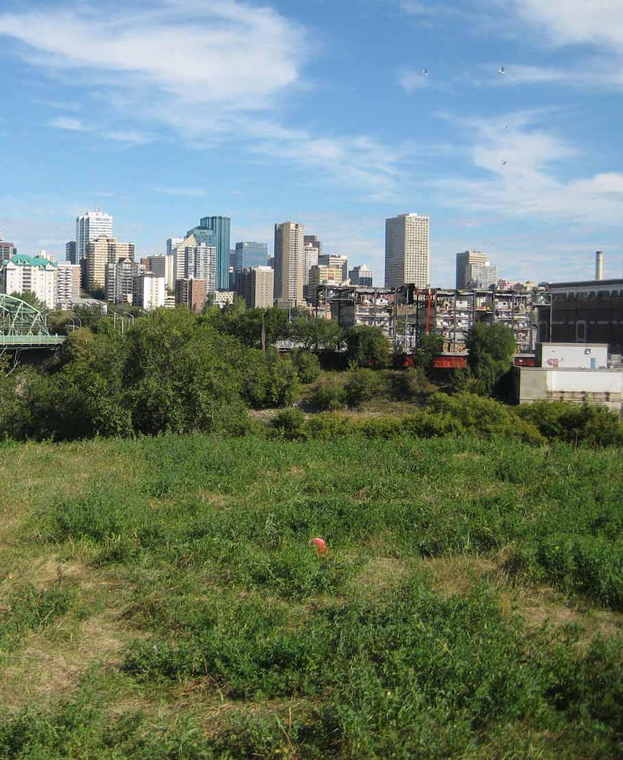
7 Queen Elizabeth Park Master Plan City of Edmonton Guiding principles 1. The park is accessible for Pedestrians and cyclists Create a universally-accessible trail into and through the park that connects pedestrians and cyclists to downtown Identify and enhance key entry points into the park 2. The pedestrian and cyclist Pathway network is well-connected Improve east-west and north-south multi-use trails through the park Improve accessibility of trails throughout the park Improve pedestrian crossing at Queen Elizabeth Park Rd Clarify organization of unimproved trail network for use by hikers, trail runners and/or bikers Increase trail network legibility through signage and wayfinding. Design the path network to encourage good trail etiquette and to reduce conflict between different user groups. 3. There is a hierarchy of active and passive spaces for year-round use Create spaces that allow for a range of activities in the park, from quiet intimate spaces to larger group gatherings or small events Enhance year-round programming, including new or improved summer activities (children s play, mountain bike skills, picnicking, ethnobotanical gardens, small event space) and winter activities (e.g. snowshoeing, cross-country skiing, tobogganing) Explore the use of mountain biking skills features and/or skills park Provide program opportunities for all ages, particularly children 5. Important places are identified within the Park for site stories and viewpoints Identify important places for interpreting the cultural and natural history of the site Maintain and enhance key viewpoints to the river valley and downtown skyline 6. The ecological character of the park is celebrated and enhanced Enhance opportunities for wildlife watching and nature interpretation Identify areas for enhancing forest and wetland ecology and wildlife habitat opportunities Minimize disturbance to forest ecosystem during new trail or amenity development 7. Opportunities are provided to experience the river s Edge Create an accessible path that allows park visitors to get close to the river Improve conditions along the shoreline Explore ways to engage people with the river 8. THE park provides a GATEWAY EXPERIENCE INTO THE DOWNTOWN CORE Build on the gateway function of the new Walterdale Bridge by enhancing the experience of travelling downtown along Queen Elizabeth Park Road. 4. Amenities are provided to support user comfort Enhance washroom facilities and/or access to washrooms through improved signage and wayfinding Improve sense of park safety through lighting and/or other design features Provide additional site amenities such as drinking water, seating, and/or waste bins
8 4 Programming needs assessment New Program ideas for queen Elizabeth park The public consultation workshops and online survey generated several ideas for new programs and/or amenities in Queen Elizabeth Park. New or enhanced program ideas that were mentioned included: Mountain bike skills facility / trails Non-motorized boat launch Improved river access Enhanced winter activities, including cross-country skiing, snowshoeing, tobogganing opportunities Educational opportunities (school programs, general interpretation, guided walks) Pavilion / shelter for group gatherings (possibly yearround) Enhanced ecology and wildlife habitat Splash park Natural playground Disc (frisbee) golf Expanded picnicking amenities Bird watching Identification of edible plants / ethnobotanical garden Amphitheatre Staging area for small events Food production-related programming, including community gardens, orchard, and an edible forest garden Improved lighting and safety Infrastructure to support skateboarding / long boarding Suitability analysis of existing programs at queen Elizabeth park The table on the opposite page outlines the current programs and activities in Queen Elizabeth Park and indicates their general program requirements, the extent of existing services or facilities in the park, how suitable the activity is for the park, and what opportunities exist for the program in the future. Suitability analysis of potential new programs The table on page 5 provides a suitability analysis of potential new programs identified for Queen Elizabeth Park based on the ideas suggested above. The table summarizes the general requirements for new programs, their desirable site conditions, their suitability for Queen Elizabeth Park, and whether the program is accommodated at a river valley park within 10km. Two important recommendations to change pedestrian access were identified: Creation of an accessible trail into the park from Saskatchewan Drive Creation of a safer pedestrian connection between the upper and lower park areas (across Queen Elizabeth Park Road)
9 Queen Elizabeth Park Master Plan City of Edmonton Suitability analysis of Existing programs at Queen Elizabeth Park Current Programs / Activities walking / running (paved trails) Hiking / trail running (unpaved/ unimproved trails) COMMUTER AND RECREATIONAL CYCLING (paved TRAILS) Mountain biking (unpaved/ unimproved trails) General program requirements Paved trail with accessible grades, well-connected Variety of trail experiences and terrain characteristics. Trail guidelines or design features should be used to reduce conflict between different user groups by providing networks that adequately support desired circulation patterns and demand and encourage trail etiquette. Paved trail with accessible grades, well-connected Variety of trail experiences and terrain characteristics. Trail guidelines or design features should be used to reduce conflict between different user groups. Existing services / facilities at Queen Elizabeth park Major east-west multiuse paved trail, stair access to Saskatchewan Drive. There is a network of unofficial single-track trails throughout the upper and lower parks that are used for hiking, trail running, and mountain biking. Trails take advantage of the site s varying topography. Major east-west multiuse paved trail connects Nellie McClung Park (east) and Kinsmen Park (west). Access from Strathcona neighbourhood is difficult. There is no trail connection along Queen Elizabeth Park Rd. Access from Saskatchewan Dr. into the park is available from three staircases (one equipped with a ramp) and from 91st Ave, through the Lavigne area. There is a network of unofficial single-track trails throughout the upper and lower parks that are used for hiking, trail running, and mountain biking. Trails take advantage of the site s varying topography. Suitability of program for Queen Elizabeth park Walking / running is a popular activity in the park and is well-suited for Queen Elizabeth Park. New trail development should minimize disturbance to existing forest where possible. Hiking / trail running on unpaved/unimproved trails can be compatible with Queen Elizabeth Park. Trail design should be low-impact. The park s location is highly conducive to supporting commuting cyclists who travel between Strathcona and Downtown. New trail development should minimize disturbance to existing forest where possible. Mountain biking is a popular activity in the park and there appears to be a good degree of public support for the activity. Secondary / mountain bike trail design should be low impact to reduce erosion and tree damage. Opportunities for future park programming Users would benefit from universally-accessible trail connections to/from Saskatchewan Drive. Additional accessible trail connections can be added to improve circulation and park access. There is an opportunity to formalize the network of secondary trails and improve trail standards to reduce any negative impacts on the forest. There is an opportunity for better and safer north-south cycling routes through the park, particularly to support bike commuters who travel between Strathcona and Downtown. There is an opportunity to formalize the network of secondary trails and improve trail standards to reduce any negative impacts on the forest. Opportunities may exist to engage mountain biking clubs with trail building and stewardship.
10 6 Current Programs / Activities Picnicking Canada Day Fireworks Cross country mountain bike RACES Enjoying views of river valley and downtown tablelands green shack program (storage) General program requirements Formal picnic areas include picnic tables and fire barbecues. Some picnic sites should be wheelchair accessible. Informal picnic areas should be well drained and have appropriate surfacing (e.g. lawn). Waste bins and recycling bins could be situated nearby. Queen Elizabeth Park Road and Walterdale Hill Rd are closed from 9:35-10:45pm on July 1st for Canada Day fireworks. Loop track between Walterdale Br. and Old Timers Cabin primarily on single-track trails with a small portion of gravel trail, and along Lavigne Road/90 Ave. Start/ Finish on multi-use path northeast of washroom building. Vantage points and seating areas. Storage for green shacks (~10 x 10 ) outside of summer program season Existing services / facilities at Queen Elizabeth park Approx. 25 picnic sites, each equipped with picnic table and some have barbecue stands. Views of the river valley and downtown, spectators access site from all sides on foot when streets are closed to vehicular traffic Single track trails, multiuse trails, washrooms, parking for loading/ unloading team vehicles with tents/equipment. Participant parking in upper park. There are many informal viewpoints to the river valley and downtown from Saskatchewan Drive, Queen Elizabeth Park Road, and Dantzer s Hill. Formal views from Saskatchewan Drive entry points are partially obscured by forest green shacks are stored in the existing Queen Elizabeth Park Compound outside of the summer season (~150 to 250 m 2 ) Suitability of program for Queen Elizabeth park Picnicking is a well-loved activity that has a long tradition in the park, and there is an interest by the public in doing more picnicking in the park. Picnicking is a low impact activity that is well-suited to happen in its existing location. Park has ample capacity and open spaces with views of fireworks and is a popular place to watch them from Bike races utilize existing linear single track trail system for 1-3 events per year. Some disturbance to regular park users during race events due to increased traffic and restricted trail use. Formal and informal view points with seating are highly suitable for Queen Elizabeth Park. Green shacks are not used for programming in Queen Elizabeth Park. The park does offer a desirable central location for Parks storage, however this may not be the best use of Queen Elizabeth Park. Opportunities for future park programming There may be opportunities to increase the number of picnic areas, and/or to diversify the areas available for picnicking. There is an opportunity to improve the quality and flexibility of open space with unobstructed views of the river valley and downtown By ensuring that sufficient circulation options are provided, inconvenience to regular park users during race events may be reduced. Trails, seating nodes and viewpoints within the park and along Saskatchewan Dr. can be developed to take advantage of viewpoints to the river valley and downtown. Since green shacks serve tablelands parks programming, it has been suggested that the storage of green shacks might be more suitable on tablelands.
11 Queen Elizabeth Park Master Plan City of Edmonton Current Programs / Activities boat storage River Valley Programming (Archery, Low Ropes) General program requirements Large, flat area that is accessible by vehicle for transportation to and from a boat launch. Desirable to be close to a boat launch location. Secured area to reduce theft and vandalism. Archery requires a clear, flat area with controlled access to ensure public safety. Area behind archery targets requires man-made or natural barricade or backing. Low ropes course requires a group of spaced posts, connected with ropes. Designated drop-off and parking for school buses with trail connections to program area, within a walkable distance. Spaces designed/ designated for children to play, buffered from traffic, easily accessible, variety of play opportunities with consideration for all ages and abilities Existing services / facilities at Queen Elizabeth park Ceyana Canoe Club and Edmonton Dragon boat Festival Association have license agreements with the City to accommodate boat storage. Ceyana Canoe Club license area includes a 2-bay garage. Located within a fenced compound approximately 1 ha in size. Two Green Shacks for storage - one for each program. Suitability of program for Queen Elizabeth park Boat storage occurs at Queen Elizabeth Park due to the park s central location, although the boats are not used for programming in the park. Ideally boat storage is located within the vicinity of launch sites. New Walterdale Bridge development requires realignment of existing access road. Potential for vehicular/pedestrian conflict depending on alternative new access road development. Brings approximately 4000 youth to the park annually for outdoor team-building activities Opportunities for future park programming The steep riverbank at Queen Elizabeth Park hinders access. A number of physical changes to the riverbank have happened in the last 20 years which have hindered the development of a permanent hand launch or dock. Ideally boat storage is accommodated in areas with unhindered vehicular access and in proximity to launch sites. Potential to relocate the facilities to a location in the park with nicer surroundings that is more integrated with other uses in the park. Playground Small, dated playground near east end of park, forests and open grass areas Potential to increase opportunities for play and other physical activity for all ages and in all seasons Enhanced spaces that support children s cognitive, social and motor skills development should be well-integrated throughout the park.
12 8 Suitability analysis of potential new programs This table summarizes the general requirements for new programs, their desirable site conditions, their suitability for Queen Elizabeth Park, and whether the program is at any river valley parks within 10km of Queen Elizabeth Park. New Program / activity ideas General program requirements Desirable Site Conditions Suitability of program for Queen Elizabeth park Nearby parks with similar program Festivals / Large Events free ride skills trails Mountain bike skills facility Non-motorized boat launch Flexible open space. Service road access for the delivery and removal of event equipment (i.e. tents, tables, chairs, stage, etc.) The size of events in parks is dependent on the space and amenities available. Variety of riding experiences, some areas of challenging terrain, challenge structures, features to keep users in designated areas / on designated trails. Variety of riding experiences, including terrain, challenge structures and features to keep users in designated areas. Vehicular access and parking close to boat launch, cleared shoreline area with stabilized ground. Buffered from traffic, picnic tables, seating and fire BBQs, a drinking fountain with a source of potable water (hose bib), washrooms, emergency BluFone, a 220V power source that can be fitted with a step-down to 110V, parking within a comfortable walk, wheelchair parking close by. Stable soils, welldrained conditions, not in areas of sensitive vegetation / habitat areas. Located on a previouslydisturbed site with access for mountain bikers and spectators. Gentle shoreline grades, previously-disturbed shoreline conditions away from sensitive vegetation / habitat areas. Small to medium sized events could work well in the park depending on the flexible open space available. The largest events are more appropriate elsewhere. Unofficial single track trails already exist at Queen Elizabeth Park and are used by mountain bikers. Formalizing trails may help to protect topography and vegetation. Steep terrain may be easily erodible, particularly in the eastern parts of the park. Vegetation should be protected. Queen Elizabeth Park s central location is popular amongst mountain bikers. Several potential locations exist in the park. More research is required to determine if a skills park is wellsuited to the park. The shoreline near the new Walterdale Bridge could potentially be designed to allow for a boat hand launch. However, distance to carry boats may detract. Gallagher Park Hawrelak Park Louise McKinney Park Multi-use and a network of single track trails connect the river valley park system. There is no formal mountain bike skills park within the river valley or, at present, within the City. Emily Murphy Park Louise McKinney Riverfront Park Henrietta Miur Park
13 Queen Elizabeth Park Master Plan City of Edmonton New Program / activity ideas Improved river access General program requirements River access points can be informal (e.g. open shoreline area, gentle grades, stable ground) or formal (e.g. floating or fixed dock) Desirable Site Conditions Gentle shoreline grades, previously-disturbed shoreline conditions away from sensitive vegetation / habitat areas. Suitability of program for Queen Elizabeth park Queen Elizabeth Park currently has some areas that offer informal access to the river. Nearby parks with similar program Emily Murphy Park (informal) Louise McKinney Riverfront Park (formal) Kinsmen Park (informal) Henrietta Miur Park (formal and informal) Cross-country skiing Snowshoeing Tobogganing Skating School programs, guided walks Enhanced ecology and wildlife habitat Looping trails of a variety of lengths / that connect to other ski trails, groomed trails. Ski trails should be separate from multi-use trails that are cleared of snow in the winter. Un-plowed, snow covered areas Steeply sloping grass areas with clear, flat landing area at bottom Flat open area or wide path that can be surfaced with ice. A skating path should be complementary to existing, cleared path network in winter. Drop-off / Pick-up location for school buses Existing areas where interventions can have a positive effect on restoring and enhancing existing ecology and wildlife habitat Relatively gentle grades, north facing or shaded areas extend available ski season. Gentle or steep grades, north facing or shaded areas extend snowshoeing season. Areas to rest that are protected from wind. Buffered from traffic, north facing aspect to hold snow longer without melting, pedestrian trail access nearby Flat, impervious surface, parking access, warmup amenities, skate change area. Diverse natural environments (topography, flora, fauna) with trail access Existing disturbed or degraded areas identified for enhancement Open spaces may be suitable. Grades may be too steep in several locations. Limited space for looped trails. Well suited to unmaintained and open areas. Low-impact on park. A good way to encourage winter use of the park and take advantage of the steep terrain and north-facing slopes. Space to warm up in nearby Kinsmen Sports Centre. Queen Elizabeth Park has some flat, shaded areas that may be amenable to a small skating rink or to the creation of a skating path. Queen Elizabeth Park has good access and parking for buses, central location and a range of opportunities to experience the river valley. Queen Elizabeth Park has large areas in a non-manicured state that are degraded or disturbed. Kinsmen Park has easy and moderate cross country ski trails. Formalized snowshoe programming at the John Janzen Nature Centre at Fort Edmonton Park. Informal snowshoeing opportunities available. Emily Murphy Park Gallagher Park Government House Park Whitemud Park Victoria Park outdoor skating oval Hawrelak Park Various (To be confirmed) Various restoration projects ongoing.
14 10 New Program / activity ideas Splash park Natural playground Disc (frisbee) golf Ethnobotanical garden Amphitheatre Food production, including community gardens, orchard, edible forest garden General program requirements A high visibility location with convenient access Environments that provide opportunities for open-ended play and interaction with nature. Targets, tee pads signage, topography and safety Indigenous and culturally-significant plant species with traditional uses as medicines, food, or as materials for fabrication or ceremonial purposes A natural formation shaped into a semicircular tiered seating area for viewing performances or other activities Depending on the program, requirements may include some or all of the following: sun, water, gardening tools, compost, passive surveillance, and a central, accessible location, community initiative to establish and maintain gardens. Desirable Site Conditions Existing infrastructure in place (water, sewer, parking) and complementary programming activities that support high attendance numbers. Buffered from traffic, central location with convenient access, trees, nearby neighbourhoods with families Under utilized parts of parks where possibility of points of interaction with non-players is minimized. Vegetated areas near pedestrian paths to provide opportunities for interpretation. Semi-circular tiered slope with an interesting background view. Varies depending on program. Suitability of program for Queen Elizabeth park Not well suited to Queen Elizabeth Park Lots of existing trees and forested areas, topography, views, picnic areas, multi-use paths and history as a family destination. Potential to enhance play opportunities in all seasons. The areas of the park most suited for disc golf are also those most suited to other activities, potentially leading to conflict and safety concerns between user groups. As traditional territory of the Cree and Blackfoot First Nation, the park is in a culturally significant area of the river valley. An ethnobotanical garden is an appropriate way of acknowledging the history of the site and the Aboriginal use of native plants. The regrading of Dantzer s Hill for the construction of the new Walterdale Bridge provides an opportunity for shaping the space into an amphitheatre City policy does not currently allow food production to take place in the river valley. Nearby parks with similar program Kinsmen Park None known Rundle Park None known Hawrelak Park Various community gardens located in neighbourhood parks (non-river valley) i.e. Strathcona Rail (105th St between 85th and 86th Ave)
15 Queen Elizabeth Park Master Plan City of Edmonton Inventory of amenities and programs at nearby parks Nearby river valley parks / APPROX. Driving distance from Queen Elizabeth Park Improved trails Unimproved trails Picnic sites winterized washrooms Hand boat launch Play area tobogganing xc skiing Snowshoeing Ice skating Sports fields Pool / spray park Covered group / picnic shelter Queen Elizabeth park Concession bldg Informal open space River access OTHER Unofficial skiing / snowshoeing / tobogganing / river access KINSMEN PARK (<500 m) Pitch and Putt, museum NELLIE MCCLUNG PARK (<500 M) MILL CREEK RAVINE PARK (1 KM) VICTORIA PARK (3 KM) EMILY MURPHY PARK (3 KM) HENRIETTA MUIR EDWARDS PARK / gallagher park (3 KM) hawrelak park (4 KM) Government house park (4 km) LOUISE MCKINNEY PARK (4 KM) Golf course adjacent, ball diamond, pitch and putt, cricket oval, horseshoes, pavilion planned, six reservable group picnic sites Two reservable group picnic sites Muttart Conservatory, Edmonton ski club, Riverboat launch, festival site Golf course adjacent, paddle boating, amphitheatre, five reservable group picnic sites, festival site Public dock, performance stage, riverfront plaza with future amenities / concession planned whitemud park (5 KM) Equestrian centre and trails Fort Edmonton park (6 KM) buena vista / wilfrid laurier parks (10 KM) Paid admission required for museum facilities Trailered boat launch, fishing area, horseshoe pits, picnic site reservations available
16 Queen Elizabeth Park Master Plan City of Edmonton
17 Queen Elizabeth Park Master Plan City of Edmonton Preliminary design concepts Two preliminary design concepts were developed for Queen Elizabeth Park based on information gathered in the DISCOVER phase, and based on the park vision, mission and guiding principles that were derived from this information. Public review and input on these concepts will inform the selection of a preferred approach for the park master plan.
18 14 Concept 1: Tranquil riverfront OVERALL INTENT The overall intent of Concept 1 is to create a quiet, natural setting close to the river s edge, where people can enjoy informal recreation in the large open field, or discover traditional uses of native plants at the ethnobotanical garden. The field and adjacent slope can also accommodate the occasional small event and winter activities. More active uses (bike skills area, river valley programming) are placed in the upper park by the old Queen Elizabeth Pool and picnic area, where they are easily accessed by existing parking and a new path along Fort Hill Road. KEY FEATURES OF CONCEPT 1 Park access New multi-use trail along Fort Hill Road, beneath Saskatchewan Drive. This route would be quite steep (15% slope) but would not require stairs. Potential new multi-use trail along Queen Elizabeth Park Road with moderate grades (8% slope). This path would require rebuilding part of Queen Elizabeth Park Road, which would impact adjacent slopes and vegetation. Treatment of Dantzer s Hill New large open field to accommodate a range of activities year-round. A slope connects the south end of the field to Queen Elizabeth Park Road, providing a lookout point and tobogganing hill in the winter. Bike skills area New bike skills area in the upper park at the site of the old Queen Elizabeth Pool. This site would have convenient access from the existing parking lot and, as a previously developed site, it avoids new disturbance to natural areas. Single track trails New single track trails are built and existing trails are upgraded in the upper park. The primary single track trails are kept in the lower park, but others are closed and naturalized. River BANK The single-track trail is retained and a new lookout is created. Interpretive elements are provided to identify stories about wildlife and their habitat. The natural conditions of the river bank are enhanced. Ethnobotanical plantings Ethnobotanical plantings (e.g. native species traditionally used by First Nations) are established at the site of the old wastewater treatment plant and storage compound. Some interesting ruins of the wastewater treatment plant will be left to tell the industrial history of the area. New multi-use trails + Trail connections New multi-use trail along the lower half of Queen Elizabeth Road to improve north-south pedestrian movement. A trail connection between the existing access road and picnic area is made using stairs and ramps. Potential new multi-use trail along Queen Elizabeth Park Road (Refer to Park Access) River valley programming River Valley Programming is relocated to the upper park, where it can take advantage of the existing parking lot and the existing wall of the O Keefe Yard for archery. Common FEATURES in Concept 1 and Concept 2 Improved pedestrian crossing mid-way down Queen Elizabeth Park Road Expanded multi-use trail network throughout the park. Improved quality, location, design and construction of single track trails to minimize impact on natural areas. New lookouts and improvements to existing lookouts to provide views of downtown and the river valley. Enhanced play area to provide a wider variety of play experiences. Enhanced picnic areas. Improved habitat and ecological health of the forest and river s edge. Removing the wastewater treatment plant, cleaning up the site and leaving some ruins that can be interpreted as reminders of the site s industrial history. New service road built as part of the new Walterdale Bridge project. This road will be a shared route for pedestrians, cyclists and service vehicles (no public vehicle access).


 * New service road (part of Walterdale")


19 Enhanced natural condition of river bank with single track trail and new lookout Existing condition Important node in park va Hill with lookouts, tobogganing in winter Ethnobotanical plantings among ruins from old wastewater treatment plant North Saskatchewan River Flexible open space for year-round small events, festivals, informal sports Existing Walterdale Bridge New Walterdale Bridge Rossdale New trail / stair access between picnic area and existing service road Kinsmen Park Public art (part of Walterdale Bridge project) * New service road (part of Walterdale Bridge project) Existing pump house Existing condition Existing, treacherous, single track trail is closed, forest restored Lookout Kinsmen Sports Centre Additional / improved single track trails in shaded areas New lookout opportunity 109 St Improved multiuse trail along Saskatchewan Drive Walterdale Hill Rd Improved pedestrian and cycling access along Fort Hill Road River Valley Programming Fort Hill Rd Rebuilt lookout O Keefe Site 106 St Bike skills area Queen Elizabeth Park Rd Lookouts Existing stairs Enhanced picnic areas Improved parking Saskatchewan Drive 105 St Relocated and improved pedestrian crossing 104 St Upgraded Washrooms Existing stairs Gateway Blvd Enhanced lookout Enhanced entry experience Lavigne Neighbourhood Existing stairs Potential for multi-use trail along existing roadway Enhanced picnic areas Existing park road shared by vehicles, pedestrians and cyclists Enhanced and expanded play area Existing condition Queen Elizabeth Park Concept 1: Tranquil Riverfront 1:1500 METRES N CIRCULATION LEGEND Single-track trails Multi-use trails, paved Shared trail / road Roadway
20 16 Concept 2: Vibrant riverfront OVERALL INTENT The overall intent of Concept 2 is to create a vibrant riverfront by improving connections into the lower park and creating destination activities near the river bank. A northsouth multi-use trail will lead visitors through the park from Saskatchewan Drive, connecting the upper and lower parks with an attractive pedestrian overpass and bold landform. A river access point is created near the new Walterdale bridge, and a new bike skills area is integrated with ruins from the old wastewater treatment plant by the river bank. KEY FEATURES OF CONCEPT 2 Park access New multi-use trail access into the park from Saskatchewan Drive (near old Queen Elizabeth Pool). This route would have a moderate slope (8%), and would involve regrading the south side of the O Keefe site (some tree removal). Upgrade existing trail into the park from the existing stairs east of the hairpin turn onto Queen Elizabeth Park Road. Pedestrian crossing over Queen Elizabeth Park Road Accessible and attractive pedestrian overpass connecting the upper park and lower park over Queen Elizabeth Park Road. Treatment of Dantzer s Hill A large mound provides opportunities for elevated lookouts and tobogganing in the winter. The mound also provides a landing for the proposed pedestrian overpass. A smaller open field next to the mound can accommodate a wide range of activities. An east-west trail connects Kinsmen Park with the new bike skills area. Bike skills area A bike skills area in the lower park at the site of the old wastewater treatment plant and storage compound. A bike park in this location could be integrated with ruins of the waste water treatment plant and would be less prominent in the park, but easily accessed by people using the river valley trail system. Single track trails New single track trails and upgraded existing trails in the lower park, around the old wastewater treatment plant and pump house. Closure and naturalization of all but the primary single track trails in the upper park. River BANK New access to the river s edge next to the new Walterdale bridge, with a path, seating, interpretive elements, and water access. Enhanced natural condition of the adjacent river s edge to the east. New multi-use trails + Trail connections From the new park access point (from Saskatchewan Drive), a multi-use trail would continue through the park to form a strong north-south axis. A multi-use trail connection near the new bike skills area improves access to the existing service road. Potential new trail into the park from the existing stairs east of Queen Elizabeth Park Road. River valley programming River Valley Programming is relocated to the east side of the existing pump house, where it can be accessed by the service road. Common FEATURES in Concept 1 and Concept 2 Improved pedestrian crossing mid-way down Queen Elizabeth Park Road Expanded multi-use trail network throughout the park. Improved quality, location, design and construction of single track trails to minimize impact on natural areas. New lookouts and improvements to existing lookouts to provide views of downtown and the river valley. Enhanced play area to provide a wider variety of play experiences. Enhanced picnic areas. Improved habitat and ecological health of the forest and river s edge. Removing the wastewater treatment plant, cleaning up the site and leaving some ruins that can be interpreted as reminders of the site s industrial history. New service road built as part of the new Walterdale Bridge project. This road will be a shared route for pedestrians, cyclists and service vehicles (no public vehicle access).


 *")
 Existing pump house")


21 Flexible open space for year-round small events, festivals, informal sports River access / viewpoint Important node in park Bike skills area River Valley Programming Large mound with lookouts, tobogganing in winter North Saskatchewan River Existing Walterdale Bridge Enhanced natural condition of river bank Additional / improved single track trails in shaded areas New Walterdale Bridge Rossdale Pedestrian overpass Kinsmen Park Public art (part of Walterdale Bridge project) * New service road (part of Walterdale Bridge project) Existing pump house Existing condition Existing, treacherous, single track trail is closed, forest restored Kinsmen Sports Centre Lookouts Lavigne Neighbourhood 109 St Walterdale Hill Rd Fort Hill Rd 106 St O Keefe Site Queen Elizabeth Park Rd Enhanced picnic areas and ethnobotanical plantings New / enhanced picnic areas 107 St Enhanced picnic areas Existing stairs Improved parking Saskatchewan Drive 105 St 104 St Upgraded Washrooms Existing stairs Gateway Blvd Existing stairs Additional parking (stalls / parallel) Existing park road shared by vehicles, pedestrians and cyclists Enhanced and expanded play area New lookout opportunity Improved multiuse trail along Saskatchewan Dr. Lookout opportunity from Duggan Bridge Rebuilt lookout New multi-use trail / entry Relocated and improved pedestrian crossing Enhanced lookout Enhanced entry experience Potential to upgrade existing trail (requires stair access) Existing condition Existing condition Queen Elizabeth Park Concept 2: Vibrant Riverfront 1:1500 METRES CIRCULATION LEGEND Single-track trails Multi-use trails, paved N Shared trail / road Roadway
22 18
23 Queen Elizabeth Park Master Plan City of Edmonton Features unique to each Concept Feature Concept 1 Concept 2 Park access Pedestrian Crossing over Queen Elizabeth Park Road Treatment of Dantzer s Hill River bank Bike Skills Area Single-Track Trails New multi-use trail along Fort Hill Road (below Saskatchewan Drive). Potential new multi-use trail along Queen Elizabeth Park Road. Small slope (lookouts, tobogganing hill) connecting Queen Elizabeth Park Road to a large open field The single-track trail is retained and a new lookout and interpretation opportunities are provided. No official river access area. Situated in upper park, at site of old Queen Elizabeth Pool. Access to Strathcona neighbourhood and nearby parking. Single-track trails upgraded and expanded in upper park. All but primary single-track trails in lower park are closed and naturalized. Accessible multi-use trail entry from Saskatchewan Drive to the old Queen Elizabeth Pool site which continues through the park to form a strong north-south multi-use axis. Upgrade existing trail into the park from the existing stairs east of the hairpin turn onto Queen Elizabeth Park Road. Multi-use trail overpass over Queen Elizabeth Park Road. Large mound (landmark, lookout point, tobogganing hill) and open field for flexible programming in the area currently occupied by Dantzer s Hill. An east-west trail across the field connects Kinsmen Park to the new bike skills area. River access is provided next to the new Walterdale Bridge, allowing people to get down to the water s edge. The single-track trail is upgraded to a more defined trail, with seating, and interpretation opportunities provided. Situated in lower park at site of former wastewater treatment plant and storage compound. Bike skills area incorporates ruins from old wastewater treatment plant. Distance from parking. Single-track trails upgraded and expanded in lower park. All but primary single-track trails in upper park are closed and naturalized. Multi-use Trails and Trail Connections Ethnobotanical plantings New multi-use trail along the lower half of Queen Elizabeth Park Road. Potential new multi-use trail along upper half of Queen Elizabeth Park Road. New connection between picnic area and existing service road using combination of stairs and ramps. Dedicated area for ethnobotanical plantings in the lower park, with ruins from old wastewater treatment plant. Accessible multi-use trail north-south from Saskatchewan Drive to the new Walterdale Bridge via overpass. Multi-use trail connection near the new bike skills area for improved access to the river bank. East-west trail across new field. No dedicated area for ethnobotanical plantings; plantings incorporated throughout park. River Valley Programming Relocated to upper park, next to the old Queen Elizabeth Pool. Kept in lower park, but moved east of its current location.
24 20 Winter Activities Winter in queen Elizabeth park Both conceptual designs for Queen Elizabeth Park allow for a variety of winter activities. Fill will be removed from Dantzer s Hill as part of the new Walterdale Bridge project, thereby creating the opportunity to re-grade this area into one of Edmonton s best hills for tobogganing and other downhill uses (e.g. snow slide, snow scooters). In Concept 1 this hill is of a moderate size, while Concept 2 envisions it to be a larger, bolder mound feature that is linked to the pedestrian overpass. The hill would also provide good vantage points toward Edmonton s winter skyline and snowy river valley. Wintercity strategy incorporation The City of Edmonton is currently developing a WinterCity Strategy as a tool to help make Edmonton known worldwide as a vibrant, fun, northern city. The City has been soliciting ideas for winter programming from the public and over 400 ideas have been submitted. A draft WinterCity Strategy is scheduled for release in Summer New accessible paved paths are proposed to lead into the park from Saskatchewan Drive. These will be cleared of snow in the winter, thereby facilitating year-round access into the river valley. A network of cleared, paved paths will allow visitors to travel through the park and to adjacent parks and facilities (e.g. to Kinsmen Sports Centre) throughout the winter. Unpaved paths and single-track trails will not be cleared in the winter, allowing these areas to be used for snowshoeing, winter hiking, and winter mountain biking when conditions allow. Clearings within the park can be programmed for a wide variety of winter activities. The large open field north of the tobogganing hill has the potential to be a prominent location in the river valley for winter festivals and snow structures (e.g. snow forts, wind barriers, ice climbing walls, snow mounds). Smaller clearings in the picnic areas could be equipped with portable gas fire pits, year-round barbeques, and temporary winter warming huts. More detailed design can ensure that sun, shadow, wind, and snow are considered to create comfortable outdoor microclimates. For special events, food trucks could be brought in to sell hot drinks and food, and affordable winter equipment rentals could be provided (e.g. snowshoes, toboggans) to help visitors fully enjoy the park in winter. Interesting lighting can be incorporated into seating, paths, structures (e.g. pedestrian overpass) and other elements to enliven these spaces and extend their usability past daylight hours. Interpretation of the site could incorporate messaging that speaks to winter activities (e.g. winter wildlife) and cultural traditions for living in a cold climate.
25 Queen Elizabeth Park Master Plan City of Edmonton Paved paths to be kept clear of snow in winter Flexible winter activity space potential for festivals, snow structures, creative lighting, outdoor fire pits Small toboggan hill Year-round barbeque pits in picnic areas Accessible, cleared entry route into park along Fort Hill Rd Unpaved paths and single-track trails can be used for snowshoeing CONCEPT 1 WITH WINTER ACTIVITIES OVERLAY Potential accessible, cleared entry route into park along QE Park Road N 100M Paved paths to be kept clear of snow in winter Flexible winter activity space potential for festivals, snow structures, creative lighting, outdoor fire pits Large tobogganing mound / winter slide Year-round barbeque pits in picnic areas Accessible, cleared entry route into park Unpaved paths and single-track trails can be used for snowshoeing CONCEPT 2 WITH WINTER ACTIVITIES OVERLAY N 100M
Queen Elizabeth Park Master Plan City of Edmonton 2013
 Queen Elizabeth Park Master Plan City of Edmonton 2013 55 04 Core design strategies 56 4.1 Vision, mission and guiding principles Queen Elizabeth Park s vision statement describes a desired future state
RIVER ACCESS STRATEGY
 RIVER ACCESS STRATEGY The River Access Strategy is a 10-year plan the City of Edmonton is developing to inform future programming, operations and infrastructure improvements that support access to the
Welcome to the future of Terwillegar Park a Unique Natural Park
 Welcome to the future of Terwillegar Park a Unique Natural Park 1 Introduction The Terwillegar Park Concept Plan study will develop an overall concept plan, management objectives and development guidelines
BOAT DOCKS AND LAUNCHES. Public Engagement Report July 2015
 BOAT DOCKS AND LAUNCHES Public Engagement Report July 2015 TABLE OF CONTENTS BACKGROUND 3 STAKEHOLDER CONSULTATION 6 PARTICIPANT PROFILE 7 RESPONSE THEMES 8 CONCLUSION 16 BACKGROUND The North Saskatchewan
Preferred Recreation Recommendations Stemilt-Squilchuck Recreation Plan March 2018
 Preferred Recreation Recommendations Stemilt-Squilchuck Recreation Plan March 2018 Below are the recommended recreation ideas and strategies that package together the various recreation concepts compiled
Lake Waconia Regional Park 6. Lake Waconia Regional Park
 Lower Lakeshore Trail Interpretive/Adventure Trail Multiple Seating & Observation Areas Flexible Day Use Recreation Area Docks/Fishing Group Camping Group Day Use Space Winter Gathering/Event Space -Season
NORTHWEST SECTION CONTENTS: CLEVELAND PARK FOLWELL PARK RYAN LAKE PARK VICTORY PRAIRIE DOG PARK VICTORY PARK
 NORTHWEST SECTION CONTENTS: CLEVELAND PARK FOLWELL PARK RYAN LAKE PARK VICTORY PRAIRIE DOG PARK VICTORY PARK LUCY LANEY COMMUNITY SCHOOL N 33RD AVE N 33RD AVE SINGLE-FAMILY RESIDENTIAL MULTI-USE DIAMOND
Proposal to Redevelop Lower Kananaskis River-Barrier Lake. Bow Valley Provincial Park
 Frequently Asked Questions Proposal to Redevelop Lower Kananaskis River-Barrier Lake Bow Valley Provincial Park Frequently Asked Questions What has been decided? What are the details of the plan? What
Logo Department Name Agency Organization Organization Address Information 5700 North Sabino Canyon Road
 Logo Department Name Agency Organization Organization Address Information United States Forest Coronado National Forest 5700 North Sabino Canyon Road Department of Service Santa Catalina Ranger District
Wilds. Headwaters. Lakes. Oxbows. Falls
 56 5 4 3 Wilds Headwaters Lakes Oxbows Falls 57 Zones It could be said the on-the-ground essence of this master plan appears within the next 6 pages of this report. As we learned in the preceding Cultural
Proposal to Redevelop Lower Kananaskis River-Barrier Lake. Bow Valley Provincial Park. Frequently Asked Questions
 Proposal to Redevelop Lower Kananaskis River-Barrier Lake Bow Valley Provincial Park Frequently Asked Questions What is being proposed? What are the details of the proposal? Where is the project area located?
Lake Myra County Park. Wake County, North Carolina Community Forum #2 June 12, 2008
 Lake Myra County Park Wake County, North Carolina Community Forum #2 June 12, 2008 Welcome and Introduction Meeting Agenda Welcome Introductions of Project Team Master Plan Process Community Forum #1 Updates
MASTER PLAN EXECUTIVE SUMMARY
 Biscuit Run State Park Scottsville Road (State Route 20) Charlottesville, VA 22902 Biscuit Run State Park MASTER PLAN EXECUTIVE SUMMARY Department of Conservation and Recreation Division of Planning and
2. Goals and Policies. The following are the adopted Parks and Trails Goals for Stillwater Township:
 D. PARKS AND TRAILS 1. Introduction Stillwater Township s population is relatively low, with most residents living on rural residences on large lots. The need for active park space has been minimal in
Land Management Summary
 photo credit: ANGAIR Anglesea Heath Land Management Summary The Anglesea Heath (6,501 ha) was incorporated into the Great Otway National Park in January 2018. This provides an opportunity to consider the
CHAPTER 5. Chapter 5 Recreation Element
 CHAPTER 5 Recreation Element Chapter 5 Recreation Element The Recreation Element of the Meyers Area Plan is a supplement to the Recreation Element of the TRPA Regional Plan and the El Dorado County General
The Vision for the San Juan Islands Scenic Byway
 The Vision for the San Juan Islands Scenic Byway 2 Judd Cove, Orcas Island, Courtesy of Kurt Thorson (kurtthorson.com) and San Juan County Land Bank Vision for the San Juan Islands Scenic Byway The San
Appendix A BC Provincial Parks System Goals
 Appendix A BC Provincial Parks System Goals The British Columbia Provincial Parks System has two mandates: To conserve significant and representative natural and cultural resources To provide a wide variety
Committee. Presentation Outline
 CW-33-15 11/9/2015 Community and Corporate Services Committee November 10, 2015 1 Presentation Outline Background Vision and Objectives Study Process and Timeline Public and Stakeholder Engagement Organization
EAST DON TRAIL ENVIRONMENTAL ASSESSMENT. Community Liaison Committee Meeting #3 July 15, :30 to 8:30 pm Flemingdon Park Library
 EAST DON TRAIL ENVIRONMENTAL ASSESSMENT Community Liaison Committee Meeting #3 July 15, 2013 6:30 to 8:30 pm Flemingdon Park Library Agenda 1. Welcome 2. Housekeeping and Updates a) Housekeeping b) CLC
BACK COUNTRY UNIT PREFERRED ALTERNATIVE
 BACK COUNTRY UNIT PREFERRED ALTERNATIVE San Francisco (118 mi) Carmel-By-The-Sea Carmel River Carmel Valley Road State Beach Private Property Point Lobos State Reserve Point Lobos Ranch RUSTIC CAMPING
NEWBORO AND PORTLAND HARBOUR REDVELOPMENT PLANS
 INTRODUCTION The Municipal docks in both Newboro and Portland were transferred to the Township of Rideau Lakes by Parks Canada in 2002. Little has been done to improve the docks physical condition or role
Understanding the caring capacity of the visitor experience Provide facilities to support a high level user experience Address visual quality through
 Understanding the caring capacity of the visitor experience Provide facilities to support a high level user experience Address visual quality through recreation ecological restoration opportunities Collaboration
China Creek North Park Upgrades and Glen Pump Station. Park Board Committee Meeting Monday, July 10, 2017
 China Creek North Park Upgrades and Glen Pump Station Park Board Committee Meeting Monday, July 10, 2017 Purpose The purpose of this presentation is to: Share the results of the public engagement processes;
M E S T I Z O C U R T I S P A R K
 ARAPAHOE CONNECTION TO BUS ROUTE AT ND AND LAWRENCE, FUTURE LIGHT RAIL STATION LEGEND SOCIAL TRAIL FLAGSTONE PAVING TO RESTORE/MAINTAIN CONCRETE PAVING DIAGONAL CURVILINEAR SOCIAL ROUTE IS OUT OF HISTORIC
Silver Lake Park An Environmental Jewel for the Citizens of Prince William County
 Silver Lake Park An Environmental Jewel for the Citizens of Prince William County The Prince William Park Authority Mission Statement states: The Prince William County Park Authority will create quality
Mt. Hood National Forest
 United States Department of Agriculture Forest Service Mt. Hood National Forest Zigzag Ranger District 70220 E. Highway 26 Zigzag, OR 97049 503-622-3191 Fax: 503-622-5622 File Code: 1950-1 Date: June 29,
Waterfront Concept Plan: Community Survey Summary
 Waterfront Concept Plan: Community Survey Summary Published April 20, 2016 #1100085 Introduction The survey was one component of the public consultation process endorsed by Council in October, 2015. This
CRANE LAKE TRAILS NETWORK AND SPACES
 CRANE LAKE TRAILS NETWORK AND SPACES AREA TRAILS COMMUNITY TRAILS GOLD COAST TRAIL LAKE PARK OPTION ONE LAKE PARK OPTION TWO OVERFLOW TRAILHEAD PARKING THE GATE AREA TRAILS Trails are a major resource
Thank you for this second opportunity to comment on the proposed revisions to the Coconino National Forest Management plan.
 March 8, 2011 Flagstaff Biking Organization PO Box 23851 Flagstaff, AZ 86002 Yewah Lau Coconino National Forest Attn: Plan Revision 1824 South Thompson Street Flagstaff, Arizona 86001 Sent via electronic
Information Requests. Street Car Wildlife Golden Valley Leash Ordinance/Dog Park
 Information Requests Street Car Wildlife Golden Valley Leash Ordinance/Dog Park (How we got here!) 1980 Plan for Wirth Park (Designated Master Plan) Wirth Lake/Picnic Area designated as a general recreation
CONTENTS. 1 Introduction Always Moving Forward while Building on the Past A Dynamic Destination... 5
 2010 STRUCTURE PLAN - 2 - CONTENTS 1 Introduction... 5 1.1 Always Moving Forward while Building on the Past... 5 1.2 A Dynamic Destination... 5 2 Map A... 6 Exhibition Place and its Neighbours... 7 3 Demonstration
THAT the Board approve the final proposed concept plan for the Jericho Marginal Wharf site as shown in Figure C-4 of Appendix C.
 Date: January 17, 2012 TO: Board Members Vancouver Park Board FROM: General Manager Parks and Recreation SUBJECT: Jericho Marginal Wharf Phase 2 Concept Plan RECOMMENDATION THAT the Board approve the final
BRYAN REGIONAL PARK. Presented by: Burditt Consultants November 13, 2018
 BRYAN REGIONAL PARK Presented by: Burditt Consultants November 13, 2018 AGENDA 1. Project Purpose & Mission 2. Project Vision & Goals 3. Stakeholder Feedback 4. Program Overview 5. Phase A Plan Overview
Sibley LUPA. Board Executive Committee Meeting December 7, 2017
 Sibley LUPA Board Executive Committee Meeting December 7, 2017 Project Location & Project Area 1,318-acre Robert Sibley Volcanic Regional Preserve Project Area Purpose Project Purpose & Goals Append the
PROPOSED PARK ALTERNATIVES
 8 Chimne y Rock State Park M a ster Pl an 2011 PROPOSED PARK ALTERNATIVES Introduction Three different park development concepts were prepared and presented to the citizens of North Carolina through a
Mechanized River Valley Access Public Engagement Report. April 2015
 Mechanized River Valley Access Public Engagement Report April 2015 Table of Contents Background... 1 Stakeholder Consultation... 3 What We Heard... 4 Conclusion... 7 Background The North Saskatchewan River
MPRB: Southwest LRT Community Advisory Committee Issues and Outcomes by Location Current to: 12 November 2010
 MPRB: Southwest LRT Community Advisory Committee Issues and Outcomes by Location Current to: 12 November 2010 This is a compilation of issues and outcomes identified by the CAC. It is a work in progress,
Stony Creek Master Plan Public Meeting #2. May 21, 2016
 Stony Creek Master Plan Public Meeting #2 May 21, 2016 Today s Agenda 10:00 10:20 am Presentation 10:20 10:45 am Q & A 10:45 11:30 am Browse, discuss, and comment Metroparks Master Plan Process 4 months
Hudson Highlands Fjord Trail Draft Master Plan. April 29, 2015
 Hudson Highlands Fjord Trail Draft Master Plan April 29, 2015 Agenda Route Overview Proposed Segment Results of Community Survey on that Segment Next Steps Municipal Endorsement Environmental Review Implementation
2. STAKEHOLDER FEEDBACK // What We Heard
 1. QUARRY ROAD TRAIL // Welcome to the Information Session PROJECT DESCRIPTION WHY WE ARE HERE Quarry Road Trail is a popular commuter trail and recreational area for Calgarians. 1. To report citizen feedback
NORTH HEMPSTEAD BEACH PARK MASTER PLAN
 NORTH HEMPSTEAD BEACH PARK MASTER PLAN COMMUNITY DESIGN CHARRETTE Supervisor Judi Bosworth Viviana L. Russell Peter J. Zuckerman Angelo P. Ferrara Anna M. Kaplan Lee R. Seeman Dina M. De Giorgio VISIONING
BASSETTS CREEK SECTION CONTENTS: BASSETTS CREEK BRYN MAWR LUCE LINE
 BASSETTS CREEK SECTION CONTENTS: BASSETTS CREEK BRYN MAWR LUCE LINE GLENWOOD AVE MULTI-USE DIAMONDS VINCENT AVE N MORGAN AVE N PENN AVE N DOG PARK MULTI-USE FIELDS PLAYGROUND AK E RD S CHESTNUT AVE DA
WEST CENTRAL SECTION CONTENTS: FARWELL PARK NORTH COMMONS PARK OLIVER TRIANGLE RUSSELL PARK THEODORE WIRTH REGIONAL PARK VALLEY VIEW PARK WILLARD PARK
 WEST CENTRAL SECTION CONTENTS: FARWELL PARK NORTH COMMONS PARK OLIVER TRIANGLE RUSSELL PARK THEODORE WIRTH REGIONAL PARK VALLEY VIEW PARK WILLARD PARK FARWELL PLACE THOMAS AVE N SWING BENCH PICNIC AREA
River First Initiative and Waterworks Park
 River First Initiative and Waterworks Park The RiverFIRST proposal is critical to the creation of a larger regional parks and trails network, as well as ecological and infrastructure system. When realized,
National Recreation Trail Application for Designation
 National Recreation Trail Application for Designation Introduction Thank you for your interest in the National Recreation Trail (NRT) program. Completed NRT application packages must be submitted by December
Longmont to Boulder Regional Trail Jay Road Connection DRAFT FINAL REPORT
 Longmont to Boulder Regional Trail Jay Road Connection DRAFT FINAL REPORT December 2018 Project Summary Boulder County, Colorado, in partnership with the City of Boulder, is evaluating options for multi-use
1 PROJECT STATUS UPDATE 2 ND CONCESSION FROM BRISTOL ROAD TO DOANE ROAD TOWNS OF EAST GWILLIMBURY AND NEWMARKET
 Report No. 3 of the Regional Council Meeting of March 28, 2013 1 PROJECT STATUS UPDATE 2 ND CONCESSION FROM BRISTOL ROAD TO DOANE ROAD TOWNS OF EAST GWILLIMBURY AND NEWMARKET The recommends: 1. Receipt
A summary of Draft Makara Peak Mountain Bike Park Master Plan
 A summary of Draft Makara Peak Mountain Bike Park Master Plan OVEMBER 216 Image: Peter Marshall 2 3 Introduction Since it was established in 1998, the Makara Peak Mountain Bike Park (Makara Peak) has grown
EXECUTIVE SUMMARY PROGRAM DEVELOPMENT REPORT PURPOSE EXISTING SETTING EXPANDING PARKLAND
 EXECUTIVE SUMMARY PROGRAM DEVELOPMENT REPORT PURPOSE As the culmination of the first phase of the master planning process, this Program Development Report creates the framework to develop the Calero County
Survey Summary. 1. Overview. Pilot Implementation Survey Toronto Parks & Trails Wayfinding Strategy (Phase II) September 30 November 6, 2017
 September 30 November 6, 2017") Survey Summary Pilot Implementation Survey Toronto Parks & Trails Wayfinding Strategy (Phase II) September 30 November 6, 2017 1. Overview Between September 30 and November 6, 2017, the City of Toronto
Survey Summary Pilot Implementation Survey Toronto Parks & Trails Wayfinding Strategy (Phase II) September 30 November 6, 2017 1. Overview Between September 30 and November 6, 2017, the City of Toronto
NAVAJO COMMUNITY PLAN
 NAVAJO COMMUNITY PLAN Prepared by the NAVAJO COMMUNITY PLANNERS and THE CITY OF SAN DIEGO City of San Diego Planning Department 202 C Street, MS 4A San Diego, CA 92101 Printed on recycled paper. This information,
PIONEER PARK. City of Des Peres Parks Master Plan. SWT Design 46 INTRODUCTION
 PIONEER PARK INTRODUCTION Pioneer Park is a 7 acre neighborhood park located east of Interstate 270 and south of Manchester Road along Tallie Road. The park is situated in a residential neighborhood with
Camping (Primitive) Camping (RV) Electrical Potable Water Grill Established Fire Pit Picnic Table
 Camping (RV) Electrical Potable Water Grill Established Fire Pit Picnic Table") Alden - 9th Road River Mile 777 Map: 38.20833, -98.32031 Managing Agency: Kansas Department of Wildlife, Parks & Tourism Nearest Community: Alden, Rice County Kansas Developed Amenities Provided Parking
Alden - 9th Road River Mile 777 Map: 38.20833, -98.32031 Managing Agency: Kansas Department of Wildlife, Parks & Tourism Nearest Community: Alden, Rice County Kansas Developed Amenities Provided Parking
Watchorn Provincial Park. Management Plan
 Watchorn Provincial Park Management Plan 2 Watchorn Provincial Park Table of Contents 1. Introduction... 3 2. Park History... 3 3. Park Attributes... 3 3.1 Natural... 4 3.2 Recreational... 4 3.3 Additional
PICTURE THE FUTURE. of Odell and Killarney Lake Parks! PUBLIC CONSULTATION SUMMARY. July 2017
 PICTURE THE FUTURE of Odell and Killarney Lake Parks! PUBLIC CONSULTATION SUMMARY July 2017 TOP ACTIVITIES RECREATION MOUNTAIN SOCIAL WALKING ACTIVITIES CYCLING SNOWSHOEING BIKING SWIMMING GATHERINGS DOG
St. John s Park Redevelopment Master Plan Public Engagement Report
 St. John s Park Redevelopment Master Plan Public Engagement Report Prepared by HTFC Planning & Design October 2017 TABLE OF CONTENTS 1.0 Introduction........ 1 2.0 Stakeholder and Public Notification......
National Recreation Trail Update Form
 National Recreation Trail Update Form Introduction Thank you for taking the time to complete this form. Your assistance will help ensure that the National Recreation Trail (NRT) database is complete and
Pier Enhancements April 6, 2017
 Pier Enhancements April 6, 2017 Pier Enhancement Categories Pier Plaza Improvements Contingency Play Elements Destination Differentiators Water Recreation Zone Furniture, Fixtures & Equipment Transportation
A BOAT RAMP TO NOWHERE
 A BOAT RAMP TO NOWHERE A PROPOSAL FOR ACCESS TO HARVIE PASSAGE A Presentation to the City of Calgary December 2017 Presented by: Peter Crowe-Swords Bow River Trout Foundation Background: The Bow River
Environmental Development of River Road Ranch
 Environmental Development of River Road Ranch New Braunfels, Texas Alix Scarborough GEO 3426 April 2012 Introduction The 2,400-acre Word-Borcher ranch has been owned by the Word family since 1941. Located
Washington Township MASTER PLAN. Addendum: Washington Township Master Plan
 Washington Township MASTER PLAN Addendum: Washington Township Master Plan CHAPTER XI RECREATION CORE DISTRICT Introduction The Recreation Core District generally encompasses the areas north of 30 Mile
STITCH TRANSFORMATIVE IDEA 3. SHORELINE STITCH. Re-connect the city to the waterfront and link the east and west Core Circle landscapes
 SHORE STITCH TRANSFORMATIVE IDEA 3. SHORELINE STITCH Re-connect the city to the waterfront and link the east and west Core Circle landscapes 126 LINE PUBLIC WORK 127 TRANSFORMATIVE IDEA 3. SHORELINE STITCH
Economic Development and Tourism
 SECTION 4 SECTION 4 Economic Development and Tourism 4. Economic Development and Tourism Tourism plays a very important role in Niagara s economy, providing employment and generating business for support
Pillar Park. Management Plan
 Pillar Park Management Plan January 2014 Pillar Park Management Plan Approved by: Jeff Leahy Regional Director Thompson Cariboo Region BC Parks January 9, 2014 Date Brian Bawtinheimer Executive Director
Discussion Paper: Development of a Plan for Trails on Public Land
 Discussion Paper: Development of a Plan for Trails on Public Land APRIL 2017 The purpose of this Discussion Paper is to summarize the status & issues relating to District trails and feedback to date, and
FEASIBILITY CRITERIA
 This chapter describes the methodology and criteria used to evaluate the feasibility of developing trails throughout the study areas. Land availability, habitat sensitivity, roadway crossings and on-street
Waterfront and Marina Strategic Plan. May 26, 2015 Infrastructure, Investment & Development Committee
 Waterfront and Marina Strategic Plan May 26, 2015 Infrastructure, Investment & Development Committee 1 Purpose Background Update work completed or underway Vision & principles Balanced plan with opportunities
ADVENTURE PLAN EXPLORE PARK
 ADVENTURE PLAN ROANOKE COUNTY S EXPLORE PARK ROANOKE COUNTY PARKS, RECREATION AND TOURISM 1206 KESSLER MILL RD SALEM, VA 24153 (540) 387-6078 WHAT S INCLUDED? Explore Park Adventure Plan - Guided by extensive
GATEWAY PHASE 2. U.S. Forest Service and the Mount Shasta Trails Association
 GATEWAY PHASE 2 U.S. Forest Service and the Mount Shasta Trails Association PROJECT DEVELOPMENT Brief history - Gateway Phase 1 - IMBA conceptual plan - BikeShasta: concert series - USFS & MSTA partnered
Alliant Energy Center Visioning Workshop Input Madison, WI July 20, 2017
 Alliant Energy Center Visioning Workshop Input Madison, WI July 2, 217 A neighborhood meeting was held on July 18 and 19 th, 217 to gather community feedback on the topics of connections, destination district,
Non-motorized Trail Plan & Proposal. August 8, 2014
 Town of Star Valley Ranch, Wyoming and the Star Valley Ranch Association in partnership with the USDA Forest Service, Bridger-Teton National Forest, Greys River Ranger District Non-motorized Trail Plan
how it started where we are now what is coming up NEW WESTMINSTER WATERFRONT PARK THE RIVER THE PAST THE PEOPLE
 how it started Downtown Waterfront Park How It Started March 2009 City of New Westminster Purchases 3.2 Hectare Westminster Pier Site March 2009 City of New Westminster and Design Team develop plan for
SAXON HARBOR REDEVELOPMENT SURVEY
 SAXON HARBOR REDEVELOPMENT SURVEY SEPTEMBER, 2016 1,173 RESPONSES 1 BACKGROUND 1. WHAT TYPES OF ACTIVITIES DO YOU ENGAGE IN AT SAXON HARBOR Sightseeing Swimming Picnicing Fishing Camping Photography Motorized
Dungeness Recreation Area County Park Master Plan
 Dungeness Recreation Area County Park Public Outreach Meeting October 10, 2007 Project Overview USFWS Site Dungeness Recreation Area County Park Meeting Objectives: Re-Introduce project; provide status
Final Environmental Impact Statement for the Merced Wild and Scenic River. Comprehensive Management Plan, Yosemite National Park, Madera and Mariposa
 This document is scheduled to be published in the Federal Register on 02/26/2014 and available online at http://federalregister.gov/a/2014-04061, and on FDsys.gov DEPARTMENT OF THE INTERIOR 4312-FF NATIONAL
ETOBICOKE CREEK NORTH TRAIL PROJECT. May 18, 2017 at Michael Power High School 105 Eringate Drive, Etobicoke ON M9C 3Z7
 ETOBICOKE CREEK NORTH TRAIL PROJECT May 18, 2017 at Michael Power High School 105 Eringate Drive, Etobicoke ON M9C 3Z7 1 Purpose of Open House The purpose of today s open house is to present the design
Blue River Trail Master Plan JSA to Town Hall June 2004
 Blue River Trail Master Plan JSA to Town Hall June 2004 Prepared for: Silverthorne Town Council Silverthorne SPORT Committee Department of Recreation and Culture Silverthorne Public Works Silverthorne
J. Recreation Plan of Conservation and Development. The Town of Hebron. Section 2. Preservation of Unique Assets. 1 P a g e
 The Town of Hebron Section 2 2014 Plan of Conservation and Development Preservation of Unique Assets J. Recreation Open spaces, parks, sports fields, and recreational programs are considered essential
3. COLTA / HUGA CONNECTIONS - PRELIMINARY
 9 3. COLTA / HUGA CONNECTIONS - PRELIMINARY 3.1 COLTA The Chain of Lakes Trail Association (COLTA) trail, formerly identified as the Chester Spur Line, was completed and opened for use in June 2011. The
Welcome to the Cross County Trail Public Input Session!
 Welcome to the Cross County Trail Public Input Session! Please sign in on the table below! What are we doing here? Camden County has proposed a bicycle and pedestrian trail spanning across the entire county.
Trails Technical Committee
 Trails Technical Committee Winter 2017 Draft Report Alignment Proposals for the Inyo National Forest and the Town of Mammoth Lakes Map ID #S18 February 08, 2017 Map ID #S18 Key Agreements As of February
TRUCKEE TAHOE AIRPORT DISTRICT BOARD OF DIRECTOR STAFF REPORT
 AGENDA ITEM: 11 TRUCKEE TAHOE AIRPORT DISTRICT BOARD OF DIRECTOR STAFF REPORT AGENDA TITLE: MEETING DATE: January 24, 2018 PREPARED BY: NTPUD Agency Partnership Opportunity, Multi-Use Trailhead Access
Ouimet Canyon Provincial Nature Reserve. Management Plan
 Ouimet Canyon Provincial Nature Reserve Management Plan NOTE: This document has been scanned and formatted, and therefore is slightly different from the original version. -March 2002 Additional copies
BACKCOUNTRY TRAIL FLOOD REHABILITATION PROGRAM
 BACKCOUNTRY TRAIL FLOOD REHABILITATION PROGRAM Backcountry Trail Flood Rehabilitation A June 2013 Flood Recovery Program Summary In June 2013, parts of Southern Alberta were devastated from significant
places esplanade Distinctive Destinations Healthy,Active and Event Ready Family Friendly Foreshore Evolution five
 five places 1 6 2 4 3 14 5 7 8 9 13 Foreshore & esplanade Healthy,Active and Event Ready Parkland planning for enhanced triathlon competitor and spectator experience, as well as catering for everyday exercise
City of Haslett. City of East Lansing. City of East Lansing
 Central Park North (Nancy L. Moore Park) Lake Park North Expansion White Park Expansion #2 White Park Expansion #1 County East East Haslett East East TF87-212 Acquisition $90,000.00 Park. TF08-138 Acquisition
Spencer Environmental Appendix A: Alternative Analysis for Construction Access Route
 Spencer Environmental Appendix A: Alternative Analysis for Construction Access Route February 2015 Valley ine-stage 1 RT EISA Update FINA REPORT Page A1 Memorandum AECOM ConnectEd Transit Partnership 10235
Section 61 Recreational Vehicle Park / Campground (Bylaw No. 2012/10)
") Part 7 General Regulations Section 61 Recreational Vehicle Park / Campground (Bylaw No. 2012/10) 61.1 A comprehensive site plan shall be provided to the satisfaction of the Development Authority that shows
Part 7 General Regulations Section 61 Recreational Vehicle Park / Campground (Bylaw No. 2012/10) 61.1 A comprehensive site plan shall be provided to the satisfaction of the Development Authority that shows
ANAGEMENT. LAN November, 1996
 M ANAGEMENT P LAN November, 1996 for Paul Lake Provincial Park Ministry of Environment, Lands and Parks BC Parks Department Paul Lake Provincial Park M ANAGEMENT P LAN Prepared by BC Parks Kamloops Area
Hemisfair Civic Park. Vision and Program Plan
 Hemisfair Civic Park Vision and Program Plan OCTOBER 2013 Hemisfair Civic Park Vision and Program Plan Prepared under the direction of the Hemisfair Park Area Redevelopment Corporation. Planning assistance
The Narrows Waterfront Park A Crown Jewel for Southern Brooklyn
 The Narrows Waterfront Park A Crown Jewel for Southern Brooklyn In New York, the unquestioned popularity of urban spaces such as Riverside Park, the High Line, Brooklyn Bridge Park and others has demonstrated
Welcome! INTRODUCTION. Tell us what you think! Comment forms are provided for your feedback
 Welcome! Comment forms are provided for your feedback Tell us what you think! INTRODUCTION The City of Salmon Arm s O cial Community Plan (OCP) and its Parks and Recrea on Master Plan (2012) both iden
Rating: 5.0 (scale of 1-10)
") 95 Community Trail System Groundcover: 2-metre paved path, 1- metre grass buffer on either side. Location: Fort St. John Ownership: City of Fort St. John Rating: 5.0 (scale of 1-10) Strategic value: Linear
95 Community Trail System Groundcover: 2-metre paved path, 1- metre grass buffer on either side. Location: Fort St. John Ownership: City of Fort St. John Rating: 5.0 (scale of 1-10) Strategic value: Linear
Header i
 Header i 048285014.10 Header Sub Title Body Text here. Body text here. Body text here. Section 1... 1 Executive Summary... 1 Opportunities and Constraints... 3 Overall Opportunities and Constraints Map
Business needs consumers! Get people back in to Port by attracting them!
 18 March 2013 Port Adelaide Precinct Plan Theme based analysis community feedback from Open Day Business District There were a range of suggestions for revitalising and boosting the Business District s
AGENDA ITEM 5 D WAKULLA ENVIRONMENTAL INSTITUTE (WEI) TRAIL FEASIBILITY STUDY
 TRAIL FEASIBILITY STUDY") March 19, 2018 AGENDA ITEM 5 D WAKULLA ENVIRONMENTAL INSTITUTE (WEI) TRAIL FEASIBILITY STUDY TYPE OF ITEM: Action STATEMENT OF ISSUE The Wakulla Environmental Institute (WEI) Trail is one of several trails
March 19, 2018 AGENDA ITEM 5 D WAKULLA ENVIRONMENTAL INSTITUTE (WEI) TRAIL FEASIBILITY STUDY TYPE OF ITEM: Action STATEMENT OF ISSUE The Wakulla Environmental Institute (WEI) Trail is one of several trails
Table of Contents. page 3 Long term Goals Project Scope Project History. 4 User Groups Defined Trail Representative Committee. 5 Trail Users Breakdown
 Launched April 27th, 2010 1 Table of Contents page 3 Long term Goals Project Scope Project History 4 User Groups Defined Trail Representative Committee 5 Trail Users Breakdown 13 Trail Users Desires 16
CONCEPTUAL DESIGN SUB-ZONING AND SASKATCHEWAN LANDING SUB-ZONING REPORT PHASE 2. December 2012
 December 2012 SASKATCHEWAN LANDING SUB-ZONING REPORT PHASE 2 SUB-ZONING AND CONCEPTUAL DESIGN CONTENTS 1.0 CONTENTS 1.0 INTRODUCTION 1 1.1 PURPOSE AND OBJECTIVES 1 1.2 GUIDING PRINCIPLES 1 2.0 PARK ZONES
5.0 OUTDOOR RECREATION OPPORTUNITIES AND MANAGEMENT
 5.0 OUTDOOR RECREATION OPPORTUNITIES AND MANAGEMENT 5.1 Introduction This section describes the range of recreational activities that currently take place in Marble Range and Edge Hills Parks, as well