REVITALIZING BUFFALO S WATERFRONT
|
|
|
- Eugene Barton
- 5 years ago
- Views:
Transcription

1 REVITALIZING BUFFALO S WATERFRONT HIGHWAYS TO BOULEVARDS INITIATIVE CONGRESS FOR THE NEW URBANISM CENTER FOR NEIGHBORHOOD TECHNOLOGY
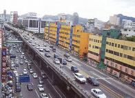
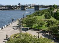
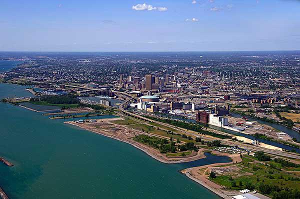
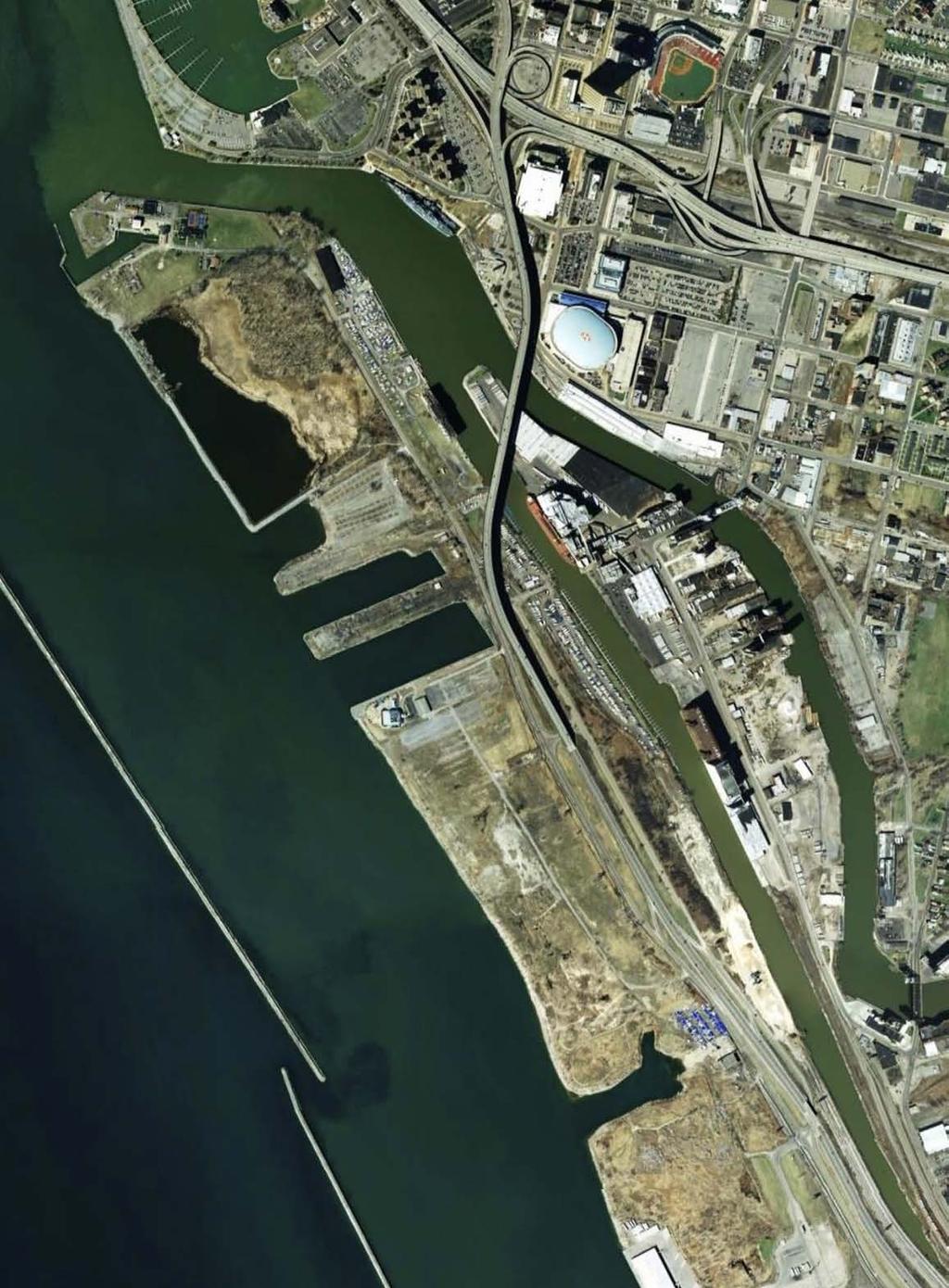
2 TWO VERY DIFFERENT CHOICES BUFFALO IS A WATERFRONT CITY WITH A DEEP HISTORY ALONG THE SHORES OF LAKE ERIE. WITH MORE THAN HALF OF THE CITY S WATERFRONT LEFT VACANT, THE POTENTIAL FOR REVITALIZATION IS IMMENSE. WHOLE NEIGHBORHOODS AND COMMERCIAL DISTRICTS COULD BE BUILT WITH STRONG CONNECTIONS TO DOWNTOWN AND THE CITY S EXISTING NEIGHBORHOODS. TO ACHIEVE THIS VISION, BUFFALO NEEDS TO LAY DOWN THE PROPER FOUNDATION. GOOD DEVELOPMENT IS TIED TO GOOD INFRASTRUCTURE. THE FORM OF THE STREETS CAN SEAL THE FATE OF VAST AMOUNTS OF LAND. THE NEW YORK STATE DEPARTMENT OF TRANSPORTATION (NYSDOT) EVAL- UATED THREE INFRASTRUCTRE ALTERNATIVES FOR THE OUTER HARBOR. IT SELECTED THE PLAN THAT WILL, IN ALL LIKELIHOOD, KEEP THE WATER- FRONT VACANT FOR ANOTHER 50 TO 100 YEARS. THIS PLAN MAINTAINS THE ELEVATED SKYWAY AND THE EMBANKED ROUTE 5 AND EXPANDS A MAJOR FRONTAGE ROAD, WHILE CONSUMING UNNECCESSARY AMOUNTS OF LAND THAT COULD OTHERWISE BUILD THE CITY S TAX BASE. BUT BY SIMPLY CHOOSING THE BOULEVARD ALTERNATIVE ALREADY DEVEL- OPED BY THE DEPARTMENT OF TRANSPORTATION, BUFFALO COULD BUILD A SINGLE URBAN THOROUGHFARE THAT WOULD ACCOMMODATE TRAF- FIC DEMANDS AND BECOME A VALUABLE DESTINATION IN IT S OWN RIGHT. THE NEW BOULEVARD WOULD SIGNIFICANTLY IMPROVE WATERFRONT AC- CESS AND SUPPORT THE REVITALIZATION THAT BUFFALONIANS HAVE BEEN FIGHTING FOR. BUFFALO HAS TWO VERY DIFFERENT CHOICES ON THE TABLE. BY CHOOSING THE BOULEVARD ALTERNATIVE, THE CITY WILL OPEN THE DOOR TO WORLD- CLASS DEVELOPMENT. THE FOLLOWING SERIES OF IMAGES DEMONSTRATES WHAT COULD HAPPEN ALONG THE WATERFRONT WITH THE RIGHT INFRASTRUCTURE IN PLACE. IT CONSTRASTS THAT FUTURE WITH WHAT WILL HAPPEN IF THE NYSDOT IS ALLOWED TO CONTINUE WITH ITS CURRENT PLANS.
3
4 STREETS AND BLOCKS: A CATALYST FOR REVITALIZATION A NETWORK OF STREETS AND BLOCKS EXPANDS ACCESS AND CONNECTIVITY TO THE OUTER HARBOR.


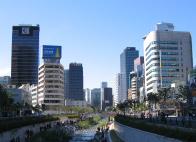
5 WITH A BOULEVARD INSTEAD OF AN EMBANKED HIGHWAY, THE THOROUGHFARE CAN BE CONNECTED TO A SERIES OF SMALLER BLOCKS AND NARROW STREETS THAT INCREASE WALKABILITY. A MIXTURE OF COMMERCIAL, OFFICE, AND RESIDENTIAL DEVELOPMENT, ALONG WITH PARK SPACE, WOULD MAKE THE WATERFRONT A REAL DESTINATION EXPLORED BY RESIDENTS AND VISITORS ALIKE.
6 SUBURBAN-STYLE PARKWAY: MORE OF THE SAME THE CURRENT PLANS ARE TO EXPAND FUHRMANN BOU- LEVARD INTO A FOUR-LANE PARKWAY ON THE LAKE SIDE OF THE EMBANKED ROUTE 5. ADDITIONAL MONEY WILL BE SPENT RECONSTRUCTING TWO INTERCHANGES BETWEEN FUHRMANN BOULEVARD AND THE HIGHWAY. BECAUSE THESE PLANS RETAIN THE EMBANKED HIGHWAY, ALONG WITH THE ELEVATED SKYWAY BRIDGE, THE FULL POTENITAL OF THE WATERFRONT WILL BE NOT BE REALIZED.


7 WITH AN EMBANKED ROAD ON ONE SIDE, DEVELOPMENT ALONG FUHRMANN WILL CONTINUE TO BE LOW-VALUE AND AUTO-ORIENTED, YIELDING MINIMAL SHORT-TERM GAINS INSTEAD OF A LONG LASTING WATERFRONT NEIGHBOR- HOOD. AND DESPITE THE MILLIONS INVESTED, LACK OF CONNEC- TIVITY WITH THE REST OF BUFFALO ESSENTIALLY REMAINS THE SAME.

8 WASTING SPACE THE CURRENT PLANS CREATE TWO PARALLEL ROADS VERY CLOSE TOGETHER--OCCUPYING AN UNNECCESSARILY LARGE SWATH OF VALUABLE WATERFRONT REAL ESTATE. THE LAYOUT MAKES DEVELOPMENT ALONG THE STREET EDGE HIGHLY UNLIKELY. ONE SIDE IS COMPLETELY OC- CUPPIED BY THE EMBANKED HIGHWAY, THE OTHER SIDE IS ONLY LIKELY TO SUPPORT ISOLATED SUBURBAN-STYLE DEVELOPMENT.

9 THE BOULEVARD OPTION: DOT HAD IT RIGHT THE FIRST TIME THE BOULEVARD ALTERNATIVE DEVELOPED BY NYSDOT SHOULD BE USED INSTEAD OF THE COMBINATION OF ACCESS ROAD AND EMBANKED HIGHWAY. IT BRINGS ROUTE 5 DOWN TO SURFACE LEVEL AND ALLOWS FOR THE SKY- WAY BRIDGE TO BE REPLACED WITH AT-GRADE BRIDGES. WITH SLIGHT DESIGN CHANGES, THIS BOULEVARD COULD BE TRANSFORMED FROM ONE THAT SERVES ONLY THROUGH TRAFFIC TO ONE THAT SUPPORTS ENDURING ECONOMIC DEVELOPMENT ROOTED IN A STRONG SENSE OF PLACE.

10 STREET DESIGN OPTIONS FUHRMANN AND ROUTE 5 SHOULD BE REPLACED WITH ONE THOROUGHFARE THAT HAS DEVELOPMENT LINING THE STREET. THE THOROUGHFARE COULD THEN BE CONNECTED WITH SEVERAL CROSS STREETS ALL ALONG THE WATER- FRONT. GIVEN CURRENT TRAFFIC VOLUMES, AN AVENUE WITH FOUR MOVING LANES AND TWO PARKING LANES COULD EASILY PROVIDE ADEQUATE TRAFFIC CAPACITY. WITH A BICYCLE LANE, LARGE SIDEWALKS, AND BUILDINGS ALONG THE STREET EDGE, THIS STREET COULD ATTRACT A VARIETY OF USERS.


11 A MULTI-WAY BOULEVARD COULD ALSO BE CONSIDERED. IT ALLOWS THROUGH TRAFFIC TO KEEP MOVING IN THE CENTER LANES AND LOCAL TRAFFIC --THE KIND NECESSARY FOR COMMERCIAL DEVELOPMENT--TO CONTINUE AT ITS OWN PACE.

12 RETURNING TO THE WATERFRONT HARKENING BACK TO THE GREAT DEVELOPMENT PATTERNS FOUND IN BUFFALO S DOWNTOWN AND NEIGHBORHOODS, THE WATERFRONT COULD BE BUILT UP WITH BUILDINGS THAT MATCH THE LOCAL VERNICULAR. THE BOULEVARD OPTION WITH A STREET NETWORK WOULD OPEN UP AN ADDITIONAL 235 ACRES FOR DEVELOPMENT. CURRENTLY, THESE UNDERUTILIZED ACRES ARE ONLY AS- SESSED AT $17.6 MILLION--WELL BELOW THE CITY AVERAGE. CREATING A VALUABLE PLACE CONNECTED TO THE CITY WOULD RAISE PROPERTY VALUES UP TO THE CITY AVERAGE, YIELDING $82 MILLION IN ASSESSED VALUES. AND THERE S NO REASON TO THINK THAT THE VALUES WOULD STOP THERE. FOLLOWING MILWAUKEE S FREEWAY CONVERSION EXAMPLE, THE SAME DEVELOPMENT RATES COULD RAISE THE ASSESSED VALUES TO $168 MILLION.


13 THE LONG TERM HORIZON LOOKS EVEN BETTER. PORTLAND REMOVED THEIR WATERFRONT FREEWAY IN THE 1970S. IF BUFFALO FOLLOWS PORTLAND S EXAMPLE, THE VALUE OF THE RESTORED WATERFRONT ACREAGE COULD REACH $1.3 BILLION.
A VISION FOR EL MIRAGE
 el mirage A VISION FOR EL MIRAGE OASIS, ARIZONA A thriving desert jewel destination with a strong arts district, high-wage employment parks system joined together by cohesive, multi-use accessible trails
SOUTH INTERCHANGE AREA
 Santaquin City General Plan 1 Location and Characteristics The South Interchange Area of Santaquin is located west of Interstate 15 and south of 500 South (Figure 1). It includes properties already annexed
Lake Erie Commerce Center Traffic Analysis
 LOCATION: East of NYS Route 5 at Bayview Road Town of Hamburg Erie County, New York PREPARED BY: Wendel Companies 140 John James Audubon Parkway Suite 200 Amherst, New York 14228 January 2012 i ii Table
 288.075, F.S. Florida Job Growth Infrastructure Application Response to Question 1A Provide the title and a detailed description of the public infrastructure improvements. The West River Riverwalk
STITCH TRANSFORMATIVE IDEA 3. SHORELINE STITCH. Re-connect the city to the waterfront and link the east and west Core Circle landscapes
 SHORE STITCH TRANSFORMATIVE IDEA 3. SHORELINE STITCH Re-connect the city to the waterfront and link the east and west Core Circle landscapes 126 LINE PUBLIC WORK 127 TRANSFORMATIVE IDEA 3. SHORELINE STITCH
Experience the environment
 Experience it. Experience the environment The Grand is where CREATIVE, STATE-OF-THE-ART OFFICE meets inviting outdoor spaces featuring vibrant landscaping, pedestrian walkways and a two acre PROMINENT
Part Three : COMMUNITY PLAN AREAS AND SPECIAL STUDY AREAS SACRAMENTO 2030 GENERAL PLAN. Introduction
 Special study Areas Part Three : COMMUNITY PLAN AREAS AND SPECIAL STUDY AREAS SACRAMENTO 2030 GENERAL PLAN Introduction Beyond the boundaries of the 2030 General Plan, the City has defined Special Study
The Transportation Corridor Overlay District
 The Transportation Corridor Overlay District The Transportation Corridor Overlay District is a policy framework under which certain potentially beneficial development proposals may be considered, given
Macleod Trail Corridor Study. Welcome. Macleod Trail Corridor Study Open House. Presentation of Proposed Design Concepts
 Macleod Trail Corridor Study Welcome Macleod Trail Corridor Study Open House Presentation of Proposed Design Concepts Study Purpose Develop a corridor plan for Macleod Trail that aligns with The City s:
Clackamas County Development Agency
 Clackamas County Development Agency Development Services Building, 150 Beavercreek Rd., Oregon City, OR 97045 www.clackamas.us/transportation/renewal 503-742-4323 The Clackamas County Board of Commissioners
Inner Harbor 2.0. The resulting Inner Harbor 2.0 Plan provides a road map for a more sustainable, attractive and active Inner Harbor.
 Inner Harbor 2.0 In 2012, recognizing that some of the Inner Harbor infrastructure had outlived its useful life, the City completed a State of Good Repair Study, while Waterfront Partnership, along with
Sidewalk. Summer Kids Camp
 Sidewalk Toronto Summer Kids Camp October 2018 Contents About Kids Camp 05 Curriculum 07 Detailed Program 09 Campers Reflections 13 4 About Kids The Sidewalk Toronto Summer Kids Camp was created for children
DOWNTOWN EAST RESTAURANT AND RETAIL SPACE. Matt Friday. Senior Vice President
 DOWNTOWN EAST RESTAURANT AND RETAIL SPACE AVAILABLE for lease Matt Friday Senior Vice President 612 336 4209 matt.friday@cbre.com David Daly Vice President 612 336 4319 david.daly@cbre.com Eric Sheaffer
95 KING STREET EAST, TORONTO
 95 KING STREET EAST, TORONTO OFFICE FOR LEASE LOCATED ON KING STREET EAST, AT CHURCH STREET FOR MORE INFORMATION PLEASE CONTACT ASHLAR URBAN REALTY INC. Real Estate Brokerage 166 Pearl Street, Suite 300
95 KING STREET EAST, TORONTO
 95 KING STREET EAST, TORONTO OFFICE FOR LEASE LOCATED ON KING STREET EAST, AT CHURCH STREET FOR MORE INFORMATION PLEASE CONTACT ASHLAR URBAN REALTY INC. Real Estate Brokerage 166 Pearl Street, Suite 300
 The Atlanta BeltLine is actively transforming Atlanta s neighborhoods, consumption habits, and travel and transit routes. Stream Realty Partners seized the opportunity to invest in the Westside Trail and
chapter - Hex Highway Touring Route Hamburg to Strausstown Overview
 chapter - 2 Hex Highway Touring Route Hamburg to Strausstown Overview The on-road Hex Highway automobile and bicycle touring route begins on State Street in downtown Hamburg. The route continues west on
4.0 Context for the Crossing Project
 4.0 Context for the Crossing Project This section provides background information about key features of the North Douglas Crossing project area, and opportunities and constraints. This information is important
NIAGARA FALLS DEVELOPERS FORUM
 NIAGARA FALLS DEVELOPERS FORUM 1 Mayors Welcome 5 Available Sites 2 USA NIAGARA 6 Financing AGENDA 3 BOA Program 7 6Done Deals 4 Master Plan 8 Bus Tour / Lunch New Attitudes, New Niagara Falls Paul Tronolone,
MEETING MINUTES District 1 Trail Planning Meeting 1
 MEETING MINUTES District 1 Trail Planning Meeting 1 June 1, 2017 2:00 PM 3:30 PM City of Two Harbors 2:00 Introductions Attendees: Lisa Austin, MnDOT Bryan Anderson, MnDOT Jasna Hadzic-Stanek, MnDOT Justin
THE TEAPOT - BUSINESS AND REAL ESTATE FOR SALE
 THE TEAPOT - BUSINESS AND REAL ESTATE FOR SALE 818 N. 5TH AVE. PHOENIX, AZ 85003 Justin Horwitz Senior Advisor 480.425.5518 justin.horwitz@svn.com Paul Borgesen III Advisor 480.425.5516 paul.borgesen@svn.com
Southwest LRT Alignment Video Narration
 Southwest LRT Alignment Video Narration September 2015 Southwest Light Rail Transit, a proposed extension of the METRO Green Line, will serve Minneapolis, St. Louis Park, Hopkins, Minnetonka and Eden Prairie.
CONTENTS. 1 Introduction Always Moving Forward while Building on the Past A Dynamic Destination... 5
 2010 STRUCTURE PLAN - 2 - CONTENTS 1 Introduction... 5 1.1 Always Moving Forward while Building on the Past... 5 1.2 A Dynamic Destination... 5 2 Map A... 6 Exhibition Place and its Neighbours... 7 3 Demonstration
PELEE ISLAND PROPERTIES AVAILABLE THROUGH THE SAME ENTITIES NOW FOR SALE
 PELEE ISLAND PROPERTIES AVAILABLE THROUGH THE SAME ENTITIES NOW FOR SALE CONTACT: JOSEPH PINGUE, JR. 1-614-565-3737 JPINGUE@AOL.COM REGIONAL LOCATION MAP ISLAND PROPERTY LOCATION MAP THE AVAILABLE UNIQUE
EAST-WEST STITCH. Connecting the Western Edge of the City to the Centre
 98 AC_BEU_CCMP_2_TM1_4 _FD.indd 98 20/07/12 12:06 PM 02 EAST-WEST STITCH Connecting the Western Edge of the City to the Centre 01 02 Northern Motorway Daldy Street Fanshawe Street Nelson Street Hobson
Everett Riverwalk Life style explore
 Life style explore Project Overview The 217-acre Everett Riverfront redevelopment is visible from I-5 with traffic counts charted at 170,000+ vehicles per day with direct freeway access from 4-way interchange.
Washington Township MASTER PLAN. Addendum: Washington Township Master Plan
 Washington Township MASTER PLAN Addendum: Washington Township Master Plan CHAPTER XI RECREATION CORE DISTRICT Introduction The Recreation Core District generally encompasses the areas north of 30 Mile
Attachment 1: Revitalizing Yonge Downtown Yonge Street
 Attachment 1: Revitalizing Yonge Downtown Yonge Street Photo credit: Downtown Yonge BIA Attachment - Revitalizing Yonge Downtown Yonge Street 1 Photo credit: Downtown Yonge BIA Photo credit: Downtown Yonge
North Forty Area ( area bounded by Lark Avenue, Los Gatos Boulevard, Highway 85 and
 RESOLUTION 2015-056 RESOLUTION OF THE TOWN COUNCIL OF THE TOWN OF LOS GATOS ADOPTING GENERAL PLAN AMENDMENTS NECESSARY FOR THE NORTH FORTY SPECIFIC PLAN. THE PLAN AREA COMPRISES APPROXIMATELY 44 ACRES
The Atlanta BeltLine. Project Overview Map
 The Atlanta BeltLine Project Overview Map The Atlanta BeltLine is a dynamic and transformative project for Atlanta. Through the development of a new transit system, multi-use trails, greenspace, and affordable
SAM S CLUB PLAZA 315/335 SW PINE ISLAND RD CAPE CORAL, FL 33991
 SAM S CLUB PLAZA 315/335 SW PINE ISLAND RD CAPE CORAL, FL 33991 03 05 10 12 EXECUTIVE SUMMARY PROPERTY LOCATION COMPARABLE PROJECTS MARKET OVERVIEW CONTACT INFORMATION TIM SCHNEIDER Principal 239.334.3040
SAM S CLUB PLAZA 315/335 SW PINE ISLAND RD CAPE CORAL, FL 33991
 SAM S CLUB PLAZA 315/335 SW PINE ISLAND RD CAPE CORAL, FL 33991 03 EXECUTIVE SUMMARY 05 PROPERTY LOCATION 09 THEATER COMPETITION 11 MARKET OVERVIEW CONTACT INFORMATION TIM SCHNEIDER Principal 239.334.3040
2016 Regional Transportation Alternatives Program (TAP) Grant Application
 Grant Application") 2016 Regional Transportation Alternatives Program (TAP) Grant Application PROJECT TITLE: Yelm-Tenino Trail Extension Feasibility Study TRPC use only GENERAL PROJECT INFORMATION Agency or Organization City
2016 Regional Transportation Alternatives Program (TAP) Grant Application PROJECT TITLE: Yelm-Tenino Trail Extension Feasibility Study TRPC use only GENERAL PROJECT INFORMATION Agency or Organization City
Downtown Revitalization Tomball, Texas. Presented By: Mayor Gretchen Fagan City of Tomball
 Downtown Revitalization Tomball, Texas Presented By: Mayor Gretchen Fagan City of Tomball Downtown defines our community! Brings people together central gathering space Economic Opportunity increased property
El Mercado Zona Cultural San Antonio
 El Mercado Zona Cultural San Antonio Today s Conversation Context Vision for Zona Cultural Revitalization Plan Opportunities Organization Next Steps 2015 Centro Inc. All rights reserved. - 2 - Context
Southlake Town Hall Training Rooms 3A & 3B 1400 Main Street Southlake, Texas, 76092
 Southlake 2035 Corridor Planning Committee Meeting Report Meeting 3 March 21, 2016 MEETING LOCATION: IN ATTENDANCE: AGENDA ITEMS: MEETING OVERVIEW: Southlake Town Hall Training Rooms 3A & 3B 1400 Main
Efforts and Inter-City Partnership of FutureCity Yokohama
 Oct. 27, 2015 The 5th International Forum on FutureCity Initiative Efforts and Inter-City Partnership of FutureCity Yokohama Nobuya Suzuki Deputy Mayor, City of Yokohama All rights reserved. History of
Ballston Mall Redevelopment Outline of a Public Private Agreement with Forest City Enterprises
 Ballston Mall Redevelopment Outline of a Public Private Agreement with Forest City Enterprises County Manager s Report to the Arlington County Board July 21, 2015 County Board Direction June 16, 2015 The
22 nd Annual Sioux Falls Market Outlook February 21, 2019
 22 nd Annual Sioux Falls Market Outlook 2019 February 21, 2019 Economic Overview Michael Bender, CCIM, SIOR Top 6 Trends Commercial Real Estate Trends to Dominate into 2020 and Beyond Opportunity Zone
6. How connected do you feel to the Sans Souci community?
 Please complete and return before May 1st, 2017, to be entered for a prize drawing. Further instructions are available on the last page. Digital version available at GCPlanning.org. 1. Do you live and/or
BRIDGEPORT. Metro Atlanta s Mega-Site. Pope & Land Enterprises, Inc Cumberland Boulevard Suite 400 Atlanta, GA
 18.660 AC AIRPORT ZONED 69.45 A U S H W Y 2 7 / 2 9 #4 60.074 AC C S X R A I L R O A D I N T E R S T A T E 8 5 #1 834.759 AC #5 69.141 AC Metro Atlanta s Mega-Site Pope & Land Enterprises, Inc. 3225 Cumberland
The Benefits of a Whittier Blvd. Alignment for the Metro Eastside Extension
 The Benefits of a Whittier Blvd. Alignment for the Metro Eastside Extension by Bart Reed The Transit Coalition P.O. Box 567 San Fernando, CA 91341-0567 (818) 367-1661 1 Introduction Metro has released
Header i
 Header i 048285014.10 Header Sub Title Body Text here. Body text here. Body text here. Section 1... 1 Executive Summary... 1 Opportunities and Constraints... 3 Overall Opportunities and Constraints Map
Westbrook Station. Transit Oriented Development Opportunity
 DEVELOPM Westbrook Station Transit Oriented Development Opportunity OPPOR Table of Contents Prime Real Estate Development Opportunity page 1 Calgary City of Opportunity page 3 What is Transit Oriented
Welcome to the Cross County Trail Public Input Session!
 Welcome to the Cross County Trail Public Input Session! Please sign in on the table below! What are we doing here? Camden County has proposed a bicycle and pedestrian trail spanning across the entire county.
SUMMIT POINTE RETAIL LEASING SIGNATURE PROPERTIES
 RETAIL LEASING SIGNATURE PROPERTIES Be Part of the Premiere Coastal Virginia Destination Leasing Team Contacts CHRIS READ Senior Vice President +1 757 228-1803 chris.read@colliers.com JEFF PARKER, CCIM
A number of goals were identified during the initial work on this Big Lake Transportation Plan.
 C. Transportation General Background Information Big Lake s transportation system includes all the roads, paths and facilities that allow the movement of private vehicles, trains and planes, as well as
Colorado Springs & Pikes Peak Region Destination Master Plan
 Colorado Springs & Pikes Peak Region Destination Master Plan Overview June 19, 2018 DESTINATION MASTER PLAN What is Destination Master Planning? Focus on infrastructure, facilities, services, attractions
DEVELOPMENT OPPORTUNITY 630 Central Park Yonkers, NY 10704
 DEVELOPMENT OPPORTUNITY 630 Central Park Yonkers, NY 10704 Cross County Shopping Mall 630 Central Park Empire City Casino and Race Track Yonkers 630 Central Park, Yonkers, NY 10704 2 Yonkers is located
I-70/I-71 Project Public Meeting Presented By
 I-70/I-71 Project Public Meeting Presented By Ohio Department of Transportation ms consultants, inc. engineers, architects, planners MSI Design June 9, 2010 W e l c o m e Thom Slack Planning Administrator,
Lincoln Village Pedestrian Bicycle Bridge Community Meeting September 13th, 2016
 Lincoln Village Pedestrian Bicycle Bridge Community Meeting September 13th, 2016 Purpose of the Meeting Introduce the project and the proposed improvements Review existing conditions Discuss the needs
THE UNITED TOWER COMMERCIAL OFFICES RETAIL SPACE BAHRAIN BAY NOW LEASING
 THE UNITED TOWER BAHRAIN BAY COMMERCIAL RETAIL SPACE NOW LEASING THE UNITED TOWER BAHRAIN BAY A SPIRAL CITY MIXED USE DEVELOPMENT The United Tower was conceived as a building with multiple uses: a vertical
Page 1 of 7 FULL TRANSCRIPT: WESTERN SYDNEY AIRPORT ANIMATION VIDEO
 Page 1 of 7 FULL TRANSCRIPT: WESTERN SYDNEY AIRPORT ANIMATION VIDEO 00:00 Opening information screen with Australian Government Department of Infrastructure and Regional Development logo. Text reads: Western
URBAN DESIGN REPORT. Proposed Residential Development, Old Church Road, Caledon East
 Proposed Residential Development, Old Church Road, Caledon East TABLE CONTENTS: 1.0 DEVELOPMENT 1.1 Introduction-Analysis of Guiding Principles and Documents 1.2 Community Design and Architectural Design
Introducing the Lower Connecticut River Valley Trail
 Introducing the Lower Connecticut River Valley Trail 1 2 Purpose of Today s Presentation To introduce you to an important opportunity to protect some of the most valuable property in the Lower CT River
Pinecrest DICKINSON NORTH DAKOTA COMMONS TAKING ROOT IN THE BAKKEN.
 Pinecrest TAKING ROOT IN THE BAKKEN. COMMONS DICKINSON NORTH DAKOTA About The Trade Area About The Development Over 30 acres of commercial / retail land being developed Over 30 acres of office land being
e: w: remingtoncorp.com Quarry Park News More on page 1 & 2.
 e: QuarryParkLOA@remingtoncorp.com w: remingtoncorp.com Quarry Park News INSIDE: New Amenities Set For 2016 Openings More on page 1 & 2. Amenities Opening in 2016 The Remington YMCA Quarry Park Recreation
A CASE FOR COMPLETING THE JORDAN RIVER PARKWAY: A
 A CASE FOR COMPLETING THE JORDAN RIVER PARKWAY: A safe crossing at 9000 South and 850 West Proposed 9000 South Underpass Parkway Timeline Parkway, Trail, and Tourism Facts Blueprint Jordan River 1971 1973
LA Waterfront Public Sites Opportunity Analysis IGTCT Committee Meeting
 LA Waterfront Public Sites Opportunity Analysis IGTCT Committee Meeting Economic & Planning Systems, Inc. (EPS) Oakland Denver Los Angeles Sacramento February 21, 2017 Economic & Planning Systems, Inc.
Poulsbo Event and Recreation Center. Proposal to Kitsap Public Facilities District December 3, 2018
 Poulsbo Event and Recreation Center Proposal to Kitsap Public Facilities District December 3, 2018 Premier event facility available for regional conferences, business meetings, workshops, banquets, community
FEASIBILITY CRITERIA
 This chapter describes the methodology and criteria used to evaluate the feasibility of developing trails throughout the study areas. Land availability, habitat sensitivity, roadway crossings and on-street
MARKETBEAT RETAIL SNAPSHOT
 Bil US$ MARKETBEAT RETAIL SNAPSHOT LAS VEGAS, NV A Cushman & Wakefield Research Publication Q4 2014 NATIONAL ECONOMIC OVERVIEW Like Floyd Mayweather in the final round of a championship match, the U.S
Stuart Thain. Elizabeth Leader Cameron Simonsen
 I-15 AND SOUTHERN PARKWAY ST GEORGE, UT Developed by: Desert Color is a master-planned community built around a plan of connectivity, community and sustainability. It is a place where you will find the
State of Center City Charlotte
 State of Center City Charlotte Our Purpose To facilitate the growth & vibrancy of Center City which serves as the foundation for a healthy regional economy to improve the quality of life for all Charlotteans.
PROPOSED FOR IMPLEMENTATION
 PROPOSED FOR IMPLEMENTATION Capital Transit Schedule & Route Revision Objective: Update the current Capital Transit schedules and routes to provide a higher level of reliability, add service to Riverside
Florida Department of TRANSPORTATION. First Coast Expressway
 Florida Department of TRANSPORTATION First Coast Expressway What is the (FCE)? Multi-lane, limited access toll expressway Connects I-10 in Duval County to I-95 in St. Johns County How does FCE connect
S i t e A n a ly s i s
 S i t e A n a ly s i s 11 SECTION B SITE ANALYSIS Existing Conditions TRANSPORTATION CONTEXT: The Ohlone Greenway site, paralleling San Pablo Avenue to the west, is centrally located within the City of
Section 106 Update Memo #1 Attachment D. Traffic Diversion & APE Expansion Methodology & Maps
 Section 106 Update Memo #1 Attachment D Traffic Diversion & APE Expansion Methodology & Maps I-65/I-70 North Split Interchange Reconstruction Project (Des. Nos. 1592385 & 1600808) Traffic Diversion and
The Coalition s Policy to Build the Swan Valley Bypass and Perth Gateway
 1 Our Plan Real Solutions for all Australians The direction, values and policy priorities of the next Coalition Government. The Coalition s Policy to Build the Swan Valley Bypass and Perth Gateway August
THE FAIRHAVEN OPTION
 THE FAIRHAVEN OPTION A mainland ferry landing for Lummi Island Fairhaven Ferry Terminal The Fairhaven Option! 1 THE FAIRHAVEN OPTION Klayton Curtis December 2010 Overview The option of using the Fairhaven
RIVERFRONT PROPERTIES
 Proposed Location Photo Credit: Visit Saint Paul An iconic downtown Saint Paul site located along the bluff with sweeping, unobstructed views of the Mississippi River Urban site Transit access Vibrant
Creating Walkable Environments in Frankston. Marti Fooks Urban Designer & Clare Davey Traffic and Transport Coordinator
 Creating Walkable Environments in Frankston Marti Fooks Urban Designer & Clare Davey Traffic and Transport Coordinator Frankston City Population 2006 121,587 % of Melbourne Statistical Division (SD) 3.2%
CD-1 Rezoning: 777 Pacific Blvd (NEFC Sub-area 10C)
") CD-1 Rezoning: 777 Pacific Blvd (NEFC Sub-area 10C) Public Hearing July 10, 2018 Site Context NEFC Events and Entertainment District Current location of BC Place Stadium 750 772 Pacific Blvd (NEFC 777
CD-1 Rezoning: 777 Pacific Blvd (NEFC Sub-area 10C) Public Hearing July 10, 2018 Site Context NEFC Events and Entertainment District Current location of BC Place Stadium 750 772 Pacific Blvd (NEFC 777
CHURCH AVENUE CHULA VISTA, CA 91910
 For Additional Information: Sean Bascom 619.916.9179 bascom@scc1031.com Lic# 01862044 CHURCH AVENUE CHULA VISTA, CA 91910 CHULA VISTA DEVELOPMENT OPPORTUNITY Excellent Location Near Vibrant Third Avenue
Spadina Avenue Built Form Study Preliminary Report
 STAFF REPORT ACTION REQUIRED Spadina Avenue Built Form Study Preliminary Report Date: July 9, 2014 To: From: Wards: Reference Number: Toronto and East York Community Council Director, Community Planning,
HARBOUR EDGE STITCH. Uniting the Waterfront with the City Centre
 78 AC_BEU_CCMP_2_TM1_4 _FD.indd 78 20/07/12 12:04 PM 01 HARBOUR EDGE STITCH Uniting the Waterfront with the City Centre 01 VISION OUR 2032 VISION IS: Quay Street as a high-quality Harbour Edge space that
Long Range Strategic Plan for the Jamestown Regional Airport Approved by the Board 3/15/2017
 Long Range Strategic Plan for the Jamestown Regional Airport 2017-2021 Approved by the Board 3/15/2017 1 Strategic Plan 2017-2021 Vision Statement: Become the Regional Airport of Choice providing World
INFILL HARD CORNER & REDEVELOPMENT OPPORTUNITY 731 PROBANDT and 134 & 138 KING ROGER ST
 INFILL HARD CORNER & REDEVELOPMENT OPPORTUNITY 731 PROBANDT and 134 & 138 KING ROGER ST First American Commercial Property Group 18618 Tuscany Stone, Ste. 210, San Antonio, TX 78258 Ph: 210.496.7775 Fx:
Excellent Freeway Oriented, Big Box, Shopping Center or Hotel site
 Centennial Plaza Hanford Mall 35,671 CPD 19 Glendale Ave 198 198 70,010 CPD 10715 th AVENUE PRIME DEVELOPMENT OPPORTUNITY: ±16.38 ACRES OF LAND Lender Owned th AVENUE Excellent Freeway Oriented, Big Box,
PCAL Case Study Retail Areas: Rouse Hill Town Centre
 PCAL Case Study Retail Areas: Rouse Hill Town Centre Introduction Rouse Hill Town Centre is a new mixed use development on a greenfield site in Sydney s North West. It has been planned to be a major hub
CHAPTER 4 -- THE LAND USE PLAN: DESCRIPTIONS AND POLICIES FOR THIRTEEN PLANNING AREAS
 CHAPTER 4 -- THE LAND USE PLAN: DESCRIPTIONS AND POLICIES FOR THIRTEEN PLANNING AREAS NORTH CENTRAL CAC AREA LITTLE VALLEY ROAD TO JUG HANDLE CREEK PLANNING AREA This planning area includes Cleone, Noyo,
RETAIL POTENTIAL ON 1/2 ACRE SITE
 NO STANDING FEATURES: NEARBY: RETAIL POTENTIAL ON 1/2 ACRE SITE 20,000 SF ONE-STORY BUILDING ADJACENT TO NEWLY BUILT AUTOZONE CANARSIE - DIVISIONS AVAILABLE Building Dimensions: 200 x 100 Brooklyn Terminal
Airport Planning Area
 PLANNING AREA POLICIES l AIRPORT Airport Planning Area LOCATION AND CONTEXT The Airport Planning Area ( Airport area ) is a key part of Boise s economy and transportation network; it features a multi-purpose
Salisbury's Destination Business Park!
 Unique and desirable Planned Development District zoning allows for many uses: Retail Professional Restaurant Hotel Medical Frontage, access & visibility on Three Major Thoroughfares: US Rt. 50 St. Hwy
EXPERIENCE AN ICON REBORN
 EXPERIENCE AN ICON REBORN BE CENTERED CONNECT FASTER PROJECT HIGHLIGHTS 1.5 SF transit-oriented, mixed use development Large blocks on upper floors: Harris & South Tower Building naming and signage opportunity
EXHIBIT 1. BOARD AUTHORIZATION FOR PUBLIC HEARING AND SUBSEQUENT ISSUANCE OF A JOINT DEVELOPMENT SOLICITATION
 EXHIBIT 1. BOARD AUTHORIZATION FOR PUBLIC HEARING AND SUBSEQUENT ISSUANCE OF A JOINT DEVELOPMENT SOLICITATION Washington Metropolitan Area Transit Authority Board Action/Information Summary @Action O Information
LAND FOR SALE SUBDIVISION LAND: SFR DEVELOPMENT LAND OF ±100 HOMES Ave 13 1/2, Madera, CA PROPERTY FEATURES
 SALE PRICE: $1,795,000 PRICE PER LOT: $18,505 PRICE PER SF: $2.35 LOT SIZE: 17.48 Acres APN #: 034-151-018 & -019 ZONING: PUD 6,000 R-1 Residential MARKET: City Of Madera PROPERTY FEATURES Shovel-ready
Slide 1. Waterfront Plan Land Use Subcommittee. Port Seawall Lots
 Slide 1 Waterfront Plan Land Use Subcommittee Port Seawall Lots June 7, 2017 Slide 2 Discussion of Seawall Lots 1 Brief history on North of China Basin seawall lots 2 Waterfront Plan Use policies and current
Site Analysis. Context Plan ANALYSIS
 Site Analysis Context Plan The site located in Crosstown, occupies an entire city block bridging between the Downtown, Gastown, False Creek North, and Yaletown neighborhoods. It is bounded by W Georgia
DURFEE DURFEE PECK ROAD AVENUE SOUTH EL MONTE, CA EL MONTE SOUTH EL MONTE HIGH SCHOOL. THE GOLDWYN (116 newly developed homes)
") 1225 DURFEE AVENUE SOUTH EL MONTE, CA 91733 SOUTH EL MONTE HIGH SCHOOL THE GOLDWYN (116 newly developed homes) EL MONTE 1225 DURFEE PECK ROAD EXECUTIVE SUMMARY Marcus & Millichap has been selected to exclusively
1225 DURFEE AVENUE SOUTH EL MONTE, CA 91733 SOUTH EL MONTE HIGH SCHOOL THE GOLDWYN (116 newly developed homes) EL MONTE 1225 DURFEE PECK ROAD EXECUTIVE SUMMARY Marcus & Millichap has been selected to exclusively
LEAVE NO TRACE CENTER FOR OUTDOOR ETHICS CONSULTING SERVICES
 LEAVE NO TRACE CENTER FOR OUTDOOR ETHICS CONSULTING SERVICES LEAVE NO TRACE PURPOSE Americans love the outdoors. Today, more than 300 million people visit America s national parks and another 150 million
Redevelopment of East Boston s Inner Harbor Waterfront
 to its Waterfront Redevelopment of East Boston s Inner Harbor Waterfront to its Waterfront Redevelopment of East Boston s Inner Harbor Waterfront Redevelopment Background extensive planning City + community
PLANNING BOARD TOWN OF PETERBOROUGH, New Hampshire. Minutes of July 9, 2012
 PLANNING BOARD TOWN OF PETERBOROUGH, New Hampshire Minutes of July 9, 2012 Members Present: Chairman Rick Monahon, Joel Harrington, Alan Zeller, Rich Clark, Alternate Jerry Galus, Alternate Audrey Cass,
LEGACY WATERIDGE Wateridge Circle Sorrento Mesa, California HOME
 HOME 61,249 sf office space for lease Recently completed capital improvements include lobby upgrades, market-ready work, landscaping and project signage Sorrento Mesa s premier office campus Unparalleled
CITIZEN ENGAGEMENT. Who was included in the public input process?
 A CITIZEN CREATED VISION - CITIZEN INPUT This Comprehensive Plan was crafted to respond to what residents of Buda and nearby areas want to see happen. It is a vision that responds to their hopes and concerns
4. Proposed Transit Improvements
 4. Proposed Transit Improvements The following proposed transit improvements have been assembled based on input received from the community meetings and from review and coordination with the TAC as well
2.1 Redevelopment Area
 DESIGN PRINCIPLES 7 2.1 Redevelopment Area The Asbury Park Waterfront Redevelopment Area that was designated in November 7, 1984 remains the same area under this plan amendment (see attached map). The
THREE STATE-OF-THE-ART INDUSTRIAL BUILDINGS RANGING FROM 60,923 SF TO 105,047 SF AVAILABLE
 THREE STATE-OF-THE-ART INDUSTRIAL BUILDINGS RANGING FROM 60,923 SF TO 105,047 SF AVAILABLE VALENCIA, CALIFORNIA Hugged by greenery, rolling hills and endless amenities the Santa Clarita Valley is your
Honorable Members of the Mobility Solutions, Infrastructure and Sustainability Committee
 Memorandum DATE August 10, 2018 CITY OF DALLAS TO Honorable Members of the Mobility Solutions, Infrastructure and Sustainability Committee SUBJECT Dallas Love Field Master Plan Update On Monday, August
The Falls: A Visitor & Interpretive Center for the Upper Lock
 The Falls: A Visitor & Interpretive Center for the Upper Lock Image courtesy of Northern Spark Surface by Aaron Dysart Illuminate the Lock is a program of Mississippi Park Connection The Falls Initiative