Preservation & Restoration of the Houston Region s Green Fabric: The Role of the Harris County Flood Control District
|
|
|
- Shauna Hampton
- 5 years ago
- Views:
Transcription
1 Preservation & Restoration of the Houston Region s Green Fabric: The Role of the Harris County Flood Control District Glenn Laird, Environmental Chief Harris County Flood Control District Parks + Natural Areas Roundtable Houston-Galveston Area Council March 12, 2018
2 HCFCD s Mission To provide flood damage reduction projects that work, with appropriate regard for community and natural values.
3 In the beginning HCFCD was created in 1937 by the Texas Legislature The result of major Houston floods in 1929 & 1935 Primary Purpose: To be the Local Partner to the U.S. Army Corps of Engineers for Flood Control Projects (Flood Control Act of 1936)
4 Interesting other purposes the storing, preservation, and distribution of the storm and flood waters... for domestic, municipal, flood control, irrigation, and other useful purposes the conservation of forests


5 Evolving Since 1937: Channels Where we ve been Where we re headed


6 Evolving Since 1937: Detention Basins (since 1985) Where we ve been Where we re headed
7 Expanding the Green Fabric Through Floodplain Acquisition and Preservation Remember that bit about the conservation of forests?

8 HCFCD Current CIP Priorities
9 Floodplain Acquisition and Preservation For the last 30+ years Voluntary sellers (usually) Undeveloped (mostly) Deep in the floodplain Support County Precincts Spring Creek 500 ac. Cypress Creek 5,566 ac. (85% KPC) Greens Bayou 1,617 ac. Clear Creek 60 ac. Armand Bayou 224 ac. San Jacinto 625 ac.
10 Expanding The Green Fabric Through HCFCD Partnerships Process + Examples

11 Channels & Basins
12 HCFCD s Prime Assets Channels Over 800 miles of natural channels Over 1,700 miles of manmade channels Roughly 1/3 owned in fee by HCFCD (8,844 acres) Basins 7,550 acres in 98 basins currently available 445 acres in Hermann Park 1,466 acres in Memorial Park
13 Multi-Objective Partnering With Whom Harris County Precincts Local Municipalities Municipal Utility Districts Management Districts Tax Increment Reinvestment Zones How HCFCD must have fee title Development of Master Plans Development of Site Plans Inter-local Agreements
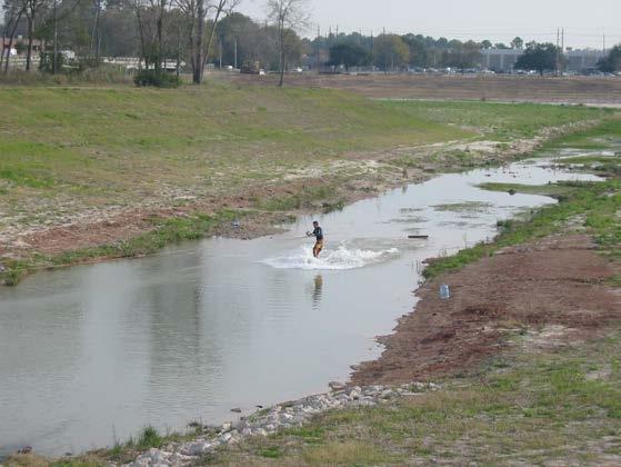
14 Recreational Projects Along Channels 175+ miles of Hike & Bike Trail Systems (Regional & Local) Bayou Greenways Initiative (Houston Parks Board) is a big part of it, and growing! In Detention Basins Sports fields Picnic areas Playgrounds Fishing lakes Nature trails Currently covering 2,232 acres
15 Recreational Projects Along Channels Harris County Precincts: Spring Creek & Cypress Creek Greenways, Mason Creek, Brays Bayou & Buffalo Bayous HPARD/HPB: Brays, White Oak, Sims, Buffalo, Hunting, Halls, Greens Bayous In Detention Basins Harris County Precincts: Gene Green Park, Arthur Storey Park, Terry Hershey Park, Cypress Park City of Houston: Keith-Wiess Park, Willow Waterhole, Shady Lane Park, Mary Withers Park
16 Representative Basin Projects Harris County & City of Houston

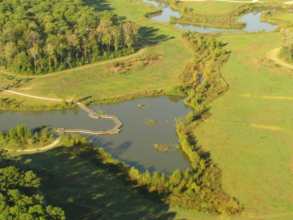
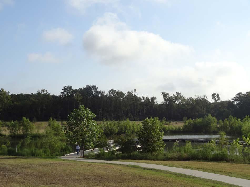
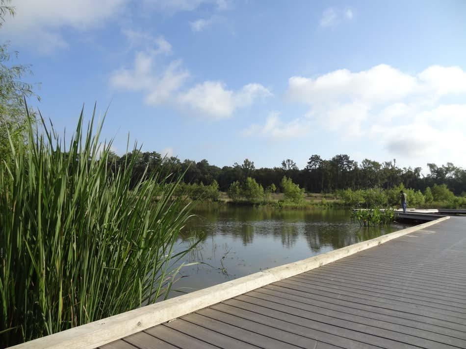
17 Gene Green Park Harris County Precinct 2

18 Gene Green Park

19 Gene Green Park

20 Gene Green Park
21 Representative Basin Projects Harris County & City of Houston

22 Arthur Storey Park Harris County Precinct 3

23 Arthur Storey Park

24 Arthur Storey Park

25 Arthur Storey Park
26 Representative Basin Projects Harris County & City of Houston

27 Terry Hershey Park Harris County Precinct 3

28 Terry Hershey Park

29 Terry Hershey Park
30 Representative Basin Projects Harris County & City of Houston

31 Cypress Park Harris County Precinct 3

32 Cypress Park
33 Representative Basin Projects Harris County & City of Houston

34 Keith-Wiess Park City of Houston
35 Keith-Wiess Park
36 Keith-Wiess Park
37 Keith-Wiess Park

38 Representative Basin Projects Harris County & City of Houston

39 Willow Waterhole City of Houston

40 Willow Waterhole

41 Willow Waterhole

42 Willow Waterhole
43 Buffalo Bayou Park A Stream Restored As an Integral Component of A Park Restored
44 The On-Again/Off-Again Park Arthur C. Comey Parks Plan (1913) Land Acquisition ( ) Allen & Memorial Parkways ( ) HCFCD Channelization (1957) Minor trails & park features ( )

45 Then THE WOODCUTTERS BALL: HCFCD clears, straightens & channelizes the bayou from Sabine to Shepherd (1957)
46 A Grand Vision A Grand Partnership Led by the BBP (Buffalo Bayou & Beyond 2002) Environmental Advisory Committee Community Input Master Plan released January 2012 Balance of Natural Systems & Recreation
47 A Grand Vision Construction began August 2012 with HCFCD s restoration of nearly 2 miles of the Bayou s channel utilizing Natural Channel Design principles Park now contains miles of trails, bridges, paddling, playgrounds, dog park, gardens, sculptures, lawns, forests, and more! Grand Opening 10/3/2015

48 Now (pre- Harvey) HCFCD applies new Natural Channel Design principles to restoration of the Bayou from Sabine to Shepherd as the spine of the fully restored park
49 Major Themes Think outside of the box (get creative) Be visionary (make no small plans) Partner up (whole sum of the parts) Ante up (you get what you pay for)
50 Ad Hoc Recreation in HCFCD Facilities
51 Questions?
Buffalo Bayou Preservation Association was founded
 1. 1962 Rachel Carson publishes Silent Spring, an environmental discourse which inspired an environmental movement that led to the creation of the U.S. Environmental Protection Agency 2. 1966 Buffalo Bayou
Parks and Natural Areas Awards
 Houston-Galveston Area Council Parks and Natural Areas Awards The Houston-Galveston Area Council Parks and Natural Areas Subcommittee of the Natural Resources Advisory Committee recognizes best practices
Chapter 2: Summary of Existing Open Space System
 Chapter 2: Summary of Existing Open Space System In 1976, the Wake County Board of Commissioners established the Wake County Parks and Recreation Department in order to provide park facilities and programs
SAN ANTONIO RIVER IMPROVEMENTS PROJECT. April 27, 2009
 SAN ANTONIO RIVER IMPROVEMENTS PROJECT April 27, 2009 1 Project Limits 2 Project Partners City of San Antonio Provides project funding for project amenities (i.e.. Sidewalks, Landscaping, Lighting, etc.)
2012 Texas Water Conservation Association Meeting
 2012 Texas Water Conservation Association Meeting BG Thomas Kula Southwestern Division Commander 15 June 2012 US Army Corps of Engineers AGENDA UNCLASSIFIED Overview of Southwestern Division Missions Texas
SAME/SBA CONFERENCE. Col. Christopher W. Sallese Commander, Galveston District U.S. Army Corps of Engineers April 11, 2012
 SAME/A CONFERENCE Col. Christopher W. Sallese Commander, Galveston District U.S. Army Corps of Engineers April 11, 2012 U.S. Army Corps of Engineers Galveston District BUILDING STRONG 1 History of the
Villages at Buffalo Run East
 Villages at Buffalo Run East Neighborhood Park Subhead to title page goes here. Public Design Meeting April 9, 2015 Capital Improvement Program Commerce City s $137 million CIP is the result of a 2013
MEMORANDUM. Immediate Report Final April 17-18, 2016 (Tax Day) Storm and Flood Information
 Storm and Flood Information") MEMORANDUM DATE: June 27, 2016 TO: FROM: HCFCD Flood Watch/Partners Jeff Lindner Meteorologist / Flood Watch Manager Steve Fitzgerald Flood Watch Leader 9900 Northwest Freeway Houston, TX 77092 713-684-4000
MEMORANDUM DATE: June 27, 2016 TO: FROM: HCFCD Flood Watch/Partners Jeff Lindner Meteorologist / Flood Watch Manager Steve Fitzgerald Flood Watch Leader 9900 Northwest Freeway Houston, TX 77092 713-684-4000
SAN ANTONIO RIVER IMPROVEMENTS PROJECT. August 6, 2008
 SAN ANTONIO RIVER IMPROVEMENTS PROJECT August 6, 2008 1 History of the SA River Improvements 1921 Flood Olmos Dam Complete in 1929 Downtown Flood Relief Projects in 1950 s Dams on the River Channel and
GALVESTON DISTRICT O&M NAVIGATION MISSION & RESPONSE TO HURRICANE HARVEY
 GALVESTON DISTRICT O&M NAVIGATION MISSION & RESPONSE TO HURRICANE HARVEY 237 237 237 217 217 217 200 200 200 80 119 27 252 174.59 1 255 255 255 0 0 0 163 163 163 131 132 122 239 65 53 Christopher Frabotta
Northeast Quadrant Distinctive Features
 NORTHEAST QUADRANT Northeast Quadrant Distinctive Features LAND USE The Northeast Quadrant includes all the area within the planning area that is east of Interstate 5 and to the north of State Route 44.
BRYAN REGIONAL PARK. Presented by: Burditt Consultants November 13, 2018
 BRYAN REGIONAL PARK Presented by: Burditt Consultants November 13, 2018 AGENDA 1. Project Purpose & Mission 2. Project Vision & Goals 3. Stakeholder Feedback 4. Program Overview 5. Phase A Plan Overview
Chapter eight. Parks and Recreation. Introduction. Crystal Lake Park District
 Chapter eight Parks and Recreation Introduction One of the indicators of quality of life in a city is the parks and recreation system. The City of Crystal Lake is fortunate to have an excellent parks and
Harris County Park Amenities. Harris County- Precinct 1- Commissioner El Franco Lee
 Court Harris County- 1- Commissioner El Franco Lee 1 Alexander Deussen Park/dog park 309.0 1 Barbara Jordan Park 6.0 1 Bill Crowley Park 30.0 1 Brays Bayou Hike and Bike 10.2 1 Challenger Seven Memorial
Wilds. Headwaters. Lakes. Oxbows. Falls
 56 5 4 3 Wilds Headwaters Lakes Oxbows Falls 57 Zones It could be said the on-the-ground essence of this master plan appears within the next 6 pages of this report. As we learned in the preceding Cultural
10/25/2013. What is the SCORP?! 2013 Local Government Survey 2013 Statewide Public Survey Advisory Group Priority Areas Your Suggestions!
 COLORADO OUTDOOR RECREATION TRENDS RESULTS FROM THE SCORP AND STATEWIDE Colorado Outdoor Recreation Resource Partnership September 2013 PRESENTATION What is the SCORP?! 2013 Local Government Survey 2013
Galveston Bay Estuary Program. Carla G. Guthrie, Ph.D. Galveston Bay Council Member Texas Water Development Board
 Galveston Bay Estuary Program Carla G. Guthrie, Ph.D. Galveston Bay Council Member Texas Water Development Board The statements contained in this presentation are my current views and opinions and are
Phoenix Habitat Restoration Projects
 Phoenix Habitat Restoration Projects Spur Cross Ranch Cave Creek (Estergard) Regional Tree and Shade Summit March 9, 2010 Desert Riparian Ecosystems Healthy riparian areas like this once existed along
NEW MEADOWS PARK PROPOSED MASTER PLAN
 NEW MEADOWS PARK PROPOSED MASTER PLAN A vision for your neighborhood park, the draft master plan is ready for your review. Tuesday September 12 th, 2017 5:30-7:00 PM Hellgate School District #4 middle
State of the City. Mayor Bill Houston City Manager Chris Dick. 1 State of the City Midlothian Chamber of Commerce
 State of the City Mayor Bill Houston City Manager Chris Dick 1 State of the City Midlothian Chamber of Commerce 14 November 2018 Growth & Development Managing Our Finances Quality of Life Public Health
GALVESTON DISTRICT Dredging Schedules
 GALVESTON DISTRICT Dredging Schedules Christopher Frabotta Chief, Navigation Branch Southwestern Division - Galveston District November 2, 2016 Galveston District Dredging Meeting Custodians of the Texas
Parks & Recreation Areas Program
 PARKS & RECREATION Parks & Recreation Areas Program As part of its mission to conserve and protect natural resources, the Upper Big Blue Natural Resources District (NRD) has been involved in several large-scale
TEXAS PORTS Value to the Nation
 TEXAS PORTS Value to the Nation Col. Christopher W. Sallese District Commander, Galveston District U.S. Army Corps of Engineers March 18, 2013 Houston-Galveston Area Council US Army Corps of Engineers
MARCH 2014 HYDROGRAPHIC REPORT
 DEPARTMENT OF THE ARMY GALVESTON DISTRICT, CORPS OF ENGINEERS P.O. BOX 1229 GALVESTON, TEXAS 77553-1229 MARCH 2014 HYDROGRAPHIC REPORT CHANNELS WITH PROJECT DEPTHS 25 FEET OR OVER A report of the depths
The Narrows Waterfront Park A Crown Jewel for Southern Brooklyn
 The Narrows Waterfront Park A Crown Jewel for Southern Brooklyn In New York, the unquestioned popularity of urban spaces such as Riverside Park, the High Line, Brooklyn Bridge Park and others has demonstrated
Establishing a National Urban Park in the Rouge Valley
 STAFF REPORT ACTION REQUIRED Establishing a National Urban Park in the Rouge Valley Date: March 29, 2012 To: From: Wards: Reference Number: Executive Committee Deputy City Manager, Cluster B All p:\2012\cluster
TRUCKEE TAHOE AIRPORT DISTRICT BOARD OF DIRECTOR STAFF REPORT
 AGENDA ITEM: 11 TRUCKEE TAHOE AIRPORT DISTRICT BOARD OF DIRECTOR STAFF REPORT AGENDA TITLE: MEETING DATE: January 24, 2018 PREPARED BY: NTPUD Agency Partnership Opportunity, Multi-Use Trailhead Access
Town of Oakfield Agricultural and Farmland Protection Plan
 SECTION III COMMUNITY OVERVIEW A. Regional Setting / Location The Town of Oakfield is located in the northwestern portion of Genesee County. Located west of New York's Finger Lakes, the Town is uniquely
Acquisition in fee simple of approximately one-half acre of property on the shore of Spring Lake to expand the Lakeside Beach Park.
 Lakeside Beach TF00-136 $122,550.00 in fee simple of approximately one-half acre of property on the shore of Spring Lake to exp the Lakeside Beach. 2000 River Ravines TF00-150 $910,000.00 in fee simple
A Vision for South Skunk River and Chichaqua Bottoms Greenbelt
 A Vision for South Skunk River and Chichaqua Bottoms Greenbelt Photo: Jim Pease Chichaqua Bottoms Booklet 7 of 8 Greater Des Moines Water Trails and Greenways 1 2016 Table of Contents Booklet 1: Water
METROPOLITAN COUNCIL 390 North Robert Street, St. Paul, MN Phone (651) TDD (651)
 TDD (651)") DATE: March 27, 2012 METROPOLITAN COUNCIL 390 North Robert Street, St. Paul, MN 55101 Phone (651) 602-1000 TDD (651) 291-0904 TO: Metropolitan Parks and Open Space Commission FROM: Arne Stefferud, Planning
DATE: March 27, 2012 METROPOLITAN COUNCIL 390 North Robert Street, St. Paul, MN 55101 Phone (651) 602-1000 TDD (651) 291-0904 TO: Metropolitan Parks and Open Space Commission FROM: Arne Stefferud, Planning
Budget Presentation City of Hamilton. January 23, 2018
 Budget Presentation City of Hamilton January 23, 2018 HCA Watershed & 2017 Highlights 2018 Budget Details HCA Land Holdings Acreage - Over 11,000 acres, ~10% of watershed In last decade have significant
Cat Island Chain Background & Access Guide
 Cat Chain Background & Access Guide Brown County Port & Resource Recovery Department 2561 S. Broadway, Green Bay, WI 54304 (920) 492-4950 www.portofgreenbay.com January 2018 1 Restoration of the Cat Chain
CHAPTER 5. Chapter 5 Recreation Element
 CHAPTER 5 Recreation Element Chapter 5 Recreation Element The Recreation Element of the Meyers Area Plan is a supplement to the Recreation Element of the TRPA Regional Plan and the El Dorado County General
A CASE FOR COMPLETING THE JORDAN RIVER PARKWAY: A
 A CASE FOR COMPLETING THE JORDAN RIVER PARKWAY: A safe crossing at 9000 South and 850 West Proposed 9000 South Underpass Parkway Timeline Parkway, Trail, and Tourism Facts Blueprint Jordan River 1971 1973
Preferred Recreation Recommendations Stemilt-Squilchuck Recreation Plan March 2018
 Preferred Recreation Recommendations Stemilt-Squilchuck Recreation Plan March 2018 Below are the recommended recreation ideas and strategies that package together the various recreation concepts compiled
Sibley LUPA. Board Executive Committee Meeting December 7, 2017
 Sibley LUPA Board Executive Committee Meeting December 7, 2017 Project Location & Project Area 1,318-acre Robert Sibley Volcanic Regional Preserve Project Area Purpose Project Purpose & Goals Append the
$866,000. $1,400,000 Health Benefits $13,156,000 TOTAL ANNUAL DIRECT BENEFITS. $10,890,000 Economic Benefits
 SINGING RIVER TRAIL Trails Create Value + Generate Economic Activity Trails generate economic returns through improved health, safety, and environmental conditions, raise property values, and attract visitors.
The Master Plan, Walkability, and Trails in the City of Solon. April 23, 2018
 The Master Plan, Walkability, and Trails in the City of Solon April 23, 2018 Tonight s topics 1. Existing trail options in the City of Solon 2. Potential trail options 3. How trails and walkability converge
Meshach Browning Trail System at the Deep Creek Lake Lion s Club Park on Bumble Bee Rd.
 Meshach Browning Trail System at the Deep Creek Lake Lion s Club Park on Bumble Bee Rd. The Meshach Browning trail system will be a public, non-motorized, multi-use (running, dog-walking, cross country
City of Keller Parks and Facilities Inventory
 City of Keller Parks and Facilities Inventory April 2013 1. BEAR CREEK PARK 44 ACRES 1 Basketball Court with 2 goals 4 Drinking Fountains 1 Large Pavilion with 4 picnic tables, electricity and fireplace
USACE GALVESTON DISTRICT PROJECT UPDATE
 USACE GALVESTON DISTRICT PROJECT UPDATE 255 255 255 237 237 237 0 0 0 217 217 217 163 163 163 200 200 200 DREDGE YOUR DOCKS 2018 131 132 122 239 65 53 80 119 27 110 135 120 252 174.59 112 92 56 62 102
proof Northwest District
 1 Northwest District The Northwest Florida Water Management District is the most rural of all five water management districts. From just east of Tallahassee west to the Florida/Alabama line, and from the
Public Park System. Township of Derry. Providing natural open space for the recreational use of our residents and guests.
 Township of Derry Public Park System Providing natural open space for the recreational use of our residents and guests. Directory of Recreational Amenities Hershey s Commitment to Recreation Famous candy
Committee. Presentation Outline
 CW-33-15 11/9/2015 Community and Corporate Services Committee November 10, 2015 1 Presentation Outline Background Vision and Objectives Study Process and Timeline Public and Stakeholder Engagement Organization
Greater Minnesota Regional Parks and Trails Commission Designation Application
 Greater Minnesota Regional Parks and Trails Commission Designation Application General Section Designation Application #: 14-015D Date Submitted: 08/31/2015 Park or Trail Name: Alexander Ramsey Park District
WESTERN SYDNEY PARKLANDS PLAN 2020 CORPORATE
 WESTERN SYDNEY PARKLANDS 2020 CORPORATE PLAN March 2015 Table of Contents Message from the Chairman and Director 1 What is the Western Sydney Parklands? 4 The Western Sydney Parklands Trust 4 The Corporate
LOUISIANA Department of Culture, Recreation, & Tourism
 Management Plan Louisiana LOUISIANA Department of Culture, Recreation, & Tourism National Park Service U. S. Department of the Interior Management Plan Newsletter 2 Public Comment Summary for Dear Friends,
Action Recommendation: Budget Impact:
 City of Fayetteville Staff Review Form Matt Mihalevich 1/16/2019 DEVELOPMENT SERVICES (620) Submitted By 2019 0050 Legistar File ID February 5th, 2019 City Council Meeting Date Agenda Item Only N/A for
crrv OF DALLAS Memorandum Trinity River Corridor Project Update On Recreation
 Memorandum OATE December 8, 2011 crrv OF DALLAS TO Trinity River Corridor Project Committee Members: Vonciel Jones Hill (Chair) Linda Koop (Vice Chair), Monica Alonzo, Scott Griggs, Angela Hunt, Delia
Segment 2: La Crescent to Miller s Corner
 goal of the USFWS refuges is to conserve, protect and enhance fish, wildlife and plants and their habitats for the continuing benefit of the American people. Refuge lands are used largely for fishing,
GREATER DES MOINES WATER TRAILS AND GREENWAYS PLAN
 GREATER DES MOINES WATER TRAILS AND GREENWAYS PLAN A shared vision for our rivers, creeks and greenways. www.dmampo.org/water-trails Des Moines Area MPO Iowa Department of Natural Resources dmampo.org/water-trails
2009 RIVER TOWN OF THE YEAR AWARD APPLICATION Supplemental Material Images
 2009 RIVER TOWN OF THE YEAR AWARD APPLICATION Supplemental Material Images Our History The earliest record of settlement along the river is in 1854; one of the earliest in Carroll County. About this time
Waterfront and Marina Strategic Plan. May 26, 2015 Infrastructure, Investment & Development Committee
 Waterfront and Marina Strategic Plan May 26, 2015 Infrastructure, Investment & Development Committee 1 Purpose Background Update work completed or underway Vision & principles Balanced plan with opportunities
Pinellas County Environmental Lands
 Pinellas County Environmental Lands In addition to traditional parks and recreation facilities, Pinellas County owns and manages a system of environmental lands that provides specialized resource-based
Parks, Recreation and Cultural Needs Assessment and Facilities Plan. November 21, 2016 City Council Worksession
 Parks, Recreation and Cultural Needs Assessment and Facilities Plan November 21, 2016 City Council Worksession History and Process FY16/17 Budget Appropriation for Needs Assessment, Dean and Stonewall
U.S. Army Corps of Engineers Fiscal Year 2013 Handshake Program Application
 U.S. Army Corps of Engineers Fiscal Year 2013 Handshake Program Application Please review instructions before completing application! Corps Lake/Project Name:Rathbun Lake/ North Shore Trail Handshake Proposal
Ministry of Parks, Culture and Sport. Plan for saskatchewan.ca
 Ministry of Parks, Culture and Sport Plan for 2018-19 saskatchewan.ca Table of Contents Statement from the Minister... 1 Response to Government Direction... 2 Operational Plan... 3 Highlights... 7 Financial
This Executive Summary highlights the results of a multi-year planning process and includes recommendations of the New Jersey Trails Plan.
 Purpose and Scope The New Jersey Trails Plan presents a renewed vision, goals and strategic actions to help guide the efforts of all those who plan, build, operate and maintain New Jersey s trails. Building
LONG TERM (OPERATION) IMPACTS AND POTENTIAL MITIGATION
 IMPACTS AND POTENTIAL MITIGATION") 3.6 This chapter provides a project-level analysis of potential impacts to recreation sites in the study area including parks, natural areas, open spaces, trails, and playfields, as well as amenities such
3.6 This chapter provides a project-level analysis of potential impacts to recreation sites in the study area including parks, natural areas, open spaces, trails, and playfields, as well as amenities such
Harris County Flood Control District. Cypress Creek Overflow Management Plan
 Harris County Flood Control District Cypress Creek Overflow Management Plan Transcript including Verbal Comments Public Meeting, August 16, 2012 2 1 P R O C E E D I N G S 2 3 (Meeting began at 3:30 p.m.)
October 23, 2017 Council Workshop
 MAPLEWOOD VILLAGE CENTRE AND INNOVATION DISTRICT IMPLEMENTATION PLAN & DESIGN GUIDELINES October 23, 2017 Council Workshop COMMUNITY PLAN Purpose of Council Workshop Highlight What We Heard Phase 3 & Key
Yuba Creek Natural Area Acquisition. Acme Township. Acme Township. TF Acquisition $1,576, Grand Traverse
 Yuba Creek Natural Area TF00-162 $1,576,021.00 in fee simple of 403 acres of critical wetls upl habitat with over 5,000 feet of frontage on Yuba Creek, a tributary to the east arm of Bay. 2000 Petobago
NORTH OF BROADWAY SECTION CONTENTS: COTTAGE PARK FARVIEW PARK GLEN GALE PARK IRVING TRIANGLE JORDAN PARK NEWTON PARK PERKINS HILL PARK
 NORTH OF BROADWAY SECTION CONTENTS: COTTAGE PARK FARVIEW PARK GLEN GALE PARK IRVING TRIANGLE JORDAN PARK NEWTON PARK PERKINS HILL PARK N ILIO NA VE N JAM ES AV E PLAYGROUND PAR K PRO PER TY B OUN DAR Y
March 2, The Honorable Mayor Williams D. Sessoms, Jr. Members of City Council. Subject: Coastal CIP Presentation to City Council - March 6, 2018
 OFFICE OF THE CITY MANAGER (757) 385-4242 (757) 427-5626 FAX MUNICIPAL CENTER BUILDING 1, ROOM 234 2401 COURTHOUSE DRIVE VIRGINIA BEACH, VA 23456-9001 March 2, 2018 The Honorable Mayor Williams D. Sessoms,
Projects Awarded GOCO Funding in El Paso County
 Grant Type Fiscal Year Sponsor Title Grant Amount Acres Conserved Inspire 2016 City of Colorado Springs Out the Door Pikes Peak! $75,000.00 0 Parks 2016 Colorado State Parks 2016 City of Manitou Springs
Environment and Natural Resources Trust Fund 2019 Request for Proposals (RFP)
") Environment and Natural Resources Trust Fund 2019 Request for Proposals (RFP) Project Title: Glacial Edge Trail and Downtown Pedestrian Bridge Category: G. Land Acquisition for Habitat and Recreation ENRTF
Environment and Natural Resources Trust Fund 2019 Request for Proposals (RFP) Project Title: Glacial Edge Trail and Downtown Pedestrian Bridge Category: G. Land Acquisition for Habitat and Recreation ENRTF
MAPLEWOOD VILLAGE CENTRE AND INNOVATION DISTRICT IMPLEMENTATION PLAN & DESIGN GUIDELINES. November 6, 2017 Regular Meeting of Council
 MAPLEWOOD VILLAGE CENTRE AND INNOVATION DISTRICT IMPLEMENTATION PLAN & DESIGN GUIDELINES November 6, 2017 Regular Meeting of Council Recommendation THAT Council: Approve the Maplewood Village Centre and
STITCH TRANSFORMATIVE IDEA 3. SHORELINE STITCH. Re-connect the city to the waterfront and link the east and west Core Circle landscapes
 SHORE STITCH TRANSFORMATIVE IDEA 3. SHORELINE STITCH Re-connect the city to the waterfront and link the east and west Core Circle landscapes 126 LINE PUBLIC WORK 127 TRANSFORMATIVE IDEA 3. SHORELINE STITCH
A number of goals were identified during the initial work on this Big Lake Transportation Plan.
 C. Transportation General Background Information Big Lake s transportation system includes all the roads, paths and facilities that allow the movement of private vehicles, trains and planes, as well as
ATKINSON PARK POOL / SPLASH PAD PUBLIC
 WELCOME TO ATKINSON PARK POOL / SPLASH PAD PUBLIC OPEN HOUSE PURPOSE OF MEETING TO GAIN INPUT AND COMMENTS FROM THE COMMUNITY REGARDING CHANGING ATKINSON POOL TO A SPLASH PAD AND RENOVATING THE CURRENT
Rockin River Ranch State Park
 Rockin River Ranch State Park Public Meeting No. 3 August 16 th, 2017 Arizona State Parks and Trails (ASPT) Welcome Executive Director Sue Black Park budget = $4 million Balance of recreation uses, environment,
Silver Lake Park An Environmental Jewel for the Citizens of Prince William County
 Silver Lake Park An Environmental Jewel for the Citizens of Prince William County The Prince William Park Authority Mission Statement states: The Prince William County Park Authority will create quality
Southwest Quadrant Distinctive Features
 SOUTHWEST QUADRANT Southwest Quadrant Distinctive Features LAND USE The 31.17 square mile Southwest Quadrant includes all the area within the planning area west of I-5 and south of the Sacramento River.
Yard Creek Provincial Park. Management Plan
 Yard Creek Provincial Park Management Plan Draft January 2010 Yard Creek Provincial Park Management Plan Approved by: telàlsemkin/siyam/chief Scott Benton Bill Williams Squamish Executive Director ation
MASTER PLAN EXECUTIVE SUMMARY
 Biscuit Run State Park Scottsville Road (State Route 20) Charlottesville, VA 22902 Biscuit Run State Park MASTER PLAN EXECUTIVE SUMMARY Department of Conservation and Recreation Division of Planning and
SECTION 3 GENERAL DESCRIPTION OF THE RIVER BASIN
 SECTION 3 GENERAL DESCRIPTION OF THE RIVER BASIN SECTION 3 GENERAL DESCRIPTION OF THE RIVER BASIN River basin description. A general description of the river basin or subbasin, as appropriate, in which
Appalachian Trail Community
 Harpers Ferry, West Virginia Appalachian Trail Community A Designation Program of the Appalachian Trail Conservancy The Appalachian Trail Conservancy (ATC) mission is to preserve and manage the Appalachian
December 3, Joan Dupes Administrative Asst
 The Conservation and Natural Resources Advisory Council s Review and Recommendations Regarding DCNR s Role and Responsibilities with Trail Maintenance in Pennsylvania December 3, 2008 Clifford C. David,
David Lewis Entergy Arkansas Corporate Communications Pager #2284
 Date: March, 5, 2003 For Release: March, 5, 2003 Contact: Terry Payne City of Hot Springs 501-321-6806 News Release David Lewis Entergy Arkansas Corporate Communications 501-377-3560 dlewis1@entergy.com
4180 acre-feet minimum conservation pool
 MEMORANDUM Subject: Bear River Basin Plan SULPHUR CREEK RESERVOIR Date: July 20, 2000 Location: Section 34, Township 14N, Range 119W. Located on Sulphur Creek, tributary to the Bear River. Located approximately
OKANAGAN LAKE PROVINCIAL PARK Purpose Statement and Zoning Plan
 1 OKANAGAN LAKE PROVINCIAL PARK Purpose Statement and Zoning Plan Okanagan Lake Park is a 98 hectare area fronting on Okanagan Lake. The park straddles Highway 97 midway between Summerland and Peachland.
FEASIBILITY STUDY. holdings SEPTEMBER 13, prepared for: prepared by:
 FEASIBILITY STUDY SEPTEMBER 13, 2013 prepared for: holdings prepared by: Table of Contents Project Feasibility... 3 Project Background... 4 Project and Community Context... 5 Site constraints... 6 Statement
THE SHIFTING LANDSCAPE for THE MAINTENANCE, REPAIR AND OVERHAUL MARKET
 MERGERS & ACQUISITIONS PRIVATE CAPITAL STRATEGIC ADVISORY THE SHIFTING LANDSCAPE for THE MAINTENANCE, REPAIR AND OVERHAUL MARKET Aerospace, Defense & Government Services Report The Shifting Landscape for
Raystown Lake Handshake Awards
 Handshake Awards Allen Gwinn Park Ranger 2/24/2011 U.S. US Army Corps of of Engineers BUILDING STRONG 2004 Old Logger s Trail Wayside Exhibits 2006 NWTF Habitat Restoration 2008 Raystown Conservation Education
NORTHWEST SECTION CONTENTS: CLEVELAND PARK FOLWELL PARK RYAN LAKE PARK VICTORY PRAIRIE DOG PARK VICTORY PARK
 NORTHWEST SECTION CONTENTS: CLEVELAND PARK FOLWELL PARK RYAN LAKE PARK VICTORY PRAIRIE DOG PARK VICTORY PARK LUCY LANEY COMMUNITY SCHOOL N 33RD AVE N 33RD AVE SINGLE-FAMILY RESIDENTIAL MULTI-USE DIAMOND
Conservation of Critical Environmental Resources in Chatham Park
 Conservation of Critical Environmental Resources in Chatham Park Elaine Chiosso, Haw Riverkeeper Haw River Assembly Haw River As Seen From Chatham Park "Spreading southwestward from the banks of the Haw
2. Goals and Policies. The following are the adopted Parks and Trails Goals for Stillwater Township:
 D. PARKS AND TRAILS 1. Introduction Stillwater Township s population is relatively low, with most residents living on rural residences on large lots. The need for active park space has been minimal in
Trinity River Vision Update
 Trinity River Vision Update Presented to the City Council by: Mark Rauscher, Program Manager Planning & Development Department / Program Management Office August 23, 2011 1 Purpose of the Briefing Overview
Mohawk Hudson Bike Hike Trail Crossroad Connection Study
 Summary Report - April 21, 2003 Mohawk Hudson Bike Hike Trail Crossroad Connection Study Summary Report Introduction The Capital District Transportation Committee (CDTC), in partnership with Albany County,
IOWA ORNITHOLOGISTS' UNION - Birding Sites in Dallas County
 IOWA ORNITHOLOGISTS' UNION - Birding Sites in Dallas County Printed on 7/19/2018 Beaver Bottoms Wetland (restricted) (Important Bird Area) GPS Coordinates:, Ownership: Private (see directions for access)
Rogue River Access and Management Plan Draft Alternatives
 Rogue River Access and Management Plan Draft Alternatives The Rogue River Access and Management Plan was initiated in December, 2011 and is being led by Jackson County Parks (JCP) and Oregon Department
For Sale ±0.42 Acres (±18,332 SF) Redevelopment Opportunity West Dallas East of Taft Prime Inner Loop
 Redevelopment Opportunity West Dallas East of Taft Prime Inner Loop") For Sale ±0.42 Acres (±18,332 SF) Redevelopment Opportunity West Dallas East of Taft Prime Inner Loop 1712 W. Dallas St Houston, Texas 77019 For more information, contact: Simmi Jaggi Senior Vice President
For Sale ±0.42 Acres (±18,332 SF) Redevelopment Opportunity West Dallas East of Taft Prime Inner Loop 1712 W. Dallas St Houston, Texas 77019 For more information, contact: Simmi Jaggi Senior Vice President
Dr. Christopher Brown New Mexico State University GEF Project Rio Meeting Ciudad Juárez, México 3-5 October 2006
 Political and Institutional Aspects of Rio Grande/ Río Bravo Basin Management Dr. Christopher Brown New Mexico State University GEF Project Rio Meeting Ciudad Juárez, México 3-5 October 2006 Institutional
RATTLESNAKE HILL PHILLIPS, HARRIS FARM, LIME KILN & QUARRY
 Town of, MA Trails Map 6a SPLIT ROCK PRIMARY SECONDARY PRIVATE PRIVATE PROPERY STAY ON HEAD FUTURE TO SKINNER (NOT MARKED) 0 miles 0.25 0.250 0.5 Mapbox, Data Odbl, OpenStreetMap contributors primary use
For Sale. Paint and Body Shop with approved and grandfathered paint booth. West Dallas East of Taft Prime Inner Loop Location
 For Sale Paint and Body Shop with approved and grandfathered paint booth West Dallas East of Taft Prime Inner Loop Location 1712 West Dallas Street Houston, Texas Simmi Jaggi Senior Vice President +1 713
Sam Imperati Facilitator
 Sam Imperati Facilitator 1 Introductions 1) Facilitator Introduction a) Name b) Occupation c) Role 2) Chair and Member Introductions: a) Name b) Affiliations c) Occupation 3) Project Team Introductions:
April 10, Mark Stiles San Juan Public Lands Center Manager 15 Burnett Court Durango, CO Dear Mark,
 Mark Stiles San Juan Public Lands Center Manager 15 Burnett Court Durango, CO 81301 Dear Mark, We are pleased to offer the following comments on the draft San Juan Public Lands Center management plans
An Introduction. The Saginaw River/Bay Area of Concern
 Saginaw River & Bay Area of Concern: Looking Forward Continued Partnerships in the Restoration of Saginaw Bay Michelle Selzer Lake Huron Coordinator & Interim AOC Coordinator Saginaw Bay Watershed Conference
ADMINISTRATION AND FINANCE COMMITTEE (MISCELLANEOUS)
") AGENDA - DALLAS PARK AND RECREATION BOARD REGULAR MEETING Dallas City Hall - 1500 Marilla Street, Room 6FN Dallas, Texas 75201 Thursday November 3, 2005 - (10:00 AM) No Meeting Administration & Finance
AGENDA - DALLAS PARK AND RECREATION BOARD REGULAR MEETING Dallas City Hall - 1500 Marilla Street, Room 6FN Dallas, Texas 75201 Thursday November 3, 2005 - (10:00 AM) No Meeting Administration & Finance