Brighton and Hove U3A Discovering the History of Hove Group. What do we mean by Hove?
|
|
|
- Oswin Pope
- 5 years ago
- Views:
Transcription

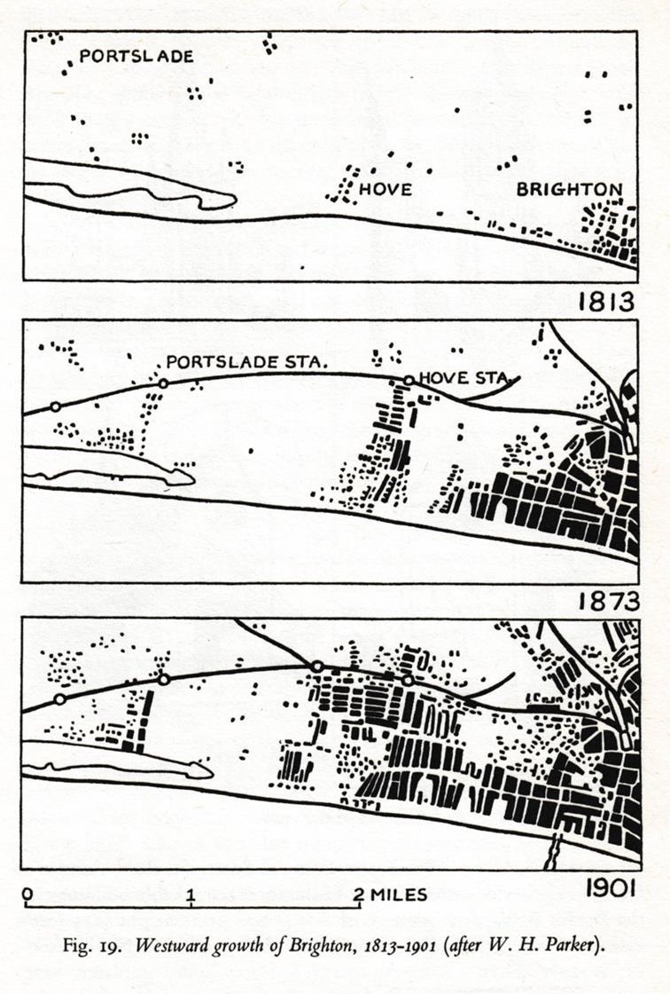
1 Brighton and Hove U3A Discovering the History of Hove Group What do we mean by Hove? There are plenty of signs of prehistoric settlement in and around the area now known as Hove. A 20-foot high Bronze Age burial mound was destroyed in the creation of Palmeira Square and the remains of a Romano-British villa have been unearthed in West Blatchington By 1801 it was a hamlet of just 101 inhabitants in the parish of Hove which was about 780 acres. By the time it merged with Brighton in 1997 it had grown into a town with a population of 91,000 spread over 6,900 acres. In 1723 a traveller, John Warburton, wrote: I passed through a ruinous village called Hove which the sea is daily eating up and is in a fair way of being quite deserted; but the church being quite large and a good distance from the shore may perhaps escape' The parish church he referred to was this one: St Andrew s in Church Road between Tescos and George Street. But at the time it had been sorely neglected, stood isolated in the fields north east of the village and looked more like this:
 shows the remains of the tower even more decrepit and the addition of a small belfry. St Andrews was rebuilt in 1832-4.")

2 The church tower is said to have fallen down in the 16 th Century and the stone used to construct it carted away for use on other buildings. Another later view (below) shows the remains of the tower even more decrepit and the addition of a small belfry. St Andrews was rebuilt in This map of Lewes and its surroundings in 1797 shows the position of the church in relation to the main village street which became known as Hove Street though it was originally part of the track known as Hove Drove which ran north towards Blatchington along the route we now know as Sackville Road and Nevill Road.

 on the corner of Stanford Road.")
3 This map can be viewed online HERE It shows: Brighthelmstone to the east of Hove The Roads north to the Dyke, Preston and London, Ditchling and Lewes and the Old Shoreham Road which forms the northern boundary of Hove Parish just south of Goldstone Bottom. Wick Farm near what is now St Anne s Well Gardens The faint lines of the parish boundaries. The parish boundary began on the seafront in the east where the Peace Statue now stands and ran NNE up the middle of what is now Little Western Street and Boundary Passage. It reached the Old Shoreham Road (OSR) on the corner of Stanford Road. From there ran west along OSR south of Goldstone Bottom and past Hove Drove before turning SSE just about where


4 Homebase car park now is. It reached the beach between what is now Prince s Crescent and Westbourne Gardens. Below it is marked in blue. Goldstone Bottom later became Hove Park but was then outside the parish of Hove.


5 This view of Hove, painted by George Hilditch around 1850 can be seen in Hove Museum. It was painted from the Wick or Furze Hill and shows Wick Farm in the foreground and the newly rebuilt St Andrew s Church beyond. Running left from the church down towards the sea are the buildings of Hove Street. The painting shows how Hove stood amid open fields at this time. The photographs of Hove Street below from the Regency Society s James Gray archive give an impression of what it was like at the beginning of the 20 th Century before it was widened and straightened. Hove Street 1915 looking south towards the sea Hove Street 1914 looking North towards the houses in Church Street (now Road). The building on the far right is Hove Manor.
 was set back in readiness for the wideneing and")
 can be seen with its roof towers.")
6 Looking south from the Church Road end of Hove Street The Connaught Hotel (1880) was set back in readiness for the wideneing and straightening of the roadway. Hove Manor (centre left) can be seen with its roof towers. Below is the straight and wide Hove Street and the Connaught Hotel today.


7 1914: Hove Street looking north from the seaward end. The Ship Inn was built in 1809 and rebuilt in the early 20 th Century. It is now called the Ginger Pig. Below is the 18 th Century Hove Manor, demolished in 1936.
 beyond the church is probably marking the boundary between Hove and Aldrington parishes.")
8 This painting of Hove from Brighton again shows the church of St Andrews and Hove Street in the middle distance. The hedge running right (north) beyond the church is probably marking the boundary between Hove and Aldrington parishes. In the foreground the unknown artist has recorded the construction underway on the Regency-style terraces of Brunswick Square which began in 1824 and were completed by Brunswick Square This was the start of the extension of Brighton over the parish boundary into Hove not so much a development of Hove as an encroachment of Brighton into Hove.


9 Adelaide Crescent to the west of Brunswick Town was begun in 1830 but progressed slowly. The plan for a crescent facing the sea (below) was later modified.


10 Adelaide Crescent and Palmeira Square were completed in The Ordnance Survey Map (explore it online HERE) of 1875 shows Brunswick Town and Adelaide Crescent and the position of First and Second Avenues.


11 By 1875 construction had barely begun on Hove s widest avenues of what was to be called the West Brighton Estate. The land here belonged to the Stanford family but was entailed and so remained fields while debvelopment continued elsewhere. Further west 20 acres of land adjacent to Hove Street had been sold in the 1850s for development of what was named Cliftonville, perhaps to avoid any association with the shabby environs of Hove Street. The major streets were Osborne Villas, St Aubyns, Medina Villas and Albany Villas. But unlike the uniform building styles of Brunswick and Adelaide Crescent, the development of Cliftonville was more piecemeal with a large variety of houses. Osbourne Villas (above) and Medina Villas (below)
 The gasworks in Hove (pictured here from one of the new houses of St Aubyn s) was")
 railway station can just be seen standing isolated in fields.")
12 Cliftonville also extended north of Church Road The dwellings were less grand and built to a greater density Goldstone Villas lead to the railway station Today s Hove station was originally known as Cliftonville (opened 1865) The gasworks in Hove (pictured here from one of the new houses of St Aubyn s) was right beside St Andrew s Church. It is now the site of Tescos supermarket and car park. Between the gasworks and church tower the pale building of Cliftonville (now Hove) railway station can just be seen standing isolated in fields. A zoomable map of Cliftonville and Hove Street in 1875 (below) can be viewed online HERE


13 Work began on the West Brighton Estate on the entailed Stanford land between Brunswick and Adelaide Terraces and Cliftonville in This included the wide boulevards of Grand Avenue and First, Second, Third and Fourth Avenues. Princes Hotel at the bottom of Grand Avenue (left) Tithe map of Hove parish showing land ownership.
14
 and")
15 Population Hove Parish: 1801: : 11, : 29, : 69,535 Population of Aldrington: 1801: : : 2, : 13,574 In 1894 Hove and Aldrington were combined in a new Hove Urban District In 1898 the Borough of Hove created by Royal Charte On 1 April 1928 Hove Borough was extended to include: Hangleton Preston Rural West Blatchington Parts of Patcham (Tongdean) and Parts of Brighton (west of Dyke Road On April Portslade was merged with the borough of Hove Hove had grown from 778 acres to 6,790 acres Almost 9 times the size of the old Hove parish
MAJOR HISTORIC HERITAGE MUSEUM SITE WITHIN BRIGHTON & HOVE
 THE DROVEWAY, HOVE, EAST SUSSEX, BN3 7QA MAJOR HISTORIC HERITAGE MUSEUM SITE WITHIN BRIGHTON & HOVE Significant potential for a variety of uses LEISURE BUSINESS SPACE EDUCATIONAL MEDIA CAMPUS INSTITUTIONAL
Safe Places in Brighton and Hove. For people with learning disabilities. Go to a Safe Place if you are being bullied or lost.
 s in Brighton and Hove For people with learning disabilities Go to a if you are being bullied or lost. North Street and Old Steine Opening Times One Stop Travel 26 North Street Brighton BN1 1EB Tel: 01273
Baslow & Bubnell Page 1 of 5 A Comparison
 Baslow & Bubnell Page 1 of 5 Introduction This paper describes the number of houses in Baslow and Bubnell from 1670 up to the present day. Most of the data was obtained by counting the buildings on a series
Centurion Way Chichester
 Centurion Way Chichester Work book of plans to show details of the Centurion Way, its links, and potential developments and enhancements from linking to the South Downs National Park all the way to the
Hotel History. Weston-super-mare
 Hotel History Weston-super-mare BLANK PAGE BLANK PAGE BLANK PAGE introduction/explanation 1BA 1889 The Grand Atlantic hotel was built in 1859 originally as the weston college. Left Right The Grand Atlantic
Our Future City. Tuesday 5 th July, 4pm-6pm Suite 1, Jurys Inn Brighton
 Our Future City Tuesday 5 th July, 4pm-6pm Suite 1, Jurys Inn Brighton Brighton & Hove the connected city. Creative, dynamic, inclusive and caring. A fantastic place to live, work and visit Objective To
GREEN DIAMOND BARTHOLOMEW SQUARE, BRIGHTON
 B BARON ESTATES GREEN DIAMOND BARTHOLOMEW SQUARE, BRIGHTON 40 BRAND NEW 1 & 2 BEDROOM APARTMENTS WHAT YOU NEED TO KNOW GREEN DIAMOND BARTHOLOMEW SQUARE, BRIGHTON Green Diamond is an outstanding development
Afon Adda Refurbishment Bangor
 Afon Adda Refurbishment Bangor Archaeological Assessment Revised Report GAT Project No. 1876 Report No. 628 April 2006 Ymddiriedolaeth Archaeolegol Gwynedd Gwynedd Archaeological Trust Craig Beuno, Ffordd
Places in Brent. Stonebridge. Grange Museum of Community History and Brent Archive
 Places in Brent Stonebridge Grange Museum of Community History and Brent Archive Stonebridge is situated in southern Brent, on the Harrow Road between Harlesden and Wembley. The 17 th and 18 th centuries
THE MARSDEN FAMILY OF OSSETT AND HORBURY 1. The Old Halfway House and Matty Marsden Lane Horbury - Who was Matty Marsden?
 THE MARSDEN FAMILY OF OSSETT AND HORBURY 1 The Old Halfway House and Matty Marsden Lane Horbury - Who was Matty Marsden? The Old Halfway House Horbury stands at the junction of Westfield Road and Matty
Oakwood House. Photograph taken in 2004 when members of the ODHS were kindly shown round by members of the staff.
 From Oak Leaves, Part 13, Autumn 2013 - published by Oakwood and District Historical Society [ODHS] Oakwood House and the Origins of Oakwood, North Leeds. By Neville Hurworth The location of the boundaries
YORKSHIRE GARDENS TRUST
 YORKSHIRE GARDENS TRUST Hambleton District Historic Designed Landscapes Project Aldwark Manor Report by Louise Wickham[July 2017] 1. CORE DATA 1.1 Name of site: Aldwark Manor 1.2 Grid reference: SE 469630
Hillbrook Clappers Lane, Fulking, West Sussex
 Hillbrook Clappers Lane, Fulking, West Sussex Hillbrook Clappers Lane, Fulking, West Sussex BN5 9NH Offers in Excess of 795,000 Detached 3 Bedroom Bungalow Potential for Extending or Possible Rebuild,
PEARL RIVER DELTA OVERFLIGHT. 27 November 2008
 PEARL RIVER DELTA OVERFLIGHT 27 November 2008 Introduction This will be an unusual rental car tour. Not only was it not conducted by rental car, it was not even conducted by car. Airplanes were the mode,
Joining instructions. National Conference April 2016
 Joining instructions National Conference 2016 19-21 April 2016 Venue and arrival Name and address of venue: Brighton Centre King s Road Brighton East Sussex BN1 2GR 0844 847 1515 http://brightoncentre.co.uk/
BRIGHTON AND HOVE CITY COUNCIL WEEKLY LIST OF APPLICATIONS
 BRIGHTON AND HOVE CITY COUNCIL WEEKLY LIST OF APPLICATIONS BRIGHTON AND HOVE CITY COUNCIL TOWN & COUNTRY PLANNING ACT 1990 PLANNING (LISTED BUILDINGS & CONSERVATION AREAS) REGULATIONS 1990 TOWN & COUNTRY
USEFUL. SOURCES 1 The Inland Revenue Survey of Land Value and Land Ownership, LOCAL HISTORY. Introduction. Douglas G Lockhart
 USEFUL LOCAL HISTORY SOURCES 1 The Inland Revenue Survey of Land Value and Land Ownership, 1910-1915 Introduction Douglas G Lockhart A survey of all land in Scotland took place between 1910 and 1915 the
The History of Rock Cottage, Westfield Road, Horbury circa
 The History of Rock Cottage, Westfield Road, Horbury circa 1860-1960. This is the history of a dwelling known in its day as Rock Cottage which was situated on Denton Lane (now Westfield Road) in Horbury
The Archaeology of Cheltenham
 The Archaeology of Cheltenham The archaeology collection of The Wilson contains a rich quantity of material relating to the prehistoric and Roman occupation of the North Cotswolds and parts of the Severn
Pottstown postcard from the early 1960s. History compiled by Thomas Hylton
 Over a 250-year period, Pottstown has evolved into one of the loveliest small towns in Pennsylvania. The borough reached its economic zenith about 1960 and continued to prosper through the mid 1970s, when
park house language school, hove park
 park house language school, hove park Home Places possible future visits hints n tips Park House was a Bellerby's Language School which stood on the corner of Goldstone Crescent and Old Shoreham Road,
U3A WALK Harby Hose. Route Summary. Route Overview. Description. Waypoints. Harby. Stuart Galloway
 U3A WALK Harby Hose Stuart Galloway Route Summary A circular walk taking in Harby, Hose and the Grantham Canal. Route Overview Category: Walking Length: 7.310 km / 4.57 mi Parking: Village Hall School
Middle Row: Part of a Georgian Industrial Settlement in Cark in Cartmel, Cumbria Les Gilpin
 Middle Row: Part of a Georgian Industrial Settlement in Cark in Cartmel, Cumbria Les Gilpin The Georgian rows of of High Row and Low Row which sit alongside ' Cark Beck' (river Eea) in the hamlet of Cark
1 TRADE, SERVICES AND MARKETS
 1 TRADE, SERVICES AND MARKETS As producer and consumer of agricultural produce, rural and urban Scotland were tied together in a symbiotic relationship. The transactions which linked them were marketing,
The Castor Roman Walk
 The Castor Roman Walk Welcome to the Route Plan and teachers notes for the Castor Roman Walk. The walk is approximately 3km, with an optional extension of 0.7km. We suggest that you bring with you OS Explorer
Brenig Archaeology Trail
 Walk Information: Maps: OS Explorer 264 Distance: 2.5 miles / 4 kilometres Duration: Allow 2.5 hours for the circular walk Difficulty: easy. Well-marked trail over fields. Start and finish: SH 98325741
STEP BACK IN TIME AND BRIGHTON & HOVE STUFF. In conjunction with THE SUSSEX POSTCARD CLUB A U C T I O N
 STEP BACK IN TIME AND BRIGHTON & HOVE STUFF In conjunction with THE SUSSEX POSTCARD CLUB A U C T I O N Of Brighton, Hove and Sussex postcards, books, real photos, Ephemera, maps and other items On Tuesday
Impressive modern country house in a beautiful riverside setting. roineabhal kilchrenan, taynuilt, argyll
 Impressive modern country house in a beautiful riverside setting roineabhal kilchrenan, taynuilt, argyll Impressive modern country house combining traditional appearance with modern comforts in a beautiful
The History of a Floodplain Meadow Bridget Smith
 The History of a Floodplain Meadow Bridget Smith I have lived in the village of Hemingford Grey near the River Great Ouse since 1976 and, like many others, walked the 1½ km into St Ives by the ancient
The house was rebuilt in 1663 in the restoration style and two diarists, Samuel Pepys and Sir John Evelyn, recorded visits there.
 HISTORY OF BELSIZE Modern Belsize includes the manor of Belsize and the northern part of the Chalcots estate. This section summarises the history of the two estates and explains how in the second half
8. Bincombe Discovering the Ridgeway
 8. Bincombe Discovering the Ridgeway 26.04.18 Key Features Bincombe is no more than a hamlet of farms the Church among them, perched in the slope of the chalk downs below Bincombe Hill just under the Ridgeway
A leisurely one mile stroll through the history of Aldershot s Manor park, considered by many as the most attractive and pleasant parts of our town.
 Figure 1 Entrance to Park from the Aldershot Green/Churchill road end A leisurely one mile stroll through the history of Aldershot s Manor park, considered by many as the most attractive and pleasant parts
Hay Wood, Rowington and Baddesley Clinton - Warwickshire
 Hay Wood, Rowington and Baddesley Clinton - Warwickshire Starts at Lay-by alongside Hay Wood 2 hours 30 minutes 5.5miles 8.8km Leisurely ID: 0.683 Developed by: John Clift Checked by: Andy Page www.ramblersroutes.org
Black Buoy, Wivenhoe to Spinnaker, Colchester
 Start: Finish: Total Distance: Black Buoy, Wivenhoe Crown, Ardleigh 6.3 miles Black Buoy, Wivenhoe to Spinnaker, Colchester Distance: 2.4 miles Turn right out of the Black Buoy, then left into East Street.
The footpaths in Eaves Wood, Mytholm, Hebden Bridge. Dedicating historic paths as rights of way: submission by Hebden Bridge Walkers Action
 The footpaths in Eaves Wood, Mytholm, Hebden Bridge Dedicating historic paths as rights of way: submission by Hebden Bridge Walkers Action Summary This submission to Calderdale MBC proposes that the council
The Development of Railways around Ashdown Forest
 The Development of Railways around Ashdown Forest 1850-1914 A collation of text and images from the Group s exhibition Ashdown Forest in a Time of Change, 1850-1914 which was held at the Ashdown Forest
Chiselbury Camp hillfort
 Chiselbury Camp hillfort Reasons for Designation Large univallate hillforts are defined as fortified enclosures of varying shape, ranging in size between 1ha and 10ha, located on hilltops and surrounded
4. Bronze Age Ballybrowney, County Cork Eamonn Cotter
 4. Bronze Age Ballybrowney, County Cork Eamonn Cotter Illus. 1 Location map of the excavated features at Ballybrowney Lower (Archaeological Consultancy Services Ltd, based on the Ordnance Survey Ireland
RAILWAY BOUNDARY MARKERS IN GLOUCESTERSHIRE. John Putley
 Reprinted from: Gloucestershire Society for Industrial Archaeology Journal for 2005 pages 52-56 RAILWAY BOUNDARY MARKERS IN GLOUCESTERSHIRE John Putley Recently the author became aware of some railway
FOUNDATIONS OF ARCHAEOLOGY A WALK IN VERNDITCH CHASE
 FOUNDATIONS OF ARCHAEOLOGY A WALK IN VERNDITCH CHASE 1. A Tale of two Long Barrows Long barrows were constructed as earthen or drystone mounds with flanking ditches and acted as funerary monuments during
RA.C.K.S. Residents Association of Cherryvalley, Kensington and Shandon. Historical sketch by Aidan Campbell
 RA.C.K.S. Residents Association of Cherryvalley, Kensington and Shandon Historical sketch by Aidan Campbell RACKS is located in a suburb of East Belfast known as Knock. The name of Knock has its origin
Business Register and Employment Survey 2016 Update Final March 2016
 Business Register and Employment Survey 2016 Update Final March 2016 Jamie.watson@coast2capital.org.uk EXECUTIVE SUMMARY The Business Register and Employment Survey (BRES) update has shown that the Coast
DOWNLOAD OR READ : THE CRYSTAL PALACE EXHIBITION ILLUSTRATED CATALOGUE PDF EBOOK EPUB MOBI
 DOWNLOAD OR READ : THE CRYSTAL PALACE EXHIBITION ILLUSTRATED CATALOGUE PDF EBOOK EPUB MOBI Page 1 Page 2 the crystal palace exhibition illustrated catalogue the crystal palace exhibition pdf the crystal
Appendix 7 Local Green Spaces - Detailed Evidence
 Appendix 7 Local Green Spaces - Detailed Evidence Neigh Bridge Country Park, Somerford Keynes General information Neigh Bridge Country Park is situated at the southern entrance to Somerford Keynes village.
Destructor Bridge, Bath. An Historic Survey. Kirsten Elliott 58 Minster Way Bath BA2 6RL
 Destructor Bridge, Bath An Historic Survey Kirsten Elliott 58 Minster Way Bath BA2 6RL Copyright The documentation within this report may not be reproduced, photo-copied, translated or transmitted in any
Union Square. & Park Place. Project Summary Submitted by DeHoff Development Company
 Union Square & Park Place Submitted by DeHoff Development Company December 18, 2012 encompass a 250-acre, mixed-use corporate campus that includes office, hotel, retail and residential components. The
Weber Point The First Sammamish Lumber and Shingles
 Weber Point The bunkhouse picture is "Courtesy Issaquah History Museums, Neg. 2005.1.18" Weber Point, located on the eastern shores of Lake Sammamish in the northern part of the city of Sammamish, is today
2. 4 Avebury: stone circles and nearby sites
 24 2. 4 Avebury: stone circles and nearby sites N E W S Beckhampton Avenue The bank originally stood 7 m (23 ft) high, much taller than today. The ditch was originally 9 m (30 ft) deep and 20 m (65 ft)
Roanoke River Lighthouse Moved Again This Time It s Permanent
 Roanoke River Lighthouse Moved Again This Time It s Permanent By Timothy Harrison This past May, North Carolina s Roanoke River Lighthouse, the last standing screw-pile style of lighthouse in its original
Quiet Beverley - A walk with Val Wise. May and June 2018
 Quiet Beverley - A walk with Val Wise May and June 2018 This was one of two walks in May and June with half the group going on each and then swapping over to attend the other one. I joined Val in the Library
Le Château d Arc-en-Barrois A royal French château
 Le Château d Arc-en-Barrois A royal French château Partnerselskabet Arc-en-Barrois P/S, Hambros Alle 27, 2900 Hellerup, Denmark Château d Arc-en-Barrois, 16 Place Moreau, 52210 Arc-en-Barrois, France www.my-french-chateau.com
Chetwode. HISTORIC LANDSCAPE REPORT / June 2011
 Chetwode Buckinghamshire Archaeological Society HISTORIC LANDSCAPE REPORT / June 2011 Report BAS/2011-05. Compiled by Karen Pepler, from a survey by Karen Pepler, Gary Marshall and Peter Marsden, with
The Original Farm, Dairy & Sausage plant buildings
 The Original Farm, Dairy & Sausage plant buildings Featured below are images of the original Deerfoot farm buildings along Stony Brook. Beginning in 1894, the original farm buildings along with 20 acres
SEVILLE: PLANNER S EUROPE (ALMOST) 31 May 2004: Revised. Calling all North American urban planners. The Promised Land is in Spain. Eureka!
 31 May 2004: Revised. Calling all North American urban planners. The Promised Land is in Spain. Eureka!") SEVILLE: PLANNER S EUROPE (ALMOST) FAST FACTS Similar To Urbanized Area* Population 750,000 Honolulu, Ottawa, Lille Urbanized Land Area: Square Miles 52 Ho Chi Minh City, Chicoutimi, Urbanized Land Area:
SEVILLE: PLANNER S EUROPE (ALMOST) FAST FACTS Similar To Urbanized Area* Population 750,000 Honolulu, Ottawa, Lille Urbanized Land Area: Square Miles 52 Ho Chi Minh City, Chicoutimi, Urbanized Land Area:
Leasing Brochure. Park Plaza Shopping Center 1150 N. Federal Highway, Pompano Beach, Florida Under Construction - Coming Very Soon
 Park Plaza Shopping Center 1150 N. Federal Highway, Pompano Beach, Florida 33062 Leasing Brochure Under Construction - Coming Very Soon Exclusive Leasing Broker 2048 East Sample Road, Lighthouse Point,
A walk around old Ardersier
 A walk around old Ardersier Ardersier Local History Group 2014 Welcome to our Ardersier village walk We hope you enjoy your tour and that the weather is dry! Allow an hour for a leisurely stroll: the
LANDING S PARK CONCEPTUAL PLAN HAMILTON ANDERSON JANUARY City of Novi, Michigan. The Park at 13 Mile and Old Novi Road
 HAMILTON ANDERSON JANUARY 2012 LANDING S PARK CONCEPTUAL PLAN January 2012 Page 1 of 15 January 2012 PROJECT GOALS Activate the park by introducing new elements Provide clear access to the water and enhance
A brief history of Embleton and Wythop. by Walter Head and Derek Denman Embleton Community Hall, 15 April
 A brief history of Embleton and Wythop by Walter Head and Derek Denman Embleton Community Hall, 15 April 2015 1 Structure of presentations Derek Denman: An outline of the history of Embleton and Wythop
Sun, sea and... step-free access. Your guide to an accessible break in Brighton
 Sun, sea and... step-free access Your guide to an accessible break in Brighton 1 Welcome to your guide When choosing where to go on your next English holiday the last thing you should have to worry about
STATION QUARTER NORTH
 This is an historic landscape of escarpment, wooded valley, green open fields, streams, springs and ponds all gently sloping towards the waters of the River Test estuary. 1810: A sketch view of Southampton
Claro Community Archaeology Group
 Site Record Form Item Number Claro Community Archaeology Group 60940161 Date Initials Inspected Access Visibility NGR Centre 434851 458431 NGR Linear Item Description HOUSE Site Data Roundell's Manor History
The Clyde Walkway. Cambuslang Bridge to Strathclyde Country Park. Thanks to
 Thanks to The Clyde Walkway is a partnership venture based on co-operation and agreement. North Lanarkshire, South Lanarkshire and Glasgow City Councils would like to acknowledge the help and support of
Eagle Harbor (PG 87B-038)
") Eagle Harbor (PG 87B-038) The resort community of Eagle Harbor began to develop in the 1920s at the site of an ancient river port, Trueman Point (87B-028), on the Patuxent River. 1 Eagle Harbor is located
Eagle Harbor (PG 87B-038) The resort community of Eagle Harbor began to develop in the 1920s at the site of an ancient river port, Trueman Point (87B-028), on the Patuxent River. 1 Eagle Harbor is located
Walk 1: Highfield, Lob Wood and The River Wharfe
 Walk 1: Highfield, Lob Wood and The River Wharfe Start: The Hen Pen Garden, Main Street, Addingham LS29 0NS, SE 077 498. Alternative Start: Near Bolton Bridge SE 071 525 (see page 6). Full walk: 4.5 miles
RAY YENKANA Willowbrook Cr, Dawson Creek BC Canada $2,847,000
 1716 Willowbrook Cr, Dawson Creek BC Canada For SALE $2,847,000 This is a rare find, 32 townhomes in Dawson Creek, BC. Excellent investment in a single title multi family complex. Vendor has upgraded this
In need of some modernisation or further development
 11 Market Place Bingham Nottingham NG13 8AR Tel: (01949) 87 86 85 bingham@hammondpropertyservices.com With possible links to the discovery of Tutankhamun! 8 CHERRY STREET, BINGHAM, NOTTINGHAM NG13 8AJ
89-90 LONDON ROAD BRIGHTON BN1 4JF RETAIL & RESIDENTIAL INVESTMENT OPPORTUNITY
 INVESTMENT CONSIDERATIONS Located in the popular city of Brighton 6 minute walk (0.3 miles) from Brighton Railway Station London Road is an up and coming vibrant area Comprises a ground floor retail unit
ORFORD & GEDGRAVE PARISH COUNCIL
 ORFORD & GEDGRAVE PARISH COUNCIL The Town Hall, Market Hill, Orford, Woodbridge, Suffolk. IP12 2NZ Tel: 01394 459172 E-mail: orfordtownhall@btconnect.com Minutes of the 204 th meeting of Orford & Gedgrave
A number of goals were identified during the initial work on this Big Lake Transportation Plan.
 C. Transportation General Background Information Big Lake s transportation system includes all the roads, paths and facilities that allow the movement of private vehicles, trains and planes, as well as
Chart 315. Old Aldenhamian Duke of Richmond St Andrew's Lancing Lodge Southwick Lodge Lodge Lodge Lodge No No No No No.
 Chart 315 This information is copyright, and reproduced by permission, of the United Grand Lodge of England Royal York Lodge No. 315 Royal Brunswick Yarborough Lodge Saint Cecilia Burrell Lodge Stanford
29 Plas Derwen. Exploring Abergavenny
 29 Plas Derwen Exploring Abergavenny Cover: rhythm 2 plas derwen EXPLORING ABERGAVENNY For several years the Abergavenny and District Civic Society has been studying the streets, spaces and buildings of
Looking north from the SW shieling site with Lub na Luachrach in the foreground
 Looking north from the SW shieling site with Lub na Luachrach in the foreground Upper Gleann Goibhre - Shieling sites Two shieling sites in the upper reaches of the Allt Goibhre were visited and recorded
The Mill House Pirbright Surrey
 The Mill House Pirbright Surrey The Mill House Pirbright Surrey An outstanding Grade II listed mill house dating from the 17th Century with immense character and charm. Accommodation Reception hall, drawing
WALKS AROUND WOODHURST
 WALKS AROUND WOODHURST With Walks To Woodhurst from North St. Ives Woodhurst is situated on the verge of an elevated tract of table land four miles north of St. Ives. Its footpaths vary from leafy lanes
Seven Wonders of the Ancient World. Lighthouse of Alexandria. The Colossus of Rhodes. Hanging Gardens of Babylon.
 Seven Wonders of the Ancient World Lighthouse of Alexandria The Colossus of Rhodes Hanging Gardens of Babylon Please note: this PDF is copyrighted by Montessori for Everyone and is free for personal use
Castleton and Its Old Inhabitants.
 Castleton and Its Old Inhabitants. Chapter 6. The Churchyard-side buildings on Castle Street. Part of Castle Street has changed somewhat over the years, mainly due to the earlier presence of a little row
An Assessment of Lower Boddington
 W An Assessment of Lower Boddington Design and Conservation Team Reviewed Winter 2017 Contents Introduction... 2 Origins and Archaeology... 3 Historic Development... 3 Plan Form... 3 Space and relationship
ARCHAEOLOGICAL S E R V I C E S S O U T H. Newhaven Primary School, Newhaven, East Sussex. Archaeological Desk-based Assessment.
 T H A M E S V A L L E Y ARCHAEOLOGICAL S E R V I C E S S O U T H Newhaven Primary School, Newhaven, East Sussex Archaeological Desk-based Assessment by Sean Wallis Site Code NSN14/110 (TQ 4401 0056) 02000
THE BLOCK HOUSE. A time where yesterday is not necessarily the day before today: but a past that no longer exists.
 THE BLOCK HOUSE Going around in Tell el Eisa, obvious to those who know where to go, you can cross small areas where there are still many relics from the period of the battles of El Alamein. Some of these
KRAKÓW SEPTEMBER Thursday the 25th we were in Kazimierz. After we had a break at a restaurant we went on.
 KRAKÓW 22. - 27. SEPTEMBER 2014 Thursday the 25th we were in Kazimierz. After we had a break at a restaurant we went on. Here we are arriving at Szeroka. It is a short street stub with a number of restaurants.
The Croft LOWER ASHTON, EXETER, DEVON
 The Croft LOWER ASHTON, EXETER, DEVON The Croft LOWER ASHTON, EXETER, DEVON Chudleigh 5 miles Exeter 8 miles (London Paddington 2 hours) Moretonhampstead 8 miles Bovey Tracey 7 miles (All distances and
COSTOCK. Location and boundaries. is bounded to the north by Bunny, to the east by Wysall, to the south by Rempstone and to the west
 VCH Nottinghamshire On-line Texts in Progress This version: January 2013 Author: Sheila Leeds COSTOCK Location and boundaries The ancient parish of Costock occupies 1,688 acres 1 about 9½ miles south of
The Sand House A Victorian Marvel
 The Sand House A Victorian Marvel A talk given by Richard Bell to Tickhill & District Local History Society in April 2007 The majority of Doncaster s 21st Century residents are oblivious to the unique
Residential and Retail Development Site at Jim Bush Drive, Prestonpans, East Lothian, EH32 9GP
 Residential and Retail Development Site at Jim Bush Drive, Prestonpans, East Lothian, EH32 9GP Development site with planning permission for 14 apartments and 5 retail units (15/00487/P) Approx. 0.59 acres
Executive Summary. Ideally suited for a company requiring an impressive corporate headquarters
 Executive Summary A unique opportunity to acquire an 8.87 acre freehold campus located inside the M25 providing outstanding office and ancillary accommodation 35,557 sq ft (3,303 sq m) of Grade A office
Aerial photograph of Forest Hills, Googlemaps
 Aerial photograph of Forest Hills, 2010. Googlemaps Aerial photograph of Forest Hills, 1929. Boston Public Library Print Department Forest Hills 1874. GM Hopkins Atlas of West Roxbury Jacob W. Seaver Mansion.
Trench 91 revealed that the cobbled court extends further to the north.
 Report on the 2013 Gournia Excavations The 2013 excavations at Gournia were conducted June 17 July 26 under the aegis of the American School of Classical Studies at Athens and the supervision of the KD
Chess & Gade. Chalfont & Latimer Station - Latimer - Chenies - Sarratt - Kings Langley Station. Length: 8 ¾ miles (14.25km)
") 1 Chess & Gade Chalfont & Latimer Station - Latimer - Chenies - Sarratt - Kings Langley Station Length: 8 ¾ miles (14.25km) Underfoot: Well-trodden paths, mainly firm in all weather conditions, though
1 Chess & Gade Chalfont & Latimer Station - Latimer - Chenies - Sarratt - Kings Langley Station Length: 8 ¾ miles (14.25km) Underfoot: Well-trodden paths, mainly firm in all weather conditions, though
BISHOPSTONE CIRCULAR WALK
 BISHOPSTONE CIRCULAR WALK 4½ miles (7¼ km) - allow 2 hours (see maps on final pages) Introduction This walk is within the North Wessex Downs Area of Outstanding Natural Beauty and starts from the small,
BASLOW ENCLOSURE AWARD
 BASLOW ENCLOSURE AWARD Or How The Duke got his Golden Gates including THE BASLOW ENCLOSURE AWARD THE TURNPIKE ROADS OF 1812 & 1824 THE RUTLAND/DEVONSHIRE EXCHANGE OF LANDS THE NEW OUTER PARK by 2017 update
# BATHS # BEDROOMS MONTHLY RATE NORTH MYRTLE BEACH WINTER/MONTHLY RENTAL HOMES
 WINTER/ RENTAL HOMES Bay Watch III 441 1 1 Oceanfront $850 $28 per day Buena Vista Plaza 506 1 1 Oceanfront $650 $22 per day Buena Vista Plaza 707 1 1 Oceanfront $750 $25 per day Chateau Manor 103 1 1
An archaeological excavation and watching brief at the Musket Club, Homefield Road, Colchester, Essex December 2004-February 2005
 An archaeological excavation and watching brief at the Musket Club, Homefield Road, Colchester, Essex December 2004-February 2005 report prepared by Howard Brooks on behalf of RMPA and the MoD CAT project
Now you can live in one of Australia s most beautiful places Vantage at Evans
 Now you can live in one of Australia s most beautiful places Vantage at Evans A master-planned community Vantage at Evans This masterplanned community is designed to integrate with and preserve the natural
A Wander through. Sculcoates...
 A Wander through Sculcoates... Part of the project, 2007. !Sculcoates Lan" Wandering down Sculcoates Lane, toward the northern boundaries of the district of Sculcoates, two sites either side of the road
Santa Clara Valley s Railroad Lines
 Smith-Layton Archive Charlene Duval, Executive Secretary cduval@sourisseauacademy.org Leilani Marshall, Archivist lmarshall@sourisseauacademy.org Phone: 408 808-2064 Santa Clara Valley s Railroad Lines
Cholesbury New House, Parrots Lane, Cholesbury, Buckinghamshire
 Cholesbury New House, Parrots Lane, Cholesbury, Buckinghamshire An Archaeological Watching Brief For Mr Martin Wood by Sean Wallis Thames Valley Archaeological Services Ltd Site Code PLC 06/135 March 2007
Morgan s Vale and Woodfalls History Trail. (You could start at any point and follow the trail round)
") Morgan s Vale and Woodfalls History Trail (You could start at any point and follow the trail round) 1) MORGAN S VALE & WOODFALLS PRIMARY SCHOOL Built in 1869, it served as a church on Sundays until the
Morgan s Vale and Woodfalls History Trail (You could start at any point and follow the trail round) 1) MORGAN S VALE & WOODFALLS PRIMARY SCHOOL Built in 1869, it served as a church on Sundays until the
EOMAN EEMAINS POUND AT BAMSGATE.
 Archaeologia Cantiana Vol. 12 1878 EOMAN EEMAINS POUND AT BAMSGATE. BY ROBERT HICKS, M.B.C.S. WHEN Thanet was completely isolated, the sea flowed in at Eeculver, covering the marshes between that place
Korean War Veteran Internet Journal for the World s Veterans of the Korean War February 4, 2015
 Korean War Veteran Internet Journal for the World s Veterans of the Korean War February 4, 2015 Commonwealth Revisit scheduled for April 20-25 Thinking of Revisiting Korea? Now is the time to make your
CANDOVERS PARISH COUNCIL
 CANDOVERS PARISH COUNCIL MINUTES OF MEETING OF THE COUNCIL Date: Wednesday 8 th January 2014. Time: 7:00pm Venue: The Old Post Office, 31 Brown Candover Present: Jonathan Moseley Chairman Sue Marriott