Highway Operational Standards
|
|
|
- Laurence Mills
- 5 years ago
- Views:
Transcription
1 Highway Operational Standards April 2018 cambridgeshire.gov.uk
2 Cambridgeshire County Council s Highway Operational Standards CONTENTS Section Pages 1. Introduction 1 2. Asset Descriptions 3 3. Data Management 5 4. Community requirements and customer communications Future Demands Asset Investment Strategies / Lifecycle Plans Financial Summary Asset Management Planning Practice Service Standards (Planned, cyclic and reactive maintenance) Performance Management and Benchmarking Risk Management Continuous Improvement Management of the Plan Links to associated documents and references Glossary 28 Appendices Appendix A Highway Safety Inspections Cat 1 (1a and 1b) Defect Investigation levels Appendix B - Reactive Maintenance Investigatory levels for Category 2 defects Appendix C Communications Strategy Appendix D BCI and RCI Indices Appendix E Highway Capital Maintenance Programme Flow Charts Appendix F Highway Standards and Enforcement Appendix G Life Cycle Plans Appendix H Skid Resistance Policy Appendix I - Adoption of Non-Motorised User (NMU) Routes
3 Appendix J Definitive Map Modification Order and Public Path Order Statement of Priority Appendix K Road Classification Policy Appendix L Street Lighting Policy Appendix M Highway Capital Maintenance Programme Appendix N Traffic Signals Design and Operational Guidance
4 1 1. Introduction 1.1 This Highway Operational Standards (HOS) sets out how Cambridgeshire County Council manages and maintains the highway infrastructure for which it is responsible. It brings together the County Council Corporate and Local Transport Plan (LTP) objectives. This Plan details how the principles of asset management will be increasingly used to ensure that the Highways Service meets the requirements of its users and delivers value for money. 1.2 The Department for Transport (DfT) document Gearing up for efficient highway delivery and funding, published in January 2014, identified how highway maintenance funding was likely to be allocated in the future. It suggested that authorities which have a highway asset management plan in place, and can demonstrate its use, will be incentivised through a revised highway maintenance funding formula. An Incentive Funding stream was implemented from 2016/17. The amount of funding that authorities receive from this source is dependent upon the extent to which they have implemented the asset management approach. The potential funding available to the Authority from this source is 9,628,000 for the years 2016/17 to 2020/21. This Plan plays an essential role in securing and maximising long term capital funding for the maintenance of Cambridgeshire s highway network. 1.3 A new national Code of Practice Well Managed Highway Infrastructure was published in October This supersedes the previous Codes, published in 2005, which included Well Maintained Highways. The new Code contains fewer prescriptive standards and promotes a more risk based approach. This Plan reflects the Authority s implementation of the key elements of the new Code. 1.4 This Plan, along with the Highway Asset Management Policy and Strategy, demonstrates the Authority s commitment to highway asset management via an approach that is tailored to Cambridgeshire s needs, whilst also recognising national best practice. The Plan sets out how progress in implementing the asset management approach is monitored. The integrated approach promoted throughout the Plan enables the consideration of the wider issues associated with the management of the county s transport network, such as sustainability and growth pressures. 1.5 Cambridgeshire s highway network is by far the most valuable asset for which the County Council is responsible, with a gross replacement cost in the order of 11.5 billion, (in accordance with Whole of Government Accounts principles). The highway assets covered by this plan are outlined in Section The purpose of this Plan is to: Define affordable highway service standards Publish investment and maintenance strategies for key highway asset groups Improve the way in which the county s highway are managed and maintained Enable the delivery of value for money through efficient and effective highway service provision 1.7 This Plan covers the period It has been produced in accordance with national guidance provided by the Highway Maintenance Efficiency Programme


5 2 (HMEP) - Highway Infrastructure Asset Management and Prevention and a Better Cure. Fig 1: HMEP Guidance documents 1.8 This Plan covers the development, maintenance and operation of Cambridgeshire s highway network. 1.9 This Plan is a key operational document that is linked intrinsically to other County Council policies and processes. This relationship is illustrated in the Systems Diagram below. Fig 2: Asset Management Systems Diagram Corporate Plan Community Plan Business Plan Government Policy and Legislation National Guidance LTP Highway Asset Management Policy and Strategy HOS Customer Expectation Service Delivery Local Plans Operational Service Documents (e.g. Service Plan, Highway Capital Maintenance Programme
6 3 2. Asset Descriptions 2.1 The official records of the overall status and extent of Cambridgeshire s public highway asset are managed within the Highways Service. 2.2 A summary of the main asset groups covered in this Plan is provided in Figure 3 below: Fig 3: Summary of Assets Managed Asset Group Element Quantity Carriageways Footways and cycleways Structures Street Lighting Intelligent Transport Systems (ITS) Grassed areas and trees Public rights of way A Road B Roads C Roads Unclassified Roads Soft Roads (unmade/green lanes) Total Cycletracks Fords & causeways Traffic Calming features Anti-skid Cat 1a Footways Cat 1 Footways Cat 2 Footways Cat 3 Footways Cat 4 Footways (estimate) Total Permissive paths (excluding cycleways) Pedestrian / cycle bridges Road bridges Retaining Walls Underpass / subway Signal Gantry sites PROW structures (over 5m) Street Lights Illuminated signs and bollards Traffic Signals - Junctions Traffic Signals Crossings Variable message signs Vehicle Activated Sign Parking guidance signs RTPI (bus stop displays) Rising Bollards (Cambridge City Centre) CCTV Cameras Flood Warning Signs Highway Trees (All trees within falling distance are collectively termed highway trees ) Verge length Restricted Byways Byways Bridleways Footpaths Total 427 km 570 km 1115 km 2266 km 133 km 4,505 km 64km 7 no (ok to keep) 1,682 no (ok to keep) 29 km (ok to keep) 14km 28 km 66 km 175 km 2,020km 2,275 km 644km 142 no 917 no 63 no 17 no 5 no approx no no 5,735 no 611 no 201 no 47 no 317 no 37 no 335 no 21 no 23 no 9 no 87,429 no 4284km 5km 407km 596km 2,227km 3,235km
7 4 Asset Group Element Quantity Drainage Gullies Offlets 154,150 no 7,101 no Street Furniture Non illuminated signs & bollards Safety Cameras Pedestrian guardrail Vehicle restraint systems (safety fencing) Weather stations Automatic Traffic Counters Verge Marker posts 62,744 no 35 no (plus one average speed camera installation) km 54,291 km 3 no 63 no 6,867 no 2.3 Assets not covered by this plan This Plan covers the management of key highway infrastructure assets. The Plan does not cover the following transport related assets. Some are the responsibility of other authorities or agencies, whilst others are County Council assets that are currently managed outside of this Plan. Fig 4: Assets not covered by this Plan Asset Guided Busway Street Lighting Park and ride sites Car Parks Street name Plates (owned and managed by district councils) Picnic site A10 Brandon Creek Bus shelters (Parish Council owned) Pay and Display parking machines Motorways and Trunk Roads M11 A11 to A14 A11 A14 to M11 A428 A14 to A1 A14 A11 to Boundary with Northamptonshire near Keyston A1(M) A1 near Alconbury to Peterborough Boundary North of A15 Norman Cross A1 A428 to A1(M) near Alconbury A47 Norfolk Boundary near Emneth to Peterborough boundary near Thorney Toll Responsibility CCC s Park & Ride and Busway Team Maintenance is covered by a PFI contract with Balfour Beatty. A street lighting Policy is included as an appendix to this document. CCC s Park & Ride and Busway Team Multi storey and street level managed by either private company or district council City/District Council CCC maintains barrier and cuts vegetation Parish Council except Drummer Street Bus Station Cambridge which is managed within CCC s Park & Ride and Busway Team CCC s Traffic Manager Team Highways England In Cambridgeshire there is approximately 280km of trunk road and motorway network managed by Highways England
8 5 3. Data management 3.1 The main purpose of data collection is to provide the County Council with information to help make the best use of the funds available to the Authority. Data is collected via: Safety Inspections Condition Inspections / Surveys Inventory collection Safety inspections are either walked driven or cycled inspections. Driven Inspections are carried out by two people in a slow moving vehicle as outlined in table 4a below. 3.2 Asset data is required to enable the following: Effective Management of the Highway Network Assessment of the expected lives of individual assets or asset components The assessment of current and development of future levels of service The assessment of current and development of future performance indicators The development of sustainable maintenance options The identification of future investment strategies The development of short, medium and long-term forward works programmes Valuation assessments for each of the assets and the calculation of how they have depreciated in value since they were created Once completed, these processes will allow informed and cost effective asset management decisions to be made. 3.3 Network Hierarchy The Council s Highway Network Hierarchy is based upon the criteria set out in the 2016 Code of Practice (CoP) Well-Managed Highway Infrastructure. The hierarchy reflects local needs and priorities. The hierarchies, which are shown in figures 4 a-c form the overarching framework for all data management activities. These were last reviewed in November Safety Inspections A primary source of information is a formal regime of safety inspections that identify and record Category 1a and 1b defects. 3.5 The frequency and method of these inspections is outlined in Fig. 5 below. The safety inspection frequencies and methods set out in this Plan are based upon the 2016 Code of Practice, with some variations to reflect local circumstances. 3.6 Where there is a controlled pedestrian crossing point within a carriageway then the adjacent footway defect intervention criteria are applied. Pedestrianised areas are deemed to be footways for the purposes of safety inspections and defect intervention criteria. 3.7 A resilient network has been identified in accordance with the requirements of the 2016 Code of Practice Well Managed Highway Infrastructure. Any carriageway on the identified resilient network will receive a safety inspection at a minimum frequency equivalent to a Link Road, i.e. 4 times per year.
9 6 Fig 5: Inspection frequencies for main asset groups a) Carriageways Category Hierarchy Description Type of Road General Description Description CCC Inspection frequency and type CCC Inspection frequency tolerance CW1 CW2 Motorway Strategic Route Main Distributor Limited access motorway regulations apply Principal 'A' class roads between Primary Destinations Major Urban Network and Inter-Primary Links. Routes for fast moving long distance traffic. Fully grade separated and restrictions on use. The Primary Route Network Short - medium distance traffic Routes between Strategic Routes and linking urban centres to the strategic network Not inspected by CCC responsibility of Highways England 12 times per year (monthly) Driven 12 times per year (monthly) Driven Not applicable ± 7 calendar days ± 7 calendar days CW3* Secondary Distributor Mostly B and C class roads and some unclassified routes typically carrying bus, HGV and local traffic. Might have frontage access and frequent junctions* In residential and other built up areas these roads have typically 20 or 30 mph speed limits and very high levels of pedestrian activity with some crossing facilities. On-street parking is generally unrestricted except for safety reasons. In rural areas these roads usually link the larger villages, bus routes and HGV generators to the Strategic and Main Distributor Network 12 times per year (monthly) Driven ± 7 calendar days CW4 Link Road Roads linking between the Main and Secondary Distributor Network typically with frontage access and frequent junctions In urban areas these are residential or industrial roads connecting areas of development, typically with 20 or 30 mph speed limits, random pedestrian movements and uncontrolled parking. In rural areas these roads link the smaller villages to the distributor roads 4 times a year (3 monthly) - Driven ± 14 calendar days
10 7 CW5 Local Access Road Roads serving limited numbers of properties carrying only access traffic In rural areas these roads serve small settlements and provide access to properties and land. In urban areas they are often residential loop roads or cul-de-sacs Annually (once per year) Driven ± 28 calendar days CW6 CW7 Minor Roads Soft Roads (Green Lanes) Little used roads serving very limited numbers of properties Unmade unclassified Locally defined roads typically serving 5 or less properties with lower volumes of traffic Exclusively in rural areas carrying mainly agricultural vehicles and pedestrians Once every two years (24 monthly) Driven (standard is that they are passable with care) No formal inspection regime. Inspected on a reactive basis (standard is that they are passable in a 4 wheel drive vehicle) *Whilst this is generally accepted, there are exceptions where some more minor classified roads are categorised as a CW4 or CW5 ± 28 calendar days Not applicable b) Footways Category FW1 FW2 Category Name Prestige walking zones Primary Walking routes Description Very busy areas of towns and cities with high public space and street scene contribution Busy urban shopping and business areas and main pedestrian routes. CCC Inspection frequency and type 12 times per year (monthly) walked inspection with associated carriageway inspected at same time 12 times per year (monthly) walked inspection with associated carriageway inspected at same time CCC Inspection frequency tolerance ± 7 calendar days ± 7 calendar days FW3 Secondary Walking Routes Medium usage routes through local areas feeding into primary routes, local shopping centres etc. 12 times per year (monthly) walked inspection with associated carriageway inspected at the same time ± 7 calendar days FW4 Link Footways Linking local access footways through urban areas and busy rural footways Annually (once per year) - Driven with carriageway inspection ± 28 calendar days FW5 Local Access Footways Footways associated with low usage, short estate roads to the main routes and cul-de-sacs. Annually (once per year) Driven with carriageway inspection ± 28 calendar days FW6 Minor Footways Little used rural footways serving very limited numbers of properties Annually (once per year) Driven with carriageway inspection ± 28 calendar days
11 8 c) Cycleways Category CY1 CY2 CY3 CY4 CY5 Description Prestige/ busier commuter route Cycle Track (by Legal Order) - a highway route for cyclists not contiguous with the public footway or carriageway, and shared cycle/pedestrian paths, either segregated by a white line or other physical segregation, or un-segregated. Other routes Cycle Track (by Legal Order) - a highway route for cyclists not contiguous with the public footway or carriageway and shared cycle/pedestrian paths, either segregated by a white line or other physical segregation, or un-segregated. Cycle lane forming part of the carriageway, typically a strip adjacent to the nearside kerb, with provision of cycle route road markings. Cycle gaps at road closure point (no entry to traffic, but allowing cycle access). Cycle trails, leisure routes through open spaces. These are not necessarily the responsibility of the highway authority, but may be maintained by an authority under other powers or duties. Cycle provision on carriageway, other than a marked cycle lane or marked cycle provision, where cycle flows are significant CCC Inspection frequency and type Twice per year (6 monthly cycled or walked) Annually (Once per year cycled or walked), or Inspected with footway/carriageway at same frequency and method Inspected with carriageway at same frequency and method (see Fig. 5 a) above) Annually (Once per year cycled or walked) Inspected with carriageway at same frequency and method (see Fig. 5 a) above) CCC Inspection frequency tolerance ± 21 calendar days ± 28 calendar days As carriageway ± 28 calendar days As carriageway 3.8 Condition surveys Condition surveys are used to provide information for the prioritisation of maintenance schemes and also for performance and benchmarking purposes. They provide key information used to determine the effectiveness of the Asset Management Strategy. Figure 6 below describes the extent of the condition surveys undertaken. Fig 6: Condition Survey extent and coverage Carriageway Survey Type Scanner Extent A Roads B Roads C Roads CCC coverage / frequency 100% of the network in one direction each year 100% of the network in one direction each year 50% of the network in one direction each year CVI Unclassified Roads Approximately 20% of the network each year SCRIM Deflectograph All hierarchy 2 & 3a roads All roads 100% of the network in both directions each year Scheme specific as required during development of forward programmes FNS All footways Approximately 20% of the network each year
12 9 Highway Structures Category Description CCC Inspection frequency and type GI PI General Inspection of all structures and gantries Principal Inspection Every 2 years Every 6 Years of structures with Technical issues / difficulties Traffic Signals (Incl. VAS) Category Description CCC Inspection frequency and type Periodic Inspection (PI) Physical condition of the site is checked visually, together with testing all of the electronic signal and communications equipment Each installation is inspected once per year Public Rights of Way Category Description CCC Inspection frequency and type PROW All PROW No formal safety inspection. Inspected reactively 3.9 Inventory collection The Council s Highway Management System (Symology s Insight) acts as the Councils Highway Asset Register within which all highway inventory data is stored Insurance Claims The number of highway related insurance claims received can be indicative of both network condition and how well the network is being managed. The graph below shows the insurance data over the 4 years to 2016/17. Claims will continue to be monitored through the life of this plan. Fig 7: Insurance Claims Received City East North South West Total 0 13/14 14/15 15/16 16/17
13 10 13/14 14/15 15/16 16/17 City East North South West Total Inspector Training Highway Inspectors are trained to National Highway Inspector Competency Standards as set out in the 2016 CoP and are registered on the National Register of Highway Inspectors. In addition, all Inspectors will attend the Level 1 Tree Inspectors Training Course (from April 2015). Refresher training for Inspectors is provided as per the CoP Highway Asset Management Training Key staff within the Highways Service responsible for the overall management of the HOS have attended the Institute of Highway Engineers Highway Asset Management Practitioners Training course (or equivalent). Training for operational staff will be provided on an ongoing basis should new developments / practice be introduced. 4. Community requirements and customer communications 4.1 This section contains information about community requirements and how they have been identified. It also outlines how ongoing customer communications will take place in relation to highway maintenance activities. 4.2 Customer Priorities The Council s Highway Asset Management Strategy was produced following analysis of data provided by customers so that community needs could be built into the strategy and in turn used to inform the development of this Plan. 4.3 The vast majority of customer contacts relate to the condition of carriageways. Fig 8 shows the proportions of the customer contacts received by the Council s Customer Service Centre associated with the differing highways assets over the last 5 years Fig 8: Customer Service Requests by Asset Group Carriageway Footway Bridges Drainage Grass and Weeds Signs, Bollard Traffic Signals Vegetation and Furniture and Trees % comparison of the last 5 years service requests ( )
14 Analysis of these carriageway service requests shows that over 50% of requests relate to the condition of unclassified roads (Figure 9). These figures support a need to focus future investment towards dealing with carriageways across all hierarchies. Fig 9: Split of service requests by road class Split of Service Request by Road Class ( ) AR BR CR UR 4.5 National Highways and Transportation Survey (NHT) The Council currently participates in the NHT survey of customer priorities and satisfaction. 4.6 Results from the 2017 National Highways and Transportation (NHT) customer survey for the county show that the condition and safety of roads are the criteria that are most important to users and the criterion with which users are least satisfied is the condition of roads. The data shows that of all the aspects of the highways service, the area in which customers would least like to see a reduction in the level of service is the maintenance of roads. 4.7 It is recognised that other highway subject areas mentioned generated significant levels of interest (in particular pavements and safety on roads). However, this recent customer derived data supports the need for increased investment in roads (carriageways). It also indicates a clear public preference for investment in carriageways ahead of other highway assets. 4.8 Communications The aspirations of customers are likely to focus on visible and perceived safety related condition, whereas engineering needs will be based on detailed, often complex condition surveys, coupled with knowledge and experience of how assets behave over time. 4.9 It is therefore essential that the County Council presents any complex engineering based information in a manner that is easily understood by communities. To help with this, a Communication Strategy for Highway Services has been developed and this can be found in Appendix C.
15 Contact from members of the public will be handled in line with Cambridgeshire County Council s corporate standards. The involvement of local members, Spokespersons and relevant Committee(s) will be in line with the Council s guide for member involvement. In addition to these standards, County Councillors, District / City Councils and Parish / Town Councils will be appropriately informed of work taking place in their area Our communication activities will focus around: Communicating through a variety of channels, appropriate to our target audience Being clear about the level of influence stakeholders have Being open and making information available Using consistent messages Managing expectations Being digital by design and making use of corporate social media resources Make information available in other formats and languages if required 4.12 In addition, all communications will: use Plain English be tailored to their target audience direct to further resources when appropriate be proactive about keeping the public informed about how their money is being spent 5. Future Demand 5.1 The future usage and demands on the network need to be assessed to facilitate the further development of this plan and formulation of proposals for future funding. The main demands that could become influential are: Asset growth Traffic growth Population growth Legislation Changes Changes in Technology Climate Change Environmental conditions 5.2 Asset growth New development and growth within Cambridgeshire has and will continue to create additional highway assets that will require future maintenance. 5.3 Traffic growth Traffic Growth in the county is monitored regularly and is detailed in the Annual Traffic Monitoring Report. The Report shows that The density of HGV traffic on Cambridgeshire s trunk A roads is almost three times the national average, and on non-trunk main roads it is 81% above the national average

16 Traffic Composition The composition of traffic is a major factor that influences the rate at which the highway network deteriorates. In Cambridgeshire, this is a particular concern in areas where agricultural activities are prevalent on roads that have evolved and have never been designed to deal which such heavy loads. This accelerated deterioration is of significant concern in the north of the county. 5.5 Population Growth Population in the county is forecast to increase by 25% over the next 20 years. In order to satisfy this, there will be a need to ensure that the road network and other highway infrastructure will satisfy the increased potential demand. 5.6 Environmental Conditions One of the most significant issues that impacts on the condition of Cambridgeshire s carriageway assets is that of drought damage. Fenland areas have soils which are "susceptible to cyclic shrinkage and swelling". This is exacerbated in periods of unusually high or low rainfall and this movement can aggravate cracking and subsidence along roads in affected areas. This became particularly prevalent during the summer of 2011 which was exceptionally dry and caused widespread damage to the road infrastructure around the north of the county. 5.7 The map below shows the areas of the county (in orange) that are at higher risk of drought damage. The strategies for carriageways, along with the associated lifecycle plans, recognise the need to deal with these roads appropriately. Fig 12: Drought damage (Fen soil) statistics Class of Road Total Network Length Susceptible Roads by class (km) Susceptible Roads by class (%) % of total road class affected A B C U Total
17 Severe weather events Severe weather events will cause increased damage to the highway network. This is likely to be more significant on carriageway assets, through flooding and the impact of ice/snow on the fabric of the road. It is recognised that the funding breakdowns laid out in this plan would need to be reviewed should such an event occur. Flooding events will be managed in conjunction with the Council s Floods and Water Team who manage the Council s obligations as the Lead Local Flood Authority under the Floods and Water Management Act Asset Investment Strategies 6.1 Prudential Borrowing Strategy The need to invest in highway maintenance was recognised by the County Council in 2010/11 when a commitment to use prudential borrowing to invest an additional 90m in highway maintenance was made. This strategy assumes that the remainder of this funding will be available. This has been approved by members. The strategy optimises the use of this funding by investing in the right assets at the right time. 6.2 The strategy assumes the funding below: Annual LTP Capital Funding for Highways m* Prudential Borrowing (remaining at end of 2016/17) est m * Allocation shown assuming maximum funding is achieved via the DfT Incentive Fund and Directs all the remaining prudential borrowing monies to carriageways Spreads the investment of prudential borrowing until 2022/23. This provides significant advantages in terms borrowing costs, greater value in the selection of schemes and delivers a consistent programme level each year 6.3 Maintenance Strategy The maintenance strategy is the plan of action required to accomplish the specific performance targets for each asset group. The maintenance strategy targets intervention thresholds at or below where maintenance action is to be considered. 6.4 A preventative maintenance strategy is adopted for carriageways and footways, investing a greater proportion of the available budget to treat assets in the early stages of deterioration. This is opposed to a worst first approach which targets investment towards those assets that are at the end of their life and are in a poorer condition. 6.5 The preventative approach being adopted means that, in some cases, roads which appear to be in poor condition might wait longer for repair, while roads which appear in better condition are treated to arrest their deterioration. This HOS clearly sets out new and affordable Service Standards in line with this approach. 6.6 There will also be changes to seasonal maintenance and the way we respond to issues reported by the public. For example, grass might be cut less often, white lines might be replaced less frequently and potholes in some locations might be allowed to further deteriorate before they are repaired.

18 The asset management approach has increased the quantity of surface treatments carried out each year (e.g. surface dressing), and decreased the amount spent on traditional resurfacing, whereby the old surface is completely removed and replaced. 6.8 Structures and Traffic Signal Assets will be maintained on the basis of need, within the budgets available. In effect, the assets in the worst condition will be dealt with first. 6.9 Lifecycle Planning The whole life costing approach considers all of the costs associated with the maintenance of an asset until it needs to be fully replaced. Highway assets have lifecycles that include the following phases: Creation/Acquisition Operation and Maintenance Renewal, Replacement or upgrade Operation and Maintenance Disposal or Decommissioning Fig 13: Asset Lifecycle Consideration of each of these phases for the Council s highway assets will help drive a shift towards longer-term asset management and planning. Such a longer-term approach is a key element of the highway asset management approach Lifecycle Approach through Long Term Cost Prediction (LTCP) Models When developing the Council s Asset Management Strategy, lifecycle planning has been used to consider different treatment options, their performance and their impact upon the whole life cost of maintaining the assets. For each key asset group the Lifecycle Plan is linked directly to the Service Standards Lifecycle Plan Outputs For each of the key asset groups, Life Cycle Planning models have been created and the effects of differing investment scenarios investigated.


19 Carriageways The LTCP model for carriageway maintenance allocates investment into 3 broad treatment categories: Strengthening Treatment, Resurfacing Treatment & Surface Treatment. Carriageway funding will be allocated to treatments as determined by the LTCP model with specific sites identified primarily through the Council s Pavement Management System. Schemes will be put forward though the Highway Capital Maintenance Programme The profile graphs below show carriageway condition predictions up to 2034 based on the funding assumptions made in Section 7. Banding for RCI values are given in Appendix D. Fig 14: Condition ouput from LTCP Models for All Roads as at 2016 Fig 15: Condition ouput from LTCP Models for Footways - Cat 1a and 1 as at 2016
20 17 7. Financial Summary 7.1 Funding for highway asset maintenance and improvement is split into revenue and capital expenditure. Consideration of levels of service, the views of stakeholders, risk management and whole life costs will serve to support ongoing investment decisions. 7.2 Valuation As at 2017 Cambridgeshire County Council s Highway Assets are valued as follows. All financial figures within the HOS are based on current values and are not discounted or adjusted for inflation. Fig 16: Asset Valuation Figures Asset Gross Replacement Cost (GRC) m Depreciated Replacement Cost (DRC) m Annualised Depreciation Cost (ADC) m Carriageways 4,082 3, Footways and Cycleways Structures Street Lighting Traffic Management (incl. Signals & ITS) Street Furniture Total 5,103 4, Gross Replacement Cost (GRC) m Carriageways Footways and Cycleways Structures Street Lighting Traffic Management (incl. Signals & ITS) Street Furniture
21 Planned funding and investment The Service Standards Shown in Section 9 assume the future investment in maintenance forecast below in Figure 17. These allocations have been optimised to meet the requirements of the Highway Asset Management Strategy. Fig 17: Investment forecast Actual Forecast Asset Group / works 2017/ / / /21 Carriageways Footways & Cycleways Revenue (routine & reactive) Capital - LTP (planned) Capital - Prudential Borrowing Capital - Pothole Action Fund Revenue (routine & reactive) 3,485* To be confirmed 6,272 6,322 6,472 6,472 6,269 6,000 6,000 6,000 1,155 To be confirmed 718** To be confirmed Capital (planned) 1,200 1,200 1,200 1,200 Locally Determined schemes Capital - LTP (planned) Traffic Signals & VMS Structures Drainage Safety Fencing Street Furniture, Signs and road markings Cyclic (Grass Cutting, Weed Spraying, Gully Emptying) Winter Maintenance Public Rights of Way Energy Costs 233 To be confirmed Revenue (routine & reactive) Capital - LTP (planned) Revenue (routine & reactive) Capital - LTP (planned) Revenue (routine & reactive) Capital - LTP (planned) Revenue (routine & reactive) Capital - LTP (planned) Revenue (routine & reactive) 345 To be confirmed To be confirmed 2,564 2,564 2,564 2, To be confirmed ,000 1,000 1,000 0 To be confirmed To be confirmed Revenue 1,587 To be confirmed Revenue 1,975 To be confirmed Revenue (routine & reactive) Capital - LTP (planned) 35 To be confirmed
22 19 Actual Forecast Asset Group / works 2017/ / / /21 Integrated Highway Management Centre Real Time Passenger Information Other Staff Costs, Highway condition Surveys, Fees, Inspections etc. Energy costs 13 To be confirmed Revenue (routine & reactive) Capital - LTP (planned) 70 To be confirmed Energy costs 13 To be confirmed Revenue (routine & reactive) Capital - LTP (planned) Revenue (routine & reactive) 225 To be confirmed ,716 To be confirmed Capital Total Revenue 12,367 To be confirmed Total Capital - Prudential Borrowing 6,269 6,000 6,000 6,000 Total Capital - LTP 14,591 14,591 14,591 14,591 Total Capital Pothole Action Fund 1,155 To be confirmed *Includes additional 2.15m **Includes additional 300k Highway Maintenance Block Capital Funding formula annual allocations from 2016 (over and above the needs based formula) will be determined by self-assessment, related to performance around efficiencies and Asset management practices. These capital figures assume band 3 (maximum funding). 8. Asset Management Planning Practice 8.1 This Section outlines the key activities that are in place to help deliver the elements of this plan and in turn the overall strategy. 8.2 Forward Works Programme The Highway Capital Maintenance Programme (HCMP) The County Council s forward works programme is the Highway Capital Maintenance Programme. It is a 3 year programme that contains all highway capital maintenance schemes. Maintenance schemes will be selected based on their condition in order to help deliver the outcomes of the Asset Management Strategy. The processes that govern how maintenance schemes are selected for the HCMP are shown in Appendix E. The HCMP is approved annually by Members and is subject to confirmation of need and the available resources. 8.3 Local Discretionary Highways Funding In order to help provide a more efficient and responsive local highway maintenance service, the HCMP will allocate a nominal proportion of the Capital Maintenance budget that is to be managed within each geographical highways area. This funding is specifically for highway maintenance work and will be used for small scale works and importantly on sites that support the delivery of the Highway Asset Management
23 20 strategic outcomes. The level of funding provided to this fund will be reviewed annually with expenditure monitored to ensure value for money. 8.4 Local Highways Improvement Initiative The Local Highways Improvement initiative allows local communities to apply for up to 10,000 as a contribution to a capital highways project. Projects should improve road safety and be based on issues that are felt to be important locally. To be eligible applicants must supply at least 10% of the overall cost. These projects need the support of local Parish/Town Councils and where appropriate they will need to meet (not contravene) the principles of the Asset Management Strategy and supporting policies. Where applications involve ongoing operational costs such as the cost of power supplies for measures such as zebra crossings, the applicant is expected to meet these costs, or, for some non-standard highway features or equipment, become responsible for the asset itself. 8.5 Annual review of Options and Asset Investment Strategies An important part of ongoing Asset Management is the monitoring of the performance of the strategy as outlined in Section Highway Services Performance of the Highway Services will be regularly monitored and reported upon in order to ensure that the contract is delivering Value for Money and is supporting the objectives of the County Council s Highway Asset Management approach. 9. Service Standards 9.1 This section sets out the primary Service Standards and performance targets that can be expected from Cambridgeshire s highway assets. 9.2 The Service Standards: Are closely linked with asset condition (both existing and desired) and demand aspirations from both the Council and Customer (what it is expected to deliver now and throughout its life cycle) Relate to such factors as: quality, quantity, reliability, responsiveness, environmental effect, cost and performance 9.3 Use of Service Standards This plan is based on the delivery of affordable Service Standards (based on the funding levels shown in Section 7). The Service Standards will be used: To inform customers of the proposed type and level of service to be offered As a focus for the asset management strategy outcomes developed to deliver the required level of service As a measure of the effectiveness of this asset management plan To help identify the value and benefits of the services offered To enable customers to assess suitability and affordability of the services offered To inform members of the levels of service available
24 The prescribed Service Standards are shown in the tables below Headline Service Standard Statements are shown at the top of each table. Fig 18: Service Standards Statements, measures and targets a) We will inspect carriageways, footways & cycleways for defects with the busiest routes inspected most frequently Service Measured by Target Standard Safety Inspections Percentage of Safety inspections completed on time within stated tolerance 100% b) We will respond to make safe emergency incidents Service Measured by Target Standard Emergency Incidents Percentage of emergency incidents attended within response times* 90% c) We will repair known defects that meet our repair criteria Service Measured by Target Standard Road defects Road condition (see Appendix D for RCI bandings) Skid resistance Footway / cycleway defects % of high priority (Cat 1 (1a and 1b) defects repaired within response times* % of other defects (Cat 2) repaired within response times* Percentage of the road network where maintenance should be considered Strategic & Main Distributor 90% Secondary Distributor 90% All other roads 90% Strategic & Main Distributor 90% Secondary Distributor 90% All other roads 90% A Roads 5% B Roads 7.5% C Roads 10% Unclassified Roads 30% Percentage of the skid resistance network at or below the skidding investigatory level (3 year average value) % of high priority (Cat 1 (1a and 1b) defects repaired within response times* % of other defects (Cat 2) repaired within response times* Prestige/ busier commuter route 25% 90% Others 90% Prestige/ busier commuter route 90% Others 90%
25 22 d) We will maintain safe structures and bridges Service Measured by Target Standard Structures (see Appendix D for BSCI bandings) % of structures in very/severe poor condition 20% Number of structures requiring strengthening 40 e) We will maintain a reliable traffic signals network Service Measured by Target Standard Traffic signal faults Traffic signal condition % of compliance with fault repair response times for urgent defects** % of compliance with fault repair response times for non-urgent defects ** % of traffic signal installations exceeding average expected service life (20 years) 95% 95% 9% f) We will ensure that the identified gritting routes are treated during periods of snow and ice Service Measured by Target Standard Winter Maintenance Percentage of precautionary road salting completed on time within identified season* 100% g) We will cut the grass on highway verges to maintain visibility Service Measured by Target Standard Cut the grass on highway verges Number of cuts of grass verges per annum Rural Number of cuts of grass verges per annum Urban 2 3 h) We will empty roadside gullies cyclically Service Measured by Target Standard Empty roadside gullies Targeted approach at agreed locations identified on risk based approach N/A i) We will apply weed killer to highway areas Service Measured by Target Standard Apply Weed killer Within built up village/town areas within 40mph limits or below only (excluding central islands) per annum 2 * Time standards may be exceeded by a reasonable period due to unforeseen delays such as adverse weather conditions, emergency road closures, excessive traffic congestion or plant breakdown ** As defined in the council s Intelligent Transport Systems Term Services Contract
26 Reactive Maintenance Interventions Achievement of the Council s Asset Management Strategy objectives is reliant on the efficient application of affordable reactive maintenance standards. The interventions have been developed taking into account the need to carry out routine maintenance work in a planned and efficient way, balanced with the need to maintain high levels of highway user safety. These interventions support the right first time principles outlined in the HMEP document - Prevention and a Better Cure. 9.6 Response times Category 1 (1a and 1b) - those that require prompt attention because they represent an immediate or imminent hazard or because there is a risk of shortterm structural deterioration Category 2 - all other defects 9.7 The Council s response time categories and timescales are show below: Fig 19: Response Timescales Type of defect/incident Timescale Response Emergency incidents up to 2 hours Attend / make safe Category 1 (1a and 1b) excluding potholes (urgent) Category 1 (1a and 1b) potholes (urgent) Category 2 defects (planned) Cat 1a up to 36 hours Cat 1b up to 21 calendar days Cat 1a up to 5 calendar days Cat 1b up to 21 calendar days up to 12 weeks Make safe or repair Permanent repair Repair during next available programme 9.8 Where defects with potentially serious consequences for network safety are made safe by means of temporary signing or repair, arrangements will be made for further inspections to ensure the continued integrity of the signing or repair is maintained, until permanent repairs are undertaken. 9.9 The reactive maintenance investigatory levels for Category 2 defects shown in Appendix B have been developed using a risk based approach in line with the above response times. 10. Performance Management and Benchmarking 10.1 This plan outlines a series of baseline statistics for the Council s various assets and activities. This is key information in helping ascertain a baseline position from which future performance can be gauged to help define Value for Money (VfM) going forward Monthly Performance Reports Performance reports will be produced on a monthly basis for use by operational teams focussing on local budgetary, customer service and works ordering information; that will help with ongoing performance management.
27 Benchmarking The County Council recognises the importance of sharing information to support continuous improvement. Benchmarking allows comparisons to be made with other similar authorities, the sharing of best practice and performance information and provides a basis to develop local and national best practice The Council s involvement in benchmarking activities is under continuous review to ensure that they continue to provide the required benefits and value for money. NHT Customer Satisfaction survey and Customer Quality Cost comparisons (CQC) DfT - Road condition comparisons against Shire authorities Data and process benchmarking via the Eastern Highways Alliance (EHA) 11. Risk Management 11.1 Managing risk is an integral part of the management of the highways assets. This section of the plan only outlines the main risks to the delivery of the Highway Asset Management Strategy The County Council s Risk Management Policy and procedures set out how the Authority manages risk corporately and this approach has been applied to the way in which highway assets are managed The delivery of the Highway Asset Management Strategy is an overarching risk that is identified within the new Highways Services Risk Register. There is also a joint register currently managed and reviewed by Cambridgeshire and Skanska through the Cambridgeshire Highways Contract Transition Risk Register. These registers are reviewed quarterly. These registers in turn feed any relevant risks into the Place and Economy Risk Register, and into the Corporate Risk Register as required The high level tactical risks that relate to the delivery of effective highway asset management, the achievement of the highway asset management strategic outcomes and the associated service standards are identified in Fig 20 below. Fig 20: Table of Risks Ref Plan assumption Risk Action if Risk occurs 1.* The plan is based on operating with reliable IT hardware, Highway Management and Pavement Management Systems Failure of systems will impact on ability to identify correct interventions; will prevent works ordering and the effective management of customer service requests. Adoption of actions as outlined in CCC and Service Provider(s) Business Continuity Plan
28 25 Ref Plan assumption Risk Action if Risk occurs 2. The Plan is based upon a non-exceptional winter. 3. The Plan is based upon the assumption that no significant drought events occur that impact the network 4. The Plan is based on the assumption that no significant flood damage occurs on the network 5. The Plan assumes available budgets as shown in section 7 6. The Plan assumes that construction inflation will remain at a similar level to the last 5 years. 7. The Plan assumes that any increase in assets will be matched by sufficient additional maintenance funding being provided 8. Deterioration rates and levels of defects are based on current data Adverse winter weather will lead to higher levels of defects requiring reactive repair than have been anticipated. Drought events lead to higher levels of deterioration in parts of the network founded on fen soils that are susceptible to cyclic shrinkage and swelling Flooding will lead to higher levels of defects requiring reactive repair than have been planned for. Significant events could lead to the failure of key assets. Funding available for the Highways Services might reduce. Construction inflation will increase the cost of works and an adverse rise will impact on the quantity of work that needs to be delivered to meet the required service standards. Increase of new development through the growth agenda. A14 improvement scheme will result in increased assets to maintain. Assets deteriorate more rapidly than has been predicted resulting in insufficient levels of investment. Predictions and budget disaggregation within this plan will be revised and updated in the event of abnormal winters. Predictions and budget disaggregation within this plan will be revised and updated in the event of prolonged drought events. Predictions and budget disaggregation within this plan will be revised and updated in the event of significant flood damage. Service Standards will be revised to affordable levels. - Service Standards will be reviewed and revised to affordable levels. - Review of supply chain management, procurement arrangements and more sustainable practices by the Service Provider - Commuted sums obtained where appropriate. - s and predictions will be revised and this plan updated accordingly. Levels of planned and reactive maintenance to be revised accordingly The risks identified with an * are identified within the Cambridgeshire Highways Contract Transition Risk register. This register also contains a series of wider contractual / operational risks that relate to the provision of highway maintenance services by the current service provider.
29 Critical infrastructure is that which would have a significant impact upon the integrity of the county s highway network in the event of failure or unavailability. Cambridgeshire s critical highway infrastructure has been identified and risk registers are in place for each critical asset. These risk registers include appropriate mitigation measures The Council s approach to highway asset management is focussed on implementing (and funding) a preventative approach to carriageway maintenance. In order to deliver this a comparative risk approach has been applied to other key assets, such as footways, traffic signals and structures. This approach supports the process of scheme appraisal and selection by assisting with the assessment of: The comparative risks of providing differing levels of service, e.g. is it acceptable to fund only a minimum level of service for a certain asset group i.e. a repair when broken (reactive) approach? The comparative risk of funding works on different assets, e.g. is it better to fund works on carriageways as opposed to structures? The comparative risk of funding improvements to the network as opposed to maintenance works, e.g. is it better to provide additional speed control facilities or to increase response time to certain defects? 11.8 The identification of highway defects will be managed on the basis of risk to ensure the best use of funding. This approach takes into account the type and nature of a particular defect along with its location on the network The intervention levels support the preventative approach that is promoted within the Highway Asset Management Strategy, which relies on the principles of right first time being applied in a planned and effective way The reactive maintenance intervention levels are shown in Appendix B. 12. Continuous Improvement 12.1 The County Council s approach to Highway Asset Management and the development of its Policy, Strategy and this Plan reflect the recommendations outlined within the HMEP Highway Infrastructure Asset Management Guidance document This Plan has been produced to be a catalyst for driving improvements and efficiencies in the way highway maintenance activities are carried out in Cambridgeshire. Whilst specific benefits are being targeted there are ongoing improvement actions that are required to help realise and optimise these benefits Key areas for improvement and development include: Working with Peterborough City Council and Skanska to maximise opportunities to jointly develop the asset management approach Refinement of data and systems to enhance life cycle planning for key assets 13. Management of the Plan 13.1 Responsibilities The table below shows the key officers who have ultimate responsibility for the delivery of the HOS.
30 27 Fig 21: Responsibilities for Highway Asset Management Activities Plan element HOS Document HOS implementation and improvements HOS document updating and reporting Finance and Valuation HOS Data HOS Risk Delivery of Lifecycle Plan outputs (Carriageway, Footway, Traffic Signals, Structures) Monthly Performance Reports Annual Options and Performance Report Communication Strategy Highway Asset Management Policy and Strategy Main Council Position(s) Responsible - Highways Asset Manager - Highways Asset Manager - Asset Planning Manager - Asset Planning Manager - Highways Asset Manager - Asset Planning Manager - Asset Planning Manager - Assistant Director - Highways - Highways Asset Manager - Assistant Director Highways - Signals and Systems Manager - Maintenance Manager - Highways Projects and Road Safety Manager - Traffic Manager - Maintenance Manager - Highways Asset Manager - Asset Planning Manager - Assistant Director - Highways - Highways Asset Manager - Assistant Director - Highways - Highways Asset Manager 14. Links to associated documents and references The following documents are key components of the County Council s approach to Highway Asset Management and have direct links to this Plan a) Cambridgeshire County Council s Highway Asset Management Policy. The Highway Asset Management Policy describes the principles adopted in applying asset management and how they link to the Council s Corporate and LTP Objectives b) Cambridgeshire County Council s Highway Asset Management Strategy. Sets out the strategy of how highway infrastructure asset management is to be delivered c) Cambridgeshire County Council s Highway Capital Maintenance Programme. The County Council s Forward Programme of Highway Capital Maintenance Schemes (3 Year)
31 28 d) Cambridgeshire County Council s 3 rd Local Transport Plan. The Council s high level plan that contains details of the improvement and maintenance priorities for transport within Cambridgeshire e) Cambridgeshire County Council s Winter Maintenance Plan. The Winter Maintenance Plan documents how the Winter Service will be delivered and shows which parts of the network will be treated f) Cambridgeshire Highways Contract Transition Risk Register. Used to manage and monitor risks associated with the Highway Services Contract. g) Cambridgeshire County Council s Rights of Way Improvement Plan. A document covering the whole of Cambridgeshire, setting out how the authority intends to improve the management, provision and promotion of public rights of way in the county h) Well Maintained Highways National Code of Practice for Highway maintenance and management - superseded version i) Well-Managed Highway Infrastructure: A Code of Practice National Code of Practice for highway maintenance and management current version j) Cambridgeshire s Local Flood Risk Management Strategy. Produced by the County Council as the Lead Local Flood Authority for Cambridgeshire (LLFA). Focuses on local flood risk from surface water (incl. highway surface water), groundwater and ordinary watercourses, and identifies the responsibilities for flooding within the county and enables a range of organisations to work together to improve the management of flood risk k) Cambridgeshire County Council s Traffic Monitoring Report. Annual report that publishes the results of the Traffic Census and associated information 15. Glossary Terminology ADEPT Asset Management Asset Management Regime Asset Management System Definition Association of Directors of Environment, Economy, Planning and Transport (formerly County Surveyors Society -CSS) A strategic approach that identifies the optimal allocation of resources for the management, operation, preservation and enhancement of the highway infrastructure to meet the needs of current and future customers Comprises the organisational structure and business processes, asset management planning and work planning and information management and systems that enable asset management to be effectively planned and delivered The hardware and software that supports Asset Management practices and processes. Used to store the asset data and information
32 29 Terminology Definition Asset Valuation The procedure used to calculate the asset value Authority BCI Cambridgeshire Highways Council or County Council or CCC A collective term used to refer to the asset owner Bridge Condition Indices Indicator used to assess the condition of Highway structures The partnership between Cambridgeshire County Council and Skanska delivering Highway Services on behalf of the County Council Cambridgeshire County Council CROW Countryside and Rights of Way Act 2000 CVI Data Deflectograph DfT DRC DVI FNS Symology GRC Highway Network HMEP HOS IHMC IMO KPI LA Coarse Visual Inspection Numbers, words, symbols, pictures, etc. without context or meaning, i.e. data in a raw format. Machine survey that measures the deflection of a pavement, determining its structural condition Department for Transport Depreciated Replacement Cost Detailed Visual Inspection Footway Network Survey Supplier of Cambridgeshire County Council s Computer Based Highway Management System Gross Replacement Cost Collective term for publicly maintained facilities laid out for all types of user, and for the purpose of this guidance includes, but is not restricted to, roads, streets, footways, footpaths and cycle routes. Highway Maintenance Efficiency Programme Highway Operational Standards - A plan for managing the transport asset base over a period of time in order to deliver agreed target Levels of Service, in the most cost effective manner. Integrated Highway Management Centre The County Council s Infrastructure Management and Operations Directorate Key Performance Indicator Local Authority
33 30 Terminology Service Standards Lifecycle Plan LTP Maintenance Maintenance Strategy Monitoring NI Owner PMS Performance Performance Measure PROW RCI Residual Risk Reconstruction Resurfacing Risk Risk Assessment Definition A statement of the performance of the asset in terms that the stakeholder can understand. They cover the condition of the asset and non-condition related demand aspirations, i.e. a representation of how the asset is performing in terms of both delivering the service to stakeholders and maintaining its physical integrity at an appropriate level. Service Standards typically cover condition, availability, accessibility, capacity, amenity, safety, environmental impact and social equity. A considered strategy for managing an asset, or group of similar assets, from conception construction (planning and design) to disposal. A lifecycle plan should give due consideration to minimising costs and providing the required performance. Local Transport Plan A collective term used to describe all the activities and operations undertaken to manage and maintain highway assets, e.g. inspection, assessment, renewal, upgrade etc. The overarching approach to maintenance that is aimed at delivering the overall Asset Management Strategy and associated performance targets. Observation or measurement repeated periodically or continuously over time. National Indicators A collective term used to refer to any owner of a highway asset, i.e. highway authorities and other owners. Also see authority. Pavement Management System (County Council s is WDM) A term used to describe the service delivered as measured by a series of levels of service. It comprises both condition and non-condition measures (i.e. safety, accessibility, etc). A generic term used to describe a measure or indicator that reflects the performance and/or condition of an asset, e.g. Best Value Performance Indicators. Public Right of Way Road Condition Index used to assess road condition Remaining risk after implementation of risk treatment or control Surfacing technique that replaces all layers of a road / footway Surfacing technique that replaces the top layer of a road / footway Chance of something happening that will impact on objectives The process of risk identification, risk analysis and risk evaluation
34 31 Terminology Risk Evaluation Risk Identification Risk Management Risk Reduction ROW ROWIP RTPI SCANNER SCRIM Stakeholder SuDS Surface Treatment Treatment Option UKPMS Value Engineering WGA Whole Life Cost Definition Comparison of the risk score against the risk tolerance The process of determining what, where, when, how and why something could happen The chance of something happening which will have an impact on corporate, departmental, tactical, operational or project objectives Action taken to lessen the likelihood, negative consequence or both Rights of Way Rights of Way Improvement Plan Real Time Passenger Information Surface Condition Assessment of the National Network of Roads Sideway-force Coefficient Routine Investigation Machine An individual, group, body or organisation with a vested interest in the management of the transport network, e.g. authority/owner, public, users, community, customers, shareholders and businesses. Sustainable Drainage System Preventative surfacing that prolongs the life of a road / footway. (surface dressing, slurry seals, micro asphalts, asphalt rejuvenators) A possible treatment type that can be used for the maintenance of an asset. United Kingdom Pavement Management System Development of optimal solutions for prioritised maintenance needs using option appraisal, whole life costing, scheme development, and synergies with other highway schemes. Whole Government Accounts Total cost of the asset over the term of its life including planning, design, construction, acquisition, operation, maintenance, rehabilitation and disposal.
35 Appendices Appendix A - Highway Safety Inspections Cat 1 (1a and 1b) Defect Investigation levels Appendix B - Reactive Maintenance Investigatory levels for Category 2 defects Appendix C Communications Strategy Appendix D BCI and RCI Indices Appendix E Highway Capital Maintenance Programme Flow Charts Appendix F Highway Standards and Enforcement Appendix G Life Cycle Plans Appendix H Skid Resistance Policy Appendix I - Adoption of Non-Motorised User (NMU) Routes Appendix J Definitive Map Modification Order and Public Path Order Statement of Priority Appendix K Road Classification Policy Appendix L Street Lighting Policy Appendix M Highway Capital Maintenance Programme Appendix N Traffic Signals Design and Operational Guidance
36 Appendix A Highway Safety Inspections Cat 1 (1a and 1b) Defect Investigation levels Item Defect Investigatory Level Carriageway Strategic and Main Distributor Roads Pothole/spalling/ Depression/sunken cover Gap/crack 40mm depth (75mm across in any horizontal direction) 40mm depth (> 20mm width) If risk assessed as Cat 1a If risk assessed as Cat 1b 5 days 21 days 5 days 21 days Ridge/Hump 40mm height 5 days 21 days Secondary Distributor Roads Pothole/spalling Depression/sunken cover Gap/crack 50mm depth (75mm across in any horizontal direction) 50mm depth (> 20mm width) 5 days 21 days 5 days 21 days Ridge, Hump 50mm height 5 days 21 days Link and Local Access Roads Pothole/spalling/ Depression/sunken cover Gap/crack 50mm depth (75mm across in any horizontal direction) 50mm depth (> 20mm width) 5 days 21 days 5 days 21 days Ridge, Hump 50mm height 5 days 21 days Minor Roads Pothole/spalling/ Depression/sunken cover Gap/crack 80mm depth (75mm across in any horizontal direction) 80mm depth (> 20mm width) 5 days 21 days 5 days 21 days Ridge, Hump 80mm depth 5 days 21 days
37 Item Defect Investigatory Level Cycleway (part of Carriageway) Strategic and Main Distributor Roads Pothole/spalling/ Depression/sunken cover Gap/crack 40mm depth (75mm across in any horizontal direction) 40mm depth (> 20mm width) If risk assessed as Cat 1a If risk assessed as Cat 1b 5 days 21 days 5 days 21 days Ridge, Hump 40mm height 5 days 21 days Secondary Distributor Roads Pothole/spalling/ Depression/sunken cover Gap/crack 50mm depth (75mm across in any horizontal direction) 50mm depth (> 20mm width) 5 days 21 days 5 days 21 days Ridge, Hump 50mm height 5 days 21 days Link and Local Access Roads Pothole/spalling/ Depression/sunken cover Gap/crack 50mm depth (where metalled) (75mm across in any horizontal direction) 50mm depth (where metalled) (> 20mm width) 5 days 21 days 5 days 21 days Ridge, Hump 50mm height (where metalled) 5 days 21 days Minor Roads Pothole/spalling/ Depression/sunken cover Gap/crack 80mm depth (where metalled) (75mm across in any horizontal direction) 80mm depth (where metalled) (> 20mm width) 5 days 21 days 5 days 21 days Ridge, Hump 80mm height (where metalled) 5 days 21 days
38 Item Defect Investigatory Level Footways and Cycleways Category FW1, FW2 & FW3 footways Category CY1 & CY3 Cycleways Trip/pothole/sunken cover 25mm high/deep (75mm across in any horizontal direction) If risk assessed as Cat 1a If risk assessed as Cat 1b 36 hours 21 days Rocking slab/block 25mm high/deep 36 hours 21 days Open joint Depression >25mm wide and >25mm deep >25mm deep and >600mm wide in any horizontal direction 36 hours 21 days 36 hours 21 days Trip/pothole/sunken cover 25mm high/deep (75mm across in any horizontal direction) 36 hours 21 days Rocking slab/block 25mm high/deep 36 hours 21 days All Other categories Open joint >25mm wide and >25mm deep 36 hours 21 days Depression >25mm deep and >600mm wide in any horizontal direction 36 hours 21 days Kerbs, Edging and Channels Misaligned/ Loose/rocking 50mm horizontally/vertically 36 hours 21 days Missing Missing kerb 36 hours 21 days Verges Sunken area adjacent and running parallel with c/way edge 150mm depth and 5m longitudinal 5 days 21 days
39 Item Defect Defect / Dimensions Iron works Carriageway Gaps within framework (other than designed by manufacturer) causing a hazard Level differences within framework If risk assessed as Cat 1a If risk assessed as Cat 1b Present 2 hours NA 20mm 36 hours NA Rocking covers 20mm 36 hours NA Cracked/broken covers Worn/polished covers No Cat 1 (1a or 1b) defect No Cat 1 (1a or 1b) defect Missing covers Missing 2 hours NA NA NA NA NA Gaps within framework (other than designed by manufacturer) causing a hazard Present 2 hours NA Footway/ Cycleway Level differences within framework 20mm high/deep 2 hours NA Rocking covers 20mm high/deep 2 hours NA Cracked/broken covers Worn/polished covers No Cat 1 (1a or 1b) defect No Cat 1 (1a or 1b) defect Missing covers Missing 2 hours NA NA NA NA NA Verge Missing cover or damaged cover Yes 2 hours NA Flooding Drainage Standing water 2 hours after cessation of rainfall which inhibits the free flow of traffic Substantial running water across carriageway/footway Blocked gully (silted above outlet) Yes if leading to network restrictions/safety concerns warning signs /other mitigation deployed Yes if leading to network restrictions/safety concerns warning signs /other mitigation deployed Yes if leading to network restrictions/safety concerns or risk to property 2 hours NA 2 hours NA 2 hours NA Collapsed/blocked/settled items or systems Yes if leading to network restrictions/safety concerns 2 hours NA
40 Item Defect Defect / Dimensions Road Markings Strategic Main & Secondary Distributors Local, Link & Minor If risk assessed as Cat 1a If risk assessed as Cat 1b Missing or obscured Mandatory Lines 5 days NA Faded or worn markings No Cat 1 (1a or 1b) defect Missing or obscured Mandatory Lines 5 days NA Faded or worn markings No Cat 1 (1a or 1b) defect Missing or obscured Mandatory Lines 5 days NA Faded or worn markings No Cat 1 defect NA NA NA NA NA NA Road Studs Footways and Cycleways Signs & traffic signals Missing or obscured Mandatory Lines 5 days NA Faded or worn markings Missing stud leaving hole Displaced road stud (not rubber insert) on carriageway, footway or cycleway, causing a hazard Damaged/misaligned item causing a hazard Missing or obscured item causing a hazard Signals not operating correctly/malfunctioning No Cat 1 (1a or 1b) defect As carriageway / footway / cycleway pothole criteria NA NA - - Present 2 hours NA Present 2 hours NA Present 2 hours NA Present 2 hours NA Exposed wiring Present 2 hours NA Missing door to item Present 2 hours NA Street Furniture Hedges and trees Item missing Present 2 hours NA Item damaged or misaligned causing a hazard Item missing causing a hazard Unstable tree causing danger of collapse onto highway Overhanging tree leading to loss of height clearance over carriageway, footway or cycleway Present 2 hours NA Present 2 hours NA Present 2 hours NA No Cat 1 (1a or 1b) defect N/A NA
41 Item Defect Defect / Dimensions Highway general Oil / debris / mud / stones / gravel likely to cause a hazard If risk assessed as Cat 1a If risk assessed as Cat 1b Present 2 hours NA Illegal signs Causing a safety hazard 2 hours NA Obstructions in the highway Causing a safety hazard 2 hours NA Obstructed sight lines Causing a safety hazard 2 hours NA Other dangers to the public Graffiti Removal from County Council owned assets Unauthorised ramps in carriageway Embankment and cuttings apparently unstable Anything else considered dangerous Graffiti will be removed from CCC owned assets that is: offensive, gang related, insulting or against public interest likely to encourage more graffiti or tagging inappropriate for the location or out of keeping with the surrounding area a cause of complaints to the Council on a listed building or in a conservation area libellous or potentially libellous intimidating Causing a safety hazard 2 hours NA Present 2 hours NA Present 2 hours NA For offensive graffiti 5 days NA All 2 hours make safe emergencies will be permanently repaired in 28 days or as part of the next scheme 5 days = 5 calendar days Current contractor completion timescale from date of order A Emergency 2 hour response 1 Cat 1a non-pothole 36 hour response 2 Cat 1a pothole 5 day response 3 - Cat 1b 21 day response
42 Appendix B Reactive Maintenance Investigatory levels for Category 2 defects Item Defect Category 2 defects Carriageway Strategic and Main Distributor Roads Secondary Distributor Roads Pothole/spalling/ Depression/sunken cover Gap/crack Ridge/Hump Pothole/spalling/ Depression/sunken cover Gap/crack Ridge/Hump 20mm depth (75mm across in any horizontal direction) 20mm depth (>20mm width) 20mm depth 40mm depth (75mm across in any horizontal direction) 40mm depth (>20mm width) 40mm Response times Planned maintenance programme (Priority D) Planned maintenance programme (Priority D) Planned maintenance programme (Priority D) Planned maintenance programme (Priority D) Planned maintenance programme (Priority D) Planned maintenance programme (Priority D) Pothole/spalling/ Depression/sunken cover Outside of scope for intervention Not applicable Link, Local Access and Minor Roads Gap/crack Outside of scope for intervention Not applicable Ridge/Hump Outside of scope for intervention Not applicable
43 Item Defect Category 2 defects Cycleway (part of Carriageway) Strategic and Main Distributor Roads Secondary Distributor Roads Link, Local Access and Minor Roads Pothole/spalling Gap/crack Ridge, Hump Depression/sunken cover Pothole/spalling Gap/crack Ridge, Hump Depression/sunken cover Pothole/spalling Gap/crack Ridge, Hump, Depression/sunken cover 20mm depth (75mm across in any horizontal direction) 20mm (>20mm width) 20mm 20mm depth (75mm across in any horizontal direction) 20mm (>20mm width) 20mm Outside of scope for intervention Outside of scope for intervention Outside of scope for intervention Response times Planned maintenance programme (Priority D) Planned maintenance programme (Priority D) Planned maintenance programme (Priority D) Planned maintenance programme (Priority D) Planned maintenance programme (Priority D) Planned maintenance programme (Priority D) Not applicable Not applicable Not applicable
44 Item Defect Category 2 defects Footways and Cycleways Kerbs, Edging and Channels Verges Category FW1, FW2 & FW3 footways Category CY1 & CY3 Cycleways All Other categories Trip/pothole/sunken cover Rocking slab/block Open joint Depression Trip/pothole/sunken cover Rocking slab/block Open joint Depression Misaligned/ Loose/rocking Sunken area adjacent and running parallel with c/way edge 20mm depth (75mm across in any horizontal direction) 20mm vertical movement >20mm wide and >25mm deep 20mm depth (100mm x 50mm horizontally) 20mm depth (75mm across in any horizontal direction) 20mm vertical movement >20mm wide and >25mm deep 20mm depth (100mm x 50mm horizontally) 20mm horizontally/vertically Outside of scope for intervention Response times Planned maintenance programme (Priority D) Planned maintenance programme (Priority D) Planned maintenance programme (Priority D) Planned maintenance programme (Priority D) Planned maintenance programme (Priority D) Planned maintenance programme (Priority D) Planned maintenance programme (Priority D) Planned maintenance programme (Priority D) Planned maintenance programme (Priority D) Not applicable
45 Item Defect Category 2 defects Iron works Gaps within framework (other than designed by manufacturer) Response times As c/w criteria - Flooding Drainage Carriageway Footways / Cycleways Verge Level differences within framework Rocking covers Cracked/broken covers Worn/polished covers Gaps within framework (other than designed by manufacturer) Level differences within framework Rocking covers Cracked/broken covers Worn/polished covers Substantial running water across carriageway / footway / cycleway Blocked gully (silted above outlet) As c/w criteria - Maximum height as c/w criteria Present Present Risk assess by LHO Risk assess by LHO As f/w criteria - As f/w criteria - Maximum height as f/w criteria Present Present As footway/cycleway above Present If no network restrictions / safety concerns Risk assess by LHO Risk assess by LHO Risk assess by LHO Risk assess by LHO - - Collapsed/blocked/settled items or systems If no network restrictions / safety concerns Risk assess by LHO
46 Item Defect Category 2 defects Road Markings Strategic Roads Faded or worn markings Where 30% loss of effective marking, refer to Road Markings and studs policy within Highways Standards and Enforcement Appendix F Response times Planned maintenance programme (Priority D) Main and Secondary Distributor Roads Faded or worn markings Where 50% loss of effective marking, refer to Road Markings and studs policy within Highways Standards and Enforcement Appendix F Planned maintenance programme (Priority D) Road Studs Link, Local Access and Minor Roads Footways and Cycleways Signs & traffic signals Faded or worn markings Faded or worn markings Where 70% loss of effective marking, refer to Road Markings and studs policy within Highways Standards and Enforcement Appendix F 70% loss of effective markings Planned maintenance programme (Priority D) Planned maintenance programme (Priority D) Missing stud leaving hole N/A N/A Displaced road stud (not rubber insert) on carriageway, footway or cycleway, causing a hazard Damaged/misaligned item causing a hazard Missing or obscured item causing a hazard Signals not operating correctly/malfunctioning N/A N/A N/A N/A N/A N/A N/A N/A Exposed wiring N/A N/A Missing door to item N/A N/A Item missing N/A N/A
47 Item Defect Category 2 defects Street Furniture Item damaged or misaligned causing a hazard Item missing causing a hazard Overhanging tree leading to loss of height clearance over carriageway, footway or cycleway N/A N/A Over Carriageway <5.1m Response times N/A N/A Risk assess Over Cycleway <2.7m Risk assess Over Footway <2.1m Risk assess Illegal signs Not causing a safety hazard Refer to HOS Appendix F Obstructions in the highway N/A N/A Obstructed sight lines N/A N/A Unauthorised ramps in carriageway Not causing a safety hazard Refer to HOS Appendix F Graffiti Removal from County Council owned assets Graffiti will be removed from CCC owned assets that is: offensive, gang related, insulting or against public interest likely to encourage more graffiti or tagging inappropriate for the location or out of keeping with the surrounding area a cause of complaints to the Council on a listed building or in a conservation area libellous or potentially libellous intimidating Current contractor completion timescale from date of order D Planned maintenance programme 13 weeks E Planned maintenance programme 28 days For other graffiti types To be reported to and removed by the environmental services department of local District/City Council in line with their procedures
48 xlv Appendix C Highway Operational Standards Communications Strategy 1. Executive Summary 1.1 This strategy supports the Highway Operational Standards (HOS). The Strategy sets out how the implementation of the asset management approach will be communicated to stakeholders and emphasises the benefits of asset management. 1.2 This strategy aims to provide information for use by Place and Economy staff, the Corporate Communications Team and Members. 1.3 This strategy is designed to provide a clear framework for relevant information associated with asset management to be actively communicated through engagement with relevant stakeholders in a consistent, co-ordinated and considered approach. 2. Background and Vision 2.1 The HOS intends to maximise the life of highway assets by adopting a longer term approach in the selection of schemes requiring maintenance interventions. Communication of this approach, as well as the way that work is undertaken needs to be in accordance with Local Government communication objectives, in particular the aims of the Cambridgeshire Highways Communications Strategy. 2.2 Activities delivered under the HOS can be split into three categories for the purposes of communications planned, cyclic and reactive Planned activities include improvement schemes, planned maintenance works and other projects that have developed ahead of time Cyclic activities are the regular works that take place periodically. These include surface dressing, grass cutting, gully cleansing, weed treatments and gritting Reactive activities present the most common form of public interaction reported potholes and other highway faults. 3. Objectives 3.1 Communications should be in line with the Cambridgeshire Highways Communications Strategy, with particular focus on the following elements: Communicating through a variety of channels Be clear about the level of influence stakeholders have Be open and make information available Use consistent messages Manage expectations Be digital by design and make use of corporate social media resources
49 xlvi In addition, communications should use Plain English (see guide here be tailored to their target audience or medium direct to further resources when appropriate be proactive about keeping the public informed about how their money is being spent 3.2 Communications should align with Cambridgeshire County Council s ethos of community engagement, providing a consistent, friendly approach. In addition to the use of plain English, authoritative, demanding or absolute language should only be used when absolutely necessary. 3.3 Communication is proactive; the public is informed of planned work in advance and completed work is publicised, raising the profile of HOS activities. 4. Audiences 4.1 Engaging with stakeholders to understand their needs and expectations provides the information needed to determine and review the service of asset management activities. 4.2 Externally, the highway network is often of significant interest to the public, Local Members and the media. Internally, highway activities are of interest to Major Infrastructure Delivery (MID), Transport and Infrastructure, Policy and Funding (TIPF), and the Highways Service Reactive activities represent the majority of public interactions with the service. Communication in this area has been poor historically and represents a great opportunity to look at lessons learnt and make significant improvements Involvement of members will be either at a local member level through spokespersons or the relevant committee as appropriate. Whilst selection of highway maintenance work will be driven predominantly by condition criteria, the role of local members to challenge is vital in ensuring that local priorities are incorporated into delivery plans Communication advice can be sought from the Corporate Communications Team and any contact with media will be through the Corporate Communications Team. Consistent messaging will be essential and improved liaison internally will help achieve this Internally, staff can speak to the Corporate Communications Team to ensure staff across the organisation are aware of the work. A consistent programme of communications between the communications team and project teams should be considered a long term aim. Improved liaison between corporate communication, MID/TIPF and Highways staff should be considered an area for development.
50 xlvii 4.3 Stakeholder analysis High (Keep Satisfied) Department of Transport (DfT) (Key Players) Members Place and Economy/Highways Management Cambridgeshire Highways Media Influence Low (Monitor) - (Keep Informed) Town and Parish Councils Local Community Groups General Public Contact Centre District Councillors Low High Interest Table 1 map of stakeholders scored against their influence and interest 5. Communication Tools and Activities 5.1 Cambridgeshire County Council must ensure it is working in an open and transparent way, asset management activities are of no exception. The Authority therefore needs to ensure a wide range of information is easily available, and accessible, to the public. 5.2 Cambridgeshire County Council must communicate how decisions are made in the assessment, programming and delivery of asset management activities, including maintenance works. 5.3 No additional branding is required for the HOS. All communications should adhere to the County Council s normal branding requirements. 5.4 Communications tools Cambridgeshire County Council has a variety of communication processes in place to provide transparency in the planned, cyclic and reactive maintenance approach using a range of channels to reach as many audiences as possible. Please speak to the Corporate Communications Team for advice:
51 xlviii Engagement Target Tool Regularity/detail s Key Players Members Face to As required to Place and Face discuss Economy/ meetings development and Highways future changes Management Cambridgeshire Highways Keep Informed Keep Satisfied Monitor General public Contact Centre/District Councillors/Local Community Groups Town and Parish Councils Press releases Letters to residents/ businesses Highways Fault Reporting Tool Social Media Website Key seasonal milestones, large consultations and notable changes to policy In advance of the work Every report made resulting in standard s to customer. Seasonal, end of projects etc. regular positive messages and engagement In advance of the work and throughout Direct Start of seasonal works, relevant projects, changes to policy etc. LHO liaison Daily/weekly as appropriate to establish new patterns of work Responsibility Highways Asset Manager/Assistan t Director- Highways Corporate Communications Project manager in conjunction with corporate communications Asset Systems Manager / Highways officers Corporate Communications Information Services Highways Officers LHOs DfT Web Monthly statistics Asset Systems Manager Direct report As required for additional funding Highways management Table 2 Table of audience related communication tools
52 xlix 5.5 Planned activities On successful completion of a project / activity, liaise with the corporate communications team about promoting the work. In addition, a factsheet has been developed to remind Highways staff to engage with members throughout planned works. This ensures members can help staff communicate our plans and decisions adequately to the public. All communications should be issued by the officer managing the works in conjunction with corporate communications. If works require a road closure, IHMC should be informed when the road is reopened Planned activities should all be included in the Highway Capital Maintenance Programme (HCMP). It has been noticed that there is potential to improve our communication regarding schemes within the HCMP. Because HCMP schemes are planned in advance there is an opportunity to inform stakeholders about the works in advance. A project is therefore under way to create an interactive, publically accessible map that shows all HCMP projects months in advance. The works will be colour coordinated and seen as pins on a map detailing the extent of the works planned. Ensuring that this project is completed and kept up to date should be included as part of the HOS project. 5.6 Cyclic activities There is an existing communications plan associated with cyclic activities. The plan aligns with this strategy. Key stakeholders receive copies of planned schedules and liaison with the corporate communications team before the start of a work programme is vital. 5.7 Reactive activities Cambridgeshire County Council has been taking fault reports online for over 4 years; however improvements have been identified through lessons learnt. Therefore a new improved Fault Reporting System is being implemented to allow residents to report a range of highway faults, such as potholes, signage, flooding, traffic lights and street lighting The new system answers much of the criticism levelled at the previous fault reporting site where users responses suggested it was difficult to understand if work was being actioned or not due to poor communication feedback. The new system will improve on this and provide timely information about how a fault is being progressed on the site and via automated s Feedback on the current system has been received from residents, local councillors from all tiers, as well as local citizen journalists and bloggers Improving the online fault reporting system will also help save the taxpayer money. The cost of recording a fault online is 0 compared to a reporting via the Contact Centre which costs up to 3. In 2013, the contact centre took over 17,500 calls which could have been dealt with by the customer online. Over a year we could therefore potentially save around 40, The launch of the new system comes at a time when the Digital First agenda aims to reduce costs by encouraging people to use online local government services. The new
53 l Fault Reporting System will be tested for 1 month prior to an official launch. This offers local people the chance to give their views and feedback on the new site. For this a SmartSurvey has been set up to analyse responses. We want to make sure that the site works to its best ability and ensure all lessons learnt are incorporated into the new site Taking on board feedback and lessons, the new Fault Reporting System will include: Full screen mapping The app works on any device, including iphone and Android devices You can attach a photo of the defect to your report Status updates are seamless and detailed Holistic customer experience, allowing redirection to other highways related services, for example street lighting Alongside the new Fault Reporting System, a further improvement has been identified. When reported faults are not scheduled to be fixed, due to them not reaching our intervention level criteria, a new webpage has been developed to detail these criteria in a more user friendly and accessible format. Currently, the HOS reactive maintenance intervention levels are appended to the HOS, an 81 page document. Many calls were being transferred to LHOs from people complaining that their reported issue isn t being fixed, therefore this new page details simply our intervention levels, reducing these calls The more accessible and user friendly process of reporting a highway fault to the authority will ensure we act in an open and transparent way, as set out in the objectives above. By acting in an open way, the decision making process for reactive activities is clear. Making our intervention levels accessible and creating a one stop shop for all highway issues demonstrates how the authority makes its decisions and communicates this clearly to the customer. This also helps to manage expectations With the new Fault Reporting System in place, users will not have to manually track their reported fault. Instead, a traffic light system will be used with green, yellow, amber and red pins. At each stage an automated will also be sent informing the reporter of how we are progressing and next steps The aim of this new system is ultimately to demonstrate the challenging financial constraints the authority is facing, making the best use of the available funds which ultimately keeps the whole network in the best condition possible Highway defects are a major area of requests for the service and can include complaints or claims. This new process will improve our quality of communication providing a high quality service. 6. Risks 6.1 Resources with HOS changes affecting an extremely wide range of activities, it is vital that any communication plan is consistently achievable with the resources available. 6.2 Raised expectations the direction proposed by this strategy increases the amount of information given to the public about work being undertaken on Cambridgeshire s highways. It is important to ensure that this does not create an appetite for further communication that would place an unreasonable burden on services.
54 li 6.3 Data integrity with a drive towards digital by design and the use of online mapping to demonstrate planned and potentially cyclic activities, it is vital that digital records are kept in one place and that is the source referred to by all parties. Officer use of individual or offline records is likely to result in misinformation for the public. Cyclic communication plan Workstreams 1. Green Maintenance 2. Winter Maintenance 3. Gullies/Flooding 4. Surface Dressing Levels of communication in conjunction with corporate communications team County Countywide information Generic sent to all Council levels and areas Parish / Town Drawn from works programme Targeted to individual parishes Specific information sent to specific Councillors Street Letter drop to residents On street signage Works process leaflet (from contractor) to residents Road user IHMC daily tweet of roads affected by works Set up Establish distribution lists (groups that need contacting e.g. emergency services etc.) for each work stream with business support. Business Support should then manage the lists to keep them up to date (changes to councillors, staff etc), but Network Management remain responsible for asking for groups to be added/removed. 1. Green Maintenance (grass cutting, tree works, weed spraying) Start of programme: Create works program with locations and intended dates. Append the following statement and save to pdf. The programme shown here is for guidance only and should not be published as definite. Work can be affected by a number of factors including weather conditions and the date or duration of works is subject to change without notice. Send pdf to business support for distribution to affected County, District and parish Cllrs, LHOs etc. (as per agreed distribution list). Liaise with corporate communications about how to positively get the message across about the programme Daily during programme If any works are likely to cause a delay, ensure that notification is sent to ihmc@cambridgeshire.gov.uk for twitter
55 lii 2. Winter Maintenance Start of programme Make sure the gritting maps (interactive and pdf) online are up to date for the season Liaise with corporate communications to arrange messages about winter maintenance Daily If gritting takes place, and to keep them informed. Make sure this includes requests for winter volunteers 3. Gullies/Flooding Start of programme Create works programme with locations and intended dates. Ensure the public is aware the The programme shown here is for guidance only and should not be published as definite. Work can be affected by a number of factors including weather conditions and the date or duration of works is subject to change. Send pdf to business support for distribution to affected County, District and parish Cllrs, LHOs etc. (as per agreed distribution list) Contact corporate communications to arrange messages about the programme daily Daily Send updates on any flooding to ihmc@cambridgeshire.gov.uk and communications@cambridgeshire.gov.uk (in line with normal flood procedure) 4. Surface Dressing Start of programme Works programme with locations and intended dates uploaded on the CCC corporate website prior to works commencing informing stakeholders of our intended schedule. This will be updated on a weekly basis as work can be affected by a number of factors including weather conditions and the date or duration of works is subject to change. Send pdf to business support for distribution to affected County, District and parish Cllrs, LHOs etc. (as per agreed distribution list). Contact corporate communications to arrange messages about the programme. A new information leaflet has been created to help our pro-active engagement with properties affected by the works. Homes adjacent to the works will receive a what to expect leaflet with FAQs. Increased number of signs will be erected on site around two weeks before works begin with a letter from Skanska detailing the dates of the works.
56 liii Appendix D Road Condition Index - RCI RCI Score Range RCI Road Condition Description RCI Road Condition Description Between 0 & 40 Green Between 40 & 80 Yellow Between 80 & 100 Amber Red Good Condition Plan investigation soon Plan investigation soon Plan maintenance soon Minor defects and/or deterioration Moderate defects and/or deterioration present) Significant defects and/or deterioration present) Major defects and/or deterioration Bridge Condition Index - BCI BSCI Range Bridge Stock Condition based on BSCIav Bridge Stock Condition based on BSCIcrit Very Good Bridge stock is in a very good condition Good Bridge stock is in a good condition Fair Bridge stock is in a fair condition Poor Bridge stock is in a poor condition 39 0 Very Poor Bridge stock is in a very poor condition. Very few critical load bearing elements may be in a moderate to severe condition. Represents very low risk to public safety. A few critical load bearing elements may be in a severe condition. Represents a low risk to public safety. Wide variability of conditions for critical load bearing elements, some may be in a severe condition. Some bridges may represent a moderate risk to public safety unless mitigation measures are put in place. A significant number of critical load bearing elements may be in a severe condition. Some bridges may represent a significant risk to public safety unless mitigation measures are put in place. Many critical load bearing elements may be unserviceable or in a dangerous condition. Some bridges may represent a high risk to public safety unless mitigation measures are put in place.
57 liv Appendix E CARRIAGEWAY RESURFACING/RECYCLING AND SURFACE TREATMENT Assets Team MEETINGS (C/W & ST) MEETING Highway condition survey carried out District Highway Manager District H/W manager Assets Projects/Network Management Assets District H/W Manager Operations Produce condition plans and list of locations Sense check Assets Team lists Agree Final Draft Assets Team Analyse locations to produce list of schemes based on condition data Review LHO lists Update and prioritise schemes from Assets and LHO lists Agree standard Criteria (kerb height, drainage, etc ) Produce final programme including coordination with longer term plans and aspirations Produce list of roads based on inspections MEETING District H/W Manager From final draft finalise form of construction & coordination spread sheet including budget Produce Project briefs LHO Delivery manager LHO Data collection Sense checking Final draft Finalisation
58 lv FOOTWAY/CYCLEWAY RESURFACING & SLURRY SEALING (Cat 1a, 1 & 2 for f/w maintenance; all categories for Slurry) LHO District Highway Manager MEETINGS (F/W & SS) District H/W manager Assets Team Projects/Network Management MEETING Assets Team District H/W Manager Operations Produce list of footways based on inspections Sense check and review LHO lists Agree Final Draft Agree standard Criteria A&C Update and prioritise schemes from LHO lists (kerb height, drainage, etc ) Produce final programme including coordination with longer term plans and aspirations MEETING From final draft finalise form of construction & coordination spread sheet including budget Produce Project briefs District H/W Manager LHO Delivery manager Data collection Sense checking Final draft Finalisation
59 lvi DRAINAGE MEETING MEETING District H/W manager Assets Team LHO District Highway Manager Assets Team District H/W Manager Projects/Network Management Operations Produce list of drainage based on inspections Sense check and review LHO lists and Flood team input Agree Final Draft Agree standard Criteria Assets Team Provide list of sites for consideration Update and prioritise schemes from lists (kerb height, drainage, etc ) Produce final programme including coordination with longer term plans and aspirations Flood team MEETING From final draft finalise form of construction & coordination spread sheet including budget Produce Project briefs District H/W Manager LHO Delivery manager Data collection Sense checking Final draft Finalisation
60 Appendix F Cambridgeshire County Council s Highway Standards and Enforcement Revised April 2018
61
62 Cambridgeshire County Council Highway Standards and Enforcement CONTENTS Page No. 1. Introduction 1 2. A Boards 1 3. Abandoned vehicles on the Highway 1 4. Access Protection 1 5. Banners on the Highway 2 6. Bollards and Marker Posts 2 7. Commuted Sums 3 8. Disabled Parking Bays 4 9. Encroachments and Obstructions Gating Orders Grit/Salt Bins Hanging Baskets HCV Access Restrictions Highway Charges Highway Scheme Funding Horses on the Highway Indemnity for Highway Works Kerbing Memorials and Floral Tributes on the Highway Mirrors on the Highway Mobile Catering Policy Mud on the Highway Parking Pedestrian Crossings Pedestrian Dropped Kerbs Planters, Litter Bins, Seats and Cycle Stands Religious symbols on the Highway Road markings and studs School flashing amber lamps Speed Limits Stopping up of a Highway Street Traders Tables and Chairs Temporary Road Closures Tourist Signing Traffic Calming Traffic Regulation Orders Traffic Signals Traffic Signs Tree Policy Vehicle Activated Signs (VAS) Vehicular Access Vehicles for sale on the highway Highway Enforcement 46
63
64 1. Introduction This document sets out the standards that apply to the operation of the highway network in Cambridgeshire excluding the rights of way network, motorways and trunk roads. The document identifies areas of highway enforcement and the process by which the enforcement is undertaken. The Standards and Enforcement document has been drafted to contain standards that are necessary to: ensure safety comply with legislation manage the risk of litigation or claim protect the council s reputation encourage investment by third parties embrace the Localism agenda focus on local priorities This is Cambridgeshire County Council s list of standards related to the operation of the highway. Whilst we have endeavoured to capture the majority of topics, the list is by no means exhaustive. Each standard provides a statement of intent and where appropriate links to the available supporting documentation and guidance as appropriate. 2. A-Boards A-Boards may require planning permission from your District or City Council. A-boards should be on private land off the Highway, or within the tables and chairs enclosure (subject to having a valid table and chair licence) to: Minimise clutter Support traffic management Promote safety Support local business Cambridge City Council are responsible for the management and enforcement of A- boards with Cambridge City. 3. Abandoned Vehicles on the highway Vehicles that are abandoned on the public highway are dealt with by the Environmental Health Department of the local District or City Council. 4. Access Protection Access protection markings will normally only be permitted where the access has the necessary planning permissions (if required), a properly constructed footway crossing and dropped kerb and there is sufficient area of off-street parking available appropriate to the length of marking requested. The property owner is expected to meet the cost of providing and maintaining any requested access protection marking. 1
65 Within locations where area wide parking controls are applied in line with county parking policy, existing access protection markings will be replaced by an at any time waiting prohibition (double yellow lines) to facilitate parking enforcement, if required. Access protection markings are white 'H' shaped lines painted onto a road and situated in front of accesses to highlight dropped kerbs to other road users. They may be used to highlight any type of access or uncontrolled crossing point including vehicle accesses to properties (vehicle crossovers). The marking is normally provided where the presence of a driveway is not obvious and the blocking of drives occurs on a regular basis by drivers other than residents. Anyone who applies for this facility is required to provide evidence of persistent problems in the form of photos, dates, times and if relevant, police incident report numbers. As the markings are not legally enforceable, they should be used sparingly, and only where a problem is isolated and a Traffic Regulation Order could not be justified or easily enforced. In the unlikely event that lines are removed due to resurfacing or excavations in the road we will try to replace them but cannot guarantee to do so. Repainting of APM s will be undertaken as part of planned routine maintenance where possible. Please note that there is a non-returnable fee for processing this service, and we will need payment before carrying out our investigations. 5. Banners on the Highway Banners over the highway must be licensed. Applications will be considered for events organised to provide effective publicity for local charitable, cultural and educational events. Consent will not be given to any banner containing direct commercial or sponsorship advertising. All banner licences will be subject to the applicant providing a minimum public liability indemnity of 5,000,000. The applicant must also provide a method statement for the erection of the banner, an emergency contact whilst the banner is in place and agreement that the erector of the banner will meet all costs incurred by the Highway Authority should it need to attend to the banner. Flags or Sails attached to lamp columns do not require a licence but must have the approval of Cambridgeshire County Council s Street Lighting service provider, who will ensure that the structure of the column is appropriate. 6. Bollards and Marker Posts Bollards and marker posts may be installed on the highway to prevent vehicle overrun of footways or to define changes in carriageway alignment at sites where there is evidence of a safety problem. 2
66 Highway Authority approval must be obtained in writing, please contact the local highway officer for advice and guidance in the first instance. 7. Commuted Sums Commuted sums will be paid to the council to support any increased cost of maintaining the adopted highway due to a development. Section 38(6) and 278(3) of the Highways Act 1980 provides the power to seek commuted sums from developers. The council will require a commuted sum to cover the following adoptable items: where the materials chosen have a higher maintenance cost than those of conventional materials, this may include higher levels of street lighting than the standard specification additional highway features only required due to the development; examples being structures and traffic signals additional areas not required for the safe operation of the highway; an example would be trees or grassed areas beyond a required visibility splay Sustainable Drainage Systems (SuDS) and soakaways Where the existing network is modified due to 3 rd party works a commuted sum will be payable by the 3 rd party for any increase in maintaining the highway. The table below shows the current charges for 2017/18. Unless otherwise stipulated, commuted sums shall be calculated following the principals of the CSS (ADEPT) publication Commuted Sums for Maintaining Infrastructure Assets Guidance Document. Some charges are detailed on the council s website, under Economy, Transport and Environment Non-Statutory Fees and Charges. Item Unit/Basis for calculation Notes 1 Non-standard surface materials m² 1 off replacement cost 2 Non-essential street furniture Works cost 1 off replacement cost 3 Trees Each Soakaways Each 5,314 5 SuDS Works cost 4 Shrub beds/grass/landscaping 20 years maintenance 5 Intelligent Transport Systems (ITS) inc.traffic signals/junctions /crossings & electronic signs 20 years maintenance plus one replacement of equipment Refer to Place and Economy (formally ETE) Fees and Charges 3
67 6 Traffic calming 20 years maintenance plus one replacement of non-standard features Expected life of asset 7 Bridges, tunnels, subways, culverts, retaining walls, head walls, sign and signal gantries, geotextile engineered embankments, fords, causeways and cattle grids ADEPT guidance: (Commuted sums for maintaining infrastructure assets) Designed for a 120 year lifespan 8. Disabled Parking Bays In residential areas, applications for disabled parking bays will only be considered where the following conditions exist: the applicant has no access to suitable off-road parking facilities the applicant holds a Blue disabled drivers badge the applicant is either the driver of the vehicle or the driver is resident at the same address as the applicant that a suitable location for the disabled bay can be found that is acceptable in terms of achieving a balance of parking provision Bays will not be provided in locations that may compromise public safety such as: on a bend on a brow of a hill close to a junction within a turning head of a cul-de-sac where the road is too narrow (less than 5.5 metres) where parking is already prohibited e.g. on yellow lines, zigzag lines etc If, for any reason, a disabled bay is no longer required in a particular street, it may be removed if: there is pressure for the space to be made available for other users; and There are 2 different types of Disabled parking bay, these are the Advisory Disabled Bay and the Mandatory Disabled Bay the Highway Authority will assess each application to decide which bay is most appropriate. 9. Encroachment and obstruction Any allegation of an encroachment/obstruction onto/on a highway will be notified to the land owner requesting appropriate action to remove the encroachment. 4
68 10. Gating Orders Powers to close alleyways were first introduced by the Countryside and Rights of Way Act 2000 (CROW Act 2000); this enables alleyways, which are also Public rights of way, to be closed through special extinguishment and diversion orders and gated for crime prevention reasons. For a route to be eligible it must lie within a designated crime area, the application procedures for which are set out under the CROW Act. It is unlikely that any areas within Cambridgeshire would meet a request for such a designation. Such orders do not enable alleyways to be gated expressly to prevent anti-social behaviour (ASB) and they exclude many alleyways that are public highways but not recorded as rights of way. Also, under these provisions the removal of rights of passage is irrevocable. PUBLIC SPACE PROTECTION ORDERS (PSPOs) Public spaces protection orders (PSPOs) are intended to deal with a specific nuisance or problem in a particular area that is detrimental to the local community s qualify of life, by imposing conditions on the use of that area which apply to everyone. PSPOs are dealt with by the local District or City Council. PSPOs were introduced in October 2014 by the Antisocial Behaviour, Crime and Policing Act 2014 and replace Gating Orders under section 129A of the Highways Act General Principles A PSPO is made by a Local Authority if satisfied that two conditions are met. Firstly, that (i) activities carried out in a public place within the authority s area have had a detrimental effect on the quality of life of those in the locality; and (ii) (ii) it is likely that activities will be carried out in a public place within that area and that they will have such an effect. Secondly the restrictions imposed by the notice are justified if the activities are of a persistent, unreasonable nature. A PSPO is an order that identifies the public place and prohibits specified activities in the restricted area and/or requires specified actions by persons carrying on specified activities in that area. The order may not have effect for more than 3 years and the Local Authority must consult with the chief officer of the police and the local Highway Authority before making an order. Special extinguishment or diversion orders that remove the highway status of an alleyway, for crime prevention reasons, should continue to be made under the provisions of the CROW Act 2005 if a Secretary of State crime area designation can be achieved. Temporary gating orders for crime or ASB prevention reasons, should be made under the Clean Neighbourhoods and Environment Act 2005 (Sections 129A to 129G of the Highways Act 1980). 5
69 Restrictions on Public Rights of Way PSPOs are not the only solution to tackling crime and ASB on certain highways. Before proposing an order, consideration must be given to whether there are alternative measures that may be more appropriate for tackling the specific problems, which do not involve gating the highway. Government advice gives examples of the installation of security lighting and CCTV. PSPOs should be seen as a last resort. Cambridgeshire County Council will only consider the use of a PSPO in the following circumstances: i) when alternative solutions for tackling the specific problems being experienced, such as the installation of security lighting, CCTV, increased police officer surveillance or neighbourhood watch, have been fully investigated or tried and have been found to be ineffective or prohibitively more costly than erecting a barrier. ii) on public highways (generally urban alleyways) where it can be shown that persistent crime and/or serious ASB is occurring and is expressly facilitated by the use of the public highway; iii) where the order will not restrict the public right of way over a highway for the occupiers of premises adjoining or adjacent to the highway. iv) where the order would not restrict the public right of way over a highway that is the only or principal means of access to a dwelling. v) where the order will not restrict the principal means of access to premises used for business or recreational purposes during periods when the premises are normally used for those purposes. Cambridgeshire County Council will expect any consultation to demonstrate that all the above can be met through documented evidence. It should be remembered that the orders are not meant to be permanent solutions. If a PSPO is made then they may not have effect for a period of more than 3 years so that the effect of the order and other factors such as action to combat the sources of the ASB or a change in local circumstances such as redevelopment can be assessed and a decision taken as to whether the order needs to be varied or revoked. 11. Grit and Salt Bins All grit/salt bins will be provided by the City/Town/Parish Council and located, at the agreed location, by the relevant Highway Area office. The bin will be filled and replenished when resources are available. CCC will replace/repair any bin that was not bought by the City/Town/Parish Council prior to However, before the bin is replaced, CCC will assess its usage and make a judgment if it is still required and if it is, CCC will provide one. Future repair/replacement will be the responsibility of the City/Town/Parish Council. It will be the responsibility of the City/Town/Parish Council to repair/replace any bin they have purchased after 2009 and those that have been replaced by CCC as detailed above. Requests that come in from a City/Town/Parish Council to position/fill bins on un-adopted roads will be considered only if the street is subject to a Section 38 agreement. The provision/filling/replenishment of the bin will be as described above. 6
70 The positioning of the bin will be agreed by both the developer and CCC in order that the bin will not require repositioning on adoption. 12. Hanging Baskets Hanging baskets provided by third parties may be permitted on street lighting columns with the approval of Cambridgeshire County Council s Street Lighting service provider, who will ensure that the structure of the column is appropriate and that the baskets would not interfere with the safe and convenient passage of highway users. The installation and maintenance of hanging baskets must be the responsibility of the third party who must provide evidence of the necessary level of public liability indemnity insurance. 13. Heavy Commercial Vehicle (HCV) Access Restrictions Local Freight Issues HGV movements can have a detrimental impact on local communities in terms of environmental intrusion and the perception of road safety. HGV traffic on Cambridgeshire s trunk A roads is almost three times the national average and on non-trunk main roads it is 76% above the national average. Enforcement The Police are responsible for the enforcement of any existing Weight Limits. What can be done to prevent HGV s from using certain roads It is difficult to restrict the movement of HGV s as they are permitted to use any classification of road for access and deliveries even if there is a Weight Restriction in place (unless it is a structural weight limit e.g. weak bridge weight). As a main through route, HGV s are directed to use the most appropriate route via motorways, dual carriage ways and main roads. The County Council s adopted advisory freight route map is intended to inform and influence decisions taken by HGV drivers when passing through the county or requiring access to sites within. The map has been prepared to reflect the current situation on the network. The main HGV routes and abnormal load routes through the county have been identified, together with recommended access routes to sites that generate a significant number of HGV movements and existing physical and traffic regulation order HGV restrictions. The map can be viewed on our website. HGV s are permitted to use any classification of road for access and deliveries. Only in exceptional traffic management circumstances can we consider the use of a Weight Limit Traffic Regulation Order (TRO) to reduce the movement of HGVs via structural restrictions (e.g. Weak Bridge) and environmental restrictions. Implementing regulatory HGV management measures requires the making of a legal order, which involves a statutory consultation process that requires the Highway Authority to advertise, in the local press and on-street, a public notice stating the proposal and the reasons for it. The advert invites the public to formally support or 7
71 object to the proposals in writing within a 21 day notice period. Should any objections be received then a report would go before Members for decision. The cost of the legal process is approximately 1,000. The cost of the signs will depend on the size and complexity of the limit. There is no existing Council funding available to introduce any new weight limits, therefore external funding would need to be identified by the requesting party Advisory Signing Advisory signs indicating that a road is not suitable for HGV s will not be considered for use on A and B class roads. Signs will only be considered on other roads if a survey shows that more than 10% of vehicles using the road are HGV s, without legitimate access. There is currently no existing Council funding available to carry out a survey or install new signs on the road, and therefore external funding would need to be identified by the requesting party. Other options available to residents and communities If particular haulage companies can be identified who continue to use the road as a through route when another main route is available, then we can contact them, making them aware that complaints from residents have been received, and advising them to use another route. Regulatory HGV Management measures Assessment Any measures applied to the county road network to management HGV movements should: accord with the advisory freight route map accord with parking policies, if related to HGV parking matters be developed in partnership with local communities and the haulage industry using the strategy assessment process (Diagram 1) consider all options with formal restrictions being the last resort unless necessary on structural grounds e.g. weak bridge weight restriction The exposure index, which forms part of the assessment process, is intended to provide some benchmark comparator upon which to form a judgment over the degree of impact resulting from HGV movements in communities. It is recognised that it is, to some degree, subjective in nature but it is also recognised that no index will satisfy all conditions. It is expected that local communities will be closely involved in the decision making process but where regulatory management measures are proposed through a traffic regulation order process, the final decision will rest with the county council. 8


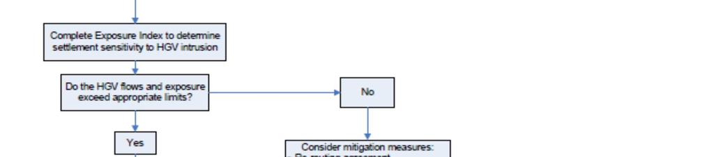

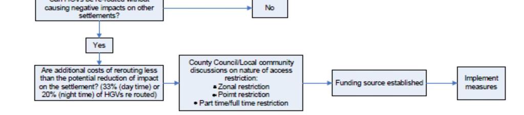
72 Diagram 1 9

73 Diagram 2 10
74 14. Highway Charges Charges are made for various elements of Network Management work and are displayed on the County Council website. These will be amended annually in line with the index associated with each charge. 15. Highway Scheme Funding Third Party Funding of Highway features Privately funded highway features may be installed on the public highway in the following circumstances: there is a safety problem which the proposed feature(s) would be expected to address; the proposed feature(s) could be installed safely (as demonstrated by a positive Safety Audit process); the provision of the proposed feature(s) would comply with current County Council policy; the proposed feature(s) are acceptable to the local community. Local Highway Improvements To assist communities in improving their local highways, the County Council provides funds annually towards improvement projects. Communities can enter an application for this funding, which will be assessed by an advisory panel of County Councillors for each District Council area of Cambridgeshire. The panels will take into account the views of local Parish Councils, before making recommendations on allocating the funding, so applicants should make sure they can demonstrate local support for their project before applying. 16. Horses on the Highway If a horse/s is straying on the highway this should be reported to the police. If there is no danger of the horse getting on to the road but the horse is clearly sick, distressed or injured it should be reported to the RSPCA. 17. Indemnity for Highway Works Any work the highway authority authorises on the county road network by a third party, other than a public utility of their agents, will be conditional on the third party demonstrating that it has in place public liability indemnity up to a minimum value of 5m for each and every potential claim. 18. Kerbing Kerbing, subject to approval in writing from the County Council, may be provided in the following circumstances: As part of a Highway Capital Maintenance Programme project; Where required to protect pedestrians from vehicular over run of footway areas; 11
75 To assist with drainage; To support the edge of the carriageway. 19. Memorials and Floral Tributes on the Highway General Any ban on the placing of road side tributes following fatal accidents would be difficult to enforce and potentially insensitive. In recognition of a possible need for bereaved relatives to visit the scene of an accident as part of the grieving process, any request from the police for traffic management support during any site visit for the purposes of placing a tribute will be treated sensitively and will be provided free of charge. Floral Tributes Any floral tributes left at the site should be allowed to remain for a period of not less than14 days, but generally not more than 30 days. The relevant District Highways Manager should arrange for collection and disposal at the end of the period. Sensitivity must be shown, with the bereaved being given the option of receiving any non-floral tributes which may be placed along with flowers. Roadside Memorials Roadside memorials, including green memorials such as shrubs and bulb planting, should be discouraged as a matter of principle to address the potential safety risks associated with repeat visits. While some memorials may be very discreet and in allocation where they will not create any problem, the majority of situations will have some form of potential hazard. Any decision to remove any roadside memorial must be communicated to the bereaved through the Police Family Liaison Officer. 20. Mirrors on the Highway The following criteria will be applied when assessing requests for traffic mirrors; a. The site in question must have a demonstrable history of injury accidents where poor visibility is a contributory factor. b. The reduced sightline must not be due to an object which can be realistically removed, such as a parked vehicle or overhanging foliage. c. A mirror cannot be used to serve a private access onto the Highway Mirrors placed on the highway can cause other highway users to be dazzled by headlight or sun reflection. The judgements made about the speed and distance of approaching traffic can be distorted when using a mirror. Each application will be considered on its merits. If a mirror placed on the public highway is considered a hazard or is the subject of a complaint, it will be removed without notice and placed in storage for retrieval by the owner for a 2 week period before being recycled of disposed of. Mirrors erected on private land may require planning approval which should be sought from the relevant District Council. 12
76 21. Mobile Catering Responsibilities The County Council are responsible for the maintenance of the roads and the making of Regulations controlling the traffic management and ensuring under the various Highway Acts of Parliament, that roads are safe and available for use by the public, and are not obstructed. The Police have responsibility for the management of traffic on the roads, with the relevant district council s Environmental Health Departments being responsible for Food Safety, Litter and Street Cleaning etc. Street Trading Licence Cambridge City Council, South Cambridgeshire, East Cambridgeshire and Fenland District Council have adopted Schedule 4 of the Local Government (Miscellaneous Provisions) Act This allows them to designate any street in their district as a prohibited street, a licence street or a consent street; thereby controlling street trading. Where a Council has designated a consent zone and within that has designated certain streets as consent streets. This means that street traders in those streets must have formal consent from the council. Where a street does not fall within the consent zone it falls outside of the legislation and therefore does not require a street trading licence. Premises Licence Where someone intends to supply hot food or drink to the public between 11pm and 5am they will be required to obtain a Premises Licence from the relevant district council under the Licensing Act Food Hygiene Certificate All food business are required to be registered with the relevant district council, they are then subject to food hygiene inspections and are awarded a Food Hygiene rating. Siting of mobile food outlets on public highway Operators of roadside catering vehicles must get consent from the local Highways Office before starting to trade and should be aware of and bear in mind the following when considering making an application: No units are allowed in laybys on dual carriageways. There shall only be one outlet on any site at any one time trading or nontrading. The unit should be truly mobile, that is, self-propelled or towable on its chassis The unit shall not conflict with any form of traffic regulation order. It shall not cause or give rise to road safety concerns. It shall not cause any damage to the highway or interfere with the free and safe flow of traffic. All waste and liquids shall be kept off the highway at all times and litter removed from the highway at the end of each opening period of business. 13
77 The unit shall be sited behind the kerb line leaving at least 1.5m between it and the highway to provide a pedestrian safety margin. This shall also apply to any portaloo or waste containers. The operator is responsible for complying with planning legislation, environmental health and any other legislative requirements. Should any damage occur to the highway, for example, HGVs overrunning which could be attributable to the vending operation or should the area of highway be required by us for highway maintenance purposes, the vendor will be required to vacate the site on a permanent or temporary basis. Likewise, in the event of any occurrence related to the vending operation which could be considered to be prejudicial to highway safety. Any operator should be aware that in the event the vehicle causes an obstruction the police have the power to move the operator on. It must be understood that the 'pitch' does not become the property of a trader and no rights are acquired thorough length of use. No nuisance shall be caused to adjoining land owners or persons. Upon receipt of complaints which are upheld, whereby we have a duty to take some action, you will be asked to move on. Enforcement Where a mobile food outlet is found to be operating without approval, the operator will be served with both verbal and written notice of the requirement to remove the outlet from the highway within 7 days. After the 7 day notice has expired, a further inspection will be made and any objects/furniture occupying the highway will be removed from the highway without further notice. An inventory detailing the confiscated items will be made and a receipt issued to the operator. Items removed by the Council will be subject to a release fee. This fee will be reviewed annually. If the items are not collected within 21 days of the date of seizure the Council will dispose of them. 22. Mud on the Highway To report mud on roads in the county, contact Cambridgeshire constabulary on 101 who will assess the situation. Prior to any activity likely to bring mud onto the highway, warning signs should be set up in both directions. However, signs in themselves do not prevent liability for accidents that occur. The placement of warning signs when no effort is being made to clean the road will not be permitted. 14
78 23. Parking Parking controls will be introduced to regulate on-street, residential, Coach and Taxi parking, to assist the flow of traffic or to manage demand and achieve the efficient and fair use of the often limited space that is available for parking. Parking controls should be developed on an area wide basis to ensure that the transfer of parking problems into neighbouring streets is minimised. 24. Pedestrian Crossings The design of controlled pedestrian crossing facilities (Puffin, Toucan, Pegasus and Zebra) will be in accordance with all relevant current standards and will take into account all current design guidance. Any departure from current design standards and any significant departure from current design guidance must be approved by the Service Director, Infrastructure Management & Operations. Choosing which crossing is most appropriate and indeed where it should go is a sometimes difficult job as there are many competing demands and criteria related to safety and amenity that must be fulfilled in order for the crossing to be well used and beneficial to the travelling public. A PUFFIN CROSSING is a signal controlled pedestrian crossing where the lights controlling the pedestrians are on the near side of the road. The system also utilises sensors which detect the presence of pedestrians waiting at the crossing and as they are crossing the road. If after pushing the button the pedestrian decides to cross before the 'green man' appears, the sensor detects this movement and can automatically cancel the requested 'demand' if there is no one else waiting to cross. A TOUCAN CROSSING is a signal controlled pedestrian crossing that also allows bicycles to be ridden across. A PEGASUS CROSSING is a signalised pedestrian crossing with special consideration for horse riders. At a minimum, these crossings are in the form of a pelican crossing but simply have two control panels, one at the normal height for pedestrians or dismounted riders, and another one two metres above the ground for the use of mounted riders. A PARALLEL PRIORITY CROSSING is parallel pedestrian and cycle crossing which does not require the installation of signal controls. A ZEBRA CROSSING is a pedestrian crossing consisting of alternating dark and light stripes on the road surface and belisha beacons (flashing amber globes on posts). These provide suitable crossing points where pedestrian flows are light and vehicle speeds low. Good visibility is essential. There is a risk that pedestrians feel they have absolute priority whereas some drivers may not observe zebra crossings in the same way that they would comply with traffic lights. Requests for controlled crossings are assessed against two documents produced by the Department for Transport. These are Local Transport Note 1/95 "The Assessment 15
79 of Pedestrians Crossings" and Local Transport Note 2/95 "The Design of Pedestrian Crossings". These documents can be found by clicking on the highlighted documents on the Department for Transport website. The level of need for a crossing will need to be assessed by: 1. Measuring the degree of conflict between pedestrians crossing the road and the two-way traffic flow and 2. Taking into account the following factors The age and ability of pedestrians Any supressed demand The different types of vehicle in the flow of traffic The length of time pedestrians have to wait to cross The width of the road The speed of traffic The pedestrian injury accident record at the site Funding opportunities for improvements to the public road network are available via either the County Council s Local Highway Improvement (LHI) initiative or by third party funding. Third party funding would need to cover the cost of the assessment, procuring and installing the measure and, in some cases, any ongoing operating costs would also need to be covered. The provision of developer funded pedestrian crossing facilities will be sought, through the planning process, at suitable locations. 25. Pedestrian Dropped Kerbs Where dropped kerbs are provided to help those with mobility problems, wheelchair users and people with pushchairs they shall be set flush with the carriageway channel level. Tactile paving must be provided at all dropped kerbs where pedestrians can be expected to cross. Kerbs will be dropped to provide pedestrian crossings during planned footway maintenance to help wheelchair users and people with pushchairs. If you feel that a pedestrian crossing is needed please contact highways@cambridgeshre.gov.uk and one of our officers will meet with local disabled groups to assess the location and, if a crossing is needed, it will be included in future maintenance work. 26. Planters, Litter Bins, Seats and Cycle Stands Planters, litter bins, seats and cycle stands may be permitted on the public highway as part of works to enhance or improve the environment, maintenance or the operation of 16
80 the highway provided they do not interfere with the safe or convenient passage of highway users or the maintenance of the highway. Where provided by third parties they will be subject to the policy on third party funding of highway features although the need for a commuted sum may be substituted by a suitable maintenance agreement and as such will be considered on a case by case basis. 27. Religious Symbols on the Highway Religious symbols on the public highway will only be permitted upon application, provided the applicants: Can demonstrate the symbol is to be displayed in connection with an event in their religion s calendar; Can demonstrate that the religion in question has a recognised place of worship within the city, town or village that the symbol was to be placed; Submit an acceptable method statement for the erection of the symbol; Provide and maintain appropriate fencing around the symbol for the duration of its display, if required for the safety of the public or to protect the symbol; Can demonstrate that they have suitable public indemnity insurance. Religious symbols would only be permitted on the public highway where they would not adversely affect the passage or safety of other highway users. For the purpose of this policy, Christmas trees are considered a religious symbol. 28. Road Markings and Studs Cambridgeshire County Council is responsible for the provision of road markings and studs on the road network throughout Cambridgeshire other than on motorways, trunk roads and private or non-adopted roads. Road markings are as important as signs. The purpose of road markings and studs are to define traffic lanes, & alignment changes, provide warning, identify parking and waiting restrictions and to convey Give Way & other instructions to road users in a manner that is clearly visible both day and night. This policy identifies the procedures and guidelines for the placement and maintenance of road markings and studs within the public highway and forms the basis of the decision making process for the provision of all road markings and studs on the public highway. Over the years there has been an inconsistent approach to the provision of road markings and studs across Cambridgeshire County. Therefore it is necessary to review existing road markings when undertaking resurfacing works and routine maintenance works to ensure that they are used in the most effective manner and applied consistently across Cambridgeshire in line with: The Traffic Signs Regulations and General Directions 2016 (TSRGD) Chapter 5 of the Traffic Signs Manual 2003 (TSM) Cambridgeshire County Council guidance 17
81 Requirements BS EN 1436: A1:2008 Road marking materials road marking performance for road users. The over-use of road markings can diminish their effect on road users. This policy aims to rationalise their use and maximise their effectiveness, where they are necessary. Standards & Guidelines for the provision & maintenance of road markings and studs Proposals for road markings on the public highway must be approved by the scheme manager. Road markings or layouts that are not contained within the TSRGD 2016 are not permitted without prior approval from the Department for Transport (DfT) including any that are experimental and under trial. Unless being provided as part of accident remedial work or as part of a speed management scheme, the following rules will apply to the provision of road markings: Centre Lines Centre line markings and centre warning line markings should not be provided on any carriageway of typically less than 5.5 metres total width. Centre line markings must not be used on: unclassified roads estate roads residential cul-de-sac. Centre warning line markings should only be used on unclassified roads estate roads residential cul-de-sac. in conjunction with give way markings and at other significant hazards. Centre warning line markings should only be provided on approach to a hazard. They must not be used in place of standard centre line markings between hazards. Centre warning line markings should only to be provided as per DfT guidance: at significant bends/crests each side of junction centres or significant Where parking bays are provided, centre line markings should be omitted where the remaining carriageway width is less than 5.5 metres. Edge of Carriageway Markings Edge of carriageway markings should generally only be used: in conjunction with centre warning line markings with double white line systems where no kerbing exists at sites where there is a persistent recorded problem with vehicles overrunning the highway verge. 18
82 Edge of carriageway markings shall only be provided on carriageways of typically less than 5.5 metres in width where it is not permissible to provide a centre warning line. For example: on bends, alongside deep drains or other hazards. In locations where occasional short lengths of kerb exist, edge of carriageway markings should be continued through the kerbed length to maintain continuity. Wherever used, edge of carriageway markings must be offset from the edge of the carriageway surface by 180mm to prevent their deterioration and facilitate future maintenance of the lines. Give Way Markings Give way markings will be laid at all junctions where no other marking is provided on: strategic routes main distributor roads local roads at their junctions with secondary distributors on any road if their use is recommended following an accident investigation study Give way triangle markings will be laid: on the approach to strategic routes on main distributor roads in conjunction with give way signs at other locations where their use is recommended following an accident investigation study. Give way markings should only be provided on estate roads in situations where the priority is not obvious or where there is recorded evidence of an accident problem. Other Road Markings Road markings such as (but not limited to) bus stops, School Keep Clear, Keep Clear, access protection markings, pedestrian crossings, disabled/parking bays and stop lines must be assessed for suitability by the Policy and Regulation team before replacement. Longitudinal carriageway markings approaching traffic islands should be continued around and offset outside the island to provide adequate vehicle deflection. Conservation Areas and Environmentally Sensitive Locations Where used in conservation areas and other environmentally sensitive locations, yellow road markings for waiting restrictions should be 50mm in width and must be "primrose" yellow. Other yellow waiting restriction markings should be in yellow material and be 50mm or 75mm in width. 100mm-wide markings should only be used on high speed roads (outside 40mph speed limits). 19
83 Studs Under current regulations it is only a requirement for road studs to be used in conjunction with a solid double white line system. Road Studs may be replaced on A roads except in street lit areas or inside 30mph limits. They may only be replaced on other roads in exceptional circumstances such as accident reduction schemes. Long-type studs shall be used on principal roads with Halifax-type reflecting "cats eye pads". All road studs within proximity of a level crossing MUST be stick-on type. The use of 360 degree studs or solar powered studs shall only be considered where night-time accident rates are high and only after consultation with the Road Safety Engineering team. Further Information The table below specifies the road markings and studs requirements for each road type. If clarification is required on any aspect of road markings or studs please contact the Network Management Team for guidance in the first instance. Table A: General rules for road classifications Classification Centre Line Edge Line Road Studs A B C Yes, with warning lines where appropriate Yes, where carriageway width typically exceeds 5.5 metres and with warning lines where appropriate. Only on consistently high traffic flow routes (typically >2000 vehicles in 12 hours) where carriageway width Yes, on high speed sections except alongside kerbed sections and inside 30 mph speed limits. Only on consistently high traffic flow routes (typically >6000 vehicles in 12 hours) or at specific hazard locations (eg: bends and alongside deep drains or where buildings abut the highway). Only at specific hazard locations (eg: bends and alongside deep drains or where 20 Yes, except in street lit areas or inside 30mph limits. No, except in conjunction with a double white line system or in exceptional circumstances such as accident reduction schemes. No, except in conjunction with a double white line system or in exceptional circumstances such
84 U & Estate typically exceeds 5.5 metres. Warning lines at specific hazard locations (eg: junctions and bends). No markings at all except warning lines at specific hazard locations (eg: junctions and bends). buildings abut the highway). No markings at all except at specific hazard locations (eg: alongside deep drains or where buildings abut the highway). as accident reduction schemes. No, except in conjunction with a double white line system or in exceptional circumstances such as accident reduction schemes. 29. School Flashing Amber Lamps Flashing amber lamp units are permitted at school sites where either the 85 th %ile approach speed to the crossing point is in excess of 36mph or the advance visibility of the crossing point is less than 100 metres. At sites which do not meet the speed or visibility criteria specified above the provision of flashing amber lamps will be permitted if the installation, operational and maintenance costs are met by a third party. 30. Speed Limits Speed limits in settlements This policy has been developed with reference to national policy issued by central government Setting Local Speed Limits, Department for Transport Circular 01/2013 The County Council will ensure that speed limits are introduced in a manner consistent with the current government guidance. Exceptions to usual practice will be subject to Committee approval. The purpose of this policy is to explain the roles, responsibilities and the procedure that will be followed by Cambridgeshire County Council when deciding whether to change a speed limit. Several factors are taken into account in the assessment of a road or area for a speed limit. These include: General character of the road or area Type and extent of roadside development Traffic composition Accident history Current traffic speed Enforcement The frequency of junctions 21
85 Presence of amenities that attract pedestrians and cyclists Environmental impact such as increased journey times, vehicles emissions, and the visual impact of the signing The three national speed limits are: 30 mph speed limit on roads with street lighting (sometimes referred to as Restricted Roads) National speed limit of 60 mph on single carriageway roads National speed limit of 70 mph on dual carriageways and motorways. These national speed limits are not, however, appropriate for all roads. The speed limit regime enables authorities like Cambridgeshire County Council to set local speed limits in situations where local needs and conditions suggest a need for a speed limit which is different from the national speed limit. For example while higher speed limits are appropriate for strategic roads between main towns, lower speed limits will usually apply within towns and villages. A limit of 20 mph may be appropriate in residential areas, busy shopping streets and near schools where the needs and safety of pedestrians and cyclists should have greater priority. The speed limit regime enables traffic authorities to set local speed limits in situations where local needs and conditions suggest a speed limit which is different from the respective national speed limit. 30 mph Limits The county council will work towards the introduction of a 30mph speed limit in the developed parts of all settlements in the County together with, where appropriate and affordable, complementary features to encourage drivers to travel at an appropriate speed. Where mean speeds are in excess of 30mph, to initiate a lower speed restriction with simply a sign is unlikely to ensure conformity by the general motorist if the road and highway environment is not conducive and is likely to lead to unacceptable levels of requests for enforcement action on the part of Police officers. Current resourcing and ongoing operational commitments may not allow for specific, routine or targeted enforcement action to be undertaken. Consideration should therefore be given to the introduction of complementary speed reduction features. Depending on the site, soft features such as gateways, red surfacing and roundels may be appropriate where mean speeds are 35mph or below and traditional traffic calming measures may be required to achieve compliance where speeds exceed 35mph. 20 mph Limits (Dft circular 1/13 Setting Local Speed Limits table 1) Successful 20 mph zones and 20 mph speed limits are generally self-enforcing, i.e. the existing conditions of the road together with measures such as traffic calming or signing, publicity and information as part of the scheme, lead to a mean traffic speed compliant with the speed limit. Therefore 20mph speed limits may be permitted at sites: where the mean speed of traffic is 24mph or lower 22
86 in combination with self-enforcing speed reduction features necessary to achieve a mean speed no greater than 24mph Having reliable information about existing speeds is vital to help confirm that the speed limit is appropriate for the road, therefore 7 days data from an automatic traffic counting device should be provided. Surveys should be carried out during a neutral, or representative, month avoiding main and local holiday periods, local school holidays and half terms, and other abnormal traffic periods. To achieve compliance there should be no expectation on the police to provide additional enforcement beyond their routine activity 20 mph zones must be introduced in clearly defined zones (e.g. between radial routes or a spine road with culs-de-sac) and not in isolated roads or culs-de-sac. School time 20mph speed limits supported by interactive signs and "soft" traffic calming may be provided outside school sites where the existing mean speed does not exceed 30 mph. Where the existing mean speed exceeds 30 mph to initiate a lower speed restriction with simply a sign is unlikely to ensure conformity by the general motorist if the road and highway environment is not conducive and is likely to lead to unacceptable levels of requests for enforcement action on the part of Police officers. Current resourcing and ongoing operational commitments may not allow for specific, routine or targeted enforcement action to be undertaken. Consideration should therefore be given to the introduction of complementary speed reduction features. Depending on the site, traditional traffic calming measures may be required to achieve compliance. Buffer speed limits of up to 400 metres in length, set at a minimum of 10 mph above the settlement speed limit will be permitted. For speed limit purposes the following definitions will apply: I. A settlement will be At least 20 properties fronting onto a length of public highway over a distance of at least 600m II. The extent of a settlement will be The point at which full frontage development begins, or at the first property fronting a road entering a settlement, on which there is at least 3 properties/100 metre length of road, prior to the point at which full frontage development begins. Decision Making Implementing speed limits requires the making of a legal order, which involves a statutory consultation process that requires the Highway Authority to advertise, in the local press and on-street, a public notice stating the proposal and the reasons for it. The advert invites the public to formally support or object to the proposals in writing within a 21 day notice period. The County Council will also consult with the emergency services, (the Chief Officer of Police is a statutory consultee) the local County, District and Parish Councilors and any other persons most likely to be directly affected by the proposal. Should any objections be received then the Council has a duty to consider the objection and a report would go before Members for a decision whether to uphold or overrule. 23
87 Police Support Proposed speed limits should be supported by the Police. If the Police are not supportive communities must ensure that expectations over the likely level of compliance with the limit are managed. Speed limits outside settlements Typical characteristics for speed limits in rural areas outside settlements are shown in the table below: Speed limit (Mph) Upper tier (Roads with predominant traffic flow function) 60 Recommended for most high quality strategic A and B roads with few bends, junctions or accesses 50 Should be considered for lower quality A and B roads, which may have a relatively high number of bends, junctions or accesses. Can also be considered where mean speeds are below 50 mph, so lower limit does not interfere with traffic flow. 40 Should be considered where there is a high number of bends, junctions or accesses, substantial development, where there is a strong environmental or landscape reason, or where there are considerable numbers of vulnerable road users. Lower tier (Roads with important access and recreational function) Recommended only for the best quality C and Unclassified roads with a mixed (i.e. partial traffic flow) function with few bends, junctions or accesses. In the longer term, these roads should be assessed against upper tier criteria. Should be considered for lower quality C and Unclassified roads with a mixed function where there are a relatively high number of bends, junctions or accesses Should be considered for roads with a predominantly local, access or recreational function, or if it forms part of a recommended route for vulnerable road users. Guidance in urban speed limit characteristics A summary of typical urban characteristics and appropriate speed limits is shown in the table below. Speed Limit (mph) Characteristics 20 In town centres, residential areas and in the vicinity of schools and other premises where there is a high presence of vulnerable road users The standard limit in settlements that are fully developed. 40 Higher quality suburban roads or those on the outskirts of urban areas where there is little development and few vulnerable road users. Should have good width and layout, parking and waiting restrictions in operation and buildings set back from the road. 24
88 Should wherever possible cater for the needs of non-motorised users through segregation of road space and have adequate footways and crossing places. 550 Usually most suited to special roads, dual carriageway ring or radial routes or bypasses which have become partially built up. Should be little or no roadside development. To achieve average speeds appropriate to the typical speed limits given in the table above it may be necessary to introduce speed reduction measures. Speed limits in new developments All roads in areas of new development should be designed to physically restrict vehicle speeds to the appropriate maximum levels shown in the table above. Manual for streets (the guide for the design, construction, adoption and maintenance of new residential streets) recommends 20 mph or less as the design speed for residential roads in new developments. 31. Stopping up of a Highway When considering applications to stop up a highway or part of a highway the following conditions will be considered: That the highway is no longer necessary or; That the highway can be diverted so as to make it nearer or more appropriate for public need. The applicant is expected to meet all the legal costs incurred in this process, regardless of whether the application for stopping up is approved by a Magistrates Court and an engineering fee to cover the costs associated with technical vetting and Court attendance (see Highway Charges). Consultation will be undertaken with the relevant parish council and local county councillor. 32. Street Traders A licence is required to become a street trader. Licences are issued by the local District or City Council. 33. Tables and Chairs The Highways Act 1980 regulates tables and chairs permits. You will need a permit if you would like to place tables and chairs on the public highway. You may also need to get planning permission. Contact your local Planning Department for more details. For Highways Tables & Chairs Application Forms please visit our web site. 25
89 Policy Guidance Notes - Placing tables and chairs on the highway 1. Introduction There is an increasing demand to allow tables and chairs outside restaurants and cafés. Provided that free and safe passage for pedestrians can be maintained then such amenities can be beneficial and permission may be granted (subject to meeting certain conditions) on an individual basis. 2. Relevant Legislation The setting up of Pavement Cafés on the public highway is dealt with under Part VIIA, Section 115(A to K) of the Highways Act The Highway Authority (Cambridgeshire County Council) will normally require before consent is granted that: Applicants will have obtained planning permission from the Local Planning Authority (District Council) unless the Local Planning Authority has confirmed in writing that this is not required (de minimis ruling) A licence is issued under the Licensing Act 2003 if appropriate (District Council) 3. Conditions under which consent may be granted a) The provision of tables and chairs on the highway shall be regularised by the granting of licences by the Highway Authority. b) Suitable conditions shall be drawn up by the Highway Authority relating to the extent of the tables and chairs, clearances, pedestrian access provisions, barriers and parasols, together with obligations on the control and management of the area and access to Statutory Undertakers plant. c) The licensee shall conform to conditions laid down in the licence and these will be enforced by the Highway Authority. d) In general, only footways will be used for Pavement Cafés, assuming all safety and non-obstruction requirements are met. However, exceptions may be made in pedestrian areas or zones during pedestrian only hours. e) The role of the public highway is to allow the public to pass and re-pass. In granting permission for pavement cafés it is important to ensure that these rights are not detrimentally affected. They must be located and managed in a manner that protects the rights and safety of all users with special attention to wheelchair users and those with impaired vision. f) You must display the licence summary sticker (Which confirms the licence duration) at your premises where it can be easily seen. g) To apply and make the initial payment for a tables and chairs licence please complete the online and chairs licence You need: to read the guidance notes and standard licencing conditions before completing the form an address as we will use this to communicate with you concerning your application a debit or credit card for the initial assessment payment to upload a plan showing the location of the premises to upload a dimension plan showing the area to be utilised for tables and chairs 26
90 to upload images showing types of furniture to upload a copy of any relevant consents (e.g. planning permission) if applicable the freeholder's name, address and contact details, if it is not you to have in place public liability insurance policy for 5m as detailed in the licencing conditions 4. Supplementary a) In some cases it will be necessary to provide brass studs in the highway defining the periphery of the agreed area. The cost of providing and installing the studs will need to be meet by the applicant at its sole expense and will be in addition to the cost of the licence. Local circumstances may also require a low level marker to assist the blind and partially sighted who use a white stick for guidance. The Layout of tables and chairs must take account of the existing street furniture. b) A pedestrian route must be maintained at all times for people to walk or take a wheelchair or buggy through or around the pavement café with minimal inconvenience. The route should be straight, and adjacent to the premises to ensure that all pedestrians and particularly those with a disability can maintain their normal path. c) Each site will need to be evaluated and determined on its merits taking into account pedestrian flows and physical constraints. Local Access Groups may be consulted regarding suitability of layout as the circumstances of each site will need to be evaluated and determined on its merit. d) All licences are valid from the date of grant for one year and will be not automatically renewed. e) The Highway Authority will require a copy of the applicant s third party insurance prior to the granting of a licence and at each anniversary of the insurance renewal. Failure to provide this will result in revocation of the licence. f) If contravention of license conditions is observed, the licensee will be requested to comply with the conditions and, if necessary, issued with a warning letter advising that further contravention will result in revocation of the licence. The licensee will be allowed seven days to comply with a warning letter. If contravention continues after seven days of the warning or a contravention reoccurs within a year of the warning the license will be revoked. g) Where a licence is not renewed or is revoked under f) above, the licensee must remove its property from the public highway within 7 days. After 7 days, the Highway Authority is empowered to remove and store or dispose of furniture from the highway, at the cost of the licensee. The Highway Authority will not be responsible for their safekeeping. 5. Terms and Conditions These are contained in a separate document on the right hand side of the web page. The operator should be aware that the Highway Authority and others (e.g. police, statutory undertakers) may need access at various times (including emergencies) for maintenance, installation, special events, improvements etc and may therefore require the pavement café to cease operating for a period of time. On these occasions there will be no compensation for loss of business. 27
91 6. Consultations All of the applications we receive must go through a 28 day period of consultation. Local residents, Councillors, businesses and council officers are asked if they have any objections to a premise placing amenities (tables and chairs) on the public highway. During this period tables and chairs must not be placed on the public highway unless the premise has a current valid consent. Whatever the outcome, the relevant authority makes sure that any objections received are relevant to the application and work hard to ensure that all applications are issued fairly. 7. Decision Making The Assistant Director - Highways in consultation with the Local Members for all districts has authority to exercise, in accordance with the relevant policies of the authority and within the budget allocated for the purpose, the powers of the County Council where the completion of the consultation process for a pavement licence results in objections, to determine those objections. 8.Fee Charged There will be an initial application fee of 250. This charge covers inspection and administration costs. The annual licence fee is then 100 per square metre within Cambridge s historic core area and 50 per square metre elsewhere. The application fee will be deducted from the annual licence fee if an application is successful. 9. Renewal Applications Licences will not be renewed automatically, renewals must be applied for at least 2 months prior to expiry to allow sufficient time for the application to be considered. Where an application is made to renew a licence, the Highway Authority will consider: 1. Evidence of past demonstrable impacts from the activity on the safety and amenity of local residents. 2. Whether appropriate measures have been agreed and put into effect by the applicant to mitigate any adverse impacts. 3. Compliance with the terms or conditions of any previous licence, including the timely payment of the licence fee. The Highway authority reserves the right to refuse renewal applications where appropriate. 10. Variation of Conditions Where an application is made to vary the consents in terms of hours of operation or number of amenities as previously permitted, the Highway Authority will take into account the criteria set out in points 1, 2 and 3 above. 28
92 HIGHWAYS ACT 1980 SECTION 115E STANDARD LICENCE CONDITIONS TABLES AND CHAIRS ON THE HIGHWAY The following conditions will be applied to every licence granted under the above Act: 1. This licence is granted in accordance with compliance with the advice given in the guidance notes issued at the time of application 2. The tables and chairs placed on the highway after the granting of a licence must be in accordance with the details and plans provided at the time of the application. No changes are permitted without prior approval of the Highway Authority. 3. The amenities must be removed from the public highway at the end of the permitted period each day. (To be used in all cases, except where consent for picnic tables is granted). 4. All tables and chairs authorised by the licence must be removed by midnight on the day the licence expires unless a renewal licence has been applied for and granted. Renewals must be applied for at least 2 months prior to expiry to allow sufficient time for the application to be considered. 5. Failure to pay the annual licence fee and return the signed licence by midnight on the day the previous licence expires will render the licensee in breach of the Standard License conditions and subject to enforcement. 6. The Licensee shall maintain a public liability insurance policy up to the value of 5 million pounds against any liability, loss or damage, claim or proceeding whatsoever arising under Statute or Common law in respect of the placing and maintaining of the tables and chairs on the highway or their removal there from. 7. The Licensee shall be responsible for keeping the designated area in a clean and tidy condition at all times. Under your duty of care you must ensure that any waste produced is handled safely and in accordance with the law. You must keep all waste safe, prevent it from escaping from your control and ensure that it is only handled or dealt with by persons that are authorised to deal with it. 8. The Licence may be suspended where necessary to allow highway maintenance and any other necessary remedial work to be carried out at the location covered by the licence. A reasonable period of notice will be given to the licensee where possible. The Highway Authority will not be liable for any loss of earnings arising out of the suspension of a licence. 9. Any umbrellas provided must not protrude beyond the designated boundary of the licensed area. They shall be kept in good condition so as not to detract from the appearance of the street. You are advised that enclosed structures 29
93 (including gazebos) and the like will not be permitted within the proposed boundary of the licensed area. 10. If you intend to use space heaters, their metric dimensions materials and colour must be specified as part of the application. You will also be required to submit a formal risk assessment as required by the Management of Health and Safety at Work Regulations 1999 in support of your application. This should be carried out by a competent person i.e. someone who has knowledge of the law, British Standards, and Health and Safety Executive Codes of Practice and Guidance. In considering an application, the Council will have regard to the inherent safety of the equipment, its location, storage of Liquid Petroleum Gas Cylinders, maintenance and training arrangements. The County Council will consider the adequacy of the risk assessment which must: Identify the hazards e.g. fire, explosions, burns, impact from falling equipment/cylinders Decide who may be harmed and how Evaluate the risks and decide whether proposed precautions will be adequate or whether more could be done. Record findings, review assessment and revise on an annual basis or more frequently if the situation requires it e.g. a significant change in equipment, etc. 11. In areas of significant footfall (to be determined by the Highway Authority), when in use, the pavement café area will need to be enclosed, to demarcate the licensed area and contain the tables and chairs, thus making it distinguishable to other pavement users, and to assist blind and visually impaired pedestrians. (Applicable with immediate effect to all new licenses and renewals made from 1st January 2019) 12. The placing of speakers or any other equipment for the amplification of music within the licensed area is strictly prohibited unless authorized by a premises licence issued under the Licensing Act Any such authorised music must not cause a nuisance or annoyance to others. 13. Any sales of alcohol within the licensed area must be authorised by a premises licence issued under the Licensing Act Any material alteration to the Means of Escape, which affects people using the Means of Escape, inside or in the immediate vicinity outside the premises must be recorded in the premises' Fire Risk Assessment as a significant finding. Control measures should be put in place to reduce risk within the area as well as recording them. A review of the hazards and risks should be ongoing throughout the period the premises are in use. 15. This Licence covers the use of amenities by customers for consuming food or refreshment which have been purchased from the licenced establishment. This Licence does not permit the use of the amenities for any other purposes at any time. 16. No additional charge shall be made to customers for the use of the tables and chairs within the licensed area. 30
94 17. The licensee may only use the land for the placing of tables and chairs in the course of his business only during the hours permitted by the licence and only within the defined area applied for. 18. No tables and chairs or barriers may be placed in the area until a licence has been granted. 19. No other items may be placed on the highway within the licensed area other than that approved in accordance with the application and the licence when granted. This consent also excludes A boards unless specified on the licence. 20. The licence is granted for a period of 12 months. This licence will not be renewed automatically. Compliance with the terms of conditions of any previous licence will be taken into account at any application for renewal. The Highway Authority reserves the right to refuse renewal applications where appropriate. 21. The licensee is responsible for carrying out the reinstatement of the highway in the event of any damage to the highway occurring as a result of the activity (if requested to do so by the Highway Authority). The permanent surface reinstatement shall be carried out to the satisfaction of the Highway Authority. 22. The license is issued to the applicant only and is not transferable. 23. These conditions may be varied where appropriate to reflect any changes in local circumstances. 24. The footway must not be obstructed by patrons standing between tables, chairs and the kerb, or by the personal possessions of patrons. 25. The fee is for the administration and grant of the licence. No refunds will be made in the event of a surrender of the licence before expiry. There is no automatic right to appeal against refusal of consent. 26. The Highway Authority may withdraw this consent at any time upon giving the licensee seven days notice in writing. Upon withdrawal of the consent the licensee shall remove the amenities from the public highway and, in default, the Highway Authority may remove the amenities and recover from the licensee its cost in so doing. Enforcement Measures Periodic inspections of pavement cafés will be made by the Council to ensure compliance with the Pavement Café Policy and Guidance Breach of Conditions Where a breach of a license condition is noted, the operator of the pavement café will be served with both verbal and written notice of the offence(s) being committed. The operator will be given 7 days to comply. 31
95 Where the Highway Authority serves a notice on the licensee requiring him/her to remedy any breach of the terms of this consent, and the licensee fails to comply with the notice, the Highway Authority may itself take the steps required by the notice and recover from the licensee any expenses incurred. A further inspection will be made of the pavement café 7 days after the notice is served. If remedial action has not been taken then a Notice of Contravention will be issued further outlining the nature of the offence(s) and informing the operator that they are to remedy the breach or remove the pavement café from the highway within a period of 7 days from the date the notice is served. After the 7 day notice has expired, a further inspection will be made and if it is found the breach has not been remedied then the pavement café furniture will be removed by the Council or the Police and the licence revoked. If the pavement café continues to operate once the licence has been revoked then any objects/furniture occupying the highway will be removed from the without further notice. Unauthorised Pavement Cafés (a café without a valid licence) Where an unauthorised pavement café is found to be operating without the correct permissions, the operator will be served with both verbal and written notice of the requirement to remove the pavement café from the highway within 7 days. After the 7 day notice has expired, a further inspection will be made and any objects/furniture occupying the highway will be removed from the highway without further notice. An inventory detailing the confiscated items will be made and a receipt issued to the licence holder/operator. Items removed by the Council will be subject to a release fee. This fee will be reviewed annually. If the items are not collected within 21 days of the date of seizure the Council will dispose of them. Persistent variances from the conditions will result in the licence being revoked. No part of the fee shall be refunded should the licence be revoked 34. Temporary Road Closures Temporary road closure orders may be made to facilitate: Events taking place on the highway Highway works by a statutory undertaker / public utility Highway works by a third party to facilitate new development Improvement or maintenance of the highway network Temporary road closures may not last for more than 18 months unless approval of the Secretary of State is granted. 32
96 Temporary closure orders for third parties and statutory undertakers / public utilities will be subject to a charge (see Highway Charges). 35. Tourist Signing 1. DEFINITION 1.1 A tourist destination is defined as a permanently established attraction which attracts or is used by visitors to an area and is open to the public without prior booking during its normal opening hours. 2. GENERAL POLICY 2.1 To ensure that tourist confidence is upheld in the white on brown system of direction signing to tourist attractions and facilities it is essential that a minimum level of quality is maintained and that the provision of tourist signing does not lead to a proliferation of direction signing to the detriment of road safety and the environment. 2.2 For these reasons the provision of tourist signing will only be considered: to permanently established sites which are open to visitors without prior booking for a minimum of 4 hours a day, 150 days per year to sites whose primary purpose is to provide an attraction or facility for touriststourist signing will not be permitted at locations where other directional signing (including private signing) exists, or is to be provided where their provision is considered essential to direct visitors to an attraction or facility-signs will not be approved at locations where their provision would be mainly for promotional or advertisement reasons for sites where other eligible establishments in the vicinity would not be compromised by their provision at locations where the effectiveness of existing traffic signs will not be adversely effected in areas where their provision will not detract from the visual environment. 3. TOURIST ATTRACTION REQUIREMENTS 3.1 Tourist attractions will generally include places of interest open to the public which attract visitors to the area and offer recreational, educational or historical interest. These include, for example, theme parks, historic houses, museums, zoos and leisure complexes. 3.2 In addition to the general conditions stated in paragraph 2.2, tourist attractions must also comply with all of the following conditions to qualify for the provision of tourist signing: The owners or management of the attraction must provide confirmation that they have registered with Visit England and have agreed to abide by its Code of Practice for Visitor Attractions (leisure destinations no not have to be and for reasons of their national interest English Heritage and National Trust properties are exempted from this requirement) The applicant must provide evidence that appropriate steps have been taken to publicise the attraction and to inform potential visitors of suitable approach routes There must be adequate on-site facilities for visitors, including parking, appropriate to the size of the site and the number of visitors which it is likely to attract. 33
97 Where off-site parking is provided it must be within a safe reasonable walking distance of the attraction. If the off-site car park is not owned by the operator of the attraction, written confirmation that such use is acceptable must be provided. a. Attractions will only be signed from the nearest A or B Class road or the nearest signed settlement. Those with direct access to such a road will not need signing if the entrance is visible and identifiable from a sufficient distance to enable safe vehicular movement at the access. Signing from motorways and trunk roads will be considered in accordance with the Highways Agency s own criteria, and will be subject to their approval. Where an attraction meets these criteria, consideration should be given to signing from the nearest of these roads. Signing to attractions in urban areas should be considered in conjunction with any signing to tourist facilities and should form part of a comprehensive scheme developed in conjunction with the local Council, Tourist Officer, business associations and other local representative bodies. Priority should be given to directing tourists to appropriate public car parks and to providing Tourist Information Centres (TICs) or Tourist Information Points (TIPs) within the car parks. Signing to attractions could then take the form of pedestrian signing. Subject to road safety and traffic management considerations outlined in Section 7, as a general rule no more than six destinations (less on high speed roads), of which not more than four should be tourist destinations, should be included in any sign structure. It may be necessary to prioritise tourist destinations with primary and other local destinations, and where necessary, tourist destinations may be prioritised on the basis of visitor numbers or closeness to the initial signing. Directional signing to the attraction must satisfy the environmental requirements listed in Section 6. To reduce environmental impact, where an attraction requires signing through more than two junctions, consideration should be given to providing signs of the For X, follow Y type, utilizing where possible existing signing legends rather than providing additional continuity signing. 4. ASSESSMENT OF TOURIST FACILITIES 4.1 The provision of signing to tourist facilities will only be considered where it can be shown that they will be of benefit to tourists who require serviced accommodation, refreshment, shopping, leisure facilities etc. The numbers and level of provision of tourist facilities vary across the County and between urban and rural locations. Clearly, it would be impracticable to sign every facility. 4.2 To avoid a proliferation of signing, basic conditions have been developed which apply to all facilities and more specific conditions for each type of facility. Basic conditions 4.3 In addition to the general conditions stated in paragraph 2.2 tourist facilities must also comply with all of the following basic conditions to qualify for the provision of tourist signing: 34
98 The owners or management of the facility must provide confirmation that they have been operating for at least 12months. The facility must meet the standards required by professional or regulatory organisations appropriate to the facility and its conduct of business and operation The applicant must provide evidence that appropriate steps have been taken to publicise the facility and to inform potential visitors of suitable approach routes. There must be adequate on-site facilities for visitors, including parking, appropriate to the size of the site and the number of visitors which it is likely to attract. Where off-site parking is provided it must be within a safe reasonable walking distance of the facility. If the off-site car park is not owned by the operator of the facility, written confirmation that such use is acceptable must be provided. In addition to these basic conditions establishments will also need to satisfy the more specific conditions for the various types of facility listed below. Accommodation 4.4 The provision of tourist facility signing for the following types of accommodation will be restricted in both rural and urban areas to premises whose primary function is providing accommodation. 4.5 Hotels and Bed and Breakfast establishments must be members of a quality assurance scheme which requires independent inspection of all member premises and which are more than just marketing schemes. Those operated by the ETB, AA or the RAC are suitable. 4.6 Camping and Caravan sites retain their eligibility for tourist signing from the 1991 regulations. To qualify for signs a site must be licensed under the Caravan Sites and Control of Development Act 1960 and/or the Public Health Act 1936 and have a minimum of 20 pitches for casual overnight use. They should also be members of the British Graded Holiday Parks Scheme ( Q scheme) or alternatively be registered with the ETB. 4.7 Youth Hostels also retain their eligibility for tourist signing under the 1991 regulations and all Hostels managed by the Youth Hostels Association may be provided with tourist signing. 4.8 Self-catering accommodation tends to be pre-booked, with visitors receiving directions to the premises. In this situation it should not be necessary to consider such facilities for tourist signing. If evidence can be produced that self-catering accommodation is available without pre-booking and the ETB quality standard for this type of accommodation is met then the provision of tourist signing could be considered. Refreshment 4.9 Tourist facility signing will only be considered for establishments whose primary function is to provide refreshments for visitors to the area. This group of facilities will include restaurants, cafes and public houses, which provide food but will exclude premises whose primary function is the sale of alcoholic drinks Many premises provide refreshments and it would clearly be unacceptable to provide tourist signing to all such facilities. To do so would lead to a proliferation of 35
99 signs which in many cases would be directing visitors away from equally suitable establishments. For these reasons only isolated or remote refreshment establishments and those which are promoted as tourist attractions will be considered for signing Similarly, it is proposed that there should be no tourist signing of refreshment facilities in urban areas. In these areas it is recommended that there should be greater use and signing of TICs and TIPs. In the market towns TIPs should be located in the town centre public car parks and should contain information on the attractions and facilities available. The information displayed will be a matter for the District/City Authorities to agree with the appropriate bodies representing the various tourist facilities and attractions involved In rural areas tourist signing to refreshment facilities will only be considered where: The facility is not located on a Class A or B Road or on a main thoroughfare. Establishments in bypassed communities will be considered under the special conditions which relate to this situation and are described in paragraph 5.2 There are no similar facilities within one mile The facility must comply with all relevant Environmental Health, Planning and other legislation The facility must have a minimum of 20 seats available for dining and should serve hot meals at lunch times and in the evening without pre-booking. Shopping 4.13 Conventional local direction signing is already available for directing visitors to town centres, superstores etc. and this should continue to be used. Only shops which have special features specifically for tourists will be considered for signing in urban areas. The use of TICs and TIPs is considered to be most appropriate for this type of signing In remote areas the signing of village stores will be permissible but only in locations where their presence would not otherwise be apparent Garden centres which are able to demonstrate that they promote themselves to the tourist market may be considered for signing Generally, shopping facilities will be signed by their generic names i.e. village store, craft centre, garden centre etc. Individual naming of facilities will only be considered to prevent possible confusion between similar facilities. Leisure 4.17 Leisure facilities will include recreational facilities, sports venues, cinemas and leisure centres etc. Tourist signing will be considered if the following requirements are met: Theatres, cinemas and music venues must have a minimum of 50 seats Sporting venues must demonstrate a regional or national significance, holding regular fixtures with suitable visitor facilities. 36
100 Implementation Guidelines 4.18 Facilities will only be signed from the nearest A or B Class road. Those with direct access to such a road will not need signing if the entrance is visible and identifiable from a sufficient distance to enable safe vehicular movement at the site Signing from motorways and trunk roads will be considered in accordance with the Highways Agency s own criteria, and will be subject to their approval. Where a facility meets the criteria, consideration should be given to signing from the nearest of these roads Signing to facilities in urban areas should be considered in conjunction with any signing to tourist attractions and should form part of a comprehensive scheme developed in conjunction with the local Council, Tourist Officer, business associations and other local representative bodies. Priority should be given to directing tourists to appropriate public car parks and to providing TICs or TIPs within the car parks. Signing to facilities could then take the form of pedestrian signing Subject to the road safety and traffic management considerations outlined in Section 7, as a general rule no more than six destinations (less on high speed roads), of which not more than four should be tourist destinations, should be included in any sign structure. It may be necessary to prioritise tourist destinations with primary and other local destinations, and where necessary, tourist destinations may be prioritised on the basis of visitor numbers or closeness to the initial signing Directional signing to the facility must satisfy the environmental requirements listed in Section To reduce environmental impact, where a facility requires signing through more than two junctions, consideration should be given to providing signs of the For X, follow Y type, utilising where possible existing signing legends rather than providing additional continuity signing The general requirement to admit the public without prior booking will preclude the signing of facilities that are primarily membership organisations (e.g. golf clubs) Where there are two or more facilities of the same type either in an area, or along a particular route, then generic legends rather than individual ones should be used. 5. POLICY FOR BYPASSED COMMUNITIES 5.1 The presence of local services in by-passed villages or small towns can now be signed using the white on brown tourist signs. The sign can include a short descriptive phrase, such as Historic market town. Generic names and/or symbols should be used to indicate the facilities/attractions available (i.e. Hotels/bed symbol; restaurants/knife and fork symbol, etc). It is reasonable to expect larger towns to provide the full range of visitor facilities and therefore, it is proposed that only settlements of 10,000 population or less which are also within 3 miles of a main road will be considered for this type of signing. 37
101 6. ENVIRONMENTAL CONSIDERATIONS 6.1 Many tourist attractions and facilities are located in environmentally sensitive areas quality of the surroundings. A proliferation of signing in these areas would be counter-productive to the very reason for tourists visiting the area. 6.2 Details of tourist facilities should be provided at TICs and TIPs for which signing using the i symbol will be permitted. 6.3 In conservation areas tourist attractions may be signed but signing to tourist facilities will not be permitted. A boundary sign may be allowed at the edge of the village or town to identify the available tourist facilities. Within conservation areas signing to tourist attractions will be considered but will be subject to the approval of the Director of Environment and Regulation and the appropriate District Council Planning Officer. 7. ROAD SAFETY AND TRAFFIC MANAGEMENT ISSUES 7.1 Signs will be provided in accordance with the Traffic Signs Regulations and General Directions 2016 and all subsequent amendments and shall be manufactured in accordance with BS The number and size of signs required will depend on the road system and traffic flows and speeds. Sign design will be in accordance with good traffic management practice and will be to the satisfaction of the Assistant Director - Highways. 7.3 If tourist signing is refused on road safety grounds, the applicant will be clearly informed of the dangers which necessitated refusal. 8. APPLICATION PROCEDURE AND PAYMENT FOR SIGNS 8.1 All tourist signing costs should be borne by the applicant. This includes design, administration, manufacture, installation and ultimately maintenance. 8.2 On receipt of an initial enquiry applicants will be supplied with a self-assessment form (see below) and an application form. These will facilitate an initial self-assessment of their eligibility for tourism signing and if this appears favourable to make a full application. The form will also state the conditions relating to the provision and costs of signing and when completed and returned to the Highways Directorate, with the completed application form and initial administration fee will instigate the detailed assessment of eligibility and entitlement. 8.3 The following costs will be borne by the applicant: i. Administration and site feasibility fee -if the applicant decides to make a formal application for tourist signing he/she will be asked to provide a nonreturnable fee of and to sign a form of agreement which sets out the pricing mechanism and their legal obligation. The fee will cover the administration time in checking eligibility, assessing entitlement, copying applications for consultation, staff time and travelling costs in carrying out the assessment of sign locations and all associated correspondence. ii. Design and post erection inspection fee -the full cost of these works will be charged. 38
102 8.4 The applicant will be expected to pay all fees in advance. The signs will be procured under the third party funding policy for highway features with the applicant meeting all works costs and a commuted sum for the maintenance of the signs during their design life. The cost of replacing signs as a result of damage vandalism or theft or at the end of their design life must be met by the applicant. 8.5 The County Council reserves the right to remove signs, should an attraction or facility cease to meet the relevant criteria, and to charge the operator of the attraction for the cost of this work. It may also prove necessary to relocate signs for road safety or traffic management reasons but such works would be carried out at the County Council s expense. 8.6 Where there is more than one destination on any sign the cost of that sign will be borne equally by the applicants. 9. ELIGIBILITY 9.1 To be eligible for consideration for the provision of tourist signing operators must be able to answer yes to all of the questions below. ELIGIBILITY AND CONDITIONS SELF ASSESSMENT FORM 1 Does your business benefit from tourism? 2 Has it been operating from a permanent site for 12 months? 3 Does it fulfil an identified tourist need? 4 Do visitors need directions other than normal road signs to find your establishment? 5 Is it open to the public without prior booking? 6 Are you prepared to pay all reasonable costs for signing if your application is successful? 7 Do you accept that any agreed signing can be removed at your cost if your facilities fail to maintain relevant criteria or move location? 8 If your application is successful will you remove any off site advertisement signing which you may have on or adjacent to the public highway? Notes i. The administration and site visit fee is payable at the time of application in accordance with the approved schedule of highway charges and fees. ii. There are additional costs for design fees, safety audit of sign schemes designed by other than Cambridgeshire County Council, construction and erection. iii. Traffic management, road safety, local amenity, quality of attraction and standard of service all have to be taken into account and could, without prejudice, form the basis for rejection of your application. iv. The design, maximum number and locations of signs are determined by Cambridgeshire County Council and may be altered upon review of traffic management, safety or amenity needs. v. Applicants should not expect signing from all possible directions. vi. All signs become and remain the property of Cambridgeshire County Council. Updated January Traffic Calming Traffic calming schemes may consist of a combination of various traffic calming features, designed to reduce and manage the speed of vehicles and improve road 39
103 safety. The design of schemes should accord with current Department for Transport standards and take into account all relevant guidance and advice. 37. Traffic Regulation Orders Traffic regulation orders must comply with County Council policies subject to Elected Member decision via the Committee process. The process for introducing traffic regulation orders shall be in accordance with the current Government procedure regulations. The informal consultation process will identify who is likely to be affected by a proposal and we will ask those individuals/groups to provide feedback on draft plans. We may use this process to help shape the proposal that will later go out for formal consultation. The formal advertisement of a draft traffic regulation order will be undertaken by the Policy and Regulation Team. 38. Traffic Signals Traffic signals may be provided to: reduce accidents improve conditions for pedestrians (in particular vulnerable users), cyclists and public transport balance conflicting access demands manage vehicle flow New installations will be designed in accordance with current relevant standards, taking into account all relevant guidance. New installations shall incorporate pedestrian and cycle facilities as far as is reasonably practicable. 39. Traffic Signs All directional, warning and information traffic signs will be designed in accordance with the current Traffic Signs Regulations and General Directions (TSRDG) and other national guidelines issued by the Department for Transport. The use of non-prescribed signs must be authorised by the Department for Transport. New or replacement sign posts on roads with speed limits of 50 mph or higher shall comply with the requirements for road restraint systems as set out in the Design Manual for Roads and Bridges. Passively safe street furniture will not be considered on roads with speed limits of 30 mph or less due to the possibility of frangible posts hitting pedestrians or causing other secondary accidents. The need for passive street furniture on roads with speed limits between 40 mph and 50 mph will be risk assessed as part of the road safety audit process. 40
104 40. Tree Policy Scope This document sets out Cambridgeshire County Council s approach to preserving and enhancing the tree stock across Cambridgeshire s highway network. The approach outlined below is very much a partnership effort, with the County Council working closely with Members, District and Parish councils, local organisations, communities and individuals. Asset Management This document forms part of the Highway Operational Standards (HOS), which details the County Council s approach to improving, managing, operating and maintaining its assets on the public highway and rights of way network. Responsibility There are over 87,000 highway trees in the County and many more privately owned trees adjacent to the highway. Trees situated within the boundary of the public highway are generally the responsibility of the Highway Authority (Cambridgeshire County Council). Highways England is responsible for trees along motorways and trunk roads. Trees on private land are the responsibility of the land owner or occupier. Trees in hedges and boundaries are usually the responsibility of the land owner/occupier whose property abounds the highway. Trees on private property adjoining the highway are the responsibility of the owner/occupier, but the Highway Authority has a duty to ensure that such trees do not endanger the Highway or its users and statutory powers to discharge the duty. The responsibility for cutting back trees and other vegetation that overhangs the public highway from neighbouring land rests with the owners or occupiers of the land on which the trees or vegetation grow. The Highway Authority can enforce such actions, using its statutory powers, if the overhang is deemed a danger or nuisance. Cambridge City Council currently manages the tree stock within Cambridge City on behalf of Cambridgeshire County Council. There are some 10,400 street trees within Cambridge City. Routine Tree Work The County Council will cut back all hedges, trees and shrubs that are the responsibility of the Highway Authority to ensure appropriate visibility and sight lines and that road signs are not obscured. All cutting shall be undertaken in the late autumn or winter to accord with the Wildlife & Countryside Act 1981 and will be carried out to recognised arboriculture standards. Where an obstruction to a sight line, street light, road sign etc. or a potential hazard has been identified these shall be prioritised to allow works to be undertaken as part of the cyclic maintenance programme. The local member/s of the County Council and the relevant District, Parish, Town or City Council will be informed of any works due to be carried out, a minimum of two weeks prior to the work being undertaken. In the case of emergency work the relevant 41
105 local members will be updated once the work has been completed, should it not be practical to do so before dealing with the emergency. Trees Encroaching on Public Highway Trees and vegetation that overhang the highway should be crown-lifted to at least 5.2m to allow safe passage of high sided vehicles as well as being cut back sufficiently from the edge of the carriageway to allow clearance for wing mirrors. Trees and vegetation that overhang footways and footpaths should be crown-lifted to at least 2.5m and cut back to ensure that the footpath/way is at least 1.2m in width or to recover the full width. This is to allow safe passage for all footpath/way users including wheelchairs and mobility scooters. For obscured road signs, the area cut shall be from the edge of the carriageway to the signpost furthest from the carriageway tapering to the edge of the carriageway at a distance of 150 m on A and B class roads and 75m on all other roads, so that the sign is visible to the road user. These heights have been selected as an acceptable standard and any vegetation below this may be deemed to be an obstruction. We may enforce Section 152 of the Highways Act (1980) which allows us to serve notice upon the owner of the trees/ vegetation informing them that they need to clear any obstructions safely. When considering works to trees close to the highway, it is important to remember that wet, leaf laden branches may droop up to a metre lower than in their leafless, winter state. Hedge Maintenance Hedges should be trimmed as appropriate for highway safety or as part of their regular maintenance. They should be cut or laid, never flailed, unless they have been managed in this manner for five years or more. The cuttings should be swept up from carriageways and footways where they may cause punctures. Trimming hedges during the bird nesting season should be avoided unless hedges are preventing the passage, or affecting the safety of the highway user, including cyclists and pedestrians. The most active period of bird nesting season is from 1st March to 31st July but can extend from February to August so it is important to check that there are no active nests before trimming. Birds and their nests are protected by law. More information on this can be obtained from Natural England. Replacement Trees Trees that have to be removed from the highway or pathway will be replaced if the Council budget is available. Where no budget is available, the Council will contact the local Parish, City or District Council to see if they or local residents would like to pay for the planting of a replacement tree. The local County Council Member will also be informed about the tree removal and opportunity for a replacement. 42
106 Planting New Trees The Council is happy to license new planting on the public highway where it is considered feasible and appropriate, via a risk assessment and safety check sheet. We will work closely with District, Town and Parish Councils, local organisations and individuals who may wish to plant trees in the public highway subject to good arboriculture practice, with cases assessed on a site by site basis. Householders can apply to plant and maintain trees on the highway verge in front of their house only. This is done under Section 142 of the Highways Act. Support regarding an application will be provided by the Highway Authority, including specific guidance on species, location and suitability. If you are a District, Town or Parish Council we will consider granting an agreement under Section 96 of the Highways Act to plant and maintain trees in your town or parish (please see our page on planting on the public highway). We will need to be satisfied that the trees are suitable now and in the long term, taking into account safety, existing features, utility apparatus, water extraction, tree canopy and future maintenance implications. Commuted sums should be in place before a new tree is adopted in respect of the ongoing tree and landscape maintenance, but the County Council will help seek alternative sources of funding for tree planting, as well as commuted sums from others, (e.g. Parish Councils), for those who wish to plant trees on highways. Good arboriculture practice must support any new planting proposal on new developments or existing adopted public highway. The 2014 Trees & Design Action Group guide Trees in Hard Landscapes a Guide for Delivery which considers technical design solutions and methods for tree planting in roadway verges and hard landscape areas is a useful document to promote good practice. Planting will be approved either by Agreement (Highways Act Section 96) or by Licence (Highways Act Section 142), or by commuted sum. Depending on the type of agreement, ownership and maintenance of the planting will transfer to the County, District, Town or Parish Council (Section 96) or the frontage (Section 142) owner who will be responsible for maintenance. Privately Funded / Third Party Trees Parish Planting Schemes and/or privately funded new or replacement trees are welcomed and encouraged, and the County Council is keen to work with organisations / individuals that wish to fund replacement / new trees on the public highway. Considerations for those wishing to privately fund trees: The type and siting of the planting does not differ from the approved scheme without written consent of the Highway Authority; The Council encourages a minimum of three metres planting distance from the road edge. However, some roadside verges may accommodate trees closer to the road edge than this, and the Council is pleased to consider site specific assessments on a case by case basis. For new trees, the party carrying out the planting consults with all affected utility companies, and pays for any alterations or damage caused during planting; 43
107 For new trees the party carrying out the planting consults adjoining landowner(s), local Parish, Town or City Council, concerning the proposals and resolves any dispute or objection to the scheme; For new trees copies of the correspondence with utility companies and adjoining landowners are provided to Cambridgeshire County Council along with the proposal. Insurance Claims and Subsidence Caused by Trees There has been much discussion concerning subsidence of structures allegedly caused by street trees. Subsidence may be the result of many things such as a general reduction of ground water levels, inadequately designed or constructed foundations or seasonal variations in the moisture content of soils. Consequently we will not automatically agree to remove trees where there is evidence of building subsidence and property owners should seek professional advice. It is up to the owner of the property to prove that the tree(s) is (are) causing the damage. This is normally done by submitting a full arboriculture report from a structural engineer and/or a chartered surveyor and a professionally qualified arboriculturalist (with 12 months of crack monitoring data attached, soil analysis and other supporting evidence) from your insurance company. The Council will carefully consider any relevant claims for subsidence damage but does not accept as a matter of course nearby highway trees are likely to cause or contribute to a subsidence problem. Early investigations are recommended as early action can limit the potential for damage. Subsidence claims related to highway trees are administered by the Council Insurance Team. The claimant must provide positive evidence to demonstrate that the highway trees have caused the subsidence. Where appropriate the Council will obtain an independent third party opinion. The following information is required: Plan showing the location of the property and trees Age of property Depth and type of foundation Details of relevant property extensions Drainage details and location of other services Extent of damage Tree root data Soil and subsoil analysis Seasonal movement monitoring level distortion survey Summary The Highway Authority recognises that trees on the highway form an important part of the natural landscape providing aesthetic, ecological and environmental benefits. To that end we are keen to support and encourage local communities that wish to plant trees in their area. In the first instance please contact the Local Highway Officer for your area. 44
108 41. Vehicle Activated Signs (VAS) It is recommended that VAS are only deployed if it is clear that the problem cannot be remedied by changing the environment, therefore VAS will only be permitted at accident cluster sites where there is a record of personal injury accidents for which excessive speed is considered to be a contributory factor and engineering measures have not resolved the problem. The trigger speed for sites is an 85th percentile speed above ACPO limits (Association of Chief Policy Officers), i.e. 15% of drivers would be exceeding ACPO levels (= speed limit +10% +2mph). Without a recognised speed problem there is little benefit in reinforcing the speed limit. Where a VAS is installed on the highway the sponsor must also provide funding for a commuted sum to cover its future maintenance, usually we limit this to 20 years. If a VAS sign is adopted by the Highway Authority it will be maintained throughout its working life. Replacement due to failure and not being economical to repair will need to be third party funded. Replacement due to failure or as a result of accident damage and not being economical to repair will need to be third party funded. However replacement VAS will not automatically be approved unless the circumstance meet the above criteria. We are promoting in place of main operated units, the use of Moveable Vehicle Activated Signs or Speed Indicator Devices which removes the need for solar panels or expensive mains power supplies. The sponsor would need to recharge the battery and may need to pay the manufacturer a small annual service charge. These signs are cheaper than the traditional ones and we currently do not require a commuted sum to be paid. Moveable Vehicle Activated Signs (MVAS) MVAS are temporary and will not be in operation at any one site for more than one month. MVAS sites will be determined by the Local Highway Authority after consideration of the following factors: The criteria for a VAS are not met Evidence of inappropriate speed Evidence of Parish/Town/City Council support for public concern over vehicle speeds and willingness to operate a volunteer MVAS relocation scheme Speed Indicator Devices (SIDs) SIDs are temporary and will not be in operation at any one site for more than one month. SIDs will only be permitted at locations covered by a 30mph speed limit. SIDs sites will be determined by the Local Highway Authority after consideration of the following factors: 45
109 The criteria for a VAS are not met Evidence of inappropriate speed Evidence of Parish/Town/City Council support for public concern over vehicle speeds and willingness to operate a volunteer SID relocation scheme 42. Vehicle Access A dropped kerb may be used to provide access for vehicles to a property. If you would like a dropped kerb for vehicle access you need to put in an application to the County Council and if successful, arrange and pay for the construction. To make an application (charges available on website and subject to annual review): contact your local planning authority; gain planning permission or a written statement that you do not need planning permission; call and apply for a dropped crossing. Please note that a fee is payable at this point as detailed on our website, under Fees and Charges; if your application is approved you will need to employ a contractor to carry out the work. If your application is not approved you will receive a refund as detailed on our website, under Fees and Charges; complete a booking road space form 43. Vehicles for Sale on the Highway Vehicles offered for sale on the public highway should be reported to the District Council for enforcement under the Neighbourhoods and Environment Act. 44. Highway Enforcement General In the most serious cases the County Council will consider the use of enforcement powers. Any action that is taken will have been carefully considered and will be in line with the Council s Enforcement Policies. The Enforcement Policies can be viewed on our website The County Council s Enforcement Policies comply with the requirements of the following and should be read in conjunction with them: Regulators Compliance Code Code for Crown Prosecutor Enforcement Concordat The Guidance Manual for the Cambridge Parking Scheme Street works Enforcement - Refer to national legislation Areas for Enforcement The County Council s powers of highway enforcement would be exercised should the following items be found not to be compliant with the policy. 46
110 A Boards Abandoned vehicles on the Highway Banners on the Highway Bollards and Marker Posts Depositing materials on the highway Encroachments and Obstructions Horses on the Highway Kerbing Mirrors on the Highway Mud on the Highway Religious symbols on the Highway Street Traders Tables and Chairs Vehicular Access Vehicles for sale on the highway Specific guidance is shown below (items 4 and 5 in relation to unauthorised encampments and signs) Unauthorised Encampments Where an unauthorised encampment is situated on the public highway, including a Public Right of Way, the Asset Manager will liaise with and support the Travellers Liaison Officer in confirming that the encampment is on highway land and whether any action should be taken to achieve the removal of the encampment off the public highway. Any decision to instruct Legal Services to serve notice on the travellers and to seek an appropriate court order will be made by the Assistant Director Highways, in consultation with the Travellers Liaison Officer in accordance with the County Council s policy. Unauthorised Signs Advertising signs are not permitted on the highway. Highway Officers will take action when unauthorised signs along a road become a problem or in response to a complaint from a parish or town council or from other elected representatives. Signs or A-boards which interfere with the safe movement of road users will be removed without notice and stored for not less than four weeks. The owner may collect the sign(s) on payment of a fee. The signs will be disposed of if not collected after four weeks. 47


111 Appendix G Life Cycle Plans Carriageway as at 2016 Fig. 1 A class roads Fig. 2 B class roads


112 Fig. 3 C class roads Fig. 4 Unclassified roads
113 Appendix H Skid Resistance Policy The maintenance of adequate levels of skidding resistance on carriageways is a most important aspect of highway maintenance, and one that contributes significantly to network safety, particularly for riders of motorcycles. However, whilst the frequency of accidents is expected to increase as skidding resistance falls, the effect will be more pronounced for more difficult sites and there is no skidding resistance boundary at which a surfacing passes from being safe to dangerous. Difficult sites are those where the geometry, for example, bends, junctions, steep gradients, pedestrian crossings and traffic signals increase the risks of skidding accidents. Skid resistance network The network to which this policy applies is based upon Cambridgeshire s maintenance hierarchy and incorporates Strategic Routes and Main Distributor Roads. A review of the maintenance hierarchy will be carried out periodically to ensure any changes to the road network or its usage are reflected and incorporated into this policy. A list of roads that are routinely tested and for which this Skid Resistance Policy is applicable is given as Annex A. Test Equipment The test equipment to be used for routine skid resistance testing is SCRIM (Sideways Force Co-efficient Routine Investigation Machine). This complies with the national standard for skid resistance and is the preferred method for calculating the Characteristic SCRIM Co-efficient (CSC). The network shall be tested on an annual basis, with 100% of the network to which this policy applies tested in both directions. Setting Investigatory Levels The initial investigatory Level (IL) is based upon various factors including road type, alignment or feature. HD28/15 Table 4.1 contains nationally defined IL categories, descriptions and values, for trunk roads and motorways. It is noted that HD 28/15 states that it is not intended for the management of skid resistance on local roads, similar principles may be applicable. The table is reproduced below. Site Category and Definition A B C Q Motorway Dual carriageway non-event Single carriageway non-event Approaches to and across minor and major junctions, approaches to roundabouts Investigatory Level at 50km/h
114 Approaches to pedestrian K crossings and other high risk situations R Roundabout G1 Gradient 5-10% longer than 50m G2 Gradient >10% longer than 50m Bend radius <500m dual S1 carriageway Bend radius <500m single S2 carriageway The dark shading indicates the range of IL that will generally be used for trunk roads carrying significant traffic levels The light shading indicates a lower IL that will be appropriate in low risk situations, such as low traffic levels or where the risks present are well mitigated and a low incidence of accidents has been observed Exceptionally, a higher or lower IL may be assigned if justified by the observed accident record and local risk assessment Cambridgeshire County Council has set appropriate IL s for its network, based upon the table above, amended to reflect lower traffic levels. These are reviewed on a 3 year rolling programme, by a detailed site specific risk assessment. This assessment is to be undertaken by competent officer. The annual IL review programme is detailed in Annex B. In addition, a review of the IL shall be carried out whenever there is a significant change to the network, such as the installation of a pedestrian crossing or roundabout. This review shall be carried out annually to incorporate any new installations/changes that are delivered through the authority s Highway Capital Maintenance Programme, and to capture any changes due to private development of which the Authority is aware. Roads within any site category with no exceptional risk of skidding accidents will be assigned the lowest IL. Cambridgeshire County Council bases its approach to setting ILs on Table 4.1 from HD28/15. Where the table permits lower values (light shading), the Authority will consider adopting these values. Detailed Site Specific Risk Assessments and Site investigation When routine SCRIM testing has been carried out, results are analysed to determine if there are any sites that are at or below the Investigation Level. Where any site is at or below the IL, an investigation is undertaken to establish whether the site in question has a wet skidding accident skidding history. Those sites showing a correlation of wet skidding injury accident history and skidding resistance at or below IL are then subject to further investigation, leading to a prioritised list of sites for treatment.
115 Sites that have had one or more wet skidding injury accidents during the 3 year period prior to the SCRIM survey are deemed to have a wet skidding accident history. Method of Prioritisation of Sites Those sites that have skidding resistance considerably less than IL and also have a wet skidding injury accident history will be prioritised for further site investigation by the Authority s road safety team and probable treatment. Typically such sites will be 0.25 or more below IL. All sites 0.10 or more below IL but less than 0.25 below IL that also have a wet skidding injury accident history will be assessed by the Authority s road safety team for possible site investigation and treatment. Those sites less than 0.10 below IL will only be prioritised for treatment where there is a wet skidding injury accident history combined with poor texture depth and there are clear indications that improving the condition of the surfacing is likely to significantly reduce the risks of injury accidents occurring. Accident histories will be assessed based upon the number of wet skidding injury accidents over the 3 year period prior to the SCRIM survey being undertaken. Site Investigations Individual site investigations shall be completed and documented. The results of the site investigation will determine whether or not there is justification for treatment, or whether other action may be more appropriate. Surface treatment may not always be a necessary response and other measures to reduce the injury accident risk of the site may be both more cost effective and consistent with local transport policy. All decisions shall be fully documented on the Site Investigation Form, Annex C. Any priority treatments will be identified and fed into the Highway Capital Maintenance Programme. Site investigations will be commissioned or undertaken by the Council s road safety team. The road safety team will finalise the list of sites for treatment each year, based upon SCRIM data, injury accident histories, site investigations and other data held by the Authority. This data will include public reports of highways defects and service users concerns. Priority for treatment will be given to those sites with the greatest difference below the IL, where low skid resistance is combined with low texture depth and where the injury accident history shows there to be a clearly increased risk of wet or skidding accidents. Cambridgeshire s Road Safety team will work with colleagues within the Highways Service and providers of highway services to ascertain the most cost effective treatments.
116 Slippery Road Signs Signs will be erected where, following the above prioritisation processes (see also Annex C), treatment to improve skid resistance is scheduled to be undertaken. Upon completion of the works, signs will be removed.
117 Annex A Road Network subject to routine Skid Resistance Testing Road Number Strategic Roads From To Length (km) A1101 Lincolnshire boundary Norfolk boundary A1303 A428 M11 junction A605 Entire length A10 Entire length A141 Entire length A142 Entire length A505 Entire length A1198 A14 A Total length of Strategic roads Main Distributor Roads A1101 Shippea Hill B A1303 M11 junction 13 A A15 Entire length 3.16 A603 Entire length A1096 Entire length 5.35 A1123 Entire length A1198 A428 Hertfordshire boundary A1301 Entire length A1304 Entire length A1307 Entire length A1421 Entire length 3.76 A1309 Entire length 5.68 A1134 Entire length B1040 A141 B B1042 Entire length 6.47 B1043 C105 C339/A B1049 A14 A B1050 A14 A B1095 Entire length 6.12 B1102 A142 A14 (omit Isaacson Road, Burwell) B1381 Entire length 8.1 Addenbrookes Road A1301 & U7046 Hauxton Road Dame Mary Archer Way 2.15 Total length of Main Distributor roads Total length of testing road network
118 Annex B Programme for review of Investigatory Levels Road Number 2018/ / /21 A A A A A A A A A A A A A A A A A A A A A B B B B B B B B A1301 & U Total km
119 Annex C Site Investigation Form General Information Name of Investigator Weather conditions Date / time Traffic conditions Site location and use Location and nature of the site (attach plan) Are there any features that could require users to stop or manoeuvre to avoid an accident? Has there been any change in site use since IL was set? Pavement condition data Site Category - (attach plan) Investigatory level - (attach plan) Test results - (attach plan) SCRIM deficiency - (attach plan) Also include excel spreadsheet as example provided Is the skid resistance consistent over the site? If no, what are the variations? Is the lowest skid resistance in locations where users have a specific need to stop or manoeuvre? Are there any individual 10m lengths that fall below the mean for an averaging length? Is the location significant, i.e. within a sharp curve? Does the site contain a sharp bend to the left in combination with braking or accelerating? What is the texture depth over the low skid resistance areas
120 Are there any extreme values of rut depth or longitudinal profile variance that could affect vehicle handling or drainage of water from the carriageway? Accident history % Number % wet accidents % skid accidents % wet skid accidents Visual assessment Is a visual inspection of the surface condition consistent with the survey data? Is the whole of the carriageway surface generally consistent with the measured nearside wheel track? If so, is the location such that it is likely to increase the risk of accidents occurring? Is the surface free from debris? Does water appear to drain adequately during heavy rain? Is the pavement free from defects such as potholes? Road users What is the type and volume of road user? Are observed traffic speeds appropriate to the nature of the site? What types of manoeuvres are made and what is the consequence if not completed successfully? Is there evidence that road users fail to negotiate the site successfully?
121 Road layout Is the road design still appropriate for the speed, volume and type of traffic? Is the layout unusual or confusing to road users? Is the road particularly narrow? Is the layout appropriate for vulnerable road users? Are junction sizes appropriate? Are right turning vehicles adequately catered for? Are priorities at junctions clearly defined? Are signals operating correctly? Are signals / signs clearly visible to approaching motorists? Are all pavement markings and signs appropriate and visible in all conditions? Have old markings been removed properly Are there any redundant signs that could cause confusion? Are all roadside objects on high speed roads protected adequately from vehicle impact? Do sight lines appear to be adequate? Is the end of likely queues visible to road users? Does landscaping reduce the visibility, including signs? Additional information Are there any other sources of information available, such as reports or visual evidence of damage only accidents or damage to street furniture?
122 Results and actions Is action needed? If not, why not? If yes, what action is required? Officer responsible for report: Signature: Date:
123 Appendix I Adoption of New Non-Motorised User (NMU) Routes 1. Introduction 1.1 The maintenance of Cambridgeshire County Council s existing highway network is planned and managed through its Highway Operational Standards (HOS), reviewed annually. The County s various transport strategies provide the guiding principles regarding the strategic development and management of the transport network, including non-motorised user routes comprising public rights of way and cycle routes ( NMU routes ). 1.2 Records of the County s highway assets are managed by the Asset Information and Asset Planning teams. These databases provide the basis for the maintenance of the highway network, and include NMU routes. 1.3 In order for the network to be effectively planned and managed, both the current and future maintenance liabilities have to be managed. The adoption of new roads is well regulated through the Highway Development Management process. There is also an existing policy specifically regarding the adoption of public rights of way through diversions under the Highways Act This policy sets out how the County Council will decide what NMU routes it should adopt in future in terms of need, affordability and consistency. This is particularly important in the current economic climate of ever-reducing budgets where an asset management approach is being taken to highway maintenance. 1.5 The policy first sets out the process by which the County Council will decide what new NMU routes it will adopt in future, based on criteria applied equally to all potential candidates. 1.6 Secondly, it addresses situations where the County Council has to decide if it will adopt recorded public rights of way not previously maintainable at public expense. It also addresses public path order diversion proposals that would result in additional maintenance liability than is currently the case, such as a change of surface material or additional length.
124 2 Classes of public access 2.1 Most linear forms of public access in Cambridgeshire exist as public highways, which may or may not be maintainable at public expense, depending on their origin. However, access can also be provided by permission of a landowner, as explained at 3.3 below. 2.2 There are six classes of highway, ranging from public footpaths at the lowest level to carriageways at the highest: Footpath provides users with the right to pass and repass on foot only. A footpath is geographically separate from carriageways with adjacent footways (pavements). Bridleway - provides the right to pass and repass on foot, bicycle and horse. However, cyclists should give way to pedestrians and horse-riders. Restricted byway - provides the right to pass and repass on foot, bicycle, horse and horse-drawn vehicles in equal rights. Byway open to all traffic ( BOAT ) provides the right to pass and repass on foot, bicycle, horse, horse-drawn vehicles and all motor vehicles. However they usually have a soft surface and many are not suitable for modern vehicles. Cycle track may carry pedestrians and bicycles, or only bicycles depending on its designation. All-purpose highway these are principally carriageways and carry all types of traffic from Non-Motorised Users to all motorised vehicles. Carriageways are divided into A, B, C and Unclassified categories. Unclassified status includes unsurfaced soft roads. Carriageways may or may not contain footways, cycle tracks or multi-user routes for pedestrians, cyclists and equestrians adjacent to the section used by vehicles. Margins can be provided in or beside a carriageway for horses or driven animals if considered necessary. 2.3 Non-Motorised User routes (NMU routes) is a generic term covering all types of public access that can be used by pedestrians, cyclists and equestrians and horse-driven carriages. They include footpaths, bridleways, restricted byways, cycle tracks, and footways and multi-user routes within the highway. 2.4 The lengths of the different classes of highway and other public access in Cambridgeshire are shown in Table 1 at Document A. The majority of the highways shown in Table 1 are maintainable at public expense. 1.8% (58km) of public rights of way are known to be not maintainable at public expense; potentially this figure is as much as 9% (291km), depending on their historic legal origin. 2.5 The length of cycle tracks is a current estimate. However, it is likely that the figure is significantly higher, because cycle routes have been created over some decades not only by the County Council, but also under agency agreements with the District Councils. They are very poorly documented, and so the extent of the County Council s potential liability is unknown. A project is underway to identify the routes.
125 2.6 In addition to these highways, Cambridgeshire has 641km of permissive paths (footpaths, bridleways, restricted byways and cycle routes). The majority of these are maintained privately by the landowner. However, the County Council may be liable for maintaining many of the cycle routes, depending on the agreement (see below). 3 Methods by which public rights of access are created 3.1 The County Council accrues new highways through a number of different legal mechanisms. Many arise through external parties, such as developers and Central Government transport schemes. The mechanisms are shown in Table 2 at Document B. 3.2 Highways are also accrued in a number of ways through the County Council s own initiatives, including strategic transport plans and third party schemes. These are set out in Table 3 at Document B. Capital schemes (documented and approved annually in the County Council s Highway Capital Maintenance Programme (HCMP)) are often achieved through the County Council s own powers of build and adopt, which technically requires no formal documentation of legal creation. Local Highway Initiatives are approved separately by Members each year, and can include NMU schemes. 3.3 Public access can also be provided by permission of a landowner through a formal legal agreement or licence (see Table 4 at Document B). This gives local communities additional valuable facilities, whilst protecting the land from permanent rights being accrued. The majority of permissive paths are not maintainable at public expense. 3.4 Many of the cycle routes provided in partnership with the charity Sustrans have been achieved through permissive agreements. Some, such as the Jubilee Cycle Path along Riverside in Cambridge run over existing public footpaths, leading to a dual status and potentially differing maintenance liabilities. 4 Maintenance Liability 4.1 Most new highways will be maintainable at public expense, but there are certain situations in which this will not be the case. These are listed at Table 5 at Document C. Diagram 1 at Document C shows the relationship of different categories of highways and their maintenance liability to the different legal systems of asset record management. 4.2 The tables at Document B show that the sources of public access are wide and varied. The County Council has influence over the location and design of most of these highways and permissive routes through negotiation with the parties concerned, and will accept them provided certain legal tests and technical specifications are met. 4.3 However, the Authority does not necessarily have control over how many highways it will accrue in a given year. This is because it is a function of many factors, such as the
126 amount of development coming on-stream, the issues involved with each scheme, and when Central Government gives approval for major transport schemes. 4.4 Another factor is that landowners can apply to divert public rights of way that are not currently maintainable at public expense and, if the relevant legal tests for diversion are met, the County Council will become liable for such diverted paths. However, the burden of taking on maintenance liability is not one of the legal tests for diversions. This policy addresses this issue. 5. The Asset Management approach to adoption of NMU routes 5.1 In order to ensure that the County Council can afford to take on new NMU routes and public rights of way that are not currently maintainable at public expense, two sets of criteria have been developed. Proposals will be assessed against the relevant criteria for the category as set out below. The criteria can be found at Document D. Criteria Set 1: Adoption of New NMU Routes 5.2 The first set of criteria at Document D applies to all new NMU routes proposed through i) the planning and development process in negotiation with Asset Management; ii) new public rights of way proposed by landowners or other third parties outside of the development process; and iii) through all the County Council s own transport initiatives. The application of these criteria will ensure an auditable consistency of approach. It will not affect proposals negotiated with the County Council s Highway Development Management team (under section 38 and 278 Highways Act 1980 agreements). 5.3 New NMU routes covered by this policy include: Public rights of way Dedicated cycle tracks NMU routes within the highway Permissive paths and cycle routes 5.4 The criteria are based on: Cambridgeshire County Council s Vision as set out in its Business Plan outcomes: o Older people live well independently o People with disabilities live well independently o The Cambridgeshire economy prospers to the benefit of all residents o People lead a healthy lifestyle and stay healthy for longer o People live in a safe environment Statements of Action from the County Council s Rights of Way Improvement Plan policy (adopted 2006, revised 2016). The Cambridgeshire Health & Well Being Strategy Good practice developed over years of experience by the County Council s Cycling team and Asset Information team.
127 5.5 In order to be successful, a scheme must achieve a threshold score of at least 75% (see scoring notes in Document D). A Viability and Affordability criterion will mean that schemes must demonstrate that they are sustainable in terms of ongoing maintenance. Schemes that cannot demonstrate this will not pass. Project Managers will be expected to agree the Viability and Affordability score with Highway Asset Management and the relevant local highways office. Scoring for the other criteria will need to be agreed with Asset Information and the relevant Highway or ROW Officer. Solutions to enable viability include ensuring that the route is built to the County Council s Housing Estate Road Construction Specification, or offering an agreed commuted sum. 5.6 Schemes that pass will still have to undergo their relevant legal process, for example Public Path Creation Agreements and Orders through the formal Highways Act 1980 process. Schemes that are adopted via the Highways Development Management process and satisfy the relevant specification will be deemed to pass and will not be subject to the other criteria. 5.7 The criteria will also apply where it is proposed that the County Council takes on the maintenance liability of a permissive route for the life of the agreement. Criteria Set 2: Public Path Diversion Order Applications 5.8 The second set of criteria at Document D applies to all public path diversion order applications under the Highways Act 1980 (HA80) and the Town & Country Planning Act 1990 (TCPA90), including like-for-like diversions; routes that are recorded public rights of way but are not currently maintainable at public expense; and packages to reorganise the network. 5.9 The criteria are based on a revised version of the County Council s Requirements for making a diversion order (previously adopted as policy in 2010), and provide an equitable means of assessing the maintenance liability that would be incurred. The criteria consider: accessibility relating to the County Council s duty under the Equality Act 2010; the benefit to the Authority and communities from resolving long term maintenance problems; the benefit to the PROW network; and the benefit to landowners from improved land management. Applications will still have to meet all the HA80 and TCPA90 legal tests The criteria are split into two elements: Six Pass/Fail criteria relating to County Council requirements that must be met in order for an application to be considered. If an application fails one of these criteria, it fails regardless of its numerical score. Officers will then revert to the applicant to discuss their options. Numerically scored criteria, where a 70% threshold must be met in order for an application to be taken forward. If an application passes the Pass/Fail criteria but fails the 70% numerical threshold, it will not proceed and officers will revert to the applicant to discuss their options.
128 5.11 If the maintenance liability incurred would be significantly greater than the existing, an application may still pass if a solution is agreed, such as a commuted sum or an agreement for a third party to maintain the route instead Cambridgeshire County Council s Public Path Order Diversion Requirements are now encapsulated in the Criteria 2: Public Path Order Diversion Applications. The Flow Chart for Public Path Order Applications has been amended to reflect these changes (see Document E). 6. References Cambridgeshire County Council - Housing Estate Road Construction Specification - elopment Highway Operational Standards plans_and_policies/4 Rights of Way Improvement Plan plans_and_policies Local Transport Plan plans_and_policies Highway Capital Maintenance Programme plans_and_policies/4 7. Glossary Term Definition HA80 Highways Act 1980 HOS Highway Operational Standards LTP Local Transport Plan NMU Routes Non-Motorised User Routes ROWIP Rights of Way Improvement Plan PROW Public Rights of Way TCPA90 Town & Country Planning Act 1990 HCMP Highway Capital Maintenance Programme 8. Documents A Sources of highway accrual B Highways not maintainable at public expense and the Relationship between highways and maintenance liability C Lengths of highways and public access in Cambridgeshire D NMU Adoption Criteria E Public Path Order Applications Flow Chart
129 DOCUMENT A Table 1 Lengths of highways and other public access in Cambridgeshire Class km Total (km) % of Total Network Maintained by CCC (km) (including routes requiring further investigation) % Network maintained by CCC (including routes requiring further investigation) % not maintainable at public expense Length of routes requiring further investigation (km) % Network requiring further investigation Total % network potentially not maintainable at public expense Footpaths 2, % % 0.77% % 1.14% Bridleways % % 1.01% % 2.28% Restricted Byways 5 0.2% 5 0.2% 0.00% % 8.00% Byways % % 0.02% % 53.29% Total PROW (PROW) 3, % 3, % 1.80% % 9.01% Cycle tracks % % Soft roads % % U roads 2, % 2, % B roads % % C roads 1, % 1, % A roads % % Total roads and (Roads+CTs) cycletracks 4, % 100% 100% 0% 0% 0% 0% Total highways 7, % Permissive paths (including cycleways) unknown unknown unknown unknown unknown unknown All routes 8,435
130 DOCUMENT B Sources of Highway Accrual and Liability Table 2 External sources of highway creation and associated maintenance liability Source Scheme type New CCC Highway Created Highways England Major roads e.g. A14 New/diverted side roads, PROW, cycle tracks and NMU routes Network Rail Major rail infrastructure New/diverted side schemes roads, PROW, Developers Developers Parish and Town Councils and other third parties Housing, commercial, mineral developments Housing, commercial, mineral developments Local Highway Initiatives cycle tracks Roads, cycle tracks, PROW PROW Cycle tracks; footways; margins for horses; widening Legal Mechanism Development Consent Order; Side Roads Order Transport & Works Act 1992 Order; Highways Act 1980 s118a/ 119A Highways Act 1980 Section 37/38/278; Town & Country Planning Act 1990 s247 S106 obligations requiring Highways Act 1980 Section 25/s30 agreements; s26/s118/s119 orders; or Town & Country Planning Act 1990 s247/s257 orders Highways Act section 65; s66; s71; s72 and others Liability Maintainable at public expense by CCC Maintainable at public expense by CCC Maintainable at public expense by CCC Maintainable at public expense by CCC except for s30 HA80 agreements Maintainable at public expense by CCC. Widening done by parish/town councils may not be maintainable at public expense unless formally adopted by CCC. Maintainable at public expense, except for s30 agreements. Landowners/parish/ Town councils Public Path Orders PROW Highways Act 1980 ss25; 26; ; 118 Landowners Public paths Public paths Express dedication at common law Not maintainable at public expense Public Unrecorded PROW PROW Wildlife & Countryside Act 1981 May or may not be maintainable at applications/proactive section 53 public expense, depending on the CCC orders legal history Public requests/proactive CCC investigations Unrecorded roads/cycle tracks Public roads/ cycle tracks Highways Act 1980 ss 31; 32; 36 May or may not be maintainable at public expense, depending on the legal history
131 Table 3 Internal sources of highway creation and associated maintenance liability (cont.) Source Scheme type New CCC Highway Created CCC Major road schemes Roads; alterations to e.g. bypasses PROW; creation of NMU routes CCC Cycle schemes Cycle tracks (which may be shared pedestrian and cycle or cycle only); NMU margins within highway CCC CCC Discovery of unrecorded PROW Public path orders to resolve longstanding problems Legal Mechanism Highways Act 1980 s24 Highways Act 1980 ss24, 65, 71, 72 PROW Wildlife & Countryside Act 1981 section 53 PROW Wildlife & Countryside Act 1981 section 53; ss25, 26, 118, 119 Highways Act 1980 Liability CCC CCC May or may not be maintainable at public expense, depending on its legal history May or may not be maintainable at public expense, depending on its legal history Table 4 Other sources of public access and associated maintenance liability Source Scheme type Type of Access Created CCC, District Cycle schemes Councils, Sustrans and other third parties CCC Permissive rights of way Shared pedestrian and cycle routes; separate cycle routes Pedestrian, cycle, equestrian, driven horses Legal Mechanism Licence or permissive agreement Licence or permissive agreement Liability Depends upon terms of agreement Usually landowner but depends upon terms of agreement
132 DOCUMENT C Table 5 Methods through which highways can be created but which are not maintainable at public expense Highway created 1 Public rights of way accrued through public applications, mainly created through usage over time since 1959 (typically 20 years) Legal mechanism Section 53 Wildlife & Countryside Act Routes discovered to be highways (anything from a footpath up to a road) for which documentary evidence proves they are not maintainable at public expense 3 Where a town or parish council has entered into an agreement with a landowner to create a public right of way. The parish council can maintain such paths themselves. They can be added to the Definitive Map & Statement (the legal record of public rights of way) which gives them protection, for example they would be disclosed for property searches. However, there is no obligation on the Highway Authority to maintain them. 4 Where a landowner has made an express dedication at common law that a certain route shall be a highway of a certain status. However, there is no obligation for the Highway Authority to adopt the maintenance liability for such a route, and it would not be possible for a member of the public to serve notice on the Authority requiring it to put the route into good order as he or she could for a highway maintainable at public expense. Sections 31, 32, 36 Highways Act 1980 Section 30 Highways Act 1980 Express dedication at common law, captured in a deed
133 Diagram 1 The relationship between highways and maintenance liability Public Rights of Way on the Definitive Map but not Maintainable at Public Expense The Definitive Map & Statement of Public Rights of Way Wildlife & Countryside Act 1981, Section 53 All Public Highways Public Rights of Way on Definitive Map & Maintainable at Public Expense The List of Streets Maintainable at Public Expense Highways Act 1980, Section 36 Other Highways Maintainable at Public Expense Public Highways that are not maintainable at Public Expense Sue Rumfitt & Robin Carr
134 DOCUMENT D Criteria Set 1: Adoption of Non-Motorised User Routes Criteria - New Highways Subject area Criteria Maximum available score Scheme Notes No. Item (SOA = Statement of Action in ROWIP) CCC Estate Road Specification 1 Project design complies with requirements of CCC Housing Estate Road Construction Specification (PASS or FAIL only) Pass or Fail Maintenance & Financial Safety 3 Connectivity & Safety 2 Viability and Affordability (PASS or FAIL only) Pass or Fail 4 Connectivity 5 Mitigates conflict between potential users and different modes on an existing route, e.g. by splitting/removing one or more modes of user Provides safer road crossing and/or off-road link not currently provided for (SOA2) Provides a missing link to a wider network, supporting physical and mental well being (SOA2, SOA5) Connectivity 6 Connectivity 7 Connectivity; convenience 8 Connectivity 9 Enables a new circular route (Whole or in part) supporting physical and mental well being (SOA2, SOA5) Provides convenient access to work, education centres, health facilities and/or transport hubs Provides a sustainable transport connection (Walking, Cycling or Equestrian) with an existing or new development (SOA3) Provides convenient access for users to other local amenities (e.g. community facilities, shopping, religious centres)
135 Equalities Impact 10 Project will benefit pedestrians 3 Equalities Impact 11 Project will benefit equestrians 3 Equalities Impact 12 Project will benefit cyclists 3 Equalities Impact 13 Significant negative impact on accessibility - Equalities Act -3 Equalities Impact 14 Significant increase in accessibility - Equalities Act 3 Equalities Impact; health & wellbeing 15 Increases access to green space and opportunities for physical and mental wellbeing Consultation 16 Support from local communities 3 Biodiversity Duty 17 Significant negative impact on biodiversity -2 Promoted route 18 BONUS POINTS Route will be on a promoted way e.g. National Cycle Network, Ouse Valley Way TOTAL 3 1 Enjoyment; convenience 19 Enhancement of a route currently used Plus 1 Features of Interest 20 A route leading to, through or past (200m radius) a site of historic, cultural or wildlife interest. (BONUS - 1 point for each) Plus 3 Biodiversity Duty 21 Route enhances biodiversity Plus 2 Equalities Impact; health & well-being 22 Route allows/enhances access for disadvantaged groups (Cambridgeshire Health & Well Being Strategy; JSNA) Plus 2 Total Score /44 +8 bonus points (Pass mark 75% i.e. 33)
136 New Highways: Scoring Notes These criteria are only to be used for proposals that involve the creation of completely new routes. Scoring will be applied to each proposal separately. If a number of competing proposals are being offered, schemes will be ranked according to score, with higher scores being prioritised. Where a criterion is deemed to be of higher importance and so has a higher possible maximum score, the reasoning behind this should be clearly recorded so any disputes can be addressed. If a proposal passes Criterion 1 (green), then the whole scheme passes overall and all other criteria are overridden. If it fails this questions, this does NOT mean the whole scheme fails, but it will still need to pass Criterion 2 and meet the 75% pass threshold. For example, schemes with unbound surfaces are not built to the County Council's Housing Estate Road Construction Specification but may still meet the other criteria. If a proposal fails Criterion 2 (orange), then the whole scheme will fail and all other criteria are overridden. SOA numbers in brackets refer to the Statement of Action in the County Council's adopted Rights of Way Improvement Plan Threshold: A scheme must reach the threshold of 75% of maximum score in order to be considered for adoption. However, schemes will still have to undergo their relevant legal process e.g. Public Path Orders through the formal consultation process, and may later be abandoned in accordance with the Council's Public Path Order Policy. Similarly, CCC highway initiatives will still need to be passed through the HCMP or LHI process, with appropriate asset records certification at the end of the process. There are 44 core marks, but schemes can score additional bonus points which can result in an overall score that meets the 75% threshold.
137 Criteria Set 2: Non-Motorised User Routes Adoption Criteria - Public Path Diversion Applications under S119 Highways Act 1980 and S257 Town and County Planning Act 1990 Subject area Criteria Maximum available score Scheme Notes No. Consultations 1 Consultations 2 Consultations 3 Width 4 Item (SOA = Statement of Action in ROWIP) Pre-application consultations have been carried out with the prescribed bodies. The existing route is available for use and any temporary obstructions have been removed, in order to allow a comparison to be made. Any request for exemption will be decided by the Director Economy, Transport and Environment Services as to whether or not that is appropriate. No objections are received to the proposals during the statutory consultation period prior to making an order. However, the County Council will review this criterion in individual cases in light of objections and potential public benefit of the proposal. If the County Council consider the objection to be irrelevant, this will class as a pass. A minimum width of 2m is provided for a diverted footpath, and a minimum width of 4m for a diverted bridleway. In exceptional cases, e.g. cross-field paths, the County Council may, taking into account all the available facts, require such a width as it considers reasonable and appropriate. Pass or Fail Pass or Fail Pass or Fail Pass or Fail
138 Maintenance & Financial Equalities impact - Gaps & Gates 5 6 Equalities impact 7 If maintenance liability is significantly greater than existing, the landowner has agreed to undertake or fund future maintenance. The proposed route would have no stiles or gates or allows for people with mobility issues. Significant negative impact on a class of user - Equalities Act Pass or Fail Pass or Fail Equalities impact 8 Significant increase in accessibility - Equalities Act 2 Maintenance & Financial Maintenance & Financial 9 Resolves long-term maintenance problems 3 10 Use of Land 11 Connectivity 12 Connectivity and enjoyment 13 The proposed new route is not less convenient for maintenance than the original. The effect the order would have on the land served by the existing path and also the land across which the new path would run. The proposed new route is substantially as convenient to the public as the original. User enjoyment is similar to the existing route or is enhanced by the proposal Connectivity 14 There are no other reasonable or viable alternatives 2 Connectivity & Enjoyment Connectivity & Enjoyment A suitable alternative path is provided for every path that is to be diverted. The proposal maintains or improves usefulness of the Rights of Way Network Total Score out of /20 (Pass mark 70% i.e. 14)
139 Diversion Applications: Scoring notes A scheme must reach the threshold of 70% of maximum score in order to be adopted. However, schemes will still have to undergo their relevant legal process e.g. Public Path Orders through the formal consultation process, and may later be abandoned in accordance with the Council's Public Path Order Policy. There are six Pass/Fail criteria relating to County Council requirements that must be met in order for an application to be considered. If an application fails one of these criteria, it fails regardless of its numerical score. Officers will then revert to the applicant to discuss their options. For the numerically scored criteria, a 70% threshold must be met in order for an application to be taken forward. If an application passes the Pass/Fail criteria but fails the 70% numerical threshold, it will not proceed and officers will revert to the applicant to discuss their options. If the maintenance liability incurred would be significantly greater than the existing, an application may still pass if a solution is agreed, such as a commuted sum or an agreement for a third party to maintain the route instead.
140 DOCUMENT E - Cambridgeshire County Council Highways Act 1980 & Town & Country Planning Act 1990 Public Path Order Applications: Flow chart of process Please note that further guidance is available from NE112 - A guide to definitive maps and changes to public rights of way Revision =8f4433c1-0c14-488e-96b6-b7d67bacbfd4
141
142

143 Appendix J Definitive Map Modification Order and Public Path Order Statement of Priority STATEMENT OF PRIORITIES FOR DEALING WITH APPLICATIONS TO MODIFY THE DEFINITIVE MAP AND STATEMENT OF PUBLIC RIGHTS OF WAY UNDER SECTION 53 OF THE WILDLIFE AND COUNTRYSIDE ACT 1. All applications made under Schedule 14 to the Wildlife and Countryside Act to modify the Definitive Map and Statement will be dealt with in chronological order of receipt by the County Council unless any of the following exceptional circumstances apply:- a) The route concerned is likely to become permanently obstructed as a result of development; b) The route has been physically obstructed, causing significant community severance and the application is contentious locally; c) The documentary evidence supporting the application pre-dates 1949 and any unrecorded public rights might therefore be vulnerable to extinguishment on 1st January Any request for an application to be taken out of turn will be considered by Assistant Director (Highways) in liaison with the Definitive Map Manager. STATEMENT OF PRIORITIES FOR DEALING WITH APPLICATIONS TO DIVERT, CREATE OR EXTINGUISH PUBLIC RIGHTS OF WAY UNDER SECTIONS 25, 26, 118 AND 119 OF THE HIGHWAYS ACT 1980 AND SECTION 257 OF THE TOWN AND COUNTRY PLANNING ACT All applications to divert, create or extinguish public rights of way will be dealt with in chronological order of receipt by the County Council unless any of the following circumstances apply: a) The diversion has been submitted to enable development to take place and as such must be completed within a specific timescale as part of the planning consent. b) The route is permanently obstructed and the diversion application has been made as a result of enforcement action taken by the County Council. c) Where demonstrable public or community benefit is evidenced by the application and the applicant is paying all costs to the County Council. 2. Any request for an application to be taken out of turn will be considered by the Assistant Director (Highways) in liaison with the Definitive Map Manager.
MEMORANDUM OF UNDERSTANDING WITH BUSINESS IMPROVEMENT DISTRICTS WITHIN BIRMINGHAM
 MEMORANDUM OF UNDERSTANDING WITH BUSINESS IMPROVEMENT DISTRICTS WITHIN BIRMINGHAM For services in respect of: Highway Maintenance and Management Car Parking Traffic Management Signatories: For Birmingham
Major Scheme Business Case Summary Report for Programme Entry
 Paper A Heart of South West Local Transport Board Major Scheme Business Case Summary Report for Programme Entry M5 Junction 25, Taunton July 2016 1 SCHEME SUMMARY Scheme Name M5 Junction 25, Taunton Date
Arrangements for the delivery of minor highway maintenance services by Town and Parish Councils
 Arrangements for the delivery of minor highway maintenance services by Town and Parish Councils Cabinet Date of Meeting 8 March 2017 Officer Cllr Peter Finney, Cabinet Member for Environment, Infrastructure
Roundhouse Way Transport Interchange (Part of NATS City Centre Package)
") Roundhouse Way Transport Interchange (Part of NATS City Centre Package) 15/16 16/17 17/18 18/19 19/20 Total TOTAL COST Roundhouse Way Transport Interchange 0.5m 0.5m FUNDING CIL 0.05m 0.05m Growth Deal
Roundhouse Way Transport Interchange (Part of NATS City Centre Package) 15/16 16/17 17/18 18/19 19/20 Total TOTAL COST Roundhouse Way Transport Interchange 0.5m 0.5m FUNDING CIL 0.05m 0.05m Growth Deal
Open Report on behalf of Richard Wills, Executive Director for Environment and Economy
 Agenda Item 7 Executive Open Report on behalf of Richard Wills, Executive Director for Environment and Economy Report to: Executive Date: 02 September 2014 Subject: Lincoln East West Link Road Phase 1
London Borough of Barnet Traffic & Development Design Team
 London Borough of Barnet Traffic & Development Design Team AERODROME ROAD PEDESTRIAN FACILITY AND BUS STOP INTRODUCTION FEASIBILITY REPORT Job Number: 60668 Doc Ref: S106/12-13/60668 Author: Manoj Kalair
The Strategic Commercial and Procurement Manager
 Item 3 To: Procurement Sub Committee On: 8 June 2016 Report by: The Strategic Commercial and Procurement Manager Heading: Renfrewshire Council s Community Benefit Strategy 2016 1. Summary 1.1. The purpose
Report to: Greater Cambridge Partnership Joint Assembly 18 January A10 Foxton level crossing bypass and travel hub
 Report to: Greater Cambridge Partnership Joint Assembly 18 January 2018 Lead officer: Chris Tunstall GCP Director of Transport A10 Foxton level crossing bypass and travel hub 1. Purpose 1.1 The list of
IOW Ramblers Submission Paper to the Sept 2016 ROW Improvement Plan Consultation.
 IOW Ramblers Submission Paper to the Sept 2016 ROW Improvement Plan Consultation. The current Island Rights of Way Improvement Plan is a comprehensive document and much of its content is still relevant
Report of the Strategic Director of Place to the meeting of Executive to be held on 11 September 2018
 Report of the Strategic Director of Place to the meeting of Executive to be held on 11 September 2018 Subject: M Arrangements for the establishment of a West Yorkshire Urban Traffic Management Control
Terms of Reference: Introduction
 Terms of Reference: Assessment of airport-airline engagement on the appropriate scope, design and cost of new runway capacity; and Support in analysing technical responses to the Government s draft NPS
ANGLIAN WATER GREEN BOND
 ANGLIAN WATER GREEN BOND DNV GL ELIGIBILITY ASSESSMENT Scope and Objectives Anglian Water Services Financing Plc is the financing subsidiary of Anglian Water Services Limited. References in this eligibility
Map showing location of public transport projects in vicinity of railway station
 Map showing location of public transport projects in vicinity of railway station Market Town Transport Strategy 2013 39 ID PT1a Specific Location Approach at Detail of Project Develop Area Master plan
NATIONAL AIRSPACE POLICY OF NEW ZEALAND
 NATIONAL AIRSPACE POLICY OF NEW ZEALAND APRIL 2012 FOREWORD TO NATIONAL AIRSPACE POLICY STATEMENT When the government issued Connecting New Zealand, its policy direction for transport in August 2011, one
Economic Development Sub- Committee
 Report title: Economic Development Sub- Committee Item No. Date of meeting: 24 November 2016 A47 Road Investment Strategy - update Responsible Chief Tom McCabe Executive Director, Community Officer: and
Transport Indicators Report June 2018
 Transport Indicators Report June 2018 Board Meeting 21 August 2018 Recommendation That the Board: i. Receives this report. Executive summary 1. The attached Monthly and Quarterly Indicator Reports provide
Commissioning Director - Environment
 Finchley and Golders Green Area Committee 27 April 2017 Title Report of Wards Status Urgent Key Enclosures Summers Lane,N12 Request for Pedestrian Improvements Commissioning Director - Environment Woodhouse
PERTH-ADELAIDE CORRIDOR STRATEGY
 INTRODUCTION The Royal Automobile Association of SA Inc (RAA), the State s principal advocate for motorists on a broad range of motoring-related issues, represents the views of more than 560,000 South
Proposals for the Harrogate Road / New Line Junction Improvement Scheme. August / September Supported by:
 Proposals for the Harrogate / New Line Junction Improvement Scheme August / September 2016 Supported by: Introduction Key Benefits Proposals are currently being developed for changes to the junction of
Seek the Board s approval for the Donald Place kerb and channel renewal to progress to final design, tender and construction; and
 3. DONALD PLACE - KERB AND CHANNEL RENEWAL General Manager responsible: General Manager City Environment Officer responsible: Transport and City Streets Manager Author: Michelle Flanagan, Streets Capital
Infrastructure for Growth
 A passion to deliver a prosperous future Connecting North Cambridgeshire Infrastructure for Growth Infrastructure for growth Wisbech is the largest settlement in Fenland. The town and its hinterland has
2.2 For these reasons the provision of tourist signing will only be considered:
 TOURIST SIGNING POLICY 2015 1. DEFINITION 1.1 A tourist destination is defined as a permanently established attraction which attracts or is used by visitors to an area and is open to the public without
30 th January Local Government s critical role in driving the tourism economy. January 2016 de Waal
 30 th January 2016 Local Government s critical role in driving the tourism economy January 2016 de Waal Contents Local Government can make or break tourism in their jurisdiction... 3 TNQ Tourism Vision...
AUCKLAND $1.2 BILLION $1.9 BILLION $149 MILLION 15% SPEND $5.7 BILLION
 AUCKLAND AUCKLAND $5.7 BILLION FORECAST TOTAL AUCKLAND INVESTMENT The next 10 years are expected to underline Auckland s performance as the fastest growing major city in Australasia. The city is expected
Research Briefing Flood and Coastal Erosion Risk Management in Wales
 Research Briefing Flood and Coastal Erosion Risk Management in Wales Author: Wendy Dodds Date: September 2017 National Assembly for Wales Research Service The National Assembly for Wales is the democratically
Wellington $312 $49 $456 OVERVIEW WELLINGTON REGIONAL SUMMARY
 National Land Transport Programme 2015 18 Wellington WELLINGTON REGIONAL SUMMARY OVERVIEW The Wellington region is made up of a number of cities, urban areas and supporting rural hinterland. The city is
Customer consultation
 Customer consultation Anglian Waterways navigation charges 2018/19 July 2017 Introduction We need to increase the boat registration charges payable for any boat kept, used or let for hire on our Anglian
Chapter 8 Route Window NE7 Chadwell Heath station. Transport for London
 Chapter 8 Route Window NE7 Chadwell Heath station Transport CHADWELL HEATH STATION 8 Route Window NE7 Chadwell Heath station Baseline conditions 8.6 This route window lies within the London Boroughs of
LYNDHURST NEW URBAN DEVELOPMENT AREA STRUCTURE PLAN. Lyndhurst New Urban Development Area Structure Plan OUTCOMES AND PERFORMANCE STANDARDS
 APPENDIX 15.1-3 LYNDHURST NEW URBAN DEVELOPMENT AREA STRUCTURE PLAN Purpose of the Structure Plan Lyndhurst New Urban Development Area Structure Plan OUTCOMES AND PERFORMANCE STANDARDS LSP-P1 The District
Local Development Scheme
 Local Development Scheme August 2014 Local Development Scheme (August 2014) / Page 2 Contents Section 1: Introduction Great Yarmouth s Development Plan 4 Section 2: Plan Making Process Public participation
PERTH AND KINROSS COUNCIL. 22 June 2016 DEVELOPING THE CULTURAL OFFER IN PERTH AND KINROSS UPDATE AND NEXT STEPS
 PERTH AND KINROSS COUNCIL 8 16/278 22 June 2016 DEVELOPING THE CULTURAL OFFER IN PERTH AND KINROSS UPDATE AND NEXT STEPS Report by Senior Depute Chief Executive (Equality, Community Planning & Public Service
MAXIMUM LEVELS OF AVIATION TERMINAL SERVICE CHARGES that may be imposed by the Irish Aviation Authority ISSUE PAPER CP3/2010 COMMENTS OF AER LINGUS
 MAXIMUM LEVELS OF AVIATION TERMINAL SERVICE CHARGES that may be imposed by the Irish Aviation Authority ISSUE PAPER CP3/2010 COMMENTS OF AER LINGUS 1. Introduction A safe, reliable and efficient terminal
Decision Strategic Plan Commission Paper 5/ th May 2017
 Decision Strategic Plan 2017-2019 Commission Paper 5/2017 5 th May 2017 Commission for Aviation Regulation 3 rd Floor, Alexandra House Earlsfort Terrace Dublin 2 Ireland Tel: +353 1 6611700 Fax: +353 1
7. CONSULTATION ON THE TRAVELLER SITES ALLOCATIONS DOCUMENT
 7. CONSULTATION ON THE TRAVELLER SITES ALLOCATIONS DOCUMENT REPORT OF: HEAD OF ECONOMIC PROMOTION AND PLANNING Contact Officer: Nathan Spilsted, Senior Planning Officer Email: nathan.splistead@midsussex.gov.uk
TRANSPORT FOR GREATER MANCHESTER COMMITTEE REPORT FOR RESOLUTION
 TRANSPORT FOR GREATER MANCHESTER COMMITTEE REPORT FOR RESOLUTION DATE: 11 November 2011 SUBJECT: REPORT OF: Proposed making of a Quality Partnership Scheme for the A6 corridor between Manchester and Hazel
Date: 11 th January, From: Plaistow & Ifold Parish Neighbourhood Plan - Steering Group. Plaistow & Ifold Parish Council
 Date: 11 th January, 2017 From: Plaistow & Ifold Parish Neighbourhood Plan - Steering Group To: Plaistow & Ifold Parish Council Re: Neighbourhood Plan Report to Parish Council Meeting 17 Jan 2017 The Steering
WELLINGTON $422 MILLION $614 MILLION $83 MILLION 22% SPEND $1.9 BILLION
 WELLINGTON WELLINGTON $1.9 BILLION FORECAST TOTAL WELLINGTON INVESTMENT The Wellington region s transport challenges are dominated by the region s concentration of population in the metropolitan cities,
ACI EUROPE POSITION PAPER. Airport Slot Allocation
 ACI EUROPE POSITION PAPER Airport Slot Allocation June 2017 Cover / Photo: Madrid-Barajas Adolfo Suárez Airport (MAD) Introduction The European Union s regulatory framework for the allocation of slots
Environment Committee 24 September 2015
 Environment Committee 24 September 2015 Title Enforcement of Single Yellow Lines on Bank Holidays Report of Commissioning Director - Environment Wards All Status Public Urgent No Enclosures Key No Appendix
Rail Delivery Group. Consultation on the future of the East Midlands rail franchise
 Rail Delivery Group Response to: Department for Transport Consultation on the future of the East Midlands rail franchise Date: 11 October 2017 Rail Delivery Group Limited Registered Office, 2nd Floor,
HIGHWAYS PANEL held at COUNCIL OFFICES LONDON ROAD SAFFRON WALDEN at 7.30pm on 23 MARCH 2015
 HIGHWAYS PANEL held at COUNCIL OFFICES LONDON ROAD SAFFRON WALDEN at 7.30pm on 23 MARCH 2015 Present: Councillor A Walters (Chairman) Councillors C Cant, J Freeman and J Salmon (Uttlesford District Council).
East West Rail Consortium
 East West Rail Consortium EWR Wider Economic Case: Refresh 18 th November 2015 Rupert Dyer Rail Expertise Ltd Rail Expertise Ltd. Tel: 01543 493533 Email: info@railexpertise.co.uk 1 Introduction 1.1 The
THRESHOLD GUIDELINES FOR AVALANCHE SAFETY MEASURES
 BRITISH COLUMBIA MINISTRY OF TRANSPORTATION & INFRASTRUCTURE AVALANCHE & WEATHER PROGRAMS THRESHOLD GUIDELINES FOR AVALANCHE SAFETY MEASURES British Columbia Ministry of Transportation & Infrastructure
ACI EUROPE POSITION PAPER
 ACI EUROPE POSITION PAPER November 2018 Cover / Photo: Stockholm Arlanda Airport (ARN) Introduction Air traffic growth in Europe has shown strong performance in recent years, but airspace capacity has
Appendix 8 Sawston Greenway Review
 Appendix 8 Sawston Greenway Review Nigel Brigham & Associates A report for 1 Introduction This report is based on fieldwork carried out in 2016 to review the Greenway network around Cambridge as shown
Consultation on Draft Airports National Policy Statement: new runway capacity and infrastructure at airports in the South East of England
 Tony Kershaw Honorary Secretary County Hall Chichester West Sussex PO19 1RQ Telephone 033022 22543 Website: www.gatcom.org.uk If calling ask for Mrs. Paula Street e-mail: secretary@gatcom.org.uk 22 May
THIRTEENTH AIR NAVIGATION CONFERENCE
 International Civil Aviation Organization AN-Conf/13-WP/22 14/6/18 WORKING PAPER THIRTEENTH AIR NAVIGATION CONFERENCE Agenda Item 1: Air navigation global strategy 1.4: Air navigation business cases Montréal,
Christchurch City Council. Major Cycleways. Activity Management Plan. Long Term Plan
 Major Cycleways Activity Management Plan Long Term Plan 2015 2025 3 December 2014 Quality Assurance Statement Christchurch City Council Civic Offices 53 Hereford Street PO Box 73015 Christchurch 8154 Tel:
Traffic Calming and Road Safety Provision Options Woore Village
 Traffic Calming and Road Safety Provision Options Woore Village Contents 1 Executive Summary 4 2 Introduction 6 2.1 Background 6 3 Existing Provisions and Conditions 7 3.1 Background supporting option
JOINT CORE STRATEGY FOR BROADLAND, NORWICH AND SOUTH NORFOLK EXAMINATION MATTER 3C EASTON/COSTESSEY
 Matter 3C Easton/Costessey Representor No. 8826 JOINT CORE STRATEGY FOR BROADLAND, NORWICH AND SOUTH NORFOLK EXAMINATION MATTER 3C EASTON/COSTESSEY SUBMISSION ON BEHALF OF TAYLOR WIMPEY DEVELOPMENTS AND
WORKING TOGETHER TO ENHANCE AIRPORT OPERATIONAL SAFETY. Ermenando Silva APEX, in Safety Manager ACI, World
 WORKING TOGETHER TO ENHANCE AIRPORT OPERATIONAL SAFETY Ermenando Silva APEX, in Safety Manager ACI, World Aerodrome Manual The aim and objectives of the aerodrome manual and how it is to be used by operating
John Betts School Crossing Review
 John Betts School Crossing Review Paddenswick Road London Borough of Hammersmith & Fulham August 2015 DOCUMENT CONTROL Project Centre has prepared this report in accordance with the instructions from the
5 Rail demand in Western Sydney
 5 Rail demand in Western Sydney About this chapter To better understand where new or enhanced rail services are needed, this chapter presents an overview of the existing and future demand on the rail network
Monitoring and data acquisition for the safety related traffic information services
 Monitoring and data acquisition for the safety related traffic information services Best Practices on Monitoring Deployment Workshop 12 th September 2013 - Helsinki Contents 1. Transport Scotland and Traffic
East Lancashire Highways and Transport Masterplan East Lancashire Rail Connectivity Study Conditional Output Statement (Appendix 'A' refers)
") Report to the Cabinet Member for Highways and Transport Report submitted by: Director of Corporate Commissioning Date: 1 June 2015 Part I Electoral Divisions affected: All East Lancashire Highways and
Report to the Cabinet Member for Highways and Transport Report submitted by: Director of Corporate Commissioning Date: 1 June 2015 Part I Electoral Divisions affected: All East Lancashire Highways and
Agenda Item 5: Rail East Midlands Rail Franchise Consultation
 Strategic Transport Forum 15 th September 2017 Agenda Item 5: Rail East Midlands Rail Franchise Consultation Recommendation: It is recommended that the Forum agree (subject to any amendments agreed by
Transport Delivery Committee
 Agenda Item No. 11 Transport Delivery Committee Date 6 th March 2016 Report title Accountable Director Accountable Employee Virgin Trains Partnership Agreement Update Pete Bond, Director of Transport Services
Cuadrilla Elswick Ltd
 Cuadrilla Elswick Ltd Tewmporary Shale Gas Exploration Description Roseacre Wood, Lancashire Planning Inspectorate Reference APP/Q2371/W/15/3134385 Local Authority Reference: LCC/2014/0101 CE 1/3 Summary
HIGHWAYS PANEL held at COUNCIL OFFICES LONDON ROAD SAFFRON WALDEN at 7.00 pm on 29 NOVEMBER 2012
 HIGHWAYS PANEL held at COUNCIL OFFICES LONDON ROAD SAFFRON WALDEN at 7.00 pm on 29 NOVEMBER 2012 Present: Councillor A Walters Chairman. Councillor J Salmon (Uttlesford District Council). Councillors R
Calderdale MBC. Wards Affected: Town. Economy and Investment Panel: 20 October Halifax Station Gateway Masterplan
 Calderdale MBC Wards Affected: Town Economy and Investment Panel: 20 October 2016 Halifax Station Gateway Masterplan Report of the Acting Director, Economy and Environment 1. Purpose of the Report 1.1
The implementation of this Master Plan will be undertaken in logical stages to meet passenger and workforce demands.
 The implementation of this Master Plan will be undertaken in logical stages to meet passenger and workforce demands. Connecting People Building Opportunities 198 Brisbane Airport Corporation CHAPTER 10
Chapter 6 Route Window NE5 Seven Kings station. Transport for London
 Chapter 6 Route Window NE5 Seven Kings station Transport SEVEN KINGS STATION 6 Route Window NE5 Seven Kings Station Transport Introduction 6.1 All construction activities in this route window are associated
CONGESTION MONITORING THE NEW ZEALAND EXPERIENCE. By Mike Curran, Manager Strategic Policy, Transit New Zealand
 CONGESTION MONITORING THE NEW ZEALAND EXPERIENCE 26 th Australasian Transport Research Forum Wellington New Zealand 1-3 October 2003 By, Manager Strategic Policy, Transit New Zealand Abstract New Zealand
Performance monitoring report for 2014/15
 Performance monitoring report for 20/15 Date of issue: August 2015 Gatwick Airport Limited Summary Gatwick Airport is performing well for passengers and airlines, and in many aspects is ahead of the performance
Team London Bridge Response to the Department for Transport Consultation on the combined Thameslink, Southern and Great Northern franchise
 Team London Bridge Response to the Department for Transport Consultation on the combined Thameslink, Southern and Great Northern franchise 23 August 2012 Table of Contents 1. Executive Summary 2. Introduction
Perth and Kinross Council Development Control Committee 27 August 2008 Recommendation by Development Quality Manager
 Perth and Kinross Council Development Control Committee 27 August 2008 Recommendation by Development Quality Manager 5(7) 08/414 Erection of kennels and cattery at Baltree Farm, Hatchbank, Kinross, KY13
Part four. In this part you will find: The next steps to deliver the master plan
 Part four NEXT STEPS In this part you will find: The next steps to deliver the master plan 6. How COULD the Master Plan be delivered? There are a number of steps required to take the proposals in the master
REPORT ON CHARGING FOR CAR PARKING AND THE IMPLEMENTATION OF CEL1 (2008) WITHIN NHS LOTHIAN
 WITHIN NHS LOTHIAN") NHS Lothian John Jack Director of Facilities 5th June 2008 REPORT ON CHARGING FOR CAR PARKING AND THE IMPLEMENTATION OF CEL1 (2008) WITHIN NHS LOTHIAN 1 Purpose of the Report 1.1 The purpose of this report
NHS Lothian John Jack Director of Facilities 5th June 2008 REPORT ON CHARGING FOR CAR PARKING AND THE IMPLEMENTATION OF CEL1 (2008) WITHIN NHS LOTHIAN 1 Purpose of the Report 1.1 The purpose of this report
(Also known as the Den-Ice Agreements Program) Evaluation & Advisory Services. Transport Canada
 Evaluation & Advisory Services. Transport Canada") Evaluation of Transport Canada s Program of Payments to Other Government or International Agencies for the Operation and Maintenance of Airports, Air Navigation, and Airways Facilities (Also known as the
Evaluation of Transport Canada s Program of Payments to Other Government or International Agencies for the Operation and Maintenance of Airports, Air Navigation, and Airways Facilities (Also known as the
EAST WEST RAIL EASTERN SECTION. prospectus for growth
 EAST WEST RAIL EASTERN SECTION prospectus for growth September 2018 executive summary The East West Rail Consortium, a partnership of local authorities, rail operators and Network Rail, continues to promote
CHRISTCHURCH MOTORWAYS. Project Summary Statement February 2010
 CHRISTCHURCH MOTORWAYS Project Summary Statement February 2010 Table of Contents 1. Purpose of Document 2. Strategic Context 3. Benefits 4. Project Scope and Economics 5. Implementation Plan 1 ROADS OF
Saighton Camp, Chester. Technical Note: Impact of Boughton Heath S278 Works upon the operation of the Local Highway Network
 Technical Note: Impact of Boughton Heath S278 Works July 2013 SAIGHTON CAMP CHESTER COMMERCIAL ESTATES GROUP TECHNICAL NOTE: IMPACT OF BOUGHTON HEATH S278 WORKS UPON THE OPERATION OF THE LOCAL HIGHWAY
Smart Motorways Programme
 Smart Motorways Programme M27 Junction 4 to 11 Smart Motorway Response to Statutory Instrument Consultation The introduction of variable mandatory speed limits July 2018 Contents Executive Summary 3 1.
Gold Coast. Rapid Transit. Chapter twelve Social impact. Chapter content
 Gold Coast Rapid Transit Chapter twelve Social impact Chapter content Social impact assessment process...235 Existing community profile...237 Consultation...238 Social impacts and mitigation strategies...239
Finchley and Golders Green Area Committee 27 April 2017
 Finchley and Golders Green Area Committee 27 April 2017 Title Report of Wards Status Urgent Key Enclosures Officer Contact Details Junction of Regents Park Road / Tillingbourne Gardens, N3 Commissioning
L 342/20 Official Journal of the European Union
 L 342/20 Official Journal of the European Union 24.12.2005 COMMISSION REGULATION (EC) No 2150/2005 of 23 December 2005 laying down common rules for the flexible use of airspace (Text with EEA relevance)
Consultation on the draft Traffic Signs Regulations and General Directions 2015 English Heritage response, 12/06/2014
 Consultation on the draft Traffic Signs Regulations and General Directions 2015 English Heritage response, 12/06/2014 Please find below the English Heritage response to the DfT Consultation on the draft
Update on the Thameslink programme
 A picture of the National Audit Office logo Report by the Comptroller and Auditor General Department for Transport Update on the Thameslink programme HC 413 SESSION 2017 2019 23 NOVEMBER 2017 4 Key facts
ANNUAL REPORT PREPARED BY PETER J FALLA SENIOR MANAGER, PROJECTS & ROADS
 ANNUAL REPORT 2013 PREPARED BY PETER J FALLA SENIOR MANAGER, PROJECTS & ROADS Contents 1 EXECUTIVE SUMMARY 3 2 ESTABLISHING THE BRAND OF GUERNSEY ROADS 4 3 TRANSFORMING THE WAY GUERNSEY ROADS OPERATES
Boxley Parish Council Highway Issues Briefing Note M2 junction 3 A229 Local Traffic Infrastructure
 Boxley Parish Council www.boxleyparishcouncil.org.uk Chairman: Bob Hinder Clerk: Pauline Bowdery Assistant Clerk: Melanie Fooks 28 November 2017 Boxley Parish Council Highway Issues Briefing Note M2 junction
Air Operator Certification
 Civil Aviation Rules Part 119, Amendment 15 Docket 8/CAR/1 Contents Rule objective... 4 Extent of consultation Safety Management project... 4 Summary of submissions... 5 Extent of consultation Maintenance
Presentation to BRT UK Technical Visit to Leigh to Ellenbrook Guided Busway
 Presentation to BRT UK Technical Visit to Leigh to Ellenbrook Guided Busway Welcome Introductions: Anthony Murden Project Sponsor Adam Price Project Manager Martin Shier - Bus Partnerships Delivery Manager
A140 study and Major Road Network
 A140 study and Major Road Network Executive Summary The Government s new Transport Investment Strategy sets out a new long-term approach for government infrastructure spending. Funding will be targeted
Appendix 6 Fulbourn Greenway Review
 Appendix 6 Fulbourn Greenway Review Nigel Brigham & Associates A report for 1 Introduction This report is based on fieldwork carried out in 2016 to review the Greenway network around Cambridge as shown
Regional summary - Wellington
 Regional summary Wellington Regional summary - Wellington This is a summary of data relevant to transportation in this region, viewed from a Land Transport NZ perspective. It s purpose is to inform the
HEAD OF ECONOMIC PROMOTION AND PLANNING Nathan Spilsted, Senior Planning Officer Tel:
 7. TRAVELLER SITES ALLOCATIONS DOCUMENT REPORT OF: Contact Officer: Wards Affected: Key Decision: Report to: HEAD OF ECONOMIC PROMOTION AND PLANNING Nathan Spilsted, Senior Planning Officer Email: nathan.spilsted@midsussex.gov.uk
ENVIRONMENT ACTION PLAN
 ENVIRONMENT ACTION PLAN 2015 16 Airservices Australia 2015 This work is copyright. Apart from any use as permitted under the Copyright Act 1968, no part may be reproduced by any process without prior written
Ermine Street Environmental Enhancements
 Ermine Street Environmental Enhancements As part of Urban&Civic s commitment to minimise the impacts and maximise the benefits of the Alconbury Weald development, the design team have worked up a scheme
Agenda: SASP SAC Meeting 3
 Agenda: SASP SAC Meeting 3 Date: 04/12/18 Public Involvement Plan Update Defining the System Recommended Classifications Discussion Break Review current system Outreach what we heard Proposed changes Classification
Consumer Council for Northern Ireland response to Department for Transport Developing a sustainable framework for UK aviation: Scoping document
 Consumer Council for Northern Ireland response to Department for Transport Developing a sustainable framework for UK aviation: Scoping document Introduction The Consumer Council for Northern Ireland (CCNI)
Benefits of NEXTT. Nick Careen SVP, APCS. Will Squires Project Manager, Atkins. Anne Carnall Program Manager, NEXTT
 Benefits of NEXTT Nick Careen SVP, APCS Anne Carnall Program Manager, NEXTT Will Squires Project Manager, Atkins 12 December 2018 1 Our industry continues to grow Our forecasts predict there will be 8.2
Your Transport Levy Your Transport Future. Sunshine Coast Council Transport Levy Annual Report
 Your Transport Levy Your Transport Future Sunshine Coast Council Transport Levy Annual Report 2016-2017 www.sunshinecoast.qld.gov.au T 07 5475 7272 F 07 5475 7277 Locked Bag 72 Sunshine Coast Mail Centre
TOWN PLANNING SUBMISSION TO THE GREATER SYDNEY COMMISSION LANDS AT ARTARMON
 TOWN PLANNING SUBMISSION TO THE GREATER SYDNEY COMMISSION LANDS AT ARTARMON March 2017 TABLE OF CONTENTS 1.0 INTRODUCTION 3 2.0 THE SUBJECT SITE 4 3.0 STRATEGIC PLANNING CONTEXT 6 4.0 SUMMARY AND CONCLUSIONS
Co-ordinated and Orderly Growth A Suite of Infrastructure and Public Assets for the Future... 1
 Co-ordinated and Orderly Growth... 1 A Suite of Infrastructure and Public Assets for the Future... 1 Funding Sources, Revenues and Prioritising Expenditure... 2 Stage 1 Short Term Growth Sunbury to 50,000...
Land area 1.73 million km 2 Queensland population (as at 31 December 2017) Brisbane population* (preliminary estimate as at 30 June 2017)
 Brisbane population* (preliminary estimate as at 30 June 2017)") Queensland - 11 Queensland OVERVIEW Queensland is nearly five times the size of Japan, seven times the size of Great Britain, and two and a half times the size of Texas. Queensland is Australia s second
Queensland - 11 Queensland OVERVIEW Queensland is nearly five times the size of Japan, seven times the size of Great Britain, and two and a half times the size of Texas. Queensland is Australia s second
Movement Strategy. November On behalf of Barton Oxford LLP
 Movement Strategy November 2014 On behalf of Barton Oxford LLP BARTON PARK, OXFORD. Movement Strategy 17/11/2014 Quality Management Issue/revision Issue 1 Revision 1 Revision 2 Revision 3 Remarks Date
Riverside Heights, Norwich. Travel Plan
 RIVERSIDE HEIGHTS, NORWICH Client: Engineer: Taylor Wimpey East Anglia Create Consulting Engineers Limited Hungate House Princes Street Norwich Norfolk NR3 1AZ Tel: 08454507908 Email: enquiries@createconsultingengineers.co.uk
Response to the London Heathrow Airport Expansion Public Consultation
 Response to the London Heathrow Airport Expansion Public Consultation Summary This report sets out the response to the Heathrow Airport s consultation on airport expansion and airspace change. The consultation
Committee. Presentation Outline
 CW-33-15 11/9/2015 Community and Corporate Services Committee November 10, 2015 1 Presentation Outline Background Vision and Objectives Study Process and Timeline Public and Stakeholder Engagement Organization
2. Our response follows the structure of the consultation document and covers the following issues in turn:
 Virgin Atlantic Airways response to the CAA s consultation on Economic regulation of capacity expansion at Heathrow: policy update and consultation (CAP 1658) Introduction 1. Virgin Atlantic Airways (VAA)