Norwich Area Transportation Strategy (NATS) Review Transport Related Problems and Issues
|
|
|
- Aron Young
- 5 years ago
- Views:
Transcription


1 Norwich Area Transportation Strategy (NATS) Review Transport Related Problems and Issues Prepared by Norfolk County Council, April
2 Executive Summary 3 Introduction 3 Main Problems and Issues 3 Chapter 1 Introduction 5 Introduction 5 How this report has been compiled 5 Format of this report 6 Chapter 2: Characteristics of the Norwich Area 7 Introduction 7 Social Characteristics of the Population 7 North Earlham and Marlpit 10 Characteristics of Built and Natural Environment 10 Introduction 10 Townscape 11 Landscape 11 Habitats 12 Characteristics of the Economy 13 Introduction 13 Employment 14 Economic Development 14 Sport and Leisure 15 Retail 15 Tourism 15 Characteristics of the Transport Network 17 Introduction 17 Road Network 17 Parking 17 Park and Ride 18 Bus services 19 Rail 20 Cyclists and pedestrians 20 Norwich International Airport 21 Taxis 21 Freight 22 Water transport 22 Chapter 3: Existing and Forecast Travel Patterns 23 Introduction 23 Results of Monitoring 23 Future Travel Patterns 27 Introduction 27 Technology 27 Economy 27 Traffic Forecasts 28 Social Changes leading to variance in the demand for travel 28 Population 29 Housing 29 1
3 Other Land-Use Changes 30 Chapter 4: Problems and Issues 31 Introduction 31 Perception of Transport Provision 31 Social 32 Introduction 32 Access to the Transport System 33 Crime and Perception of Crime in the NATS Area 34 People with Disabilities 36 Road Safety 37 Road Traffic Casualties 37 Residential Areas 38 The Economy 39 Introduction 39 Strategic Links into the Area 39 Land-use policy 40 Housing Need 40 Norwich International Airport 41 Norwich Research Park 41 Freight Issues 42 Congestion and Vehicle Speeds 42 The Ring Roads and their Junctions 43 Car Parking 43 Environmental 44 Introduction 44 Noise and Visual Intrusion from Traffic 44 Traffic in the Periphery of the Built up Area 45 Local Air Quality and Greenhouse Gases 46 Other health impacts 46 Walking 46 Cycling 47 Norwich Bus Station 47 Reliability of Buses 48 Powered Two Wheelers 48 Chapter 5: Summary and Conclusions 49 Summary 49 Conclusions 49 2
4 Executive Summary Introduction This report summarises: the characteristics of the Norwich Area; existing and predicted future travel patterns; and transport problems and issues in the Norwich area. The work was compiled by Norfolk County Council in partnership with Norwich City Council, Broadland District Council and South Norfolk District Council. Extensive use has been made of previous consultations carried out in the Norwich Area. The work was largely completed between August 2002 and December In February 2003, a consultation on Problems and Issues was held in Norwich. For this, a report Summary of Transport Related Problems and Issues Consultation report was produced. A report of the outcomes of the consultation has also been produced. This report was finalised following the consultation event, with the addition of comments arising from it. Main Problems and Issues Work is being done to address many of the Problems and Issues in the Norwich Area. The new transportation strategy will need to continue to tackle the issues summarised in this report, including: addressing the aspects of transport provision that people have rated poorly bus services, the bus station, quantity of car and cycle parking, cycle routes and safety in the city centre after dark; making it easier to travel in and around the area; allowing people especially people who are poor, from deprived areas or don t have the use of a car to access places like work, shops and medical facilities; reducing traffic congestion; minimising people s fears about travelling; reducing accidents and noise and air pollution; reducing traffic problems in areas where people live; catering for the economic growth aspirations of the area, and in particular expansion of Norwich International Airport and the Norwich Research Park; identifying transport solutions for the increasing population, and social trends such as a move towards smaller household sizes; addressing the impact of traffic on minor roads and residential streets around the north of Norwich; addressing air quality issues within the city centre; and increasing travel choice and providing options for ways in which people can travel. 3
5 Next Steps This work will be used in the next stage of the NATS Review: identifying a range of possible strategies that will address the problems and issues and meet the agreed Aims and Objectives. Consultation on possible strategies will take place during autumn A final transportation strategy for the Norwich Area will then be adopted and implemented. 4
6 Chapter 1 Introduction Introduction 1.1. Norwich is an important focus in the county for a range of services as well as the administrative and operational headquarters for a number of commercial and other organisations. It is a city of considerable historic importance and the city centre, in particular, retains many historic features. It has an extensive catchment area in Norfolk and north-east Suffolk Transport plays an important part in allowing the Norwich Area to fulfil its potential. But it can also cause problems such as traffic congestion or environmental impacts. A transportation strategy is an important tool in making sure that transport can bring the maximum benefits to the area and ensuring that any problems are minimised The current Norwich Area Transportation Strategy (NATS3) was adopted in This strategy reviewed and amended the previous version in the light of the then current transport policy. A number of significant issues have been identified since the adoption of NATS3 that pointed to a need for a review of the strategy. The review was put underway in March The study area includes the city of Norwich, its suburbs and the first ring of surrounding villages. This is shown on the plan on the inside of the back cover. It is an area approximately 22km by 18km and includes the Norwich City Council administration area and parts of the Districts of South Norfolk and Broadland This report summarises the characteristics of the Norwich Area; existing and predicted future travel patterns; and transport problems and issues in the Norwich area. How this report has been compiled 1.6. This report has been put together by Norfolk County Council in partnership with Norwich City Council, Broadland District Council and South Norfolk District Council. Extensive use has been made of previous consultations carried out in the Norwich Area. In particular, these include: Consultation on the South West Sector Strategy (Norfolk County Council July 2001); Quantitative Research for Norfolk s Local Transport Plan (MAP Research for Norfolk County Council, June 2000); Norwich City Centre Transport Survey (MAP Research for Norfolk County Council, October 1999); Review of the Norfolk Structure Plan (Norfolk County Council, 1998); Consultation for Norfolk s Local Transport Plan and Annual Progress Reports (Norfolk County Council 200, 2001 and 2002). 5
7 1.7. Additionally, use has been made of the literature produced from previous reviews of the NATS Strategy (Norfolk County Council, 1974, 1990 and 1997). Format of this report 1.8. This report contains the following Chapters and Sections: Chapter 2 Characteristics of the Norwich Area. This chapter sets out the area s character, including details of its people, landscape and townscape, its economy and the transport network. Chapter 3 Existing and Forecast Travel Patterns. This chapter summarises the progress made against targets in the existing NATS strategy and looks forward to how these trends may change in the future. Chapter 4 Problems and Issues. Problems and Issues have been grouped into four themes for the purposes of this report: Impacts from motorised Traffic, Issues for Other Modes, Social Inclusion and the Economy. 6
8 Chapter 2: Characteristics of the Norwich Area Introduction 2.1. The NATS study area includes the city of Norwich, its suburbs and the first ring of surrounding villages. This is shown on Plan No 1. It is an area approximately 22km by 18km and includes the Norwich City Council administration area and parts of the Districts of South Norfolk and Broadland Norwich has an extensive catchment area in Norfolk and north-east Suffolk. As regional capital, the city fulfils an important function in the County providing for a range of services as well as being the administrative and operational headquarters for a number of commercial and other organisations. It is a city of considerable historic importance and the city centre, in particular, retains many historic features. Social Characteristics of the Population 2.3. The population of the NATS Area was approximately 243,000 in Figure 2.1, below, shows that whilst the population within Norwich City has been falling in recent years, that of the NATS area as a whole is rising. The populations of Norwich City and that of the rest of the NATS area are now about the same. Figure 2.1: Population in the study area population (1,000s) NATS area total population (1000,s) N orwich C ity Y ear 200 N A T S area excluding N orwich T otal N AT S A rea ,000 people (almost one quarter of the total population) are aged over 60. A similar number are 19 years or younger (2001 Health Authority 7
9 ward population estimates). Results of the 2001 Census show that Norwich City has more than the average number of 20 to 30 year-olds. The other age groups have a similar profile to the national average The unemployment rate in Norwich is 7.8% (Source: Office for National Statistics) Between 1993 and 2000, 33% of Norfolk s new houses were built in the Norwich Policy Area (NPA). (The NPA is the same as the NATS area, but also includes Wymondham and Long Stratton.) Housing completions have averaged 1,120 per year in recent years. In 1999 there were approximately 107,000 dwellings in the NATS area. The table below shows wards with increases between 1997 and Table 2.1 Increases in Dwellings in NATS area 1997 to 2000 Ward Increase in dwellings Norwich City 500 Thorpe 644 Drayton 181 Horsford 254 Rackheath 148 Sprowston 164 Taverham Within the NATS there are around 95,000 households in total. Table 2.2 illustrates the household characteristics. Table 2.2: Household characteristics (Source: 1991 census) Household sizes 1 person 2 person 3 persons 4 or more persons 27% 37% 15% 20% Household types Households with children aged 0-15 Lone 'parent' with children aged 0-15 Households consisting of pensioners only One pensioner living alone Other 25% 3% 27% 15% 30% Tenure (excludes non-permanent accommodation Owneroccupied Rented privately Rented with a job or Rented from a housing business association 63% 8% 2% 4% 23% Rented from a local authority 8
10 Table 2.3: Car Ownership in NATS Area. Source: 1991 Census LBS, ONS Crown Copyright NATS Area (1991) National ( ) No car 30% 28% 1 car 49% 45% 2 or more cars 22% 26% Table 2.4: Journey to work (Source: Census 1991, total employees and self employed 10% sample) Distance (km) < Residents of 28% 38% 22% 6% 2% 1% 2% NATS area Workplace in NATS area 23% 31% 19% 14% 7% 3% 2% 2.8. The above table shows that it is likely that at least 50% of commuting trips are from within the NATS area. Surveys of motorists were carried out during autumn 2001 to spring This will provide more information on the origins and destinations of motorists in the NATS area. Results from this will not be available until April 2003 at the earliest. Plan No 2 shows those residents living within 400 metres of a bus stop, with a 20-minute or better bus service. Table 2.5: Journeys by mode by residents of NATS Area (Source: Norfolk County Council mode share monitoring 2000/2001) Mode All journeys To Work Walking 18% 13% Bike 5% 9% Bus / Coach 7% 8% Park & Ride* 0% 0% Rail 1% 1% Taxi 1% 1% Car 49% 54% Car passenger 16% 6% Motorbike 1% 2% Homeworking 1% 5% 100% 100% *NB Rounding results in this being shown as 0% The mean household incomes vary considerably by ward. Throughout the study area, the mean household income is 18,900 (1998 data). The mean average income ranges from 12,500 in Mile Cross to over 30,000 in Cringleford and Colney The former Department of the Environment, Transport and the Regions (DETR) published The Indices of Multiple Deprivation This publication provides a comparison of relative levels of deprivation between different wards in the country. The Index of Multiple Deprivation is made up from six 9
11 indicators: income, employment, health deprivation and disability, education skills and training, housing and geographical access to services. Combining the six indicators derives an Index of Multiple Deprivation Score. This shows Mile Cross as in the top 5% most deprived wards nationally. By contrast, Cringleford and Colney and Taverham are two of the 5% least deprived wards nationally. Plan No. 3 illustrates the Index Score for the NATS wards. Regeneration None of the NATS Area has been identified as eligible for European Structural Funds under Objective 1,2 or 3 areas, or proposed by Government as Assisted Areas In 1998, a successful bid for Single regeneration Budget funding was made. This was a 7-year bid to raise the education attainment levels and employability of young people with low educational achievement levels and the disadvantaged. The bid supplemented the existing schemes in Greater Mile Cross and East Norwich, improving employability by making learning opportunities more accessible; raising skill levels; raising aspirations; boosting confidence and adaptability; widening participation in learning and creating a culture of lifelong learning In September 1998 Government launched the New Deal for Communities initiative. This initiative was designed to target money on the most deprived neighbourhoods to: Improve job prospects Bring together investment in buildings and investment in people; and Improve neighbourhood management and the delivery of local services Seventeen local authorities that had areas with very low scores on the Index of Local Deprivation were chosen to submit bids to establish Pathfinder areas to try to pioneer new ways of working to cut across traditional barriers. North Earlham and Marlpit was selected to participate. The Department of the Environment, Transport and the Regions report Social Exclusion and the Provision and Availability of Public Transport described the New Deal area as one where there is little for young people to do. There is no doctor and no supermarket. The school where most parents want to send their children is three miles away. The community appears to be suffering from a great lack of morale and low self esteem. Characteristics of Built and Natural Environment Introduction Plans 4 to 10 show characteristics of the built and natural environment The city of Norwich stands on the confluence of three main rivers the Yare, the Wensum and the Tas. This has contributed to the prosperity of the city from medieval times and has also resulted in the wealth of wildlife and high quality landscapes found within the study area boundaries. 10
12 Townscape Norwich is the historical capital of East Anglia; the centre is of national and international importance, particularly in built environment terms. It is the largest medieval walled city in the country, with over 1,500 listed buildings, including 32 pre-reformation churches, a Norman castle and two cathedrals The historic core of Norwich has a pattern of narrow streets within the city walls lined by many notable medieval and Georgian buildings and churches. Some streets are still cobbled. In the eighteenth and nineteenth centuries the city spread beyond the walls chiefly along the main approach roads, paralleled by growth in peripheral villages such as Sprowston, Lakenham and Hellesdon In the 1930s Norwich City Council began building large numbers of houses for rent around the northern fringes of the city. This expansion continued, firstly as ribbon development along the main arterial routes followed by infill until the present day when the villages of Sprowston, Hellesdon, Drayton, Taverham, Old Catton and Thorpe have grown together to form an urban fringe to the city To the south, the influence of the River Yare and the unwillingness of the large estates to sell land limited the outward expansion of the urban area with the exception of Cringleford and, to a lesser extent, Trowse. More recently, significant growth has occurred around Poringland and Mulbarton, some 5 miles south east of the city centre The study area also includes a number of villages outside the built up area: Brundall in the east, Horsford to the north, Marlingford to the west and Stoke Holy Cross to the south. It also includes the new settlement of Thorpe Marriott, built in the 1980s and 1990s on a green field site as well as the large extension of the built up area at Dussindale, Thorpe St Andrew. Three further villages, Hethersett, Poringland and Horsford have also undergone major expansion during the late twentieth century There are 12 Conservation Areas covering the built up area of Norwich. These include the historic medieval core, Georgian and Victorian settlements, former village centres of Sewell, Catton, Old Lakenham and Hellesdon and the 1930s Mile Cross Estate. (These are shown on Plan No. 10.) A number of villages within the study area also have churches and buildings of historic interest and 8 have parts of the settlement designated as Conservation Areas. In addition, Venta Roman Town at Caistor and Arminghall Henge are important Scheduled Ancient Monuments. The village of Thorpe End was originally laid out as a garden village. Landscape The city contains, and is set within, a landscape of significant national and local value, which is also important for informal recreation. Nationally 11
13 designated areas include the Broads and historic parklands, whilst areas designated in Local Plans include woodland areas and river valleys Within the built up area, swathes of countryside run along the floors and wooded slopes of the river valleys. Open spaces such as Mousehold Heath, the Norwich parks, historic parkland at Catton Hall and the Rosary and Earlham cemeteries are also features of significant landscape quality. Smaller pockets of open space, together with the wealth of trees along the city streets form important landscape features within the urban area Outside the built up area, the landscape comprises two main topographical types: the river valleys and the plateau lands between. Within these areas the landscape types are: River valleys with their pastoral valley floors; Woodland and remnant heath; Historic Parkland such as Crown Point, Rackheath and Great Melton; Undulating farmland; and Flooded gravel workings, forming a chain of lakes in the Bawburgh / Costessey area and the new broad at Whitlingham The Broads Authority area is of national importance and equivalent in status to a National Park. The area follows the broad flood plain of the River Yare, running through the NATS study area from Brundall in the east to Trowse on the fringe of the built up area. The Broads Area extends along the river as far as New Mills Yard, off King Street in the central part of Norwich Within the city area, five public parks, two cemeteries and the Plantation Garden, an Edwardian Garden within an old chalk quarry, are registered on English Heritage s list of nationally important historic landscapes. Another three parklands within the NATS study area are on the register, including Catton Hall, which is famous as landscape designer Humphrey Repton s first commission. Habitats The study area contains a fine range of habitats of local, national and international importance. Amongst these are five priority habitats: fen, floodplain, grazing marsh, reed bed and heathland, identified through the National and Norfolk Biodiversity Action plan process together with six priority species: otter, water vole, linnet, song thrush, great crested newt and sandy silt puffball The River Wensum and associated grazing marsh up stream of Hellesdon, Crostwick Marsh and the Yare and Broads Marsh south of Brundall are all Candidate Special Areas of Conservation and are internationally important for their wildlife. The Yare and Broads Marsh is also designated as a Ramsar site, an internationally important wetland site The are five nationally important Sites of Special Scientific Interest (SSSI) within the study area including two, Sweetbriar Marshes and St James Pit (geological SSSI) within the outer ring road of the city. 12
14 2.32. Many County Wildlife Sites of local importance are found within the study area. Many of these are along the river valleys of the Tas, Yare and Wensum although they include a number of other areas of woodland, heath and common land and former chalk workings. Land use The Norfolk Structure Plan was adopted in October It has a policy commitment to provide for sustainable development and states that the Norwich Policy Area provides the greatest potential for doing this. It identifies strategic locations for employment as the city centre, Longwater, Wymondham, Sweet Briar Road, Colney and Thorpe St Andrew. Colney is identified as a strategic location for research and development and Thorpe St Andrew as a strategic location for a business/office park The Structure Plan is currently being reviewed. Consultation on the Structure Plan Issues Report is underway Since adoption of NATS3 in 1997, the following significant land-use changes have occurred in the Norwich Area: Mixed-use development at Riverside including supermarket, housing, retail and leisure facilities including a multiplex cinema and swimming pool (under construction); Multiplex cinema in Castle Mall; Homebase on Hall Road, B&Q on Mile Cross Lane; St Andrews and Broadland Business Parks - Employment and associated development. A hotel and bar/restaurant is planned; Longwater Employment area - Limited employment plus hotel and associated development; Norwich International Business Park Employment and associated development. Hotel and bar/restaurant planned; Norwich Research Park - Expansion at UEA including the Sportspark and opening of new hospital at Colney The following major developments are underway: Site of former chocolate factory on Chapelfield is being redeveloped for a mixed-use of retail and housing; Former hospital site on St Stephens Road to be redeveloped, predominantly for housing. Characteristics of the Economy Introduction Norwich attracts large numbers of people from considerable distances to shop, work and enjoy the many leisure and entertainment attractions. It is over 60 miles to a comparable range of employment opportunity, and 100 miles to a rival retail centre (in terms of overall ranking). 13
15 Employment The following are the major employers (over 500 staff) Aviva (CGNU) Norwich City Council Norfolk County Council Marsh N&N University Hospital NHS Royal Mail Trust John Innes Centre Norwich Primary Care NHS Virgin One Trust Contract Personnel Archant Ltd Astron Ltd UEA John Lewis Group Lotus (although this is KLM UK Engineering Ltd just outside the NATS area) Virgin Money Anglian Group City College These organisations are currently the largest in the Norwich area, with most based within the city boundary. In addition, supermarkets such as Tesco and Sainsbury are large employers, although their workforce is split across a number of stores. These, together with the plethora of micro, small and medium businesses account for some 140,000 jobs in the Norwich area of which 94,000 are located within the city itself Job growth in the city between 1995 and 1999 increased by 3.4% compared to a national figure of 8.9%. In Norfolk, over the 10 years between 2000 and 2010, Business Strategies Ltd predicts that employment will increase by 9%, and as far as the Norwich Area is concerned, much of its share of this growth will occur at the major new employment areas along the A47 Southern Bypass. Economic Development It is predicted that, of sectors well represented in the Norwich area, the following will grow the most in terms of numbers of employees in the next 8 years: Business Services; Financial and related services - 2 sectors that predominate in the Norwich Area; Health; Education; Hotels and catering; Retailing; Construction Decline is anticipated in relatively few sectors predominant in the Norwich area, with the possible exception of chemical and food processing The major out of town strategic employment sites are the Norwich Research Park, Broadland Business Park and the Longwater Employment Area. Norwich Research Park is situated to the south west of the city and includes research institutions, the University of East Anglia and the Norfolk 14
16 and Norwich University Hospital. Broadland Business Park and Longwater Employment Area are located at opposite ends of the A47 Southern Bypass, some 4 miles from the city centre. Both contain large allocations of employment land, but neither has yet been fully taken up. Sport and Leisure The city has a wide range of sport and leisure facilities, including: Norwich City Football Club average home gates this season are about 20,000. Promotion to the premiership and redevelopment of the South Stand could further increase supporter numbers and influence their spending/travelling habits. Norwich Sports Park its impact is only starting to have an effect. The recent corporate games illustrate that the complex could increasingly become the focus for more high profile events. Night Time Economy on some evenings up to 30,000 people are estimated to come into the city. The new Riverside development expands and consolidates the night time leisure scene to the east of the centre. There are a number of more local sporting and leisure facilities including the Royal Norfolk Showground. Tourism Tourism forms an important part of the city s economy. Norwich has one of England's finest Norman Cathedrals, the striking Catholic Cathedral and a Norman Castle. It can also boast the most complete medieval street pattern in England with 1,500 historic buildings within its walled centre and a large open-air market. There are many other attractions, including riverside walks, 1930's parks, Mousehold Heath, a thriving retail centre, a regional theatre, the Sainsbury Centre for the Visual Arts, a wide range of pubs, tearooms, cafes, restaurants and nightclubs, the Forum and League Football. Norwich also provides an ideal base to explore the Norfolk Broads, as well as the region s market towns and villages, coast and attractions During the 1990s, employment in tourism in Norwich increased at a faster rate than the average for Great Britain and during 1998, approximately 170m was derived from tourism in the Norwich area. The current and possible future growth of Norwich and Stansted airports brings Norwich even closer as a tourist destination, especially for those living near to other budget airline airports. Retail Norwich is the 8th highest ranking retail centre in the UK (source: Experian), based on the range and quality of its facilities. Despite impacts from the internet and home delivery, the retail sector shows every sign of remaining buoyant and even growing. The Riverside development is very successful and, with a 350,000sq. ft. development planned for Chapelfield, this could further consolidate the importance of Norwich. The market towns surrounding the Norwich area seem to be experiencing a modest revival, which could reverse some of the traffic flows, but this will not cause any major displacement of the position of Norwich as the retail capital. 15
17 Figure 2.2: Retail Vacancy Trends: Floorspace, Norwich city centre 24,000 22,000 20,000 18,000 16,000 14,000 12,000 10,000 8,000 6,000 4,000 2,000 0 Nov 87 May 88 Jan 89 Jul 89 Jan 90 Jul 90 Square Metres Net Jan 91 Jul 91 Jan 92 Jan 93 Jan 94 Jan 95 Jan 96 Jan 97 Feb 98 Feb 99 Feb 00 Jan 01 Castle Mall Secondary Areas and Other Streets Principal Area (excluding Mall) The graph illustrates that the overall vacancy rate for retail floorspace is falling. The graph also illustrates the impact of Castle Mall, which opened in January This resulted in a large increase in retail floorspace, which since opening has increasingly been taken up. Castle Mall effectively resulted in a concentration of retail space within the core of the city centre. In terms of transport, this has resulted in a large demand for trips into the most central part of the city, including a large demand for car trips. The graph does not show the impact of the Riverside development. 16
18 Characteristics of the Transport Network Introduction The transport infrastructure serving the Norwich Area is illustrated on Plan No. 11a. The transport system is described in more detail in the following sections. Road Network The road network is characterised by a pattern of radial routes converging at the city centre. Two ring roads, both well within the built up area, cater for orbital movements and north south through traffic. The Inner Ring Road bounds the city centre office and retail area. The Outer Ring Road is some 2-3kms further from the centre with the built up area extending beyond. Neither the Inner nor Outer Ring Roads are complete; to the south east there is a common section comprising, in part, radial routes. The A47 Norwich Southern Bypass opened in September 1992 and carries east west through traffic. The Southern Bypass acts as an orbital distributor road to the south of Norwich. There is no equivalent in the north of Norwich beyond the Outer Ring Road. Parking Norwich City Council and private companies operate car parks in Norwich. Policies in NATS3 aim to reduce the use of long stay car parking in the city centre and encourage longer stay visitors and commuters to use either Park and Ride or other means of travel into the centre. These policies were aimed to be implemented through charges at the car parks, with high tariffs for long-stay parking. Plan No 11b shows the major public car parks Norwich City Council is currently in the process of entering into partnership agreements with private companies to run its car parks. This is because of the large investment that is needed into the current stock of City Council owned multi-storey car parks. The City Council is unable to make this investment on its own and is looking for private-sector partners. To illustrate the scale of the maintenance difficulties, one multi-storey car park has recently been demolished as a consequence of structural problems Charges for on-street parking have recently been introduced within the city centre (generally within the Inner Ring Road). Residents Only parking zones are in operation within much of the city. These extend from the city centre to a distance sufficient to deter commuters from parking and walking into the city centre, generally 1-2 miles. Norwich City Council has taken over the enforcement of parking within the city. Revenue raised from enforcement (through parking penalty fines) and parking charges can be used to finance transport schemes Table 2.6 below shows the parking stock in Norwich city centre (within the Inner Ring Road) as at October (Source Norwich City Council. The figures for Private Non-Residential spaces are from a Norwich City Council survey in 1993.) 17
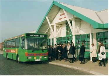
19 2.55. A review of motorcycle parking in the county was carried out in In Norwich, the motorcycle parking provision is popular and well used, although there is a lack of signing to it. Within the city centre there are approximately 80 dedicated spaces. The review recommended that an additional 135 to 150 spaces be provided. This would raise motorcycle parking to approximately 2.5% of the parking stock, from its present level of 1.5%. Table 2.6 Parking Stock in Norwich city centre Parking Type Short/Long Spaces Tariff up to 4 hrs Tariff up to 8 hrs Private Non Long 7,000 N/A N/A Residential Public On- Short N/A Street Public Off- Street Short 3, (average cost) 9.09 (average cost) Long 3, (average cost) 3.46 (average cost) The table excludes semi-private shop car parks such as Morrisons, Big W, Sainsburys and Toys R Us Cycle parking in the city centre generally comprises open-air racks, although there is secure undercover storage at the library. Overall it is likely that cycle parking provision is adequate, in terms of overall level of provision. However, there is a general lack of secure, undercover facilities, particularly within the city centre and at the rail and bus stations There are 34 spaces for holders of blue badges within Norwich city centre and 22 for holders of green badges. The City Council's Green Badge scheme is to enable people with severe mobility difficulties to park in the city centre on specially allocated spaces. The green disabled badge system is not a national scheme. Anyone who has a green badge should also have a blue badge Following a review of on-street waiting and loading restrictions earlier this year, the City Council intend to undertake some changes to the on-street restrictions to increase the number of disabled badge holders spaces in the City centre. It is anticipated that this will be undertaken early in the New Year Parking is available for holders Disabled Badges on all Norwich City Council's Pay & Display car parks. Park and Ride Park and Ride is a feature of NATS3 and, to date, 4 sites are in operation. Three of these are purpose-built and sited at Costessey, Postwick and the Airport. A fourth service operates from a temporary site off Hall Road at Harford. Park and Ride services are provided at a frequency of approximately every 8-10 minutes between 0700 and 1900 Monday to Saturday. The services are enhanced in the period leading up to Christmas, operating a later service on Thursdays and a Sunday service. 18
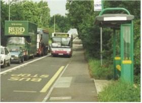
20 2.61. The Airport and Postwick sites have purpose built central waiting areas. The latest site, at Costessey, operates on an airport parking type arrangement where the bus picks passengers up from various points within the car park. The site also has a central toilet and information facility. The service from Costessey currently operates on a largely commercial basis (although some journeys are paid for via the NHS Trust using money from a Section 106 agreement secured as a result of the planning consent for the hospital). It operates via the new Norfolk and Norwich University NHS Trust Hospital at Colney with other intermediate stops en-route. A privately operated Park and Ride, not forming part of the Council s strategy, recently started to operate from a car-park close to the rail station. Table 2.7 Park and Ride Sites operated by Norfolk County Council Site Date of Number of Tariff opening spaces Costessey July , (Adult Return) 2.50 (Group Return) Airport June Postwick May Harford Total number of spaces 2, (before 9am) 2.50 (after 9am) Bus services The majority of bus services in the NATS area are provided by First on a commercial basis with no public subsidy. First also operate the Costessey Park and Ride service on a commercial basis Services in the city area operate via the radial road network to and from the city centre. This is shown on Plan No. 12. For orbital trips it is necessary to change services in the city centre, although a few services do provide through-city links. This means for example that it is possible to make a trip from Costessey to Heartsease without changing buses. There are relatively few routes with extensive penetration beyond the suburbs There is 5½km of bus lane in the city. Cross-city buses stop in Castle Meadow. Frequencies vary, but it is the Council s aim to encourage the provision of a ten-minute daytime frequency, with a minimum half-hourly evening and Sunday frequency on principal urban bus routes. Service 25 operates 24 hours between the hospital / University and the railway station The bus station is situated in the city centre, although it does not offer the facilities expected by today s bus user. Many bus services do not utilise the bus station, and instead use on-street facilities. The County Council has been successful in securing funding from Government to rebuild the bus station. This scheme will provide 14 bays, improve links between the bus and rail stations and improve interchange facilities at the rail station. 19
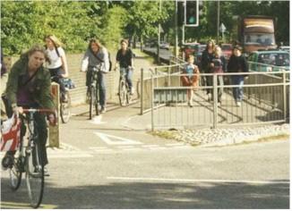
21 2.66. Within the NATS Area there are two voluntary and community transport schemes Norwich Door to Door and Carlink. Norwich Door to Door provides a minibus service for people who cannot use conventional transport due to physical mobility impairments. It can be used for any purpose. Carlink is a coordinated community car scheme based in Norwich but providing a service countywide. It provides journeys for people who cannot use or do not have access to bus services and who can travel in a volunteer s car (i.e. they are not permanently confined to a wheelchair). These schemes have the overall aim of reducing social exclusion and isolation and are managed via registered charities and a committed team of volunteers and paid personnel. They offer an important complementary service to that provided by conventional bus and trains services. Rail Rail travel provides an opportunity for commuting and visitor trips from some outlying villages and further afield. In the NATS area there are rail stations at Norwich, Rackheath and Brundall. Rail services operating from Norwich station can generally be classified as longer distance services (such as to Cambridge, London, the north or the Midlands) or local services. Local services provide commuter and visitor links to surrounding towns and villages including Wymondham, Great Yarmouth and Cromer. Anglia Railways operate the majority of services out of Norwich. Central Trains operate services to the north and Midlands, via Ely. The rail services are currently being re-franchised, to take effect from March The new Greater Anglia franchise will cover a wider area Norwich Thorpe rail station is situated some 800 metres east of the city centre and has recently been refurbished. Short-stay parking is provided on the station forecourt, with long-stay parking provision situated in a multi-storey car park recently constructed as part of the Riverside redevelopment. Cyclists and pedestrians The cycle network in the NATS area comprises a mix of on-road and off-road facilities. A cycle network has been identified and work has been implemented, albeit often on an ad-hoc basis, to implement this Within the city centre, much of the network has been pedestrianised, and includes London Street, the first pedestrianised street in the country. Parts of the city centre appear pedestrianised but allow vehicular access for parts of the day or certain classes of vehicle or usage Pedestrian phases have been introduced at most traffic signals in the city centre and pedestrian crossings have been introduced at specific locations. In April 2002, 92% (127 of 138 crossings) had facilities for disabled people; i.e. audible warning, tactile surfacing and tactile cones. Of those not meeting the criteria, three are pelican crossings on Wroxham Road, the rest being signalised junctions The former M&GN (Midlands and Great Northern) and Lakenham Way railway corridors have been dedicated for cycle and pedestrian use. The 20
22 M&GN corridor runs from Barkers Street / Crispins Road roundabout alongside the River Wensum to Thorpe Marriott and beyond. The Lakenham Way runs adjacent to Hall Road, from the Inner Ring Road at Brazengate to the Outer Ring Road at Mansfield Road. Norwich International Airport Norwich International Airport lies to the north of the built up area of the city at Hellesdon and has about 1,000 full-time employees based on the site. It is designated a Regional Connecting and Accessibility Point under the European Union s guidelines on Trans-European Networks Currently the airport serves Amsterdam, Aberdeen, Edinburgh and Manchester with scheduled flights. Holiday services serve 14 locations during the summer and Alicante, Malaga, Malta, Gran Canaria and Tenerife in the winter. The current split in passenger between leisure and business (based on charter / scheduled flights) is around 50/ It is one of the fastest growing airports in the country, seeing a 59% increase in passengers since 1993/4. Some 390,000 passengers used it in 2000/01 and this is expected to continue to rise. Forecasts produced by Norwich International Airport Limited range from 0.9 million passengers per annum (low growth) to 1.57 million passengers per annum (high growth) by The Government consultation on the Future Development of Air Transport in the UK: South-East notes that the future role of airports like Norwich depends on the amount and timing of future capacity at the major south-east airports. It sets out two growth scenarios for Norwich Airport to 2030: 4.4 million passengers per annum (mppa) if growth is constrained at main south-east airports or 0.7mppa if growth is not constrained. Norwich International Airport themselves anticipate handling 1mppa by 2014 and 2mppa by Work completed by Arup Economics and Planning for Norfolk County Council (2002) also acknowledges the relationship between growth of other airports, in particular at Stansted, and demand for Norwich Airport. The study finds that there is a potential for Norwich to take advantage of changes to the market and for example pick up a greater share of the low cost and charter market, with major expansion at Stansted. Taxis The District Councils Norwich, South Norfolk and Broadland, license taxis within the NATS area. Only hackney cabs in Norwich are required to have facilities for people with disabilities. These generally comprise ramps and seatbelts. All other vehicles are usually family saloons. Hackney cabs licensed in one District cannot pick up passengers in other Districts, although private hire vehicles can, if pre-booked Generally, there are sufficient spaces on taxi ranks in the area. 21
23 Table 2.8 Numbers of licensed taxis in each District Norwich Broadland South Norfolk Hackney Number Style Black cabs fully accessible for people with disabilities Generally family saloons. Unlikely to have facilities for people with disabilities Private Number hire Style Generally family saloons. Unlikely to have facilities for people with disabilities Note numbers have been rounded to nearest ten Freight The only specific facilities for freight deliveries in the Norwich area are on-street loading bays. Vehicles are also allowed to load and unload in the pedestrianised areas outside of the working day. There are no facilities, for example, to transfer freight from large to small vehicles and no area wide voluntary agreements on routing or loading arrangements. There is a weight restriction within the Outer Ring Road, preventing heavy vehicles from using the central parts of Norwich as a through route. Water transport Although Norwich is on a navigable waterway, there is little in the way of water-borne commercial traffic. River traffic is almost wholly related to tourism. A river bus operates from Norwich to Surlingham Broad, but again this is largely tourist-related. 22
24 Chapter 3: Existing and Future Travel Patterns Introduction 3.1. NATS3 contains 14 targets, designed to measure the success of the strategy and also as an aspiration of what the strategy is designed to achieve. The first section of this Chapter provides a summary of the results of monitoring against these. A full report Review of NATS targets is also available The second part of the Chapter looks ahead to the likely situation in the future. Results of Monitoring Target 1 - Traffic 3.3. Traffic levels are monitored on cordons at the Inner and Outer Ring Roads. Traffic crossing the Outer Ring Road has grown by an average of 0.6% per annum. There has been a slight reduction ( 0.1% per annum) in traffic crossing the Inner Ring Road. Further analysis of available traffic counts shows that there has been a reduction of traffic on the Inner Ring Road itself. This reduction has been approximately 6% between 1989 and The monitoring thus indicates an overall reduction in traffic within the centre of Norwich Monitoring shows that traffic crossing the outer ring road is increasing. It also suggests that the increase in traffic is due to traffic: Having an origin or destination between the inner and outer ring roads. (The pattern of flow might be explained by the increase in trips to out-oftown centres by for example people living between the outer and inner ring roads.); and / or Avoiding the Inner Ring Road when making cross-city trips The results also suggest that introducing traffic management features (including traffic calming, traffic signals or roundabout junctions) results in traffic displacing onto other roads. Table 3.1: Traffic crossing the Inner and Outer Ring Roads Year Outer Ring Road N/A 217, , , ,127 Cordon total Inner Ring Road Cordon total (common sites only) 105,264 N/A 100,452 N/A 92,954 Target 2 - Cycling 3.6. The monitoring of cycle use that has been carried out to measure progress against the NATS target shows that the number of cycle trips has remained at a stable level. There is some evidence to show that the introduction of dedicated new cycle facilities has led to an increase in the numbers of cyclists recorded on that new facility, for example the Hall Road 23
25 cycle route. Balanced against this, however, there has been a recorded reduction in cycles on existing dedicated facilities such as at Bluebell Road. Figure 3.1: Number of Cycles Crossing Inner Ring Road Cordon Targets 3 and 7 - Public Transport 3.7. Bus passengers crossing the Outer Ring Road have been counted annually. Counts show an increase in the numbers of bus passengers. Numbers have increased on both registered scheduled services and Park and Ride Services. However, the rate of growth on Park and Ride is much greater than on registered services. This is probably due to it starting from a much lower base. Table 3.2: Growth rates of passengers on Registered Service Buses and Park and Ride Services. Year Actual Target Registered Services Park and Ride Passenger Index: Passenger Index: numbers 1997=100 numbers 1997= , , , , , , , , , , Bus passenger numbers are rising slightly faster during the peak than the off-peak hours. The increase in passengers is similar between the am and pm peak hours First have provided provisional figures showing patronage on bus services from outside of the Norwich Area. This found approximately 12% of passengers arrived by County Services, compared to 88% on City Services. 24
26 3.10. There has also been an increase in the numbers of passengers arriving at Norwich Thorpe rail station, of nearly 20% between 1995 and This rate of increase is just below the target rate. Targets 4 and 5 - Mode Share Results from the County Council s modal share monitoring can be summarised as follows, in comparison to results from the 1991 census: The mode share of walking has remained fairly constant. The mode share of cycling has increased. It is interesting to note that the survey shows the mode share of cycling to have risen from 7% to 10%, whilst results from counts of cycles appears to show that the actual numbers of cyclists recorded have remained fairly static. This is probably due to the location of the counters resulting in them not picking up on all of the cycling trips made within the area. Similarly, the mode share of public transport has only risen by 1%, whilst the monitoring of passenger numbers shows a fairly substantial rise. For car journeys, the mode share has fallen. Monitoring of traffic levels crossing the ring roads shows increases crossing the outer ring road, and a reduction in traffic crossing the inner ring road. Target 6 School Trips No survey was undertaken for the proportion of pupils travelling on foot, public transport or by bicycle and hence no information is known on progress against this target. Target 8 Traffic Delay Journey time surveys were carried out in 1989 and repeated in These show that, overall, journey speeds in the city centre (inside the Outer Ring Road) in 2002 were 19.2mph It is difficult to draw conclusions from the journey time surveys, but it would appear that: Journey times for orbital or cross-city routes have increased, especially in the south-west area of the city. On routes out of the city to the south-east journey times appear to have shortened. This may be attributable to the introduction of the Southern Bypass. Routes to the south show increased journey times, especially during the peak hours, which could be a result of additional junctions on the A140. Targets 9, 10 and 11 Commuter Plans Targets for the adoption of commuter plans by the local authorities and major employers in the NATS area have not been met. Targets 13 and 14 Air Quality and Emissions The District Councils are responsible for reviewing and monitoring air quality. In the NATS area, only areas within the city centre have been found to have standards of air quality lower than the required standards. As a consequence, Norwich City Council is looking to declare Air Quality Management Areas around the Castle, in Grapes Hill and St Augustine s. 25
JOINT CORE STRATEGY FOR BROADLAND, NORWICH AND SOUTH NORFOLK EXAMINATION MATTER 3C EASTON/COSTESSEY
 Matter 3C Easton/Costessey Representor No. 8826 JOINT CORE STRATEGY FOR BROADLAND, NORWICH AND SOUTH NORFOLK EXAMINATION MATTER 3C EASTON/COSTESSEY SUBMISSION ON BEHALF OF TAYLOR WIMPEY DEVELOPMENTS AND
Roundhouse Way Transport Interchange (Part of NATS City Centre Package)
") Roundhouse Way Transport Interchange (Part of NATS City Centre Package) 15/16 16/17 17/18 18/19 19/20 Total TOTAL COST Roundhouse Way Transport Interchange 0.5m 0.5m FUNDING CIL 0.05m 0.05m Growth Deal
Roundhouse Way Transport Interchange (Part of NATS City Centre Package) 15/16 16/17 17/18 18/19 19/20 Total TOTAL COST Roundhouse Way Transport Interchange 0.5m 0.5m FUNDING CIL 0.05m 0.05m Growth Deal
3. Coach Supporting Statement
 3. Coach Supporting Statement Content 1. Setting the Scene 2. Vision 3. Coaches and the Shared Priorities 4. Issues 5. Delivery Programme in the first Plan Period 2001/02 2005/06 6. Good Practice 7. Strategy
EAST WEST RAIL EASTERN SECTION. prospectus for growth
 EAST WEST RAIL EASTERN SECTION prospectus for growth September 2018 executive summary The East West Rail Consortium, a partnership of local authorities, rail operators and Network Rail, continues to promote
Inside Government Conference Case Study: Norwich Northern Distributor Road
 Inside Government Conference Case Study: Norwich Northern Distributor Road 29 March 2017 Martin Wilby Chair of Environment, Development and Transport Committee Norfolk County Council Introduction What
A TRANSPORT SYSTEM CONNECTING PEOPLE TO PLACES
 THE MAYOR'S VISION FOR TRANSPORT A TRANSPORT SYSTEM CONNECTING PEOPLE TO PLACES VISION We will build a transport system that works for everyone, connecting people to the places they want to go within the
5 Rail demand in Western Sydney
 5 Rail demand in Western Sydney About this chapter To better understand where new or enhanced rail services are needed, this chapter presents an overview of the existing and future demand on the rail network
A140 study and Major Road Network
 A140 study and Major Road Network Executive Summary The Government s new Transport Investment Strategy sets out a new long-term approach for government infrastructure spending. Funding will be targeted
Tourism 201 CHAPTER 10
 Tourism 201 CHAPTER 10 202 Doncaster Unitary Development Plan Tourism 203 Tourism INTRODUCTION 10.1 The increasing importance of tourism is recognised in the UDP by having its own chapter. The benefits
FOR CONSIDERATION BY The Executive on 30 October Angus Ross, Executive Member for Environment
 ITEM NO: 69.00 TITLE Leisure Facility Options Study FOR CONSIDERATION BY The Executive on 30 October 2014 WARD DIRECTOR LEAD MEMBER None specific Heather Thwaites, Director of Environment; Stuart Rowbotham,
Welcome. Great Yarmouth Third River Crossing. Norfolk County Council
 Welcome Great Yarmouth Third River Crossing We are proposing to build a new bridge between Harfreys Roundabout and South Denes Road, and we would like your views. This consultation is stage two of a three-stage
STRATEGIC INVESTMENT IN MANCHESTER AIRPORT
 Report To: EXECUTIVE CABINET Date: 7 February 2018 Cabinet Deputy/Reporting Officer: Subject: Report Summary: Cllr Bill Fairfoull Executive Member (Finance & Performance) Tom Wilkinson, Assistant Director
Infrastructure for Growth
 A passion to deliver a prosperous future Connecting North Cambridgeshire Infrastructure for Growth Infrastructure for growth Wisbech is the largest settlement in Fenland. The town and its hinterland has
30A TIMES FARES MAPS. Hellesdon Mill Corner. Taverham, Thorpe Marriott & Drayton village links. or Hellesdon Hercules Rd Mile Cross City Centre
 A, Thorpe Marriott & Drayton village links then up to every mins between Hellesdon Mill Corner or Hellesdon Hercules Rd Mile Cross City Centre calling at Asda Heigham Street from 14th May 2017 TIMES FARES
The case for a local rail station. At Great Blakenham, Suffolk.
 The case for a local rail station At Great Blakenham, Suffolk. The London to Norwich (Great Eastern) main rail line passes through Great Blakenham in Suffolk, a village which adjoins Claydon and Barham.
Norwich Research Park Overarching Travel Plan November 2017
 Norwich Research Park Overarching Travel Plan November 2017 Norwich Research Park Overarching Travel Plan November 2017 Contents Page 1 Norwich Research Park Site & Development Proposals... 1 2 Site Location
Report of the Strategic Director of Place to the meeting of Executive to be held on 11 September 2018
 Report of the Strategic Director of Place to the meeting of Executive to be held on 11 September 2018 Subject: M Arrangements for the establishment of a West Yorkshire Urban Traffic Management Control
Proposed Lidl Food store West Hendford, Yeovil
 Proposed Lidl Food store West Hendford, Yeovil Lidl Travel Plan October 2015 CONTENTS Page 1.0 INTRODUCTION 1 1.1 Background 1 1.2 Aim of Travel Plan 1 1.3 Contents 2 2.0 TRANSPORT CONTEXT 3 2.1 Site Location
IPSWICH MEANS BUSINESS
 IPSWICH MEANS BUSINESS Ipswich is the oldest English town that boasts a new waterfront, a university and a cultural centre that attracts visitors from all over the world. Its location makes connection
APPENDIX 8. Leeds Socio-Economic Baseline Report. Report. July Metro and Leeds City Council
 APPENDIX 8 Leeds Socio-Economic Baseline Report Report July 2009 Prepared for: Prepared by: Metro and Leeds City Council Steer Davies Gleave West Riding House 67 Albion Street Leeds LS1 5AA +44 (0)113
Q: How many flights arrived and departed in 2017? A: In 2017 the airport saw 39,300 air transport movements.
 Southampton Airport Masterplan FAQ 4 October 2018 Background Southampton Airport Today Q: How many passengers currently use Southampton Airport and how has this changed over the last 5 years? A: Over the
East West Rail Consortium
 East West Rail Consortium EWR Wider Economic Case: Refresh 18 th November 2015 Rupert Dyer Rail Expertise Ltd Rail Expertise Ltd. Tel: 01543 493533 Email: info@railexpertise.co.uk 1 Introduction 1.1 The
CONTENTS 03 BIG PICTURE 15 BARS & RESTAURANTS 05 OFFICE 16 EMPLOYMENT 07 EDUCATION ART AND CULTURE 18 TRANSPORT AND ACCESS 9 TOURISM AND HOTELS
 CONTENTS 3 BIG PICTURE 5 OFFICE 15 BARS & RESTAURANTS 16 EMPLOYMENT 7 EDUCATION ART AND CULTURE 18 TRANSPORT AND ACCESS 9 TOURISM AND HOTELS 12 RETAIL 2 CITY LIVING 23 SOURCE INTRODUCTION Norwich The City
Guildford Borough Transport Strategy 2017, Topic Paper: Transport, June 2017 (accompanying Local Plan 2017) Local Plan Transport Strategy 2017
 Local Plan Transport Strategy 2017") Guildford Society Transport Group Position Paper August 2017 Based on submissions in response to the June/July 2017 Local Plan consultation including material presented to Drop-in Session 15 July 2017.
Guildford Society Transport Group Position Paper August 2017 Based on submissions in response to the June/July 2017 Local Plan consultation including material presented to Drop-in Session 15 July 2017.
Team London Bridge Response to the Department for Transport Consultation on the combined Thameslink, Southern and Great Northern franchise
 Team London Bridge Response to the Department for Transport Consultation on the combined Thameslink, Southern and Great Northern franchise 23 August 2012 Table of Contents 1. Executive Summary 2. Introduction
Reference: 06/13/0594/F Parish: Fritton & St Olaves Officer: Mrs M Pieterman Expiry Date:
 Schedule of Planning Applications Committee Date: 21 st January 2014 Reference: 06/13/0594/F Parish: Fritton & St Olaves Officer: Mrs M Pieterman Expiry Date: 20-01-2014 Applicant: Proposal: Site: Lord
INVESTMENT CITY CENTRE INVESTMENT GROUND FLOOR AND BASEMENT WESTLEGATE, NORWICH NR1 3LR LET TO EVANS CYCLES
 INVESTMENT GROUND FLOOR AND BASEMENT 14-18 WESTLEGATE, NORWICH NR1 3LR CITY CENTRE INVESTMENT LET TO EVANS CYCLES INVESTMENT SUMMARY Norwich is a major UK city with a large and affluent catchment. Prominent
Re-opening of the Skipton to Colne Railway Executive Summary
 Re-opening of the to Colne Railway Executive Summary SELRAP SELRAP is the East Lancashire Rail Action Partnership. It was established with the objective of campaigning for the reinstatement of the railway
BURGH CASTLE MARINA & HOLIDAY PARK
 Burgh Castle Marina Holiday Homes Burgh is a beautiful place and for many people Burgh Castle is the finest spot in Broadland, with its glorious views of the Yare and Waveney valleys and marshlands. At
Public Realm & Landscape
 Town Centre Context Public Realm & Landscape 1. Public realm in the Town Centre varies significantly in quality. Areas of particularly good quality public realm are located around the Minster and outside
Living & Working Tourism
 Living & Working Tourism 5.10Tourism Background 5.10.1 Tourism is a major rural industry in Dorset, contributing over 600 million in visitor expenditure and supporting over 21,000 jobs directly and indirectly
Submission to Infrastructure Victoria s Draft 30-Year Infrastructure Strategy
 Submission to Infrastructure Victoria s Draft 30-Year Infrastructure Strategy 1. Introduction This submission is a response to Infrastructure Victoria s assessment of the need to construct a heavy rail
Response to the London Heathrow Airport Expansion Public Consultation
 Response to the London Heathrow Airport Expansion Public Consultation Summary This report sets out the response to the Heathrow Airport s consultation on airport expansion and airspace change. The consultation
SOUTH CAMBRIDGESHIRE DISTRICT COUNCIL. Executive Director / Senior Planning Policy Officer
 SOUTH CAMBRIDGESHIRE DISTRICT COUNCIL REPORT TO: Leader and Cabinet 8 May 2008 AUTHOR/S: Executive Director / Senior Planning Policy Officer SOUTH CAMBRIDGESHIRE DISTRICT COUNCIL S RESPONSE TO UTTLESFORD
Settlement Profile of BARMBY MOOR
 Settlement Profile of BARMBY MOOR Copyright Andy Beecroft and licensed for reuse under this Creative Commons Licence (Attribution-Share Alike 2.0 Generic) The village of Barmby Moor is situated approximately
PCAL Case Study Retail Areas: Rouse Hill Town Centre
 PCAL Case Study Retail Areas: Rouse Hill Town Centre Introduction Rouse Hill Town Centre is a new mixed use development on a greenfield site in Sydney s North West. It has been planned to be a major hub
What s happening with Transport in Bristol?
 What s happening with Transport in Bristol? Bristol Local Transport Plan Update Autumn 2002 getting Bristol to work Bristol s five-year Local Transport Plan was published in July 2000 after extensive public
DRAFT MARCH MARKET TOWN TRANSPORT STRATEGY 2013 INTRODUCTION
 DRAFT MARCH MARKET TOWN TRANSPORT STRATEGY 2013 INTRODUCTION This is the second Market Town Transport Strategy for March, replacing the strategy produced in 2002. It forms a part of the Third Cambridgeshire
Haworth Tr T avel Plan r 10th February 2006
 Haworth Travel Plan 10th February 2006 Haworth Travel Plan has been prepared for: Contents 1 Why have Haworth Travel Plan?... 3 2 Who will benefit from Haworth Travel Plan?... 4 3 What actions will be
Gold Coast. Rapid Transit. Chapter twelve Social impact. Chapter content
 Gold Coast Rapid Transit Chapter twelve Social impact Chapter content Social impact assessment process...235 Existing community profile...237 Consultation...238 Social impacts and mitigation strategies...239
Future Economy. Future Econo. Conditions for Growth. Conditions for Growth. Growth for Business. Growth for Business. Isles of Scilly.
 Isles of Scilly Evidence Base Future Economy Future Economy Conditions for Growth Conditions for Growth Growth for Business Growth for Business Future Econo CONTENTS Introduction... 3 Economic Overview...
Llandudno Junction. Regeneration Proposals for the Future. December 2009
 Llandudno Junction Regeneration Proposals for the Future December 2009 Llandudno Junction - Vision Statement 1 Purpose 1.1 The purpose of this document is to describe key priorities to support the regeneration
Economic Impact of Tourism. Norfolk
 Economic Impact of Tourism Norfolk - 2009 Produced by: East of England Tourism Dettingen House Dettingen Way, Bury St Edmunds Suffolk IP33 3TU Tel. 01284 727480 Contextual analysis Regional Economic Trends
Rail passengers priorities for improvement November 2017
 Rail passengers priorities for improvement November 2017 Rail passengers priorities for improvement November 2017 Foreword We asked more than 12,800 passengers across the country to rank 31 possible improvements
Saighton Camp, Chester. Technical Note: Impact of Boughton Heath S278 Works upon the operation of the Local Highway Network
 Technical Note: Impact of Boughton Heath S278 Works July 2013 SAIGHTON CAMP CHESTER COMMERCIAL ESTATES GROUP TECHNICAL NOTE: IMPACT OF BOUGHTON HEATH S278 WORKS UPON THE OPERATION OF THE LOCAL HIGHWAY
Scrappage for Equality
 Scrappage for Equality Calls continue to be made for the Government to sponsor a vehicle scrappage scheme to remove the most polluting vehicles from the parc. Previous RAC Foundation research has revealed
London Borough of Barnet Traffic & Development Design Team
 London Borough of Barnet Traffic & Development Design Team AERODROME ROAD PEDESTRIAN FACILITY AND BUS STOP INTRODUCTION FEASIBILITY REPORT Job Number: 60668 Doc Ref: S106/12-13/60668 Author: Manoj Kalair
REAUTHORISATION OF THE ALLIANCE BETWEEN AIR NEW ZEALAND AND CATHAY PACIFIC
 Chair Cabinet Economic Growth and Infrastructure Committee Office of the Minister of Transport REAUTHORISATION OF THE ALLIANCE BETWEEN AIR NEW ZEALAND AND CATHAY PACIFIC Proposal 1. I propose that the
Annex 1 Revised TEE, AMCB and Public Accounts Tables Print Version
 Annex 1 Revised TEE, AMCB and Public Accounts Tables Print Version NB. The Excel file also includes the BAFB and Full approval cost tables. South Yorkshire BRT Northern Route Full Approval September 2013
August Briefing. Why airport expansion is bad for regional economies
 August 2005 Briefing Why airport expansion is bad for regional economies 1 Summary The UK runs a massive economic deficit from air travel. Foreign visitors arriving by air spent nearly 11 billion in the
Produced by: Destination Research Sergi Jarques, Director
 Produced by: Destination Research Sergi Jarques, Director Economic Impact of Tourism North Norfolk District - 2016 Contents Page Summary Results 2 Contextual analysis 4 Volume of Tourism 7 Staying Visitors
Produced by: Destination Research Sergi Jarques, Director
 Produced by: Destination Research Sergi Jarques, Director Economic Impact of Tourism Norfolk - 2016 Contents Page Summary Results 2 Contextual analysis 4 Volume of Tourism 7 Staying Visitors - Accommodation
Investing in Greater Manchester transport 2017/2018
 TRAFFIC Investing in Greater Manchester transport 2017/2018 INFORMATION www.greatermanchester-ca.gov.uk Transport is an important part of life for residents and businesses in Greater Manchester. It connects
West of England. Priority Places Requiring Public Investment
 West of England Priority Places Requiring Public Investment Development Urban Regeneration & Suburban Intensification Bristol Central Area Bristol Central Area; Stokes Croft, Temple Meads & St Philips
Open Report on behalf of Richard Wills, Executive Director for Environment and Economy
 Agenda Item 7 Executive Open Report on behalf of Richard Wills, Executive Director for Environment and Economy Report to: Executive Date: 02 September 2014 Subject: Lincoln East West Link Road Phase 1
The Bus Services Bill and Municipal Bus Companies
 The Bus Services Bill and Municipal Bus Companies Summary Why we need bus services What are municipal bus operators? Network Warrington Being commercial/serving the community Bus Services Bill Value to
Locate in Falkirk. A guide for retail businesses
 Locate in Falkirk A guide for retail businesses Contents Introduction to Falkirk and the surrounding area Introduction to Falkirk and the surrounding area...3 Key Economic Growth Priorities...4 Transport
RESPONSE TO AIRPORT EXPANSION CONSULTATION 27 MARCH 2018 Submitted online by Helen Monger, Director
 RESPONSE TO AIRPORT EXPANSION CONSULTATION 27 MARCH 2018 Submitted online by Helen Monger, Director 1. Expanding Heathrow The expansion of Heathrow will be one of the largest infrastructure projects in
East Lancashire Highways and Transport Masterplan East Lancashire Rail Connectivity Study Conditional Output Statement (Appendix 'A' refers)
") Report to the Cabinet Member for Highways and Transport Report submitted by: Director of Corporate Commissioning Date: 1 June 2015 Part I Electoral Divisions affected: All East Lancashire Highways and
Report to the Cabinet Member for Highways and Transport Report submitted by: Director of Corporate Commissioning Date: 1 June 2015 Part I Electoral Divisions affected: All East Lancashire Highways and
East Lothian. Skills Assessment January SDS-1154-Jan16
 East Lothian Skills Assessment January 2016 SDS-1154-Jan16 Acknowledgement The Regional Skills Assessment Steering Group (Skills Development Scotland, Scottish Enterprise, the Scottish Funding Council
OBJECTION TO AMENDMENT TO PLANNING SCHEME AND GRANTING OF PLANNING PERMIT
 PLANNING AND ENVIRONMENT ACT 1987 OBJECTION TO AMENDMENT TO PLANNING SCHEME AND GRANTING OF PLANNING PERMIT AMENDMENT C32 APPLICATION 0873/02 Public Transport Users Association Inc. 247-249 Flinders Lane
Stannard Place. Exceptional open plan offices with car parking (1 space per 500 sq ft) St Crispins Road, Norwich. Cavell House & Austin House
 St Crispins Road, Norwich. Cavell House & Austin House") Stannard Place St Crispins Road, Norwich Cavell House & Austin House Exceptional open plan offices with car parking (1 space per 500 sq ft) To Let Situation Norwich is the administrative centre of Norfolk
Stannard Place St Crispins Road, Norwich Cavell House & Austin House Exceptional open plan offices with car parking (1 space per 500 sq ft) To Let Situation Norwich is the administrative centre of Norfolk
Retail The UK retail hierarchy: Beyond the shopping centre pipeline
 Retail The UK retail hierarchy: Beyond the shopping centre pipeline Received (in revised form): 2 October 2006 Andrew Go odwin is a partner at Donaldsons; independent property consultants in the UK and
Agenda Item 5: Rail East Midlands Rail Franchise Consultation
 Strategic Transport Forum 15 th September 2017 Agenda Item 5: Rail East Midlands Rail Franchise Consultation Recommendation: It is recommended that the Forum agree (subject to any amendments agreed by
SUBMISSION FROM RENFREWSHIRE COUNCIL
 SUBMISSION FROM RENFREWSHIRE COUNCIL What does regeneration mean in your area? 1. Renfrewshire takes a broad view of regeneration activity. It firmly embedded in our strategic documents, such as the Single
CONSULTATION ON ISSUES AFFECTING PASSENGERS ACCESS TO UK AIRPORTS A REVIEW OF SURFACE ACCESS. Response by Newcastle International Airport Ltd
 CONSULTATION ON ISSUES AFFECTING PASSENGERS ACCESS TO UK AIRPORTS 1. Introduction A REVIEW OF SURFACE ACCESS Response by Newcastle International Airport Ltd Newcastle is the largest airport in the North
North Lanarkshire. Skills Assessment January SDS-1163-Jan16
 North Lanarkshire Skills Assessment January 2016 SDS-1163-Jan16 Acknowledgement The Regional Skills Assessment Steering Group (Skills Development Scotland, Scottish Enterprise, the Scottish Funding Council
STANSTED AIRPORT PLANNING APPLICATION UTT/18/0460/FUL SECTION 106 CONDITIONS TO BE REQUIRED IF PLANNING APPLICATION IS APPROVED
 STANSTED MOUNTFITCHET PARISH COUNCIL STANSTED AIRPORT PLANNING APPLICATION UTT/18/0460/FUL SECTION 106 S TO BE REQUIRED IF PLANNING APPLICATION IS APPROVED 1 INTRODUCTION 1.1 Stansted Mountfitchet Parish
WHAT MAKES A SUCCESSFUL BUSINESS COMMUNITY?
 WHAT MAKES A SUCCESSFUL BUSINESS COMMUNITY? The traditional business park format is no longer sustainable. Occupiers want more; more amenities, more convenience and a better working environment [work-life
Chapter 8 Route Window NE7 Chadwell Heath station. Transport for London
 Chapter 8 Route Window NE7 Chadwell Heath station Transport CHADWELL HEATH STATION 8 Route Window NE7 Chadwell Heath station Baseline conditions 8.6 This route window lies within the London Boroughs of
YOU MAY NOT HAVE HEARD...
 YOU MAY NOT HAVE HEARD... ... NOW IS THE TIME TO INVEST IN GREATER NORWICH Norwich is a thriving, vibrant and youthful city with ambitious growth plans. With particular expertise in health and life sciences,
CAA Passenger Survey Report 2005
 Economic Regulation Group CAA Passenger Survey Report 2005 Survey of passengers at Aberdeen, Bournemouth, Durham Tees Valley, Edinburgh, Gatwick, Glasgow, Heathrow, Inverness, Leeds Bradford, Luton, Manchester,
Destination Performance 2012
 Destination Performance 2012 Sample Council City 2 Prepared by: TSE Research www.tourismsoutheast.com Contextual Information Welcome to the Destination Intelligence report for British Destinations members.
WELSH GOVERNMENT RESPONSE P Ensure Disabled People can Access Public Transport As and When They Need it
 WELSH GOVERNMENT RESPONSE P-05-710 Ensure Disabled People can Access Public Transport As and When They Need it The petition submitted by Whizz Kidz seeking action to ensure that disabled people can access
National Passenger Survey Spring putting rail passengers first
 National Passenger Survey putting rail passengers first What is Passenger Focus? Passenger Focus is the independent national rail consumer watchdog. Our mission is to get the best deal for Britain s rail
North West London Hospitals NHS Trust
 North West London Hospitals NHS Trust Policy Communication Cover Sheet Policy Name: Post Holder Responsible: Approved by: Replaces: PARKING POLICY Philip Sutcliffe, Director of Corporate Services Executive
Traffic calming on major roads: a traffic calming scheme at Costessey, Norfolk
 Traffic Advisory Leaflet 14/99 December 1999 Traffic calming on major roads: a traffic calming scheme at Costessey, Norfolk Introduction This leaflet summarises the impact of a traffic calming scheme on
Chapter 6 Route Window NE5 Seven Kings station. Transport for London
 Chapter 6 Route Window NE5 Seven Kings station Transport SEVEN KINGS STATION 6 Route Window NE5 Seven Kings Station Transport Introduction 6.1 All construction activities in this route window are associated
National Rail Performance Report - Quarter /14
 A London TravelWatch report The voice of transport users National Rail Performance Report - July 2014 London TravelWatch is the official body set up by Parliament to provide a voice for London s travelling
PERTH AND KINROSS COUNCIL. 22 June 2016 DEVELOPING THE CULTURAL OFFER IN PERTH AND KINROSS UPDATE AND NEXT STEPS
 PERTH AND KINROSS COUNCIL 8 16/278 22 June 2016 DEVELOPING THE CULTURAL OFFER IN PERTH AND KINROSS UPDATE AND NEXT STEPS Report by Senior Depute Chief Executive (Equality, Community Planning & Public Service
Date 24/10/2011. Date 04/11/2011. Date 25/10/2011. Date 10/11/2011. Date 25/10/2011. Date 25/10/2011. Date 10/11/2011.
 DELEGATED POWERS REPORT NO. 1489 SUBJECT: Traffic Signal Review, Junction of Oakleigh Road North and the A1000 Control sheet All of the following actions MUST be completed at each stage of the process
BUSINESS BAROMETER December 2018
 Credit: Chris Orange BUSINESS BAROMETER December Credit: Nigel Moore 1 Contents Summary of findings 3 Annual monthly performance: visitor attractions..4 Visit Herts Team update 5 National context.8 Visitor
FUTURE AIRSPACE CHANGE
 HEATHROW EXPANSION FUTURE AIRSPACE CHANGE UPDATE SEPTEMBER 2018 On 25 June 2018, Parliament formally backed Heathrow expansion, with MPs voting in support of the Government s Airports National Policy Statement
Pre-application submission for Committee: Phase 4 development at West Hendon
 Pre-application submission for Committee: Phase 4 development at West Hendon 1. Development Details Phase 4 of the West Hendon Estate Regeneration. 2. Background The redevelopment of the West Hendon Estate
Workplace Parking Levies: the contribution of commuters to funding public transport. Sue Flack Consultant
 Workplace Parking Levies: the contribution of commuters to funding public transport Sue Flack Consultant Summary 1. 2. 3. 4. 5. Example of Nottingham, UK Use of Workplace Parking Levy Revenue Why Workplace
Rail Update Station Usage Statistics and Network Rail Performance
 Rail Update Station Usage Statistics and Network Rail Performance Committee Operations Date of meeting 26 January 2018 Date of report 21 December 2017 Report by Senior Director 1. Object of report To update
Lower Thames Crossing consultation response
 Lower Thames Crossing consultation response Context: This is the response from Campaign for Better Transport to the Department for Transport s consultation Options for a new Lower Thames Crossing. Consultation
TfL Planning. 1. Question 1
 TfL Planning TfL response to questions from Zac Goldsmith MP, Chair of the All Party Parliamentary Group on Heathrow and the Wider Economy Heathrow airport expansion proposal - surface access February
Map showing location of public transport projects in vicinity of railway station
 Map showing location of public transport projects in vicinity of railway station Market Town Transport Strategy 2013 39 ID PT1a Specific Location Approach at Detail of Project Develop Area Master plan
The Economic Impact of Tourism Brighton & Hove Prepared by: Tourism South East Research Unit 40 Chamberlayne Road Eastleigh Hampshire SO50 5JH
 The Economic Impact of Tourism Brighton & Hove 2013 Prepared by: Tourism South East Research Unit 40 Chamberlayne Road Eastleigh Hampshire SO50 5JH CONTENTS 1. Summary of Results 1 1.1 Introduction 1 1.2
SOUTH CAMBRIDGESHIRE DISTRICT COUNCIL
 SOUTH CAMBRIDGESHIRE DISTRICT COUNCIL REPORT TO: Leader and Cabinet 13 July 2006 AUTHOR: Executive Director / Principal Planning Policy Officer (Transport) STANSTED AIRPORT GENERATION 1 CONSULTATION ON
Suffolk Chamber Transport Board Greater Anglia. 16 January 2018
 Suffolk Chamber Transport Board Greater Anglia 16 January 2018 Greater Anglia update GEML Taskforce NRPS Spring 2017 results Fleet reliability and refresh initiatives Timetable improvements New trains
Economic Development Sub- Committee
 Report title: Economic Development Sub- Committee Item No. Date of meeting: 24 November 2016 A47 Road Investment Strategy - update Responsible Chief Tom McCabe Executive Director, Community Officer: and
Produced by: Destination Research Sergi Jarques, Director
 Produced by: Destination Research Sergi Jarques, Director Economic Impact of Tourism Norfolk - 2017 Contents Page Summary Results 2 Contextual analysis 4 Volume of Tourism 7 Staying Visitors - Accommodation
Local Development Scheme
 Local Development Scheme August 2014 Local Development Scheme (August 2014) / Page 2 Contents Section 1: Introduction Great Yarmouth s Development Plan 4 Section 2: Plan Making Process Public participation
Proposals for the Harrogate Road / New Line Junction Improvement Scheme. August / September Supported by:
 Proposals for the Harrogate / New Line Junction Improvement Scheme August / September 2016 Supported by: Introduction Key Benefits Proposals are currently being developed for changes to the junction of
Councillor Briefing on Elvetham Chase
 Councillor Briefing on Elvetham Chase In partnership with the Calthorpe Estate, Wates Developments vision for Elvetham Chase is to provide an outstanding new community for Hart District that will become
Bartlett Square Welcome. Investment Framework. London Airport Ltd
 1 Welcome Welcome to Luton s public exhibition on proposals for the (formerly known as Stirling Place) project which will comprise 2.5 acres of commercial development, providing up to 2,000 jobs for local
The promotion of tourism in Wales
 The promotion of tourism in Wales AN OUTLINE OF THE POTENTIAL ADVANTAGES AND DISADVANTAGES OF ADVANCING CLOCKS BY AN ADDITIONAL HOUR IN SUMMER AND WINTER Dr. Mayer Hillman Senior Fellow Emeritus, Policy
A303. Sparkford to Ilchester Dualling Scheme Preferred Route Announcement
 A303 Sparkford to Ilchester Dualling Scheme Preferred Route Announcement About this booklet This booklet presents the preferred route for the A303 Sparkford to Ilchester dualling scheme and a summary of