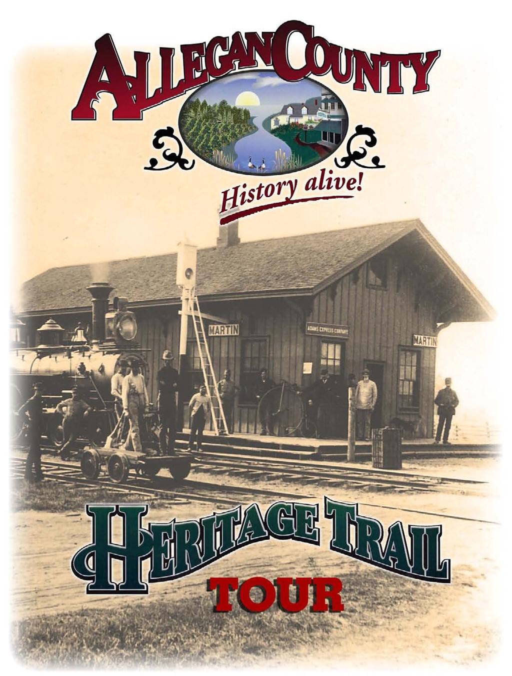
Table of Contents. Allegan County Heritage Trail Driving Tour
|
|
|
- Elwin Jones
- 6 years ago
- Views:
Transcription
1
2 Table of Contents A Brief History of Allegan County... 1 Welcome to the Allegan County Heritage Trail!... 3 Where does the trail go?... 3 How long is the trail?... 3 How does the driving tour work?... 4 Site No.1: The City of Otsego... 5 Site No.2: Pine Creek Where did the town go?... 6 Site No.3: Pine Creek Dam... 7 Site No.4: The City of Allegan... 8 Site No.5: Lake Allegan Overlook Site No.6: WWII Prisoner of War Camp & Camp Lockwood Civilian Conservation Corp Camp Site No.7: Calkins Dam (Lake Allegan Dam) Site No.8: Allegan State Game Area Headquarters Site No.9: The Tree Army A Drive-By Site No.10: The City of Fennville Site No.11: Hutchins Lake A Drive-By Site No.12: Orchards & Berries A Drive-By Site No.13: Hudson Heritage Farm Vista Site No.14: The Community of Glenn Site No.15: West Side County Park Lake Michigan Site No.16: Pier Cove Site No.17: The City of the Village of Douglas Site No.18: The City of Saugatuck Site No.19: River Bluff Park Site No.20: New Richmond and the Swing Bridge Site No.21: Wooden Trestle in Hamilton Site No.22: Commercial Flower Farms Site No.23: Dutch Heritage Farms & Homes A Drive-By Site No.24: The Village of Hopkins Site No.25: The City of Wayland Site No.26: Shelbyville and Gun Lake Site No.27: The Village of Martin Site No.28: The City of Plainwell ii i
3 A Brief History of Allegan County 1830s-40s: Land Rush in Michigan 1837: Michigan statehood : Civil War 1871: Great Chicago Fire : World War I : Great Depression : World War II 1830: First Settler 1837: Allegan platted 1840: Four lumber mills 1847: Dutch immigrants arrive 1868: First railroad in Allegan County 1870: 34 million feet of lumber exported from Saugatuck : Paper mills open in Otsego and Plainwell 1884: Peach boom, Douglas 1899: Dam provides first electricity to County 1911: Plank Road paved 1920: Fire destroys Hopkins business district 1933: CCC plants millions of tree seedlings 1944: POW Camp 1961: Old County courthouse torn down The first settler in Allegan County, William Butler, landed at the mouth of the Kalamazoo River with his wife in the spring of 1830 and settled in what is now downtown Saugatuck (Site No.18). The second and third groups of settlers arrived shortly thereafter but traveled further inland, settling near Pine Creek (Site No.2). When the white settlers arrived, Allegan County was home to three Native American tribes the Potawatomi, Odawa, and Ojibwa. They had several villages in the eastern part of the county and one in the Saugatuck area. Life in those first years, especially the winters, was very rough, and the early settlers depended on the Native Americans to supply them with game, berries, and other foodstuffs. The earliest settlers were people who came to work and make their fortunes primarily from the area s natural resources towering virgin white pine trees for lumber and shingles, hemlock trees to use in tanning hides, and land speculation. During the 1830s and 1840s, a number of lumber mills were set up in the county, but they suffered from a lack of customers. However, with the midcentury growth of Chicago and Milwaukee, the influx of Civil War veterans in the late 1860s, and especially the Great Chicago Fire of 1871, the demand for Allegan County s lumber exploded. Trees were cut literally round-the-clock at times, and lumber mills were operating full-blast to meet the demand. A different kind of settler, however, came to the northwest corner of the county. There, Dutch immigrants, arriving in Holland, moved to the surrounding countryside as part of religious communities. In 1847, seventy immigrants from one town settled Graafschap. And in 1848, an entire religious community from another village settled the town of Overisel. These settlers, and many of those that followed, were conservative religious Separatists who were fleeing religious persecution, much like the Puritans. The lumber boom, together with the construction of a plank road connecting Grand Rapids and Kalamazoo through the eastern part of Allegan County in 1854 and the arrival of several railroads around 1870, created a flurry of new settlements and population growth. The population grew from 5,125 in 1850 to just over 16,000 by It doubled again by 1870 and peaked at around 38,000 in 1880 where it remained till post WWII. After the trees had all been clear-cut and the lumber boom ended, the land with good or passable soil was converted to farming. On the western side of the county, much of the land near Lake Mich- 1 i
4 igan was converted to fruit orchards. Indeed, the peaches grown in the Saugatuck-Douglas area were famous in the markets of Chicago where they were called Michigan Gold. While agriculture has remained important in most parts of the county, the eastern and western portions of Allegan County developed somewhat differently during the 20th century. From the 1870s through the early 1900 s, numerous paper mills opened along the Kalamazoo River in Otsego (Site No.1) and Plainwell (Site No.28) and became an important part of the local economy for much of the 20th century. Today, all but two are closed, and both remain major employers in the area. On the western side, the advent of the 20th century brought a different industry to the county s Lake Michigan coastline, and especially Saugatuck tourism. Large groups of cottagers and vacationers from Chicago and as far away as St. Louis came to this area of great natural beauty to get back to nature and escape the summer heat. Many also came by steamship just for the day to dance at the Big Pavilion in Saugatuck. 2 i


5 Welcome to the Allegan County Heritage Trail! Travel into the past see historic villages and towns little touched by modern development. Experience the sights and sounds of the river and the railroads that were the engines of the country s westward expansion. View the bountiful farmlands and orchards that were and still are the backbone of this rural county. Discover the stories, some funny, some tragic, all entertaining, of Allegan County s history. This is the experience that awaits you along the Allegan County Heritage Trail! Where does the trail go? To orient yourself, take a quick look at the route map located in this booklet. The tour is a loop that runs from Saugatuck east across the farmlands of northern Allegan County and on through the towns of Hopkins, Wayland and Martin down to Plainwell. From there, the trail heads back along the Kalamazoo River through Otsego and Allegan, then past Lake Allegan and through the Allegan State Game Area. The tour continues past orchards and vineyards in the Fennville area to Lake Michigan, and then up the lakefront back to Saugatuck and Douglas. How long is the trail? That depends on how much time you have! The tour is designed so that you can take the whole tour loop or take your own shorter route! If you take the entire tour, figure on taking a full day if you stop to view the various sites and enjoy the experiences along the way. The entire loop is 122 miles and to drive it non-stop would take around 4-5 hours. 3 i


6 How does the driving tour work? You can start the tour from any location on the route. It s designed to be driven in a clockwise direction, which provides better scenic vistas. At each Heritage Trail Site along the route, a marker like the one at right will be posted along with the corresponding Site Number. Markers are generally posted in locations visible from the roadway. At each turn in the route, you will also see a Heritage Trail directional marker like the one shown at the lower right. The arrow indicates the direction you will need to turn to continue along the trail. Please note that while you can follow the trail in either direction, Heritage Trail directional markers are only posted in the clockwise direction and some Heritage Trail Site markers may be oriented toward traffic coming from that direction. You might want to read ahead in this guidebook to see what the next Site is so you will know what to watch for. Most of the Sites have opportunities for you to park your vehicle and explore a little. A few sites are just drive-bys. Enjoy your journey on the Heritage Trail! Example of a Heritage Trail Site marker. (C.Bessert) Example of an information panel at a Heritage Trail site. Example of a Heritage Trail route turn marker. (C.Bessert) 4 i

7 Site No.1: The City of Otsego Otsego s early history is fascinating because it prospered from the presence of water in two very different and ultimately mutually exclusive ways. Mineral springs were discovered in Otsego around 1850 and the town quickly became a spa resort, which by 1870 was attracting visitors from far and wide to take the waters. Many hotels sprang up to support the industry and mineral water was shipped from here all over the state. The Otsego Mineral Springs. The sign on the building says, Hot and cold baths for General Debility and all Chronic diseases treated successfully. Then in the late 1870 s Otsego s location on the Kalamazoo River brought the first of several paper mills that would change Otsego forever. The first mill was the Bardeen Paper Mill. By 1887, 125 men were employed by the town s mills. Workers received $7.00 a week for a ten-hour day, six days a week good money at that time! Today, only one mill remains, but it is a major source of employment and prosperity for the town. Take some time to explore the community and learn more about its history. A historic self-guiding walking tour pamphlet is available. Check with the Chamber of Commerce, the public library or the Otsego Area Historical Museum for a copy. 5 i
, a thriving town and an important stopover for westbound wagon trains.")
8 Site No.2: Pine Creek Where did the town go? Can you see it? Well, you ll have to use your imagination. From around 1830 until about 1900 this was the location of New Rochester (or sometimes called Pine Creek), a thriving town and an important stopover for westbound wagon trains. The town is gone now, but the story and memories remain. A glimpse of the ghost town. This photo was taken about In the foreground is the blacksmith shop of G.W. Morter. Only a few of the town s buildings are shown here. There were two sawmills, a gristmill, and a cider mill, besides stores, a school, a church and many residences. Under water! That s where the town would soon be! All of the land where this town stood would soon be under water due to the construction of the Pine Creek Dam in Before it was flooded, the village buildings were moved, some to Otsego, and some to other places to start anew. 6 i


9 Site No.3: Pine Creek Dam In the early days the Kalamazoo River was primarily important as a means of transportation and as a source of power to drive mills. By 1900, with the forests all logged and the advent of the railroad, the river was no longer important for transportation. But with new technology, it became an important source of electricity from water-powered turbines. This dam would provide some of the first generally available electricity in the county! Just think what it must have been like to construct the dam using horses and brute strength, rather than modernday earthmovers and other large equipment! Indeed, Pine Creek s sister dam, the Trowbridge Dam just a few miles down stream, was Michigan s first large hydroelectric facility, designed by W. A. Foote, a pioneer in the production and transmission of electric power in Michigan. An earth embankment dam, it originally included three wooden radial or tainter gates. Steel tainter gates were installed in The original installation featured four pair of Leffel turbines connected in tandem to a single shaft. The newly-built Pine Creek Dam as it looked in i


10 Site No.4: The City of Allegan The Chippewa Indians called this area Allegan, meaning the lake of the Algonquins, but Allegan had other names, too. Its first name was Lyons in Later it was called Allegan Court House and was officially named Allegan in 1838 when it became a village and then a city in The Fire of Like most of the cities and towns you will visit on this tour, Allegan had its share of fires. By 1885, however, the entire business district had been rebuilt. The best way to explore Allegan is on foot, so we recommend you take the self-guided walking tour available from the Allegan Public Library. It will guide you past more then 70 historic buildings and homes. One of the churches you should see is the First Presbyterian Church on Cutler Street. The original building burned in After a temperance meeting held by the church ladies, the second one also burned in At the suggestion of Judge Williams, all of Allegan s saloonkeepers donated to a new church, which is the one you see here today. (See photo at right.) 8 i

11 Another structure to see is the Second Street Bridge. This simply ornamented wrought iron bridge was built in It replaced an earlier wooden one that had begun to fall into disrepair. Designed by the King Iron Bridge & Manufacturing Company of Cleveland, Ohio, the double-intersection Pratt truss bridge was completed at a cost of $7, Eighteen feet wide and spanning 225 feet of the Kalamazoo River, it is one of the largest extent bridges designed by the firm. Following a battle by city officials and local citizens to save the bridge from demolition, it was restored at a cost of $552,000 in The bridge was listed in the National Register of Historic Places in i
 Dam and the resulting impoundment. The driving tour takes you to the dam spillway as well (Site No.7).")
 you can drop your line here and try your angling skills. This is just one of several locations where you can see and enjoy the lake.")
12 Site No.5: Lake Allegan Overlook Lake Allegan is one of the many outstanding lakes in the county. It is a man-made lake formed by the construction of the Calkins (Lake Allegan) Dam and the resulting impoundment. The driving tour takes you to the dam spillway as well (Site No.7). This pull-off is a Michigan Department of Natural Resources Boating Access Site (boat launch) and a great place to stop, have a stretch, and watch for wildlife. If you brought your fishing gear (and license) you can drop your line here and try your angling skills. This is just one of several locations where you can see and enjoy the lake. If you re a bird watcher, come early for the geese, ducks, kingfishers, and great blue heron. They are just a few of the many birds you will see here, just by sitting and watching. In the spring, the dogwoods are spectacular here and throughout the Allegan State Game Area. 10i

 were sent to Michigan 250 to Allegan County to assist farmers during the 1944 harvest as most of the men")
13 Site No.6: WWII Prisoner of War Camp & Camp Lockwood Civilian Conservation Corp Camp As you drive along this stretch of road you won t be able to see any remains (However, look for the interpretive sign!), but one of the most interesting chapters in Allegan s history occurred here. In 1944 five-thousand POWs (German and Italian soldiers taken prisoner during World War II) were sent to Michigan 250 to Allegan County to assist farmers during the 1944 harvest as most of the men were away fighting the war in Europe and in the Pacific. They were held at Camp Lakewood, which was a Civilian Conservation Corp (CCC) camp built in Try to Escape? There was one escape attempt when some German soldiers thought they would swim across Lake Michigan to Chicago where they thought German families might hide them. But they mistook Lake Allegan for Lake Michigan! After their long swim they were still in Michigan and were quickly captured. The former U.S. Officers barracks for the POW camp. After the war was over and the prisoners returned home, many came back to Allegan County, having made friends with local families during their captivity. With Germany in ruins, they were welcomed back to begin new lives here in the County. Panorama of Civilian Conservation Corps Camp Lockwood, ca i
 The Calkins (Lake Allegan) Dam and Spillway was and is the replacement dam for")

14 Site No.7: Calkins Dam (Lake Allegan Dam) The Calkins (Lake Allegan) Dam and Spillway was and is the replacement dam for the dismantled Pine Creek Dam (Site No.3). This dam still provides electricity for the area, as well as flood control for the Kalamazoo River drainage basin, and recreational opportunities. In the spring and fall, when the fish are spawning, this is a favorite spot for fishermen who come in large numbers to try their luck. 12i

15 Site No.8: Allegan State Game Area Headquarters You are now at the center of the Allegan State Game Area, an incredibly beautiful, rich and varied area in which to both observe nature as well as hunt and fish (in season). The area is crisscrossed with marked hiking trails, snowmobile trails, and cross country skiing trails. It is also home to the 60-mile Allegan County Equestrian Trail System, which is managed by Allegan County Parks. It s a great place to get out of the car and stretch your legs, or make a note to come back here another time for an extended hike. True or False? Much of the Allegan State Game Area was once at the bottom of Lake Michigan. TRUE! During the last glacial period, about 13,000 years ago, lake levels were about eighty feet higher than they are today. The sandy soils you ll find here are the result of lake deposits left during this period of higher lake levels. If you have any questions about recreational activities here, stop in the main office. They will be happy to answer your questions and point you in the right direction. They can also be reached by phone at (269) If you have questions about the Allegan County Equestrian Trails System, contact Allegan County Parks at (269) or visit them on the Web at 13i

16 Site No.9: The Tree Army A Drive-By Just to your right are the remnants of a pine plantation that has a story that will take us back in time to the 1930s. It was the Great Depression and President Franklin D. Roosevelt had plans to get people back to work. One of those programs was the Civilian Conservation Corps (CCC), which put young men to work on various conservation projects around the U.S. One of their jobs was to plant millions of trees, reforesting lands once cleared by the timber industry. The CCC was sometimes called the Tree Army. In Michigan, tree planting was the major reforestation project. More than 485 million seedlings were planted. Fire fighting, timber stand improvement, disease and insect control, and the reintroduction of natural game such as deer and turkey were also major accomplishments. More than 102,000 men from the state were enrolled and more than 97,000 men served in Michigan. The projects they completed and structures they built still stand today. The CCC provided an opportunity to work for millions of men. It was disbanded on June 30, 1942, as the men were needed elsewhere with the United States entry into the Second World War. 14i

17 Site No.10: The City of Fennville According to legend the settlement of Fennville was established where two corduroy roads crossed in the swamp. Corduroy roads, from the French corde du roi because they were originally created in France for the king s travel, were formed by logs placed transversely across the path. The fabric corduroy got its name because its undulations resemble that of the logs forming the road. In the mid-1860s most of Fennville occupied the high ground. Later, as farmers drained the swamp, the main downtown area was developed. The photo below shows the main street of Fennville as it looked in the early 1900s. Fennville was originally called Fenn s Mills, named for Elam Fenn of New York who had come here in 1851 and erected a sawmill at the site of Fennville in But the first train conductors had trouble announcing the name and it slowly changed to Fennville. It was a railroad shipping center for a large fruit growing and mint production operation here in the 1920s some of which you can still see in operation today. 15i

.")
18 Site No.11: Hutchins Lake A Drive-By Hutchins Lake is one of the larger natural lakes in the county and has been developed over the years as a residential recreational site, with private homes located on or near the lakeshore. This stop is called a drive-by as there really isn t any place to stop except for a small parking area (photo below). But if there is space, and you want to stop for a look, please do. Otherwise enjoy the view of the lake and homes as you continue on to your next tour route stop. Postcard showing Hutchins Lake in the early 1900s. Hutchins Lake public access parking area as seen today. 16i


19 Site No.12: Orchards & Berries A Drive-By In this region of Allegan County you will see apples, peaches, cherries, grapes and berries being grown. As you drive through this area in the spring the orchards are full of blossoms and there is a wonderful sweet smell in the air. Between the 1880s and the early 1900s, this was a major peach growing area, producing nearly a quarter of all the peaches grown in Michigan. The produce was shipped by rail from Fennville or by boat from Saugatuck to major cities like Chicago, where Michigan peaches were known as Michigan Gold. There are several U-pick orchards in this area of the county as well as some U-pick berry farms as you head down towards Glenn (Site No.14). The season for picking depends on the type of fruit: peaches (August), apples (late September and early October), strawberries (June), and blueberries (July). Wine country Did you know that Michigan has some outstanding wineries? The route will take you past vineyards and a local award-winning winery. 17i

20 Site No.13: Hudson Heritage Farm Vista This site is just a half-mile jog from the main route. It celebrates the farm heritage of the Hudson family, and includes an interpretive panel about the original log cabin where Herbert Hudson was born in This is a Michigan Centennial Farm as well. A centennial farm is a working farm of ten or more acres that has been continuously owned by the same family for at least 100 years. The sculpture was done by Babette Bloch of Redding, Connecticut and was dedicated May 26, This is a scenic viewpoint and heritage site you won t want to miss. 18i

21 Site No.14: The Community of Glenn In the early 1860s Glenn, like many small towns in Allegan County, was growing. Sawmills were springing up everywhere as the settlers cleared the land. Almost everyone who lived on a creek had a sawmill! This created a need for a convenient way to get the huge piles of lumber to a market. With Lake Michigan being so close, shipping the lumber by boat was the perfect solution. Charles Hamlin built the first pier here in It was the first of many piers to be constructed over the next sixty years. As the timber supply ran out, other businesses would replace it such as shipping agriculture produce, especially peaches, as the area around Glenn was excellent for growing peaches. Like most small towns, prosperity would ebb and flow. Today a nice quiet town, there are many more stories about this once very important shipping port, and several books have been written about it that are still available locally. Take some time to walk around and explore Glenn. One of the historic structures there is the last one-room schoolhouse remaining in operation of the original 183 in the county. 19i


22 Site No.15: West Side County Park Lake Michigan Are you ready for a rest yet? If you have been driving from the Eastern part of the county you might be and this is a nice place to stop. This site gives you a good access point to a Lake Michigan beach. There are several others as well on this tour including Pier Cove, just up the road, and Oval Beach in Saugatuck. So if the weather is nice and you have the time, take a walk down to the lake and enjoy the view and sounds of the water lapping on the shoreline. 20i

23 Site No.16: Pier Cove Surveyed in 1839, the village of Pier Cove was once hailed as the busiest port between St. Joseph and Muskegon. Before the Civil War, Pier Cove was a bustling community and a major point for lumber distribution, with ships departing daily carrying tanbark and cordwood to Chicago and Milwaukee. One of Pier Cove s piers in Note the railroad tracks for loading the produce from rail cars onto the waiting ships. By the 1860s the lumber was exhausted, but shipping commodities mainly fruit became Pier Cove s shipping mainstay. By 1917, most shipping had ceased and Pier Cove would soon fade away remembered mainly by photographs. Look for the historic marker by the parking area and Lake Michigan access. 21i

24 Site No.17: The City of the Village of Douglas Douglas was settled in the 1850s as a lumber mill town. Although never as booming as Saugatuck, it was a thriving place. In 1871, a visitor to the area wrote, In Douglas there are two stores, two sawmills, one grist mill, one tannery, one planing mill, carpenter shops, one wagon shop, one paint shop, two meat markets, three millinery and dressmaking shops, one church, one school and one hotel. Prior to the village being incorporated in 1870, there had been a little battle between two families over the name of the town. Half of the village had been platted by William F. Dutcher who named the plat Douglas after his son-in-law s birthplace on the Isle of Man in the Irish Sea. The other half was platted by Jonathan Wade, who built the first sawmill in Singapore and the first house in the village. He named his plat Dudleyville in honor of his brother who had just moved here from Canada. But Douglas carried the day. By the late 1870s most of the area s white pines had been cut down, bringing the lumbering era to a close. At this point, Douglas, together with much of the surrounding land within several miles of Lake Michigan, became a major producer of peaches. By 1884, there were 134,812 trees under cultivation in this area, producing nearly a quarter of all the peaches grown in Michigan. Michigan peaches were known as Michigan Gold in Chicago. But soon after the turn of the century, the peach business too was in decline. 22i

25 At about the same time, wealthy families from Oak Park, Illinois and later St. Louis, Cincinnati, and other distant points discovered the beauty of the area s lakeshore. These new summer residents built both small and grand cottages on the Douglas lakeshore, most of which still exist today. On December 13, 2004, residents voted to adopt a charter changing the status of the village into a city form of government. Under Michigan law, cities are independent entities whereas villages are part of the township. Because residents did not want to lose the goodwill of the Village of Douglas name, the decision was made to officially adopt the name the City of the Village of Douglas. Today, the agricultural background of Douglas can still be felt as one walks around town. A number of barns remain, and many houses sit on large lots, one still on the entire square block that was the site of the town s first peach orchard. Indeed, the best way to experience Douglas and relive its history is on foot. So we recommend stopping and taking the self-guided walking tour that will lead you to many historic sites and homes within this charming community. A copy of the walking tour brochure can be found in the mailbox in front of Dutcher Lodge, which is also the City Hall. There are also interesting shops and restaurants in Douglas for you to enjoy. The Charles McVea docked at the Douglas basket factory during the 1880 s. 23i


26 Site No.18: The City of Saugatuck What s in a name? William Butler was the first settler here in Early maps of the town show it being called Kalamazoo. But the legislature gave that name to another town, so the town was then called Newark. However, the postmaster had been calling the town Saugatuck since the post office opened in 1835! That was the name of his hometown in Connecticut, which happened to be appropriate because it s an Indian word meaning mouth of the river. When the town was incorporated in 1868, the name Saugatuck became official. Like many Michigan towns, Saugatuck started life based largely on the stands of virgin white pine, which covered the landscape. By the late 1860 s, eight lumber mills were going full-blast shipping lumber to Chicago and other cities around the Great Lakes. Saugatuck lumber helped rebuild Chicago after the Great Fire of But by 1880, round-the-clock clear-cutting had finished off the area s white pines. Fruit growing then replaced lumber as the area s main resource. By 1884, it was a major producer of peaches, with many of them being traded and shipped through the Fruit Exchange in Saugatuck. During this same period, boat building became a major industry, with more than 200 vessels being built between 1880 and But by the early part of the 20th century, both the boat building and fruit growing booms were over, and a new type of industry started to emerge... tourism. The area s natural beauty provided an escape for Chicago and other Midwestern big-city residents. Enticing more tourists to come, even just for the day, was The Big Pavilion, which was built in Billed as the second largest dance floor in America, the Pavilion catered to as many as a thousand people a day during its heyday. Also emerging at this time was Saugatuck s reputation as an artist colony when 24i

27 a group of Chicago artists established the Summer School of Painting at the Ox-Bow lagoon. The Ox-Bow School still exists and is now formally part of the School of the Art Institute of Chicago. The best way to explore Saugatuck is on foot where you will find that it is a town rich with historical architecture and character, as well as good shopping and restaurants. The Saugatuck-Douglas Historical Society s award-winning self-guided Walking Tour is available at the Information Booth downtown, across from City Hall. Also, each year, the Society s award-winning museum, which has been called the best little museum in Michigan, mounts an exhibit on some aspect of local history and culture. 25i

28 Site No.19: River Bluff Park For a short walk/hike through a wooden ravine that leads to a scenic view of the Kalamazoo River, stop here and enjoy a nature break. Look at the historic site marker by the road and you will see that you are driving on Old Allegan Road. When Allegan County was organized in 1835, the only road from the interior to Lake Michigan followed an Indian trail along the Kalamazoo River. In 1838, Ralph Mann of Connecticut was supervising improvements at the short-lived town of Richmond. He and two men widened the trail eight miles from Richmond toward Allegan. Beginning in the 1840s stagecoaches traveled this road used by settlers, traders, and trappers. The Allegan Road provided an important link between the county seat and the lake. 26i


29 Site No.20: New Richmond and the Swing Bridge As you descend into the valley created by the Kalamazoo River you will find yourself in New Richmond, a true river flats town surrounded by water. This little community was created when the Chicago & West Michigan Railroad came through and was chosen as a station because of its easy access by river from Saugatuck. In 1868 a sawmill was built to supply logs and timbers for the railroad track base and the construction of railroad bridges in the area. New Richmond remained a key transportation point, with its passenger and freight station providing access to distant places for people and goods from all over the county, until the Interurban Train began service between Holland and Saugatuck. With the loss of the Saugatuck passengers, and other transportation options becoming available on the eastern side of the county, the New Richmond depot fell into disuse. New Richmond train station. (date unknown) The Swing Bridge. Built in 1879, this is the oldest remaining vehicular swing bridge of its kind in the United States and is on the National Register of Historic Places. The bridge was designed so that the center span could swing open with a hand crank to allow boat traffic up and down the Kalamazoo River. It was completely restored in 2004 and is now open to pedestrian traffic only. It is the centerpiece of New Richmond Bridge County Park. The photo on the left is how the swing bridge looked ca and the photo on the right is how it appears today. 27i


30 Site No.21: Wooden Trestle in Hamilton As you approach Hamilton Township Park, you ll be surprised by the unexpected appearance of a very rare wooden railroad trestle bridge. When you drive down into the park and arrive at the river s edge and look up there it is, towering above you. Just like something out of an old Western movie. The bridge is still being used today, and there is nothing like watching a train rumble over it! Above: A photo of the bridge shortly after it was constructed ca Below: It really hasn t changed much since then! (Photo by Ron Reeves) 28i

31 Site No.22: Commercial Flower Farms Where do flowers come from? You are now in the midst of a huge flower farm, surrounded by hundreds of acres planted in a variety of blooming perennials. Throughout most of the growing season, the area is ablaze with color from the many different flowers that are grown here. This land is leased from local farmers by a commercial flower farm that produces live perennial plants that are sent to commercial greenhouses all over the country. As this is a commercial farm they have no shops or visitor services for retail sales. But they don t mind if you stop and smell the flowers and enjoy the view! 29i

32 Site No.23: Dutch Heritage Farms & Homes A Drive-By The northern section of the tour will take you through mile after mile of beautiful rolling farmland, dotted with picturesque historic barns and homes. But when the Dutch settlers first came here in the mid-1800s, this land was densely forested with beech and maple trees. These early farmers had to clear the land of all the trees, and their stumps, before they could start farming. As you are driving, be on the lookout for the different looking Veneklasen brick farmhouses. Veneklasen was a Dutch brick maker. Because of the different types of soil he worked with, he produced both a red and a yellow color brick. Typically, the yellow brick was used for decorative work around the windows and under the eaves. An especially beautiful example of this type of brickwork is pictured above. The Dutch immigrants who settled the northwest corner of Allegan County were different from the other early settlers of the county in two ways. They were immigrants from a foreign country, not merely resettling from somewhere else in the United States. More importantly, they came as part of religious communities. In 1847, seventy Dutch-speaking German Calvinists from a small village on the Netherlands/German border left their home village and migrated to the United States, settling the town of Graafschap. And in 1848, an entire religious community left the Village of Hellendoorn, in the province of Overijsel in the Netherlands and settled the town of Overisel. Other groups followed. These settlers were conservative religious Separatists who were fleeing persecution, much like the Puritans who founded Massachusetts, as well as seeking a better economic life. They were drawn here by the 30i

33 Dutch religious community in Holland as well as the fertile clay soil in this part of the county and an ample and cheap supply of lumber for shelter and fuel. Driving along this part of the tour route, you will pass several good examples of Dutch barns, one of which is shown below. The long sloping roofs are very distinctive. 31i

34 Site No.24: The Village of Hopkins Hopkins is one of many towns that were devastated by fires in the days before electricity. Hopkins was first settled in 1870 when the K A & G R Railroad came through the area. The name Hopkins was chosen to honor Stephen Hopkins, a signer of the Declaration of Independence, who was an ancestor of R.C. Round, the first settler in the Township. As the above photo shows, Hopkins in 1888 was a thriving little town. This is Water Street. From right to left: the drug store, post office, Andrew Bee Tin Shop, Watkins Store, bank, Orrie Gordon (dry goods), Dendel Store, Millinery Shop, the Hopkins Hotel, and a mill (far left that burned down later). But on July 25, 1920 the town experienced a traumatic event when the Hopkins business district was destroyed by fire. Within forty-five minutes of its discovery, both sides of the town were a roaring blaze. 32i


35 Site No.25: The City of Wayland The City of Wayland was first settled by Nelson Chambers in Then it was known as Chamber s Corners. Chambers built a small cabin at the southeast corner of what is now Main Street and Superior Street. This was added on to and became Wayland s first hotel called the Wayland House. Like most of the towns on this tour, Wayland was also visited by fire. The 1902 fire destroyed the southwest block of Main and Superior Streets. One building was left standing the little red barn you can see today behind Wayland Hardware is that building. Wayland The morning after the 1902 Fire. Why so many fires? Remember that most of the buildings were made of wood, and all cooking and heating before the advent of electricity and gas was done with wood burning stoves or fireplaces. Fires were a common occurrence in towns in the 1800 s and early 1900 s. Take some time to walk around the town, and see if you can find the little red barn. 33i


36 Site No.26: Shelbyville and Gun Lake Shelbyville, a station on the Grand Rapids & Indiana Railroad in 1870, was a typical railroad town. It was named after Mr. Shelby who was the first train station agent there. The settlement s name was originally Shelby, but there was already a town in Michigan by that name so they added the ville. Some wanted to call the town Meredith after another resident. But Mr. Meredith didn t like the idea of the train conductor calling out his name every time the train went through town and nixed the idea. The Shelbyville train depot, ca If you are looking for a great place to relax, enjoy a picnic lunch, or go for a refreshing swim, Gun Lake is just three short miles from Shelbyville. To get there, head east on 124th Avenue and follow it until it ends at Gun Lake. The beach at Gun Lake County Park. 34i


37 Site No.27: The Village of Martin Martin, which was named for President Martin Van Buren, had its beginning in 1836 when Mumford Eldred purchased forty acres of land and built his cabin in the township. Martin became part of the transportation link between Grand Rapids and Kalamazoo in 1855 when a plank road was completed between the two cities. The construction of the Grand Rapids and Indiana Railroad in 1870 helped to make the village an area trade center. Voters and candidates in Martin after the results of the 1896 presidential and local elections were in. It was the custom for losers to push winners in wheelbarrows! Local man becomes national Civil War hero! On May 10, 1865, Jefferson Davis, the President of the Confederate States, was captured. Being guarded by federal troops, Davis made an attempt to escape. The men who foiled this escape became national heroes. One of those men was Andrew Bee, a former Martin resident. He was buried in the Martin cemetery along with other Civil War veterans. 35i


38 Site No.28: The City of Plainwell The first settler in Plainwell was Henry Wellever, who was attracted to the area because of the construction of a new plank road. Most of the towns on this tour have in common the fact that their original reason for existing was location, location, location... whether on the river, a railroad stop, or, in the case of Plainwell, at an important intersection of the new road. Easy access to transportation was critical to a town s development. Main Street in Plainwell looking south ca. Late 1800 s. This view looks pretty much the same today, minus the horse and buggies! In the early 1850s, the old rutted (and when it rained, muddy) dirt road between Grand Rapids and Kalamazoo, and between here and Allegan, was replaced by a new plank road. The sawn planks were made out of oak or walnut and were 8 long and 2 thick. This pioneer version of a paved highway was a huge improvement... having a relatively smooth surface that would not be impacted much by the weather. When the plank road was completed in 1854, the result was a considerable amount of traffic and the area, 36i


39 simply referred to as The Junction at that time, started to grow into a town. The town was surveyed and platted in April 1863 and was given the name Plainwell. The plank road remained in operation until the early 1900 s, when the current paved 10th Street between Wayland and Plainwell, which uses the same roadbed, replaced it. Without a doubt, there is a lot to see and do in Plainwell, and it s a good place to stop for lunch or dinner. So stop and have a look around. You are surrounded by history here. Traveling to and from Plainwell must have been a treat with the stagecoach running over the plank road instead of the dirt road it replaced. An elephant in your basement? When this building on the corner of South Main and West Bridge Streets was being constructed in 1916, a circus came to town. One of the elephants got loose and wandered around town, eventually walking into this building and crashing through the ground level floor into the basement! Don t worry, they got it out. This is a photo of the original Soule Memorial Fountain, which was built in Inside it had four fountains with drinking places on the outside for dogs and horses. It was destroyed by an auto accident in 1953 and was replaced by a new one in Because materials from the original fountain were hard to duplicate, the newer version was much simpler than the original. 37i
Bike MS Ride, West Michigan Riding In Historical Allegan County
 Bike MS Ride, West Michigan Riding In Historical Allegan County The Michigan Chapter of the National MS Society would like to extend our gratitude to the Steering Committee for the West Michigan Bike MS
HISTORIC AMERICAN ENGINEERING RECORD COVE CREEK SPILLWAY BRIDGE. HAER No. AR-83
 HISTORIC AMERICAN ENGINEERING RECORD COVE CREEK SPILLWAY BRIDGE LOCATION: Spanning Cove Creek Spillway at State Highway 309 (formerly Paris-Mt. Magazine Road), Corley vicinity, Logan County, Arkansas UTM:
BACKROADS BICYCLE/AUTOMOBILE TOUR OF MIDDLESEX, VERMONT
 BACKROADS BICYCLE/AUTOMOBILE TOUR OF MIDDLESEX, VERMONT (created and published by the Middlesex Historical Society) Welcome to a 25-mile self-guided historical tour of the backroads of Middlesex. You may
Hudson Valley Vernacular Architecture Dutch Barn Preservation Society Field Trip to the Palatine Region of the Mohawk Valley May 18, 2013
 Hudson Valley Vernacular Architecture Dutch Barn Preservation Society Field Trip to the Palatine Region of the Mohawk Valley May 18, 2013 Trip Schedule Site Arrive Depart Old Palatine Church 10:30 am 11:15
Corridor Management Plan for Virginia Coal Heritage Trail WMTH Corporation, 2011, trailsrus.com
 CHAPTER IV: HIGHLIGHTS Along the The St. Paul loop travels over 80 miles through the counties of Russell, Scott, Lee and Wise before ending back at St. Paul. As noted earlier, St. Paul holds the distinction
BROCHURE. APPLE HILL WOODS 118 +/- Acres Camino, California. Presented by Jim Copeland
 BROCHURE APPLE HILL WOODS 118 +/- Acres Camino, California Presented by Jim Copeland 1 The Property This 118 acre is a rare gem in the Sierra Nevada foothills. Covered with lush forestland and scattered
ARCHIVES MONTH in Washington!
 ARCHIVES MONTH in Washington! We received an invitation in September from The State Archives to participate in Archives Month : 2014 is the 125th anniversary of Washington reaching statehood. It is a momentous
A Day Trip to Silver Falls State Park and Silverton
 A Day Trip to Silver Falls State Park and Silverton One of my favorite Portland day trips is Salem area s Silver Falls State Park. Quite simply, this is a park I make a point to visit at least once a year.
The gorges of Mohican Park in Ohio create a hiker's paradise Sunday, May 22, 2011 By Bob Downing, Akron Beacon Journal
 Pittsburgh Post-Gazette The gorges of Mohican Park in Ohio create a hiker's paradise Sunday, May 22, 2011 By Bob Downing, Akron Beacon Journal Bob Downing Big Lyons Falls drops 80 feet into a shady U-shaped
Auto Walking Tour of Beavers Bend State Park s Historic Structures
 Auto Walking Tour of Beavers Bend State Park s Historic Structures A guide to some of Beavers Bend State Park s distinctive and important historic structures. Introduction President Franklin Roosevelt
Segment 2: La Crescent to Miller s Corner
 goal of the USFWS refuges is to conserve, protect and enhance fish, wildlife and plants and their habitats for the continuing benefit of the American people. Refuge lands are used largely for fishing,
This Passport: Revised October 20, 2017, EAM # Discovering the Trails of Webster, NY
 This Passport: Revised October 20, 2017, EAM #161923 Discovering the Trails of Webster, NY The Town of Webster invites you to explore and experience our diverse outdoor adventures! Here s your opportunity
Fort Ticonderoga Carillon Battlefield Walking Trail Guide
 Fort Ticonderoga Carillon Battlefield Walking Trail Guide Copyright Fort Ticonderoga. Photo Credit Carl Heilman II Length: Approximately 1¾ mile Welcome to Fort Ticonderoga s Walking Trail Blue markers
Economy 3. This region s economy was based on agriculture. 4. This region produced items such as textiles, iron, and ships in great quantities. For th
 Geography 1. This region has a climate of warm summers and snowy cold winters. 2. This region has a climate that is generally warm and sunny, with long, hot, humid summers, and mild winters, and heavy
FOR SALE : Land. XXXX St. Croix Trail S, Denmark Township, MN ACRES/4 PARCELS - RESIDENTIAL DEVELOPMENT FACTS & FEATURES
 FACTS & FEATURES List Price: $560,000 Property Type: Residential Land for Development Total Site - 10 Acres Currently Could Build 2 Homes on 5 Acres each Being Re-Platted for 4 lots ~2.5 Acres each Zoning:
Cassadaga HISTORIC WALKING TOUR OF
 HISTORIC WALKING TOUR OF Cassadaga This tour was developed by Citizens for a Better Cassadaga, with the generous financial support of the Chautauqua County Health Network, as part of Creating Healthy Schools
Auto-Walking Tour of Osage Hills State Park s Historic Structures
 Auto-Walking Tour of Osage Hills State Park s Historic Structures A guide to some of Osage Hills State Park s distinctive and important historic structures. Introduction President Franklin Roosevelt s
The Natchez Trace The DAR and its Tishomingo County Connection
 The Natchez Trace The DAR and its Tishomingo County Connection Presented By Cindy Whirley Nelson, Chapter Regent, 2006-2008, Chief Tishomingo Chapter DAR Since the time pre-historic tribes roamed the hills
Rochester Avon Historical Society Research Reports
 Rochester Avon Historical Society Research Reports Research Report #9 Rochester Municipal Park (formerly Avon Park) March 2012 Rochester Avon Historical Society Rochester, Michigan www.rochesteravonhistoricalsociety.org
Redesigning The Waterfront
 San Francisco Maritime National Park Service U.S. Department of the Interior National Historical Park California Redesigning The Waterfront A Self-Guided Walking Tour Then & Black Point Cove, ca. 1910.
History along McDade Trail I Hialeah Picnic Area to Turn Farm Trailhead
 US Dept of the Interior National Park Service History along McDade Trail I Hialeah Picnic Area to Turn Farm Trailhead McDade Trail from Hialeah Picnic Area to Turn Farm Trailhead Spanning the Gap The newsletter
Discover WALLOON VILLAGE. Your Guide to the Hidden Gem
 Discover VILLAGE Your Guide to the Hidden Gem Melrose TOWNSHIP PARK Melrose Township Park offers 22 acres of recreational opportunities. A charming beach sits on the eastern shore of Walloon Lake allowing
C E N T R A L C A T S K I L L S
 120 C E N T R A L C A T S K I L L S Central Catskills Once out of the southern parts of the Catskills, the Long Path enters the more well traveled and civilized regions. The trail joins the Devil s Path,
President Roosevelt and Naturalist John Burroughs at Fort Yellowstone. Ruined Castles of Yellowstone. East Entrance Station
 President Roosevelt and Naturalist John Burroughs at Fort Yellowstone Ruined Castles of Yellowstone East Entrance Station President Roosevelt at Liberty Cap Yellowstone Lake, Mary s Bay Fire Hole River
Own a piece of history
 Own a piece of history history OF THE estate 1618 1621 1720 Flowerdew Hundred, a land grant settlement is established by the Virginia Company of London as authorized by King James I First Post Windmill
Auto-Walking Tour of Boiling Springs State Park s Historic Structures
 Auto-Walking Tour of Boiling Springs State Park s Historic Structures A guide to some of Boiling Springs State Park s distinctive and important historic structures. Introduction President Franklin Roosevelt
Chapter Nine. Northern Pacific Railway Advertising brochure, William Hoy Collection
 Chapter Nine Trains to the Park stop service Chapter Nine President Calvin and Mrs. Coolidge visit. A woman loses her dress. Albright is head of the National Park Service. An elegant train runs to the
MP : The Big Chief Overlook and the Glen
 MP 253 254: The Big Chief Overlook and the Glen The mile between MP 253 and 254 has lots of history in it. It includes the only recorded remains of the Victory Highway on the Clear Creek County side of
DAKOTA CULTURE UPPER SIOUX COMMUNITY: AREA CHARACTER ANALYSIS ALIGNMENT STRATEGY
 UPPER SIOUX COMMUNITY: AREA CHARACTER ANALYSIS ALIGNMENT STRATEGY 51 AREA CHARACTER ANALYSIS: OPPORTUNITIES & CONSTRAINTS RECREATIONAL VEHICLE PARK: A recreational vehicle park will be built to accommodate
Village of Harrisville and Town of Diana
 Village of Harrisville and Town of Diana Resources are located between NYS DOT End Mile Point Lewis County Line 00.00-11.43 & St. Lawrence County 00.00-7.90 Joseph Bonaparte (former King of Spain and brother
The Original Farm, Dairy & Sausage plant buildings
 The Original Farm, Dairy & Sausage plant buildings Featured below are images of the original Deerfoot farm buildings along Stony Brook. Beginning in 1894, the original farm buildings along with 20 acres
GUIDE TO THE WEAVERVILLE JOSS HOUSE STATE HISTORIC PARK PHOTOGRAPHIC COLLECTION California State Parks
 GUIDE TO THE WEAVERVILLE JOSS HOUSE STATE HISTORIC PARK PHOTOGRAPHIC COLLECTION 2016 California State Parks Collection processed and cataloged by California State Parks Photographic Archives interns Finding
Matthiessen State Park Dells Area Hike
 90 Easy Hikes Close to Home At the south end of the hike, you ll climb on top of a mound left over from a former coal-mining operation in the park. Not far from Goose Lake Prairie, the town of Morris hosts
The Tanska Resort and Family Tanska Auto Camp
 The Tanska Resort and Family Tanska Auto Camp The Tanska Auto Camp was an early twentieth-century retreat located on the northwestern shore of Pine Lake on the Sammamish Plateau (King County), operating
next purchase at Antelope Springs Ranch. These centrally located parcels are strategically positioned between Roswell and Artesia, New Mexico.
 Wide open spaces and beautiful sunsets! That s what you get when you make your next purchase at Antelope Springs Ranch. These centrally located parcels are strategically positioned between Roswell and
Walking Horace Greeley s Farm A New Castle Historical Society Project
 Walking Horace Greeley s Farm A New Castle Historical Society Project A Brief History of Horace Greeley s Farm Horace Greeley, publisher of the New York Tribune, and later a candidate for President of
Ponderosa Pines Ranch
 PONDEROSA PINES RANCH Ponderosa Pines Ranch Shepherd, Montana $3,285,000. Offered Exclusively By: Sonny Todd Real Estate 301 W First, PO Box 788 Big Timber, MT 59011 Office: (406) 932-6668 (406) 932-LAND
River Ridge Campgrounds Cabin and RV sites
 River Ridge Campgrounds Cabin and RV sites Hooray!!! The River Ridge Campground at Sprewell Bluff Park is officially open for overnight guests! There are primitive cabins and RV sites for anyone who would
Communication in the West and the Transcontinental Railroad!!!
 Communication in the West and the Transcontinental Railroad!!! What was communication like during Westward Expansion? If people wanted to get letters from the West back to the East, the fastest way was
SOL VS.2a, 2b, 2c, 10b
 What are the characteristics of the Coastal Plain? 1. Also known as Tidewater 2. Located near the Atlantic Ocean and the Chesapeake Bay 3. Includes the Eastern Shore, a peninsula between the Atlantic Ocean
Pick a Box Game 1. a green I see story as. at be and story number and. green a number at as see. and story as green be I. I see be and at number
 Pick a Box Game 1 a green I see story as at be and story number and green a number at as see and story as green be I I see be and at number Pick a Box Game 2 like one we the or an or an like said of it
PASSPORT. Discovering the Trails of Webster, NY
 PASSPORT to family wellness Discovering the Trails of Webster, NY Join the Friends of Webster Trails, Webster Health and Education Network, The Town of Webster and Wegmans to get moving more and enjoy
A Visit to Cloud Cap Inn
 October 2018 A Visit to Cloud Cap Inn Webfooters Post Card Club PO Box 17240 Portland OR 97217-0240 www.thewebfooters.com A Visit to Cloud Cap Inn Above the Clouds Mountain climbers visit Cloud Cap Inn,
Chapter 1: Introduction
 Chapter 1: Purpose of the Comprehensive Plan The purpose of the Comprehensive Plan of the City of Rockaway Beach is to provide a policy guide for the growth and future development of the City. Section
Isle Royale Info Section 5: Campgrounds
 Isle Royale Info Section 5: Campgrounds Overview: All of the campgrounds are very well marked and the sites have shelters and or tent pads. Shelters are typically available at campgrounds on Lake Superior,
Cataract s Historical Falls BY ANDREW HIND n PHOTOS BY MIKE DAVIS
 20 Niagara Escarpment Views summer 2015 Cataract s Historical Falls BY ANDREW HIND n PHOTOS BY MIKE DAVIS Ontario s most dramatic waterfall is, quite obviously, located at Niagara. It s a world wonder
MP : The Empire Toll Gate and Glen Arbor
 MP 255 256: The Empire Toll Gate and Glen Arbor This section includes the location of the Empire Toll Gate, Glen Arbor and a reservoir. Route Mile Marker X Y Longitude Latitude 1 U. S. Highway 40 255 439593.25
SPARTA Finding treasures off the beaten path just got a lot easier.
 FIND TREASURES OFF THE BEATEN PATH IN WHITE CO., TN By Amy Davis, Herald Citizen Staff Herald Citizen, Cookeville, TN Thursday, 23 February 2012, pg. A 9 SPARTA Finding treasures off the beaten path just
THE REGION LAKE SUPERIOR THE GITCHI-GAMI TRAIL & THE NORTH SHORE
 LAKE SUPERIOR THE GITCHI-GAMI TRAIL & THE NORTH SHORE 7 LAKE SUPERIOR: Water covers 70% of the earth s surface area, but only 3% of it is freshwater. Saltwater makes up 97% of the earth s water supply.
This Passport: Revised October 20, 2017, EAM # Discovering the Trails of Penfield, NY
 This Passport: Revised October 20, 2017, EAM #161922 Discovering the Trails of Penfield, NY The Town of Penfield is fortunate to have a wide variety of natural resources which make for many unique and
The Tacoma Star of Destiny
 The Tacoma Star of Destiny The Tacoma Star of Destiny is an advertising tool that was developed early in the 20th century touting all the advantages of Tacoma, WA. The following is the list of the manufacturers,
MINNESOTA ARCHITECTURE - HISTORY INVENTORY FORM Property Location
 MINNESOTA ARCHITECTURE - HISTORY INVENTORY FORM ------ - Property Location -- ---- Property Name: Washington Park Address: 215 N 4th Street County: Blue Earth City/Twp: Mankato PIN: R01.09.07.461.001 Legal
Section 1: Vocabulary. Be able to determine if the word in bold is used correctly in a sentence.
 Section 1: Vocabulary. Be able to determine if the word in bold is used correctly in a sentence. Hardships: difficult conditions or situations that cause discomfort and/or suffering Pioneers: the people
Cranberry Lake Farm. By Alicia McCullough for the Oakland Township HDC
 Cranberry Lake Farm By Alicia McCullough for the Oakland Township HDC Cranberry Lake Farm s History Cranberry Lake Farm was purchased by Seymour Fletcher in 1837 from the Federal Government. The development
43 STONE MOUNTAIN LOOP
 204 60 hikes within 60 miles: atlanta 43 STONE MOUNTAIN LOO i KEY AT-A-GLANCE INFORMATION LENGTH: 5.5 miles CONFIGURATION: Loop DIFFICULTY: Easy SCENERY: Views of Stone Mountain and Confederate Memorial;
2.1 HISTORIC CONTEXT. View looking South from Main & 6th circa Typical logging scene with bullocks and skid road, 1885
 2.1 HISTORIC CONTEXT View looking North from Main & 7th circa 1889 View looking South from Main & 6th circa 1893 Typical logging scene with bullocks and skid road, 1885 The history of the Mt. Pleasant
Bikes talk to each other like dogs, they wag their wheels and tinkle their bells, the riders let their mounts mingle.
 Bikes talk to each other like dogs, they wag their wheels and tinkle their bells, the riders let their mounts mingle. Daniel Behrman, The Man Who Loved Bicycles W hitmore Lake Loop route: Dexter, the corner
Lyons. photo by Richard Palmer Layton Road
 Lyons 3532 Layton Road Construction commenced on the Jackson one-room school house at 336 Pleasant Valley Road, Lyons, in 1829. It was completed in 1831 at a cost of $187. It was named for President Andrew
The Battle of Quebec: 1759
 The Battle of Quebec: 1759 In the spring of 1759, the inhabitants of Quebec watched the river with worried eyes. They waited anxiously to see whether the ships of the French, or those of the British fleet,
Indian Creek. Plumas County, California. Proudly Offered By
 Indian Creek Plumas County, California Proudly Offered By 707 Merchant Street, Suite 100, Vacaville, Ca 95688 (707) 455-4444 Office (707) 455-0455 Fax info@caoutdoorproperties.com Introduction House looking
NORTH GEORGIA MOUNTAINS, USA. Knights Mill Farm
 NORTH GEORGIA MOUNTAINS, USA Knights Mill Farm Knights Mill Farm NORTH GEORGIA MOUNTAINS, USA Introduction: This historically significant property is perfect for development into a family compound with
Manatee County. Florida. Comprehensive Annual Financial Report
 Manatee County Florida Comprehensive Annual Financial Report Fiscal Year Ended September 30, 2008 Manatee County Florida Wish you were here. This standard greeting is often inscribed upon postcards in
The Covered Bridges of Preble County. Past, Present and Future By: R. Kyle Cross, P.E., P.S.
 The Covered Bridges of Preble County Past, Present and Future By: R. Kyle Cross, P.E., P.S. The History of the 8 Covered Bridges There are 8 covered bridges in Preble County. Only 2 of them are moved for
4 Rock River Cruise. The Ride
 4 Rock River Cruise Among the many attractions on this ride are the charming town of Oregon, the John Deere Historic Site, and a handful of picturesque parks where you ll be enveloped in the local scenery.
Weber Point The First Sammamish Lumber and Shingles
 Weber Point The bunkhouse picture is "Courtesy Issaquah History Museums, Neg. 2005.1.18" Weber Point, located on the eastern shores of Lake Sammamish in the northern part of the city of Sammamish, is today
Young State Park. Charlevoix County, Michigan
 Young State Park Charlevoix County, Michigan 1920 2010 Young State Park, on Lake Charlevoix (previously called Pine Lake) originated in 1920 when 100+ acres of land was donated to the State by Boyne City.
TOWNSHIP OF HILLSIDE, NJ.
 TOWNSHIP OF HILLSIDE, NJ. HILLSIDE Formed as Township: 1913 1970 Population: 21,636 Land Area 2.70 square miles The initial settlement of the township now known as present day Hillside followed shortly
The Glenmary Coke Ovens
 The Glenmary Coke Ovens By MAGGIE BARGER Coke, not for quenching thirst or getting high on, but as a byproduct of coal production. With the coming of the railroad the abundant coal deposits in the area
STEEL RIBBON OF MAKING TRACKS FEATURE STORY. The railway helped to make Canada a country, but along the way there were winners and losers, shady
 FEATURE STORY RIBBON OF STEEL The railway helped to make Canada a country, but along the way there were winners and losers, shady deals and amazing achievements The first true railway in Canada was the
KoenigRubloffLovesHarborCountry COMMUNITY GUIDE
 KoenigRubloffLovesHarborCountry COMMUNITY GUIDE HARBOR COUNTRY IS A VERY SPECIAL PLACE THAT WE ARE THRILLED TO SERVE Few places in America can compare to the communities in Harbor Country. With incredible
CELEBRATE WEST GREENWICH GEOCACHING THROUGHOUT WEST GREENWICH
 CELEBRATE WEST GREENWICH GEOCACHING THROUGHOUT WEST GREENWICH The West Greenwich Land Trust (WGLT) is sponsoring Celebrate West Greenwich, an event designed to celebrate the beauty and history of scenic
2009 RIVER TOWN OF THE YEAR AWARD APPLICATION Supplemental Material Images
 2009 RIVER TOWN OF THE YEAR AWARD APPLICATION Supplemental Material Images Our History The earliest record of settlement along the river is in 1854; one of the earliest in Carroll County. About this time
A CONCEPT FOR F.H. BARBER PROVINCIAL PARK.
 A CONCEPT FOR F.H. BARBER PROVINCIAL PARK. 2-7-4-101-27 APPROVAL This Concept for F.H. Barber Provincial Park has been reviewed and is approved. Lower Mainland Region Parks and Outdoor Recreation Division
Greene Park Historic Walking Tour
 Greene Park Historic Walking Tour Created by Weston J. Myers 2015 Joint Base Lewis-McChord History of Greene Park In 1917, Major General Henry A. Greene had an idea to create an amusement park to provide
A Historical Timeline of Cedar Falls
 A Historical Timeline of Cedar Falls 1700-1750 The Meskwaki (Fox), after having been forced out of their former homes further east, move into the area by 1750. They are allied with the Sauk through language
DRIVING TOUR OF PICKETT COUNTY TN THROUGH PHOTOS Traveling east on Hwy 111 starting at the Overton/Pickett County Line
 DRIVING TOUR OF PICKETT COUNTY TN THROUGH PHOTOS Traveling east on Hwy 111 starting at the Overton/Pickett County Line Welcome Sign as one enters County County Line Flea Market and Auction Historic Church
CASS SCENIC RAILROAD. Cass, West Virginia. Written by Dan Whetzel Photography by Lance C. Bell
 CASS SCENIC RAILROAD Cass, West Virginia Written by Dan Whetzel Photography by Lance C. Bell m o u n t a i n d i s c o v e r i e s 49 Facing page: Cass Scenic Railroad s Heisler #6 departs from the depot
Human Geography of Canada
 Human Geography of Canada History and Government of Canada Like the United States, people migrated across Beringia into Canada, these people were the ancestors of the Inuit (Eskimos) 16 th and 17 th centuries,
BROCHURE Sierra Foothills Ranch 55 Acres Pilot Hill, California. Presented by Jim Copeland
 BROCHURE Sierra Foothills Ranch 55 Acres Pilot Hill, California Presented by Jim Copeland 1 The Property This 55 acres is located midway between the historic California gold rush towns of Placerville and
AOTA ArtTrek Locations
 AOTA ArtTrek Locations ArtTrek is a summer-long Grand County, CO art adventure. Highlighted by snow-covered mountain vistas and rolling meadows threaded with sparkling streams and rivers, numerous sites
M U S E U M S. Bradford County. Experience an unforgettable journey through over two centuries of history.
 A COMPREHENSIVE GUIDE TO Bradford County PENNSYLVANIA Experience an unforgettable journey through over two centuries of history. M U S E U M S This is your official PASSPORT THROUGH HISTORY See contest
BUTCHER CREEK RANCH. Butcher Creek Ranch. Roscoe, Montana. Reduced to $1,650,000.
 BUTCHER CREEK RANCH Butcher Creek Ranch Roscoe, Montana Reduced to $1,650,000. Offered Exclusively By: Sonny Todd Real Estate 301 West First Avenue, PO Box 788 Big Timber, Montana 59011 Office: (406) 932-1031
THE SETTING REGION COMMUNITY ANALYSIS
 THE SETTING REGION COMMUNITY ANALYSIS REGION Historical Setting The Crane Lake waterway pre-dates the American Indians who traveled its waters for generations before it became a fur-trading route for the
Brisbane to Toowoomba Historical Weekend
 Brisbane to Toowoomba Historical Weekend Take a drive back into the past with this historical weekend drive, from Brisbane to Toowoomba, through the charming town of Ipswich Brisbane to Toowoomba Historical
THANKSGIVING AND CHRISTMAS
 Historical Society Newsletter Inside This Issue October 2012 THANKSGIVING AND CHRISTMAS Volume 21, Issue 8 The first Christmas was celebrated mid 4th century. It has evolved into what we are familiar with
Field Guide. Nature Nearby. Traverse City
 Field Guide Nature Nearby Traverse City FEATURED PROPERTIES 1 DEEPWATER POINT NATURAL AREA 2 HICKORY MEADOWS NATURAL AREA KALKASKA 3 MAPLE BAY NATURAL AREA E as t A rm G r a n d Tr a v er s e B ay 4 PELIZZARI
Human Services ABOUT SUTTER COUNTY. Section E. Photo courtesy Jack Davis
 Human Services ABOUT SUTTER COUNTY Section E Photo courtesy Jack Davis About Sutter County Sutter County is one of California s original 27 counties. Agricultural and commercial operations in Sutter County
Driving Time: 3 hours (allow extra time for stops)
") Scenic Byways loop This journey takes visitors through the eastern edge of Mt. Rainier National Park and along two of Washington s most beloved scenic byways, the Chinook Byway and the White Pass Scenic
Scenic Byways loop This journey takes visitors through the eastern edge of Mt. Rainier National Park and along two of Washington s most beloved scenic byways, the Chinook Byway and the White Pass Scenic
Major Battles During WWII Events that Changed the Course of the War
 The Battle of Britain Major Battles During WWII Events that Changed the Course of the War With all of Europe under its control, as the last hold out The English Channel is only at the most narrow point
A Note from the President
 Volume 37, Issue 1 www.stowhistory.org March 2015 2015 Officers John Baranek President 330-688-9381 jbaranek@stow.oh.us shs@stow.oh.us John Daugherty Vice President 330-730-5107 jhdaugh@aol.com Marcia
Middle Creek a streaming resource
 Middle Creek a streaming resource The Middle Creek Watershed has a long history of human activity. Native Americans used the watershed before the European settlers; they traveled, hunted, and settled in
Mankato s Transportation Heritage
 Mankato s Transportation Heritage City of Mankato Mankato Heritage Preservation Commission May 11, 2017 1. Union Depot, 112 S. Riverfront Drive, c. 1896. The railroads were Mankato s dominant transportation
Wade & Gatton. Nurseries. We invite you to learn more about our history through this guide.
 Wade & Gatton Van & Shirley Wade visiting a garden during National Hosta Convention. In 2018, Wade & Gatton is celebrating its 90th year as a family business. It has grown from humble beginnings as a fruit
HISTORY OF THE WABASH RAILROAD. Local History at the St. Thomas Public Library
 HISTORY OF THE WABASH RAILROAD Local History at the St. Thomas Public Library 8 November 1838: The first railroad locomotive of the future Wabash Railroad is placed on track at Meredosia, Illinois. The
HISTORICAL MARKERS issued by
 HISTORICAL MARKERS issued by INDIANA HISTORICAL BUREAU in MONTGOMERY COUNTY, INDIANA 2016 Compiled by Dian Moore, Montgomery County historian NUMBER NAME 54.1962.1 Lane Place 54.1963.1 Major General Lew
and led Jimmy to the prison office. There Jimmy was given an important He had been sent to prison to stay for four years.
 O. H e n r y p IN THE PRISON SHOE-SHOP, JIMMY VALENTINE was busily at work making shoes. A prison officer came into the shop, and led Jimmy to the prison office. There Jimmy was given an important paper.
A Publication of Friends of Sleeping Bear Dunes
 A Publication of Friends of Sleeping Bear Dunes 2011, Friends of Sleeping Bear Dunes, P.O. Box 545, Empire, MI 49630 www.friendsofsleepingbear.org info@friendsofsleepingbear.org Learn more about the Friends
Name Date The Great Depression & The New Deal
 Name Date The Great Depression & The New Deal The Great Depression & the New Deal The United States was booming and many people invested money in the stock market. In October, stocks began to lose their
CHAPTER 4 -- THE LAND USE PLAN: DESCRIPTIONS AND POLICIES FOR THIRTEEN PLANNING AREAS
 CHAPTER 4 -- THE LAND USE PLAN: DESCRIPTIONS AND POLICIES FOR THIRTEEN PLANNING AREAS SOUTH COAST CAC PLANNING AREA 4.10 NAVARRO RIVER TO MALLO PASS CREEK PLANNING AREA (Includes Greenwood/Elk) This planning
Trail Etiquette. Hours of Operation. Trail Accessibility
 Trail Guide The Elmhurst Park District, with 28 parks and over 460 acres of land, offers nearly six miles of paved or asphalt park trails and maintains an additional 3.6 miles of trails within Elmhurst.