South March Highlands Carp River Conservation Inc. [All photos in this presentation were taken in or of the South March Highlands]
|
|
|
- Christal Stevens
- 5 years ago
- Views:
Transcription

1 South March Highlands Carp River Conservation Inc. [All photos in this presentation were taken in or of the South March Highlands]

2 South of March Road East of Huntmar West of March Road North of Where we Are Now

3 30 Eco-Types Of Vegetation Visible Canadian Shield 10 Distinct Habitats
4 Gatineau Park Shirley s Bay SMH

5 March Road Existing Eco Corridors Old CNR Railway Beaver Pond Huntmar Road Goulbourne Forced Road


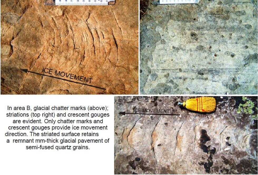
6


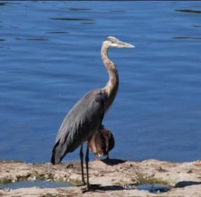
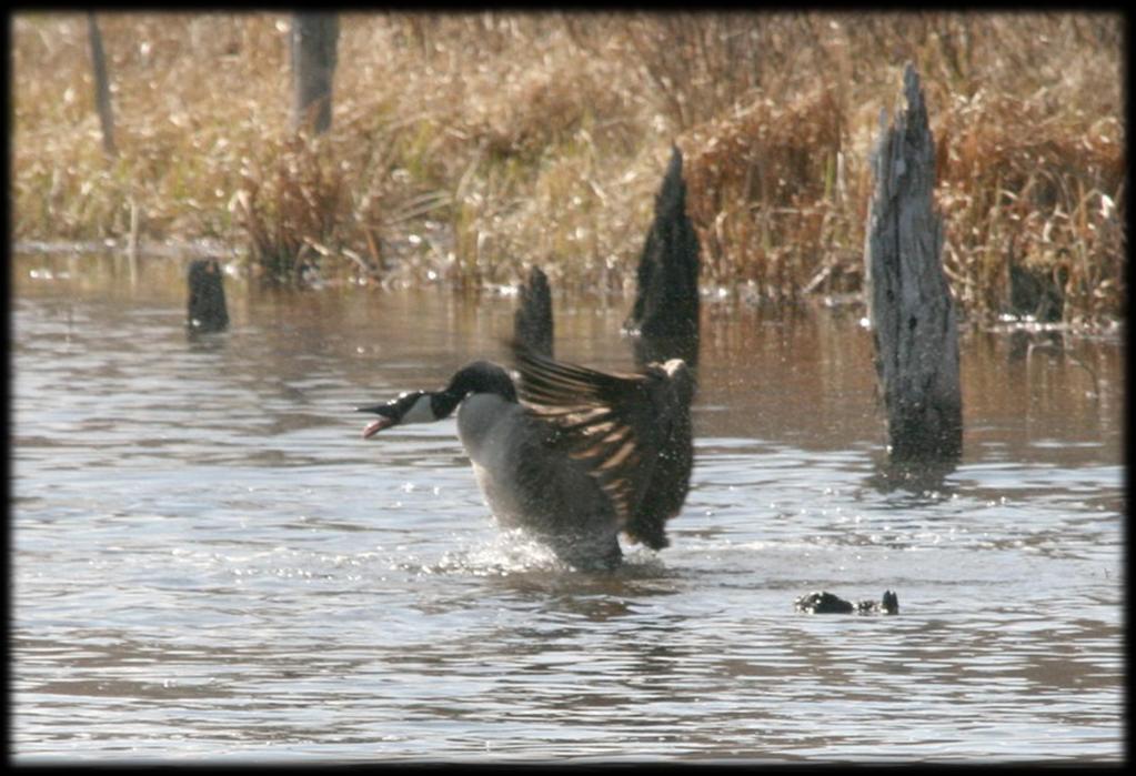
7 Klondike Pond Shirley s Bay Shirley s Brook Goose Pond Heron Pond Carp River Kizell Drain Watt s Creek


8 Shield Rock Is 1 Billion Years Old


9 Only Location In Ottawa with Exposed Canadian Shield One of Many Locations Where Shield is Magnificently Displayed Impressive Even after Development


10 Any Development Requires Blasting Max Depth of Shield is 1m

11 Distinctive and Unique GeoMorphology


12 500m Long Nepean Sandstone Pavement Barren
13


14 The only known area in Ottawa with unequivocal dewatering cylinders preserved in Paleozoic sandstone An Ancient Spring
 from salt waters of the Champlain Sea 8,000-12,000")
15 Ottawa Montreal Champlain Sea Glacial Lake Iroquois Plattsburg Kingston The SMH was an island at a time when Frontenac Axis geological formation separated Glacial Lake Iroquois (precursor to Lake Ontario) from salt waters of the Champlain Sea 8,000-12,000 years ago


16 the rocky upland areas. should be considered to be of high potential for occupation by early postglacial sea mammal hunters along subsequent shorelines as local sea levels dropped from about 120 m above current sea level at around 11,000 years ago, to 90 meters above sea level at some time around 9,000 years ago. Dr. Robert McGhee Retired Curator Canadian Museum of Civilization Several centuries later, circa 9,800 BCE, a huge freshwater table, Lampsilis Lake, replaced the Champlain Sea in the Ottawa Valley and throughout the St. Lawrence lowlands we estimate the level of Lampsilis Lake in the central Ottawa Valley to have been roughly 70 meters. Dr. Marcel Laliberte National Capital Commission Archaeological Resource Potential [1998] Anything below Elevation of 90 m is submerged

17 Unconfirmed Stone Circle Validated Workshop Sites Waiting For Assessment Stage 3 Study Recommended But Never Done For TFDE 2 1 Ancient Shoreline Confirmed 10,000 Year Old Tool Workshop


18 Bi-Face clearly developed by hand and consistent with Late Paleo- Early Archaic Indian tool technology Found at location (1) at elevation where approximate age is 8,000-10,000 BCE Still sharp!


19 Tool marks clearly developed by hand Quartzite indicates Paleo-Archaic Indian Found at location (3) workshop Elevation indicates approximate age as 10,000 BCE
 workshop Elevation (115 m) consistent with approximate age of 10,000")
20 Pyramidal shape developed by hand Quartzite material indicates Late Paleo-Indian origin Found at location (4) workshop Elevation (115 m) consistent with approximate age of 10,000 BCE
 A Feldspar Mine dating approximately to 1919-1921 (unique in Ottawa)")
21 McMurtry s Tannery (Circa 1860) Also: Several 19 th Century homestead sites dating back to 1820 (as old as Pinhey s Point) Richardson Stone House dating back to approx (as old as the Log Farm) A Feldspar Mine dating approximately to (unique in Ottawa)

22 1870 Forest Fire destroyed most of Ottawa Valley Highlands and Wetlands of SMH provided critical firebreak Signs of that Fire can still be seen today Several trees survived the great Fire and are over 130 years old Heron Pond

23 MNR Technical Handbook: Old Growth (pages 45-46) Large proportion of trees in older age classes Many years old Broad spectrum of tree sizes with some very tall trees Uneven canopy due to fallen trees Abundant fallen logs various stages of decomposition Forest supports a high diversity of wildlife species

24 Coniferous Meets Deciduous
![Natural Heritage: Densest Bio-Diversity In Ottawa [Gidakiiminaan] Unknown Number of Insect, Fungi & Bryophyte](/docs-images/86/94415673/images/25-1.jpg "Species Over 679 Species: 440 Native Plants 164 Avian 75 Mammals, Fish, Amphibians, Reptiles All Within an Area of 3")
25 Natural Heritage: Densest Bio-Diversity In Ottawa [Gidakiiminaan] Unknown Number of Insect, Fungi & Bryophyte Species Over 679 Species: 440 Native Plants 164 Avian 75 Mammals, Fish, Amphibians, Reptiles All Within an Area of 3 x 4 km

26 Red Wolf, Coyote Canada Lynx, Red Fox Black Bear Fischer, Long-tail Weasel Beaver, Muscrat Ermine, River Otter, Mink Snoeshoe Hare, Cottontail Rabbit Meadow Jumping Mouse, Deer Mouse, House Mouse, White Footed Mouse Meadow Vole, Star-Nosed Mole, Southern Red-Backed Vole Barred Owl, Eastern Screech Owl, Great Grey Owl, Great Horned Owl, Long Eared Owl, Northern Saw-whet Owl Cooper s Hawk, Red Tail Hawk, Red Shouldered Hawk, Sharp Skinned Hawk, Broad Winged Hawk Northern Flying Squirrel Silver Haired Bat, Hoary Bat, Big Brown Bat, Little Brown Bat Common Shrew, Northern Short-tailed Shrew, Pygmy Shrew, Smokey Shrew Blanding s Turtle, Snapping Turtle, Eastern Painted Turtle, Musk Turtle


27 875 ha deer habitat

28 895 Hectares Rated ANSI 440 Species Native Vascular Plants Highest Floristic Diversity of Any Natural Area in Ottawa 26 Species Traditionally Used for Native Medicine 5.08 = Highest Coefficient of Conservation in Ottawa 2 Endangered 6 Provincially Rare 64 Regionally Rare 50 Uncommon Native Vascular Plants


29 Trillium Woods, which is like a chunk of the Gatineau in the urban landscape of Ottawa, with rich plant and animal life found nowhere else in the urban part of the City Ottawa Urban Natural Areas Environmental Evaluation [Muncaster & Brunton, 2008]

30 114 Hectares Rated ANSI 164 Avian Species Observed 1 Endangered 4 Threatened 5 Special Concern 30 Regionally Rare Avian Species Shirley s Pond


31


32 Over 26 identified species of Herpetofauna Monarch Butterfly is Species-at-Risk in South March Highlands 3 Threatened Species 2 Special Concern

33 Wildlife Movement Only Studied In Winter SMH Is Unevaluated Candidate ANSI For 20 Years? No SAR Population Studies No Study of Non-Vascular Plants No Study of Mosses & Lichens No Study of Fungi No Study of Insects

34 Endangered or Threatened American Ginseng Butternut Loggerhead Shrike Bobolink Whip-poor-will Golden Winged Warbler Olive Sided Flycatcher Western Chorus Frog Blanding's Turtle Eastern Musk Turtle Chimney Swift Special Concern Bridle Shiner Short Eared Owl Black Tern Common Nighthawk Snapping Turtle Eastern Milksnake Monarch Butterfly Bald Eagle Red Headed Woodpecker

35 Evening Grosbeak Eastern Wood Peewee Wood Thrush Bank Swallow American Bullfrog American Kestrel Belted-Kingfisher Field Sparrow Eastern Red-Backed Salamander Blue-Spotted Salamander American Toad Bluntnose Minnow Boreal Chickadee Killdeer Midland Painted Turtle Green Frog Wood Frog Northern Two-Lined Salamander Species Found In SMH That Are Also Listed For Evaluation by COSEWIC as Potential Species at Risk

36 Cathcart s Woodsia Oregon Woodsia Spiny Coon-tail Adder s-tongue Fern Back s Sedge Large Duckweed Long-spurred Violet Showy Orchis Southern Arrow-wood Strawberry-blight Virginia Spring Beauty

37


38 Denning mammals killed by tree-cutting machines or freeze-to-death due to loss of shelter 2/3 of Porcupine Population estimated killed in Beaver Pond Forest due to Winter Clearcut Hibernating amphibians & reptiles are crushed by heavy equipment

39

40 Severs Inter-Connectivity Significantly Impacts Intra-Connectivity


41 2007 EA Addendum Promised Eco-passages & No Fencing 2010 As-Built Road Eco-passages replaced by unusable tunnels Fencing creates Berlin Wall 20 m 3 m 1.2 m 1 m
 Richardson Ridge Phase I Clearcut (Regional Group) Urbandale & Richcraft In Progress Phases 1-6 Significant Water Diversion Planned Across")
42 KNL Phase 7 (Future) KNL Phase 8 (Future) Richardson Ridge Phase II (Regional Group) Planned SWM Facility In PSW TFDE Now Chokes Trillium Woods KNL Phase 9 Clearcut (Beaver Pond) Richardson Ridge Phase I Clearcut (Regional Group) Urbandale & Richcraft In Progress Phases 1-6 Significant Water Diversion Planned Across Sub-Watersheds

43 Regulating Wetland water storage & retention Filtering and cleaning air & water Natural control of pests & insects & related diseases Natural prevention against invasive species Climate & temperature regulation All These Functions Are Free and Automatically Renewable at Zero Cost Provisioning Replenishment of natural resources Renewable supply of food, fibre, water Habitat for Biodiversity Eco-corridor Functions Agricultural Pollination Cultural Educational & Artistic Value Health & Spiritual Benefits Recreational & Eco-Tourism Value Supporting Soil formation & Erosion control Carbon storage & GHG uptake Nutrient Cycling Total Value in Excess of $35 M per year in SMH

44 Development reduces multi-purpose landscape to a single purpose Housing Commercial, etc. Developed Infrastructure must be rebuilt / repaired periodically Roads, Bridges Subdivisions Storm Water Management Facilities Construction = Temporary job creation vs. Eco-Tourism = Permanent jobs Terry Fox Dr July 24, 2009 Development impacts adjacent environment Loss of wetland function directly related to reduced water quality in Ontario Significant loss of biodiversity and increase in invasive species

45 SMH Mistakenly Excluded from 3 working Concepts for Greenbelt Master Plan SMH
46 Creates National Symbol Of Stewardship SMH National Historic Park For Anishinabe First Nations Shepherd s Hook Costs Less Than Purchasing 3x F-35 Fighter Jets Stony Swamp

47 Gatineau Park Islands Shirley s Bay Mer Bleue 11 Eco-Corridors Linking 7 Ecological Reservoirs SMH Stony Swamp Leitrim
48

49 Massive Sandstone Barren Unprotected Conservation Forest Total Size: 455 ha Goose Pond Shirley s Pond Terry Fox Drive Extension Richardson Forest Unprotected Trillium Woods Beaver Pond Forest West Block Richardson Farm Beaver Pond Kizell Provincially Significant Wetland
Niagara Natural Heritage Park
 A Future Proposal For the Niagara-on-the-Lake DND Lands....... Parks Canada Lakeshore Road Property 1 May, 2016 The Harmony Residents Group We are proposing a Natural Heritage Park be established on the
Rouge National Park. Opportunities and Challenges
 Rouge National Park Opportunities and Challenges January 2013 Rouge Park Finch Meander Rouge Beach at Lake Ontario Toronto GLWQA Area of Concern Rouge National Park Nationally Significant First Nation
Wetlands Reservoirs of Biodiversity. Billy McCord, SCDNR
 Wetlands Reservoirs of Biodiversity Billy McCord, SCDNR Estuaries Tidal Deepwater Intertidal Salt Marsh Tidal Riverine Fresh & Brackish Deepwater Tidal Emergent Marsh Freshwater Riverine Seasonally Flooded
PROPOSED QUARRY FOOTPRINT PHASE 2 PHASE 3. PHASE 5 West. PHASE 5 East. PHASE 6 West. PHASE 6 East PHASE 7 PHASE 4 PHASE 1
 PHASE 4 \\Cd1220-f02\01609\active\2001 Active Projects\1100-1199\G1188\graphics\GIS\MXD\_Final Draft Sept 2008\MXD\Section_5\62601188_Fig5-0_ProposedQuarryFootprint_01Dec08_NJB.mxd PHASE 7 PHASE 5 West
Conservation Area Management Statement
 Conservation Area Management Statement Miller Creek Wildlife Area Resolution #: Approval: Issue Date: Date of Last Revision: Table of Contents 1. Purpose....... 1 2. Property Description...... 1 2.1. Legal
CRAZY HORSE TRAIL GUIDE
 CRAZY HORSE TRAIL GUIDE Abridged Version: July 2016 This is a short form of our interpretive trail guide for the Crazy Horse Trail. The full version of the guide has a more detailed description of the
Hudson Bay Lowlands Proposed Protected Areas
 Hudson Bay Lowlands Proposed Protected Areas Hudson Bay Lowlands Proposed Protected Areas The Protected Areas Initiative has identified portions of the Hudson Bay Lowlands region that have significant
Wright s Mountain Quest
 Bradford, Vermont Difficult Natural, Vista Trail 2:30 Wright s Mountain Quest To get there: From Exit 16 of I-91 (this is the Bradford / Piermont exit) go northwest up the Waits River on RT 25. Continue
Ecological Land Classification Primer
 Ecological Land Classification Primer Central and Southern Ontario Ecological Land Classification Internationally, various systems exist to delineate natural regions based on ecological factors. In Ontario,
Cuyahoga Valley National Park Ohio
 Cuyahoga Valley National Park Ohio Brandywine Falls The Ledges The Beaver Marsh Temperate Deciduous Forest How To Get There... Located between Cleveland & Akron, Ohio Cuyahoga Valley National Park can
Mackinnon Esker Ecological Reserve Draft - Management Plan
 Mackinnon Esker Ecological Reserve Draft - Management Plan May 2011 Photo Credit: This document replaces the direction provided in the Carp Lake Provincial Park and Protected Area and Mackinnon Esker Ecological
1. Landforms. The Boreal Shield. Location The Boreal Shield can be found from Alberta to Newfoundland, between the Taiga Shield and the Boreal Plains.
 The Boreal Shield Location The Boreal Shield can be found from Alberta to Newfoundland, between the Taiga Shield and the Boreal Plains. 1. Landforms Rolling hills Exposed bedrock Evidence of glacial weathering
June 18 Town Hall Meeting AGENDA
 June 18 Town Hall Meeting AGENDA Welcome/Announcements Councillor s Updates Kanata Town Centre Meeting New & Revised Development Plans Community Issues & Q&A Dates to Remember Welcome & Announcements Councillor
OPG, Nuclear 2
 B iodiversity Assessment Building a Biodiversity Management Plan November 24, 2011 OPG, Nuclear 2 Biodiversity Assessment What habitat, or your site? potential habitat, is available on What species of
Quintessential Rare Plant Site Protected, Forever Celebrating the New Wilsons Lake Conservation Lands
 Quintessential Rare Plant Site Protected, Forever Celebrating the New Wilsons Lake Conservation Lands A hotspot for Canadian endangered species conservation has been protected, forever, in Nova Scotia.
Colorado Life Zone Scavenger Hunt
 Colorado Life Zone Scavenger Hunt Below are worksheets created for all the habitats or life zones. They were designed with the intention of breaking the class up into small groups, and having students
Birch Point Provincial Park. Management Plan
 Birch Point Provincial Park Management Plan 2 Birch Point Provincial Park Table of Contents 1. Introduction... 3 2. Park History... 3 3. Park Attributes... 4 3.1 Natural... 4 3.2 Recreational... 4 4. Park
2.1 Physical and Biological Description Matabitchuan River Watershed
 2.1 Physical and Biological Description Watershed 2.1.1 Physical Description The system watershed has a total area of about 933 km 2 and is a tributary system to Lake Temiskaming and the Ottawa River Drainage
Photo Credit: Travel Alberta
 Located roughly three hours northeast of Edmonton, just 3 kilometres northeast of the beautiful City of, Cold Lake is situated in a transition zone between parkland to the south and true boreal forest
South Atikaki Provincial Park. Draft Management Plan
 South Atikaki Provincial Park Draft Management Plan South Atikaki Provincial Park Draft Management Plan Table of Contents 1. Introduction... 3 2. Park History... 3 3. Park Attributes... 3 3.1 Natural...
A Vision for Sutter s Landing Park Sacramento s Gateway to the American River Parkway
 A Vision for Sutter s Landing Park Sacramento s Gateway to the American River Parkway Created by Friends of Sutter s Landing Park http://www.sutterslandingpark.org A Vision for Sutter s Landing Park Create
Greening Project Status Report: Grand Canyon National Park
 Greening Project Status Report: Grand Canyon National Park Prepared for the Federal Energy Management Program U.S. Department of Energy February 2001 iii Contents Page 1. Introduction... 1 2. Context of
The Old Foundation. Glacial Rocks. Types of Trees
 The Old Foundation Back in the 1920s, real estate speculators created a housing development here, known as the Metuchen Manor. Many lots were sold in this area. However in the 1930s, during the Great Depression,
The Fauna. Of The Central Balkan
 The Fauna Of The Central Balkan The diverse relief, vegetation and microclimate of the Central Balkan National Park determine the high diversity of the fauna. The territory of the park shelters 70% of
Mackinnon Esker Ecological Reserve. Management Plan
 Mackinnon Esker Ecological Reserve Management Plan March 2017 Cover Page Photo Credit: Rob Bell This document replaces the direction provided in the Carp Lake Provincial Park and Protected Area and Mackinnon
MAIN LAKE PROVINCIAL PARK
 MAIN LAKE PROVINCIAL PARK PURPOSE STATEMENT AND ZONING PLAN March 2003 MAIN LAKE PROVINCIAL PARK Purpose Statement and Zoning Plan Primary Role The primary role of Main Lake Park is to protect a biologically
SPECTACLE LAKE PROVINCIAL PARK PURPOSE STATEMENT AND ZONING PLAN
 SPECTACLE LAKE PROVINCIAL PARK PURPOSE STATEMENT AND ZONING PLAN August 2003 1 SPECTACLE LAKE PROVINCIAL PARK Purpose Statement and Zoning Plan Primary Role The primary role of Spectacle Lake Park is to
Nakina Moraine Provincial Park. Interim Management Statement. Ontario. Ministry of Natural Resources
 Nakina Moraine Provincial Park Interim Management Statement Ontario Ministry of Natural Resources 1999, Queen's Printer for Ontario Printed in Ontario, Canada Additional copies of this publication can
The Chippewas of Georgina Island First Nation At A Glimpse
 Located in Lake Simcoe approximately100 km north of the Greater Toronto Area (GTA) in Ontario Canada. Consisting of 3 separate Islands, Georgina, Snake and Fox with 2 mainland access points.. Georgina
628: BELOVEZHSKAYA PUSHCHA STATE NATIONAL PARK (BELARUS)
") WORLD HERITAGE NOMINATION - IUCN SUMMARY 628: BELOVEZHSKAYA PUSHCHA STATE NATIONAL PARK (BELARUS) Summary prepared by WCMC/IUCN (April 1992) based on the original nomination submitted by the Government
WORLD HERITAGE NOMINATION - IUCN SUMMARY 628: BELOVEZHSKAYA PUSHCHA STATE NATIONAL PARK (BELARUS) Summary prepared by WCMC/IUCN (April 1992) based on the original nomination submitted by the Government
Sand Lakes Provincial Park. Draft Management Plan
 Sand Lakes Provincial Park Draft Management Plan 2 Sand Lakes Provincial Park Table of Contents 1. Introduction... 3 2. Background... 3 3. Park Purpose... 5 4. Park Management Guidelines... 6 Appendix...
STORNETTA BROTHERS COASTAL RANCH
 STORNETTA BROTHERS COASTAL RANCH Location: Surrounding Point Arena Lighthouse and immediately south of Manchester State Park Mendocino Co., CA Acres: 1,860 Resources: Over two miles of Pacific Ocean coastline
Allegheny Mountain Cluster
 Allegheny Mountain Cluster Laurel Fork Paddy Lick West Back Creek Mountain The Allegheny Mountain Cluster lies on the backbone of Virginia. Its components are located in the James River and Warm Springs
Green Legacy. Securing our. Greenlands Strategy
 Greenlands Strategy Securing our Green Legacy Together we can create an interconnected network of Greenlands for the health and well-being of the environment and future generations Caring for the Credit
Presentation Outline
 Sea Otter Tiger Salamander Burrowing Owl Working together to protect species at risk: strategies recommended by local government to improve conservation on municipal, regional and private lands in British
KETTLE CREEK CONSERVATION AUTHORITY TRAIL GUIDE.
 KETTLE CREEK CONSERVATION AUTHORITY TRAIL GUIDE www.kettlecreekconservation.on.ca EXPLORE OUR TRAILS HIKE OUR TRAILS Kettle Creek Conservation Authority (KCCA) proudly supports and promotes an active lifestyle
TRAILS WHERE TO FIND TRAILS IN NOVA SCOTIA
 TRAILs SIGNAGE Know the Signs............................ 44 WHERE YOU CAN RIDE Roads and Highways........................ 46 Designated Trails........................... 47 Established Trails...........................
Pembina Valley Provincial Park. Draft Management Plan
 Pembina Valley Provincial Park Draft Management Plan 2 Pembina Valley Provincial Park Table of Contents 1. Introduction... 3 2. Park History... 3 3. Park Attributes... 3 3.1 Natural... 3 3.2 Recreational...
Comanche National Grassland, Timpas Unit
 Comanche National Grassland, Timpas Unit Heritage Resources More than 540 sites are eligible for listing on the National Register of Historic Places (NRHP) by Forest Service staff and/or the Colorado State
State of Nature 2016
 State Nature 2016 State Nature 2016 Results look up tables This document presents tables the results referred to in the report in an easy to access format. All data presented here feature in the report
Stuart River Provincial Park Purpose Statement and Zoning Plan
 Stuart River Provincial Park Purpose Statement and Zoning Plan Stuart River Provincial Park protects three-quarters of the 110 kilometer long Stuart River corridor between Stuart Lake and the Nechako River.
Wallace Lake Provincial Park. Draft Management Plan
 Wallace Lake Provincial Park Draft Management Plan Wallace Lake Provincial Park Draft Management Plan Table of Contents 1. Introduction... 3 2. Park History... 3 3. Park Attributes... 4 3.1 Natural...
Seager Wheeler Lake. Representative Area. -- Concept Management Plan --
 Seager Wheeler Lake Representative Area -- Concept Management Plan -- Saskatchewan Environment and Resource Management January, 1999 Saskatchewan s Representative Areas Network Program The Government of
Kwadacha Wilderness Provincial Park and Kwadacha Addition (Kwadacha Recreation Area) Purpose Statement and Zoning Plan
 Purpose Statement and Zoning Plan") Kwadacha Wilderness Provincial Park and Kwadacha Addition (Kwadacha Recreation Area) Purpose Statement and Zoning Plan Located in a remote area of the northern interior of BC, this large park straddles
Kwadacha Wilderness Provincial Park and Kwadacha Addition (Kwadacha Recreation Area) Purpose Statement and Zoning Plan Located in a remote area of the northern interior of BC, this large park straddles
Whitemouth Falls Provincial Park. Draft Management Plan
 Whitemouth Falls Provincial Park Draft Management Plan Whitemouth Falls Provincial Park Draft Management Plan Table of Contents 1. Introduction... 3 2. Park History... 3 3. Park Attributes... 4 3.1 Natural...
Marchand Provincial Park. Management Plan
 Marchand Provincial Park Management Plan 2 Marchand Provincial Park Table of Contents 1. Introduction... 3 2. Park History... 3 3. Park Attributes... 4 3.1 Natural... 4 3.2 Recreational... 4 3.3 Additional
Establishing a National Urban Park in the Rouge Valley
 STAFF REPORT ACTION REQUIRED Establishing a National Urban Park in the Rouge Valley Date: March 29, 2012 To: From: Wards: Reference Number: Executive Committee Deputy City Manager, Cluster B All p:\2012\cluster
Pricing: Program pricing is quoted per program below. Adults are free. Parking is free.
 Program Policies Pricing: Program pricing is quoted per program below. Adults are free. Parking is free. Program Scheduling: Programs can be scheduled on Monday - Friday evenings and Saturday and Sunday
Wallace Lake Provincial Park. Management Plan
 Wallace Lake Provincial Park Management Plan 2 Wallace Lake Provincial Park Table of Contents 1. Introduction... 3 2. Park History... 3 3. Park Attributes... 4 3.1 Natural... 4 3.2 Recreational... 4 4.
South Texas Plains. Texas, Our Texas
 South Texas Plains This is a region characterized by considerable variety. Climatically, the South Texas Plains region is sub-humid to dry. The in the north part of the South Texas, erosion of the Edwards
Bayview Escarpment. Interim Management Statement
 Bayview Escarpment Interim Management Statement Bayview Escarpment Provincial Nature Reserve Interim Management Statement January 15, 1995 REGIONAL DIRECTOR'S APPROVAL STATEMENT This Interim Management
ONTARIO TRAILS COUNCIL FAQ
 Trail Facts Ontario has some of the most treasured and protected outdoor areas in the world with: 329 Provincial Parks 400 Conservation Areas 292 Conservation Reserves Many people link trails with recreation
Brador hills biodiversity reserve
 Brador hills biodiversity reserve September 2003 1. Plan and description 1.1. Geographic location, boundaries and dimensions The plan of the proposed Brador hills biodiversity reserve and its location
Physical Regions of the U.S.
 Physical Regions of the U.S. Quickly use this map to label the map on your paper Pacific Coast The coast from southern California to Alaska The region of the Pacific Northwest has a long history that was
CONSERVATION PLAN FOR THE CARTER PROPERTY BEAR LAKE COUNTY, IDAHO
 CONSERVATION PLAN FOR THE CARTER PROPERTY BEAR LAKE COUNTY, IDAHO Prepared By John Carter P.O. Box 280 Mendon, Utah 84325 435-881-1232 IINTRODUCTION In 1993, I began acquiring land in Paris Canyon, Idaho
2.0 Physical Characteristics
 _ 2.0 Physical Characteristics 2.1 Existing Land Use for the Project The site is comprised of approximately 114 acres bounded by Highway 101 to the north, the existing town of Los Alamos to the east, State
A Vision for Sutter s Landing Park Sacramento s Gateway to the American River Parkway
 A Vision for Sutter s Landing Park Sacramento s Gateway to the American River Parkway Created by Friends of Sutter s Landing Park http://www.sutterslandingpark.org A Vision for Sutter s Landing Park Create
Andy Sharp Natural Resources Northern & Yorke. Brooke Liebelt Yorke Peninsula Tourism
 Andy Sharp Natural Resources Northern & Yorke Brooke Liebelt Yorke Peninsula Tourism Rewilding is about restoring natural processes, to: improve conservation outcomes improve the ecosystem services provided
A THRIVING ENVIRONMENTAL AND RECREATIONAL PRECINCT IN OUR SOUTHERN SUBURBS
 A THRIVING ENVIRONMENTAL AND RECREATIONAL PRECINCT IN OUR SOUTHERN SUBURBS A STRONG PLAN FOR REAL CHANGE 1 We re ready. Over the last four years, we ve been working hard developing our vision for the future
B10. Agate Beach State Recreation Site
 B10. Agate Beach State Recreation Site Location Within the City of Newport, just south of the Yaquina Head Outstanding Natural Area. The park is located along the west side of Highway 101 at the mouth
Geoscape Toronto The Oak Ridges Moraine Activity 2 - Page 1 of 10 Information Bulletin
 About 13,000 years ago as the Laurentide Ice Sheet melted, glacial meltwater accumulated between the ice sheet and the Niagara Escarpment. This formed a lake basin into which gravel and sand were deposited.
The Conservation Contributions of Ecotourism Cassandra Wardle
 The Conservation Contributions of Ecotourism Cassandra Wardle PhD Candidate, Gold Coast, Australia Supervisors: Ralf Buckley, Aishath Shakeela and Guy Castley State of the Environment State of the Environment
 March 25, 1994 To: Re: MEMO TO FILE MINOR AMENDMENT - PINERY PROVINCIAL PARK MANAGEMENT PLAN The following paragraph from page 5 of the Pinery Provincial Park Management Plan (ISBN 0-7729-0290-9) lnsects
APPENDIX F List of Commitments
 APPENDIX F List of Commitments s Table F.1 Standard Mitigation Measures Mitigation Measure MnDOT Specification Number Status Update Description Status Update Utilities Provide early notice to utility operators
MONTAGUE HARBOUR MARINE PROVINCIAL PARK
 MONTAGUE HARBOUR MARINE PROVINCIAL PARK PURPOSE STATEMENT AND ZONING PLAN March 2003 1 MONTAGUE HARBOUR MARINE PROVINCIAL PARK Purpose Statement and Zoning Plan Primary Role The primary role of Montague
Status of Mangroves in Belize
 Status of Mangroves in Belize State of the Coastal zone Summit June 7 th 2012 Nadia Bood*, Emil Cherrington and Tim Smith Outline Introduction to mangroves Importance of mangrove to Belize National status
Town of Holliston Massachusetts
 Town of Holliston Massachusetts Conservation Lands in Holliston 2009 Holliston Conservation Associates, 2009 INTRODUCTION The Holliston Conservation Commission (HCC) has been entrusted with the care of
BLANKET CREEK PROVINCIAL PARK
 BLANKET CREEK PROVINCIAL PARK PURPOSE STATEMENT AND ZONING PLAN February 2003 BLANKET CREEK PROVINCIAL PARK Purpose Statement and Zoning Plan Primary Role The primary role of Blanket Creek Park is to maintain
NATURAL ENVIRONMENT LEVEL 1 AND 2 TECHNICAL REPORT VIOLET HILL PIT TOWN OF MONO DUFFERIN COUNTY. June 2016
 NATURAL ENVIRONMENT LEVEL 1 AND 2 TECHNICAL REPORT VIOLET HILL PIT TOWN OF MONO DUFFERIN COUNTY June 2016 Prepared for: Greenwood Aggregates Company Limited Prepared by: Robin E. Craig, B.Sc., M.Sc. Certified
Home to mangroves- trees that can grow in saltwater Mangroves provide housing for fish Greater Sundas home to endangered birds and other animals
 Home to mangroves- trees that can grow in saltwater Mangroves provide housing for fish Greater Sundas home to endangered birds and other animals Climate in ecosystem varies-lots of biodiversity Sumatra
SRC 2010: JUNGLE BINGO Words
 SRC 2010: JUNGLE BINGO Words B Adventure B Ape B Binoculars B Boa Constrictor B Camp B Canteen B Cougar B Danger B Ecosystem B Elephant B Forest B Guides B Habitat B Jeep B King B Knife B Madagascar B
FINGER-TATUK PROVINCIAL PARK
 FINGER-TATUK PROVINCIAL PARK PURPOSE STATEMENT AND ZONING PLAN March 2003 FINGER-TATUK PROVINCIAL PARK Purpose Statement and Zoning Plan Finger-Tatuk Provincial Park is 17,151 ha in size. It includes the
Clearwater Lake Provincial Park. Draft Management Plan
 Clearwater Lake Provincial Park Draft Management Plan Clearwater Lake Provincial Park Draft Management Plan Table of Contents 1. Introduction... 3 2. Park History... 4 3. Park Attributes... 4 3.1 Location/Access...4
Theme 6: Parks and Protected Areas
 Wildlife in Jeopardy Education Kit Theme 6: Parks and Protected Areas Figure 1: grey wolf Although parks and ecological reserves provide protection for some areas of special importance to wildlife, only
Overview of Protected Areas Management in Nepal. Hari Bhadra Acharya Under Secretary Department of National Parks and Wildlife Conservation, Nepal
 Overview of Protected Areas Management in Nepal Hari Bhadra Acharya Under Secretary Department of National Parks and Wildlife Conservation, Nepal July 17, 2014 Contents Contents History of Protected Area
Environmental Geotechnical Planning Construction Testing & Inspection Building Science Duty To Consult
 About Me? 2 Member of the Chippewas of Georgina Island FN Worked in my Community for 17+ years in various capacities Childcare, Council, Housing, Bylaws, Waste Management, Environment, Climate Change 2011
Public Notice ISSUED: December 10, 2018 EXPIRES: January 9, 2019
 APPLICANT: REFER TO: St. Louis and Lake Counties Regional Rail Authority 2018-01942-ARC Public Notice ISSUED: December 10, 2018 EXPIRES: January 9, 2019 SECTION:404 - Clean Water Act 1. APPLICATION FOR
Nature is for everyone to enjoy, so let your followers experience the beauty.
 POCKET GUIDE WHILE YOU RE HIKING For your safety, please watch for loose rocks, tree roots, and other obstacles along the trails. Please park in designated parking areas only. Stay on the marked trail;
Meeting Minutes. Participants:
 Dufferin Aggregates Meeting Minutes Event: Date & Time: Place: Chair: Participants: Community Advisory Panel (CAP) Paris Pit CAP # 9 Operation and Ecology Update Tuesday September 17, 2013 7:00-9:00 PM
PRELIMINARY MANAGEMENT PLAN MIRA RIVER PROVINCIAL PARK CAPE BRETON COUNTY, NOVA SCOTIA DRAFT. Nova Scotia Department of Natural Resources
 PRELIMINARY MANAGEMENT PLAN MIRA RIVER PROVINCIAL PARK CAPE BRETON COUNTY, NOVA SCOTIA DRAFT Nova Scotia Department of Natural Resources August 26, 2009 Table of Contents 1.0 EXECUTIVE SUMMARY...1 2.0
Wildlife Management Plan for the Great Barrier Reef Airport at Hamilton Island
 Wildlife Management Plan for the Great Barrier Reef Airport at Hamilton Island Dr Graham Hall, Tasmanian Department of Primary Industries and Water, and Dale Criss, Hamilton Island Ltd History Keith Williams
Terrestrial Protected Area Nomination: Central Mangrove Wetland South-West, Grand Cayman
 Terrestrial Protected Area Nomination: Central Mangrove Wetland South-West, Grand Cayman The attached nomination, proposing that a parcel of land in the Central Mangrove Wetland be made a Protected Area
The Design of Nature Reserves
 The Design of Nature Reserves Goals Maintenance of MVP s for targeted species Maintenance of intact communities Minimization of disease Considerations of reserve design 1. Disturbance regime Fire Insect
ROBERTS CREEK PROVINCIAL PARK MASTER PLAN. November, 1981
 Ministry of Lands, Parks and Housing Parks and Outdoor Recreation Division Park Operations Branch North Vancouver, B. C. ROBERTS CREEK PROVINCIAL PARK MASTER PLAN November, 1981 Mr. G. Trachuk Director
NARRABEEN LAGOON SUMMIT am Wednesday, 13 April 2005 Warringah Council Chambers, 725 Pittwater Road, Dee Why.
 NARRABEEN LAGOON SUMMIT 9.15 9.30am Wednesday, 13 April 2005 Warringah Council Chambers, 725 Pittwater Road, Dee Why. NSW Minister for the Environment, the Hon. Bob Debus I am very pleased to be here to
MCARTHUR SWAMP PLANNING UNIT Pit-McCloud River Watershed
 Existing Conditions & Uses Overview Spring-fed lake and rivers; valuable grazing lands and important waterfowl area Planning unit provides the only public access to Ahjumawi Lava Springs State Park 7,596
Public Lands in Alaska. 200 million acres of federal land - Over 57 Million acres of Wilderness more than half the Wilderness in the entire nation
 Public Lands in Alaska 200 million acres of federal land - Over 57 Million acres of Wilderness more than half the Wilderness in the entire nation alaskawild.org Ground Zero for Climate Change Over the
ONE ISLAND LAKE PROVINCIAL PARK Purpose Statement and Zoning Plan
 ONE ISLAND LAKE PROVINCIAL PARK Purpose Statement and Zoning Plan Primary Role The primary role of One Island Lake Provincial Park is to provide recreational opportunities to regional and residential area
Department of Environment, Climate Change & Water NSW. Stakeholder feedback
 Department of Environment, Climate Change & Water NSW Stakeholder feedback 1 Stakeholders group Blue Gum High Forest Group Guardians of Lane Cove NP Sydney Metropolitan Wildlife Service Ku-ring-gai Historical
The Taiga Boreal Forest. By: Charlie Lichauer, Harrison Simons, and Hunter Williams
 z The Taiga Boreal Forest By: Charlie Lichauer, Harrison Simons, and Hunter Williams Purpose We chose to do the Taiga Boreal biome because we believe it is the optimal host to excite the viewers. The taiga
2018 Summer Day Camps
 2018 Summer Day Camps At the Dorothy Pecaut Nature Center Sponsored by the Woodbury Co. Cons. Board and Woodbury Co. Cons. Foundation 712-258-0838 -- www.woodburyparks.org General Information Woodbury
White Lake Peatlands. Interim Management Statement
 White Lake Peatlands Interim Management Statement 2007 APPROVAL STATEMENT I am pleased to approve this Interim Management Statement for White Lake Peatlands Provincial Park. This park was regulated under
Rare Coastal Sand Ecosystems
 of the Boundary Bay Wildlife Management Area The sand in Beach Grove supports unique ecosystems not commonly found in BC. The plants and animals found here are well adapted to their environment of ever-shifting
ETOBICOKE CREEK NORTH TRAIL PROJECT. May 18, 2017 at Michael Power High School 105 Eringate Drive, Etobicoke ON M9C 3Z7
 ETOBICOKE CREEK NORTH TRAIL PROJECT May 18, 2017 at Michael Power High School 105 Eringate Drive, Etobicoke ON M9C 3Z7 1 Purpose of Open House The purpose of today s open house is to present the design
Nags Head Woods Preserve ANNUAL REPORT
 Nags Head Woods Preserve 2017-2018 ANNUAL REPORT TOWN OF KILL DEVIL H I L L S Aaron McCall, Northeast Regional Steward September 2018 Staff Pictured from left: Jennifer Gilbreath, Conservation Coordinator,
Water in the Amazon. By Heather and Georgie
 Water in the Amazon By Heather and Georgie The Amazon is the world s largest tropical rainforest. The Amazon is so big that the U.K and Ireland would fit into it 17 times. The Amazon River It s length
OHIO DEPARTMENT OF TRANSPORTATION BAT GATE CONSTRUCTION
 OHIO DEPARTMENT OF TRANSPORTATION BAT GATE CONSTRUCTION ABANDONED RAIL TUNNELS REDISCOVERED During survey work for the Harrison County Road 51 bridge replacement project, the first of the abandoned rail
Fraser River Provincial Park Purpose Statement and Zoning Plan
 Fraser River Provincial Park Purpose Statement and Zoning Plan Fraser River Provincial Park is located on the west bank of the Fraser River, approximately 35 km south of Prince George. This 4,899 ha Protected
IOWA ORNITHOLOGISTS' UNION - Birding Sites in Dallas County
 IOWA ORNITHOLOGISTS' UNION - Birding Sites in Dallas County Printed on 7/19/2018 Beaver Bottoms Wetland (restricted) (Important Bird Area) GPS Coordinates:, Ownership: Private (see directions for access)
 AGREEMENT Between Director of the Białowieża National Park, based in Białowieża (Poland) and Director of the National Park Bialowieża Forest, based in Kamieniuki (Belarus) and Head Forester of the Białowieża