Nature is for everyone to enjoy, so let your followers experience the beauty.
|
|
|
- Alicia Randall
- 5 years ago
- Views:
Transcription


1 POCKET GUIDE

2 WHILE YOU RE HIKING For your safety, please watch for loose rocks, tree roots, and other obstacles along the trails. Please park in designated parking areas only. Stay on the marked trail; do not take shortcuts. The trail has been laid out to minimize destruction of surrounding vegetation and to prevent erosion. Carry out what you carry in. If the trail users before you have not done this, you can help by removing their trash, too. We ask you to leave only footprints and take only pictures. Nature is for everyone to enjoy, so let your followers experience the beauty.

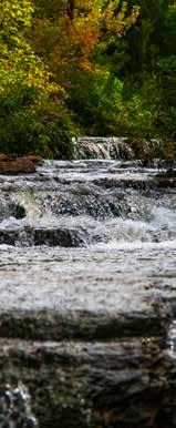
3 SCENIC HIKING TRAILS Each of Innsbrook s seven beautiful and unique nature trails will please both the Sunday stroller and the avid hiker. Aspen Spur Trail 1/2mi+ This fairly straight trail looks upon the Aspen Spillway and meadow, providing wonderful views of waterfalls, grasslands and wildlife. Meadows Trail This trail is wonderful for exploring the diverse flora and fauna of Innsbrook. Bring your camera; the path boasts plenty of wildlife, colorful wildflowers and beautiful scenery. 1mi+ 1mi+ Grendel Trail This moss-covered trail traverses around scenic 6.5-acre Lake Grendel. 1/2mi+ Sonnenblick Trail This trail meanders through the forest in the extreme southeast corner of the Innsbrook property. 1mi+ Wynnbrook Trail This trail, offers a bit more of a challenge for recreational hikers. Lake Wynnbrook is great for discovering the many wildflowers, trees, birds and wildlife of our community. 1mi+ Lake Konstanz Trail This trail circles around beautiful Lake Konstanz, offering expansive views of both Alpine Lake and Lake Konstanz. Tyrolean Trail 3mi+ Innsbrook s Tyrolean Trail provides different scenic attractions and levels of challenge.


4 1/2mi+ The Aspen Spur Hiking Trail, located west of Lake Aspen and east of Harmony Bridge, looks upon the Aspen Spillway and meadow. The path is fairly straight spanning from Aspen Dam to Harmony Bridge. There is no turnaround on this section of the trail, but the views are wonderful. You can see the waterfalls caused by the spillover of the lake and the grassy land below. Look for wildlife in the spillway, as it is one of the favorite hideouts for heron and other birds. In addition to birds and wildlife, many types of wildflowers and plants grow in this section. Hike time on this trail is approximately 15 minutes. You can extend your hike by walking along the main road across Harmony Bridge and connect to The Meadows Hiking Trail. HOW TO GET THERE From the Real Estate Sales Office, travel south on Aspen Way Drive, then south on West Aspen Circle Drive. The parking area is just across the bridge on the dam. The trail head is on the north side of the bridge. In addition to this trail map, we suggest you bring along a color Innsbrook development map (available at the Front Gate, Real Estate or Aspen Center Front Desk).

 Lake Woodland Parking Stream Road Lots")
5 Trail Map Highway F Meadow Valley Drive TO MEADOWS NATURE TRAIL N West Aspen Circle Drive Aspen LEGEND Trail (0.59 miles) Lake Woodland Parking Stream Road Lots (Private Property) Harmony Bridge


6 1mi+ The Meadows Hiking Trail, located just west of Harmony Bridge, is a wonderful trail for exploring the diverse flora and fauna of Innsbrook. Hike time is approximately one hour. This trail follows Charrette Creek, winding in and around The Meadows offering diverse views. Bring your camera because the path boasts plenty of wildlife, colorful wildflowers and beautiful scenery. The pathway loops around to The Meadows Park where it is necessary to walk on the main road in order to return to the parking lot. HOW TO GET THERE The Meadows Hiking Trail is located near Harmony Bridge. Just west of the bridge, you will see The Meadows Hiking Trail parking area to the south. This is also the trail head. In addition to this trail map, we suggest you bring along a color Innsbrook development map (available at the Front Gate, Real Estate or Aspen Center Front Desk).

 Primary Road Secondary Road LEGEND Lakes Lots (Private")
7 Farmhouse Drive Trail Map Meadow Ridge Drive Meadow Valley Drive TO ASPEN SPUR NATURE TRAIL Meadow Creek Drive Meadow Oaks Drive Highway F Innisfree N Trail (1.51 miles) Primary Road Secondary Road LEGEND Lakes Lots (Private Property) Stream Parking Harmony Bridge


8 NATURE AT INNSBROOK WILDFLOWERS Look for these common wildflowers along our trails. BLACK-EYED SUSAN Blooms: May - October near bluffs and forest openings. INDIAN PAINTBRUSH Blooms: April - July, often in wet soil along streams. BLOODROOT Blooms: March - April on rich slopes of woods and near streams. MAYAPPLE Blooms: March - May in dry, open woods. GOLDENROD Blooms: June - December in openings in the woods and other sunny places. VIRGINIA BLUEBELLS Blooms: March - June, often in large groups. BUTTERFLIES Keep an eye on some of these beautiful butterflies as they flutter by. BLACK SWALLOWTAIL Black Swallowtails can be found in open habitats, including grasslands and old fields. Their flight is fast and dashing, a few feet above the ground. Adults fly from April through late fall. COMMON CHECKERED- SKIPPER This species prefers areas with low vegetation and some bare soil. They sometimes gather in large numbers on lake shores and at mud puddles. Adults fly from March into November. GREAT SPANGLED FRITILLARY This butterfly is common and easily recognized. It can be spotted in prairies, fields, open woodland edges and wet meadows. Adults fly from mid-may through early October. MONARCH Monarchs can be found in fields, grasslands and roadsides. Famous for their annual migration to overwinter in Mexico, you may see monarchs at Innsbrook from about May to mid-october.


9 BIRDS Spot some of these birds nestled in trees or flying high above while you re hiking. AMERICAN GOLDFINCH It s hard to miss these bright yellow flyers with their delightful per-chick-o-ree and sueweet calls. OWL You might spot a barred owl silently watching your movements with its sharp eyes from a high perch. BLUE JAY Described as sassy and sometimes aggressive, blue jays screaming and mobbing behaviors serve to protect many bird species against hawks, owls, cats and other predators. CARDINAL Even though they re not exactly uncommon in our area, cardinals are one of the most exciting birds to glimpse in the woods. PILEATED WOODPECKER You ll most likely hear them before you see them, clack-clack-clacking away on a tree, looking for insects and sap to feast on under the bark. TURKEY Turkey sightings are very common in these parts as they forage through grasslands and leaves on the forest floor. ANIMAL TRACKS HIND BEAVER front: inches hind: 2.5 inches FRONT RED FOX front: 2.25 x 2.21 inches hind: 2 x 1.75 inches FRONT HIND HIND RABBIT front: 1 x 1 inches hind: 3.5 x 1.75 inches FRONT WOODCHUCK front: 2 inches hind: 2.25 inches FRONT HIND FRONT RACCOON front: 2.25 inches hind: 3.2 inches FRONT WHITE-TAILED DEER front: 3 inches hind: 2.5 inches HIND HIND


10 1mi+ Moss-covered paths pave the way for much of the Grendel Hiking Trail that traverses around scenic 6.5-acre Lake Grendel. The few hills on this trail are short, but steep, so gear up at the bottom and power through to the top. Watch for blue jays along parts of the trail where there are pine trees, which is where these large songbirds prefer to nest. You ll also spot many shade-loving ferns growing from the forest floor and young trees reaching for spots where the sun shines through the forest canopy. You ll likely hear the persistent squawks of turkey buzzards before you spot their shadows flying through the trees. Look up to see them circling near the halfway point of the trail. HOW TO GET THERE The Grendel Trail is the westernmost trail in our system. From the Alpine Tunnel, head south on Alpine Lake Drive and follow that road around the lake until you reach Grendel Drive. Head northwest on that road and follow it until it ends. You ll find gravel parking and the trailhead to the west of the parking lot (towards Schuetzenground Road). In addition to this trail map, we suggest you bring along a color Innsbrook development map (available at the Front Gate, Real Estate or Aspen Center Front Desk).

")
11 Trail Map Schuetzenground Road Grendel Wiedersehen Alpine Lake Drive N Seebrook Trail (1.46 miles) Lakes Linden Lot 2429 Lot 2428 Linden Point Drive LEGEND Primary Road Lots (Private Property) Secondary Road Woodland Alpine Parking


12 1/2mi+ The Sonnenblick Hiking Trail meanders through the forest in the extreme southeast corner of the Innsbrook property. See how many different bird calls you can identify as their songs float through the woods around you. In early spring, colorful blooming dogwood and redbud trees are at the forefront. Also, look for colonies of mayapple in the open woods! As you hike, you may wonder why we don t haul away trees that have fallen to the ground. Fallen or dead trees remain on the Innsbrook forest floor, as long as they are not blocking a hiking path, because they make ideal habitats for many species including birds, bats, squirrels and raccoons. Please stay on the trail. Remember, plants grow by the inch and die by the foot. Take only pictures and leave only footprints. HOW TO GET THERE The Sonnenblick Trail is located in the southeast corner of Innsbrook. From the Aspen Center, turn south on East Aspen Circle Drive and follow it to Lake Wynnbrook Drive. Turn east on Lake Wynnbrook Drive and wind your way down near lot 1715, just before the road meets Sonnenblick Drive. There is a small gravel parking area off the road to the left. The trailhead is located nearby and appears as an opening in the woods. In addition to this trail map, we suggest you bring along a color Innsbrook development map (available at the Front Gate, Real Estate or Aspen Center Front Desk).


13 Trail Map Wynnbrook East St. Gallen Drive Sonnenalp Sonnenalp Trail Sonnenblick Drive Sonnenblick Sonnenalp View Drive Sonnenblick Drive Turrach Drive Turrach N Sonnendrei Ridge Silvretta Trail (0.93 miles) Primary Road LEGEND Lakes Woodland Stream Secondary Road Lots (Private Property) Parking

 in order to find")
14 1mi+ The Wynnbrook Hiking Trail, located southeast of Lake Aspen, circles around Lake Wynnbrook. It is a pleasant trail for discovering the many wildflowers, trees, birds and wildlife of our community. The Wynnbrook Hiking Trail traverses varied terrain and is best suited for those recreational hikers looking for a bit of a challenge. HOW TO GET THERE In addition to this trail map, we suggest you bring along a color Innsbrook development map (available at the Front Gate, Real Estate or Aspen Center Front Desk) in order to find your way to the trail head. The Wynnbrook Hiking Trail is located southeast of Lake Aspen. From the Aspen Center, follow East Aspen Circle Drive around Lake Aspen to the trail head parking, located near the intersection of East Aspen Circle Drive and East St. Gallen Drive. Enjoy your hike!

 Sonnenalp LEGEND Primary Road Lakes Prairie Stream")
15 Trail Map N Moon East Aspen Circle Drive Sycamore Lake Wynnbrook Drive Wynnbrook Wynnbrook East St. Gallen Drive Woods Drive Lake Wynnbrook Drive Trail (1.2 miles) Sonnenalp LEGEND Primary Road Lakes Prairie Stream Secondary Road Lots (Private Property) Parking


16 1mi+ Lake Konstanz Hiking Trail, located northwest of Alpine Lake and west of Stracks Church Road, circles around beautiful Lake Konstanz. It is an enjoyable trail with expansive views of both lakes, Alpine and Konstanz. For portions of the Lake Konstanz Trail, you will have to travel off the dirt path and follow the road. HOW TO GET THERE Lake Konstanz Hiking Trail is located in the western part of the development, just east of Alpine Lake. From the Real Estate Office, travel south on Aspen Way Drive, then west on Meadow Valley Drive. When you approach the Konstanz threeway intersection, go right on North Konstanz Drive. Parking for the nature trail will be on the east side of the road, across from Lot This is also the trail head. In addition to this trail map, we suggest you bring along a color Innsbrook development map (available at the Front Gate, Real Estate or Aspen Center Front Desk).

 Lake Woodland Parking Road Lots (Private Property)")
17 Stracks Church Road Trail Map East Wanderfern Circle Drive Dog Park North Konstanz Drive Alpine Konstanz South Konstanz Drive N Alpine Lake Drive Meadow Valley Drive LEGEND Trail (1.79 miles) Lake Woodland Parking Road Lots (Private Property) Prairie Alpine Tunnel


18 3mi+ Innsbrook s Tyrolean Hiking Trail is a great combination of the property s various terrains. You ll experience shady forest canopy with wet, green undergrowth and the rustle of frogs hopping through the flora, as well as open prairieland speckled with purple, white and yellow wildflowers as butterflies dance through the air around you. Hikers will traverse up and down the Alpine Valley near our contemporary cottages, as well as pass by the more than century-old historic log cabin and scenic waterfalls. WATERFALLS SECTION DISTANCE: 1.10 MI This challenging 1.10 mile trek includes rocky terrain as well as steep climbs and descents. It offers great scenery including a creek, Alpine Lake, a view of Alpine Valley and several waterfalls in wet weather. HOW TO GET THERE The Tyrolean Trail is located south of Alpine Lake. Travel west on Meadow Valley Drive and turn south on Alpine Lake Drive. Just before crossing the dam, there is a sign denoting the Historic Log Cabin and a gravel road that goes south into the valley. Turn on the gravel road and make your first right at the bottom of the hill to get to parking and the trailhead. In addition to this trail map, we suggest you bring along a color Innsbrook development map (available at the Front Gate, Real Estate or Aspen Center Front Desk).
 Historic Log Cabin (0.20mi) Historic Cemetery 1 (0.36mi) (0.")
 Primary Road Woodland Lake Bridge Waterfalls Section Secondary")
19 Alpine Alpine Lake Drive Trail Map 2 N E W S (0.86mi) (0.18mi) Historic Log Cabin (0.20mi) Historic Cemetery 1 (0.36mi) (0.32mi) 4 3 (0.42mi) Alpine Woods Drive (1.03mi) LEGEND Trail (1.97 miles) Primary Road Woodland Lake Bridge Waterfalls Section Secondary Road Trailhead Parking Fire Ring Creek
928-3366 ext. 9180 or email information@innsbrook-resort.com WWW.")
20 TRAIL NOTES Use this section to jot down descriptions of the trail, animals you encounter and flowers you spot. For more information about Innsbrook s nature trails, contact us at (636) ext or information@innsbrook-resort.com
THE HOMES AND HOMESITES ON INNSBROOK, MISSOURI
 THE HOMES AND HOMESITES ON Alpine Lake INNSBROOK, MISSOURI Alpine Lake a beautiful setting is just the beginning Nestled quietly amid the rolling wooded hills and sharing company with dozens of other lakes,
THE COTTAGES AT. Alpine Woods Innsbrook, Missouri
 THE COTTAGES AT Alpine Woods Innsbrook, Missouri ABOUT INNSBROOK Life at the Lakes, Closer to Home With all-season and vacation properties, you can choose a home tailor-made to your lifestyle. Your piece
THE COTTAGES AT. Alpine Woods Innsbrook, Missouri
 THE COTTAGES AT Alpine Woods Innsbrook, Missouri ABOUT INNSBROOK Life at the Lakes, Closer to Home With all-season and vacation properties, you can choose a home tailor-made to your lifestyle. Your piece
Cuyahoga Valley National Park Ohio
 Cuyahoga Valley National Park Ohio Brandywine Falls The Ledges The Beaver Marsh Temperate Deciduous Forest How To Get There... Located between Cleveland & Akron, Ohio Cuyahoga Valley National Park can
Real Estate. Innsbrook. our listings Winter
 Real Estate at Innsbrook our listings Winter 2014-2015 about innsbrook Life at the Lakes, Closer to Home A vacation home community located 45 minutes west of Saint Louis, Innsbrook has a 43-year history
ABOUT THE PARKS NANTAHALA NATIONAL FOREST MOUNTAINS NATIONAL PARK CHEROKEE NATIONAL FOREST PISGAH NATIONAL FOREST GREAT SMOKY HIKING TRAILS
 ABOUT THE PARKS GREAT SMOKY MOUNTAINS NATIONAL PARK NANTAHALA NATIONAL FOREST CHEROKEE NATIONAL FOREST PISGAH NATIONAL FOREST GREAT SMOKY MOUNTAINS NATIONAL PARK Straddling the border between North Carolina
This Passport: Revised October 20, 2017, EAM # Discovering the Trails of Webster, NY
 This Passport: Revised October 20, 2017, EAM #161923 Discovering the Trails of Webster, NY The Town of Webster invites you to explore and experience our diverse outdoor adventures! Here s your opportunity
Little Grand Canyon near Pomona, Illinois
 Little Grand Canyon near Pomona, Illinois Below: View of the trail and the terrain created using the Map My Hike app Below: Summary of the hike created using the Map My Hike app Presented by: Jennifer
Hiking Las Vegas.com
 Hike: Mt. Wilson via First Creek Canyon route Trailhead: First Creek marked Distance: 10 miles up and back Elevation gain: 3,400 feet Elevation of Peak: 7,070 feet Time: 7 to 9 hours (up and back) Difficulty:
Hiking Trail Descriptions
 Hiking Trail Descriptions For ye shall go out with joy. And be led forth with peace. The mountains and the hills shall break forth before you in singing. And all the trees of the fields shall clap their
Stephens State Park Trails
 TRAILS OF ALLAMUCHY MOUNTAIN & STEPHENS STATE PARKS Allamuchy Mountain and Stephens State Parks contain 28 marked trails providing access to diverse landscapes for walking, hiking, biking, bird-watching,
PASSPORT. Discovering the Trails of Webster, NY
 PASSPORT to family wellness Discovering the Trails of Webster, NY Join the Friends of Webster Trails, Webster Health and Education Network, The Town of Webster and Wegmans to get moving more and enjoy
PLACES TO WALK IN PORT COQUITLAM
 Places to Walk in Port Coquitlam Port Coquitlam is a walker s paradise, whether you re looking for a leisurely stroll or a challenging trek. Lace up your sneakers and try out these 18 walks submitted by
beach. Make the ford and follow the trail out to the junction with Red Creek Tr in an open grassy area.
 Description: This is a moderate to slightly strenuous 22.8 mile backpack (add 2.6 miles if you do the packless out and back to the Lion s Head) that will have you exploring nearly every thing that is The
CREW Cypress Dome Trails Self-Guided Tour
 CREW Cypress Dome Trails Self-Guided Tour The numbers in this guide correspond to numbers on the Cypress Dome Trail Map (included in this guide below) and to the brown number plates fastened to marker
proof Northwest District
 1 Northwest District The Northwest Florida Water Management District is the most rural of all five water management districts. From just east of Tallahassee west to the Florida/Alabama line, and from the
Tiger Mountain State Forest:
 98 60 hikes within 60 miles: SEATTLE 20 Tiger Mountain State Forest: West Tiger Mountain Three Loop i KEY AT-A-GLANCE INFORMATION Length: 5.1 miles round-trip Configuration: Loop Difficulty: Moderate difficult
Dogwood Lane Trail Guide
 Dogwood Lane Trail Guide Activity Book & www.arkansasstateparks.com Lake Frierson State Park Trail Station Answers 1. urushiol oil 2. gray and fox squirrels 3. black dye 4. chewing gum, tobacco, root bear,
F.O.K.O.S. Friends of Kingston Open Space A GUIDE TO KINGSTON OPEN SPACE
 F.O.K.O.S. Friends of Kingston Open Space A GUIDE TO KINGSTON OPEN SPACE Friends of Kingston Open Space (FOKOS) was formed when a handful of concerned citizens joined together to learn what could be done
A Publication of Friends of Sleeping Bear Dunes
 A Publication of Friends of Sleeping Bear Dunes 2014, Friends of Sleeping Bear Dunes, P.O. Box 545, Empire, MI 49630 www.friendsofsleepingbear.org info@friendsofsleepingbear.org Learn more about the Friends
Human Habitat. Cachuma Lake DISCOVERY BOOK Cachuma Lake Discovery Book V1, Santa Barbara County Parks
 Human Habitat Cachuma Lake DISCOVERY BOOK.0 The Human Habitat People live in houses and buildings to be comfortable and safe. We live together in towns and cities. We build roads to drive our cars from
GIFFORD PINCHOT NATIONAL FOREST
 GIFFORD PINCHOT NATIONAL FOREST 9341 Wright Meadow 93 Spencer Meadow Spencer Butte 4247' 30 30A 19 24 80 31C Lewis River Lower Falls 5 Quartz Creek 90 Taidnapam Falls Upper Falls 31 Spencer Peak 3861'
GOLDEN EARS PROVINCIAL PARK
 GOLDEN EARS PROVINCIAL PARK Trail Information as of October 10 th 2015 Do not underestimate the mountainous wilderness of Golden Ears Provincial Park. The combination of rugged terrain and rapidly changing
Crystal Lake Area Trails
 Lake Area Trails Welcome to the Lake area of the Big Snowy Mountains! This island mountain range in central Montana features peaks reaching to 8,600 feet and long, high ridges from which vistas of the
San Luis Obispo. Bishop Peak Felsman Loop Eagle Rock Maino Open Space Poly Canyon Poly P Other Areas
 San Luis Obispo Bishop Peak Felsman Loop Eagle Rock Maino Open Space Poly Canyon Poly P Other Areas 1 JCT. ELEV. 72 400 00 0 FELSMAN LOOP GATE LOOP RIDGE 600 FENCE JCT. ELEV. 860 1000 1200 BISHOP PEAK
ASRA 2018 Hike Schedule
 ASRA 2018 Hike Schedule Date/Day Destination Hike Info Meeting Info Leader Feb 10, Saturday Stagecoach and 9:00 at the Confluence kiosk. Manzanita trails Parking fee required. We ll hike along the trail
Non-motorized Trail Plan & Proposal. August 8, 2014
 Town of Star Valley Ranch, Wyoming and the Star Valley Ranch Association in partnership with the USDA Forest Service, Bridger-Teton National Forest, Greys River Ranger District Non-motorized Trail Plan
HIGH POINT STATE PARK
 State of New Jersey, Department of Environmental Protection Division of Parks and Forestry State Park Service njparksandforests.org HIGH POINT STATE PARK TRAILS OF HIGH POINT STATE PARK There are thirteen
Driving Time: 3 hours (allow extra time for stops)
") Scenic Byways loop This journey takes visitors through the eastern edge of Mt. Rainier National Park and along two of Washington s most beloved scenic byways, the Chinook Byway and the White Pass Scenic
Scenic Byways loop This journey takes visitors through the eastern edge of Mt. Rainier National Park and along two of Washington s most beloved scenic byways, the Chinook Byway and the White Pass Scenic
Matthiessen State Park Dells Area Hike
 90 Easy Hikes Close to Home At the south end of the hike, you ll climb on top of a mound left over from a former coal-mining operation in the park. Not far from Goose Lake Prairie, the town of Morris hosts
Rock Creek Park, MD - Lake Needwood
 ock Creek Park, MD - Lake Needwood Lake Needwood, is a reservoir located at the end of the north end of the ock Creek hiker-biker trail. At the other end, ock Creek empties into the Potomac iver near Thompson
Drive and Stop Routes
 Drive and Stop Routes Limantour Road 1 - easy and likely productive. From Bear Valley Visitor Center drive back out and turn left onto Bear Valley Rd. Turn left at Limantour Road (the first road). Drive
Beaver Creek State Park
 GENERAL INFORMATION Name of Park/Forest/Facility: Beaver Creek State Park County: Columbiana (St. Clair Township) Address: 12816 Sprucevale Road (ie County Rd 428) (street #, city) East Liverpool, Ohio
SIMON CANYON AREA OF CRITICAL ENVIRONMENTAL CONCERN (ACEC)
") SIMON CANYON AREA OF CRITICAL ENVIRONMENTAL CONCERN (ACEC) Activities: Facilities: Season / Hours: Description: Hiking, backpacking, fishing, picnicking, watchable wildlife. A graveled parking area, picnic
SIMON CANYON AREA OF CRITICAL ENVIRONMENTAL CONCERN (ACEC) Activities: Facilities: Season / Hours: Description: Hiking, backpacking, fishing, picnicking, watchable wildlife. A graveled parking area, picnic
Skiing and Snowshoes on Un-groomed Fernan Saddle Terrain
 Skiing and Snowshoes on Un-groomed Fernan Saddle Terrain Three ski or snowshoe routes are available from the Fernan Saddle Parking Lot which either do not cover routes ordinarily groomed for snow machine
Spring is here! Even if the weather's still chilly where you live, setting off on a Scout hike is a terrific way to launch into the season.
 In this Issue: A Tale of a Trail The Buzz on Bees Knots of Achievement Quiz Vol. 3, No. 4 Early Spring Edition Spring is here! Even if the weather's still chilly where you live, setting off on a Scout
Treaty Oaks Ranch 323+/- Acres Hood County, Texas $1,776,500
 Bret Polk Mobile: (254) 965-0349 Office: (214) 361-9191 Treaty Oaks Ranch 323+/- Acres Hood County, Texas $1,776,500 LOCATION: The ranch is located in a desirable area 10+/- miles south of Granbury, Texas,
Piestewa Peak/Dreamy Draw Trail Guide
 Piestewa Peak/Dreamy Draw Trail Guide Trail #1A - Perl Charles Memorial Trail Length: 4.8 miles Elevation: 2,200 ft. - 1,340 ft. Difficulty: Moderate to difficult The Perl Charles trailhead is located
playwinterpark.com Off The Beaten Path Hikes Hiking Recommendations for the Adventurous Hiker
 playwinterpark.com Off The Beaten Path Hikes Hiking Recommendations for the Adventurous Hiker Hike: Devil s Thumb (difficult) Length: 3.93 miles one-way Elevation: Trailhead 9609 Destination 12,236 Trailhead
The Roots of Carrying Capacity
 1 Applying Carrying Capacity Concepts in Wilderness 1872 1964...shall be preserved for the use & enjoyment of the American people...in such manner as will leave them unimpaired for future generations...
TRAVEL WITH CHRIS BROWN
 TRAVEL WITH CHRIS BROWN ARKABA STATION In South Australia's magnificent Flinders Ranges, one eco tourism company is doing their bit to protect native wildlife. Arkaba Station was once a sheep station but
See Explorer Camp Brochure/ for Ages Ages 4-9
 www.tinmountain.org See Explorer Camp Brochure/ www.tinmountain.org for Ages 10-16 Ages 4-9 SUMMER CAMP 2011 CELEBRATING 27 YEARS OF SUMMER CAMP FOR CHILDREN AGES 4-16 YEARS Tin Mountain s mission is to
KETTLE CREEK CONSERVATION AUTHORITY TRAIL GUIDE.
 KETTLE CREEK CONSERVATION AUTHORITY TRAIL GUIDE www.kettlecreekconservation.on.ca EXPLORE OUR TRAILS HIKE OUR TRAILS Kettle Creek Conservation Authority (KCCA) proudly supports and promotes an active lifestyle
HIKING. The ten essentials will make your trip more comfortable and equip you to deal with emergencies and unforeseen circumstances.
 HIKING HIKING Hikes can include walks from a troop meeting, a field trip to a neighborhood park, following trails in camp or a planned day hike. Walking from one place to another can be a hike and turned
Applying Carrying Capacity Concepts in Wilderness
 Applying Carrying Capacity Concepts in Wilderness...shall be preserved for the use & enjoyment of the American people...in such manner as will leave them unimpaired for future generations... CSS 490 Professor
Route #1) Mt. of the Holy Cross - North Ridge
 Mt. of the Holy Cross - North Ridge") Climbing 14ers can be very dangerous, please read the Mountaineering Safety Page and make sure you have a map+compass and can use them effectively, without the help of electronic devices. Route #1) Mt.
Climbing 14ers can be very dangerous, please read the Mountaineering Safety Page and make sure you have a map+compass and can use them effectively, without the help of electronic devices. Route #1) Mt.
This Passport: Revised October 20, 2017, EAM # Discovering the Trails of Penfield, NY
 This Passport: Revised October 20, 2017, EAM #161922 Discovering the Trails of Penfield, NY The Town of Penfield is fortunate to have a wide variety of natural resources which make for many unique and
Lodging Property Phone Location
 1875 Homestead B&B 812.988.0853 Southeast 4 Seasons Lodge B&B 812.597.2450 Hidden Valley Inn 812.988.9000 Village Abbey Inn, LLC 812.988.2397 Southwest Brown County Inn 812.988.2291 Near The Village Cornerstone
New Jersey School of Conservation One Wapalanne Road Branchville, NJ Questing
 Subject Area: Interdisciplinary New Jersey School of Conservation One Wapalanne Road Branchville, NJ 07826-5116 973-948-4646 http://www.csam.montclair.edu/njsoc/ Questing NGSS: MS-ESS2-2, MS-LS2-2, MS-LS4-2,
Staunton River Trail to Hoover Camp and Fork Mtn. Relay Tower (Based on September 18, 2013 hike by Ron Singleton, Fredericksburg, Va.
 Staunton River Trail to Hoover Camp and Fork Mtn. Relay Tower (Based on September 18, 2013 hike by Ron Singleton, Fredericksburg, Va.) The President's Cabin (The "Brown" House) at Camp Hoover. Sign on
306 Ice Age Trail Guidebook : 200,000 compilation scale. February 3, Marsh. Glenbeulah. Greenbush. Sheboygan. Parnell. Segment.
 G MANITOWOC Existing Ice Age Trail, subject to change as it evolves toward completion FOND DU LAC Other Trail Unofficial Connecting Route (unmarked) County Boundary ublic or IATA Land Miles 0 1 2 3 4 Marsh
To Wellness. To Wellness PASSPORT PASSPORT. Partners. Partners. Ashland County Health & Human Services 630 Sanborn Avenue, Ashland, WI
 Partners Ashland County Health & Human Services 630 Sanborn Avenue, Ashland, WI Ashland Bretting Center 320 4th Avenue W., Ashland, WI PASSPORT Bayfield County Health Department 117 E. 6th Street, Washburn,
Difficult Run Stream Valley Park
 Difficult Run Stream Valley Park The more intense mountain bikers have known about for Difficult Run for some time. Equestrians have known it longer. Eight miles of unpaved trail, the Rails to River Trail
Section 7: Pick Up Where You Left Off! S-Tree Road over the Todd Road
 2018 TRACE NOTES Helpful information for your adventure on Section 7 of the Hiker Challenge. Start Point S-Tree Rd. End Point Intersection Todd Rd. / Hale Ridge Rd. WEATHER DECISION Weather Alert!!!! Potential
(/ 12 (/ 18 (/ 18 (/ 12 (/ 51 (/ 14 Æ%106 Æ% 106 Æ% 213 Æ% 104 Æ% 89 Æ% 26 Æ% 73 Æ% 59 Æ% 138 Æ% 92 Æ% 26 Æ% 67 Æ% 11 Æ% 11 Æ% 11. Æÿ H Æÿ Z.
 WAUKESHA Existing Ice Age Trail, subject to change as it evolves toward completion Glacial Drumlin Rail-Trail 94 Ice Age Trail Rock, Walworth and Jefferson Counties Other Trail Unofficial Connecting Route
Junior Ranger Guide. Recommended for Ages 7-12
 Junior Ranger Guide Recommended for Ages 7-12 Photo: Charlie Johnson Larimer County Natural Resources 1800 S. Country Rd. 31 Loveland, CO 80537 (970) 619-4570 larimer.org/naturalresources 1 Hi! I m Barry
Royal Gorge Far Out Trail to Le Point
 Royal Gorge Far Out Trail to Le Point Direction to trailhead: From East Ridge Campground: Drive west from Canon City on US 50 to County Road 3A, the entrance road to the Royal Gorge Park. Turn left onto
MONTGOMERY TOWNSHIP OPEN SPACE & PATHWAYS COMMITTEE
 MONTGOMERY TOWNSHIP OPEN SPACE & PATHWAYS COMMITTEE Meetings: 2 nd Wednesday of each month @ 6:30 PM in the Municipal Building Questions? Call the Open Space Coordinator, Lauren Wasilauski, at (908) 359-8211
Wright s Mountain Quest
 Bradford, Vermont Difficult Natural, Vista Trail 2:30 Wright s Mountain Quest To get there: From Exit 16 of I-91 (this is the Bradford / Piermont exit) go northwest up the Waits River on RT 25. Continue
Cincinnati Nature Center s
 120 60 hikes within 60 miles: cincinnati 24 Cincinnati Nature Center s Rowe Woods i KEY AT-A-GLANCE INFORMATION Length: 8.9 miles Configuration: Loop Difficulty: Difficult Scenery: Forest, ponds, prairie,
Baltimore County Nature Quest NEW TRAILS 2014
 Baltimore County Nature Quest NEW TRAILS 2014 Nature Quest Park Locations Robert E. Lee Park Cromwell Valley Park Agricultural Ctr. & Farm Park Honeygo Regional Park Marshy Point Park and Nature Center
Sunrise Ranch 6890 acres, Jeff Davis County, Texas On the Fort Davis Scenic Loop
 Sunrise Ranch 6890 acres, Jeff Davis County, Texas On the Fort Davis Scenic Loop 432-386-2821 Cell 432-426-2024 Office james@kinglandwater.com King Land & Water LLC P.O. Box 109, 600 State Street, Fort
Our Mission. Discover the many states of California. Chino Hills State Park 1879 Jackson Street Riverside, Ca (951)
") Chino Hills State Park Our Mission The mission of the California Department of Parks and Recreation is to provide for the health, inspiration and education of the people of California by helping to preserve
Chino Hills State Park Our Mission The mission of the California Department of Parks and Recreation is to provide for the health, inspiration and education of the people of California by helping to preserve
BIRDING Lake Fayetteville
 BIRDING Lake Fayetteville Lake Fayetteville is an impoundment of Clear Creek, created as a water supply for Fayetteville in 1949. With development of other water supplies, especially Beaver Lake, Lake
Best Hikes on Orcas Island
 Published on San Juan Islands Washington Visitors Bureau Orcas Island Lopez Island Friday Harbor San Juan Island (https://www.visitsanjuans.com) Best Hikes on Orcas Island The Emerald Isle offers big trees,
Self-guided Tours Tour 4: Warden Woods and The Goulding Estate
 THE TAYLOR MASSEY PROJECT Celebrating and Protecting Taylor Massey Creek Self-guided Tours Tour 4: Warden Woods and The Goulding Estate Reach Partners: The J. Walton House Clairlea Neighbourhood Association
CAMP ROCK RANCH JACK KAVANAUGH RMABROKERS.COM
 CAMP ROCK RANCH JACK KAVANAUGH 303.909.1706 JACK@RMABROKERS.COM RMABROKERS.COM CAMP ROCK RANCH COLORADO - CLEAR CREEK COUNTY - UPPER BEAR CREEK ROAD, EVERGREEN The 162±-acre Camp Rock Ranch is surprisingly
1. Waterfall Gully Mt Lofty. 5 Of the Best Hikes in Adelaide
 Adelaide is a beautiful city, and one of the most incredible things about Adelaide is the quality of bushwalking available on the suburban fringe. It is surrounded by the Mt Lofty Ranges, and much of the
Location: Height: Access: Distance: Elevation: Season: Difficulty: Lat/Long: Directions:
 Upper Eagle Falls Upper Eagle Falls (~20 ft.) is a short hike up from the roadside at the Eagle Falls picnic area. It is very difficult to get a parking spot here during the day, so it is recommended to
Segment 2: La Crescent to Miller s Corner
 goal of the USFWS refuges is to conserve, protect and enhance fish, wildlife and plants and their habitats for the continuing benefit of the American people. Refuge lands are used largely for fishing,
Bratt ") 4. % F l o r i d a D e s i g n a t e d P a d d l i n g T r a i l s ") 164 «97 ") 99. Barrineau Park. M a p 1. M a p 2.
 4. % F l o r i d a D e s i g n a t e d P a d d l i n g T r a i l s ) 164 «97 ) 99. Barrineau Park. M a p 1. M a p 2.") F l o r i d a D e s i g n a t e d P a d d l i n g T r a i l s Bratt ") 4 Bluff Springs «4 Jay ") P e r d i d o R i v e r P e r d i d o CR R99A i v Walnut e r Hill ") 164 ") 97A «89 «97 ") 197 Barrineau
F l o r i d a D e s i g n a t e d P a d d l i n g T r a i l s Bratt ") 4 Bluff Springs «4 Jay ") P e r d i d o R i v e r P e r d i d o CR R99A i v Walnut e r Hill ") 164 ") 97A «89 «97 ") 197 Barrineau
NORTH GEORGIA MOUNTAINS, USA. Knights Mill Farm
 NORTH GEORGIA MOUNTAINS, USA Knights Mill Farm Knights Mill Farm NORTH GEORGIA MOUNTAINS, USA Introduction: This historically significant property is perfect for development into a family compound with
Weston County, Wyoming
 The Sweet 200-Acre Property Weston County, Wyoming A unique opportunity to own a little piece of the old West, where one can experience unparalleled scenery, adventure and history walk in the footsteps
Black Hill Regional Park, Little Seneca Lake
 Black Hill Regional Park, ittle Seneca ake ittle Seneca ake, in Black Hill Regional Park, is a reservoir created after a previous drought struck the Washington area. The park is under Maryland-National
AOTA ArtTrek Locations
 AOTA ArtTrek Locations ArtTrek is a summer-long Grand County, CO art adventure. Highlighted by snow-covered mountain vistas and rolling meadows threaded with sparkling streams and rivers, numerous sites
Trail Beginning Elevation: 7553 ft The Poison Creek Trailhead is located at the end of National Forest Road 646E (NF-646E).
.") West Mountain Trails Poison Creek Trail #134 Length: 2.9 miles (4.7 km) Difficulty Horseback: A good trail for the first time west mountain rider, some steep sections Hiking: Most Difficult USGS Maps:
West Mountain Trails Poison Creek Trail #134 Length: 2.9 miles (4.7 km) Difficulty Horseback: A good trail for the first time west mountain rider, some steep sections Hiking: Most Difficult USGS Maps:
KETTLEBOWL - Distance: Approximately 13 miles Highway 52 to Polar at Highway 64.
 LANGLADE COUNTY ICE AGE NATIONAL SCENIC TRAIL CONDITIONS (As of September 7, 2017) Due to situations beyond the control of the Langlade County Chapter of the Ice Age Trail Alliance, conditions are constantly
The gorges of Mohican Park in Ohio create a hiker's paradise Sunday, May 22, 2011 By Bob Downing, Akron Beacon Journal
 Pittsburgh Post-Gazette The gorges of Mohican Park in Ohio create a hiker's paradise Sunday, May 22, 2011 By Bob Downing, Akron Beacon Journal Bob Downing Big Lyons Falls drops 80 feet into a shady U-shaped
Marilla Reservoir to Chestnut Ridge via Marilla Trails and Bullis Hollow Trail east to west
 USGS topographic maps useful to this hike are the Bradford and Stickney 7.5 minute sectionals. These notes are designed to assist in identifying distance and location using geophysical and man-made characteristics
LOWER SPRING CANYON - CAPITOL REEF
 LOWER SPRING CANYON - CAPITOL REEF Rating: Moderate Hike Length: 5-7 hours (10-11 miles) Gear: Standard Hiking Gear Maps: Fruita, UT; Twin Rocks, UT; Water: A filterable spring a bit over 1/2 way. Recommend
TAYLOR CANYON RANCH COLORADO - ROUTT COUNTY - STEAMBOAT SPRINGS
 TAYLOR CANYON RANCH COLORADO - ROUTT COUNTY - STEAMBOAT SPRINGS Tucked up against the steep valley shaped by Mt. Pau and rising to the Routt National Forest, Taylor Canyon Ranch is an easily accessible,
The following criteria were used to identify Benchmark Areas:
 7.0 BENCHMARK AREAS The Churn Creek Protected Area offers a significant opportunity to learn more about how grassland ecosystems function. One of the key tools that will be used to monitor larger grassland
Other Agencies and Organizations
 Daniel Boone National Forest 1700 Bypass Road WInchester, KY 40391 859-745-3100 Location Northern terminus is near Morehead, Kentucky. Southern terminus is located in the Big South Fork NRRA in Tennessee.
Broadford & Ashford The Project. The Trails Flora & Fauna Mullaghareirk Ramblers. Social Media Get Involved
 Get Involved 2017 1 2 3 4 5 6 7 Broadford & Ashford The Project The Trails Flora & Fauna Mullaghareirk Ramblers Social Media Get Involved 1 Broadford & Ashford Broadford - Back beside the bridge, a quarter
Lewis and Clark Recreation Area
 Lewis and Clark Recreation Area Bicycle/Pedestrian Trail Also part of the Pierson Ranch Recreation Area trail Type of trail: Walking, biking and rollerblading Trail surface: Asphalt Rated: Mostly flat.
Trail Phasing Plan. Note: Trails in the Clear Creek Canyon area (Segments will be finalized in the future to minimize wildlife impacts
 Note: Trails in the Clear Creek Canyon area (Segments 2 5 and a future JCOS connection) will be finalized in the future to minimize wildlife impacts Trail Phasing Plan P Parking 3 Easy Trail Intermediate
Colorado Life Zone Scavenger Hunt
 Colorado Life Zone Scavenger Hunt Below are worksheets created for all the habitats or life zones. They were designed with the intention of breaking the class up into small groups, and having students
CRAZY HORSE TRAIL GUIDE
 CRAZY HORSE TRAIL GUIDE Abridged Version: July 2016 This is a short form of our interpretive trail guide for the Crazy Horse Trail. The full version of the guide has a more detailed description of the
2015 Summer Nature Camps
 2015 Summer Nature Camps We LOVE CAMP! Pottawattamie County Conservation 2015 Pottawattamie Conservation Summer Nature Camps Welcome to a summer of exploration and enjoyment in the outdoors. Our experienced,
Brown County Cabins Varies Brown County Getaways Varies Brown County Inn Near the Village B'twixt the Ridges Lo
 1078 Hideaway 812.345.9726 Northeast 1875 Homestead B&B 812.988.0853 Southeast Abbey Inn 812.988.2397 Southwest Abe Martin Lodge 812.988.4418 Southeast Adventurewood Log Cabin 812.438.2992 Southwest All
Eagle Pinon Ranch. 2,963 +/- acres, Hudspeth County
 Eagle Pinon Ranch 2,963 +/- acres, Hudspeth County Eagle Piñon Ranch 2963 acres Hudspeth County, Texas Location The Eagles are part of a chain of sky island mountains that stretch from New Mexico through
Silver Lake Park An Environmental Jewel for the Citizens of Prince William County
 Silver Lake Park An Environmental Jewel for the Citizens of Prince William County The Prince William Park Authority Mission Statement states: The Prince William County Park Authority will create quality
Mazatzal Wilderness Trail Maintenance and Exploration
 Mazatzal Wilderness Trail Maintenance and Exploration March 15-19 (Wednesday - Sunday) Difficulty: Beginner Camping: Car Camping Mileage: Wednesday ~4 miles Thursday ~4-6 miles Friday ~4-6 miles Saturday
National Forests and Grasslands in Texas
 United States Department of Agriculture Forest Service National Forests and Grasslands in Texas Sam Houston NF 394 FM 1375 West New Waverly, Texas 77358 Phone 936-344-6205 Dear Friends, File Code: 1950
Lava Mountain Trail Distance: Elevation Range: Trail Type: Difficulty: Season: Driving Distance: Driving Time: USGS Maps: Pros Cons
 Lava Mountain Trail Distance: 13.4 miles (including the side trip to North Star Lake) Elevation Range: 5900'-8330' Trail Type: singletrack Difficulty: moderate Season: late June-October Driving Distance:
Maya s Creek Crossing Hwy 17 N acres $185,000 Fort Davis, Texas
 Maya s Creek Crossing Hwy 17 N 14.98 acres $185,000 Fort Davis, Texas James King, Agent Office 432-426-2024 Cell 432-386-2821 James@KingLandWater.com King Land & Water LLC P.O. Box 109, 600 State Street,
SOUTH WALTON TRAILWAYS
 SOUTH WALTON TRAILWAYS 13 14 15 10 1 2 11 12 3 5 6 4 3 7 9 8 Nestled throughout Walton County are 200 miles of hiking and biking trails winding through state forests, state parks and public-private greenways.
Telluride-to-Moab Alternative Singletrack Options
 Telluride-to-Moab Alternative Singletrack Options Day 1 Day 1 Alternate 1: Galloping Goose to Deep Creek. 18.4 miles, ascent 3,530ft, descent 1,388ft. This is fun, flowey, moderate to intermediate singletrack
Mills Pecos River Ranch 7800 Acres Val Verde County, Texas Situated along both sides of the Pecos River
 Mills Pecos River Ranch 7800 Acres Val Verde County, Texas Situated along both sides of the Pecos River James King, Agent Office 432-426-2024 Cell 432-386-2821 James@KingLandWater.com King Land & Water
Silver-washed Fritillaries in the Straits Inclosure in July
 ALICE HOLT FOREST Hampshire from www.discoverbutterflies.com the website for the book Discover Butterflies in Britain D E Newland Silver-washed Fritillaries in the Straits Inclosure in July Alice Holt