OPEN TO THE PUBLIC. NO RESERVATIONS ARE REQUIRED
|
|
|
- Corey Shields
- 5 years ago
- Views:
Transcription

1

2 Funding for Canyoneers is generously provided by The Samuel I. and John Henry Fox Foundation, The Canyoneers, and SDG&E Environmental Champions. The San Diego Natural History Museum s education programs Funding are funded for in Canyoneers part by the City of is San generously Diego Commission for Arts and Culture. provided by The Samuel I. and John Henry Fox Foundation, The Canyoneers, and SDG&E Environmental Champions. The San Diego Natural History Museum s education programs are funded in part by the City of San Diego Commission for Arts and Culture. 2
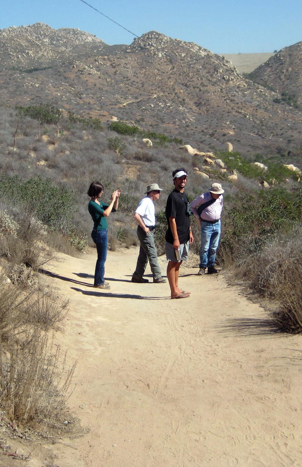
3 OPEN TO THE PUBLIC NO RESERVATIONS ARE REQUIRED Canyoneers are San Diego Natural History Museum volunteers trained to inspire appreciation of plants and animals in southern California. If you are interested in volunteering as a Canyoneer visit or call the director of volunteers at These programs are interpretive nature walks, not endurance hikes, and Canyoneers try to accommodate the desires and abilities of all participants. However, some of the walks can be taxing, especially those in the desert or mountains. The walks are ranked as follows: Difficulty Level HIKES ARE RANKED USING THE FOLLOWING SYSTEM E Easy I Intermediate D Difficult X Extra* *boulder scrambling, rough trail, low light, etc. Mileage (rounded to nearest mile) Elevation Change ( gain or loss) a = up to 200 ft b = up to 500 ft c = up to 1000 ft d = up to 1500 ft e = greater than 1500 ft EXAMPLES Using the system above, Florida Canyon is E2a (easy, 2 miles, up to 200 feet elevation change). Kate O. Sessions Memorial Park is IX2a (Intermediate, 2 miles, up to 200 feet elevation change with X for sometimes rough trail). 3
4 Cancellations Check the online Museum calendar ( for cancellations due to park closures or emergencies, or call ; choose option 4 then option 1. In the case of inclement weather, Canyoneers still hike unless the trail is dangerous or impassable. Not all events are known before the start of the hike or the publication of the brochure. Barring unforeseen circumstance, a Canyoneer will always show up at the trailhead to inform potential hikers of cancellations. Be prepared! Wear comfortable walking shoes and a hat. Hiking boots are recommended for desert and mountain hikes. Bring adequate water and food; even the short or easy hikes can demand liquid and energy resources. You may also wish to carry a jacket, binoculars, and field guides. Bring rain gear if rain is a possibility. If you would like to accompany a more leisurely group, alert the Canyoneer host when you sign in. Please follow common rules of courtesy and safety. Do not litter the trail or smoke. Dogs or other pets are not permitted on the walks, as they interfere with observing wildlife. Please notify your guide if you decide to leave the group before a walk ends. Group tours for scouts, senior citizen groups, clubs, and other organizations may be arranged by calling the Museum two weeks in advance at There is a nominal fee of $2 per person. If your group of 10 or more plans to join a regularly scheduled Canyoneer walk on the weekend, please call at least two weeks ahead so arrangements can be made for sufficient guides. School group hikes are also available for a fee of $2 per person. Call for information. PARKING FEE INFORMATION Parking fees have been instituted or increased at many hike locations. Such information, where available at the time this schedule was prepared, has been included. Please check location websites or the phone numbers listed below for parking fee information as it is subject to change. County of San Diego A $40 annual parking pass waives the $3 parking fee (per vehicle) in all San Diego County Regional Day-Use Parks (except for single park annual pass for $25). Seniors (62+) and disabled persons park free if they have the free parking pass permit. Passes may be obtained at the County Parks and Recreation Office: 5500 Overland Ave., Suite 410, San Diego, CA or at the any of the County Parks where there is a ranger station. The office is open Monday Friday, 8 AM 5 PM. You may purchase over the phone with a credit card by calling You may also purchase or obtain the free senior/disabled pass at all county parks. 4
. There is also an overnight camping fee at these campgrounds. For more information, call 760.767.5311.")
5 Anza-Borrego Desert State Park Generally, there are no day-use parking fees in Anza Borrego Desert State Park with the exception of the designated campgrounds (Bow Willow, Tamarisk Grove, and Borrego Palm Canyon Campground. Fees vary from $5 8). There is also an overnight camping fee at these campgrounds. For more information, call Cleveland National Forest California National Forests, including Cleveland National Forest, require visitors to display a National Forest Adventure Pass in their vehicles when parked in a national forest including trailheads in high use areas. A $5 daily pass or a $30 annual pass valid for 12 months from date of purchase is available at Forest Services offices and ranger stations, Adventure 16, and REI stores, and vendors within the forest. For more information on specific areas that require this pass, call the Descanso District, , or the Palomar District, , or visit Cuyamaca Rancho State Park A parking fee of $8 is in effect for Paso Picacho and Green Valley campgrounds. A special California Experience annual day-use pass is available for $75. This pass entitles you to park in Cuyumaca Rancho State Park and other designated parks. Parking is free in turn-out sites where not prohibited. For more information, call or visit Photo courtesy of Canyoneers Stacey Vielma and Liz Tymkiw 5
6 CALENDAR OF WALKS Date Day Time Trail Region/ Notes September Sun 9 AM 10:30 AM Florida Canyon I 14 Sun 9 AM 11 AM Kate O. Sessions Memorial Park I 20 Sat 9 AM 1 PM Mission Trails Regional Park I, W (Lake Murray - Kiowa) 21 Sun 8 AM 10 AM Torrey Pines State Reserve Extension C 28 Sun 8:30 AM 11 AM Tijuana Estuary (North Beach Trail) New! C October Sat 8 AM 10:30 AM Batiquitos Lagoon C 5 Sun 9 AM 11 AM or 9 AM 12:30 PM Blue Sky Ecological Reserve New! I 12 Sun 9:30 AM 11:30 AM Cabrillo National Monument (Bayside Trail) I, $P 19 Sun 3 PM 5 PM Greenbelt (Shepard) Canyon I 25 Sat 9 AM 11 AM Famosa Slough New! C 26 Sun 9 AM 12:30 PM San Dieguito River Park (Del Dios Gorge Trail) New! I November Sun 9 AM NOON William Heise County Park M, $P (Desert View) 8 Sat 1 PM 3 PM Navajo Canyon Open Space Park I 9 Sun 10 AM NOON Los Jilgueros Preserve I Note: bold indicates new hike locations Regions Key: C Coast D Desert I Inland M Mountain Code Legend: $P Parking W Wheelchair accesible 6
7 Date Day Time Trail Region/ Notes 15 Sat 10 AM 2 PM SDSU Field Station (Sky Oaks) I 16 Sun 9 AM NOON Mission Trails Regional Park I (Oak Canyon) 22 Sat 1 PM 4 PM Ruffin Canyon Open Space I December Fri 5 PM 9 PM Balboa Park December Nights 6 Sat 5 PM 9 PM Balboa Park December Nights 6 Sat 10 AM 2 PM Mount Woodson (North) New! I 7 Sun 9:30 AM San Elijo Lagoon County Ecological C 11:30 AM Preserve (Rios Ave.) 13 Sat 10 AM 3 PM Anza-Borrego Desert State Park D (Maidenhair Falls Aka Hellhole Canyon) 14 Sun 9 AM 1 PM Anza Borrego Desert State Park D (Coyote Canyon - Lower Willows) 21 Sun 6 AM 7:30 AM Mission Trails Regional Park (Cowles Mountain Winter Solstice) I January Sat 9 AM 2 PM Anza-Borrego Desert State Park D (Indian Hill) 11 Sun 9 AM 1 PM Anza-Borrego Desert State Park D (Mountain Palm Springs - 5 Groves) 17 Sat 10 AM 1 PM Daley Ranch (Boulder Loop) I 18 Sun 8 AM 11:30 AM Tecolote Canyon Natural Park (West) I 24 Sat 8 AM 10 AM Balboa Park Centennial Trail #2 I New! 25 Sun 10 AM NOON Crest Canyon Open Space Park C 31 Sat 2:30 PM 4 PM Santee Lakes I Febuary Sat 9 AM 3 PM Anza-Borrego Desert State Park (Bow D, $P Willow - Rockhouse Canyon Loop) 8 Sun 9 AM 1 PM El Monte Park (Flume Trail) I 14 Sat 10 AM 1 PM San Dieguito River Park (Coast To Crest Trail - Old Coach Staging Area To Raptor Ridge) I 7
8 Date Day Time Trail Region/ Notes 15 Sun 9 AM NOON Gonzales Canyon (Torrey Pines I Loop) New! 21 Sat 10 AM 3 PM Anza-Borrego Desert State Park D (Moonlight Canyon & Inner Pasture) 22 Sun 9 AM 3 PM Anza-Borrego Desert State Park D (Morteros & Ghost Mountain) 28 Sat 10 AM 1 PM Oakoasis County Open Space Preserve I March Sun 8:30 AM Black Mountain Open Space Park I 11:30 AM (Miner s Loop) 7 Sat 9 AM NOON San Dieguito River Park I (Santa Fe Trail) 7 Sat 10 AM 2 PM Anza-Borrego Desert State Park (Mine Canyon) D 8 Sun 9:30 AM 1:30 PM Anza-Borrego Desert State Park (Sandstone Canyon) 14 Sat 9 AM 12:30 PM Mount Gower County I Open Space Preserve 14 Sat 4 PM 6 PM Lopez Canyon Open Space Preserve I (Sorrento Valley To Pacific Mesa) 15 Sun 9:30 AM NOON Silverwood Wildlife Sanctuary I 21 Sat 9 AM NOON Sloan Canyon I 22 Sun 8 AM 1 PM Santa Rosa Plateau Ecological Reserve I, $P 28 Sat 9 AM 11 AM or 9 AM 2 PM 29 Sun 7:30 AM NOON or 7:30 AM 1:30 PM April 2015 McGinty Mountain Ecological Reserve Iron Mountain (Ellie Lane Loop Trail) 4 Sat 8 AM 11:30 AM Cleveland National Forest (Kitchen Creek Falls) 5 Sun 9 AM 1 PM Mission Trails Regional Park (Rim Trail) D I I M, $P I 11 Sat 8:30 AM 2 PM Cuyamaca Rancho State Park (Juaquapin Creek Loop) 12 Sun 8:30 AM 1:30 PM Cuyamaca Rancho State Park (Green Valley Falls Loop) M, $P M 8
9 Date Day Time Trail Region/ Notes 18 Sat 9 AM 1 PM Eagle Peak I 19 Sun 9 AM 1:30 PM Lake Morena County Park M 25 Sat 9 AM 2 PM SDSU Field Station (Santa Margarita I Ecological Reserve) 26 Sun 9 AM 1 PM Hollenbeck Canyon I May Sat 9 AM NOON Boulder Mountain Road Private Nature Trail I 3 Sun 8:30 AM 4 PM Cleveland National Forest M, $P (Noble Canyon) 9 Sat 9 AM 1 PM Cleveland National Forest (Horsethief M, $P Canyon) 10 Sun 9 AM 2 PM Cleveland National Forest M, $P (Secret Canyon Trail) 16 Sat 10 AM NOON San Diego River (Hazard Center I, W Trolley Stop) 17 Sun 9 AM NOON Santa Margarita River Trail I 30 Sat 9 AM 2 PM Volcan Mountain County Open Space Preserve 31 Sun 4:30 PM 6:30 PM June 2015 San Elijo Lagoon County Ecological Preserve (Rios Ave.) 6 Sat 9 AM 1 PM Cuyamaca Rancho State Park M (Airplane Monument) 6 Sat 5 PM 7 PM Rose Canyon Open Space Park I 7 Sun 8:30 AM 2:30 PM Cleveland National Forest (Agua Dulce-Chico Spur Loop) New! 13 Sat 8 AM 12:30 PM San Dieguito River Park (Coast To Crest Trail Del Mar) New! 14 Sun 9 AM 2 PM Cleveland National Forest (Sunset Trail) 20 Sat 9 AM NOON Cleveland National Forest (Love Valley Meadow) 21 Sun 10 AM 2:30 PM Palomar Mountain State Park (Thunder Spring/Chimney Flats) 27 Sat 8 AM 1 PM Cuyamaca Rancho State Park (Oakzanita Peak) 28 Sun 4 PM 7:30 PM Cuyamaca Rancho State Park (Stonewall Peak) M C M, $P C M, $P M, $P M, $P M M, $P 9
10 10
11 CANYONEER WALKS Descriptions and Directions to Canyoneer Walks Map references refer to the 2008 Thomas Guide (Map page-section). Other editions may be similar. GPS coordinates are given in decimal degrees (hddd. dddddd). You may need to convert to another format for your particular application. Hiking difficulty E(ASY), I(NTERMEDIATE), D(IFFICULT), distance, and elevation change listed for each hike. The key can be found on the first pages of this brochure. Driving times are approximated from Balboa Park. Florida Canyon E2a Sunday, September 7, AM 10:30 AM Explore this Balboa Park canyon preserved by Helen Witham Chamlee. Together with Docents of the San Diego Natural History Museum, Chamlee founded the Canyoneers in 1973 as the Florida Canyoneers. (Balboa Park) From Park Blvd., take Morley Field Dr. east, crossing Florida Dr. at the top of the hill, turn right twice into the parking lot next to the lawn. Facilities at tennis courts. (Map 1269-C7; GPS N , W ) Kate O. Sessions Memorial Park IX2a Sunday, September 14, AM 11 AM Enjoy one of the most beautiful spots in San Diego, overlooking Mission Bay, and explore its natural charm on a sometimes-rough trail in a scrub-covered section of the park. (Pacific Beach) From I-5, exit west on Garnet Ave., then turn right (north) onto Lamont St. Turn right on Park Dr. into the parking lot. Meet near the playground. Facilities and water. Allow 20 minutes driving time. (Map 1248-A4; GPS N , W ) Mission Trails Regional Park E6a (LAKE MURRAY - KIOWA) Saturday, September 20, AM 1 PM Look for seasonal wildflowers and water birds on this out-and-back walk to the west side of the lake as you make your way toward the dam that was built in This area is wheelchair accessible. (Mission Trails Regional Park, San Diego) From I-8, exit north on Lake Murray Blvd., then left at Kiowa Dr. Go through the gate and drive to the lake. Turn into the right hand parking lot. Meet the Canyoneer host past the picnic tables at the start of the trail. Wheelchair accessible. Facilities and water. Allow 30 minutes driving time. (Map 1270-F1; GPS N , W ) 11
12 Torrey Pines State Reserve Extension I2a Sunday, September 21, AM 10 AM See Torrey pines, native chaparral, and seasonal wildflowers on this easy walk to a vista point overlooking Peñasquitos Lagoon and the ocean. (Del Mar) From I-5, exit west on Carmel Valley Rd. Turn right (north) onto Del Mar Scenic Pkwy. Go to the end of the road and park. No facilities. Allow 30 minutes driving time. (Map 1207-H1; GPS N , W ) Tijuana Estuary New! E2a (NORTH BEACH TRAIL) Sunday, September 28, :30 AM 11 AM Revel in one of the few remaining salt marshes in Southern California as we walk along the coastal side of the reserve and then onto the North Beach Trail. Endangered bird species, including the Ridgway s (Clapper) Rail, Belding s Savannah Sparrow, and the California Least Tern may be seen. (Imperial Beach) From I-5, exit west on Coronado Ave. (Coronado Ave. becomes Imperial Beach Ave.). Park between 3rd and 2nd Streets. Facilities and water are available at the Tijuana Estuary Interpretive Center, 301 Caspian Way. Allow 30 minutes driving time. (Map 1349-F1; GPS N , W ) Batiquitos Lagoon E3a Saturday, October 4, AM 10:30 AM A pleasant walk on level terrain provides ample opportunity to enjoy lagoon plants and shorebirds. Along the way is a native plant garden. (Carlsbad) From I-5, exit east on Poinsettia Lane. Turn right onto Batiquitos Dr., with another right on Gabbiano Lane. Park at the end of the road. No facilities. Allow 40 minutes driving time. (Map 1127-A7; GPS N , W ) Blue Sky Ecological Reserve New! E3a or D5c Sunday, October 5, AM 11 AM or 9 AM 12:30 PM This easy walk just north of Lake Poway follows along a stream and a woodland canyon of large oaks. The tracks of wild animals including coyotes, mountain lions, and bobcats attest to the habitats protected by the reserve. The new longer hike option will climb to an overlook of Lake Poway. (Poway) From I-15, exit east on Rancho Bernardo Rd., which becomes Espola Rd. (S5). The entrance to the reserve is 0.25 miles east of the intersection of Old Coach Rd./Bridlewood Rd. Facilities. Allow 40 minutes driving time. (Map 1170-G3; GPS N , W ) 12
 From I-8, exit on Rosecrans St.")
13 Cabrillo National Monument I2b (BAYSIDE TRAIL) Sunday, October 12, :30 AM 11:30 AM Encounter windswept vegetation and chaparral scrub forests on cliffs overlooking San Diego harbor on this 2-mile round-trip hike. Remnants of WWII defense installations are visible. The return walk at your own pace is all uphill. (Cabrillo National Monument, Point Loma) From I-8, exit on Rosecrans St. Turn right on Cañon St. and continue 1 mile to the traffic signal at Catalina Blvd. Turn left (south) and follow the road to Cabrillo National Monument and park. Meet on the sidewalk to the lighthouse (next to the road). Parking is $5 per car. Water and facilities at the Visitor Center. Allow 30 minutes driving time. (Map 1308-A2; GPS N , W ) 13
14 Greenbelt (Shepard) Canyon E3a Sunday, October 19, PM 5 PM Take a stroll through the canyon toward a small reservoir that attracts birds and other animals. This is part of a greenbelt area that sustains native vegetation in the area formerly known as Camp Elliott. (Tierrasanta) From I-15, exit east on Clairemont Mesa Blvd. then turn left (north) on Santo Rd. for 0.25 miles to the greenbelt and park on Antigua Blvd. west of Santo Rd. No facilities. Allow 20 minutes driving time. (Map 1229-H7; GPS N , W ) Famosa Slough New! E2a Saturday, October 25, AM 11 AM Observe plants and birds on a short 2-mile walk in this 37-acre natural wetland preserve. (Pt. Loma) Take I-8 west to the end; follow the signs toward Nimitz Blvd. Turn left at West Point Loma Blvd. After crossing Famosa Blvd., park on the right. Facilities. Allow 20 minutes driving time. (Map 1268-B5; GPS N , W ) San Dieguito River Park New! E5b (DEL DIOS GORGE TRAIL) Sunday, October 26, AM 12:30 PM Admire the steeply rising granitic walls of the Del Dios Gorge and the scattered willows and oaks along the San Dieguito riverbed on this 5-mile round-trip hike. We will view the 1918 Lake Hodges Dam from the Rattlesnake Viewing Platform. (Rancho Santa Fe) From I-5, exit east on Lomas Santa Fe Dr. Continue on Linea del Cielo, which turns into Paseo Delicias and then Del Dios Hwy. Turn right after passing Calle Ambiente and turn in at the fruit stand on the right. There is a road marked with an SDRP sign that leads to the parking area where you ll meet the Canyoneer host. No facilities. Allow 1 hour driving time. (Map 1148-J7; GPS N , W ) William Heise County Park I5c (DESERT VIEW) Sunday, November 2, AM NOON Forests of oak, pine, and cedar are found in this 929-acre park that is one of the few county-run parks to have snowfall each year. Be prepared for temperature changes. (Julian) From the junction of Hwy. 79 & Pine Hills Rd., (1 mile west of Julian), turn south on Pine Hills Rd. Go east on Frisius Rd. Parking fee is $3. Facilities and water. Allow 1.5 hours driving time. (Map 1156-C5; GPS N , W ) 14
 From I-8, exit north on Waring Rd. then right at Adobe Falls Rd. Park on the street.")
15 Navajo Canyon Open Space Park E2a Saturday, November 8, PM 3 PM As we walk along the streambed part way up Navajo Canyon, which cuts narrowly into the communities of Del Cerro and Allied Gardens, many native plant species, including teasel, gooseberry, and scrub oak can be seen. (San Diego) From I-8, exit north on Waring Rd. then right at Adobe Falls Rd. Park on the street. No facilities. Allow 20 minutes driving time. (Map 1250-A7; GPS N , W ) Los Jilgueros Preserve E2a Sunday, November 9, AM NOON Follow a looping path over a plank footbridge to view ponds and a freshwater marsh. Visit the firescape garden to learn about fire-resistant plants. (Fallbrook) From I-15, exit west at Hwy. 76 (Pala Rd.). Go 4.5 miles then right (north) on South Mission Rd. Just past Sterling Bridge Lane, turn right into the Los Jilgueros Preserve driveway. No facilities. Allow 1 hour driving time. (Map 1027-G6; GPS N , W ) 15
 From Hwy. 67, continue east on Hwy. 78, then left (north) on Hwy. 79 in Santa Ysabel to Chihuahua Valley Rd.")
16 SDSU Field Station I4b (SKY OAKS) Saturday, November 15, AM 2 PM Don t miss this special opportunity! Canyoneers have permission to guide at this SDSU field station for this date only. We will make a loop through open chaparral and lunch under oak trees. (Chihuahua Valley) From Hwy. 67, continue east on Hwy. 78, then left (north) on Hwy. 79 in Santa Ysabel to Chihuahua Valley Rd. Turn right (east) and continue 6.5 miles. When the road makes a sharp right turn (indicated by a sign with a black arrow on a yellow background), drive straight ahead and cross the road. Take the road to the right marked as Lost Valley Rd./Lost Valley Scout Camp, 11 miles. Travel 2.9 miles to the field station on the left. Facilities. Allow 2 hours driving time. (Map 409-K5; GPS N , W ) Mission Trails Regional Park E4b (OAK CANYON) Sunday, November 16, AM NOON The walk starts past the Old Mission Dam (a nationally registered historic landmark) and follows a streambed rimmed by Coast Live Oaks. (Mission Trails Regional Park, Santee) From I-8, exit north on Mission Gorge Rd. Continue about 4 miles, then turn left onto Father Junipero Serra Trail. Drive past the Visitor Center through the gated road for 1.8 miles to the parking lot at the dam, or park along the road at the dam. Alternate route: From Santee take Mission Gorge Rd. west and turn right onto Father Junipero Serra Trail to the parking lot. Meet in the lot and we will walk together to the trailhead. Facilities and water. Allow 30 minutes driving time. (Map 1230-F6; GPS N , W ) 16
17 Ruffin Canyon Open Space I3c Saturday, November 22, PM 4 PM Please join us on this rocky trail through an urban canyon, which is part of the San Diego River watershed. (Serra Mesa) From I-15, exit west on Aero Dr. then go south on Ruffin Rd. Cross Gramercy Dr. and meet the Canyoneer host at the east side of Taft Middle School. No facilities. Allow 20 minutes driving time. (Map 1249-E5; GPS N , W ) Balboa Park December Nights E1a Friday, December 5, PM 9 PM Saturday, December 6, PM 9 PM In this annual event, Canyoneers will be selling locally gathered mistletoe to benefit the San Diego Natural History Museum. (Balboa Park) The Museum is located south of the zoo at Park Blvd. and Village Pl. Wheelchair accessible. Facilities. (Map 1269-C7) Check decembernights for parking information. Mount Woodson (North) New! I6c Saturday, December 6, AM 2 PM Hike the more gentle side of Mt. Woodson on the less-traveled Fry-Koegel trail. Enjoy cool oak-covered sections of the trail before moving into wide open hillsides of chaparral and coastal sage scrub. Many native plants and birds should be found along the northern side of Mt. Woodson. (Ramona) From I-15, take either Poway Rd. (S4) or Scripps-Poway Parkway east to Hwy. 67. Go north about 3 or 4.5 miles respectively to Mt. Woodson. Alternate route: From I-8 east, take Hwy. 67 north to Mt. Woodson. Park on the west (left) shoulder of Hwy. 67, avoiding the Forest Service fire station. Or, if you park on the east (right) shoulder of Hwy. 67, use extreme caution when crossing Hwy. 67 on foot. No facilities. Allow 1 hour driving time. (Map 1171-F4; GPS N , W ) San Elijo Lagoon County Ecological Preserve E2a (RIOS AVE.) Sunday, December 7, :30 AM 11:30 AM The preserve has more than 250 species of shore and water birds in multiple plant communities that include marsh, sage scrub, and chaparral. Bring your binoculars! (Solana Beach) From I-5, exit west on Lomas Santa Fe Dr. Turn right (north) onto Rios Ave. Go to the end of the road and park. No facilities. Allow 30 minutes driving time. (Map 1167-E6; GPS N , W ) 17
18 Anza-Borrego Desert State Park IX6c (MAIDENHAIR FALLS AKA HELLHOLE CANYON) Saturday, December 13, AM 3 PM Explore an ideal desert canyon fed by a year-round spring on this challenging hike. See vegetation not generally found in the desert sycamore trees, palms, maidenhair ferns, and even a sighting of orchids. The higher portion of this canyon trek does involve some boulder scrambling. (Anza-Borrego Desert State Park) From I-8 east, take Hwy. 79 to Santa Ysabel. Continue north out of Santa Ysabel on Hwy. 79 to S2 (San Felipe Rd.). Turn east (right) on S2 to S22 (Montezuma Valley Rd.) and make a left turn. Continue on Montezuma Valley Rd. and park at the bottom of the grade in the lot on the west side of the road. Meet the Canyoneer host here. (If you reach Palm Canyon Dr., you have gone too far). Alternate route: From I-8 east take Hwy. 67 north to Hwy. 78 via Ramona to Santa Ysabel. Take Hwy. 79 out of Santa Ysabel and follow directions above. Facilities. Allow 2 hours driving time. (Map 1058/1078-F3; GPS N , W )e road. Meet the Canyoneer host here. (If you reach Palm Canyon Dr., Anza-Borrego Desert State Park I4a (COYOTE CANYON - LOWER WILLOWS) Sunday, December 14, AM 1 PM Hike to the largest year-round spring in San Diego County. Dense willows provide habitat for birds and insects. Wading through water may be necessary. High-clearance vehicles are needed for the off-road portion of this trip. For those who are reluctant to drive off-road, shared rides will be arranged to caravan from the meeting place. (Anza-Borrego Desert State Park) From Christmas Circle in Borrego Springs, take Palm Canyon Dr. (S22) east to Di Giorgio Rd. Continue north to the end of the pavement, where you will meet your Canyoneer host. No facilities. Allow 2 hours driving time. (Map /1059-A1; GPS N , W ) Mission Trails Regional Park DX3c (COWLES MOUNTAIN WINTER SOLSTICE) Sunday, December 21, AM 7:30 AM Ascend Cowles Mountain in near-darkness to watch the sunrise on the first day of winter. Our viewing spot is a Kumeyaay solstice observatory, about halfway up the mountain. (Mission Trails Regional Park, San Carlos) From I-8, exit north on College Ave. then turn right (east) onto Navajo Rd. Drive 2.5 miles to Golfcrest Dr. Turn left on Golfcrest Dr. and park. Meet near the northeast corner of Golfcrest Dr. and Navajo Rd. Water and facilities. Allow 30 minutes driving time. (Map 1250-F4; GPS N , W ) 18
19 Anza-Borrego Desert State Park IX6c (INDIAN HILL) Saturday, January 10, AM 2 PM Hike through hillsides of teddy bear cholla and barrel cactus to the remains of a primitive 1912 railroad camp. (Anza-Borrego Desert State Park) From I-8, exit on S2 (Imperial Hwy.) at Ocotillo. Go northwest (left) on S2 for 8.7 miles, turning left onto Mortero Wash. Meet the Canyoneer host there. We will consolidate into 4WD or high-clearance vehicles to reach the trailhead. No facilities. Allow 2 hours driving time. (Map 430-F6; GPS N , W ) Anza-Borrego Desert State Park I3b (MOUNTAIN PALM SPRINGS - 5 GROVES) Sunday, January 11, AM 1 PM Explore the vegetation, bird, and animal life of the five palm groves, two of which have spring-fed surface water. Look for the unique Torote tree, also called the Elephant tree. (Anza-Borrego Desert State Park) From I-8, exit on S2 (Imperial Hwy.) at Ocotillo. Go northwest (west) on S2 for about 17 miles to about 0.1 miles before mile marker 47 (decreasing numbers). Turn west (left) at the signed Mountain Palm Springs Campground entrance and follow a short dirt road to the campground. Facilities are available at the campground. Allow 2 hours driving time. (Map 430-E5; GPS N , W ) Daley Ranch I4c (BOULDER LOOP) Saturday, January 17, AM 1 PM Daley Ranch has habitats that support a variety of plant and animal species. Enjoy spectacular views of the surrounding area along the trail. (Escondido) From I-15, exit east on El Norte Pkwy. Turn left (north) on La Honda Dr. Parking area for Daley Ranch is on the left. To the right is Dixon Lake with facilities, water, and picnic areas. Allow 45 minutes driving time. (Map 1110-C3; GPS N , W ) Tecolote Canyon Natural Park (West) I4c Sunday, January 18, AM 11:30 AM Observe seasonal changes to natural vegetation in the park and climb to a high point for a view of the golf course and the University of San Diego. Visit the nature center to see informative exhibits about the canyon. (San Diego) From I-5 exit east on SeaWorld Dr./Tecolote Rd. and follow it past the ball fields. Park in the Nature or Recreation Center lots. Facilities and water. Allow 20 minutes driving time. (Map 1268-F2; GPS N , W ) 19
20 Balboa Park Centennial Trail #2 New! E2a Saturday, January 24, AM 10 AM Discover architectural treasures from the 1915 Panama-California Exhibition and see many of San Diego s native plants on this special walk in honor of Balboa Park s Centennial Celebration. (Balboa Park) From CA-163, exit north on Park Blvd. Turn left (west) onto Village Pl. Meet Canyoneer host by the Natural History Museum just north of the Bea Evenson Fountain. Facilities. (Map 1289-C1; GPS N , W ) Crest Canyon Open Space Park E2a Sunday, January 25, AM NOON Enjoy a variety of native and nonnative plants in this coastal canyon south of San Dieguito Lagoon. The trail ascends gradually into the canyon through sage scrub and chaparral. (Del Mar) From I-5, exit west on Via De La Valle, then turn left (south) onto Jimmy Durante Blvd. Just after crossing the bridge over the San Dieguito River, turn left (east) onto San Dieguito Dr., which becomes Race Track View Dr. Continue through to the stop sign, parking on the road shoulder. No facilities. Allow 30 minutes driving time. (Map 1187-H4; GPS N , W ) Santee Lakes E2a Saturday, January 31, :30 PM 4 PM Birds to look for on this shore walk include coots, grebes, double-crested cormorants, reintroduced wood ducks, and possibly white pelicans. Bring your binoculars! (Santee) From Hwy. 52, exit east on Mast Blvd. Turn left (north) onto Fanita Pwky. Park on Lake Canyon Rd. and meet the Canyoneer host past the gate west of Fanita Pwky. Facilities. Allow 30 minutes driving time. (Map 1231-A4; GPS N , W ) Anza-Borrego Desert State Park IX8c (BOW WILLOW - ROCKHOUSE CANYON LOOP) Saturday, February 7, AM 3 PM This is a moderately strenuous hike over some well-marked trails. Hearty desert plants like cholla, ocotillo, and creosote bush are likely to be seen on the way to a rock shack, watering trough, and pipeline leading to a seasonal spring and waterfall. Part of the journey requires boulder hopping and some simple route finding. (Anza-Borrego Desert State Park) From I-8, exit on S2 (Imperial Hwy.) at Ocotillo. Turn northwest (left) on S2, and drive 16 miles to milepost 48 and look for a turnoff on the left for Bow Willow Campground (signed). Drive 1.6 miles to the campground. Continue to the western most campsites and park just beyond the last campsite. A day use fee of $5 payable at a kiosk is required to park. Please refer to Parking Fee Information on the inside front cover. Facilities. Allow 2 hours driving time. (Map 430-E5; GPS N , W ) 20
 From I-8, exit north on Lake Jennings Rd., and turn right on El Monte Rd. Meet the Canyoneer host at the parking lot before the park entrance.")
21 El Monte Park D4d (FLUME TRAIL) Sunday, February 8, AM 1 PM Our trail follows switchbacks through chaparral and sage scrub to reach the area where a flume was built to carry water from El Capitan Reservoir to downtown San Diego. (Lakeside) From I-8, exit north on Lake Jennings Rd., and turn right on El Monte Rd. Meet the Canyoneer host at the parking lot before the park entrance. No facilities. Allow 40 minutes driving time. (Map 1213-A6; GPS N , W ) San Dieguito River Park I5b (COAST TO CREST TRAIL - OLD COACH STAGING AREA TO RAPTOR RIDGE) Saturday, February 14, AM 1 PM Hike to Raptor Ridge and if hawks, vultures, and other raptors are present, you ll understand how it got its name. From the viewpoint you will have a panoramic view of the San Pasqual Agricultural Preserve and the San Diego Zoo Safari Park. (Escondido, San Dieguito River Park) From CA-163 north, merge onto I-15 to the Pomerado Rd./West Rancho Bernardo Rd. exit. Go east on Pomerado Rd. to the first traffic light after leaving the freeway. Make a left turn onto Highland Valley Rd. Drive 2.4 miles from the traffic light to the Old Coach Staging Area on the right. There is ample parking and the trailhead is well marked. No facilities. Allow 40 minutes driving time. (Map 1150-F4; GPS N , W ) 21
22 22 Gonzales Canyon New! E4a (TORREY PINES LOOP) Sunday, February 15, AM NOON See a wide variety of plants representing coastal sage scrub, chaparral, and riparian habitats. We should observe many seasonal wildflowers and birds on this hike. (Carmel Valley) From I-5, exit east on Del Mar Heights Rd. for 1.4 miles then left on Lansdale Dr. Go 0.5 miles, turn left into Sword Way for 0.5 miles. Meet the Canyoneer host at the start of the trail. No facilities. Allow 30 minutes driving time. (Map 1188-C4; GPS N , W ) Anza-Borrego Desert State Park DX5c (MOONLIGHT CANYON & INNER PASTURE) Saturday, February 21, AM 3 PM Hike through Moonlight Canyon from the Agua Caliente Hot Springs to the isolated Inner Pasture. The Kumeyaay once lived in this area between the Sawtooth Mountains and the Tierra Blanca Mountains of Anza-Borrego. (Anza-Borrego Desert State Park) From I-8, exit north on Hwy. 79 through Cuyamaca Rancho State Park to Julian. Turn east on Hwy. 78 and proceed to the junction of Hwy. 78 and S2 (Scissors Crossing). Turn south on S2. Drive 21 miles to the store at the entrance of Agua Caliente County Park. Turn left and park at side of road to meet the Canyoneer host. Facilities. Allow 2 hours driving time. (Map 430-D3/page D; GPS N , W ). Anza-Borrego Desert State Park I3b (MORTEROS & GHOST MOUNTAIN) Sunday, February 22, AM 3 PM Visit a Kumeyaay cultural area where foods were processed leaving deep morteros in the native rock. Then visit the home of Marshal South, a homesteader in the 1930s and 1940s who emulated Kumeyaay ways. (Anza-Borrego Desert State Park) From I-8, exit north on Hwy. 79 through Cuyamaca Rancho State Park to Julian. Turn east on Hwy. 78 and proceed to the junction of Hwy. 78 and S2 (Scissors Crossing). Turn south on S2. Go about 6 miles to the signed entrance to Blair Valley on the east side of the road. Meet the Canyoneer host in the parking area by the vault toilets. Carpool to Morteros and Ghost Mountain. Facilities. Allow 2 hours driving time. (Map 430-B1; GPS N , W ) Oakoasis County Open Space Preserve I3b Saturday, February 28, AM 1 PM This trail, lined with wild lilac, passes through thick chaparral on a gentle upward slope. Take a short climb to a promontory overlooking San Vicente Reservoir where we will stop for a snack before beginning the return trip.
23 (Lakeside) From Hwy. 67, exit east on Mapleview St. and then turn left (north) onto Ashwood St., which becomes Wildcat Canyon Rd. The preserve is on the left (west) at Wildcat Canyon Rd., about 2.5 miles past Louis A. Stelzer Park. Facilities. Allow 1 hour driving time. (Map 1212-F3; GPS N , W ) Black Mountain Open Space Park I3b (MINER S LOOP) Sunday, March 1, :30 AM 11:30 AM Hike through chaparral to view the remains of an old arsenic mine. Seasonal wildflowers should be plentiful on this moderately challenging hike. (Rancho Peñasquitos) Take I-15 to 56 west, then exit north on Black Mountain Rd. Turn right on Carmel Valley Rd. and go 0.9 miles to the second Black Mountain Open Space Entrance on the right (first entrance is the glider port), driving uphill to meet the Canyoneer host in the parking lot. No facilities. Allow 40 minutes driving time. (Map 1169-E7; GPS N , W ) San Dieguito River Park E4a (SANTA FE TRAIL) Saturday, March 7, AM NOON Explore riparian vegetation and a large pond along the San Dieguito River. This area was impacted by the 2007 Witch Creek Fire. (Rancho Santa Fe) From I-5, exit east on Lomas Santa Fe Dr. Continue on Linea del Cielo, which turns into Paseo Delicias and then Del Dios Hwy. Turn right after passing Calle Ambiente and turn in at the fruit stand on the right. There is a road marked with an SDRP sign that leads to the parking area where you ll meet the Canyoneer host. No facilities. Allow 1 hour driving time. (Map 1148-J7; GPS N , W ) Anza-Borrego Desert State Park EX5b (MINE CANYON) Saturday, March 7, AM 2 PM Hike into the North Pinyon Mountains, the site of many desert mine locations. Visit a large Kumeyaay village site with hundreds of agave-roasting pits. (Anza-Borrego Desert State Park) From I-8, exit north on Hwy. 79 through Cuyamaca Rancho State Park to Julian. Turn right on Hwy. 78. Meet the Canyoneer host at the beginning of Mine Wash Rd, 2.7 miles east of the Tamarisk Grove (Yaqui Pass Rd.) intersection on Hwy. 78. We will consolidate into 4WD or high-clearance vehicles to reach the trailhead. No facilities. Allow 2 hours driving time. (Map 1098/1119-F5; GPS N , W ) 23
 From I-8 east, exit Hwy. 79 through Cuyamaca State Park to Julian.")
24 Anza-Borrego Desert State Park E2a (SANDSTONE CANYON) Sunday, March 8, :30 AM 1:30 PM We will drive through the geologically interesting Split Mountain area to Sandstone Canyon. Once there, we will walk through a spectacular wash with walls that are in places 200 feet high. (Anza-Borrego Desert State Park) From I-8 east, exit Hwy. 79 through Cuyamaca State Park to Julian. Turn right on Hwy. 78 for 34 miles. Turn right on Split Mountain Rd. and go 8 miles to meet the Canyoneer host. We will consolidate into 4WD or high-clearance vehicles to travel to the hike location. No facilities. Allow 2.5 hours driving time. (Map 410-F11; GPS N , W ) Mount Gower County Open Space Preserve I4b Saturday, March 14, AM 12:30 PM Chaparral and oak woodland provide corridors for diverse wildlife. We hope to see woolly blue curls and canchalaguas along the trail. This walk involves a moderate climb to a viewpoint. (Ramona) From Hwy. 67, go east on Mapleview St. 0.5 miles to Ashwood St. Turn north (left) on Ashwood St. (it changes to Wildcat Canyon Rd.) and continue 12.3 miles to San Vicente Rd. Go east (right) on San Vicente Rd. 1.6 miles to Gunn Stage Rd. Go north (left) on Gunn Stage Rd. for 1.8 miles to the entrance of the Preserve and park in the staging area. Facilities. Allow 1 hour driving time. (Map 1173-F1; GPS N , W ) 24
25 Lopez Canyon Open Space Preserve I3a (SORRENTO VALLEY TO PACIFIC MESA) Saturday, March 14, PM 6 PM This quiet canyon is home to a variety of wildlife, including several species of birds of prey. Walk past magnificent sycamores and other riparian vegetation along an old creek bed into areas where dense chaparral mixes with coastal sage scrub at the top of the mesa. (Sorrento Valley) Take I-5 north to the Sorrento Valley Rd. exit (Exit 30) and turn left onto Roselle St. Turn right on Sorrento Valley Blvd. Continue for approximately 1 mile to the parking lot on right (4280 Sorrento Valley Blvd). Facilities. Allow 30 minutes driving time. (Map 1208-D5; GPS N , W ) Silverwood Wildlife Sanctuary E2a Sunday, March 15, :30 AM NOON Be sure to bring your binoculars to this oak-dotted Audubon Society preserve. We will observe wildflowers in season and higher-elevation chaparral growth and regeneration after the 2003 Cedar fire. (Lakeside) From Hwy. 67, exit east on Mapleview St. then turn left (north) onto Ashwood St., which changes to Wildcat Canyon Rd. Drive 5 miles. Silverwood is on the right just beyond Oak Oasis (13003 Wildcat Canyon Rd., Lakeside). Facilities. Allow 40 minutes driving time. (Map 1212-F2; GPS N , W ) Sloan Canyon I3c Saturday, March 21, AM NOON A profusion of seasonal wildflowers makes this hike worthwhile. The moderate climb of about 1,000 feet over 2.5 miles is on an old road. From this elevation there is a great view of the Sweetwater River. (Dehesa) From I-8 take the Harbison Canyon/Dunbar Lane exit. Merge onto Alpine Way. Turn right onto Arnold Way and then right onto Harbison Canyon Rd. (becomes Dehesa Rd.) to Sloan Canyon Rd.(a dirt road on the left), about 6 miles from the I-8 offramp. Turn left on Sloan Canyon Rd. and proceed to the end of the road, about 4 miles. This is a good graded road suitable for sedans. Park at the end of Sloan Canyon Rd. on the side of the road. Take care not to block the two gates. No facilities. Allow 1 hour driving time. (Maps 1253-A7 and 1273-B1; GPS N , W ) 25
 From I-15, go southwest on Clinton Keith Rd.")
26 Santa Rosa Plateau Ecological Reserve I6b Sunday, March 22, AM 1 PM View the only known examples of southern basalt flow vernal pools and then continue on to visit two historic adobes, circa We will learn about the plateau s unique topography, geology, and habitats. (Riverside County, Murrieta) From I-15, go southwest on Clinton Keith Rd. to the Visitor Center and pay the park s day use fee: $3 adults, $2 children. Meet the Canyoneer host there to caravan to the vernal pool trailhead. Water and facilities. Allow 1.25 hours driving time. (Map 409-B3; GPS N , W ) McGinty Mountain Ecological Reserve D5d Saturday, March 28, AM 11 AM or 9 AM 2 PM This small mountain southeast of El Cajon offers a hike with a 1400-foot elevation gain/ loss. Plants endemic to this island of gabbro soil are of special interest. The short hike to the South Ridge is about 2 miles round trip. The long hike to the summit is about 5 miles round trip and will take 4 to 5 hours. (Jamul) From Hwy. 94 (Campo Rd.), turn left on Lyons Valley Rd. for about 0.8 miles, then turn left at Jamul Dr. and continue for a little less than 0.5 miles to the entrance. Park in small turnout on right. No facilities. Allow 30 minutes driving time. (Maps 1272-H7, 1292-H1; GPS N , W ) Iron Mountain I6e or I10e (ELLIE LANE LOOP TRAIL) Sunday, March 29, :30 AM NOON or 7:30 AM 1:30 PM This alternative approach to hiking Iron Mountain has many of the same challenges and scenery but starts from a less-crowded parking area. There are hillsides of granitic boulders and views of Ramona from a saddle 200 feet lower than Iron Mountain peak. The longer hike includes a side trip to the peak. 26

27 (Poway) Take I-8 east to Hwy. 67 and drive 13.5 miles north. Turn right at Ellie Lane (0.5 miles north of the Poway Rd. traffic light) and meet the Canyoneer host in the parking area. Do not turn in at the Poway Rd. intersection entrance to the main Iron Mountain trailhead parking area. No facilities. Allow 40 minutes driving time. (Map 1171-D7; GPS N , W ) Cleveland National Forest I5c (KITCHEN CREEK FALLS) Saturday, April 4, AM 11:30 AM This 5-mile round-trip hike in the Laguna Mountains has an elevation gain/loss of 900 feet in a gradual slope. The view is spectacular as the trail rises. Plan to eat lunch at the falls. (Cleveland National Forest) Take I-8 east to Buckman Springs Rd. Turn right (south) at the first stop sign and left (east) at the second stop sign. Proceed for 2 miles to the Forest Service campground (Pacific Crest Trail parking). A National Forest Adventure Pass is required to park. Facilities and water available at the Buckman Springs Rest Stop. Allow 1.5 hours driving time. (Map 430-A7; GPS N , W ) Mission Trails Regional Park D6c (RIM TRAIL) Sunday, April 5, AM 1 PM The Rim Trail on the western edge of Mission Trails Regional Park highlights views of Fortuna and Cowles Mountains, Suycott Wash, and the Peninsular Ranges to the east. Look for threatened species of variegated Dudleya, summer holly, barrel cactus, johnny jump-ups, and shooting stars. (Mission Trails Regional Park, San Diego) From I-15 or CA-163, exit east on Clairemont Mesa Blvd. and park at the trailhead at the end of the road. No facilities. Allow 20 minutes driving time. (Map 1250-B1; GPS N , W ) 27
28 Cuyamaca Rancho State Park I6c (JUAQUAPIN CREEK LOOP) Saturday, April 11, :30 AM 2 PM Walk along a beautiful, shaded creek and stop for lunch near an area where native people once prepared food in morteros. (Cuyamaca Rancho State Park) From I-8, exit north onto Hwy. 79 for 7.5 miles. Turn into the large parking area on the right (0.5 miles past the Green Valley Campground). No facilities. Allow 1 hour driving time. (Map 1216-F2; GPS N , W ) Cuyamaca Rancho State Park I5c (GREEN VALLEY FALLS LOOP) Sunday, April 12, :30 AM 1:30 PM We will make an early-morning start at the falls and then hike along the east side of the Sweetwater River. After crossing to the west side of the river, we will return through chaparral, riparian, and meadow habitats. (Cuyamaca Rancho State Park) From I-8, exit north onto Hwy. 79 for 7 miles to the Green Valley Campground kiosk. There is an $8 day-use charge per vehicle. Park at the falls day-use parking lot past campsite #76. Facilities. Allow 1 hour driving time. (Map 1216-E3; GPS N , W ) Eagle Peak I4d Saturday, April 18, AM 1 PM This trail has panoramic views of the Three Sisters Waterfalls. On a clear day, the view from the peak can extend to the ocean. (Descanso) From I-8, exit north on Hwy. 79 and then go left (west ) on Riverside Dr. Turn left on Viejas Grade then make an immediate right past the store onto Oak Grove Dr. Turn right on Boulder Creek Rd. and drive 13 miles (it becomes a well-kept dirt road) to a hairpin turn that intersects Cedar Creek Rd. and the trailhead. No facilities. Allow 1.5 hours driving time. (Map 1175-B6; GPS N , W ) Lake Morena County Park I6c Sunday, April 19, AM 1:30 PM Morena Reservoir and the Pacific Crest Trail in the Cleveland National Forest provide access to some spectacular areas of vegetation, including riparian and chaparral communities. Giant granitic boulders border portions of the lake. (Morena Village) Take I-8 east to the Buckman Springs Rd. exit. Turn right (south) onto Buckman Springs Rd. (S1 ) and continue 5 miles to Oak Rd. Proceed to Lake Morena Dr. Turn right to the County Park. Meet at the Pacific Crest Trail parking lot. Please allow extra time to pay the County parking fee of $3 at the ranger station a short distance beyond the meeting site. Facilities. Allow 1.5 hours driving time. (Map 1296/1297-D5; GPS N , W ) 28
29 SDSU Field Station I7d (SANTA MARGARITA ECOLOGICAL RESERVE) Saturday, April 25, AM 2 PM Canyoneers have permission to guide at this SDSU field station on this date only. This hike has it all. Explore Stone Creek and the Santa Margarita River at the bottom of this impressive gorge and discover a variety of native plants found on the steep slopes and open areas of chaparral. (Fallbrook) From I-15, exit west on Mission Rd. (S13) and turn right onto Willow Glen Rd. Drive to the end of Willow Glen and continue right (north) on Stage Coach Lane for 2 miles on a well maintained dirt road. The gate to the reserve will be open a half-hour before the hike. Follow the Canyoneer sign to the parking area. Facilities. Allow 1.5 hours driving time. (Map 998-C3; GPS N , W ) Hollenbeck Canyon I4b Sunday, April 26, AM 1 PM This hike will pass through a riparian habitat wildlife area with the remains of a cabin and evidence of floodwaters. Lunch will be along a creek, sitting on boulders before we loop back to the trailhead. (Jamul) From I-8, exit I-805 south to Hwy. 94 east. Exit on Honey Springs Rd. and turn left and make a quick left into a parking lot to meet the Canyoneer host. Facilities. Allow 40 minutes driving time. (Map 1293 section 1313-E1; GPS N , W ) Boulder Mountain Road Private Nature Trail E4a Saturday, May 2, AM NOON The owner of this private property has given the Canyoneers special permission to lead a hike on this date only. Please join us at this Poway location with an exceptional variety of native plants. (Poway) From I-15, exit east on Rancho Bernardo Rd., which becomes Espola Rd. (S5). Make right turns on Martincoit and Orchard Gate, then left on Lime Grove which turns right, becoming Arroyo Vista Rd. Turn left on Boulder Mountain Rd. and meet the Canyoneer host. Do not be late, as we will have limited access through the gate. No facilities. Allow 40 minutes driving time. (Map 1170-E5; GPS N , W ) 29
30 Cleveland National Forest D8b (NOBLE CANYON) Sunday, May 3, :30 AM 4 PM Enjoy a downhill trek through this beautiful stream-cut canyon in the Laguna Mountains. We will pass through a stand of California bay-laurel trees and look for wild orchids, penstemons, and woolly blue curls. Bring plenty of water as the hike down to Pine Valley passes through open chaparral. Guides will shuttle drivers back to the trailhead as needed. (Cleveland National Forest) From I-8, exit Pine Valley Rd. going north. Turn west on Old Hwy. 80. Turn north directly past the bridge at Pine Creek Rd. keeping to the left. Park in the Noble Canyon parking lot near the restrooms. We will consolidate into 4WD or high-clearance vehicles to reach the trailhead. A National Forest Adventure Pass is required to park. Allow 1 hour driving time. (Map 1237-C3; GPS N , W ) Cleveland National Forest I3b (HORSETHIEF CANYON) Saturday, May 9, AM 1 PM We will descend 400 feet to the canyon floor and then follow a flat trail to Pine Valley Creek that will lead us through live oaks, sycamores and seasonal wildflowers. (Cleveland National Forest, Pine Creek Wilderness Area) From I-8 east, exit south on Japatul Valley Rd. to Lyons Valley Rd. Follow it to the trailhead at Mile Marker A National Forest Adventure Pass is required to park. No facilities. Allow 1.5 hours driving time. (Map 1275-E4; GPS N , W ) Cleveland National Forest D4b (SECRET CANYON TRAIL) Sunday, May 10, AM 2 PM Follow Pine Valley Creek and pass under the Pine Valley Bridge, which is 400 feet above the gorge. Explore remains of an1895 flume intended to move water from a proposed reservoir in Pine Valley to King Creek, a San Diego River tributary. (Cleveland National Forest, Pine Valley) From I-8, take Exit 45 (Pine Valley Rd) and turn north on Pine Valley Rd, then turn left on Old Hwy. 80 for 1.5 miles. Park in the Pine Creek Trailhead on the left. A National Forest Adventure Pass is required to park. No Facilities. Allow 1 hour driving time. (Map 1237-A4; GPS N , W ) 30
31 San Diego River E2a (HAZARD CENTER TROLLEY STOP) Saturday, May 16, AM NOON Arrive by mass transit to see native riparian and chaparral plants along the San Diego River mostly via a paved walkway. (San Diego, Mission Valley) By trolley, take the Green Line to Hazard Center. By car, from CA-163 exit east on Friars Rd. Turn right at Frazee Rd. and right again on Hazard Center Dr. Look for the Canyoneer host at the trolley station. Wheelchair accessible. No facilities. Allow 15 minutes driving time. (Map1269-A2; GPS N , W ) Santa Margarita River Trail EX3a Sunday, May 17, AM NOON There should be a grand display of seasonal wildflowers on the river trail. (Fallbrook) From I-15, exit Mission Rd. toward Fallbrook then left at E. Mission Rd./Old Hwy Turn right at E. Mission Rd. then take another right at N. Pico Ave. continuing on De Luz Rd. Make a slight right at Sandia Creek Dr. then enter the parking lot (if you drive over the Arizona Crossing you missed the lot!). No facilities. Allow 1.5 hours driving time. (Map 997-G5; GPS N , W ) Volcan Mountain County Open Space Preserve D5c Saturday, May 30, AM 2 PM This 2,195-acre preserve offers an array of seasonal wildflowers in oak-pine woodland. We walk to Volcan Peak for a lunch stop and a grand view of the area. (Julian) From Julian, take Main St. north out of town for about 2.2 miles (Main St. becomes Farmer Rd.). Turn right on Wynola Rd. for about 100 yards and then take the first left, which is a continuation of Farmer Rd. The preserve entrance is on the right. Park on the shoulder of the road. No facilities. Allow 1.5 hours driving time. (Map 1136-B3; GPS N , W ) San Elijo Lagoon County Ecological Preserve E2a (RIOS AVE.) Sunday, May 31, :30 PM 6:30 PM The preserve has more than 250 species of shore and water birds in multiple plant communities that include marsh, sage scrub, and chaparral. Bring your binoculars! (Solana Beach) From I-5, exit west on Lomas Santa Fe Dr. Turn right (north) onto Rios Ave. Go to the end of the road and park. No facilities. Allow 30 minutes driving time. (Map 1167-E6; GPS N , W ) 31
32 Cuyamaca Rancho State Park I5c (AIRPLANE MONUMENT) Saturday, June 6, AM 1 PM There are scenic views along the trail to the monument, which marks the site of the 1922 crash of Lt. Col. F.C. Marshal and 1st Lt. C.L. Weber. The memorial is a 12-cylinder engine mounted in stone. (Cuyamaca Rancho State Park) From I-8, exit north onto Hwy. 79 for 7.5 miles. Turn into the large parking area on the right (0.5 miles past the Green Valley Campground). No facilities. Allow 1 hour driving time. (Map 1216-F2; GPS N , W ) Rose Canyon Open Space Park E4a Saturday, June 6, PM 7 PM Watch for hawks soaring above Rose Creek in this 275-acre oasis along the old Santa Fe Railroad roadbed. Volunteers have planted a native garden near the trailhead. (University City) From Hwy. 52 or from Clairemont Mesa Blvd., take Genesee Ave. north to Decoro St. Turn left onto Decoro St. and park. Walk south on Genesee back to the trailhead to meet the Canyoneer host. No facilities. Allow 20 minutes driving time. (Map 1228-D4; GPS N , W ) Cleveland National Forest New! I7b (AGUA DULCE - CHICO SPUR LOOP) Sunday, June 7, :30 AM 2:30 PM Walk under pines, oaks, and incense cedar on this 7-mile hike that follows the Agua Dulce fire road with a return on the Chico Spur. (Cleveland National Forest, Laguna Mountains) From I-8, exit north on Sunrise Hwy. (S1) and go 8.3 miles to Wooded Hill Rd. Turn left and drive about 0.4 miles to the Agua Dulce Trailhead parking lot. A National Forest Adventure Pass is required to park. Facilities. Allow 1 hour driving time. (Map 430-B5; GPS N , W ) San Dieguito River Park New! E6a (COAST TO CREST TRAIL - DEL MAR) Saturday, June 13, AM 12:30 PM Hike the western-most section of the Coast to Crest Trail that will someday extend 55 miles from the ocean at Del Mar to Volcan Mountain just north of Julian. (San Dieguito River Park, Del Mar) From I-5, exit at Via De La Valle. Turn east on Via De La Valle and then south on San Andres Drive, parking at the end of the street. Facilities along the trail. Allow 30 minutes driving time. (Map 1187-H2; GPS N , W ) 32
33 Cleveland National Forest I7b (SUNSET TRAIL) Sunday, June 14, AM 2 PM This hike winds through Laguna Meadow and then loops behind the mountains on the Sunset Trail for some spectacular views. (Cleveland National Forest) From I-8, exit north on Sunrise Hwy. (S1). Drive 13.5 miles to the Penny Pines turnout near mile marker 27.3 and park. A National Forest Adventure Pass is required to park. No facilities. Allow 1.5 hours driving time. (Map 1218-C4; GPS N , W ) Cleveland National Forest E2b (LOVE VALLEY MEADOW) Saturday, June 20, AM NOON Enjoy views of Lake Henshaw, golden grass meadows, and a rustic barn during this walk. (Cleveland National Forest, Lake Henshaw) From I-15, exit east on Bear Valley Pkwy. (which joins Valley Pkwy.), bearing north to Hwy. 76, then east to East Grade Rd. (S7). Follow it to the trailhead at 3.3 miles and park at the south turnoff. A National Forest Adventure Pass is required to park. No facilities. Allow 2 hours driving time. (Map 409- H8; GPS N , W ) Palomar Mountain State Park I4c (THUNDER SPRING/CHIMNEY FLATS) Sunday, June 21, AM 2:30 PM Enjoy a picturesque trail to Thunder Spring while hiking through bracken fern, oaks, and conifers. There are some steep elevation gains/losses as well as plenty of poison oak along the trail. (Palomar Mountain State Park) From Hwy. 76, take S6 to Palomar Mountain. Turn left at S7 (just before the store and restaurant) to Palomar Mountain State Park. An $8 parking fee is payable at the park entrance. Follow the signs to Doane Pond and park in the lot. Facilities. Allow 2 hours driving time. (Map 1032-B4; GPS N , W ) Cuyamaca Rancho State Park I7d (OAKZANITA PEAK) Saturday, June 27, AM 1 PM Scarlet larkspur and Indian pinks brighten this challenging hike that climbs to the top of Oakzanita Peak (about 7 miles round trip) for a spectacular view. There will be an option for a less strenuous loop hike of about 5 miles. (Cuyamaca Rancho State Park) From I-8, exit north on Hwy. 79 to just past Oakzanita Campground. As you enter Cuyamaca Rancho State Park, park in the dirt lot immediately to the right after the sign. No facilities. Allow 1 hour driving time. (Map 1216-F5; GPS N , W ) 33
 From I-8, exit north on Hwy. 79.")
34 Cuyamaca Rancho State Park I5c (STONEWALL PEAK) Sunday, June 28, PM 7:30 PM Follow this switchback trail to granitic Stonewall Peak, elevation 5,730 ft. Enjoy views of Cuyamaca Reservoir and nearby peaks of the Cuyamaca Mountains. (Cuyamaca Rancho State Park) From I-8, exit north on Hwy. 79. Drive about 12 miles to the entrance of the Paso Picacho Campground. Meet the Canyoneer host in the parking lot. Parking fee is $8. Facilities. Allow 1 hour driving time. (Map 1176/1196-E2; GPS N , W ) MISSION To interpret the natural world through research, education, and exhibits; to promote understanding of the evolution and diversity of southern California and the peninsula of Baja California; and to inspire in all a respect for nature and the environment. 34

35 Funding for Canyoneers is generously provided by The Samuel I. and John Henry Fox Foundation, The Canyoneers, and SDG&E Environmental Champions. Photos The San courtesy Diego Natural of History Canyoneers: Museum s education programs are funded in part by the City of San Diego Commission for Arts and Culture. Stacey Vielma, Linda Pardy, and Liz Tymkiw. 35
Canyoneers September 2012 June 2013
 Free Guided Nature Walks Canyoneers September 2012 June 2013 Funding for Canyoneers is generously provided by The Samuel I. & John Henry Fox Foundation and The Samuel & Katherine French Fund. We would
2018 Firefighter Boot Drive Locations Thursday, March 1
 2018 Firefighter Boot Drive Locations Thursday, March 1 Alpine Fire Protection District Alpine Boulevard & S. Grade Road Harbison Canyon & Arnold Way Tavern Road & Alpine Boulevard Barona Fire Department
A DESERT CAMPING GUIDE FOR ANZA BORREGO DESERT STATE PARK
 A DESERT CAMPING GUIDE FOR ANZA BORREGO DESERT STATE PARK With over 500,000 acres of beautiful terrain, Anza Borrego Desert State Park offers endless opportunities for Boy Scout Troops, Venture Crews and
Coast to Crest Trail Corridor Hike
 Coast to Crest Trail Corridor Hike Jim Cunningham, Poway City Council member and Board Chair of the San Dieguito River Park in 2013 has embarked on a project to hike the entire 70-mile San Dieguito River
Potato Chip Grinder. Sheet1
 Potato Chip Grinder MILE DIRECTIONS FOR 0 START: Albertsons 5 Woodland Pkwy San Marcos, CA. (OPEN:00:00 CLOSE:+0:00) Obtain proof of start from local business with time & date stamp. Exit parking lot toward
Fire, Brush, and Building Information for Municipalities and Fire Protection Districts in the County of San Diego
 in the Alpine Alpine Fire Protection District 1364 Tavern Road Alpine, CA 91901-2107 (619) 445-2635 http://www.alpinefire.org Bonita / Sunnyside Bonita - Sunnyside Fire Protection District 4900 Bonita
Full County 2013 REPORT
 North San Diego Association of REALTORS $ North San Diego HomeDex TM Full REPORT Statistics HomeDex is an exclusive NSDCAR member benefit PLEASE READ The name HomeDex and its contents are protected under
NOVEMBER San Diego County Summary Statistics
 Copyright 2017 Greater San Diego Association of REALTORS. Data for single-family detached and attached home sales through the Multiple Listing Service of Sandicor, Inc. Neither SDAR nor Sandicor guarantees
Camelback High Adventure Backpacking Award
 Trek Aid 103 Camelback High Adventure Backpacking Award High Adventure Team San Diego - Imperial Council Boy Scouts of America Page Intentionally Left Blank Trek Aid 103 Camelback High Adventure Backpacking
For Lease RENOVATIONS UNDERWAY CROSTHWAITE CIRCLE, POWAY. Rare opportunity to lease a 192,629 SF industrial/r&d space in Central San Diego
 For Lease 12367 CROSTHWAITE CIRCLE, POWAY RENOVATIONS UNDERWAY Rare opportunity to lease a 192,629 SF industrial/r&d space in Central San Diego Exclusively Listed By KIDDER MATHEWS Mickey Morera Executive
BORREGO EXPLORER PHOTO WORKSHOP 2019 Friday, March 22 nd Sunday, March 24 th. With workshop co-leaders Sandy Zelasko & Barbara Swanson
 BORREGO EXPLORER PHOTO WORKSHOP 2019 Friday, March 22 nd Sunday, March 24 th With workshop co-leaders Sandy Zelasko & Barbara Swanson Workshop Itinerary BORREGO EXPLORER PHOTO WORKSHOP 2019 Friday, March
Annual Report on the North San Diego County Housing Market RESIDENTIAL REAL ESTATE ACTIVITY IN NORTH SAN DIEGO COUNTY
 Annual Report on the North San Diego County Housing Market RESIDENTIAL REAL ESTATE ACTIVITY IN NORTH SAN DIEGO COUNTY RESIDENTIAL REAL ESTATE ACTIVITY IN NORTH SAN DIEGO COUNTY There is an ongoing and
Driving Time: 3 hours (allow extra time for stops)
") Scenic Byways loop This journey takes visitors through the eastern edge of Mt. Rainier National Park and along two of Washington s most beloved scenic byways, the Chinook Byway and the White Pass Scenic
Scenic Byways loop This journey takes visitors through the eastern edge of Mt. Rainier National Park and along two of Washington s most beloved scenic byways, the Chinook Byway and the White Pass Scenic
Rogue Gorge (Mt. Stella) Roadless Area-- T30S R3E (primarily in portions of Sections 23, 26, 33, 34 & 35)
 Roadless Area-- T30S R3E (primarily in portions of Sections 23, 26, 33, 34 & 35)") Rogue Gorge (Mt. Stella) Roadless Area-- T30S R3E (primarily in portions of Sections 23, 26, 33, 34 & 35) Rogue River-Siskiyou National Forest--High Cascades Ranger District Upper, higher elevation trail
Rogue Gorge (Mt. Stella) Roadless Area-- T30S R3E (primarily in portions of Sections 23, 26, 33, 34 & 35) Rogue River-Siskiyou National Forest--High Cascades Ranger District Upper, higher elevation trail
San Diego County. The San Diego County Courthouse. Part 1 of 6: San Diego.
 San Diego County The San Diego County Courthouse. Part 1 of 6: San Diego. San Diego County San Diego County Data Population: 2,813,833 ( Rank: 3) Land Area (square miles): 4,200 (Rank: 9) The hills that
Crystal Lake Area Trails
 Lake Area Trails Welcome to the Lake area of the Big Snowy Mountains! This island mountain range in central Montana features peaks reaching to 8,600 feet and long, high ridges from which vistas of the
GIFFORD PINCHOT NATIONAL FOREST
 GIFFORD PINCHOT NATIONAL FOREST 9341 Wright Meadow 93 Spencer Meadow Spencer Butte 4247' 30 30A 19 24 80 31C Lewis River Lower Falls 5 Quartz Creek 90 Taidnapam Falls Upper Falls 31 Spencer Peak 3861'
Friday October 3. Lower Javelina Trail - Level D. about 3 miles, less than 500. Hike Contact: Joel Tormoen
 Friday October 3 Lower Javelina Trail - Level D. about 3 miles, less than 500 Hike Contact: Joel Tormoen joeltormoen@gmail.com Depart WB trailhead 8:00 am - return before 11:00 am This quite easy hike
DIRECTIONS TO SCHOOLS
 DIRECTIONS TO SCHOOLS BELL JUNIOR HIGH 620 South Briarwood Road San Diego, CA 92139 (619) 479-7111 Take 805 South to Plaza Blvd. exit, stay in the left hand lane. Plaza turns into Paradise Valley Road;
Stephens State Park Trails
 TRAILS OF ALLAMUCHY MOUNTAIN & STEPHENS STATE PARKS Allamuchy Mountain and Stephens State Parks contain 28 marked trails providing access to diverse landscapes for walking, hiking, biking, bird-watching,
Hike at Pico Blanco Labor Day Weekend!
 Hike at Pico Blanco Labor Day Weekend! The Pico Blanco Hymn Here among the trees majestic Pleasures you will find On the trails of Pico Blanco With your friends and mine Trail the Eagle ever onward This
CAMELBACK MOUNTAIN: CHOLLA TRAIL
 CITY OF PHOENIX :: Camelback Mountain: Cholla T rail 21 CAMELBACK MOUNTAIN: CHOLLA TRAIL IN BRIEF Camelback Mountain is the tallest point in the city of Phoenix. From the 2,704-foot summit of Camelback,
Piestewa Peak/Dreamy Draw Trail Guide
 Piestewa Peak/Dreamy Draw Trail Guide Trail #1A - Perl Charles Memorial Trail Length: 4.8 miles Elevation: 2,200 ft. - 1,340 ft. Difficulty: Moderate to difficult The Perl Charles trailhead is located
ebird Regional Hotspots San Diego County 9/13
 L1100233 US US- CA US- CA- 073 32.9503072-116.3034582 Agua Caliente County Park L458135 US US- CA US- CA- 073 33.1405093-117.3226777 Agua Hedionda Ecological Reserve L2064579 US US- CA US- CA- 073 33.1424024-117.3388767
Trail Phasing Plan. Note: Trails in the Clear Creek Canyon area (Segments will be finalized in the future to minimize wildlife impacts
 Note: Trails in the Clear Creek Canyon area (Segments 2 5 and a future JCOS connection) will be finalized in the future to minimize wildlife impacts Trail Phasing Plan P Parking 3 Easy Trail Intermediate
GOLDEN EARS PROVINCIAL PARK
 GOLDEN EARS PROVINCIAL PARK Trail Information as of October 10 th 2015 Do not underestimate the mountainous wilderness of Golden Ears Provincial Park. The combination of rugged terrain and rapidly changing
Auditor s Apportionment Spreadsheet
 APPORTIONMENT of San Diego LAFCO NET OPERATING COST Auditor s Apportionment Spreadsheet General Cities class 1 1. City of Carlsbad $117,089,256 $117,695,090 $ 64,511 $ 62,032 (2,479) 2. City of Chula Vista
EAST VALLEY PARKWAY FOR SALE - RESIDENTIAL DEVELOPMENT OPPORTUNITY 3141 E. VALLEY PARKWAY ESCONDIDO, CA ACRE SITE $1,100,000
 3141 E. VALLEY PARKWAY ESCONDIDO, CA 92027-5219 3.31 ACRE SITE $1,100,000 OFFERING HIGHLIGHTS Valley High School Residential Development Opportunity Close to Frances Ryan Park & Multiple Schools Settled
San Luis Obispo. Bishop Peak Felsman Loop Eagle Rock Maino Open Space Poly Canyon Poly P Other Areas
 San Luis Obispo Bishop Peak Felsman Loop Eagle Rock Maino Open Space Poly Canyon Poly P Other Areas 1 JCT. ELEV. 72 400 00 0 FELSMAN LOOP GATE LOOP RIDGE 600 FENCE JCT. ELEV. 860 1000 1200 BISHOP PEAK
Royal Gorge Far Out Trail to Le Point
 Royal Gorge Far Out Trail to Le Point Direction to trailhead: From East Ridge Campground: Drive west from Canon City on US 50 to County Road 3A, the entrance road to the Royal Gorge Park. Turn left onto
C E N T R A L C A T S K I L L S
 120 C E N T R A L C A T S K I L L S Central Catskills Once out of the southern parts of the Catskills, the Long Path enters the more well traveled and civilized regions. The trail joins the Devil s Path,
2018 Unimproved Property List
 2018 Unimproved Property List ITEM NUMBER APN NUMBER MINIMUM BID SITUS PROP_DESC 0002 1014400900 $11,400.00 DAILY RD FALLBROOK CA 92028 POR NE 1/4 OF SW 1/4 OF SEC 33-8-4W 0007 1083701600 $29,100.00 4260
Southern Utah University Hike Brochure
 Southern Utah University Hike Brochure Taylor Creek Trail Twenty minutes from Cedar City Red Hollow An hour and a half from Cedar City Fees: Entrance fee to Kolb Canyon Length: 5 miles round trip Length:
Note: Coordinates are provided as Universal Transverse Mercator UTM Zone U21, North American Datum 1983 (NAD 83).
.") Northern Traverse Route Description The Northern Traverse (formerly the North Rim Traverse) is an unmarked and rugged backcountry hiking route. It is known be a demanding hike, because of its terrain and
Northern Traverse Route Description The Northern Traverse (formerly the North Rim Traverse) is an unmarked and rugged backcountry hiking route. It is known be a demanding hike, because of its terrain and
AOTA ArtTrek Locations
 AOTA ArtTrek Locations ArtTrek is a summer-long Grand County, CO art adventure. Highlighted by snow-covered mountain vistas and rolling meadows threaded with sparkling streams and rivers, numerous sites
Lava Mountain Trail Distance: Elevation Range: Trail Type: Difficulty: Season: Driving Distance: Driving Time: USGS Maps: Pros Cons
 Lava Mountain Trail Distance: 13.4 miles (including the side trip to North Star Lake) Elevation Range: 5900'-8330' Trail Type: singletrack Difficulty: moderate Season: late June-October Driving Distance:
Asheville & WNC Hikes
 Asheville & WNC Hikes Amazingly, we have 3,000+ miles of free public hiking trails near Asheville, including 1,600 miles in the Pisgah and Nantahala National Forests, 850 miles in Great Smokey Mountains
Blue Ridge Hiking Club Hike List July- September 2016
 Blue Ridge Hiking Club Hike List July- September 2016 Saturday, July 2, Elk Knob: 3.8 mile round trip with 900 ft. gain in elevation. Spectacular views at the summit. The trails are mostly moderate, but
Route #1) Mt. of the Holy Cross - North Ridge
 Mt. of the Holy Cross - North Ridge") Climbing 14ers can be very dangerous, please read the Mountaineering Safety Page and make sure you have a map+compass and can use them effectively, without the help of electronic devices. Route #1) Mt.
Climbing 14ers can be very dangerous, please read the Mountaineering Safety Page and make sure you have a map+compass and can use them effectively, without the help of electronic devices. Route #1) Mt.
Telluride-to-Moab Alternative Singletrack Options
 Telluride-to-Moab Alternative Singletrack Options Day 1 Day 1 Alternate 1: Galloping Goose to Deep Creek. 18.4 miles, ascent 3,530ft, descent 1,388ft. This is fun, flowey, moderate to intermediate singletrack
A Publication of Friends of Sleeping Bear Dunes
 A Publication of Friends of Sleeping Bear Dunes 2014, Friends of Sleeping Bear Dunes, P.O. Box 545, Empire, MI 49630 www.friendsofsleepingbear.org info@friendsofsleepingbear.org Learn more about the Friends
playwinterpark.com Off The Beaten Path Hikes Hiking Recommendations for the Adventurous Hiker
 playwinterpark.com Off The Beaten Path Hikes Hiking Recommendations for the Adventurous Hiker Hike: Devil s Thumb (difficult) Length: 3.93 miles one-way Elevation: Trailhead 9609 Destination 12,236 Trailhead
Best Hikes on Orcas Island
 Published on San Juan Islands Washington Visitors Bureau Orcas Island Lopez Island Friday Harbor San Juan Island (https://www.visitsanjuans.com) Best Hikes on Orcas Island The Emerald Isle offers big trees,
ANGEL PEAK SCENIC AREA
 Activities: Facilities: ANGEL PEAK SCENIC AREA Hiking, photography, watchable wildlife, camping, picnicking. Note: While formal hiking trails in the area are limited, dispersed hiking opportunities abound
Janitorial Service Needed
 HEPATITIS A - HAND WASHING STATIONS (HWS) - PLACEMENT LIST - OCTOBER 6, 2017 By Date and Method of Placement No. Site Address Jurisdiction 1 Balboa Park - Cabrillo Bridge / Museum of Man 1329 El Prado,
2017 Cool Zone Site List
 2017 Cool Zone Site List Organization Address City State Zip Code Phone Operational Hours Salvation Army Senior Dining & Social 1011 E. Main St El Cajon CA 92021 (619) 440-2457 ext. 413 (Middle Office)
CAE003 N ', W ' Columbia St. US 80 (and Market St.) once continued straight west from here. Continue east on Market St.
 once continued straight west from here. Continue east on Market St.") West to east. San Diego to Viejas Casino. CAE001 N 32 42.68', W 117 10.26' Harbor Dr and Pacific Hwy. Terminus of US 80 from 1943 to 1953. Pacific Hwy was US 101. CAE002 N 32 42.67', W 117 10.10' Harbor
West to east. San Diego to Viejas Casino. CAE001 N 32 42.68', W 117 10.26' Harbor Dr and Pacific Hwy. Terminus of US 80 from 1943 to 1953. Pacific Hwy was US 101. CAE002 N 32 42.67', W 117 10.10' Harbor
Black Hill Regional Park, Little Seneca Lake
 Black Hill Regional Park, ittle Seneca ake ittle Seneca ake, in Black Hill Regional Park, is a reservoir created after a previous drought struck the Washington area. The park is under Maryland-National
Mazatzal Wilderness Trail Maintenance and Exploration
 Mazatzal Wilderness Trail Maintenance and Exploration March 15-19 (Wednesday - Sunday) Difficulty: Beginner Camping: Car Camping Mileage: Wednesday ~4 miles Thursday ~4-6 miles Friday ~4-6 miles Saturday
LAS VARAS RANCH CA COASTAL TRAIL PROPOSED ALIGNMENT
 LAS VARAS RANCH CA COASTAL TRAIL PROPOSED ALIGNMENT Santa Barbara Trails Council * Prepared by Ray Ford February 1,2012 The following notes accompany the Santa Barbara Trails Council map for the Las Varas
NAVAJO COMMUNITY PLAN
 NAVAJO COMMUNITY PLAN Prepared by the NAVAJO COMMUNITY PLANNERS and THE CITY OF SAN DIEGO City of San Diego Planning Department 202 C Street, MS 4A San Diego, CA 92101 Printed on recycled paper. This information,
This Passport: Revised October 20, 2017, EAM # Discovering the Trails of Penfield, NY
 This Passport: Revised October 20, 2017, EAM #161922 Discovering the Trails of Penfield, NY The Town of Penfield is fortunate to have a wide variety of natural resources which make for many unique and
The Happenings! MARCH 2017 Volume 35, Issue 3. Sierra Club San Diego Chapter Sierra Social Section
 The Happenings! MARCH 2017 Volume 35, Issue 3 Sierra Club San Diego Chapter Sierra Social Section Please note volleyball has resumed. The Social Section is in need of a treasurer! If you have accounting
Our Mission. Discover the many states of California. Chino Hills State Park 1879 Jackson Street Riverside, Ca (951)
") Chino Hills State Park Our Mission The mission of the California Department of Parks and Recreation is to provide for the health, inspiration and education of the people of California by helping to preserve
Chino Hills State Park Our Mission The mission of the California Department of Parks and Recreation is to provide for the health, inspiration and education of the people of California by helping to preserve
Blue Ridge Hiking Club - First Quarter 2018 Hikes
 Blue Ridge Hiking Club - First Quarter 2018 Hikes Monday, Jan 1: Trout Lake to Manor House & Figure 8 Trail: Meet at Trout Lake parking lot, at 9:30. (1st exit left off Parkway just south of Cone Manor
Baltimore County Nature Quest NEW TRAILS 2014
 Baltimore County Nature Quest NEW TRAILS 2014 Nature Quest Park Locations Robert E. Lee Park Cromwell Valley Park Agricultural Ctr. & Farm Park Honeygo Regional Park Marshy Point Park and Nature Center
Hiking Trail Descriptions
 Hiking Trail Descriptions For ye shall go out with joy. And be led forth with peace. The mountains and the hills shall break forth before you in singing. And all the trees of the fields shall clap their
9,600 SF Multi-Tenant Retail Center INVESTMENT OPPORTUNITY
 Emerald raldld H Hill Hill Ln Ln Ln Woodside Ave 9,600 SF Multi-Tenant Retail Center INVESTMENT OPPORTUNITY Prospect Ave TABLE OF CONTENTS 04 Executive Summary 04 05 06 08 09 10 11 12 13 14 24 24 24 25
Tiger Mountain State Forest:
 98 60 hikes within 60 miles: SEATTLE 20 Tiger Mountain State Forest: West Tiger Mountain Three Loop i KEY AT-A-GLANCE INFORMATION Length: 5.1 miles round-trip Configuration: Loop Difficulty: Moderate difficult
Trail Beginning Elevation: 7553 ft The Poison Creek Trailhead is located at the end of National Forest Road 646E (NF-646E).
.") West Mountain Trails Poison Creek Trail #134 Length: 2.9 miles (4.7 km) Difficulty Horseback: A good trail for the first time west mountain rider, some steep sections Hiking: Most Difficult USGS Maps:
West Mountain Trails Poison Creek Trail #134 Length: 2.9 miles (4.7 km) Difficulty Horseback: A good trail for the first time west mountain rider, some steep sections Hiking: Most Difficult USGS Maps:
Hop one or all shops and be eligible to win prizes!
 Hop one or all shops and be eligible to win prizes! Get a group together, plan your route, pick up a passport, and start hoppin! You ll be entertained with movie themed shops that will welcome you with
Hiking Las Vegas.com
 Hike: Mt. Wilson via First Creek Canyon route Trailhead: First Creek marked Distance: 10 miles up and back Elevation gain: 3,400 feet Elevation of Peak: 7,070 feet Time: 7 to 9 hours (up and back) Difficulty:
Renovations Under Way! See Pg. 3 for more details.
 FOR LEASE > ±48,326 SF INDUSTRIAL MANUFACTURING FACILITY Renovations Under Way! See Pg. 3 for more details. 10605SPRING VALLEY CA Jamacha Blvd Tucker Hohenstein, SIOR +1 760 930 7966 tucker.hohenstein@colliers.com
Children's Discovery Trail Guide - Lost Creek
 Children's Discovery Trail Guide - Lost Creek Thank you for spending time learning and observing some of the secrets of Red Rock Canyon Conservation Area has to offer. Feel free to talk to a ranger if
Route #2) Mt. Massive - Southwest Slopes
 Mt. Massive - Southwest Slopes") Route #2) Mt. Massive - Southwest Slopes Difficulty: Class 2 Ski: Advanced, D6 / R2 / III Exposure: Summit Elevation: Trailhead Elevation: Elevation Gain: Round-trip Length: Trailhead: County Sheriff:
Route #2) Mt. Massive - Southwest Slopes Difficulty: Class 2 Ski: Advanced, D6 / R2 / III Exposure: Summit Elevation: Trailhead Elevation: Elevation Gain: Round-trip Length: Trailhead: County Sheriff:
Drive and Stop Routes
 Drive and Stop Routes Limantour Road 1 - easy and likely productive. From Bear Valley Visitor Center drive back out and turn left onto Bear Valley Rd. Turn left at Limantour Road (the first road). Drive
TREK THE ROCKIES ABOUT THE CHALLENGE TREK THE ROCKIES FOR HIGHLAND HOSPICE CANADA TREK DEMANDING
 TREK THE ROCKIES CANADA TREK DEMANDING ABOUT THE CHALLENGE The Canadian Rockies are justifiably world-famous for their magnificent scenery: the combination of impressive, jagged mountains, bright turquoise
HIGH COUNTRY L-BAR RANCH
 HIGH COUNTRY L-BAR RANCH Sandoval and mckinley counties N e w m e x i c o Jim Haworth, Ranch Team Lead Broker ~ 505-235-5236 3613 NMSR 528 NW, Ste. H, Albuquerque, NM 87114 505-792-3713 www.wwrealty.com
ASRA 2018 Hike Schedule
 ASRA 2018 Hike Schedule Date/Day Destination Hike Info Meeting Info Leader Feb 10, Saturday Stagecoach and 9:00 at the Confluence kiosk. Manzanita trails Parking fee required. We ll hike along the trail
DOGS ARE NOT PERMITTED ON TRAILS OR TOURS
 Saturday, March 1, 2008 1:00 p.m. Hike - Roving Naturalist in Borrego Palm Canyon 4 Hours Volunteer Naturalist Paul Larson will be roaming the Borrego Palm Canyon Trail searching for bighorn sheep and
U.S. National Forest Campground Guide
 U.S. National Forest Campground Guide Southwestern Region Arizona, New Mexico, Oklahoma and Texas National Forests and Grasslands in the Southwestern Region NF = National Forest NG = National Grassland
10926 W OOD SI D E AV E N.
 10926 W OOD SI D E AV E N. SANTEE, CA 92071 F OR SALE OR APPROXIMATELY 91,923 SF STATE OF THE ART INDUSTRIAL / MANUFACTURING BUILDING OWNER USER / INVESTMENT OPPORTUNITY APPROXIMATELY 91,923 SF STATE OF
Suggested Day Hikes. Mount Greylock State Reservation 3, 4 1, 2. Take a Hike! Things to remember:
 Suggested Day Hikes Mount Greylock State Reservation Take a Hike! This guide offers suggested day hike routes in two parts: 1) Year-round Hikes and 2) Seasonal Hikes (late-may to Nov.1). Use this guide
beach. Make the ford and follow the trail out to the junction with Red Creek Tr in an open grassy area.
 Description: This is a moderate to slightly strenuous 22.8 mile backpack (add 2.6 miles if you do the packless out and back to the Lion s Head) that will have you exploring nearly every thing that is The
CIEC 9 PEAKS AWARD SUPPLEMENT POSSIBLE ROUTES FOR THE 9 PEAKS AWARD TRIP
 CIEC 9 PEAKS AWARD SUPPLEMENT POSSIBLE ROUTES FOR THE 9 PEAKS AWARD TRIP As you plan your trip, be aware of 3 regulations in this wilderness: 1. Camp only in designated campsites. 2. No campfires allowed.
The Happenings! September 2017 Volume 35, Issue 9. Sierra Club San Diego Chapter Sierra Social Section. Blue Sky Reserve 7 Lake Poway Loop (M5B)
") The Happenings! September 2017 Volume 35, Issue 9 Sierra Club San Diego Chapter Sierra Social Section Sept 1 Fri 6:30 PM Sierra Talks Sept 9, Sat Dinner And Movie Sept 10, Sun Sept 15, Fri Sept 16, Sat
The Happenings! September 2017 Volume 35, Issue 9 Sierra Club San Diego Chapter Sierra Social Section Sept 1 Fri 6:30 PM Sierra Talks Sept 9, Sat Dinner And Movie Sept 10, Sun Sept 15, Fri Sept 16, Sat
IOWA ORNITHOLOGISTS' UNION - Birding Sites in Dallas County
 IOWA ORNITHOLOGISTS' UNION - Birding Sites in Dallas County Printed on 7/19/2018 Beaver Bottoms Wetland (restricted) (Important Bird Area) GPS Coordinates:, Ownership: Private (see directions for access)
DOGS ARE NOT PERMITTED ON TRAILS OR TOURS
 Tuesday, January 1, 2008 9:00 a.m. Hike Voices, Visions, and Views of Alcoholic Pass 3 Hours Hike Alcoholic Pass! Experience and discover the prehistory, history, and present day journey of those who have
Marilla Reservoir to Chestnut Ridge via Marilla Trails and Bullis Hollow Trail east to west
 USGS topographic maps useful to this hike are the Bradford and Stickney 7.5 minute sectionals. These notes are designed to assist in identifying distance and location using geophysical and man-made characteristics
Trailhead Ambassadors 2018 Latourell Falls: Alternative Hikes
 Trailhead Ambassadors 2018 Latourell Falls: Alternative Hikes General Note: The Historic Highway is closed from the Bridal Veil exit to its eastern end near Wyeth i.e., the Waterfall Alley section. The
Little Grand Canyon near Pomona, Illinois
 Little Grand Canyon near Pomona, Illinois Below: View of the trail and the terrain created using the Map My Hike app Below: Summary of the hike created using the Map My Hike app Presented by: Jennifer
Non-motorized Trail Plan & Proposal. August 8, 2014
 Town of Star Valley Ranch, Wyoming and the Star Valley Ranch Association in partnership with the USDA Forest Service, Bridger-Teton National Forest, Greys River Ranger District Non-motorized Trail Plan
JUNIOR RANGER. William Heise County Park Junior Rangers Program Guide
 JUNIOR William Heise County Park Junior Rangers Program Guide JUNIOR William Heise County Park Junior Rangers Table of Contents. Table of Contents.... 2 Hello Prospective Junior Rangers... 3 Draw What
Skyline Drive Hogback Canon City
 Skyline Drive Hogback Canon City Direction to trailhead: From US 50, turn north onto 15th Street. At the traffic circle, continue north on 15th Street until it dead ends at Washington Street (about 1.5
Location: Height: Access: Distance: Elevation: Season: Difficulty: Lat/Long: Directions:
 Upper Eagle Falls Upper Eagle Falls (~20 ft.) is a short hike up from the roadside at the Eagle Falls picnic area. It is very difficult to get a parking spot here during the day, so it is recommended to
Bryce Canyon Country ATV Multi-Day Itinerary
 Bryce Canyon Country ATV Multi-Day Itinerary Look for more trail information and maps on these web-sites listed below. www. Casto Canyon Kick off your ATV adventure with this 36 mile round-trip ride through
Ortiz River Ranch Pagosa Springs, Colorado
 Ortiz River Ranch Pagosa Springs, Colorado This ranch provides an exceptional opportunity to own a property with frontage on the San Juan and Navajo Rivers, lush irrigated pastures, and beautiful rolling
Return of the SCPOC TOR!
 Return of the SCPOC TOR! DAY 1 - TWIST-O-RAMA August 21, 2003 10:00am to????? Starting Point: Ending Point: ARCO Olympic Training Center 2800 Olympic Parkway Chula Vista, CA HomeTown Buffet 651 Palomar
Quick Reference: Smart Growth Areas by Place Type May 2016
 Quick Reference: Smart Growth Areas by Place Type May 2016 Metropolitan Center (1) Existing/Planned: 1 Potential: 0 Urban Centers (10) Existing/Planned: 9 Potential: 1 Town Centers (50) Existing/Planned:
Trailhead Ambassadors 2018 Starvation Creek: Alternative Hikes
 Trailhead Ambassadors 2018 Starvation Creek: Alternative Hikes Starvation Creek Summary Near the Trailhead: o Starvation Creek Falls. Just a short walk to the east. o Loop trail to Cabin Creek Falls, Hole-in-the-Wall
March 30 to April 5, 2015 Adventures, Events in Area and Upcoming Special Events, California State Parks
 CALIFORNIA DEPARTMENT OF PARKS AND RECREATION News Release For Immediate Release Contact: Linda Hitchcock/Elizabeth Hammack, SPI III Start: March 30, 2015 Phone No.: (831)335-6391 End: April 5, 2015 Jodi
Accelerating Success. PCD. FOR LEASE Vista, CA ±157,176 SF FREESTANDING INDUSTRIAL ANOTHER QUALITY PROJECT BY:
 1 3 9 5 PCD P A R K C E N T E R D R I V E Accelerating Success. www.1395parkcenterdrive.com ANOTHER QUALITY PROJECT BY: Property Features LOCATION Prominent corner of Carlsbad/Vista Signalized intersection
FOR SALE. Excellent Owner-User Opportunity El Cajon Blvd San Diego, CA 92115
 FOR SALE Excellent Owner-User Opportunity 6602 El Cajon Blvd San Diego, CA 92115 2aCG 2
UTAH S NATIONAL PARK TOUR
 UTAH S NATIONAL PARK TOUR DAY 1 Each client needs to check in any time at the fabulous Aria Hotel located in the heart of Las Vegas. We will meet at 6pm for a one hour orientation explaining the schedule
SAN DIEGO CITY PARKS WITH 24 HOUR BOOZE BAN
 SAN DIEGO CITY PARKS WITH 24 HOUR BOOZE BAN Adams Community Park Adams Elementary School/Park Alcott Elementary School/Park Allen, Dennis V., Neighborhood Park Azalea Community Park Balboa Park areas not
2019 DAY HIKE AT IRON MOUNTAIN SATURDAY, JANUARY 19
 WHERE? In Google Maps, paste the following coordinates for Iron Mountain: 32.978215,-116.972593 or CLICK ON THIS LINK. I. Purpose of the Day Hike A. THE WBC Day Hike is a relatively short trail hike to
6 DAYS MACHAME ROUTES ON KILIMANJARO
 6 DAYS MACHAME ROUTES ON KILIMANJARO Day 1: Moshi Machame camp In the morning, we depart from our base hotel at approximately 8:00 AM for the Machame village where you begin the trek. From the park entrance
Twin Oaks Valley Rd Windy Way
 & Twin Oaks Valley Rd Windy Way NE Corner of Twin Oaks Valley Rd & Windy Way San Marcos, CA 92069 TUCKER HOHENSTEIN, SIOR +1 760 930 7966 tucker.hohenstein@colliers.com JOHN WITHERALL +1 760 930 7927 john.witherall@colliers.com
ITINERARY OUTLINE FOR BESPOKE TRIPS
 TREK GRAND CANYON 1 ITINERARY OUTLINE FOR BESPOKE TRIPS DAY 1 DEPART / ARRIVE LAS VEGAS We arrive into Las Vegas and transfer 30 minutes directly to our Boulder City hotel with our local team. This evening
HAVE A GREAT HIKE AND ENJOY!
 BAKER LAKE HIKE #5634 & #234 (Moderate to Strenuous walking sticks recommended) DIRECTIONS TO TRAILHEAD: From Triple Creek s driveway, turn left on West Fork Road and drive about 1.3 miles (just past mile