State Road 230 Market Street Bridge Over Conoy Creek; Elizabethtown, Pennsylvania
|
|
|
- Ashley Quinn
- 5 years ago
- Views:
Transcription

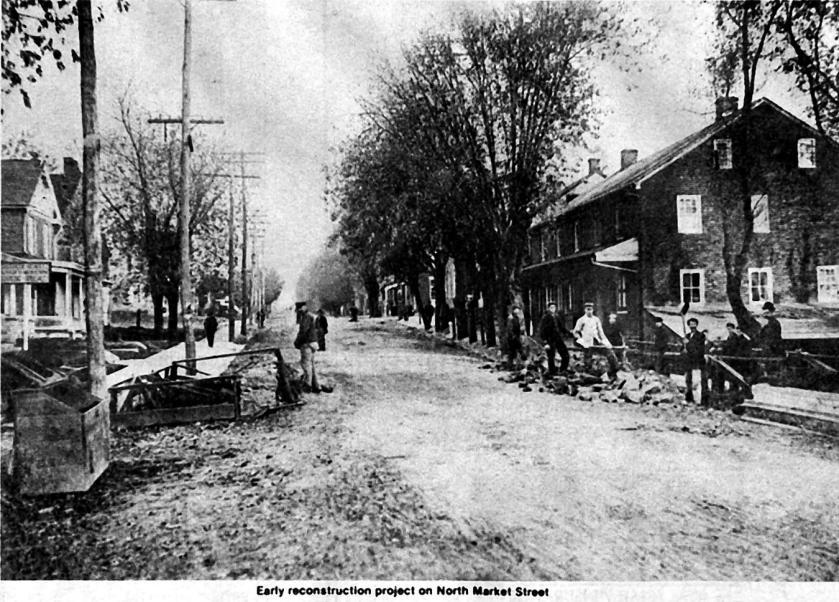
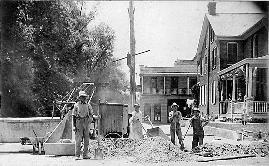
1 Hon 170: Elizabethtown History: Campus and Community Robert Yahara, Robert Pavlik, Ramon Rios III 1 Professor Benowitz 5 May 2017 State Road 230 Market Street Bridge Over Conoy Creek; Elizabethtown, Pennsylvania Abstract: In 1729 the western part of Chester County became Lancaster County. In 1732 the Lancaster County Court conducted a study on building a road linking Lancaster to Elizabethtown. In 1734 John Harris of Paxtang proposed building a road linking his ferry to Lancaster. Between 1736 and 1738 "The Great Road" from Harris Ferry to Lancaster was opened. In 1796, this would become a turnpike when The Lancaster, Elizabethtown, and Middletown Turnpike Company was incorporated. In 1926, this road became U.S. Rt. 230 with the creation of the U.S. Highway System. Known as Market Street in Elizabethtown, the Conoy Creek was first forded, then crossed with a wooden plank road, and then a stone arched bridge was constructed and was replaced in 1911 with this T-beam bridge. This road has played a significant role in the history of westward expansion and the Elizabethtown community. Deed Search: The current community of Elizabethtown is situated between the Conoy Creek and the Conwego Creek along the Susquehanna River. In 1534 French King Francis, I ( ) colonized North America establishing New France with Jacques Cartier ( ) as Viceroy in Quebec. 2 As early as 1615 Étienne Brûlé ( ) explored the Susquehanna River and its tributaries in Lancaster County. 3 Pennsylvania was claimed by Sweden in 1638 and then by the Dutch in The British claimed the former Dutch holdings in 1 Robert Yahara audited this class and Robert Pavlik is a student at Elizabethtown College. Ramon R. Rios III edited the report. 2 Robert Jean Knecht, Francis I (Cambridge: Cambridge University Press, 1935), Consul Willshire Butterfield, History of Brulé's Discoveries and Explorations, Being a Narrative of the Discovery by Stephen Brulé of Lakes Huron, Ontario and Superior, and of his Explorations of Pennsylvania and western New York: Also of the Province of Ontario (Cleveland, OH: Herman-Taylor, 1898),
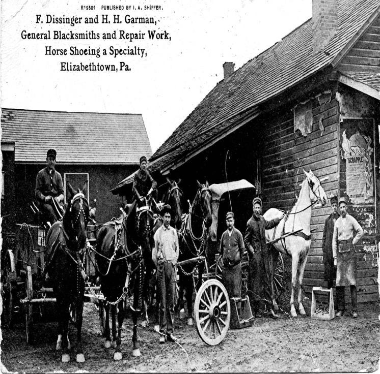
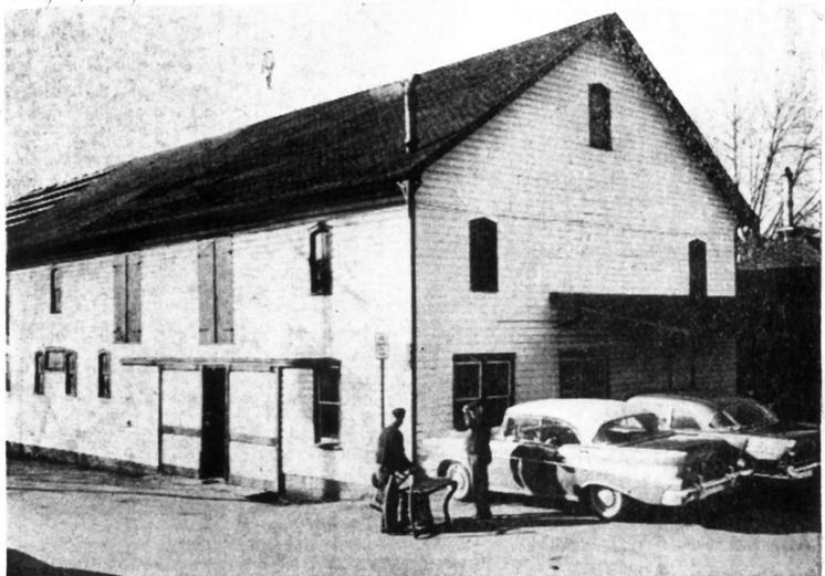
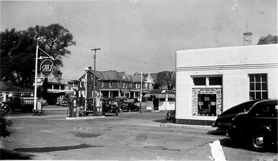
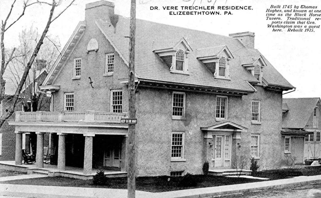
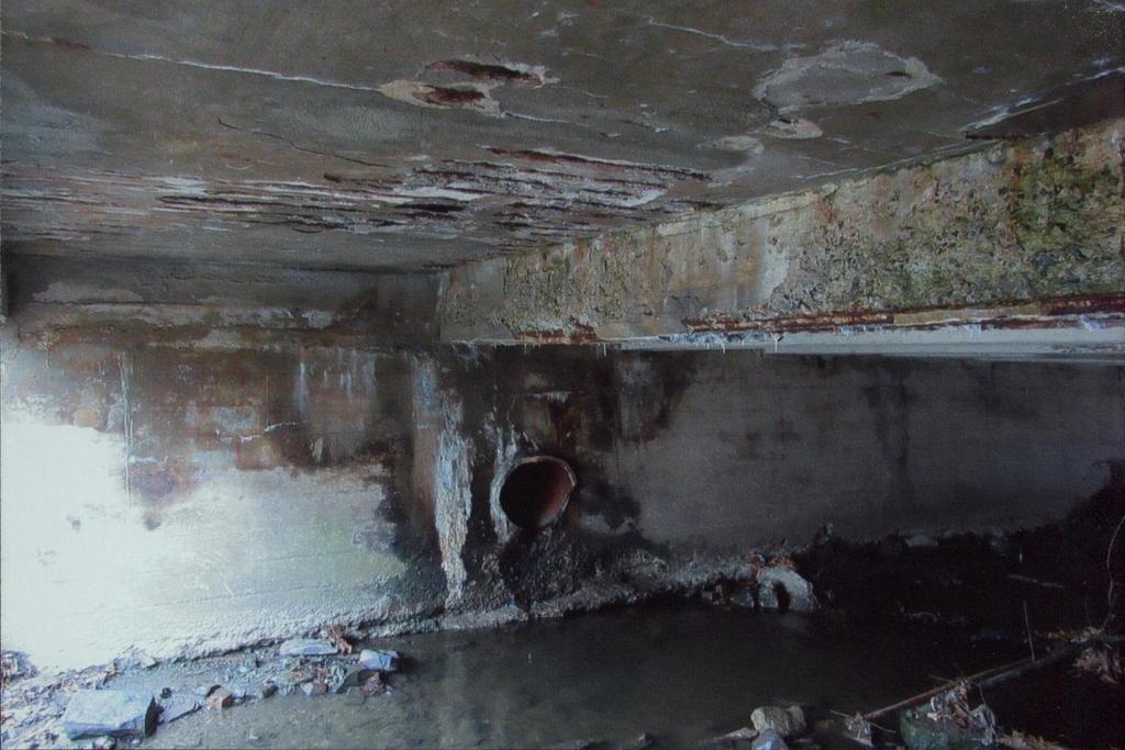
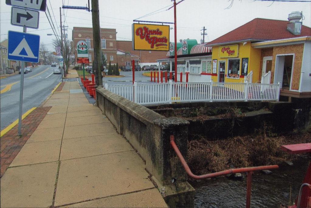
2 British King Charles, II ( ) granted William Penn ( ) the Province of Pennsylvania in The French and British disputed control of Pennsylvania between During this time in 1707 French fur trader Peter Bezaillion ( ) established a settlement between the Conoy and Conwego Creeks along the Susquehanna River. 7 In 1719 Peter Bezaillion invited the Piscataway Indians to move from Maryland and settle with him along the Cony Creek and Susquehanna River. 8 Captain Thomas Harris ( ) settled in Pennsylvania in In 1730, he builds a log cabin along the Conoy Creek and in 1741 he legally receives the warrant to the land. 9 Then, in 1745 he builds the Sign of the Bear Tavern, which is the first permanent structure in Elizabethtown. 10 Thomas Harris owned the land until it was sold to Lazarus Lowery in The ownership of the land passed in succession from after Lazarus Lowery to Barnabas Hughes (July January 1765), Samuel Hughes (2 January October 1790), Alexander Boggs (28 October February 1809) 11, George Wealand (21 February 1809-unknown), 12 John Bender (unknown-1843), 13 Thomas Winnemore ( ), 14 Henry Gingrich ( ), 15 Andrew Wade ( April 1857), 16 Henry A Wade (14 April April 1884), and 17 Martin G. Keller (2 April April 1905). 18 Architectural Style: The original stone arched bridge over the Conoy Creek was replaced by the current bridge in The length of the bridge is 28ft and has a width of 60ft. The bridge is a simple early T beam bridge with no noted changes. The bridge is supported by concrete abutments contiguous. Later there were retaining walls built to help channelize the creek and has concrete parapets as a finish. Southeast of the bridge was a gas station which is currently Groff Meats Inc which contains a stone wall next to the bridge which was part of the foundation from a nineteenth century brick building. Southwest of the bridge was Dissinger, Garman, and Scheetz blacksmith shop, then Clarence E. Lutz gas station, and is now Rita's Italian Ice. Northeast of the bridge was the former Boll's Brew House, then Sheetze Tavern which is now Lucky Ducks Bar and Grille. Northwest of the bridge is the former R. H. Forney Chrysler dealership which is now an Ray Bowers auto furniture upholstery shop. Market street was opened in 1738 by the Commonwealth of Pennsylvania so it would be rational to conclude the bridges spanning the creek were built by the Commonwealth as well. The bridge located on North Market St. is one of 2,300 T beam bridges in the state of Pennsylvania, but this is part of the few bridges part of the 12 oldest bridges built before This bridge is one of the few early simple T beam bridge designs, which became popular in the 1910s and used throughout the 1950s. 4 Randall M. Miller, ed., Pennsylvania: A History of the Commonwealth (University Park, PA: Pennsylvania State University Press and the Pennsylvania Historical and Museum Commission, 2002), Jean R. Soderlund, William Penn and the Founding of Pennsylvania, : A Documentary History (Philadelphia: University of Pennsylvania Press and the Historical Society of Pennsylvania, 1983), Henry Melchior Muhlenberg Richards, The Pennsylvania-Germans in the French and Indian War: A Historical Sketch Prepared at the Request of the Pennsylvania-German Society (Lancaster: The Pennsylvania German Society, 1905), David L. Martin, A Clash of Cultures: Native Americans and Colonialism in Lancaster County, Pennsylvania (Morgantown, PA: Masthof Press, 2010), Ibid. 9 Richard K. MacMaster, Elizabethtown: The First Three Centuries (Elizabethtown, PA: Elizabethtown Historical Scoeity,1999), Ibid., Lancaster County Recorder of Deeds, Search Online Records, Infodex, Document, Book: LL, Page Number: 545, accessed 25 April 2017, 12 Book: 1, Page: 120, Accessed April 25, Book: Q Volume: 5, Page: 53, Accessed April 25, Book: Q Volume: 5, Page: 55, Accessed April 25, Book: D Volume: 6, Page: 45, Accessed April 25, Book: Y Volume: 6, Page: 386, Accessed April 25, Book: I Volume: 8, Page: 262, Accessed April 25, Book: A Volume: 9, Page: 34, Accessed April 25, 2017.
3 Historical Context and Purpose: In 1708 Peter Bezaillon, a French fur trader developed one of the first trails which connected what would become Lancaster County to Paxtang. 19 In 1729 the western part of Chester County became Lancaster County. 20 In 1732 the Lancaster County Court conducted a study on building a road linking Lancaster to Elizabethtown. 21 To improve the trade routes, settlers from Paxtang wanted to expand the roadways from John Harris' Ferry to Lancaster. In 1734 John Harris of Paxtang proposed building a road linking his ferry to Lancaster. Between 1736 and 1738 "The Great Road" from Harris Ferry to Lancaster was opened. 22 The men appointed by Lancaster County Court chose to have the road directed to Thomas Harris's house, which was situated close to the Conoy Creek and built several years prior to the planning and finished construction of "The Great Road," known today as Harrisburg Pike, Rt. 230, and the small section that runs through Elizabethtown as Market Street. 23 Thomas Harris's cabin marked the halfway point from Lancaster to Harrisburg. With this new road in place settlers and traders came to the Port of Philadelphia and traveled to Lancaster County. From there they would have take the new road and stopped at Thomas Harris's log cabin to rest and resupply before going up to Harris' Ferry. It was not until after this road was built that Thomas Harris was able to afford to build his large stone house in 1745, known as the Sign of the Bear Tavern. Market Street in Elizabethtown, crosses over the Conoy Creek, but before a bridge was built, the creek was first forded, then crossed with a wooden plank road. During this time, cities and towns were growing and wanted to expand economic opportunities through trade and used turnpikes, bridges, and canals to expand the trading areas. 24 Settlers and travelers wanted more of these tools, but the United States did not have enough capital to support all of the public projects. The private sector was the primary facilitator in building roads, bridges, and canals. These companies relied on investors who would purchase stock in the company for voting rights related to the projects that the company was working on, and a dividend if the company was profitable from the tolls then placed on the finished projects. 25 In 1796, "The Great Road" became a turnpike when The Lancaster, Elizabethtown, and Middletown Turnpike Company was incorporated. The company, however, did not start to expand the road way or make any improvements to "The Great Road." Over time, the economic hub of the United States began to shift from the Port of Philadelphia, to the larger port of Baltimore. Merchants from Baltimore would use the water ways to travel as far as York, Carlisle, and Lancaster, but depended heavily on the turnpikes to go further inland. In 1804 the state legislature provided a new charter to the Lancaster, Elizabethtown, and Middletown Turnpike Company. 26 George Redsecker represented Elizabethtown and worked with several other managers from Lancaster and Middletown. 27 In order to raise funds for the new turnpike, companies like the Lancaster, Elizabethtown, and Middletown Turnpike Company would sell shares in the company. Investors would be granted voting rights in project decisions and would be given a dividend when the turnpike became profitable from the tolls. In May of 1804, George Redsecker began to sell shares from his home for $100 a share, but would only have to pay $10 upfront. 28 This process took a very long time to raise sufficient funds for the project. It was not until May of 1806 that the project was underway, but by September of 1808 the company did not have enough funds to finish the project. The company began charging tolls from Lancaster, up until the completed section to that point in Little Chiques Creek. 29 In January 1807 the company began accepting bids from contractors to add five miles of roadways and bridges over Big and Little Chiques Creek to the turnpike. This next phase of the project was completed in several months, being finished in early By May of 1807 the company began plans to expand the turnpike 19 MacMaster, Ibid., Ibid. 22 Ibid. 23 Ibid., 5,7. 24 Ibid., Ibid. 26 ibid. 27 Ibid. 28 Ibid., Ibid.
4 through Elizabethtown to Conewago Creek. 30 Construction of this phase went until the end of the summer. In 1808 the company was electing new officers and receive bids from contactors to finish the rest of the turnpike. Stockholders attended the meeting which was held at Michael Coble's tavern in Elizabethtown to vote on the new officers. By the end of 1808 the turnpike reached Middletown, but was still incomplete because stockholders not paying their installments. Each mile of the turnpike cost $4,506. Thirteen percent of the project was funded through The State of Pennsylvania's shares, while over eighty-seven percent was funded through private investors. 31 Jacob Kauffman, Jacob Gish, George Wolfley, and Joseph Gorgas, all from Elizabethtown were selected by stockholders to be managers of the turnpike company. 32 To help travelers on the finished turnpike, milestones were erected to show the distance between Lancaster and Middletown while on the turnpike. In 1926, this road became U.S. Rt. 230 with the creation of the U.S. Highway System. Eventually, the wooden plank road on Market Street was replaced by a stone arched bridge, which in 1911 was replaced with this T-beam bridge. 30 Ibid. 31 Ibid. 32 Ibid., 67.


5 Appendix Historical Photos:


6


7


8 Appendix Current Photos:


9

10

11


12
13
North Poplar Street Bridge Over Conoy Creek Tributary
 Hon 170: Elizabethtown History: Campus and Community Robert Yahara, Robert Pavlik & Ramon Rios III 1 Professor Benowitz 5 May 2017 North Poplar Street Bridge Over Conoy Creek Tributary Abstract: In 1909
Boll s Brewhouse: 45 North Market Street, Elizabethtown Pennsylvania
 Hon 170: Elizabethtown History: Campus and Community Joseph Santos Professor Benowitz 5 May 2017 Boll s Brewhouse: 45 North Market Street, Elizabethtown Pennsylvania Abstract: Henry Boll s Brewery operated
Redsecker Residence: 244 South Market Street; Elizabethtown, Pennsylvania
 Hon 170: Elizabethtown History: Campus and Community Joseph Santos Professor Benowitz 5 May 2017 Redsecker Residence: 244 South Market Street; Elizabethtown, Pennsylvania Abstract: The Redsecker Residence,
Olweiler-Needham Store: 8 South Market Street; Elizabethtown, Pennsylvania
 Hon 170: Elizabethtown History: Campus and Community Ramon Robert Rios III Professor Benowitz 5 May 2017 Olweiler-Needham Store: 8 South Market Street; Elizabethtown, Pennsylvania Abstract: The Oweiler-Needham
Horst Hall: 2 South Market Street; Elizabethtown, Pennsylvania
 Hon 170: Elizabethtown History: Campus and Community Kory Trout Professor Benowitz 5 May 2017 Horst Hall: 2 South Market Street; Elizabethtown, Pennsylvania Abstract: Horst s Hall, opened December 29,
SWINGING OVER SCHUYLKILL THE HISTORY OF THE PW&B AND BRIDGE NO. 31
 THE SWINGING OVER SCHUYLKILL THE HISTORY OF THE PW&B AND BRIDGE NO. 31 The Philadelphia, Wilmington & Baltimore Railroad Company (PW&B) was formed in 1836. In 1838, the railroad was enlarged by the joining
History of the Denten Bridge
 History of the Denten Bridge By Scott J. Lawson, Plumas County Museum Director The subject of this piece is the historic Denten Bridge, located southeast of the town of Blairsden and east of Graeagle,
_------_ As the designated acthority under the National Historic Preservation Act of 1986, as amended, 1 hereby certify that this
 ===================================== ===== 4. State/Federal Agency Certification _- - ----_--_-_------_----------- --_- - -_--------------------- ---------------- _------_--------- As the designated acthority
Piscataway (84-023) Mary Quarterly, 3rd Ser., Vol. 36, No. 4. (Oct., 1979), pp Preservation Section, 1.
 Mary Quarterly, 3rd Ser., Vol. 36, No. 4. (Oct., 1979), pp Preservation Section, 1.") Piscataway (84-023) Piscataway, located in southwestern Prince George s County, is one of the oldest villages in the county. Piscataway takes its name from a Native American tribe of the same name that
Piscataway (84-023) Piscataway, located in southwestern Prince George s County, is one of the oldest villages in the county. Piscataway takes its name from a Native American tribe of the same name that
The Settlement of A New Land : Canada
 The Settlement of A New Land : Canada Part One : 1600-1713 DIVITO 2018 In the beginning: After the discovery of the great fishing along the coast of the Atlantic Provinces, fertile land along the St. Lawrence,
A. From I-68 in Monongalia County, West Virginia to SR 6119 in Fayette County, Pennsylvania 1
 Mon-Fayette Transportation Project A. From I-68 in Monongalia County, West Virginia to SR 6119 in Fayette County, Pennsylvania 1 The Mon/Fayette Transportation Project (MFTP) from I-68 in West Virginia
Hudson Valley Vernacular Architecture Dutch Barn Preservation Society Field Trip to the Palatine Region of the Mohawk Valley May 18, 2013
 Hudson Valley Vernacular Architecture Dutch Barn Preservation Society Field Trip to the Palatine Region of the Mohawk Valley May 18, 2013 Trip Schedule Site Arrive Depart Old Palatine Church 10:30 am 11:15
Louis Jolliet French Explorer and Cartographer Explored the Mississippi River with Jacques Marquette
 Louis Jolliet 1645-1700 French Explorer and Cartographer Explored the Mississippi with Jacques Marquette LOUIS JOLLIET WAS BORN in 1645 in Quebec in what is now Canada. When he was born, it was called
Project Location MP A44.5 MP A38 PRELIMINARY. A A57 (Future Project) A42 - A44.5 (Fall Fall 2019) A38 - A42. A31 - A38 - In Design
 A42 - A44.5 (Fall Fall 2019) A38 - A42. A31 - A38 - In Design") RECONSTRUCTION AND WIDENING PROJECT Project Location A44.5 - A57 (Future Project) MP A44.5 Steinsburg Road (Fall 2015 - Fall 2016) John Fries Highway (Fall 2017 - Fall 2019) A42 - A44.5 (Fall 2017 - Fall
RECONSTRUCTION AND WIDENING PROJECT Project Location A44.5 - A57 (Future Project) MP A44.5 Steinsburg Road (Fall 2015 - Fall 2016) John Fries Highway (Fall 2017 - Fall 2019) A42 - A44.5 (Fall 2017 - Fall
CHAPTER 1. INTRODUCTION AND BACKGROUND
 SETTING CHAPTER 1. INTRODUCTION AND BACKGROUND The City and Borough of Juneau (CBJ) is located in the central portion of the Alaskan panhandle, approximately 700 miles from Anchorage and 950 miles from
Lyons. photo by Richard Palmer Layton Road
 Lyons 3532 Layton Road Construction commenced on the Jackson one-room school house at 336 Pleasant Valley Road, Lyons, in 1829. It was completed in 1831 at a cost of $187. It was named for President Andrew
Part 5 War between France and Great Britain
 Part 5 War between France and Great Britain The objects of colonial rivalries PAGE 111 France Wanted to control the fur trade Expand their territory Great Britain Wanted to control the fur trade Expand
TEAM BULLETIN UPDATED: January 20, 2017
 TEAM BULLETIN UPDATED: January 20, 2017 Welcome It is with great pleasure and excitement that USA Field Hockey will be hosting the 2017 Pan American Cups (PAC) for both women and men in Lancaster, Pennsylvania,
PROCEEDINGS OF THE ST. CLOUD HERITAGE PRESERVATION COMMISSION
 PROCEEDINGS OF THE ST. CLOUD HERITAGE PRESERVATION COMMISSION A meeting of the St. Cloud Heritage Preservation Commission was held on February 23, 2010, at 7 p.m. in the St. Cloud City Hall Council Chambers.
A Historical Timeline of Cedar Falls
 A Historical Timeline of Cedar Falls 1700-1750 The Meskwaki (Fox), after having been forced out of their former homes further east, move into the area by 1750. They are allied with the Sauk through language
HISTORICAL MARKERS issued by
 HISTORICAL MARKERS issued by INDIANA HISTORICAL BUREAU in MONTGOMERY COUNTY, INDIANA 2016 Compiled by Dian Moore, Montgomery County historian NUMBER NAME 54.1962.1 Lane Place 54.1963.1 Major General Lew
The Age of European Expansion
 The Age of European Expansion 1580-1760 Spanish and Portuguese America 1581-1640 1. The Viceroyalty of New Spain was first established in 1535 by King Charles I 1 2. The 15 Captaincies of Brazil were first
State Level Historic Documentation Report. John Blue Bridge Hampshire County
 State Level Historic Documentation Report State Project No. S314-28-22.27 Federal Project No. BR-0028(058)D John Blue Bridge Hampshire County Prepared by: Randy Epperly, Historian Department of Transportation
THE CHATHAM-KENT MUNICIPAL HERITAGE REGISTER
 THE CHATHAM-KENT MUNICIPAL HERITAGE REGISTER Listed Properties in the Community of Tilbury Photo Credit: W.J. Bolton/Canada. Dept. of Manpower and Immigration/Library and Archives Canada/PA-031135, 1923-1924
The Covered Bridges of Preble County. Past, Present and Future By: R. Kyle Cross, P.E., P.S.
 The Covered Bridges of Preble County Past, Present and Future By: R. Kyle Cross, P.E., P.S. The History of the 8 Covered Bridges There are 8 covered bridges in Preble County. Only 2 of them are moved for
Part 5 War between France and Great Britain
 Part 5 War between France and Great Britain The objects of colonial rivalries PAGE 117 France Wanted to control the fur trade Expand their territory Great Britain Wanted to control the fur trade Expand
TOWNSHIP OF HILLSIDE, NJ.
 TOWNSHIP OF HILLSIDE, NJ. HILLSIDE Formed as Township: 1913 1970 Population: 21,636 Land Area 2.70 square miles The initial settlement of the township now known as present day Hillside followed shortly
Appendix II-A. Canadian Sectors Covered by Article XVI of the GATS
 Appendix II-A Canadian Sectors Covered by Article XVI of the GATS For the following Sectors, Canada s obligations under Article XVI of the GATS are improved: Sector/Sub-sector Accounting, Auditing, and
ENGLISH COLONIES CHAPTER 3
 ENGLISH COLONIES CHAPTER 3 NEW ENGLAND COLONIES Colonies MA PLYMOUTH, MA BAY, NH, CT, RI Climate/Geography bitterly cold winters and mild summers; SHORT GROWING SEASONS! Land was flat close to the coastline
The Susquehanna Turnpike
 By Joan Odess 1750-1790s Mountains, streams and thick forests made the interior of New York State difficult to reach. In 1753 Catskill explorer and pioneer, Gideon Hawley described the landscape as obstructed
Human Geography of Canada
 Human Geography of Canada History and Government of Canada Like the United States, people migrated across Beringia into Canada, these people were the ancestors of the Inuit (Eskimos) 16 th and 17 th centuries,
September 24, :43 PM THEMED SCHOOL FIELD TRIPS PIONEER INDIANA
 September 24, 2015 2:43 PM THEMED SCHOOL FIELD TRIPS PIONEER INDIANA Gallery PIONEER INDIANA Using the galleries and public spaces of the Indiana State Museum, answer the following questions. Q: If pioneer
AGENDA Committee Meeting March 1, 2012
 AGENDA Committee Meeting March 1, 2012 Milford City Hall Joseph Ronnie Rogers Council Chamber 201 South Walnut Street Milford, Delaware 19963 ECONOMIC DEVELOPMENT COMMITTEE 5:00 p.m. Call to Order-Chairman
HISTORIC AMERICAN ENGINEERING RECORD COVE CREEK SPILLWAY BRIDGE. HAER No. AR-83
 HISTORIC AMERICAN ENGINEERING RECORD COVE CREEK SPILLWAY BRIDGE LOCATION: Spanning Cove Creek Spillway at State Highway 309 (formerly Paris-Mt. Magazine Road), Corley vicinity, Logan County, Arkansas UTM:
1. Title slide: Great Wagon Roads
 1. Title slide: Great Wagon Roads a. Going to discuss how our ancestors may have come to South Carolina b. Of course could have come aboard ship to Charleston c. Many came overland from the more northern
O HARA TOWNSHIP. Chapter 2 - Early History. Comprehensive Development Plan
 O HARA TOWNSHIP Chapter 2 - Early History The O Hara Township History Committee has assembled a significant volume of historical data from primary and secondary sources, about persons, places and events
Chapter 3. The English Colonies
 Chapter 3 The English Colonies Terms 1. Indentured servants 2. Cash crops 3. Assembly 4. Puritans 5. Mayflower Compact 6. Slave trade 7. Fundamental orders Massachusetts- 1630 Founders- William Bradford
The mission of Liberty State Park is to provide the public with access to the harbor s resources, a sense of its history and a charge of
 Liberty State Park The mission of Liberty State Park is to provide the public with access to the harbor s resources, a sense of its history and a charge of responsibility to its continued improvement.
THREE MILE PLAN TOWN OF SUPERIOR COLORADO
 THREE MILE PLAN TOWN OF SUPERIOR COLORADO February 23, 2015 INTRODUCTION This document has been prepared by the Town of Superior, Colorado, to address the existing and proposed land uses within an approximate
table of contents The future of office
 1100-1140 VIRGINIA DRIVE NEW CLASS A SPACE NOW AVAILABLE Largest contiguous space available on one floor in Philadelphia For further information, please contact: Doug Newbert at +1 610 249 2273 or email
Hwy Retaining Wall/ Sea Wall. Not Eligible, see Statement of Significance Also member of listed NR district: Mantorville Historic District
 Historic Name CS # 2007 Other Name SHPO Inv # Location E and W sides of TH 57 between 6th St and 7th St Hwy District Reference City/Township County Mantorville, City of Dodge Acres Twp Rng Sec 107N 16W
Maryland Historical Trust Inventory No. PG: Maryland Inventory of Historic Properties Form
 Inventory No. PG: 62-012 Maryland Inventory of 1. Name of Property (indicate preferred name) historic other 2. Location street and number 11205 Old Baltimore Pike not for publication city, town Beltsville
ALBION E. SHEPARD HOUSE
 Texas Historical Commission staff (BB), 8/5/2013, rev 9/23/13, 11/12/13 27 x 42 Official Texas Historical Marker with post Brewster County (Job #13BS01) Subject (Atlas 17696) UTM: 13 668898E 3343090N Location:
15 day Eastern USA & Canada Tour
 15 day Eastern USA & Canada Tour 15 days/14 nights - Globus Hit the highlights of Eastern USA and Canada on this 15-day escorted tour. You'll discover a mix of natural, historic and modern attractions
Henbury s Great House. By Andrew Michael Chugg
 Henbury s Great House By Andrew Michael Chugg A Key Source on Henbury s Great House Transactions of the Bristol and Gloucestershire Archaeological Society The Owners of the Great House, Henbury, Gloucestershire
The Supervisor called the meeting to order at 6:00pm by saluting the flag.
 The Town of Moriah Town Board held their Regular Board Meeting on Thursday, December 10, 2015 at 6:00pm at the Town of Moriah Court House, 42 Park Place, Port Henry, New York. Present: Thomas Scozzafava
HISTORIC SITE FORM HISTORIC SITES INVENTORY
 HISTORIC SITE FORM HISTORIC SITES INVENTORY 1 IDENTIFICATION Name of Property: House at 569 Park Avenue PARK CITY MUNICIPAL CORPORATION (10-08) Address: 569 Park Avenue City, County: Park City, Summit
Unit 5: Selling of the American West
 Unit 5: Selling of the American West Announcements: midterms handed back assignment folder update posted next week turning in assignment folder June 12th Unit 5: Age of Exploration North America Thomas
THE NATIONAL ROAD. The Road to Allegany and Garrett County History
 42 m o u n t a i n d i s c o v e r i e s THE NATIONAL ROAD The Road to Allegany and Garrett County History Written by: Dan Whetzel Photography by: Lance C. Bell Western Maryland received a major economic
HOLIDAY INN EXPRESS & SUITES CARTHAGE 2295 SE Loop Carthage, TX 75633
 2295 SE Loop Carthage, TX 75633 1 EXECUTIVE SUMMARY VITAL DATA CURRENT YEAR 1 Price $5,400,000 CAP Rate 13.37% 12.48% Net Operating Income $721,851 $673,841 Down Payment 20% / $1,080,000 Net Cash Flow
HISTORICAL PLAQUES IN HAMILTON TOWNSHIP. 1. Located In Gore's Landing in Pioneer Park. Bearing the Ontario Coat of Arms GORE'S LANDING
 HISTORICAL PLAQUES IN HAMILTON TOWNSHIP 1. Located In Gore's Landing in Pioneer Park Bearing the Ontario Coat of Arms GORE'S LANDING Named after Thomas S. Gore, an Irishman who settled in this vicinity
The President James K. Polk State Historic Site Teacher s Packet
 The President James K. Polk State Historic Site Teacher s Packet 2008-2009 Mailing Address: PO Box 475 Pineville, NC 28134 Street Address: 12031 Lancaster Highway Pineville, NC 28134 (704) 889-7145 phone
IN THE FOOTSTEPS OF THE VOYAGEURS Self-Directed Walking Tour
 IN THE FOOTSTEPS OF THE VOYAGEURS Self-Directed Walking Tour Welcome to a Routes on the Red self-directed tour of the Red River Valley. These itineraries guide you through the history and the geography
L 2-1. Heritage Report: Reasons for Heritage Designation. Wilkinson / Lundy Farmhouse 715 Queen Street West
 L 2-1 Heritage Report: Reasons for Heritage Designation Brampton Heritage Board Date: January 15, 2013 Wilkinson / Lundy Farmhouse 715 Queen Street West January 2013 1 L 2-2 Profile of Subject Property
Salisbury's Destination Business Park!
 Unique and desirable Planned Development District zoning allows for many uses: Retail Professional Restaurant Hotel Medical Frontage, access & visibility on Three Major Thoroughfares: US Rt. 50 St. Hwy
LESAGE, WEST VIRGINIA
 AVAILABLE SPACE BRICK AND CLAY MACHINERY COMPANY BUILDING COMPANY BUILDING LOCATION Building Address - 47 Williams Street Lesage, WV 25537 Located in City Limits - No County - Cabell Located in Business/Industrial
4th Grade Social Studies 2nd Nine Weeks Test
 4th Grade Social Studies 2nd Nine Weeks Test Multiple Choice Identify the choice that best completes the statement or answers the question. 1 Which is the largest city in the United States? A Philadelphia,
America s First Highway. Copyright WV DNR. 4 March
 America s First Highway 4 March 2013. www.wonderfulwv.com This vintage postcard shows a circa 1920s view of the National Road between Washington, Pennsylvania, and Wheeling. Note the billboard at lower
THE CORPORATION OF THE MUNICIPALITY OF KINCARDINE BY-LAW NO
 THE CORPORATION OF THE MUNICIPALITY OF KINCARDINE BY-LAW NO. 2015-100 BEING A BY-LAW TO AMEND BY-LAW NO. 4428; BEING A BY-LAW TO DESIGNATE THE HOME OF MARY PARKINSON AT 217 HARBOUR STREET OF ARCHITECTURAL
Feature Article. Fall City: The Hotel Corner since (southeast corner of 337th SE and Redmond-Fall City Rd)
") Feature Article Fall City: The Hotel Corner since 1886 (southeast corner of 337th SE and Redmond-Fall City Rd) Fall City ca.1887 In this very early photo, the river-powered ferry run by the Rutherford
Feature Article Fall City: The Hotel Corner since 1886 (southeast corner of 337th SE and Redmond-Fall City Rd) Fall City ca.1887 In this very early photo, the river-powered ferry run by the Rutherford
The Panama Canal An Engineering Wonder
 The Panama Canal An Engineering Wonder By Priyanka Ann Saini, Sea News - November 28, 2017 The Panama Canal is a modern day engineering wonder. It is approximately 80 kilometers long between the Atlantic
KAMPALA: THE GARDEN CITY
 KAMPALA: THE GARDEN CITY Kampala is urbanizing rapidly. The city has a population of over three million people and accounts for over sixty percent of Uganda's GDP. According the to the Kampala City Council
Welcome to GE Measurement & Control
 Welcome to GE Measurement & Control Inspection Technologies Customer Solutions Center 50 Industrial Park Road, PA 17044 GENERAL INFORMATION This document provides general information that will help you
U.S. ROUTE 202 SECTION 300 IMPROVEMENT PROJECT East Whiteland Township Tredyffrin Township Chester County
 U.S. ROUTE 202 SECTION 300 IMPROVEMENT PROJECT East Whiteland Township Tredyffrin Township Chester County TMACC Information Session January 24, 2011 U.S. Route 202 Section 300 Project Limits U.S. ROUTE
President. Continental Motor Sales Co., Inc. President. Fran Carfagno President Valley Forge Toyota 2062 West Main Street
 5/15/85 AMERICAN-INTERNATIONAL AUTOMOTIVE CONGRESS '85 W. Eugene Anderson Valley Toyota, Inc. Routes 11-15 Sellnsgrove, PA 17870 (717) 743-1171 Fran Carfagno Valley Forge Toyota 2062 West Main Street Norrlstown,
History of the Elizabethtown Community Park
 FYS 100 HD Landmarks & Legends: Learning Local History Camile Teajman Professor Benowitz 06 November 2017 History of the Elizabethtown Community Park In 1950, the Elizabethtown Area Chamber of Commerce
Welcome to the Midwest!
 Welcome to the Midwest! Why do we call the Midwest "America's Heartland"? 5 9 7 4 2 Farm State 6 8 1 St. Louis 3 St. Louis, Missouri "Gateway to the West" Frontier: the beginning of unexplored land Pioneers:
9-month consolidated revenues up 14.5% 1 to 1,090.7 million
 Paris, November 13, 2012, 5:45 pm Press release Q3 2012 Revenues and business performance 9-month consolidated revenues up 14.5% 1 to 1,090.7 million Retail Shopping centers: Rental income posted solid
CLARKSBURG, WEST VIRGINIA
 AVAILABLE SPACE CLARKSBURG BUILDING UNITS 3 & 4 LOCATION Building Address - 761 Armory Road Clarksburg, WV 26301 Located in City Limits - No County - Harrison Located in Business/Industrial Park - No Can
Commonwealth of Massachusetts Massachusetts Historical Commission 220 Morrissey Boulevard, Boston, Massachusetts
 Inventory No: Historic Name: Common Name: Address: HRV.165 Blood, Joseph House Farnsworth, Jonathan - Beaman, Jonathan House 74 Poor Farm Rd City/Town: Village/Neighborhood: Local No: 9-17 Year Constructed:
SOUTHEASTERN PENNSLYVANIA TRANSPORTATION AUTHORITY TARIFF NO. 270 GOVERNING THE FURNISHING OF PASSENGER TRANSPORTATION BY SEPTA S ROUTE 4
 SOUTHEASTERN PENNSLYVANIA TRANSPORTATION AUTHORITY TARIFF NO. 270 GOVERNING THE FURNISHING OF PASSENGER TRANSPORTATION BY SEPTA S ROUTE 4 FILED: October 5, 2011 EFFECTIVE: On a date to be determined by
JEFFERSON DAVIS HIGHWAY MARKERS By Kathy Hillman At the 1913 UDC Convention in New Orleans, President General Mrs. Alexander B.
 JEFFERSON DAVIS HIGHWAY MARKERS By Kathy Hillman At the 1913 UDC Convention in New Orleans, President General Mrs. Alexander B. White recommended that the UDC secure for an ocean-to-ocean highway from
Susquehanna Greenway Driving Tour
 Welcome to the Susquehanna Greenway, a corridor of parks, trails, and river communities stretching over 500 miles along the Susquehanna River. It is Pennsylvania s longest greenway! The Susquehanna River
A History of LaValette Commandery No. 15
 A History of LaValette Commandery No. 15 The history information was compiled by Em. Sir Hamilton A. Mattison. When finished, click on your browser s back button to return to the Commandery page. John
A History of the Detroit Riverfront. From 1760 though to the
 A History of the Detroit Riverfront From 1760 though to the Detroit attracts immigrant workers 176o-1800 AD 1805 AD A devastating fire sweeps through Detroit, destroying all 200 of its structures except
REGION OF WATERLOO INTERNATIONAL AIRPORT AIRPORT MASTER PLAN EXECUTIVE SUMMARY MARCH 2017
 REGION OF WATERLOO INTERNATIONAL AIRPORT AIRPORT MASTER PLAN EXECUTIVE SUMMARY MARCH 2017 Contact: Chris Wood, Airport General Manager cwood@regionofwaterloo.ca (519) 648-2256 ext. 8502 Airport Master
KILLMACHRENAN. By: Lawrence J. Fleenor, Jr. & Edgar A. Howard. Copyright & All Rights Reserved: Lawrence J. Fleenor, Jr. Big Stone Gap, Va.
 KILLMACHRENAN By: Lawrence J. Fleenor, Jr. & Edgar A. Howard Copyright & All Rights Reserved: Lawrence J. Fleenor, Jr. Big Stone Gap, Va. March 2015 An Essay for the Daniel Boone Wilderness Trail Assn.
I I I I LINDEN TO WOOD FORD SURVEY ITEMS OF HISTORICAL SIGNIFICANCE I I I I I I I I I I I I I
 LNDEN TO WOOD FORD SURVEY TEMS OF HSTORCAL SGNFCANCE ------------------------------------------------------------------------------ --- - CONTENTS OF THE REPORT 1.0 ntroduction to the Report 1.1 Parameters
The Evolution of Holmesburg
 The Evolution of Holmesburg In the autumn of 1681 William Penn appointed three commissioners - William Crispin, John Bezar, and Nathaniel Allen - to proceed to Penn s new colony of Pennsylvania to make
GEOGRAPHY OF THE UNITED STATES & CANADA. By Brett Lucas
 GEOGRAPHY OF THE UNITED STATES & CANADA By Brett Lucas MEGALOPOLIS Setting the Boundaries What states and provinces are part of the region? Primarily the east coast between Norfolk, VA and Boston, MA,
Arch bridges were built by the Romans and have been in use ever since. They are often chosen for their strength and
 Arch Bridges Arch bridges were built by the Romans and have been in use ever since. They are often chosen for their strength and appearance. It is the shape of the arch that gives the bridge its strength,
Marketing Package for the sale of the
 Marketing Package for the sale of the 5261 Lincoln Highway East Gap, Pennsylvania 17527 Prepared by Dwight E. Wagner, CCIM email: dwight@uscommercialrealty.net TABLE OF CONTENTS Aerial Photograph For Entire
INLAND STEEL COMPANY, INDIANA HARBOR WORKS PHOTOGRAPHS,
 Collection # P 0711 INLAND STEEL COMPANY, INDIANA HARBOR WORKS PHOTOGRAPHS, 1926 Collection Information 1 Historical Sketch 2 Scope and Content Note 3 Contents 4 Processed by Dalton Gackle July 2018 Manuscript
Mauritius Official name Population Form of governmen Total area Urban-rural population Head of state Life expectancy Head of government
 Mauritius Official name :Republic of Mauritius Form of government: Republic with one legislative house (National Assembly [691]) Head of state: President Ameenah Gurib-Fakim Head of government :Prime Minister:
Haitian/Haitian American Curriculum Third Grade Social Studies Lesson Plan The Pirates of the Caribbean
 Haitian/Haitian American Curriculum Third Grade Social Studies Lesson Plan The Pirates of the Caribbean Content/Theme: The Caribbean Grade: Third Grade Primary Benchmark SS.3.G.2.1 Label the countries
Sylvan Park Neighborhood Survey, ca. 1983
 Sylvan Park Neighborhood Survey, ca. 1983 Collection Summary Creator: Sarah Foster Kelley Title: Sylvan Park Neighborhood Survey Inclusive Dates: ca.1983 Summary/Abstract: Deed research sheets and color
Transportation. By: Matthew Kikkert
 Transportation By: Matthew Kikkert Early Transportation Dirt roads began to connect major cities in the early 1700s, but conditions were very poor and dangerous. Taverns sprung up on these roads and were
DOWNLOAD OR READ : COLONIAL AMERICA FROM JAMESTOWN TO YORKTOWN PDF EBOOK EPUB MOBI
 DOWNLOAD OR READ : COLONIAL AMERICA FROM JAMESTOWN TO YORKTOWN PDF EBOOK EPUB MOBI Page 1 Page 2 colonial america from jamestown to yorktown colonial america from jamestown pdf colonial america from jamestown
Bristol Borough (Pa.) municipal records
 municipal records") 01 Finding aid prepared by Celia Caust-Ellenbogen and Faith Charlton through the Historical Society of Pennsylvania's Hidden Collections Initiative for Pennsylvania Small Archival Repositories. Last updated
01 Finding aid prepared by Celia Caust-Ellenbogen and Faith Charlton through the Historical Society of Pennsylvania's Hidden Collections Initiative for Pennsylvania Small Archival Repositories. Last updated
History of the Canada Southern Railway
 History of the Canada Southern Railway Local History at the St. Thomas Public Library www.st-thomas.library.on.ca Pre-1873: St. Thomas has almost no industrial exports and relies entirely on agriculture.
POINT PLEASANT, WEST VIRGINIA
 AVAILABLE SPACE WAREHOUSE 2 CAMP CONLEY POINT PLEASANT, WEST VIRGINIA LOCATION Building Address - 261 Camp Conley Road Point Pleasant, WV 25550 Located in City Limits - No Zoning - None County - Mason
Rochester Avon Historical Society Research Reports
 Rochester Avon Historical Society Research Reports Research Report #9 Rochester Municipal Park (formerly Avon Park) March 2012 Rochester Avon Historical Society Rochester, Michigan www.rochesteravonhistoricalsociety.org
Seminario internacional sobre gestiόn privada de aeropuertos
 Seminario internacional sobre gestiόn privada de aeropuertos Madrid K CHEONG Head of Economic Regulation Civil Aviation Authority United Kingdom Slide 1 UK privatisation entering a new phase of Economic
Leasing Brochure. Park Plaza Shopping Center 1150 N. Federal Highway, Pompano Beach, Florida Under Construction - Coming Very Soon
 Park Plaza Shopping Center 1150 N. Federal Highway, Pompano Beach, Florida 33062 Leasing Brochure Under Construction - Coming Very Soon Exclusive Leasing Broker 2048 East Sample Road, Lighthouse Point,
Pennsylvania Public Utility Commission
 DECISIONS OF Pennsylvania Public Utility Commission VOLUME 19 HARRISBURG, PENNSYLVANIA 1942 Baltimore & Ohio Railroad Company, et al., Department of Highways of the Commonwealth of Pennsylvania v. 586
AVAILABLE SPACE PENMARVA BUILDING
 AVAILABLE SPACE PENMARVA BUILDING LOCATION Building Address - 131 North Sigler Street Located in City Limits - Yes County - Preston Located in Business/Industrial Park - No Can the Building be Multi-Tenant
Fort Christanna Historical and Recreational Park
 Brunswick County, Virginia 2012 Virginia Association of Counties Achievement Award Submission Parks and Recreation Fort Christanna Historical and Recreational Park Brunswick County Fort Christanna Historical
Backroads. By Vinnie Rotondaro
 By Vinnie Rotondaro Joe pulled up in a red Jeep Cherokee, put the car in park and let the engine idle. It was about 10:45 in the morning, a Friday. Sam arrived a few minutes later fresh off of the subway,
Heritage Outlook News from the Historic Preservation Trust of Lancaster County
 Heritage Outlook News from the Historic Preservation Trust of Lancaster County January 2015 IN THIS ISSUE 2015 Watch List of Threatened Properties Released Three New Directors Elected to Preservation Trust
Betty J. Strecker Doylestown Sesquicentennial records
 14 Finding aid prepared by Celia Caust-Ellenbogen and Faith Charlton through the Historical Society of Pennsylvania's Hidden Collections Initiative for Pennsylvania Small Archival Repositories. Last updated