Fort Christanna Historical and Recreational Park
|
|
|
- Rodney Foster
- 6 years ago
- Views:
Transcription


1 Brunswick County, Virginia 2012 Virginia Association of Counties Achievement Award Submission Parks and Recreation Fort Christanna Historical and Recreational Park
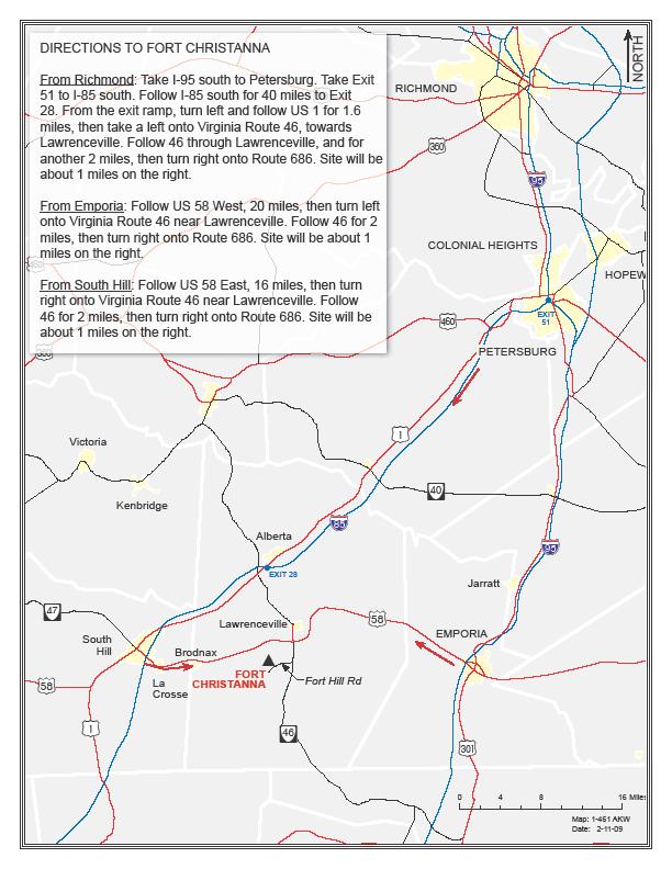
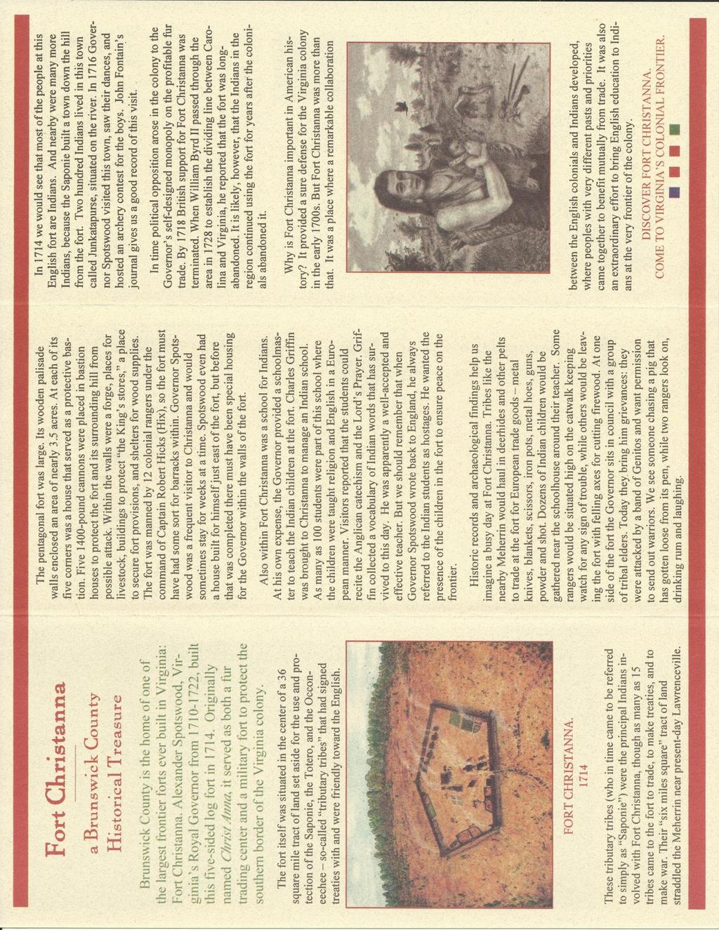
2 Brunswick County Fort Christanna Historical and Recreational Park Parks and Recreation 2012 Achievement Award Submission Virginia Association of Counties Narrative Brunswick County is home to the Fort Christanna Historical Site. In 1714, Governor Alexander Spotswood began construction of Fort Christanna on Virginia s western frontier. The 3.5 acre five-sided fort was built, in part, to defend both the local settlers and the Indian tribes that were allied with the English. Fort Christanna was situated within a 36 square mile tract of land set aside for the Saponie and Occaneechee Indians. By 1717 the fort and the school at Christanna had lost its support in London and Virginia, however. The Indian School closed, and its schoolmaster went back east to teach Indian students at the College of William and Mary. In 2007, the Brunswick County Board of Supervisors recognized the importance and need to develop Fort Christanna into an historical and recreation park. The members of the Board of Supervisors realized that the site was of important regional, state and national significance. The site, which is located 2 miles south of Lawrenceville, Virginia along the banks of the Meherrin River, had become an overgrown wooded area that had nothing to see or attract residents and visitors. With Brunswick County taking the lead and bring on many public and private partnerships, the site has been transformed into a 25 acre historical and recreational park, with trails around the perimeter of where the five sided fort was located. A new parking area was constructed with handicap parking, with a brick terrace welcome area and information kiosk. Interpretive signage has been installed at the brick terrace area and along the fort wall paths describing Alexander Spotswood s role in the establishment of the fort, Native American presence at the site, construction of the fort and the role of Brunswick County and the National Society of the Colonial Dames of American in the State of Virginia
3 Brunswick County Fort Christanna Historical and Recreational Park Parks and Recreation 2012 Achievement Award Submission Virginia Association of Counties The Brunswick County Board of Supervisors is a member in good standing with the Virginia Association of Counties and submits this 2012 Achievement Award Application under the category of Parks and Recreation. Background: Brunswick County is home to the Fort Christanna Historical Site. In 1714, Governor Alexander Spotswood began construction of Fort Christanna on Virginia s western frontier. The 3.5 acre five-sided fort was built, in part, to defend both the local settlers and the Indian tribes that were allied with the English. Fort Christanna was situated within a 36 square mile tract of land set aside for the Saponie and Occaneechee Indians. Governor Spotswood s fort included the creation of an Indian School. At his own expense Spotswood paid the salary of the schoolmaster Charles Griffin. At the school the students were taught English and Religion. A visitor in 1716 reported that the Indian students knew the Lord s Prayer and could recite the Anglican catechism. As many as 100 students were in the Indian School at Fort Christanna. Having Indian children within the walls of the fort was, in part, a strategy to prevent Indian attack. By 1717 the fort and the school at Christanna had lost its support in London and Virginia, however. The Indian School closed, and its schoolmaster went back east to teach Indian students at the College of William and Mary. The Fort Christanna experience brought to the tribes of the region new ideas, a new language, a new religion, and new dependency on Europeans trade goods. The old tribal ways and traditions
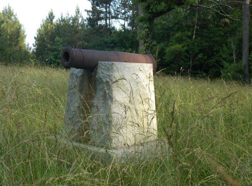
4 fast fell away as the Virginia colony expanded. But the tribes whose children were educated at Fort Christanna adapted and endured. Several tribes in Virginia and North Carolina today are proud descendants of those students at the Christanna Indian School. In time, the fort s palisade walls and buildings fell, and the site reverted to forest land. Even after its decline, however, stories of the fort were kept alive by residents of Brunswick County. In 2001, the Board of Supervisors, in order to protect the original three acre fort site, purchased 22 acres of surrounding property. In 2006, to further protect the site, two and a half acres, directly across the road from the site was purchased by the Board of Supervisors. Problem: In 2007, the Brunswick County Board of Supervisors recognized the importance and need to develop Fort Christanna into an historical and recreational park to enhance the quality of life for local residents and for cultural heritage tourism and recreational enthusiast. The members of the Board of Supervisors also realized that the site was of important regional, state and national significance. The site, which is located two miles south of Lawrenceville, Virginia on Fort Hill Road (Route 686) along the banks of the Meherrin River, had become an overgrown wooded area that had nothing to see or attract residents and visitors except a monument with cannon, which was placed in 1924 by The National Society of Colonial Dames of America in the State of Virginia. The Board of Supervisors also realized the need to create and improve the tourism assets in the county to attract more visitors to the area and improve the quality of life for citizens of the county.
5 Development Overview: The first action taken by the Board of Supervisors was to create and appoint members to the Fort Christanna Site Development Committee. The committee s purpose and mission was to develop the Fort Christanna site as a cultural resource, creating an educational and recreational experience that effectively communicates the history of Fort Christanna, with preservation of the archaeology and sacred nature of the place. The committee consisted of a member of the Board of Supervisors, a member of the Brunswick County/Lake Gaston Tourism office, the Brunswick County Historical Society, representatives from several Native American tribes that were descendants from Fort Christanna and several interested members of the community. The committee was tasked with formulating a plan to turn the site into an important historical site and recreational area for county residents and visitors. The Board of Supervisors action was supported by the 2006 Brunswick County Comprehensive Plan, which identifies, under History and Culture, implementation strategies to: preserve important historic, archaeological and scenic assets of the county, to guide development so as to protect historic and potentially historic properties and perpetuate cultural heritage, and to support historic preservation committees or societies. Goals and Objectives: The Fort Christanna Site Development Committee created a set of Goals and Objectives to meet the short and long term needs of the site. Goal 1: Develop a mission statement for the Fort Christanna Historical Site project. 1. Create and adopt a mission statement to guide the committee and keep the project and development of the site in focus.
6 Goal 2: Create a Master Plan for the site: 1. Gather ideas on how to best meet the needs and develop the site for county residents and visitors. 2. Hire an architect to take committee ideas and help the committee develop a master plan for development of the site into a historical and recreational park. The plan included parking, trails, interpretive signage, brick entrance and kiosk area and a learning center. All of the aspects of the master plan were created to be as low maintenance as possible. 3. Gain approval from the Board of Supervisors on the Master Plan. Goal 3: Develop a five year plan of work and budget for the project. 1. Identify and divide the parts of the architect s master plan into stages that will be developed over a period of five years. 2. Develop a working yearly budget that includes the stages of work to be completed each year. 3. Present the five year plan of work to the Board of Supervisors. Goal 4: Develop signage and funding source to direct visitors to the site. 1. Identify signage needed to direct visitors from major roads to the Fort Christanna Historical Site. 2. Identify a funding source to acquire needed signage. 3. Work with Virginia Logos, the company that handles all signage for the Virginia Department of Transportation, to have signs fabricated and installed to direct visitors to the site.
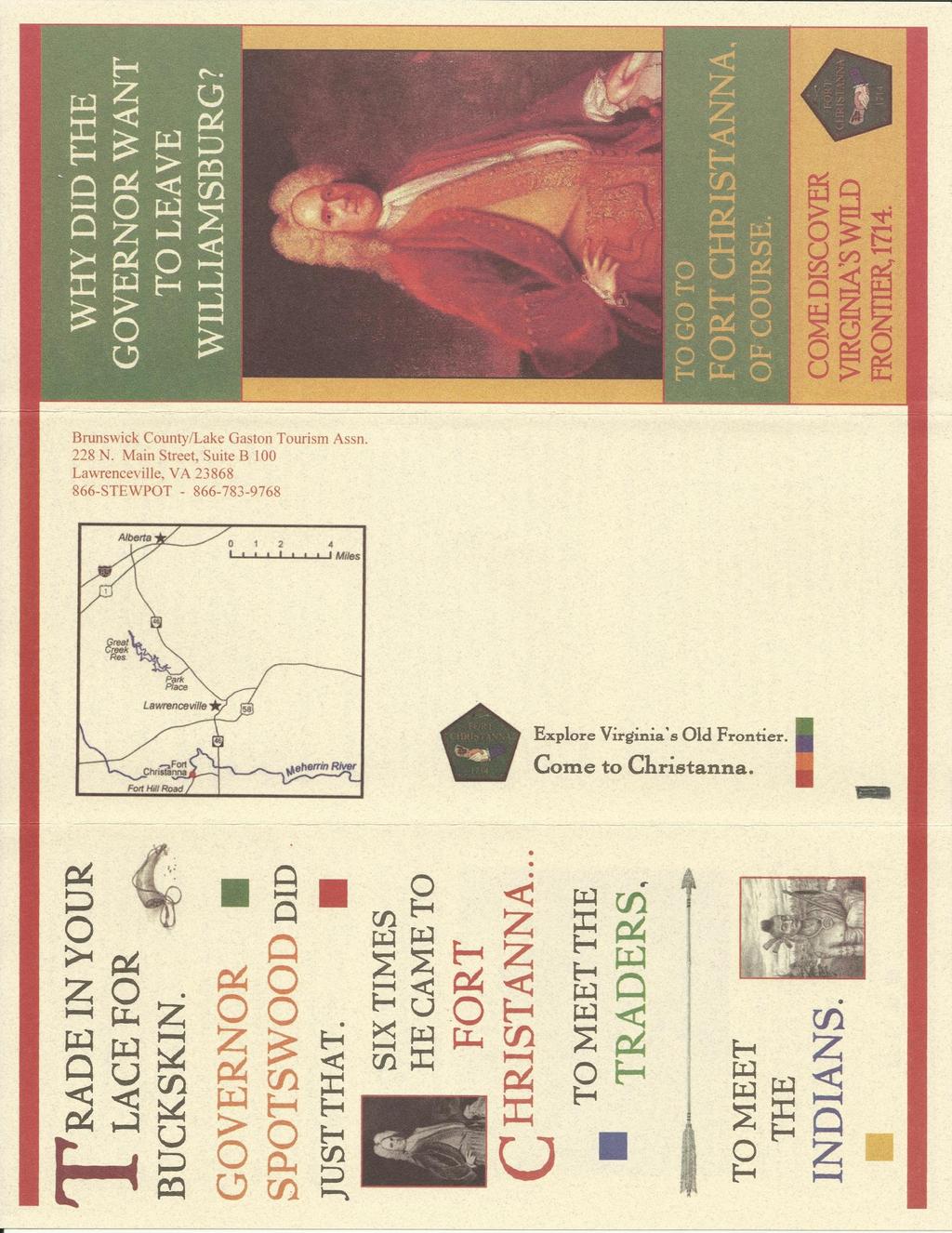
7 Goal 5: Develop a Fort Christanna Historical Site Brochure 1. Work with a historical writer and the Virginia Department of Historic Resources to develop a color brochure to explain the history and promote the site. 2. Work with area and regional visitors centers and three official Virginia Welcome Centers to have the brochure available to help entice and attract tourist to visit the site. Funding: The Brunswick County Board of Supervisors appropriated $ 50,000 per year for four years as the lead funding partner on the project. Numerous other financial partners helped achieve the goals of the county and committee. The Virginia Tobacco Indemnification and Revitalization Commission awarded a $ 30,000 grant to the county to provide brown directional signage on Interstate 85 at the Alberta exit, at the intersection of Highway 58 and 46 at Lawrenceville and along the Highway 46 corridor from Alberta through Lawrenceville to the site. The Brunswick Garden Club received the Common Wealth Award from the Garden Club of Virginia to create the learning center and the Virginia Daughters of the American Revolution gave a monetary gift for the entrance sign. Several area businesses such as Vulcan Materials and Lawrenceville Brick contributed building materials. Recently, the Town and Country Garden Club provided funds to establish a Fort Christanna Website which is currently being developed. The county currently promotes the site at their website Other Partnerships: Many public and private partnerships were created with the development of the Fort Christanna Historical Site. The county partnered with the Virginia Department of Game and Inland Fisheries (VDGIF) to have the site added as a stop on the Christanna Loop of the Virginia Birding and
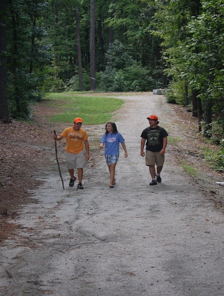
8 Wildlife Trail. The VDGIF also has provided technical assistance in developing trail signage for the nature trail from the fort site to the Meherrin River, which is a State Scenic River. Because of the early education of Native American children at the fort, the county partnered with Virginia s Retreat, a 13 county marketing consortium, which maintains the Civil Rights in Education Heritage Trail, to have the site added as a stop on the trail. Also, the county partnered with the Virginia Department of Transportation to have Fort Hill Road (Route 686) and the Fort Christanna site added as new point of interest on the Official Virginia State Transportation Map. Brochure: The committee developed a color brochure explaining the history and significance of the site. Included in the brochure is a map with directions to Fort Christanna and the contact information for more information about the site. 15,000 brochures were printed and approximately 10,000 have been distributed. The brochure has been placed in local tourist information centers in the region as well as three of the Official Virginia Welcome Centers. Results: The site has been transformed into a 25 acre historical and recreational park, with trails around the perimeter of where the five sided fort was located. A new parking area with handicap parking was constructed, with a brick terrace welcome area and information kiosk. Interpretive signage has been installed at the brick terrace area and along the fort wall paths describing Alexander Spotswood s role in the establishment of the fort, Native American presence at the site, construction of the fort and the role of Brunswick County and the National Society of the Colonial Dames of American in the State of Virginia. The historical, recreational and scenic assets of the site are being visited, used and enjoyed by visitors to the area as well as county
9 citizens. The site now is seen as not only an attraction for visitors, but is used to improve the quality of life for county citizens who utilize the recreational trails for exercise. Visitation: Since the site is not manned daily, an exact number of visitors has not been established, however, brochures are refilled each week in a weather proof box located at the kiosk brochures are left at the site each week. Also, during the times when committee members are at the site, visitors with vehicles from Virginia and other states such as Maryland, North Carolina, New Jersey and Kentucky are seen visiting the site. The site is also being utilized by county citizens for recreational uses, picnics and family outings. Local schools and home schools are also using the site as a teaching tool for local history and nature. Awards: The Fort Christanna Historical Site received the 2010 Award of Merit from the American Association of State and Local History (AASLH) Leadership in History Awards. The AASLH Leadership in History Awards is the most prestigious recognition for achievement in the preservation and interpretation of state and local history. The development of the Fort Christanna Historical Site into an historical and recreational park has been exceptionally successful at achieving both the goals of Brunswick County government and the mission of the Fort Christanna Site Planning Committee. Because of this success, plans are already underway to expand the current park by adding more interpretive signage, an additional walking/nature trail and outdoor privy.
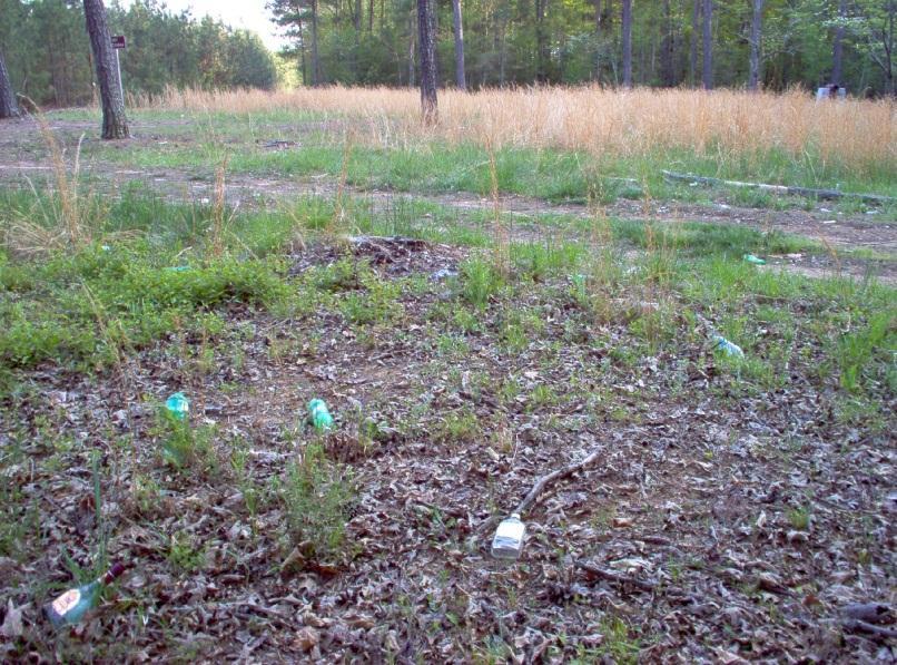
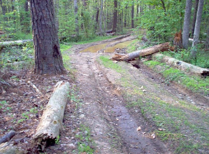
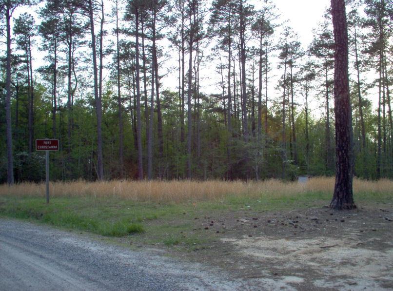
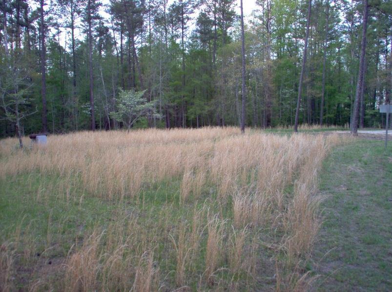
10 Fort Christanna Historical and Recreational Park Brunswick County, Virginia Before Work Began
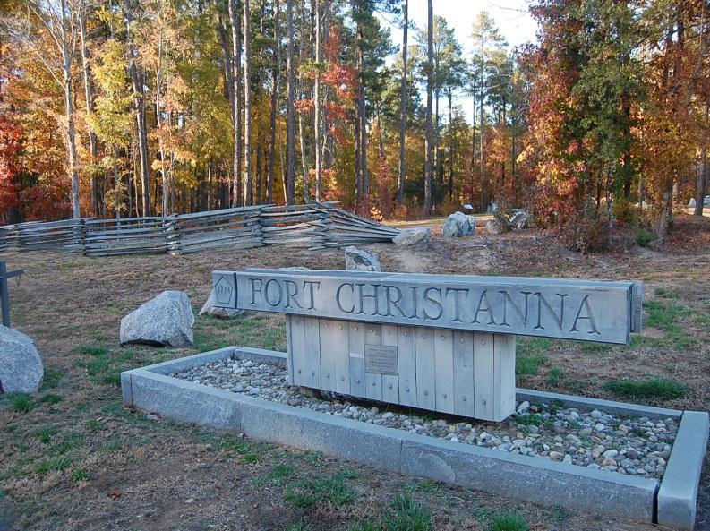
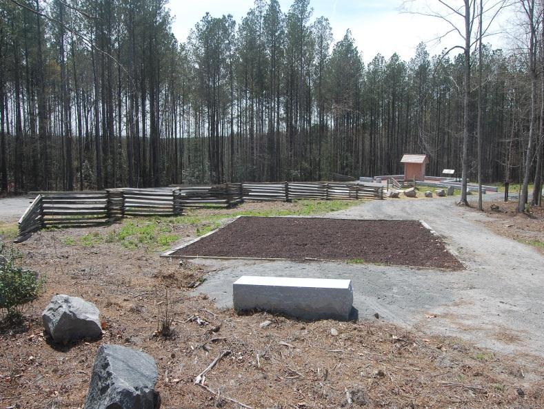


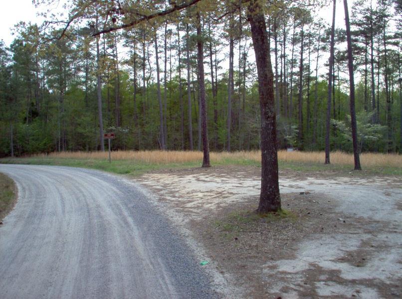
11 Fort Christanna Historical and Recreational Park Brunswick County, Virginia After Work
12

13


14 Official Virginia Transportation Map Section Showing Addition of Fort Christanna and Route 686
15
16
Strategic Plan. Manassas Battlefield Trust
 Manassas Battlefield Trust m Strategic Plan 2018-2020 M a n a s s a s B a t t l e f i e l d T r u s t, 1 2 5 2 1 L e e H i g h w a y, M a n a s s a s, V A 2 0 1 0 9 Manassas Battlefield Trust Manassas,
GOALS, OBJECTIVES, & RECOMMENDATIONS historic preservation. BUDA 2030 COMPREHENSIVE PLAN preserving our heritage sustaining our future
 HISTORIC PRESERVATION Buda has the second largest concentration of historic structures in Hays County, many of which are located along Main Street in downtown Buda. 1 These historic buildings form the
Mississippi River Parkway Commission of Minnesota
 Mississippi River Parkway Commission of Minnesota Metro Region (Elk River to Hastings) October 27, 2016 2:00 3:30 p.m. Historic Fort Snelling 200 Tower Avenue, St. Paul, MN Metro Region Agenda I. Welcome
Blueways: Rivers, lakes, or streams with public access for recreation that includes fishing, nature observation, and opportunities for boating.
 Parks, Open Space and Trails PRINCE WILLIAM COUNTY 2008 COMPREHENSIVE PLAN TRAILS PLAN CONTENTS The components of the trails plan are: Intent Definitions Goals, Policies, and Action Strategies Trails Map
National Scenic Byways Program US Department of Transportation
 1 2 National Scenic Byways Program US Department of Transportation Abstract The Cowlitz-Wahkiakum Council of Governments in partnership with Cowlitz, Skamania and Lewis Counties and the U.S. Forest Service,
The Future of the Road to Revolutions. A Battle Road Scenic Byway Public Forum November 9, 2010
 The Future of the Road to Revolutions A Battle Road Scenic Byway Public Forum November 9, 2010 Who is the Battle Road Scenic Byway? Four Towns: Arlington, Lexington, Lincoln, Concord Minute Man National
Important Sites to Visit
 Important Sites to Visit Pompey s Pillar Rates & Fees $3.00 per vehicle (Day - until May 1, 2007) $100.00 per bus or group Admission is free with Golden Age, Golden Access, and Golden Eagle Passports.
Mississippi River Parkway Commission of Minnesota
 Mississippi River Parkway Commission of Minnesota Bluffs Region (Hastings to Iowa Border) September 23, 2016 10:00 11:30 a.m. Red Wing Ignite 419 Bush Street, Red Wing, MN Bluffs Region Agenda I. Welcome
Appalachian Trail Community
 Harpers Ferry, West Virginia Appalachian Trail Community A Designation Program of the Appalachian Trail Conservancy The Appalachian Trail Conservancy (ATC) mission is to preserve and manage the Appalachian
Operating Principles Tourism Dawson Creek will operate on the following operating principles:
 Vision Statement That Tourism Dawson Creek be recognized as a provincial leader and innovator in destination development and marketing while leading the City of Dawson Creek towards sustainable economic
New Jersey State Parks
 New Jersey State Parks History and Facts Kevin Woyce Photographs by the author Kevin Woyce NEW JERSEY STATE PARKS: HISTORY AND FACTS Copyright 2011 Kevin Woyce All Rights Reserved. No part of this book
Silver Lake Park An Environmental Jewel for the Citizens of Prince William County
 Silver Lake Park An Environmental Jewel for the Citizens of Prince William County The Prince William Park Authority Mission Statement states: The Prince William County Park Authority will create quality
3. Describe the musical instrument that you come across in the beginning of the exhibit and what types of materials are used to create it.
 Did you know that you are on an American Indian reservation? You are officially on the Isabella Indian Reservation which belongs to the Saginaw Chippewa Tribal Nation, or Saginaw Ojibwe People. The reservation
1500+ Miles of Byways FLORIDA SCENIC HIGHWAYS PROGRAM. All-American Road. National Scenic Byways. Counties. Scenic Highways. A 20-Year Partnership
 FLORIDA SCENIC HIGHWAYS PROGRAM A Program of the Florida Department of Transportation 2016 Annual Report A MESSAGE FROM THE PROGRAM COORDINATOR Launched in July 1996, the Florida Scenic Highways Program
History Alive. The Lake Champlain Region is rich with history, all within 50 miles of your hotel door. For google map:
 History Alive The Lake Champlain Region is rich with history, all within 50 miles of your hotel door. For google map: http://goo.gl/maps/zak1c The Route 1. Lake Champlain Maritime Museum on property 2.
The Vision for the San Juan Islands Scenic Byway
 The Vision for the San Juan Islands Scenic Byway 2 Judd Cove, Orcas Island, Courtesy of Kurt Thorson (kurtthorson.com) and San Juan County Land Bank Vision for the San Juan Islands Scenic Byway The San
Galveston Bay Estuary Program. Carla G. Guthrie, Ph.D. Galveston Bay Council Member Texas Water Development Board
 Galveston Bay Estuary Program Carla G. Guthrie, Ph.D. Galveston Bay Council Member Texas Water Development Board The statements contained in this presentation are my current views and opinions and are
ILLINOIS RIVER CENTER AT HAVANA. Linking Resources for Success. Governor s Conference on the Management of the Illinois River System (October, 2005)
") ILLINOIS RIVER CENTER AT HAVANA Linking Resources for Success Governor s Conference on the Management of the Illinois River System (October, 2005) Linking Resources For Success COMMUNITY REVITALIZATION
ILLINOIS RIVER CENTER AT HAVANA Linking Resources for Success Governor s Conference on the Management of the Illinois River System (October, 2005) Linking Resources For Success COMMUNITY REVITALIZATION
CITY OF VAUGHAN EXTRACT FROM COUNCIL MEETING MINUTES OF OCTOBER 30, 2012
 CITY OF VAUGHAN EXTRACT FROM COUNCIL MEETING MINUTES OF OCTOBER 30, 2012 Item 36, Report No. 39, of the Committee of the Whole, which was adopted without amendment by the Council of the City of Vaughan
DOWNLOAD OR READ : WILLIAM PARKS PDF EBOOK EPUB MOBI
 DOWNLOAD OR READ : WILLIAM PARKS PDF EBOOK EPUB MOBI Page 1 Page 2 william parks william parks pdf william parks March 14, 2019 OC Parks Volunteer Information NightJoin OC Parks staff and volunteers Monday,
SENATE, No STATE OF NEW JERSEY. 217th LEGISLATURE INTRODUCED FEBRUARY 8, 2016
 SENATE, No. STATE OF NEW JERSEY th LEGISLATURE INTRODUCED FEBRUARY, 0 Sponsored by: Senator ROBERT W. SINGER District 0 (Monmouth and Ocean) Senator JOSEPH F. VITALE District (Middlesex) SYNOPSIS Establishes
2014 VACo Achievement Awards
 Application Form All applications must include the following information. Separate applications must be submitted for each eligible program. Deadline: June 2, 2014. Program Information Locality Program
SECTION 4. PUBLIC RECREATION
 SECTION 4. PUBLIC RECREATION Brooker Creek Preserve is the largest remaining tract of wild land in Pinellas County and contains many species not found anywhere else in the County. As such, these wild lands
Bridge District Board of Directors Meeting
 Partnership with the Golden Gate Bridge District National Park Service, and Golden Gate National Parks Conservancy presented at the Bridge District Board of Directors Meeting March 11, 2011 THE GOLDEN
X Respond to staff direction
 Page 1 of Report TO: Community Services Committee Corporate Services Division SUBJECT: Apeldoorn Mundalization Project Report Number: Report Date: February 17, 2010 File Number(s): Ward(s) Affected: 1
Recreation and Park Commission, Capital Committee
 DATE: March 7, 2018 TO: THRU: FROM: RE: Recreation and Park Commission, Capital Committee Philip A. Ginsburg, General Manager Lisa Bransten, Director of Partnerships New Park at Francisco Reservoir Park
LGFCU Excellence in Innovation Award Project Evaluation
 LGFCU Excellence in Innovation Award Project Evaluation Project Number PIP-2 Title of Program Fonta Flora Loop Trail Program Category Public Information/Participation Submission Date 5/29/2015 9:52:00
Kansas (KAW) River History
 River History") Kansas (KAW) River History The first map of the Kansas River is dated back to 1718. Lewis and Clark spent 3 days camped at Kaw Point at the confluence of the Kansas and Missouri Rivers. Kansas (KAW) River
Kansas (KAW) River History The first map of the Kansas River is dated back to 1718. Lewis and Clark spent 3 days camped at Kaw Point at the confluence of the Kansas and Missouri Rivers. Kansas (KAW) River
David Lewis Entergy Arkansas Corporate Communications Pager #2284
 Date: March, 5, 2003 For Release: March, 5, 2003 Contact: Terry Payne City of Hot Springs 501-321-6806 News Release David Lewis Entergy Arkansas Corporate Communications 501-377-3560 dlewis1@entergy.com
SPARTA Finding treasures off the beaten path just got a lot easier.
 FIND TREASURES OFF THE BEATEN PATH IN WHITE CO., TN By Amy Davis, Herald Citizen Staff Herald Citizen, Cookeville, TN Thursday, 23 February 2012, pg. A 9 SPARTA Finding treasures off the beaten path just
Planning and Managing Tourism in Protected Areas
 Planning and Managing Tourism in Protected Areas Mobile Seminar - September 10-25, 2013 CENTER FOR PROTECTED AREA MANAGEMENT AND TRAINING Introduction The Mobile Seminar on Planning and Managing Tourism
Tribal Agritourism Marketing Tools, Part 2: Using NativeAmerica.travel to promote tourism and your agribusiness products
 Tribal Agritourism Marketing Tools, Part 2: Using NativeAmerica.travel to promote tourism and your agribusiness products THANK YOU FOR JOINING US! THE WEBINAR WILL BEGIN SHORTLY. Webinar Management Participants
Welcome to the future of Terwillegar Park a Unique Natural Park
 Welcome to the future of Terwillegar Park a Unique Natural Park 1 Introduction The Terwillegar Park Concept Plan study will develop an overall concept plan, management objectives and development guidelines
GLASS HOUSE MOUNTAINS PEAKS WALK, BEERBURRUM TRAILHEAD DRAFT CONCEPT PLAN
 GLASS HOUSE MOUNTAINS PEAKS WALK, BEERBURRUM TRAILHEAD DRAFT CONCEPT PLAN GLASS HOUSE Figure 1 REGIONAL WALK/RIDE OVERVIEW Aspirational Goal Create an interconnected nature-based recreation trail network
Maryland State Parks Diversity and Inclusion Efforts: Staff Perspectives and Media Reporting
 Maryland State Parks Diversity and Inclusion Efforts: Staff Perspectives and Media Reporting Natalia Buta, Ph.D. Associate Professor, Frostburg State University University System of Maryland Objectives
Transportation Infrastructure and Planning for Tribal Economic Development, Trade & Tourism
 Transportation Infrastructure and Planning for Tribal Economic Development, Trade & Tourism Presented by: Camille L. Ferguson, AIANTA Executive Director And Edward Hall III, BIA Transportation Coordinator
DRAFT Appendix A Appendix B. Planning Process & Public Participation
 1 2 3 4 5 Appendix A Appendix B Planning Process & Public Participation This chapter provides an overview of the planning process. Summaries of public input for the comprehensive planning process are provided.
Virginia Beach. InOneofAmerica s. GreatestAquariums! The City of Virginia Beach Has An Exciting Opportunity
 Virginia Beach The City of Virginia Beach Has An Exciting Opportunity InOneofAmerica s GreatestAquariums! The City of Virginia Beach Seeks a Director to Lead our Aquarium & Museums Things to love about
PEMBERTON VALLEY RECREATIONAL TRAILS MASTER PLAN UPDATE Community Open House. April 2018
 PEMBERTON VALLEY RECREATIONAL TRAILS MASTER PLAN UPDATE Community Open House April 2018 Introductions Introductions Matt Bakker, BHA Project Coordinator Other Team Members: Liz Scroggins, Grey Owl Consulting
3/18/2015 BENEFITS OF AGRITOURISM HOW BENEFICIAL IS AGRITOURISM? MEET FOXIE!
 MEET FOXIE! Foxie Morgan of PHARSALIA from Tyro, Virginia. Sooooo proud of all the beautiful flowers! www.pharsaliaevents.com YOUR SUCCESS WELCOMING VISITORS TO THE FARM Annie Baggett, Agritourism Marketing
Aitkin County Comprehensive Recrea5on Trail Plan. May 2010
 Aitkin County Comprehensive Recrea5on Trail Plan May 2010 Overview and Goals of the Plan Why do a plan? Who is responsible for the plan How the plan has been developed What is in the plan Ac#on Steps &
1.2 Corridor History and Current Characteristics
 SECTION 1 Description and Background of Study Area 1.1 Introduction This preliminary engineering report was prepared for the Alaska Department of Transportation and Public Facilities (ADOT&PF). It is part
The Palmetto Trail: Linking the Mountains to the Sea
 The Palmetto Trail: Linking the Mountains to the Sea Jana Locklair Pine Ridge Middle School jlock794@aol.com Overview Students will be given the opportunity to become familiar with the landform regions
Fred Milch Project Review Manager East Central Florida Regional Planning Council
 RESHAPING THE ROLE OF PARKS, RECREATIONAL AREAS, AND GREEN SPACE TO ENHANCE LIVABILITY Fred Milch Project Review Manager East Central Florida Regional Planning Council St. Johns River to Sea Loop Webinar
The Airport. p a g e 2
 The Airport Telluride Regional Airport (TEX) with a runway altitude of 9,070 feet MSL is the highest airport in North America with commercial service in light of the fact that, after a two-year hiatus,
It Takes Many Hands to Control Invasive Plants Along the Appalachian Trail
 It Takes Many Hands to Control Invasive Plants Along the Appalachian Trail James Åkerson, Supervisory Forest Ecologist, NPS Mid-Atlantic Exotic Plant Management Team, 3655 U.S. Hwy 211-E, Luray, VA 22835;
National Park Service Wilderness Action Plan
 National Park Service U.S. Department of the Interior National Park Service Wilderness Action Plan National Wilderness Steering Committee National Park Service "The mountains can be reached in all seasons.
Program Manual Version 2.0 July 2018
 Program Manual Version 2.0 July 2018 Table of Contents Introduction 3 Benefits 4 EarthCraft Certification Programs 5 EarthCraft Program Participants 7 EarthCraft Program Process 9 EarthCraft Marketing
Strengthening the Ontario Trails Strategy. Report on Consultations and the Environmental Bill of Rights Registry
 Strengthening the Ontario Trails Strategy Report on Consultations and the Environmental Bill of Rights Registry Purpose To report on the feedback and information received through the regional consultations,
Chapter 6: POLICY AND PROCEDURE RECOMMENDATIONS
 Chapter 6 POLICY AND PROCEDURE RECOMMENDATIONS FOR SRRA Below are seven policy elements that should be considered for adoption by the Southwest Regional Recreation Authority of Virginia: 1. Develop strategies
TOURISM & PUBLIC SERVICES RURAL SIGNAGE POLICY
 Policy and Procedures Subject Title: Tourism and Public Services Rural Signage Policy Corporate Policy (Approved by Council): X Policy Ref. No.: ROADS-01-07 Administrative Policy (Approved by CAO): By-Law
The historic heart of downtown: The Whitehorse Waterfront
 The historic heart of downtown: The Whitehorse Waterfront Yesterday & Today The early years Before highways and airlines, being at the river s edge meant everything: supply of food and water, transportation,
MARBLE RIVER PROVINCIAL PARK
 MARBLE RIVER PROVINCIAL PARK PURPOSE STATEMENT AND ZONING PLAN March 2003 MARBLE RIVER PROVINCIAL PARK Purpose Statement and Zoning Plan Primary Role The primary role of Marble River Park is to protect
Lost Colony of Roanoke
 Lost Colony of Roanoke Lesson Number: 3 Title: The Lost Colony of Roanoke Grade Level: 5 th Time: 50-60 minutes Materials: Per Student: Roanoke: The Lost Colony short story Roanoke Theories worksheet Evidence
Northern Rockies District Value of Tourism Research Project December 2007
 Northern Rockies District Value of Tourism Research Project December 2007 Project Partners: Northern Rockies Regional District, Tourism British Columbia, Northern Rockies Alaska Highway Tourism Association,
Tapawingo. A Christian Summer Camp for Girls ages 9-17
 Tapawingo A Christian Summer Camp for Girls ages 9-17 to e om lc e W o g in w a p Ta Tapawingo is a Christian camp for girls ages 9-17. Situated on an island in the middle of Lake Pleasant, we are located
2017 EMPLOYEE SATISFACTION SURVEY RESULTS
 2017 EMPLOYEE SATISFACTION SURVEY RESULTS Office of Human Resources 2017 Employee Satisfaction Survey Results 2017 Employee Satisfaction Survey Results 0 P a g e 2017 Employee Satisfaction Survey Results
REVISED AGENDA. Special Council Meeting. Monday, September 11, 2017 (REVISED TO INCLUDE ON-TABLE ITEMS)
") Mission Statement In carrying out its mandate, Bowen Island Municipality will work towards conducting operations in a way that: Improves the economic, environmental and social well-being for present and
Mission Statement In carrying out its mandate, Bowen Island Municipality will work towards conducting operations in a way that: Improves the economic, environmental and social well-being for present and
Tourism: An Integral Part of a Community s Economic Development Portfolio. Michael Liffmann LSU-Sea Sea Grant College Program
 Tourism: An Integral Part of a Community s Economic Development Portfolio Michael Liffmann LSU-Sea Sea Grant College Program Today s Talk What is the tourism industry? Its economic significance to LA?
Cultural Heritage Pride Program
 Cultural Heritage Pride Program NOW: Background Heritage is a broad concept and includes the natural as well as the cultural environment. It encompasses landscapes, historic places, sites and built environments,
Southern Virginia Regional Section
 Southern Virginia Regional Section Introduction As a supplement to the Virginia State Tourism Plan, this section is dedicated to the Southern Virginia region. It is strongly suggested that the Virginia
Follow our Travels. through
 Follow our Travels through On a regular workday, many people don t get to look forward to a day of travel, tourism, and good food, but here in Freedom s Frontier National Heritage Area (FFNHA), monthly
PUERTO RICO: PATHWAY TO THE FUTURE Opportunities of an Economic Transformation
 PUERTO RICO: PATHWAY TO THE FUTURE Opportunities of an Economic Transformation Rebuilding Puerto Rico Mr. Omar J. Marrero, Esq. Executive Director Puerto Rico Public-Private Partnerships Authority & Central
SPONSORSHIP OPPORTUNITIES
 P R E S E N T S A P R I L 2 2-2 4, 2 0 1 9 H A N OV E R, N H SPONSORSHIP OPPORTUNITIES G E T R. E. A. L : R E AC H. E N GAG E. AC C E S S. L E V E R AG E. NEW HAMPSHIRE TRAVEL COUNCIL S 2019 ANNUAL GOVERNOR
Project Summary 2009
 Project Summary 2009 SB-2009-MN-55360: Lady Slipper Scenic Byway Pedestrian Walkway State Submission Date not submitted Division Submission Date not submitted State Priority 0 This application must be
What is Pimachiowin Aki? What is The Land that Gives Life?
 What is Pimachiowin Aki? What is The Land that Gives Life? Pimachiowin Aki is Canada s newest and first mixed (cultural and natural) World Heritage Site. In Anishaabemowin, the Ojibwe language, Pimachiowin
Trails and Towers El Camino Real and the Verde Power Line in Santa Fe County
 Devin Bent, p 1 of 6, December 16, 2016. Introduction Trails and Towers El Camino Real and the Verde Power Line in Santa Fe County El Camino Real begins in Mexico City and travels 1600 miles north entering
Securing Permanent Protection for Public Land
 Securing Permanent Protection for Public Land Tools for Wyoming Advocates Paul Spitler* The Wilderness Society * I am a wilderness policy expert, not a powerpoint expert! Platform and Resolutions of the
City of Durango 5.8 FUNDING TRAILS DEVELOPMENT
 5.8 FUNDING TRAILS DEVELOPMENT The City has been successful in establishing dedicated local funding sources as well as applying for grants to develop the City s trail system, having received nearly $2.4
SUBJECT: BROCKTON TOTEM POLES CONCESSION/VISITOR CENTRE - MARKETING STRATEGY
 DATE: January 28, 1998 SUBJECT: BROCKTON TOTEM POLES CONCESSION/VISITOR CENTRE - MARKETING STRATEGY RECOMMENDATION: THAT the Board approve the attached marketing strategy on the type of merchandise to
LANDING S PARK CONCEPTUAL PLAN HAMILTON ANDERSON JANUARY City of Novi, Michigan. The Park at 13 Mile and Old Novi Road
 HAMILTON ANDERSON JANUARY 2012 LANDING S PARK CONCEPTUAL PLAN January 2012 Page 1 of 15 January 2012 PROJECT GOALS Activate the park by introducing new elements Provide clear access to the water and enhance
TURTLE SURVIVAL ALLIANCE EXECUTIVE DIRECTOR
 Transforming passion for turtles into effective conservation action through a global network of living collections and recovery programs. TURTLE SURVIVAL ALLIANCE BACKGROUND TURTLE SURVIVAL ALLIANCE EXECUTIVE
2. Goals and Policies. The following are the adopted Parks and Trails Goals for Stillwater Township:
 D. PARKS AND TRAILS 1. Introduction Stillwater Township s population is relatively low, with most residents living on rural residences on large lots. The need for active park space has been minimal in
This section of the Plan provides a general overview of the Smoky Mountain Region. It consists of the following four subsections:
 SECTION 3 COMMUNITY PROFILE This section of the Plan provides a general overview of the Smoky Mountain Region. It consists of the following four subsections: 3.1 Geography and the Environment 3.2 Population
Marland s Grand Home Centennial Articles June to 1970
 Marland s Grand Home Centennial Articles June 2016 1960 to 1970 ************************************************************************************* Note: Sixth in a series of twelve monthly articles
Below is the section of the Byway discussed in the Tazewell County meeting. Primary coal sites are noted on the map.
 APPENDIX H: PUBLIC PARTICIPATION SERIES OF TOWN MEETINGS Virginia Coal Heritage Trail Corridor Management Plan Meeting in Richlands on the Tazewell County portion of the Pocahontas Trail September 21 st
Wild Pacific Trail Society
 Wild Pacific Trail Society Section H Completion Report January 24, 2014 Project Manager: Tel: Email: Jim Martin 250-726-7565 oysterjim@hotmail.com Project Report: Tel: Email: Heather Grimshire 250-266-2053
I. PREFACE II. THE PARTNERSHIP
 I. PREFACE This document is the "local" plan for the management of the Appalachian Trail in Maine from Maine Highway 26 in Grafton Notch to the summit of Katahdin. It is a part (the other being the Appalachian
INFORMATION NOTICE 15-2 Limited & Excluded Lands
 INFORMATION NOTICE 15-2 Limited & Excluded Lands Schedule 1 (Land Description) of onshore petroleum Agreements issued by the Department of Energy details the total hectares calculated. Total hectares are
Request for Proposals
 E CONOMIC DEVELOPMENT AUTHORITY of the City of Norfolk Board of Directors Officers Robert E. Garris, Jr., Chairman Executive Director Michael W. Lee, Vice Chairman Peter Chapman Jeffrey F. Brooke Kim Brown
National Wilderness Steering Committee
 National Wilderness Steering Committee Guidance White Paper Number 1 Issue: Cultural Resources and Wilderness Date: November 30, 2002 Introduction to the Issue Two of the purposes of the National Wilderness
Ministry of Parks, Culture and Sport. Plan for saskatchewan.ca
 Ministry of Parks, Culture and Sport Plan for 2018-19 saskatchewan.ca Table of Contents Statement from the Minister... 1 Response to Government Direction... 2 Operational Plan... 3 Highlights... 7 Financial
The Persian Empire 550 BCE-330 BCE
 The Persian Empire 550 BCE-330 BCE The Rise of Persia The Persians based their empire on tolerance and diplomacy. They relied on a strong military to back up their policies. Ancient Persia is where Iran
LIFETIME SERVICE AWARD NOMINEE SAM H. POWELL
 LIFETIME SERVICE AWARD NOMINEE SAM H. POWELL Sam H. Powell and his wife Emilie started hiking 1955 to 1958 in the Smoky Mountains while students at the University of Tennessee in nearby Knoxville. They
BRYAN REGIONAL PARK. Presented by: Burditt Consultants November 13, 2018
 BRYAN REGIONAL PARK Presented by: Burditt Consultants November 13, 2018 AGENDA 1. Project Purpose & Mission 2. Project Vision & Goals 3. Stakeholder Feedback 4. Program Overview 5. Phase A Plan Overview
Implementation Strategy for the Lethbridge Destination Management Organization (LDMO)
") Implementation Strategy for the Lethbridge Destination Management Organization (LDMO) IMPLEMENTATION AND TRANSITION STRATEGY LDMO MANDATE: To establish a destination management organization that provides
Implementation Strategy for the Lethbridge Destination Management Organization (LDMO) IMPLEMENTATION AND TRANSITION STRATEGY LDMO MANDATE: To establish a destination management organization that provides
$850,000 Awarded to 20 Organizations
 $850,000 Awarded to 20 Organizations The Conservation Alliance is pleased to fund the following organizations to support their efforts to protect wild lands and waterways for their habitat and recreation
NAVAJO COMMUNITY PLAN
 NAVAJO COMMUNITY PLAN Prepared by the NAVAJO COMMUNITY PLANNERS and THE CITY OF SAN DIEGO City of San Diego Planning Department 202 C Street, MS 4A San Diego, CA 92101 Printed on recycled paper. This information,
Chapter 1: Introduction
 Chapter 1: Purpose of the Comprehensive Plan The purpose of the Comprehensive Plan of the City of Rockaway Beach is to provide a policy guide for the growth and future development of the City. Section
Downtown Frederick Hotel and Conference Center BRIEFING.
 Downtown Frederick Hotel and Conference Center BRIEFING Public-Private Partnership Team Public-Private Partnership initiated by the Chamber of Commerce and business community to retain existing employers
The Corporation of Delta COUNCIL REPORT Regular Meeting
 The Corporation of Delta COUNCIL REPORT Regular Meeting F.03 To: From: Mayor and Council Delta Heritage Advisory Commission File No.: A.04 Date: Septel11ber 19, 2017 Delta Heritage Advisory Commission
13.1 REGIONAL TOURISM ISSUES AND SUMMARY OF FINDINGS
 13 REGIONAL TOURISM T he County of Mariposa s recreation needs and facilities fall within two categories: regional tourism and local recreation. This Element focuses on regional tourism issues related
Cascade River State Park Management Plan Amendment
 This document is made available electronically by the Minnesota Legislative Reference Library as part of an ongoing digital archiving project. http://www.leg.state.mn.us/lrl/lrl.asp Cascade River State
The Partnership Wild & Scenic Rivers Program
 BUDGET REQUEST FISCAL YEAR 2017 Proven, cost-effective protection for 770 miles of rivers and thousands of acres of riparian land Westfield River, MA (L) and Farmington River, CT (R) Partnership Wild &
LAKE APOPKA NORTH SHORE ECO TOURISM. Strategic Action Plan 4/10/2014
 LAKE APOPKA NORTH SHORE ECO ECO-TOURISM TOURISM 4/10/2014 Strategic Action Plan The purpose of this report is to identify strategic actions for implementing a comprehensive ecotourism plan for the North
2016 Visitor Information Centre Report
 2016 Visitor Information Centre Report June 2017 Tourism Bowen Island Association 432 Cardena Drive Bowen Island, BC V0N 1G1 Ph: 604-200-2399 E: admin@tourismbowenisland.com https://www.tourismbowenisland.com/
ROYAL GORGE PARK and RECREATION AREA. A Feat of Natural and Man-Made Engineering
 ROYAL GORGE PARK and RECREATION AREA A Feat of Natural and Man-Made Engineering As Growth Resumed in the 1870 s Town Leaders Began to Envision a Tourist Industry. The Arkansas River Canyon was advertised
North Dakota Tourism HOSPITALITY TRAINING WORKBOOK
 North Dakota Tourism HOSPITALITY TRAINING WORKBOOK HOSPITALITY TRAINING WORKBOOK www.ndtourism.com Thank you for participating in this Legendary hospitality training. There s so much to learn about North
National Recreation Trail Application for Designation
 National Recreation Trail Application for Designation Introduction Thank you for your interest in the National Recreation Trail (NRT) program. Completed NRT application packages must be submitted by December
Buffalo Bayou Preservation Association was founded
 1. 1962 Rachel Carson publishes Silent Spring, an environmental discourse which inspired an environmental movement that led to the creation of the U.S. Environmental Protection Agency 2. 1966 Buffalo Bayou