Master Plan Update Working Paper Two
|
|
|
- Candice Howard
- 5 years ago
- Views:
Transcription


1 Master Plan Update Working Paper Two

2 Master Plan Update Working Paper Two September 2015 The preparation of this document may have been supported, in part, with financial assistance from the Federal Aviation Administration through the Airport Improvement Program. The contents do not necessarily reflect the official views or policy of the FAA. Acceptance of these documents by the FAA does not in any way constitute a commitment on the part of the United States to participate in any development depicted herein nor does it indicate that the proposed development is environmentally acceptable in accordance with appropriate public law. TULSA 1616 East 15th Street Tulsa, Oklahoma Phone Woolpert Inc. ORLANDO, FLORIDA McFarland Architects, PC TULSA, OKLAHOMA Aerial Data Service, Inc. TULSA, OKLAHOMA Marr Arnold Planning AMES, IOWA Garver TULSA, OKLAHOMA
3 Contents Contents Tables Illustrations Acronyms Glossary iii iv v vi x Chapter C. Capacity & Facility Requirements Introduction C.1 Airfield Capacity Methodology C.1 Airfield Layout C.2 Environmental Conditions C.2 Characteristics of Demand C.7 Air Traffic Control Rules C.9 Airfield Capacity Analysis C.10 Hourly Runway Capacity C.10 Annual Service Volume C.10 Ground Access Capacity C.11 Terminal Curb Frontage C.13 Terminal Parking Space C.14 Capacity Summary C.15 Airfield Facility and Airspace Requirements C.16 Airfield Design Standards C.16 Runways C.24 Runway End Siting Surfaces C.36 Federal Aviation Regulations (FAR) Part 77 C.41 Instrumentation and Lighting C.43 Taxiways C.44 Taxiway Dimensional Criteria C.45 Exit Taxiway Analysis C.54 Landside Facility Requirements C.61 Passenger Terminal Area Requirements C.61 Ground Access and Parking Requirements C.61 General Aviation Aircraft Storage C.62 Air Cargo C.65 Aviation Industrial/Maintenance Facilities C.65 Oklahoma National Guard Facilities C.65 Support Facilities Requirements C.66
4 Summary C.69 Tables Table C1 EXISTING METEOROLOGICAL CONDITIONS C.4 Table C2 ALL-WEATHER WIND COVERAGE SUMMARY C.5 Table C3 IFR WEATHER WIND COVERAGE SUMMARY C.7 Table C4 AIRCRAFT CLASS MIX FORECAST, C.8 Table C5 AIRFIELD CAPACITY FORECAST SUMMARY, C.11 Table C6 GROUND ACCESS FACILITY VOLUME C.12 Table C7 AIRPORT ACCESS DEMAND FORECAST, C.13 Table C8 PUBLIC PASSENGER TERMINAL VEHICLE PARKING PROJECTIONS C.15 Table C9 RUNWAY 18L/36R DESIGN STANDARDS MATRIX RDC D-IV-1600 (< ¾-MILE VISIBILITY MINIMUMS) C.17 Table C10 RUNWAY 8/26 DESIGN STANDARDS MATRIX RDC D-III-4000 (> ¾-MILE VISIBILITY MINIMUMS) C.19 Table C11 RUNWAY 18R/36L DESIGN STANDARDS MATRIX RDC D-II-4000 (> ¾-MILE VISIBILITY MINIMUMS) C.21 Table C12 EXISTING COMMERCIAL AIRCRAFT RUNWAY TAKEOFF LENGTH RECOMENDATIONS, IN FEET C.26 Table C13 EXISTING COMMERCIAL AIRCRAFT RUNWAY LANDING LENGTH RECOMENDATIONS, IN FEET C.27 Table C14 RUNWAY TAKEOFF LENGTH RECOMMENDATIONS, IN FEET C.29 Table C15 EXISTING BUSINESS JET RUNWAY TAKEOFF LENGTH REQUIREMENTS, IN FEET C.30 Table C16 EXISTING BUSINESS JET RUNWAY LANDING LENGTH REQUIREMENTS, IN FEET C.31 Table C17 RUNWAY PROTECTION ZONE DIMENSIONS, IN FEET C.35 Table C18 RUNWAY END SITING CRITERIA, IN FEET C.37 Table C19 RUNWAY 18L/36R TAXIWAY DESIGN STANDARDS MATRIX (ADG), IN FEET C.46 Table C20 RUNWAY 18L/36R TAXIWAY DESIGN STANDARDS MATRIX, IN FEET (TDG) C.48 Table C21 RUNWAY 8/26 TAXIWAY DESIGN STANDARDS MATRIX, IN FEET (ADG) C.49 Table C22 RUNWAY 8/26 TAXIWAY DESIGN STANDARDS MATRIX, IN FEET (TDG) C.51 Table C23 RUNWAY 18R/36L TAXIWAY DESIGN STANDARDS MATRIX (ADG) C.52 Table C24 RUNWAY 18R/36L TAXIWAY DESIGN STANDARDS MATRIX (TDG) C.54 Table C25 RUNWAY 18L/36R EXIT TAXIWAY ANALYSIS C.55 Table C26 RUNWAY 8/26 EXIT TAXIWAY ANALYSIS C.57 Table C27 RUNWAY 18R/36L EXIT TAXIWAY ANALYSIS C 59 Table C28 FUEL STORAGE REQUIREMENTS, C.68 Table C29 REPRESENTATIVE AIR CARRIER AIRCRAFT LENGTHS AND ARFF INDEX C.69
5 Illustrations Figure C1 ALL-WEATHER WIND ROSE C.6 Figure C2 IFR WEATHER WIND ROSE C.7 Figure C3 EXISTING RDC D-IV-1600 DESIGN STANDARDS C.18 Figure C4 EXISTING RDC D-III-4000 DESIGN STANDARDS C.20 Figure C5 EXISTING RDC D-II-4000 DESIGN STANDARDS C.22 Figure C6 RUNWAY 18L/36R & RUNWAY 8/26 RVZ DETAIL C.34 Figure C7 RUNWAY 18L/36R THRESHOLD SITING SURFACE ANALYSIS C.38 Figure C8 RUNWAY 8/26 THRESHOLD SITING SURFACE ANALYSIS C.39 Figure C9 RUNWAY 18R/36L THRESHOLD SITING SURFACE ANALYSIS C.40 Figure C10 FAR PART 77 SURFACES C.42 Figure C11 RUNWAY 18L/36R TAXIWAY SYSTEM DIMENSIONAL STANDARD DETAIL C.47 Figure C12 RUNWAY 8/26 TAXIWAY SYSTEM DIMENSIONAL STANDARD DETAIL C.50 Figure C13 RUNWAY 18R/36L TAXIWAY SYSTEM DIMENSIONAL STANDARD DETAIL C.53 Figure C14 RUNWAY 18L/36R EXIT TAXIWAY SYSTEM C.56 Figure C15 RUNWAY 8/26 EXIT TAXIWAY SYSTEM C.58 Figure C16 RUNWAY 18R/36L EXIT TAXIWAY SYSTEM C.60 Figure C17 POTENTIAL GENERAL AVIATION INFILL DEVELOPENT AREA C.63 Figure C18 EXISTING AIR TRAFFIC CONTROL TOWER SHADOW AREAS C.67
6 Acronyms AAF Army Air Field AASF Army Aviation Support Facility AC Advisory Circular ACRP Airport Cooperative Research Program ADG Airplane Design Group ADO Airports District Office AGL Above Ground Level AIP Airport Improvement Program AIRS Aerometric Information Retrieval System ALP Airport Layout Plan ALS Approach Lighting System ALSF Approach Lighting System with Sequenced Flashers AMSL Above Mean Sea Level AOC Airport Operating Certificate AOPA Aircraft Owners and Pilots Association APV Approach Procedure with Vertical Guidance AQP Aquifer Protection Area ARC Airport Reference Code ARFF Aircraft Rescue and Firefighting Facility ARTCC Air Route Traffic Control Center ASDI Aircraft Situation Display to Industry ASO Aviation Service Operator ASOS Automated Surface Observing System ASV Annual Service Volume ATC Air Traffic Control ATCT Airport Traffic Control Tower AVGAS Aviation Gasoline BCA Benefit Cost Analysis BLF Boarding Load Factor BMP Best Management Practice CAP Civil Air Patrol CBD Central Business District CFR Code of Federal Regulations CIP Capital Improvement Program CSSN Capacity/Safety/Security/Noise CTAF Common Traffic Advisory Frequency DER Decision End of Runway db Decibel
7 DNL DOD EPA FAA FAR FAS FATO FBO FCT FPPA FSS GA GDP GMA GQS GPS HIRL IAP IFR ILS IMC INM LATS LIRL LITL LOI LOS LPV MALS MALSR MAS MIRL MITL MTOW NAAQS NACD NAS NASA NAVAIDS NBAA NCDC Day-Night Noise Level Department of Defense Environmental Protection Agency Federal Aviation Administration Federal Aviation Regulations Final Approach Segment Final Approach and Takeoff Area Fixed Base Operator FAA Contract Tower Farmland Protection Policy Act Flight Service Station General Aviation Gross Domestic Product Growth Management Act Glidepath Qualification Surface Global Positioning System High Intensity Runway Lights Instrument Approach Procedure Instrument Flight Rules Instrument Landing System Instrument Meteorological Conditions Integrated Noise Model Long-Term Air Transportation Study Low Intensity Runway Lights Low Intensity Taxiway Lights Letter Of Intent Level of Service or Line of Sight Localizer Performance with Vertical Guidance Medium Intensity Approach Lighting System Medium Intensity Approach Lighting System with Runway Alignment Indicator Lights Missed Approach Segment Medium Intensity Runway Lights Medium Intensity Taxiway Lights Maximum Takeoff Weight National Ambient Air Quality Standards Native American Consultation Database National Airspace System National Aeronautics and Space Administration Navigational Aids National Business Aviation Association National Climatic Data Center
8 NCP NDB NEPA NHPA NM NOAA NPDES NPE NPIAS NRCS NRHP OCS ODALS OPBA PAPI PCA PVC RCL REIL RNAV RNP ROFA RPZ RSA RTR RVR SEL SEPA SPCC SSALR SSALS TAA TACAN TAF TAIT TDZ TERPS TIA TLOF TOFA TRACON Noise Compatibility Program Non-Directional Beacon National Environmental Policy Act National Historic Preservation Act Nautical Mile National Oceanic and Atmospheric Administration National Pollutant Discharge Elimination System Non-Primary Airports Entitlement National Plan of Integrated Airport Systems National Resources Conservation Service National Register of Historic Places Obstacle Clearance Surface Omnidirectional Approach Lighting System Operation Per Based Aircraft Precision Approach Path Indicator Permit Compliance System Poor Visibility and Ceiling Runway Centerline Lighting Runway End Identifier Lights Area Navigation Required Navigation Procedure Runway Object Free Area Runway Protection Zone Runway Safety Area Remote Transmitter/Receiver Runway Visual Range Sound Exposure Level State Environmental Policy Act Spill Prevention, Control, and Countermeasures Short Simplified Approach Lighting System with Runway Alignment Indicator Lights Simplified Short Approach Lighting System Tulsa Airport Authority Tactical Air Navigation Terminal Area Forecasts Tulsa Airport Improvement Trust Touchdown Zone United States Standard for Terminal Instrument Approach Procedures Turn Initiation Area Touchdown and Liftoff Area Taxiway Object Free Area Terminal Radar Approach Control
9 TSA TSS TUL UNICOM USDA USFWS VFR VLJ VMC VOR VOR/DME VORTAC WAAS WDFW WHPA Transportation Security Administration Threshold Siting Surface Tulsa International Airport Universal Communications United States Department of Agriculture United States Fish and Wildlife Service Visual Flight Rules Very Light Jet Visual Meteorological Conditions Very High Frequency Omnidirectional Range Very High Frequency Omnidirectional Range with Distance Measuring Equipment Very High Frequency Omnidirectional Range/Tactical Air Navigation Wide Area Augmentation System Washington State Department of Fish and Wildlife Wellhead Protection Area
10 Glossary Above Mean Sea Level. The elevation of an object above the average sea level. Air Carrier. A commercial airline with published schedules operating at least five round trips per week. Aircraft Operation. An aircraft arrival (landing) or an aircraft departure (takeoff) represents one aircraft operation. Aircraft Rescue and Firefighting Facility. A facility housing specifically trained personnel and equipment in response, firefighting, hazard mitigation, evacuation, and rescue of passengers and crew of an aircraft involved in a ground emergency. Airport Layout Plan. The official, FAA approved drawing of an airport s existing and proposed facilities. Airport Reference Code. An FAA design criteria based upon the approach speed (represented by a capital letter) and wingspan (represented by a roman numeral) of an aircraft that produces a minimum annual itinerant operations per year at an airport. Airport Traffic Control Tower. A central operations tower in the terminal air traffic control system with an associated IFR room if radar equipped, using air to ground communications and/or radar, visual signaling, and other devices to provide the safe and expeditious movement of air traffic. Air Route Traffic Control Center. A facility providing air traffic control to aircraft on an IFR flight plan within controlled airspace and principally during the enroute phase of flight. Air Traffic Control. The control of aircraft traffic in the vicinity of airports from control towers, and in the airways between airports from control centers. Annual Service Volume. A reasonable estimated of an airport s annual capacity (i.e., the level of annual aircraft operations that will result in an average annual aircraft delay of approximately one to four minutes). Approach Lighting System. Radiating light beams guiding pilots to the extended runway centerline on final approach and landing. Area Navigation. A method of navigation that permits aircraft operation on any desired course within the coverage of station-referenced navigation signals or within the limits of a self-contained system capability, or a combination of these. Boarding Load Factor. The ratio of aircraft seats available for passenger boarding compared to the number of passengers actually boarding.
11 Common Traffic Advisory Frequency. The name given to a VHF radio frequency used at U.S., Canadian, and Australian airports that do not have an active or on-site control tower. Decibel. A measurement used to quantify sound levels referencing a scale from the threshold of human hearing, 0 db, upward toward the threshold of pain, about db. Distance Measuring Equipment. Equipment used to measure, in nautical miles, the distance of an aircraft from the broadcasting facility. Day-Night Noise Level. The daily average noise metric in which noise occurring between 10:00 p.m. and 7:00 a.m. is penalized by 10 db. DNL is often expressed as annual average noise levels. Federal Aviation Regulations. The rules and regulations that govern the operation of aircraft, airways, airmen, and airports. Fixed Based Operator. A facility on an airport providing various services for aircraft such as maintenance, fuel, storage, etc. Fleet Mix. The mix or differing aircraft types operated at a particular airport or by an airline. Flight Plan. Specific information related to the intended flight of an aircraft, filed with a Flight Service Station or Air Traffic Control facility. General Aviation. Civil aviation excluding air carriers, commercial operations, and military aircraft. Glide Slope. An angle of approach to a runway established by means of airborne instruments during instrument approaches, or visual ground aids for the visual portion of an instrument approach and landing. Global Positioning System. A satellite-based radio positioning, navigation, and time-transfer system. High Intensity Runway Lights. High intensity light fixtures delineating the limits of a runway served by a precision instrument approach procedure. Instrument Approach. A series of predetermined maneuvers developed for the orderly transfer of aircraft under instrument flight conditions, from the beginning of the initial approach to a landing, or to a point from which a landing may be made visually. Instrument Flight Procedure. Procedures developed by the FAA to guide aircraft to airports including distance, topography, elevation, coordinates, angle of approach, and missed approach procedures. Instrument Flight Rules. Rules specified by the FAA for the flight under weather conditions in which visual reference cannot be made to the ground and the pilot must rely on instruments to fly and navigate.
12 Instrument Landing System. A precision instrument approach system that normally consists of a localizer antenna, glide slope antenna, outer marker, middle marker, and ad approach lighting system. Instrument Meteorological Conditions. Weather conditions that require that pilots rely primarily on instrumentation for navigation under IFR, rather than by visual reference and VFR. Itinerant Operation. An aircraft landing or takeoff that originates at one airport and terminates at another (place-to-place). Knots. A measure of speed used in navigation. One knot is equal to one nautical mile per hour (1.15 knots 1 mile per hour). Landing Minimums. Prescribed altitudes and visibility distances that the pilot uses to make a decision as to whether or not it is safe to land on a particular runway. Local Operation. An aircraft landing or takeoff that remains in the local traffic pattern (i.e. training or touch-and-go operation). Level of Service. A measure that determines the quality of service provided by transportation devices, or transportation infrastructure, and is generally linked to time and speed of the vehicles. Low Intensity Runway Lights. Low intensity light fixtures delineating the limits of a runway having no instrument approach procedures. Load Factor. The percentage of seats occupied on an aircraft by passengers. Medium Intensity Approach Lighting System with Runway Alignment Indicator Lights. A medium intensity approach lighting system providing a visual lighting path for landing pilots, consisting of nine light bars with five steady burning white fixtures, five sequential flashing white fixtures, and a threshold bar of 18 steady burning green fixtures. Medium Intensity Runway Lights. Medium intensity light fixtures delineating the limits of a runway supplied with a non-precision instrument approach procedure. Middle Marker. A beacon that defines a point along the glide slope of an Instrument Landing System, normally located at or near the point of decision height. Missed Approach. An instrument approach not completed by a landing. This may be due to visual contact not established at authorized minimums or instructions from air traffic control, or other reasons. National Ambient Air Quality Standards. Standards established by the United States Environmental Protection Agency for six outdoor air pollutants considered harmful to the public health and the environment.
13 National Airspace System. The common network of U.S. airspace, air navigation facilities, equipment and services, airports or landing areas, aeronautical charts, information and services, rules, regulations and procedures, technical information, manpower, and material. National Plan of Integrated Airport Systems. Established by the Airport and Airway Improvement Act of 1982, it is the identification of national airport system needs including short- and long-term development costs. Nautical Mile. A measure of distance used in air and sea navigation. One nautical mile is equal to the length of one minute of latitude along the Earth s equator, officially set as 6, feet. Navaid. Any facility providing assistance or aid to pilots for navigating through the air. Noise Contour. The map of noise exposure around an airport, computed by the Integrated Noise Model. The FAA defines significant noise exposure as any area within the 65 DNL contour, which is the area within an annual average noise exposure of 65 decibels or higher. Non-Directional Beacon. A navaid providing signals that can be read by pilots of aircraft equipped with direction finding equipment, used to determine bearing and can home in or track to or from the desired point. Non-Precision Approach. A standard instrument approach procedure in which no vertical guidance is provided. Omnidirectional Approach Lighting System. An approach lighting system consisting of five sequential flashing omnidirectional lights extended along the runway centerline and two located on either side of the runway threshold. Outer Marker. A navigational facility within the terminal area navigational system located four to seven miles from the runway threshold on the extended centerline indicating the beginning of the final approach. Precision Approach Path Indicator. A visual navigational aid providing guidance information to help pilots acquire and maintain the correct approach (in the vertical plane) to a runway. Runway. A strip of pavement, land, or water used by aircraft for takeoff or landing. Runway Object Free Area. A defined two-dimensional surface centered on a runway providing enhanced safety for aircraft operations by having the area free of objects protruding above the runway safety area edge elevation, except for objects that need to be located within the area for air navigation or aircraft ground maneuvering purposes. Runway Safety Area. A defined surface surrounding a runway prepared or suitable for reducing the risk or damage to aircraft in the event of an undershoot, overshoot, or excursion from the runway. Runway Visual Range. Facilities providing a measurement of horizontal visibility located adjacent to instrument runways.
14 Single Event. Noise generated by a single aircraft overflight. Tactical Air Navigation. An enroute navaid combining azimuth and distance measuring equipment into one unit and operated in the ultra-high frequency band. Taxiway. A designated area that connects runways with aprons, providing the ability to move aircraft on the ground so they will not interfere with takeoffs or landings. Terminal Airspace. The airspace controlled by a terminal radar approach control facility. Terminal Area. A general term used to describe airspace in which approach control service or airport traffic control service is provided. Terminal Radar Approach Control. An FAA air traffic control service to aircraft arriving, departing, or transiting airspace controlled the facility. Transient Aircraft. An aircraft that is not based at the airport in which it is currently located. Very High Frequency Omnidirectional Range. A ground based electronic navigation aid transmitting navigation signals for 360 oriented from magnetic north. Very High Frequency Omnidirectional Range/Tactical Air Navigation. A ground based electronic navigation aid providing VOR azimuth, TACAN azimuth, and TACAN distance measuring equipment at a single site. Visual Approach. An aircraft approach conducted under IFR, which authorizes the pilot to proceed visually and clear of clouds to the airport. The pilot must, at all times, have either the airport or the preceding aircraft in sight. Visual Flight Rules. Rules that govern the procedures for conducting flight under visual meteorological conditions. Visual Meteorological Conditions. Weather conditions under which pilots have the ability to visually see and avoid stationary objects and other aircraft and fly without the use of instrumentation, under VFR.
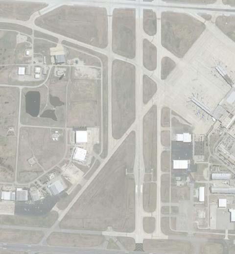
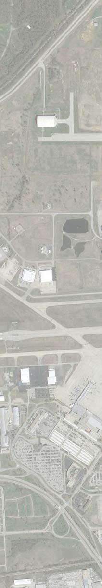
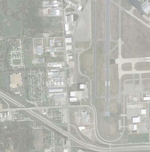
15 CHAPTER C Capacity & Facility Requirements Introduction This analysis uses the forecasts presented in the preceding chapter for establishing future development at the Airport. This is not intended to dismiss the possibility that either accelerated growth or consistently higher or lower levels of activity may occur. Aviation activity levels should be monitored for consistency with the forecasts. In addition, an airport s runway(s) and taxiways should be designed in accordance with the specified Runway Design Code (RDC) based on the Design Aircraft. The FAA defines Design Aircraft as an aircraft or group of aircraft within an RDC that have a minimum of 500 annual operations at an airport. The existing Airport Layout Plan (ALP) indicates Runway 18L/36R and Runway 8/26 are designated as RDC D-IV, while Runway 18R/36L is designated as RDC D-III. However, based on the critical aircraft analysis conducted for this MP Update, it has been determined that the RDC for Runways 8/26 and 18R/36L should be revised. Therefore, the following RDCs at TUL will be evaluated for this planning effort: Runway 18L/36R: RDC D-IV-1600 Runway 8/26: RDC D-III-4000 Runway 18R/36L: RDC D-II-4000 Airfield Capacity Methodology The capacity of an airfield is primarily a function of the major aircraft operating surfaces that compose the facility and the configuration of those surfaces (runways and taxiways). However, it is also related to and considered in conjunction with; environmental conditions, wind coverage, airspace utilization, and the C.1
16 availability and type of navigational aids. Capacity refers to the number of aircraft operations that a facility can accommodate on either an hourly or yearly basis. It does not refer to the size or weight of aircraft. The evaluation method used to determine the capacity of the airside facilities to accommodate aviation operational demand is described in the following narrative. Evaluation of this capability is expressed in terms of potential excesses and deficiencies in capacity. The methodology used for the measurement of airfield capacity is described in Federal Aviation Administration (FAA) Advisory Circular (AC) 150/5060-5, Airport Capacity and Delay. From this methodology, airfield capacity is defined in the following terms: Hourly Capacity of Runways: The maximum number of aircraft that can be accommodated under conditions of continuous demand during a one-hour period. Annual Service Volume: A reasonable estimate of an airport s annual capacity (i.e., level of annual aircraft operations that will result in an average annual aircraft delay of approximately one to four minutes). The capacity of an airport s airside facilities is a function of several factors. These factors include the layout of the airfield, local environmental conditions, specific characteristics of local aviation demand, and air traffic control requirements. The relationship of these factors and their cumulative impact on airfield capacity are examined in the following paragraphs. Airfield Layout The arrangement and interaction of airfield components (runways, taxiways, and ramp entrances) refers to the layout or design of the airfield. As previously described, TUL is operated with a three runway configuration. Two of the runways are parallel (Runway 18L/36R & Runway 18R/36L), oriented in a general north-south direction, and supported by a system of parallel and connecting taxiways. The third is a crosswind runway (Runway 8/26), oriented in a general east-west direction, which is also supported by a parallel and connecting taxiway system. Environmental Conditions Climatological conditions specific to the location of an airport not only influence the layout of the airfield, but also affect the use of the runway system. Surface wind conditions have a direct effect on the operations of an airport; runways not oriented to take the fullest advantage of prevailing winds will restrict the capacity of the airport to varying degrees. When landing and taking off, aircraft are able to operate properly on a runway as long as the wind component perpendicular to the direction of travel (defined as a crosswind) is not excessive. The wind coverage analysis translates the crosswind velocity and direction into a crosswind component. Smaller aircraft are more easily affected by crosswinds than larger aircraft, so therefore, they have a smaller crosswind component. Ceiling and Visibility. FAA Advisory Circular 150/5060-5, Airport Capacity and Delay, describes three categories of ceiling and visibility minimums for use in both capacity and delay calculations. Visual Flight Rules (VFR) conditions occur whenever the cloud ceiling is at least 1,000 feet above ground level and the C.2
17 visibility is at least three statute miles. Instrument Flight Rules (IFR) conditions occur when the reported cloud ceiling is at least 500 feet, but less than 1,000 feet and/or visibility is at least one statute mile, but less than three statute miles. Poor Visibility and Ceiling (PVC) conditions exist whenever the cloud ceiling is less than 500 feet and/or the visibility is less than one statute mile. However, meteorological data obtained for TUL from the National Climatic Data Center (2005 to 2014) for use in this planning effort, have been categorized in more specific terms. A summary of this data is presented in the following text and table entitled EXISTING METEOROLOGICAL CONDITIONS. VFR Conditions: A cloud ceiling equal to or greater than 1,000 feet above ground level (AGL) and the horizontal visibility is equal to or greater than 3 statute miles (SM). These conditions occur at the Airport approximately 92.89% of the time annually. VFR minimums to RNAV GPS Approach minimums (Runway 36L): A cloud ceiling less than 1,000 feet AGL and/or visibility less than 3 SM, but ceiling is equal to or greater than 427 feet AGL and visibility is equal to or greater than 1½ SM. These conditions occur at the Airport approximately 4.43% of the time annually. VFR minimums to ILS Approach minimums (Runways 18R & 26): A cloud ceiling less than 1,000 feet AGL and/or visibility less than 3 SM, but ceiling is equal to or greater than 200 feet AGL and visibility is equal to or greater than ¾ SM. These conditions occur at the Airport approximately 6.09% of the time annually. VFR minimums to Cat I ILS Approach minimums (Runways 18L & 36R): A cloud ceiling less than 1,000 feet AGL and/or visibility less than 3 SM, but ceiling is equal to or greater than 200 feet AGL and visibility is equal to or greater than ½ SM. These conditions occur at the Airport approximately 6.43% of the time annually. VFR minimums to Cat II ILS Approach minimums (Runway 36R): A cloud ceiling less than 1,000 feet AGL and/or visibility less than 3 SM, but ceiling is equal to or greater than 100 feet AGL and visibility is equal to or greater than ¼ SM. These conditions occur at the Airport approximately 6.45% of the time annually. Below Runway 36R Instrument Approach Minimums: A cloud ceiling less than 100 feet AGL and/or visibility less than ¼ SM. These conditions occur at the Airport approximately 0.66% of the time annually. C.3
18 Table C1 EXISTING METEOROLOGICAL CONDITIONS Weather Condition Percent Approximate Days Per Year VFR (Greater Than: 1,000 FT, 3 SM) 92.89% 339 IFR (427-1,000 FT; SM) to VFR Mins. 4.43% 16.2 IFR (200-1,000 FT; ¾-3 SM) to VFR Mins. 6.09% 22.2 IFR (200-1,000 FT; ½-3 SM) to VFR Mins. 6.43% 23.4 IFR (100-1,000 FT; ¼-3 SM) to VFR Mins. 6.45% 23.5 Below Minimums (0-100 FT; 0- ¼ SM) 0.66% 2.4 Source: Weather analysis tabulation provided by Mead & Hunt utilizing data obtained from NOAA, NCDC, Station /Tulsa International Airport. Period of Record: Therefore, in consideration of the existing weather data available for analysis from the existing TUL ASOS, it can be noted that the majority of the IFR accessibility benefit (over 94% of the existing IFR access) is provided by the non-precision instrument approach procedures offering 200-foot ceilings and ¾-statute mile visibility minimums. When the ½-mile approach visibility minimums are considered for the main runway, over 99% of the existing IFR access is available. For these existing conditions, the Airport can be expected to experience VFR conditions approximately 92.89% of the time, IFR conditions approximately 6.45% of the time, and below minimums approximately 0.66% of the time. These findings will be evaluated in a later section of this document to identify any future instrument procedure enhancement or revision recommendations for the Airport. Wind Coverage. Surface wind conditions (i.e., direction and speed) generally determine the desired alignment and configurations of the runway system. Runways, which are not oriented to take advantage of prevailing winds, will restrict the capacity of an airport. Wind conditions affect all aircraft in varying degrees; however, the ability to land and takeoff in crosswind conditions varies according to pilot proficiency and aircraft type. Generally, the smaller the aircraft, the more it is affected by crosswinds. To determine wind velocity and direction at TUL, wind data to construct the all-weather wind rose was obtained for the years from observations taken at the Airport. There were approximately 120,311 observations available for analysis during this ten-year period. The allowable crosswind component is dependent upon the Runway Design Code (RDC) for the type of aircraft that utilize the Airport on a regular basis. As identified previously, the RDC for Runway 18L/36R is D-IV, Runway 8/26 is D-III, and Runway 18R/36L is D-II. In consideration of the RDC D-IV classification for Runway 18L/36R, these standards specify that the 20-knot crosswind component be utilized for the analysis. In consideration of the RDC D-II and D-III classifications for Runway 18R/36L and Runway 8/26, these standards specify that the 16-knot crosswind component be utilized for the analysis. In addition, it is known that the Airport will continue to serve small single and multiengine aircraft for which the 10.5-knot crosswind component is considered maximum. Therefore, depending on runway designation, the 20-knot and 16-knot components, along with 13-knot and 10.5-knot crosswind C.4
19 components, were analyzed. The following figure entitled ALL-WEATHER WIND ROSE, illustrates the allweather wind coverage provided at TUL. The desirable wind coverage for an airport s runway system is 95 percent. This means that the runway orientation and configuration should be developed, so that the maximum crosswind component is not exceeded more than five percent of the time annually. The following table entitled ALL-WEATHER WIND COVERGE SUMMARY, quantifies the wind coverage offered by the Airport s existing runway system, including the coverage for each runway end. Based on the all-weather wind analysis for TUL, utilizing data from the National Oceanic and Atmospheric Administration (NOAA), National Climatic Data Center (NCDC), and the FAA Wind Analysis tool, the existing runway configuration provides excellent wind coverage (i.e., in excess of 98% for the 10.5-knot crosswind component, and also exceeds the 95% threshold for the parallel runway configuration). Therefore, no additional runways are required from a wind coverage standpoint. Table C2 ALL-WEATHER WIND COVERAGE SUMMARY Runway 10.5-Knot 13-Knot 16-Knot 20-Knot Runways 18L/36R & 18R/36L 95.43% 97.70% 99.22% 99.80% Runway 18L & 18R 76.74% 78.00% 78.91% 79.85% Runway 36R & 36L 62.17% 63.72% 64.95% 65.44% Runway 8/ % 83.68% 93.89% 98.40% Runway % 75.05% 84.09% 86.71% Runway % 73.68% 82.64% 81.61% Combined Runways 98.67% 99.67% 99.95% 99.99% Source: Wind analysis tabulation provided by Mead & Hunt utilizing the FAA Airport Design Tools, Wind Analysis. Wind data obtained from NOAA, NCDC, Station /Tulsa International Airport. Period of Record: NOTE: A 5-knot tailwind component was used for the individual runway end analysis. C.5
20 Figure C1 ALL-WEATHER WIND ROSE SOURCE: Wind rose provided by Mead & Hunt utilizing the FAA Airport Design Tools, Wind Analysis. Wind data obtained from NOAA, NCDC, Station /Tulsa International Airport. Period of Record: The Airport is served by fifteen (15) instrument approach procedures (5 to Runway 18L/36R, 6 to Runway 8/26, and 4 to Runway 18R/36L). In an effort to analyze the effectiveness of the current approaches an IFR wind analysis has been conducted. Using the wind data obtained from the NCDC, the following table, entitled IFR WEATHER WIND COVERAGE SUMMARY, quantifies the wind coverage provided during IFR meteorological weather conditions (i.e., ceiling less than 1,000 feet AGL and/or visibility less than 3 SM) to each runway and the individual runway ends. From the analysis, it can be determined that the north-south parallel runways offer the best overall wind coverage under IFR meteorological conditions. However, at the higher 16 & 20-knot crosswind components, the crosswind runway offers single runway end coverages that exceed the coverage provided by Runways 36R and 36L. The following figure entitled IFR WEATHER WIND ROSE, graphically portrays the IFR wind coverage. C.6
21 Table C3 IFR WEATHER WIND COVERAGE SUMMARY Runway 10.5-Knot 13-Knot 16-Knot 20-Knot Runways 18L/36R & 18R/36L 93.78% 96.43% 98.41% 99.41% Runways 18L & 18R 60.53% 61.83% 62.92% 63.47% Runways 36R & 36L 78.07% 80.05% 81.65% 82.48% Runway 8/ % 86.82% 95.39% 98.83% Runway % 77.54% 84.55% 86.78% Runway % 75.12% 82.70% 85.88% Combined Runways 97.94% 99.31% 99.81% 99.95% Source: Wind analysis tabulation provided by Mead & Hunt utilizing the FAA Airport Design Tools, Wind Analysis. Wind data obtained from NOAA, NCDC, Station /Tulsa International Airport. Period of Record: NOTE: A 5-knot tailwind component was used for the individual runway end analysis. Figure C2 IFR WEATHER WIND ROSE SOURCE: Wind rose provided by Mead & Hunt utilizing the FAA Airport Design Tools, Wind Analysis. Wind data obtained from NOAA, NCDC, Station /Tulsa International Airport. Period of Record: Characteristics of Demand Certain site-specific characteristics related to aviation use and aircraft fleet makeup impact the capacity of the airfield. These characteristics include runway use, aircraft mix, percent arrivals, touch-and-go operations, and exit taxiways. Aircraft Mix. The capacity of a runway is dependent on the type and size of the aircraft that utilize the facility. Aircraft are categorized into four classes: Classes A and B consist of small single engine and twin-engine aircraft (both prop and jet), weighing 12,500 pounds or less, which are representative of the smaller general aviation fleet. Class C and D aircraft are large jet and propeller aircraft typical of those utilized by the larger general aviation fleet, airline industry, and the military. Aircraft mix is C.7
22 defined as the relative percentage of operations conducted by each of these four classes of aircraft. In consideration of the forecasts presented in the previous chapter, an aircraft mix table has been generated. The following table, entitled AIRCRAFT CLASS MIX FORECAST, , presents the projected operational mix for the selected forecasts. Table C4 AIRCRAFT CLASS MIX FORECAST, VFR Conditions IFR Conditions Year Class A & B Class C Class D Class A & B Class C Class D % 83.22% 2.54% 5.00% 85.00% 10.00% % 83.50% 2.50% 5.00% 85.00% 10.00% % 83.00% 2.50% 5.00% 85.00% 10.00% % 83.00% 2.50% 5.00% 85.00% 10.00% % 83.00% 2.00% 5.50% 85.00% 9.50% Class A - Small Single Engine, < 12,500 pounds Class C - 12, ,000 pounds Class B - Small Twin-Engine, < 12,500 pounds Class D - > 300,000 pounds 1 Existing percentage breakdowns were tabulated/estimated by Mead & Hunt from 2014 TUL Passur data. NOTE: Future percentage breakdowns were estimated by Mead & Hunt. Percent Arrivals. Runway capacity is also significantly influenced by the percentage of all operations that are arrivals. Because aircraft on final approach are typically given absolute priority over departures, higher percentages of arrivals during peak periods of operations will reduce the Annual Service Volume (ASV). The operations mix occurring on the runway system at the Airport reflects a general balance of arrivals to departures; therefore, it will be assumed in the capacity calculations that arrivals equal departures during the peak period. Touch-and-Go Operations. A touch-and-go operation refers to an aircraft maneuver in which the aircraft performs a normal landing touchdown followed by an immediate takeoff, without stopping or taxiing clear of the runway. These operations are normally associated with training activity and are included in local operations figures when reported by an air traffic control tower. According to Air Traffic Control records, local operations are estimated to represent approximately 4.5% of the total annual operations being conducted at the Airport. It is anticipated that this existing level of flight training will likely continue through the planning period; thus, the overall percentage of touch-and-go operations is projected to remain relatively constant through the planning period. Runway Use. The use configuration of the runway system is defined by the number, location, and orientation of the active runway(s) and relates to the distribution and frequency of aircraft operations to those facilities. Both the prevailing winds in the region, the instrument approach procedure capabilities the runways and the existing runway configuration at TUL combine to dictate the utilization of the existing runway system. According to the analysis of 2014 Passur data for TUL, the existing runway utilization breakdown for the Airport is presented as follows: C.8
23 Runway 75.5% Runway 47.1% Runway 28.4% Runway 22.8% Runway 14.4% Runway 8.4% Runway 3.6% Runway 1.9% Runway 1.7% Exit Taxiways. The capacity of a runway system is greatly influenced by the ability of an aircraft to exit the runway as quickly and safely as possible. Therefore, the quantity and design of the exit taxiways can directly influence aircraft runway occupancy time and the capacity of the runway system. Based on the location of the existing exit taxiways serving the runway system at TUL, the number of available exit taxiways for use in the capacity calculation is generally adequate. For Runway 18L/36R and Runway 8/26, in consideration of the mix index of aircraft operating under VFR conditions, the capacity analysis, as described in the FAA Advisory Circular 150/5060-5, Airport Capacity and Delay, gives credit to only those runway exit taxiways located between 5,000 and 7,000 feet from the landing threshold. Therefore, landings to each runway end received an exit rating of two (2), with the exception of Runway 36R landings exiting to the east (e.g., in route to the American Airlines maintenance base) and Runway 8 landings exiting to the north, which each received an exit rating of one (1). Due to the shorter length of Runway 18R/36L, landings to each runway end only received an exit rating of one (1). A taxiway exit rating of four (4) is the maximum rating that can be received, and no credit given for an exit within 750 feet of another exit. Given the Airport s existing and projected operational levels, the future addition and/or repositioning of existing exit taxiways (if any) will be evaluated in conjunction with the formulation of airside development alternatives. Air Traffic Control Rules The FAA specifies separation criteria and operational procedures for aircraft in the vicinity of an airport contingent upon aircraft size, availability of radar, sequencing of operations, and noise abatement procedures (both advisory and/or regulatory, which may be in effect at the airport). Typically, the impact of air traffic control on runway capacity is most influenced by aircraft separation requirements dictated by the mix of aircraft utilizing the Airport. However, the existing parallel runway configuration permits a relatively easy separation of traffic between the commercial carriers, passengers and cargo, using the primary runway (Runway 18L/36R) and the bulk of the general aviation activity using the secondary runway (Runway 18R/36L). Thus, there are no special air traffic control rules in effect at TUL that significantly affect operational capacity. C.9
24 Airfield Capacity Analysis As previously described, the determination of capacity for TUL uses the methodology described in the FAA Advisory Circular 150/5060-5, Airport Capacity and Delay, along with the Airport Design Computer Program that accompanies AC 150/ Several assumptions are incorporated in these capacity calculations: arrivals equal departures, the percent of touch-and-go operations is between 0-50% of total operations, there is a full-length parallel taxiway with ample exits and no taxiway crossing problems, there are no airspace limitations, the Airport has at least one runway equipped with an ILS and the necessary air traffic control facilities to carry out operations in a radar environment, IFR weather conditions occur roughly 10% of the time, and approximately 80% of the time the Airport is operated with the runway use configuration that produces the greatest hourly capacity. Applying information generated from the preceding analyses, capacity and demand are formulated in terms of the following results: Hourly Capacity of Runways (VFR and IFR) Annual Service Volume (ASV) Hourly Runway Capacity Calculations of hourly capacity begin with an evaluation of each possible runway-use configuration at the Airport. With consideration of the Airport s aircraft mix index, annual percentage of touch-and-go operations, and taxiway exit rating, an hourly capacity was calculated. In its normal operating configurations, the VFR hourly capacity is potentially as high as 83 operations and the IFR hourly capacity is potentially as high as 80 operations per hour. Annual Service Volume After determining the hourly capacity for each potential runway use configuration, a weighted hourly capacity of the entire Airport can be calculated. The weighted hourly capacity takes into consideration not only the aircraft mix index, but the percent utilization of each possible runway use configuration as well. The weighted hourly capacity for TUL for 2014 was determined to be approximately 81 operations per hour. This weighted hourly capacity can then be used in calculating the Annual Service Volume (ASV) for the Airport. The ASV is calculated using the following formula: ASV = C W x D x H CW weighted hourly capacity D ratio of annual demand to average daily demand H ratio of average daily demand to average peak hour demand C.10
25 With the existing runway configuration, and in consideration of existing utilization patterns, the Airport has been determined to have a daily ratio (D) of 307 and an hourly ratio (H) of 10.3 and, thus, an ASV of approximately 255,928. Conditions that involve the determination of the weighted hourly capacity and the daily demand are not forecast to change significantly at the Airport in the future, and those numbers will generally remain constant throughout the planning period. The hourly ratio, as specified in the formula, is the inverse of the daily operations that occur during the peak period. In other words, as operations increase, the peak periods tend to spread out, increasing the hourly ratio (H). As the hourly ratio increases, the ASV will increase. Thus, as presented in the following table, entitled AIRFIELD CAPACITY FORECAST SUMMARY, , even without runway improvements, the ASV at TUL could increase to over 300,00 operations by This analysis indicates that the forecast demand does not suggest the need for a new runway at the Airport within the planning period covered in this Master Plan Update. However, the evaluation of future improvements/upgrades to Runway 18R/36L is included as an element of planning effort and will be addressed in later sections of this chapter. In addition, future taxiway improvements will also be examined and potentially recommended for development to maintain an efficient and safe aviation operational environment. Table C5 AIRFIELD CAPACITY FORECAST SUMMARY, Year Annual Operations Design Hour Operations Annual Service Volume (ASV) , , , , , , , ,406 Source: Mead & Hunt using FAA AC 150/5060-5, Airport Capacity and Delay, September Ground Access Capacity The capacity of airport ground access roadway systems is a function of the maximum number of vehicles accommodated by a particular facility. At TUL, this relates primarily to the entrance/looped roadway system capacity, which is the number of vehicles that can use a certain roadway section in a given time period. The capacity analyses for the roadways providing access to the Airport, as well as the airport roadway system, are based upon generalized planning guidelines from the 2010 Highway Capacity Manual (HCM), published by the Transportation Research Board. According to this manual, it is normally preferred that roadways operate below capacity to provide reasonable flow and minimize delay to the vehicles using it. The manual defines different operating conditions, known as Levels-Of-Service (LOS). The LOS are functions of the volume and composition of the traffic and the speeds attained. Six LOS have been established, designated by the letters A-F, providing for best to worst service in terms of driver satisfaction. LOS A C.11
26 roadways are completely unimpeded in their ability to maneuver within the traffic system. A LOS C (stable traffic flow and minimal delays) is generally the preferred level-of-service on an urban road system. Average hourly volumes of airport service roadways of typical facilities at level-of-service C and D are summarized in the following table, entitled GROUND ACCESS FACILITY VOLUME. The various ranges given in the table make their use in defining roadway capacity analysis beneficial for initial problem testing. Table C6 GROUND ACCESS FACILITY VOLUME Facility Type Average Hourly Volume 1 (Vehicle/Hour/Lane) (2) Freeways (Uninterrupted Flow Facilities) 1,510-1,830 Signalized Arterials 40 mph or higher posted speed limit (Interrupted Flow Facilities) 3 Signalized Arterials 35 mph or slower posted speed limit (Interrupted Flow Facilities) , Source: Mead & Hunt review of 2010 Highway Capacity Manual & Florida Department of Transportation s Generalized Peak Hour Directional Volumes. 1 Level-of-Service C and D. 2 Passenger-Car Equivalents. 3 Includes One-Way Facility Adjustment (increase) of 1.2. The breadth of the ranges given in the above table is most useful for initial testing of problems with roadway capacity. The focus of the access roadway capacity assessment is on the service provided between the terminal curb or parking areas and the highway interchange linking the Airport with the regional transportation system. Thus, the analysis for TUL is focused on Airport Drive, which connects the terminal area with State Highway 11/Gilcrease Expressway. Airport Drive is a closed loop access road (consisting of 2-3 lanes) that provides free flow access to and from the lower departure and the upper arrival levels area of the passenger terminal building. The posted speeds for this roadway range from 25 mph on the perimeter to 15 mph along the terminal curbs. There are also pedestrian crosswalks that intersect Airport Drive on both the departure and arrival levels, which link the parking structure with the terminal building. These pedestrian crossings, particularly on the upper arrivals level, do reduce the throughput rates of the access roadway system during peak hour operating periods. A conservative estimate of the traffic volumes presented in the previous table would indicate that Airport Drive has a capacity of 900 to 1,200 vehicles per hour at a LOS in the C to D range. One of the existing transportation design/engineering challenges with Airport Drive is the relatively close proximity between the Gilcrease Expressway and the access roadways serving the terminal parking structure/ rental-car return facilities. Thus, vehicles accessing Airport Drive have a limited length of terminal approach roadway (i.e., approximately 1/10 of a mile or about 600 feet) to maneuver to the far left lane to access the parking structure for long-term parking or the rental-car return facility. C.12
27 This existing situation is somewhat mitigated with the existing airport roadway signage that is provided, and some additional signage improvements are programmed in conjunction with the planned parking structure expansion and reconfiguration project. The following table presents existing and forecasted peak hour passenger cars in the peak direction. These estimates are intended to be somewhat high, and are based upon 100% of passengers arriving to the Airport in rental cars or private automobiles, based on an average vehicle occupancy rates typically observed at airports similar to TUL of 1.5 passengers per vehicle. Table C7 AIRPORT ACCESS DEMAND FORECAST, Peak Hour Passenger Cars Year in Peak Direction Source: Mead & Hunt estimates based on projected peak hour passenger data. As can be seen from the tables, Airport Drive would appear to have adequate capacity to accommodate existing and forecasted passenger vehicular traffic, including shuttle buses and taxis, through the planning period. However, this analysis does not consider background traffic (i.e., traffic using the terminal area roadways that is unrelated to passenger-generated traffic). At TUL, the background traffic within the passenger terminal area consists primarily of airport staff/terminal building employees, hotel guests, and cargo-related vehicular traffic that primarily utilize other supporting roadways (e.g., N. Cargo Road, E. Young Street, E. Apache Street, etc.), which minimizes vehicular congestion on Airport Drive. In addition, there is a substantial amount of employee vehicular traffic located on the east side of the Airport that is related to the American Airlines Maintenance Base, Spirit Aerosystems, the Oklahoma Air National Guard, and the IC Tulsa Bus Plant. Each of these facilities is provided vehicular access via N. Mingo Road (a four lane arterial) with direct connections to U.S. Highway 169/Mingo Valley Expressway via 36 St. North and 46 St. North, which are also a four lane arterial roadways. N. Mingo Road also intersects E. Pine Street southeast of the Airport, which connects to U.S. Highway 169 to the east, as well as State Highway 11 to the west. Based upon existing employee traffic levels utilizing these roadways on the east side of the Airport, it appears that the roadway capacity is currently adequate. However, the capacity of the roadways should be monitored periodically in conjunction with the continued development of new industrial land uses on the east side of the Airport. Terminal Curb Frontage Many passengers, their baggage, and sometimes accompanying visitors are dropped off and picked up at the terminal building curb frontage. In this area, passengers leave ground transportation (automobile, taxi, limousine, or courtesy van) and become pedestrians on their way to or from the aircraft loading gate. Therefore, the terminal curb is the interface between the terminal building and the ground transportation C.13
28 system. The length of curb required for the loading and unloading of passengers is determined by the type and volume of ground vehicle traffic anticipated in the peak period on the design day. According to information contained in Airport Cooperative Research Program (ACRP) Report 25, Airport Passenger Terminal Planning and Design, Volume 1: Guidebook, the interior lane closest to the curb is dedicated to vehicles stopping to drop-off/pick-up passengers. The second lane is used by both double-parked vehicles, as well as a transition lane, used by vehicles pulling in and away from the curb. The third lane is a transition/weaving lane, while the fourth lane is a dedicated thru lane used by vehicles driving past the curb. As noted in the previous section, access to both the lower departure level and the upper arrival level of the terminal building is provided via Airport Drive. Each level offers both private passenger and commercial vehicle drop-off/pick-up, with two dedicated drive thru lanes and two additional parallel parking lanes at the terminal curb. There are approximately 1,000 linear feet of curb frontage at both the arrival and the departure levels. The scope of this planning effort does not warrant a detailed analysis of the passenger terminal curb requirements. However, based on staff observations of existing peak period passenger enplanements and deplanements, the terminal curb at the arrivals level is experiencing excessive congestion, and the Airport is investigating various options to enhance capacity. These capacity enhancement options include signage changes, curb length extension, and the potential construction of an additional lane with curb/loading area. With these additional improvements, the terminal curb length would have adequate capacity to accommodate both existing and forecast passenger demand throughout the 20-year planning period of this Master Plan Update. Terminal Parking Space The existing public automobile parking areas at TUL are represented by a combination of spaces provided by the Airport within the terminal area and a private off-site parking provider that shuttles passengers to and from the terminal building. The Airport s parking, totaling 3,664 spaces, are distributed between the existing parking garage (2,001 spaces) and the surface level Express Shuttle/Vallet Lots (1,663 spaces). In addition to public parking spaces, the Airport has two employee lots, totaling of 573 spaces and a ready-rental car lot of 502 spaces in the parking garage and an additional 1,534 spaces available in the remote-rental storage area. The private offsite parking operator currently provides an estimated total of 2,380 spaces that are allocated between a parking garage and surface parking (covered and uncovered). This analysis is limited to establishing an estimate of the total public car spaces required over the 20-year planning period of this study. Typically, for generalized planning purposes automobile parking space requirements are developed in relationship to annual passenger enplanements as opposed to peak hour passengers 1. Therefore, a parking space ratio (i.e., spaces required per 1 million enplanements) has been identified using both existing enplanements and parking space counts. The resulting tabulation equates to 4,387 public parking spaces per million annual originating enplanements. Based upon Airport Staff observations, the existing Airport parking facilities are nearing capacity, and the ratio has been increased to 4,600 spaces to account for the Airport s current parking structure expansion project (i.e., improvements will add 292 public parking spaces). The 1 Airport Cooperative Research Program (ACRP) Report 25 Airport Passenger Terminal Planning and Design, Volume 1: Guidebook provides Rule-of-Thumb passenger parking guidelines that can be customized to a specific airport. C.14
29 adjusted parking space ratio has been used to assess the projected parking requirements throughout the planning period. The following table illustrates the results of the analysis and indicates that the existing public parking capacity at TUL will likely need to be expanded through the planning period, with an estimated 2,860 additional spaces being needed by Table C8 PUBLIC PASSENGER TERMINAL VEHICLE PARKING PROJECTIONS Item Forecast Annual Enplanements 1,375,399 1,497,055 1,622,924 1,933,490 Forecast Peak Hour Enplanements Existing Airport Public Parking (Sub-total) 3, Short-Term (Garage) Long-Term (Garage) 1, Long-Term (Express Shuttle/Vallet) 1, Existing Offsite Public Parking (Sub-total) 2, Garage 1, Surface 1, Total Public Parking 6, Existing Parking Space Ratio 4,387 spaces/ 1 million enplanements 4,600 spaces/ 1 million enplanements 4,600 spaces/ 1 million enplanements 4,600 spaces/ 1 million enplanements Estimated Parking Space Requirements 6, ,886 7,465 8,894 (Additional Spaces Needed) ,429 Source: Mead & Hunt Notes: 1 Current parking structure expansion improvements will add 292 public parking spaces. Capacity Summary This section has analyzed the capacity of existing facilities at TUL. Both adequate airfield and ground access facilities are critical components in the ability of the Airport as a whole to efficiently serve the public. Capacity deficiencies that cause delays associated within one area will often be reflected in the ability or inability of the entire facility to function properly. The following facility requirements section will delineate the various facilities required to properly accommodate future demand. This information, in addition to the capacity analysis, will provide the basis for C.15
30 formulating the alternative development scenarios for the Airport, ensuring that the new Recommended Development Plan can adequately accommodate the long-term aviation development requirements of the region. Airfield Facility and Airspace Requirements To identify facility needs, it is necessary to translate the forecast aviation activity into specific types and quantities. This section addresses the actual physical facilities and/or improvements to existing facilities needed to safely and efficiently accommodate the projected demand that will be placed on the Airport. This section consists of two separate analyses: those requirements dealing with airfield facilities, and those dealing with landside facilities. The analysis of airfield requirements focuses on the determination of needed facilities and spatial considerations related to the actual operation of aircraft on the Airport. This evaluation includes the analysis of airfield dimensional criteria according to the updated FAA Advisory Circular 150/ A, Change 1, Airport Design, the establishment of design parameters for the runway and taxiway system, and an identification of airfield instrumentation and lighting needs. Airfield Design Standards The types of aircraft that currently operate at TUL, and those projected to utilize the facility in the future have an impact on the planning and design of airport facilities. This knowledge assists in the selection of FAA specified design standards for the Airport, which include runway and taxiway dimensional requirements, runway length, and pavement strength. These standards are based on the Design Aircraft that currently utilize the Airport, or that are projected to utilize the Airport in the future. According the AC 150/ A, Change 1, Airport Design; the first step in defining a runway s design geometry is to determine the Runway Design Code (RDC). The Design Aircraft can take the form of one particular aircraft, or a composite aircraft representing a collection of aircraft classified by three parameters: Aircraft Approach Category (AAC), Airplane Design Group (ADG), and Taxiway Design Group (TDG). As described in the previous chapter, the critical aircraft for each runway at TUL was identified and is documented as follows: Runway 18L/36R: Combination of the Learjet series of aircraft (Aircraft Approach Category D, based on approach speed) and the Boeing /Airbus A-300 (Airplane Design Group IV, based on wingspan), along with approach visibility minimums of < ¾-mile. Runway 8/26: Combination of the Learjet series of aircraft (Aircraft Approach Category D, based on approach speed) and the Boeing (Airplane Design Group III, based on wingspan), along with approach visibility minimums of > ¾-mile. Runway 18L/36R: Combination of the Learjet series of aircraft (Aircraft Approach Category D, based on approach speed) and the Bombardier Challenger 600 (Airplane Design Group II, based on wingspan), along with approach visibility minimums of > ¾-mile. C.16
31 The third component of the Design Aircraft is the Taxiway Design Group (TDG). The TDG is based on both the wheelbase, the distance between the aircraft s main gear, or the overall Main Gear Width (MGW), and the distance from the aircraft cockpit to the main gear, or the Cockpit to Main Gear (CMG) distance. For example, the Boeing has a MGW of 21 feet, and a CMG of 42.7 feet, placing the aircraft in the TDG 3 classification. Not all of the taxiways at TUL are designed to accommodate the same TDG s, and these taxiway design standards will be covered in greater detail in later sections. Runway 18L/36R Design Standards. Existing dimensions and the corresponding existing FAA design standards applicable to Runway 18L/36R are presented in the following table entitled RUNWAY 18L/36R DESIGN STANDARDS MATRIX RDC D-IV < ¾ MILE VISIBILITY MINIMUMS and the following figure entitled EXISTING RDC D-IV DESIGN STANDARDS. As can be noted, the runway meets or exceeds all of the specified FAA dimensional standards for the RDC D-IV Table C9 RUNWAY 18L/36R DESIGN STANDARDS MATRIX RDC D-IV-1600 (< ¾-MILE VISIBILITY MINIMUMS) Item Existing Dimension FAA Criteria Standard Met RUNWAY DESIGN Runway Width 150 FT 150 FT Yes Shoulder Width 50 FT 25 FT Yes Blast Pad Width 200 FT 200 FT Yes Blast Pad Length 200 FT 200 FT Yes Crosswind Component 20 Knots 20 Knots Yes RUNWAY PROTECTION Runway Safety Area (RSA) - Both Runway Ends Length beyond departure end 1,000 FT 1,000 FT Yes Length prior to threshold 600 FT 600 FT Yes Width 500 FT 500 FT Yes Runway Object Free Area (ROFA) - Both Runway Ends Length beyond departure end 1,000 FT 1,000 FT Yes Length prior to threshold 600 FT 600 FT Yes Width 800 FT 800 FT Yes Runway Obstacle Free Zone (ROFZ) - Both Runway Ends Length 200 FT 200 FT Yes Width 400 FT 400 FT Yes Precision Obstacle Free Zone (POFZ) - Both Runway Ends Length 200 FT 200 FT Yes Width 800 FT 800 FT Yes Approach Runway Protection Zone (RPZ) Length 2,500 FT/2,500 FT 2,500 FT/2,500 FT Yes 1, 2 Inner Width 1,000 FT/1,000 FT 1,000 FT/1,000 FT Yes Outer Width 1,750 FT/1,750 FT 1,750 FT/1,750 FT Yes Departure Runway Protection Zone (RPZ) Length 1,700 FT 1,700 FT Inner Width 500 FT 500 FT Yes 1, 2 Yes C.17


32
33 Table C9 RUNWAY 18L/36R DESIGN STANDARDS MATRIX RDC D-IV-1600 (< ¾-MILE VISIBILITY MINIMUMS) CONTINUED Item Existing Dimension FAA Criteria Standard Met Outer Width 1,010 FT 1,010 FT Yes RUNWAY SEPARATION Runway centerline to: Parallel runway centerline 5,104 FT 5,000 FT Yes Holding position 250 FT 250 FT Yes Parallel taxiway/taxilane centerline (TW E ) FT 400 FT Yes Parallel taxiway/taxilane centerline (TW J ) 500 FT 400 FT 3 Yes Parallel taxiway/taxilane centerline (TW G ) 712 FT 400 FT 3 Yes Aircraft parking area (east) 780 FT 500 FT Yes Aircraft parking area (west) 844 FT 500 FT Yes Source: FAA Advisory Circular 150/ A, Change 1, Airport Design (February 2014) Note: 1 N. Port Road, railroad tracks, and overhead utility lines traverse the Runway 18L approach and departure RPZ. 2 N. 85 th E. Ave. and railroad tracks traverse the Runway 36R approach and departure RPZ. 3 Separation standards are increased based on TDG to accommodate high speed exits (e.g., 450 for TDG 5). Runway 8/26 Design Standards. Existing dimensions and the corresponding existing FAA design standards applicable to Runway 16/34 are presented in the following table entitled RUNWAY 8/26 DESIGN STANDARDS MATRIX RDC D-III > ¾ MILE VISIBILITY MINIMUMS and the following figure entitled EXISTING RDC D-III DESIGN STANDARDS. As can be noted, the runway meets or exceeds all of the specified FAA dimensional standards for the RDC D-III Table C10 RUNWAY 8/26 DESIGN STANDARDS MATRIX RDC D-III-4000 (> ¾-MILE VISIBILITY MINIMUMS) Item Existing Dimension FAA Criteria Standard Met RUNWAY DESIGN Runway Width 150 FT 150 FT Yes Shoulder Width 50 FT 25 FT Yes Blast Pad Width 200 FT 200 FT Yes Blast Pad Length 200 FT 200 FT Yes Crosswind Component 16 Knots 16 Knots Yes RUNWAY PROTECTION Runway Safety Area (RSA) - Both Runway Ends Length beyond departure end 1,000 FT 1,000 FT Yes Length prior to threshold 600 FT 600 FT Yes Width 500 FT 500 FT Yes Runway Object Free Area (ROFA) - Both Runway Ends Length beyond departure end 1,000 FT 1,000 FT Yes Length prior to threshold 600 FT 600 FT Yes Width 800 FT 800 FT Yes Runway Obstacle Free Zone (ROFZ) - Both Runway Ends Length 200 FT 200 FT Yes Width 400 FT 400 FT Yes C.19


34
35 Table C10 RUNWAY 8/26 DESIGN STANDARDS MATRIX RDC D-III-4000 (> ¾-MILE VISIBILITY MINIMUMS) CONTINUED Item Existing Dimension FAA Criteria Standard Met Approach Runway Protection Zone (RPZ) Length 1,700 FT/1,700 FT 1,700 FT/1,700 FT Yes 1, 2 Inner Width 500 FT/1.000 FT 500 FT/1.000 FT Yes Outer Width 1,010 FT/1,510 FT 1,010 FT/1,510 FT Yes Departure Runway Protection Zone (RPZ) Length 1,700 FT 1,700 FT Inner Width 500 FT 500 FT Yes 1, 2 Yes Outer Width 1,010 FT 1,010 FT Yes RUNWAY SEPARATION Runway centerline to: Holding position 250 FT 250 FT Yes Parallel taxiway/taxilane centerline (TW B ) 600 FT 400 FT 3 Yes Parallel taxiway/taxilane centerline (TW C ) 400 FT 400 FT 3 Yes Aircraft parking area (north) 814 FT 500 FT Yes Aircraft parking area (south) 654 FT 500 FT Yes Source: FAA Advisory Circular 150/ A, Change 1, Airport Design (February 2014) Note: 1 Sheridan Road traverses the Runway 8 approach and departure RPZ. 2 Mingo Road traverses the Runway 26 approach and departure RPZ. 3 Separation standards are increased based on TDG to accommodate high speed exits (e.g., 450 for TDG 5). Runway 18R/36L Design Standards. Existing dimensions and the corresponding existing FAA design standards applicable to Runway 16/34 are presented in the following table entitled RUNWAY 18R/36L DESIGN STANDARDS MATRIX RDC D-II > ¾ MILE VISIBILITY MINIMUMS and the following figure entitled EXISTING RDC D-II DESIGN STANDARDS. As can be noted, the runway does not meet all of the specified FAA dimensional standards for the RDC D-II The existing Runway Safety Area (RSA) is non-standard at each end of the runway, while the Runway Object Free Area (ROFA) is non-standard at the south end of the runway. Table C11 RUNWAY 18R/36L DESIGN STANDARDS MATRIX RDC D-II-4000 (> ¾-MILE VISIBILITY MINIMUMS) Item Existing Dimension FAA Criteria Standard Met RUNWAY DESIGN Runway Width 150 FT 100 FT Yes Shoulder Width 50 FT 10 FT Yes Blast Pad Width 200 FT 120 FT Yes Blast Pad Length 200 FT 150 FT Yes Crosswind Component 16 Knots 16 Knots Yes RUNWAY PROTECTION Runway Safety Area (RSA) Length beyond departure end (Runway 36L) 52 FT 1,000 FT No 1 Length prior to threshold (Runway 18R) 52 FT 600 FT No 1 Length beyond departure end (Runway 18R) 630 FT 1,000 FT No 2 C.21


36
37 Table C11 RUNWAY 18R/36L DESIGN STANDARDS MATRIX RDC D-II-4000 (> ¾-MILE VISIBILITY MINIMUMS) CONTINUED Item Existing Dimension FAA Criteria Standard Met Length prior to threshold (Runway 36L) 630 FT 600 FT Yes Width 500 FT 500 FT Yes Runway Object Free Area (ROFA) - Both Runway Ends Length beyond departure end (Runway 36L) 1,000 FT 1,000 FT Yes Length prior to threshold (Runway 18R) 1,000 FT 600 FT Yes Length beyond departure end (Runway 18R) 0 FT 1,000 FT No 3 Length prior to threshold (Runway 36L) 0 FT 600 FT No 3 Width 800 FT 800 FT Yes Runway Obstacle Free Zone (ROFZ) - Both Runway Ends Length 200 FT 200 FT Yes Width 400 FT 400 FT Yes Approach Runway Protection Zone (RPZ) Length 1,700 FT/1,700 FT 1,700 FT/1,700 FT Yes 4, 5 Inner Width 1,000 FT/500 FT 1,000 FT/500 FT Yes Outer Width 1,510 FT/1,010 FT 1,510 FT/1,010 FT Yes Departure Runway Protection Zone (RPZ) Length 1,700 FT 1,700 FT Yes 4, 5 Inner Width 500 FT 500 FT Yes Outer Width 1,010 FT 1,010 FT Yes RUNWAY SEPARATION Runway centerline to: Holding position 250 FT 250 FT Yes Parallel taxiway/taxilane centerline (TW L ) 400 FT 400 FT Yes Parallel taxiway/taxilane centerline (TW M ) 400 FT 400 FT Yes Aircraft parking area (east) 750 FT 500 FT Yes Aircraft parking area (west) >500 FT 500 FT Yes Source: FAA Advisory Circular 150/ A, Change 1, Airport Design (February 2014) Note: 1 The RSA length requirements are not met off the Runway 18R end given the proximity of steep topography, security fencing, N. Port Road, railroad tracks, and overhead utility lines. 2 The RSA length requirements are not met off the Runway 36L end given the proximity of the existing localizer, security fencing, and E. Apache/E. 31 st Street. 3 The ROFA length requirement is not met off the Runway 36L end given the proximity of security fencing and E. Apache/E. 31 st Street. 4 N. Port Road, railroad tracks, and overhead utility lines traverse the Runway 18R approach and departure RPZ. 5 E. Apache/E. 31 st Street and the Gilcrease Expressway traverse the Runway 36L approach and departure RPZ. The RSA is an integral component of the runway environment. It enhances the safety of aircraft operations which undershoot, overrun, or veer off the runway, and it provides greater accessibility for fire-fighting and rescue equipment during such incidents. FAA Advisory Circular 150/ A, Change 1 Airport Design, states that the RSA is a defined surface centered on the runway centerline, prepared and suitable for reducing the risk of damage to aircraft in the event of an undershoot, overshoot, or excursion from the runway. It must be cleared and graded and have no potentially hazardous ruts, humps, depression, or other surface variations; drained by grading or storm sewers to prevent water accumulation; capable under dry conditions of supporting rescue vehicles; and free C.23
38 of objects except those that must be located in the RSA by function. If objects higher than three inches must be located within the RSA, then to the extent practical, they must be constructed on frangible mounted structures of the lowest practical height with the frangible point no higher than three inches above grade. The design standard for a RDC D-II RSA width is 500 feet wide, extending 250 feet laterally from the runway centerline. The RSA width for Runway 18R/36L meets this standard. The design standard for a RDC D-II RSA length is to extend 1,000 feet past the departure end, and 600 feet prior to the landing threshold of the runway. The RSA at the approach end of Runway 18R is limited to approximately 52 feet, by topography, roadways, and a railroad to the north, while the RSA at the approach end of Runway 36L is limited to approximately 630 feet by the localizer antenna and roadways to the south. It is also important to note that RSA standards cannot be modified or waived. The Runway Object Free Area (ROFA) is centered about the runway centerline and requires clearing the ROFA of above-ground objects protruding above the nearest point of the RSA. Except where precluded by other clearing standards, it is acceptable for objects that need to be located in the ROFA for air navigation or aircraft ground maneuvering purposes to protrude above the nearest point of the RSA, and to taxi and hold aircraft in the ROFA. To the extent practicable, objects in the ROFA should meet the same frangibility requirements as the RSA. Objects non-essential for air navigation or aircraft ground maneuvering purposed must not be placed in the ROFA, this includes parked aircraft. The design standard for a RDC D-II ROFA width is 800 feet wide and the design standard for length is 1,000 feet beyond the runway end. As with the RSA, the ROFA meets the width standards. However, the ROFA length at the approach end of Runway 36L is limited to approximately 0 feet by security fencing and roadways to the west. Runways In consideration of the forecasts of future aviation activity, the adequacy of the runway system must be analyzed from several perspectives. These include runway orientation and airfield capacity, which were analyzed in previous sections, as well as runway length, pavement strength and runway visibility, which will be evaluated in the following text. The analysis of these various aspects pertaining to the runway system will provide a basis for recommendations of future improvements. Runway Length. The determination of runway length recommendations for airport planning purposes is based on several factors. These factors include: Airport elevation Above Mean Sea Level (AMSL); Mean Normal Maximum daily Temperature (MNMT) of the hottest month; Runway gradient; Family grouping of critical aircraft for runway length purposes; and Stage length of the longest nonstop trip destination. The calculation for runway length requirements at TUL are based on an elevation of feet (AMSL), 93.1 Fahrenheit MNMT, and a maximum differential in runway centerline elevation for each runway as follows: C.24
39 Runway 17.5 feet Runway 38.3 feet Runway 42.4 feet In 2005, the FAA published an update to the Advisory Circular (AC) 150/5325-4B, Runway Length Requirements for Airport Design. The revised AC included a process for determining recommended runway length. The first step is to determine a critical aircraft for runway length. If this critical aircraft is a regional jet or a commercial aircraft with a Maximum Take-Off Weight (MTOW) over 60,000 pounds, the AC directs the reader to the design guidelines in Chapter 4, which includes instructions for utilizing aircraft manufacturer published Airport Planning Manuals (APMs) for determining recommended runway lengths and then applying an adjustment for non-zero effective runway gradients. This adjustment equates to a 10 foot increase in runway length for each one foot of difference in the runway centerline elevation. After following the Chapter 4 instructions for each individual aircraft using the Airport on a regular basis, the final recommended runway length is determined by selecting the longest runway length recommendation. For the purposes of this runway length analysis, commercial aircraft that currently operate at the Airport were considered in the following table entitled EXISTING COMMERICAL AIRCRAFT RUNWAY TAKEOFF LENGTH RECOMMENDATIONS, IN FEET. The runway length requirements for these aircraft will apply to the primary runway (i.e., Runway 18L/36R) and the crosswind runway (i.e., Runway 8/26). In addition for the commercial aircraft fleet, the landing length requirements are typically less demanding than the takeoff length requirements and this is the case for TUL. However, some consideration should be given to the FAA s 60% rule 2 for landings as specified in CFR Title 14: Aeronautics and Space for Part 121 operators. Table C13, entitled EXISTING COMMERICAL AIRCRAFT RUNWAY LANDING LENGTH RECOMMENDATIONS, IN FEET provides a comparative landing length for each aircraft. As can be noted, the available landing distance for the primary and crosswind runways is significantly reduced in consideration of the 60% rule. However, it is estimated that the typical landing weights for the commercial aircraft fleet at TUL would normally be below the maximum landing weights specified for each aircraft. It is important to consider that the fleet mix of the commercial air carriers at TUL will continue to evolve with the current trend being the ultimate phase-out of the smaller regional jets (e.g., the Bombardier CRJ-200) and older narrow body aircraft (e.g., the Boeing-Douglas MD 80s and Boeing s), with continued transition to a combination of larger regional jets and newer generation narrow body aircraft (e.g., the Boeing 737 MAX that is projected to provide slightly better performance for both takeoffs and landings). 2 Excerpt from 14 CFR : Except as provided in paragraph (c), (d), or (e) of this section, no person operating a turbine engine powered airplane may take off that airplane unless its weight on arrival, allowing for normal consumption of fuel and oil in flight (in accordance with the landing distance set forth in the Airplane Flight Manual for the elevation of the destination airport and the wind conditions anticipated there at the time of landing), would allow a full stop landing at the intended destination airport within 60 percent of the effective length of each runway described below from a point 50 feet above the intersection of the obstruction clearance plane and the runway. C.25
40 Table C12 EXISTING COMMERCIAL AIRCRAFT RUNWAY TAKEOFF LENGTH RECOMENDATIONS, IN FEET Aircraft Type Engine Type/Model Existing Runways: Runway 10,000 (Primary) Runway 7,376 (Secondary/Crosswind) Runway 6,101 (Secondary) 3 Aircraft Operator Max Takeoff Weight (MTOW) (lbs.) Runway Length Standard Day 1, 2 Runway Length Hot Day 1, 2 Cargo Aircraft Boeing (Douglas) DC 10 CF6-50C1 FEDEX 555,500 10,383 12,383 Boeing (Douglas) MD 11 PW4460 FEDEX 602,500 10,483 11,583 Airbus A-310* PWJT9D-7R4 FEDEX 337,304 9,133 9,883 Airbus A-300* PWJT9D-7R4H1 FEDEX, UPS 363,760 7,883 8,483 Boeing * PW 2040 UPS, FEDEX 255,000 7,183 8,383 Passenger Aircraft Boeing PW4060 American 412,000 9,983 10,483 Boeing (Douglas) MD 83* JT8D-219 American 160,000 8,583 9,383 Boeing (Douglas) MD 88* JT8D-217A Delta, Allegiant 149,500 8,183 8,583 Boeing * PW 2040 American 255,000 8,183 8,383 Boeing * CFM56-3B2 Southwest 139,500 7,883 8,383 Bombardier CRJ-200* CF34-3B1 United & Delta (Skywest Airlines) 53,000 6,883 8,383 Boeing * CFM56-7B27 American, Sun Country, 172,500 7,633 8,183 Southwest Bombardier CRJ-900* CF34-8C5 United (Skywest, Expressjet, Gojet) 84,500 7,133 8,183 Embraer 145* AE3007 A1P United (Expressjet, Trans States) 48,502 7,383 7,783 Airbus A-320 CFM56 Allegiant, Delta 169,756 7,133 7,783 Boeing * CFM56-7B24B1 Southwest 154,500 6,583 6,883 Bombardier CRJ-700* CF34-8C1 United & Delta (Skywest, Expressjet, Gojet) 72,750 5,683 6,733 Embraer 190 CF 34-10E7 United (Republic) 110,892 6,083 6,583 Airbus A-319 CFM56 Delta, American, United 154,323 6,283 6,383 Boeing BR715 Delta 119,000 5,883 6,133 Source: Mead & Hunt review of Airplane Characteristics from various manufacturer s Airport Planning documents. 1 All Airport Planning Manuals considered for this analysis included runway length charts with a design temperature of standard day (59 sea level) and standard day plus F. The Normal Mean Maximum Temperature of the hottest month at TUL is slightly higher at 93.1 F. 2 All runway length requirements include a 388-foot adjustment (increase) based on the existing Runway 8/26 centerline elevation differential. 3 Runway 18R/36L is currently not included within the Airport s Part 139 certificate for the operation of commercial service aircraft. * Asterisk identifies aircraft that recorded a minimum of 500 annual operations at TUL in 2014, which satisfies FAA s Substantial Use Threshold for Federal project funding eligibility. C.26
41 Table C13 EXISTING COMMERCIAL AIRCRAFT RUNWAY LANDING LENGTH RECOMENDATIONS, IN FEET Aircraft Type Maximum Landing Weight (lbs.) Flap Setting Existing Runways: Runway 10,000 (Primary)/FAA 60% Rule: 6,000 Available Runway 7,376 (Secondary/Crosswind)/FAA 60% Rule: 4,426 Available Runway 6,101 (Secondary) 3 Dry Runway Length 1 Wet Runway Length 1, 2 Cargo Aircraft Boeing (Douglas) MD , ,600 8,700 Boeing (Douglas) DC , ,100 7,015 Airbus A-310* 261, ,100 5,865 Airbus A-300* 304, ,100 5,865 Boeing * 198, ,900 5,500 Passenger Aircraft Bombardier CRJ-900* 73, ,600 6,440 Boeing , ,600 6,400 Boeing * 144, ,400 6,300 Boeing (Douglas) MD 83* 139, ,100 5,900 Airbus A ,505 ND 5,100 5,865 Bombardier CRJ-700* 67, ,100 5,865 Bombardier CRJ-200* 47, ,000 5,750 Boeing (Douglas) MD 88* 130, ,800 5,600 Boeing * 198, ,900 5,500 Boeing * 129, ,700 5,500 Boeing , ,700 5,500 Boeing * 114, ,750 5,400 Airbus A , ,700 5,405 Embraer 145* 42, ,600 5,290 Embraer 190* 94,799 Full 4,100 4,715 Source: Mead & Hunt review of Airplane Characteristics from various manufacturer s Airport Planning documents. 1 All Airport Planning Manuals considered for this analysis included runway length charts with a design temperature of standard day (59 sea level), zero wind, zero gradient, and maximum flap setting. 2 Wet runway length requirements include a 115% adjustment (increase). 3 Runway 18R/36L is currently not included within the Airport s Part 139 certificate for the operation of commercial service aircraft. * Asterisk identifies aircraft that recorded a minimum of 500 annual operations at TUL in 2014, which satisfies FAA s Substantial Use Threshold for Federal project funding eligibility. Runway 18L/36R (Primary Runway) Length Analysis. It can be determined that two of the cargo aircraft operated by Federal Express and one of the passenger aircraft operated by American Airlines have runway MTOW length requirements from TUL that exceed the length of the 10,000-foot primary runway. In addition, the landing length requirements for several of the aircraft exceed the available length in consideration of the FAA s 60% rule. However, given the relatively short stage lengths flown by several of these aircraft, which reduces the typical operating weights for both takeoffs and landings, it is concluded that Runway 18L/36R at C.27
42 a length of 10,000 feet satisfies the existing runway length requirements of the commercial aircraft fleet and large business jet aircraft (see additional information below) at TUL. It should also be noted that this runway also satisfies the runway length requirements of the F16C/D Fighting Falcon operated by the 138 th Fighter Wing from the Oklahoma Air National Guard facility located at TUL. In addition, this runway is equipped with a with a retractable arresting gear system to support the operation of the F16s. Runway 8/26 (Crosswind Runway) Analysis. The primary purpose of the crosswind runway is to supplement the wind coverage of the primary runway at airports where the 95% wind coverage criteria cannot be met. At TUL, the 95% wind coverage requirements are provided by the primary runway. However, Runway 8/26 provides a dual role at TUL, also serving as a secondary runway, as needed, for the commercial service aircraft fleet. Given this dual role, the optimal length of the crosswind runway would be 100% of the primary runway length, which is 10,000 feet. As shown on the current Airport Layout Plan (ALP), the existing development constraints of the Airport limit the future extension of Runway 8/26 to approximately 400 feet (without consideration of bridging Mingo Road), thus providing an ultimate crosswind runway length of 7,776 feet. As noted from Table C12, several of the aircraft MTOW length requirements from TUL are exceeded for both the existing and ultimate crosswind runway lengths. Also, noted from Table C13, the available landing length for the crosswind runway in consideration of the FAA s 60% rule, specified at 4,426 feet, is more restrictive than the primary runway. Fortunately, the relatively short stage lengths flown by many of these aircraft does permit takeoff operations (without weight penalty) of the majority of the commercial aircraft fleet from Runway 8/26 on all but the hottest days of the year, and most of the commercial aircraft are able to utilize the runway for landings throughout the year at less than maximum landing operational weights. As with the primary runway, Runway 8/26 also satisfies the runway length requirements of the F16C/D Fighting Falcon, and is equipped with a with a retractable arresting gear system to support the landing operation of these aircraft. Runway 18R/36L (Secondary Runway) Analysis. Serving as the Airport s secondary parallel runway, Runway 18R/36L primarily serves the general aviation users at TUL, with an emphasis on aircraft operations having a MTOW ranging between 12,500 and 60,000 pounds. However, larger business jets routinely operate on the runway (primarily associated with maintenance-related operations that are typically conducted at reduced operating weights). The recommended runway lengths for this weight category of airplanes is derived from the FAA AC 150/5325-4B, which provides standards and guidelines recommended strictly for use in the design of civil airports and include airplane performance data curves and tables for use in airport planning and runway length analysis. The runway length recommendations are dependent on meeting the operational requirements of a certain percentage of the fleet at a certain percentage of the useful load, (e.g., 75% of the fleet at 60% useful load). The useful load of an aircraft is defined as the difference between the maximum allowable structural gross weight and the operating weight empty. Useful load is the load that can be carried by the aircraft composed of passengers, fuel, and cargo. Runway lengths for airplanes within the 12,500 to 60,000 pound family grouping in the AC are based on no wind, a dry runway surface, and zero effective runway gradient. As directed in AC 150/5325-4B, the runway length should be increased to account for 1) takeoff operations when the effective runway gradient is other than zero, and 2) landing operations of turbojet-powered airplanes under wet and slippery runway conditions. The increases are not cumulative since the first length adjustment applies to takeoffs and the C.28
43 latter to landings. After both adjustments have been independently applied, the larger resulting runway length becomes the recommended runway length. The effective runway gradient is added to the runway lengths obtained from the charts by increasing the length at a rate of 10 feet for each foot of elevation difference between the high and low point of the runway centerline. The runway length adjustment for wet and slippery runways, in consideration of turbojetpowered airplanes from the 60% useful load curves, are to be increased by 15%, or up to a total runway length of 5,500 feet, whichever is less, and the 90% useful load curves increased by 15%, or up to a total runway length of 7,000 feet, whichever is less. It should be noted that no adjustment is necessary for turboprop-powered airplanes. The following table, entitled GENERALIZED RUNWAY 18R/36L TAKEOFF LENGTH RECOMMENDATIONS, IN FEET, represents various recommended runway lengths based on the aircraft types that utilize the Airport. Table C14 GENERALIZED RUNWAY 18R/36L TAKEOFF LENGTH RECOMMENDATIONS, IN FEET Aircraft Type Existing Runways: Runway 10,000 (Primary) Runway 7,376 (Secondary/Crosswind) Runway 6,101 (Secondary) Runway Length Curve Runway Length with Adjustments Large Airplanes (12,500 60,000.lbs MTOW) 75% of 60% Useful Load 4,800 5,500 90% Useful Load 7,000 7, % of 60% Useful Load 5,800 6,670 90% Useful Load 8,800 9,224 2 Source: Mead & Hunt analysis using FAA AC 150/5325-4B, Runway Length Requirements for Airport Design. Notes: 1 Increased by 15%, or 700 feet, due to wet and slippery runway conditions for turbojet-powered aircraft. 2 Increased by 424 feet due to 42.4 foot runway centerline elevation differential for Runway 18R/36L. 3 Increased by 15%, or 870 feet, due to wet and slippery runway conditions for turbojet-powered aircraft. Based on an examination of the 2014 Passur aircraft operations data for TUL it is determined that the 75% of Fleet is the appropriate group to establish the recommended runway length for Runway 18R/36L. As presented in the previous table, the existing runway length of 6,101 feet generally accommodates this family grouping of aircraft at the 60% useful load, in consideration of both wet/slippery conditions and the existing runway centerline elevation differential, but is only marginally acceptable at the higher operating weights. In addition, a runway length analysis for individual business jet aircraft regularly operating at TUL was also conducted and is presented in the following table, entitled BUSINESS JET AIRCRAFT RUNWAY TAKEOFF LENGTH REQUIREMENTS, IN FEET and in Table C16, entitled BUSINESS JET AIRCRAFT RUNWAY LANDING LENGTH REQUIREMENTS, IN FEET. The runway lengths provided in the tables are categorized for reference to C.29
44 the 75% and 100% of Fleet designations that were presented in Table C14. As can be noted, the runway takeoff length requirements for several of the aircraft exceed the existing 6,101-foot length for Runway 18R/36L during Hot Day conditions, but the specified runway lengths for both Standard Day and Hot Day conditions are based on MTOW loadings, which are often not required for takeoff operations at TUL. In addition, the landing length requirements for several of the business jets exceed the available length of Runway 18R/36L in consideration of the FAA s 60% rule. However, as previously stated, many of these aircraft are able to utilize the runway for landings throughout the year at less than maximum landing weights and the landing length requirements specified in CFR Title 14: Aeronautics and Space for both Part 135 operators conducting on-demand flights and Part 91 operators are afforded compliance scenarios in which the FAA s 60% rule can be increased to 80%, which can further reduce the required landing length requirements of the business jet fleet. Additional factors that must be considered in the future length evaluation of Runway 18R/36L are the existing non-standard runway safety areas (RSAs) that are located at each end of the runway, reassessment of the long-term development viability of the 3 rd parallel runway that is currently identified on the ALP, and the long-term maintenance/operational viability of the crosswind runway (Runway 8/26). The resolution of the existing Runway 18R/36L RSA deficiencies, in consideration of the long-term planning recommendations for the proposed 3 rd parallel runway and Runway 8/26, will be examined in the Alternatives Analysis section of this document. Based upon the analysis of aircraft performance characteristics and runway length data assembled for this planning effort, it has been determined that the optimum length for Runway 18R/36L for use as a secondary general aviation runway serving 75% of the Fleet would be in the range of 6,800 to 7,000 feet. If this runway were to be upgraded for use as secondary parallel air carrier runway, the optimum runway length would be approximately 8,500 feet. Table C15 EXISTING BUSINESS JET RUNWAY TAKEOFF LENGTH REQUIREMENTS, IN FEET Aircraft Type RDC Max Takeoff Weight (lbs.) Runway Length Standard Day 1 Runway Length Hot Day 2 Existing Runways: Runway 10,000 (Primary) Runway 7,376 (Crosswind) Runway 6,101 (Secondary) 100% of Fleet (> 12,500 lbs. to < 60,000 lbs. Max. Take-Off Weight) Bombardier Challenger 600 C-II 47,600 6,615 FT 7,657 FT Bombardier Learjet 60* D-I 23,500 6,201 FT 7,174 FT Dassault Falcon 2000 B-II 35,800 6,042 FT 6,989 FT Cessna Citation X (C750)* C-II 36,100 5,873 FT 6,790 FT Hawker 800 C-I 28,000 5,758 FT 6,657 FT Dassault Falcon 900 B-II 45,500 5,608 FT 6,481 FT Bombardier Learjet 45* D-I 20,200 5,093 FT 5,880 FT C.30
45 Table C15 EXISTING BUSINESS JET RUNWAY TAKEOFF LENGTH REQUIREMENTS, IN FEET CONTINUED Aircraft Type RDC Max Takeoff Weight (lbs.) Runway Length Standard Day 1 Runway Length Hot Day 2 75% of Fleet (> 12,500 lbs. to < 60,000 lbs. Max. Take-Off Weight) Gulfstream G200 C-II 35,450 5,724 FT 6,617 FT Dassault Falcon 50 B-II 38,800 5,655 FT 6,537 FT Beechjet 400 C-I 16,300 4,454 FT 5,133 FT > 60,000 lbs. Max. Take-Off Weight) Bombardier Global Express C-III 92,500 6,986 FT 8,091 FT Gulfstream IV/G400 D-II 74,600 6,201 FT 7,174 FT Gulfstream V/G500 D-III 76,850 5,936 FT 6,865 FT Source: Mead & Hunt review of manufacturer specific airplane characteristics for airport planning documents and Takeoff Runway Length Adjustment Worksheet from FAA Southern Region-Airports Division/Regional Guidance Letter. 1 Runway length requirements based on TUL elevation of feet Above Mean Sea Level (AMSL) and Standard Day temperature of 59 F and include a 424-foot adjustment (increase) due to 42.4 foot runway centerline elevation differential for Runway 18R/36L. 2 Runway length requirements based on TUL elevation of feet Above Mean Sea Level (AMSL) and Hot Day temperature of 93.1 F and include a 424-foot adjustment (increase) due to 42.4 foot runway centerline elevation differential for Runway 18R/36L. * Asterisk identifies aircraft that recorded a minimum of 500 annual operations at TUL in 2014, which satisfies FAA s Substantial Use Threshold for Federal project funding eligibility. Table C16 EXISTING BUSINESS JET RUNWAY LANDING LENGTH REQUIREMENTS, IN FEET Aircraft Type RDC FAA Actual Landing Length (Over 50 Obstacle) Dry Runway Length (FAA 60%/80% Rule) 1 Wet Runway Length (FAA 60%/80% Rule) 2 Existing Runways: Runway 10,000 (Primary) Runway 7,376 (Crosswind) Runway 6,101 (Secondary) 100% of Fleet (> 12,500 lbs. to < 60,000 lbs. Max. Take-Off Weight) Bombardier Learjet 60* D-I 3,420 7,060/5,274 8,119/6,065 Cessna Citation X (C750)* C-II 3,400 7,019/4,975 8,072/5,721 Bombardier Challenger 600 C-II 2,775 5,729/4,060 6,588/4,669 Bombardier Learjet 45* D-I 2,660 5,491/3,892 6,315/4,476 Dassault Falcon 2000 B-II 2,640 5,450/3,863 6,2674,442 Dassault Falcon 900 B-II 2,400 4,954/3,512 5,698/4,038 Hawker 800 C-I 2,344 4,839/3,430 5,565/3,944 75% of Fleet (> 12,500 lbs. to < 60,000 lbs. Max. Take-Off Weight) Gulfstream G200 C-II 3,280 6,771/4,799 7,787/5,519 Beechjet 400 C-I 2,730 5,636/3,994 6,481/4,593 Dassault Falcon 50 B-II 2,150 4,438/3,146 5,104/3,618 C.31
46 Table C16 EXISTING BUSINESS JET RUNWAY LANDING LENGTH REQUIREMENTS, IN FEET CONTINUED Aircraft Type RDC FAA Actual Landing Length (Over 50 Obstacle) Dry Runway Length (FAA 60%/80% Rule) 1 Wet Runway Length (FAA 60%/80% Rule) 2 > 60,000 lbs. Max. Take-Off Weight) Gulfstream IV/G400 D-II 3,200 6,730/4,682 7,739/5,384 Gulfstream V/G500 D-III 2,770 5,718/4,053 6,576/4,661 Bombardier Global Express C-III 2,700 5,574/3,950 6,410/4,543 Source: Mead & Hunt review of manufacturer specific airplane characteristics for airport planning documents and Landing Runway Length Adjustment Worksheet from FAA Southern Region-Airports Division/Regional Guidance Letter. 1 Runway length requirements based on TUL elevation of feet Above Mean Sea Level (AMSL), Standard Day temperature of 59 F., and include adjustment (increase) for FAA s 60% & 80% Landing Rule. 2 Runway length requirements based on TUL elevation of feet Above Mean Sea Level (AMSL) and Hot Day temperature of 93.1 F.and include adjustment (increase) for FAA s 60% & 80% Landing Rule. * Asterisk identifies aircraft that recorded a minimum of 500 annual operations at TUL in 2014, which satisfies FAA s Substantial Use Threshold for Federal project funding eligibility. Runway Pavement Strength. As identified in the Inventory chapter of this document, the gross weight bearing capacity for each of the runways at TUL do vary as follows: Runway 18L/36R 75,000 pounds single wheel/200,000 pounds dual wheel/400,000 pounds dual tandem wheel main landing gear configuration Runway 8/26 75,000 pounds single wheel/200,000 pounds dual wheel/350,000 pounds dual tandem main landing gear configuration Runway 18R/36L 60,000 pounds single wheel/100,000 pounds dual wheel main landing gear configuration It should be noted that the complete reconstruction of Runway 18L/36R was completed in 2014 and thus the runway condition is recorded as excellent. For comparison, the condition of Runway 8/26 is rated as good, while Runway 18R/36L is rated in fair condition. The TAIT s current 5-year Capital Improvement Plan identifies a project for the design/reconstruction of Runway 18R/36L, and the Airport is currently undertaking a separate pavement condition/analysis study of the existing airfield that will inform the planning recommendations and phasing of future pavement reconstructions projects identified in this Master Plan Update. Runway Line-of-Sight and Runway Visibility Zone (RVZ). According to existing runway line-of-sight standards, any two (2) points located five feet (5') above the runway centerline must be mutually visible for the entire length of the runway. If the runway has a full-length parallel taxiway, the visibility requirement is reduced to a distance of one-half the runway length. TUL meets all of the criteria to comply with the runway line-ofsight standards for the entire length of all runways. However, when airfield geometry includes intersecting runways, line of sight standards indicate there must be an unobstructed view from any point five feet above C.32
47 the runway centerline to any other point five feet above the intersecting runway within the visibility zone. At TUL, the existing RVZ is established by four (4) points located equidistant from the runway intersection to runway ends 18L, 36R, 8, and 26. The RVZ standards are graphically depicted in Figure C6, entitled RUNWAY 18L/36R & RUNWAY 8/26 RVZ DETAIL. As can be noted, the intersecting runway line-of-sight standard within this RVZ is currently not met due to the location of an existing aircraft hangar positioned northwest of the runway intersection and the existing ARFF building located northeast of the intersection. However, this nonstandard RVS criteria is currently mitigated due to the fact that the Airport has a 24-hour operating air traffic control tower (ATCT). Runway Protection Zones. The function of a Runway Protection Zone (RPZ) is to enhance the protection of people and property on the ground beyond the runway ends. This is achieved through airport control of the RPZ areas, and control is preferably exercised through the acquisition of sufficient property interest within the RPZ. It is desirable to clear all above ground objects from with RPZs; where this is impractical, airport owners, at minimum, should maintain the RPZ clear of all facilities supporting incompatible activities. RPZs are trapezoidal in shape, are centered about the runway centerline, and begin 200 feet beyond the end of the area usable for takeoff or landing. The RPZ dimensions are functions of the type of aircraft using the runway and the approach visibility minimums associated with each runway end. In FAA Memorandum Interim Guidance on Land Uses within a Runway Protection Zone, the FAA Office of Airports (ARP), outlined interim policy on land uses within RPZs, providing comprehensive guidance documents for existing and proposed land uses within RPZs. The interim guidance requires ARP Regional Office (RO), and Airport District Office (ADO), staff to consult with National Airport Planning and Environmental Division (APP-400), when defined land uses would enter the limits of the RPZ as a result of actions such as airfield improvements (e.g., runway extensions or shifts), change in Design Aircraft increasing the RPZ dimensions, new or revised instrument approach procedures increasing the RPZ dimensions, or local development proposals in the RPZ. Land uses defined in the memorandum that require consultation include buildings and structures (e.g., residences, schools, churches, hospitals or other medical care facilities, commercial/industrial buildings), recreational land uses (e.g., golf courses, sports fields, amusement parks, other places of public assembly), transportation facilities (such as, rail facilities, public roads and highways, vehicular parking facilities), above or below ground fuel storage or hazardous materials storage facilities, wastewater treatment facilities, and above ground utility infrastructure (e.g., electrical substations, including any type of solar panel installations). RO and ADO staff are further required to work with airport sponsors to identify, analyze, and document a full range of alternatives that avoid introducing a land use issues within the RPZ, minimize the impact of the land use in the RPZ (e.g., routing a new roadway through the controlled activity area, move farther away from the runway end, etc.), and mitigate risk to people and property on the ground (e.g. tunneling, depressing, and/or protecting roadways through the RPZ, implement operational measures to mitigate any risks). The following uses are permissible within a RPZ without further evaluation from the FAA; farming that meets airport design standards; irrigation channels that meet the requirements of AC 150/ and FAA/USDA manual, Wildlife Hazard Management at Airports; airport service roads, as long as the road is not a public road, and is directly controlled by the airport; underground facilities, as long as they meet other design criteria, such as C.33
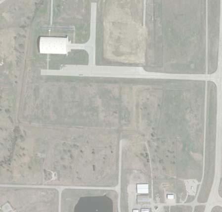


48
49 RSA requirements: and unstaffed NAVAIDs and facilities, such as equipment for airport facilities that are considered fixed-by-function. In consideration of the existing instrument approach minimums and the type of aircraft the runway is designed to accommodate, the following table entitled RUNWAY PROTECTION ZONE DIMENSIONS, IN FEET lists the existing RPZ dimensional requirements. Table C17 RUNWAY PROTECTION ZONE DIMENSIONS, IN FEET Item Width at Runway End Length Width at Outer End Airport Controls Entire RPZ Existing RPZ Dimensional Requirements Runway 18L/36R Runway 18L 1,000 2,500 1,750 No Runway 36R 1,000 2,500 1,750 Yes Runway 8/26 Runway ,700 1,010 No Runway 26 1,000 1,700 1,510 Yes Runway 18R/36L Runway 18R 1,000 1,700 1,510 No Runway 36L 500 1,700 1,010 Yes Standard Approach RPZ Dimensions for Various Visibility Minimums: Visual and not lower than 1-mile, Small Aircraft Only 250 1, Visual and not lower than 1-mile, Approach Categories A & B 500 1, Visual and not lower than 1-mile, Approach Categories C & D 500 1,700 1, Not lower than 3/4-mile, all aircraft 1,000 1,700 1, Lower than 3/4-mile, all aircraft 1,000 2,500 1, Standard Departure RPZ Dimensions: Small Aircraft Only, AACs A and B 250 1, Large Aircraft, AACs A and B 500 1, Large Aircraft, AACs C, D, and E 500 1,700 1, Source: FAA AC 150/ A, Change 1, Airport Design. Currently, the existing RPZs at TUL meet the dimensional standards based on the existing visibility minimums and the appropriate AAC. The existing RPZs for Runways 18L, 18R, and 8 extend beyond the airport boundary and are not fully controlled by the TAIT. However, the uncontrolled portions of the Runway 18L & 18R RPZs are located within the Mohawk Park boundary and not exposed to the future development of nonconforming land uses. In addition, each of the Airport s RPZs contain existing non-conforming land uses (e.g., existing roadway and railroad right-of-ways). Any alternatives that analyze future improvements to the runway and/or instrument approach procedures (presented in the next chapter) will include a re-evaluation C.35
50 of the RPZ requirements presented here, including an analysis of the compatible nature of land uses that might be located within RPZs as a result of activities listed in the FAA memorandum on land use guidance. Since the FAA prefers the control of the RPZ to come from fee simple land acquisition of the property, further consideration will be given to the options the Airport has in regards to achieving full control of all RPZs. Runway End Siting Surfaces Criteria contained in FAA AC 150/ A, Change 1 Airport Design provides guidance for the proper siting of runway ends and thresholds. The criteria are in the form of evaluation surfaces that are typically trapezoidal shaped and extend away from the runway ends along the centerline at a specific slope, expressed in horizontal feet by vertical feet. The specific size, slope, and starting point of the trapezoid depends upon the visibility minimums and the type of procedure associated with the runway end. The existing criteria for TUL are presented in the following table entitled RUNWAY END SITING CRITERIA, IN FEET. Threshold Siting Analysis. Thresholds are located to provide proper clearance over obstacles for landing aircraft on approach to a runway end. When an object is beyond an airport owner s ability to remove, relocate, or lower obstructs the airspace required for aircraft to land at the beginning of the runway for takeoff, the landing threshold may require a location other than the end of the pavement (i.e., a displaced threshold). Like the RPZ criteria, the threshold siting criteria are based on the type of aircraft and approach visibility minimums associated with each runway end. Glide Path Qualification Surface Analysis. The Glide Path Qualification Surface (GQS) is an imaginary surface used to evaluate precision approaches and approaches providing vertical guidance. When objects exceed the height of the GQS that cannot be mitigated, then an approach with vertical guidance cannot be authorized. The GQS begin at the threshold, have a width at the threshold of the runway width plus 200 feet, an outer width of 1,520 feet, extend to 10,000 feet (or the visual descent point or the decision altitude), and have a slope of 30:1. Departure Surface Analysis. Departure ends of runways normally mark the end of the full-strength runway pavement available and suitable for departures. Departure surfaces, when clear of obstacles, allow pilots to follow standard departure procedures. If obstacles penetrate the departure surface, then the obstacles must be evaluated through the Obstruction Evaluation/Airport Airspace Analysis (OE/AAA) process. After the OE/AAA process, departure procedure amendments such as non-standard climb rates, non-standard (higher) departure minimums, or a reduction in the length of Takeoff Distance Available (TODA) may be required. Departure surfaces begin at the end of the Takeoff Distance Available (TODA), are trapezoidal in shape, extend along the extended runway centerline, and have a slope of 40:1. C.36
51 Table C18 RUNWAY END SITING CRITERIA, IN FEET Runway Type Distance From Runway End Width at Inner Edge Length Width at Outer Edge Slope Existing Threshold Siting Surfaces Runway 18L/36R Runway 18L (Type 7) ,000 3,800 34:1 Runway 36R (Type 7) ,000 3,800 34:1 Runway 8/26 Runway 8 (Type 5) ,000 3,800 20:1 Runway 26 (Type 6) ,000 3,800 20:1 Runway 18R/36L Runway 18R (Type 6) ,000 3,800 20:1 Runway 36L (Type 5) ,000 3,800 20:1 Standard Threshold Siting Surface Dimensions: 1. Small aircraft only with approach speeds < 50 knots, visual approach , :1 2. Small aircraft only with approach speeds > 50 knots, visual approach , :1 3. Large aircraft, visual approach, or instrument minimums one mile, day only ,000 1,000 20:1 4. AAC A and B only, instrument night operations ,000 3,800 20:1 5. AAC > B, instrument night operations ,000 3,800 20:1 6. Instrument approach with visibility minimums < one statute mile but ¾ statute mile, day or ,000 3,800 20:1 night 7. Instrument approach with visibility minimums < 3/4 statute mile or precision approach, day or night ,000 3,800 34:1 8. Instrument approach with positive vertical Runway 0 guidance (GQS) width ,000 1,520 30:1 Existing Departure Surfaces (All Runway TUL) 9. Departure runway ends for all instrument operations) 0 1,000 10,200 6,466 40:1 Standard Departure Surface Dimensions: 0 1,000 10,200 6,466 40:1 Source: FAA AC 150/ A, Change 1, Airport Design. The following threshold siting surface figures illustrate the threshold siting surface (TSS) analysis in both plan and profile views for each runway end. The specific clearance criteria for this surface has changed since the preparation of the previous Master Plan, and the continued clearance of these surfaces need to be confirmed periodically in response new construction and growth of vegetation. Therefore, updated Airport Geographic Information System (AGIS) survey data is currently being collected and will be analyzed/documented for this evaluation effort when complete. C.37
52 Figure C7 RUNWAY 18L/36R THRESHOLD SITING SURFACE ANALYSIS (To Be Included in Draft Report) C.38
53 Figure C8 RUNWAY 8/26 THRESHOLD SITING SURFACE ANALYSIS (To Be Included in Draft Report) C.39
54 Figure C9 RUNWAY 18R/36L THRESHOLD SITING SURFACE ANALYSIS (To Be Included in Draft Report) C.40
55 Federal Aviation Regulations (FAR) Part 77 Safe and efficient landing and takeoff operations at an airport require that certain areas on and near the airport are clear of objects or restricted to objects with certain function, composition, and/or height. Obstruction clearing standards and criteria are established to create a safer environment for aircraft operations on or near the airport. Any existing or proposed object, whether man-made or of natural growth that penetrates obstruction clearance surfaces is classified as an obstruction and is presumed to be a hazard to air navigation. These obstructions are subject to FAA aeronautical study, after which the FAA issues a determination stating if the obstruction is in fact considered a hazard. The criteria contained in Federal Aviation Regulations (FAR), Part 77 Safe, Efficient Use, and Preservation of Navigable Airspace, apply to existing and proposed manmade objects and/or objects of natural growth and terrain (i.e., obstructions). These guidelines define the critical areas in the vicinity of airport that should be kept free of obstructions. Secondary areas may contain obstructions if they are determined to be nonhazardous by aeronautical study and/or if they are marked and lighted as specified in the aeronautical study determination. Airfield navigational aids, as well as lighting and visual aids, by nature of their location, may constitute obstructions. However, these objects do not violate FAR Part 77 requirements, as they are essential to the operation of the Airport. The Primary Surface is a surface that is longitudinally centered on the runway. This surface extends 200 feet beyond each end of the runway for a hard surface runway. The Primary Surface width also varies based upon the current instrument approach visibility minimums of the runway. Since each of the runways at TUL have existing instrument approach visibility minimums as low as ¾-statute miles, the resulting Primary Surface width is 1,000 feet wide, (500 feet from centerline on each side of the runway). The Approach Surface is longitudinally centered on the extended runway centerline and extends outward and upward from each end to the Primary Surface at a specific slope, expressed in horizontal feet by vertical feet. For example, a 20:1 slope rises one unit vertically for every 20 units horizontally. An Approach Surface is applied to each end of the runway based upon the type of approach available or planned for that runway end. The inner width of the Approach Surface is the same as the Primary Surface (1,000 Feet), and expands uniformly to a width of 16,000 feet for each end of Runway 18L/36R. The outer width of the approach surface to Runways 18R and 26 measure at 4,000 feet, which compares to 3,500 feet for Runway 36L. The Approach Surface for Runway 18L/36R extends for a horizontal distance of 10,000 feet at a slope of 50:1 and an additional 40,000 feet at a slope of 40:1. The Approach Surface for Runways 8/26 and 18R/36L extend for a horizontal distance of 10,000 feet at a slope of 34:1. As noted previously, new aerial photography and obstruction data is being acquired that will permit an updated analysis of the FAR Part 77 surfaces and documentation of potential obstructions. The FAR Part 77 imaginary surfaces for TUL and the known associated terrain penetrations of these surfaces are presented in the following figure entitled FAR PART 77 SURFACES. C.41
56 Figure C10 FAR PART 77 SURFACES (To Be Included in Draft Report) C.42
57 Instrumentation and Lighting Instrument Approach Procedures. Instrument Approach Procedure (IAP) capabilities and associated equipment, airport lighting, and weather/airspace services, were detailed in the Inventory chapter. As noted, the Airport has fifteen (15) published instrument approach procedures (IAPs). Runway 18L/36R offers the best IAP minimums, with ceiling and visibility minimums of 200 feet and ½ statute mile (Category I ILS minimums) to each runway end, including minimums of 100 feet and ¼ statute mile (Category II ILS minimums) to Runway 36R. In addition, IAPs with minimums of 200 feet and ¾ statute mile are also available on the crosswind runway (i.e., Runway 26) and the secondary runway (i.e., Runway 18R). Based upon an analysis of the Airport s existing climatological conditions (presented earlier in this chapter), the existing IAPs provide excellent IFR accessibility, with below minimum conditions occurring 0.66% of the time annually, or approximately 2.4 days of the year. In addition, the majority of the IFR access capability is provided by the Category I ILS minimums, thus no additional improvements to Category II ILS minimums is recommended. Also, based on the IFR wind analysis, Runways 36R and 26 provide the best wind coverage during IFR weather conditions, and thus any future improvements to Runway 18R/36L should also include consideration of future IAP enhancements for Runway 36L to provide ceiling and visibility minimums of 200 feet and ½ statute mile. Visual Landings Aids. Presently, each of the runways at TUL are equipped with a variety of visual landing aids. These facilities are listed as follows: Runway 18L/36R High Intensity Runway Lights (HIRLs) Four-light Precision Approach Path Indicator (PAPI) Both runway ends Medium Intensity Approach Lighting System with Runway Alignment Indicator Lights (MALSR) Runway 18L Category II/III High Intensity Approach Lighting System with Centerline Sequenced Flashers (ALSF2) Runway 36R Runway 8/26 High Intensity Runway Lights (HIRLs) Four-light PAPI Both runway ends Runway End Identifier Lights (REILs) Both runway ends MALSR Runway 26 Runway 18R/36L High Intensity Runway Lights (HIRLs) Four-light PAPI Both runway ends REILs Both runway ends C.43
58 According to guidance contained in AC 150/ A, Change 1, an Approach Light System (ALS) is recommended, but not required for IAPs with visibility minimums not less than ¾ statute mile. Unless the ALS is a requirement to achieve the lower visibility minimums based on credit for lighting, they are not normally eligible for FAA Airport Improvement Program (AIP) funding. There are no future ALS improvements recommended for Runway 18L/36R and future ALS improvements, if any, to Runways 8/26 and 18R/36L will be evaluated in conjunction with the alternatives development analysis presented in the following chapter. Taxiways Taxiways provide defined movement corridors for aircraft between the various functional landside areas on an airport and the runway system. Some taxiways are necessary simply to provide access between aircraft parking aprons and runways, whereas other taxiways become necessary to provide more efficient and safer use of the airfield. Parallel taxiways eliminate the use of the runway for taxiing, thus increasing capacity and protecting the runway under low visibility conditions. Taxiway turns and intersections are designed for safe and efficient taxiing by aircraft while minimizing excess pavement. Taxiway Design Methodology. Taxiways are designed for cockpit over centerline taxing with pavement being of sufficient width to allow a certain amount of wander. Potential runway incursions should be kept to a minimum by proper taxiway design, choosing simplicity over complexity wherever possible. AC 150/ A provides basic taxiway design concepts and methodologies that are outlined in the following narrative. Taxiway intersections should be kept simple by utilizing the three-node concept, which means that a pilot is presented with no more than three choices at each intersection ideally, left, right, and straight ahead. Intersection angles ideally should be 90 wherever possible, but standard angles of 30, 45, 60, 120, 135, and 150 are acceptable. Taxiway to runway interface encompassing wide expanses of pavement should be avoided, as wide pavements require placement of signs far from a pilot s eyes and reduce the conspicuity of other visual cues (e.g., the existing Taxiway K / C / J intersection that is identified as an existing airfield hotspot ). Opportunities for human error can be reduced by limiting the need for runway crossings, especially crossings within the middle third of runways defined as high energy intersections. Limiting runway crossings to the outer thirds of the runway keeps clear the portion of the runway where pilots can least maneuver to avoid collisions. Right angle intersections, both between taxiways and between taxiways and runways, provide the best visibility to the left and right for a pilot. A right angle turn at the end of the parallel taxiway is a clear indication of approaching a runway. Acute angle exit taxiways provide greater runway efficiency, but should not be used for runway entrance or crossing points (e.g., Taxiways J, F-1, and E-2 ). C.44
59 Runways used as a taxiways and taxiways used as runways only lead to confusion and should be avoided. Runways should be clearly identified as a runway and only a runway. Taxiways should not lead directly from an apron to a runway without requiring a turn. This design only leads to confusion when a pilot typically expects to encounter a parallel taxiway (e.g., Taxiways KK, W, and L-1 ). Each of the taxiway systems at TUL will be examined in consideration of these taxiway design concepts and methodologies in conjunction with the alternatives analysis presented in the following chapter, and taxiway reconfiguration recommendations will be identified. In addition, many of the existing taxiway intersections at TUL were constructed in consideration of judgmental oversteering, with the new standard being cockpit over centerline steering. Therefore, future taxiway reconstruction projects will be designed in accordance with the new cockpit over centerline guidelines. Taxiway Dimensional Criteria Taxiway and taxilane clearance requirements are the required distances between a taxiway/taxilane centerline and other objects, which are based upon the required wingtip clearance, a function of the wingspan, and therefore are determined by the ADG as it relates to the Design Aircraft. Taxiway and taxilane pavement design standards are related to the Taxiway Design Group (TDG), which is based on the overall Main Gear Width (MGW) and the Cockpit to Main Gear (CMG) distance of the Design Aircraft. Runway 18L/36R Taxiway Design Analysis. Using the data compiled from the aircraft operations and runway utilization analysis presented in the previous chapter, ADG IV and TDG 5 were identified as the appropriate design standard for the Runway 18L/36R parallel taxiway system. These standards are presented in the following two tables, entitled RUNWAY 18L/36R TAXIWAY DESIGN GROUP MATRIX (ADG) and RUNWAY 18L/36R TAXIWAY DESIGN GROUP MATRIX (TDG). In addition, these various taxiway design standards are graphically depicted in Figure C11, entitled RUNWAY 18L/36R TAXIWAY SYSTEM DIMENSIONAL STANDARD DETAIL. C.45
60 Table C19 RUNWAY 18L/36R TAXIWAY DESIGN STANDARDS MATRIX (ADG), IN FEET Item Existing Dimension ADG IV Standard Standard Met Taxiway E (East Side Parallel) Taxiway Safety Area (TSA) Yes Taxiway Object Free Area (TOFA) Yes Taxilane Object Free Area NA Taxiway Centerline to Parallel Taxiway/Taxilane Centerline 3 > Yes Taxiway Centerline to Fixed or Movable Object > Yes Taxilane Centerline to Parallel Taxiway/Taxilane Centerline NA Taxilane Centerline to Fixed or Movable Object NA Taxiway Wingtip Clearance Yes Taxilane Wingtip Clearance NA Taxiway J & G (West Side Partial Parallel) Taxiway Safety Area (TSA) Yes Taxiway Object Free Area (TOFA) Yes Taxilane Object Free Area NA Taxiway Centerline to Parallel Taxiway/Taxilane Centerline NA Taxiway Centerline to Fixed or Movable Object > Yes Taxilane Centerline to Parallel Taxiway/Taxilane Centerline NA Taxilane Centerline to Fixed or Movable Object NA Taxiway Wingtip Clearance Yes Taxilane Wingtip Clearance Yes Source: FAA AC 150/ A, Change 1, Airport Design. 1 TSA A clear, graded, and drained area on both sides of a taxiway/taxilane intended to protect the landing gear in the event of an excursion from the taxiway pavement. 2 Taxiway/Taxilane Object Free Area An area on both sides of a taxiway/taxilane intended to protect the airplane wing. 3 TDG standards are more critical when 180 degree turns between parallel taxiways are required. C.46

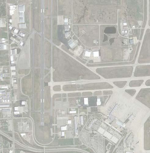


61
62 Table C20 RUNWAY 18L/36R TAXIWAY DESIGN STANDARDS MATRIX, IN FEET (TDG) Item Taxiway E (East Side Parallel) Existing Dimension TDG 5 Standard Standard Met Taxiway Width 75 FT 75 Yes Taxiway Edge Safety Margin 1 15 FT 15 Yes Taxiway Shoulder Width 0 30 No Taxiway Centerline to Parallel Taxiway/Taxilane Centerline 2 > Yes Taxiway J & G (West Side Partial Parallel) Taxiway Width 75 FT 75 Yes Taxiway Edge Safety Margin 1 15 FT 15 Yes Taxiway Shoulder Width 0 30 No Taxiway Centerline to Parallel Taxiway/Taxilane Centerline NA Source: FAA AC 150/ A, Change 1, Airport Design. 1 Taxiway Edge Safety Margin minimum pavement to be provided between the outer edge of the main gear tire and the edge of taxiway/taxilane pavement. 2 TDG standards are more critical when 180 degree turns between parallel taxiways are required. According to AC 150/ A, unprotected soils adjacent to runways and taxiways are susceptible to erosion due to jet blast. A dense, well-rooted turf cover can prevent erosion and support the occasional passage of aircraft, maintenance equipment, or emergency equipment under dry conditions. Paved shoulders are only required for runways, taxiways, taxilanes, and aprons accommodating ADG IV and larger aircraft, and are recommended for taxiways, taxilanes, and aprons accommodating ADG III aircraft (e.g., the Boeing 737 series). It is recommended that ADG IV/TDG 5 standards be implemented on all future taxiway development or reconstruction projects that support Runway 18L/36R. Runway 8/26 Taxiway Design Analysis. Due to the existing role of serving as both the crosswind runway and secondary air carrier runway, the Runway 8/26 taxiway system should be maintained to same taxiway design standards as the Runway 18L/36R taxiway system (i.e., ADG IV and TDG 5). These standards are presented in the following tables, entitled RUNWAY 8/26 TAXIWAY DESIGN GROUP MATRIX (ADG) and RUNWAY 8/26 TAXIWAY DESIGN GROUP MATRIX (TDG). In addition, these various taxiway design standards are graphically depicted in Figure C12, entitled RUNWAY 8/26 TAXIWAY SYSTEM DIMENSIONAL STANDARD DETAIL. C.48
63 Table C21 RUNWAY 8/26 TAXIWAY DESIGN STANDARDS MATRIX, IN FEET (ADG) Item Existing Dimension ADG IV Standard Standard Met Taxiway B (North Side Partial Parallel) Taxiway Safety Area (TSA) Yes Taxiway Object Free Area (TOFA) Yes Taxilane Object Free Area NA Taxiway Centerline to Parallel Taxiway/Taxilane Centerline NA Taxiway Centerline to Fixed or Movable Object Yes Taxilane Centerline to Parallel Taxiway/Taxilane Centerline NA Taxilane Centerline to Fixed or Movable Object NA Taxiway Wingtip Clearance Yes Taxilane Wingtip Clearance NA Taxiway C (South Side Parallel) Taxiway Safety Area (TSA) Yes Taxiway Object Free Area (TOFA) Yes Taxilane Object Free Area NA Taxiway Centerline to Parallel Taxiway/Taxilane Centerline NA Taxiway Centerline to Fixed or Movable Object Yes Taxilane Centerline to Parallel Taxiway/Taxilane Centerline NA Taxilane Centerline to Fixed or Movable Object NA Taxiway Wingtip Clearance Yes Taxilane Wingtip Clearance NA Source: FAA AC 150/ A, Change 1, Airport Design. 1 TSA A clear, graded, and drained area on both sides of a taxiway/taxilane intended to protect the landing gear in the event of an excursion from the taxiway pavement. 2 Taxiway/Taxilane Object Free Area An area on both sides of a taxiway/taxilane intended to protect the airplane wing. 3 TDG standards are more critical when 180 degree turns between parallel taxiways are required. C.49
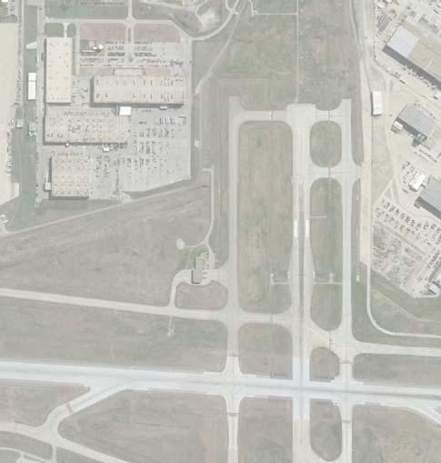


64
65 Table C22 RUNWAY 8/26 TAXIWAY DESIGN STANDARDS MATRIX, IN FEET (TDG) Item Taxiway B (North Side Partial Parallel) Existing Dimension TDG 5 Standard Standard Met Taxiway Width 75 FT 75 Yes Taxiway Edge Safety Margin 1 15 FT 15 Yes Taxiway Shoulder Width 0 30 No 3 Taxiway Centerline to Parallel Taxiway/Taxilane Centerline NA Taxiway C (South Side Parallel) Taxiway Width 75 FT 75 Yes Taxiway Edge Safety Margin 1 15 FT 15 Yes Taxiway Shoulder Width 0 30 No 3 Taxiway Centerline to Parallel Taxiway/Taxilane Centerline NA Source: FAA AC 150/ A, Change 1, Airport Design. 1 Taxiway Edge Safety Margin minimum pavement to be provided between the outer edge of the main gear tire and the edge of taxiway/taxilane pavement. 2 TDG standards are more critical when 180 degree turns between parallel taxiways are required. 3 FAA will determine taxiway shoulders are required since existing operations by TDG 5 are below substantial use threshold counts. Based upon the current use of the crosswind runway as a secondary air carrier runway, it is recommended that ADG IV/TDG 5 standards be implemented on all future taxiway development or reconstruction projects that support Runway 8/26. In addition, the current ALP identifies the future fulllength extension of Taxiway B to Taxiway L, and this project will be re-examined in conjunction with the alternatives analysis presented in the following chapter. Runway 18R/36L Taxiway Design Analysis. Using the data compiled from the aircraft operations and runway utilization analysis presented in the previous chapter, ADG III and TDG 3 were identified as the appropriate existing design standard for the Runway 18R/36L parallel taxiway system. However, the future taxiway design standards for this runway will be contingent upon the long-term development recommendations for the runway (i.e., continued general aviation use vs upgrade to secondary commercial service use). These existing standards are presented in the tables, entitled RUNWAY 18R/36L TAXIWAY DESIGN GROUP MATRIX (ADG) and RUNWAY 18R/36L TAXIWAY DESIGN GROUP MATRIX (TDG). In addition, these various taxiway design standards are graphically depicted in Figure C13, entitled RUNWAY 18R/36L TAXIWAY SYSTEM DIMENSIONAL STANDARD DETAIL. C.51
66 Table C23 RUNWAY 18R/36L TAXIWAY DESIGN STANDARDS MATRIX (ADG) Item Existing Dimension ADG III Standard Standard Met Taxiway L (East Side Parallel) Taxiway Safety Area (TSA) Yes Taxiway Object Free Area (TOFA) Yes Taxilane Object Free Area NA Taxiway Centerline to Parallel Taxiway/Taxilane Centerline 3 > Yes Taxiway Centerline to Fixed or Movable Object >93 93 Yes Taxilane Centerline to Parallel Taxiway/Taxilane Centerline NA Taxilane Centerline to Fixed or Movable Object NA Taxiway Wingtip Clearance Yes Taxilane Wingtip Clearance NA Taxiway M (West Side Partial Parallel) Taxiway Safety Area (TSA) Yes Taxiway Object Free Area (TOFA) Yes Taxilane Object Free Area NA Taxiway Centerline to Parallel Taxiway/Taxilane Centerline 3 > Yes Taxiway Centerline to Fixed or Movable Object >93 93 Yes Taxilane Centerline to Parallel Taxiway/Taxilane Centerline NA Taxilane Centerline to Fixed or Movable Object NA Taxiway Wingtip Clearance Yes Taxilane Wingtip Clearance NA Source: FAA AC 150/ A, Change 1, Airport Design. 1 TSA A clear, graded, and drained area on both sides of a taxiway/taxilane intended to protect the landing gear in the event of an excursion from the taxiway pavement. 2 Taxiway/Taxilane Object Free Area An area on both sides of a taxiway/taxilane intended to protect the airplane wing. 3 TDG standards are more critical when 180 degree turns between parallel taxiways are required. C.52


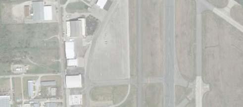


67
68 Table C24 RUNWAY 18R/36L TAXIWAY DESIGN STANDARDS MATRIX (TDG) Item Taxiway L (East Side Parallel) Existing Dimension TDG 3 Standard Standard Met Taxiway Width 75 FT 50 Yes Taxiway Edge Safety Margin 1 15 FT 10 Yes Taxiway Shoulder Width 0 20 No 3 Taxiway Centerline to Parallel Taxiway/Taxilane Centerline 2 > Yes Taxiway M (West Side Partial Parallel) Taxiway Width 75 FT 50 Yes Taxiway Edge Safety Margin 1 15 FT 10 Yes Taxiway Shoulder Width 0 20 No 3 Taxiway Centerline to Parallel Taxiway/Taxilane Centerline 2 > NA Source: FAA AC 150/ A, Change 1, Airport Design. 1 Taxiway Edge Safety Margin minimum pavement to be provided between the outer edge of the main gear tire and the edge of taxiway/taxilane pavement. 2 TDG standards are more critical when 180 degree turns between parallel taxiways are required. 3 Paved shoulders are only recommended for ADG III aircraft. Contingent upon the future development recommendations for the west parallel runway (i.e., continued use as a general aviation reliever or upgrade to a secondary air carrier runway) a determination of the recommended ADG/TDG standards will be evaluated in conjunction with the alternatives development analysis presented in the following chapter. Exit Taxiway Analysis As noted in the previous chapter, each of the runways at TUL are served by either parallel or partial parallel taxiway systems that serve both sides of the runway and are provided with connector/exit taxiways at various locations along the runway that are designed to varying standards and dimensions. According to the FAA taxiway design guidance provided in AC 150/ A, Change 1 AIRPORT DESIGN, right-angled taxiways are the recommended standard for all runway/taxiway intersections, except where there is a need for highspeed or angled exit taxiways at congested airports to enhance throughput capacity. For example at TUL, the angled exit taxiways that serve landings to Runway 36R (i.e., Taxiways J-3 and J-1 ) facilitate quick and efficient exit off the runway by the commercial aircraft fleet. Optimally located/aligned exit taxiways minimize runway occupancy times and allow the airfield to be used more efficiently. Table 4-13 of AC 150/ A provides the cumulative percentages of aircraft typically able to exit runways at specific exit taxiway locations, in 500-foot increments. Percentages for both wet and dry runway conditions are included as are right-angled and acute-angled exit taxiway configurations. It should be noted that since the percentages provided in Table 4-13 of the AC are based on 500-foot increments, the approximate exit percentage for those exit taxiways located in between the 500-foot increments have been interpolated. C.54
69 As presented in the following tables, the performance capabilities of the existing exit taxiway system for each of the three runways at TUL has been evaluated. Based upon this analysis, the optimal exit taxiway location for small multi-engine aircraft weighing less than 12,500 lbs. is between 4,000 and 5,000 feet, which compares to between 5,500 and 7,500 feet for large aircraft weighing between 12,500 lbs. and 300,000 lbs. The findings of this analysis will be coordinated with input from the TUL ATC personnel and TAIT Operations Staff, and subsequently incorporated into the preparation of airside development alternatives that will include taxiway improvements. Table C25 RUNWAY 18L/36R EXIT TAXIWAY ANALYSIS Distance From Exit Landing Threshold (In Feet) Percentage of Aircraft Exiting Runway Dry Conditions (%) Wet Conditions (%) S T L S T L Runway 18L (East Side) R/A R/A R/A R&A R&A R&A Taxiway B (R) 6, / /100 93/ Taxiway C (R) 7, / / / Taxiway E-2 (R) 8, / / / / / /100 Taxiway E (R) 10, / / / / / /100 Runway 18L (West Side) R/A R/A R/A R&A R&A R&A Taxiway B (R) 6, / /100 93/ Taxiway C (R) 7, / / / Taxiway F (A) 7, / / / Taxiway F-1 (R) 8, / / / / / /100 Taxiway G-1 (R) 10, / / / / / /100 Runway 36R (East Side) R/A R/A R/A R&A R&A R&A Taxiway E-2 (R) 1,600 44/60 0/0 0/ Taxiway C (R) 2, /100 39/40 0/ Taxiway B (R) 4, /100 98/98 8/ Taxiway E-1 (A) 6, / /100 99/ Taxiway E (R) 10, / / / / / /100 Runway 36R (West Side) R/A R/A R/A R&A R&A R&A Taxiway B (R) 4, /100 98/98 8/ Taxiway J-3 (A) 5, / /100 54/ Taxiway J-1 (A) 6, / /100 99/ Taxiway J (A) 10, / / / / / /100 Source: FAA Advisory Circular 150/ A, Change 1, Airport Design (February 2014), Table Note: S- Small, single engine (12,500 lbs. or less) T Small, twin engine (12,500 lbs. or less) L Large (12,500 lbs. to 300,000 lbs.) C.55

70
71 Table C26 RUNWAY 8/26 EXIT TAXIWAY ANALYSIS Exit Distance From Landing Threshold (In Feet) Percentage of Aircraft Exiting Runway Dry Conditions Wet Conditions S T L S T L Runway 8 (North Side) R/A R/A R/A R&A R&A R&A Taxiway J (A) 3, /100 89/90 5/ Taxiway H (A) 4, /100 99/99 16/ Taxiway E (R) 5, / /100 75/ Taxiway B (R) 7, / / / Runway 8 (South Side) R/A R/A R/A R&A R&A R&A Taxiway J (A) 3, /100 81/82 2/ Taxiway H (A) 4, /100 99/99 17/ Taxiway E (A) 5, / /100 75/ Taxiway CC (R) 6, / /100 99/ Taxiway C (R) 7, / / / Runway 26 (North Side) R/A R/A R/A R&A R&A R&A Taxiway J (A) 3, /100 83/84 0/ Taxiway K (A) 4, / /100 45/ Runway 26 (South Side) R/A R/A R/A R&A R&A R&A Taxiway H (A) 3, /100 39/40 0/ Taxiway J (A) 3, /100 90/91 5/ Taxiway K (A) 4, /100 99/99 29/ Taxiway C-1 (R) 6, / /100 99/ Taxiway C (R) 7, / / / Source: FAA Advisory Circular 150/ A, Change 1, Airport Design (February 2014), Table Note: S- Small, single engine (12,500 lbs. or less) T Small, twin engine (12,500 lbs. or less) L Large (12,500 lbs. to 300,000 lbs.) C.57

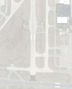
72
73 Table C27 RUNWAY 18R/36L EXIT TAXIWAY ANALYSIS Exit Distance From Landing Threshold (In Feet) Percentage of Aircraft Exiting Runway Dry Conditions Wet Conditions S T L S T L Runway 18R (East Side) R/A R/A R/A R&A R&A R&A Taxiway L-1 (R) 1,100 12/23 0/0 0/ Taxiway K (A) 2,100 87/91 3/3 0/ Taxiway L-2 (R) 3, /100 60/60 1/ Taxiway L-3 (A) 3, /100 90/91 5/ Taxiway L-4 (A) 5, / /100 54/ Taxiway L-5 (R) 6, / /100 93/ Runway 18R(West Side) R/A R/A R/A R&A R&A R&A Taxiway K (A) 1,800 62/71 0/0 0/ Taxiway M-1 (R) 3, /100 60/60 1/ Taxiway M-2 (R) 5, / /100 55/ Runway 36L (East Side) R/A R/A R/A R&A R&A R&A Taxiway L-3 (A) 2,200 91/94 5/5 0/ Taxiway L-2 (R) 2,500 99/99 10/10 0/ Taxiway K (A) 3, /100 89/90 5/ Taxiway L-1 (R) 4, / /100 36/ Taxiway W (R) 6, / /100 93/ Runway 36L (West Side) R/A R/A R/A R&A R&A R&A Taxiway M-1 (R) 2,500 91/94 5/5 0/ Taxiway K (A) 4, /100 98/98 8/ Taxiway M (R) 6, / /100 93/ Source: FAA Advisory Circular 150/ A, Change 1, Airport Design (February 2014), Table Note: S- Small, single engine (12,500 lbs. or less) T Small, twin engine (12,500 lbs. or less) L Large (12,500 lbs. to 300,000 lbs.) C.59


74
75 Landside Facility Requirements Landside facilities are those facilities which support the airside facilities, but are not actually a part of the aircraft operating surfaces. These consist of such facilities as terminal buildings, hangars, aprons, access roads, and support facilities. Following an analysis of these facilities, current deficiencies can be noted in terms of accommodating both existing and future aviation needs at the Airport. Passenger Terminal Area Requirements Components of the passenger terminal complex include the terminal building, gate/parking positions, apron area, vehicular access, and auto parking. As noted in the Inventory chapter, the passenger terminal building complex is nearing the completion of a multi-year upgrade and improvement plan that was initiated in These improvements have included the establishment of a single centralized security screening area, new exit only passenger lanes, a concession boulevard, a food court, and several new restaurants. In recent years, upgrades have been completed to each concourse that include raised concourse ceiling with added skylight, renovated restrooms, new holdroom seating with fully integrated power charging stations, a business center, and back-up generators. The combined area of the arrivals and departures levels of the terminal building equals approximately square feet of which approximately 172,147 square feet is dedicated to passenger access areas. The facility provides adequate space for airlines (both building area and gate positions), baggage check, baggage claim, departure lounges, rental car counters, circulation, concessions, and public space and complies with the design provisions set forth in the Americans with Disabilities Act of Based on typical terminal space planning requirements, the passenger terminal is expected to be able to accommodate all forecast commercial operations and enplanements throughout the 20-year planning period. Some short-term improvements are currently included in the Airport s CIP related to the terminal building. These improvements include: Replacement of existing escalators with elevators Fire suppression upgrades and roof replacement within pre-security areas Various utility upgrades Ground Access and Parking Requirements The Airport s roadway access system consists of three components: the terminal area entrance and local access roadways (e.g., Airport Drive, North Mingo Road, and North Sheridan Road), passenger terminal vehicle parking, and terminal building curb frontage. Based upon previous planning goals and objectives identified by the TAIT, and the projected increases in passenger enplanements, some additional improvements to the Airport s terminal area ground access and parking system have been initiated. These include: C.61
76 Expansion/reconfiguration/upgrade of the existing parking garage Reconfigure several existing access roadways and ramps that serve the parking garage Canopy replacement on arrival roadway and parking garage Construct two valet parking storage areas As noted in previous sections of this chapter, the existing public parking capacity of the terminal area will likely need to be increased through the planning period, with the potential need for an additional 2,860 spaces being identified by There does appear to be adequate space within the footprint of the existing parking garage structure and the adjacent terminal support area to accommodate these potential expansion requirements. However, it is recommended that an updated comprehensive terminal parking study be prepared for TUL to support the long-term parking facility requirements of the passenger terminal area. In addition, the analysis presented earlier indicated that Airport Drive has adequate capacity to accommodate the forecast passenger traffic demand through the planning period. However, it was noted that the limited length of the terminal approach section of Airport Drive could benefit from improved directional roadway signage to help expedite the maneuvering of vehicles wishing to access the parking structure for long-term parking or the rental-car return facility. Directional signage improvements are included as an element of the proposed parking garage expansion project, which should assist passengers arriving at their intended destination within the terminal area complex. It should also be noted that public transit options (i.e., City bus and taxi service) is provided at the Airport with designated stops on the center section of the arrivals level of the terminal building. The Inventory chapter also identified the existing rail lines in the vicinity of the Airport, and the long-term planning recommendations of this master plan should include consideration of both passenger rail and cargo-related rail connections to the Airport. General Aviation Aircraft Storage The majority of existing general aviation aircraft storage facilities at TUL are located on the west side of the Airport, adjacent to Runway 18R/36L. Aircraft based at TUL are primarily stored in a variety of large commercial hangars (i.e., Fixed Base Operator and charter hangar storage facilities) and large private corporate hangars. Over the course of the 20-year planning period the number of based aircraft is forecast to increase from 157 to 202 based aircraft, indicating that an increase in storage facilities will be required. It is projected that the vast majority of new based aircraft will occur within the business jet category, and it is assumed that future storage space will reflect many of the same characteristics of current storage patterns, with the majority of the based aircraft fleet being stored in hangars. The trend of increasing general aviation aircraft size will also play a role in defining future development needs. Perhaps the most important influence contributing to the need for a comprehensive analysis of the future development needs for general aviation is the configuration of the existing facilities in consideration of space currently available for development. As can be noted on the following illustration, entitled POTENTIAL GENERAL AVIATION INFILL DEVELOPENT AREA, there is sufficient area remaining within the various general aviation development areas for the construction of additional general aviation storage facilities. However, the future build-out of these areas must also include consideration and impact of the line-of-sight (LOS) requirements from the existing and/or future ATCT (some of the identified general aviation infill development areas would impact ATCT LOS from the existing tower location). Following are several storage C.62


77
78 options that will be considered in the development of a plan for the configuration of future general aviation facilities at the Airport. Tiedown Storage Requirements/Based Aircraft. Aircraft tiedowns are provided for those aircraft that do not require, or do not desire to pay the cost for, hangar storage. At present, the number of based aircraft currently using tiedown facilities at the Airport is extremely low, and the amount of existing tiedown apron area is projected to be adequate for the duration of the 20-year planning period. Space calculations for these areas are typically based on 360 square yards of apron for each aircraft to be tied down. This amount of space typically allows for aircraft parking and circulation between the rows of parked aircraft. Tiedown Storage Requirements/Itinerant Aircraft. In addition to the needs of the based aircraft tiedown areas, transient aircraft also require apron parking areas at TUL. The Airport is served by six (6) full service Fixed Base Operators, and several provide apron tiedown storage options for transient aircraft. Based upon existing & projected general aviation itinerant operation counts, the itinerant apron requirements at TUL would be expected to increase from about 3.7 acres to 4.7 acres for the 20-year planning period, and these requirements can be accommodated with existing apron facilities. In consideration of future apron tiedown modifications that may be required in this planning effort, several apron design and planning guidelines are presented as follow: Aprons and associated taxilanes should be designed based on a specific Design Aircraft and/or the combination of aircraft that will use the facility. Itinerant aprons should be designed for easy access by the aircraft under power. Aprons designed to handle jet aircraft should take into account the effects of jet blast and allow sufficient space for safe maneuvering. The primary design consideration is to provide adequate wingtip clearance for the aircraft positions and the associated taxilanes. Parked aircraft must remain clear of the Object Free Areas (OFAs) of runways and taxiways and no part of the parked aircraft should penetrate the runway approach and departure surfaces, and if applicable, the RVZ. The layout of aprons on the Airport should be grouped according to the aircraft wingspans. This allows the taxilane OFA width to be optimized for the aircraft using the area. It is also a good practice to separate corporate jets and heavy jets from lighter propeller powered aircraft to minimize the effects of jet blast and prop wash. Recommended surface gradients have been developed to ease aircraft towing and taxiing while promoting positive drainage. The maximum allowable grade in any direction is 2.0 percent for Aircraft Approach Categories A and B and 1.0 percent for Aircraft Approach Categories C, D, and E. Hangars. As stated previously, large aircraft hangars are the preferred storage facility for existing based aircraft owners at TUL, and the projected increase in based business jets suggests a continued trend in these storage practices. Therefore, it is important that the Airport continue to plan for and reserve space for these facilities, also considering both the vehicular and taxiway access requirements associated with each proposed development area. C.64
79 Air Cargo Air cargo at TUL is primarily transported by commercial cargo carriers (e.g., Federal Express, UPS, Martinaire, and Ameriflight), as well as in the belly compartments of commercial service passenger aircraft. There are two air cargo development areas that are southeast of the passenger terminal building. The first area, located adjacent to the passenger terminal, consists of five (5) buildings and adjacent apron area. This area supports cargo operations for the United Parcel Service (UPS), as well as belly freight cargo handled by the various airlines (i.e., American Airlines Cargo, United Cargo, and Southwest Cargo). The second cargo area is located east of the Runway 36R threshold and consists of a single building and adjacent apron area that is utilized exclusively by FedEx). In 2014, approximately 58,627 tons of freight (99.9%) and mail and (both enplaned and deplaned) was handled at the Airport. Air cargo tons at the Airport are projected to increase at an annual rate of 1.8% through the planning period, increasing to approximately 83,763 tons by The TAIT has current plans to replace one of the existing aging cargo buildings to expand available cargo building capacity, and the existing cargo apron areas are projected to be adequate in size to accommodate the increasing all-cargo operation counts through the planning period. Aviation Industrial/Maintenance Facilities These facilities at TUL are currently highlighted by aircraft Maintenance, Repair, and Overhaul (MRO) operations conducted by the American Airlines Maintenance & Engineering Center. American Airlines is located on approximately 260 acres of airport property that is positioned east and adjacent to the north end of Runway 18L/36R. The facility operates from approximately 3.3 million square feet of maintenance plant and includes over 54 acres of open apron areas and apron associated with individual hangar facilities. In recent years, American Airlines has begun an aggressive fleet modernization plan that will ultimately phase-out the McDonnell Douglas MD-80s by 2018, and also include the retirement of some Boeing 757s and 767s. Many of these aircraft are programmed to be replaced with Boeing s, as well as Airbus 319s, 320s, and 321s. The long-term viability of the existing maintenance base will require a substantial reinvestment of aircraft docking equipment, engine test cells, and bench test equipment to perform maintenance operations on the newer generation aircraft. Discussions between the City of Tulsa and American Airlines regarding the potential funding arrangement of these facility improvements is ongoing and any recommendations for improved airside or landside facilities will be incorporated into this planning document. In addition, the TAIT has been proactive in the pre-development site preparation of future aviation-related development property on the Airport. The area, consisting of approximately 176 acres, is located in the north central portion of the Airport and provided with airside access to Taxiway J and Runway 18L/36R. Existing vehicular access to the area is provided from Port Road. American Airlines initiated development within the area in 2009 with the construction of a large maintenance hangar and access taxiway system. Oklahoma National Guard Facilities There are two Oklahoma National Guard Units [i.e., the 138 th Fighter Wing/Oklahoma Air National Guard and the Army Aviation Support Facility (AASF) #2/Oklahoma Army National Guard] that are located and operate from TUL property. C.65
80 The 138 th Fighter Wing operates the F16C/D Fighting Falcon, a multi-role combat aircraft, from an 81.0 acre base located adjacent to the north end of the primary runway (i.e., Runway 18L/36R) at TUL. There are currently twenty-two (22) F16s based at the facility and the Pentagon is scheduled to transition from the F16 to the F-35 Lighting II (a multi-role stealth fighter) over the next ten year period. TUL would like to be selected as one of three (3) Air National Guard bases in the country that will provide basing facilities for the F-35 in the 2022 or 2023 timeframe. From an aircraft/facility design standpoint (e.g., aircraft size, operating weights, and performance characteristics) the F-35 would transition very easily to the existing airside and landside facilities provided at the base. In addition, the State of Oklahoma, along with the City of Tulsa and the TAIT, are very supportive of the opportunity to accommodate the future basing and new mission of the F- 35 at TUL. The Army Aviation Support Facility (AASF) #2 at TUL provides maintenance on UH-60 Black Hawk helicopters (i.e., a four-bladed, twin-engine, medium-lift utility helicopter manufactured by Sikorsky Aircraft), and there are currently eight (8) UH-60 Black Hawk helicopters based at the TUL facility. At present, there are no plans to expand or reconfigure any of the existing airside or landside facilities associated with the Army National Guard facility. Support Facilities Requirements In addition to the facilities described above, there are several airport support facilities that have quantifiable requirements and that are vital to the efficient and safe operation of the Airport. Airport Traffic Control Tower (ATCT). The TUL Airport Traffic Control Tower (ATCT) is designated as an ATC-8 combined tower and radar approach control facility with Class C airspace that is operated by FAA personnel twenty (24) hours daily. Originally constructed in the 1960s, the facility has undergone numerous improvements and maintenance projects over the years. Having exceeded the useful life of the structure, a new ATCT has been identified on the current Airport Layout Plan (ALP) for several years. Both the existing and proposed ATCT sites are located on the north side of Runway 8/26 (directly north of the passenger terminal building) and between the two north-south parallel runways. It should also be noted that there are five locations on the airfield where visibility from the ATCT is restricted or shadowed (i.e., Taxilanes QQ, LZ, LA, and NN, as well as the portion of Taxiway L that is south of Taxiway L-5 ). These existing ATCT shadow areas, along with the location of the existing and proposed ATCT sites are presented on the following illustration, entitled EXISTING AIR TRAFFIC CONTROL TOWER SHADOW AREAS. A preliminary site confirmation of the location for the new ATCT is a component of this Master Plan Update and will be conducted in conjunction with the airfield alternatives analysis to be presented in the following chapter. Fuel Storage Facility. TUL currently offers aircraft fueling services and products ranging from Avgas, Jet A, Military Jet fuel, unleaded, and diesel. These products are provided by six (6) Fixed Base Operators (FBOs) from fuel storage/dispensing facilities that are sited at various locations on airport property. In addition, there are several based corporate aircraft operators that also maintain private fuel storage facilities used for self-fueling of corporate aircraft. According to fuel sale records provided by airport management, there has been an average of 159,868 gallons of AVGAS, 22,992,237 gallons of Jet A, and 2,541,192 gallons of military jet fuel sold per year, over the C.66


81
Source: Chippewa Valley Regional Airport ASOS, Period of Record
 Chapter 1 Inventory Runway wind coverage is the percentage of time a runway can be used without exceeding allowable crosswind velocities. Allowable crosswind velocities vary depending on aircraft size
According to FAA Advisory Circular 150/5060-5, Airport Capacity and Delay, the elements that affect airfield capacity include:
 4.1 INTRODUCTION The previous chapters have described the existing facilities and provided planning guidelines as well as a forecast of demand for aviation activity at North Perry Airport. The demand/capacity
The purpose of this Demand/Capacity. The airfield configuration for SPG. Methods for determining airport AIRPORT DEMAND CAPACITY. Runway Configuration
 Chapter 4 Page 65 AIRPORT DEMAND CAPACITY The purpose of this Demand/Capacity Analysis is to examine the capability of the Albert Whitted Airport (SPG) to meet the needs of its users. In doing so, this
1.1.3 Taxiways. Figure 1-15: Taxiway Data. DRAFT Inventory TYPICAL PAVEMENT CROSS-SECTION LIGHTING TYPE LENGTH (FEET) WIDTH (FEET) LIGHTING CONDITION
 WIDTH (FEET) LIGHTING CONDITION") 1.1.3 Taxiways EWN has an extensive network of taxiways and taxilanes connecting the terminal, air cargo, and general aviation areas with the runways as listed in Figure 1-15. A 50-foot wide parallel taxiway
1.1.3 Taxiways EWN has an extensive network of taxiways and taxilanes connecting the terminal, air cargo, and general aviation areas with the runways as listed in Figure 1-15. A 50-foot wide parallel taxiway
DRAFT MASTER PLAN UPDATE
 DRAFT MASTER PLAN UPDATE CHAPTER VI: AIRPORT LAYOUT PLAN NARRATIVE DRAFT REPORT APRIL 2017 PREPARED BY: Table of Contents WESTCHESTER COUNTY AIRPORT 6 AIRPORT LAYOUT PLAN NARRATIVE REPORT... 6-1 6.1 AGIS
C > Capacity Analysis and Facility Requirements
 Buchanan Field Buchanan Field Airport Master Planning Program C. CAPACITY ANALYSIS & FACILITY REQUIREMENTS C > Capacity Analysis and Facility Requirements INTRODUCTION. The capacity of an airfield is primarily
CATCODE ] CATCODE
![CATCODE ] CATCODE](/thumbs/82/85644630.jpg "CATCODE ] CATCODE") Runways. FAC: 1111 CATCODE: 111111 OPR: AFCEC/COS OCR: AF/A3O-A 1.1. Description. The runway is the paved surface provided for normal aircraft landings and take offs. Runways are classified as either Class
Runways. FAC: 1111 CATCODE: 111111 OPR: AFCEC/COS OCR: AF/A3O-A 1.1. Description. The runway is the paved surface provided for normal aircraft landings and take offs. Runways are classified as either Class
Ted Stevens Anchorage International Airport FAR Part 150 Study Update Glossary of Common Acoustic and Air Traffic Control Terms
 Ted Stevens Anchorage International Airport FAR Part 150 Study Update Glossary of Common Acoustic and Air Traffic Control Terms ADOT&PF (Alaska Department of Transportation and Public Facilities): The
Study Committee Meeting. September 2015
 W ki P T / Working Paper Two/ Study Committee Meeting September 2015 Agenda Introductions and Opening Comments Project Overview, Process, and Schedule Review Materials from Working Paper Two Comments,
DECEMBER Gensler Unison Consulting Trillion Aviation Arora Engineers, Inc. MSA Engineering Consultants KPS3. in association with
 DECEMBER 2018 DECEMBER 2018 in association with Gensler Unison Consulting Trillion Aviation Arora Engineers, Inc. MSA Engineering Consultants KPS3 Webber Air Cargo ECORP Traffic Works Q&D Construction
Tallahassee International Airport Master Plan. Technical Advisory Committee Meeting #2 October 19, 2016
 Tallahassee International Airport Master Plan Technical Advisory Committee Meeting #2 October 19, 2016 Agenda Welcome / Introductions Master Plan Process and Project Status Forecast of Aviation Demand
GLOSSARY A.1 ABBREVIATIONS/ACRONYMS
 Appendices Glossary A A GLOSSARY A.1 ABBREVIATIONS/ACRONYMS AC ADF ADPM AGL AIP ALP ALS ALSF-1 ARC ARFF ARP ARTCC ASDA ASO ASR ASV ATC ATCT AVGAS BLI CBP CIP - Advisory Circular - Automatic Direction
Hartford-Brainard Airport Potential Runway Closure White Paper
 Hartford-Brainard Airport Potential Runway 11-29 Closure White Paper June 2012 In recent years there has been discussion regarding the necessity of Runway 11-29 to the Hartford- Brainard Airport (HFD)
Capacity Analysis and Facility Requirements
 Capacity Analysis and Facility Requirements Introduction The capacity analysis for Paine Field is composed of two distinct elements: the ability of airport facilities to accommodate existing and projected
CHAPTER D Capacity Analysis and Facility Requirements INTRODUCTION
 CHAPTER D Capacity Analysis and Facility Requirements INTRODUCTION The capacity of an airfield is primarily a function of the major aircraft operating surfaces that compose the facility and the configuration
APPENDIX C AIRSPACE PROCEDURES
 APPENDIX C AIRSPACE PROCEDURES This appendix is designed to provide the reader with an introduction to how aircraft operate in and around Cincinnati/Northern Kentucky International Airport (CVG), the facilities
Facility Requirements
 4. This chapter presents the airside and landside facility requirements necessary to accommodate existing and forecasted demand at Erie International Airport (ERI or the Airport) in accordance with Federal
MetroAir Virtual Airlines
 MetroAir Virtual Airlines NAVIGATION BASICS V 1.0 NOT FOR REAL WORLD AVIATION GETTING STARTED 2 P a g e Having a good understanding of navigation is critical when you fly online the VATSIM network. ATC
Prepared By: Mead & Hunt, Inc Port Lansing Road Lansing, MI 48906
 Master Plan The preparation of this document was financed in part through a planning grant from the Federal Aviation Administration (FAA) as provided under Section 505 of the Airport and Airway Improvement
Appendix C AIRPORT LAYOUT PLANS
 Appendix C AIRPORT LAYOUT PLANS Appendix C AIRPORT LAYOUT PLANS Airport Master Plan Santa Barbara Airport As part of this Airport Master Plan, the Federal Aviation Administration (FAA) requires the development
3.1 Facility Requirements Overview Airfield Facility Requirements... 1
 Table of Contents 3.1 Overview... 1 3.2 Airfield... 1 Airspace Capacity...1 Airside Capacity... 2 Aircraft Mix Index... 3 Arrivals Percentage... 4 Touch-and-Go Percentage... 4 Taxiway Access Factors...
CHAPTER 5 - FACILITY REQUIREMENTS
 CHAPTER 5 - FACILITY REQUIREMENTS This chapter identifies the requirements for airfield and landside facilities to accommodate the forecast demand level. Facility requirements have been developed for the
DRAFT FINAL REPORT AIRPORT MASTER PLAN. Rifle Garfield County Airport Revised May 15, 2014
 DRAFT FINAL REPORT AIRPORT MASTER PLAN Rifle Garfield County Airport Revised May 15, 2014 As required by Paragraph 425.B(4) of FAA Order 5100.38C, Airport Improvement Program (AIP) Handbook: The preparation
Executive Summary. MASTER PLAN UPDATE Fort Collins-Loveland Municipal Airport
 Executive Summary MASTER PLAN UPDATE Fort Collins-Loveland Municipal Airport As a general aviation and commercial service airport, Fort Collins- Loveland Municipal Airport serves as an important niche
Navigation - Runways. Chap 2, Nolan
 Navigation - Runways Chap 2, Nolan 1 Runways Runways numbered to correspond to magnetic bearing Runway 27 has magnetic bearing 270 degrees Active Runway selected for headwind greater than 5 knots When
Chapter 5 Facility Requirements
 Chapter 5 Facility Requirements 50 INTRODUCTION This chapter describes the airside and landside facility requirements necessary to accommodate existing and forecasted demand in accordance with Federal
Public Information Meeting. September 2015
 W ki P O & T / Working Papers One & Two/ Public Information Meeting September 2015 Agenda Introductions and Opening Comments Project Overview, Process, and Schedule Review Materials from Working Papers
Merritt Island Airport
 TABLE OF CONTENTS CHAPTER 1 INTRODUCTION... 1-1 INTRODUCTION AND PROJECT OVERVIEW... 1-1 General Guidelines... 1-1 Prior Planning Documentation... 1-2 Key Issues... 1-2 Goals and Objectives... 1-2 Regulatory
CHAPTER 4 DEMAND/CAPACITY ANALYSIS
 CHAPTER DEMAND/CAPACITY ANALYSIS INTRODUCTION The demand/capacity analysis examines the capability of the airfield system at Blue Grass Airport (LEX) to address existing levels of activity as well as determine
4.0 AIRFIELD CAPACITY & FACILITY REQUIREMENTS
 4.0 AIRFIELD CAPACITY & FACILITY REQUIREMENTS A key step in the Airport Master Plan (AMP) process is determining future requirements for airport facilities that will allow for airside and landside development
SUMMARY OF QUANTITES NO. ITEM DESCRIPTION UNIT QUANTITY DRAWING NUMBER TITLE GENERAL ELECTRICAL
 SRQ-D-FOTS-G000 DRAWING NUMBER TITLE GENERAL 1 SRQ-D-FOTS-G000 COVER SHEET 2 SRQ-D-FOTS-G001 DRAWING INDEX AND SUMMARY OF QUANTITIES 3 SRQ-D-FOTS-G002 LEGEND AND ABBREVIATIONS 4 SRQ-D-FOTS-G101 OVERALL
STUDY WORK GROUP MEETING No. 3. November 29, 2016
 STUDY WORK GROUP MEETING No. 3 November 29, 2016 Agenda Welcome and introductions Update project schedule Brief overview of previous SWG meeting Update on aviation forecasts Introduction to airfield demand/capacity
AERONAUTICAL SURVEYS & INSTRUMENT FLIGHT PROCEDURES
 AERONAUTICAL SURVEYS & INSTRUMENT FLIGHT PROCEDURES Current as of November 2012 ALASKA AVIATION SYSTEM PLAN UPDATE Prepared for: State of Alaska Department of Transportation & Public Facilities Division
Airport Master Plan for. Brown Field Municipal Airport PAC Meeting #3
 Airport Master Plan for Brown Field Municipal Airport PAC Meeting #3 Public Meeting #1 > 8/24/17 from 5:30 to 8:00 pm > 41 attendees signed-in > Comments: > EAA area > Environmental constraints > Focus
1.0 Project Background Mission Statement and Goals Objectives of this Sustainable Master Plan
 TABLE OF CONTENTS CHAPTER 1 INTRODUCTION 10 Project Background 1-1 11 Mission Statement and Goals 1-1 12 Objectives of this Sustainable Master Plan 1-2 CHAPTER 2 INVENTORY 20 Airport Background 2-1 201
Airport Master Plan for Montgomery-Gibbs Executive Airport PAC Meeting #3
 Airport Master Plan for Montgomery-Gibbs Executive Airport PAC Meeting #3 Agenda > Introductions > Public Meetings Overview > Working Paper 3 - Facility Requirements > Working Paper 4 - Environmental Baseline
Actual Runway Length: The length of full-width, usable runway from end to end or full strength pavement where those runways are paved
 Actual Runway Length: The length of full-width, usable runway from end to end or full strength pavement where those runways are paved ADF: Automatic Direction Finder Advisory Circular (AC): A series of
1 DRAFT. General Aviation Terminal Services Aircraft Hangars Aircraft Parking Aprons Airport Support Facilities
 To properly plan for improvements at Dallas Executive Airport, it is necessary to translate forecast aviation demand into the specific types and quantities of facilities that can adequately serve the demand.
Acronyms. Airport Layout Plan Report Appendix A A-1
 Appendix A Acronyms AC... Advisory Circular ADG... Airplane Design Group ADO... Airport District Office AGL... Above Ground Level AIM... Aeronautical Information Manual AIP... Airport Improvement Program
Appendix B Ultimate Airport Capacity and Delay Simulation Modeling Analysis
 Appendix B ULTIMATE AIRPORT CAPACITY & DELAY SIMULATION MODELING ANALYSIS B TABLE OF CONTENTS EXHIBITS TABLES B.1 Introduction... 1 B.2 Simulation Modeling Assumption and Methodology... 4 B.2.1 Runway
Glossary. Part I Acronyms/Data Terminology. AIFSS -- Automated International Flight Service Station.
 Glossary Part I Acronyms/Data Terminology AC -- Air Carrier. AFSS -- Automated Flight Service Station. AIFSS -- Automated International Flight Service Station. ARTCC -- Air Route Traffic Control Center.
Chapter 4 Airport Capacity Assessment and Identification of Facility Needs
 Chapter 4 Airport Capacity Assessment and Identification of Facility Needs 4.1 Introduction The purpose of the airport capacity assessment and identification of facility needs is to evaluate the single
BELLINGHAM INTERNATIONAL AIRPORT. Appendix A. Glossary. Prepared by: Leibowitz & Horton AMC JUB Engineers, Inc.
 BELLINGHAM INTERNATIONAL AIRPORT MASTER PLAN UPDATE Appendix A Glossary Prepared by: Leibowitz & Horton AMC JUB Engineers, Inc. A APPENDIX A: GLOSSARY A.1 ABBREVIATIONS AC - Advisory Circular ADF - Automatic
CHAPTER 1 BACKGROUND AND PROPOSED ACTION
 CHAPTER 1 BACKGROUND AND PROPOSED ACTION 1.0 INTRODUCTION An Environmental Assessment (EA) evaluates the effects of a proposed Federal action on the surrounding environment and is prepared in compliance
USE OF RADAR IN THE APPROACH CONTROL SERVICE
 USE OF RADAR IN THE APPROACH CONTROL SERVICE 1. Introduction The indications presented on the ATS surveillance system named radar may be used to perform the aerodrome, approach and en-route control service:
Inventory of Existing Conditions.
 A Inventory of Existing Conditions. Fort Collins-Loveland Municipal Airport, jointly owned and operated by the Cities of Fort Collins and Loveland, is located in the heart of a region with a thriving economy,
Chapter 5 Facility Requirements
 Chapter 5 Facility Requirements 5.0 INTRODUCTION The Facility Requirements chapter of this Sustainable Master Plan Update describes airside and landside facilities, which are needed to accommodate existing
CHAPTER 1 INTRODUCTION AND BACKGROUND
 CHAPTER 1 INTRODUCTION AND BACKGROUND An Environmental Assessment (EA) evaluates the effects of a proposed Federal action on the surrounding environment and is prepared in compliance with the National
Washington Dulles International Airport (IAD) Aircraft Noise Contour Map Update
 Aircraft Noise Contour Map Update") Washington Dulles International Airport (IAD) Aircraft Noise Contour Map Update Ultimate ASV, Runway Use and Flight Tracks 4th Working Group Briefing 8/13/18 Meeting Purpose Discuss Public Workshop input
Washington Dulles International Airport (IAD) Aircraft Noise Contour Map Update Ultimate ASV, Runway Use and Flight Tracks 4th Working Group Briefing 8/13/18 Meeting Purpose Discuss Public Workshop input
APPENDIX A GLOSSARY. A series of external FAA publications consisting of all non-regulatory material of a policy, guidance, and informational nature.
 GLOSSARY APPENDIX A GLOSSARY Above Ground Level (AGL) Advisory Circular (AC) Aircraft Aircraft Operation Aircraft Owners and Pilots Association (AOPA) Aircraft Rescue and Fire Fighting (ARFF) Airport Advisory
Table of Contents Facility Requirements Overview Airport Capacity and Delay Analysis... 1
 Table of Contents Table of Contents... 2 3.1 Overview... 1 3.2 Airport Capacity and Delay Analysis... 1 Airspace Capacity... 1 Aircraft Mix Index... 3 Arrivals Percentage... 3 Touch-and-Go Percentage...
Airport Obstruction Standards
 Airport Obstruction Standards Dr. Antonio Trani Department of Civil and Environmental Engineering Virginia Tech Outline of this Presentation Obstructions to navigation around airports Discussion of Federal
Chapter 3 FACILITY REQUIREMENTS
 Chapter 3 FACILITY REQUIREMENTS Chapter Three Facility Requirements To properly plan for the future of Ryan Airfield, it is necessary to translate forecast aviation demand into the specific types and quantities
PORT OF PORTLAND. Chapter Four AVIATION FACILITY REQUIREMENTS
 PORT OF PORTLAND Chapter Four AVIATION FACILITY REQUIREMENTS CHAPTER FOUR PORT OF PORTLAND AVIATION FACILITY REQUIREMENTS In this chapter, existing components of the airport are evaluated to identify the
TECHNICAL REPORT #3 Palm Beach International Airport Demand/Capacity and Facility Requirements
 TECHNICAL REPORT #3 Palm Beach International Airport Demand/Capacity and Facility Requirements Technical Report #3 Palm Beach International Airport Demand/Capacity and Facility Requirements Palm Beach
4. Demand/Capacity Assessment and Facility Requirements
 4. This chapter presents an evaluation of the existing airfield facilities, buildings, and other facilities at the Airport and an assessment of their potential use under the demand scenarios defined for
FORT LAUDERDALE-HOLLYWOOD INTERNATIONAL AIRPORT ENVIRONMENTAL IMPACT STATEMENT DRAFT
 D.3 RUNWAY LENGTH ANALYSIS Appendix D Purpose and Need THIS PAGE INTENTIONALLY LEFT BLANK Appendix D Purpose and Need APPENDIX D.3 AIRFIELD GEOMETRIC REQUIREMENTS This information provided in this appendix
Chapter 4.0 Facility Requirements
 Chapter 4.0 Facility Requirements Having inventoried the existing infrastructure and forecasted demand, determining airport facility requirements is the next essential step in the airport master planning
Planning Horizon Activity Levels Airfield Capacity and Delay Airport Physical Planning Criteria Airfield and Landside Facility Requirements
 Proper airport planning requires the translation of forecast aviation demand into the specific types and quantities of facilities that can adequately serve the identified demand. This chapter will analyze
DEMAND/CAPACITY ANALYSIS St. Petersburg-Clearwater International Airport
 DEMAND/CAPACITY ANALYSIS St. Petersburg-Clearwater International Airport 5.1 GENERAL OVERVIEW The next step in the Master Plan process is analyzing the capacity of existing airport facilities against forecasted
AIRFIELD CAPACITY AND FACILITY REQUIREMENTS
 CHAPTER FOUR: AIRFIELD CAPACITY AND FACILITY REQUIREMENTS 4.1 INTRODUCTION A key step in the Airport Master Plan Update (AMPU) process is determining future requirements for airport facilities that will
Demand Capacity and Facility Requirements
 Chapter 2 Demand Capacity and Facility Requirements Missoula International Airport Master Plan Update Prepared for Missoula County Airport Authority August 2008 Contents Section Page 2 Demand Capacity
TECHNICAL REPORT #7 Palm Beach International Airport Airport Layout Plan
 TECHNICAL REPORT #7 Palm Beach International Airport Airport Layout Plan Technical Report #7 Palm Beach International Airport Layout Plan Palm Beach International Airport Prepared for Palm Beach County
Runway Length Analysis Prescott Municipal Airport
 APPENDIX 2 Runway Length Analysis Prescott Municipal Airport May 11, 2009 Version 2 (draft) Table of Contents Introduction... 1-1 Section 1 Purpose & Need... 1-2 Section 2 Design Standards...1-3 Section
FINAL GLOSSARY OF TERMS
 GLOSSARY OF TERMS The following list of terms and definitions are intended to assist the reader in understanding the various technical discussions presented in the following chapters. A-Weighted Sound
Agenda: SASP SAC Meeting 3
 Agenda: SASP SAC Meeting 3 Date: 04/12/18 Public Involvement Plan Update Defining the System Recommended Classifications Discussion Break Review current system Outreach what we heard Proposed changes Classification
Airport Master Plan. Brookings Regional Airport. Runway Runway 17-35
 Runway 17-35 Airport Master Plan Runway 12-30 Brookings Regional Airport Table of Contents Table of Contents Chapter 1: Master Plan Goals... 1-1 1.1. Introduction... 1 1.2. Objective 1 Identify improvements
FAA Requirements for Engine-out Procedures and Obstacle Clearance
 FAA Requirements for Engine-out Procedures and Obstacle Clearance Presentation to: CAAC Engine-out Procedures Seminar Name: Chuck Friesenhahn Date: 11/29/2005 Flight Standards Senior Advisor, Advanced
Table of Contents. Overview Objectives Key Issues Process...1-3
 Table of Contents Chapter One Introduction Overview...1-1 Objectives...1-1 Key Issues...1-2 Process...1-3 Chapter Two Inventory of Existing Conditions Airport Setting...2-1 Locale...2-1 Airport Surroundings...2-5
Appendix 6.1: Hazard Worksheet
 Appendix 6.1: Appendix 6.1: Ref. Condition, real or potential; that can cause injury, illness, etc. This is a prerequisite for an Airfield Hazards 1. Taxiway Geometry Direct access to runway from ramp
Las Vegas McCarran International Airport. Capacity Enhancement Plan
 Las Vegas McCarran International Airport Capacity Enhancement Plan Las Vegas McCarran International Airport Capacity Enhancement Plan September 1994 Prepared jointly by the U.S. Department of Transportation,
FACILITY REQUIREMENTS
 FACILITY REQUIREMENTS In order to ensure that Bradley International Airport (BDL) is capable of supporting the expected increase in passenger traffic, care must be taken to ensure that the recommendations
INTRODUCTION. General
 CHAPTER FOUR Airfield Demand/Capacity Analysis & Facility Requirements INTRODUCTION A key step in the master plan process is the determination of airport facility requirements to allow airside and landside
a. Aeronautical charts DID THIS IN LESSON 2
 AIRMAN CERTIFICATION STANDARDS: REMOTE PILOT SMALL: You will know and be able to explain in writing or oral form the below tasks regarding AIRPORT OPERATIONS Task References Objective Task B. Airport Operations
Document prepared by MnDOT Office of Aeronautics and HNTB Corporation. MINNESOTA GO STATE AVIATION SYSTEM PLAN
 LAST UPDATE JULY 2013 Acknowledgements The preparation of this document was financed in part by a grant from the Federal Aviation Administration (Project No: 3-27-0000-07-10), with the financial support
COMMERCIAL AND GENERAL AVIATION
 Existing Facilities Daytona Beach International Airport is served by a number of airside and landside facilities. The airport has three asphalt runways: Runway 07L/25R (10,500 feet long by 150 feet wide),
CHAPTER 3 FACILITY REQUIREMENTS
 CHAPTER 3 FACILITY REQUIREMENTS 3.1 INTRODUCTION To properly plan for the future requirements of Newport News/Williamsburg International Airport, it is necessary to translate the forecasts of aviation
SITE ELEVATION AMSL...Ground Elevation in feet AMSL STRUCTURE HEIGHT...Height Above Ground Level OVERALL HEIGHT AMSL...Total Overall Height AMSL
 ******************************************** * Federal Airways & Airspace * * Summary Report * ******************************************** File: User Assigned File Name Latitude: NAD83 Coordinate Longitude:
15 Precision Approach Path Indicator 33 None RSA 150 feet wide by 300 feet long 150 feet wide by 300 feet long
 The first (AMP) was completed in 1984 and updated in 2000. The current FAA approved Airport Layout Plan (ALP) is dated November 9, 2001. The FAA suggests updating the AMP every five year in accordance
Inventory of Existing Conditions
 CHAPTER A. Inventory of Existing Conditions INTRODUCTION. The layout/configuration of the Snohomish County Airport (Paine Field) runway and taxiway system has evolved over many years. In the early 1940
CE 563 Airport Design
 CE 563 Airport Design Prevent aircraft collisions Prevent aircraft collisions with obstructions Expedite and maintain an orderly flow of air traffic Air traffic control system command center Herndon, VA
Facility Requirements
 C H A P T E R T H R E E Facility Requirements 3.0 OVERVIEW Airport planning for facility requirements is based upon addressing any existing issues and accommodating the probable demand that may occur over
4.0 FACILITY REQUIREMENTS
 4.0 FACILITY REQUIREMENTS This chapter documents the facilities needed to meet the demand requirements as described in Chapter 3, Aviation Activity Forecasts. Current facilities were examined to determine
3.1 CRITICAL AIRCRAFT
 The purpose of the demand capacity analysis is to determine an airport s capacity and its ability to support the forecasted aviation demand. Facility requirements identify development, replacement, and/or
BELFAST MUNICIPAL AIRPORT OVERVIEW
 BELFAST MUNICIPAL AIRPORT OVERVIEW LOCATION AND HISTORY Belfast Municipal Airport (Federal Aviation Administration (FAA) airport code BST, International Civil Aviation Organization airport code KBST, FAA
Draft Concept Alternatives Analysis for the Inaugural Airport Program September 2005
 Draft Concept Alternatives Analysis for the Inaugural Airport Program September 2005 Section 3 - Refinement of the Ultimate Airfield Concept Using the Base Concept identified in Section 2, IDOT re-examined
Chapter Six ALP Drawings. Tacoma Narrows Airport. Master Plan Update
 Chapter Six ALP Drawings Master Plan Update The master planning process for the (Airport) has evolved through efforts in the previous chapters to analyze future aviation demand, establish airside and landside
 IFR 91.157 Must be instrument rated to fly special VFR at Night (civil twilight to civil twilight, sun 6 degrees below horizon) 91.159 Unless in a holding pattern of 2 minutes or less, VFR cruising altitude
CHAPTER 3 ALTERNATIVES CONSIDERED
 CHAPTER 3 ALTERNATIVES CONSIDERED 3.0 ALTERNATIVES The 2010 Stevensville Airport Master Plan contained five (5) airside development options designed to meet projected demands. Each of the options from
ABOVE GROUND LEVEL. The elevation of a point or surface above the ground. ACCELERATE STOP DISTANCE AVAILABLE (ASDA). See declared distances
. See declared distances") Appendix A Glossary of Terms Master Plan Update DEFINITIONS ABOVE GROUND LEVEL. The elevation of a point or surface above the ground. ACCELERATE STOP DISTANCE AVAILABLE (ASDA). See declared distances ADVISORY
Appendix A Glossary of Terms Master Plan Update DEFINITIONS ABOVE GROUND LEVEL. The elevation of a point or surface above the ground. ACCELERATE STOP DISTANCE AVAILABLE (ASDA). See declared distances ADVISORY
The demand/capacity analysis was performed utilizing Federal Aviation Administration (FAA) publications, including the following:
 publications, including the following:") Chapter Three To properly plan for the future of Monterey Regional Airport, it is necessary to examine the capacities of the key airport systems. This chapter uses the results of the forecasts prepared
Chapter Three To properly plan for the future of Monterey Regional Airport, it is necessary to examine the capacities of the key airport systems. This chapter uses the results of the forecasts prepared
Airport Master Plan Update
 Duttchessss Countty Airrporrtt Masstterr Plan Updatte Airport Master Plan Update Final Report Dutchess County Airport Town of Wappingers, New York C&S Engineers, Inc. 499 Col. Eileen Collins Blvd. Syracuse,
FINAL APPENDIX A GLOSSARY
 APPENDIX A GLOSSARY Advanced Navigation (ANAV) Any method of flight navigation that utilizes the best available technology, currently satellite-based, to allow more precise and efficient routes of flight.
FINAL GLOSSARY OF TERMS
 GLOSSARY OF TERMS Airport planning and the Environmental Impact Statement (EIS) process require the use of many technical terms. Some of the most important are defined in this section. Terms in italics
Chapter Three AIRPORT FACILITY REQUIREMENTS/ALTERNATIVES
 Chapter Three AIRPORT FACILITY REQUIREMENTS/ALTERNATIVES Airport Layout Plan Report In this chapter, existing components of the Airport are evaluated so that the capacities of the overall system are identified.
APPENDIX 1 - ABBREVIATIONS
 APPENDIX 1 - ABBREVIATIONS AAAE AAD AAGR AC ACAIS ACI ADA ADG AF AFS AFSS AGL AIP ALP ALS ALSF-1 ALSF-2 AMASS AMP ANG ARC ARFF ARP ARSA ARTCC ARTS ASM ASOS ASR ATA ATC ATCT ATIS ATS AWOS American Association
Table of Contents. Master Plan March 2014 TOC i Spokane International Airport
 Table of Contents Page Chapter 1 Inventory 1. Introduction... 1 1 1.1 Community Profile... 1 2 1.1.1 Location and Setting... 1 1 1.1.2 Climate... 1 2 1.1.3 Socioeconomic Conditions... 1 5 1.1.4 Area Land
Section 3: Demand/Capacity Analysis and Facility Requirements
 3.0 INTRODUCTION In the previous section, aviation demand forecasts were presented for FDK through the year 2025. These forecasts included projections of aircraft operations, based aircraft, aircraft fleet
Draft Concept Alternatives Analysis for the Inaugural Airport Program September 2005
 Section 10 Preferred Inaugural Airport Concept 10.0 Introduction The Preferred Inaugural Airport Concept for SSA was developed by adding the preferred support/ancillary facilities selected in Section 9
IFR SEPARATION USING RADAR
 IFR SEPARATION USING RADAR 1. Introduction When flying IFR inside controlled airspace, air traffic controllers either providing a service to an aircraft under their control or to another controller s traffic,