Part 77 and Construction
|
|
|
- Samuel Underwood
- 6 years ago
- Views:
Transcription

1 Part 77 and Construction Presented to: By: Date: Advanced ASOS Steven Oetzell October 18, 2016
2 14 CFR Part 77, Objects Affecting Navigable Airspace Reporting objects to the FAA 14 CFR Part states that, in a manner authorized by the administrator, the certificate holder must ensure that each object in each area within its authority that has been determined by the FAA to be an obstruction is removed, marked or lighted, unless determined to be unnecessary by an FAA aeronautical study. Part 77 contains the criteria for reporting the construction or alteration of objects to the FAA. Part 77 requires that construction or alteration be reported to the FAA is the object: Is over 200 feet above ground level (AGL) at its site Penetrates an imaginary surface extending upward and outward from a runway or helipad at a slope as shown in the table. Willful failure to comply with Part 77 reporting requirements is a violation of both civil and criminal law. The violation is punishable by fines of up to $10,000 per day and/or imprisonment.
3 Reporting objects to the FAA If a public use or military airport/heliport has a Longest runway over 3200 feet long Longest runway no more than 3200 feet long Then the imaginary surface slope (horizontal:vertical) is. From the nearest point of the nearest runway/helipad for a horizontal distance of 100:1 20,000 feet 50:1 10,000 feet Helipad of any size 25:1 5,000 feet
4 Reporting objects to the FAA In addition, the FAA may request that construction or alteration be reported if: Object is in an instrument approach area Available information indicates it may exceed Part 77 standard
5 Height Adjustments When considering whether to report certain objects, their height must be adjusted for other objects that might be traveling on them. For example, the height of a railroad must be adjusted for the height of the trains. Object Interstate highways Other public roadways Private roads Railroad Waterway Other traverse ways Add. 17 feet 15 feet 10 feet or the height of the highest mobile object 23 feet The height of the highest mobile object expected to traverse it The height of the highest mobile object expected to traverse it
6 Reporting Form FAA Form Notice of Proposed Construction or Alteration, is used to report the construction or alteration of objects to the FAA. This is accomplished through the Obstruction Evaluation/Airport Airspace Analysis (OE/AAA) website: If construction or alteration is NOT located on an airport If construction or alteration IS located on an airport

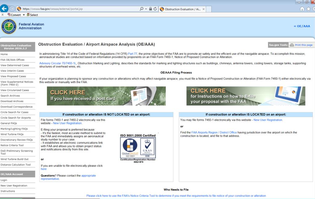
7 Reporting Form, OE/AAA
8 Determining Objects An object is an obstruction to air navigation if it is of greater height than any of the heights at the locations shown in the table below. Height 500 feet AGL At the site of the object Location 200 AGL Within 3 nautical miles of the airport reference point A height that would result in less than the required obstacle clearance between the object and the established minimum instrument flight altitude A height that would increase the minimum obstacle clearance altitude (MOCA) Within a terminal obstacle clearance area including an initial approach segment, a departure area an a circling approach area Within an enroute obstacle clearance area including turn and termination areas of a Federal airway or approved off-airway route
9 Determining Objects An obstruction to air navigation is not necessarily a hazard to air navigation. This determination is made by an airspace review under the procedures outlined in FAA Order , Procedures for Handling Airspace Matters. An airspace review also determines whether the obstruction needs to be marked, lighted or removed. Advisory Circular 150/ A, Airport Design, section 306 states However, any existing or proposed object, whether man-made or of natural growth that penetrates these (Part 77) surfaces is classified as an obstruction and is presumed to be a hazard to air navigation.


10 Part 77 Surfaces Primary Surface Approach Surface Transitional Surface Horizontal Surface Conical Surface
11 Construction Considerations Obstructions creating line of sight issues for ATCT Obstructions requiring ATCT to change procedures Different taxi routes Restrictions on a runway of a taxiway Effects on approach minima Procedures for coordination for lowering crane when weather is below certain minimums, verifying crane is down by phone numbers for POCs Can the approach minimums be increased if the crane cannot be taken down
12 References 14 CFR Part 77, Objects Affecting Navigable Airspace 14 CFR Part 139, Certification of Airports FAA Advisory Circular 70/7460-1L, Obstruction Marking and Lighting FAA Advisory Circular 150/ A, Airport Design OE/AAA Website: FAA Advisory Circular 150/5370-2F, Operational Safety on Airports During Construction
13 Questions
SITE ELEVATION AMSL...Ground Elevation in feet AMSL STRUCTURE HEIGHT...Height Above Ground Level OVERALL HEIGHT AMSL...Total Overall Height AMSL
 ******************************************** * Federal Airways & Airspace * * Summary Report * ******************************************** File: User Assigned File Name Latitude: NAD83 Coordinate Longitude:
AIRSPACE PROTECTION. Guidance and considerations for development in the vicinity of Ohio s airports and heliports
 AIRSPACE PROTECTION Guidance and considerations for development in the vicinity of Ohio s airports and heliports UPDATED SPRING 2018 AIRSPACE PROTECTION When construction is proposed near public use airports
Airport Obstruction Standards
 Airport Obstruction Standards Dr. Antonio Trani Department of Civil and Environmental Engineering Virginia Tech Outline of this Presentation Obstructions to navigation around airports Discussion of Federal
APPENDIX D FEDERAL AVIATION REGULATIONS, PART 77
 APPENDIX D FEDERAL AVIATION REGULATIONS, PART 77 Subparts A through C PART 77 - OBJECTS AFFECTING NAVIGABLE AIRSPACE Subpart A General 77.1 Scope. 77.2 Definition of terms. 77.3 Standards. 77.5 Kinds of
Aerodrome Inspectors Workshop
 Aerodrome Inspectors Workshop Obstructions, Public Protection & Fencing Location: Trinidad & Tobago, 9-13 JUN 2014 Presenter: Herman Smith, FAA ACSI Date Presentation Title 1 Obstructions and Public Protection
Appendix C AIRPORT LAYOUT PLANS
 Appendix C AIRPORT LAYOUT PLANS Appendix C AIRPORT LAYOUT PLANS Airport Master Plan Santa Barbara Airport As part of this Airport Master Plan, the Federal Aviation Administration (FAA) requires the development
FAA Requirements for Engine-out Procedures and Obstacle Clearance
 FAA Requirements for Engine-out Procedures and Obstacle Clearance Presentation to: CAAC Engine-out Procedures Seminar Name: Chuck Friesenhahn Date: 11/29/2005 Flight Standards Senior Advisor, Advanced
SUBCHAPTER E AIRSPACE
 PART 71 DESIGNATION OF CLASS A, B, C, D, AND E AIRSPACE AREAS; AIR TRAFFIC SERVICE ROUTES; AND REPORTING POINTS Sec. SPECIAL FEDERAL AVIATION REGULATION NO. 97 [NOTE] 71.1 Applicability. 71.3 [Reserved]
The following criteria shall be applied within the boundaries of the AO District:
 Sec. 419 (a) Purpose AIRPORT OVERLAY DISTRICT (AO) The purpose of the Airport Overlay District is to regulate and restrict the height of structures, objects, or natural growth, regulate the locations of
NOTICE TO PROPOSED CITY PERMITS: ZONING HEIGHT RESTRICTIONS/APPROVAL PROCESS
 NOTICE TO PROPOSED CITY PERMITS: ZONING HEIGHT RESTRICTIONS/APPROVAL PROCESS Dear Prospective Permittee: The City of St Petersburg (City) issues permits for construction projects based on local and state
Article 11 Airport District
 Cities County A Article 11 Article 11 Section 11.01 Intent (a) A. The A is established to provide for uses, activities, facilities, and structures necessary for the safe and efficient operation of aircraft
Noble Energy, Inc. MX3501-N Communication Tower. FAA and FCC Data
 Noble Energy, Inc. MX3501-N Communication Tower FAA and FCC Data Submitted to: Garfield County Building & Planning Department OA Project No. 011-2632 January 10, 2012 Notice Criteria Tool https://oeaaa.faa.gov/oeaaa/external/gistools/gisaction.jsp?action=dononoticerequired...
DRAFT MASTER PLAN UPDATE
 DRAFT MASTER PLAN UPDATE CHAPTER VI: AIRPORT LAYOUT PLAN NARRATIVE DRAFT REPORT APRIL 2017 PREPARED BY: Table of Contents WESTCHESTER COUNTY AIRPORT 6 AIRPORT LAYOUT PLAN NARRATIVE REPORT... 6-1 6.1 AGIS
Appendix K: MSP Class B Airspace
 Appendix K: MSP Class B Airspace K All of the open sky covering the United States, from less than an inch off the ground all the way to outer space, is part of America s airspace. This airspace resource
Chapter Six ALP Drawings. Tacoma Narrows Airport. Master Plan Update
 Chapter Six ALP Drawings Master Plan Update The master planning process for the (Airport) has evolved through efforts in the previous chapters to analyze future aviation demand, establish airside and landside
Consideration will be given to other methods of compliance which may be presented to the Authority.
 Advisory Circular AC 139-10 Revision 1 Control of Obstacles 27 April 2007 General Civil Aviation Authority advisory circulars (AC) contain information about standards, practices and procedures that the
** DETERMINATION OF NO HAZARD TO AIR NAVIGATION **
 Mail Processing Center Federal Aviation Administration Southwest Regional Office Obstruction Evaluation Group 2601 Meacham Boulevard Fort Worth, TX 76137 Issued Date: 05/16/2011 Aeronautical Study No.
AVIATION PLANNING AND DEVELOPMENT Oakland International Airport 530 Water Street Oakland, CA 94607
 AVIATION PLANNING AND DEVELOPMENT Oakland International Airport 530 Water Street When Do I Need to File an FAA Form 7460-1? Objects Affecting Navigable Airspace (14CFR77) June 2013 Background The Federal
Part 77 CAA Consolidation 1 April 2014 Objects and Activities Affecting Navigable Airspace
 Part 77 CAA Consolidation 1 April 2014 Objects and Activities Affecting Navigable Airspace Published by the Civil Aviation Authority of New Zealand DESCRIPTION Part 77 prescribes rules for persons proposing
Source: Chippewa Valley Regional Airport ASOS, Period of Record
 Chapter 1 Inventory Runway wind coverage is the percentage of time a runway can be used without exceeding allowable crosswind velocities. Allowable crosswind velocities vary depending on aircraft size
DP-3 ICAO Electronic Terrain and. Amendments 33 & 36
 DP-3 ICAO Electronic Terrain and Obstacle Data Amendments 33 & 36 1 Published Amendment 33 to ICAO Annex 15, Chapter 10 July 2004, ICAO Annex 15(Aeronautical Information Services) addeda new Chapter 10
U.S. DEPARTMENT OF TRANSPORTATION FEDERAL AVIATION ADMINISTRATION. National Policy
 NOTICE U.S. DEPARTMENT OF TRANSPORTATION FEDERAL AVIATION ADMINISTRATION National Policy N 8900.318 Effective Date: 8/13/15 Cancellation Date: 8/13/16 SUBJ: Optional Letter of Authorization (LOA) for Straight-In
** DETERMINATION OF NO HAZARD TO AIR NAVIGATION **
 Mail Processing Center Federal Aviation Administration Southwest Regional Office Obstruction Evaluation Group 2601 Meacham Boulevard Fort Worth, TX 76137 Issued Date: 01/04/2012 Aeronautical Study No.
ORDINANCE NO. _2013-
 ORDINANCE NO. _2013- AN ORDINANCE OF THE TOWNSHIP OF CONEWAGO, DAUPHIN COUNTY, PENNSYLVANIA, PROVIDING FOR AIRPORT ZONING REGULATIONS WITHIN THE AIRPORT ZONING OVERLAY DISTRICT CREATED BY THIS ORDINANCE
GACE Flying Club Ground Review Test, 2019 NAME: DATE: SCORE: CORRECTED BY: CFI# DATE:
 GACE Flying Club Ground Review Test, 2019 NAME: DATE: SCORE: CORRECTED BY: CFI# DATE: Circle all correct answer(s), fill in the blanks, or answer true or false. Test to be corrected to 100% by a GACE CFI.
Windmills & Airspace Can We Work Together?
 May 29, 2008 Windmills & Airspace Can We Work Together? J. Randolph Babbitt C O N F I D E N T I A L www.oliverwyman.com Windmills & Airspace Overview of Airspace Issues For Wind Turbine Sites The FAA s
** DETERMINATION OF NO HAZARD TO AIR NAVIGATION **
 Federal Aviation Administration Air Traffic Airspace Branch, ASW-520 2601 Meacham Blvd. Fort Worth, TX 76137-0520 Aeronautical Study No. 2010-WTE-13969-OE Issued Date: 09/30/2010 Morgan Johnston University
AIR LAW AND ATC PROCEDURES
 1 The International Civil Aviation Organisation (ICAO) establishes: A standards and recommended international practices for contracting member states. B aeronautical standards adopted by all states. C
Table 5-15 Special Use Airspace in the SBMR Airspace ROI
 5.4 AIRSPACE 5.4.1 Affected Environment The affected airspace environment is described below in terms of its principal attributes, namely controlled and uncontrolled airspace, special use airspace, military
SFAR 93 and Minimum Altitudes
 SFAR 93 and Minimum Altitudes Stuart W. Goering FAA Aviation Safety Counselor 1/14/2003 22:12 Copyright 2003 Stuart W. Goering 1 You Make the Call Too Low or Just Fine? 1/14/2003 22:12 Copyright 2003 Stuart
AERODROME LICENCE APPLICATION PROCESS
 0000180111 Page 2 Why is a Licence Required? An aerodrome licence is required for a site if it is intended to facilitate operations by commercial transport aircraft, other aerial work other than rotorcraft,
Contents. Subpart A General 91.1 Purpose... 7
 Contents Rule objective... 3 Extent of consultation... 3 Summary of comments... 4 Examination of comments... 6 Insertion of Amendments... 6 Effective date of rule... 6 Availability of rules... 6 Part 91
SECTION 32. Airfield and Aircraft Operations
 SECTION 32 Airfield and Aircraft Operations 32.A Airfields General. 32.A.01 The following safety requirements shall be in addition to the airfield's safety requirements. When an airfield has safety requirements
AIRSPACE IMPACTS ON AIRPORT PLANNING
 2017 AIRPORT PLANNING & NEPA WORKSHOP AIRSPACE IMPACTS ON AIRPORT PLANNING Planning Session 3: Up in the Air: Flight Procedures, Part 77, TERPS, and Other Airspace Considerations in Planning Greg Albjerg
Ronald Reagan Washington National Airport. April 18, 2012
 ONE ENGINE INOPERATIVE SURFACE DEVELOPMENT CASE STUDY Ronald Reagan Washington National Airport April 18, 2012 Mike Hines, C.M. Metropolitan Washington Airports Authority N Ronald Reagan Washington National
Section 32 TABLE OF CONTENTS Airfield and Aircraft Operations. 32.A General B Aircraft
 Section 32 TABLE OF CONTENTS Airfield and Aircraft Operations Section: Page 32.A General... 32-1 32.B Aircraft... 32-4 32-i THIS PAGE INTENTIONALLY LEFT BLANK 32-i SECTION 32 Airfield and Aircraft Operations
** DETERMINATION OF NO HAZARD TO AIR NAVIGATION **
 Mail Processing Center Federal Aviation Administration Southwest Regional Office Obstruction Evaluation Group 2601 Meacham Boulevard Fort Worth, TX 76137 Issued Date: 07/03/2013 Aeronautical Study No.
STAFF REPORT. Airport Land Use Consistency Determination Betteravia Plaza. MEETING DATE: January 21, 2016 AGENDA ITEM: 8D
 STAFF REPORT SUBJECT: Airport Land Use Consistency Determination Betteravia Plaza MEETING DATE: AGENDA ITEM: 8D STAFF CONTACT: Andrew Orfila RECOMMENDATION: Adopt findings for the Betteravia Plaza project
1.1.3 Taxiways. Figure 1-15: Taxiway Data. DRAFT Inventory TYPICAL PAVEMENT CROSS-SECTION LIGHTING TYPE LENGTH (FEET) WIDTH (FEET) LIGHTING CONDITION
 WIDTH (FEET) LIGHTING CONDITION") 1.1.3 Taxiways EWN has an extensive network of taxiways and taxilanes connecting the terminal, air cargo, and general aviation areas with the runways as listed in Figure 1-15. A 50-foot wide parallel taxiway
1.1.3 Taxiways EWN has an extensive network of taxiways and taxilanes connecting the terminal, air cargo, and general aviation areas with the runways as listed in Figure 1-15. A 50-foot wide parallel taxiway
** DETERMINATION OF NO HAZARD TO AIR NAVIGATION **
 Mail Processing Center Federal Aviation Administration Southwest Regional Office Obstruction Evaluation Group 2601 Meacham Boulevard Fort Worth, TX 76137 Issued Date: 08/15/2012 Aeronautical Study No.
** DETERMINATION OF NO HAZARD TO AIR NAVIGATION **
 Mail Processing Center Federal Aviation Administration Southwest Regional Office Obstruction Evaluation Group 10101 Hillwood Parkway Fort Worth, TX 76177 Issued Date: 07/29/2016 Aeronautical Study No.
4.2 AIRSPACE. 4.2 Airspace. Supplemental Draft Environmental Impact Statement August 2008 Military Training Activities at Mākua Military Reservation
 4.2 AIRSPACE 4.2.1 Impact Methodology Impacts on airspace use were assessed by evaluating the potential effects of the proposed training activities on the principal attributes of airspace use, as described
SECRETARY OF THE ARM Y WASHINGTON
 SECRETARY OF THE ARM Y WASHINGTON f 3 JAN 2012 MEMORANDUM FOR SEE DISTRIBUTION SUBJECT: Army Directive 2012-02 (Supplemental Policy for Operations of Unmanned Aircraft Systems in the National Airspace
DO NOT BEGIN THIS WORK UNTIL YOU HAVE COMPLETED ALL REQUIRED ASSIGNED READING AND EXERCISES.
 DO NOT BEGIN THIS WORK UNTIL YOU HAVE COMPLETED ALL REQUIRED ASSIGNED READING AND EXERCISES. Gardner Textbook Review Questions to prepare for Class #12 Answer these on notebook paper (or a text file) then
Overview ICAO Standards and Recommended Practices for Aerodrome Safeguarding
 Overview ICAO Standards and Recommended Practices for Aerodrome Safeguarding References The Convention on International Civil Aviation (Chicago Convention) ICAO SARPS Annex 14 Vol. I, 7 th Edition, July
Chapter 4 Airport Facility Requirements
 Chapter 4 Airport Facility Requirements Introduction CHAPTER 4 AIRPORT FACILITY REQUIREMENTS MAY 2013-1 Organization of Materials CHAPTER 4 AIRPORT FACILITY REQUIREMENTS MAY 2013-2 RPZ - ROAD RPZ - NON-AIRPORT
Instrument Proficiency Check Flight Record
 Instrument Proficiency Check Flight Record Date: Flight Time: Sim. Inst. Time: Pilot Name: Aircraft Type: Aircraft Tail Number: Act. Inst. Time: Instructor Name: Holding Procedures Task Notes N/A Satisfactory
-NOTE: NOT TO BE USED FOR NAVIGATION PURPOSES-
 APPENDIX 1-B INSTRUMENT APPROACH PROCEDURES March 2010 SKYHAVEN AIRPORT -NOTE: NOT TO BE USED FOR NAVIGATION PURPOSES- -NOTE: NOT TO BE USED FOR NAVIGATION PURPOSES- -NOTE: NOT TO BE USED FOR NAVIGATION
Table of Contents. List of Tables. Cincinnati/Northern Kentucky International Airport 2035 Master Plan Update
 Table of Contents 7.1. Airport Layout Plan (Existing Conditions)... 2 7.2. Airport Layout Plan (Future Conditions)... 3 7.3. Technical Data Sheet... 5 7.4. Commercial Terminal Area Drawing... 5 7.5. East
USE OF 3D GIS IN ANALYSIS OF AIRSPACE OBSTRUCTIONS
 USE OF 3D GIS IN ANALYSIS OF AIRSPACE OBSTRUCTIONS A project by by Samuka D. W. F19/1461/2010 Supervisor; Dr D. N. Siriba 1 Background and Problem Statement The Airports in Kenya are the main link between
a. Aeronautical charts DID THIS IN LESSON 2
 AIRMAN CERTIFICATION STANDARDS: REMOTE PILOT SMALL: You will know and be able to explain in writing or oral form the below tasks regarding AIRPORT OPERATIONS Task References Objective Task B. Airport Operations
Control of Cranes and Other Temporary Obstacles
 United Kingdom Overseas Territories Aviation Circular OTAC 139-27 140-11 171-8 172-11 178-10 Control of Cranes and Other Temporary Obstacles Issue 1 1 June 2018 Effective on issue GENERAL Overseas Territories
IVAO Flight Operations Department Indonesia (ID) Division Procedures
 Division Procedures") IVAO Flight Operations Department Indonesia (ID) Division Procedures Revised April 12 rd, 2010 Please consult also the local application of common procedures on http://www.ivao.web.id 1. General 1.1 In
IVAO Flight Operations Department Indonesia (ID) Division Procedures Revised April 12 rd, 2010 Please consult also the local application of common procedures on http://www.ivao.web.id 1. General 1.1 In
FIT FOR PURPOSE: A Guide to Using NAV CANADA Aeronautical Publications SECTION B PUBLICATION SPECIFIC FIT FOR PURPOSE INFORMATION
 FIT FOR : A Guide to Using NAV CANADA Aeronautical Publications SECTION B PUBLICATION SPECIFIC FIT FOR INFORMATION I TABLE OF CONTENTS SECTION A: GENERAL MATERIAL 2 SECTION B: PUBLICATION SPECIFIC FIT
Effective Altitude. R-3103 To 30,000 (To 9,144 meters) Source: NACO 2002 Notes: 1 By NOTAM issued 12 hours in advance
 Source: NACO 2002 Notes: 1 By NOTAM issued 12 hours in advance") 8.4 AIRSPACE USE 8.4.1 Affected Environment The affected airspace environment is described below in terms of its principal attributes, namely controlled and uncontrolled airspace, special use airspace,
8.4 AIRSPACE USE 8.4.1 Affected Environment The affected airspace environment is described below in terms of its principal attributes, namely controlled and uncontrolled airspace, special use airspace,
Airspace. Chapter 14. Gold Seal Online Ground School. Introduction
 Gold Seal Online Ground School www.onlinegroundschool.com Chapter 14 Airspace Introduction The two categories of airspace are: regulatory and nonregulatory. Within these two categories there are four types:
RULES OF TENNESSEE DEPARTMENT OF TRANSPORTATION AERONAUTICS DIVISION CHAPTER LICENSING AND REGISTRATION OF AIRPORTS TABLE OF CONTENTS
 RULES OF TENNESSEE DEPARTMENT OF TRANSPORTATION AERONAUTICS DIVISION CHAPTER 1680-1-2 LICENSING AND REGISTRATION OF AIRPORTS TABLE OF CONTENTS 1680-1-2-.01 Purpose 1680-1-2-.06 Repealed 1680-1-2-.02 Definitions
EXPLANATION OF TPP TERMS AND SYMBOLS
 U.S. TERMINAL PROCEDURES PUBLICATION 52 EXPLANATION OF TPP TERMS AND SYMBOLS The discussions and examples in this section will be based primarily on the IFR (Instrument Flight Rule) Terminal Procedures
AD 2. AERODROMES. For the ICAO location indicators used for Canadian aerodromes, refer to the following publications:
 AIP CANADA (ICAO) PART 3 AERODROMES (AD) AD 2. AERODROMES AD 2.1 Aerodrome Location Indicator and Name For the ICAO location indicators used for Canadian aerodromes, refer to the following publications:
APPENDIX F AIRSPACE INFORMATION
 APPENDIX F AIRSPACE INFORMATION Airspace Use DEFINITION OF AIRSPACE Airspace, or that space which lies above a nation and comes under its jurisdiction, is generally viewed as being unlimited. However,
STAFF REPORT. Airport Land Use Plan Consistency Review: Old Town Village Mixed Use Project City of Goleta. MEETING DATE: June 18, 2015 AGENDA ITEM: 5M
 STAFF REPORT SUBJECT: Airport Land Use Plan Consistency Review: Old Town Village Mixed Use Project City of Goleta MEETING DATE: AGENDA ITEM: 5M STAFF CONTACT: Peter Imhof, Andrew Orfila RECOMMENDATION:
Initiated By: AFS-400
 U.S. Department of Transportation Federal Aviation Administration Advisory Circular Subject: Development and Submission of Special Date: 04/14/2015 AC No: 90-112A Instrument Procedures to the FAA Initiated
MINIMUM FLIGHT ALTITUDES
 MINIMUM FLIGHT ALTITUDES 1. Introduction Minimum flight altitudes are created first to ensure safety, awareness and adequate radio navigation reception for aircraft flying at the same time in specific
TANZANIA CIVIL AVIATION AUTHORITY AIR NAVIGATION SERVICES INSPECTORATE. Title: CONSTRUCTION OF VISUAL AND INSTRUMENT FLIGHT PROCEDURES
 Page 1 of 8 1. PURPOSE 1.1. This Advisory Circular provides guidance to personnel involved in construction of instrument and visual flight procedures for publication in the Aeronautical Information Publication.
Chapter 9 - Airspace: The Wild Blue, Green & Red Yonder
 I5 Class G Airspace 38. [I4/3/3] What minimum visibility and clearance from clouds are required for VFR operations in Class G airspace at 700 feet AGL or lower during daylight hours? A. mile visibility
Learning More About: Protecting and Evaluating Airspace for Airports
 Learning More About: Protecting and Evaluating Airspace for Airports Introduction Tall structures, smoke, and Tall Structures rising terrain are just a few conditions that can create hazardous conditions
Lecture Minimum safe flight altitude
 Lecture Minimum safe flight altitude Calculate of minimum safe flight altitude, safe flight altitude in approach zone, in circle zone (circle altitude), minimum safe flight altitude in aerodrome area,
USE OF RADAR IN THE APPROACH CONTROL SERVICE
 USE OF RADAR IN THE APPROACH CONTROL SERVICE 1. Introduction The indications presented on the ATS surveillance system named radar may be used to perform the aerodrome, approach and en-route control service:
Chapter 1. Draw Standard Departure Procedure
 Chapter 1. Draw Standard Departure Procedure 1. Prior to drawing departure area consult the US Terminal Procedures book to determine if there are published take off special Take Off Minimums and (Obstacle)
Albuquerque Aerostat Ascension Association
 Attachment C Albuquerque Aerostat Ascension Association Balloon Flight Operations Manual AAAA Flying Events AAAA Balloon Flight Operations Manual Table of Contents This manual has been prepared as part
Regulations & Obligations
 Regulations & Obligations Thursday, March 24, 2015 9:00 a.m. 10:00 a.m.) PRESENTED BY: John Harpool Richard White Adam Hartley International Operators Conference San Diego, CA March 21 24, 2016 Sources:
Re: Findings Regarding Possible Impacts of Proposed Rockfort Quarry on Aviation Activities at Brampton Airport
 Mr. Christopher J. Tzekas, Partner, WeirFoulds LLP, The Exchange Tower, Suite 1600, P.O. Box 480, 130 King Street West, Toronto, Ontario, M5X 1J5. May 8, 2010. Re: Findings Regarding Possible Impacts of
PLANNING AND ZONING MEETING. March 20, 2019 AGENDA. 1. Review Minutes. 1
 PLANNING AND ZONING MEETING March 20, 2019 AGENDA 1. Review Minutes. 1 2. Appointments A. Land Use Map Discussion Horrocks Engineers.. 2 B. Airport Protection Ordinance. 3-8 3. Other Business 4. Adjourn
[1] Gleim #: Source: AIM Para Learning Statement Code: PLT141
![[1] Gleim #: Source: AIM Para Learning Statement Code: PLT141](/thumbs/75/71500728.jpg "[1] Gleim #: Source: AIM Para Learning Statement Code: PLT141") Gleim FAA Test Prep: Private Pilot (15 questions) Unit 3a: Airports, Air Traffic Control, and Airspace Name: Date: Circle the correct answer on the question sheets and fill in the corresponding circle
Gleim FAA Test Prep: Private Pilot (15 questions) Unit 3a: Airports, Air Traffic Control, and Airspace Name: Date: Circle the correct answer on the question sheets and fill in the corresponding circle
AIRPORT ZONING REGULATIONS for the City of McPherson, Kansas
 AIRPORT ZONING REGULATIONS for the City of McPherson, Kansas ARTICLE 1. TITLE, PURPOSE, AUTHORITY AND JURISDICTION 100 Title. These regulations, including the McPherson Airport Zoning Map made a part hereof,
AMENDMENT No. 8 TO THE INTERNATIONAL STANDARDS AND RECOMMENDED PRACTICES AERODROMES ANNEX 14 TO THE CONVENTION ON INTERNATIONAL CIVIL AVIATION
 AMENDMENT No. 8 TO THE INTERNATIONAL STANDARDS AERODROMES ANNEX 14 TO THE CONVENTION ON INTERNATIONAL CIVIL AVIATION VOLUME I AERODROME DESIGN AND OPERATIONS The amendment to Annex 14, Volume I contained
USE OF REMOTELY PILOTED AIRCRAFT AND MODEL AIRCRAFT IN AVIATION
 luo Regulation 1 (10) OPS M1-32 Issued: 4 December 2018 Enters into force: 7 December 2018 Validity: indefinitely Legal basis: Aviation Act (864/2014), Sections 5, 9 and 57 Act on Transport Services (320/2017),
Chapter AIRPORT ZONING
 Chapter 142 - AIRPORT ZONING ARTICLE I. - IN GENERAL Sec 142-1 Applicability The airport protection zoning regulations contained in this Chapter shall be applicable to the areas identified in Exhibit A,
AIR NAVIGATION ORDER
 CLEARANCE AREAS AND OBSTACLE LIMITATION SURFACES AT AIR NAVIGATION ORDER VERSION : 2.0 DATE OF IMPLEMENTATION : 15-02-2013 OFFICE OF PRIME INTEREST : AERODROME STANDARDS BRANCH. (Directorate of Airspace
H O M E C O M I N G. NOTAM Aircraft Owners and Pilots Association (AOPA) Fly-In Frederick Municipal Airport (FDK) Frederick, MD
 Fly-In Frederick Municipal Airport (FDK) Frederick, MD") F L Y - I N AOPA H O M E C O M I N G FREDERICK, MD NOTAM Aircraft Owners and Pilots Association (AOPA) Fly-In Frederick Municipal Airport (FDK) Frederick, MD SPECIAL FLIGHT PROCEDURES EFFECTIVE 1200 NOON
F L Y - I N AOPA H O M E C O M I N G FREDERICK, MD NOTAM Aircraft Owners and Pilots Association (AOPA) Fly-In Frederick Municipal Airport (FDK) Frederick, MD SPECIAL FLIGHT PROCEDURES EFFECTIVE 1200 NOON
Introduction. Appendix D: Airspace Protection
 Preliminary PreliminaryDraft DraftMaster MasterPlan Plan Bankstown Airport Introduction : Airspace Protection D Preliminary Master Plan Draft Master Plan Airspace protection D1 OVERVIEW The protection
Western Service Area Unmanned Aircraft Systems (UAS) Update. Federal Aviation Administration. Defense Symposium
 Update. Federal Aviation Administration. Defense Symposium") Western Service Area Unmanned Aircraft Systems (UAS) Update Presented to: Presented by: Northwest Aerospace & Defense Symposium Matt Gammon, Tactical Operations Team, FAA Western Service Center Date: May
Western Service Area Unmanned Aircraft Systems (UAS) Update Presented to: Presented by: Northwest Aerospace & Defense Symposium Matt Gammon, Tactical Operations Team, FAA Western Service Center Date: May
SPORT AVIATION CORP LTD
 SPORT AVIATION CORP LTD RECREATIONAL PILOT WRITTEN EXAMINATION Subcategory: Microlight No. 1 AIR LAW This examination paper remains the property of SAC Ltd and is protected by copyright. Name of Applicant:
SECURITY OVERSIGHT AGENCY May 2017 EXTENDED DIVERSION TIME OPERATIONS (EDTO)
") ADVISORY CIRCULAR CIVIL AVIATION SAFETY AND CAA-AC-OPS031A SECURITY OVERSIGHT AGENCY May 2017 1.0 PURPOSE EXTENDED DIVERSION TIME OPERATIONS (EDTO) 1.1 This advisory circular (AC) provides guidance to
ADVISORY CIRCULAR CIVIL AVIATION SAFETY AND CAA-AC-OPS031A SECURITY OVERSIGHT AGENCY May 2017 1.0 PURPOSE EXTENDED DIVERSION TIME OPERATIONS (EDTO) 1.1 This advisory circular (AC) provides guidance to
FLIGHT ADVISORY WASHINGTON D.C. SPECIAL FLIGHT RULES AREA LEESBURG MANUVERING AREA
 FLIGHT ADVISORY WASHINGTON D.C. SPECIAL FLIGHT RULES AREA LEESBURG MANUVERING AREA EFFECTIVE October 11, 201609 0400 This Notice does not supersede restrictions pertaining to the use of airspace contained
Jeppesen Mobile FliteDeck VFR
 Airport Information CLEARWATER INTL (PIE) 10 Rwy9730 118.30 CTAF Location Name Fuel and Services Available Identifier Length of longest runway Frequency (public airports only) Airport Elevation 118.60
Contents. Page 1 of 11 / Draft Chapter 142 Version CHAPTER AIRPORT ZONING... 2 ARTICLE I. - IN GENERAL... 2
 Contents CHAPTER 142 - AIRPORT ZONING... 2 ARTICLE I. - IN GENERAL... 2 Sec 142-1. - Applicability... 2 Secs. 142-2 142-35. - Reserved.... 3 ARTICLE II. - ST. PETERSBURG-CLEARWATER INTERNATIONAL AIRPORT
AIRPORT LAND USE COMPATILIBILTY AIRPORT LAND USE COMPATIBILIITY
 CHAPTER 7 AIRPORT LAND USE COMPATILIBILTY CHAPTER 7 AIRPORT LAND USE COMPATIBILIITY 7.0 INTRODUCTION On airport aviation related development is typically compatible with aircraft operations. On airport
DEPARTMENT: CIVIL ENGINEERING SEMESTER: III SUBJECT CODE / Name: CE2303/ Railway, Airport and Harbors Engineering 2 MARK QUESTIONS AND ANSWERS
 DEPARTMENT: CIVIL ENGINEERING SEMESTER: III SUBJECT CODE / Name: CE2303/ Railway, Airport and Harbors Engineering 2 MARK QUESTIONS AND ANSWERS 1.Define wind Coverage (AUC NOV/DEC 2010),(AUC NOV/DEC 2011)
Airport Zoning Regulations
 Airport Zoning Regulations Tampa International Airport Tampa Executive Airport Peter O. Knight Airport Plant City Airport Hillsborough County Aviation Authority June 1, 2017 TABLE OF CONTENTS Page Section
Glossary. Part I Acronyms/Data Terminology. AIFSS -- Automated International Flight Service Station.
 Glossary Part I Acronyms/Data Terminology AC -- Air Carrier. AFSS -- Automated Flight Service Station. AIFSS -- Automated International Flight Service Station. ARTCC -- Air Route Traffic Control Center.
AERONAUTICAL SURVEYS & INSTRUMENT FLIGHT PROCEDURES
 AERONAUTICAL SURVEYS & INSTRUMENT FLIGHT PROCEDURES Current as of November 2012 ALASKA AVIATION SYSTEM PLAN UPDATE Prepared for: State of Alaska Department of Transportation & Public Facilities Division
APPENDIX F. FAA and Orange County ALUC References
 APPENDIX F FAA and Orange County ALUC References Mail Processing Center Federal Aviation Administration Southwest Regional Office Obstruction Evaluation Group 2601 Meacham Boulevard Fort Worth, TX 76193
INTERNATIONAL CIVIL AVIATION ORGANIZATION FIRST MEETING OF DIRECTORS OF CIVIL AVIATION OF THE CARIBBEAN REGION (CAR/DCA/1)
") CAR DCA/1 20/09/02 INTERNATIONAL CIVIL AVIATION ORGANIZATION FIRST MEETING OF DIRECTORS OF CIVIL AVIATION OF THE CARIBBEAN REGION (CAR/DCA/1) (Grand Cayman, Cayman Islands, 8-11 October 2002) Agenda Item
CAR DCA/1 20/09/02 INTERNATIONAL CIVIL AVIATION ORGANIZATION FIRST MEETING OF DIRECTORS OF CIVIL AVIATION OF THE CARIBBEAN REGION (CAR/DCA/1) (Grand Cayman, Cayman Islands, 8-11 October 2002) Agenda Item
Learning Objectives 7.3 Flight Performance and Planning Flight Planning & Flight Monitoring
 030 00 00 00 FLIGHT PERFORMANCE AND PLANNING 033 00 00 00 FLIGHT PLANNING AND FLIGHT MONITORING 033 01 00 00 FLIGHT PLANNING FOR VFR FLIGHTS Remark Using Training Route Manual VFR charts or CQB Annexes
[Docket No. FAA ; Airspace Docket No. 14-ASO-4] SUMMARY: This action proposes to amend Class E Airspace at Newnan, GA,
![[Docket No. FAA ; Airspace Docket No. 14-ASO-4] SUMMARY: This action proposes to amend Class E Airspace at Newnan, GA,](/thumbs/96/128013796.jpg "[Docket No. FAA ; Airspace Docket No. 14-ASO-4] SUMMARY: This action proposes to amend Class E Airspace at Newnan, GA,") This document is scheduled to be published in the Federal Register on 03/18/2014 and available online at http://federalregister.gov/a/2014-05888, and on FDsys.gov [4910-13] DEPARTMENT OF TRANSPORTATION
This document is scheduled to be published in the Federal Register on 03/18/2014 and available online at http://federalregister.gov/a/2014-05888, and on FDsys.gov [4910-13] DEPARTMENT OF TRANSPORTATION
FAA FORM UAS COA Attachment FAA
 Page 1 of 6 DEPARTMENT OF TRANSPORTATION FEDERAL AVIATION ADMINISTRATION CERTIFICATE OF WAIVER OR AUTHORIZATION ISSUED TO Xcam Aerials, Inc. 10197 SE 144th Place Summerfield, FL 34491 This certificate
TABLE OF CONTENTS 1.0 INTRODUCTION...
 Advisory Circular Subject: General Safety Practices Model Aircraft and Unmanned Air Vehicle Systems Issuing Office: Civil Aviation, Standards Document No.: AC 600-02 File Classification No.: Z 5000-31
NAVIGATION: CHARTS, PUBLICATIONS, FLIGHT COMPUTERS (chapters 7 & 8)
") NAVIGATION: CHARTS, PUBLICATIONS, FLIGHT COMPUTERS (chapters 7 & 8) LONGITUDE AND LATITUDE 1. The location of an airport can be determined by the intersection of lines of latitude and longitude. a. Lines
NAVIGATION: CHARTS, PUBLICATIONS, FLIGHT COMPUTERS (chapters 7 & 8) LONGITUDE AND LATITUDE 1. The location of an airport can be determined by the intersection of lines of latitude and longitude. a. Lines
Guidance material for land use at or near aerodromes
 Guidance material for land use at or near aerodromes Table of Contents Overview... 1 Glossary... 1 Types of Aerodromes... 1 Obstacle Limitation Surfaces... 2 Wildlife Hazard Management... 2 Notice of Intention