Establish the Delta Military Operations Area Environmental Assessment
|
|
|
- Rudolph Watson
- 5 years ago
- Views:
Transcription


1 Establish the Delta Military Operations Area Environmental Assessment January 2010
2 Acronyms and Abbreviations degree F degree Fahrenheit µg/m 3 micrograms per cubic meter 11 AF 11 th Air Force 3 WG 3 rd Wing AFB Air Force Base AFI Air Force Instruction AGIA Alaska Gasline Inducement Act AGL above ground level AK MOA EIS Alaska Military Operations Area Environmental Impact Statement ALCAN Alaska-Canadian ARTCC Air Route Traffic Control Center ATC Air Traffic Control ATCAA Air Traffic Control Assigned Airspace ATV All-terrain Vehicle AWACS Airborne Warning and Control System BRAC Base Realignment and Closure BLM Bureau of Land Management CAA Clean Air Act CAS Close Air Support CDNL C-weighted Day-Night Average Sound Level CEQ Council on Environmental Quality CFR Code of Federal Regulations CO carbon monoxide db decibel Delta T-MOA Delta Temporary Military Operations Area DoD Department of Defense DZ drop zone EA Environmental Assessment EIS Environmental Impact Statement EO Executive Order ESA Endangered Species Act FAA Federal Aviation Administration FBO Fixed-Base Operator FL Flight Level FONSI Finding of No Significant Impact HMMWV High Mobility Multipurpose Wheeled Vehicle IAP Instrument Approach Procedure IDO Initial Defense Operations Capability IFR Instrument Flight Rule IICEP Interagency and Intergovernmental Coordination for Environmental Planning ILS Instrument Landing System IR Instrument Route JASSM Joint Air-to-Surface Standoff Missile JCS Joint Chiefs of Staff JDAM Joint Direct Attack Munition JSOW Joint Standoff Weapon KIAS Knots Indicated Airspeed L dn Day-Night Average Sound Level L dnmr Onset Rate-Adjusted Monthly Day-Night Average Sound Level LFE L max MEA MFE MOA MSL MTR NAAQS NE NEPA NHPA NM NO 2 NOTAM NRHP NRIS O 3 P.L. P/CG Pb PM 10 PM 2.5 ppm PSD psf RF-A ROD ROI RPC S&I SEL SHPO SO 2 SUA SUAIS U.S. USAF USC USEPA USFWS USGS VFR VR Large Force Exercise Maximum Sound Level Minimum Enroute Altitude Major Flying Exercise Military Operations Area mean sea level Military Training Route National Ambient Air Quality Standards Northern Edge National Environmental Policy Act National Historic Preservation Act nautical mile nitrogen dioxide Notice to Airmen National Register of Historic Places National Register Information Service ozone Public Law Pilot/Controller Glossary lead particulate matter less than 10 micrometers in diameter particulate matter less than 2.5 micrometers in diameter parts per million Prevention of Significant Deterioration pounds per square foot Red Flag-Alaska Record of Decision Region of Influence Resource Protection Council safe & initiation Sound Exposure Level State Historic Preservation Office sulfur dioxide Special Use Airspace Special Use Airspace Information Service United States United States Air Force United States Code United States Environmental Protection Agency United States Fish and Wildlife Service United States Geological Survey Visual Flight Rule Visual Route
3 a. Responsible Agency: United States Air Force (USAF) Cover Sheet ESTABLISH THE DELTA MOA, 11 TH AIR FORCE, ELMENDORF AFB, ALASKA ENVIRONMENTAL ASSESSMENT b. Proposals and Actions: This Environmental Assessment (EA) analyzes the potential environmental consequences of a proposal to improve required training for Major Flying Exercises (MFEs) by establishing the Delta Military Operations Areas (MOAs) as part of the Yukon/Fox Complex. The Yukon/Fox Complex consists of the Yukon, Fox, Eielson, Birch, and Buffalo MOAs; associated Air Traffic Control Assigned Airspace (ATCAAs); ranges R-2202, R-2205, and R-2211; and the Delta ATCAA. The proposed Delta MOA would allow aircrews to train as they fight. Current MFE training cannot be achieved at the combat mission level with the existing ATCAA and MOA structure connecting the Yukon and Fox/Eielson Special Use Airspaces (SUAs). At present, MFE training aircraft must transition the Delta corridor by either climbing above Flight Level (FL) 180 (18,000 feet above mean sea level [MSL]) into the Delta ATCAA or funneling through the low altitude Birch or Buffalo MOAs. The abrupt and segmented changes in altitude artificially constrain realistic threat-avoidance and attack run-in training precisely when pilots should be focused on combat conditions. The proposed Delta MOA permits use of current technology and tactics and provides all angle surface attacks, threat reaction tactics, air-to-air combat maneuvering, and joint air-ground operations in conjunction with ranges R-2202 and R The Delta MOA would overlie the Birch and Buffalo MOAs, have a ceiling of FL180 at the existing Delta ATCAA, have a floor of 10,000 feet MSL from Eielson Air Force Base (AFB) to the Birch MOA, and have a floor 3,000 feet above ground level (AGL) between the Birch and Buffalo MOAs. The Delta MOA would be activated not more than 6 MFEs a year not to exceed 60 days per year with hour periods twice a weekday. A typical two-week exercise would have 3 hours between two daily usage periods. MFE annual schedules would be published and civil aviation would be provided details at least 30 days in advance. MFEs would not be scheduled in January, 27 June to 11 July, September, or December. Priority would be given to medevac, fire, and other emergency activities during MFEs. Visual Flight Rule (VFR) corridors in the Birch and Buffalo MOAs support VFR traffic. V-444 would be available for Instrument Flight Rule (IFR) traffic for a minimum of 19 hours each MFE day. V-444 would not be available for up to 300 hours, or 3.4 percent of the year. A corridor south of 63 degrees ( ) latitude in the Fox 3 ATCAA would support transit of commercial and other civil aircraft which could not otherwise deconflict schedules. Chaff and defensive flares, as currently used in the Delta ATCAA and the Birch and Buffalo MOAs, would be used in the Delta MOA under existing Alaskan altitude release restrictions. Existing supersonic activity above FL300 above the Delta MOA would continue. The Delta MOA would support MFE training in accordance with the conditions and mitigations identified for the Delta Temporary MOA (Delta T-MOA) and the Alaska Military Operations Areas Environmental Impact Statement (AK MOA EIS) Record of Decision (ROD) (1997). The Federal Aviation Administration (FAA) is responsible for charting airspace and is a cooperating agency for this EA. The No Action Alternative would not establish the proposed Delta MOA on aeronautical charts. The Birch and Buffalo MOAs and the Delta ATCAA would continue to be used for MFE training. This results in continued low-quality MFE training and reduces the realism needed for aircrews to experience combat situations before being deployed to the actual combat theater. c. Comments and Inquiries: Written comments on this document should be directed to Mr. James W. Hostman, 611 CES/CEAO, th St., Ste. 302, Elmendorf AFB, AK Telephone inquiries may be made to d. Designation: Environmental Assessment e. This EA has been prepared in accordance with the National Environmental Policy Act (NEPA). Public and agency comments focused the environmental analysis on airspace management, safety, socioeconomics, biological resources, and land use. Additional environmental resources include noise, air quality, physical resources, cultural resources, and environmental justice. The Delta T-MOA provides substantial information on the potential environmental effects from establishing the Delta MOA. VFR traffic would continue to use the established Delta transit corridor. Medevac, fire survey, firefighting, or emergency flights would be given priority. An estimated one to two general aviation IFR flights per MFE training day could be delayed by approximately one hour, primarily at Northway or Fairbanks, if V-444 was not available. Civil aviation traffic would need to communicate through established radio communication systems to obtain MOA status. If no other deconfliction scheduling was possible, one to two commercial flights per MFE day could be re-routed at altitude south of the 63 corridor. Annual average noise levels below the Birch and Buffalo MOAs would be lower than baseline and annual average noise levels between the Birch and Buffalo MOAs would noticeably increase from 41.0 to 45.2 Onset Rate-Adjusted Monthly Day-Night Average Sound Level (L dnmr ). The change would not exceed the annual average of 55 Day-Night Average Sound Level (L dn ) identified by the United States Environmental Protection Agency (USEPA) as the level to begin assessing the potential for environmental impacts. Experience with the Delta T-MOA demonstrated that scheduling, communication, IFR access on V-444 a minimum of 19 hours an MFE day, VFR corridors, and priority for emergency flights mitigated potential impacts. There would be no discernible impacts on air, soils, or water within the Tanana River Valley or the Yukon-Tanana Upland. Extensive studies of chaff particles and defensive flares, as currently used in the Delta ATCAA and Birch and Buffalo MOAs, have found no negative impacts of chaff or flare materials to biological resources. Alaska Native villages at Healy Lake and Dot Lake, under the Buffalo MOA, would experience a discernible reduction in aircraft overflight noise when compared with No Action. National Register of Historic Places (NRHP) properties under the Delta ATCAA would experience an increase in average annual noise levels from training above 3,000 feet AGL. There would be no disproportionately high or adverse impacts to minorities or low-income communities and no disproportionate health or safety risks to children. There would be no expected impact to land use. Public scoping concerns questioned socioeconomic effects on regional airports. Expanded radio and radar coverage and adopting the AK MOA EIS ROD and Delta T-MOA mitigations could result in approximately one to two IFR general aviation aircraft being delayed by approximately one hour during an MFE day. Such delays would not be expected to significantly affect transit or refueling of general aviation aircraft at Northway. The availability of VFR corridors, and scheduling MFEs to have V-444 daily accessible to IFR traffic for 19 hours each MFE day, would reduce the potential for any socioeconomic impacts to Northway and other local airports along the Delta corridor. A Fairbanks fixedbase operator (FBO) stated that one cargo service decided to refuel in Anchorage in place of Fairbanks due to the uncertainty regarding the Delta T-MOA. One or two commercial aircraft per day which could not deconflict during a Delta MOA activation period and were required to transit south of the 63 corridor would each incur approximately 500 pounds of fuel and 7 minutes of additional flight time. The proposed Delta MOA would not be expected to significantly impact regional socioeconomics, although some civil aviation pilots would be annoyed and even limited delays could affect FBOs. No significant cumulative impacts are expected to any environmental resource within the Delta corridor.
4
5 FINDING OF NO SIGNIFICANT IMPACT NAME OF PROPOSED ACTION. Establish the Delta Military Operations Areas (MOAs), Eielson Air Force Base (AFB), Alaska DESCRIPTION OF THE PROPOSED ACTION AND NO ACTION ALTERNATIVES. The United States Air Force (USAF) proposes to improve required training for Major Flying Exercises (MFEs) by establishing the Delta MOAs consisting of four connected MOAs which could be scheduled together or independently. The proposed action would establish connecting airspace to provide a realistic setting for MFEs. MFEs in Alaskan airspace provide aircrews with realistic simulated combat experience. The expanded capability of aircraft establishes the need for contiguous airspace to meet MFE training objectives. The Delta corridor separates the Yukon MOAs from ranges R-2202, R-2205, and R-2211, and the Fox and Eielson MOAs. At present, training aircraft must transition the Delta corridor by either climbing above Flight Level (FL) 180 (18,000 feet above mean sea level [MSL]) into the Delta Air Traffic Control Assigned Airspace (ATCAA) or funneling through the low-level Birch or Buffalo MOAs. The abrupt and segmented changes in altitude associated with the current MOA structure introduce pilot concerns about the boundary of the airspace and artificially constrain realistic threat-avoidance and attack run-in training at exactly the time pilots should be focused on combat conditions. The current airspace configuration requires pilots to train using non-optimal tactics in restricted training regimens. This continually reinforces negative habit patterns which can affect pilot survivability in combat. Current MFE training requirements cannot be achieved at the combat mission level with the existing ATCAA and MOA structure connecting the Yukon and Fox/Eielson Special Use Airspaces (SUAs). The Delta MOAs (collectively termed the Delta MOA in this Environmental Assessment [EA]) would permit the north/south training environment required by today s technology to meet current MFE training. The proposed Delta MOA would have a ceiling of FL180 at the existing Delta ATCAA and overlie the Birch and Buffalo MOAs. The proposed Delta MOA would have a floor of 10,000 feet MSL from Eielson AFB to the Birch MOA to support aviation activity in the vicinity of Eielson AFB, and have a floor of 3,000 feet above ground level (AGL) over Delta Junction between the Birch and Buffalo MOAs. The 3,000 foot floor over Delta Junction, in conjunction with the Birch MOA floor of 500 feet AGL and the Buffalo MOA floor of 300 feet AGL create realistic varied altitude access across the Delta corridor. This altitude range to 3,000 feet in the proposed Delta MOA and below for the Birch and Buffalo MOAs permits training with modern sensors and aircraft capabilities. Today s training requires low to high maneuvering to simulate combat conditions and to work with ground forces, follow through on targets, accomplish supply missions, and perform other real-life training missions. MFEs would activate the MOA up to 6 times a year for up to a maximum of 60 days per year. Activation for an MFE would be hour periods twice a weekday. The daily time blocks would have 3 hours between exercises. MFE schedules would be publicized annually and details provided at least 30 days prior to an exercise. MFEs would not be scheduled in January, 27 June to 11 July, September, or December. Chaff and defensive flares are currently used above the Delta corridor in the Delta ATCAA and the Birch and Buffalo MOAs and would be proposed for the Delta MOA. Visual Flight Rule (VFR) corridors in the Birch and Buffalo MOAs and the floor altitude of the proposed Delta MOA would support VFR traffic. V-444 would be available for Instrument 1
6 Flight Rule (IFR) traffic a minimum of 19 hours per MFE day. During the up to 300 hours of annual MFE activation (3.4 percent of the year), V-444 would not be available for IFR traffic. A corridor south of 63 degrees ( ) latitude between FL320 and FL350 in the Fox 3 ATCAA would support transit of commercial and other high performance civil aircraft which could not otherwise deconflict through scheduling. Life flight, fire, and other emergency activities in the proposed Delta MOA during MFEs would be accommodated by temporarily raising the floor of the MOA or otherwise altering the MFE to meet emergency requirements. Medevac requirements would include a lifeguard flight returning to its station. The USAF has worked with the Federal Aviation Administration (FAA) to schedule a Delta Temporary MOA (Delta T-MOA) to support MFEs during The proposed Delta MOA would be in accordance with the conditions and mitigations identified for the Delta T-MOA and the Alaska MOA Environmental Impact Statement (AK MOA EIS) Record of Decision (ROD) dated The No Action Alternative would not establish the Delta MOA on aeronautical charts used by civil aviation. The Birch and Buffalo MOAs and the Delta ATCAA would continue to be used for MFE training. The USAF would continue to request a Delta T-MOA to support realistic MFE training. MFEs without a Delta MOA result in continued low-quality MFE training and reduce the realism needed for aircrews to experience combat situations before being deployed to the actual combat theater. SUMMARY OF ENVIRONMENTAL CONSEQUENCES. This Delta MOA EA addresses the potential environmental consequences from implementing the Proposed Action and includes the No Action Alternative. Public and agency comments during scoping focused the environmental analysis on airspace management, safety, socioeconomics, biological resources, and land use. Public comments on the Draft EA emphasized airspace, safety, and socioeconomics. Additional environmental resources considered in the EA include noise, air quality, physical resources, cultural resources, environmental justice, and cumulative effects. The EA demonstrates that the proposed Delta MOA, including schedule and other mitigations developed through experience with the Delta T-MOA and the AK MOA EIS ROD (1997), would not result in significant environmental impacts to any environmental resources area. Potential environmental consequences may be summarized as follows. The proposed Delta MOA would have minimal effect upon VFR traffic which would continue to use established VFR corridors. Other than communication, there would be no or minimal effect on medevac, fire survey, firefighting, or emergency flights, which would be given priority. An estimated one to two general aviation IFR flights per MFE training day could be delayed primarily at Northway or Fairbanks approximately one hour if IFR circumstances prevailed and V-444 was not available for IFR traffic. Civil aviation traffic operating from improved or unimproved airfields along the Delta corridor between Northway and Fairbanks would need to communicate through established radio systems to obtain MOA status. If no other deconfliction scheduling was possible, one to two commercial or other high altitude civil flights per MFE day could be re-routed south of the 63 corridor. Annual average noise levels below the Birch and Buffalo MOAs would be lower than projected baseline conditions. Noise levels between the Birch and Buffalo MOAs in the proposed Delta MOA are projected to increase from an annual average of 41.0 to an annual average of 45.2 Onset Rate-Adjusted Monthly Day-Night Average Sound Level (L dnmr ). The noticeable increase in noise levels would not exceed the annual average of 55 Day-Night Average Sound Level (L dn ) identified by the United States Environmental Protection Agency (USEPA) as the level to begin assessing the potential for 2
7 environmental impacts. Supersonic flights would continue to be limited to above FL300 in the existing Delta ATCAA and would not occur in the proposed Delta MOA. Sonic booms are currently experienced and would be expected to continue under supersonic overflight areas of the Yukon/Fox Complex. Experience with the Delta T-MOA has demonstrated that implementation of scheduling, improved communication, priority for medevac, fire, and other emergencies, and continued recognition of the VFR corridors have mitigated the potential for safety impacts. Some commenters on the Draft EA expressed the opinion that any interruption or delay in a general aviation pilot s intent to fly through the Delta corridor could impact, and result in annoyance to, the pilot. Defensive flare use would adhere to existing restrictions on flare use in the Alaskan airspace to above 5,000 feet AGL from June to September and above 2,000 feet AGL for the remainder of the year. No impacts to air quality would occur because the proposed Delta MOA altitude floor is above the mixing level for air emissions. No impacts to the soils or water within the Tanana River Valley or the Yukon-Tanana Upland would occur. Chaff and flares are currently used and residual materials are currently deposited under the Delta ATCAA and Birch and Buffalo MOAs. Extensive studies of chaff particles and defensive flare constituents have found no negative impacts to biological resources. The proposed Delta MOA adopts the AK MOA EIS ROD biological mitigations, including the minimum overflight altitude of 3,000 feet AGL above the Delta Caribou Herd calving areas from May 15 to June 15, a minimum overflight altitude of 5,000 feet AGL over Dall sheep lambing areas from May 15 to June 15, and a minimum overflight altitude of 5,000 feet AGL over Dall sheep rutting areas from November 15 to December 15 (no MFEs in December). The change in annual average noise levels associated with MFE training in the proposed Delta MOA would not be at a level or altitude to affect wildlife. Alaska Native villages at Healy Lake and Dot Lake under the Buffalo MOA are estimated to experience a discernible reduction in aircraft overflight noise below baseline conditions. There would be no disproportionately high or adverse impacts to minorities or low-income communities, and there would be no disproportionate health or safety risks to children. National Register of Historic Places (NRHP) properties under the Delta ATCAA would experience an increase in annual average noise levels associated with MFE training above 3,000 feet AGL. This training and associated noise level would not be expected to affect historic structures or historic properties. Areas under the proposed Delta MOA between the Buffalo and Birch MOAs would have a discernible increase in average noise level but would not be expected to impact land use under the airspace. Supersonic flights would not occur in the proposed Delta MOA although existing sonic booms from supersonic flights above FL300 would continue. Continued use of chaff and defensive flares could result in a hunter, fisherman, or other individual finding a piece of chaff or flare wrapping material or plastic from a deployed chaff or defensive flare and being annoyed. Public scoping and comments on the Draft EA questioned socioeconomic effects on the region and regional airports, particularly Northway and Fairbanks. Many commenters on the Draft EA incorrectly interpreted that the USAF was proposing to permanently close V-444. The USAF proposal has always been to have V-444 accessible to civilian IFR traffic for 305 days per year and a minimum of 19 hours each of the remaining 60 days of MFE training. During each MFE day, scheduling and publication of MOA activation could still result in approximately one to two general aviation aircraft seeking to fly IFR through the Delta corridor being delayed by 3
8
9 Establish the Delta Military Operations Area Environmental Assessment Elmendorf Air Force Base, Alaska January 2010
10
11 TABLE OF CONTENTS EXECUTIVE SUMMARY... ES PURPOSE AND NEED FOR THE PROPOSED ACTION AND ALTERNATIVES Purpose and Need for the Proposed Action Background Red Flag Alaska and Military Training Training Ranges Critical to MFEs Current Training Requirements Current Airspace and Current Aircraft Capabilities Changes in the Nature of Warfare Training Airspace Below 10,000 Feet MSL Airspace Requirements for MFE Realism Summary of Operational Requirements Lead and Cooperating Agencies Organization of this EA DESCRIPTION OF PROPOSED ACTION AND ALTERNATIVES Introduction Elements of Proposed Action Creation of New Airspace Changes in Airspace Use Chaff and Flare Use in the Proposed Delta MOA No Action Alternative Summary of Proposed Action and Alternative Summary of the Proposed Action and No Action Alternative USAF Adopted Mitigations Alternatives Considered But Not Carried Forward Extend Birch and Buffalo MOAs to the Delta ATCAA Expanded Use of Simulators in Place of the Delta MOA New Military Airspace North of the Yukon 5 MOA or West of Fairbanks Splitting the Delta T-MOA to Allow V-444 to Remain Open Environmental Impact Analysis Process Environmental Assessment Process Scope of Resource Analysis Public and Agency Input to the Environmental Process Regulatory Compliance Environmental Comparison of the Proposed Action Options and the No Action Alternative TRAINING SPECIAL USE AIRSPACE AFFECTED ENVIRONMENT Airspace Management Definition Existing Conditions Military Operations Areas Air Traffic Control Assigned Airspace Military Training Routes Restricted Areas Existing Use of MOAs and ATCAAs Existing Civil Aviation Use of the Delta Corridor Noise Definition Table of Contents Page i
12 3.2.2 Existing Conditions Subsonic Flight Supersonic Flight Safety Definition Existing Conditions Communication within the Airspace Flight Safety Ground and Explosive Safety Chaff and Flare Use Air Quality Definition Existing Conditions Physical Resources Definition Existing Conditions Biological Resources Definition Existing Conditions Biological Mitigations from the 1997 ROD Cultural Resources Definition Existing Conditions Land Use and Recreation Definition Existing Conditions Socioeconomics Definition Existing Conditions Environmental Justice Definition Existing Conditions ENVIRONMENTAL CONSEQUENCES Airspace Management Proposed Action No Action Noise Proposed Action No Action Safety Proposed Action No Action Air Quality Proposed Action No Action Physical Resources Proposed Action No Action Biological Resources Proposed Action No Action Page ii Table of Contents
13 4.7 Cultural Resources Proposed Action No Action Land Use Proposed Action No Action Socioeconomics Proposed Action No Action Environmental Justice Proposed Action No Action CUMULATIVE CONSEQUENCES Cumulative Effects analysis Past, Present, and Reasonably Foreseeable Actions Military Actions Non-Federal Actions Cumulative Effects Other Environmental Considerations Relationship Between Short-Term Uses and Long-Term Productivity Irreversible and Irretrievable Commitment of Resources REFERENCES LIST OF PREPARERS APPENDIX A APPENDIX B APPENDIX C APPENDIX D APPENDIX E APPENDIX F APPENDIX G APPENDIX H APPENDIX I APPENDIX J ALASKA MILITARY OPERATIONS AREAS SPECIAL USE AIRSPACE INFORMATION SERVICE PAMPHLET CHARACTERISTICS OF CHAFF CHARACTERISTICS AND ANALYSIS OF FLARES PUBLIC INVOLVEMENT AND AGENCY CORRESPONDENCE RELEVANT STATUTES, REGULATIONS, AND GUIDELINES AIRSPACE MANAGEMENT AIRCRAFT NOISE ANALYSIS AND AIRSPACE OPERATIONS MID-AIR COLLISION AVOIDANCE PAMPHLET REVIEW OF EFFECTS OF AIRCRAFT NOISE, CHAFF, AND FLARES ON BIOLOGICAL RESOURCES COMMENTS AND RESPONSES Table of Contents Page iii
14 TABLES Representative MFE Use of the Proposed Delta MOA Existing and Proposed Airspace Utilization Estimates for Proposed Delta MOA and Adjacent MOAs Estimated Delta, Birch, and Buffalo MOA Annual MFE Hours by Altitude by MOA Estimated Chaff and Flare Use in the Proposed Delta MOA during One Two-Week MFE Residual Material Deposited on the Surface Following Deployment of One Flare Community Outreach Meetings Public Concerns and USAF Proposed Actions Summary of Impacts by Resource for Proposed Delta MOA Description of MOAs in the Vicinity of the Proposed Delta MOA Description of Restricted Airspace IFR Flights on V-444 from 10 September to 23 September Representative A-Weighted Instantaneous Maximum (L max ) in Decibels Under the Flight Track for Aircraft at Various Altitudes in the Primary Airspace Sound Exposure Level (SEL) in Decibels under the Flight Track for Aircraft at Various Altitudes in the Primary Airspace Baseline and Projected Noise Levels from 60 Days of MFE Training Sonic Boom Peak Overpressures (psf) for Aircraft at Mach 1.2 Level Flight (in pounds per square foot) Relation Between Average and Impulse Noise (Sonic Booms, Munitions) and Population Annoyance Class A Mishaps for Current and Projected MFE Operations in the Proposed Delta MOA The Relationship of Special-Status Species to the Proposed Delta MOA Land Area under Proposed Delta MOA Demographic Characteristics of Affected Regions (2000) Economic Characteristics of Regions (2000) Airport Facility, Aircraft, and Operations Information Minority and Low-Income Populations by Area (2000) Current and Future Military and Non-Military Projects Page iv Table of Contents
15 FIGURES Establish the Delta MOA EA Alaskan Airspace Scheduled for USAF Training Proposed Delta MOA Relative to Other Airspace Cross Section of Proposed Delta MOA Blue Aircraft Marshal for Attack on Red Airfields and High Value Assets Red Aircraft Move Across the Delta MOA to Fight Blue Attacking Aircraft in the Yukon MOAs Red Aircraft Forced Back Across the Delta MOA and are Destroyed; Aircraft are Regenerated at Base. Blue Aircraft Transit the Delta MOA to Attack High Value Targets Blue Aircraft Maneuver to Avoid and Suppress Simulated Surface-to-Air and Air-to-Air Attacks. Blue Aircraft Reform to Assess Attack Results and Plan New Attacks Blue Aircraft use Delta Corridor to Train for Multiple New Mission Requirements FAA s Non-Regulatory Special Use Airspace Standard Process Delta Corridor Including VFR Corridors Life Cycle of Training Defensive Chaff and Flares EA Process Types of Alaskan Training Airspace Proposed Delta MOA Relative to Other Special Use Airspace Past Radio Coverage Enhanced Radio Coverage Past Radar Coverage Expanded Radar Coverage Federally Recognized Alaska Native Villages Land Uses within the Delta MOA Region of Influence Airports in Delta MOA Region Table of Contents Page v
16 THIS PAGE INTENTIONALLY LEFT BLANK. Page vi Table of Contents
17 EXECUTIVE SUMMARY The United States Air Force (USAF) proposes to improve required training for Major Flying Exercises (MFEs), including Red Flag Alaska (RF-A) and Northern Edge (NE) training exercises, by establishing the Delta Military Operations Areas (MOAs). The proposed Delta MOA consists of four MOAs, represented in Figure 1.1-2, page 1-4, which could be activated in combination or independently depending on the types of MFE mission training needed. These MOAs are collectively referred to as the Delta MOA in this Environmental Assessment (EA). The Delta MOA would become part of the Yukon/Fox Complex. The Yukon/Fox Complex consists of the Yukon, Fox, Viper, Eielson, Birch, and Buffalo MOAs; ranges R-2202, R-2205, and R-2211; and the overlying associated Air Traffic Control Assigned Airspace (ATCAAs) including the Delta ATCAA. The purpose of the Delta MOA is to establish connecting airspace which would provide USAF and other military services with a realistic setting for MFEs. The proposed Delta MOA airspace would be in use for up to 6 MFEs a year for up to, but not exceeding, 60 days per year. The airspace would be activated for two hour periods with a 3 hour separation between exercises to support civil aircraft access. The airspace would provide the USAF the capability to train aircrews as they fight and ensure that aircrews experience the critical first 10 combat missions in as realistic a setting as possible. The first 10 combat missions have been found to be the most critical for aircrew survival in combat. This EA and Finding of No Significant Impact (FONSI) have been prepared in accordance with the National Environmental Policy Act (NEPA) and its implementing regulations. A Draft EA and Draft FONSI were issued for a 30-day public and agency review and comment period and the comment period was extended to a 60 day review in response to requests because of the holidays. Comments on the draft have been incorporated into this EA. These comments, in addition to the EA analysis, were considered in decisionmaking regarding the establishing of the Delta MOA. Purpose and Need MFEs in Alaskan airspace are designed to provide aircrews with realistic training and simulated combat experience. During the 1980s and 1990s, military training was transitioning from Cold War penetration missions to the warfare of the 21st century. The development of low-observability platforms, much longer range sensors, and advanced targetable stand-off weapons resulted in engagement distances in excess of 100 nautical miles (NM). Opponent tactics have expanded from defending resources to destroying attacking assets. For training to keep up with actual combat technology and distance requirements, most MFEs in Alaskan airspace have to be fought in a north/south war. The Delta corridor creates a speed bump which prohibits flow-through attack precisely when aircraft attacking or defending a target need the most realism. Experience in recent conflicts in Iraq and Afghanistan, and expanded capability of aircraft such as the F-22, expected F-35, upgraded F-15, and B-1, establish the need for contiguous airspace to meet MFE training objectives. The Delta corridor separates the Yukon MOAs from training ranges and the Fox and Eielson MOAs. At present, training aircraft must transition the Delta corridor by either climbing above Flight Level (FL) 180 (18,000 feet above mean sea level [MSL]) into the Delta ATCAA or being funneled through the low-level Birch or Buffalo MOAs. These Executive Summary Page ES-1
18 constraints occur precisely when training aircrews should have the most realistic combat experience. The abrupt and segmented changes in altitude associated with the current MOA structure introduce pilot concerns about the boundary of the airspace and artificially constrain realistic threat-avoidance and attack run-in training precisely when pilots should be focused on combat conditions. The current airspace configuration requires pilots to train using non-optimal tactics in restricted training regimens. This continually reinforces negative habit patterns which can affect pilot survivability in combat. Current MFE training requirements cannot be achieved at the combat mission level with the existing ATCAA and MOA structure connecting the Yukon and Fox/Eielson Special Use Airspaces (SUAs). The USAF has worked with the Federal Aviation Administration (FAA) to schedule a Delta temporary MOA (Delta T-MOA) to support MFEs during 2007, 2008, and The purpose of the Proposed Action is to establish the Delta MOA airspace to support MFE training in accordance with the conditions and mitigations identified for the Delta T-MOA and mitigations identified in the Alaska MOA Environmental Impact Statement (AK MOA EIS) Record of Decision (ROD) (1997). The proposed Delta MOA is designed to meet 21st century MFE training needs for all angle realistic surface attacks, threat reaction tactics, air-to-air combat maneuvering at realistic scales, conducting missions at realistic altitudes, and joint air-ground operations near ranges R-2202, R-2205, and R The proposed Delta MOA would distribute aircraft throughout the airspace as training aircrews face challenges from advanced aircraft and surface-to-air weapon systems. The Proposed Action would permit the 11 th Air Force (11 AF) to perform realistic MFE training. Proposed Action and Alternatives The proposed Delta MOA establishes the required north/south training environment to meet MFE demands of current aircraft technology and weapons systems capabilities. The proposed Delta MOA would have a ceiling of FL180 at the existing Delta ATCAA and would: Have a floor of 10,000 feet MSL from Eielson Air Force Base (AFB) to the Birch MOA to support aircraft operations in the vicinity of Eielson AFB and Fairbanks. Overlie the Birch MOA from the top of the Birch MOA with a floor at, but not including, the 5,000 feet MSL top of the Birch MOA. Have a floor at, but not including, 3,000 feet above ground level (AGL) between the Birch and Buffalo MOAs. Overlie the Buffalo MOA with a floor at, but not including, the 7,000 feet MSL top of the Buffalo MOA. Be activated up to 6 MFEs for a maximum of 60 days per year for hour periods twice a day. The daily schedule would have 3 hours between the exercises to support civil aviation needs. MFEs would typically occur over a two-week period and not be scheduled on weekends. MFEs would be scheduled with a minimum of two weeks between MFEs as noted in the 1997 AK MOA EIS ROD Section Page ES-2 Executive Summary
19 Establish the Delta MOA EA Be typically scheduled as one MFE in April-May, two in June-August, and one in October, with year-to-year variations. No exercises would be scheduled in January, 27 June to 11 July, September, or December. Include chaff and defensive flare use as currently used in the Delta ATCAA and the Birch and Buffalo MOAs. Provide an annual MFE schedule and provide MFE details to the public at least 30 days prior to the exercise with accurate times to minimize disruption to civil aviation. Continue to meet Delta T-MOA and AK MOA EIS ROD (1997) mitigations, including Visual Flight Rule (VFR) corridors in the Birch and Buffalo MOAs to support VFR traffic transiting the Delta corridor. Provide a corridor south of 63 degrees ( ) latitude between FL320 and FL350 in the Fox 3 ATCAA to support transit of commercial and other high altitude civil aircraft which could not otherwise use schedules to deconflict with MFE training during the up to 60 days per year when V-444 would be unavailable for up to two hour periods each day. Have V-444 open for civilian Instrument Flight Rule (IFR) traffic for at least 19 hours every MFE day. Prioritize life flight, fire, and other emergency activities in the proposed Delta MOA during MFEs. Such flights, including lifeguard flights returning to station, would be accommodated through temporarily raising the floor of the MOA or otherwise altering the MFE to meet emergency requirements. Adopt all mitigations from the AK MOA EIS ROD, dated 1997, as part of the proposed Delta MOA. The No Action Alternative would not establish the proposed Delta MOA and would not include the Delta MOA airspace in aeronautical charts used by civil aviation. The Birch and Buffalo MOAs and the Delta ATCAA would be used for MFE training. This results in continued lowquality MFE training and reduces the realism needed for aircrews to experience combat situations before being deployed to the actual combat theater. No Action would include continued use of chaff and defensive flares in existing MOA and ATCAA airspace and continued supersonic activity above FL300 in the Delta ATCAA. The USAF would continue to request a Delta T-MOA to support realistic MFE training. Environmental Consequences The public and agency comments during community meetings and comments on the Draft EA focused the environmental analysis on the following environmental resources: airspace management, safety, socioeconomics, biological resources, and land use. Additional environmental resources considered in this environmental assessment include noise, air quality, physical resources, cultural resources, and environmental justice. Airspace Management The experience with the Delta T-MOA has provided substantial information on the potential effects upon airspace management associated with establishing the Delta MOA. The proposed Delta MOA is expected to have minimal effect upon VFR traffic which would continue to use Executive Summary Page ES-3
20 established VFR corridors to transit the Delta corridor. There would be no or minimal effect beyond communication on medevac, fire survey, firefighting, or emergency flights, which would be given priority if they occurred during the time the proposed Delta MOA was active for an MFE. There would be some delay to IFR traffic under circumstances where IFR conditions prevailed, the proposed Delta MOA was active (3.4 percent of the year), and V-444 was not available for IFR traffic. V-444 would be open for IFR traffic for a minimum of 19 hours on any MFE day. Many commenters on the Draft EA incorrectly interpreted that the Delta MOA would permanently close V-444. This was never the USAF s proposal. An estimated one to two general aviation IFR flights per MFE training day could be delayed by approximately one hour, primarily at Northway or Fairbanks. Some commenters on the Draft EA expressed the opinion that any interruption or delay in a general aviation pilot s intent to fly through the Delta corridor could impact and result in annoyance to the pilot. Civil aviation traffic operating from improved or unimproved airfields along the Delta corridor between Northway and Fairbanks would need to communicate through established radio communication systems to obtain status of the proposed Delta MOA activation during scheduled MFE times. If no other deconfliction scheduling were possible, one to two commercial flights per MFE day could be rerouted between FL320 and FL350 south of the 63 corridor. Comments on the Draft EA noted that commercial aircraft were required to fly a total of over 1,000 additional miles during the Delta T-MOA activation for MFEs during The 40 days of activation meant that, if deconfliction could not otherwise occur through scheduling, a commercial flight was required to fly an average of over 25 additional miles per MFE day. Commenters on the Draft EA noted the positive effects of the 11 AF Resource Protection Council (RPC) established as a result of the 1997 ROD. Scientific noise studies and other programs implemented by the RPC have increased knowledge and understanding of the civil and military needs for Alaskan airspace. Establishing the proposed Delta MOA with the airspace scheduling mitigations, communication enhancements, and established corridors would not be expected to significantly impact airspace management within the region. Noise Annual average noise levels below the Birch MOA would be slightly but indiscernibly lower than calculated for baseline condition. Under the Buffalo MOA, average noise levels would be discernibly lower with the proposed Delta MOA. Noise levels between Eielson AFB and the Birch MOA are projected to indiscernibly increase and noise levels between the Birch and Buffalo MOAs in the proposed Delta MOA are projected to discernibly increase from 41.0 Onset Rate-Adjusted Monthly Day-Night Average Sound Level (L dnmr ) to 45.2 L dnmr. The change in noise levels under the proposed Delta MOA outside the Birch or Buffalo MOAs would not exceed the annual average of 55 Day-Night Average Sound Level (L dn ) identified by the United States Environmental Protection Agency (USEPA) as the level to begin assessing the potential for environmental impacts. Supersonic flights would continue to be limited to above FL300 in the Delta ATCAA and sonic booms would continue to be heard within the Delta corridor although supersonic flight would not occur in the proposed Delta MOA. The proposed Delta MOA would not be expected to result in a substantial impact to noise beneath the airspace. Page ES-4 Executive Summary
21 Safety Establish the Delta MOA EA Experience with the Delta T-MOA has demonstrated that implementation of scheduling, improved communication, and continued recognition of the VFR corridors can address concerns of general aviation pilots and mitigate potential safety impacts. Recently improved radar and communication systems improve safety in this area for both civilian and military pilots. Not scheduling MFEs during weekends, the high use September period, December or January, and from 27 June through 11 July reduces the potential for safety risk during periods of high civil aviation usage. The Proposed Action would provide access for emergency aircraft to support lifeguard flight, fire, and other emergencies in the region, including lifeguard aircraft repositioning to home station. Chaff and defensive flare use under the proposed Delta MOA would adhere to existing restrictions on flare use in the airspace to above 5,000 feet AGL from June to September and above 2,000 feet AGL for the remainder of the year. Commenters on the Draft EA expressed concern that even if an emergency medical flight were given priority during a Large Force Exercise (LFE), the flight would need to return to station. A 30-minute to 1-hour delay in the return to station was seen as a potentially unsafe situation if another emergency were to occur during that time. The USAF and FAA have coordinated to permit the emergency flight to using its lifeguard designation and be given priority for a returnto-station flight. In the unlikely event that a private pilot entered the airspace flying VFR before or during an MFE, was required to change from VFR to IFR due to weather conditions, and had to declare a fuel emergency to continue to traverse the airspace, the USAF and the FAA would work with the pilot to provide safe transit. This could include declaring a low-fuel emergency situation or suspending MFE activity below a specified altitude to permit the IFR aircraft to safely reach its destination. Commenters on the Draft EA requested clarification of emergency response protocol. If an aircraft accident was to occur, the military on-scene commander would coordinate activities and site access, as appropriate, and inform landowners and land management agencies of an incident which could affect non-military lands and/or waters. No significant safety effects are anticipated from establishing the proposed Delta MOA. Air Quality The mixing level for air emissions is below 3,000 feet AGL. The proposed Delta MOA does not include airspace below 3,000 feet AGL. No emission concentrations or changes to existing air quality attainment would be expected if the proposed Delta MOA was established. Physical Resources There is no on-the-ground construction associated with the proposed Delta MOA. Defensive countermeasures consisting of chaff and flares are currently used in the Delta ATCAA and the Birch and Buffalo MOAs. The amount of chaff distributed within the airspace would not substantially change from that currently used during MFE training. Chaff is primarily composed of aluminum and silica, is thinner than a human hair, and breaks down to become indistinguishable from native soils. During deployment of chaff and flares, small plastic or nylon pieces fall to the ground. These plastics pieces and wrappers are inert, widely dispersed, and are not expected to be concentrated in any way that could impact soil or water resources. Executive Summary Page ES-5
22 Establishing the proposed Delta MOA would not be expected to discernibly impact the soils or water within the Tanana River Valley or the Yukon-Tanana Upland. Biological Resources Biological resources include sensitive species as well as game species. The AK MOA EIS ROD (1997) established an RPC consisting of three interagency (federal, state, USAF) coordination teams. These three teams focused on Resource Protection/Mitigation, Public Information, and Research and Monitoring. These teams performed noise studies and oversaw mitigations. The AK MOA EIS ROD included a mitigation to establish a minimum overflight altitude of 3,000 feet AGL above the Delta Caribou Herd calving areas from May 15 to June 15. The proposed Delta MOA is not below 3,000 feet AGL. This means that the proposed Delta MOAs meets the USAF-adopted mitigations to reduce potential impacts upon the Delta Caribou Herd. Another 1997 ROD mitigation is a minimum flight level of 5,000 feet AGL over Tanana Hills Dall sheep lambing areas (nominally from May 15 to June 15) and over Dall sheep rutting areas from November 15 to December 15. The proposed Delta MOA will meet all USAF-adopted mitigations from the 1997 ROD which apply to the Delta MOA potentially affected area. The floor of the proposed Delta MOA, combined with some change in annual average noise levels associated with MFE training in the proposed Delta MOA, means that the proposed Delta MOA would have essentially the same effect on wildlife as exists under baseline conditions. Chaff and flares are currently used in the Delta ATCAA and Birch and Buffalo MOAs, and residual materials are currently deposited along the Delta corridor. Extensive studies of chaff particles and defensive flares have not documented negative impacts of chaff or flares to biological resources. The proposed Delta MOA would incorporate the existing AK MOA EIS ROD established minimum altitude and seasonal restrictions on defensive flare release. No significant impact to biological resources would be expected from establishing the proposed Delta MOA. Cultural Resources Cultural resources include architectural resources listed on the National Register of Historic Places (NRHP) and cultural properties and villages important to Alaska Natives. Two Alaska Native Villages at Healy Lake and Dot Lake are located under the Buffalo MOA and are expected to experience a small reduction in calculated aircraft overflight noise with the proposed Delta MOA. NRHP properties are currently under the Delta ATCAA and will experience an increase in average annual noise levels associated with MFE training as low as 3,000 feet AGL. This training and associated noise level would not be expected to affect historic structures or historic properties. No change in supersonic activities is expected because Delta ATCAA supersonic activities would continue to be above FL300. No significant impacts to traditional cultural properties or Alaska Native activities are anticipated to result from the proposed Delta MOA. Land Use Land use under the proposed Delta MOA between the Birch and Buffalo MOAs would experience an annual average subsonic noise increase from L dnmr of 41.0 to This noise level change would be discernible but be below the 55 L dn which the USEPA has identified as the annual average noise level to begin assessing the potential for noise impact. Supersonic flights would not occur in the proposed Delta MOA. The proposed Delta MOA would not be expected to impact land use under the airspace. Continued use of chaff and defensive flares could result Page ES-6 Executive Summary
23 in a hunter, fisherman, or other individual finding a piece of wrapping material or plastic from a deployed chaff or defensive flare and being annoyed. No impact to land use would be expected with the establishing of the proposed Delta MOA. Socioeconomics Many public commenters on the Draft EA expressed concern because they had been informed that establishing the Delta MOA would result in a permanent closure of V-444. Commenters specifically stated that the USAF should only use the Delta MOA for MFEs for short predetermined and published times so that V-444 would be available every day outside of those times. That is exactly the USAF proposal. V-444 would be open a minimum of 19 hours a day during any MFE day. MFEs would be scheduled annually, and details of the MFE schedules would be made available at least 30 days in advance of the MFEs. Commenters also expressed concerns about socioeconomic effects on regional airports. Of particular concern were the effects upon Northway and Fairbanks. Northway is a location for general aviation aircraft transiting from Canada into Alaska. Such aircraft stop at Northway for customs and other activities. The mitigations were integrated into the Delta T-MOA for an MFE, including scheduling and publication of MOA activation. MOA activation could result in approximately one to two general aviation aircraft seeking to fly IFR through the Delta corridor being delayed by approximately one hour during the scheduled MFE time. A potential one-hour delay was considered to be an unacceptable delay by some general aviation pilots commenting on the Draft EA. Communication as a result of USAF radio and radar expanded coverage in the region would improve safety and reduce delays to a minimum. Such delays would not be expected to significantly affect transit or refueling of general aviation aircraft at Northway. The availability of VFR corridors, combined with the scheduling of MFE activity to avoid high-use general aviation periods, such as the high use September period, would reduce any potential for socioeconomic impacts to Northway and other local airports along the Delta corridor. Accurate communication of the USAF s proposal and scheduling to civil aviation pilots reduces their concern and helps mitigate any potential schedule impacts. Inaccurate communication of the proposed Delta MOA schedule and mitigations may cause civil aviation pilots to re-route and avoid the Delta corridor. For example, misleading statements, such as the Delta MOA would effectively close the airspace corridor between Northway and Fairbanks, resulted in 25 to 30 Draft EA commenters incorrectly expressing the concern that the Delta MOA would permanently close V-444 and/or the Delta corridor. The proposed Delta MOA would not permanently close V-444. V-444 would be available for IFR flight a minimum of 19 hours every MFE training day. Such misleading statements about closure of V-444 could result in civil aviation pilots deciding to alter flight routes to Fairbanks or to locations beyond Fairbanks. During scoping, a Fairbanks Fixed-base Operator (FBO) stated that one cargo service which had been using the Fairbanks International Airport for refueling decided to refuel in Anchorage in place of Fairbanks due to the uncertainty regarding the Delta T-MOA. Advanced communication and accurate information regarding activation of the proposed Delta MOA would be expected to result in no significant impact upon airport economics within the region. Commercial aircraft which could not deconflict during a Delta MOA activation period and were required to fly south of the 63 corridor would incur some economic impacts. These impacts Executive Summary Page ES-7
24 would be approximately 500 pounds of fuel and 7 minutes of additional flight time for each of one to two commercial flights per day. Any additional fuel consumption would be of concern and would be seen as an impact to airline operations. An airline commenter on the Draft EA noted that during the 2008 Delta T-MOA activation, the airline had been required to fly a total of over 1,000 extra miles. The Delta T-MOA was scheduled a total of 40 days during The additional flight miles flown are within the estimated effect presented in the Draft EA. The total economic effect of the proposed Delta MOA would not be expected to significantly impact regional socioeconomics, although specific civil aviation support operations could incur some impacts. Environmental Justice Persons living under the proposed Delta MOA between the Birch and Buffalo MOAs would experience an increase in average annual noise levels. Persons living in the Alaska Native villages of Healy Lake and Dot Lake would experience a low, but discernible, reduction in calculated noise. Residents under the Delta corridor are not a disproportionate minority, nor are there a disproportionate number of children or low-income persons when compared with the region of Alaska as a whole. There would be no disproportionately high or adverse impacts to minorities or low-income communities as a result of establishing the proposed Delta MOAs. There would be no disproportionate health or safety risks to children. Cumulative Consequences A variety of projects are proposed for the Delta corridor or for development in Alaska beyond Fairbanks. Comments on the Draft EA pointed to increased energy development, the proposed railroad, and military projects. These are included in the EA cumulative analysis. Changes in aircraft at Eielson AFB or regional airspace could affect the number of training flights outside those estimated for MFEs. The proposed rail extension from Fairbanks to Delta Junction and the proposed natural gas pipeline would increase construction and other activities within the region. The USAF has supported temporary amendments to airspace actions such as for fixed and rotary wing activity around the Pago Mine construction in the Yukon 1 MOA. Increased training at Fort Wainwright would increase construction expenditures and socioeconomic activity in the Delta Junction area. Resource development in the northern parts of Alaska would have the potential to increase civil aviation use of the Delta corridor. MFE training in an established Delta MOA would not be expected to affect or be affected by any project on the ground under the proposed MOA. The calculated increase in noise from MFE training between the Birch and Buffalo MOAs would not be expected to have a noticeable cumulative effect with other projects within the region. The estimate of one to two general aviation flights delayed by approximately one hour per MFE day is incorporated into the EA socioeconomic and airspace sections. The Delta T-MOA experience was that an estimated one to two general aviation flights were delayed per 10-day MFE. This means the one to two IFR flights delayed per MFE day would already reflect cumulative project flight activity associated with increased development. No significant cumulative impacts are expected to any environmental resource within the Delta corridor. Page ES-8 Executive Summary
 and Northern Edge (NE) Training Exercises by establishing the Delta Military Operations Area (MOA). The Delta MOA would become part of the Yukon/Fox Complex.")
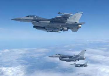
25 1.0 PURPOSE AND NEED FOR THE PROPOSED ACTION AND ALTERNATIVES The United States Air Force (USAF) proposes to improve required training opportunities for Major Flying Exercises (MFEs) including Red Flag Alaska (RF-A) and Northern Edge (NE) Training Exercises by establishing the Delta Military Operations Area (MOA). The Delta MOA would become part of the Yukon/Fox Complex. The Yukon/Fox Complex consists of the Yukon, Fox, Viper, Eielson, Birch, and Buffalo MOAs; ranges R-2202, R-2205, and R-2211; and the Delta Air Traffic Control Assigned Airspace (ATCAA) and other associated ATCAAs. This Environmental Assessment (EA) addresses the environmental consequences on the human and natural environment potentially resulting from implementation of the Delta MOA proposal. The following sections summarize the purpose and need for the proposed Delta MOA. 1.1 Purpose and Need for the Proposed Action The purpose of the Proposed Action is to establish connecting airspace which would provide USAF and other military services with a realistic setting for MFEs. The proposed airspace would be in use for up to 6 MFEs a year not to exceed 60 days a year. The proposed Delta MOA airspace would be activated during an MFE day for two hour periods. This airspace would provide the USAF the capability to train aircrews as they fight and ensure they experience the critical first 10 combat missions in a realistic, but controlled setting. The first 10 combat missions have been found to be the most critical for aircrew survival in combat. F-16 aircraft from the 18 th Aggressor Squadron provide realistic training during MFEs. This combat level training allows pilots to practice fighting and maneuvering against the capabilities of enemy aircraft. Experiences during recent military activities in Iraq and Afghanistan have established new or expanded roles for military aircrews. In addition to interdiction missions, the changing threats have created new challenges for close air support (CAS), convoy escort, dynamic targeting, pipeline and infrastructure protection, time-sensitive targeting, and tactical airlift. Training must prepare aircrews for these, as well as established air-to-air and air-to-ground combat missions. Training must mirror combat to the greatest extent possible, and the Yukon/Fox Complex training assets need to provide the opportunity for realistic, effective training operations. During the 1980s and 1990s, military training was transitioning from Cold War penetration missions to the warfare of the 21st century. The development of low-observability platforms, much longer range sensors, and advanced targetable stand-off weapons resulted in engagement distances in excess of 100 miles. Opponent tactics have expanded from defending resources to destroying attacking assets. For training to keep up with actual combat sensors and threats, most MFEs in Alaskan airspace have to be fought in a north/south war. The Delta corridor creates a speed bump which prohibits flow-through attack precisely when aircrews attacking or defending a target need the most realism. Aircraft, such as the F-15, B-1, F-22 and, in production, F-35, have expanded sensor and weaponry capabilities, which permit them to acquire targets at distances unheard of in the 1980s and early 1990s. Currently, 1.0 Purpose and Need for the Proposed Action and Alternatives Page 1-1
26 deployed surface-to-air missile systems have an engagement envelope of roughly 100 nautical miles (NM) and can be a direct threat to all but the most stealthy aircraft. MFE training needs contiguous airspace to meet current real-life MFE training objectives. The current Birch MOA, Buffalo MOA, and higher Delta ATCAA connect the existing Fox, Eielson, and Yukon airspaces with existing ranges, but do not provide for MFE training to meet the challenges of current combat. MFEs in the Yukon/Fox Complex are designed to provide aircrews with realistic experience and simulated combat. Pilots must be trained the way they will fight and enter combat with the experience and training required to support operational missions, protect their aircraft, and survive real-life threats. RF-A is an example of an MFE conducted in Alaskan military training airspace. Figure 1.1-1, page 1-3, presents the overall training airspace in Alaska, and Figure 1.1-2, page 1-4, focuses on the Delta corridor airspace under consideration in this proposal. Figure 1.1-3, page 1-5, presents a sectional, or side view, of the airspace between the Yukon and Fox/Eielson MOAs. The proposed Delta MOA on Figure 1.1-2, page 1-4, would overlie and connect the Birch and Buffalo MOAs and provide an airspace bridge between the Yukon, Fox, and Eielson MOA complexes. Aircraft attacking or defending targets during an MFE currently are funneled through the Birch or Buffalo MOAs in Figure 1.1-3, page 1-5, or have to pop up over the speed bump of the Delta corridor. On the critical final approach and attack to a target, pilots cannot realistically train as they will fight. As one aggressor (red air) pilot explained, the attacking blue air are like fish in a barrel. The aggressors always know where to look for the attacking pilots as they come out of the Birch or Buffalo MOAs. MFE training using the proposed Delta MOA establishes a realistic setting for both attacking and defending aircraft. The proposed Delta MOA consists of four MOAs, represented by circled numbers in Figure 1.1-2, page 1-4, which could be activated in combination or independently depending on the types of MFE mission training needed. These MOAs are collectively referred to as the Delta MOA in this EA. The Delta MOA would become part of the Yukon/Fox Complex. The Yukon/Fox Complex consists of the Yukon, Fox, Viper, Eielson, Birch, and Buffalo MOAs; ranges R-2202, R-2205, and R-2211; and the overlying ATCAAs including the Delta ATCAA. The proposed Delta MOA would permit MFE training using the full target acquisition and engagement capabilities incorporated into current aircraft and on next generation combat aircraft. Realistic combat training with current technology requires distances to detect threats and space for multiple combat aircraft to maneuver for attack and defense in an MFE. The Yukon/Fox Complex is unique in the United States (U.S.) in that it provides a realistic overland airspace. No other overland area in the U.S. provides the extent of the Yukon/Fox Complex. A review of Figure 1.1-2, page 1-4, demonstrates that this airspace provides the following: The Yukon MOAs are ideally situated to permit attacking blue air to assemble outside of sensor range and attack targets on ranges R-2202, R-2205, and R The Fox and Eielson MOAs are ideally situated to permit defending red air (typically, Eielson Air Force Base [AFB]-based F-16 aggressors) to set up outside of sensor range in defense of targets and/or to set up to ambush attacking blue air assets. Page Purpose and Need for the Proposed Action and Alternatives


27 Figure Alaskan Airspace Scheduled for USAF Training 1.0 Purpose and Need for the Proposed Action and Alternatives Page 1-3
28 Figure Proposed Delta MOA Relative to Other Airspace Page Purpose and Need for the Proposed Action and Alternatives


29 Figure Cross Section of Proposed Delta MOA 1.0 Purpose and Need for the Proposed Action and Alternatives Page 1-5
30 The Fox and Eielson MOAs adjoin restricted airspace southwest of Delta Junction with target complexes for air-to-ground training and for training with ground forces. The MOAs and ranges contain sites for threat emitters which simulate ground-based threats of anti-aircraft artillery and surface-to-air missiles. Aircrews can use either the Fox and Eielson MOAs or Yukon MOAs to train for unit level engagements without the proposed Delta MOA. Large Force Exercises (LFEs) can also be performed without the proposed Delta MOA. Realistic MFE training is a graduate experience beyond unit engagements. MFEs need capabilities beyond those required for unit training or LFEs. The Delta MOA would connect Alaskan military training airspace for full scale, realistic combat. Existing airspace limitations do not provide aircrews opportunities to train as they will fight. The proposed Delta MOA improvement substantially increases the ability to perform diversified and realistic training for MFEs. During 2007 and 2008, RF-A exercises were scheduled in a Delta Temporary MOA (Delta T-MOA) connecting the Fox, Eielson, and Yukon airspaces. The Delta T-MOA is being proposed for establishing the Delta MOA. The Delta T-MOA permitted aircrews to train in the variety of missions required in current and projected future combat conditions. The experience with the Delta T-MOA demonstrated the training value of the connecting airspace. The appreciation of pilots for this airspace can best be summed up with the quote How did you ever train for combat without the Delta T-MOA? The experience with the Delta T-MOA also demonstrated that the proposed Delta MOA can be established with specified operational scheduling for other users and established priorities to minimize the potential for disruption to commercial and general aviation. This proposal to establish the Delta MOA builds on the experience of the Delta T-MOA for use in RF-A and other MFE training. Experience with the Delta T-MOA demonstrated that MFE benefits and training realism can be accomplished with minimum effect to civil aviation. Specific aspects incorporated into the Delta T-MOA which the USAF proposes to apply to an established Delta MOA include: The Delta MOA would be activated for a very specific, limited time to meet flight training periods only. There would be no more than 6 MFEs per year (not to exceed 60 days per year). MFEs would activate the Delta MOA up to hour periods twice a weekday with 3 hours between exercises to support civil aircraft access. MFE schedules would be provided annually and details publicized at least 30 days prior to the exercise. MFEs would not be scheduled in December, January, 27 June to 11 July, or September. Terms Used in This EA Unit Level Training Mission: Consists of one or more aircraft to multi-ship flights within the training airspace. These training missions would not require use of the proposed Delta MOA. Large Force Exercise (LFE): Describes a single flying period of aircraft for local readiness exercises or extended stays of RF-A participants. These training exercises can be conducted without use of the proposed Delta MOA. Major Flying Exercise (MFE): Consists of replicating all phases of actual combat over a multi-day exercise. MFEs may involve 75 fighters and/or helicopters plus 25 heavy aircraft such as B-1B bombers and DC-10 tankers. MFEs would propose to activate the proposed Delta MOA typically during two-week periods for a maximum of 60 days per year. The Victor airway, V-444, which traverses the Delta corridor, would be available a minimum of 19 hours a day during an MFE training day. Page Purpose and Need for the Proposed Action and Alternatives
 (4,000 feet MSL south of Delta Junction). This is in accordance with the Alaska MOA EIS (AK MOA EIS) Record of Decision (ROD) of 1997.")
31 Establish the Delta MOA EA Visual Flight Rule (VFR) corridors for civil aviation transit along highways in established flight corridors would always be available below 3,500 feet above mean sea level (MSL) (4,000 feet MSL south of Delta Junction). This is in accordance with the Alaska MOA EIS (AK MOA EIS) Record of Decision (ROD) of The Special Use Airspace Information Service (SUAIS) provides substantially improved information and radar and radio coverage to help with deconfliction of military and civil aircraft. The T-MOA was demonstrated to be a dynamic airspace with no extension of published times and was returned to the Air Traffic Controller as soon as MFE engagements were completed or not needed during 2007 and The Delta MOA would be managed in the same way for MFEs. Priority would be given to any medevac reposition, fire fighting, or emergency flights that required access to the T-MOA. The T-MOA did result in a temporary delay in Instrument Flight Rule (IFR) traffic on V-444 through the Delta corridor when such traffic sought to transit the T-MOA during the limited time it was active. The Delta MOA would be expected to have the same temporary (approximately an hour) delay during an MFE. The T-MOA did result in re-routing commercial traffic from a flight pattern below 18,000 MSL on the Delta corridor to between Flight Level (FL) 320 and FL350 through the Fox ATCAA south of 63 degrees ( ). The Delta MOA would be expected to have the same re-routing for aircraft which could not otherwise deconflict from the MFE activation period. 1.2 Background Experience from the Vietnam War demonstrated conclusively that the first 10 combat missions are the most critical. During those missions, pilots hone their survival skills and learn to cope with the dynamics of combat. The decision was made at the highest Department of Defense (DoD) levels to recreate those first 10 combat missions in a structured training environment where multiple aircraft would train as they fight in an MFE. The realistic 10 combat missions would dramatically improve survival skills in real combat. The flanker color scheme F-16s fly as the opposing force during MFEs and use enemy tactics, techniques and procedures to give a realistic combat simulation. The existing MOA configuration does not permit realistic training during the critical period when the attacking aircraft are approaching range targets. In 1975, the USAF instituted the Red Flag experience at Nellis AFB. USAF specially trained aggressor squadrons and ground-based threats created a realistic two-week combat experience so that air and ground crews could be tested by nearly all aspects of real combat. Red Flag exercises have successfully graduated experienced pilots who have met the rigors and requirements of combat. During the 1980s and 1990s, Cold War military training was focused on penetration of heavily defended resources or destruction of massed armor. The warfare of the 21st century has low-observability platforms, long range sensors, and targetable stand-off weapons with distances well in excess of 100 miles. These new capabilities have 1.0 Purpose and Need for the Proposed Action and Alternatives Page 1-7
32 changed both the strategic and tactical way war is conducted. Aircraft such as the F-16, F-15, F- 22, upcoming F-35, B-1, and B-52 have received upgrades to dramatically change their sensor, targeting, and munitions capabilities from what existed in the 1980s and early 1990s. Events associated with recent conflicts in Iraq and Afghanistan have changed the training and deployment of personnel and equipment. The way these capabilities affect training is depicted in Section 1.3. Sensors now can pick up and target aircraft at extended distances. Opposing aircraft (red air) now not only defend high value targets but also maneuver to be in a position to inflict as much damage as possible on blue air assets. This could affect both the capability and the will to pursue an engagement. Training for the full extent of this type of engagement can only be accomplished with high value targets toward the center of the airspace and ample room in all directions to maneuver and threaten opposing forces. Defensive red assets are distributed, hide, and are deployed to maximize damage to blue assets. The Yukon/Fox Complex, with associated airspace and Army Ranges and the proposed Delta MOA, provide realistic distances as possible for 21st century engagements with aircraft and ground equipment using 21st century sensors, weapons, tactics, and strategy. These changes in aircraft capabilities and recent conflicts have changed training requirements. New aircraft capabilities which identify targets at distances in excess of 100 miles, new lowobservability and electronic warfare systems, new missions, and new munitions have placed increasing requirements on the multiple roles of current and future weapon systems. New conflict situations have increased the role of pilots in communication, threat evaluation, close support of ground forces, and precision munitions deployment while avoiding collateral damage. Reactions to unanticipated threats and training to cope with expanded targets of opportunity are needed. In addition to all of these new and expanding roles, pilots must be fully trained to meet increasingly sophisticated air-to-air and surface-to-air threats Red Flag Alaska and Military Training In 1992, Cope Thunder Exercise moved from the Philippines to the Yukon/Fox Complex. In 2006, the Cope Thunder Exercise was renamed Red Flag Alaska. The USAF has been conducting MFEs in Yukon/Fox Complex since RF-A is conducted in the Yukon/Fox Complex, which is part of what has been known since 2000 as the Pacific Alaska Range Complex. The Yukon/Fox Complex is a series of contiguous MOAs and Restricted Areas that extend from north of the Yukon River to south of the Alaska Range (see Figure 1.1-2, page 1-4). The airspace is approximately 180 NM wide (at its widest point) and averages between 110 and 140 NM wide. The complex is about 240 NM in length. The airspace is divided north/south along the Tanana River by the airspace that has become known as the Delta corridor. The Delta corridor averages about 20 NM from north to south and about 120 NM from east to west (see Figure 1.1-2, page 1-4). The Tanana River valley traverses most of the Delta corridor and the major road connecting Canada, Northway, Tok, Delta Junction, and Fairbanks is in this valley. The corridor is coincident with the IFR flyway known as V-444. The river corridor is crossed by two north/south low-altitude airspace tunnels, known as the Birch and Buffalo MOAs, that allow transit below 5,000 and 7,000 feet respectively (see Figures 1.1-2, page 1-4 and 1.1-3, page 1-5). Page Purpose and Need for the Proposed Action and Alternatives
 toward the west end of the corridor.")
33 1.2.2 Training Ranges Critical to MFEs Establish the Delta MOA EA The USAF utilizes two primary training ranges that are in close proximity to the Tanana River valley. As demonstrated on Figure 1.1-2, page 1-4, R-2205 is just north of the river (about 15 NM by 15 NM in dimension) toward the west end of the corridor. R-2202 contains different letter designations and is about 30 NM by 30 NM in dimension and just south of the river toward the center of the corridor. The USAF has invested heavily in building target complexes, drop zones, and threat simulators in these ranges. Through 2008, the USAF spent around $14 million per year on R-2202 and R-2205 alone. These ranges are the only place that military aircraft can practice dropping ordnance throughout the exercise airspace. Defending threat simulators are also located on the ranges on hard sites with pads, buildings, and logistical resupply. R-2205 is accessible via the few permanent military dirt roads in the area year around while R-2202 is only accessible by a temporary ice bridge during the winter or by helicopter. The remaining portions of the airspace are accessible only by helicopter and therefore have limited capability for building target and threat systems to support necessary training. The bulk of the military tactical training is focused on the two ranges, R-2202 and R The ranges are in effect the goal line for the majority of U.S./Allied aircraft to reach during an MFE. These ranges are therefore the goal to defend by simulated enemy aggressor forces. The locations of R-2202 and R-2205, in close proximity to the Tanana River, is a function of Alaska geography. The ranges are close to the associated military bases, relatively flat in terrain, and supportable from the only transit corridor in interior Alaska. In 2006, RF-A was identified as the military s premier training opportunity by General Mosely, the USAF Chief of Staff. With the Delta MOA, the Yukon/Fox Complex would have the contiguous extent of airspace needed to realistically train with improved aircraft capabilities, offers an over land training area which realistically represents current and potential military engagement areas, contains ground-based threats and threat sites to simulate surfaceto-air threats, contains target locations which can be used for air-to-surface attacks, and has an aggressor squadron based at Eielson AFB to create near-real combat mission experience. The realistic 10 combat missions provided by MFE exercises has dramatically improved survival skills as demonstrated by extremely successful campaigns in the last 30 years with minimal combat losses. 1.3 Current Training Requirements The primary MFE area depicted in Figure 1.1-2, page 1-4, includes restricted areas over ranges, the Fox and Eielson MOA complex, the Yukon MOA complex, and overlying ATCAAs which provide for high altitude training. Military Training Routes (MTRs) provide access and traverse the MOAs. The Yukon, Fox, and Eielson MOAs are connected only at ATCAA levels above the Delta area and through the low-level Birch and Buffalo MOA corridors (see Figures 1.1-2, page 1-4, and 1.1-3, page 1-5). At one time, these connections met training needs, but they do not provide for realistic MFE training with current weapon systems. During MFEs, KC-135R tanker aircraft provide refueling for participating aircraft. Tanker aircraft operate at refueling altitudes, pictured as ovals in Figures through 1.3-4, outside the main combat area and outside the proposed Delta MOA. 1.0 Purpose and Need for the Proposed Action and Alternatives Page 1-9
34 1.3.1 Current Airspace and Current Aircraft Capabilities The current Yukon/Fox Complex was put together in the early 1990s. The AK MOA EIS was completed in 1995 and the ROD is dated The Delta corridor along the Tanana River was excluded from the airspace construct to provide for civilian IFR and VFR flyways. In the early 1990s, the U.S. military was primarily engaged in dropping gravity dumb bombs from altitudes above 20,000 feet as well as some precision and laser guided ordnance from medium and high altitude. Cargo aircraft were not a major focus of airspace training. Road Reconnaissance and Counter Insurgency-type operations were not routine missions for U.S. airpower. The air-to-air war was conducted largely by F-15s with sensors and target capabilities from the 1980s with a typical engagement range of less than 50 miles. The airspace construct was sufficient for most training, but still limited MFE training around the river corridor. During an MFE, the Yukon/Fox airspace is divided vertically into 4,000 to 5,000 foot blocks. Each group of aircraft are assigned a block to facility safety. Enemy force aircraft are not assigned the same blocks used by U.S./Allied blue air. The vertical division of airspace constructed across the Delta corridor requires aircraft to climb above 18,000 feet MSL to cross the river corridor or drop down to the low altitude Birch or Buffalo MOAs. The required altitude deviation detracts from aircrews ability to flow across the river valley and into the restricted area with realistic and effective training. Pilots and aircrew often have to terminate the tactical portion of their training at the critical juncture when they are preparing for a bomb run or reacting to a threat to avoid violating the airspace constraint. All air-to-air fighting unrealistically ceases over the river corridor to prevent any aircraft from spilling out of authorized airspace. The result is a lack of both air and ground threat capability to pursue blue air while they perform an administrative transition through the Delta corridor. That means the fight stops precisely when the fight should be the most demanding on the pilots. Without the contiguous proposed Delta MOA, aircrews are not receiving the demanding training required to simulate their critical first ten combat missions. The abrupt and segmented changes in altitude associated with the current MOA structure introduce pilot concerns about the boundary of the airspace and artificially constrain realistic threat-avoidance and attack run-in training precisely when pilots should be focused on combat conditions. The current airspace configuration requires pilots to train using non-optimal tactics in restricted training regimens. This continually reinforces negative habit patterns which can affect pilot survivability in combat. Current MFE training requirements cannot be achieved at the combat mission level with the unconnected airspace Changes in the Nature of Warfare The nature of war has changed since the Yukon/Fox airspace construct was first conceived. Airpower missions are far different and new weapon systems like the F-22 and C-17, plus upgrades to the F-15, B-1, and others, require a different approach to training and use of the airspace than previously. The F-22 travels faster than the F-15, has much more powerful weapon systems, and has sensors which can search out over 100 NM. Optimum training for an F-22 pilot requires two or three times the airspace that an F-15 pilot requires. C-17s are faster than the C-130s they replace and can perform airdrop missions from low to high altitudes. Global Positioning System guided weapons and new air-to-surface missions have Page Purpose and Need for the Proposed Action and Alternatives
35 greater drop ranges than the previous generation of weapons. New generations of targeting pods also allow high fidelity ability to identify vehicles and personnel on the ground. Current training must extensively integrate space, air, and ground forces for successful mission execution. The Delta corridor is now critical for training the modern USAF Training Airspace Below 10,000 Feet MSL Several commenters on the Draft Delta MOA EA requested expanded explanation of missions during an MFE which required training in or across the proposed Delta MOA below 10,000 feet MSL. The airspace 10,000 feet and below allows the military to prepare for missions that are currently being conducted in recent conflicts in Iraq and Afghanistan. Mission success is highly dependent on the ability of aircrews to use onboard sensors to detect people, roadside bombs, and disturbed ground. Collateral damage is to be avoided to the extent possible. Training must balance the enemy s weapons threat and the benefits of increased sensor sensitivity at lower altitudes. Military pilots are required to train below 10,000 feet MSL in the Delta corridor to conduct the following missions: Convoy Escort requires low altitude for air support of convoys on roads which can be simulated in the Delta corridor. Search and Rescue training requires low altitude for both helicopter and fixed wing escort aircraft. Time Sensitive Targeting can only be accomplished by creating realistic pop up and time sensitive targets. Low altitude is required to assess and verify target validity. CAS and ground support training allows participants to counter simulated threat systems in a continuous close air support environment with air and ground forces without training being interrupted by unrealistic airspace constraints. Weapons delivery profiles need to be flown at high, low, and medium altitudes to replicate real-life situations required for support of allied ground assets. Helicopters are used for realistic Army integration into RF-A Search and Rescue Training events. Fighter escort have to train to spot and neutralize ground threats during Search and Rescue missions. Heavy airlift (airdrops) are required to increase Army and USAF joint training and integration. These airdrops can be required to cross the Delta MOA at low altitude. Low Show Targets attacks currently are unrealistically restricted to a single attack axis or forced into medium or high altitude attacks. The Delta MOA would permit all axis attacks at realistic altitudes. Strip Alert launch simulation allows opposition forces to simulate realistic threat scenarios as if launched from unimproved strips. This creates realistic scenarios to optimize training for air-to-air participants. Improved weapons tactical planning and employment training provides for all axis, all altitude attack planning and weapons delivery options. This allows varied weapon employment and increases training realism. 1.0 Purpose and Need for the Proposed Action and Alternatives Page 1-11
36 Realistic threat replication/capability permits red forces to increase threat systems and capabilities (both ground and air). This forces realistic threat reactions at all altitudes. Threat reaction and maneuvering are not restricted by a lack of airspace and current airspace restrictions. Realistic threats and airspace for threat reactions improves responses and provides realistic Joint and Coalition Threat Tactics, Techniques, and Procedures. Some aircraft/missions (i.e., C-17s, C-130s, F-15Es) need low altitude training for pilot to learn and experience effective defense against threats. Military aircraft deconfliction would be enhanced during MFEs with the Delta MOA. The airspace hour training periods would provide more room for multiple aircraft to move in and out of target areas and provide an increased safety margin for complex missions. The Delta MOA airspace provides for realistic training to the U.S. military and coalition forces at realistic training altitudes. Current conflicts have emphasized the requirements for training an all altitude, all weather fighting force Airspace Requirements for MFE Realism Commenters on the Draft Delta MOA EA requested expanded information why a north/south war is required for MFEs. A north/south orientation is the only way to accrue enough airspace area to fully utilize the increased technological advancements and threat capabilities of current fighter aircraft. Modern enemy surface-to-air missiles pose a threat to Allied aircraft in excess of 100 NM away. The ability to conduct large scale, integrated aerial campaigns requires marshalling 70 to 100 or more aircraft in a defined piece of airspace. RF-A traditionally marshals blue forces north of the Yukon River. The F-22 has the ability to sanitize airspace more than 150 NM in front of it. A review of Figure 1.1-2, page 1-4, demonstrates that the F-22 can only receive realistic training if the MFE is oriented in a north/south war. A quick picture of the airspace required to fight a war looks like this: Airborne Warning and Control System (AWACS) aircraft set up 200 NM from the threat flying 12 NM x 30 NM orbits. Aerial Tankers, 4 to 6 aircraft flying 10 to 20 NM in front of the AWACS, are established in 10 NM x 40 NM orbits. Multiple bomber and fighter hold orbits (10 NM x 15 NM) about 20 NM in front of the tankers. Marshalling and setting up the aircraft for a realistic fight requires about 70 NM of airspace. Red air sets up between 100 and 200 NM away, with 15 NM orbits and another 10 to 20 NM for the red air tankers. This is more airspace than is currently available in all of the Yukon/Fox Complex. The total airspace required for an MFE is in excess of 250 NM. East/west wars are still feasible for LFEs or unit engagements. An east/west MFE war could be performed with a creative application of the airspace. In such an east/west war, the Delta MOA is even more important because more aircraft would spend more time performing all the missions and training described in Section In an east/west war, the training aircraft could fight along the 120 NM axis of the Delta corridor as opposed to fighting across the 20 NM Delta corridor in a north/south war. An example of an MFE engagement best depicts the importance of the Delta MOA to realistic MFE training. Figures 1.3-1, page 1-13, through 1.3-5, page 1-15, are representative fight examples for an MFE. Page Purpose and Need for the Proposed Action and Alternatives
. Red aircraft marshall across the Delta MOA for defense of their assets. Fight on! Figure 1.")
37 Figure 1.3-1, page 1-13: Refueling aircraft are established and AWACS aircraft provide communication and radar coverage for the attack to MFE. Blue aircraft marshall for attack on red threats (depicted as green triangles). Red aircraft marshall across the Delta MOA for defense of their assets. Fight on! Figure 1.3-2, page 1-14: Engagement of blue and red aircraft with simulated air-to-air combat. Red aircraft forced back across Delta corridor. Figure 1.3-3, page 1-14: Blue attacks across Delta corridor for air-to-ground suppression of enemy air defenses and continued air-to-air engagements. Destroyed aircraft (white silhouettes) return to base to be replaced or as new threats. Figure 1.3-4, page 1-15: Blue fights across Delta MOA to destroy enemy air defenses and enemy targets under continued air-to-air engagements. Blue aircraft face air and ground threats as they seek to complete mission requirements. Upon successful completion, blue aircraft return to refuel and assess battle success while planning the next engagement. Figure 1.3-5, page 1-15: Blue aircraft traverse the Delta corridor to perform convoy, target of opportunity, and other missions. Figure Blue Aircraft Marshal for Attack on Red Airfields and High Value Assets 1.0 Purpose and Need for the Proposed Action and Alternatives Page 1-13


38 Establish the Delta MOA EA Figure Red Aircraft Move Across the Delta MOA to Fight Blue Attacking Aircraft in the Yukon MOAs Figure Red Aircraft Forced Back Across the Delta MOA and are Destroyed; Aircraft are Regenerated at Base. Blue Aircraft Transit the Delta MOA to Attack High Value Targets Page Purpose and Need for the Proposed Action and Alternatives


39 Establish the Delta MOA EA Figure Blue Aircraft Maneuver to Avoid and Suppress Simulated Surface-to-Air and Air-to-Air Attacks. Blue Aircraft Reform to Assess Attack Results and Plan New Attacks Figure Blue Aircraft use Delta Corridor to Train for Multiple New Mission Requirements 1.0 Purpose and Need for the Proposed Action and Alternatives Page 1-15

40 Current altitude restrictions below the Delta ATCAA hamper the military s ability to provide realistic training during MFEs. The U.S. military is committed to sharing the Alaskan airspace in order to provide realistic combat training for U.S. forces and minimize disruption to commercial and general aviation. 1.4 Summary of Operational Requirements The Delta MOA would be used for MFEs and would achieve a series of beneficial training results. The Delta MOA would: Provide functional connection between R-2202, R-2205, R-2211, and the Yukon Complex, and allow for continuous realistic fight scenario across the Yukon, Fox, and Eielson MOA complexes. Increase the number of approach options to threats and targets (both air-to-air and air-to-ground). Provide for aggressors to recycle more efficiently during MFEs. Aggressors retreat and regenerate after being killed to increase the number of aggressors. Aggressors need to refuel in air refueling tracks in the Fox and other ATCAAs. Expand training with weapons systems/capabilities such as F/A-18, F-22, F-35, A-10C, Advanced Targeting Pods, Joint Direct Attack Munition (JDAM), Joint Standoff Weapon (JSOW), Joint Air-to-Surface Standoff Missile (JASSM), and other long-range standoff weapons. Many of the air-to-surface training events are simulated. Enhance training for specific missions such as Air-to-Air, Strike Missions, CAS, Dynamic Targeting, Suppression of Enemy Air Defenses, Pipeline Protection, Convoy Escort, C-17, C-130, V-22, and other aircraft, airlift and tactical airdrops, Combat Search and Rescue, and Target of Opportunity. Create a realistic training setting with more realistic boundaries, air-to-air and air-toground at realistic standoff distances, and multi-aircraft training formation throughout the duration of an exercise. 1.5 Lead and Cooperating Agencies The USAF is the proponent for the Delta MOA proposal and is the lead agency for the preparation of the EA. The Federal Aviation Administration (FAA) is a cooperating agency. As defined in 40 Code of Federal Regulations (CFR) , a cooperating agency means any Federal agency other than a lead agency which has jurisdiction by law or special expertise with respect to any environmental impact involved in a proposal (or a reasonable alternative) for legislation or other major Federal action significantly affecting the quality of the human environment. An Aggressor F-16 with arctic color scheme lands at Eielson AFB. The proposed Delta MOA complex would permit multiple realistic MFE training opportunities for aircrews. Page Purpose and Need for the Proposed Action and Alternatives
41 Congress has charged the FAA with administering all navigable airspace in the public interest as necessary to ensure the safety of aircraft and the efficient use of such airspace. As the agency with jurisdiction by law and special expertise with respect to those portions of the proposal regarding establishment of new Delta MOA airspace, the FAA is participating in this EA as a cooperating agency. As a cooperating agency, FAA participated in the preparation of the EA. No established airspace decision has been made or will be made prior to complete environmental review. The Delta T-MOA has been applied for, and approved, to support MFEs in 2007, 2008, and The FAA has stated that the USAF annually applying for a Delta T- MOA does not provide charted information for civil aircraft use and that the USAF needs to present an aeronautical proposal for an established Delta MOA. This EA is part of that process. After review of the public and agency comments on the Draft Delta MOA EA and the Draft Finding of No Significant Impact (FONSI), the USAF has prepared this EA. The USAF s decision on the Delta MOA proposal is documented in a USAF FONSI. The USAF will submit a final airspace proposal to FAA requesting action on the airspace modifications and establishment of new airspace as recorded in the EA and FONSI. Figure 1.5-1, page 1-18, depicts the FAA Non-Regulatory Special Use Airspace Standard Process. According to FAA environmental policies and procedures (Order E Change 1) and in accordance with 40 CFR , the Delta MOA EA can be adopted in whole or in part, as an official environmental analysis supporting the airspace proposal. Upon acceptance, the FAA would issue its own determination and provide notification to the United States Environmental Protection Agency (USEPA) of the adoption. 1.6 Organization of this EA This EA is organized into the following chapters. Chapter 1.0 describes MFE training and the purpose and need of the proposal to provide military training airspace that adequately connects the Fox, Eielson, and Yukon MOA complexes for a specified number of MFE training days. Chapter 2.0 details the Proposed Action and the No Action Alternative, and presents proposed USAF actions to reduce any potential for environmental consequences. Chapter 2.0 also discusses alternatives considered but not carried forward for further analysis. Finally, Chapter 2.0 provides a comparative summary of the effects of the alternatives with respect to the various environmental resources. Chapter 3.0 describes the existing conditions of environmental resources that could be affected by the Proposed Action or an alternative. Chapter 4.0 overlays the Chapter 2.0 Proposed Action upon the existing conditions described in Chapter 3.0. Chapter 4.0 addresses the environmental consequences to those resources that could result from implementing the Proposed Action. Chapter 5.0 addresses the cumulative effects of recent past, present, and reasonably foreseeable actions that may be implemented in the region of influence (ROI). Chapter 5.0 also presents the relationship between short-term uses and long-term productivity identified for the resources affected, and any irreversible and irretrievable commitment of resources if the Proposed Action or an alternative were selected. Chapter 6.0 contains references cited in the EA and lists the individuals and organizations contacted during the preparation of the EA. A list of the document preparers is included in Chapter Purpose and Need for the Proposed Action and Alternatives Page 1-17
42 Figure FAA s Non-Regulatory Special Use Airspace Standard Process Page Purpose and Need for the Proposed Action and Alternatives
43 Summary Delta MOA EA 1.0 Purpose and Need for the Proposed Action and Alternatives 2.0 Description of the Proposed Action and Alternatives 3.0 Existing Conditions 3.1 Introduction 3.2 Airspace/Air Traffic 3.3 Noise 3.4 Safety 3.5 Air Quality 3.6 Physical Sciences 3.7 Biological Sciences 3.8 Cultural and Historic 3.9 Land Use 3.10 Socioeconomic 3.11 Environmental Justice 4.0 Potential Environmental Consequences 4.1 Introduction 4.2 Airspace/Air Traffic 4.3 Noise 4.4 Safety 4.5 Air Quality 4.6 Physical Sciences 4.7 Biological Sciences 4.8 Cultural and Historic 4.9 Land Use 4.10 Socioeconomic 4.11 Environmental Justice 5.0 Cumulative and Other Environmental Considerations 6.0 References 7.0 List of Preparers Appendices In addition to the main text in this Delta MOA EA, the following appendices are included: Appendix A, Alaska Military Operations Areas Special Use Airspace Information Service Pamphlet; Appendix B, Characteristics of Chaff; Appendix C, Characteristics and Analysis of Flares; Appendix D, Public Involvement and Agency Correspondence; Appendix E, Relevant Statutes, Regulations, and Guidelines; Appendix F, Airspace Management; Appendix G, Aircraft Noise Analysis and Airspace Operations; Appendix H, Mid-Air Collision Avoidance Pamphlet; Appendix I, Review of Effects of Aircraft Noise, Chaff, and Flares on Biological Resources; and Appendix J, Comments and Responses. 1.0 Purpose and Need for the Proposed Action and Alternatives Page 1-19
44 THIS PAGE INTENTIONALLY LEFT BLANK. Page Purpose and Need for the Proposed Action and Alternatives
45 2.0 DESCRIPTION OF PROPOSED ACTION AND ALTERNATIVES This chapter describes the Proposed Action and the No Action Alternative. The Proposed Action is designed to provide more realistic training during Major Flying Exercises (MFEs) by the 11 th Air Force (11 AF). The proposal is to create a Delta Military Operations Area (MOA) beneath the confines of the present Delta Air Traffic Control Assigned Airspace (ATCAA) and schedule use of the Delta MOA for specific times up to 6 MFEs annually and not to exceed 60 days per year. The proposed Delta MOA would support joint and combined military forces training, including the Joint Chiefs of Staff (JCS) Northern Edge (NE) Exercises and the United States Air Force (USAF) Red Flag-Alaska (RF-A) Exercises. This Environmental Assessment (EA) assesses the environmental consequences of establishing the proposed Delta MOA and the No Action Alternative. This EA has the benefit of a Delta Temporary MOA (Delta T-MOA) being used for MFE training during 2007 and Section 2.4 summarizes the proposed Delta MOA and provides an overview of comments received on the Draft Delta EA. Section 2.4 also presents USAF actions taken to reduce the potential for environmental impacts during use of the Delta T-MOA. These actions to reduce the potential for impacts are proposed to be applied to a Federal Aviation Administration (FAA)-established Delta MOA. 2.1 Introduction MFE is a structured exercise designed to replicate combat missions as described in Section 1.3. The MFE is typically organized around the requirement for interdiction combat missions. The proposed Delta MOA would permit realistic MFEs to train aircrews as they fight typically in two week scheduled exercises. During MFEs, there would be two 1.5 to 2.5 hour flight periods per day, not to exceed 60 days per year. The typical interdiction combat mission follows a general profile which is tailored to the objective and includes tactics to pursue that objective. The general profile includes the following events: 1) transit to the combat area, 2) enter combat area and assemble along with the force package, 3) ingress to target and strike with appropriate weapons, 4) egress target area and rejoin force package, and 5) exit combat area and return to base. Missions can also include tactical airdrops in support of ground operations. Airdrops may be accomplished by platforms other than C-130 and C-17. Enemy ground and air forces defend high-value targets on the ranges. Section 1.3 depicted typical mission activities during an MFE. In this example, blue or friendly aircraft set up in the Yukon MOAs for an attack on range targets. Red air defends the targets and seeks to destroy as many blue air assets as possible. Blue aircraft maneuver to avoid threats and conduct suppression of enemy air and ground targets. Maneuvering can include bursts of supersonic speeds and deployment of defensive chaff and flares to avoid threats. Aircraft transit the proposed Delta MOA at different locations and various altitudes to attack or defend high-value targets on the ranges adjacent to the Delta corridor. The attackers re-form following the attack. Enemy and friendly aircraft destroyed during the engagement retreat to their respective borders to refuel and re-form to re-enter as regenerated fighters. 2.0 Description of Proposed Action and Alternatives Page 2-1

46 F-16 aircraft participate in MFEs as both aggressors and as aircraft from throughout the Air Force and other nations. Each MFE is designed to train aircrews for combat situations, often with emphasis on interdiction missions. Altitude restrictions between the Fox, Eielson, and Yukon MOAs, beneath the Delta ATCAA, create discontinuous low altitude airspace in the Birch and Buffalo MOAs (refer to Figure 1.1-3, page 1-5). These altitude restrictions hamper training and impair the military s ability to conduct realistic north/south training during MFEs as described in Section 1.3. Aircraft must leave training altitudes, fly up through either the Delta ATCAA or be funneled through the low-ceiling Birch or Buffalo MOAs and then resume training altitudes in the adjoining ranges and MOAs just as they approach targets. Tactical airdrops, support for special operations on range tactical drop zones (DZs), and target of opportunity are all required for current MFE training. The airspace without the proposed Delta MOA is not conducive to practical and realistic military training for today s and tomorrow s conflicts. Missions have changed or expanded, especially in the past decade. Realistic, integrated training in MFEs ensures that aircrews possess the skills and readiness for combat that: 1) mirror combat events, 2) link a realistic sequence of training activities into a cohesive mission, and 3) hone aircrew teamwork. Each training mission requires realistic, linked, and sequenced activities that equate to combat events. A review of any newspaper today describes the new or expanded missions for which the USAF must train. These missions are typically conducted at altitudes from 8,000 to 20,000 feet above mean sea level (MSL) and include the requirement to pursue a target to much lower altitudes. Missions include: Close Air Support (CAS). CAS requires aircraft to coordinate closely with ground troops. With the fast pace and changing positions in these generally small battles, precise, realtime coordination protects against inaccurate targeting and collateral damage. Training involves target identification and precise deployment of munitions on a range. Convoy Escort. In a traditional convoy escort mission, the aircraft proceeds to observe the area through which a convoy is traveling. The convoy escort may identify and attack a threat in advance of a convoy or provide CAS to defend a convoy under enemy attack. Vehicles on a highway under the Delta MOA could be pickup trucks, vans, High Mobility Multipurpose Wheeled Vehicles (HMMWVs), or flat trailers to simulate a convoy. Pipeline Protection. Pipeline protection is similar to convoy escort without a moving convoy. The aircrew observes the pipeline, identifies potential threats, and may take action independently or in conjunction with other ground or air assets observing the threat. As with CAS and convoy support, close coordination and communication is required in training and actual combat and low-altitude follow-through is often required. Dynamic Targeting. Normal interdiction has a briefed aircrew depart the operating base and proceed to the predefined combat area point. For dynamic targeting, the aircrew on its assigned mission may be reassigned to address a new high-value target. The aircrew must rapidly change plans, calculate routes to targets, face enemy defenses, and address the new targets, and follow through, sometimes at low-altitude, to be sure of the target s destruction. Page Description of Proposed Action and Alternatives
47 Establish the Delta MOA EA Time Sensitive Targeting. For time sensitive targeting, an aircraft flies a predetermined alert orbit awaiting target information and attack authorization from command. Many sources may provide target identification and location data to the aircrew. Once authorized, the aircrew delivers ordnance on command-identified coordinates. High- or Low-Altitude Resupply Missions. C-130s, C-17s, and V-22s routinely drop supplies to ground forces from high altitudes (12,000 feet to 20,000 feet) or from lowaltitudes below 3,000 feet. These missions successfully resupply troops in remote range DZ locations without exposing the aircraft and crew to low-altitude threats on the missions can involve low-altitude penetration to support and resupply special forces. Any and all of these missions must be executed in combat, and training during MFEs must occur for all. The Delta MOA would permit diverse training to recognize and defeat real-world threats in realistic combat conditions. The Delta MOA would permit CAS from any heading for friendly troops. The Delta MOA would permit convoy escort training during an MFE along the Alaska-Canadian (ALCAN) Highway as aircraft scan the route for potential threats. The Delta MOA would support Pipeline protection missions where pipelines are readily accessible to threats, such as at highway crossings. The Delta MOA would support dynamic targeting as aircraft from the north The Alaska Pipeline, here crossing the Tanana River, would offer good training for Air Force pipeline protection missions. or south could be directed to a changing target on a nearby range. The Delta MOA would support time sensitive targets as aircrews identified or were vectored (directed) to a range target where time sensitivity (ongoing terrorist ) activity was occurring. The Delta MOA would also allow airlift aircraft to practice high altitude airdrops on tactical DZs. For example, R-2211 overlies the only USAF air-to-ground range in Alaska. It contains strafe targets, a bomb drop target, and an accuracy range to train the pilots where the bomb or bullet goes after it leaves the aircraft. The Proposed Action would relax current airspace limitations and associated procedures for MFEs that prohibit optimal military aircraft training and employment. The Delta MOA would permit all angle realistic surface attacks, threat reaction tactics, and air-to-air combat maneuvering at realistic scales, and joint air-ground operations near bombing ranges R-2202, R-2205, and R During MFEs with the existing airspace configuration, aircrews are often required to prioritize attention to airspace vertical borders rather than training for tactically sound flying techniques. The use of Birch and Buffalo MOAs during a north/south scenario is no longer a practical alternative because it forces aircraft into unrealistically low altitudes and funnels large numbers of aircraft through relatively small airspace blocks. The proposed Delta MOA would distribute aircraft realistically throughout the airspace as aircrews face realistic challenges from advanced aircraft and surface-to-air weapons systems. The Proposed Action would permit the 11 AF to perform MFE training for new aircraft, weapons systems, and tactics. 2.0 Description of Proposed Action and Alternatives Page 2-3
48 2.2 Elements of Proposed Action The Proposed Action has basic elements to establish the MFE training demands of current aircraft, weapon systems, and exercises while accommodating civilian and commercial aviation. The proposed Delta MOA would: Have a ceiling of Flight Level (FL) 180 at the existing Delta ATCAA. Have a floor of 10,000 feet MSL from Eielson Air Force Base (AFB) to the Birch MOA to support aircraft operations in the vicinity of Eielson AFB and Fairbanks. Overlie the Birch MOA from the top of the Birch MOA with a floor at, but not including, the 5,000 feet MSL top of the Birch MOA. Have a floor at, but not including, 3,000 feet above ground level (AGL) between the Birch and Buffalo MOAs. Overlie the Buffalo MOA with a floor at, but not including, the 7,000 feet MSL top of the Buffalo MOA. Be activated up to a maximum of 60 days per year for up to hour periods twice a day. The daily time periods would have 3 hours between the exercises to support civil aviation needs. Not more than 6 MFEs would occur a year. MFEs would be scheduled typically over a two-week period and not be scheduled on weekends. MFEs would be scheduled with a minimum of two weeks between MFEs as noted in the 1997 AK MOA EIS ROD Section Be typically scheduled as one MFE in April-May, two in June-August, and one in October, with year-to-year variations. No exercises would be scheduled in January, 27 June to 11 July, September, or December. Include chaff and defensive flare use as currently used in the Delta ATCAA and the Birch and Buffalo MOAs. Provide an annual MFE schedule and provide MFE details at least 30 days prior to the exercise with accurate times to minimize disruption to civil aviation. Continue to meet T-MOA and Alaska MOA EIS (AK MOA EIS) 1997 Record of Decision (ROD) mitigations, including Visual Flight Rule (VFR) corridors in the Birch and Buffalo MOAs to support VFR traffic transiting the Delta corridor. Provide a corridor south of 63 degrees ( ) latitude between FL320 and FL350 in the Fox 3 ATCAA to support transit of commercial and other high altitude civil aircraft which could not use schedules to deconflict with MFE training during the up to 60 days per year when V-444 would be unavailable for up to two hour periods each MFE day. Have V-444 open for civilian IFR traffic for at least 19 hours every MFE day to minimize MFE disturbance of civil aviation. Prioritize life flight, fire, and other emergency activities, including medevac repositioning, in the proposed Delta MOA during MFEs. Such flights would be accommodated through temporarily raising the floor of the MOA or otherwise altering the MFE to meet emergency requirements. Page Description of Proposed Action and Alternatives
49 Establish the Delta MOA EA Adopt all mitigations from the AK MOA EIS ROD, dated 1997, where applicable to the proposed Delta MOA Creation of New Airspace The creation of the Delta MOA would enhance existing training opportunities by establishing a new special use airspace (SUA). The proposed Delta MOA airspace would have a ceiling extending to the floor of the existing Delta ATCAA up to, but not including, FL180. Figure 2.2-1, page 2-6, depicts the top down view of the proposed Delta MOA airspace outlined in yellow and the VFR corridors in red. The Delta MOA airspace would consist of four MOAS which could be scheduled in combination or independently for specific MFE training requirements. These four MOAs are depicted as circled number on Figure 2.2-1, page 2-6. This EA refers to the four proposed Delta MOAs as the Delta MOA. The four MOAs which would make up the Delta MOA are: Delta MOA 1: The western most section, nearest Eielson AFB and west of the Birch MOA, would have a floor at 10,000 feet MSL and a ceiling up to, but not including, FL180. Delta MOA 2: The section overlying the Birch MOA would extend from the top of the Birch MOA with a floor at, but not including, 5,000 feet MSL and a ceiling up to, but not including, FL180. Delta MOA 3: The section between the Birch and Buffalo MOAs would be from 3,000 feet AGL to the Delta ATCAA at an altitude of FL180. Delta MOA 4: The most easterly section overlying the Buffalo MOA would extend from, and include, 7,000 feet MSL to a ceiling up to, but not including, FL180. Figure 2.2-1, page 2-6, includes the existing VFR corridors through the Buffalo and Birch MOAs. These corridors, combined with the proposed 3,000 foot AGL floor of the Delta MOA between the Buffalo and Birch MOAs, means that VFR traffic could traverse the Delta corridor at an altitude below 2,500 to 3,000 feet AGL during the MFEs. Currently, commercial traffic traversing the Delta MOA during an MFE must descend to altitudes below the FL180 floor of the Delta ATCAA. During an MFE, high altitude non-participating traffic currently descends to 16,000 or 17,000 feet MSL prior to entering the Delta corridor and flies through the Delta corridor at that altitude prior to descending to Fairbanks. High altitude aircraft departing Fairbanks during an MFE are currently required to stay below 18,000 feet until beyond the Delta ATCAA. Under the proposed Delta MOA, when an MFE was active, commercial and other high-altitude traffic which could not otherwise deconflict from one of the two hour period MOA activations would remain at altitude FL320 to FL350 south of N 63 through the Fox 3 ATCAA and descend into Fairbanks on the west side of the Fox MOAs. The number of commercial or other high altitude flights potentially affected is based upon airline schedules and seasonal variations. Typically one to six commercial airlines could be using the airspace on any given day and, depending upon the schedule, none to three or four could require deconfliction during an MFE. For the purpose of this analysis, one to two commercial aircraft are assumed unable to deconflict during a Delta MOA activation period. 2.0 Description of Proposed Action and Alternatives Page 2-5


50 Figure Delta Corridor Including VFR Corridors Changes in Airspace Use Under Title 49, United States Code (USC) and Public Law (P.L.) , the United States (U.S.) government has sovereignty over the nation s airspace from the surface to above FL600. The FAA plans, manages, and controls the structure and use of this airspace to make it as useful as possible for all types of aircraft. The USAF, in working with the FAA, recognized that proposed training airspace should limit or reduce the potential for conflicts with the structure and use of the airspace system by civil aviation. Avoidance of conflicts with airports, jet routes, federal airways, and other airspace units represents a priority for the 11 AF/Alaska Command. The Delta MOA would create a functional bridge between Eielson and Fox 2 MOAs to the south and Yukon 1 and 3 MOAs to the north for two hour periods a day and up to 60 days per year during not more than 6 MFEs per year. The Delta speed bump would be removed for those hours to permit realistic training opportunities during air-to-air engagements, realistic altitude transits of the Delta corridor, ground operations support, and ground target ingress and egress. The 11 AF/Alaska Command would schedule and activate the proposed Delta MOA during MFEs, including RF-A, NE, and other exercises. The proposed Delta MOA would adopt all of the AK MOA EIS ROD 1997 mitigations. The 11 AF Resource Protection Council (RPC) was one mitigation from the 1997 ROD. Under the RPC, a series of environmental studies were conducted to identify potential MFE impacts. Implemented restrictions and mitigations from the AK MOA EIS ROD and the RPC studies will continue to be in place and used during MFE planning. These mitigations are summarized in Section of this EA. The 11 AF/Alaska Page Description of Proposed Action and Alternatives

51 Command will continue to provide annual MFE schedules and Delta MOA appropriate notification with details at least 30 days in advance of an MFE. USAF public affairs channels would be used to inform Alaska Native organizations and the public. MFE schedules would be provided and the airspace would be activated for two hour periods daily so that others may also use the airspace. The USAF will dynamically manage the proposed Delta MOA to provide return of the airspace to Air Traffic Control (ATC) as soon as possible. In practice, the USAF would typically be active in the airspace in 1.5 hour blocks twice per weekday during an MFE. The USAF would schedule up to hour periods to allow for aircraft launch, marshalling, or other potential short delays. As soon as the USAF exercise was completed for the time block, the airspace would be available for Instrument Flight Rule (IFR) traffic. The airspace would always be available to VFR traffic and the VFR corridor below 3,000 feet AGL would always be open. The USAF will continue to use the Special Use Airspace Information System (SUAIS) to provide the most recent information available to civil aviation operating in Alaskan airspace (see Appendix A). The MFE schedules will be published annually with details published a minimum of 30 days in advance to provide for civilian pilot advanced planning. During comments on the Draft EA, several commenters wanted assurance that the SUAIS would continue to be used. The USAF will continue to use the SUAIS and, to the extent possible, the USAF will support timely data through the Notice to Airmen (NOTAM) system. The USAF will take every reasonable step possible to ensure communication to general aviation. This includes publishing MFE schedule details a minimum of 30 days in advance on the Eielson AFB and Elmendorf AFB websites and distributing information through the SUAIS. Next generation high performance F-22 aircraft, pictured here at Eielson AFB, participate in MFE training. There would be no supersonic flights within the Delta MOA and supersonic flights would continue to be limited to above 30,000 feet MSL. The proposed Delta MOA will adhere to the Delta T-MOA Memo of Understanding, which addresses medevac, emergency, and forest fire support aircraft. In situations where these aircraft are unable to travel VFR, the USAF will put a floor on the Delta T-MOA to allow emergency IFR traffic through this airspace. This emergency floor would be proposed at 10,000 feet allowing IFR traffic at 8,000 and 9,000, and the floor can be adjusted dynamically with real time communication between Anchorage Center and the Eielson Range Control. This concept is a continuation of Anchorage Center and Eielson Range Control agreements for the Delta T-MOA with medevac, emergency, and forest fire support aircraft in the current MOAs on a 24/7 basis. Emergency aircraft which have completed a transit would be able to return to station using the lifeguard emergency call sign. Section 1.3 depicts a representative MFE in a north/south battle between Yukon airspace with R-2205 and R-2211, and the Eielson and Fox MOAs with R Airspace usage of the proposed Delta MOA would be comparable to the usage of the Yukon or Fox MOA complexes during an MFE. The exception would be that some heavy aircraft such as KC-10s, KC-135s, and E-3s would stand off at the periphery of the combat zone and would not likely be present in the proposed Delta MOA during an MFE. Aircraft types that could be expected to participate in an MFE are presented in Table 2.2-1, page Description of Proposed Action and Alternatives Page 2-7
52 Aircraft Type Table Representative MFE Use of the Proposed Delta MOA Transiting within the Delta MOA ESTIMATED PERCENT OF TIME AT TYPICAL ALTITUDE WITHIN DELTA MOA 1 <-1,000 feet AGL 1,000-5,000 feet AGL 5,000-10,000 feet AGL 10,000 feet AGL-FL180 Above FL180 A-10 Y F-15C Y F-15E Y F-16 Y F-18 Y F-22 Y F-35 Y Helicopters Y V-22 Y Foreign Y Fighters EA-6B N B-1 Y B-2 N B-52 O C-130 Y C-17 Y KC-135 N KC-10 N E-3 N E-2 N Foreign Heavies O Note: 1. Below 3,000 feet AGL would only occur in the existing Birch or Buffalo MOAs where low level flights are authorized. Y = Yes, expected regularly during MFE. N = Not expected regularly O = Occasionally in airspace. Source: Personal communication, Monberg Page Description of Proposed Action and Alternatives

53 The current supersonic limit is above FL300 in the Delta ATCAA. There is no proposed change to this supersonic altitude limit. There is no proposal to fly supersonic in the Delta MOA. Aircraft flying at supersonic speeds above FL300 could produce sonic booms on the ground. Supersonic events currently occur in the Yukon/Fox Complex, and in the Delta corridor under the Delta ATCAA. During a typical MFE, there may be 100 single aircraft sorties (or aircraft flights) by a variety of aircraft during each exercise period twice per day. The distribution of aircraft types in the proposed Delta MOA airspace would be no more than 60 sorties twice per day. Table 2.2-1, page 2-8, estimates typical altitude distributions of the representative aircraft as they transit the proposed Delta MOA airspace. Table 2.2-2, page 2-10, summarizes an estimate of the number of operations for the Delta MOA and nearby MOAs during MFE exercises. This analysis uses a full number of 60 days and 300 hours of MFEs. The estimated number of annual operations is distributed by aircraft type and by altitude in Table 2.2-3, page Table 2.2-3, page 2-11, assumes 6 minutes in the small Birch MOA, 24 minutes in the Buffalo MOA and 30 minutes in the proposed Delta MOA airspace for each operation. The number of operations is estimated based on the types of aircraft expected to participate during one This F-16 is deploying munitions over approved training ranges adjacent to, and outside of, the proposed Delta MOA. The proposed Delta MOA would permit combat-realistic approaches to targets and substantially improve the realism of MFEs. year of MFEs. The basis of the estimated distribution is recent annual experience combined with the projected altitude block distribution and the maximum of 300 hours of MFE use. The annual estimates of proposed use by aircraft, by MOA, and by altitude blocks represent a reasonable estimate of usage. Actual usage could vary depending upon the aircraft participating in an MFE and the specific training objectives of the MFE. The number and types of aircraft would depend upon what squadrons of USAF, Navy, Marine, or foreign aircraft participated in a particular MFE. A typical MFE could have approximately 75 fighters and helicopters (EA-6B and above in Table 2.2-1, page 2-8) and 25 heavies (B-1 and below in Table 2.2-1, page 2-8) participating for a typically two-week exercise. During a two-week exercise, there would typically be 10 flying days with 100 sorties scheduled in two hour periods per day. Section 1.3 describes the aircraft training requirements for an MFE and explains the purpose and need for the Delta MOA. During MFE exercises with the Delta MOA, training aircraft would not be unrealistically funneled at low altitudes through the Birch or Buffalo MOAs or pop up over the Delta speed bump into the Delta ATCAA before reforming at combat altitudes. The Delta MOA would permit MFEs to realistically replicate training needed for survival in combat. 2.0 Description of Proposed Action and Alternatives Page 2-9
54 Table Existing and Proposed Airspace Utilization Estimates for Proposed Delta MOA and Adjacent MOAs MOA Typical Number of Operations EXISTING FY07 Days Activated Hours Utilized Typical Number of Operations PROPOSED (ESTIMATED) Days Activated 1 Hours Utilized 2 Birch 3, , Buffalo 3, , Delta NA NA NA 4, Eielson 6, , ,100 Fox 1 6, , ,100 Fox 2 6, , ,100 Viper B 6, , ,100 Yukon 1 6, , ,100 Yukon 3 3, , Notes: 1. MFE: Up to 60 days per year 2. MFE: Up to hour periods twice per day Page Description of Proposed Action and Alternatives
55 Table Estimated Delta, Birch, and Buffalo MOA Annual MFE Hours by Altitude by MOA WITHOUT DELTA MOA WITH PROPOSED DELTA MOA ALTITUDE ALTITUDE 5,000-10,000- Aircraft Type <1,000 AGL 1,000-5,000 AGL 7,000 AGL >FL180 Aircraft Type <1,000 AGL 1,000-5,000 AGL 5,000-10,000 AGL 18,000 AGL >FL180 Birch Buffalo Birch Buffalo Buffalo ATCAA Birch Buffalo Birch Buffalo Delta Buffalo Delta Delta ATCAA A A F F F-16/ F F-16/ F F-18E/F F-18E/F F F V V EA-6B EA-6B B-1B B-1B C C C C Total Total Notes: 1. Includes F15C 2. Includes foreign fighters 3. Includes all helicopters 4. Includes foreign types 5. Includes other foreign heavies Page Description of Proposed Action and Alternatives
56 2.2.3 Chaff and Flare Use in the Proposed Delta MOA Under the Proposed Action, the current use of training chaff and flares in the existing Birch and Buffalo MOAs and the Delta ATCAA would be extended into the new and modified Delta MOA airspace. There would not be an estimated increase in the use of chaff and flares within the overall airspace, although there would be a redistribution of chaff and flares within the new and modified airspace. Chaff and flares are used throughout the Yukon/Fox Complex as air combat defensive counter measures to defend against air or ground-based threats. Table presents the estimated use of chaff and flares in the existing Birch MOA, Buffalo MOA, and Delta ATCAA during a typical MFE and the projected use of chaff and flares in the airspace with the proposed Delta MOA. Table Estimated Chaff and Flare Use in the Proposed Delta MOA during One Two-Week MFE Mission MFE Chaff Bundles Birch MOA EXISTING (NO ACTION) Buffalo MOA Delta ATCAA Birch MOA PROPOSED DELTA MOA Buffalo MOA Delta MOA Delta ATCAA Flares MFE aircraft currently transit the Delta corridor in the Delta ATCAA above FL180 or in the Birch or Buffalo MOAs. These aircraft deploy defensive chaff and flares in response to existing threats. During an MFE, there are an estimated 60 sorties twice per weekday typically for a two week period. The total number of MFE days can be up to 60 in a calendar year. The Delta corridor represents approximately one-seventh of the Fox to Yukon airspace. During training, aircraft, on average, deploy 3 bundles of chaff and 21 flares. Data collected during show a typical MFE to use 4,000 to 7,000 bundles of chaff and 1,000 to 2,000 flares. For the purpose of this EA, a 10-day MFE is estimated to use 7,000 bundles of chaff and 1,800 flares. Applying these estimates to the expected training sorties during an MFE and the volume of airspace represented by the proposed Delta MOA yields the estimated chaff and flare use per MFE in Table The numbers in the table are representative of MFE training and assume, under existing conditions, all aircraft flying below 10,000 feet MSL in the Yukon or Fox MOAs traverse the Delta corridor through the Birch or Buffalo MOAs and all aircraft above 10,000 feet MSL climb over the Delta speed bump to the Delta ATCAA to traverse the Delta corridor. An MFE using the proposed Delta MOA would realistically have training aircraft more evenly distributed in the entire airspace. Chaff and flare use is estimated to be proportional to the training activity within the Delta MOA. Figure 2.2-2, page 2-13, depicts the life cycle of defensive chaff and flares. Flares are used to attract enemy heat-seeking missiles and lead them away from the targeted aircraft. Effective air combat training requires that pilots instantaneously react to a threat by deploying chaff or flares as defensive counter measures. 2.0 Description of Proposed Action and Alternatives Page 2-12


57 Chaff Figure Life Cycle of Training Defensive Chaff and Flares Chaff, bundles of extremely small strands of aluminum-coated silica fibers, is designed to create a brief electronic cloud to confuse opposition radar and permit a pilot to maneuver to avoid the threat. The thinner than human hair chaff fibers and two plastic end caps that are 1/8-inch thick x 1-inch x 1-inch pieces of plastic, and a felt spacer, are ejected with the chaff. On rare occasions, the chaff may not wholly separate and may fall to earth as a clump. A concentration of chaff fibers could be higher if a chaff bundle failed to function. For more detailed information on chaff, please refer to Appendix B. Flares Flares are used to attract enemy heat-seeking missiles and lead them away from the targeted aircraft. Defensive flares are magnesium pellets that, when ignited, burn for a short period (typically 5 seconds) at approximately 2,000 degrees Fahrenheit ( F). Because the burn temperature is hotter than the exhaust of an aircraft engine, the flare attracts and decoys heat- 2.0 Description of Proposed Action and Alternatives Page 2-13
58 seeking weapons and sensors targeted on the aircraft. Pilots must regularly train with defensive flares under simulated threat conditions to ensure a near-instinctive reaction to deploy flares in extremely high stress conditions. Restrictions for flare use in Alaskan MOAs are: Flares may only be deployed above 5,000 feet AGL from 1 June through 30 September. Flares may be deployed above 2,000 feet AGL from 1 October through 31 May. Flares burn out in approximately 500 feet. The altitude restrictions are designed to result in flare burnout above 1,500 to 4,500 feet AGL. Typical flares used for defensive training in the Alaskan MOAs include M-206, MJU-7 A/B, and MJU-10/B flares. Table presents the residual materials deposited on the surface following deployment of each flare type. The MJU-23/B used by the B-1B bomber is also listed as representative of flares from a heavy aircraft. The majority of the residual flare materials that fall have surface area to weight ratios that would not produce an impact when the residual flare material struck the surface. The one item that could fall with enough force to impact an object on the ground is the Safe & Initiation (S&I) device with a weight of 0.7 ounces. The S&I device would strike the earth with approximately the same force as a large hailstone. On extremely rare occasions (approximately 0.01 percent of the flares dispensed), a flare may not ignite and would fall to the earth as a dud flare. For more detailed information on flares, refer to Appendix C. Table Residual Material Deposited on the Surface Following Deployment of One Flare Material End Cap Piston One 1 inch x 1 inch x ¼ inch plastic or nylon One 1 inch x 1 inch x ½ inch plastic or nylon Spacer One or two 1 inch x 1 inch felt Wrapping One up to 2 inch x 17 inch piece of aluminum-coated stiff duct-tape type material FLARE TYPE M-206 MJU-7/B MJU-10/B MJU-23/B One 2 inch x 1 inch x ¼ One 2 inch x 2 inch inch plastic or nylon x ¼ inch plastic or One 2 inch x 1 inch x ½ inch plastic or nylon One or two 2 inch x 1 inch felt One up to 3 inch x 17 inch piece of aluminum-coated stiff duct-tape type material S&I Device N/A One 2 inch x 1 inch x ½ inch nylon and plastic spring device nylon One 2 inch x 2 inch x ½ inch plastic or nylon One or two 2 inch x 2 inch felt One up to 4 inch x 17 inch piece of aluminum-coated stiff duct-tape type material One 2 inch x 1 inch x ½ inch nylon and plastic spring device One 2 ¾ inch diameter x ¼ inch thick round plastic disc One approximately 2 ¾ inch diameter x ½ inch aluminum (or plastic) piston One ½ inch thick x 2 ¾ inch diameter rubber shock absorber sealant, two (1/8 inch x 2 ¾ inch diameter) felt discs, up to four 1 inch x 10 inch felt strips One up to 4 ½ inch x 20 inch piece of aluminumcoated stiff duct-tape type material One 2 inch x 1 inch x ½ inch nylon and plastic spring device Page Description of Proposed Action and Alternatives
59 2.3 No Action Alternative Establish the Delta MOA EA The No Action Alternative consists of continuing to use the Birch and Buffalo MOAs and the Delta ATCAA for MFEs. This would result in continued low quality MFE training and reduce the realism needed for aircrews to experience combat situations before being deployed to the actual combat theater. No Action would include continued use of defensive chaff and flares in existing MOA and ATCAA airspace and continued supersonic activity in the Delta ATCAA. The No Action Alternative would not establish the Delta MOA on aeronautical charts used by civil aviation. The Birch and Buffalo MOAs and the Delta ATCAA would continue to be used for MFE training. The USAF would continue to request a Delta T-MOA to support realistic MFE training. MFEs without a Delta MOA result in continued low-quality MFE training, and reduce the realism needed for aircrews to experience combat situations before being deployed to the actual combat theater. Analysis of the No Action Alternative is used primarily as a benchmark, allowing for a comparison of the magnitude of environmental effects of the Proposed Action. Section (d) of the National Environmental Policy Act (NEPA) requires analysis of the No Action Alternative in an EA. 2.4 Summary of Proposed Action and Alternative This section summarizes the elements of the proposed establishing of the Delta MOA in Section Section presents the mitigation measures adopted by the USAF for the AK MOA EIS ROD dated Section summarizes comments received on the Delta T-MOA and the proposed actions to reduce the potential for impact of MFE use of the proposed Delta MOA Summary of the Proposed Action and No Action Alternative The Proposed Delta MOA airspace would be designed to accomplish the following. The Proposed Action creates the Delta MOA, described in Section 2.2, as a new training airspace to optimize airspace use by military aircrews and provide more realistic training opportunities. The Delta MOA consists of four separable MOAs which could be scheduled separately or in concert for MFE use depending upon training requirements. The new airspace will have a relatively high floor to support VFR transit of the airspace below 3,000 feet AGL. The proposed Delta MOA is designed to facilitate maneuvering and training within the Yukon/Fox Complex. The MOA would be scheduled not to exceed 6 MFEs a year to a maximum of 60 days each year with a minimum of two weeks between MFEs. Daily flight operations would provide access to V-444 a minimum of 19 hours an MFE day by scheduling a maximum of hour periods twice per weekday with a 3.0 hour separation between activation time periods. Outside those time periods, the airspace would be released to ATC. The USAF would minimize the activation times of the Delta MOA and would turn this airspace back to Anchorage Center when all participants have exited. The times the proposed Delta MOA will be activated will be published MFE information in SUAIS a minimum of 30 days prior to each exercise and the information provided to 2.0 Description of Proposed Action and Alternatives Page 2-15
60 the FAA for NOTAMs, giving the IFR pilot ample time to plan ahead. The airspace will only be opened during the NOTAM d time by positive communications between Anchorage Center and Eielson Range Control. When the USAF is done using the MOA for the NOTAM d period, it will immediately be returned to the FAA, regardless of the times it was NOTAM d out. Civilian aviators would have an annual MFE schedule and the scheduled MOA times 30 days in advance and can plan around these scheduled two 2.5-hour periods to ensure their flights are uninterrupted. The USAF would provide a corridor south of 63 in the Fox 3 ATCAA to support transit of commercial and other high altitude civil aircraft which could not otherwise deconflict schedules in lieu of the current transit through the Delta corridor below FL180 during MFE training. Defensive countermeasure use would occur in the new airspace in the same way chaff and flares are used in other MOAs and ATCAAs, including the Birch and Buffalo MOAs and the Delta ATCAA. The proposed Delta MOA would better match airspace structure to advanced aircraft, weapons, and training, and contribute to an improved combat ready U.S. military while harmonizing commercial and general aviation airspace user demands. Under the No Action Alternative, a new MOA would not be created. Aircrews would continue to funnel through Birch and Buffalo MOAs during north/south MFEs; unrealistic battlespace distances would be reinforced during training; and approaches, targeting, and ground support related to bombing ranges R-2202 and R-2205 would continue to be limited USAF Adopted Mitigations The mitigation actions identified to reduce the potential for impacts in the AK MOA EIS ROD (USAF 1997a) are adopted for the proposed Delta MOA. Mitigations have been monitored by the RPC to plan for and implement steps to protect environmental resources that could be significantly impacted. The RPC is made up of multiple organizations including federal, state, and USAF membership. These actions include the following general mitigations with specifics to the proposed Delta MOA where applicable. Resource Protection Protecting certain at-risk wildlife populations by restricting overflights during critical life cycle periods. Protecting the Delta Caribou Herd by establishing a minimum overflight altitude of 3,000 feet AGL, over calving areas, in appropriate areas of the Birch and Eielson MOAs from May 15 to June 15. Protecting Dall sheep by establishing a minimum overflight altitude of 5,000 feet AGL, over lambing areas and spring mineral licks, in appropriate areas of Yukon 1, 2, 3, and 4, Buffalo, Eielson, and Fox MOAs (nominally May 15 to June 15), and rutting areas (nominally from November 15 to December 15). Reducing potential noise impacts to peregrine falcons and other resources by increasing existing flight avoidance efforts on the Yukon, Charley, and Kandik Rivers, within Page Description of Proposed Action and Alternatives
61 Establish the Delta MOA EA appropriate areas of Yukon MOAs 1, 2, 3, and 4, and by extending the avoidance period from April 15 through September 15. Minimizing potential impacts to subsistence/sport hunting and late season recreational activities by conducting no MFEs during September. Continuously evaluating environmental efforts, identifying where more changes are needed, and providing information to agencies and the public through the public affairs channels of the RPC that includes federal, state, and USAF membership. Minimizing potential impacts to sport and subsistence hunting and other late season recreation and aviation activities by conducting no MFEs during January, September, or December. Minimizing potential impacts associated with supersonic operations by conducting supersonic operations at or above 5,000 feet AGL or 12,000 feet MSL, whichever is higher in Yukon 1, 2, 3, 4, and 5 MOAs. Reducing potential impacts to subsistence and other resources by restricting the use of Yukon 5 to MFEs only. Civil Aviation/Safety Enhancing safety for civil aviators transiting the MOAs by establishing VFRs in civil aviation corridors in the Buffalo and Birch MOAs along the Richardson and Alaskan Highways. Enhancing civil aviation access and safety in adjacent areas by dividing the Yukon 3 MOA into horizontal and vertical sections and reducing hours of scheduled activation. Noise Accommodating civil aviation traffic participating in subsistence/hunting and recreation activities by maintaining the year-round minimum altitude of southeast half of Yukon 3 MOA to 2,000 feet AGL. Increasing situational awareness of all aviators operating in the interior MOAs by establishing and improving the capabilities of the SUAIS in Eielson, Birch, Buffalo, and Yukon 1, 2, and 3. Creating direct dialogue on potential impacts to aviation activities through the Alaska Civil/Military Aviation Council. In the very unlikely chance an IFR pilot arrived at the edge of the airspace during an MFE, the pilot would have several choices: one, cancel IFR and proceed VFR; two, turn around and return to Northway; or three, declare emergency minimum fuel. In situations where aircraft are unable to travel VFR, after having left Northway for Fairbanks, and are required to fly IFR, the USAF will work with the FAA to allow such emergency IFR traffic through the airspace. Avoiding the creation of aircraft noise around the Gulkana and Delta National Wild and Scenic Rivers, Tangle Lakes area, Richardson Highway, and trumpeter swan nesting areas with the Fox MOA eastern boundary. 2.0 Description of Proposed Action and Alternatives Page 2-17
62 Reducing potential noise impacts by maintaining the minimum altitude of the Yukon 5 and Fox MOAs to 5,000 feet AGL. Reducing aircraft noise in the Salcha River and Harding Lake areas with the northwest boundary of the Birch MOA. Reducing potential noise impacts to recreation activities by conducting no MFEs 27 June to 11 July for the 4th of July holidays. Public Information Exchange Assisting the public in planning activities around MFEs by publicizing the annual MFE schedules in publications such as the Milepost, visitor and traveler guides, and various newspapers. Providing the public information on USAF aviation activities, MFE schedules, and receiving information and/or concerns about USAF activities, by continuing the in-state toll free number for Alaska residents ( ). Publishing MFE information a minimum of 30 days prior to each exercise, and provide this information to eh FAA for NOTAMs, giving the IFR pilot ample time to plan ahead. 2.5 Alternatives Considered But Not Carried Forward This section reviews alternatives considered to bring the Yukon/Fox Complex capabilities to the level needed for realistic MFEs. Additional potential alternatives, including concepts raised during public meetings, were evaluated but either did not meet the fundamental purpose and need for Yukon/Fox Complex MFEs or were not reasonable alternatives. The following describes why each of these concepts was not carried forward for detailed analysis in this EA Extend Birch and Buffalo MOAs to the Delta ATCAA Extension of the Birch and Buffalo MOAs from their current floor altitudes to FL180 would expand the connection between the Yukon and Fox MOA complexes. These corridors would continue to unrealistically channel attacking and defending aircraft into predictable attack headings. This channeling of the aircraft combined with serious limitations on the ability to perform convoy escort, dynamic targeting, and restrictions on potential CAS of ground forces means that vertical extension of the Birch and Buffalo MOAs would not achieve the training for required current MFE missions. This alternative was not carried forward because it did not meet MFE mission requirements Expanded Use of Simulators in Place of the Delta MOA Simulators have improved over the years and represent a valuable training aid. However, simulators lack the realism of actual flying. Aircrews do not receive the same physical or training challenges in simulators that occur in actual flight. Simulators cannot replicate the problems and teamwork associated with flying with other aircraft. Using simulators also excludes other parts of the USAF team essential in completing actual missions, including maintenance, supply, and weather analysis. Simulators alone do not produce the type of MFE training proposed with the Yukon/Fox Complex. Expanding the use of simulators in place of the proposed Delta MOA was not carried forward for further analysis. Page Description of Proposed Action and Alternatives
63 2.5.3 New Military Airspace North of the Yukon 5 MOA or West of Fairbanks Commenters on the Draft EA recommended establishing new military airspace north of the Yukon 5 MOA or west of Fairbanks. The proposed Delta MOA provides realistic combat training in the vicinity of R-2202, R-2211, and R Theses restricted areas contain the only areas in which munitions can be utilized from aircraft. These areas also contain the majority of the target sets, threat emitters, joint training land, and lines of communications currently available for targeting purposes. The recent conflicts in Iraq and Afghanistan have forced military aircraft to train to perform missions such as convoy escort, pipeline monitoring, and time sensitive targeting, all which require major lines of communication for training purposes to replicate real world conditions. The major lines of communication in this area run beneath the proposed Delta MOA. The Yukon 5 MOA is approximately 150 miles from Eielson AFB and 370 miles from Elmendorf AFB. Increased fuel usage and increased transit time would severely limit training due to duty day and airspace limitations. Establishing entirely new and extensive airspace west of Fairbanks would involve overflying areas not currently overflown. Establishing new military airspace north of Yukon 5 and/or establishing an entirely new airspace west of Fairbanks were alternatives which would not meet the purpose and need to provide realistic training in areas already overflown in conjunction with transportation and existing target systems Splitting the Delta T-MOA to Allow V-444 to Remain Open V-444 is not closed. V-444 would be available for IFR traffic at least 19 hours every MFE day. The daily MFE schedule would have 3 hours between the twice a weekday hour training periods. Details of MFE schedules would be publicized at least 30 days prior to the exercise. The USAF considered splitting the Delta MOA vertically into a high and low MOA. As explained in the expanded Section 1.3 with details in Section 1.3.3, all altitudes in the Delta MOA are required for realistic military training. Both the high and low MOAs would need to be scheduled/activated together. Splitting the Delta MOA would double the MOAs in the Proposed Action, increase confusion, increase complexity, and not provide a benefit to civil aviation because the vertically split MOAs would need to be scheduled together for the hour MFE training periods. A vertically split MOA alternative is an alternative considered but not carried forward because it did not accomplish the purpose and need. 2.6 Environmental Impact Analysis Process This EA for establishing the Delta MOA has been prepared in accordance with NEPA (42 USC ), Council on Environmental Quality (CEQ) Regulations (40 Code of Federal Regulations [CFR] ), and 32 CFR 989, et seq., Environmental Impact Analysis Process (Air Force Instruction [AFI] ). NEPA is the basic national requirement for identifying environmental consequences of federal decisions. NEPA ensures that environmental information is available to the public, agencies, and the decision-maker before decisions are made and before actions are taken. 2.0 Description of Proposed Action and Alternatives Page 2-19
, in compliance with NEPA guidance, includes public and agency review of information pertinent to the Proposed Action and provides a full and fair discussion of potential consequences to the")
 for 30 days (extended on request to a total of 60 days) for public and agency review.")
64 2.6.1 Environmental Assessment Process The EA process (depicted in Figure 2.6-1), in compliance with NEPA guidance, includes public and agency review of information pertinent to the Proposed Action and provides a full and fair discussion of potential consequences to the natural and human environment. The USAF published notification and issued the Draft EA with Draft Finding of No Significant Impact (FONSI) for 30 days (extended on request to a total of 60 days) for public and agency review. This issuance of the Draft EA included announcements which solicited public and agency input on the Draft EA. In preparing for the proposed Delta MOA EA, a series of community outreach/scoping meetings were held in Fairbanks, Delta Junction, Tok, and Anchorage, Alaska during the spring of These meetings involved the public and agencies, explained the purpose of the Proposed Action, identified possible consequences of the Proposed Action, and focused analysis on environmental resources potentially affected by the Proposed Action or the No Action Alternative (Table 2.6-1). Interagency and Intergovernmental Coordination for Environmental Planning (IICEP) letters were sent and responses received in Community outreach and scoping handouts and IICEP letters included information on the Proposed Action (Appendix D). Additionally, the April-May 2008 edition of The Transponder Figure EA Process publication dedicated a full-page article on the Establishing of the Delta MOA with information on the public comment timeframe and points of contact. Table Community Outreach Meetings Publication Meeting Date Meeting Location Mukluk News March 18, 2008 Tok, Alaska Delta Wind News March 19, 2008 Delta Junction, Alaska Fairbanks Daily News-Miner March 20, 2008 Fairbanks, Alaska Anchorage Daily News April 8, 2008 Anchorage, Alaska Scope of Resource Analysis The Proposed Action and alternatives have the potential to affect certain environmental resources. These potentially affected resources were identified through public scoping meetings, communications with state and federal agencies and Alaska Natives, and review of past environmental documentation. Environmental resources with the potential for environmental consequences included airspace management and ATC (including airport traffic), noise, safety, air quality, physical resources (including visual), biological resources, cultural resources, land use, socioeconomics, and environmental justice. These environmental resources are addressed in this EA. Page Description of Proposed Action and Alternatives
65 2.6.3 Public and Agency Input to the Environmental Process Public and agency inputs were received during the community outreach/scoping meetings noted in Table and during the public review of the Draft EA. The 10 most frequently voiced concerns and the USAF actions to reduce the potential for environmental consequences are described in Table 2.6-2, page Other public and agency inputs are considered in applicable EA sections. 2.0 Description of Proposed Action and Alternatives Page 2-21
66 Table Public Concerns and USAF Proposed Actions (Page 1 of 4) Concern 1 The permanent closing of the Delta MOA places hardship on the Alaska aviator. Do not change our right to fly into the Delta MOA. 2 The 2.5 hour block activation times of the proposed Delta MOA are too long. Activation times should be coordinated more dynamically. Recommends real-time coordination to permit IFR traffic during an MFE. 3 The additional civil aviation rerouting miles and time results in longer flights, greater potential for misconnections, increased crew duty time, increased fuel costs, and scheduling impacts. Action Substantial misinformation was provided to 25 to 30 individuals who commented on the Draft EA. These commenters were misled to believe that the FAA establishing a Delta MOA would result in the closure of the Delta corridor to civilian traffic. As described throughout the Draft EA, the Delta MOA would be activated for two hour time periods a maximum of 60 days per year. There would never be more than 5 hours when V-444 would not be accessible for civil aircraft even during an MFE day. The majority of the activation periods would be for 1.5 to 2.5 hours and would be returned back to Anchorage Center in real time when all MFE aircraft are clear of the airspace. The USAF has reduced the amount of time this air route would be temporarily unavailable to the smallest amount possible and the airspace would be controlled real time. When the USAF is done using the MOA for the NOTAM d period, it will immediately be returned to the FAA, regardless of the times it was NOTAM d out. Civilian aviators would have an annual MFE schedule and the scheduled MOA times 30 days in advance and can plan around these scheduled two hour periods to ensure their flights are uninterrupted. When flying on an IFR flight plan, all aviators, either military or civilian, understand their flights are always subject to delay based on navigational aid availability, weather, traffic, and other factors that affect all users of the National Airspace System. The USAF will minimize the activation times of the proposed Delta MOA and will turn this airspace back to Anchorage Center when all participants have exited. As a result, more than half of the activation times are expected to be 1.5 hour blocks, not 2.5 hour blocks (see Section 2.2.2). The nature of realistic military training would not be comparable with civilian IFR transit during an MFE hour training period. The established Delta MOA would have no constraints on civil aviation except when activated during an MFE. The USAF would provide a corridor that starts at the North Latitude line and extends south through Fox 3 ATCAA and Paxson ATCAA between FL320 and FL350 back to Anchorage Center when the proposed Delta MOA was active. Large commercial aircraft will normally utilize the 63 degree corridor. Smaller aircraft unable to utilize the corridor will have to plan around the 1.5 to 2 hours blocks or utilize their VFR options. A commercial carrier commented on the Draft EA that they were not able to otherwise deconflict schedules and had to fly a total of over 1,000 additional miles during the 40 days MFEs were scheduled in This re-routing is consistent with the extent of re-routing described in the Draft Delta MOA EA. Page Description of Proposed Action and Alternatives
67 Table Public Concerns and USAF Proposed Actions (Page 2 of 4) Concern 4 The proposed Delta MOA would impact the only Victor airway, V-444 that connects Fairbanks and northern Alaska with Canada and the lower 48 states. V-444 also provides IFR access to Allen Army Airfield serving the Delta Junction and Ft. Greely areas. The only alternative route would require a detour of nearly 390 nautical miles (NM), with a Minimum Enroute Altitude (MEA) of 10,000 feet that requires two crossings of the Alaska Range. 5 How will ATC open and close this airspace, and will this window be extended to a larger timeframe to allow for schedule delays or weather? Action The proposed Delta MOA would not permanently close V-444. V-444 will be open when the Delta MOA is not active, which is 97 percent of the year. The annual schedule for the proposed Delta MOA activation will be published and MFE detailed information will be provided a minimum of 30 days prior to each exercise. The information will be provided to the FAA for NOTAMs, giving the IFR pilot ample time to plan ahead. The IFR traffic counts along V-444 during the high use September 2008 period was 2.7 aircraft over a 13 hour window. During an MFE day of up to five hours, the number of aircraft potentially delayed up to one hour is projected to be one to two per MFE day. IFR pilots have several options to transit the Delta MOA corridor. 1. Prior Planning schedule around the NOTAM d hour blocks 2. Utilize the 63 degree corridor thru the Fox and Paxon ATCAA 3. Cancel IFR and utilize the published VFR corridors (communication with SUAIS is greatly encouraged) 4. Fly thru the Delta MOA VFR (This option is not recommended/endorsed, however if chosen, has been proven successful and safe with SUAIS communication during the past three years). The existing VFR corridor allows 24/7 access and is supported by the SUAIS at all times when military flying is in progress in the Interior Alaskan MOAs and Restricted Areas, normally staffed from 7 a.m. to 5 p.m., Monday through Friday (except federal holidays). As described in Section 3.3 of this EA, the USAF installed additional radars and new communication facilities throughout this area. The USAF is working to ensure that Anchorage Center has these important radar and communication capabilities. The times the proposed Delta MOA will be activated will be published MFE information in SUAIS a minimum of 30 days prior to each exercise and the information provided to the FAA for NOTAMs, giving the IFR pilot ample time to plan ahead. The airspace will only be opened during the NOTAM d time by positive communications between Anchorage Center and Eielson Range Control. This airspace will be turned back over to Anchorage Center in real time by Eielson Range Control. The USAF will not extend the proposed Delta MOA activation time past the NOTAM d time (see Section 2.2.2). 2.0 Description of Proposed Action and Alternatives Page 2-23
68 Table Public Concerns and USAF Proposed Actions (Page 3 of 4) Concern 6 Will medevac and emergency flights be available 24/7 and will they be given priority? 7 Aircraft inbound from Whitehorse will have been airborne for a couple of hours before encountering the airspace. These require very different levels of coordination with Anchorage Center. Some level of discussion needs to take place between the Flight Standards Office, Air Traffic, the USAF, and a few of the operations affected by this MOA, to determine how these cases will be handled before we have assurance that access won t be unjustifiably restricted. 8 Real time coordination with FAA ATC could permit IFR traffic in the corridor during an MFE. VFR operations monitored by Eielson Range Control include radio communications, radar coverage, and a single point of contact for military and civil pilots operating in the MOAs. Procedures using similar technology and coordinated with FAA ATC could allow access by civil aviation to IFR route structure in the corridor during MFEs. Action The USAF, in coordination with the FAA, established procedures in providing Lifeguard missions priority through Delta T-MOA airspace by either capping the T-MOA altitude or stopping the exercise entirely if required. This procedure was used during T-MOA action periods during 2007 and The USAF initiated coordination with the FAA, and is advised that, as per Advisory Circular (Emergency Medical Services/Airplane, 11/19/90), the 40 Mile Air Medevac aircraft may utilize the Lifeguard callsign to facilitate reposition of the aircraft for the next mission. This will ensure that medevac capability is available in the Tanana Valley. This demonstrates the USAF s commitment to ensuring fire fighting, emergency, life flight, and life flight reposition flights access through this airspace when required (see also Section 2.2.2). The proposed Delta MOA could affect IFR aircraft inbound from Whitehorse to Fairbanks where pilots had a) not read the NOTAMs and b) happen to be arriving during the limited time period the Delta MOA was active. Actions could include: First, during the coordination for the initial IFR clearance, this airspace conflict should become evident. Second, Anchorage Center will be informed about this IFR traffic approximately 30 minutes prior to reaching the Alaskan border, at this time Anchorage Center would report this airspace conflict. Third, most small aircraft stop at Northway Alaska to clear customs and, therefore, an IFR clearance would not be issued when it was in conflict with the MFE. In the very unlikely chance an IFR pilot could arrive at the edge of the Delta MOA, the pilot would have several choices: one, cancel IFR and proceed VFR; two, turn around and return to Northway; or three, declare minimum fuel emergency. As part of the proposed Delta MOA, the USAF will adhere to the Delta T-MOA Memo of Understanding to allow Anchorage Center to ask for the floor of the MOA to be raised (similar to medevac and emergency aircraft) for minimum fuel emergency aircraft. The FAA does not allow the simultaneous or real time use of airspace between military aircraft and civilian aircraft filed on IFR flight plans. This is the primary reason MOAs are established, to ensure safety and separation of military and IFR traffic. The USAF has implemented procedures to make this airspace as real-time as possible (see Section 2.2.2). Page Description of Proposed Action and Alternatives
69 Table Public Concerns and USAF Proposed Actions (Page 4 of 4) Concern 9 What is the need for airspace below 10,000 feet MSL. The floor of the Delta MOA could be at 10,000 feet MSL. 10 Permanently closing the Delta corridor to civil traffic and/or eliminating V-444 would result in a significant environmental impact. Action The Draft EA described the need for airspace below 10,000 feet MSL to permit training with current technology and weapon systems. Section of this EA has been expanded to describe the types of MFE missions which would require aircraft to fly below 10,000 feet MSL for effective and realistic training. The USAF agrees that permanently closing the Delta corridor to civil traffic or eliminating V-444 would result in a significant environmental impact. That is why the USAF has never proposed permanently closing the Delta corridor nor eliminating V-444. (See the response to #1.) 2.0 Description of Proposed Action and Alternatives Page 2-25
70 2.7 Regulatory Compliance This EA has been prepared to satisfy the USAF and FAA requirements of NEPA (P.L , 42 USC 4321 et seq.) as amended in 1975 by P.L and P.L The intent of NEPA is to protect, restore, and enhance the environment through well-informed federal decisions. In addition, this document was prepared in accordance with Section 102 (2) of NEPA, regulations established by the CEQ (40 CFR ), and AFI (i.e., 32 CFR Part 989). Certain areas of federal legislation, such as the Endangered Species Act (ESA) and National Historic Preservation Act (NHPA), have been given special consideration in this EA. Establishment of the proposed Delta MOA could require various federal and state reviews (Appendix E). Implementation of the Proposed Action would involve coordination with several organizations and agencies. Compliance with the ESA requires communication with the U.S. Fish and Wildlife Service (USFWS) in cases where a federal action could affect listed threatened or endangered species, species proposed for listing, or candidates for listing. The primary focus of this consultation is to request a determination of whether any of these species occur in the proposal area. If any of these species is present, a determination is made of any potential adverse effects on the species. Should no species protected by the ESA be affected by the Proposed Action, no additional action is required. Letters were sent to the appropriate USFWS offices, as well as state agencies, informing them of the proposal and requesting data regarding applicable protected species (Appendix D). The USFWS replied that there are no federally listed or proposed species and/or designated or proposed critical habitat within the action area of the proposed project; therefore no further action is required regarding ESA. The preservation of Alaska Native cultural resources is coordinated by the State Historic Preservation Office (SHPO), as mandated by the NHPA and its implementing regulations. Letters were sent to potentially affected Alaska Native communities informing them of the proposal (Appendix D). The SHPO replied stating no concerns regarding adverse effects to historic properties in the proposed project area; therefore no further action is required regarding Section 106 consultation. Further communication is included as part of the Draft EA review process. 2.8 Environmental Comparison of the Proposed Action Options and the No Action Alternative Table 2.8-1, page 2-27, summarizes the consequences of implementing the Proposed Action and includes the No Action Alternative. This summary is derived from the detailed analyses presented in Chapter 4.0 of this Delta MOA EA. Page Description of Proposed Action and Alternatives
71 Airspace Management and Air Traffic Control Noise Table Summary of Impacts by Resource for Proposed Delta MOA (Page 1 of 5) Proposed Action Minimal effect upon VFR traffic because established VFR corridors would remain open during MFEs. No effect except communication for medevac, fire survey, firefighting, or declared emergency flights, which would be given priority during an MFE. Civil aviation traffic could fly IFR on V-444 a minimum of 19 hours any MFE training day by scheduling around the two hour Delta MOA activation periods with three hours separating the activation periods. Civil aviation could not fly IFR on V- 444 for a not-to-exceed 300 hours annually, or 3.4 percent of the year. An estimated one to two general aviation IFR flights per MFE training day could be delayed by approximately one hour at Northway or Fairbanks. If no other deconfliction scheduling were possible, one to two commercial or other high-altitude jet flights per MFE day could be re-routed south of the 63 corridor and be required to turn north to Fairbanks. This would result in approximately 500 pounds of fuel and 7 minutes of flight time per re-routed commercial flight. Estimated annual average noise levels under the Birch and Buffalo MOAs would be lower than existing MFE conditions with the proposed Delta MOA. Annual average noise levels between the Birch and Buffalo MOAs under the proposed Delta MOA are projected to increase from 41.0 Onset Rate-Adjusted Monthly Day- Night Average Sound Level (L dnmr ) to 45.2 L dnmr. This increase in noise levels would be noticeable but would not exceed the annual average of 55 Day-Night Average Sound Level (L dn ) identified by the United States Environmental Protection Agency (USEPA) as the level to begin assessing the potential for environmental impact. Realistic training throughout the airspace would result in calculated noise level reductions to L dnmr of 56.7 and 51.6 decibels (db) under the Birch and Buffalo MOAs, respectively. Supersonic flights would not occur in the proposed Delta MOA, but would continue in Delta ATCAA airspace above FL300. Establish the Delta MOA EA No Action VFR and IFR traffic would continue to use the Delta corridor as they have been during an MFE. Commercial or other high-altitude jet aircraft would continue to be required to fly below FL180 on the Delta corridor during an MFE. Calculated annual average noise levels would continue with L dnmr 58.7 to 60.1 db noise levels under the Birch and Buffalo MOAs. Supersonic flights would continue to occur above FL300. Sonic booms would continue to be detected in areas under the ATCAAs. 2.0 Description of Proposed Action and Alternatives Page 2-27
72 Table Summary of Impacts by Resource for Proposed Delta MOA (Page 2 of 5) Proposed Action Safety Emergency aircraft to support medevac reposition, fire, and other emergencies would be given priority. General aviation pilots would continue to have access to VFR corridors. MFEs would not be scheduled a maximum of 60 days per year for hours twice a weekday. The daily schedule would have 3 hours between the hour exercises. MFEs would not be scheduled in December, January, 27 June to 11 July, or September to avoid times of heavy use by general aviation. The potential for Class A mishaps is not expected to change with the proposed Delta MOA. Chaff and defensive flares are used in the Birch and Buffalo MOAs and the Delta ATCAA. Use within the proposed Delta MOA would adhere to existing restrictions on flare use in the Alaskan airspace to above 5,000 feet AGL from June to September and above 2,000 feet AGL for the remainder of the year. If an aircraft declared an emergency condition, the USAF would work with the FAA to suspend MFE activity below a specific altitude to permit IFR aircraft to reach its destination safely. Re-routing commercial and other high performance aircraft flights south of the 63 corridor between FL320 and FL350, if no other deconfliction scheduling were possible, would ensure safe transit of the area during an MFE. Air Quality The mixing level for air emissions is below 3,000 feet AGL. The proposed Delta MOA does not include airspace below 3,000 feet AGL. No emission concentrations or changes to existing air quality attainment would be expected. Physical Resources No on-the-ground construction is proposed. Chaff and flare distribution within the airspace would not substantially change from that currently used during MFE training. Chaff and flare small plastic or nylon pieces and wrappers that represent residual material after deployment of defensive countermeasures would be widely dispersed and not expected to be concentrated in any way that could impact soil or water resources. No Action Civil aircraft, including emergency aircraft, would continue to operate as they have during MFEs. Chaff and flare use would continue in the Birch and Buffalo MOAs and in the Delta ATCAA. Existing Class A potential accident risk would continue. The area under the Delta MOA is in air quality attainment. No change from existing conditions, which include deployment of defensive countermeasure in the Birch and Buffalo MOAs and the Delta ATCAA. Page Description of Proposed Action and Alternatives
73 Biological Resources Cultural Resources Land Use/Transportation/ Recreation Table Summary of Impacts by Resource for Proposed Delta MOA (Page 3 of 5) Proposed Action The proposed Delta MOA meets USAF-adopted mitigations to reduce potential impacts upon the Delta Caribou Herd. Other mitigations from the AK MOA EIS ROD (1997) would apply. Chaff and flares are currently used in the Delta ATCAA and Birch and Buffalo MOAs, and residual materials are currently deposited along the Delta corridor. Minimum altitude and seasonal restrictions on defensive flares would continue. Chaff particles become indistinguishable from dirt and have no documented negative impacts upon biological resources. Reduced annual average noise under the Birch and Buffalo MOAs and increased annual average noise west of the Birch MOA and between the Birch and Buffalo MOAs would not be of a level which could affect biological resources. No projected effect on National Register of Historic Places (NRHP) properties under the proposed Delta MOA. Some noticeable increased noise levels will occur in the Delta Junction area and noticeable reduced noise levels will occur under the Buffalo MOA. Training and noise levels not expected to affect NRHP properties. No change in supersonic activities because supersonic flight is limited to above FL300. Some reduced noise to Alaska Native villages at Healy Lake and Dot Lake under the Buffalo MOA. Subsonic noise increase from L dnmr 41.0 to 45.2, discernible under the proposed Delta MOA between the Birch and Buffalo MOAs, is below the 55 L dn which USEPA identified as the annual average noise level to begin assessing for potential noise impact. Continued use of chaff and defensive flares could result in a hunter, fisherman, or other individual being annoyed by finding a piece of wrapping material or plastic from a deployed chaff or defensive flare. Land use under the airspace not expected to be impacted. Establish the Delta MOA EA No Action No change from existing conditions, including continued deployment of defensive countermeasures above the Delta corridor and current average annual noise levels. Continued existing conditions with slightly higher noise levels above Healy Lake and Dot Lake and discernibly lower noise levels above Delta Junction when compared with the proposed action. No change from existing conditions. Continued use of chaff and defensive flares above Delta corridor. No change in average annual noise levels. 2.0 Description of Proposed Action and Alternatives Page 2-29
74 Socioeconomics Environmental Justice Table Summary of Impacts by Resource for Proposed Delta MOA (Page 4 of 5) Proposed Action VFR aircraft would be able to transit the MOAs on established corridors. V-444 would not be permanently closed or eliminated. V-444 would be available to IFR traffic a minimum of 19 hours each of the 60 scheduled MFE days per year. V- 444 would be unavailable for IFR traffic up to 300 hours, or 3.4 percent of a year. This could require one to two general aviation aircraft per MFE day seeking to fly IFR through the Delta corridor being delayed by approximately one hour at Northway or Fairbanks. Accurate communication of USAF scheduling and improved radio and radar coverage should facilitate use of VFR corridors and minimize effect on IFR traffic. Commercial aircraft which could not deconflict during a Delta MOA activation period and were required to fly south of the 63 corridor would each incur an estimated additional consumption of approximately 500 pounds of fuel and 7 minutes of additional flight time. Comments on the Draft Delta MOA EA by one commercial carrier noted that their commercial aircraft were forced to fly a total of over 1,000 additional miles during the 40 days of MFEs scheduled in If scheduling deconfliction were not possible, an estimated one to two commercial flights per MFE day could be affected. As specified in the AK MOA EIS ROD (1997), not scheduling MFEs in January, 27 June to 11 July, September, or December, reduces potential effects on general aviation, recreational, and hunting activities. Specific aviation support operations at Fairbanks could incur some impacts. No significant impact to regional socioeconomics would be expected. Residents under the Delta corridor are not disproportionately minority children or low income when compared with the region. Reduced average annual noise levels under the Buffalo MOA would have noticeable effect upon Alaska Native villages. The proposed action would have no disproportionately high adverse impacts to minorities or low income communities and no disproportionate health or safety risks to children. No Action V-444 would continue to be open the up to 300 hours proposed for MFE activity. No change in commercial airline use of the Delta corridor below FL180 during an MFE. No change from existing conditions. No change in effects upon individuals along the Delta corridor. Page Description of Proposed Action and Alternatives
75 Cumulative Environmental Consequences Table Summary of Impacts by Resource for Proposed Delta MOA (Page 5 of 5) Proposed Action Past, present, and reasonably foreseeable projects in the Delta corridor include a rail extension from Fairbanks to Delta Junction, natural gas pipeline construction, increased training at Fort Wainwright, changes in Eielson aircraft and airspace usage, and natural resource development in Alaska. The USAF has supported temporary amendments to airspace actions such as for fixed and rotary wing activity around the Pago Mine construction in the Yukon 1 MOA. Commenters on the Draft Delta EA noted that these projects could cumulatively increase civil aviation use of the Delta corridor. MFEs in 2007 and 2008 typically delayed one to two general aviation aircraft per two-week MFE based on FAA information. This Delta MOA EA analyzes one to two general aviation aircraft being delayed approximately one hour per MFE day. One to two delays per day as compared to one to two in a two-week period means that this EA inherently includes the cumulative effects of increased general aviation activity along the Delta corridor. The proposed action has no ground disturbance and is above air quality mixing levels. No significant cumulative effects are anticipated. Establish the Delta MOA EA No Action Cumulative effects along the Delta corridor would not be noticeably changed by implementing or not implementing the proposed Delta MOA. 2.0 Description of Proposed Action and Alternatives Page 2-31
76 THIS PAGE INTENTIONALLY LEFT BLANK. Page Description of Proposed Action and Alternatives
77 3.0 TRAINING SPECIAL USE AIRSPACE AFFECTED ENVIRONMENT Chapter 1.0 of this Environmental Assessment (EA) describes the purpose and need for the Delta Military Operations Area (MOA) and Chapter 2.0 details the configuration and operations of the proposed Delta MOA. This chapter describes the environment potentially affected by the proposed Delta MOA and the No Action Alternative within the training Special Use Airspace (SUA) associated with the proposed Delta MOA. The National Environmental Policy Act (NEPA) requires that the analysis address those areas and the components of the environment with the potential to be affected; locations and resources with no potential to be affected need not be analyzed. The Affected Environment discussion of each relevant environmental resource gives the public and agency decision-makers a meaningful point from which they can compare potential future environmental, social, and economic effects. The environment potentially affected consists of the conditions prevailing under the annual, up to 6, MFEs not to exceed 60 days per year from the Alaska MOA Environmental Impact Statement (AK MOA EIS) Record of Decision (ROD) (1997) (United States Air Force [USAF] 1997a). Chapter 3.0 presents the affected environment. Chapter 4.0, Environmental Consequences, overlays the project elements from Chapter 2.0 upon Chapter 3.0, Affected Environment, to project potential environmental consequences. Potential cumulative and other effects are discussed in Chapter 5.0. Each resource discussion begins with a definition including resource attributes and any applicable regulations. The expected geographic scope of potential impacts is also identified as the region of influence (ROI). The ROI is defined as the estimated boundary of potential environmental consequences. For most resources in this chapter, the ROI is defined as the lands underlying the Delta MOA. Some resources (such as Airspace Management, Air Quality, and Socioeconomics), have an ROI which extends over a larger jurisdiction unique to the resource. 3.1 Airspace Management Definition The Yukon/Fox Complex military training airspace in Alaska is part of the navigable airspace administered by the Federal Aviation Administration (FAA). FAA has charted and published SUA for military and other governmental activities. Management of SUA considers how airspace is designated, used, and administered to best accommodate the individual and common needs of commercial aviation, general aviation, the military, resource management agencies, and others. The FAA considers multiple and sometimes competing demands for aviation airspace in relation to airport operations, Federal Airways, Jet Routes, military flight training activities, and other special needs to determine how the National Airspace System can best be structured to address all user requirements. The FAA has designated four types of airspace within the United States (U.S.): Controlled, Special Use, Other, and Uncontrolled airspace. Controlled airspace is airspace of defined dimensions within which Air Traffic Control (ATC) service is provided to Instrument Flight Rule (IFR) flights and to Visual Flight Rule (VFR) flights in accordance with the airspace classification (Pilot/Controller Glossary [P/CG] 2004). Controlled airspace is categorized into five separate classes: Classes A through E. These classes identify airspace that is controlled, 3.0 Training Special Use Airspace Affected Environment Page 3-1
78 airspace supporting airport operations, and designated airways affording en route transit from place-to-place. The classes also dictate pilot qualification requirements, rules of flight that must be followed, and the type of equipment necessary to operate within that airspace class. Military aircrews fly under FAA rules when not training in SUA. These airspaces are shown graphically in Appendix F. SUA is designated airspace within which flight activities are conducted that require confinement of participating aircraft or place operating limitations on non-participating aircraft. The Fox, Eielson, and Yukon MOAs are examples of SUA. The R-2202, R-2205, and R-2211 Restricted Areas are also examples of SUA. Other airspace consists of advisory areas, areas that have specific flight limitations or designated prohibitions, areas designated for parachute jump operations, Military Training Routes (MTRs), and Aerial Refueling Tracks. This category also includes the Delta and other Air Traffic Control Assigned Airspaces (ATCAAs). When not required for other needs, an ATCAA is airspace authorized for military use by the managing Air Route Traffic Control Center (ARTCC). ATCAAs can extend from Flight Level (FL) 180 to FL600 or higher. Uncontrolled airspace is designated Class G airspace and has no specific prohibitions associated with its use. Military training airspace currently used by Elmendorf Air Force Base (AFB), Eielson AFB, and Major Flying Exercise (MFE) aircrews includes MOAs, ATCAAs, MTRs, and Restricted Areas. MOAs, MTRs, and Restricted Areas are normally scheduled by the using agency under the overall management of the applicable ARTCC. Alaskan SUA is managed by the 11 th Air Force (11 AF) Commander Existing Conditions This section discusses the existing SUA that supports the USAF and MFE training activity in the Yukon/Fox Complex. Figure 3.1-1, page 3-3, depicts the types of airspace used for training in Alaska. The ROI for the proposed Delta MOA includes the airspace within the proposed Delta MOA, adjacent SUA airspace, and civilian airspace from Fairbanks to the Alaskan-Canadian border Military Operations Areas The Proposed Action would establish a new Delta MOA as part of the Yukon/Fox Complex. A MOA is airspace of defined vertical and lateral limits to separate and segregate certain nonhazardous military activities from IFR traffic and to identify for VFR traffic where these activities are conducted (P/CG 2004). Class A airspace covers the Continental U.S. and limited parts of Alaska, including the airspace overlying the water within 12 nautical miles (NM) of the U.S. coast. Class A airspace extends from FL180 up to and including FL600 (P/CG 2004). When activated for military training, MOAs can have military aircraft operating at high speeds and performing sudden maneuvers and rapid changes in altitude and speed. Non-participating aircraft operating under VFR are permitted to enter a MOA, even when the MOA is active for military use. Aircraft operating under IFR are required to remain clear of an active MOA unless approved by the responsible ARTCC. Table 3.1-1, page 3-4, describes the existing MOAs used by USAF and other Alaskan military users for flight training in the vicinity of the proposed Delta MOA. These MOAs are mapped on Figure 3.1-2, page 3-5. Page Training Special Use Airspace Affected Environment


79 Figure Types of Alaskan Training Airspace 3.0 Training Special Use Airspace Affected Environment Page 3-3
80 Table Description of MOAs in the Vicinity of the Proposed Delta MOA ALTITUDES HOURS OF USE 1 Controlling MOA Minimum Maximum 2 From To ARTCC Birch 500 AGL Up to and 8:00 a.m. 6:00 p.m. Anchorage including 5,000 MSL Buffalo 300 AGL Up to but not 8:00 a.m. 6:00 p.m. Anchorage including 7,000 MSL Eielson 100 AGL FL :00 a.m. 6:00 p.m. Anchorage Fox 1 5,000 AGL Up to but not 8:00 a.m. 6:00 p.m. Anchorage including FL180 Fox 2 7,000 MSL Up to but not 8:00 a.m. 6:00 p.m. Anchorage including FL180 Fox 3 5,000 AGL Up to but not 8:00 a.m. 6:00 p.m. Anchorage including FL180 Yukon AGL Up to but not 8:00 a.m. 6:00 p.m. Anchorage including FL180 Yukon AGL Up to but not including FL180 8:00 a.m. 6:00 p.m. Anchorage Yukon 3 High 10,000 MSL Up to but not including FL180 10:00 a.m. 3:00 p.m. Mon Fri, for other times between 7:00 a.m. 10:00 p.m. contact USAF SUAIS or any FSS Anchorage Yukon 3A Low Up to but not including 100 AGL 10,000 MSL 10:00 a.m. 1:30 p.m. 11:30 a.m. 3:00 p.m. Anchorage Yukon 3B 2,000 AGL Up to but not including FL180 Only During Major Flying Exercise Anchorage Yukon AGL Up to but not including FL180 10:00 a.m. 3:00 p.m. Anchorage Yukon 5 5,000 AGL Up to but not Only During Major Flying Anchorage including FL180 Exercise Viper AGL Up to but not including FL180 7:00 a.m. - 10:00 p.m. Intermittent Anchorage Notes: 1. Days of use are Monday through Friday. All times are local times as normally scheduled. 2. Maximum is up to, but not including unless otherwise noted. 3. Described in terms of hundreds of feet MSL using a standard altimeter setting. Thus, FL180 is approximately 18,000 feet MSL. 4. Viper A/B are divided at 10,000 feet MSL. AGL = above ground level MSL = mean sea level FL = Flight Level Source: FAA 2000 Page Training Special Use Airspace Affected Environment
81 Figure Proposed Delta MOA Relative to Other Special Use Airspace 3.0 Training Special Use Airspace Affected Environment Page 3-5
82 Flight in an active MOA by both participating military and VFR non-participating aircraft is conducted under the see-and-avoid concept, which stipulates that when weather conditions permit, pilots operating IFR or VFR are required to observe and maneuver to avoid other aircraft. Right-of-way rules are contained in Code of Federal Regulations (CFR) Part 91 (P/CG 2004). The see-and-avoid procedures mean that if a MOA were active under weather conditions which obscured visibility, a pilot flying VFR could not safely access the MOA airspace. Pilots would not normally fly VFR under obscured visibility conditions. The responsible ARTCC provides separation service for aircraft operating under IFR and MOA participants. Route V-444 is the IFR in the Delta corridor and approximately follows Alaska Route Air Traffic Control Assigned Airspace ATCAAs are airspaces of defined vertical and lateral limits assigned by ATC for the purpose of providing air traffic segregation between the specified activities being conducted within the assigned airspace and other IFR air traffic (P/CG 2004). ATCAA airspace, if not required for other purposes, may be made available for military use. ATCAAs are normally structured and used to extend the horizontal and/or vertical boundaries of SUA such as MOAs and Restricted Areas. With the exception of the Buffalo MOA and the Birch MOA, all of the Alaskan MOAs currently used for MFE training have associated ATCAAs. The Delta ATCAA, with a floor of FL180, connects the Yukon and Fox ATCAAs. Through letters of agreement with the FAA, ATCAAs may extend up to and above FL600. Several of the ATCAAs used by military aircrews are capped at lower altitudes by the managing ARTCC to allow unimpeded transit by civil and commercial aircraft traffic. There is no proposed change in Yukon/Fox Complex ATCAAs to support an established Delta MOA Military Training Routes MTRs are flight corridors developed and used to practice high-speed, low-altitude flight, generally below 10,000 feet MSL. Specifically, MTRs are airspace of defined vertical and lateral dimensions established for the conduct of military flight training at airspeeds in excess of 250 knots indicated airspeed (KIAS) (P/CG 2004). MTRs are developed in accordance with criteria specified in FAA Order (Department of Defense [DoD] 2004). They are described by a centerline, with defined horizontal limits on either side of the centerline, and vertical limits expressed as minimum and maximum altitudes along the flight track. MTRs are identified as Visual Routes (VRs) or Instrument Routes (IRs). The Delta MOA proposal does not involve any changes to Alaskan MTRs Restricted Areas A Restricted Area is designated airspace that supports ground or flight activities that may be extremely hazardous to non-participating aircraft. A Restricted Area is designated under 14 CFR Part 73, within which the flight of non-participating aircraft, while not wholly prohibited, is subject to restriction. Most restricted areas are designated joint-use and IFR/VFR operations in the area may be authorized by the controlling ATC facility when it is not being utilized by the using agency. The restricted airspaces, R-2202, R-2203, and R-2205, are Army ranges and airspace used by the USAF as part of the Yukon/Fox Complex. R-2206 is not a flying range. R-2211 is USAF-owned and managed airspace to support training activities. According to FAA Order M, R-2202C is from 10,000 MSL to and including FL310 and Page Training Special Use Airspace Affected Environment
83 R-2202D is above FL310 to unlimited. These airspace elements are described in Table and mapped on Figure 1.1-2, page 1-4. The Delta MOA proposal does not include changes to any restricted airspace. Table Description of Restricted Airspace ALTITUDES HOURS OF USE 1 Controlling Restricted Area Minimum Maximum From To ARTCC R-2202A Surface Up to but not 7:00 a.m. 6:00 p.m., Anchorage including 10,000 MSL other times by NOTAM R-2202B Surface Up to but not 7:00 a.m. 6:00 p.m., Anchorage including 10,000 MSL other times by NOTAM R-2202C 10,000 MSL FL310 Intermittent by NOTAM Anchorage R-2205 Surface FL200 7:00 a.m. 7:00 p.m., other times by NOTAM Fairbanks Approach R Surface 8,800 MSL Continuous Continuous Anchorage R-2211 Surface FL310 8:00 a.m. 6:00 p.m. Anchorage Notes: 1. Days of use are Monday through Friday. All times are local times as normally scheduled. 2. Not used for training. MSL = mean sea level Source: USAF Range management involves the development and implementation of those processes and procedures required by Air Force Instruction (AFI) , Volumes 1, 2, and 3, to ensure that USAF ranges are planned, operated, and managed in a safe manner, that all required equipment and facilities are available to support range use, and that proper security for range assets is present. Specific direction on different range activities is contained in AFI , Volume 1, Range Planning and Operations, Volume 2, Range Construction and Maintenance, and Volume 3, SAFE-RANGE Program Methodology (USAF 2001a, 2001b, 2001c). The focus of range management is on ensuring the safe, effective, and efficient operation of USAF ranges. The overall purpose of range management is to balance the military s need to accomplish realistic testing and training with the need to minimize potential impacts of such activities on the environment and surrounding communities (USAF 2001a, 2001b, 2001c) Existing Use of MOAs and ATCAAs The USAF currently conducts MFEs within the MOAs and ATCAAs depicted in Figure 3.1-2, page 3-5. Detailed MFE training missions within the airspace are described in Chapter 2.0. During an MFE, attacking or blue aircraft may assemble for attack in the Yukon MOAs and ATCAAs, and defending, or red aircraft, may assemble in the Fox and Eielson MOAs and ATCAAs and the Delta ATCAA to protect targets in the Restricted Areas. Refueling aircraft are located in ATCAAs such as Fox 3 and Yukon 4 or 5. During each battle sequence, the attacking aircraft are currently required to funnel from the Yukon MOAs through the low level Birch and Buffalo MOAs to attack targets in the Restricted Areas. Realistic training designed to teach aircrews to avoid threats as they address targets cannot be conducted during the final run in to the targets. See Sections 1.1 and 1.3 for additional explanation of how an MFE is conducted. 3.0 Training Special Use Airspace Affected Environment Page 3-7
84 Existing Civil Aviation Use of the Delta Corridor In accordance with the AK MOA EIS ROD (1997), the USAF does not propose to schedule any MFEs during September to avoid the heavier general aviation traffic associated with moose, caribou, duck, and Dall sheep hunting season. FAA, the cooperating agency on this Delta MOA EA, prepared Table to identify how much civil aviation activity occurs along the Delta corridor. September was used by FAA to depict a representative heavy use time. Table presents the aviation traffic on V-444, the instrument route affected by the proposed Delta MOA. The traffic reflects the expected hunting season activities, especially the surge on September as hunting season draws to a close. The civilian traffic in the 13-hour window averages 2.7 aircraft per day. The maximum 5-hour MFE daily use is projected to have resulted in an estimated 1 to 2 civilian aircraft being delayed if an MFE had been scheduled during a comparable high civilian use period. The FAA data are useful to demonstrate the potential for 1 to 2 general aviation delays per day during a September heavy-use time. Although, the USAF will not activate the proposed Delta MOA during September, to avoid general aviation usage during hunting season, the 1 or 2 general aviation delays of approximately one hour each during an MFE day is used for analysis in this Delta MOA EA. Table IFR Flights on V-444 from 10 September to 23 September 2008 Civilian between hours of 9 a.m. Date Total Civilian IFR Flights and 10 p.m. (1800Z-0700Z) 1 10 September September September September September September September September September September September September September September 5 2 Totals Average Per Day Note: Normal hours MFE conducted. Page Training Special Use Airspace Affected Environment
85 3.2 Noise Definition Establish the Delta MOA EA Within the Yukon/Fox Complex, subsonic training is dispersed and often occurs randomly or, due to either airspace configuration or training scenarios, training may be concentrated or channeled into specific areas or corridors. Supersonic flight would not occur in the Delta MOA. Supersonic flight in the existing overlying Delta ATCAA would continue to be above FL300. The ROI for noise is the area under the Delta corridor. The USAF has developed the MR_NMAP (MOA-Range NOISEMAP) computer program (Lucas and Calamia 1996) to calculate subsonic aircraft noise in these areas. These computer programs calculate projected noise based on aircraft type, flight characteristics, meteorological conditions, and training activities. The models are based upon data collected under military airspace and represent the best data available for environmental evaluation. MR_NMAP can calculate noise for both random operations and operations channeled into corridors. The model results are supported by measurements in several military airspaces (Lucas et al. 1995). The affected airspace for the proposed Delta MOA includes the Birch and Buffalo MOAs and the overlying Delta ATCAA in which training aircraft operate during an MFE. The primary noise metric calculated by MR_NMAP for this assessment is the Onset Rate- Adjusted Monthly Day-Night Average Sound Level (L dnmr ). This is an extension of the Day- Night Average Sound Level (L dn, also denoted DNL), and accounts for the additional annoyance due to the rapid onset rate of noise from low-altitude high-speed aircraft. This quantity has been computed for each of the primary airspace units potentially affected by the Proposed Action and No Action Alternative. As discussed in Appendix G, this cumulative metric represents the most widely accepted method of quantifying noise impact. L dnmr is the monthly average of the L dn. Noise levels are interpreted the same way for both L dn and L dnmr. The annual sortie-operations for a MOA is divided by 12 to define monthly average sortieoperations. For this EA, training airspace noise levels for 60 days of MFEs were calculated using L dnmr. L dnmr provides a total noise exposure, but may not provide an intuitive description of the noise environment. People often desire to know what the loudness of an individual aircraft will be; MR_NMAP and its supporting programs can provide the maximum sound level (L max ) and sound exposure level (SEL) that accounts for both the duration and intensity of a noise event for individual aircraft at various distances and altitudes. Table 3.2-1, page 3-10, presents L max for aircraft typically participating in an MFE. Table 3.2-2, page 3-10, presents SEL values for representation aircraft at various altitudes. The L max indicates the maximum noise level that would be heard by an individual as the aircraft flies overhead. SELs reflect the complete noise exposure as an aircraft flies by, accounting for both the level and duration of the sound. Both measures are described in Appendix G. These two tables demonstrate that, at comparable speeds, the F-15C and F-22 produce similar L max and SEL noise levels. 3.0 Training Special Use Airspace Affected Environment Page 3-9
86 Table Representative A-Weighted Instantaneous Maximum (L max ) in Decibels Under the Flight Track for Aircraft at Various Altitudes in the Primary Airspace 1 Aircraft Type Airspeed Power Setting AGL 500 AGL 1,000 AGL 2,000 AGL 5,000 AGL 10,000 AGL 20,000 AGL F-15C % NC F % ETR F-16A % NC F-18A % NC B-1B % RPM C C Notes: 1. Level flight, steady, high-speed conditions. 2. Engine power setting while in a MOA. The type of engine and aircraft determines the power setting: RPM = rotations per minute, NC = percent core RPM, and ETR = engine throttle ratio. 3. Projected based on F-22 composite aircraft. AGL = above ground level Sources: USAF 2006a, 2006b; Tetra Tech, Inc Table Sound Exposure Level (SEL) in Decibels under the Flight Track for Aircraft at Various Altitudes in the Primary Airspace 1 Aircraft Type Airspeed 300 AGL 500 AGL 1,000 AGL 2,000 AGL 5,000 AGL 10,000 AGL 20,000 AGL F-15C F F-16A F-18A B-1B C C Note: 1. Level flight, steady, high-speed conditions. 2. Projected based on F-22 composite aircraft. AGL = above ground level Sources: USAF 2006a, 2006b, 2007 Page Training Special Use Airspace Affected Environment
87 3.2.2 Existing Conditions Subsonic Flight Table shows the baseline and projected noise levels under the Delta corridor currently used for MFE training. The table presents calculated noise levels from 60 days of MFE activity without and with the proposed Delta MOA. Calculated existing noise levels in all airspace units are 60.1 L dnmr or less. Table Baseline and Projected Noise Levels from 60 Days of MFE Training MOA/ATCAA 1 Baseline without Delta MOA Projected with Delta MOA Delta (from Eielson to Birch) Birch Delta (from Birch to Buffalo) Buffalo Notes: 1. Supersonic approved in ATCAA above FL Baseline: Delta ATCAA; Projected: Delta MOA/ATCAA. 3. Delta ATCAA above for Baseline; Delta ATCAA and MOA above for Projected. Studies of community annoyance to numerous types of environmental noise show that L dn /L dnmr correlates well with effects, and Schultz (1978) showed a consistent relationship between noise levels and annoyance. A more recent study reaffirmed and updated this relationship (Fidell et al. 1991). The updated relationship, which does not differ substantially from the original, is the current preferred form (see Appendix G) Supersonic Flight Supersonic flight is primarily associated with air combat training. Supersonic activity is authorized in the Yukon/Fox Complex. Supersonic flight produces an air pressure wave that may reach the ground as a sonic boom. The amplitude of an individual sonic boom is measured by its peak overpressure, in pounds per square foot (psf) and depends on an aircraft s size, weight, geometry, Mach number, and flight altitude. Table 3.2-4, page 3-12, shows sonic boom overpressures for F-15C, F-22, and F-16 aircraft in level flight at various altitudes. The biggest single condition affecting overpressure is altitude. Maneuvers can also affect boom peak overpressures, increasing or decreasing overpressures from those shown in Table 3.2-4, page 3-12 (also see Appendix G). 3.0 Training Special Use Airspace Affected Environment Page 3-11
88 Table Sonic Boom Peak Overpressures (psf) for Aircraft at Mach 1.2 Level Flight (in pounds per square foot) Aircraft ALTITUDE (FEET) 10,000 20,000 30,000 40,000 F-15C F F F Source: USAF 2006a In general, there is a high correlation between the percentages of groups of people highly annoyed and the level of average noise exposure measured in L dn or L dnmr. The correlation is lower for the annoyance of individuals. This is not surprising considering the varying personal factors that influence the manner in which individuals react to noise. The inherent variability between individuals makes it impossible to predict accurately how any specific individual will react to a given noise event. Nevertheless, findings substantiate that community annoyance to aircraft noise is represented quite reliably using L dn. During community meetings, meeting participants identified low level C-17 flights over Delta Junction as an annoyance. Community effects from sonic booms, in the form of annoyance, correlates well with the C-weighted Day-Night Average Sound Level (CDNL). CDNL is similar to L dn, but uses C-weighting to account for the low frequency impulsive nature of sonic booms. Interpretation of CDNL uses a slightly different relation than interpretation of L dn, with a given numeric value of CDNL generally representing more annoyance than the same numeric value of L dn (see Table 3.2-5). Table Relation Between Average and Impulse Noise (Sonic Booms, Munitions) and Population Annoyance L dn /L dnmr CDNL % Population Highly Annoyed Aircraft exceeding Mach 1 always create a sonic boom, although not all supersonic flight activities will cause a boom at the ground. As altitude increases, air temperature decreases, and the resulting layers of temperature change, causing booms to be turned upward as they travel toward the ground. Depending on the altitude of the aircraft and the Mach number, many sonic booms are bent upward sufficiently that they never reach the ground. This same phenomenon, referred to as cutoff, also acts to limit the width (area covered) of the sonic booms that reach the ground (Plotkin et al. 1989). Page Training Special Use Airspace Affected Environment
89 When a sonic boom reaches the ground, it impacts an area which is referred to as a footprint or (for sustained supersonic flight) a carpet. The size of the footprint depends on the supersonic flight path and on atmospheric conditions. The area under the Delta ATCAA, which is over both the Birch and Buffalo MOAs, is projected to experience to an estimated 12.2 booms per month (USAF 2006b). Sonic booms are loudest near the center of the footprint, with a sharp bang-bang sound. Near the edges, they are weak and have a rumbling sound like distant thunder. Sonic booms from air combat training activity have an elliptical pattern. Aircraft will set up at positions in excess of 100 NM apart before proceeding toward each other for an engagement. The airspace used tends to be aligned, connecting the setup points in an elliptical shape. Aircraft will fly supersonic at various times during an engagement exercise. Supersonic events can occur as the aircraft accelerate toward each other, during dives in the engagement itself, and during disengagement. A variety of aircraft conducting training perform flight activities that include supersonic events. For most aircraft, these events occur during air-to-air combat, often at high altitudes. Longterm sonic boom measurement projects have been conducted in four airspaces: White Sands, New Mexico (Plotkin et al. 1989); the eastern portion of the Goldwater Range, Arizona (Plotkin et al. 1992); the Elgin MOA at Nellis AFB, Nevada (Frampton et al. 1993); and the western portion of the Goldwater Range Arizona (Page et al. 1994). These studies included analysis of schedule and air combat maneuvering instrumentation data, and they supported development of the 1992 BooMap model (Plotkin et al. 1992). The current version of BooMap (Frampton et al. 1993; Plotkin 1996) incorporates results from all four studies. Because BooMap is directly based on long-term measurements, it implicitly accounts for maneuvers, statistical variations in operations, atmospheric effects, and other factors. Individual sonic boom footprints could affect areas from about 10 square miles to 100 square miles. During an MFE conducted 7 April through 18 April 2008, throughout the Yukon/Fox Complex training airspace, sonic boom reports from the public were received by Eielson AFB. Approximately 50 noise reports were traced to supersonic events during the MFE. The public reports of sonic booms were spread over an area of approximately 300 square miles. Two of the noise complaints were identified as coming from residents under the proposed Delta MOA airspace. 3.3 Safety Definition Safety is the conduct of flight training within the Alaskan airspace in a manner that protects other users of the area, as well as military pilots. The ROI for safety is the same as for airspace management. Communication is an important part of safety within the airspace. Elmendorf AFB and Eielson AFB have existing programs and guidance to support safe operations and reduce risks associated with training in Alaskan airspace (USAF 1995; Elmendorf AFB 2003; 3 rd Wing [3 WG] 2004). Appendix H contains an example of a communication pamphlet to help civil aviation with safe transit of MOAs during military training. This section addresses communication, flight, ground, explosive, and other safety issues associated with 11 AF and MFE aircrew training within the airspace. 3.0 Training Special Use Airspace Affected Environment Page 3-13
90 3.3.2 Existing Conditions Communication within the Airspace Communication within the ATCAAs and MOAs is an important part of safe airspace management. As part of the overall Yukon/Fox Complex communication system, the USAF has initiated projects to expand communication within the airspace used for all training, including MFEs. These communication enhancements expand both radio and radar coverage in the airspace potentially affected by the proposed Delta MOA. Figure 3.3-1, page 3-15, presents the past radio coverage for communication with military and civil aviation in the airspace. The dark purple includes areas where radio communication exists from 1,000 feet above ground level (AGL) and above. Certain areas of the Buffalo MOA did not have adequate radio coverage. Figure 3.3-2, page 3-16, depicts the enhanced radio coverage resulting when the three additional relay systems are fully operational. The USAF is working with the FAA to provide ATC with the enhanced radio coverage. This radio coverage in the future would benefit airspace management and military and civil aviation throughout the Fox, Eielson, and Yukon MOAs, as well as outside the MOAs in airspace not used for military training. The enhancements also benefit aircraft in the Delta corridor. Radar coverage is important to safe airspace management because it permits ATC to determine the location of aircraft which have location transmitters. Figure 3.3-3, page 3-17, depicts the past radar coverage accessible to ATC. Substantial areas of the Fox and Buffalo MOAs did not have radar coverage below 5,000 to 10,000 feet MSL. Enhancements depicted in Figure 3.3-4, page 3-18, demonstrate that ATC certifiable radar coverage is below 2,000 feet MSL in nearly all areas of the proposed Delta corridor. The enhanced radar coverage provides information to Eielson Range Control of aircraft activity within the airspace. The combined effect of enhanced radio and radar coverage provides information for improved safety in airspace management. These improvements include improved ability to communicate airspace activity, better information of aircraft locations, and ability to update routing and altitude information. Although all general aviation aircraft in Alaska do not possess location transponders, the airspace improvements to communication and radar coverage improve safety, efficiency, and emergency coverage of the area Flight Safety Based on historical data on mishaps at all installations, and under all conditions of flight, the military services calculate Class A mishap rates per 100,000 flying hours for each type of aircraft in the inventory. These mishap rates do not consider combat losses due to enemy action. Class A mishaps tend to occur more frequently around airfields and in low-altitude flight regimes. Major considerations in any accident are loss of life and damage to property. The aircrew s ability to exit from a malfunctioning aircraft is dependent on the type of malfunction encountered. The probability of an aircraft crashing into a populated area is extremely low, but it cannot be totally discounted. Several factors are relevant in the ROI: the immediate surrounding areas have relatively low population densities; pilots of aircraft are instructed to avoid direct overflight of population centers at very low altitudes; and the limited amount of time the aircraft is over any specific geographic area limits the probability that impact of a disabled aircraft in a populated area would occur. Page Training Special Use Airspace Affected Environment
91 Yukon 5 Yukon 2 Yukon Yukon 1 Yukon Fox Figure Past Radio Coverage 3.0 Training Special Use Airspace Affected Environment Page 3-15
92 Yukon 5 Yukon 2 Yukon Yukon 1 Yukon Fox Figure Enhanced Radio Coverage Page Training Special Use Airspace Affected Environment


93 Figure Past Radar Coverage 3.0 Training Special Use Airspace Affected Environment Page 3-17


94 Figure Expanded Radar Coverage Secondary effects of an aircraft crash include the potential for fire or environmental contamination. Again, because the extent of these secondary effects is situationally dependent, they are difficult to quantify. The terrain overflown in the ROI is diverse. For example, should a mishap occur in highly vegetated areas during a hot, dry summer, such a mishap would have a higher risk of extensive fires than would a mishap in more barren and rocky areas during the winter. When an aircraft crashes, it may release hydrocarbons. Those petroleums, oils, and lubricants not consumed in a fire could contaminate soil and water. The potential for contamination is dependent on several factors. For example, the porosity of the surface soils will determine how rapidly contaminants are absorbed, while the specific geologic structure in the region will determine the extent and direction of the contamination plume. The locations and characteristics of surface and groundwater in the area will also affect the extent of contamination to those resources. In the case of MOAs, for each specific aircraft using the airspace an estimated average sortie duration may be used to estimate annual flight hours in the airspace. Then, the Class A mishap rate per 100,000 flying hours can be used to compute a statistical projection of anticipated time between Class A mishaps in each applicable element of airspace. In evaluating this information, it should be emphasized that those data presented are only statistically predictive. The actual causes of mishaps are due to many factors, not simply the amount of flying time of the aircraft. Page Training Special Use Airspace Affected Environment
95 Table presents estimated Class A mishap rates for an estimated annual maximum of 60 days of MFE flight operations conducted in the Delta ATCAA and Birch and Buffalo MOAs. Shown for the airspace is the mishap rate for the aircraft, the estimated number of annual operations for those aircraft, the levels of use, and the statistically predicted time between Class A mishaps considering the mishap rates and levels of use. The proposed Delta MOA would result in a redistribution of aircraft by altitude in the Delta corridor. The number of aircraft operating within the Delta ATCAA and available MOAs is projected to be approximately the same with existing conditions or with the proposed Delta MOA. Table Class A Mishaps for Current and Projected MFE Operations Airspace Aircraft Type Mishap Rate Delta ATCAA and Proposed Delta MOA Including Birch and Buffalo MOAs in the Proposed Delta MOA MFE Annual Operations (Estimated) Years Between Projected Mishap 2 MFE Hours 1 (Estimated) A F F F F B-1B C Notes: 1. Assumes maximum number of 60 MFE days per year 2. Years between mishap = 1.0/[(mishap rate/100,000)*mfe hours] 3. Foreign and other fighter aircraft assumed comparable to F F-22, F-35, and V-22 have not flown requisite hours for a meaningful Class A rate; F-15 operational rate assumed 5. Includes C-17 and other heavies Source: Air Force Safety Center 2006 The military maintains detailed emergency and mishap response plans and protocols to react to an aircraft accident, should one occur. During comments on the Draft Delta MOA EA, a land management agency requested information on emergency response protocols. USAF response plans assign agency responsibilities and prescribe functional activities necessary to react to major mishaps, whether on or off base. If an accident was to occur, military response plans include the identification and subsequent notification of landowners and/or land management agencies whose lands and/or waters may be affected by an aircraft accident. If an accident was to occur, the military On-Scene Commander would coordinate response activities and site access, as appropriate, with the land owner(s)/land manager(s) representative(s), if the incident affects non-military lands and/or waters. Response would normally occur in two phases. The initial response focuses on rescue, evacuation, fire suppression, safety, elimination of explosive devices, ensuring security of the area, and other actions immediately necessary to prevent loss of life or further property damage. The second phase investigates the accident to determine the cause. First response to a crash scene is often provided by local emergency services nearest the scene. At the same time, the USAF rapidly mobilizes a response team. The initial response element consists of those personnel and agencies primarily responsible to initiate the initial phase. This element will include the Fire Chief, who will normally be the first On-Scene Commander, firefighting and crash rescue personnel, medical personnel, security police, and crash recovery personnel. A subsequent response team is comprised of an array of organizations whose 3.0 Training Special Use Airspace Affected Environment Page 3-19
96 participation will be governed by the circumstances associated with the mishap and actions required to be performed. After all required actions on the site are complete, the aircraft will be removed and the site cleaned up. Depending on the extent of damage resulting from a Class A mishap, only the largest damaged parts may be located and removed from a crash site. During community meetings held in conjunction with preparation of this EA, and in comments on the Draft EA, pilots expressed concern about flight safety as it relates to interaction between military and civil aviation. Some public concerns were associated with the mistaken belief that the USAF was proposing to permanently close V-444 and pilots would be forced to re-route around the airspace. The USAF proposal has never been to permanently close V-444. As described in the Draft EA, V-444 would be useable for IFR traffic at all times except for two hour periods during an MFE day. This means V-444 would be open for IFR use a minimum of 19 hours a day even during an MFE day. A variety of existing actions have been implemented by the 11 AF to reduce the potential for interaction between military and civilian aircraft (see Table 2.6-2, page 2-22 and Section ). The USAF does not propose to schedule MFEs during weekends, the high use September period, 27 June through 11 July, December, or January. Discussions during meetings with pilots, hunters, fishermen, and recreationists flying to use the land under the MOAs revealed that, although they occasionally sighted a military aircraft, they generally flew at lower altitudes than the military aircraft and both civilian and military pilots practiced see-and-avoid measures. A VFR corridor is between Tok and Fairbanks through the Birch and Buffalo MOAs. This VFR corridor is kept open for civil aviation during USAF regular training and MFEs. Improved communication and radar coverage have been installed and is operated by the USAF to improve tracking of and communication with civil aviation within the ROI airspace. These actions and other ongoing communication methods have been implemented by the USAF to support safe training while being joint users of Alaskan airspace Ground and Explosive Safety Aircrews in Alaskan Airspace train on air-to-ground ranges under the Restricted Airspace. USAF safety standards require safeguards on weapons systems and ordnance to ensure against inadvertent releases. All munitions mounted on an aircraft, as well as the guns, are equipped with mechanisms that preclude release or firing without activation of an electronic arming circuit. Detailed operating procedures published by the air-to-ground ranges that support 11 AF training ensure that all safety standards are met for the type of ordnance delivered and the delivery profile associated with that ordnance delivery Chaff and Flare Use Chaff and defensive flares are managed as ordnance. Chaff and flares are authorized for use by 11 AF crews in existing MOAs and ATCAAs. Use is governed by detailed operating procedures to ensure safety. USAF altitude restrictions for flare use in Alaskan airspace are above 5,000 feet AGL from June through September and above 2,000 feet AGL for the rest of the year. These altitude restrictions substantially reduce any risk of a fire from training with defensive flares. Chaff, which is ejected from an aircraft to reflect radar signals, consists of fibers of aluminumcoated silica thinner than human hair packed into approximately 4-ounce bundles. When Page Training Special Use Airspace Affected Environment
97 ejected, chaff forms a brief electronic cloud that temporarily masks the aircraft from radar detection. Although the chaff may be ejected from the aircraft using a small pyrotechnic charge, the chaff itself is not explosive (USAF 1997b). Depending on the chaff used, plastic or nylon pieces, a felt piece, and parchment paper 2-inch by 3-inch squares can fall to the ground with each released chaff bundle. Appendix B provides an expanded discussion of chaff. Each defensive flare consists of small pellets of highly flammable material that burn rapidly at extremely high temperature. Flares provide a heat source, other than the aircraft s engine exhaust, to mislead heat-sensitive or heat-seeking targeting systems and decoy them away from the aircraft. The flare ignites upon ejection from the aircraft and burns completely within approximately 3.5 to 5 seconds, or approximately 400 to 500 feet from its release point (USAF 1997b). The existing use of flares as defensive countermeasures results in small plastic, nylon, and aluminum-coated Mylar pieces falling to the ground. As discussed in Appendix C, Characteristics of Flares and Appendix I, Review of Effects of Aircraft Noise, Chaff, and Flares on Biological Resources, flare residual materials are generally light with a high surface to weight ratio. This results in essentially no likelihood of a flare end cap, piston, or wrapper causing injury in the highly unlikely event residual material from a flare struck a person or an animal. The only exception could be the flare safe & initiation (S&I) device which falls with the force of a medium-sized hailstone. Calculations of the likelihood of an S&I device striking an individual take into consideration the population density under the airspace, the number of flares deployed, and the amount of time the population was outside and unprotected even by a hat. If, for example, a population has an average density of 0.5 persons per square mile and is exposed 50 percent of the time under an airspace the size of the proposed Delta MOA, and if 2,000 flares were deployed annually in the airspace, the expected strikes of a hailstone-sized S&I device to a person would be 1 in 16,000 years. In other words, it is extremely unlikely that anyone would be struck with the force of a medium-sized hailstone as a result of existing or proposed USAF training with flares in the airspace. 3.4 Air Quality Definition This section discusses air quality considerations and conditions in the area under the proposed Delta MOA. It addresses air quality standards and describes current air quality conditions in the region. The potential influence of emissions on regional air quality would typically be confined to the air basin in which the emissions occur. Federal and State Air Quality Standards. Air quality is determined by the type and concentration of pollutants in the atmosphere, the size and topography of the air basin, and local and regional meteorological influences. The significance of a pollutant concentration in a region or geographical area is determined by comparing it to federal and/or state ambient air quality standards. Under the authority of the Clean Air Act (CAA), the U.S. Environmental Protection Agency (USEPA) has established nationwide air quality standards to protect public health and welfare, with an adequate margin of safety. These federal standards, known as the National Ambient Air Quality Standards (NAAQS), represent the maximum allowable atmospheric concentrations and were developed for seven criteria pollutants: carbon 3.0 Training Special Use Airspace Affected Environment Page 3-21
98 monoxide (CO), nitrogen dioxide (NO 2 ), sulfur dioxide (SO 2 ), particulate matter less than or equal to 10 micrometers in diameter (PM 10 ), particulate matter less than or equal to 2.5 micrometers in diameter (PM 2.5 ), ozone (O 3 ), and lead (Pb). The NAAQS are defined in terms of concentration (e.g., parts per million [ppm] or micrograms per cubic meter [µg/m 3 ]) determined over various periods of time (averaging periods). Short-term standards (1-hour, 8-hour, or 24- hour periods) were established for pollutants with acute health effects and generally may not be exceeded more than once a year. Long-term standards (annual periods) were established for pollutants with chronic health effects and may never be exceeded. Prevention of Significant Deterioration. Section 162 of the CAA established the goal of Prevention of Significant Deterioration (PSD) of air quality in all international parks; national parks which exceeded 6,000 acres; and national wilderness areas and memorial parks which exceeded 5,000 acres if these areas were in existence on August 7, These areas were defined as mandatory Class I areas, while all other attainment or unclassifiable areas were defined as Class II areas. Under CAA Section 164, the federal government, states, or tribal nations have the authority to redesignate certain areas, such as a national park or national wilderness areas greater than 10,000 acres established after August 7, 1977, as (non-mandatory) PSD Class I areas. PSD Class I areas are areas where any appreciable deterioration of air quality is considered significant. Class II areas are those where moderate, well-controlled growth could be permitted. Class III areas are those designated by the governor of a state as requiring less protection than Class II areas. No Class III areas have yet been so designated. The PSD requirements affect construction of new major stationary sources in the PSD Class I, II, and III areas and are a pre-construction permitting system Existing Conditions Based on measured ambient criteria pollutant data, the USEPA designates areas of the U.S. as having air quality equal to or better than the NAAQS (attainment) or worse than the NAAQS (nonattainment). Upon achieving attainment, areas previously in nonattainment are considered to be in maintenance status for a period of 10 or more years. Areas are designated as unclassifiable for a pollutant when there is insufficient ambient air quality data for the USEPA to form a basis of attainment status. For the purpose of applying air quality regulations, unclassifiable areas are treated similar to areas that are in attainment of the NAAQS. Air quality in the Delta corridor is in attainment and has air quality equal to or better than the NAAQS. The Delta corridor has winds funneling through nearby mountain passes which break up inversions by mixing the air. This Delta corridor condition is substantially different from the geographic setting of Fairbanks which is situated within a three-sided basin and protected from winds. This basin produces one of the lowest wind conditions in the world and can produce very stable inversion conditions around Fairbanks. In Alaska, alternative forms of transportation and energy generation are a necessity given the isolated nature of many towns and villages. All-terrain vehicles (ATVs or 4-wheelers) often replace the automobile in the warmer weather months and snowmobiles take their place as soon as the snow falls. These vehicle engines, as well as diesel generators used to produce electricity, contribute to the air emissions of the region. The rural areas under the proposed Delta MOA are classified as attainment areas for emissions. No ground construction is proposed as part of the Delta MOA. Page Training Special Use Airspace Affected Environment
.")
99 The likelihood for air quality impacts associated with airspace use was evaluated based on the floor height of the primary MOAs relative to the mixing height for pollutants. Mixing height for the area under the proposed Delta MOA is 2,000 feet AGL. The proposed floor of the Delta MOA would be 3,000 feet AGL (Figure 1.1-3, page 1-5). MFE training in the proposed Delta MOA would not include aircraft flying below the average mixing height of 2,000 feet. MFE training in the proposed Delta MOA would not be at altitudes that could contribute to deterioration of air quality within the Delta corridor. 3.5 Physical Resources Definition Physical resources are defined as the earth and water resources beneath the proposed Delta MOA. This ROI is an area of diverse geologic and hydrologic features and is classified as part of the Interior of Alaska Existing Conditions The area primarily traverses the Tanana River valley between the Alaska Range to the south and Mertie Mountains to the north. The physiography of much of the area consists of fluvial, glaciofluvial, and wind-borne sediments overlying granitic and sedimentary bedrock. River bottoms are level to slightly sloping up to the east and feature fine to course quaternary sediments, gravel, and cobble. Much of the central portion of the environment beneath the proposed airspace is dominated by the broad and highly-braided floodplains of the Tanana and Delta Rivers. Beyond this, the landscape is punctuated by prominent bedrock exposures (primary to the northern and southern reaches of the proposed airspace, but occasionally adding interest and topographic The Alaska interior around Fairbanks is represented by low population density, forested uplands, wetlands, and river systems. relief to the highway corridor), steep alluvial fans and moraines. Nearly all low-lying areas are classified as wetlands. Portions of the existing Birch, Buffalo, and Eielson MOAs overlie the Yukon-Tanana Upland (USAF 1995). Earth resources beneath the proposed training airspace extend from the Alaska Range on the south and generally follow the course of the Tanana River. The area is generally characterized by low ridges with gentle slopes and summits 1,500 to 2,500 feet high with a few 3,500-foot peaks. Valley floors are broad and irregular, with many imperceptible divides. The flat floodplains are rolling silt and gravel-covered marginal terraces having sharp escarpments 150 to 600 feet high which rise above the flats and slope gradually up to altitudes of about 1,500 feet at the base of surrounding uplands and mountains (U.S. Geological Survey [USGS] 2000). The Yukon-Tanana Upland is characterized by rounded even-topped ridges. In the western part, these rounded ridges trend northwestward to eastward and have altitudes of 1,500 to 3,000 feet. The ridges are surmounted by compact rugged mountains 4,000 to 5,000 feet in altitude. Ridges in the eastern part are 3,000 to 5,000 feet in altitude and rise 1,500 to 3,000 feet above adjacent valleys. Valleys in the western part are generally flat, alluvium floored, and mile wide to within a few miles of headwaters. No glaciers are in the region, but the entire 3.0 Training Special Use Airspace Affected Environment Page 3-23
100 section is underlain by discontinuous permafrost (USGS 2000). The Birch, Buffalo, and Eielson MOAs also overlie the Tanana-Kuskokwim Lowland and the Northern Hills. The lowland is a broad depression north of the foothills of the Alaska Range. The Tanana and Delta rivers, rising in the Alaska Range, flow north across the lowland at intervals of 5 to 20 miles. Thaw lakes and sinks are abundant in the lowlands. The Northern Foothills of the Alaska Range are flat-topped east-trending ridges 2,000 to 4,500 feet in elevation, 3 to 7 miles wide, and 5 to 20 miles long, and separated by rolling lowlands 700 to 1,500 feet high and 2 to 10 miles wide (USAF 1995). South of the proposed Delta MOA, beneath the Fox MOAs, the region is bounded on the east by the St. Elias and Chugach mountains, which are breached only by the Copper River Valley. The Aleutian Range along the western boundary of the Fox MOAs is characterized by extreme relief with lowlands near sea level and mountains rising up to 10,000 to 20,320 feet. The Fox MOAs overlie the central part of the Alaska Range in the north, the Clearwater Mountains in the center, the foothills of the Talkeetna Mountains in the southwest, and the Gulkana Upland and Copper River Lowland in the southeast. The central part of the Alaska Range contains ridges 6,000 to 9,000 feet high, surmounted by peaks over 9,500 feet in elevation, including Mount Deborah (12,329 feet), Mount Moffit (13,020 feet), and Mount Hayes (13,832 feet). The range rises abruptly from lower country on either side (USAF 1995). 3.6 Biological Resources Definition Biological resources on lands under SUA include vegetation and habitat, wetlands, fish and wildlife, and special-status species. Table 3.6-1, page 3-25, identifies the relationship between special-status species and the Alaskan training airspace used for MFEs. The ROI for training airspace in Alaska consists of lands under the proposed Delta MOA. Vegetation in the area is primarily riparian forest consisting of variable mixed stands of balsam poplar, alder, and black and white spruce. Early secessional river bars are dominated by mixed willow and other shrubs. Most areas are underlain by permafrost at a depth of 50 to 75 centimeters (Magoun and Dean 2000). The upper tree line is approximately 900 feet MSL (Bonanza Creek Long Term Ecological Research 2007). The physiography and vegetation create a highly varied setting for wildlife. Rich avian habitat is provided for migrating breeding birds in both river bottoms and forests. Furbearers and large mammals find habitats rich in resources (Magoun and Dean 2000) Existing Conditions Existing training airspace occurs primarily in MOAs and ATCAAs, some of which overlie the Delta corridor. Training is authorized at different altitudes depending upon the MOA. Chaff and flare use is authorized in existing airspace over the Delta corridor. ATCAAs, including the Delta ATCAA, have supersonic flight authorized above FL300. Vegetation. The existing training airspace overlies the Upland Tundra and Boreal Forest ecoregions (Bailey 1995). Predominant land cover types are forests (60 percent), fields (17 percent), and tundra (15 percent) (USAF 2001d). Forest types are largely evergreen and mixed conifer/deciduous. Rivers and wetlands are interspersed with the forests. Wetland types under the airspace are largely deciduous, evergreen, and mixed forest wetlands. Page Training Special Use Airspace Affected Environment
101 Table The Relationship of Special-Status Species to the Proposed Delta MOA Common Name Scientific Name Status Occurrence under Training Airspace Aleutian shield fern Polystichum aleuticum FE No Chinook salmon (Fall Oncorhynchus AK SSC No stock from Snake River) tshawytscha Short-tailed albatross Phoebastria albatrus FE, AKE No Kittlitz s murrelet Brachyramphus FC No brevirostris Eskimo curlew Numenius borealis FE, AKE Unlikely; species is considered extinct Spectacled eider Somateria fisheri FT, AK SSC No Stellar s eider (AK Polysticta stelleri FT, AK SSC No breeding population) Aleutian Canada Branta canadensis AK SSC No goose leucopareia Peregrine falcon Falco peregrinus AK SSC Yes Northern goshawk Accipiter gentilis laingi AK SSC No (southeast AK population) Olive-sided flycatcher Contopus cooperi AK SSC Yes Gray-cheeked thrush Catharus minimus AK SSC Yes Townsend s warbler Dendroica townsendi AK SSC Yes Blackpoll warbler Dendroica striata AK SSC Yes FE = Federal Endangered; FT = Federal Threatened; FC = Federal Candidate; AKE = State of Alaska Endangered; AK SSC = State of Alaska Species of Special Concern. Sources: Alaska Department of Fish and Game 2005a and 2005b, United States Fish and Wildlife Service (USFWS) Fish and Wildlife. Common fish and wildlife species within the existing Delta corridor include regionally important game species such as moose, caribou (Rangifer tarandus), Dall sheep (Ovis dalli), bears, and various species of waterfowl. Moose, caribou, and Dall sheep have critical lambing/calving, wintering, and rutting areas underneath portions of training airspace. The USAF has existing airspace restrictions that prevent potential overflight effects on these and other wildlife species. These mitigations are summarized in Section These mitigations include protecting certain at risk wildlife populations by restricting overflights during critical life cycle periods. For example, the minimum overflight altitude is 3,000 feet over the Delta caribou herd calving areas from May 15 to June 15 (USAF 1995). The Delta Junction State Bison Range is comprised of plains bison introduced in 1928 into an area formerly occupied by wood bison southeast of Delta Junction. The Bison Range starts about 12 miles southeast of Delta Junction on the Richardson Highway and is primarily under the Buffalo MOA. MFE use of the Buffalo MOA would be reduced with establishment of the proposed Delta MOA. Neither the existing MFE use of the Buffalo MOA nor the proposed MFE 3.0 Training Special Use Airspace Affected Environment Page 3-25
102 training in a new Delta MOA and the existing Buffalo MOA would be expected to impact the Bison Range. Special-Status Species. Special-status species include species designated as threatened, endangered, or candidate species by state or federal agencies. There are no federally listed threatened or endangered species that occur under lands of the proposed training airspace (Table 3.6-1, page 3-25). Five Alaska species of special concern likely occur in the ROI. These are peregrine falcon, olive-sided flycatcher, gray-cheeked thrush, blackpoll warbler, and Townsend s warbler Biological Mitigations from the 1997 ROD The AK MOA EIS (1995) and the subsequent 1997 ROD implemented a series of studies and mitigations to reduce potential noise impacts to natural and human populations under what is now the Yukon/Fox Complex. Section describes the USAF adopted mitigations from the 1997 ROD. Adopted mitigation measures with potential application to the Delta corridor are: Protecting certain at-risk wildlife populations by restricting overflights during critical life cycle periods. Protecting the Delta Caribou Herd by establishing a minimum overflight altitude of 3,000 feet AGL, over calving areas, in appropriate areas of the Birch and Eielson MOAs from May 15 to June 15. Protecting Dall sheep by establishing a minimum overflight altitude of 5,000 feet AGL, over lambing areas and spring mineral licks, in appropriate areas of Yukon 1, 2, 3, and 4, Buffalo, Eielson, and Fox MOAs (nominally May 15 to June 15), and rutting areas (nominally from November 15 to December 15). Reducing potential noise impacts to peregrine falcons and other resources by increasing existing flight avoidance efforts on the Yukon, Charley, and Kandik Rivers, within appropriate areas of Yukon MOAs 1, 2, 3, and 4, and by extending the avoidance period from April 15 through September 15. Continuously evaluating environmental efforts, identifying where more changes are needed, and providing information to agencies and the public through the public affairs channels of the Resource Protection Council (RPC) that includes federal, state, and USAF membership. 3.7 Cultural Resources Definition Cultural resources are any Alaskan Native, historic or prehistoric district, site, building, structure, or object considered important to a culture or community for scientific, traditional, religious or other purposes. The ROI for cultural resources is the area beneath the proposed Delta MOA Existing Conditions Alaskan Native and archaeological sites under training airspace include native burial grounds, village and settlement sites, and historic mining sites (USAF 2006b). Architectural resources under the proposed MOAs include structures relating to gold mining, trapping, the Alaska- Canadian (ALCAN) Highway, and the railroad (USAF 2006b). Architectural resources under Page Training Special Use Airspace Affected Environment
103 the proposed Delta MOA, which are listed on the National Register of Historic Places (NRHP), are as follows: Big Delta Historic District (Also known as Big Delta State Historical Park), Delta Junction. John Haines Homestead (Also known as Richardson Homestead), Delta. Rapids Roadhouse (Also known as Black Rapids Roadhouse), Delta. Rika s Landing Roadhouse (Also known as Rika s Landing Site), Big Delta. Sullivan Roadhouse (Also known as T-3000 ), Delta Junction. National Register of Historic Places (NRHP)-listed resources underlie the Birch, Buffalo, Eielson, and Viper MOAs (National Register Information Service [NRIS] 2006). The Regional Native Corporation for the area is Doyon. The Alaska Native villages of Healy Lake and Dot Lake are located under the existing Buffalo MOA as depicted on Figure 3.7-1, page Sixty days of MFE training without the Delta MOA results in L dnmr 60.1 decibel (db) noise levels under the Buffalo MOA. These noise levels without the Delta MOA are above the 55 db level identified by the USEPA as the level to begin assessing the potential for environmental impacts. The AK MOA EIS adopted mitigations to reduce potential effects to Native Alaskan subsistence hunting and guiding. These mitigations include restricting use of the adjacent Yukon 5 MOA to MFEs only, maintaining 2,000 feet AGL as the minimum altitude of the southeast half of the Yukon 3 MOA, and not scheduling MFEs during September (USAF 1995). 3.8 Land Use and Recreation Definition Land use addresses general land use patterns, land ownership, land management plans, and special use areas under the proposed Delta MOA. General land use patterns characterize the types of uses within a particular area such as forests, residential, military, and recreational. Land ownership is a categorization of land according to type of owner. The major land ownership categories include state, federal, Alaska Native corporations, and other private landowners. Federal lands are described by the managing agency, which may include the USFWS, the U.S. Forest Service, Bureau of Land Management (BLM), or DoD. State of Alaska land under the study area is typically managed by the Departments of Fish and Game or Natural Resources. The land management plans include those documents prepared by agencies to establish appropriate goals for future use and development. As part of this process, sensitive land use areas are often identified by agencies as being worthy of more rigorous management. FAA administers all navigable airspace above public and private lands. Recreation resources consider outdoor recreational activities that take place away from the residences of participants. This includes natural resources and man-made facilities that are designated or available for public recreational use in remote areas. As part of the mitigations identified for the AK MOA EIS ROD, the USAF participates with public affairs channels to work with agencies, Alaska Natives, and others in the identification and mitigation of potential consequences to environmental resources (USAF 1995). The ROI for land use and recreation consists of all the lands under the proposed Delta MOA airspace. 3.0 Training Special Use Airspace Affected Environment Page 3-27
104 Figure Federally Recognized Alaska Native Villages Page Training Special Use Airspace Affected Environment

105 3.8.2 Existing Conditions The general land use patterns underlying this airspace may be characterized as very rural with scattered communities and other human uses extending throughout the Richardson and Alaskan Highway corridor beneath the proposed Delta MOA. Communities include Big Horn, Bluff, Moose Creek, Salcha, Richardson, Big Delta, Delta Junction, and Dot Lake. There are large public land areas as well as some agricultural forested areas. Remote areas are accessible only by waterways or small planes. Within populated communities, a variety of land use types occur, including residential, commercial, industrial, and public lands. Methods used to identify land uses under the proposed Delta MOA involved collection and review of available Establish the Delta MOA EA published information, and a reconnaissance of the human and natural environments under the proposed airspace to refine information and record site-specific conditions. The results are presented using a segment system consisting of five segments established for the Richardson and Alaskan Highway system from Eielson AFB to south of Donnelly Dome and Delta Junction to Dot Lake. The approximately 165 mile Richardson and Alaskan Highway corridor has been divided into five segments to make the presentation of data and analysis manageable and consistent. The five segments are: Segment 1: Richardson Highway from east of North Pole to near Silver Fox Lodge. Segment 2: Richardson Highway from Silver Fox Lodge to Shaw Creek Flats. Segment 3: Richardson Highway from Shaw Creek Flats to Delta Junction. Segment 4: Alaskan Highway from terminus at Delta Junction to Dot Lake. Segment 5, Delta 3 and 4 MOA: Richardson Highway from south of Delta Junction to south of Donnelly Dome area. Segment 1 The Richardson Highway, designated Alaska Route 2 from Fairbanks to Delta Junction, is the all season highway under the proposed Delta MOA. Segment 1 begins where the western margin of the proposed Delta MOA crosses the Richardson Highway east of North Pole. This area is closest to Fairbanks and supports the highest levels of human activity. Within a setting dominated by late stage black spruce forest and wetlands, numerous sloughs and small lakes intermix with small residential communities and other human land uses. A small community called Big Horn is followed by another called Bluff. As the southeast trending highway reaches Moose Creek Village, it turns more southward to parallel the airfield of Eielson AFB (milepost 334). With the end of Eielson AFB property begins the rather dispersed community of Salcha. Originally an Alaskan Native community, Salcha was slowly transformed during the early part of the 20 th century as European immigrants lived along side and then replaced the shrinking Alaskan Native population. Salcha Elementary School is located at milepost Segment 1 becomes more remote and scenic as the highway converges on the Tanana River. Lodges and recreational areas abound. These include Salcha River State 3.0 Training Special Use Airspace Affected Environment Page 3-29
106 Recreation Area (milepost 324.3), Harding Lake State Recreation Area (milepost 321.6), and Silver Fox Lodge. An avian flyway is evidenced on power lines crossing the Salcha River (milepost 322). Segment 2 Segment 2 begins at a hill to the east of Silver Fox Lodge. It then continues on to the Birch Lake Military Recreation Area (milepost 305.2). All-season recreational uses are evidenced. Cabins dot the margin of the lake. The Salcha community ends at the Banner Creek Bridge near the community of Richardson. Beyond Richardson, the highway briefly traverses upland habitats with more variable relief, with more rugged landscapes lying to the north. The highway crosses Shaw Creek and resumes its river-following course at the Shaw Creek Lodge (milepost 286.4). Segment 2 ends with a broad area of marshy bottom land (Shaw Creek Flats). Segment 3 From the Shaw Creek Flats, the highway continues through the communities of Big Delta and Delta Junction. These are the largest communities under the proposed Delta MOA. The Quartz Lake State Recreation Area is located at milepost 278. Throughout the length of this segment, the highway lies in close association with the Tanana and Delta Rivers moving through willow, poplar, and spruce habitats. Although mostly level, at the confluence of the Tanana and Delta Rivers, the highway traverses a bedrock exposure of some relief. At the Tanana River crossing, an Alaskan Pipeline river crossing parallels the highway. A state historical park is located in Big Delta (milepost 275). Delta Junction is an active community that marks the northern terminus of the ALCAN Highway. Segment 4 Segment 4 follows the ALCAN Highway to Dot Lake. For most of its length, this segment is straight and level as it moves through black spruce forest. Agricultural land uses are north of the highway. At ALCAN milepost 1410, near Dot Lake, the highway enters Tanana Valley State Forest and the Tok Management Area as it converges once more with the Tanana River. An airstrip is located just west of Dot Lake. Segment 5 Segment 5 moves south from Delta Junction and follows the Richardson Highway through Fort Greely. The Richardson Highway parallels the trans-alaska pipeline route. The highway grades upward on its approach to Donnelly Dome and the foothills of the Alaska Range. As Route 4 transitions above the tree line, it enters an area of willow-dominated shrubs where moose find rich forage and cover. The highway travels south along the border of the existing Buffalo MOA and the Fox 2 MOA and exits the proposed Delta MOA. Special use areas provide recreational activities (trails and parks), hunting, fishing, and/or solitude or wilderness experience (parks, forests, and wilderness areas). Table 3.8-1, page 3-31, identifies the total area under the airspace units. Figure 3.8-1, page 3-31, presents these special use areas under or near training airspace. For the purpose of this EA, Alaska Native regional corporation private lands and village statistical areas are included with recreational areas. This broad grouping of special use areas includes large public land areas such as state or national parks, forests, and reserves which may include individual campgrounds, trails, and visitor centers. This broad definition of special use areas also includes large private land areas under the airspace. Page Training Special Use Airspace Affected Environment
 Establish the")


107 Airspace Proposed Delta MOA West of Birch MOA Table Land Area under Proposed Delta MOA Total Area under Airspace (Acres) Establish the Delta MOA EA Primary Land Use under Airspace 534,295 Western portion settled; most natural resources and recreation Birch MOA 475,900 Natural resources and recreation Proposed Delta MOA between Birch and Buffalo MOAs 708,552 Settled along highway and at Delta Junction; some military; most natural resources and recreation Buffalo MOA 1,861,643 Settled along highway and at Healy Lake; most natural resources and recreation Figure Land Uses within the Delta MOA Region of Influence 3.0 Training Special Use Airspace Affected Environment Page 3-31

108 3.9 Socioeconomics Socioeconomic factors are defined as the basic attributes and resources associated with the human environment, including population and economic activity. Data for the socioeconomic analysis in this EA were obtained from the U.S. Bureau of the Census, the Alaska Departments of Commerce and Labor, and communication with potentially affected airfields Definition The ROI for socioeconomic resources includes geographic areas under or proximate to the proposed training airspace. The geographic area considered is the Southeast Fairbanks Census Area, located partially under the existing Birch and Buffalo MOAs and the proposed Delta MOA. The population center of Fairbanks is included although it is outside the airspace because scoping comments questioned potential effects from airspace changes. Other communities potentially affected include Delta Junction, Tok, and Northway Existing Conditions Population and Housing The Southeast Fairbanks Census Area includes lands under training airspace which are very rural in nature with scattered populations. Population density in the region is 0.2 persons or fewer per square mile (see Table 3.9-1). The 34.9 percent housing vacancy rate reflects seasonal housing. Average household size in the area under the proposed airspace is approximately 2.8 persons per household. Information on specific communities within the region is included in the Aviation Facilities section below. Table Demographic Characteristics of Affected Regions (2000) Total Population Percent Rural Population Density Average Household Size Housing Vacancy Rate State of Alaska 626, Fairbanks North Star Borough 82, Southeast Fairbanks Census 6, Area Source: U.S. Bureau of the Census Economic Activity Economic activity in the region away from population centers revolves primarily around Alaska s natural resources. Government and government enterprises provide many jobs in these regions and provide a measure of stability through year-round employment. Seasonal employment that includes guided hunting and fishing, recreation, and related industries are an important source of income. Population in many of these areas fluctuates throughout the year in response to seasonal activity. Resource-based tourism, mining, and oil/gas employment also contribute to regional economic activity. For many General aviation is an important part of transportation in the interior of Alaska in nearly all weather conditions. Page Training Special Use Airspace Affected Environment
109 residents, subsistence fishing and hunting are important and contribute substantially to people s diets and supplementary income. Fairbanks is a regional hub at the heart of the Alaskan Interior and provides a concentration of economic resources including intellectual capital, the natural resources industry, transportation infrastructure, the University of Alaska Fairbanks, and cold climate testing facilities (Fairbanks Economic Development Council 2006). Expanding on its traditional economic base, Fairbanks is moving to a more diverse economy while continuing to support development of the state s rich natural resources. Seasonal unemployment rates vary widely in response to fluctuations in resource-based employment. Average annual unemployment rates in the rural areas are approximately 9.5 percent, in comparison to the state s average unemployment rate of 6.1 percent (see Table 3.9-2). Median household income and per capita personal income vary considerably. With nearly 50 percent of the state s population in the city of Anchorage and its environs, the household and personal income of Anchorage dominate state statistics. Most rural regions experience income levels lower than Anchorage or Anchorage-driven average state levels. Table Economic Characteristics of Regions (2000) Total Employment Percent Unemployment Median Household Income Per Capita Personal Income State of Alaska 281, $51,571 $22,660 Fairbanks North Star Borough 35, $49,076 $21,553 Southeast Fairbanks Census Area 1, $38,776 $16,679 Source: U.S. Bureau of the Census The Fairbanks region includes a strong military presence. Eielson AFB and Fort Wainwright contribute substantially to economic activity, with an estimated annual economic impact of $800 million (Fairbanks Economic Development Council 2006). Eielson AFB hosts two-week MFEs which typically involve foreign participant expenditures of $24 million per MFE (personal communication, Eielson AFB Public Affairs 2008). Military expenditures generate economic activity in the region through housing, lodging, restaurants, and other miscellaneous participant spending. Military personnel and contracts complete the estimated $800 million annual military contribution to the Fairbanks region. Military-civilian collaborations on coldweather testing and other high-tech developments generate indirect economic effects and diversify Alaska s resource-based economy. Aviation Activity General aviation in Alaska has many unique features and unique challenges. The spectrum of general aviation activities ranges from the individual with an aircraft parked in his yard that uses the highway as a runway to take-off or land to the corporate jet aircraft supporting resource exploration throughout the state. It is not unusual to see grocery stores in Fairbanks advertising air delivery of groceries to remote areas. Hunters, fishermen, sightseers, and recreationists all have an important part in general aviation activities within the region. The aircraft plays a key role in game management through tracking and documenting game resources. Fixed base operators at the airports derive much of their income from transient 3.0 Training Special Use Airspace Affected Environment Page 3-33
110 users. The distances in Alaska necessitate the use of aircraft for emergency, safety, fire reconnaissance, firefighting, and other needs. General aviation contributes to travel, safety, firefighting, recreation, mining, oil and gas development, and supplies. Airfields either located within the ROI or otherwise potentially affected by the Delta MOA include Fairbanks, Delta Junction, Tanacross, Tok Junction, and Northway. General aviation also uses landing strips and lakes throughout the area under the proposed Delta MOA. Operational information were collected for each of the five public airports underlying or potentially affected by establishing the Delta MOA airspace (see Table 3.9-3, page 3-35). Figure 3.9-1, page 3-36, displays the proposed Delta MOA airspace and the location of relevant public airports. Of the five airports identified, Fairbanks International is the only facility with a control tower, an Instrument Landing System (ILS) installed, and a broad spectrum of services and Fixed-Base Operators (FBOs). Delta Junction Airport, owned by the City of Delta Junction and situated under the proposed Delta MOA airspace, serves VFR transient general aviation. The facility itself is unattended with no on-site services. Tanacross Airport is currently owned by the BLM, however, it is in the process of being conveyed to the State of Alaska. Use at this unattended, uncontrolled facility is entirely transient general aviation. Tok Junction and Northway Airports both provide Instrument Approach Procedures (IAP) and serve a variety of operational uses including air taxi, local and general aviation, and some military. The Northway Airport is a location for general aviation aircraft transiting from Canada into Alaska and emergency flight services. Such aircraft stop at Northway for customs and other activities. During scoping and comments on the Draft EA, public concerns were expressed regarding the potential effects upon both commercial and civil aviation, including flights through active MOAs, flights during inclement weather, operational delays and increased fuel costs due to rerouting, and effects on emergency flights. Managers of the general aviation facilities serving VFR traffic expressed the opinion that proposed scheduling, communications, and airspace boundaries associated with the Delta MOA were generally adequate to support continued VFR operations (Morris 2008). Fairbanks International Airport and commercial operators expressed concern that commercial aircraft, and other IFR traffic, could not deconflict during a Delta MOA activation period and would be required to fly south of the 63 degree ( ) corridor, incurring operational delays and increased fuel costs. Because the airplane plays such a crucial role in Alaskan transportation, any potential restrictions on airspace are given substantial attention. The importance of general aviation and commercial aviation to Alaska was taken into consideration by the USAF and the FAA in development mitigations implemented in conjunction with the Delta T-MOA. These mitigations, described in Section 1.1, are designed to minimize social and economic effects upon general aviation if the Delta MOA proposal is implemented. Page Training Special Use Airspace Affected Environment
111 Table Airport Facility, Aircraft, and Operations Information Airport Information Facility & Services Aircraft Operations Fairbanks International FAI (State of Alaska) Jesse Vanderzanden based aircraft: 437 single-engine, 77 multiengine. Delta Junction Airport D66 (City of Delta Junction) Jack Morris Control tower. Continuous attendance. IAP (ILS). Four runways: 11,800 feet asphalt, 6,500 feet asphalt, 2,900 feet gravel, 5,400 feet water. Terminal building, hangars, fuel, major airframe service, major powerplant service. Service providers include Alaska Aerofuel, ACE Fuels, Northland Aviation Services, and several lodging/hospitality facilities. No control tower. Unattended. No IAP. Two runways: 2,500 feet gravel, 1,600 feet dirt. Tiedowns. No services. 16 based aircraft: 15 single-engine, 1 multi-engine. 133,267 annual operations. 35 percent local general, 33 percent transient general, 18 percent air taxi, 13 percent commercial, 2 percent military. No published operations data. Estimated 2,000 annual operations. 100 percent transient general. Tok Junction Airport 6K8 (State of Alaska) Jim Fehrenbacher Northway Airport ORT (State of Alaska) Jim Fehrenbacher Tanacross Airport TSG (BLM) Shelly Jacobson No control tower. Unattended. IAP (RNAV). One runway: 2,509 feet asphalt. Fuel, tiedowns. Service providers include 40-Mile Air. No control tower. Continuous attendance. IAP (RNAV). One runway: 5,100 feet gravel. Fuel, hangars, minor airframe service, minor powerplant service. Service providers include Northway Airport Services. No control tower. Unattended. No IAP. Two runways: 5,100 feet asphalt, 5,000 feet asphalt. No fuel, major airframe service, minor powerplant service. No other services. Source: Airport IQ , AirNav.com based aircraft: 20 single-engine, 1 multi-engine, 1 helicopter. 8 based aircraft: 7 single-engine, 1 multi-engine. None. 2,700 annual operations. 56 percent air taxi, 37 percent local general aviation, 7 percent transient general aviation. 15,800 annual operations. 51 percent transient general aviation, 25 percent air taxi, 22 percent local general aviation, 2 percent military. 800 annual operations. 100 percent transient general aviation. 3.0 Training Special Use Airspace Affected Environment Page 3-35


 a.")

112 Figure Airports in Delta MOA Region Public commenters during scoping expressed concern that aircraft-related construction activity be accommodated for large construction projects. The USAF has consistently shown a willingness to be receptive to requests for temporary amendments to airspace actions when sufficient need and justification is shown. A specific example is the airspace around Pogo Mine in the Yukon 1 MOA where the USAF has self-imposed, varying airspace restrictions based on the mine s fixed and rotary wing activity. The existing restriction from the 11 AF Airspace Handbook, dated 21 March 2008, item 43, is as follows: Pogo airstrip and Goodpaster River Valley (adjustment to Yukon 1) a. Description: Pogo airstrip, 5 NM radius around N, W Goodpaster River, 2 NM either side of river centerline from Pogo airstrip to its exit point at the southern boundary of Yukon 1 MOA b. Altitude: 500 AGL c. Time of year: Continuous. Such existing accommodations of specific construction and related civil aviation activities are a consistent part of the USAF s intent to support civil aviation as a crucial part of Alaskan transportation. Airport managers in the region stressed that accurate, advance communication from the USAF regarding activation and use of the MOA is vital to minimizing issues and concerns (Fehrenbacher 2008, Morris 2008). Page Training Special Use Airspace Affected Environment
113 3.10 Environmental Justice Establish the Delta MOA EA Executive Order (EO) 12898, Federal Actions to Address Environmental Justice in Minority Populations and Low-Income Populations, directs federal agencies to address environmental and human health conditions in minority and low-income communities. In addition to environmental justice concerns are those pursuant to EO 13045, Protection of Children from Environmental Health Risks and Safety Risks, which directs federal agencies to identify and assess environmental health and safety risks that may disproportionately affect children. For purposes of this analysis, minority, low-income, and youth populations are defined as follows: Minority Population: Alaska Natives, persons of Hispanic origin of any race, Blacks, American Indians, Asians, or Pacific Islanders. Low-Income Population: Persons living below the poverty level. Youth Population: Children under the age of 18 years. Estimates of these three population categories were developed based on data from the U.S. Bureau of the Census. The census does not report minority population, per se, but reports population by race and by ethnic origin. These data were used to estimate minority populations potentially affected by implementation of the Proposed Action. Low-income and youth population figures also were drawn from the Census 2000 Profile of General Demographic Characteristics Definition The ROI for environmental justice is the Southeast Fairbanks Census Area geographic area under the affected airspace and the Fairbanks North Star Borough Existing Conditions Alaska Natives live on many land areas under existing SUA. Baseline data on minority, lowincome, and youth populations in the ROI are presented in Table , page Minority persons represent between 22.6 percent and 24 percent of the regions population. The percent minority and the percent Alaska Native populations under and near the proposed Delta MOA are below the percent minority population of the State of Alaska. The regional percent low-income is above the corresponding percent low-income in the State of Alaska and reflects the region s seasonal employment. Doyon Ltd. is the Regional Native Corporation whose boundaries include the proposed Delta MOA airspace. Two federally-recognized Alaska Native villages, Healy Lake and Dot Lake, are currently under the Buffalo MOA. These villages are on Alaska Route 2, the ALCAN Highway (see Figure 3.7-1, page 3-28). Annual average noise levels under the Buffalo MOA, without the Delta MOA, and assuming a 60 day per year MFE schedule, are calculated to be L dnmr 60.1 db. This without Delta MOA noise level exceeds the annual average of L dn 55 db identified by the USEPA as the level to begin assessing the potential for environmental impacts. Average indoor noise levels are reduced by construction methods that are designed to cope with extreme weather conditions in the interior of Alaska. 3.0 Training Special Use Airspace Affected Environment Page 3-37
114 Table Minority and Low-Income Populations by Area (2000) Percent Low- Income Percent Alaska Native Total Population Percent Minority Percent Youth State of Alaska 626, Anchorage Municipality 260, Bethel Census Area 16, Dillingham Census Area 4, Fairbanks North Star Borough 82, Lake and Peninsula Borough 1, Matanuska-Susitna Borough 59, Southeast Fairbanks Census Area 6, Valdez-Cordova Census Area 10, Yukon-Koyukuk Census Area 6, Source: U.S. Bureau of the Census 2000a, The site at Healy Lake has been occupied by Alaska Natives for more than 10,000 years. Newton s trading post was established at the mouth of the Healy River, and the community developed at Healy Lake in the late nineteenth century. In the early 1900s, the community became permanent, with trade localized to Healy Lake and neighboring Tanacross (Cook 1989). In 2000, there were 37 residents of Healy Lake comprised of 13 households. The population is 73 percent Alaska Native or Alaska Native descent. The median income for a household was $51,250, and the median income for a family was $53,750 (U.S. Bureau of the Census 2000). Dot Lake is a traditional Upper Tanana Athabascan village in which about three of every four residents is Alaska Native or part Native and subsistence activities are important to the economy. A separate, non-native community is located near Dot Lake Lodge. The lodge, motel, grocery store, and gas station comprise the community of Dot Lake. The Natives in Dot Lake Village have limited local employment opportunities in the village council, Tanana Chiefs Conference, and the school. Parkas, moccasins, beadwork, and other handicrafts are sold by local residents. In the summer, the BLM hires firefighting crews. In 2000, Dot Lake had 19 residents comprised of 10 households. The census listed the median income for a household as $13,750 and the median income for families as $62,500 (U.S. Bureau of the Census 2000). Based on 2000 Census data, the incidence of persons and families in the Southern Fairbanks Census Area with incomes below the poverty level generally exceeded state levels (see Table ). Poverty rates in the affected rural regions under the training airspace are approximately 18.9 percent. Poverty rates in Fairbanks are below the state average of approximately 7.8 percent. This poverty rate reflects the seasonal employment in the rural Southeast Fairbanks Census Area. Table demonstrates the difference in income levels between the urban areas of Anchorage, Fairbanks, and Valdez-Cordova and the rural areas including the Southeast Fairbanks Census Area. Page Training Special Use Airspace Affected Environment
115 4.0 ENVIRONMENTAL CONSEQUENCES This chapter overlays the project description from Chapter 2.0 upon the potentially affected environment from Chapter 3.0 to identify potential environmental consequences associated with establishing the Delta Military Operations Area (MOA). For the purposes of evaluating potential environmental consequences, the Delta MOA Major Flying Exercise (MFE) is assumed to be activated twice daily for up to two periods of hours each for up to 60 days per year. A maximum of 60 days per year with a maximum of 6 MFEs per year is the total MFE usage identified in the Alaska Military Operations Area Environmental Impact Statement (AK MOA EIS) Record of Decision (ROD) (United States Air Force [USAF] 1997a). Table 2.6-2, page 2-21, identifies public concerns and USAF actions and commitments incorporated into the proposal to establish the Delta MOA. Appendix J presents the communications received on the Draft Delta MOA Environmental Assessment (EA). USAF actions designed to reduce the potential for environmental impacts are included in this presentation of environmental consequences. Cumulative effects are discussed in Chapter Airspace Management Proposed Action Table 2.2-3, page 2-11, describes the existing and projected MOA usage associated with the proposed establishing of the Delta MOA. The Delta MOA is proposed for use during MFEs. The established Delta MOA is proposed to be the same as the Delta Temporary MOA (Delta T-MOA) used for MFE training during 2007 and Establishing the Delta MOA and using the airspace for MFE training are not expected to affect regional airspace management. MFE training within the Delta MOA could change the use of the airspace by civil aviation during the hours of MFE activities. The USAF would work with commercial airlines to schedule the proposed Delta MOA activation times (within operational, weather, and financial constraints) to deconflict MFE training from scheduled flights. The management of an established Delta MOA would be the same as under the Delta T-MOA. This Delta MOA proposal does not involve any changes to other Yukon/Fox airspace. Use of the Delta MOA for any specific MFE would distribute aircraft training activities throughout a larger airspace, as depicted in Figure 1.1-3, page 1-5. Air-to-ground training in the Yukon/Fox Complex is performed by flying attack profiles and practicing the release of munitions. The Delta MOA would substantially enhance realistic air-to-ground training by providing airspace to support simulated releases of munitions over approved ranges within restricted airspace. Practice munitions would be deployed only in the restricted areas and ranges, several of which are adjacent to the proposed Delta MOA. The delivery of practice munitions would occur at altitudes designed to train aircrews in the handling and characteristics of an aircraft under deployed conditions. As noted in Section 1.1, the effects and conditions associated with the Delta T-MOA are representative of the effects from an established Delta MOA. An established Delta MOA would have no constraints on civil aviation except when activated during an MFE. During an MFE, the effects include: No or minimum communication effect upon Visual Flight Rule (VFR) traffic, which would continue to use established VFR corridors to transit the Delta corridor. The 4.0 Environmental Consequences Page 4-1
116 existing VFR corridor allows 24/7 access and is supported by the SUAIS at all times when military flying is in progress in the Interior Alaskan MOAs and Restricted Areas, normally staffed from 7 a.m. to 5 p.m., Monday through Friday (except federal holidays). As described in Section 3.3 of this EA, the USAF installed additional radars and new communication facilities throughout this area. The USAF is working to ensure that Anchorage Center has these important radar and communication capabilities. No or minimum communication effect upon medevac reposition, fire survey, firefighting, or emergency flights which would be given priority if they occurred during the time the proposed Delta MOA was active for an MFE. Some effect upon Instrument Flight Rule (IFR) traffic, which could be delayed under a circumstance where IFR conditions prevail and the Delta MOA was active for MFE training. V-444, which traverses the Delta corridor, could not be used for IFR traffic for up to hours for each of two military exercises during an MFE day. V-444 would be available for IFR traffic a minimum of 19 hours per day even during an MFE day. The Delta MOA would be activated up to 300 hours per year when the Delta MOA was activated for MFEs or 3.4 percent of the year. Based upon the data from September 2008, experience with the Delta T-MOA, and Draft EA comments about potentially increased flights for resource development, as many as one to two general aviation IFR flights per MFE training day could be delayed by approximately one hour, primarily at Northway or Fairbanks. Some effect upon re-routed commercial flights, which could add an estimated seven minutes to the flight and approximately 500 pounds of fuel consumption to one to two commercial flights per MFE day. If no other deconfliction scheduling were possible, these commercial flights would be re-routed south of the 63 degree ( ) corridor between Flight Level (FL) 320 and FL350. Some potential effects could occur to civil aviation traffic operating from improved or unimproved airfields along the Delta corridor between Northway and Fairbanks. Such aircraft would need to communicate to learn the MOA status. Section 3.3 describes radio and radar communication enhancements which improve information on the scheduling and status of regional MOAs. All mitigations in the 1997 AK MOA EIS ROD and mitigations to the Delta T-MOA would apply to the established Delta MOA. These mitigations are described in Section and Table 2.6-2, page Dissemination of flight information was identified as an important element during community information meetings for the Delta MOA EA and in comments on the Draft Delta MOA EA. The Special Use Airspace Information Service (SUAIS) would continue to provide information to both civil and military pilots and aircrews. The enhanced radio and radar coverage within the airspace, which is being established to improve communications, would support the SUAIS. Page Environmental Consequences

117 The Fairbanks International Airport supports international, national, and regional commercial carriers as well as general aviation. During an MFE day, an estimated one to two commercial flights flying into Fairbanks could be re-routed south of the 63 corridor into Fairbanks if no other scheduling options were available. Establish the Delta MOA EA Some commenters on the Draft EA expressed the opinion that any interruption or delay in a general aviation pilot s intent, desire, or need to fly IFR through the Delta corridor could impact and result in annoyance to the pilot. Airfields such as the Delta Junction Airport and private airfields within the Delta MOA would not be substantially affected by the proposed Delta MOA. The proposed altitude above Delta Junction would be 3,000 feet above ground level (AGL), and the existing VFR corridors through the Buffalo and Birch MOAs would continue to be available for civil aircraft. Aircraft entering or departing from Delta Junction airspace could operate VFR within the 3,000 foot AGL floor when the proposed Delta MOA was activated for MFE training. Aircraft operating from fields under the Birch or Buffalo MOAs would be able to take-off and land as they currently do when the Birch MOA or Buffalo MOA is activated. No MOA, Air Traffic Control Assigned Airspace (ATCAA), or Military Training Route (MTR) other than the Delta MOA and ATCAA airspace and the corridor south of 63 would be affected by the proposed Delta MOA. Establishing the Delta MOA would not impact airspace management within the region. Airspace scheduling mitigations and communication enhancements are being developed and implemented so that general aviation would be minimally affected by an established Delta MOA. Commercial aviation would be required to avoid IFR transit of an active MOA. The USAF acknowledges and appreciates the fact that a commercial carrier was affected when required to utilize the 63 corridor during the 40 days of scheduled MFE training in The total of over 1,000 miles flown by the commercial carrier during the 40 days corresponds to the flight plan data provided to the USAF in These data indicated an increase of approximately 500 pounds of fuel and 7 minutes of additional flight time for each flight inbound to Fairbanks which could not otherwise deconflict and used the 63 corridor. If the Delta MOA is established, the USAF will continue to provide airspace south of 63N latitude from FL320 to FL350 for IFR traffic as it has during the T-MOA. The procedures reserving this airspace to commercial traffic would be identical to those used during the 2008 Delta T-MOA. There would be approximately 500 pounds of fuel and seven minute flight time impact to each of one to two commercial flights per MFE day which could not otherwise deconflict with an MFE hour training period No Action Existing airspace usage would continue under the No Action Alternative. The Delta T-MOA would continue to be used on a case-by-case basis through coordination with the Federal Aviation Administration (FAA). The FAA has expressed the position that, if a Delta T-MOA were scheduled on a regular basis for multiple years, an established Delta MOA for the same airspace as the Delta T-MOA under the same conditions would provide for consistency of 4.0 Environmental Consequences Page 4-3
118 information on the sectional aeronautical chart. If No Action were to result in no Delta T-MOA were in use for MFEs, training quality would be compromised. 4.2 Noise Proposed Action MFE training within the proposed Delta MOA would have some effect upon noise conditions under the proposed Delta MOA. As described in Section 3.2, Table 3.2-3, page 3-11, the primary change in noise would be under the Delta MOA between the Birch and Buffalo MOAs and under the Buffalo MOA. The Delta ATCAA overlies the Delta MOA, including the Birch and Buffalo MOAs. Noise levels between the Birch and Buffalo MOAs are projected to increase from a calculated 41.0 Onset Rate-Adjusted Monthly Day-Night Average Sound Level (L dnmr ) up to 45.2 L dnmr. The United States Environmental Protection Agency (USEPA) has identified an annual average of 55 Day-Night Average Sound Level (L dn ) as a level to begin assessing the potential for environmental impacts. The change in noise levels under the Delta MOA would be noticeable but would not exceed any level of impact identified by USAF and USEPA agreements. Noise experienced at ground level is greater from military aircraft at low levels. The proposed Delta MOA floor of 3,000 feet AGL would not be expected to result in high noise or startle effects at ground level. No noticeable change would be expected on lands under the adjacent Yukon, Fox, or other airspaces as a result of MFE activity with an established Delta MOA. With the Delta MOA, annual average noise levels under the Birch MOA would experience a minimal reduction from a calculated L dnmr 58.7 decibel (db) to 56.7 db. This noise level reduction is the result of aircraft being dispersed in realistic training throughout the Delta MOA. The affect of fewer low-level aircraft would be definitely noticeable under the Buffalo MOA where annual average noise levels would decline from a calculated L dnmr 60.1 db to 51.6 db. Annual average noise levels under the proposed Delta MOA west of the Birch MOA would minimally increase from a calculated L dnmr 41.0 to L dnmr This small change is primarily due to the proposed Delta MOA 10,000 feet above mean sea level (MSL) floor over this area. Supersonic activity would continue to be limited to above FL300. Supersonic activity currently occurs in the Delta ATCAA, as well as in ATCAAs overlying MOAs adjacent to the proposed Delta ATCAA. Advanced aircraft capabilities, such as those with the F-22, increase the possibility of supersonic events within the Yukon/Fox Complex (USAF 2006b). As noted in Section , existing MFE training results in some annoyance and noise complaints over a large area, including the Delta corridor. No change in supersonic events would be expected as a result of establishing the Delta MOA. Aircraft using the proposed Delta MOA would not fly at supersonic speeds. An established Delta MOA would be expected to result in increased L dnmr noise levels within the Delta corridor between the Birch and Buffalo MOAs. This projected increase from 41.0 L dnmr to 45.2 L dnmr is not expected to result in a significant impact to activities beneath the proposed Delta MOA. Page Environmental Consequences
119 4.2.2 No Action Establish the Delta MOA EA No Action means that the Delta MOA would not be established. Noise conditions under the Delta T-MOA would continue as long as the Delta T-MOA were authorized by FAA on a yearby-year basis. Noise conditions under the Delta ATCAA within the areas outside the Birch or Buffalo MOAs would continue as existing. This means that, from Table 3.2-3, page 3-11, the area under the Delta ATCAA would continue to experience an estimated 12 supersonic events per month and the baseline L dnmr of Noise levels in all other areas would be expected to remain the same as described in Table 3.2-3, page Safety Proposed Action Community meetings held during the preparation of this Delta EA and public comments on the Draft EA identified concerns of private pilots with flight safety in a established Delta MOA. These concerns include the ability to fly VFR, the ability to fly IFR, and the accessibility of the airspace under emergency conditions. Some safety concerns were the result of misinformation distributed that the USAF was proposing to permanently close V-444. The Delta MOA proposal has always had V-444 available for IFR traffic a minimum of 19 hours every MFE day. V-444 will be open when the Delta MOA is not active, which is 97 percent of the year. Experience with the Delta T-MOA has demonstrated that pre-planning and communication addressed the safety concerns of civil aviation pilots and mitigated the potential for safety impacts. A variety of actions were identified during both the original AK MOA EIS (1995) and the Delta T-MOA to reduce the potential for interaction between military and civil aviation. General aviation support includes not scheduling MFEs during January, 27 June to 11 July, September, December, or weekends. Another support action is to maintain 24/7 VFR corridors through the Birch and Buffalo MOAs for use during regular USAF training and during MFEs. The 3,000-foot AGL floor between Birch and Buffalo MOAs would continue in the area through which pilots could fly VFR. The VFR corridor is supported by the SUAIS at all times when military flying is in progress in the Interior Alaskan MOAs and Restricted Areas, normally staffed from 7 a.m. to 5 p.m., Monday through Friday (except federal holidays). As described in Section 3.3 of this EA, the USAF installed additional radars and new communication facilities throughout this area. The USAF is working to ensure that Anchorage Center has these important radar and communication capabilities. Section describes communication improvements which have been funded and constructed in the airspace adjacent to and including the Delta corridor. These communication improvements addressed some of the safety concerns expressed by pilots. A comparison of Figures 3.3-2, page 3-16, and 3.3-4, page 3-18, with Figures 1.1-2, page 1-4, and 1.1-3, page 1-5, demonstrate that these communication systems provide both radio and radar coverage at the altitudes covered by the proposed Delta MOA. This information is being made available to FAA as soon as equipment issues can be resolved. The FAA does not allow for simultaneous or real time use of MOAs and IFR traffic as this would create a serious safety concern. The USAF minimizes the potential for impact on other airspace users by: Minimizing the activation period to not more than 2.5 hours with three hours between twice daily periods. 4.0 Environmental Consequences Page 4-5
120 Publishing an annual schedule and specific activation times 30 days in advance. Providing the 63 north corridor for high level civil traffic if no other deconfliction were possible. Incorporating provisions for fire fighting, emergency, lifeguard, and lifeguard reposition flights. The USAF-FAA Delta T-MOA agreement includes providing priority access for emergency aircraft, including lifeguard, medevac reposition, fire monitoring, fire attack, and other emergencies. These would all continue to be part of the proposed Delta MOA. The proposed Delta MOA would not permanently close V-444. The annual schedule for the proposed Delta MOA activation will be published and MFE detailed information will be provided a minimum of 30 days prior to each exercise. The information will be provided to the FAA for NOTAMs, giving the IFR pilot ample time to plan ahead. The IFR traffic counts along V-444 during the high use September 2008 period was 2.7 aircraft over a 13 hour window. During an MFE day of up to five hours, the number of aircraft potentially delayed up to one hour is projected to be one to two per MFE day. Safety concerns expressed by the public dealt with the concern that additional large fast-moving aircraft would be required to fly VFR. The VFR corridor which is open 24/7 is typically between 2,000 and 3,000 feet AGL through the entire Delta corridor. The number of aircraft flying VFR through the airspace would not be expected to substantially change if the Delta MOA were activated for two 1.5 to 2.5-hour periods per day. IFR traffic would be expected to schedule around the activation hourly periods, which would be published annually with details known 30 days in advance. The Air Force recognizes that weather conditions in Alaska can change quickly, and that is why the Air Force has included a 3-hour period between MOA activation times during an MFE day so that full IFR services would be available to permit safe transit of the Delta corridor. The Delta corridor would be open for IFR traffic, even during an MFE-scheduled training day, for a minimum of 19 hours during a 24-hour day. In the unlikely event that a private pilot entered the airspace before or during an MFE, was required to change from VFR to IFR, and only had sufficient fuel to continue to traverse the airspace, the pilot could declare a fuel emergency and the USAF and the FAA would work with the pilot to provide safe transit. This could include declaring an emergency situation or suspending MFE activity below a specified altitude, such as 10,000 feet MSL, to permit the aircraft to safely reach its destination. The potential for bird aircraft strikes is not expected to change with the proposed Delta MOA. The Delta MOA floor presented in Figure 1.1-3, page 1-5, at 3,000 feet AGL at its lowest point is expected to be above most migrating species along the Delta corridor. The number and types of military aircraft traversing the Delta corridor would not be expected to substantially change with an established Delta MOA. Aircraft participating in MFEs would have more airspace within which to operate and would not be constrained to fly in either the Delta ATCAA or low-level Birch or Buffalo MOAs. The ability to fly through the entire airspace as part of an MFE would not be expected to substantively change any risk of Class A mishaps from those presented in Table 3.3-1, page The 63 corridor in the Fox ATCAA for commercial aircraft or other high performance aircraft would ensure safe separation of Page Environmental Consequences
121 commercial aircraft from military training aircraft during the time when the proposed Delta MOA would be activated for MFEs. Chaff and flare usage under the proposed Delta MOA would not be expected to substantively change from that currently used in the Delta ATCAA plus the Birch and Buffalo MOAs. USAF restrictions on flare use would continue to apply within the proposed Delta MOA. These conditions include AK MOA EIS ROD 1997 restrictions on flare use in the Yukon/Fox airspace to above 5,000 feet AGL from June to September and above 2,000 feet AGL for the remainder of the year. Since flares burn out within approximately 3.5 to 5 seconds and fall an estimated 400 to 500 feet from their release point, no fire impacts from defensive flare use would be anticipated. Chaff consists of extremely small fibers of aluminum-coated silica as described in Appendix B. Chaff is currently used above the Delta corridor and is not expected to have any discernible effects upon physical or biological resources under the airspace. Currently during deployment of defensive chaff and flares, residual plastic pieces and aluminum-coated Mylar, similar in appearance to dry duct tape, fall to the ground. These residual materials are described in Section Approximately the same number of residual pieces would be deposited within the Delta corridor under existing conditions or the Proposed Action. As described in Appendices B and C, this residual debris is not of a concentration which could substantively affect physical or biological resources. If a hiker, hunter, or other individual found a one-inch by two-inch by 1/8-inch piece of plastic or some other plastic or Mylar piece and identified it as coming from a deployed flare, that individual could be annoyed. An estimated 0.01 percent of deployed flares do not ignite and fall to earth as a dud flare. In the extremely unlikely case that an individual found a dud flare approximately one-inch by twoinches wide and eight inches long, the individual should mark the location and notify Eielson Air Force Base (AFB) Public Affairs. As described in Appendix C, a very high temperature (near 2,000 degrees Fahrenheit [ F]) or friction, such as could be caused by a bullet, could ignite a dud flare. Handling or striking a dud flare could result in injury or death. Improved communication and radar coverage, priority to emergency conditions, no MFEs scheduled during high general aviation use, and no discernible change in chaff, flares, or flight safety are expected to result in no significant safety impacts No Action MFE training within the Yukon/Fox Complex would continue. The expected Class A mishap rate described in Table 3.3-1, page 3-19, would continue. Use of chaff and flares and deposition of chaff and flare residual materials on the surface would continue as currently exists. If no T-MOA were activated during an MFE, civil aviation would continue to be able to fly IFR through the Delta corridor below 18,000 feet MSL. The existing conditions for aircraft flight safety, mishap rates, and chaff and flare residuals would be essentially unchanged with the proposed Delta MOA or the No Action Alternative. 4.4 Air Quality Proposed Action The mixing level for emissions is below 3,000 feet AGL. The proposed Delta MOA does not include airspace below 3,000 feet AGL (see Figure 1.1-3, page 1-5). Aircraft activities in the 4.0 Environmental Consequences Page 4-7

122 existing Birch MOA and existing Buffalo MOA, which do operate below 3,000 feet AGL, are expected to be reduced as a result of the expanded training aircraft maneuvering room in the proposed Delta MOA. No emission concentrations or changes to existing air quality attainment would be expected if the proposed Delta MOA were established. No increased particulate matter or visibility impacts would be expected to affect any air quality resources. The rural areas under the proposed Delta MOA are classified as attainment areas for emission. The proposed Delta MOA would not change the attainment classification. There are no on-theground construction aspects associated with the Delta MOA proposal. Emissions from flare usage do not discernibly affect air quality. Vehicular usage of highways or other roads during MFE training would be incidental and consistent with existing highway usage. No effects on air quality are expected as a result of establishing the Delta MOA. Existing air quality attainment would continue No Action Emissions from military aircraft would not change under No Action. The existing number of low-level flights in the Birch and Buffalo MOAs would continue and would not be distributed at higher altitudes within a Delta MOA. Existing air quality attainment would continue. 4.5 Physical Resources Proposed Action The Tanana River drains much of the area under the proposed Delta MOA. Establishing the MOA would not impact physical resources within the area. No on-the-ground construction is proposed for the Delta MOA. The proposed Delta MOA would not substantially change airspace use or training above the physical resources described in Section 3.5. Aircraft would continue to train with defensive countermeasures in airspace over the Delta corridor. These defensive countermeasures consist of chaff and flares and result in residual materials falling to the earth. As described in Section and Appendix B, chaff consists of fine segments (thinner than a human hair) of aluminum-coated silica cut to lengths of 1-1/2 to 2 or more inches to reflect radar signals threatening aircraft. With the proposed Delta MOA, the amount of chaff distributed within the airspace would not substantially change from that currently used during MFE training in the Delta ATCAA and Birch and Buffalo MOAs. Chaff rapidly breaks up to become indistinguishable from native soil. Chaff would not be discerned in the environment and would not produce an effect on water or soils under the airspace. During deployment, chaff or flares release small plastic or nylon pieces, which fall to the ground. Appendix B describes the chaff residual material, and Appendix C describes the flare residual materials. These plastics parts and wrappers are inert and not expected to be concentrated in any way that could impact soil or water resources. The number of flares proposed to be used during MFE training is comparable to the current MFE usage. Page Environmental Consequences
123 Establishing the Delta MOA would not significantly impact the soils or water within the Tanana River Valley or the Yukon-Tanana Upland No Action No Action would not change use of the training airspace nor change the use of defensive countermeasure within the airspace. As with the Proposed Action, no impacts to physical resources are expected. 4.6 Biological Resources Proposed Action There would be no construction or ground-disturbing activities associated with establishing the Delta MOA. No construction impacts to vegetation or wildlife would occur under the proposed airspace. During community information meetings, the public expressed concern for noise impacts on those species that are hunted in Alaska. Moose, caribou, and Dall sheep are important game species in Alaska, and critical calving grounds are located under the training airspace. Several studies have documented the reaction and effects to ungulates exposed to military aircraft overflights. Responses ranged from no reaction and habituation to panic reaction from overflights below 500 feet AGL followed by stampeding (Weisenberger et al. 1996; see reviews in Manci et al. 1988). Although few studies have evaluated the effect of military overflights on moose, several have studied the effect on caribou. A recent study in Alaska documented only mild short-term reactions of caribou to military overflights in the Yukon MOAs (Lawler et al. 2005). A large portion of the Fortymile Caribou Herd calves underneath the Yukon MOAs. Lawler et al. (2005) concluded that military overflights did not cause any calf death, nor did cow-calf pairs exhibit increased movement in response to the overflights. Maier et al. (1998) found that cow-calf pairs of the Delta Caribou Herd within a range that includes the Delta corridor exposed to low-altitude overflights in existing MOAs moved about 2.5 kilometers more per day than those not exposed (Maier et al.1998). The authors stated that this distance was of low energetic cost. Harrington and Veitch (1991) expressed concern for survival and health of woodland caribou calves in Labrador, Eastern Canada, where military training flights occur as low as 100 feet AGL. Low-level transit of the Birch and Buffalo MOAs would be minimally reduced as aircraft were dispersed throughout the proposed Delta MOA airspace. The Delta MOA lowest altitude is 3,000 feet AGL (Figure 1.1-3, page 1-5). One of the adopted mitigations from the AK MOA EIS ROD (USAF 1997a) included establishing a minimum overflight altitude of 3,000 feet AGL over the Delta Caribou Herd calving areas from May 15 to June 15. This means the proposed Delta MOA meets the USAF-adopted mitigation in the AK MOA EIS to reduce potential impacts upon the Delta Caribou Herd (USAF 1995). Beckstead (2004) reported on a study of the effects of military jet overflights on Dall sheep under the Yukon 1 and 2 MOAs in Alaska. The study could find no difference in population trends, productivity, survival rates, behavior, or habitat use between areas mitigated and not mitigated for low-level military aircraft by the AK MOA EIS (USAF 1995). In the mitigated area of the Yukon MOAs, flights are restricted to above 5,000 feet AGL during the lambing season. Another mitigation from the AK MOA EIS ROD (1997) protects Dall sheep in the Tanana Hills by establishing a minimum overflight altitude of 5,000 feet AGL over lambing areas and spring mineral licks (nominally from May 15 to June 15) and over rutting areas (nominally from 4.0 Environmental Consequences Page 4-9
124 November 15 to December 15). The Delta MOA adopts mitigations from the AK MOA EIS ROD (1997) and the Delta T-MOA. Noise effects to other wildlife species are reviewed in Appendix I. Based on previous research, current flight restrictions over calving/lambing grounds (USAF 1995), and the relatively small changes in noise levels associated with MFE training in the proposed Delta MOA, establishing the Delta MOA would have essentially the same effects on wildlife as exist under baseline conditions. Some animals may startle in response to a sonic boom. However, most animals under the training airspace have been previously exposed to sonic booms from F-15s, F-16s, and other training aircraft flying above FL300 and are likely habituated to the sound (see Appendix I). Supersonic flights would not occur within the Delta MOA and sonic boom activity is not projected to change with an established Delta MOA (see Section 3.2). Training with chaff and defensive flares is proposed in an established Delta MOA. Chaff and flare use over the Delta corridor is projected to remain approximately the same as under current conditions in the Birch and Buffalo MOAs and the Delta ATCAA. There would be no change in the minimum altitude or seasonal restrictions on defensive flare release. The potential environmental consequences and characteristic of chaff and flares are reviewed in Appendices B and C. Specific issues raised during the scoping period for this EA include the potential for and consequences of (1) ingestion of chaff fibers or chaff or flare plastic, nylon, or Mylar materials; (2) inhalation of chaff fibers; (3) physical external effects from chaff fibers, such as skin irritation; (4) effects on water quality and forage quality; (5) increased fire potential; and (6) potential for being struck by medium hailstone-sized flare debris. The review in Appendix B demonstrates that no reports or studies to date have documented negative impacts of training chaff or flares to biological resources. 1. Chaff fibers break down and have the same composition as current soils. Ingestion would not normally occur, or if it occurred, the results would be comparable to ingesting soil particles during feeding (Appendix B). 2. Chaff fibers eventually break down and a small portion of the fibers become particulate matter less than 10 micrometers in diameter (PM 10 ) or smaller particles. During scoping, concern was expressed that bison could inhale chaff fibers. Once deployed, chaff rapidly disperses and is not concentrated in any location. The material composition of chaff particles would produce no different effect than inhaling dust. Under an electron microscope, chaff particles are indistinguishable from ambient soil particles except in the rare case where both aluminum and silica are present in the sample undergoing analysis (Appendix B). Aluminum and silica are the two most common elements in the earth s crust. 3. Chaff fibers and particles have no characteristics which distinguish them from naturally occurring materials. No skin irritation would be expected. 4. Studies on soils and sediment subjected to decades of concentrated chaff deployment have not been able to distinguish chaff from naturally occurring materials. Studies of fresh water organisms have found no significant change in mortality when organisms Page Environmental Consequences

125 are exposed to 10 or 100 times the expected chaff concentration under training airspace (Appendix B). 5. Mitigations in place to restrict altitude deployment of flares in Alaska have successfully avoided fire impacts from MFE training with defensive flares. 6. The greatest potential force from a residual plastic piece is 0.16 pounds per second (equivalent to a medium-sized hailstone). The distribution of species, aerial extent of the proposed MOA, and current use of chaff and flares would not be expected to change any risk of an individual being struck by a medium hailstone-sized plastic piece. No significant changes in noise levels or chaff and flare use would result in no significant impacts to biological resources in the Delta corridor No Action Under the No Action Alternative, MFE training would remain the same as under current conditions. The use of chaff and flares would continue in the Birch and Buffalo MOAs and in the Delta ATCAA. Biological resources would not change from existing conditions. 4.7 Cultural Resources Proposed Action A summary of federal regulations and guidelines established for the management of cultural resources is presented in Section 3.7. Architectural resources under the proposed Delta MOA and listed on the National Register of Historic Places (NRHP) are also presented in Section 3.7. No impacts to historic properties under the airspace are expected as a result of the proposed Delta MOA. Chaff and flare use are not expected to noticeably change from existing conditions or to impact historic properties under the airspace. Aircraft currently train in the airspace above the Delta corridor in the Delta ATCAA and in the Birch and Buffalo MOAs. Some increase in average noise levels associated with MFE training would be discernible at historic sites under the airspace. This increase from an estimated L dnmr 41.0 to 45.2 db would not be of a magnitude to impact historic structures. Traditional Cultural Properties Two Alaska Native villages at Healy Lake and Dot Lake are located under the Buffalo MOA. These villages are under the existing Buffalo MOA, which supports channeling of low-level aircraft from the Yukon MOAs to the ranges associated with the Fox MOAs. Fewer lowlevel aircraft flights would be expected in the Buffalo MOA during an MFE with the established Delta MOA. The purpose of the Delta MOA is to expand the training opportunity for aircrews participating in MFEs by expanding the airspace volume which they could use to Dot Lake, one of the recognized Alaska Native communities currently under the Buffalo MOA, would have a discernible reduction in aircraft noise with the proposed Delta MOA. transit between the Yukon and Fox MOAs. This expanded airspace would redistribute the aircraft and is projected to reduce the number of low-level flights in the Buffalo MOA (see Section 2.2.2). The net effect, as noted in Table 2.2-3, page 2-11, would be a discernible 4.0 Environmental Consequences Page 4-11
126 reduction in aircraft overflight noise to the Alaska Native villages under the Buffalo MOA. The number of supersonic events is expected to remain the same with the proposed Delta MOA as no supersonic activity would occur within the proposed Delta MOA. Alaska Natives use the area under the proposed Delta MOA for subsistence hunting. Subsistence hunting and resource extraction for marketable products are important parts of the Alaska Native economics. The floor of the proposed Delta MOA is above 3,000 feet AGL. This is sufficiently high that military aircraft would not be expected to result in startle effects which could impact subsistence hunting or fishing. No MFEs during September supports Alaska Native hunting and guiding activities during hunting season. No surface disturbance is proposed in conjunction with establishing the Delta MOA. The annual average noise levels under the MOAs are not expected to noticeably change as a result of the Proposed Action, although average annual noise levels under the proposed Delta MOA between the Birch and Buffalo MOAs would increase. Aircraft noise would primarily occur on MFE training days. Assuming SHPO and Alaska Native concurrence, no significant impacts to historic properties, traditional cultural properties, or Alaska Native activities are anticipated to result from the proposed Delta MOA No Action Under the No Action Alternative, the Delta MOA would not be established. Existing MFE training would continue to use the Delta ATCAA and the Birch and Buffalo MOAs to traverse the Delta corridor. Resources would continue to be managed in compliance with federal law and USAF regulations. 4.8 Land Use Proposed Action The potential to affect land use under the proposed Delta MOA is slight. No direct construction would occur in any of the land use segments discussed in Section The potential for indirect environmental consequences would be associated with aircraft overflights and aircraft noise. Under the Proposed Action, subsonic noise would increase from a predicted L dnmr of 41.0 to a predicted 45.2 in the area under the proposed Delta MOA between the Birch and Buffalo MOAs. This is primarily Segment 3 in Section The USEPA has identified an annual average noise level of 55 L dn as a level to begin assessing the potential for noise impacts. With projected noise levels below 55 L dn under all but the Birch MOA (where noise levels reduce from 58.7 to 56.7 db), it is unlikely the land use patterns, ownership, or management practices would be affected by the use of the airspace for MFE training. Supersonic flights would not occur in the Delta MOA and there would be no projected change in MFE supersonic activity above FL300. The proposed Delta MOA would have no direct effects from construction, no change in supersonic events, and noise levels below 55 L dnmr throughout nearly all the airspace. No significant land use impacts would be anticipated. The continued use of defensive chaff and flares would not be expected to impact land use. All of the Delta corridor segments discussed in Section are under airspace where chaff and defensive flares are currently deployed during training. If a hunter, fisherman, hiker, resident, Page Environmental Consequences

127 or other individual found a piece of plastic or wrapping material under the airspace and identified it as a residual material from deployed defensive chaff or flare, the individual could be annoyed. The proposed Delta MOA would not result in any noticeable change to current defensive chaff and flare use during MFEs. Many Alaskan residents in rural areas treat light aircraft as residents of the lower 48 treat cars. General aviation aircraft are frequently parked at rural homes and straight highways serve as runways. Telephone and power lines are typically set far enough back from the roadway to permit this joint use. The continued availability of the VFR corridors through the Birch and Buffalo MOAs during MFEs, combined with the 3,000-foot AGL floor of the proposed Delta MOA between the Birch and Buffalo MOAs, should result in no change to established Alaskan general aviation VFR transportation. Improved radio and radar communication is expected to support civil and military aviation throughout the Delta corridor. Civil aviation is discussed further in Sections 4.1 and No Action Under the No Action Alternative, the Delta MOA would not be established. No changes associated with aircraft overflights and aircraft noise would be anticipated. No changes to existing chaff and defensive flare training would occur. 4.9 Socioeconomics The potential for environmental consequences to socioeconomics within the region of influence (ROI) focuses on the need to minimize impacts to aviation in Alaska. With such a range of aviation activities and the desire to be compatible with those activities to the extent possible, the USAF and FAA face several challenges. The USAF has implemented a series of projects to improve radio and radar communication within the airspace. These improvements were designed to meet one of the primary concerns of general aviation. Section 3.3, Safety, describes the improvements in radio and radar coverage which benefit the Delta corridor. Based on the issues and concerns presented in Section 3.9, potential socioeconomic impacts were evaluated related to modifications in airspace use. Other resource analyses (e.g., airspace management, noise, and safety) were reviewed to determine the potential consequences to these resources, which may further result in social or economic impacts within the region. The potential for effects on airports under or near the modified airspace is also discussed in Section 4.1, Airspace Management Proposed Action Airspace Modifications The airport at Tok, outside the proposed Delta MOA boundaries, supports all-season general aviation activity in the region. The Delta MOA would not be expected to affect VFR traffic, although, under IFR conditions, an estimated one to two general aviation flights at Northway or Tok could be delayed approximately one hour during an MFE day. Under the Proposed Action, Delta T-MOA airspace previously used on a temporary basis would be established as the Delta MOA. Comments on the Draft EA relayed concern that 4.0 Environmental Consequences Page 4-13
128 creation of the Delta MOA airspace would affect commercial and general aviation, and thereby potentially result in economic effects to regional business and communities. There was misinformation distributed to the public which stated that establishing the Delta MOA would permanently close the Delta corridor to IFR traffic. The USAF never proposed such an action in the Delta Corridor. The USAF proposal is described in Chapter 2.0 of this EA. The USAF proposal is to have the Delta corridor and V-444 open for IFR traffic for at least 19 hours every MFE day. During review of the Draft EA, this information was also distributed that the airspace would be blocked for a 5-hour period. That is not the case. The proposal is that the airspace would be activated for 1.5 to 2.5 hours twice a day with a 3-hour time period between activations to allow for civil aviation IFR traffic (see Section 1.1.) The Delta MOA would always be accessible to VFR traffic flying either in the established corridor or flying using see-and-avoid techniques (see Section 2.2). This EA used FAA data for a very active civil aviation time in September (See Section ). These data formed the basis for the EA conclusion that when the proposed Delta MOA was activated an estimated 1 to 2 general aviation aircraft per MFE training day seeking to transit the corridor IFR would incur an approximately one hour delay (see Section 4.1.1). This estimate of 1 to 2 aircraft is approximately the number of delays actually experienced during an entire 10-day MFE in A series of mitigative actions were developed through USAF and FAA evaluation of air transportation needs. These actions were implemented as part of the Delta T-MOA to reduce the potential for social or economic impacts upon civil aviation. The continuation of VFR corridors, combined with the floor altitude of the proposed Delta MOA, provide for VFR transit of the Delta corridor during an MFE. The very specific, and limited, times for the Delta T-MOA activation were designed to meet military flight training requirements while allowing access to the airspace by general aviation. The USAF s SUAIS connects the improved radio and radar coverage and provides USAF sources of pilot communication to help deconflict military and civil aircraft. The proposed Delta MOA would be scheduled to avoid inference with high periods of recreational use, fishing, and hunting. The Delta T-MOA and the proposed Delta MOA would give priority to any medevac, firefighting, or emergency flights. Agreements were reached to provide minimum delay for return medevac flights to ensure aircraft were on station for emergencies. Experience with the Delta T-MOA suggests there would be minimal effect upon VFR traffic or emergency IFR activities. VFR traffic would continue to use established VFR corridors to transit the Delta airspace. Medical, fire, and other emergency flight activity in the proposed Delta MOA would be given priority during MFEs. The USAF, in coordination with the FAA, established procedures in providing Lifeguard missions priority through Delta T-MOA airspace by either capping the T-MOA altitude or stopping the exercise entirely if required. This procedure was used during T-MOA action periods during 2007 and The USAF initiated coordination with the FAA, and is advised that, as per Advisory Circular (Emergency Medical Services/Airplane, 11/19/90), the 40 Mile Air Medevac aircraft may utilize the Lifeguard callsign to facilitate reposition of the aircraft for the next mission. This will ensure that medevac capability is available in the Tanana Valley. This demonstrates the USAF s commitment to ensuring fire fighting, emergency, life flight, and life flight reposition flights access through this airspace when required. Page Environmental Consequences
129 Public comments on the Draft EA expressed concern that military training in an established Delta MOA could interfere with potential major construction projects in the Delta corridor. As described in Section with the example of the Pogo Mine, the USAF has consistently demonstrated a willingness to be receptive to requests for temporary amendments to airspace actions in support of construction or related activity. This approach to temporary training restrictions to accommodate specific needs would be expected to result in no significant impact to potential major construction projects. IFR traffic would experience some delay, estimated at one hour at Fairbanks or Northway, when the proposed Delta MOA was active, IFR circumstances prevailed, and V-444 was not available for IFR traffic. Northway is of particular interest as a location for general aviation aircraft transiting from Canada into Alaska for customs and other activities. Mitigations integrated into the Delta T-MOA include scheduling and publication of MOA activation. During an entire two-week MFE in 2007, the FAA experienced a total of one to two general aviation aircraft seeking to fly IFR through the Delta corridor which were delayed by approximately one hour. Such delays would not be expected to significantly affect transit or refueling of general aviation at Northway. Continued mitigation and availability of USAF communication would reduce delays to a minimum. The availability of VFR corridors, combined with the scheduling of MFE activity to avoid high-use general aviation periods such as weekends and hunting season, would reduce the potential for socioeconomic impacts. Game management flights could either be scheduled to work around MFEs or, with adequate communication, game management flights during MFEs could be conducted on a see-andavoid basis. Game management activity in the Yukon MOAs has been conducted in this manner since the AK MOA EIS was completed in Accurate, advance communication of the USAF s proposal and scheduling mitigations is a key element in reducing civil aviation concerns and potential schedule impacts. Inaccurate communication of the proposed Delta MOA schedule and mitigations may cause civil aviation pilots to re-route and avoid the Delta corridor, resulting in civil aviation pilots deciding to alter flight routes to Fairbanks or to locations beyond Fairbanks. Advanced communication and accurate information regarding the proposed Delta MOA would be expected to result in no significant impact upon airport economics within the region. The regional economic effects of the proposed Delta MOA would be minimal. The proposed Delta MOA would be available for VFR transit 24/7. The proposed airspace would be available for IFR transit in January, 27 June through 11 July, September, December, and 198 other days during the rest of the year, including all weekends. During a maximum of 60 days per year when the proposed Delta MOA would be activated for military MFE training, the Delta corridor would be accessible to IFR transit 19 hours of any 24-hour day. The amount of time the Delta corridor would be unavailable for IFR transit would be two 1.5 to 2.5-hour training periods separated by a 3-hour IFR access period. The proposed Delta corridor would be fully open to IFR traffic 305 days per year and would be open to IFR traffic for at least 19 hours per day the remaining 60 days per year. This means, for example, if a heating or plumbing job required servicing and no other services were available or if an air taxi service sought to fly IFR during one of the 60 days of the Delta MOA activation and during a time other than the 19 hours per day the IFR corridor would be fully accessible even during an MFE, the heating or plumbing or air taxi service could incur an approximate one- 4.0 Environmental Consequences Page 4-15
130 hour delay. During scoping, an FBO at Fairbanks expressed concern that any change in airspace could affect pilot decisions and local purchase of fuel. Additional aviation traffic to support construction is anticipated in the Delta corridor. This is why this Delta MOA EA analysis used data for a high level of general aviation activity. Those data are the basis for the 1 to 2 IFR aircraft per MFE day which could be delayed approximately one hour. If special personnel or equipment sought access to a proposed construction project in the Delta corridor, the access would most likely occur via helicopter from Fairbanks. The VFR corridor would always be open, so helicopter traffic would have access to the construction corridor. The Pogo mine experience demonstrates that the Air Force is willing to temporary training restrictions to meet a specific construction project requirement (Final EA, Sections and 4.9.1). If access came by high performance aircraft from the lower 48 during the hours the Delta MOA was activated, there would be an effect comparable to that described for commercial flights (see Section 4.1.1). Commercial aircraft which could not deconflict during a Delta MOA activation period would be required to fly south of the 63 corridor. Economic effects of this re-routing would amount to approximately 500 pounds of additional fuel and 7 minutes of additional flight time for one to two commercial flights per day arriving at Fairbanks. In the unlikely event that a commercial aircraft departed Fairbanks when the proposed Delta MOA was activated during an MFE, the departing aircraft could consume an additional 1900 pounds of fuel and 11 minutes of flight time to route south of 63 at FL330 (personal communication, Peck 2008). The USAF acknowledges and appreciates the fact that a commercial carrier was affected when required to utilize the 63 corridor during The total of over 1,000 additional miles flown by the commercial carrier during the 40 days of scheduled MFEs during 2008 corresponds to the flight plan data provided to the USAF and the estimates of consequences contained in the Draft EA. Establishing of the proposed Delta MOA in combination with airspace scheduling mitigations, communication enhancements, and established corridors would not be expected to significantly impact regional economics. The proposed airspace altitude provides VFR corridors and has a floor of 3,000 feet AGL over Delta Junction and 10,000 feet AGL west of the Birch MOA. General aviation would have continued access to airports under the proposed MOA. With proper communication of the mitigations incorporated into the proposed Delta MOA, no significant impacts upon socioeconomics or aviation resources in Alaska are anticipated. Noise Disturbances Under the Proposed Action, flight activity would occur over an expanded area resulting in average noise levels under the Birch MOA that are slightly reduced with the Delta MOA and noise levels under the Buffalo MOA that are noticeably reduced with the Delta MOA. Under the proposed Delta MOA between the Birch and Buffalo MOAs, noise levels are projected to increase by a discernable amount but would remain below 55 L dn identified by the USEPA as protective of the public health and welfare. This 55 L dn level represents a threshold below which adverse noise effects to human populations are generally not expected. West of the Birch MOA, calculated noise levels would slightly increase to L dnmr 43.4 db. Anticipated changes in the noise environment in the affected area, whether decreases or increases in noise levels, would not be sufficient to affect the rural economies on lands underlying the airspace. The altitude floor of the Delta MOA would not produce an impact upon game species (see Section 4.6). Page Environmental Consequences
131 Neither recreational nor subsistence hunting or fishing would be impacted. No adverse socioeconomic impacts are anticipated related to noise under the Proposed Action. Chaff and Flare Use Defensive training using chaff and flares currently occurs in the Delta ATCAA and the Birch and Buffalo MOAs. The amount of chaff and flare use would not substantially change under the Proposed Action. Deployment of chaff and flares results in small plastic or nylon pieces falling to the ground, which are inert and widely dispersed. Flare usage has altitude restrictions to reduce the potential for fire. Defensive flares burn out in 500 feet, and the floor for release is either 3,000 feet or 5,000 feet above the ground, depending upon the season. There are no environmental impacts anticipated related to chaff and flare use that would result in any effects to socioeconomic resources in the region No Action Under the No Action Alternative, airspace use and related activity would remain the same as under existing conditions. Flight activity, noise levels, and training chaff and flare use would not change. No effects to socioeconomic resources would occur Environmental Justice The environmental justice analysis examines the potential for disproportionate effects of the proposed airspace modifications and chaff and flare use on minority or low-income communities or youth populations in the region, as identified in Section Alaska Natives are primary users of the natural resources under the training airspace. For many residents, subsistence fishing and hunting are vital, contributing substantially to people s diets and providing much-needed supplementary income Proposed Action Under the Proposed Action, noise levels below the Delta MOA between the Birch and Buffalo MOAs would increase by a discernible amount. Alaska Native villages at Healy Lake and Dot Lake under the Buffalo MOA are estimated to experience a discernible reduction in aircraft overflight noise when compared with baseline conditions. Anticipated noise levels would be below USEPA threshold levels, and hunting or fishing by Alaska Natives would be unlikely to be affected. Airspace scheduling to avoid hunting, fishing, and high recreation periods avoids Alaska Native concerns. The population under the Delta MOA is lower income than the urban population of Fairbanks (see Section ). The population under the Delta MOA is not disproportionately minority or low-income compared to the rural Alaskan areas throughout the state, nor are there disproportionate concentrations of youth. The changes in the noise environment, with small increases in some areas and small decrease in others, are not expected to impact Alaska Natives. No significant adverse environmental impacts that might affect human populations are anticipated as a result of the Proposed Action. There are no disproportionate environmental justice impacts related to minority or low-income populations, nor would there be any special health or safety risks to children. 4.0 Environmental Consequences Page 4-17
132 No Action Under the No Action Alternative, no changes in flight activity or chaff and flare use are anticipated. No environmental justice impacts or special health and safety risks to children would occur. Page Environmental Consequences
133 5.0 CUMULATIVE CONSEQUENCES 5.1 Cumulative Effects analysis The Council on Environmental Quality (CEQ) regulations stipulate that the cumulative effects analysis in an Environmental Assessment (EA) considers the potential environmental consequences resulting from the incremental impact of the action when added to other past, present, and reasonably foreseeable future actions regardless of what agency (federal or nonfederal) or person undertakes such other actions (40 Code of Federal Regulations [CFR] ). Chapter 3.0 discussed the baseline conditions of the proposed Delta MOA. Chapter 4.0 discusses potential consequences under the training airspace. Chapter 5.0 identifies and evaluates projects that are reasonably foreseeable that could cumulatively affect environmental resources in conjunction with the Delta Military Operations Area (MOA). Assessing cumulative effects begins with defining the scope of other actions and their potential interrelationship with the Proposed Action or alternatives (CEQ 1997). The scope must consider other projects that coincide with the location and timetable of the Proposed Action and other actions. Cumulative effects analyses evaluate the interactions of multiple actions. The first steps of the environmental impact analysis process helped identify other potential and planned actions. During early community outreach efforts, the public and agencies were asked to provide information about ongoing regional projects and the potential interaction of the proposed Delta MOA with such projects. These initial discussions defined the Region of Influence (ROI), which in turn defined what actions should be considered cumulatively. The ROI for cumulative effects would have both spatial and temporal dimensions. The CEQ identified and defined eight ways in which effects can accumulate: time crowding, time lag, space crowding, cross boundary, fragmentation, compounding effects, indirect effects, and triggers and thresholds. Furthermore, cumulative effects can arise from single or multiple actions and through additive or interactive processes (CEQ 1997). Actions not identified in Chapter 2.0 as part of the proposal, but that could be considered as actions connected in time or space (40 CFR ) (CEQ 1997) may include projects that affect areas in or near the ROI, areas underlying the affected training airspace, as well as the airspace itself. This EA analysis addresses three questions to identify cumulative effects: 1. Does a relationship exist such that elements of the project alternatives might interact with elements of past, present, or reasonably foreseeable actions? 2. If one or more of the elements of the alternatives and another action could be expected to interact, would the alternative affect or be affected by impacts of the other action? 3. If such a relationship exists, does an assessment reveal any potentially significant impacts not identified when the alternative is considered alone? An effort has been made to identify all actions that are being considered and that are in the planning phase at this time. To the extent that details regarding such actions exist and the actions have a potential to interact with the proposal, these actions are included in this cumulative analysis. This approach enables decision-makers to have the most current information available so that they can evaluate the environmental consequences of the Proposed Action. 5.0 Cumulative Impacts Page 5-1
134 5.1.1 Past, Present, and Reasonably Foreseeable Actions Table 5.1-1, page 5-3, identifies past, present, and reasonably foreseeable actions which have the potential to interact with the proposed Delta MOA. Comments on the Draft EA pointed to increased energy development, specifically the gas pipeline, the railroad proposal, and military projects as reasonably foreseeable actions Military Actions Recent past and ongoing military actions in the region were considered as part of the baseline or existing condition in the ROI. Each project on Table 5.1-1, page 5-3, was reviewed to consider the implication of each action and its synergy with the Proposed Action. Of particular concern were potential overlap in affected area and project timing. Shared aircraft operations were a consideration. Active military installations such as Eielson Air Force Base (AFB), Fort Wainwright, and Fort Greely experience continuous evolution of mission and training requirements. This process of change is consistent with the United States (U.S.) defense policy that the U.S. military must be ready to respond to threats to American interests throughout the world. Any new construction must comply with land use controls and environmental analysis. As noted in Table 5.1-1, page 5-3, the cumulative actions which have the potential to interact with the proposed Delta MOA, including the beddown at Elmendorf AFB of F-22 and C-17 aircraft, are included in the aircraft projected to use the Delta MOA during a Major Flying Exercise (MFE). The F-16 Aggressor Squadron at Eielson AFB would be an active participant in MFEs. The cumulative airspace, noise, and related effects of training with these and other aircraft are assessed throughout this EA Non-Federal Actions Non-federal actions include projects of the State of Alaska, various cities under the ROI, and private projects. The municipalities of Fairbanks and Delta Junction may have multiple construction projects occurring, especially in the summer months. Specific major actions within the vicinity of Eielson AFB are summarized in Table 5.1-1, page 5-3. Major non-federal actions which have the potential for cumulative consequences in the Delta corridor include proposed expanded resource development and the proposed railway between Fairbanks and Delta Junction Cumulative Effects Airspace Management and Air Traffic Control Airspace management in this EA takes into consideration additional aviation activity associated with development described in Table 5.1-1, page 5-3. Experience with the Delta Temporary MOA (Delta T-MOA) in 2007 and 2008 resulted in an estimated one to two Instrument Flight Rule (IFR) aircraft being delayed approximately one hour. The analysis in this EA reflects increased traffic by an estimated one to two IFR delays per MFE day. Cumulative effects in terms of total aircraft potentially delayed are included in this EA and are not projected to be significant. Page Cumulative Impacts
135 Table Current and Future Military and Non-Military Projects (Page 1 of 3) Establish the Delta MOA EA Action Document Description Military Projects Ground-based Midcourse Defense Initial Defensive Operations Capability (IDOC) Record of Decision Fort Greely, Alaska April 2003 The Fort Greely IDOC consists of up to 40 sites equipped with ground-based interceptor missiles, communications systems, infrastructure, and support facilities. Construction is phased with the initial phase consisting of six silos and support facilities. Test firing of ground-based interceptors would not be proposed from the Fort Greely site. Construction and manpower growth at Fort Greely could result in soil erosion, water quality, and socioeconomic effects. C-17 Beddown Final EA Elmendorf AFB, Alaska September 2004 C-17 Training Areas Modification of Military Training Routes (MTRs) Eielson BRAC projects F-22A Beddown Final EA Elmendorf AFB, Alaska November 2005 Final EA June 2006 Identified as a BRAC action by BRAC Act of 2005 Final EA Elmendorf AFB, Alaska May 2006 The addition of new C-17 aircraft brings the USAF Alaska airlift capabilities to state-of-the-art standards and increases its capacity. The beddown included C-17 aircraft and aircraft operations (both mission- and training-related), and the construction and use of support facilities on Elmendorf AFB. C-17 aircraft and C-130 aircraft are included as users of the proposed Delta MOA. C-17 training includes operations in Alaskan Special Use Airspace (SUA). The project also includes upgrading Runway 07/25 at Allen Army Airfield, frequent use of the runway as a C-17 assault landing zone, and frequent use of five existing drop zones for C-17 training. C-17 aircraft are included as users of the proposed Delta MOA. The USAF is proposing to modify existing MTRs within the state of Alaska to better connect the MTRs with existing SUA. These changed MTRs would be used by aircraft with low level navigation missions. MFE training in the proposed Delta MOA includes low-level flight in the Birch and Buffalo MOAs. This project removes 354th Fighter Wing assigned A-10 aircraft from Eielson AFB. An Aggressor Squadron of F-16s replaces operational F-16s at Eielson AFB. The Aggressor Squadron F-16s are identified as a participant in MFE activity in this EA. Two F-22A operational squadrons at Elmendorf AFB replaced and supplemented F-15C and F-15E aircraft which can be targeted by enemy air defenses at increasingly greater distances. F-22A training flights take place in existing Alaskan MOAs, Air Traffic Control Assigned Airspace (ATCAAs), and ranges. During training, F-22As employ defensive countermeasures such as chaff and flares in airspace authorized for their use and deploy munitions on approved ranges. F-22A capabilities increase the number of sonic booms experienced under training airspace. F-22A training is included in this Delta MOA EA. 5.0 Cumulative Impacts Page 5-3
136 Table Current and Future Military and Non-Military Projects (Page 2 of 3) Action Document Description F-35 Beddown Eielson identified as a potential location for an operational wing in an on-going environmental impact analysis process (EIAP) Basing locations for F-35 operational aircraft are being evaluated as part of a nationwide Environmental Impact Statement (EIS). One alternative location under consideration is Eielson AFB. If Eielson were selected as an F-35 operational location, there would be construction at the base and training in the airspace. F-35s, either locally or remotely based, are assumed to participate in MFE training in this Delta MOA EA. Other aircraft changes at Eielson AFB Future evaluation of the Alaska MOA and range capabilities Eielson AFB is a dynamic installation and could have increases or decreases in aircraft assigned to the base Proposed evaluation of Army and USAF airspace and range future needs. The Pacific Alaska Range Complex is the term used since 2001 in reference to the Alaskan Airspace The USAF is undergoing a period of change with a new command responsible. This change and/or other restructuring of strategic defense responsibilities could affect aircraft changes at many bases, including Eielson AFB. Any future aircraft changes would be subject to separate environmental evaluation. USAF and Army airspace and range requirements have evolved with the recent conflicts in Iraq and Afghanistan and the development of new, unanticipated systems including long-range targeting capabilities, unmanned aircraft systems, and new rules of engagement. There is an intent to review Alaskan military needs as they compare with ranges and airspace established as the Cold War was drawing to a close. No specific airspace or range proposals have been developed for military or environmental evaluation. Should modifications to the Alaska ranges and/or airspace be proposed, such changes would be subject to separate environmental analysis. The Delta MOA is currently needed for MFEs for the reasons described in Chapter 1.0 of this EA. The Delta MOA is needed for MFEs totally unrelated to any undefined future review of Alaskan ranges and airspace. Page Cumulative Impacts
137 Table Current and Future Military and Non-Military Projects (Page 3 of 3) Action Document Description Non-Military Projects Natural Gas Pipeline and Energy Development Northern Rail Extension Written Findings and Determination by the Commissioners of Natural Resources and Revenue for Issuance of a License under the Alaska Gasline Inducement Act (AGIA) May 2008 Draft EIS 2007 Establish the Delta MOA EA Alaska is pursuing the construction of a natural gas pipeline. Part of the construction staging and a pipeline extension could occur under the proposed airspace area. If construction was occurring during the time of the MFEs, this could temporarily increase noise and emissions in the area. Commenters noted the potential for increased general aviation activity to support pipeline construction and natural resources development. This increased activity is included as the one to two IFR aircraft which could be delayed at Fairbanks or Northway for approximately one hour during an MFE day. The military provides annual SUA utilization reports to the FAA which are used to analyze all SUA s in the country. In addition, 11AF has a proven track record of working with the civilian aviation community in Alaska thru the ACMAC meetings. The Air Force will continue to work on acceptable mitigation when/if potential conflicts arise. This would include the construction of the natural gas pipeline and/or any other major actions in the Delta MOA area. Alaska Railroad is pursuing the construction of a railroad extension from North Pole to Delta Junction. The construction staging and rail extension would occur under the proposed airspace area. If construction was occurring during the time of the MFEs, this could temporarily increase noise and emissions in the area and ground activity under the training airspace. 5.0 Cumulative Impacts Page 5-5
138 Noise Noise conditions addressed for the establishing of the Delta MOA take into consideration the F-22A beddown, the C-17 beddown, F-16 changes, A-10 changes, and the F-15C and F-15E changes associated with Base Realignment and Closure (BRAC) and other actions. The noise analysis for the establishing of the Delta MOA presented in Section 4.2 is effectively a cumulative analysis. Rail line construction would increase localized noise levels, but would not be expected to have long-term regional effects. The Delta MOA would contribute no substantial cumulative noise effects other than those identified in Section 4.2. The redistribution of training aircraft throughout the proposed Delta MOA would not be expected to result in significant cumulative noise impacts. Safety Flight and ground safety associated with the establishing of the Delta MOA is not expected to have any cumulative effects in conjunction with other past, present, and reasonably foreseeable actions. Cumulative airspace safety would not be expected to change with the mitigation measures, scheduling, and communication associated with the proposed Delta MOA in conjunction with other projects. Implementation of the Proposed Action would not result in any cumulative effects to safety. Air Quality The floor of the proposed Delta MOA is above the mixing level within the Delta corridor. This would not result in cumulative effects from MFE tracking with recently beddown military aircraft. Ground level activities including construction effects at Fort Greely and rail development along the Delta corridor have the potential to affect local air quality. The Delta MOA would not be expected to have a cumulative contribution to any air quality environmental effects from these projects. Physical Resources Cumulative construction projects on the ground under the proposed Delta MOA could affect soils and water resources. Because the Proposed Action has no ground disturbance, it would not affect physical resources under the airspace. Chaff and flare effects are not projected to substantively change for MFE training with the Delta MOA. The Proposed Action would not contribute to cumulative effects to earth and water resources. Biological Resources Construction projects at Fort Greely and on the Delta corridor could disturb soils, vegetation, and wildlife. If any of these construction activities occur on undeveloped locations, native vegetation, wetlands, or special-status species could be affected. These projects have been or will be subject to the National Environmental Policy Act (NEPA) process, and any impacts to biological resources would be identified. Establishing the Delta MOA would not impact ground or sensitive species. No immediate adverse threats due to cumulative activities were identified for biological resources underneath the training airspace. The effects of aircraft noise during the MFEs in Alaska would be slight. The average annual noise levels and MOA altitude levels would not be expected to contribute to cumulative noise effects to biological resources under the airspace. The frequency of the training exercises is a maximum of 3.4 percent of the year and mitigations from the Alaska 5.0 Cumulative Impacts Page 5-6
139 MOA Environmental Impact Statement (AK MOA EIS) Record of Decision (ROD) (1997) have been adopted to address specific species of concern. Cultural Resources The Proposed Action would not impact cultural resources under the proposed airspace. Ground disturbance associated with other projects identified in Table 5.1-1, page 5-3, could affect cultural resources, but there would be no expected cumulative contribution to any effects by the proposed Delta MOA. Land Use and Recreation The Proposed Action would not affect land use plans or land use patterns in the ROI. Implementation of the Natural Gas Pipeline and Northern Rail Extension proposals could temporarily increase traffic and construction under the airspace and could generate land use and transportation effects in the Delta corridor. During such projects, the USAF has consistently shown a willingness to be receptive to requests for temporary amendments to airspace actions when sufficient need and justification is shown. A specific example is the airspace around Pogo Mine in the Yukon 1 MOA where the USAF has self-imposed, varying airspace restrictions based on the mine s fixed and rotary wing activity. Incremental effects of the Delta MOA would not be expected to create adverse cumulative effects to potential projects or land use in the region. Socioeconomics Proposed personnel changes at Fort Greely and rail or pipeline construction would be expected to stimulate economic activity along the Delta corridor. The socioeconomic effects of MFE training activity occur mainly in the Fairbanks and Anchorage areas. These effects would be expected whether or not the established Delta MOA increased the quality of MFE training. Economic activities in the region, including that related to Alaska Native subsistence activities, are not expected to experience any major limitations or negative effects under implementation of the Proposed Action separately or in conjunction with relevant past, present and reasonably foreseeable future actions. Table 5.1-1, page 5-3, suggests a number of military and non-military projects would increase the demand for construction employment and activity in the region. Although the increase in economic activity associated with a specific project would be temporary, lasting only for the duration of the construction period, the cumulative effects of the construction projects create employment for the foreseeable future. Incremental effects of establishing the Delta MOA, in combination with potential impacts associated with the reasonably foreseeable future actions, would not be expected to create any significant or adverse cumulative effect to socioeconomic resources in the region. Environmental Justice Establishing the Delta MOA would not separately or cumulatively contribute to any adverse impacts on minority, low-income, or youth populations in the ROI. The incremental effects of this proposal, in combination with potential impacts associated with the relevant past, present, and reasonably foreseeable future actions, would not be expected to have any cumulative environmental justice effects. 5.0 Cumulative Impacts Page 5-7
140 5.2 Other Environmental Considerations Relationship Between Short-Term Uses and Long-Term Productivity CEQ regulations (Section ) specify that environmental analysis must address the relationship between short-term uses of man s environment and the maintenance and enhancement of long-term productivity. Special attention should be given to impacts that narrow the range of beneficial uses of the environment in the long-term or pose a long-term risk to human health or safety. This section evaluates the short-term benefits of the proposal compared to the long-term productivity derived from not pursuing the proposal. Short-term effects to the environment are generally defined as a direct consequence of a project in its immediate vicinity. Short-term effects could include higher average annual noise levels in some areas. The proposed Delta MOA would be activated not more than 60 days per year. Short-term noise levels would change very little from current conditions and would not be expected to result in permanent or long-term changes in wildlife or habitat use. Continued use of chaff and flares along the Delta corridor would not negatively affect the long-term quality of the land, air, or water. Establishing the Delta MOA is an aeronautical chart action with short-term benefits and no expected long-term productivity effects. Short-term effects would include beneficial effects of enhanced realistic training. Detrimental effects are short-term delays to an estimated one to two IFR aircraft and re-routing of one to two commercial flights per MFE day. As described in this EA, long-term regional productivity of the region would not be adversely impacted by establishing the Delta MOA Irreversible and Irretrievable Commitment of Resources Irreversible and irretrievable resource commitments are related to the use of nonrenewable resources and the effects that the uses of these resources have on future generations. Irreversible effects primarily result from the use or destruction of a specific resource (e.g., energy and minerals) that cannot be replaced within a reasonable time frame. Irretrievable resource commitments involve the loss in value of an affected resource that cannot be restored as a result of the action. For Alaska airspace, most impacts are short-term and temporary due to the infrequent use of the airspace or longer lasting, but negligible, consumption of fuel, oil, and lubricants due to delays, rescheduling, or re-routing of civilian aircraft. This consumption is approximately 500 pounds of jet fuel for each commercial aircraft unable to deconflict during a Delta MOA activation period. MFE training operations would involve consumption of essentially the same amount of nonrenewable resources, such as fuel, and commitment of chaff and flares, with the established Delta MOA as with existing conditions. The change in MFE training associated with establishing the Delta MOA would not significantly decrease the availability of minerals or petroleum resources or result in a substantial irreversible or irretrievable commitment of resources. Page Cumulative Impacts
141 6.0 REFERENCES 3 rd Wing (3 WG) Wing Instruction Airfield and Air Traffic Control Procedures. 1 March. Air Force Safety Center Aircraft Class A Mishap Rates, Selected Statistics. Downloaded January AirNav.com Airport Facility, Aircraft, and Operations Information for Fairbanks International Airport, Delta Junction Airport, Tok Junction Airport, Northway Airport, and Tanacross Airport. Airport IQ Airport Facility, Aircraft, and Operations Information for Fairbanks International Airport, Delta Junction Airport, Tok Junction Airport, Northway Airport, and Tanacross Airport. Alaska Department of Community and Economic Development (DCED) Alaska Community Database. Alaska Department of Fish and Game. 2005a. State of Alaska Endangered Species List. Website accessed on December 22, b. State of Alaska Species of Special Concern. Website accessed on December 22, Bailey, R.G Descriptions of the Ecoregions of the United States. Second Edition. U.S. Forest Service Miscellaneous Publication Number Bonanza Creek Long Term Ecological Research Physiographic Region. Beckstead, D The Effects of Military Jet Overflights on Dall s Sheep in Interior Alaska. Website accessed December 29, toc.htm Cook, J.P Historic Archaeology and Ethnohistory at Healy Lake, Alaska. Arctic 42(2): Council on Environmental Quality (CEQ) Considering Cumulative Effects Under the National Environmental Policy Act. January Department of Defense (DoD) AP/1A DoD Flight Information Publication, Area Planning, Special Use Airspace North and South America, 25 November. Elmendorf Air Force Base (AFB) Wing Instruction Bird and Wildlife Aircraft Strike Hazard (BASH) Program. 30 September. 6.0 References Page 6-1
142 Fairbanks Economic Development Council Community and Economic Profiles. Website accessed February 9, Federal Aviation Administration (FAA) Order H, Special Use Airspace. 1 September. Fehrenbacher, Jim Manager, Tok Junction Airport, personal communication. Fidell, S., D.S. Barger, and Schultz, T.J Updating a Dosage-Effect Relationship for the Prevalence of Annoyance Due to General Transportation Noise. J. Acoust. Soc. Am., 89, January Frampton, K., M. Lucas, and B. Cook Modeling the Sonic Boom Noise Environment in Military Operating Areas. AIAA Paper Harrington, F.H., and A.M. Veitch Short-term Impacts of Low-level Jet Fighter Training on Caribou in Labrador. Arctic 44(4): Lawler, J.P., A.J. Magoun, C.T. Seaton, C.L. Gardner, R.D. Bobertje, J.M. Ver Hoef, and P.A. Del Vecchio Short-term Impacts of Military Overflights on Caribou during Calving Season. Journal of Wildlife Management 69(3): Lucas, J.A., and P.T. Calamia Military Operations Area and Range Noise Model: MR_NMAP User s Manual. Final. Wright-Patterson AFB, Ohio: A1/OE-MN Lucas, M.J., J.J. Czech, and B.D. Schantz Aircraft Noise Study for Naval Air Weapons Station China Lake, California. Wyle Research Report WR Magoun, A.J. and F.C. Dean Flood Plain Forests Along the Tanana River, Interior Alaska. AFES Miscellaneous Publication December Maier, J. A. K., S. M. Murphy, R. G. White, and M. D. Smith Responses of Caribou to Overflights by Low-Altitude Jet Aircraft. Journal of Wildlife Management 62(2): Manci, K.M., D.N. Gladwin, R. Villella, and M. Cavendish Effects of Aircraft Noise and Sonic Booms on Domestic Animals and Wildlife: a Literature Synthesis. U.S. Fish and Wildlife Service National Ecology Research Center, Ft. Collins, CO. NERC-88/29. Monberg, Maj Robert M CTS/ADO, personal communication. Morris, Jack Manager, Delta Junction Airport, personal communication. National Register Information Service Query of NRIS database of National Register listed properties for Alaska. Website accessed in January Page, J.A., B.D. Schantz, R. Brown, K.J. Plotkin, and C.L. Moulton Measurements of Sonic Booms Due to ACM Training in R2301 W of the Barry Goldwater Air Force Range. Wyle Research Report WR Page References
143 Peck, Maj Robert from Steve Baker, Alaska Airlines to Maj Robert Peck regarding Alaska Airlines Flight Plans. Pilot/Controller Glossary (P/CG) Addendum to Aeronautical Information Manual. FAA Order , Flight Services, and FAA Order , Air Traffic Control. Downloaded September Plotkin, K.J PCBoom3 Sonic Boom Prediction Model: Version 1.0c. Wyle Research Report WR 95-22C. May Plotkin, K.J., V.R. Desai, C.L. Moulton, M.J. Lucas, and R. Brown Measurements of Sonic Booms due to ACM Training at White Sands Missile Range. Wyle Research Report WR Plotkin, K.J., C.L. Moulton, V.R. Desai, and M.J. Lucas Sonic Boom Environment under a Supersonic Military Operations Area. Journal of Aircraft 29(6): Schultz, T.J Synthesis of Social Surveys on Noise Annoyance. Journal of the Acoustical Society of America, Vol. 64, pp August Tetra Tech, Inc Final Environmental Impact Statement, Transformation of the 2 nd Brigade, 25 th Infantry Division (L) to a Stryker Brigade Combat Team in Hawaii. Appendix H-4, Aircraft Noise Estimates. May. United States Air Force (USAF) Final Environmental Impact Statement, Alaska Military Operation Areas. 11 th Air Force, Elmendorf Air Force Base, Alaska a. Final Environmental Impact Statement, Alaska Military Operation Areas Record of Decision. 11 th Air Force, Elmendorf Air Force Base, Alaska. 1997b. Environmental Effects of Self Protection Chaff and Flares. Final Report. August a. Air Force Instruction (AFI) , Volume 1. Space, Missile, Command, and Control; Range Planning and Operations. 7 August b. Air Force Instruction (AFI) , Volume 2. Space, Missile, Command, and Control; Range Construction and Maintenance. 7 August c. Air Force Instruction (AFI) , Volume 3. Space, Missile, Command, and Control; SAFE-RANGE Program Methodology. 7 August. 2001d. Initial F-22 Operational Wing Beddown Final EIS. November Draft Military Training Route Environmental Assessment (Alaska). 11 th Air Force, Elmendorf AFB, Alaska. June a. New Mexico Training Range Initiative Environmental Impact Statement. 27 th Fighter Wing, Cannon Air Force Base, New Mexico. October. 6.0 References Page 6-3
144 . 2006b. F-22A Beddown Environmental Assessment. Elmendorf Air Force Base, Alaska. June AFSOC Assets Beddown at Cannon Air Force Base, New Mexico Environmental Impact Statement. July. United States Bureau of the Census American FactFinder. Census 2000 Summary File 1, demographic and economic data sets for Alaska state, boroughs, and municipalities. Website accessed December 28, State & County QuickFacts from the U.S. Census Bureau. Census data for Alaska state, boroughs, and municipalities. Website accessed December 26, United States Fish and Wildlife Service (USFWS) Threatened and Endangered Species System (TESS). Listings by state and territory as of 12/21/2005 Alaska. Website accessed on December 21, United States Geological Survey (USGS) Environmental and Hydrologic Overview of the Yukon River Basin Alaska and Canada. Water Resources Investigations Report Brabets, Timothy P., Bronwen, Wang, and Robert H. Meade. Anchorage, Alaska. Weisenberger, M.E., P.R. Krausman, M.C. Wallace, and D.W. De Young, and O.E. Maughan Effects of Simulated Jet Aircraft Noise on Heart Rate and Behavior of Desert Ungulates. Journal of Wildlife Management 60(1): Photo Credits Page Credit 1-1 USAF photo by Staff Sgt. Eric T. Sheler 1-7 USAF photo by Airman 1 st Class Jonathan Snyder 1-9 USAF photo by Master Sgt. Rob Wieland 1-16 USAF Photo by Airman 1 st Class Jonathan Snyder 2-2 USAF photo by Master Sgt. Rob Wieland 2-3 SAIC photo by Robert E. Van Tassel 2-7 USAF photo by Kevin Roberston 2-9 USAF photo by Master Sgt. Rob Wieland 3-23 SAIC photo by Robert E. Van Tassel 3-29 SAIC photo by Robert E. Van Tassel 3-32 SAIC photo by Robert E. Van Tassel 4-2 Alaska Department of Transportation photo 4-7 SAIC photo by Robert E. Van Tassel 4-10 SAIC photo by Robert E. Van Tassel 4-12 SAIC photo by Robert E. Van Tassel Page References
145 7.0 LIST OF PREPARERS Bill Doering, Biological Resources M.S., Idaho State University, 1996 B.A., Biology, University of San Diego, 1988 Years of Experience: 14 Lorraine S. Gross, Cultural Resources M.A., Anthropology, Washington State University, 1986 B.A., Anthropology, Pomona College, 1975 Years of Experience: 24 Irene Johnson, Socioeconomics and Environmental Justice M.A., Economics, University of Washington, 1991 B.S., Economics, George Mason University, 1989 Years of Experience: 15 Claudia Laughlin, Graphics Years of Experience: 10 Kevin Brent McBroom, GIS Analyst Certified GIS Professional (by GISCI) Years of Experience: 10 Thomas W. Mulroy, Biological Resources Ph.D., University of California, Irvine, 1976 M.S., Biology, University of Arizona, 1971 B.A., Zoology, Pomona College, 2968 Years of Experience: 30 Kristi Regotti, Deputy Project Manager, Physical Resources M.H.S., Environmental Health, Boise State University, 2008 M.P.A., Environmental and Natural Resource Policy, Boise State University, 2003 B.S., Political Science, Boise State University, 2001 Years of Experience: 7 Robert E. Van Tassel, Program Manager, Safety and Land Use M.A., Economics, University of California, Santa Barbara, 1972 B.A., Economics, University of California, Santa Barbara, 1970 Years of Experience: 33 Kimberly Wilson, Production Manager Years of Experience: 20 William Wuest, Airspace and Noise M.P.A., Public Administration, 1974 B.S., Political Science, 1963 Years of Experience: List of Preparers Page 7-1
146 THIS PAGE INTENTIONALLY LEFT BLANK. Page List of Preparers
147 APPENDIX A ALASKA MILITARY OPERATIONS AREAS SPECIAL USE AIRSPACE INFORMATION SERVICE PAMPHLET
148

 372-6913 To file a NOISE COMPLAINT call the 24 HOUR FEEDBACK LINE 1-800-538-6647 1-800-JET-NOISE For ADDITIONAL INFORMATION about military activity in Alaska see our web site")
149 I AM NOT A PILOT. WHY SHOULD I KNOW ABOUT MOAs AND SUAIS? The information in this pamphlet is for all persons traveling in the vicinity of Military Operations Areas (MOAs) in Alaska. For persons on the ground, this pamphlet provides information on where low flying military aircraft and jet noise may occur. SUAIS INFORMATION For current information on MOA activity and range status, contact: EIELSON RANGE CONTROL VHF (907) To file a NOISE COMPLAINT call the 24 HOUR FEEDBACK LINE JET-NOISE For ADDITIONAL INFORMATION about military activity in Alaska see our web site at: under Featured Links, select Alaska Airspace Info THIS PAMPHLET IS PROVIDED FOR INFORMATION PURPOSES ONLY. IT IS NOT INTENDED TO REPLACE OFFICIAL GUIDANCE AVAILABLE THROUGH THE FAA. IT IS RECOMMENDED THAT PILOTS CONTACT THE NEAREST FLIGHT SERVICE STATION FOR THE LATEST NOTAM INFORMATION ON RESTRICTED/SPECIAL USE AIRSPACE. TENTATIVE DELTA TEMPORARY MOA FAIRBANKS EIELSON AFB R 2211 Delta 1 EIELSON MOA FOX 1 MOA VIPER A & B MOA R 2205 Delta 2 R 2202 RICHARDSON HIGHWAY VFR CORRIDOR: FOX BIRCH Delta 3 DELTA JCT YUKON 1 MOA BIRCH VFR CORRIDOR The Air Force has applied for the Delta Temporary MOA and is expecting a decision by HQ FAA in February If approved, this MOA will only be utilized during 2009 major exercises (dates listed on flip side). Usage times will be published 30 days prior to the start of each exercise. The exercise activation times will normally consist of a morning and evening period. Each period will last hours. Reference the web page below and NOTAMs for actual activation times. This MOA will be returned to the FAA immediately upon completion of military use. By publishing times 30 days in advance, other users can plan their flights around the small activation windows. Emergency aircraft, air evacuation, Life Flight, and fire fighting aircraft will always have priority over military training. Please refer to the AK Airspace webpage for the most current updates: Select Alaska Airspace Info HEALY LAKE Delta 4 YUKON 3 HIGH AND 3A LOW MOAS ALASKA ALASKA HIGHWAY VFR CORRIDOR FL180 DELTA 1 DELTA 2 DELTA 3 DELTA ' MSL 7000' MSL EIELSON AFB 5000' MSL 500' AGL SIDE VIEW 3000' AGL DELTA JUNCTION BUFFALO MOA 300' AGL ALASKA MILITARY OPERATIONS AREAS (MOAs) SPECIAL USE AIRSPACE INFORMATION SERVICE (SUAIS) IMPORTANT INFORMATION ON MILITARY AIRCRAFT OPERATIONS IN ALASKA FOR ALL PILOTS, RESIDENTS, AND VISITORS 2009 EDITION DEPARTMENT OF THE AIR FORCE 11 TH AIR FORCE ELMENDORF AFB, ALASKA
150 FOR INFORMATION ONLY - NOT TO BE USED FOR NAVIGATION Current Sectional Charts Now Available Central Circle Hot Springs YUKON 2 MOA YUKON CHARLIE YUKON 4 MOA EAGLE C A N A D A FAIRBANKS RESTRICTED AREA 2211 VIPER A & B MOA EIELSON AFB HARDING LAKE RESTRICTED AREA 2205 BIRCH MOA YUKON 1 MOA BIRCH VFR CORRIDOR: From 1/2 NM north of the Alaska Highway to the south side of the Tanana River - Surface to 3,000 feet MSL. QUARTZ LAKE MERTIE MOUNTAINS GOODPASTER YUKON 3 HIGH AND 3A LOW MOAS YUKON 3B MOA CHICKEN EIELSON MOA FOX MOA RESTRICTED AREA 2202 DELTA JCT BUFFALO MOA HEALY LAKE LAKE GEORGE ALASKA HIGHWAY VFR CORRIDOR: From 2 NM north of the highway to 2 NM south of the highway - Surface to 3,000 feet MSL RICHARDSON HIGHWAY VFR CORRIDOR NORTH SEGMENT: From the north border of the Buffalo MOA to convergence of Richardson Highway and Delta River - 2 NM east of the highway to 1/2 NM west of the highway or pipeline, whichever is further west - surface to 3,500 feet MSL FOX 2 ALASKA HIGHWAY RICHARDSON HIGHWAY VFR CORRIDOR SOUTH SEGMENT: From convergence of Richardson Highway and Delta River to southern Buffalo MOA TOK Border 1/2 NM east of the highway to the west side of the Delta River - surface to 3,500 feet MSL
151 ALASKA MILITARY OPERATIONS FOR INFORMATION ONLY - NOT TO BE USED FOR NAVIGATION Current Sectional Charts Now Available Barrow Scale in Statute Miles Prudhoe Bay Nome Stony B Galena Yukon River Galena McGrath Stony A Fairbanks Birch Tanana River R Susitna Eielson Talkeetna Fort Yukon Viper A & B Fox 1 Fox 3 Arctic Village Venetie Yukon 2 Yukon 1 Delta Jct Buffalo Fox 2 Chalkyitsik Yukon 5 Glennallen Yukon 4 Yukon 3 High & 3A Low Yukon 3B Tok Northway C A N A D A Bethel Sleetmute Naknek 1 Naknek 2 Sparrevohn Anchorage R 2203 Valdez Lake Illiamna Dillingham W-612 SPECIAL USE AIRSPACE LIMITS MILITARY OPERATING AREAS (MOA): BIRCH 500 AGL 5,000 MSL BUFFALO 300 AGL 6,999 MSL EIELSON 100 AGL 17,999 MSL YUKON AGL 17,999 MSL YUKON AGL 17,999 MSL YUKON 3 HIGH 10,000 MSL YUKON 3A LOW 100 AGL 9,999 MSL YUKON 3B 2,000 AGL 17,999 MSL YUKON AGL 17,999 MSL YUKON 5 5,000 AGL 17,999 MSL VIPER A 500 AGL 10,000 MSL VIPER B 10,001 MSL 17,999 MSL FOX 1 5,000 AGL - 17,999 MSL FOX 2 7,000 MSL - 17,999 MSL FOX 3 5,000 AGL - 17,999 MSL GALENA 1,000 AGL - 17,999 MSL NAKNEK 1 3,000 AGL - 17,999 MSL 17,999 MSL NAKNEK 2 3,000 AGL - 17,999 MSL STONY A 100 AGL - 17,999 MSL STONY B 2,000 AGL - 17,999 MSL SUSITNA ** - 17,999 MSL ** FOR SUSITNA, FLOOR OF 5,000 AGL OR 10,000 MSL, WHICHEVER IS HIGHER RESTRICTED AREAS: R-2202A/B SURF 9,999 MSL R-2202C 10,000 MSL FL 310 R-2202D 31,001 MSL UNLIMITED R-2203A/B SURF 11,000 MSL R-2203C SURF 5,000 MSL R-2205 SURF 20,000 MSL R-2206 SURF 8,800 MSL R-2211 SURF FL 310 WARNING AREA: W-612 SURF FL 290
152 WHAT IS THE SPECIAL USE AIRSPACE INFORMATION SERVICE? The Special Use Airspace Information Service (SUAIS) is a 24-hour service provided to civilian pilots. The SUAIS s primary function is to assist pilots in planning flights through or around MOAs and Restricted Airspace within central Alaska. The service provides near real time information on military activity in the Fairbanks and Delta Junction areas. SUAIS also provides information on Army artillery firing and known helicopter operations. CONTACT INFORMATION AND HOURS OF OPERATION Eielson Range Control is an airspace facilitator at Eielson Air Force Base, Alaska which is staffed during the 10 hour flying window. This window is normally from 9 a.m. to 7 p.m., Monday through Friday (except federal holidays), and times when military flying is in progress in the Interior Alaskan MOAs and Restricted Areas. After hours, telephone and radio callers will receive the airspace status through a recorded message. Eielson Range Control is equipped with UHF and VHF radios and radar displays. Pilots can call SUAIS at or from the Fairbanks area. If airborne, contact Eielson Range Control, VHF SUAIS information can also be found on the Elmendorf AFB home page at under Featured Links, select Alaska Airspace Info then select Special Use Airspace Information Service. Obtain the most current MOA status information from any Automated Flight Service Station (AFSS), Anchorage Center, or Eielson Range Control. WHY USE SUAIS? SAFETY: Eielson Range Control monitors all military activity in MOAs and can advise civilian pilots of high-speed military aircraft operating in them. The MOAs adjacent to the Richardson and ALCAN Highways between Tok, Delta Junction, and Fairbanks are areas of heavy general aviation use. VFR transit corridors have been established along the highways, but the MOAs are of special concern since they are subject to flights at high speed/low altitude by military aircraft. EFFICIENCY: Military Restricted Areas are not always in use. Eielson Range Control can advise civilian aircraft of current restricted area status. EMERGENCY: Eielson Range Control can assist in clearing military aircraft out of this airspace if requested by the FAA or other agencies for emergency operations such as air ambulance missions or fire fighting operations. HOW TO USE SUAIS PREFLIGHT: Call the SUAIS phone number to find out which MOAs along your route of flight are scheduled to be active and during what times. INITIAL RADIO CONTACT WITH RANGE CONTROL: Provide your present position (with reference to a NavAid or a well known geographic reference), altitude, and intended route of flight. Conveying intentions is critical to helping the system enhance flight safety in areas that lack low altitude radio coverage. POSITION REPORTS: To promote safety and improve everyone s situational awareness, pilots are encouraged to provide routing and destination updates, particularly if their route of flight changes. SUAIS RADIO AND RADAR COVERAGE Radio relay stations permit pilots flying as low as a few hundred feet to contact Eielson Range Control in the Tanana Valley between Lake George and Fairbanks. Aircraft flying in mountainous terrain to the east of the Tanana River will need to be as high as the tops of the highest terrain in their immediate vicinity. The general area of coverage is bounded by 50 miles North of Circle, Fairbanks to the west, Black Rapids to the south, and Lake George to the east. The ability to detect light aircraft without transponders is limited. Transponder use is highly recommended. Eielson Range Control does not provide air traffic control services. They can provide information on the status of airspace and the approximate locations of military aircraft in the area. IFR vectoring, processing of flight plans, etc., is not provided. Use of the SUAIS constitutes an acknowledgment, understanding, and acceptance of these limitations. SPRING/SUMMER 2009 MAJOR EXERCISE SCHEDULE The following schedule lists dates when higher than usual levels of activity can be expected in Alaskan MOAs. Military flying activities are not limited to these dates. Military aircraft may be encountered at any time throughout the year. Military flight activity will normally increase two business days prior to major exercises to allow pilots to familiarize themselves with the airspace. The major exercises dates are listed below. Dates below subject to change Check the web site for updates RED FLAG-Alaska April - 1 May 2009 NORTHERN EDGE June 2009 RED FLAG-Alaska July 7 August 2009 RED FLAG-Alaska October 2009
153 APPENDIX B CHARACTERISTICS OF CHAFF
154
155 APPENDIX B CHARACTERISTICS OF CHAFF Chaff is currently authorized for use in the existing Delta Air Traffic Control Assigned Airspace (ATCAA), Buffalo Military Operations Area (MOA), and Birch MOA, and under the Proposed Action, training chaff would continue to be employed in the charted Delta MOA. Chaff consists of extremely small strands (or dipoles) of an aluminum-coated crystalline silica core. When released from an aircraft, chaff initially forms a sphere, then disperses in the air and eventually drifts to the ground. The chaff effectively reflects radar signals in various bands (depending on the length of the chaff fibers) and forms a very large image or electronic cloud of reflected signals on a radar screen. When the aircraft is obscured from radar detection by the cloud, the aircraft can safely maneuver or leave an area. Chaff is made as small and light as possible so that it will remain in the air long enough to confuse enemy radar. The chaff fibers are thinner than a human hair (i.e., generally 25.4 microns in diameter), and range in length from 0.3 to over 1 inch. The weight of chaff material in the RR-170 or RR-188 cartridge is approximately 95 grams or 3.35 ounces (United States Air Force [Air Force] 1997). Since chaff can obstruct radar, its use is coordinated with the Federal Aviation Administration (FAA). RR-170 combat chaff is used during Major Flying Exercise (MFE) training in Alaska Special Use Airspace (SUA). RR-170 and RR-188 chaff are the same size. RR-188 chaff has D and E band dipoles removed to avoid interference with FAA radar. RR-170 chaff dipoles are cut to disguise the aircraft and produce a more realistic training experience in threat avoidance. 1.0 Chaff Characteristics Chaff is comprised of silica, aluminum, and stearic acid, which are generally prevalent in the environment. Silica (silicon dioxide) belongs to the most common mineral group, silicate minerals. Silica is inert in the environment and does not present an environmental concern with respect to soil chemistry. Aluminum is the third most abundant element in the earth s crust, forming some of the most common minerals, such as feldspars, micas, and clays. Natural soil concentrations of aluminum ranging from 10,000 to 300,000 parts per million have been documented (Lindsay 1979). These levels vary depending on numerous environmental factors, including climate, parent rock materials from which the soils were formed, vegetation, and soil moisture alkalinity/acidity. The solubility of aluminum is greater in acidic and highly alkaline soils than in neutral ph conditions. Aluminum eventually oxidizes to Al 2 O 3 (aluminum oxide) over time, depending on its size and form and the environmental conditions. The chaff fibers have an anti-clumping agent (Neofat 90 percent stearic acid and 10 percent palmitic acid) to assist with rapid dispersal of the fibers during deployment (Air Force 1997). Stearic acid is an animal fat that degrades when exposed to light and air. A single bundle of chaff consists of the chaff fibers in an 8-inch long rectangular tube or cartridge, a plastic piston, a cushioned spacer, and two plastic end caps (1/8-inch thick, 1-inch x 1-inch or 1-inch x 2-inch). The chaff dispenser remains in the aircraft. The plastic end caps and spacer fall to the ground when chaff is dispensed. The spacer is a spongy material (felt) designed to absorb the force of release. Figure 1 illustrates the components of a chaff cartridge. Table 1 lists the components of the silica core and the aluminum coating. Table 2 presents the characteristics of RR-188 or RR-170 chaff. Appendix B Characteristics of Chaff Page B-1
156 Figure 1. RR-188 or RR-170 Chaff Cartridge Table 1. Components of RR-188 or RR-170 Chaff Element Chemical Symbol Percent (by weight) Silica Core Silicon dioxide SiO Alumina Al 2 O Calcium Oxide and Magnesium CaO and MgO Oxide Boron Oxide B 2 O Sodium Oxide and Potassium Oxide Na 2 O and K 2 O 1-4 Iron Oxide Fe 2 O 3 1 or less Aluminum Coating (Typically Alloy 1145) Aluminum Al minimum Silicon and Iron Si and Fe 0.55 maximum Copper Cu 0.05 maximum Manganese Mn 0.05 maximum Magnesium Mg 0.05 maximum Zinc Zn 0.05 maximum Vanadium V 0.05 maximum Titanium Ti 0.03 maximum Others 0.03 maximum Source: Air Force 1997 Page B-2 Appendix B Characteristics of Chaff
157 Table 2. Characteristics of RR-188 or RR-170 Chaff Attribute Composition Ejection Mode Configuration Size Number of Dipoles Dipole Size (crosssection) Impulse Cartridge Other Comments Source: Air Force 1997 RR-188 or RR-170 Aluminum coated silica Pyrotechnic Rectangular tube cartridge 8 x 1 x 1 inches (8 cubic inches) 5.46 million 1 mil (diameter) BBU-35/B Cartridge stays in aircraft; less interference with FAA radar (no D and E bands) The F-22A uses the same chaff material in a slightly different chaff cartridge to expedite clean ejection of the chaff. The chaff cartridge design is less likely to leave debris of any kind in the dispenser bay yet still provides robust chaff dispensing. Figure 2 is a photograph of an opened RR-188 chaff with all the pieces. The F-22A delayed-opening chaff is packaged in two sets of soft packs that retain approximately the same number of dipoles per cut as RR-170 chaff. The differences are two end caps and six parchment paper wraps that facilitate deployment. Two end caps, two pistons, six approximately 2-inch by 4-inch paper pieces, and chaff fibers fall to the ground with each chaff cartridge deployed. Other aircraft, including foreign aircraft, participating in MFE training discharge comparable chaff fibers and similar residual pieces to those described for RR-170 chaff. 2.0 Chaff Ejection Chaff is ejected from aircraft pyrotechnically using a BBU-35/B impulse cartridge. Pyrotechnic ejection uses hot gases generated by an explosive impulse charge. The gases push the small piston down the chaff-filled tube. A small plastic end cap is ejected, followed by the chaff fibers, and, in the case of F-22A chaff, three mylar pieces. The plastic tube remains within the aircraft. Debris from the ejection consists of two small, square pieces of plastic 1/8-inch thick (i.e., the piston and the end cap), three mylar strips, and the felt spacer. Table 3 lists the characteristics of BBU-35/B impulse cartridges used to pyrotechnically eject chaff. Appendix B Characteristics of Chaff Page B-3

158 Piston Felt Square End Cap Chaff Figure 2. RR-170 A/AL Chaff Table 3. BBU-35/B Impulse Charges Used to Eject Chaff Component BBU-35/B Overall Size inches x inches Overall Volume inches 3 Total Explosive Volume inches 3 Bridgewire Trophet A inches x 0.15 inches Initiation Charge cubic inches 130 mg 7,650 psi boron 20% potassium perchlorate 80% * Booster Charge cubic inches 105 mg 7030 psi boron 18% potassium nitrate 82% Main Charge cubic inches 250 mg loose fill RDX ** pellets 38.2% potassium perchlorate 30.5% boron 3.9% potassium nitrate 15.3% super floss 4.6% Viton A 7.6% Source: Air Force 1997 Page B-4 Appendix B Characteristics of Chaff
159 Upon release from an aircraft, chaff forms a cloud approximately 30 meters in diameter in less than one second under normal conditions. Quality standards for chaff cartridges require that they demonstrate ejection of 98 percent of the chaff in undamaged condition, with a reliability of 95 percent at a 95 percent confidence level. They must also be able to withstand a variety of environmental conditions that might be encountered during storage, shipment, and operation. The net result is that chaff is normally manufactured to tolerance levels in excess of 99 percent reliability. Table 4 lists performance requirements for chaff. Table 4. Performance Requirements for Chaff Condition Performance Requirement High Temperature Up to +165 degrees Fahrenheit Low Temperature Down to 65 o F Temperature Shock Shock from 70 o F to +165 o F Temperature Altitude Combined temperature altitude conditions up to 70,000 feet Humidity Up to 95 percent relative humidity Sand and Dust Sand and dust encountered in desert regions subject to high sand dust conditions and blowing sand and dust particles Accelerations/Axis G-Level Time (minute) Transverse-Left (X) Transverse-Right (-X) Transverse (Z) Transverse (-Z) Lateral-Aft (-Y) Lateral-Forward (Y) Shock (Transmit) Shock encountered during aircraft flight Vibration Vibration encountered during aircraft flight Free Fall Drop Shock encountered during unpackaged item drop Vibration (Repetitive) Vibration encountered during rough handling of packaged item Three Foot Drop Shock encountered during rough handling of packaged item Note: Cartridge must be capable of total ejection of chaff from the cartridge liner under these conditions. Source: Air Force Policies and Regulations on Chaff Use Current Air Force policy on use of chaff and flares was established by the Airspace Subgroup of Headquarter Air Force Flight Standards Agency in It requires units to obtain frequency clearance from the Air Force Frequency Management Center and the FAA prior to using chaff Appendix B Characteristics of Chaff Page B-5
160 to ensure that training with chaff is conducted on a non-interference basis. This ensures electromagnetic compatibility between the FAA, the Federal Communications Commission, and Department of Defense (DoD) agencies. The Air Force does not place any restrictions on the use of chaff provided those conditions are met (Air Force 1997). Air Force Instruction (AFI) , U.S. Air Force Airspace Management, September This guidance establishes practices to decrease disturbance from flight operations that might cause adverse public reaction. It emphasizes the Air Force s responsibility to ensure that the public is protected to the maximum extent practicable from hazards and effects associated with flight operations. AFI Aircrew and Weapons Director and Terminal Attack Controller Procedures for Air Operations, July This instruction delineates procedures for chaff and flare use. It prohibits use unless in an approved area. 4.0 Environmental Effects of Chaff The potential for effects of chaff deposition and fragmentation in the environment has been of interest to agencies and the public. There has also been interest by land management agencies in the military use of chaff. This interest is largely driven by concern that the fragmentation of chaff fibers was not documented. Does chaff begin breaking down almost immediately following ejection? Does it become small enough to be inhaled by man or by wildlife? Conversely, if the chaff does not fragment, could chaff particles be ingested by livestock or wildlife? What would be the environmental effects of chaff particles? A variety of studies on the effects of chaff have been conducted over the past 40 years for the Army, Navy, Air Force, National Guard Bureau, and Canadian Forces Headquarters (Government Accountability Office [GAO] 1998). The focus of these studies ranged from effects on livestock from ingestion of chaff (Canada Department of Agriculture 1972) to environmental impacts from the deposition of chaff fibers on marine and terrestrial ecosystems (Air Force 1997). In the early 1990s, ACC prepared a study on the known environmental consequences of chaff and other defensive measures (Air Force 1997). None of the studies demonstrated significant environmental effects of chaff. In response to continuing concern on the part of private citizens with the military s use of chaff, Senator Harry Reid (Nevada) requested that the GAO conduct an independent evaluation of chaff use. The subsequent GAO report (1998) acknowledged that citizens and various public interest groups continued to express concerns of potentially harmful or undesirable effects of chaff on the environment. The report recommended that the Secretaries of the Air Force, Army, and Navy determine the merits of open questions made in previous chaff reports and whether additional actions are needed to address them. 4.1 Atmospheric Effects The DoD engaged a Select Blue Ribbon Panel of independent, non-government scientists to 1) review the environmental effects of radio frequency (RF) chaff used by the United States (U.S.) military; and 2) to make recommendations to decrease scientific uncertainty where significant environmental effects of RF chaff are possible. The report of the Blue Ribbon Panel (Spargo Page B-6 Appendix B Characteristics of Chaff
161 1999) identified a variety of issues of interest, and included specific recommendations for the further evaluation of chaff use. The fate of chaff fibers after release was of particular interest to the Blue Ribbon Panel. The panel requested additional data on the degree of chaff fragmentation and the potential for resuspension of chaff or chaff fragments in the natural environment. Two issues related to chaff fragmentation and re-suspension were identified (Spargo 1999). Atmospheric effects: What fraction of emitted chaff breaks up from mid-air turbulence into respirable particles? Ground effects: What fraction of chaff reaching the ground is subsequently abraded, resuspended, and reduced to respirable sized particles? An independent study on chaff fragmentation and re-suspension rates was initiated to evaluate these issues. The Fate and Distribution of Radio-Frequency Chaff, Desert Research Institute (DRI) was released on 1 April A parallel independent study also addressed chaff fragmentation and resuspension (Cook 2002). Both studies used atmospheric chaff fragmentation tests and a fluidized bed to simulate chaff fragmentation in the atmosphere. The ground chaff fragmentation tests used wind generation in a portable environmental chamber to simulate chaff fragmentation after it falls to the ground. 4.2 Mid-Air Turbulence Effects Chaff in the military training environment released at altitudes below 30,000 feet above ground level (AGL) are typically deposited on the ground within ten hours of formation (DRI 2002). Atmospheric fragmentation, which appears to occur, takes place within the first 2 hours of release, likely immediately after release, when the density of fibers within the cloud is at its greatest. The DRI findings suggest that in the simulated mid-air column, relatively little fragmentation occurs between 2 and 8 hours (DRI 2002). The experimental data obtained from tests were not sufficiently robust to definitively conclude when most chaff fragmentation occurs. Most fragmentation could occur immediately upon ejection or within the first 2 hours after ejection. While chaff fragmentation in the DRI tests appeared to be minor, some fragmentation did occur, and there was some degree of formation of particles sufficiently small as to be considered respirable. Abrasion tests suggested that on the order of one part mass in 10 7 may be abraded to particulate matter less than 10 micrograms in diameter (PM 10 ) or smaller (DRI 2002). The data sampling and testing did result in a small fraction of chaff being converted to respirable particles. The data suggest that this is not a significant factor in the fate of training chaff in the mid-air column. DRI concluded that virtually none of the airborne chaff was degraded to respirable size particles of PM 10 or less. Based on these tests, there is little environmental risk from airborne chaff abrading to respirable particles prior to the chaff being deposited on the surface. 4.3 Surface Effects and Fragmentation The 1998 GAO report recommended that the Secretaries of the Air Force, Army, and Navy determine the merits of open questions made in previous chaff reports and whether additional Appendix B Characteristics of Chaff Page B-7
162 actions were needed to address them. The Select Blue-Ribbon Panel of independent, nongovernment scientists (Spargo 1999) identified a need for further investigation of the resuspension of chaff and chaff fragments once deposited on the surface Ground Surface Effects Following deposition on the ground, chaff is subjected to various physical processes that may break the individual fibers into fragments. Processes that may induce fragmentation on the ground include wind-driven re-suspension and deposition, wind-driven interaction with soils, wind-driven interaction with plants, disturbance by animals, and vehicular traffic. Processes that may induce fragmentation on water include wind and wave action. Field studies on ground fragmentation were conducted to gain information on the relative importance of these processes and to address different test approaches to evaluate post-deposition fragmentation (DRI 2002; Cook 2002). Results of these studies indicate that, once deposited on the ground, chaff undergoes rapid fragmentation. Typically between 5 and 10 percent of the chaff in these tests was reduced to particles less than 10 microns in length over a 2-hour period. In nature, assuming similar wind, soil interaction, and other processes are at work, it seems likely that most chaff would be reduced to fragments less than 10 microns within a matter of days of deposition. Chaff fragmentation on the ground surface is primarily wind driven. Increasing airflow in these studies resulted in increasing fragmentation. This suggests that higher wind levels in the ambient environment would lead to increased fragmentation (DRI 2002). Baseline sampling results from this study indicated minimal chaff concentrations (1 microgram/square foot) in the soil of an area heavily utilized for military aircraft training using chaff. This may indicate extensive fragmentation and dispersal of chaff used for training purposes on the range. The naturally occurring materials that comprise chaff, wind driven turbulence, fragmentation, and dispersal of PM 10 size particles provide a sufficient basis to explain this finding. In essence, chaff particles, once on the ground, appear to rapidly degrade and become indiscernible from ambient silica and aluminum soil materials (DRI 2002, Cook 2002) Aquatic Surface and Substrate Effects Potential aquatic and marine effects of chaff have been of interest to both the Air Force and the Navy. Aquatic environments are sensitive to any chemicals released from any sources. The questions asked regarding chaff in an aquatic environment deal with the dissolution of the chaff in the water or marine environment, the potential resulting release of chemicals which could be mobile within the aquatic ecosystems, and the potential sensitivity of aquatic organisms to released chemicals (Farrell and Siciliano 2005). Although not specifically tested, chaff fragments in a marine environment would be subject to both wind and wave action. This suggests that chaff fragmentation in an aquatic marine environment would be similar to chaff fragmentation observed in ground fragmentation tests. Chaff deposition on the water surface would be subject to physical factors and would be expected to become part of the underlying sediment. The Navy sponsored a series of studies to Page B-8 Appendix B Characteristics of Chaff
163 address the potential for chaff materials to concentrate in the sediment. An area in the Chesapeake Bay was identified as a location for Navy-sponsored studies. A series of studies were performed in the Chesapeake Bay to address whether chaff release was contributing to aluminum levels in the Chesapeake Bay (Wilson et al. 2001). An estimated 500 tons of chaff had been deposited over the bay during aircraft and Navy maneuvers for both research and training purposes from the mid-1970s to As part of the Wilson study, a series of sediment sampling locations were tested at various sampling depths to determine whether increased aluminum could be detected. A background sampling location at approximately the same depths was sampled in an area not subject to chaff deposition. The studies found no significant difference in mean aluminum concentrations between the sediments that were from the control site and those taken from areas of heavy chaff use. The results did demonstrate some variation in the types of aluminum at the test and control locations. Inorganic monometric aluminum concentrations were significantly lower under the chaff use areas than in the background conditions. Mean concentrations of organic monometric aluminum were significantly higher in the sediment under the high chaff use area than in the control area. Exchangeable aluminum (AL EX ) represents aluminum bound to the soil by an electrostatic charge. AL EX is a good indicator of soil acidity and of the concentration of potential toxic aluminum present. AL EX concentrations under the heavy chaff use area were numerically lower but not significantly different from those of the control area (Wilson et al. 2001). Sediment sampling in the Chesapeake Bay area did not indicate that aluminum concentrations below the flight path were significantly increased as a result of chaff use. Aluminum concentrations in fish, plants, or other biota were not assessed in the sediment survey. Aluminum is not known to accumulate to any great extent in most invertebrates under non-acid conditions. It is unlikely that much, if any, of the aluminum present as a result of chaff use would be available for uptake by aquatic plants, fish, or other biota. The conclusions reached by Wilson et al. suggested that deployment of chaff resulted in minimal but statistically significant increases in nontoxic aluminum in sediment under the flight path. Concentrations of aluminum of toxicological interest were significantly lower under the heavy chaff use area than in background sediment samples (Wilson et al. 2001). Additional studies were conducted to evaluate the potential for chaff concentrations to be harmful to aquatic organisms. A Chesapeake Bay study by Systems Consultants for the U.S. Navy found no evidence that chaff was acutely toxic to six species of aquatic organisms (Arfsten et al. 2002). Concentrations of chaff at between 10 to 100 times the exposure levels expected to be found in the Chesapeake Bay were placed in tanks containing a variety of aquatic organisms. American oysters, blue mussels, blue crab, and killifish were among the species tested. There was no significance in mortality as a result of exposure to concentrations of chaff of one to two orders of magnitude greater than expected chaff concentrations (Arfsten et al. 2002). Chaff was not found to result in concentrations of aluminum which would produce environmental impacts in the Chesapeake Bay environment. Part of the reason for this may be that chaff is comprised of nearly entirely aluminum and silicate with some trace elements. Aluminum and silicate are the most common minerals in the earth s crust. Ocean waters are in Appendix B Characteristics of Chaff Page B-9
164 constant exposure to crust materials, and there would be little reason to believe that the addition of small amounts of aluminum and silicate from chaff would have any effect on either the marine environment or sediment. Before becoming part of the sediment, could chaff particles have environmental consequences? Chaff particles in the aquatic environment are similar to natural particles produced by sponges. The most abundant ocean shallow water sponges have siliceous spicules (small spikes) which are very similar to chaff. All fresh water sponges also contain spicules. Sponge spicules are simple, straight, needle-like silicon dioxide spikes, often with sharp pointed ends. Sponge spicules range from 1 to 30 micrometers (µm) in diameter and from 40 to 850 µm in length. Chaff fibers are approximately 25 µm in diameter and can break down to different lengths. Thus, naturally occurring sponge spicules are approximately the same diameter and can be the same length as chaff fibers. Both marine and fresh water sponges are abundant in the environment and aquatic animals regularly come in contact with spicules. A variety of species feed on sponges, including ring-necked ducks, crayfish, sea urchins, clams, shrimp, larval king crabs, and hawks-bill turtles. These species do not purposefully consume spicules but they do come in contact with spicules as a result of consuming sponges. Aquatic organisms are regularly exposed to and consume materials of the same size and similar composition to chaff fibers (Spargo 1999). This contact and consumption would reduce the likelihood that free floating chaff particles would result in environmental consequences. Chaff in an aquatic environment has not been found to significantly increase the concentration of any toxic aluminum constituents in sediments under airspace that has undergone 25 years of chaff operations. Concentrations of chaff in test environments were not found to result in a significant change in mortality to a variety of marine organisms in the Chesapeake Bay area. No effect was seen in marine organisms exposed to concentrations of 10 times and 100 times the expected environmental exposure. Marine and fresh water sponges normally create chaff-like spicules and foraging species are exposed to and consume these spicules on a regular basis with no detrimental effect. Chaff release in airspace above an aquatic environment is not expected to affect the environment and likely is not discernible within the environment. 4.4 Chaff Effects on Radar Systems Chaff is designed to interfere with radar so that a maneuvering aircraft can escape a radar lock from an opposing radar. This use of chaff in training could affect weather monitoring radar. Weather radar has become increasingly important to predicting both flight and ground weather effects Weather Tracking Radar The primary weather surveillance radar operated by the National Weather Service (NWS), FAA, and the DoD is the Weather Surveillance Radar-1988 Doppler (WSR-88D system) (National Research Council 2002). DoD training uses chaff as a defensive countermeasure. Within the CONUS, the Air Force uses RR-188 chaff to reduce, but not eliminate, chaff caused echoes to weather and other radars. In certain regions of the CONUS, including near DoD training areas in the west and southwest, RR-188 chaff can be seen as a major radar echo contaminant (Elmore Page B-10 Appendix B Characteristics of Chaff
165 et al. 2004). Chaff deployed in PACAF training areas can include RR-188 chaff, as well as combat coded chaff which creates a chaff echo. The Next Generation Weather Radar (NEXRAD) system provides Doppler radar coverage to most of the U.S. Designed in the mid-1980s, NEXRAD is continuing to be upgraded to meet air traffic and weather prediction requirements (National Research Council 2002). As part of the ongoing NEXRAD modernization, the NWS is adding polarimetric capability to existing operational radars. These capabilities improve the radar s ability to identify and classify hydrameteor types, such as rain, hail, ice crystals, and to distinguish non-meteorological types, such as chaff (Ryzhkov et al. 2003). Several radar images have distinctive properties which can be differentiated using radar classification algorithms Airspace and Range Issues The improvements in NEXRAD have enhanced the ability of radar systems to detect RR-188 chaff. Investigations have been conducted to see whether RR-188 training chaff could be deployed and remain within the boundaries of a training airspace. By its very nature, chaff is light and designed to remain airborne to permit the evading aircraft to maneuver while the chaff cloud breaks radar contact. Could chaff be deployed at a low enough altitude that, under specific meteorological conditions, chaff particles would stay within the surface area under the training airspace? In most cases, this is not possible because the meteorological conditions and chaff fall rate are unpredictable. It has not been possible to determine where chaff particles would fall. The chaff plume migrates with the prevailing wind at altitude. In a series of case studies designed to track chaff plumes, the chaff plume from a release at altitudes between 15,000 to 22,000 feet above mean sea level (MSL), under moderate wind and stable atmosphere conditions, produced chaff plumes that traveled over 100 miles in two hours and could be expected to stay aloft for approximately another three hours. The total expected distance traveled by the deployed chaff prior to being deposited on the surface could be in the 120 to 300 mile range (DRI 2002). The nature of chaff and the diversity of meteorological conditions mean that deployed chaff will continue to be an echo contaminant. This echo effect can be partially addressed through the radar operators understanding when and where chaff is deployed and, possibly, through additional software or hardware refinement to distinguish and differentiate the chaff echo contamination PACAF Training Airspace Assets The ability of NEXRAD to track chaff and the distances chaff could travel relative to Continental U.S. (CONUS) training airspace creates a scenario which could affect Pacific Air Forces (PACAF) training airspace. PACAF training in Hawaiian overwater Warning Areas and the Pacific Alaska Range Complex (PARC) permits the use of combat coded chaff for realistic training. Should there be changes in the use of chaff for training within the CONUS, PACAF airspace would continue to be available for diversified training, including MFEs. Training within PACAF-managed airspace has the current ability to support the concept of train as you Appendix B Characteristics of Chaff Page B-11
166 will fight using combat coded chaff. Likewise, should additional restrictions be placed upon use of chaff in CONUS airspace, the PACAF airspace could increase in training value. 4.5 Chaff Conclusions Although large numbers of chaff bundles are deployed in training, modern chaff is typically not easy to identify in the environment unless the chaff bundle fails to properly deploy and a clump of chaff is deposited on the surface. Chaff particles are difficult to identify in an environment subject to training chaff use for decades. The reasons for the difficulty in identifying chaff or chaff particles is because chaff is found to rapidly fragment on the surface and chaff is primarily composed of silica and aluminum, two of the most common elements in the earth s crust. Multiple studies to identify chaff particles or to locate elevated concentrations on the ground or in substrate have had limited success, primarily because chaff rapidly fragments in the environment and becomes indiscernible from ambient soil particles. No biological effects to marine organisms have been observed even when such organisms are subject to substantially higher concentrations than could be expected to occur as a result of training. The use of parchment paper in place of Mylar for delayed opening chaff reduces the deposition of plastic pieces to the environment to the level experienced with similar non delayed opening chaff. Chaff radar reflectivity produces echoes on upgraded NEXRAD radar used for weather and air traffic in the CONUS. The ability of PACAF training airspace to accommodate combat coded chaff in offshore Hawaiian Warning Areas and the PARC enhances pilot training realism without unduly affecting weather or air traffic radars. 5.0 References Arfsten, D.P., C.A. Wilson, K.R. Still, B.J. Spargo, and J. Callahan Characterization of the Ecotoxicity of Five Biodegredable Polymers under Consideration by NAVAIR for Use in Chaff-Dispensing Systems. Naval Health Research Center Detachment (Toxicology), Wright-Patterson Air Force Base, Ohio. 21 March. Canada Department of Agriculture The Ingestion of Fiberglass Chaff by Cattle. Report prepared for the Director of Electronic Warfare, Canadian Forces Headquarters. Cook, B.W Investigation of the Abrasion Fragmentation, and Re-Suspension of Chaff. Christopher Newport University, Virginia. Desert Research Institute (DRI) The Fate and Distribution of Radio-Frequency Chaff. Reno, Nevada Elmore, K.L., C.J. Kessinger, T.L. Schneider, and D.J. Smalley The AWRP s Advanced Weather Radar Product Development Team. Farrell, R.E., Ph.D. and S.D. Siciliano, Ph.D Environmental Effects of Radio Frequency (RF) Chaff Released during Military Training Exercises: A Review of the Literature. Department of Soil Science, University of Saskatchewan. 4 March. Government Accountability Office (GAO) Environmental Protection: DOD Management Issues Related to Chaff. GAO Report GAO/NSAID Page B-12 Appendix B Characteristics of Chaff
167 Lindsay, W.L Chemical equilibrium in soils. John Wiley & Sons, New York. National Research Council Weather Radar Technology Beyond NEXRAD. Ryzhkov, A., D. Zrnic, R. Doviak, P. Zhang Development of a Classification Algorithm for Operational Polarimetric NEXRAD Radar. Cooperative Institute for Mesosacle Meteorological Studies, University of Oklahoma, National Severe Storms Laboratory, Norman, Oklahoma. Spargo, B.J Environmental Effects of RF Chaff: A Select Panel Report to the Undersecretary of Defense for Environmental Security. Naval Research Laboratory/PU/ , Washington, D.C. 31 August. Wilson, C.L., D.P. Arfsten, R.L. Carpenter, W.K. Alexander, and K.R. Still Effect of Navy Chaff Release on Aluminum Levels in an Area of the Chesapeake Bay. Naval Health Research Center Detachment (Toxicology), Wright-Patterson Air Force Base, Ohio. Ecotoxicology and Environmental Safety 52, (2002). United States Air Force (Air Force) Environmental Effects of Self-Protection Chaff and Flares. Prepared for Headquarters Air Combat Command, Langley Air Force Base, Virginia Description of the Proposed Action and Alternatives (DOPAA) for the Expansion of the Use of Self-Protection Chaff and Flares at the Utah Test and Training Range, Hill Air Force Base, Utah. Prepared for Headquarters Air Force Reserve Command Environmental Division, Robins AFB, Georgia. Appendix B Characteristics of Chaff Page B-13
168 THIS PAGE INTENTIONALLY LEFT BLANK. Page B-14 Appendix B Characteristics of Chaff
169 APPENDIX C CHARACTERISTICS AND ANALYSIS OF FLARES
170
171 APPENDIX C CHARACTERISTICS AND ANALYSIS OF FLARES 1.0 Introduction Aircraft participating in Major Flying Exercises (MFEs) use a variety of self-protection flares in approved airspace over parts of Alaska. Self-protection flares are magnesium pellets that, when ignited, burn for 3.5 to 5 seconds at 2,000 degrees Fahrenheit. The burn temperature is hotter than the exhaust of an aircraft, and therefore attracts and decoys heat-seeking weapons targeted on the aircraft. Flares are used in pilot training to develop the near instinctive reactions to a threat that are critical to combat survival. This appendix describes flare characteristics, ejection, risks, and associated regulations. 2.0 Flare Characteristics Self-protection flares are primarily mixtures of magnesium and Teflon (polytetrafluoroethylene) molded into rectangular shapes (United States Air Force [Air Force] 1997). Longitudinal grooves provide space for materials that aid in ignition. Typically, flares are wrapped with an aluminum-coated mylar or filament-reinforced tape (wrapping) and inserted into an aluminum (0.03 inches thick) case that is closed with a felt spacer and a small plastic end cap (Air Force 1997). The top of the case has a pyrotechnic impulse cartridge that is activated electrically to produce hot gases that push a piston, the flare material, and the end cap out of the aircraft into the airstream. The F-22A uses MJU-10/B flared. The F-15 uses either the MJU-10/B or MJU-7 A/B flare. Table 1 presents the types of aircraft and flares which could be normally expected during Pacific Air Forces (PACAF) exercises in the Pacific Alaska Range Complex (PARC). There are three types of ignition mechanisms for self-protection flares: non-parasitic, parasitic, and semi-parasitic. The non-parasitic flare is discharged from the aircraft before ignition. The parasitic flare ignites inside the tube within the aircraft and is discharged already burning. The semi-parasitic flare is thrust out of the case by a firing mechanism that also begins the flare ignition process. Both the MJU-10/B and MJU-7 A/B are semi-parasitic flares. Figure 1 is a drawing of a simple M-206 flare. It is 1 inch wide, 1 inch high, and 8 inches long. When the firing device is electronically triggered, gas pressure pushes the small nylon or plastic piston. A hole extends through the piston and concurrently starts the flare burning. The piston pushes the flare out of the casing, pops off the plastic end cap, splits the wrapping material, and deploys the flare. Figure 2 presents an M-206 countermeasure flare and the aluminum case, which stays in the aircraft. Appendix C Characteristics of and Analysis of Flares Page C-1
172 Table 1. Typical Self-Protection Flares Used for Training in PACAF-scheduled Airspace Attribute ALA-17 M-206 MJU-7 A/B MJU-10/B MJU-23/B and A/B Aircraft B-52, AC-130 A-10, F-16, F-16, F-15, F-15, F-22A B-1B C-130, C-17 C-130 Mode Parasitic Parasitic Semiparasitiparasitic Semi- Non-parasitic Configuration 2 cylindrical Rectangular Rectangular Rectangular Cylindrical cartridges in series Size Each cylinder 4.75x2.25 inches (diameter) 1x1x8 inches (8 cubic inches) 1x2x8 inches (16 cubic inches) 2.66x2x8 inches (42.6 cubic inches) 10.5x2.75 inches (diameter) (90.7 cubic inches) Impulse cartridge Safety and Initiation (S&I) Device Weight (nominal) Other Comments None; electrically activated M-2 squib None None Slider assembly Pellet: 18 oz Canister: 10 oz Canister ejected with first unit M-796 BBU-36/B BBU-36/B BBU-46/B Slider assembly Slider assembly with ignition charge 6.9 ounces 13 ounces 40 ounces 43 ounces None None None None Page C-2 Appendix C Characteristics of and Analysis of Flares
173 Figure 1. M-206 Flare Appendix C Characteristics of and Analysis of Flares Page C-3

174 Figure 2. M-206 Countermeasure Flare A flare may be compared to a muzzle-loading rifle. There is a firing cap, a powder charge, wadding between the charge and the bullet, and a wad at the end that keeps everything in place. The electrical firing cap creates a gas that ejects the plastic or nylon slider, 2 felt spacers that hold everything in place, and the end cap. The bullet is a magnesium/teflon flare pellet that is ejected and burns up in 4 to 5 seconds. Figure 3 is a drawing of an MJU-7 A/B flare. The MJU-7 A/B is a semi-parasitic flare which contains a charge that is ignited as the flare is ejected from the aircraft. The MJU-7 A/B is 2 inches wide, 1 inch high, and 8 inches long. The MJU-7 A/B is similar to the M-206, with a flare pellet, a nylon or plastic slider (or piston), felt spacers, and an end cap. In addition, the MJU-7 A/B contains a safe and initiation (S&I) device which is ejected with flare deployment. The S&I device provides for the ignition and also splits open the wrapping as the flare exits the aircraft. Figure 4 presents a cutaway view of all parts of the MJU-7 A/B flare. Page C-4 Appendix C Characteristics of and Analysis of Flares
175 Figure 3. MJU-7 A/B Flare Appendix C Characteristics of and Analysis of Flares Page C-5

176 Figure 4. MJU-7 A/B Countermeasure Flare (cut away view) The flare used by the F-22A is the MJU-10/B flare. Figure 5 is a drawing of the MJU-10/B flare. The primary difference between the MJU-7 A/B and the MJU-10/B flare types is that the MJU-10/B flare is twice as large as the MJU-7 A/B. Table 2 provides a summary description of the M-206, MJU-7 A/B, and MJU-10/B flares. The M-206 contains a flare pellet of approximately 7 cubic inches. The MJU-7 A/B flare pellet is approximately 14 cubic inches and the MJU-10/B flare pellet is approximately 36 cubic inches. Table 3 presents the typical composition of F-22A and F-15 defensive flares. The flares are expelled from the flare cartridges with a BBU-36/B impulse charge. Table 4 presents the components of this impulse charge. Other types of flares which could be used during exercises in PACAF training airspace include B-1B, B-52, Navy, and foreign aircraft participating in the exercise. The B-1B uses the MJU-23/B flare as noted in Table 1. The MJU-23/B, shown in Figure 6, is a non-parasitic cylindrical flare used only on the B-1B aircraft. It is 10.5 inches long and 2.75 inches in diameter. The MJU-23/B flare includes the same S&I device as the semi-parasitic MJU-7 A/B flare. The MJU-23/B has a plastic end cap with 0.5 inches of black rubber potting compound designed to absorb the shock of hitting spring-loaded doors on the aircraft. Earlier versions of the MJU-23 used an aluminum piston and included strips of felt spacers on the side and circular felt spacers in the cylinder. The newer MJU-23/B replaces the aluminum with a plastic piston, retains circular felt spacers, and reduces the side felt spacer strips. The MJU-23/B uses the BBU-46/B impulse cartridge. Page C-6 Appendix C Characteristics of and Analysis of Flares

177 Figure 5. MJU-10/B Flare Appendix C Characteristics of and Analysis of Flares Page C-7
178 Table 2. Description of M-206, MJU-7 A/B, and MJU-10/B Flares Attribute M-206 MJU-7 A/B MJU-10/B Aircraft F-16, A-10, AC-130, C-17 F-15, F-16, AC-130 F-15, F-22A Mode Parasitic Semi-parasitic Semi-parasitic Configuration Rectangle Rectangle Rectangle Size 1x1x8 inches (8 cubic inches) 1x2x8 inches (16 cubic inches) 2x2x8 inches (32 cubic inches) Impulse Cartridge M-796 BBU-36/B: MJU-7 BBU-36/B S&I Device None Slider Assembly Slider Assembly Weight (nominal) 6.8 ounces 13 ounces 40 ounces Felt Spacers 1 to 2, 1x1 inch 1 to 2, 1x2 inches 1 to 2, 2x2 inches Table 3. Typical Composition of MJU-10/B and MJU-7 A/B Self-Protection Flares Flare Pellet Part First Fire Mixture Immediate Fire/ Dip Coat Aluminum Wrap End Cap Felt Spacers Safe & Initiation (S&I) Device Piston Source: Air Force 1997 Combustible Components Polytetrafluoroethylene (Teflon) (-[C 2 F 4 ] n n=20,000 units) Magnesium (Mg) Fluoroelastomer (Viton, Fluorel, Hytemp) Boron (B) Magnesium (Mg) Potassium perchlorate (KClO 4 ) Barium chromate (BaCrO 4 ) Fluoroelastomer Polytetrafluoroethylene (Teflon) (-[C 2 F 4 ] n n=20,000 units) Magnesium (Mg) Fluoroelastomer Assemblage (Residual Components) Mylar or filament tape bonded to aluminum tape Plastic (nylon) Felt pads (0.25 inches by cross section of flare) Plastic (nylon, tefzel, zytel) Plastic (nylon, tefzel, zytel) Page C-8 Appendix C Characteristics of and Analysis of Flares
179 Table 4. Components of BBU-36/B Impulse Charges Component Overall Size Overall Volume Total Explosive Volume Bridgewire Closure Disk Volume Weight Compaction Composition Volume Weight Compaction Composition Volume Weight Compaction Composition Source: Air Force 1997 BBU-36/B x inches cubic inches cubic inches Trophet A Scribed disc, washer Initiation Charge 0.01 cubic inches 100 mg 6,200 psi 42.5 percent boron 52.5 percent potassium perchlorate 5.0 percent Viton A Booster Charge 0.01 cubic inches 150 mg 5,100 psi 20 percent boron 80 percent potassium nitrate Main Charge cubic inches 655 mg Loose fill Hercules #2400 smokeless powder (50-77% nitrocellulose, percent nitroglycerine) Appendix C Characteristics of and Analysis of Flares Page C-9
180 Safe and Initiation Figure 6. MJU-23/B Flare Used by B-1B Aircraft Page C-10 Appendix C Characteristics of and Analysis of Flares
181 The B-52 uses the ALA-17 A/B flare as noted in Table 1. ALA-17A/B flares consist of two independently fired aluminum cylinders, each 4.75 inches long and 2.25 inches in diameter, crimped together end-to-end. The ALA-17 A/B flare with the two cylinders is 9.5 inches long, 2.25 inches in diameter, and from the outside, looks similar to the MJU-23/B flare. When the top cylinder is fired, the flare pellet is ejected from the aircraft, along with the entire bottom cylinder. Impulse cartridges are not used; the flares are fired directly with an electrically activated squib set in potting compound. The M-2 squib weights about ounces and is composed of 40 percent potassium chlorate, 32 percent lead thiocyanate, 18 percent charcoal, and 10 percent Egyptian lacquer (Global Security 2008). 3.0 Environmental Effects of Flares 3.1 Flare Reliability Initial concerns regarding defensive training flare use focused on questions of flare reliability, fire risk, and flare emissions. Flare reliability is important because a flare failure could have a variety of environmental consequences. Reliability is determined by testing the flares after manufacture. Flare testing consists of selecting 80 flares randomly from a lot of several thousand flares. Lot acceptance testing for the MJU-7 A/B, the most heavily used flare, examines the success of ignition and burn, pellet breakup, and indication of dispenser damage. The specification requires that a flare lot pass an ignition and ejection test. In this test, with a sample size of 80, two failures would be acceptable, but three failures would result in the entire flare lot being rejected (Air Force 1997). To ensure that good lots are not erroneously rejected in these tests, the flares would have to be designed to a reliability of 99 percent (assuming a confidence level of 95 percent). Therefore, the reliability of the MJU-7 A/B flare is expected to be approximately 99 percent. Other factors are required to achieve comparable levels of reliability. Flares are manufactured to avoid rejection of the entire lot. These levels of reliability are reasonable when the purpose of the flare is taken into consideration. A flare is designed to protect life and a multi-million dollar investment. 3.2 Flare Failures There are four different types of flare failure. One failure would be if the flare was electrically triggered but did not release and did not burn. Such a flare would be treated as unexploded ordnance (UXO) when the aircraft returned to the base, and the flare would be removed for disposal. A second type of flare failure would be if the flare burned but did not release from the aircraft. This would be an extremely dangerous situation for the pilot. There is one known case of this occurring; in 1980, an F-102 aircraft was destroyed and the pilot ejected. Reliability of flare ignition and deployment has been substantially improved since then. A third type of flare failure would be a released flare at an improper altitude or that did not burn correctly. If a burning flare struck the ground, it could result in a fire, with potential environmental consequences. If a broken part of a flare struck the ground, it would not burn unless subject to temperatures or friction generating temperatures in the one to two thousand degree range. A fourth type of flare failure is if a flare were released from the aircraft but did not burn, either in whole or part, and becomes a dud flare on the ground. There are two potential locations for a dud flare: on or off military-controlled land. Military-controlled land includes the base airfield Appendix C Characteristics of and Analysis of Flares Page C-11
182 where, at times, an unburned flare (the first type of failure) is jolted out of its container during a landing and becomes a dud flare (the fourth type of failure) on or adjacent to the runway. Military-controlled land also includes training ranges over which flares are deployed. Nonmilitary controlled land includes lands managed by other governmental agencies and private lands. The first type of flare failure results in an unburned flare returning to the base. This would be handled as UXO and would not normally be treated as a potential environmental impact. The second type of flare failure is an extremely rare case of a flare causing a Class A accident with loss of an aircraft and possibly a life. Such a situation would be quantified in terms of flight safety and would be part of the documented Class A accident rates for the specific aircraft. As noted above, there is only one documented case of this type of flare failure. The third type of flare failure is a flare which is still burning when it strikes the ground. Documented cases of this have occurred. Upon investigation, such cases are nearly always the case of a flare being deployed at too low an altitude. If a flare struck the ground while still burning, it could ignite surface material and cause a fire. This has occurred at active military training ranges where flare- or munitions-caused fires are documented. In all known cases, the flares burning when they struck the ground were released at a very low altitude. Table 5 presents the time-to-distance for a falling object, such as a flare. Release at an altitude below 300 feet has the potential for a flare that burns in 4 to 5 seconds to still be burning when it strikes the ground. On active military ranges, firebreaks are established to reduce the potential for fires to spread off the range. The best way to reduce the risk of flare-caused fires is to establish adequate minimum altitudes for flare release. In 8 seconds, a flare would fall approximately 1,000 feet. An M-206 or an MJU-7 A/B flare is designed to burn out within 150 to 400 feet. Where flares are deployed at a minimum altitude of 1,500 feet above the ground, the likelihood of a flare-caused fire is substantially reduced. In areas where flares are used within training airspace over public or private lands, the minimum altitude for flare deployment is typically between 1,500 to 2,000 feet above ground level (AGL). Further restrictions on flare use are often established in specified fire conditions. For PARC Military Operations Areas (MOAs), flares may only be deployed above 5,000 feet AGL from June 1 through September to reduce the potential for fires. For the remainder of the year, the minimum altitude for flare use is 2,000 feet AGL. These altitudes are well above the safety standards set by the Department of Defense (DoD). Page C-12 Appendix C Characteristics of and Analysis of Flares
183 Table 5. Flare Burn-out Rate and Distance Time (in Sec) Acceleration Distance (in feet) Note: Initial velocity is assumed to be zero. 3.3 Dud Flares The fourth type of flare failure is a dud flare on the ground. A dud flare on nonmilitary land, either public or private land, has the potential to produce environmental consequences. United States (U.S.) military training ranges where flares are used were contacted to estimate the potential for locating a dud flare on the ground. The military has personnel experienced with UXO who survey military ranges to identify and remove live ordnance or dud flares. Experience from the Goldwater Range in Arizona and the Utah Test and Training Range identified very few dud flares on the ground. The surveys were not scientific studies that evaluated the entire military training ranges, but did survey areas within which 95 to 99 percent of the UXO would be expected. In areas where approximately 200,000 flares had been deployed, an estimated 18 duds were found on the ground. This calculates to a ratio of approximately 1 in 10,000. There is no instance of a dud flare or any flare debris striking an individual. A dud M-206 flare would be an approximately 3/4 pound piece of material falling at a speed of over 100 miles per hour. It is extremely unlikely that an individual could be struck by such a falling object, but if someone were, it could cause severe injury or death. Dud flares are extremely rare, but they are dangerous. Although very few dud flares would be expected on the ground, and fewer would be expected to be found, any located dud flare should be treated as UXO. Figure 7 is approximately 40 percent of an M-206 flare and wrapping that did not burn. Apparently, during deployment, the Appendix C Characteristics of and Analysis of Flares Page C-13

184 M-206 flare pellet broke before it was completely ignited and the unburned portion was deposited on the military training range. A dud flare would probably not ignite even in a campfire unless it was on a very hot bed of coals. If a dud flare were shot with a bullet or cut with a power saw, the friction could cause it to ignite. If a dud flare were struck by an ax, it is unlikely, but possible, that an ignition could occur. Should a flare be ignited, it would burn at a temperature of 2,000 F and could result in severe injury or death. Figure 7. Approximately 40 Percent of an M-206 Flare The primary environmental message for anyone in the public finding a dud flare (an extremely unlikely event) is: mark its location but do not touch it. The likelihood of finding a dud flare is extremely remote, and the likelihood of a dud flare igniting is even more remote, but because there would be dud flares on the ground under the airspace, someone has the potential to come upon one. The message is: do not touch it; tell an authority about its location. The number of dud flares on the ground is few. If a dud flare fell in a water body, it would deteriorate over time. The chemicals released during deterioration would not be expected to be of sufficient quantity to cause a noticeable reduction in the water quality or impact upon marine resources. Page C-14 Appendix C Characteristics of and Analysis of Flares
185 3.4 Flare Emissions Environmental questions have also been raised regarding flare emissions, including flare ash. Studies on ash components were performed by measuring residual materials after flares were ignited in a furnace (Air Force 1997). Constituents from combustion were identified, and a worst case scenario was estimated to calculate whether flare emissions or flare ash could result in an environmental impact. The M-206 and MJU-7 A/B do not contain lead although some earlier flares had lead in the firing mechanism, and some flares still contain chromium in the firing mechanism. A statistical model was used to calculate emission concentrations of lead and chromium with the goal of learning what level of flare emissions or ash would be required to achieve toxic levels of lead or chromium. The model calculated that 1.5 million MJU-7 A/B flares would have to be released below an altitude of 400 feet AGL over a 10,000 acre training range before the level of chromium emissions would become a health risk. Approximately 400,000 flares are deployed by Air Combat Command (ACC) aircraft in all ACC training airspace approved for defensive flare training (Air Force 1997). No location has the combination of flare numbers, altitude, and range area. The number of flares is smaller, the minimum release altitude is higher, and the training area is substantially larger. Flare emissions are not now, nor is it feasible that they could become, a health hazard (Air Force 1997). There are also trace elements of boron in the flare pellet. To achieve a toxic level of boron, flare ash from approximately 4,000 flares would annually need to fall on an acre of land. It would be almost impossible to deposit 4,000 flares on one acre of land. In fact, it would not be possible for a high performance military aircraft to purposefully deposit even one flare on a specific acre of land. Flare emissions and flare ash are not likely to result in measurable air quality or physical effects to the environment. 3.5 Flare Residual Materials Environmental questions have been raised regarding flare materials which are not consumed during the flare burn and which are deposited on the surface following flare deployment. Table 6 presents the residual materials from representative flares used in PARC training airspace. Residual materials identified as MJU-7 wrapping materials are included in Figure 8 with a pen for scale. This is believed to be the wrapping from an MJU-7 A/B flare and was attributed to training aircraft over private property. Range workers were shown residual flare materials and asked to see if they could find such materials on the range. The workers located a variety of residual materials including the materials pictured in Figures 7, 9, and 10. Figure 9 is the piston or nylon slider assembly from an M-206 flare. The M-206 is a parasitic flare where ignition occurs as the flare is discharged. The burn occurs very quickly and parts, such as portion of the wrapping material, may not be consumed. Wrapping material is not a risk, but it can be viewed as a piece of unanticipated debris by anyone finding it on public or private land under airspace assessed for flare use. Appendix C Characteristics of and Analysis of Flares Page C-15
186 Material Establish the Delta MOA EA Table 6. Residual Material Deposited on the Surface Following Deployment of One Flare End Cap One 1 inch x 1 inch x 1/4 inch plastic or nylon Piston One 1 inch x 1 inch x 1/2 inch plastic or nylon Spacer One or two 1 inch x 1 inch felt Wrapping FLARE TYPE M-206 MJU-7/B MJU-10/B MJU-23/B One up to 2 inch x 17 inch piece of aluminumcoated stiff ducttape type material One 2 inch x 1 inch x 1/4 inch plastic or nylon One 2 inch x 1 inch x 1/2 inch plastic or nylon One or two 2 inch x 1 inch felt One up to 3 inch x 17 inch piece of aluminumcoated stiff ducttape type material S&I Device N/A One 2 inch x 1 inch x 1/2 inch nylon and plastic spring device One 2 inch x 2 inch x 1/4 inch plastic or nylon One 2 inch x 2 inch x 1/2 inch plastic or nylon One or two 2 inch x 2 inch felt One up to 4 inch x 17 inch piece of aluminumcoated stiff ducttape type material One 2 inch x 1 inch x 1/2 inch nylon and plastic spring device One 2 3/4 inch diameter x 1/4 inch thick round plastic disc One approximately 2 3/4 inch diameter x 1/2 inch aluminum (or plastic) piston One 1/2 inch thick x 2 3/4 inch diameter rubber shock absorber sealant, two (1/8 inch x 2 3/4 inch diameter) felt discs, up to four 1 inch x 10 inch felt strips One up to 4 1/2 inch x 20 inch piece of aluminumcoated stiff ducttape type material One 2 inch x 1 inch x 1/2 inch nylon and plastic spring device Page C-16 Appendix C Characteristics of and Analysis of Flares

187 Figure 8. MJU-7 Residual Flare Wrapping Materials Appendix C Characteristics of and Analysis of Flares Page C-17

188 Figure 9. M-206 Piston The weight of flare residual materials is of interest to assess whether the materials represent a safety risk. Weights of residual components for representative flares are presented in Table 7. The M-206 piston and felt cushion together weigh approximately 0.06 ounces. The M-206 and MJU-7 A/B wrapping materials have a high surface-to-weight ratio and do not fall with much force. The heaviest residual component is the S&I device used in several flares (Table 6). Each S&I device weighs about.07 to.08 ounces depending upon material which may be melted to the S&I device. Two S&I devices are pictured in Figure 10 with some melted fibers from the wrapping material attached. Table 7. M-206 and MJU-7 A/B Component Weights Component M-206 Plastic end cap Piston and cushion assembly Felt spacer Wrapper (2 inches x 13 inches) MJU-7 A/B End cap S&I Device (clean) Piston Felt spacer Wrapper (3 inches x 13 inches) Weight ounces ounces ounces ounces ounces ounces ounces ounces ounces Page C-18 Appendix C Characteristics of and Analysis of Flares
. By comparison, if an element with a momentum of 0.")
189 Figure 10. Two S&I Devices Used in MJU-10/B, and Other Flare Types Calculations were made that take into consideration the weight and surface area of the S&I device. At gravitational rates of acceleration, an S&I device could strike the ground at a momentum of from 0.08 to 0.16 pounds per second (see Table 8). By comparison, if an element with a momentum of 0.1 pounds per second were to strike an individual s unprotected head, there is a one percent possibility of a concussion (Air Force 1997). This means that if an S&I device struck an unprotected individual with no hat, it could cause injury comparable to that of a marble-sized hailstone. Table 8. MJU-7 A/B Component Hazard MAXIMUM SURFACE AREA Component Area (in 2 ) Terminal Velocity (ft/sec) Momentum (lb-sec) S&I Device Piston End Caps MINIMUM SURFACE AREA S&I Device Piston End Caps Table 9 quantifies how often an S&I device could be expected to strike a structure, a vehicle, or a person. The assumptions behind this table are that approximately 2,000 MJU-7 A/B-type flares Appendix C Characteristics of and Analysis of Flares Page C-19
190 would be annually deployed over an area of 2,000 square miles with a population of one person per square mile. Based on studies performed in the U.S., individuals were, in aggregate, out of doors and unprotected, with no hat, approximately 10 percent of the time (Tennessee Valley Authority 2003, Klepeis et al. 2001). Other assumptions are 2.7 persons per family and 2 structures plus 2 vehicles per family. In an area with one person per square mile and these assumptions, there would be an expected structure hit once in 13 years by a hailstone-sized S&I device under the airspace where MJU-7 A/B flares were used for training. No damage would be expected to the structures. Table 9. S&I Device Potential Annual Strikes Persons Per Square Mile Structure Vehicle Person Table 9 can be used to calculate other population densities and other exposures of a population. For example, if there were a population of one person per square mile with all individuals unprotected one hundred percent of the time (living out of doors with no hat or 10 times the table), there would be an expected person struck by an S&I device annually or one person in 4,000 years. These results demonstrate that it is very unlikely that an individual could be struck by one of these objects with the force of a large hailstone, and if a person were struck on an unprotected head, there would be an approximately one percent chance of a concussion. Some of the flare materials which fall to the surface after deployment are larger than an S&I device. Table 6 lists larger pieces from the MJU-10/B and MJU-23/B flares, including the end caps and wrapping. The surface to mass ratio of most of these pieces would not be expected to permit the pieces to achieve a terminal velocity as great as the S&I device. Some parts, such as the ALA-17A/B flare debris include the entire bottom cylinder assembly, as well as the end cap and felt spacers from the top flare. The debris from an ALA-17A/B flare could fall in an orientation that the terminal velocity could produce a momentum in the 0.10 to 0.20 range. The relative low use of these flares reduces potential risk from the bottom cylinder assembly. ACC units are estimated to annually use fewer than 4,000 of these flares worldwide. End caps, felt spacers, sliders, and wrapping material fall to the earth with each flare deployed. Most flare types have a plastic S&I device which falls to the ground. These dropped objects are extremely unlikely to pose a risk of injury or environmental damage, but the materials would fall to the ground under airspace where such flares are used in training. Figure 11 is an example of an M-206 flare wrapper on the ground. To the untrained eye, as the wrapping material weathers, the wrapper may have the appearance of a natural object, such as the stick in the foreground. However, individuals finding and identifying these pieces could express annoyance with the residual flare materials. Page C-20 Appendix C Characteristics of and Analysis of Flares

191 Figure 11. A Flare Wrapper Partially Covered by Pine Needles. 4.0 Flare Conclusions Section 2.0 describes typical flares used regularly or intermittently in PACAF-scheduled training airspace. The environmental consequences of realistic military training with flares can be summarized as: The risk of a fire can be greatly reduced through adjusting the minimum altitude for deployment of self-protection flares. There is still the possibility of a mistake where a flare could be deployed at too low an altitude, but establishing minimum altitudes substantially reduces the potential for that mistake or for a flare-caused fire in the environment. Dud flares are infrequent with today s technology. The important environmental piece of information for dud flares is that, if one is found, it should be left where it is, its location should be marked, and authorities should be notified. Environmental analyses could explain that the risk from a falling dud flare striking anything is so low as to be inconsequential. If a dud flare were found, it should not be moved and an authority should be notified. There is almost no discernible trace from flare ash. A burning flare can be seen, but there is almost no detectable air or soils pollution that could come from the number of flares burned within a training airspace. Appendix C Characteristics of and Analysis of Flares Page C-21
192 Establish the Delta MOA EA Debris from the M-206, the MJU-7 A/B, and MJU-10/B flares has very little safety risk. Flare debris would have little environmental effect except that it could be an annoyance if found. 5.0 References Global Security ALA-17 Flare Cartridge. Tennessee Valley Authority On the Air, Technical Notes on Important Air Quality Issues, Outdoor Ozone Monitors Over-Estimate Actual Human Ozone Exposure. United States Air Force (Air Force) Environmental Effects of Self-protection Chaff and Flares: Final Report. Prepared for Headquarters Air Combat Command, Langley AFB, VA. Page C-22 Appendix C Characteristics of and Analysis of Flares
193 APPENDIX D PUBLIC INVOLVEMENT AND AGENCY CORRESPONDENCE
194
195 INTERAGENCY AND INTERGOVERNMENTAL COORDINATION FOR ENVIRONMENTAL PLANNING (IICEP) LETTERS AND DISTRIBUTION LISTS
196
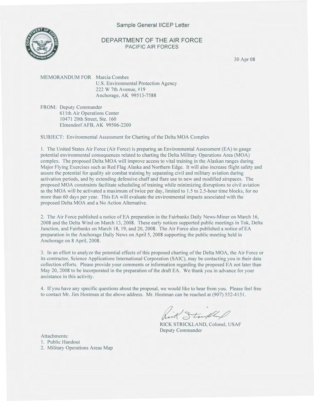
197


198 Attachment 1 Why is the Delta MOA Complex Needed? Activities Start and Sign In: 6:00 p.m. Air Force Welcome and Briefing Discussion and Comments on Topic Areas Finish: 8:00 p.m. The Proposed Action creates the Delta MOA Complex to: meet training requirements, change airspace use, extend defensive chaff and flare use to new and modified airspace, and; schedule training to minimize disruption to civil aviation. The United States Air Force proposes to improve required training opportunities for Major Flying Exercises including Red Flag Alaska and Northern Edge by charting the Delta Military Operations Area (MOA) complex. The Delta MOA is proposed to be: activated for two week periods activated for 1.5 to 2.5 hour time periods twice per day total use would not exceed 60 days per year. Staging area for enemy aircraft. The Draft EA will evaluate the potential environmental consequences on environmental resources from the Proposed Action and No-Action Alternatives. The proposed Delta MOA would permit realistic Major Flying Exercises (MFEs) to train aircrews as they fight in two week scheduled excercises. During MFEs there would be two 1.5 to 2.5 hour flight periods per day. Total use would not exceed 60 days per year. Eielson AFB Eielson MOA Enemy aircraft defending high value target. Fox MOAs Refueling track Supression of enemy defense. Refueling Track Staging area for attacking aircraft. Simulated deployment of munitions delivery at supersonic speeds. Attack on range. Yukon MOAs High speed maneuverability to attack targets. Use of chaff and flares to avoid threats. Reforming after attack. Aircraft Proposed Delta MOA Complex Ranges Threat Emitters Targets on Range Miles Note: Aircraft, Threat Emitters, and Targets not to scale Nautical Miles Simplified depiction of MFEs in Alaskan Airspace
 analyzes the following resources to determine the potential environmental consequences associated with this proposal.")


199 Attachment 1 The National Environmental Policy Act (NEPA) guides the Environmental Assessment. The Draft Environmental Assessment (EA) analyzes the following resources to determine the potential environmental consequences associated with this proposal. The Proposed Action creates the Delta Military Operations Airspace (MOA) complex to meet the training requirements, changes airspace use, extends defensive chaff and flare use to new airspace, and schedules training to minimize distruption to civil aviation. Airspace Operations Airspace, Noise, Air Quality, and Safety (ground and air) Natural Resources Physical and Biological Resources Cultural Resources Native Alaskan and Historical Resources Human Resources Land Use, Socioeconomics, and Environmental Justice Your comments will be used to help shape and refine the proposal and will guide the enviromental analysis. Persons wishing to mail comments should mail them before April 30, 2008, to the address below, in order to be considered in the Draft EA. Your involvement and input are essential to the environmental process. The EA Process Opportunities for Public Involvement Where Are We Now? Notice of Intent to Prepare EA Published in Newspapers Community Outreach Refine Proposed Action Preparation of Draft EA Notice of Availability of Draft EA Public and Agency Comment Period Preparation of Final EA Notice of Availability of Final EA Public Meetings Tuesday, March 18, 2008 University of Alaska, Tok Center Tok, AK Send written comments to: James W. Hostman 611 CES/CEVQP th Street, Suite 302 Elmendorf AFB, AK jim.hostman@elmendorf.af.mil For general information, contact: Alaskan Command Public Affairs Wednesday, March 19, 2008 Jarvis West Building Delta Junction, AK Thursday, March 20, 2008 Pioneer Park, Exhibit Hall Fairbanks, AK
200 ! Venetie P o r c u p i n e R i v e r! F or t Yu k o n! Chalkyitsik Y U K O N 5 M O A Central! Circle! Y U KON 2 M O A Y U K ON 4 M OA 2 R-2205! Circle Hot Springs Y u k o n R i v e r Fort Jonathan Wainwright! 3 R-2206 A n d e r s on R-2211 V I P E R A / B F ai rb a n k s! N o r t h P o l e! E i e l s o n A i r F o r c e B a s e E I E L S ON M OA F O X 1 M OA! B I R C H M OA! F OX 2 M OA R-2202B & C Chena Hot Springs Y U K ON 1 M O A D e l t a J u n c t i o n B U F F A L O M O A R-2202A & C Y U KON 3 & 3 A M O A! T ok!! E agl e Y U K ON 3B M O A C h i c k e n Proposed Delta MOA! B o u n d T alk e e t n a F O X 3 M OA 4 G l e n n a l l e n! Cities & Towns Waterbodies Alaska Canada Eielson Air Force Base Major Highways Roads Miles SPECIAL USE AIRSPACE Nautical Miles Existing MOA Bombing Ranges (Restricted Airspace) Proposed Delta MOA Complex 4 Sources: Alaska Dept. of Community and Regional Affairs, Alaska Dept. of Natural Resources, Environmental Systems Research Institute, Inc., National Imagery and Mapping, 11th Air Force Elmendorf AFB, AK Military Operations Airspace Map Attachment 2
201 General IICEP Letter Distribution List (included attachments to General IICEP Letter) Bureau of Land Management Fairbanks Field Office 1150 University Avenue Fairbanks, AK National Park Service, Alaska Regional Office ATTN: Regional Director 240 W 5th Avenue, Rm. 114 Anchorage, AK Grant Hilderbrand State of Alaska Department of Fish and Game Division of Wildlife Conservation 333 Raspberry Rd. Anchorage, AK Michael Menge State of Alaska Department of Natural Resources 550 W 7th Street, Ste. 500 Anchorage, AK Jim Freechione State of Alaska Department of Environmental Conservation 555 Cordova Street Anchorage, AK Sue Magee State of Alaska Division of Governmental Coordination 550 W 7th Avenue, Ste Anchorage, AK Kevin Gardner U.S. Army Alaska 730 Quartermaster Road Fort Richardson, AK U.S. Department of Agriculture NRCS 510 L Street Anchorage, AK Marcia Combes U.S. Environmental Protection Agency 222 W 7th Avenue, #19 Anchorage, AK
202
203
204 Alaska Native IICEP Letter Distribution List (included attachments to General IICEP Letter) Julie Kitka Alaska Federation of Natives 1577 C Street Suite 300 Anchorage, AK Paul Edwin Chalkyitsik Village PO Box 57 Chalkyitsik, AK Gary Harrison Chickaloon Village Traditional Council PO Box 1105 Chickaloon, AK Paul Nathaniel Circle Village Council PO Box 89 Circle, AK William Miller Dot Lake Village Council PO Box 2275 Dot Lake, AK David Howard Eagle Traditional Council PO Box 19 Eagle, AK Darrell Hess Fairview Community Council 328 E 15th Avenue, #1 Anchorage, AK Stephanie Kesler Government Hill Community Council PO Box Anchorage, AK Ben Saylor Healy Lake Traditional Council PO Box Fairbanks, AK Hugh Wade Mountain View Community Council 733 N Flower Street Anchorage, AK Gordon Carlson Native Village of Cantwell PO Box 94 Cantwell, AK Ted Charles Native Village of Dot Lake PO Box 2279 Dot Lake, AK Maria Coleman Native Village of Eklutna 8131 Harvest Circle Anchorage, AK JoAnn Polston Native Village of Healy Lake PO Box Fairbanks, AK Bob Roses Northeast Community Council 8200 E 2nd Avenue Anchorage, AK Harold Brown Tanana Chiefs Conference 122 First Avenue, Ste. 600 Fairbanks, AK 99701

205 Sample U.S. Fish and Wildlife IICEP Letter
206 U.S. Fish and Wildlife Service IICEP Letter Distribution List (included attachments to General IICEP Letter) US Fish and Wildlife Service Fairbanks Field Office th Avenue, Room 110 Fairbanks, AK US Fish and Wildlife Service ATTN: Regional Wilderness Coordinator/NEPA Specialist 1011 E Tudor, MS 221 Anchorage, AK
207
208
209 PUBLIC MEETING MATERIALS
210
211 Welcome to this Delta MOA Air Force Public Meeting


212 The Air Force encourages you to learn about the charting of the Delta MOA Proposed Action and No-Action alternatives. We would like to hear your inputs and concerns on these issues. To be involved in the charting of the Delta MOA proposal, please provide information by submitting written comment to: James W. Hostman 611 CES/CEVQP th Street, Suite 302 Elmendorf AFB, AK (907)


213 Why is the Delta MOA Complex Needed? The United States Air Force proposes to improve required training opportunities for Major Flying Exercises including Red Flag Alaska and Northern Edge by charting the Delta Military Operations Area (MOA) complex. The Delta MOA is proposed to be: activated for two week periods activated for 1.5 to 2.5 hour time periods twice per day total use would not exceed 60 days per year. The Draft EA will evaluate the potential environmental consequences on environmental resources from the Proposed Action and No-Action Alternatives. The Proposed Action creates the Delta MOA Complex to: meet training requirements, change airspace use, extend defensive chaff and flare use to new and modified airspace, and; schedule training to minimize disruption to civil aviation.


214 The proposed Delta MOA would permit realistic Major Flying Exercises (MFEs) to train aircrews as they participate in two week scheduled excercises. During MFEs there would be two 1.5 to 2.5 hour flying periods per day, total use would not exceed 60 days per year. Eielson AFB Refueling Track Staging area for attacking aircraft. Yukon MOAs Simulated deployment of munitions delivery at supersonic speeds. High speed maneuverability to attack targets. Supression of enemy defense. Use of chaff and flares to avoid threats. Eielson MOA Reforming after attack. Staging area for enemy aircraft. Enemy aircraft defending high value target. Attack on range. Aircraft Proposed Delta MOA Complex Ranges Threat Emitters Targets on Range Fox MOAs Refueling track Miles Nautical Miles Note: Aircraft, Threat Emitters, and Targets not to scale. Simplified depiction of MFEs in Alaskan Airspace
 analyzes the following resources to determine the potential environmental consequences associated with this proposal.")


215 The National Environmental Policy Act guides the Environmental Assessment. The Draft Environmental Assessment (EA) analyzes the following resources to determine the potential environmental consequences associated with this proposal. The Proposed Action creates the Delta Military Operations Airspace (MOA) complex to meet the training requirements, changes airspace use, extends defensive chaff and flare use to new airspace, and schedules training to minimize distruption to civil aviation. Airspace Operations Airspace, Noise, Air Quality, and Safety (ground and air) Natural Resources Physical and Biological Resources Cultural Resources Native Alaskan and Historical Resources Human Resources Land Use, Socioeconomics, and Environmental Justice Your involvement and input are essential to the environmental process. The EA Process Opportunities for Public Involvement Where Are We Now? Notice of Intent to Prepare EA Published in Newspapers Community Outreach Refine Proposed Action Preparation of Draft EA Notice of Availability of Draft EA Public and Agency Comment Period Preparation of Final EA Notice of Availability of Final EA There are numerous opportunities to be involved in the Delta MOA Environmental Assessment process. Public Meetings Tuesday, March 18, 2008 University of Alaska, Tok Center Tok, AK. Wednesday, March 19, 2008 Jarvis West Building Delta Junction, AK. Thursday, March 20, 2008 Pioneer Park, Exhibit Hall Fairbanks, AK. Please take this opportunity to: Learn more about the proposal Identify community specific issues Make sure you are included on our mailing list Public Comment Period Submit written comments during this meeting or mail written comments before April 30, 2008 to: James W. Hostman 611 CES/CEVQP th Street, Suite 302 Elmendorf AFB, AK (907) The Air Force will consider public and agency comments and will use this information to prepare the Draft EA.
216 ! Venetie Porcupine River! Fort Yukon! Chalkyitsik YUKON 5 MOA Central! Circle! YUKON 2 MOA YUKON 4 MOA 2 R-2205! Circle Hot Springs Yukon River Fort Jonathan Wainwright! 3 R-2206 Anderson R-2211 VIPER A/B Fairbanks! North Pole! Eielson Air Force Base EIELSON MOA FOX 1 MOA! BIRCH MOA! FOX 2 MOA R-2202B & C Chena Hot Springs YUKON 1 MOA Delta Junction BUFFALO MOA R-2202A & C YUKON 3 & 3A MOA! Tok!! Eagle YUKON 3B MOA Proposed Delta MOA Chicken! Bound FOX 3 MOA 4 Glennallen! Cities & Towns Waterbodies Alaska Canada Eielson Air Force Base Major Highways Roads Miles SPECIAL USE AIRSPACE Nautical Miles Existing MOA Bombing Ranges (Restricted Airspace) Proposed Delta MOA Complex 4 Sources: Alaska Dept. of Community and Regional Affairs, Alaska Dept. of Natural Resources, Environmental Systems Research Institute, Inc., National Imagery and Mapping, 11th Air Force Elmendorf AFB, AK Proposed Delta MOA Complex
217 DRAFT ENVIRONMENTAL ASSESSMENT DISTRIBUTION LIST
218
219 Alaska State Court Law Library 820 W 4th Avenue Anchorage AK Alaska Resources Library and Information Services 3211 Providence Drive Anchorage AK Circle Hot Springs Resort PO Box Circle AK Eagle School Library General Delivery Eagle AK Fairbanks North Star Borough Public Library Noel Wien Library 1215 Cowles Street Fairbanks AK Village Council Building General Delivery Chalkyitsik AK University of Alaska Fairbanks Elmer E. Rasmuson Library PO Box Fairbanks AK Delta Community Library 2288 Deborah Street Delta Junction AK Elmendorf Library 3rd Services Squadron nd Street Elmendorf AFB AK US Fish and Wildlife Service Fairbanks Field Office th Avenue, Room 110 Fairbanks AK Alaska State Library 333 Willoughby Avenue, 8th floor PO Box Juneau AK Fairbanks North Star Borough Public Library Noel Wien Library 1215 Cowles Street Fairbanks AK North Pole Branch Library 601 Snowman Lane North Pole AK Eielson AFB Library 3340 Central Avenue, Ste. 100 Eielson AFB AK Zach Morris PO Box 525 Delta Junction AK Pete Lehmann AOPA 421 Aviation Way Frederick MD Steve Baker Alaska Airlines PO Box Seattle WA Judith Bittner Alaska Department of History and Archaeology 550 W 7th Avenue Suite 1310 Anchorage AK Michael Paschall Delta Wind PO Box 986 Delta Junction AK Butch Brant PO Box 803 Delta Junction AK Musgrove JW PO Box 1538 Delta Junction AK Tom George AOPA PO Box Fairbanks AK Phyllis Tate PO Box Fairbanks AK Pete Haggland EAA PO Box Fairbanks AK Peter Vandehei FAI Airport 6450 Airport Way, Ste 1 Fairbanks AK Marlan Pruett 1106 Airline Drive North Pole AK Mary Ames Alaska Airmens Assoc PO Box Fairbanks AK Jesse VanderZarden FAI 6450 Airport Way, Ste 1 Fairbanks AK Stan Halverson AK Aerofuel 1024 Kellup Fairbanks AK Myron Babcock FAI 423 Ketchikan Avenue Fairbanks AK Lisa Fox National Park Service Alaska Regional Office 240 W Fifth Ave, Room 114 Anchorage AK Ted Charles Native Village of Dot Lake PO Box 2279 Dot Lake AK 99737
220 JoAnn Polston Native Village of Healy Lake PO Box Fairbanks AK Julie Kitka Alaska Federation of Natives 1577 C Street Suite 300 Anchorage AK Paul Edwin Chalkyitsik Village PO Box 57 Chalkyitsik AK Gary Harrison Chickaloon Village Traditional Council PO Box 1105 Chickaloon AK Paul Nathaniel Circle Village Council PO Box 89 Circle AK William Miller Dot Lake Village Council PO Box 2275 Dot Lake AK Gordon Carlson Native Village of Cantwell PO Box 94 Cantwell AK David Howard Eagle Traditional Council PO Box 19 Eagle AK Ben Saylor Healy Lake Traditional Council PO Box Fairbanks AK Marcia Combes U.S. Environmental Protection Agency 222 W 7th Avenue, #19 Anchorage AK National Park Service, Alaska Regional Office ATTN: Regional Director 240 W 5th Avenue, Rm. 114 Anchorage AK Kevin Gardner U.S. Army Alaska 730 Quartermaster Road Fort Richardson AK Bureau of Land Management Fairbanks Field Office 1150 University Avenue Fairbanks AK U.S. Department of Agriculture NRCS 510 L Street Anchorage AK Sue Magee State of Alaska Division of Governmental Coordination 550 W 7th Avenue, Ste Anchorage AK Michael Menge State of Alaska Department of Natural Resources 550 W 7th Street, Ste. 500 Anchorage AK Jim Freechione State of Alaska Department of Environmental Conservation 555 Cordova Street Anchorage AK Grant Hilderbrand State of Alaska Department of Fish and Game Division of Wildlife Conservation 333 Raspberry Rd. Anchorage AK Bob Roses Northeast Community Council 8200 E 2nd Avenue Anchorage AK Stephanie Kesler Government Hill Community Council PO Box Anchorage AK Hugh Wade Mountain View Community Council 733 N Flower Street Anchorage AK Darrell Hess Fairview Community Council 328 E 15th Avenue, #1 Anchorage AK US Fish and Wildlife Service ATTN: Regional Wilderness Coordinator/NEPA Specialist 1011 E Tudor, MS 221 Anchorage AK Maria Coleman Native Village of Eklutna 8131 Harvest Circle Anchorage AK Harold Brown Tanana Chiefs Conference 122 First Avenue, Ste. 600 Fairbanks AK 99701
221 REPOSITORY LIST FOR DRAFT ENVIRONMENTAL ASSESSMENT DISTRIBUTION
222
223 Alaska Resources Library and Information Services 3211 Providence Drive Anchorage, AK Alaska State Court Law Library 820 W 4th Avenue Anchorage, AK Alaska State Library 333 Willoughby Avenue, 8th floor PO Box Juneau, AK Circle Hot Springs Resort PO Box Circle, AK Delta Community Library 2288 Deborah Street Delta Junction, AK Eagle School Library General Delivery Eagle, AK Eielson AFB Library 3340 Central Avenue, Ste. 100 Eielson AFB, AK Elmendorf Library 3rd Services Squadron nd Street Elmendorf AFB, AK Fairbanks North Star Borough Public Library Noel Wien Library 1215 Cowles Street Fairbanks, AK Fairbanks North Star Borough Public Library Noel Wien Library 1215 Cowles Street Fairbanks, AK North Pole Branch Library 601 Snowman Lane North Pole, AK University of Alaska Fairbanks Elmer E. Rasmuson Library PO Box Fairbanks, AK Village Council Building General Delivery Chalkyitsik, AK 99788
224
225 APPENDIX E RELEVANT STATUTES, REGULATIONS, AND GUIDELINES
226
227 APPENDIX E RELEVANT STATUTES, REGULATIONS, AND GUIDELINES GENERAL National Environmental Policy Act (NEPA) of 1969 (Public Law [PL] , 42 United States Code [USC] 4347, as amended). Requires federal agencies to take the environmental consequences of proposed actions into consideration in their decision-making process. The intent of NEPA is to protect, restore or enhance the environment through well informed federal decisions. The Council on Environmental Quality (CEQ) was established under NEPA to implement and oversee federal policy in this process. Air Force Instruction , Environmental Impact Analysis Process (EIAP), as promulgated at 32 CFR Part 989. Air Force implementation of the procedural provisions of NEPA and CEQ regulations. AFPD 32-70, Environmental Quality. Requires that the Air Force comply with applicable federal, state, and local environmental laws and regulations, including NEPA. Executive Order (EO) 11514, Protection and Enhancement of Environmental Quality, as amended by EO 11991, sets policy directing the federal government in providing leadership in protecting and enhancing the environment. Intergovernmental Coordination Act and EO 12372, Intergovernmental Review of Federal Programs. Requires federal agencies to cooperate with and consider state and local views in implementing a federal proposal. AFI requires proponents to implement a process known as Interagency and Intergovernmental Coordination for Environmental Planning (IICEP), which is used for the purpose of agency coordination and implements scoping requirements. Ensuring Quality of Information Disseminated to the Public by the Department of Defense. This memorandum, signed February 10, 2003 requires that all components of the Department of Defense adopt standards of data quality for information they disseminate. AIRSPACE Federal Aviation Act of Created the Federal Aviation Administration (FAA) and charges the FAA Administrator with ensuring the safety of aircraft and the efficient utilization of the National Airspace System, within the jurisdiction of the United States. Federal Aviation Regulation Part 71 (1975). Delineates the designation of federal airways, area low routes, controlled airspace, and navigational reporting points. Federal Aviation Regulation Part 73 (1975). Defines special use airspace and prescribes the requirements for the use of that airspace. Federal Aviation Regulation Part 91 (1990). Describes the rules governing the operation of aircraft within the United States. FAA Order Prescribes policy, criteria, and procedures applicable to rulemaking and non-rulemaking actions associated with airspace allocation and utilization, obstruction Appendix E Relevant Statutes, Regulations, and Guidelines E-1
228 evaluation and marking airport airspace analyses, and the establishment of air navigation aids. FAA Order Prescribes air traffic control procedures and phraseology for use by personnel providing air traffic control services in the United States. ACOUSTIC ENVIRONMENT Executive Order (EO) Federal Compliance with Pollution Control Standards (1978). Requires the head of each executive agency to be responsible for ensuring that all necessary actions are taken for the prevention, control, and abatement of environmental pollution, including noise pollution, with respect to federal facilities and activities under the control of the agency. Federal Interagency Committee on Urban Noise (1980). Defines noise levels for various land uses and may result in areas that will not qualify for federal mortgage insurance. Additional sections allow for noise attenuation measures that are often required for HUD approval. SAFETY AFI The Fire Protection Operations and Fire Prevention Program (1 April 1999). Defines the requirements for Air Force installation fire protection programs, including equipment, response times, and training. AFI Explosive Ordnance Disposal Program (1 October 1999). Regulates and provides procedures for explosives safety and handling. Defines criteria for quantity distances, clear zones, and facilities associated with ordnance. AFI The US Air Force Mishap Prevention Program (1 August 1998). Establishes mishap prevention program requirements, assigns responsibilities for program elements, and contains program management information. AFI , Air Force Occupational and Environmental Safety, Fire Protection, and Health (AFOSH). Program implements AFPD 91-3, Occupational Safety and Health by outlining the AFOSH Program. The purpose of the AFOSH Program is to minimize loss of Air Force resources and to protect Air Force people from occupational deaths, injuries, or illnesses by managing risks. Air Force Manual , Safety: Explosives Safety Standards. Establishes safety standards, provides planning guidance, and defines safety requirements for explosives operations of any kind (including testing, disassembling, modifying, storing, transporting, and handling explosives or ammunition) at Air Force facilities. Department of Defense Flight Information Publication. Indicates locations of potential hazards (e.g., bird aggregations, obstructions, and noise sensitive locations) under military airspace and defines horizontal and/or vertical avoidance measures. Updated monthly to present current conditions. E-2 Appendix E Relevant Statutes, Regulations, and Guidelines
229 PHYSICAL RESOURCES Federal Water Pollution Control Act of Establishes procedures and programs for the restoration and maintenance of the chemical, physical, and biological integrity of the nation s waters, thus protecting habitat conditions in aquatic and wetland ecosystems. Clean Water Act of 1977 (33 USC ). Requires a National Pollution Discharge Elimination System (NPDES) permit for all discharges into waters of the United States to reduce pollution that could affect any form of life. Section 404 of this act regulates development in streams and wetlands and requires a permit from the U.S. Army Corps of Engineers. EO Floodplain Management (1977). Requires that governmental agencies, in carrying out their responsibilities, provide leadership and take action to restore and preserve the natural and beneficial values served by floodplains. BIOLOGICAL RESOURCES Lacey Act of 1900 (16 USC ). Brings the unlawful taking of fish, wildlife, and plants under federal jurisdiction by prohibiting specimens taken illegally from being shipped across state boundaries. Migratory Bird Treaty Act of 1918 (16 USC s). Establishes protection for migratory birds and their parts (including eggs, nests, and feathers) from hunting, capture, or sale. Bald Eagle Protection Act of 1940 (16 USC c). Protects bald eagles and golden eagles by prohibiting the take, possession, or transportation of these species, dead or alive, and includes protection of their nests and eggs. Fish and Wildlife Coordination Act of 1958 (16 USC c as amended). Provides for conservation and management of fish and wildlife by encouraging cooperation between the U.S. Fish and Wildlife Service and other federal, state, public, and private agencies. Wilderness Act of 1964 (16 USC 1131). Directs the Secretary of the Interior to review every roadless area greater than or equal to 5,000 acres and every roadless island (regardless of size) within National Wildlife Refuge and National Park Systems and to recommend to the President the suitability of each such area or island for inclusion in the National Wilderness Preservation System. The act provides criteria for determining suitability and establishes restrictions on activities that can be undertaken on designated areas. Endangered Species Act of 1973 (16 USC , as amended). Establishes measures for the conservation of plant and animal species listed, or proposed for listing, as threatened or endangered, including the protection of critical habitat necessary for their continued existence. EO Protection of Wetlands (1977). Requires the governmental agencies, in carrying out their responsibilities, to provide leadership and take action to minimize the destruction, loss, or degradation of wetlands and to preserve and enhance the natural and beneficial values of wetlands. Factors to be considered include conservation and long-term productivity of existing flora and fauna, species and habitat diversity and stability, hydrologic utility, fish, and wildlife. Appendix E Relevant Statutes, Regulations, and Guidelines E-3
230 Fish and Wildlife Conservation Act of 1980 (16 USC as amended). Promotes state programs, and authorizes funding for grants, aimed at developing and implementing comprehensive state non-game fish and wildlife management plans. North American Wetlands Conservation Act (16 USC ) (1989). Supports the management and preservation of waterfowl by funding the implementation of the North American Waterfowl Management Plan and the Tripartite Agreement on wetlands between Canada, the U.S., and Mexico. CULTURAL RESOURCES National Historic Preservation Act of 1966, as amended. Provides the principal authority used to protect historic properties, establishes the National Register of Historic Places (NRHP), and defines, in Section 106, the requirements for federal agencies to consider the effects of an action on properties listed on, or eligible for, the NRHP. Archaeological Resources Protection Act (ARPA) of 1979 (16 USC section 470aa-47011). Ensures the protection and preservation of archaeological sites on federal or Native American lands and establishes a permitting system to allow legitimate scientific study of such resources. Protection of Historic and Cultural Properties (36 CFR section 800) (2000). Provides an explicit set of procedures for federal agencies to meet their obligations under the National Historic Preservation Act including inventorying resources and consultation with State Historic Preservation Officers (SHPOs) and federally recognized tribes. Native American Graves Protection and Repatriation Act of 1990 (25 USC ). Requires protection and repatriation of Native American burial items found or, or taken from, federal or tribal lands, and requires repatriation of burial items controlled by federal agencies or museums receiving federal funds. AFI Cultural Resource Management (2004). Sets guidelines for protecting and managing cultural resources on lands managed by the Air Force. American Indian Religious Freedom Act of 1978 (42 USC section 1996). States that it is the policy of the United States to protect and preserve for American Indians their inherent right of freedom to believe, express, and exercise the traditional religions including but not limited to access to sites, use and possession of sacred objects, and the freedom to worship through ceremonial and traditional rites. EO Indian Sacred Sites (1996). Requires that, to the extent practicable, federal agencies accommodate access to, and ceremonial use of, sacred sites by Native American religious practitioners, and to avoid adversely affecting the physical integrity of sacred sites. EO Consultation and Coordination with Indian Tribal Governments (1998). Requires that federal agencies have an effective process to permit elected officials and other representatives of Indian tribal governments to provide meaningful and timely input in the development of regulatory policies on matters that significantly or uniquely affect their communities. Department of Defense (DoD) American Indian and Alaska Native Policy (21 November 1999). This policy emphasizes the importance of respecting and consulting with tribal E-4 Appendix E Relevant Statutes, Regulations, and Guidelines
231 governments on a government-to-government basis and requires an assessment, through consultation, of proposed DoD actions that may have the potential to significantly affect protected tribal resources, tribal rights, and Indian lands before decisions are made by the services. Land Use Department of Transportation Act of 1966 (49 USC 303), Section 4(f) (formerly 49 USC 1651 (b)(2) and 49 USC 1653f). Protection of certain public lands and all historic sites was originally mandated in Section 4(f) of the 1966 Department of Transportation Act. Public law (amended in 1968) amended Section 4(f) to its most commonly known form. In 1983, PL re-codified the Act from 49 USC 1651 to 49 USC 303. Congress has amended this Act three other times without substantive changes. It is referred to as Section 4(f) in the Federal Highway Administration Environmental Procedures (23 CFR 772). It declares a national policy to preserve, where possible, the natural beauty of the countryside and public park and recreation lands, wildlife and waterfowl refuges, and historic sites. It protects cultural resources that are on or eligible for the National Register of Historic Places. Section 6(f) (3)-Land and Water Conservation Funds Act. Section 6(f)(3) of the 1964 Land and Water Conservation Funds (L&WCF) Act requires that all property acquired or developed with L&WCF assistance be maintained perpetually in public recreation use. Title 36, Chapter 1, Part 59 describes post-completion compliance responsibilities. These responsibilities apply to each 6(f) property regardless of the extent of program participation. The State is responsible for compliance and enforcement of these provisions and to ensure consistency with the contractual agreement with the National Park Service. ENVIRONMENTAL JUSTICE EO Federal Actions to Address Environmental Justice in Minority Populations and Low-Income Populations (1995). Requires federal agencies to identify and address disproportionately high and adverse human health or environmental effects of their programs, policies, and activities on minority and low-income populations. The essential purpose of EO is to ensure the fair treatment and meaningful involvement of all people regardless of race, color, national origin, or income with respect to the development, implementation, and enforcement of environmental laws, regulations, and policies. AF Guidance, Interim Guide for Environmental Justice Analysis with the Environmental Impact Analysis Process (November 1997). Provides guidance for implementation of EO in relevant Air Force environmental impact assessments. EO Protection of Children from Environmental Health Risks and Safety Risks (1998). This Executive Order directs federal agencies to identify and assess environmental health and safety risks that may disproportionately affect children. Appendix E Relevant Statutes, Regulations, and Guidelines E-5
232 THIS PAGE INTENTIONALLY LEFT BLANK. E-6 Appendix E Relevant Statutes, Regulations, and Guidelines
233 APPENDIX F AIRSPACE MANAGEMENT
234
235 APPENDIX F AIRSPACE MANAGEMENT Controlled Airspace is defined in Federal Aviation Administration (FAA) Order It is airspace of defined dimensions within which Air Traffic Control (ATC) service is provided to Instrument Flight Rule (IFR) flights and to Visual Flight Rule (VFR) flights in accordance with the airspace classification. For IFR operations in controlled airspace, a pilot must file an IFR flight plan and receive an appropriate ATC clearance. Controlled airspace in the United States is designated as Class A, B, C, D, and E. Each Class B, C, and D airspace designated for an airport contains at least one primary airport around which the airspace is designated. Class A airspace, generally, is that airspace from 18,000 feet above mean sea level (MSL) up to and including Flight Level (FL) 600. Flight levels are altitudes MSL based on the use of a directed barometric altimeter setting, and are expressed in hundreds-of-feet. Therefore, FL 600 is equal to approximately 60,000 feet MSL. Class A airspace includes the airspace overlying the waters within 12 nautical miles (NM) of the coast of the 48 contiguous States and Alaska (DOT 2001). Class B airspace, generally, is that airspace from the surface to 10,000 feet MSL around the nation s busiest airports. The actual configuration of Class B airspace is individually tailored and consists of a surface area and two or more layers, and is designed to contain all published instrument procedures (DOT 2001). Class C airspace, generally, is that airspace from the surface to 4,000 feet above the airport elevation (charted in MSL) surrounding those airports that have an operational control tower, are serviced by a radar approach control (RAPCON), and that have a certain number of IFR operations or passenger enplanements. Although the actual configuration of Class C airspace is individually tailored, it usually consists of a surface area with a 5 NM radius, and an outer circle with a 10 NM radius that extends from 1,200 feet to 4,000 feet above the airport elevation (DOT 2001). Class D airspace, generally, is that airspace from the surface to 2,500 feet above the airport elevation (charted in MSL) surrounding those airports that have an operational control tower. The configuration of each Class D airspace area is individually tailored and when instrument procedures are published, the airspace will normally be designed to contain the procedures. Arrival extensions for instrument approach procedures may be designated as Class D or Class E airspace (DOT 2001). Class E airspace is controlled airspace that is not Class A, B, C, or D. There are seven types of Class E airspace, as described below. Surface Area Designated For An Airport. When so designated, the airspace will be configured to contain all instrument procedures. Extension To A Surface Area. There are Class E airspace areas that serve as extensions to Class B, C, and D surface areas designated for an airport. This airspace provides controlled airspace to contain standard instrument approach procedures without imposing a communications requirement on pilots operating under VFR. Appendix F Airspace Management F-1

236 Airspace Used For Transition. There are Class E airspace areas beginning at either 700 or 1,200 feet above ground level (AGL) used to transition to/from the terminal or en route environment. En Route Domestic Airspace Areas. These areas are Class E airspace areas that extend upward from a specified altitude to provide controlled airspace where there is a requirement for IFR en route ATC services, but where the Federal airway system is inadequate. Federal Airways. Federal Airways (Victor Routes) are Class E airspace areas, and, unless otherwise specified, extend upward from 1,200 feet to, but not including, 18,000 feet MSL. Other. Unless designated at a lower altitude, Class E airspace begins at 14,500 feet MSL to, but not including 18,000 feet MSL overlying: a) the 48 contiguous States, including the waters within 12 miles from the coast of the 48 contiguous States; b) the District of Columbia; c) Alaska, including the waters within 12 miles from the coast of Alaska, and that airspace above FL 600; d) excluding the Alaska peninsula west of 160 o west longitude, and the airspace below 1,500 feet above the surface of the earth unless specifically so designated. Offshore/Control Airspace Areas. This includes airspace areas beyond 12 NM from the coast of the United States, wherein ATC services are provided (DOT 2001). Airspace that has not been designated as Class A, B, C, D, or E airspace is Uncontrolled Airspace (Class G) (DOT 2001). These airspaces are shown graphically in Figure 1. Figure 1. Controlled / Uncontrolled Airspace Source: DOT 2003 F-2 Appendix F Airspace Management
237 Airspace for Special Use (ASU) is used to collectively identify non-sua assets. It is of defined dimensions wherein activities must be confined because of their nature, and/or wherein limitations may be imposed upon aircraft operations that are not a part of those activities. ASU includes Military Training Routes (MTRs) (Instrument Routes [IR]/Visual Routes [VR]), Air Traffic Control Assigned Airspace (ATCAA), aerial refueling track/anchors (AR), slow routes (SR), and low-altitude tactical navigation areas. Military Operations Area (MOA) is airspace of defined vertical and lateral limits established outside Class A airspace to separate and segregate certain non-hazardous military activities from IFR traffic and to identify for VFR traffic where these activities are conducted (P/CG 2004). Class A airspace covers the continental U.S. and limited parts of Alaska, including the airspace overlying the water within 12 nautical miles (NM) of the U.S. coast. It extends from 18,000 feet above mean sea level (MSL) up to and including 60,000 feet MSL (P/CG 2004). MOAs are considered joint use airspace. Non-participating aircraft operating under VFR are permitted to enter a MOA, even when the MOA is active for military use. Aircraft operating under IFR must remain clear of an active MOA unless approved by the responsible ARTCC. Flight by both participating and VFR non-participating aircraft is conducted under the seeand-avoid concept, which stipulates that when weather conditions permit, pilots operating IFR or VFR are required to observe and maneuver to avoid other aircraft. Right-of-way rules are contained in CFR Part 91 (P/CG 2004). The responsible ARTCC provides separation service for aircraft operating under IFR and MOA participants. The see-and-avoid procedures mean that if a MOA were active during inclement weather, the general aviation pilot could not safely access the MOA airspace. Air Traffic Control Assigned Airspace (ATCAA) is airspace of defined vertical and lateral limits, assigned by Air Traffic Control (ATC), for the purpose of providing air traffic segregation between the specified activities being conducted within the assigned airspace and other IFR air traffic (P/CG 2004). This airspace, if not required for other purposes, may be made available for military use. ATCAAs are frequently structured and used to extend the horizontal and/or vertical boundaries of MOAs. Restricted Area is designated airspace that supports ground or flight activities that could be hazardous to non-participating aircraft. A Restricted Area is airspace designated under 14 Code of Federal Regulations (CFR) Part 73, within which the flight of aircraft, while not wholly prohibited, is subject to restriction. Most restricted areas are designated joint-use and IFR/VFR operations in the area may be authorized by the controlling ATC facility when it is not being utilized by the using agency (P/CG 2004). Military Training Routes (MTRs) are flight corridors developed and used by the DoD to practice high-speed, low-altitude flight, generally below 10,000 feet MSL. Specifically, MTRs are airspace of defined vertical and lateral dimensions established for the conduct of military flight training at airspeeds in excess of 250 knots indicated airspeed (KIAS) (P/CG 2004). MTRs are developed in accordance with criteria specified in FAA Order (DoD 2004). They are described by a centerline (often with defined horizontal limits on either side of the centerline) and vertical limits expressed as minimum and maximum altitudes along the flight track. MTRs are identified as Visual Routes (VR) or Instrument Routes (IR). VRs and IRs are used by DoD and associated Reserve and Air Guard units for the purpose of conducting low-altitude navigation and tactical training. VRs are under VFR conditions (usually Appendix F Airspace Management F-3
238 below 10,000 feet MSL) at airspeeds in excess of 250 KIAS (P/CG 2004). IRs are used by DoD, including associated Reserve and Air Guard units, for the purpose of conducting low-altitude navigation and tactical training in both IFR and VFR weather conditions usually below 10,000 feet MSL at airspeeds in excess of 250 KIAS (P/CG 2004). Special Use Airspace (SUA) is airspace of defined dimensions identified by an area on the surface of the earth wherein activities must be confined because of their nature and/or wherein limitations may be imposed upon aircraft operations that are not part of those activities. Types of SUA include Alert Areas, Controlled Firing Areas, MOAs, Prohibited Areas, Restricted Areas, and Warning Areas. References U.S. Department of Transportation (DOT), Federal Aviation Administration (FAA) Aeronautical Information Manual, February 16, Headquarters Air Combat Command (ACC) Page 12, Supplement 1 to Air Force Instruction , Air Force Airspace Management, 24 June U.S. Department of Transportation (DOT), Federal Aviation Administration (FAA) FAA- H , Pilot s Handbook of Aeronautical Knowledge. U.S. Department of Transportation (DOT), Federal Aviation Administration (FAA) FAA Order E, Procedures For Handling Airspace Matters. June 4. F-4 Appendix F Airspace Management
239 APPENDIX G AIRCRAFT NOISE ANALYSIS AND AIRSPACE OPERATIONS
240
241 APPENDIX G AIRCRAFT NOISE ANALYSIS AND AIRSPACE OPERATIONS Noise is generally described as unwanted sound. Unwanted sound can be based on objective effects (such as hearing loss or damage to structures) or subjective judgments (community annoyance). Noise analysis thus requires a combination of physical measurement of sound, physical and physiological effects, plus psycho- and socio-acoustic effects. Section 1.0 of this appendix describes how sound is measured and summarizes noise impact in terms of community acceptability and land use compatibility. Section 2.0 gives detailed descriptions of the effects of noise that lead to the impact guidelines presented in section 1. Section 3.0 provides a description of the specific methods used to predict aircraft noise, including a detailed description of sonic booms. 1.0 NOISE DESCRIPTORS AND IMPACT Aircraft operating in the military airspace generate two types of sound. One is subsonic noise, which is continuous sound generated by the aircraft s engines and also by air flowing over the aircraft itself. The other is sonic booms (where authorized for supersonic), which are transient impulsive sounds generated during supersonic flight. These are quantified in different ways. Section 1.1 describes the characteristics which are used to describe sound. Section 1.2 describes the specific noise metrics used for noise impact analysis. Section 1.3 describes how environmental impact and land use compatibility are judged in terms of these quantities. 1.1 Quantifying Sound Measurement and perception of sound involve two basic physical characteristics: amplitude and frequency. Amplitude is a measure of the strength of the sound and is directly measured in terms of the pressure of a sound wave. Because sound pressure varies in time, various types of pressure averages are usually used. Frequency, commonly perceived as pitch, is the number of times per second the sound causes air molecules to oscillate. Frequency is measured in units of cycles per second, or hertz (Hz). Amplitude. The loudest sounds the human ear can comfortably hear have acoustic energy one trillion times the acoustic energy of sounds the ear can barely detect. Because of this vast range, attempts to represent sound amplitude by pressure are generally unwieldy. Sound is, therefore, usually represented on a logarithmic scale with a unit called the decibel (db). Sound on the decibel scale is referred to as a sound level. The threshold of human hearing is approximately 0 db, and the threshold of discomfort or pain is around 120 db. Because of the logarithmic nature of the decibel scale, sounds levels do not add and subtract directly and are somewhat cumbersome to handle mathematically. However, some simple rules of thumb are useful in dealing with sound levels. First, if a sound s intensity is doubled, the sound level increases by 3 db, regardless of the initial sound level. Thus, for example: Appendix G Aircraft Noise Analysis and Airspace Operations Page G-1
242 60 db + 60 db = 63 db, and 80 db + 80 db = 83 db. The total sound level produced by two sounds of different levels is usually only slightly more than the higher of the two. For example: 60.0 db db = 70.4 db. Because the addition of sound levels behaves differently than that of ordinary numbers, such addition is often referred to as decibel addition or energy addition. The latter term arises from the fact that combination of decibel values consists of first converting each decibel value to its corresponding acoustic energy, then adding the energies using the normal rules of addition, and finally converting the total energy back to its decibel equivalent. The difference in db between two sounds represents the ratio of the amplitudes of those two sounds. Because human senses tend to be proportional (i.e., detect whether one sound is twice as big as another) rather than absolute (i.e., detect whether one sound is a given number of pressure units bigger than another), the decibel scale correlates well with human response. Under laboratory conditions, differences in sound level of 1 db can be detected by the human ear. In the community, the smallest change in average noise level that can be detected is about 3 db. A change in sound level of about 10 db is usually perceived by the average person as a doubling (or halving) of the sound s loudness, and this relation holds true for loud sounds and for quieter sounds. A decrease in sound level of 10 db actually represents a 90 percent decrease in sound intensity but only a 50 percent decrease in perceived loudness because of the nonlinear response of the human ear (similar to most human senses). The one exception to the exclusive use of levels, rather than physical pressure units, to quantify sound is in the case of sonic booms. As described in Section 3, sonic booms are coherent waves with specific characteristics. There is a long-standing tradition of describing individual sonic booms by the amplitude of the shock waves, in pounds per square foot (psf). This is particularly relevant when assessing structural effects as opposed to loudness or cumulative community response. In this study, sonic booms are quantified by either db or psf, as appropriate for the particular impact being assessed. Frequency. The normal human ear can hear frequencies from about 20 Hz to about 20,000 Hz. It is most sensitive to sounds in the 1,000 to 4,000 Hz range. When measuring community response to noise, it is common to adjust the frequency content of the measured sound to correspond to the frequency sensitivity of the human ear. This adjustment is called A-weighting (American National Standards Institute 1988). Sound levels that have been so adjusted are referred to as A-weighted sound levels. The audible quality of high thrust engines in modern military combat aircraft can be somewhat different than other aircraft, including (at high throttle settings) the characteristic nonlinear crackle of high thrust engines. The spectral characteristics of various noises are accounted for by A-weighting, which approximates the response of the human ear but does not necessarily account for quality. There are other, more detailed, weighting factors that have been applied to Page G-2 Appendix G Aircraft Noise Analysis and Airspace Operations
243 sounds. In the 1950s and 1960s, when noise from civilian jet aircraft became an issue, substantial research was performed to determine what characteristics of jet noise were a problem. The metrics Perceived Noise Level and Effective Perceived Noise Level were developed. These accounted for nonlinear behavior of hearing and the importance of low frequencies at high levels, and for many years airport/airbase noise contours were presented in terms of Noise Exposure Forecast, which was based on Perceived Noise Level and Effective Perceived Noise Level. In the 1970s, however, it was realized that the primary intrusive aspect of aircraft noise was the high noise level, a factor which is well represented by A-weighted levels and DNL. The refinement of Perceived Noise Level, Effective Perceived Noise Level, and Noise Exposure Forecast was not significant in protecting the public from noise. There has been continuing research on noise metrics and the importance of sound quality, sponsored by the Department of Defense (DoD) for military aircraft noise and by the Federal Aviation Administration (FAA) for civil aircraft noise. The metric L dnmr, which is described later and accounts for the increased annoyance of rapid onset rate of sound, is a product of this longterm research. The amplitude of A-weighted sound levels is measured in db. It is common for some noise analysts to denote the unit of A-weighted sounds by dba. As long as the use of A-weighting is understood, there is no difference between db or dba: it is only important that the use of A- weighting be made clear. In this Environmental Assessment (EA), sound levels are reported in db. A-weighting is appropriate for continuous sounds, which are perceived by the ear. Impulsive sounds, such as sonic booms, are perceived by more than just the ear. When experienced indoors, there can be secondary noise from rattling of the building. Vibrations may also be felt. C-weighting (American National Standards Institute 1988) is applied to such sounds. This is a frequency weighting that is flat over the range of human hearing (about 20 Hz to 20,000 Hz) and rolls off above and below that range. In this study, C-weighted sound levels are used for the assessment of sonic booms and other impulsive sounds. As with A-weighting, the unit is db, but dbc is sometimes used for clarity. In this study, sound levels are reported in db, and C- weighting is specified as necessary. Time Averaging. Sound pressure of a continuous sound varies greatly with time, so it is customary to deal with sound levels that represent averages over time. Levels presented as instantaneous (i.e., as might be read from the display of a sound level meter) are based on averages of sound energy over either 1/8 second (fast) or 1 second (slow). The formal definitions of fast and slow levels are somewhat complex, with details that are important to the makers and users of instrumentation. They may, however, be thought of as levels corresponding to the root-mean-square sound pressure measured over the 1/8-second or 1- second periods. Appendix G Aircraft Noise Analysis and Airspace Operations Page G-3
244 The most common uses of the fast or slow sound level in environmental analysis is in the discussion of the maximum sound level that occurs from the action, and in discussions of typical sound levels. Figure G-1 is a chart of A-weighted sound levels from typical sounds. Some (air conditioner, vacuum cleaner) are continuous sounds whose levels are constant for some time. Some (automobile, heavy truck) are the maximum sound during a vehicle passby. Some (urban daytime, urban nighttime) are averages over some extended period. A variety of noise metrics have been developed to describe noise over different time periods. These are described in section Noise Metrics Maximum Sound Level The highest A-weighted sound level measured during a single event in which the sound level changes value as time goes on (e.g., an aircraft overflight) is called the maximum A-weighted sound level or maximum sound level, for short. It is usually abbreviated by ALM, L max, or L Amax. The maximum sound level is important in judging the interference caused by a noise event with conversation, TV or radio listening, sleeping, or other common activities. Table G-1 reflects Lmax values for typical aircraft associated with this assessment operating at the indicated flight profiles and power settings. Table G-1. Representative A-Weighted Instantaneous Maximum (Lmax) in Decibels Under the Flight Track for Aircraft at Various Altitudes in the Primary Airspace 1 Aircraft Type Airspeed Power Setting AGL 500 AGL 1,000 AGL 2,000 AGL 5,000 AGL 10,000 AGL 20,000 AGL F-15C % NC F-22A % ETR F-16A % NC F-18A % NC B-1B % RPM C C Notes: 1. Level flight, steady, high-speed conditions. 2. Engine power setting while in a MOA. The type of engine and aircraft determines the power setting: RPM = rotations per minute, NC = percent core RPM, and ETR = engine throttle ratio. 3. Projected based on F-22A composite aircraft. AGL = above ground level Sources: Air Force 2006a, 2006b; Tetra Tech, Inc Peak Sound Level For impulsive sounds, the true instantaneous sound pressure is of interest. For sonic booms, this is the peak pressure of the shock wave, as described in section 3.2 of this appendix. This pressure is usually presented in physical units of pounds per square foot. Sometimes it is Page G-4 Appendix G Aircraft Noise Analysis and Airspace Operations
245 represented on the decibel scale, with symbol L pk. Peak sound levels do not use either A or C weighting. Sound Exposure Level Individual time-varying noise events have two main characteristics: a sound level that changes throughout the event and a period of time during which the event is heard. Although the maximum sound level, described above, provides some measure of the intrusiveness of the event, it alone does not completely describe the total event. The period of time during which the sound is heard is also significant. The Sound Exposure Level (abbreviated SEL or L AE for A-weighted sounds) combines both of these characteristics into a single metric. SEL is a composite metric that represents both the intensity of a sound and its duration. Mathematically, the mean square sound pressure is computed over the duration of the event, then multiplied by the duration in seconds, and the resultant product is turned into a sound level. It does not directly represent the sound level heard at any given time, but rather provides a measure of the net impact of the entire acoustic event. It has been well established in the scientific community that SEL measures this impact much more reliably than just the maximum sound level. Table G-2 shows SEL values corresponding to the aircraft and speeds reflected in Table G-1. Table G-2. Sound Exposure Level (SEL) in Decibels under the Flight Track for Aircraft at Various Altitudes in the Primary Airspace 1 Aircraft Type Airspeed 300 AGL 500 AGL 1,000 AGL 2,000 AGL 5,000 AGL 10,000 AGL 20,000 AGL F-15C F-22A F-16A F-18A B-1B C C Note: 1. Level flight, steady, high-speed conditions. 2. Projected based on F-22A composite aircraft. AGL = above ground level Sources: Air Force 2006a, 2006b, 2007 Appendix G Aircraft Noise Analysis and Airspace Operations Page G-5
246 COMMON SOUND LEVEL LOUDNESS SOUNDS db Compared to 70 db 130 Oxygen Torch 120 UNCOMFORTABLE 32 Times as Loud Discotheque Times as Loud Textile Mill 100 VERY LOUD Heavy Truck at 50 Feet 90 4 Times as Loud Garbage Disposal 80 Vacuum Cleaner at 10 Feet 70 Automobile at 100 Feet Air Conditioner at 100 Feet 60 MODERATE Quiet Urban Daytime 50 1/4 as Loud QUIET Quiet Urban Nighttime 40 Bedroom at Night 30 1/16 as Loud Recording Studio JUST AUDIBLE Threshold of Hearing 0 Source: Handbook of Noise Control, C.M. Harris, Editor, McGraw-Hill Book Co., 1979, and FICON Figure G-1. Typical A-Weighted Sound Levels of Common Sounds Page G-6 Appendix G Aircraft Noise Analysis and Airspace Operations
247 Because the SEL and the maximum sound level are both used to describe single events, there is sometimes confusion between the two, so the specific metric used should be clearly stated. SEL can be computed for C-weighted levels (appropriate for impulsive sounds), and the results denoted CSEL or L CE. SEL for A-weighted sound is sometimes denoted ASEL. Within this study, SEL is used for A-weighted sounds and CSEL for C-weighted. Equivalent Sound Level For longer periods of time, total sound is represented by the equivalent continuous sound pressure level (L eq ). L eq is the average sound level over some time period (often an hour or a day, but any explicit time span can be specified), with the averaging being done on the same energy basis as used for SEL. SEL and L eq are closely related, with L eq being SEL over some time period normalized by that time. Just as SEL has proven to be a good measure of the noise impact of a single event, L eq has been established to be a good measure of the impact of a series of events during a given time period. Also, while Leq is defined as an average, it is effectively a sum over that time period and is, thus, a measure of the cumulative impact of noise. Day-Night Average Sound Level Noise tends to be more intrusive at night than during the day. This effect is accounted for by applying a 10 db penalty to events that occur after 10 pm and before 7 am. If L eq is computed over a 24-hour period with this nighttime penalty applied, the result is the day-night average sound level (DNL). DNL is the community noise metric recommended by the USEPA (United States Environmental Protection Agency [USEPA] 1974) and has been adopted by most federal agencies (Federal Interagency Committee on Noise 1992). It has been well established that DNL correlates well with community response to noise (Schultz 1978; Finegold et al. 1994). This correlation is presented in Section 1.3 of this appendix. While DNL carries the nomenclature average, it incorporates all of the noise at a given location. For this reason, DNL is often referred to as a cumulative metric. It accounts for the total, or cumulative, noise impact. It was noted earlier that, for impulsive sounds, such as sonic booms, C-weighting is more appropriate than A-weighting. The day-night average sound level can be computed for C- weighted noise and is denoted CDNL or L Cdn. This procedure has been standardized, and impact interpretive criteria similar to those for DNL have been developed (Committee on Hearing, Bioacoustics and Biomechanics 1981). Onset-Adjusted Monthly Day-Night Average Sound Level Aircraft operations in military training airspace generate a noise environment somewhat different from other community noise environments. Overflights are sporadic, occurring at random times and varying from day to day and week to week. This situation differs from most community noise environments, in which noise tends to be continuous or patterned. Individual Appendix G Aircraft Noise Analysis and Airspace Operations Page G-7
248 military overflight events also differ from typical community noise events in that noise from a low-altitude, high-airspeed flyover can have a rather sudden onset. To represent these differences, the conventional DNL metric is adjusted to account for the surprise effect of the sudden onset of aircraft noise events on humans (Plotkin et al. 1987; Stusnick et al. 1992; Stusnick et al. 1993). For aircraft exhibiting a rate of increase in sound level (called onset rate) of from 15 to 150 db per second, an adjustment or penalty ranging from 0 to 11 db is added to the normal SEL. Onset rates above 150 db per second require an 11 db penalty, while onset rates below 15 db per second require no adjustment. The DNL is then determined in the same manner as for conventional aircraft noise events and is designated as Onset-Rate Adjusted Day-Night Average Sound Level (abbreviated L dnmr ). Because of the irregular occurrences of aircraft operations, the number of average daily operations is determined by using the calendar month with the highest number of operations. The monthly average is denoted L dnmr. Noise levels are calculated the same way for both DNL and L dnmr. L dnmr is interpreted by the same criteria as used for DNL. 1.3 Noise Impact Community Reaction Studies of community annoyance to numerous types of environmental noise show that DNL correlates well with impact. Schultz (1978) showed a consistent relationship between DNL and annoyance. Shultz s original curve fit (Figure G-2) shows that there is a remarkable consistency in results of attitudinal surveys which relate the percentages of groups of people who express various degrees of annoyance when exposed to different DNL. A more recent study has reaffirmed this relationship (Fidell et al. 1991). Figure G-3 (Federal Interagency Committee on Noise 1992) shows an updated form of the curve fit (Finegold et al. 1994) in comparison with the original. The updated fit, which does not differ substantially from the original, is the current preferred form. In general, correlation coefficients of 0.85 to 0.95 are found between the percentages of groups of people highly annoyed and the level of average noise exposure. The correlation coefficients for the annoyance of individuals are relatively low, however, on the order of 0.5 or less. This is not surprising, considering the varying personal factors that influence the manner in which individuals react to noise. Nevertheless, findings substantiate that community annoyance to aircraft noise is represented quite reliably using DNL. As noted earlier for SEL, DNL does not represent the sound level heard at any particular time, but rather represents the total sound exposure. DNL accounts for the sound level of individual noise events, the duration of those events, and the number of events. Its use is endorsed by the scientific community (American National Standards Institute 1980, 1988; USEPA 1974; Federal Interagency Committee on Urban Noise 1980; Federal Interagency Committee on Noise 1992). Page G-8 Appendix G Aircraft Noise Analysis and Airspace Operations
249 Figure G-2. Community Surveys of Noise Annoyance (Source: Schultz 1978) Appendix G Aircraft Noise Analysis and Airspace Operations Page G-9
250 While DNL is the best metric for quantitatively assessing cumulative noise impact, it does not lend itself to intuitive interpretation by non-experts. Accordingly, it is common for environmental noise analyses to include other metrics for illustrative purposes. A general indication of the noise environment can be presented by noting the maximum sound levels which can occur and the number of times per day noise events will be loud enough to be heard. Use of other metrics as supplements to DNL has been endorsed by federal agencies (Federal Interagency Committee on Noise 1992). The Schultz curve is generally applied to annual average DNL. In Section 1.2, L dnmr was described and presented as being appropriate for quantifying noise in military airspace. In the current study, the Schultz curve is used with L dnmr as the noise metric. L dnmr is always equal to or greater than DNL, so impact is generally higher than would have been predicted if the onset rate and busiest-month adjustments were not accounted for. There are several points of interest in the noise-annoyance relation. The first is DNL of 65 db. This is a level most commonly used for noise planning purposes and represents a compromise between community impact and the need for activities like aviation which do cause noise. Areas exposed to DNL above 65 db are generally not considered suitable for residential use. The second is DNL of 55 db, which was identified by USEPA as a level...requisite to protect the public health and welfare with an adequate margin of safety, (USEPA 1974) which is essentially a level below which adverse impact is not expected. The third is DNL of 75 db. This is the lowest level at which adverse health effects could be credible (USEPA 1974). The very high annoyance levels correlated with DNL of 75 db make such areas unsuitable for residential land use. Sonic boom exposure is measured by C-weighting, with the corresponding cumulative metric being CDNL. Correlation between CDNL and annoyance has been established, based on community reaction to impulsive sounds (Committee on Hearing, Bioacoustics and Biomechanics 1981). Values of the C-weighted equivalent to the Schultz curve are different than that of the Schultz curve itself. Table G-3 shows the relation between annoyance, DNL, and CDNL. Table G-3. Relation Between Annoyance, DNL and CDNL DNL % Highly Annoyed CDNL Page G-10 Appendix G Aircraft Noise Analysis and Airspace Operations
251 USAF (Finegold et al. 1992) DATA 400 POINTS %HA=100/[1 + EXP ( LDN) ] (Solid Line) SCHULTZ DATA 161 POINTS %HA=100/[1 + EXP ( LDN) ] (Dashed Line) Figure G-3. Response of Communities to Noise; Comparison of Original (Schultz 1978) and Current (Finegold et al. 1994) Curve Fits. Appendix G Aircraft Noise Analysis and Airspace Operations Page G-11
252 Interpretation of CDNL from impulsive noise is accomplished by using the CDNL versus annoyance values in Table G-1. CDNL can be interpreted in terms of an equivalent annoyance DNL. For example, CDNL of 52, 61, and 69 db are equivalent to DNL of 55, 65, and 75 db, respectively. If both continuous and impulsive noise occurs in the same area, impacts are assessed separately for each. Land Use Compatibility As noted above, the inherent variability between individuals makes it impossible to predict accurately how any individual will react to a given noise event. Nevertheless, when a community is considered as a whole, its overall reaction to noise can be represented with a high degree of confidence. As described above, the best noise exposure metric for this correlation is the DNL or L dnmr for military overflights. Impulsive noise can be assessed by relating CDNL to an equivalent annoyance DNL, as outlined in Section In June 1980, an ad hoc Federal Interagency Committee on Urban Noise published guidelines (Federal Interagency Committee on Urban Noise 1980) relating DNL to compatible land uses. This committee was composed of representatives from DoD, Transportation, and Housing and Urban Development; USEPA; and the Veterans Administration. Since the issuance of these guidelines, federal agencies have generally adopted these guidelines for their noise analyses. Following the lead of the committee, DoD and FAA adopted the concept of land-use compatibility as the accepted measure of aircraft noise effect. The FAA included the committee s guidelines in the Federal Aviation Regulations (United States Department of Transportation 1984). These guidelines are reprinted in Table G-4, along with the explanatory notes included in the regulation. Although these guidelines are not mandatory (note the footnote * in the table), they provide the best means for determining noise impact in airport communities. In general, residential land uses normally are not compatible with outdoor DNL values above 65 db, and the extent of land areas and populations exposed to DNL of 65 db and higher provides the best means for assessing the noise impacts of alternative aircraft actions. In some cases a change in noise level, rather than an absolute threshold, may be a more appropriate measure of impact. 2.0 NOISE EFFECTS The discussion in Section 1.3 presents the global effect of noise on communities. The following sections describe particular noise effects. Page G-12 Appendix G Aircraft Noise Analysis and Airspace Operations
253 Table G-4. Land-Use Compatibility With Yearly Day-Night Average Sound Levels Land Use Yearly Day-Night Average Sound Level (DNL) in Decibels Below Over 85 Residential Residential, other than mobile homes and transient lodgings... Y N(1) N(1) N N N Mobile home parks... Y N N N N N Transient lodgings... Y N(1) N(1) N(1) N N Public Use Schools... Y N(1) N(1) N N N Hospitals and nursing homes... Y N N N Churches, auditoria, and concert halls... Y N N N Government services... Y Y N N Transportation... Y Y Y(2) Y(3) Y(4) Y(4) Parking... Y Y Y(2) Y(3) Y(4) N Commercial Use Offices, business and professional... Y Y N N Wholesale and retail building materials, hardware, and farm equipment... Y Y Y(2) Y(3) Y(4) N Retail trade general... Y Y N N Utilities... Y Y Y(2) Y(3) Y(4) N Communication... Y Y N N Manufacturing and Production Manufacturing, general... Y Y Y(2) Y(3) Y(4 ) N Photographic and optical... Y Y N N Agriculture (except livestock) and forestry... Y Y(6) Y(7) Y(8) Y(8) Y(8) Livestock farming and breeding... Y Y(6) Y(7) N N N Mining and fishing, resource production and extraction... Y Y Y Y Y Y Recreational Outdoor sports arenas and spectator sports... Y Y(5) Y(5) N N N Outdoor music shells, amphitheaters... Y N N N N N Nature exhibits and zoos... Y Y N N N N Amusements, parks, resorts, and camps... Y Y Y N N N Golf courses, riding stables, and water recreation... Y Y N N Numbers in parentheses refer to notes. * The designations contained in this table do not constitute a federal determination that any use of land covered by the program is acceptable or unacceptable under federal, state, or local law. The responsibility for determining the acceptable and permissible land uses and the relationship between specific properties and specific noise contours rests with the local authorities. FAA determinations under Part 150 are not intended to substitute federally determined land uses for those determined to be appropriate by local authorities in response to locally determined needs and values in achieving noise-compatible land uses. KEY TO TABLE G-4 Y (YES) = Land Use and related structures compatible without restrictions. N (No) = Land Use and related structures are not compatible and should be prohibited. NLR = Noise Level Reduction (outdoor to indoor) to be achieved through incorporation of noise attenuation into the design and construction of the structure. 25, 30, or 35 = Land Use and related structures generally compatible; measures to achieve NLR of 25, 30, or 35 db must be incorporated into design and construction of structures. NOTES FOR TABLE G-4 (1) Where the community determines that residential or school uses must be allowed, measures to achieve outdoor-to-indoor Noise Level Reduction (NLR) of at least 25 db and 30 db should be incorporated into building codes and be considered in individual approvals. Normal residential construction can be expected to provide an NLR of 20 db; thus the reduction requirements are often stated as 5, 10, or 15 db over standard construction and normally assume mechanical ventilation and closed windows year-round. However, the use of NLR criteria will not eliminate outdoor noise problems. (2) Measures to achieve NLR 25 db must be incorporated into the design and construction of portions of these buildings where the public is received, office areas, noise-sensitive areas, or where the normal noise level is low. (3) Measures to achieve NLR 30 db must be incorporated into the design and construction of portions of these buildings where the public is received, office areas, noise-sensitive areas, or where the normal noise level is low. (4) Measures to achieve NLR 35 db must be incorporated into the design and construction of portions of these buildings where the public is received, office areas, noise-sensitive areas, or where the normal noise level is low. (5) Land-use compatible provided special sound reinforcement systems are installed. (6) Residential buildings require an NLR of 25. (7) Residential buildings require an NLR of 30. (8) Residential buildings not permitted. Appendix G Aircraft Noise Analysis and Airspace Operations Page G-13
254 2.1 Hearing Loss Noise-induced hearing loss is probably the best defined of the potential effects of human exposure to excessive noise. Federal workplace standards for protection from hearing loss allow a time-average level of 90 db over an 8-hour work period, or 85 db averaged over a 16-hour period. Even the most protective criterion (no measurable hearing loss for the most sensitive portion of the population at the ear s most sensitive frequency, 4,000 Hz, after a 40-year exposure) suggests a time-average sound level of 70 db over a 24-hour period (USEPA 1974). Since it is unlikely that airport neighbors will remain outside their homes 24 hours per day for extended periods of time, there is little possibility of hearing loss below a DNL of 75 db, and this level is extremely conservative. 2.2 Nonauditory Health Effects Nonauditory health effects of long-term noise exposure, where noise may act as a risk factor, have not been found to occur at levels below those protective against noise-induced hearing loss, described above. Most studies attempting to clarify such health effects have found that noise exposure levels established for hearing protection will also protect against any potential nonauditory health effects, at least in workplace conditions. The best scientific summary of these findings is contained in the lead paper at the National Institutes of Health Conference on Noise and Hearing Loss, held on January 22 24, 1990, in Washington, D.C., which states The nonauditory effects of chronic noise exposure, when noise is suspected to act as one of the risk factors in the development of hypertension, cardiovascular disease, and other nervous disorders, have never been proven to occur as chronic manifestations at levels below these criteria (an average of 75 dba for complete protection against hearing loss for an eight-hour day) (von Gierke 1990; parenthetical wording added for clarification). At the International Congress (1988) on Noise as a Public Health Problem, most studies attempting to clarify such health effects did not find them at levels below the criteria protective of noise-induced hearing loss; and even above these criteria, results regarding such health effects were ambiguous. Consequently, it can be concluded that establishing and enforcing exposure levels protecting against noise-induced hearing loss would not only solve the noise-induced hearing loss problem but also any potential nonauditory health effects in the work place. Although these findings were directed specifically at noise effects in the work place, they are equally applicable to aircraft noise effects in the community environment. Research studies regarding the nonauditory health effects of aircraft noise are ambiguous, at best, and often contradictory. Yet, even those studies which purport to find such health effects use time-average noise levels of 75 db and higher for their research. For example, in an often-quoted paper, two University of California at Los Angeles researchers found a relation between aircraft noise levels under the approach path to Los Angeles International Airport and increased mortality rates among the exposed residents by using an average noise exposure level greater than 75 db for the noise-exposed population (Meecham and Shaw 1979). Nevertheless, three other University of California at Los Angeles professors analyzed those same data and found no relation between noise exposure and mortality rates (Frerichs et al. 1980). Page G-14 Appendix G Aircraft Noise Analysis and Airspace Operations
255 As a second example, two other University of California at Los Angeles researchers used this same population near Los Angeles International Airport to show a higher rate of birth defects during the period of 1970 to 1972 when compared with a control group residing away from the airport (Jones and Tauscher 1978). Based on this report, a separate group at the United States Centers for Disease Control performed a more thorough study of populations near Atlanta s Hartsfield International Airport for 1970 to 1972 and found no relation in their study of 17 identified categories of birth defects to aircraft noise levels above 65 db (Edmonds 1979). A recent review of health effects, prepared by a Committee of the Health Council of The Netherlands (Committee of the Health Council of the Netherlands 1996), analyzed currently available published information on this topic. The committee concluded that the threshold for possible long-term health effects was a 16-hour (6:00 a.m. to 10:00 p.m.) L eq of 70 db. Projecting this to 24 hours and applying the 10 db nighttime penalty used with DNL, this corresponds to DNL of about 75 db. The study also affirmed the risk threshold for hearing loss, as discussed earlier. In summary, there is no scientific basis for a claim that potential health effects exist for aircraft time-average sound levels below 75 db. 2.3 Annoyance The primary effect of aircraft noise on exposed communities is one of annoyance. Noise annoyance is defined by the USEPA as any negative subjective reaction on the part of an individual or group (USEPA 1974). As noted in the discussion of DNL above, community annoyance is best measured by that metric. Because the USEPA Levels Document (USEPA 1974) identified DNL of 55 db as... requisite to protect public health and welfare with an adequate margin of safety, it is commonly assumed that 55 db should be adopted as a criterion for community noise analysis. From a noise exposure perspective, that would be an ideal selection. However, financial and technical resources are generally not available to achieve that goal. Most agencies have identified DNL of 65 db as a criterion which protects those most impacted by noise, and which can often be achieved on a practical basis (Federal Interagency Committee on Noise 1992). This corresponds to about 12 percent of the exposed population being highly annoyed. Although DNL of 65 db is widely used as a benchmark for significant noise impact, and is often an acceptable compromise, it is not a statutory limit, and it is appropriate to consider other thresholds in particular cases. In this EA, no specific threshold is used. The noise in the affected environment is evaluated on the basis of the information presented in this appendix and in the body of the EA. Community annoyance from sonic booms is based on CDNL, as discussed in Section 1.3. These effects are implicitly included in the equivalent annoyance CDNL values in Table G-1, since those were developed from actual community noise impact. Appendix G Aircraft Noise Analysis and Airspace Operations Page G-15
256 2.4 Speech Interference Establish the Delta MOA EA Speech interference associated with aircraft noise is a primary cause of annoyance to individuals on the ground. The disruption of routine activities in the home, such as radio or television listening, telephone use, or family conversation, gives rise to frustration and irritation. The quality of speech communication is also important in classrooms, offices, and industrial settings and can cause fatigue and vocal strain in those who attempt to communicate over the noise. Research has shown that the use of the SEL metric will measure speech interference successfully, and that a SEL exceeding 65 db will begin to interfere with speech communication. 2.5 Sleep Interference Sleep interference is another source of annoyance associated with aircraft noise. This is especially true because of the intermittent nature and content of aircraft noise, which is more disturbing than continuous noise of equal energy and neutral meaning. Sleep interference may be measured in either of two ways. Arousal represents actual awakening from sleep, while a change in sleep stage represents a shift from one of four sleep stages to another stage of lighter sleep without actual awakening. In general, arousal requires a somewhat higher noise level than does a change in sleep stage. An analysis sponsored by the Air Force summarized 21 published studies concerning the effects of noise on sleep (Pearsons et al. 1989). The analysis concluded that a lack of reliable in-home studies, combined with large differences among the results from the various laboratory studies, did not permit development of an acceptably accurate assessment procedure. The noise events used in the laboratory studies and in contrived in-home studies were presented at much higher rates of occurrence than would normally be experienced. None of the laboratory studies were of sufficiently long duration to determine any effects of habituation, such as that which would occur under normal community conditions. A recent extensive study of sleep interference in people s own homes (Ollerhead 1992) showed very little disturbance from aircraft noise. There is some controversy associated with the recent studies, so a conservative approach should be taken in judging sleep interference. Based on older data, the USEPA identified an indoor DNL of 45 db as necessary to protect against sleep interference (USEPA 1974). Assuming a very conservative structural noise insulation of 20 db for typical dwelling units, this corresponds to an outdoor DNL of 65 db as minimizing sleep interference. A 1984 publication reviewed the probability of arousal or behavioral awakening in terms of SEL (Kryter 1984). Figure G-4, extracted from Figure of Kryter (1984), indicates that an indoor SEL of 65 db or lower should awaken less than 5 percent of those exposed. These results do not include any habituation over time by sleeping subjects. Nevertheless, this provides a reasonable guideline for assessing sleep interference and corresponds to similar guidance for speech interference, as noted above. Page G-16 Appendix G Aircraft Noise Analysis and Airspace Operations
257 Figure G-4. Probability of Arousal or Behavioral Awakening in Terms of Sound Exposure Level Appendix G Aircraft Noise Analysis and Airspace Operations Page G-17
258 2.6 Noise Effects on Domestic Animals and Wildlife Animal species differ greatly in their responses to noise. Each species has adapted, physically and behaviorally, to fill its ecological role in nature, and its hearing ability usually reflects that role. Animals rely on their hearing to avoid predators, obtain food, and communicate with and attract other members of their species. Aircraft noise may mask or interfere with these functions. Secondary effects may include nonauditory effects similar to those exhibited by humans: stress, hypertension, and other nervous disorders. Tertiary effects may include interference with mating and resultant population declines. A review of the effects of noise and sonic boom on livestock and wildlife is presented in Section 4.6 and Appendix H in this EA. 2.7 Noise Effects on Structures Subsonic Aircraft Noise Normally, the most sensitive components of a structure to airborne noise are the windows and, infrequently, the plastered walls and ceilings. An evaluation of the peak sound pressures impinging on the structure is normally sufficient to determine the possibility of damage. In general, at sound levels above 130 db, there is the possibility of the excitation of structural component resonance. While certain frequencies (such as 30 Hz for window breakage) may be of more concern than other frequencies, conservatively, only sounds lasting more than one second above a sound level of 130 db are potentially damaging to structural components (National Research Council/National Academy of Sciences 1977). A study directed specifically at low-altitude, high-speed aircraft showed that there is little probability of structural damage from such operations (Sutherland 1989). One finding in that study is that sound levels at damaging frequencies (e.g., 30 Hz for window breakage or 15 to 25 Hz for whole-house response) are rarely above 130 db. Noise-induced structural vibration may also cause annoyance to dwelling occupants because of induced secondary vibrations, or rattle, of objects within the dwelling, such as hanging pictures, dishes, plaques, and bric-a-brac. Window panes may also vibrate noticeably when exposed to high levels of airborne noise, causing homeowners to fear breakage. In general, such noise-induced vibrations occur at sound levels above those considered normally incompatible with residential land use. Thus assessments of noise exposure levels for compatible land use should also be protective of noise-induced secondary vibrations. Sonic Booms Sonic booms are commonly associated with structural damage. Most damage claims are for brittle objects, such as glass and plaster. Table G-5 summarizes the threshold of damage that might be expected at various overpressures. There is a large degree of variability in damage experience, and much damage depends on the pre-existing condition of a structure. Breakage data for glass, for example, spans a range of two to three orders of magnitude at a given overpressure. At 1 psf, the probability of a window breaking ranges from one in a billion (Sutherland 1990) to one in a million (Hershey and Higgins 1976). These damage rates are Page G-18 Appendix G Aircraft Noise Analysis and Airspace Operations
259 associated with a combination of boom load and glass condition. At 10 psf, the probability of breakage is between one in a hundred and one in a thousand. Laboratory tests of glass (White 1972) have shown that properly installed window glass will not break at overpressures below 10 psf, even when subjected to repeated booms, but in the real world glass is not in pristine condition. Damage to plaster occurs at similar ranges to glass damage. Plaster has a compounding issue in that it will often crack due to shrinkage while curing, or from stresses as a structure settles, even in the absence of outside loads. Sonic boom damage to plaster often occurs when internal stresses are high from these factors. Some degree of damage to glass and plaster should thus be expected whenever there are sonic booms, but usually at the low rates noted above. In general, structural damage from sonic booms should be expected only for overpressures above 10 psf. 2.8 Noise Effects on Terrain Subsonic Aircraft Noise Members of the public often believe that noise from low-flying aircraft can cause avalanches or landslides by disturbing fragile soil or snow structures in mountainous areas. There are no known instances of such effects, and it is considered improbable that such effects will result from routine, subsonic aircraft operations. Sonic Booms In contrast to subsonic noise, sonic booms are considered to be a potential trigger for snow avalanches. Avalanches are highly dependent on the physical status of the snow, and do occur spontaneously. They can be triggered by minor disturbances, and there are documented accounts of sonic booms triggering avalanches. Switzerland routinely restricts supersonic flight during avalanche season. Landslides are not an issue for sonic booms. There was one anecdotal report of a minor landslide from a sonic boom generated by the Space Shuttle during landing, but there is no credible mechanism or consistent pattern of reports. Appendix G Aircraft Noise Analysis and Airspace Operations Page G-19
260 Table G-5. Possible Damage to Structures From Sonic Booms Sonic Boom Overpressure Nominal (psf) Item Affected Type of Damage Plaster Fine cracks; extension of existing cracks; more in ceilings; over door frames; between some plaster boards. Glass Roof Damage to outside walls Bric-a-brac Other 2-4 Glass, plaster, roofs, ceilings Rarely shattered; either partial or extension of existing cracks. Slippage of existing loose tiles/slates; sometimes new cracking of old slates at nail hole. Existing cracks in stucco extended. Those carefully balanced or on edges can fall; fine glass, such as large goblets, can fall and break. Dust falls in chimneys. For elements nominally in good condition, failures show that would have been difficult to forecast in terms of their existing localized condition Glass Regular failures within a population of well-installed glass; industrial as well as domestic greenhouses. Plaster Roofs Walls (out) Walls (in) Partial ceiling collapse of good plaster; complete collapse of very new, incompletely cured, or very old plaster. High probability rate of failure in slurry wash in nominally good state; some chance of failures in tiles on modern roofs; light roofs (bungalow) or large area can move bodily. Old, free standing, in fairly good condition can collapse. Internal ( party ) walls known to move at 10 psf. Greater than 10 Glass Some good window glass will fail when exposed to regular sonic booms from the same direction. Glass with existing faults could shatter and fly. Large window frames move. Plaster Ceilings Roofs Walls Bric-a-brac Source: Haber and Nakaki 1989 Most plaster affected. Plaster boards displaced by nail popping. Most slate/slurry roofs affected, some badly; large roofs having good tile can be affected; some roofs bodily displaced causing gale-end and wall-plate cracks; domestic chimneys dislodged if not in good condition. Internal party walls can move even if carrying fittings such as hand basins or taps; secondary damage due to water leakage. Some nominally secure items can fall; e.g., large pictures, especially if fixed to party walls. Page G-20 Appendix G Aircraft Noise Analysis and Airspace Operations
261 2.9 Noise Effects on Historical and Archaeological Sites Because of the potential for increased fragility of structural components of historical buildings and other historical sites, aircraft noise may affect such sites more severely than newer, modern structures. Again, there are few scientific studies of such effects to provide guidance for their assessment. One study involved the measurements of sound levels and structural vibration levels in a superbly restored plantation house, originally built in 1795, and now situated approximately 1,500 feet from the centerline at the departure end of Runway 19L at Washington Dulles International Airport. These measurements were made in connection with the proposed scheduled operation of the supersonic Concorde airplane at Dulles (Wesler 1977). There was special concern for the building s windows, since roughly half of the 324 panes were original. No instances of structural damage were found. Interestingly, despite the high levels of noise during Concorde takeoffs, the induced structural vibration levels were actually less than those induced by touring groups and vacuum cleaning within the building itself. As noted above for the noise effects of noise-induced vibrations on normal structures, assessments of noise exposure levels for normally compatible land uses should also be protective of historic and archaeological sites. 3.0 NOISE MODELING 3.1 Subsonic Aircraft Noise An aircraft in subsonic flight generally emits noise from two sources: the engines and flow noise around the airframe. Noise generation mechanisms are complex and, in practical models, the noise sources must be based on measured data. The Air Force has developed a series of computer models and aircraft noise databases for this purpose. The models include NOISEMAP (Moulton 1992) for noise around airbases, and MR_NMAP (Lucas and Calamia 1996) for use in MOAs, ranges, and low-level training routes. These models use the NOISEFILE database developed by the Air Force. NOISEFILE data includes SEL and L Amax as a function of speed and power setting for aircraft in straight flight. Noise from an individual aircraft is a time-varying continuous sound. It is first audible as the aircraft approaches, increases to a maximum when the aircraft is near its closest point, then diminishes as it departs. The noise depends on the speed and power setting of the aircraft and its trajectory. The models noted above divide the trajectory into segments whose noise can be computed from the data in NOISEFILE. The contributions from these segments are summed. MR_NMAP was used to compute noise levels in the airspace. The primary noise metric computed by MR_NMAP was L dnmr averaged over each airspace. Supporting routines from NOISEMAP were used to calculate SEL and L Amax for various flight altitudes and lateral offsets from a ground receiver position. Appendix G Aircraft Noise Analysis and Airspace Operations Page G-21
262 3.2 Sonic Booms Establish the Delta MOA EA When an aircraft moves through the air, it pushes the air out of its way. At subsonic speeds, the displaced air forms a pressure wave that disperses rapidly. At supersonic speeds, the aircraft is moving too quickly for the wave to disperse, so it remains as a coherent wave. This wave is a sonic boom. When heard at the ground, a sonic boom consists of two shock waves (one associated with the forward part of the aircraft, the other with the rear part) of approximately equal strength and (for fighter aircraft) separated by 100 to 200 milliseconds. When plotted, this pair of shock waves and the expanding flow between them have the appearance of a capital letter N, so a sonic boom pressure wave is usually called an N-wave. An N-wave has a characteristic "bang-bang" sound that can be startling. Figure G-5 shows the generation and evolution of a sonic boom N-wave under the aircraft. Figure G-6 shows the sonic boom pattern for an aircraft in steady supersonic flight. The boom forms a cone that is said to sweep out a carpet under the flight track. Figure G-5. Sonic Boom Generation, and Evolution to N-wave Page G-22 Appendix G Aircraft Noise Analysis and Airspace Operations
263 Figure G-6. Sonic Boom Carpet in Steady Flight The complete ground pattern of a sonic boom depends on the size, shape, speed, and trajectory of the aircraft. Even for a nominally steady mission, the aircraft must accelerate to supersonic speed at the start, decelerate back to subsonic speed at the end, and usually change altitude. Figure G-7 illustrates the complexity of a nominal full mission. Figure G-7. Complex Sonic Boom Pattern for Full Mission Appendix G Aircraft Noise Analysis and Airspace Operations Page G-23
264 The Air Force s PCBoom4 computer program (Plotkin and Grandi 2002) can be used to compute the complete sonic boom footprint for a given single event, accounting for details of a particular maneuver. Supersonic operations for the proposed action and alternatives are, however, associated with air combat training, which cannot be described in the deterministic manner that PCBoom4 requires. Supersonic events occur as aircraft approach an engagement, break at the end, and maneuver for advantage during the engagement. Long time cumulative sonic boom exposure, CDNL, is meaningful for this kind of environment. Long-term sonic boom measurement projects have been conducted in four supersonic air combat training airspaces: White Sands, New Mexico (Plotkin et al. 1989); the eastern portion of the Goldwater Range, Arizona (Plotkin et al. 1992); the Elgin MOA at Nellis AFB, Nevada (Frampton et al. 1993); and the western portion of the Goldwater Range (Page et al. 1994). These studies included analysis of schedule and air combat maneuvering instrumentation data and supported development of the 1992 BOOMAP model (Plotkin et al. 1992). The current version of BOOMAP (Frampton et al. 1993; Plotkin 1996) incorporates results from all four studies. Because BOOMAP is directly based on long-term measurements, it implicitly accounts for such variables as maneuvers, statistical variations in operations, atmosphere effects, and other factors. Figure G-8 shows a sample of supersonic flight tracks measured in the air combat training airspace at White Sands (Plotkin et al. 1989). The tracks fall into an elliptical pattern aligned with preferred engagement directions in the airspace. Figure G-9 shows the CDNL contours that were fit to six months of measured booms in that airspace. The subsequent measurement programs refined the fit, and demonstrated that the elliptical maneuver area is related to the size and shape of the airspace (Frampton et al. 1993). BOOMAP quantifies the size and shape of CDNL contours, and also numbers of booms per day, in air combat training airspaces. That model was used for prediction of cumulative sonic boom exposure in the study area. Page G-24 Appendix G Aircraft Noise Analysis and Airspace Operations
265 Figure G-8. Supersonic Flight Tracks in Supersonic Air Combat Training Airspace Figure G-9. Elliptical CDNL Contours in Supersonic Air Combat Training Airspace Appendix G Aircraft Noise Analysis and Airspace Operations Page G-25
266 REFERENCES American National Standards Institute Sound Level Descriptors for Determination of Compatible Land Use. American National Standards Institute Standard ANSI S Quantities and Procedures for Description and Measurement of Environmental Sound, Part 1. American National Standards Institute Standard ANSI S Committee on Hearing, Bioacoustics and Biomechanics Assessment of Community Noise Response to High-Energy Impulsive Sounds. Report of Working Group 84, Committee on Hearing, Bioacoustics and Biomechanics, Assembly of Behavioral and Social Sciences. National Research Council, National Academy of Sciences. Washington, DC. Committee of the Health Council of the Netherlands Effects of Noise on Health. Noise/News International 4. September. Edmonds, L.D., P.M. Layde, and J.D. Erickson Airport Noise and Teratogenesis. Archives of Environmental Health, July/August. Federal Interagency Committee on Noise Federal Agency Review of Selected Airport Noise Analysis Issues. Federal Interagency Committee on Noise. August. Federal Interagency Committee on Urban Noise Guidelines for Considering Noise in Land-Use Planning and Control. Federal Interagency Committee on Urban Noise. June. Fidell, S., D.S. Barger, and T.J. Schultz Updating a Dosage-Effect Relationship for the Prevalence of Annoyance Due to General Transportation Noise. J. Acoust. Soc. Am., 89, January. Finegold, L.S., C.S. Harris, and H.E. von Gierke Community Annoyance and Sleep Disturbance: Updated Criteria for Assessing the Impacts of General Transportation Noise on People. In Noise Control Engineering Journal, Volume 42, Number 1. pp January-February. Frampton, K.D., M.J. Lucas, and B. Cook Modeling the Sonic Boom Noise Environment in Military Operating Areas. AIAA Paper Frerichs, R.R., B.L. Beeman, and A.H. Coulson Los Angeles Airport Noise and Mortality: Faulty Analysis and Public Policy. Am. J. Public Health, April. Haber, J. and D. Nakaki Sonic Boom Damage to Conventional Structures. HSD-TR April. Harris, C.M. (editor) Handbook of Noise Control. McGraw-Hill. Page G-26 Appendix G Aircraft Noise Analysis and Airspace Operations
267 Hershey, R.L. and T.H. Higgins. 1976, "Statistical Model of Sonic Boom Structural Damage," FAA-RD-76-87, July 1976 Jones, F.N. and J. Tauscher Residence Under an Airport Landing Pattern as a Factor in Teratism. Archives of Environmental Health, January/February. Kryter, K.D Physiological, Psychological, and Social Effects of Noise. NASA Reference Publication 1115, 446. July. Lucas, M.J. and P.T. Calamia Military Operations Area and Range Noise Model: NRNMAP User s Manual. Final. Wright-Patterson AFB, Ohio: AAMRL. A1/OE-MN Lucas, M.J. and K. Plotkin ROUTEMAP Model for Predicting Noise Exposure From Aircraft Operations on Military Training Routes. Final, Wright-Patterson AFB, Ohio. AAMRL. AAMRL-TR Meecham, W.C. and N. Shaw Effects of Jet Noise on Mortality Rates. British J. Audiology, August. Moulton, C.L Air Force Procedure for Predicting Noise Around Airbases: Noise Exposure Model (NOISEMAP). Technical Report AL-TR National Research Council/National Academy of Sciences Guidelines for Preparing Environmental Impact Statements on Noise. Committee on Hearing, Bioacoustics, and Biomechanics. Ollerhead, J.B., C.J. Jones, R.E. Cadoux, A. Woodley, B.J. Atkinson, J.A. Horne, F. Pankhurst, L. Reyner, K.I. Hume, F. Van, A. Watson, I.D. Diamond, P. Egger, D. Holmes, and J. McKean Report of a Field Study of Aircraft Noise and Sleep Disturbance. The Department of Transport, Department of Safety Environment and Engineering. Civil Aviation Authority, London. December. Page, J.A., B.D. Schantz, R. Brown, K.J. Plotkin, and C.L. Moulton Measurements of Sonic Booms Due to ACM Training in R2301 W of the Barry Goldwater Air Force Range, Wyle Research Report WR Pearsons, K.S., D.S. Barber, and B.G. Tabachick Analyses of the Predictability of Noise- Induced Sleep Disturbance. USAF Report HSD-TR October. Plotkin, K.J., V.R. Desai, C.L. Moulton, M.J. Lucas, and R. Brown Measurements of Sonic Booms due to ACM Training at White Sands Missile Range, Wyle Research Report WR Plotkin, K.J., C.L. Moulton, V.R. Desai, and M.J. Lucas Sonic Boom Environment under a Supersonic Military Operations Area, Journal of Aircraft 29(6): Appendix G Aircraft Noise Analysis and Airspace Operations Page G-27
268 Plotkin, K.J., PCBoom3 Sonic Boom Prediction Model: Version 1.0c. Wyle Research Report WR 95-22C. May. Plotkin, K.J. and F. Grandi, "Computer Models for Sonic Boom Analysis: PCBoom4, CABoom, BooMap, CORBoom," Wyle Research Report WR 02-11, June Plotkin, K.J., L.C. Sutherland, and J.A. Molino Environmental Noise Assessment for Military Aircraft Training Routes, Volume II: Recommended Noise Metric. Wyle Research Report WR January. Schultz, T.J Synthesis of Social Surveys on Noise Annoyance. J. Acoust. Soc. Am., 64, August. Stusnick, E., K.A. Bradley, J.A. Molino, and G. DeMiranda The Effect of Onset Rate on Aircraft Noise Annoyance. Volume 2: Rented Own-Home Experiment. Wyle Laboratories Research Report WR March. Stusnick, E., K.A. Bradley, M.A. Bossi, and D.G. Rickert The Effect of Onset Rate on Aircraft Noise Annoyance. Volume 3: Hybrid Own-Home Experiment. Wyle Laboratories Research Report WR December. Sutherland, L Assessment of Potential Structural Damage from Low Altitude Subsonic Aircraft. Wyle Laboratories Research Report WR El Segundo, CA. Sutherland, L.C "Effects of Sonic Boom on Structures," Lecture 3 of Sonic Boom: Prediction and Effects, AIAA Short Course, October Tetra Tech, Inc Final Environmental Impact Statement, Transformation of the 2 nd Brigade, 25 th Infantry Division (L) to a Stryker Brigade Combat Team in Hawaii. Appendix H-4, Aircraft Noise Estimates. May. United States Air Force. 2006a. New Mexico Training Range Initiative Environmental Impact Statement. 27 th Fighter Wing, Cannon Air Force Base, New Mexico. October b. F-22A Beddown Environmental Assessment. Elmendorf Air Force Base, Alaska. June AFSOC Assets Beddown at Cannon Air Force Base, New Mexico Environmental Impact Statement. July. United States Department of Transportation Airport Noise Compatibility Planning; Development of Submission of Airport Operator s Noise Exposure Map and Noise Compatibility Program; Final Rule and Request for Comments. 14 CFR Parts 11 and 150, Federal Register 49(244): 18 December. United States Environmental Protection Agency (USEPA) Information on Levels of Environmental Noise Requisite to Protect the Public Health and Welfare With an Page G-28 Appendix G Aircraft Noise Analysis and Airspace Operations
269 Adequate Margin of Safety. U.S. Environmental Protection Agency Report 550/ March. von Gierke, H.R The Noise-Induced Hearing Loss Problem. NIH Consensus Development Conference on Noise and Hearing Loss. Washington, D.C January. Wesler, J.E Concorde Operations At Dulles International Airport. NOISEXPO 77, Chicago, IL. March. White, R Effects of Repetitive Sonic Booms on Glass Breakage. FAA Report FAA-RD April. Appendix G Aircraft Noise Analysis and Airspace Operations Page G-29
270 THIS PAGE INTENTIONALLY LEFT BLANK. Page G-30 Appendix G Aircraft Noise Analysis and Airspace Operations
271 APPENDIX H MID-AIR COLLISION AVOIDANCE PAMPHLET
272


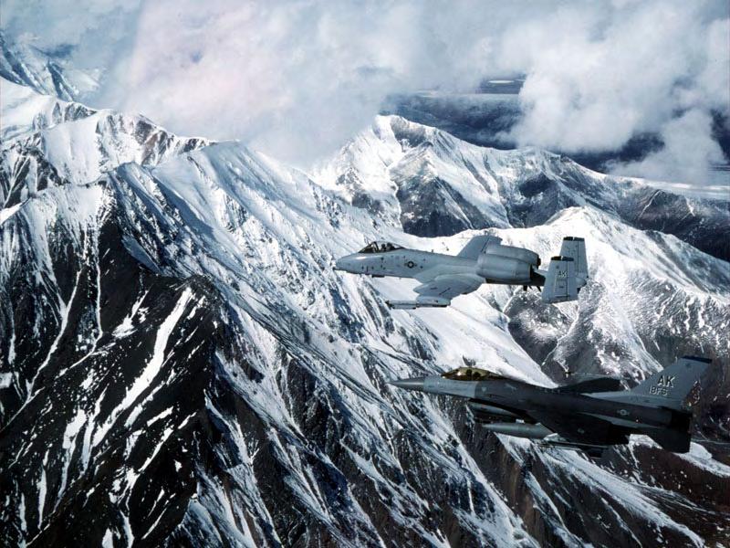
273
274 MEMORANDUM FOR ALASKA AVIATORS 12 MARCH 2007 FROM: 354th Fighter Wing Flight Safety Office SUBJECT: Military Flying in Interior Alaska 1. This pamphlet is offered to give you a working knowledge of the military airspace used in interior Alaska. This airspace is shared with the military, flying businesses and civilians who fly for pleasure. The information in this pamphlet is focused toward reducing the risk of a mid-air collision between civil and military aviators. 2. Some pilots refer to the Big Sky theory of air traffic control. This method of air traffic control is based upon two conditions: 1) lots of airspace, and 2) very few airplanes. Although the Alaskan skies are spacious, the Big Sky method of mid-air collision avoidance is risky at best, and in the Fairbanks flying area is unreasonable. 3. There are six active airfields within five miles of the International Airport, serving helicopters, light planes, jumbo jets, and everything in between. Also, Eielson Air Force Base is home to fighters, tankers, helicopters, light aircraft, Red Flag Alaska and many other transient aircraft. Add to this the pipeline patrol aircraft and the numerous small airports and backyard runways scattered throughout the Interior and the potential for a traffic conflict becomes high. 4. In this environment a pilot using knowledge, good visual and radio lookout, and help from ground-based radar is much better off than the pilot using the Big Sky method. Good pilots know the location of all high density traffic areas, and the general flight characteristics of the primary types of aircraft operating in these areas. Knowing the location and restrictions (if any) is beneficial to all pilots. The smart pilot is not averse to requesting radar advisories whenever possible. Special Use Airspace Information Service (SUAIS) is available 24 hours a day and can be a great aid to pilots flying in Alaska. This pamphlet will discuss SUAIS and its use along with other information you can use to avoid a near miss or a mid-air collision. Remember... flying safety is no accident. 5. If you have any questions about military flying at Eielson Air Force Base, or any of our military operating areas, please call the Eielson Safety Office at //Signed// MATTHEW W. MITCHELL, Lt Col, USAF Chief of Safety
275 AIRCRAFT BASED AT EIELSON A-10A THUNDERBOLT II The Fairchild A-10A Thunderbolt II is dedicated to Close Air Support role, flying in support of army ground forces. The A-10A uses its 30-millimeter Gatling gun, air-to-ground missiles, rockets, and 16,000-pound payload to suppress enemy ground forces. They usually fly in formation, typically between 300 and 3,000 feet AGL. Formations are generally very loose with up to a mile or more between aircraft. Positioning of the #2 aircraft ranges from a line abreast to degrees echelon or even directly in trail. So, if you visually acquire only one aircraft, watch the surrounding sky for its partner(s). Another aircraft could be out in front to the side, or behind. Remember, if you only see one, you don t know if it s the leader or a wingman. Their gray paint, low operating altitude and degree of maneuverability enhances the A-10 s survivability in a hostile environment. Unfortunately, in peacetime these same characteristics make them hard for other pilots to see. In peacetime, they operate their red and green navigation lights full bright and leave their anti collision strobe lights (located on wing tips and tail) flashing at all times. The A-10A operates at speeds between 200 and 350 KIAS. A-10s are not limited to training within the Military Operations Area (MOA). They can fly enroute navigation sorties outside MOAs as long as they comply with FAA regulations. Their slow airspeed allows this. They normally fly between Ft AGL when flying outside of MOAs. F-16C FIGHTING FALCON The General Dynamic F-16 Fighting Falcon is a multi-role tactical fighter with full air-to-air and air-to-ground combat capabilities. The F-16 has the capability to fight its way to a target, deliver air-to-ground ordnance, and then fight its way back to safety. This may be accomplished using a variety of tactics. The pilots train to become experts with these tactics in the Interior (MOA) airspace as well as Restricted Area R-2202, R-2205, and R-2211 and military training routes (MTR). The F-16 carries onboard radar that can detect other aircraft at great distances beyond visual range. This enhances the pilot s ability to see and avoid other aircraft. However, because of its small size (wing span=33 feet), high speed (normal operating speeds at low level = 400 to 550 KIS), and extremely effective gray camouflage paint scheme, it can be difficult to acquire.

276 F-16s also use widely spread formations and could be in formations consisting of four or more aircraft. The F-16 also has an anti collision strobe light mounted on top of the vertical stabilizer. KC-135 STRATOTANKER The Boeing KC-135 Stratotanker provides air refueling for fighter, bomber, and transport aircraft. The KC-135 aircrews train in the local area flying both VFR and IFR approach patterns. Although they are substantially larger than the fighter aircraft based at Eielson AFB, their paint scheme blends in well with the surrounding area. The KC-135 flies between 150 and 250 KIAS when below 10,000 feet.
277 SPECIAL USE AIRSPACE INFORMATION SERVICE What is it? SUAIS is a 24-hour service provided to civilian pilots flying in and around MOAs and Restricted Areas in Interior Alaska. Pilots can call SUAIS at Restricted Joint Use- USAF ( ), from the Fairbanks area, or VHF 125.3, call sign Eielson Range Control. Primary coverage is along the AK Hwy. The further from the highway, typically the coverage quality is reduced. For more on SUAIS log on to: Who is Eielson Range Control (ERC)? ERC is an airspace manager at Eielson AFB, Alaska. It is normally staffed from 7 a.m. to 5 p.m., Monday through Friday (except federal holidays), and times when Air Force flying is in progress in Interior Alaskan MOAs and Restricted Areas. After hours, telephone and radio callers will hear the airspace status through a recorded message. ERC is equipped with UHF and VHF radios and radar displays. Why use it? First: safety. Eielson Range Control can advise civilian pilots of high-speed military aircraft operating in shared MOA airspace. Of particular concern are the Birch and Buffalo MOAs overlaying the Richardson and AK highways between Tok, Delta Junction, Glennallen, and Fairbanks--military aircraft occasionally use the corridor. Second: efficiency. Military Restricted Areas are not always in use during the charted operating times. When not in use, ERC can clear civilian aircraft through these areas. ERC can also clear military aircraft out of any airspace if civilian aircraft emergency operations-for example, an air ambulance mission-requires it. Where is SUAIS radio and radar coverage provided? Currently, through a series of radio relays, aircraft flying in the vicinity of R-2202, R-2205, R-2211 and the western Yukon MOAs talk to ERC. Coverage extends along the Alaska Highway toward the Canadian border and south of the Alaska Range to Glenallen. Aircraft flying in mountainous terrain to the east of the Tanana River will need to be at or above the tops of the highest terrain in their immediate vicinity. The ability to see non-transponder-equipped light aircraft is limited and unpredictable. Squawking is highly encouraged. Can Eielson Range provide air traffic control? No. Service is limited to advisory information on the active/inactive status of airspace and the approximate locations of Air Force aircraft. IFR vectoring, processing of flight plans, etc., cannot be provided. However, ERC is an excellent source of information and should be used to develop your situational awareness on the airspace. Conveying your intentions to ERC is critical to helping the system enhance flight safety. Does SUAIS include current Army operations? SUAIS includes Army artillery firing at all hours, and known helicopter operations. It also provides Army Unmanned Aerial Vehicle operations information in their area of coverage between Donnelly Dome and Fairbanks. History. The Air Force created SUAIS in 1994 to enhance both safety and efficient airspace use in Interior Alaska. Since then, it has become a regular feature of general and commercial aviation in the area. For more information log on to the following Web site:

278 SPECIAL UISE AIRSPACE
279 FLYING IN THE EIELSON AFB AREA Awareness of MOAs, MTRs, and Restricted Areas is essential to safe flying. Red Flag Alaska exercises bring large numbers of military aircraft to operate in these areas. Eielson AFB aircraft use three bombing (and artillery) ranges (R-2202, R-2205, and R-2211). These ranges are clearly depicted on sectional charts. It is essential that civilian aircraft avoid flying in these ranges when they are in use. Fairbanks Approach Control can be contacted to determine whether the ranges are in use. In addition, civilian aircraft can contact Eielson Range Control on (SUAIS) to obtain clearance to fly through these areas when conditions permit. Eielson AFB also uses several permanent MOAs. There are no FAA controlling agencies that civilian aircraft can contact for traffic advisories when the MOAs are active. Limited traffic information within approximately 25 nm of the bombing ranges can be obtained from Eielson Range Control on (see SUAIS). While range control may help, diligent visual lookout must be practiced when flying through active MOAs in the interior. Fighter aircraft from Eielson AFB also use many MTRs in the area. These routes, both VR and IR, are depicted on sectional charts; however, only the route centerline is shown (almost all interior routes are 10nm wide). Generally these routes extend from the surface to 3000 feet AGL; but some go as high as 17,000 MSL. The routes are active by NOTAM Advisory. Flight Service Stations can tell you which routes are active within 100NM. Generally, fighter aircraft flying in MTRs are low altitude and high speed. It is best to avoid active MTRs if at all possible. DO: Become familiar with the Interior military airspace. Avoid flying through active MOAs and MTRs, whenever possible. Contact nearest FSS or Fairbanks Approach to determine if ranges, MOAs, or MTRs are active. Contact Eielson Range Control for SUAIS in the vicinity of Eielson AFB, interior ranges or MOAs. When flying through active MOAs or MTRs maintain a constant visual lookout (ahead and behind) for military traffic. DON T: EVER fly through an active restricted area without contacting Eielson Range Control on for permission. Live bombing, artillery or surface to air missile firings may be in progress. Fly through active Military Airspace unless it is impractical to go around it. VISUAL APPROACHES/DEPARTURES Military aircraft flying visual approaches to Eielson usually fly across the Tanana River at 2,000 feet MSL, often in close formation, to line up with the runway. They will then operate in a rectangular or overhead pattern. Visual departures will make climbing turns out of traffic, usually toward one of the restricted areas.
280 INSTRUMENT APPROACHES/DEPARTURES Both military and civilian aircraft practice instrument procedures at Eielson. The TACAN and ILS approaches basically extend along the runway centerline out to about twelve miles (approximately over Harding Lake for Runway 31). SPECIAL CONSIDERATIONS FOR RED FLAG ALASKA EXERCISES Red Flag Alaska is a series of large scale flying exercises, which occur in the Eielson AFB area several times a year. These exercises may have up to 100 military aircraft flying in the Eielson AFB area at one time (in the span of two hours). It is very hazardous to fly VFR within the Interior Military Operations Areas during Red Flag Alaska exercise periods. These periods are usually two hours long; normally one period is in the morning and one in the afternoon. Fairbanks FSS, Fairbanks Approach, or Eielson Range Control (VHF 125.3) can confirm these exercise periods. Civilian aircraft flying from Northway or Glenallen to Fairbanks can avoid Red Flag Alaska airspace by flying at altitudes between 7,500 MSL up to Class A Airspace. You are encouraged to participate in the Special Use Airspace Information Service (SUAIS) provided by Eielson Range Control when airborne. This service is described above and also in pamphlets obtained at any Flight Service Station in the interior or on the web page. The web page also contains the Cope Thunder annual schedule. There you will get all the military airspace information you desire. LIGHTS OUT OPERATIONS AT NIGHT Military operations now require pilots to train with Night Vision Goggles (NVGs). This training involves flying with reduced aircraft lighting and in some cases no exterior lights at all. At times pilots practice NVG takeoffs and landings which require Eielson AFB airfield lighting to be turned down or even off. A NOTAM will be posted listing times, Restricted Airspace and/or MOAs being used. Pilots relying only on See and Avoid will not be able to see these aircraft, nor in some cases the airfield and should avoid the area or coordinate with the controlling agency in order to ensure positive separation. Safety procedures are in place using radar to ensure that military aircrews know when VFR aircraft enter the airspace. If necessary, they will turn their lights on and stop training if an unsafe situation develops. WAKE TURBULENCE Dangerous? YES! Unexpected, invisible, and unpredictable? NO! The one positive aspect of wake turbulence is its predictable occurrence. Wake turbulence is a vortex created by any wing producing lift. The vortex trails the wing tips and spreads outwards and downwards at 500 feet per minute. All aircraft produce some degree of wake turbulence, however, the greater the generating aircraft weight and the slower it flies, the more powerful the vortices. Cargo aircraft and passenger airliners produce powerful wake turbulence that could have a dramatic effect on the unsuspecting general aviation pilot. Here are some good rules of thumb for avoiding wake turbulence. During cruise, avoid flying directly behind and below other aircraft. During landing, fly your approach above the heavy aircraft and land beyond the point where the aircraft lowers its nose to the runway; during takeoff, liftoff before the rotation point of the heavy aircraft and climb above its flight path. Allow adequate time separation between yourself and the aircraft in
281 front of you, even if traveling perpendicular to its flight path. Don t get caught in these horizontal tornadoes...think Ahead! EIELSON S CLASS D AIRSPACE Defined as that airspace within a 4.7nm radius of Eielson extending from the surface up to, but not including 3,000 feet AGL. The control tower is operational daily from local time and other times by NOTAM. Eielson tower must be contacted if operating in the Class D Airspace. Frequencies are and NOTE: There is a long stretch of the Tanana River that lies well within the 4.7nm radius of the Class D Airspace. Also take note that Eielson TACAN lies at the south end of the 14,500-foot runway (That s almost three miles!). As such, when traversing the Eielson Class D Air space, it is advisable not to use just the river or TACAN (DME) as a guide to five miles, instead remain well clear to the west of the river and always contact the tower if able. REPORTING CONFLICTS WITH MILITARY AIRCRAFT If you are unfortunate enough to have a close encounter with a military aircraft in the Eielson AFB area then please report it to the FAA and to the Eielson AFB Safety Office. Reporting the incident to the Eielson Safety Office is the best way to ensure that action is taken to prevent further incidents. To report incidents call (907) or (907) You can also reach the Safety Office by mail at:. 354 FW/SE 354 Broadway St., Unit 13A Eielson AFB AK or at: 354fw.se@eielson.af.mil
282 FREQUENT VISITING AIRCRAFT F-15 EAGLE The F-15C is the Air Force s all-weather air superiority fighter. The F-15E is an air-to-ground version of the F-15C. Based at Elmendorf AFB, these aircraft utilize the Interior airspace frequently. They also use Eielson AFB for instrument approach training. F-15 s operate at all altitudes and all airspeeds. Both models of the F-15 carry an onboard radar that can detect other aircraft at great distances. They are painted gray camouflage and are very hard to see. C-130 HERCULES The C-130 Hercules is used for tactical transport and airdrop. Special versions of the C-130 include rescue, weather, special operations, and gunship variants. They all operate at airspeeds between 150 and 250 KIAS in the landing pattern. These aircraft sometimes participate in exercises in the Interior MOAs and fly at very low altitudes (300 to 500 feet above the ground). Watch for groups of 2-6 aircraft in 2,000 to 4,000 trail formation. Active duty aircraft are generally gray and ANG are typically green camouflage. Like the A-10, these aircraft are not limited to operations within MOAs. They can be found flying VFR practically anywhere.
283 C-12 KING AIR The Beech King Air is used for personnel transport throughout Alaska and frequents the Eielson area. It travels at 250 KIAS, and is capable of operating out of bare-base airfields. HH-60 BLACK HAWK The Sikorsky HH-60 Black Hawk helicopter performs a variety of roles around Eielson including support of range operations, search and rescue exercises, and re-supply of Eielson s outlying sites. They fly low altitude from the surface to 1,000 feet above the ground, between 120 and 150 KIAS. OTHERS C-5 and C-17 cargo aircraft are occasional visitors to Eielson and these are somewhat larger than the aging C-141. They typically fly similar profiles as the C-130. KC-10 refueling aircraft also visit from time to time. They are the military derivative of the DC-10 and typically operate above FL 180.
284 LOCATION RUNWAY 31/13 ELEVATION LIGHTING RUNWAY EIELSON AFB AIRFIELD INFORMATION NAVAIDS TACAN-CH 98 Runway 31 ILS Runway 13 ILS RADAR CLASS D AIRSPACE FREQUENCIES SUAIS 22 miles east of Fairbanks, Alaska 14,500 feet, concrete, two north arresting cables, one south arresting cable 547 feet MSL Airfield Rotating Beacon (1 Green, 2 White) High Intensity Runway Lighting (HIRL) with Sequenced Flashing, Precision Approach Path Indicator (PAPI) No radar approaches at this time 4.7 nm radius up to 3,000 feet MSL TOWER (VHF) OR (UHF) GROUND (VHF) OR (UHF) RANGE CONTROL (VHF) or from Fairbanks area EIELSON AFB AIR TRAFFIC CONTROL CONTACTS Commander, Airfield Operations Flight Capt James Hudnell (907) Chief Controller SMSgt John Turner (907) Chief, ATC Training Standardization MSgt Johnny Cofer (907) A Superior Pilot Is One Who Stays Out Of Trouble By Using Superior Judgment To Avoid Situations, Which Might Require The Use Of Superior Skills! This pamphlet published by Eielson AFB Flight Safety Office with coordination through 611 Air Operations Group 611 AOS/AOO (Airspace Management) Elmendorf Air Force Base and FAA Flight Standards District Office Fairbanks, Alaska
285 APPENDIX I REVIEW OF EFFECTS OF AIRCRAFT NOISE, CHAFF, AND FLARES ON BIOLOGICAL RESOURCES
286
287 APPENDIX I REVIEW OF EFFECTS OF AIRCRAFT NOISE, CHAFF, AND FLARES ON BIOLOGICAL RESOURCES 1.0 Introduction This biological resources appendix addresses the effects of aircraft noise, including sonic booms, on wildlife and domestic animals. This appendix also considers the effects of training chaff and flares on biological resources under the training airspaces used by the F-15C, F-15E, and the proposed use by F-22A. 2.0 Aircraft Noise The review of the noise effects literature shows that the most documented reaction of animals newly or infrequently exposed to low-altitude aircraft and sonic booms is the startle effect. Although an observer s interpretation of the startle effect is behavioral (e.g., the animal runs in response to the sound or flinches and remains in place), it does have a physiological basis. The startle effect is a reflex; it is an autonomic reaction to loud, sudden noise (Westman and Walters 1981, Harrington and Veitch 1991). Increased heart rate and muscle flexion are the typical physiological responses. The literature indicates that the type of noise that can stimulate the startle reflex is highly variable among animal species (Manci et al. 1988). In general, studies have indicated that close, loud, and sudden noises that are combined with a visual stimulus produce the most intense reactions. Rotary wing aircraft (helicopters) generally induce the startle effect more frequently than fixed wing aircraft (Gladwin et al. 1988, Ward et al. 1999). Similarly the crack-crack of a nearby sonic boom has a higher potential to startle an animal compared to the thunder-like sound from a distant sonic boom. External physical variables, such as landscape structure and wind, can also lessen the animal s perception of and response to aircraft noise (Ward et al. 1999). Animals can habituate to fixed wing aircraft noise as demonstrated under controlled conditions (e.g., Conomy et al. 1998, Krausman et al. 1998) and by observations reported by biologists working in parks and wildlife refuges (Gladwin et al. 1988). Brown et al. (1999) defined habituation as an active learning process that permits individuals to discard a response to a recurring stimulus for which constant response is biologically inappropriate without impairment of their ability to respond to other stimuli. However, species can differ in their ability to habituate to aircraft noise, particularly the sporadic noise associated with military aircraft training (e.g., Conomy et al. 1998). Furthermore, there are no studies that have investigated the potential for adverse effects to wildlife due to long-term exposure to aircraft noise. Ungulates Wild ungulates appear to vary in sensitivity to aircraft noise. Responses reported in the literature varied from no effect and habituation to panic reactions followed by stampeding (Weisenberger et al. 1996; see reviews in Manci et al. 1988). Aircraft noise has the potential to be most detrimental during periods of stress, especially winter, gestation, and calving (DeForge 1981). Krausman et al. (1998) studied the response of wild bighorn sheep (Ovis canadensis) in a Appendix I Review of Effects of Aircraft Noise, Chaff, I-1 and Flares on Biological Resources
288 790-acre enclosure to frequent F-16 overflight at 395 feet AGL. Heart rate increased above preflight level during 7 percent of the overflights but returned to normal within 120 seconds. No behavioral response by the bighorn sheep was observed during the overflights. Wild ungulates typically have little to no response to sonic booms. Workman et al. (1992) studied the physiological and behavioral responses of pronghorn (Antilocapra americana), elk (Cervus elaphus), and bighorn sheep to sonic booms. All three species exhibited an increase in heart rate lasting from 30 seconds to 1 ½ minutes in response to their first exposure to a sonic boom. After successive sonic booms, this response decreased greatly, indicating habituation. A recent study in Alaska documented only mild short-term reactions of caribou (Rangifer tarandus) to military overflights in the Yukon Military Operations Areas (MOAs) (Lawler et al. 2005). A large portion of the Fortymile Caribou Herd calves underneath the Yukon MOAs. The authors concluded that military overflights did not cause any calf deaths, nor did cow-calf pairs exhibit increased movement in response to the overflights. Because daily movements increase with calf age, the authors controlled for calf age in their analysis. Lawler et al. (2005) generally only observed higher-level reactions, such as rising quickly from a bedded position or extended running, when the faster F-15 and F-16s were within 1,000 feet above ground level (AGL). They also noted considerable variation in responses due to speed, slant distance, group size and activity, and even individual variation with groups. In contrast, a study of the Delta Caribou Herd in interior Alaska found that female caribou with calves exposed to low-altitude overflights moved about 2.5 kilometers more per day than those not exposed (Maier et al. 1998). The authors, however, stated that this distance was of low energetic cost. Furthermore, this study did not consider calf age in their analyses (Lawler et al. 2005), which may bias results. Harrington and Veitch (1991) expressed concern for survival and health of woodland caribou calves in Labrador, where military training flights are allowed within 100 feet AGL. Few studies of the effects of low-altitude overflights have been conducted on moose (Alces alces) or Dall s sheep (Ovis dalli). Andersen et al. (1996) observed that moose responded more adversely to human stimuli than mechanical stimuli. Beckstead (2004) reported on a study of the effects of military jet overflights on Dall s sheep under the Yukon 1 and 2 MOAs in Alaska. He could find no difference in population trends, productivity, survival rates, behavior, or habitat use between areas mitigated and not mitigated for low-level military aircraft by the Alaska MOAs Environmental Impact Statement (EIS) (United States Air Force [Air Force] 1995). In the mitigated area, flights are restricted to above 5,000 feet AGL during the lambing season, while the unmitigated area could experience flights as low as 100 feet AGL. Similarly, largeforce Major Flying Exercises did not adversely affect Dall s sheep. Marine Mammals The effects of noise on marine mammals, such as dolphins and whales, have been relatively well studied. Noise behaves differently underwater than in air, so a brief description of noise characteristics in the ocean environment is necessary. Water is denser than air; therefore, sound waves travel five times faster in water (about 5,000 feet per second) than air (Stocker 2002). This density also allows sound to travel farther underwater. In addition, there are few obstacles (such as trees, houses, etc.) underwater that block sound. Since sound waves are influenced by density, factors that influence the density of I-2 Appendix I Review of Effects of Aircraft Noise, Chaff, and Flares on Biological Resources
289 water also affect the travel of sound. Temperature, pressure, and salinity can result in varied water densities. The following discussion is from Air Force (2001). Propagation of sound from air to water is a complicated topic. For a pressure wave arriving at the air/water interface at angles steeper than 13 degrees, the wave is transmitted into the water and propagates at a shallower angle in the water. The pressure in the water at the interface is double the incident pressure, and falls off according to propagation conditions in the water column. For energy incident from air on the sea surface at angles less than 13 degrees, there is no transmission of energy as a propagating wave into the water. Instead, there is only an evanescent, or non-propagating, wave whose amplitude decays exponentially with depth in the water. As before, there is a doubling of pressure at the interface, but the impact is limited to a region close to the surface and point of incidence. The wave does not propagate on its own in water, but is bound to the pressure field in the air. It thus appears to travel horizontally at the velocity of the aircraft. Because the plane is moving, subsonic noise from an aircraft can have angles both more and less than the critical 13 degrees. The pressure doubles at the surface, propagates for steep arrivals, and decays with depth for the less steep arrivals. For certain ocean conditions, the propagating energy may travel significant distance with low loss intensity. For this reason, a loitering airplane or helicopter may be more worrisome than a fast-moving or supersonic aircraft. As for military fixed-wing aircraft traveling at subsonic speeds, noise source levels are generally less than 210 decibels (db) (re 1 Pa at 1 m). For flights at an altitude of 1,000 feet, the maximum sound pressure level at the sea surface would be no greater than about 155 db (re 1 Pa), which is well below most harassment thresholds in current use (Air Force 2001). Because marine mammals rely on sound for communication, navigation, and capturing prey, the effect of noise on marine mammals is of particular concern. Anthropogenic noise in the ocean occurs from a variety of sources, ranging from small boats to icebreakers, to oil drilling and seismic exploration. Most of these noise sources are of greater concern than aircraft, for the reasons discussed above. For example, underwater noise from icebreakers (192 to 205 db are 1 Pa at 1 m) have the potential to result in temporary hearing damage to beluga whales (Delphinapterus leucas) staying within 1 to 4 km of an icebreaker for 20 minutes (Erbe and Farmer 2000). In general, reported behavioral responses of marine mammals to aircraft noise range from no reaction to diving (Air Force 2001, Moore and Clarke 2002). Perry et al. (2002) studied the above-water response of gray seals (Halichoerus grypus) and harbor seals (Phoca vitulina) to sonic booms. They observed no behavioral responses of gray seals to sonic booms, but harbor seals appeared more vigilant. Similarly, gray seals fitted with heart rate monitors showed no change in heart rate during or after a sonic boom while harbor seals showed a slight increase. Perry et al. (2002) concluded that sonic booms did not affect breeding behavior of the seals. Small Mammals A few researchers have studied the potential affects of aircraft noise on small mammals. Chesser et al. (1975) found that house mice (Mus musculus) trapped near an airport runway had larger adrenal glands than those trapped 2 kilometers from the airport. In the lab, naïve mice subjected to simulated aircraft noise also developed larger adrenal glands than a control group. Appendix I Review of Effects of Aircraft Noise, Chaff, I-3 and Flares on Biological Resources
290 However, the implications of enlarged adrenals for small mammals with a relatively short life span are undetermined. The burrows of some small mammals may reduce their exposure to aircraft noise. Francine et al. (1995) found that kit foxes (Vulpes macrotis) with twisting tunnels leading to deeper burrows experienced less noise than kangaroo rats (Dipodomys merriami) with shallow burrows. McClenaghan and Bowles (1995) studied the effects of aircraft overflights on small mammals and were unable to distinguish potential long-term effects due to aircraft noise compared to other environmental factors. Raptors Most studies have found few negative effects of aircraft noise on raptors. Ellis et al. (1991) examined behavioral and reproductive responses of several raptor species to low-level flights. No incidents of reproductive failure were observed and site re-occupancy rates were high (95 percent) the following year. Several researchers found that ground-based activities, such as operating chainsaws or an intruding human, were more disturbing than aircraft (White and Thurow 1985, Grubb and King 1991, Delaney et al. 1997). Red-tailed hawks (Buteo jamaicensis) and osprey (Pandion haliaetus) appeared to readily habituate to regular aircraft overflights (Andersen et al. 1989, Trimper et al. 1998). Mexican spotted owls (Strix occidentalis lucida) did not flush from a nest or perch unless a helicopter was as close as 330 feet (Delaney et al. 1997). Nest attendance, time-activity budgets, and provisioning rates of nesting peregrine falcons (Falco peregrinus) in Alaska were found not to be significantly affected by jet aircraft overflights (Palmer et al. 2003). On the other hand, Andersen et al. (1990) observed a shift in home ranges of four raptor species away from new military helicopter activity, which supports other reports that wild species are more sensitive to rotary wing aircraft than fixed-wing aircraft. The effects of aircraft noise on the bald eagle (Haliaetus leucocephalus) have been studied relatively well, compared to most wildlife species. Overall, there have been no reports of reduced reproductive success or physiological risks to bald eagles exposed to aircraft overflights or other types of military noise (Fraser et al. 1985, Stalmaster and Kaiser 1997, Brown et al. 1999; see review in Buehler 2000). Most researchers have documented that pedestrians and helicopters were more disturbing to bald eagles than fixed-wing aircraft, including military jets (Fraser et al. 1985, Grubb and King 1991, Grubb and Bowerman 1997). However, bald eagles can be disturbed by fixed-wing aircraft. Recorded reactions to disturbance ranged from an alert posture to flushing from a nest or perch. Grubb and King (1991) reported that 19 percent of breeding eagles were disturbed when an aircraft was within 625 meters (2,050 feet). Waterfowl and Other Waterbirds In their review, Manci et al. (1988) noted that aircraft can be particularly disturbing to waterfowl. Conomy et al. (1998) suggested, though, that responses were species-specific. They found that black ducks (Anas rubripes) were able to habituate to aircraft noise, while wood ducks (Aix sponsa) did not. Black ducks exhibited a significant decrease in startle response to actual and simulated jet aircraft noise over a 17-day period, but wood duck response did not decrease uniformly following initial exposure. Some bird species appear to be more sensitive to aircraft noise at different times of the year. Snow geese (Chen caerulescens) were more easily disturbed by aircraft prior to fall migration than at the beginning of the nesting season (Belanger and Bedard 1989). On an autumn staging ground in Alaska (i.e., prior to fall migration), 75 percent of brant (Branta bernicla) and only 9 percent of Canada geese (Branta canadensis) flew in response to aircraft overflights (Ward et al. 1999). There tended to be a I-4 Appendix I Review of Effects of Aircraft Noise, Chaff, and Flares on Biological Resources
291 greater response to aircraft at 1,000 to 2,500 feet AGL than at lower or higher altitudes. In contrast, Kushlan (1979) did not observe any negative effects to wading bird colonies (i.e., rookeries) when fixed-wing aircraft conducted surveys within 200 feet AGL; 90 percent of the observations indicated no reactions from the birds. Nesting California least terns (Sterna albifrons browni) did not respond negatively to a nearby missile launch (Henningson, Durham, and Richardson 1981). Previous research also shows varied responses of waterbirds to sonic booms. Burger (1981) found that herring gulls (Larus argentatus) responded intensively to sonic booms and many eggs were broken as adults flushed from nests. One study discussed by Manci et al. (1988) described the reproductive failure of a colony of sooty terns (Sterna fuscata) on the Dry Tortugas reportedly due to sonic booms. However, based on laboratory and numerical models, Ting et al. (2002) concluded that sonic boom overpressures from military operations of existing aircraft are unlikely to damage avian eggs. Domestic Animals As with wildlife, the startle reflex is the most commonly documented effect on domestic animals. Results of the startle reflex are typically minor (e.g., increase in heart rate or nervousness) and do not result in injury. Espmark et al. (1974) did not observe any adverse effects due to minor behavioral reactions to low-altitude flights with noise levels of 95 to 101 A- weighted decibels (dba). They noted only minimal reactions of cattle and sheep to sonic booms, such as muscle and tail twitching and walking or running short distances (up to 65 feet). More severe reactions may occur when animals are crowded in small enclosures, where loud, sudden noise may cause a widespread panic reaction (Air Force 1993). Such negative impacts were typically only observed when aircraft were less than 330 feet AGL (United States Forest Service 1992). Several studies have found little direct evidence of decreased milk production, weight loss, or lower reproductive success in response to aircraft noise or sonic booms. For example, Head et al. (1993) did not find any reductions in milk yields with aircraft Sound Exposure Levels (SEL) levels of 105 to 112 dba. Many studies documented that domestic animals habituate to aircraft noise (see reviews in Manci et al. 1998; Head et al. 1993). There is little direct evidence that aircraft noise or sonic booms can cause domestic chicken eggs to crack or result in lower hatching rates. Stadelman (1958) did not observe a decrease in hatchability when domestic chicken eggs were exposed to loud noises measured at 96 db inside incubators and 120 db outside. Bowles and Seddon (1994) found no difference in the hatch rate of four groups of chicken eggs exposed to 1) no sonic booms (control group), 2) sonic booms of 3 pounds per square foot (psf), 3) sonic booms of 20 psf, and 4) sonic booms of 30 psf. No eggs were cracked by the sonic booms and all chicks hatched were normal. 3.0 Training Chaff and Flares Specific issues and potential impacts of training chaff and flares on biological resources are discussed below. These issues have been identified by Department of Defense (DoD) research (Air Force 1997, Cook 2001), General Accounting Office review (United States General Accounting Office 1998), independent review (Spargo 1999), resource agency instruction, and public concern and perception. No reports to date have documented negative impacts of training chaff and flares to biological resources. These studies are reviewed below. Appendix I Review of Effects of Aircraft Noise, Chaff, I-5 and Flares on Biological Resources
292 Concerns for biological resources are related to the residual materials of training chaff and flares that fall to the ground or dud flares. Residual materials are several flare components, including plastic end caps, felt spacers, aluminum-coated wrapping material, plastic retaining devices, and plastic pistons. Specific issues are (1) ingestion of chaff fibers or flare residual materials; (2) inhalation of chaff fibers; (3) physical external effects from chaff fibers, such as skin irritation; (4) effects on water quality and forage quality; (5) increased fire potential; and (6) potential for being struck by large flare debris (the plastic Safe and Initiation [S&I] device of the MJU-7 A/B flare). Because of the low rate of application and dispersal of training chaff fibers and flare residues during defensive training, wildlife and domestic animals would have little opportunity to ingest, inhale, or otherwise come in contact with these residual materials. Although some chemical components of chaff are toxic at high levels, such levels could only be reached through the ingestion of many chaff bundles or billions of chaff fibers. Barrett and MacKay (1972) documented that cattle avoided consuming clumps of chaff in their feed. When calves were fed chaff thoroughly mixed with molasses in their feed, no adverse physiological effects were observed pre- or post-mortem. Chaff fibers are too large for inhalation, although chaff particles can degrade to small pieces. However, the number of degraded or fragmented particles is insufficient to result in disease (Spargo 1999). Chaff is similar in form and softness to very fine human hair, and is unlikely to cause negative reactions if animals were to inadvertently come in contact with it. Chaff fibers could accumulate on the ground or in water bodies. Studies have shown that chaff breaks down quickly in humid environments and acidic soil conditions (Air Force 1997). In water, only under very high or low ph could the aluminum in chaff become soluble and toxic (Air Force 1997). Few organisms would be present in water bodies with such extreme ph levels. Given the small amount of diffuse or aggregate chaff material that could possibly reach water bodies, water chemistry would not be expected to be affected. Similarly, the magnesium in flares can be toxic at extremely high levels, a situation that could occur only under repeated and concentrated use in localized areas. Flare ash would disperse over wide areas; thus, no impact is expected from the magnesium in flare ash. The probability of an intact dud flare leaving an aircraft during training and falling to the ground outside of a military base is estimated to be 0.01 percent (Air Force 2001). Since toxic levels would require several dud flares to fall in one confined water body, no effect of flares on water quality would be expected. Furthermore, uptake by plants would not be expected to occur. The expected frequency of an S&I device from an MJU-7 A/B flare striking an exposed animal depends on the number of flares used and the size and population density of the exposed animals. Calculations of potential strikes to a human-sized animal with a density of 50 animals per square mile, where 8,000 flares were used annually, was one strike in 200 years. An animal 1/100 th the size of a human with a density of 500 animals per square mile exposed 100 percent of the time (i.e., animals not protected by burrows or dense vegetation) would also have an expected strike rate of one in 200 years. The S&I device strikes with the force of a medium-sized hailstone. Such a strike to a bird, small mammal, or reptile could produce a mortality. The very small likelihood of such a strike, especially when compared with more immediate threats such as highways, would not be expected to have any effect on populations of small species. Strikes to larger species, such as wild ungulates or farm animals could produce a bruise and a startle I-6 Appendix I Review of Effects of Aircraft Noise, Chaff, and Flares on Biological Resources
293 reaction. Such a strike from an S&I device would not be expected to seriously injure or otherwise significantly affect natural or domestic species. Flare debris also includes aluminum-coated mylar wrapping and lighter plastic parts. The plastic parts, such as end caps, are inert and are not expected to be used by or consumed by any species. The aluminum coated wrapping, as it degrades, could produce fibrous materials similar to naturally occurring nesting materials. There is no known case of such materials being used in nest construction. In a study of pack rats (Neotoma spp.), a notorious collector of odd materials, no chaff or flare materials were found in nests on military ranges subject to decades of dispensing chaff and flares (Air Force 1997). Although lighter flare debris could be used by species under the airspace, such use would be expected to be infrequent and incidental. Bovine hardware disease is of concern for domestic cattle. Hardware disease, or traumatic reticuloperitonitis, is a relatively common disease in cattle. The disease results when a cow ingests a foreign object, typically metallic. The object can become lodged in the wall of the stomach and can penetrate into the diaphragm and heart, resulting in pain and infection; in severe cases animals can die without treatment. Treatment consists of antibiotics and/or surgery. Statistics are not readily available, but one study documented that percent of cattle slaughtered in the eastern United States (U.S.) had metallic objects in their stomachs, but the objects did not result in damage (Moseley 2003). Dairy cattle are typically more vulnerable to hardware disease due to the confined nature of diary operations. Many livestock managers rely on magnets inserted into the cow s stomach to prevent and treat hardware disease. The magnet attracts metallic objects, thereby preventing them from traveling to the stomach wall. The culprit of bovine hardware disease is often a nail or piece of wire greater than 1 inch in length, such as that used to bale hay (Cavedo et al. 2004). If livestock ingested residual materials of the M-206 and MJU-7 A/B flares, the plastic materials of the end cap and slider and the flexible aluminum wrapping would be less likely to result in injury than a metallic object. Flares used for training by F-15 and F-22 aircraft are designed to burn out within approximately 400 feet of the release altitude. Given the minimum allowable release altitudes for flares, this leaves an extensive safety margin to prevent any burning materials from reaching the ground (Air Force 2001). In the Alaska training airspace, flares must be released above 5,000 feet AGL from June 1 to September 30 to reduce any potential of a flare-caused fire. For the remainder of the year when soils and vegetation are moist or snow covered, flares can be released above 2,000 feet AGL. Plastic and aluminum coated wrapping materials from flares that do reach the ground would be inert. The percentage of flares that malfunction is small (<1 percent probability for all categories of malfunction; Air Force 2001). Dud flares (i.e., those that do not ignite at release and fall intact to the ground) contain magnesium, which is thermally stable and requires a temperature of 1,200 degrees Fahrenheit for ignition. Self-ignition is highly unlikely under natural conditions. 4.0 References Andersen, D.E., O.J. Rongstad, and W.R. Mytton Response of Nesting Red-tailed Hawks to Helicopter Overflights. Condor 91: Home-Range Changes in Raptors Exposed to Increased Human Activity Levels in Southeastern Colorado. Wildlife Society Bulletin 18(2): Appendix I Review of Effects of Aircraft Noise, Chaff, I-7 and Flares on Biological Resources
294 Andersen, R., J.D.C. Linnell, and R. Langvatn Short Term Behavioral and Physiological Responses of Moose Alces alces to Military Disturbance in Norway. Biological Conservation 77: Barrett, B.B., and R.R. MacKay The Ingestion of Fiberglass Chaff by Cattle. Animal Diseases Research Institute, Canada Department of Agriculture/Health of Animals Branch. Beckstead, D The Effects of Military Jet Overflights on Dall s Sheep in Interior Alaska. Available at tm. Accessed December 29, Belanger, L. and J. Bedard Responses of Staging Greater Snow Geese to Human Disturbance. Journal of Wildlife Management 53(3): Bowles, A. E., and M. D. Seddon Effects of simulated sonic booms on the hatchability of white leghorn chicken eggs. Armstrong Laboratory, Air Force Materiel Command, Brooks Air Force Base, TX. AL/OE-TR Brown, B.T., G.S. Mills, C. Powels, W.A. Russell, G.D. Therres, and J.J. Pottie The Influence of Weapons-Testing Noise on Bald Eagle Behavior. Journal of Raptor Research 33(3): Buehler, D.A Bald Eagle (Haliaeetus leucocephalus). In The Birds of North America, No. 506 (A. Poole and F. Gill, eds.). The Birds of North America, Inc., Philadelphia, PA. Burger, J Behavioral Responses of Herring Gulls Larus argentatus to Aircraft Noise. Environmental Pollution (Series A): Cavedo, A. M., K. S. Latimer, H. L. Tarpley, and P. J. Bain Traumatic Reticulopertonitis (Hardware Disease) in Cattle. Class of 2004 and Department of Pathology, College of Veterinary Medicine, University of Georgia, Athens, GA. Available at Accessed 6/23/2005. Chesser, R.K., R.S. Caldwell, and M.J. Harvey Effects of Noise on Feral Populations of Mus musculus. Physiological Zoology 48(4): Conomy, J.T., J.A. Dubovsky, J.A. Collazo, and W.J. Fleming Do Black Ducks and Wood Ducks Habituate to Aircraft Disturbance? Journal of Wildlife Management 62(3): Cook, B.C Investigation of Abrasion, Fragmentation and Re-suspension of Chaff. Master s Thesis. Christopher Newport University. DeForge, J.R Stress: Changing Environments and the Effects on Desert Bighorn Sheep. Desert Bighorn Council 1981 Transactions. Delaney, D.K., T.G. Grubb, and L.L. Pater Effects of Helicopter Noise on Nesting Mexican Spotted Owls. Project Order No. DE P.O. 95-4, U.S. Air Force, Holloman Air Force Base, New Mexico. Ellis, D.H., C.H. Ellis, and D.P. Mindell Raptor Responses to Low-Level Jet Aircraft and Sonic Booms. Environmental Pollution 74: I-8 Appendix I Review of Effects of Aircraft Noise, Chaff, and Flares on Biological Resources
295 Erbe, C., and D. M. Farmer Zones of Impact around Icebreakers Affecting Beluga Whales in the Beaufort Sea. Journal of the Acoustical Society of America 108(3): Espmark, Y., L. Falt, and B. Falt Behavioral Responses in Cattle and Sheep Exposed to Sonic Booms and Low-altitude Subsonic Flight Noise. The Veterinary Record 94: Francine, J.K., J.S. Yaeger, and A.E. Bowles Sound from Low-Altitude Jet Overflights in Burrows of the Merriam s Kangaroo Rat, Dipodomys merriami, and the Kit Fox, Vulpes macrotis. In R. J. Bernhard and J. S. Bolton. Proceedings of Inter-Noise 95: The 1995 International Congress on Noise Control Engineering. Volume II. Pages Fraser, J.D., L.D. Frenzel, and J.E. Mathisen The Impact of Human Activity on Breeding Bald Eagles in North-Central Minnesota. Journal of Wildlife Management 49(3): Gladwin, D.N., D.A. Asherin, and K.M. Manci Effects of Aircraft Noise and Sonic Booms on Fish and Wildlife. Results of a Survey of U.S. Fish and Wildlife Service Endangered Species and Ecological Services Field Offices, Refuges, Hatcheries, and Research Centers. U.S. Fish and Wildlife Service, National Ecology Research Center, Fort Collins, Colorado. Grubb, T.G. and R.M. King Assessing Human Disturbance of Breeding Bald Eagles with Classification Tree Models. Journal of Wildlife Management 55(3): Grubb, T.G. and W.W. Bowerman Variations in Breeding Bald Eagle Responses to Jets, Light Planes and Helicopters. Journal of Raptor Research 31(3): Harrington, F.H., and A.M. Veitch Short-term Impacts of Low-level Jet Fighter Training on Caribou in Labrador. Arctic 44(4): Head, H. H., R. C. Kull, Jr., M. S. Campos, K. C. Bachman, C. J. Wilcox, L. L. Cline, and M. J. Hayen Milk Yield, Milk Composition, and Behavior of Holstein Cows in Response to Jet Aircraft Noise before Milking. Journal of Dairy Science 76: Henningson, Durham and Richardson Effects of Minuteman Launch on California Least Tern Nesting Activity, Vandenberg AFB, California. Prepared for U.S. Air Force, Ballistic Missile Office, Norton Air Force Base, California. Krausman, P.R., M.C. Wallace, K.L. Hayes, and D.W. DeYoung Effects of Jet Aircraft on Mountain Sheep. Journal of Wildlife Management 62(4): Kushlan, J. A Effects of Helicopter Censuses on Wading Bird Colonies. Journal of Wildlife Management 43(3): Lawler, J. P., A. J. Magoun, C. T. Seaton, C. L. Gardner, R. D. Bobertje, J. M. Ver Hoef, and P. A. Del Vecchio Short-term Impacts of Military Overflights on Caribou during Calving Season. Journal of Wildlife Management 69(3): Maier, J. A. K., S. M. Murphy, R. G. White, and M. D. Smith Responses of Caribou to Overflights by Low-Altitude Jet Aircraft. Journal of Wildlife Management 62(2): Manci, K.M., D.N. Gladwin, R. Villella, and M. Cavendish Effects of Aircraft Noise and Sonic Booms on Domestic Animals and Wildlife: a Literature Synthesis. U.S. Fish and Wildlife Service National Ecology Research Center, Ft. Collins, CO. NERC-88/29. Appendix I Review of Effects of Aircraft Noise, Chaff, I-9 and Flares on Biological Resources
296 McClenaghan, L, and A.E. Bowles Effects of Low-Altitude Overflights on Populations of Small Mammals on the Barry M. Goldwater Range. In R. J. Bernhard and J. S. Bolton. Proceedings of Inter-Noise 95: The 1995 International Congress on Noise Control Engineering. Volume II. Pages Moore, S. E., and J. T. Clarke Potential Impact of Offshore Human Activities on Gray Whales (Eschrichtius robustus). Journal of Cetacean Research and Management 4(1): Moseley, B. L Hardware Disease in Cattle. University of Missouri, MU Extension. Available at Accessed 7/26/2005. Palmer, A.G., D.L. Nordmeyer, and D.D. Roby Effects of Jet Aircraft Overflights on Parental Care of Peregrine Falcons. Wildlife Society Bulletin 31(2): Perry, E. A., D. J. Boness, and S. J. Insley Effects of Sonic Booms on Breeding Gray Seals and Harbor Seals on Sable Island, Canada. Journal of the Acoustical Society of America 111(1): Spargo, B.J Environmental Effects of RF Chaff: a Select Panel Report to the Undersecretary of Defense for Environmental Security. NRL/PU/ , Washington, D.C. Stadelman, W.J The effect of sounds of varying intensity on hatchability of chicken eggs. Poultry Sciences 37: Stalmaster, M.V. and J.L. Kaiser Flushing Responses of Wintering Bald Eagles to Military Activity. Journal of Wildlife Management 61(4): Stocker, M Fish, Mollusks and other Sea Animals, and the Impact of Anthropogenic Noise in the Marine Acoustical Environment. Michael Stocker Associates, For Earth Island Institute. Ting, C., J. Garrelick, and A. Bowles An Analysis of the Response of Sooty Tern Eggs to Sonic Boom Overpressures. The Journal of the Acoustical Society of America 111(1): Trimper, P.G., N.M. Standen, L.M. Lye, D. Lemon, T.E. Chubbs, and G.W. Humphries Effects of Low-level Jet Aircraft Noise on the Behaviour of Nesting Osprey. Journal of Applied Ecology 35: United States Air Force (Air Force) The Impact of Low Altitude Flights on Livestock and Poultry. AF Handbook #-#, Volume 8. United States Air Force (Air Force) Environmental Effects of Self Protection Chaff and Flares. Final Report. August Final Environmental Assessment for the Defensive Training Initiative, Cannon Air Force Base, New Mexico. Prepared for Air Combat Command, Langley Air Force Base, Virginia. I-10 Appendix I Review of Effects of Aircraft Noise, Chaff, and Flares on Biological Resources
297 United States Forest Service Report to Congress: Potential Impacts of Aircraft Overflights of National Forest System Wilderness. Prepared pursuant to Public Law , The National Parks Overflights Act of United States General Accounting Office DoD Management Issues Related to Chaff: Report to the Honorable Harry Reid, U.S. Senate. Ward, D.H., R.A. Stehn, W.P. Erickson, and D.V. Derksen Response of Fall-Staging Brant and Canada Geese to Aircraft Overflights in Southwestern Alaska. Journal of Wildlife Management 63(1): Weisenberger, M.E., P.R. Krausman, M.C. Wallace, and D.W. De Young, and O.E. Maughan Effects of Simulated Jet Aircraft Noise on Heart Rate and Behavior of Desert Ungulates. Journal of Wildlife Management 60(1): Westman, J.C., and J.R. Walters Noise and Stress: a Comprehensive Approach. Environmental Health Perspectives 41: White, C.M., and T.L. Thurow Reproduction of Ferruginous Hawks Exposed to Controlled Disturbance. Condor 87: Workman, G.W., T.D. Bunch, L.S. Neilson, E.M. Rawlings, J.W. Call, R.C. Evans, N.R. Lundberg, W.T. Maughan, and J.E. Braithwaite Sonic Boom/Animal Disturbance Studies on Pronghorn Antelope, Rocky Mountain Elk, and Bighorn Sheep. Utah State University. Contract number F Submitted to U.S. Air Force, Hill Air Force Base, Utah. Appendix I Review of Effects of Aircraft Noise, Chaff, I-11 and Flares on Biological Resources
298 THIS PAGE INTENTIONALLY LEFT BLANK. I-12 Appendix I Review of Effects of Aircraft Noise, Chaff, and Flares on Biological Resources
299 APPENDIX J COMMENTS AND RESPONSES
300
301 APPENDIX J COMMENTS AND RESPONSES This appendix includes a narrative description of the Delta Military Operations Area (MOA) Environmental Assessment (EA) comment and response process, a directory of commenters, a table generalizing comments with responses, a table containing agency comments, and copies of public and agency comments. Comment and Response Process The 60-day public review process period (30-day initially with a 30-day extension) began November 21, Either a hard copy or compact disc (CD) of the Draft EA was distributed to individuals who requested a copy and to agencies and repositories that are required to have a copy. Appendix D includes a list of the libraries and repositories that were provided a hard copy or CD of the Draft EA for the purpose of making the document available for public review. The Draft EA also was posted for the public to view on the World Wide Web at and It was noted that these comments would be published in the Final EA (and that providing personal information on those comments was considered consent to publish it). Public notification materials included newspaper display ads, press releases, public service announcements, and the base websites. The formal public comment period ended on January 22, In accordance with the National Environmental Policy Act (NEPA), public and agency comments were reviewed and incorporated into this Final EA. The United States Air Force (USAF) and Federal Aviation Administration (FAA) have considered these public and agency comments in the decision making process. Locating Your Comments and Responses Table J-1 provides a directory to locate your name and your assigned letter number. As noted on the public displays, sign-in, and comment sheets, providing your name in the EA process meant that you understood that your name and comment would be made a part of the public record for this EA. An identification number was assigned to your comment letter and is located in the upper right hand corner of the letter and to the left of your name in the table at the end of this appendix. Written comments, submitted letters, and agency letters are located immediately following the directory. Table J-2 contains generalized comments received on the Draft EA along with a response to each generalized comment and the section of the EA where the comment was addressed. The left hand column contains the appropriate letter s assigned number that corresponds to that generalized comment. In several cases, the letter number may appear with more than one comment and/or more than one number may appear with a generalized comment. Table J-3 contains summarized comments received from the FAA, a cooperating agency, as well as responses to these comments. Public and agency involvement is an important part of the NEPA process, and all letters and their associated comments are taken into consideration by the Air Force in its decision making process. Appendix J Comments and Responses Page J-1
302 Table J-1. Draft Delta MOA EA Comment Letters Received Comment Number From Date 1. Alaskan Airmen s Association 19 Jan Frontier Flying Service 19 Jan AOPA 2 Dec Mile Air 28 Nov AACA 5 Dec Department of Interior 18 Dec James Gibertoni 23 Dec William J. Schwaab No date 9. Ray Andreassen 16 Dec Alaska Airlines 15 Jan AACA 16 Jan AOPA 20 Jan ConocoPhillips Alaska (Shared Services Aviation) 17 Jan Alaskan Aviation Safety Foundation 17 Jan Bob Bursiel 19 Jan Paul Reinders 17 Jan Charles Cozad 18 Jan P J Reinders 17 Jan Craig Walls 17 Jan Michael Vivion 19 Jan Robert Stapleton, Jr 16 Jan Tim Rittol 17 Jan Gale Partch 17 Jan Charles Hosack 17 Jan Merlin Johnson 17 Jan Michael Kelly 17 Jan Richard Dunning 17 Jan Darrell Bright 17 Jan John Brown 17 Jan Christopher Gill 17 Jan Michael Ice 17 Jan Bryan Silva 17 Jan Mark Buzby 17 Jan Sean Ruddy 17 Jan Larry LaGrone 17 Jan John Pakan 17 Jan Lars Gleitsmann 17 Jan Toni Schmidt 17 Jan Nicholas Cassara 17 Jan Kenneth Thorall 17 Jan Kenneth Barnes 17 Jan Robert Jones 17 Jan Claude Adams 17 Jan 09 Page J-2 Appendix J Comments and Responses
303 Comment Number From Date 44. Eric Rains 17 Jan Roger Bruce Walden 17 Jan James Cunnington 17 Jan Randy Tyler 17 Jan Fairbanks International Airport 12 Dec Alaska Aerofuel 31 Dec Fairbanks Chamber of Commerce 2 Mar 09 Appendix J Comments and Responses Page J-3
304 Table J-2. Generalized Public Comments and Responses (Page 1 of 11) Comment Number Generalized concern Response Recommends real time coordination with FAA ATC development to permit IFR traffic during Red Flag Exercises. Concern that the additional civil aviation rerouting miles and time will result in longer flights, greater potential for missed connections, increased crew duty time, increased fuel costs, and scheduling impacts. Concern that the exercises will pose impacts to their operations because they had to fly over 1000 additional miles during the 2008 exercises. The FAA does not allow the simultaneous or real time use of airspace between military aircraft and civilian aircraft filed on IFR flight plans. This is the primary reason MOAs are established, to ensure safety and separation of military and IFR traffic. The USAF has implemented procedures to make this airspace as realtime as possible. The nature of realistic military training would not be comparable with civilian IFR transit during an MFE 2.5-hour training period. The established Delta MOA would have no constraints on civil aviation except when activated during an MFE. The USAF would provide a corridor that starts at the North Latitude line and extends south through Fox 3 ATCAA and Paxson ATCAA between FL320 and FL350 back to Anchorage Center when the proposed Delta MOA was active. Large commercial aircraft will normally utilize the 63 degree corridor. Smaller aircraft unable to utilize the corridor will have to plan around the 1.5 to 2 hours blocks or utilize their VFR options. A commercial carrier commented on the Draft EA that they were not able to otherwise deconflict schedules and had to fly a total of over 1,000 additional miles during the 40 days MFEs were scheduled in This rerouting is consistent with the extent of rerouting described in the Draft Delta MOA EA. VFR pilots have several options to transit the Delta MOA corridor. 1. Prior Planning schedule around the NOTAM d hour blocks 2. Utilize the published VFR corridors (communication with SUAIS is greatly encouraged) 3. Fly thru the Delta MOA VFR (This option is not recommended/ endorsed, however if chosen, has been proven successful and safe with SUAIS communication during the past three years) Section of EA Addressing Comment Page J-4 Appendix J Comments and Responses
305 Table J-2. Generalized Public Comments and Responses (Page 2 of 11) Comment Number Generalized concern Response 1 Concerned about safety for VFR 8 operators Experience with the Delta T-MOA has demonstrated that implementation of scheduling, improved communication, and continued recognition of the VFR corridors can address concerns of general aviation pilots. V-444 will be open when the Delta MOA is not active which is 97% of a year. The existing VFR corridor allows 24/7 access and is supported by the SUAIS at all times when military flying is in progress in the Interior Alaskan MOAs and Restricted Areas, and normally staffed from 7 a.m. to 5 p.m., Monday through Friday (except federal holidays). As described in Section 3.3 of this EA, the USAF installed additional radars and new communication facilities throughout this area. The USAF is working to ensure that Anchorage Center has these important radar and communication capabilities. The proposed Delta MOA would not permanently close V-444. The annual schedule for the proposed Delta MOA activation will be published and MFE detailed information will be provided a minimum of 30 days prior to each exercise. The information will be provided to the FAA for NOTAMs, giving the IFR pilot ample time to plan ahead. The IFR traffic counts along V-444 during the high usage September 2008 period was 2.7 aircraft over a 13 hour window. During an up to five-hour MFE day, the number of aircraft potentially delayed up to one hour is projected to be one to two per MFE day. Safety concerns expressed by the public dealt with the concern that additional large fast-moving aircraft would be required to fly VFR. The VFR corridor which is open 24/7 is typically between 2,000 and 3,000 feet AGL through the entire Delta corridor. The number of aircraft flying VFR through the airspace would not be expected to substantially change if the Delta MOA were activated for two 1.5 to 2.5-hour periods per day. Section of EA Addressing Comment Appendix J Comments and Responses Page J-5
306 Table J-2. Generalized Public Comments and Responses (Page 3 of 11) Comment Number Generalized concern Response IFR traffic would be expected to schedule around the activation hourly periods, which would be published annually with details known 30 days in advance. The Air Force recognizes that weather conditions in Alaska can change quickly, and that is why the Air Force has included a 3-hour period between MOA activation times during an MFE day so that full IFR services would be available to permit safe transit of the Delta corridor. The Delta corridor would be open for IFR traffic, even during an MFE-scheduled training day, for a minimum of 19 hours during a 24-hour day. 2 Concerned about an increase in pilot s Substantial misinformation was provided 8 need to have unrestricted access to the to 25 to 30 individuals who commented 9 airspace to meet their customers flying on the Draft EA. These commenters were 11 requirements because equal, shared use of falsely led to believe that the FAA 12 the airspace is important to them. establishing a Delta MOA would result in 14 the closure of the Delta corridor to civilian 15 traffic. As described throughout the Draft 21 EA, the Delta MOA would be activated for a maximum of two 2.5-hour time periods a maximum of 60 days per year. There would never be more than 5 hours when V-444 would not be accessible for civil aircraft even during an MFE day. The majority of the activation periods would be for 1.5 to 2.5 hours and would be returned back to Anchorage Center in real time when all MFE aircraft are clear of the airspace. The USAF has reduced the amount of time this air route would be temporarily unavailable to the smallest amount possible and the airspace would be controlled real time. When the USAF is done using the MOA for the NOTAM d period, it will immediately be returned to the FAA, regardless of the times it was NOTAM d out. Civilian aviators would have an annual MFE schedule and the scheduled MOA times 30 days in advance and can plan around these scheduled two 2.5 hour periods to ensure their flights are uninterrupted. When flying on an IFR flight plan, all aviators, either military or civilian, understand their flights are Section of EA Addressing Comment Page J-6 Appendix J Comments and Responses
307 Table J-2. Generalized Public Comments and Responses (Page 4 of 11) Comment Number Generalized concern Response always subject to delay based on navigational aid availability, weather, traffic, and other factors that affect all users of the National Airspace System. 3 Request for the Air Force to extend the 30 Public comment period extended an 5 day comment period on the Draft EA an additional 30 days (total of 60 days). 14 additional days Concern that the proposed Delta MOA would impact the only Victor airway, V- 444 that connects Fairbanks and northern Alaska with Canada and the lower 48 states. V-444 also provides IFR access to Allen Army Airfield serving the Delta Junction and Ft. Greely areas. The only alternative route would require a detour of nearly 390 NM, with a Minimum Enroute Altitude (MEA) of 10,000 feet that requires two crossings of the Alaska Range. The proposed Delta MOA would not permanently close V-444. The annual schedule for the proposed Delta MOA activation will be published and MFE detailed information will be provided a minimum of 30 days prior to each exercise. The information will be provided to the FAA for NOTAMs, giving the IFR pilot ample time to plan ahead. The IFR traffic counts along V-444 during the high usage September 2008 period was 2.7 aircraft over a 13 hour window. During an up to five-hour MFE day, the number of aircraft potentially delayed up to one hour is projected to be one to two per MFE day. IFR pilots have several options to transit the Delta MOA corridor. 1. Prior Planning schedule around the NOTAM d hour blocks 2. Utilize the 63 degree corridor thru the Fox and Paxon ATCAA 3. Cancel IFR and utilize the published VFR corridors (communication with SUAIS is greatly encouraged) 4. Fly thru the Delta MOA VFR (This option is not recommended/endorsed, however if chosen, has been proven successful and safe with SUAIS communication during the past three years). The existing VFR corridor allows 24/7 access and is supported by the SUAIS at all times when military flying is in progress in the Interior Alaskan MOAs and Restricted Areas, and normally staffed from 7 a.m. to 5 p.m., Monday through Friday (except federal holidays). As described in Section 3.3 of this EA, the Section of EA Addressing Comment Appendix J Comments and Responses Page J-7
308 Table J-2. Generalized Public Comments and Responses (Page 5 of 11) Comment Number Generalized concern Response USAF installed additional radars and new communication facilities throughout this area. The USAF is working to ensure that Anchorage Center has these important radar and communication capabilities. 4 Concern that emergency medical air The USAF, in coordination with the FAA, 8 service for Delta Junction and established procedures in providing 11 surrounding communities could be Lifeguard missions priority through Delta 13 adversely affected with the unavailability T-MOA airspace by either capping the T- of the IFR service to Allen Army Airfield. MOA altitude or stopping the exercise entirely if required. This procedure was used during T-MOA action periods during 2007 and The USAF initiated coordination with the FAA, and is advised that, as per Advisory Circular (Emergency Medical Services/Airplane, 11/19/90), the 40 Mile Air Medevac aircraft may utilize the Lifeguard callsign to facilitate reposition of the aircraft for the next mission. This will ensure that medevac capability is available in the Tanana Valley. This demonstrates the USAF s commitment to ensuring fire fighting, emergency, life flight, and life flight reposition flights access through this airspace when required. See also correspondence from USAF and FAA following this table (pages J-14 and J-15) Would prefer the Air Force to establish the floor of the MOA at 2,000 to 3,000 feet above Victor 444 s MEA or a High Low MOA. Continue IFR services to Allen Army Airfield. Another alternative suggested would be to establish airspace north of Yukon 5 MOA instead or areas to the west should be utilized instead of the area chosen. 6 Suggests the following modifications pursuant to their emergency response protocol: Page 3-19, Section , Flight Safety, first paragraph. We suggest adding the following sentence: Military response plans include the identification and subsequent notification of landowners and/or land management agencies whose Airspace north of the Yukon 5 MOA would not meet the purpose and need described in Section 1.0. The Draft EA described the need for airspace below 10,000 feet MSL to permit training with current technology and weapon systems. Section of this EA has been expanded to describe the types of MFE missions which would require aircraft to fly below 10,000 feet MSL for effective and realistic training. Added to document: If an accident were to occur, military response plans include the identification and subsequent notification of landowners and/or land management agencies whose lands and/or waters may be affected by an aircraft accident. If an accident were to occur, the military On-Scene Commander will coordinate Section of EA Addressing Comment Appendix J correspondence Page J-8 Appendix J Comments and Responses
309 Table J-2. Generalized Public Comments and Responses (Page 6 of 11) Comment Number Generalized concern Response lands and/or waters may be affected by response activities and site access, as an aircraft accident. appropriate, with the land owner(s)/land Page 3-19, Section , Flight Safety, manager(s) representative(s), if the second paragraph. We suggest adding the incident affects non-military lands and/or following sentence: The military On- waters. Scene Commander will coordinate response activities and site access, as appropriate, with the land owner(s)/land manager(s) Would prefer the USAF keep the MOA temporary and only use during major exercise for short, predetermined and published times so V444 is available every day outside of those times. The FAA JO G, a-c states, When it is determined that the need for a temporary MOA will occur on a regular and continuous basis, the airspace should be considered for establishment as a permanent MOA. The Air Force intends to utilize the Delta MOA for the foreseeable future, therefore the Air Force is seeking the permanent MOA in compliance with the FAA JO G. Substantial misinformation was provided to 25 to 30 individuals who commented on the Draft EA. These commenters were falsely led to believe that the FAA establishing a Delta MOA would result in the closure of the Delta corridor to civilian traffic. As described throughout the Draft EA, the Delta MOA would be activated for a maximum of two 2.5-hour time periods a maximum of 60 days per year. There would never be more than 5 hours when V-444 would not be accessible for civil aircraft even during an MFE day. The majority of the activation periods would be for 1.5 to 2.5 hours and would be returned back to Anchorage Center in real time when all MFE aircraft are clear of the airspace. The USAF has reduced the amount of time this air route would be temporarily unavailable to the smallest amount possible and the airspace would be controlled real time. When the USAF is done using the MOA for the NOTAM d period, it will immediately be returned to the FAA, regardless of the times it was NOTAM d out. Civilian aviators would have an annual MFE schedule and the scheduled MOA times 30 days in advance and can plan around these scheduled two Section of EA Addressing Comment 1.1 Appendix J Comments and Responses Page J-9
310 Table J-2. Generalized Public Comments and Responses (Page 7 of 11) Comment Number Generalized concern Response 2.5 hour periods to ensure their flights are uninterrupted. When flying on an IFR flight plan, all aviators, either military or civilian, understand their flights are always subject to delay based on navigational aid availability, weather, traffic, and other factors that affect all users of the National Airspace System. 11 Concern that the scope and magnitude of Section describes the gas pipeline 12 the Natural Gas Pipeline were not fully as a cumulative action. The military 13 considered in the document. They expect provides annual Special Use Airspace 14 an increase in their air traffic for 3 years. (SUA) utilization reports to the FAA 15 Delays will have an economic impact to which are used to analyze all SUA s in their business. the country. In addition, 11AF has a proven track record of working with the civilian aviation community in Alaska thru the ACMAC meetings. The Air Force will continue to work on acceptable mitigation when/if potential conflicts arise. This would include the construction of the natural gas pipeline and/or any other major actions in the Delta MOA area Would like to see permanent corridors established in the Delta MOA to allow continued and uninterrupted access at all times. Concern that the scheduled use of the MOA will change as soon as it goes through or that the Air Force will continue to ask for more airspace. 13 Concern that the MOA activation is given with short notice. The VFR corridors would always be open for construction and monitoring VFR traffic. The estimated 1 to 2 IFR flights per MFE day delayed by approximately 1 hour includes increased IFR flights in the Delta corridor. The Air Force record of MFE and MOA usage from the agreed-to AK MOA EIS in 1997 has been noted by several commenters as the way activities should be continued. The Air Force record of MFE and MOA usage from the agreed-to AK MOA EIS in 1997 has been noted by several commenters as the way activities should be continued. The Air Force record demonstrates successful adherence to AK MOA agreements (see also Section 5.1.2). The Air Force record demonstrates successful adherence to AK MOA EIS agreements. The times the proposed Delta MOA will be activated will be published MFE information in SUAIS a minimum of 30 days prior to each exercise and the information provided to the FAA Section of EA Addressing Comment Page J-10 Appendix J Comments and Responses
311 Table J-2. Generalized Public Comments and Responses (Page 8 of 11) Comment Number Generalized concern Response for NOTAMs, giving the IFR pilot ample time to plan ahead. The airspace will only be opened during the NOTAM d time by positive communications between Anchorage Center and Eielson Range Control. This airspace will be turned back over to Anchorage Center in real time by Eielson Range Control. The USAF will not extend the proposed Delta MOA activation time past the NOTAM d time. 14 Concern that data is inadequate for The Delta EA describes and explains all 16 analysis and an EIR should be completed potential human and natural 18 to conclude that the action would not consequences. 21 result in impacts to human and 25 environmental issues Concern of isolating the second largest population center in the state. The proposed Delta MOA would not permanently close V-444. The annual schedule for the proposed Delta MOA activation will be published and MFE detailed information will be provided a minimum of 30 days prior to each exercise. The information will be provided to the FAA for NOTAMs, giving the IFR pilot ample time to plan ahead. The IFR traffic counts along V-444 during high usage September 2008 period was 2.7 aircraft over a 13 hour window. During an up to five-hour MFE day, the number of aircraft potentially delayed up to one hour is projected to be one to two per MFE day. The existing VFR corridor allows 24/7 access and is supported by the SUAIS at all times when military flying is in progress in the Interior Alaskan MOAs and Restricted Areas, and normally staffed from 7 a.m. to 5 p.m., Monday through Friday (except federal holidays). As described in Section 3.3 of this EA, the USAF installed additional radars and new communication facilities throughout this area. The USAF is working to ensure that Anchorage Center has these important radar and communication capabilities. Section of EA Addressing Comment Appendix J Comments and Responses Page J-11
312 Table J-2. Generalized Public Comments and Responses (Page 9 of 11) Comment Number Generalized concern Response 18 Concern that MOA is not the proper There is no proposal for restricted or terminology for this airspace, but should prohibited airspace. Victor 444 would not be referred to as Restricted of Prohibited be closed. Airspace Concern about economic effects to region resulting from MOA activation Much of the concerns regarding potential economic effects relate to the misconception that the Delta MOA would either permanently close V-444 or close V- 444 for extended periods of time. That is not the case. The Delta MOA proposal is that the Delta corridor would be available for IFR traffic for 19 hours in any 24-hour day, even when the MOA was activated. There were misconceptions that the airspace would be blocked for a 5-hour period. That is not the case. The proposal is that the airspace would be activated for 1.5 to 2.5 hours twice a day with a 3-hour time period between activations to allow for civil aviation IFR traffic (see Section 1.1.) The MOA would always be accessible to VFR traffic flying either in the established corridor or flying using see-and-avoid techniques (see Section 2.2). The EA used FAA data for a very active civil aviation time during the high usage September period (See Section ). These data formed the basis for the EA conclusion that when the proposed Delta MOA was activated an estimated 1 to 2 general aviation aircraft per MFE training day seeking to transit the corridor IFR would incur an approximately one hour delay (see Section 4.1.1). This estimate of 1 to 2 aircraft is approximately the number of delays actually experienced during an entire 10-day MFE in The regional economic effects of the proposed Delta MOA would be minimal. The proposed Delta MOA would be available for VFR transit 24/7. The Delta MOA will not be utilized during weekends, high usage September period, 27 June 11 Jul, December or January and 198 other days during the rest of the year. During a maximum of 60 days per year when the proposed Delta MOA would be activated for up to two 2.5 hour Section of EA Addressing Comment Page J-12 Appendix J Comments and Responses
313 Table J-2. Generalized Public Comments and Responses (Page 10 of 11) Comment Number Generalized concern Response periods for military MFE training, the Delta corridor would be accessible to IFR transit 19 hours of any 24-hour day. The amount of time the Delta corridor would be unavailable for IFR transit would be two 1.5 to 2.5-hour training periods separated by a 3-hour IFR access period. Basically, the proposed Delta corridor would be fully open to IFR traffic 305 days per year and would be open to IFR traffic for at least 19 hours per day the remaining 60 days per year. This means, for example, if a heating or plumbing job required servicing and no other services were available or if an air taxi service sought to fly IFR during one of the 60 days of the Delta MOA activation and during a time other than the 19 hours per day the IFR corridor would be fully accessible even during an MFE, the heating or plumbing or air taxi service could incur an approximate one-hour delay. Comments on the Draft EA noted the 40 days of Delta T-MOA scheduled activation in 2008 resulted in an additional 1,000 miles of commercial aircraft flight as a result of diversion to the corridor below This mileage is consistent with the economic effects described in the Draft Delta MOA EA (see Section 4.1.1). Additional aviation traffic to support construction is anticipated in the Delta corridor. This is why the Delta MOA EA analysis used data for a high level of general aviation activity. Those data are the basis for the 1 to 2 IFR aircraft per MFE day which could be delayed approximately one hour. If special personnel or equipment sought access to a proposed construction project in the Delta corridor, the access would most likely occur via helicopter from Fairbanks. The VFR corridor would always be open, so helicopter traffic would have access to the construction corridor. The Pogo mine experience demonstrates that the Air Force is willing to temporary training restrictions to meet a specific construction project requirement (Final EA, Sections Section of EA Addressing Comment Appendix J Comments and Responses Page J-13
314 Table J-2. Generalized Public Comments and Responses (Page 11 of 11) Comment Number Generalized concern Response and 4.9.1). If access came by high performance aircraft from the lower 48, there would be an effect comparable to that described for commercial flights (see Section 4.1.1). The Delta MOA EA describes changes in airspace for improved training of military personnel and notes that there is a potential for some economic effects, specifically the estimated 7 minute additional flight time for commercial or high performance aircraft which could not otherwise deconflict schedules, and the delay of 1 to 2 other civil aircraft seeking to fly IFR by approximately one hour per MFE day. The estimated 7 minutes of commercial or high performance routing change where other deconfliction actions could not be applied and the delay of approximately one hour of 1 to 2 civil aircraft seeking to fly IFR each MFE training day could result in additional fuel costs for 500 pounds of fuel and some annoyance for delay. This additional fuel and annoyance would not represent a significant economic impact upon regional economics and would be expected to result in minimal economic effects to the entities potentially affected during the 60 days when the proposed Delta corridor was activated for two 1.5 to 2.5-hour periods. Section of EA Addressing Comment Page J-14 Appendix J Comments and Responses

315 Appendix J Comments and Responses Page J-15

316 Page J-16 Appendix J Comments and Responses
317 Table J-3. Summarized FAA Comments and Responses (Page 1 of 2) # Comment Response 1 The release of a Draft FONSI as part of a Draft EA is not consistent with FAA procedures. 2 The term complex is usually applied to a larger complex of MOAs and Restricted Areas. FAA suggests removing the word complex from the document when associated with the Delta MOA. 3 Use of the term charting could imply that the Delta MOA already exists. FAA recommends using the term establish the Delta MOA. 4 FAA requests an expanded discussion on the need for training airspace below 10,000 feet. 5 FAA requests an expanded discussion on the reasons for a north-south war. 6 FAA questioned whether the Delta MOA action should be considered in the context of a greater plan for Alaska. Air Force procedure has a draft FONSI released with the draft EA for public review and comment, and is consistent with Air Force procedures (32 CFR ). The title of the EA is edited to Establish the Delta Military Operations Area Environmental Assessment Charting changed to Establish the Delta Military Operations Area (MOA), Eielson Alaska or Proposed Delta MOA throughout. Purpose and Need Sections and added to give more details on training missions below 10,000 feet MSL. Section 1.2 text has been added to explain technology driven distances. Text was added to Purpose and Need Section to describe how technology drives setback distances to a north-south war. Joint Air Force Army discussions and planning are expected to continue for years. There is, and has been for several years, a pressing need for the Delta MOA airspace to improve the realism of MFE training by using the proposed Delta MOA. 7 FAA reviewed noise calculations for the EA. A thorough noise analysis was conducted and explained in the EA in Sections 3.2 and 4.2 and consequences are described in Sections 4.5, 4.9, and Correctly refer to the 1995 AK MOA EIS and the 1997 AK MOA EIS ROD throughout the document. PARC is not used in the 1995 AK MOA EIS or the 1997 AK MOA EIS ROD. 9 Terminology and mitigations from 1995 AK MOA EIS and the 1997 AK MOA EIS ROD should be used throughout the Delta EA. Revised references to correctly refer to the AK MOA EIS and ROD throughout. EA edits use the Yukon/Fox Complex as opposed to the Pacific Alaska Range Complex. EA edits use the agreed-to-mitigations and timing for the mitigations. The 1997 ROD mitigations for MFE use restrict them from operations in September, December, January, and 27 June to 11 July. The 1997 ROD requires two full weeks between each MFE as a mitigation. Text was edited in several places to include ROD identified or designated mitigations. There would be a maximum of 6 MFEs per year for a not-to-exceed 60 days per year. Appendix J Comments and Responses Page J-17
318 Table J-3. Summarized FAA Comments and Responses (Page 2 of 2) # Comment Response 10 Make reference to the 97 AK MOA EIS ROD when discussing supersonic flight in ATCAAs above FL300. Supersonic flight details from the 1997 ROD are included in Section The 11 AF Resource Protection Council (RPC) is not mentioned anywhere in this document. The 11 AF Resource Protection Council (RPC is explained in Section and relevant studies prepared by the RPC referenced. 12 FAA wanted to be sure that an established Delta MOA Yes, the Delta MOA would be in the SUAIS. would be included in the SUAIS action. 13 Change agreed-to to designated Edited globally to designated 14 FAA wanted to be sure the IICEP letters were the signed copies. Appendix D letters replaced with signed copies. In July 2009, the FAA made an Aeronautical Study No. 08-AAL-22NR available to the public for a 45-day comment period ending September 1, During this comment period, the FAA received letters from the public and organizations. All of the 12 commenters had aeronautical concerns, and eight included concerns which were also environmental. The eight letters with environmental concerns are listed in this appendix. For commenters with environmental concerns, Table J-4 provides a directory to locate your name and your assigned letter number. An identification number was assigned to your comment letter and is located in the upper right hand corner of the letter and to the left of your name in the table at the end of this appendix. Table J-5 contains generalized comments received on the FAA Aeronautical Study along with a response to each generalized comment and the section of the EA where the comment was addressed. The left hand column contains the appropriate letter s assigned number that corresponds to that generalized comment. In several cases, the letter number may appear with more than one comment and/or more than one number may appear with a generalized comment. Table J-4. FAA Aeronautical Study Comments Letters Received Comment Number From Date 1. David Parker July 26, James E. Gibertoni, Aaron Plumbing and Heating September 6, David Matthews, Wright Air Service September 1, Jane Dale, Alaska Airports Association n.d. 5. Warbelow s Air Ventures August 27, Steve Baker, Alaska Airlines August 31, Everett Leaf, Frontier Flying Service August 28, Ronald K. Dearborn August 28, 2009 Page J-18 Appendix J Comments and Responses
319 Table J-5. Generalized Public Comments and Concerns on the FAA Aeronautical Study (Page 1 of 6) Comment Number Generalized concern Response Concern that the additional civil aviation rerouting miles and time will result in longer flights, greater potential for missed connections, increased crew duty time, increased fuel costs, and scheduling impacts. Concern that the exercises will pose impacts to their operations because they had to fly over 1,000 additional miles during the 2008 exercises and upwards of 1,500 additional miles during the April, June, and August exercises of 2009 Concerned about safety for VFR operators, especially if IFR-capable aircraft use VFR corridors. The USAF would provide a corridor that starts at the North Latitude line and extends south through Fox 3 ATCAA and Paxson ATCAA between FL320 and FL350 back to Anchorage Center when the proposed Delta MOA was active. The established Delta MOA would have no constraints on civil aviation except when activated during an MFE. Commercial aircraft, which could not be deconflicted through USAF or airline scheduling, would be required to use the routing below the MFE airspace. A commercial carrier commented on the Draft EA that they were not able to otherwise deconflict schedules and had to fly a total of over 1,000 additional miles during the 40 days MFEs were scheduled in 2008 and 1,500 additional miles during three months with MFEs in This re-routing is consistent with the extent of re-routing described in the Draft Delta MOA EA. Experience with the Delta T-MOA has demonstrated that implementation of scheduling, improved communication, and continued recognition of the VFR corridors can address concerns of general aviation pilots and mitigate potential safety impacts. The extent of civilian traffic during MFEs and the ability to fly see-and-avoid is not expected to increase safety risks. VFR time-sensitive traffic has been able to transit the area even during MFEs. Recently improved radar and communication systems improve safety in this area for both civilian and military pilots. Section of EA Addressing Comment Appendix J Comments and Responses Page J-19
320 Comment Establish the Delta MOA EA Table J-5. Generalized Public Comments and Concerns on the FAA Aeronautical Study (Page 2 of 6) Number Generalized concern Response 7 Concerned about an increase in pilot s Substantial misinformation was need to have unrestricted access to the provided to 25 to 30 individuals who airspace to meet their customers timesensitive or charter flying requirements commenters were falsely led to believe commented on the Draft EA. These because equal, shared use of the airspace that the FAA establishing a Delta is important to them. MOA would result in the closure of the Delta corridor to civilian traffic. As described throughout the Draft EA, the Delta MOA would be activated for a maximum of two 2.5- hour time periods a maximum of 60 days per year. The two 2.5-hour time periods would be typically separated by a 3-hour period during which IFR traffic could transit the area. There would never be more than a total of 5 hours when V-444 would not be accessible for civil aircraft even during an MFE day. The majority of the activation periods would be for 1.5 to 2.5 hours and would be returned back to Anchorage Center in real time when all MFE aircraft are clear of the airspace. The USAF has reduced the amount of time this air route would be temporarily unavailable to the smallest amount possible and the airspace would be controlled real time. When the USAF is done using the MOA for the NOTAM d period, it will immediately be returned to the FAA, regardless of the times it was NOTAM d out. Civilian aviators would have an annual MFE schedule and the scheduled MOA times 30 days in advance and can plan around these scheduled two 2.5 hour periods to ensure their flights are uninterrupted. The potential extent of civil aircraft delay associated with the Delta T- MOA experience is consistent with the time described in the Draft EA. When flying on an IFR flight plan, all Section of EA Addressing Comment Page J-20 Appendix J Comments and Responses
321 Table J-5. Generalized Public Comments and Concerns on the FAA Aeronautical Study (Page 3 of 6) Comment Number Generalized concern Response aviators, either military or civilian, understand their flights are always subject to delay based on navigational aid availability, weather, traffic, and other factors that affect all users of the National Airspace System Concern that the proposed Delta MOA would impact the only Victor airway, V- 444 that connects Fairbanks and northern Alaska with Canada and the lower 48 states. V-444 also provides IFR access to Allen Army Airfield serving the Delta Junction and Ft. Greely areas. The only alternative route would require a detour of nearly 390 NM, with a Minimum Enroute Altitude (MEA) of 10,000 feet that requires two crossings of the Alaska Range. Would prefer the USAF to establish the floor of the MOA at 2,000 to 3,000 feet above Victor 444 s MEA or a High Low MOA. Continue IFR services to Allen Army Airfield. Another alternative The proposed Delta MOA would not permanently close V-444. The annual schedule for the proposed Delta MOA activation will be published and MFE detailed information will be provided a minimum of 30 days prior to each exercise. The information will be provided to the FAA for NOTAMs, giving the IFR pilot ample time to plan ahead. The IFR traffic counts along V-444 during the high usage September 2008 period was 2.7 aircraft over a 13 hour window. During an up to five-hour MFE day, the number of aircraft potentially delayed up to one hour is projected to be one to two per MFE day. The existing VFR corridor allows 24/7 access and is supported by the SUAIS at all times when military flying is in progress in the Interior Alaskan MOAs and Restricted Areas, and normally staffed from 7 a.m. to 5 p.m., Monday through Friday (except federal holidays). As described in Section 3.3 of this EA, the USAF installed additional radars and new communication facilities throughout this area. The USAF is working to ensure that Anchorage Center has these important radar and communication capabilities. Section of this EA has been expanded to describe the types of MFE missions which would require aircraft to fly below 10,000 feet MSL for effective and realistic training. Section of EA Addressing Comment Appendix J Comments and Responses Page J-21
322 Table J-5. Generalized Public Comments and Concerns on the FAA Aeronautical Study (Page 4 of 6) Comment Number Generalized concern Response suggested would be to establish Airspace north of the Yukon 5 MOA airspace north of Yukon 5 MOA instead would not meet the purpose and or areas to the west should be utilized need described in Section 1.0. The instead of the area chosen. Draft EA described the need for airspace below 10,000 feet MSL to permit training with current technology and weapon systems Would prefer the USAF keep the MOA temporary and only use during major exercise for short, predetermined and published times so V444 is available every day outside of those times. The Delta MOA would only be used for major exercises for short, predetermined and published times so V-444 is available every day outside of those times. The Delta MOA would be activated for a maximum of two 2.5-hour time periods a maximum of 60 days per year. There would never be more than 5 total hours when V-444 would not be accessible for civil aircraft even during an MFE day. The majority of the activation periods would be for 1.5 to 2.5 hours with a 3-hour period for IFR access between the two MOA activation periods. The airspace would be returned back to Anchorage Center in real time when all MFE aircraft are clear of the airspace. The USAF has reduced the amount of time this air route would be temporarily unavailable to the smallest amount possible and the airspace would be controlled real time. When the USAF is done using the MOA for the NOTAM d period, it will immediately be returned to the FAA, regardless of the times it was NOTAM d out. Civilian aviators would have an annual MFE schedule and the scheduled MOA times 30 days in advance and can plan around these scheduled two 2.5-hour periods to ensure their flights are uninterrupted. Section of EA Addressing Comment Page J-22 Appendix J Comments and Responses
323 Table J-5. Generalized Public Comments and Concerns on the FAA Aeronautical Study (Page 5 of 6) Comment Number Generalized concern Response Concern that the scope and magnitude of the Natural Gas Pipeline and future mining operations were not fully considered in the document. They expect an increase in their air traffic for 3 years. Delays will have an economic impact to their business. Would like to see permanent corridors established in the Delta MOA to allow continued and uninterrupted access at all times. Concern of isolating the second largest population center in the state. Section describes the gas pipeline and other projects as cumulative actions. The VFR corridors would always be open for construction and monitoring VFR traffic. The estimated 1 to 2 IFR flights per MFE day delayed by approximately 1 hour includes increased IFR flights in the Delta corridor. The USAF record of MFE and MOA usage from the agreed-to AK MOA EIS in 1997 has been noted by several commenters as the way activities should be continued. The proposed Delta MOA would not permanently close V-444. The annual schedule for the proposed Delta MOA activation will be published and MFE detailed information will be provided a minimum of 30 days prior to each exercise. The information will be provided to the FAA for NOTAMs, giving the IFR pilot ample time to plan ahead. The IFR traffic counts along V-444 during the high usage September 2008 period was 2.7 aircraft over a 13 hour window. During an MFE day, there would be two 2.5-hour training segments separated by a 3-hour time period for IFR transit of the area. The number of aircraft potentially delayed up to 1 hour is projected to be one to two per MFE day. The existing VFR corridor allows 24/7 access and is supported by the SUAIS at all times when Section of EA Addressing Comment Appendix J Comments and Responses Page J-23
324 Table J-5. Generalized Public Comments and Concerns on the FAA Aeronautical Study (Page 6 of 6) Comment Number Generalized concern Response military flying is in progress in the Interior Alaskan MOAs and Restricted Areas, and normally staffed from 7 a.m. to 5 p.m., Monday through Friday (except federal holidays). As described in Section 3.3 of this EA, the USAF installed additional radars and new communication facilities throughout this area. The USAF is working to ensure that Anchorage Center has these important radar and communication capabilities. Section of EA Addressing Comment Page J-24 Appendix J Comments and Responses
325 COMMENTS ON DRAFT EA
326
327 Comment on Draft EA 1
328 Comment on Draft EA 2
329 Comment on Draft EA 3
330 Comment on Draft EA 4
331 Comment on Draft EA 4


332 Comment on Draft EA 5


333 Comment on Draft EA 6 United States Department of the Interior OFFICE OF THE SECRETARY Office of Environmental Policy and Compliance 1689 C Street, Room 119 Anchorage, Alaska December 18, 2008 PEP/ANC via electronic mail James W. Hostman U.S. Air Force 611 CES/CEAO th Street, Suite 302 Elmendorf Air Force Base, AK Dear Mr. Hostman: The U.S. Department of the Interior (DOI) has reviewed the November 2008 Draft Environmental Assessment (EA) for Charting of the Delta Military Operations Area Complex, Eielson Air Force Base, Alaska. The Draft EA examines proposals to improve training for major flying exercises within the Delta Military Operations Area Complex. We believe our comments need to be addressed in the Final EA. These comments are submitted in accordance with the National Environmental Policy Act, Fish and Wildlife Coordination Act, Alaska National Interest Lands Conservation Act, Federal Land Policy and Management Act, and the Council on Environmental Quality guidance for providing technical expertise on water, biological, and geological resources. DOI and the U.S. Air Force (ALCOM/J3) established in 1996 (subsequently updated) a protocol for emergency response in the case of a downed military aircraft in Alaska. The protocol calls for the Alaska Command to identify, notify, and coordinate with, the appropriate DOI Bureau(s) with land management responsibilities that may be affected by the incident; and to notify the DOI Office of Environmental Policy and Compliance, which is the Alaska DOI point-of-contact for emergency incidents statewide. Pursuant to this protocol, we recommend the following modifications be made to the Draft EA: Page 3-19, Section , Flight Safety, first paragraph. We suggest adding the following sentence: Military response plans include the identification and subsequent notification of landowners and/or land management agencies whose lands and/or waters may be affected by an aircraft accident. Page 3-19, Section , Flight Safety, second paragraph. We suggest adding the following sentence: The military On-Scene Commander will coordinate response activities and site access, as appropriate, with the land owner(s)/land manager(s) representative(s), if the incident affects non-military lands and/or waters.
334 Comment on Draft EA 6 If you have questions regarding our comments, or if we may be of further assistance, please contact me or Douglas Mutter at Sincerely, Pamela Bergmann Regional Environmental Officer Alaska Page 2 of 2
335 Comment on Draft EA 7
336 Comment on Draft EA 8
337 Comment on Draft EA 9
338 Comment on Draft EA 10

339 Comment on Draft EA 11 ALASKA AIR CARRIERS ASSOCIATION 2301 Merrill Field Drive, Suite A 3 Anchorage, Alaska fax Board of Directors Wilfred Ryan, President ARCTIC TRANSPORTATION SERVICES Mike Stedman, Vice President WINGS OF ALASKA Mike Morgan, Secretary WARBELOW S AIR VENTURES 16 January 2009 Mr. James W. Hostman 611 CES / CEAO th Street, Suite 302 Elmendorf AFB, Alaska RE: Draft EA and FONSI for the Charting of the Delta MOA Dear Mr. Hostman: Brien Salazar, Treasurer TAQUAN AIR Jerry Rock, Past President JANSSEN CONTRACTING CO. David Barder CALEDONIAN INSURANCE GROUP, INC. Allen Haddadi BERING AIR, INC. Bob Hajdukovich FRONTIER FLYING SERVICE, INC. Mary Hefty ALASKA AIRLINES Susan Hoshaw EVERTS AIR ALASKA Bonnie McKay DENALI ALASKAN INSURANCE, LLC Randy Onysko INTERNATIONAL GOVERNOR SERVICES Danny Seybert PENAIR C. Joy Journeay Executive Director ALASKA AIR CARRIERS ASSOCIATION The Alaska Air Carriers Association (AACA) is a statewide organization representing 75 air carriers and 74 associate members. Our mission is to promote aviation safety in Alaska and promote the uniform treatment of aviation businesses by association, cooperation and education. The AACA works tirelessly for improved safety, with more than 100 air carriers and 800 general aviation operators actively participating in safety programs begun by AACA. AACA appreciates the Air Force issuance of the 30 day extension for the receipt of comment on the Draft EA and FONSI for the Charting of the Delta MOA. We understand the time and effort taken by the Air Force to ensure the safety and economic viability of Alaska s people and the aviation industry that provides a lifeline to over 80% of Alaskan communities. AACA regrets that we do not concur with the Air Force finding of no significant impact, as our carriers already have experienced both safety and socioeconomic impacts during TMOA activity. Concerns have also already been raised by the general aviation community. Forcing IFR traffic into VFR at low altitudes along a major corridor utilized by slow moving aircraft (many not equipped with radios), numerous tourist aircraft not familiar with the area, and prevalent high winds with turbulence will be a significant safety impact. The proposed MOA would shut off access to V 444, a major east west route and the only viable instrument service route for emergency medevac support to communities in Eastern Alaska. We believe that, as proposed, the MOA will have a
340 Comment on Draft EA January 2009 Mr. James W. Hostman RE: Draft EA and FONSI for Charting of the Delta MOA Page two continued negative impact on emergency medical air service and air commerce to the communities of the Upper Tanana Valley. In addition, the removal of IFR service to Allen Army Airfield could also adversely affect emergency medical air service for Delta Junction and its surrounding community. The Air Force findings state that, Medevac, fire survey, firefighting, or emergency flights would be given priority. Yet, during Delta TMOA activity in past years, delays have occurred to medevac service despite the promised priority classification. For instance, in reality a flight might be allowed through, and then not allowed to return to base. This has occurred during TMOA exercises and we must assume it would continue. Because medevac aircraft support a 22,000 square mile region of Alaska, to delay their return to base effectively removes their ability for timely response to another incidence. In addition, the proposed natural gas pipeline shall be placed through this corridor. Planning and construction will require the frequent access of aircraft and will significantly increase air traffic. AACA believes there are better solutions and multiple alternatives to both provide the Air Force with desired airspace connection and still insure aviation safety and community access to vital air support. Thank you in advance for your vital support of this worthwhile aviation program. Sincere regards, C. Joy Journeay, Executive Director Alaska Air Carriers Association cc: AACA Board of Directors Existing to foster and support a stable commercial aviation industry founded upon the principles of safety, professionalism and longevity

. The Finding of No Significant hnpact (FONS!")
 access.")


341 421 Aviation Way Frederick, Maryland Comment on Draft EA 12 T F January 20, 2009 Mr. James W. Hostman 611 CES/CEVQP th Street, Suite 302 Elmendorf AFB, AK Dear Mr. Hostman: Re: Draft Environmental Assessment regarding creation of a Delta Military Operations Area The Aircraft Owners and Pilots Association (AOPA), representing more than 415,000 members nationwide, 4,300 of which reside in the state of Alaska, oppose the establishment of the Delta Military Operations Areas (MOAs). The Finding of No Significant hnpact (FONS!) that the United States Air Force (USAF) arrived at in the draft Environmental Assessment (EA) does not take into consideration key aspects of transportation the Alaskan public relies on. While we support military training, the exercises need to be conducted without the loss of Instrument Flight Rules (IFR) access. The proposal to create a new Delta MOA removes the only airway remaining that transitions through the Pacific Alaska Airspace Complex, an area approximately 320 nautical miles across and at least 100 nautical miles deep, covering some 34,863 square miles. The principle impacts of this proposal to general aviation are:.the severing of the IFR airways between Fairbanks, Delta Junction, Northway and Glennallen. The USAF suggested mitigation of civillfr traffic cancelling their IFR flight plan, and continuing through the active MOA under VFR is not viable due to the significant impacts to safety..visual Flight Rules (VFR) traffic increased exposure to high-speed military traffic along a heavily travelled route. Delta MOA Impacts V -444 Access and Limits IFR Traffic Alaska, at a size of approximately one-fifth of the rest of the nation, relies largely on air travel, with over 200 communities that count on aviation as their sole means of year-around access. The size of the proposed Delta MOA is approximately 3.5 million acres in size, or slightly larger than the state of Connecticut. The impact of precluding IFR access across an area this size is significant enough in its own right, however when the Delta MOA is planned to be activated, it becomes contiguous with the remainder of eastern Alaska MOA complex, an area in size of approximately 22.3 million acres, an area almost the size of the state of Indiana. Because IFR access is not allowed in MOA's when active, this creates a significant block to civil access to very large areas, which are not practical to circumnavigate by most general aviation aircraft. AIRCRAFT OWNERS AND PILOTS ASSOCIATION


342 Comment on Draft EA 12 Mr. James W. Hostman Page 2 January 20,2009 The draft EA claims the impact to civil aviation would be insignificant by citing an annual usage is only 3.1 % of total annual hours. This percentage is based on total number of hours in a year, and does not take into consideration the time of day the MOAs will be activated. The USAF plans to activate the MOAs during the daylight hours of normal work weeks. In Alaska, these daylight hours are highly valued by the general aviation community due to the reduced duration, compared to that of the lower 48 states. In addressing the impact for normal business activities, it is more appropriate to take into account what percent of the business day the airway will be closed during the times the major flying exercises are active. With up to five hour activation periods per day, during week days only, over a typical two week exercise, this represents a restriction from access of 50 hours out of a typical 80 hour work period, or 63% of the period. The only alternative IFR route would require a detour of nearly 390 nautical miles, with a minimum enroute altitude (MEA) of 10,000 feet, and requires two crossings of the Alaska Range. This is not practical or safe for many general aviation aircraft and would eliminate the use of3 airway routes in each direction, that are currently in use with V-444's 5,000 feet msl MEA. Delta MOA Impact to VFR Aircraft While VFR aircraft are pennitted to fly in active MOAs, the corridor of airspace the Delta MOA proposal attempts to fill was specifically designed to provide airspace free from high speed military maneuvers and tactics for civil traffic along this well established travel corridor. These VFR corridors are low level routes along automobile highways that were designed to provide a safe haven for slow aircraft that either had no radios, or otherwise wished to deconflict by staying below the "fast movers" that used the Buffalo and Birch MOAs. During infonnal discussions the USAF has wanted to avoid significant re-routing around the Delta MOA should cancel IFR and proceed VFR using the VFR corridors. This type of operation creates a potential reduction in safety for operators and passengers alike, and may encourage pilots to continue VFR into poor weather conditions. AOP A has always encouraged members to avoid flying in such conditions. Furthennore, AOP A and the Federal Aviation Administration (FAA) have made many efforts to reduce the number of controlled flight into terrain (CFIT) accidents over the past decade, and would ask that the USAF remove this potential mitigation option. Delta MOA Economic Impacts The draft EA indicated that based on 2007 operations during the exercise periods, the proposed airspace will displace no more than one or two general aviation flights per day and that one or two "commercial" flights would have to be sent south of the 63 degree high altitude corridor. There is no mention or apparent consideration of commercial or corporate aircraft that operate in the low altitude structure along this route. Current uses today include oil pipeline transportation, mineral exploration support, and construction


343 Comment on Draft EA 12 Mr. James W. Hostrnan Page 3 January 20,2009 management and support. The needs for aviation support to prepare for and construct a natural gas pipeline, or rail road along this corridor doesn't appear to have been taken into consideration in the analysis of potential economic impact. Furthermore, the study only takes into account IFR traffic data, and does not take into consideration VFR traffic that do not participate in radar services. AOP A Recommendations for Mitigation In light of the additional Air Force radar and improved radio communication between IFR aircraft and Anchorage Center, the FAA should establish procedures to avoid complete closure of V AOP A recommends the airspace be separated into a low and high MOA along the airway that would allow the low MOA (10,000 feet and below) to remain available for use. With the additional surveillance and communication tools provided by the military, AOPA contends that procedures must be established for real-time coordination of this airspace that accommodates military training without adversely impacting civilian access. AOP A and the Alaskan aviation community have actively worked with the FAA and Air Force to explore creative solutions for all users of this airspace. From those discussions, innovations such as the Special Use Airspace Information Service (SUAIS) have greatly increased situational awareness for Visual Flight Rules (VFR) traffic operating in the eastern Alaska MOA complex. A similar effort is needed to continue uninterrupted access for IFR traffic, while supporting the military's need to train. AOP A appreciates the opportunity to provide input on the impacts associated with the proposed MOAs and looks forward to further coordination efforts between the Alaska aviation community, the FAA and the Air Force to address these concerns. ~ Pete Lehmann Manager Air Traffic Services

344 Hostman. Jim Civ USAF PACAF 611 CES/CEAO Comment on Draft EA 13 From: Sent: To: Cc: Subject: Attachments: Parrish, D Saturday, January 17, :20 AM Hostman, Jim Civ USAF PACAF 611 CES/CEAO Smith, Terry A Delta MOA moa.doc Mr. Hostman, Attached are our comments regarding the Delta MOA. Please call if you have any question. my Cell number listed below. I will be traveling for the next week so please call Thank you.. «moa.doc» Dennis Parrish ConocoPhillips Alaska Shared Services Aviation Fixed Wing and Helicopter Boeing 737 Captain Office FAX Cell Coordinator 1


345 /r sharedservices aviation // Dennis Parrish ConocoPhillips Special Projects Fixed Wing and Helicopter Coordinator Boeing 737 Captain 6601 S. Airpark PI Ste. 100 Anchorage. AK Phone Comment on Draft EA 13 Dear Mr. Hostman, We agree the personnel who are dedicated to maintaining our National Security Policy have the highest level of training. It is because of the superior training this nation gives its fighting forces that we consistently prove to have the finest military in the world. The Big Delta MOA will enhance the training scenarios to a more realistic alert-response profile. The value of this is appreciated. ConocoPhillips, as well as other energy companies in Alaska, are moving toward the construction of a Natural Gas pipeline from Prudhoe Bay to the Canadian border along the existing highway system. The routing of that pipeline will take it through the Big Delta area. This project has been under discussion for many years however the economics were not there to justify the cost of constructing a $30 billion gas line. Because of this many individuals have ceased considering this an event that would happen anytime soon. For that reason it is understandable why a construction project of this scope and magnitude was not considered when the change to the Delta MOA was conceived. The economics have changed. The price of Natural (ias has increased to levels which now make the project worthy of pursuit. Additionally, the National Energy Policy along with the U.S. markets for the product move the project forward. In 2009 the air traffic in support of this venture between Fairbanks and the communities along the route to the Canadian border will be minimal. Starting in 2010 there will be a steady increase in air traffic supporting right of way studies, environmental studies, and construction. The air traffic will eventually reach a peak lasting approximately 3 years in which we will be supporting several thousand personnel in the field. In February of 2009 we will begin working with the State of Alaska DOT to determine which airports along the route will need physical improvements to support the development and construction process, as well as the long-term operation of the gas line. There will be airports between Fairbanks and the border which will be receiving instrument approaches that do not currently have any. These will in all likelihood be WMS based LPV approaches. Additionally, we are now working with the FM to establish new "T" Routes along the proposed gas line corridor to replace the Victor and Amber routes. Associated with the approaches and "T" Routes, we will eventually be seeking new "Transitions" to the LPV approaches once the airports are identified. Air support for this project will include operations which will occur on a regular schedule. However the majority of the air support will be unscheduled operations to meet various demands as the needs arise, both emergency and nonemergency. The work which will be conducted on this project has a price of tens of thousands of dollars per hour to hundreds of thousands of dollars per hour. If there are delays due to the inability to transport key parts and equipment or key personnel, the economic penalties will be substantial. For that reason, as well as the ability to re:spond without delay, to emergency situations involving life and limb, we ask that permanent corridors be established through the Delta MOA to allow continued and uninterrupted access to the routes alorlg the gas pipeline corridor. The proposed schedule as to how often the MOA would be active and for what time periods appears fairly benign. However, once the MOA is established it is unlikely the proposed schedule will remain as stated. There is a serious shortage of quality training locations available to the military. The training locations in other geographic areas come under increasing pressure, due to our nation's growing population and the resulting loss of isolated land area. For this reason, the use of the Delta MOA will only escalate.
346 To maintain realistic training, the times that the MOA will be active will be on short notice. It will be impractical to coordinate the schedules of the civilian needs regarding total possession of the airspace with the military as both will not have a dependable calendar which could be coordinated. This would also create a need to have "schedulers" from both that would only add a potential point of error which could have disastrous results. Again, we support the use of the Delta MOA for the highest quality training possible and for the potential value the MOA will have in military Research and Development. As stated earlier we request established routes through the MOA to allow uninterrupted access along the gas line corridor. We believe this will allow the best balance of supporting both the National Security Policies and the National Energy Policies. Though it is not critical at this time, we ask that in the future a notification process be developed to allow approaches to airports under the MOA, when the MOA is active. Thank you very much for having this public comment opportunity, Comment on Draft EA 13 Dennis Parrish * Shared Services Aviation is a part of ConocoPhillips Global Aviation Services which is solely owned and operated by ConocoPhillips in the furtherance of its own business.

347 " Comment on Draft EA 14 From: Sent: To: Cc: Subject: Attachments: Carl Siebe Monday, January 19, :17 PM Hostman, Jim Civ U~)AF PACAF 611 CES/CEAO Dee Hanson; Joy JolJrneay Re: Delta MOA EA MSF delta ea letter.doc Mr. Hostman, I erred and attached the wrong letter yesterday. letter attached. Please find the correct Carl Siebe wrote: > Mr. Hostman, please find attached the submittal from the Alaskan > Aviation Safety Foundation as our input towards the Delta MOA public > process. Please call if you have any questions. > Carl Siebe, Chairman of the Board 1


348 , Comment on Draft EA 14 Alaskan Aviation Safety Foundation 2811 Merrill Field Dr. Anchorage, AK January 17, 2009 Mr. James W. Hostman 611 CES/CEVQP th Street, Suite 302 Elmendorf AFB, AK Re: Draft Environmental Assessment regarding creation of a Delta Military Operations Area Dear Mr. Hostman: The Alaskan Aviation Safety Foundation is a non-profit organization that promotes aviation safety across the state of Alaska. We have worked w'ith the Military successfully for over 25 years to find safety solutions that work for all aviators in Alaska. In fact we consider the Military one of our constituents, even though the militciry cannot support us with a membership check. Our Foundation was heavily invollved in the mid-1990's, when the Military Operations Areas in eastern Alaska were sucl::essfully expanded to support military training, initially operated as Cope Thunder exercises. We worked with other aviation organizations, the Air Force and FM to help design tlhe configuration of the airspace. At that time the corridor along the Richardson and Alaska Highways, now proposed to become the Delta MOA, was purposefully excluded from the complex to provide a safe area for VFR and IFR operations along this long established civilian tra"el corridor. We offer the following comments in the spirit of again serving all aviators in Alaska including our Military constituents. We are primarily concerned about two aspects of the proposed MOA. Displacement from IFR to VFR The proposal outlined in the draft Environment Assessment completely shuts down the IFR airway that connects Fairbanks to the communities 01' Delta, Tok and Northway. This airway is also used by aircraft traveling IFR to and from Canlada and the lower-48 states. IFR airways are specifically designed to provide safe and efficient travel routes with terrain clearance, access to radio communication with FAA and Range Control facilities, navigation aides and thanks to improvements made by the Air F,orce, radar for surveillance. To suggest that continued access through these areas is provide,d by use of the low-level VFR corridors is to invite a significant degradation of aviation safety. The low level routes were initially devised for low-altitude, slow aircraft, perhaps without radio equipment. To encourage a wider mix of faster and heavier aircraft to utilize these corridors which range from 1,000 to 1,500 ft above ground level, and vary in width from 2 to 5 nautical miles, increases the potential exposure mid-air collision. It also encourage~s aircraft to operate close to terrain and out of radio range, which also leads to an increased ~;afety hazard.


349 Alaskan Aviation Safety Foundation 2811 Merrill Field Dr. Anchorage, AK Comment on Draft EA 14 Loss of I FR Access The draft assessment attempts to paint a very low impact of the closure of the airway, caused by activation of the proposed Delta MOA. Attempting to characterize the impact as a mere 3.4% of the year, is a mis-representation of the impact when applied to the real-world environment of civil aviation, either commercial or general aviation. The two planned activation periods, of up to 2.5 hours/day is a loss of over fifty percent of the business day during a typical 1 0 day exercise period. Several of these exercise periods occur during the summer construction, travel and tourist season. Weather must be factored into the operations scenario for most general aviation and smaller commercial aircraft. Often convective activity builds in the afternoon, or fog is slow in burning off in the morning, making IFR travel the much safer option. These or other operational considerations may delay departures originally planned. To then have up to 5 hours delay added by the MOA may now yield a delay of an entire day. This is not factored into the analysis of impact in this document. The estimated number of general aviation and comme~rcial flights that would be disrupted by the proposed Delta MOA appears to be based on two years "observations" with very little real data provided in the assessment. If the numbers are based on 2008 data alone, during that season overall air traffic was down, in part due to record high fuel prices. I also have access to proprietary preliminary studies for a proposed natural gas line construction project that is just getting under way, and which will increase the demand of aviation access to support the both the construction and ultimate operation of the gas line along this route. Given these factors, we believe that the proposed Delta MOA does have a significant impact both on aviation safety as well as a socio-economic effect on the aviation industry, which is already financially stressed. The Foundation is concerned that under these already difficult economic conditions for the aviation industry, especially in Alaska with some of the highest fuel prices in the country, safety may be even further degraded. The Safety Foundation is a strong supporter of military training and providing appropriate airspace for this training. We encourage the Air Force and FM to work with civil aviation groups as we did when this MOA complex was first expanded. It is essential to minimize the impacts on civil aviation to more acceptable levels. W'e believe there are solutions which will support both civil and military needs and avoid the significant impacts of the current proposal. Thank you for the opportunity to comment. We look forward to working with you to refine this proposal. Sincerely, Carl Siebe Chairman of the Board

350 Hostman, Jim Civ USAF PACAF 611 CES/CEAO Comment on Draft EA 14 From: Sent: To: Cc: Subject: Attachments: Carl Siebe Sunday, January 18, :52 PM Hostman, Jim Civ USAF PACAF 611 CES/CEAO Dee Hanson; Joy Journeay Delta MOA EA AASF Delta MOA EA. doc Mr. Hostman, please find attached the submittal from the Alaskan Aviation Safety Foundation as our input towards the Delta MOA public process. Please call if you have any questions. Carl Siebel Chairman of the Board, 1


351 Mr. James Hostman 611 CES/CEAO th St, Suite 302 Ehnendorf AFB, AJ{ Alaskan Aviation Safety Foundation 2811 Merrill Field Dr. Anchorage,AK December 14, 2008 Re: Draft Environmental Assessment Delta Military Operations Area Dear Mr. Hostman: This letter is a requesto extend the comment period for the Draft Environmental Assessment for the Delta Military Operations Area. The Alaska Aviation Safety Foundation is an all volunteer organization whose sole mission is to improve aviation safety in Alaska. Since we are an all volunteer organization, sometimes our response to important aviation issues takes a little more time to assemble. We have been cooperative and have always tried to offer helpful comments on previous military airspace actions. We would like to do the same with this EA. Therefore, we respectfully request a time extension for comments until the end of February I recognize this request for a time extension is quite long. The volunteer member of my board who is most knowledgeable of airspace issues is fully committed with his paying job until the middle of February. I think we can provide meaningful comments if we can have extra time to assemble those comments. Thank you for your consideration. Sincerely, Comment on Draft EA 14 Carl Siebe, Chairman of the Board


352 Hostman, Jim Civ USAF PACAF 611 CES/CEAO Comment on Draft EA 15 From: Sent: To: Subject: Bob Bursiel Monday, January 19, :21 PM Hostman, Jim Civ USAF PACAF 611 CES/CEAO Delta MOA January 19, 2889 Sirs: Wright Air Service objects to the establishment of a permanent Delta MOA. Wright Air Service believes that establishing a permanent Delta MOA would significantly impact the regional socioeconomics of the Interior of Alaska. Wright Air Service believes that the establishment of: a permanent MOA east of Fairbanks would obstruct aviation commerce along V444, which is the alirway between Fairbanks and Northway near the Canadian border. This would result in forci.ng gas line construction companies to rely on suppliers out of Anchorage. This would not only severely impact Wright Air Service and other air taxi businesses in Fairbanks, but would also impact pipeline construction companies by increasing their costs, and would resu11: in a loss of aviation support activities and jobs from Fairbanks. The use of V-444 will increase significantly when construction of the gas pipeline begins and that increased activity has not been factored into this social/environmental assessment. The Air Taxi/Charter business depends on timely departures and access along key transportation routes. Restricting this eliminates one of the prinl:ipal elements of our business. For these reasons, Wright Air Service believes this action would significantly impact regional socioeconomics. Sincerely) Bob Bursiel 1
353 pr Hostman, Jim Civ USAF PACAF 611 CES/CEAO Comment on Draft EA 16 From: Sent: To: Subject: Satu rday, January 17, : 10 PM Hostman, Jim Civ USAF PACAF 611 CES/CEAO; MOA The proposed MOA (Prohibited Area) near Fairbanks is so biased as to find "no significant impact" and no EIR required. Any proposal that requires low VFR flight through narrow passes.. and 4ee mile detours.. is obviously going to have significant impact. This proposal is so obviously biased as to require the Prohibited Area to be labeled dangerously as an MOA in order to attempt to slip it through "under the radar". Any pilot injured as a result of this proposal should have the right to sue all concerned with it,. Until an ErR is included to properly reflect the effects of this proposal, the proposal should be tabled without further consideration. Paul Reinders - Click and get free information on a satisfying career as a massage therapist. RC6C/ 1


354 Comment on Draft EA 17 From: Sent: To: Subject: Charles Cozad Sunday, January 18, :17 AM Hostman, Jim Civ USAF PACAF 611 CES/CEAO Proposed Fairbanks MOA Gentlemen) Your proposal is fatally flawed. Your MOA proposal has not been thought out. It appears you selected a conclusion and then tried to justify it without supporting data. General aviation is a very vital part and in some areas the only means of transportation in Alaska. With the hugh areas available just West of the Alaska area why on earth you choose to block a major route to Fairbanks is mind boggling. Perhaps this should be reviewed or perhaps congress should start cutting funds for such nonsense. How much airspace is enough for MOA's. I have served as a pilot in the Air Force and was an,airline pilot for 31 years and I am quite familiar with the lack of common sense that pervades the Military Establishment.It is my belief that this is a proposal that needs the round file. Think SAFETY. Charles E. Coda Retired FEDEX and active Alaska Pilot. 1


355 Hostman, Jim Civ USAF PACAF 611 CES/CEAO Comment on Draft EA 18 From: Sent: To: Subject: Saturday, January 17, :54 PM Hostman, Jim Civ USAF PACAF 611 CES/CEAO; MOA The environmental assessment of "no significant impac1:" is so obviously in error that the proposal should be sent to the garbage bin without ou1: further consideration until a sound assessment of the proposal is included. When civil aviation aircraft are forced to detour 4ee miles around Prohibited Airspace between a large population center and a major destination (Canada), there is a significant impact. Also, an MOA does not close airspace. Restricted or Prohibited Airspace closes airspace. This proposal is so convoluted and dangerous that evert the military is aware that it must be camouflaged under another title to stand any chance whatsoever of sneaking through proper channels. Alaska depends on small aircraft and civil aviation like no other state. To consider a proposal that isolates the second largest population c:enter in the state is absolutely asinine...especially when it has a certifiably inaccurate environmental assessment, and is labeled inaccurately as an MOA instead of as the Prohibited Airspace that it is. Hunters, guides, and other pilots departing from isolated camp5i within the proposed area would have no way of ascertaining that this so-called MOA had suddenly become a Prohibited Area. If it is going to be a Prohibited Area, label it as such to prevent unwarranted intrusions. If a Prohibited Area is not viable, then kill the proposal because it is DANGEROUS! Do not try to slip it through under the present false pretenses that alienates even the ex-military pilots among those of us flying in Alaska. Until and unless the military labels the proposal and the airspace correctlyj the proposal should be killed without further consideration. P J Reinders Free information -Learn about Wheel Chair options. Click nowl N2Vd0/>


356 Hostman, Jim Civ USAF PACAF 611 CES/CEAO Comment on Draft EA 19 From: Sent: To: Cc: Saturday, January 17, :23 AM Hostman, Jim Civ USAF PACAF 611 CES/CEAO Sirs: Please reconsider the propsed MOA which would effectively block access to the important east. west route V-444. Implementing the USAF's proposed change would make flying in the area not only more restrictive adding time and distance to our trips but also create dangerous situations whereby GA pilots would be forced to use the proposed lower altitude VFR corridor below the MOA which is too low to be safe through the mountainous terrain. Please consider the AOPA's proposal which allows all parties to accomplish their goals. Respectively, Craig Walls, Private Pilot mai12web -Check your from the web at 1
 Alaska.")


357 Hostman, Jim Civ USAF PACAF 611 CES/CEAO Comment on Draft EA 20 From: Sent: To: Cc: Subject: Michael Vivian Monday, January 19, 20094:43 PM Hostman, Jim Civ USAF PACAF 611 CES/CEAO Proposed Delta MOA Mr Hostman, Please accept this message as my comment on the proposal to implement a permanent Military Operations Airspace airspace near Delta Junction) Alaska. I strongly object to the establishment of such airspace area, for several reasons First, this proposed MOA, combined with the ATCAA which overlies this airspace, would effectively eliminate the only IFR corridor through eastern Alaska. This would not only eliminate the possibility of providing reliable commuter service between the settlements of Northway, Tok, Delta Junction and Fairbanks, but it would also require major airline traffic to re-route en route from Fairbanks to Minneapolis, a I"oute now flown at least seasonally by Northwest Airlines. Secondly, this proposal would force VFR general aviation traffic to mix with high speed military traffic in this important and busy VFR corridor. While local pilots may soon figure out methods of working around or through this airspace, using SUAIS as a tool, the Air Force and FAA have singularly failed to communicate the complexity of this airspace and how to navigate safely through it to non local general aviation pilots. To now force VFR pilots to either fly at tree top heights or mix with high speed military aircraft in the MOA is simply unacceptable, and far too risky. Finally, as one of the participants representing civil aviation during the original process which resulted in the establishment of the Eastern Alaska MOA Complex, I can tell you that one of the biggest concerns on the civilian aviation ~.ide of those discussions was that the military would try again and again to come back for even more airspace. It hasn't taken long for the military to attempt to "acquire" even more air'space. The MOA Complex that currently exists represents one of the largest blocks of MOA air'space anywhere. There are few and tiny corridors through that airspace to accommodate general aviation and the airlines, both commuter and major. I for one, do not want to see us lose any more airspace to military operations areas in this part of the world. 1
358 ~. Comment on Draft EA 20 I have read the Aircraft OwnerJs and Pilots AssociationJs response to this proposalj and I concur with that response. I strongly oppose the establishment of a permanent Delta MOA. Thank you for the opportunity to comment on this proposal Michael T. Vivian 2


359 Comment on Draft EA 21 Friday, January 16, 2009 Mr. James W. Hostman, 611 CES/CEAO th Street, Suite 302, Elmendorf AFB, AK : I do not support the USAF proposal to make the Delta Military Operations Area permanent for the following reasons. The proposed VFR-only corridor to get through UNDER the proposed MOA is too low to be safe and can only be used in VERY good VFR weather. This route is dangerous as it is a narrow valley and mountainous. I support the AOPA's solution that was proposed to the Air Force. The AOPA suggests a High MOA and a Low MOA that are not hot at the same time, so that GA can fly through there safely during these operations is a balanced solution. I am also not in support of making the Delta MOA permanent because the more the access is restricted, means less access to Canadian airspace between Fairbanks and the border. As a GA pilot I fear that by deeming this a permanent MOA this may be the beginning of a need for more military airspace that will be unusable to GA and commerciallfr traffic in the future. The proposed MOA would also shut off access to V-444, a major east-west route. Without access to V-444, pilots would need to make a detour of nearly 400 miles using an airway with a minimum en route altitude that is 5,000 feet highera significant difference for most general aviation aircraft. Despite that fact, the Air Force environmental assessment ended in a "finding of no significant impact." My social, to further study this proposal for its impact to environmental through impact studies. 1~2., Jr., t:fy
 on the proposed Delta MOA as part of the extended")

360 Comment on Draft EA 22 To whom is may concern, the following are my comment~) on the proposed Delta MOA as part of the extended public comment period due on Jan. 19, ;' ~ /~ /'-.{; a~ /1'1oJl /~ /7/ ;Cl~1~=~; '7 " /~ Address: ~ Telephone No: EM Member ~ mber


 ~ off ~ Qc.JTZt\- LA.:.. ~ C):f' CerYl'dP?")

361 Comment on Draft EA 23 To whom is may concern, the following are my comment:s on the proposed Delta r\l10a as part of the extended public comment period due on Jan. 19, :2009. The following are~ my comments about the proposed pernnanent Delta Military Operation Area: do, 1!:Je(C>V\/\.~ ~ ~ YVt::; Y1~ ~. /~ c.u~ d c./ () ~ off ~ Qc.JTZt\- LA.:.. ~ C):f' CerYl'dP? ry \ (', w 0 (.I(... ( J h~ 6' r- ~C-~>J-f. e.c.l t/"" L- ( I, -I I -( ~ <.A.~ d 1 LIL {Ie- 5C.A...v<\.LI\I\aI')V"\t::JtI\t~c; ~.jp-m.5
,jt' IAe fy}{1k~ {Je.r'MOrJer'1/-(;.")
e~e.s5i.~~~~ ~ 1/ tk-5;\"(j \", If Sue.. A a. f~rf,\~ V1. for rjet~ u {'.5 rna ) 60.")
362 10 ofe~~j' Comment on Draft EA 24 To whom is may concern, the following are my comments on the proposed Delta MOA as part of the extended public comment period due on Jan. 19, The following are my comments about the proposed permanent Delta Military Operation Area: I I : I -ctae be-i+a. mcjj1 ::;: 0 fft),jt' IAe fy}{1k~ {Je.r'MOrJer'1/-(;.513VJ; t ; e.o 111 ~ (!)P "/tj2> r; s k,, v-.,'/ 0.- v-ii/i/- ( ~ II d.' l-c!;.-ro ~ ~ c:-ho-v1qe 'Ao f ~' Jh,'.s r(j cj Ie. 0/, 7JJ~ IS t1< "II. ~ r; J, J kr-- to Fe., IA1tJull /)e~e.s5i.~~~~ ~ 1/ tk-5;"(j ", If Sue.. A a. f~rf,\~ V1. for rjet~ u {'.5 rna ) 60. Fe7 of' Signed: Name Printed: Address: Telephone No: EAA Member Number or Chapter Number:
e-n; <.9~ ' '.. \"\"- v..:> C- \". I ~,. D C-( ( >\" d;-c; : pm IIt-c-- ~ --t- fk=. 0 f- /J--~ \"t.. 'c ~ - I 6),.:) ~ -h \" ~)IJ}5 ~.1CC.6l'J.~C~ tjj7r: ;VI/N./J':r (; r c-e. () {- ~\",vji('~~~p( t~ J I.")
 if< ~ tz 2~ U 4\"\"~(~ /;1'--- ~--,- tj:- it 2---' d<i) J 0 J s 1 fort ~ r e-( ~b...j;9-j.-\'-'~ FA cu.-jdv-ckj ~ r e; ~,; ~, G-J-t- _0 ~ \" A~ ~T'7'ie ~~Jwl~ ~) h:'-jj..,..) ) r.")
363 cgr~(\;lc~j~ ~Lri/ c Comment on Draft EA 25 To whom is may concern, the following are my comments on the proposed Delta MOA as part of the extended public c;omment period due on Jan. 19, j)e-n; <.9~ ' '.. ""- v..:> C- ". I ~,. D C-( ( >" d;-c; : pm IIt-c-- ~ --t- fk=. 0 f- /J--~ "t.. 'c ~ - I 6),.:) ~ -h " ~)IJ}5 ~.1CC.6l'J.~C~ tjj7r: ;VI/N./J':r (; r c-e. () {- ~",vji('~~~p( t~ J I. r '7".;) y ~=~l;~1 U ( J1~2>..4 ft;:-,1 ;YI~I-I~ '~,JQL S'~ \\ A~-- " /f-c.-{,.., ~ - ~ D,,'-- -" '" ii- Ar T r~.f ~-t:::) \ O"~~ ~- L~19-,.:';;) f '-- "...) if< ~ tz 2~ U 4""~(~ /;1'--- ~--,- tj:- it 2---' d<i) J 0 J s 1 fort ~ r e-( ~b...j;9-j.-\'-'~ FA cu.-jdv-ckj ~ r e; ~,; ~, G-J-t- _0 ~ " A~ ~T'7'ie ~~Jwl~ ~) h:'-jj..,..) ) r.e-j(~ [ ~ F I S s~o I;\. (J ~.,~ I: (' ~.-c -~""f1-c-t Signed:,/}"2:-6cd Name Printed: ji7) -,).3. Address: Telephone No: EAA Member Number or Chapter Number: ~~ ~",.J Sv ~ \J 1.s:5~5, ~s-}f~.. I '::I I t~c9r~ W!'}-r~"""!kd, It:) fj; UF~l ( '-~f~tl ~'.
ermanent Delta Military Operation Area:.-- J- DffYD-CL +~~ tp.jolfjo.sc::~ L'~41j~ ~ ~-c::... Oe:{k 1110 H- Signed: lt1ij r~l!")
364 Comment on Draft EA 26 To whom is may concern, the following are my comment~; on the proposed Delta MOA as part of the extended public comrnent period due on Jan. 19, ~2009. The following are my comments about the proposed ~)ermanent Delta Military Operation Area:.-- J- DffYD-CL +~~ tp.jolfjo.sc::~ L'~41j~ ~ ~-c::... Oe:{k 1110 H- Signed: lt1ij r~l!~ Name Printed: l/l1i%~-e(!(6'((y; Address: Telephone No: EM Member Number or Chapter Number:

365 Comment on Draft EA 27 To whom is may concern, the following are my comments on the proposed Delta MOA as part of the extended public comrnent period due on Jan. 19, ~2009..:::t; The following are my comments about the proposed permanent Delta Military Operation Area: ~ 0 ~ t.1r ":::;;c..1~~~\ '-'"h ~ c t ~. U.5L ~~C/ L-D ~~- ~ C;;~ '7-I M V 6: D rrl,s C ~tl.t...l~. S 'I S' ~ M..-<; t.1;... -m ~ l '1I-R t) L... \1~ J../fI(:;} ~ Signed: ~~~ Name Printed: r~~.~~~~~d Address: TelephoneNO' : EM Member N ~N~tM~

366 qq5o.t! Comment on Draft EA 28 To whom is may concern, the following are my comments on the proposed Delta MOA as part of the extended public comment period due on Jan. 19, The following are my comments about the proposed permanent Delta Military Operation Area: Sig;;e-aZ~;~~-: &.7 Gr'T Name Printed: Address: Telephone No: EM Member Number or Chapter Number:

367 Comment on Draft EA 29 To whom is may concern, the following are my comments on the proposed Delta ~"'OA as part of the extended public comrnent period due on Jan. 19, ~2009. / Signed: (. f1~ ~ W Name :>~~ Address: Telephone No: EM Member Number or Chapter Number:

368 Comment on Draft EA 30 To whom is may concern, the following are my comments on the proposed Delta MOA as part of the extended public comrnent period due on Jan. 19, ~2009.

369 AI,,? T u Rift-.:::r galb )1; Comment on Draft EA 31 To whom is may concern, the following are my comment~) on the proposed Delta ~AOA as part of the extended public comrnent period due on Jan. 19, ~~OO9. The following are my comments about the proposed permanent Delta Military Operation Area: DO ~- Thwl<. Ii.f1JOI +his /ltl:{, sf/{ ~ hu..aillfltj -ta-e. f-er,a14ajz»t S&;-/<IOUSIy / I!-t f'1?~ I C.A/ (//Ro..v,t-{, AJ7: plel'tlsf- \)0 A eo "'f ci?.1 ( T. :x- c - Signed: Name Printed: Address: Telephone No: EM Member Number or Chapter Number:

![i ~ Alf 5 fa-c~ ~ ~ E,xc (~s/rtjai ])esj,lvd"'on r, /' ;>.f''" / t? t:::t' j c tt' /II I'~ f CJSSI't ~ da/ 7 i?",'vde i-l'a q;1 c.- 4 ",.. ~ e /,';11 e ~ 6.e v t/1t~ ~~ e(;'.](/docs-images/91/106738028/images/370-12.jpg ".n-l I' Alai') \"AJ.f. ~tt'j ~ I c-- a /IJ ei WI',I/ 4/t1 etk -~ t\" tie ( 1.5.#',:!'- (!J/'- rfj;l4/u44/eqr{-6dus\"ve AJt1I1i/1 ~I'\" 1 Signed: j 4vL ~ Name I. I: Bt?")
370 ~ b7 Comment on Draft EA 32 To whom is may concern, the following are my comment~, on the proposed Delta MOA as part of the extended public comment period due,on Jan. 19, :2009. The following are! my comments about the proposed permanent Delta Military Operation Area: IC A.51Z-: ~j /:or pte".. / tf t;'t' C I... ~...,t.i ~ Alf 5 fa-c~ ~ ~ E,xc (~s/rtjai ])esj,lvd"'on r, /' ;>.f''" / t? t:::t' j c tt' /II I'~ f CJSSI't ~ da/ 7 i?",'vde i-l'a q;1 c.- 4 ",.. ~ e /,';11 e ~ 6.e v t/1t~ ~~ e(;'..n-l I' Alai') "AJ.f. ~tt'j ~ I c-- a /IJ ei WI',I/ 4/t1 etk -~ t" tie ( 1.5.#',:!'- (!J/'- rfj;l4/u44/eqr{-6dus"ve AJt1I1i/1 ~I'" 1 Signed: j 4vL ~ Name I. I: Bt?Y AN SIt- VA- Address: Telephone No: EAA Member Number or Chapter Number:
posc\) A- MOA: ~{2J) e; N ot-.j GA A- ( PJ:;- (l..a-f-r- '712ft t/ \" u.. I rj ~ A- SIz.")
371 na;c<:'s Comment on Draft EA 33 To whom is may' concern, the following are my comments on the proposed Delta 1'v'10A as part of the extended public c:omment period due on Jan. 19, The following are my comments about the proposed permanent Delta Military Operation Area: De- L.."t"" ~( p(lc)posc\) A- MOA: ~{2J) e; N ot-.j GA A- ( PJ:;- (l..a-f-r- '712ft t/ " u.. I rj ~ A- SIz.I\-~ EA;"5~ ~r--"\. -r A: ( 12-6A-~1.L 5 tv/..{e;f\,.) Hoc G;A- 1""f<A;VC:L- A/l..tlUN I:> MoA. w -n-!c(l. fjr:c (()cj l~f" F ( c... -n.-1'f2-()ucit..i ~4CH A: LltfL4t: ~ fa},.l( (; J,..) 'tv.(!e IS Signed. Name. fafr"f-f.l- ~t-"-~t{ Address: Telephone No: EM Member Number or Chapter Number:

372 Comment on Draft EA 34 To whom is may' concern, the following are my comments on the proposed Delta MOA as part of the extended public comment period due on.jan. 19, The following are my comments about the proposed perrnanent Delta Military Operation Area:!1I\/\t}~ ""-.-//1. ~"l.f r ~ Q~ A/"I;-.J,_."",",.,:.~- A- k.l2~~- ~/'f/i/v'- ~'OlJ r h-",~ G.II;- A'::'-""lf$-: AJ/I.~ ~~~"':2~ A-.. r ~~ ~.$.)JVv- ~ G~?,r/~ ~ 1"1""\. I/'"-<.-J'h.. -h:~;;=-.d.../-.~~t~-"t J ~I ~/V'1$ 'T~ ~ cr- 1-'-"'-!./ 1111\/ TR ~ ~~f;'-<:'~--c-"~/"z~ SA.trYl.I ~ t'\i\...~..(/, (? () 1::L- / V'\.. ~~""-1,..t..l-.'::::~~"'-- 4- ~ 6f- 4:-1..J./1."""""'6:2.o1..l ~ Ic...",~~ ~ t?\..ju2..af«~ ~ C IlJ ('.' ).{J...""""'-' s 1-1'""-( V\/\., \it~, I fi ~,'A... ~. ""\ F-p/",\ Signed:?-~I ~"v )",~~.../ Name Printed: 5..e~,v R u [) lj Y Address: Telephone No: EM Member Number or Chapter Number: ~ T'~;'


373 ~:;;~~1 Comment on Draft EA 35 To whom is may concern, the following are my comment:s on the proposed Delta MOA as part of the extended public c:omment period due on Jan. 19, :2009. The following are my comments about the proposed permanent Delta Military Operation Area: t'.~.~~.-c~' ~'"""'~..~!~: 6ZPI.. e... ~ I A'I//.12ft- ~, /1J:t-~-e..'~;/....t-JO'\ '1~(~"'-"~~rv:.~~..~~ =:;;(4 c~~~~::~:";;~i~ ~t:?' ~~.'1~~"~~~ ~ Signed: /~~~~.."'--<-- Name Printed: );~ry)~ t:'~~~, Address: Telephone No: EM Member Number or Chapter Number:

374 Comment on Draft EA 36 To whom is may concern, the following are my comments on the proposed Delta MOA as part of the extended public comrnent period due on Jan. 19, The following are~ my comments about the proposed permanent Delta Mil ita ~ 0 P':;i -:;44~ez ::I.df'?e.t..el-&-1't.~ b EL- 711./If 6>.4 ~J. ~a~~:~:~~ ~~~~~:~~ ~ ;~"""~..,,~ _// -~ ~/ ot:-oz,..-1 ~~~~~:~~;~~~:;~~~~lt_l~ -;: (~~--t.v~~4...#-e1.-~ft~~:::~'1~ rr ~ ~~~:f I ~ z;t// p..,.. ~ ~ /4?. t~~4t,..?;t/ ~ 4-"U.c...e:~~~~ ~ -A -,/- L -.:? ~ -? 0 Cel- -~ /~ I' /9 f-?11&~~ ~~-?-..f ~ i/pi2- C./$l~~"7/"1 ~A/t'.:,.e.~e(:"~~~1' #-~-z;~ ~, a f~~~~~;:c""~~ B ~ ;-- F f; f~.t~4"".e.~/ '- ~~~~ ' ~~~~...e-~g:"7 ~~t~ - ~;~~J ~ ~
ermanent Delta Military Operation Area: AS' a p,. L Ct f tl ai: u a> C;.{ { ow 11 (\c. J ~ ;/19:~1\"1~'Z\"\":::~~~ -C~ 7:1ir;S OV\ $ CQ\"'Yl t{ 'V't.2.")
375 c..(~-- Comment on Draft EA 37 To whom is may concern, the following are my comments on the proposed Delta MOA as part of the extended public comment period due on Jan. 19, The following are my comments about the proposed ~)ermanent Delta Military Operation Area: AS' a p,. L Ct f tl ai: u a> C;.{ { ow 11 (\c. J ~ ;/19:~1"1~'Z"":::~~~ -C~ 7:1ir;S OV\ $ CQ"'Yl t{ 'V't.2.-1A fsr J ~Q t.e Slle n a {ot. J ~ Q~ (~ 4 /(.e f(.e U S ;t1;[i4c~ VVVld c{l '}/)10af C.I!R ~t ~Clscect1': - V..ef~""O{.MS;.?(".a ye.$.e~ fke ;fi~o (Sf-C~Je. ~ ~ ~ rtif({1 { b.l L if. ~ /lm.e ( ) k ~ av ti1 crw ha of 1~ I ~ CfLj "'\J'-K/l/v-eR ~ + ~ At{- fevc-.e. fft-r< I 0l/1A f {e Q J.t!- Do Wof c"~~~ fu ~k,~f~ 5rg~:~1Ar(',ltc +l,..e (,~o (0' /hof U ;UoA" Do t'lot /JM.Clk..-e, M 0 A ~ il--q s..e 0I/l e ro-{.( <s c k ~ f~ ctrf t\ J ~ Cf:re p '}-e f (j~vcr ~ a.g's 0 ~t c.y ~ ~ r e SS~" ) ~l,./v'\ a~ 50 ~i-e ~ off o,}:eol fu Q 1/l1J c~a...u~ ~ f~ c:u Y"~Vl f \tv Oy- ~ ()' c;- J S ft-y\-..; ke.e; ~ +~ M oj -r ~ fj.cjr Wt Q M-{/V"A- / ~ 0 A ~ oe.< WCi.{t k Is 0 II ( flf a ~ ~~ I, kg{, f '6 M a;;f,d'\ aj- ( ~ Is S U f fo$r c:( +0 be ii..iv C P'i""I"J1Ctt11'( -t ~ ;f( 0 A! ~~~:~1~~~~ rrts' MA IVy Address: ' Telephone EM Member Number or Chapter Number: --~
' ~ \",/~($,:t::'t::t::~a~::r!")
376 /k.e 'c~~~ Comment on Draft EA 38 To whom is may concern, the following are my comments on the proposed Delta MOA as part of the extended public comment period due on Jan. 19, :2009. The following are~ my comments about the proposed permanent Delta Military Operation Area: /ee a'r~f~ at=~/ /,~./'e-~ ~~f a ~~~e::~7?~e~~~-e ~ a #H Ci;'P:e:;;~ ~ /~ ~ /i;)' ~ ",/~($,:t::'t::t::~a~::r!f< e.~ eed-::r ~u:/ /~cu ~ 7- ';/ tf;-p-;t:!: h ~4 4-e.-f" y~ ~ J/ d,/', 14~~~o Un-r ~ /-;I:;~ -z:;,... 4~...eu~u.~""'~.;e:' a d~,.~.e ""~~ -.:r ~ a~~ t:;9y~..,p/ ~ ~ ed" /""~~~ e«,:ft:c ~ f r ~~;~~~~~?"~~: Signed: /1 r//-z.. Name Printed: #kr" Address: Telephone No: kk*/c/7
377 Comment on Draft EA 39

378 .[ ~~d~ 0 C~( Comment on Draft EA 40 To whom is may concern, the following are my comments on the proposed Delta rv10a as part of the extended public comment period due on Jan. 19, :2009. The following are my comments about the proposed permanent Delta Military Operation Area: ~ A'l.-t A.. b..q-e1-, We [l"fl (~ u.<;;:,*- ti"t-'1...e,t(~6',j.. ~~~j~ Ct1<6 ~~c/~~ Lf 0 d..f1-4. I- ~,.f- (--r s. ~ ~ t-t.., 0' -P- "'Jp,e l-.- q -t:; "-. ~a..,.~.. do~ f 1-.. pttge.-t:!.l./ lit J -e ~ to f--t-t /:.Iv,.,r i.!. T & pc'c..j toll's e; I.J-{ a ~ J P()~;C{b~/ Cl c.,.o(!) lm2 J ~~VI VlO(~~ w( yt; Mciro C(!.ottc.fl~, t~..s. p J..Q~os.ol. { ~ Lf v / I, f.. r6~ O{O~(VfS l/ijq. -1~ 01 ~~~ ~ ~ J2;..'1- ~ S' VeL--- ~a"...<. ti f ~ d _~L!:::::.~!fL ~ 6-e v -e J...'1 () t' c..c...i-. a r(')l~d ('/J MO.4 WI>v-{j wtyl-f(t l..c...o-l.-/< L"'. ~ tvb. ~ it:, r'll 14e wo.vlj ~ CI (;.t... C (I", "1hg ~ f,--s y(..e ~- OlVVI-f., j ~ r{..e ~~()f/~-~ ba ~011.. fupk -~ lj{~ ~~-T4'~ p-l2-dp~ I: i~ p vb' c Ct,rC- <:'-f! $-1" {.,II f1vl j --e~ 1./'("/"1-1. et.(-f' vi- q ('i::~kci, {4~ W Q/ t--k A bl.e I(...tI1./(,.z. w~ -rh~t- J.ltl7 6 ~ K.e.~v{ T wr/v/j ~t t1/&7 a.,u j C,4--~E!1 -~~ () C/l-- a 0 v,ei--ph-t'r r r~(1j)7.t-, IJ.f J)., I ~ fj c{ -!: D.- tjr <!.(L..-{'ll ~ q { L- foc/1- ~ Signed: ~~1"~d;;;(:%:~~-:;l7 ( Name Printed: I(::: i1vtet4' --rf,l,.-~ Ii Address: Telephone No: EM Member Number or Chapter Number:

379 th Comment on Draft EA 41 To whom is may concern, the following are my comment:; on the proposed Delta ~v10a as part of the extended public comment period due on Jan. 19, The following are my comments about the proposed permanent Delta Military Operation Area: ~ -e ;VI ~.A".. I r hfr5 cj Oil/ :' -r jyto.-4,.. C/JPMr?' :c1... III/ J/;< if! S 7 {lrfd r I( t? P IIJ3: /V/ Gd.. Signed: J{bfJNI=::-r;; 81l1(/(t:"".5\ N a m e P ri nted: /~~..~--:~?tt'~~ '4-~ '" ~ r Address: Telephone No: EM Member Number or Ch.-a.Pter Number: // I it ;:0 A' C/
t) /11 f) 1- -!")
380 ;()k: Comment on Draft EA 42 To whom is may concern, the following are my comments on the proposed Delta MOA as part of the extended public comment period due on Jan. 19, The following are my comments about the proposed permanent Delta Military Operation Area: -::]:::! ~ be-~..j- :JVNes o~ B~~ Lp.~ 162/~~ alyl ~ I "I)t) /11 f) 1- -!d ~ -~-12- ~ tlj s ~,' If} J y- ~ ::z:;"r; ~ 'r-o 6:~~t;1e,12 IJ. ( II(;;lV,\ a ~ C 0 AJ ; II) 19/ ~ ~ ~ IJ~~ 5/,\ f { ~~ ~-h..e: ~<:1 ~ ~-I lf~-re.e--if.j~ ~ cpr i cj tr.,- k &:...tv d, Sin ~ ( p ) 61-I1le-S r N Y- k -, q Jea-~ ~N+ \ fj1/:j-ke n',jdlj1uj<j, ~k-+ F/ - I'm ; ft,l::i~ ~ IV~ A- {.kj-ii"oa ( 0 /lj.ij~ ~ fi1~ t<.j { it ' /IV e. cjl> /\J if- Wal1J" '"TO m ~12t2 of(. -Ik 'S,'Ju«-- ~ ('OPLJ:=' o~ --. ~~ttf~1- Signed: l~~?~~~ Name Printed: ~ ~ m ~ ~t) Address: Telephone No: #e> EM Member Number or Chapter Number:,
 'Z> tt::> \".t..? ~ tt\ e- \"\"'--.")
381 Comment on Draft EA 43 To whom is may concern, the following are my comment~) on the proposed Delta ~"OA as part of the extended public comrnent period due on Jan. 19, The following are my comments about the proposed permanent Delta Military Operation Area: 1\ ~?,T." Q. }~}S r1~di ---I:- Dp - -L-} C' ~~ f'u A I,.~.'" ~ A t '-j..) 'Z> tt::> ".t..? ~ tt\ e- ""'--.) +k {>t Q.\~., tt7b-.~ pp~?-~ \.. - c::- 1It->.' J, 0 ~ -I-> 0.. I L cto.q... yo e j 00&.- j-j....,')j ~ 'b- p ~ 't.,q ~ i- Y ~..o (!;j'-- I ~ ~ L..,..:=> ~ ~ L", ~l ~ ""'L.5"j If.-'>.-Iw~..i::I""::>-,)~.v '<. I,, -' 4~ ' r ~ v.i~.,..;) ~ V.,.>t.~., I ':-> ~~~~~"..",jj Il-=> t,.,~~ ~ -- S i 9 n e d : L1lc z..-~ 5"(,---1 ~ Name Printed:,L 1 A- --ctl ~ A ,"-- > Address: Telephone No: EM Member Number or Chapter Number:

ca.y Signed: - Name Printed: rj( TlQil.")
382 Comment on Draft EA 44 To whom is may concern, the following are my comments on the proposed Delta MOA as part of the extended public comment period due on Jan. 19, The following are my comments about the proposed permanent Delta Mili~ary Operation Area:.r Q..M e>ppo~ ~ ay\,v change In +k cu (f'ej1+ ~() J4 s y<.:;:+e yu J n I) I a~.l::a. T.ha~ be~ a p,'lc+ in. 4/asf:.q ~r -f:our$ ~be,o yea r-s and 6lA.)"'1 0:.1-"'\ a ~I rug;.. ~+ here.., i 1'1 -I*.Q 5k+e. ji"'e.a.i <See ;+ I ho..~ -fcj -I'ly h and l{)ca.y Signed: - Name Printed: rj( TlQil.'1~ Address: Telephone No: EAA Member Number or Chapter Number:
 /l\"e5 ~ce ff..s;' e C(t1$\";.")
383 (e Comment on Draft EA 45 To whom is may concern, the following are my comment~) on the proposed Delta ~/10A as part of the extended public comment period due on Jan. 19, The following are~ my comments about the proposed permanent Delta Military Operation Area: A It ~( :z kc.t t{. f (q c e...5 "'" Ct V (Q iov q + e vv (-P'C ~ fke.. j) /l"e5 ~ce ff..s;' e C(t1$";.y +-- ~ U.> t\ :1 0 OJ! Df-tle h~v;.5~~ C\1 ~ ~e. of q {( ~ J(), tvc:l..i/e. Signed: ~ ~ ~/2CJ-c Name Printed: I<d3eJ/ t3vl{c;- ~~e~ 5,.!:-C; () y".1 Address: Telephone No: EM Member Number or Chapter Number: f" e 11' v -e j)

384 Comment on Draft EA 46 To whom is may concern, the following are my commenu5 on the proposed Delta ~~OA as part of the extended public comment period due on Jan. 19, :2009. The following are my commen1:s abou the proposed permanent Delta Military Operation Area: 9> ~ ~..a\j~~.,,-~ ~ -t::\...t\""\~ \.I\. ~i'rv~jv."\gj~ U~ \Y\ Q~~~ ~.~ ~ ~~~'"\~>:~ ~ ~ ~ ~ \.g;;'if;. ~ ~~~~).~e\. 1, ~ ~~~ ~ ~"'~ ~ ~ ~ II ~ "'" ~:-\-. ~ ~ N.n\~~,,~.1 ~M~~"Mruj~ ~ ~..~g.. ~.& ~ ~J.)J~"\.~ ~ ~ ~~ ~ Q;~~)., J.o ~).~~~~).o..)j\j~ ~ ~ %~~~.}..8..Q..:> ~ ~ ~ '1'f'V"~j.h~.r;X; ~!f)~~.( ~ ~ ~j\}~).~~ r~~~~~ I ~ ~ ~ ffi~~mq ~ p~)\.).>.-"~~, Signed:..2.0.N'1~ ~~~ Name Printe-tt: ~~VY\~~ ~"""~~, Address: Telephone No: EM Member Number or Chapter Number:
 fj ~, ~ ~ ~ tt+,...j<...!i- \o..j \ ~ ~\"L.")
r.jl L U'Q fi- ~ T\+.")
.;::6 It--IJ Pc #J Ir..N LJ I ~L1.N'lf-l li'-:p ~ S~\"rfv\"'-.fv...Jr- ~~-\Jt..-D ~ft- U.Q c..1i ~ ~ nt?\"s AunIv..J.PL-M.,St, L'(i.-!'r ~ ~~l&fl 1*1 ~!rr-- ~..s A\" ~A:.::ro(L.")
385 Comment on Draft EA 47 To whom is may concern, the following are my comments on the proposed Delta r~oa as part of the extended public comment period due on Jan. 19, :2009. The following are~ my comments about the proposed perrnanent Delta Military Operation Area: D ~ U 4'r-.J T1:\-tL f't o I,...;~ os 0 f- ~ E..- A (0,...;() fj ~, ~ ~ ~ tt+,...j<...!i- \o..j \ ~ ~"L.. "f2..o{i...q ()\ ~ ~.s t) f. ~. (tj~ ~ fi;.,, U \ ~ ~I..-~ \... f "'-lc..'1 ~ I 7'\.HL CN~ ( L tj"'- (~v \,L~\I,~'j\.+ L & ~ l ~ #'" I..J~.~ os, It 1..1'4 T\+,fa.-!h n ~,... I f,.j ~ ~ "'" ii- ~.1'2.-J 0 (., i, A- tj4 ltf-i1'l.l ~ f1.jl ~IJ \ f..,1...j (JF ~'L POi 1-MI ~ ~ 1r+fI..1\, ~,. *"-13 TV *"L.~ ~ A- fir1j, ~~S t rj\t+ U r ~ ~ :t: ~.::l: (.p)r.jl L U'Q fi- ~ T\+.:If:; l"'-"-p L( ~~ d ~ ~ t'~.p oj fi,ij A't.-'f1.0.,J ~ LL ~ VL, )~ A ~J~ AJ' H (~ \ """,,,~-C--'r \'O~.e us ~ ()~ /, LU'r.s ~ ~ PtJ6 L, L- VS U-s. Tt'fo11or"L.l,. ~L I A-' fi~/n~ dj=: S (4 I..J, F I ~ I ~ ~ I ~ ~~.tvr).;::6 It--IJ Pc #J Ir..N LJ I ~L1.N'lf-l li'-:p ~ S~"rfv"'-.fv...Jr- ~~-\Jt..-D ~ft- U.Q c..1i ~ ~ nt?"s AunIv..J.PL-M.,St, L'(i.-!'r ~ ~~l&fl 1*1 ~!rr-- ~..s A" ~A:.::ro(L."""",, ~ 1-0 ~~'L j)~ ~ IL~-A-L hv' ~4.J ~ ~V\..f cj~f\ ~ 4U-~.A-~' $Jt..fJif'l ~.D1.s~(j>~~ tj'tj 'DA1L~ '~ ()f- T\t1..s 1'r1 t.-.s, ~ t..~~fi- -PcLIJ"'P D ~ ~ ~}I.J c, L t Signed: 1Z-1~. T2- Name Printed: \2.A-~ ~ 4 I T~ L.-~ Address: Telephone No: EM Member Number or Chapter Number: tj.sfit-f1~t'(j)i..a(... SJ() I\)Orr ~.$ Po 1l\Jj ~ ThE Ilfi-~v~ 1'r~ ~ tm-{..1),s'h1fij I4'V,*~ ~ ~~ ~..s

386 Comment on Draft EA 48
387 Comment on Draft EA 49

388 Comment on Draft EA 50 Interior Alaska The Place To Do Business March 2, 2009 Mr. James W. Hostman 611 CES/CEAO th Street, Suite 302 Elmendorf AFB, AK Re: Charting the Delta Military Operations Area Complex Draft Environmental Assessment Dear Mr. Hostman, The Greater Fairbanks Chamber of Commerce represents more than 750 business members by building partnerships, advocating for a healthy economic environment, and promoting the greater Fairbanks area as an attractive place for business and community. The Chamber is a strong supporter of high-quality training for our troops at Eielson AFB and Ft. Wainwright. We appreciate the time and effort of the Air Force in educating our community regarding training and air space needs. Considering that, we also appreciate the Air Force s flexibility in designing the Military Operations Area (MOA) activity to minimize the impact and to accommodate private air transportation. The Chamber supports the proposed changes to the MOA and we are cognizant of the importance of these changes in providing for a superior training experience during Red Flag Exercises. In the future, there may come the need to re-evaluate air space usage, and we look forward to an ongoing dialogue as we jointly work to support military training objectives while concurrently providing opportunities for our civilian aviation community. We are extremely proud, and value the outstanding relationship we have with our military neighbors. Sincerely, Butch Stein Chairman Military Affairs Committee Cc: BrigGen Mark W Graper, USAF PACAF 354 FW/CC MAJ Robert Peck, USAF 611 AOC 661 AOS/CODK Jack Wilbur Chairman Board of Directors INVESTORS DIAMOND BP Exploration ConocoPhillips ExxonMobil Fairbanks Daily News-Miner FMH & Denali Center Flint Hills Resources Alaska PLATINUM Alyeska Pipeline Service Co. Carlson Center Fred Meyer GCI Golden Heart Utilities Mt. McKinley Bank Wells Fargo Bank Alaska GOLD Alaska USA FCU Birchwood Homes Denali State Bank Design Alaska Doyon, Limited First National Bank Alaska Kinross-Fort Knox Mine Laborers Union Local 942 MAC Federal Credit Union The Boeing Co. Usibelli Coal Mine SILVER ACS Alaska Airlines Alaska Railroad AT&T Denali The Alaska Gas Pipeline Everts Air Cargo Fairbanks Natural Gas Flowline Alaska Fountainhead Development GVEA Hale & Associates, Inc. JL Properties, Inc. Key Bank K Janitorial Services, LLC Northrim Bank Operating Engineers Local 302 Personnel Plus Pogo Mine Santina s Flowers & Gifts Spirit of Alaska FCU Tanana Valley Clinic TDL Professional Staffing TOTE 100 Cushman St., Suite 1002 Fairbanks, Alaska ph (907) fax (907)
389 COMMENTS ON FAA AERONAUTICAL STUDY
390
391 Comment of FAA Aeronautical Study 1
392 Comment of FAA Aeronautical Study 1
393 Comment of FAA Aeronautical Study 1
394
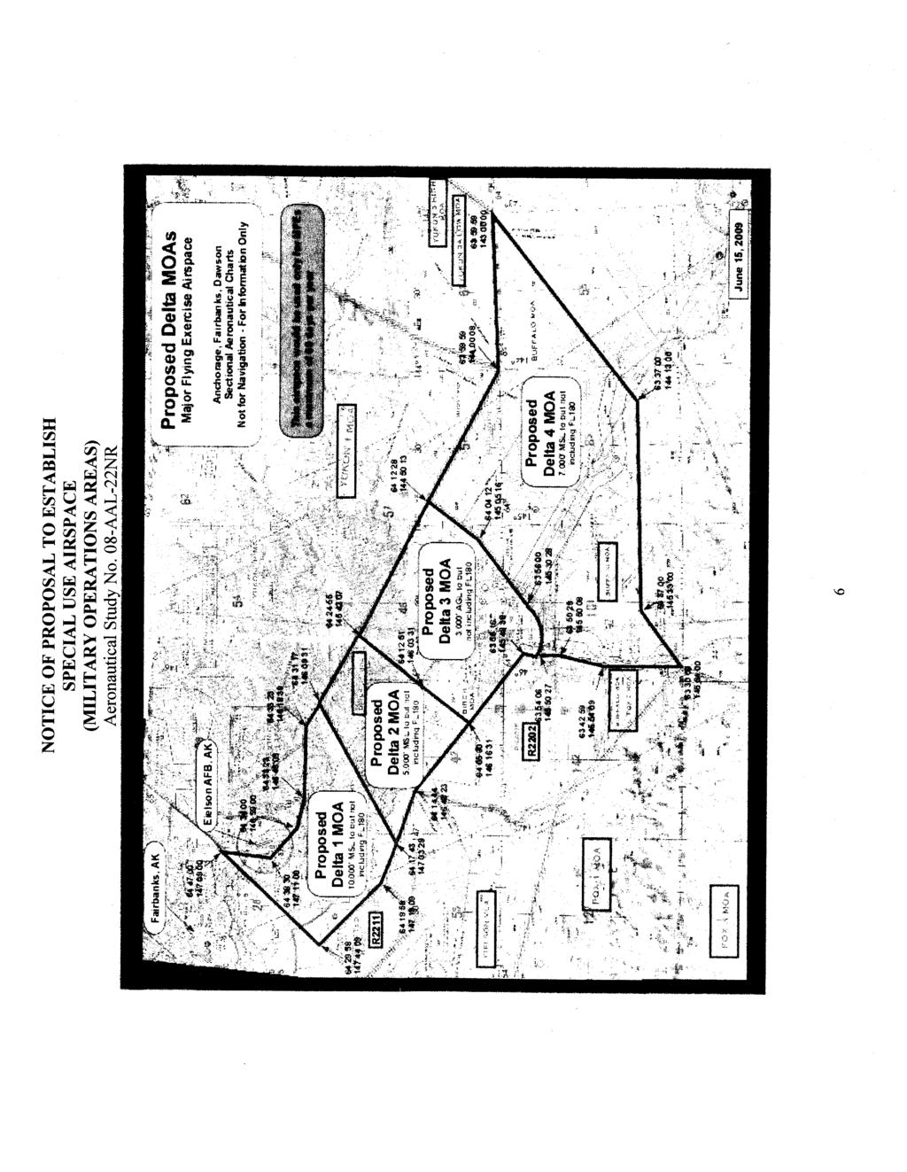
395
396 Comment of FAA Aeronautical Study 2 A A R O N P L U M B I N G A N D H E A T I N G C O M P A N Y A P ROFESSIONAL M ECHANICAL C ONTRACTING FIRM. I NCORPORATED IN FAIRBANKS, ALASKA SINCE 1982 A LASKA C ONTRACTING L ICENSE # A P.O. B OX F AIRBANKS, AK (907) F AX: (907) E MAIL: jimgibertoni@aaronak.com Tony Wylie, Manager Alaska Flight Services Information Area Group Federal Aviation Administration AAL W. 7 th Ave. #14 Anchorage, AK September 6, 2009 Re: Aeronautical Study No. 08-AAL-22NR, Proposed Delta MOA Dear Mr. Wylie: Points: I use my single engine aircraft for business, to manage construction projects across the state from my base in Fairbanks. These projects average $1m to 6m, and require timely travel between my facilities in Fairbanks, and the jobsite location, often at communities without road access, or too far to make travel by road the only form of access. I Use IFR for the protection and increased access it affords me to visit construction sites. During the construction season, it is essential I can have access to my work sites. The proposed MOA cuts IFR travel along V444 and other routes for up to five hours a day, during ten-day exercises. This is a very significant impact. There simply must be a corridor, or some mechanism to allow routine, non-emergency traffic to transit this corridor IFR. Suggesting that access is provided by the low-level VFR corridor through the MOAs is a safety issue. Forcing IFR capable aircraft to use these corridors to get though to meet business schedules is not a good idea. In fact this is the reason FAA invented the T-ROUTE system, so this did not happen! I support military training, and have participated in it personally through the Civil Air Patrol. I was an actually RED FLAGG Pilot in the last RED FLAGG in August of More then most involve, I really got a first hand picture of how and why the Air Force has this need. With that said you need to walk a mile in my moccasins now, like I have walk a mile in the Air Forces moccasins (Being a past RED Flag pilot). In the last three months, I just completed a project with my firm in a remote village of Kaltag which involved no less then 22 round trips over a 90 day period, via aircraft along that route during mid June till September 1 st. That was about 117 hours flown just for the one project 67 of those hours were IFR. I have numerous project beside this one! A A R O N P L U M B I N G A N D H E A T I N G C O M P A N Y 2143 S T A N D A R D A V E. F A I R B A N K S, AK 99701
397 Comment of FAA Aeronautical Study 2 On Friday August 21 st at 5pm 2009 my firm completed this project to the point of substantial completion. School started on Monday the 24 th. The liquidated Damages if my firm was late was $2, per day for every day. This was a $1.8m contract for three months. My point is had this project been on the other side of this proposed Delta MOA and I got shut down, do you have any idea what the ramification would have been to my firm with the kind of impact? Mr. Wylie, understand, this letter is very very hard for me to write. My son in law, is a US Air Force JTAC. His job in the Air Force is to be on the ground, with US Army Special Forces, in the bad zone so to speak. He the guy with the special box that ultimately puts the bomb where it needs to go so to speak. He spent six years at Eielson training in this very area just for that reason. Today he is in Afghanistan, Believe me I get the big picture!, I know what is at stake here more then most both form actually being a pilot in Red Flagg and from my son in law. What we have here, is two sides not willing to bend. To me the final solution is very clear! Pull out a sectional for Phoenix, Arizona. Directly over the city, the international airport and five other airports and military bases is a corridor, for both VFR and IFR traffic both ways. Been there for twenty years, works perfect. I realize there is 1,789 reasons why this cannot be done, however you and I know there is one reason why it should be done. Finding a structure for the proposed MOAs that provides access for civil traffic, while allowing military training is essential. If you have any questions please do not hesitate to call me directly on my cell Sincerely, James E Gibertoni General Manager C:\Documents and Settings\Jim Gibertoni\My Documents\gibertoni draft DELTA MOA Letter revised.doc 2
398 Comment of FAA Aeronautical Study 3 Robert P. Bursiel, President Wright Air Service, Inc. PO Box Fairbanks, Alaska Tony Wylie, Manager Alaska Flight Services Information Area Group Federal Aviation Administration AAL W. 7 th Ave. #14 Anchorage, AK Re: Aeronautical Study No. 08-AAL-22NR, Proposed Delta MOA Dear Mr. Wylie: September 1, 2009 Wright Air Service, Inc. is a commuter airline and charter business located in Fairbanks, Alaska. Wright Air Service opposes the establishment of the Delta Military Operations Areas as defined in this proposal. The nature of our business requires that we be able to access any portion of the state in a timely manner. Wright Air Service objects to the loss of Instrument Flight Rule (IFR) access through this area. The proposal eliminates ready access to points east (Northway and Canada) and southeast of Fairbanks (Glennallen and Valdez). The Alaska Range and the lack of suitable VFR or IFR alternates make limiting access to IFR services unrealistic and options risky. This summer, Wright Air Service supported fire suppression efforts southeast of Glennallen. At times, the only access to this area was through Talkeetna then east to Glennallen, a much longer route. Access through the Delta TMOA would have cost the taxpayer less, provided prompt fire suppression support and perhaps lessened the impact of dense smoke on the Alaskan public. Wright Air Service supports military training in Alaska and recognizes the benefits this state provides to the military. However, Wright Air Service believes that this training and associated MOAs need to be conducted in other areas of the state not located in the middle of the population corridors. The Air Taxi/Charter business depends on timely access along key transportation routes. Restricting this by creating a permanent Delta MOA eliminates one of the principal elements of our business. Consequently, Wright Air Service objects to the establishment of a permanent Delta MOA. Sincerely, David C. Matthews, Director of Safety; For Robert P. Bursiel
 495-6708 Tony Wylie, Manager Alaska Flight Services Information Area Group FAA, AAL-530 222 W. 7th Ave. #14 Anchorage, AK 99513-7687 RE: Aeronautical Study No. 08-AAL-22NR.")
399 Comment of FAA Aeronautical Study 4 Alaska Airports Association P.O. Box Anchorage,AJC (907) Tony Wylie, Manager Alaska Flight Services Information Area Group FAA, AAL W. 7th Ave. #14 Anchorage, AK RE: Aeronautical Study No. 08-AAL-22NR. Proposed Delta MOA Dear Mr. Wylie: The purpose of this letter is to provide comments regarding the proposed Delta Military Operations Area. The goal of the Alaska Airports Association (AkAA) is to enhance and promote the operations and management of public and private airports in the State of Alaska. Our membership includes airport professionals associated with public and private airports, pilots, air carriers and more. Representatives of AkAA have attended presentations regarding the proposed Delta Military Operations Area. The Alaska Airports Association supports military training exercises in Alaska, but urges the economic consequences related to aviation uses be considered before making a fmal decision regarding the Military Operations Areas in Delta as presented. The proposed Delta Military Operations Area will impact IFR Airways which may have future impacts to Airport development and ultimately commerce in the region. Public Airports operate off revenues earned from leasing, landing fees, fuel sales and others. Restricting the use of IFR Airways may impact the viability of air carriers and general aviation which could adversely impact the operation of public airports between Fairbanks and Delta and Northway areas. As the potential for an Alaska natural gas line continues to grow, future mining operations in the region expand; airports serve a critical need in supporting the economic vitality of the region while providing efficient use of the transportation resources available in this limited access area. Should you have questions please call me at

400 Comment of FAA Aeronautical Study 5

401 Comment of FAA Aeronautical Study 5
Powder River Training Complex Commonly Asked Questions September 15, 2010
 Powder River Training Complex Commonly Asked Questions September 15, 2010 QUESTION: Why is this expansion needed? Answer: Realistic and effective training. Twenty years ago, enemy surface-to-air threats
DEPARTMENT OF TRANSPORTATION FEDERAL AVIATION ADMINISTRATION ADOPTION OF ENVIRONMENTAL IMPACT STATEMENT AND FAA RECORD OF DECISION FOR
 DEPARTMENT OF TRANSPORTATION FEDERAL AVIATION ADMINISTRATION ADOPTION OF ENVIRONMENTAL IMPACT STATEMENT AND FAA RECORD OF DECISION FOR Establishment of the Powder River Training Complex Located in Montana,
What Is The Proposed 29Palms Training Land Acquisition and Airspace Establishment Project? Frequently Asked Questions Airspace Related June 2014
 MARINE CORPS / DEPARTMENT OF THE NAVY SUBMIT SPECIAL USE AIRSPACE PROPOSALS TO THE FEDERAL AVIATION ADMINISTRATION TO MEET MARINE EXPEDITIONARY BRIGADE TRAINING REQUIREMENTS 1. Why has the Marine Corps
What Is The 29Palms Training Land Acquisition and Airspace Establishment Project Frequently Asked Questions Airspace Related July 2015
 MARINE CORPS / DEPARTMENT OF THE NAVY SUBMIT SPECIAL USE AIRSPACE PROPOSALS TO THE FEDERAL AVIATION ADMINISTRATION TO MEET MARINE EXPEDITIONARY BRIGADE TRAINING REQUIREMENTS 1. Why has the Marine Corps
FINAL SUPPLEMENTAL ENVIRONMENTAL ASSESSMENT (SEA) FOR MODIFICATION OF AIRSPACE UNITS R-3008A/B/C FROM VISUAL FLIGHT RULES (VFR) TO VFR-INSTRUMENT
 FOR MODIFICATION OF AIRSPACE UNITS R-3008A/B/C FROM VISUAL FLIGHT RULES (VFR) TO VFR-INSTRUMENT") FINAL SUPPLEMENTAL ENVIRONMENTAL ASSESSMENT (SEA) FOR MODIFICATION OF AIRSPACE UNITS R-3008A/B/C FROM VISUAL FLIGHT RULES (VFR) TO VFR-INSTRUMENT FLIGHT RULES (IFR) AT MOODY AIR FORCE BASE, GEORGIA FINAL
FINAL SUPPLEMENTAL ENVIRONMENTAL ASSESSMENT (SEA) FOR MODIFICATION OF AIRSPACE UNITS R-3008A/B/C FROM VISUAL FLIGHT RULES (VFR) TO VFR-INSTRUMENT FLIGHT RULES (IFR) AT MOODY AIR FORCE BASE, GEORGIA FINAL
DRAFT ENVIRONMENTAL ASSESSMENT FOR THE CREATION OF RESTRICTED AREA (RA) R-5601G AND R-5601H FORT SILL, OKLAHOMA
 R-5601G AND R-5601H FORT SILL, OKLAHOMA") DRAFT ENVIRONMENTAL ASSESSMENT FOR THE CREATION OF RESTRICTED AREA (RA) R-5601G AND R-5601H FORT SILL, OKLAHOMA Prepared by: Leidos Engineering, LLC Prepared for: U.S. Army Corps of Engineers, Tulsa District
DRAFT ENVIRONMENTAL ASSESSMENT FOR THE CREATION OF RESTRICTED AREA (RA) R-5601G AND R-5601H FORT SILL, OKLAHOMA Prepared by: Leidos Engineering, LLC Prepared for: U.S. Army Corps of Engineers, Tulsa District
Proposed Establishment of and Modification to Restricted Areas; Fort Sill, OK
 This document is scheduled to be published in the Federal Register on 10/19/2015 and available online at http://federalregister.gov/a/2015-26499, and on FDsys.gov 4910-13 DEPARTMENT OF TRANSPORTATION Federal
Airspace Establishment Project Frequently Asked Questions Permanent SUA and Environmental Assessment March 2019
 OVERVIEW OF PERMANENT SPECIAL USE AIRSPACE ESTABLISHMENT AND MODIFICATIONS AT MARINE AIR GROUND TASK FORCE TRAINING COMMAND, TWENTYNINE PALMS, CA 1. What is Special Use Airspace (SUA)? Special Use Airspace
Environmental Assessment for Lowering Base Altitude of Military Operations Areas. Vance Air Force Base
 Environmental Assessment for Lowering Base Altitude of Military Operations Areas Vance Air Force Base United States Air Force Air Education and Training Command 71st Flying Training Wing Report Documentation
June 2009 BOI DOC 3-1
 Draft Environmental Assessment for Proposed Airspace Changes for Paradise East and Paradise West Military Operations Areas (MOAs) at Mountain Home Air Force Base (MHAFB) Idaho June 2009 BOI070850106.DOC
Powder River Training Complex Ellsworth Air Force Base, South Dakota Environmental Impact Statement
 Powder River Training Complex Environmental Impact Statement Powder River Training Complex Ellsworth Air Force Base, South Dakota Environmental Impact Statement August 2010 This volume contains the printed
4.2 AIRSPACE. 4.2 Airspace. Supplemental Draft Environmental Impact Statement August 2008 Military Training Activities at Mākua Military Reservation
 4.2 AIRSPACE 4.2.1 Impact Methodology Impacts on airspace use were assessed by evaluating the potential effects of the proposed training activities on the principal attributes of airspace use, as described
APPENDIX D MSP Airfield Simulation Analysis
 APPENDIX D MSP Airfield Simulation Analysis This page is left intentionally blank. MSP Airfield Simulation Analysis Technical Report Prepared by: HNTB November 2011 2020 Improvements Environmental Assessment/
Effective Altitude. R-3103 To 30,000 (To 9,144 meters) Source: NACO 2002 Notes: 1 By NOTAM issued 12 hours in advance
 Source: NACO 2002 Notes: 1 By NOTAM issued 12 hours in advance") 8.4 AIRSPACE USE 8.4.1 Affected Environment The affected airspace environment is described below in terms of its principal attributes, namely controlled and uncontrolled airspace, special use airspace,
8.4 AIRSPACE USE 8.4.1 Affected Environment The affected airspace environment is described below in terms of its principal attributes, namely controlled and uncontrolled airspace, special use airspace,
DRAFT. Environmental Assessment for Establishment of the Grayling Temporary Military Operations Area (MOA)
") DRAFT Environmental Assessment for Establishment of the Grayling Temporary Military Operations Area (MOA) Michigan Air National Guard Alpena Readiness Training Center Alpena, Michigan 6 November 2018 Guarding
DRAFT Environmental Assessment for Establishment of the Grayling Temporary Military Operations Area (MOA) Michigan Air National Guard Alpena Readiness Training Center Alpena, Michigan 6 November 2018 Guarding
Replacement of F-15 Aircraft with F-22A Aircraft Hickam Air Force Base, Hawaii Environmental Assessment
 Replacement of F-15 Aircraft with F-22A Aircraft Hickam Air Force Base, Hawaii Environmental Assessment September 2007 Report Documentation Page Form Approved OMB No. 0704-0188 Public reporting burden
R-2508 COMPLEX R-2515 SFC TO UNLIMITED
 R-2508 COMPLEX R-2515 SFC TO UNLIMITED R-2515 Info available online @... http://www.edwards.af.mil/home/r-2515-airspace R-2515 Airspace Brief EAFBI 13-100 PPR Requests SPORT Pre-Brief Sheet EAFB Wx R-2508
APPENDIX F AIRSPACE INFORMATION
 APPENDIX F AIRSPACE INFORMATION Airspace Use DEFINITION OF AIRSPACE Airspace, or that space which lies above a nation and comes under its jurisdiction, is generally viewed as being unlimited. However,
Public Comment on Condor MOA Proposal
 Public Comment on Condor MOA Proposal Michael Wells, Lt. Colonel (retired) P.O. Box 274 Wilton, ME 04294 20 November, 2009 1. As a retired Air Force Lt. Colonel, squadron commander, F-15 Instructor Pilot,
Amendment of Restricted Areas R-2907A and R-2907B, Lake George, FL; and R-2910, Pinecastle, FL
 This document is scheduled to be published in the Federal Register on 07/03/2013 and available online at http://federalregister.gov/a/2013-16054, and on FDsys.gov 4910-13 DEPARTMENT OF TRANSPORTATION Federal
4.6 AIRSPACE. Approach to Analysis
 4.6 AIRSPACE Section 4.6 describes the impacts that could potentially occur to the existing airspace environment from the proposed action. Potential impacts would stem from the establishment of new Special
Class B Airspace. Description
 Class B Airspace Ref. AIM 3-2-3 and FAR 91.131 Surrounds certain large airports Within each Class B airspace area, there are multiple segments with different ceiling/floor altitudes. Example: 70/30 = ceiling
FLASHCARDS AIRSPACE. Courtesy of the Air Safety Institute, a Division of the AOPA Foundation, and made possible by AOPA Holdings Company.
 AIRSPACE FLASHCARDS Courtesy of the Air Safety Institute, a Division of the AOPA Foundation, and made possible by AOPA Holdings Company. The Air Safety Institute is dedicated to making flying easier and
129 th RQW/SE P.O. Box 103, MS#1 Moffett Federal Airfield, CA
 MID-AIR COLLISION AVOIDANCE (MACA) HANDBOOK 129 th RQW/SE P.O. Box 103, MS#1 Moffett Federal Airfield, CA 94035-0103 129TH RESCUE WING MOFFETT FEDERAL AIRFIELD, CA 1 NOV 2013 TABLE OF CONTENTS FLYING SAFETY
Report to Congress: Improving General Aviation Security
 Report to Congress: Improving General Aviation Security December 2001 Report of the Secretary of Transportation to the United States Congress Pursuant to Section 132 (b) of the Aviation and Transportation
TO: Air Traffic Control System Command Center (ATCSCC) DATE: May 10, FROM: Paul McEwen, Traffic Management Officer, Anchorage ARTCC
 DATE: May 10, FROM: Paul McEwen, Traffic Management Officer, Anchorage ARTCC") Memorandum Federal Aviation Administration TO: Air Traffic Control System Command Center (ATCSCC) DATE: May 10, 2017 FROM: Paul McEwen, Traffic Management Officer, Anchorage ARTCC SUBJECT: System Impact
Memorandum Federal Aviation Administration TO: Air Traffic Control System Command Center (ATCSCC) DATE: May 10, 2017 FROM: Paul McEwen, Traffic Management Officer, Anchorage ARTCC SUBJECT: System Impact
Class Alpha. In addition, if you fly above FL240 your aircraft must have DME or a suitable RNAV system.
 Go For It Class Alpha Class A airspace is from 18,000 feet MSL to Flight Level 600 (60,000 feet pressure altitude). Its lateral extent includes the contiguous U.S. and Alaska, and extends 12 nm from the
Airspace. Chapter 14. Gold Seal Online Ground School. Introduction
 Gold Seal Online Ground School www.onlinegroundschool.com Chapter 14 Airspace Introduction The two categories of airspace are: regulatory and nonregulatory. Within these two categories there are four types:
FREQUENTLY ASKED QUESTIONS. Modification of the Cheyenne Low and High military operations areas. in eastern Colorado and western Kansas
 FREQUENTLY ASKED QUESTIONS Modification of the Cheyenne Low and High military operations areas in eastern Colorado and western Kansas NATIONAL ENVIRONMENTAL POLICY ACT QUESTIONS Q: What is an environmental
Pope Field, NC MID-AIR COLLISION AVOIDANCE
 Pope Field, NC MID-AIR COLLISION AVOIDANCE 2017 43 rd Air Mobility Operations Group Flight Safety, Pope Field, NC Tel: (910)394-8383/ 8389 Fax: (910)394-8098 E-mail:43AMOGW.SE1@US.AF.MIL The potential
Environmental Assessment
 Final Environmental Assessment Volume I Addressing the Establishment of Urban Close Air Support (CAS) Air and Ground Training Spaces near Mountain Home Air Force Base, Idaho November 2018 PRIVACY ADVISORY
Acronyms and Abbreviations
 Acronyms and Abbreviations 28 CES 28th Civil Engineering Squadron 28 BW 28th Bomb Wing 28 BW/PA 28th Bomb Wing/Public Affairs 28 OG 28th Operations Group 28 OSS 28th Operations Support Squadron A3 Training
Appendix B Ultimate Airport Capacity and Delay Simulation Modeling Analysis
 Appendix B ULTIMATE AIRPORT CAPACITY & DELAY SIMULATION MODELING ANALYSIS B TABLE OF CONTENTS EXHIBITS TABLES B.1 Introduction... 1 B.2 Simulation Modeling Assumption and Methodology... 4 B.2.1 Runway
FINAL ENVIRONMENTAL ASSESSMENT FOR QSEU LOWER PATTERN ALTITUDE AT MOODY AIR FORCE BASE, GEORGIA
 FINAL ENVIRONMENTAL ASSESSMENT FOR QSEU116038 LOWER PATTERN ALTITUDE AT MOODY AIR FORCE BASE, GEORGIA April 2012 Report Documentation Page Form Approved OMB No. 0704-0188 Public reporting burden for the
APPENDIX I AIRSPACE TECHNICAL MEMO
 APPENDIX I AIRSPACE TECHNICAL MEMO Table of Contents 1.0 INTRODUCTION... 1 1.1 AIRSPACE REGULATORY FRAMEWORK... 7 1.2 RESOURCE DEFINITION... 7 1.3 DESCRIPTION OF PROPOSED SPECIAL USE AIRSPACE AND TRAINING
USE OF RADAR IN THE APPROACH CONTROL SERVICE
 USE OF RADAR IN THE APPROACH CONTROL SERVICE 1. Introduction The indications presented on the ATS surveillance system named radar may be used to perform the aerodrome, approach and en-route control service:
The purpose of this Demand/Capacity. The airfield configuration for SPG. Methods for determining airport AIRPORT DEMAND CAPACITY. Runway Configuration
 Chapter 4 Page 65 AIRPORT DEMAND CAPACITY The purpose of this Demand/Capacity Analysis is to examine the capability of the Albert Whitted Airport (SPG) to meet the needs of its users. In doing so, this
R-2515 R-2508 COMPLEX
 R-2515 R-2508 COMPLEX Edwards AFB PPR Briefing Edwards AFB and Edwards Class D Surface Area lie within Restricted Area 2515: R-2515 and Edwards Class D Surface Area contain many flight hazards for aircrews
DRAFT ENVIRONMENTAL ASSESSMENT FOR THE MODIFICATION OF SPECIAL USE AIRSPACE FORT BLISS, TEXAS AND NEW MEXICO
 DRAFT ENVIRONMENTAL ASSESSMENT FOR THE MODIFICATION OF SPECIAL USE AIRSPACE FORT BLISS, TEXAS AND NEW MEXICO Prepared for: FORT BLISS Prepared by: Directorate of Public Works Environmental Division, Fort
FLIGHT ADVISORY WASHINGTON D.C. SPECIAL FLIGHT RULES AREA LEESBURG MANUVERING AREA
 FLIGHT ADVISORY WASHINGTON D.C. SPECIAL FLIGHT RULES AREA LEESBURG MANUVERING AREA EFFECTIVE October 11, 201609 0400 This Notice does not supersede restrictions pertaining to the use of airspace contained
3.11 Transportation & Circulation
 3.11 Transportation & Circulation 3.11 TRANSPORTATION AND CIRCULATION 3.11.1 Affected Environment For purposes of this Environmental Impact Statement/Overseas Environmental Impact Statement (EIS/OEIS),
The NOTAM described will replace previously issued FDC NOTAMs 6/2550 and 7/7778 for the DC ADIZ/FRZ.
 This advisory covers published NOTAMs 7/0206 for the DC ADIZ, 7/0211 for the DC FRZ and FDC 7/0204 for the outer speed restriction. WARNING This document only contains an overview of the new rules for
Table 5-15 Special Use Airspace in the SBMR Airspace ROI
 5.4 AIRSPACE 5.4.1 Affected Environment The affected airspace environment is described below in terms of its principal attributes, namely controlled and uncontrolled airspace, special use airspace, military
Fresno Area Mid-Air Collision Avoidance Program (MACA) California Air National Guard 144 th Fighter Wing, Fresno, CA
 California Air National Guard 144 th Fighter Wing, Fresno, CA") Fresno Area Mid-Air Collision Avoidance Program (MACA) California Air National Guard 144 th Fighter Wing, Fresno, CA As of March 2013 Mid-Air Collision Avoidance This briefing contains material that can
Fresno Area Mid-Air Collision Avoidance Program (MACA) California Air National Guard 144 th Fighter Wing, Fresno, CA As of March 2013 Mid-Air Collision Avoidance This briefing contains material that can
DO NOT BEGIN THIS WORK UNTIL YOU HAVE COMPLETED ALL REQUIRED ASSIGNED READING AND EXERCISES.
 DO NOT BEGIN THIS WORK UNTIL YOU HAVE COMPLETED ALL REQUIRED ASSIGNED READING AND EXERCISES. Gardner Textbook Review Questions to prepare for Class #12 Answer these on notebook paper (or a text file) then
UNITED STATES OF AMERICA FEDERAL AVIATION ADMINISTRATION WASHINGTON D.C. GRANT OF EXEMPTION
 In the matter of the petition of the DEPARTMENT OF DEFENSE UNITED STATES OF AMERICA FEDERAL AVIATION ADMINISTRATION WASHINGTON D.C. Exemption No. 5100B For an exemption from the provisions 25863 Of sections
Department of Defense DIRECTIVE
 Department of Defense DIRECTIVE NUMBER 5030.61 May 24, 2013 Incorporating Change 2, August 24, 2017 USD(AT&L) SUBJECT: DoD Airworthiness Policy References: See Enclosure 1 1. PURPOSE. This directive establishes
Civil/Military Coordination Workshop Havana, Cuba April 2015
 Civil/Military Coordination Workshop Havana, Cuba 13-17 April 2015 Civil/Military Coordination in the United States based on Appendix A of ICAO Circular 330 Dave Edwards, U.S. Coast Guard Chairman, ICAO/International
April 5, Dear Mr. Ready,
 50 F St. NW, Suite 750 Washington, D.C. 20001 T. 202-737-7950 F. 202-273-7951 www.aopa.org Mr. Kenneth Ready U.S. Department of Transportation Docket Operations 1200 New Jersey Avenue SE. West Building
PLAN Anoka County - Blaine Airport
 Reliever Airports: NOISE ABATEMENT PLAN Anoka County - Blaine Airport INTRODUCTION The noise abatement plan for the Anoka County-Blaine Airport was prepared in recognition of the need to make the airport
COMPLIANCE WITH THIS PUBLICATION IS MANDATORY
 BY ORDER OF THE COMMANDER 30TH SPACE WING 30TH SPACE WING INSTRUCTION 13-205 2 OCTOBER 2006 Certified Current 18 September 2017 Space Missile Command and Control RESTRICTED AREA/DANGER ZONE ENTRY ACCESSIBILITY:
CATCODE ] CATCODE
![CATCODE ] CATCODE](/thumbs/82/85644630.jpg "CATCODE ] CATCODE") Runways. FAC: 1111 CATCODE: 111111 OPR: AFCEC/COS OCR: AF/A3O-A 1.1. Description. The runway is the paved surface provided for normal aircraft landings and take offs. Runways are classified as either Class
Runways. FAC: 1111 CATCODE: 111111 OPR: AFCEC/COS OCR: AF/A3O-A 1.1. Description. The runway is the paved surface provided for normal aircraft landings and take offs. Runways are classified as either Class
STAFF REPORT. Airport Land Use Consistency Determination Betteravia Plaza. MEETING DATE: January 21, 2016 AGENDA ITEM: 8D
 STAFF REPORT SUBJECT: Airport Land Use Consistency Determination Betteravia Plaza MEETING DATE: AGENDA ITEM: 8D STAFF CONTACT: Andrew Orfila RECOMMENDATION: Adopt findings for the Betteravia Plaza project
AO-1 Aircraft Operations Analytical Approach
 AO-1 Aircraft Operations Analytical Approach APPENDIX AO-1 AIRCRAFT OPERATIONS Training activities involving aircraft operations by F-15Cs and F-22s form a focus of this Draft Environmental Impact Statement
UNMANNED AIRCRAFT PROVISIONS IN FAA REAUTHORIZATION BILL
 UNMANNED AIRCRAFT PROVISIONS IN FAA REAUTHORIZATION BILL Section 341 Comprehensive Plan -Codifies in title 49 the requirement in the 2012 FAA reauthorization Act that a comprehensive plan to safely accelerate
FUTENMA REPLACEMENT FACILITY BILATERAL EXPERTS STUDY GROUP REPORT. August 31, 2010
 FUTENMA REPLACEMENT FACILITY BILATERAL EXPERTS STUDY GROUP REPORT August 31, 2010 MANDATE AND SCOPE OF WORK: In order to achieve the earliest possible relocation of Marine Corps Air Station Futenma, the
According to FAA Advisory Circular 150/5060-5, Airport Capacity and Delay, the elements that affect airfield capacity include:
 4.1 INTRODUCTION The previous chapters have described the existing facilities and provided planning guidelines as well as a forecast of demand for aviation activity at North Perry Airport. The demand/capacity
ex) & Comple nce Avoidan 1 August 2010
 & Comple nce Avoidan 1 August 2010") 23 rd Wing, Detachment 1 MacDilll Air Force Base (Deployed Fighter Unit Comple ex) & Avon Park Air Force Range (Restricted Area R-2901) Mid-Air Collision Avoidan nce ( M.A.C. A.) 1 August 2010 Purpose
23 rd Wing, Detachment 1 MacDilll Air Force Base (Deployed Fighter Unit Comple ex) & Avon Park Air Force Range (Restricted Area R-2901) Mid-Air Collision Avoidan nce ( M.A.C. A.) 1 August 2010 Purpose
March 2016 Safety Meeting
 March 2016 Safety Meeting AC 61 98C Subject: Currency Requirements and Guidance for the Flight Review and Instrument Proficiency Check Date: 11/20/15 AC No: 61-98C Initiated by: AFS-800 Supercedes: AC
STAFF REPORT. Airport Land Use Plan Consistency Review: Old Town Village Mixed Use Project City of Goleta. MEETING DATE: June 18, 2015 AGENDA ITEM: 5M
 STAFF REPORT SUBJECT: Airport Land Use Plan Consistency Review: Old Town Village Mixed Use Project City of Goleta MEETING DATE: AGENDA ITEM: 5M STAFF CONTACT: Peter Imhof, Andrew Orfila RECOMMENDATION:
Washington Dulles International Airport (IAD) Aircraft Noise Contour Map Update
 Aircraft Noise Contour Map Update") Washington Dulles International Airport (IAD) Aircraft Noise Contour Map Update Ultimate ASV, Runway Use and Flight Tracks 4th Working Group Briefing 8/13/18 Meeting Purpose Discuss Public Workshop input
Washington Dulles International Airport (IAD) Aircraft Noise Contour Map Update Ultimate ASV, Runway Use and Flight Tracks 4th Working Group Briefing 8/13/18 Meeting Purpose Discuss Public Workshop input
1.0 Project Background Mission Statement and Goals Objectives of this Sustainable Master Plan
 TABLE OF CONTENTS CHAPTER 1 INTRODUCTION 10 Project Background 1-1 11 Mission Statement and Goals 1-1 12 Objectives of this Sustainable Master Plan 1-2 CHAPTER 2 INVENTORY 20 Airport Background 2-1 201
Appendix D List of Acronyms & Glossary of Terms
 Appendix D List of Acronyms & Glossary of Terms Acronyms A AAD ACCRI ACEC AEE AGL ALP APE ARTCC ASR ATADS ATC ATCT ATO Average Annual Day Aviation Climate Change Research Initiative Area of Critical Environmental
HOUSTON AIR ROUTE TRAFFIC CONTROL CENTER VATSIM United States Division. Letter of Agreement. Revised: July 25, 2004 Effective: July 25, 2004
 HOUSTON AIR ROUTE TRAFFIC CONTROL CENTER VATSIM United States Division Letter of Agreement Revised: July 25, 2004 Effective: July 25, 2004 Purpose Scope This Letter of Agreement (LOA) establishes operating
UNITED STATES OF AMERICA FEDERAL AVIATION ADMINISTRATION WASHINGTON D.C. GRANT OF EXEMPTION
 In the matter of the petition of the DEPARTMENT OF DEFENSE UNITED STATES OF AMERICA FEDERAL AVIATION ADMINISTRATION WASHINGTON D.C. Exemption No. 5100C For an exemption from the provisions 25863 Of sections
Analysis of Operational Impacts of Continuous Descent Arrivals (CDA) using runwaysimulator
 using runwaysimulator") Analysis of Operational Impacts of Continuous Descent Arrivals (CDA) using runwaysimulator Camille Shiotsuki Dr. Gene C. Lin Ed Hahn December 5, 2007 Outline Background Objective and Scope Study Approach
Analysis of Operational Impacts of Continuous Descent Arrivals (CDA) using runwaysimulator Camille Shiotsuki Dr. Gene C. Lin Ed Hahn December 5, 2007 Outline Background Objective and Scope Study Approach
FAA FORM UAS COA Attachment FAA
 Page 1 of 6 DEPARTMENT OF TRANSPORTATION FEDERAL AVIATION ADMINISTRATION CERTIFICATE OF WAIVER OR AUTHORIZATION ISSUED TO Xcam Aerials, Inc. 10197 SE 144th Place Summerfield, FL 34491 This certificate
Reliever Airports: NOISE ABATEMENT PLAN Flying Cloud Airport (FCM)
") Reliever Airports: NOISE ABATEMENT PLAN Flying Cloud Airport (FCM) INTRODUCTION The Noise Abatement Plan (FCM Plan) for the Flying Cloud Airport has been prepared in recognition of the need to make the
Reliever Airports: NOISE ABATEMENT PLAN Flying Cloud Airport (FCM) INTRODUCTION The Noise Abatement Plan (FCM Plan) for the Flying Cloud Airport has been prepared in recognition of the need to make the
Appendix K: MSP Class B Airspace
 Appendix K: MSP Class B Airspace K All of the open sky covering the United States, from less than an inch off the ground all the way to outer space, is part of America s airspace. This airspace resource
Amendment of Restricted Areas R-3004A and R-3004B and Establishment of R-3004C;
 This document is scheduled to be published in the Federal Register on 09/25/2017 and available online at https://federalregister.gov/d/2017-20435, and on FDsys.gov 4910-13 DEPARTMENT OF TRANSPORTATION
** DETERMINATION OF NO HAZARD TO AIR NAVIGATION **
 Mail Processing Center Federal Aviation Administration Southwest Regional Office Obstruction Evaluation Group 2601 Meacham Boulevard Fort Worth, TX 76137 Issued Date: 05/16/2011 Aeronautical Study No.
VIRTUAL UNITED STATES NAVY (VUSN) AND MIAMI CENTER (ZMA) LETTER OF AGREEMENT Effective: 06 JAN 2004
 AND MIAMI CENTER (ZMA) LETTER OF AGREEMENT Effective: 06 JAN 2004") VIRTUAL UNITED STATES NAVY (VUSN) AND MIAMI CENTER (ZMA) LETTER OF AGREEMENT Effective: 06 JAN 2004 SUBJECT: VUSN SPECIAL USE AIRSPACE OPERATIONS 1. PURPOSE: This Letter of Agreement (LOA) outlines standard
VIRTUAL UNITED STATES NAVY (VUSN) AND MIAMI CENTER (ZMA) LETTER OF AGREEMENT Effective: 06 JAN 2004 SUBJECT: VUSN SPECIAL USE AIRSPACE OPERATIONS 1. PURPOSE: This Letter of Agreement (LOA) outlines standard
SECTION 6 - SEPARATION STANDARDS
 SECTION 6 - SEPARATION STANDARDS CHAPTER 1 - PROVISION OF STANDARD SEPARATION 1.1 Standard vertical or horizontal separation shall be provided between: a) All flights in Class A airspace. b) IFR flights
MEMORANDUM FOR ALASKA AVIATORS 21 Apr 2016
 21 April 2016 MEMORANDUM FOR ALASKA AVIATORS 21 Apr 2016 FROM: 354 FW/SEF 354 Broadway Ave Unit 14A Eielson AFB AK 99702-1899 SUBJECT: Military Flying in Interior Alaska 1. This pamphlet is offered to
CHAPTER 2 AIRCRAFT INFORMATION SUMMARY TABLE OF CONTENTS
 CHAPTER 2 AIRCRAFT INFORMATION SUMMARY TABLE OF CONTENTS General...2 Kinds of Operations...2 Structural and weight limitations...2 Maneuvering limitations...3 Flight load factor limitations...3 Power plant
TAKEOFF SAFETY ISSUE 2-11/2001. Flight Operations Support & Line Assistance
 TAKEOFF SAFETY T R A I N I N G A I D ISSUE 2-11/2001 Flight Operations Support & Line Assistance Flight Operations Support & Line Assistance Introduction The purpose of this brochure is to provide the
Airports and UAS: Integrating UAS into Airport Infrastructure and Planning
 ACRP Problem Statement 17-03-09 Recommended Allocation: $500,000 Airports and UAS: Integrating UAS into Airport Infrastructure and Planning ACRP Staff Comments This is one of four UAS-themed problem statements
NATIONAL BUSINESS AVIATION ASSOCIATION (NBAA) CONVENTION
 CONVENTION") NATIONAL BUSINESS AVIATION ASSOCIATION (NBAA) CONVENTION LAS VEGAS, October 10 12, 2017 In anticipation of a large number of aircraft operating to and from the Las Vegas area in conjunction with the 2017
NATIONAL BUSINESS AVIATION ASSOCIATION (NBAA) CONVENTION LAS VEGAS, October 10 12, 2017 In anticipation of a large number of aircraft operating to and from the Las Vegas area in conjunction with the 2017
MESA COUNTY DEPARTMENT OF PUBLIC WORKS Administration - Building - Engineering Road and Bridge Traffic - Planning - Solid Waste Management
 MESA COUNTY DEPARTMENT OF PUBLIC WORKS Administration - Building - Engineering Road and Bridge Traffic - Planning - Solid Waste Management 200 S. Spruce St. P.O. Box 20,000 Grand Junction, Colorado 81502-5022
Proposed Changes to Inverness Airport s Airspace The Introduction of Controlled Airspace and Optimisation of Instrument Flight Procedures
 Proposed Changes to Inverness Airport s Airspace The Introduction of Controlled Airspace and Optimisation of Instrument Flight Procedures What is an Airspace Change Proposal? It is a formal UK Civil Aviation
2.0 DESCRIPTION OF THE PROPOSED ACTION AND ALTERNATIVES
 February 2016 F-35A Pacific Operational Beddown Final EIS 2.0 DESCRIPTION OF THE PROPOSED ACTION AND ALTERNATIVES This chapter rigorously explores and objectively evaluates all reasonable alternatives.
DECISION MEMO. Rawhide Trail #7073 Maintenance and Reconstruction
 Page 1 of 6 Background DECISION MEMO USDA Forest Service Jefferson Ranger District Jefferson County, Montana Rawhide Trail #7073 is located in the Elkhorn Mountain Range approximately 10 miles east of
NASA Low Boom Flight Demonstration (LBFD) Project Overview
 Project Overview") NASA Low Boom Flight Demonstration (LBFD) Project Overview Presented by Craig Nickol LBFD PM February 27, 2018 Aviation Noise & Emissions Symposium Long Beach, CA 1 Outline Why LBFD? Overview of NASA Role
NASA Low Boom Flight Demonstration (LBFD) Project Overview Presented by Craig Nickol LBFD PM February 27, 2018 Aviation Noise & Emissions Symposium Long Beach, CA 1 Outline Why LBFD? Overview of NASA Role
Municipal Drone Operations Ben Roper City of College Station
 Municipal Drone Operations Ben Roper City of College Station Unmanned Aerial System (UAS) aka Drone You are establishing an aviation unit for your entity What could possible go wrong? https://youtu.be/aolm1aqkews
Buchanan Field. Airport Planning Program. FAR Part 150 Meeting. September 28, Master Plan FAR Part 150 Noise Study Strategic Business Plan
 Airport Planning Program Master Plan FAR Part 150 ise Study Strategic Business Plan FAR Part 150 Meeting September 28, 2006 Agenda Introduction Part 150 Study Working Paper Two Operational Alternatives
COMPLIANCE WITH THIS PUBLICATION IS MANDATORY
 BY ORDER OF THE SECRETARY OF THE AIR FORCE AIR FORCE INSTRUCTION 11-201 30 NOVEMBER 2018 Flying Operations FLIGHT INFORMATION PUBLICATIONS COMPLIANCE WITH THIS PUBLICATION IS MANDATORY ACCESSIBILITY: Publications
a. Aeronautical charts DID THIS IN LESSON 2
 AIRMAN CERTIFICATION STANDARDS: REMOTE PILOT SMALL: You will know and be able to explain in writing or oral form the below tasks regarding AIRPORT OPERATIONS Task References Objective Task B. Airport Operations
Contents. Subpart A General 91.1 Purpose... 7
 Contents Rule objective... 3 Extent of consultation... 3 Summary of comments... 4 Examination of comments... 6 Insertion of Amendments... 6 Effective date of rule... 6 Availability of rules... 6 Part 91
INITIAL ENVIRONMENTAL REVIEW. Boston-Logan Runway 4 Left Area Navigation (RNAV) Visual Flight Procedure Test
 Visual Flight Procedure Test") INITIAL ENVIRONMENTAL REVIEW Boston-Logan Runway 4 Left Area Navigation (RNAV) Visual Flight Procedure Test FAA Order 7400.2 Appendix 5 (Modified) ======================================================================
INITIAL ENVIRONMENTAL REVIEW Boston-Logan Runway 4 Left Area Navigation (RNAV) Visual Flight Procedure Test FAA Order 7400.2 Appendix 5 (Modified) ======================================================================
FORT LAUDERDALE-HOLLYWOOD INTERNATIONAL AIRPORT ENVIRONMENTAL IMPACT STATEMENT DRAFT
 D.3 RUNWAY LENGTH ANALYSIS Appendix D Purpose and Need THIS PAGE INTENTIONALLY LEFT BLANK Appendix D Purpose and Need APPENDIX D.3 AIRFIELD GEOMETRIC REQUIREMENTS This information provided in this appendix
2012 Mat Su Valley Collision Avoidance Survey
 Table of Contents Table of Contents 1 INTRODUCTION Measurement Objectives 3 Methodology and Notes 4 Key Findings 5 PILOT LOCATION Activity in the Area 7 Pilot Location 8 Altitudes Flown 9 SAFETY IN THE
Chapter 2 Description of Proposed Action and Alternatives
 Chapter 2 Description of Proposed Action and Alternatives 2.0 Description of Proposed Action and Alternatives 2.1 Definitive Actions Evaluated in this EIS 2.0 DESCRIPTION OF PROPOSED ACTION AND ALTERNATIVES
MONTEREY REGIONAL AIRPORT MASTER PLAN TOPICAL QUESTIONS FROM THE PLANNING ADVISORY COMMITTEE AND TOPICAL RESPONSES
 MONTEREY REGIONAL AIRPORT MASTER PLAN TOPICAL QUESTIONS FROM THE PLANNING ADVISORY COMMITTEE AND TOPICAL RESPONSES Recurring topics emerged in some of the comments and questions raised by members of the
1.1.3 Taxiways. Figure 1-15: Taxiway Data. DRAFT Inventory TYPICAL PAVEMENT CROSS-SECTION LIGHTING TYPE LENGTH (FEET) WIDTH (FEET) LIGHTING CONDITION
 WIDTH (FEET) LIGHTING CONDITION") 1.1.3 Taxiways EWN has an extensive network of taxiways and taxilanes connecting the terminal, air cargo, and general aviation areas with the runways as listed in Figure 1-15. A 50-foot wide parallel taxiway
1.1.3 Taxiways EWN has an extensive network of taxiways and taxilanes connecting the terminal, air cargo, and general aviation areas with the runways as listed in Figure 1-15. A 50-foot wide parallel taxiway
During all other times operators are required to use the designated run-up locations for run-ups above idle power.
 OVERVIEW Thank you for your interest in the Portland International Airport Management Program. We appreciate your commitment to noise abatement and helping us remain good neighbors. The Port of Portland
KOAK HIGH. Metropolitan Oakland Intl Airport Oakland, California, United States
 NOISE ABATEMENT PROCEDURES by Whispertrack Diagram #1: North Field Abatement Procedures All Aircraft Categories / Runways: 10L, 10R, 28L, 28R & 33 p. 1 of 9 NOISE ABATEMENT PROCEDURES by Whispertrack Diagram
The following criteria shall be applied within the boundaries of the AO District:
 Sec. 419 (a) Purpose AIRPORT OVERLAY DISTRICT (AO) The purpose of the Airport Overlay District is to regulate and restrict the height of structures, objects, or natural growth, regulate the locations of
AERONAUTICAL SURVEYS & INSTRUMENT FLIGHT PROCEDURES
 AERONAUTICAL SURVEYS & INSTRUMENT FLIGHT PROCEDURES Current as of November 2012 ALASKA AVIATION SYSTEM PLAN UPDATE Prepared for: State of Alaska Department of Transportation & Public Facilities Division
Runway Length Analysis Prescott Municipal Airport
 APPENDIX 2 Runway Length Analysis Prescott Municipal Airport May 11, 2009 Version 2 (draft) Table of Contents Introduction... 1-1 Section 1 Purpose & Need... 1-2 Section 2 Design Standards...1-3 Section
II. Purpose and Need. 2.1 Background
 II. 2.1 Background The Metropolitan Washington Airports Authority is preparing an Environmental Assessment of potential environmental impacts associated with proposed enhancements to the Runway 4-22 and