Powder River Training Complex Ellsworth Air Force Base, South Dakota Environmental Impact Statement
|
|
|
- Letitia Martin
- 6 years ago
- Views:
Transcription


1 Powder River Training Complex Environmental Impact Statement Powder River Training Complex Ellsworth Air Force Base, South Dakota Environmental Impact Statement August 2010
2 This volume contains the printed of the Powder River Training Complex (PRTC), Ellsworth Air Force Base (AFB) South Dakota, Draft Environmental Impact Statement (EIS) and the entire Draft EIS on the CD in the pocket below. To view the Draft EIS on CD, you will need Adobe Acrobat Reader. If you do not already have Adobe Acrobat Reader, you can download it at To review the PRTC Draft EIS: Insert the CD in your computer s CD drive and double click on the file in the CD directory. Either scroll through the document or click on a heading in the Table of Contents and it will take you to that section of the Draft EIS. The CD files are read only, which means you may view and/or print them from the CD. If you would like to view a printed copy of the PRTC Draft EIS, it is available for review at Montana State Library, Miles City, Ekalaka, Henry A. Malley Memorial, Fallon County, Rosebud County, Bicentennial, Parmly Billings, Montana; Bowman Regional, Dickinson Area, North Dakota State, North Dakota; Deadwood, Belle Fourche, Grace Balloch Memorial, South Dakota State, Rapid City, South Dakota; Wyoming State, Crook County, Sheridan County Fulmer, Sheridan College Griffith Memorial, Gillette College, Campbell County, Wyoming public libraries. The Draft EIS is also available online at the Air Combat Command and Ellsworth AFB websites. To request further information contact: Captain Matthew Reese 28 BW/PA, Ellsworth AFB, SD Phone: (605) To submit comments on the Draft EIS, contact: Linda DeVine, Program Manager ACC/A7PS 129 Andrews St., Suite 337 Langley AFB, VA Fax: (757)
3 Draft Powder River Training Complex Ellsworth Air Force Base South Dakota Environmental Impact Statement Public comments on this Draft EIS are requested pursuant to the National Environmental Policy Act, 42 United States Code 4321, et seq. All written comments received during the comment period will be made available to the public and considered during Final EIS preparation. The provision of private address information with your comment is voluntary. However, this information is used to compile the mailing list for Final EIS distribution and failure to provide such information will result in your name not being included on the list. Private address information will not be released for any other purpose unless required by law. August 2010
4 This page intentionally left blank.
5 This is designed to direct the reader to the Powder River Training Complex (PRTC) Draft Environmental Impact Statement (EIS). A CD containing the Draft EIS is provided on the inside front cover of this Draft EIS. The Draft EIS is organized in seven chapters. Chapter 1.0, Purpose and Need for the Proposed Action and Alternatives, describes the purpose and need of the proposal to provide military training airspace that is adequately sized, properly configured, and capable of supporting the training mission for B 1 aircrews operating from Ellsworth Air Force Base (AFB) and B 52 aircrews operating from Minot AFB. Chapter 2.0, Description of Proposed Action and Alternatives, provides a detailed description of the Proposed Action (Alternative A), Alternative B, Alternative C, and the No Action Alternative, which is continued training in the existing Powder River airspace. Chapter 2.0 discusses the alternative selection process and alternatives considered but not carried forward for further analysis. Chapter 2.0 also provides a comparative summary of the environmental effects of the alternatives. Chapter 3.0, Affected Environment, describes the existing conditions of environmental resources that could be affected by the PRTC. Chapter 4.0, Environmental Consequences, addresses the potential environmental consequences by overlaying the Chapter 2.0, Description of Proposed Action and Alternatives, on the existing or baseline conditions from Chapter 3.0. Chapter 5.0, Cumulative Effects and Other Environmental Considerations, addresses the cumulative effects of recent past, present, and reasonably foreseeable actions that may be implemented in the region of influence (ROI). Chapter 6.0, References, contains references cited in the EIS and lists the individuals and organizations contacted during the preparation of the EIS. Chapter 7.0, List of Preparers, presents a list of the document preparers. Appendices A I complete the CD. Proponent and Cooperating Agency The United States Air Force (Air Force) is the proponent for the Powder River Training Complex (PRTC) proposal and is the lead agency for the preparation of the Environmental Impact Statement (EIS). The Federal Aviation Administration (FAA) is a cooperating agency as defined in 40 Code of Federal Regulations (CFR) Congress has charged the FAA with administering all navigable airspace in the public interest as necessary to ensure the safety of aircraft and the efficient use of such airspace. The FAA is the agency with jurisdiction by law and special expertise to those portions of the PRTC proposal regarding changes in the configuration of the airspace and establishment of new airspace. The FAA is participating as a cooperating agency in this EIS. As a cooperating agency, FAA has participated in public scoping and preparation of the Draft EIS. FAA input has been critical in developing the Proposed Action and alternatives.
6 This page intentionally left blank.
7 EXECUTIVE SUMMARY PURPOSE AND NEED FOR THE PROPOSED ACTION AND ALTERNATIVES The overarching purpose of any military force is to be able to successfully conduct combat operations. To accomplish this purpose, the military force must train often and realistically. A trained military force is essential to support national political and security objectives. Capabilities in the air and capabilities in space can rapidly provide the national command structure a full range of military options to meet national objectives and protect national interests. B 1 and B 52 aircraft have the range to reach and remain near a target area, the combat capability to carry a variety of munitions and sensors for specific targets, the responsiveness to be at the scene when needed, and the flexibility to relocate and respond to time sensitive targets. These capabilities make United States Air Force (Air Force) bombers flown by trained aircrews a key asset in national defense. Aircrews need to train to become that key asset, and training requires airspace. Multiple changes to B 1 and B 52 missions are explained in EIS Section These capability and mission changes make the current Powder River airspace inadequate to meet training requirements. The Air Force needs to improve airspace assets for required training by B 1 aircrews stationed at Ellsworth Air Force Base (AFB), South Dakota and B 52 aircrews stationed at Minot AFB, North Dakota. The Air Force proposes the Powder River Training Complex (PRTC) to improve training through establishing new airspace and modifying existing airspace. PRTC would improve training through: establishing new airspace and modifying existing airspace in the region of Ellsworth AFB and Minot AFB; providing for complex multi mission training in the new and modified airspace; permitting defensive training with chaff and flare countermeasures in the new and modified airspace; providing for realistic Large Force Exercises (LFEs) with approximately 20 aircraft of various types during 1 to 3 days per quarter, an expected total of 10 days per year; authorizing supersonic flight for the B 1s above 20,000 feet mean sea level (MSL) in the new and modified airspace to be scheduled only during the expected 10 days per year of LFEs; and authorizing other military units with fighters, primarily from the surrounding area, to conduct supersonic flight above 10,000 feet AGL in the new and modified airspaces to be scheduled only during the expected 10 days per year of LFEs. The purpose of the proposed PRTC is to provide local airspace that would support primarily Ellsworth and Minot AFBs with the capability to adequately train aircrews and ensure their readiness to succeed and survive in combat. No bombing range is proposed for this action. Bomber technology, capabilities, and combat missions have changed and expanded in recent years. Aircraft and threat systems now have longer range and higher altitude capabilities. Fuel conservation necessitates shorter training flights while low altitude training and new targeting pods require more diverse airspace. Combat experience requires complex multiple mission training, and the number of users has increased. This has all resulted in a requirement for bombers to take on multi role taskings and very high utilization rates. Identifying a location for improved training involved assessing airspace options throughout the Western United States (U.S.). Figure ES 1 summarizes the alternatives identification process described in the Page ES-1
 were created and configured for Cold War era missions.")
, Utah Test and Training Range (UTTR), and Nevada Test and Training Range (NTTR) are excellent ranges with updated electronic and")
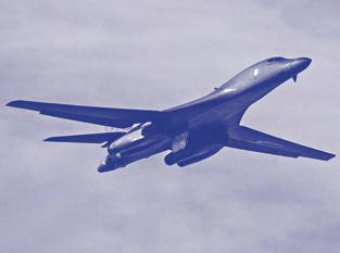
8 Draft Environmental Impact Statement (EIS) Chapter 2.0. Airspaces such as the Tiger, Devils Lake, Hays, and Lake Andes Military Operations Areas (MOAs) were created and configured for Cold War era missions. They do not have the dimensions, altitude structure, or electronic capabilities to meet today or tomorrow s Overseas Contingency Operation training missions for bombers. Western airspaces such as the Mountain Home Range Complex (MHRC), Utah Test and Training Range (UTTR), and Nevada Test and Training Range (NTTR) are excellent ranges with updated electronic and target capabilities; however, these ranges are distant from B 1 and B 52 bases. In addition, the excellent training offered by these ranges leads to intensive use for both test and training missions by locally based aircraft, severely limiting access for bomber training. This limited access, combined with the distance from B 1 and B 52 home bases, makes it difficult to conduct realistic training and maintain aircrew proficiency. Since 9/11, the Air Force has evolved multiple new roles and responsibilities for the B 1, including support for Non Traditional Intelligence, Surveillance, and Reconnaissance. In combat, B 1s are often launched fully loaded and set up an orbit with a variety of munitions near the expected action. B 1s are the weapon of choice in combat where they can be called on to target everything from an enemy mobile SCUD missile minutes from launching to an enemy pinning down a Sea, Air, Land (SEAL) team on a hilltop to a weapons cache found by a Special Operations team. B 1 aircrews must be trained to be experts in every possible mission. Training the B 1 four man aircrew to accomplish these multiple new and existing assignments, often on the same mission, requires dynamic, realistic training airspace. The expanded B 1 capabilities and the aircraft s performance mean that one or two B 1s require all the current Powder River airspace for a realistic training mission. The B 1 operational wing at Ellsworth AFB does not have adequate airspace to train aircrews for present and future training requirements. The B 52 operational aircraft at Minot AFB face comparable training limitations. Airspace and ground assets must be integrated into a local training complex accessible to Ellsworth AFB and Minot AFB with the opportunity for multiple mission training. The capability to launch more local training flights would permit aircrews to fulfill requirements for combat readiness because a higher proportion of training time per flying hour would be spent in multi mission training for today s and tomorrow s conflicts. B 1 aircrews cannot accomplish the array of expanded training requirements while commuting to remote training complexes, and these remote training complexes have limited availability. Commuting and availability further reduce flexibility and efficiency. B 52s from Minot AFB face the same training challenge. B 52 aircrews must fulfill a broad range of missions, with new missions for electronic suppression and smart weapons arising from the Overseas Contingency Operation. This varied array of missions include strategic attacks, counter land and air, and preparation for deployment with the Aerospace Expeditionary Forces (AEFs). Meeting these requirements demands efficient and effective use of limited available training hours. As with the B 1s, the B 52s must train in an airspace complex located and configured to provide a high proportion of training and minimal low value commuting time. Such a complex would permit Minot AFB to generate quality local sorties and fulfill training requirements for B 52 (pictured here) and B 1 bombers have historically used Ellsworth AFB scheduled Military Training Routes (MTRs) in Montana, North Dakota, South Dakota, and Wyoming for lowaltitude penetration mission training. Page ES-2
9 combat readiness. Figure ES 2 presents an overview of the modular nature of the proposed PRTC and describes the airspace segments of the PRTC. The PRTC is designed to address nearly all the limitations of the existing Powder River airspace explained in Section 1.0 of the Draft EIS. These limitations and training deficiencies, summarized in Table ES 1, drive the need to implement the proposed PRTC. Table ES 2 summarizes the improved training capabilities that would fulfill the needs summarized in Table ES 1 should PRTC be implemented. The sections referenced in Table ES 2 are the Draft EIS sections where additional details are presented. Both distance and accessibility of remote airspace complexes described in Figure ES 1 result in inefficient and ineffective use of aircrew and aircraft flying hours. Commuting flight hours do not permit aircrews to generate sufficient sorties to meet expanded training requirements with new weapon systems. Limitations of aircraft maintenance personnel and time further reduce the ability of flight crews to achieve training requirements. Such limitations and deficiencies can preclude aircrews from achieving timely combat ready status. The Air Force proposes to establish PRTC to overcome the limitations and deficiencies listed in Table ES 1. The proposed PRTC modular nature would permit joining the airspace for once quarterly LFEs. An LFE is a highly sophisticated training exercise that simulates full scale battlefield scenarios, and requires enough airspace to provide assembly, ingress, egress, and maneuver areas. Such training exercises employ a full range of combat tactics, equipment, and personnel. The Air Force proposes to conduct LFEs a maximum of once per calendar quarter, lasting 1 to 3 days. LFEs would occur in a 2 to 4 hour block and may include approximately 20 aircraft, of various aircraft types training in simulated combat. Supersonic flight would only be authorized during the 10 days per year of LFEs to permit aircrews to use the full capabilities of their aircraft. At supersonic speeds, the timeframe during which aircrews are exposed to enemy threats tests crew reaction times, which may have been seconds, and become tenths of seconds. During LFEs, the B 1 would conduct supersonic flights above 20,000 feet MSL, and transient fighters would conduct supersonic flights above 10,000 feet AGL. LFEs would occupy all or substantial portions of the proposed PRTC. Combat tactics are both offensive and defensive in nature and include use of defensive chaff and flares. Defensive training using chaff and flares permits aircrews to train to meet increasingly complex surface to air threats which require near instantaneous aircrew response to the threat. Chaff and flare deployment represent necessary The existing Powder River airspace includes the Powder River Military Operations Areas (MOAs), associated Air Traffic Control Assigned Airspace (ATCAA), and an array of no drop targets and electronic threats. The proposed Powder River Training Complex (PRTC) builds upon the Powder River airspace and adds and reconfigures MOA and ATCAA assets to meet today s and tomorrow s training needs. Aviation and Airspace Use Terminology Above Ground Level (AGL): Altitude expressed in feet measured above the ground surface. Mean Sea Level (MSL): Altitude expressed in feet measured above average (mean) sea level. Flight Level (FL): Manner in which altitudes at 18,000 feet MSL and above are expressed, as measured by a standard altimeter setting of Visual Flight Rules (VFR): A standard set of rules that all pilots, both civilian and military, must follow when not operating under instrument flight rules and in visual meteorological conditions. These rules require that pilots remain clear of clouds and avoid other aircraft. Instrument Flight Rules (IFR): A standard set of rules that all pilots, civilian and military, must follow when operating under flight conditions that are more stringent than visual flight rules. These conditions include operating an aircraft in clouds, operating above certain altitudes prescribed by Federal Aviation Administration (FAA) regulations, and operating in some locations such as major civilian airports. Air Traffic Control (ATC) agencies ensure separation of all aircraft operating under IFR. Source: FAA Pilot/Controller Glossary 2010 Page ES-3
10 combat operations which bomber aircrews cannot perform in the existing local airspace. Chaff creates a brief reflective cloud of fibers thinner than a human hair to confuse enemy radar. Flares create a heat source to decoy heat seeking missiles away from the aircraft. These countermeasures defend aircraft against enemy threats and are extensively used in combat. Training to employ these countermeasures in an effective and timely manner is essential for aircrews conducting almost any mission. Chaff would not be deployed where it could interfere with airport radars and flares would be deployed above 2,000 feet AGL (flares burn out in 500 feet) or not be deployed in a MOA during extreme fire conditions. Table ES 2 summarizes the improved training capabilities of the proposed PRTC depicted on Figure ES 2. A comparison of Tables ES 1 and ES 2 demonstrates that PRTC would provide bomber aircrews adequately sized, configured, and available airspace to train as they would fight during worldwide deployment. The long timeframe for any future bomber development places an even greater emphasis on B 1 capabilities and training. Bomber aircrews face reduced budgets, a reduced number of airframes, high aircraft utilization requirements, new multi role taskings, and expanded capabilities to achieve U.S. military objectives. Bomber aircrews must train to be experts with their own weapons systems and to function as an integrated force package with other aircraft to leverage the capabilities of each weapon system and enhance survivability of the collective force. Expanding the existing Powder River airspace to form the PRTC would improve realistic combat training and increase flexibility and availability of limited resources and assets. Table ES 3 summarizes the PRTC project elements for each alternative explained in the Draft EIS Chapter 2.0. Figure ES 3 presents the proposed PRTC airspace and identifies some of the geopolitical features of the potentially affected region and the communities under and on the periphery of the proposed airspace. Table ES 1. Summary of Factors Which Establish the Need for Expanded Local Airspace 1. B 1 and B 52 missions, aircraft capabilities, and training requirements have increased and will continue to increase and the Powder River airspace cannot accommodate these requirements. 2. Commuting consumes limited available aircrew and aircraft flying hours without accomplishing essential training, and distant complexes that theoretically could provide needed training with long commutes have a limited accessibility because locally based aircraft and other users have priority. 3. Flight hours spent commuting consumes excessive fuel and requires extensive on ground maintenance hours for airframes to be ready for the next mission. Multiple hours with commuting missions force aircraft inspections and maintenance sooner than the same number of local mission training. This results in a reduction in available airframes for aircrew training. 4. Combat readiness requires complex multiple mission training, but the existing Powder River airspace accommodates approximately 46 percent of required B 1 aircrew training sorties and 31 percent of required B 52 aircrew training sorties. 5. The existing Powder River airspace does not permit certain required training activities essential to today s combat, such as supersonic flight, training in the deployment of defensive chaff and flares, diversified low altitude training, or Large Force Exercises (LFEs). 6. The number of users has increased, but the Powder River airspace capacity does not provide for multiple or dissimilar aircraft training with current sensors and weapon capabilities. 7. The B 1 and B 52 aircrews currently face aircraft and threat systems with ranges far in excess of the existing Powder River airspace. Additionally, supersonic training is required for bomber aircrew proficiency as well as fighter tactical employment. Training must detect and react to such threats. 8. The existing Powder River airspace has inadequate space and diversity to accommodate necessary B 1 and B 52 training requirements for combat readiness. Page ES-4

11 Figure ES-1. Regional Location of Powder River Airspace and Remote Training Airspaces and Ranges Page ES-5
12

13 Figure ES-2. Overview of Ellsworth AFB, Minot AFB, and Proposed PRTC Airspace Page ES-7
14

15 Figure ES-3. Extent of Proposed PRTC Airspace Page ES-9
16
17 Table ES 2. Summary of PRTC Purposes and Improved Training Capabilities 1. Provides for aircrew training to implement and employ technology upgrades and fulfill both current and anticipated future operational requirements (Section 2.2.1). Addresses Need Factors 1, 4, 5, 6, 7, and 8 in Table ES Enables aircrews to conduct diverse training missions while dramatically reducing commuting hours and issues of accessibility to remote ranges (Section ) and provides locally available airspace with scheduling priority for bombers (Section ). Addresses Need Factors 2 and 3 in Table ES Enables maintenance turnaround of the aircraft to generate adequate training sorties (Section ) and provides more efficient use of fuel resulting in training time to improve both training quality and quantity. Addresses Need Factors 2 and 3 in Table ES Accommodates approximately 85 percent of required aircrew complex multi mission training sorties for both B 1 and B 52 aircrews (Section 1.2). Addresses Need Factors 1, 4, 5, 6, 7, and 8 in Table ES Increases the proportion of training time for new and diversified training requirements, including defensive chaff and flares, supersonic maneuvers during LFEs, and diversified areas for low altitude training (Sections and 2.2.2). Addresses Need Factors 1, 4, 5, 6, 7, and 8 in Table ES Improves integrated aircrew combat training operations by quarterly support of LFEs engaging in realistic tactics using various aircraft types and expanded network based operations training (Section ). Addresses Need Factors 4, 5, 6, 7, and 8 in Table ES Increases the availability of real world training for multiple, concurrent flights of aircraft from Ellsworth and Minot AFBs (Section ). Addresses Need Factors 4, 5, 6, 7, and 8 in Table ES Restructures and adds local airspace to meet the training needs for 28 BW and 5th Bomb Wing (5 BW) aircrews (Section 1.3). Addresses Need Factors 1, 2, 3, 6, 7, and 8 in Table ES 1. Project Element Expand and reconfigure Powder River A and B MOAs to create the PR 2 MOA Establish the PR 1A and PR 1B and Gap A MOAs Table ES-3. Summary of Alternative Project Elements (Page 1 of 2) Proposed Action Alternative A Alternative B Alternative C Establish PR 2 MOA from Establish PR 2 MOA from Establish PR 2 MOA from 500 feet AGL to FL180 in 500 feet AGL to FL180 in 500 feet AGL to FL180 in place of Powder River A place of Powder River A place of Powder River A and B MOAs and B MOAs and B MOAs Establish PR 1A and Gap A Low MOAs from 500 feet AGL to but not including 12,000 feet MSL and High MOA from 12,000 feet MSL to but not including FL180. Establish PR 1B MOA from 500 feet AGL to but not including FL180 No PR 1 A/B MOA or Gap A MOA Establish PR 1A and Gap A Low MOAs from 500 feet AGL to but not including 12,000 feet MSL and High MOAs from 12,000 feet MSL to but not including FL180. Establish PR 1B MOA from 500 feet AGL to but not including FL180 No Action Alternative Continued use of Powder River A and B MOAs for limited training No new MOAs or ATCAAs Page ES-11
18 Project Element Establish the PR 3 and Gap B MOAs Establish the PR 4 and Gap C MOAs Establish PRTC ATCAAs and Gap ATCAAs and expand Gateway ATCAA Chaff and flare defensive training Supersonic training only during 10 days of LFEs per year LFE with approximately 20 aircraft of various aircraft types Table ES-3. Summary of Alternative Project Elements (Page 2 of 2) Proposed Action Alternative A Alternative B Alternative C Establish PR 3 and Gap B Establish PR 3 and Gap B Establish PR 3 and Gap B Low MOAs from 500 feet Low MOAs from 500 feet Low MOAs from 500 feet AGL to but not including AGL to but not including AGL to but not including 12,000 feet MSL and 12,000 feet MSL and High 12,000 feet MSL and High High MOA from 12,000 MOAs from 12,000 feet MOAs from 12,000 feet feet MSL to but not MSL to but not including MSL to but not including including FL180 FL180 FL180 Establish PR 4 and Gap C MOAs Low from 500 feet AGL to but not including 12,000 feet MSL and High from 12,000 feet MSL to but not including FL180 Establish Low ATCAAs from FL180 to FL260, Medium ATCAAs above FL260 to FL370, and High ATCAAs above FL370 to FL600 Chaff except near major airports or other radars; flares 2,000 feet AGL and discontinue use in MOA when extreme fire conditions exist B 1 supersonic above 20,000 feet MSL; transient fighters supersonic above 10,000 feet AGL during LFEs only Conduct LFE a maximum of once per quarter 4 hours daily for 1 to 3 days a total of approximately 10 days per year; Gap MOA/ATCAAs; PR 3 and PR 4 Medium ATCAAs and all High ATCAAs during LFEs only Establish PR 4 and Gap C MOAs Low from 500 feet AGL to but not including 12,000 feet MSL and High MOA from 12,000 feet MSL to but not including FL180 Establish Low ATCAAs from FL180 to FL260, Medium ATCAAs above FL260 to FL370, and High ATCAAs above FL370 to FL600 Chaff except near major airports or other radars; flares 2,000 feet AGL and discontinue use in MOA when extreme fire conditions exist B 1 supersonic above 20,000 feet MSL; transient fighters supersonic above 10,000 feet AGL during LFEs only Conduct LFE a maximum of once per quarter 4 hours daily for 1 to 3 days a total of approximately 10 days per year; Gap MOA/ATCAAs; PR 3 and PR 4 Medium ATCAAs and all High ATCAAs during LFEs only No PR 4 MOA or Gap C MOA Establish Low ATCAAs from FL180 to FL260, Medium ATCAAs above FL260 to FL370, and High ATCAAs above FL370 to FL600 Chaff except near major airports or other radars; flares 2,000 feet AGL and discontinue use in MOA when extreme fire conditions exist B 1 supersonic above 20,000 feet MSL; transient fighters supersonic above 10,000 feet AGL during LFEs only Conduct LFE a maximum of once per quarter 4 hours daily for 1 to 3 days a total of approximately 10 days per year; Gap MOA/ATCAAs; PR 3 and PR 4 Medium ATCAAs and all High ATCAAs during LFEs only No Action Alternative No new MOAs or ATCAAs No new MOAs or ATCAAs Continued training in Powder River Gateway, Crossbow, and Black Hills ATCAAs No defensive chaff and flare training; bombers commute to remote ranges for defensive training with chaff and flares No supersonic training; B 1s commute to remote ranges for supersonic training No LFEs; limited dissimilar training in existing Powder River airspace Page ES-12
19 The Air Force would employ the following measures during regular training and LFEs to address impacts: Airspace scheduled times of use are specified in the Air Force s aeronautical proposal summarized in EIS Section 2.5.1, Tables 2 10 and 2 11, and are published online at Airspace scheduled outside of normal published times of use is disseminated via Notice to Airmen (NOTAMs), available at Low and High MOAs allow ATC to vector IFR traffic as soon as training is completed in an airspace. Airspace use and long term planning information on deconfliction, fire fighting operations, and special events/cultural events is available during normal business hours 8:00 am 5:00 pm Monday through Friday from the Ellsworth AFB Airspace Management Office at (605) Information posted on flyers and posters can be found at public airports underlying the airspace and is updated annually by the Ellsworth AFB Flight Safety Office as part of the Mid Air Collision Avoidance Program at (605) The Ellsworth AFB Public Affairs Office is available to answer inquiries and complaints at (605) :00 am 5:00 pm Monday through Friday. In the event of any damage or injury associated with PRTC operations, descriptive documentation related to the Air Force Claims Program can be sent in to the Ellsworth AFB Public Affairs Office. The Air Force would establish reasonable temporary or seasonal avoidance areas for Tribal activities or could adopt other measures identified in consultation with affected Tribes to reduce intrusive impacts. The Air Force would extend the current practice of establishing reasonable temporary or seasonal avoidance areas in response to affected ranchers who call Ellsworth AFB Public Affairs Office to identify locations of ranch operations, such as calving, weaning, and branding. Where schedule changes require use of airspace outside of published times of use, the Air Force would inform Air Route Traffic Control Centers (ARTCCs) at least 2 hours in advance in order to facilitate issuance of a NOTAM. The Air Force would publish a notice at least one month in advance of LFEs to help civil aircraft pilots and the public plan for LFE airspace activation. The Air Force would establish procedures to avoid low altitude overflight of, and frequency interference with, known blasting operations. The Air Force would establish communication procedures to ensure the ability to recall the military aircraft from the low altitude MOAs in PR 1A, PR 3, and PR 4 to allow civil IFR departures and arrivals. The Air Force would establish communication procedures to ensure deconfliction with emergency flight operations within the proposed airspace. The following sections summarize the EIS findings for each alternative. The environmental consequences are presented for each resource identified as important during the public scoping period and during scoping meetings held throughout the region in June and July of The referenced sections are Draft EIS sections. Page ES-13
20 Summary of Environmental Consequences Airspace/Air Traffic (See Draft EIS Section 4.1) The PRTC would establish new MOAs and ATCAAs as depicted on Figure ES 2. The type, size, and configuration of the airspace elements are designed to meet training needs while avoiding, to the extent possible, impacts to civil aviation. The Gap MOAs are existing Victor Airways which provide corridors for aviation traffic. The proposed schedule for MOA activation would be Monday through Thursday 7:30 am to 12:00 pm and 6:00 pm to 11:30 pm and from 7:30 am to 12:00 pm on Friday local time, other times by NOTAMs. The proposed Powder River 1A (PR 1A), Powder River 1B (PR 1B), Powder River 2 (PR 2), Powder River 3 (PR 3), and Powder River 4 (PR 4) MOAs would not have civilian Instrument Flight Rules (IFR) flights when the MOA was activated. Visual Flight Rules (VFR) traffic can fly see and avoid in an active MOA, weather permitting. PR 2 is essentially the existing Powder River A and B MOAs and currently does not have IFR traffic when the MOAs are activated. The PRTC is overflown by a series of jet routes where commercial and other jet aircraft are typically flying above Flight Level (FL) 260 and mostly above FL300. Alternative A: Proposed Action (See Draft EIS Section ) Victor Airways and MOAs: Civil aircraft pilots in the region often rely upon Global Positioning System (GPS) for point to point travel and do not rely on IFR below FL180 in much of the area because radar and radio communication are limited below 12,000 feet MSL and in some areas are limited below FL180. Following public and agency scoping, the Air Force proposed PR 1A, PR 3, PR 4, and Gap MOAs to have Low and High MOAs to support Air Traffic Control directed IFR traffic. PRTC would impact IFR and VFR traffic within the PR 1A, PR 1B, PR 2, PR 3, and PR 4 MOAs through ground hold, flying VFR see andavoid in an active MOA, and/or diversion. An estimated 129 civil operations could be impacted when Alternative A MOAs are activated Monday through Thursday (approximately one third of that number on Friday morning). PR 1A/1B MOAs and ATCAAs were adjusted in the revised Air Force proposal to avoid impacts to major public airports including Billings, Bismarck, and Dickinson. Public participants during scoping were concerned that the absence of navigable routes and limited radar and radio frequency coverage could impact civil aviation when PRTC MOA segments were activated for day to day training and would have greater impacts during LFEs when all the Victory Airways traversing the airspace would be unavailable. Public Airports and Private Airfields: There are two public airports and no private airfields identified under PR 1A (and Gap A), no public and one private under PR 1B, two public and one private under PR 2 (existing airspace), four public and eight private under PR 3 (and Gap B), six public and two private under PR 4 (and Gap C). There are 12 public airports and 9 private airfields on the periphery of the proposed MOAs. There are 13 airports and airfields under the Gateway ATCAAs and three civilian airports and airfields on the periphery of the Gateway ATCAAs. The numbers of airports and airfields, especially under PR 3 and PR 4, combined with limited communication capabilities in the region, create what is perceived as an impact by airport operators and users. Aircraft from these public or private airports would not be able to fly IFR in an active MOA, although they could fly VFR using see and avoid in an active MOA, weather permitting. Proposed hours for MOA scheduling during Monday through Friday morning are designed to provide times when the MOA would not be activated to support civil aviation. Jet Routes and ATCAAs: Following public and agency scoping inputs, the Air Force revised the Proposed Action to include Low, Medium, and High ATCAAs. B 1s would normally conduct missions in the Low ATCAAs, although B 52s could require Medium or High ATCAAs. The segmented ATCAAs permit the Air Force to avoid impacting commercial and other traffic using existing jet routes and Canadian (CAN) Page ES-14
21 routes to avoid mid West thunderstorms and congestion. An ATCAA to FL260 would provide for commercial and other jet traffic at higher altitudes while allowing 99 percent of B 1 training. B 52 training above FL260 and LFEs have the potential to significantly impact commercial traffic and would be scheduled by FAA. Depending on the 4 hour training periods, an LFE above FL260 could daily impact from 43 to 244 high altitude flights. LFEs: During the estimated 10 days of LFEs, annually, approximately 20 aircraft of various types would perform combined training within the airspace. LFEs would activate MOAs and ATCAAs and impact civil aircraft traversing the region. Civil aircraft would be required to fly see and avoid in the airspace, weather permitting, ground hold, divert to another airport for a period of 2 to 4 hours, or otherwise reschedule flights. Use of ATCAA airspace for LFE training would need careful scheduling to avoid significant impacts to en route commercial traffic typically above FL300. Commercial carriers or timesensitive deliveries to provide personnel or equipment repair support to mining or agricultural activities would be unable to fly IFR in an activated MOA. If the pilots chose not to fly VFR, or could not due to weather, deliveries could be delayed by 2 to 4 hours. The LFEs could be viewed as a significant impact to airspace users. Other Airspace Activities: Emergency access for firefighting, life flight, or other emergencies was identified as a concern during scoping. The Air Force would coordinate with Air Traffic Control (ATC) to relocate training aircraft from an area which needed emergency access, including during LFEs. This policy is currently applied to the Powder River A and B MOAs. Agricultural applications typically occur below 500 feet AGL, although aircraft may transit at higher altitudes. Aerial applications require calm conditions and are normally conducted in early morning hours. Aerial applicators fly at near gross weight with little maneuvering altitude and expressed serious concerns about random flight of lowaltitude bombers. Applicators could face decisions as to whether they would fly in an activated MOA. Weather modification and aerial mapping have special requirements, which include meteorological conditions and rapid access to accomplish mission specific tasking. Gliding and skydiving under ATCAAs are not impacted. Additional communication would be required to coordinate with Air Force training missions so that these seasonal activities could be accomplished. Alternative B (See Draft EIS Section ) Alternative B civilian aircraft flights below FL180 would be impacted in PR 2, PR 3, PR 4, and associated Gap MOAs as described for Alternative A. No PR 1A, PR 1B, or Gap A MOAs would be established beneath the ATCAA. An estimated 97 civil operations would be impacted Monday through Thursday (approximately one third of that number on Friday morning) when the Alternative B MOAs are activated. Impacts would be a mix of ground delays, re routing, or having to decide to fly VFR while the MOA is active. ATCAA impacts would be the same as described for Alternative A. Under Alternative B, lowaltitude overflights would not occur below the PR 1A, PR 1B, or the Gap A ATCAAs. Aircraft and airports within the Billings Miles City Gillette triangle would not be impacted below FL180. LFE impacts for Alternative B would be as described for Alternative A, with the exception that Alternative B would not include military training overflights below FL180 in the Billings Miles City Gillette triangle. Alternative C (See Draft EIS Section ) Alternative C impacts to the Victor Airways on the west side of the PRTC airspace would be comparable to those described for Alternative A. Airspace impacts could include delays, re routing, or having to fly see and avoid in an active MOA. An estimated 79 civil operations would be impacted Monday through Thursday (approximately one third of that number on Friday morning) when the Alternative C MOAs are active. The PR 4 ATCAA and associated Gap C ATCAA would not have MOAs below them. This means that Alternative C would not impact airports in the Bismarck Dickinson Rapid City triangle below FL180. Page ES-15
22 Traffic on V 491 between Dickinson and Rapid City would be able to transit the area IFR below FL180 even during an LFE. Impacts to airports and airfields under PR 1A, PR 1B, PR 2, PR 3, and associated Gap MOAs would be as described for Alternative A. Jet route and high altitude impacts for Alternative C would be as described for Alternative A. Emergency and related services would be given priority as with Alternative A. Aerial applications and skydiver/glider impacts would be comparable to Alternative A except under the PR 4 ATCAA where no low altitude military flights would occur. Information and scheduling would be required to reduce the potential for impacts. No-Action Alternative (See Draft EIS Section ) The No Action Alternative would have no change in projected baseline conditions. Projected baseline conditions with aircraft returned to Ellsworth and Minot AFBs from overseas activities would be expected to increase annual sortie operations in the existing Powder River airspace. B 1 and B 52 flight training would continue in the Powder River A and B MOAs, which constitute nearly all of the proposed PR 2 MOA. The estimated number of civilian aircraft impacted daily by not flying IFR, delay, re routing, or having to fly see and avoid in an active MOA is seven. Flight training in Powder River airspace ATCAAs would continue as permitted under existing letters of agreement with the FAA. The structure and management of the Powder River airspace would continue to provide limited training to B 1 and B 52 aircrews. Noise (See Draft EIS Section 4.2) Public concerns for noise focused on startle effect, interference with rural activities and the natural quiet of the area, potential startle effect safety risks associated with ranching operations, potential damage to structures from supersonic events, and conflict with tribal ceremonies and culturally sensitive sites. Three aspects of noise could cause environmental impacts: (1) increases in ambient noise levels, (2) low level startle effects, and (3) sonic booms. Alternative A: Proposed Action (See Draft EIS Section ) Day Night Average Sound Levels: Public scoping commenters expressed an appreciation for the wideopen space and relative low noise levels within the region. Ambient noise conditions are typically in the Day Night Average Sound Level (DNL) less than 45 decibel (db) range except under Powder River A and B MOAs where noise levels are DNL 53 to 54 db. Calculated DNL noise levels from aircraft overflight within the proposed PR 1A, PR 1B, PR 3, and PR 4 MOAs would be expected to be in the 40 to 47 db range. The U.S. Environmental Protection Agency (USEPA) has identified DNL of 55 db as a level protective of the public health and welfare. Increases in the DNL and individual noise events from an aircraft overflight would be noticed and could be perceived as a significant impact by residents under the airspace. Low Level Effects: Low level overflight of a bomber below 2,000 feet AGL within one quarter mile of the flight path would be expected to occur over approximately 2 to 4 percent of each MOA each training day or an average at any location of 6 to 9 low level overflights per year. The random nature of B 1 and B 52 training means any specific location could be overflown at low altitude more or less than the average. The uncertainty of low level overflight and the inability to anticipate when such an overflight could occur would contribute to the startle effect. The revised Air Force proposal has MOAs scheduled Monday through Thursday in the mornings and late afternoon/evenings and Friday mornings to somewhat reduce the uncertainty of when a low altitude overflight could occur. During many low level B 1 missions, the aircraft performs a rapid acceleration from below 2,000 feet AGL and climbs with afterburners, potentially creating a localized single event onset rate adjusted sound exposure level (SEL r ) of 133 db. While operating at high speeds at 500 feet AGL and not climbing, B 1 aircraft generate SEL r Page ES-16
23 noise levels of approximately 117 db. B 52 aircraft typically generate an SEL r of approximately 100 db during overflight at 1,000 feet AGL, the lowest altitude at which B 52 aircraft would regularly fly in PRTC. Sudden onset sounds, such as the noise created by low altitude high speed aircraft, can be startling to humans and animals. In specific cases where ranching operations herd livestock for weaning and branding, low level overflights have caused cattle to spook and resulted in damage to both the livestock and fencing. Within the Powder River A/B MOAs, ranchers have identified for the Air Force locations and seasonal times when low level overflights have the potential to cause serious impacts. The Air Force has established temporary avoidance areas at these locations to reduce the potential for impacts from low altitude overflights. During public scoping meetings, individuals expressed the opinion that such low altitude overflights could be a significant impact. Sonic Booms: Sonic booms are created by the movement of air in response to an aircraft traveling in excess of the speed of sound. Supersonic flights of B 1s above 20,000 feet MSL and fighters above 10,000 feet AGL during the 10 days of LFEs per year could result in an estimated average of approximately one sonic boom per LFE day at any given location on the ground. Areas under the PR 2, PR 3, and Gap B MOA/ATCAAs would be more likely to experience sonic booms than areas under other airspaces due to the flight pattern of training aircraft. Most sonic booms would be heard as thunder, although approximately 1,300 acres could experience sonic booms of 4 pounds per square foot (psf) and a smaller acreage could experience a higher focus boom. Glass, plaster, and other structural elements, normally in good condition, would not be expected to fail as a result of overpressures of 4 psf or greater, but failure would be possible. Infrequent, but sudden sonic booms can impact wildlife and ranch animals similarly to the impacts described for low level overflights. Training aircraft do not have the ability to direct a sonic boom away from a specific area. Should a sonic boom occur during a hunting or ranching activity, it could result in a reaction on the part of domestic or wild animals. It is not likely that these reactions would significantly impact the species, but, at the very least, such impacts could be an annoyance to persons on the ground. Alternative B (See Draft EIS Section ) Alternative B effects would be the same as Alternative A in nearly all respects except that low level overflight would not occur under the PR 1A, PR 1B, or Gap A ATCAAs. Noise under these areas would be close to ambient conditions. Noise under PR 2, PR 3, PR 4, and Gap MOAs and ATCAAs would be as described for Alternative A. Infrequent sonic booms during LFEs and 6 to 9 low altitude overflight effects would be as described for Alternative A for all areas except those under the PR 1A, PR 1B, or Gap A ATCAAS. Alternative C (See Draft EIS Section ) Alternative C effects would be the same as Alternative A except that low level overflight would not occur under the PR 4 or Gap C ATCAAs. Noise under these areas would be comparable to ambient conditions. Noise under PR 1A, PR 1B, PR 2, PR 3, and Gap MOAs and ATCAAs would be as described for Alternative A. Infrequent sonic booms during LFEs and 6 to 9 low altitude overflight effects would be approximately as described for Alternative A for all areas except those under the PR 4 or Gap C ATCAAs. No-Action Alternative (See Draft EIS Section ) Noise under the existing Powder River airspace would be at projected baseline conditions as the base returns to the peacetime operational tempo. Low altitude startle effects would be experienced but supersonic flight would not be scheduled. Page ES-17
24 Safety (See Draft EIS Section 4.3) Safety concerns expressed during scoping meetings dealt with the impacts of limited communication, flight safety, low altitude military training flights, wake vortices, electronic emissions, potential for accidents, and use of chaff and flares. Alternative A (See Draft EIS Section ) Communication: Limited communication and radar coverage impact safe civil aircraft operations at airports and for flights below 12,000 feet MSL in much of the proposed airspace and below FL180 in some areas. Communication limits are greatest in PR 3, the western portion of PR 4, the existing PR A/B (PR 2), and the eastern portion of PR 1A and PR 1B MOAs. There is no proposal for increased radio frequency coverage or radar coverage for the PRTC airspace where current coverage is limited. General aviation pilots could receive status updates prior to flight by reviewing NOTAMs or could call the Ellsworth AFB airspace management office to determine the status of the MOAs. General aviation pilots accustomed to flying through the airspace with GPS coordinates perceived limited communication as an impact to their ability to transit the airspace. Flight Safety: FAA has noted that agreements comparable to those for existing Powder River airspaces must be in place to restrict timing and altitude use of the PRTC ATCAAs. This would avoid the potential for significant flight safety impacts to commercial and other aircraft transiting the airspace especially above FL300. During LFEs, the use of ATCAA airspace above FL260 could require re routing of 43 to 244 commercial and other high altitude aircraft to avoid safety impacts. The Air Force s revised aeronautical proposal reduces impacts to air traffic at large commercial airports such as the Billings and Bismarck airports. Potential impacts identified by the FAA include safety risks to civil aircraft unable to communicate while flying IFR on Victor Airways located in the GAP MOAs. The revised Air Force aeronautical proposal has Low and High MOAs in PR 1A, PR 3, PR 4, and Gap MOAs to reduce impacts to IFR traffic. Supersonic aircraft during the 10 days of annual LFEs would not be expected to impact civil aircraft flight safety. Class A mishap and bird strike risks are expected to be proportional to the amount of training time in the proposed airspace and not expected to be significant. Based upon experience with current training in the Powder River airspace, the estimated annual bird strikes in the proposed PRTC would be 3 to 6 per year. Bird strikes could be higher in the PR 3 and PR 4 Low MOAs where migratory bird flyways converge. Chaff and Flares: Chaff and flare use in the proposed PRTC would not be expected to result in significant impacts. Chaff are very fine (thinner than a human hair) strands of silica coated with aluminum to reflect radar. Specific types of chaff configured to reduce interference with FAA radar would be permitted for use within the PRTC. Flares would be restricted in release altitude to above 2,000 feet AGL and not deployed in a MOA during extreme fire conditions. Flares burn out in approximately 500 vertical feet, or a minimum of 1,500 feet above the ground. There would be a very slight potential for increased fire risk if flares were accidentally deployed substantially below authorized altitudes. A dud flare is a flare which does not ignite and falls to the surface of the ground. Based on scheduled flare usage, one dud flare every 3 years is estimated fall to the ground under the entire proposed PRTC airspace. The likelihood of a person finding a dud flare is very low. It would take a hot fire to ignite the flare, although a dud flare could be ignited by a strike with a power saw or a bullet. Should a dud flare be encountered, the public should not touch it but should notify a public safety authority of its location. Page ES-18
DEPARTMENT OF TRANSPORTATION FEDERAL AVIATION ADMINISTRATION ADOPTION OF ENVIRONMENTAL IMPACT STATEMENT AND FAA RECORD OF DECISION FOR
 DEPARTMENT OF TRANSPORTATION FEDERAL AVIATION ADMINISTRATION ADOPTION OF ENVIRONMENTAL IMPACT STATEMENT AND FAA RECORD OF DECISION FOR Establishment of the Powder River Training Complex Located in Montana,
What Is The 29Palms Training Land Acquisition and Airspace Establishment Project Frequently Asked Questions Airspace Related July 2015
 MARINE CORPS / DEPARTMENT OF THE NAVY SUBMIT SPECIAL USE AIRSPACE PROPOSALS TO THE FEDERAL AVIATION ADMINISTRATION TO MEET MARINE EXPEDITIONARY BRIGADE TRAINING REQUIREMENTS 1. Why has the Marine Corps
Powder River Training Complex Commonly Asked Questions September 15, 2010
 Powder River Training Complex Commonly Asked Questions September 15, 2010 QUESTION: Why is this expansion needed? Answer: Realistic and effective training. Twenty years ago, enemy surface-to-air threats
What Is The Proposed 29Palms Training Land Acquisition and Airspace Establishment Project? Frequently Asked Questions Airspace Related June 2014
 MARINE CORPS / DEPARTMENT OF THE NAVY SUBMIT SPECIAL USE AIRSPACE PROPOSALS TO THE FEDERAL AVIATION ADMINISTRATION TO MEET MARINE EXPEDITIONARY BRIGADE TRAINING REQUIREMENTS 1. Why has the Marine Corps
Acronyms and Abbreviations
 Acronyms and Abbreviations 28 CES 28th Civil Engineering Squadron 28 BW 28th Bomb Wing 28 BW/PA 28th Bomb Wing/Public Affairs 28 OG 28th Operations Group 28 OSS 28th Operations Support Squadron A3 Training
Proposed Establishment of and Modification to Restricted Areas; Fort Sill, OK
 This document is scheduled to be published in the Federal Register on 10/19/2015 and available online at http://federalregister.gov/a/2015-26499, and on FDsys.gov 4910-13 DEPARTMENT OF TRANSPORTATION Federal
Powder River Training Complex Special Use Airspace General & Business Aviation Survey
 Powder River Training Complex Special Use Airspace General & Business Aviation Survey February 2018 Survey and Report Completed By Aircraft Owners and Pilots Association National Business Aviation Association
FREQUENTLY ASKED QUESTIONS. Modification of the Cheyenne Low and High military operations areas. in eastern Colorado and western Kansas
 FREQUENTLY ASKED QUESTIONS Modification of the Cheyenne Low and High military operations areas in eastern Colorado and western Kansas NATIONAL ENVIRONMENTAL POLICY ACT QUESTIONS Q: What is an environmental
Airspace Establishment Project Frequently Asked Questions Permanent SUA and Environmental Assessment March 2019
 OVERVIEW OF PERMANENT SPECIAL USE AIRSPACE ESTABLISHMENT AND MODIFICATIONS AT MARINE AIR GROUND TASK FORCE TRAINING COMMAND, TWENTYNINE PALMS, CA 1. What is Special Use Airspace (SUA)? Special Use Airspace
Report to Congress: Improving General Aviation Security
 Report to Congress: Improving General Aviation Security December 2001 Report of the Secretary of Transportation to the United States Congress Pursuant to Section 132 (b) of the Aviation and Transportation
Public Comment on Condor MOA Proposal
 Public Comment on Condor MOA Proposal Michael Wells, Lt. Colonel (retired) P.O. Box 274 Wilton, ME 04294 20 November, 2009 1. As a retired Air Force Lt. Colonel, squadron commander, F-15 Instructor Pilot,
4.6 AIRSPACE. Approach to Analysis
 4.6 AIRSPACE Section 4.6 describes the impacts that could potentially occur to the existing airspace environment from the proposed action. Potential impacts would stem from the establishment of new Special
Establish the Delta Military Operations Area Environmental Assessment
 Establish the Delta Military Operations Area Environmental Assessment January 2010 Acronyms and Abbreviations degree F degree Fahrenheit µg/m 3 micrograms per cubic meter 11 AF 11 th Air Force 3 WG 3 rd
4.2 AIRSPACE. 4.2 Airspace. Supplemental Draft Environmental Impact Statement August 2008 Military Training Activities at Mākua Military Reservation
 4.2 AIRSPACE 4.2.1 Impact Methodology Impacts on airspace use were assessed by evaluating the potential effects of the proposed training activities on the principal attributes of airspace use, as described
April 5, Dear Mr. Ready,
 50 F St. NW, Suite 750 Washington, D.C. 20001 T. 202-737-7950 F. 202-273-7951 www.aopa.org Mr. Kenneth Ready U.S. Department of Transportation Docket Operations 1200 New Jersey Avenue SE. West Building
June 2009 BOI DOC 3-1
 Draft Environmental Assessment for Proposed Airspace Changes for Paradise East and Paradise West Military Operations Areas (MOAs) at Mountain Home Air Force Base (MHAFB) Idaho June 2009 BOI070850106.DOC
Amendment of Restricted Areas R-2907A and R-2907B, Lake George, FL; and R-2910, Pinecastle, FL
 This document is scheduled to be published in the Federal Register on 07/03/2013 and available online at http://federalregister.gov/a/2013-16054, and on FDsys.gov 4910-13 DEPARTMENT OF TRANSPORTATION Federal
UNITED STATES OF AMERICA FEDERAL AVIATION ADMINISTRATION WASHINGTON D.C. GRANT OF EXEMPTION
 In the matter of the petition of the DEPARTMENT OF DEFENSE UNITED STATES OF AMERICA FEDERAL AVIATION ADMINISTRATION WASHINGTON D.C. Exemption No. 5100B For an exemption from the provisions 25863 Of sections
UNMANNED AIRCRAFT PROVISIONS IN FAA REAUTHORIZATION BILL
 UNMANNED AIRCRAFT PROVISIONS IN FAA REAUTHORIZATION BILL Section 341 Comprehensive Plan -Codifies in title 49 the requirement in the 2012 FAA reauthorization Act that a comprehensive plan to safely accelerate
The following criteria shall be applied within the boundaries of the AO District:
 Sec. 419 (a) Purpose AIRPORT OVERLAY DISTRICT (AO) The purpose of the Airport Overlay District is to regulate and restrict the height of structures, objects, or natural growth, regulate the locations of
Effective Altitude. R-3103 To 30,000 (To 9,144 meters) Source: NACO 2002 Notes: 1 By NOTAM issued 12 hours in advance
 Source: NACO 2002 Notes: 1 By NOTAM issued 12 hours in advance") 8.4 AIRSPACE USE 8.4.1 Affected Environment The affected airspace environment is described below in terms of its principal attributes, namely controlled and uncontrolled airspace, special use airspace,
8.4 AIRSPACE USE 8.4.1 Affected Environment The affected airspace environment is described below in terms of its principal attributes, namely controlled and uncontrolled airspace, special use airspace,
FLIGHT PATH FOR THE FUTURE OF MOBILITY
 FLIGHT PATH FOR THE FUTURE OF MOBILITY Building the flight path for the future of mobility takes more than imagination. Success relies on the proven ability to transform vision into reality for the betterment
USE OF RADAR IN THE APPROACH CONTROL SERVICE
 USE OF RADAR IN THE APPROACH CONTROL SERVICE 1. Introduction The indications presented on the ATS surveillance system named radar may be used to perform the aerodrome, approach and en-route control service:
Agenda: SASP SAC Meeting 3
 Agenda: SASP SAC Meeting 3 Date: 04/12/18 Public Involvement Plan Update Defining the System Recommended Classifications Discussion Break Review current system Outreach what we heard Proposed changes Classification
Airspace. Chapter 14. Gold Seal Online Ground School. Introduction
 Gold Seal Online Ground School www.onlinegroundschool.com Chapter 14 Airspace Introduction The two categories of airspace are: regulatory and nonregulatory. Within these two categories there are four types:
TWENTY-SECOND MEETING OF THE ASIA/PACIFIC AIR NAVIGATION PLANNING AND IMPLEMENTATION REGIONAL GROUP (APANPIRG/22)
") INTERNATIONAL CIVIL AVIATION ORGANIZATION TWENTY-SECOND MEETING OF THE ASIA/PACIFIC AIR NAVIGATION PLANNING AND IMPLEMENTATION REGIONAL GROUP (APANPIRG/22) Bangkok, Thailand, 5-9 September 2011 Agenda
INTERNATIONAL CIVIL AVIATION ORGANIZATION TWENTY-SECOND MEETING OF THE ASIA/PACIFIC AIR NAVIGATION PLANNING AND IMPLEMENTATION REGIONAL GROUP (APANPIRG/22) Bangkok, Thailand, 5-9 September 2011 Agenda
Appendix K: MSP Class B Airspace
 Appendix K: MSP Class B Airspace K All of the open sky covering the United States, from less than an inch off the ground all the way to outer space, is part of America s airspace. This airspace resource
Pope Field, NC MID-AIR COLLISION AVOIDANCE
 Pope Field, NC MID-AIR COLLISION AVOIDANCE 2017 43 rd Air Mobility Operations Group Flight Safety, Pope Field, NC Tel: (910)394-8383/ 8389 Fax: (910)394-8098 E-mail:43AMOGW.SE1@US.AF.MIL The potential
R-2515 R-2508 COMPLEX
 R-2515 R-2508 COMPLEX Edwards AFB PPR Briefing Edwards AFB and Edwards Class D Surface Area lie within Restricted Area 2515: R-2515 and Edwards Class D Surface Area contain many flight hazards for aircrews
Class B Airspace. Description
 Class B Airspace Ref. AIM 3-2-3 and FAR 91.131 Surrounds certain large airports Within each Class B airspace area, there are multiple segments with different ceiling/floor altitudes. Example: 70/30 = ceiling
STAFF REPORT. Airport Land Use Consistency Determination Betteravia Plaza. MEETING DATE: January 21, 2016 AGENDA ITEM: 8D
 STAFF REPORT SUBJECT: Airport Land Use Consistency Determination Betteravia Plaza MEETING DATE: AGENDA ITEM: 8D STAFF CONTACT: Andrew Orfila RECOMMENDATION: Adopt findings for the Betteravia Plaza project
R-2508 COMPLEX R-2515 SFC TO UNLIMITED
 R-2508 COMPLEX R-2515 SFC TO UNLIMITED R-2515 Info available online @... http://www.edwards.af.mil/home/r-2515-airspace R-2515 Airspace Brief EAFBI 13-100 PPR Requests SPORT Pre-Brief Sheet EAFB Wx R-2508
STAFF REPORT. Airport Land Use Plan Consistency Review: Old Town Village Mixed Use Project City of Goleta. MEETING DATE: June 18, 2015 AGENDA ITEM: 5M
 STAFF REPORT SUBJECT: Airport Land Use Plan Consistency Review: Old Town Village Mixed Use Project City of Goleta MEETING DATE: AGENDA ITEM: 5M STAFF CONTACT: Peter Imhof, Andrew Orfila RECOMMENDATION:
Appendix B. Comparative Risk Assessment Form
 Appendix B Comparative Risk Assessment Form B-1 SEC TRACKING No: This is the number assigned CRA Title: Title as assigned by the FAA SEC to the CRA by the FAA System Engineering Council (SEC) SYSTEM: This
NASA Low Boom Flight Demonstration (LBFD) Project Overview
 Project Overview") NASA Low Boom Flight Demonstration (LBFD) Project Overview Presented by Craig Nickol LBFD PM February 27, 2018 Aviation Noise & Emissions Symposium Long Beach, CA 1 Outline Why LBFD? Overview of NASA Role
NASA Low Boom Flight Demonstration (LBFD) Project Overview Presented by Craig Nickol LBFD PM February 27, 2018 Aviation Noise & Emissions Symposium Long Beach, CA 1 Outline Why LBFD? Overview of NASA Role
Contents. Subpart A General 91.1 Purpose... 7
 Contents Rule objective... 3 Extent of consultation... 3 Summary of comments... 4 Examination of comments... 6 Insertion of Amendments... 6 Effective date of rule... 6 Availability of rules... 6 Part 91
Windmills & Airspace Can We Work Together?
 May 29, 2008 Windmills & Airspace Can We Work Together? J. Randolph Babbitt C O N F I D E N T I A L www.oliverwyman.com Windmills & Airspace Overview of Airspace Issues For Wind Turbine Sites The FAA s
Washington Dulles International Airport (IAD) Aircraft Noise Contour Map Update
 Aircraft Noise Contour Map Update") Washington Dulles International Airport (IAD) Aircraft Noise Contour Map Update Ultimate ASV, Runway Use and Flight Tracks 4th Working Group Briefing 8/13/18 Meeting Purpose Discuss Public Workshop input
Washington Dulles International Airport (IAD) Aircraft Noise Contour Map Update Ultimate ASV, Runway Use and Flight Tracks 4th Working Group Briefing 8/13/18 Meeting Purpose Discuss Public Workshop input
FUTENMA REPLACEMENT FACILITY BILATERAL EXPERTS STUDY GROUP REPORT. August 31, 2010
 FUTENMA REPLACEMENT FACILITY BILATERAL EXPERTS STUDY GROUP REPORT August 31, 2010 MANDATE AND SCOPE OF WORK: In order to achieve the earliest possible relocation of Marine Corps Air Station Futenma, the
Appendix B Ultimate Airport Capacity and Delay Simulation Modeling Analysis
 Appendix B ULTIMATE AIRPORT CAPACITY & DELAY SIMULATION MODELING ANALYSIS B TABLE OF CONTENTS EXHIBITS TABLES B.1 Introduction... 1 B.2 Simulation Modeling Assumption and Methodology... 4 B.2.1 Runway
Surveillance and Broadcast Services
 Surveillance and Broadcast Services Benefits Analysis Overview August 2007 Final Investment Decision Baseline January 3, 2012 Program Status: Investment Decisions September 9, 2005 initial investment decision:
40 BEALEAFBI OCTOBER Chapter 8 RQ-4 OPERATIONS
 40 BEALEAFBI11-250 1 OCTOBER 2012 Chapter 8 RQ-4 OPERATIONS 8.1. CERTIFICATE OF AUTHORIZATION. Pilots will comply with each COA and LOA in effect between Beale and other Air Traffic Control (ATC) facilities.
FAA FORM UAS COA Attachment FAA
 Page 1 of 6 DEPARTMENT OF TRANSPORTATION FEDERAL AVIATION ADMINISTRATION CERTIFICATE OF WAIVER OR AUTHORIZATION ISSUED TO Xcam Aerials, Inc. 10197 SE 144th Place Summerfield, FL 34491 This certificate
CIVIL AVIATION AUTHORITY, PAKISTAN OPERATIONAL CONTROL SYSTEMS CONTENTS
 CIVIL AVIATION AUTHORITY, PAKISTAN Air Navigation Order No. : 91-0004 Date : 7 th April, 2010 Issue : Two OPERATIONAL CONTROL SYSTEMS CONTENTS SECTIONS 1. Authority 2. Purpose 3. Scope 4. Operational Control
DRAFT ENVIRONMENTAL ASSESSMENT FOR THE CREATION OF RESTRICTED AREA (RA) R-5601G AND R-5601H FORT SILL, OKLAHOMA
 R-5601G AND R-5601H FORT SILL, OKLAHOMA") DRAFT ENVIRONMENTAL ASSESSMENT FOR THE CREATION OF RESTRICTED AREA (RA) R-5601G AND R-5601H FORT SILL, OKLAHOMA Prepared by: Leidos Engineering, LLC Prepared for: U.S. Army Corps of Engineers, Tulsa District
DRAFT ENVIRONMENTAL ASSESSMENT FOR THE CREATION OF RESTRICTED AREA (RA) R-5601G AND R-5601H FORT SILL, OKLAHOMA Prepared by: Leidos Engineering, LLC Prepared for: U.S. Army Corps of Engineers, Tulsa District
Consideration will be given to other methods of compliance which may be presented to the Authority.
 Advisory Circular AC 139-10 Revision 1 Control of Obstacles 27 April 2007 General Civil Aviation Authority advisory circulars (AC) contain information about standards, practices and procedures that the
The NOTAM described will replace previously issued FDC NOTAMs 6/2550 and 7/7778 for the DC ADIZ/FRZ.
 This advisory covers published NOTAMs 7/0206 for the DC ADIZ, 7/0211 for the DC FRZ and FDC 7/0204 for the outer speed restriction. WARNING This document only contains an overview of the new rules for
APPENDIX F AIRSPACE INFORMATION
 APPENDIX F AIRSPACE INFORMATION Airspace Use DEFINITION OF AIRSPACE Airspace, or that space which lies above a nation and comes under its jurisdiction, is generally viewed as being unlimited. However,
FLASHCARDS AIRSPACE. Courtesy of the Air Safety Institute, a Division of the AOPA Foundation, and made possible by AOPA Holdings Company.
 AIRSPACE FLASHCARDS Courtesy of the Air Safety Institute, a Division of the AOPA Foundation, and made possible by AOPA Holdings Company. The Air Safety Institute is dedicated to making flying easier and
Environmental Assessment for Lowering Base Altitude of Military Operations Areas. Vance Air Force Base
 Environmental Assessment for Lowering Base Altitude of Military Operations Areas Vance Air Force Base United States Air Force Air Education and Training Command 71st Flying Training Wing Report Documentation
UNITED STATES OF AMERICA FEDERAL AVIATION ADMINISTRATION WASHINGTON D.C. GRANT OF EXEMPTION
 In the matter of the petition of the DEPARTMENT OF DEFENSE UNITED STATES OF AMERICA FEDERAL AVIATION ADMINISTRATION WASHINGTON D.C. Exemption No. 5100C For an exemption from the provisions 25863 Of sections
Document prepared by MnDOT Office of Aeronautics and HNTB Corporation. MINNESOTA GO STATE AVIATION SYSTEM PLAN
 LAST UPDATE JULY 2013 Acknowledgements The preparation of this document was financed in part by a grant from the Federal Aviation Administration (Project No: 3-27-0000-07-10), with the financial support
Mr. Chairman, Members of the Committee, I am Chet Fuller, President GE Aviation
 Mr. Chairman, Members of the Committee, I am Chet Fuller, President GE Aviation Systems, Civil. Thank you for the opportunity to testify before the Subcommittee today on the issue of Area Navigation (RNAV)
Peter Sorensen Director, Europe Safety, Operations & Infrastructure To represent, lead and serve the airline industry
 Future of ATM Peter Sorensen Director, Europe Safety, Operations & Infrastructure To represent, lead and serve the airline industry 1 1 Air Traffic Management (ATM) Management of aircraft and airspace
Civil/Military Coordination Workshop Havana, Cuba April 2015
 Civil/Military Coordination Workshop Havana, Cuba 13-17 April 2015 Civil/Military Coordination in the United States based on Appendix A of ICAO Circular 330 Dave Edwards, U.S. Coast Guard Chairman, ICAO/International
EMBARGOED FOR 5AM ET JUNE 5, 2017 PRESIDENT DONALD J. TRUMP S PRINCIPLES FOR REFORMING THE U.S. AIR TRAFFIC CONTROL SYSTEM.
 EMBARGOED FOR 5AM ET JUNE 5, 2017 PRESIDENT DONALD J. TRUMP S PRINCIPLES FOR REFORMING THE U.S. AIR TRAFFIC CONTROL SYSTEM Overview The U.S. Air Traffic Control (ATC) system is one of the most important
COMPLIANCE WITH THIS PUBLICATION IS MANDATORY
 BY ORDER OF THE SECRETARY OF THE AIR FORCE AIR FORCE MANUAL 13-215 VOLUME 1 11 FEBRUARY 2019 Nuclear, Space, Missile, Command, and Control AIRFIELD OPERATIONS DATA SYSTEMS COMPLIANCE WITH THIS PUBLICATION
PLAN Anoka County - Blaine Airport
 Reliever Airports: NOISE ABATEMENT PLAN Anoka County - Blaine Airport INTRODUCTION The noise abatement plan for the Anoka County-Blaine Airport was prepared in recognition of the need to make the airport
112th CONGRESS. 1st Session H. R. 113 IN THE HOUSE OF REPRESENTATIVES
 HR 113 IH 112th CONGRESS 1st Session H. R. 113 To provide for additions to the Cucamonga and Sheep Mountain Wilderness Areas in the Angeles and San Bernardino National Forests and the protection of existing
Proposed Changes to Inverness Airport s Airspace The Introduction of Controlled Airspace and Optimisation of Instrument Flight Procedures
 Proposed Changes to Inverness Airport s Airspace The Introduction of Controlled Airspace and Optimisation of Instrument Flight Procedures What is an Airspace Change Proposal? It is a formal UK Civil Aviation
Airmen s Academic Examination
 Airmen s Academic Examination E4 ualification Airline Transport Pilot (Airplane, rotorcraft and airship) No. of questions; time allowed 20 questions; 40 minutes Subject Civil Aeronautics Law (subject code:
ex) & Comple nce Avoidan 1 August 2010
 & Comple nce Avoidan 1 August 2010") 23 rd Wing, Detachment 1 MacDilll Air Force Base (Deployed Fighter Unit Comple ex) & Avon Park Air Force Range (Restricted Area R-2901) Mid-Air Collision Avoidan nce ( M.A.C. A.) 1 August 2010 Purpose
23 rd Wing, Detachment 1 MacDilll Air Force Base (Deployed Fighter Unit Comple ex) & Avon Park Air Force Range (Restricted Area R-2901) Mid-Air Collision Avoidan nce ( M.A.C. A.) 1 August 2010 Purpose
ICAO Big Data Project ADS-B Data as a source for analytical solutions for traffic behaviour in airspace
 ICAO Big Data Project ADS-B Data as a source for analytical solutions for traffic behaviour in airspace ICAO/IATA/CANSO PBN/2 San Jose December 8, 2016 Big Data process Quantitative Quantitative / Qualitative
Airmen s Academic Examination
 ualification Subject Airmen s Academic Examination Airline Transport Pilot (Airplane, rotorcraft and airship) Multi-crew Pilot (Airplane) Civil Aeronautics Law (subject code: 04) No. of questions; time
Real-time route planning streamlines onboard operations, reduces fuel burn and delays, and improves on-time performance.
 Real-time route planning streamlines onboard operations, reduces fuel burn and delays, and improves on-time performance. Operational Efficiency of Dynamic Navigation Charting Benefits such as improved
Modification of VOR Federal Airway V-170 in the Vicinity of Devils Lake, ND
 This document is scheduled to be published in the Federal Register on 01/09/2013 and available online at http://federalregister.gov/a/2013-00288, and on FDsys.gov 4910-13 DEPARTMENT OF TRANSPORTATION Federal
REGIONAL CARIBBEAN CONTINGENCY PROCEDURES FOR HURRICANES
 REGIONAL CARIBBEAN CONTINGENCY PROCEDURES FOR HURRICANES TABLE OF CONTENTS 1. STRATEGIC PHASE 2. PRETACTICAL PHASE 3. TACTICAL PHASE 4. AIR TRAFFIC FLOW MANAGEMENT PROCEDURES 5. AIR TRAFFIC CONTROL PROCEDURES
Noise Abatement 101. July 13, Regular Board Meeting / August 7, 2014 Hillsborough County Aviation Authority
 Noise Abatement 101 July 13, 2017 1 Objectives Provide context and a better understanding for how and why flights may operate at Tampa International Airport the way they do. Provide an overview of laws,
MetroAir Virtual Airlines
 MetroAir Virtual Airlines NAVIGATION BASICS V 1.0 NOT FOR REAL WORLD AVIATION GETTING STARTED 2 P a g e Having a good understanding of navigation is critical when you fly online the VATSIM network. ATC
CERTIFICATE OF WAIVER OR AUTHORIZATION
 DEPARTMENT OF TRANSPORTATION FEDERAL AVIATION ADMINISTRATION CERTIFICATE OF WAIVER OR AUTHORIZATION ISSUED TO Utah State University Utah Water Research Laboratory 8200 Old Main Hill Logan, Utah 84322 This
CE 563 Airport Design
 CE 563 Airport Design Prevent aircraft collisions Prevent aircraft collisions with obstructions Expedite and maintain an orderly flow of air traffic Air traffic control system command center Herndon, VA
Air Law. Iain Darby NAPC/PH-NSIL IAEA. International Atomic Energy Agency
 Air Law Iain Darby NAPC/PH-NSIL International Atomic Energy Agency Aviation Regulations International Civil Aviation Organisation (ICAO) Convention on International Civil Aviation also known as the Chicago
International Civil Aviation Organization. Twenty-Fourth South East Asia ATM Coordination Group (SAIOACG/7) Bangkok, Thailand, March 2017
 Bangkok, Thailand, March 2017") International Civil Aviation Organization SEACG/24 IP/10 06 08/03/2017 Twenty-Fourth South East Asia ATM Coordination Group (SAIOACG/7) Bangkok, Thailand, 06 08 March 2017 Agenda Item 3: Review of Current
International Civil Aviation Organization SEACG/24 IP/10 06 08/03/2017 Twenty-Fourth South East Asia ATM Coordination Group (SAIOACG/7) Bangkok, Thailand, 06 08 March 2017 Agenda Item 3: Review of Current
POST-IMPLEMENTATION COMMUNITY IMPACT REVIEW
 POST-IMPLEMENTATION COMMUNITY IMPACT REVIEW RNAV STAR updates and RNP AR approaches at Halifax Stanfield International Airport NAV CANADA 77 Metcalfe Street Ottawa, Ontario K1P 5L6 November 2017 The information
Fresno Area Mid-Air Collision Avoidance Program (MACA) California Air National Guard 144 th Fighter Wing, Fresno, CA
 California Air National Guard 144 th Fighter Wing, Fresno, CA") Fresno Area Mid-Air Collision Avoidance Program (MACA) California Air National Guard 144 th Fighter Wing, Fresno, CA As of March 2013 Mid-Air Collision Avoidance This briefing contains material that can
Fresno Area Mid-Air Collision Avoidance Program (MACA) California Air National Guard 144 th Fighter Wing, Fresno, CA As of March 2013 Mid-Air Collision Avoidance This briefing contains material that can
Amendment of Restricted Areas R-3004A and R-3004B and Establishment of R-3004C;
 This document is scheduled to be published in the Federal Register on 09/25/2017 and available online at https://federalregister.gov/d/2017-20435, and on FDsys.gov 4910-13 DEPARTMENT OF TRANSPORTATION
Chapter The All-new, World-class Denver International Airport Identify Describe Know Describe Describe
 Chapter 10 The aerospace subject is very large and diverse. As seen in previous chapters, there are many subject areas. So far you have learned about history, weather, space and aerodynamics. Now you will
Reliever Airports: NOISE ABATEMENT PLAN Flying Cloud Airport (FCM)
") Reliever Airports: NOISE ABATEMENT PLAN Flying Cloud Airport (FCM) INTRODUCTION The Noise Abatement Plan (FCM Plan) for the Flying Cloud Airport has been prepared in recognition of the need to make the
Reliever Airports: NOISE ABATEMENT PLAN Flying Cloud Airport (FCM) INTRODUCTION The Noise Abatement Plan (FCM Plan) for the Flying Cloud Airport has been prepared in recognition of the need to make the
REGULATIONS (10) FOREIGN AIR OPERATORS
 FOREIGN AIR OPERATORS") Republic of Iraq Ministry of Transport Iraq Civil Aviation Authority REGULATIONS (10) FOREIGN AIR OPERATORS Legal Notice No. REPUBLIC OF IRAQ THE CIVIL AVIATION ACT, NO.148 REGULATIONS THE CIVIL AVIATION
Republic of Iraq Ministry of Transport Iraq Civil Aviation Authority REGULATIONS (10) FOREIGN AIR OPERATORS Legal Notice No. REPUBLIC OF IRAQ THE CIVIL AVIATION ACT, NO.148 REGULATIONS THE CIVIL AVIATION
TWELFTH AIR NAVIGATION CONFERENCE
 International Civil Aviation Organization 19/3/12 WORKING PAPER TWELFTH AIR NAVIGATION CONFERENCE Montréal, 19 to 30 November 2012 (Presented by the Secretariat) EXPLANATORY NOTES ON THE AGENDA ITEMS The
FINAL ENVIRONMENTAL ASSESSMENT FOR QSEU LOWER PATTERN ALTITUDE AT MOODY AIR FORCE BASE, GEORGIA
 FINAL ENVIRONMENTAL ASSESSMENT FOR QSEU116038 LOWER PATTERN ALTITUDE AT MOODY AIR FORCE BASE, GEORGIA April 2012 Report Documentation Page Form Approved OMB No. 0704-0188 Public reporting burden for the
WHEREAS, the City operates and manages Rapid City Regional Airport (RAP); and
; and") MEMORANDUM OF UNDERSTANDING BETWEEN THE RAPID CITY DEPARTMENT OF FIRE & EMERGENCY SERVICES AND RAPID CITY REGIONAL AIRPORT BOARD RELATING TO THE PROVISION OF AIRPORT RESCUE AND FIREFIGHTING SERVICES This
MEMORANDUM OF UNDERSTANDING BETWEEN THE RAPID CITY DEPARTMENT OF FIRE & EMERGENCY SERVICES AND RAPID CITY REGIONAL AIRPORT BOARD RELATING TO THE PROVISION OF AIRPORT RESCUE AND FIREFIGHTING SERVICES This
IFR SEPARATION USING RADAR
 IFR SEPARATION USING RADAR 1. Introduction When flying IFR inside controlled airspace, air traffic controllers either providing a service to an aircraft under their control or to another controller s traffic,
NATMAC INFORMATIVE INTRODUCTION OF STANSTED TRANSPONDER MANDATORY ZONE (TMZ)
") Directorate of Airspace Policy NATMAC Representatives DAP/STNTMZ 23 July 2009 NATMAC INFORMATIVE Dear Colleagues INTRODUCTION OF STANSTED TRANSPONDER MANDATORY ZONE (TMZ) INTRODUCTION 1.1 NATS issued a
Directorate of Airspace Policy NATMAC Representatives DAP/STNTMZ 23 July 2009 NATMAC INFORMATIVE Dear Colleagues INTRODUCTION OF STANSTED TRANSPONDER MANDATORY ZONE (TMZ) INTRODUCTION 1.1 NATS issued a
CHAPTER 1 EXECUTIVE SUMMARY
 CHAPTER 1 EXECUTIVE SUMMARY 1 1 EXECUTIVE SUMMARY INTRODUCTION William R. Fairchild International Airport (CLM) is located approximately three miles west of the city of Port Angeles, Washington. The airport
COMMERCIAL OPERATIONS
 Cornell University UAV Guidelines Office of Risk Management and Insurance Purpose: The Office of Risk Management and Insurance has published guidelines as a resource for members of the University community
Airport Land Use Compatibility Plan (ALUCP) Update. Public Information Meeting #4 June 8 & 9, 2016
 Update. Public Information Meeting #4 June 8 & 9, 2016") Airport Land Use Compatibility Plan (ALUCP) Update Public Information Meeting #4 June 8 & 9, 2016 Agenda 1. Study Process 2. Noise Complaint Patterns 3. Proposed Overflight Areas (AOA) 4. Proposed Land
Airport Land Use Compatibility Plan (ALUCP) Update Public Information Meeting #4 June 8 & 9, 2016 Agenda 1. Study Process 2. Noise Complaint Patterns 3. Proposed Overflight Areas (AOA) 4. Proposed Land
Chapter 6. Nonradar. Section 1. General DISTANCE
 12/10/15 JO 7110.65W Chapter 6. Nonradar Section 1. General 6 1 1. DISTANCE Use mileage based (DME and/or ATD) procedures and minima only when direct pilot/controller communications are maintained. FIG
Turbulence Data Sharing Project. Katya Vashchankova Head, IATA Meteorological (MET) Program
 Program") Turbulence Data Sharing Project Katya Vashchankova Head, IATA Meteorological (MET) Program 1 Turbulence is The leading cause of injuries to cabin crew and passengers in non-fatal accidents (FAA) Costing
Turbulence Data Sharing Project Katya Vashchankova Head, IATA Meteorological (MET) Program 1 Turbulence is The leading cause of injuries to cabin crew and passengers in non-fatal accidents (FAA) Costing
Class Alpha. In addition, if you fly above FL240 your aircraft must have DME or a suitable RNAV system.
 Go For It Class Alpha Class A airspace is from 18,000 feet MSL to Flight Level 600 (60,000 feet pressure altitude). Its lateral extent includes the contiguous U.S. and Alaska, and extends 12 nm from the
FRENCH VALLEY AIRPORT (F70) Sky Canyon Dr. Murrieta, CA. Phone: Riverside FAA FSDO Complaint Line: (951)
 Sky Canyon Dr. Murrieta, CA. Phone: Riverside FAA FSDO Complaint Line: (951)") FRENCH VALLEY AIRPORT (F70) 37600 Sky Canyon Dr. Murrieta, CA Phone: 951-600-7297 Riverside FAA FSDO Complaint Line: (951) 276-6701 Visit the F70 website for additional information regarding the airport
FRENCH VALLEY AIRPORT (F70) 37600 Sky Canyon Dr. Murrieta, CA Phone: 951-600-7297 Riverside FAA FSDO Complaint Line: (951) 276-6701 Visit the F70 website for additional information regarding the airport
Surveillance and Broadcast Services
 Surveillance and Broadcast Services NextGen's ADS-B - the FAA's Plan to Modernize our National Air Transportation System, and What It Means to You To: Texas General Aviation Summit By: Tim Schroeder, SBS
Department of Defense DIRECTIVE
 Department of Defense DIRECTIVE NUMBER 5030.61 May 24, 2013 Incorporating Change 2, August 24, 2017 USD(AT&L) SUBJECT: DoD Airworthiness Policy References: See Enclosure 1 1. PURPOSE. This directive establishes
Subtitle B Unmanned Aircraft Systems
 H. R. 658 62 (e) USE OF DESIGNEES. The Administrator may use designees to carry out subsection (a) to the extent practicable in order to minimize the burdens on pilots. (f) REPORT TO CONGRESS. (1) IN GENERAL.
a. Aeronautical charts DID THIS IN LESSON 2
 AIRMAN CERTIFICATION STANDARDS: REMOTE PILOT SMALL: You will know and be able to explain in writing or oral form the below tasks regarding AIRPORT OPERATIONS Task References Objective Task B. Airport Operations
NATIONAL BUSINESS AVIATION ASSOCIATION (NBAA) CONVENTION
 CONVENTION") NATIONAL BUSINESS AVIATION ASSOCIATION (NBAA) CONVENTION LAS VEGAS, October 10 12, 2017 In anticipation of a large number of aircraft operating to and from the Las Vegas area in conjunction with the 2017
NATIONAL BUSINESS AVIATION ASSOCIATION (NBAA) CONVENTION LAS VEGAS, October 10 12, 2017 In anticipation of a large number of aircraft operating to and from the Las Vegas area in conjunction with the 2017
AERONAUTICAL SURVEYS & INSTRUMENT FLIGHT PROCEDURES
 AERONAUTICAL SURVEYS & INSTRUMENT FLIGHT PROCEDURES Current as of November 2012 ALASKA AVIATION SYSTEM PLAN UPDATE Prepared for: State of Alaska Department of Transportation & Public Facilities Division
Table 5-15 Special Use Airspace in the SBMR Airspace ROI
 5.4 AIRSPACE 5.4.1 Affected Environment The affected airspace environment is described below in terms of its principal attributes, namely controlled and uncontrolled airspace, special use airspace, military
SECTION 6 - SEPARATION STANDARDS
 SECTION 6 - SEPARATION STANDARDS CHAPTER 1 - PROVISION OF STANDARD SEPARATION 1.1 Standard vertical or horizontal separation shall be provided between: a) All flights in Class A airspace. b) IFR flights
CATCODE ] CATCODE
![CATCODE ] CATCODE](/thumbs/82/85644630.jpg "CATCODE ] CATCODE") Runways. FAC: 1111 CATCODE: 111111 OPR: AFCEC/COS OCR: AF/A3O-A 1.1. Description. The runway is the paved surface provided for normal aircraft landings and take offs. Runways are classified as either Class
Runways. FAC: 1111 CATCODE: 111111 OPR: AFCEC/COS OCR: AF/A3O-A 1.1. Description. The runway is the paved surface provided for normal aircraft landings and take offs. Runways are classified as either Class