Public Meeting. September, 2011
|
|
|
- Eustace Harrell
- 5 years ago
- Views:
Transcription


1 Public Meeting September, 2011
2 1. Why are we here tonight? 1. What are Greenways? 2. Results of the Greenways Survey 3. Vision for Chautauqua County Greenways Evaluating, Analyzing, and Identifying Corridors Discussion and Questions 4. Natural System Greenway Recommendations 5. Recreation Greenway Recommendations 6. Potential Demonstration Projects Group Exercise to Rank Priorities 7. Management Structure 8. Discussion/Next Steps

3 Comprehensive Plan Recommended Action Stakeholder Group 3% Occupancy Tax Dedicated Funding Source Management of our Parks and Natural Assets


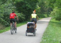
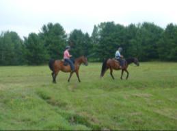
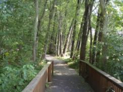
4 me greenways are recreational corridors or scenic byways that ay accommodate motorized and non motorized vehicles. hers function almost exclusively for environmental protection d are not designed for human passage.


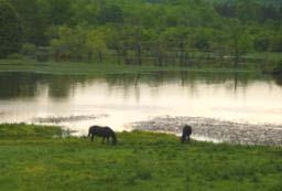
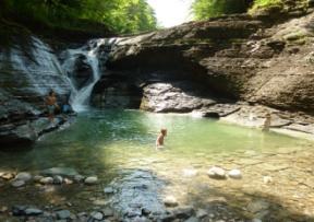
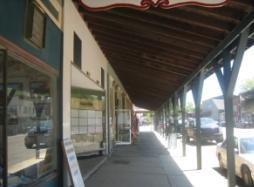
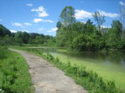
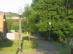
5 Communities Recreation, Culture, & History Natural Areas
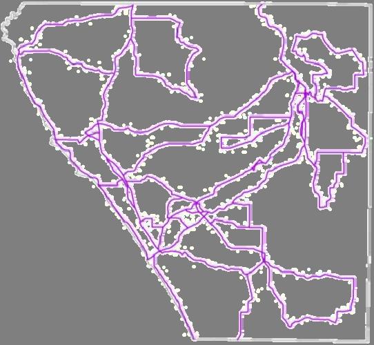
6
 completed entire survey 50 long term residents of County ges mostly 20")

7 o Responded? 13 (of 700+) completed entire survey 50 long term residents of County ges mostly and trong family ties (residents and visitors) ver 90% support hiking; protecting the atural environment; more trail and open pace development igh interest in volunteering for aintenance, especially on trails that onnect destinations


8 hat do People Want? Connect Destinations Good Signage System Promote Existing Trails More Well Maintained Feel Safe Places to Sit Suit Diverse Types Keep Things Simple
9
10 R VISION (how we see ourselves 5 to 10 years from now) 020 Chautauqua County envisions a system of greenways planned, implemented, and naged to: ovide opportunities for active living by providing a variety of land and water based trails to facilitate lthy lifestyles for our physical and mental well being; ovide alternative transportation corridors for us to access work, school, business districts, parks, eums, historic sites, and other cultural resources; nnect us to the land, to each other, and to archaeological, historic, and cultural resources; nserve sensitive natural resources for their essential functions, ecosystems and habitat; and to serve open space for continued agricultural production and to maintain the rural character that is the e of Chautauqua residents; corporate Chautauqua County s brand, the The World s Learning Center, into all aspects of the nty s greenway system; ovide leadership to the County s cities, towns, villages, and hamlets by advocating for and in lementing complete streets, active living, and sustainable land use practices throughout the County; hance economic development and tourism in our business districts; and


11 R GOALS (specific ideas about how we will accomplish our mission & vision) achieve this vision we have established seven goals: al One: al Two: al Three: al Four: al Five: Active Living/Alternative Transportation Conservation of Natural Resources Connectivity and Trail Development Management, Operations, and Maintenance The World s Learning Center al Six: Leadership al Seven: Marketing & Tourism
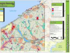
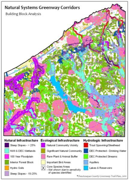
12 atural Infrastructure ological Infrastructure drologic Infrastructure


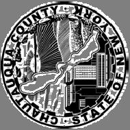
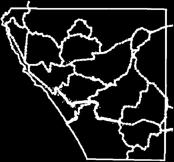
13 French Creek Cassadaga Creek Conewango Creek Canadaway Creek Chautauqua Lake Chautauqua Creek Cherry Creek Twentymile Creek Goose Creek Bear Lake Outlet Little Brokenstraw Creek Stillwater Creek Brokenstraw Creek Lake Erie Clear Creek Findley Lake Silver Creek Walnut Creek Prendergast Creek Cattaraugus Creek Natural Systems Greenways with Vineyard Overlay

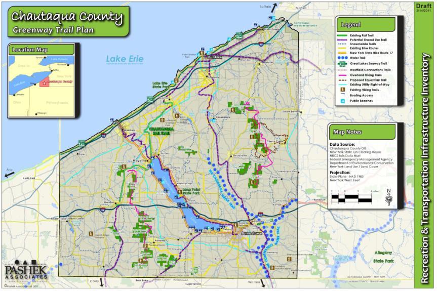


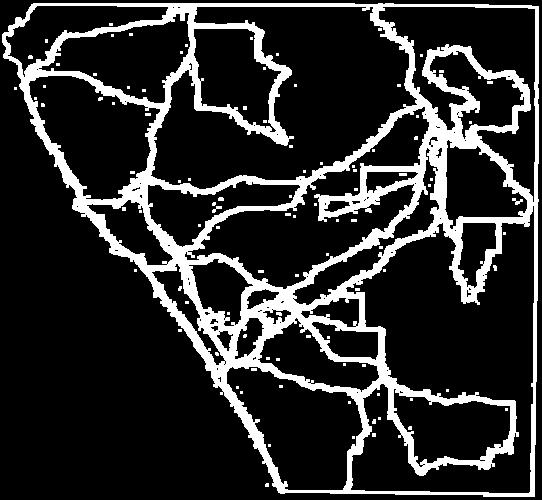
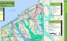
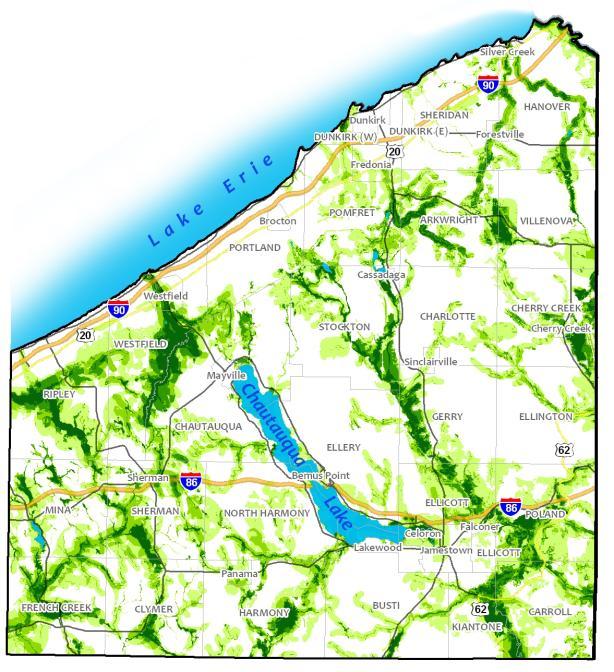
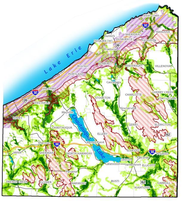
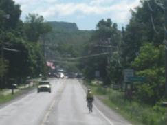
14 Recreation & Transportation Greenway Corridor Analysis Multi Use Trails Seaway Trail

15 posed Recreation Greenways
16
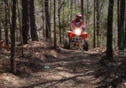
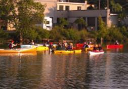
17 reation & Transportation Greenway Corridors ritization Criteria & Proposed Trail Corridors Trail Type (Regional, County, Connector) Existing Trail Group Support Corridor Status Connectivity Funding Opportunities & Partners Prioritization Criteria Trail Use Priority Rank ngo Creek Paddle Trail X Exceptional uqua County Rail Trail X X X X X X Exceptional Clymer Rail Trail X X X X X X Exceptional to Sherman Rail Trail X X X X X X Exceptional urg to North Warren PA Rail Trail X X X X X X Exceptional akes Seaway Trail Scenic Byway X X Exceptional Blockville to Jamestown On Road Trail X X Significant ll Hill State Forest to Cockaigne Equestrian Trail X Significant ast Overland Trail Harris Hill Extension X X Significant e to Westfield Rail Trail (Portage Trail extension) X X X X X X Significant rg to Falconer Rail Trail X X X X X X Significant r to Sinclairsville Rail Trail X X X X X X Significant sville to Fredonia Rail Trail X X X X X X Significant Cusimano Westside Overland Trail X X X X X X Significant oin River Paddle Trail X Significant ld to Barcelona Harbor On Road Trail X X Significant Economic Development Potential Extension of Existing Trail Total Priority Non Motorized Shared Use Path Hiking Biking Mountain Biking Equestrian Cross Country Skiing All Terrain Vehicle Snowmobile Water Trail
18
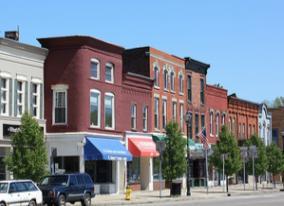
19 hat is a Trail Town? ails Towns provide the goods and services desired by trail users and visitors to the County. Enticing trail users to get off the trail and into your town. Welcoming trail users to your town by making information about the community readily available at the trail. Making a strong and safe connection between your town and the trail. Educating local businesses on the economic benefits of meeting the needs of trail tourists. Recruiting new businesses or expand existing ones to fill gaps in the goods or services that trail users need. Promoting the trail friendly character of the town. Working with neighboring communities to promote the entire trail corridor as a tourist destination. A potential trail town must provide at least 3 of the 4 goods and services: Main Street Food Lodging Fuel
20 Main Street Food Lodging Fuel Entertainment Recreation Cultural / Historic Sites Other Attraction(s) Proximity of Trail to Main Street No. of Trail Connections Local Partners Economic Development Potential Existing or Proposed Trail Potential Trail Town Potential Major Hub Potential Hub Significant Exceptional Priority Potential Trail Towns and Hubs Proposed Core Attributes Supporting Attributes Prioritization Criteria Classification Jamestown X X X X X X X X TT Total Sherman X X X X TT Mayville X X X X TT Cherry Creek X X X X TT Dunkirk X X X X X TT Falconer X X X X X TT Westfield X X X X X X X TT Fredonia X X X X X X X X TT Frewsburg X X X TT Irving X X X TT Forestville X X X TT Lakewood X X X X X X X X TT Silver Creek X X MH Celoron X X H Gerry X X X X TT Bemus Point X X X X X X X X TT Clymer X X X TT Stockton X H Findley Lake X X X X X MH


21 Irving Legend Dunkirk Sheridan Forestville Trail Town Fredonia Activity Hub Brocton Major Hub 1.Silver Creek 2.Findley Lake 3.Ashville 4.Sunset Bay 5.Van Buren Bay 6.Lily Dale Westfield Mayville Cassaadaga Sinclairville Camp Onyahsa Cherry Creek Cockaigne Hub 1.Celeron 2.Stockton 3.Kennedy 4.Maple Springs 5.French Creek 6.Barcelona 7.Bear Lake Sherman Peek n Peak Panama Clymer Gerry Bemus Point Roger Tory Peterson Lakewood Falconer Jamestown Frewsburg
22


23 ing Mountain Biking in Chautauqua County Project: icipalities: escription: Solidify the sport of mountain biking in Chautauqua County by capitalizing on what is in place, increasing trail mileage, and growing the economic impact the sport and its enthusiasts would produce for the County. Towns of Gerry, Cherry Creek, and Villenova as well as the Village of Cherry Creek. Continue development of the Harris Hill Ext. mountain bike trails. There are approximately another three to four miles flagged for proposed trail creation. This would create nine to ten miles entailing four distinct loops. Other potential mountain bike trail opportunities throughout the county are also a part of the recommendations.

24 To the south, this trail can link up with the North Warren Trail to connect to Warren, PA. Future extensions to the north could take the trail through Sinclairville and Cassadaga into Fredonia. Additional future connections could include a spur to the Jamestown Audubon Center on Riverside Road. sylvania State Line to Falconer Trail Project: Develop a multi use trail from the Pennsylvania State Line to Falconer. icipalities: escription: Towns of Carroll, Ellicott, and Poland as well as the Village of Falconer. This trail will follow the former New York Central railroad corridor, which is owned by Chautauqua Rails to Trails, from the PA state line to the Village of Frewsburg. From Frewsburg to Falconer the corridor is owned by.

25 tauqua County ATV Park Project: Develop an ATV park and trail system in Chautauqua County. It has been communicated by county wide ATV enthusiasts that there needs to be more places or more opportunities to ride in the county. icipalities: escription: To be determined The first step would be to approach the riders in Chautauqua County to form a ATV riders group. The next step would be to complete a feasibility study to determine the details of the ATV initiative, including the best location for an ATV Park and trail system.

26 tauqua Institution to Barcelona Harbor Trail Project: icipalities: escription: Implement recommendations from the Westfield Connections Plan with an additional connection to the Chautauqua Institution. Village and Town of Westfield as well as the Village of Mayville and the Town of Chautauqua. This trail would follow along the historic rail and trolley rights of way, as well as along rural roads that make their way through the countryside and vineyards. The additional connection would extend south from the existing Chautauqua Rails to Trails corridor along Route 394 to the Chautauqua Institution. This connection would enable seasonal visitors to the Institution to access the Villages of Mayville and Westfield and Barcelona
27 land Trails Maintenance Improvements Project: icipalities: escription: Maintenance and management recommendations for the Overland Trails. Towns of Harmony, North Harmony, Sherman, Chautauqua, Gerry, Ellington, Cherry Creek, Charlotte, and Arkwright. This project would entail the assessment of the existing maintenance and management of these trails, making recommendations for future maintenance and management improvements, and implementing the recommended improvements.
 Project: icipalities: escription: Extend the Jamestown Riverwalk from the City center through Chadakoin Park along the Chadakoin")

28 akoin Park Trail (Jamestown Riverwalk Ext.) Project: icipalities: escription: Extend the Jamestown Riverwalk from the City center through Chadakoin Park along the Chadakoin River. City of Jamestown and Town of Ellicott. Construct a trail from the terminus of the existing Riverwalk in downtown Jamestown along the Northeast bank of the Chadakoin River. This trail will follow the former Jamestown Westfield & Northwestern Railroad abandoned electric interurban line. The proposed trail would terminate at Denison Avenue in Ellicott Township.


29 ds of Chautauqua County Greenways Project: icipalities: escription: Create an organization or group to champion the recommendations of the Chautauqua County Greenway Trail Plan recommendations. All municipalities. This group would set priorities, lobby for support, and pursue funding to implement projects.

30 & West Side Overland Trail Loops Project: icipalities: escription: Create loop trails at the end of both the East Side and West Side Overland trails to improve upon the out and back trail user experience. The Towns of Arkwright, Charlotte, Chautauqua, Cherry Creek, Clymer, Ellington, Gerry, Harmony, North Harmony, Sherman, and Villenova. Create small loops at the end of the north and south terminus of both trails so that trail users don t have to turn around to do an out and back. These trails could be created within the existing DEC property.

31 strian Trail System Expansion Project: icipalities: escription: Build on the planned network of equestrian trails in Cherry Creek. Towns of Gerry, Ellington, Cherry Creek, Charlotte, and Arkwright. Determine the best routes for extending equestrian trails north out of Boutwell State Forest to Canadaway Creek Wildlife Management Area, south from Cockaigne Ski Area to Harris Hill State Forest and Hatch Creek Wildlife Management Area, and east through Cattaragus County to the Pine Hill Equestrian Trail.


32 rman Trail Town Study Project: Sherman Trail Town Feasibility Study. nicipalities: Village/Town of Sherman. Description: Complete a feasibility study to determine the potential to develop and promote the Village of Sherman as a Trail Town.


33 k La rie E e 1. Growing Mountain Biking 2. PA State Line to Falconer Trail 3. Chautauqua County ATV Park 4. Chautauqua Institution to Barcelona Harbor Trail 5. Overland Trails Maintenance Improvements 6. Chadakoin Park Trail 7. Friends of Chautauqua Greenways 8. East & West Side Overland Trail Loops 9. Equestrian Trail System Expansion 10. Sherman Trail Town Study
34


35 Over 100 potential partners and stakeholders have been identified!


36 eys to Getting It Done
37 round Rules Every idea is valid; Please respect the opinions of others. You do not have to agree with every idea that is suggested; Even if you don t agree, this is not the time to debate a specific item. Groups Please have a spokesperson speak for the entire group. Pleaseremain quiet while someone else is talking; Everyone will have a chance to speak. Please keep your statements as clear and concise as possible. Convey one issue per turn. Pleaserespect the time limit.
38
RE: Request for Proposal (RFP) for Developing Chautauqua County's Equestrian Trail Plan.
 for Developing Chautauqua County's Equestrian Trail Plan.") Chautauqua County DEPARTMENT OF PLANNING AND ECONOMIC DEVELOPMENT 200 Harrison Street Jamestown, New York 14701 Phone (716) 661-8900 Fax (716) 664-4515 www.planningchautauqua.com RE: Request for Proposal
Chautauqua County DEPARTMENT OF PLANNING AND ECONOMIC DEVELOPMENT 200 Harrison Street Jamestown, New York 14701 Phone (716) 661-8900 Fax (716) 664-4515 www.planningchautauqua.com RE: Request for Proposal
New York Zip Codes. Note: Some Zip Codes listed below are not served by National Fuel Gas Distribution
 14001 NY AKRON 14003 NY ALABAMA 14004 NY ALDEN 14005 NY ALEXANDER 14006 NY ANGOLA 14008 NY APPLETON 14009 NY ARCADE 14010 NY ATHOL SPRINGS 14011 NY ATTICA 14012 NY BARKER 14013 NY BASOM 14020 NY BATAVIA
CCAA League Alignments Approved and Updated 11/14/12 FALL SPORTS. Cross Country. Girls Swimming
 FALL SPORTS Cross Country Division 1 (7 League Meets) Division 2 (5 League Meets) A Jamestown 1049 D Randolph 237 B Olean 480 D Silver Creek 232 B Dunkirk 472 D Clymer/Sherman 215 C Fredonia 382 D Frewsburg
2. Goals and Policies. The following are the adopted Parks and Trails Goals for Stillwater Township:
 D. PARKS AND TRAILS 1. Introduction Stillwater Township s population is relatively low, with most residents living on rural residences on large lots. The need for active park space has been minimal in
TABLE OF CONTENTS. Appendix A Summary of Existing Planning Efforts Page 167. Appendix D Points of Interest & Historic Sites Inventories Page 201
 Chautauqua County Greenway Plan Appendix Document TABLE OF CONTENTS Appendix A Summary of Existing Planning Efforts Page 167 Appendix B Benefits of Greenways Page 171 Appendix C Recreation Infrastructure
Coast to Coast Connector Summit
 Project Partners Welcome to the Coast to Coast Connector Summit Winter Garden, Florida City Hall October 1, 2014 1 Why are we here? Objectives 1. Inform key stakeholders on the current state of the C2C
Trails. Lois Jensen Nature Preserve is a 30 acre parcel on the north end of the city. It provides unspoiled wooded paths.
 Trails Lois Jensen Nature Preserve is a 30 acre parcel on the north end of the city. It provides unspoiled wooded paths. TRAIL S, PATHS, ROUTES AND CONNECTORS Citizen input pointed to trails, paths, bike
APPENDIX OFFICIAL MAP ORDINANCE OF HAMILTONBAN TOWNSHIP OFFICIAL MAP NARRATIVE
 APPENDIX A OFFICIAL MAP ORDINANCE OF HAMILTONBAN TOWNSHIP OFFICIAL MAP NARRATIVE INTRODUCTION: The Official Map of Hamiltonban Township has been prepared to identify those lands and features that Hamiltonban
COUNTY COMPREHENSIVE PLAN
 50 : Policy Statement Lewis County has a unique and attractive rural character, which makes it a wonderful place to visit and explore. The region abounds with recreation opportunities that attract visitors
DRAFT - APRIL 13, 2007 ROUTING STUDY FOR TRAIL CONNECTIONS BETWEEN CALAIS AND AYERS JUNCTION
 DRAFT - APRIL 13, 2007 ROUTING STUDY FOR TRAIL CONNECTIONS BETWEEN CALAIS AND AYERS JUNCTION Abstract The vision for the East Coast Greenway is an off-road urban trail system running from Calais, Maine
2015 Business Survey Report Erie to Pittsburgh Trail March 2015
 2015 Business Survey Report Erie to Pittsburgh Trail March 2015 Table of Contents Executive Summary 2 2013 EPT Trail User Survey and Impact Analysis 3 Overview 3 Results 3 2014 2015 Erie to Pittsburgh
Preferred Recreation Recommendations Stemilt-Squilchuck Recreation Plan March 2018
 Preferred Recreation Recommendations Stemilt-Squilchuck Recreation Plan March 2018 Below are the recommended recreation ideas and strategies that package together the various recreation concepts compiled
Tracy Ridge Shared Use Trails and Plan Amendment Project
 Tracy Ridge Shared Use Trails and Plan Amendment Project Scoping Document Forest Service Allegheny National Forest Bradford Ranger District McKean, County, Pennsylvania In accordance with Federal civil
Economic Development and Tourism
 SECTION 4 SECTION 4 Economic Development and Tourism 4. Economic Development and Tourism Tourism plays a very important role in Niagara s economy, providing employment and generating business for support
City Council Workshop July 26, 2010
 Des Moines Trails Connecting a Community City Council Workshop July 26, 2010 1 OVERVIEW Trail Benefits Trails Progress How We Fund Trails What s Next for Trails 2 What is a trail? Paved Trails 10 wide
The Vision for the San Juan Islands Scenic Byway
 The Vision for the San Juan Islands Scenic Byway 2 Judd Cove, Orcas Island, Courtesy of Kurt Thorson (kurtthorson.com) and San Juan County Land Bank Vision for the San Juan Islands Scenic Byway The San
Mohawk Hudson Bike Hike Trail Crossroad Connection Study
 Summary Report - April 21, 2003 Mohawk Hudson Bike Hike Trail Crossroad Connection Study Summary Report Introduction The Capital District Transportation Committee (CDTC), in partnership with Albany County,
PROPOSED PARK ALTERNATIVES
 8 Chimne y Rock State Park M a ster Pl an 2011 PROPOSED PARK ALTERNATIVES Introduction Three different park development concepts were prepared and presented to the citizens of North Carolina through a
3.0 LEARNING FROM CHATHAM-KENT S CITIZENS
 3.0 LEARNING FROM CHATHAM-KENT S CITIZENS An important aspect in developing the Chatham-Kent Trails Master Plan was to obtain input from stakeholders and the general public. Throughout the course of the
2016 Regional Transportation Alternatives Program (TAP) Grant Application
 Grant Application") 2016 Regional Transportation Alternatives Program (TAP) Grant Application PROJECT TITLE: Yelm-Tenino Trail Extension Feasibility Study TRPC use only GENERAL PROJECT INFORMATION Agency or Organization City
2016 Regional Transportation Alternatives Program (TAP) Grant Application PROJECT TITLE: Yelm-Tenino Trail Extension Feasibility Study TRPC use only GENERAL PROJECT INFORMATION Agency or Organization City
BACKCOUNTRY TRAIL FLOOD REHABILITATION PROGRAM
 BACKCOUNTRY TRAIL FLOOD REHABILITATION PROGRAM Backcountry Trail Flood Rehabilitation A June 2013 Flood Recovery Program Summary In June 2013, parts of Southern Alberta were devastated from significant
The Future of the Road to Revolutions. A Battle Road Scenic Byway Public Forum November 9, 2010
 The Future of the Road to Revolutions A Battle Road Scenic Byway Public Forum November 9, 2010 Who is the Battle Road Scenic Byway? Four Towns: Arlington, Lexington, Lincoln, Concord Minute Man National
13.1 REGIONAL TOURISM ISSUES AND SUMMARY OF FINDINGS
 13 REGIONAL TOURISM T he County of Mariposa s recreation needs and facilities fall within two categories: regional tourism and local recreation. This Element focuses on regional tourism issues related
Sacramento Placerville Transportation Corridor Alternatives Analysis
 Sacramento Placerville Transportation Corridor Alternatives Analysis EL DORADO COUNTY TRANSPORTATION COMMISSION 1 Sacramento Placerville Transportation Corridor 2 Goal of the Project To give public officials
Segment 2: La Crescent to Miller s Corner
 goal of the USFWS refuges is to conserve, protect and enhance fish, wildlife and plants and their habitats for the continuing benefit of the American people. Refuge lands are used largely for fishing,
A Vision for South Skunk River and Chichaqua Bottoms Greenbelt
 A Vision for South Skunk River and Chichaqua Bottoms Greenbelt Photo: Jim Pease Chichaqua Bottoms Booklet 7 of 8 Greater Des Moines Water Trails and Greenways 1 2016 Table of Contents Booklet 1: Water
IL 390 Station. Wood Dale Open House Summary 5/18/17
 Wood Dale Open House Summary 5/18/17 The first public open house for the Wood Dale Comprehensive Plan took place on May 18 th, 2017. The program was conducted as a fun community event and there were 216
Georgetown-Lewes Rail/Trail Study. Rail/Trail Study: Cool Spring to Cape Henlopen State Park New Road Extension (House Resolution No.
 Georgetown-Lewes Rail/Trail Study Rail/Trail Study: Cool Spring to Cape Henlopen State Park New Road Extension (House Resolution No. 47) August 22, 2011 Presentation Outline Background Benefits Statewide
Meeting Report. Listening Session for Greenways + Blueways May 27, LaPorte County Solid Waste & Water Conservation Office, 6:00 8:00
 May 27, 2015 LaPorte County Solid Waste & Water Conservation Office, 6:00 8:00 Of the three meeting participants, two filled out the participant survey. The demographic results were as follows: o Caucasian:
RUSHMORE CONNECTOR TRAIL PROPOSAL
 PURPOSE AND NEED Background The U.S. Forest Service, Black Hills National Forest (Forest Service) has received a special use permit application from the State of South Dakota Department of Game, Fish and
This page has been intentionally left blank.
 This page has been intentionally left blank. Chapter 2 2-2 2. Growing the Economy In many ways, the Niagara Region is a community of communities and this is becoming increasingly so. It is made up of towns
!" # $ % & % ' ( '' ) ) ) ) )
 ) ) ) )") !" #$% &% ' ( ')) ))) #% * % ) +#% *- *,% ) Trails Attract Business, Residents and Tourists National Association of Homebuilders 0% 20% 40% 60% % of What People Desired Exercise Facilities Proximity to
!" #$% &% ' ( ')) ))) #% * % ) +#% *- *,% ) Trails Attract Business, Residents and Tourists National Association of Homebuilders 0% 20% 40% 60% % of What People Desired Exercise Facilities Proximity to
Proposal to Redevelop Lower Kananaskis River-Barrier Lake. Bow Valley Provincial Park. Frequently Asked Questions
 Proposal to Redevelop Lower Kananaskis River-Barrier Lake Bow Valley Provincial Park Frequently Asked Questions What is being proposed? What are the details of the proposal? Where is the project area located?
Auburn Trail / Ontario Pathways Trail Connector Feasibility Study Public Information Meeting Wednesday, August 22, 2012
 Auburn Trail / Ontario Pathways Trail Connector Feasibility Study Public Information Meeting Wednesday, August 22, 2012 Purpose of Feasibility Study Purpose Evaluate the feasibility of constructing a multiuse
Appalachian Trail Community
 Harpers Ferry, West Virginia Appalachian Trail Community A Designation Program of the Appalachian Trail Conservancy The Appalachian Trail Conservancy (ATC) mission is to preserve and manage the Appalachian
FINAL TESTIMONY 1 COMMITTEE ON RESOURCES UNITED STATES HOUSE OF REPRESENTATIVES. July 13, 2005 CONCERNING. Motorized Recreational Use of Federal Lands
 FINAL TESTIMONY 1 STATEMENT OF DALE BOSWORTH CHIEF Of the FOREST SERVICE UNITED STATES DEPARTMENT OF AGRICULTURE Before the SUBCOMMITTEE ON FORESTS AND FOREST HEALTH And the SUBCOMMITTEE ON NATIONAL PARKS,
Blueways: Rivers, lakes, or streams with public access for recreation that includes fishing, nature observation, and opportunities for boating.
 Parks, Open Space and Trails PRINCE WILLIAM COUNTY 2008 COMPREHENSIVE PLAN TRAILS PLAN CONTENTS The components of the trails plan are: Intent Definitions Goals, Policies, and Action Strategies Trails Map
Lake Placid Assessment Updated November 2008
 Lake Placid Assessment Updated November 2008 Intro Statement Years ago, Lake Placid took its tourism future in its own hands. It took a blossoming Adirondack resort destination and went out and convinced
CHAPTER 5. Chapter 5 Recreation Element
 CHAPTER 5 Recreation Element Chapter 5 Recreation Element The Recreation Element of the Meyers Area Plan is a supplement to the Recreation Element of the TRPA Regional Plan and the El Dorado County General
Strengthening the Ontario Trails Strategy. Report on Consultations and the Environmental Bill of Rights Registry
 Strengthening the Ontario Trails Strategy Report on Consultations and the Environmental Bill of Rights Registry Purpose To report on the feedback and information received through the regional consultations,
CHAPTER ONE LITERATURE REVIEW
 CHAPTER ONE LITERATURE REVIEW LITERATURE REVIEW This chapter summarizes the most recently published community impact studies and articles that relate to multiuse trails. The review focuses on publications
Colorado Springs & Pikes Peak Region Destination Master Plan
 Colorado Springs & Pikes Peak Region Destination Master Plan Overview June 19, 2018 DESTINATION MASTER PLAN What is Destination Master Planning? Focus on infrastructure, facilities, services, attractions
Rogue River Access and Management Plan Draft Alternatives
 Rogue River Access and Management Plan Draft Alternatives The Rogue River Access and Management Plan was initiated in December, 2011 and is being led by Jackson County Parks (JCP) and Oregon Department
MOREAU LAKE STATE PARK CURRENT PLANNING EFFORTS
 MOREAU LAKE STATE PARK CURRENT PLANNING EFFORTS PLANNING EFFORTS S O U T H E R N PA L M E R T O W N CONSERVATION & ECONOMIC DEVELOPMENT STRATEGY Moreau Lake State Park Master Plan Mt. McGregor Correctional
Proposal to Redevelop Lower Kananaskis River-Barrier Lake. Bow Valley Provincial Park
 Frequently Asked Questions Proposal to Redevelop Lower Kananaskis River-Barrier Lake Bow Valley Provincial Park Frequently Asked Questions What has been decided? What are the details of the plan? What
Other Principle Arterials Minor Arterial Major Collector Minor Collector Local
 CHAPTER 10 TRANSPORTATION Introduction The system of public roads in East Pikeland Township is decidedly rural in character. Since the 1984, the road network has remained much the same, with the addition
Trail Town Program Creating Opportunities along the Nation s Trails. David Kahley President & CEO The Progress Fund
 Trail Town Program Creating Opportunities along the Nation s Trails David Kahley President & CEO The Progress Fund The Progress Fund Non-Profit Established 1997 CDFI with Rural Focus Provides Capital &
Greater Minnesota Regional Parks and Trails Commission Designation Application
 Greater Minnesota Regional Parks and Trails Commission Designation Application General Section Designation Application #: 15-050D Date Submitted: 06/30/2015 Park or Trail Name: Perham to Pelican Rapids
Chambers of Commerce and Lake Groups advertised this NCWRPC created online survey that was : Opened: August 22, 2012; and Closed: October 4, 2012.
 Vilas County Outdoor Recreation Survey Chambers of Commerce and Lake Groups advertised this NCWRPC created online survey that was : Opened: August 22, 202; and Closed: October 4, 202. Q What Vilas County
Restore and implement protected status that is equivalent, or better than what was lost during the mid-1990 s
 THE ROSSLAND RANGE, OLD GLORY AREA. Executive summary. The Friends of the Rossland Range Society, on behalf of the local outdoor community, seeks to accomplish the following with respect to the Old Glory
Cherry Creek (Village) NO ZONING LAW
 NO ZONING LAW") Arkwright PB Roger Cardot 8875 Center Road Cassadaga NY 14718 Arkwright PB Doug Fairbanks, Jr. 9366 Putnam Road Forestville NY 14062 Arkwright PB Martha Hahl 1880 Straight Road Forestville NY 14062 Arkwright
Arkwright PB Roger Cardot 8875 Center Road Cassadaga NY 14718 Arkwright PB Doug Fairbanks, Jr. 9366 Putnam Road Forestville NY 14062 Arkwright PB Martha Hahl 1880 Straight Road Forestville NY 14062 Arkwright
O REGON TRAILS SUMMIT. Oregon Trails Summit. Rogue River National Forest
 O REGON TRAILS SUMMIT Oregon Trails Summit 2014 Rogue River National Forest OREGON TRAILS 2015: A VISION FOR THE FUTURE The 2015-2024 Oregon Statewide Trails Plan Why do a trails plan? 2005-2014 Oregon
Florida National Scenic Trail 5-Year Strategic Plan. Barbara Bowen
 Florida National Scenic Trail 5-Year Strategic Plan 2012 Barbara Bowen Florida National Scenic Trail M. Timothy O Keefe M. Timothy O Keefe Mike Knox 20-mile Planning Corridor Florida National Scenic Trail
Welcome to the Cross County Trail Public Input Session!
 Welcome to the Cross County Trail Public Input Session! Please sign in on the table below! What are we doing here? Camden County has proposed a bicycle and pedestrian trail spanning across the entire county.
Committee Members: Page 1 of 6
 Auburn Trail/Ontario Pathways Trail Connector Feasibility Study Project Advisory Committee Meeting June 29, 2011 at 6:30 p.m. Canandaigua Town Hall Draft Minutes Committee Members: Ronald L. Brand, Director
$866,000. $1,400,000 Health Benefits $13,156,000 TOTAL ANNUAL DIRECT BENEFITS. $10,890,000 Economic Benefits
 SINGING RIVER TRAIL Trails Create Value + Generate Economic Activity Trails generate economic returns through improved health, safety, and environmental conditions, raise property values, and attract visitors.
MEETING MINUTES District 1 Trail Planning Meeting 1
 MEETING MINUTES District 1 Trail Planning Meeting 1 June 1, 2017 2:00 PM 3:30 PM City of Two Harbors 2:00 Introductions Attendees: Lisa Austin, MnDOT Bryan Anderson, MnDOT Jasna Hadzic-Stanek, MnDOT Justin
BUCKS COUNTY TRAILS. September 10, 2015 Presentation to:
 BUCKS COUNTY TRAILS September 10, 2015 Presentation to: BUCKS COUNTY TRAILS Benefits of Trails Bucks County Trails The Circuit Active Trail Projects Planning Studies Municipal Trails Planning Other Trail
Chapter 6. Trail Design. Trail Design
 Chapter 6 Trail Design Trail Design The trail winds through a region rich in scenic beauty, cultural, and natural history. Volunteer landscape architects working with the Core and Planning Teams, have
Regional Wayfinding Sign Strategy Thurston County Trails 2017
 Regional Wayfinding Sign Strategy Thurston County Trails 2017 Partners: Members and partnering organizations of the Thurston Thrives Community Design Action Team City of Lacey, City of Olympia, City of
COMOX VALLEY AIRPORT. Strategic Plan Summary. October 2010
 COMOX VALLEY AIRPORT Strategic Plan 2011-2015 Summary October 2010 COMOX VALLEY AIRPORT Introduction History The Comox Airport was constructed by the Department of National Defence in 1942. The Comox Airport
If anyone would like to discuss either the questions, or the answers, with me, they are invited to contact me at
 Questionnaire 2017 Municipal Elections If anyone would like to discuss either the questions, or the answers, with me, they are invited to contact me at andrealockwoodchelsea2017@gmail.com. 1. Do you believe
A link to heritage by connecting the community to its history.
 In March 2015 the Board of Sentiers Chelsea Trails asked Chelsea Council to explore the feasibility of converting the winter rail corridor trail into a 4 season, non-motorized, multi-purpose trail. To
A CASE FOR COMPLETING THE JORDAN RIVER PARKWAY: A
 A CASE FOR COMPLETING THE JORDAN RIVER PARKWAY: A safe crossing at 9000 South and 850 West Proposed 9000 South Underpass Parkway Timeline Parkway, Trail, and Tourism Facts Blueprint Jordan River 1971 1973
Aitkin County Comprehensive Recrea5on Trail Plan. May 2010
 Aitkin County Comprehensive Recrea5on Trail Plan May 2010 Overview and Goals of the Plan Why do a plan? Who is responsible for the plan How the plan has been developed What is in the plan Ac#on Steps &
INGHAM COUNTY TRAILS AND PARKS TASK FORCE MEETING 2
 INGHAM COUNTY TRAILS AND PARKS TASK FORCE MEETING 2 October 22, 2015 Mannik and Smith Group Michigan Trails & Greenways Alliance AGENDA FOR TONIGHT 1. Project Approach, Process and Timeframe 2. Public
Committee. Presentation Outline
 CW-33-15 11/9/2015 Community and Corporate Services Committee November 10, 2015 1 Presentation Outline Background Vision and Objectives Study Process and Timeline Public and Stakeholder Engagement Organization
PEMBERTON VALLEY RECREATIONAL TRAILS MASTER PLAN UPDATE Community Open House. April 2018
 PEMBERTON VALLEY RECREATIONAL TRAILS MASTER PLAN UPDATE Community Open House April 2018 Introductions Introductions Matt Bakker, BHA Project Coordinator Other Team Members: Liz Scroggins, Grey Owl Consulting
Longmont to Boulder Regional Trail Jay Road Connection DRAFT FINAL REPORT
 Longmont to Boulder Regional Trail Jay Road Connection DRAFT FINAL REPORT December 2018 Project Summary Boulder County, Colorado, in partnership with the City of Boulder, is evaluating options for multi-use
PROJECTS. Otonabee South Monaghan. Active Transportation Master Plan Proposed Ultimate Network
 Otonabee South Monaghan Ultimate Network Otonabee-South Monaghan, located on the north shore of Rice Lake, is home to Lang Pioneer Village, Harold Town Conservation Area and numerous resorts that are major
TRAILS WHERE TO FIND TRAILS IN NOVA SCOTIA
 TRAILs SIGNAGE Know the Signs............................ 44 WHERE YOU CAN RIDE Roads and Highways........................ 46 Designated Trails........................... 47 Established Trails...........................
Hudson Highlands Fjord Trail Draft Master Plan. April 29, 2015
 Hudson Highlands Fjord Trail Draft Master Plan April 29, 2015 Agenda Route Overview Proposed Segment Results of Community Survey on that Segment Next Steps Municipal Endorsement Environmental Review Implementation
Kelly Motorized Trails Project Proposed Action
 Kelly Motorized Trails Project Proposed Action November 28, 2011 The Flagstaff Ranger District of the Coconino National Forest is seeking public input on the proposed Kelly Motorized Trails Project (formerly
National Scenic Byways Program US Department of Transportation
 1 2 National Scenic Byways Program US Department of Transportation Abstract The Cowlitz-Wahkiakum Council of Governments in partnership with Cowlitz, Skamania and Lewis Counties and the U.S. Forest Service,
NORTHEAST CARLTON COUNTY BICYCLE ROUTE PLAN
 NORTHEAST CARLTON COUNTY BICYCLE ROUTE PLAN 5/31/2014 and St. Louis River Trail Plan Update Produced by the Arrowhead Regional Development Commission (ARDC) in Partnership with the State Health Improvement
The Chu property is a 6.57 acre parcel located in the Town of Superior on the west side of McCaslin Boulevard. In 2014, the Town of Superior acquired
 1 The Chu property is a 6.57 acre parcel located in the Town of Superior on the west side of McCaslin Boulevard. In 2014, the Town of Superior acquired the Chu property for open space with a contribution
Northern Rockies District Value of Tourism Research Project December 2007
 Northern Rockies District Value of Tourism Research Project December 2007 Project Partners: Northern Rockies Regional District, Tourism British Columbia, Northern Rockies Alaska Highway Tourism Association,
County of Peterborough Active Transportation Master Plan
 The TMP developed a conceptual AT/cycling network for Peterborough County that identified both on-road and off-road (trail) AT facilities. This was a coarse network based on the existing trails and off-road
Green Mountain Trail Collaborative Stewardship and Communication Work Group Meeting Notes June 30, 2010
 Date: 6-30-10 Time: 12:30-1:30 Location: Phone Conference Facilitator: Brian D. Cotterill Note Taker: Brian D. Cotterill Committee Members in Attendance: Danny Hale Doug Webber Sherry Winnie Alexis Nelson
Tabor Mountain Recreation Society Who We Are What We Do Regional Park The Ask. Photo by Ken Hodges
 Tabor Mountain Recreation Society Who We Are What We Do Regional Park The Ask Photo by Ken Hodges 1 TMRS History 1961 logging and the Grove Fire activities resulted in many of the existing trails 1961
City of Durango 5.8 FUNDING TRAILS DEVELOPMENT
 5.8 FUNDING TRAILS DEVELOPMENT The City has been successful in establishing dedicated local funding sources as well as applying for grants to develop the City s trail system, having received nearly $2.4
Table of Contents. page 3 Long term Goals Project Scope Project History. 4 User Groups Defined Trail Representative Committee. 5 Trail Users Breakdown
 Launched April 27th, 2010 1 Table of Contents page 3 Long term Goals Project Scope Project History 4 User Groups Defined Trail Representative Committee 5 Trail Users Breakdown 13 Trail Users Desires 16
The Recreational Trail along Cushing Park road has been a successful addition to the city
 The Recreational Trail along Cushing Park road has been a successful addition to the city Trails TRAILS, PATHS, ROUTES AND CONNECTORS Citizen input pointed to trails, paths, bike routes, and other non-motorized
FY19 Colorado Tourism Office Marketing Matching Grant Recipients
 $25,000 Colorado Campground and Lodging Owners Association A marketing plan centered on the Camp Colorado Guide, and expanding the use of digital marketing and social media channels in order to inspire
Chapter 6: POLICY AND PROCEDURE RECOMMENDATIONS
 Chapter 6 POLICY AND PROCEDURE RECOMMENDATIONS FOR SRRA Below are seven policy elements that should be considered for adoption by the Southwest Regional Recreation Authority of Virginia: 1. Develop strategies
Greater Minnesota Regional Parks and Trails Commission Designation Application
 Greater Minnesota Regional Parks and Trails Commission Designation Application General Section Designation Application #: 16-043D Date Submitted: 04/28/2016 Park or Trail Name: Tioga Recreation Area District
ROYAL GORGE PARK and RECREATION AREA. A Feat of Natural and Man-Made Engineering
 ROYAL GORGE PARK and RECREATION AREA A Feat of Natural and Man-Made Engineering As Growth Resumed in the 1870 s Town Leaders Began to Envision a Tourist Industry. The Arkansas River Canyon was advertised
Hermosa Area Preservation The Colorado Trail Foundation 4/11/2008
 Hermosa Area Preservation The Colorado Trail Foundation 4/11/2008 Legend d o Tr ail NPA - National Protection Area ra NCA - National Conservation Area o e C Th The Colorado Trail lo FS inventoried Roadless
Continental Divide National Scenic Trail Legislative History and Planning Guidance
 Continental Divide National Scenic Trail Legislative History and Planning Guidance Legislation, Policy, and Direction Regarding National Scenic Trails The National Trails System Act, P.L. 90-543, was passed
CHAPTER FOUR: TRANSPORTATION
 CHAPTER FOUR: TRANSPORTATION Barron County Comprehensive Plan: Transportation Page 61 Background Transportation facilities have a significant influence on land use, development and quality of life for
Mt. Hood National Forest
 United States Department of Agriculture Forest Service Mt. Hood National Forest Zigzag Ranger District 70220 E. Highway 26 Zigzag, OR 97049 503-622-3191 Fax: 503-622-5622 File Code: 1950-1 Date: June 29,
Strategic Objectives, Initiatives and Actions
 Strategic Objectives, Initiatives and Actions The following Strategic Objectives and the associated Initiatives and Actions for each have been developed to meet the challenges associated with trail development
Chapter 6. Action Program. Heart of the Lakes Area Recreation Plan
 Heart of the Lakes Area Recreation Plan 1. Design and construct the following trails (please see the following map): a. the Speedway Trail 1) primary pathway the main trail 2) secondary pathway the proposed
Gardner: overview. Santa Fe, Oregon, and California National Historic Trails UNINCORPORATED JOHNSON COUNTY OLATHE UNINCORPORATED JOHNSON COUNTY
 Santa Fe, Oregon, and California ational Historic Trails : overview 99: p.134 100: p.135 GARDER JUCTIO 102: p.137 56: p.126 EDGERTO Burlington orthern Intermodal and Logistics 98: p.133 101: p.136 S Waverly
PLANNING THE SUNBURY GROWTH CORRIDOR
 SUNBURY GROWTH CORRIDOR NOVEMBER 2016 PLANNING THE SUNBURY GROWTH CORRIDOR Sunbury Planning Background The Victorian Planning Authority, in consultation with Hume City Council, is undertaking a number
ADVENTURE PLAN EXPLORE PARK
 ADVENTURE PLAN ROANOKE COUNTY S EXPLORE PARK ROANOKE COUNTY PARKS, RECREATION AND TOURISM 1206 KESSLER MILL RD SALEM, VA 24153 (540) 387-6078 WHAT S INCLUDED? Explore Park Adventure Plan - Guided by extensive
Regional Collaboration for Natural Heritage Tourism on the Lower Mississippi River
 Regional Collaboration for Natural Heritage Tourism on the Lower Mississippi River Alan W. Barton Ashford University G. Reid Bishop Belhaven University Project Summary The Mississippi River Field Institute
Trail Towns Using Trail Systems To Leverage Place, Tourism, and Economic Development
 Trail Towns Using Trail Systems To Leverage Place, Tourism, and Economic Development Harry Burkholder, AICP Community Planner II 324 Munson Avenue Traverse City, MI 49686 231-929-3696 burkholder@liaa.org
TRAIL DATABASE SCHEMA (8/26/2014)
") Trail Data Model for LINES Source Data Source Agency dataagency Agency or entity that created the dataset where the original line was sourced from. Source Date of Last Data Used to Update sourcedate Publication
Trail Data Model for LINES Source Data Source Agency dataagency Agency or entity that created the dataset where the original line was sourced from. Source Date of Last Data Used to Update sourcedate Publication
Non-Motorized Transportation
 Non-Motorized Transportation Non-motorized facilities are important components to the transportation system. They provide an environmentally-friendly, low-cost mode of travel. Some of the facilities can